4 minute read
COSPAR Session on Space-Observation Contributions Supporting Climate Action


[Ralph Kahn – Chair, COSPAR Commission A – Earth Sciences - COSPAR Commission A]
‘‘To retain our credibility as scientists ... it is critical that we remain evenhanded in our analysis and our reporting of results’’
On Tuesday, 14 February 2023, COSPAR Commission A hosted a session in Vienna, Austria and virtually, on “Space-Observation Contributions Supporting Climate Action,” as part of the United Nations Office for Outer Space Affairs (UNOOSA) Committee on the Peaceful Uses of Outer Space (UN COPUOS) Symposium on the Agenda for Sustainable Development.
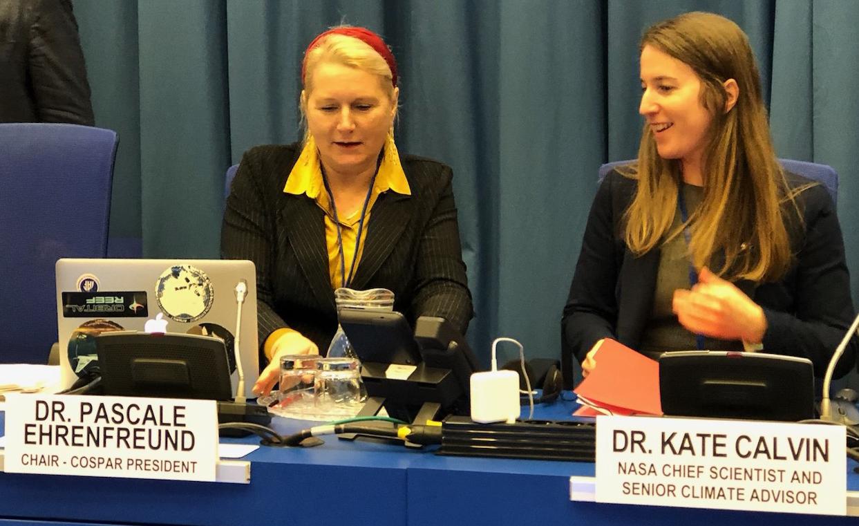
COSPAR President Pascale Ehrenfreund provided an overall introduction, summarizing the main attributes of COSPAR, emphasizing the urgency of addressing climate change based on scientific evidence, and highlighting the role that Earth observation from space plays in understanding the Earth System and in monitoring changes. COSPAR Commission A Chair Ralph Kahn followed with an introduction to the session presentations. He pointed out that COSPAR is primarily a scientifically oriented organization, whereas “Climate Action” tends to be the domain of “activists.” To retain our credibility as scientists, and for the contributions we make as scientists to continue carrying the weight of scientific truth, it is critical that we remain evenhanded in our analysis and our reporting of results.
As such, the seven subsequent presentations focused on different attributes of the Earth System and its evolution that we observe objectively from space, frequently, on a global scale, and to a degree that is generally not possible any other way. Most presentations also covered how these data help inform policy and decision-makers, the public in general, as well as those taking direct action.
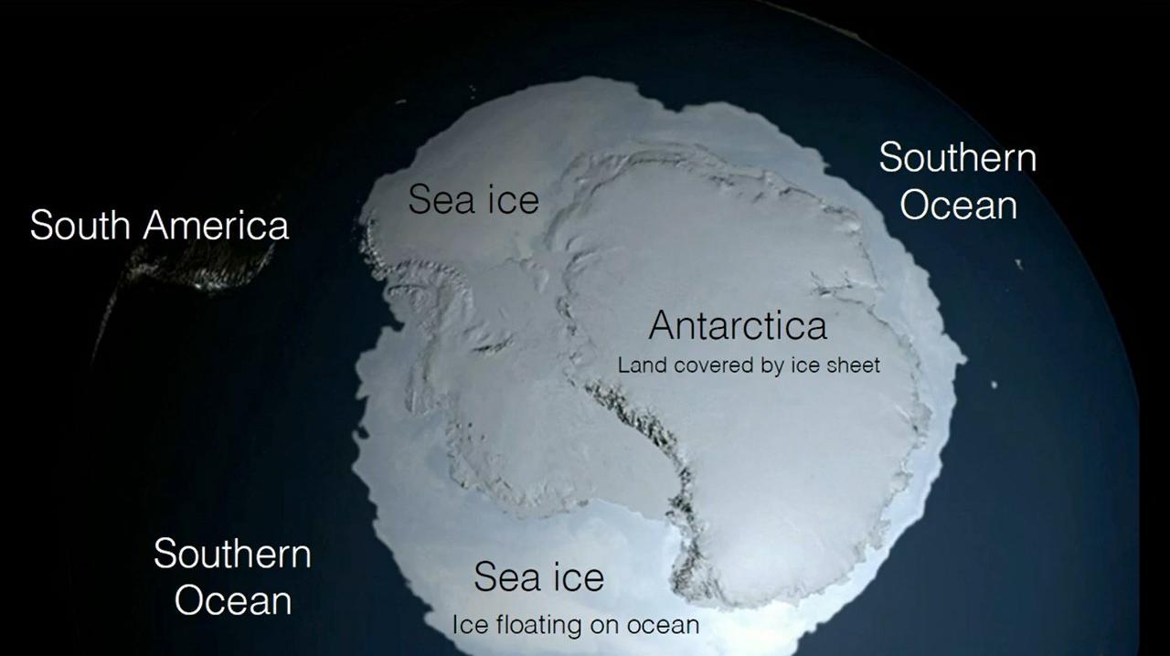
NASA Chief Scientist and Senior Climate Advisor Kate Calvin spoke next, giving an overview of the range of relevant observations contributed by one of the premier space agencies. Solar activity, greenhouse gas concentrations, the state of the ozone layer, sea ice and land ice distributions, sea level rise, global surface temperatures, and air pollution are all monitored by NASA satellites, and the data are disseminated widely to potential stakeholders.
Anny Cazenave from the Laboratoire d’Études en Géophysique et Océanographie Spatiales (LEGOS) explained how three decades of satellite measurements of sea-level changes contribute to coastal impact assessment. She discussed how space-based observations of sea level rise and the accelerating loss of land ice in Greenland and Antarctica provide key information needed to improve predictions of the future effects of rising waters on coastal populations.
Edward Blanchard from the University of Washington, Seattle, followed by reviewing the way sea-ice loss, as observed from space, contributes to climate forecasting. Arctic sea-ice extent has been monitored by satellites for about 50 years, documenting the dramatic rate at which loss is occurring; having such an extensive, long-term data record helps improve predictions of future sea-ice
‘‘Arctic sea-ice extent has been monitored by satellites for about 50 years’’
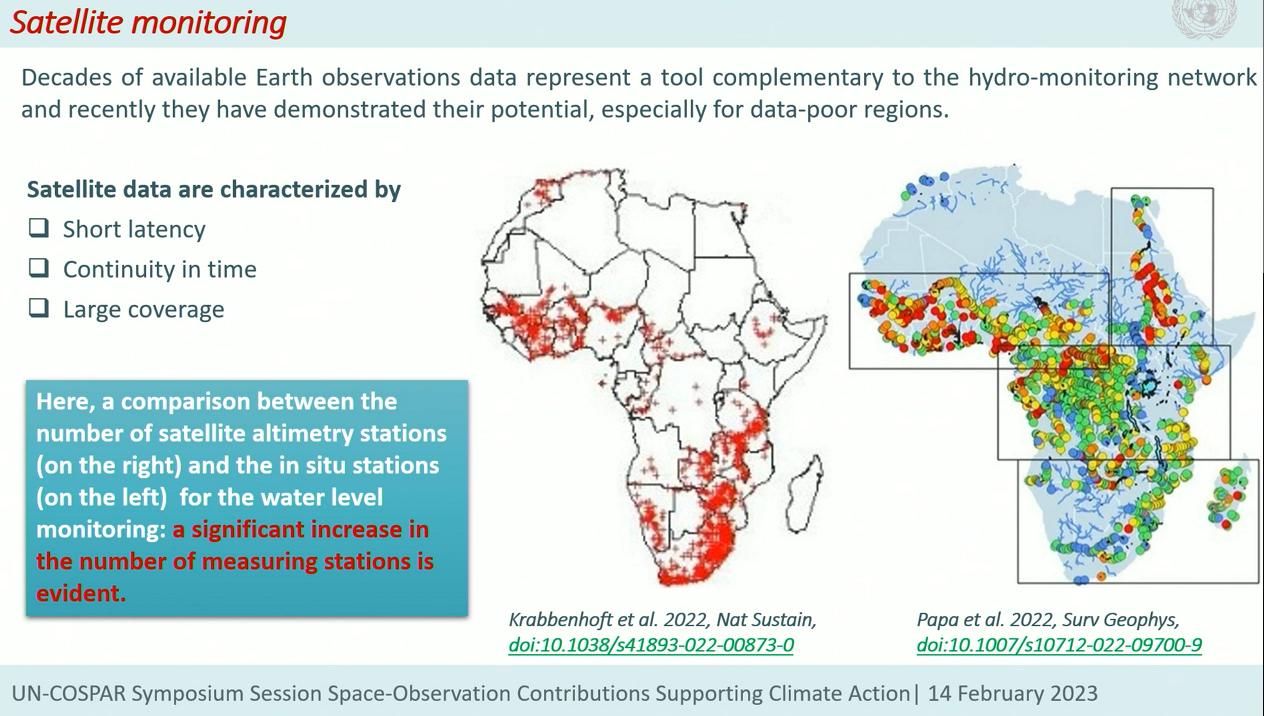
‘‘the COSPAR-sponsored session on Space-Observation Contributions Supporting Climate Action covered many aspects of our space-based ... observations, and drew the connections between these measurements and their application to policy and decision-making.’’ changes as well as strengthening assessments of the impacts these changes will have on other elements of the Earth System. The third focused talk was given by Angelica Tarpanelli of the Italian National Research Council. She concentrated on space-based monitoring of African river flow, the results of which are used to inform water management over the continent. In situ measurements are sparse in Africa, and radar altimetry as well as optical mapping by remote sensing instruments provide a broadly sampled complement to surface-based gauges in constraining the models used for resource forecasting and to help determine water management policy.
C.K. Shum from Ohio State University spoke next, describing the increasingly capable suite of space-based instruments studying the land surface for potential hazards. The impressive list includes satellite gravimetry, altimetry, global navigation system (GNSS) bistatic altimetry, synthetic aperture radar (SAR), Interferometric SAR (InSAR), and commercial, high-spatiotemporal-resolution multispectral imagery. These data, individually and especially in combination, are used to identify everything from groundwater reservoir depletion to even very subtle surface movement that can presage hazards such as landslides and larger earthquake events.
Wildfires are of increasing concern to populations in many parts of the world, and Nancy French of Michigan Tech University highlighted the range of satellite measurements that allow for better fire prediction as well as monitoring of smoke transport for downwind air quality forecasting and climate impact assessment. Everything from vegetation health and fuel loading, to “fire weather,” mainly related to near-surface temperature, relative humidity, wind speed and precipitation, to fire location, smoke plume injection height and source strength, as well as downwind dispersion are all observed from space and are used in fire and smoke modeling.
The final presentation, given by Aneesh Subramanian of the University of Colorado, Boulder, discussed a future mission that would add to our space-based Earth observation capabilities by quantifying the turbulent air-sea fluxes of heat and moisture at relatively high (~25 km) spatial resolution. The role of these fluxes in mediating severe storms, as well as longer-term climate phenomena such as droughts and floods, has become increasingly clear through the combination of satellite observations and advanced modeling. The proposed, space-based passive microwave instrument would provide flux measurements at a global scale, with greater sensitivity, and at higher spatial resolution, than current instruments offer.
In summary, the COSPAR-sponsored session on Space-Observation Contributions Supporting Climate Action covered many aspects of our space-based cryosphere, ocean, land, and atmosphere observations, and drew the connections between these measurements and their application to policy and decision-making. An underlying theme, especially relevant to the core values of COSPAR, is that these data tend to be acquired globally. As such, they typically apply to conditions in underserved nations as much as they do to areas that are otherwise well-monitored. The additional step required in many cases is capacity building, to develop regional expertise at actually using the satellite data, so the necessary analysis can be performed by those most closely affected by and interested in the results. Capacity building is another core value of COSPAR.

“Earth Observation Monitoring of African rivers in a Climate Change Context” was covered by