Welcome to our public exhibition
Jewel of Hertsmere Ltd and Liberty Aldenham Ltd welcome you to our public exhibition to find out more about the future of Aldenham Reservoir and how it will be secured and preserved for the local community and generations to come. This event has been organised to share our proposals with the local community.
We would welcome your feedback on our proposals. There are members of the project team available to answer any questions you may have.
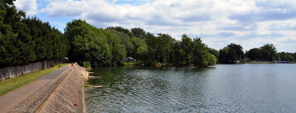
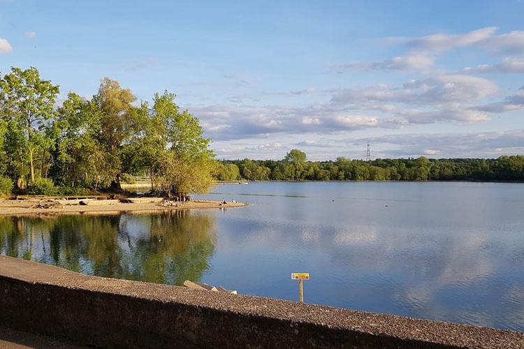
Aldenham Reservoir
History
1795-1797
The Reservoir is built by French prisoners of war
Earliest picture of Reservoir from 1822

1992
British Waterways disposes of the Reservoir and it is acquired by Safari investments, the council’s 42 year lease still ongoing
2019
A new planning application for a nature retreat is submitted but recommended for refusal so withdrawn 2019 application
1920s/1930s
British Waterways acquire the Reservoir and it is a popular day out for swimming, boating and fishing
A day out at the reservoir
2010/2011
After years of leasing and running the Reservoir, Hertfordshire County Council decides that it will not renew its lease of the Reservoir expiring in 2015
2015
1970
The Reservoir’s original purpose was to top up the River Colne. By 1970, the Reservoir ceases to be used to top up the River Colne and as far as British Waterways is concerned, is an unwelcome liability
An engineer reports note that there are issues with the dam that will need to be addressed. Safari submits planning application for 2015 application
residential development to fund repairs to the dam, but later withdraws this over opposition
2020
On the advice of experts, the water level in the reservoir is reduced by 1m to reduce pressure on the dam. With the lowered water level, Aldenham Sailing Club ceases to operate from the reservoir
1973
Hertfordshire County Council sign a 42 year lease on the Reservoir from British Waterways and reopen the Reservoir to the public
2015/2016
Liberty Lake Leisure Ltd takes over the Reservoir and resubmits a planning application for residential development to secure and preserve the future of the Reservoir but this is refused
Aldenham Reservoir
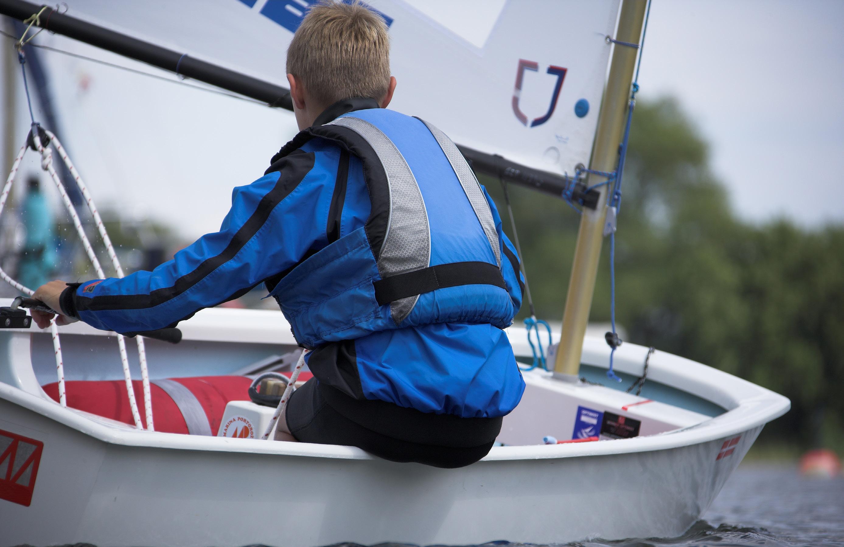
 Aldenham Sailing Club
Current Challenges
Currently the public use of the Reservoir is restricted and is limited to the public footpath. The sailing club can no longer operate due to the reduced water level.
These three options are left for the reservoir:
1. Discontinuance - effectively drain the reservoir and remove the ability of the dam to impound water greater than 25,000m3. A much lower value of 10,000m3 is recommended.
The Environment Agency defines the Reservoir as ‘High-risk’. An extensive review was undertaken by Mott MacDonald in August 2022. The review reports that despite some previous measures put in place, the dam continues to deform and will be prone to future movement. The risk of further erosion is credible and significant which would lead to leakage within the embankment dam. The engineers’ report confirmed the need to have lowered the water levels in the interest of public safety.
2. Permanent reduction of retained water level to a much lower level than it is today.
3. Improvement works to return the Reservoir safely to normal operating level
Aldenham Reservoir
Our proposed solution
We recognise that Aldenham Reservoir is a treasured community asset which is why we want to restore it and preserve it as an area of thriving, natural beauty, for everyone to enjoy.
The building and funding of a new dam, as part of our proposal, will enable the water to be restored safely to normal operating levels. This will support the return of the sailing club and ensure that the Reservoir can once again be a well-maintained hub of community activity.
Aldenham Reservoir
TykesWater


Aldenham Reservoir
Key to symbols App’d Ch’k’d Description Drawn Date Rev Rev Status Drawing Number Scale at A1 Eng check Approved Coordination Dwg check Drawn Designed Title Notes Client Reference drawings Security W Aldenham Reservoir Outline Design Plan of Proposed Dam Public Consultation Drawing Bryant TB Anderson TA M Colledge MC Foster JRF M Colledge MC Foster JRF 1:1000 S1 100381711-DG01-MM-RI-00-DR-LD-9005 P1 STD Floor 3 Whitehall Riverside Leeds LS1 4BN United Kingdom 0113 394 6700 Mottmac.com This document is issued for the party which commissioned it and for specific purposes connected with the captioned project only It should not be relied upon by any other party or used for any other purpose. We accept no responsibility for the consequences of this document being relied upon by any other party, or being used for any ther purpose, or containing any error or omission which is due to an error or omission in data supplied to us by other parties. Mott MacDonald 2019 Estimated extents of the reservoir embankment 1. All dimensions in millimetres and all levels in metres above ordnance datum unless otherwise stated. 2. This drawing is to be read in conjunction with the Dam Stabilisation Report. It is not under any circumstances to be used for tender or construction. 3. No topographical survey has been undertaken for this study. Therefore all structure lines are indicative. 4. Dam toe positions, shoulder angles and foundation levels are indicative. 5. Design is subject to change during detailed design. 6. Layout is indicative only and will be developed during detailed design. P01 17/11/2022 TA First Issue MC JRF Plan Slope gradient 100381711-DG01-MM-RI-00-DR-LD-9001-S1-01-Plan of Proposed works 100381711-DG01-MM-RI-00-DR-LD-9002-S1-01-Existing Plan of Dam 100381711-DG01-MM-RI-00-DR-LD-9003-S1-01-Proposed Plan of Dam 100381711-DG01-MM-RI-00-DR-LD-9004-S1-01-Embankment Sections 100381711-DG01-MM-RI-00-DR-LD-9006-S1-01-Typical Section CONCEPT 0 1:1000 @A1 50m 100m Reservoir extents All trees removed and area reinstated with grass and shrubs up to 2m in height, to protect the integrity of the spillway New concrete spillway along same alignment as existing spillway with width extended towards dam by approximately 1m to convey all possible flood flows safely away from the reservoir and dam Existing spillway extents All trees and shrubs to be removed from the embankment and area reinstated with grass, to improve embankment stability New crest path, approximately 3m upstream of the existing crest path Existing crest path to be removed and buried Works to either improve or replace buried draw-off pipework Extents of upstream embankment Extents of downstream embankment New concrete stilling basin to protect the downstream watercourse New footbridge Raised upstream embankment Reservoir extents New crest footpath Raised embankment extents Existing embankment. Area to be cleared of trees and reinstated with grass Area to be cleared of trees and reinstated with grass and shrubs New spillway Existing spillway New footbridge Aldenham Reservoir Spillway widened locally in this area Spillway extended by approximately 5m to create the new reservoir water line Existing reservoir water line Existing crest footpath Existing reservoir water line Level of existing rock protection New slurry trench buried by embankment re-profiling New slurry trench Proposed repairs to the Reservoir
of Proposed works 100381711-DG01-MM-RI-00-DR-LD-9002-S1-01-Existing Plan of
100381711-DG01-MM-RI-00-DR-LD-9003-S1-01-Proposed Plan of


100381711-DG01-MM-RI-00-DR-LD-9004-S1-01-Embankment Sections 100381711-DG01-MM-RI-00-DR-LD-9005-S1-01-Plan of


Aldenham Reservoir Typical section
the embankment Normal maximum water level 98.175 Estimated maximum flood level 100.895 1 101.145 99.91 Existing dam profile Existing rock protection New waterproof liner within sand protection layer, to prevent leakage from the reservoir New engineered fill New rock protection, preventing wave damage to the dam Slurry trench cut-off to prevent leakage from the reservoir, improving stability of the embankment 4 Existing crest path Proposed crest path Post and rail fencing, for safety New drainage to improve embankment stability New concrete spillway channel, approximately 1m wider than existing channel, to improve condition and capacity of the spillway to protect the reservoir embankment Existing spillway profile App’d Ch’k’d Description Drawn Date Rev Rev Status Drawing Number Scale at A1 Eng check Approved Coordination Dwg check Drawn Designed Title Client Security ..\..\Background information\CRT Logo.png Notes W Aldenham Reservoir Embankment Regrading Works Typical Section Public Consultation Drawing Bryant TB Anderson TA M Colledge MC Foster JRF M Colledge MC Foster JRF 1:125 S1 100381711-DG01-MM-RI-00-DR-LD-9006 P01 STD Floor 3 Whitehall Riverside Leeds LS1 4BN United Kingdom 0113 394 6700 Mottmac.com This document is issued for the party which commissioned it and for specific purposes connected with the captioned project only should not be relied upon by any other party or used for any other purpose. We accept no responsibility for the consequences of this document being relied upon by any other party, or being used for any other purpose, or containing any error or omission which is due to an error or omission in data supplied to us by other parties. Mott MacDonald 2022 P01 17/11/2022 TA First Issue MC JRF Key to symbols Reference drawings 1. All dimensions in millimetres and all levels in metres above ordnance datum unless otherwise stated. 2. This drawing is to be read in conjunction with the Dam Stabilisation Report. It is not under any circumstances to be used for tender or construction. 3. No topographical survey has been undertaken for this study. Therefore all structure lines are indicative. 4. Dam toe positions, shoulder angles and foundation levels are indicative. 5. Design is subject to change during detailed design. 6. Layout is indicative only and will be developed during detailed design. 0 1:125 6.25m 12.5m CONCEPT
Dam
Proposed Dam Reservoir extents New crest footpath New sand Existing embankment Natural ground bedrock New spillway Existing crest footpath New engineered fill New slurry trench Existing rock protection Drainage bedding material New rock protection
repairs
the Reservoir
through
100381711-DG01-MM-RI-00-DR-LD-9001-S1-01-Plan
Dam
Proposed
to
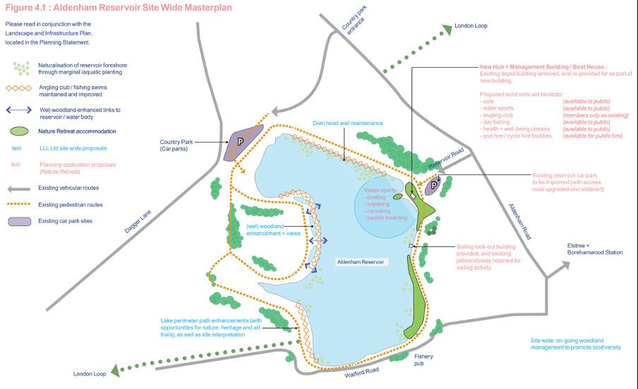
Restoring public access to the Reservoir
Alongside the repairs to the Reservoir, we are proposing to renovate the angling and sailing club clubhouses, providing improved facilities for the local community. This will help the sailing club to reopen and provide a better space for the angling club.

We are also proposing landscape improvements, footpath repair and new waterside security features to ensure the Reservoir can be enjoyed safely by all.


Aldenham Reservoir
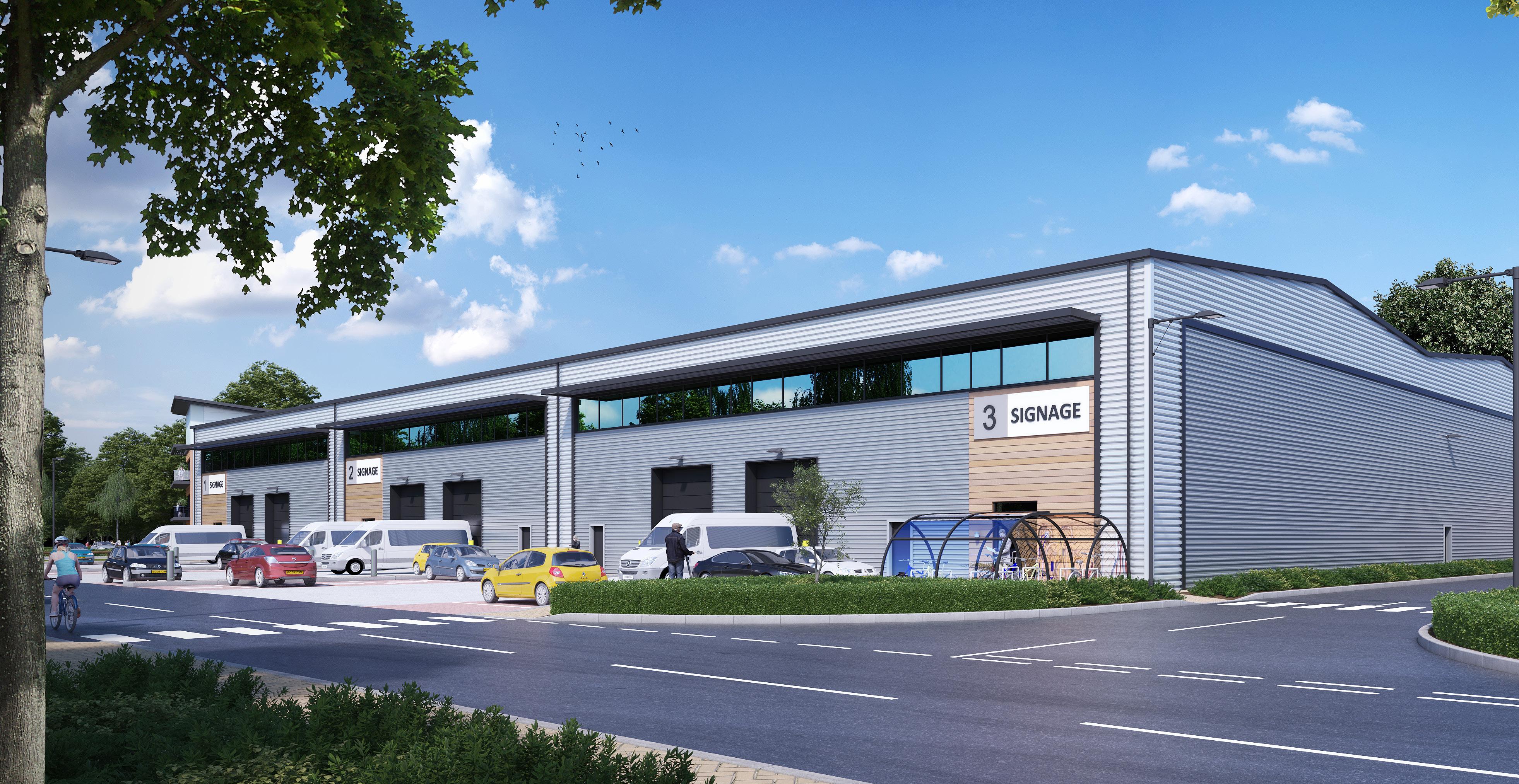
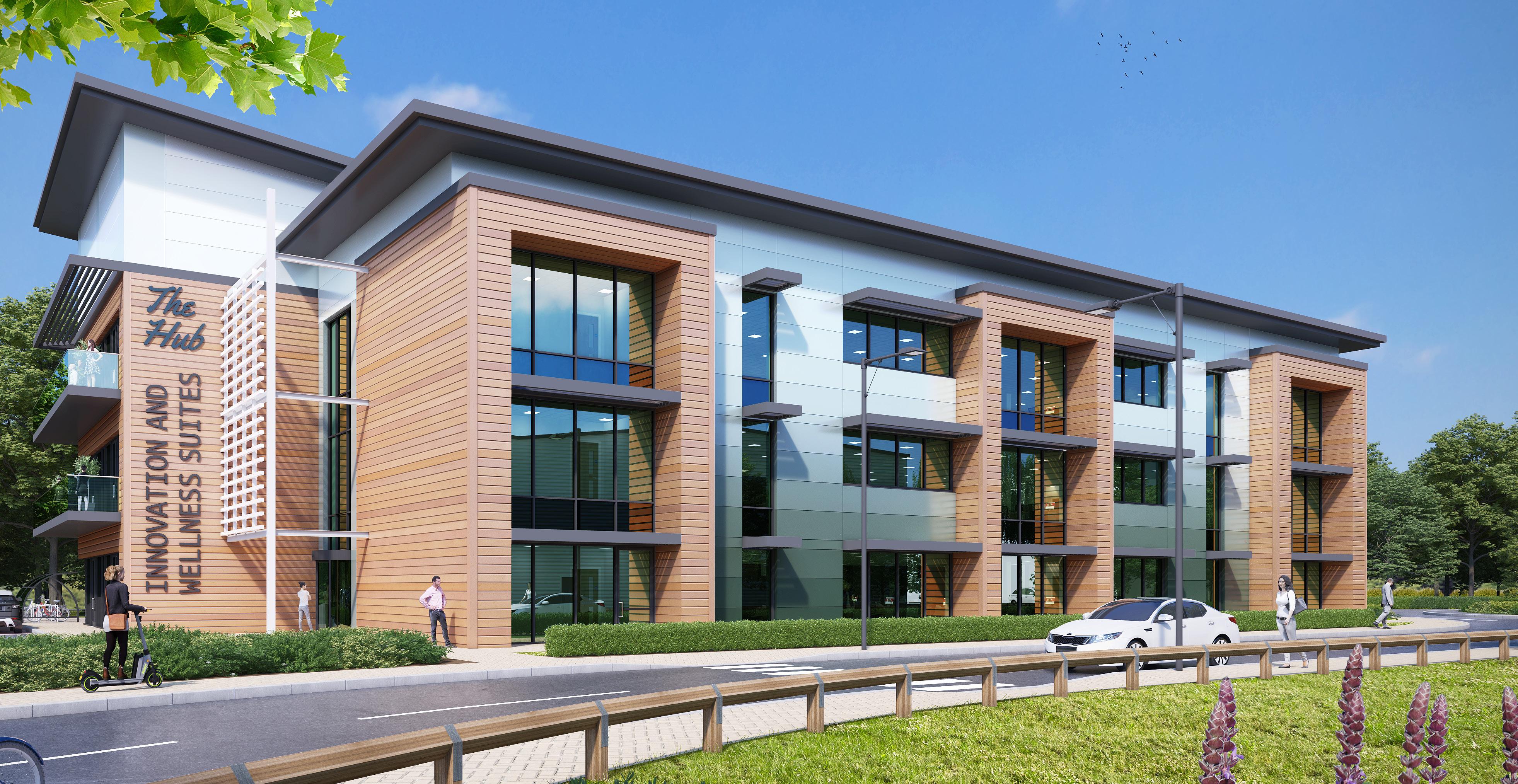
A new employment development
The Reservoir repairs and the renovation of both the sailing and angling clubhouses need to be funded. We are proposing to fund this through a new employment development scheme.
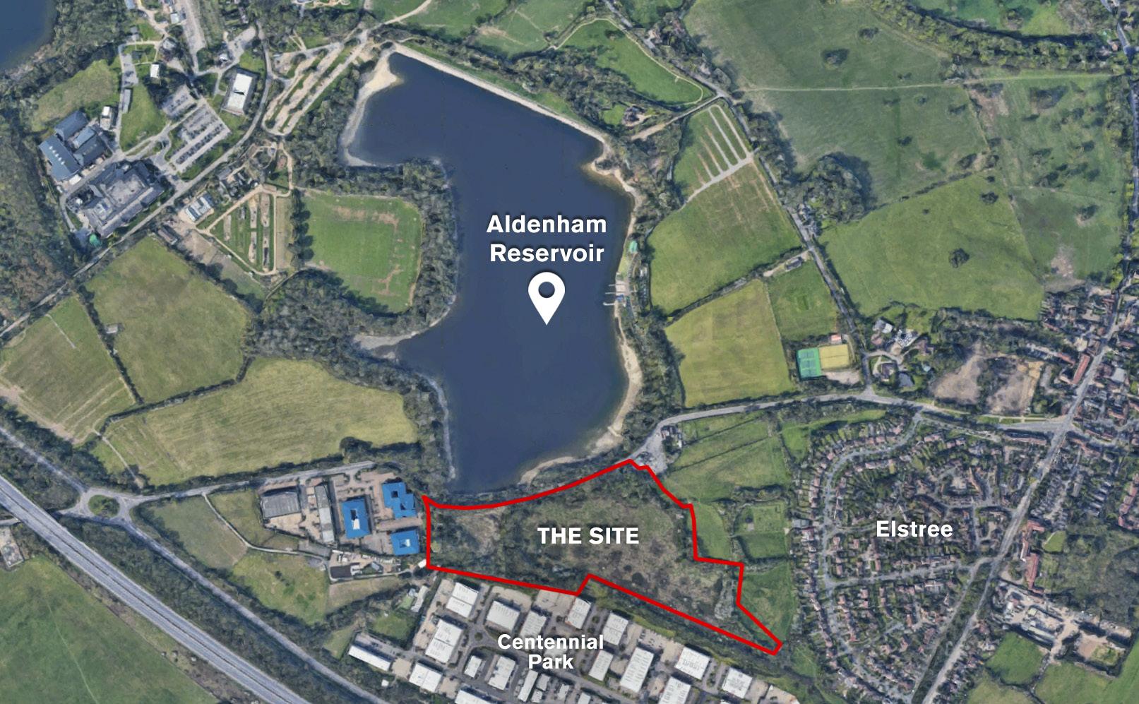
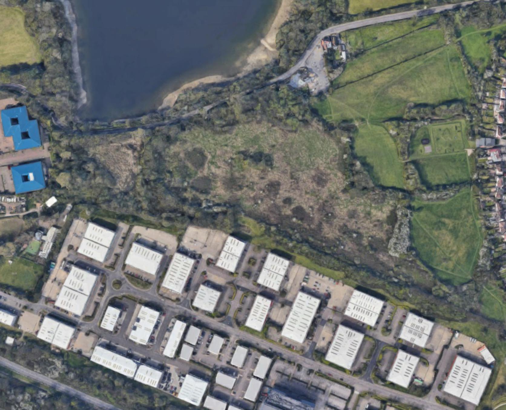
This would not be located on or directly around the reservoir site. This development would be on the opposite side of the road, on unused land backing on to Centennial Park. This development will help us raise vital funds required to build a new dam and maintain the reservoir, in order to secure and preserve safe public access to the reservoir for generations to come. We want to see the Reservoir restored to a thriving, natural and beautiful community asset.
The proposed employment development on the land backing on to Centennial Park (not on or around the reservoir) will provide:
• High quality industrial space with smaller scale units to meet local demand
• Innovation Hub providing office space with views onto the Reservoir
• Opportunities for affordable workspace, coworking and community space
• New landscaped amenity space providing a meeting place for workers and the local community
Aldenham Reservoir
A


Aldenham Reservoir
new employment
UNIT UNIT 1 PYLON WATFORD ROAD (A411) TREES RETAINED YARD ATTENUATION CYC RESERVOIR VIEWS TO BELOW ASSUMED EASEMENT GROUND SERVICES- TBC TO BELOW EXISTING LANDSCAPING TANK ASSUMED BIO-DIVERSITY/ UNIT 2 UNIT UNIT 1 UNIT UNIT 3 CYC UNIT 1 UNIT UNIT 3 UNIT 4 UNIT UNIT 6 UNIT BLOCK 1 BLOCK 2 BLOCK 3 BLOCK 4 CO-WORKING, WELLNESS & INNOVATION HUB STRUCTURED PYLON TREES RETAINED THROUGH TREES CRIB LOCK This drawing and the building works depicted are the copyright BHP Design (UK) LTD. and may not be reproduced or amended except written permission. No liability will accepted for amendments made by other persons. The Contractor check and verify all building and site dimensions, levels and sewer invert levels connection points before work starts. The Contractor is to comply all respects with current Building Legislation, British Standard Specifications, Building Regulations, Construction (Design Management) Regulations, Party Wall Act, etc. whether or not specifically stated on this drawing. This drawing must read with and checked against any structural, geotechnical other specialist documentation provided. This drawing not intended to show details of foundations, ground conditions ground contaminants. Each area of ground relied upon support any structure depicted (including drainage) must investigated the Contractor. suitable method of foundation should be provided allowing for existing ground conditions. Any suspect fluid ground, contaminates on within the ground, should be further investigated by suitable expert. Any earthwork constructions shown indicate typical slopes for guidance only should be further investigated by suitable expert. Where existing trees are be retained they should subject to full Arboricultural inspection for safety. All trees are planted ensure they are minimum metres from buildings and metres from drainage and services. suitable method foundation to be provided accommodate the proposed tree planting. Sketch proposals are illustrative purposes only as such are subject to detailed site investigation including ground conditions/contaminants, drainage, design planning/density negotiations. Sketch proposals may based upon enlargements of OS sheets visual estimations of existing site features, accuracy will therefore need be verified survey. Sketch proposals have not been considered respect CDM Regulations. Notes: PROJECT: B3 1FQ, United Kingdom St. Paul's Place, 40 St. Paul's Square, Birmingham, TITLE: Design Date Scale: Draft: Drw No Revision: +44(0)121 314 6618 e info@bhp-design.co.uk PROPOSED DEVELOPMENT OFF A411 WATFORD ROAD ELSTREE BOREHAMWOOD WD6 3TH SITE LAYOUT PLAN (AERIAL BASED) DFC 22-076SK-25-10-22/01 OCT 2022 JC C 1:2000@A3 CLIENT: 0m 40 200 20 100 1:2000 60 80 120 140 160 180 SCHEDULE OF ACCOMMODATION CO-WORKING,WELLNESS & INNOVATION HUB MEZZANINE (20% OF TOTAL) (3 STOREY) 22,500 SQFT N/A TOTAL 22,500 SQFT (NOTE: NIA) N/A BLOCK 1 UNIT 12,000 SQFT 15,000 SQFT UNIT 12,000 SQFT 15,000 SQFT UNIT 15,000 SQFT 18,750 SQFT TOTAL 39,000 SQFT GIA 48,750 SQFT GIA BLOCK 2 UNIT 5,000 SQFT 6,250 SQFT UNIT 5,000 SQFT 6,250 SQFT UNIT 5,000 SQFT 6,250 SQFT UNIT 5,000 SQFT 6,250 SQFT UNIT 10,000 SQFT 12,500 SQFT UNIT 10,000 SQFT 12,500 SQFT UNIT 7,500 SQFT 9,375 SQFT TOTAL 47,500 SQFT GIA 59,375 SQFT GIA BLOCK 3 UNIT 15,000 SQFT 18,750 SQFT UNIT 12,000 SQFT 15,000 SQFT UNIT 15,000 SQFT 18,750 SQFT TOTAL 42,000 SQFT GIA 52,500 SQFT GIA BLOCK 4 UNIT 30,000 SQFT 37,500 SQFT TOTAL 30,000 SQFT GIA 37,500 SQFT GIA GRAND TOTAL 181,000 SQFT GIA 220,625 SQFT GIA New workspace for the local community New landscaped amenity space to relax and socialise
development
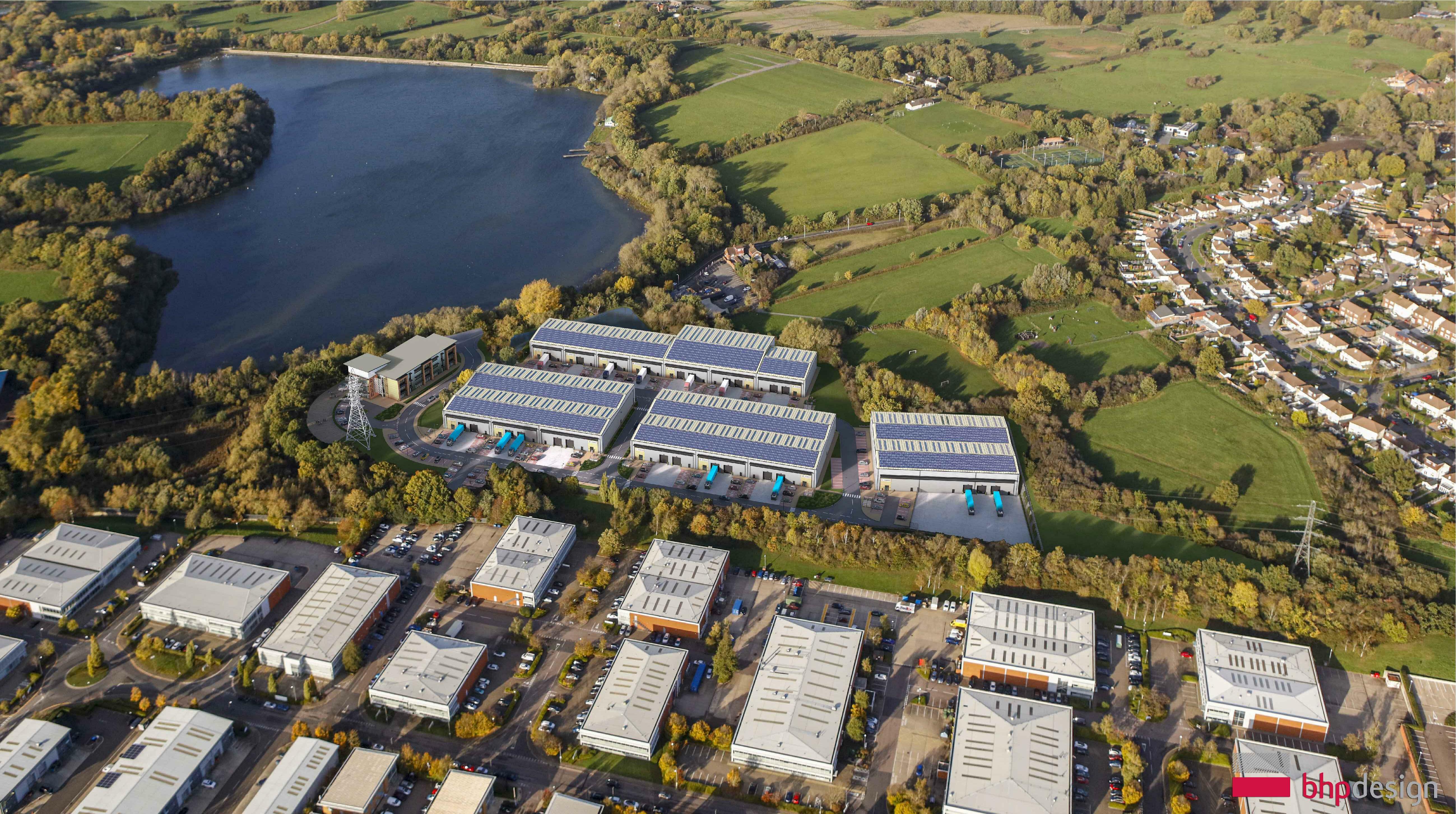
Visuals This drawing and the building works depicted are the copyright BHP Design (UK) LTD. and may not reproduced amended except by written permission. No liability will be accepted amendments made by other persons. The Contractor is check and verify building and site dimensions, levels and sewer invert levels connection points before work starts. The Contractor comply in respects with current Building Legislation, British Standard Specifications, Building Regulations, Construction (Design Management) Regulations, Party Wall Act, etc. whether or not specifically stated this drawing. This drawing must be read with and checked against any structural, geotechnical other specialist documentation provided. Each area ground relied upon support any structure depicted (including drainage) must be investigated by the Contractor. suitable method foundation should provided allowing existing ground conditions. Any suspect fluid ground, contaminates on or within the ground, should further investigated suitable expert. Any earthwork constructions shown indicate typical slopes for guidance only should be further investigated suitable expert. Where existing trees are be retained they should be subject to full Arboricultural inspection for safety. All trees are be planted ensure they are minimum metres from buildings and metres from drainage and services. suitable method foundation be provided accommodate the proposed tree planting. Sketch proposals are illustrative purposes only as such are subject detailed site investigation including ground conditions/contaminants, drainage, design planning/density negotiations. Sketch proposals may be based upon enlargements OS sheets visual estimations of existing site features, accuracy will therefore need to be verified by survey. Sketch proposals have not been considered respect CDM Regulations. Notes: PROJECT: B3 1FQ, United Kingdom St. Paul's Place, 40 St. Paul's Square, Birmingham, TITLE: Design Date Scale: Draft: Drw No Revision: t. +44(0)121 314 6618 e info@bhp-design.co.uk PROPOSED DEVELOPMENT OFF A411 WATFORD ROAD ELSTREE BOREHAMWOOD WD6 3TH SITE AERIAL PHOTOMONTAGE DFC NOV 2022 WC A NTS@A3 CLIENT: 22-076-OPA-07 Proposed Innovation Hub providing new workspace Proposed industrial space Proposed aerial view Aldenham Reservoir
Repairs to the Reservoir to allow for public access once again
Improved facilities at the angling and sailing clubhouses for the local community
Key benefits
New landscaped amenity space providing a new meeting place for people to come together
A new employment development on unused land backing on to Centennial Park (not on or directly around the reservoir) to fund the building of a new dam and ongoing maintenance of the Reservoir
New job creation opportunities to help boost the local economy
An ideal location for an employment development, adjacent to the existing Centennial Park
Aldenham Reservoir
WELCOME
Next steps
Thank you for coming to our public exhibition to find out about our proposals to secure and preserve Aldenham Reservoir for the local community and generations to come.
Ahead of submitting a planning application to Hertsmere Borough Council we would welcome your feedback on the plans.
Please feel free to email us via kbrown@conciliocomms.com to submit any feedback. You can also call us on 0800 193 0884. Your views are welcomed.
Aldenham Reservoir
Planning submission Planning decision Works begin Repair works complete Employment development complete December 2022 Spring 2023 September 2023 Spring 2025 Spring 2025
