Strategy Area Description
2.6.8
2.6.9
Figure 2-1: Statutory designated sites for nature conservation 9
Figure 2-2: Priority habitats in Herefordshire 11
Figure 2-3: Condition of SSSIs in Herefordshire 13
Figure 2-4: National Character areas within Herefordshire 16
Figure 2-5: Bedrock geology of Herefordshire 17
Figure 2-6: Superficial (Drift) geology of Herefordshire 18
Figure 2-7: Herefordshire’s river catchments 19
Table 2-1: National Forestry Inventory (NFI) woodland (standard) cover within Herefordshire 26
Table 2-2: Area (ha) of farming types within Herefordshire 35
Acronym
ACIB
Meaning
Areas that could become important for biodiversity
AONB Area of Outstanding Natural Beauty
AQMA Air Quality Management Area
ASNW
Ancient Semi-Natural Woodland
CLA Country Land and Business Association
Defra Department for Environment, Food & Rural Affairs
EA Environmental Agency
EIP
Environmental Improvement Plan
FC Forestry Commission
ha Hectares
HBRC
HER
HWT
GCER
GWT
LGS
LNP
LNR
LNRS
LWS
Herefordshire Biological Records Centre
Historic Environment Record
Herefordshire Wildlife Trust
Gloucestershire Centre for Environmental Records
Gloucestershire Wildlife Trust
Local Geological Sites
Local Nature Partnership
Local Nature Reserves
Local Nature Recovery Strategy
Local Wildlife Sites
my million years
NCA
National Character Areas
NE Natural England
NFI
NFM
NFU
NNR
NRN
National Forest Inventory
Natural Flood Management
National Farmers Union
National Nature Reserves
Nature Recovery Network
PAWS Plantations on Ancient Woodland Sites
SAC
SHINE
SPA
SPD
SSSI
WCP
WEBs
WFD
Special Areas of Conservation
Select Heritage Inventory for Natural England
Special Protection Area
Supplementary Planning Document
Site of Special Scientific Interest
Wye Catchment Partnership
Wider Environmental Benefits
Water Framework Directive
Under the Environment Act (2021) England has been divided into 48 strategy areas. Each strategy area will have a designated “responsible authority” who will lead the preparation, publication, review and republication of their Local Nature Recovery Strategy (LNRS).
The LNRS will identify locations to create or improve habitats, which deliver the greatest benefit to nature and the wider environment. Together, the LNRSs will form a system of spatial strategies vital to improving the state of nature both locally and nationally and will also help to encourage action that provides wider environmental or societal benefits, called “nature based solutions”.
By law, each LNRS must include:
A Statement of Biodiversity Priorities, comprising:
• A description of the strategy area and its biodiversity;
• A description of the opportunities for recovering or enhancing biodiversity in the strategy area;
• The priorities for recovering or enhancing biodiversity (taking into account the contribution that this can also make to other environmental benefits); and
• Proposals as to potential measures relating to those priorities.
A Local Habitat Map that identifies:
• National conservation sites in the strategy area
• Local nature reserves in the strategy area
• Other areas in the strategy area which:
- Are of particular importance for biodiversity; or
- Could be of particular importance for biodiversity
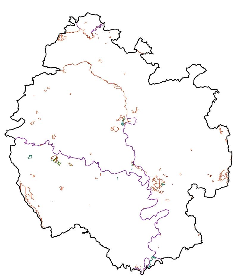
Herefordshire Council is the “responsible authority” for the Herefordshire LNRS, as shown in the map


Herefordshire Council led the development the LNRS, working closely with the Steering Group and local partners. The Steering Group is made up of stakeholders including:
• Natural England (NE);
• Environment Agency (EA);
• Forestry Commission (FC);
• Herefordshire Wildlife Trust (HWT);
• Representatives from the two National Landscapes1 (The Wye Valley and The Malvern Hills) which sit partly within the county;
• Landowner representation though the the Country Land and Business Association (CLA) and the National Farmers Union (NFU);
• Herefordshire Biological Records Centre (HBRC); and
• Wye and Usk Foundation.
During the development of the strategy, separate working groups were established to provide targeted knowledge in specific areas. These comprised of design of the mapping, short listing Priorities and Measures, shortlisting species and planning engagement events. To best capture the needs of each group the attendees were extended to wider stakeholders such as the Woodland Trust and country species recorders.
The Local Nature Partnership (LNP) are a group of local partners that have had a substantial role in the development of the strategy. As a high-level group of stakeholders for the improvement of the natural environment, their knowledge regarding specific habitat types and wider organisations looking to use the LNRS have been vital in the process of creation and refinement of the strategy.
The Wye Catchment Partnership (WCP) is a key local partner; ensuring coordinated efforts for environmental restoration and sustainable management in the Wye catchment, a major component of the LNRS area. They are responsible for catchment planning, integrated management and supporting initiatives, which are well aligned with the LNRS.
The LNRS has been driven by the evidence and data available for Herefordshire and collaboration with local organisations, partners and individuals through consultations and working groups to ensure that nature recovery and local communities are at the centre of this strategy.
A list of the involved individuals and groups is summarised below:
• Market Towns Market Sessions – 5 towns across the county;
• Parish Council Webinar – 66 attendees;
• Business and Education Webinar – 25 attendees;
• Online Mapping Survey – 78 responses and 12 email responses;
• Online General Engagement Survey – 170 responses; and
• Five Farmer and Landowner/Manager’ Focused Workshops held across Herefordshire:
- Ross – 8 attendees;
- Leominster – 5 attendees;
- Ledbury – 6 attendees;
- Bad Harvest Barn – 17 attendees; and
- Whittern Farms – 13 attendees.
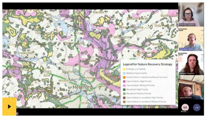
The first step in developing the Local Habitat Map for the LNRS was to create a Nature Recovery Network (NRN) map for Herefordshire. The NRN identified national conservation sites, Local Nature Reserves, and other areas which are of particular importance for biodiversity (such as traditional orchards that are a key habitat for Herefordshire). It has also been used to map areas that could become of particular importance for biodiversity. These have been grouped into opportunity areas for four ecological networks: wetland; woodland; open habitats (species-rich grassland and heathland habitats); and open or woodland opportunities. These separate habitat opportunities will be used to target each of the measures and ensure that specific habitats are only receiving measures that they truly need.
Full technical details of the methodology can be found in the Herefordshire Nature Recovery Network Mapping Methodology document written by Gloucestershire Centre for Environmental Records (GCER) and Gloucestershire Wildlife Trust (GWT)2
This initial opportunity mapping exercise has helped to identify areas where potential measures could be undertaken to deliver the priorities for the recovery or enhancement of biodiversity and make a particular contribution to other environmental benefits.
It identifies broad habitat opportunity areas by expanding upon and connecting existing high-quality habitats. This is done by utilising a mapping tool called ‘cost distance analysis’. This analysis is a way of mapping a landscape to show how easily a species can move from one area to another. The mapping model estimates how easily different species can move through an area by assigning a ‘permeability’ score to each habitat. Using these scores, the model then calculates the path of least resistance across the entire map. The result is a map that doesn’t just show habitats but also highlights the most critical areas for habitat restoration to improve connectivity between existing sites. This forms the ‘Areas that could become important for biodiversity’ (ACIBs).
Following on from the creation of the ACIBs, the habitat and species measures were mapped to the specific locations where they apply. Not all measures can be mapped, however those that can have been identified through the steering group. A combination of existing data sets have been selected and combined to create a new mappable layer for each measure. The measures are mapped to opportunity areas where they are best suited and will deliver the greatest benefits for nature. This uses an evidence driven approach to assigning on the ground actions to a particular place. Using a prioritisation matrix, that takes into account wider environmental benefits, the measures will appear on the interactive map in a ranked order.
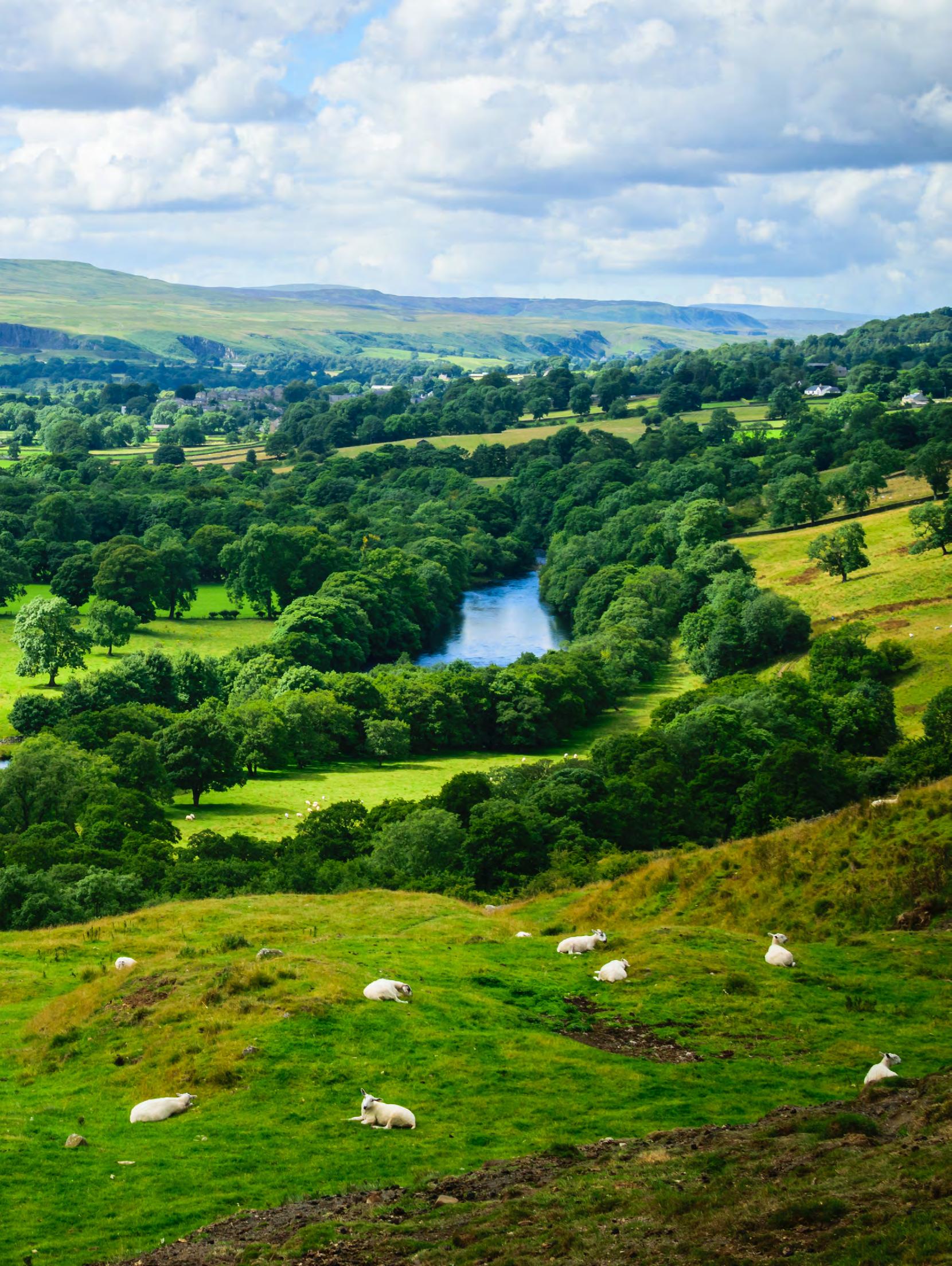
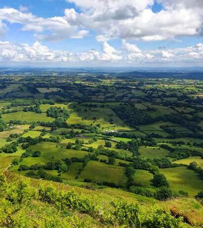
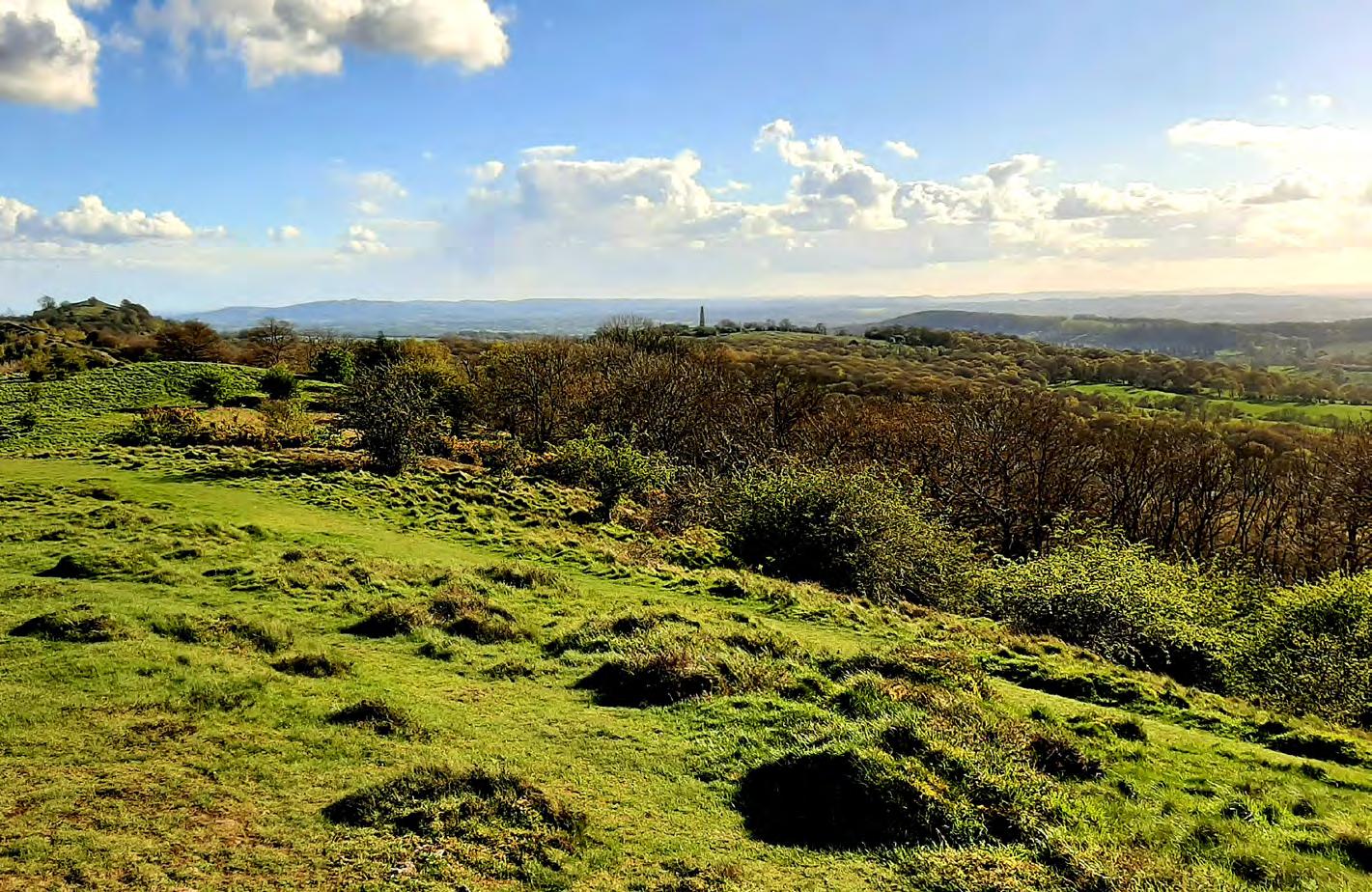
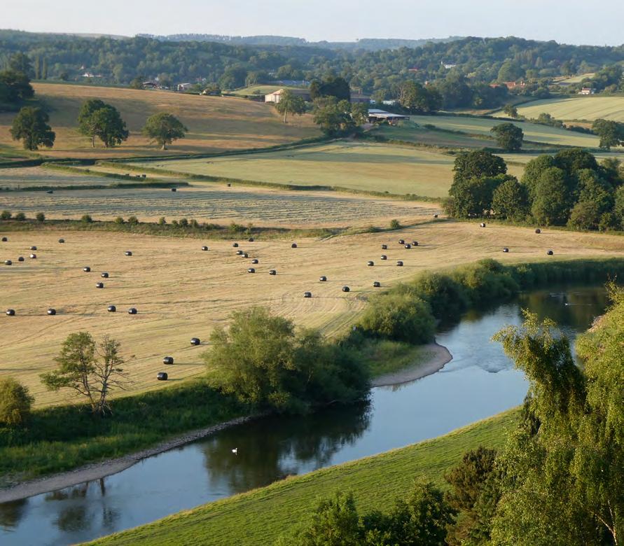
Herefordshire is a county known for its rural landscapes, ranging from the fertile floodplains along the River Wye to the dramatic scenery of the uplands, notably in the Black Mountains and the Malvern Hills. These landscapes are home to a great diversity of wildlife and natural habitats.
This section provides a description of the area encompassed by the LNRS. It draws together information from multiple sources to explore Herefordshire’s natural environment as it currently stands and is defined by its iconic sites, habitats and species. Appendix A provides details on the data referred to within this section. Important habitats, from ancient woodlands and lowland meadows to traditional orchards and rivers, are described in detail. The range of species which call Herefordshire home are also explored.
Herefordshire’s natural environment faces numerous pressures, such as from intensive agriculture, pollution, changes in land use and climate change. These are examined in the context of how they affect, or could affect, biodiversity assets in Herefordshire with the aim of identifying opportunities and guiding future action on how nature can be restored in the county.
Importantly, the thriving biodiversity that exists within Herefordshire has been protected through the hard work and dedication of committed networks of local organisations and partnerships. These groups strive to protect existing areas of high value for nature, as well as working to restore nature back into Herefordshire’s landscapes, and to inspire people of all ages to discover and take action to defend and improve Herefordshire’s wildlife. Their successes are highlighted throughout the document.
Some 40,062hectares (ha) or 18% of Herefordshire is subject to nature-based designations (from international to local level) which seek to protect the most valuable habitats and their residing species. Land is subject to statutory designation where it meets published criteria in terms of being of valuable to particular species, species groups and habitats of high importance, among other features. These sites provide vital areas for nature to thrive, and act as key refugia for wildlife, linking together Herefordshire with the wider landscape. However, isolated sites cannot conserve nature on their own, they must form part of a larger well-connected ecological network to allow wildlife to cope with changes and pressures.
A wide range of statutorily designated sites for nature occur in Herefordshire. They include Sites of Special Scientific Interest (SSSIs), Special Areas of Conservation (SACs), Special Protection Areas (SPAs), National Nature Reserves (NNRs), and Local Nature Reserves (LNRs). Non-statutory sites are also present within the county including Local Wildlife Sites (LWS) and Local Geological Sites (LGS). Many of these statutory and/or non-statutory designated sites are of high value to nature, but if they are small, poorly connected to other natural habitats and sit in isolation, they can be threatened. For example, each species has a different capacity to move between habitats: a motorway will represent a significant barrier to amphibian and reptile movement, whereas birds of prey may fly over mostly unaffected. Unlit corridors of vegetation enable bats to fly and forage, and streams, canals and rivers allow movement of aquatic species along blue corridors.
Herefordshire County Boundary
Special Areas Of Conservation (SAC)
Sites Of Special ScientificInterest (SSSI)
National Nature Reserves (NNR)
Local Nature Reserves (LNR)
Within Herefordshire, there are four SACs, which comprise of woodland and freshwater habitats covering 0.5% of the county (Figure 2-1). This includes the River Wye, which is the only river in the UK that is cross border and designated along its full length. These SACs represent the highest international level of designation that are protected by the Habitats Regulations, which implement the European Union Habitats Directive (Directive 92/43/EEC). There are also three NNRs comprising woodland, wood pasture, and grassland habitats covering 0.1% of the county. NNRs are important nationally and are designated by NE as places that typically hold nationally important populations of species. A prime example is Moccas Park, managed by Natural England, which is one of the largest and most diverse examples of wood pasture habitat remaining in Britain.
There are also 77 SSSIs in the county (covering 46 ha/2.1%), which are designated for their biological or geological interest or a combination of both (four sites). These range from the lowland woodlands of Downton Gorge, the lowland grasslands of the Lugg and Hampton Meadows, the Wye and Lugg rivers, to the upland scrub of the Black Mountains.
An accurate image of the number of designated sites within the county can be located within the MAGIC Map from the Government website
In terms of local designations, across Herefordshire, there are seven LNRs which comprise of woodland, ancient grassland, open grassland, and meadow habitats located mostly in the south, as well as 772 LWS covering 19,109 ha/9%. The LWS reflect the local character and distinctiveness of Herefordshire, having been identified and selected locally by a partnership of the local authority, nature conservation charities, statutory agencies, ecologists and local nature experts, using transparent criteria and detailed surveys. They can be found on both public and private land, including habitats such as species-rich grasslands, ancient woodlands, fens, orchards, and river corridors.
Irreplaceable habitats, as referred to in The Biodiversity Gain Requirements (Irreplaceable Habitat) Regulations 2024, are
Blanket bog
Coastal and floodplain grazing marsh
Deciduous woodland
Good quality semi improved grassland
Grass moorland
Lowland calcareous grassland
Lowland dry acid grassland
Lowland fens
Lowland heathland
Lowland meadows
No main habitat but additional habitats present
Ponds
Purple moor grass and rush pastures
Traditional orchard
Upland flushes fens and swamps
Upland heathland
considered extremely difficult or impossible to restore, create, or replace once destroyed due to their rarity, uniqueness, species diversity, and/or age. Within Herefordshire, such irreplaceable habitats include ancient and veteran trees, ancient woodland, blanket bog, certain areas of semi-natural grassland, and lowland fens. Planning permission for developments that result in the loss of these irreplaceable habitats would only be granted in exceptional circumstances.
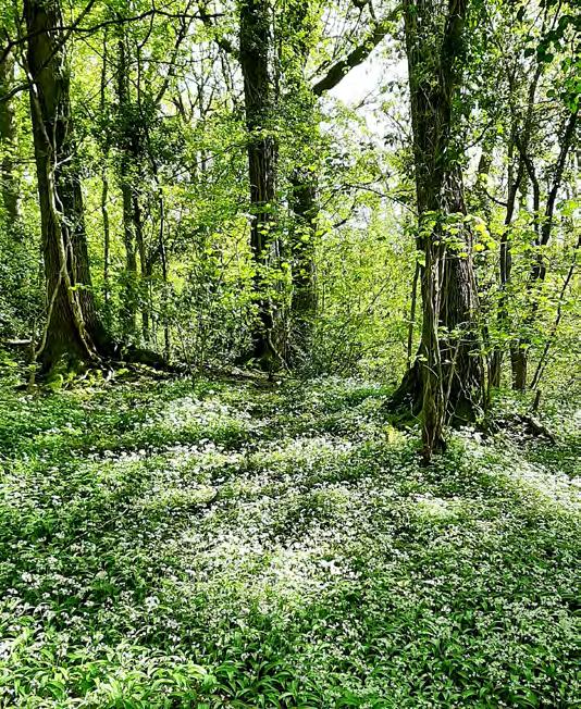
In addition, Herefordshire hosts many UK Priority habitats – these can be rare and valuable habitat types, which therefore receive additional protection in a planning context and are the target for many conservation and restoration projects. These are outlined in Figure 2-2 and the infographic overleaf.
Long term data is collected on the condition of SSSIs within Herefordshire (Figure 2-3), to monitor their conservation value and the progress of any remedial / restoration measures that may have been put in place against published standards. The condition of SSSIs in Herefordshire varies. For some sites the designated features are in decline and in unfavourable condition, whereas other features or sites are recovering or favourable.
Currently, only 35.7% (1,780 ha) of features are in favourable condition, with the remaining 64.3% (3,209 ha) in unfavourable condition. However, over the years some of the SSSI sites have improved and have moved towards being managed for recovery rather than remaining unfavourable – no change, although approximately one quarter
of SSSIs are still classed as suffering with a category of unfavourable – declining. This includes the River Wye and Lugg SSSI. Compared to the country average (41.2%), Herefordshire has fewer SSSIs in favourable condition. However, not all sites have been surveyed or re-surveyed at the same time, with the result that some condition data may be more than a decade old and, as such, should be interpreted with caution. Further independent checks that have been carried out by the County Botanical Recorder on multiple sites have also shown that no further sites are classed as favourable but several could now be classed as less favourable.
Whilst the data above relates only to SSSIs, Herefordshire Council are currently resurveying all of the Local Wildlife Sites within the county with the aim of providing an update on the existing habitats, as well as include new criteria relating to traditional orchard habitats.
Condition
Unfavourable - Recovering
Unfavourable - No Change
Unfavourable - Declining
Favourable
Unfavourable - Recovering
Unfavourable - No Change
Unfavourable - Declining
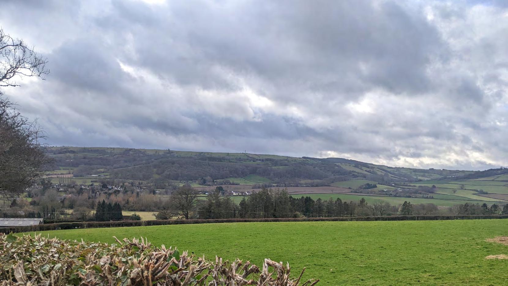
Herefordshire is a county with rich and diverse landscapes that have formed over centuries as people and communities have interacted with the physical landscape. This has resulted in locally distinctive qualities in the region as both physical controls on the landscape (such as geology, temperature, altitude and topography) are combined with historic and current human influence from farming to development. In general, although Herefordshire has a city and towns it has retained its rural and in places remote character, with both small, dispersed villages and linear villages, that originally formed around features such as churches and along roads or at river crossings.
Lowland farmland dominates the centre of the county, associated with river floodplains and the different morphologies of river valleys.
On the broadest scale, National Landscapes (formerly known as Areas of Outstanding Natural Beauty or AONBs) in England are protected areas valued for their distinctive and beautiful landscapes. Herefordshire contains two of these National Landscapes, the Wye Valley and the Malvern Hills which are shared with neighbouring counties.
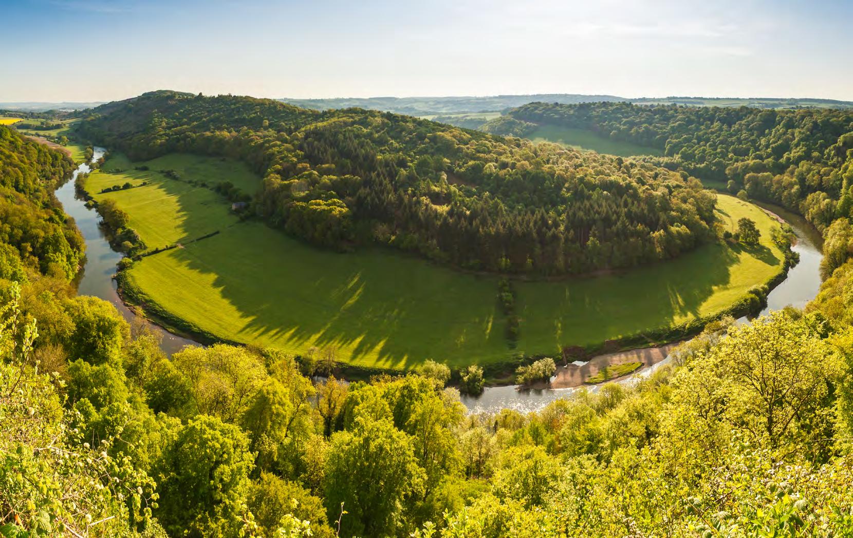
The Wye Valley National Landscape lies to the southeast of Hereford, following the catchment and floodplain of the lower River Wye. This landscape is characterised by wooded valleys, meandering riverbanks, and hedgerow-lined fields.
The Malvern Hills National Landscape lies to the east of Ledbury in the south-east of the county. The Malvern Hills form a distinctive skyline in views eastward from many of Herefordshire’s rolling lowlands. The narrow line of Precambrian igneous rocks which form the Hills run along the boundary of Herefordshire and Worcestershire, with its dramatic topography forming a distinctive feature in the region’s landscape.
On a finer scale, National Character Areas (NCAs) are also used to describe landscapes. There are 159 NCAs across England and they are subdivided based on landscapes, biodiversity, geodiversity and economic activities.
Herefordshire contains six NCAs and an additional two border the county. They are shown in Figure 2-4 below and comprise:
Herefordshire Lowlands: this NCA lies almost entirely within Herefordshire and is largely tranquil and rural in character but does include the larger settlements of Hereford and Leominster. There are other small, dispersed settlements of hamlets and villages, many of which contain older traditional buildings and also have historic farmsteads. The lowlands are underlain by Upper Silurian, easily eroded, red mudstones, the first of the Old Red Sandstone rocks. Rising out of the lowlands are hills of the Lowest Devonian sandstones.
South Herefordshire and Over
Severn: this NCA stretches from the border with the Forest of Dean in the south, north eastwards almost to the southern point of the Malvern Hills. The River Wye flows southwards through the centre of this area and has a well-wooded landscape with substantial areas of Ancient Semi-Natural Woodland (ASNW). It is underlain mainly by Devonian sandstones, resistant to erosion.
Teme Valley: this NCA is predominantly situated in Worcestershire but comprises the River Teme. This NCA has a highly rural character, with fertile farmlands and areas of valley woodlands.
Forest of Dean and Lower Wye: bounded by the Wye Gorge, the plain of South Herefordshire to the north, and the wide valley of the River Severn and Estuary to the south and east, this NCA has a central plateau, that is dominated by the Forest of Dean but also contains an undulating landscape of arable and pasture farmland. It is underlain in part by Carboniferous Limestones seen in the spectacular Wye Gorge.
Clun and North West Herefordshire Hills: an undulating and rural landscape which is divided by the river valleys of the Clun and Teme. The higher land is typically exposed heath and moorlands bordered by small irregular enclosures, which then slope down to the Herefordshire Lowlands NCA to the south-east, typically with plantation and native woodland on the hill tops and upper valley slopes. The area is underlain by Silurian limestones and siltstones.
Black Mountains and Golden Valley: situated within the south-west corner of Herefordshire, this area has few settlements or development. However, upland areas, are suffering from fragmentation, and recreational pressure vies with the sparsely populated area. The area is underlain by Lower Devonian sandstones which are resistant to erosion.
Malvern Hills: this comprises a narrow ridge of steep-sided rounded hills, which to the west, subside to the Herefordshire Lowlands, and to the north-west subside to the Herefordshire Plateau. This NCA has contrasts between the height of the Malvern Hills, Precambrian intrusive igneous rocks and, to their west, low wooded escarpments and woodlands, ridges of Silurian limestones and intervening vales of shale.
Herefordshire Plateau: this NCA lies predominantly within Herefordshire and rises out of the Herefordshire lowlands to the west and south. It is highly rural and retains this nature with small sparse hamlets with historic buildings and country houses in the wider countryside. It is underlain by the youngest of the Lower Devonian sandstones.
Nature Recovery actions that are proposed in the strategy will all need to be implemented with respect to the landscape character that it is situated in. A key aim of the LNRS is to not disrupt the landscape character and turn it into something that goes against the culture and heritage of the existing land.
Herefordshire County Boundary
National CharacterAreas
65: Shropshire Hills
98: Clun and North West Herefordshire Hills
99: Black Mountains and Golden Valley
100: Herefordshire Lowlands
101: Herefordshire Plateau
102: Teme Valley
103: Malvern Hills
104: South Herefordshire and Over Severn
105: Forest of Dean and Lower Wye
106: Severn andAvon Vales
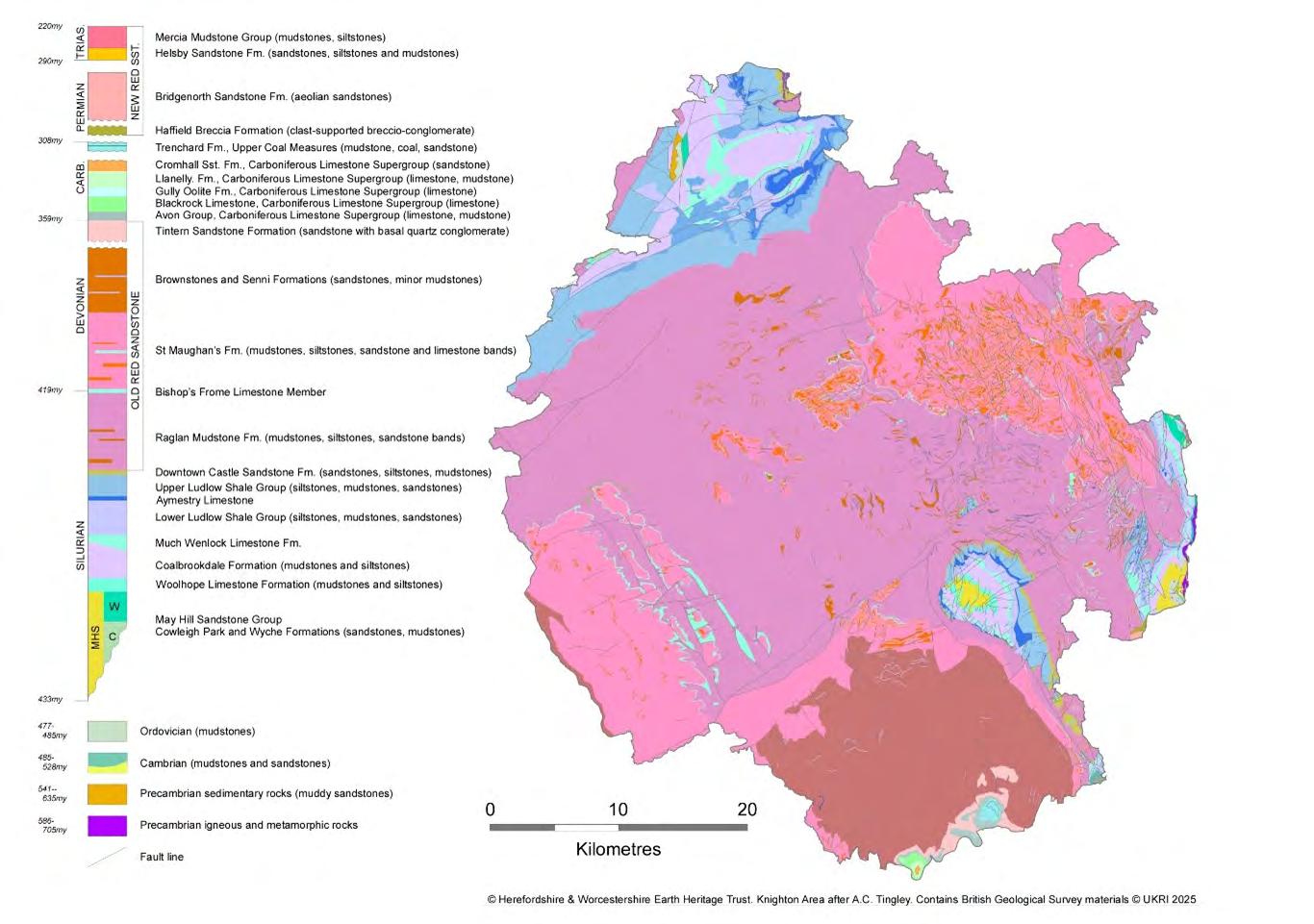
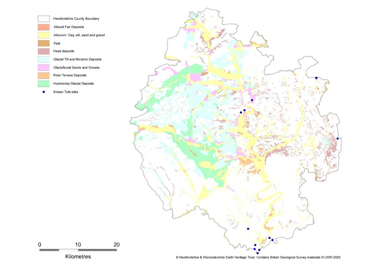
Herefordshire is underlain by bedrocks of Late Precambrian to Triassic age (c. 705-220 million years (my): Figure 2-5). These dominantly comprise sedimentary such as sandstones, mudstones and limestones but also include igneous rocks in the Malvern Hills (diorites and granites). Overlying the bedrock in some areas, especially within the Herefordshire Lowlands and Wye Valley, are much younger superficial sediments deposited during and after the Pleistocene Ice Age (<0.5my) by glaciers, and meltwater rivers. The youngest rocks in Herefordshire are tufas which form (and are currently forming) in carbonate-rich aquatic environments, with limestone deposition probably influenced by the specialised biota associated with these sites (Figure 2-6).
Bedrock and superficial lithologies shape the scenery, land use, soils and habitats of
the county. The Herefordshire Lowlands are underlain by easily eroded red mudstones of the Raglan Mudstone Formation and host the main drainage rivers. The surrounding watersheds comprise harder rocks resistant to erosion, such as the Precambrian igneous rocks of the Malvern Hills and the Devonian Old Red Sandstones of the Black Hills, Herefordshire Plateau and areas SW of Ross-on-Wye. The Forest of Dean, to the south of the county, is mostly underlain by similarly resistant limestones and sandstones of Carboniferous age, best seen in the dramatic Wye Gorge which was cut during the end of the Ice Age, with further incision of the river into the bedrock during post-glacial, isostatic uplift. Layered sequences of Silurian limestones and softer mudstones, folded by tectonic activity around 290my ago, create the characteristic ridge and vale topography of the areas immediately west of the Malverns, across the Woolhope Dome and in the north west of the county.
Glacial superficial deposits are widely distributed through the valleys and lowland plains of Herefordshire with moraines and tills forming distinct landforms over much of the Herefordshire Plain. Ice Age ponds, and their important habitats, are associated with hummocky moraines in these areas, while peat has accumulated in areas where drainage has been restricted by glacial landforms.
Soils in Herefordshire relate closely to the underlying geology and to geomorphological setting. Slightly acid loamy and clay soils are present across most of the Herefordshire Plain, with topography controlling how well the soils are drained. Loamy, clay-rich soils are developed over the river floodplains, dominantly on superficial deposits. These soil types are generally moderate to high fertility.
Free-draining but thin, acid soils are present over the higher ground on the Malverns, while free-draining slightly acid soils are present on the Permo-Triassic sandstones south of Ledbury. Both of these soil types are of low fertility. A limited blanket bog soil area is recorded at the head of the Olchon Valley. In general, soils over limestone bedrocks support distinctive habitat types, such as calcareous grassland.
Multiple sites in Herefordshire have been designated for geological interest, including 20 SSSIs specifically designated for their geology. A total of 146 Local Geological Sites have been designated in Herefordshire covering bedrock, superficial and geomorphological interests. Of global significance, the Herefordshire Lagerstӓtte, is a site where remarkably preserved fossils of Silurian age have been recovered, complete with their soft body parts.
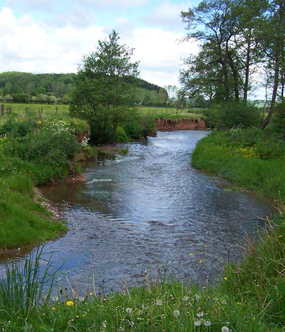
Herefordshire’s hydrology is shaped by its undulating hilly landscapes, permeable and fertile soils and its underlying bedrock geology. Most of Herefordshire lies within the catchment of the River Wye (Figure 2-7), voted the “nation’s favourite river” with its ecological significance recognised by the international and national designations of SAC3 and SSSI4 Both are designated for several fish species, otter (Lutra lutra) and white-clawed crayfish (Austropotamobius pallipes). The River Wye along with its tributaries, such as the Lugg, Arrow, and Frome, dominate the county’s hydrological regime, and provide a wealth of benefits to nature and people, such as recreation, water supply, flood mitigation and valuable habitats.
The River Teme is, since it was diverted in the Ice Age, a tributary of the Severn and enters Herefordshire near Leintwardine, and forms part of the England-Wales border in its upper reaches north of the county. The entirety of the river is designated as an SSSI for its rare and notable flora species in its waters and along its banks.
Herefordshire’s rivers experience several pressures, one of the most significant being excessive nutrient input and pollution from, sewage discharges and runoff from industry, infrastructure, agriculture and development. Climate change also poses a large threat to many rivers; the River Wye is particularly vulnerable to high temperatures and low
Figure 2-7: Herefordshire’s river catchments
3Natural England (2005) Citation for River Wye SAC. [Accessed: 1/9/25].
4Natural England (1996) River Wye SSSI Citation. [Accessed: 1/9/25].
flows as a result of climate change, due to its size. Regular monitoring of nutrient levels in water from the River Wye catchment has identified high levels of nutrients, particularly phosphorus, with the River Lugg part of the River Wye SAC continuing to exceed the limits set out in its designation for ecological health and chemical pollution. To address this, a significant area of the Arrow and Lugg operational catchment to the north of Herefordshire is designated and monitored for Nutrient Neutrality, meaning that all new developments must demonstrate that they are not leading to overall increases in nutrient pollution in these catchments.
A unique and often overlooked feature of Herefordshire’s hydrological landscape are its Ice Age ponds, also known as Kettle Hole ponds. These small, circular water bodies were formed over 10,000 years ago at the end of the last glacial period and are located predominantly in the north of the county and the Wye Valley upstream of Hereford. They form when large blocks of glacial ice are buried within sediments, melt, and then leave depressions behind that then fill with water to form ponds. Ice-age ponds are biodiversity hotspots, home to rare aquatic plants,
invertebrates and a variety of amphibian species. Further information can be found on the Wildlife Trust website
Other ponds that can be found throughout the county are Dew ponds. These are within the farmed landscape and are manmade. They are often important heritage and cultural features, as for many centuries they were created with the aim of providing a place for livestock to receive water where a natural source was lacking . Dew ponds can be areas of strong biodiversity due to the variety of species that benefit from a local water source.
Throughout the county drainage ditches are widespread, initially created to aid in the removal of water from the land. Typically, this was to improve the soil for agricultural land to become more suitable for crops to be planted. The need for the creation of the ditches reflects the fact that the heavy soils and frequent springs and seepages once made the county famously wet and muddy. However their presence, while critical for continued agricultural growth, can lead to negative impacts for some ecosystems.
The archaeology, history and heritage of Herefordshire is rich, varied, and diverse. It is highly valued and core to the identity of the county and its people. Every aspect of the landscape seen today is derived and created from human choice and actions over time. This extends even to those places we consider wild, pristine, natural, or untouched. These human choices and decisions are defined as the historic environment. Understanding the history of place through the historic environment record is therefore essential to anyone undertaking nature recovery work. By understanding landscape, its character, development, and history as well as its change over time better holistic decisions can be made which enrich and support both the aims of nature recovery and preserve our shared heritage for the benefit of all.
However, unlike the natural environment, the historic environment is a non-renewable finite resource – once lost it cannot be recovered, regenerated or replaced. It is gone / extinct and can never be restored. It is as much at risk from land use decisions and climate change as the natural world this policy looks to support. The historic environment has been degraded in the same way as our natural world through an everaccelerating agricultural intensification, land-use change and development. However, by recognising and valuing this shared heritage and through considering it from the outset of any nature recovery plan or project the potential to maximise both the environmental benefits as well as the historic ones can be accommodated and achieved (a win win situation for everyone). The historic vs natural environment is a false dichotomy - it is not (and should never be considered) a binary – either / or – choice: instead, it is a decision that has the potential to exponentially enhance both.
In Herefordshire, as part of the nature recovery strategy, the historic environment should be considered within every nature recovery project. Knowing how the land has been managed in the past can inform, enrich, enhance, and support every aspect of recovery work.
The council curates a statutory historic environment record (HER) which is used to better understand the impacts of policy and development on projects and schemes across the county. The HER service combines both statutory and non-statutory heritage information to better understand and promote the heritage, history and archaeology of the county. Within the HER is information relating to sites and monuments; historic buildings; events and activities; archaeological finds and discoveries; historic mapping and aerial surveys; historic landscape characterisation data and information on historic farmsteads. Some of these sites are protected by legislation (Scheduled Monuments, Listed Buildings, Designated Parks and Gardens, Conservation Areas, or Areas of Archaeological Importance) and activities within these sites are restricted without specific consents.
Other places are covered by council policy and national guidance such as National Landscapes, non-designated parks and gardens, the settings and curtilage of listed buildings, locally listed buildings, structures, and places as well as landscapes recorded on the Select Heritage Inventory for Natural England (SHINE). The majority of these places are located in the rural landscape and without specialist input would be difficult to identify. More information regarding the HER and the records it holds can be found on our website.
To aid and support those undertaking Nature Recovery a heritage opportunity map has been added to the LNRS portal / system. This combines multiple sources of heritage information to create a single uniform layer to alert, support, and advise that further information and discussions are needed. In some instances, these heritage assets may constrain certain elements of nature recovery or involve additional permissions and consents with parties external to Herefordshire Council.
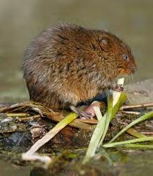
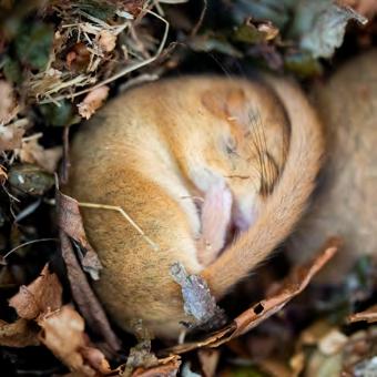
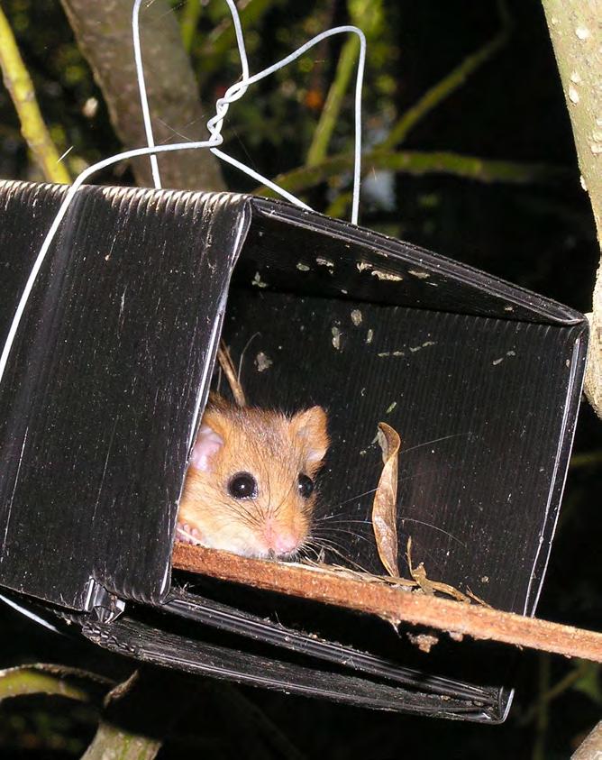
Herefordshire covers a total of 217,971 ha and is primarily an agricultural county with around 80% of land in farming use. A variety of natural and semi natural habitats also occur within Herefordshire and include woodland, wood pasture and parkland, grassland (including lowland meadows), and traditional orchard habitats – the latter of which cover nearly 2,635 ha. Smaller proportions of Herefordshire comprise habitats such as upland heath and moorland, scrub, hedgerows and boundary features, rivers and streams, ponds and wetlands. Herefordshire also has a diverse array of wildlife, including a number of protected species such as water vole (Arvicola amphibius), hazel dormouse (Muscardinus avellanarius), harvest mouse (Micromys minutus), and multiple bat species. Key species are highlighted alongside relevant habitats, with trends in bird species populations outlined in Section 2.6.9.
The city of Hereford and the market towns of Leominster, Ledbury, Ross-on-Wye, Kington and Bromyard provide urban habitats. Beyond this there are many villages, hamlets, isolated farms, dwellings and estates.
Whilst many local organisations and partnerships work to protect and restore nature in Herefordshire, the county’s wildlife still experiences threats from numerous sources (see Section 2.7), and joined-up action at large scale, promoted by the LNRS, is one step in assisting nature’s recovery. Recent success stories of conservation actions are highlighted in the sections below.
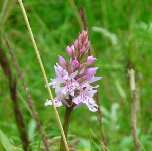
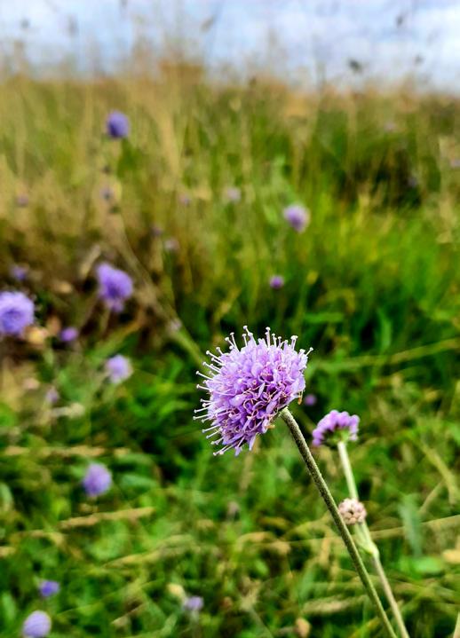
Herefordshire contains several species-rich grassland, predominantly acid, calcareous, and neutral grassland, and lowland meadows and pastures. Wetter grassland habitats including floodplain grazing marsh, and purple moor-grass and rush pastures are also found across the county (1,138ha/0.5%). Wet lowland meadows and pastures encompass floodplain meadows which are often used for grazing and/or hay cutting.
Acid grasslands occur on nutrient poor, free-draining soils with a pH of 4-5.5. The Malvern Hills and Welsh borders have important concentrations of this habitat, and they are also found on common land such as Bircher Common, to the north of Leominster. A total of 643ha/0.29% of acid grasslands are found across Herefordshire.
Calcareous grassland is the rarest grassland habitat found within Herefordshire with only 68ha/0.03% recorded. It occurs on shallow, lime rich soil generally overlying limestone rocks, which can be found at Woolhope (south east of Hereford); at Bury Farm SSSI (north of Hereford); at Orchid Bank, Winslow Mill SSSI (east of Hereford); and Doward, south of Whitchurch, within the Wye Valley National Landscape.
Neutral grassland – which includes lowland meadows - is the most abundant grassland type in Herefordshire, comprising approximately 3,316ha/1.5% in total. Neutral grasslands can be found throughout the Herefordshire area; however, the largest area is located near the city of Hereford at Lugg Meadows. Lugg Meadows is thought to be the largest surviving Lammas meadow in the country and is an important site for ground nesting birds, particularly the endangered curlew (Numenius arquata) as well as the nationally rare plant species narrow leaved water dropwort (Oenanthe silaifolia).
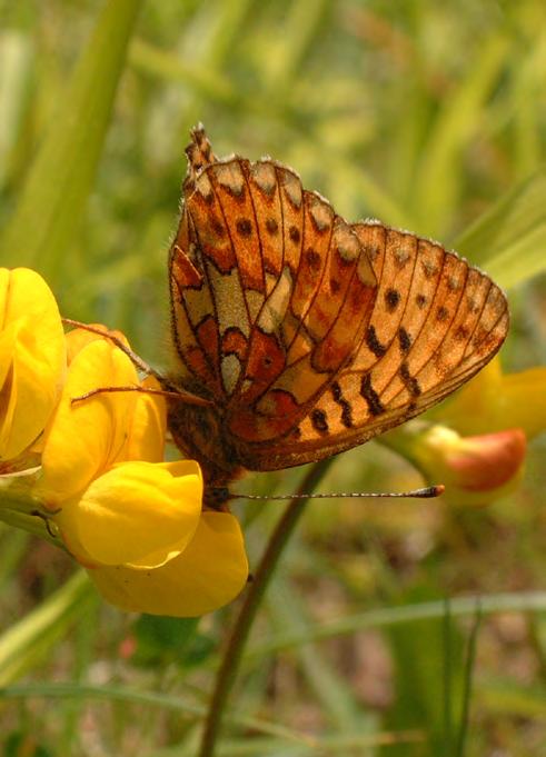
Other examples of neutral grasslands can be found at: The Flits NNR and SSSI (west of Hereford); within the Black Mountains SSSI (south west of Hereford); at the Birches SSSI, The Sturts LWS and SSSI, Burrington Meadow SSSI (north west of Hereford); the Lugg and Common Meadows SSSI, and Common Hill SSSI (east of Hereford). The majority of these sites host a range of meadow flowers and plants, with Common Hill for example, hosting tiny adder’s tongue fern (Ophioglossum vulgatum), common spotted orchid (Dactylorhiza fuchsii), yellow rattle (Rhinanthus minor), masses of cowslips (Primula veris) in spring, quaking grass (Briza media), common rock-rose (Helianthemum nummularium), wild thyme (Thymus polytrichus), and milkwort (Polygala vulgaris), as well as various insects and butterfly species including dingy skipper (Erynnis tages), wood white (Leptidea sinapis), marbled white (Melanargia galathea), and pearl-bordered fritillary (Boloria euphrosyne).
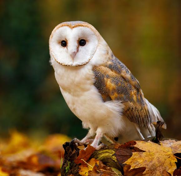
Herefordshire Wildlife Trust are restoring the Bartonsham Meadows on the banks of the River Wye back to wildflower meadows. These meadows will play an important role in natural flood management and create new habitats for rare wildlife such as skylark (Alauda arvensis), barn owl (Tyto alba), water vole, and various species of invertebrates. They also plan to restore old hedgerows and consider restoring former ponds.
Herefordshire Meadows is a new and growing charity seeking to conserve and restore species-rich grasslands. It has a proven track record having recreated over 400ha of locally appropriate species-rich grassland since 2019, well-distributed throughout the county, and is now highly-regarded even beyond the county’s fringes. It has a strong membership solidly embracing the farming community, and a wider reach through social media, is active in sustainability policy, and runs a successful programme of training and educational events. Funding has been raised by Herefordshire Meadows for the conservation, restoration, and creation of flower-rich grasslands across Herefordshire as part of their ‘For the Love of Meadows’ campaign. The campaign has strived to deliver a series of free events, discussions, and training days hosted at meadows and restoration sites, aimed at inspiring a better understanding, management and preservation of meadows in Herefordshire.
Within the Wye and Usk catchments
Herefordshire Meadows are delivering the Botanica project with the Wye and Usk Foundation which includes the creation of 60 ha of pollen-rich habitats and species-rich grassland.
The Wye Valley National Landscape has secured significant funding for meadow restoration, wetland creation, and tree planting over the next few years, supported by National Grid’s Landscape Enhancement Initiative. Here, Herefordshire Meadows will be working with seven landowners to restore around 25 hectares of species-rich grassland as part of the project, with work due to commence in autumn 2025.
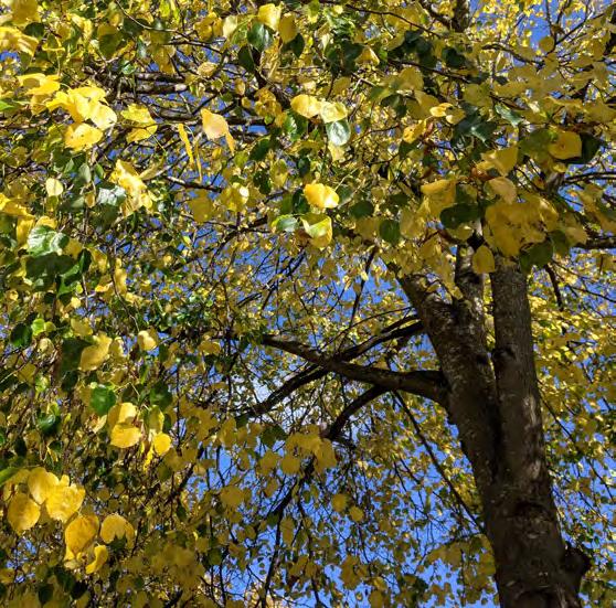
Tree and woodland habitats are one of the most extensive semi-natural habitats in Herefordshire and are thus an important part of the Herefordshire landscape. Herefordshire’s woodlands are home to species such as long haired fallow deer (Dama dama), hazel dormice (Muscardinus avellanarius), lesser spotted woodpecker (Dryobates minor), nuthatch (Sitta europaea), tawny owl (Strix aluco), and treecreeper (Certhia familiaris). Around 65.5% of the county’s woodlands are managed, either privately (52%) or by Forestry England (13.5%), with the remaining woodland classified as unmanaged. These woodlands comprise mainly of mixed deciduous woodland; wood-pasture and parkland, veteran trees; and traditional orchards. The total tree and woodland cover within the county is 19.42%, which comprises 11.69% of woodland cover (as measured with the NFI standard woodland cover) and 7.74% representing tree cover outside of woodlands (including traditional orchards).
An overview of the county’s National Forestry Inventory (NFI) woodland (standard) cover can be seen in Table 2-2 below.
Table 2-1: National Forestry Inventory (NFI) woodland (standard) cover within Herefordshire
Almost half of the woodlands in Herefordshire are recorded as ancient woodland (13,446ha/6.2%), with 55% of these woodlands recorded as plantations on ancient woodland sites (PAWS) and 45% recorded as ASNW. Ancient woodlands within Herefordshire include Haugh Wood and Woolhope, which are located in the north of the Wye Valley National Landscape. Both ancient woodlands are also designated as SSSIs due to their national importance for butterflies and moths, with over 600 species recorded within. Ancient woodlands and orchards are a stronghold in the county for rarer bird species such as lesser spotted woodpecker and marsh tit (Poecile palustris).
The majority of the county’s woodland is classed as broadleaved woodland (15,443ha/60.5%). Broadleaved woodland can be found on a variety of soil types and provide a vast variety of habitats and niches for woodland species. Some designated woodlands in the county are classed as lowland oak or lowland beech and yew woodlands. These forests are rich in wildlife, for example, Mortimer Forest comprises lowland mixed deciduous (oak/ birch and oak/beech) woodland which is home to various birds of prey, small woodland birds, butterflies, reptiles and long haired fallow deer (Dama dama).
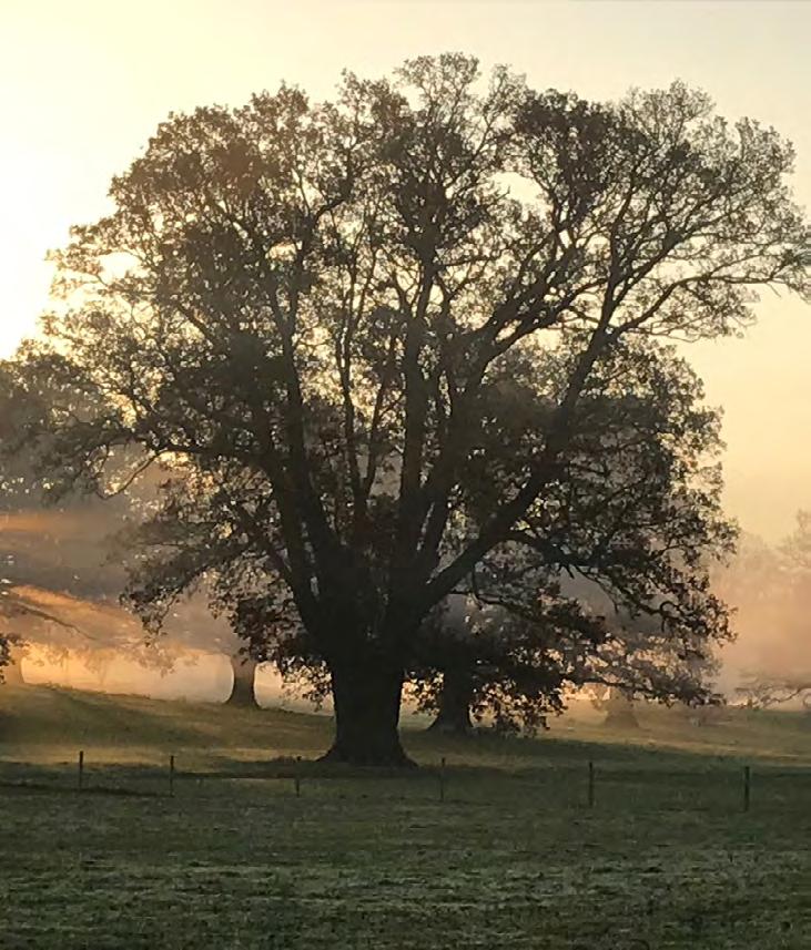
One of Herefordshire’s key features is the extent of ancient and veteran trees occurring in a range of settings across the county – be that parklands, churchyards, woods, fields or hedgerows. These trees provide a high level of ecological continuity, connecting fragmented landscapes and contributing to the area’s rich landscape character.
Wood pasture and parkland are also key habitats occurring in Herefordshire and are classified by a landscape consisting of large mature and/or veteran trees occurring within grazed grassland, heathland, or woodland. Many of the parks in the county date from the Norman Conquest through to the 19th century, for example Moccas Park, which hosts dense plantations of veteran chestnut and oak trees. It also supports one of the most endangered insect species in Britain, the Moccas beetle (Hypebaeus flavipes), known only at this location and recorded from approximately 16 of the older oak trees. This species is a saproxylic invertebrate (i.e. species dependent on dead or decaying wood), for which the county is particularly important for supporting. Wood pasture and parkland habitats are most commonly associated with large historic estates (e.g., National Trust’s Croft Castle and Berrington Hall). Overall, Herefordshire holds 8,893ha/4.1% of parkland and wood pasture.
When looking at the coverage of trees outside of woodlands – which covers small woods, groups of trees and lone trees – there is a total of 16,863ha/7.8%. Of particular importance in this category is orchards, which cover 5,654ha/2.6% of the county. This cover counts both commercial and traditional orchard types. Traditional orchards are a priority habitat and are defined as groups of fruit and nut trees planted on vigorous rootstocks at low densities in permanent grassland; and managed in a low intensity way. This is in contrast to commercial orchards, which typically have higher yields, higher density of trees, and may use chemical inputs (pesticides, herbicides and fertilisers) to boost production.
Traditional orchards are of high social and ecological importance to Herefordshire particularly, with the orchards holding historic importance, traditional fruit varieties, as well as providing an important habitat for biodiversity. The mistletoe marble moth (Celypha woodiana) is a moth whose caterpillars feed exclusively on mistletoe (Viscum album), and is thus found in traditional orchards, gardens and hedgerow habitats. The species is highly localised and found only in Herefordshire and its adjoining counties.
Severn Treescapes is a Gloucestershire, Herefordshire and Worcestershire Wildlife Trusts’ partnership project, working across the three counties to increase woodland connectivity at a regional scale. The project aims to halt or reverse the decline in particular wooded habitats such as traditional orchards and the loss of trees from Dutch elm disease or ash dieback (see Section 2.7.5).
Woodlands for Water is a Department for Environment, Food & Rural Affairs (Defra), Rivers Trust, Beavers Trust and Wye & Usk Foundation project that was completed in March 2025. The project enhanced biodiversity through tree planting, wildlife corridors, and climate resilience in the Dore, Dulas and Lugg catchments.
Wye/Lugg Agroforestry Project, which was introduced to establish agroforestry practices to improve water quality and riparian shading for the Lugg catchment and River Wye to benefit biodiversity in the area.
Forestry England have a number on ongoing woodland projects focused on various species restoration, including:
• Hazel dormouse at Haugh Wood, Wigmore Rolls, Queens Wood/Dymock, and Frith Wood.
• Lepidoptera, with support from the Butterfly Conservation, at Haugh Wood, north west Herefordshire based around Wigmore Rolls, Michael Harper reserves, Dymock, and Queens Wood.
• Reptiles at Mortimer Forest.
• Bird box schemes at Haugh Wood, Shobdon Wood, and Wigmore Rolls.
• Bat boxes at Frith Wood.
Herefordshire contains the major river catchments of the Teme and the Wye (both a part of the larger Severn River Basin District). The River Wye drains much of the county with the lower sections of the Wye designated as part of the Wye Valley National Landscape.
The Wye includes four operational catchments: Wye; Arrow Lugg and Frome; Monnow; and Wye – Ithon to Hay, and the Teme includes three operational catchments: Clun River; Teme Lower; and Teme Upper. Due to the extent of the River Wye and Lugg, a significant proportion (8%) of Herefordshire falls within an active floodplain, such as the Wye Valley Meadows. The floodplains are typically used for pasture, with tree cover present along watercourses. Seasonal flooding however has created extensive wetland habitats within these floodplains, many of which are designated locally as LWS. The Wye and its tributaries are currently suffering serious, complex, systemic problems stemming from water quality, rising temperatures and widely fluctuating water levels. The causative factors stretch back decades and will take many years to address.
The Rivers Wye, Lugg and Clun SACs and their tributaries support a wide range of habitats and species, including white-clawed crayfish, otter, water vole and beds of the aquatic plant water-crowfoot (Ranunculus fluitans and Ranunculus pseudofluitans), as well as acting as important wildlife corridors between fragmented habitats. Since 2004, within Herefordshire the number of water voles have declined by 70% and water-crowfoot by 81%. White-clawed crayfish and otters have seen population declines on a national scale due to fragmentation and pollution of the natural environment, as well as disease. Whereas in Herefordshire their numbers per 1km have increased by 10% from 2014-2023, in comparison to the 2004-2013 data. The gap in otter distribution that once existed between the south west, south Wales, and the Wye has now closed, indicating a recovery and reconnection of populations. In relation to water pollution, the River Clun and Lugg have been identified as ‘Critical Threshold’ sites for water quality, where they can no longer be maintained without the intervention of a recognised mitigation strategy.
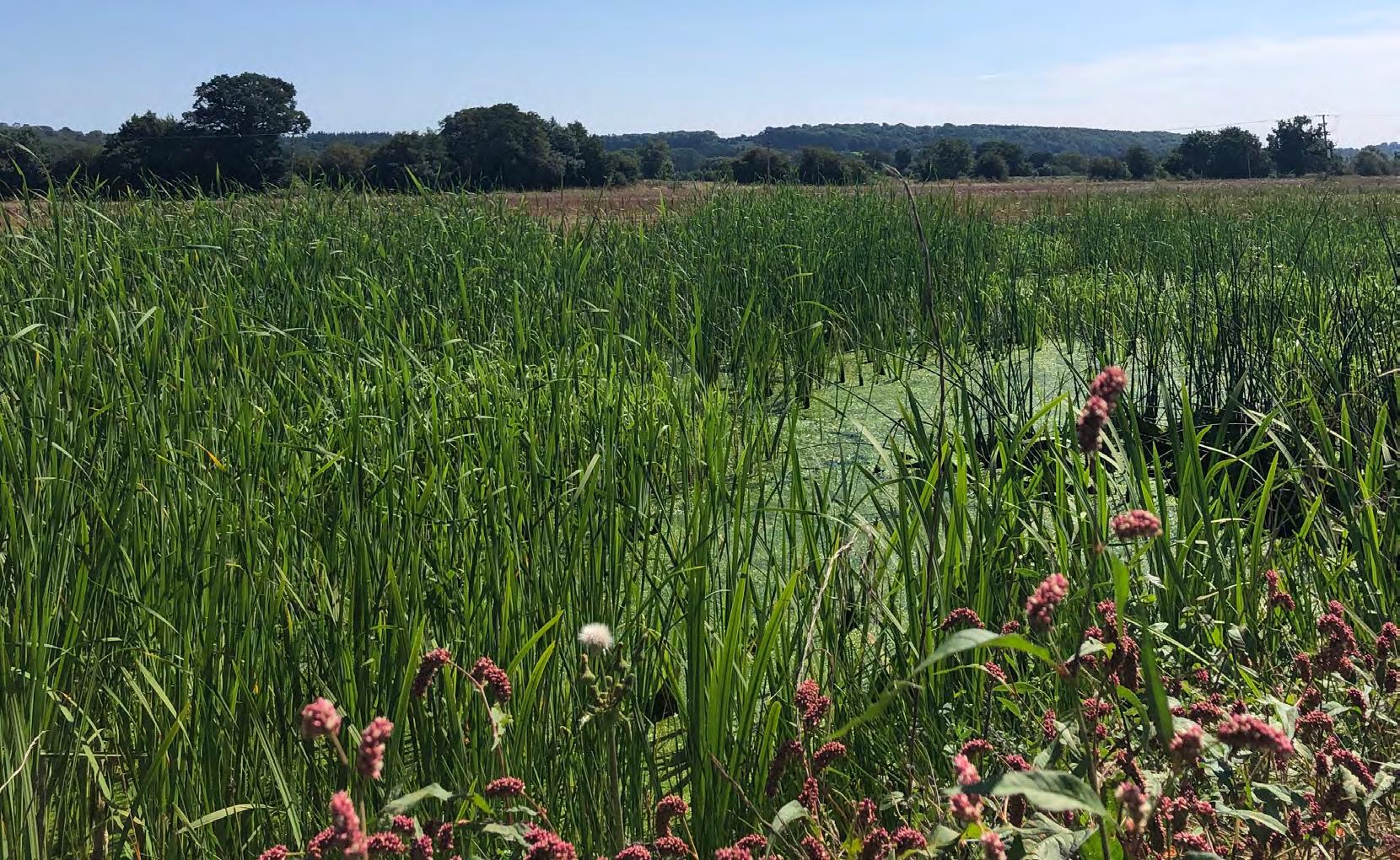
In terms of standing water (ponds, lakes and reservoirs) Herefordshire contains 82 surface water bodies which intersect or lie within the Herefordshire county boundary as classified under the Water Framework Directive (WFD). The ecological condition of these waterbodies is monitored by the EA with over half (43) classified as ‘Moderate’, nine classified as ‘Good’, almost a third (25) as ‘Poor’, and five as ‘Bad’.
The county contains an above the national average of pond density with 2.1 pond per km2 (totalling 0.1% of the county). Around a quarter of these ponds are Ice Age ponds which were formed by glacial activity between 20,000 and 13,000 years ago in the last glacial maximum period, and many still survive today. The are important for biodiversity (e.g., breeding amphibians, foraging wildfowl and wading birds) and are of geological significance. They support their own characteristic range of flora and fauna; some species such as specially protected Medicinal leech and Tubular Water dropwort are largely confined to these ponds. Ice Age ponds can be found mainly in the north and west of the county and regularly occur within farmland.
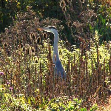
Herefordshire hosts other larger waterbodies at Bodenham Lake Nature Reserve, Lugg Meadows Nature Reserve, Titley Pool Nature Reserve, The Sturts Nature Reserves, and Wellington Gravel Pits, which support a variety of wildfowl and wading bird species (e.g. great crested grebe (Podiceps cristatus), little grebe (Tachybaptus ruficollis), black-tailed godwit (Limosa limosa), shoveler (Spatula clypeata), common snipe (Gallinago gallinago), lapwing (Vanellus vanellus), goosander (Mergus merganser), goldeneye (Bucephala clangula), wigeon (Anas penelope), teal (Anas crecca) and green sandpiper (Tringa ochropus).
Herefordshire also supports a range of amphibian species, including common frog (Rana temporaria), common toad (Bufo bufo), great crested newt (Triturus cristatus), smooth newt (Lissotriton vulgaris) and palmate newt (Lissotriton helveticus). Amphibians thrive in Herefordshire’s aquatic habitats, especially in ponds and wetlands.
As part of the National Highways Network for Nature programme, at Bodenham Lake 1 ha of reedbed and marginal aquatic plants were installed to create fish nurseries which in turn supports numerous wetland bird populations, and otters. An additional 2 ha of floodplain meadow grassland were created using a rare mix of floodplain grass and plant species from nearby Nature Reserves. Hibernacula were also created within Bodenham Lake to create refugia for toads on site and reduce road crossing deaths.
As part of Lugg Living Landscapes, HWT have been the leading partner, collaborating with the Wye and Usk foundation, the EA, and NE to deliver river restoration works within the River Lugg catchment.
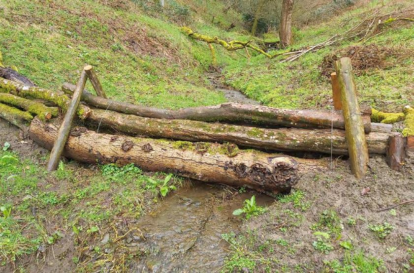
HWT have also delivered a Restoring the Rivers project (funded by the EA) based around the Lingen and Lime Brooks, aimed at supporting river health and delivering Natural Flood Management (NFM) solutions – which utilise natural processes and ecosystems to reduce flood risks and enhance resilience against flooding - such as leaky dams and fencing off watercourses to reduce bankside erosion.
HWT have also delivered a project on Oak Tree Farm within the Lugg floodplain, involving the creation of a new wetland, permanent pond, and seven ephemeral ponds. The project also involves the creation of 360m of hedgerow, as well as 7.69 ha of meadow restoration.
NFM projects are being delivered by Herefordshire Council (funded by Defra) in partnership with other organisation including the EA and Wye and Usk foundation and Severn Rivers Trust. These projects have sought to deliver both short and long-term benefits to flood risk. The Delivering Innovative Markets for the Environment (DIME) project at Dulas brook, is developing an ecosystem service contract structure, identifying buyers and sellers, and producing a framework to be rolled out across the whole of the Wye. The Little Frome Wetlands Project involved the construction of a wetlands at a farm in Bromyard aimed at delivering water quality and biodiversity benefits.
Herefordshire Council and the Local Enterprise Partnership have funded an Integrated Constructed Wetland at Luston and Tarrington to demonstrate nutrient neutrality. The wetlands will address point source pollution by taking treated water from Welsh Water treatment works and diverting its flow through the wetland for phosphate removal. Together Luston and Tarrington have allowed Herefordshire Council to release phosphate credits for trade to offset residential development in the Lugg catchment.
The ‘Conserving Herefordshire’s Ice Age Pond” project which ran between 2019 and 2022 was a partnership between the Herefordshire Wildlife Trust, the Earth Heritage Trust and the Herefordshire Amphibian & Reptile Team was involved in saving or restoring the area’s unique glacial ponds, creating trails and interpretation boards to facilitate wider understanding of this unique habitat. Twenty-six pond management plans were written for land owners with management work being carried out at 10 sites involving 15 ponds during the project. This included two ghost pond restorations, one at the Sturts, East HWT nature reserve and one at Lower Blakemere on Duchy of Cornwall land. The Ice Age Ponds Project mapped 284 Ice Age Pond locations and produced detailed, on-site surveys of many of them.
The Wye and Usk Foundation delivered a Habitat Restoration Strategic Allocation Fund, an ongoing multi-year programme of projects designed to deliver significant improvements to the riparian ecosystems of the Wye and Usk catchments, including riverside boundary improvements, clearance of obstructions to fish passage and removal of debris from river courses, evaluation and removal (where possible) of weir and manmade structures, transplanting gravel and the use of lime augmentation to lower acid conditions in source areas of the upper rivers due to bog and pine forest conditions.
HWT, NE and EA delivered the Restoring our Rivers project. The project focuses on habitat and biodiversity improvement through encouraging local communities and farmers to use more sustainable practices to prevent damage to rivers, in the Lugg catchment.
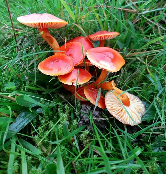
Scrub and mosaic habitats often occur as small patches flanking other habitat types, such as woodland, heathland or grassland. Mosaic habitats are transitional areas where one habitat type may grade into another, for example from woodland to grassland there may be a mosaic region of small saplings and scrub within grassland. Due to their small size, they are difficult to map and assess at a county scale. Stands of bracken are included within this category and can be found largely in the south west of Herefordshire, with bracken and scrub accounting for 9.2 ha/0.4% of habitat across the county as a whole. The pearl-bordered fritillary butterfly is an endangered species found in rough hillsides with bracken and woodland clearings and known from only three sites in Herefordshire. This species has declined nationally by 90% in the last 50 years and declined by 67% within Herefordshire since 2004. Wood white favours sheltered, semi-open habitats with a mix of tall grassland, scrub, and woodland edge environments. There are around 20 major populations in Herefordshire, representing approximately 15% of the national population. Despite this, since 2004, this species has declined by 42% in the county.
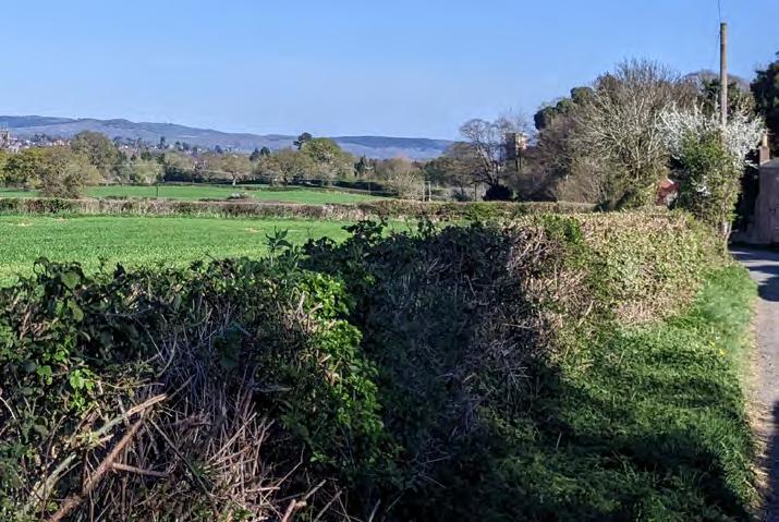
Hedgerows are one of the iconic defining features of Herefordshire’s rural landscapes, and they often contain mature or veteran trees within them. Two types of hedgerows that hold particularly high biodiversity value are ancient hedgerows and species-rich hedgerows. Ancient hedgerows are defined as hedgerows which were present before the Enclosures Act (between 1720 – 1840), and species-rich hedgerows typically contain five or more native woody species and a minimum length of 30m.
Common hedgerow species include hawthorn (Crataegus monogyna), blackthorn and related taxa (Prunus spp), and hazel (Corylus avellana). Hedgerows contribute strongly to the landscape character of Herefordshire, and high densities of hedges in an area can create a complex matrix of pastoral fields and narrow lanes. There is no single process of hedgerow management across the county, thus creating different character and visual effects where they have been over trimmed and/or rejuvenated. This has resulted in a range of forms, from dense and well managed, to tall and overgrown.
Hedgerows are key features that aid in habitat connectivity, as they provide linear strips of natural habitat connecting areas that otherwise may not be used by wildlife, such as large arable fields. They support birds such as dunnock (Prunella modularis), bullfinch (Pyrrhula pyrrhula), and song thrush (Turdus philomelos). Hedgerows are also important carbon stores and can help improve air quality and reduce flooding.
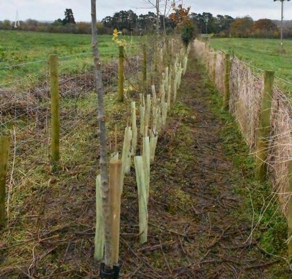
The Hedgerow Heroes Herefordshire project planted and restored over 3.7 km of hedgerows between 2024 and 2025, well above their original target of 2.5 km. The next season is now looking to target 4 km of new and restored hedgerows across the county between September 2025 and April 2026. Hundreds of volunteers were involved, with donations from the Tree Council, support from four sponsors and ran three two-day hedge laying courses run by Really Rural. The courses will be run again this season, alongside talks on the history and value of hedges and inspire young people through hands-on learning projects.
Herefordshire Council have developed a Tree and Hedgerow Code of Practice, which outlines how they intend to manage trees and hedgerows under legal responsibilities and to promote the value of hedgerows on council-owned land.
The Herefordshire Trees, Hedgerows and Woodlands Strategy also sets out a vision to create and manage a “treescape” across Herefordshire, connecting woodlands, hedgerows, orchards and parklands together. The strategy sets out an action plan for ensuring effective planting, aftercare, monitoring and management of hedgerows.
A number of habitats are found in upland moorland areas. Heathland habitat contains plants such as heather and gorse of varying heights, found alongside areas of scattered trees, bare ground, wet heaths, and open water. Within Herefordshire, heathland can be found in small pockets on sites that have previously been conifer plantations such as Haugh Wood, Lea Bailey End, Mortimer Forest, and Queenswood, and overall covers 7.9ha/0.36% of the county. Heathland can be separated out into different habitat types based on species assemblage and hydrological regime, such as wet heath and dry heath.
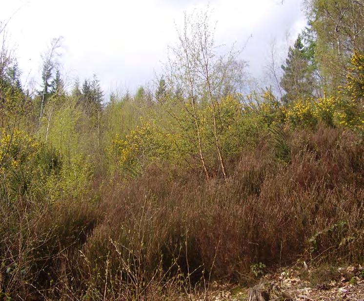
The upland fringe or ffridd, as it is known in Wales, refers to the area between upland moorland and more intensively managed lowland. It comprises of a mosaic of scattered trees, small woodland areas, bracken, heather, grasslands and bog providing habitat to a wide range of species.
Blanket bog is a type of peatland habitat that forms in cool, wet locations where peat is able to accumulate to great depth over many hundreds of years. This habitat is dominated by heather (Calluna vulgaris), Bilberry (Vaccinium myrtillus) and Crowberry (Empetrum nigrum). Due to their peat stores, blanket bogs are valuable habitats for carbon storage and water regulation. Active bogs that are currently accruing peat have the potential to continue to sequester carbon more efficiently than other habitats. However currently the blanket bogs found within Herefordshire are not in this state and restoration work is required to restore this important habitat.
Valley mires and flushes also form in upland environments: these are wet and often peaty areas along slopes where groundwater emerges to the surface, or in valley bases where water can accumulate. Sedges, rushes and moss species are abundant in these habitats.
The Black Mountains and Welsh borders are home to upland habitats, which often occur in mosaics of blanket bog, scrub, and woodland. These habitats support birds such as red kite (Milvus milvus), raven (Corvus corax), and meadow pipit (Anthus pratensis), reptiles such as common lizard (Zootoca vivipara), slow worm (Anguis fragilis), and grass snake (Natrix helvetica). Smaller areas of dry and wet heath habitat are also present across Herefordshire. Upland habitats can experience threats from excessive scrub encroachment, drainage and overgrazing.
The Black Mountains Land Use Partnership is a pioneering, cross-border collaborative partnership between local landowners, graziers and relevant regulatory bodies, including Brecon Beacons National Park Authority, Natural Resources Wales, Welsh Water and NE. It covered an area 24,600 ha and promoted the restoration and sustainable management of the Black Mountains natural resources and habitats, as well as providing a forum for discussion and collaboration on the current and future management, sustainability and conservation.
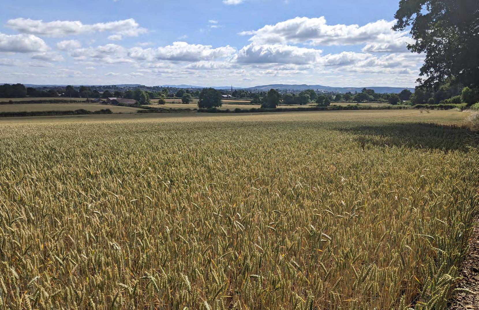
Agricultural land in Herefordshire is strongly influenced by topography and soils, with livestock farming dominating the uplands, and mixed pasture and arable farming, commercial orchards and horticulture on the central lowland plain. An overview of the farmland areas can be seen in Table 2-3.
Agricultural land can hold value for wildlife, typically when it is managed in a sensitive, low-impact way with reduced inputs of artificial chemicals such as fertilisers and pesticides. Field margins in arable fields are valuable for certain plants and can attract a variety of farmland birds, such as skylarks, lapwings and yellowhammers (Emberiza citrinella), or brown hare (Lepus europae).
Table 2-2: Area (ha) of farming types within Herefordshire
The Wye and Usk Foundation have delivered the Wye-P on the Arrow project in March 2025, with funding from Defra. The project engaged with a variety of farms across the Arrow catchment and produced detailed reports on current farming practices, soil health assessments and natural capital audits. It promoted regenerative farming practices to reduce pollution and enhance biodiversity in the Arrow catchment.
The Rooting for Better Soils project was completed in March 2025, by EA and Herefordshire Meadows. It restored waterdependent habitats, including lowland meadows, and promotes sustainable farming practices to improve biodiversity and soil health in the Lugg catchment.
The Go Wild in the Curl project was run by Wye & Usk foundation from 2016 to 2021. It improved water quality and biodiversity in the Curl Brook catchment through sustainable farming and habitat restoration.
Herefordshire’s main urban areas comprise the city of Hereford and the market towns of Leominster, Ross-on-Wye, Ledbury, Kington, and Bromyard. Many villages and hamlets are also scattered across the county. Built environments can provide value for nature, often on smaller scales compared to the wider rural landscape. Green infrastructure is the term used to describe the network of multi-functional greenspaces within a settlement. Parks, gardens, street trees and green roofs can all provide habitat for certain species, and when they are well connected, can create green corridors that aid in wildlife movement through cities and towns. This can also include verges, allotments, cemeteries and churchyards, civic space, natural and semi-natural greenspace and outdoor sports facilities.
Estates, parks and gardens are all key areas that provide spaces for wildlife such as blackbird (Turdus merula), blue tit (Cyanistes caeruleus), house sparrow (Passer domesticus), and starling (Sturnus vulgaris). There are 25 registered Parks and Gardens in Herefordshire, alongside numerous locally important parks and gardens, some of which are located within or adjacent to urban areas.
Sparsely vegetated habitats often occur on derelict land, which can support specialist species such as the grizzled skipper (Pyrgus malvae). This butterfly has been in decline since the 1950s and there are only three known colonies within Herefordshire. However, compared to 2004-2013 data, the population in Herefordshire has been recorded as increasing by 50% from 2014-2023.
As part of the housing development at Old Eardisley Road, a voluntary group called the Kington Pollinators was established. They work with Herefordshire Council to provide wild planting, information boards, bug houses and bird boxes in the play area and open spaces. They provide on-going maintenance of the more natural areas of the site, which provide both natural play and wildlife habitats. The Kington Pollinators actively encourage local children to play and learn about nature in this natural environment. Remaining funding will be spent in partnership with Kington Pollinators in support of providing additional experiences to the more natural play and education opportunities for children, in particular.
At King George V Playing Fields, Herefordshire Council have undertaken tree planting in February 2022. This consisted of over 25 trees of a wide range of native and ornamental species including English oak, dawn redwood, Scots pine and wingnut.
Bird populations are used to provide a good indication of the broad state of wildlife across the UK. Mirroring national trends, declines have been recorded in Herefordshire bird species. From 1968 – 2011, a number of resident species have recorded declines of between 18-80%.
As of 2017, there are several known breeding pairs of barn owl within Herefordshire. Barn owls have experienced national population decline due to habitat loss and reduction in prey availability. Similarly, there are now thought to be less than a dozen breeding pairs of curlew, all of which are found in the southern half of the county. Curlew is listed as “Amber” on the Royal Society for the Protection of Birds list of birds of conservation concern and has experienced rapid population decline since the 1990s again, attributed to loss of breeding habitat such as uplands and moorlands.
These population declines are driven by a range of different factors including habitat loss, habitat fragmentation, pressure from pollution, invasive species and urbanisation, as well as new threats like climate change. Declines based on bird groups for Herefordshire are as follows:
Farmland birds
• Tree sparrow (Passer montanus) – 57%.
• Corn bunting (Emberiza Calandra) – 80%.
• Grey partridge (Perdix perdix) – 53%.
• Lapwing – 20%.
Woodland birds
• Woodcock (Scolopax rusticola) – 46%.
• Willow tit (Poecile montanus) – 30%.
• Little owl (Athene Noctua) – 19%.
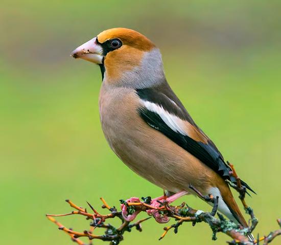
• Hawfinch (Coccothraustes coccothraustes) – 55%.
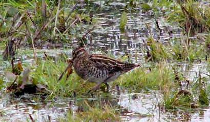
Wetland birds
• Common snipe (Gallinago gallinago) – 80%.
• Curlew – 18%.
Across the Herefordshire region there are several major pressures on the natural environment. These will vary based on the type of pressure, the type of habitat and the scale at which impacts are felt. For example, particular threats to certain habitats may act to damage them or reduce their ability to function adequately in providing niches for wildlife, or in providing ecosystem services such as flood alleviation, water quality, pollination or carbon storage that are important for society as well as nature. Different pressures and threats to nature can also build upon each other, thus exacerbating impacts even further: climate change represents an immense overarching pressure that intensifies the effect of other pressures for particular places, habitats and species.
Broadly speaking, unsustainable development can place additional pressure on nature and biodiversity. Within Herefordshire, this may stem from multiple areas, from increased tourism, expansion of settlements and wider urbanisation.
Herefordshire’s Destination Management Plan 2025-2035 identifies numerous locations that experience high or growing levels of tourism, including the Wye Valley National Landscape and the Malvern Hills used in a variety of recreational activities from hiking, canoeing, nature-watching and more. Overuse or insufficient provision of footpaths can lead to disturbance or degradation of habitats, for example through erosion and littering. In addition, insufficient transport routes or parking areas can lead to disturbance and degradation of habitats on road verges. However significant investment in the region aims to improve blue and green corridors and create more wildlife-rich and nature reserves to provide well-managed and planned spaces for recreational use of outdoor landscapes.
Whilst Herefordshire is a predominantly rural county, it is not immune to the pressures of urbanisation and settlement expansion. The latest mandatory housing targets from the government will require the delivery of additional homes (in particular, affordable homes) across the city, towns and many villages. This can place pressure on biodiversity with land converted to development, additional footfall in local nature reserves from a larger population (including more dogs) and increased levels of disturbance. The Herefordshire Council Plan 2024-28 details the Council’s intention to build “the right housing in the right place”, and stresses how partnership working will be key to successful delivery of sustainable housing and urban development. The Council is now progressing a new Local Plan under the new plan making system that is being introduced through the Levelling Up and Regeneration Act 2023. The distribution of development has not at this stage been determined but is likely to be focused on the most sustainable locations, or where they can be made sustainable.
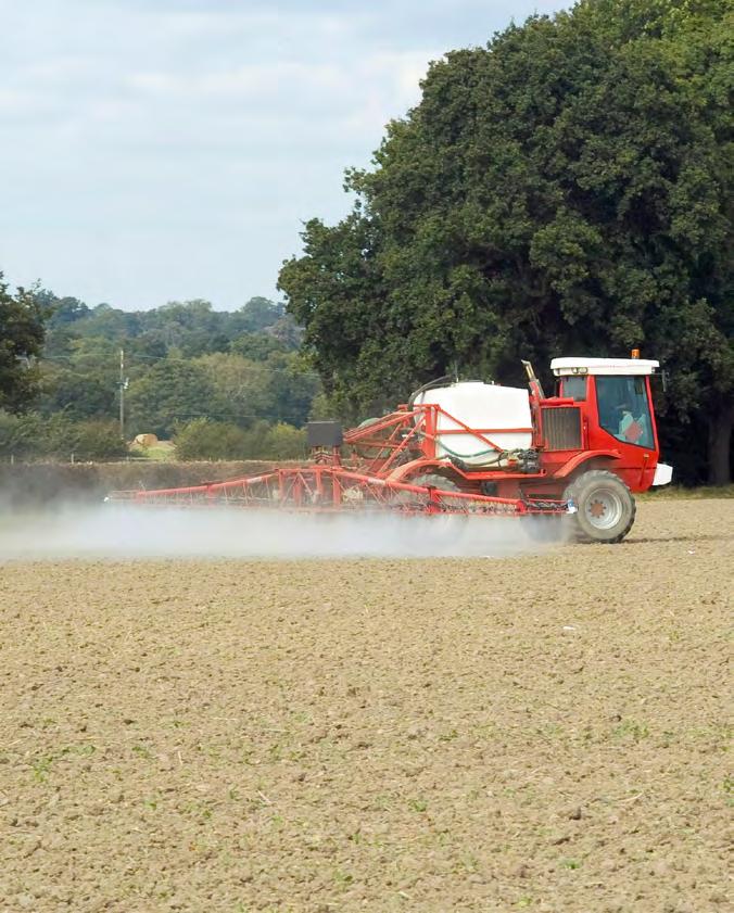
Herefordshire is known for its agriculture, which accounts for nearly 10% of employment and Gross Domestic Product, and the county is home to some of the most productive agricultural land in the country. Whilst the agricultural sector therefore has importance in contributing to national food supply and security, it also has impacts on the county’s landscape and wildlife.
Herefordshire has experienced huge growth in agricultural development in the past 100 years, with the county authorising the highest number of new poultry units out of any English counties in the last 25 years. This has not resulted in a significant change in land area, but rather in land use with intensification of agricultural land management practices. The biggest impact of this has increasing the nutrient load within the river catchments through the production of chicken manure. Other types of farming such as dairy, soft fruit and arable farming have also seen intensification.
Changes in agricultural practices can threaten biodiversity in numerous ways. Expansions of field sizes with intensive management and hedgerow removal can create barriers to species movement and reduction in suitable habitats. The loss of traditional orchards through intensification (i.e. conversion to commercial orchards) can result in reduced biodiversity and habitat for orchard specialist species, such as noble chafer beetles. Increases in cattle housing and intensive poultry units across the county can result in the potential for increased pollution of soils and watercourses through leaching of nutrients into river systems.
Numerous projects are underway across the county to promote more naturefriendly farming practices. The Wyescapes Landscape Recovery Project aims to recover habitats and species within river corridors and the floodplain of the Wye catchment, with a joint aim of encouraging and applying sustainable agricultural practices in order to achieve this. The network of landowners will act as a valuable platform for sharing wins or successes of sustainable and regenerative farming practices.
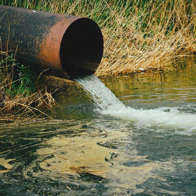
Pollution of soils and watercourses is a major threat for Herefordshire’s natural environment. Sources can include sewage discharges, industrial and agricultural runoff and rural septic systems. Three main pollution types are from phosphate, ammonia and nitrogen deposition.
Excessive phosphate is a key contributor to the poor ecological condition of Herefordshire’s river network. Multiple sources of phosphate loading occur in the River Wye, from effluent discharges from wastewater treatment centres and rural septic tank systems, light industrial discharges, and surface and sub-surface runoff from agricultural land, farmyards and urban areas. One example of the impact of excessive phosphate in river systems is the growth of algal blooms, which block sunlight and deplete oxygen in the water, thus severely harming aquatic life. Beyond river catchments, phosphate pollution also impacts soil health. The long-term accumulation of surplus phosphate in agricultural soils has created a “legacy” of nutrient overload, which continues to leach into waterways.
As a result of the high phosphate levels, water quality in many areas of the catchment is failing current eutrophication control standards. A Diffuse Water Pollution Plan (DWPP) has been prepared jointly by the EA and NE the plan outlines the current condition of the Wye Special Area of Conservation (SAC) in England, it identifies the sources and impacts of diffuse pollution, and sets out the strategic priorities and actions required to achieve favourable condition status.
Ammonia pollution is also high within Herefordshire. Emissions lead to higher deposition of ammonia onto habitats, soils and plants. Excess nitrogen from the ammonia deposition increases the acidity of soils and creates nutrient-rich soils that can result in a shift in plant diversity towards more fast-growing species at the expense of less nutrient-tolerant flora. This can lead to severe ecosystem imbalances and habitat degradation.
Ammonia is also an important contributor to total nitrogen deposition (alongside other sources such as transport and industry). Rates of nitrogen deposition in western Herefordshire is amongst the highest anywhere in the UK. Most areas receive nitrogen deposition in excess of 14kg of nitrogen per ha per year which is known to be damaging to a wide range of habitats. Again, these changes can lead to the decline of species adapted to low-nutrient environments and affect food webs and ecological resilience. Most protected sites now exceed their critical levels or loads for ammonia and nitrogen.
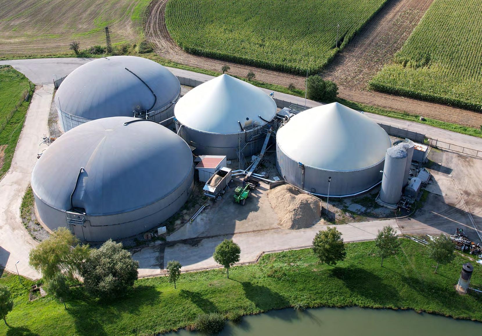
The Herefordshire Minerals and Waste Local Plan incorporated a specific policy to deal with agricultural waste as a proactive strategy to address agricultural intensification and pollution. Adopted in March 2024, a specific policy controls how agricultural waste will be required to be addressed in certain circumstances; such as incorporating waste management method statements where livestock units are proposed; anaerobic digestion proposals where the waste used is generated primarily on the agricultural unit where it is located; and finally on all proposals for livestock units, anaerobic digestion and waste management proposals, as well as demonstrating at least nutrient neutrality within the River Wye SAC or River Clun SAC.
This policy is only applied where planning permission is required and is not applicable to existing development and to development proposals that are progressed under national permitted development rights.
Climate change presents a major threat to natural environments, wildlife, ecosystems, and their ability to function effectively and provide the wealth of benefits society receives from them. As with the rest of the UK, Herefordshire is already experiencing the effects of climate change and impacts are projected to intensify in future decades.
Herefordshire’s Climate Change Adaptation Plan (2023-2028) outlines that the county is likely to experience increasingly unpredictable weather with hotter drier summers becoming more common, especially in urban settlements like Hereford. Under high-emission scenarios, annual temperatures may increase by up to 3.9°C by 2080. In addition, rainfall over winter months is projected to increase by up to 30%, leading to more frequent and intense flooding. The River Wye and Lugg catchments already experience flood events that damage infrastructure, houses and farmland, and are set to become more vulnerable to these events with climate change.
The likely decrease in summer precipitation, predicted to decrease by up to 40% by 2080, is likely to have extreme impacts on water availability, leading to an increased risk of drought which will affect agriculture and a variety of water-dependent ecosystems such as wetlands, woodlands and moorlands.
Climate change will also have impacts on species across the county. The changing seasons may disturb migrating birds and invertebrates, as there will be an increasing mismatch in timing of the arrival of migratory species and food sources, and species distributions may change on a national scale with those suited to hotter dryer conditions increasing
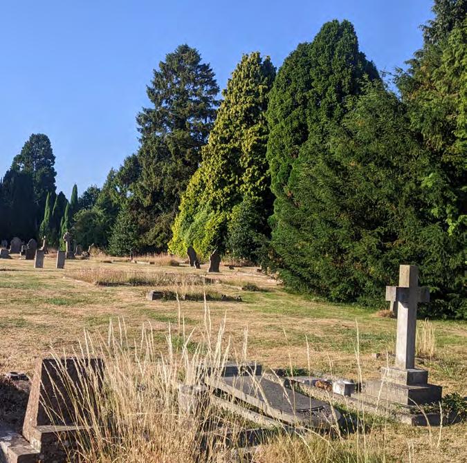
their range northwards, potentially outcompeting species with less tolerance for high temperatures. Droughts and higher temperatures have the capacity to stress woodland, heathland, and dry grassland habitats, increasing the risk of wildfires.
To address these risks, Herefordshire Council declared a climate emergency in 2019, followed by a formal commitment to accelerate reductions in greenhouse gas emissions and aspiration to become carbon neutral by 2030/1. The Council’s Carbon Management Action Plan sets targets to achieve reductions in council emissions through transitions to electric vehicles and improving energy efficiency in council buildings.
However, to attempt to mitigate climate change impacts to the natural environment, ensuring habitat creation, restoration and management takes into account predicted weather and climate changes is important. HWT outline plans to incorporate nature based solutions across the county, engaging land managers and communities to build resilience and improve biodiversity, to help tackle and adapt to climate change through their “Wye Adapt to Climate Change” project.
Invasive species, including Japanese knotweed (Fallopia japonica), Himalayan balsam (Impatiens glandulifera), American skunk cabbage (Lysichiton americanus) and American signal crayfish present a threat to native flora and fauna throughout the county. Pests and diseases of trees also cause significant impact, and include ash dieback, acute oak decline, Phytophthora, Dutch elm disease, horse chestnut bleeding canker, and horse chestnut leaf miner, grey squirrel (Sciurus carolinensis), and browsing deer have had negative impacts on the county’s tree stocks. Concerns regarding their effects on landscape character have been cited in the Malvern Hills and Wye Valley National Landscape Management Plans.
Herefordshire has a high number of ash trees within its woodland habitats, scoring within the top 10 counties in the UK for percentage ash within woodland canopy cover. Ash is also listed as the most dominant hedgerow tree in the county, and ash trees comprise 10% of the trees recorded in the Ancient Tree Inventory for Herefordshire. Overall, this results in a high level of vulnerability in Herefordshire’s woodlands, hedgerows and ancient trees from the effects of ash dieback disease. To address this risk, Herefordshire Council have created a Ash Dieback Action Plan for the county which identifies the national and local importance of ash in the county, provides an overview of current knowledge and processes, and looks to recommend the way forward for the Council in respect of its own stock of ash trees ensuring there is no net reduction in tree numbers from ash dieback, and that Herefordshire Council can fulfil its statutory obligations and implement new processes and systems.
Furthermore, the increasing incidence of pests, pathogens, and invasive species as a result of climate change may cause irreversible damage to numerous terrestrial and freshwater habitats and species, as well as creating changes in species composition (e.g. woodlands).
The Wye and Usk Foundation have delivered several projects aimed at invasive species management, including the Invasive Weed Eradication based within the Wye catchment, and the Phosphates and Weeds project which will develop an approach for farm wetland design and development and aim to expand the organisation’s work on invasive weed control for Japanese knotweed and giant hogweed (Heracleum mantegazzianum) in the Wye catchment.
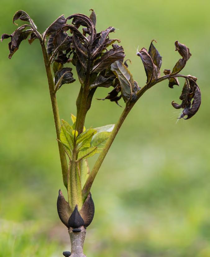
A key part of the LNRS is the ability for actions to not only support nature recovery but also deliver a number of wider environmental benefits (WEBs). These align with the UK government’s 25 Year Environment Plan (2018) and its first revision in 2023, the Environmental Improvement Plan (EIP) which sets out ten goals to help the natural world regain and retain good health (Figure 3-1). The EIP was revised and published on 1st December 20255 to improve the understanding of how it works as a system and how delivery of the goals is connected. The goals remain broadly unchanged with the key focus of the updates to streamline the actions to better focus on the biggest priorities. The EIP 2025 now clearly prioritises work and responsibilities across government and beyond. Alongside this is a clearer framework for monitoring and evaluating progress.
For each of the ten EIP goals to be successful, it must incorporate at least one of the 10 WEBs into its plans, as without the WEB’s none of the goals would be fully achievable or come with any benefits ecologically or socially for Herefordshire. The differences between the WEB’s and EIP’s is that the EIP’s are the overall outcome that LNRS want to achieve, whereas the WEBs are the key aspects that need to be changed and improved for the EIP’s to be successful.
Figure 3-1: Connections between ten environmental goals of the EIP.
The key WEBs for Herefordshire are outlined below and have been used to help prioritise the measures proposed in the LNRS mapping feature.
Woodlands are a key feature of Herefordshire with an average tree canopy cover of 19%, which is above the UK average of 13%. However, there is large variability across the county from 10% or less to 35%. Increasing woodland cover across Herefordshire, particularly in those areas with lower average tree canopy cover, will provide habitat for biodiversity, increase carbon sequestration, remove pollutants, cool urban areas, reduce rainfall runoff, and can improve wellbeing. This WEB would therefore also help to contribute towards the other WEBs listed below.
Air pollution and poor air quality is recognised as a contributing factor in the onset of heart disease and cancer and can lead to a range of health impacts. The main air pollutant within Herefordshire is nitrogen dioxide, with sources largely attributed to vehicle emissions and two Air Quality Management Areas (AQMAs) declared due to nitrogen dioxide levels exceeding national standards due to heavy congestion in the Hereford and Leominster. It is therefore vital to undertake nature recovery actions to increase the number of habitats that can help to reduce air pollutants, alongside behavioural changes to travel patterns, increase active travel and improve public health across the county.
Herefordshire’s watercourses are threatened by poor water quality due to high levels of nutrients and sediment entering rivers as well as changes to the flow and temperature, that are impacted by climate change. The Rivers Wye, Frome, Lugg and Clun are currently among some of the most threatened watercourses in Herefordshire. The main water pollutant is phosphate; however, high levels of nitrates are also present within the River Clun. Improving water quality will help to restore the natural watercourse ecosystem allowing more species to survive and their communities to become more stable. It will also contribute to enhanced recreation and tourism, improved public health for those using the watercourse for water sports and be more visually appealing contributing to the beauty of the county.
As a rural county with several watercourses across the landscape, Herefordshire is susceptible to flood events, as experienced with widespread flooding in 2024. Management of flood risks will use natural processes to hold and slow the flow of water. These natural techniques can include planting trees, creating leaky dams, scrapes and ponds and improving soil health through cover crops and contour ploughing. This will increase biodiversity and habitats, as well as restoring watercourses and floodplain functioning to reduce the detrimental impacts of flooding.
A climate emergency was declared by Herefordshire Council on the 8 March 2019, marking the beginning of activities towards net zero and preparing for the impacts of climate change. These impacts include more intense and frequent extreme weather events (flooding, heatwaves and storms). By embedding climate change adaptation into nature recovery, the measures and outcomes will help to mitigate the impacts, reducing flooding, increasing urban cooling, improving food production resilience and providing storm breaks, as well as supporting the natural environment into the future.
The natural and historic environment of Herefordshire offers a valuable asset to enhance biodiversity whilst also supporting public health and providing cultural services. By increasing access and connection to nature, through recreation, education and community engagement, these habitats can contribute to improving people’s mental and physical wellbeing. By understanding landscape, its character, development, and history as well as its change over time better holistic decisions can be made which enrich and support both the aims of nature recovery and preserve our shared heritage for the benefit of all.
As a predominantly rural county, Herefordshire is highly dependent on healthy soils to support nature and farms. Improving soil health encapsulates practices to support microbial life, as well as the wildlife we can see. It will also provide sustainable farmland, support nutrient cycling, reduce erosion and chemical inputs and enhance carbon and water storage to mitigate for climate change.
As a major land use in Herefordshire, farming and alteration to farming practices present a significant opportunity to support nature alongside successful businesses. Nature friendly farming involves a reduced use of chemicals, such as pesticides and fertilisers, and integration of habitats to the farm. For example, enhancing existing habitats or creating new habitats for pollinators and wintering birds or managing ponds, tree lines or hedgerows for biodiversity.
Invasive species such as Himalayan balsam, Japanese knotweed, giant hogweed or American signal crayfish have potential to cause harm to our native species through disease, competition for resources, predation or hybridisation. They can also result in negative impacts on public health or infrastructure. Therefore, controlling invasive species will reduce these negative impacts and support our native biodiversity. Nature recovery using adaptable species and habitats may also contribute to controlling biosecurity, which will help to overcome the impacts of pests and disease such as ash dieback.
Access to local, fresh and affordable food will help to support public health, Herefordshire’s rural economy and foster a sense of community and connection with food produced in their own county. Many of the habitats created for wildlife, such as orchards or hedgerows, can also generate productive food systems and reduce diet-related illnesses.
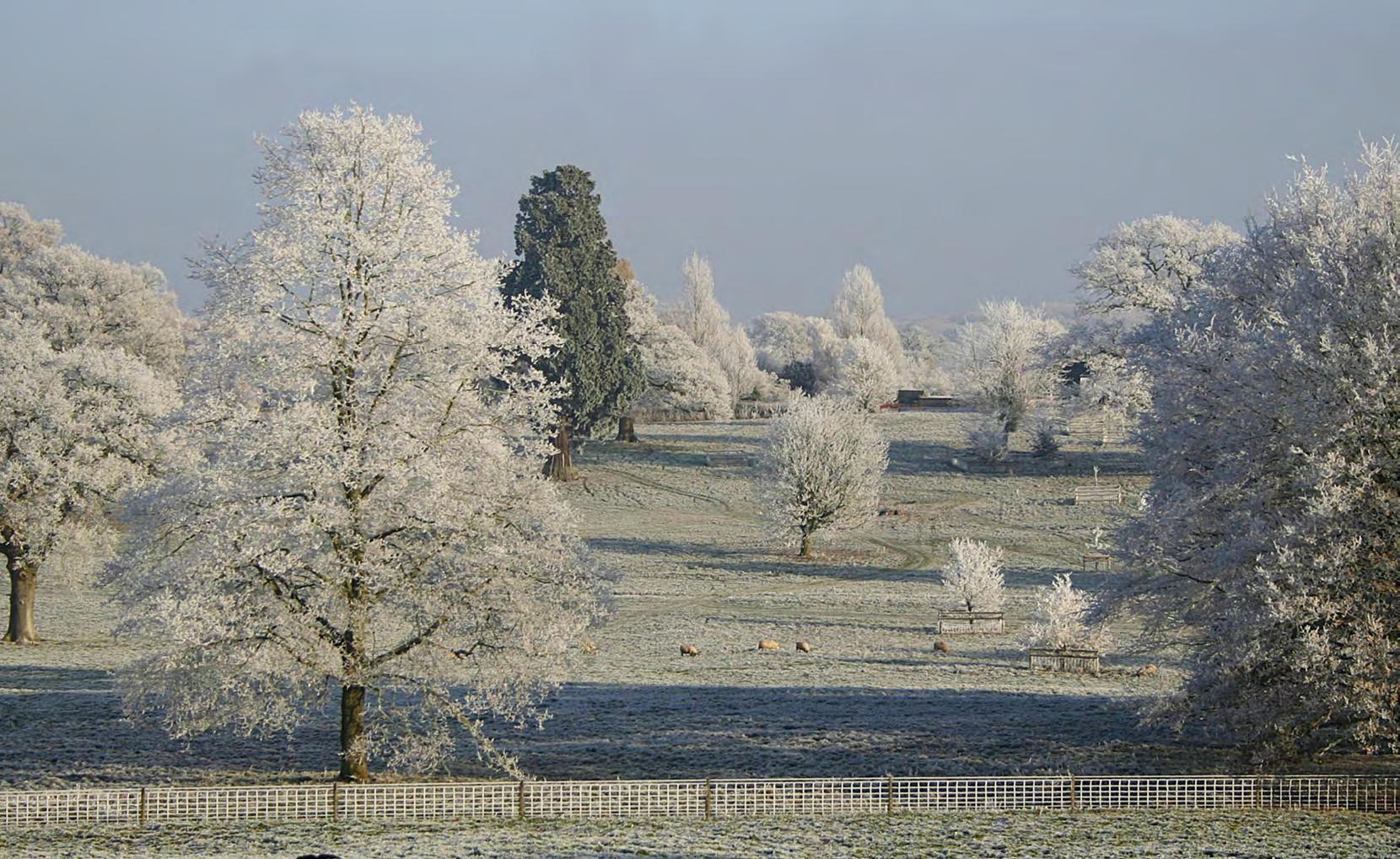
This Strategy Area Description provides a comprehensive overview of Herefordshire’s landscapes, habitats, species and the pressures they face. Herefordshire is predominantly rural and contains a diversity of habitats of value to wildlife including ancient woodlands, wetlands, moorlands, Ice Age ponds and traditional orchards. Herefordshire’s most important places for nature are protected by international, national and local designations such as SAC, SSSIs and Local Wildlife Sites. These sites play a crucial role in conserving the county’s rich biodiversity, although many would benefit from improved management and connectivity of natural habitats between them.
Herefordshire’s habitats are home to a wide range of species, from hedgehogs and the common toad to rare invertebrates and important bird assemblages. The county’s species rely on natural habitats that are in good condition and well connected in order to thrive and grow their populations. However, like with many counties across the UK, Herefordshire experiences threats and pressures on nature, that have potential to result in habitat loss, degradation, pollution and its resulting impacts on species decline.
A key challenge for Herefordshire is that the River Wye and River Lugg are experiencing widespread environmental degradation and decline in quality. Climate change is expected to exacerbate these issues, with projections indicating hotter, drier summers and wetter winters, increasing flood and drought risks and altering species distributions.
The analysis of baseline conditions across the county has identified several opportunities to improve the environmental conditions across Herefordshire. Nature recovery can build upon the work that is currently taking place by a range of organisations and groups, such as the Wyescapes Landscape Recovery Project and efforts led by local groups to restore wildlife meadows and greenspaces in urban settings, to also support climate change adaptation. This Strategy Area Description outlines the state of nature within the county and will inform the priorities and measures that make up the LNRS, ensuring that nature recovery actions are beneficial and tailored to Herefordshire.
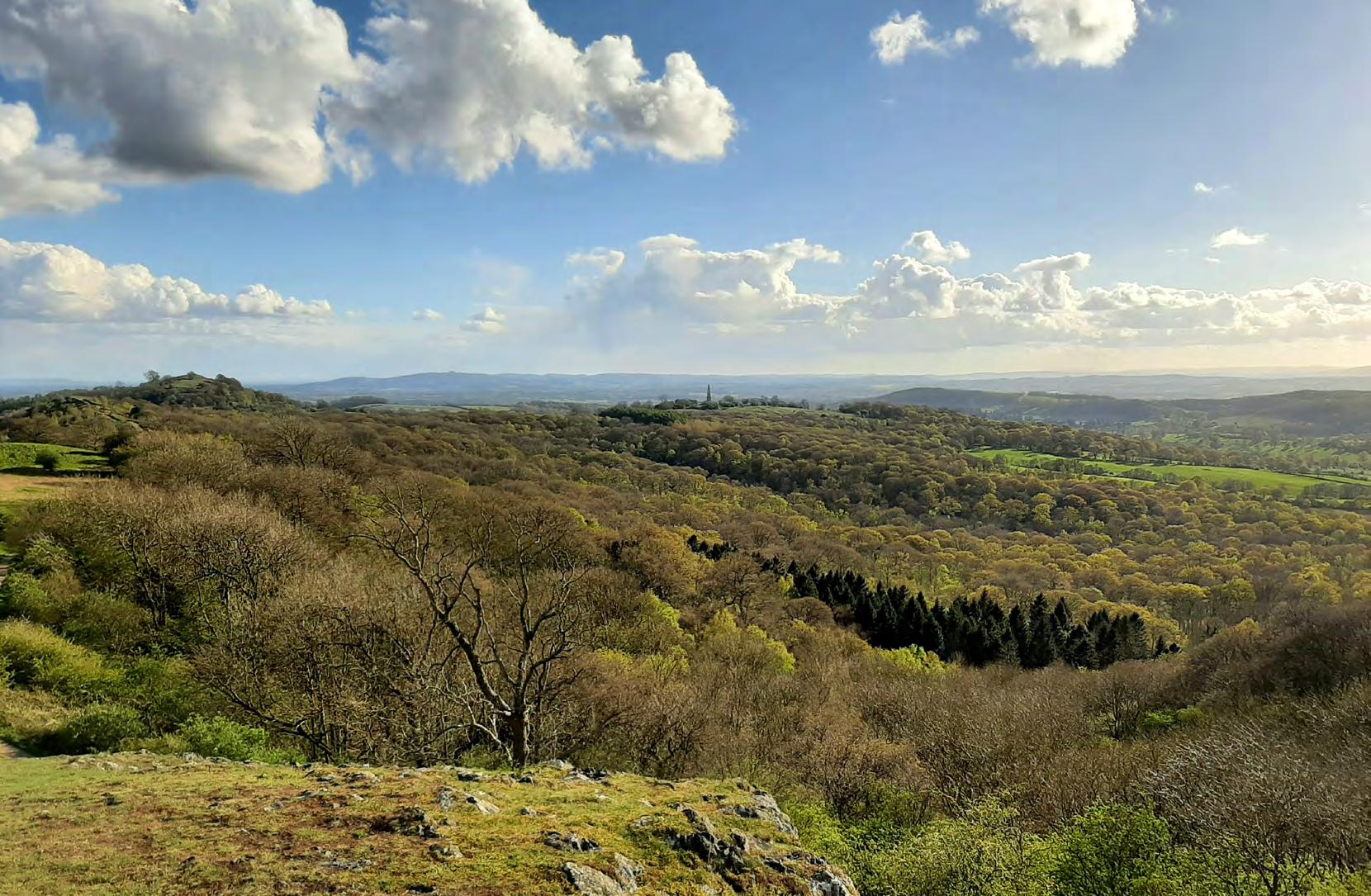
Various types of reference material, datasets, case studies and information were consulted to produce the Strategy Area Description. The sources are set out below, but do not constitute an exhaustive list of information available about Herefordshire’s natural environment.
The following draft reports or datasets were provided by Herefordshire Council:
• Shapefile data and a Methodology Report relating to drafts of the Herefordshire Nature Recovery Network Mapping carried out by November 2024 by the Gloucestershire Centre for Environmental Records and Gloucestershire Wildlife Trust;
• The Draft Herefordshire Tree, Hedgerow and Woodland Strategy produced by LUC in January 2025;
• An internal document on air quality in Shropshire and Herefordshire;
• A spreadsheet on the coverage (ha, % county) of designated sites, HBRC Biodiversity Action Plan habitats and Priority habitat inventory data; and
• Data on farm types and their coverage across Herefordshire.
The following datasets were shared from various stakeholders and partners:
• SSSI data (including on status of SSSI parcels) was shared by Natural England.
• Statistics on EA WFD waterbodies, their ecological and chemical statuses, and RNAGs in Herefordshire
• NRW data on WFD waterbodies
• Woodland data was provided by Forestry Commission
• Management plans were shared by the EA, including:
• The Severn River Basin Management Plan
• The Severn River Basin District Flood Risk Management Plan
• BTO Atlas data
• Data on species abundance changes between 2004-2013 and 2013-2024 were shared by HBRC.
The below references publicly available information, reports and data that was consulted for the production of this report.
Defra (2023) Engaging the land management sector in Local Nature Recovery Strategies Advice for Responsible Authorities. Defra, London.
Defra (2023) Identifying and agreeing priorities and potential measures within Local Nature Recovery Strategies. Defra, London.
Defra (2023) Relevant national environmental objectives for Responsible Authorities to seek to contribute to when developing their Local Nature Recovery Strategy. Defra, London.
Environment Agency (2025). Diffuse Water Pollution Plan, River Wye Special Area of Conservation. (Accessed: 5th December 2025)
Environment Agency & Natural England. (2019) The WYE Catchment Partnership Plan (By The Wye & Usk Foundation & Natural Resources Wales). (Accessed: 31 July 2025).
Herefordshire and Worcestershire Earth Heritage Trust (2025) Herefordshire’s geology and soils (support for LNRS). Earth Heritage Trust.
Herefordshire Council (2021) Local plan 2021 - 2041, Herefordshire Council (Accessed: 31 July 2025).
Herefordshire Council (2023). Blue and green infrastructure Strategy. Herefordshire Council. (Accessed: 31 July 2025).
Herefordshire Council (2023). Landscape character assessment. Herefordshire Council. (Accessed: 31 July 2025).
Herefordshire Council (2024) Ash Dieback Action Plan. Herefordshire Council.
Malvern Hills Area of Outstanding Natural Beauty. (2019). Malvern Hills Area of Outstanding Natural Beauty Management Plan 2019-2024. (Accessed: 31 July 2025).
Natural England. (2024). Natural England - National Character Area Profiles - National Character Area Profiles. (Accessed: 31 July 2025).
Natural Resources Wales, Environment Agency, Natural England (2021). River Wye SAC Nutrient Management Plan Phosphate Action Plan. NRW
Sustainability West Midlands (2023) Climate Change Adaptation Plan for Herefordshire 2023-2028. Herefordshire Council.
Sustainability West Midlands (2023) Climate Change Technical Report for Herefordshire. Herefordshire Council.
Sustainability West Midlands (2023). Severe Weather Impact Assessment for Herefordshire 2008 –2022. Herefordshire Council.
Withers, P.J., Forber, K.J. and Rothwell, S.A. (2023) Soil Phosphorus Status and Water Quality in the River Wye, Phase 2: Land Use Change and Phosphorus Balances in the Wye Catchment. Lancaster University.
Withers, P.J.A., Rothwell, S.A. and Lyon, C. (2022) Re-focusing Phosphorus use in the Wye Catchment. Lancaster University.
Wye Valley AONB Office, Webb, A., Minister for Rural Affairs and Biosecurity, Defra, Welsh Government. (2021). Wye Valley AONB Management Plan 2021-2026. (Accessed: 31 July 2025).