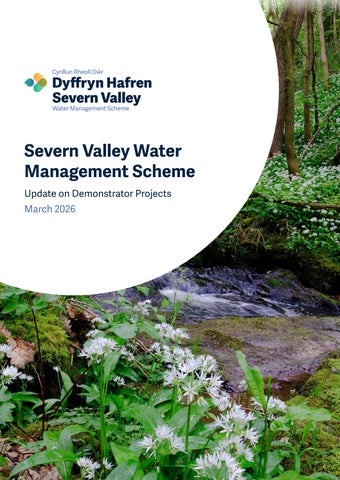
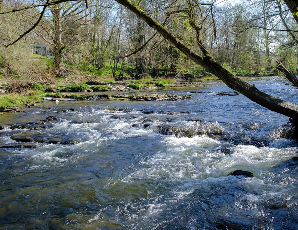
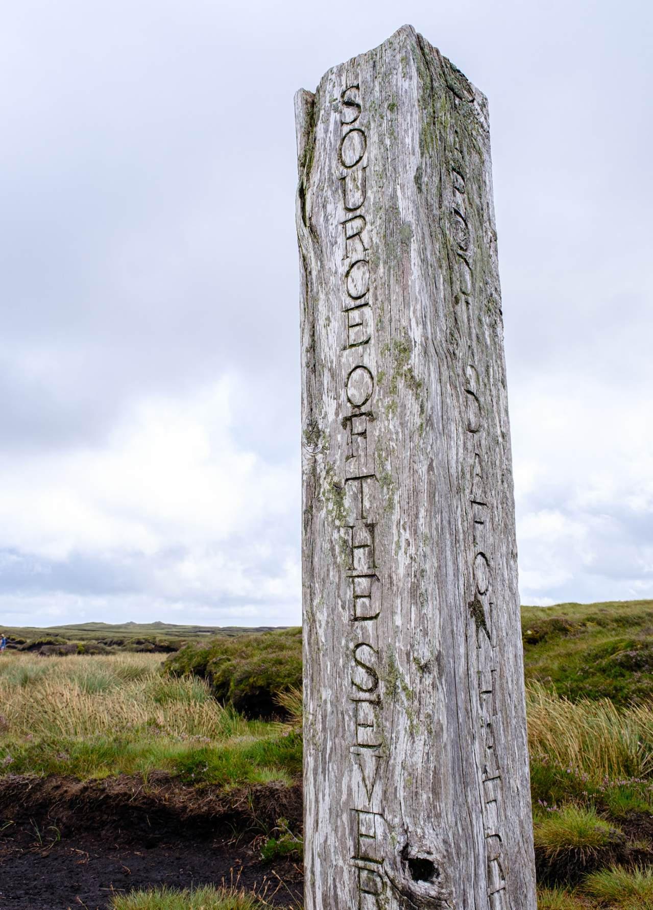
Severn Valley Water Management Scheme
Update on Demonstrator Projects
March 2026
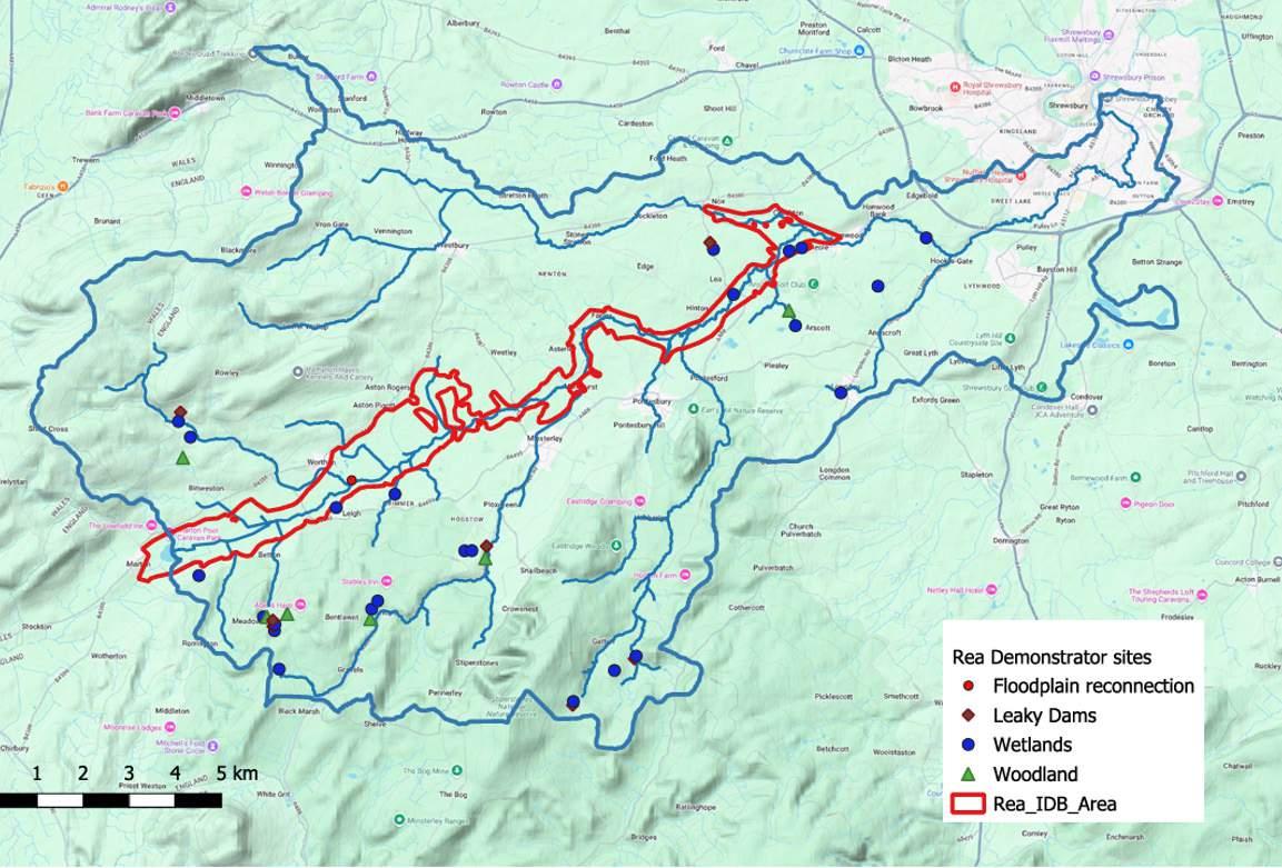
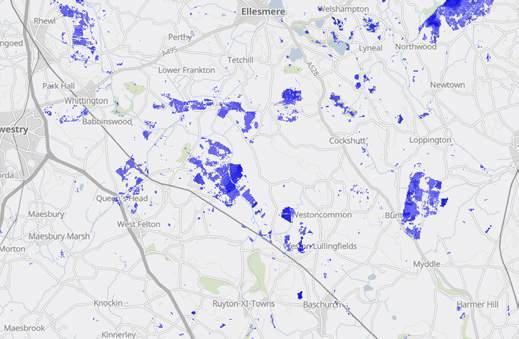
Location of Demonstrator Projects
A470
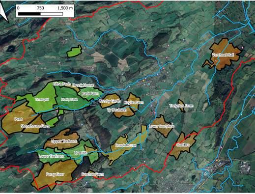
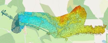
The 8 Demonstrators are located across the upper Severn catchment as seen in the map here. 6 of the Demonstrator projects are catchment or locality based. The remaining two projects, that is Marches Future Farming and CLiCC Demonstrators are investigating themes and issues across the whole upper Severn as farming and careers are not limited to just small areas of the region but of universal concern. The map also shows the indicative spread of possible approaches to flood and drought resilience, such as land use adaptation, natural flood management and the creation of flood water temporary storage. The yellow patches show where the search for the locations of flood water storage features is likely to begin. Please note though the Demonstrators are actively installing natural flood management measures to test and trial them the overall strategy for the upper Severn is yet to be completed. The final strategy document is due by March 2027.
Indicative areas where we believe flood storage areas may be most effective at reducing local and catchment flood risk.
Centre for Living with Climate Change


Marches Future Farming


Llanwddyn
Llanidloes
Oswestry Depave


Geospatial Demonstrator Project


Key
Areas of search for temporary flood storage areas
Natural Flood Management opportunities
Land use enhancement opportunities
Sub-catchment border
Welsh & English border
Rivers
Newtown
Welshpool
Minsterley Oswestry
Shrewsbury
Guilsfield Brook
Rea Brook
Attingham Estate
Perry and Peatlands
Overview of Demonstrator Projects
The Demonstrator projects are setting out to test and investigate how best to adapt the upper Severn catchment to ensure flood and drought resilience for people and wildlife into the future. This graphic summarises the number of new nature-based flood management features installed by three of the Demonstrator projects, that is Guilsfield, Reabrook and Attingham, up to Spring 2026.
Each feature brings water slowing benefits to protect homes, livelihoods and transport links, they enrich wildlife spaces and build drought resilience for the upper Severn catchment. Each type of natural flood management feature acts to either temporarily intercept and slow storm flows, encourage infiltration, evaporation and uptake by tree roots or provide additional storage of peak volumes of seasonal water. Each feature also sits alongside existing land uses buffering food production elements and conserving soils.
Much is already understood about the effectiveness of the NFM features but less about the economics of installation, cost-benefit analysis, long-term maintenance, land use change dynamics, groundwater recharge and specialist contractor sector skills development. These themes and more are the work of the Demonstrator project teams and the insights gained will be used to inform and shape the Severn Valley Water Management Scheme strategy.
18 Seepage Barriers
19 Ponds Created
6. 2 km
Of Watercourse Enhanced
8. 6 ha Of Habitat Created 22 New Wetlands
109 m
Fencing 6. 9 km Of Hedgerows
Aerated
Severn Valley Water Management Scheme
Update on Demonstrator Projects
Introduction to the Severn Valley Water Management Scheme
The Severn Valley Water Management Scheme (SVWMS), is a strategy programme which aims to “preserve and enhance the Upper Severn Valley by creating thriving communities and resilient environments through sustainable and holistic water management”.
The River Severn forms an integral part of life for those who live and work around it. It provides benefits and opportunities for wildlife, transport and recreation, as well as water for farming and community uses. Those living near the River Severn will know of the long history of significant flooding in recent decades, causing damage to homes and businesses, impacting local infrastructure and disrupting travel. Conversely, local communities have also experienced periods of prolonged dry weather and, in some cases, droughts which have led to restrictions in local water use.
In 2022, the Upper Severn catchment went from winter flooding conditions through to formal drought status within the space of eight months. Groundwater and reservoir stores were used to support the communities and wildlife who depended on the water supply provided by the Severn. To provide resilience to those communities regularly affected by flooding we need to store the equivalent of 65 billion litres of water during times of flood. If the Severn Valley Water Management Scheme is to effectively support the conservation and enhancement of the Upper Severn by creating thriving communities and resilient natural environments we need to test out our assumptions of what that might mean and how it might be done. As the scheme was coming together it was agreed to seek funding from Defra to support a programme of 8 pilot or Demonstrator projects to carry out research and pioneer delivery of nature-based solutions to build a deeper understanding of what it will require to build significant flood and drought resilience in the upper Severn for the communities of Wales and those of England across the border.
Introduction to the Demonstrator Projects
The Demonstrator programme is a collaboration between highly regarded environmental organisations, local flood risk management authorities, academic institutions, expert consultants and representatives from the farming community. Each project has a lead organisation as listed below.
We are committed to work with local communities and stakeholders to develop and test long-term water management solutions for the Upper Severn that will reduce flood risk, and support nature, people and the economy.
The Defra funding award of £4.5m made in 2022 is held by Environment Agency and issued as a grant to Shropshire Council who manage the programme. Each project has been tasked to investigate a different aspect of the emerging Severn Valley Water Management Scheme strategic plan.
• Guilsfield – Severn Rivers Trust – Testing natural flood management; exploring effective community engagement; building local contractor skills
• Rea Brook – Severn Rivers Trust – Investigating the challenges of creating complex natural flood management schemes; design and permitting
• Perry and Peatlands – Shropshire Wildlife Trust – Farmer designed solutions for flood water management; peat mapping and partnerships
• Oswestry Depave – Shropshire Wildlife Trust –converting impermeable townscapes into permeable flood solutions; communities on board
• Attingham Park – National Trust – water and nature recovery on large estates; collaboration between tenants, landlords and the visiting public
• CLiCC – University of Chester – water management careers and learning pathway; climate change adaptation
• Geospatial – University of Chester – leading edge survey and mapping for flood management; community designed flood resilience
• Marches Future Farming – University of Chester –hearing the farmers voice; testing future economics; groundwater research; sharing knowledge
Keeping you informed about the Demonstrator Projects
The Demonstrator project teams will be producing a series of short punchy technical notes, long more indepth case studies and 8 summary reports. Each will be able to bring direct real experience to the Severn Valley Water Management Scheme to ensure it becomes a robust policy support for the future of the Upper Severn, based on tried and tested principles and practices. The first Demonstrator project, Guilsfield, started work in early 2022, it is due to complete its work by March 2026. The other 7 Demonstrators will be reporting throughout 2026 and then handover their final reports in by the end of March 2027.
To find out more about the Demonstrators follow this link – https:// severnvalleywatermanagementscheme.commonplace.is
With thanks to the Severn Valley Water Management Scheme Demonstrator Programme partners:
Shropshire Council, Environment Agency, Severn Rivers Trust, Shropshire Wildlife Trust, National Trust, University of Chester, Faulkner and Mayne Agricultural Services, Maesmawr Farmers Group, North Shropshire Farmers Group, Hannah Fraser Consulting, Richard Maryniak, Marches Forward Partnership, 3Keel and Ernst Young. Thank you to Defra for funding the programme.
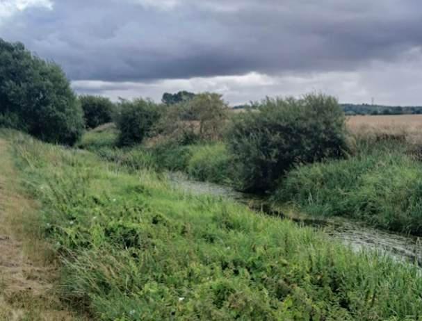
Guilsfield Demonstrator Project
Introduction
The Guilsfield Demonstrator Project began in Spring 2022. Led by Severn Rivers Trust, with partner support from Powys County Council, Shropshire Council and the Environment Agency. The Guilsfield Brook Project is the first jointly delivered project between England and Wales within the River Severn Partnership.
The Guilsfield Demonstrator project aims to test innovative solutions to long term flood resilience in the Upper Severn catchment, and use natural flood management techniques (floodplain reconnection, wetland creation, woody debris dams and woodland planting) to ‘slow the flow’ of water.
This project is tackling flood risk within the Guilsfield catchment on two levels. Firstly, it is installing a range of traditional Natural Flood Management (NFM) measures, to make an immediate contribution to addressing flood risk, and build resilience into the soil landscape. Alongside this, the project will be looking at how to support greater awareness of land and water management options for land managers and farmers through the Farm Hydrology App.
The project aims to reduce flood risk through adding extra temporary floodwater storage. This will be done through the creation of woodland, hedgerows, ponds, and leaky dams. There will also be an increase in the ecological resilience of the catchment through the creation of woodland and wetland habitat. Severn Rivers Trust officers have been working with landowners to deliver these farm-led measures across the catchment while considering the farms' individual needs and aims, working with local contractors and suppliers.
Landowner Engagement
To deliver the project at scale, considerable landowner engagement has been required. This has been embarked upon on a farm boundary to farm boundary basis, to maximise the benefit to the farms and their immediate neighbours as they often shared boundaries alongside watercourses, wooded dingles, and hedges. These boundaries act as biosecurity measures for the farms, and their hedges and edges give protection for stock and wildlife alike.
There is now considerable appetite for the type of NFM works in the Guilsfield Catchment farming community as the aims and effects of the project are better understood from the conversations and exchanges that Severn Rivers Trust (SRT) have hosted at the farm gate, roadsides and public events. The high work standards of the local contractors has helped support the project aims and build a good reputation for SRT.
The SRT project team employed to deliver the project are field tested practitioners in public-facing conservation management. They have direct experience of negotiating and cooperating with farmers and landowners to restore and create natural flood management features and habitat mosaics at a catchment scale including: wetlands, riparian woodlands and floodplain meadows. As well as delivering the project they provide advice to farmers and incentivise regenerative agriculture practices.
Project officers visited the farms and then after giving a frank and open explanation of the SVWMS and carrying out agreeable negotiations would scope the farm during a site walkover with the landowner where all the possible landscape restoration operations were mapped onto the farm’s base map. This map was then drawn up and specifications for the works agreed with the farmer, who was given the understanding that only the operations with the most NFM benefits would be prioritised. Since starting the project has installed over 100 leaky woody debris barriers to slow flow in upstream tributaries. Nearly 20 pools and basins have been created and restored to increase temporary floodwater storage. By the close of the project over a kilometre of new hedgerow will have been planted and approximately 2 hectares of new woodland. To date over 17 farm businesses have taken part in the project and done their part in improving flood resilience in the Guilsfield catchment.
Challenges and Issues
While there have been many successes of the project so far, there have also been some challenges to learn from and overcome. There is a high level of uncertainty and caution in the farming community around Agrienvironment schemes due to past and present experiences. Currently there are no long-term financial supports for maintenance of natural flood management features. At present project staff could only speculate that the Natural Flood Management measures that were created on the recipient farms would to be of benefit to them in the future as a source of income, when such schemes are announced.
Lack of experience in conservation management operations by local contractors was also an obstacle, the mindset of both farmer and contractor in the case of drainage, was to send any overland flow into their nearest field drains and into their ditches and water courses and off the farm as quickly as possible. Good drainage has a key role in land management and it is hoped the same skills and knowledge can be applied to holding flood water back to allow drainage systems down stream to cope with peak flows. The project team arranged a series of good practice sessions which helped address the experience gap of the local teams resulting in benefits for all.
Map showing farms engaged with in the Guilsfield Catchment. Orange shows farms where engagement is complete, green shows farms where work is ongoing
Similar challenges were felt in the case for leaky woody barriers where common farm practice was to keep watercourses clear of woody debris so that any water could not linger on the farm’s fields. Careful placement of features to slow flows and avoid inundation of arable or pasture land can be achieved but confidence in siting these features by landowners needs to grow.
Understanding how to use the land to manage flows and reduce flood impacts by slowing flows in one part of the catchment and speeding it along in another will take time and support.
‘Are you here to steal my land for trees?!’ was a common response by farmers to project staff calling in on farms. At the end of most conversations, a common understanding was reached of “right tree in the right place”.
Hedgerow planting was a popular option as farmers clearly support the restoration of the hedgerows as they act a shelter for stock and biosecurity barriers within the farm. Initial impact of the project from media coverage was not as effective as it was hoped, many visits or call to farms resulted in professing no knowledge of the project. To address this issue staff attended the popular Guilsfield Show with our EmRiver interactive flood modelling water tray model. This proved a great success for generating interest in the Severn Valley Water Management Scheme and most importantly generated many leads for future farm visits by project staff.
Research and Monitoring
As well as meeting farmers and talking about where the opportunities might be for natural flood management the project team have used historical maps and other topographic surveys such as LIDAR [Light Detection And Ranging ] have enabled us to see where historical features are such as old hedges, ponds had been and where water channels had been modified. This allows us to restore features that have been lost in the landscape, which can be more appealing to landowners than creating a new feature.
An example of this is at Tirnewydd farm, where showing an old Ordnance Survey map helped convince a farmer to restore historic woodland. This was planted on a Shopshire business corporate day under a local company’s staff Health and Well-being programme. Woodlands were planted on the former footprint of cleared ancient woodland and volunteers could see the signs of this when planting amongst bluebells and wood anemones.
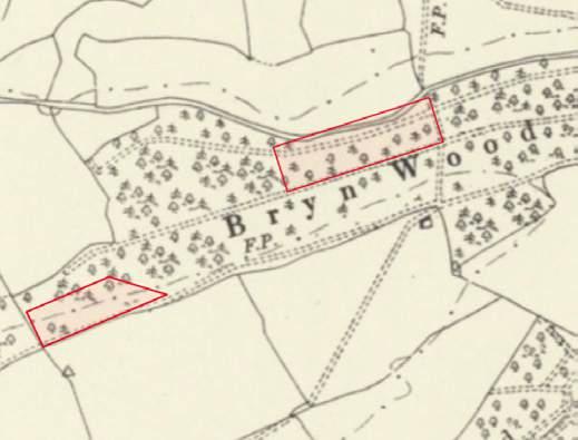
1888-1915 OS map showing historic woodland at Tirnewydd farm. Red polygons show the areas restored as part of the Guilsfield demonstrator.
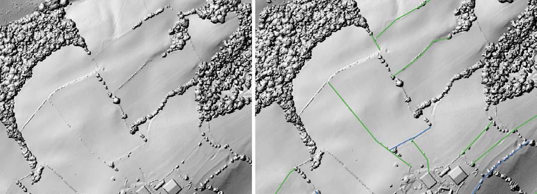
Using a Digital Surface Models (LIDAR) and historical maps, a catchment-wide map has been created of historic hedgerows, which can allow us to determine the potential impact of restoration, as well as create a focus for delivery.
All depleted hedgerows in the Guilsfield Catchment, green shows where hedgerow has been completely removed, blue shows where hedgerow has gaps.
Monitoring has also been carried out on delivered interventions such as leaky dams and attenuation features through camera trap timelapse footage. Camera traps are installed on the feature and set to take a photo every 10 minutes. This means that when there is a storm event the rainfall and the water being captured is recorded. Quantitative measurements are also able to be retrieved from this by installing gauge boards in the feature which will show the water level on storm flow.
This is a great tool for engagement of both landowners and the public as it shows that the installation of NFM measures is effective, and just how much water can be held back with one feature. This also allows us to see the impact of features we are installing, as we often can’t go on site to see them in floods, due to roads being flooded and inaccessible.
The other monitoring technique we have employed, is using Solnist Level Loggers to demonstrate the difference in discharge of two comparable streams. One stream has natural flood management measures installed, and the other has none. We are yet to receive results from this, but we hope to see a quantifiable difference in the two streams.
We are also looking to find a way of consistently measuring extra volume stored by the NFM measures we implement. We may look at the Rivers Trust’s Replenish tool as a means of doing this, however more work will need to be done to understand how it’s measures fit in with our own outputs.
Farm Hydrology App
The Farm Hydrology App is being developed as an engagement device to present farmers with information regarding risks and opportunities relating to water management. This information will be specific to each farm’s geographic location, providing users with personalised information relevant to their site and farm business. It is hoped that this will serve as a means of inspiring farmers to undertake some of the options presented. A data sharing agreement has been secured to integrate the Severn Valley Water Management Scheme Nature-based Solutions Opportunity Maps into the tool, creating a user interface for accessing this data with ease and maximising its benefits and preventing the need for replicating this dataset. The App will be available in English and Welsh. It is planned to test the App in the final year of the scheme.
Example of hedgerow depletion at farm scale, and how LIDAR shows remnant hedgerows indicated by green and blue lines.
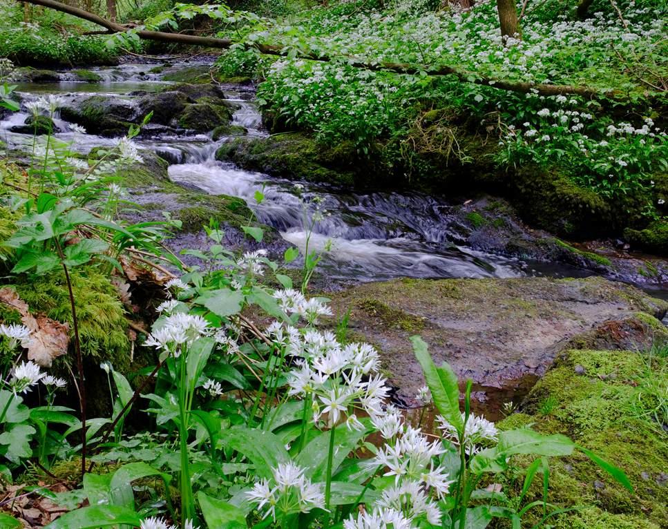
Rea Brook Demonstrator Project
Introduction
The Rea Brook Demonstrator project commenced in January 2024, and is due to be completed by March 2027. The project is being delivered by Severn Rivers Trust who have a longstanding commitment to work for the betterment of the Rea Brook catchment.
The aim of the project is to demonstrate the benefits that can be achieved by using natural flood management (NFM) measures to slow the flow of water during flood and storm events. It also aims to show the benefits of working with landowners, empowering them to implement these measures as an integral part of their farm business, rather than being seen as taking land out of production as may historically have been the case for NFM schemes.
The project delivers fully funded nature-based solutions NFM techniques such as floodplain reconnection, wetland creation, woody debris dams and cross slope woodland planting to ‘slow the flow’ of water.
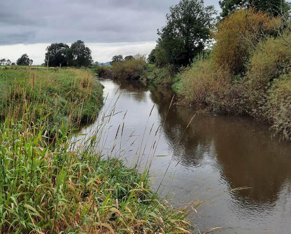
Catchment Background
The Rea Brook is a large catchment covering approximately 190km2. It is mainly rural agricultural land, but its lowest reach flows through Shrewsbury to join the River Severn by the English Bridge. It is made up of a wide flood plain flanked by the hills of Long Mountain to the north and the Stiperstones to the south, with a number of tributaries flowing off both sides of these hills. Its source is located in the flood plain at Marton Pool, a designated SSSI and Ramsar site. Villages which suffer flooding are located on all the major tributaries, and the Rea Brook contributes to flooding in the Coleham area of Shrewsbury at its confluence with the Severn.
Approach
Given the large size of the catchment and the number of individual tributaries, the project so far has not looked to target specific areas to identify suitable landowners (cold calling), but to work with landowners who have approached SRT with ideas (warm leads). This is capitalising on capital delivery projects done in previous years using EA Water Environment Improvement Fund (WEIF-EA) which has helped to develop contacts and build SRT’s reputation for delivering measures across the catchment in a professional manner. It may become necessary to move towards more cold calling approaches as the project progresses, but the delivery so far will help target areas for this to maximise the benefits that can be achieved.
Following the initial contact, SRT then undertake a site visit to look at the landowners' ideas and if appropriate make suggestions for additional or alternative options that could expand the benefits that could be achieved. Readily available desk-based information is reviewed to check that the intended location is suitable for the measures. Once an outline plan is in place, the EA project manager is taken to view the site and confirm whether the idea could go forward under the Demonstrator project, or
whether it might be more suitable for seeking alternate funding such as Water Environment Improvement Fund or Severn Woodlands. In some cases, projects end up as partnerships between several funding sources. Once approval has been obtained to proceed, the ideas are then developed in more detail. This may include applying to Shropshire Council for an Ordinary Water Course (OWC) consent, or to the EA for a Flood Risk Activity Permit (FRAP). In addition, some sites will lie within the area of the Rea Brook where drainage is managed by the Internal Drainage Board, and appropriate consultation will be made in those cases. To date, one large project has been undertaken within the IDB area, and for this the IDB delegated their statutory drainage powers to Shropshire Council. If the site shows evidence of botanical interest, a suitable survey is undertaken by the SRT ecologist or a local botanist, and results may shape the design plan. In some cases, early engagement with a suitable contractor is beneficial to fine tune ideas into a working plan. SRT have developed good relations with several trusted experienced contractors in the area who offer a range of skills needed to deliver high quality and long lasting NFM measures. Before work is undertaken, health and safety documentation is drawn up, including checking service plans for the sites.
Rea Brook Demonstrator planned and completed projects July 2025
Challenges Engagement
The Rea Demonstrator is a very ambitious project with its objectives including 35ha of wetlands, and >150 leaky dams, as well as woodland and floodplain connection. Whilst so far there has been a good level of interest and by July 2025 projects completed at 14 landholdings have included almost 50 wetland features, the actual area of wetlands created to date only totals about 3ha so the project target [35ha] is very challenging. It is noted that in this catchment that landowners never request leaky dams, and therefore the 31 to date installed have come from interested landowners who can be convinced to add these features alongside wetlands. However, they are also perceived as ‘risky’ by some landowners, and in at least one case permission has not been given to proceed unless accompanied by significant maintenance payments, which are not available under the Demonstrator projects.
Whilst some landowners have come forward enthusiastic to use their land to slow the flow, recognising the benefits of using the land to protect homes and manage peak flows locally not everyone is convinced this multi-function approach is workable. An exceptionally wet 2024 and very dry 2025 to date are putting big financial pressures onto the farming community, and the sudden closure earlier in 2025 of the Sustainable Farming Incentive (SFI) scheme has not helped the overall drive towards more nature friendly farming in some cases.
As the majority of warm lead projects turn into delivered schemes, it is becoming necessary to consider cold calling approaches, which are by nature challenging, and are likely to have a time impact on the project pipeline. However it is hoped that existing schemes may provide an educational tool.
The measures that have been completed to date demonstrate different ways to slow the flow in different settings, with much variation between flood plain and upland schemes. However, the ability to deliver large-scale measures is likely to depend on options for landowners to seek ongoing financial compensation such as higher tier stewardship agreements for taking larger areas out of productive use, and/or modifying their farm plans and business model. At this time, access to suitable water based higher tier schemes is uncertain, and it is hoped as those schemes start to be rolled out then landowners may feel encouraged to look at the longer term and larger scale measures.
Partnerships for funding
There are obviously many environmental benefits from the Demonstrator projects. However, an additional benefit is the ability at times to partner with other funding sources to meet landowners ambitions. The Rea Demonstrator project has specified objectives that not all landowner ideas meet. To date, the project has partnered with a number of other schemes to allow greater flexibility in what is delivered, including:
• Severn Valley REAction: funding from the EA’s Water Environment Improvement Fund, delivered by SRT.
• Severn Woodlands: woodland creation scheme funded by the EA, delivered by SRT
• Hedgerow Heroes: hedgerow creation projects delivered by CPRE Shropshire.
Partnerships such as these are vital to keep the momentum of landowner engagement moving forward, together with maintaining the credibility of environmental improvements, so that when the initial response to a landowner request is ‘sorry my project can’t fund that’ it can be followed with ‘but I know a scheme that may be able to help’.
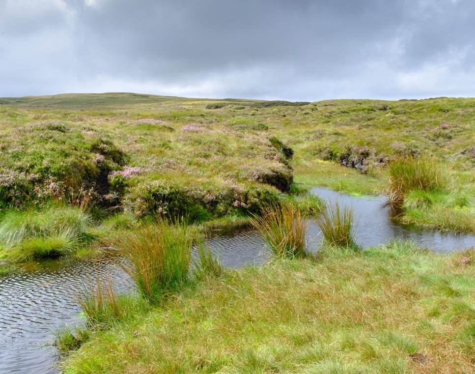
Perry and Peatlands Demonstrator Project
Introduction
The Perry and Peatlands Project commenced in September 2024, led by Shropshire Wildlife Trust, and managed by Shropshire Council through the River Severn Partnership. The project is exploring opportunities for farmer designed nature-based solutions to manage water flow, reduce flood risk, and provide greater landscape resilience to climate change within the River Perry and its geographically connected catchments.
Examples of nature-based solutions include floodplain reconnection, wetland creation, sustainable or wetter land management across peat soils, or fully restored peatland areas. These interventions have the added benefit of enhancing habitats, biodiversity, and increased carbon sequestration and storage.
The project team is working with locally based agricultural consultants Faulkner and Mayne Sustainable Agriculture Ltd (Kate Mayne and Sarah Faulkner) and the North Shropshire Farmers Group, to liaise directly with
farming and rural businesses within the focus catchment. Farmers and landowners in north Shropshire are already joining the conversation, and are influencing the project by sharing their knowledge, insight and solutions for the design of natural flood management schemes on their land.
The Perry and Peatlands project has five workstreams –
1. Farmer business engagement – local information on water management on farmland
2. On-farm farmer designed Demonstrator sites –natural flood management
3. Peat mapping – enhanced data
4. Landscape scale peatland study – detailed condition survey
5. Formation of Marches Peat Partnership –collaboration hub
Aims and objectives
The aim of the Perry and Peatland Project is to demonstrate an innovative and long-term sustainable approach to large-scale flood risk reduction through the delivery of:
• Areas of adapted land management, wetter farming, or rewetted areas on undesignated lowland peat under farmland, to provide water retention and attenuation, biodiversity enhancement, improving water quality, and enhancing carbon sequestration potential.
• Creation of native woodland habitat which will provide habitat, river shading, and provide a carbon sequestration role.
• Creation of wetland habitat, that will facilitate the development of a more natural hydrology, and provide new habitat.
• Improved knowledge and learning of peatland restoration and land management practices.
• The Project will be sharing the evidence and learning to influence the Severn Valley Water Management Scheme and wider River Severn Partnership. This will include:
• Better understanding of the potential for water storage within the peatland found in the catchment and how peatland, tree planting and Natural Flood Management [NFM] can co-exist and complement each other.
• Better understanding of the potential opportunities around green finance or other funding opportunities that can support farmers with the creation and maintenance of sustainably managed or restored peatland, tree planting and other NFM interventions.
• Better understanding of how NFM interventions can be integrated into farm businesses and the rural economy.
• Creation of demonstration areas to help encourage local farmers to seek alternative and more sustainable uses of peatland and encourage the implementation of other nature-based solutions.
Farming and Rural business engagement
Discussions and interviews with farmers in the project area have helped to gain insight into the current use and value of peatland and peaty soils to local farm businesses, and how the implications of climate change are being experienced on the ground.
Farmer Feedback
A selection of the feedback themes and topics received is summarised below;
Changes in weather patterns
1. Changes in rainfall patterns with ‘tropical style’ rainfall events.
2. Flood occurrences experienced have increased in frequency
3. Flood inundation from rivers, or areas of standing water caused by surface water run-off, are lasting longer, causing significant damage and cost to soils, crops and machinery.
Changes in land and drainage management
1. There is concern from farmers about the lack of vegetation management on key watercourses and drains.
2. There is concern about the impacts of urban runoff into a rural catchment
3. A perceived lack of joined up approach from regulatory and planning bodies to urban and rural water management.
4. Where long term flood water inundation is experienced, farmers are considering whether different forms of land management would be appropriate.
5. Issues with waterlogged soils has caused cropping to be altered from winter to spring.
6. In some years, ground conditions have not become suitable to plant and harvest spring crops in a season, or have resulted in un-harvested crops being left in fields.
River Perry on Baggy Moor
7. Farmers hold a wealth of knowledge around land drainage interventions, however significant amounts of information are not formally logged or mapped, and is at risk of being lost.
8. Peat conservation and active management in lowland farmed landscapes is a new concept for some businesses.
9. Any proposed changes to land management and/ or drainage in order to create peat restoration and water storage opportunities, need to be designed to support productive capacity in other land parcels.
10. The potential implications of changing land use from actively farmed to woodland or wetlands are not known, leading to uncertainty and hesitancy around making these changes.
Changes to funding streams
1. Several announcements and changes to funding have led to uncertainty about business structures, succession planning, and future investment.
2. In England, there are currently no short-term or flexible Agri-environment schemes that could support creation and/or maintenance of naturebased water management solutions. Recent changes to existing schemes has undermined confidence in the reliability of future funding offers.
Future plans
Knowledge share events, open to farmers and landowners, to gain a deeper understanding of the challenges faced and share project findings and opportunities will take place in late 2025 and throughout 2026.
Demonstrator
sites
Five farms in England, and one in Wales have been identified to take forward for further works in 2026.
Work at these sites will focus on understanding the process and permissions which are required to implement nature-based solutions on peat and non-peat areas. Nature-based solutions could include ditch and gully blocking, removal of land drainage to create wet grassland areas, re-wiggling drains, creating scrapes and wetlands, creating water attenuation features, tree and hedgerow planting, changing land management practices on peat, or re-wetting peatland areas.
Other sites where peat presence is already known, will focus on investigating the depth and condition of the peat, and how it could be managed more sustainably, farmed under wetter conditions, or undergo a full peatland restoration. Research into green finance opportunities, including Biodiversity Net Gain and the Peatland Code, will be undertaken to understand how these options could be accessed by farmers to support this type of work.
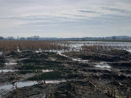
Flood water inundation on peaty soils leading to un-harvested crops
Peat mapping
A new England Peat Map was published by Natural England in May 2025. Published Peat Maps are important as they will influence the Local Nature Recovery Strategy. The Local Nature Recovery Strategy (LNRS) indicates what might be the highest priority opportunities in a given location. Farmers are not obligated to carry out the actions shown in the LNRS. However, these areas highlight where action could make a real difference — and it’s expected that government and local organisations will support efforts in these places through funding, advice, and other opportunities. It is hoped that the strategy and map inspire voluntary action and collaboration to help nature thrive.
There are several differences between this new peat map and historical peaty soils maps. In addition, through knowledge gained from the workshops with local farmers, these maps also differ from the reports of peat presence mapped by those with knowledge and experience of local ground conditions. The project will be supporting efforts to remedy the errors in the local peat mapping.
Landscape scale peatland study
The project is looking at the potential for peatland restoration within the River Perry and its neighbouring catchments. To be able to identify opportunities for sustainable peatland management or restoration, and establish how this work could be undertaken on a local and landscape scale. A greater understanding of the ecological, hydrological and hydrogeological functioning of the peatland within this project area is required.
meadow area proposed for creation of water attenuation features
Specialist consultants Rigare Ltd, whom provide services and advice on the subjects of peatland and wetland ecohydrology and hydrogeology, have been employed to undertake research that begins to answer these questions. In addition, with the support of the River Severn Partnership Advanced Wireless Innovation Region, a network of remote water level sensors will be deployed within peatland environments across the catchment. Data and conclusions from the research when complete will be anonymised and will be shared with the local farming community and with colleagues working in peatland research. The work here and the insights gained will be utilised to influence the Severn Valley Water Management Scheme, in particular its recommendations in respect of peatland soils in the upper Severn.
of the new Peat map (The map is published by Natural England (https://england-peat-map-portal-ncea.hub.arcgis.com/)
Development of a Marches Peat Partnership
Peatlands have a key role to play in nature’s recovery, and many local businesses, organisations, charities, and Universities have an interest in peatland restoration and management, sustainable land use, farmed peatland, and the environmental services provided by peat across the Marches region. Lots of projects, important work and research in this field is already being undertaken locally. The Perry and Peatland Demonstrator Project is supporting Shropshire Wildlife Trust to form a Marches Peat Partnership to bring these groups together to share knowledge and skills related to peatland, and foster collaborative working between stakeholders across the region.
Wet
Section
Example of installed monitoring equipment in a field ditch
Depave – Oswestry Demonstrator Project
Introduction
Flooding in the settlements, villages and towns of the upper Severn can endanger life, damage property, cause disruption and impact health and businesses. Traditional drainage networks can be overwhelmed and the hard surfacing, tarmac and concrete found in the places we live can make the problems worse. By increasing the ability for our surroundings to infiltrate and absorb rainfall, to tackle local flooding 'wet-spots' we can make the places we live in more flood proof and resilient.
The Oswestry Depave projects aims to show how we can create more flood resilient urban spaces. Oswestry is a busy and vibrant border town but like others suffers from spot flooding. Oswestry lies within the catchments of two Shropshire rivers, the Morda which rises in the Berwyn Hills in Wales and the Perry which starts to the north of town though the Common Brook a tributary of this river starts somewhere under the town. Much of the drainage under the town is Victorian expanding out from
the old walled town centre. Like other towns there are opportunities around the town where changes could be made to improve drainage and create more green spaces too. The Oswestry Depave project is led by Shropshire Wildlife Trust, their Landscape Recovery team have a long track record in bringing nature-based solutions to local communities to address health, wellbeing, water quality or in this case flood resilience.
Our urban places are complex and in making changes to how they work to improve flood resilience involves detailed investigation, consultation and collaboration. The Oswestry Depave project is working closely with Oswestry Town Council, numerous community organisations and individuals to understand the opportunities and design them together. All of this work will be captured and used to understand how other communities in the upper Severn could also enhance their flood resilience through nature-based solutions.
Investigating the opportunities
Oswestry Depave have been exploring the town, looking at places where there is potential to change surfaces from sealed tarmac, concrete slabs or other impermeable areas to permeable materials, soil, gravels, new planting beds or tree pits. Wet-spots around Oswestry have been identified and used to highlight target areas for potential Depave features.
A complete dataset has been compiled with information on the ground type, utilities, protected sites and land ownership included using Geographic Information Systems [GIS] mapping. Now the remote mapping has been done the team have been out in the town taking a closer look at the opportunities the mapping has indicated to see which ones can be actually done. The most effective features will be designed according to the needs of the area.
The project aims to include a variety of features such as rain gardens, swales [shallow drainage ditches], grassed highway verges and rainwater harvesting items such as water butts throughout several locations in Oswestry. These will be installed by experienced contractors. Though each location will offer a tiny benefit in reducing the rainfall load on the local drains or highways, the cumulative effect of many changes can make a positive difference. The team will also be looking upstream of the town centre, out into the surrounding countryside to see if there are opportunities to slow the flow but without impacting food production and making the flood resilient benefits felt more widely.
Oswestry Depave Aims and objectives
The Project will provide evidence and learning that can help other places in the upper Severn to be more flood resilient. The project aims to:
• Create 2 hectares of new or improved habitat by creating new features such as rain gardens and other natural flood management interventions. This will be achieved by identifying opportunities to improve permeability of ground surface to absorb stormwater and by enhancing how green spaces can help with managing peak rainfall.
• Support local communities who are impacted by flooding and those actively involved in the green spaces of Oswestry. The project team are working to support and enable access to funding opportunities, assist in the development of project ideas, promote inclusivity and ensure Depave is rooted in the interests of the local community.
• Produce case studies, technical information and a final report to guide and inspire other communities to look at how they could transform their roads, streets, building layouts and green spaces to support better flood resilience.
The project will deliver these key benefits:
• Improved flood risk resilience in urban Oswestry.
• Increased biodiversity and environmental enhancement through the creation of green spaces.
• Positive carbon benefits and air quality improvements through the creation of urban green infrastructure.
• Increased and enhanced engagement with the local community and landowners.
• Development of Depave research to support future community flood resilience in the upper Severn.
Attingham Park Demonstrator Project
Introduction
Situated on the edge of the Shropshire Plain, the 1600 hectare National Trust Attingham Estate is bisected by two rivers, the Tern and Severn, the confluence of which is on the estate. Beyond the Grade II Registered Park and Garden, the majority of the estate consists of tenanted farmland, and a scattering of in-hand woodland. This fertile lowland landscape has suffered from habitat loss and fragmentation and substantial land draining during the 20th century due to agricultural intensification.
The National Trust (NT) has embarked on delivery of a bold 10-year vision for landscape-scale land use change at Attingham to meet its habitat and carbon targets and play its part in responding to global nature and climate crises. At the heart of the vision is a flagship agricultural estate showcasing sustainable arable and mixed farming that delivers healthy soils, clean water, climate change resilience and thriving wildlife. This vision will be delivered in partnership with NT tenants and engage local people to connect with nature by widening access and participation in nature recovery.
Aims and objectives
The Demonstrator project at Attingham aims to explore how multiple farm tenants on a large estate can be worked with to deliver land use changes, nature-based solutions and the storage and attenuation of water to provide insights into the future roll-out of the Severn Valley Water Management Scheme. With the support of the Demonstrator project, NT will be able to kickstart the transformation of the estate and accelerate delivery of the Attingham vision for nature recovery.
Specifically, the project is supporting the design, facilitation and delivery of natural flood management opportunities in collaboration with Attingham tenant farmers. It is anticipated that wider environmental enhancement in the future will be unlocked through the Demonstrator project.
There are four main areas of work that the Demonstrator project team at Attingham are focused on:
• Tenant farmer facilitation, engagement and support activities
• Survey, design work and consents needed to develop identified opportunities into deliverable projects
• Delivery of a number of natural flood management interventions
• Engagement with people to encourage them to connect with nature
Tenant farmer facilitation, engagement and support
Attingham Estate has six farm tenants managing 1400ha, who run mixed farming systems of arable and livestock for meat production. They hold a mixture of agri-environment schemes - Higher-Level Stewardship, Countryside Stewardship and Sustainable Farming Initiative. NT has shared the 10-year nature recovery vision with the tenants and has embarked on a journey to encourage more naturefriendly farming across the estate and to enable delivery of natural flood management. Activities include:
• Soil testing and habitat surveys
• Inform location of interventions but also the feasibility of land use change, for example, to restore species rich grassland.
• Peer-to-peer events
• Farm walks on NT Attingham and NT Dudmaston Estate to help build understanding of what naturefriendly farming is in practice and share perspectives of farmers who are already implementing land use change.
• Support to enter Agri-environment schemes
• External independent reports commissioned for each tenant to investigate the way that a transition to nature-friendly farming and delivery of nature-based solutions can be monetised and explain impacts of proposed changes on current farming practices.
• Development of Countryside Stewardship Higher Tier (CSHT) applications Engagement with Natural England and liaison with two tenants who have been invited to apply for CSHT in 2025. Collaboratively developing a scheme that fits with the farm business and delivery of NT Attingham vision and SVWMS demonstrator project.
• Quarterly newsletter to share forthcoming NT and partner events, share findings from surveys, other estate news.
• Species surveys – birds, butterflies, bats, saproxylic invertebrates, reptiles, harvest mouse. These have been undertaken to demonstrate where land use change and nature friendly farming is already making an impact and benefiting species. The surveys also indicate where there is potential for expansion of good practice on individual farms to protect existing species populations.
Survey highlights
• Winter birds - Flock of 65 lapwing, green sandpipers and snipe at a few locations and woodcock
• Birds using river corridor: Shelduck, goosander and kingfisher and cormorants
• Red-listed bird species, grey partridge, breeding on the estate. Once common in lowland farmland, such as Attingham, it has seen dramatic declines in its population (92% over the last 60 years).
• Utilising the latest technology combined with more traditional approaches we were able to confirm that Attingham plays host to the Barbastelle bat. Very few breeding sites are currently known in the UK and they prefer pastoral landscapes with deciduous woodland, wet meadows and waterbodies so the work we intend to deliver through the project should directly benefit this species.
Feasibility, survey and design of naturebased solutions
Following on from an Opportunity Appraisal Report produced by Arup in 2023, the Attingham Demonstrator project team has been conducting additional feasibility, surveying and ground-truthing the report’s recommendations for nature-based solutions. The following activities have been completed using a combination of National Trust staff, volunteers and external consultants.
• Hedgerows - Surveying the condition of hedgerows to identify where replacement planting is required to fill gaps.
• Leaky woody debris barriers - Design work has been completed on potential locations for installation of woody barriers in ditches and an Ordinary Watercourse Consent has been secured from Shropshire Council.
• Ponds - Pond surveys to assess habitat suitability and collect eDNA samples for Great-crested newt, this helped attract additional funding via Shropshire Wildlife Trust.
• Wetland creation feasibility and design work – six locations across the Estate might have opportunities to create/restore wetland or fen habitat, re-wiggle channels/ditches, create scrapes or restore the hydrology of parkland.
• Review of Attingham Park Conservation Management Plan - This will inform how Attingham’s Registered Parkland is managed in light of the maturity of the landscape and environmental challenges, such as climate change and nature depletion.
• Woodland creation - A plan for creating 28ha woodland at Uckington and Wheathill Farms has been informed by geophysical survey undertaken across the Attingham Estate to identify high, medium and low sensitivity locations for tree planting. Other factors taken into account in the location of the proposed planting scheme were existing biodiversity interest, utilities such as power lines and planned development. These woodlands will provide carbon sequestration, improve soil health and infiltration (reducing run-off), produce outstanding new habitat for wildlife, and provide a sanctuary for people to connect with nature and spend time outdoors with the commensurate health and wellbeing benefits that will deliver.
Hedges, ponds and leaky barriers
After considerable effort planning and securing permissions the number of new features is increasing steadily. Last winter 2024-25 the project team with volunteers planted 68m of hedgerow at Lower Betton farm. This winter works will commence across the Estate on more hedges, pond restorations and the placement of large woody barriers to slow flows in the many small ditches and streams across the NT holding.
Connecting with nature
If we want our work at Attingham to be sustainable we need to involve more people in caring for and protecting the landscape and all the nature that calls it home.
• Volunteer recruitment and engagement - Recruited and trained 29 active volunteers and created new volunteer roles to attract a broader range of people to help with wildlife surveying, water quality testing, hedge surveying and planting and river surveying. These volunteers have generously provided nearly 400 hours of precious time in just over a year to support the project.
Lessons learned – challenges and successes
Since the project started the NT team have worked very hard to get their planning, early survey and design work complete so they can move ahead with actual practical works. The project has not only been asked to create numerous new features in the landscape but also find out how easy, or maybe how hard it is to work through things like the permitting process. The team have been capturing and noting the challenges of doing the work so that they can pass on their learning via the Severn Valley Water Management Scheme and ease the way for others. Some of the learning so far is below:
• The project has provided an amazing opportunity to build capability of NT staff and volunteers in the delivery of nature recovery work.
• The maintenance and management of NatureBased Solutions needs to be underpinned by a stable regulatory and financial environment that incentivises and enables landowners and tenants to ensure the long-term viability of land use change and natural flood management interventions. Currently there is significant uncertainty around agri-environment funding schemes and a lack of alignment between them.
• Most of the legal/regulatory framework that governs the consenting process is overly complex and poorly understood for the types of interventions proposed to deliver nature-based solutions. This adds delays, additional costs and resource for delivering projects outside of the control of the applicant and in so doing does not achieve the best value for money for funders.
• Being part of an estate with half a million visitors offers a golden opportunity to engage a large number of people with nature recovery work and build people’s connection to nature. However, it also means that the nature recovery communications and engagement has to fit in with an existing programme of activity encompassing all the other aspects of Attingham Park. Similarly, we have been a victim of our own success with the project attracting substantial attention internally and externally eg. Filming / press opportunities, site visits which is great for giving the project a high profile and garnering support, however, can be resource heavy and time consuming for project staff to accommodate.
• Through the network of Demonstrator projects, it’s been possible for the team to share knowledge and experience of different aspects of natural flood management interventions, discover different ways of solving problems and gain access to trusted contractors.
• In the cases where NT tenants are in tenancy agreements covered by the Agricultural Holdings Act 1986 and where the tenant is not inclined to implement Nature-Based Solutions / nature-friendly farming, there are limited options available to the landowner to negotiate a change to this position. The project team are spending time to understand where this might leave both parties as we face challenging climatic, economic and ecological conditions in future years.
• Constraints and opportunities - Various constraints exist which limit the period of time to undertake capital delivery, for instance, avoiding seasons when sensitive wildlife is breeding. When you combine this with unpredictable and hugely variable weather conditions it significantly limits the window for undertaking works at a favourable time. The project team are investigating how best to programme a wide range of beneficial works in the optimum way.
Centre for Living with Climate Change (CLiCC) Demonstrator Project
Introduction
Our weather patterns are changing, flood and drought periods are increasing in severity and getting more extreme. These are not one-off events but a climatic trend of change for which we need to adapt and prepare. To help us cope with more variable weather we need people with skills and knowledge to defend and look after our flood impacted communities, nurture water resources and support growth in our region. The Centre for Living with Climate Change Demonstrator or CLiCC Project led by The University of Chester is looking to help us understand what types of expertise and job creation is needed to keep pace with climate change in the upper Severn.
The CLiCC research team will be helping the Marches Forward Partnership, a collaboration between Powys Council, Shropshire Council, Herefordshire Council and Monmouthshire Council to generate regional employment and skills growth in the cross-border Marches region.
The CLiCC Demonstrator project aims to improve water management in the River Severn Basin by providing community co-designed skills resources and identifying employment needs thereby bringing people together to address water management and climate change challenges. It asks importantly what are the characteristics of the water resources management skills gap, and what capacity and resource needs to be developed in the area? The project team will also find out whether current resources such as innovation centres are sufficient to meet the future needs or whether virtual resources may help.
This is a complex task with many small steps, importantly each of these steps are designed by the people of Powys and Shropshire, using Participatory Action Research (PAR). PAR is a collaborative research approach that actively involves participants in the research process to address social issues and create positive change, via action. It doesn’t relegate knowledge and research to academic ‘experts’. Each stage results in a positive, actionable result that can be reviewed. The problem addressed can evolve throughout as solutions appear, resulting in an adaptable and resilient project.
Skills: It was recently announced that the water sector will recruit 50,000 people by 2030, with ministers signing the Water Skills Pledge to guarantee support for workers. This includes recruiting 5,000 apprentices over the next five years and launching a new £25k annual Watershot Research Prize. These initiatives mark important prioritisation of the sector, particularly as the UK Commission for Employment and Skills (UKCES, 2016) reported that more than a third of vacancies in water and related industries between 2011 and 2015 were due to skills shortages. Svilpa (2022) also claimed that 63,000 new hires will be required over the next 5 years, though many reports lack verifiable supporting data
Water resource management is absent from local skills plans in both Mid Wales and the Marches region. The literature indicates a decline in hydrogeology MSc programmes, with a general low awareness in schools and colleges suggested as a reason for low uptake. This runs alongside limited alternate pathways into water resource careers, especially at entry/vocational levels. Competition with other “green” sectors like renewables and agritech for talent is given as one of the recruitment issues faced in engineering. There is also indication that young people leave rural areas due to limited job visibility and socio-economic challenges (e.g. housing). Though these challenges certainly come through, initial results from the interviews suggest that the WRM skills and recruitment landscape may be more nuanced than the literature suggests and the challenges more complicated.
From the literature, workshops and interviews, career groups were identified and condensed in order to provide an overview of the sector. The career groups identified are regulation and policy, engineering and technical, scientific and analytic, communication and management.
So far, qualitative data has been gathered through workshops and semi-structured interviews following standard research procedures to explore the characteristics of the water management skills gap.
• Workshops: 5 workshops were conducted via Teams or in-person
• Semi-Structured Interviews: 18 One-on-one interviews, lasting up to one hour.
This first phase of the project has allowed the team to identify skills groups and some of the job pathways relevant to climate change resilience in the future of the upper Severn.
Innovation Space: In designing an innovation space, it is important to understand how they can benefit us and to undertake a literature review to build a baseline understanding. Recent research identified three conditions for sustainable rural development to tackle the decline; 1) development of new economic activities 2) local entrepreneurship that can establish and expand these new activities; and 3) social capital that can support the entrepreneurship in new activities utilising the social networks provided [Li et al 2019]. These things are all supported by innovation spaces and can help rural areas not only survive but thrive.
Innovation spaces provide a structured platform for fostering these collaborations between stakeholder groups. For example, the Quadruple Helix (QH) model integrating government, industry, academia, and civil society has been effectively employed to design solutions tailored to rural challenges such as agricultural technology or health service access.
Though there is no single "model" for sustainable rural development, the work of innovation spaces, policies and initiatives require community support and engagement.
Interim findings
CLiCC’s skills research to date shows that the real challenge for the sector lies less in recruitment numbers and more in the need for cross-disciplinary skills and clear entry-level pathways into Water resource management careers. Innovation can support this gap by raising awareness and facilitating conversation around skills needed, but only if this is supported by local people. Through Participatory Action Research, CLiCC can help turn community hesitancy around concepts like Innovation into active participation, ensuring that it is understood by and in return understands the local people. Together, these strands of work create the conditions for Powys and Shropshire to attract, develop, and retain the talent and community needed for long-term rural resilience. In doing so, CLiCC has the potential to act as an anchor for inclusive growth, delivering benefits that are both practical and rooted in community needs. While more objectives remain, the first round of skills research has been successful, and though innovation is progressing more slowly, the outcome will justify the investment in people and place.
The CLiCC team will be producing a series of case studies and technical notes to help inform the Severn Valley Water Management Scheme Strategy.
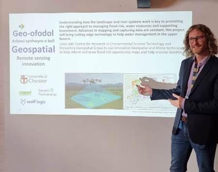
Geospatial Demonstrator Project
Introduction
The Geospatial Demonstrator Project commenced in Spring 2025. Led by the University of Chester in collaboration with Wolf Logic and Severn Partnership and with operational project management from Shropshire Council and steered by EA programme management.
The Geospatial Demonstrator project aims to enhance our understanding of the potential and impact of natural flood management approaches within the Habberley Brook sub-catchment in Shropshire, and to develop methodologies which will allow this work to be scaled up more widely. To achieve this the project will:
• Develop a methodology for identifying optimal Natural Flood Management [NFM] locations using high-resolution geospatial data.
• Quantify the impact of planned Natural Flood Management interventions on surface water flow and storage.
• Co-design a stakeholder-led mobile application for sharing data and insights.
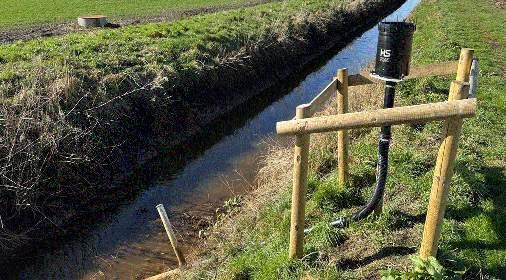
• The project team have been working with landowners and alongside the Rea Brook Demonstrator [Severn Rivers Trust] team to focus efforts on areas in which NFM interventions are known to be planned. Severn Partnership have completed a full 3D laser scan of a focus area covering around 37 hectares, in which a suite of interventions is due for implementation. Real-time rainfall and water level sensors have been installed since September 2025.
Overview of detailed laser scan carried out by Severn Partnership
Data Analysis
Following data collection, geospatial analysis will be undertaken to map the potential for further natural flood management interventions based on landscape characteristics derived from laser scanning and satellite imagery, while quantitative analysis and modelling will be undertaken to evaluate the impacts of NFM measures implemented within the area. This will be led by Dr Andrew Miles from the University of Chester.
Initially the laser scanning data has been converted to 0.1 m digital terrain and digital surface models, 100x more detailed than the 1 m resolution LIDAR currently available through the environment agency and providing much more detail below the canopy and vegetation. This hundred-fold increase in resolution allows us to move beyond mapping major channels to identifying subtle but critical surface flow pathways, ditches, and micro-topography that are completely invisible in existing datasets. This is the key to unlocking a true understanding of where small-scale interventions will have the biggest impact.
This approach allows for detailed mapping of surface flow pathways and initial analysis has used this to model potential storage locations which could be created by implementing leaky dams or bunds. Future analysis will consider a much wider range of NFM interventions, such as cross-slope hedge planting, floodplain reconnection, soil management improvements (e.g., reducing compaction), and gully blocking.
The use of high resolution (3m) satellite imagery at frequent intervals will provide an understanding of patterns of surface wetness and vegetation health, which can further feed into identification of sites suitable for NFM measures as well as wider measures of natural capital.
The installation of the in-situ sensors will give us a highly detailed understanding of how the catchment responds to storms and other rainfall events. The sensors' primary role will be to provide essential real-world data for the calibration and validation of the hydrological analysis developed from the high-resolution laser scanning.
Any rainfall events captured during this short preintervention period will allow the team to validate this analysis, ensuring they accurately reflect the catchment's true response. After the NFM measures are in place, the analysis will then compare the new, observed data from the sensors against the pre-intervention scenario. This robust analytical method allows us to still quantify the impact of the interventions—such as a reduction in flood peaks or a delay in water flow—and provide tangible evidence of NFM performance. These insights will be crucial for sharing with landowners and stakeholders through the app being developed by Wolf Logic.
Stakeholder Engagement and App Development
Alongside the analytical element of the project, the demonstrator will also engage local stakeholders to understand their needs and aspirations in terms of understanding NFM opportunities and catchment response. This element of the project will be led by Associate Prof Namrata Bhattacharya-Mis from the University of Chester. Any dataset is only as useful as it is used, so by understanding the needs of various stakeholders it can be ensured that the data is filtered and focused on an appropriate level to provide the information needed in a form that is readily understandable. This may include insights into potential NFM opportunities for landowners and advanced warning of potential flood risks for local residents, as well as the opportunity for citizen scientists to contribute additional data and observations to the project.
We will connect with the community through a series of public events and focus groups. The insights generated from this stakeholder research are vital, as they will directly inform both the project's data analysis and the app's development by Wolf Logic. This ensures the final product is a useful portal targeted specifically to the needs of its users.
The app itself is designed to be a user-friendly hub, and will feature interactive NFM Maps, showing the outputs of our data analysis, highlighting potential opportunities for Natural Flood Management interventions. Live catchment data, displaying real-time information from sensors on river and rainfall levels to provide advanced warning of potential flood risks and community contributions, creating opportunities for citizen scientists and local groups to contribute their own valuable data and observations through uploads and form submissions.
Long-term Impacts and Scaling Up
This project is designed to deliver both immediate, tangible results for the Habberley Brook catchment and a lasting framework that can be scaled up for wider application.
Key Project Deliverables
By its conclusion, the project will produce a suite of valuable outputs:
• A High-Resolution "Digital Twin": A foundational dataset for the 37-hectare focus area, including the 0.1m resolution Digital Terrain and Surface Models, which are 100 times more detailed than existing LIDAR data.
• Improved hydrological understanding: A detailed evaluation of the potential impact of NFM interventions.
• NFM Opportunity Maps: Geospatial products that clearly identify the most promising locations for future NFM work based on the detailed landscape analysis.
• Stakeholder Engagement App: A user-friendly mobile app, co-developed with local stakeholders and built by Wolf Logic, which is being designed for long-term, low-cost maintenance beyond the project's initial lifespan.
Long-term Impact & Scaling Up
The project's true legacy will be its contribution to sustainable water management across the entire Severn Valley and beyond:
• Methodological Blueprint: The primary long-term outcome is a tested and refined workflow. This blueprint will provide a clear methodology for other authorities and groups to apply the same highresolution analysis to other catchments far more quickly and cost-effectively.
• Evidence for Investment: By quantifying the impact of NFM measures, the project will provide the hard evidence needed to justify future investment in natural flood management schemes and enhance natural capital
• Enhanced Stakeholder Buy-in: The app and engagement process will create a powerful new way to communicate with landowners and residents, showing them the tangible benefits of NFM on their land and helping to build trust and encourage future participation.
Explaining the outline and aims of the project
Marches Future Farming
Demonstrator Project
Introduction
The Upper Severn Valley is a working rural landscape supporting highly productive farming systems, thriving communities, and a rich natural environment. However, it is also a region where the impacts of climate change are increasingly visible and in recent years, the catchment has experienced repeated flooding events followed by prolonged dry spells. For farming communities, these extremes result in crop damage, increased costs for feed and shelter, soil erosion, damaged infrastructure, and disruptions to grazing patterns. For the wider community, they bring greater flood risks, water scarcity, reduced water quality, and pressure on biodiversity.
Meanwhile, farmers are adapting to fundamental changes in agricultural policy and markets. These environmental pressures coincide with significant shifts in farming policy and markets, creating a double challenge for farm businesses. It is here that interest in natural flood management (NFM) and green finance is growing, although farmers remain cautious. Years of short-term projects, conflicting advice, and “one size fits all” schemes have created fatigue and mistrust. Many feel under pressure from all sides. The Marches Future Farming Demonstrator is designed to respond to these challenges. It will bring together farmers, communities, researchers, and policymakers to test how farming businesses can adapt to a changing climate while continuing to operate sustainably and safeguard the environment.
What the Project Will Do
The project will act as a live demonstrator (trial) exploring how farm businesses in the Upper Severn can adapt and thrive. The goals of the project are to:
• Work with farmers – drawing on their real-world experiences, challenges, and future ambitions.
• Test practical measures – trialling soil, water, and land management practices on working farms.
• Generate evidence – addressing knowledge gaps on resilience and natural flood management, and how these relate to farming businesses and the farming economy.
• Connect communities – linking farmers, advisers, and researchers across England and Wales.
• Look to the future – exploring how emerging policies and new markets can support rural communities and resilience (through an environmental platform).
• Support the Well-being of Future Generations (Wales) Act – through collaboration, integration, involvement, the long-term and prevention. It will also support potential benefits across borders and downstream.
Project Partners
The University of Chester is leading the project in collaboration with a strong team of partners:
• Hannah Fraser Consulting (Shropshire Water Forum) – providing hydrogeological expertise and leading groundwater recharge trials
• Faulkner and Mayne Sustainable Agriculture (Sarah Faulkner and Kate Mayne) – experienced facilitators of farmer groups, with deep knowledge of agricultural policy and practical farm systems
• Maesmawr Farmers Group (Heather Mitchell) – an established Award winning Welsh cluster group with a strong record in soil health, biodiversity, and water management. Will ensure the Welsh farming voice is heard.
• Richard Maryniak – of Aqualate Consulting is a Defra Test and Trials lead, a leadership committee member of the Marches Environmental Investment Platform and Chair of the Upper Severn CaBA. He also farms as part of the Aqualate Estate family, located within a Site of Special Scientific Interest (SSSI) and a Ramsar conservation landscape.
Planned Activities
The project will be delivered through a number of interconnected areas of activity.
• The project supports the building of capacity in the Upper Severn Catchment Partnership and will work with the members to create a proactive hub to support collaboration. They will also conduct a manual mapping exercise into live projects and potential projects in the Upper Severn Catchment.
• Collaborate with other partner organisations in the development of a green finance mechanism (Marches Environmental Investment Platform)
• The Shropshire Water Forum will be running a series of knowledge sharing events to support the regional community of water management professionals, that is not only established specialists but also new and young entrants to the sector.
• The team will listen and connect with farmers, advisers, local authorities, and communities to assess how farmer engagement in the Severn Valley Water Management Scheme can be shaped. The objective being to influence how future funding is approached and structured. That is in a way that meets farming needs as well as flood and drought resilience. The team will assess environmental schemes such as Sustainable Farming Initiative in England and the Sustainable Farming Scheme in Wales to inform the emerging Severn Valley Water Management Scheme strategy as to their fit and future adaptation.
Marches Future Farming – objectives
The project team have set out to research, draft and publish Marches Future Farming Report - a detailed, cross-border account of farming conditions and opportunities. The report will contain:
• Robust evidence on how land management practices affect water and resilience
• Farmer-led case studies showcasing sustainable climate-smart practices
The team also aim to support the growth of stronger networks of farmers and advisers working collaboratively cross border. Also they hope to identify additional practical pathways for farmers to access environmental markets and green finance on terms that support their businesses.

Keep updated by checking out our website severnvalleywatermanagementscheme.commonplace.is
If you have any questions about the Scheme, you can contact us at SVWMS@environment-agency.gov.uk