RULES OF THE TRAIL
Do your part to preserve and enhance by observing the following rules of the trail. These rules are recognized around the world as the standard code of conduct for trail users.
1. Ride On Open Trails Only Respect trail and road closures (ask if uncertain); avoid trespassing on private land; obtain permits or other authorization as may be required. The way you use the trails will influence trail management decisions and policies.

2. Leave no trace. Be sensitive to the dirt beneath you. Recognize different types of soils and trail construction. Wet and muddy trails are more vulnerable to damage.This also means staying on existing trails and not creating new ones. Don’t cut switchbacks. Be sure to pack out at least as much as you pack in.
3. Control your vehicle. Inattention for even a second can cause problems. Obey all speed regulations, guidelines and recommendations.
TRAIL SAFETY TIPS
• Always tell someone when and where you are going.
• Bring maps, along with a compass or GPS device.
• Wear appropriate footwear and clothing, and bring sufficient food and water.
• Carry identification (including name, phone number, and pertinent medical information).
• Bring a portable phone or other communication device, along with pertinent phone numbers.
STOP INVASIVE SPECIES IN YOUR TRACKS
• REMOVE plants, animals and mud from bikes, boots, gear, pets and vehicles.

• CLEAN your gear before entering & leaving the recreation site using BOOT BRUSH provided.

• STAY on designated trails.
JANUARY THRU DECEMBER


Trails on Crown Lands are within HUNTING AREAS
• All persons using these trails do so at their own risk
• All persons should wear highly visable clothing
• All persons should keep to the main trails
• Make noise when approaching a curve or uphill climb
• Avoid animal carcasses
• Make dogs visible
4. Always yield to others on the trail. Let fellow trail users know you’re coming. A friendly greeting or bell is considerate and works well; don’t startle others. Show your respect when passing, by slowing to a walking pace or even stopping. Anticipate other trail users around corners or in blind spots.Yielding means slow down, establish communication, be prepared to stop and pass safely.
5. Never scare animals. All animals are startled by an unannounced approach, a sudden movement, or a loud noise. This can be dangerous for you, others, and the animals. Give animals extra room and time to adjust to you. When passing horses use special care and follow directions from the horseback riders (ask if uncertain). Running cattle and disturbing wildlife is a serious offense. Leave gates as you found them, or as marked.
6. Plan ahead. Know your equipment, your abilities, and the area in which you are traveling. Prepare accordingly. Be selfsufficient at all times, keep your equipment in good repair, and carry necessary supplies for changes in weather or other conditions.
Use at your own risk.
• Many trails are NOT MAINTAINED – USE AT YOUR OWN RISK
• Many trails are accessible by ACTIVE or DEACTIVATED LOGGING ROADS requiring 4WD or high clearance vehicles. 2-way radio communication is recommended. Be aware these roads may be closed at certain times.
• PETS! Keep on a leash and clean up after them.
• WATCH FOR WILDLIFE and avoid areas showing recent signs of black bears, grizzly bears, and cougars.
• BEFORE heading out, check with local contacts to make sure the trails and roads are safe.
• BACK-COUNTRY: Check conditions at avalanche.ca
5 Get maps & full trail details at shuswaptrails.com
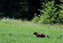
BEWARE! YOU ARE IN BEAR COUNTRY
The way you hike, bike, or ride today shapes the trail access for tomorrow.
- prepared by the International Mountain Bicycling Association
The Columbia Shuswap Regional District assumes no responsibility for the safety of any persons, animals or equipment when using the trails listed in this guide.
TM
SAFETY
TRAIL
Small City, BIG Adventure
Welcome to Salmon Arm! Our City is located along the shores of the breathtaking Shuswap Lake, within the Secwépemc Nation Traditional Territory. A fast growing community, Salmon Arm is a "Small City with Big Ideas."


Our downtown core is chock-full of unique boutiques, artisitic endeavours, thoughtful gathering spaces and memorable experiences. And yet, just steps away, is a bird sanctuary, a robust network of walking paths and North America's longest curved inland wooden wharf. Salmon Arm offers authentic community, varied activity, real prosperity, and true opportunity.
Tag us! #sabigideas #smallcitybigadventure
Ale
bcaletrail.ca/ale-trails/southern-interior
Trail Taste Trail
shuswaptourism.ca
BC Bird Trail
Public Art Walk
6
shuswaptourism.ca
Visit travelsalmonarm.ca to find your next adventure!
more trails...
bcbirdtrail.ca salmonarmdowntown.com/walking-loops
Explore
Salmon Arm & Area
Sxwesméllp means “soopolallie bush” in Secwepemctsín (Secwépemc language) and refers to the area around the confluence of the Salmon River and the southern end of Shuswap Lake within Secwépemcúĺecw (territory).
Salmon Arm – the area’s largest community – sits in this rolling, fertile valley boasting impressive, thickly forested mountains rising in all directions. It is a splendorous natural setting for a city that retains a rich small-town charm.

1. Around-the-Hill LARCH HILLS
DISTANCE: 6.5 km loop
DURATION: 2+ Hours
ELEVATION GAIN: Moderate
A quiet, contemplative encounter with one of the few remaining old growth cedar stands in the Larch Hills. (No bikes or horses.) The full Around-the-Hill Greenway Loop links Hemlock Glide, Afterthought, White Pine Walk and the upper section of the Greenway non-track set backcountry ski trail with the Ida View section of the Larch Hills Traverse.
ACCESS: from the Larch Hills Nordic Trails’ North Hub on the Larch Hills Forestry Rd west of Cec’s Cabin via White Pine Walk, or from the Rubberhead Muffin Top trailhead via Half Baked, or alternately as part
of an extended trip from the South Canoe Trailhead via the Ida View Trail on the Larch Hills Traverse.
Wilderness backcountry trail: be prepared. Watch for bears. Stay on the designated trail to protect sensitive habitat.
2. BADGER PARK
DISTANCE: 0.7 m
DURATION: Short
ELEVATION GAIN: Minimal
Short trails lead through fir trees to a hidden basketball court tucked behind the houses in this neighbourhood park. A good shortcut for dogwalking to sidestep the busier 20th Ave.
ACCESS: There are four trail access points to Badger Park.
7 Get maps & full trail details at shuswaptrails.com
NORTH
SALMON ARM & AREA
3. CANOE BALL DIAMOND & BEACH CONNECTOR
DISTANCE: 1.4 km store to beach
DURATION: 0.25 Hour
ELEVATION GAIN: Minimal
Gravel capped trail around the Canoe ball diamonds to a solar powered pedestrian light creates a direct (and very pleasant) walking/biking route between the Canoe Store and Seniors Centre to Canoe Beach, without having to walk in traffic along Canoe Beach Dr. Add a stroll out to the wharf north of Canoe Store.
ACCESS: Start at the Canoe Store on the corner of 50 St NE and Canoe Beach Dr NE in Salmon Arm, the Park Hill Trailheads, or the Canoe Beach parking area.
4. CANOE BEACH
DISTANCE: 500 m (one-way)
DURATION: 0.25 Hour
ELEVATION GAIN: Minimal
Sandy beach and spectacular views across Salmon Arm Bay to Bastion Mountain make this a popular summer destination for swimming, picnics and a short stroll along the paved beach path. A dedicated dog beach is located at the far east end of the beach path. Also links to the Park Hill Trail System and the Shuswap Paddle Centre. shuswappaddleandrow.ca
ACCESS: East of Salmon Arm on the Trans Canada Hwy turn west at Canoe
onto 50th St NE. Proceed toward the lake. At the stop sign just before the tracks turn left onto Canoe Beach Dr and turn right at the cross walk by the ball diamonds.
5. COYOTE PARK
DISTANCE: 1 - 3 km (loops)
DURATION: 0.5 - 1 Hour
ELEVATION GAIN: Moderate
A variety of short loops in a beautiful forest with glimpses west towards Salmon Arm Bay. A trail linking to the Raven subdivision can create a longer walk or mountain bike ride connecting the foreshore trail to downtown Salmon Arm.
ACCESS: From downtown Salmon Arm, follow Lakeshore Rd which turns into 20 Ave NE at the top of the hill. Turn left back onto Lakeshore Rd and follow for 3 kms until you reach 54 Ave NE. Watch for sign and parking on the left.
6. Necalclánk (FLY HILLS) ROTARY SKYVIEW LOOKOUT
DISTANCE: 0.5+ km (various)
DURATION: 0.5 - 2+ Hours
ELEVATION GAIN: Moderate
A short walk to a viewpoint provides outstanding views of Salmon Arm, Shuswap Lake and Salmon River Valley, wildflowers, birds and the extent of the 1998 fires across on Kle7scén (Mt Ida). A loop is possible back to the parking area.

Necalclánk (Chase eastern dialect) or Nclcahl (Splatsin dialect) means “Steep Hillside” in Secwepemctsín.
ACCESS: Via Fly Hills FSR #170 west of Salmon Arm off Salmon River Rd. After climbing the FSR steeply through six switchbacks for approx 7.5 kms watch for the parking landing on your left.
Watch for oncoming forestry traffic and recreational ATV and motorcycle use. Winter use is managed by the Snowblazers Snowmobile Club and limited to snowmobile traffic only.
7. FORESHORE TRAIL
DISTANCE: 4 km (one-way)
DURATION: 1+ Hours (one-way)
ELEVATION GAIN: Minimal
Boardwalk and viewing platforms for excellent bird watching in one of the province’s premier migratory estuaries, plus a side trail to Christmas Island for views of the bay and waterfowl. Be sure to review the dog access rules and monitoring program signs and help to protect this very special area. Part of the Salmon Arm Nature Bay Trails. sabnes.org
ACCESS: Trailhead is at the east end of Harbourfront Dr in downtown Salmon Arm, on the north side of the Railroad tracks. Alternate route starts in Raven subdivision at the foot of 47 Ave.
This is protected sensitive riparian habitat. Please stay on the designated trail, and respect seasonal closures due to nesting and flooding. Dogs are only allowed on the main trail and must be kept on a short leash (max. 2 meters) at all times to prevent impact to the surrounding nesting habitat. Dogs are not allowed off the main trail on any of the viewing decks or Christmas Island. Dogs not allowed on the main trail during the critical nesting season between May 1 and June 30 each year.
8 shuswaptourism.ca
#7 Foreshore Trail SALMON ARM & AREA
SHUSWAP TRAIL ALLIANCE PHOTO
8. gARdom lake TRAILS
DISTANCE: 2.8 km (various)
DURATION: Various
ELEVATION GAIN: Minimal
A lovely place to picnic and swim. Interpretive trail has old growth trees, wildflowers, bird viewing, and painted turtles. There are trails on the two islands in the lake, along the shoreline, and across the road from the park.
ACCESS: East of Salmon Arm on Hwy 1, turn south on Hwy 97B, drive approx 15.8 km to Gardom Lake Rd, and then turn right. Travel 3.5 km and turn left onto Park Rd. Proceed 700 m to the entrance and parking area on the left. Additional parking for launching canoes and kayaks can be found by driving a little further south on Park Rd, turning east on Musgrave Rd to the CSRD Parks hand launch site.
In consideration of local bird and wildlife, no pets allowed.
9. LARCH HILLS
DISTANCE: 170 km (various)
DURATION: 0.5 - 3+ Hours (various)
ELEVATION GAIN: Moderate to Long -
various with route
The region’s premier nordic ski area provides 170 km of ski trails (57 km trackset, and 6.5 km lit for night
skiing), over 17 km of snowshoe trails, and is a great destination for hiking, mountain bikes and equestrian riding spring through fall.


Multiple trail options include visits to old growth forest, an interpretative nature loop surrounding one of the area’s many wetland fens, spectacular views over the surrounding valleys on the higher trails, and visits to the South Hub, and Cec’s Cabin just south of Larch Lake. Several longdistance cross-country options for mountain bikers and well-prepared skiers can link routes from the nordic centre. These include connections with Salmon Arm on Metford FSR, the Rubberhead Mountain Bike Network and 110 FSR, or the Larch Hills Traverse to Sicamous.
During the summer a beautiful 4 km forest hiking loop through parts of the Upper Violet Provincial Park links the Moose Trail, Lost in the Woods, and Interpretive Loop snowshoe trails starting at the main chalet. Nonwinter trail stiles have been added to protect the Upper Violet Provincial Park protected area. skilarchhills.ca
ACCESS: Turn east onto Grandview Bench Rd off Hwy 97B east of Salmon Arm. (Watch for the Larch Hills Ski Area sign.) After approx 5.4 km turn north onto Edgar Rd. After another 3 km keep left at the
junction and travel another 3 km to the Larch Hills ski area parking lot.
Alternate access: Turn north onto Grandview Bench Rd off Hwy 97A west of Grindrod. After approx 3.2 km turn north onto Edgar Rd. Watch for logging vehicles during non-winter months. Many of the Larch Hills Trails are multi-use. Watch for ATVs. Avoid soft wet areas until the ground dries.
10. LARCH HILLS TRAVERSE
DISTANCE: 40 km (one-way)
DURATION: 4 - 10 Hours (one way) cycle; 11 - 14 Hours back-country ski tour, shorter loop options available.
ELEVATION GAIN: Long
The Larch Hills Traverse was the first section of the wider Shuswap Trail System to be completed, and is still evolving as new single track trail sections get added, and new loop options are created.
It’s an epic 40 km highland crosscountry romp through the forests, fens, and dramatic lake vistas of the Larch Hills, linking the communities of Salmon Arm and Sicamous, as well as linking into the South Canoe Trail System, the Larch Hills Nordic Trail System, the Shuswap Outdoors! backcountry trails, the Rubberhead
9 Get maps & full trail details at shuswaptrails.com
SALMON ARM & AREA
SHUSWAP TRAIL ALLIANCE PHOTO LINDA BUCHANAN PHOTO
#9 Larch Hills
#9 Larch Hills
to
to
Mountain Bike Trail system, the Hyde Mountain Lookout, the Sicamous Greenway trail system, and the Shuswap North Okanagan Rail Trail. Simply put - it’s the backbone connecting a whole lot of good trail karma in the Shuswap.
The traverse is a four-season challenge, with variations in the winter where more obvious lines open up under snow cover. It’s doable in a very long day by mountain bikers or nordic ski tourers. Overnight option — especially for through hikers.
A series of shorter circuit trips can be linked along the extended route. Together they can be collected over time to build a complete traverse. You can reserve overnight stays to the Larch Hills Nordic Society’s main Chalet or Cec’s Cabin. Visit skilarchhills.ca for booking info.
WEST TRAILHEAD ACCESS: at the South Canoe Trailhead east of Salmon Arm at the end of 10th Ave SE (turn east on 10th Ave SE at the crosswalk on Hwy 97B).
EAST TRAILHEAD ACCESS
(Sicamous): See Larch Hills Traverse - Sicamous Trailhead for details. Park at the Visitors Information Centre or wharf in Sicamous and walk or cycle west to the “Welcome to Sicamous” sign 1 km west of the Sicamous Narrows Bridge. The trailhead is 400 m up the short access road.
ALTERNATE SOUTH TRAILHEAD
(Larch Hills): See Larch Hills Nordic Trails access to the main Larch Hills Ski Area parking area. NOTE: Equestrian access is limited at other trailheads. This is the best access for equestrian riders with trailers to park.

Careful preparation, adequate food, water, gear, and knowledge of backcountry travel and navigation are essential. Plan accordingly.
11. LARCH HILLS TRAVERSE - IDA VIEW
DISTANCE: 6 - 16+ km (various)
DURATION: 1 - 6+ Hours (various)
ELEVATION GAIN: Long
The newest addition to the Larch Hills Traverse also serves as an excellent day hike, snowshoe, cross country mountain bike, or equestrian ride from Salmon Arm. It is designed as a shared use trail so watch for horses. The trail climbs through the forested slopes past viewpoints looking toward Kle7scén (meaning funny coloured rock in Secwepemctsín and called Mt. Ida by European settlers) and out over the Sxwesméllp bay area (which means soopolallie bush in Secwepemctsín referring to the area called Salmon Arm Bay by European settlers).
The trail links into the Around-theHill Greenway Loop trail, Larch Hills Nordic Trails North Hub, and the upper Rubberhead trail system creating even more creative long distance trail loop options. Or just go for it and continue on to Sicamous. (See #10 Larch Hills Traverse).

ACCESS: Start at the South Canoe Trailhead crossing the new East Canoe Creek trail bridge. (See South Canoe Trail System).
12. LITTLE MOUNTAIN PARK
DISTANCE: up to 8 km (various)
DURATION: 0.5 - 2 Hours (various)
ELEVATION GAIN: Low - Moderatevarious with route
8 km of wide, smooth forested nature trails appropriate for families, and a variety of figure 8 loop options and difficulty levels, including a short climb to views of Salmon Arm, Salmon Arm Bay, Fly Hills, Kle7scén (Mt Ida), and spring wildflowers along the west facing bluffs.
ACCESS: Three trailheads include the east end of Okanagan Ave off 30 St SE in Salmon Arm, the southwest corner of Little Mountain Fieldhouse parking lot on 30 St SE, or just south of 37 St SE on 10 Ave SE.
13. McGUIRE LAKE PARK
DISTANCE: 0.8 km (around the lake)
DURATION: 0.25 - 0.5 Hour

ELEVATION GAIN: Minimal
In the heart of Salmon Arm, a wheel chair accessible, paved path, picnic tables, and plenty of opportunity for
For detailed maps...
Get a copy of the Shuswap Nordic Map available at local visitor centres, or online at shuswaptourism.ca
10
SALMON ARM
shuswaptourism.ca
& AREA
FINDYOUR STRIDE THE SHUSWAP TRAILS & SHUSWAPTOURISM.CA
South Canoe Kid’s Bike Loop
SHUSWAP TRAIL ALLIANCE PHOTO
to
waterfowl viewing circle this little lake with the city’s trademark fountain. Watch for the painted turtles out soaking up the sun on hot days, and visit the Japanese Friendship Gate, a gift from Inashiki, Japan, Salmon Arm’s sister city.
Extend your walk with a visit to the Marine Peace Park and Nature Bay trails via the pedestrian stairway north of the BDO Dunwoody building, or link east to Turner Creek Trail, the Rec Centre, and Little Mountain Park.
ACCESS: At the east end of Hudson Ave NE in downtown Salmon Arm, north of Hwy 1.
14. KLE7scÉñ (MOUNT IDA) east & west
These trails are currently under review as part of comprehensive stewardship planning led by Secwépemc First Nations leadership. The iconic Kle7scén (meaning funny coloured rock in Secwepemctsín and called Mt. Ida by European settlers) towers above Sxwesméllp (meaning soopolallie bush referring to the area called Salmon Arm Bay by settlers). It is an important cultural and sacred area in Secwepémcúĺecw (territory).
Leadership from the Secwépemc communities are working with provincial land managers, tenure
holders, and local trail stewards to prepare a plan that guides future trails and recreational access, protects sensitive cultural and environmental sites, and engages everyone in taking care of the mountain.
Visit shuswaptrails.com for updates on this important effort of reconciliation.
15. PARK HILL TRAIL SYSTEM
DISTANCE: 5 km (various)
DURATION: 0.5 - 1.5+ Hours
ELEVATION GAIN: Moderate
Park Hill offers trail users a variety of single-track loops for hikers, mountain bikers, and snowshoers on both the west and east side of Park Hill Rd above Canoe Beach. Link to Canoe Beach, the Paddle Centre and boat launch, or the Canoe Ball Diamonds.
In the winter, bring your snowshoes or ice cleats. Once everything’s packed down these make great fat-tire mountain bike loops.
Remember: the Salmon Arm Rowing and Paddle Centre is right at Canoe Beach. Link a Blueway paddle with a Greenway hike! shuswaprowingandpaddling.com
ACCESS: There are four main access points – one in the overflow parking above Canoe Beach just before the bottom of Park Hill Rd in Northeast
Salmon Arm, another halfway up Park Hill Rd at the blue pump house, or start right at the Canoe Beach parking lot (trailhead just across the road), or to the east at the Canoe Ball Diamonds.
16. PILEATED WOODS
DISTANCE: 2.0 km (various)
DURATION: 20 min - 1.0+ Hours
ELEVATION GAIN: Moderate
These trails are a part of Salmon Arm’s growing greenway network maintained by residents who live around the park. Handmade interpretive signs have been created by one of the region’s noted biologists and provide a glimpse into the forest ecology.
Look for the Owls Prowl town connector trail for mountain bikes and walking between Auto Rd near the junction with 10 St SE through to Old Auto Rd at 7 St SE.
ACCESS: Travel south along Shuswap St SE from Hwy 1 in Salmon Arm. Turn left/east on 10 Ave SE and watch for the park entrances on the left just past 6 St SE and at the left bend where 10th turns into Auto Rd. Other entrances can be found on the south side of Old Auto Rd.
17. RJ HANEY HERITAGE PARK NATURE TRAIL
DISTANCE: 2 km (round trip)
DURATION: 0.5+ Hour
ELEVATION GAIN: Minimal
This regional gem is easy to walk, especially for families with strollers and assisted wheelchair exploration. A forest nature trail with interpretive signs, ravine, creek, small bridges, wildflowers, picnic tables, museum, and heritage village. salmonarmmuseum.org
ACCESS: East of Salmon Arm on Hwy 1, turn south at the Hwy 97B junction and watch for the entrance on your right.

11 Get maps & full trail details at shuswaptrails.com SALMON ARM & AREA
SAEDS PHOTO
to
#13 McGuire Lake Park
18. RUBBERHEAD MOUNTAIN BIKE TRAIL SYSTEM
DISTANCE: 22.5 km (various)
(1 - 4.5 km downhill; 3 - 8.5 km uphill)
DURATION: 1 - 3+ Hours (various)
ELEVATION GAIN: Long
Rubberhead started off as a single mountain bike trail that has now expanded into a network of trails including a climbing trail that can be ridden up to the 7 km mark on the FSR #110 via the Rubberhead Traverse, or to the top of the Half Baked trail using the Larch Hills Traverse Ida View section.
The area offers a variety of downhill mountain bike options for intermediate to advance riders. From steep and rooty to open and flowy, this system has something for everyone. The trail system is looked after by the Shuswap Cycling Club. shuswapbike.com
ACCESS: East of Salmon Arm on Hwy 1 approx 4 km past the Canoe Mill turn onto FSR #110. The trailhead parking area is 2.5 km on the left. Watch for the sign.
Use at own risk. Some sections of trail are steep, difficult, and poorly maintained with limited signage. These trails are designed as freeride downhill mountain bike trails. Hikers should use extreme caution. Always watch for active logging activites.
19. SALMON ARM NATURE TRAIL & INTERPRETIVE CENTRE
DISTANCE: 0.2 - 4 km (various)
DURATION: 0.5 - 2+ Hours (various)
ELEVATION GAIN: Minimal
Discover one of the province’s premier migratory estuaries and nesting homes to the remarkable western grebe.
The bird blind and osprey nest viewing trail is on the west side of the boat launch in front of the Prestige Harbourfront Resort, and links into the West Walkway. North America’s longest wooden inland wharf extends out into the estuary and offers numerous vantages for viewing wildlife. Watch for the family of otters living under the docks, and spend time better understanding this place within Secwépemcúĺecw at the Sxwesméllp landmark sculpture.
Extend your walk west by adding a visit to the Peter Jannick Nature Park, or east to the Raven Foreshore Trail. Stop by the SABNES Nature Centre during the summer months and check the bulletin boards yearround for local bird counts and sighting updates. sabnes.org
ACCESS: Park at the Salmon Arm Marine Peace Park on Marine Park Drive in downtown Salmon Arm, on the north side of the railroad tracks (east of the Prestige Inn Resort).
20. SALMON ARM GREENWAYS

DISTANCE: Various
DURATION: 0.25 - 2+ Hours (various)
ELEVATION GAIN: MinimalModerate (varies with route)
Along with the city’s feature trail systems, like the Turner Creek Rotary Trail, Foreshore Trail, Park Hill, Coyote Park, South Canoe, Pileated Woods, and Little Mountain, new greenway links continue to be added throughout the community. These trail corridors create interesting new outings and loops for walking and cycling. Watch for the greenway trail signs.
ACCESS: Visit shuswaptrails.com for individual trail locations, maps and updates.
21. SALMON ARM MEMORIAL CEMETERY PARK TRAILS
DISTANCE: 4.4 km (loops)
DURATION: 0.5 - 1.0+ Hours
ELEVATION GAIN: MinimalModerate
to
The newest park trail system in Salmon Arm formally started when the new memorial cemetery development closed off a popular area for walking old trails established when the area was owned by the Department of Defense. You still see the occasional trail marker reminding of those days. But now the area is part of the City parks system and features a little pond hidden within the forest.
Two new trails added in 2019 - Space Cadet and Boot Camp climb the hillside.
ACCESS: Find the trailhead entrance on 20 Ave SE just west from Auto Rd SE in Salmon Arm.
Watch for bears. This is a living greenway connector for wildlife.
12 shuswaptourism.ca SALMON ARM & AREA
Salmon Arm Wharf to
to
CIEL SANDERS PHOTO
22. SALMON ARM WEST GREENWAY
DISTANCE: 1.5 - 3+ km (one-way)
DURATION: 0.5 - 1+ Hours
ELEVATION GAIN: Minimal
Explore west Salmon Arm on the parallel multi-use pedestrian/bicycle pathway along 10 Ave SW Frontage Rd south of Hwy 1 between Westside Stores at 20 St SW and the Salmon River Rd traffic circles at 42 St SW to 1 Ave SW and First Nations Rd. Use the greenway path to link north on 30 St SW to the little greenway walk behind Walmart overlooking the Sxwesméllp delta (meaning soopolallie bush in Secwepemctsín), west to Pedro’s and DeMille’s Farm Markets, or cross the Salmon River foot bridge to connect to the Neskonlith te Secwépemc’s Switzmalph community, the Switzmalph Centre Nature Walk, and the Gleneden backroads.
ACCESS: From any of the mentioned destinations.
23. South canoe TRAIL system
DISTANCE: 47 km (various loops)
DURATION: 0.5 - 2.5+ Hours (round trip)
ELEVATION GAIN: ModerateLong (various with route)
A large, busy destination network of over 60 trails built and used by mountain bikers, hikers, snowshoers, fat-tire mountain bikers, and local equestrian riders. A kids’ run bike loop, pump track area, and picnic sites were recently added at the trailhead. It also provides access to the Larch Hills trail system above, as well as the Larch Hills Traverse.
ATV and motorcycles use the forestry road during the summer. Watch for trail signs indicating which trails are mountain bike, EQ or shared. All trails are open to hikers, trail runners, and snowshoers unless marked, but use caution and always watch for bikes and horses.
South Canoe is the home of the Salty Dog 6-hour Enduro mountain bike race. It is also the west trailhead to the Larch Hills Traverse and the new Ida View trail connecting to the Rubberhead and Larch Hills Nordic trails. During the winter, select trails are groomed for fat tire biking by the Shuswap Cycling Club. Check the winter grooming report for updates on fat-tire mountain bike trail conditions and best practices etiquette: shuswaptrails.com
ACCESS: South of Salmon Arm off Hwy 97B at the east end of 10 Ave SE.
Metford Rd runs through the area, is an active logging and multi-use forestry road. Watch for motorized vehicles and logging trucks. Stay away from forestry equipment and active logging areas. Watch for bears and respect other users on trails. Make noise and control speed.
24. SWITSMALPH CENTRE NATURE WALK
DISTANCE: 1.7 km
DURATION: 0.5 - 1.0 Hour
ELEVATION GAIN: Minimal
By appointment. Educational walk along the mouth of the Salmon River just east of Salmon Arm. Explore this significant black cottonwood ecosystem, native culture, healing, ecology, and watershed stewardship. The centre is run by the Switzmalph Cultural Society, founded by Dr. Mary Thomas, beloved Neskonlith elder of the Secwépemc Nation. switzmalph.com
25. SYPHON FALLS & GAYLE CREEK
DISTANCE: 3.5 km (various)
DURATION: 0.3 Hours (one-way to falls); 1 Hour - Gayle Creek Loop
ELEVATION GAIN: Moderate
A short walk to pretty falls nestled in the forest that can be combined with
the Gayle Creek loop. A popular local climbing area and pleasant morning or afternoon walk.
ACCESS: Exit Hwy 1 west of Salmon Arm on the Salmon River Rd roundabout taking the 1 Ave SW exit. Turn left (west) on 1 Ave SW climbing up to 50 St NW. Turn west onto 40 Ave NW, drive past the Glen Eden Firehall and turn left onto 60 St NW. The trailhead parking area is on the right.
Do not climb above the falls. It is sensitive wetland habitat, and very dangerous. There have been numerous injuries.
26. TURNER CREEK TRAIL
DISTANCE: 2.6 km (one-way)
DURATION: 1.5+ Hours (round trip)
ELEVATION GAIN: Moderate - Long depending on access point.
Forest, creek, ponds, birds on a signature greenway trail connecting McGuire Lake with Little Mountain Park in Salmon Arm. Extend your trip with a start at the Salmon Arm Marine Park or an additional loop on the Little Mountain trails.
ACCESS: The lower trailhead officially begins at McGuire Lake in downtown Salmon Arm, but you can start at the Salmon Arm wharf parking area for an extended walk. The upper trailhead can be found just north of the Okanagan Ave/ 30 St junction. Park at the Little Mountain Fieldhouse on 30 St SE. Neighbourhood connector access points can be found along the length of the trail.
Watch for cyclists riding downhill on lower sections.
BIRD HOT SPOTS
The Foreshore Trail and Pileated Woods provide several viewpoints to watch bird and waterfowl species.
13 Get maps & full trail details at shuswaptrails.com SALMON ARM & AREA
to to to
NORTH SHUSWAP
Immerse yourself in authentic stories of a rural and resilient existence. This is home to the incomparable Sockeye Salmon run at Tsútswecw Provincial Park (many rivers) and the Adams Lake, Skwlàx te Secwepémcúĺecw (Little Shuswap Lake), and Neskonlith who together are the Yucwmenlúcwu (caretakers) of the area.
You’ll find an unpretentious, quirky North Shuswap culture welcoming visitors all yearround. Pebble beaches, acres of lake, miles of back-country trails, amazing waterfalls and some really good homestyle cafés and bakeries.

27. ALBAS FALLS
DISTANCE: 4.0 km (round trip)
DURATION: 1 Hour (round trip)
ELEVATION GAIN: Moderate
This loop trail follows both sides of Celista Creek up from the shores of Shuswap Lake through a series of five impressive waterfalls. bcparks.ca
ACCESS: Approx 32 km north of St Ives along the FSR to Seymour Arm watch for the Albas Provincial Park sign on the right. The falls drop in a series to the left of the road, with parking at the bottom of the road at the campsite. This is part of the Shuswap Lake Marine Park.
The falls and canyon area can be very dangerous - fatalities have occurred. Observe signs and stay well back from the edge.
28. copper island
DISTANCE: 2.8 km (round trip)
DURATION: 1 Hour (round trip)
ELEVATION GAIN: Moderate
This loop trail to the summit of the sole island in the Shuswap Lake provides panoramic views of the lake and Blind Bay. bcparks.ca
ACCESS: Take the SquilaxAnglemont Rd exit off of Hwy 1 and follow it for approx 18 km to Scotch Creek to Shuswap Lake Provincial Park. Copper Island is located 2 km offshore. Boat to the east side of the island to a small beach and trail signs. Steep cliffs. No camping or fires permitted on the island. Water access only.
14 shuswaptourism.ca NORTH SHUSWAP
NORTH
29. crowfoot mountain and mobley lookout
DISTANCE: 5.5+ km from top of Sheep Track to Crowfoot Meadows; additional 6 km from Crowfoot Meadows to Mobley Mountain
DURATION: Hiker: 2+ hours (one way) from top of FSR to Crowfoot Meadows; additional 2 hours (one-way) to Mobley.
ELEVATION GAIN: Long
This is a historic route important to the Secwépemc communities, that became an access route to the Big Bend Goldrush, sheep herders, foresters, and more recently recreational enthusiasts. Managed in the winter by the Crowfoot Snowmobile Club under authorization of Recreation Sites and Trails BC, the route leads to the rolling sub-alpine meadows on Crowfoot and Mobley Mountains. In the summer it makes an outstanding hike or mountain bike to views of the surrounding Shuswap highlands, glacier carved valleys, wildlife, birds and wildflowers.
ACCESS: North of Celista off Squilax-Anglemont Rd, turn onto Begulin Rd and up the hill for 1.5 km. Turn right at the stop sign onto Line 17 Rd, then left onto Garland Rd. Proceed 2.6 km until
Garland Rd becomes #730 FSR at the first corner. Turn right and set odometre to zero. Watch for logging trucks. Follow the main road for approx 1.7 km, then take the right fork. At 2.2 km cross a bridge and continue up the hill staying on the main road for another 8 km climbing high above the lake until a Deactivated Road sign signals the junction with the 4WD Sheep Track at 11 km. Park here for a walk up to the meadows and back (11 + km return), or a cross-country mountain bike ride up to Mobley Lookout and back (approx 20 km return).
NOTE: Protect the delicate flora and fauna of this area by staying on established tracks. Area is a popular ATV destination in the summer.
Be well prepared - this is remote backcountry with grizzly habitat. There is a range license in the area. Avoid disruption to cattle herds. Watch for forestry activity on the lower access.
30. EVELYN FALLS
DISTANCE: 3 km (round trip)
DURATION: 2+ Hours (round trip)
ELEVATION GAIN: Moderate
A perfect little out-and-back trail explores the North Shuswap forest above Anglemont and leads to a

hidden waterfall. Link your visit to a picnic and swim at Lakeview Park.
ACCESS: Approx 41.6 km from the intersection of Trans-Canada Hwy on Squilax-Anglemont Rd to Anglemont turn north onto Golf Course Rd. Trailhead parking just past the fire hall on the right. Please only use the marked trail. Access through the private air strip is prohibited.
Stay on the trail. Do not climb around the falls. Slippery rocks, steep ledges & sensitive habitat.
31. FARRELL’S FIELD NATURE TRAILS
DISTANCE: Approx 1.7 km loop trail
DURATION: 0.25 + Hours
ELEVATION GAIN: Minimal
A series of nature trail loops hidden in the forest beside the skating rink above Celista. Check out the old nature interpretive signs, and watch for uber steward, Chris Chaster's clever snowshoe/fat-tire bike grooming in the winter.
ACCESS: North on Meadow Creek Rd at the North Shuswap Elementary School in Celista. Watch for the skating rink and trailhead on your right (east) past Leopold Rd.
32. GRIZZLY (fowler) mountain
DISTANCE: Various
DURATION: Various (day trip)
ELEVATION GAIN: Long
Views, alpine meadows, wildflowers, birds, animals.
ACCESS: Approx 45 km north of Hwy 1 on Squilax-Angelmont Rd to St Ives. Proceed 4 km on the main FSR then turn left onto FSR #1025. Travel 10.4 km to a junction in the road and park.
Be well prepared, as this is remote backcountry with grizzly habitat.
15 Get maps & full trail details at shuswaptrails.com NORTH SHUSWAP
SHUSWAP TRAIL ALLIANCE PHOTO
to
#29 Crowfoot Meadows
33. pukeashun mountain
DISTANCE: 13 km (one-way)
DURATION: Overnight hike/Long day mountain bike
ELEVATION GAIN: Long
Remote Provincial Park with alpine meadows and outstanding views.
ACCESS: Approx 12 km from the intersection of Trans-Canada Hwy on Squilax-Anglemont Rd turn left (north) on the Scotch Creek FSR #670. Travel 12.5 km to the Kwikoit Recreation Site. Stay on FSR #670 and at 22 km where the road takes a sharp turn crossing a creek, stay left. At 27.5 km the Adams FSR joins on the left. Keep right and stay on FSR #670. Just before the 35 km marker turn off to the right onto FSR #680 - from here it is 4WD or park and start to hike. Cross a creek and take the next left, going steeply up the mountain through several switchbacks. Keep right. At 3.5 km from the #670 FSR turn off watch for an ATV quad trail into the trees on the left. This is the beginning of the trail.
NOTE: If you reach a point where the road narrows due to land sliding you’ve gone too far. Backtrack, looking for the ATV track.
Be well prepared, this is remote backcountry with grizzly habitat. Road conditions subject to change.
34. scotch creek/ hlina lookout
DISTANCE: 3.5 - 6.5 km (round trip)
DURATION: 1 - 1.5 Hours (round trip) to Scotch Creek Lookout; 3+ Hours (round trip) via Hlina Lookout
ELEVATION GAIN: Moderate Forest walk to impressive views over Shuswap Lake high above Scotch Creek.

Scotch Creek Lookout: This 3.5 km round trip takes hikers, mountain bikers, and even snowshoers to an impressive viewpoint high above Scotch Creek.
Hlina Loop Route: A 6.5 km loop option is possible. Look for the route post sign at the northwest corner of the Scotch Creek Lookout trail. A side spur about 500 m from the Scotch Creek junction gives another impressive viewpoint. Continue making lots of noise for bears, before looping back to the trailhead parking via forestry roads. Be sure to find the short side spur to Lost Lake just before returning to the vehicles.
ACCESS: Travel east through Scotch Creek on the Squilax-Anglemont Rd to Leopold Rd at the top of the hill. Driving up Leopold Rd watch for trailhead arrows at each junction. Stay straight at the first junction past Allen Rd (620 m) onto Scotch Creek Hlina FSR. As you continue up the road, watch for cattle gates. If there is no sign and you find the gate closed, close it behind you.
If you find it open, leave it open. Otherwise, follow the directions on the posted signs, and watch for cattle. At approx 6.7 km from Leopold Rd take the left fork to find the trailhead parking area another 200 m around the bend. Park here and begin your walk (or ride) continuing up the logging road until it meets the trail.
Steep edges at viewpoints. Stay clear, and keep children well back. This is a wilderness trail. Be prepared. Make noise for bears. Access is on active logging road. Watch for vehicles. Use with care. Please take special care to protect the fertile grass forage by staying to trails and avoid disturbing cattle.
35. scotch creek greenway
DISTANCE: 3 km (one-way)
DURATION: 0.5 Hours (one-way)
ELEVATION GAIN: Minimal
Parallel pathway for walking and bikes separated from vehicles through the community of Scotch Creek linking Shuswap Lake Provincial Park and Rose-Clifford Community Park with the Scotch Creek Wharf Rd Community Park.
ACCESS: East trailhead starts at the entrance to Shuswap Lake Provincial Park in Scotch Creek. South trailhead starts at the Scotch Creek Wharf Road Community Park on Shuswap Lake.
16 shuswaptourism.ca NORTH SHUSWAP
#34 Scotch Creek / Hlina Lookout
SUTRA BRETT PHOTO
36. seymour river falls
DISTANCE: 200 m
DURATION: 0.5 Hour
ELEVATION GAIN: Minimal
Old growth cedar forest, spectacular falls and a canyon.
ACCESS: Follow the FSR #1100 past the Seymour Arm townsite. At the 15 km marker cross the Seymour River. Go approx 0.2 km to the wide spot in the road. Look for the mini map and markings on the west side of the road. Park and find the short trail to the falls.
Exercise extreme caution and stay back from edges.
37. shuswap lake provincial park
DISTANCE: 5.2 kms (various)
DURATION: 0.5 - 1 + Hours
ELEVATION GAIN: Minimal
Numerous trails in the park, including an interpretive trail and strolls along the lake shore. Link up with the Scotch Creek Greenway. Many of these trails are suitable for crosscountry skiing and snowshoeing when there’s enough snow. bcparks.ca

ACCESS: Find the provincial park entrance 18 km north of Hwy 1 on the Squilax-Anglemont Rd in Scotch Creek.
38. TSúTSWECW provincial park
DISTANCE: 26 kms (various)
DURATION: 0.5 - 3 + Hours
ELEVATION GAIN: Low - Moderate (varies with route)
A network of trails along the Adams River, located between Adams Lake and Shuswap Lake. River views, forest, wild-flowers, mosses, ferns, wildlife, interpretive trails and site of the world-famous sockeye salmon run.
Tsútswecw means place of many rivers in Secwepemctsín, referring to the tributaries that make this such a fertile salmon spawning area. It is a significant area for Secwépemc communities and their caretaker relationship to the lands and waters.
The Lower Trail System encompasses all the trails south of the SquilaxAnglemont Rd and provides access to the viewing areas during the October salmon runs.

The Upper Trail System encompasses all of the trails north of the SquilaxAnglemont Rd including the canyon. Bear Creek Flume Trail: This 8.5 km trail follow a historic flume used to transport logs to the Adams River. There are a series of unique bridges and the impressive Bear Creek Falls on this scenic and interesting route. Be sure to check both the upper and lower trails.
ACCESS: Approx 5 km north of Hwy 1 on Squilax-Anglemont Rd. There are three trailheads. The Main Parking Lot, (the location of the Salute to the Sockeye festival every four years), is straight ahead across the bridge 1 km on the right. The Raft Pullout parking area (to access the upper Adams River Gorge on the northeast side of the river), is just after the Adams River bridge on the left. Bear Creek Flume parking area (gives access to the southwest side of the Adams River), turn left onto Holding Rd just prior to the bridge, then travel approx 3 km, watching for the trailhead on the left.
bcparks.ca
salmonsociety.com
Steep Cliffs. Bikes are not permitted in the ADAMS CANYON or FLUME areas. Please respect signage and keep to the appropriate trails. Take care close to the river, banks are constantly being eroded and undermined.
BIRD HOT SPOTS
Tsústwecw Provincial Park trails provide several viewpoints to watch bird and waterfowl species interact in nature.
17 Get maps & full trail details at shuswaptrails.com
NORTH SHUSWAP
PHIL McINTYRE-PAUL PHOTO
SHUSWAP TRAIL ALLIANCE PHOTO
#36 Seymour River Falls
to
#38 TsútswecwBear Creek Flume Trail
CHASE & AREA
From Chase, you can explore Little Shuswap Lake, Neskonlith, Chase Creek, Turtle Valley, the South Thompson River Valley and the Adams Lake areas. Authentic Secwépemc culture excursions start here. Take in a pow wow, taste the food, and go on a canoe journey, or experience a healing ceremony in a sweat lodge. The Village of Chase blooms with seasonal flower baskets, specialty stores, art and culture venues. Stop into a café for a latté, a bannock taco or pick up fresh bread and treats for a picnic.
39. chase creek falls
DISTANCE: 237 m (one-way)
DURATION: 0.25 Hour (round trip)
ELEVATION GAIN: Minimal
A short walk to dramatic falls. Look for big horn sheep on the slopes above. Connect across the bridge to the Scatchard Trails.
ACCESS: Turn north off Hwy 1 onto Shuswap Ave in Chase, southeast on Coburn St, then north onto Poquette Rd. Drive to the trailhead parking. The trail passes under the highway bridge past the zipline.

40. chase HISTORIC WALK
DISTANCE: Various
DURATION: Various
ELEVATION GAIN: Minimal
A walk back in time through the colourful history of Chase. Combine your visit with a trip up the historic Scatchard Mountain Switchbacks and a visit to the beach.
ACCESS: Traveling west on Hwy 1 to Chase, turn right/north onto Shuswap Ave and drive to the Museum at the corner of Okanagan Ave. Ask for a
copy of the Chase Historic Walking Tour brochure. Alternatively, drive through town and enquire at the Visitors’ Centre on the West end of Shuswap Ave. chasechamber.com
41. nIskonlith lake PRoVINCIAL PARK
DISTANCE: Various
DURATION: Various
ELEVATION GAIN: Minimal
Enjoy the beauty of this tranquil lake. Walk along the shore in the provincial campground and find some hidden trails through the forest. Also a lovely place to paddle and watch osprey fish.
ACCESS: From Downtown Chase follow Pine St across the tracks and the bridge. Travel west along this gravel road for 3 km where you will come to a fork. Take the right fork onto Loakin-Bear Creek Rd. You will be rewarded here with a spectacular view of Little Shuswap Lake, the villages of Chase and Adams Lake First Nations, and the South Thompson River. Stay on this road for approx. 3 km. Watch for the park entrance on your left. Another 2 km brings you to the lake and campground.
42. neskonlith meadows
DISTANCE: Various
DURATION: Various
ELEVATION GAIN: Moderate
Early spring floral displays along a rolling grassland bench above the mouth of the South Thompson River. The Neskonlith Meadows are within Adams Lake First Nations lands. Access is regulated by permit only. Permits are available at the Adams Lake Band Office (see access description.) Seasonal closures apply.
ACCESS: From Downtown Chase follow Pine St north across the South Thompson Bridge. Turn right just after the bridge and up to the Adams Lake Band Offices immediately on the right. Enquire at the reception office regarding seasonal closures, to purchase a permit and for directions.
NISKONLITH or NESKONLITH?
Niskonlith is the spelling used on BC Parks provincial maps. Neskonlith is the local Secwépemc spelling of the area.
18
shuswaptourism.ca
&
CHASE
AREA
NORTH
43. senc ckwimemÉws scatchard mountain switchbacks
DISTANCE: 4.5 km (one-way)
DURATION: 1+ Hour (one-way)
ELEVATION GAIN: Moderate
The historic trail climbs to viewpoints overlooking Chase and the Chase Creek Canyon and further on to Chase Creek Rd. Watch for Big Horn Sheep across the canyon on the slopes above Chase Creek.
The historic Switchback trail follows the old road from the southeast corner of the Chase Cemetery. Senc ckwimeméws (Secwepemctsín for Rock Narrow Path): The newest addition to the trails is found approx 350 m up the old road on the right (west). Known as the Rocky Road Section, this side trail was developed with Secwépemc leadership to showcase ongoing Secwépemc and European settler history of the area. It passes over an old, abandoned roadbed hand built in the 1900’s from large rocks with many old discarded settler artifacts inviting reflection on the path of reconciliation ahead within SecwépemcúÌecw and the challenge to take better care of the land. Further up the road hikers are rewarded with views over Little
Shuswap Lake and the Village of Chase. Take a side trail to Odin’s Lookout to search the opposite hillsides for glimpses of Big Horn Sheep. Another side loop follows the original switchbacked road known as Attila’s Lane. Return the way you came. Or for a loop ride, drop down the Chase-Falkland Rd to Hwy 1 and return to Chase. Visit the Chase Museum or Chamber Visitor’s Centre for an interpretive pamphlet. chasechamber.com

ACCESS: Start in the Safety Mart parking lot on the north side of Hwy 1 in Chase and walk through the new underpass below the highway. Alternately, drive on Brooke Dr to the trailhead parking by the cemetery. Watch for a new access path from the Chase Creek Falls trailhead over the bridge.
44. skmana lake trails
DISTANCE: 14 km (xc ski); 3.5 km (snowshoe)
DURATION: 0.5 - 2 + Hours (round trip)
ELEVATION GAIN: Moderate
The series of nordic ski loop trails, and a growing series of snowshoe trails maintained by the Skmana Ski Club surrounding beautiful wetlands and intimate twin lakes keep getting better!

There are 14 km of XC ski trails and an abundance of designated snowshoe trails. A winter warming hut provides a cozy place to gather pre-and-apres ski. Trail use fee: by donation to the Skmana Ski Club at the trailhead kiosk map just in from the parking area.
ACCESS: From Downtown Chase follow Pine St across the tracks and the bridge. Travel west along this gravel road for 3 km where you will come to a fork. Take the right fork onto Loakin-Bear Creek Rd. Stay on this road for another 10 km until you pass under the BC Hydro transmission lines. Watch for the parking lot on your left. Get maps and directions at ski-skmana.com
Alternatively (coming from the east) from Hwy 1, cross the Squilax Bridge to the north shore, then left on Holding Rd. Turn left on Loakin-Bear Creek Rd, and drive 10 km. Watch for the Skmana Ski signs, on the right (north), following the Skmana Valley Rd to the recreation site.
For detailed maps...
Get a copy of the Shuswap Nordic Map available at local visitor centres, or online at shuswaptourism.ca
19 Get maps & full trail details at shuswaptrails.com
CHASE & AREA
SHUSWAP TRAIL ALLIANCE PHOTO SHUSWAP TRAIL ALLIANCE PHOTO
#43 Senc ckwimeméws / Scatchard Mountain
#44 Skmana Lake Trails
FINDYOUR STRIDE THE SHUSWAP TRAILS & SHUSWAPTOURISM.CA HILLS, to
falkland & AREA
Come relax in the small, tranquil communities straddling the overlapping territories of Secwépemc and Syilx/Okanagan Nations, where life is full and the pace is deliciously relaxed. It’s recognized as a farming and ranching community, home to the century old Falkland Stampede, but roadside pathways, forested grassland trails, rocky vistas, and cycle touring routes through the peaceful rural setting are all part of the story here.
45. estekwalen MOUNTAIN
DISTANCE: Approx 11 km (round trip)
DURATION: 4 - 5 Hours (round trip)
ELEVATION GAIN: Long & Exposed
A rigorous wilderness trail for fit, experienced hikers. Approx 11 km return trip to alpine at 1745 m, best in summer. Tremendous views of Paxton Valley and the Monashee Mountains to the east. Forest, wildflowers, and very steep cliffs. The start of the trail heads north through the forest and then climbs steeply through switchbacks. Eventually the trail opens onto an area of loose rock and follows the ridgeline straight up (favouring the left side) to the edge of the summit ridge. Several exposed areas require comfort with scrambling and heights.
Along the lower FSR there may be cattle in the area. Please remember to close cattle gates.
ACCESS: From Falkland drive 1 km west on Hwy 97. Just past the Falkland Stampede grounds, turn right onto Wetaskawin Rd going to the landfill, and then turn left above the landfill site. Continue through switchbacks, going uphill for the next 7 km. The incline can be very slippery when wet. At 7 km a sign indicates parking and the trailhead on your right (north). See vernonoutdoorsclub.org/ resources/trails fordetailed info.
Wilderness Trail. Route finding is required on the upper slopes and ridge, with some exposed scrambling. The round trip encounters serious rock hazards and route finding on the descent. The weather can change quickly so bring extra clothing and be prepared for wilderness travel.

20 shuswaptourism.ca
FALKLAND & AREA
NORTH
46. glenemma TRAILS
DISTANCE: 11+ km (various)
DURATION: 1 - 3+ Hours (various)
ELEVATION GAIN: Moderate - Long Explore drier south facing interior Douglas fir forests at the newest authorized, signed, and maintained trail system; a multi-use trailhead staging area for motorized and non-motorized recreational users features dedicated off-road vehicle loading and a novice ORV play area plus signed access routes up into the Kelly Mtn area. Hikers, mountain bikers, and equestrian trail users are directed to a series of established non-motorized trail loops south of the trailhead staging area. A dedicated non-motorized equestrian trail up into the Kelly Mtn area helps to manage ORV/equestrian access in and out of the trailhead.
ACCESS: North of Hwy 97 off Salmon River Rd, take Yankee Flats Rd west at the junction with Heywood Armstrong Rd, then turn left (south) off the second switchback onto McTavish Rd. At approx 750 m turn right (north) up the FSR to the trailhead staging area approx 200 m on your right (north side of the FSR).
Important cattle range land and sensitive interior Douglas fir grassland habitat. Stay on designated trails, roads, and tracks, stay out of wet areas, follow all etiquette signage, avoid disturbing cattle, limit use during high fire seasons. Prevent invasive plants by cleaning your boots, hooves, and tires at the trailhead.
47. HAINES creek
DISTANCE: Various
DURATION: Various
ELEVATION GAIN: Long
Multi-use recreational trails are maintained primarily by local offroad motorbike trail riders and for access to the region’s main climbing crags. Forest and creek views, plus good vistas over Salmon River from the climbing crags higher up. This is also the southern end of the Silver Creek Greenway.
ACCESS: From Salmon Arm, head west on Hwy 1 to Salmon Valley Rd. Follow for 18.5 km, past the Silver Creek store and the 7th Day Adventist Church. Turn left at the community playing field /park, just before the Silver Creek Fire Hall. At the ‘T’ intersection by the gravel pit, turn left and travel 3 km
This is a popular off-road area. Watch for motorcyclists and ATVs.
48. lisa road trail
DISTANCE: Various
DURATION: 1.5 Hours (round trip)
ELEVATION GAIN: Moderate
Old logging road that leads up for approx 60 minutes to a serene environment. Terrific views of the surrounding hills, valleys, and fields, wildflowers, berries, small pond.

ACCESS: From Falkland travel approx 12 km northwest on ChaseFalkland Rd to just past (north) of Pillar Lake Resort’s main entrance, then turn right (east) onto Lisa Rd, cross the cattle guard and turn back and park along the fence to the trail. Yellow ribbons mark where to turn left and then it dead ends.

DETAILED MAPS
21 Get maps & full trail details at shuswaptrails.com FALKLAND & AREA
SHUSWAP TRAIL ALLIANCE PHOTO SHUSWAP TRAIL ALLIANCE PHOTO
#46 Glenemma Trails
to
#47 Haines Creek
to
TRAILHEAD
&
ACCESs
Access detailed maps, trailhead directions, GPS downloads and trail updates @ shuswaptrails.com
49. silver creek greenway
DISTANCE: 3.5 km (one-way)
DURATION: Walk 1.5 Hours (round trip); Bike 0.5 Hour (round trip)
ELEVATION GAIN: Minimal

A beautiful rural parallel greenway path along Salmon River Rd connecting the Silver Creek Store, library, school, and community centre on the north to the Silver Creek Community Park ball diamonds, picnic area, equestrian ring, and ice-skating rink to the south. The path is asphalt surfaced making it wheelchair friendly and ideal for family strolls and bicycles. (Also see Haines Creek).
ACCESS: The best trailhead parking is at Silver Creek Community Park

15 km south of Salmon Arm (3.5 km south of the Silver Creek Store) on Salmon River Rd.
50. tuktakamin mountain
DISTANCE: Approx 4.7 km (round trip)
DURATION: 5 - 6 Hours (round trip)
ELEVATION GAIN: Long
A circuit route of mixed forests, ridgelines, vistas, and wildflowers overlooking Falkland.
The trail starts on the left (north) side of the maintenance road, climbing steeply up through the forest to emerge on the open ridgeline, climbs eastward toward the obvious summit of Tuktakamin with its array of radio towers, then loops down a roughly flagged trail found by exploring the western slope below the radio towers. It drops through the trees steeply and meets the maintenance road then continues a short walk further down the road on the left where it climbs another ridge before dropping steeply back into the forest. Watch for occasional blaze markers. The trail emerges onto the maintenance road just below (west) of the starting point. A short walk back up the road returns you to your vehicle.
ACCESS: 10 km west of Falkland on Hwy 97 turn left (south) onto Old Pinaus Lake Rd, a deactivated logging road. After climbing approx 4 km turn left (east) towards Tuktakamin Mtn and follow signs to the trailhead partway up the maintenance road on the left.
An alternate route to the trailhead is 14 km west of Falkland on Hwy 97 turn left (south) onto Ingram Creek FSR. Drive approx 6.5 km on this active logging road, then left onto Will Lake FSR, following signs to the trailhead.
See vernonoutdoorsclub.org/ resources/trails for a more detailed description.
Scrambling on open ridges. Route finding required.
22 shuswaptourism.ca
FALKLAND
& AREA
ROGER BEARDMORE PHOTO
SHUSWAP TRAIL ALLIANCE PHOTO
#49 Silver Creek Greenway
#45 Estekwalen Mountain
SOUTH SHUSWAP
Surrounded on three sides by water in the heart of the Lakes region of Secwépemcúĺecw (territory) of the Secwépemc people, the area offers lake views, highland vistas, boat launches and beaches, a burgeoning cultural scene, award-winning cool climate wineries, snowshoeing, sleigh rides and ice fishing, preserved railway era buildings, waterfront dining, and trails to enchanting cliffs, creeks and waterfalls.
51. BALMORAL TRAIL SYSTEM
DISTANCE: 0.5 - 4.0 km round trip
DURATION: 1 + Hours round trip
ELEVATION GAIN: Moderate -Long; varies with route
Short loop options up to the old growth fir tree and the Balmoral Bluffs viewpoint, or access to a longer traverse hike over to White Lake (8 km). Shorter loop options weave up past the Balmoral Bluffs viewpoint through forests. The Balmoral Trail System connects with the Blind Bay Bluffs and the White Lake trail systems. Check the route map at the parking lot trailhead.
52. KWELLKéMT BASTION MTN
DISTANCE: 1.0 km
DURATION: 0.5+ Hours
ELEVATION GAIN: Minimal (viewpoint) Long (FSR)
Approx 11 km journey up logging roads plus a 1 km walk along the cliffs for great views of Shuswap Lake and surrounding mountains.

BIRD HOT SPOTS
White Lake, Skimikin Lake and Loftus Lake provide several viewpoints to watch bird and waterfowl species.
ACCESS: Approx 9.3 km east of Sorrento, or approx 24 km west of Salmon Arm, turn north onto Balmoral Rd. Follow for 1.5 km; watch for the large trailhead parking lot on the right (east), just before Alpen Paradies subdivision.
Trails beyond the Balmoral Trail Loops take you to hiking routes requiring additional preparation, including water.
ACCESS: 15 km west of Salmon Arm on Hwy 1 (or 18 km east from Sorrento) turn east onto SunnybraeCanoe Point Rd. Follow this road for approx 6.5 km and at the base of a slide that comes nearly to the road, turn left onto the rough gravel road leading up to Bastion Mountain. Follow the road up to the top of the cliffs and relay tower, keeping to the best traveled road.
Active logging road - use a 2-way radio or follow a radioed vehicle or logging truck. Dangerous cliff edge and trail, especially in wet conditions. Stay clear and keep children and dogs well back.
23 Get maps & full trail details at shuswaptrails.com
SOUTH SHUSWAP to
NORTH
53. Blind bay BLUFFS
DISTANCE: 6.5 km (one-way)
DURATION: 2.5 Hours (one-way)
ELEVATION GAIN: Long
Spectacular vistas west over Blind Bay, South Shuswap, Squilax, Chase, and the distant Mt Todd at Sun Peaks.
From the Balmoral Bluffs viewpoint take the upper trail and follow the signs. The trail emerges onto shared ATV skid trails. Watch for signs at key junctions. Return the way you came or make a shuttle trip leaving a vehicle at the McArthur Heights trailhead.
ACCESS: See Balmoral Trail System. Steep bluffs. Stay clear of edge. Wilderness trail, be prepared. Make noise for Bears.
54. Blind bay lookoutmcARTHUR HEIGHTS
DISTANCE: 1 km (one-way)
DURATION: 1.0 Hour (one-way)
ELEVATION GAIN: Long & Steep
A very steep challenging climb up small sections of scree slope and exposed rock. The summit features panoramic views of Shuswap Lake over Blind Bay and toward Salmon Arm.
The trail starts at the left (north) end of the McArthur Heights Trailhead parking lot.
After the exposed rocky section things become more secure but continue steeply making this short 1 km feel a
lot longer. The trail follows the ridge line eventually rounding off at the Blind Bay Lookout.
From here, return the way you came, or for an extended day hike, follow the signs from the summit to the Balmoral Trailhead (approx 8 km one way from McArthur Heights to Balmoral).
ACCESS: Approx 9.3 km east of Sorrento, or approx 24 km west of Salmon Arm, turn north onto Balmoral Rd and travel north to Reedman Point Rd, (approx 2 km past the Blind Bay Rd junction). Turn right, then take the next left onto McBride Rd. Follow McBride Rd up through the McArthur Heights subdivision to the end of the road and park. This lookout trail has dangerous exposed sections requiring comfort with heights. Extreme caution is required.
55. Blind bay ROADWALKWAY
DISTANCE: Various
DURATION: 0.5 + Hours (one-way)
ELEVATION GAIN: Minimal
Widened shoulder for pedestrians and cyclists follows the Blind Bay Road. This shoreline walkway is the result of leadership by the South Shuswap Recreational Trail Society, the local community, and Ministry of Transport.
ACCESS: From the west via the Blind Bay Rd east of Sorrento on Hwy 1.
From the east via Balmoral Rd turning north of Hwy 1 down to Blind Bay. Park at the Blind Bay Village Grocer.
56. Blind bay to white lake trail
DISTANCE: 7.3 km (one-way)
DURATION: 2+ Hours (one-way hike)
ELEVATION GAIN: Long
Flowing trail immerses you in the tranquility of the forest between Blind Bay and White Lake.

The trail climbs to a halfway viewpoint with vistas south and west toward Tappen and Notch Hill. A great turn around destination or rest stop before continuing to the John Evdokimoff Bike Skills Park and White Lake trailhead.
ACCESS: See Balmoral Trail System and John Evdokimoff Park.
Wilderness trail. Be prepared, make noise for bears.
57. BRYDEN & PEMENT LAKE
DISTANCE: 3.5 km (one way)
DURATION: 1 Hour (one-way)
ELEVATION GAIN: Minimal
Two small quiet fishing lakes in the Ptarmigan Hills with Recreation sites.
ACCESS: Via forestry roads west of Skimikin Lake on China Valley Rd or from Chase-Falkland Rd past Pillar Lake on #180 Charcoal Creek FSR. On the China Valley FSR travel approx 14.6 km and keep right at the junction with #180 Charcoal Creek FSR 4 km further, turn right immediately after a switchback over a small creek. Continue 2.2 km to the parking area. Follow the trail east for approx 2 km to Pement Lake on the right fork, and another 1.5 km on the left fork to Bryden Lake.
The final 2.2 km of the road to the parking lot can be seriously water trenched at the start; a 4WD vehicle may be required.
24 shuswaptourism.ca
SOUTH SHUSWAP P.TOGRAPHY.CA PHOTO #62 Mt. Balldy
58. HERMAN LAKE
DISTANCE: 150+ m
DURATION: 0.25 Hour
ELEVATION GAIN: Minimal
Small fishing lake with numerous trails, a boardwalk, wildflowers and birds. The recreation site has walk-in camping and a pit toilet.
From White Lake: Travel on Hwy 1 approx 9.3 km east of Sorrento, or approx 24 km west of Salmon Arm and turn north onto Balmoral Rd. Turn right onto White Lake Rd behind the Balmoral Store, continuing approx 7 km before turning left onto Parri Rd at the west end of White Lake. Follow to the end of the pavement and continue straight ahead onto the White Lake FSR. Herman Lake is approx 8.3 km. Keep left at the corral. Watch for a sign on the right.
From Eagle Bay: From the Balmoral Rd junction at Hwy 1, travel north past Blind Bay Village Grocer onto Eagle Bay Rd, continuing 16.5 km to Ivy Rd. Turn right (south) onto Ivy Rd and go up to #700 FSR. Turn left here. (Note: the road ahead leads onto private property and is gated). Travel up 700 FS Rd to the next right, and then take the next right. At the junction by the cattle corral turn right to Herman Lake Recreation Site.
59. HERALD PRoVINCIAL PARK & MARGARET FALLS
DISTANCE: 0.5 - 3 km (round trip)
DURATION: 0.5 - 1 Hours
ELEVATION GAIN: MinimalModerate; varies with route
Views of Shuswap Lake, creek, waterfalls, forest, mosses. Lower trails are wheelchair accessible and appropriate for all ages.
The Lower Trails loop along Shuswap Lake past the picnic area, up through the campground along the creek, and across the road to Margaret Falls.
To reach the Upper Trails walk west
up a short, steep trail from the Herald Park Day Use area crossing the road to a set of stairs up the bank and into the trees. The upper trail crosses Reinecker Creek on a bridge (just past the trail junction for the longer Reinecker Creek Trail system) and returns back to the road. Follow the road to return to the Margaret Falls trailhead. More info @ bcparks.ca
ACCESS: 15 km west of Salmon Arm on Hwy 1, or 18 km east from Sorrento, turn east onto SunnybraeCanoe Point Rd and travel 12 km.
60. J0HN EVD0KIM0FF BIKE SKILLS
PARK
DISTANCE: 1.5 km (trails + elements)
DURATION: 0.5+ Hour
ELEVATION GAIN: Moderate
Progressive technical skills park, pump track, tabletops, jumps, and free ride trail for mountain bikers.
The skills park is a fun place to warm up before a ride on the Blind Bay/ White Lake Trails, or a playful end to a day of cross-country riding. Don’t miss the practice climb trail and downhill berm trail that starts at the very top of the park (use the uphill track to the left).
Note: The park is also the east trailhead for the Blind Bay to White Lake Trail system.
ACCESS: Approx 9.3 km east of Sorrento on Hwy 1 at the Balmoral Rd junction, turn right immediately onto White Lake Rd behind Balmoral Store. (White Lake Rd forms a loop, returning to Hwy 1 at Carlin 4 km farther east, approx 20 km west of Salmon Arm). Watch for the John Evdokimoff Bike Park sign on your left (west) about 7 km from the Balmoral Store on White Lake Rd.
Progressive technical features. Mtn bikers must wear helmets. Use at your own risk.
61. LOFTUS LAKE
DISTANCE: Short
DURATION: Short
ELEVATION GAIN: Moderate
At the time of printing, CSRD Parks is developing a new trailhead, dog park, and hard packed universal access trail loop in the forest with views of the Loftus Lake Fen.
ACCESS: Look for the new trailhead 1 km south of Hwy 1 on Balmoral Rd, then left (west) onto Golf Course Dr and finally turn right (north) a little way down through a new housing subdivision.
62. MT. BALDY LOOKOUT
DISTANCE: 7.6 km (round trip)
DURATION: 3+ Hours
ELEVATION GAIN: Long
An intermediate hike (3.3 km uphill) through mixed forest combined with a 1.7 km upper loop. The trail to the lookout and back makes a perfect 7.6 km hike. The first section climbs the grassy ridge through interior Douglas fir forest to connect to an old skid trail through to a deactivated fire break. Follow the trail signs into mixed forests to meander and switchback climbing steadily to a great viewpoint overlooking Shuswap Lake.
At the top, the trail travels along the edge of the trembling aspen stand and then makes its way up to the ridge on a short section of trail that avoids an old unsustainable route.
This is sensitive wildlife habitat. Trail users are asked to stay to the new reroutes to avoid further erosion to this vulnerable ecosystem. Watch your foot placement and stay to rock and mineral surfaces to minimize damage to the sensitive ecology on these unique Shuswap rocky outcrops. Take a moment to acknowledge the significance of these lookout locations within the Secwépemc Nation Territory in which you stand.
25 Get maps & full trail details at shuswaptrails.com
SOUTH SHUSWAP to to
ACCESS: Drive west of Sorrento on Hwy 1. Turn left (south) onto Elson Rd and drive past Crannog Ales, left over the railway track, and then left on South Shore Place to park in the culde-sac at the trailhead kiosk sign. Be sure to allow plenty of room for others to turn around and avoid blocking local driveways. The trailhead starts here over a short bridge.
63. MT.TUAM COMMUNITY BIKE PARK
DISTANCE: 272 m walk + 520 m bike
DURATION: 0.25 - 0.5+ Hours
ELEVATION GAIN: Minimal (walk) to Moderate (bike)
This pocket park in Blind Bay is the perfect play spot for novice mountain bikers to practice. The trails roll and wind with built up burms to help new cyclists learn to ride the trails “pump style” using their own momentum. A walking-only upper trail leads to benches overlooking the bike trails and Copper Island.

ACCESS: Take the Blind Bay exit off Hwy 1 at Shuswap Lake Estates, and follow Fairway Hills Rd northward into Cedar Dr watching for Mt Tuam Cres on your right (east). Watch for the trailhead on your left (north).
64. REINECKER CREEK TRAIL SYSTEM
DISTANCE: 10 - 20 km (various, round trip)
DURATION: 4 - 8+ Hours (round trip hike)
ELEVATION GAIN: Long
The Reinecker Creek trails provide opportunity for a lengthy day or overnight hike, snowshoe, or half/full day mountain bike circuits through the forested valley above Herald Park, connecting Sunnybrae through to White Lake.

The East trail begins from Herald Park off the Upper Canyon Loop trail. It is a 10 km long non-motorized single track trail. There are two creek crossing points that create an upper loop option using the forestry road and smaller multi-use skid trail along the west side of the creek. The South Crossing is approx 5 km along the trail and the North crossing is another 5 km further at the Northern end. Note: Mountain Bikes can only access and exit Herald Park from the yellow gate on the east side of Margaret Falls Parking Lot (watch for signs).
ACCESS FROM HERALD PARK:
From Hwy 1 travel 11.5 km on Sunnybrae-Canoe Point Rd past Margaret Falls to the Herald Park day-use entrance on the right.
HIKERS AND SNOWSHOERS: follow the trail signs from the north side of the parking lot back up to Sunnybrae Rd. Cross the road and continue up the wooden stairs.
MOUNTAIN BIKERS: Ride the parking lot road back up to Sunnybrae-Canoe Point Rd, turn left and ride back past the Margaret Falls parking lot to the yellow gate on the right. Keep straight ahead on the old wagon road to reach the East trail. Be well prepared, as this is a remote backcountry trail in bear habitat. Watch for vehicles on Forestry roads and ATV tracks. There is a range license at the north end of the trail system. Avoid disruption to cattle and close gates.
65. ROCKY MARTINSON PARK TRAIL
DISTANCE: 0.5 km (one-way); 1.4 km (round trip)
DURATION: 0.5+ Hours
ELEVATION GAIN: Moderate
A trail connects Eagle Bay Rd with the neighbourhood just above Eagle Bay Camp, creating a fun alternate for local mountain biking and walking. An old road creates a 1.4 km loop walk past a historic root cellar back to the trailhead. Alternately link an exploration of Ivy Rd and the Shannon Beach Trails further east.
ACCESS: Turn north off Hwy 1 at Balmoral Rd (5 km west of Carlin School) and continue straight. The road becomes Eagle Bay Rd. Travel approx 20 km. Look for the Rocky Martinson Regional Park sign on your right. Park just off the road along the dirt access road.
26 shuswaptourism.ca
SOUTH SHUSWAP
#63 Mt. Tuam Bike Park
to
SHUSWAP TRAIL ALLIANCE PHOTO LINDA BUCHANAN PHOTO
#67 Skimikin Lake Trails
66. SHANNON BEACH TRAIL SYSTEM
DISTANCE: 2 km (round trip)
DURATION: 1.0 Hour
ELEVATION GAIN: Moderate
The easier to moderate lower loop features a unique forest rock wall. The intermediate upper trail features a short steep cross-country mountain bike forest loop. Lake and road accessible with CSRD Parks picnic area, washrooms and designated swimming area. A great picnic spot and cool place for a quiet walk
ACCESS: Travel 3 km north off Hwy 1 on Balmoral Rd (5 km west of Carlin School). Balmoral Rd turns into Eagle Bay Rd. Stay straight ahead for another 19 km. Look for the Shannon Beach Regional Parks sign and parking area on your right.
67. SKIMIKIN LAKE TRAILS
DISTANCE: 100+ km (various)
DURATION: Various
ELEVATION GAIN: Minimal - Long; varies with route
Noted for its equestrian trails, there is an extensive multi-use (motorized & non-motorized) trail network around the lake and up onto the benches and crags of the surrounding mountain sides, with gentle inclines and views over the valley below.

An important Secwépemc cultural site and wetland habitat, a joint working group of motorized and nonmotorized trail stewards assist with care for the area in consultation with Secwépemc leaders and provincial land managers. Please respect signage and stay on designated trails.
ACCESS: Follow Hwy 1 for 14.3 km west of Salmon Arm, or 18.6 km east of Sorrento and turn west onto Tappen Valley Rd. After approx 4 km turn left (west) onto Skimikin Lake Rd. Travel 6.1 km, past Recline Ridge Winery, over a cattle gate and past the CSRD Waste Transfer site. Skimikin Lake Recreation Site is on your left.
68. SORRENTOBLIND BAY PARK TRAIL
DISTANCE: 0.7 km (loop)
DURATION: 0.5+ Hours
ELEVATION GAIN: Minimal
A short loop walk on a hard packed universal pathway by a creek under the trees around the edge of the community park. A well-used trail for local dog walkers. The park has tennis courts, baseball diamonds, soccer pitch, a playground, and a skating rink in winter.
ACCESS: Turn south from Hwy 1 at Sorrento onto Notch Hill Rd. Take the first right onto Dilworth Rd and then the next left onto Davidson Rd. The park entrance is up on the left. Find the trail around the perimeter of the park in the trees.
69. TAPPEN BLUFFS
DISTANCE: 4 km (one way)
DURATION: 1.5+ Hours (one way)
ELEVATION GAIN: Long
A FSR walk or ride up to glorious views over the Tappen Valley to Salmon Arm. Can be linked to the Skimikin Lake Trail System for a longer ride. Short steep final section. Begin your walk or ride from the junction with the FSR and Skimikin Lake Rd. Travel 3 km up the main FSR enjoying views over the valley along the way. At 3 km take the
smaller ATV track uphill on your right to a very steep short climb. But don’t despair, the viewpoint is just a short distance further along the track once you get to the top. Return the way you came.
ACCESS: Follow Hwy 1 for 14.3 km west of Salmon Arm, or 18.6 km east of Sorrento and turn west onto Tappen Valley Rd. After approx 4 km turn left (west) onto Skimikin Lake Rd. Travel past Recline Ridge Winery, over a cattle gate and just past the CSRD Waste Transfer site. Watch for the next FSR on the right. (Look for #130 on a yellow sign attached to a tree and a grey metal transformer to the left of FSR 130.) Park here on the right, just off Skimikin Rd. (Stay well clear of the FSR entry.)
Note: The “No Entry” sign applies to the road straight ahead leading to a gravel quarry and old district dump. Your route takes FSR 130 which starts immediately to your left and goes uphill just past the signs
Be well prepared, as this is bear habitat. Watch for vehicles on Forestry Roads and ATV tracks. There is a range license where the FSR crosses the cattleguard. Avoid disruption to cattle
27 Get maps & full trail details at shuswaptrails.com
SOUTH SHUSWAP to
LINDA BUCHANAN PHOTO
#67 Skimikin Lake Trails
70. WHITE LAKE LOOKOUT TRAIL
DISTANCE: 2.5 km (one-way)
DURATION: 0.5+ Hours (one-way)
ELEVATION GAIN: Long
This shared trail was originally built as a downhill Mountain Bike Trail. It is a short, steep hike to a lookout with wonderful views of White Lake, Little White Lake, and the Tappen Valley and towards Mt Ida in Salmon Arm. The total trail length is 2 km long but the best viewpoint is only 1 km from the bottom of the trail. Start at the John Evdokimoff Bike Park trailhead in White Lake.
The trail starts on the southwest side of the park climbing alongside a stream (intermittent in the summer) before emerging onto the FSR. Turn left along the FSR for a short distance then turn right onto an ATV track just before the stream crossing at the bend of the FSR. Stay right at the first junction on the ATV track and watch for the trail a little further up on the left.
From the tower, proceed to the right (northeast) along the quad track and look for a narrow trail on your right (watch for abundant wild strawberries here... and bears!) Follow this trail until it emerges at a forestry landing and knoll with

more views over White Lake and the Reinecker Creek valley. Return the way you came.

For a longer mountain bike loop (9 km): take the OHV route on the FSR above John Evdokimoff Park staying right at the switchback for approx 3.8 km. At the junction take the skid road to the right climbing to a ridge line for another approx 2.8 km to the forestry landing and viewpoint knoll. From here ride the White Lake Lookout trail downhill to complete the loop.
ACCESS: See John Evdokimoff Park. Steep narrow sections. Watch for other trail users. Mountain bikers keep your speed in check.
71. WHITE LAKE PROVINCIAL PARK
DISTANCE: 1.2 km (one-way)
DURATION: 0.5+ Hours (one-way)
ELEVATION GAIN: Minimal
A footpath west along White Lake allows walkers to savour the natural beauty of this ecological reserve. Please stay on the trail to protect the delicate foreshore habitat.
ACCESS: North of Hwy. 1 at the Balmoral Rd. junction, turn right immediately onto White Lake Rd.
(behind Balmoral Store), continuing approx 7 km before turning left on Parri Rd at the west end of White Lake. Turn east here and drive approx 3 km watching for the White Lake Provincial Park sign on your right. Park near the boat launch and look for the trail onto an old gated road bed just behind the camping area to the west along the lake. Visit bcparks.ca for more info.
72. WILD ROSE BAY
DISTANCE: 400 m - 1.1 km
DURATION: 0.5 Hours (round trip)
ELEVATION GAIN: Moderate
A short, forested trail down to the lake featuring low flat rocky outcrops into the water, plus two short loop options back to the trailhead parking area. A good road cycling or picnic destination along Eagle Bay Rd. Explore the lakeside loop trail featuring beautiful rocky outcrops draped with mosses.
ACCESS: Turn north off Hwy 1 at Balmoral Rd (5 km west of Carlin School) and continue straight. The road becomes Eagle Bay Rd. Travel approx 29 km. Look for the Wild Rose Bay Regional Parks sign and parking area on your left.
28 shuswaptourism.ca
SOUTH SHUSWAP
PHOTO CREDIT SHUSWAP TRAIL ALLIANCE PHOTO
#70 White Lake Lookout
#72 Wild Rose Bay
ENDERBY & AREA
ENDERBY & AREA

Amazing clifftop vistas, festivals and museums, wineries and farmers markets, drive-in movies, live music, and spectacular trail systems (including the new rail trail) make this area a delight to all the senses. Splatsin te Secwépemc are the primary Yucwmenlúcwu (caretakers) of this area of responsibility within Secwépemcúĺecw. Splatsin’s rich culture and tradition shape the community and is shared through many community events. The area overlaps with Syilx/Okanagan Nation territory to the south.
73. TPLAQUINENDERBY CLIFFS TRAIL
DISTANCE: 6.5 km (one-way)
DURATION: 2+ Hours (one-way)
ELEVATION GAIN: Long
Splatsin, BC Parks, and the Shuswap Trail Alliance continue working together to improve access to this iconic trail, reducing erosion issues and protecting an important Splatsin te Secwépemc sacred area. This trail offers views high above the town of Enderby with a unique perspective of the Shuswap and North Okanagan. Please stay on the trail to protect this sensitive ecosystem and avoid damaging erosion cutoffs. bcparks.ca
ACCESS: Turn east in downtown Enderby (follow signs to Mabel Lake), cross the Shuswap River Bridge onto Mabel Lake Rd. Continue for 2 km east on Mabel Lake Rd (across the river) and a left turn onto Brash Allen Rd heading north. Stay right at the fork in the road at 1.4 km and follow the road for 1.6 km to the parking area.
Steep edges. Stay clear and keep children well back. This is a narrow and exposed trail with sections of loose dirt and rock. Slippery when wet. Use at own risk.
74. ENDERBYSPLATSIN GREENWAYS
DISTANCE: Various
DURATION: Various
ELEVATION GAIN: MinimalModerate
Enderby and Splatsin continue to expand their Active Transportation network for walking and bicycles with pathways adjacent to Salmon Arm Dr and Cliff Dr, connector paths at Norleen Lane, the MV Beattie Trail, the west side path on Hwy 97A to Splatsin, recreational trails on the Knoll at the top of Johnston Ave, the beautiful Jim Watt Heritage River Walk, and the newly added Enderby-Splatsin section of the Rail Trail connecting north to Sicamous and south to Armstrong with a side pathway to the Splatsin Centre. Plus there are three hand launch sites to paddle the Shuswap River. Combined they all make for an interesting exploration of the Enderby-Splatsin communities. Make it an overnight trip with camping at Enderby’s Riverside Park or Splatsin’s Quilakwa RV & Campground.
ACCESS: Find the Visitor’s Centre at Belvidere Park just south of Cliff Ave on Railway St in Enderby.

29 Get maps & full trail details at shuswaptrails.com
ENDERBY & AREA SHUSWAP TRAIL ALLIANCE PHOTO
#77 Jim Watt Heritage River Walk
NORTH
75. GRINDROD PARK TRAIL
DISTANCE: 750 m (loop)
DURATION: 0.5 Hours
ELEVATION GAIN: Minimal
This gravel surfaced pathway circles Grindrod Park along the banks of the Shuswap River, with views of the Enderby Cliffs. A great staging spot for local road cycle touring, as well as access to the Shuswap North Okanagan Rail Trail once completed one block north. Look for the path below the bridge that links to the restaurant, pub, and grocery store.
ACCESS: Drive 10 km north of Enderby on Hwy 97A to Grindrod (4 km north of the 97B junction to Salmon Arm). The park entrance is on the north side of the highway right next to the bridge on the west side of the river. Watch for traffic behind you when turning off the hwy.
76. HIDDEN LAKE
DISTANCE: 4.3 km (various)
DURATION: Various
ELEVATION GAIN: Minimal
A Provincial Recreation Site nestled in the forested hills east of Enderby. A popular fishing spot and campsite with a trail around the lake. Excellent bird, wildlife, and wetland nature viewing. Find an approx 1.8 km hiking trail along the east side of the lake starting near campsite #20, and another approx 2.5 km of trails along the north side of the lake starting near campsite #24 with with side spurs to the lake and connecting to the forestry road on the west side of the lake. A longer loop is possible for the enthusiastic using the forest service road along the west side of the lake to link back to the main forestry road on the east side.
ACCESS: Travel 8 km east of Enderby on the Mabel Lake Rd. At Ashton Creek turn right (south) on Trinity Valley Rd and travel across the bridge for 6 km. Stay left on the Hidden Lake FSR travelling 13 km
on graded gravel to Hidden Lake. Look for the Recreation Site kiosk sign with map showing trailheads along the east and north sides of the lake.
77. JIM WATT HERITAGE RIVER WALK
DISTANCE: 1.5 km (one-way)
DURATION: 0.5 Hours
ELEVATION GAIN: Minimal
Paved historic interpretive walk extends along the banks of the Shuswap River in Enderby. An urban stroll along the water. Connects Belvidere Park with Riverside Park. Combined with the Heritage walking tour of Enderby, the Riverwalk takes you on a journey of the areas past and invites you to appreciate the surrounding landscape and birdlife. Watch for turtles and beaver near the island. Link into a loop with the new Enderby-Splatsin section of the Shuswap North Okanagan Rail Trail.
ACCESS: Turn east in downtown Enderby (follow signs to Mabel Lake). Before crossing the Shuswap River Bridge look for the Visitor Centre on your right. Park here and stop in for the walking tour map.
78. KINGFISHER INTERPRETIVE CENTRE TRAILS
DISTANCE: 1.0 km
DURATION: 0.5+ Hours
ELEVATION GAIN: Minimal
Nature trails through mixed cedar hemlock forest surround the Kingfisher Interpretive Centre, and link to the Cooke Creek Foresty Campground. The centre has played an important role in enhancing the number of Chinook salmon in the Shuswap River and provides educational programs.

ACCESS: Turn east in downtown Enderby (follow signs to Mabel Lake), cross the Shuswap River Bridge onto Mabel Lake Rd. Continue on the Mabel Lake Rd
for 25 km and watch for the sign on your right just after the Cooke Creek Recreation Site. Visit kingfishercentre.com for more info.
79. KINGFISHER GREENWAYS (at MABEL LAKE)
DISTANCE: 2.8 km - 5 km (various)
DURATION: 0.5+ Hours
ELEVATION GAIN: Moderate
A 5 km walking or bicycle loop around the Kingfisher community at the mouth of Shuswap River on Mabel Lake is possible combining several greenway pathways with local residential roads. Tie them in to a walk along the lakeshore between Rivermouth Rd and Large Rd.
ACCESS: 33 km east of Enderby on the Mabel Lake Rd. The greenway trails can be accessed from various points including the Kingfisher Hall on Kingfisher Rd, at the south end of Beattie Rd, connecting Lusk Rd and Dolly Varden Rd, at the Riverside Marina on Rivermouth Rd, and from Splatsin’s Quilakwa at the Lake Campground on Parkway Rd.
These pathways are shared with golf carts. Watch for moving vehicles.
30
shuswaptourism.ca
ENDERBY & AREA
SHUSWAP TRAIL ALLIANCE PHOTO
#76 Hidden Lake
80. MV BEATTIE GREENWAY
DISTANCE: 500 m+ (one-way)
DURATION: 0.25+ Hours
ELEVATION GAIN: Minimal
The MV Beattie Greenway and wetland pond path add an important link in the growing network of paths throughout Enderby for cycling and walking, including parallel paths along key streets, little connector paths, the Jim Watt Heritage River Walk, and the Rail Trail.
ACCESS: From the Southwest, access off Salmon Arm Dr just north of Norleen Lane. From the North, access west off Hwy 97A from the Howard Johnson parking lot across from Sutherlands Grocery.
81. MT RoseSWANSON
DISTANCE: 4 - 8 km (round trip)
DURATION: 1.5 - 3+ Hours (round trip)
ELEVATION GAIN: Long
A variety of forested trails loop to several smaller summits and rock bluffs overlooking the Spallumcheen Valley above Armstrong.
Mt Swanson is accessed from the trail heading south from the right/ west entrance of the parking area, and Mt Rose is accessed from the trail on the left/east side. The two trails join to make a large loop, with two alternate side loops off each creating options for extended trips. A trail map is posted at the trailhead and each junction. Visit the Armstrong Spallumcheen Trail Society at astrailssociety.com for more information.
ACCESS: Head west on Salmon River Rd out of Armstrong for 4 km to Hallam Rd, turn left and continue for approx 2 km. Look for Chamberlain Rd heading south on your left, make the sharp turn back onto Chamberlain continuing south for approx 2 km staying left at the fork. The parking area is on the left a few hundred metres further on.
Note: Equestrian riders, there is limited parking at the trailhead for trailers.
82. splatsin te secwépemc shuswap north okanagan rail Trail

DISTANCE: 50 km (one-way)
DURATION: Various options
ELEVATION GAIN: Minimal
Check the description in the Sicamous/East Shuswap Section on the new legacy rail trail corridor linking all the communities between Sicamous and Armstrong. Enderby and Area access points include Grindrod, Enderby, Splatsin Centre, Stepney X Road, and Armstrong. Check shuswapnorthokanaganrailtrail.ca for progress updates.
83. THOMAS HAYES ECOLOGICAL PARK
DISTANCE: 4.5 km (loops)
DURATION: 1 Hour +
ELEVATION GAIN: Moderate
A series of loop trails through a protected park of Interior Douglas Forest habitat surrounded by Spallumcheen farmlands. This is Syilx/Okanagan territory with trails maintained by the Armstrong
Spallumcheen Trails Society. Maps and information at astrailssociety.com
ACCESS: South of Armstrong and east of Otter Lake Cross Rd on Thomas Hayes Rd travel 1.1 km to the trailhead parking area on the left (west) side of the road.
84. FLOAT THE SHUSWAP RIVER
DISTANCE: 50 km (various)
DURATION: Mid-summer / fall tube float times 1 - 6+ Hours (various)
ELEVATION GAIN: Minimal
Tubefloating, kayaking or canoeing the Shuswap River is a very popular activity. However, it also poses certain dangers. Educate yourself about safe practices and how to spot potential hazards. Be aware of your situation while on the water at all times. Ensure a fun-filled and safe experience on the Shuswap River. For maps, details and information visit: shuswapriverambassadors.com
Spring and early summer during high water is dangersous and not recommended. Always wear a PFD.
31 Get maps & full trail details at shuswaptrails.com
ENDERBY & AREA
SHUSWAP TRAIL ALLIANCE PHOTO
to
#82 Shuswap North Okanagan Rail Trail
SICAMOUS & AREA
Long a meeting point within Secwépemcúĺecw, this is the gateway to waterways east into the interior Monashee Mountain range, south into the Okanagan valley, and west into the great river systems to the Pacific Ocean. Sicamous and its neighbours — Malakwa, Eagle Valley, Craigellachie and Three Valley Gap — share an astounding natural backdrop for life on the water and the land. From cabins to canoeing, camping to snowmobiling, alpine hiking to houseboating and everything inbetween – including km 0.0 of the rail trail to Armstrong – the area has an energy all its own.
85. CARIBOU LAKE TRAIL
DISTANCE: 1.2 km (one-way)
DURATION: 30 Min
ELEVATION GAIN: Moderate
This short 1.2 km trail leads to a pristine sub-alpine mountain lake with good fishing. See Mt Griffin Park at bcparks.ca
ACCESS: Take Hwy 1 approx 16 km east of Sicamous to the Malakwa Loop Rd. Turn right (south) then right on Oxbow Frontage Rd. Take the first left onto Yard Creek Loop Rd and go 2.5 km to the end where the Yard Creek FSR begins. Take this road for 10.6 km to a junction, stay to the left and stay on the main road for another 14.4 km
The FSR can be very rough. 4WD with high suspension is recommended.
86. CINNEMOUSUN NARROWS PROVINCIAL PARK
DISTANCE: 1.5 km
DURATION: 0.5 Hours (round trip)
ELEVATION GAIN: Moderate
Situated where the four arms of Shuswap Lake meet, this marine access only park has a camping area and beach area. A popular area in the summer.
On the south side of the narrows, Haven Point is an easy 1.5 km walk with good views both of Seymour and Anstey Arms. On the north side, Brock Point trail goes around the lake and past a lighthouse. See Shuswap Lake Marine Park at bcparks.ca
WATER ACCESS ONLY.

32 shuswaptourism.ca
SICAMOUS & AREA NORTH
87. CRAZY CREEK WATERFALLS
DISTANCE: 1.5 km
DURATION: 0.5 Hours
ELEVATION GAIN: Minimal
This hike offers a 73 m suspension bridge 26 m above the falls, with excellent views of waterfalls, unique deep water polished rock funnels, wildflowers, ferns and mosses. Includes interpretive signs for the historic village of Taft.
ACCESS: Approx 31 km east of Sicamous on Hwy 1, parking area is on the east side of the bridge over Crazy Creek. Admission fee. Visit crazycreekwaterfalls.com for more info.
88. CUMMINS LAKE
DISTANCE: 1.0 km (one-way)
DURATION: 0.3+ Hours (one-way)
ELEVATION GAIN: Minimal
This short 1 km trail leads to a remote sub-alpine lake with fishing and a usermaintained recreation site.
ACCESS: Take Hwy 1 approx 16 km east from Sicamous to the Malakwa Loop Rd. Turn south and then immediately right on Oxbow Frontage Rd. Take the first left onto Yard Creek Loop Rd and go 2.5 km to the end where the Yard Creek FSR begins. Take this road for 10.6 km to a junction. Stay to the right and continue
for another 5.8 km to the Cummins Lake Forest Service campsite sign. Park at the sign. Trail is to the right. Do not attempt to drive to the lake after the sign as the final 1 km has severe ruts.
89. EAGLE PASS MOUNTAIN
DISTANCE: 3.9 km (one-way) Eagle Pass Lookout; 2.6 km (one-way) Twin Lakes
DURATION: 2.5 Hours (one-way) Eagle Pass Lookout
ELEVATION GAIN: Long
One of the region’s most loved alpine hikes. The trail contours east around the south slopes below the mountain, climbing quickly up into alpine. Continue to follow the obvious line toward the summit. The final climb to the site of the historic Dominion Fire Lookout is a steep and narrow scramble. Route finding increases with lingering snow. A second rigorous 2.6 km trail to Twin Lakes branches left at the bridge just above the tree line. Steep cliffs. Best in mid-summer to avoid snow and/or wet conditions.

ACCESS: Travel 29 km east from Sicamous on Hwy 1, approx 1.9 km past the Perry River Bridge, turn left (north) off Hwy 1 onto Crazy Creek FSR. Set your odometer. Stay left
at approx 4.5 km (go uphill here, not down). Turn left at 8.7 km where you will see a sign: Eagle Pass Mt Hiking Trail 5 km. Drive to the trailhead at the end of the road (approx 14 km from Hwy 1). 4WD may be necessary at this point as the road is rough. Be well prepared. Remote backcountry with grizzly habitat.
90. EAGLE RIVER NATURE PARK
DISTANCE: 6.0 km (various)
DURATION: Various
ELEVATION GAIN: Minimal
A series of loop trails explore the old growth cedar and hemlock forest along the Eagle River. Includes board walk, foot bridge and interpretive signs. Look for salmon running up Yard Creek at the east end of the trails in September. Link these trails with a visit to the trails on the south side of the highway at Yard Creek Park.
ACCESS: Travel approx 13 km east of Sicamous on Hwy 1 to the west end of the 4-lane section near Malakwa. Turn left onto the north frontage road and drive for approx 300 m parallel to the highway before turning right into an old gravel pit. The parking area is near the entrance sign and trail map.

33 Get maps & full trail details at shuswaptrails.com SICAMOUS &
AREA
SICAMOUS & AREA
KERRY MILLER PHOTO SHUSWAP TRAIL ALLIANCE PHOTO
#89 Eagle Pass Mtn
#90 Eagle River Nature Park
91. GORGE CREEK BACK-COUNTRY SKI TOURING

DISTANCE: Various (back-country)
DURATION: Various (back-country)
ELEVATION GAIN: Long
The Monashee mountains are known for deep powder and steep wellspaced tree skiing. While there are no formally developed areas there is a vast landscape to explore. The Gorge Ski Touring Association is working to advocate for backcountry ski touring in the Gorge creek area by building strong community relationships with local user groups, industry and community partners. Visit gorgeskitouringassoc.ca
Be prepared, know your limits, and travel within your experience level. All backcountry wilderness travel is dangerous. Backcountry travellers should ensure they have the training, knowledge and equipment sufficient for the activity and conditions. This is remote backcountry avalanche terrain. Contact Avalanche Canada at avalanche.ca. Watch for active logging use of the forestry road when plowed and obey all signs. 2-way radio recommended. This is caribou habitat. Please report sightings, watch for signage, and obey closure notices.
92. HUNAKWA LAKE TRAIL
DISTANCE: 1.5 km (one-way)
DURATION: 0.5 Hours (one-way)
ELEVATION GAIN: Minimal
North end of Anstey Arm, there are two creeks – the trail begins by the creek on the west side of the bay. If you moored on the open beaches, you’ll have to cross the creek to get to the trail which runs along the left (west) bank. A small marker sign is at the trailhead on the west corner of the bay outside of the park. A 1.5 km trail up to Hunakwa Lake through old growth cedars and cottonwoods. Good fishing. bcparks.ca
WATER ACCESS ONLY
93. HYDE MOUNTAIN LOOKOUT
DISTANCE: 8.4 km (one-way)
DURATION: 2.5 Hours (one-way)
ELEVATION GAIN: Long
Forest hike to east Larch Hills from Sicamous with spectacular views of south Mara Lake above Hyde Mountain. A remarkable series of 33 switchbacks makes the first 3.6 km uphill a pleasant forest stroll and a rigorous but doable mountain bike ride. At 4 km the trail emerges from the trees onto the eastern most end of the FSR #112. Head south
along the FSR for a few hundred meters and keep your eyes open for a signpost directing back on the trail. Follow the signs as the trail crosses several forestry roads in the next few kms. On the third road crossing look for the sign directing you to the Hyde Mountain lookout. Follow the skid track to the end and find a rough foot trail down into the bushes ahead to inspiring views over Mara Lake and the North Okanagan Valley. Head to the right (west) for another 800 m to two more viewpoints, the second being the turnaround point and a well-deserved break. Return the way you came.
ACCESS: See Larch Hills Traverse -Sicamous Trailhead.
Bear country. Watch for vehicles on Forestry roads and ATV tracks. Stay back from steep, dangerous cliff edges.
94. JOSS MOUNTAIN PASS
DISTANCE: 7.5 km (one-way)
DURATION: 7+ Hours (round trip)
ELEVATION GAIN: Long
A full day hike with abundant options for exploring in the alpine. The trail also links with the Greenbush Lake trail to the east, and overnight options from the alpine linking south to Tsuius Mountain and the Sawtooth Range. The area is one of the largest protected grizzly habitats in the southern interior, and an important area within the Splatsin te Secwépemc’s responsibility as Yucwmenlúcwu (caretakers). Recreational access is being monitored. Obey all signs and seasonal closures, and check for updates.
Initially, the trail follows the creek, then crosses and continues along a tight valley bottom with willow and avalanche slopes on both sides. (Plus lots of bear sign, so make noise!) Hike past a little lake still following the tight valley bottom and watch for a junction in the trail where you turn right for Joss Mountain. (The faint trail that continues straight connects to
34 shuswaptourism.ca SICAMOUS & AREA
#91 Gorge Creek
ADRIAN BOSTOCK PHOTO
Greenbush Lake and the headwaters of the Shuswap River). Taking the clearer right trail, begin to climb and traverse the west slope.
At the first open area below a cliff face the trail climbs up to the right (north). Watch for intermittent signs of the trail and rock cairns climbing steadily up into the meadows and talus slopes.
The summit is obvious to the north as the trail weaves its way upward. The rebuilt Dominion Forestry Lookout becomes evident at the summit.
ACCESS: Visit shuswaptrails.com for full access description.
Access is via steep FSR. 4WD recommended. This is a serious alpine backcountry hike requiring experience in wilderness preparation, travel, and navigation. This is grizzly country.
95. KAY FALLS
DISTANCE: 100 m (one-way)
DURATION: 0.25 Hours
ELEVATION GAIN: Minimal
Look for the trail on the right (east) side of the falls. A rough trail leads up to a viewpoint at the base of the falls.
ACCESS: 36.4 km east of Sicamous on Hwy 1, park on the south/ eastbound lane side of the highway immediately after the bridge. The falls are visible from the highway.
Hwy 1 is dangerous. Park well off the highway.
96. LARCH HILLS TRAVERSESICAMOUS TRAILHEAD

DISTANCE: 40 km (to Salmon Arm); 4 km (to Sicamous Forest Viewpoint); 7.4 km (trailhead to Hyde Mtn. Lookout); Visitor Centre Parking area to trailhead: 2 km
DURATION: Various: 1 Hour (oneway to Sicamous Forest Viewpoint), 2.5 hours (one-way to Hyde Mtn Viewpoint), 4 - 10 Hours (one-way bike), 11 -14 Hours (back-country ski tour) to Salmon Arm.
ELEVATION GAIN: Long
This is the Sicamous trailhead of the epic cross-country highland trail linking Salmon Arm and Sicamous over Larch Hills. Great for a shorter stroll up through the forests on the western slope above Sicamous Narrows, or a day hike to the viewpoint above Hyde Mtn, with views east over Mara Lake. See the Salmon Arm section for a description of the full Larch Hills Traverse, and the Hyde Mtn Lookout Trail.
East Trailhead (Sicamous): Park at the Visitors Information Kiosk or Wharf in Sicamous. (No parking at the trailhead.) Walk or cycle west to the “Welcome to Sicamous” sign 1 km west of the Sicamous Narrows Bridge on Hwy 1. The trailhead is 400 m up the short access road.
Wilderness Trail. This is not for the faint of heart. Careful preparation, adequate food, water, gear, and knowledge of backcountry travel and navigation are essential. Plan accordingly.
97. THE LIZARD
DISTANCE: 10+ km (one-way)
DURATION: 2.5+ Hours (round trip)
ELEVATION GAIN: Long
The Lizard Mountain Bike trail starts with a series of switchbacks climbing the hillside east of the Sicamous Creek Falls parking lot. At the first junction turn left at the signs and ride until you meet the old forestry road. Turn right onto the road and continue climbing. The Lizard continues along forestry roads to link into the main Owlhead FSR connecting back to Sicamous at MacLean-McPherson Rd. Loop back through Sicamous to the trailhead, or tailor an out and back returning the way you came.
ACCESS: Travel approx 3.6 km south from Sicamous on Hwy 97A along the east side of Mara Lake. Turn left onto Two Mile Rd and go 400 m to the parking lot on the right. A sign with a map is posted at the parking area. The Lizard trailhead is the first on the left as you enter the parking area.
Steep, dangerous drops above canyon. Stay on trail.
35 Get maps & full trail details at shuswaptrails.com SICAMOUS & AREA
SHUSWAP TRAILS PHOTO
#96 Larch Hills TraverseSicamous Trailhead
98. MALAKWA COMMUNITY PARK
DISTANCE: 580 m (loop)
DURATION: 0.5+ Hours
ELEVATION GAIN: Minimal
The Malakwa Community Park includes two trail loops, one for walking and one for kids’ mountain bike skill development. Plus tie it into a loop over the Malakwa suspension bridge and walking loop back to the new picnic tables for a pleasant outing.
ACCESS: Travel 17 km east of Sicamous on Hwy 1 and turn left (north) onto Malakwa Rd, just past the Malakwa Café. Follow this road for approx 1.5 km (north) until it meets the railroad tracks. Turn right (southeast) on Community Hall Rd and look for the Malakwa Park sign directly on your left (northeast side of the road). This can also be your staging area for the Malakwa Suspension Bridge loop walk.
99. MALAKWA SUSPENSION BRIDGE
DISTANCE: Various ( one-way)
DURATION: 0.25 - 1 Hour (road loop)
ELEVATION GAIN: Minimal
This unique and historic swinging foot bridge spans the Eagle River. Originally built in 1915 by local farmers to connect their farms to the community and school. Rebuilt by the Dept of Highways in 1940.
To create a pleasant backroad walking loop route from the parking area, cross the swinging bridge and create a 4 km loop walk of country roads by continuing north on Warner Rd for approx 1 km past the river and Malakwa Beach Rd, at the T-junction with Mizon Rd turn left (south) and travel approx 2 km to meet again with Sommerville-Husted Rd. Turn left (east) and go approx 800 m over another bridge into the village (tracks on your right). Watch for the junction with Malakwa Suspension Bridge Rd on your left back to the parking area. Alternate option - start at the Malakwa Community Park and include a loop of the park trails in your walk.
ACCESS: Travel 17 km east of Sicamous on Hwy 1 and turn left (north) onto Malakwa Rd just past the Malakwa Café. Follow this road for approx 1.5 km until it meets the railroad tracks. Turn left on Summerville Husted Rd and cross the tracks. Continue straight ahead on the Malakwa Suspension Bridge Rd for approx 100 m to the end where there is a sign and a small parking area.
100. MARA Mountain (Owlhead) LOOKOUT
DISTANCE: 8.2 km (one-way)
DURATION: 2.5 Hours (one-way)
ELEVATION GAIN: Long
A full day hike in alpine/subalpine terrain. This misnamed 8.2 km trail follows the old trail to the historic fire lookout on Morton Peak (with
a view west to the actual Mara Mountain summit) and features rugged mountain bluffs, alpine meadows, spectacular views of Mabel and Shuswap Lakes as well as the Monashee Mountains. Additional hiking and exploring is possible in the Mara Meadows.
The hiking trail passes the old cache cabin then continues climbing up through the forest (enjoy the newly repaired boardwalks) into the sub-alpine past the Eagle Valley Snowmobile Club’s chalet approx 1.5 hour from the trailhead. The main route continues to climb up to the summit and old Fire Lookout on Morton Peak. Again, some route finding is required to work your way up the north slopes to the fire lookout.
ACCESS: At the east end of Sicamous on Hwy 1, turn right onto McLeanMcPherson Rd, and go to its end where the Owlhead FSR starts. Drive to just before the 17 km marker where a trailhead sign on the right (south) side indicates the trailhead. Park well off the side of the road to avoid blocking forestry traffic. Note: recent wildfires temporarily closed the access road. Obey all notices and check shuswaptrails.com for updates.
Watch for active logging use on the FSR and obey all signs. 2-way radio use is recommended. Contact the Ministry of Forests for road updates. Be well prepared, this is remote backcountry and active grizzly habitat.

36 shuswaptourism.ca SICAMOUS & AREA
#102 North Fork Wild
SHUSWAP TRAIL ALLIANCE PHOTO
101. MARBLE POINT TRAIL
to
DISTANCE: 1.0 km (one-way)
DURATION: 0.5 Hours
ELEVATION GAIN: Minimal
Unusual marble/limestone outcroppings, set in a lush, mossy forest.
WATER ACCESS ONLY: Midway between Sicamous and Cinnemousun Narrows on the east side of Shuswap Lake, linking the north and south camping areas. Trailhead just inside the trees. See Shuswap Lake Marine Park at bcparks.ca
102. NORTH FORK WILD
DISTANCE: 2.0 - 5.0 km (various possible routes)
DURATION: 1.0+ Hours
ELEVATION GAIN: Moderate
A 21-hectare conservation park adjacent to the Perry River in the East Shuswap. A network of natural trails, boardwalks, and bridges loop through the property linking several unique ecological communities. There is a historic 100 year-old pack trail that connects into the north of the park –an out and back loop into spectacular old growth cedar/hemlock forest high above the Perry River canyon. The
big snowpack usually means excellent snowshoeing, but watch for dangerous cliff edges.
This is a dedicated Conservation Park, please stay on designated trails to minimize erosion to the sensitive forest understory.

ACCESS: Travel approx 28 km east of Sicamous on Hwy 1 and turn left (north) on Avoca Rd (just west of the Perry River bridge). Turn left onto the Perry River FSR and drive another 800 m to the upper trailhead parking area. Or continue straight on Avoca Rd to the lower trailhead parking area. Watch for other traffic on the FSR. Off trail winter exploration should only be done by experienced wilderness snowshoers. Stay away from steep cliff ledges above Perry River.
103. OLD SICAMOUS HIGHWAY
DISTANCE: 6.3 km (one-way)
DURATION: 1.5 Hours (one-way)
ELEVATION GAIN: Minimal
Easy level trail follows the old, historic highway for approx 6 km until it meets the existing Hwy 1. Cool shade, excellent views of Shuswap Lake,
wildflowers and birds. This trail follows the old highway bed with several lovely viewpoints to stop and admire the lake. The trail ends where it meets with Hwy 1 returning the way you came.
ACCESS: From the Sicamous Visitor Information Kiosk or Wharf parking lot, travel west on Hwy 1 across the Narrows Bridge and turn right (north) onto the Old Sicamous Hwy Rd. The paved road eventually turns to dirt. At approx 3.6 km find a trail sign where the road turns into a hike/bike trail. Note: there is very little room for parking at this point. For the full 6.3 km bike or hike trip park and start from the Sicamous Visitor Info Kiosk. Use extreme care when entering or exiting Hwy 1.
104. QUEEST MOUNTAIN
DISTANCE: Various
DURATION: 2+ Hours (one-way)
ELEVATION GAIN: Long
Superb views, alpine meadows, avalanche slopes, wildflowers, and Forest Service camp site. Full day or overnight stay. See descriptions below for good parking locations to start your journey. Once up to South Queest Rec. Site and forestry tower, the track through the alpine can be followed to North Queest summit with plenty to explore. Be prepared, this is remote alpine wilderness requiring experience, preparation, and and navigation skills.
ACCESS: Visit shuswaptrails.com for full access description. These logging roads can be rough and may be actively used by logging trucks. 4WD vehicle recommended with good clearance. Be well prepared, as this is remote backcountry with grizzly habitat.
37 Get maps & full trail details at shuswaptrails.com SICAMOUS & AREA
TWIN ANCHORS
HOUSEBOATS PHOTO
#101 Marble Point Trail
105. SPLATSIN TE SECWéPEMC SHUSWAP NoRTH oKANAGAN RAIL TRAIL
DISTANCE: 50 km
DURATION: Various options
ELEVATION GAIN: Minimal
Construction of the legacy rail trail corridor has begun under the collaborative leadership of the Splatsin te Secwépemc First Nation, Columbia Shuswap Regional District, Regional District of North Okanagan, and all the member municipalities, with support from the Province of BC, the Government of Canada, and hundreds of donors and sponsors. The rail trail links all the communities between Sicamous and Armstrong.
The 50 km rail trail greenway travels along spectacular Mara Lake, the Shuswap River, and Fortune Creek passing through forests, lake vistas, farmland, and a series of rural communities. It is home of the Splatsin te Secwépemc First Nation who are working with all the communities along the corridor to build relationships and unfold the true story of its place within Secwépemc First Nation Territory.
Check the website for updates as new sections open to the public. Recreational users of the trail must obey all signage and avoid closed sections. shuswapnorthokanaganrailtrail.ca
ACCESS: Look for trailheads in Sicamous, Grindrod, Enderby, Splatsin Centre, Stepney X Road, and Armstrong.
106. RIVERFRONT (alver holm) NATURE PARK
DISTANCE: 2.0 km
DURATION: 0.5+ Hours (various)
ELEVATION GAIN: Minimal
Several kilometers of trails near the mouth of the Eagle River with views of the river, lake, giant cottonwood trees, and wildlife. Wet in spring. Travel slowly as the bird life is abundant to those who wait and watch. Link your walk into the wider Sicamous Greenway Trail System by following the trail signs from the wharf.
ACCESS: Park at the end of Silver Sands Rd in Sicamous. Turn north off Hwy 1 just east of the bridge over Sicamous Narrows (at the houseboat info kiosk.) Alternately, start from Sicamous Beach Park or the wharf.
107. SICAMOUS CREEK FALLS
DISTANCE: 0.5 km - 1.5 km (round trip)
DURATION: 0.5 - 1+ Hours (round trip)
ELEVATION GAIN: Moderate
The scenic path slopes down to the base of the falls on the east side of the parking area. Another trail drops to the creek off the south side of the
parking area to views of the creek and the remains of a previous trail. Hikers can also walk a short upper loop using the start of the Lizard trail that switchbacks steeply up the hillside east of the parking lot. Stay right at all junctions until you meet the old FSR, then turn left to loop back down the forestry road looking for the trail sign connecting to the top of the switchbacks back to the trailhead.
ACCESS: Travel approx 3.6 km south from Sicamous on Hwy 97A along the east side of Mara Lake. Turn left onto Two Mile Rd and go 400 m to the parking lot on the right. A sign with a map is posted at the parking area. The 1.5 km upper loop is the first trail on the left as you enter the parking area. The waterfall trail is directly ahead. The third trail to the creek exits from the south side of the parking lot.
Steep, dangerous drops. Stay on the trails, obey all signs, and exercise extra caution as parts of the trail pass next to steeply exposed banks.
108. SICAMOUS GREENWAYS

DISTANCE: Various
DURATION: Various
ELEVATION GAIN: Minimal
The entire town of Sicamous is laced with signed greenway trails creating a destination worthy of exploration. You can explore separated parallel
38 shuswaptourism.ca SICAMOUS & AREA
JACOB BRETT PHOTO
#105 Shuswap North Okanagan Rail Trail
trails to the Eagle River estuary, walk the beach, follow designated walk/ bike routes, stroll the walkway along the narrows, wheel your kayak down to hand launch, travel south to climb up Bayview and over to Sicamous Creek falls. Finlayson Parks trails and exercise stations, the 1 km greenway trail in the forest down the west side of Hwy 97, across the narrows bridge links you into the Sicamous Switchbacks trail, TopO-the-Sic, Hyde Mtn Lookout, Larch Hills Traverse, the Old Sicamous Hwy trail, and the new rail trail greenway.
You can also enjoy a leisurely stroll while learning more about the history of the town on the Sicamous Heritage Trail. Check with the Sicamous Visitor Centre for a map. sicamouschamber.bc.ca
ACCESS: Recommended trailhead starting points include Finlayson Park, Sicamous Wharf or the beach parking.
109. SICAMOUS LOOKOUT
DISTANCE: 1.0 km (one-way)
DURATION: 0.5+ Hours
ELEVATION GAIN: Minimal
Not really a trail, but an old hang gliding ramp high above steep cliffs with outstanding views of the Sicamous Channel, Shuswap Lake, and Mara Lake. A photographer's paradise, and some do mountain bike their way up the #1800 FSR.
ACCESS: In Sicamous on Hwy 1, just east of the Hwy 97A junction, turn north onto the SicamousSolsqua Rd. Cross the bridge and the railroad tracks, and continue to your right on Sicamous-Solsqua Rd. At 400 m turn left up the #1800 Queest Mtn FSR for 6.2 km, then turn left onto #1800-300 FSR for 1.6 km to the lookout. Hike or bike from the bottom or drive all the way. Continue past the lookout for 1 km to an old logging road that cuts back and rejoins the #1800 FSR.
The hang-gliding ramp is old. Watch for rotting wood and stay away from the edge. Watch for active logging traffic on the roads.
110. yard creek PARK
DISTANCE: 1.0 km (one way)
DURATION: 0.5 Hours

ELEVATION GAIN: Minimal
Popular day use area and campground, with trails along Yard Creek in either direction through cedar and hemlock forest. Extend your visit to the Yard Creek trails with an exploration of the Eagle River Nature Park on the north side of the highway.
ACCESS: 15 km east of Sicamous on Hwy 1 on the south side of the four lane section just south of Malakwa.
OTHER GuiDES GET THE GOODS!
Not quite ready for your Shuswap adventure to end? Neither are we!
Pick up a copy of one of our guides at a Visitor Kiosk, or stop by shuswaptourism.ca to view these guides online or download them for future reference.

BIRD HOT SPOTS
Eagle River Nature Park, North Fork Wild and Riverfront (Alver Holm) Nature Park, provide several viewpoints to watch bird and waterfowl species. For an alpine adventure with wildflowers, explore Eagle Pass and Mara Mountain (Owlhead) Lookout.
CONTACTS
EMERGENCY
RCMP Police / Search & Rescue 911
Report a Wildfire
1-800-663-5555 or *5555 (cell phone)
Public Avalanche Forecast
1-800-667-1105 avalanche.ca
EXPERIENCE GUIDE
Featuring regional highlights, hidden gems, and ideas for every season and taste.
NORDIC ski & SNOWSHOE GUIDE

Detailed maps for snowshoe and nordic skiing trails.
SHUSWAPNOrth OKANAGAN CYCLING GUIDE

Loop and out-and-back road cycling routes for day trips.
MOUNTAIN BIKE GUIDE
Detailed maps for the best local mountain bike trails.
paddle GUIDE
Local picks for the best lakes and rivers for paddling.

39 Get maps & full trail details at shuswaptrails.com
FIND YOUR STRIDE THE SHUS &
SICAMOUS & AREA
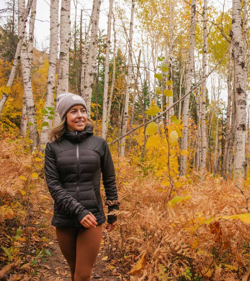

tirelessly
our
Shuswap Trails are within the unceded territory of the Secwépemc Nation. ShuswapTrails.com Find Your Trail • Report Trail Issues • Download GeoReferenced Maps • View Instructional Videos • Sign Up for Trail Bulletins #62 Mt. Baldy Trail P.TOGRAPHY.CA
The Shuswap Trail Alliance acknowledges the collaborative work and support of its community partners representing over 250 regional agencies, stewardship and recreational organizations, Secwepemc, municipal/regional, and provincial government partners, regional businesses, and the hundreds of individuals and volunteers from around the Shuswap who
are
making
communities healthier places to live.