1 Hydrology and fluvial geomorphology Amongst the hillslopes and valleys of Earth, water has played a clear part in shaping the landscape. This chapter will look at the hydrological cycle and its interactions between the atmosphere, lithosphere (geological world) and biosphere (living world).
The drainage basin system
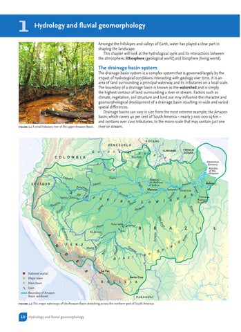
figure 1.1 A small tributary river of the upper Amazon Basin.
The drainage basin system is a complex system that is governed largely by the impact of hydrological conditions interacting with geology over time. It is an area of land surrounding a principal waterway and its tributaries on a local scale. The boundary of a drainage basin is known as the watershed and is simply the highest contour of land surrounding a river or stream. Factors such as climate, vegetation, soil structure and land use may influence the character and geomorphological development of a drainage basin resulting in wide and varied spatial differences. Drainage basins can vary in size from the most extreme example; the Amazon basin, which covers 40 per cent of South America – nearly 7 000 000 sq km – and contains over 1100 tributaries, to the micro-scale that may contain just one river or stream.
National capital Major town Main town Dam Boundary of Amazon Basin rainforest figure 1.2 The major waterways of the Amazon Basin stretching across the northern part of South America.
10 Hydrology and fluvial geomorphology