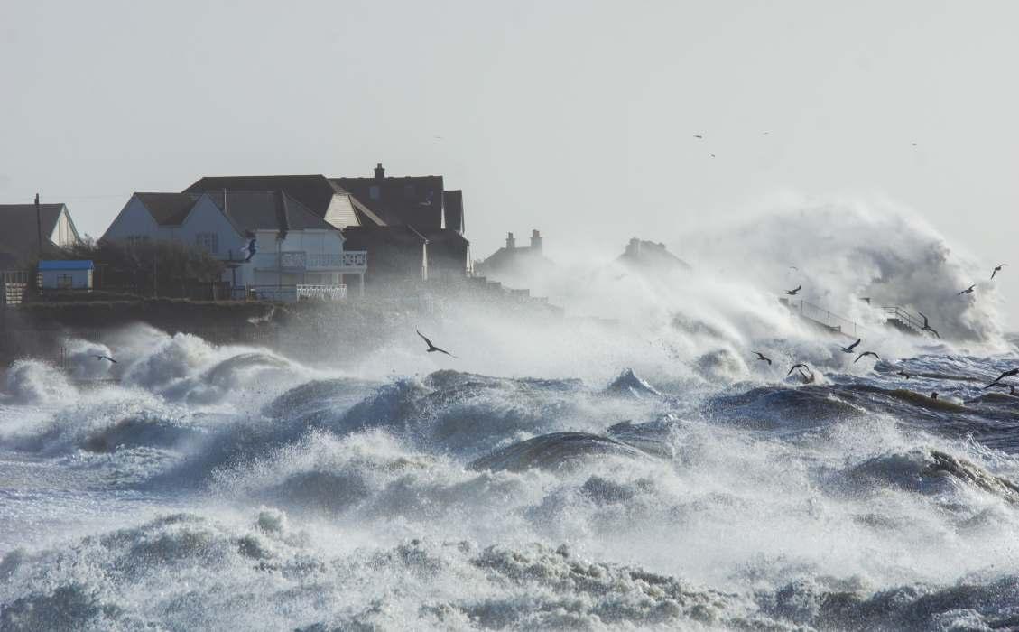
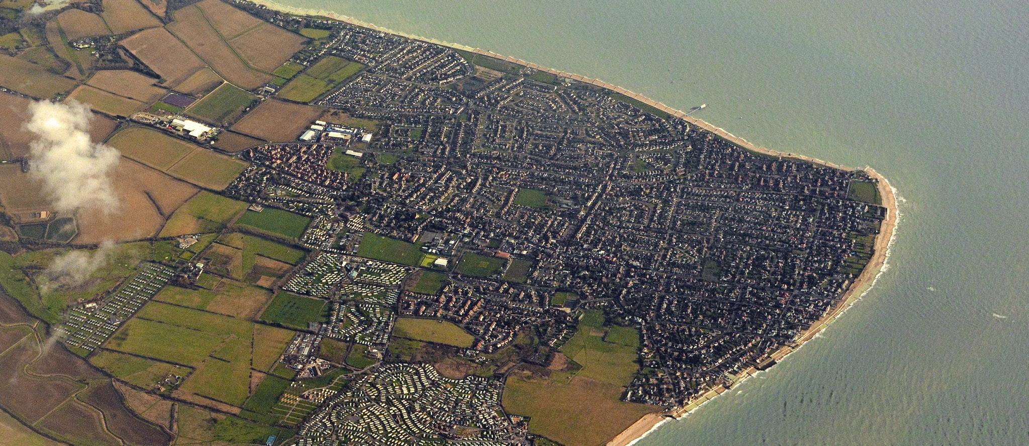
Selsey’s sea defences have a lot to contend with. The peninsula has always been subject to constant pressure from the sea, but now climate change is intensifying its impact. The current defences are coming to the end of their serviceable lives making stormier seas a serious challenge for Selsey.
A Changing Climate
‘Climate change’ refers to changes in climatical patterns relating to increased greenhouse gas emissions. For coastal management, climate change is forecast to result in increased flooding and erosion through sea level rise and an increase in extreme storm events. This additional pressure is leading to a decreasing level of protection provided by the existing defences. In England, rising sea levels and climate change have put around 2.4 million properties at risk of flooding from rivers and the sea.
Sea Level Rise Data
Changes in Sea Level
The latest sea level rise data is published in the UK Climate Projections 2018 (UKCP18). The UKCP18 information captures assumptions of the predicted increase in temperature using a range of emissions scenarios. The graph below shows the predicted sea level rise at Selsey based on two different UKCP18 climate change projections for a high emissions scenario.
Design standard – This represents a reasonable estimate of expected conditions, incorporating an element of precaution while balancing cost-effectiveness.
Sensitivity testing – Used to assess the potential impact of more extreme scenarios. This helps in evaluating adaptability and resilience to more severe but less probable flood events.
Asset Condition & Maintenance
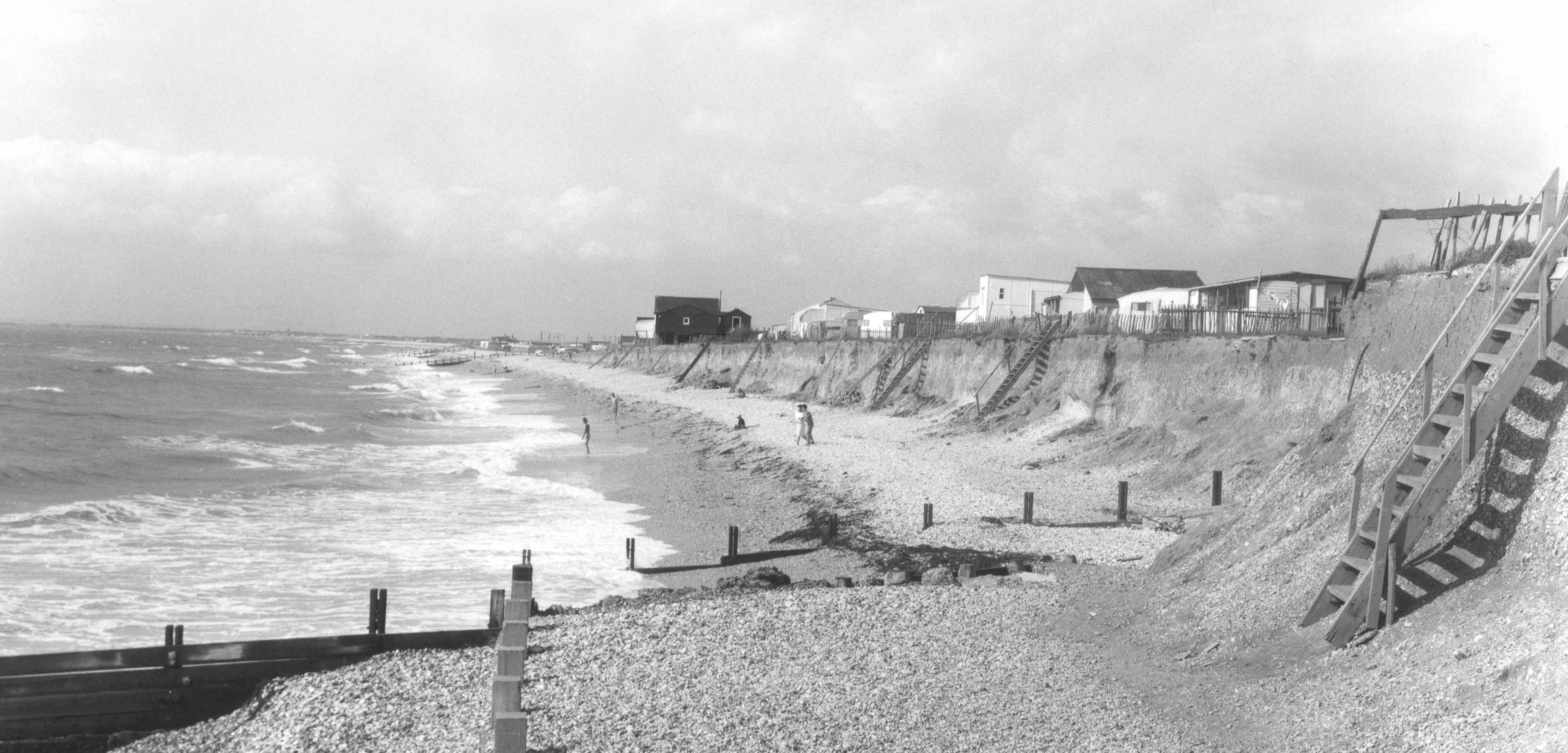
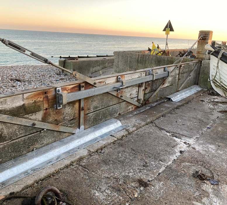
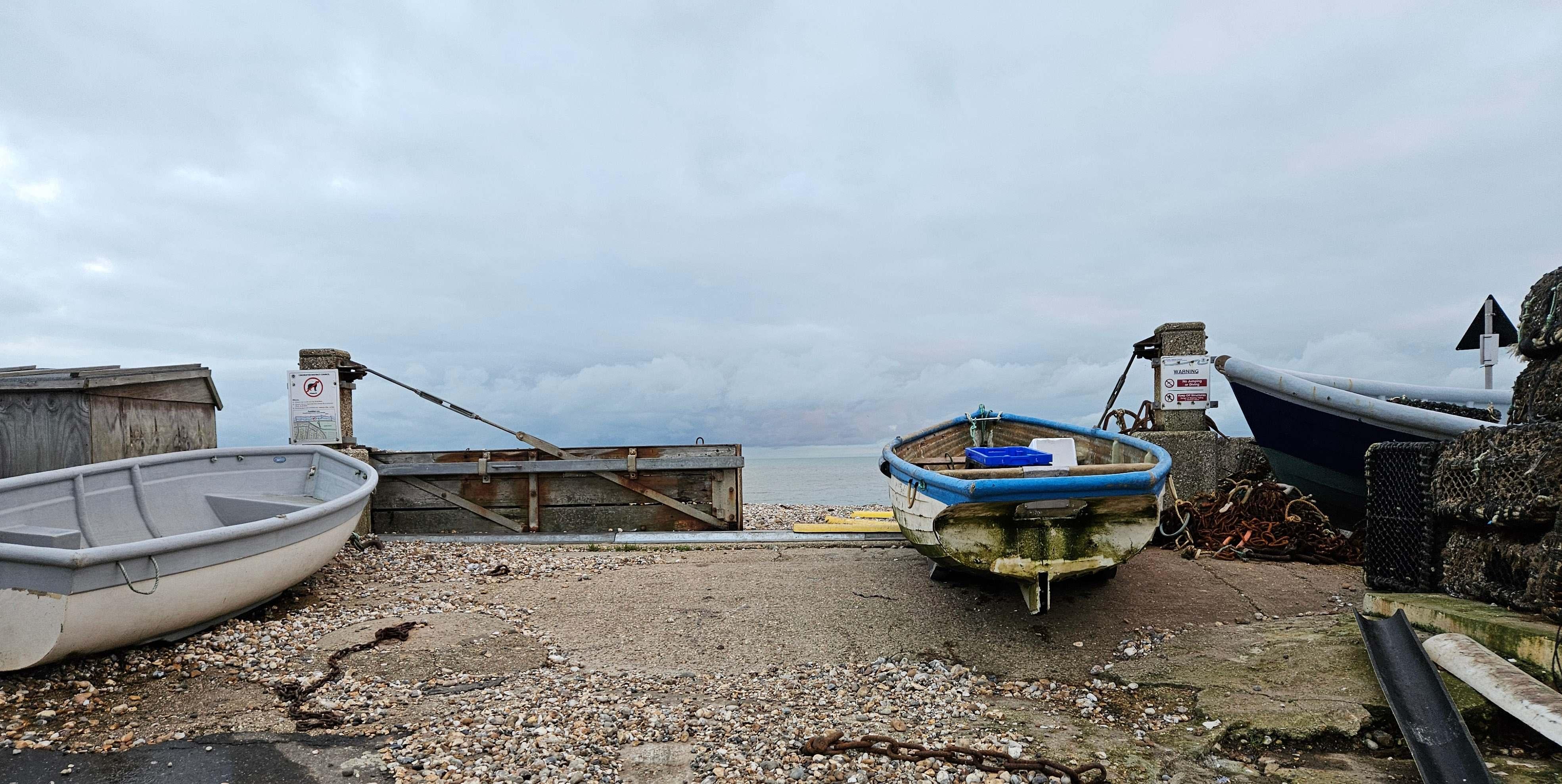
There are a wide range of coastal defences along the Selsey coastline, including seawalls, rock revetments, groynes, and shingle beaches. Whilst regular maintenance work has been carried out on the existing groynes and seawalls, such repairs are becoming increasingly difficult because many of these structures are nearly 80 years old and need replacing due to their aging condition. Selsey’s coastal defences are owned by several different individuals and organisations.
The Challenges Facing Selsey
Coastal defences do not last forever. They are subject to extreme conditions from waves, tides and currents, so they typically have a lifespan of around 50 years. Some of the defences in place today were built almost 80 years ago for the conditions of the time. In addition, climate change is driving increased storminess and a faster rate of sea level rise. The combination of these factors is leading to more significant challenges in Selsey.
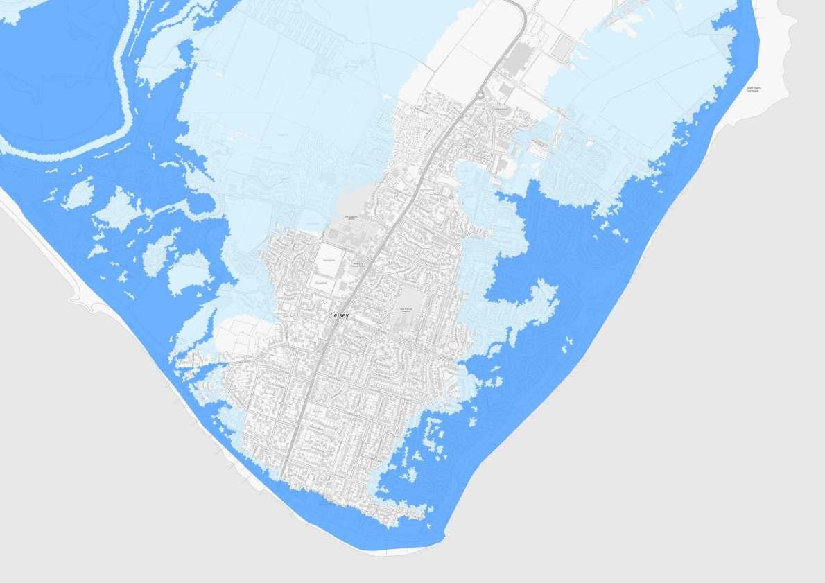
Coastal Flooding
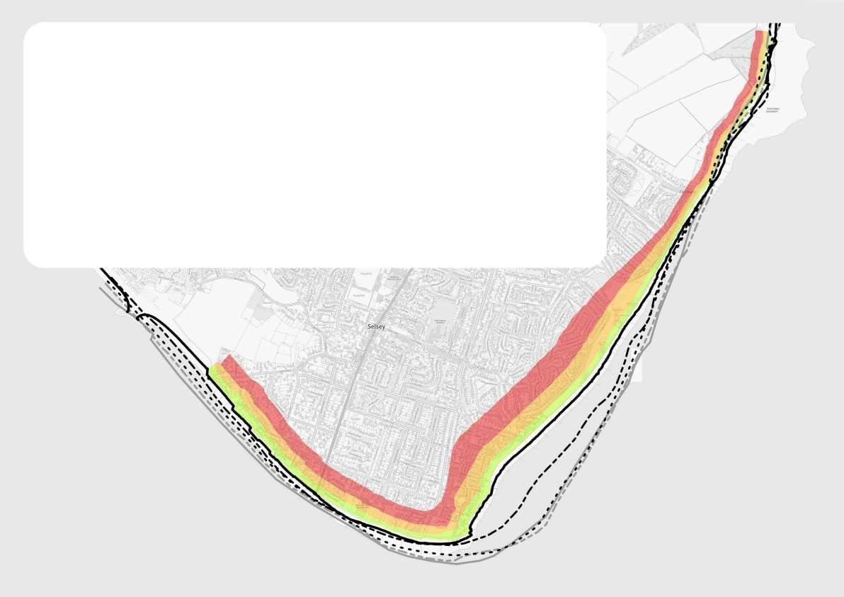
Coastal Erosion
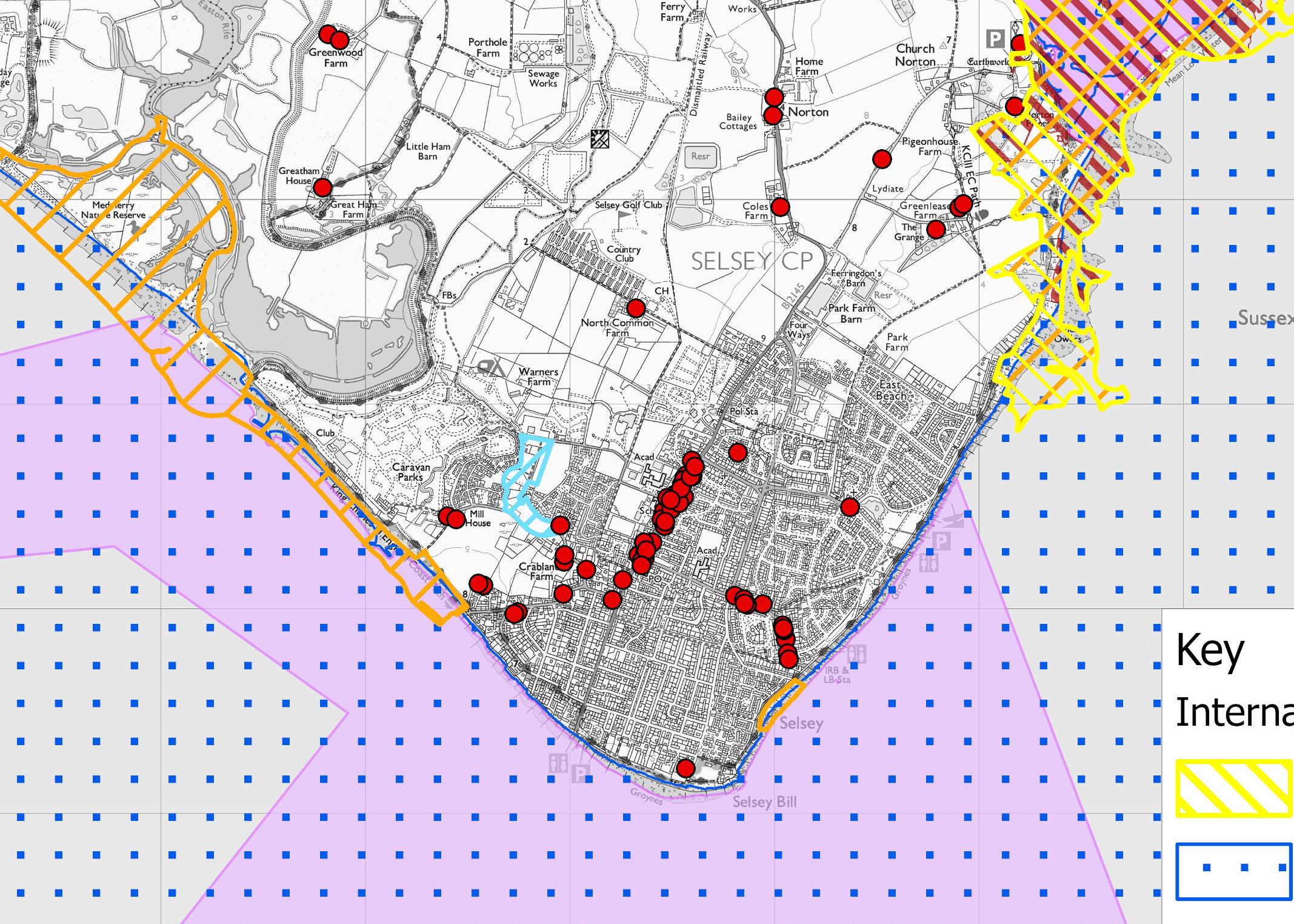
Flood maps are generated by computer modelling and show where coastal flooding may occur during an extreme weather event for both present day and in the future. The severity of coastal flooding depends on a range of factors including existing defence heights, ground levels and how close properties are to the sea. In some cases, the areas identified may never have experienced flooding before.
Selsey’s sea defences help reduce the risk of coastal flooding. At their current height the risk to the community from an extreme event is high and will increase over time due to sea level rise. Today, there are around 700 properties estimated to be at risk from an extreme event. This figure increases to approximately 1,300 properties at risk in 100 years.
Due to the age and condition of the sea defences there is an increasing risk of them failing. Historical maps and ground conditions show that Selsey is highly susceptible to coastal erosion. This is reflected in the substantial erosion rates predicted in the absence of coastal defences. Approximately 1,000 properties would be at risk of loss over 100 years.
This map is accurate as of December 2024. It does not reflect the National Coastal Erosion Risk Map (NCERM) update published by the Environment Agency in January 2025. It is expected that the number of properties at risk will increase with the new NCERM erosion rates.
FundingWhat if current defences fail?
Chichester District Council have been awarded funding for undertaking an Options Appraisal and Outline Design for Selsey, but further funding is not guaranteed. A central government cost-benefit assessment determines the funding available for new sea defences. Although some money will likely be available, under current funding rules, the scheme will have a large shortfall in the order of tens of millions of pounds.
As the project progresses, there will also be a better understanding of the leading defence options. This may mean that scheme costs increase, leading to more funding needing to be secured.
Additionally, as the sea defences reach the end of their life and deteriorate, they are becoming increasingly costly to maintain, with limited resources for repairs.
Alongside beach management, we regularly inspect the defences to ensure any issues are identified and repaired within available budgets. However, repairs are becoming increasingly challenging, and with timescales for a new scheme, funding, and site challenges, there remains a risk of defences failing before a new scheme can be implemented.
Construction work before a main scheme starts may be required to prevent failures, which will extend the life of the existing defences. Any such repairs will incur substantial additional costs, so careful consideration will be needed to ensure the repairs align with scheme options.
Coastal Flooding & Erosion Roles
& Responsibilities
Rising sea levels and changing weather patterns are having a greater impact on coastal communities. Several organisations and individuals play a role in addressing the effects of coastal flooding and erosion.
Defra has overall policy responsibility for flood and coastal erosion risk management policy in England. It provides funding through Grant in Aid (GiA).
Local Authorities are Risk Management Authorities and have permissive powers to carry out work to reduce the risk of erosion and flooding by the sea - This is not a legal obligation.
The EA has a strategic Oversight Role and is a Risk Management Authority. They have permissive powers to protect against coastal flooding and erosionThis is not a legal obligation.
Landowners
Private land owners have ultimate responsibility for protecting their own property from flooding and erosion. They must act within statutory planning regulations and other applicable legislation.
Selsey Environment & Heritage
Marine Protected Areas
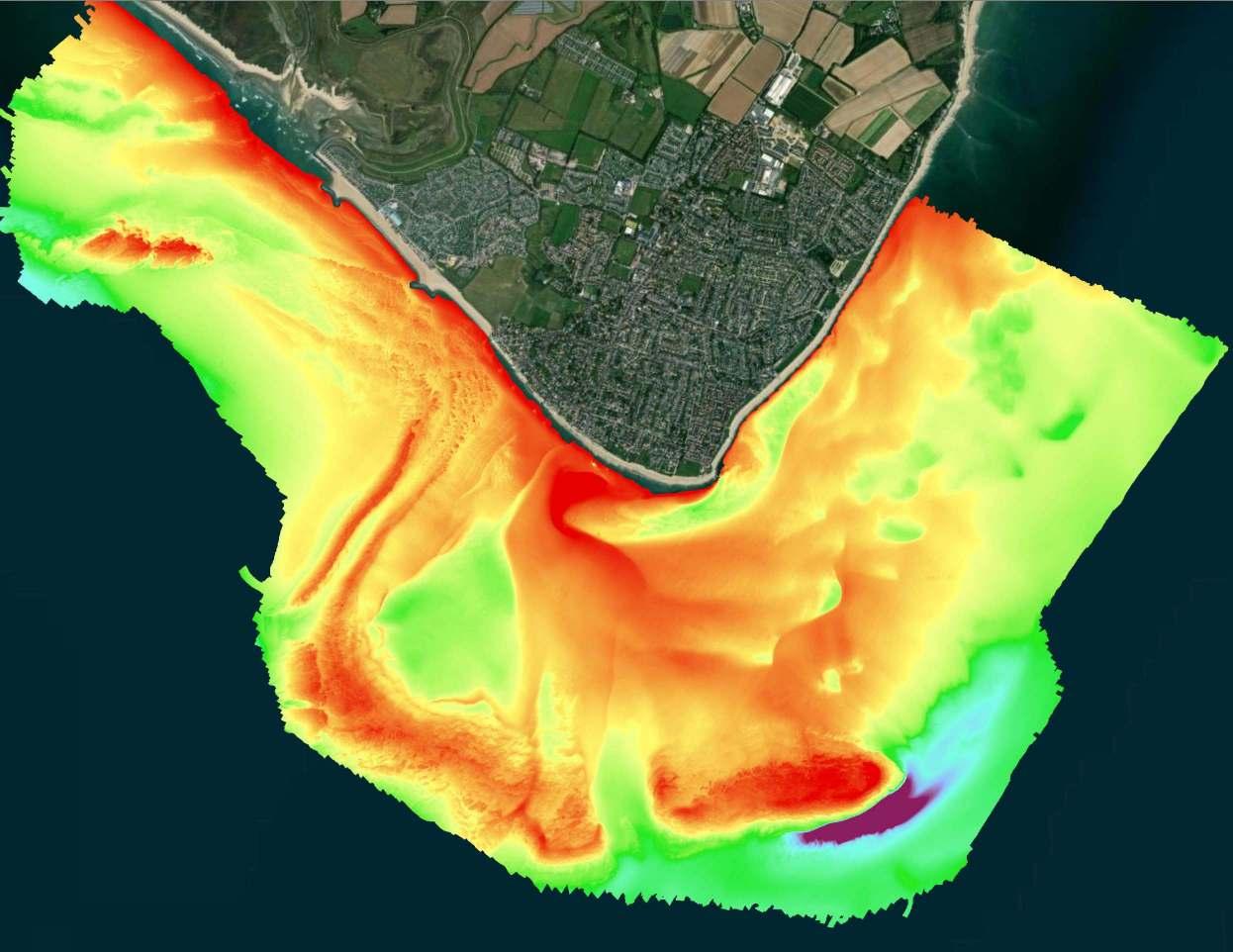
Bathymetric Survey
A bathymetric survey is a method of surveying the seafloor. It generates a detailed seabed map to illustrate depths and features such as reefs and shipwrecks. In this survey, red and orange areas represent shallow depths, while blue and purple indicate the deepest regions. The survey will be compared with historic data to improve our understanding of how sediment moves over time. The extent of reefs will also be mapped to inform how marine equipment could safely access the beach for the future construction phase.
Selsey is home to environmental and historical sites and designations that are important on international, national, and local levels.
The Selsey Bill and the Hounds Marine Conservation Zone (MCZ) covers an area of approximately 16 km2. It was established in 2019 for its high biodiversity and variety of habitats ranging from rocky layers to soft sandy sediments.
The project team will work alongside the statutory stakeholders, such as Natural England and the County Archaeologist to protect and enhance nature and preserve heritage.
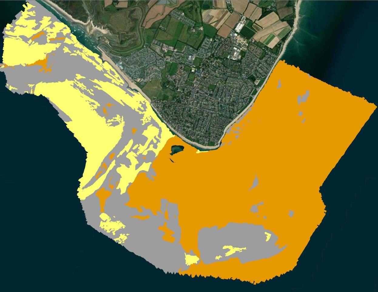
Seabed Mapping
This map shows the different material types that make up the seabed around Selsey within the designated Marine Conservation Zone. The information was produced using acoustic survey data and verified using existing seabed sampling information. Understanding the type and extent of the seabed will allow the project team to effectively assess any potential impacts of new coastal defences options on the MCZ, with the objective of causing none or as little harm as possible.
Introduction to the Selsey Coastal Scheme
In Selsey, the age and condition of the existing sea defences has led to routine repair and maintenance becoming more frequent, challenging, and costly. Coupled with increasing pressure from the sea through climate change, the need to review the defences and consider options for how to manage the flood and erosion risk has become extremely important.
Managing future coastal flooding and erosion risk and seeking a long-term solution for Selsey is a key priority for Chichester District Council. In the UK there is a three-tiered framework for planning and delivering coastal management:
Shoreline Management Plans (SMPs) are based on a long-term perspective to inform how the coast should be sustainably managed in the future. Chichester’s coastline is covered by two SMPs; The North Solent SMP (2010) and the South Downs SMP (2006). They join together at Selsey Bill and both set a policy of ‘Hold The line’ for Selsey.
‘Hold the Line’ means maintaining or improving the level of protection offered by the existing defence line.
Coastal Defence Strategies cover shorter lengths of coast and provide recommendations on how to deliver the SMP policy. Selsey is part of the Pagham to East Head Coastal Defence Strategy (2009) which recommends that a permanent scheme is needed for Selsey to reduce the risk of coastal flooding and erosion and counter sea level rise.
Coastal Defence Schemes, such as the Selsey Coastal Scheme, are tailored flood and coastal erosion risk management projects that are developed based on the individual requirements of a specific location.
Are new defences needed?
The 2009 Pagham to East Head Coastal Defence Strategy identified the challenges at Selsey, including aging defences and the affordability of delivering a new scheme - issues that persist today. To address these challenges, Chichester District Council secured £3.3 million in funding to implement a beach management plan along the frontage. Since 2011, these ongoing works have included groyne repairs and regular shingle replenishment.
In 2023, a ‘Feasibility Study’ was carried out to review the viability of a coastal flood defence scheme. This work highlighted that more than 700 properties are at coastal flood risk at the present day, a number expected to rise to approximately 1,300 within the next 100 years. It also identified that nearly 1,000 properties are at risk from coastal erosion if the defences were not in place over the same period. The study also concluded that a future scheme would encounter affordability challenges and uncertainties about the long-term sustainability of defences in the face of a changing climate.
The Project Stages Project Timeline Options Appraisal & Outline Design
Chichester District Council has successfully secured £2.9 million of Flood Defence Grant in Aid funding from Defra (the Department for Environment, Food & Rural Affairs) to progress the Selsey Coastal Scheme options appraisal and outline design stage.
Securing the funding to progress into the detailed design and construction stages is not guaranteed and is dependent on the success of future business cases.
The following objectives have been established for the project:
•
•
Reduce flood and erosion risk to people, property, businesses, and infrastructure, whilst improving resilience to climate change.
Provide cost-effective and deliverable solutions which are technically feasible and sustainable.
Maintain coastal areas for recreational use and tourism and incorporate opportunities for wider enhancements.
Maintain and where possible enhance the natural, historic, and built environments.
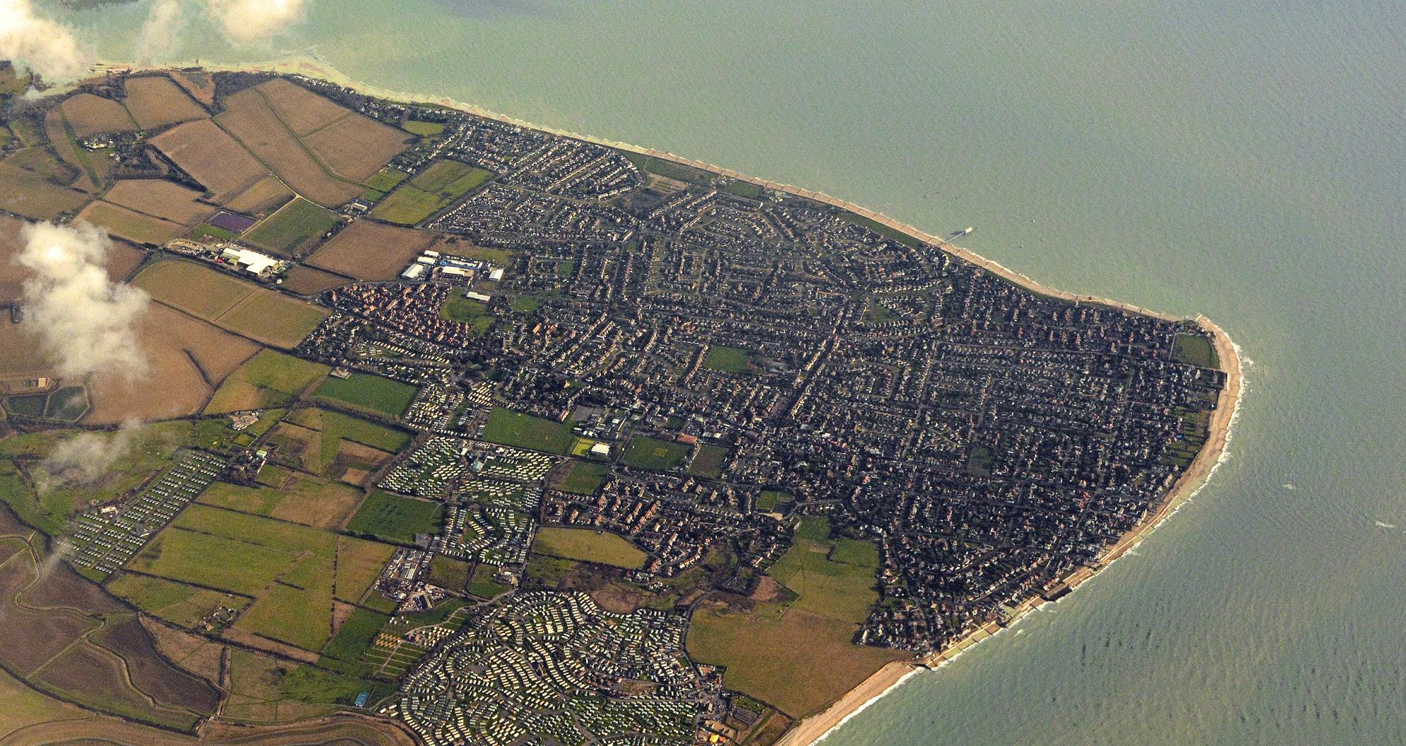
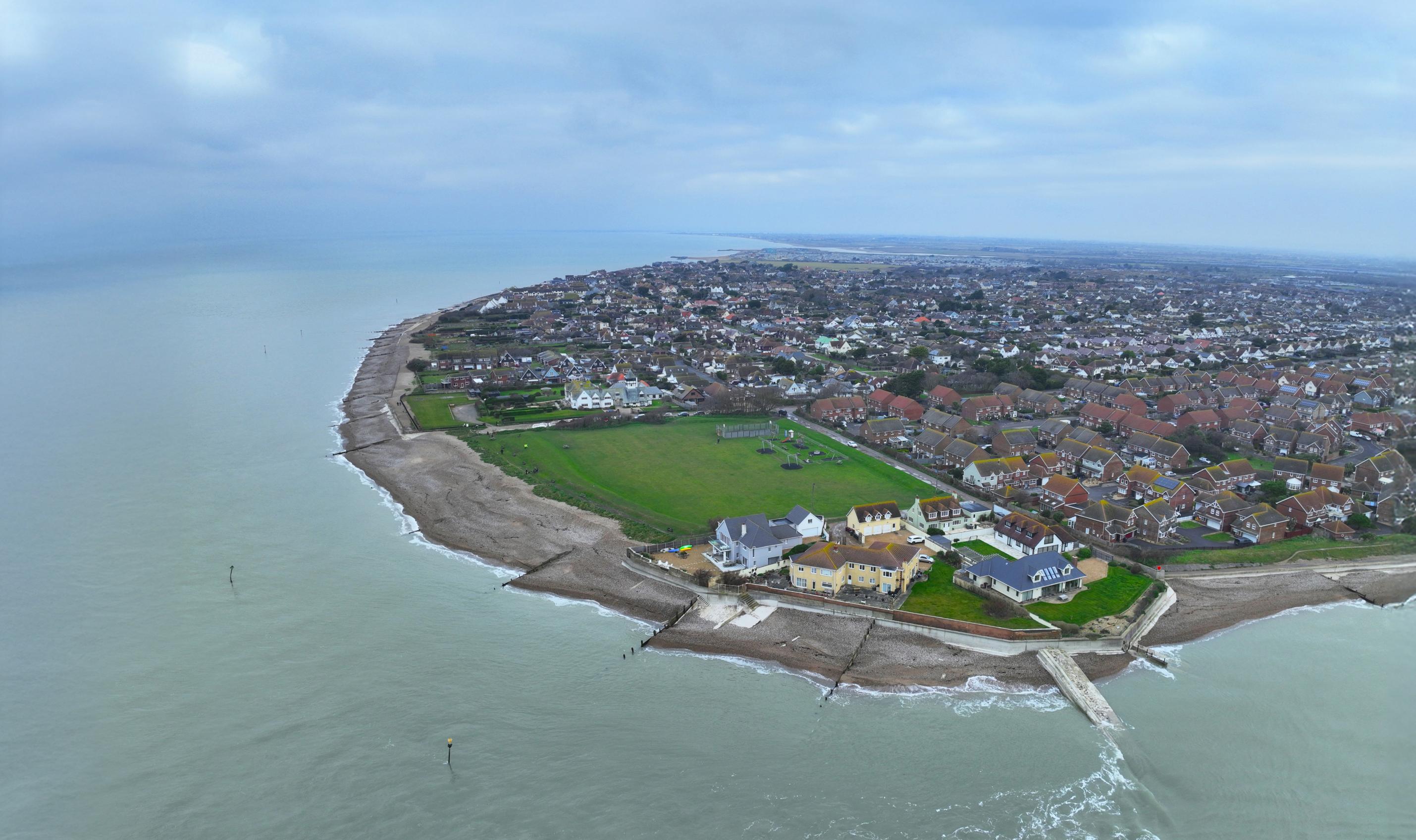
Study Area
The study area will run around the peninsula. The start and finish locations of the scheme will be determined by technical feasibility and financial viability. The extent of the scheme will be considered as part of this stage.
To help manage the flood risk effectively, there will be a need to align the defences with the higher ground at either end of the scheme. This will become clearer as the project progresses.
Selsey Bill
Options Appraisal & Outline Design
The work that is now happening is focused on collecting information to inform potential flood and coastal defence management options for Selsey. These activities include:
• Ground Investigations - Determine the underlying ground conditions to support outline design.
• Condition surveys of existing defences - Inform how any new defences may interact with the existing defences.
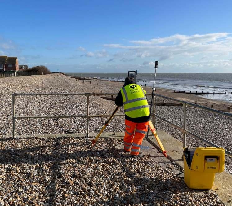
• Topographic and bathymetric surveys - Obtaining ground and seabed levels and features.
• Environmental assessments – Understanding the baseline ecology of the region
• Numerical modelling - Computer simulated models of current and future coastal flooding and erosion scenarios
These tasks help to identify and assess potential flood and coastal defence management options for Selsey. The aim is to establish opportunities that are cost-effective, technically feasible, environmentally acceptable and sustainable. Some of the work uses computer simulated models for coastal flood modelling to show what may happen if nothing is done to manage risk.
Once the leading options have been identified they will be developed into outline designs to support the business case for the next project stage, called detailed design. The work will also assist local Emergency Planning teams with managing the increasing threat of flooding and erosion in Selsey due to changes in the climate.
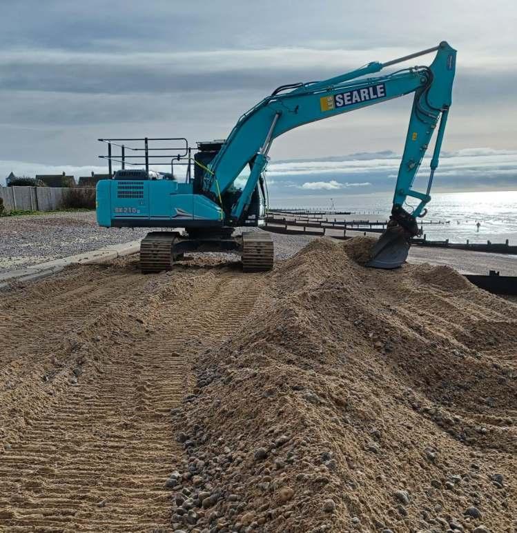
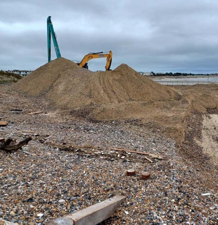
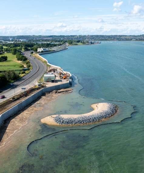
Protecting Existing Sea Defences
Whilst the Selsey Coastal Scheme is developed, a Beach Management Plan is in place to help protect the existing assets and prolong the life of the hard defences. The shingle beach is the first line of defence for large areas of the shore. Replenishing the beach material has helped reduce the speed of coastal erosion by forming a natural buffer that reduces the intensity of waves. The Beach Management Plan has Defra funding in place until 2026 and, subject to funding, this work will probably need to continue in the short term to align with the Selsey Coastal Scheme as it is developed.
Managing Flood Risk
Selsey Flood Response
If extreme high tides and significant weather events are predicted, our Coastal Incident Officers (CIOs) coordinate a coastal flood response. CIOs are volunteers who are on call 365 days a year, 24 hours a day. The Environment Agency (EA) uses a flood forecasting service to notify CIOs of potential flood events. The CIO then works with Local Authority Emergency Planning Teams to advise on the required response.
Selsey Flood Control
There are seven locations where flood boards are in place during the winter months at Selsey. Should the boards need to be closed at any other time, our CIOs work with onsite contractors to ensure that the right level of protection is provided along the eastern Selsey coastline. There are also three sets of flood gates that are privately operated.
How Can You Prepare For A Flood
Even though we work hard to reduce flood risk, it is important that landowners take the necessary steps to prepare for flooding events.
Scan to check your flood risk
Stay In Touch
This project is working with residents and business owners in Selsey, so they can understand and appreciate the challenges the area faces.
Please sign up for our Selsey enewsletter via the QR code or by emailing selsey.coastal@havant.gov.uk. More information can also be found at coastalpartners.org.uk/project/selsey-coastal-defences.
We are also very interested in any historical data and photographs related to coastal flooding and erosion that you may have, as this information will be valuable for the development of the scheme.
Scan to sign up to EA flood alerts
Scan for more information
Please do contact us if you have any material that you can share with us. Any information will be treated in confidence. Sign up to our newsletter here: or email: selsey.coastal@havant.gov.uk
Protecting Your Home From Flooding
Data shows 6.3 million properties in England are at risk of flooding from rivers, the sea or surface
Homeowners are responsible for the protection of their own property. If your home is flooded it can be very disruptive, expensive and take a long time to repair.
How The Water Gets In
• Around doors and windows.
• Through air bricks and air vents.
• Back flow through sewerage pipes, drains and manholes.
• Up through the ground, if it is porous like chalk.
• Leakage through cracks, holes and spaces that have not been sealed.
Measures to help limit the water damage to your home
About Coastal Partners Managing coastlines, improving community resilience, and enhancing the natural environment.
Chichester District Council is one of five Local Authorities that form the innovative Coastal Management Partnership called ‘Coastal Partners’.
Working as a shared service across 246km of Hampshire and West Sussex’s coastline creates cross-border efficiencies that helps to protect homes, businesses, wildlife, and infrastructure.
Our diverse work includes managing coastal flood and erosion risk, planning and designing new coastal defence schemes, inspecting and maintaining existing defences and working towards an environmentally focussed future.
On a national scale, we lobby for coastal management policy improvements. Our goal is to influence processes that can deliver greater and more sustainable benefits for our coastal communities. Working alongside residents, we are shaping the region’s coastline for the generations of tomorrow.
We have also evolved our expertise into habitat and environmental services, coastal surveying and research. Furthermore, we advise on a variety of areas including coastal policy and strategy, project planning and design, project delivery and post scheme monitoring.
Whether we’re planning, designing, and constructing new sea defences, maintaining existing coastal assets, or providing expert advice on external projects, Coastal Partners deliver first-class results through our expertise, experience, and dedication.
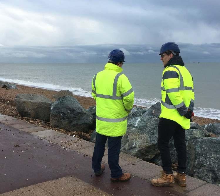
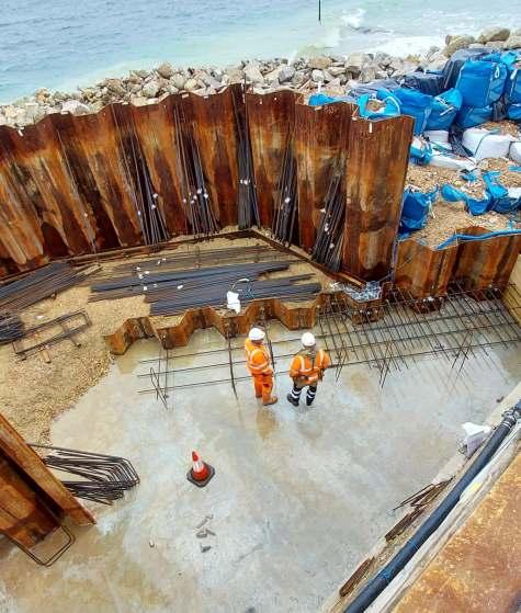
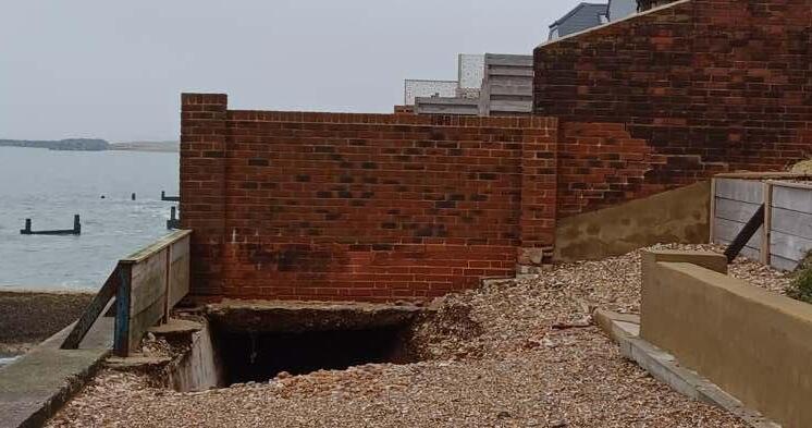
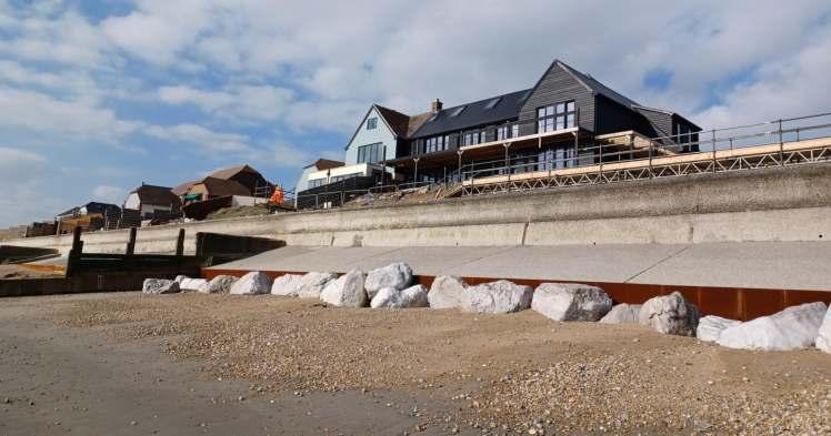
Selsey West Beach Emergency Works
When a sea wall failed in 2023 along a length of coast with homes directly on the defence line, immediate work was required to re-establish the stability of the wall. A team mobilised immediately to assess the damage, design an appropriate solution, liaise with local residents and project manage the essential work.
• Time to repair - 9 weeks
• Cost - £440,000 (Funded by Emergency Works Funding, Environment Agency)
• Solution - A fast repair to remove the immediate risk to people and property. The design injected the void with resin, repaired the sheet pile, and added a new concrete apron.
North Portsea Greening the Grey
With a large seawall being constructed in North Portsea, Portsmouth, we developed an innovative solution to help support the growth of marine animals and plants. On the seaward face of the wall, we used a mould to texture the concrete called the Ecoformliner. Its crevices are designed to retain water and provide a habitat for species to colonise.
• Length of Ecoformliner – 2.1 km
• Species recorded – Common Shore Crab, Littorinid Snails, Barnacles
• Includes 8 social spots with benches, tables, and wayfinders
Hayling Island Beach Management Plan
Eastoke, on the South Coast of Hayling Island, has a history of flooding during extreme weather events. A beach management plan adds shingle to the beach which helps take the energy out of the waves and protect homes and businesses. Despite sea level rise, the area has now been clear of significant flooding since the beach management plan has been in place. We have successfully delivered this work under increasing budgetary challenges.
• Quantity of shingle recharge per year - 43000 cubic metres