22 minute read
ADV Rider #65 issue


up to the tip,
in the land down under
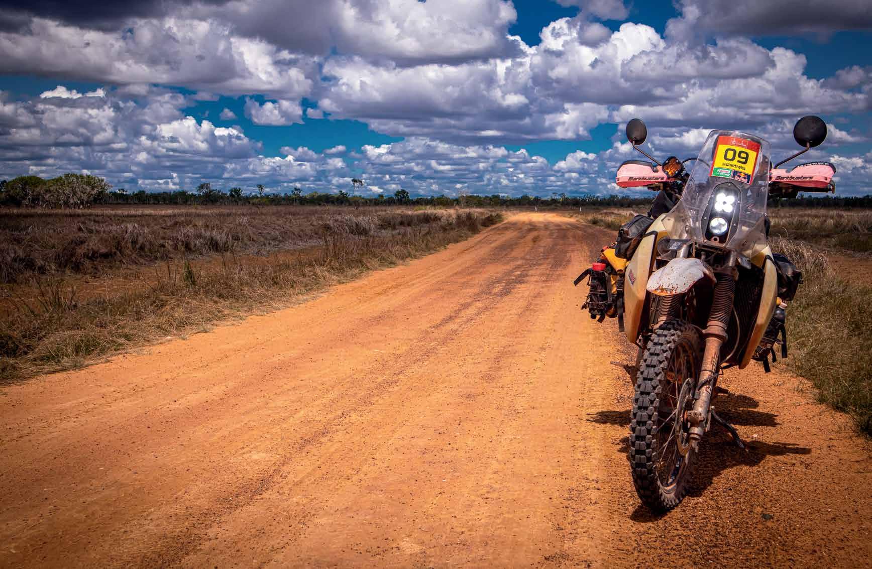
An adventure ride to the northernmost point of the Australian continent on a motorcycle.
Words and Images: Dale Tolcidas
Just like every other adventure, it starts with a dream. I’ve been wanting to ride up to Cape York and do the Old Tele Track for many years now, but I found myself slightly anxious in doing it alone after quick research online; the river and creek crossings, the big drops, unknown terrain, crocs, Gunshot Creek, and the list goes on. I decided to wait until I get a chance to do this with a few other riders. I hope this article may give you a little more of a better insight that a trip to the tip isn’t as daunting as it seems.
Prep time
With my planned Simpson Desert trip canned, I was in search of another adventure to tick off the list. I came across Tom whom I met on the previous year’s KLR Rally, he was planning a Cape York trip with his mate Luke for a while now. I had asked if they have room for one more person to join them in this journey, they were more than happy to take me with them. There couldn’t have been a more perfect timing, why not! Quite spontaneous, I reckon. I had two months to prepare myself and my 2008 KLR650 for this, most would prepare several months for this kind of trip, but I wouldn’t let this
opportunity pass. The bike is my daily driver and my weekend warrior, so there was a fair bit of maintenance that needed to be done. Over the course of 8 weeks, I managed to strip the bike apart, down to the engine and frame sitting on the stand. I had to replace the bike’s entire chewedup-problem-filled wiring harness, fit a new airbox, put the stock carburettor back in, rebuild the suspension, Loctite every single nut and bolt, replace all bearings, install a new swingarm as I had done some damage to mine, rebuild the brake callipers and more, sourcing all these replacement parts from a trusted local wrecker and odd online marketplace finds. I needed it to be up to spec and more reliable than ever. The last thing you’d want on a trip like this is breaking down in the middle of nowhere. Even though there are local companies specializing in touring the Cape York region on motorbikes, taking my own motorcycle and planning the trip myself just makes this trip more exciting, and was an independent challenge I needed.
I was ready, or so, I thought I was. By the end of the trip, I came to understand how important good road support can be.
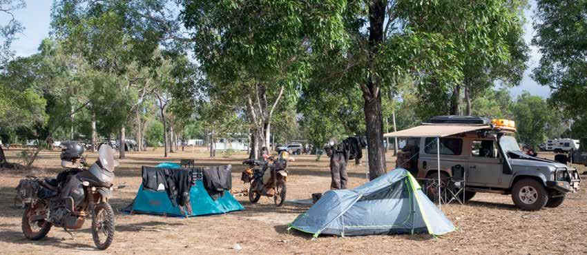
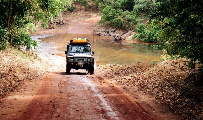
Above and right: The trusty steed taking a break at the Big Mango in Bowen, QLD. Staying very clean with all the rain over the first few days.
Brisbane to Townsville
The first leg of our trip was to make it to Townsville in about 2 days to meet Luke and start the trip from there. I left Byron Bay early to meet Tom and spend the night in Brisbane. We left Brisbane at 3 in the morning to try and beat the motorway traffic, but then we were greeted with a heavy downpour of rain that left us drenched and soaked, but this didn’t stop us, we pushed on.
We were eventually past Sunshine Coast after a few hours of endless traffic, and the sun shone upon us as soon as we reached Hervey Bay. Covering a little over 1,000 kms on the day, we reached Ilbilbie where we found a motel to stay for the night, paired with a gourmet selection of crumbed sausages and a hot pie from the petrol station across the road - a perfect start to the trip.
The next day we set off for Townsville, a shorter day of riding to meet Luke on his LR Defender who would then give us some support during this trip. We had already arranged a set of new tyres for the two

bikes to be fitted at a local dealership, do our last-minute shopping for food and supplies, and finalised the gear we would take on the bike. I know I took too much stuff with me as I had to leave a few items behind. The key to having a better riding experience is lighten your load on your bike, so share the gear in between the group such as cooking gear. Sharing the equipment saves you some weight, which tends to give you more confidence in riding these trails.
Townsville to Cooktown
Leaving Townsville, the next morning, we planned to take the coastal road through Tully, Innisfail and past Cairns. Stumbling on a minor hiccup along the way right before we reached Cairns, I felt that I was losing my front brakes, only to realise have lost a bolt that holds the brake calliper - this could have been devastating. After a quick stop to the local nut and bolt shop in Cairns, we set up camp that night in the heavy rain at the caravan park in the Daintree village, reviving our souls with some
great pizza and a few schooners at the local pub, hoping to give the Creb track a go in the morning.
We knew our chances of doing the Creb Track were very slim. Heavy rainfall had been upon us for days now and hearing the news of a serious roll over of a couple of vehicles attempting to do the track in the wet blocking the track, including the UniMog that was sent to recover the vehicles, it didn’t look very promising. The CREB Track is a very steep and very rough track linking Daintree to Wujal Wujal and is only suitable for well-equipped 4WD vehicles and motorists with vehicle recovery experience. It was originally the service access track for the old powerline to Cooktown. Even after moderate rainfall, the track can become treacherous or impassable and vehicles easily become bogged or stranded.
I woke up to a ridiculous
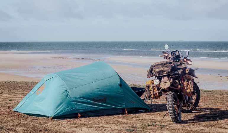
Left: Camping at Captain Billy’s Landing: Seriously the best camping spot have ever stayed in Australia.
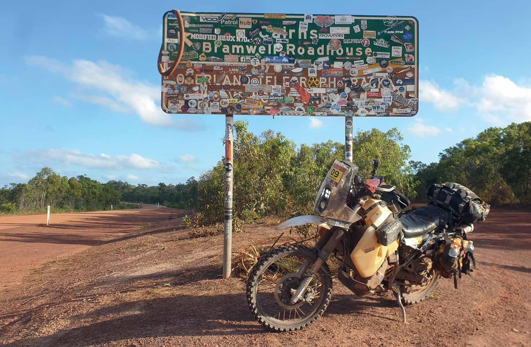
Below left: The iconic Bramwell Station, we’ve come across a group of KTM riders from Victoria making their way back heading south from the tip. Bramwell station is the last stop for fuel and supplies before reaching the Jardine Ferry.
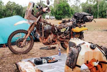
Above: Part time bush mechanic: An oil leak has become worse cause by a worn cam cover gasket. Nothing a quick epoxy can’t fix! While the bike is apart, it’s a good time to do a once over and see if any adjustments are needed. u
A quick smoko, admiring the remoteness of Lakefield NP. Moments like this make me realize how big and remote Australia can be. There were sections of vast plains along the route, hard to miss the beauty and serenity of the remote country.
myself what in the world did I get myself into? It doesn’t help either that we found a sign right on the creek entry saying “WARNING! Crocodiles inhabit this area – attacks might cause injury or death” great! Just great!
We eventually got the bikes across, helping another rider who was heading south on his RE Himalayan. Both bikes started at the first go, luckily no water has come into the airbox, otherwise it could have been a different story. We pushed on through with the heavy rain and limited visibility. The steepest parts of the track were relatively easy, down to first gear and keeping the revs high, lots of clutch control.
We did come across a 4WD touring group in trouble coming the opposite way. One of the 4WDs had jackknifed its trailer trying to make its way up, eventually blocking the track. Although this road is paved, with decent rain the track can become slippery. After a quick breather out of the rain at Wujal Wujal, we made our way to the iconic Lion’s Den Hotel for a well-deserved feed (pizzas were amazing!) and some odd souvenirs. Cooktown wasn’t too far away; we’ve set up camp well before sunset.
Cooktown to Bramwell Junction
Straight after the morning caffeine fix a few pies for brekky and a quick stop at the Grassy Hill Lookout, we headed north to Archer River Roadhouse through Lakefield National Park. A quick Google search tells us that Lakefield NP is 5,370 km2 (2,073 sq. miles) - making it bigger than Trinidad and Tobago and almost as big as Brunei. Riding through here was a great experience, with some parts being closed
six months out of the year due to extreme weather conditions. You’ll feel how remote some parts of Australia can be, as we’ve only passed probably a couple of cars in a span of a few hours. The roads were graded perfectly, certainly a lot better than the Bruce Highway!
The Peninsula Development Road aka “The PDR” runs 571km from Lakeland to Weipa, of which only 200km in sections are sealed roads. It is infamous for its extreme corrugations in some parts so, add a bit of rain and it’s a different story.
We weren’t quite sure what to expect, all we know its going to be a little rough. This was the main throughway to and back from the tip. You can certainly reach the northern most point without taking the Old Tele Track using the PDR. At this point
we’ve passed through Musgrave Station, Coen and spent a night in camp at the Archer River Roadhouse, a busy hub for many travellers, riders, and workers in the area.
If you’re taking the PDR, drop your tyre pressures! I dropped mine to 22psi and it was perfect for this. The road conditions can change very quickly from sand to extremely loose gravel, to compact red dirt and a mix of everything. Driving over the corrugations for the first time wasn’t the most pleasant
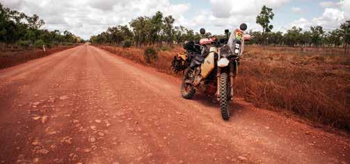
experience, but it takes a bit of getting used to. It will shake every bit of you and your bike. Remember when said I put Loctite on every bit of bolt on the KLR? This was why. We’ve eventually found out that driving at speed makes you skim over the corrugations, staying at 90-95kph was the sweet spot - any more or less we felt like we were losing control. There’s a need for a lot of attention on the road, bulldust may be up ahead, some of them are signed, some are not. You’ll be sharing the road with caravans, road trains, trucks, and wildlife. I found myself in panic when three wild bulls popped out and stopped in the middle the road while I was doing 98kph over corrugations, engaging both brakes and downshifting a gear. I’d stopped 3 metres before them, a jock staining moment right there.
We’ve reached Bramwell Tourist Park after two days, where we spent an extra day of rest before starting the Old Tele Track. Doing some maintenance on the bike is essential for a successful trip. Here, I’ve changed my air filter with a clean one that I brought with me pre oiled in a Ziplock bag, adjusted, and lubed the chain, gone down to a 14t from a 16t sprocket for some extra low-end grunt, and fixed the weeping oil leak from the cam cover with JBWeld. Old Tele, here we come!
The Old Telegraph Track - South
Here we go, the most awaited part of the trip. I didn’t do a lot of research about the Old Tele. just watched YouTube videos and referred to some Facebook posts, so kind of had an idea, but not totally. I honestly was so nervous at this point, I asked myself, why did I decide to do this? Nevertheless, there’s no turning back. Bramwell Junction was only 5kms away, so we raced north.
Funnily enough, after my maintenance day, I thought the trip was over for me as I reached Bramwell Junction, the bike wouldn’t start. After a bit of digging
Above: Luke’s Land Rover Defender coming up from a creek crossing at Lakefield NP.
Below: Tom on his blacked out KLR cruising through Lakefield NP.
through relays and the starter motor, it ended up being just a loose battery connection, yes, one of those simple things. Bramwell Junction was our last fuel stop before Bamaga. Behind the building is also the entrance to the Old Tele. After a quick coffee and a few photos at the sign, we were on. First obstacle was Palm Creek, which was honestly the hardest one we did. Of course, you must pop your cherry,
the first one is always the hardest!
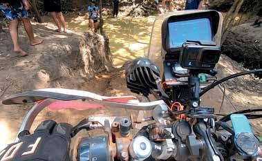
The original entrance for Palm Creek was too steep, it was literally vertical, otherwise, the water was too deep for the bikes to cross, so we had to find other “chicken tracks” that we could potentially use. After hesitating for too long, we finally dropped into the creek. There was no driving at this point, it was all about clutch control and letting the bike roll down and do its thing and maintaining balance. Luke on the Defender on the other hand made it look so easy in a 4WD. The exit we considered wasn’t going to work for us as the water level was still too high, so we sort of had to make our own. We’d managed to find an ideal exit, but it was steep, and the dirt was loose and there was very little traction. I do think Tom and I spent a good 45 minutes getting the two bikes out of the creek, uphill while Luke was winching out his 4WD by himself. All part of the adventure!
The next four creek crossings - Ducie, South and North Alice Creeks - were relatively easy, Ducie can be moderately deep, so hug the left bank as you turn into the exit. Coming into water crossings,
it is ideal to walk through them to find the best way you can position yourself with the bike, watching out for potholes and obstacles underwater. The Dulhunty River Crossing was easy too, just watch out for some washouts that you might come across.
Bertie Creek was the widest crossing.
It has a solid rocky base, although it requires you to hug the rightmost bank as you come into the creek, run up and few meters and you’ll find the exit but be aware of the deep holes that are present along the crossing: you certainly don’t want to drop your front wheel in them. After Bertie, you’ll come to a crossroad
that would eventually let you bypass Gunshot Creek (not for us), otherwise, as you continue the track, Cholmondely Creek is up ahead, which has a sandy base, but is very straight forward. Now, for the most awaited crossing, Gunshot Creek! It’s probably the most notorious crossing and many deem as the most difficult. There are a few chicken tracks around the infamous drop, so there is no need to risk it. We chose the one on the left of the big drop. You’ll find a tight bank on the rocks with motorbike tyres marking a channel telling you where your front tire should go. It will be tight, so take the panniers off when doing this as even your leg and foot pegs will scrape the wall on your left. Hang tight as you do this, don’t lean to your right too far as it’s a fair way down, put your bike on 1st gear and control the bike with the clutch and just let you and your motorbike roll down. It will eventually feel very easy, yet daunting
if you’re afraid of heights like I am. The exit out of Gunshot was harder. It was a steep, uneven uphill section that required momentum, we’ve watched a few dirt bike riders on DRZs fly up easily, but it’s a different game on a 190-kilogram motorbike plus luggage and a tank nearly full of petrol. It took me a couple of tries to get up, coming off once as I put too much throttle that made my front wheel bounce off out of a straight line. Eventually we got ourselves out with the feeling of reward of finally conquering nearly half of the Old Telegraph Track, but we still had a fair way to go.
Cockatoo Creek’s water levels may vary a lot, walk the crossing first as best practice to find the best line, watching out for the bog holes. We hugged the bank on the right and headed straight out the exit on the other side of the creek. Sheldon Lagoon and Sailor Creek was up ahead which were relatively
Left: Dropping off Palm Creek – Photos and videos don’t do any justice of how steep these drops are. I ended up rolling down in false neutral and fell over onto the water as soon as I reached the bottom. Below: Gunshot Creek! Photos again don’t do any justice. Its more dauting when you are in the moment. To the left is a heavily eroded track next to the original gunshot drop.
easy, and as you continue further down the track, you’ll eventually link up back on flat ground on the PDR, making our way to camp at Eliot Falls. At this point we were very excited to call it a day and enjoy a well-deserved beer.
Old Telegraph Track - North
After spending a full day of rest at Eliot Falls, it was now time to finish the Old Tele and head north. The southern section of the track took us almost an entire day, with our confidence topped up a little bit more, and we knew what to expect, the northern section of the Old Tele was easier and faster to complete. We skipped to see Fruit Bat Falls for the return trip, so we headed on to the first crossing on the north side, Canal Creek.
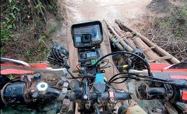
Canal creek can be quite deep, the bottom is also uneven, so it is worth walking and finding the best line to go across. Cannibal Creek entrance was steep, I took the wrong line, so some assistance was needed to readjust the position of the bike. The creek was waist deep, but hugging the bank to your left, you’ll find a ledge wide enough for a bike to go through very carefully, eventually making a wide right turn towards the exit. Cypress Creek does not require a water crossing, although you’ll have to make your way across the famous log bridge. This bridge is basically made by travellers who come past, its only a few meters long; large and some narrow tree trunks compose the bridge. It was held together by a few ratchet straps and one wrong position will let your wheel fall into a gap. Not an ideal situation as it is a fair way down. Luke on the Defender, and another group on 4WDs were behind us, making precise manoeuvres to align the wheels correctly. On the makeshift bridge, you could hear the logs squeaking and creaking with the
weight of the heavy 4WDs. We’re on for the last two crossings, Logans and Nolans, both of which are notorious for claiming vehicles, known for their deep-water crossings. It was a fair way from Cypress to Logans, following the track filled with vegetation, tinted with red soil, the track quickly changes from white sand to hard red rock, uneven red dirt with potholes and large washouts. Some sections you can do easily doing 60kph, some at 10kph. It’s a tight one lane track at some sections - the branches and bushland constantly hit the Barkbuster hand guards. The large termite mounds can be found along the track, a quick photo op got me stung by paper wasps on the face, so be careful where you stop, as stings on a swollen face isn’t one of the best feelings. We got to Logans in no time and there was a queue of probably six 4WDs waiting for their turn. The chances of the motorbikes of going through the water were not great as the water level was too high, going over the seat. We found ourselves a small drop that would bypass the deep water, but on the bottom was this unforgiving, slushy mud that got
us bogged once we landed. The boys that watched us do this gave us a hand pushing the bikes out which was lucky.
Last crossing, Nolan’s Brook! We could definitely see the light at the end of the tunnel, after an exhausting couple of days, we were ready to kick back and get to the tip! We wouldn’t be able to get our bikes across without using the log bridge, yes, again. It was built for the motorbikes, made from larger sticks and a random sidestep off a 4WD, this made this seem unstable, when we tried to cross. We had to position the wheels correctly and walk the bike through with the three of us holding the bike up as we made it across. Finally, we did it! We finished the Old Tele Track! I would probably do this again on a lighter motorcycle!
The pure joy of knowing you’ve conquered something this challenging, stepping out of your comfort zone in riding is exhilarating, the constant adrenaline rush over the last few days boosts up your confidence and skill as a rider, having to take on and experience one of the most challenging off-road tracks in Australia, you feel that you can
ride almost everything.
We’ve then set ourselves to head north along the worst corrugated section of the PDR and we eventually hopped on to the most expensive ferry ride in Australia, the Jardine River Ferry, at $55 for a motorbike, for a crossing of less than 100 metres. After a quick stop in Bamaga for some much-needed supplies, and a stop at the famous Croc Tent, we set up camp in Punsand Bay and not long after, reached the Northern Most Point of the Australian Continent. It was such an achievement. We enjoyed two full days at Punsand Bay and exploring a bit of the area, our route home was to follow the entire PDR pointing south, spending one night at Captain Billy’s Landing, stopping by the iconic roadhouses and stops along the way. The corrugations during this time were extremely bad in between the Jardine Ferry until Bramwell station, eventually, the road becomes pretty much bitumen from Laura heading south.
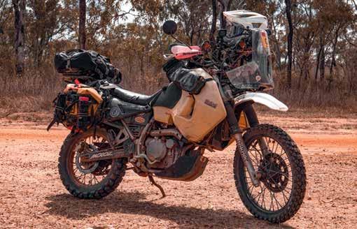
Gearing up for a trip to Cape York
Camping on a motorcycle for an extended number of days, can become quite a task. Luckily the tropical weather in FNQ requires much less camping gear you need to bring, depending on your preference. I’ve decided to go back to basics, and settled with just a hiking tent, an inflatable lightweight hiking
Top left: The log bridge crossing, a long way down to the flowing creek. Definitely one of the worst places to drop your motorcycle!
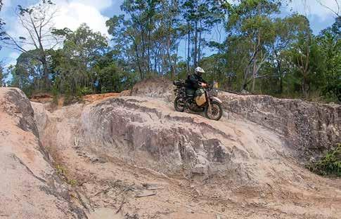
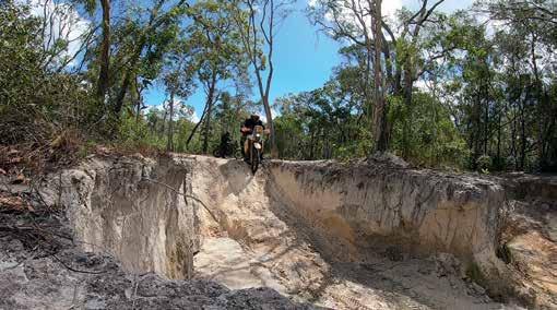
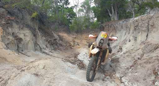
Top right: Coming down over a random erosion, there was an easier way around but, it doesn’t hurt to muck around!
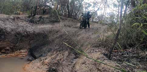
Left: Tom coming down from the hill down to the creek bed. This was one of the steepest we had to come across, the sand was so soft, there was barely any traction coming down.
mattress, a sheet cover, and an inflatable pillow. Leave the sleeping bag at home, you won’t need it as the nights are well warm. I’ve found a good cotton sleeping bag liner is great as a blanket, otherwise, sleeping with just your jocks on was the main go. We were fortunate that Luke had a dual battery system in the Defender so we could charge on the go. I got myself a 12v battery powered fan for those hot and humid nights! The Defender was also somehow our mothership, which carried the fridge for all the food and drinks, and some of our camping gear to lighten the load on the bikes.
I’ve found wearing MX gear perfect for this trip, sporting the adventure riding jacket and pants didn’t really attract me this time - I wanted to be extra comfortable. A jersey, armour, MX pants and a good pair of motocross boots were perfect for what I needed. You’d want something that provides a whole lot of airflow and dries up very quick, because there’s a 95% chance that you’re going to get wet. Pack light and keep it basic. Roadhouses and petrol stations are less than 300km in between, so you’ll be
able to restock if you need to.
Do an extensive pre ride check on the bike, from making sure the bolts are within torque spec, to lubing your brake and throttle cables and greasing all necessary bearings and pivot points. Take the essential bike tools with you in case the need for repairs. During the trip, I used gaffer tape, lots of cable ties and JBWeld to fix an oil leak. I also used this to make on road repairs on the
crack of my radiator when we got to Coen due to the corrugations. Between Tom and I, we had two sets of ultra heavy-duty tubes for the entire trip, I only used one rear tube. A cut on the base of the valve stem caused a slow leak, needing an immediate replacement. If an opportunity for a 4WD support is available, don’t hesitate. Its beneficial to make the ride easier, and having a good crew to do this is important!
