01 NEW URBAN EXPANSION
Design of a new urban expansion focusing on the keywords of climate change and decarbonisation of buildings. pp. 1-2
02 CONTEST MOLA DI BARI
Proposal for the reorganization of public spaces in Mola di Bari pp. 3-5
03 CIVIL PROTECTION PLAN
Drafting of the Civil Protection Plan for the Municipality of Ploaghe. pp. 6-7
04 LA PIETRAIA ALGHERO
From “canal-city” to “city-barena”: an operational pathway for identifying urban reorganization strategies for a permeable city pp. 8-9
05 BOSA HYDROLOGICAL BASIN
Re-organization of the land use to provide an envronmantal restoration of the hydrological basin of Bosa pp. 10-12
06 LA PIETRAIA ALGHERO
Re-organization of the land use to provide an envronmantal restoration of the hydrological basin of Bosa pp. 13-15
07 SAN DONATO SASSARI
An operational process of urban and social recovery of degraded micro-spaces within the relational fabric of the historic city of Sassari pp. 16-17
PHONE (+39) 3938427279
MAIL clatedde@gmail.com
PEC arch.claudiotedde.pec@architetticagliari.it
PORTFOLIO
01 NEW URBAN EXPANSION
Design of a new urban expansion focusing on the keywords of climate change and decarbonisation of buildings.
Santa Teresa Gallura, 2021-2022
Our group was asked to enhance a new urban expansion composed of single houses and a 36 rooms hotel. We designed a neighbourhood thinking of climate change and sustainability. This project was shared with pubblic offices to identify the best solutions.
Our mission was to nail down a design and urban policies about the new organization as to for example urban shape, pubblic spaces, the quantity of permeable and non-permeable surfaces, materials for the houses, energy production.
We organised the urban spaces and the buildings thinking of an effective passive design that can help to improve building performance concerning reduced CO2 emissons, use of renewable energy systems.
A mixed-use zoning combine residential, commercial, and public functions to reduce the need for long commutes, encouraging walking and cycling. Mixed-use areas often perform better in terms of energy efficiency and social vibrancy.
We strategically place trees and green roofs to create microclimates that lower urban temperatures. Green spaces also help absorb rainwater,reducing stormwater runoff and mitigating the urban heat island effect.


• Increasing permeable surfaces to promote the infiltration of water into the soil and thermoregulation


Improve green solutions using vegetation as design element.


• Green roofs with a specific type of brushes and plant that need a little water and low maintenance
• Reduced concrete surfaces in favor of use of drainage flloring or draining concrete


• Design the new expansion to take advantage of the solar exposition and iradiation to reduce energy cosnuption

• Implamentation of renewable energy systems on each house to reduce its impact and CO2 emissions in the environment


• Focus on materials, systems to improve building perfomance and redue CO2 emissions


• Green Spaces Integration: The roof features extensive greenery, suggesting the use of a green roof system. This helps in natural insulation, reducing heat absorption, and promoting biodiversity within urban settings.
• Permeable Surfaces: The wide patio and garden areas, likely made of permeable materials, contribute to stormwater management, allowing water to seep into the ground instead of creating runoff. This is in line with urban policies aimed at reducing flood risks and improving groundwater recharge.
• Reduction of Gas Emissions: The inclusion of green spaces and energy-efficient design principles, like maximized natural light and ventilation, likely contribute to reduced energy consumption. The orientation and glass facade support passive heating and cooling strategies, reducing dependency on fossil fuels.
• Promotion of Outdoor Activities: The outdoor areas encourage outdoor living and active, healthy lifestyles. The presence of greenery reduces heat island effects common in dense urban areas.

02 CONCORSO MOLA DI BARI
Proposal for the reorganization of public spaces in Mola di Bari Mola di Bari, 2020
Mola di Bari. Piazza dei Mille presents itself as a real crossroads of urban flows that run through the city from the center and the coast to the inland parts, a predominantly vehicular area, an undefined unregulated parking lot intended for residents and workers. The figure of the pedestrian appears secondary and the places of relational life are fragmented, often absent and inadequate to the real needs of the population. The provision of seating, scarce and insufficient, does not seem designed to foster relationships between individuals; green areas are confined and limited only to the portion facing Palazzo Tanzi.
The project envisions the reorganization of the area with new relationship spaces, designed through a combined and integrated design of seating and green areas. The seating, organized in modules were arranged by re-proposing the levels of interaction, from the most to the least intimate, of proxemics and taking into account the distances resulting from the current health emergency. The design of the green areas aims to increase the quantity and diversity of vegetation inspired, according to the climatic and pedological conditions of the context, by the Mediterranean garden, safeguarding the pre-existing species.
Tedde


Surface reorganization with single, raised pavement and increased pedestrian areas
Reduction of driveway area, establishment of a 30 zone and reorganization of parking areas (recovery of 9 stalls, including 2 reserved for disabled persons)
Increased social opportunities through combined green area and seating project
Reorganization of structures and services in a unified and context-consistent manner


Visual frames, equipped with descriptive panels, distributed throughout the area in order to enhance the square-to-city relationship
Signage located close to the Church of St. Mary of the Purification and Tanzi Palace for tourism and information purposes


PLANT SPECIES
CsCerc s sliquastrum Small deciduous tree, typical of Mediterranean regions. The showy pinkish-purple flowers, which bloom in April, make it an essence of high ornamental value

Hieght (m): 8-10
Crown width (m): 5-8


NoNer um oleander
Evergreen shrub managed as a small tree with a bushy, compact, rounded habit. Flowering, of various colors and scents depending on the variety, lasts throughout the summer
Height (m): 4-5
Crown width (m): 2-4


TpTil a p a yphyllos Large deciduous tree with regular, dense, fastgrowing foliage. The yellowish-white, fragrant flowers appear around May-June
Height (m): 25-30
Crown width (m): 15-18


03 CIVIL PROTECTION PLAN
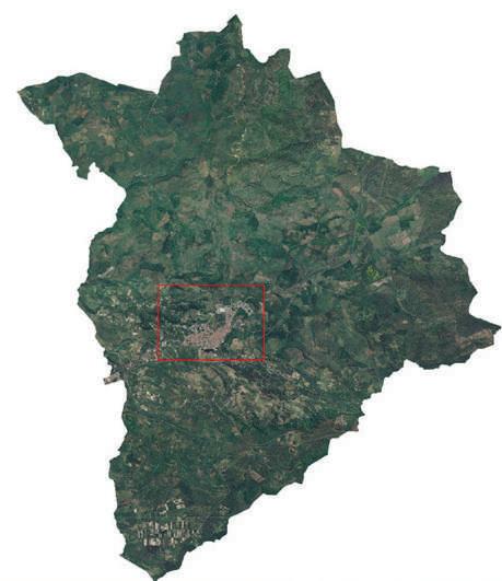
Drafting of the Civil Protection Plan for the Municipality of Ploaghe. Ploaghe , 2017-2019
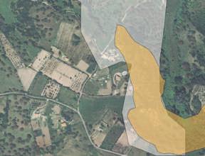
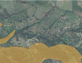
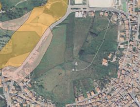
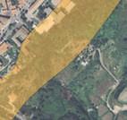
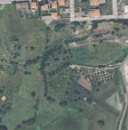
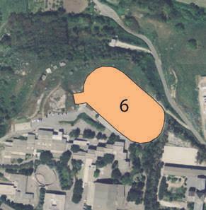
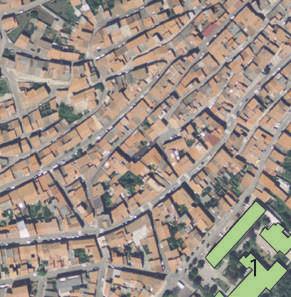
The Civil Protection Plan is configured as a strategic tool for the study and management of risk scenarios, particularly in relation to fire and flooding hazards, and their potential impacts on different segments of the population, as well as possible damage to movable property and critical infrastructure networks. It must clearly and precisely define the actions to be undertaken, the timing of those actions, and the specific operators responsible for their execution in the event of one of the identified risk scenarios.
The primary objective of the plan is to establish a set of directives and policies informed by a detailed analysis of both suburban and urban contexts, with a particular emphasis on the urban area, where the intensity and consequences of such events are likely to be more severe due to higher population density and concentration of services.
The plan serves as a preventive and emergency response guide and also as a planning framework that supports the development of more resilient, informed, and adaptive urban environments. It promotes the integration of civil protection measures into broader urban planning strategies, ensuring preparedness and rapid response capabilities are embedded within the city’s long-term development vision.
Municipality of Ploaghe







“The
prioritizes










04 LA PIETRAIA ALGHERO
From “canal-city” to “city-barena”: an operational pathway for identifying urban reorganization strategies for a permeable city Alghero, 2017/2018
The objective of this thesis is to define an urban organization and its relationship with stormwater for the management of generated surface runoff from the perspective of changing global and local weather and climate conditions.
Urbanized areas provide an example of how land transformation activities have direct consequences on the formation and management of urban runoff. The proposed thesis goes through the recovery of the natural hydrological functions of soil free from transformation, in some cases recovering urbanized areas and in others abandoned areas, through the inclusion of vegetated surfaces, which re-establish the natural processes of infiltration of the water element.
The term “waters” has been used as a synonym for water resource voluntarily in the plural to indicate that there is no universal and generalized “water” of reference. In fact, it is intended to recall the mutability and dynamism of the resource, as well as the plurality of forms it takes, which necessitate different studies, approaches and solutions.
REPORTER Prof. A. Casu
CORRELATOR Verdina Satta


In the areas of recent new expansions, single buildings without a unified urban frontage are characterized, set back from the street and alternating with voids, identifiable as green spaces and areas pertaining to the single building. The recent typology with respect to the nineteenth-century block offers benefits in cases where the vacant surfaces are occupied by permeable areas that allow interception of a share, albeit minimal, of water before it drains to the surface. The result with buildings on both sides of the street axes gives us back a continuous and organized dense and compact city system that, coupled with an urban structure that interrupts natural hydrologic runoff, emphasizes urban stormwater runoff management issues.


Minor watershed of the stony permeable surfaces Minor watershed of the stony impermeable surfaces
From the intersection of the data derived from the analysis with the evidence of the events, an urban basin-level risk map was drawn up showing the areas affected by flooding during the past 7 years, in relation to the extent of the urban hydrographic network and the runoff generated during extreme events.
Areas in red represent the high possibility of flooding and the frequency that these occur over a one-year period. Orange color identifies a medium level of criticality, while areas without color identify areas with low or very low probability of flooding or where there has been no evidence of occurrence. The urban risk map highlights how the areas affected by flooding affected the same routes into which the new urban hydrography flows, through the new urban compluvial lines identified by the study.
Impervious surfaces are twice as large as permeable ones. With the expansion of the tourist portion in the area between Don Minzoni Street and Lido Street toward the sea, the neighborhood has changed its appearance with the concentration of more than 1/3 (34.62%) of the impermeable surfaces in the entire basin. La Pietraia represents at the same time the most permeable and the most impermeable neighborhood compared to the rest of the city.
The design solution envisions a different management of permeable areas with the possibility of reorganization of permeable green surfaces that are not ends in themselves but take on a role as urban pores capable of intercepting urban runoff generated during rainfall.


05 BOSA HYDROLOGICAL BASIN
Re-organization of the land use to provide an envronmantal restoration of the hydrologi cal basin of Bosa
Alghero, 2017/2018
The objective of this work is a re-organization of the farms in the hydrological basin of Bosa. We work the hydrological structure of the basin to understand the it works and how the rivers affect the landscape structure.
Farming is a polluting activity. In the region of Bosa, farms are the typical single-settlement in the farmland. Land is divided in isolated and single intensive animal farmingsof pigs and cows (pp. 16-17). These farmings are highly polluting, according to the water analysis made by the Sardinian Gorvernement.
We were aske to elaborate a solution to reduce water pollution and still retaining the traditional use of land. We made a proposal based on agroforestry. Agroforestry, also known as agro-sylviculture or forest farming, is a land use management system that integrates trees with crops or pasture. It combines agricultural and forestry technologies.
We integrate agricultral and forestry in the traditional animal farming. we applied this tecnique to provide the reduction of water and land pollution through the capacity of the vegetation. We worked on the river-sides to realize a barrier planting brushes and trees which could collect more pollutants from the ground like phosphorus and nitrogen.


06 LA PIETRAIA ALGHERO
Urban renovation of a neighborhood in the city of Alghero Alghero, 2017/2018
The main objective of our project was a complete renovation of the neighborhood, aiming to improve both its physical space and the quality of life for its residents.
La Pietraia is a neighborhood on the periphery of Alghero, located away from the city center and not well connected with the rest of the city. It is recognisable a lack of commercial e city services. However, it is close to the promenade that connects the sea to the city center; according to the inhabitants, they feel both physically and mentally isolated from the rest of the city. It is characterized by six buildings with a unique shape of “C” that, over the years, has stigmatized the neighborhood and the inhabitants as an symbol of enclosure. The neighborhood and particularly this area suffers of isolation, crimes and low education level.
Fisrtly, we studied the social structure and assessed the quality of the architectural and urban environment. We used various methods, including statistical data, video documentation, self-conducted interviews, and land analysis (impervious surfaces, public spaces, pedestrian areas, parking lots, etc.).


Our proposal focused on reorganizing the neighborhood and opening it up to the rest of the city. We introduced new connections using a cycle lane, green areas, and public spaces. Some buildings were demolished to reduce the sense of isolation, and new ones were designed to create a more open and accessible urban structure. The new layout incorporates permeable surfaces and green areas, connecting the neighborhood to existing green spaces. Walking paths were designed with continuous, permeable paving to highlight a seamless flow through the area
At the heart of the existing buildings, we designed a central square, intended to serve as the focal point of the renovation, promoting visibility and interaction within the community. A cycle lane runs through the center, connecting new and existing buildings and integrating with the city’s existing cycle network.
We also focused on improving the architectural quality of the buildings to ensure they are livable and affordable. The new buildings are simple in design, with structures open on all four sides. The housing units are larger and designed to accommodate different types of families, with ample natural light, open spaces like terraces and balconies, and varying dimensions and shapes depending on their location within the urban layout. These buildings are connected by pathways and small squares, and commercial services are located on the ground floors to provide more amenities to the neighborhood.


07 SAN DONATO SASSARI
An operational process of urban and social recovery of degraded micro-spaces within the relational fabric of the historic city of Sassari Sassari, 2015
This thesis proposes an integrated methodology for analysis and action on a peripheral area, such as the historic center of Sassari. The method of tactical urbanism was chosen to complement traditional planning tools, as they are no longer sufficient to address the current dynamics.
The process aims to experiment with new action methods through micro-interventions, involving local citizens, designers, and administrators in reconfiguring space with light, temporary structures in a degraded neighborhood with untapped potential. The objective is to foster an integrated approach to cooperation that captures vital grassroots movements within the historic center, channeling them into a proactive, innovative process. This involves building dialogue among residents, coordinators, and local authorities to define shared, long-term projects. The focus is on recovering concepts like belonging and local identity, essential for creating a unified neighborhood center.
The operational design phase engaged the community in transforming the space, revealing hidden potential areas recognized and embraced by the residents


...connect space to local services: the library engages with the area to connect with residents...
...rebuild the relationship with the school and organize the space as a passage to connect it with surrounding areas...


...free the square for public use, allowing it to host multiple functions and activities with associations, giving the space new visibility...
...shape the space with micro-interventions of lightweight, low-cost architecture...


...restore the original function of public space through spontaneous uses like play...
...tools to engage and communicate with the hardest-to-reach groups by sharing assumptions, goals, and content...

