2 01 - Ascension, Illumination, Relaxation 02 - Carlos Almaraz Chicano Art Center 03 - The New City Public Library 04 - Setting The Table 05 - Personal Work Table of Contents
3

Created in: Fall 2021
Class: Foundation Studio III
Instructor: Katie MacDonald
Location: University of Virginia- School of Architecture
Site Location: 1204 York Ave., New York, NY 10065
This studio looked at designing a medical housing campus in the Lenox Hill neighborhood of New York City. The focus of this project was to create a housing complex that centered around the ideals of relaxation and community. The challenges of the coronavirus pandemic created a great sense for the need of tranquility in the built environment. This project aimed to create a housing facility that was intended to restore tranquility within the home.
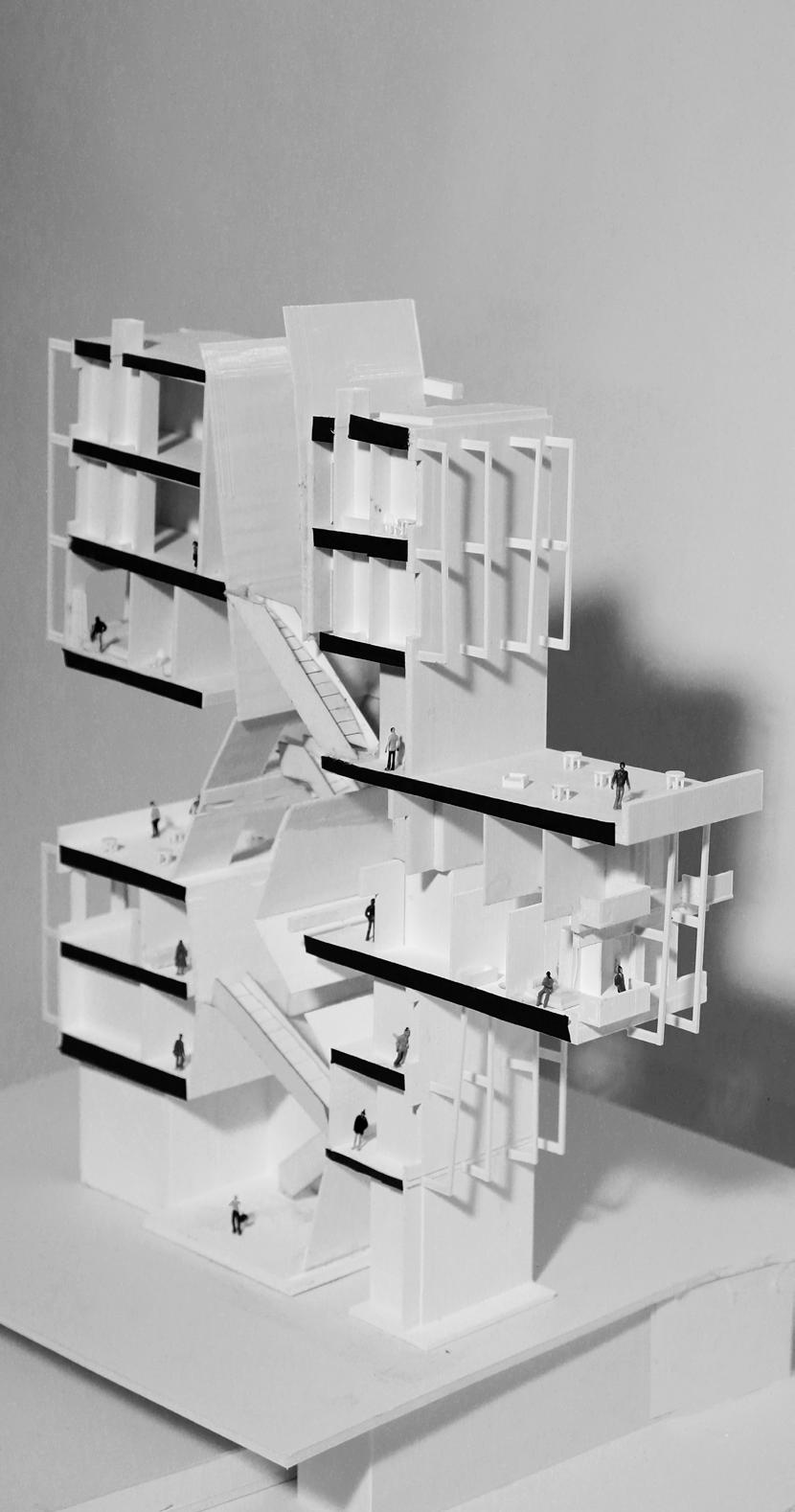
The building was designed to represent these values. The skylight is utilized to penetrate the core of the building in order to bathe the ground floor in light. The ramps and pathways bridge the medical campus from the building to the East River. The placement of the public spaces are tied to the ramps, stairs and the lightwell. The design of the building creates a warm environment for the families of the patients. These design principles help restore the sense of tranquility, while focusing on the role of the medical community. These aspects create apartments full of light, proposing a new model for equitable affordable living in New York City.
Site Perspective
This project is located within the Lenox Hill neighborhood of New York City. The site sits along the East River at 1204 York Avenue. This studio explored creating a housing complex within a medical campus.
This project offered the chance to create affordable housing opportunities. The city has only one building listed as a New York City Housing Authority building within Lenox Hill. The neighborhood consists of primarily medical facilities along York Avenue, with middle to high income housing along 1st Avenue. The site is a part of Rockefeller University. Rockefeller University owns a few of the adjacent buildings to the north and west of the site.
The site is currently used as power plant for the surrounding buildings. The project had to effectively create a connection to the surrounding buildings which tower over the site, as well as connection to the East River. The site sits above the Franklin Delano Roosevelt Highway. An important part of the project regarded how the class interplayed with the highway below.


Created in: Spring 2022
Class: Foundation Studio VI
Instructor: Ines Martin Robles
Location: University of Virginia- School of Architecture
Site Location: Between S. Soto St. & 1st St, Los Angeles, CA
This project is focused on the design of an arts school within the neighborhood of Boyle Heights. The art school is meant to take the form of a community center and house workshops, while also offering gathering spaces.
This project resides within the Boyle Heights neighborhood of Los Angeles. The neighborhood was a melting pot, as it was represented by different ethnicities which gave the community vibrance. Following World War II, the community saw enormous decline.Many of the ethnic groups left Boyle Heights, while the Chicanos stayed. The poverty and education rates within the community are far below the rest of the Los Angeles. The community remains reticent for change and has pushed back against the pressures of gentrification.
The provocation for this project began by understanding the income inequality gap within one of the world’s wealthiest cities. These maps reflect the income inequality gap within Los Angeles. The top map looks at the median income in shades of gray, where the wealthiest areas are darkest and gets lighter towards the poorer neighborhoods. One red dot represents 500 individuals who have to pay more than 30 percent of their income on rent. The map below looks at the homeless population of Boyle Heights and the locations of the homeless shelters. These maps were particularly important as they informed the ethos of this project.

Early Model of Hanging Boxes (Left)

Map of Los Angeles income equality (Top Middle)
Map of Boyle Heights homeless population (Bottom Middle)
Site Location in Plan (Top Right)
Site Perspective (Bottom Right)


The project aims to act as place for refuge and rest to the homeless community, while offering art classes to the community. The classes will help teach the history of Boyle Heights through art, while providing opportunities to learn helpful skills. The classrooms and workshops will provide a place to showcase the art. The center will also hold large event spaces, along with spaces for rest for the homeless. The intention behind the design of the project is to create a space where the visitors feel connected to the center and the community. The community is paying homage to the history of Chicano culture and allowing for a place to restore the traditions.
The design of the project is based off of the design of Cedric Price’s Fun Palace. The Carlos Almaraz Chicano Art Center is designed based off of similar principles by utilizing hanging programmatic boxes from the structure. The third floor has a slight overhang over the floors below, where it comprises of brace frames along with trusses that run north to south. The brace frame and trusses allow for programmatic boxes of the second floor to hang over the ground floor and create a gallery below.


The project is focused on providing a space of rest for the homeless while being able to learn skills. The place for rest was an important design decision for the project. The resting area is located on the top floor to provide the best view, while also being located nearest to the egress for year round access.


The Carlos Almaraz Chicano Art Center has multiple purposes aside from being an art center. It is meant to provide other resoruces to the community. The lecture hall, classroom, and meeting rooms provide a welcoming space for the community.
The gallery plays a key role within the organization of the center. It offers a large double height atrium to welcome the visitors. The gallery provides a large space for exhibitions. The gallery can also act as an event space for the community that can be brought out to the plaza around the train station.
The workshops are housed within the hanging boxes of the second floor. The location of the workshops on the second floor made it easier for a visitor to locate them upon arrival. It was important that the workshops have a visible connection to each other and the gallery below.


Created in: Spring 2021
Class: Foundation Studio II


Instructor: Seth McDowell & Erin Putalik
Location: University of Virginia- School of Architecture
Site Location: Between S. Justine St. & 47th St, New City, Chicago
This project is located within the neighborhood of New City in Chicago. New City is located towards the southern end of Chicago. New City had once seen great prosperity in the late 19th century, due to the abundance of jobs at factories. However following World War II, the factories began to close down and many individuals lost their jobs. New City saw many individuals leave the neighborhood for homes outside of the area. Over the years, the city of Chicago has funded and provided resources to neighborhoods north of New City. New City has failed to see the same influx of investment.

The purpose of this project was to design a public library that could house many elements that act as a community center. The site sits along a loud busy street, while creating boundary from the site is low single- family housing behind the site.
The main idea behind the approach to this project is to bring investment back to New City. This is attempted through creating spaces for community engagement and avenues to provide resources to the community. Courtyards are used to both bring in light and create active spaces. While the top floor is used as a community incubator space to help promote local business. The library is intended to act as a bastion for hope within the community, as a symbol that investment can come towards the community.


Created in: Fall 2022
Class: ARCH 4010/8010 Studio - Just Urban Ecologies
Instructor: Ifeoma Ebo & Hannah Jane Brown
Location: University of Virginia- School of Architecture
Site Location: Edgemere, Queens, New York
Project in Collaboration with Jessica Huang & Miriam Hossaini
Just Urban Ecologies was a studio that was focused on community engagmenet. The studio entailed multidisciplinary partnered projects. The projects were intended to be large scale urban design schemes. Setting the Table’s focus was on the themes of food and youth. It was formed as an adaptive framework to prepare the ground for further advocacy within Edgemere. The project utilized the main corridor of Beach 43rd Street to establish a North-South corridor to bring a connection of the Jamaic Bay to the Rockaway Beach. The approach to the corridor is through three zones of interventions based on site analysis and existing community planning reports. The framework included designing a Market Site and a Garden Block. The portfolio will focus on the two sites that were investigated and designed. The final deliverable for this studio was in the form of a website. You may find the link provided below. https://mrh4wve.wixsite.com/settingthetable
The Just Urban Ecologies site was located in Edgemere, Queens, New York. Edgemere was once a vibrant community that is located near the Rockaways Beach. It rose to prominance due to Rockaway Beach becoming a vacation area. The area become a focus of redlining practices within New York City. The area became home to minority groups. While the wealthier communities within the Rockaways have grown, Edgemere has seen little change.


Edgemere sits between the Jamaica Bay and the Rockaway Beach. Upon heavy rainstorms the area becomes quickly flooded. The area saw tremendous destruction due to Hurricane Sandy. The community is still struggling to rebuild from the storm. Edgemere is at the center of many of the challenges that the world will face due to climate change.
The community of Edgemere created the Resilient Edgemere Community Plan in 2017. The Resilient Edgemere Community Plan will help focus the attention on the community on the direction of design. The Resilient Edgemere Community Plan included a phasing of development based off of when the land would be floodable. The land nearest the bay was used as marshes and flexible structures that could withstand flooding. South of the floodable zone was a space that becomes more residential and leads towards the more active commercial spaces and that zone would allow for permanent structures with an understanding of it becoming floodable. While the zone furthest away from the bay would be the best for long term growth and stability. Setting the Table used this developement as a way to organize our sites. The sites are formed into 3 zones. The development plan is shown towards the right.

 Jamaica Bay
JFK Airport
Far Rockaway
Jamaica Bay
JFK Airport
Far Rockaway
High Tide 2100
High Tide 2080
High Tide 2050


High Tide 2020


Kitchen Incubator
Prepare the ground
Use generational recipes
Kitchen Season
Eat what
Kitchen Library
Season to taste you grow
Community Kitchen
Bring a dish to the potluck
Make a room at the table
It was important to provide the Edgemere community with multiple options of how the garage design style could be applied. This drawing was a catalogue of how the garage style could be used at the large or medium scale such as it’s own restaurant with seating, or at the food truck scale as used in the main design. The food cart scale could be applied throughout the streets of Edgemere. The intention was for all of the these different scales to use a similar construction method and would be similarly easy to construct over a short period of time.
Food Cart Scale
Food Truck Scale
Medium Scale
Large Scale
When I was younger my artistic interests were always in drawing with color. I found geometric shapes particular compelling to create. Prior to my architecture education, I continued my interests in drawing with geometric shapes.

I began a small exercise, where I created a model of large equiltareral triangle out of foam core. Within the triangle I created unique shapes and in some cases new triangles. This model then inspired drawings to the right that were various compositions with color of the model. I began to find the mix of color palletes with different oganization of the shapes particular beautifully simplistic.


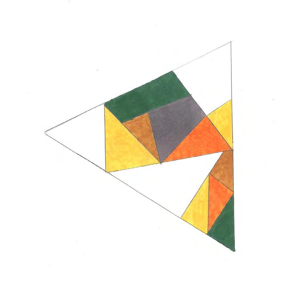

In this new set of drawings I continued to explore various ways of connecting the geometric shapes. I found that the use of the accent colors brought out new organizations of the spaces. This continued exploration of the organization of the geometric shapes accentuated my interest in becoming an architect.


