CHAPTER IV: REDEVELOPMENT SCENARIOS Festival Center Redevelopment
IV.1
CHAPTER V: ACTIVITY CENTER URBAN DESIGN STRATEGIES
Context
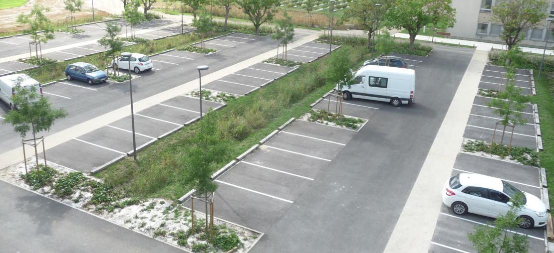
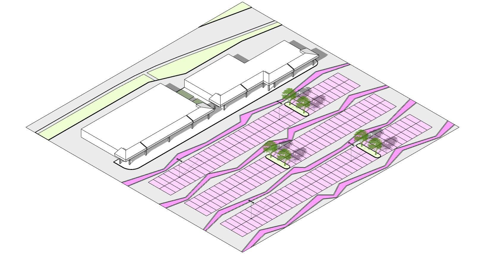
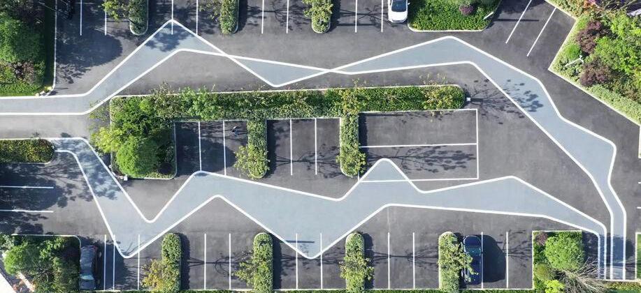
Pad Retail Infill Strategy
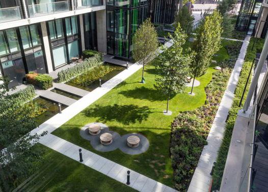
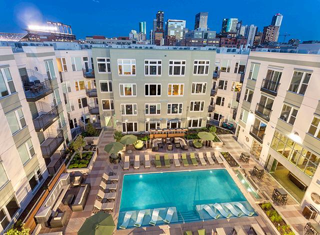
Alternative Strategies
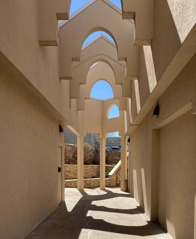
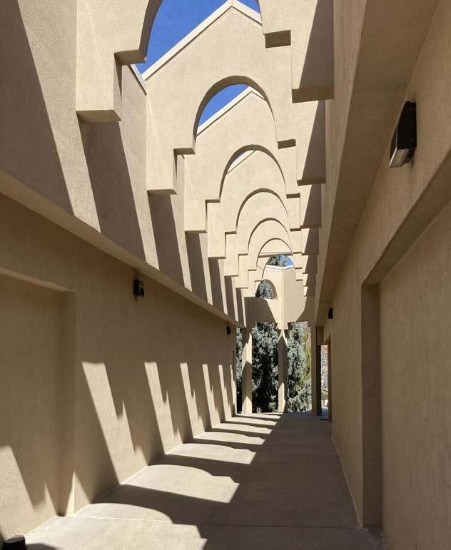
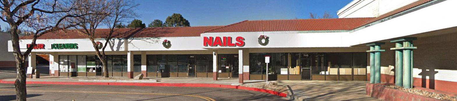
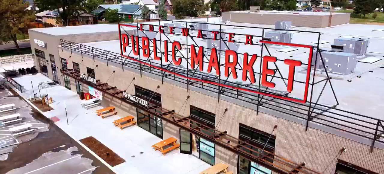
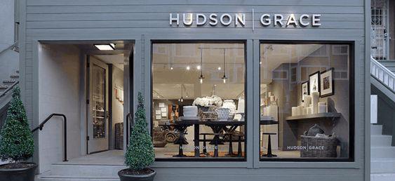
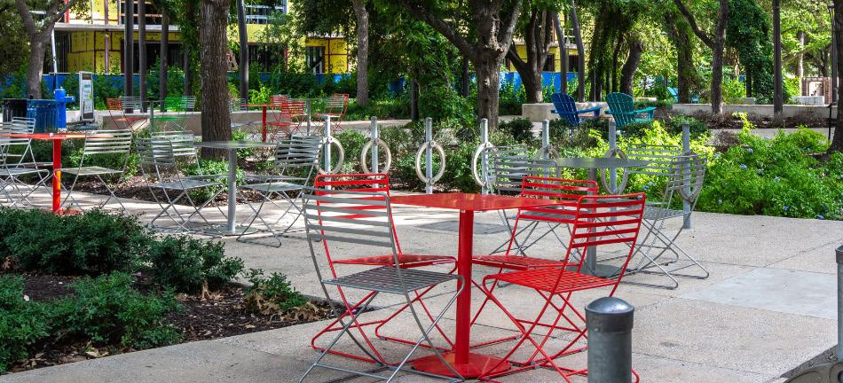
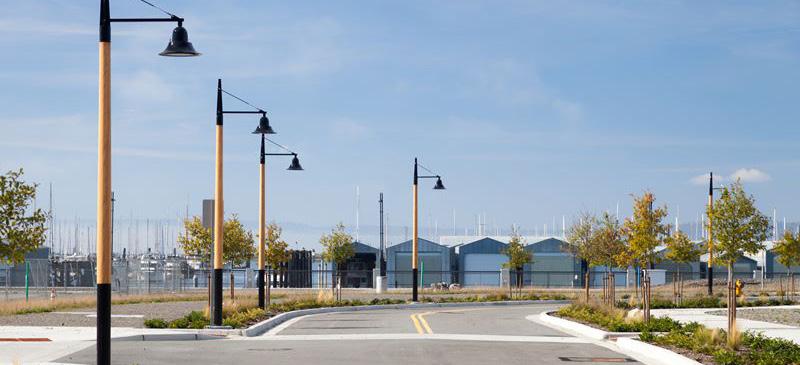
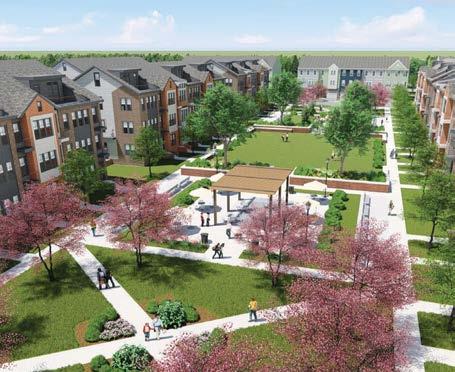
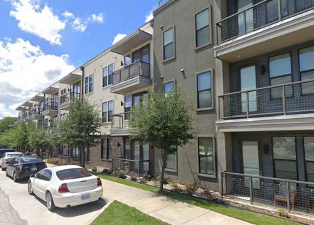
Corridor-Facing Retail Precedents
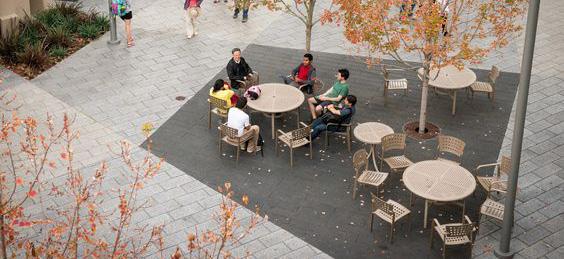
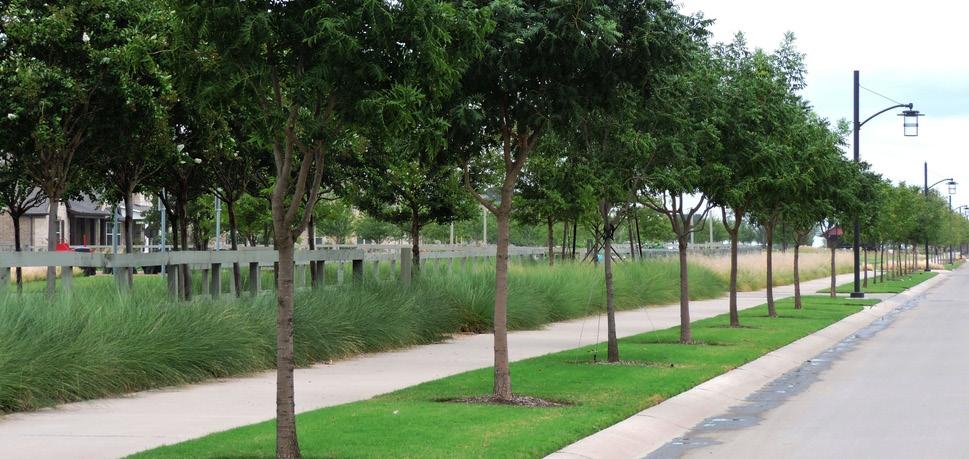
Arterial Adjacent Pedestrian Zones
Cherry Knolls Redevelopment Options
University Towne Center Redevelopment Options
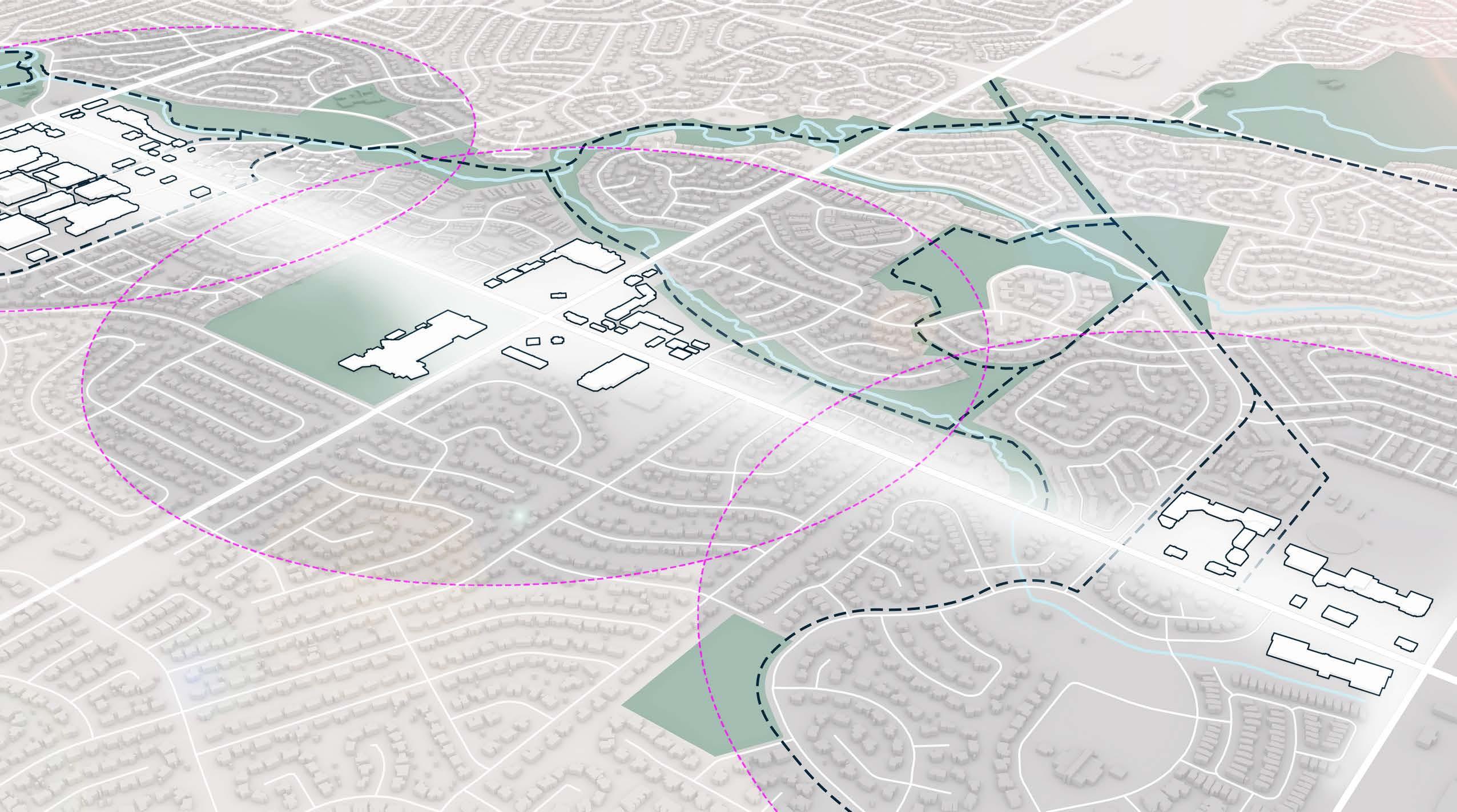
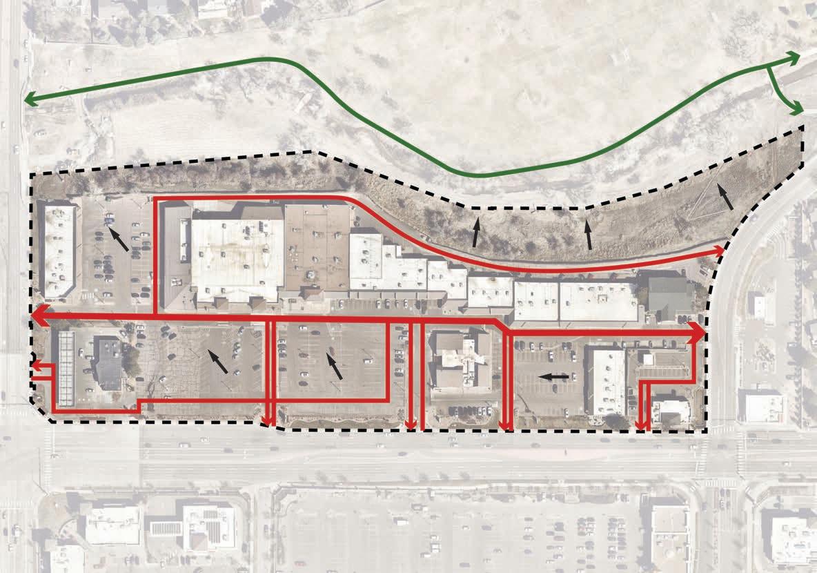
Overall Connectivity Diagram
Introduction
The City of Centennial aims to be a proactive partner through the City’s retail program efforts to assist in creating the future of exciting, unique, and sustainable retail centers. This approach aligns with the City’s Strategic Plan Key Performance Areas of Future Ready City Government, Economic Vitality, Signature Centennial and Fiscal Sustainability. Through careful planning, creative land use, and partnerships with the private sector, the City can play an integral role in transforming the retail landscape in Centennial, leading new businesses to locate in Centennial retail shopping centers and more visitors to frequent those spaces. How the City interacts and partners with the private sector is evolving, with targeted efforts by the City to create clear strategies and tools that transform retail assets in Centennial.
This book of work expands on strategy development to positively impact Centennial shopping centers, with examples of what could be possible in retail spaces and what the City would like to see occur. Potential improvements may include investment phasing, connections to greenspaces and other community assets, walkability within and to/from shopping centers, incorporation of additional land uses, right-sizing, and placemaking and wayfinding enhancements. This document is an idea toolbox to spark investment and provide opportunities for the private sector and the City to work together.
These renderings represent examples of improvements and investments that can help transform shopping centers in Centennial. Investments can be made by property owners or in partnership with the City. These visuals are intended to help steer conversations with the private sector and are not meant to depict the only investments that can be made or considered.
Centennial, like most jurisdictions in Colorado, recognizes the need for successful retail and associated sales tax revenue to fund City services. Successful retail also adds to the quality of life in our community while providing an important revenue stream for essential City services. The City is planning for shopping centers and retail partners to add continued value to the community and be sustainable into the future. This is an opportunity to start a conversation that leads to future investment in the City’s retail centers and corridors.
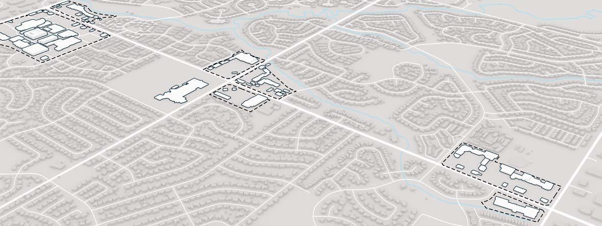
Context
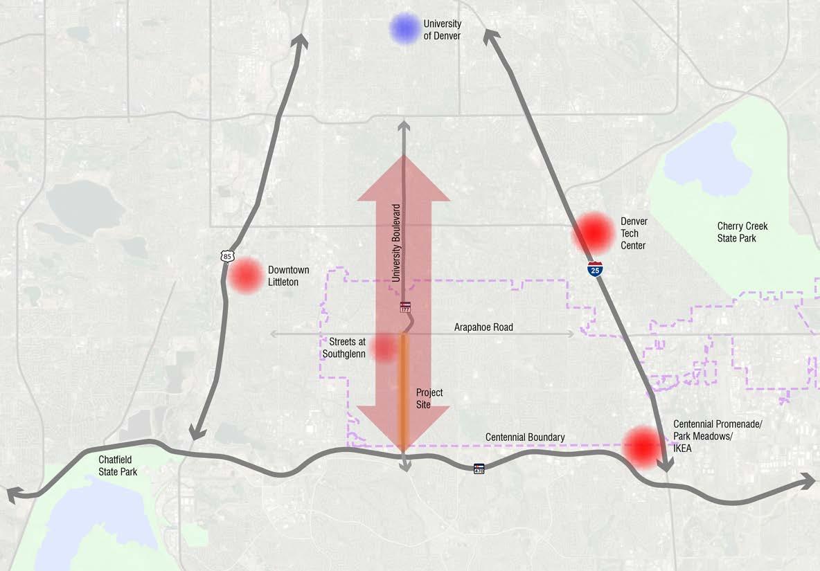
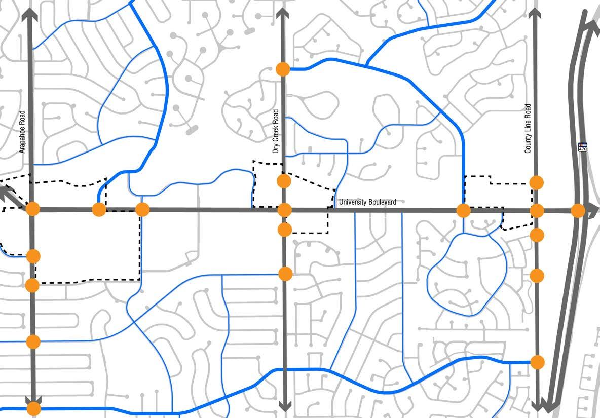
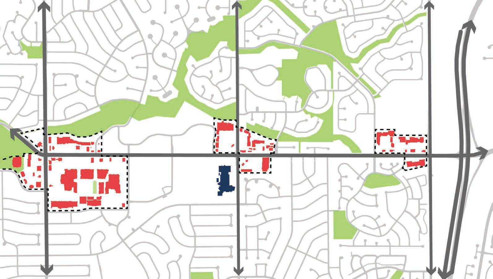
The City of Centennial engaged Civitas to study the University Boulevard corridor between Arapahoe Road and County Line Road. Civitas was tasked with developing an urban design strategy that evaluates the retail asset’s role and place within the community and larger retail market. The design team toured the corridor on several occasions, created corridorwide analysis maps and property ownership maps based upon GIS information, developed retail occupancy maps based upon existing economic data and site tours, and developed existing street cross sections based upon GIS information and Google Earth maps. Compiling this information allowed the design team and city staff to garner an understanding of current conditions along the corridor. By documenting our findings and observations of the built information, Civitas was able to identify key opportunities and constraints along University Boulevard corridor, which informed the proposed urban design concepts and strategies found in this document.
ANALYSIS FINDINGS
Regional Analysis
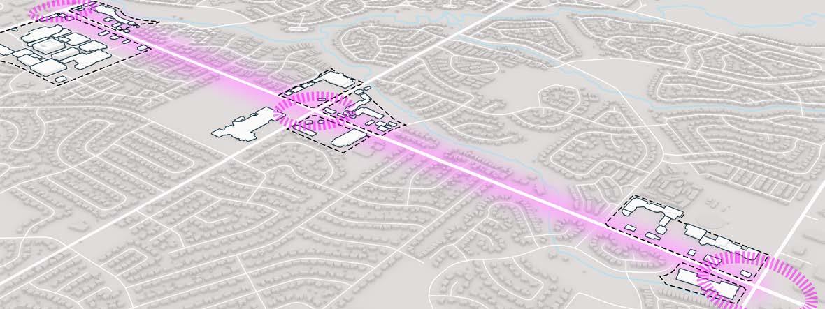
• University acts as a major north-south connection
• Enhancing the corridor will help to reinforce this connection
• University has the potential to become a center and identity of Centennial
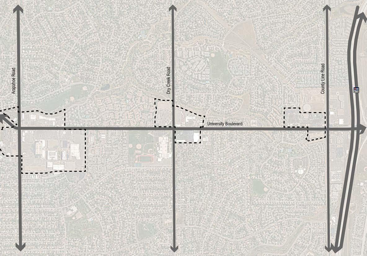
• Study area is approximately 2 miles long between Arapahoe Road and County Line Road
• 3 clusters of retail centers or “amenity centers” along this stretch
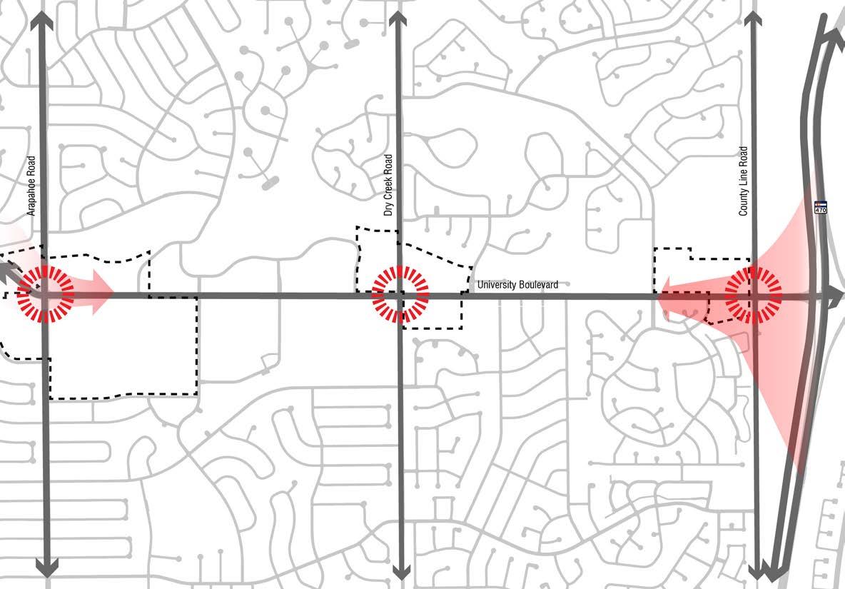
• There are “gateway opportunities” present at the intersections of the University corridor and its corresponding amenity centers
• Arapahoe Road, Dry Creek Road, and County Line Road are the primary east/west gateways to the University Boulevard Corridor
• Arapahoe Road could also serve as a gateway from downtown Denver and Denver University
• The proximity of County Line to C-470 is an opportunity to create a regional gateway announcing arrival at the City of Centennial
• These locations are opportunities to create and enhance identity for both the corridor and its amenity centers
Neighborhood Connections Legend
Major Arterial
Major Collector
Minor Collector
Signalized intersections
• The existing street system provides few connections from the adjacent neighborhoods directly to University Boulevard. As a result, additional methods of integrated connectivity between the commercial assets and the neighborhoods should be explored.
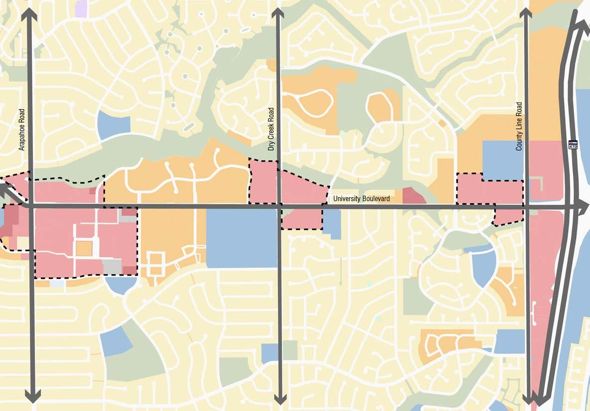
Land Use Legend
Retail
Single Family
Multifamily
Public
Commercial Park
• The land use along University Boulevard between Arapahoe Road and County Line Road is primarily retail, multifamily, and public (education), with mostly single family residential on either side of these areas
• The few single family residential areas immediately adjacent to the corridor are separated by HOA-controlled landscape buffers
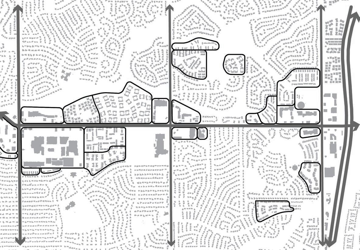
Development Groups + Densities
• This map shows groupings of different varieties of developments
• The neighborhood around University is comprised of primarily typical single family residential development
• Multifamily and townhome developments tend to be located immediately adjacent to the cooridor; these tend to be selfcontained neighborhoods that do not connect to the broader community
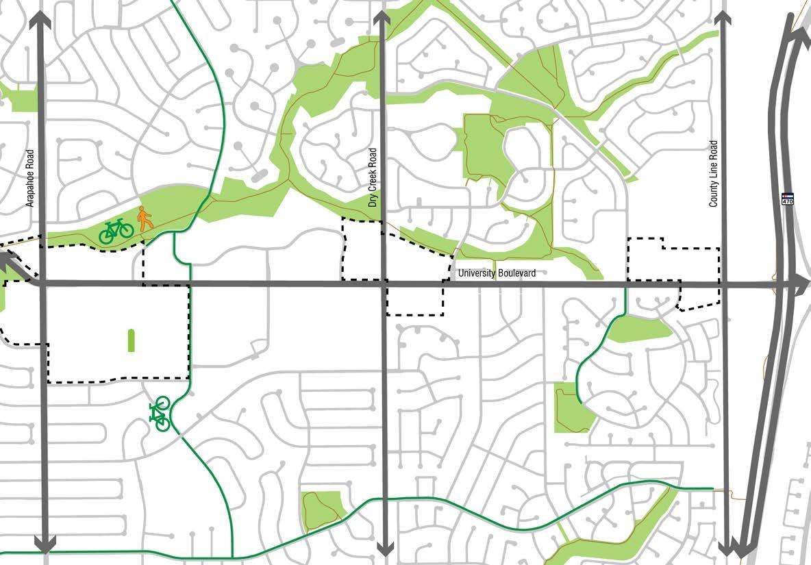
Parks + Trails Legend
Parks + Open Space
Trails
Bike Lanes
• There are minimal trail connections from the surrounding park and open space system directly to University Boulevard
• This further exacerbates the disconnect between the adjacent neighborhoods and the corridor
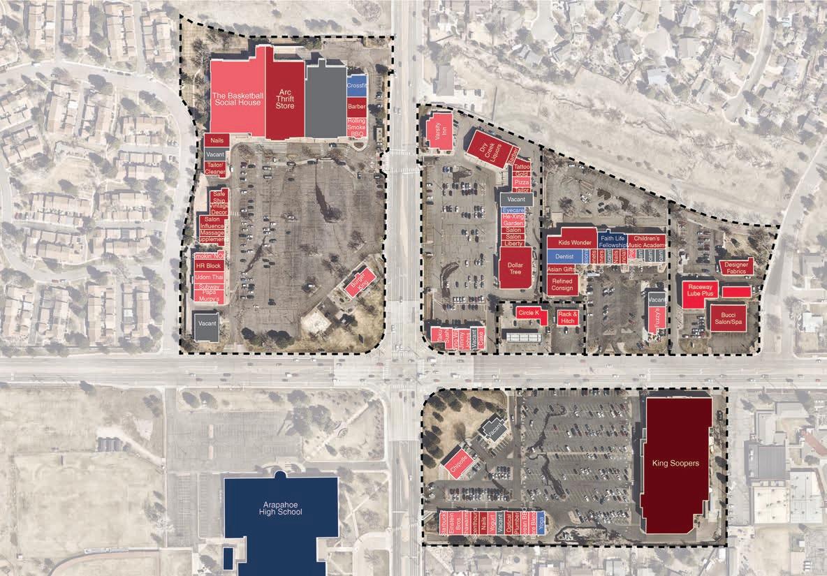
Dry Creek Intersection
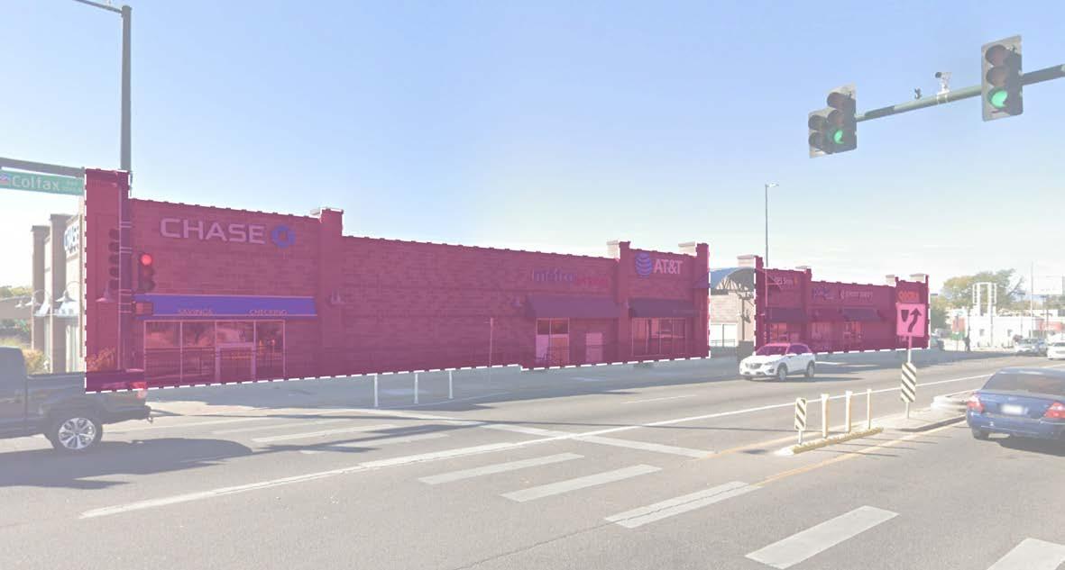
Festival Center
Cherry Knolls
Streets at Southglenn
Cherry Knolls
Tenants Legend
Public/Event Venue
Health + Human Services
Anchor Retail
Neighborhood Services
Automobile Services
• 14.85 acres
• 156,690 gross SF
• 34,462 SF vacancy
Cherry Knolls is directly across University from the popular Streets at Southglenn development. Its most prominent building is a strip mall style building that spans nearly the entirety of the activity center. It is also directly adjacent to Cherry Knolls Park to the east, although the large structure’s service drive, a screening fence, and a significant grade difference separate the activity center from the park altogether. Primary vehicular access for all surface parking runs parallel to the building’s facade, with several other small retail properties located between this drive aisle and University. Cherry Knolls Totals
Bars and Restaurants
Vacant
• This activity center is comprised primarily of neighborhood services, and 22% of the retail is vacant
• Access to the site’s retail spaces is primarily automobile-focused, which inherently creates a lack of pedestrian connectivity and safety, as pedestrians are forced to walk through automobile drive aisles
• Varying building layouts and architectural styles on the site create a lack of cohesiveness
Cherry Knolls Park
Streets at Southglenn
Cherry Knolls
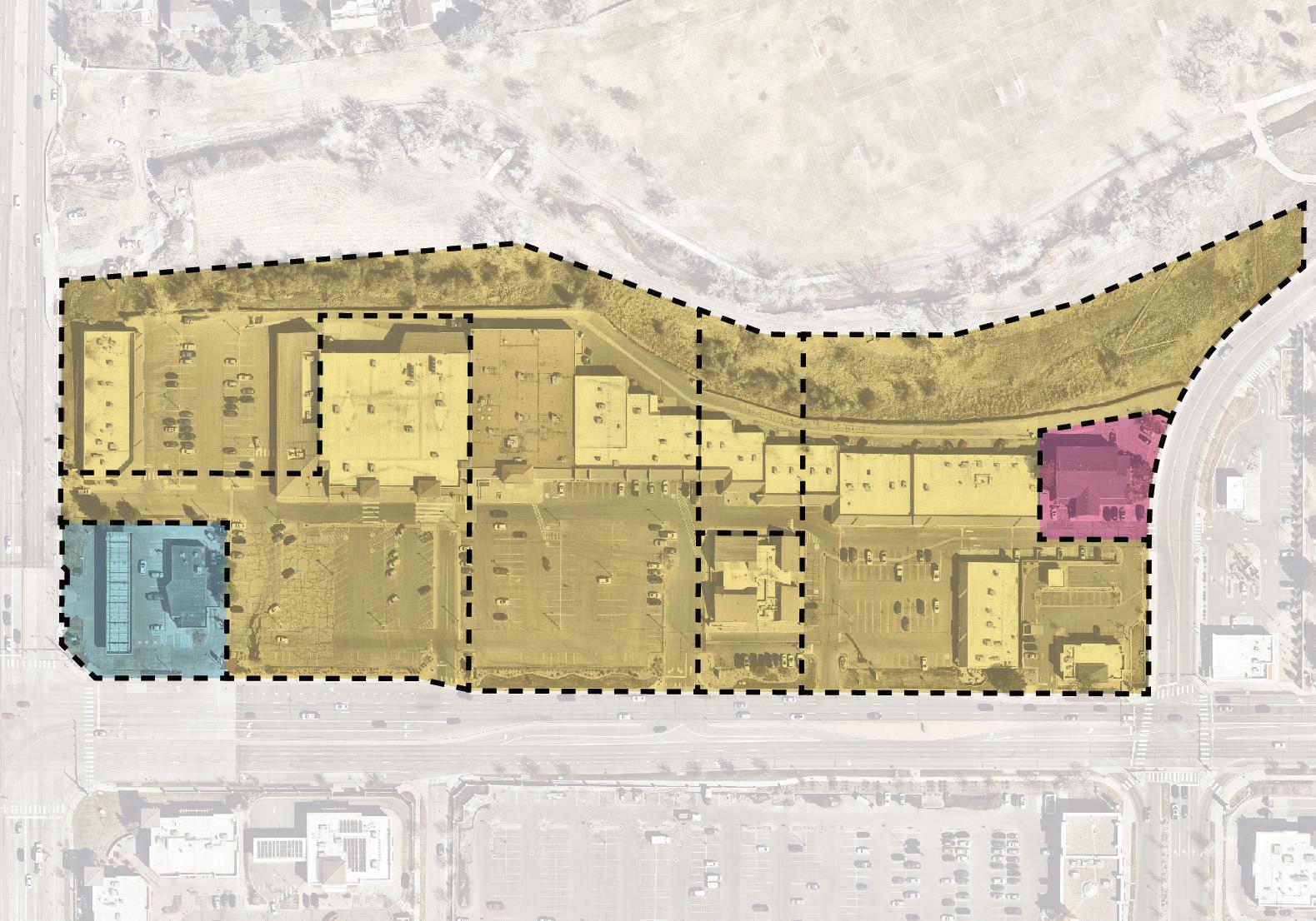
• While there are multiple parcels on this site, most of them are owned exclusively by one owner
• There are two smaller parcels owned by separate owners at either end of the site
• The site has four direct access points to University
• If this site were developed today, it is unlikely that this many access points to a major street would be permitted
• While future development may prefer to maintain access to University, closing some access points may improve pedestrian and vehicular safety along University
Eastern end of main building
Main building, showing empty anchor tenant space
Looking east at the slope separating the park from the activity center
Main building facade and canopy
Back alley/access drive edge condition
Underneath main building canopy
Dry Creek Intersection
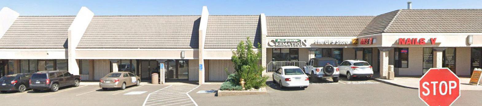
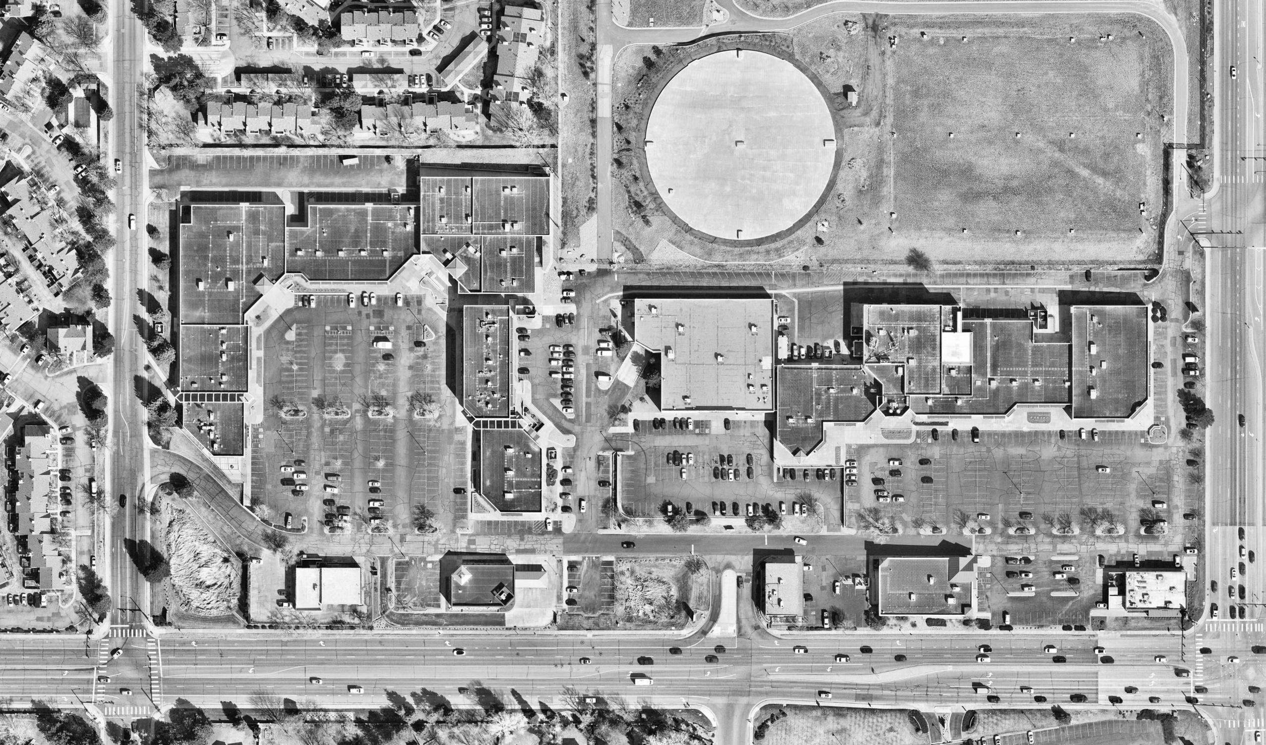
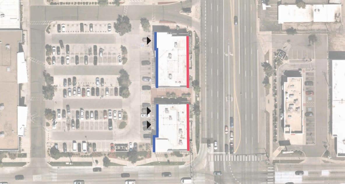
These four activity centers share the busy intersection of University and Dry Creek Road with Arapahoe High School to the northwest. As such, many of the restaurants in each activity center’s strip mall style buildings are frequented by high school students at the lunch hour and after class. Cherrywood Square also contains a King Soopers, which is a major neighborhood destination and the leading grocer in Metro Denver by market share. University Towne Center, Dry Creek Center, and Southglenn Square are all adjacent to an open space and trail system to the east, although there is no direct connection to the activity centers from the trail, as the open space is directly adjacent to the back of house or service entries of the activity centers’ buildings. While Dry Creek Center and Southglenn Square are directly adjacent to each other, there is no vehicular connection between the two, and cars are forced to drive back onto University in order to move from one activity center to the other.
• These activity centers are primarily a mix of neighborhood services and bars and restaurants
• Access to the site’s retail spaces is primarily automobile-focused, although auto and pedestrian circulation between each activity center is limited
• Each activity center has a separate architectural style or facade aesthetic
• Each activity center (University Towne Center, Dry Creek Center, Cherrywood Square, and Southglenn Square) has its own owner
• There are several smaller parcels in the southeastern cluster of activity centers with separate owners
• Each activity center has its own large parking lot, with 2-3 access points to the adjacent streets
• Despite being directly adjacent to each other, there is no vehicular circulation between the Dry Creek Center and Southglenn Square activity centers, in addition to very limited pedestrian circulation, forcing shoppers to drive back out onto University in order to move between one activity center to the other
Dry Creek Center looking southeast
Typical facade at Cherrywood Square
Typical facade at University Towne Center
Condition of open space north of Southglenn Square
Back of Southglenn Square looking west
Condition of open space north of University Towne Center
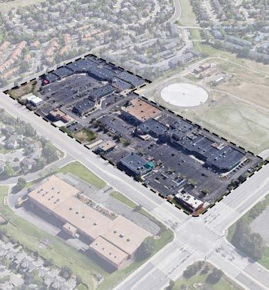
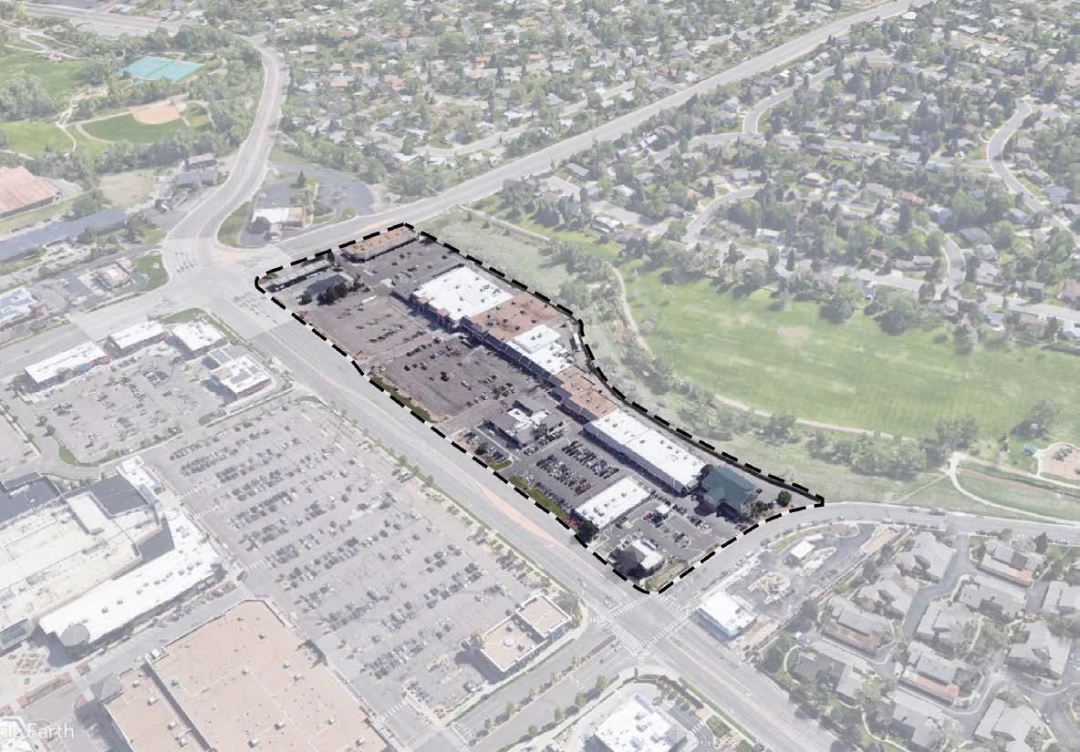
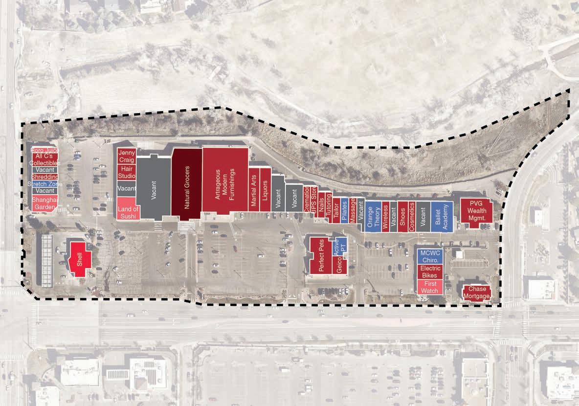
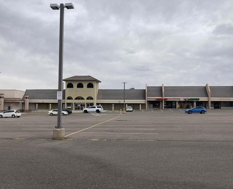
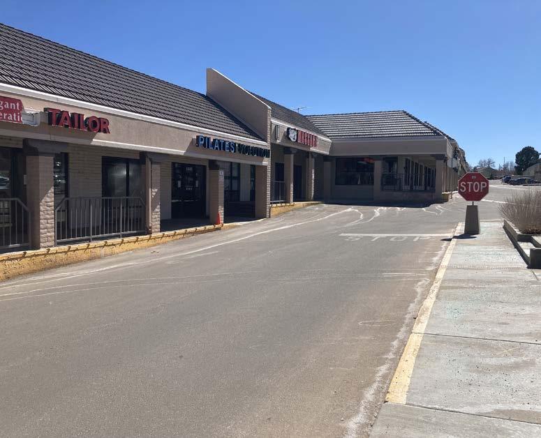
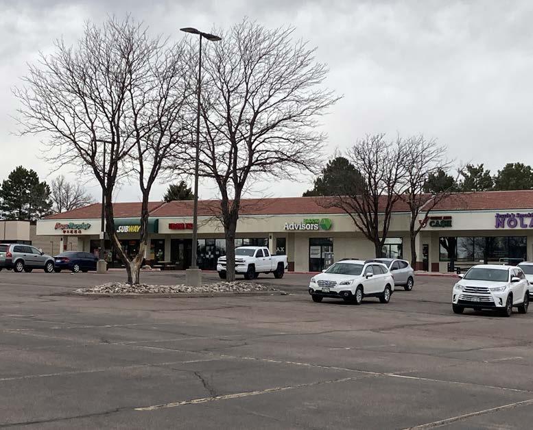
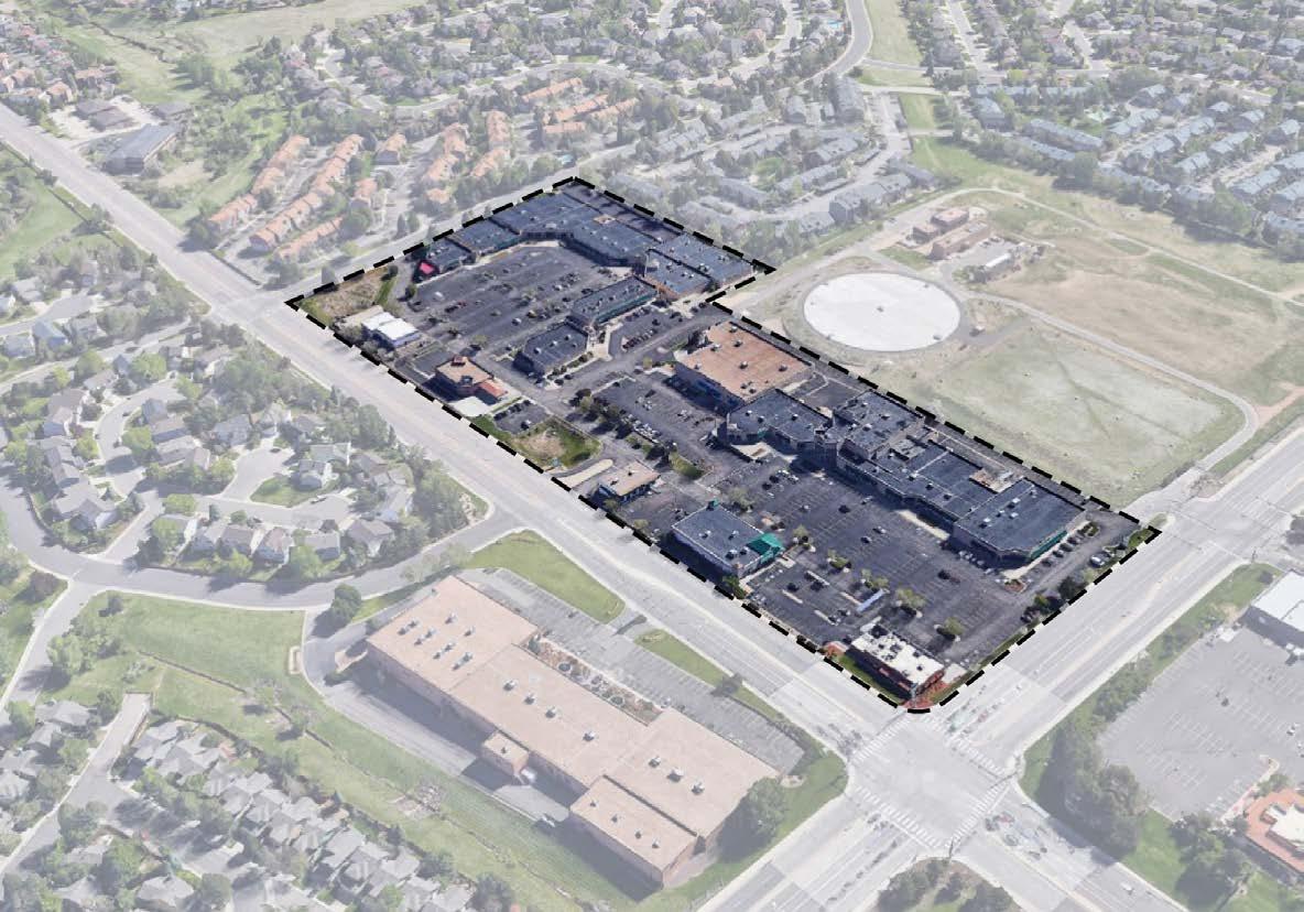
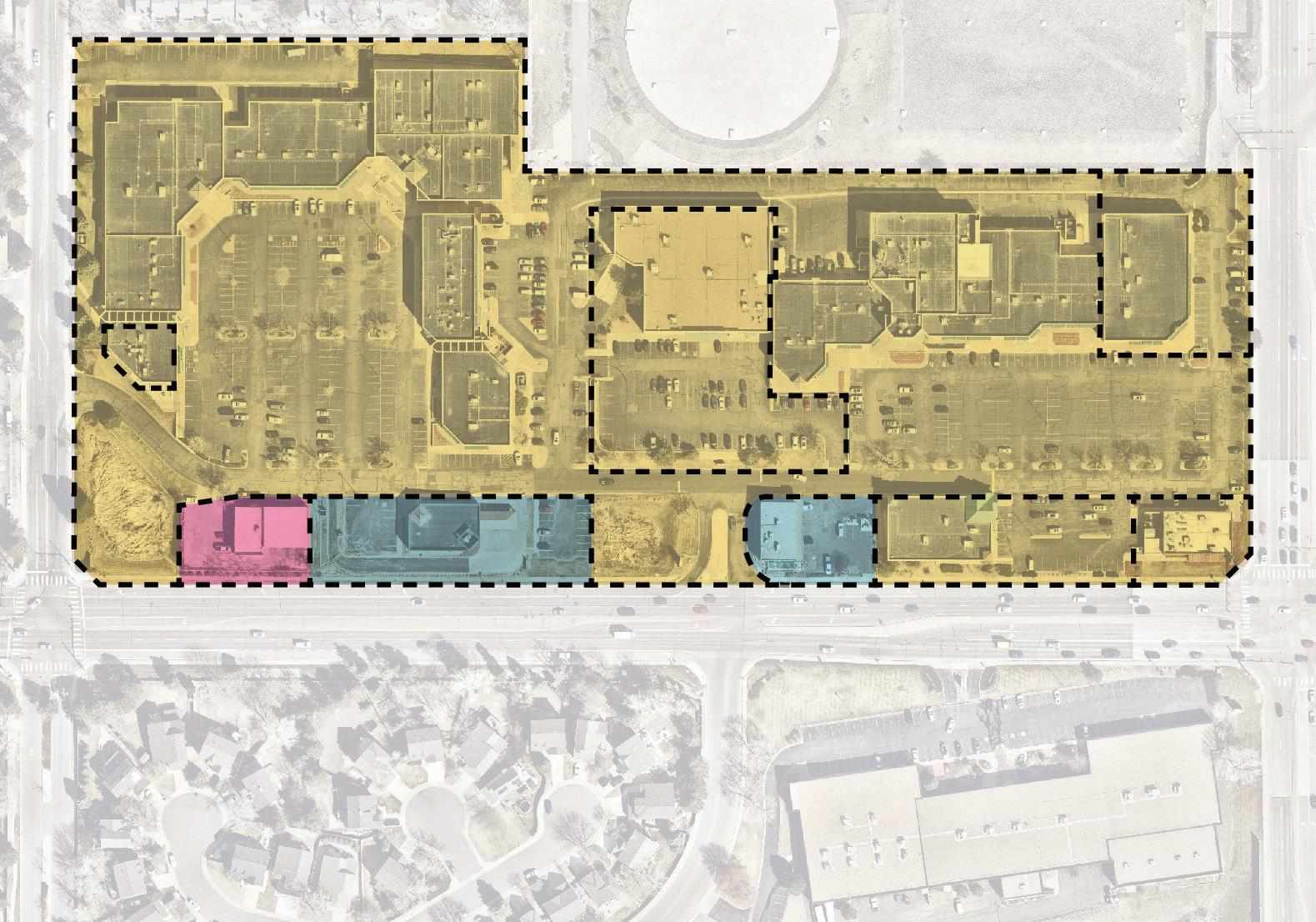
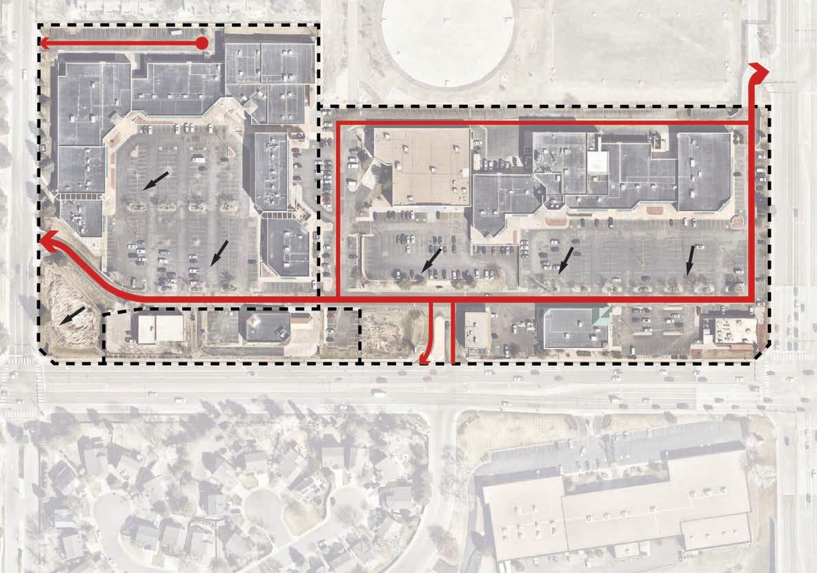
Festival Center
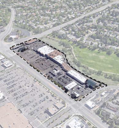
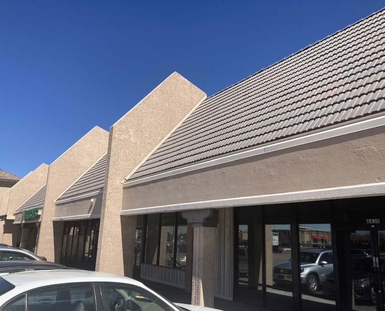
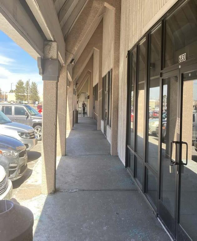
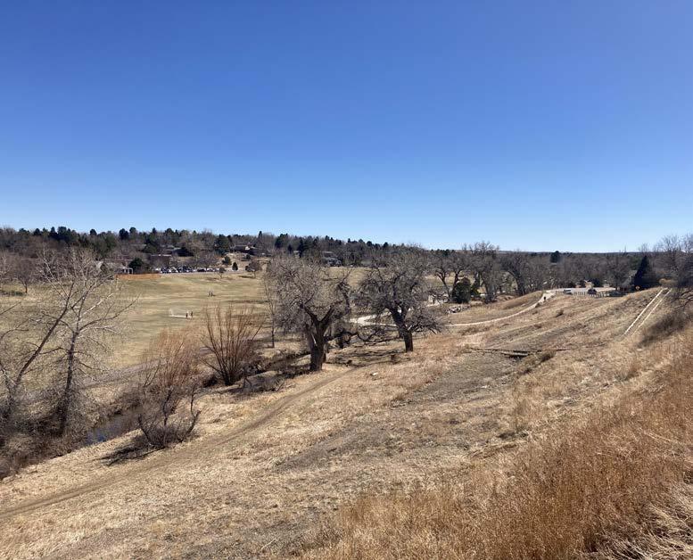
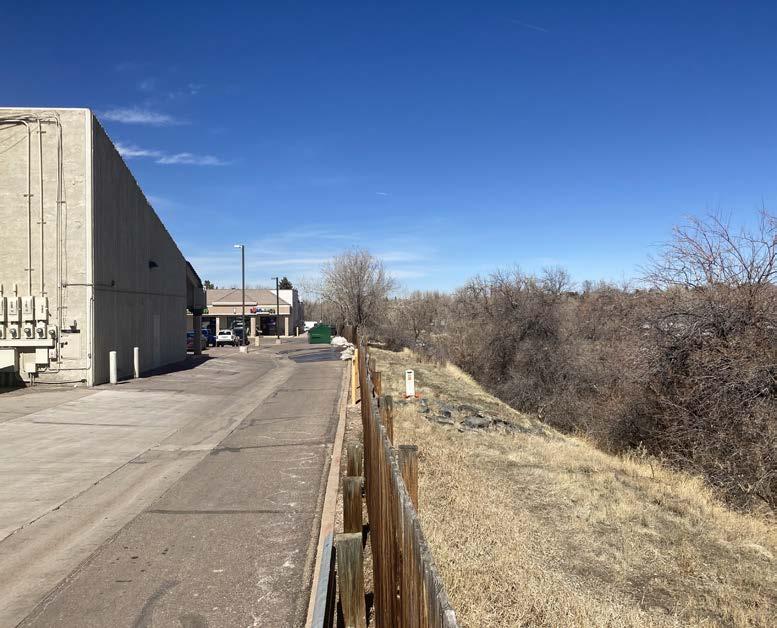
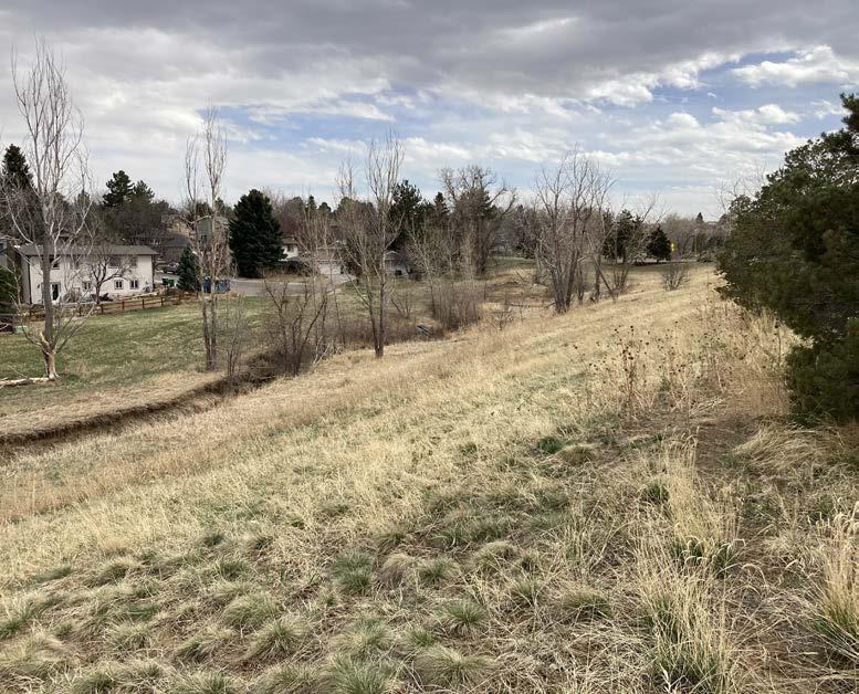
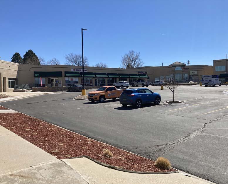
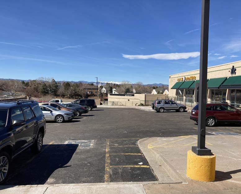
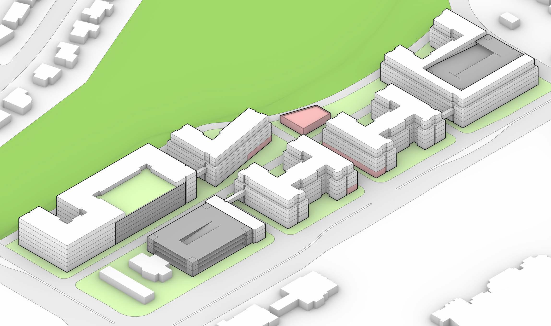
This activity center has two primary strip mall style buildings. The larger building to the north is largely vacant, with a two-story addtion on its southern end that alleviates the site’s major grade break. The building to the south houses multiple supply stores, and its largest tenant is PetCo. There are several smaller buildings closer to University, including car services, restaurants, and a bank. Each of these, along with the parking lots for the two larger buildings, is accessed via a primary drive that runs parallel to University. The site is adjacent to multiple townhome developments to the north, and a large Denver Water facility to the east, which also separates the site from a local open space and trail network.
Legend
Public/Event Venue
Health + Human Services
Anchor Retail
Neighborhood Services
Automobile Services
Bars and Restaurants
Vacant
• 7.09 acres
• 101,138 gross SF
• 57,083 SF vacancy
Center South Totals
• 8.26 acres
• 87,442 gross SF
• 17,160 SF vacancy
• This activity center is comprised primarily of neighborhood services, and 56% of the retail is vacant
• Access to the site’s retail spaces is primarily automobile-focused, which inherently creates a lack of pedestrian connectivity and safety, as pedestrians are forced to walk through automobile drive aisles
• The northern building is primarily vacant
Woodley’s Denver Water Facility
Center
Circulation Legend
• While there are multiple parcels on this site, most of them are owned exclusively by one owner
• There are three smaller parcels owned by separate owners on the western side of the site
Vehicular Circulation Slope
• The site has one primary internal vehicular circulation path, which despite running parallel to University, only has one access point to the street
• There is a significant grade change in the northeastern corner of the site, with a large slope running north-northwest
• This grade change necessitates a grade break with two separate levels of retail in the northern building, in addition to several sets of stairs and walls at the pedestrian level
Southern pass-through of the northern building
Southern building looking northeast
Northern pass-through of the northern building
Northern building looking southeast
Looking into the northern pass-through of the northern building Mountain view from the highest point of Festival Center
URBAN DESIGN STRATEGIES
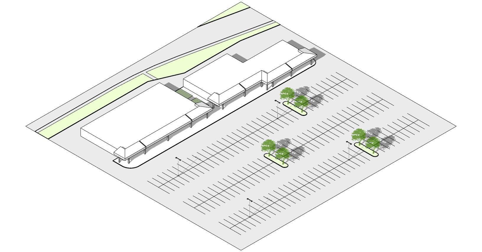
III.1 CORRIDOR-WIDE IMPROVEMENTS
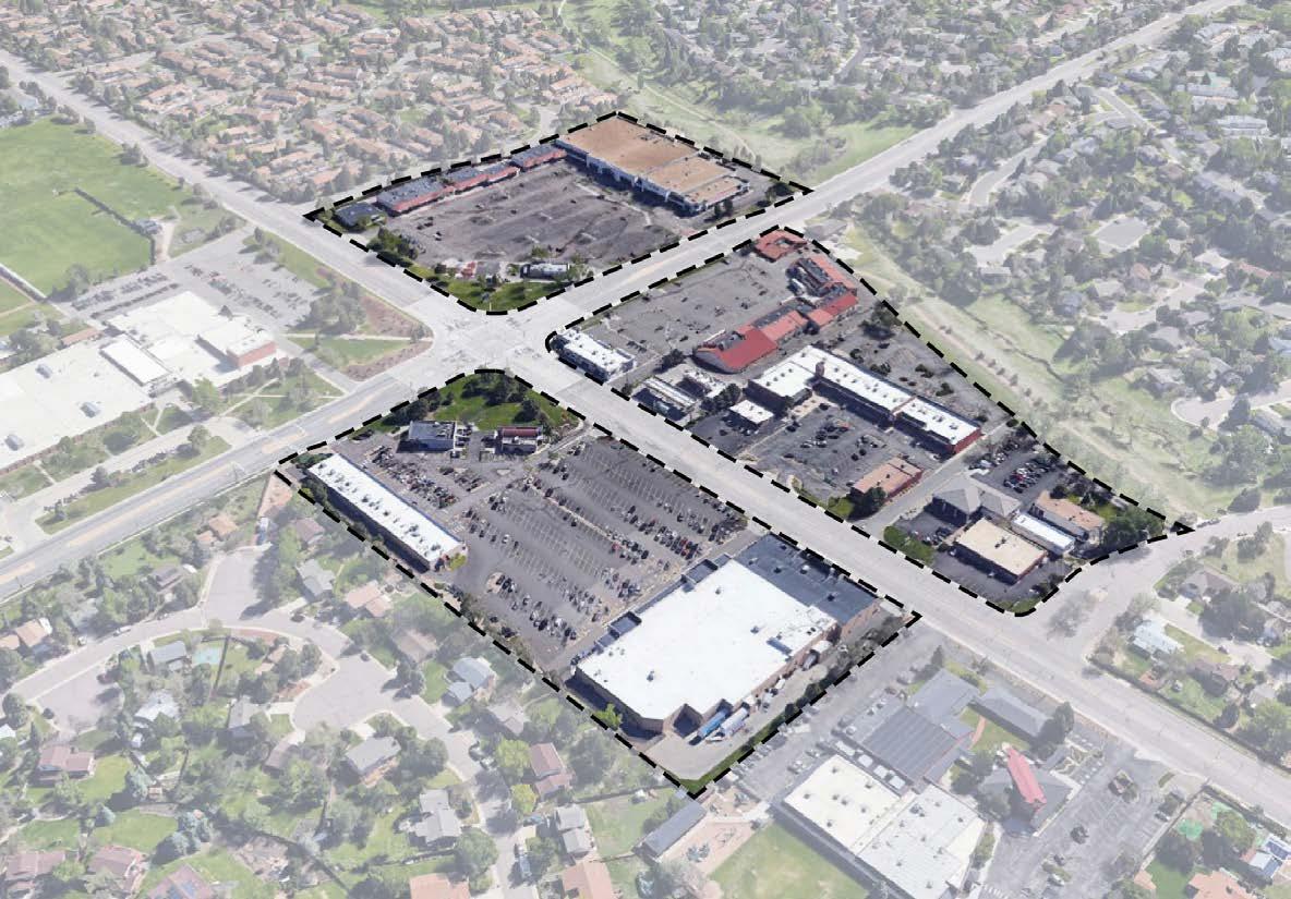
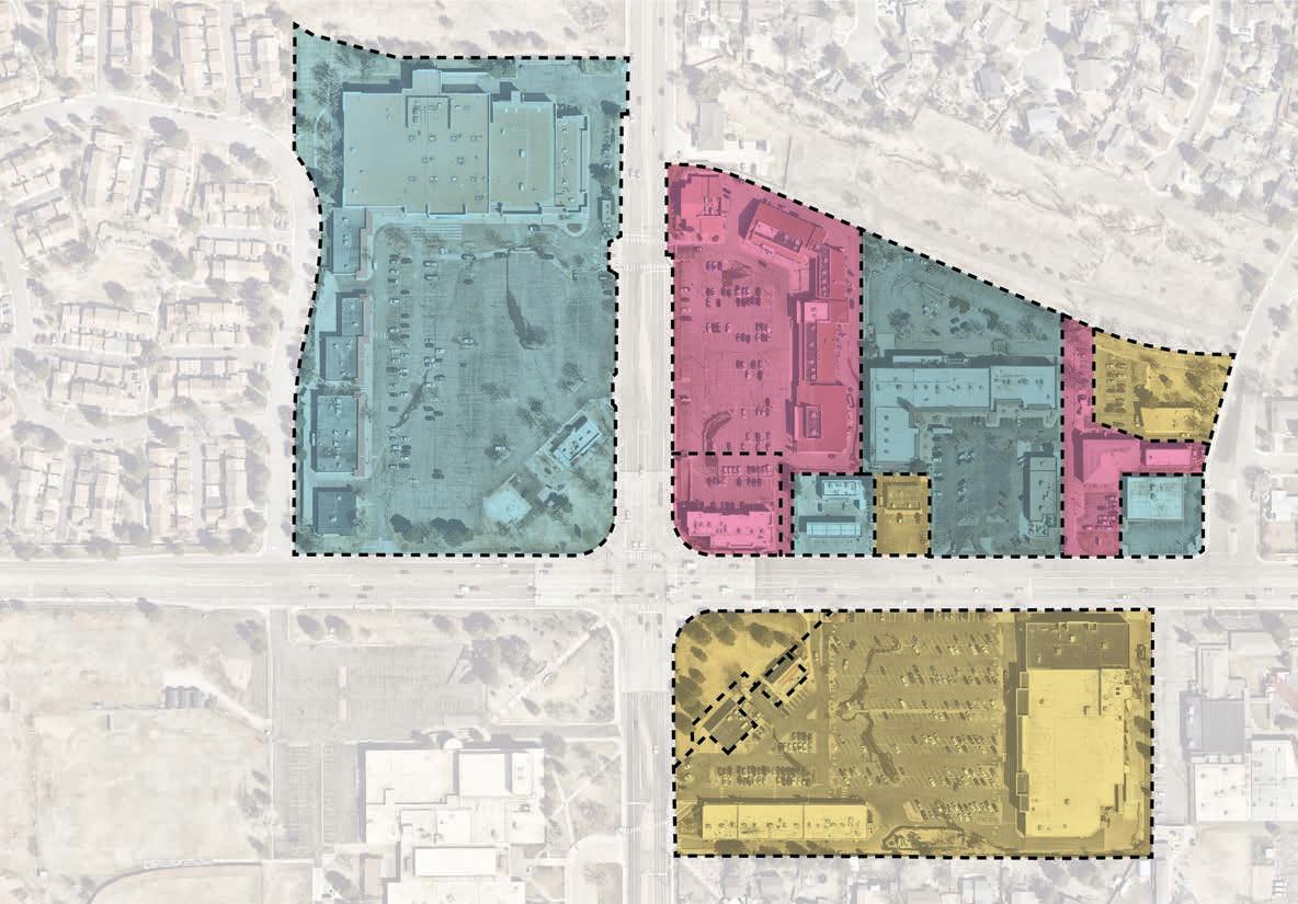
Catalytic Sites
• Based upon the research, four catalytic sites have been identified for a range of design and investment improvements: Cherry Knolls, University Towne Center, Southglenn Square, and Festival Center
• The Streets at Southglenn is another catalytic site in the corridor with a recently approved redevelopment plan. Due to this updated plan, this site was not the focus of this effort and strategy development process.
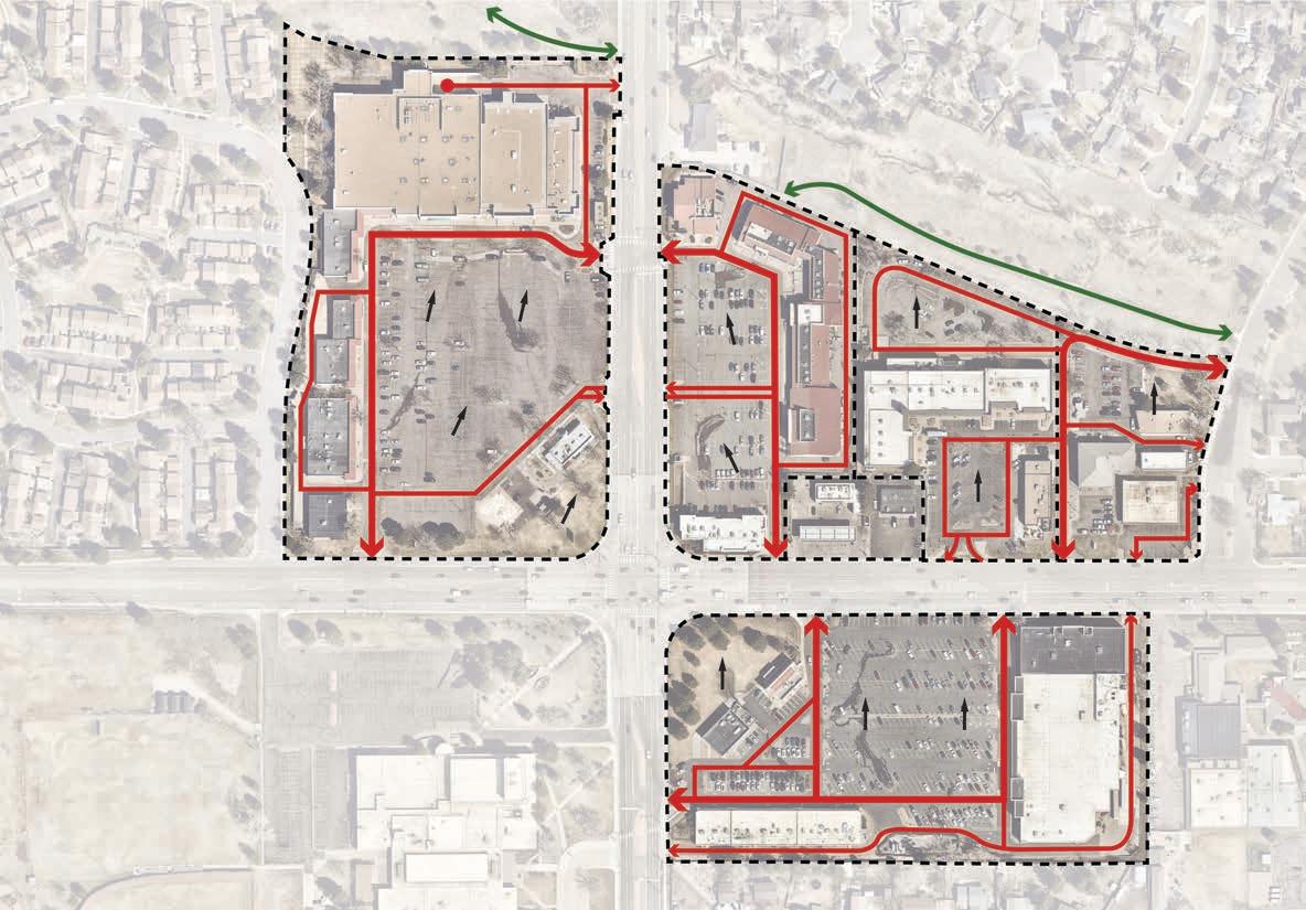
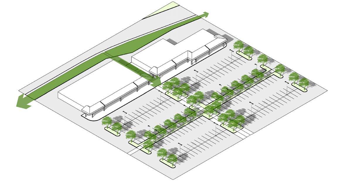
Connective Tissue
• Unify through cohesive corridor urban design
• Create identity along the corridor through distinct design of key intersections
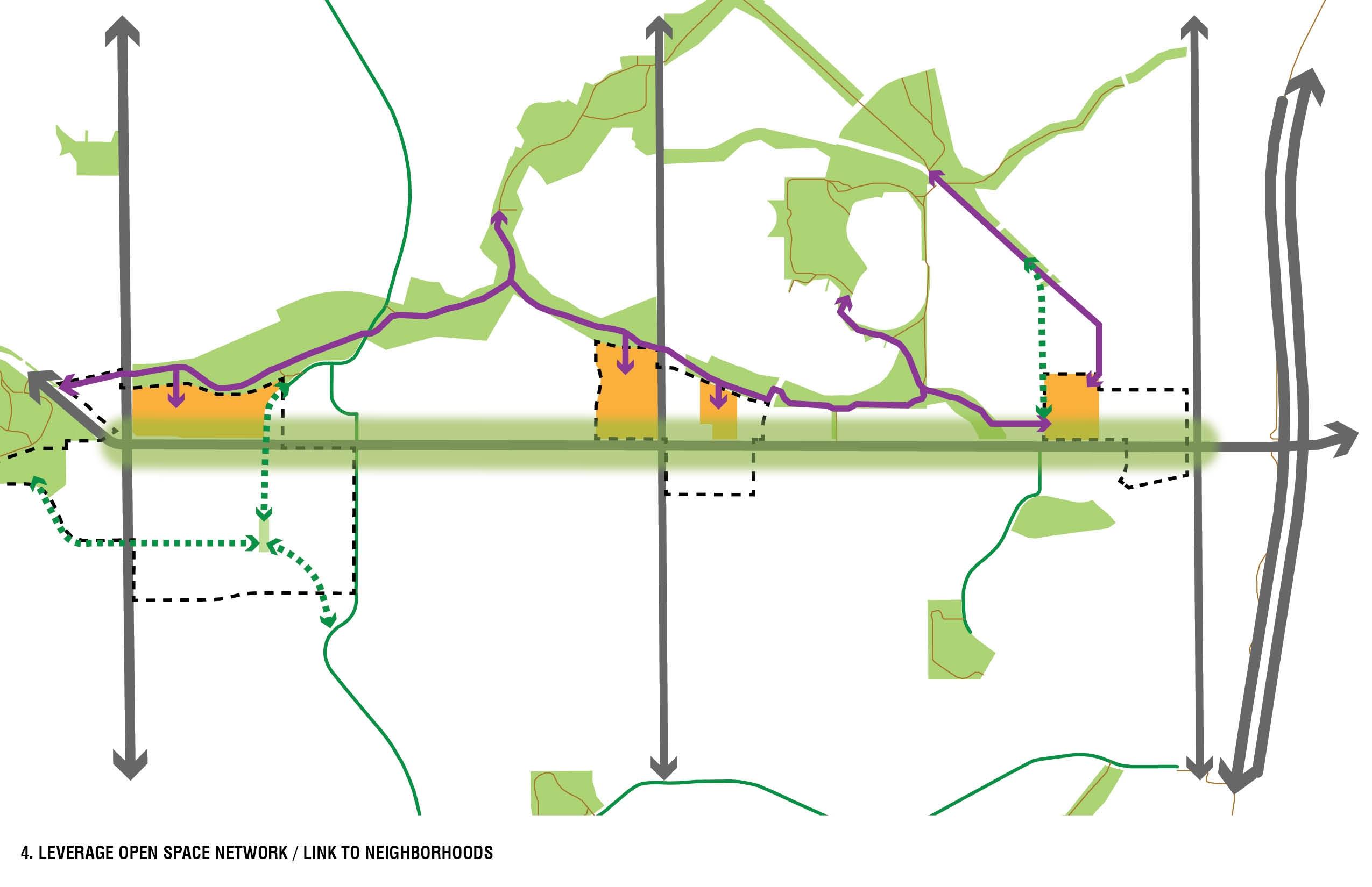
Connect to Neighborhoods
• Leverage the existing open space network to connect to the adjacent neighborhoods and trails
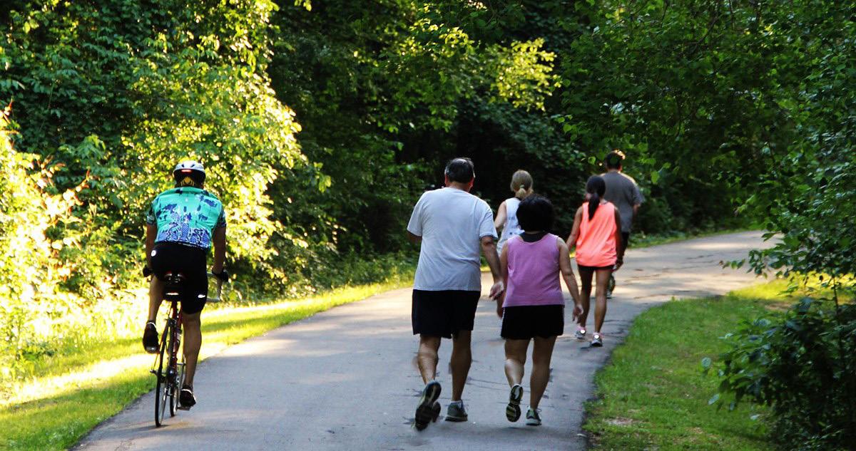
• Expand and enhance existing trail and bicycle network to link neighborhoods to the corridor
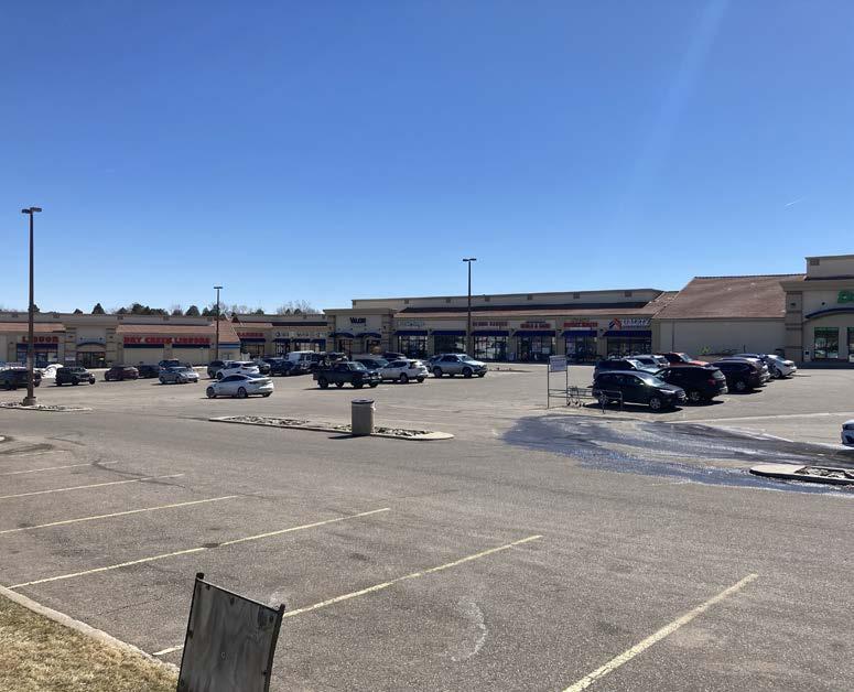
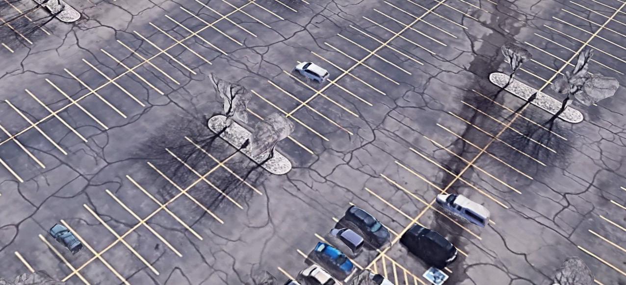
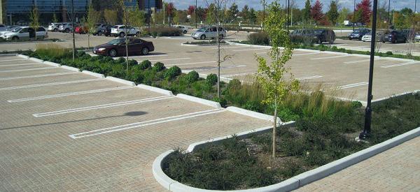
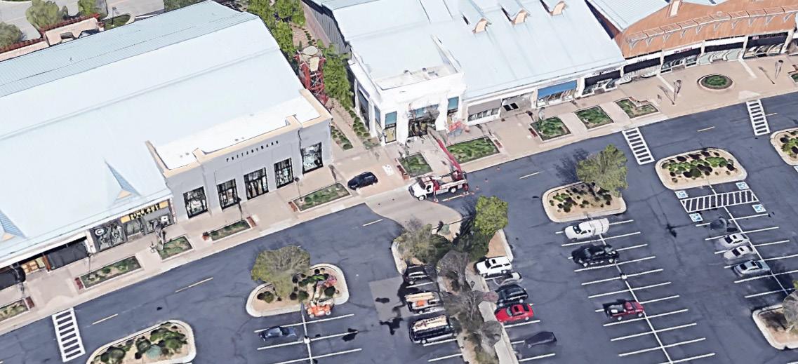
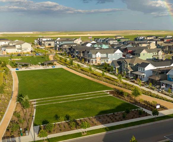
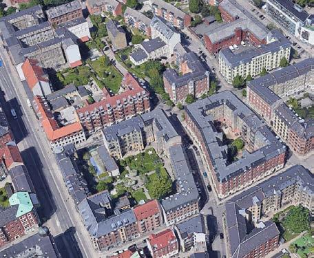
Above image: Cherry Knolls; below image: University Towne Center. Source: Google Earth
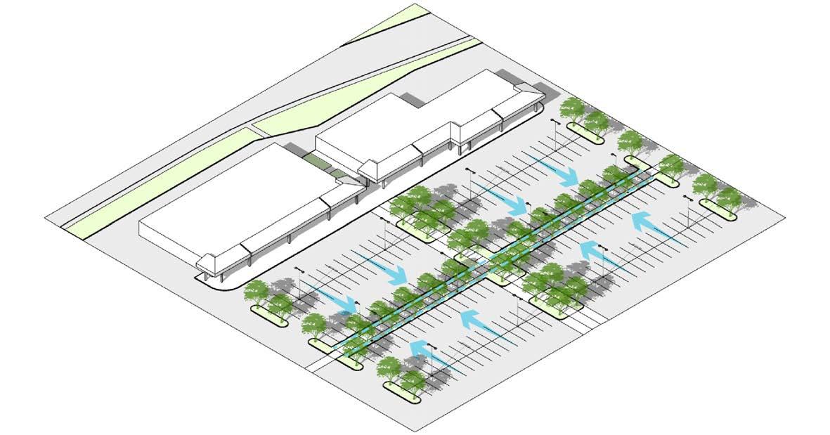
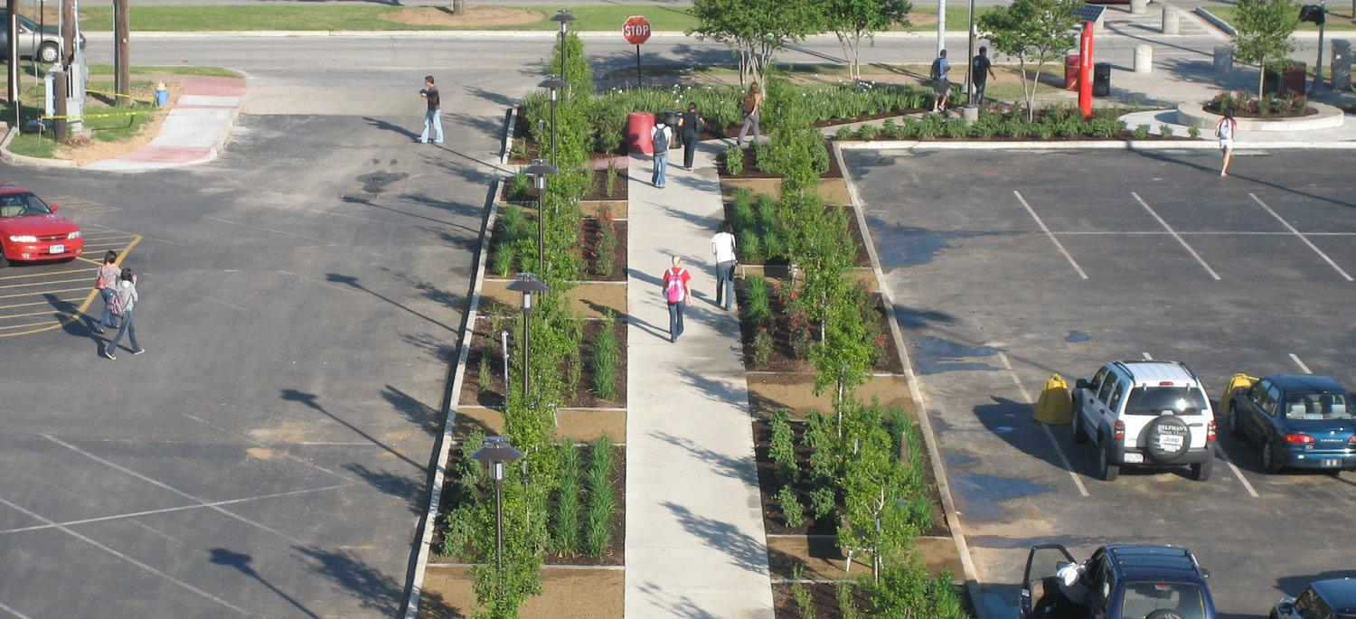
• Improved connections to adjacent parks and open spaces
• New walks in central landscape island(s)
• Table drive aisles where it intersects with pedestrian paths
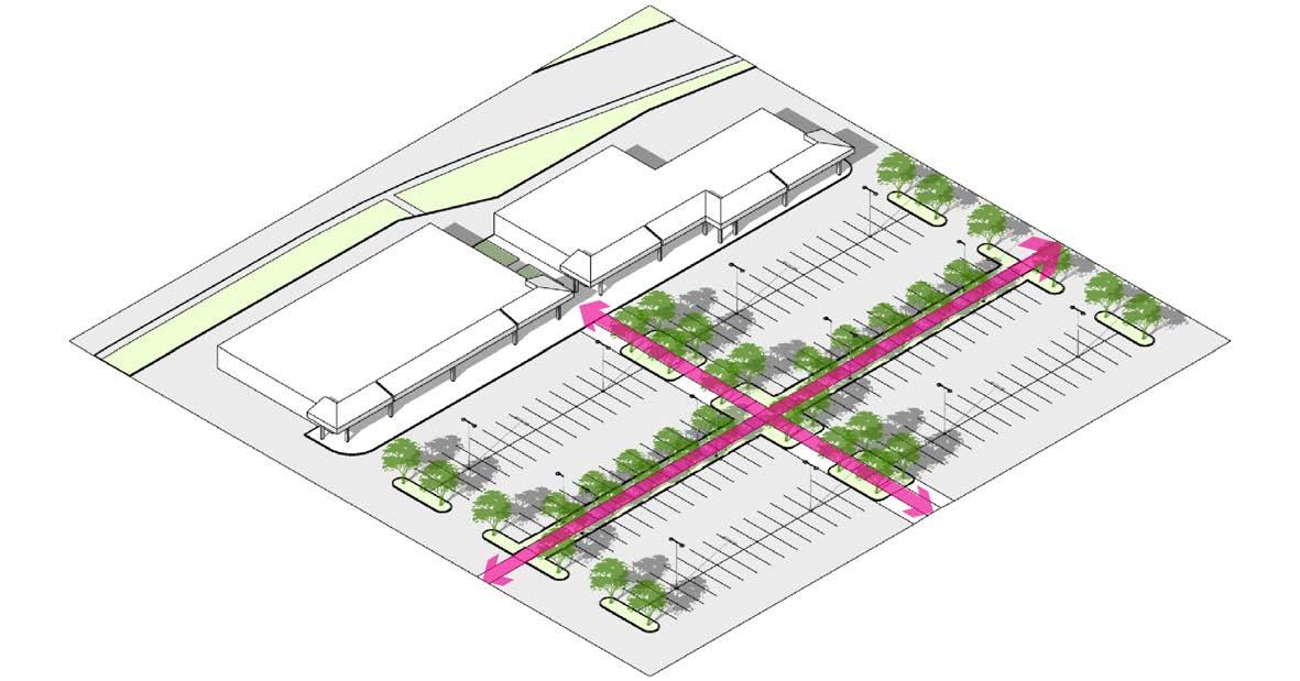
Enhanced Circulation
Green Connection
Source: Google Earth
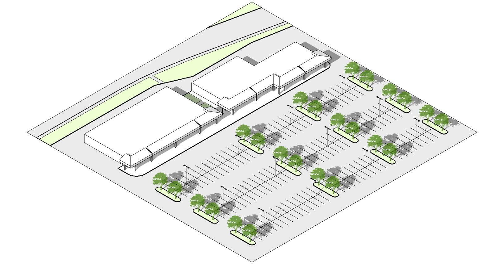
Re-Purposing Scenarios
Redevelopment and lifecycles of big box retail will change over time. Below is a series of scenarios that show the difference in potential for the changing economics of big box retail. Scenarios below show a generic site with a 50,000 SF building parked at 5/1000SF on a 5.8 AC site.
1. Thriving Retail
Successful retail environment serving its built-for purpose.
SF: 50,000
Parking: 250+ stalls (5/1000)
Tax Base: HIGH
Placemaking Potential: LOW
2. Temporary Use
Structure of big box remains intact and serves as a temporary location for retailers and pop-ups. Example: Dr. Seuss Experience
SF: 50,000
Parking: 250+ stalls (5/1000)
Tax Base: LOW
Placemaking Potential: LOW
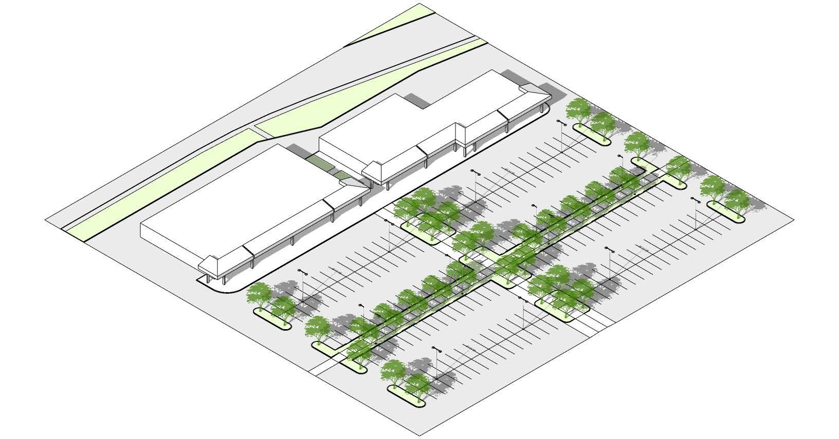
3. Adaptive Reuse
Retail uses change over to office/mixed use, or civic uses with minimal changes to original structure. parking quantities can be reduced and more landscaping and stormwater measures can be implemented.
SF: 40,000
Parking: +/- 160 stalls (4/1000)
Tax Base: LOW - MED
Placemaking Potential: LOW - MED
4. Adaptive Reconfiguration
6. Redevelopment SECTION
Building configurations using the existing structure create spaces for smaller retail and commercial spaces. Overall footprint and parking is reduced and replaced with gathering spaces and landscape
SF: 33,000
Parking: +/- 160 stalls (5/1000)
Tax Base: MED - HIGH
Placemaking Potential: MED - HIGH
5. Integrated Development
Building onto or integrated into the existing structure for a variety of uses including housing, office, and ground floor retail.
SF: Varies
Parking: Varies
Tax Base: MED - HIGH
Placemaking Potential: MED - HIGH
Demolition of the existing structure and redevelopment of the site to be residential or office mixed use.
SF: Varies
Parking: Varies
Tax Base: MED - HIGH
Placemaking Potential: HIGH
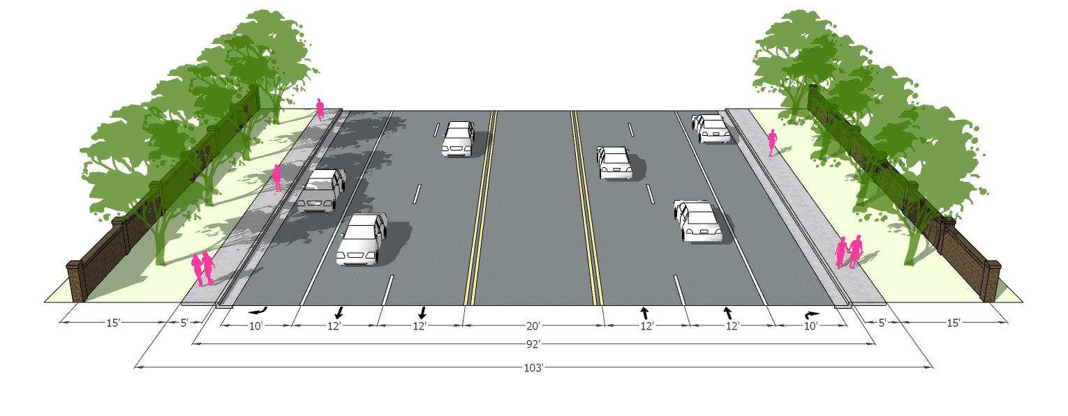
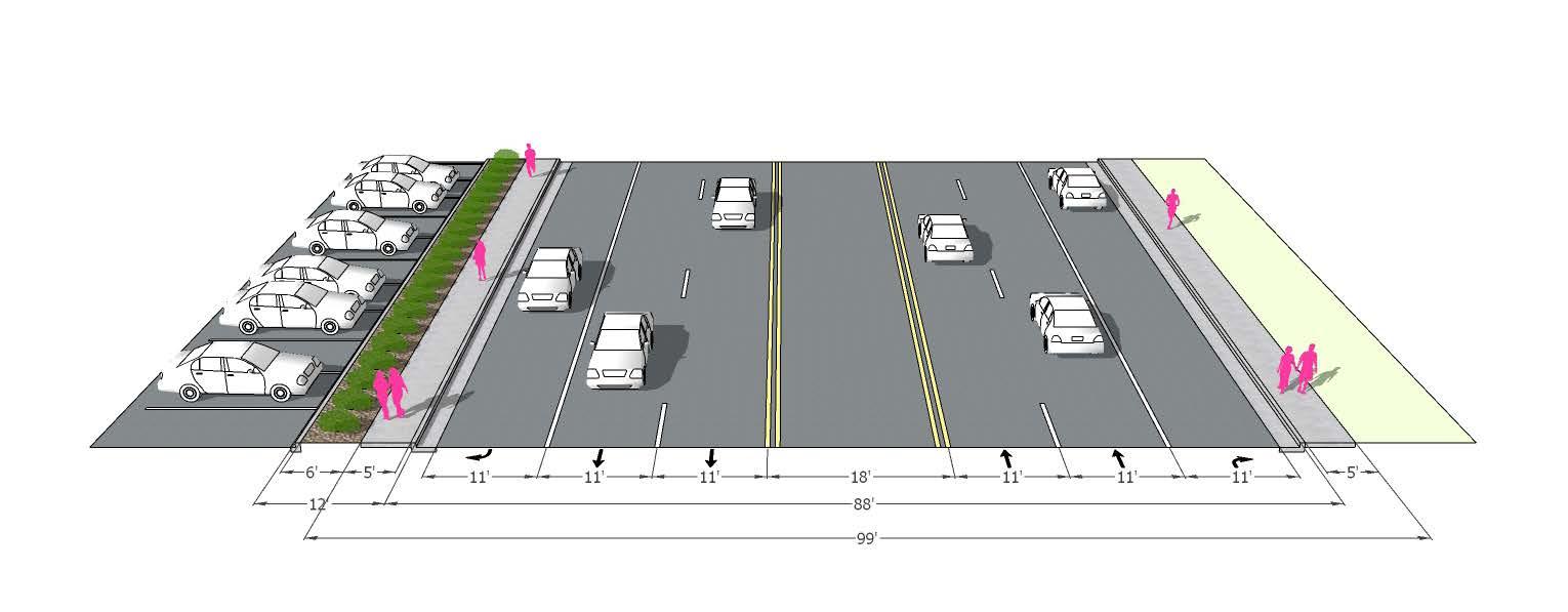
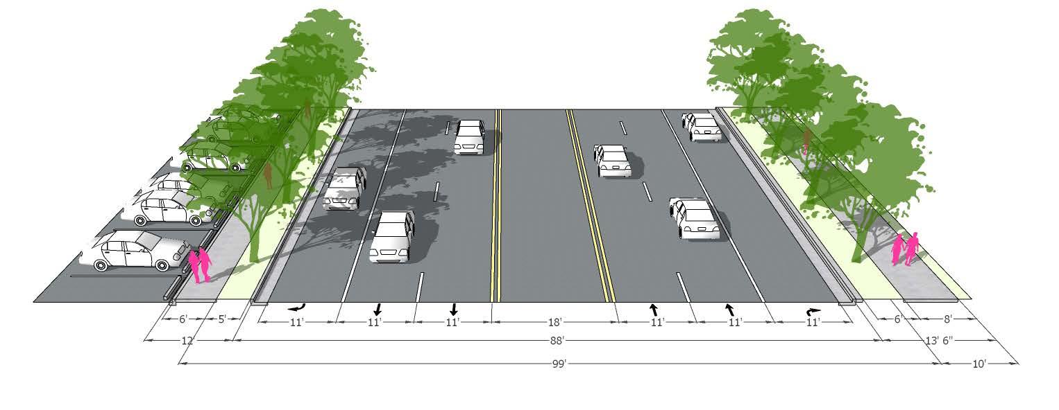
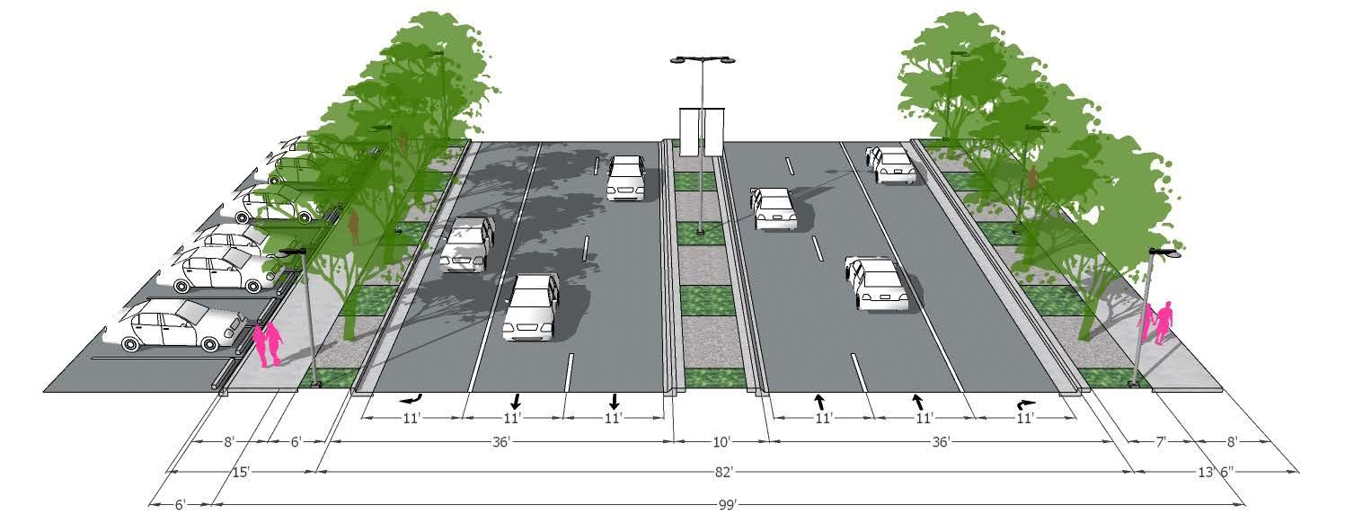
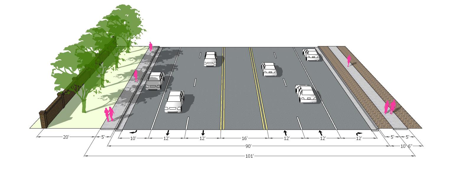
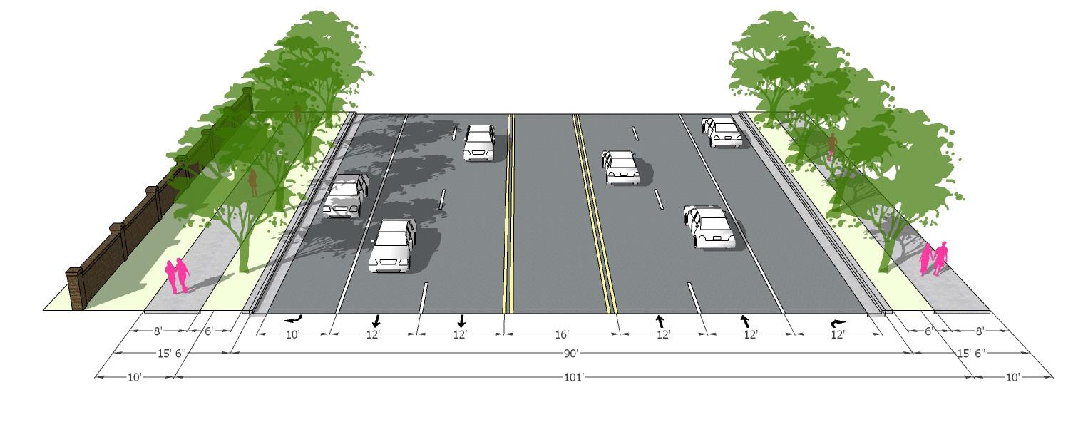
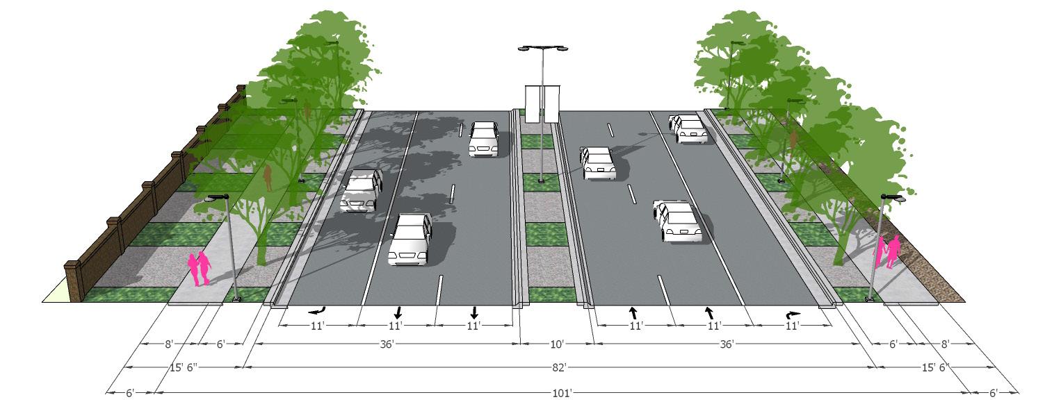
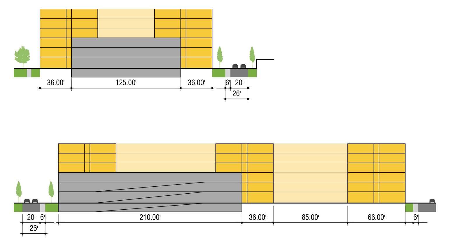
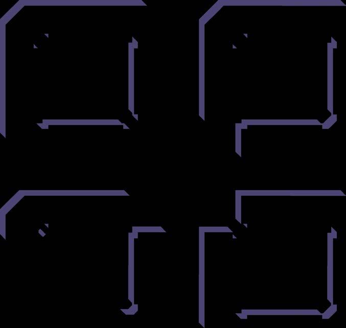
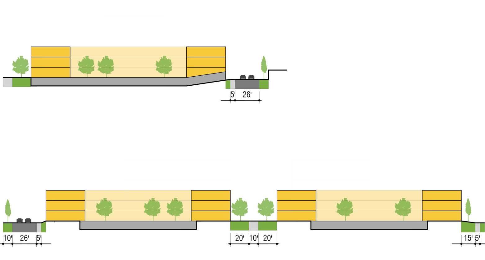
Streetscape Sections
After a thorough study of the relationships and dimensions of the existing streetscape elements along university, Civitas created a series of diagrammatic typical cross-sections that represent the various conditions along the corridor. Each of these diagrams provides typical information on the relationship between the existing elements at four strategic locations on University Boulevard, while providing a basic understanding of the adjacent conditions. The design team then developed a series of corridor-wide conceptual streetscape enhancement strategies, which introduces a variety of recommendations including landscape upgrades, shade, lighting, furnishings, art, placemaking and identity, and enhanced mobility.
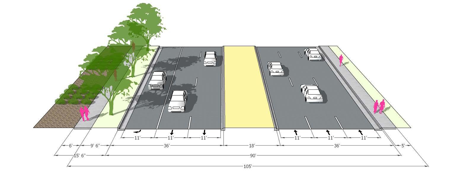
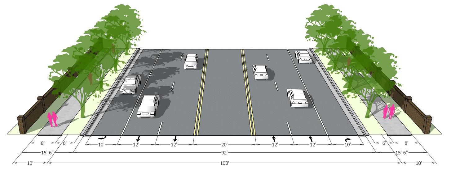
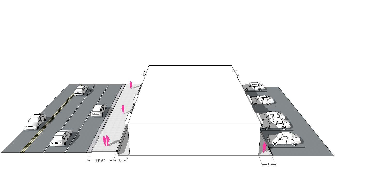
Option 1. Enhanced Pedestrian Experience and Safety
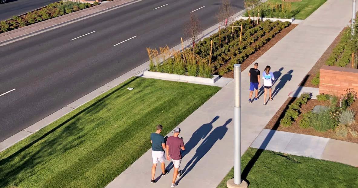
This section design concept provides a conservative approach to streetscape enhancement, requiring a landscape easement included on either side of the existing right-of-way. This additional space allows for wider landscape zones, and provides multi-use paths on both sides of the street, which inherently creates a safer environment for pedestrians and bicyclists by further separating them from the busy traffic on University.
Design Moves
• Landscape easement added to either side of the existing right-of-way
• Landscape zone increased to 6’ minimum
• 8’ multi-use path added to both sides of the street
• Regularly spaced street trees located in tree lawn
Civitas incorporated a variety of these strategies into each of the four “existing” cross-sections, keeping in mind the constraints presented by limited available space due to existing property lines and walks. The design team then created two enhanced cross-section design concepts which were applied to each of the four locations.
The ultimate goal is that the principles and bold landscape gestures from these concepts could eventually be applied to University, creating a cohesive boulevard design throughout the entire corridor.
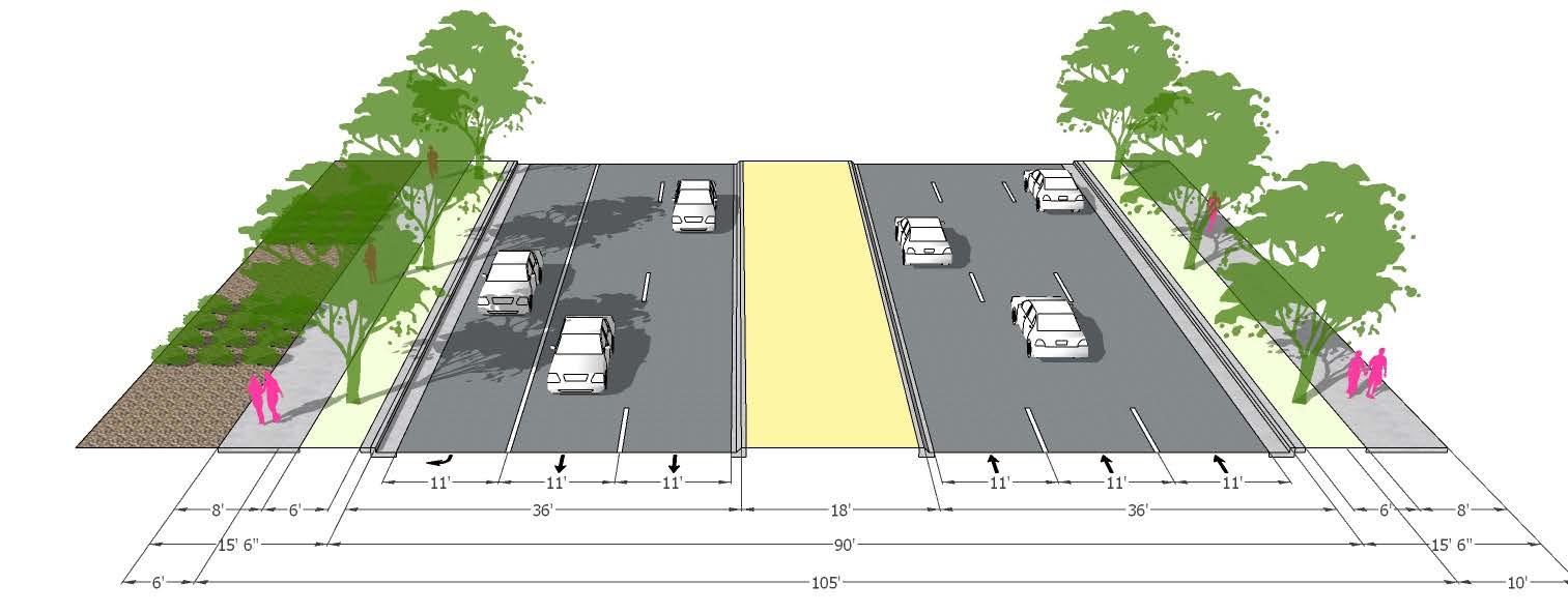
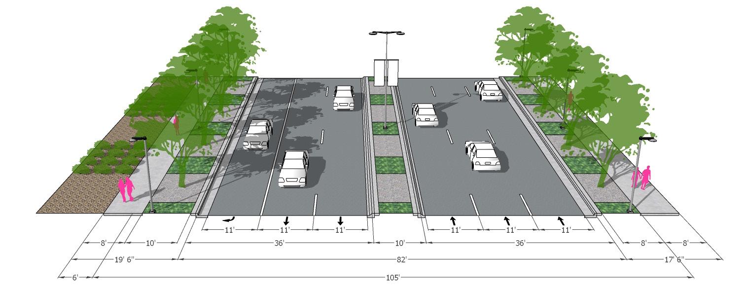
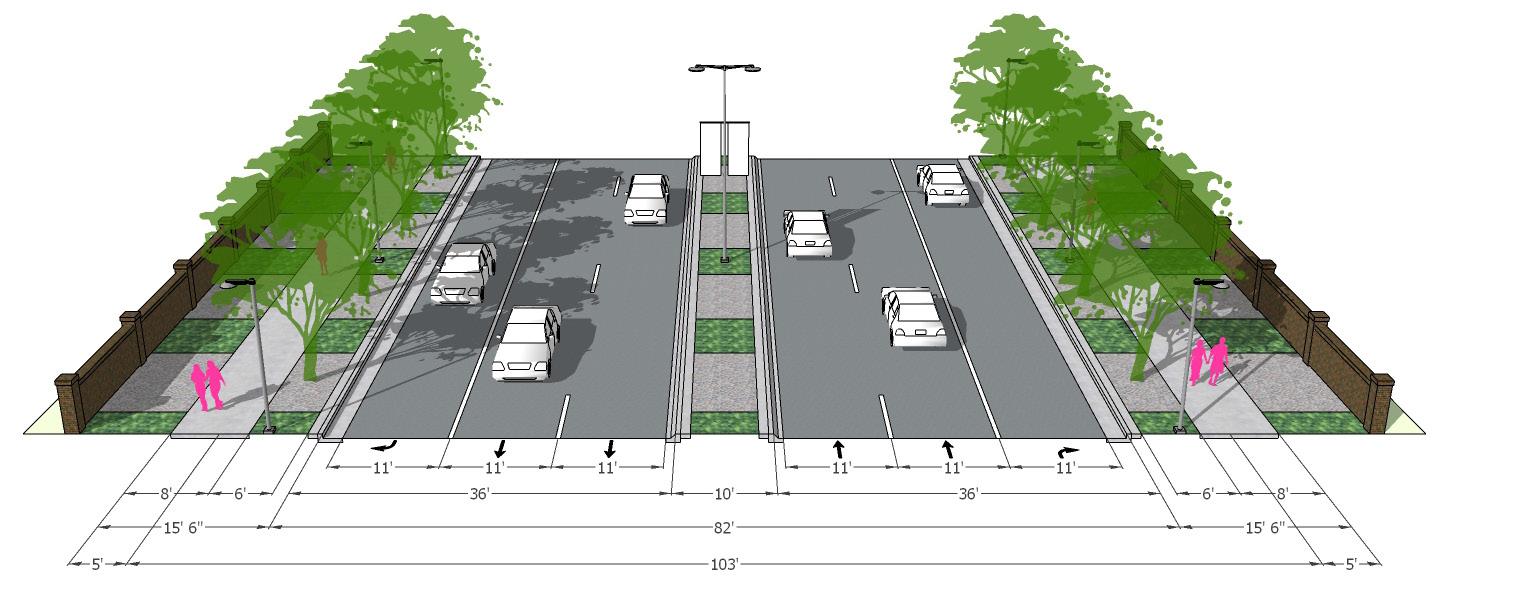
Option 2. Bold Corridor Design
This section design concept provides a more intensive approach to streetscape enhancement, in which a landscape easement is included in addition to the existing curbs being relocated, driving/turn lanes reduced in width, and the median made smaller. In addition to the safety and enhanced pedestrian experience provided by this design, this concept also proposes a number of aesthetic improvements.
Design Moves
• Landscape easement added to either side of the existing right-of-way
• Landscape zone increased to 6’ minimum w/ enhanced planting
• 8’ multi-use path added to both sides of the street
• Regularly spaced street trees located in tree lawn
• Lanes reduced to 11’, median/center turn lanes reduced to 10’ (dimensions consistent with CDOT’s requirements for a principal arterial)
• Vehicular and pedestrian lighting/banner poles/wayfinding
Option 1. Enhanced Pedestrian Experience and Safety
Option 2. Bold Corridor Design
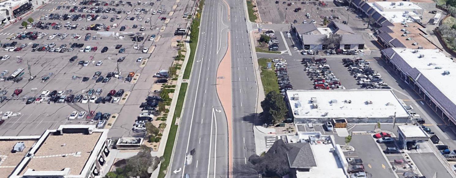
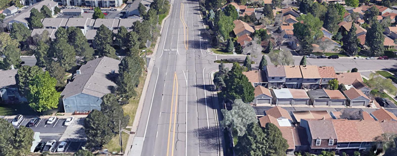
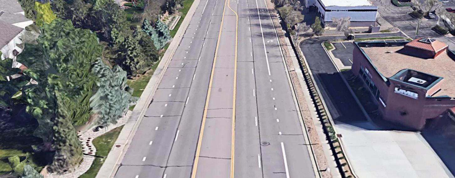
Existing Street Layout - Streets at Southglenn
Existing Aerial - Streets at Southglenn
Option 1. Enhanced Pedestrian Experience and Safety
Option 2. Bold Corridor Design
Existing Street Layout - Residential
Existing curb location
Existing Aerial - Cherrywood Square
Option 1. Enhanced Pedestrian Experience and Safety
Option 2. Bold Corridor Design
Existing curb location
Existing Street Layout - Cherrywood Square
Existing Street Layout - Festival Center
Option 1. Enhanced Pedestrian Experience and Safety
Option 2. Bold Corridor Design
Existing curb location
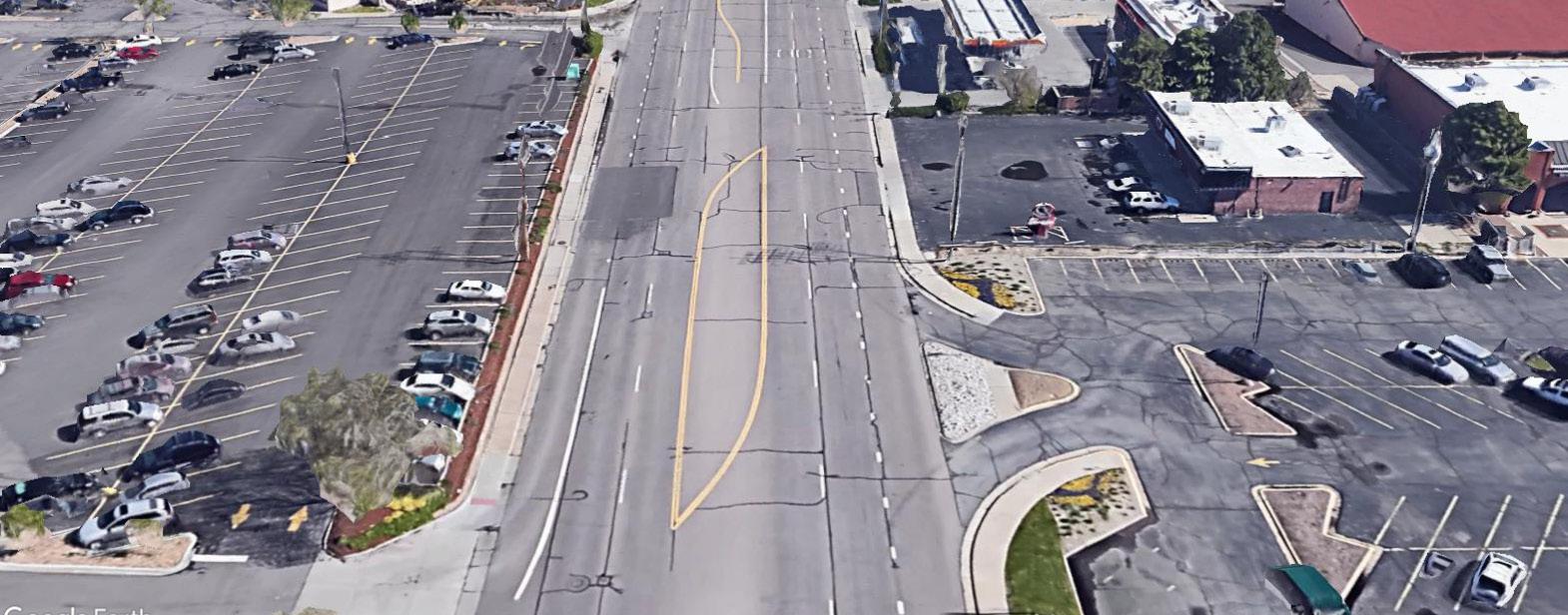
Existing Aerial - Festival Center
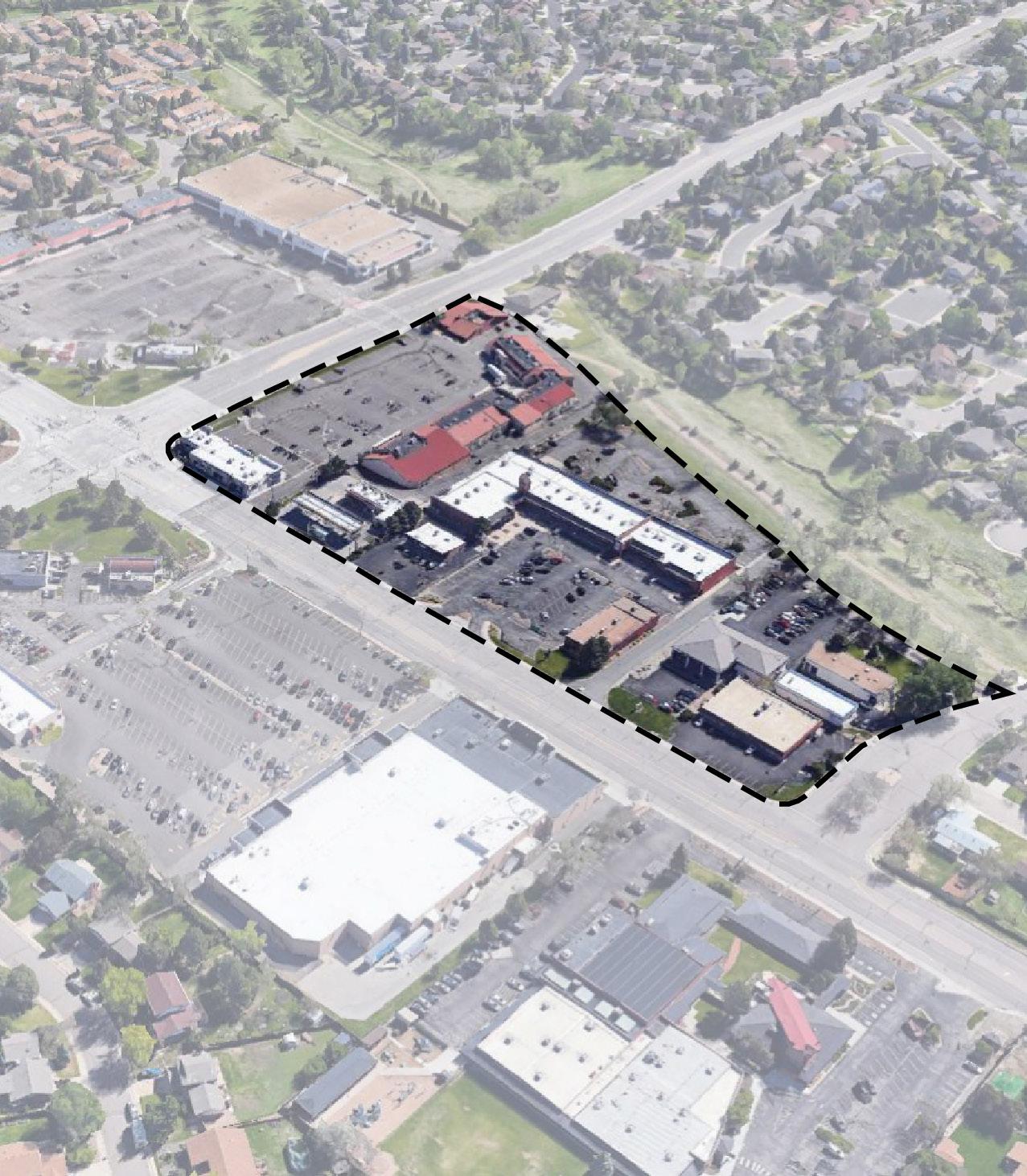
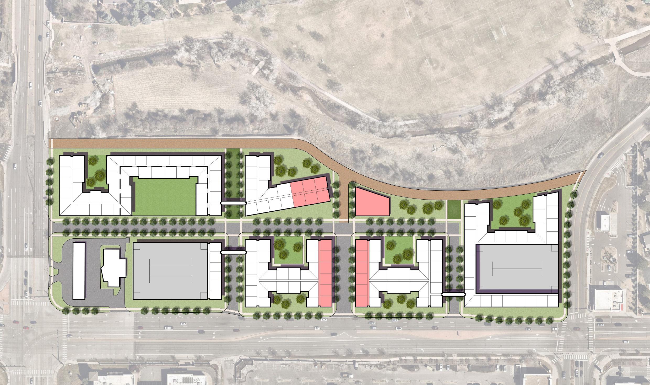
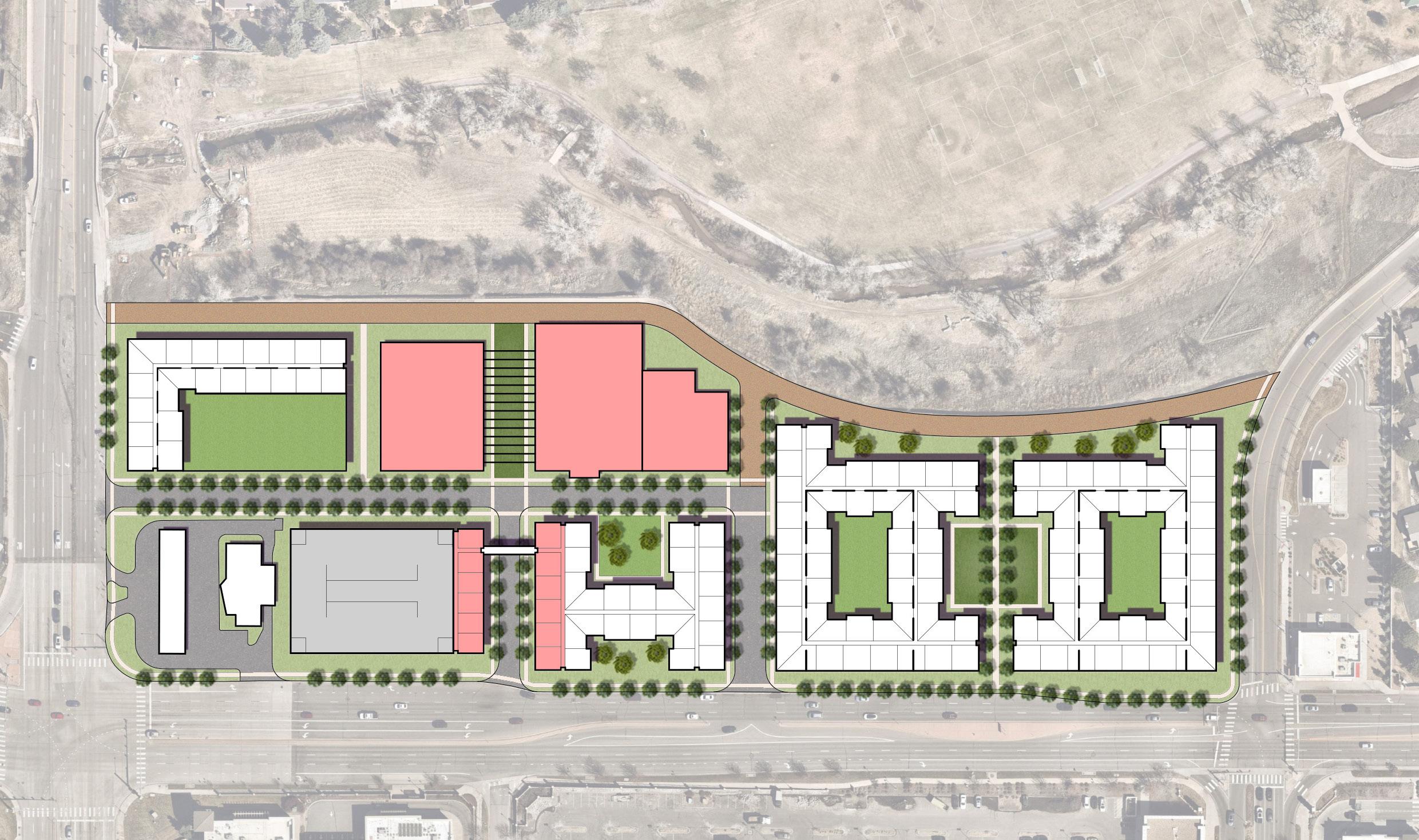
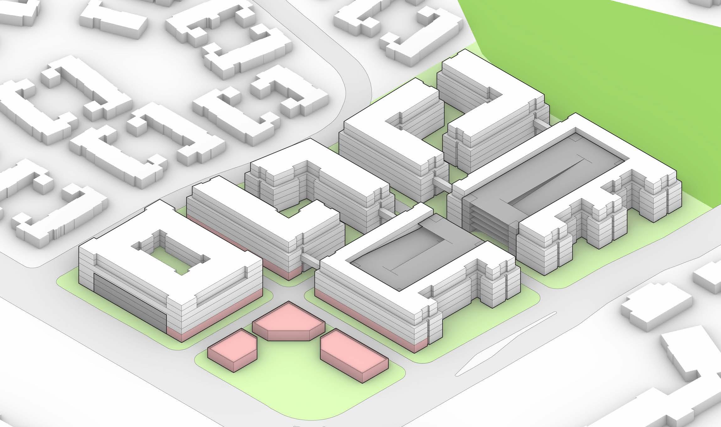
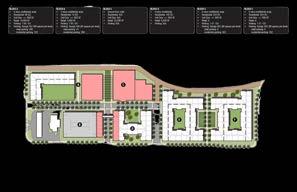
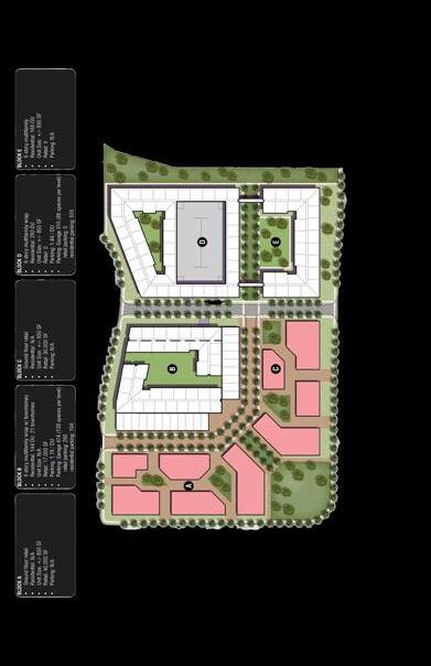
REDEVELOPMENT SCENARIOS
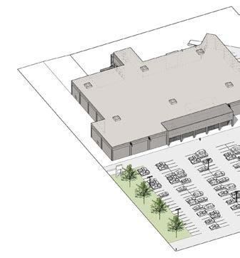
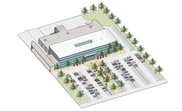
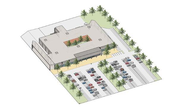
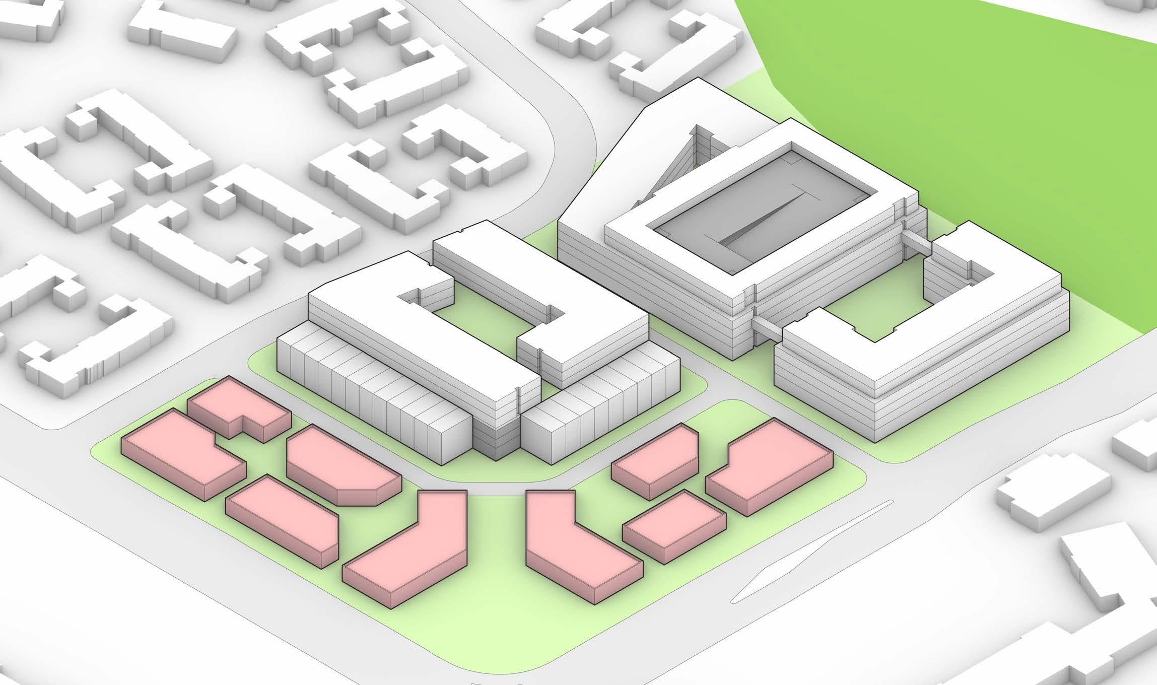
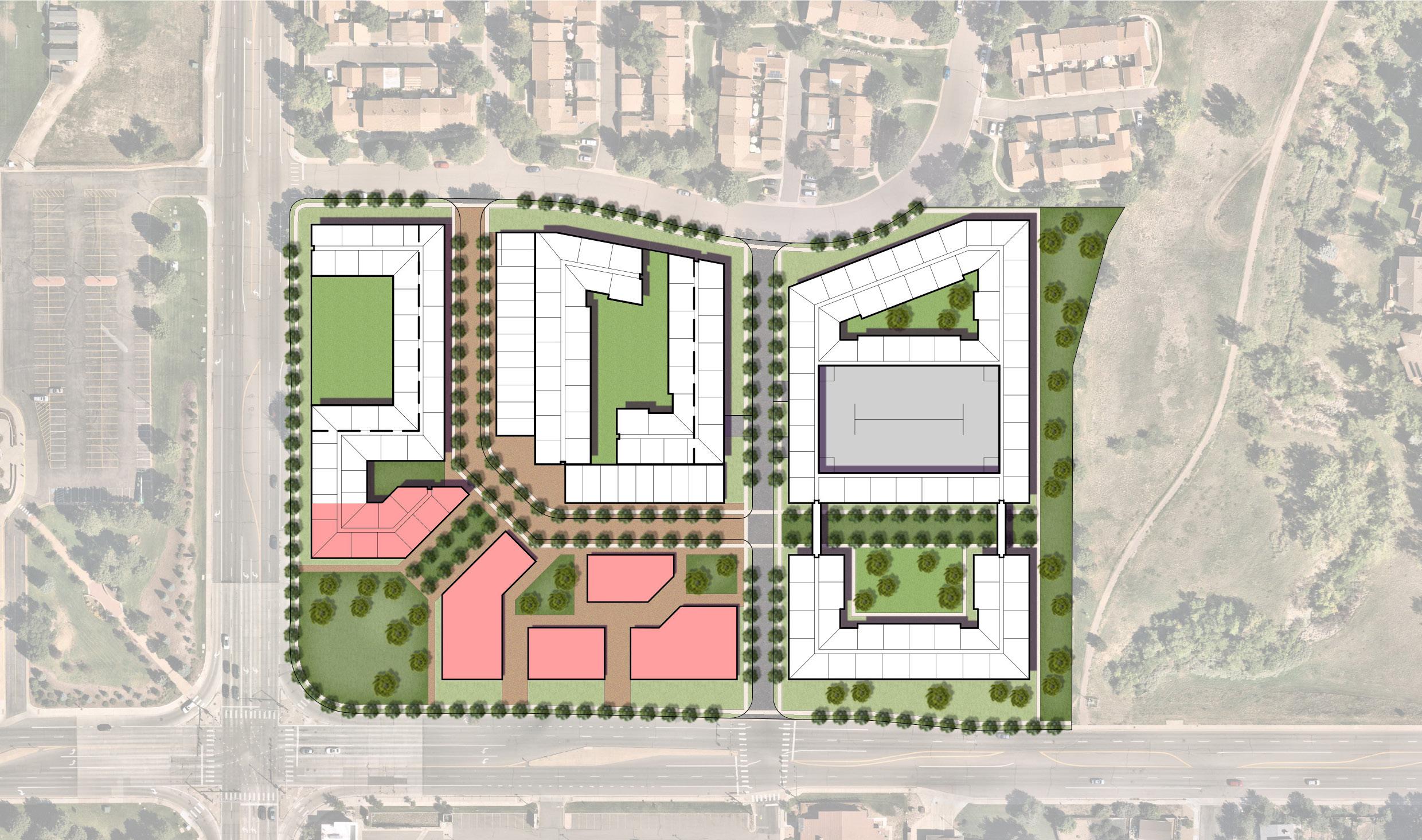
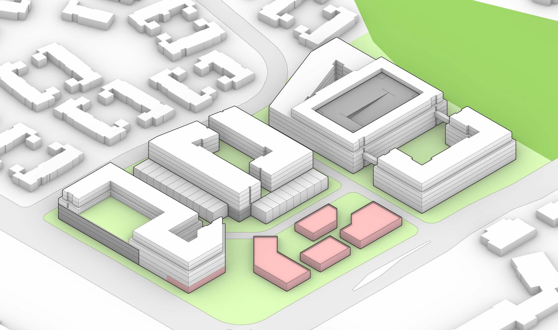
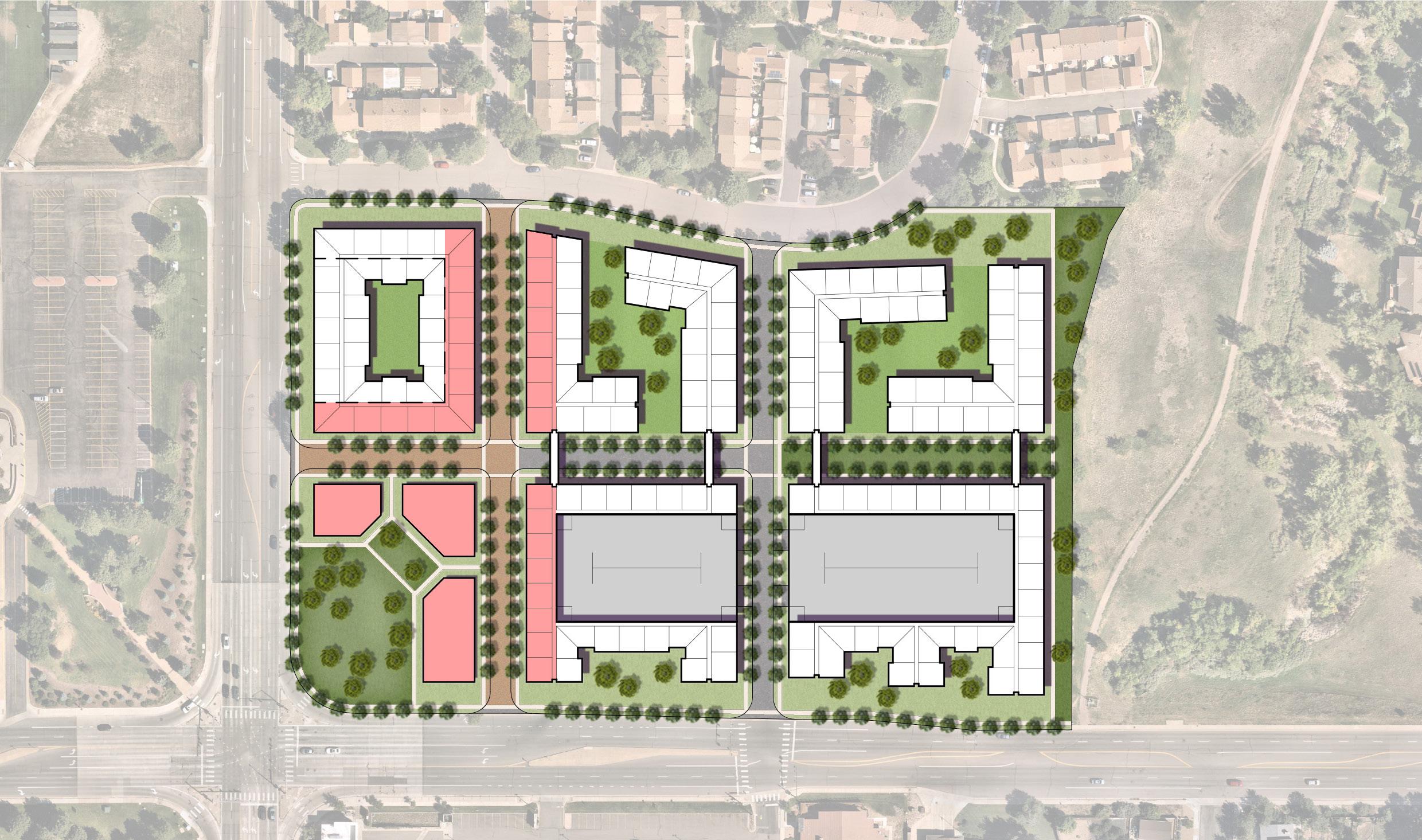
IV.1 FESTIVAL CENTER REDEVELOPMENT
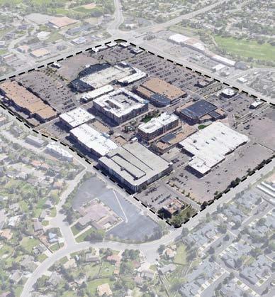
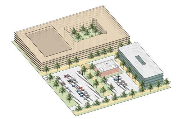
Redevelopment Scenarios
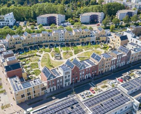
These redevelopment scenarios were a visioning exercise to understand what types of residential development were potentially feasible on a property of this size and layout. These renderings are theoretical and are not meant to show planned development outcomes for the site. Images shown may not meet all City requirements (found in the Land Development Code and other City or external agency regulations) and changes to requirements may be needed to implement similar concepts.
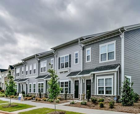
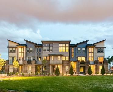
Residential Townhomes - Option 1
Residential Townhomes - Option 2
Residential Townhomes - Option 3
Residential Townhomes - Option 4
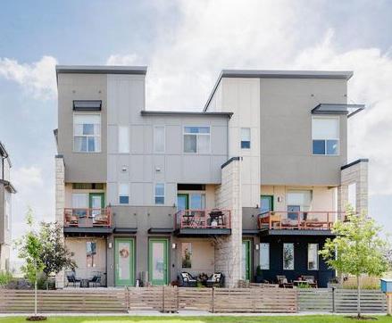
3-Story Walkup - Option 1
•
3-Story Walkup - Option 2 •
4-Story Elevator Service
5+6 Story Multifamily
•
•
•
A Elevation A - Looking North
Elevation B - Looking East
Floors
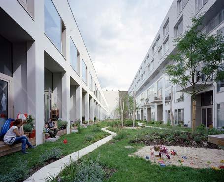
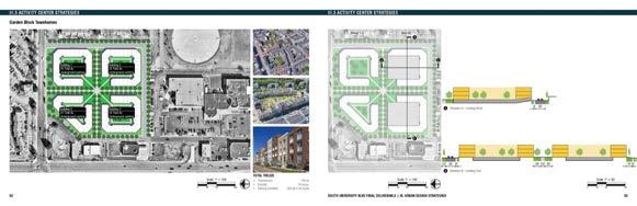
Garden Block Townhomes
Elevation A - Looking North
Elevation B - Looking East
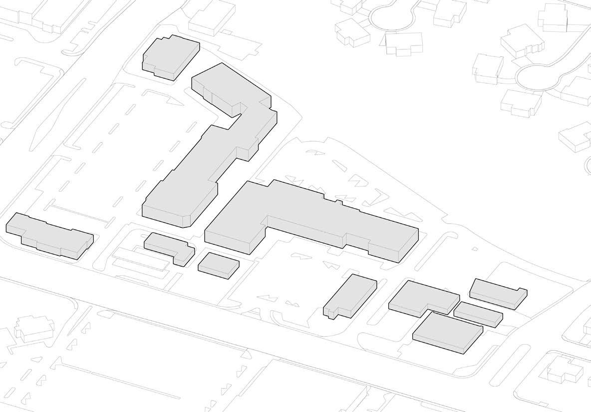
ACTIVITY CENTER URBAN DESIGN STRATEGIES
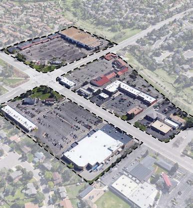
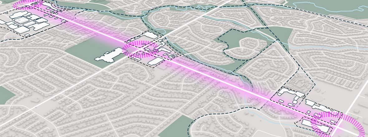
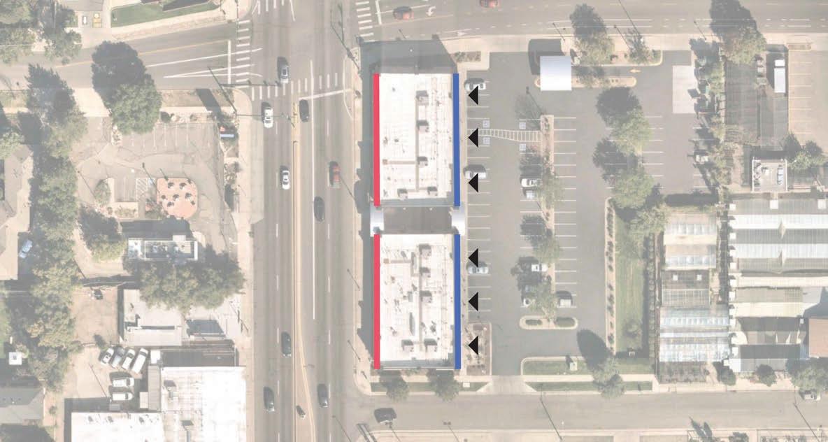
Activity Center Urban Design + Development Testing
Civitas was tasked with developing a site-specific study of the activity centers at the southeast corner of the University Boulevard and East Dry Creek Road intersection. The design team researched the Centennial Land Development Code and studied a number of relevant local precedents pertaining to the activation and pedestrian improvements of corridor retail redevelopment. This information allowed Civitas to identify a range of possible strategies for for how to develop a conventional strip of retail into a more walkable urban space.
SUniversityBlvd
Dry Creek Center
Southglenn Square
EDryCreekRoad
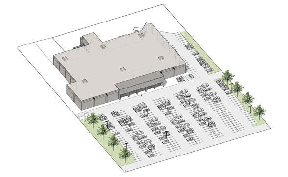
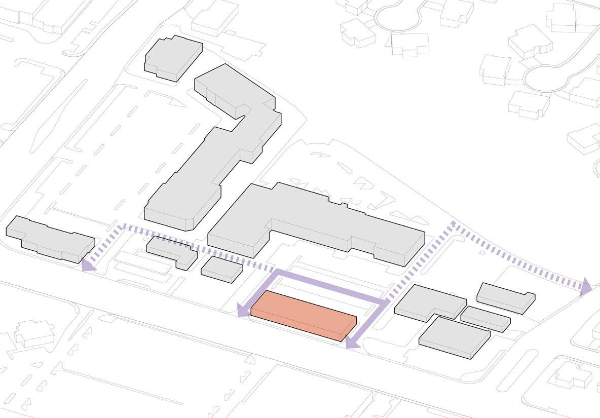
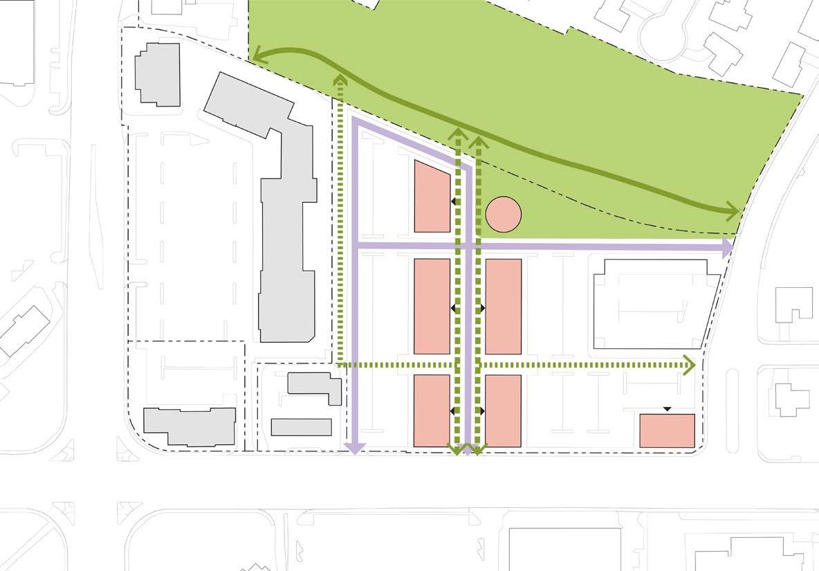
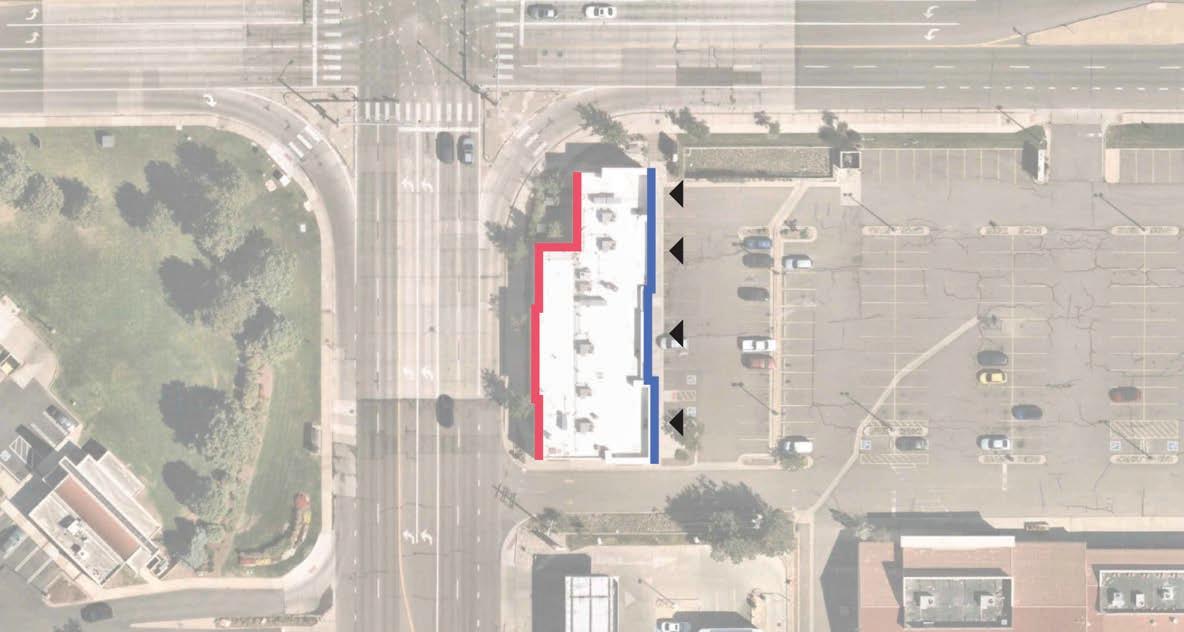
1. Existing Conditions
Proposed Retail
Existing Building
Vehicular Circulation
Vehicular Circulation (Future)
• Many activity centers have multiple developments by multiple owners
• These conditions often conflict with the City of Centennial’s code, which calls for retail frontage along major corridors
• These diagrams provide a potential phased approach toward redevelopment of a model activity center, allowing the City to create a consistent framework for vehicular and pedestrian circulation in activity centers with multiple owners
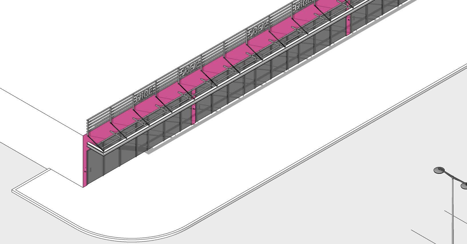
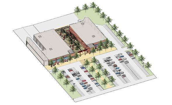
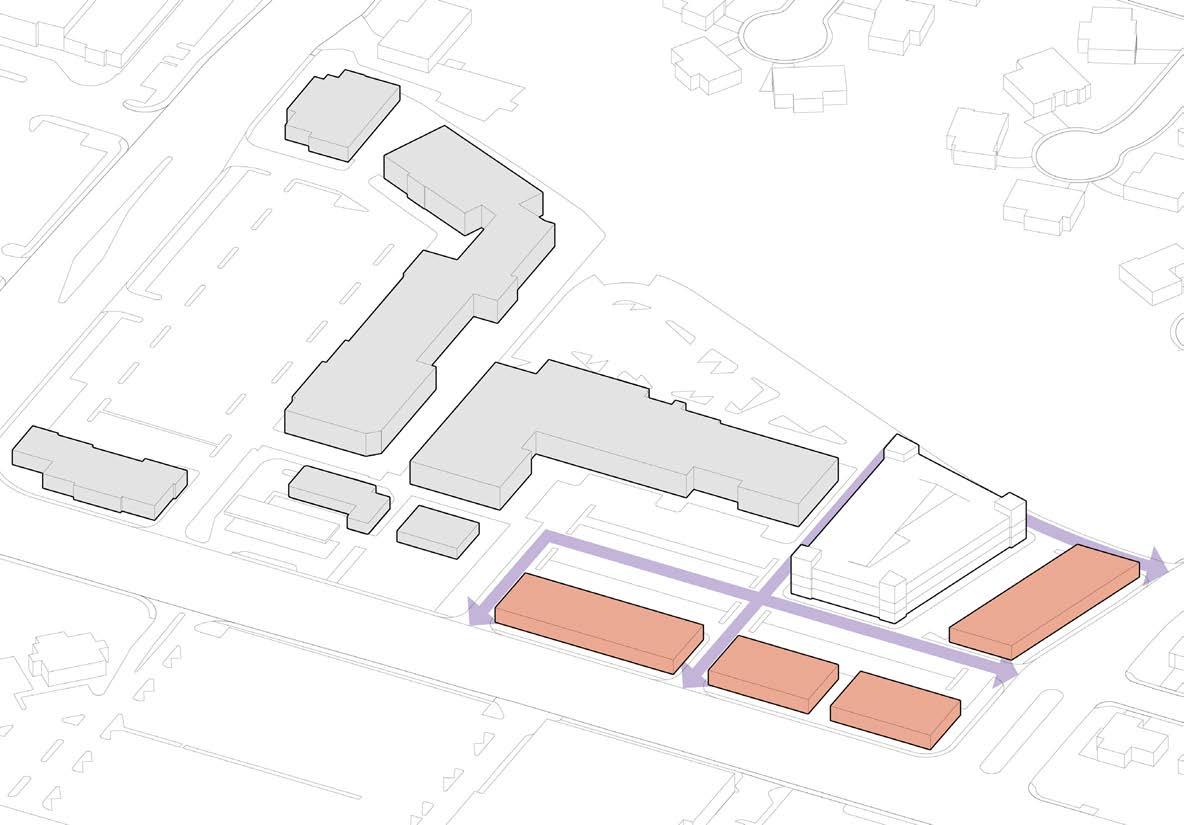
2. New Corridor-Facing Retail
Proposed Retail
Existing Building
Vehicular Circulation
Vehicular Circulation (Future)
• In the event of redevelopment within a property line, identify major circulation routes within a site
• These routes should inform a vision for future connectivity
• These routes should also be respective of larger interior shopping centers that may remain
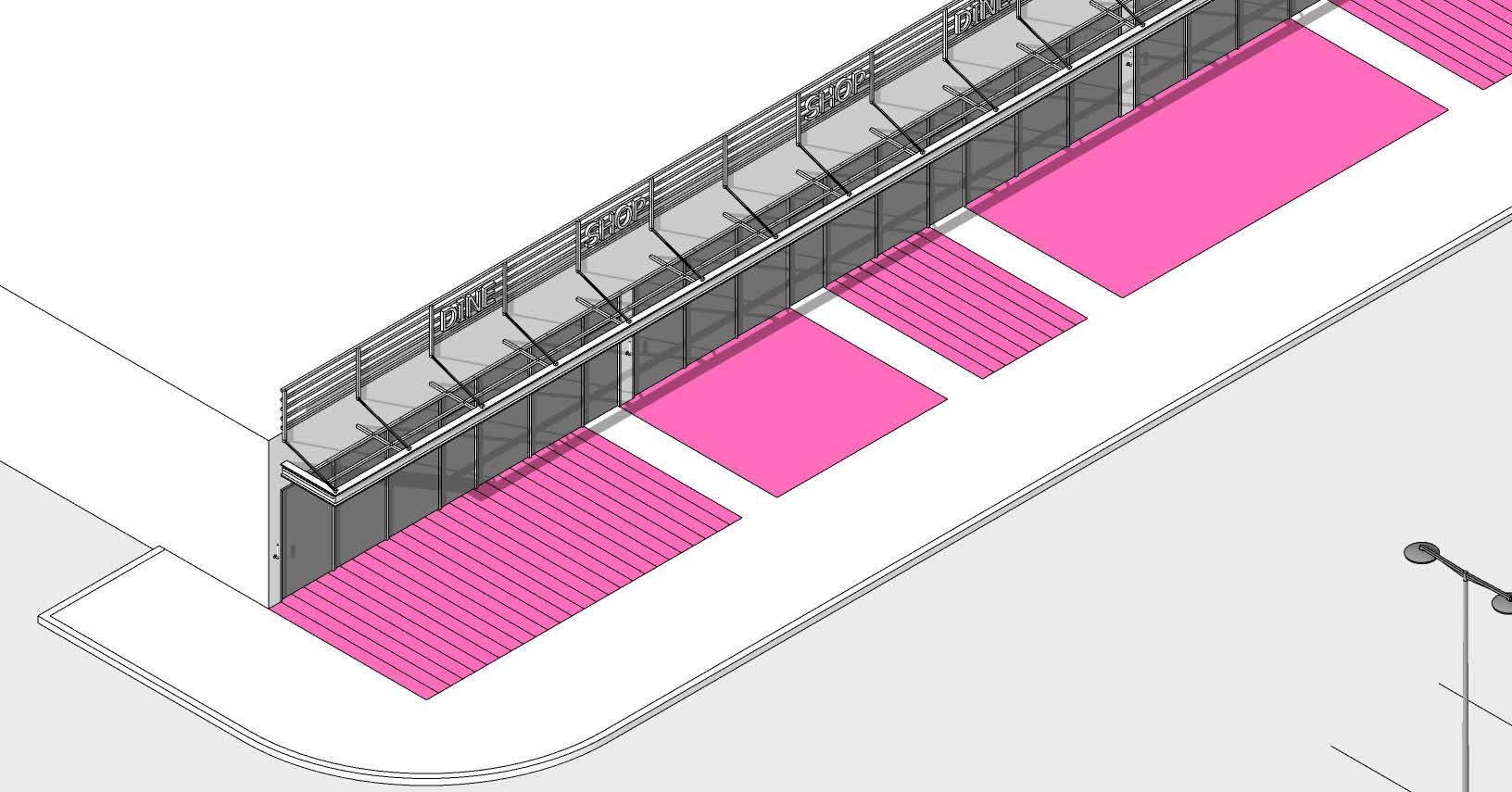
3. Continue Frontage, Provide Additional Parking
Proposed Retail
Existing Building
Vehicular Circulation
Vehicular Circulation (Future)
• Fronting major streets with retail will require parking on the interior of the activity center
• Using structured parking will allow more space for development
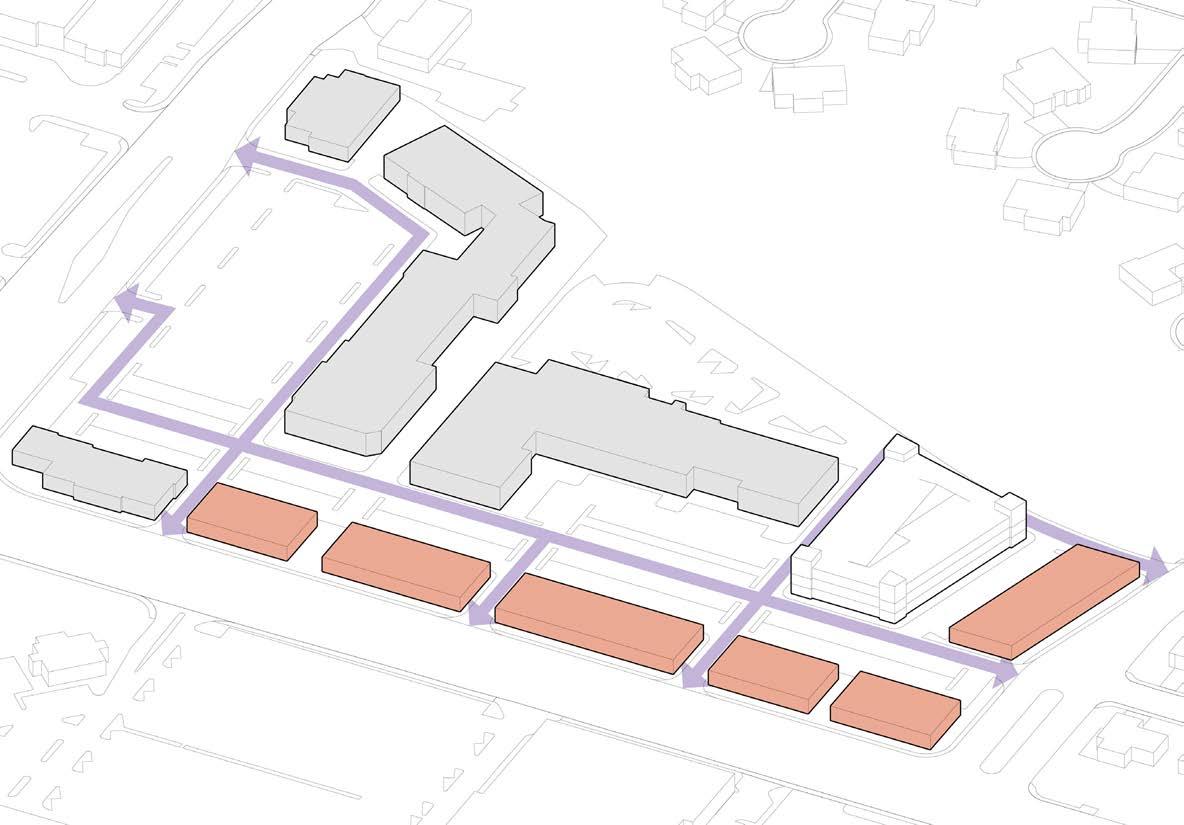
Proposed Retail
Existing Building
Vehicular Circulation
Vehicular Circulation (Future)
• Create a consistent frontage along primary corridors
• Continue vehicular and pedestrian access through the full activity center
• Redevelop long-term uses such as gas stations
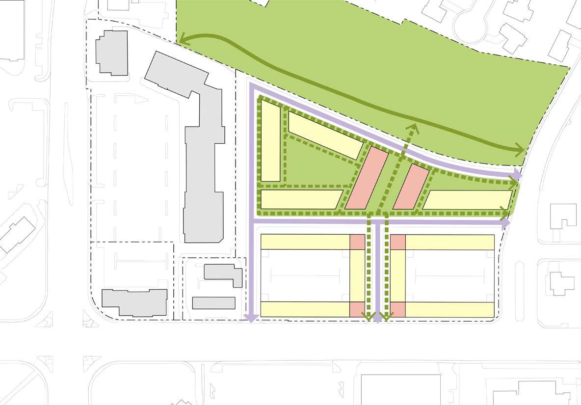
4A. Full Buildout
4B. Enhance Pedestrian Connectivity
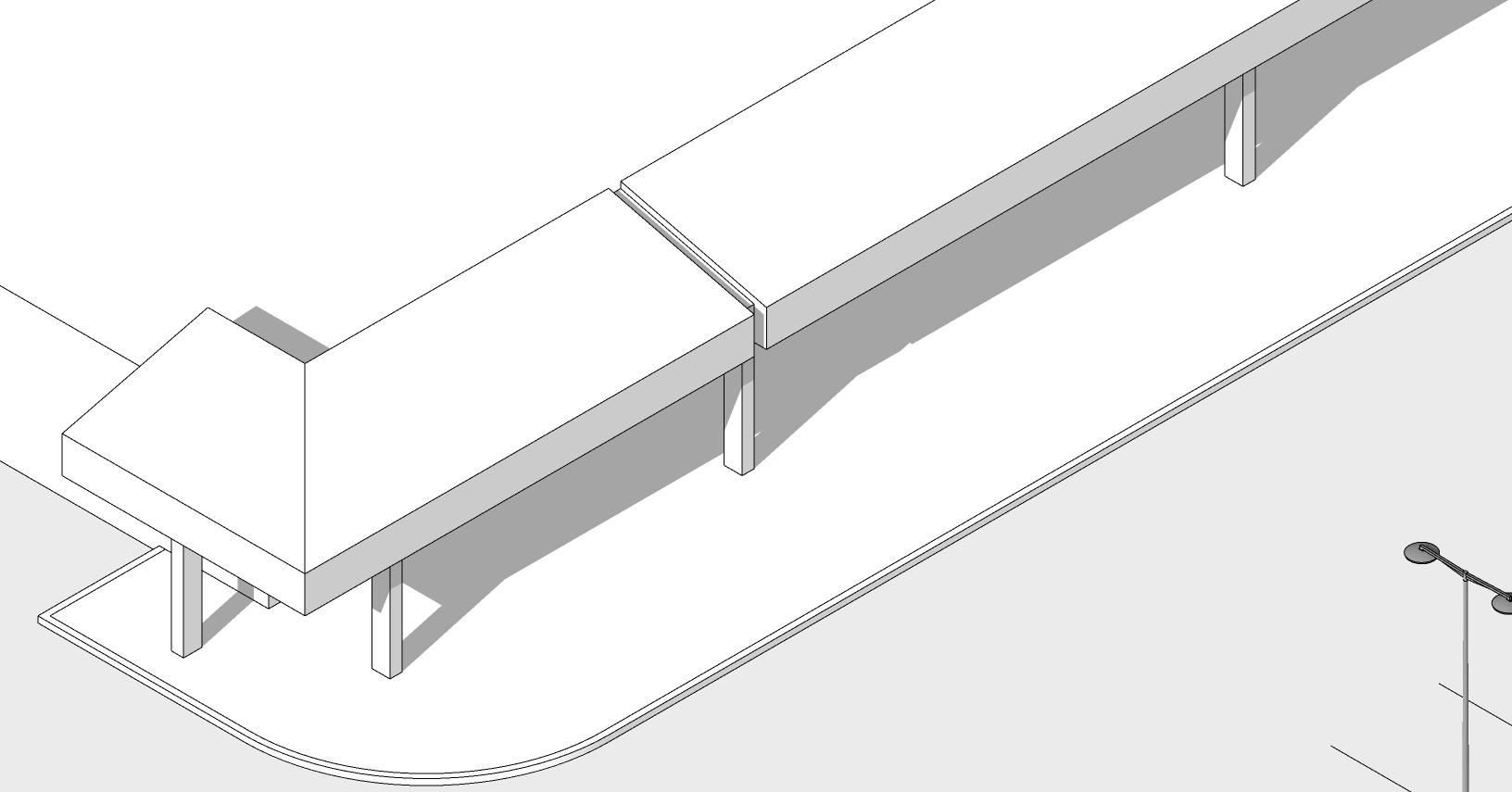
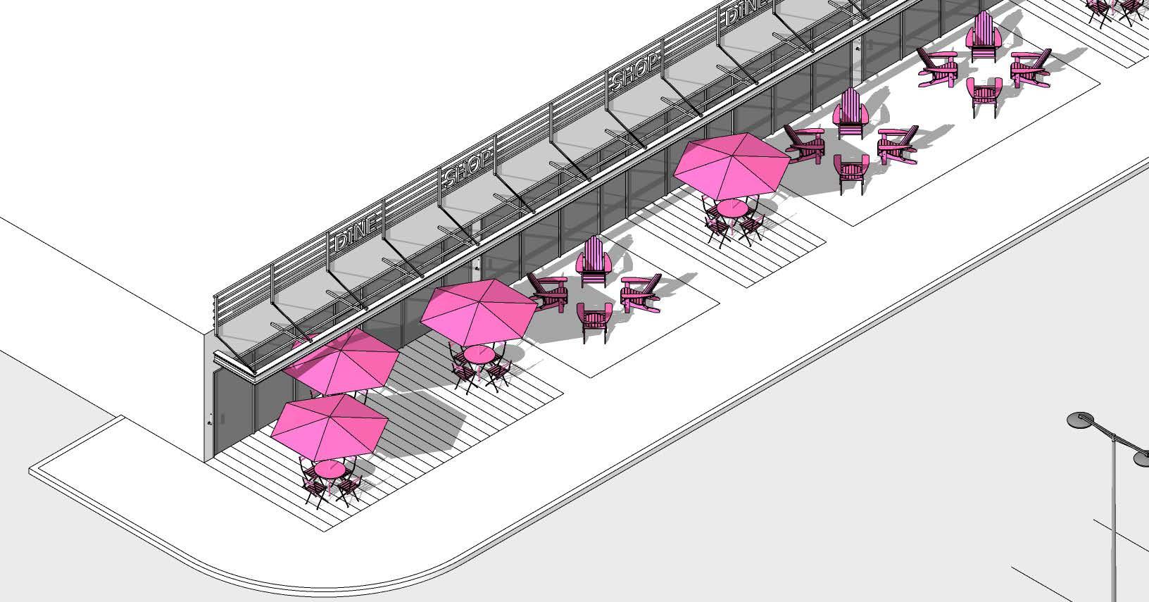
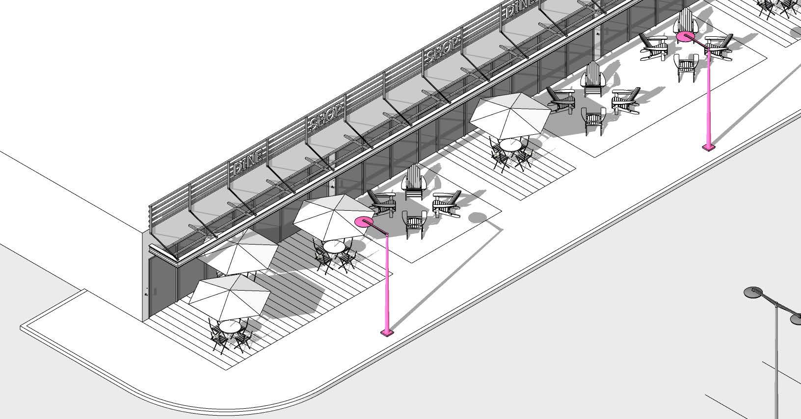
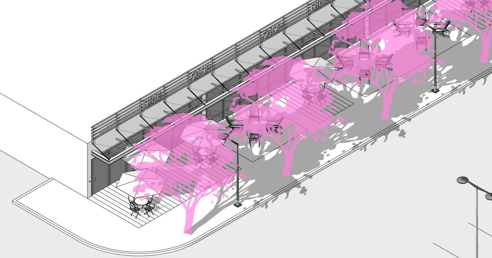
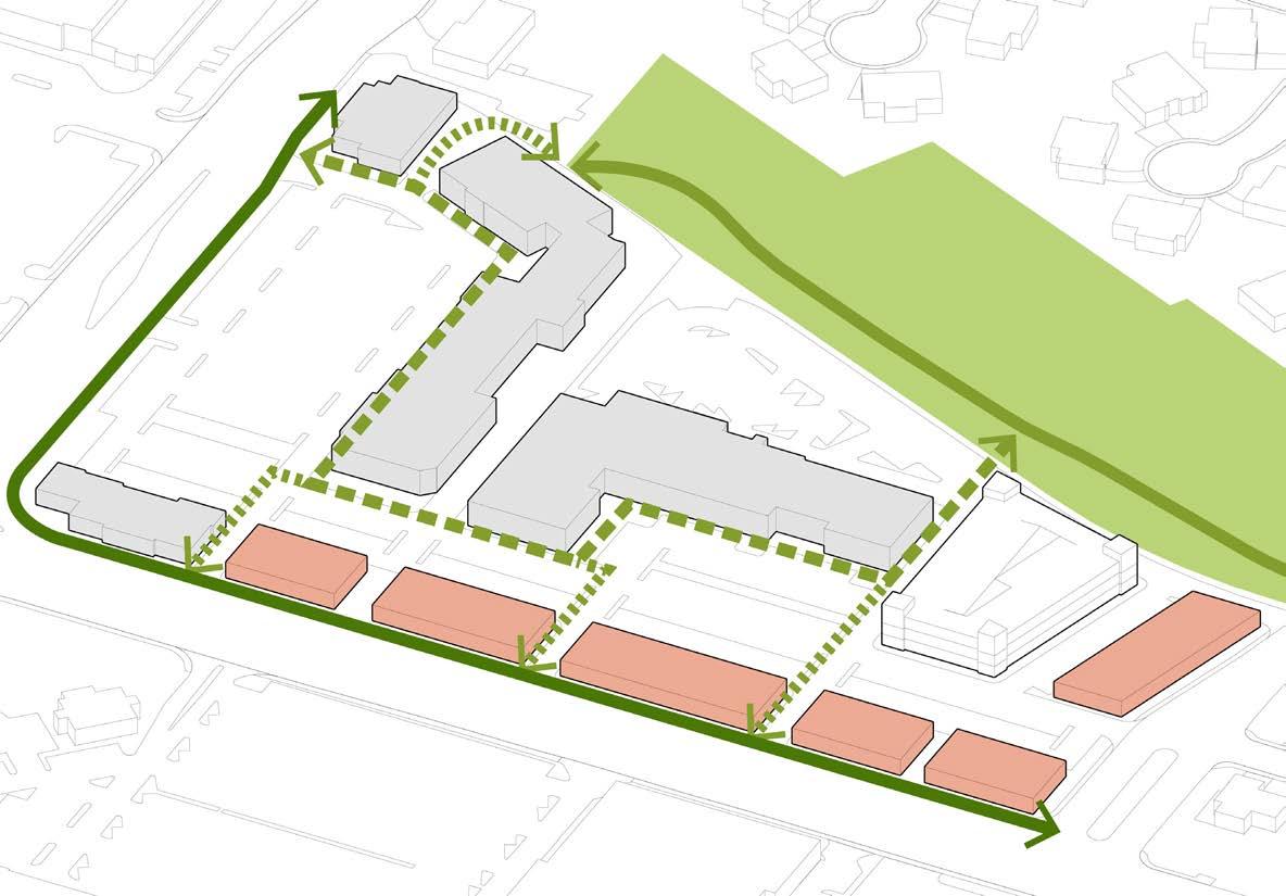
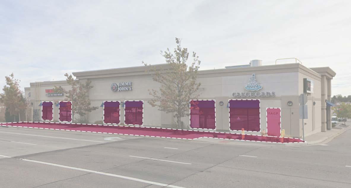
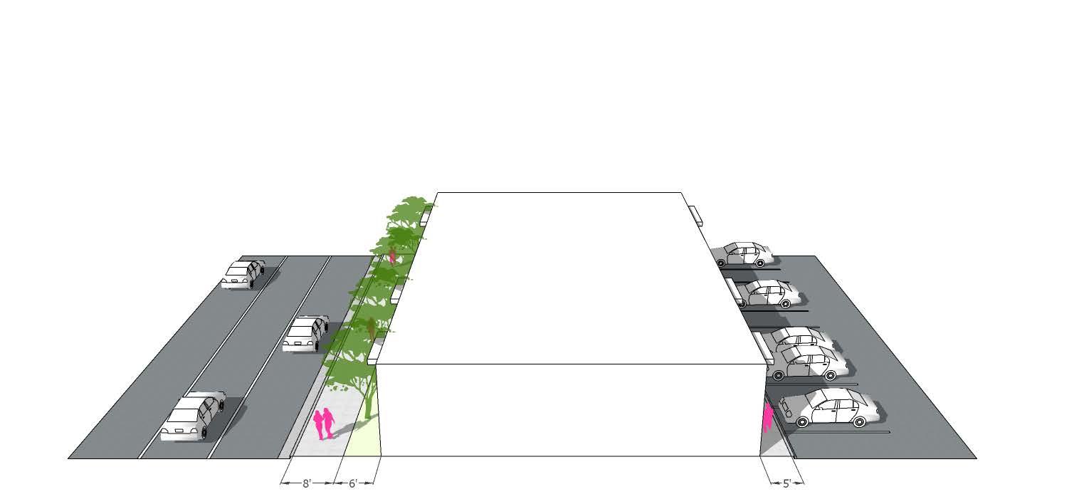
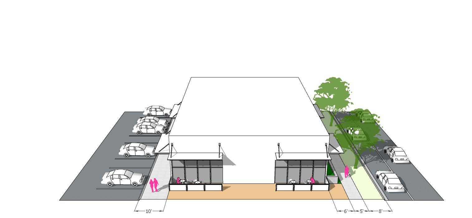
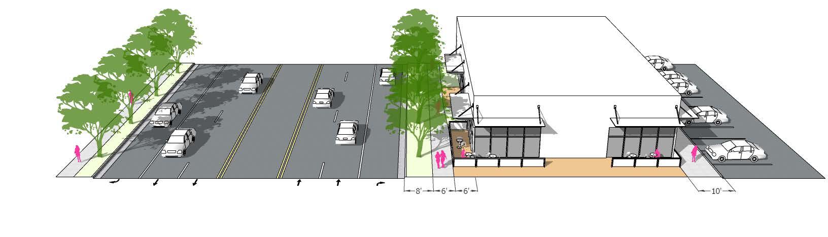
Arterial Adjacent Pedestrian Zones
Pedestrian Trails
Storefront Pedestrian Zone, ref. University Boulevard Corridor Study chapter III.2 Parking Lot Links, ref. University Boulevard Corridor Study chapter III.3
• Design Arterial Adjacent Pedestrian Zones in a manner that separates pedestrains from veicular traffic using generous landscape zones and sidewalks to allow passersby
• Fronting major streets with retail will require parking on the interior of the activity center
• Using structured parking will allow more space for development
Redevelopment: Main Street Scenario
Proposed Retail
Proposed Residential
Park Zone
Vehicular Circulation
Pedestrian Trails
Storefront Pedestrian Zone
Parking Lot Links
• Main Street as placemaking feature
• Primary retail frontages and front doors face a ‘main street’
• Parking is located behind retail with frequent pedestrian pass throughs
Redevelopment: Mixed-Use Neighborhood
Proposed Retail
Proposed Residential
Park Zone
Vehicular Circulation
Pedestrian Trails
Storefront Pedestrian Zone
Parking Lot Links
• Retail clustered around ‘town square’ or ‘piazza’ located adjacent to regional trail network, which changes the function and character of the place
• Signature retail that requires visiblity; may be located at gateway along the arterial
• Requires strong placemaking design that will become a sought after destination for neighboring residents arriving by bike, scooter, or foot as well as people arriving in automobiles
Centennial Municipal Code Pedestrian Zones
The Centennial municipal code prescribes minimal design requirements for pedestrian zones located along arterial streets such as University Boulevard. The code reads as follows: build-to lines shall be sufficient to ensure that a 16-foot wide pedestrian zone attached to an appropriate boundary element by a sidewalk and detached by a minimum four feet from the street curb is provided.
a. If the sidewalk in the existing pedestrian zone can be expanded to 12 feet in width within the right-of-way while maintaining a minimum four-foot detached planting strip, then the resulting distance to the pedestrian zone edge establishes the minimum distance for the required build-to on that frontage.
b. If the existing sidewalk cannot be expanded to 12 feet in width within the right-of-way while maintaining a minimum four-foot planting strip, then the build-to shall be 12 feet minus the distance between the property line and the edge of the sidewalk while maintaining a minimum four-foot planting strip between the street curb and the sidewalk.
Additional pedestrian zone elements specific to enhanced design standards in activity center districts are as follows:
a. Alternative Design and Materials for Required Planting Strip. A designated four-foot ‘amenity strip’ including patterned concrete (up to 20 percent of the designated amenity strip), masonry pavers, natural stone pavers, planted tree wells, trees in grates, pedestrian scaled light fixtures and street furniture may be provided in lieu of the planting strip when demonstrated to provide enhanced pedestrian accessibility to the project.
b.Landscape Durability in Pedestrian Zone. Landscape materials planted adjacent to street frontages shall be commonly recognized for durability and perennial character, and shall be required to display seasonal color and year round texture, while maintaining required sight lines established by other applicable regulations. This requirement shall be in addition to all other applicable Development Landscaping and Tree Protection requirements set forth in Article 8 of this LDC.
Refer to Centennial Municipal Code section 12-4-4 for further detail and related diagrams.
Proposed Pedestrian Zones
The precedents provided in the prior section of this document include a number of specific elements that could be additive to the Centennial Municipal Code to enhance pedestrian experience along arterial streets as well as within adjacent activity centers.
Specific guidelines include, but are not limited to:
• Provide wider planting strips in arterial-adjacent pedestrian zones to create further separation between vehicles and pedestrians
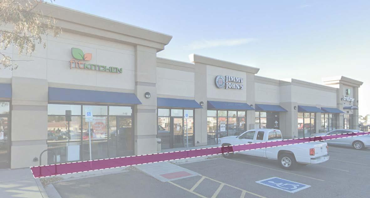
• Encourage pedestrian pass-throughs between street-facing facades and parking lot-facing facades
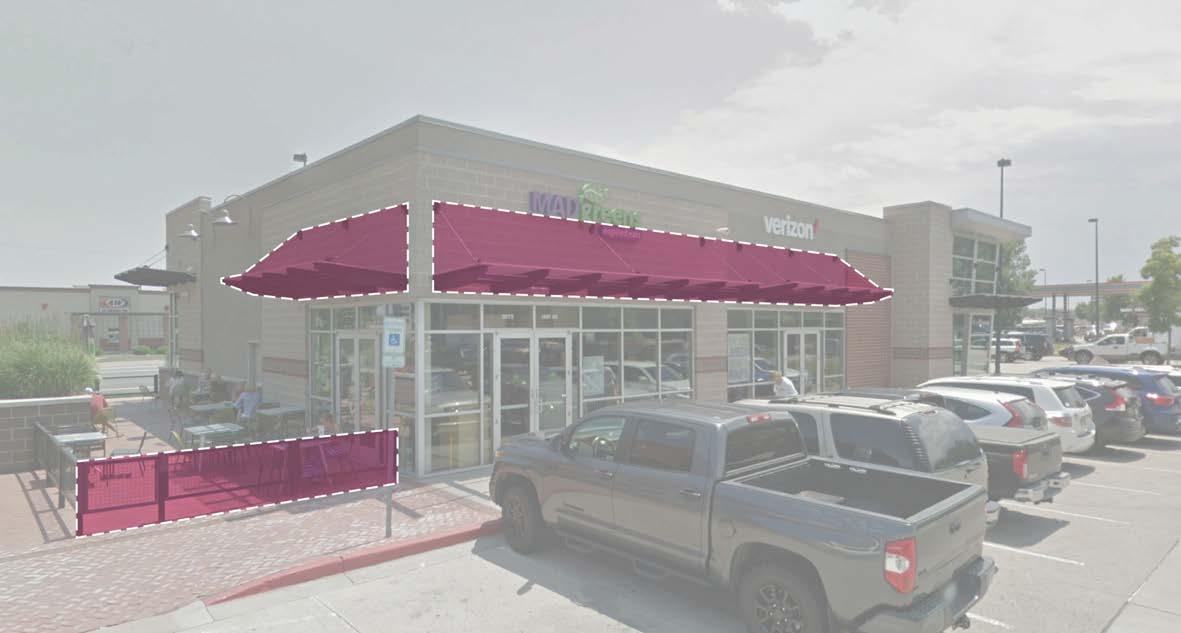
• Encourage patios along the street or in pedestrian pass-throughs
• Encourage accessible entries facing the street, or a higher percentage of glass facades that face the street
• Encourage brick facades, or other durable facade material
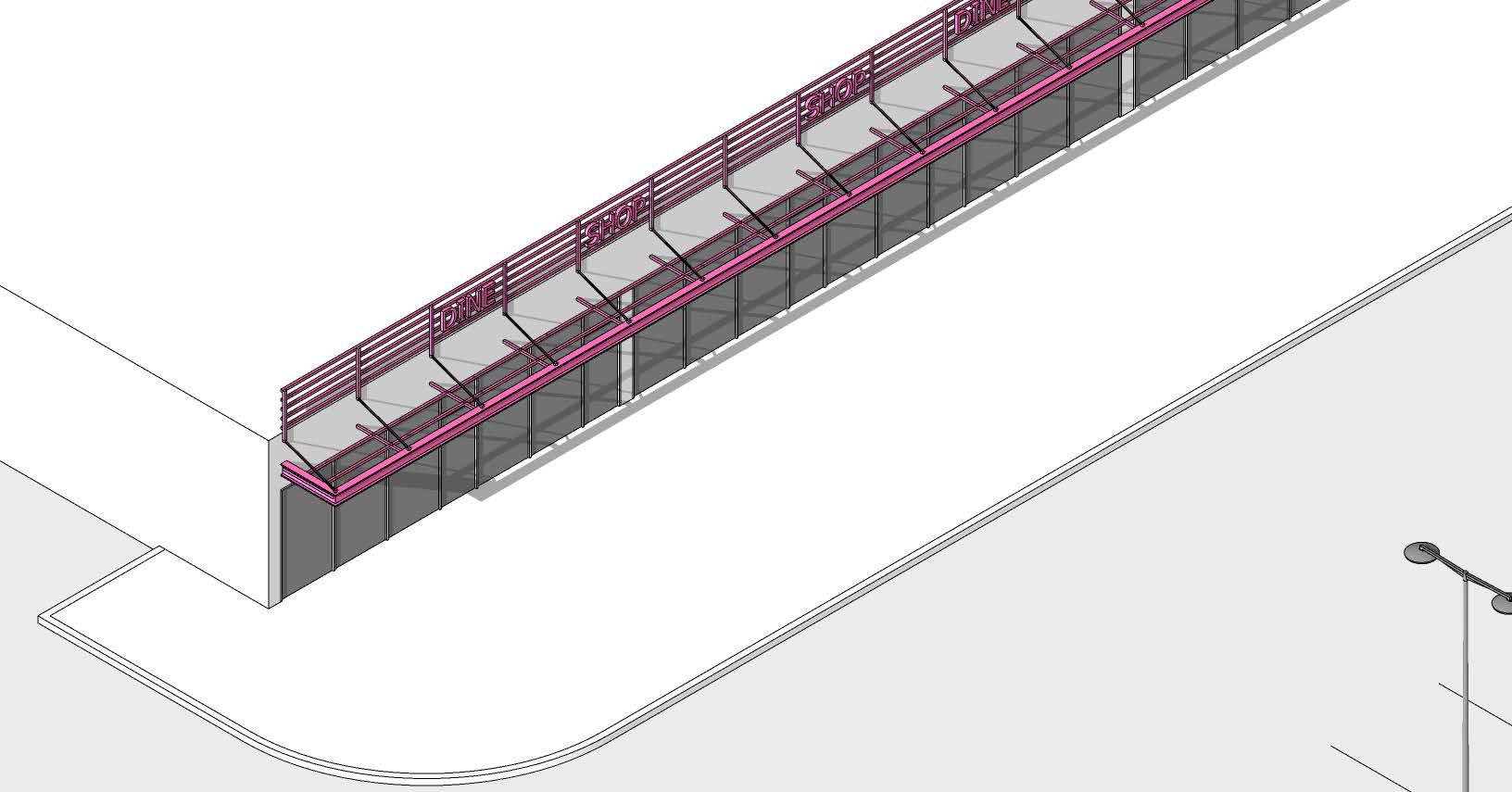
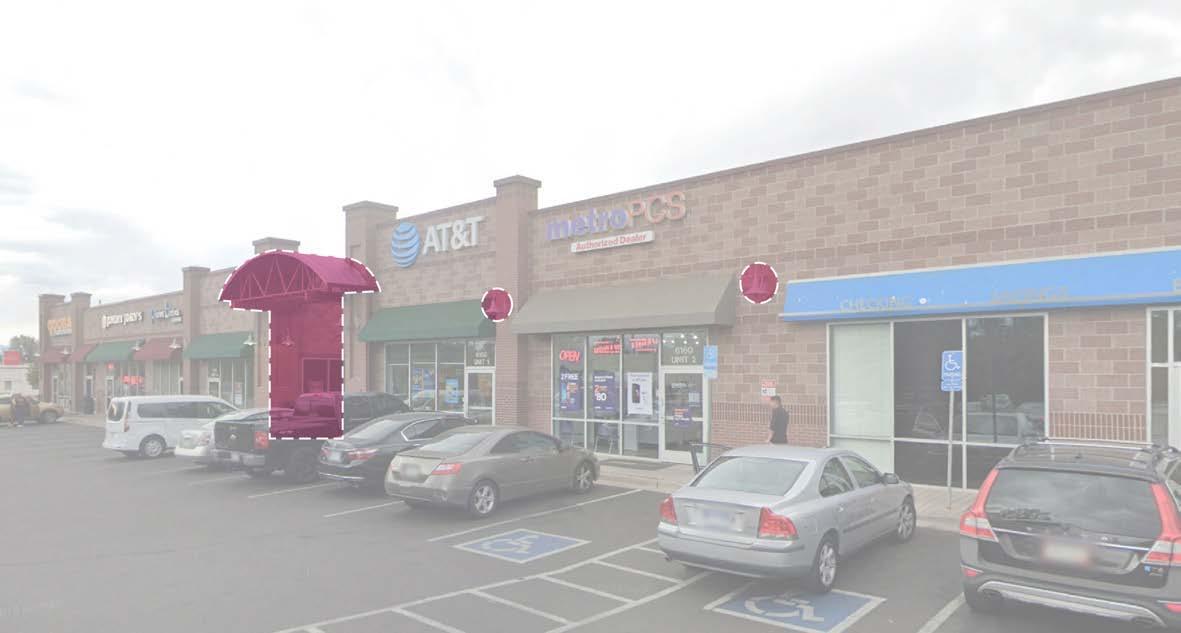
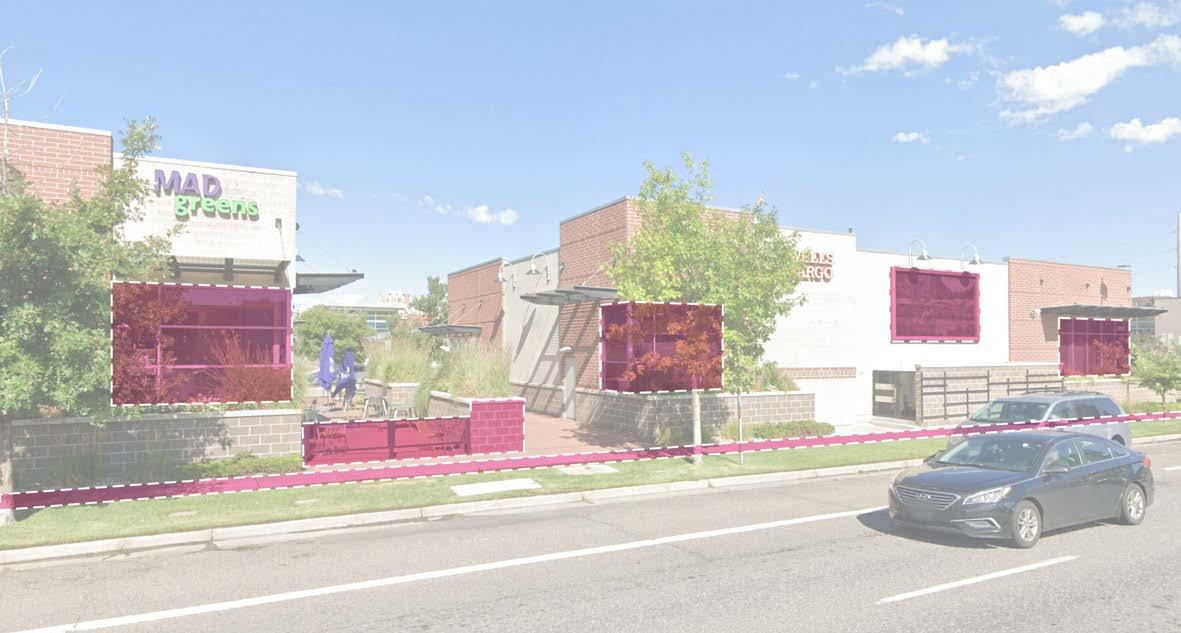
• Provide building facade lighting to add visual interest
• Provide contemporary awnings over windows and entries to create human scale experience along building face
• Establish a consistent pedestrian scale street edge along arterial streets (see cross section diagram below for recommended dimensions)
• The street facing facade and parking lot facing facade should be of the same quality and character
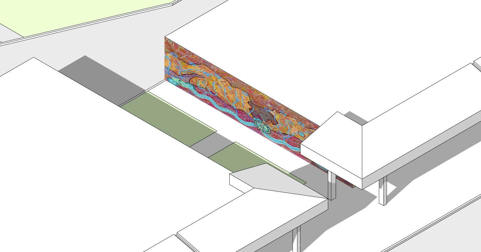
• Encourage artwork along arterial facing facades as a way to break up long, blank facades
• Low walls or planting shall be used to screen mechanical equipment located on the building facade or surface mounted between the sidewalk and building
• A six foot wide building frontage zone, located between the back of sidewalk and building face along the arterial street provides space for landscape buffer or outdoor patio space to help soften the pedestrian environment
Proposed cross section for arterial-adjacent pedestrian zones