City of Tyler
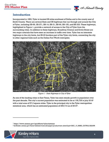
ITS Master Plan Introduction Incorporated in 1850, Tyler is located 98 miles southeast of Dallas and is the county seat of Smith County. There are several State and US highways that run through and around the City of Tyler, including US-69, US-271, SH-14, SH-31, SH-64, SH-155, and SH-323. These highways, highlighted in Figure 1, provide a network of access to the City of Tyler from the surrounding cities. In addition to these highways, Broadway Avenue and Erwin Street are two major arterials that have seen an increase in traffic over time. Tyler has no interstate highways in the city limits, but IH-20 borders part of the Tyler city limits, connecting the city to other regional hubs such as the Dallas-Fort Worth metroplex.
Figure 1 - State Highways in City of Tyler
As one of the leading cities in East Texas, Tyler has seen steady growth in population over the past decade. The city’s current population was estimated to be at 105,729 in July 20181 with a total area of 57.2 square miles. Tyler is the principal city in the Tyler metropolitan statistical area, which has an estimated population of 209,714 as of 20102.
1
https://www.census.gov/quickfacts/tylercitytexas
2
factfinder.census.gov/faces/tableservices/jsf/pages/productview.xhtml?pid=DEC_10_NSRD_GCTPL2.US24PR
4

