PLAYGROUND & CIRCUIT PATH STUDY
 Prepared by CAPITAL PROJECTS
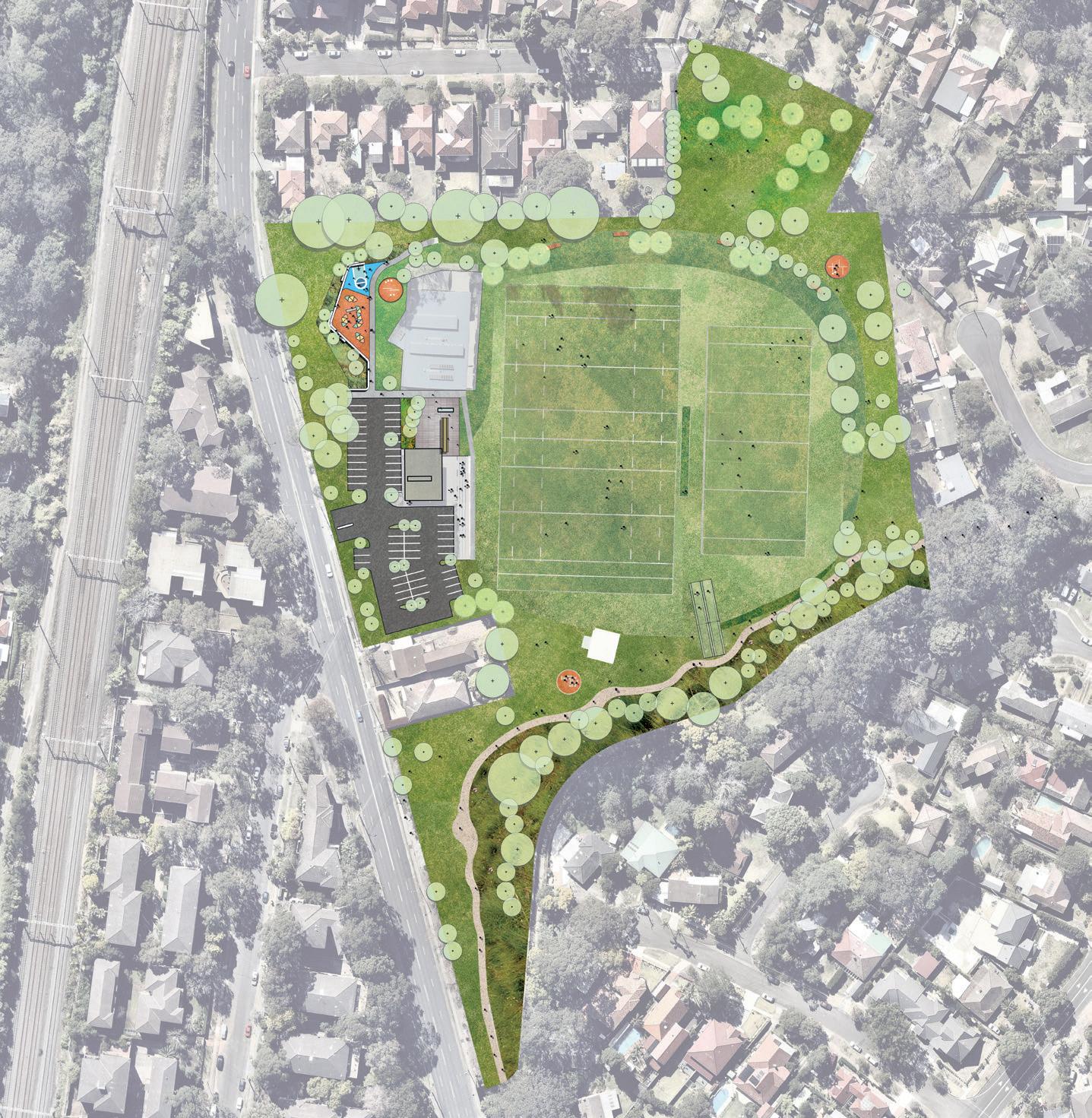
Masterplan included
LEGEND
1 Upgrade or replacement of existing amenities building.
2 Paved outdoor are adjacent to new amenities building. To include outdoor seating for communal gatherings, new shade trees and reinstated public BBQ.
3 Proposed pathway connection between amenities building and playground. Minor reconfiguration works required to car park adjacent.
4
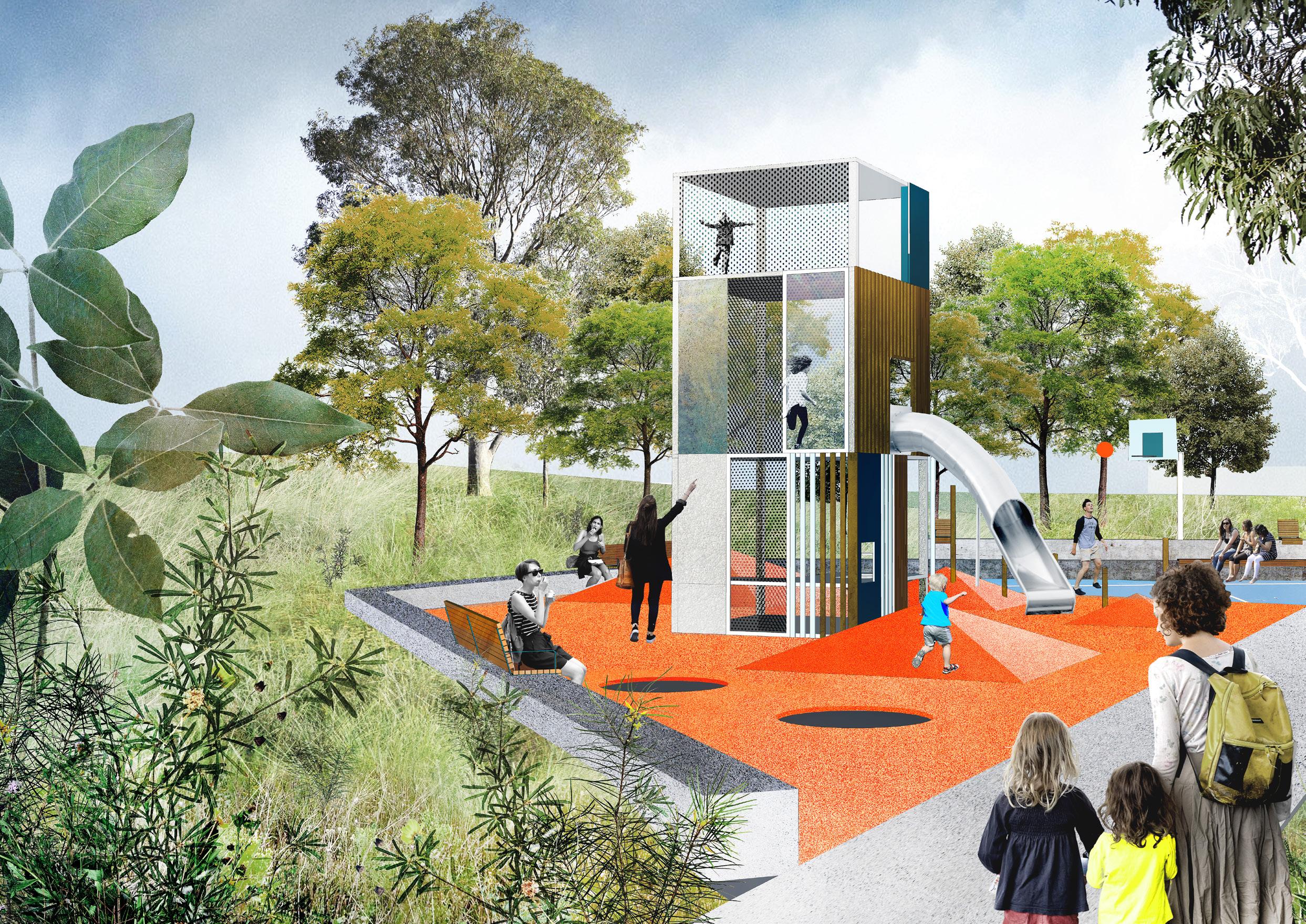
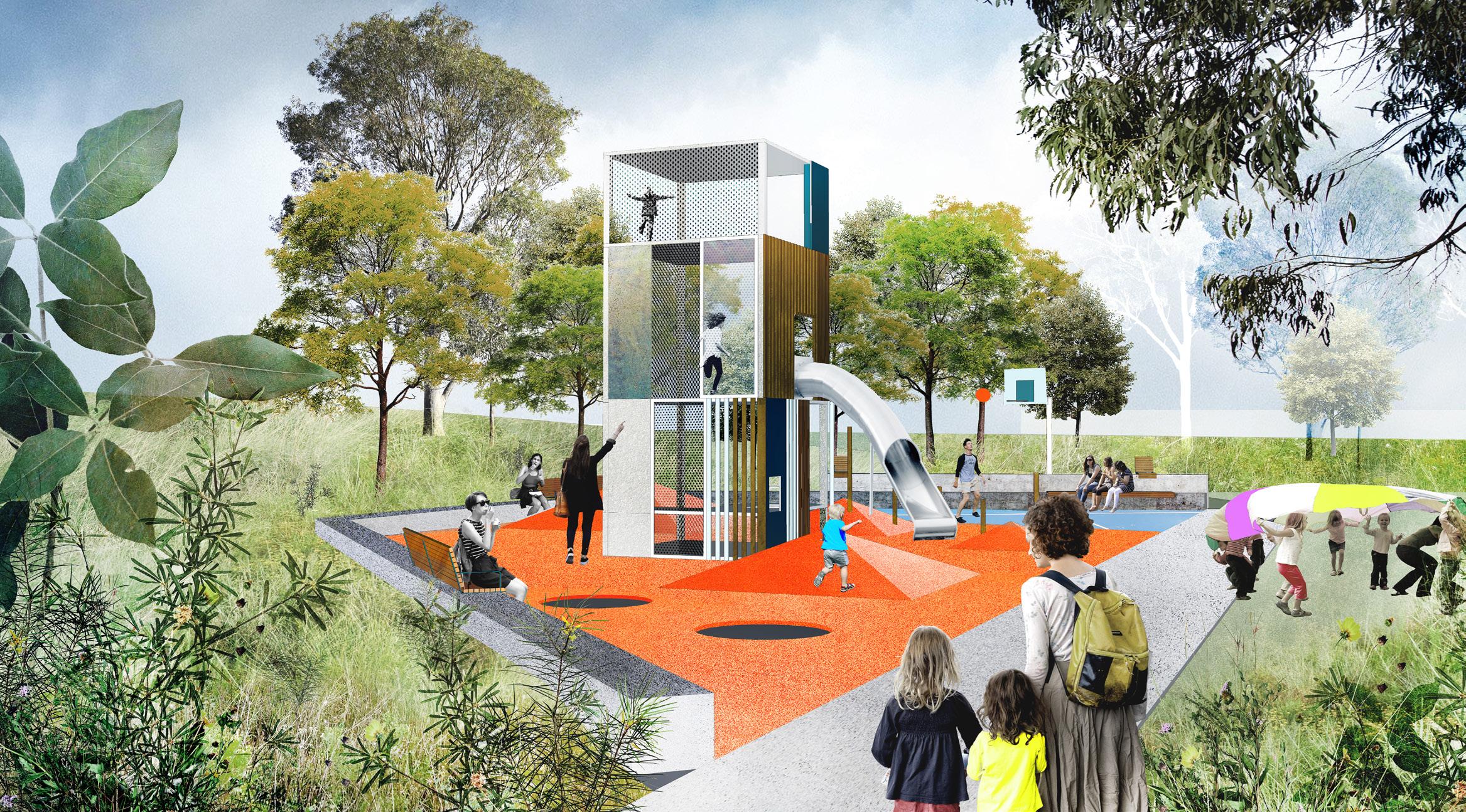
Upgrade existing playground. To include generous seating edges, vertical play elements, small sports court space and outdoor fitness equipment. Shade trees and mass planting proposed to embankment adjacent to provide screening and protection from Blaxland Road.
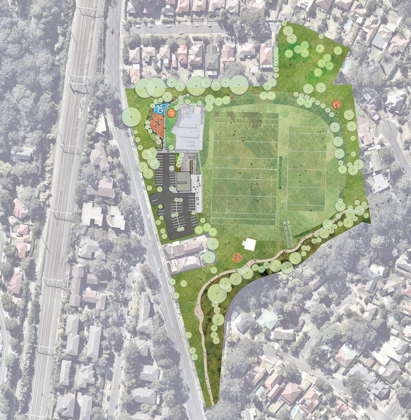
5 Accessible ramp to sports field.
6 Outdoor fitness equipment station. To include chin up bars, sit up benches, dipping bars etc.
7 Upgrade existing cricket nets ad relocate slightly north to provide space behind for pathway link.
8
Pathway connection to southern edge of park. Decomposed sandstone pathway to be bordered by native Australian mass planting and sandstone boulders to prevent overland flow and erosion of slopes adjacent to Terry’s Creek and to provide opportunities for nature play.
9 Areas of bush regeneration and native planting to Terry’s Creek embankment.
10 Way-finding and signage proposed at key entry points.
11 Upgrade of cricket pitch.
Upgrade of lighting to sports fields and surrounds.
Proposed tree planting with textured mass planting to under storey
2 Prepared By: Revision: Date:Tom Atkins A 22 Feb 2019 CAPITAL PROJECTS MASTER PLAN REPORT STUDY OF KEY DESIGN ISSUES
for reference only, please refer to previus
12
13
SCALE 0 10 20 50m 1 2 3 4 5 7 8 9 9 10 10 11 12 12 12 12 13 10 8 6 6 6 SOMERVILLE PARK MASTER PLAN
INTRODUCTION
This short document has been compiled with the intent of providing some insight into the design process that has led to the design outcome as presented in the Draft Somerville Park Masterplan Report document. This document was reviewed and discussed at a council meeting on Monday 11th February, where the following items were raised as requiring further explanation or consideration:
The playground’s location – it was raised that the playground is currently positioned too close a proximity to Blaxland Road. Blaxland Road is a busy suburban street which generates an amount of noise and could provide a potential traffic hazard for visitors to the park and playground. As part of the original design process behind the design resolution that was presented in the Master Plan Report, a locations study was conducted which informed the decision to reconstruct the playground in its current location. Various protective measures were also identified which would reduce the visual and noise impacts on the playground as well as providing an additional buffer to further protect visitors to the playground from Blaxland Road. This short document details these items for further discussion.
A circuit path within Somerville Park – In early concepts it was suggested that a hard paved or concrete path could be installed to promote movement around the perimeter of Somerville Park. Through the design process this was further explored. As an overriding concept, the idea of a circuit path presented a number of difficult scenarios that rendered the idea unfeasible. This document details the items that have led to the decision to remove the circuit path from the design and examines the alternative approach that has been taken to connectivity within the park and the immediately surrounding area.
3 Prepared By: Revision: Date:Tom Atkins A 22 Feb 2019 MASTER PLAN REPORT STUDY OF KEY DESIGN ISSUES CAPITAL PROJECTS
LEGEND Potential circuit path location (for discussion purposes only) Current playground location
The following investigation into the ideal location for a playground was undertaken following comments from our internal Asset Owners. We were asked to examine potential locations within the park for the relocation of the playground. It was felt that the facilities proximity to Blaxland Road presented a range of safety issues and that the visual and noise impact of the road would detract from the playgrounds setting within the park.
The findings of this exercise suggest that the playgrounds location presents the most accessible location within the park, presents the least disturbance to local residents, sporting teams and existing infrastructure and is readily visible from outside of the park. It is acknowledged that the playgrounds proximity to Blaxland Road presents an issue which needs to be addressed through effective design.
1
CONSIDERATION OF SCALE
In order to accommodate the proposed design of the new playground and multi-sports area, the footprint of the play facility is required to grow by around 55%, or 120m2. The new location of the playground should consider the playgrounds footprint at its proposed area of 320m2.
4 Prepared By: Revision: Date:Tom Atkins A 22 Feb 2019 CAPITAL PROJECTS MASTER PLAN REPORT STUDY OF KEY DESIGN ISSUES PLAYGROUND LOCATION MATRIX
2 43 6 5 CURRENT PLAYGROUND PROPOSED PLAYGROUND Area = 200m2 Area = 320m2
Proximity to amenities building and public toilet.
Playground should be located within 100m of amenities building and present a workable solution for an accessible path connection.
Potential for a practical solution to accessibility.
The playground should be connected by an accessible pathway connection from at least one entry point to the park.
Non-obstructive location
The playground should not impede upon views to the sporting field, or negatively impact existing infrastructure (including major services sporting assets)
Minimal disturbance to residents
The playground should not impose any additional visual or noise disturbance upon local residents.
Proximity to major roads and traffic
The playground should not present any risk to visitors as the result of its proximity to roadways or transport infrastructure.
No risk of injury or colision with sporting program
The playground should not be positioned in such a location that balls or players might be able to cause injury to users of the playground. The playground should also pose no risk to participants of organised sports.
Visible from outside the park
The playground should be positioned in a location which allows for passive surveilance and provides a landmark or attraction to passers-by.
Additional notes
Location 1’s proximity to Blaxland Road can be addressed from a safety perspective by constructing a lightweight fence amongst the proposed understorey planting surrounding the playground. A visual screen can be achieved through the selective planting of screening plants and trees.
Location 2 presents a highly detrimental outcome to the overall function of the park as a sporting facility and park. This location would require major rework to the well-used bleacher stair of the amenities building, and have a majorly negative impact on the relationship between the sporting field and the amenities building.
Zone 3 presents an outcome which is workable from an accessibility perspective, it also does not pose any negative impact to surrounding residents. It does not present a safe location in relation to passive surveillance, or to its relationship to the sporting program of the playing fields.
Zone 4 presents an outcome which is workable from an accessibility perspective, it also does not pose any negative impact to surrounding residents. It does not present a safe location in relation to passive surveillance, or to its relationship to the sporting program of the playing fields. It is also situated above large in ground tanks which cannot be relocated.
Zone 5 is located on an area of sloping topography and would require the construction of significant retaining structures to achieve the gradient required for a playground. Whilst this would result in an interesting playspace, zone 5 is located in very close proximity to surrounding residences and would present difficulties from an accessibility standpoint.
Like Zone 1, Zone 6 is also located in very close proximity to Blaxland Road. Unlike zone 1, this location does not have the advantage of a sloping topography to its surrounds. It is also in very close proximity to surrounding residences.
Conclusion
Location 1 scored an approval rating of 86% against the prescribed criteria. It is the preferred location for the new playground.
Location 2 scored an approval rating of 43% against the prescribed criteria. It is not reccomended as the preferred location for the new playground.
Location 3 scored an approval rating of 43% against the prescribed criteria. I It is not reccomended as the preferred location for the new playground.
Location 4 scored an approval rating of 43% against the prescribed criteria. It is not reccomended as the preferred location for the new playground.
Location 5 scored an approval rating of 43% against the prescribed criteria. It is not reccomended as the preferred location for the new playground.
Location 6 scored an approval rating of 57% against the prescribed criteria. It is not reccomended as the preferred location for the new playground.
5 Prepared By: Revision: Date:Tom Atkins A 22 Feb 2019 MASTER PLAN REPORT STUDY OF KEY DESIGN ISSUES CAPITAL PROJECTS LOCATION MATRIX ZONE 1 ZONE 2 ZONE 3 ZONE 4 ZONE 5 ZONE 6
IMPROVING THE SETTING & IMPROVING SAFETY
The assessment of potential location for the playground clearly identified Zone 1 as the preferred location. It also raised several important design constraints, including its proximity to Blaxland Road.
In order to address this, the playground has been designed to sit at a low point within the areas topography.
The embankments surrounding the playground would be surrounded by dense planting and shrubbery of around 600-1000mm in height (once mature). A number of mature tree plantings is also proposed for the planted embankments. The installation of new tree plantings will create an effective screen and lessen the visual impact of the Blaxland Road on the setting of the playground.
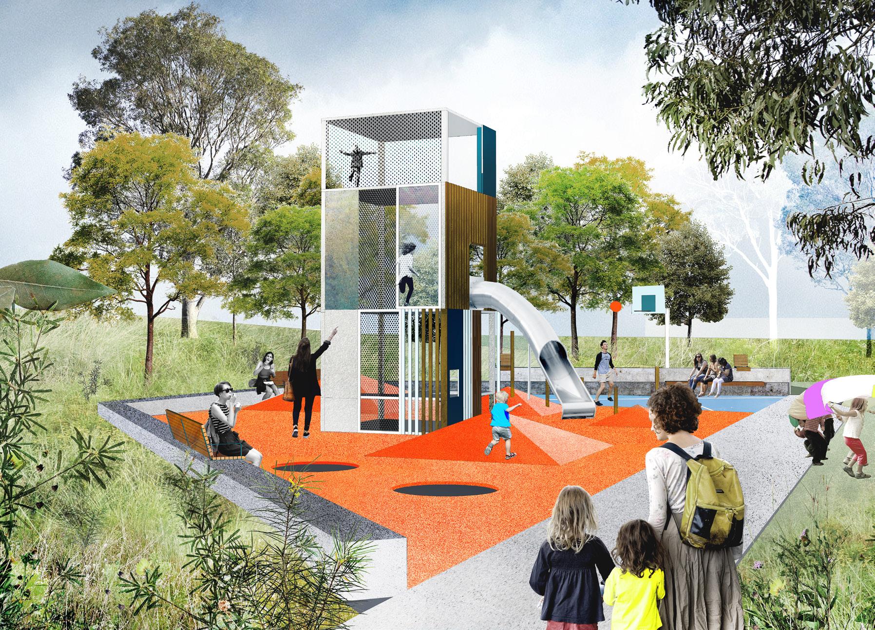
The playground has been designed to incorporate a raised seating edge around its perimeter. This encourages parents to enjoy the space with their children and facilitates an active engagement between child and parent/ minder. As well as the barrier presented by the 500-1000mm concrete step and the dense planting behind, a lightweight steel fence of around 1200mm could be concealed amongst the understorey planting to provide additional separation from the road.
With these measures in place, it is not forseen that the proposed locations proximity to Blaxland Road will have any negative impact on the safety or the setting of the playground within the park.
6 Prepared By: Revision: Date:Tom Atkins A 22 Feb 2019 CAPITAL PROJECTS MASTER PLAN REPORT STUDY OF KEY DESIGN ISSUES
7 Prepared By: Revision: Date:Tom Atkins A 22 Feb 2019 MASTER PLAN REPORT STUDY OF KEY DESIGN ISSUES CAPITAL PROJECTS Potential fence alignment Dense planted understorey & new tree plantings 500mm - 1000mm raised concrete seating edge
