Municipal Development Plan

Municipal Development Plan

We would like to thank the residents and community members who attended the public engagement sessions and participated in the preparation of this Municipal Development Plan. Your input on this project has been invaluable and is greatly appreciated.
Mayor Gerald Aalbers
Councillor Aaron Buckingham
Councillor Dr. Michael Diachuk
Councillor Glenn Fagnan
Councillor Lorelee Marin
Councillor Jonathan Torresan
Councillor Jason Whiting
Natasha Pidkowa, Manager of Planning
City of Lloydminster
Green Space Alliance
POPULUS Community Planning Inc.
The City of Lloydminster acknowledges that we are located on Treaty 6 Territory, and the City of Lloydminster respects the histories, languages, and cultures of First Nations, Metis, Inuit, and all First Peoples of Canada, whose presence continues to enrich our vibrant community.

Connection To Our Future is the City of Lloydminster’s Municipal Development Plan1 (MDP). The purpose of an MDP is to provide guidance for how our community will develop and change over time with consideration given to the needs of the people who live, work, and do business here. It provides consideration to all aspects of a community such as transportation, environment, social aspects, arts, and culture, etc.
The MDP is part of a hierarchy of documents and legislation that governs how land should be used, managed, protected, developed, and planned. The Municipal Government Act (‘the Act’), which all Alberta municipalities must follow, requires all communities to have an MDP. The requirements for an MDP are listed in Part 17, Section 632 of the Act, and include the requirement to discuss future use of land, how future development may take place, transportation issues, provision of municipal services and facilities, and other matters. This MDP reflects the requirements of the Act.
This MDP was prepared with input from many people who represented different segments of the community and who brought different points of view to the project. Participants included individual residents, businesspeople, social service providers, educators, Indigenous representatives, newcomer service providers, health care providers, and local government personnel. While everyone who participated had an interest in the outcomes of the document, not everyone’s interests are necessarily represented by this final document. The document meets the requirements of the Act while keeping in mind the best interests of the whole community.
A values-based approach as opposed to a population-based approach was used for this Plan. A values-based approach is more ‘future proof’ than a planning approach based on population targets. As values are less likely to change over time, policies based on values would remain applicable regardless of the city attaining the projected population targets.
1 Municipal Development Plan (MDP): A statutory plan, as defined by the Municipal Government Act, that outlines the direction and scope of future growth and development.
This document is broken into four main sections: Our Context, Our Values, Preference and Anticipated Outcomes, Our Future Urban Form, and Our Connection to the Future.
Our Context provides an overview of aspects that make Lloydminster the city it is, including location and demographics, physical layout, access to social, cultural and educational assets, utility infrastructure, and economic trends. It also discusses topics such as access to parks and open spaces1, how we move around, and what rate of growth and population we should plan for over time.
Our Values2, Preferences3 and Anticipated Outcomes describes how the project team obtained input from the community, how that input was organized into themes, and how those themes informed the way the policies were created to guide the future development of Lloydminster. The themes form the Values and Community Drivers4 described within the second section of this document.
Our Future Urban Form presents the Future Land Use Concept5 for Lloydminster – how different designations of land (i.e., residential, commercial, industrial, parks) are applied to the existing and future development areas across the city. It also describes the direction derived from the community’s feedback about what the future physical form of the city should look like – how parks and trails should be developed and how our transportation network can support existing types of transportation (i.e., personal automobile) as well as accommodate active modes of transportation (i.e., walking, biking, skateboarding).
It also establishes our vision for the city as a whole. In particular, it provides direction about how our residential neighbourhoods should be designed to incorporate appropriate types of commercial uses around social gathering points – places where people can grab some milk and bread, or meet for a coffee and muffin, or get their hair cut within easy walking distance from their home, while still enjoying the ability to travel freely throughout the city to access all available amenities. Finally, Our Urban Form discusses how to create great places within Lloydminster’s urban context that employ good design standards and serve the broader community, such as commercial nodes6, schools, and a vibrant downtown core.
Our Connection to the Future presents the policies that will be used to guide future decisionmaking by all who use this document. The policies are categorized by values and informed by the community input received.
1 Open space: An area of outdoor land or water that is publicly owned or publicly accessible. This may include parks, civic spaces, provincial or federal parkland, institutions, and other public spaces.
2 Value: Derived through a comprehensive engagement process, values guide the choices we make for the future of Lloydminster. The core values of Connection to Our Future include belonging, culture, ecology, innovation, community health, and initiative.
3 Preference: The direction we prefer to take for the community drivers in Connection to Our Future.
4 Community Driver: Aspects of Lloydminster that directly inform city-building. They are tangible topics or characteristics we, as a community, can look to when we make decisions about our future. There are five community drivers that form the basis of city-building in Lloydminster: urban form, mobility and connectivity, climate resilience, social equity, and fiscal responsibility.
5 Future Land Use Concept: A depiction of the existing and future land use pattern for Lloydminster.
6 Node: Centers of activity of different shapes and sizes within a city. Nodes can include a variety of housing types, land uses, and gathering spaces.
The appendices of the MDP offer additional information that does not form part of the MDP Bylaw. This means that the information contained in the appendices is useful context for understanding the intent of the policies, and how those policies inform implementation tasks, but is not subject to the same statutory bylaw process as the MDP itself.
Appendix 1 provides an overview of the Planning Framework applicable for this Plan.
Appendix 2 is called How Do We Connect and presents the roadmap for achieving the Plan’s outcomes. It includes a detailed description of various implementation approaches including advocacy measures, new studies, administrative processes, grants, funding mechanisms, partnerships, and monitoring.
Appendix 3 includes What We Heard reports, which provide a detailed summary of various public and stakeholder engagement undertaken throughout the duration of this project and what we heard during those engagement sessions.
Finally, the MDP has influence over the entire City of Lloydminster. It includes detailed background information about the city to assist the reader in understanding the intent of various policies. The contextual information included in the document also helps to establish the relationship between the values, policies and the desired outcomes of this Plan.
Lloydminster is a border city, straddling the Alberta-Saskatchewan provincial border and located approximately halfway between Edmonton in Alberta and Saskatoon in Saskatchewan. The city has a reputation for having a positive business environment with good economic opportunities, while serving a trade area of approximately 189,000 people. Lloydminster is positioned as the primary destination for recreation, retail, and social activity in the region. The city has a diversified regional economy involving industries such as agriculture, oil & gas and innovative manufacturing.
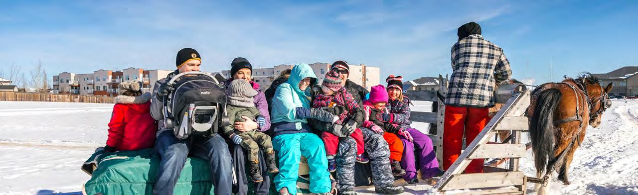
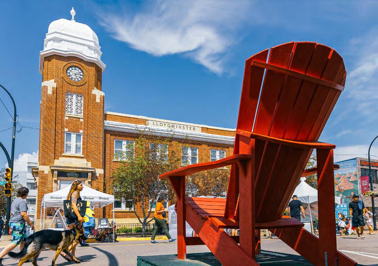
Lloydminster experiences long, cold winters. The City of Lloydminster embraces winter and continually explores how to make the best out of our longest season. Various approaches to embrace being a Winter City include establishing outdoor spaces for winter sport, careful urban design to create microclimates where people can access sunlight and take shelter from the wind, and the use of bold colour and texture to contrast a white landscape. The City’s approach is to enable everyone to enjoy public spaces and outdoor amenities during all seasons.
The City also recognizes that the extreme winter weather may pose dayto-day challenges for how we use our public and private spaces in winter months. For Lloydminster, being a winter city means doing what works here, for the people who live here.
Lloydminster has developed as a place of congregation for many years. Over 100 years ago, European settlers began to develop what is now Lloydminster. By understanding our past, we can plan for a better future. The following list highlights some of the key turning points in the history of Lloydminster.
• Pre-1903: Although Lloydminster is believed to have not been directly settled by Indigenous people, the Lloydminster area may have been in the traditional hunting and trapping region of Indigenous people of the area.
• 1903: Settlers of the Barr Colonists from England, led by Reverend E. Lloyd, began to establish Lloydminster. The city gets its name from the Reverend Lloyd and “minster”, which means “mother church”.
• 1905: The village of Lloydminster becomes part of both Alberta and Saskatchewan as provincial boundaries are officially drawn. Before the border drawing, the city was part of the Northwest Territories.
• 1905: The Canadian Northern (CN) Railways builds lines that connect Lloydminster to Edmonton and Saskatoon
• 1930: Lloydminster becomes a Town in both Alberta and Saskatchewan jurisdictions while under one municipal authority. It is the only municipality under shared provincial jurisdiction.
• 1958: The Town of Lloydminster receives its Charter and becomes the City of Lloydminster.
• 1970: The Yellowhead Highway opens, connecting Lloydminster to both Canadian coasts.
• 1980: The Airport was started by the Federal Government and ran by the Government of Alberta until the City of Lloydminster took over in 1995.
• 2002: Lloydminster reaches 20,000 residents!
• 2014: Lloydminster reaches 30,000 residents!
For the 50-year period between 1906 and 1956, the majority of Lloydminster’s population lived on the Saskatchewan side of the city. Since 1961, the majority of Lloydminster’s population has lived on the Alberta side of the city. Originally representing 25% of Lloydminster’s population in 1906, Alberta’s share of the city’s population steadily increased over 99 years to a high of 66% from 2005 through 2009. Since 2009, Saskatchewan’s share of Lloydminster’s population has steadily increased from 34% to 37% in 2016. The 2021 census population for Lloydminster is 31,582.
Lloydminster has continuously evolved and changed throughout its 100-year history since being settled in 1903. With each coming decade, people moved in, started families, built railroads, opened businesses, and grew Lloydminster into what it is today.


1970: The City of Lloydminster Waste Management Facility was built in the northeast corner of the city.
1980: The airport was built as the city continued to grow.

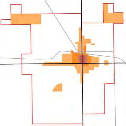
2000: Lloydminster underwent rapid residential growth and urban expansion. More development occurred on the Alberta side of the city.
2022: Where we are now! Over the past 20 years, the city experienced another period of rapid residential growth. Urban expansion has reached the city limits. As a result, the City of Lloydminster annexed new land in 2022 on the Alberta side to accommodate future growth.
Source: The growth maps provide a high-level overview of historic growth patterns in Lloydminster. These maps were developed based on historic aerial photos analysis and information received from the Lloydminster Regional Archive.
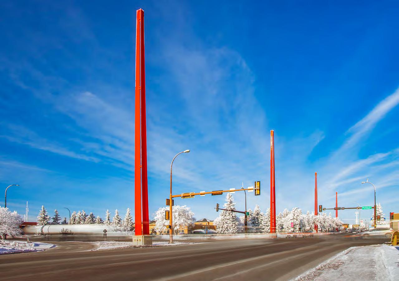
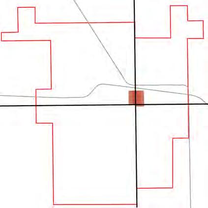
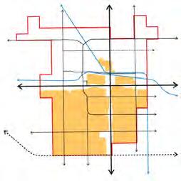
The City of Lloydminster is situated on both sides of the provincial border between Alberta and Saskatchewan. The border forms a central feature of Lloydminster, identified with the iconic orange border markers. Lloydminster is intercepted by Highway 16, which runs in the east-west direction and Highway 17, which runs in the north-south direction. Within the city limits Highway 16 is also named 44 Street and Ray Nelson Drive. Similarly, Highway 17 is named as 50 Avenue .
Lloydminster’s existing physical form (also called ‘Urban Form’) is illustrated in Map 1. It is characterized by the development patterns described below. These development patterns continue to evolve over time as new developments happen in the city.
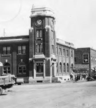
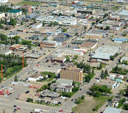
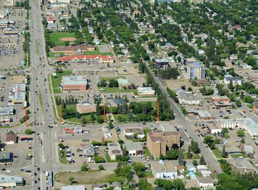
Downtown Lloydminster has always been its commercial, cultural, historical, political, and geographical center. Downtown extends on both sides of the Alberta-Saskatchewan border. The south edge is bound by Highway 16/44 Street and Highway 17/50 Avenue runs north-south through its center. The downtown core is primarily composed of commercial, office, institutional uses, and some residential development. It is anchored by major civic buildings and spaces and is also home to a variety of cultural and social amenities and destinations.
Downtown has a grid street pattern with smaller blocks and curbside sidewalks (not separated from the roadway by a grassy strip). Buildings located downtown are generally built to the property line and sit on smaller lots.
1 Downtown: The commercial, cultural, historic, political and geographical center and heart of Lloydminster.
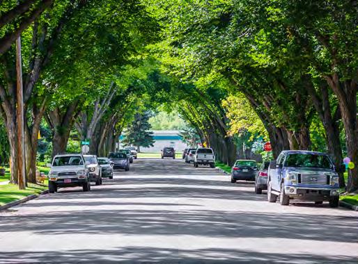
There are four mature residential neighbourhoods in Lloydminster: North Lloydminster, West Lloydminster, East Lloydminster, and the western portion of Larson Grove. These neighbourhoods were built between 1903 to 1957.
The mature neighbourhoods consist of a grid street pattern lined by boulevard sidewalks (separated from the roadway by a grassy strip) and mature trees, typically Elm. Prominent features include centrally located park and school sites, proximity to the downtown and smallscale commercial land uses along the edges of the neighbourhood. These neighbourhoods were the first to be developed in Lloydminster and include older housing stock and as well as some new infill2 development replacing older structures.
A majority of Lloydminster’s residential development can be categorized as established neighbourhoods, such as Parkview Estates, Southridge, Larson Grove, Aurora, Steele Heights, and College Park. The development of these neighbourhoods typically began around the 1950s and continues to develop to date.
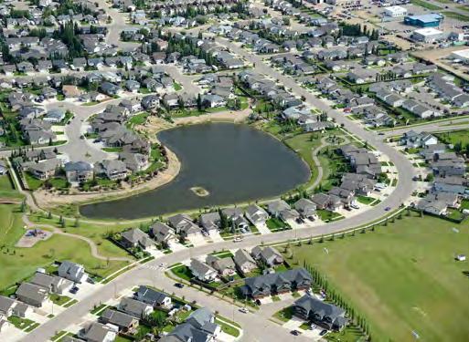
Established neighbourhoods consist of two types of street patterns, fragmented grids and curvilinear roads with loops and cul-de-sacs. Fragmented grid patterns typically consist of boulevard sidewalks without trees, linear trail networks located at the rear of residential properties and often a centrally located collector roadway with access to the city’s broader arterial road network. Curvilinear patterned neighbourhoods often contain grassed boulevards without trees along looping collector roadways, curbside sidewalks on local roads with a pattern of loops and cul-de-sacs, winding trail networks, a centrally located park and school site, and a limited number of access points to the surrounding arterial roadways.
1 Mature neighbourhood: Areas that have been fully built out, are often located within close proximity of the downtown and have a grid street pattern.
2 Infill: Development in mature or built-up areas of the city occurring on vacant or underutilized lands, behind or between existing development.
3 Established Neighbourhood: Areas that have been fully built out and with the primary characteristics of houses with garages fronting the street and curvilinear street patterns. A majority of residential development in Lloydminster can be categorized as an established neighbourhood.
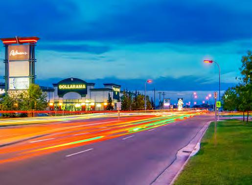
Commercial corridors in Lloydminster are located along the Highways (Highway 16/44 Street and Highway 17/50 Avenue). The pattern of development along these corridors has larger buildings on larger lots. The blocks are large, and development is set back from the front property line and dominated by surface parking lots. Development along these areas is considered auto-oriented as there are limited sidewalks connecting business entrances to the public roadway.
Both highways are lined with a wide range of commercial uses such as hotels, grocery stores, gas stations, retail stores, and restaurants, with minor light industrial uses. There is a cluster of larger big box stores on the west end of Highway 16/44 Street. The big box stores, the Lloydminster Mall and the Downtown commercial area are the city’s main commercial areas.
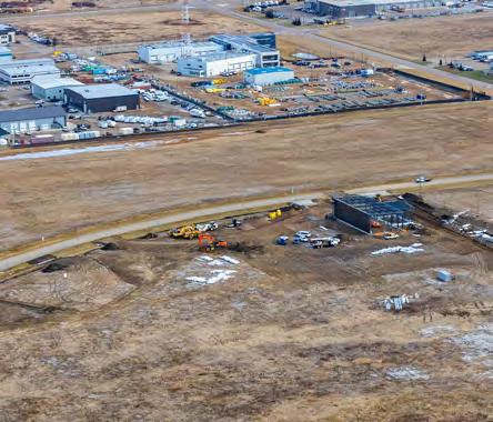
Most of the city’s industrial uses are in the northwest corner. The Cenovus Energy Refinery is located in the northwest industrial area and Cenovus Energy Upgrader is outside city limits to the city’s southeast. Both are major employers. Industrial sectors are the manufacturing and production hubs of Lloydminster. They are located within close proximity to major highways and rail lines. The pattern of development includes large buildings and storage structures, parking, and lay-down yards on larger tracts of land.

1 Corridor: A place for movement, living, and commerce that is anchored by the mobility system and well connected to surrounding land uses. There are two types of corridors: Primary corridor is a prominent urban street designed for living, working and moving. It serves as a destination in itself, but also provides critical connections throughout the city and beyond. Secondary corridor is the vibrant residential and commercial street that serves as a local destination for surrounding communities.
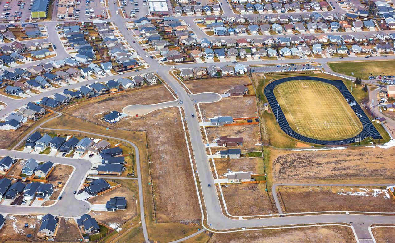
Developing areas include land that has been allocated for future development through the land use planning process. The actual development timeline for these areas would be subject to market demand and will be led by developers. All future development will be subject to the approval of an Area Structure Plan2 (ASP).
Annexation is a provincially legislated process where a municipality changes or expands its jurisdictional boundaries. It typically involves negotiating with an adjacent municipality, usually a rural municipality, to obtain additional land to support urban growth. The process requires final approval by the Province through an Order in Council. Annexation is not the same as expropriation. Annexation does not change ownership rights, and owners are not required to develop or sell their property. On the other hand, expropriation is a process for a municipality to take ownership of land against an owner’s wishes, annexation is simply a change of jurisdiction from one municipality to another.
In 2022, the City annexed approximately 23.5 quarter sections of land from the County of Vermilion River to help accommodate the city’s 35-year growth needs. New development in this area will be in accordance with the City’s MDP and ASP’s.
1 Developing Area: Areas that are not fully built out. These areas are typically along the southern edge of Lloydminster, both on the east and west side.
2 Area Structure Plan: A statutory plan, as defined by the Municipal Government Act, that guides the future land use, transportation, utility, and phasing of development for undeveloped land.
Large-scaleopenspace/ amenity
Large-scaleopenspace/ amenity
Developingareas
Developingareas
ProposedHighway16bypass
ProposedHighway16bypass
Lloydminster’s rich history and heritage are two of its greatest assets. The city is home to several cultural and social hubs that make Lloydminster a great city to live in and share experiences with friends and the community.
Social assets1 can be defined as networks, organizations, or institutions where people and communities come together, build and share knowledge. Simply put, these assets are associated with people and their social activities.
Cultural assets2 are associated with place(s). They are the buildings, locations, or other features of a community that are considered historically or culturally significant.
The key educational assets include elementary schools, middle schools, and high schools. Lakeland College and Reeves College serve the higher education needs of the wider regional population. Lakeland College is a key focal point3 in the community and also home to regional recreational and sports amenities.
By identifying the social, cultural and educational assets within Lloydminster, we can understand how to capitalize on their potential to improve the future of our city. Social, cultural and educational assets in Lloydminster are identified on Map 2
1 Social Asset: Social assets are networks, organizations, or institutions where people and communities come together, build and share knowledge. Social assets are associated with people.
2 Cultural Asset: Cultural assets are the buildings, locations, or other features of a community that are considered historically or socially significant. Cultural assets are associated with place(s).
3 Focal point: Areas of interest or emphasis within the built environment. Focal points are often places of gathering, such as plazas or squares, that contribute to a vibrant street.

The City’s municipal servicing infrastructure serves the daily needs of residents and businesses. Understanding the existing strengths and weaknesses of the infrastructure network will help us plan to accommodate future growth while maintaining appropriate levels of service within existing developed areas.
The water supply for Lloydminster comes from the North Saskatchewan River located approximately 32 km north of the city. The North Saskatchewan River supplies raw water to the city which is either treated within the Water Treatment Plant and sold as potable water or diverted to other consumers as raw water. Potable water from the City’s Water Treatment Plant is distributed through a pressurized pipe network to residents and businesses as well as sold through various potable water sales agreements to third parties including, but not limited to, the Saskatchewan Water Corporation, the Cenovus Energy Upgrader, and the Alberta Central East Water Corporation, among other smaller consumers. The Water Treatment Plant is located along 67 Street approximately 600m east of Highway 17/50 Avenue.
Accompanying the Water Treatment Plant is the City’s West End Reservoir which stores treated water which is then fed into the water distribution pressurized pipe network. The West End Reservoir would act as the city’s main location for storage of potable water during hours when the Water Treatment Plant is not operational. The West End Reservoir is located along 43 Street between 63 Avenue and 66 Avenue.
The sanitary sewer collection system consists of a gravity collection system.
The City’s sanitary sewer collection system has two main sanitary trunk sewers that drain into the Waste Water Treatment Facility: the East Trunk and the North Trunk. The two trunks collect flows from seven smaller trunk sewers, each serving an individual collection area.
The two main sanitary trunk sewers convey flows to the City’s Waste Water Treatment Facility where the sewage is treated and disposed of. It is anticipated that upon completion of the new Waste Water Treatment Plant the effluent will either be sold as re-use water for industrial process purposes or discharged back into the North Saskatchewan River. The Waste Water Treatment Facility is located along 67 Street approximately 800m east of 40 Avenue.
The sanitary sewer collection system is predominantly separate from the storm sewer system, except for a small area of combined sewer located within the downtown core. Combined sewers are disconnected and separated as they are encountered during annual capital replacement programs.
1 Infrastructure: The physical assets developed and used to support the city’s people and activities. The City’s infrastructure inventory includes assets such as drainage, roads, parks and green spaces, buildings, transit facilities, traffic controls, emergency services, etc.
Lloydminster’s success is inextricably linked to the oil and gas industry. The economic circumstances of every resident and business owner are influenced by oil and gas.
Lloydminster’s physical form is also heavily influenced by the oil and gas industry with numerous well sites, pipelines, facilities, which affects how and when proximal development can take place.
Lloydminster is home to high-tech and innovative industries with a trade area of over 189,000 people. It is an attractive place to locate for up-and-coming industrial operations due to its position along the Yellowhead Highway, CN rail line, CPR rail line, as well as the City’s business-friendly attitude and good land availability.

Lloydminster’s largest employment industry is oil, gas and innovative manufacturing, comprising approximately 16% of the community’s workforce.
Despite larger economic trends and pressures, Lloydminster’s economy has shown steady growth.
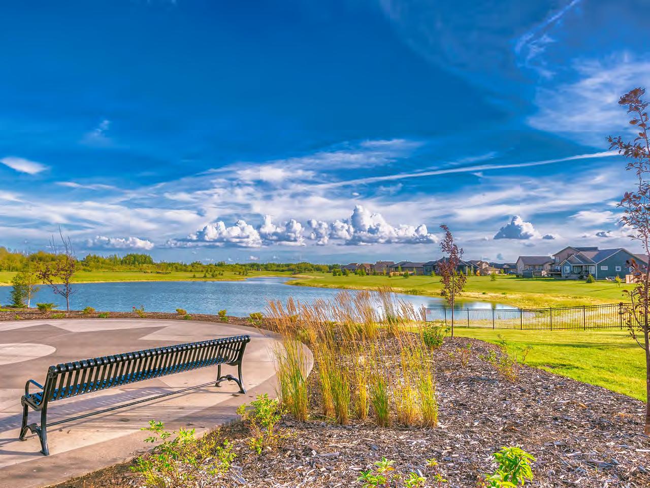
Lloydminster’s existing open space network, as identified on Map 3, consists of a wide range of publicly owned parks, privately owned amenity areas, transportation rights-ofway and joint-use school sites. Map 3 shows some key open space categories in the city including:
• Large-scale open spaces and amenities (Bud Miller All Seasons Park, Lloydminster Golf and Curling Centre);
• Publicly owned neighbourhood-level parks and sports field facilities (Approximately 33+ parks);
• Boulevard areas within key transportation corridors (Along 75 Avenue, 62 Avenue, 59 Avenue, Highway 17/50, 40 Avenue, 67 Street, 52 Street, Highway 16/44 Street, 36 Street, 25 Street, and 12 Street);
• Joint-use sites associated with schools; and
• Linear green spaces and trails.

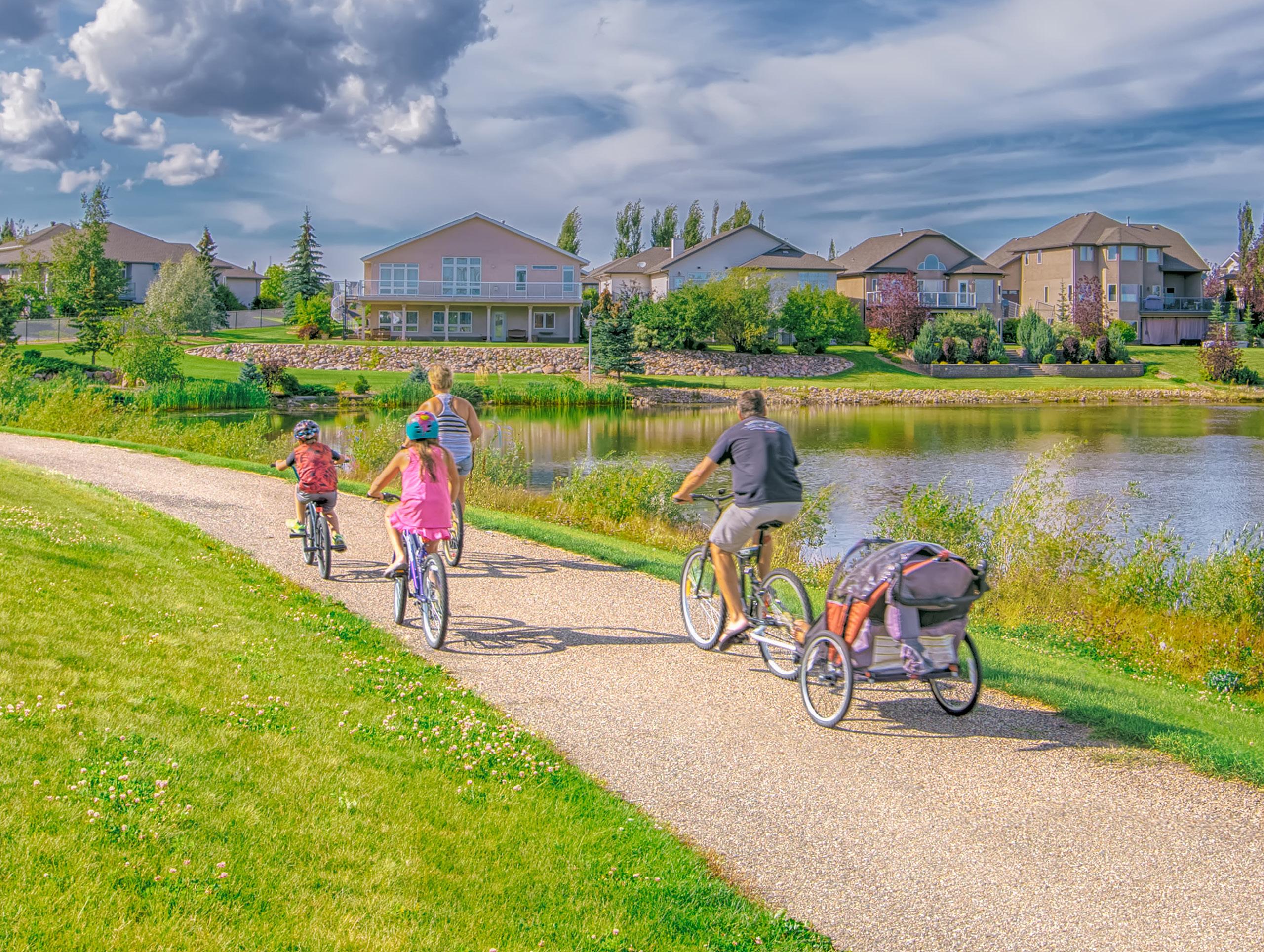
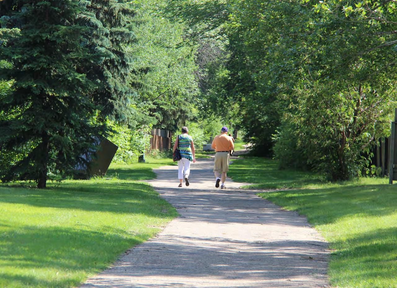
The open space and trail network in the southern half of the city is relatively more robust than the northern half. Regardless, the City’s trail network supports the active movement of people throughout the community. Focusing on interconnections between neighbourhoods and amenity clusters outside of neighbourhoods will further support active and passive transportation methods across the city.

Lloydminster’s mobility network, as identified on Map 4 enables residents to connect to destinations throughout the city by multiple transportation modes, including but not limited to personal automobile, taxi, walking, biking, skateboarding, etc. These connections help citizens to access parks, open spaces, amenities, shopping areas, work areas, and other destinations using a variety of transportation modes.
Highway 16 (Yellowhead) and Highway 17 intersect at the center of Lloydminster located within the downtown core. These major highways allow for interregional connections to other major metropolitan centers such as Edmonton in Alberta and Saskatoon in Saskatchewan.
Arterial roadways in Lloydminster are characterized by wider rights-of-way and provide access to various residential, commercial and industrial areas. Arterial roadways include 75 Avenue, 62 Avenue, 59 Avenue, 40 Avenue, 12 Street, 25 Street, 52 Street, and 62 Street. Arterial roadways in residential areas are generally flanked by rear frontages and fences of low-density housing lots. The rights-of-way of these arterial roadways in residential areas include sidewalks or trails along at least one side of the roadway. Arterial roadways in industrial areas are generally flanked by frontages of a wide range of industrial buildings.
The majority of residential collector roadways in Lloydminster are flanked by frontages of low-density residential1 housing types with sidewalks on both sides. This contributes to establishing a pedestrian-friendly environment along these collector routes. The building orientation along existing collector roadways provides opportunities for residential or mixed-use2 infill projects along these corridors. Residential collector roadways south of Highway 16/44 Street are curvilinear in nature and provide access to local roadways.
1 Low-density residential: Housing that includes single-detached, row housing, tiny homes, or multi-unit housing.
2 Mixed-use: Development that includes a combination of different land uses such as residential, commercial, retail, institutional, and recreational. Mixed uses can not only be on the same site but within the same buildings.
1
Local roads are designed to move and connect people who drive, walk, bike, etc., to their destinations. They are typically designed for slower speeds to promote safety in residential areas where there is a higher likelihood of pedestrians, in particular playing children, moving around in the streets. In Lloydminster’s mature neighbourhoods, local roads often have straight-faced curbs and a grassed or treed boulevard between the sidewalk and roadway. In most established neighbourhoods, local roads are designed to have rolled-faced curbs and curbside sidewalks, directly adjacent to the road.
Rear alleys provide multiple functions in Lloydminster. They are used to access the rear of a private parcel of land but also serve as rights-of-way for utilities, drainage, and waste/organics/recycling collection.
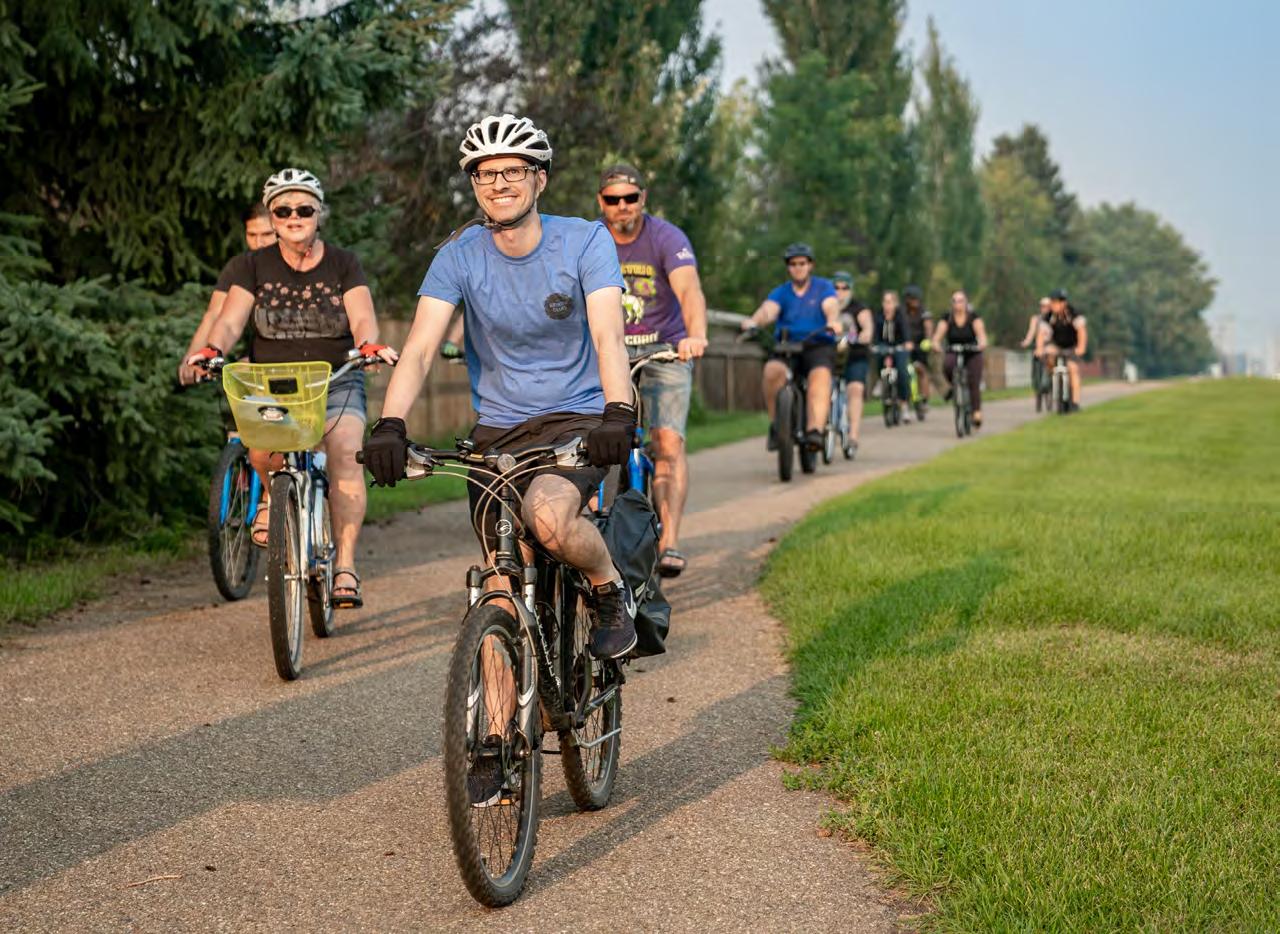
Trails and pathways in Lloydminster are designed to connect people walking, rolling, scooting, and biking. These connections often lead to parks, employment areas, or amenities within and outside of neighbourhoods. The trails and pathways allow access to many amenities within the city through various modes of active transportation1

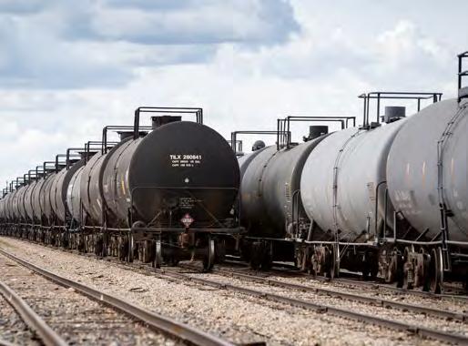
Railways are an essential means of transportation of goods for Lloydminster. Their history ties into the arrival of settlers. Initially, it served the emerging agriculture industry in the area. The discovery of oil in the area brought new industries and added rail traffic.
As the city grew in population and expanded, the interface between the railway, other means of transportation, land use, and the public became very important. Controlled intersections , that is, intersections controlled by a stop sign, signal light or other mechanism, helped to improve safety. Rail safety remains a priority for the City of Lloydminster, the railway companies, and the federal government. They are operated by Canadian National (CN) and Canadian Pacific Rail (CPR) and regulated by Transport Canada.
The Lloydminster Municipal Airport is located in the northwest of the city and is accessed via Township Road 502A. The airport provides daily non-stop flights to Calgary and provides other services such as hangar rentals and self-serve on-site fuel sales. The Airport Master Plan was developed in 2020, which designates areas to accommodate future development. The Airport aims to leverage Lloydminster’s economy and airport catchment to enable more flights, spur investment and continue to improve regional and provincial transportation.

ProposedHighway16 Bypassalignment
ProposedHighway16 Bypassalignment
Localroad Rearalley Trailsandpaths Collectorroad Arterialroad
Localroad Rearalley Trailsandpaths Collectorroad Arterialroad
Growth projections are an important tool to utilize when trying to understand how to plan the future of a city. By understanding the growth rate for population and employment for a city, plans can be put in place to ensure there are adequate services and amenities, such as housing, infrastructure, park and recreation, etc. to serve the population
Lloydminster has completed two growth studies in the last ten years:
• A Comprehensive Growth Strategy (CGS): completed in 2013, which recommended annexing 24 quarter sections of land from the County of Vermilion River; and
• A Joint Regional Growth Study (JRGS): completed in 2019, which was created to support annexation negotiations undertaken by the Intermunicipal Annexation Negotiation Committee (IANC).
The Joint Regional Growth Study includes projected population and employment growth over a 30-year timeframe, in this case, up to 2051. The IANC supported a medium population growth scenario of 1.5%-1.9% growth per year (see Table 1). With this projection, the population would be expected to be slightly less than double by 2045.
Table 1. Medium Growth Scenario
The projections were updated after receiving the 2016 Census data, and a new medium-high growth scenario of 2.1%-2.2% per year was generated. Under this scenario, the population would be expected to more than double by 2051. The 2021 census population for Lloydminster is 31,582.
Both the medium and medium-high growth scenarios direct 70% of all residential and nonresidential growth to the Alberta side and 30% to the Saskatchewan side of Lloydminster. By 2045, the city is estimated to require an additional 17.7 quarters of land to sustain the projected population growth (see Table 2).
Table 2. Gross Developable Land Needs by Land Use
Source: City of Lloydminster and County of Vermilion River Joint Regional Growth Study (2019). Page 80, Table 45.
What are the values and preferences we have for a future Lloydminster?

Connection to Our Future is a plan that will set our course to ensure we have a healthy, prosperous, and resilient future for ourselves and future generations. It is a 30-year vision based on the things we value and an action plan on how to get there.
Values are desirable qualities we strive to achieve in our future community. The Values show us ‘why’ we do what we do as a community and inform Plan’s policy statements.
Community Drivers are the aspects of our community that directly inform how the city looks, feels and functions over time.
Preferences are the choices, as a community, we are making for each Community Driver. These choices will inform the actions necessary to achieve the intended outcomes1 for each Community Driver.
The Community Drivers combined with the Preferences suggest ‘how’ to do what needs to be done to build our city.
Outcomes are the conditions that result from our choices and preferences for the future of Lloydminster. The Outcomes reflect ‘what’ we want to happen in the future.
1 Intended outcome: Statements of what the City of Lloydminster needs to accomplish in order to achieve city-building outcomes.

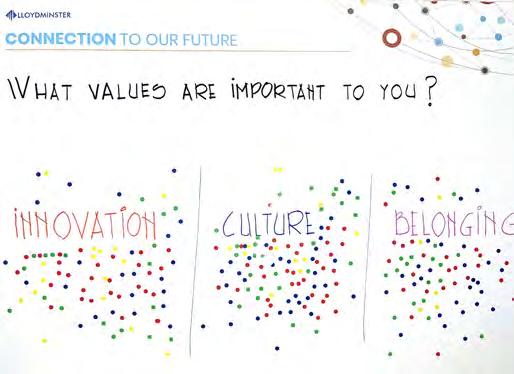
Every aspect of community growth is influenced by a strong set of foundational values that guide the choices we make for the future of our city. The Values were derived through a comprehensive process of engaging with the community. These Values will guide how we make decisions about our city and our future.
Between May and June of 2022, we called upon the Lloydminster community to begin the work of developing Connection to Our Future. The direction established in the MDP impacts everyone in the city. A series of engagement opportunities were provided to seek input from as many stakeholders as possible in an effective and efficient manner. Full details about engagement activities are included in Appendix #3.
To ensure diverse perspectives were heard, a Community Advisory Committee (CAC) was established for this project. The CAC was not a decision-making body. Rather, it was responsible for reviewing content and providing feedback and perspectives. The CAC comprised representatives from local groups, organizations and businesspeople who interact with a wide range of Lloydminster’s population. They were people who could speak on behalf of their industry, their organization and/or the people they serve, and who could provide a wide range of perspectives. The CAC included representation from the following segments of the community:
• Local Indigenous communities
• Community, family, youth, and seniors
• Affordable housing1 and shelter
• Newcomers and immigrants
• Individuals with developmental disabilities
• General community
• Business community
• Local developers
• Member of Council
Engagement during the Downtown Streetfest
1 Affordable Housing: Housing that is priced below the average market cost as a result of government subsidies. Housing is also considered affordable if it costs less than 30% of a household’s before-tax income.
In addition, a Technical Advisory Committee (TAC) was also established to ensure all technical aspects of the project were thoroughly reviewed. Again, the TAC was not a decision-making body. Rather, it reviewed materials and suggested content for alignment with existing City technical standards and guidelines. Representatives from the following City departments served on the TAC:
• Planning & Engineering
• Public Safety
• Community Development Services
• Parks and Green Spaces
• Economic Development
• Environmental Services
• Communications
To gather feedback about what is important to the community, we asked community members to tell us what they like about Lloydminster, and what they dream for the future through a twoquestion survey. The survey was made available online, at public events, on the project website, through social media posts and in-person using postcards.
Members of the Technical Advisory Committee (TAC) and Community Advisory Committee (CAC) worked together to review and sort the feedback received from the community, and to refine the core Values of the community based on the survey responses. The core Values were validated by the community during a public engagement event at Streetfest. In addition to community-focused engagement, the team also reviewed the Values with Council.

The core values include:
Belonging: Lloydminster will promote equity and inclusion for everyone and provide ample opportunities to contribute towards city-building and community well-being. Everyone will feel a strong sense of belonging in our city.
Culture: Lloydminster will provide a wide range of opportunities for arts, recreation, and culture. It will also celebrate the diverse cultures of its citizens.
Ecology: Lloydminster will achieve resilience, promote environmental accountability, and strive to preserve and enhance its natural systems.
Innovation: Lloydminster will promote educational excellence, economic diversification, creativity, and strive to achieve prosperity for everyone.
Community Health: Lloydminster will strive to enhance personal and community well-being, improve accessibility1 and promote healthy lifestyles for all ages and abilities.
Initiative: Lloydminster will promote coordination, cooperation, and collaboration between various stakeholders; provide transparent governance; and establish a business-friendly environment by getting things done in a timely manner.
1 Accessibility: Accessibility refers to the absence of barriers that prevent people from participating and contributing to society. The term also refers to the universal design of products, devices, services, and environments that people with disabilities can independently use.
Community Drivers are the physical and non-physical aspects that directly inform how a city looks, feels and functions. They are tangible topics or characteristics that we as a community can look to when we make decisions about our future.
The five Community Drivers for Lloydminster are:
Urban Form, which refers to the physical characteristics of what we build in the city, including the shape, size, density, and configuration of buildings and infrastructure.
Mobility and Connectivity1, which refers to the ways that are available for people and goods to move around the city and the levels of connection they provide.
Climate Resilience, which refers to our ability to anticipate, prepare for, and respond to hazardous events or disturbances related to climate.
Social Equity, which refers to our ability to provide education, justice, equitable2 opportunities, diversity, and inclusion for all people in our community.
Fiscal Responsibility, which refers to our ability to find a balance, just right for us, between the services our municipal government provides and what we are willing to spend.
1 Connectivity: The directness and density of links and connections in a network, for example, a pathway or a road system.
2 Equitable: Fair treatment, access, opportunity and advancement for everyone, while at the same time striving to identify and eliminate barriers that have prevented the full participation of any group.
Building a city requires making choices about how you want your community to look, feel and function – choices about your preferences. For example, do you prefer amenities all located together, or do you prefer amenities to be spread out across the city?
Understanding the community’s preferred approach to each Community Driver is necessary to create policy direction for future decision-making. Not everyone’s preferences serve the needs of all citizens and support a fair and equitable society. Therefore, future decision-making policy that serves the needs of all citizens and businesses will also need to reflect the desires of the community, needs for the future, and social equity.
For each Community Driver, three potential approaches were identified. Each approach has a different set of benefits and trade-offs that impact city-building. An online survey providing each approach to the Community Drivers was administered to gauge the community’s preferences for each Community Driver. The details contained in the survey are found in Appendix 3. The outcomes of the survey are summarized below:
Urban Form: the preference is for land uses to be arranged so that development occurs in ways that promote convenience and active modes of transportation to access daily needs. This means allowing for residential and neighbourhood commercial uses to come together in hubs where people can connect, socialize, shop, and obtain basic services. People can still use their personal automobiles to access services and amenities further away from their homes if they choose.
Mobility & Connectivity: the preference is for a transportation network of nodes and corridors. Grouping of amenities such as shopping centers, medical centers, grocery stores and some higher density housing are the ‘nodes’ connected by main roadways, which are the ‘corridors. The dominant way people move around the city is using personal automobile, but trails/paths are also used to provide active modes of transportation around the city. Nodes and corridors could support future public transit, which needs minimum residential density, by offering both residential density and amenity draws to support ridership.
Climate Resilience: the preference is to work together to develop practical approaches to build resilience, the ability to withstand or quickly recover from, the possible impacts of climate change1, while focusing on education and voluntary actions.
Social Equity: the preference is to proactively act to prevent and address social equity challenges in our community and address the current and future needs of citizens.
Fiscal Responsibility: the preference is to achieve an appropriate balance, where we move to diversify our economy and attract new investment but also continue to foster our relationships with existing industry and ensure they continue to thrive in Lloydminster.
1 Climate change: Long-term change in weather patterns over a period of time running from decades to millions of years.
After confirming the community’s preferences for each of the Community Drivers, the project team developed a series of outcomes associated with each Value and Community driver. The following outcomes were confirmed through consultation with the Community Advisory Committee and Technical Advisory Committee, and review by Council. These outcomes form the foundation for the policy framework of the Connection to Our Future document.
Equity, inclusion, opportunities to contribute
URBAN FORM
Arts, recreation, celebration
Roadways, public spaces, and infill development contribute to a built environment1 that enhances the sense of belonging for a diverse population.
We provide MOBILITY and CONNECTIVITY options for all
We are a CLIMATE RESILIENT community
Active and passive mobility networks provide access to barrier-free spaces, services, facilities, and economic and social activities.
We demonstrate shared leadership and collective responsibility as stewards of our environment and investors in our community.
Public spaces are appropriately distributed throughout the city and designed to accommodate diverse abilities, ages, and cultures.
Resilience, accountability, natural systems
Existing ecological features are identified and incorporated into greenfield developments while being sensitive to the existing urban fabric.
The mobility network connects people safely to cultural and recreational activities.
Public and private transportation systems accommodate the well-being of natural systems.
Economic diversity, prosperity, opportunity
Neighbourhood design and planning create value for the community by applying novel solutions to address housing affordability and innovation in community design.
We design technologically advanced movement systems and networks to add valuable mobility opportunities to our community.
Community well-being, accessibility
Neighbourhood and urban space design promote healthy lifestyles and overall community wellbeing.
Get it done, coordination, cooperation, collaboration, transparency
Collaboration among all orders of governments to deliver public projects and their predictable outcomes conveys a level of certainty which is vital for the private sector to respond to public policies.
The mobility network provides easy and equitable access and connectivity to alternative modes of transportation. We continually Invest to improve and expand the mobility systems and transportation networks to incrementally develop a longterm mobility plan in an efficient, collaborative manner.
As a border city, Lloydminster embodies a culture of efficient, sustainable community design, development and living.
Natural and physical systems ensure security and resilience against extreme weather events and other environmental hazards.
A diverse economy is supported by embracing services and affordable, alternative technologies adaptable to the impacts of climate change.
Residents have access to naturalized areas, wetlands, active transportation networks as well as alternative energy sources such as solar, wind, geothermal, and hydro energy.
Our economic assets strengthen our future prosperity. Our investment commitments align with innovative initiatives that promote and advocate for a more climate resilient community.
SOCIAL EQUITY
Equitable opportunities to be involved in and to contribute to the well-being and identity of Lloydminster are encouraged, welcomed, and facilitated.
FISCAL RESPONSIBILITY
The fiscal health of the municipality is considered when decisions are made regarding allocation of resources.
Opportunities are provided for diverse citizen groups to express their culture and celebrate diversity.
Access to natural areas is equitable to all residents and is barrier free.
Opportunities for education and economic prosperity are provided everyone.
Our Community is designed to foster the improved well-being of all residents of all abilities and social status.
We support groups working to improve education, justice, equity, diversity and inclusion.
Our cultural, arts, and recreational programs are maintained and fiscally sustainable.
The longterm health of ecological systems is included in our financial decisions.
Services are delivered in innovative and efficient ways that provide value to residents and businesses alike.
The long-term financial health of the municipality is included in our financial decisions.
Public institutions, businesses, community organizations and residents use their fiscal resources collaboratively.
1 Built Environment: People-made places and spaces designed and constructed to serve their social, economic, and environmental needs. The built environment can often refer to the function, shape, and configuration of buildings and their relationship to streets and open spaces.
Highway 16/44 Street and Highway 17/50 Avenue are the main transportation corridors that bisect Lloydminster into defined quadrants. These two corridors accommodate the majority of Lloydminster’s commercial development. Lloydminster’s major facilities for recreational, institutional, transportation, and utility purposes are located north of 44 Street. They include the City of Lloydminster’s Municipal Airport, Lloydminster Cemetery, Lloydminster Landfill, the Lloydminster Agricultural Exhibition, and Lloydminster Golf and Curling Centre. The exceptions to this pattern are the Lloydminster Hospital, Bud Miller All Seasons Park, and Servus Sports Centre, which are in the southern half of the municipality.
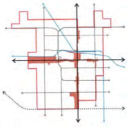
Map 5: Future Land Use Concept acknowledges Lloydminster’s existing development pattern while providing direction for future infill and greenfield opportunities.
Lloydminster’s residential growth pattern evolved initially on the Saskatchewan side and around downtown, resulting in today’s mature neighbourhoods such as East Lloydminster and North Lloydminster. Then, development shifted to the Alberta side, where West Lloydminster, another mature neighbourhood, was developed. As the city grew, residential development continued expanding to the south quadrants on Alberta and Saskatchewan sides, where established neighbourhoods currently exist.
Fast Forward to 2051, new greenfield residential neighbourhoods will continue to be located in the south quadrants expanding toward municipal boundaries. Infill development will happen at scales and intensities appropriate to their contexts, as described in the Future Urban Structure Framework.
New residential neighbourhoods will be developed as complete communities1 providing opportunities for a variety of uses and building types.
1 Complete communities refer to the type of community where the majority of basic day-to-day needs of all residents are met within the community through careful design of land uses, transportation networks, open space networks as well as social and cultural amenities.
Major commercial development in Lloydminster is located along Highway 16/44 Street and Highway 17/50 Avenue corridors. The majority of existing commercial sites located along these corridors are fully built. The most visible characteristics of this development pattern include car-friendly access and parking.
The impact of the proposed Highway 16 bypass on businesses along Highway 16/44 Street is unknown. However, as traffic exposure decreases, the policies governing commercial development along these corridors provide opportunities for intensification1 , revitalization, and repurposing. As redevelopment2 occurs, opportunities for mixed-use and pedestrian friendly environments are envisioned along these commercial corridors.

Transportation corridors such as 75 Avenue, 40 Avenue, 67 Street, and to a certain extent, Highway 17/50 Avenue provide new opportunities for industrial/commercial mixed-use developments. This type of development fronting these corridors will be light industrial and commercial in nature with a higher standard of building and landscaping appearance. Improving pedestrian safety is critical to creating corridors where people are willing to walk, roll, or bike. Equally important is ensuring a convenient and safe pedestrian environment. Industrial/commercial mixed-use areas will provide a buffer from more traditional types of medium and heavy industrial development in the interior of urban blocks.
Industrial development was settled initially in the northwest quadrant of Lloydminster. From there, it expanded by capitalizing on the alignment of the CPR and CN railways and the availability of large land tracts. Future industrial expansion will predominantly happen in the northeast quadrant of the municipality in accordance with the Northeast Area Structure Plan and the Hill Industrial Area Structure Plan.

1 Intensification: Development at a higher density than currently exists, particularly in support of nodes, corridors, and neighbourhood hubs.
2 Redevelopment: The change or growth in land use on previously developed land in existing urban areas.
Large-scaleopen
Large-scaleopen
Potentialarterialroad alignment
Potentialarterialroad alignment
ProposedHighway16 bypass Railway Arterialroad
ProposedHighway16 bypass Railway Arterialroad
Note:Parksandopenspacesinnewneighbourhoodswillbedevelopedin
Note:Parksandopenspacesinnewneighbourhoodswillbedevelopedin accordancewiththeapprovedNeighbourhoodStructurePlan
The City of Lloydminster has incrementally built parks, plazas, and other open spaces. The bulk of existing open spaces of varied scales and recreational purposes is located south of 44 Street within the residential neighbourhoods. Overall, there are over 33 parks in Lloydminster owned and maintained by the City.
In addition to neighbourhood parks, two large-scale open spaces including Bud Miller All Seasons Park and Lloydminster Golf and Curling Centre (LGCC) draw citywide attendance. Bud Miller All Seasons Park is a 200-acre park located in Lloydminster’s southwest quadrant. This park is a network of interconnected ecosystems comprising a variety of vegetation, trees, and wildlife that showcase the natural biodiversity of the prairies. A 10-acre artificial lake supports aquatic wildlife, fish, and plants, whereas natural vegetation and formal gardens are the habitats of large and small animals. The park also provides a range of active recreational opportunities and is used as the scenery of many private and public events. Lloydminster Golf & Curling Centre is a public 18-hole golf course located in the northeast quadrant.
In addition to open spaces, the City operates three other facilities that complement and support the recreational opportunities at residents’ disposal. These facilities include the Lloydminster Museum and Archives, Bioclean Aquatic Centre, and Servus Sports Centre.
Building on the existing open spaces locations, sizes, and complementary recreational facilities, the City’s vision for future open space network is identified on Map 6. The open space network related goals for the timeframe of this MDP are twofold.
Firstly, the City will continue expanding the number of neighbourhood-level parks and open spaces as new neighbourhoods unfold. Large-scale greenfield development1 must dedicate Municipal Reserve2 lands, which can be used to develop parks, schools, pathways, and trails.
Secondly, a network of trails, pathways, shared-use paths, and sidewalks will connect existing residential areas and open spaces to future parks, open spaces, community facilities, and commercial nodes both inside residential neighbourhoods and across the city.
Opportunities exist within major transportation road rights-of-way to widen the sidewalks or to develop pathways and shared-use paths. The Transportation Master Plan review and update process and the future complete street philosophies will explore these opportunities. Implementing those connections will require the allocation of funds through the capital budget process and alternative funding options.
1 Greenfield development: Conversion of land that has not previously been developed. Greenfield development often occurs on agricultural land, or the natural environment, to expand the built environment.
2 Municipal Reserve (MR) land: Land designated for use as public parks, recreation facilities, or schools for the general public.
Boulevardgreen spaceandutilities
Schoolpark
Boulevardgreen spaceandutilities
Schoolpark
Potentialopen spaceconnections
Potentialopen spaceconnections
Potentialarterialroadalignment
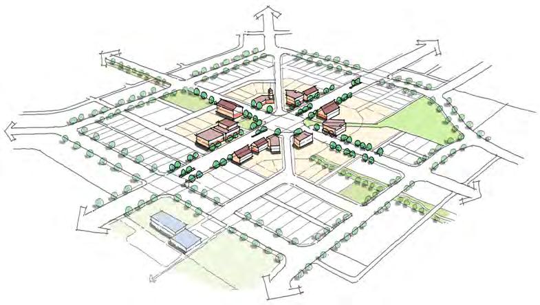
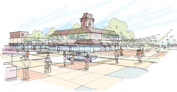
The future urban structure envisioned for Lloydminster is identified on Map 7. It provides an overview of future development network envisioned for the city including downtown, primary corridors, secondary corridors, and neighborhood hubs.
In 2020, Council adopted a new Downtown Area Redevelopment Plan (DARP). Implementation of the DARP includes a detailed implementation schedule with short-, medium-, and longterm actions to bring the plan to fruition. The implementation schedule describes the priority hierarchy, level of investment, and public support for each implementation action. In addition, a critical social factor of the implementation schedule was the formation of the Downtown Area Redevelopment Committee (DARC). The membership brings together a cross-section of community members to coordinate efforts. Council’s support for this committee will convey to the community that downtown is a high priority.
The DARP envisions a walkable downtown with mixed-use developments to create vibrant public spaces1. Retail opportunities focus on pedestrian-scale uses such as boutiques, grocery stores, restaurants, and entertainment venues.
In addition, increasing the number of people on the streets creates a critical mass for attending street-related activities such as art performances, festivals, and farmer’s markets. Having more people on the streets is paramount for brick-and-mortar businesses that are typically located downtown and rely on pedestrian traffic to succeed.
Highway 16/44 Street and Highway 17/50 Avenue are the primary transportation corridors to travel across Lloydminster in the east-west and north-south directions. Given their visibility to vehicular traffic, they became the preferred location for big-box commercial businesses.
Development of these commercial forms requires large tracts of land for the structure and ancillary functions, such as parking and loading operations. In addition, it creates opportunities for other satellite businesses to locate on the same site as they can take advantage of the exposure generated from anchor big-box businesses.
Site organization is critical to ensure an attractive and safe environment for people to move around in this type of vehicular-oriented setting. Moreover, curb appeal through appropriate facade design, parking design, lighting and landscaping provides visitors with a first glance at the quality of its urban design.
Mixed-use pedestrian-friendly developments with an enhanced aesthetic appeal are envisioned along primary corridors. New buildings should have their frontages along primary corridors and contribute towards creating a welcoming image for the traveling public.
1 Public space: Space on public or private land that is open to the public.
2 Primary Corridor: A place for movement, living, and commerce that is anchored by the mobility system and well connected to surrounding land uses. There are two types of corridors: Primary corridor is a prominent urban street designed for living, working and moving. It serves as a destination in itself, but also provides critical connections throughout the city and beyond. Secondary corridor is the vibrant residential and commercial street that serves as a local destination for surrounding communities.
Secondary corridors are identified on Map 7: Future Urban Structure Framework. As development and redevelopment happens the roadway design should incorporate opportunities for enhanced pedestrian and bicycle infrastructure along secondary corridors. In addition, buildings should orient their frontages along secondary corridors and provide spaces for social interactions.
Commercial nodes are areas with concentration of a wide variety of commercial uses including retail stores, large-format commercial and offices. As commercial nodes evolve over time, some mixed-use developments may also be considered at these locations. Map 7 identifies the locations of existing and potential commercial nodes in Lloydminster. Commercial nodes are envisioned to include enhanced building aesthetics and public amenities to serve people walking, biking and driving. As the City grows additional commercial nodes will be considered.
1 Seconday Corridor: A place for movement, living, and commerce that is anchored by the mobility system and well connected to surrounding land uses. There are two types of corridors: Primary corridor is a prominent urban street designed for living, working and moving. It serves as a destination in itself, but also provides critical connections throughout the city and beyond. Secondary corridor is the vibrant residential and commercial street that serves as a local destination for surrounding communities.
Neighbourhood hubs are developments that are mixed-use , walkable and characterized by design that is of a scale that feels comfortable for people. Homes, commercial and social uses in neighbourhood hubs are located close to each other. This means having townhouses and single detached houses located beside, behind and across from a corner store that may also contain a hair salon and day care. Also, depending on the size of the neighbourhood hub, other uses such as a school, independent restaurant, community theatre, or local coffee shop could support the social health of residents.
However, it should be noted that neighbourhood hubs will need to be identified, planned for and approved in advance of development through a land use planning process, such as the development of an Area Structure Plan or Neighbourhood Structure Plan. In general, neighbourhood hubs could be planned for and developed at a variety of locations including mature neighbourhoods, established neighbourhoods or new neighbourhoods within Lloydminster. The typical locations may include:
• Areas within mature and established neighbourhoods where potential exists for mixeduse developments in areas where existing structures are being replaced by newer infill development.
• At the edge of newly developing areas.
• At the center of newly developing areas.
The planning and design of neighbourhood hubs should focus on coordinating appropriate land uses, physical design, equity and connected street network so that people are able to enjoy the convenience and health benefits of having the choice to access some of their daily needs without having to use their personal automobile. Equity is further supported by offering various housing types, including affordable housing, within a neighbourhood hub.
School sites may also be planned for within or immediately adjacent to a new neighbourhood hub. School sites should generally be developed along neighbourhood collector roads with appropriate considerations for well-designed student drop-off zones to avoid traffic congestion and improve pedestrian safety.
The intent of a neighbourhood hub is to promote equity, convenience and active modes of transportation, such as walking and cycling, for nearby residents. The intent is not to prevent residents from accessing daily needs and amenities outside their own residential neighbourhood or to prevent residents from using their personal automobile if they so choose.
1 Neighbourhood hub: An area within a residential neighbourhood that is designed to promote convenience, promote social interactions, and support social equity.
Legend
Legend Legend
Cityboundary
Highway
Downtownnode
Cityboundary
Downtownnode
Primarycorridor
Highway
ProposedHighway16bypass
ProposedHighway16bypass
Secondarycorridor
Secondarycorridor
Commercialnode
Primarycorridor Commercialnode
Railway Arterialroad
Potentialarterialroadalignment
Potentialarterialroadalignment
Railway Arterialroad


Lloydminster will promote equity and inclusion for everyone and provide ample opportunities to contribute towards city-building and community well-being. Everyone will feel a strong sense of belonging in our city.
Development shall complement existing land uses in the surrounding context by:
• Providing appropriate buffer areas; and
• Addressing privacy and health and safety concerns.
4.1.2.1 The City shall continue to invest in the existing neighbourhoods to ensure the City-owned infrastructure such as roads, sidewalks, open spaces, and municipal underground utilities are maintained and upgraded to ensure level of service and adhere to applicable City standards.
4.1.2.2 The City shall continue to develop new Area Redevelopment Plans1 (ARP) to establish long-term visions for existing neighbourhoods that in its opinion are in need of revitalization.
Development shall demonstrate consideration for public and user safety in their design using approaches such as:
• Providing appropriate pedestrian level lighting;
• Minimizing blind spots; and
• Providing entrances and windows along public roadways where feasible.
1 Area Redevelopment Plan: A statutory plan, as defined by the Municipal Government Act, that guides the redevelopment of existing developed areas.
New large-scale infill development projects shall demonstrate integration with the surrounding urban fabric1 by:
• Aligning the site’s vehicular and pedestrian accesses and routes with the surrounding context; and
• Providing open spaces of appropriate scale that complement the scale and nature of the open spaces in the surrounding context.
The City shall promote pedestrian-oriented mixed-use developments in downtown to reposition downtown as a focal point in the city with a wide range of uses including retail, office, arts, culture, housing, civic, and entertainment facilities.
4.1.6.1 New building design and neighbourhood design should be encouraged to provide universal accessibility utilizing measures such as:
• Curb cuts and corresponding curb ramps at all intersections;
• New trail connections from residential areas to neighbourhood level and city level destinations;
• Accessible entryways for buildings; and
• Any other additional approaches identified by the Development Authority.
4.1.6.2 The City should consider installation of audible signals at intersections located along key primary and secondary corridors and other busy intersections along pedestrian routes leading to key destinations.
1 Urban fabric: Describes the physical characteristics of urban areas, usually describing the building types, streets, open spaces, frontages, and streetscape.
2 Pedestrian-oriented: A design process that refers to features within the built environment that encourage pedestrian activity and mobility.
4.1.7
The City should explore the use of solar powered street lights and pedestrian-oriented lights within public parks and along public trail networks, where feasible.
The City should increase the number and quality of trees, shrubs, and groundcover located on public land by:
• Establishing tree planting targets;
• Establishing a tree inventory program to manage the urban forest and identify heritage trees;
• Protecting existing trees where feasible;
• Establishing minimum requirements in the Municipal Development Standards for roadway designs that accommodate tree planting in boulevards and medians within new neighbourhoods; and
• Preparing an approved residential tree plant list.
The City shall consider potential uses such as community gardens and affordable housing for underutilized City-owned land in downtown and other areas.
4.1.10
The City shall support peoples’ choice to use alternative transportation methods that utilize clean sources of energy which may include, but are not limited to, sustainable fuel, electric scooters, electric bicycles, and electric cars.
4.1.11
The City shall work with local businesses and cultural organizations to provide opportunities for celebrations, gatherings, and all-season activities for everyone.
The City shall continue to support educational institutions and social organizations that may help mobilize the voice of youth and young adults in our community.
4.1.13 Affordable Services
The City shall continue to offer affordable services and activities through City-run social and recreational facilities and programs. Such activities may include, but are not limited to, programs such as:
• Free or low-cost educational and recreational opportunities; and
• Other similar initiatives aspired by the community based on ongoing need.
4.1.14 Opportunities to Contribute
The City shall support opportunities of residents of all backgrounds, experiences, and abilities to share their contributions through community engagement, and volunteerism.
4.1.15 Social Services
The City shall encourage equitable access to social services throughout the city.
4.1.16 Allocation of Resources
The City shall consider the fiscal health of the municipality when decisions are made regarding allocation of resources.

Lloydminster will provide a wide range of opportunities for arts, recreation, and culture. It will also celebrate the diverse cultures of its citizens.
The City shall ensure that development on sites adjacent to heritage properties is carried out in a manner that is compatible in terms of height, mass, setbacks, and overall architectural treatment.
4.2.2
The City shall establish and maintain an inventory of heritage properties and sites including significant archaeological sites using existing community resources which include people, artifacts, and records.
4.2.3
The City may require a Historical Resource Impact Assessment (HRIA), or at a minimum, a referral prior to the advancement of proposed developments or subdivisions to the Heritage and Museums section of Alberta Culture and Status of Women and Saskatchewan Parks, Culture and Sport to determine the need for a Historical Resource Impact Assessment (HRIA).
The City shall celebrate history by supporting initiatives such as outdoor museums, experiential tourism, and improved placemaking1
4.2.5
4.2.5.1 The City shall promote Lloydminster as a winter destination city by:
• Celebrating the city’s winter identity through the arts, recreation, events, storytelling, and winter-responsive design;
• Providing infrastructure to promote being physically active throughout all seasons; and
• Requiring development to incorporate winter city principles in the design of buildings and public spaces.
4.2.5.2 The City shall develop and implement a winter city strategy.
1 Placemaking: Placemaking is a participatory process that considers planning, design, and management of public spaces, by capitalizing on community assets to promote people’s well-being, health, and happiness.
4.2.6
4.2.6.1 The City shall explore the feasibility of supportive transportation initiatives such as private rideshare as well as on-demand transit for seniors and other vulnerable sections of society. Such service could run along key corridors in Lloydminster connecting residential areas to key civic destinations.
4.2.6.2 The City should continue discussions with the school boards to improve transportation and access issues related to school drop-off areas.
4.2.7
4.2.7.1 At the Neighbourhood Structure Plan1 (NSP) stage, new neighbourhood design shall demonstrate how the proposed trail, sidewalk and bike networks can improve the connectivity of residential areas to the existing and planned cultural and recreational destinations.
4.2.7.2 The City should improve trail, sidewalk, and bike connections from mature residential areas to existing and planned cultural and recreational destinations.
4.2.8
The City shall support energy efficient buildings that may utilize features such as, but are not limited to:
• Net-zero design approaches;
• Rainwater harvesting;
• Passive solar design methods;
• Green roofs;
• Residential wind turbines; and
• Promote and facilitate cogeneration with residents and local industry.
4.2.9 Reduce Greenhouse Gas Emissions
The City shall support the efforts of residents, organizations, and businesses to reduce energy use and greenhouse gas emissions.
4.2.10
The City shall promote inclusion of local species in public and private landscape projects.
1 Neighbourhood Structure Plan: A Neighbourhood Structure Plan (NSP) in Lloydminster is enabled by an Area Structure Plan, which is a statutory document pursuant to Part 17 of the Municipal Government Act. The NSP itself does not have statutory standing and is not a bylaw. Rather, it is a detailed land use planning document that guides subdivision, servicing and land use development at the neighbourhood scale, up to approximately two quarter sections in area, or about 130 ha.
4.2.11.1 The City shall continue to invest in public art in ongoing municipal projects in accordance with the City’s Public Art Policy for public sector projects.
4.2.11.2 The City shall continue to work with the private sector, Lloydminster Museum and Archives, and school boards to develop a public art program that encourages the display of artworks by local and regional artists in private sector and school projects.
4.2.12
The City shall continue to work with the local cultural groups to help celebrate diverse cultures through initiatives that provide affordable access to cultural activities. Such initiatives may include, but are not limited to:
• Busking at events/public spaces;
• Music in the park;
• Multicultural events and demonstrations;
• Open mic sessions; and
• Collaboration with drama departments at local schools to offer low cost/free plays to the public.
4.2.13
4.2.13.1 The City shall collaborate with schools, cultural, theatrical, and library groups to determine their specific needs and establish the best method to address them.
4.2.13.2 The City shall collaborate with schools to explore opportunities for the joint planning and provision of recreational and other amenities.
4.2.13.3 Joint use of the City and School facilities shall be promoted and encouraged through Joint Use Agreements.
4.2.14
The City shall collaborate with the private sector, service providers, and other orders of government to attract new cultural institutions, festivals, and sporting events to Lloydminster in an effort to enhance the arts and culture scene in Lloydminster throughout the year.

Lloydminster will achieve resilience, promote environmental accountability, and strive to preserve and enhance its natural systems.
4.3.1
In order to assess the environmental features of the site, the City may require applicants to provide a biophysical assessment and or a geotechnical assessment undertaken by a qualified professional.
4.3.2
The City should develop and maintain an inventory of relevant local ecologically sensitive areas that may complement the province’s ecologically significant areas inventory.
4.3.3
The City shall endeavor to improve the bike infrastructure in the city by partnering with businesses and organizations to provide enhanced facilities such as bicycle repair stations and covered and secure bicycle parking areas at key destinations.
4.3.4
The Development Authority may require applicants to provide an Environmental Site Assessment (ESA) report undertaken by a qualified professional in accordance with the Canadian Standards Association Guide, as amended from time to time, in support of a rezoning, a subdivision, development permit, an Area Structure Plan (ASP), an Area Redevelopment Plan (ARP), or a Neighbourhood Structure Plan (NSP) applications. The decision as to whether or not an Environmental Site Assessment (ESA) is required shall be subject to:
• The nature of the proposed use;
• The current and historical use of the subject property and surrounding lands; or
• Information from other sources that suggest the subject property may contain environmental contaminants.
The City shall promote the protection and conservation of natural or ecologically sensitive areas by the following means:
• Environmental Reserve (ER) dedication;
• Municipal Reserve (MR) dedication;
• Environmental Reserve Easements (ERE);
• Conservation Easements (CE);
• Donations and bequests; and
• Acquisition through purchase or land trades.
The City shall require as part of a subdivision application the protection of environmentally sensitive lands in accordance with the provisions of the Municipal Government Act
4.3.11
4.3.11.1 The City shall work with the development industry to achieve equitable distribution of open spaces, trails, and school sites throughout Lloydminster.
4.3.11.2 Developments shall be completed in a manner that encourages pedestrian connectivity to existing and future corridors in Lloydminster.
The City may require an Environmental Impact Assessment (EIA) for any proposed development that may pose negative environmental effects.
4.3.13
4.3.13.1 The City shall continue to assess and enhance Lloydminster’s natural capital by protecting natural ecosystems, embracing local biodiversity, and implementing effective management of surface water.
4.3.13.2 Key large-scale public and private projects should be encouraged to undertake life cycle cost analysis to understand and evaluate short-term and long-term outcomes that may negatively impact the natural environment.

Lloydminster will promote economic diversification, creativity, innovation, and strive to achieve prosperity for everyone.
Vehicle-oriented commercial developments shall be required to provide the following features:
• Enhanced architectural treatment for buildings;
• All season landscaping;
• Screened parking and loading areas from public roadways, where feasible; and
• Seating areas and public gathering places of appropriate scale for outdoor activities.
The City shall support the revitalization of established mature commercial areas and promote opportunities for facade improvements as well as public realm1 improvements within these areas.
The City shall promote orderly and efficient urban expansion to prevent premature subdivision and fragmentation of agricultural lands identified for future residential neighbourhoods, industrial and commercial developments within Lloydminster’s boundary.
1 Public realm: Public realm relates to streetscape elements within the public right of way such as sidewalks, street furniture, seating areas, lighting, trees, landscaping and similar elements that contribute to the overall image of the street or roadway.
4.4.4
Neighbourhoods shall include design features that:
• Promote walkability1;
• Promote pedestrian comfort and sense of safety; and
• Provide spaces for casual social interaction.
4.4.5
4.4.5.1 Trails shall be developed in accordance with the City’s Open Space Master Plan and Trails and Sidewalks Master Plan and improve connectivity between existing and future open spaces.
4.4.5.2 The location of new trails shall improve the connectivity between existing residential areas, neighbourhoods, and city-wide destinations including school sites, recreation facilities, cultural facilities, and commercial corridors.
Neighbourhood designs shall incorporate roadway designs and standards for collector roadways that allow for easy implementation of public transit service as the need for a transit system increases.
1 Walkability: The extent to which the built environment allows people to walk to get to everyday destinations for work, shopping, education and recreation, and which can be affected by street connectivity, mix of land uses, destinations and pedestrian infrastructure.
4.4.7
The City shall continue to work with local industries to establish mitigation measures that may help improve the overall air quality of Lloydminster.
4.4.8
The City shall promote clustering of industrial development to encourage partnerships and efficiencies between industrial park tenants consistent with ecoindustrial planning principles.
4.4.9
1
The City shall encourage development in new neighbourhoods to apply Low Impact Development (LID) strategies to reduce unnecessary stormwater runoff. The LID strategies shall be established at the Area Structure Plan and Neighbourhood Structure Plan stage.
4.4.10
The City should develop and maintain a communication strategy that informs citizens of its ongoing efforts and achievements regarding waste reduction, water conservation and pollution prevention.
4.4.11 Alternative Energy2
The City shall explore the feasibility of including solar photovoltaic systems and infrastructure within all new public buildings.
4.4.12
The City shall develop a housing strategy to address the distribution of housing types in neighbourhoods to ensure neighbourhoods have a broad and varied distribution of unit types and sizes that meets the needs of all demographic, age and income groups.
4.4.13
The City shall incorporate universally accessible design and age friendly design to all public buildings to provide equitable access to people of all abilities and age groups, especially children and the elderly.
1 Low Impact Development (LID): Systems, processes, or infrastructure that mimics natural hydrology by managing stormwater close to its source.
2 Alternative Energy: Alternative energy, or renewable energy, is energy derived from natural processes that are replenished at a rate equal to, or faster, than the rate they are consumed. Forms of alternative energy include energy generated from solar, wind, geothermal, hydropower, solid biomass, biogas, and liquid biofuels.
4.4.14
The City shall promote and encourage the establishment of agribusinesses in Lloydminster by taking advantage of Lloydminster’s status as an important transportation hub for agricultural and oil and gas commodities.
The City shall develop, fund, and implement a Main Street strategy to support the economic viability of commercial and retail businesses located outside existing vehicular-oriented commercial and shopping centres.
On every energy development project, the City shall communicate to oil and gas representatives from Alberta Energy Regulator (AER) and Saskatchewan Ministry of Energy and Resources, as applicable, about its long-term vision and expectation for the lands to be reclaimed, once the project is over.

Lloydminster will strive to enhance personal and community well-being, improve accessibility, and promote healthy lifestyles for all ages and abilities.
The City shall promote the development of complete communities by requiring developers to include a mix of uses, a variety of housing types, enhanced streetscape design, and incorporation of interconnected trail systems in the design of neighbourhoods.
4.5.2.1 The City shall support redevelopment in all neighbourhoods whenever it would facilitate and encourage walkability and other modes of passive and active transportation.
4.5.2.2 The City shall promote redevelopment within areas that are prone to revitalization as walkable, mixed-use environments and where the existing infrastructure capacity already exists to support intensification.
4.5.3
The City shall encourage mixed-use developments along primary corridors identified on Map 7. New developments shall be required to:
• Provide frontages along public roadways;
• Provide architectural and landscaping features to enhance visual appeal;
• Align pedestrian and vehicular accesses with the surrounding pedestrian and vehicular network; and
• Provide outdoor amenities.
4.5.4.1 The City shall endeavor, at a minimum, to develop pedestrian trails and trees along one side of secondary corridors identified on Map 7.
4.5.4.2 Corner sites along secondary corridors may be considered for future mixed-use developments. Such developments shall be required to provide frontages along secondary corridors.
4.5.4.3 Development along secondary corridors should provide opportunities for enhanced pedestrian and bicycle infrastructure within their sites along secondary corridors.
4.5.5
The City shall equitably allocate funds to establish and plan neighbourhoods that support programs and soft infrastructure such as:
• Community gathering spaces for leisure activities and social interaction;
• Enhancements to parks, trails, and green spaces that encourage passive and active recreation activities; and
• Long-term program to support investment in the adaptive use of the neighbourhood housing stock to provide options for residents to remain in the neighbourhood as it matures.
4.5.12
New neighbourhoods shall be required to provide a mix of uses and adequate areas for the development of neighbourhood level retail and commercial to implement the neighbourhood hub concept.
The City should work with the Alberta Energy Regulator (AER) in Alberta and the Ministry of Energy and Resources (MER) in Saskatchewan to ensure that required development setbacks from oil and gas pipelines, wells, and facilities are achieved.
4.5.14
The City shall not support the development of new sour gas wells and facilities within the municipal boundary.
4.5.15
The City should continue to promote crime prevention through public education campaigns, community policing, collaboration between police and community agencies and requiring new developments to incorporate design principles that promote public and personal safety.
4.5.16
In the opinion of the Development Authority, development within areas that are prone to flooding, erosion, landslides, subsidence or any other natural or human-induced hazards shall not be allowed, unless measures developed by a qualified professional are proposed to the satisfaction of the Development Authority. Development on or in proximity to hazard areas may be considered only if recommended in a geotechnical study prepared by a qualified professional and if adequate setbacks are provided.
4.5.17
Higher density residential developments such as apartments should generally be located:
• In neighbourhood hubs;
• Along collector roadways; and
• Within close proximity of parks, school sites, and commercial or institutional developments.
Proposals involving apartment developments within the interior of the neighbourhood or on interior lots shall be considered on a case-by-case basis subject to the specific merits of the proposal and incorporation of privacy, massing, and transition measures to minimize the impact of the development on the surrounding low density residential developments.
The City shall allow the development of secondary suites, garden suites, and garage suites in accordance with the Land Use Bylaw1 as a means of increasing the supply of attainable housing to new and existing neighbourhoods.
Manufactured housing developments shall be comprehensively planned communities that should demonstrate elevated levels of building and landscaping design.
4.5.20.1 Adequate separation distance and transition between industrial and non-industrial uses shall be maintained in the siting of potentially noxious industry that may create land use conflicts with regard to noise, dust, vibration, smoke, odor, potential environmental contamination, or pose safety and risk management issues.
4.5.20.2 Separation distances and buffering requirements may be determined through such methods as, but are not limited to, noise attenuation and industrial risk assessment studies undertaken by qualified professionals to the satisfaction of the Development Authority.
Appropriate mitigation measures for noise, dust, sound, and smell impacts shall be provided when industrial development is located adjacent to residential developments in accordance with the following:
• Consideration for the prevailing winds;
• Enhanced landscape buffers including a berm and a fence; and
• Emergency preparedness in the event of an industrial incident.
New schools shall be located with consideration for the following criteria:
• Provide easy connection to active mobility networks such as walking and biking;
• Be located along collector roadways; and
• Where feasible, provide frontage along at least two public roadways.
1 Land Use Bylaw (LUB): The Bylaw that divides the city into land use districts or zones and establishes procedures for deciding on development applications.
4.5.23
The City may require appropriate noise attenuation measures to be implemented to ensure acceptable noise level standards for new residential development adjacent to major arterial and collector roadways, highways and railways. These measures would be determined through a Noise Attenuation Study conducted by a qualified professional to the satisfaction of the City.
4.5.24.1 Development and subdivision applications within the intermunicipal fringe area shall comply with the Lloydminster Planning District Official Community Plan (LPDC OCP) and the County of Vermilion River and City of Lloydminster Intermunicipal Development Plan1 (IDP).
4.5.24.2 With regards to the preparation of any statutory plans within the referral areas, the City will provide an opportunity for input by adjacent municipalities during the discussion and/or preparation stage of the document.
New development shall be required to provide appropriate landscape buffer and noise mitigation measures in accordance with the applicable regulations and Canadian National (CN) and Canadian Pacific (CPR) Railway guidelines.
4.5.26
The City shall develop Residential Infill Design Guidelines to inform the scale and typology of infill development within mature and established neighbourhoods.
1 Intermunicipal Development Plan (IDP): Statutory plan that provides for the coordination of planning between two municipalities.
4.5.27
Higher density residential and employment developments shall be promoted in close proximity to existing or planned public transit infrastructure.
The City shall work to incrementally expand its parks and open space systems to create an interconnected network of parks and open spaces.
4.5.29
Neighbourhood commercial sites should be located along collector or arterial roadways and where appropriate provide connections to walking and biking networks within the neighbourhoods.
4.5.30.1 The City shall require dedication of Municipal Reserve in accordance with the Municipal Government Act or the Planning and Development Act, 2007.
4.5.30.2 At the discretion of the City:
• Reserve allocations shall be consistent with approved Area Structure Plans and Neighbourhood Structure Plans.
• Reserve may be deferred until such time as the reserve land is required for development, which shall include the identification of school requirements in consultation with affected school boards.
• Reserve may be taken in the form of cash-in-lieu in non-residential areas where the demand for park space and other typical reserve land uses is minimal.
• Where a Municipal Reserve (MR) parcel has been transferred to a school authority, and subsequently these lands are deemed unnecessary for school needs, that parcel shall be transferred in title back to the City.
4.5.31
The City shall evaluate the implementation timelines as identified within the Transportation Master Plan (TMP) against the desired development pattern anticipated within the Municipal Development Plan (MDP). The MDP and TMP shall be consistent with each other.
4.5.32
The City shall update the Municipal Development Standards (MDS) to provide road right-ofway options that can be used to implement the vision established for the city’s general mobility network and for specific areas such as downtown, neighbourhood hubs, and vehicle-oriented corridors.
4.5.33.1 The City shall monitor the level of service and evaluate the design of roadways against the safety of pedestrians, motorists, and other roadway users by implementing traffic-calming measures where there is a real or perceived decrease in user safety.
4.5.33.2 Neighbourhoods shall be required to incorporate appropriate traffic-calming measures along residential collector roadways and local roads to improve pedestrian safety and comfort.
4.5.34
4.5.34.1 The City should apply a holistic approach to stormwater management by:
• Requiring developers to design stormwater management facilities by considering future connections/expansion for abutting parcels to promote efficient and contiguous infrastructure.
• Encouraging developers to incorporate existing wetlands into stormwater management facilities and drainage to promote the reduction of the size of retention ponds and optimize their location.
4.5.34.2 The City shall require:
• Greenfield and infill development to provide efficient on-site stormwater management in a manner that provides drainage into the public system at pre-development rates.
• Existing wetlands in stormwater management facilities to be naturalized1 to support enhancement of stormwater runoff water quality.
The City should explore the viability of naturalizing the City’s stormwater retention ponds and constructed drainage channels to integrate those facilities into the natural ecology of the adjacent areas.
1 Naturalization: The process by which a developed area is returned to nature. This process can include the reintroduction of natural species, such as plants, and other natural processes.
4.5.36 Social Services and Health Facilities
4.5.36.1 The City shall continue to support community organizations that offer social programs.
4.5.36.2 Public consultation should be undertaken to assess community needs and the allocation of resources for community services in partnership with community stakeholders and service providers.
4.5.37 Attainable and Special Needs Housing
4.5.37.1 The City shall facilitate the provision of attainable and special needs housing within Lloydminster through partnerships with non-profit groups, developers, and other agencies and groups.
4.5.37.2 Residential development that offers innovative and alternative design features that broaden the range of attainable and supportive housing choices shall be encouraged.
4.5.38 Remediation of Contaminated Sites
Prior to issuing a Development Permit for a contaminated site, a remediation certificate shall be required from a qualified professional, indicating that appropriate remediation measures have been carried out to address environmental issues.
4.5.39 Reclamation of Oil & Gas Facility Sites
Prior to issuing a Development Permit for a non-functioning oil and gas site, a reclamation certificate shall be required from the Alberta Energy Regulator in Alberta and an Acknowledgement of Reclamation shall be required from the Ministry of Energy and Resources in Saskatchewan, indicating that the site has been appropriately reclaimed.
4.5.40 Inventory of Industrial Land
The City should maintain an inventory of vacant and serviced industrial sites of various lot sizes and types to meet the needs of business and industry.
4.5.41 Oil and Gas Pipeline Inventory
The City should maintain an up-to-date information base on oil and gas pipelines to assist in making sound land use decisions impacted by wells and other oil and gas infrastructure.
The City shall develop and adopt an Oil and Gas Policy to establish protocols and expectations for the safe and orderly co-existence between oil and gas facilities and urban development. The Oil and Gas Policy shall at minimum provide requirements for:
• Development around existing oil and gas facilities;
• Processes and expectations for new or expanding oil and gas facilities;
• Setbacks from abandoned wells; and
• Provisions in the Area Structure Plan (ASP) and Neighbourhood Structure Plan (NSP).
4.5.43
The City shall monitor and evaluate the implementation of the Water, Sanitary and Stormwater Master Plan recommendations against the desired development pattern and sequence of the development anticipated in this Municipal Development Plan (MDP). The MDP and Utility Master Plans shall be consistent with each other.
4.5.44
New development shall be required to provide municipal services as development of land occurs and in advance of anticipated development. In doing so, municipal services shall be extended in a logical and economically practical manner which has regard for available capacity in the overall system or portions of the system.
4.5.45
The City shall undertake relevant studies to determine utility infrastructure upgrading requirements essential to accommodate population and industrial growth.
4.5.46
The City may require developers to enter into a Subdivision and/or Development Agreement. The Subdivision and/or Development Agreement shall identify the submission requirements for water, sanitary, and stormwater engineered plans that must be approved by the City. Provisions shall be included to direct developers to bear the costs of off-site and on-site roadway improvements and municipal infrastructure to serve the subdivision or a development site.
4.5.47
The City shall maintain and update the existing assets such as recreational facilities, open spaces, and city-level corridors.
4.5.48
The City should continue its advocacy efforts with various government and industry partners to improve access to primary care and doctors for its residents.

Lloydminster will promote coordination, cooperation, and collaboration between various stakeholders; provide transparent governance; and establish a business-friendly environment by getting things done in a timely manner.
4.6.1
4.6.1.1 The City should collaborate with the County of Vermilion River to avoid premature subdivisions and land use developments on land adjacent to the airport in the County that are not compatible with the safe operation of the airport.
4.6.1.2 The City should continue work to implement the land use vision established in the Lloydminster Airport Master Plan.
The City shall encourage the joint use of utility and pipeline corridors, transportation corridors, transmission lines, and other utility rights-of-way and structures of a compatible nature to minimize adverse visual, environmental or safety impacts, as well as minimize the fragmentation of properties.
4.6.3
The City shall develop and incorporate complete street philosophies into the City’s design standards and inform the analysis and recommendations of the Transportation Master Plan (TMP), Area Redevelopment Plans (ARP), Area Structure Plans (ASP), and Neighbourhood Structure Plans (NSP).
4.6.4
The City should coordinate roadway and municipal servicing requirements with the County of Vermilion River, the Rural Municipality of Britannia No. 502, and the Rural Municipality of Wilton No. 472. This could include, but not be limited to, roadways, stormwater management, water, sanitary sewer, and trail and open space linkages.
4.6.5
The City should coordinate with Alberta Transportation, Saskatchewan Ministry of Highways, the County of Vermilion River, the Rural Municipality of Britannia No. 502, and the Rural Municipality of Wilton No. 472, to develop a safe and efficient regional transportation network.
4.6.6
Separating waste into different streams shall be encouraged to provide more opportunities to maximize waste diversion through recycling, reuse, or resource recovery.
4.6.7
4.6.7.1 The City shall continue to promote the principles of reduce, reuse, and recycle of materials within its own operations, with businesses, and with residents.
4.6.7.2 The City shall continue to provide recycling services and educational opportunities related to waste reduction.
4.6.8
The City should undertake a comprehensive review of existing roadways within the city and identify opportunities for new tree planting within the road right-of-way as part of arterial, collector, and local road renewal projects.
4.6.9
The City shall ensure that stormwater is being effectively managed within its boundaries and the flows outside are within provincial regulatory guidelines and permits.
4.6.10
4.6.10.1 The City shall support the development of a range of seniors housing, supportive housing, and social housing by supporting both the private and non-profit sectors throughout Lloydminster. This may include the need to establish partnerships with groups and individuals that can actively encourage increased seniors, supportive, and social housing opportunities.
4.6.10.2 Seniors, supportive, and social housing opportunities shall be equitably provided within existing and new neighbourhoods prioritizing locations in close proximity to or that provide mobility options to access shopping, medical services, and other amenities.
4.6.11
The City shall identify opportunities to enhance existing public spaces and develop new ones in tandem with investment in mobility infrastructure to create destinations, increase connectivity, and improve walkability, livability, and character of neighbourhoods.
4.6.12
Mixed-use buildings shall be encouraged at locations established through the approved Area Redevelopment Plans, Area Structure Plans, Neighbourhood Structure Plans to improve access to services and amenities.
4.6.13
The City shall support entrepreneurship within Lloydminster.
4.6.14
The City should promote local food production by:
• Supporting urban agriculture initiatives through facilitating development of urban farms, backyard beekeeping, and community gardens; and
• Considering allowing backyard hens in a regulated manner.
4.6.15
The City should continue to support volunteers to help operate programs and/or facilities and create a Volunteer Attraction and Retention Program to strategically retain and reward volunteers.
4.6.16
The City shall support the continued and future availability of school buildings and school grounds to Lloydminster residents and non-profit agencies for recreation, cultural activities, and educational programming outside regular school hours.
4.6.17
Redevelopments in existing neighbourhoods and new developments in emerging neighbourhoods should incorporate social inclusion approaches which may include, but are not limited to, provision of multiple housing types, equitable distribution of social services, and other similar measures.
4.6.18
4.6.18.1 The City shall support initiatives to expand, diversify, and sustain Lloydminster’s economy.
4.6.18.2 The City shall pursue diversification of its economic base by planning and coordinating land availability, services, and utility infrastructure for new businesses and expansion of established businesses in various locations based on market needs.
4.6.19
The City should continue to work with the County of Vermilion River, the Rural Municipality of Britannia No. 502, the Rural Municipality of Wilton No. 472, and other agencies in the pursuit of economic development and investment for the region.
4.6.20 Heavy Oil
The City shall continue to collaborate with heavy oil and gas organizations such as the Lloydminster Heavy Oil Show to promote initiatives that showcase Lloydminster as a center of excellence for sustainable and profitable production of heavy oil and gas.
4.6.21
The City shall continue to work with provincial and federal governments and other public and private agencies/groups to effectively market the Lloydminster region for business development and as a convention and special event destination.
4.6.22
The City shall continue to work with private developers and their own land bank to ensure that there is an adequate supply of serviced industrial land for various types of industrial activities through the Area Structure Plan (ASP) and Neighbourhood Structure Plan (NSP) processes.
4.6.23
The City shall continue to work with the Alberta Energy Regulator (AER) in Alberta and the Ministry of Energy and Resources (MER) in Saskatchewan to ensure required development setbacks from oil and gas pipelines, wells, and facilities are implemented through the subdivision and development processes.
4.6.24
The City shall continue to work cooperatively with the school divisions to determine the best locations, sizes, and configurations of future school sites. Wherever possible, school sites shall be integrated with adjoining neighbourhood parks.
4.6.25
The City shall investigate the feasibility of implementing a transit system within Lloydminster.
4.6.26
The City shall promote and support the expansion of the Lloydminster Airport in accordance with the Lloydminster Airport Master Plan.
4.6.27
The City shall work with the Canadian National Railway (CNR) and Canadian Pacific Railway (CPR) to mitigate safety concerns and nuisance impacts caused by rail traffic.
4.6.28
The City should investigate opportunities and technologies that provide cost-effective improvements in the efficiency and/or environmental impacts of the provision of municipal underground utilities.
4.6.29
The City shall work cooperatively with the County of Vermilion River, the Rural Municipality of Britannia No. 502, and the Rural Municipality of Wilton No. 472, to develop a coordinated solid waste management strategy, stormwater management strategy and where applicable, regional municipal servicing strategies.
4.6.30
The City shall continue to work with the County of Vermilion River, the Rural Municipality of Britannia No. 502, and the Rural Municipality of Wilton No. 472, on matters of mutual interest.
4.6.31 Shared Services
The City shall continue to investigate potential regional cost-sharing arrangements for services such as economic development and tourism promotions, recreation, planning and development, waste management, and other municipal services.
4.6.32
The City shall seek to resolve issues and concerns of the County of Vermilion River, the Rural Municipality of Britannia No. 502, and the Rural Municipality of Wilton No. 472, through the use of alternative dispute resolution mechanisms if and as required in accordance with the established intermunicipal plans.
4.6.33
The City shall establish a Tourism Strategy to ensure continued visitations and visitor spending in Lloydminster.
4.6.34
The City shall continue to promote Lloydminster as a venue of choice for conventions and special events given its strategic location between Edmonton and Saskatoon and its large inventory of short term accommodation.

Accessibility
Accessibility refers to the absence of barriers that prevent people from participating and contributing to society. The term also refers to the universal design of products, devices, services, and environments that people with disabilities can independently use.
Active transportationAny mode of transportation by which people use their own energy to power their motion, including walking, rolling, running, cycling, cross-country skiing, skateboarding, snowshoeing, roller blading, and the use of a wheelchair.
Affordable housingHousing that is priced below the average market cost as a result of government subsidies. Housing is also considered affordable if it costs less than 30% of a household's before-tax income.
Alternative energy
Area Redevelopment Plan (ARP)
Area Structure Plan (ASP)
Alternative energy, or renewable energy, is energy derived from natural processes that are replenished at a rate equal to, or faster, than the rate they are consumed. Forms of alternative energy include energy generated from solar, wind, geothermal, hydropower, solid biomass, biogas, and liquid biofuels.
A statutory plan, as defined by the Municipal Government Act, that guides the redevelopment of existing developed areas.
A statutory plan, as defined by the Municipal Government Act, that guides the future land use, transportation, utility, and phasing of development for undeveloped land.
Asset, cultural Cultural assets are the buildings, locations, or other features of a community that are considered historically or socially significant. Cultural assets are associated with place(s).
Asset, social Social assets are networks, organizations, or institutions where people and communities come together, build and share knowledge. Social assets are associated with people.
B
Belonging
Built environment
C
Climate change
A core value of Connection to Our Future derived from the community. In Lloydminster, we want a city that fosters equity, inclusion, and opportunities to contribute.
People-made places and spaces designed and constructed to serve their social, economic, and environmental needs. The built environment can often refer to the function, shape, and configuration of buildings and their relationship to streets and open spaces.
Long-term change in weather patterns over a period of time running from decades to millions of years.
Climate resilience A community driver for Connection to Our Future. Climate resilience is our ability to anticipate, prepare for, and respond to hazardous events or disturbances related to climate.
Community driver
Aspects of Lloydminster that directly inform city-building. They are tangible topics or characteristics we, as a community, can look to when we make decisions about our future. There are five community drivers that form the basis of city-building in Lloydminster: urban form, mobility and connectivity, climate resilience, social equity, and fiscal responsibility.
Complete communitiesComplete communities refer to the type of community where the majority of basic day-today needs of all residents are met within the community through careful design of land uses, transportation networks, open space networks as well as social and cultural amenities.
Connectivity
The directness and density of links and connections in a network, for example, a pathway or a road system.
Corridor A place for movement, living, and commerce that is anchored by the mobility system and well connected to surrounding land uses. There are two types of corridors:
Primary corridor is a prominent urban street designed for living, working and moving. It serves as a destination in itself, but also provides critical connections throughout the city and beyond.
Secondary corridor is the vibrant residential and commercial street that serves as a local destination for surrounding communities.
Culture
A core value of Connection to Our Future derived from the community. In Lloydminster, we want a city that enables celebration, cultivates the arts and supports recreation.
Intensification Development at a higher density than currently exists, particularly in support of nodes, corridors, and neighbourhood hubs.
Intermunicipal Development Plan (IDP)
Statutory plan that provides for the coordination of planning between two municipalities.
Land Use Bylaw (LUB)The Bylaw that divides the city into land use districts or zones and establishes procedures for deciding on development applications.
Low-density residentialHousing that includes single-detached, row housing, tiny homes, or multi-unit housing.
Low Impact Development (LID)
Systems, processes, or infrastructure that mimics natural hydrology by managing stormwater close to its source. M
Mature neighbourhoodAreas that have been fully built out, are often located within close proximity of the downtown and have a grid street pattern.
Mixed-use Development that includes a combination of different land uses such as residential, commercial, retail, institutional, and recreational. Mixed uses can not only be on the same site but within the same buildings.
Mobility and connectivityA community driver for Connection to Our Future. Mobility and connectivity are the ways that are available for people and goods to move around the city and the levels of connection they provide.
Municipal Development Plan (MDP)
A statutory plan, as defined by the Municipal Government Act, that outlines the direction and scope of future growth and development.
Municipal Reserve (MR) land Land designated for use as public parks, recreation facilities, or schools for the general public. N
Naturalized
The process by which a developed area is returned to nature. This process can include the reintroduction of natural species, such as plants, and other natural processes.
Neighbourhood hubAn area within a residential neighbourhood that is designed to promote convenience, promote social interactions, and support social equity.
Neighbourhood Structure Plan A Neighbourhood Structure Plan (NSP) in Lloydminster is enabled by an Area Structure Plan, which is a statutory document pursuant to Part 17 of the Municipal Government Act. The NSP itself does not have statutory standing and is not a bylaw. Rather, it is a detailed land use planning document that guides subdivision, servicing and land use development at the neighbourhood scale, up to approximately two quarter sections in area, or about 130 ha.
Nodes Centers of activity of different shapes and sizes within a city. Nodes can include a variety of housing types, land uses, and gathering spaces.
Open space
P
Passive
An area of outdoor land or water that is publicly owned or publicly accessible. This may include parks, civic spaces, provincial or federal parkland, institutions, and other public spaces.
A preference we can establish for a community driver. A passive preference accepts or allows what happens or what others do, without active response or resistance.
Pedestrian-orientedA design process that refers to features within the built environment that encourage pedestrian activity and mobility.
Placemaking
Placemaking is a participatory process that considers planning, design, and management of public spaces, by capitalizing on community assets to promote people's well-being, health, and happiness.
Preferences The direction we prefer to take for the community drivers in Connection to Our Future.
Proactive
A preference we can establish for a community driver. A proactive preference is action based and creates a controlling situation by causing something to happen rather than responding to it.
Public Realm Public realm relates to streetscape elements within the public right of way such as sidewalks, street furniture, seating areas, lighting, trees, landscaping and similar elements that contribute to the overall image of the street or roadway.
Public space Space on public or private land that is open to the public.
Redevelopment
Reactive
S
Social equity
The change or growth in land use on previously developed land in existing urban areas.
A preference we can establish for a community driver. A reactive preference acts in response to an event or action, rather than creating or controlling it.
A community driver for Connection to Our Future. Social equity is our ability to seek justice, equity, diversity, and inclusion for all people in our community.
Urban form
Urban fabric
V
Values
A community driver for Connection to Our Future. Urban form is the physical characteristics of what we build in the city, including the shape, size, density, and configuration of buildings and infrastructure.
Describes the physical characteristics of urban areas, usually describing the building types, streets, open spaces, frontages, and streetscape.
Derived through a comprehensive engagement process, values guide the choices we make for the future of Lloydminster. The core values of Connection to Our Future include belonging, culture, ecology, innovation, community health, and initiative.
Walkability
The extent to which the built environment allows people to walk to get to everyday destinations for work, shopping, education and recreation, and which can be affected by street connectivity, mix of land uses, destinations and pedestrian infrastructure.
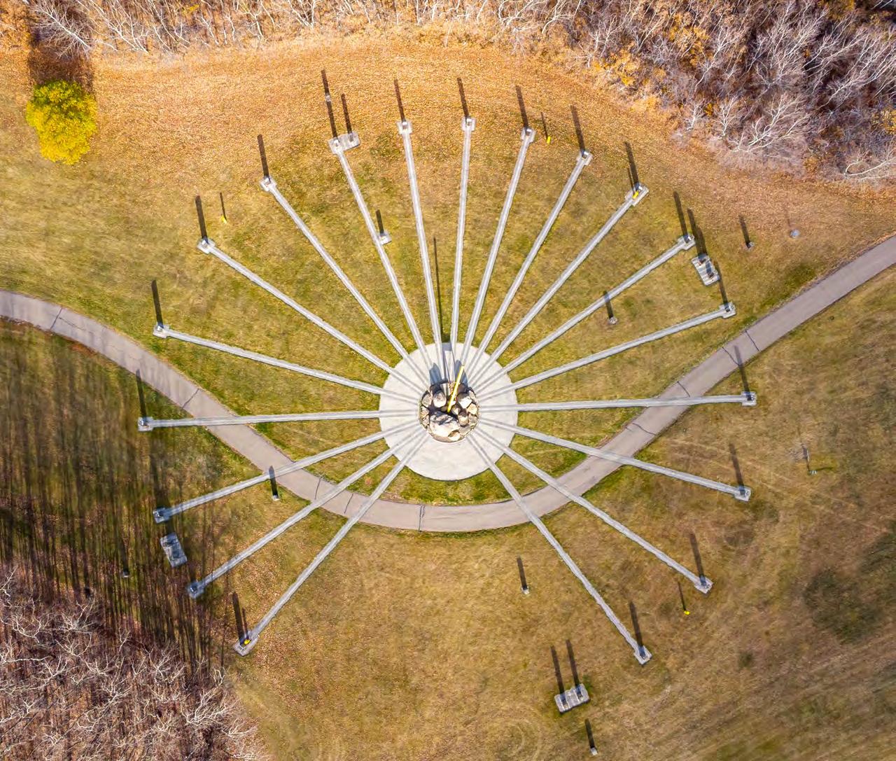
Land use planning and development in Lloydminster falls under Part 17 of the Alberta Municipal Government Act (‘the Act’), for the city as a whole, with the exception of the subdivision of land in the Saskatchewan, which falls under The Planning & Development Act. The planning framework process for the city is part of a hierarchy of documents and legislation that governs how land should be used, managed, protected, developed, and planned.
The chart below describes the hierarchy of the planning framework within Lloydminster.
Alberta’s Land Use Framework Saskatchewan’s Planning and Development Act
The IDP serves to establish a regional framework for attracting economic opportunities and managing land use, subdivision, and development in the IDP area. This forges a partnership between the City and the County of Vermillion River that facilitates development in the area and orientates Councils’ goals and vision towards the future.
The Lloydminster Planning District Official Community Plan (LPDC OCP)(Saskatchewan Side)
The Lloydminster Planning District Official Community Plan between the City of Lloydminster, Rural Municipality of Britannia No. 502, and the Rural Municipality of Wilton No. 472 addresses the need for future land use planning in the Planning District as well as other matters related to its physical, social, and economic development. The policies are intended to provide the LPDC and the member municipalities with direction and guidelines for establishing bylaws, programs and decisionmaking on future land use and development proposals in the Planning District.
The Lloydminster Charter recognizes the City of Lloydminster as a local government. It was created and empowered by both Alberta and Saskatchewan. The Lloydminster Charter enacts that Part 17 of the MGA applies to the whole city except for subdivision of land in the Province of Saskatchewan.
A Municipal Development Plan (MDP) is a statutory document that is intended to guide the growth and development of the city over several years. The MDP serves to provide direction to Area Structure Plans (ASPs) and Area Redevelopment Plans (ARPs).
Area Structure Plans (ASPs) provide specific details on the growth and future development of new areas in the city. ASPs describe proposed land uses and outline the general location of roadways and public utilities. Area Redevelopment Plans (ARPs) provide direction for the redevelopment of existing areas
LUB
The Lloydminster Land Use Bylaw (LUB) regulates and establishes all uses and developments of land within the city. It is objective in nature and ensures fair, orderly, and economic development of land. Land Use Bylaws typically achieve this by designating districts and land use classes.
In Lloydminster, Neighbourhood Structure Plans are non-statutory documents that provide additional direction to implement the vision established in Area Structure Plans.
In addition to the above planning framework, the direction set forward to prepare the Connection to Our Future document emanates from the priorities established in Lloydminster Council’s Strategic Plan. The 2022-25 Council Strategic Plan provides residents, businesses, and other stakeholders with an overview of the Council’s vision for the future of Lloydminster. It contains a series of goals and strategies to support the Corporation in setting short and longterm priorities.
Achieving the outcomes established in the Connection to Our Future document requires a collaborative effort from everyone in the city including municipal administration, citizens, civil society, and the business community. The following action plan allocates responsibilities to various City departments to undertake specific actions. It also establishes a high-level time frame to potentially complete those actions. The actions are organized into six sub-themes such as advocacy measures, studies, regulatory/administrative processes, grants/programs/incentives/ funding, partnerships, and monitoring.
The successful and timely implementation of the following actions will help the City to achieve the expected outcomes for each Community Driver in alignment with the overall community values, and ultimately connect us with our future aspirations.
4Environmental
6Recreation
8Building
BelongingSocial EquityNA
InnovationClimate Resilient
InnovationClimate Resilient
Advocate for ‘one window’ approach for the equitable delivery of services within both Alberta and Saskatchewan parts of the city for the delivery of childcare, healthcare, licensing, education, income support and housing.
Public EducationDevelop Waste Reduction and Diversion Communication Strategy, Water Conservation Strategy, and Pollution Prevention Strategy.
Public EducationWork with provincial and federal governments to promote Lloydminster as environmental, social and governance (ESG) friendly to ensure we are the world’s first choice for oil
Community Health Urban FormSecondary Suites, Garden Suites and Garage Suites
BelongingUrban FormNeighbourhood Renewal
Develop and deliver an education campaign to promote citizen knowledge about the benefits of secondary suites, garage suites and garden suites
Lead: SPS, Support: PE, HSW Ongoing
Assess the condition of existing infrastructure assets such as roads, sidewalks, open spaces, and underground utilities from maintenance, lifecycle costs and asset management on a regular basis
BelongingUrban FormSafe Spaces• Amend the Land Use Bylaw to require applicants to submit a CPTED Report developed by a qualified professional as part of the Development Permit Application package, at the discretion of the Development Authority
• Provide CPTED training to City staff to enable them to review CPTED assessments submitted by applicants
BelongingClimate ResilientAlternative uses for underutilized City-owned land
BelongingClimate ResilientAlternative Transportation
Culture Fiscal Responsibility Cultural Initiatives
Ecology Social EquityEquitable Access
Develop an inventory of underutilized City-owned land that may be used for potential urban agriculture related uses
Create an electric mobility strategy for e-scooters and e-bikes to include:
• Locations for vehicle pick-up areas
• A set of guidelines about where such electric vehicles are permitted to operate, and
• Any other relevant direction necessary for operation of such e-vehicles
Develop a year-round community events calendar in collaboration with local community groups and make it accessible to everyone through year-round advertising campaigns
Update the City’s Trails and Sidewalks Master Plan every 5 years
PE, EDShort-term
ED Support: PE, PS
Lead: RC Support: Com, ED, SPS
Ecology Fiscal Responsibility
Natural CapitalEstablish a Terms of Reference document for Life Cycle Cost Analysis of large-scale projects that may impact the environment and natural systems
InnovationSocial EquityHousing Strategy
InnovationSocial EquityUniversally Accessible Design and Age Friendly Design
Building Maintenance
Economic Development
InnovationFiscal Responsibility
InnovationFiscal Responsibility
PE Medium-term
Develop Lloydminster Housing Strategy Lead: SPS Support: ED, PE Short-term
Develop Universally Accessible Design and Age Friendly Standards.
Undertake an accessibility audit of existing public buildings.
Establish an incentive program to encourage the private sector to undertake a universal accessibility audit of existing buildings
Agri-BusinessUndertake Market Needs Analysis and Retail Gaps Analysis
Agri-BusinessSupport provincial and federal efforts to promote and market local agricultural produces in a positive light supported by data
InnovationFiscal Responsibility Downtown Improvement Program
Community Health Urban FormRedevelopment and Intensification
Community Health Urban FormHigh Quality Urban Design Throughout Lloydminster
Community Health Urban FormUrban Design Guidelines and Residential Infill Guidelines
Community Health Urban FormPolicing/Safer Community
Community Health Mobility and Connectivity Development adjacent to transit
Community Health Mobility and Connectivity Municipal Development Standards (MDS)
Community Health Mobility and Connectivity Traffic-Calming and Safety
Establish Downtown Improvement Program
Develop Area Redevelopment Plans to guide future redevelopment and intensification in those neighbourhoods
Develop design guidelines for corridors, gateways, and neighbourhood hubs
• Develop Urban Design Guidelines for specific areas in the city
• Develop Infill Design Guidelines
Develop a Community Safety Plan
Undertake a Public Transit Feasibility Study to gauge the viability of transit options along key corridors in Lloydminster and improve connectivity of residential areas to key public destinations or urban nodes
Update Municipal Development Standards (MDS)
PE Support: SPS
BM Support: SPS
PE Support: SPS
ED Support: Com Short-term
ED Support: Com
ED Short -term
PE Medium to Long-term
PS Short-term
Community Health Social EquitySocial Policy Framework
Community Health Fiscal Responsibility
Inventory of Industrial Land
• Review Accident Incident rates annually (pedestrian-vehicle collisions) as reported by RCMP
• Undertake annual traffic counts at locations identified through citizen complaints, accident incident locations and Department Review
Develop a Social Policy Framework
Develop the inventory of well-located and serviced industrial sites
PS
PE Short-term Short-term, Annual
Community Health Fiscal Responsibility Co-existence of Existing Development with Oil and Gas Facilities Develop Oil and Gas Policy
Community Health Fiscal Responsibility Utility Infrastructure Funding Identify Infrastructure Upgrading requirements
InitiativeFiscal Responsibility Intermunicipal Collaboration for Solid Waste Management and Municipal Servicing
InitiativeFiscal Responsibility
Work with regional partners to develop a coordinated solid waste management strategy, stormwater management strategy and where feasible, regional municipal servicing strategies.
Shared ServicesInvestigate the feasibility of developing regional cost sharing agreements
BelongingMobility and Connectivity Universal Accessibility
BelongingClimate Resilience Alternative Transportation
BelongingMobility and Connectivity Alternative Transportation
InnovationUrban Form Vehicle-oriented commercial
City to develop a separate policy for Accessible Parking
Establish a process to issue business licensing for electric scooters, electric bikes etc. for potential service providers
Update Parking Standards in the Land Use Bylaw to define the minimum number of electric car charging stations required for major commercial developments
Update the Land Use Bylaw to:
• Include enhanced landscaping standards for vehicle oriented commercial developments
• Review and update the Existing Highway Corridor Overlay in the Land Use Bylaw
InnovationClimate Resilient Low Impact Development (LID)
Community Health Urban FormIndustrial Development Standards
InitiativeClimate Resilient Solid Waste Reduction and Recycling
InitiativeSocial Equity Promoting Mixed Use
InitiativeSocial EquityHome Businesses, Small-scale businesses
Create Lloydminster-specific LID Guidebook for developers
Update Land Use Bylaw to include aesthetic standards for industrial development
• Review and update the Waste Services Bylaw to require source-segregation of solid waste.
• Establish a long-term Waste Management Strategy to provide ongoing direction for the waste collection, operation, and treatment
Update Land Use Bylaw to include relevant land use districts to allow more opportunities for mixed-use developments
Update Land Use Bylaw to allow a wide range of home-based businesses, outdoor patios, tourist homes, and similar uses
BelongingUrban FormNeighbourhood Renewal
BelongingMobility and accessibility Universal Accessibility
BelongingClimate Resilient Reuse, recycle and reduce
BelongingSocial EquitySupport voice of youth and young adults
Culture Urban FormResponse to heritage
Culture Urban FormCelebrate history
Explore the feasibility of potential City led Neighbourhood Renewal Program
Undertake a study to review the feasibility of a ‘Barrier Free Access - Retrofit Grant’
Provide continued support to initiatives such as pitch-in week and green-bin program
Establish a grant/incentive program to organizations involved with youth and young adults
Establish a Municipal Heritage Conservation Incentive program
Establish an incentive program to support experiential tourism in Lloydminster and regional indigenous communities
Culture Urban FormWinter CityUndertake a study to establish Lloydminster specific Winter City Design Strategies
Culture Mobility and Connectivity Supportive Transportation
Culture Climate Resilient Promote the use of local species in landscaping
Culture Social EquityPublic Art
InnovationUrban FormRevitalization of established mature commercial areas
Undertake a feasibility study for Supportive Transportation initiatives (ride share program, on-demand transit for seniors etc.) as part of the Public Transportation Master Plan
Create an inventory of suggested local planting species to be used by the development industry
Develop a new ‘Public Art Program’ for private sector projects
Explore the feasibility for a corner store grant program, commercial retrofit grants program, and facade improvement grant program
InitiativeSocial EquityHousing Municipal support/grants/programs for the community partners
PE Support: Com
ED Support: PE, Com, Fin, SPS
ES Support: Com
SPS Support: Fin
PE Support: RC, ED
ED Support: Com
to Long-term
PE Short-term
Lead: PE Support: Com Short-term
Lead: PGSShort-term
Lead: RC Support: PE, LS Medium-term
Lead: ED Support: Fin
Lead: SPS Support: Fin Long-term (need to develop an approach)
InitiativeSocial EquityAging Well in Community Municipal support/grants/programs for seniors Lead: SPS Support: Fin Long-term (need to develop an approach)
InitiativeSocial EquityBuilding Social Capital Establish a Volunteer Attraction and Retention Program
Lead: SPS Support: Com
Consideration is in the 5-year strategic plan. Need a net new to get it done. Long term.
BelongingSocial Equity Opportunities for celebration
Culture Fiscal Responsibility Work with Schools and Community Groups
Community Health Social EquityAttainable and Special Needs Housing
Community Health Fiscal Responsibility Access to primary care
InitiativeFiscal Responsibility Heavy Oil & Agriculture
Develop new partnerships with local cultural organizations
Partner with schools and community groups for joint use of facilities
Establish new partnerships with non-profit groups, developers and other agencies
Establish partnerships with Lloydminster & District Health Advisory Council and Lloydminster BiProvincial Committee to develop a Social Policy Framework
• Develop a partnership with O&G industry
• Develop partnerships with the local Agricultural industry
SPS Support: RC Ongoing, Long-term
RC Support: PE, PGS
Long-term
SPSShort-term
BelongingUrban FormMunicipal Cemetery Ensure maintenance and future capacity of municipal cemetery Lead: PGSShort-, Medium-, Longterm
BelongingClimate Resilient Alternative Transportation Work towards procuring electric vehicles for the municipality
BelongingClimate Resilient Urban ForestsDevelop a robust and fully funded Urban Forestry Program
Ecology Fiscal Responsibility Standards for sanitary sewer discharge management Enhance processes and standards for sanitary sewer discharge management
Innovation Fiscal Responsibility, Climate Resilience Procurement process Minimum Environmental Standards
• Revisit procurement process related to environmental costs/benefits and long terms/ life cycle costs
• Establish minimum environmental standards for all new and retrofitted public buildings and infrastructure, i.e., low flow fixtures, LED lighting, solar photovoltaics, green roofs, organics separation, etc.
TS Short-term to mediumterm
PGS Support: IT Short-term
ES Short-term
ES Support: PE, LS
Community Health Social Equity Outdoor Playing Surfaces Update Parks & Green Spaces Master Plan with a focus on future needs and location of open spaces, population threshold triggers for playgrounds, and operation and management of outdoor playing surfaces Lead: PGSShort-term
Community Health Fiscal Responsibility Future Utilities Provision Establish indicators for the implementation of the Utility Master Plan. Lead: PE Short-term
Community Health Fiscal responsibility Resource Recovery Program
Develop & implement resource recovery programs Develop partnerships with industry, regulatory agencies, etc. Lead: ES Medium-term
Community Health Fiscal Responsibility Compliance with Sanitary Sewer and Stormwater Management Plans
Community Health Social EquityAccess to seasonal healthy food
Community Health Fiscal Responsibility Water Conservation
Establish indicators for the implementation of the Sanitary Sewer Master Plan and Storm Drainage Master Plan.
Explore options for ‘incredible edible’ public landscaping to access free and healthy food
Create and implement residential and nonresidential water conservation program
Lead: PE Short-term
Lead: PE Support: PGS Short-term
Lead: ES Support: Com Short-term
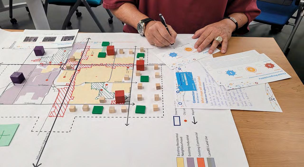

We acknowledge that the land we gather on is the traditional homeland, hunting, and ceremonial gathering places of the First Nations, Métis and Inuit. The Plains Cree, Woodland Cree, Saulteaux, Blackfoot, Métis, Dene, and Nakota Sioux people have practiced their culture and languages on Treaty 6 and Métis Region 2 territories for generations and were the original caretakers of this land. Many First Nation, Métis and Inuit peoples call this land home today and have done so for millennia. We would like to acknowledge the history we have created together on this land, and to be thankful for the opportunity to walk together side-by-side in friendship, learning from our past, and promoting positive relationships for the past, present and future.
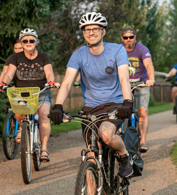
Background
To connect to our future, we must first envision it.
Connection To Our Future is a project that will set our course to ensuring we have a healthy, prosperous, and resilient future for ourselves and future generations. We are thinking ahead 30 years, and Connection To Our Future will guide our economic, social, cultural and ecological decision making in the years to come.
Practically speaking, Connection To Our Future will replace our current Municipal Development Plan. It will set policies to guide our decision-making, so we can strategically address the community’s immediate needs while taking into account our aspirations for our future. As a plan, it will provide the City Council, Administration and the wider community with a shared sense of direction—so we can grow as we choose to grow into our future.
In May and June of 2022, we called upon the Lloydminster community to begin the work of developing Connection To Our Future. Many of you joined in to help us chart a course to realizing a healthy, prosperous and resilient future for ourselves and future generations.
The first phase of engagement involved three key components:
• Citizen input: All citizens
• Community Advisory Committee: a range of community members committed to crafting a vision for Lloydminster and a desire to implement that vision
• Technical Advisory Committee: City staff and Council representatives
In addition, the following three key engagement events were envisioned for this project
• Phase 1 Engagement - What we like / What we dream, values to guide our community May / June 2022
• Phase 2 Engagement - Options and choices for our future Fall 2022
• Phase 3 Engagement - Connection To Our Future Late Fall 2022
This What We Are Hearing report summarizes Phase 1 engagement activities.

In order to gauge a strong foundation for the future we asked community members to identify what they liked already about Lloydminster. From this we explored what the dream for Lloydminster is, that could be realized and implemented. This section of the report summarizes the engagement process and findings of how community members view Lloydminster now and into the future.
Engagement activities took place online and in person.

Location • Project website at connectlloyd.ca and SurveyMonkey
Questions Asked
Number of Responses
• What do you like most about Lloydminster?
• A dream I have for Lloydminster is….
• When you think of Lloydminster, what five words come to mind?
• How long have you lived in Lloydminster?
Pop-Up Events around Lloydminster
• YourVoice Event (May 12, 2022)
• Farmer’s market (May 19, 2022)
• Bud Miller Park Event (May, 2022)
• Operations Centre Display (May and June, 2022)
• Economic Development Breakfast (May 17, 2022)
• Class Presentation (June 09, 2022)
• Airshow Pancake Breakfast (June 04, 2022)
• What do you like most about Lloydminster?
• A dream I have for Lloydminster is….
A summary of input received from the online survey and postcards is outlined in the word graphics below. The larger the word, the more often the word was mentioned in the survey and postcard responses. The smaller the word, the less frequent the theme was mentioned. What do you like the most about Lloydminster?
spirit
border town
early access small town family amenities community size administration park
big city
average quick commute events entrepreneurial spirit
How long have you lived in Lloydminster?
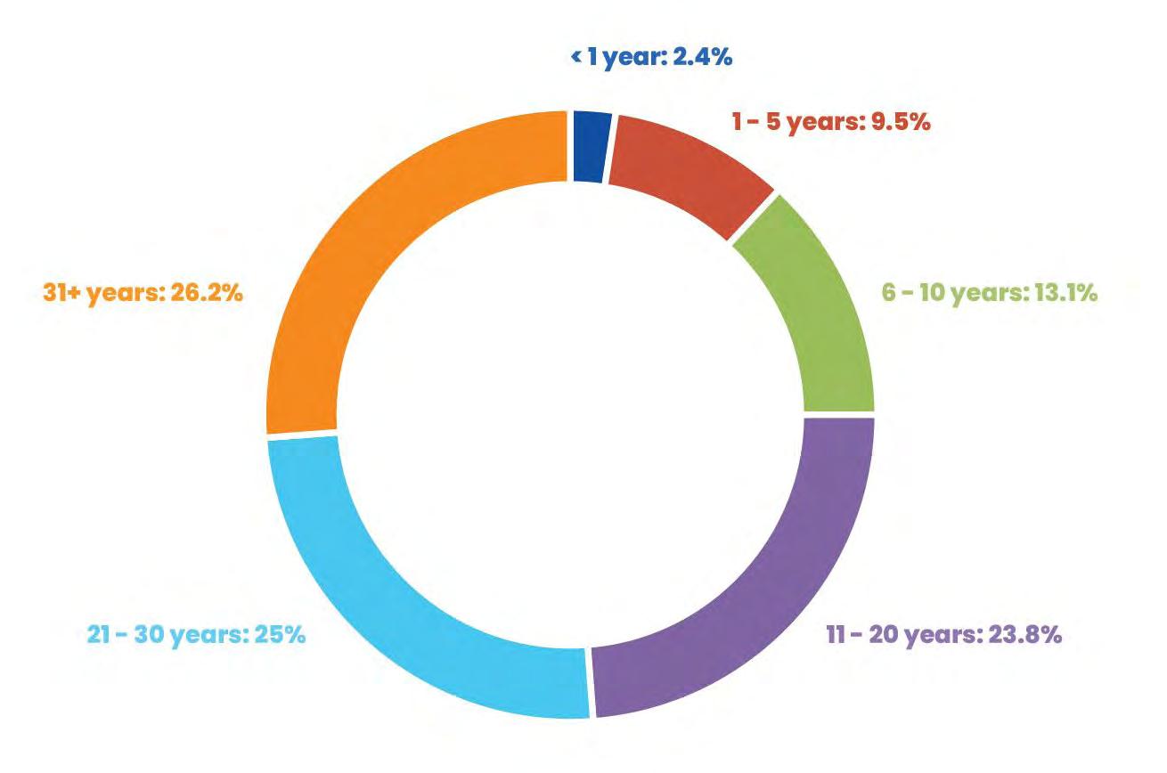

Every aspect of growth is guided by a strong set of foundational values. We have identified through collaboration with community members what Lloydminster’s values are. This section of the report outlines how we listened and what we are hearing in terms of values and guides in our community.
On June 24, 2022, the Community Advisory Committee (CAC) and Technical Advisory Committee (TAC) met to explore the 257 postcards gathered at various events throughout Lloydminster. Together, the Committees made sense of the postcards and found core values that can guide the development of Connection To Our Future. The themes found were then tested at the Downtown Street Fest on June 25, 2022.
The following table provides a list of TAC and CAC members who attended the June 24th meeting.
• Jason Whiting, Councilor
• James Rogers, Senior Manager, Capital Infrastructure, Operations
• Patrick Lancaster, Manager of Social Programs and Services
• Sean Paterson, Parks and Green Spaces
• Katlin Ducherer, Economic Division
• Natasha Pidkowa, Planning
• Sherri Husch, Executive Director at Midwest Family Connections
• Cst. Kelsey Davidge, RCMP
• Sandra Brown, Manager, Lloydminster Métis Housing Group
• Viola Pewapisconias, Little Pine - Band Member
• Kemoh Mansaray, Lloydminster Local Immigration Partnership
• Krystal Stewart, Inclusion Lloydminster
• Ben Harrison, local bike advocate
• Jackie Tomayer, Chamber of Commerce
• Nadine Graham, Lloydminster Housing Authority
• Deanna Stang-Livingston, CAO Lloydminster Region Housing Group
• Angela Rooks-Trotzuk, Director at Lloydminster Interval Home Society
• Kaitlyn Luster, City of Lloydminster
• Beth Sanders, POPULUS Community Planning Inc.
• Dnyanesh Deshpande, Green Space Alliance
• Marcelo Figueira, Green Space Alliance
In a series of conversations in small groups, Community Advisory Committee and Technical Advisory Committee members explored all 257 postcards to look for themes. The following themes started to emerge:
Members of the Community Advisory Committee and Technical Advisory Committee identified specific themes in the data. They then organized themselves to explore each theme by answering the following questions:
• What does this theme mean for Lloydminster?
• What needs our attention on this front?
• What are 5-10 words to describe this theme?
The following seventeen themes were identified:
• More affordable housing
• Public recreation/private recreation
• Costco (additional retail)
• Small town feel
• Active transportation (trails, sidewalks, walking + bikes, etc.)
• Downtown of Lloydminster
• Public transportation/public transit
• Airport
• Recreation (swimming pool & ice rink)
• Costs (financial impacts)
• Infrastructure improvement/expansion, forward thinking development
• Inclusive for everyone, inclusive and safe community where everyone belongs + contributes
• Art + history + culture (cultural diversity and festivals)
• Redevelopment of older buildings (all areas of the city, vacant property)
• Healthcare
• Transportation (public & private)
• Road improvements, heavy traffic rerouted
The following table summarizes the input received:
What it mens for Lloydminster?
More Affordable Housing
Public/Private Recreation
• Residential expansion, infill lots
• Happier, healthier families when they have a home that they can afford
• Stronger economic base for Lloydminster
• Retention of newcomers
• Decrease in crime
- direct correlation between poverty/crime
• Design, location, sizetiny houses
• Healthy Lifestyle
• Options for different levels of income
• Variety and abundance of activities
• 4 Seasons of recreation
• Retaining Workforce
What needs our attention? 5-10 words to describe this theme
• Affordable lots for building
• Infills and lots/repurposing
• Location close to services
• Example of Prince Albert - sets aside 5% of taxes for development of affordable housing and gives non-profit groups free lots for development
• Review taxes and incentives
• Define both and How they are different
• Marketing and communicationseducation
• Affordability for current recreation
• Concentration of current assets
• Pricing and costing, affordability
• Housing affordable
• Development
• Happy
• Healthy Incentives
• Design
• Size
• More varying Price Points
• Learning opportunities
• Variety
• Lifestyle
Costco (Additional Retail)
• Opportunity - Jobs
• More dollars staying local - More dollars coming into Lloydminster
• Increase tax assessment
• More retail = more opportunities = more dollars
The following table summarizes the input received (cont’d):
What it mens for Lloydminster?
Small Town Feel
Active Transportation
• Community connections (people know each other)
• Walkability (sidewalks, pathways, physical distance)
• Might meet people you know while you walk
• Shared responsibility, shared ownership, mutual aid
• Bring Amenities to where people are
• All neighbourhoods hold equal appeal and interest
• An interest in our neighbours and community
• Perception of safety
What needs our attention? 5-10 words to describe this theme
• Interest in more opportunities (rec & employment)
• How do we create that neighbourhood feel throughout the city
• Do all neighbourhoods have the components we think of in a “neighbourhood”.
• Gaps? How to address them, Spread out amenities (accessibility)
• Create opportunities for “neighbouring”
• Mindful of “truly” diverse neighbourhoodsAvoid segregating.
• Who is missing? From economy, neighbourhoods.
• Options, Accessibility, Health
• Safety
• Environment
• Economic Status
• Parents + Transportation
• Youth
• Newcomers
• Safety
• Widths of sidewalks
• Speed of roads
• Proper lighting
• Crime protection (design of roads), CPTED
• Accessibility
• Parents w/ strollers
• Cyclists
• Wheelchairs
• All ages + abilities
• Elderly
• Increased visibility (lighting, marlins, beautification at pedestrian crossings)
• Bike Theft protection
• Implementing Trails & Sidewalks Master Plan in a timely manner
• Community that cares
• Collective responsibility to address gaps
• Progress/Actions to safer, accessible
• transportation options throughout Lloydminster
The following table summarizes the input received (cont’d):
What it mens for Lloydminster?
Downtown
• Wanting downtown to be a bustling, enjoyable place to visit, shop, and eat.
• Heart of the city, unique part of the city
What needs our attention? 5-10 words to describe this theme
• Change to make being downtown more enjoyable, reduce noise, improve atmosphere with music.
• Taxes (reduce property tax)
• Incentives
• Prioritize appreciation of history
• Accessibility, make better use/design
• Communication strategy to help all parking.
• Citizens understand importance of the downtown
• Unique
• Heart of the city
• Needs to be celebrated and cherished
• Tourism
Public Transportation/ Public Transit
• Retention of immigrants
• Service needed for students, seniors
• Convenience
• Less vehicle emissions
• Necessity for lowerincome individuals
• Accessibility to services
• Can move toward more green environment
• Costly for immigrants to pay for taxis to get to work, so leaving for larger cities
• Needs to be priority spending in the city
• Consider different public transportation models that would be feasible for Lloyd. I.e. Larger vans or buses, private/public partnerships.
• Doesn’t need to be a larger diesel city bus
• Immigrants
• Accessibility
• Affordability
• Different Options
The following table summarizes the input received (cont’d):
What it mens for Lloydminster?
Airport
Recreation (Swimming pool & ice rink)
• Easier access (road improvements to airport)
• Expansion of services
• More Jobs - movement of individuals
• More diversified industry
• Shipping of Goods (importing)
• Makes city attractive
• Increased economic [value]
• Healthy lifestyle
• Bring new people in
• More activities - Variety
• Business Opportunities
• Events
• Hub for events
• Economy
• Learning new things
• Social - making friendssense of community
• Inclusivity
Costs (financial implications)
• Recreation = Costs
• Commercial & Business Prosperity = Community Prosperity
What needs our attention? 5-10 words to describe this theme
• Attract airlinespopulation base/need/ interest
• Affordability
• Road and access
• Expansion of airportRunway
• Expansion
• Opportunity
• Shipping
• Jobs
• Tourism
• City initiatives
• Public Incentive
• Inclusive - approach equity
• Expand what we have
• Focus on the new and variety
• Pop-up event based opportunities
• Awareness
• Affordable Options and Accessibility
• Spread over city
• All season activities
• Cost of Living = Quantifying, Literacy & Awareness
• Education on tax allocation/marketing and communication
• Difference between individual cost of living/larger community
• Variety
• Lifestyle - Health
• Entertainment
• Accessibility and Inclusivity
• All Season
• Education
• Prioritization
• Awareness
• Want vs. Need
• More with less
• Data
• Investment
• Understanding
The following table summarizes the input received (cont’d):
What it mens for Lloydminster?
Infrastructure Improvement/ expansion, Forward Thinking Development
Inclusivity for everyone, Inclusive and safe community where everyone belongs + contributes
• Efficient and effective spending of $$$$ [money]
• Drainage efficiencies/ alternative options
• Attractive to newcomers
• Traffic circles (How can we design to get the intent out, less “ugly”/ ”bulky”
• Visually appealing
• Future proofing/ shovel ready areas
• Sense of belonging for everyoneopportunities to contribute
• Understanding all the diverse populations (disability, culture, homeless)
• Accessibility considered beyond physical accommodation (neighbourhood development, approaches)
• Recognize that relations + socially valued roles contribute to safety + inclusion
• Ensure That there not a focus on a bias of “safe” meaning
What needs our attention?
• Moving the railroadsEfficient development of areas adjacent to the rail.
• Funding
• Education/Direction shift (ability to adjust box sides)
• Direction shift for off site levies and increasing funding available
• Awareness of needs + innovation to be realized with funding for it to happen
• Address the myths and stereotypes including racism that contribute to lack of inclusion +safety
• Mobilize the voice of youth + young adult Lloydminsterites to chart the course for the future
• Bridge from past to future
• Creative _innovative ways for “voices” to be heard → art, conversations, listening in addition to surveys, meetings & presentations
5-10 words to describe this theme
• Inclusive + safe communities where everyone belongs
• Is welcomed
• Contributes + has friends
The following table summarizes the input received (cont’d):
What it mens for Lloydminster?
Art, History + Culture
• Important for growth
• Healthy future
• Inclusivity - everyone feels like they belong
• Helps define who we are - History of Lloyd and area
• Good for business
• Economic growth
• Diversity of skills in the labour force
• Participate in other cultures
• Provides healthy community through cultural experience
What needs our attention?
• Deliberate attempt to have diversity of cultures
• History is acknowledged and celebrated in a variety of methods (written, storytelling poetry, art, artifacts, and events)
• Include diverse groups to participate
• Provide support by allowing, inviting, acknowledging (award to successful immigrant business - celebrate diversity awards)
• Newspaper - celebrating different cultures/people
• City support for various cultural initiatives
• Integrate multicultural activities/centres in mainstream recreational centres.
• Celebration through art (community led)
5-10 words to describe this theme
• Diversity
• Inclusivity
• Healthy
• Belonging
• Growth
• See it, feel it, everywhere
Redevelopment of older buildings/ vacant properties
• Densify propertiesmost visible important locations, brainstorm better uses, needs within the community such as affordable housing/ retail needs.
• More active role by the municipal government
• Reasons to take actions: reduce crime, improve image of city, tourism/ economic development, and grow tax base.
• Additional taxes or penalties
• Incentives
• Communication: Landowners, economic development department, start up Lloyd, Community Futures, non-profit sector.
• Review bylaw/policy
• Support for entrepreneurs looking for small spaces to rent
• Realize that land is a valuable asset and better use can improve crime rates, community spirit, community image, and contribute more revenue to the city that can support other priorities.
The following table summarizes the input received (cont’d):
What it mens for Lloydminster?
Healthcare
Transportation (Public & Private)
• Coordination between provincial healthcare systems
• Mental Health
• Wait times
• Addictions + Rehabilitation
• Quality Care
• Access to primary care/ doctors
• Expanding types available, i.e. Paramedics, mental health workers, speech therapists.
• Options for public: Price, Taxi’s, Rideshare, Uber, Bikes/Rentals, Bussing/Transit
• Tourism Bus: Seniors Tours, Sandy Beach
• Non-emergency medical: Handi-van
• Recreational: Scooters, Skiing, Snowmobile/ quad trails, Bikes/ Rentals
What needs our attention?
• Wages/salaries based on province
• Public outreach - people putting pressure on services to improve
• Case overloads
• Resources/medical equipment. Ex. MRI, CT, Ultrasounds
• Communication between provinces
• Urgent Care
• Communication to the public - people knowing how to navigate systems.
• Education
• Awareness
• Most Vulnerable: Low Income, Elderly, Persons w/ Disabilities
• Multi-Use Services
• Walking trail (Summer)/Ski Trail (Winter)
• Expanding on what we have
5-10 words to describe this theme
• Scary
• Confusing
• Adequate but maxed out
• Cost
• Choices and options for everyone all year round
• Expanding on what we have
At the conclusion of the workshop, participants identified nine key values that can guide Lloydminster’s future:
• Innovation
• Culture
• Belonging
• Community health
• Get it done
• Inclusion
• Economic prosperity
• Equity
• Collaboration
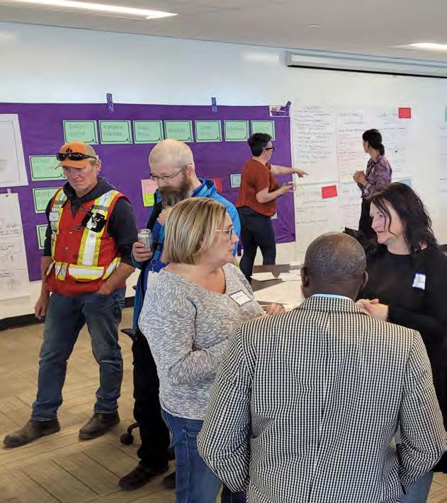
The project team brought the results of the Community Advisory Committee and Technical Advisory Committee’s work to the Downtown Street Fest on June 25, 2022. The public was asked for their reaction to the nine emerging values.
• Innovation
• Culture
• Belonging
• Community health
• Get it done
• Inclusion
• Economic prosperity
• Equity
• Collaboration Participants provided their input by placing stickers next to the values that most resonated with them. In general, citizens added a similar amount of dots to all nine values. This indicates that all nine values were strongly validated by citizens.


The project team is using the input received as they continue to create Connection To Our Future with the Lloydminster community. The values will be further refined and defined by the project team and will guide the development of policies that will ensure our plan becomes our future. The values will ensure:
• What people like about Lloydminster are important qualities of our community that need to be encouraged and enhanced.
• What people dream for Lloydminster are what we wish to encourage and enable.
Our values will guide the development of policy choices as we create Connection To Our Future.
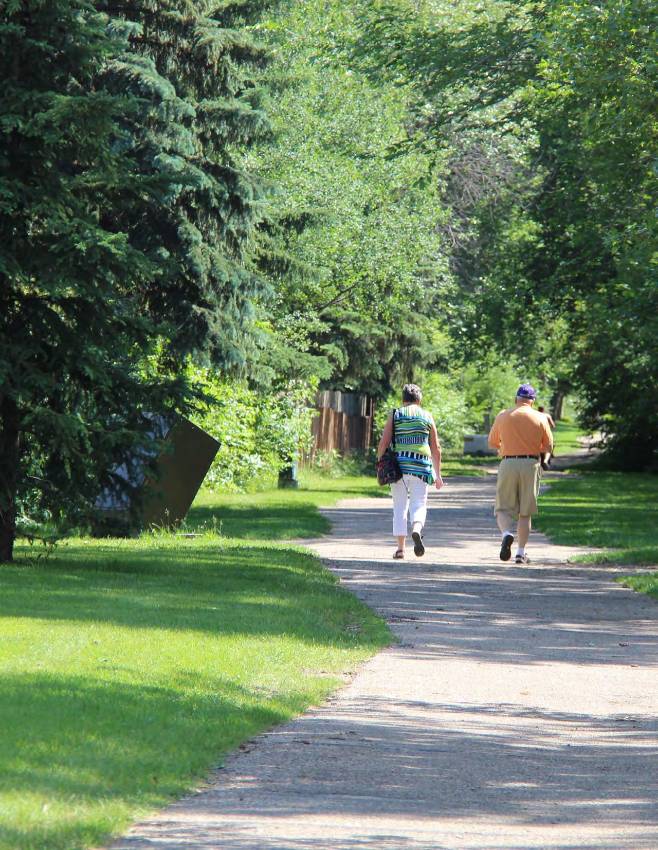
We acknowledge that the land we gather on is the traditional homeland, hunting, and ceremonial gathering places of the First Nations, Métis and Inuit. The Plains Cree, Woodland Cree, Saulteaux, Blackfoot, Métis, Dene, and Nakota Sioux people have practiced their culture and languages on Treaty 6 and Métis Region 2 territories for generations and were the original caretakers of this land. Many First Nation, Métis and Inuit peoples call this land home today and have done so for millennia. We would like to acknowledge the history we have created together on this land, and to be thankful for the opportunity to walk together side-by-side in friendship, learning from our past, and promoting positive relationships for the past, present and future.
To connect to our future, we must first envision it.
Connection To Our Future is a project that will set our course to ensuring we have a healthy, prosperous, and resilient future for ourselves and future generations. We are thinking ahead 30 years, and Connection To Our Future will guide our economic, social, cultural and ecological decision making in the years to come.
Practically speaking, Connection To Our Future will replace our current Municipal Development Plan. It will set policies to guide our decision-making, so we can strategically address the community’s immediate needs while taking into account our aspirations for our future. As a plan, it will provide the City Council, Administration and the wider community with a shared sense of direction—so we can grow as we choose to grow into our future.
The project includes the following three public engagement phases:
Phase1Engagement(May-June2022)-Whatwelike/Whatwedream,valuestoguideour community
This engagement phase included citizen input, input from the Community Advisory Committee and the Technical Advisory Committee. The first phase of engagement determined what we like, what we dream, and the values that guide our community.
Phase2Engagement(September-October2022)-Optionsandchoicesforourfuture-What shapewillLloydtake?
We called upon citizens to tell us their aspirations for Lloydminster’s urban form, mobility and connectivity, climate resilience, social equity, and fiscal responsibility.
This phase of engagement involved the following components:
• Survey - What shape will Lloyd take?
• Drop-in session - How would you accommodate 10,000 additional people in Lloydminster?
• Technical Advisory Committee meeting
Phase3Engagement (December2022)-FinalreviewoftheConnectiontoOurFuture document
This phase of engagement will include the following components:
• Joint Community Advisory Committee and Technical Advisory Committee Meeting
• Drop-in Session - Final Review of the Connection to Our Future document
This What We Are Hearing report summarizes Phase 2 engagement activities.
We asked community members what their preferred approach was concerning Lloyd’s urban form, mobility and connectivity, climate resilience, social equity, and fiscal responsibility. This section of the report summarizes the engagement process and the takeaways for how community members envision Lloydminster’s future.
Engagement activities took place online and in person.
(September to September 22, 2022)
Location Project website at connectlloyd. ca and SurveyMonkey
Questions Asked
Online Survey Questions:
• What physical shape will we take?
• How will we move around Lloyd?
• What is our climate commitment?
• How will we care for Lloyd?
• How will we demonstrate our fiscal responsibility
(September 22, 2022)
Lloydminster Public Library, Lloyd Mall, 5211 44 St Unit 160, Lloydminster, AB T9V 0A7
Exercise 1: Online Survey Questions
• Participants were asked to answer online survey questions using customdesigned cards
Exercise 2: Block Game
Participants were asked the following question:
• How would you accommodate 10,000 additional people in Lloydminster?
Responses
A summary of input received from the online survey and drop in session is outlined in the graphics below.
How will we care for Lloyd?
What is our climate commitment?
How will we demonstrate our fiscal responsibility?
Drop-in Session - How would you accommodate 10,000 additional people in Lloydminster?
At this event, participants were provided with a map of the City and a set of wooden blocks representing various land uses. Each residential block represented approximately 500 new people. Participants were asked to develop a future development scenario by distributing these wooden blocks on the provided maps and create a vision to accommodate approximately 10,000 new people within the City’s boundary. Participants were allowed to work individually or in groups subject to their preference. A total of six (6) future development scenarios were developed by participants during this event.
The following is asummary of key emerging themes:
• Continue residential neighbourhood expansion along southeast and southwest portions of the city
• Develop interconnected open space network and equitably distribute open spaces within all new neighbourhoods
• Provide amenities (neighbourhood commercial and community services) in close proximity to residential areas
• Continue to expand new industrial developments towards northeast and northwest portions of the city
• Continue to invest in downtown, Highway 16 and Highway 17 commercial corridors

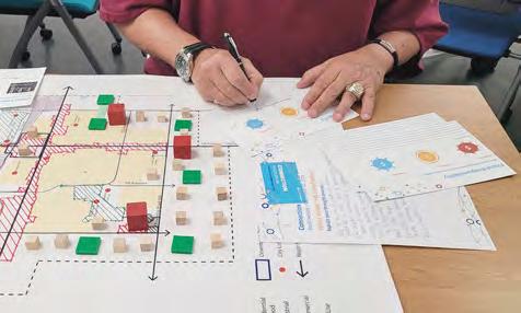

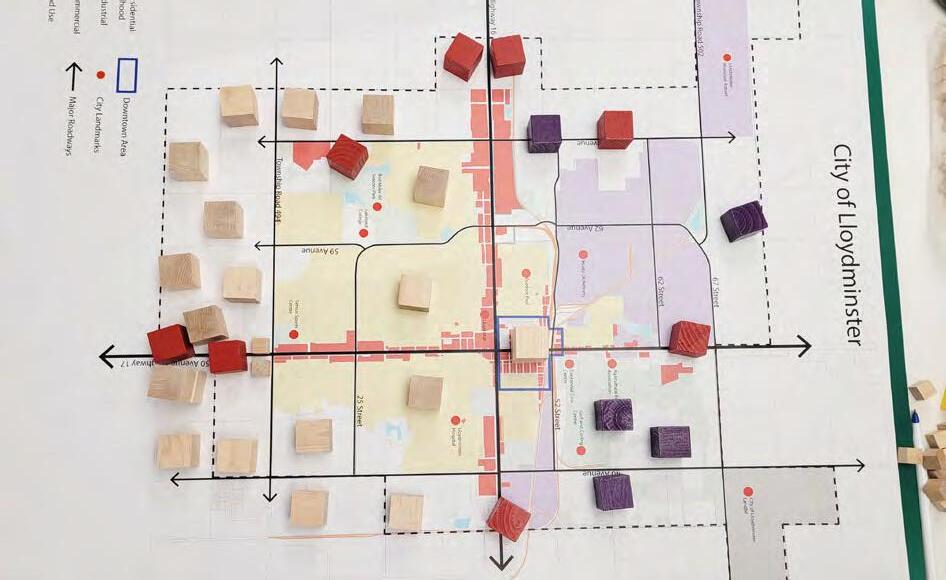
On September 23, 2022, the City organized the third Technical Advisory Committee Meeting. The online survey results were shared with the TAC members for their review. The following is a summary of the preferred direction for each city driver as confirmed by the TAC.
Urban Form Neighbourhood Villages
Mobility and Connectivity Nodes and Corridors and Neighbourhood Village Hybrid
Climate Resilience
Proactive/ Passive Hybrid
Social EquityProactive
Fiscal Responsibility
Proactive/ Passive Hybrid
Development occurs in ways that create neighbourhood villages. Neighbourhood villages are mixed-use pedestrian oriented developments designed to provide neighbourhood amenities and services within walking distance of residential areas.
Improve vehicular and pedestrian connectivity along key existing and future corridors in Lloydminster. Improve vehicular, pedestrian and open space connections towards potential urban villages.
Achieve an appropriate balance between proactive and passive approaches described below.
Proactive: We work together proactively to prevent and prepare for climate changes. We have a practical action plan to prevent and prepare for climate change.
Passive: We take some action to prevent or prepare for climate changes. We focus on education and voluntary climate action.
We proactively act to prevent and address social equity challenges.
Achieve an appropriate balance between proactive and passive approaches described below.
Proactive: We take proactive actions to help diversify our economy. We create conditions to attract skilled and creative workforce. We require new development to be self sustainable and minimize the financial burden on the municipality.
Passive: We continue to work with existing industries such as agriculture and oil and gas, and ensure they continue to thrive in Lloydminster. We explore and engage with new business sectors that may be suitable for Lloydminster.
The project team is using the input received as they continue to create Connection To Our Future with the Lloydminster community. The values determined in the first phase of engagement, as well as the priorities for various city drivers identified in the second phase of engagement will help to further the creation of policies that will reflect the community’s aspirations and the City’s future development.

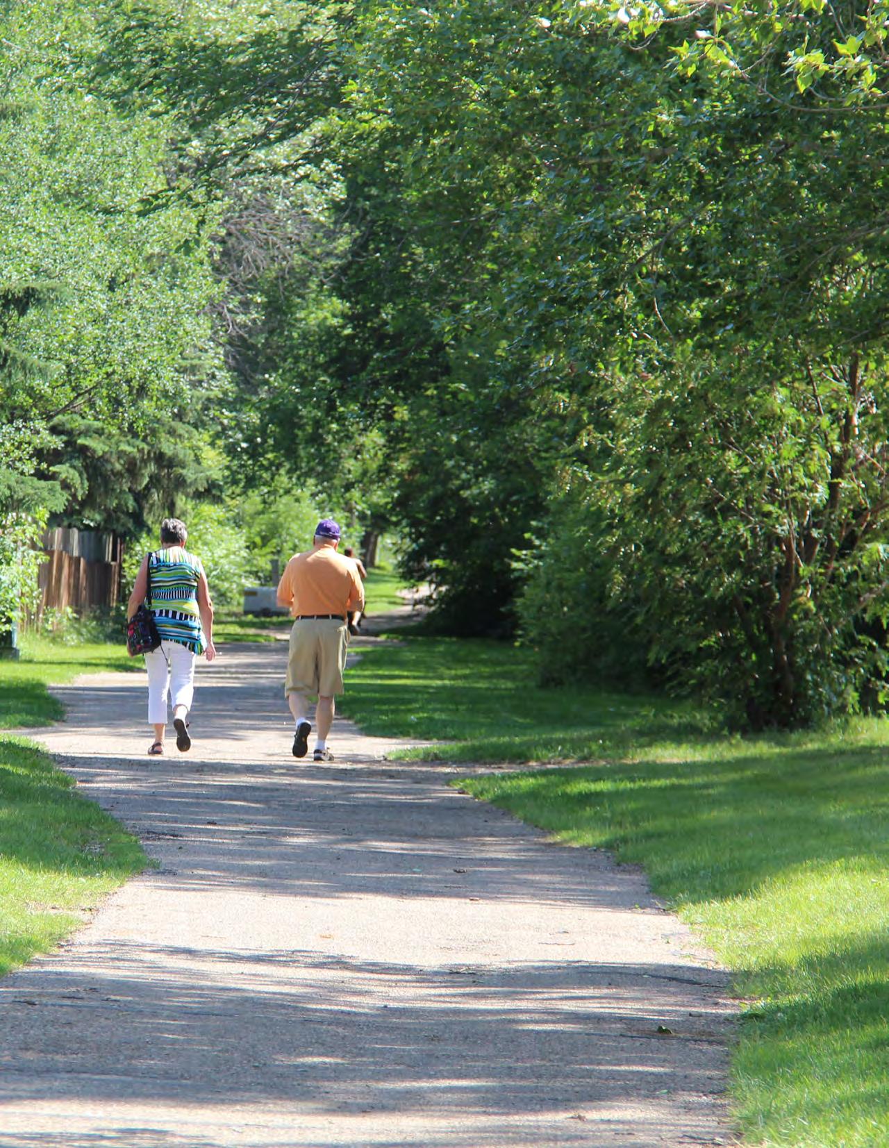
The following tables provide a summary of various approaches the City can take for each Community Driver and the preferred approach confirmed through public and stakeholder input.
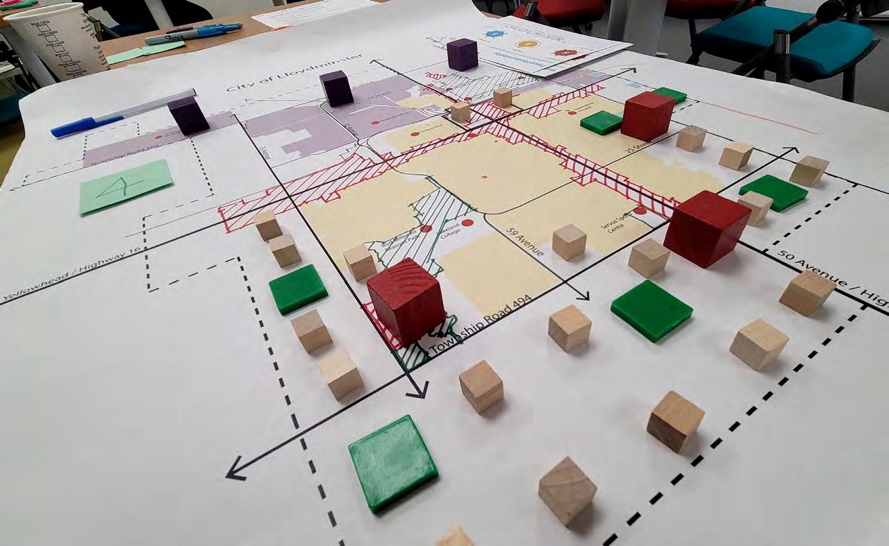
Approaches
Scattered: Development occurs in a scattered manner.
Neighbourhood Villages:
Development occurs in ways that create “neighbourhood villages” within residential areas.
Nodes and Corridors: Development occurs where existing clusters of services already exist.
Community’s Preference for Urban Form
Description
• Commercial, residential, institutional, and industrial activities are scattered throughout the community.
• Services that people need are sometimes not nearby.
• It is very likely that activities that make sense to be close to each other may be far apart (for example: homes could be far from schools, shopping, and medical).
• Very likely that the services you need are far from where you live.
• It is very likely that you will need a personal vehicle for many daily trips (for example: work, school, groceries, medical.)
• Most homes are near services.
• Some homes are built at the same location as services (residential and commercial uses at the same location).
• Parks and pathways allow pedestrian and bicycle connections within the “village”.
• Services that you need are clustered close to where you live.
• Very likely that services may be within walking or biking distance.
• Less likely that you need a personal vehicle for daily trips.
• Development takes place along major roads and at major intersections.
• Some homes are near services.
• A network of open spaces and pathways connect major clusters of services to residential areas.
• Services that you need will be located along the edge of your neighbourhoods within walking distance.
• Options are available for people to walk and bike around the city.
• Less likely that you will need a personal vehicle for daily trips.
Neighbourhood Villages
Development occurs in ways that create neighbourhood villages. Neighbourhood villages are mixed-use pedestrianoriented developments designed to provide neighbourhood amenities and services within walking distance of residential areas.
Approaches
Scattered: Movement systems that prioritize the use of personal automobiles for easy access to daily amenities.
Neighbourhood Villages: Movement systems that enable the development of potential neighbourhood villages within the city.
Description
• People predominantly move around the city using vehicular roadways with limited access to active modes of transportation.
• Our transportation system serves cars and trucks well.
• People who have personal automobiles have easy access to the city.
• People who do not have personal automobiles or do not drive have difficulty accessing services in the city.
• Roads are the primary infrastructure by which people move around the city.
• A network of paths and sidewalks provide alternatives to driving within neighbourhood villages.
• Our transportation system serves cars and trucks well.
• People who have personal automobiles have easy access to the city.
• People who are able to walk, bike, and scooter are able to access nearby services.
Nodes and Corridors: Movement systems that enhance connections to and from the city’s main transportation corridors.
Community’s Preference for Mobility and Connectivity
• Roads are the primary infrastructure by which people move around the city.
• A network of paths and sidewalks provide alternatives to driving within and between neighbourhood villages.
• Public transit serves along the main roadways.
• Our transportation system serves cars and trucks well.
• People who do not have personal automobiles or do not drive can still access the majority of services in the city using public transit.
• People who are able to walk, bike, scooter are able to access services across most of the city.
Nodes and Corridors
Improve vehicular and pedestrian connectivity along key existing and future corridors in Lloydminster. Improve vehicular, pedestrian, and open space connections towards potential neighbourhood villages.
Approaches
Reactive1: We react to climate changes when they happen. We take little action to address climate change.
Passive2: We take some action to prevent or prepare for climate changes. We focus on education and voluntary climate action.
Proactive3: We work together proactively to prevent and prepare for climate changes. We have a practical action plan to prevent and prepare for climate change.
Description
• We contribute to climate change.
• We may not be ready to address changes we will experience.
• Reacting to climate changes could be costly.
• We encourage individuals to reduce their contributions to climate change, but they may still contribute to climate change.
• Our passive response to climate challenges could incur some long-term costs for our community.
• We reduce our contributions to climate change.
• We are ready to address the changes we will experience.
• We have clear, measurable targets and require stakeholders to achieve those targets within an established timeline.
• We are climate resilient.
The hybrid approach achieves an appropriate balance between proactive and passive approachs described below.
• Proactive: We work together proactively to prevent and prepare for climate changes. We have a practical action plan to prevent and prepare for climate change.
• Passive: We take some action to prevent or prepare for climate changes. We focus on education and voluntary climate action.
1 Reactive: A preference we can establish for a community driver. A reactive preference acts in response to an event or action, rather than creating or controlling it.
2 Passive: A preference we can establish for a community driver. A passive preference accepts or allows what happens or what others do, without active response or resistance.
3 Proactive: A preference we can establish for a community driver. A proactive preference is action based and creates a controlling situation by causing something to happen rather than responding to it.
Approaches
Reactive: We react to social equity challenges when they become a hot issue.
Passive: We take some action to prevent or address social equity challenges.
Description
• We mainly depend on volunteer efforts of various organizations for the provision of cultural, social, housing, and other initiatives.
• We provide no major new incentives or grants for affordable housing, social, or cultural initiatives.
• We provide limited municipal support for various housing, social, and cultural initiatives.
• We encourage private sector developments to include affordable housing within their developments.
• We encourage social, cultural, and other groups to work together to deliver city-level celebrations/programs.
• We provide moderate municipal support for various housing, social, and cultural initiatives.
Proactive: We proactively act to prevent and address social equity challenges.
Community’s Preference for Social Equity
• We establish partnerships with local groups to provide better opportunities for city-level celebrations.
• We provide short-term and long-term municipal grants for social, cultural and other events and programs.
• We create conditions for various social, cultural, and other groups to work collaboratively with each other and ensure effective delivery of their services and programs.
• We develop a comprehensive municipal affordable housing policy and an incentive program.
Proactive
• We proactively act to prevent and address social equity challenges.
• We provide a wide range of educational opportunities for all citizens to address their current and future needs.
Approaches
Reactive:
Passive:
Proactive:
Description
• We continue to work with existing industries such as mining, oil and gas and ensure they continue to thrive in Lloydminster.
• We continue the current development practices.
• We continue to work with existing industries such as mining and oil and gas, and ensure they continue to thrive in Lloydminster.
• We explore and engage with new business sectors that may be suitable for Lloydminster.
• We encourage new developments to utilize a smaller footprint.
• We encourage the private sector to design fiscally responsible.
• We take proactive actions to help diversify our economy.
• We create conditions to attract skilled and creative workforce.
• We require new development to be self-sustainable and minimize the financial burden on the municipality. This may include higher density targets, compact communities, and similar measures.
The hybrid approach achieves an appropriate balance between proactive and passive approaches described below.
• Proactive: We take proactive actions to help diversify our economy. We create conditions to attract a skilled and creative workforce. We require new development to be self-sustainable and minimize the financial burden on the municipality.
• Passive: We continue to work with existing industries such as mining and oil and gas, and ensure they continue to thrive in Lloydminster. We explore and engage with new business sectors that may be suitable for Lloydminster.