City of Lancaster Annex The City of Lancaster annex was prepared in 2013 as part of the update to the Dallas County Multi-Jurisdictional Hazard Mitigation Action Plan. The City of Lancaster has a FEMA approved hazard mitigation plan that was adopted in 2009. The City was one of the 11 jurisdictions that participated in the initial Dallas County Hazard Mitigation Action Plan. This annex together with the countywide hazards and strategies discussed in the previous section serves as a complete hazard mitigation planning tool for the City of Lancaster and is an addition to. It contains updated capability assessment information, a specific vulnerability assessment, and a complete mitigation strategy. The methodology and process for developing this annex is explained throughout the following sections.
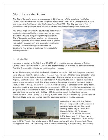
1. Introduction Lancaster is located at 36.368 N and 96.4630 W. It is at the southern border of Dallas County and sits directly east of DeSoto and approximately 20 minutes for downtown Dallas. Ten Mile Creek and its tributaries run throughout the area Abram Bledsoe bought half of the Roderick Rawlins survey in 1847 and five years later laid out a city plan near the community of Pleasant Run. He named his township Lancaster, after the name of his birthplace, Lancaster, Kentucky. Bledsoe brought with him his daughter, Virginia, a schoolteacher, who married Roderick A. Rawlins, the son of Roderick Rawlins, a settler in the area since 1845. The White family of Tennessee moved to Lancaster in late 1851, and R. P. Henry, a native of France, moved his family to Lancaster in the early 1860s. A carding machine was operated in the community in 1850. Dr. H. J. Moffett established his drugstore and practice there in 1851. In 1860 a post office was established in Lancaster and was later incorporated as a city in May 1887, becoming one of the first incorporated communities in Dallas County. R.P. Henry & Sons Bank that was robbed by Clyde Barrow of Bonnie & Clyde fame was located near the southeast corner of the town square. According to the 2010 U.S. Census Bureau, the population of Lancaster is approximately 36,361. The racial makeup of the city is 12.9% NonHispanic White, 68.7% African American, 0.4% Native American, 0.3% Asian, and 2.1% from two or more races. Hispanic or Latino of any race is 17%. The city has a total area of 30.3 square miles with all of it being land. There are approximately 13,622 housing units in the city consisting of single-family, multi-family
1
and other semi-permanent structure (i.e. mobile homes, manufactured housing, boats and RVs) units. The city of Lancaster operates under the Council-Manager form of government. CouncilManager governments function with the City Manager appointed by the Council. The Manager is responsible for the day-to-day management of City activities. The Council sets policy for the City, adopts the annual budget, appoints committee members, and addresses requests from the community. The City Manager then administers the ordinances and resolutions approved by the City Council. In addition, the City Manager is responsible for all personnel matters in the City and for preparing and submitting an annual budget for Council review. Lancaster has access to two railroad lines with an intermodal facility, and its own municipally-owned 5,000-foot runway airport. These resources enhance the opportunities to distribute products and services around the world. Lancaster also offers citywide Triple Freeport which is important in landing logistic developments (lancastertx.org). 2. Internal Planning Process: The table below lists members of the City of Lancaster Hazard Mitigation Planning Team (HMPT). These individuals collaborated to identify the city’s critical facilities, provide relevant plans, report on progress of mitigation actions and provide suggestion for mitigation actions for the City of Lancaster. Name
Title/Department or Agency
Marcus Knight Opal Mauldin-Robertson Aretha Adams Alicia Oyedele Ron Gleaves Scot Shepperd Laurel Maxwell Mark Davita Kellen Benbrook Dolle Downe Angie Arenas Rona Stringfellow
Mayor/ EMD City Manager/Administration Assistant City Manager/Administration Assistant to CM/PIO/ Administration I.T. Manager/ Information Tech I.T. for Public Safety/ Information Tech GIS Coordinator/ Information Tech Airport Manager/ Airport Airport Operations/ Airport City Secretary Assistant City Secretary Managing Director of Public Works, Development Svcs/ Development Services Assistant Director/ Building Inspections Building Official/ Building Inspections Senior Planner/ Planning Construction Inspector/Development Svcs (Assists with Annex for Animal Services and Code Compliance) Director of Economic Development Interim Finance Director/ Finance Accountant/ Finance Fire Chief. Emergency Management Assistant Fire Chief
Jim Brewer Larry King Sen Surupa Kim Pekofske Ed Brady Susan Cluse Tanangelia Beatty Thomas Griffith Pat Adamcik
2
Name
Title/Department or Agency
Dee Dee Hillary Jared Karr David Terry Kathie Eaton David Perez Rob Franklin Will Rhodes Andy Hail Dori Lee Amanda Pritchett Jerry McCulley Jimi Davis Sean Johnson
Medical Officer/ Day PIO/ Fire Department Emergency Management/ Training Officer/ Fire Department Fire Mashall Admin Secretary/ Fire Department Battalion Chief, A-Shift/ Fire Department Battalion Chief, B-Shift/ Fire Department Battalion Chief, C-Shift/ Fire Department Superintendent/ Fleet Services HR Director/ Human Resources HR Assistant/ Human Resources Library Manager/ Library Admin Asst Library Manager/ Library Admin Director of Park, recreation, Library, and Country Views Golf Course/ Parks and Recreation Admin Rec Superintendent/ Recreation Recreation Supervisor (Life Center)/ Lancaster Senior Center Park Superintendent/ Parks Police Chief/ Police Department Assistant Police Chief/ Police Department City Engineer/ Admin/Engineering Project Manager/ Admin/ Engineering Street/Stormwater Superintendent/ Streets/Stormwater Water Superintendent/ Water/Wastewater Water/Wastewater Foreman/ Water/ Wastewater Purchasing Agent/ Purchasing Chief of Police/ Lancaster ISD Nursing Supervisor/ Crescent Medical Center Lancaster Maintenance Director/ Crescent Medical Center Lancaster LISD Administration/ Lancaster ISD Assistant Police Chief/ Police Department
Kevin Moore Regina King Michael Rasco Larry Flatt Michael Smith Shwetha Pandurangi Dipak Patel Allen Carsner Andy Waits Daniel Paredez Dawn Berry Robert McIntyre Janice Miles Darrell Carlin Dr. Lamont Smith Samuel Urbanski
The Hazard Mitigation Planning Team (HMPT) met regular during the planning process data needs and to organize data collection. Meeting Dates 09/17/2013 10/01/2013
Summary of Discussions HMPT Training, Disperse required information and Data Collection Documents, Instructions for All Team members and assignments, Time line of assignments Assemble Data from team members, Review and address each issue Collect comments on Data, Assemble information for distribution Gather all data and comments, Develop and disseminate plan for review
10/22/2013
Set time line for completion, Clean up any areas of concern, Complete Document.
3
Public Involvement In April 2013, an online survey was distributed county-wide to solicit public input regarding the concern for risk to natural hazard events and suggestions for how the county could help minimize the risk. The City of Lancaster notified residents and businesses in the county about the opportunity to participate or provide input during the plan development through their City’s website, public notices in their utilities bill as well on the notice boards at City Hall and the Public Library. The notices directed the public to the online survey. The survey was made available in both English and Spanish. Copies of city’s outreach materials are included in Appendix Section. Survey Results The City of Lancaster made available a public survey that asked a wide range of questions concerning the opinions of the public regarding natural and man created hazards. The survey questions were developed and approved by the Dallas County Hazard Mitigation Working Group. The survey was linked to the Town’s website and public outreach program was implemented to solicit public input. A total of 7 survey responses were collected, the results of which are analyzed in this section. As has been stated earlier the purpose of the survey was to: 1) Solicit public input during the planning process, and 2) Help the city to identify any potential actions or problem areas. A summary of the survey results are depicted below showing the responses and the number of respondents for each answer. Detailed responses to the survey are provided in Appendix C-2 of this annex.
Survey Overview 1. Please select your jurisdiction from the list. You may only select one jurisdiction for each survey completed. If you belong to more than one jurisdiction in this list, please complete multiple surveys.
Total number of responses submitted from the citizens of the City of Lancaster - 7
4
2. Have you ever experienced or been impacted by a disaster?
3. How concerned are you about the possibility of your community or jurisdiction being impacted by a disaster?
5
4. The hazards addressed in the Dallas County Hazard Mitigation Action Plan are listed below. Please indicate your opinion on the likelihood for each hazard to impact your jurisdiction (identified above). Please rate each Hazard as follows. Unlikely Occasional Likely Highly Likely Unlikely
Occasional
Likely
Highly Likely
No Answer
Total
Average Rating
Earthquake
1
1
1
0
4
3
2.00
Tornado
0
1
0
2
4
3
3.33
Hail
0
0
1
2
4
3
3.67
High Winds
0
0
0
3
4
3
4.00
Winter Storms
0
0
2
1
4
3
3.33
Summer Hear
0
0
0
3
4
3
4.00
Drought
0
0
0
3
4
3
4.00
Flooding
1
0
0
2
4
3
3.00
Dam Failure
2
1
0
0
4
3
1.33
Stream Bank Erosion
2
0
1
0
4
3
1.67
Levee Failure
2
1
0
0
4
3
1.33
6
5. The hazards addressed in the Multi-Jurisdictional Hazard Mitigation Plan are listed below. Please indicate your opinion on the potential magnitude or impact of each hazard's impact on YOUR JURISDICTION (identified above). Please rate EACH hazard as follows. Limited Minor Major Substantial
Earthquake Tornado Hail High Winds Winter Storms Summer Hear Drought Flooding Dam Failure Stream Bank Erosion Levee Failure
Limited
Minor
Major
Substantial
No Answer
Total
2 0 0 0 0 0 0 0 2
1 0 0 1 2 1 0 1 1
0 1 2 2 1 1 2 2 0
0 2 1 0 0 1 1 0 0
4 4 4 4 4 4 4 4 4
3 3 3 3 3 3 3 3 3
2
0
1
0
4
3
2
0
1
0
4
3
6. Is there another hazard not listed above that you think is a wide-scale threat to your jurisdiction?
7
7. Below are broad mitigation strategies identified in the Dallas County Hazard Mitigation Action Plan (HazMAP) that are to address the hazards that affect Dallas County. In your opinion, please check which of these mitigation strategies do you believe could benefit your jurisdiction: Answer Choices
Responses
Improve on Land Use Program:
1
Flood Plain Management to include Localized Flood and Soil Erosion Reduction Projects (storm water management or localized flood control projects, and Cast in Place (CIP) Erosion Control):
1
Improve, adopt and enforce building codes:
2
Implement the Texas Individual Tornado Safe Room Rebate Program:
3
Expand and improve on programs such as the Community Emergency Response Teams (CERT) Training, Public Education and Public Awareness Programs:
2
Participate in the National Flood Insurance Program (NFIP) and Community Rating System (CRS) program:
2
Expanded use of CodeRED and other mass notification systems including outdoor warning siren system, and working better with the Nation Weather Service to monitor weather events:
3
Coordinate with Dam owners to conduct inundation studies of dams:
0
Water conservation strategies to include passing resolutions restricting water use for lawn and landscape irrigation; provide low follow devices to property owners:
3
Purchase and improve on the Weatherization Assistance Program (WAP):
3
Conduct an earthquake vulnerability study:
1
Purchase and install lightning prediction and protection devices such as lightning arrestors and lightning rods to protect communications and utility infrastructure:
3
Purchase and install temperature monitoring devices on the elevated roadways that are susceptible to icing:
3
Structural Retrofitting of Existing Buildings:
2
Total Respondents:
7
8
Public Review Period
9
3. Capability Assessment: The City of Lancaster identified current capabilities and mechanisms available for implementing hazard mitigation activities. The administrative and technical capacity section includes a summary of departments and their responsibilities associated with hazard mitigation planning as well as codes, ordinances, and plans already in place associated with hazard mitigation planning. Key Departments: The following is a summary of existing departments in the City and their responsibilities related to hazard mitigation planning and implementation, as well as existing planning documents and regulations related to mitigation efforts within the town. The members of the town’s Hazard Mitigation Planning Team as listed above identifies the staff, personnel, and department resources available to implement the actions identified in the mitigation section of the Plan. Fire Department/Emergency Management: The Lancaster Fire Department (LFD) provides several services to the community. These services include: Paramedic Service: LFD state-of-the-art paramedic service comprises approximately 80% of the services provided by the department Fire-Suppression Services: LFD has three fire stations located in strategic geographical areas to provide fast response anywhere in the city The Fire Department also provides specialized units. These units include: Hazardous-materials decontamination Swift-water rescue Mass-casualty situations The department also has cooperative agreements with surrounding cities in two counties in order to enhance and increase the department’s capabilities. Also the department conducts numerous school and public presentations each year to raise the public's awareness of fire and personal hazards. The Fire Chief also serves as the Emergency Management Coordinator. The EMC is responsible for coordinating activities of the City departments responsible for continued operations during disasters, coordinate agreements for the use of resources, communicate with State and Federal agencies, and provide education and training to citizens and municipal employees. Public Works: The Public Works Department is comprised of four divisions. These include: Stormwater: The City of Lancaster administers Storm Water Management Program (SWMP) in compliance with the Texas Pollutant Discharge Elimination System (TPDES) general permit. The City is actively participating in the Municipal Separate Storm Sewer Systems (MS4) program. The City of Lancaster's SWMP includes best management practices developed for each of the following six minimum control measure: o Public education and outreach on storm water impacts; o Public involvement/participation; o Illicit discharge detection and elimination; o Leaflet Construction site storm water runoff control; o Post-construction storm water management in new development and redevelopment o Pollution prevention/good housekeeping for municipal operations.
10
Streets: The Streets Division is responsible for Traffic lights and signs and street repairs Wastewater: The Wastewater Division is responsible for water main breaks, sewer stoppage, industrial pre- treatment and backflow prevention. Water: The Water Division is concerned with monitoring water quality and managing the water supply to the City.
Parks and Recreation: The Parks and Recreation Department provides the citizens of Lancaster with well-maintained, safe, and affordable recreational opportunities. The Department Responsibilities include: Parks and Recreation Department responsibilities include: Athletics Bear Creek Nature Park Building services Country View Golf Course Facility reservations Lancaster Recreation Center Median and Right of Way maintenance Park maintenance Recreation programming Senior Life Center The City of Lancaster features several neighborhood and community parks, a 64,000square-foot recreation center, the Bear Creek Nature Park, and an 11,000-square-foot Senior Life Center. The Lancaster Parks and Recreation Department offers a wide variety of recreational programs, classes, facilities, and special events that we are sure will meet your needs and interests. Human Resources: The Human Resources Department responsibilities are: Developing and managing procedures pertaining to civil service and personnel Developing and managing recruitment, training, risk management and policy development Maintaining positive employee relations Managing the city's compensation and benefit plans Managing and producing the city's employee payroll Monitoring policies and procedures to ensure compliance with federal and state regulations Police Department: The Lancaster Police Department protects the property and Constitutional Rights of all residents and visitors of Lancaster by providing professional law enforcement and public safety services. Development Services: The Development Services Administration Program is used to account for administrative and overhead costs incurred by the development services departments. These departments include: Animal Services - Animal Services is responsible for: o Capturing and housing animals found at large or abandoned o Enforcing city ordinances and state laws that pertain to the ownership, vaccination, housing, and care of animals within the city o Maintaining and promoting an adoption / rescue program
11
Building Permits and Inspections - The Building Inspection Division is established for the purpose of providing minimum standards to safeguard life, health, safety, property, and the public welfare by regulating and controlling the design, construction, quality of materials, occupancy, use, location, and maintenance of all buildings and structures constructed within the City of Lancaster. The primary activities of the Building Inspection Division are: o Certificate of Occupancy process o Inspections o Permit issuance o Plan review o Public consultation The Building Inspection Division also works closely with the Planning Division, Public Works Department, and the Fire Marshal's Office to enhance the city's overall ability to better serve the citizens of Lancaster. Additionally, the division maintains an active demolition program designed to mitigate the spread of blight through the elimination of substandard vacant structures. Code Compliance - Code Compliance works in partnership with the people of Lancaster to promote and maintain a safe and desirable living and working environment; to improve the quality of Lancaster's neighborhoods through education, enforcement, and abatement; and to respond to community concerns and attain code compliance while maintaining high professional standards and continually seeking improvements and innovations. Engineering - The Engineering Division's overall responsibility is the review, permitting, and inspection of all private development projects that are not initiated by the city to ensure compliance with all city standards, specifications, and requirements. These include: o Private improvements such as fire lanes, parking, landscaping, etc. that will be maintained by the property owner o Public infrastructure such as streets, water, sewer, and drainage that the city will maintain Other responsibilities of the division include: o Administering the city's infrastructure reimbursements o Flood plain management o Permitting and inspection of the franchised utilities o Review and inspection of trench-safety and erosion-control plans o Serving as the city's overall coordinator for the review and inspection of public works projects and the city's rights of way Planning - The Planning Division helps ensure that the community develops in a safe, efficient, and attractive manner and strives to achieve quality developments that enhance the quality of life for our citizens. The responsibilities of the division include: o Administration of the Comprehensive Plan, subdivision regulations, and the Development Code o Processing of all zoning, specific use permit, site plan, variance, and platting requests and recommending these requests to the Planning and Zoning Commission, Zoning Board of Adjustment, or City Council o Providing of zoning information to the general public, business owners, and developers Public Food and Health Safety
Economic Development: The purpose of the City of Lancaster’s Department of Economic Development is to create favorable site-selection or expansion decisions for new and existing business and industry through aggressive sales and marketing programs that are
12
designed to create a growing tax base for the community of Lancaster through new business development, existing business retention, and job creation and by ensuring a financially sustainable city government and enhancing the overall quality of life for the citizens of Lancaster. Economic development action plan: o Assist in the development and implementation of a seamless process associated with the city’s development procedures o Create and recommend to the City Council new policies and formulas for determining the feasibility and financial return from incentives associated with potential development projects in Lancaster o Create new collateral materials necessary to showcase all development opportunities in Lancaster o Develop action-oriented sales and marketing programs that create an interest in Lancaster by commercial, industrial, and retail operations o Develop and implement a program directed at manufacturers located in Asia that solicits their utilization of Lancaster as a destination point for the shipment of their products o Identify foreign sources of financial investment in Lancaster o Implement an aggressive sales-calling program on the commercial development and real estate brokerage communities o Implement programs that identify the growth and expansion needs of existing industries in Lancaster o Work with the board of the Lancaster Economic Development Corporation and respond to incentive requests made by projects that are considering locating in Lancaster Finance Department: The purpose of the Finance Department is to support the administrative activities of the city in an efficient and effective manner. These activities include accounting, accounts payable, accounts receivable, investments, capital projects, debt management, auditing, purchasing, utility administration, and administrative policies in all of the above areas. Additionally, the department advises the mayor and City Council in matters of administrative procedure, financial prudence, and long-term financial planning. Responsibilities for the department include: o Documenting revenues, expenditures, and accounts receivable and payable for accuracy and adherence to the approved budget o Handling Lancaster’s accounting, purchasing and accounts payable, and utility billing o Providing an accounting system that complies with generally accepted accounting principles o Reviewing contracts on an ongoing basis
13
Summary of Capabilities: The tables below identify the current capabilities in the City of Lancaster. Planning and Regulatory Does the plan Address hazards? Plans
Yes/No Year
Does the plan identify projects to include in the mitigation Strategy? Can the plan be used to implement mitigation actions?
Comprehensive/Master Plan
Yes 2013
Capital Improvements Plan
Yes 2012
The plan identifies hazards and mitigation strategy The Capital Improvements Plan addresses hazards and mitigations
Economic Development Plan Local Emergency Operations Plan
Yes 2012
Continuity of Operations Plan
Yes 2012
Transportation Plan
Yes 2006
Stormwater Management Plan
Yes 2007
Community Wildfire Protection Plan
No
Other special plans (e.g., brownfields redevelopment, disaster recovery, coastal zone management, climate change adaptation)
N/A
The local Emergency Operations Plan addresses mitigation strategy and hazards The Continuity of Operations Plan addresses hazards and mitigation The Transportation Plan addresses hazards and mitigation The Stormwater Management Plan addresses hazards and mitigation
14
Building Code, Permitting, and Inspections
Yes/No
Building Code
Yes
Version/Year: IBC 2012
Building Code Effectiveness Grading Schedule (BGEGS) Score
Yes
Score: ISO 4
Fire Department ISO rating
Yes
Rating: ISO 3
Site Plan review requirements
Yes
Zoning ordinance
Yes
Subdivision ordinance
Yes
Floodplain ordinance
Yes
Natural hazard specific ordinance (storm-water, steep slope, wildfire) Flood insurance rate maps
Yes
Is the ordinance an effective measure for reducing hazard impacts? Is the ordinance adequately administered and enforced? Ordinance adequately administered and enforced; measures reduction of hazards Ordinance adequately administered and enforced; measures reduction of hazards Ordinance adequately administered and enforced; measures reduction of hazards Need some expansion to include more
Yes
Needs updates
Land Use Planning and Ordinances
Yes/No
Acquisition of land for open space and public Yes Ordinance adequately administered and recreation uses enforced; measures reduction of hazards How can these capabilities be expanded and improved to reduce risk? Review with ordinances Meet with NTCOG Make and propose changes
15
Administrative and Technical Administration Planning Commission
Yes/No
Is coordination effective?
Yes
Mitigation Planning Committee
Yes
Maintenance programs to reduce risk (e.g., tree trimming , clearing drainage systems)
Yes
Mutual aid agreements
Yes
Staff
Describe capability
Yes/No FT/PT
Agreement; Law Enforcement Mutual Aid Agreement; Public Works Mutual Aid Is staffing adequate to enforce regulations? Is staff trained on hazards and mitigation?
Chief Building Official
Yes FT
Is coordination between agencies and staff effective? Larry King, Yes; Yes; Yes
Floodplain Administrator
Yes FT
Shwetha Padurangi, Yes; Yes; Yes
Emergency Manager
Yes PT
Thomas Griffith, Yes; Yes; Yes
Community Planner
Yes FT
Surupa Sen, Yes; Yes; Yes
Civil Engineer
Yes FT
Dipak Patel, Yes; Yes; Yes
GIS Coordinator
Yes FT
Laural Maxwell, Yes; Yes; Yes
Other Describe capability Technical Warning systems/services (Reverse 911, outdoor warning signals) Hazard data and information Grant writing Hazardous analysis Other
Yes/No
Yes Yes Yes
Has capability been used to assess/mitigate risk in the past? Code Red notifies residents at 20,000 per min.; 16 outdoor warning sirens/Code Red Weather/Yes Fire House/ Crimes/ NWSIWS/ NWSChat/ Web EOC/ VTC State/ Yes Assistance to Firefighters/ Safer/ COPS/ SHS/ UASI/ Yes
No N/A
How can these capabilities be expanded and improved to reduce risk?
16
Financial
Funding Resources
Capital Improvements project funding
Access/ Eligibility (Yes/No) Yes
Authority to levy taxes for specific purposes
Yes
Fees for water, sewer, gas or electric services
Yes
Impact fees for new development
Yes
Storm water utility fee
Yes
Incur debt through general obligation bonds and/or special tax bonds
Yes
Incur debt through private activities
No
Has the funding resource been used in past and for what type of activities? Could the resource be used to fund future mitigation actions? 1. Yes 2. Yes 1. Yes 2. Yes 1. Yes 2. Yes 1. Yes 2. Yes 1. Yes 2. Yes 1. Yes 2. Yes 1. No 2. No 1. Yes
Community Development Block Grant
Yes
2. Yes Dallas County
Other federal funding programs
Yes
1. Yes 2. Yes 1. Yes
State funding programs
Yes
2. Yes Aviation/Parks/ Wildlife
Other
N/A
How can these capabilities be expanded and improved to reduce risk? Capital Improvement items can be identified as a specific hazard mitigation item The Finance Department is a crucial component to managing the financial aspect of implementing mitigation actions.
17
Education and Outreach Describe program/organization and how relates to disaster resilience and mitigation. Program/Organization
Yes/No Could the program/organizations help implement future mitigation activities? CERT: The Best Southwest CERT is active with training and responses to disasters. The Comprehensive Plan Committee focuses on overall needs
Local citizen groups or non-profit organizations focused on environmental protection, emergency preparedness, access and functional needs populations, etc.
Yes
Ongoing public education or information program (e.g., responsible water use, fire safety, household preparedness, environmental education)
Yes
Dallas County Water Conservation Plan working group provides outreach to all cities in Metroplex to provide water conservation education
Natural disaster or safety related school programs
Yes
The Lancaster Public Safety Officers meet quarterly to cover safety-related school programs and school disaster response
StormReady certification
No
Firewise Communities certification
No
Public-private partnership initiatives addressing disaster-related issues
No
Other How can these capabilities be expanded and improved to reduce risk? The City of Lancaster can pursue StormReady and Firewise Certifications. Include a discussion on Hazard Mitigation in the CLP Increase awareness program to include Twitter/Facebook/ City Cable Access and City Website
18
Safe Growth Audit Comprehensive Plan
Yes
No
Land Use 1. Does the future land-use map clearly identify natural hazard areas?
2. Do the land-use policies discourage development or redevelopment within natural hazard areas?
3. Does the plan provide adequate space for expected future growth in areas located outside natural hazard areas?
Transportation 1. Does the transportation plan limit access to hazard areas?
2. Is transportation policy used to guide growth to safe locations?
3. Are movement systems designed to function under disaster conditions (e.g., evacuation)?
N/A
19
Comprehensive Plan (continued)
Yes
No
Environmental Management 1. Are environmental systems that protect development from hazards identified and mapped?
2. Do environmental policies maintain and restore protective ecosystems?
3. Do environmental policies provide incentives to development that is located outside protective ecosystems?
Public Safety 1. Are the goals and policies of the comprehensive plan related to those of the FEMA Local Hazard Mitigation Plan?
2. Is safety explicitly included in the plan’s growth and development policies?
3. Does the monitoring and implementation section of the plan cover safe growth objectives?
20
Zoning Ordinance 1. Does the zoning ordinance conform to the comprehensive plan in terms of discouraging development or redevelopment within natural hazard areas?
Yes
2. Does the ordinance contain natural hazard overlay zones that set conditions for land use within such zones?
3. Do rezoning procedures recognize natural hazard areas as limits on zoning changes that allow greater intensity or density of use?
4. Does the ordinance prohibit development within, or filling of, wetlands, floodways, and floodplains?
Subdivision Regulations
Yes
1. Do the subdivision regulations restrict the subdivision of land within or adjacent to natural hazard areas?
2. Do the regulations provide for conservation subdivisions or cluster subdivisions in order to conserve environmental resources?
3. Do the regulations allow density transfers where hazard areas exist?
No
No
21
Capital Improvement Program and Infrastructure Policies 1. Does the capital improvement program limit expenditures on projects that would encourage development in areas vulnerable to natural hazards?
2. Do infrastructure policies limit extension of existing facilities and services that would encourage development in areas vulnerable to natural hazards?
3. Does the capital improvement program provide funding for hazard mitigation projects identified in the FEMA Mitigation Plan?
Other 1. Do small area or corridor plans recognize the need to avoid or mitigation natural hazards?
2. Does the building code contain provisions to strengthen or elevate construction to withstand hazard forces?
3. Do economic development or redevelopment strategies include provisions for mitigation natural hazards?
4. Is there an adopted evacuation and shelter plan to deal with emergencies from natural hazards?
Yes
No
Yes
No
N/A
Questions adapted from Godschalk, David R. Practice Safe Growth Audits, Zoning Practice, Issue Number 10, October 2009, American Planning Association. http://www.planning.org/zoningpractice/open/pdf/oct09.pdf.
22
National Flood Insurance Program (NFIP) NFIP Topic
Source of Information
Comments
How many NFIP policies are in the community? What is the total premium and coverage?
State NFIP Coordinator or FEMA NFIP Specialist
FEMA
How many claims have been paid in the community? What is the total amount of paid claims? How many of the claims were for substantial damage?
FEMA NFIP or Insurance Specialist
HM GP Grant
How many structures are exposed to flood risk within the community?
Community Floodplain Administrator (FPA)
359
Describe any areas of flood risk with limited NFIP policy coverage
Community FPA and FEMA Insurance Specialist
See Flood Plain Map
Is the Community FPA or NFIP Coordinator certified?
Community FPA
Yes
Is floodplain management an auxiliary function?
Community FPA
Yes
Provide an explanation of NFIP administration services (e.g., permit review, GIS, education or outreach, inspections, engineering capability)
Community FPA
FP Permits; GIS Maps; Inspections; Public Outreach
What are the barriers to running an effective NFIP program in the community, if any?
Community FPA
Older structures, non-compliance, Lack of education
State NFIP Coordinator, FEMA NFIP Specialist, community records
Yes
Insurance Summary
Staff Resources
Compliance History Is the community in good standing with the NFIP? Are there any outstanding compliance issues (i.e., current violations)?
No
When was the most recent Community Assistance Visit (CAV) or Community Assistance Contact (CAC)?
April, 2012
Is a CAV or CAC scheduled or needed?
Yes/ No
23
NFIP Topic
Source of Information
Comments
When did the community enter the NFIP?
Community Status Book
1991
Are the FIRMs digital or paper?
Community FPA
Digital and Paper
Do floodplain development regulations meet or exceed FEMA or State minimum requirements? If so, in what ways?
Community FPA
Exceed
Provide an explanation of the permitting process.
Community FPA, State, FEMA NFIP
DRC to FP Permit/Site Plan Review. Then to inspection, to citizen, to reinspection, to approval
Regulation http://www.fema.gov/ national-flood-insuranceprogram/national-floodinsurance-programcommunity-status-book
Flood Insurance Manual
http://www.fema.gov/ floodinsurance-manual
Community FPA, FEMA CRS Coordinator, ISO representative CRS manual http://
www.fema.gov/library/ viewRecord.do?id=2434
Community Rating System (CRS) Does the community participate in CRS?
Community FPA, State, FEMA NFIP
No
What is the community’s CRS Class Ranking?
Flood Insurance Manual
N/A
http://www.fema.gov/ floodinsurance-manual
What categories and activities provide CRS points and how can the class be improved? Does the plan include CRS planning requirements
N/A
Community FPA, FEMA CRS Coordinator, ISO representative CRS manual http://
Yes
www.fema.gov/library/ viewRecord.do?id=2434
24
4. Hazard Assessment and Risk Assessment: As discussed in an earlier section of this Plan, each jurisdiction conducted its own Hazard Identification and Risk Analysis using the Dallas County HIRA template document. From the natural hazards identified flooding, dam failure, and wild-land fire as the only natural hazards recognized to have predictable vulnerable areas. These hazards are discussed in this section of the plan as it varies from each jurisdiction. A. Flooding: The City of Lancaster surrounded by open farmland, low rolling hills, creeks and woodlands. The Ten Mile Creek flows in an easterly direction through the south end of the City. There has been significant erosion of the stream banks in the area where Nokomis Road and Ten Mile Creek intersect. The creek was ten miles longer and flowed into the Trinity in Ellis County before it was diverted and channeled into the river at its present location. Where not diverted, the creek has a limestone bottom. Today, the creek flows through the corporate limits of Cedar Hill, Duncanville, De Soto, Lancaster, Wilmer, and Ferris. A 2007 Environmental Assessment Study conducted by the U.S. Army Corps of Engineers indicated that there was need for stream bank protection near Nokomis Road and bridge at Ten Mile Creek. It was determined that the prepackaged concrete riprap bag slope protection alternative would provide stream-bank protection against further erosion and protect the affected public bridge and road. Flooding has occurred along Ten Mile Creek. In 2008 localized flooding produced well above normal runoff and stream flows in the City of Lancaster. Emergency officials had to send out voluntary evacuation notices to 687 registered CodeRed phone numbers and closed about 16 streets in response to flooding. Homes located on Enchanted Lane experience flooding because of their proximity to Ten Mile Creek. City of Lancaster joined the Federal Emergency Management Program on June 7, 1974. The City began the Flood Insurance Rate Mapping (FIRM) effort September 1981. Storm water management policies are defined by storm water management ordinance 2004-07-21, adopted on July 26, 2004. The City’s policies for storm water management govern the planning, design, construction, operation, and maintenance of storm drainage facilities within the City’s jurisdiction. This storm water management policy is based on the Lancaster Storm Water Management Ordinance and Storm Water Design Manual. The current City Parks, Recreation and Open Space Master Plan provided direction in the acquisition and development of park land and open space needs. The Open Space Plan creates an open space system to link parks, schools, greenbelts and open spaces in the City. The City has also established criteria and standards to govern the use of natural streams and flood plains and to serve as guidelines for the development of man-made drainage facilities and improvement of natural channels. The drainage ways, creeks and flood hazard areas of the City of Lancaster are subject to periodic inundation which may result in property, health and safety hazards, disruption of commerce and governmental services and extraordinary public expenditures for flood protection and relief, all of which adversely affect the public health, safety and general welfare. Map COL.1 depicts the current FEMA flood zones for the City of Lancaster.
25
Map COL.1: FEMA Flood Zones for the City of Lancaster
26
B. Wildland Urban Interface (WUI): Texas is one of the fastest growing states in the Nation, with much of this growth occurring adjacent to metropolitan areas. This increase in population across the state will impact counties and communities that are located within the Wildland Urban Interface (WUI). The WUI is described as the area where structures and other human improvements meet and intermingle with undeveloped wildland or vegetative fuels. Population growth within the WUI substantially increases the risk from wildfire. In Texas nearly 85 percent of wildfires occur within two miles of a community. According to the Texas A&M Forest Service an estimated 43,666 people or 73 percent of the total population of the City of Lancaster live within the WUI. Map COL.2 depicts the WUI for the City of Lancaster. Map COL.2: WUI for the City of Lancaster, TX
A wildfire vulnerability assessment, using the Texas Wildfire Risk Assessment Tool (TxWRAP) developed by the Texas A&M Forest Service, revealed that the Wildfire Threat for the City of Lancaster ranges from Non-Burnable to Moderate.
27
Wildfire Threat is the likelihood of a wildfire occurring or burning into an area. Threat is derived by combining a number of landscape characteristics including surface fuels and canopy fuels, resultant fire behavior, historical fire occurrence, percentile weather derived from historical weather observations, and terrain conditions. These inputs are combined using analysis techniques based on established fire science. The measure of wildfire threat used in the Texas Wildfire Risk Assessment (TWRA) is called Wildland Fire Susceptibility Index, or WFSI. WFSI combines the probability of an acre igniting (Wildfire Ignition Density) and the expected final fire size based on rate of spread in four weather percentile categories. WFSI is defined as the likelihood of an acre burning. Since all areas in Texas have WFSI calculated consistently, it allows for comparison and ordination of areas across the entire state. For example, a high threat area in East Texas is equivalent to a high threat area in West Texas. To aid in the use of Wildfire Threat for planning activities, the output values are categorized into seven (7) classes. These are given general descriptions from Low to Very High threat. Map COL.3 below is derived at a 30 meter resolution. This scale of data was chosen to be consistent with the accuracy of the primary surface fuels dataset used in the assessment. While not appropriate for site specific analysis, it is appropriate for regional, county or local protection mitigation or prevention planning. C. Dam and Levee Failure: Neither dams nor levees currently exist within the City of Duncanville; therefore, the City is at no risk for either dam or levee failure.
28
Map COL.3: Wildfire Threat Map for the City of Lancaster, TX
5. Vulnerability Assessment: The table below provides a summary of Wildfire Vulnerable areas in the City of Lancaster. The Map COL.4 depicts the location of various City facilities. Category of Property
Valuation
Land Valuation
Total Valuation 1,723,370
Acres
Public
$ 539,470
$ 1,183,900
$
Commercial
$ 18,191,790
$ 111,138,880
$ 122,776,640
7660.4033
Residential
$ 35,735,670
$ 15,934,600
$
1577.7318
51,670,270
416.1794
29
Map COL.4: City of Lancaster Facilities
Source: City of Lancaster GIS
Land Use: The Future Land Use Plan for the City of Lancaster illustrates the desired pattern of growth for the foreseeable future. It is intended to guide public and private decision making for development and redevelopment in the City for the next several years. For purpose of this plan, the future Land use Plan assists in decision making in incorporating hazard mitigation planning activities s for the City. Map COL.5 depicts the future land use for the City of Lancaster.
30
Map COL.5: Future Land Use Map for the City of Lancaster
Source: The City of Lancaster Comprehensive Master Plan 2002
Zoning Districts: Zoning is a form of land use control permitted by both the federal and state governments. According to the Texas Local Government Code, there is a requirement that zoning be in conformance with the Comprehensive Plan. When a zoning change is requested, the first step in considering the change is to determine what the Future Land Use Plan indicates as the appropriate use of the property. If the use differs substantially, the request should be denied. To grant the requested change would require that the Future
31
Land Use Plan be amended before the zoning change could occur. This requires careful consideration to be sure that the change is in accordance with the principles, goals and objectives of the Future Land Use Element of the Comprehensive Plan. The use of the Future Land Use Plan in decision-making relating to zoning and subdivision approvals is to ensure that development and redevelopment are consistent with the City's Comprehensive Plan. Each new development or redevelopment should be reviewed for general compliance to the Comprehensive Plan. Map COL.6 depicts the Zoning Map for the City of Lancaster. Map COL.6: Zoning Map for the City of Lancaster
Source: City of Lancaster GIS
5. Mitigation Strategies: Based on the results of the risk and capability assessments, the Dallas County Hazard Mitigation Planning Team developed a mitigation strategy for the Plan Update utilizing the results of both assessments as well as reviewing the goals and objectives that were included in the 2009 HazMAP. These strategies were similar to the goals identified in Section 6 by the Dallas County Hazard Mitigation Action Plan Working Group.
32
Goal 1: Reduce or eliminate loss of life and property damage resulting from severe weather events.
Objective 1-A: Continue to enforce building codes and ordinances where applicable to ensure structures are more disaster resistant
Objective 1-B: Maintain existing codes and ordinances that require front end mitigation of hazards
Objective 1-C: Limit development in flood plain areas
Goal 2: Identify and implement hazard mitigation projects to reduce the impact of hazard events and disaster.
Objective 2-A: Identify areas where repetitive damages occur during chronic hazard events
Objective 2-B: Incorporate disaster resistant features in government facilities and infrastructure
Objective 2-C: Expand and coordinate Early Warning Systems currently in use.
Goal 3: Increase public support and understanding of hazard mitigation and disasters.
Objective 3-A: Provide public education materials to residents and private sector
Objective 3-B: Encourage private sector participation in future mitigation efforts
Objective 3-C: Encourage public participation in future mitigation efforts
Objective 3-D: Heighten public awareness for natural and man-made hazards
Goal 4: Reduce losses and repetitive damages for chronic hazard events while promoting insurance coverage for catastrophic hazards
Objective 4-A: Increase participation in the National Flood Insurance Program (NFIP) and Community Rating System (CRS)
Goal 5: Continue to build capacity for hazard mitigation in unincorporated areas of Dallas County
Objective 5-A: Continue partnerships within the Hazard Mitigation Planning Team and other partners to enhance mitigation planning efforts
Objective 5-B: Identify federal and state programs that provide financial assistance to help attract funds for mitigation projects and programs
33
Objective 5-C: Promote land use for public recreation
6. Action Items: Below is a list of the new actions items identified for the HazMAP Update. Each of the actions in this section were prioritized based on FEMA’s STAPLE+E criteria, which includes considering the social, technical, administrative, political, legal, economic and environmental factors necessary for the implementation of each action. As part of the STAPLE+E analysis economic considerations were weighed for each action. The action items that were said to be ongoing or deferred in the previous HazMAP were included as action items in the Updated Plan. The new actions items are as follows: 7. Plan Maintenance: The City of Lancaster Department Fire Rescue Department through the Emergency Management Division will be responsible for ensuring that this plan is monitored on an on-going basis. The Emergency Management Coordinator will call the Lancaster Hazard Mitigation Team (HMPT) together on an annual basis to review the mitigation actions set forth in this plan and discuss progress. During this meeting the HMPT will develop a list of items to be updated/added in future revisions of this plan. The Emergency Management Coordinator will report the outcomes of the HMPT to the Dallas County Office of Homeland Security and Emergency Management and when needed to the City’s Administration. Lancaster’s HMPT will also focus on evaluating the Plan in light of technological, budgetary, and political changes that may occur during the year or other significant events. Major disasters affecting the City of Lancaster or its communities, legal changes, and other events may trigger a meeting of the Hazard Mitigation Action Plan Working Team. This working group will be responsible for determining if the plan should be updated. The City of Lancaster is committed to reviewing and updating this plan annex at least once every five years, as required by the Disaster Mitigation Act of 2000. The City of Lancaster will be a strong advocate that jurisdictions within the Dallas County should continue to work together on updating this multi-jurisdictional plan. The public will continue to be involved whenever the plan is updated and as appropriate during the monitoring and evaluation process. Prior to adoption of updates, the City will provide the opportunity for the public to comment on the updates. A public notice will be published prior to the meeting to announce the comment period and meeting logistics. Moreover, the City of Lancaster will engage stakeholders in community emergency planning. Plan Incorporation: The City of Lancaster has several plans in place that address current mitigation activities. During the planning stage the Hazard Mitigation Planning Team will review protective mitigation measures that can be incorporated in to this annex of the Dallas County Hazard Mitigation Action Plan. The City’s Fire and Building Codes are reviewed by the City Building and Standards Commission and whatever is applicable to assisting mitigation activities will be noted and discussed during the annual HMPT meetings. Changes to the Dallas County Flood Plain Maps will also be noted and discussed at the annual meetings. Any changes to the City adopted floodplain management regulations as required for inclusion in the National Flood Insurance Program will also discussed and included in the next update of the plan. The Comprehensive Zoning Plan and Capital
34
Improvement Plan were important in developing this annex for the City of Lancaster and will continue to be key reference documents in carrying out updates. The Zoning Plan assisted with identifying subdivision, properties and citizens that maybe in an hazardous area. The Capital Improvement Project Plan is used to prioritize drainage projects for inclusion into the City's budget process. Each of these plans assisted and will continue to be used in future updates identifying goals and establishing mitigation items for the City of Lancaster. 8. Jurisdiction Appendix a. HIRA b. Supporting and Meeting Documentation c. Survey Results d. References
35
Appendix A-1: Hazard Identification and Risk Assessment (HIRA) Matrix Scale
Low/Unlikely Event probable next 10 years Average/Occasional Event possible next 5 yrs Medium/Moderate/Likely Event possible next 3 yrs High/Highly Likely Event Possible next year
Scale
1 2
Low
1
Medium/Moderate
2
High
3
Catastrophic
4
3 4
LANCASTER HAZARD IDENTIFICATION AND RISK ASSESSMENT (HIRA) HAZARD
PROBABILITY
FREQUENCY
SEVERITY
(P/F)*S=RF SEVERE STORMS TORNADO PANDEMIC/PUBLIC HEALTH EMERGENCY HAIL FLOODING EXTREME TEMPERATURES HAZARDOUS MATERIALS INCIDENTS; NUCLEAR/ RADIOLOGICAL INCIDENTS WINTER STORMS UTILITY FAILURE WILDFIRE ENERGY/FUEL SHORTAGE LIGHTNING TERRORIST ATTACK URBAN FIRE CHEMICAL/BIOLOGICAL/ NUCLEAR/RADIOLOGICAL/ EXPLOSIVE ATTACK (CBRNE) CIVIL DISORDER EARTHQUAKE LEVEE/DAM FAILURE DROUGHT AIRCRAFT ACCIDENT STREAM BANK EROSION
2013
RISK FACTOR
PEOPLE
PROPERTY
ENVIRONMENT
POTENTIAL TOTAL VULNERABILITY DAMAGE PEOPLE + PROPERTY + ENVIRONMENT =POTENTIAL DAMAGE RF/PD=V (PD) 1 3 1 5 80% 2 3 3 8 50%
4 4
4 4
4 4
4.00 4.00
1
1
4
4.00
3
1
3
7
57%
4 3 4
4 3 4
3 4 2
3.00 4.00 2.00
1 1 2
3 2 1
1 3 2
5 6 5
60% 66% 40%
4
4
3
3.00
2
2
1
5
60%
2 4 3 1 4 1 4
4 4 3 1 4 1 4
4 3 3 3 3 4 3
2.00 3.00 3.00 3.00 3.00 4.00 3.00
1 2 1 2 1 4 2
2 1 3 1 2 4 3
2 2 2 3 1 4 3
5 5 6 6 4 12 8
40% 60% 50% 50% 50% 33% 37%
1
1
4
4.00
4
4
4
12
33%
2 1 1 3 1 1
2 1 1 3 1 2
2 3 1 1 2 1
2.00 3.00 1.00 1.00 2.00 .500
2 3 1 1 3 1
2 4 2 1 3 1
2 3 3 1 3 1
6 10 6 3 9 3
33% 30% 16% 33% 22% 16%
36
Appendix B-1: Supporting and Meeting Documentation
37
Appendix C-2: City of Rowlett Survey Reponses 1. Please select your jurisdiction from the list. You may only select one jurisdiction for each survey completed. If you belong to more than one jurisdiction in this list, please complete multiple surveys.
City of Lancaster (7 responses)
1. Have you ever experienced or been impacted by a disaster?
If “Yes”, please indicate what hazard you have endured and where it occurred? 2012 Tornado Neighborhood hit by tornado; fence damaged. June 2004 – Apartment in DeSoto flooded when nearby creek overflowed its banks.
2. How concerned are you about the possibility of your community or jurisdiction being impacted by a disaster?
38
3. The hazards addressed in the Dallas County Hazard Mitigation Action Plan are listed below. Please indicate your opinion on the likelihood for each hazard to impact
Earthquake
Tornado
Hail
39
High Winds
Winter Storm
Summer Heat
40
Drought
Flooding
Dam Failure
41
ďƒź
Stream Bank Erosion
ďƒź
Levee Failure
5. The hazards addressed in the Multi-Jurisdictional Hazard Mitigation Plan are listed below. Please indicate your opinion on the potential magnitude or impact of each hazard's impact on YOUR JURISDICTION (identified above). Please rate EACH hazard as follows.
42
a. Earthquake
b. Tornado
c. Hail
43
d. High Winds
e. Winter Storms
f.
Summer Heat
44
g. Drought
h. Flooding
i.
Dam Failure
45
j.
Stream Bank Erosion
k. Levee Failure
6. Is there another hazard not listed above that you think is a wide-scale threat to your jurisdiction? Yes (0) No (3) Skipped (4)
46
If "Yes", please list the hazard(s) you think are a wide-scale threat that are not listed Terrorism Civil Unrest Power Outages West Nile Air Pollution
Bridges Breaking Chemical/ HazMat Climate Changes Epidemic/Pandemic Financial Crisis
Fraking Gas Pipeline Explosion Water Contamination Water Main Breaks
7. Below are broad mitigation strategies identified in the Dallas County Hazard Mitigation Action Plan (HazMAP) that are to address the hazards that affect Dallas County. In your opinion, please check which of these mitigation strategies do you believe could benefit your jurisdiction: Answer Choices
Responses
Improve on Land Use Program:
1
Flood Plain Management to include Localized Flood and Soil Erosion Reduction Projects (storm water management or localized flood control projects, and Cast in Place (CIP) Erosion Control):
1
Improve, adopt and enforce building codes:
2
Implement the Texas Individual Tornado Safe Room Rebate Program:
3
Expand and improve on programs such as the Community Emergency Response Teams (CERT) Training, Public Education and Public Awareness Programs:
2
Participate in the National Flood Insurance Program (NFIP) and Community Rating System (CRS) program:
2
Expanded use of CodeRED and other mass notification systems including outdoor warning siren system, and working better with the Nation Weather Service to monitor weather events:
3
Coordinate with Dam owners to conduct inundation studies of dams:
0
Water conservation strategies to include passing resolutions restricting water use for lawn and landscape irrigation; provide low follow devices to property owners:
3
Purchase and improve on the Weatherization Assistance Program (WAP):
3
Conduct an earthquake vulnerability study:
1
Purchase and install lightning prediction and protection devices such as lightning arrestors and lightning rods to protect communications and utility infrastructure:
3
Purchase and install temperature monitoring devices on the elevated roadways that are susceptible to icing:
3
Structural Retrofitting of Existing Buildings:
2
Total Respondents:
7
47
8. List any other strategies you think should be included in the plan: ďƒź None Given 9. Please comment on any other issues that the Dallas County Hazard Mitigation Planning Group should consider in developing a strategy to reduce future losses caused by hazard events: ďƒź
None Given
48