




GERRY WINSHIP
EXECUTIVE DIRECTOR
KENNETH MCCLAIN
KAREN DOWNE
CARLOS LEDEZMA
DEE PACK
ZACHARY WALKER
CITY MANAGER
ANN SMITH-TATE
ECONOMIC DEVELOPMENT MANAGER
THOMAS SCANNEL
COMMUNITY DEVELOPMENT DIRECTOR
KATHY ROBERTSON
GIS TECHNICIAN
Noland Road is a great place. It is a vital artery carrying the life blood that is Independence. Many of us have memories of the great road that was the hub of our community. High School, cruising, date night, work, business, shopping, and life. And like most memories, the details can get fuzzy. When I was allowed the opportunity to work on the Corridor Plan to revitalize Noland Road, I jumped at the chance to study in detail the road that meant so much to my experience and my life. And as the details became clearer, Noland Road surprised me.
We have been told for years that Noland Road is in decline. We have all seen the explosion of retail and development east along I-70, cannibalizing business on Noland Road. We have seen declining properties and heard anecdotes about troubles and vacancies. We have been told it is old, and worn, and in crisis.
Surprisingly, what we actually see is very low vacancy, continual reinvestment in key properties and infrastructure, and the continued redevelopment of old properties into updated service, shopping, dining, and employment opportunities. Opportunity exists throughout the corridor. As does slow and steady progress towards a better and more vibrant Noland Road.

To be sure, Noland Road needs a facelift. There are many dated properties, little to no aesthetics in the public realm, and minimal development standards to help affect change. These are critical issues that need to be addressed, or the specters of decay, blight, and irrelevance could take an eventual stranglehold on the corridor.
But, it remains a Great American Road. It is a vital corridor in need of change and support. Simply put, it needs continued updating, reinvestment, and care. This study provides a road map for just that. It has been my great and humble pleasure to be but a part of that journey, as a native of Independence, a graduate of Truman High School, a member of this community, and as a professional. Here’s to a reinvigorated Noland Road.
Ken Boone, Ochsner Hare & Hare
1.0
2.0 EXISTING CONDITIONS 12 - 59
|
5.25 SECONDARY GATEWAY NODE CONCEPT (40 HIGHWAY NODE) |
5.26 SOUTH OF 23RD STREET TO SOUTH OF GUDGELL AVENUE STREETSCAPE CONCEPT |
5.27 GUDGELL AVENUE TO 35TH STREET STREETSCAPE CONCEPT |
5.28 35TH STREET TO NORTH OF I-70 & SOUTH OF I-70 TO NORTH OF 40 HIGHWAY STREETSCAPE CONCEPT |
5.29 AESTHETICS & CHARACTER RECOMMENDATIONS | 5.30 PRIMARY GATEWAY ELEVATION & PERSPECTIVE |
5.31 SECONDARY GATEWAY CONCEPT AT 23RD STREET NODE | 5.32 TERTIARY GATEWAY CONCEPT AT 39TH STREET NODE |
5.33 ENHANCED TRANSIT STOP ALTERNATIVES | 5.34 PLANNED SENIOR LIVING COMMUNITY |
5.35 PEDESTRIAN ISLAND CONCEPT | 5.36 TENANT MONUMENTATION CONCEPTS | 5.37 “MIRACLE MILE” FENCING
6.0 IMPLEMENTATION 160 - 189
6.1 POLICY, REGULATION, & ADMINISTRATIVE ALIGNMENT IMPLEMENTATION MATRIX | 6.2 PROACTIVE PLAN ADVANCEMENT IMPLEMENTATION MATRIX | 6.3 ADDITIONAL PLANNING, DESIGN, & ENGINEERING DOCUMENTS IMPLEMENTATION MATRIX |
6.4 PRIORITY PROJECTS COMPLETION IMPLEMENTATION MATRIX


This plan is the culmination of a lengthy process to begin the work to reinvigorate and revitalize Noland Road in Independence, Missouri. The detailed history of that process can be found in Section 2.0 Existing Conditions, following. In summary, after several years of concerned property owners, civic leaders, the City, and residents searching for a way to improve the overall aesthetic and business conditions on Noland Road, a community improvement district (CID) was formed along Noland Road to provide a revenue source for reinvestment efforts. The CID Board then had this Revitalization Plan prepared to provide a coordinated and focused guide for the future revitalization efforts.

A detailed plan outlining a unified vision, goals, and implementation strategies is vital to encourage complementary and consistent future development within a corridor. Genuine participation and input was gathered through a community and stakeholder driven planning process. This plan serves those interests and the overall health of the corridor.
The purpose of this plan is to inventory the existing site and building conditions, gather public input, and analyze the current economic condition/market. Through this synthesis of factors, the Noland Road Revitalization Plan will outline recommendations for land use and zoning, vehicular and pedestrian traffic, alternative transportation options, and the character of the streetscape, building/site conditions, aesthetics, operations and functions, economic development, and redevelopment and infill.
The final plan will serve as a guide for future development initiatives.
This plan contains the following sections:
The Introduction serves as an overview of the Noland Road Revitalization Plan, providing the purpose, the organizational layout, the directing Vivion and Guiding Principles, and a charge to maintain and revisit the Plan.
This section details the formation of the CID, as well as the specifics of how collected funds may be allocated. Additionally, this section analyzes and synthesizes the current status of the corridor, as well as possible detriments to its future success. Specifically outlined are the physical conditions of the corridor including: occupancy, density, building and site conditions/character, streetscape conditions/character, vehicular traffic flows, alternative transportation availability, parks and trails, topography, and utility infrastructure.
The Market Analysis Summary focuses on the study of economic and demographic indicators, as well as an examination of the current retail, employment, and apartment’s competitive status and future potential. This section provides recommendations to strengthen potential economic growth opportunities.
This section acknowledges the integral role of stakeholder engagement in the planning process. An outline of stakeholder visioning workshop is provided. Importantly, seven key improvement priorities are identified and described. These priorities will guide the timeline of corridor improvements.
This section outlines the critical issues identified during the stakeholder engagement and analysis phases of the planning project, and subsequently, provides recommendations for addressing those issues. By also identifying the current areas of success and vitality within the corridor, recommendations focused on capitalizing on these areas are also provided. Several diagrams, maps, and concept plans are included to further illustrate the Plan and Recommendations.
As a vital phase in the project, the Implementation Plan identifies City policy and plan change recommendations, as well as short-, medium-, and long-term projects to ensure ongoing successes. City policy and plan alignment is key in the success of the Plan. Potential incentives for the implementation of projects are outlined as well.
The Walking Site Survey provides an in-depth, site-by-site analysis of the corridor. Each property was assessed to create a complete list of tenant spaces, vacancies, access points, building and site conditions, sign types, parking area sizes, and setback sizes. Basic details, such as land use, zoning, building and lot square footage, etc. are included for each property.
The Economic Analysis and Market Positioning Analysis provides the full report behind Section 3.0 Market Analysis Summary completed by Canyon Research Southwest, Inc. in September of 2015. It takes an important look into the economic and demographic indicators, provides an analysis of the competitive markets for retail, employment, and housing, and sets forth recommendations for the future growth, redevelopment, and revitalization of the corridor.
The Concept Alternatives provide further node-specific redevelopment and physical improvement opportunities throughout the corridor. Those alternative plans not initially selected by the CID Board of Directors are provided in this section. This section should be utilized throughout the lifetime of the CID as redevelopment opportunities arise.
Based upon the input gathered throughout the stakeholder engagement process, the planning team crafted a Vision for the Noland Road Corridor. A vision is an expression of future aspirations. When developing a plan of this nature, it is critical to identify such an expression so that it can be used to help direct the creation of the proposed recommendations that will define the plan. The vision for the Noland Road Revitalization Plan is stated below.
Achieving such a vision is a complex process that requires a multi-layered approach. To help guide this process, the following principles have been developed:
Define a new direction for Noland Road that ensures long-term economic sustainability for property owners, businesses, and the community.
Elevate market potential and encourage reinvestment in Noland Road by private property owners and businesses.
Create a welcoming, distinctive and cohesive environment by improving the streetscape, building architecture, site development and branding elements of the corridor.
Establish a complementary mix of uses that encourages and enables a “live, work, play” atmosphere.
Optimize circulation and traffic flow in order to create a more accessible and inviting corridor for all users.
Improve the quality of life for both the corridor and the surrounding community. Improve safety and perceptions of safety.
Create a new identity for Noland Road that leverages its unique history and celebrates the revitalization and reinvigoration of the corridor.
“THE REVITALIZATION OF NOLAND ROAD SHALL FOCUS ON CREATING AN INVITING AND VIBRANT ATMOSPHERE THAT REINVIGORATES BOTH THE BUSINESSES AND THE SURROUNDING COMMUNITY.”
While the Noland Road Revitalization Plan is a reflection of the existing conditions and property owners’ interest in the corridor at the time it was developed, the Plan will have important implications on future corridor growth, redevelopment, and revitalization. Because of this, the Plan should be reviewed from time to time. Reviewing the Plan should include an update to the economic and demographics indicators, as well as the analysis of competitive markets to determine the success of the Plan’s implementation strategies.
To ensure the Plan’s relevance and usability, it is important to revisit the recommendations and the context on which the recommendations were based. By revisiting the Plan periodically and modifying it if necessary, the overarching Vision will continue to be carried out, in light of changing (and improving) circumstances.


Before a corridor plan can be developed, it is first necessary to understand the existing conditions that make Noland Road what it is today. Section 2.0 Existing Conditions that follows was developed primarily via observations and photographs collected during a series of walking tours of the corridor in August and September of 2015. All relevant notes and photography taken in the field are compiled and documented in Appendix A: Walking Site Survey
In addition to the tours, the planning team used the following data resources:
• Relevant GIS data (provided by the City and the County)
• Google Earth Pro and Google Maps
• “Noland Road Corridor Concept Plan”, a document authored by the City of Independence in 2011

• The City’s Unified Development Ordinance (UDO)
• Interviews with the City of Independence Water and Water Pollution Control Departments, Missouri Gas Energy, Independence Power and Light, and AT&T
• City of Independence website (www.independencemo.org/)
• Crash data (provided by the City)
• Peak hour volumes and current signal timings obtained from MARC’s Operation Green Light program
The collected data was then used to create a series of maps, spreadsheets, and image boards to help the planning team understand the corridor study area in its proper context. Though accuracy and objectivity were stressed throughout the process, it is important to note that this documents serves as a “snapshot in time.” For a corridor of this size, the turnover of tenants and the redevelopment of properties is constant. In the four years since the City produced the Noland Road Corridor Concept Plan, a number of key properties have been successfully redeveloped in a way that has had a very real and positive effect on the corridor. It is important to track these improvements and understand how they are impacting the corridor as a whole. To this end, it will be worthwhile to revisit this document every five or ten years, updating it along the way.
Noland Road is a 6 mile long major arterial corridor running north and south in Independence, Missouri, from 40 Highway on the south to 24 Highway in the north. This study does not incorporate the northern end of the corridor and stops at Truman Road.
Noland Road has been a major north/south commercial arterial corridor in Independence since the 1960s, when the I-70 interchange was built. For decades this corridor served as the community’s “Main Street,” providing the access to basic retail services such as groceries, gasoline stations, pharmacies, restaurants, and other communityserving retail and commercial services. In addition to being the retail center for the community, the corridor also developed as one of the metropolitan’s premier locations to purchase a new automobile. With many of the national auto dealers represented on Noland Road, the corridor was branded as “The Miracle Mile.”
Over time, development patterns changed and the auto-oriented commercial strips that defined the corridor became less desirable to potential retailers and developers. As power centers and lifestyle centers become the norm, the focus of these uses has moved from Noland Road to the I-70/Highway 291 interchange.
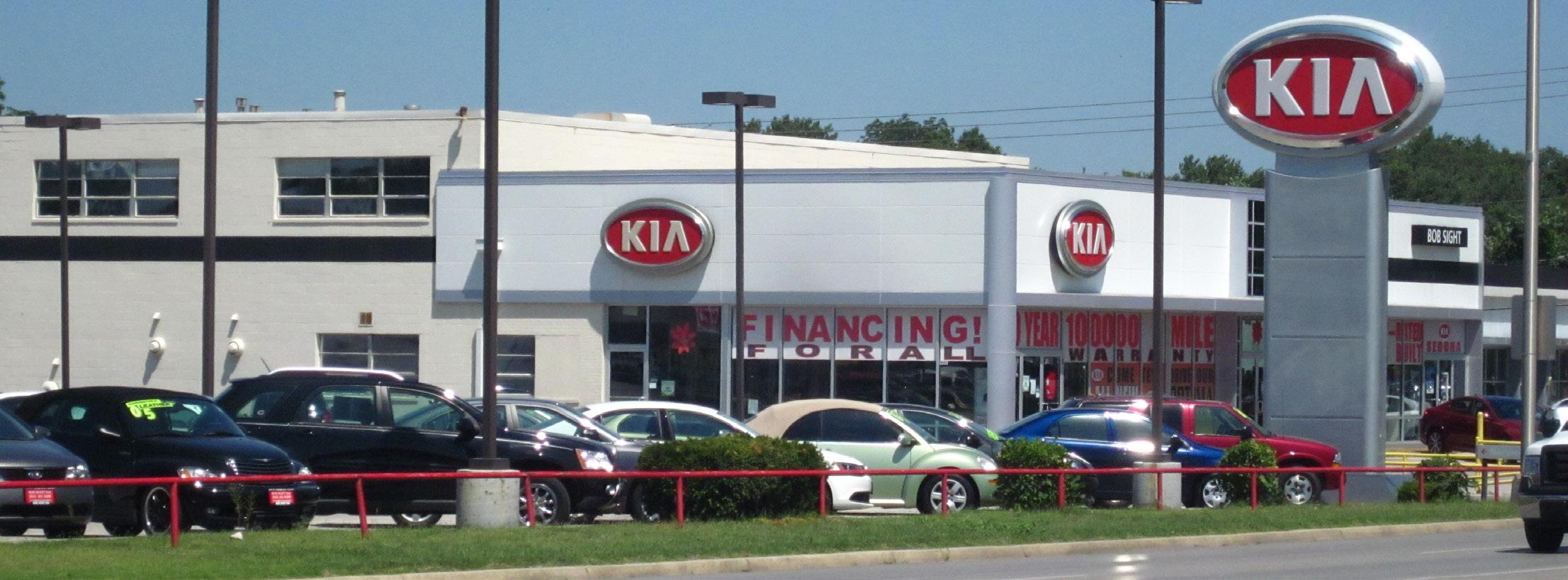
Today, Noland Road still offers local residents the day-today retail necessities, a few thriving destinations, as well as the continued strong performance by the Miracle Mile auto dealers. It also has experienced a decline in the major national tenants that are required for a destination retail corridor to thrive. The commercial strips that define Noland Road act as separate entities that have no connection to adjacent development or the surrounding neighborhoods. Pedestrian activity is practically nonexistent due to limited sidewalk connections, excessive vehicular access points, and the dated aesthetics of Noland Road. Aesthetically, the corridor suffers from a prevalence of pole signs, an absence of cohesive streetscape elements, outdated architecture and site development standards, and an overall lack of identity or sense of place.
Recently, redevelopment efforts have taken place throughout the corridor, demonstrating that the time to reshape the corridor is now. For example, business investment and new construction activity has spiked in the last five years. Since 2010, $22.6 million in new commercial projects has been permitted for construction. Observing this new investment, a growing number of national retailers, including CVS Pharmacy, Walmart Neighborhood Market, Napa Auto Parts, Taco Bell, Walgreens, and Jimmy John’s, have located along the corridor. These recent successes illustrate the need for a coordinated, consistent, and focused plan for revitalization of the overall corridor.
Past efforts to improve the corridor are still in existence. In 1996 the Independence Chamber of Commerce enlisted an architecture and engineering firm to create a corridor improvement and streetscape plan. Many physical infrastructure and streetscape improvements were recommended including: curbs, lighting, gutter, and traffic signals, as well as shrubbery, street trees, and new turf areas. Light poles, street furniture, and landscaped gateways were also recommended. In 1999 a special taxing district was created—the Noland Road Neighborhood Improvement District (NID)— which assessed property and business owners along the corridor. Ultimately, the property and business owners decided to invest only in the public infrastructure improvements. This NID is in place for 20 years.
In 2011, the Noland Road Corridor Concept Plan was created by Jennifer Clark, Community Development Department Director, and Ann Smith-Tate, Economic Development Manager, both employed by the City of Independence. The introduction to the plan states:
Noland Road Corridor Concept Plan seeks to re-imagine and reposition Noland Road as a series of diversified yet interconnected districts that will continue to provide economic stability to the central portions of Independence. The purpose of this concept plan is to provide the framework needed to restructure Noland Road into an area which property owners, developers, and the community will once again invest.
This plan and its framework was the result of the unified business and property owners’ desire to improve the physical condition and economic vitality of the corridor. Existing conditions were outlined and concepts and opportunities were proposed to improve the economic and physical conditions of the corridor. The Noland Road Oversight Committee reviewed public comments, researched updated redevelopment principles, and the current uses along Noland Road.
Through this process, the Committee set six goals focused on creating: (1) a sense of place, (2) a quality live and work area, (3) economic and residential synergy, (4) optimal traffic flows with a focus on multi-model transportation options, (5) residential connectivity, and (6) a business environment that encourages reinvestment and redevelopment.
To ease implementation, the Concept Plan divided the corridor into five distinct districts:
1. Lakeside District
2. Auto District
3. Central Business District
4. Gateway District
5. 40 Highway District
Generally, the Plan’s recommendations focused on increasing connectivity site-to-site and to residential areas, walkability, mixed-use development, increased economic viability through redevelopment opportunities, and aesthetically-pleasing streetscape, landscape, façade, and sign improvements. New businesses are opening and redevelopment is taking place, specifically at prime locations, where traffic counts and visibility is high. The desire to continue this complete and vibrant commercial and retail destination transformation remains to this day.
As a way to encourage and incentivize redevelopment throughout the corridor, a Community Improvement District (CID) was recommended by the planning team and ultimately established and led by property owners. This planning tool encourages coordinated improvements and provides a funding source for these improvements.
This property owner driven initiative is purely property owner-controlled. While the City of Independence is an active supporter of the CID and continues to provide its constant level of improvements and maintenance to the roadway, it does not have the final say over the CID-funded actions and enhancements to the corridor.
The CID is funded via a self-levied sales tax of ¾ cent on goods and services sold by properties within the CID’s boundary. Property owners do not pay any additional real estate taxes because of the CID. Once collected, this sales tax is only allocated to projects and improvements within the CID’s boundary. Property owners were asked to vote yes for the CID by both signing a petition for its approval and voting yes on a ballot to approve the sales tax; the CID was approved. The CID is estimated to generate over $50 million in reinvestment in the Noland Road corridor.
Importantly, the CID is a legal entity, created to collect the sales tax proceeds. The appointed CID Board of Directors distributes the funds for corridor improvements, projects, studies, redevelopment assistance, and overall enhancements.
Enhancements throughout the corridor will be apparent through both capital improvements and the operations and maintenance of these improvements. Capital improvements may consist of physical built public improvements within the corridor, which may include:
• a significant and welcoming gateway feature at the I-70 interchange,
• secondary gateways at 23rd Street and 40 Highway,
• tertiary gateways at key nodes along the corridor,
• streetscape improvements,
• wayfinding and branding improvements,
• pedestrian, bicycle, and transit improvements, and
• access management and intersection improvements
Also included in capital improvements are the operating costs, legal fees, study and design fees, and other administration costs, as well as the maintenance of the proposed improvements.
Secondly, incentive dollars will be used to encourage private investment of private property in the corridor. Property owners will have these funds available in order to development and/or redevelop properties in the corridor deemed “blighted” by appropriate state law. Typically allocated based on need, size of project, and overall impact on the corridor, the redevelopment assistance funds will be leveraged at a ratio of 3:1 or 4:1 development cost to assistance. Possible improvements include:
• site development and redevelopment,
• façade improvements,
• utility infrastructure,
• landscape improvements,
• sign/monumentation enhancements, and
• other site upgrades that contribute to the quality of the built environment
Many benefits arise from this innovative funding source. As redevelopment assistance funds have not been previously allocated, they are to be used on an as-proposed or as-needed basis. It is important to note that the CID does not restrict or limit the use of other redevelopment tools, such as TIF, 353, TDD, etc. In fact, “layering” these redevelopment tools presents a powerful toolbox for incentivizing redevelopment. On the other hand, capital improvements will improve the corridor’s aesthetics through tangible, built elements, which will allow the corridor to strengthen its competitive market advantage.
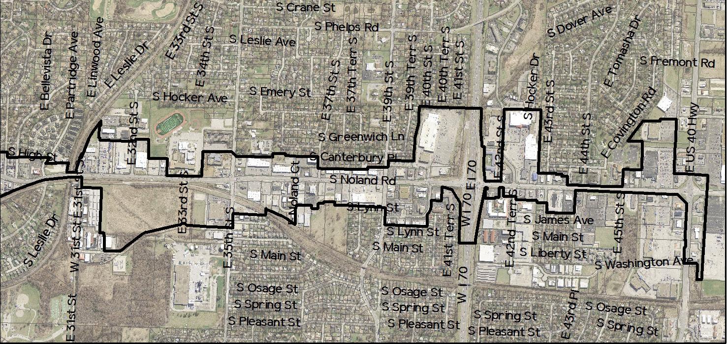
The boundaries for the Noland Road Corridor Plan, as identified in Figure 2.1: Plan Boundary, mirror the boundaries of the Noland Road Community Improvement District (Noland Road CID) established in 2015.
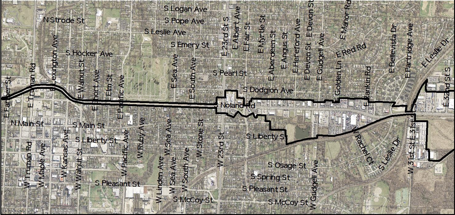
To the north, the corridor extends just beyond Farmer Street. From there, it travels south along Noland Road to just north of 23rd Street. This northern portion of the corridor consists only of Noland Road’s public right-of-way.

At 23rd Street, the corridor expands to the east and west to include the properties lining Noland Road. Though the majority of the properties within the corridor directly abut Noland, there are numerous properties to the east and west that have been included within the plan boundaries because their proximity and dependence on Noland as a major arterial route.
To the south, the corridor extends to the properties abutting the south side of 40 Highway. Due to the complexities of establishing the Noland Road CID, the southern portion of the corridor does not include Noland South or Noland Fashion Square. Truman High School, as well as all residential properties have also been excluded from the corridor.
Though Noland Road is quite obviously a commercial corridor, there are actually many types of uses on display. Understanding the differences between these types is an important aspect of analyzing the corridor. For the purposes of this document, land uses have been divided into the following 14 categories:
Commercial-Auto Sales (12.3%) – Refers to auto dealerships and vehicle rental companies that store vehicles on site.
Commercial-Auto (11.3%) – Refers to all other auto-related uses, including gas stations, auto retail, and auto service.
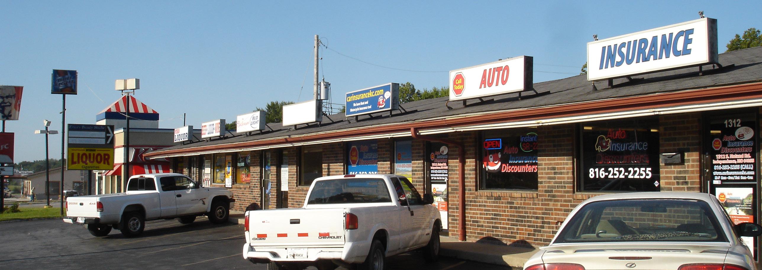
Commercial-Food (12.8%) – Refers to foodservice uses, including restaurants, bar and grills, and cafes.
Commercial-Service (2.6%) – Refers to service-related commercial such as hair salons, dry cleaners, computer repair, etc.
Commercial-Lending Institutions (5.7%) – Refers to banks, as well as payday/cash advance/car title loan establishments.
Commercial-Retail (9.2%) – Refers to single- or two-tenant retail uses.
Commercial-Retail Center (1.5%) – Refers to larger, multitenant retail developments that typically have one or more anchors.
Commercial-Strip Center (7.7%) – Refers to multi-tenant retail uses that typically face a major arterial and offer parking in front.
Commercial-Office (3.6%) – Refers to office or professional service-related uses such as attorney’s offices that are mixed in the same building or development with commercial uses such as commercial-retail or commercialservice.
Office (7.2%) – Refers to office-specific uses, including medical offices.
Institutional/Government (1.0%) – Refers to all governmentrelated uses.
Light Industrial (4.6%) – Refers to all warehouse, manufacturing, and light industrial uses. Undeveloped (15.9%) – Refers to land that has not been developed to date, or has been demolished in anticipation of future redevelopment.
Vacant (4.6%) – Refers to all land that has building structures that are not currently in use.
The percentages next to each use represents its percentage of use within the corridor. This figure is calculated by dividing the total lots with a particular use by the total lots for the corridor. There are a number of ways in which land use percentage can be calculated. This approach does not take square footage or leasable space into account. Instead, it treats all lots equally.
Upon reviewing these percentages and examining Figure 2.3: Existing Land Use, it becomes clear that retail- and service-related commercial uses dominate the Noland Road Corridor. Additional land use observations include the following:
• Though the percentage of vacancy is reasonably low, the undeveloped percentage (15.9%) is quite high for a corridor of this age and size. The complexities of having a railway run alongside and even through the corridor is likely a contributing factor for much of the undeveloped land that exists.
• Auto-related uses account for nearly a quarter of the uses within the entire corridor. Their largest concentration of this use occurs from Gudgell Avenue to Rankin Road.
• Office uses, excluding medically-related offices, are very limited within the corridor.
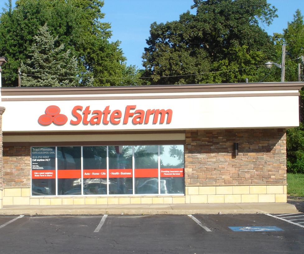

• There are no parks or meaningful open spaces within the corridor boundaries.
• The corridor itself does not include any residential uses, but it is surrounded by residential neighborhoods in all directions.
• Industrial uses are limited to a small pocket of light industrial to the west of Noland Rd, between 31st Street and Noland Court.

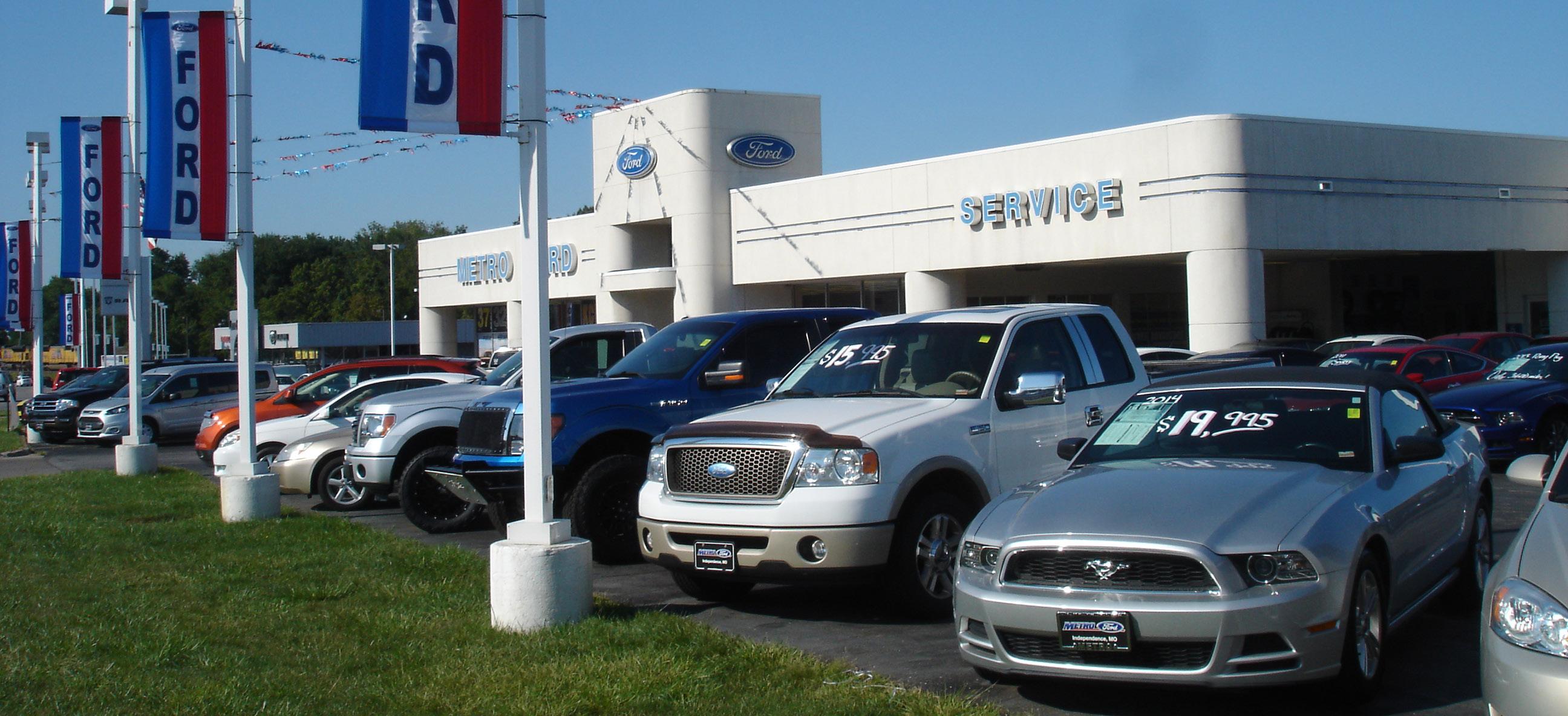

The series of automotive dealerships along both sides of Noland Road have created a strong legacy and reputation, and keep Noland Road relevant and a major destination draw. While some dealerships have changed over time, the core domestic dealerships, with local ownerships that built the “Miracle Mile,” have remained and grown stronger. They continue to cement Noland Road as a retail automotive destination. Reinvestment in modern updates to the existing major dealerships has continued. These visible changes continue to elevate the quality and stature of the corridor.
The dealerships remain a critical part of the success of Noland Road. In order to maintain its regional draw, highly visible site, building, and streetscape improvements are encouraged throughout the auto district.
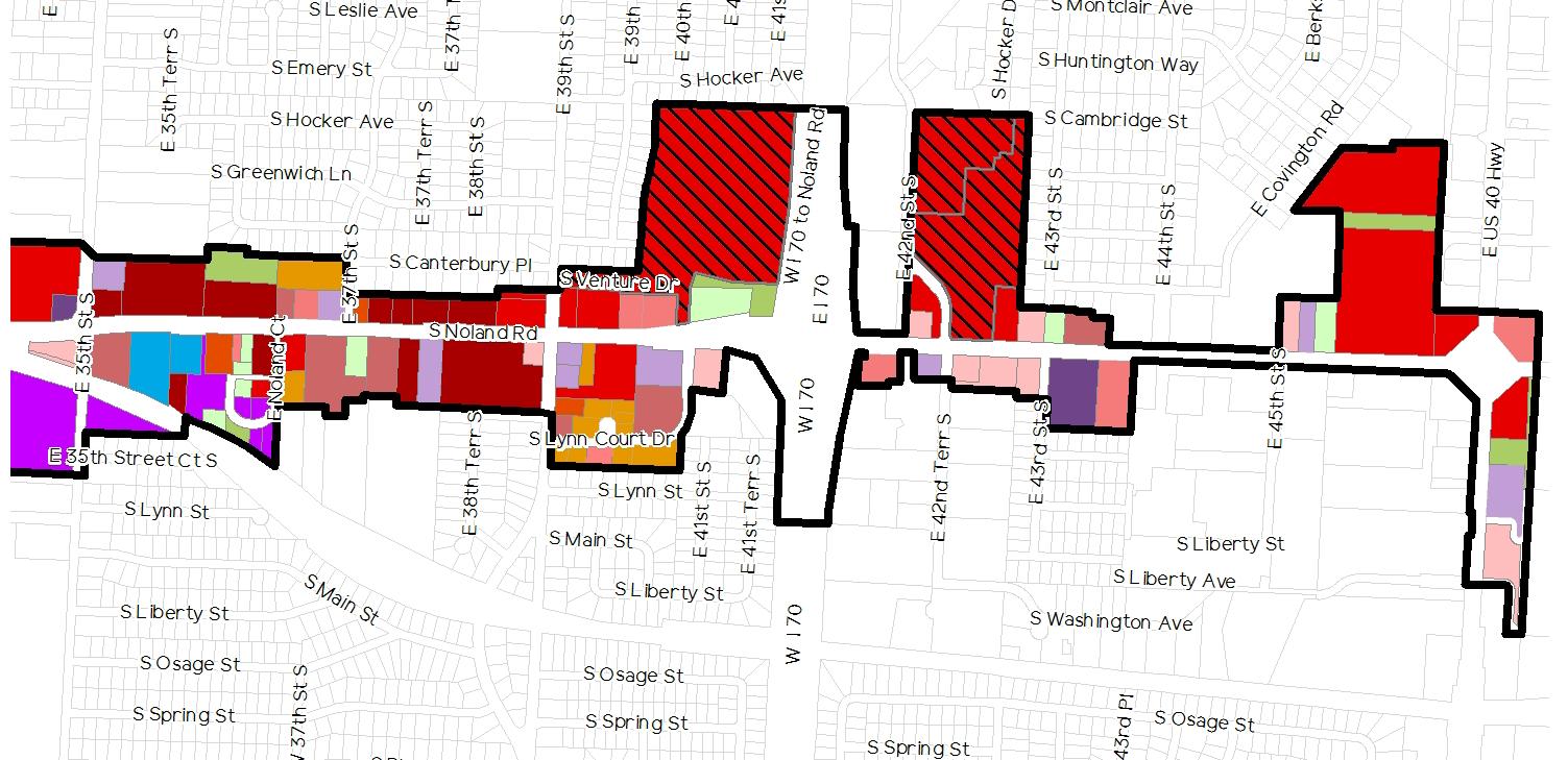
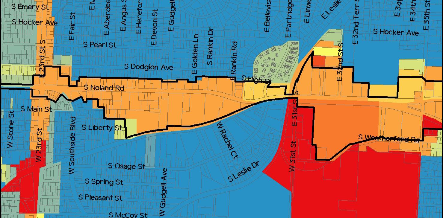
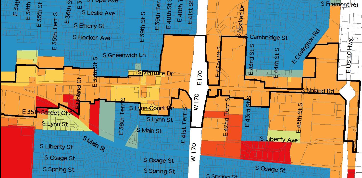
The City of Independence adopted the Existing Zoning, depicted in Figure 2.4, on June 15, 2009. The map projects and regulates future development in a manner that aims to protect the health, safety, prosperity and general welfare of the community. Zoning within the Noland Road Corridor includes the following districts:
R-6 (Single Family Residential) – Residential district that is primarily intended to accommodate single family dwellings at a maximum density of 12 units per acre.
R-12 (Two Family Residential) – Residential district that is primarily intended to accommodate single and two family dwellings at a maximum density of 12 dwelling units per acre.
R-18 PUD (Moderate Density Residential Planned Unit Development) – Residential PUD district that is intended to accommodate a maximum density of 18 dwelling units per acre.
R-30 PUD (High Density Residential Planned Unit Development) – Residential PUD district that is intended to accommodate a maximum density of 30 dwelling units per acre.
O-1 (Office Residential) – Office/residential district that is primarily intended to accommodate low-intensity office uses and buildings containing a mix of office and residential uses.
C-1 (Neighborhood Commercial) – Commercial district that is primarily intended to accommodate neighborhoodserving retail sales and service uses, as well as vertical mixed-use buildings with retail sales and service uses on the ground floor and residential uses on upper floors.
C-2 (General Commercial) – Commercial district that is primarily intended to accommodate community- and region-serving retail sales and service uses.
C-3 (Service Commercial) – Commercial district that is primarily intended to accommodate “heavier” commercial activities and limited warehousing and manufacturing operations that are typically not found in or compatible with mixed-use or neighborhood-oriented environments.
I-1 (Industrial) – Industrial district that is primarily intended to accommodate low- and moderate-impact service industrial uses.
HL (Historic Landmark) – Intended to identify properties designated as historic landmarks.
The north end of the corridor, which starts at Farmer and extends south to 23rd Street, is surrounded by large swaths of residential, commercial, and industrial zoning. The C-2 (General Commercial) district is located to the west of Noland Road and is the home to Independence City Hall and Independence Square. The I-1 (Industrial) district is positioned along the east side of Noland Road. To the south of both these districts, the corridor is encompassed by a mix of residential districts, including R-6 to the west and R-12 to the east. Smaller areas of R-18 PUD and R-30 PUD are also sprinkled into this area, along with O-1 (Office Residential) and C-1 (Neighborhood Commercial).
23rd Street is zoned C-2 at all four corners and extending to the east and west of the corridor. Panning south of 23rd Street, the properties within the corridor boundaries are zoned almost exclusively for commercial uses. C-2 is the predominate zoning district, but C-1 also shows up quite often. The major differences between these two districts are as follows:
• While C-1 is mostly geared toward neighborhood-level retail services, while C-2 is intended to accommodate a more high-impact retail use that serves the community and potentially the region.
• C-1 has more flexibility in regards to residential uses, allowing for the mixing of retail, service, and residential uses within a building.
Extending out beyond the corridor, the surrounding areas from just south of 23rd Street to just north of 31st Street are mostly zoned R-6. At 31st Street, the western half of the corridor in bordered by a sizable I-1 district that extends down to 35th Street. South of 35 Street, the area goes back to being residentially zoned.
From I-70 to 40 Highway, the corridor is bordered heavily by a C-2 district that matches the zoning of the corridor in this area. R-6 residential is also still quite prevalent at this southern end, running adjacent to the commercial and extending east and west.
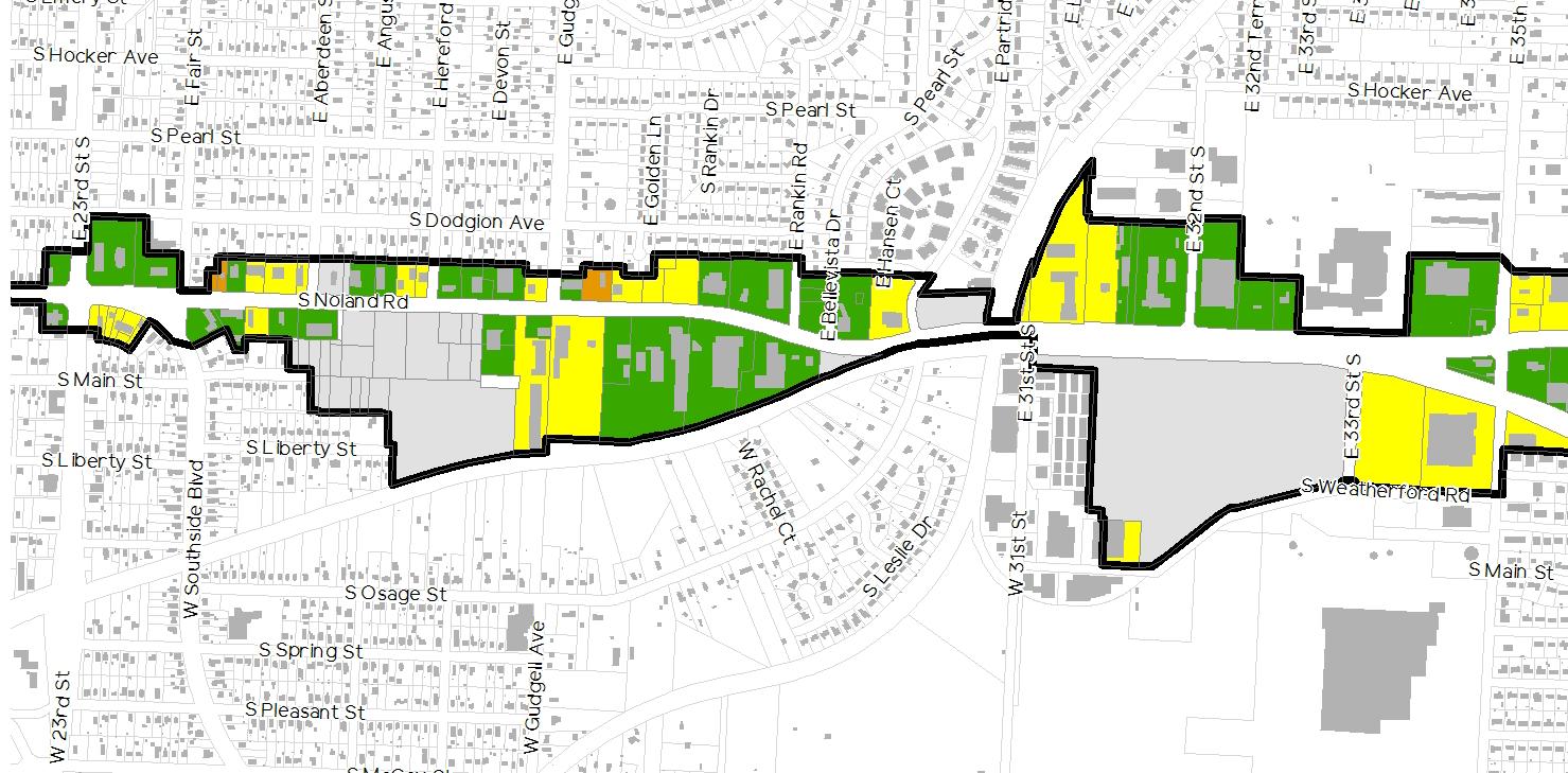
A review of the collected data, as summarized in Figure
2.5: Existing Occupancy Rates, suggests that the developed properties within the corridor are generally experiencing high occupancy. In fact, only 9 percent of the properties within the corridor have an occupancy rate below 75 percent and only 5 percent are deemed to be wholly vacant. Occupancy rates were determined via visual surveys.

Though the majority of the properties within the corridor are easy to observe, office buildings can prove more difficult in determining occupancy. When reviewing office uses, building were presumed to be fully occupied unless there was evidence to the contrary.
Despite any shortcoming detailed in this document, high occupancy is a clear indicator of the potential that the Noland Road Corridor possesses for future growth and revitalization.
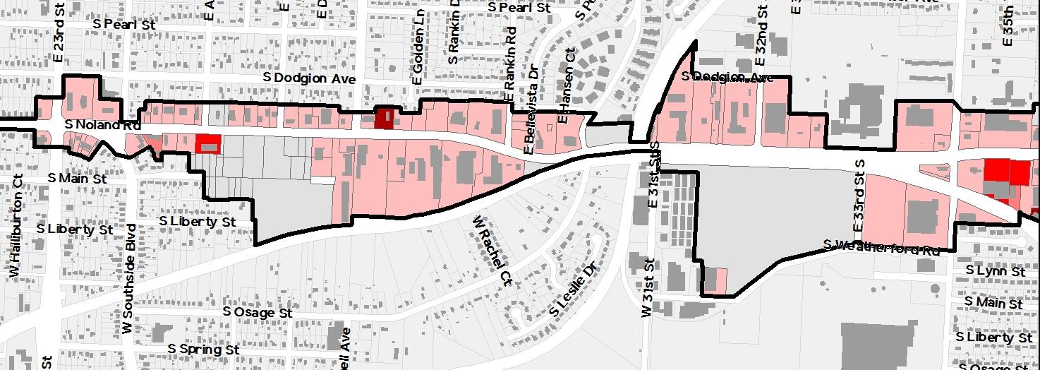
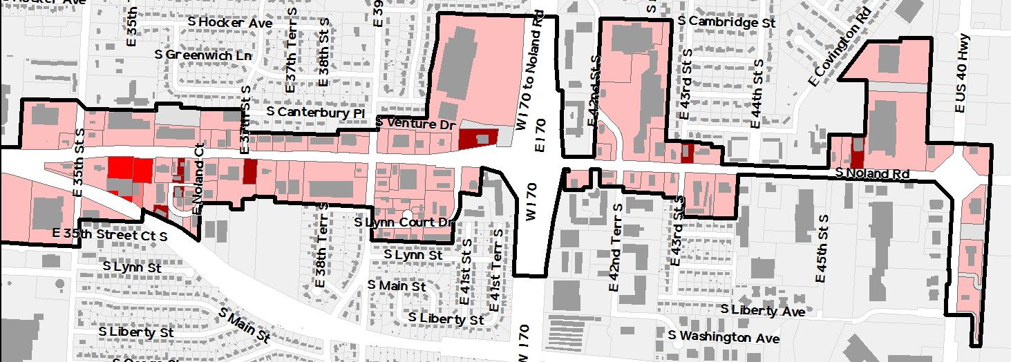
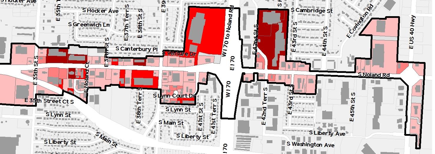
Density can be measured in a number of ways, but for the sake of this corridor and this document, it is most relevant when applied in a manner that articulates how buildings are being used. Of the 161 developed properties, 77.0 percent of them include a building occupied or intended to be occupied by a single tenant. The full breakdown, as depicted in Figure 2.6: Existing Density is as follows:
• 77.0% occupied by a single tenant
• 10.6% occupied by two (2) tenants
• 8.1% occupied by three (3) to six (6) tenants
• 4.3% occupied by seven (7) or more tenants
Of these same properties, an overwhelming 90.1 percent have been developed with a single-story building while just 9.9 percent incorporate a multi-story building. Those buildings that are multi-story are typically limited to two or three floors.
These two sets of data paint a very clear picture of the corridor and the building types that help define it. Singletenant, single-story uses rule the Noland Road Corridor. Combined with other factors identified in Subsections 2.7: Building/Site Conditions & Character and 2.8: Streetscape Conditions & Character, they establish a particular visual aesthetic that is often monotonous and spread out
Seven or More Tenants
Single Tenant Two Tenants
Three to Six Tenants
As part of the site surveys that were conducted, the planning team rated the condition of each developed property. These ratings were broken down into two categories:
1. Building Condition
2. Site Condition
A score was given for each category, based on a predetermined grading scale. The scale for both categories ranged from 1 (best) to 4 (worst).
Building conditions were identified by evaluating each building and determining where it best fit within the following scale:
1 (Good) Building is in good condition with no significant exterior deficiencies.
2 (Fair) Building is in fair or sound condition, but has minor deficiencies that could be resolved with limited investment by the owner. Deficiencies may include chipped paint, damaged exterior walls, cracked or broken windows, minor roof damage, and nonfunctioning façade lighting and signage.


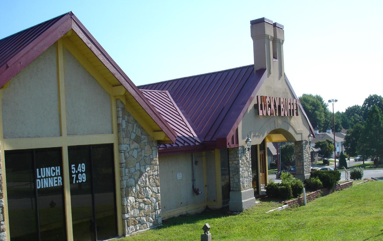
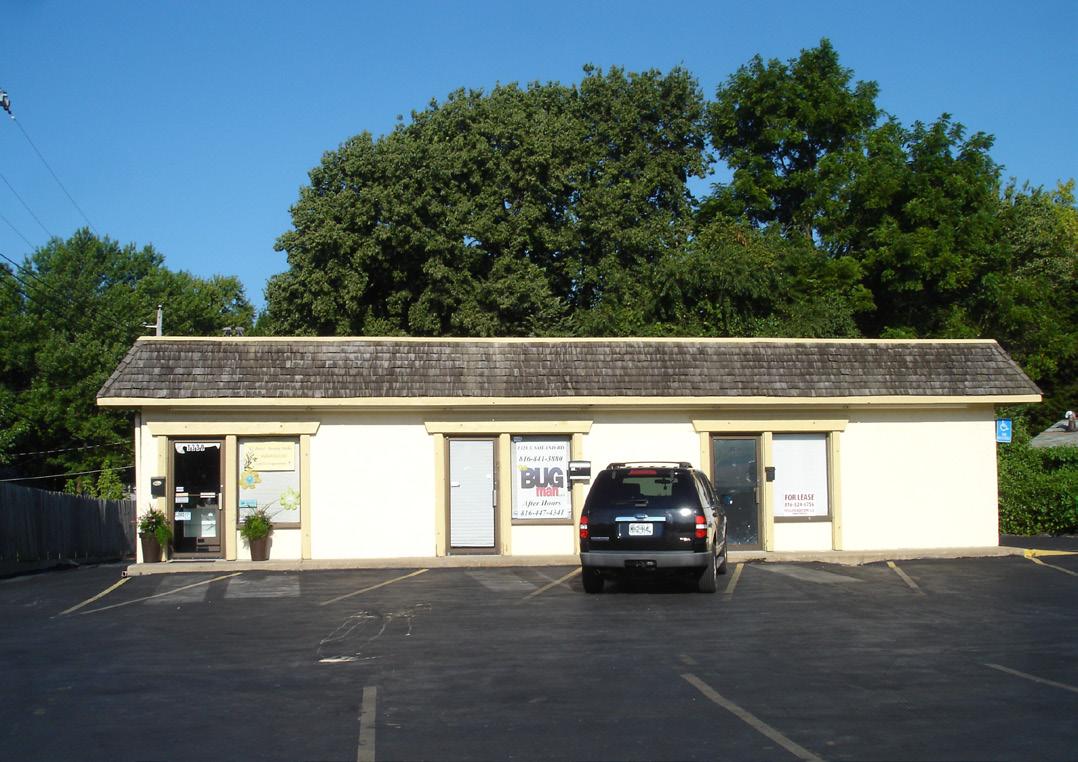
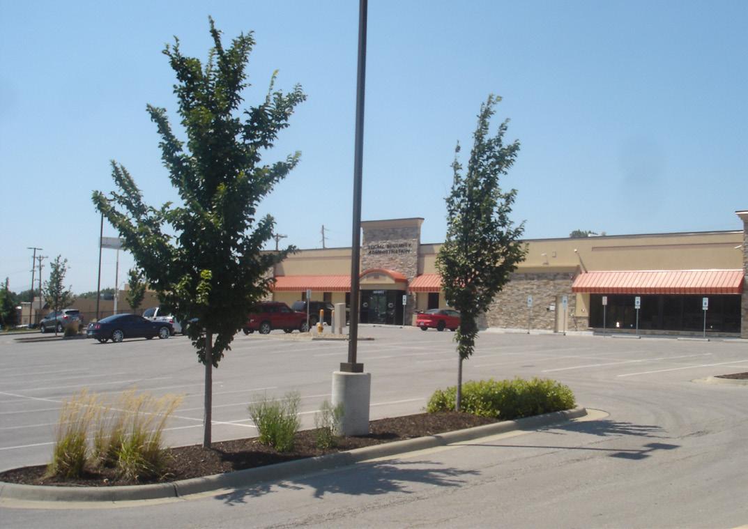
Building and site conditions along the corridor are typically good to fair, including several recently redeveloped sites that are in excellent condition (bottom right). Those developments that were deemed to be in poor condition were often vacant and poorly maintained (top right).
3 (Poor) Building is in poor condition and requires significant rehabilitation. Deficiencies may include major damage to the roof, foundation, or exterior walls, as well as widespread window damage, visible flooding issues, or general disrepair stemming from inadequate building maintenance.
4 (Dilapidated) Building is dilapidated to the extent that demolition may be the only realistic alternative.
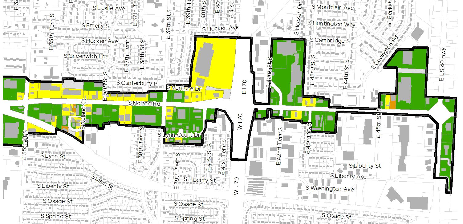
As illustrated in Figure 2.7: Existing Building Conditions, building conditions within the corridor are predominately good to fair. More specifically, 57.4 percent of the building are deemed to be in good condition, while 38.3 percent are in fair condition. Only 4.3 percent are considered to be in poor condition and none have deteriorated to the point of dilapidation.
It is important to note that only the exterior portion of the building was evaluated for the purposes of this document. Additionally, it should be made clear that this evaluation is solely based on the visual condition of the building. There has been no attempt to evaluate the particular architectural style or aesthetic of each building.
Site conditions were identified by evaluating each developed site and determining where it best fit within the following scale:
1 (Good) Site is in good condition with no significant deficiencies.
2 (Fair) Site is in fair or sound condition but has minor deficiencies that could be resolved with limited investment by the owner. Deficiencies may include small potholes in the asphalt, cracked or damaged sidewalks, overgrown or poorly maintained landscaping, damaged site signage, nonfunctioning site lighting, deteriorating retaining walls, and insufficient ADA accessibility.
3 (Poor) Site is in poor condition and requires significant rehabilitation. Deficiencies may include major deterioration or damage to asphalt paving, sidewalks, site lighting, landscaping, retaining walls, site signage, or general disrepair from inadequate site maintenance. Additionally, the extensive use of gravel paving instead of asphalt or concrete could contribute to a poor rating.
4 (Dilapidated) Site is dilapidated to the extent that demolition of a portion or all of the site may be the only realistic alternative.
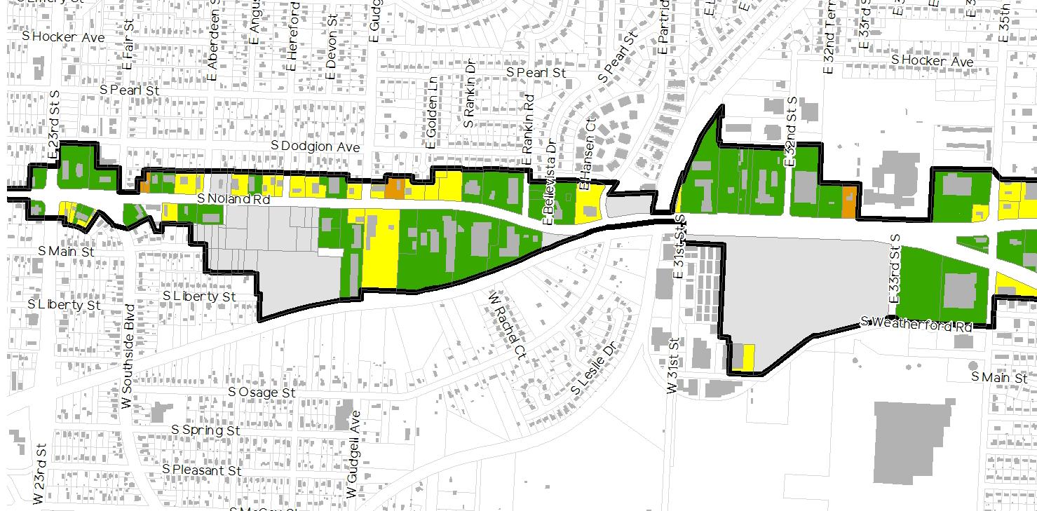
Much like the building conditions, the site conditions for the developed properties within the corridor largely fall within the good to fair range. Per the data mapped in Figure 2.8: Existing Site Conditions, 55.5 percent of the sites are considered to be in good condition, while 39.6 percent are in fair condition, and 4.9 percent are in poor condition. There are currently no sites deemed to be dilapidated by the planning team.
The evaluation of site conditions was completed with consideration of current and past development regulations in mind. For instance, it is clear that the City of Independence has not always required site landscaping. This means that a large majority of the parking lots along Noland Road do not include internal landscaping. Though this may affect the perceived quality or character of the development, it has not been factored into this condition rating.
Instead of just analyzing the building and site conditions separately, it makes sense to overlay the results and compare. In doing so, it quickly becomes clear that there is significant overlap between the two. Properties with a good building condition rating are almost always backed up with a good or sound site condition rating, and vice versa.
Though the poor ratings are few and far between, there is a significant percentage of both buildings and sites that fall under the fair rating. Though these properties were identified as having minor deficiencies, it is reasonable to conclude that segments of the corridor that have a higher percentage of fair properties may receive higher scrutiny when prioritizing potential revitalization or redevelopment projects. In reviewing Figures 2.7 and 2.8, and comparing them to the existing land uses shown in Figure 2.3, it is clear that the areas with the highest concentrations of strip retail also have the highest concentrations of fair properties. For example, the east side of Noland Road, from 35th to 39th Street, has a long run of buildings and sites in mostly sound condition. The uses for these building are predominantly single-tenant retail and multi-tenant strip retail.
The character of the developments that line Noland Road are best understood when looking at the corridor from a wider perspective. Rather than focusing on specific properties, it is best to narrow in on the characteristics that they have in common.
As mentioned previously, 91.3 percent of the properties within the plan area have been developed with single-story buildings. Though this is not necessarily a surprise for a commercial corridor the age of Noland Road, it certainly paints a picture of an area struggling to keep up with current development trends.
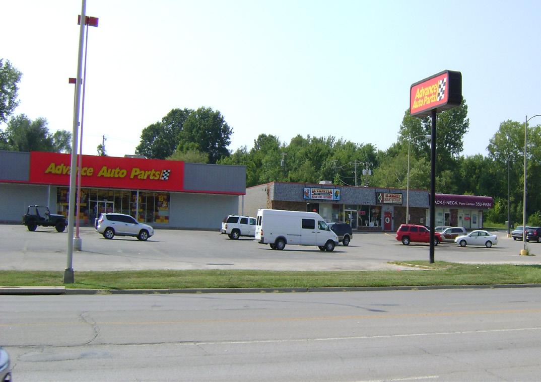
The architectural styles of Noland Road are mostly uninspiring. Strip centers look like strip centers, fast food chains look like fast food chains, and banks look like banks. There are few historically significant buildings, and even fewer unifying qualities. In truth, Noland Road has no definable architectural style.
The term setback refers to the distance between a street’s public right-of-way and the building structures that front it. Commercial properties with large building setbacks often use this space for parking. Commercial strip centers, which are prevalent throughout much of the corridor, are infamous for this. In fact, it is one of the defining characteristics of a strip center. They are certainly not the only offenders, however. Many of the single-tenant uses that front Noland also have considerable setbacks. All told, 64.4 percent of the properties fronting Noland Road were deemed by the planning team to have a large setback, 28.8 percent were noted as having medium setbacks, and a modest 6.8 percent fell under the category of small setback.3
These same properties were also categorized based on whether they had parking fronting Noland Road. Not coincidentally, 78.0 percent of the properties had parking in front of their building that ran adjacent to the right-ofway. Another 17.8 percent had parking to one or both sides of their building that abutted Noland Road. Only 4.2 percent of the properties avoiding locating any of their parking adjacent to the corridor’s central spine.
A building’s orientation, in conjunction with its setback, dictates how pedestrians interact with it. Buildings that face the street and have limited setbacks are more likely to attract pedestrians from the adjacent streetscape than those that are not oriented toward the street. On the other hand, buildings with large setbacks have a more difficult time attracting pedestrians, regardless of their orientation. A high percentage of the developments along Noland Road have the following characteristics:
• Building oriented toward the street
• Medium to large setback
• Parking located between the building and the street
Though this is not the worst-case scenario for capturing pedestrian activity, it is far from ideal. It is typical for autooriented strip commercial development.
Site access, as discussed in Subsection 2.8: Streetscape Conditions & Character, is a critical challenge for any high-traffic corridor; but cross access amongst adjacent properties is just as important. In fact, the two tend to have an inverse effect on one another. Added cross access typically leads to reduced site access points. Likewise, reduced cross access usually results in an increase in access points. Playing the second scenario out, drivers visiting multiple locations in close proximity to one another may be forced to unnecessarily enter and exit Noland Road.
This is not an uncommon scenario along Noland Road. Much of the single-tenant commercial uses have been designed with little consideration of the adjacent properties.
In general, landscaping both internal to properties and within the right-of-way, is minimal and marginally maintained.

Noland Road is in relatively good condition. It typically consists of four (4) lanes of traffic and one (1) or two (2) turn lanes, depending on the location. There are often small runs of medians to the north and south of major intersections. The one exception to this description is the length of Noland Road that extends from Pacific Avenue to South Avenue. This portion of the corridor eliminates the turn lanes in favor of a center median. The estimated width of Noland Road ranges from 62 feet at its narrowest to 80 feet at its widest. For a more thorough analysis of Noland Road, refer to Subsection 2.9: Vehicular Traffic
The curbs and gutters along Noland Road were replaced in the 1990s as part of the Noland Road NID improvements. They remain in generally good condition to this day.
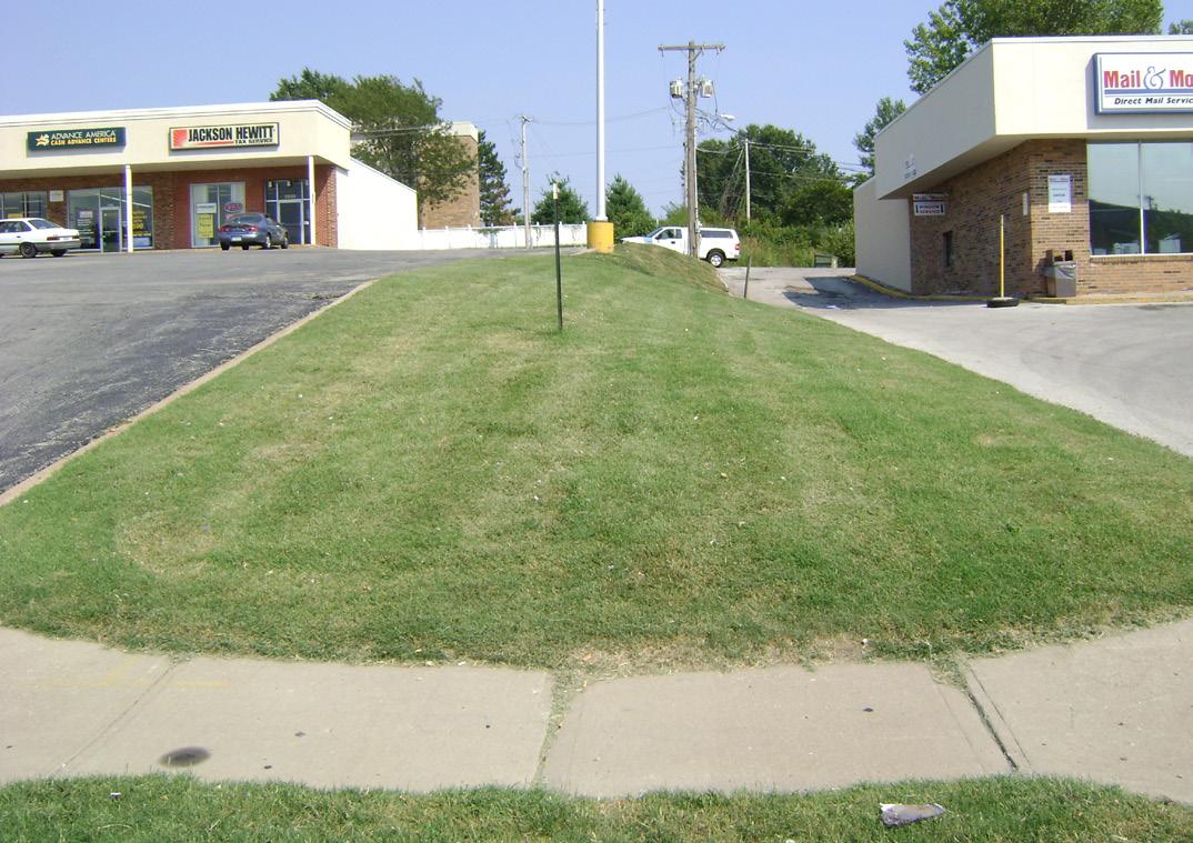
The sidewalks that exist along Noland Road are generally in good condition. They typically run parallel to the street with a five to six foot turf buffer separating the sidewalk from the curb. The walks themselves are five to six feet in width. Though the existing sidewalks are not wide enough to accommodate bikes or even high-traffic pedestrian use, they are certainly capable of handling the current pedestrian traffic levels of the corridor.
Unfortunately, sidewalks are not consistently located along both sides of Noland Road, and in fact there is a sizeable section of streetscape toward the south end of the corridor that does not have sidewalks on either side. This is obviously a major roadblock for a corridor looking to become more pedestrian-friendly.
For further analysis of the existing sidewalk routes, refer to Subsection 2.10: Alternative Transportation
The light poles along Noland Road were replaced in the 1990s as part of the Noland Road NID improvements. Though the poles have a very utilitarian aesthetic, they do effectively light the corridor at night. They are layed out in an alternating pattern along the east and west sides of Noland Road. Spacing on both sides is approximately 215 feet between poles. In areas where a median exists, the poles are located within the center of the median with a spacing of approximately 110 feet. Poles positioned along the east and west of Noland Road incorporate a single arm, while those located within the medians include a double arm design. The light poles do not include any banners or attached signage.
Landscaping along the corridor is practically nonexistent. This is likely due to either an ineffective and/or poorly enforced development ordinance. Typically, properties being developed or redeveloped are required to follow the development standards in the City’s Unified Development Ordinance (UDO). Though UDOs are commonplace and fairly standardized in 2015, that was not always the case. It is possible that when many of the properties along Noland were originally developed, the ordinance in place did not properly value the importance of landscaping. As a result, the corridor was allowed to develop with zero street trees, no parking lot screening, and very little internal landscaping.
It is clear however, that something has changed in the last decade. Properties that have been recently redeveloped include landscaping that is undoubtedly the result of improved or properly enforced development standards. QuikTrip (1201 S. Noland Rd.), KC Complete Auto Service (200 E. 23rd St.), McDonald’s (1225 S. Noland Rd.), and Walmart Neighborhood Market (3411 S. Noland Rd.) are prime example of properties that have been developed with landscaping in mind. Over time, this new emphasis on landscaping will pay huge dividends for a corridor currently awash in asphalt.
Though the new standards represent a major upgrade in quality, there is still room for improvement. Specifically, the screening requirements for parking lots are underwhelming, especially for a large commercial corridor. Per the UDO, the requirement is as follows:
“At least one tree and three shrubs must be installed for every 40 feet of parking lot perimeter, as close to 40 feet (spacing) as possible along the parking lot perimeter, allowing for utilities and intersection visibility requirements. On sites with an area of five acres or more, five shrubs are required per 40 feet of parking lot perimeter and a berm or swale with maximum side slopes of 3:1 must be installed within the parking lot perimeter buffer. Shrub plantings should be planted in groups of three or more and installed to help screen the parking lot from view of streets and abutting property.“
The overstory requirement of one tree per 40 feet is sufficient, but the understory requirement of three shrubs per the same 40 feet does not substantially contribute to the effective screening of parking lots.
Noland Road, like many aged commercial corridors, suffers from an overabundance of access drives. Of the 136 properties that run directly adjacent to its right-ofway, 56 (41.1%) of them have two or more direct points of access along Noland Road. The full breakdown, as depicted in Figure 2.9: Existing Access, is as follows (listed from lowest impact to highest):
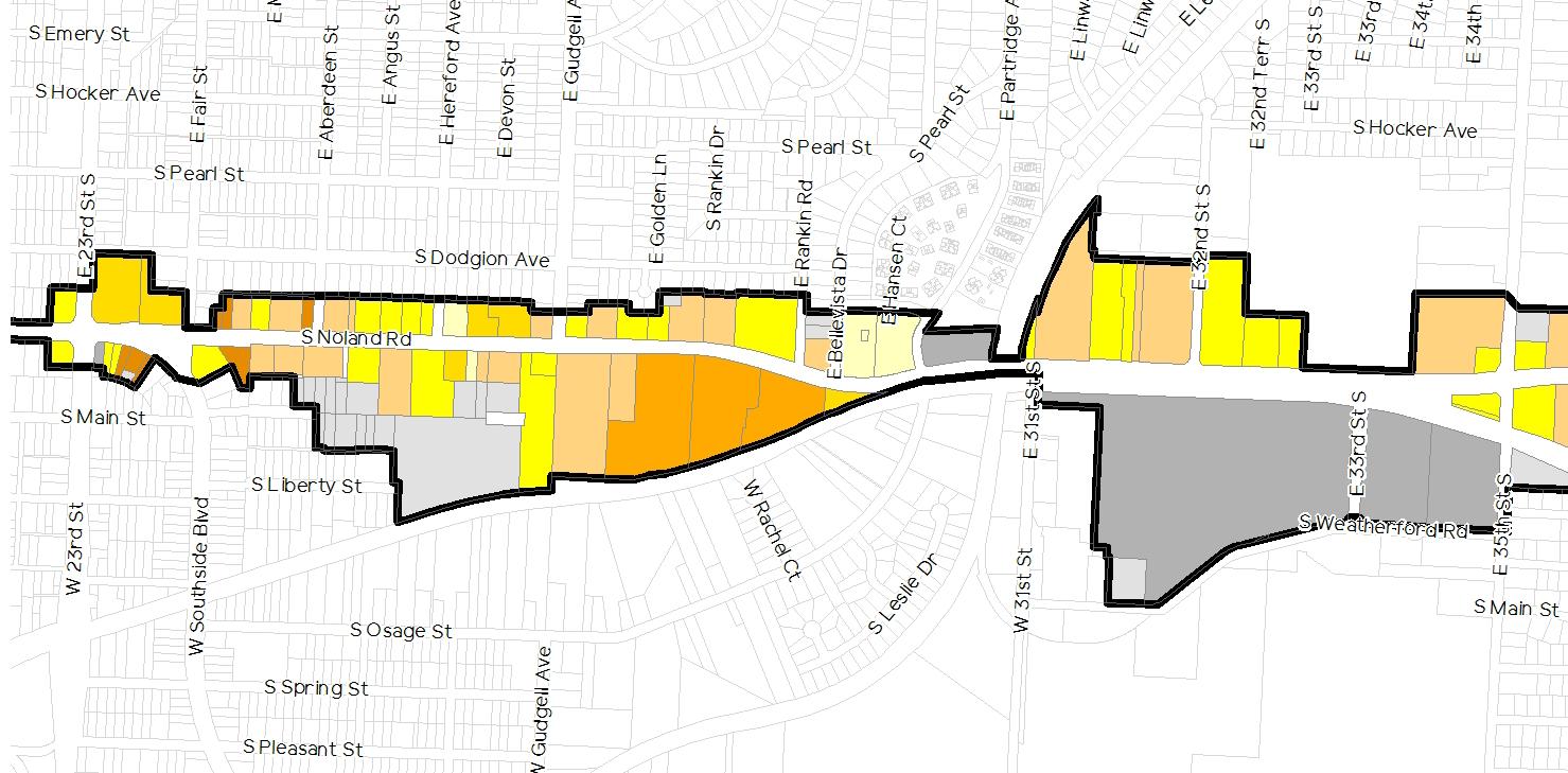
• 5.2% of the properties have zero (0) access drives
• 12.5% of the properties have one (1) shared access drive
• 36.0% of the properties have one (1) access drive of its own
• 11.0% of the properties have two (2) access drives, with at least one (1) of those being a shared drive
• 27.2% of the properties have two (2) access drives of its own
• 2.9% of the properties have three (3) or more access drives of its own
• 5.2% of the properties have continuous access along Noland Road
The result of all these access points, is an overreliance on continuous turn lanes throughout the corridor.
Gateways are often used by neighborhoods, districts, or community’s to accomplish one, two, or all of the following:
• Define boundaries
• Welcome visitors
• Establish a brand or identity
They are typically located at key locations within the defined areas. Often, there are several levels of gateways, developed within the context of an overall hierarchy. In short, gateways can be an extremely valuable and integral part of a successful streetscape. Currently, there are no physical elements to signify the importance of gateways into the corridor.
In addition to the impact they have on vehicular patterns, eccessive access points have a negative effect on the visual cohesiveness of the streetscape.
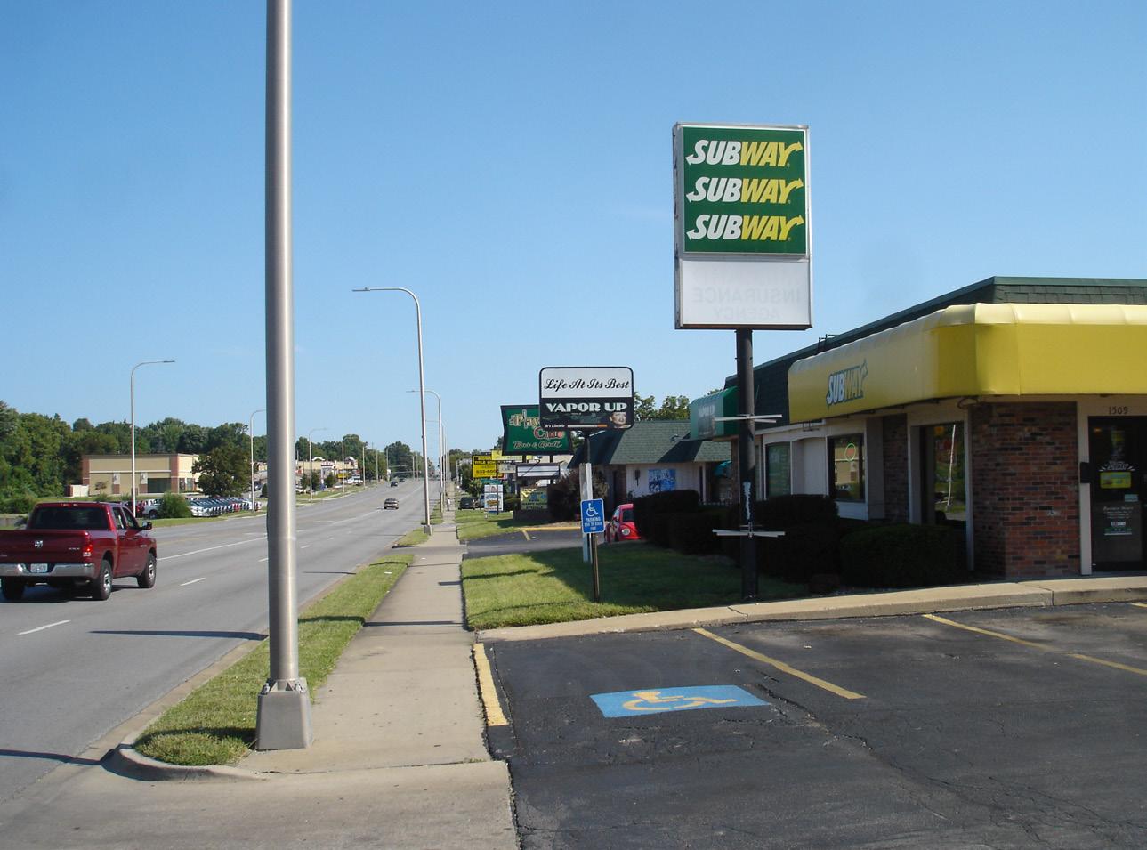
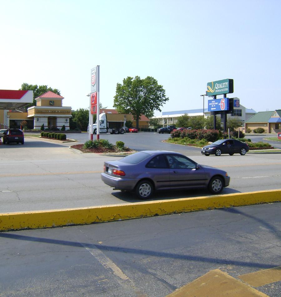
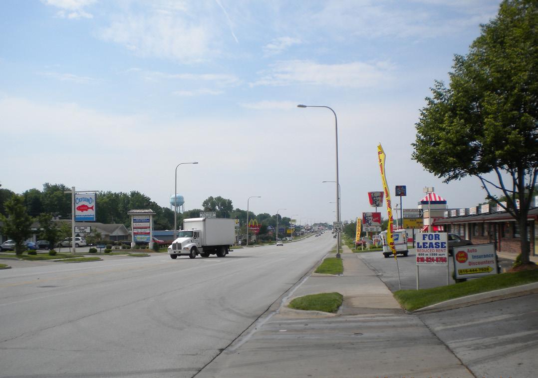
One of Noland Road’s defining qualities is the proliferation of pole or pylon signs that line its streetscape. The lack of landscaping, as described in the previous section, only adds to impact that these signs have on the overall aesthetic. And while the City appears to have reasonably course corrected in regards to landscaping, current regulation of signage still allows for negatively impactful signage to be constructed in the corridor. Per the UDO, pole signs of up to 25 feet in height are still allowed in Western Independence for single and multi-tenant nonresidential land uses.
Reviewing recent redevelopment sites, it does appear that at least some businesses have chosen to go with a smaller and more visually pleasing monument sign. Walmart Neighborhood Market and KC Complete Auto Service both incorporated modest monument signs into their site designs. QuikTrip and McDonald’s, on the other hand, went with larger pylon signs. The mixed results suggest that City staff and some tenants are interested in more modest, lower impact, higher quality signage, but that current regulations allow significantly more impactful signs if desired by the tenant, which city staff has limited ability to modify.
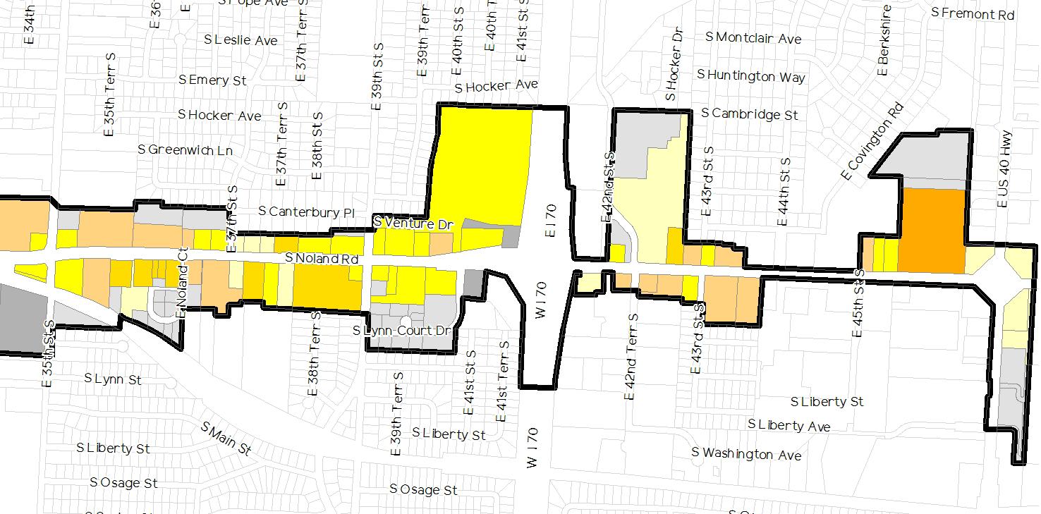
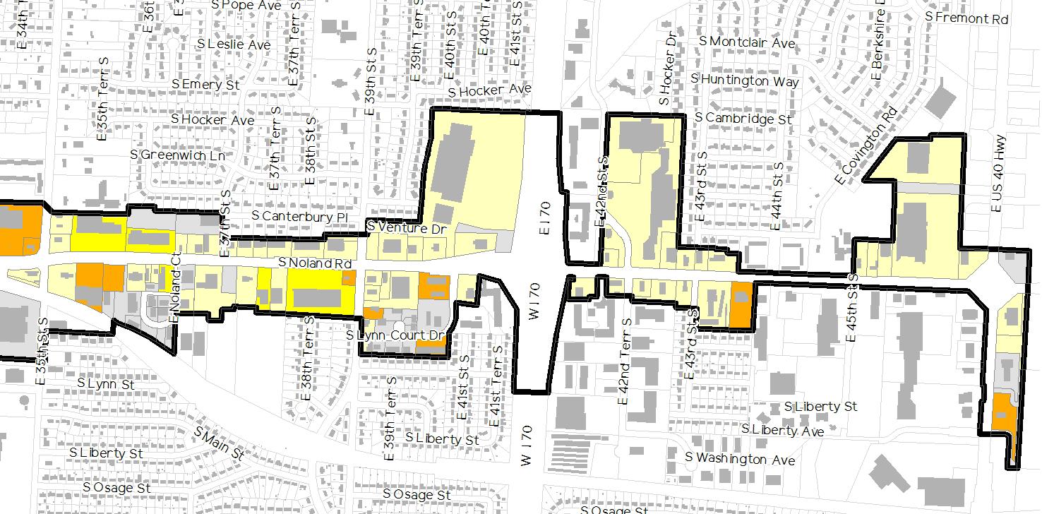
Reviewing Figure 2.10: Existing Signage & Monumentation, 67.9 pecent of the properties within the corridor include site signage located beyond the building. Examining the map further, it can be determined that those properties with site signage fall into one of the following categories:
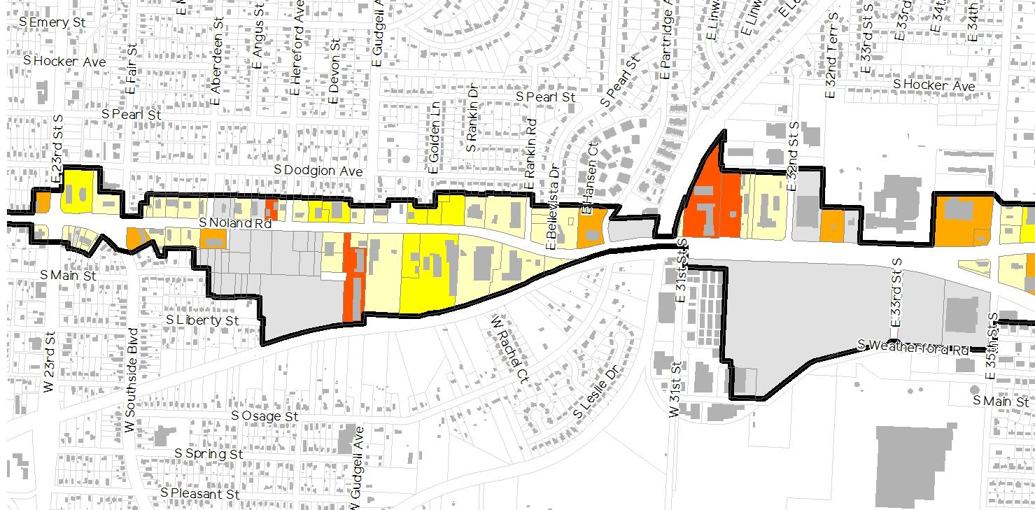
• 73.7% of the properties have one (1) pylon sign4
• 11.3% of the properties have two (2) or more pylon signs
• 12.8% of the properties have one (1) monument sign
• 2.2% of the properties have one (1) or more pylon sings and one (1) or more monument signs
Though the map shows just how prevalent pylon signs are, it does not adequately identify the worst portions of the corridor. For it is not just the prevalence of pylons, but also their proximity to one another that make their existence such an eyesore. For this reason, it is important to focus on the parts of Noland Road with the narrowest lot widths and the highest percentage of pylons. Doing so reveals that the segment of the corridor that extends from 35th Street to 44th Street is likely the worst offender. Visuals surveys of the corridor confirm this diagnosis.
4 For the purposes of this document, the primary differentiator between pylon signs and monument signs is height. Per the UDO, monument sign are regulated to a maximum height of six or eight feet, depending on the zoning district. Thus, any sign that exceeds eight feet in height is considered by this document to be a pylon sign, regardless of the form or materials used in the design of the sign.
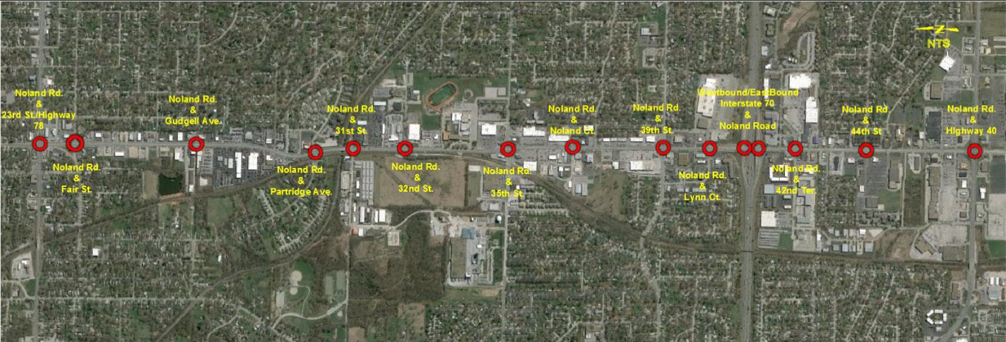
This subsection addresses existing traffic conditions along the Noland Road corridor from 23rd Street (Missouri Route 78) to Highway 40. The corridor contains a total of 15 signalized intersections along Noland Road, including:
• 23rd Street (Missouri Route 78)
• Fair Street
• Gudgell Avenue
• Partridge Avenue
• 31st Street
• 32nd Street
• 35th Street
• Noland Court
• 39th Street
• Lynn Court
• Interstate 70 Ramps
• 42nd Terrace
• 44th Street
• Highway 40
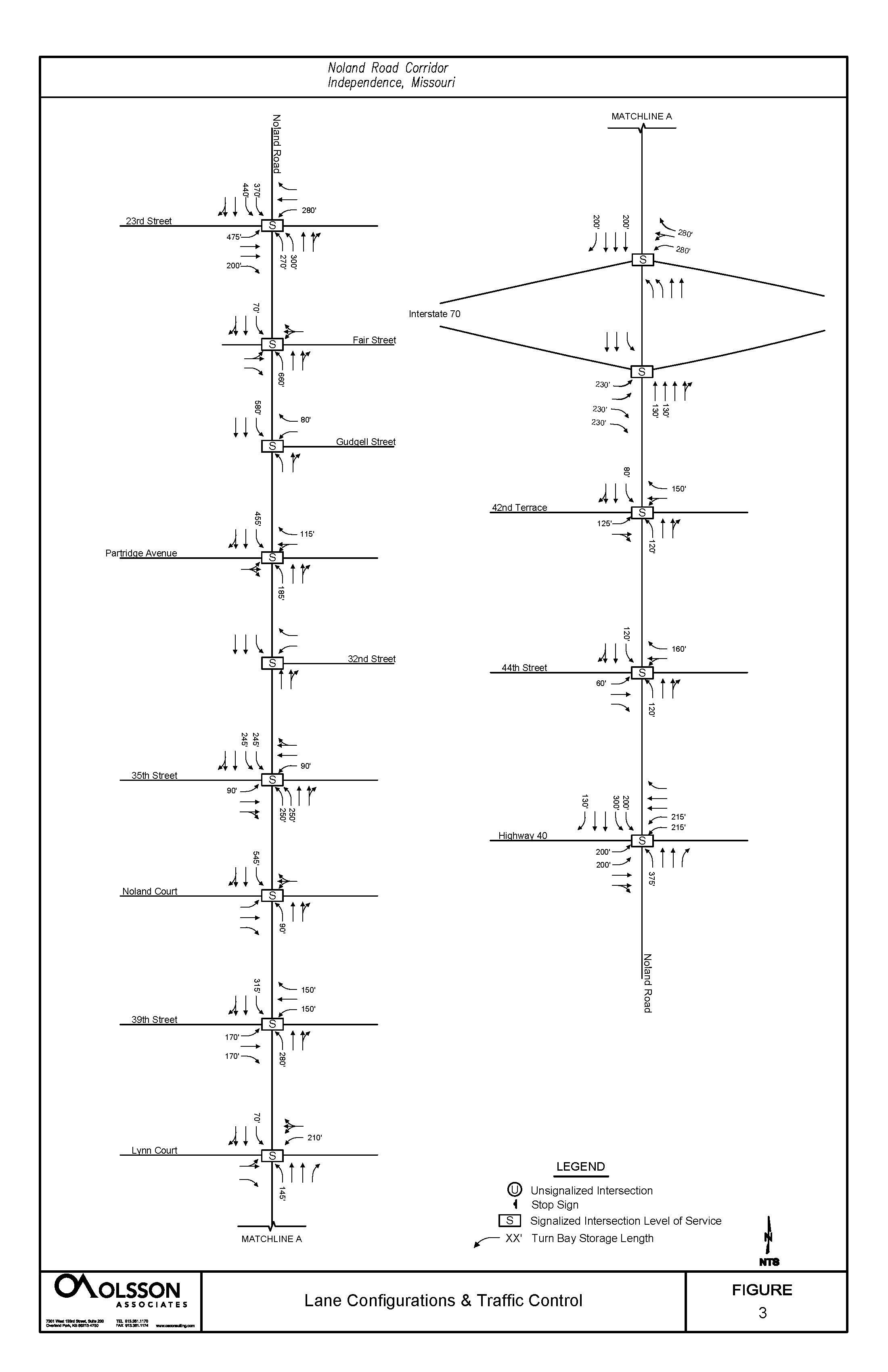
In the vicinity of the study area, Noland Road provides access to several state and interstate routes including an interchange with I-70, an intersection with Highway 40 at the southern extent and an intersection with 23rd Street (also known as Missouri Route 78). Noland Road is classified as a five lane undivided arterial roadway with two travel lanes running north/south with a posted speed limit of 35 mph. Some sections of Noland Road have medians separating north/south traffic, medians are present at the following locations:
• Between 23rd Street and Fair Street
• North side of Gudgell Avenue
• 35th Street
• North side of 37th Street
• Between 39th Street and the I-70 interchange
• Highway 40
In sections of Noland Road between Fair Street and 39th Street, side by side center left-turn lanes are present instead of a more traditional two-way left turn lane (TWLTL).
Noland Road provides access to various land uses along the 3 mile corridor including a High School, commercial, industrial and residential areas. The section between 23rd Street and Partridge Avenue is primarily comprised of retail development including several car dealerships. Just south of Partridge Avenue there is a small industrial area on the west side of Noland Road. Between Partridge Avenue and 35th Street a Union Pacific rail line runs north/south just west of Noland Road while the east side of the road is comprised of additional retail developments and a High School. South of 35th Street to Highway 40 is comprised primarily of retail developments surrounding Noland Road. Residential areas border the corridor just outside of the surrounding retail developments.
To evaluate traffic safety issues, identify high crash locations in the project area, and to better understand the corridor collision patterns, crash records for three consecutive years were collected for Noland Road from 23rd Street to Highway 40. The City of Independence provided the most recent crash data sets available, 2012 through 2014. Crashes that occurred in the project were analyzed from two aspects: roadway segments and intersection-related crashes.
The City also provided additional information regarding the planned roadway geometric and signal phasing improvements. Future planned improvement projects include the addition of north and southbound right-turn lanes at the intersection of 39th and Noland Road, the implementation of protected/permissive (previously protected only) for the northbound left at Noland Road and Noland Court, and the modification of north and southbound left-turn geometry and addition of protected lefts at Noland Road and Fair Street.
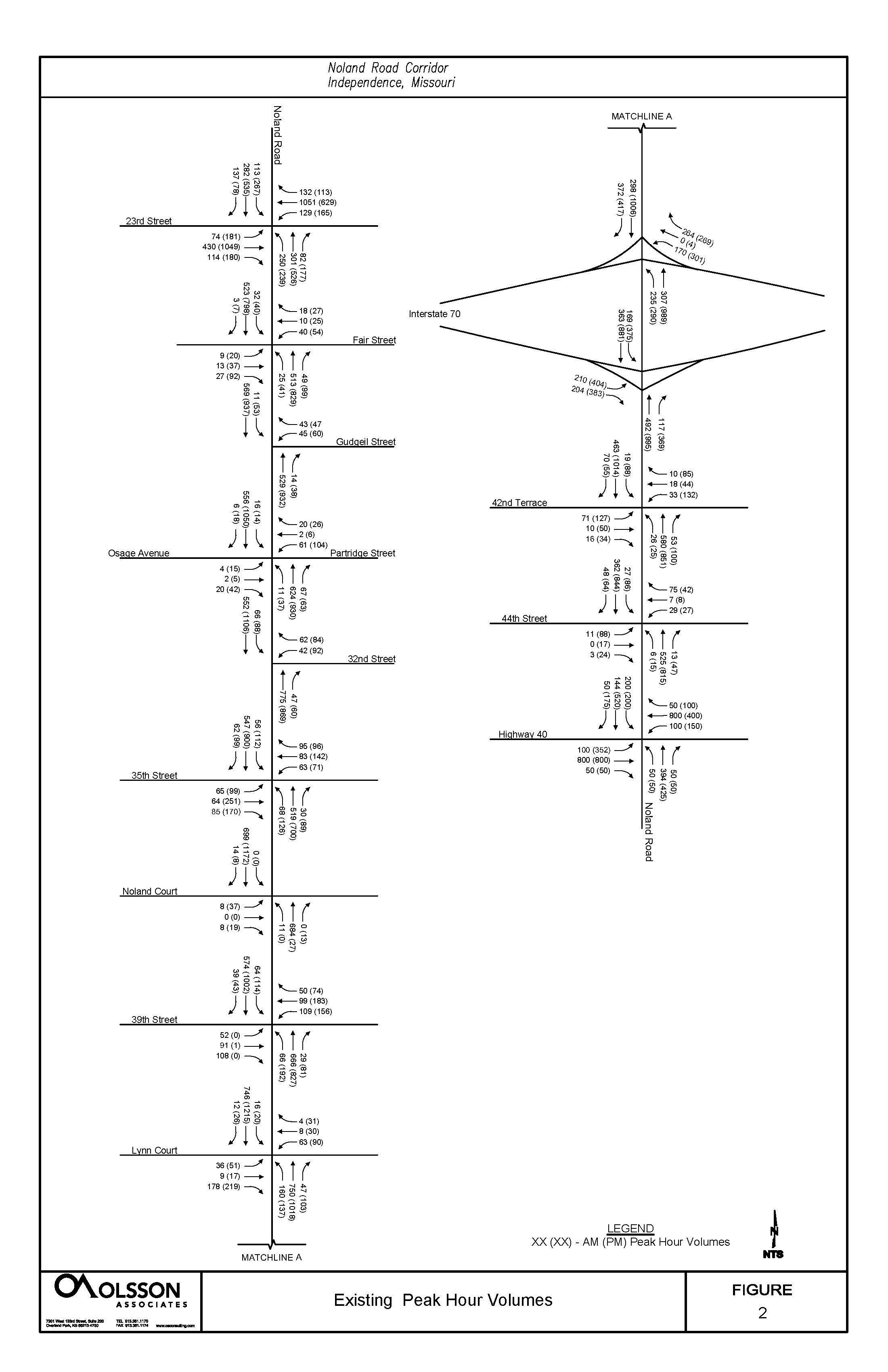
Peak Hour Volumes and current signal timings collected from the Mid America Regional Council’s Operation Green Light (OGL) program were also utilized. Estimated Average Daily Traffic (ADT) for 2012 was obtained for certain sections along the corridor from Google Earth in effort to verify corridor peak hour traffic volumes. Utilizing the estimated 2012 Average Daily Traffic (ADT), total entering vehicles per day for each intersection and segment were calculated by first obtaining the corridor ADT factor. Dividing the ADT by the PM peak hour volumes for each section provided an average ADT factor of 10. The PM peak hour total entering vehicles at each intersection and segment were multiplied by the ADT factor to convert to daily total entering vehicles. It should be noted that the PM peak hour count information for Highway 40 and Noland Road is approximate and based on adjacent intersections and ADT information available from Google Earth.
The total number of crashes at each intersection were obtained during the 3-year period; 2012-2014. Crash rates for each intersection were determined by dividing the total crashes at each intersection by the number of million entering vehicles (MEV). The intersection crash rate equation is as follows:

Intersections were then sorted from highest crash rate to the lowest, as illustrated in Figure 2.12. Although the Noland Road and I-70 interchange contains west and eastbound ramp intersections it was treated as a single intersection by utilizing the outside vehicular volumes entering the interchange area. The 3 highest intersection crash rates were found at the following intersections I-70 Ramps (0.84), US-40 Highway (0.70), and Fair Avenue (0.66) which represents the crash rate per MEV. These values were compared to the MODOT statewide average crash rate for intersections of 0.90 crashes per MEV. As shown in the table below no intersections exceeded the statewide average crash rate of 0.90, suggesting the intersections in general are operating at acceptable safety levels.
*Values are based off estimated afternoon peak hour volumes.
Applying similar strategy as the intersection crash rate calculation, crash rates by section were calculated. ADT for each section was multiplied by the section length, 365 days, and 3 years to obtain hundred million vehicle miles traveled (HMVMT) during the period 2012-2014. Section crash rate was determined by dividing total crashes along each section by HMVMT along the section. The segment crash rate equation is as follows:
The ratio of the segment crash rate to the statewide critical crash rate resulted in the critical crash rate factor. Sections with a value greater than 1.0 have higher segment crash rates than the statewide critical crash rate. These segments are expected to have a higher than average rate of crashes. Sections, as shown in Figure 2.13: Crash Rate by Segment, with the highest ratios include:
• I-70 to 42nd Terrace
• 23rd Street to Fair Avenue
Based off historical data provided by MODOT a typical statewide average crash rate of 600.00 crashes per HMVMT is common for a 5-lane undivided roadway. The segment rate was then adjusted statistically to a 95th percentile confidence interval. This statewide critical crash rate was calculated using the following equation:

Segments that have a critical crash rate factor of less than 1, but slightly greater than the statewide average were also highlighted although statistically they don’t have a high crash rate at the 95th percentile confidence interval. When the corridor was treated as a single segment the section crash rate calculated resulted in an overall critical crash rate factor of 0.89 and segment crash rate of 588.49. Short segment lengths and high Access Density (number of drives per mile) are likely contributing factors in higher segment crash rates. High critical crash rate segments; I-70 to 42nd Terrace and 23rd Street to Fair Avenue, are the shortest sections along the corridor at 0.14 and 0.11 miles, respectively. In addition, the 3 mile study area currently has a high access density of approximately 48 drives per mile.

Intersections along the Noland Road corridor currently run various timing plans throughout the day. 23rd Street and Highway 40 are coordinated for east/west traffic and have a set time of day schedule in order to keep the coordinated movements “in-step.” Remaining intersections are coordinated north/south to provide progression along Noland Road. When intersections are working as a coordinated system and running a particular cycle length they are generally set to synchronize multiple intersections to enhance the operation of one or more directional movements in the system.
The Noland Road corridor is split into two sections for the AM, Midday, and PM timing plan. During the AM and PM timing plan, the first section consists of the 23rd Street and Fair Avenue intersections, and the second section contains the remaining 13 intersections. During the midday timing plan the sections are similar except Gudgell Avenue is coordinated with the first section.
During the overnight and early AM hours when traffic volumes are relatively low, many intersections transition from running coordination to running in “free” operation. The “free” operation mode is set to dwell in Green on Noland Road and relies on detection to service vehicles on the side street when present.
Signal timing models for the AM, Midday, and PM scenarios were obtained from OGL and updated to reflect current timings and geometrics. All timing data in the OGL SYNCHRO models were current with the timings available on the OGL TransSuite server, with the exception of 23rd Street and Noland Road PM split times which were updated for all phases with recent timing modification along 23rd Street. It should be noted that the northbound left-turn at Noland Road and Lynn Street was updated from permissive phasing to protected/permissive phasing to match the current configuration. Existing peak hour volumes, lane configuration and traffic control, and capacity analysis can be found on Figures 2.16, 2.17 , and 2.18 respectively.
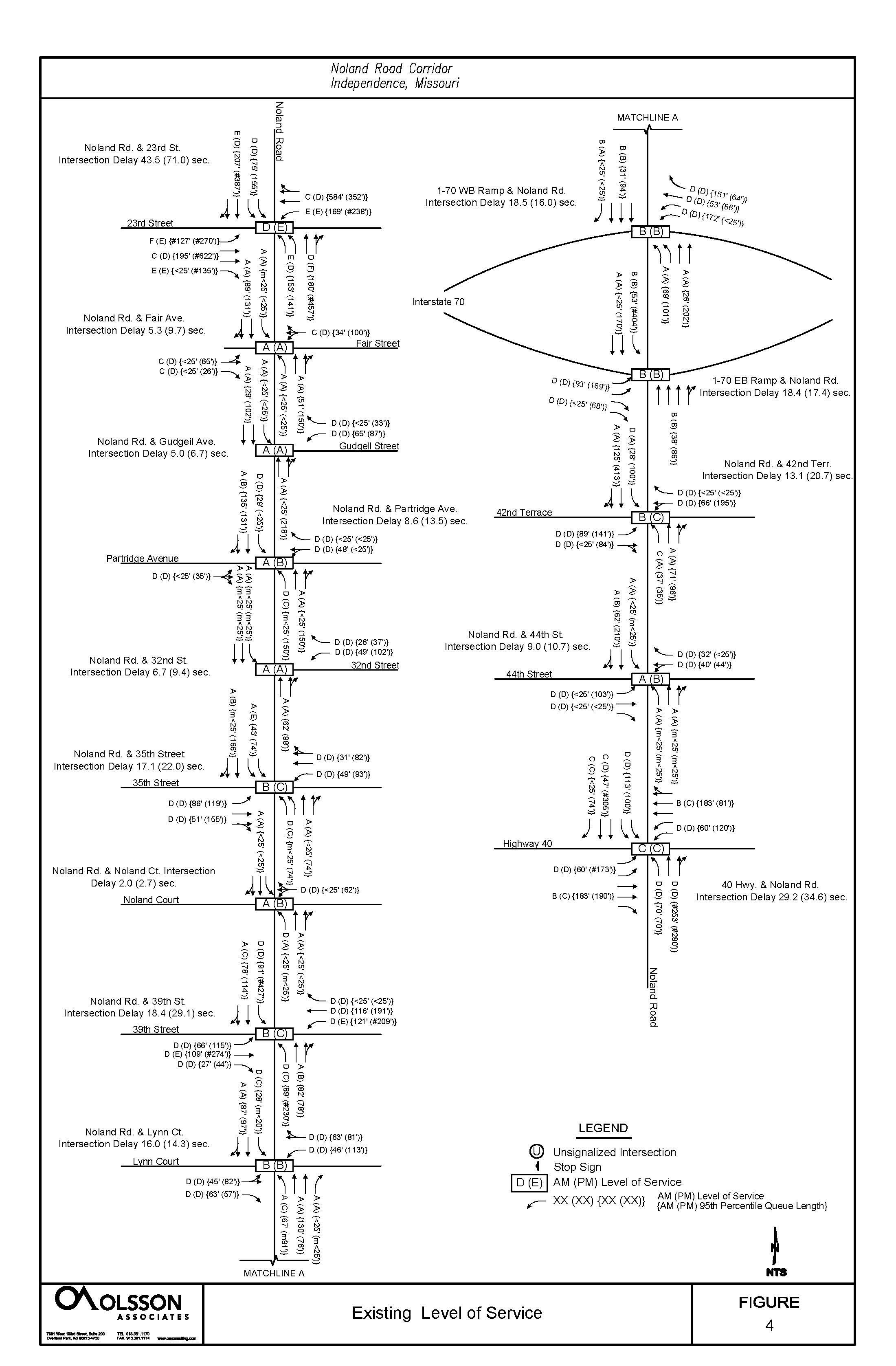
Signalized intersection capacity analyses were performed using SYNCHRO, version 9.1, based on the Highway Capacity Manual (HCM) delay methodology. For simplicity, the amount of delay is equated to a grade or Level of Service (LOS) based on thresholds of driver acceptance. A letter grade between A and F is assigned, where LOS A represents the best operation. Figure 2.15 represents the LOS associated with intersection control delay, in seconds per vehicle (sec/veh), for signalized and unsignalized intersections. At present, all intersections are operating at LOS D or better expect Noland Road and 23rd Street which is operating at LOS E during the PM peak hour. Individual turning movements are operating at a LOS D or better except at the following locations:
During the AM peak hour period:
• The Eastbound left turn operates at LOS F.
• The Eastbound right, southbound thru/right, westbound and northbound left movements operate at LOS E.
• During the AM peak hour period the major movements at the intersection include the westbound and northbound directions with heavy traffic traveling to I-435 to the west and I-70 to the south.
During the PM peak hour period:
• The Northbound thru/right movement operates at LOS F.
• The West and eastbound left, eastbound right, and eastbound left operate at LOS E.
• During the PM peak hour period the major movements at the intersection include the eastbound and southbound directions with heavy traffic traveling from I-435 to the west and I-70 to the south.
During the PM peak hour period:
• The south, west, and northbound left-turn movement operates at LOS E.
• Low LOS at minor movements can be expected to occur as higher mainline movements are accommodated.
NOLAND ROAD & 31ST STREET
During the PM peak hour period:
• The northbound left-turn movement operates at LOS F.
NOLAND ROAD & 35TH STREET
During the PM peak hour period:
• The southbound left-turn movement operates at LOS E.
• Lane utilization is a contributing factor to the poor LOS. Eastbound 35th Street on the east leg drops the outside lane into a right-turn lane 200’ from the intersection.
NOLAND ROAD & 39TH STREET
During the PM peak hour period:
• The westbound left, southbound left, and eastbound thru and left movement operates at LOS E.
• Low LOS at minor movements can be expected to occur as higher mainline movements are accommodated.
NOLAND ROAD & 42ND TERRACE
During the PM peak hour period:
• The north and eastbound left-turn movement operates at LOS E.
• Low LOS at minor movements can be expected to occur as higher mainline movements are accommodated.
NOLAND ROAD & HIGHWAY 40
During the PM peak hour period:
• The southbound right movement operates at LOS F.
• Low LOS at minor movements can be expected to occur as higher mainline movements are accommodated.
The City’s bus system, IndeBus, has six (6) lines that serve the Independence community. As illustrated in Figure 2.19: Existing Public Transit, all six begin and end their routes at the Metro Transit Center (MTC), which is located just to the west of Noland and Truman Rd. The Purple Line is the most relevant line to Noland Road, but the Blue and Green Lines also serve the corridor. What follows is an abbreviated summary of each of the six routes:
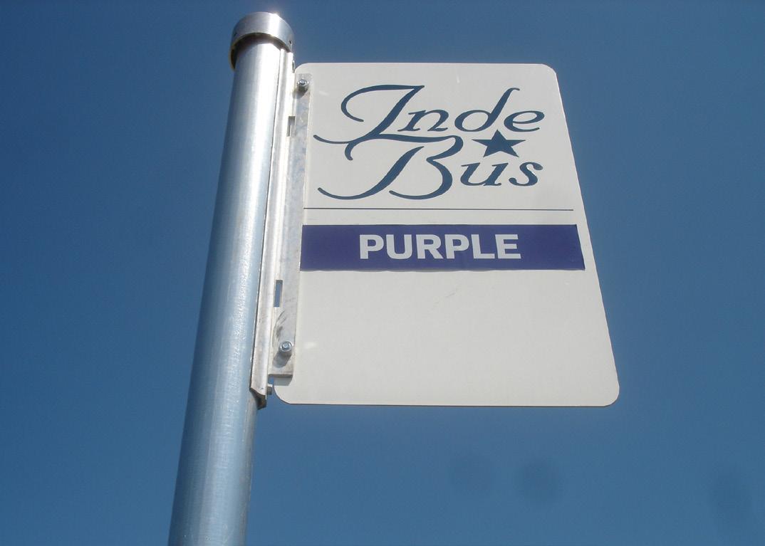
• The Purple Line briefly heads west and then south before looping back to Noland Road at Pacific and heading south. It then follows Noland Road all the way to 45th Street. It circles around Noland South Shopping Center before finally stopping at HyVee (Noland and 40 Hwy) and looping back to the north and repeating its route in reverse. The route includes multiple stops in both directions along Noland Road, though none of these stops include a dedicated bus shelter.
• The Blue Line, which mainly travels along Sterling Avenue and 40 Highway to the west, can be accessed at the north and south ends of the corridor.
• The Green Line travels south along Noland from Truman to 23rd Street, then heads east along 23rd before turning south at Lee’s Summit Road, and then east at 39th Street.
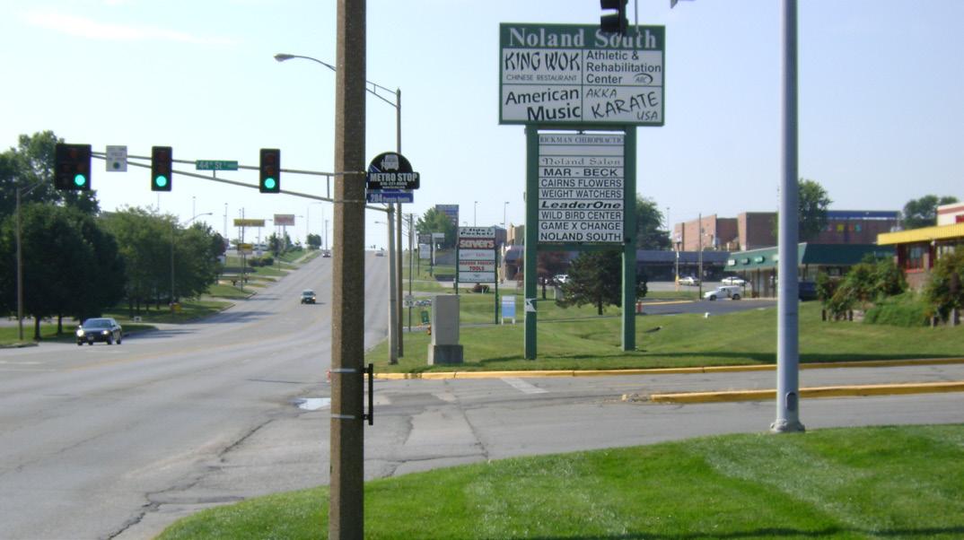
• The Red Line heads east from the MTC.
• The Yellow Line heads northeast from the MTC.
• The Orange Line heads northwest from the MTC.
There are no dedicated bike routes within the corridor. There are several trails in the surrounding neighborhoods, but none of these provide direct connections to the corridor. Given the speeds and levels of traffic along Noland Road, riding without a dedicated lane would be incredibly dangerous. As is the case, there does not appear to be any substantial bike traffic along the corridor.
Five to six foot wide sidewalks are provided throughout much of the corridor. Unfortunately, there are several significant sidewalk gaps on one or both sides of Noland Road, forcing pedestrians to walk in the grass or cross the street. The major gaps impacting pedestrian travel, as shown in Figure 2.20: Existing Sidewalks, are as follows:
WEST SIDE OF NOLAND ROAD
• Lexington Avenue to Short Avenue
• Aberdeen Street to 35th Street
• 670 foot gap to the north and south of Noland Court
• 710 foot gap just north of 39th Street
• 310 foot gap just south of 39th Street
• 42nd Street to 40 Highway
EAST SIDE OF NOLAND ROAD
• Lexington Avenue to Walnut Street
• South end of Walgreens property (south of 39th Street) to north end of HyVee property (north of 40 Highway)
NOLAND ROAD CROSS STREETS
• East side of Hereford Avenue
• East side of Gudgell Avenue
• East side of Rankin Road
• East side of 42nd Street
• West side of 40 Highway

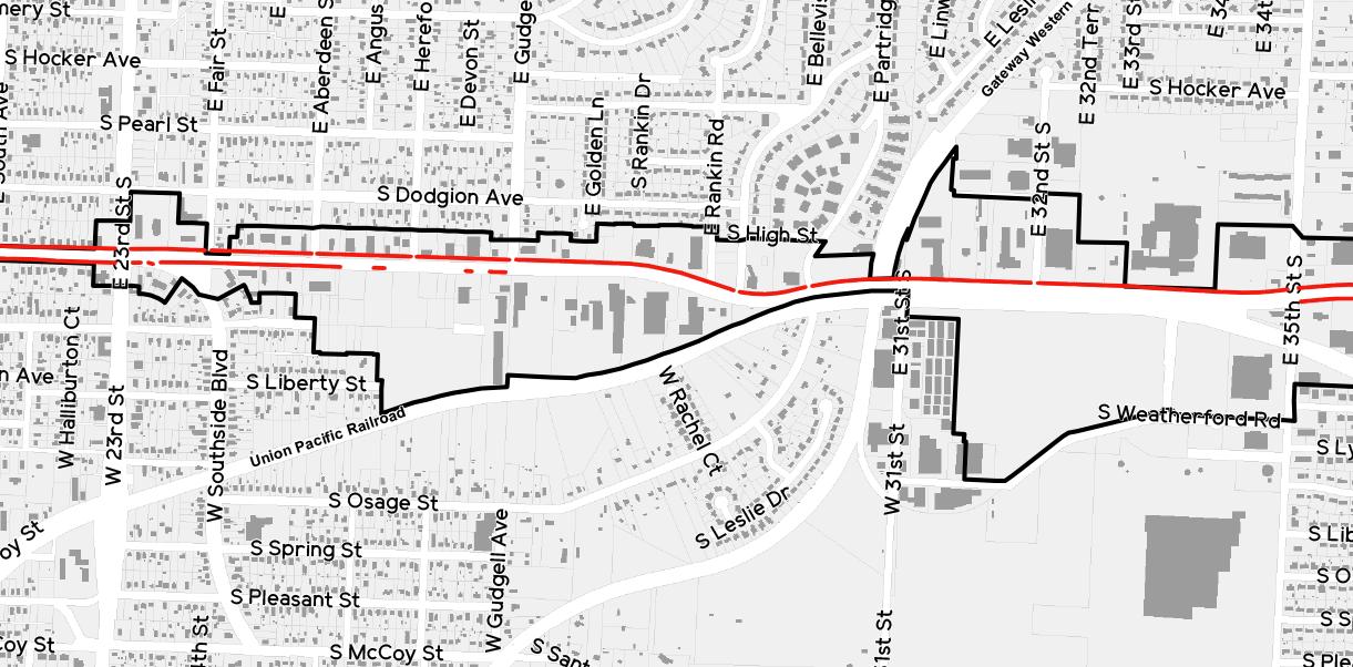
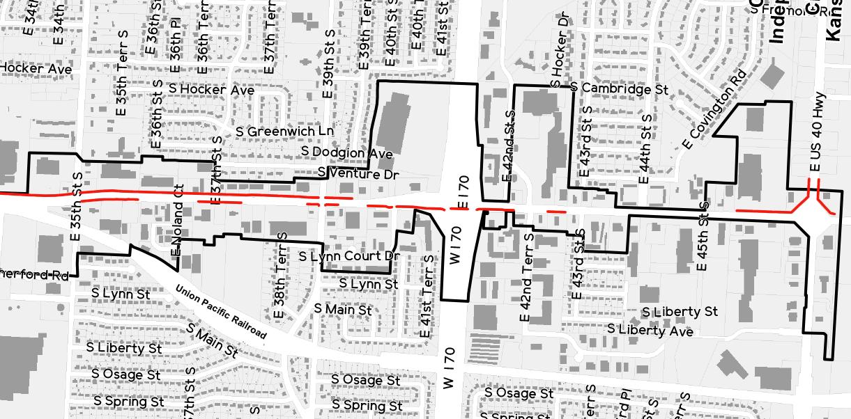

There are no parks within the Noland Road Corridor boundaries. However, there are several identified in Figure 2.21: Existing Parks & Trails that are within close proximity, including the following:

• Young Park – This small neighborhood park includes two (2) basketball courts and playground equipment.
• Roger T. Sermon Community Center – The community center includes a weight room, gymnasium, theater, as well as four (4) meeting rooms.
• Hiram Young Park – This passive open space park includes a small plaza with bench seating.
• Bingham-Waggoner Estate – This 19.5 acre estate has been designated a historic landmark. Today, it functions as a museum and a park, hosting tours and private events. The park includes an internal trail system.
• Woodlawn Cemetery and Woodlawn Park – This cemetery has been designated a historic landmark. The attached Woodlawn Park is currently limited to undeveloped open space.
• Santa Fe Trail Park – This community park includes three (3) baseball fields, twelve (12) tennis courts, playground equipment, a picnic pavilion, concessions, restroom facilities, and an internal trail system.
• Lipton Conservation Area – Sitting just south of the Santa Fe Trail Park, this Missouri Department of Conservation park includes a hiking trail and bird watching.
As Figure 2.21 shows, there are also no trail systems within or directly connecting to the Noland Road Corridor. Looking beyond Noland Road, there are seven (7) trails within range of the corridor. They are as follows:
• Young Park Trail – 1/8 mile - Small internal park trail that connects to surrounding sidewalk circulation.
• Truman Historic Walk – 2 7/10 miles – The City of Independence started developing plans for this historic walk in the early 1990s. President Harry Truman, America’s 33rd president, enjoyed walking and history. To honor his love of walking, the City organized the Truman Historic Walking Trail. There are 43 memorable sites along the way that are marked by descriptive plaques. (Source: Independence Parks & Recreation Department)
• Missouri Morman Walking Trail – 1 mile – The Mormon Walking Trail is a joint project of the City of Independence and the Missouri Mormon Frontier Foundation (MMFF). MMFF is a non-sectarian, not-for-profit group dedicated to the promotion and understanding of local history. There are 14 plaques along the trail that depict key early Mormon Sites. (Source: Independence Parks & Recreation Department)
• Bingham Waggoner Walking Trail – 1/4 mile – This walking trail is adjacent to the famous BinghamWaggoner home. The trail is a hard-surface trail with some mild inclines and is surrounded by the swales that were created by the wagon trains passing though the property in the 1830s. (Source: Independence Parks & Recreation Department)
• Santa Fe to McCoy – 3/4 mile – This walking trail located along McCoy Street travels from 23rd Street to Santa Fe Trail Park.
• Santa Fe Trail – 1/2 mile - The Santa Fe Trail is located within Santa Fe Park.
• Missouri Department of Conservation East Trail – 1/2 mile – This gravel hiking trail runs through the Lipton Conservation Area, and runs directly south of the Santa Fe Trail Park.
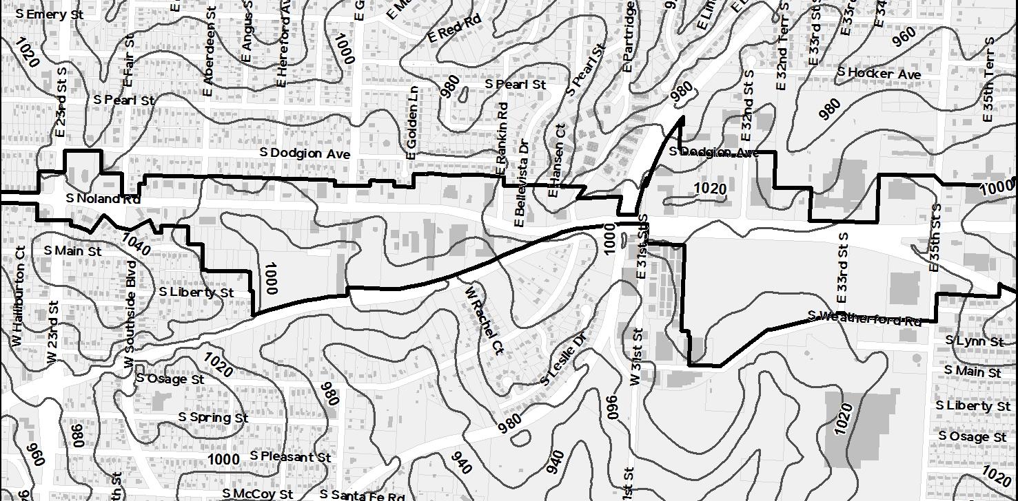
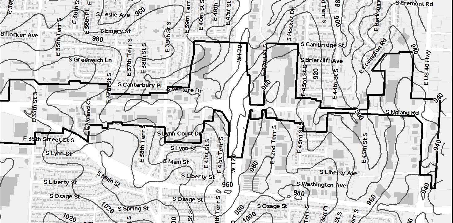
The majority of Noland Road, as shown in Figure 2.22: Existing Topography, is relatively flat. From Truman Road to 35th Street, the changes in grade are quite shallow. South of 35th Street however, the road drops considerably before bottoming out between 44th Street and 40 Highway. This slope creates the potential for fantastic views, especially for visitors entering the corridor from the southern end.
The properties adjacent to Noland Road typically sit higher than the road, but not significantly so. In places where the grade difference is more dramatic, properties rely on low walls to effectively retain grade.
The Storm Water Division of the City of Independence Water Pollution Control Department (WPC) manages the public storm water utility. WPC has developed watershed studies for the drainage basins along the corridor which include the Crackerneck Creek Watershed Drainage Study, Adair Creek Watershed Drainage Study, and the Spring Branch Creek Watershed Drainage Study. Any redeveloped properties will be required to detain and mitigate storm water runoff per current codes.
The Sanitary Sewer Division of WPC operates and maintains the sanitary sewer utility. The existing development along the corridor has sanitary sewer service provided by gravity mains. The sewer mains generally follow the drainage patterns of the adjacent land.
Missouri Gas Energy provides services the corridor. Information collection and analysis for gas services is incomplete at this time. The Plan will be updated as new information becomes available.
Independence Power and Light generally has overhead 3 phase power along the corridor that provides electric service to the existing developments. The Plan will be updated with electrical information as it becomes available.
Water mains generally run in a grid pattern along the corridor. A 24” transmission main runs in Noland Road right-of-way for most of the corridor. Distribution mains ranging in size from 6” to 12” connect to the 24” transmission main and provide water service to the adjacent developments. Water service is provided by the City of Independence Water Department.
Information is currently being gathered from AT&T. As information becomes available, analysis will be performed, and the Plan will be updated.
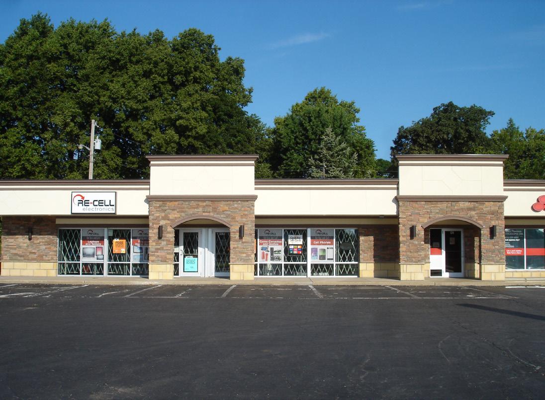
Though the corridor certainly has real shortcomings that need to be identified and addressed, it is also true that progress is already underway. A number of deteriorating properties have been redeveloped or undergone major building and site improvements in the last three years, including:
• QuikTrip (1201 S Noland Rd)
• KC Complete Auto Service (200 E 23rd St)
• McDonald’s (1225 S Noland Rd)
• State Farm/Re-Cell Building (1214 S Noland Rd)
• Dickey’s Barbecue Pit (1348 S Noland Rd)
• Walmart Neighborhood Market (3411 S Noland Rd)
• Subway (3850 S Noland Rd)
• Red Lobster (4328 S Noland Rd)
The impact of these and other successes along the corridor is significant. Their contributions to the continued revitalization of the corridor can be most easily felt in the following ways:
As has been discussed previously in this document, the City’s development code and its ability to enforce said code has likely undergone major changes over the life of the corridor. As a result, properties being redeveloped in 2015 are subject to a higher standard than those developed thirty, twenty, or even ten years ago. The redevelopment examples listed above are, without exception, visual improvements over those that they replaced.
When projecting the future revitalization of a commercial corridor, planners often identify the redevelopment of nodes as a potential catalyst for future growth. The theory is that the successful redevelopment of nodes, typically located at key intersections, will hasten the revitalization of adjacent properties.
Given its location within the corridor and the greater Independence community, it is clear that the intersection of 23rd Street and Noland Road qualifies as a key node. So the fact that so many of the recent redevelopment projects are located at or near this intersection is a prime example of how the theory may play out at other key intersections throughout the corridor.
The Noland Road CID is funded by a 3/4th cent sales tax that is anticipated to generate $30 to $35 million over the life of the district. Those funds will be strategically allocated to leverage additional private investment along the corridor. Redevelopment projects that result in an increase in sales tax generation will add dollars to the CID funding pool. In turn, Added CID dollars will almost certainly lead to additional private investment.
That is why the redevelopment of the Walmart Neighborhood Market (formerly Gaslight Shopping Center) is such a positive indicator for the future of the corridor. Projects like this, which took a failing retail center and transformed it into a sales tax generating hub, will have an undeniably positive impact on the corridor for many years to come.


Given the scope of the analysis presented in this document, it seems appropriate to look back and summarize its most salient points before moving on to the next stage of the Noland Road Corridor Plan. They are as follows:
• Retail- and service-related commercial uses dominate the corridor.
• There is still a sizeable amount of undeveloped land within the corridor. This is at least in part an effect of the proximity of the railway.
• Auto-related uses account for nearly a quarter of the uses within the entire corridor. Their largest concentration of use occurs from Gudgell Avenue to Rankin Road.
• General office uses are largely underrepresented.
• The corridor is devoid of parks and meaningful open space.
• The corridor itself does not include any residential uses, but it is surrounded by residential neighborhoods in all directions. Existing zoning suggests that it will stay that way.
• Occupancy rates are generally high throughout.
• Single-tenant, single-story uses represent the standard model of development.
• Building and site conditions are good to fair with only a few exceptions.
• The areas with the highest concentrations of strip retail also have the highest concentrations of fair properties.
• Building are overwhelmingly single-story and lacking in unifying architectural qualities. Noland Road has no definable architectural style.
• The lack of cross access between properties contributes to the proliferation of access points along Noland Road and discourages pedestrian activity.
• Most sites have limited to no internal landscaping. Parking lots lack landscape islands, building foundations are left exposed, and overstory trees are few and far between.
• The typical building along Noland Road is oriented toward the street with parking in front and moderate to large setback. This combination does little to attract pedestrian activity.
• Roadways, curbs and gutters, sidewalks, and street lights are all in generally good condition.
• There are several large segments of Noland Road that do not have sidewalks on one or both sides of the road.
• There is an overabundance of access drives along Noland Road
• The need for landscaping has been essentially ignored until very recently. There are few street trees and effective parking lot screening is nonexistent.
• Though the City’s UDO includes improved landscape requirements, the requirements for perimeter parking lot screening are still not enough.
• The corridor is overrun with pylon signs, which are still allowed by the City’s UDO.
• There are no gateway elements within the corridor.
• The streetscape, when combined with the character of the properties that line it, feels out of scale and out of balance.
• Crash data obtained from the City over the three year period from 2012 to 2014 showed that in general, intersections throughout the corridor are functioning below the statewide average crash rate.
• Calculated crash rates have identified segments with higher collision patterns.
• Short segment lengths and high driveway density along the corridor is considered to be a contributing factor of the section crash rates.
• Generally, intersections along the corridor operate at acceptable LOS with the exception of select movements as detailed in the prior sections of the report.
• Three of the City’s bus routes serve at least a portion of the corridor. The Purple Line runs along Noland Road for much of its route.
• There are no dedicated bike routes within the corridor, and traveling along Noland Road without one is not a safe alternative.
• Existing sidewalks along Noland Road are only five to six feet in width, which is too narrow to consider as a bike route.
• Though existing sidewalks are in good condition, there are several large segments of Noland Road that do not have sidewalks on one or both sides of the road.
• There are no parks or trails located within the corridor.
• Though there are several parks and trails in the surrounding areas, direct pedestrian access is limited.
• From Truman Road to 35th Street, Noland Road is mostly flat.
• From 35th Street to 40 Highway, Noland Road slopes more dramatically. This slope establishes the perfect setting for view framing along the corridor.
• Adjacent properties typically sit slightly higher than Noland Road, occasionally relying on low retaining walls to make up the difference.
• Any redeveloped properties will be required to detain and mitigate storm water runoff per current codes.
• Sewer mains generally follow the drainage patterns of the adjacent land.
• There have been several successful redevelopment projects along Noland Road in the last three years, including the Walmart Neighborhood Market, as well as a group of properties at or around the 23rd Street intersection.
• These successes have impacted the corridor by improving the visual aesthetic, encouraging future reinvestment, and creating added CID funds that will have a lasting impact.


The following section is a summary of the major findings and conclusions found in Appendix B: Economic Analysis & Market Positioning Analysis, completed by Canyon Research Southwest, Inc. in September of 2015. It provides important summaries for: economic and demographic indicators; analysis of the competitive markets for retail, employment, and housing; and recommendations for the future growth, redevelopment, and revitalization of the corridor. These findings can be invaluable tools in the planning and redevelopment process, but forecast demands for growth only reflect potential. They do not impel or require the Noland Road CID to capitalize on potential markets if doing so does not align with the wants, needs, and desires of the district.
A trade area’s purchasing power is a function of consumer population and income levels, while the demand for specific types of goods and services is influenced by the age and education of consumers. Therefore, the trade area’s population, age composition, educational attainment and income levels play significant roles in the demand for a variety of retail goods and services.
Many of the existing businesses operating in the Noland Road CID cater primarily to the surrounding neighborhoods. Therefore, the primary market area encompasses approximately a 14 square mile area bounded by Truman Road to the north, Independence/ Kansas City boundary to the south, Lee’s Summit Road to the east and Sterling Avenue to the west. Primary market area economic and demographic characteristics relevant to retail demand include:
• The 2015 primary market area population is estimated at 40,232 people. The primary market area is mature urban area with the 2020 population estimated to increase by just 247 residents;
• An estimated 17,224 households are in the primary market area supporting an average household size of 2.32 residents;
• In 2010 the primary market area’s median age was 40.8 years. By 2020 the median age is forecast at 41.6 years with the 45 to 64 and 65+ age groups accounting for the largest populations at 25.4 percent and 20.8 percent, respectively. People ages 45 to 64 possess the highest incomes and per capita consumer spending levels. Per capita retail expenditures by seniors 65+ years old is 41 percent lower than people ages 35 to 64 years;
• The primary market area’s current housing stock totals 18,773 dwelling units, of which 65.8 percent are owner occupied, as noted in Figure 3.1. The average home value is $147,245 with 62.6 percent of all homes values between $100,000 to $199,999;
• The primary market area’s median household income of $43,095 lags behind the national and statewide averages. The impact of the lower income level may result in below average per capita retail expenditures. Nearly one-quarter of primary market area households possess annual incomes of $75,000 or more and the ability to support above average retail expenditure levels on such consumer items as food, personal services, apparel, household furnishings, entertainment, automobiles and healthcare;
• When compared to the statewide average the primary market area population is less educated which may translate into below average wages, retail expenditures, and spending on such retail categories as personal services, apparel, household furnishings, entertainment, automobiles and healthcare. The educational attainment levels may place limitations on the demand for professional office space within the primary market area, but are suitable for industrial space demand;
• The work place population for the primary market area is 17,501, led by the retail trade (38.4%), services (35.9%), and finance, insurance and real estate (6.5%) sectors; and
• Excluding automobile sales, annual retail sales for the primary market area are estimated at approximately $554 million.
The big-box retailers in the Noland Road CID support an expanded trade area defined as a 10-minute drivetime from the intersection of I-70 and Noland Road. Demographic characteristics within this secondary market area that influence the composition of retail sales include:
• The secondary market area’s current population of 146,848 people is forecast to reach 148,894 by 2020;
• An estimated 60,359 households are in the secondary market area supporting an average household size of 2.38 residents;
• The secondary market area population is younger than that of the primary market area. In 2010 the secondary market area’s median age was 39.0 years. By 2020 the median age is forecast at 40.1 years with the 45 to 64 and 65+ age groups accounting for the largest populations at 27.0 percent and 16.7 percent, respectively;
• The secondary market area’s median household income of $46,074 exceeds that of the primary market area by 6.9 percent. Nearly 28 percent of primary market area households possess annual incomes of $75,000 or more;
• The secondary market area’s current housing stock totals 39,927 dwelling units, of which 58.2 percent are owner occupied. The average home value of $144,243 is 2.0 percent below that of the primary market area;
• The work place population for the secondary market area is 66,563, led by the services (38.7%), retail trade (32.5%), and finance, insurance and real estate (5.2%) sectors; and
• Excluding automobile sales, retail sales in 2015 for the secondary market area are estimated at approximately $1.95 billion.
Noland Road once served as Independence’s largest retail district housing several anchored and strip centers, grocery stores, drug stores, and big-box retailers. Prior to opening of Independence Center in 1974, Noland Road operated as Independence’s principal retail district. Over the years a growing number of major retailers opened locations within the Independence Center node which ultimately lead to its emergence as the City’s largest retail district.
Over the past five years the Noland Road CID has experienced a spike in business investment and new construction activity. Since 2010, $22.6 million in new commercial projects has been permitted for construction. With this new investment has been the arrival of a growing number of national retailers, including Walmart Neighborhood Market, Napa Auto Parts, CVS Pharmacy, Taco Bell, Walgreens, and Jimmy John’s. Noland Road now generates annual taxable sales reported at approximately $180 million.
A total of 181 businesses were identified within the Noland Road CID of which 73 percent are retail trade or FIRE businesses and 27 percent are service businesses (Figure 3.2). Independently-owned businesses account for twothirds of all businesses with chains operating the remaining one-third. The Noland Road CID businesses service neighborhood, local, and regional trade areas.
The primary market area’s pull factor was calculated at 1.39, suggesting it is capturing retail sales at a rate equivalent to 39 percent above the statewide average. This pull factor is proof that the primary market area serves an expanded trade area. However, the well above average pull factor does not suggest that the primary market area is over-retailed and not capable of supporting additional retail sales.
A common perception is that the Noland Road Corridor consists of a significant inventory of vacant commercial space. However, just 119,021 square feet of retail space is currently available for lease within the Noland Road CID, of which over half consists of a former Best Buy and the Marketplace Shopping Center. There is just a 1,500 square foot suite available in the portion of Noland Road north of 35th Street. The district south of Interstate 70 houses over 69 percent of the vacant space, or 82,651 square feet.
The primary market area is estimated to currently generate sufficient retail sales to support 56,885 square feet of additional occupied retail space. By 2020, the primary market area is forecast to support an additional 15,389 square feet of occupied retail space.
To conclude, the Noland Road CID supports a diverse mix of retail and service businesses that varies according to location, demographics, and proximity to transportation corridors. Businesses are predominantly independently owned with chain retailers more prevalent in restaurant, banking, gasoline stations and auto parts businesses as well as near the principal commercial core at the intersection of Noland Road and I-70. The automobile dealerships serve as the principal economic engine attracting customers throughout the Kansas City MSA. For several decades businesses have relocated from Noland Road to the growing Independence Center retail core that caters to a large trade area. Over the past five years considerable investment has occurred within the Noland Road CID accompanied by the market entry of several prominent national retailers.
According to Esri Business Analyst, 301 professional services businesses, 75 health services businesses and 145 industrial-related businesses operate in the primary market area, accounting for 29.3 percent of all businesses. Leading professional businesses in the primary market area include banks and lending institutions, real estate, insurance, and legal. Industrial-related businesses include wholesale trade, manufacturing, transportation, communications, and utilities.
The Noland Road CID lacks a large concentration of professional office space with just 22 businesses identified as being in the business services, legal, finance, insurance, and real estate. The principal advantages of the Noland Road CID as an office location include its Interstate 70 access and close proximity to downtown Independence and government offices. Over the next decade the Noland Road CID is forecast to capture a modest rate of net office space absorption, estimated at approximately 25,000 to 37,000 square feet. The retail center at the northeast corner of Noland Road and Interstate 70 provides the best opportunity to support large-scale office development.
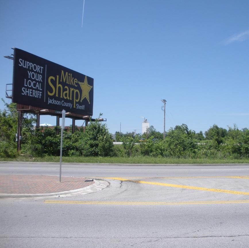
A total of 22 health services businesses currently operate within the Noland Road CID. The principal location for medical office space in the Noland Road CID is along 39th Street and Lynn Court Drive. Positive factors favoring the Noland Road CID as a future medical office location include the existing concentration of physicians and dentists, a large primary market area population, and the ability to support future population growth through infill housing. Over the next ten years, based on population growth projections, the primary market area is anticipated to support an additional 7,200 to 8,000 square feet of medical office space. Accelerated infill housing will increase the supportable inventory of medical office space.
The Noland Road CID currently lacks industrial space, though Unilever Bestfoods on 39th Street and several businesses along 31st Street west of Noland Road are located immediately adjacent. Unilever is currently under construction on an expansion of its existing facility, supporting the position that the Noland Road CID is a viable industrial location. Redevelopment plans for the 29acre RSO TIF district located northwest of 35th Street and Noland Road call for 220,000 square feet of new industrial space. Assuming the RSO TIF is available for development, over the next decade the Noland Road CID is forecast to absorb a modest inventory of industrial space absorption, estimated at 83,000 to 200,000 square feet.
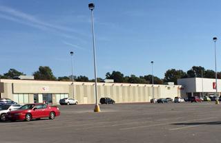
Infill housing construction should be a key component of the South Noland Road Corridor Plan. New infill housing within and adjacent to the Noland Road CID would assist in increasing the demand for commercial space by providing additional customers and retail sales.

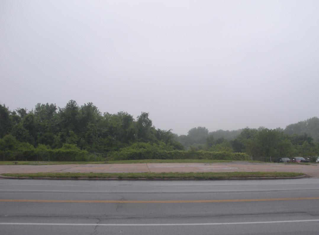
Three prospective sites were identified capable of facilitating large-scale apartment communities, including:

Renters currently account for 29.4 percent of all occupied housing units within the primary market area. The large group of young, single adults represents the primary target market for new rental housing in the primary market area.
In recent years several large-scale Class “A” apartment communities have been built in the vicinity of Independence Center. The newer apartment communities support luxury amenities and well above average rents and illustrate the demand for luxury apartment living in Independence. The existing apartment communities located in the primary market area are older Class “C” properties offering dated design, modest community amenities and unit features, and below market rents. Given the age and condition of the primary market area’s existing multi-family housing stock it appears there is demand for newer market-rate rental units.
The Noland Road CID supports four commercial districts, each supporting a uniquely different mix of business types. A total of 181 businesses were identified within the Noland Road CID of which approximately 73 percent are retail trade or FIRE businesses and 27 percent are service businesses. Independent businesses account for two-thirds of all businesses operating within the Noland Road CID with chains operating the remaining one-third. Eating and drinking places, banks and credit unions, and automobile dealerships are the most prominent retail trade businesses operating in the Noland Road CID. Health services, personal services, and auto repair are the predominant service providers operating in the corridor.
The Noland Road CID supports several tiers of businesses catering to diverse geographic market areas. Most businesses cater to a primary market area defined as the 14 square mile area immediately surrounding the corridor. The corridor’s secondary market area encompasses a 10-minute drive-time from the intersection of Noland Road and Interstate 70, and is largely supported by big-box retailers. The automobile dealerships cultivate the largest market area that includes the Kansas City MSA.
Demographic characteristics that influence a market area’s level of retail sales volumes and consumption patterns include total population, household types, age, income and education. Based on market area demographic characteristics, historic trends in primary market area retail sales, Retail MarketPlace Profile published by Esri Business Analyst, and Noland Road’s current business mix, prospective retail businesses include:
• Sit-down restaurants
• Casual dining (i.e., Panera Bread, Chipotle, etc.)
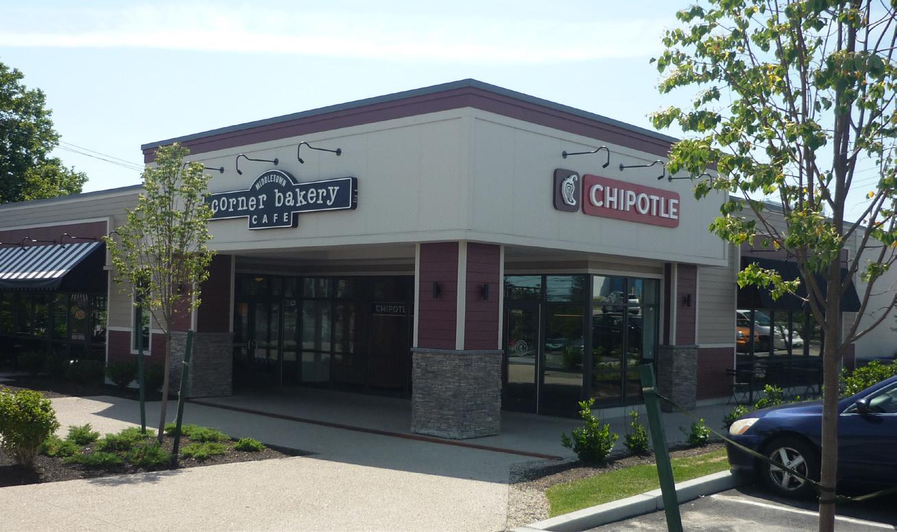
• Coffeehouse
• Apparel and accessories (i.e., men’s and women’s clothing)
• Variety stores
• Hair and Nail Salon
• Home furnishings
• Home electronics and appliances
• Hobby and crafts
• Insurance agents
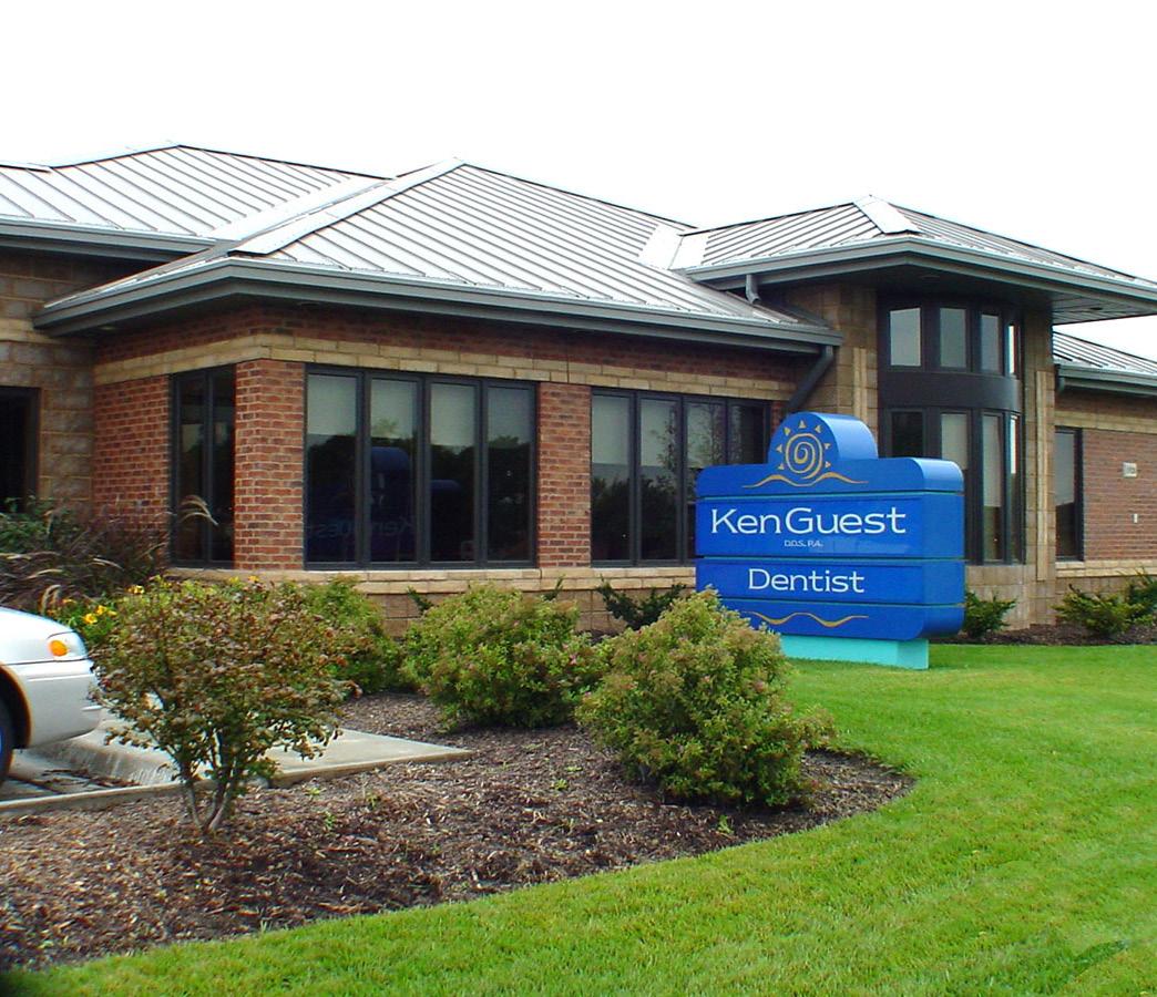
• Personal services
• Medical and dental
A mix of local and national retailers within the Noland Road CID should be encouraged. Local retailers will best define the corridor’s character and image. The greatest opportunity for attracting and supporting new businesses appears to be with those that cater more to the surrounding neighborhoods. Given the close proximity of Independence Center limited opportunity exists to attract big-box retailers to the Noland Road CID, with future potential best suited for the intersection at Interstate 70 that provides national retailers with the access and exposure they require.
The marketing strategy, as summarized in Figure 3.3: Market Positioning Strategy Key Points, will improve the corridor’s business environment and public perception with the goal of enhancing long-term sustainability through attracting private investment, new businesses, and increased economic activity. Given that the automobile dealerships serve as the corridor’s principle economic engine that drives large sales volumes, customer traffic, and market perception, any market strategy must address the need to strengthen and expand the automotive sector. Emphasis should be placed on public infrastructure, economic incentives, maintenance, marketing, and increasing the market area customer base through encouraging population and employment growth.
Prepare a capital improvement plan to anticipate and fund necessary public infrastructure on a timely basis. Upgraded public infrastructure, including streets, sidewalks, public utilities, landscaping, lighting, banners, and signage, would assist in establishing a unified theme and presence for the corridor. Specific emphasis should be placed on improving the corridor’s aesthetics, pedestrian connectivity, and vehicular movement. Establishing signature “gateways” will create boundaries, a sense of arrival and place for the corridor, as well as improve public perception.
Building improvements are usually the first visible evidence of positive economic change in a traditional commercial district. During the early years of a revitalization program, though, business and property owners may be reluctant to make substantial capital investments in building improvements. Economic incentives should be utilized to stimulate new investment, development, and businesses into the Noland Road CID. Many commercial properties in the Noland Road CID are showing their age and are in need of capital investment. Property and business owners should be encouraged to make capital investments that could include:
• Façade improvements to enhance aesthetics and property values;
• Additional landscaping; and
• Improved infrastructure and signage.
The Noland Road CID should assist in financing a portion of the cost of capital investments with matching grants or low cost loan programs.
Several tax increment financing (“TIF”) districts are in place within the corridor that funded public improvements. Tax increment financing offers local governments a means to revitalize their communities by expanding the tax base without imposing property and sales tax increases on the whole community. The future creation of additional TIF districts could be considered to assist financing of specific “impact” developments.
The Noland Road CID should also assist in financing the cost of the ongoing maintenance and upkeep of funded capital improvements. Doing so would ensure the longterm intended benefit of these improvements.
An essential component of enhancing the Noland Road as a desirable retail location for businesses and shoppers is establishing a universal promotional campaign highlighting the corridor as a diverse and unique retail destination. Key elements in the creation of a corridor-wide promotional campaign are:
• Adopt a strategic retail plan that includes the character of the corridor.
• Promote area residents to shop local;
• Attract shoppers from outside of primary market area;
• Coordinate special events and promotions with automobile dealers’ advertising;
• Maintaining brochures, maps, flyers and other marketing materials for the entire corridor and individual retail districts;
• Adding signage to promote businesses and retail districts;
• Maintaining a website promoting corridor businesses, special events and attractions; and
• Conduct survey research designed to monitor customer and public perceptions and levels of satisfaction with the corridor’s retail market and individual districts.
Increasing the housing stock through infill development will be a key component in enhancing the pedestrian activity and economic vitality of the Noland Road CID. A mix of attached housing is recommended, including apartments and senior housing.
Encourage employment-related office and industrial development, increasing the day-time population and associated demand for goods and services.
1 Prepare a Capital Improvement Plan to guide public infrastructure improvements.
2 Incentivize building improvements, assisted in part by the Noland Road CID.
3 Consider the creation of additional TIF districts, specifically for “impact” developments.
4 Identification of a funding source and creation of a plan for ongoing maintenance of improvements.
5 Craft a universal promotional campaign highlighting the corridor as a diverse and unique retail destination.
6 Increase the housing stock through infill development.
7 Encourage employment-related office and industrial development.


For several years, the many discussions that were had about the revitalization of Noland Road were undocumented. There was significant consensus on the need for change and reinvestment in Noland Road. As a crucial step in the development of the Noland Road Revitalization Plan, it was critical to discuss, document, and analyze those discussions, distill them into key issues to be addressed, and refine them to help define a clear direction for the Plan’s recommendations.
In October of 2015, the Noland Road Community Improvement District (CID) Board of Directors met to participate in a visioning workshop. The workshop was focused on an open discussion of wants, needs, desires, and issues. Metrics for determining success were discussed and formulated. Through this process, the Board of Directors identified and prioritized projects, identified areas of improvement, and narrowed the focus on key issues.

The Visioning Workshop was conducted with all Board members present. Through facilitation by the planning team, key issues were uncovered and consensus was developed, as well as their prioritization in the Plan. The following is a summary of the input received from the Board of Directors during the Visioning Workshop.
The stakeholder visioning workshop was designed to answer the following questions:
1. What is working in the corridor?
2. What is not working in the corridor?
3. What is missing from the corridor?
4. What needs to be removed from the corridor?
Through discussion of the above questions, a 15 item list was created in order to highlight important projects and focuses of the plan. The list was prioritized to further narrow the scope of the plan.
An overview of the responses to the four questions is as follows. A full list of responses can be found in Figure 4.1.
The Board indicated that the following list of actions and items have been successful: automobile dealerships, past and current redevelopment projects (such as QuikTrip and Dickey’s Barbecue Pit), traffic flows, customer accessibility, and the corridor’s potential to capture market growth.
Board members found the blighted properties, outdated signage, lack of sidewalks, and certain businesses, including pawn stores, title and payday loan stores, and tattoo parlors, were leading to a lack of unifying vision and consistency to the corridor.
The Board identified the need for updated signage, appropriate land use regulations (to regulate use, architecture, and landscaping), and pedestrian connectivity to encourage a consistent corridor design.
Members of the Board specified their desire to remove problematic businesses along the corridor, outdated signage and building facades, and curb cuts.

The stakeholders indicated that numerous building facades and site layouts were problematic throughout the corridor. Outdated facades and signage were specifically mentioned.

Three sections of corridor:
• 23rd St. - 35th St. (very successful)
• 25th St. - I-70 (somewhat successful)
• I-70 - US 40 Hwy. (unsuccessful)
Dealerships
Traffic flow
Perception:
• Locals see vibrancy and improvements
• Locals do not see railraods, signs, age, and architecture as deterrent
Infill
Convenient due to road network and location
Population density
New businesses are successful
Current City development guidelines
Customer accessibility
Lack of competition, translating to opportunities
Potential to capture the market
Funding for projects through CID funds
Lack of bad publicity
Genuine stakeholder interest and care
New investors and owners
Value proposition on available property
Lease ratse are low (good for short term)
Unique retail mix leading to less competition
Sit down restaurants
Appealing signage, graphics, and overall corridor image
Directional, wayfinding, noticing, and welcoming signage
New patrons and new growth
Clear sense of identity:
• Vision
• Gateways at key nodes and major gateway
• Repetition of architectural materials
• Removal of bad signs
• Visually appealing screening of obtrusive uses
• Encouraging redevelopment (tearing down)
Updated site planning codes
Further restriction on title loan land uses
Updated land use codes for CID only
Connectivity for pedestrians within corridor, from surrounding neighborhoods, and for aesthetics
Appropriate access from Noland Road based on use
Meaningful landscape and streetscape
Maintenance of infrastructure and landscape
Redevelopment
• Uncoordinated efforts mainly north of 39th Street
Low quantity of sit down restaurants by I-70
Lack of adjacent open space next to corridor
Perception:
• Non-locals see negatives first (railraod, signs, age, and architecture)
• Locals notice vacancies and lack of aesthetics
Blighted properties
Signage (old, not displaying current businesses)
Lack of consistency in design
Many driveway cuts
Old buildings with outdated facades
Industrial uses are not buffered or screened
No unified vision; corridor developed organically
No assurance of protected investment
Low surrounding income levels
Lack of new housing
Lack of sidewalks and connectivity
Many tattoo businesses
Many pawn stores
Many title loans and payday loans
Lease rates are low (not good for long term)
Tattoo, pawn, title loan, and payday loan stores
Outdated building facades
Outdated, incorrect signage
Unnecessary curb cuts
Following the discussion of the four questions previously identified, the Board of Directors culled those lists for the top issues that needed to be addressed. This list of fifteen key issues was then prioritized by the Board of Directors after thorough discussion and independently ranking each key issue. This prioritization process and narrowing exercise then yielded a ranked list of key issues that the Board of Directors desired to be addressed by the Corridor Plan and as next steps for implementation. The following table, Figure 4.2, indicates the key issues and their ranking.
Other items were included on the list, but received no additional ranking. Those issues are summarized on Figure 4.3. It should be noted that these four items are important and were already identified as a part of the top 15 issues to be addressed, but are lower in priority to the other issues identified in Figure 4.2
Ranking Topic
I-70 entryway/gateway
Maintenance of landscape, streetscape, and infrastructure
Design guidelines for corridor
Landscape and streetscape
Business marketing program with national-level promotions
Overlay district to guide uses and design
Redevelopment
23rd Street gateway
Reinvigorate business community along the corridor
Electronic/digital business signs
U.S. 40 Hwy. gateway
Ranking Topic
Signage
Building facades
Buffering uses
Development of undeveloped land
"The List of Key Issues to be Addressed" is the outcome of a stakeholder visioning workshop. By prioritizing, stakeholders and the planning team were able to focus on seven improvement projects to allocate funds and planning efforts towards. Each improvement area has a similar motivation: improved and consistent aesthetics, redevelopment opportunities, and the corridor’s long-term success. These projects are outlined as follows:
Serving as a primary gateway, this entryway will consist of columns and decorative railings that would be incorporated into the existing interchange area. Establishing a physical structure that welcomes visitors to Independence is key. Maintained landscaping improvements around the columns and walls of the bridge would add to the aesthetics of the gateway. The I-70 gateway is priority one—it establishes a feeling of modernity and vibrancy, and would serve to entice travelers and welcome visitors to Independence and Noland Road.
A variety of landscape, streetscape, and infrastructure improvements will be made in the corridor, either through private reinvestment or capital improvements. These improvements may include: street trees, lighting, landscape buffers, landscaped medians, crosswalks, sidewalks, and banners and signage. Stakeholders prioritized the longevity of the improvements, which will require hiring and scheduling maintenance services. Proper and timely maintenance of these improvements will demonstrate property owners’ dedication to the corridor and ensures the corridor’s success into the future.
Corridor design guidelines work to establish consistency in the physical improvements along the corridor. By establishing development details, concepts, standards, and policies, a desired visual character is institutionalized. It may be necessary for the CID Board of Directors to hire a design professional to review development plans for new projects along the corridor to ensure compliance with the design guidelines if the development is utilizing CID redevelopment assistance funds. The stakeholders prioritized this development review process.
As stated in Maintenance of Landscape, Streetscape, & Infrastructure, streetscape and landscape improvements may include: street trees, lighting, landscape buffers, landscaped medians, crosswalks, sidewalks, and banners and signage. The stakeholders prioritized aesthetics; landscape and streetscape improvements are a logical action step towards improving aesthetics. Streetscape improvements can also increase the street’s functionality by consolidating access points or the addition of bike or bus lanes.
In order to stimulate redevelopment, the stakeholders prioritized the creation of a business marketing program to spread awareness of site-specific redevelopment opportunities. This may take the form of a website and a mapping system to provide site details, CID redevelopment assistance funding opportunities, and design assistance. Promotions on the national scale will encourage large corporations to locate along the corridor.

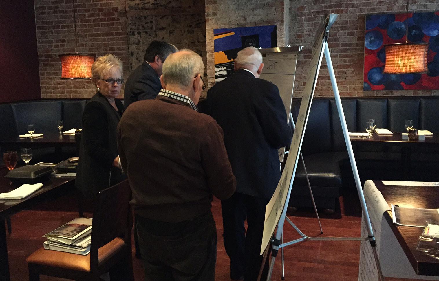
Similar to Design Guidelines for Corridor, an overlay district to guide uses and design will focus on improving aesthetics and directing physical improvements along the corridor. An overlay district serves as a regulatory tool and is set by the City as a special zoning district. The overlay adds special provisions to the district, in addition to those in the underlying district. Stakeholders prioritized the use of this tool to further monitor and ensure consistent physical improvements, including façade and site improvements.
As one of the two major CID funding allocation categories, redevelopment assistance will be used to encourage, enhance, and leverage new or redevelopment of existing properties to improve the overall quality of the corridor. This funding source will aid in redevelopment and infill efforts. This improvement area includes identifying potential retail nodes that could centralize commercial property at hightraffic intersections. Redevelopment activities will seek quality development, while maintaining the visibility and signage needs of the tenants.


While the previous sections of this document focused on the collection and analysis of information, Section 5.0 Recommendations aims to distill down even further by identifying the essential issues at hand. Once identified, recommendations are proposed to address said issues. The recommendations can be viewed as a guide or playbook for future efforts to enhance, revitalize, and sustain success along the Noland Road Corridor.
As stated in Section 1.4, the Vision for the Noland Road Corridor Plan is:
“THE REVITALIZATION OF NOLAND ROAD SHALL FOCUS ON CREATING AN INVITING AND VIBRANT ATMOSPHERE THAT REINVIGORATES BOTH THE BUSINESSES AND THE SURROUNDING COMMUNITY.”
The guiding principles for achieving this vision are:
1. Define a new direction for Noland Road that ensures long-term economic sustainability for property owners, businesses, and the community.
2. Elevate market potential and encourage reinvestment in Noland Road by private property owners and businesses.
3. Create a welcoming, distinctive, and cohesive environment by improving the streetscape, building architecture, site development, and branding elements of the corridor.
4. Establish a complementary mix of uses that encourages and enables a “live, work, play” atmosphere.
5. Optimize circulation and traffic flow in order to create a more accessible and inviting corridor for all users.
6. Improve the quality of life for both the corridor and the surrounding community. Improve safety and perceptions of safety.
7. Create a new identity for Noland Road that leverages its unique history and celebrates the revitalization and reinvigoration of the corridor.
The Noland Road Corridor Plan recommendations, in combination with their implementation strategies (see Section 6.0 Implementation), offer a long-range approach to realizing the desired vision and guiding principles. For the sake of clarity and focus, the issues and recommendations have been divided into five categories. They are as follows:
1. Land Use & Zoning
2. Development & Redevelopment
3. Transportation
4. Aesthetics & Character
5. Economic Sustainability
The recommendations for each category are accompanied by a set of supporting graphics and strategies aimed at both illustrating the proposed improvements and detailing their contribution to the desired Vision. Implementation strategies are discussed in greater detail in Section 6.0 Implementation, but it is important to first understand the opportunities that exist to achieve each recommendation.
Though the recommendations have been divided into categories, there will undoubtedly be overlap. This unavoidable overlap illustrates just how complex and layered a corridor plan of this nature can be. In order for the corridor plan to be successful, all recommendation categories must be considered in concert with one another. Only then can the vision for Noland Road be realized.
Land use planning is a tool used by cities and planning professionals to address both the current and future needs of a growing or shifting population base. It establishes guidelines for future development patterns that serve the community through a healthy, balanced mix of land uses. In the case of Noland Road, the balancing of uses is key to long-term sustainability.
• The corridor is dominated by retail- and service-related uses.
• Auto-related commercial uses are prevalent throughout the corridor. In particular the Automobile Sales District is defined by its concentration of car dealerships, which help drive traffic to the area. Consideration of future expansion of this district is key.
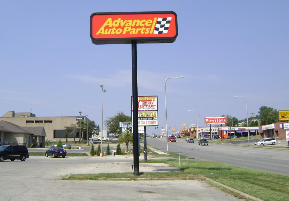
• Though much of corridor is surrounded by residential neighborhoods, only a very small percentage of properties along Noland Road have a residential use.
• The variety of housing options in the surrounding area is limited, particularly those that might attract a younger demographic with disposable income.
• As the age of the area’s residents continues to rise, there may need to be some consideration of the needs of the senior population.
• General office uses are largely underrepresented along the corridor.
• The corridor lacks parks and quality open space.
• Given the proximity of schools and residential neighborhoods, as well as the desired vision of the corridor, room for the expansion of industrial uses appears limited.
• There are a select number of large, undeveloped areas within or directly adjacent to the corridor.
• The corridor lacks the proper balance of uses that are required to create a truly vibrant place.
1. Establish a Future Land Use Plan that serves as a guide for future development and redevelopment decisions.
2. Encourage a mix of uses along Noland Road, with the goal of creating a fully integrated district where people can “live, work, play.”
3. Prioritize commercial and mixed uses at the key nodes along Noland Road, located at the intersections of 23rd Street, Gudgell Avenue, 35th Street, 39th Street, I-70, and 40 Highway.
4. Develop, approve, and enforce new development standards for Noland Road that reflect the desired vision for the corridor, while also coordinating with the intended uses of the Future Land Use Plan.

While site-specific development and redevelopment recommendations will be provided in the following subsection of this document (see 5.3 Development & Redevelopment), it is important to first establish a land use framework (see Figure 5.1: Future Land Use Recommendations) for said recommendations. Having such a framework in place will lead to informed decisionmaking and complementary uses. What follows is a description of the nine recommended land use categories.
This is the most broadly defined of the land use types, and the one that most commonly aligns with the current uses along Noland Road. Allowable uses include retail and service, dining, entertainment, and lending institutions. Lots are typically limited in size, accommodating one- to two-story buildings that are either of the stand-alone or strip center variety. They generally front or have direct access to Noland Road, and their tenants tend to be a mix of local and national businesses, servicing the residents and employees of the surrounding community.


Office and medium/high density residential should also be allowed within this land use type, under the condition that they are part of a mixed use development or building that includes an approved commercial use. If uses are combined within a single, multi-story building, retail, and other commercial uses should occupy the ground floor.
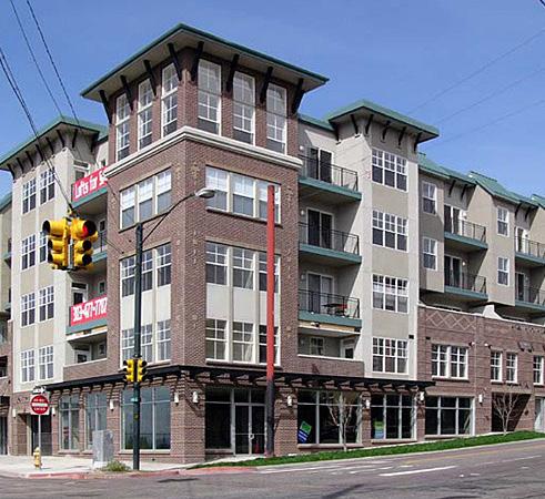

As the name suggests, this land use type applies to large lots located at major nodes. Lots are ideally positioned for a big box retail use and accompanying uses, such as hotels or restaurant pad sites, that operate as a destination for the community and possibly the region. Essential neighborhood services that require larger lots, like a grocery store, also apply.
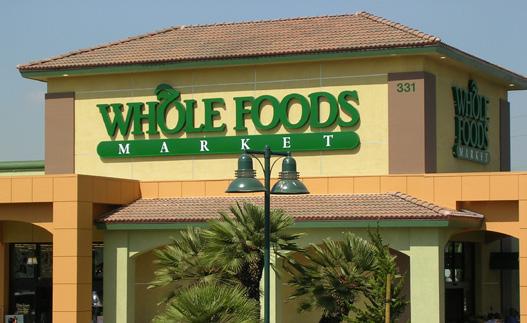
While mixed uses should be allowed to exist within the Retail, Business, and Entertainment zones, this category refers to developments that might typically include a combination of commercial, office, flex space, light industrial, and varying densities of residential. Buildings of different scales and stories should be encouraged, mixing one or more uses within a single development. Developments should incorporate common open space and amenities that can be accessed by residents, employees, and business owners.
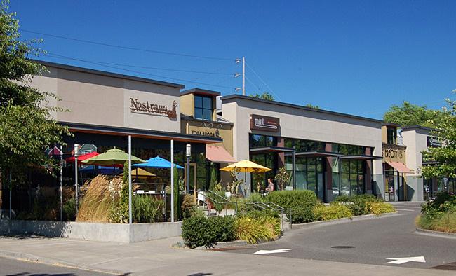

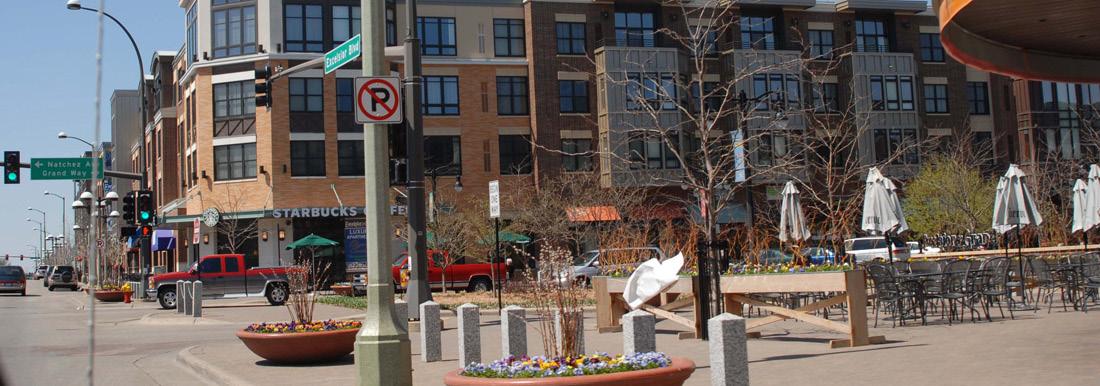
The office land use type refers to uses intended solely for professional service and medical office space. Typically, this single-function land use type should not directly front Noland Road.


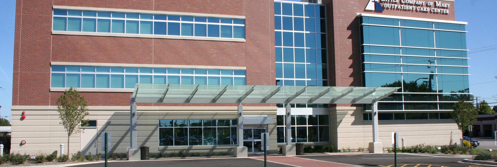
The Auto Sales and Service land use type includes the auto dealerships that define the “Miracle Mile,” but also automobile-related services and sales, such as body and repair shops, parts stores, rental companies, car washes, and gas stations. Though some of these uses naturally extend into the Commercial Retail, Business and Entertainment zones, the intent is to encourage the majority of them to be concentrated in the portion of the corridor from Gudgell Avenue to 33rd Street. This can be done by coordinating the development and design standards for this stretch to better accommodate the needs of Auto Sales and Service uses.
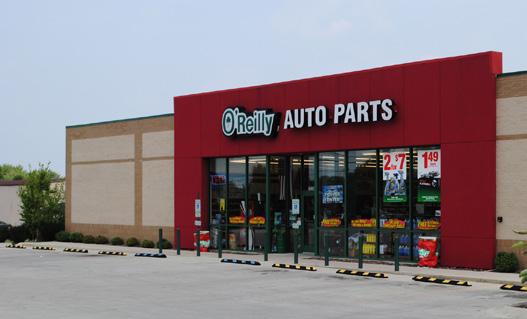
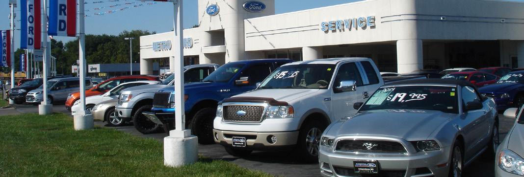
This land use type refers strictly to infill single family housing. Lot sizes and architectural characteristics should complement the surrounding neighborhoods.


The medium/high density residential category refers to a variety of multi-family housing types that should aim to diversify the housing market, attracting college students, young professionals, and senior citizen. Examples may include apartment complexes with shared amenities, walk-up apartments, townhomes, senior housing, and condominiums.

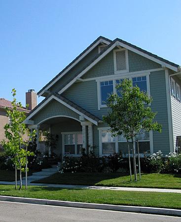
This category refers to preserved land, either privately or publicly owned, that serves as a dedicated park or open space. Parks should provide a tangible amenity to the community, while open space should add to its aesthetic character.

The diagram below is a guide for sustainable development and redevelopment along the corridor into the future. While each recommended land use may not differ from what currently exists, this diagram ensures complementary uses.
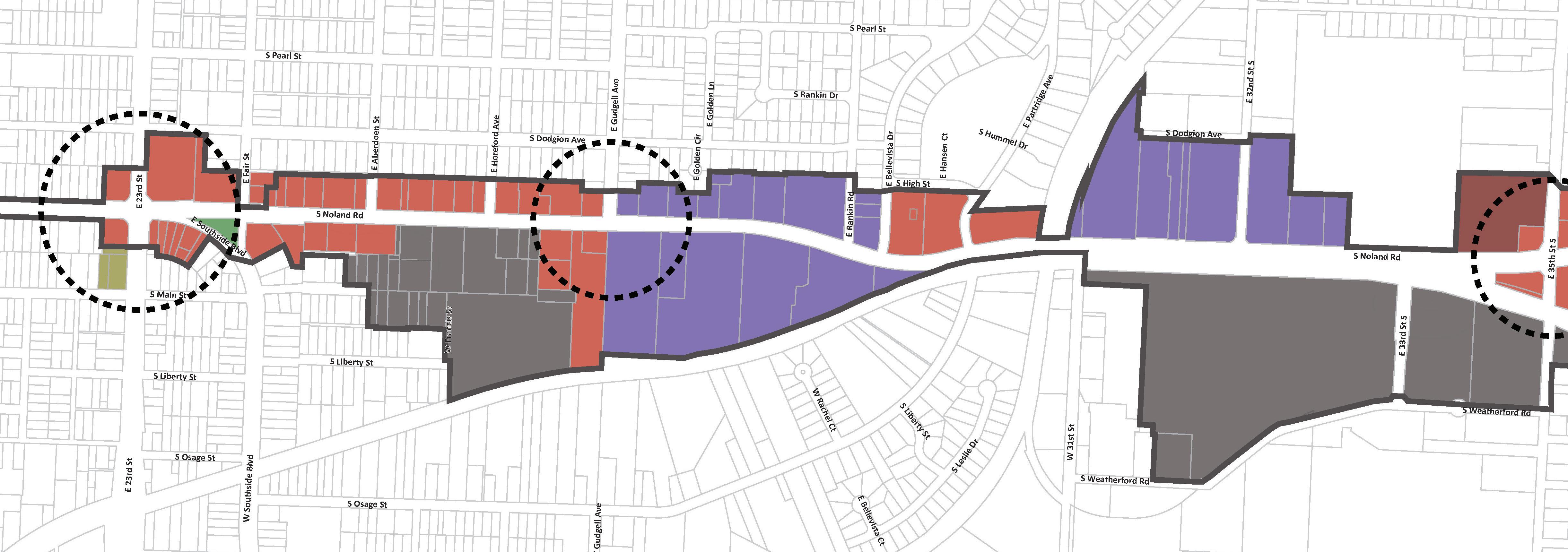

The diagram below is a guide for sustainable development and redevelopment along the corridor into the future. While each recommended land use may not differ from what currently exists, this diagram ensures complementary uses.
NORTH
CID Boundary
Commercial Node
Retail, Business, & Entertainment
Large Lot Retai
Auto Sales & Service
Mixed Use
Office
Parks & Open Space
Low Density Residentia
Medium/H gh Density Residentia
One of the key strategies for revitalizing Noland Road is the prioritization of nodes. The concept of a node can vary considerably, depending on the scope or scale of a project; for the purposes of this plan, a node is defined as follows:
A compact area, centered at a high-traffic intersection, which serves as a hub of activity for the residents, employees, and visitors of the community.
The success of a node tends to bleed into the surrounding areas, encouraging private reinvestment that might not have otherwise occurred. For an aging commercial corridor the size of Noland Road, active nodes are absolutely essential to its long-term health and sustainability. In order to maximize the impact of these activity hubs, factors such as land use, density, multi-modal access and connectivity, aesthetics, identity, user experience, and more must be coordinated with one another. Such coordination will help to encourage the kind of vibrant atmosphere described in the Noland Road Vision.
Considering Noland Road’s existing land use patterns and transportation networks, 23rd Street, Gudgell Avenue, 35th Street, 39th Street, I-70, and 40 Highway intersections all function as nodes.
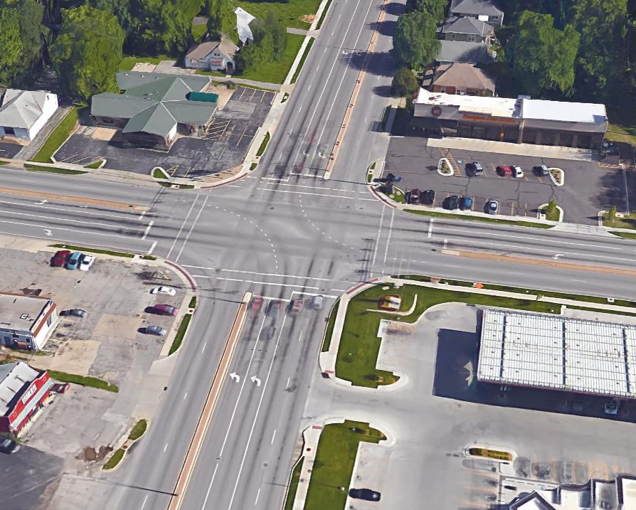
In regards to land use, the commercial nature of the corridor means that node development is less about the differentiation of uses, and more about the intensity of said uses and their ability to draw added foot traffic. In short, identified nodes should be populated by commercial or mixed use sites that attract visitors from the surrounding community and beyond. Though major retail developments are ideal for achieving such a goal, market trends, combined with the physical realities of each node, may dictate how they are used both now and in the future. The 23rd Street intersection, for example, which is surrounded by shallow lots, does not have the same ability to accommodate a major retail tenant as the I-70 intersection does.
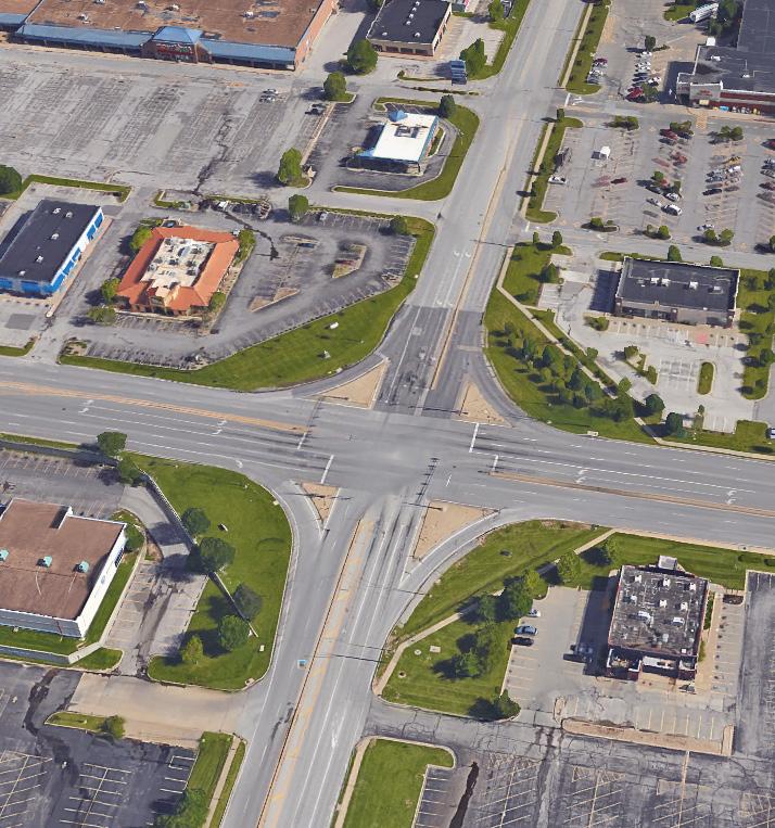
STRATEGY TO ADDRESS RECOMMENDATIONS 2-4
Many of the negative issues that Noland Road faces are due to poor, unchecked, or outdated development standards. For this there is no quick fix. No reasonable amount of funding will solve the problem overnight. Instead, the solution must be of the long-term variety. New standards that accurately reflect the Noland Road Corridor Vision should be developed and approved without delay. Given the nature of the CID, the existing development review policies of the City of Independence, and the growing number of viable projects along the corridor, action steps should be divided into the following three groups.
Redevelopment and development projects are not stagnant along Noland Road; reinvestment is increasing daily along the corridor. In order to not miss opportunities to positively impact current projects that are soon to be seeking City approval, a regulatory tool must be put in place.
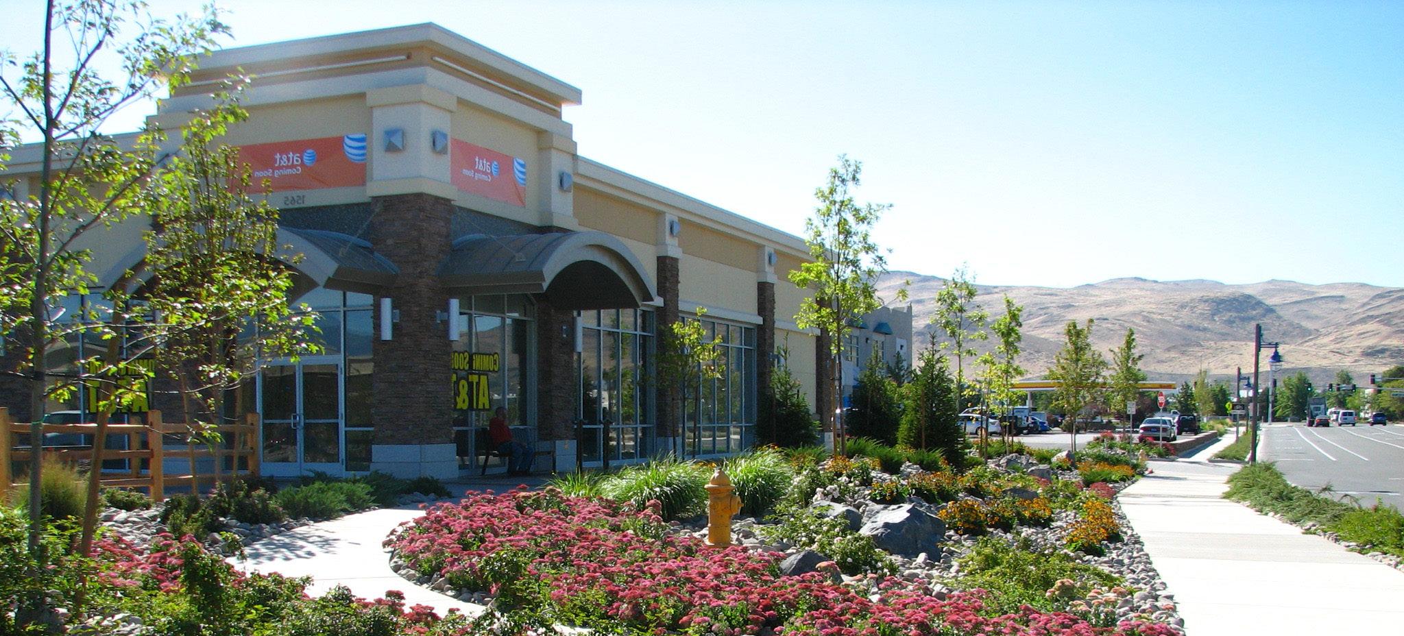
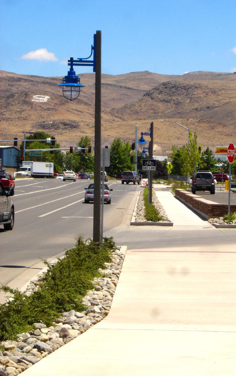

A primary issue that Noland Road currently faces is the large number of dated, poorly maintained signs, which ultimately translate to visual clutter. To best combat this phenomenon, it is recommended that the area defined by the CID boundary be rezoned to a Special Sign Character Overlay District immediately, as the current sign regulations will continue to allow the reuse or construction of dated sign styles that do not enhance the aesthetic of Noland Road.
One purpose of a Special Sign Character Overlay District is “to ensure street graphics compliment and or preserve the character of special areas within the city where standard sign regulations would result in inappropriate signage”
(14-904-02-B., City of Independence, Missouri Unified Development Ordinance). While inclusion in such a district is critical, the eventual approval of new development standards and design guidelines will serve to regulate signage in a similar fashion and will ultimately replace the signage regulations set forth in the Special Sign Character Overlay District.
This second set of standards should be crafted with the intent of having it adopted by the City of Independence and rolled into their Zoning Ordinance. Developed as an overlay, The Noland Road District (NRD) zoning standards should address typical site development issues, such as land use, building orientation, setbacks, density, coverage, access, parking, landscaping, and signage. Creation of this district will ensure that all future improvements required to go through the development review process will be expected to meet the adopted standards.
The overlay district should be flexible enough in nature to allow and even encourage the mixing of complementary uses that might lay the foundation for the dynamic, vibrant atmosphere that is envisioned. Ingraining this flexibility in the zoning framework will allow Noland Road to more deftly adapt to the needs of an ever-changing market.
Given the unique character of Noland Road and the definable sections along the corridor, such as the “Miracle Mile,” it is recommended that the NRD be divided into subdistricts to best guide corridor enhancements. Subdistricts, written correctly, acknowledge the unique uses and character of a given area, while also complementing the corridor as a whole. Similar features and improvements will be incorporated into each subdistrict, but each should have its own established standards that fit the aesthetic quality of the subdistrict.
The creation of subdistricts also allows for a staged approval process for the NRD, which may be necessary depending on the level of support from property owners within each subdistrict. Regardless of a staged approach or a singular approval of the overlay, the establishment of the NRD is a top priority.
While the NRD is intended to be integrated fully into City policy, the Noland Road Design Guidelines will be approved, enforced, and maintained by the District. All property owners who apply and receive funding from one of the incentive programs will be required to follow the standards set forth in the Guidelines.
As a staged approval process may be necessary for the NRD, overlap will certainly exist between the Guidelines and the NRD regulations. This way, those projects receiving CID funding will be required to meet certain development and design standards, regardless of the property’s location along the corridor.
Though the Guidelines may not be adopted as City policy, the expectation is that both City staff and elected officials will rely on the document as a valuable resource throughout the development review process. Those wishing to build or redevelop along Noland Road will be informed and educated about the Guidelines and encouraged to meet their standards.
The hope is that over time, the application of the Guidelines by participating properties will lead to increased expectations for everyone along the corridor. Owners who have neglected maintenance and necessary improvements in the past may feel added pressure to keep pace. This “Raise the Bar” approach will also benefit from the added weight of the public streetscape improvements being recommended for Noland Road.
The Guidelines should consider the following:


One of the primary engines for the revitalization of Noland Road is the transformation of the streetscape aesthetic. Developing a desired look and then crafting appropriate design guidelines ensures that all future streetscape improvements contribute to the aesthetic vision for the corridor. Guidelines and approved standards for site furnishings, lighting, fencing and walls, paving, crosswalk treatments, and landscaping should all be addressed. This family of approved streetscape elements should be selected with an understanding of how they complement one another, as well as how they match the other considerations of the Guidelines. Where possible, approved branding should be integrated into the improvements.
Though the architectural character of the built corridor cannot be impacted in the short-term in the same way that the public streetscape can, effective guidelines will result in steady, long-term improvement to the Noland Road aesthetic. The architectural guidelines should focus on exterior design elements such as façade and roof materials, storefront signage, entries, awnings, and window treatments. The Guidelines should be reflective of successful commercial development trends in the marketplace, but also be grounded by traditional architectural characteristics that stand the test of time.
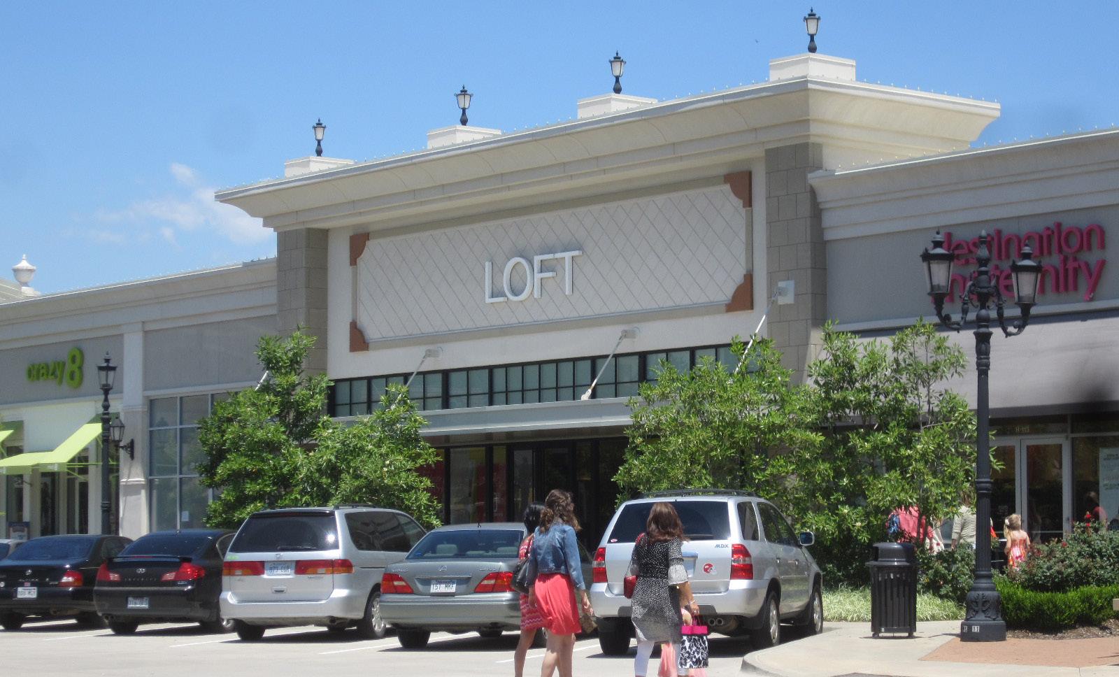
So much of what makes for a vibrant, inviting corridor can actually be attributed to site development. Both the NRD and the Guidelines should detail site development standards. Items such as vehicular and pedestrian access, cross-access between properties, landscaping and screening, fencing and retaining walls, site furnishings, and lighting should be covered.
Stakeholders emphasized the negative impact that pylon signs have on the perception of Noland Road. To resolve this issue, consistent guidelines should be developed for new and enhanced signs that address the approved standards related to size, material, colors, and placement. The Guidelines should create consistency along the corridor, but also encourage creativity and tenant branding. Additionally, consideration should be given to major tenants and multi-tenant sites, so as to not limit visibility.
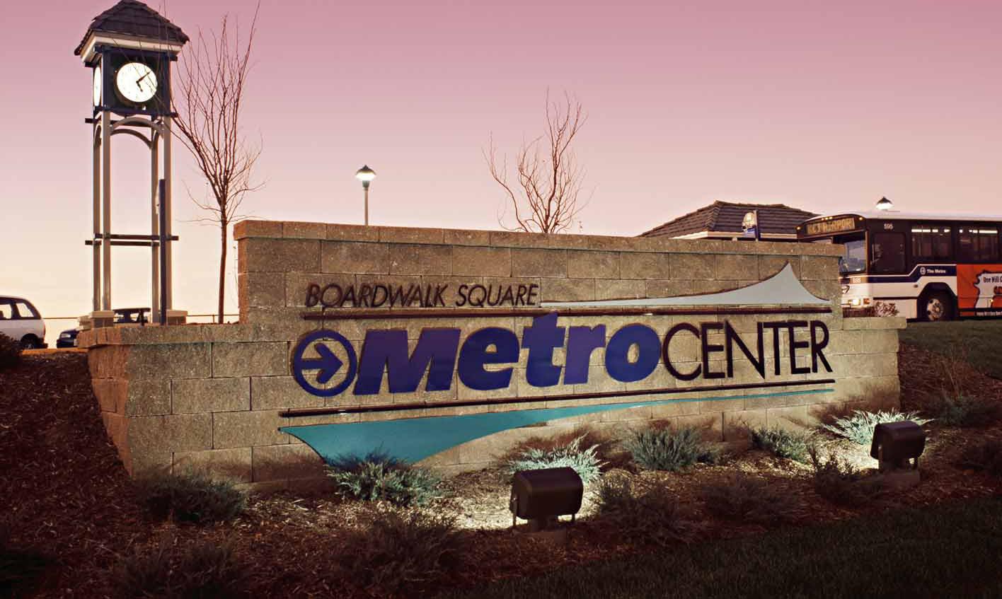
Development and redevelopment are essential components of this plan. Done properly, with the appropriate guidelines in place, they have the ability to transform the perception and economic viability of a commercial corridor in a way that capital improvements cannot achieve on their own. Though development and redevelopment recommendations should be targeted and focused in location and use, they should also be adaptable to the ever-changing dynamics of the market.
• The intersections along Noland Road that absorb the most vehicular traffic are also likely to attract the most interest from developers. The redevelopment and/or reinvestment in these intersections, and the property that surrounds them – often referred to as nodes in this document – is key to the long-term viability of the corridor.
• Noland Road is largely built out, but there are a few undeveloped areas in or directly adjacent to the corridor that are significant in size and would accommodate the type of development that might result in increased jobs, revenue, rooftops, or some combination of the three.
• Though the vacancy rates along Noland Road are relatively low, there is an overabundance of outdated strip center developments that limit the mixed use potential of the corridor and hampers its ability to attract larger, revenue-generating tenants.
• Typical site development characteristics along the corridor include large building setbacks, front and side parking, limited cross access between adjacent properties, and excessive property access along Noland Road. This pattern of development is not conducive to pedestrian activity, thus limiting the corridor’s potential.
• The building facades along Noland Road lack many of the common architectural characteristics that can be found in town centers and mixed use shopping districts developed in recent decades. Furthermore, many of the facades are aged in a way that does not reflect well on the corridor.
• The frontages along Noland Road are awash in grey. Parking lots are oversized, lack adequate screening and landscaping, and typically do not incorporate pedestrian connections to the buildings. Simply put, they are a visual eyesore for the corridor that caters too heavily to vehicular convenience.
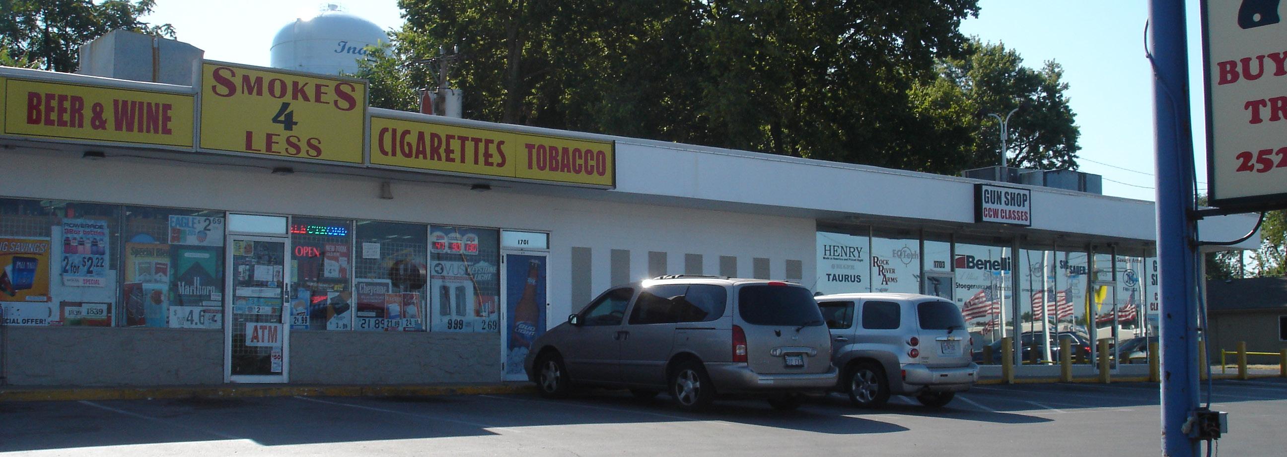
• The railway running parallel to Noland Road is likely a limiting factor in the potential development of the property at the northwest corner of the 33rd Street intersection. Its presence limits access to this site and may be perceived as a visual and noise nuisance to investors.
• The district does not currently offer any financial incentives to developers or property owners looking to make improvements to their buildings or sites.
1. Prioritize redevelopment and reinvestment in commercial or mixed use nodes at 23rd Street, Gudgell Avenue, 35th Street, 39th Street, I-70, and 40 Highway.
2. Facilitate the development of previously undeveloped land in a way that fits within the context of the Noland Road Vision and reflects the demands of the market.
3. Stimulate redevelopment and reinvestment in the remaining portions of the corridor that extend beyond and in between the major nodes.
4. Develop, approve, and enforce new development standards for Noland Road that reflect the desired vision for the corridor.
For many of the recommendation strategies that follow, a Map ID Tag # has been provided. This tag coordinates with an identical tag on Figure 5.12: Development & Redevelopment Recommendations, allowing the reader to more easily locate the site-specific strategies being proposed. Additionally, many of the sites and nodes have associated opportunities and constraints of development. Priortizations of (H) high, (M) medium, and (L) are also included.
For many of the redevelopment and development strategies that follow, the consolidation of properties may be necessary in order to produce a development type deemed appropriate and desirable to the targeted tenant groups. This holds especially true toward the north end of the corridor, where lots are often quite narrow. The recommended redevelopment area identified with Map ID Tag 21 on Figure 5.12 is also a good example. In order to effectively redevelop that particular area, consolidation is a likely first step.
Node redevelopment is a critical component of the revitalization of the Noland Road Corridor. Done successfully, thriving nodes are likely to fuel additional private reinvestment in the surrounding areas. This can already be seen in the recent redevelopment successes that have occurred at and around 23rd Street. The QuikTrip, McDonald’s, and KC Complete Auto Service properties were all redeveloped in recent years, while the State Farm Building underwent major façade improvements. Most recently, Dickey’s Barbeque Pit moved in after renovating its building. Though these properties were not necessarily redeveloped in coordination with one another, they theoretically enjoy a symbiotic relationship in which the success of one benefits the other.
As previously discussed, establishing successful commercial nodes is a complex endeavor that must consider multiple overlapping factors like land use, multi-modal access and connectivity, aesthetics, identity, user experience, and more. Though specific recommendations have been provided to address all the above considerations, they have been broken up into subcategories in order to make them more easily digestible. What follows is an overview of the proposed redevelopment recommendations for each of the six key nodes:
Redevelopment of the 23rd Street Node is already well underway, and the reinvestment it has fueled should serve as an example for the rest of the corridor. The former shopping center located at the southeast corner of the intersection was demolished and replaced by a new QuikTrip. That spawned additional redevelopment projects, including the new McDonald’s to the south, KC Complete Auto Service to the north, and a renovated State Farm Building to the west.
However, that still leaves the properties at the northwest and southwest corners of the intersection for future redevelopment. Both are currently occupied by uses that do not positively influence this key node. Though the size of the lots does limit the flexibility of these spaces to some extent, they would be an ideal fit for a business- or service-related commercial use that might benefit from the high visibility and traffic volumes of the 23rd Street intersection.
1 The northwest corner is next to an underused parking lot, and if acquired, allows this corner to be redeveloped into a larger commercial building, parking, and attractive walk-up apartments that front the street. (H)
Prime location for activity and visibility
Surrounded by recent redevelopment successes
Shallow lots
Limited access from Noland Road
Must purchase adjacent parcel for parking needs
2 The southwest corner consists of narrow parcels that host an auto service shop, a tattoo parlor, and the State Farm Building. This corner should be consolidated and redeveloped in a way that complements the character and site layout of the renovated State Farm property. (H)
Prime location for activity and visibility
Surrounded by recent successes
Close to proposed triangle park improvements

Shallow/narrow lots requiring consolidation
Limited space for parking
3 The triangular-shaped park south of 23rd Street should also be a major redevelopment component of this node. Currently functioning as passive open space, it has the potential to become a district gateway that hosts a prominent transit stop and pedestrian plaza. (M - H)
Minimal demolition costs
Prime location for activity/visibility/access from residences
Already hosts a transit stop (IndeBus’s Purple Line)
Offers no direct return on investment

In its current state, the Gudgell Avenue intersection hardly resembles a major commercial node. However, it defines the north end of the automobile sales district and includes one of the corridor’s largest development opportunities. Redeveloped properly, this intersection has the potential to serve as a gateway to the “Miracle Mile” and an extension of the 23rd Street successes.
4 The appropriate development of the land west of Noland Road (Santa Fe Trail TIF) could dramatically change the function and appeal of this intersection. The concept illustrated in Figure 5.3 imagines what the area might look like if the land on the west side of Noland was developed as a senior living community, with commercial retail fronting the road.
Under this scenario, the old lake would be preserved and restored so that it might once again be recognized as a community amenity. Though other opportunities may arise in the future, this piece of land seems ideal for the type of mixed use development that does not currently exist within the corridor. (M - H)
Adjacent to surrounding neighborhoods
Significant frontage along Noland Road
Land already consolidated
Minimal demolition costs
Significant slope/topography challenges Gaps in sidewalk network
Environmental issues perhaps limiting restoration
5 If the aforementioned development opportunity to the north is successful, this site will become an important redevelopment piece that could accommodate a variety of commercial uses. Retail would make the most sense along Noland Road, while the back half of the site could accommodate service-related commercial uses. (M - H)
Possibility to be consolidated and redeveloped in conjunction with the larger development piece to the north
Limited visibility from Noland Road (especially western half) Narrow lots limit layout, parking, and circulation possibilities
Gaps in sidewalk network
Bordered by the railway to the west
Outdated existing building
6 Given their location within the district, these two properties are perfect candidates for parcel consolidation and redevelopment for the purposes of expanding the “Miracle Mile.” (M - H)
Proximity to auto dealerships
Possible environmental issues
Shallow lots
Fig. 5.3Looking Southeast
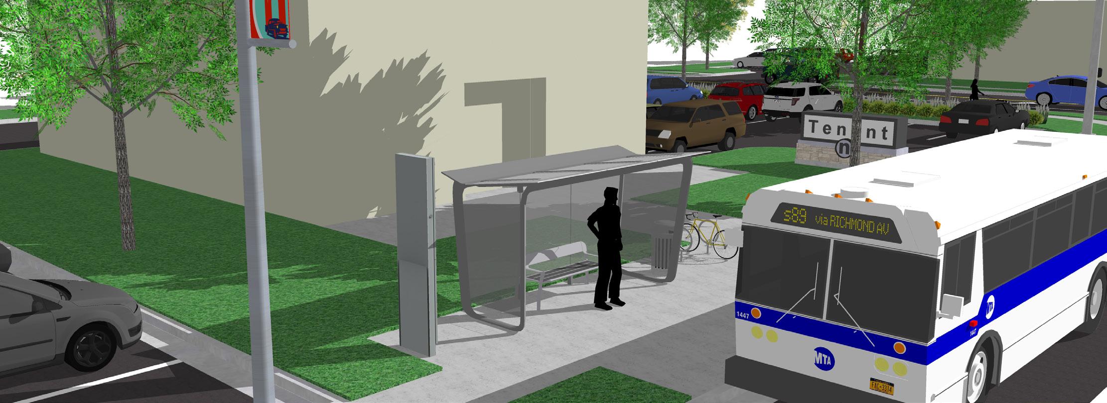
Looking North

Northward Aerial
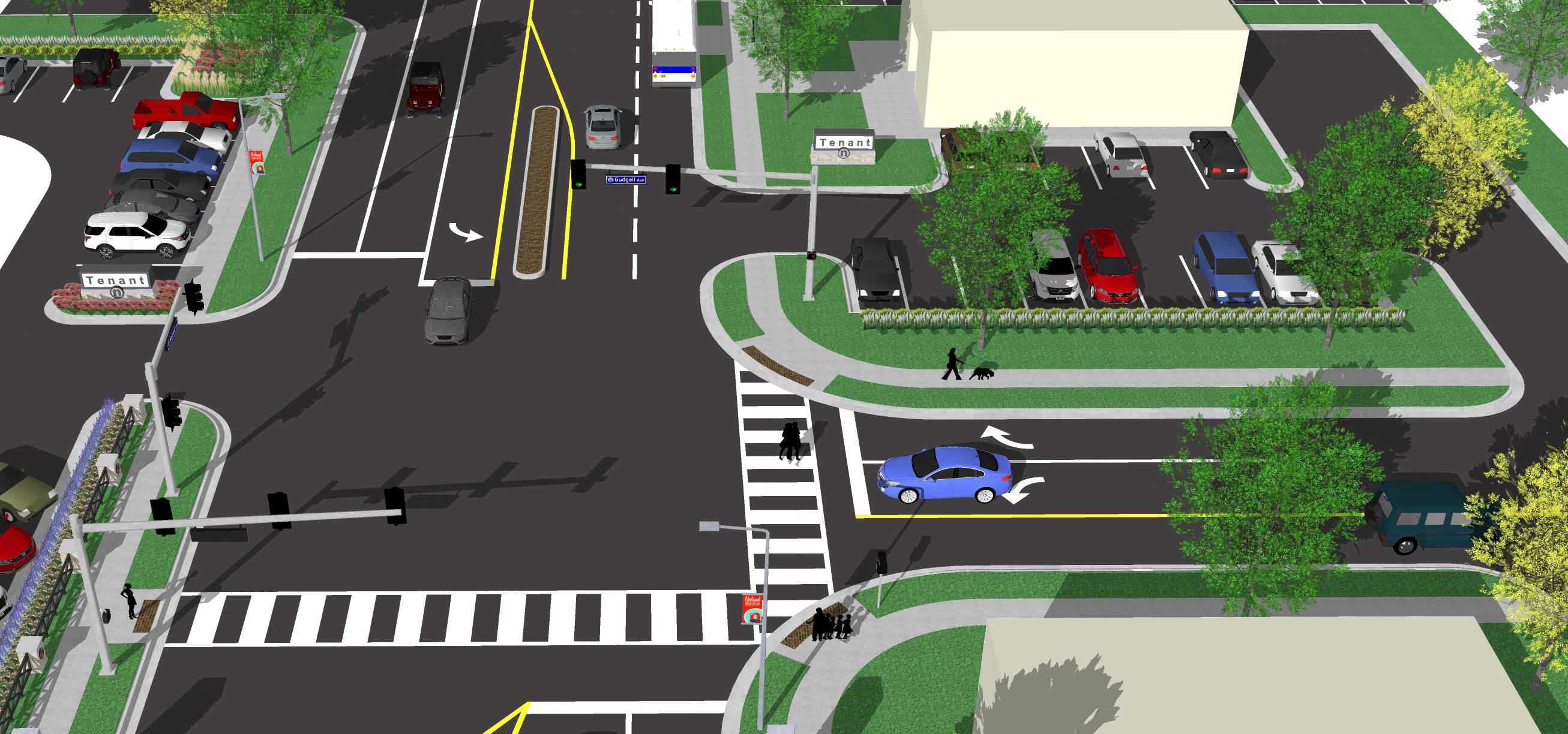
35TH STREET NODE REDEVELOPMENT

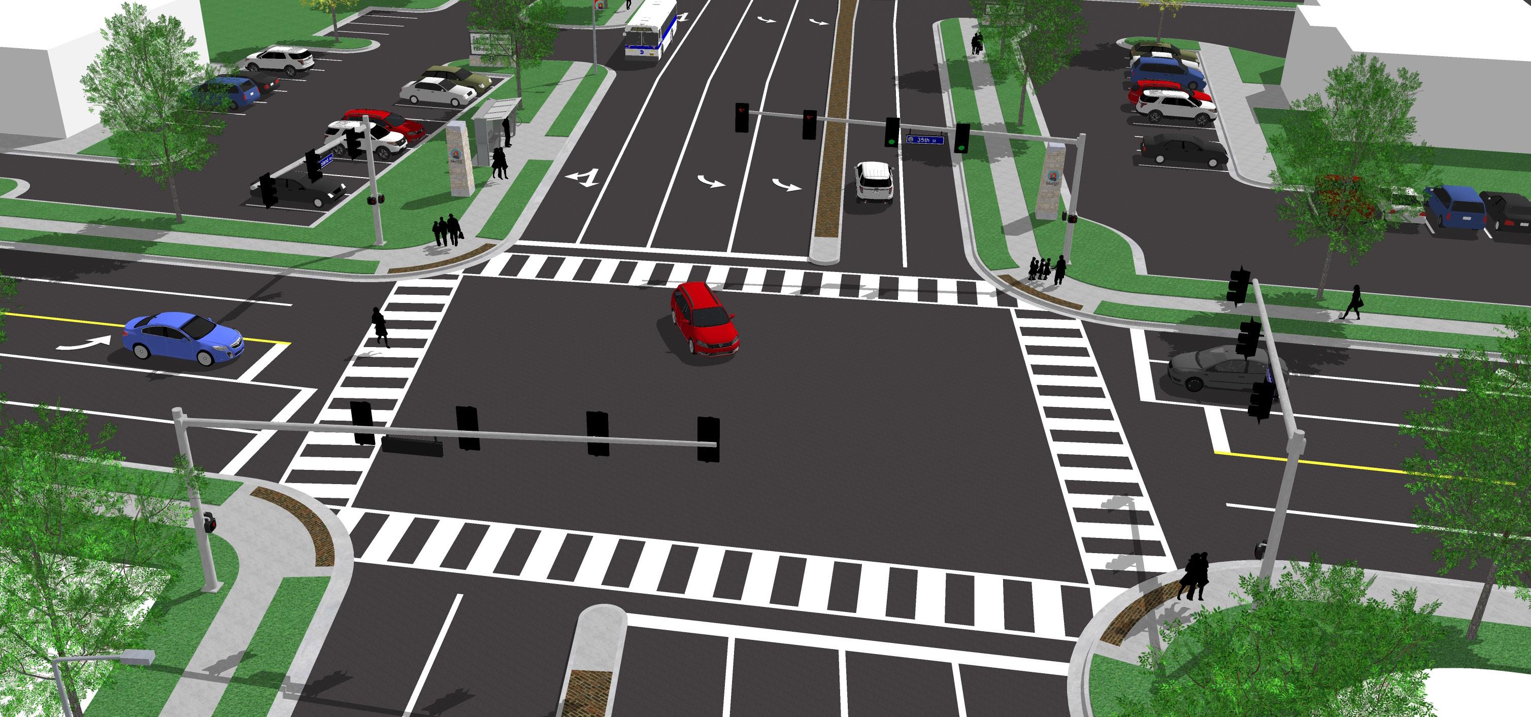
35th Street is a high-traffic intersection located within the central portion of the corridor, making it a perfect candidate for node redevelopment. Walmart’s recent move to the old Gaslight Shopping Center site only accentuates the significance of this intersection. Though major redevelopment opportunities at the corners are limited, there is still plenty that could be done to impact change.
As described under Facade & Site Improvements (Item 33), Noland Plaza and the gas station to the north would benefit from aesthetic enhancements.
7 Moving a little further south, the collection of properties located along Noland Court should be considered for consolidation and redevelopment with a mix of retail, commercial business, and office uses in mind. Though this site is a slightly removed from the 35th Street intersection, it is close enough that its redevelopment could help activate the node. (M)
The size of a consolidated site would allow for a mix of uses
Would require significant consolidation/demolition efforts
Railway limits direct access from the west
39th Street is a major arterial for Independence, collecting traffic from both residents and visitors. The uses at all four corners of this node are well entrenched and do not require major redevelopment. That said, there is still at least one major opportunity that exists.


8 As discussed later in this section under Facade & Site Improvements (Item 39), the business and office medical uses on Lynn Court act as a hodgepodge of individually planned sites with little to no shared access or parking. Reshaping the circulation and parking in this area could dramatically impact the physical function and perception of the sites and businesses that occupy it.
The redesigned circulation and parking would also free up a lot currently being used for parking, allowing it to be redeveloped to accommodate additional service or office uses. (L - M)
Conveniently located between 39th Street and I-70
Access from all directions
Dependent on redesign of surrounding circulation/parking
Limited visibility from Noland Road
Fig. 5.6 39th Street Node Concept, looking to the northeast, showing sidewalks, crosswalks, gateway features, streetscape, signage, and transit stop improvementsThough all six nodes are vital to the revitalization of Noland Road, the I-70 node is of particular importance, both because of its location and its need to be redeveloped. The Noland Road and I-70 Interchange is a welltraveled entry point for both the corridor and the City of Independence, funneling in visitors from the east and west. Despite the prime location, the uses that utilize its corners are quite underwhelming. The northwest, southwest, and southeast corners are occupied by hotels and pad sites, while the northeast corner is the location of a large, but underwhelming retail development at a prime location in the corridor.
Though redevelopment of these corners should be flexible enough to meet market trends and demands, there are certainly some potential uses that are more logical than others.
9 The northeast corner, which is anchored by Kmart and includes a vacant pad site (formerly Chuck E. Cheese’s), should be redeveloped as a commercial or mixed use center with a more modern site layout and architectural design standards in mind. While large lot retail opportunities are limited along Noland Road, this site’s size and visibility present an enticing opportunity for potential redevelopers. It could attract one or more major retail anchors, while also allowing room for additional pad site development. (H)
Lot size ideal for large lot retail or mixed use
Convenient access and visibility from I-70
Excessive parking for existing site could be reduced, allowing for additional site layout opportunities.
Kmart holds a long-term lease for the site
The reusability of the existing buildings is undetermined
Gaps in sidewalk network
10 The southeast corner, currently occupied by the American Inn, is in dire need of redevelopment. Both the aesthetic of the site and the nature of its use speak to a quality of development that this plan is attempting to eliminate. Further exasperating the issues of the site is the fact that it is highly visible to travelers from all directions, contributing to an unfairly negative, but all too real perception, of the corridor that must be reversed. The site should be redeveloped to complement the surrounding retail center anchored by Price Chopper. Food and entertainment pads would be a natural fit. (H)
Convenient access from I-70
Visibility from all directions
Next to successful development, anchored by Price Chopper
Demolition costs
Gaps in sidewalk network
Located outside of the CID Boundary
11 The southwest corner of the intersection presents the greatest challenge, due to the number and diversity of its current uses. However, restaurant pads fronting a larger retail anchor in back would certainly make sense if the necessary property consolidation can be achieved.
(L
Convenient access and visibility from I-70
Located across from the Price Chopper development to the east, which drives traffic to this area
Would require significant consolidation/demolition efforts
Gaps in sidewalk network
Located outside of the CID Boundary
12 While the other corners of the I-70 node are recommended for redevelopment, the two hotels (Best Western and Super 8) on this corner are more likely to benefit from added amenities, better maintenance and operational procedures, and a higher price point. Moderate improvements in these areas have the ability to positively impact perceptions of the corridor. (L - M)
Convenient access from I-70
Limited visibility due to the topography of the site
Located partially outside of the CID Boundary
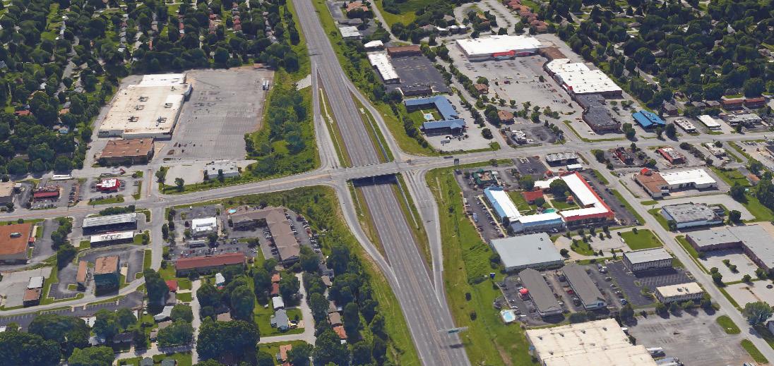
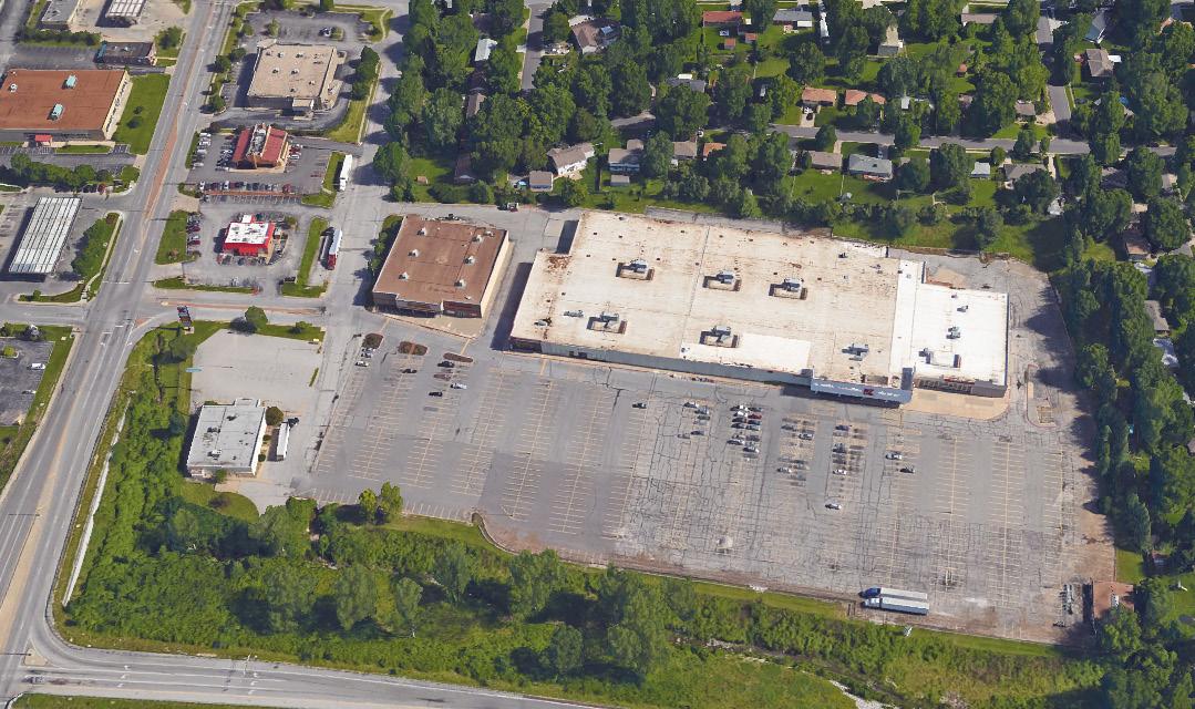
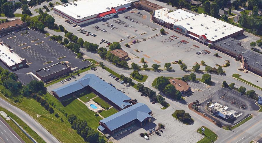
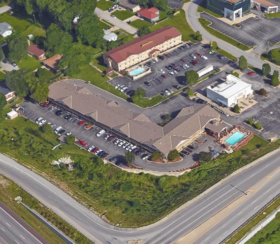
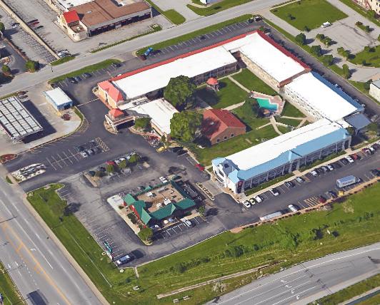

None of the nodes along Noland Road can match 40 Highway in regards to square footage of leasable retail space. However, much of this space falls outside the limits of the district, making it more difficult to address from a redevelopment perspective. What does sit within the boundaries of the district is generally leased out. Given this reality, investment should be largely focused on connectivity (transportation) and aesthetic enhancements, which will be discussed in later sections.
13 The one opportunity that does exist at this secondary gateway node is the pad site that occupies its northeast corner. The former Blockbuster location should be reused or redeveloped to accommodate a restaurant or entertainment use, which would complement the Olive Garden at the northwest corner and the Ruby Tuesday at the southeast corner.
(M - H)
Access and visibility from 40 Highway
Adjacent to high traffic grocery store (Hy-Vee)
Site in good condition
Reuse potential for the building, depending on use
Restaurants located at two of other three corners
Limited pedestrian activity
Adjacent to multiple underutilized retail centers
Fig. 5.8 40 Highway Node ConceptAs would be expected for a corridor the age of Noland Road, undeveloped land is hard to come by. That which does exist may have underlying deficiencies keeping it from being developed. Regardless, as the corridor begins to show signs of revitalization, these sites will undoubtedly become more attractive options for potential developers. What follows is an overview of the five major development opportunities that currently exist within the corridor:
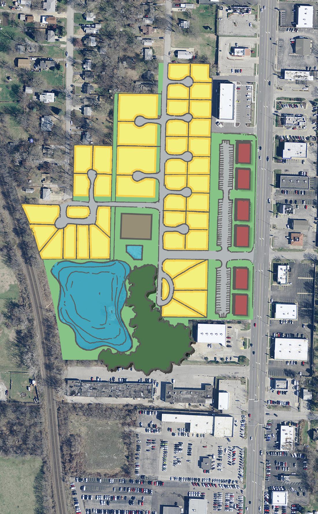

4 This multi-lot area was previously discussed in The Importance of Nodes as part of the Gudgell Avenue Redevelopment Node. In fact, it is the heart of the node. Given its relative proximity to 23rd Street, the successful redevelopment of this area could go a long way toward establishing the north end of the corridor as a major hub of activity. (M - H)
Adjacent to surrounding neighborhoods
Significant frontage along Noland Road
Land already consolidated
Minimal demolition costs
Significant slope/topography challenges
Gaps in current sidewalk network
Environmental issues of old lake may limit its restoration
14 Once occupied by a Perkins restaurant, this site has been vacant since at least 2009. Recently, there were discussions that it may serve as the location for a commuter rail station intended to serve the metropolitan area. However, those plans do not seem realistic at this time and should not be a limiting factor in other development possibilities moving forward. Considering the site’s history, as well as the uses of neighboring properties, the most likely redevelopment alternatives may be either a restaurant or an auto dealership-related use. (M)
Reduced demolition costs (building already demolished)
Good visibility from Noland Road
Located across from another restaurant (Lucky Buffet)
Adjacent to two railway lines
Not close to one of the major activity nodes
15 By far the largest piece of undeveloped land within the corridor, the viability of this site’s development potential is surely impacted by its proximity to the railway running parallel to Noland Road. In addition to the visual and noise disturbances that an active line can cause, it also limits vehicular traffic to one direct access point to Noland Road for the entire area. That said, the right use could flourish in such a location. The concepts shown in Figure 5.10 RSO TIF Development Concepts imagine a few of the ways in which the site might be developed with consideration to its given constraints. (M - H)

Surrounded by multiple industrial and warehouse uses
Adjacent to Lipton Conservation Area and near Santa Fe Park
Wholly undeveloped (limited demolition costs)
Potential to build off the success of Cargo Largo
Railway runs across the entirety of the site’s corridor frontage
Only one allowed access drive along Noland Road
Limited pedestrian connectivity
Limited connectivity amongst the adjacent industrial uses due to a gap in Weatherford Road.
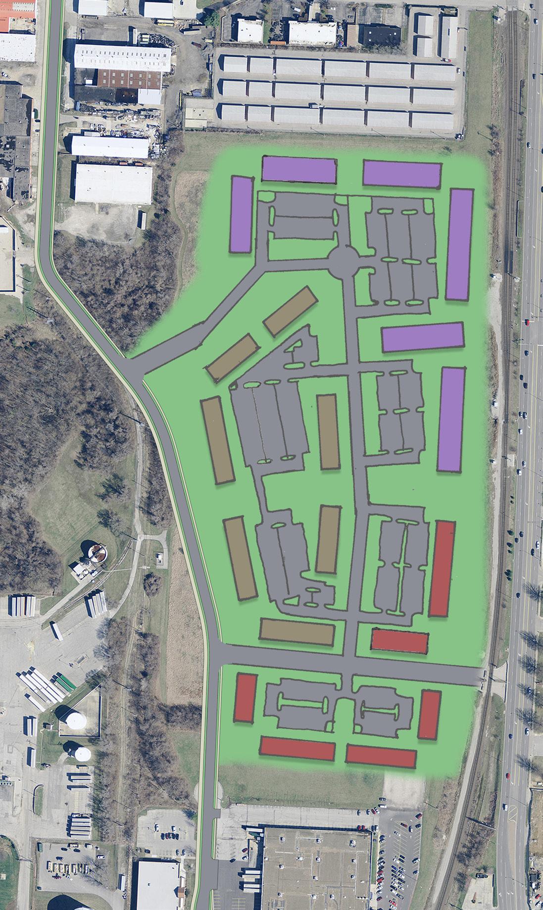
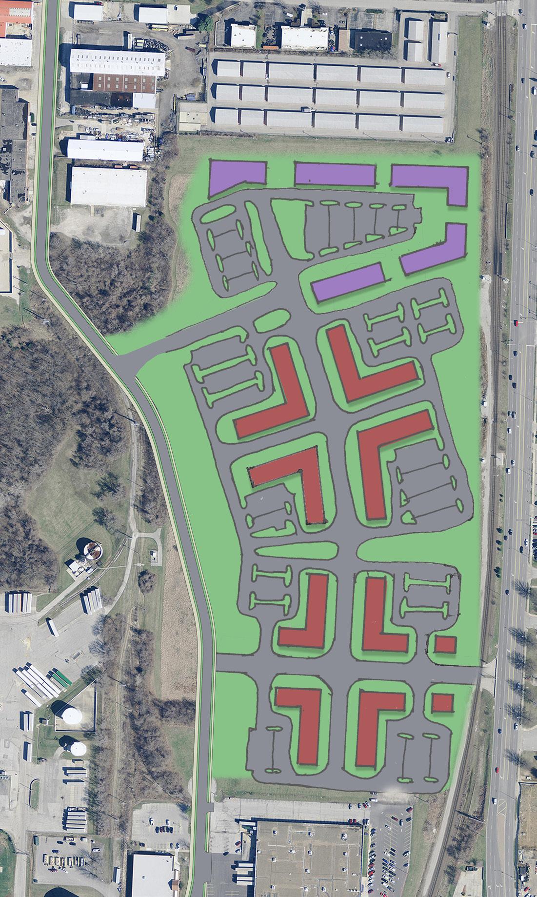
16 Located off the corridor, in back of a commercial strip center and north of an office building, this site could be developed to provide additional Class B/Class C office space. (L)
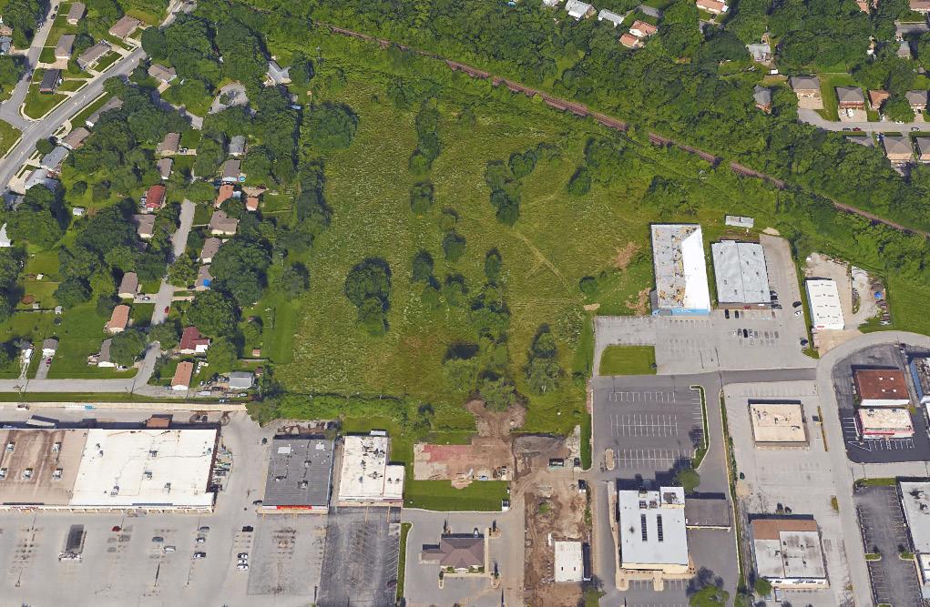
Adjacent to an existing office building
Lot size large enough to meet parking demands
Limited visibility
17 Though located just outside of the district’s boundary, this corridor-adjacent land presents the opportunity to add rooftops via single-family infill housing. The new housing should draw inspiration from the best qualities of Independence’s historic neighborhoods, while offering the typical conveniences of modern construction.
Alternatively, the site could be developed into a Class B apartment complex that would fill the demands of the market. (M)
Wholly undeveloped (limited demolition costs)
Adjacent to existing residential
Potential to be developed as residential, adding rooftops to the area
Limited access and visibility from Noland Road
Bordered by the railway to the west
The diagram below should direct and encourage small-scale and large-scale development and redevelopment along the corridor. The figure acknowledges the importance of nodal development practices, provides additional development and redevelopment opportunities, and proposes site and building aesthetic improvements.
NORTH
CID Boundary
Commercial Node
Prioritized Node Redevelopment Candidate
Development Site Candidate
Corridor Redevelopment Candidate

Site Improvements Candidate
Facade Improvements Candidate
The diagram below should direct and encourage small-scale and large-scale development and redevelopment along the corridor. The figure acknowledges the importance of nodal development practices, provides additional development and redevelopment opportunities, and proposes site and building aesthetic improvements.
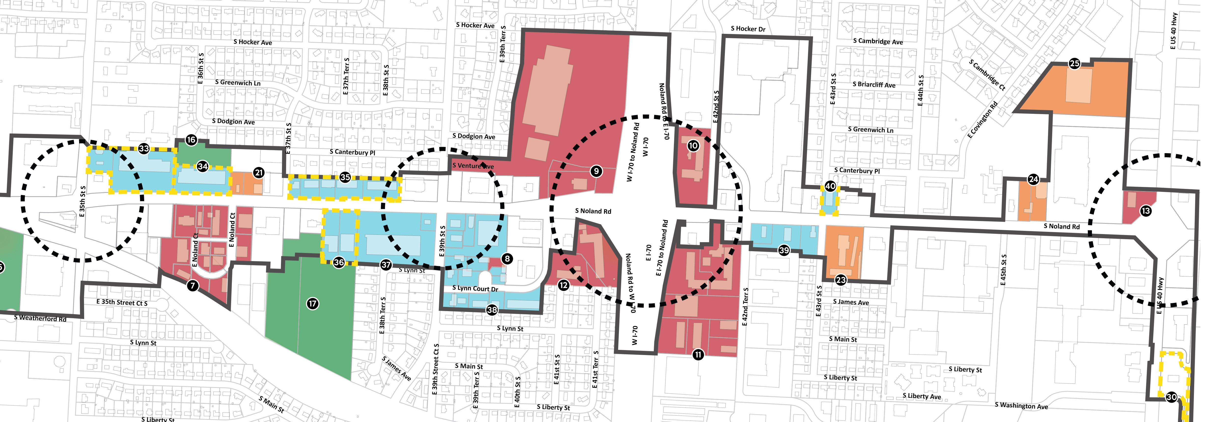
NORTH
CID Boundary
Commercial Node
Prioritized Node Redevelopment Candidate
Development Site Candidate
Corridor Redevelopment Candidate
Site Improvements Candidate
Facade Improvements Candidate
STRATEGY TO ADDRESS RECOMMENDATION 3
Though node redevelopment and the development of unused land will play large roles in reinvigorating the corridor, they cannot and should not be expected to do all the heavy lifting. Instead, there must be a concerted effort to make much needed improvements throughout the remaining portions of the corridor.
What follows is a series of potential redevelopment opportunities and strategies intended to address the remainder of the corridor. These opportunities have been grouped into one of two redevelopment types.
Property Redevelopment refers those properties that should be considered for complete redevelopment. In some cases, this may include the consolidation of multiple properties to allow for a more substantial redevelopment project.
Façade and Site Improvements refers to properties that do not require complete redevelopment, but would benefit from substantial improvements to either their building façade or site. The goal of these improvements should be to contribute to the enhanced aesthetic of the corridor, while also making the property more attractive for potential tenants.
18 19 20 21
Each of these sites should be consolidated if necessary in order to develop new neighborhood retail that would accommodate uses such as casual dining and cafés, coffee shops, boutiques, and variety stores. Multi-story buildings could also accommodate limited residential or office uses. Per the requirements set forth in the Development & Redevelopment Standards, the buildings should be placed with minimal setbacks from Noland Road. Access drives should be shared and parking located toward the rear. This site orientation will help to activate the streetscape and improve overall connectivity. (M)
Good visibility along Noland Road
Redeveloped sites with multi-tenant, mixed use buildings fronting Noland Road could activate the streetscape and improve access management
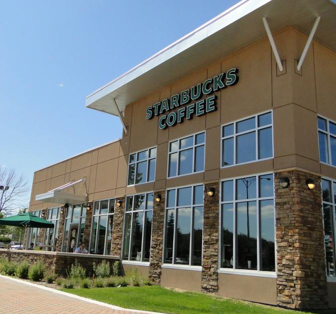
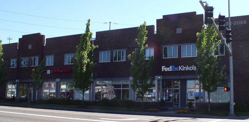
Small, narrow lots
Low vacancy, making consolidation more of a challenge Consolidated sites may need to be regraded to address topography challenges
22 The two properties at the northeast corner of Noland Road and Hereford Avenue, occupied by Midwest Title Loans, the Bakery Outlet, and Golden Rice, suffer from unnecessarily large setbacks and unattractive facades. To enhance the long-term viability of these properties without complete redevelopment, the properties should be consolidated and the following improvements should be made:
• The Midwest Title Loans building should receive facade upgrades.
• The Golden Rice building should be acquired, demolished, and replaced with a more attractive building, located with minimal setback at the corner.
• The parking for the three buildings should be redesigned to improve access management, reduce impervious pavement, and limit the amount of parking lot space fronting Noland Road.
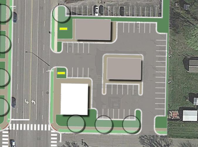
As illustrated in Figure 5.13, such improvements will allow this corner to accommodate a variety of commercial and office uses that desire a single-tenant building. (L)
Highly accessible and visible from Noland Road
The individual buildings have the ability to function as part of a larger, coordinated development with complementary uses
Outdated building facades
Poor layout of parking and circulation
Property consolidation/coordination will be necessary
23 Though it currently serves as the home of U-Haul, this site would be an ideal location in the future for a sit-down restaurant or entertainment venue, complementing the adjacent Red Lobster. (L)
Highly accessible and visible from Noland Road and I-70 Adjacent to a recently renovated restaurant (Red Lobster)
The existing use (U-Haul) is a successful business that is likely to remain in the near-term
24 The two parcels that make up this site, occupied by a vacant building and an Econo Lube, should be consolidated to facilitate its redevelopment as a restaurant or commercial retail use. (L - M)
Located adjacent to a successful, traffic generating Hy-Vee
Size of consolidated site ideal for a restaurant pad
Topographic challenges will require significant regrading of the site in order to accommodate redevelopment
Gaps in sidewalk network
25 Just north of the 40 Highway Node, the former Best Buy site presents a curious dilemma. Though it now functions as a Flea Market, the long-term viability of such a use is limited. Finding a more sustainable use should be considered, whether through the reuse of the current site, or through the redevelopment of all or part of it.
Additionally, the undeveloped portion of the property fronting 40 Highway should be considered for pad development in the future, as demand dictates. (M)
Lot size ideal for large lot retail Room for additional pad site development Building may be reusable
With the exception of Hy-Vee, the large lot retail uses around this site are underperforming and showing signs of deterioration
The site fronts 40 Highway, meaning that the recommended streetscape improvements to Noland will not directly impact the physical character of the site
Making repairs, replacements, or additions to an existing building and/or site can add significant aesthetic and economic value to the built environment. Typical improvements include:
• Exterior painting, re-siding, or professional cleaning
• Restoration of exterior finishes and materials
• Removal of architecturally outdated or incompatible exterior finishes and materials
• Repair or replacement of windows and doors
• Installation or repair of canopy or awning
• Installation or repair of exterior building signage
• Exterior lighting improvements to the building and pathways leading to the building
• Improvements that result in greater ADA accessibility to the building
• Addition of site landscaping, including parking lot screening and parking islands
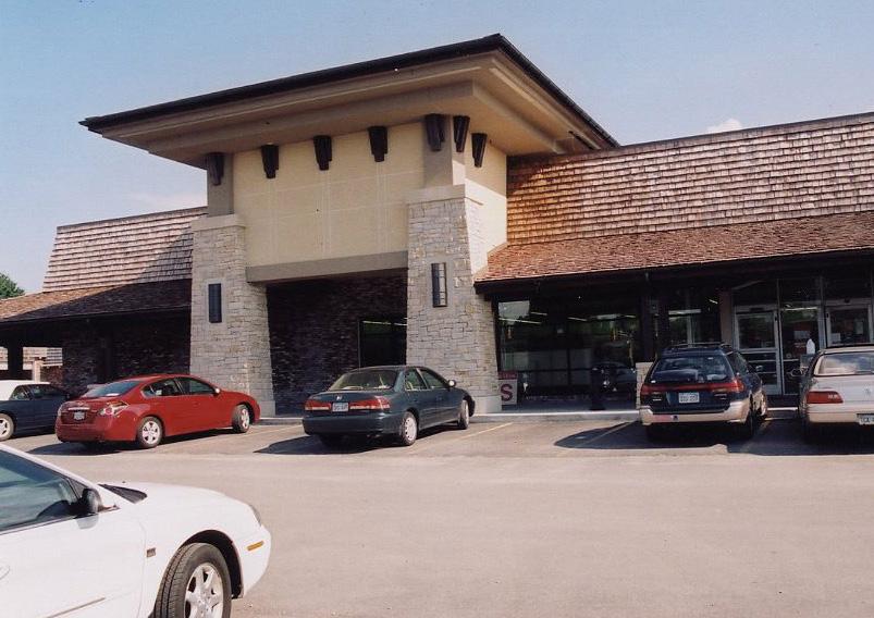
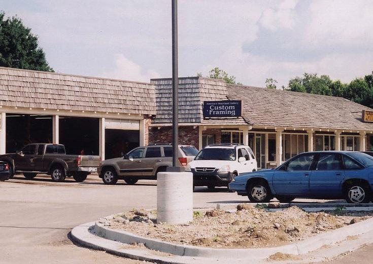
• Reduction of impervious paving and vehicular access points
• Introduction of site furnishings and amenities that enhance the user experience
Though Opportunities and Constraints have not been listed for each of the following facade and/or site improvement candidates, there are certainly some common themes that can be identified when determining the benefits of these recommendations. However, it is important to note that facade and site improvements are most effective when a coordinated effort is undertaken to improve the conditions of a larger area. Such efforts often lead to an increase in sales, property values, protection of investment, and the overall stability and vitality of the affected area. So while specific improvement candidates have been identified, it is essential that programs be put in place to encourage private reinvestment for all properties throughout the corridor. Only through continued, widespread reinvestment will the district be able achieve its desired vision.
26 The parking lot should be downsized to eliminate an unnecessary access point and reduce the amount of impervious pavement, allowing for the development of a more attractive streetscape fronting Noland Road. This can likely be achieved without reducing the number of parking stalls. (M)
27 28 29 30 The physical appearance of the facades for each of these sites should be enhanced to address outdated or aged architecture, with the intent of contributing to the overall vision for the corridor. (M)
31 The site and building façade for the Midas property should be enhanced to match the character of recent and proposed improvements to the “Miracle Mile” district. (M)
32 Similarly, this former dealership should receive site and building facade upgrades that match the character of recent and proposed improvements to the “Miracle Mile,” allowing it to accommodate a new dealership on the corridor or an expansion of an existing one. (M)
33 Noland Plaza, as well the gas station just to the north, look to be prime candidates for façade and site enhancements that would help “raise the bar” for future redevelopment projects in and around this node. (M)
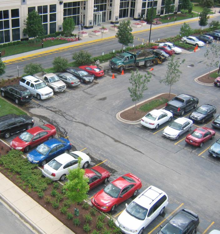
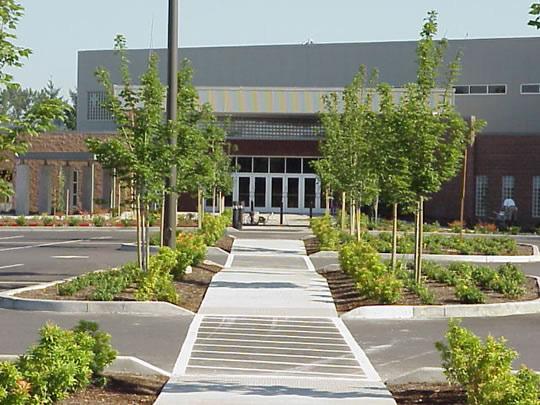
34 35 The facades for this string of strip center sites should be enhanced to better match the desired character and aesthetic of the corridor. Additionally, the interior curbs running parallel to Noland Road should be considered for relocation to the east to provide adequate buffer space for sidewalk, landscape screening, and street trees. Portions of the existing sidewalk may need to be relocated, as well, in order to achieve a consistent streetscape effect. Though further study will be required during the streetscape design phase, preliminary reviews suggest that curb adjustments should not have an impact on parking counts or circulation patterns. However, excessive access points should be identified and removed as part of the recommended streetscape improvements, if negotiations with affected property owners are successful. (M)
36 In addition to addressing necessary façade improvements, the parking and circulation for these properties (occupied by El Maguey and Advanced Auto Parts) should be enhanced by adding landscape islands with shade trees and improving access management. The parking lot improvements should be coordinated with any improvements that may be made to the adjacent retail center to the south (Thrift World/Nuts and Bolts/True Value). (M)
37 The strip center located at the northwest corner of 39th Street (Thrift World/Nuts and Bolts/True Value) could also benefit from site improvements, including the consolidation of access points and the addition of internal parking lot landscaping. The sea of asphalt that exists along the frontages of Noland Road are a prime indicator of an aged corridor, and though redeveloping all of these sites is unrealistic, there should be a concerted effort to soften their impact with landscape islands and parking lot screening. Figure 5.14 offers an example of what such improvements might look like. (M)
38 The business and office medical uses on Lynn Court act as a hodgepodge of individually planned sites with little to no shared access or parking. Figure 5.15 demonstrates the benefits of reshaping the circulation and parking in this area. This improvement could dramatically impact the physical function and perception of the sites and businesses that occupy it. (M)
39 The circulation for this grouping of three fast food sites should reconsidered to address an overabundance of access points and allow for better cross-access amongst the properties. (M)
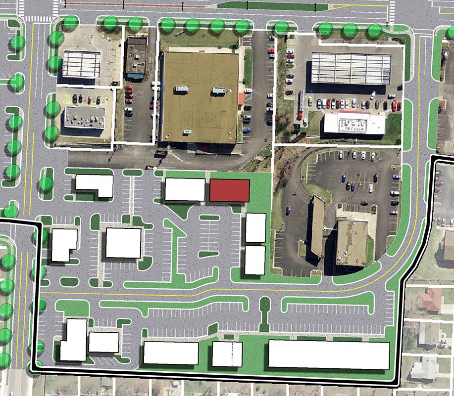
40 The physical appearance of the façade should be enhanced to attract an office or service-related use, while the parking and circulation should be improved to reduce excess impervious pavement and allow for added outdoor amenities. (M)
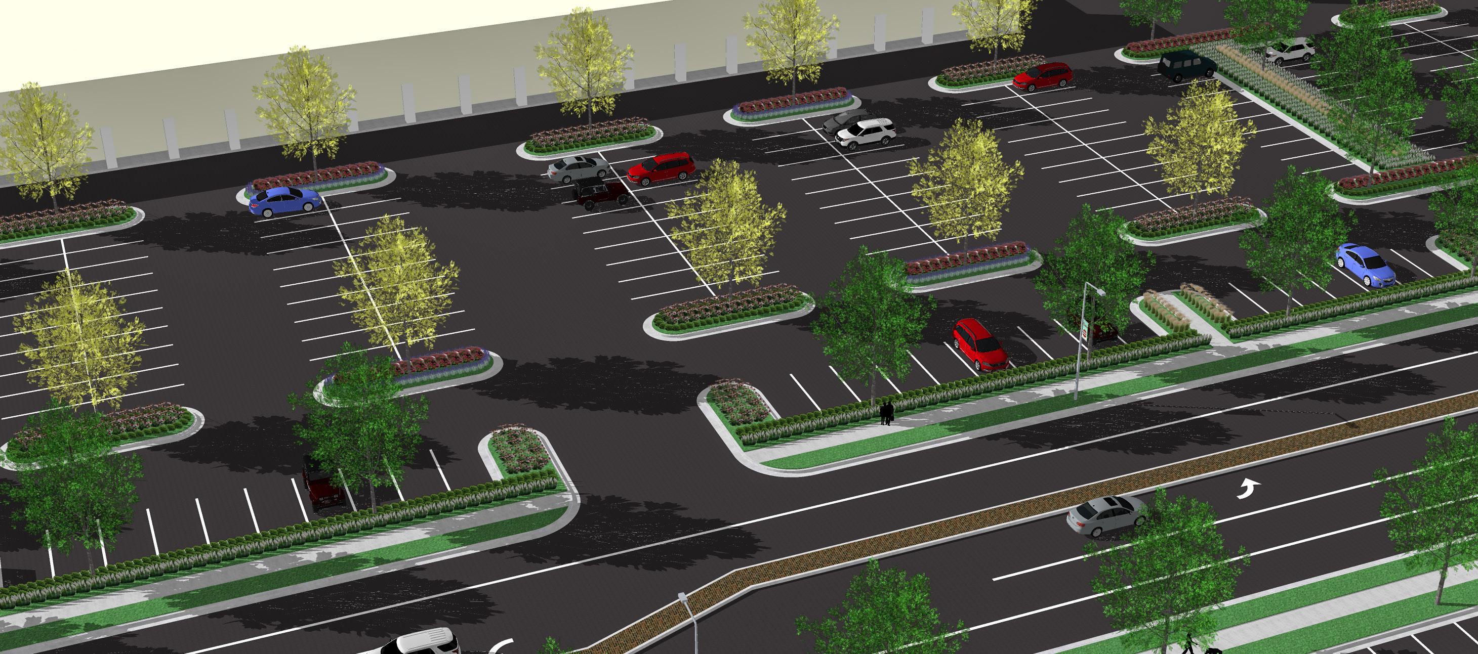
While the revenue generated by the CID sales tax is substantial, it is nowhere near enough to fund all of the improvements necessary to revitalize Noland Road. What the available revenue can do though is incentivize property owners to make investments of their own that will have a positive impact on the larger corridor. Financial incentive programs should be developed with the expectation of leveraging allocated funds at a rate of 4:1 to 3:1 (development cost : assistance). To streamline this process and make it fair and transparent to all parties, a full guidelines document should be developed. The document should address guidelines for eligibility, as well as all review, approval, and allocation procedures. Though fairness and consistency are important, the process must also be flexible enough to allow the Board to make the decisions that they feel will have the greatest impact on the corridor as a whole.
In order for the CID Board to distribute funds for use on private property (i.e. beyond the public right-of-way), there must first be a determination of blight. While this is examined in full detail in Section 6.0 Implementation, blight can be determined in two ways:
1. Determination of blight on a case-by-case basis, completed by the developer or property owner as a requirement for receiving funds
2. Determination of blight for the entire district
The second alternative would serve to simplify the incentive process and facilitate increased participation in the incentive programs.
Available assistance funds should be distributed into the following programs on a monthly or annual basis. Individual properties may be eligible for one or more of these programs at any given time.
To help kick-start the transformation of the corridor, a program aimed at incentivizing major development and redevelopment projects should be established. Though all properties are to be eligible for this program, location and forecasted economic impacts must be prioritized.
In addition to complete development or redevelopment projects, this program should also be made available to property owners considering significant site improvements that align with the Noland Road Corridor Vision, such as improved parking lot layout and screening, added pedestrian connectivity, consolidation of site access, and enhanced landscaping and open space treatments.
As its name suggests, this program is aimed at incentivizing property owners to improve the look and function of their building facades. Participants will be required to follow the Noland Road Design Guidelines in order to take advantage of available funds, ensuring that the project meets an agreed upon aesthetic or standard of design.
Though this program will be discussed in further detail in the 5.5 Aesthetics & Character, the goal is quite simple: Reduce and eventually eliminate the abundance of pylon signs littering the corridor. Driving down Noland Road, the collection of unnecessary pole signs perfectly symbolizes the aged qualities that the corridor must overcome. In some locations, they practically have an oppressive quality to them, warning potential investors to look elsewhere. Removing the pylon signs and replacing them with reasonably sized monument signs would have a major impact on the corridor and how visitors perceive it.
Though development standards were discussed previously under 5.2 Land Use & Zoning, it should be made clear how they will impact development and redevelopment along the corridor. No matter the scope or effectiveness of a set of standards or guidelines, their influence is longterm and should be treated as such. Redevelopment can only be accelerated so far. That said, it is critical that these subdistrict standards be implemented as soon as possible. Noland Road is undergoing real change right now. Every improvement that is made between now and the time at which the standards are approved and implemented is a missed opportunity.
With effective standards and guidelines in place, developers will be given what amounts to a playbook for how to successfully integrate themselves into the Noland Road Vision. Though some might see these additional requirements as an added burden, the hope is that most will come to view them as an opportunity and an assurance of the district’s long-term viability as a commercial corridor.
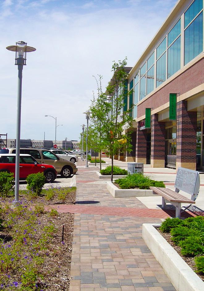
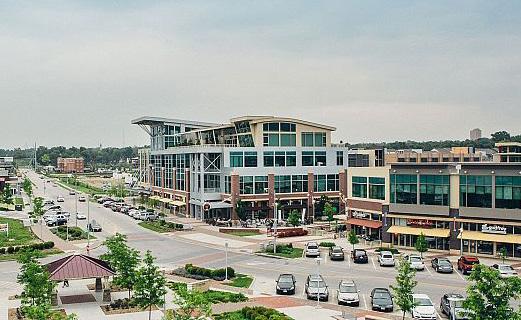
The trend toward sustainable design in the last two decades has revealed the deficiencies of commercial corridors like Noland Road that rely almost entirely on the automobile to bring traffic to their stores. Though land use and redevelopment are critical to the corridor’s revitalization, the accommodation and enhancement of all modes of transportation – vehicular, public transit, bike, and pedestrian routes – is equally important to its longterm viability. A corridor that considers all of these modes is simply more likely to attract and retain the customerbase that it requires to be successful.
• Though the existing sidewalks are generally in good condition, there are significant gaps in the network that diminish the walkability of the corridor.
• Pedestrian access at street crossings is not consistent throughout the corridor, creating an additional deterrent to pedestrian activity.
• Public transit stops along the corridor are difficult to locate and lack the typical amenities expected by transit users. If user demand increases along Noland Road, this deficiency may become a real roadblock in the push to better accommodate pedestrians and alternative modes of transportation.

• There are currently no dedicated bike lines or multi-use trails along the corridor, and the vehicular lanes feel unsafe for bike users.
• Noland Road has an overabundance of access drives and continuous turn lanes, possibly leading to increased crash rates. The excessive use of access drives also limits pedestrain walkability and discourages cross-access drives between properties.
• Noland Road is excessively wide, given the number of drive lanes that it hosts and the traffic that it absorbs. This causes drivers to view Noland Road through a utilitarian lens; it provides them access to the place they are going and little more.
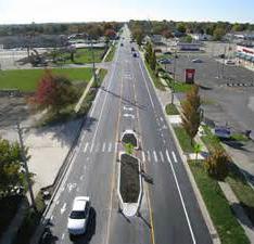
• Wayfinding along the corridor does not adequately promote the area’s significant attractions and businesses.
• While Santa Fe Park is an asset to the surrounding neighborhoods, access routes from Noland Road are unnecessarily circuitous.
• The undeveloped land north of Cargo Largo is hampered by limited access and connectivity.
As transit riding high activity centers change, routes, timing, and future shelter enhancements should be considered.
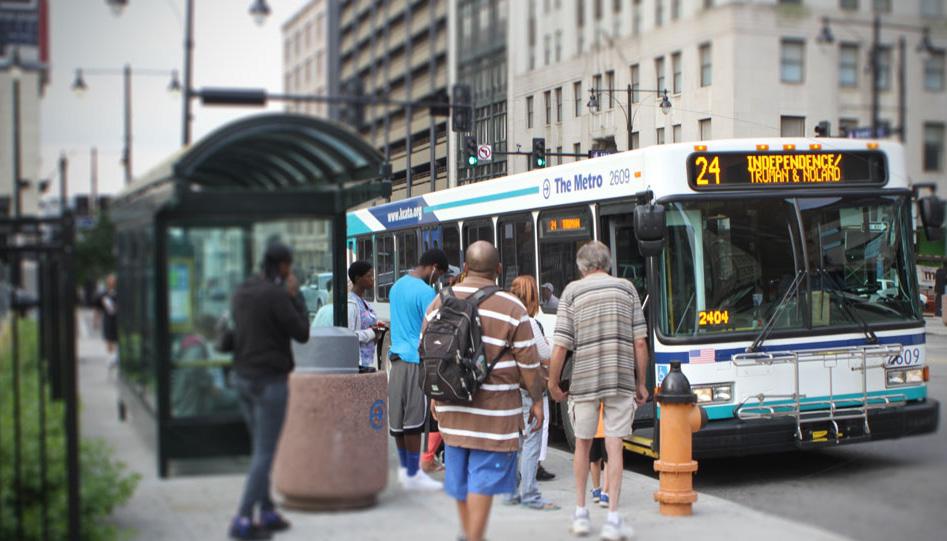
1. Encourage pedestrian activity throughout the corridor by improving connectivity and accessibility.
2. Accommodate users of the public transit system that runs through the corridor by enhancing transit stops and ensuring that they are properly identified and located in way that accurately responds to the activity and pedestrian circulation patterns of the area.
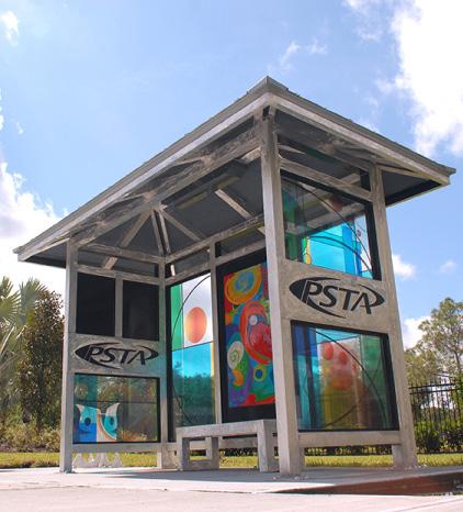
3. Encourage the development of a Citywide bike plan that public streetscape improvements and development/redevelopment sites can connect into when improving the corridor.
4. Develop access management strategies that address both short- and long-term considerations for eliminating unnecessary access points and encouraging cross-access amongst properties along Noland Road.
5. Integrate vehicular and pedestrian wayfinding systems into the public streetscape improvements for Noland Road.
6. Soften the impact of Noland Road’s expansive street profile by reintroducing landscaped medians at select locations along the corridor.
7. Provide more direct vehicular and pedestrian access to Santa Fe Park.
8. Enhance the economic viability of the undeveloped land north of Cargo Largo by improving its access and connectivity.
CREATE A MORE PEDESTRIAN-FRIENDLY CORRIDOR STRATEGY TO ADDRESS RECOMMENDATION 1
Pedestrian activity is an essential component of the kind of active, vibrant corridor that Noland Road aims to become. If desired activity levels are to be achieved, it is critical that the necessary infrastructure be in place to support them. With that in mind, the following pedestrian-related infrastructure improvements should be considered:
As highlighted in Section 2.0 Existing Conditions, the corridor has a number of significant stretches that do noy provide sidewalks on one or both sides of the street. This is especially true within the southern portion of the district, particularly south of I-70. Filling these gaps in pedestrian connectivity along Noland Road should be a priority of the public streetscape improvements.
To truly achieve better connectivity, access to and from the surrounding community should addressed as well. East-west routes connecting with adjacent neighborhoods should be infilled or improved as necessary at each of the six nodes.
Recommended locations for sidewalk infill are shown in Figure 5.18: Transportation Recommendations
One of the defining characteristics of a walkable corridor is that it provides an environment where pedestrians and vehicles can safely interact with one another. From the perspective of the pedestrian, safety mechanisms should include clearly marked crosswalks at all allowable street crossings, pedestrian crossing islands (refuge areas) at major intersections, pedestrian-actuated crossing signals, accessible ADA curb ramps, and effective lighting.
Additionally, the streetscape should be designed to provide a turf buffer between vehicular and pedestrian traffic. Said buffer should be a minimum of 5 feet in width, as shown in Figures 5.16 and 5.17 . While much of the corridor already incorporates a reasonable buffer strip,
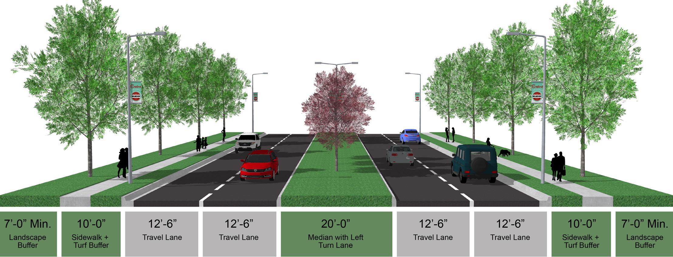
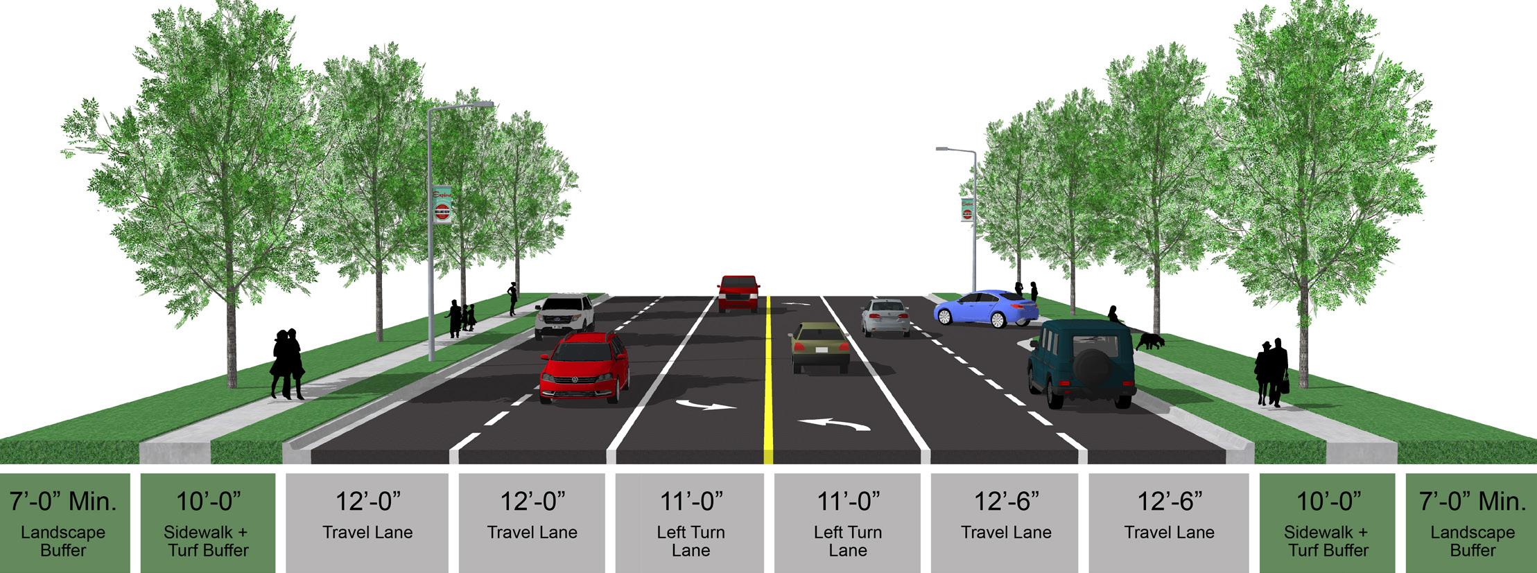
there are segments where the sidewalk directly abuts the back of curb. Development and design standards should be developed to ensure that this scenario is eliminated over time.
While safety and access are necessary elements of a pedestrian-friendly corridor, it is also important to consider the overall user experience. As it relates to walkability, the Noland Road user experience should include the integration of site furnishings, small gathering spaces at major nodes, and directories or kiosks that offer wayfinding and relevant information about the district. Such enhancements are discussed in further detail in 5.5 Aesthetics & Character
Fig. 5.17 Typical Noland Road Profile with Landscaped Median Fig. 5.16CID Boundary
Existing IndeBus Stop
IndeBus Stop Enhancement
Sidewalk Infill
Crosswalk Enhancement
Primary Enhancement Node
This diagram presents opportunities for multimodal enhancements throughout the corridor. The recommended improvements will work to modernize the outdated, automotive-focused corridor. Secondary Enhancement Node Tertiary Enhancement Node Road Extension Future Traffic Signal Installation Pedestrian Traffic Signal Installation
Lighted Street Sign Installation Landscaped Median
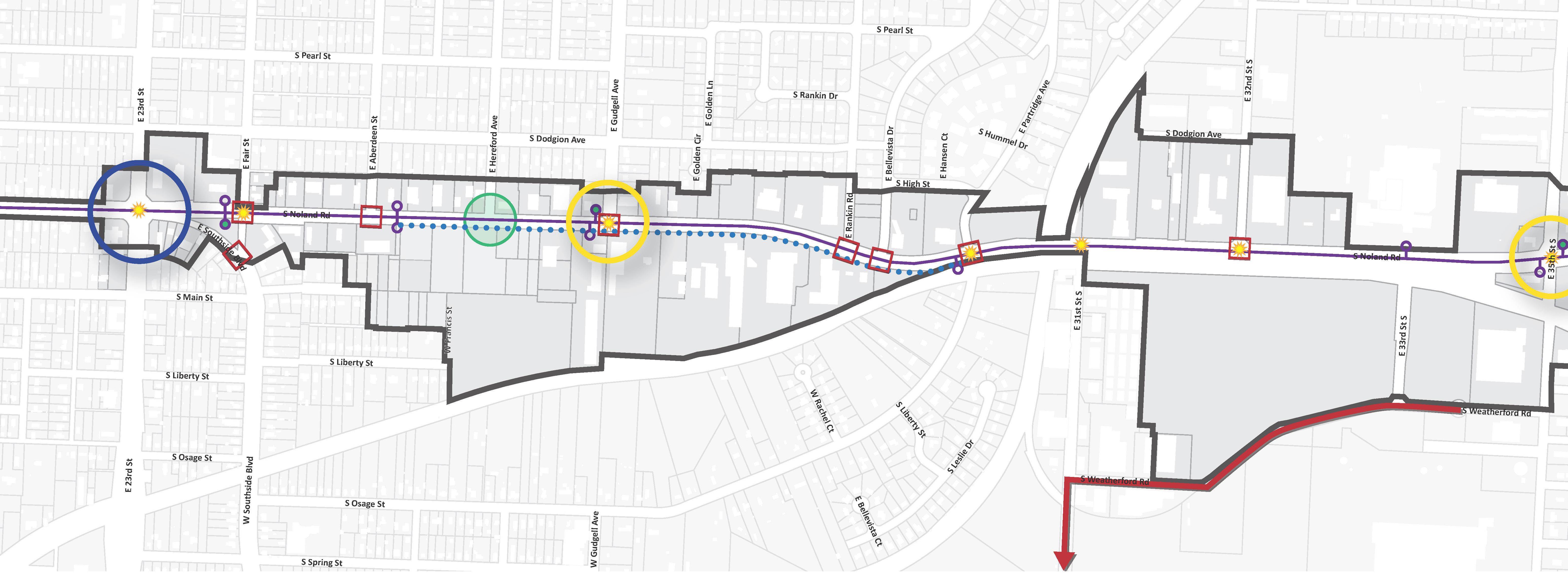
This diagram presents opportunities for multimodal enhancements throughout the corridor. The recommended improvements will work to modernize the outdated, automotive-focused corridor.
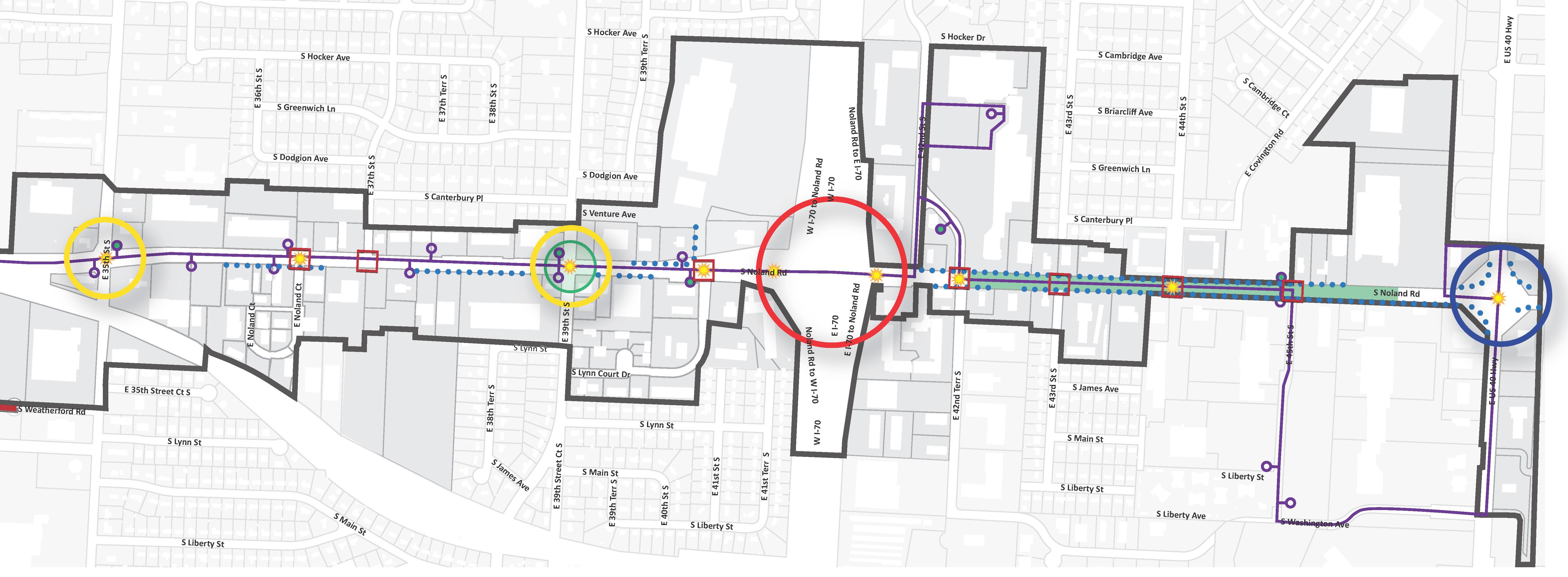
As pedestrian activity increases along the corridor, so will the demand for public transit. In order to adequately accommodate increased demand, enhancements must address the following:
Standard transit stop amenities and furnishings typically include well-lit shelters, seating, trash receptacles, and informational displays for bus routes and schedules. The stops along Noland Road offer none of these. Though installing said amenities at every stop may be unrealistic, doing so at major nodes and other significant locations along the corridor should be considered an important part of the overall streetscape improvements for Noland Road.
The majority of the major nodes are recommended for transit stop enhancements, as shown on Figure 5.18. These enhancements should be completed as each node is improved.
The recommended plaza at the 23rd Street node, in particular, should be prioritized for development, with an eye towards transit. The size of this underutilized space permits the development of a large pedestrian gathering area to serve the surrounding residential neighborhoods, dually functioning as a transit center.
In order to maximize effectiveness of the transit system, stops must be properly located to ensure that they coordinate with the activity and pedestrian circulation patterns of the corridor. Stops may need to be added or relocated along the corridor.
Ridership data are not currently available for the transit stops along Noland Road; therefore, it is recommended that IndeBus begin gathering these data in order to monitor the activity nodes along the corridor. As redevelopment and development takes place, pedestrian traffic levels are likely to change. Monitoring ridership data over time will allow additional stops to be installed at the most beneficial locations.

The installation of additional stops should be coordinated with major redevelopment and development projects as they begin in order to maximize cost-effectiveness and limit traffic interruptions.
IndeBus provides increasingly valuable services to its users. For example, complementary paratransit and senior transportation services are offered to increase its user base. Additionally, Transloc real-time bus tracking is available on IndeBus’ website (indebusmo.com), which further increases the service’s functionality and convenience. Operated regionally as a member of the Kansas City Area Transportation Authority, IndeBus is dedicated to improving rider services.
While not located along the primary commercial segment of the CID, the nearest transit center - the Independence MetroCenter - is located near the intersection of Truman Road and Noland Road. This site provides covered waiting areas and informational kiosks for riders.
Like many of the problematic issues that define Noland Road, the issue of access cannot not be solved overnight. Instead, it must be addressed primarily via the establishment of enforceable policies that will result in slow, incremental change as properties are redeveloped over time. These policies, which are to be included in the Noland Road District and the Noland Road Design Guidelines, should establish development and design standards for access management that address the following:
• Set limits on the number of allowable access drives along Noland Road
• Encourage side street access
• Encourage shared access drives between properties
• Encourage cross-access between properties
Illustrations of how each of these standards can be used to manage access can be found in Figure 5.19: Access Management Diagrams
Obviously, the goal of these new standards is not to negatively impact the viability of commercial businesses on Noland Road. Instead, it is meant to establish reasonable


guidelines that will ultimately benefit everyone by raising the standard of design, improving safety, and encouraging a more functional and physically connected corridor.

In addition to the new development and design standards, there are other steps that should be taken to address the issue of access. They include the following:
• Incentivize property owners to eliminate unnecessary access points by offering them access to the funding dollars described in Establish Financial Incentive Programs, under 5.6 Economic Sustainability.
• Negotiate the removal of unnecessary access points with property owners as part of the public streetscape improvements.
• Encourage the consolidation of narrow lots for the purposes of redevelopment. Examples of recommended redevelopment areas are provided in 5.3 Development & Redevelopment
Figure 5.20 Access Management Recommendations identifies specific opportunities for access management along Noland Road that should be considered in the design and installation of public streetscape improvements. Each opportunity will require negotiation and coordination with property owners, ensuring that the improvements benefit all parties.
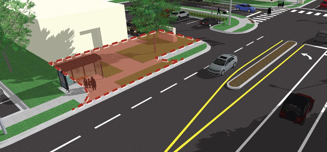
This plan identifies immediate opportunities for access management along Noland Road. Opportunities have been grouped into three distinct categories, helping to visualize the most common access deficiencies and solutions. The plan only highlights issues that can be addressed without negatively impacting existing owners and businesses. Long-term access management of the corridor should be controlled through updated development and design standards.

NORTH
CID Boundary
Consolidate Drives
Eliminate unnecessary access drives that will not negatively impact the functionality of the associated property and its users.
Shared Drives
Reduce access drives by consolidating two drives into one drive, centered along a property line shared by adjacent properties.
Reduce Drive Width
Narrow excessively wide access drives.
This plan identifies immediate opportunities for access management along Noland Road. Opportunities have been grouped into three distinct categories, helping to visualize the most common access deficiencies and solutions. The plan only highlights issues that can be addressed without negatively impacting existing owners and businesses. Long-term access management of the corridor should be controlled through updated development and design standards.
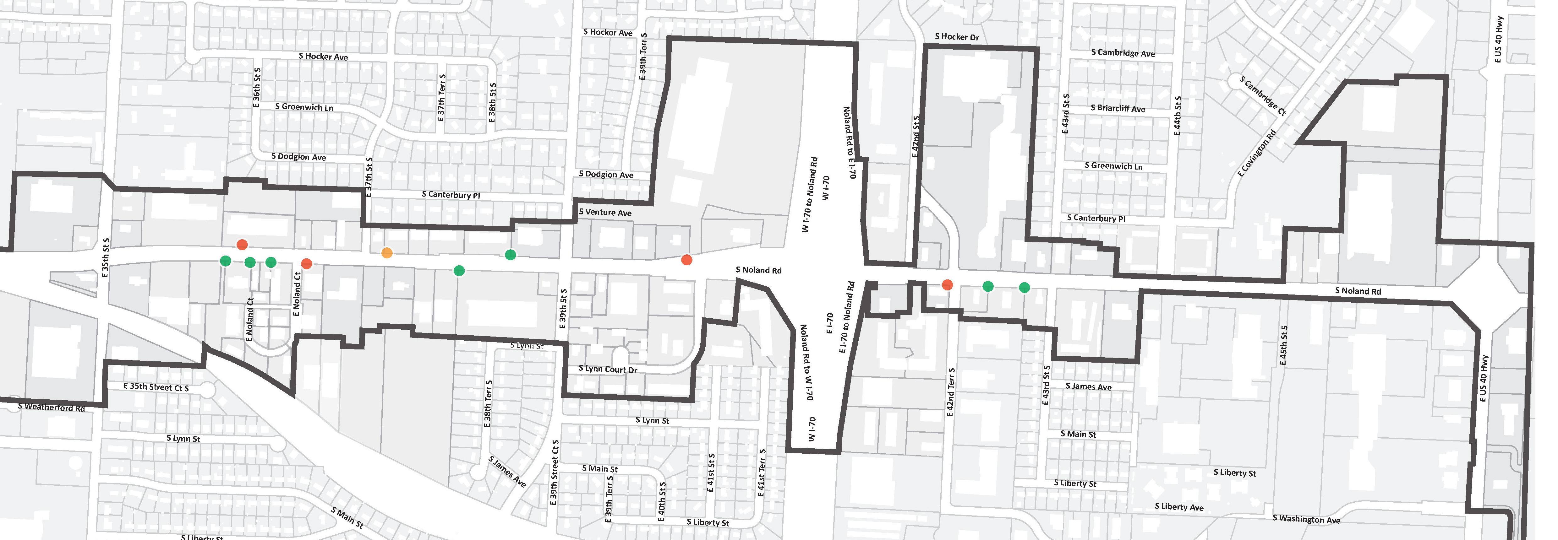
NORTH
CID Boundary
Consolidate Drives
Eliminate unnecessary access drives that will not negatively impact the functionality of the associated property and its users.
Shared Drives
Reduce access drives by consolidating two drives into one drive, centered along a property line shared by adjacent properties.
Reduce Drive Width
Narrow excessively wide access drives.
To achieve the revitalized vision for Noland Road, it is necessary to be as inviting and accessible to the surrounding community as possible. While the proposed public transit enhancements work toward achieving this goal, safe bike routes would go even further. However, the realities of the existing corridor and its ability to support bike routes must be examined closely. While the recommendation of this document is to plan for and ultimately implement routes along Noland Road, the priority and timeline of the implementation process is very much up for debate. When considering the potential for bike access along the corridor, there are a number of complicated issues to consider, including user safety, user demand, and access to the larger bicycle network.
Given its current traffic volumes and lane configurations, Noland Road does not feel like a safe place for bike travel. However, it is important to consider the impact that prioritized redevelopment and a successful implementation of the streetscape plan will have on the way that drivers navigate the district. While the conditions for safe bike access are not currently in place, this very plan represents the first step toward changing said conditions.
Though no studies have been done and only limited data has been collected, it is not unreasonable to point out that current demand for bike access along Noland Road is low. Census data shows that only a very small percentage of the surrounding community commutes to work via bike. Even when compared to other communities within the driver-friendly metropolitan area, Independence ranks toward the bottom of the scale. However, this may present an opportunity instead of a constraint. On the whole, bike usage as a mode of transportation is on the rise. In fact, recent data gathered by American Community Survey suggests that Missouri experienced one of the nation’s largest increases in bicycle commuting from 2010-2014. The low usage rates within Independence are more likely to be an issue of access rather than demand. On-street bike routes within the community are quite limited. Furthermore, the City of Independence does not have a citywide bike plan that details future routes, types of bike lanes, or prioritized implementation areas. Though there was once a Bike Committee, it was since been disbanded. The simple
truth is that the places that experience the most bike traffic are often those that make the strongest effort to support this growing user base. Considering the limited effort to implement safe bike networks throughout the community, it is not surprising that user demand remains low.
Successful bike access hinges on the establishment of a complete network of routes throughout the community. Though the implementation of this network can take years or even decades to see to fruition, the first step is of course the planning of such a network. As stated above, Independence does not have an on-street bike network or a plan for future bike routes. Without either, the impact of bike lanes along Noland Road will be stunted. While there is certainly some benefit to offering bike access from the neighborhoods directly adjacent to the corridor, the potential for greater, citywide bike access to Noland Road is simply not there at this time.
Given these considerations, it is recommended that the following steps be taken to plan for improved bike access within the district:
1. Meet with the City to negotiate their participation in this endeavor. It is necessary to fully understand the City’s perspective on bike routes before proceeding. If there is a real interest on their part to participate and facilitate the implementation of bike lanes along Noland Road, then financial participation should be discussed. Their plans for citywide bike access should also be addressed. As previously mentioned, the overall impact of bike lanes is directly tied to the user’s ability to connect to a larger network.
2. If discussions with the City go favorably, the next step should be to develop a Bike Access Plan, to include route alternatives, lane types, phasing strategies, cost estimates, etc. Preliminary analysis by the planning team identified the stretch from Truman Road to 39th Street to be the most amenable to future bike traffic, but multiple scenarios should be considered.
3. Meet with the City to discuss the results of Step 2. Again, it is important that the City indicate their interest in proceeding with the project.
4. Based on the recommendations of the Bike Access Plan, the associated costs, and the feedback gathered from meetings with the City, make a determination of how to proceed. This decision may need to be reevaluated on a semi-regular basis, given the changing climate of the corridor.
Wayfinding signage should be used to inform and direct visitors to the attractions and services that exist within the Noland Road Corridor, as well as the surrounding community. An effective wayfinding plan considers both the driver and the pedestrian, with the intent of guiding visitors from their cars to their desired location in a convenient and efficient manner.
Vehicular wayfinding on Noland Road should address local attractions, amenities, and places of significance, such as the Square, the Harry S. Truman Home and Historic District, City Hall, and Santa Fe Park. New attractions being proposed as a part of this plan should also be included as they come online. Additionally, the proposed lighted street signs will act a vehicular wayfinding tool, as they contribute to a more easily navigable and modern-looking corridor.
Pedestrian wayfinding should be more focused on attractions and businesses within the corridor. Wayfinding hubs should be located at select activity centers along Noland Road, providing pedestrians with a directory map and relevant news and information. The triangle island south of 23rd Street would be the ideal location for one of these directories. It could easily be incorporated into the design of the proposed commuter plaza in a way that would maximize its exposure.
In its heyday, landscaped medians were an integral part of the Noland Road streetscape. Unfortunately, they were long ago replaced by the single- and double- left turn lanes that now symbolize the worst qualities of the corridor. The convenience and access that these continuous turn lanes provide come at too high of a cost. They likely contribute to increased crash rates, higher traveling speeds, and a negative public perception of the corridor. Noland Road is viewed as a street to be traveled, instead of a place to be.
To help fight back against this perception and its underlying causes, landscaped medians should be reintroduced along Noland Road. As shown in Figure 5.18, The most logical stretch includes the southern end of the corridor, south of 43rd Street. The larger lots within this area limit the accessibility concerns that typically arise with the introduction of medians. Landscaped medians will improve both the functionality and character of the district.
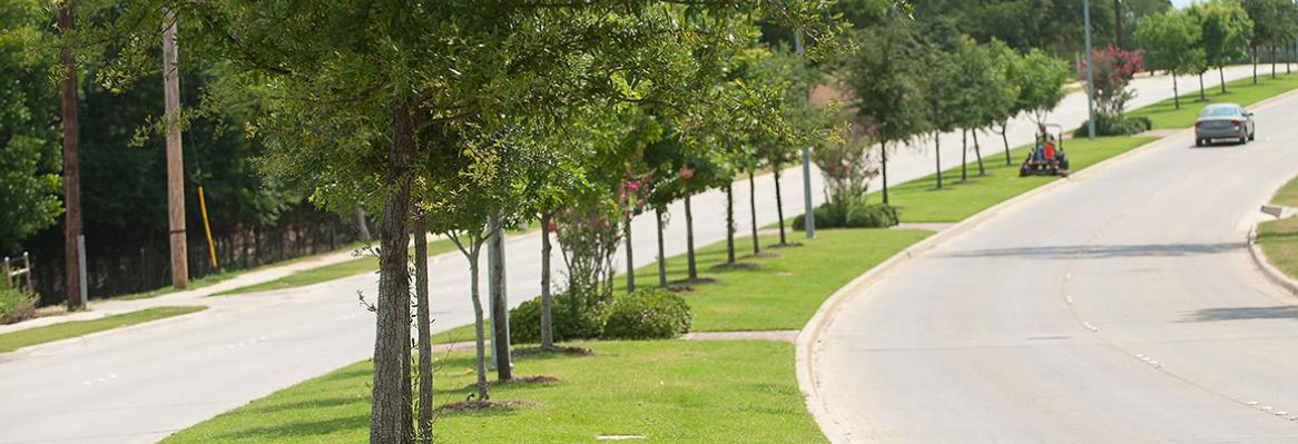

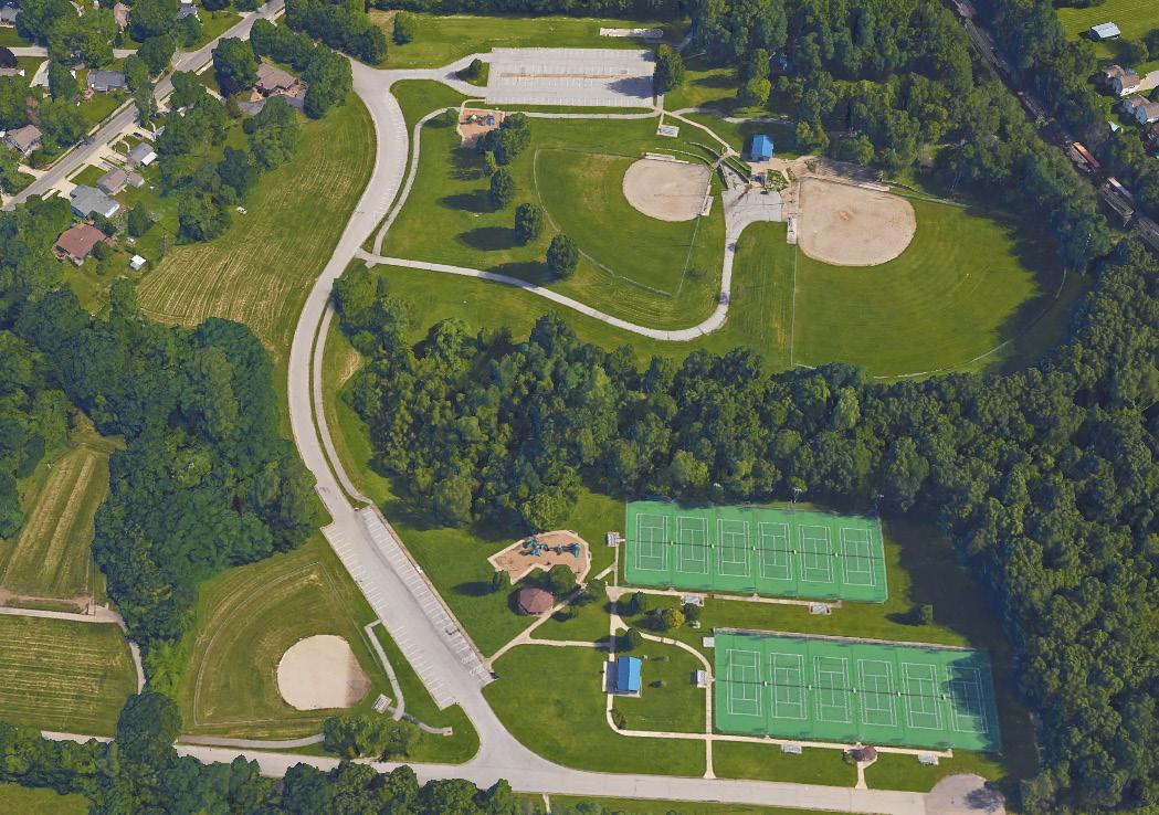
Parks and green spaces are rare commodities along the corridor. Those that do exist in and around the plan boundary should be capitalized on by maximizing connectivity for drivers and pedestrians. With that in mind, it is recommended that the gaps in Weatherford Road and 31st Street be closed in order to offer better access to Santa Fe Park and Lipton Conservation Area. By “closing the loop” as shown in Figure 5.18: Transportation Recommendations, users will have a direct route to the parks from Noland Road and a less direct but equally important route from 35th Street. While pedestrian pathways will be a challenge to install along the existing segment of 31st Street, Weatherford Road and the extended portion of 31st Street are more flexible. Combined with intersection enhancements to 35th Street, incorporating trails or sidewalks will better connect employees of the corridor and residents from the eastern neighborhoods to Santa Fe Park.
In addition to improved park access, the street extensions will serve to connect the industrial uses along the western half of Noland Road, from 31st to 35th Street. In turn, this could impact the viability of the large piece of land west of 32nd Street, making it more attractive for mixed use development.
Aesthetic improvements can enliven a development, but for maximum impact, aesthetic enhancements should be coordinated amongst properties within the CID.
The aesthetic appearance of a corridor goes a long way in determining the public perception of character and quality of life. Corridors with a high-quality, cohesive aesthetic generally feel more inviting and are more likely to retain visitors. Elements of an attractive corridor include building architecture and materials, site development, streetscape landscaping, site furnishings, lighting, gateways, signage and wayfinding, and branding, among others. Often, the improvements in the aesthetic quality of a corridor lead to increased private investment, both in the corridor and throughout the surrounding community.
• Noland Road lacks the proper level of streetscape design that is critical to establish a vibrant user experience. This is especially true of the major nodes along the corridor.
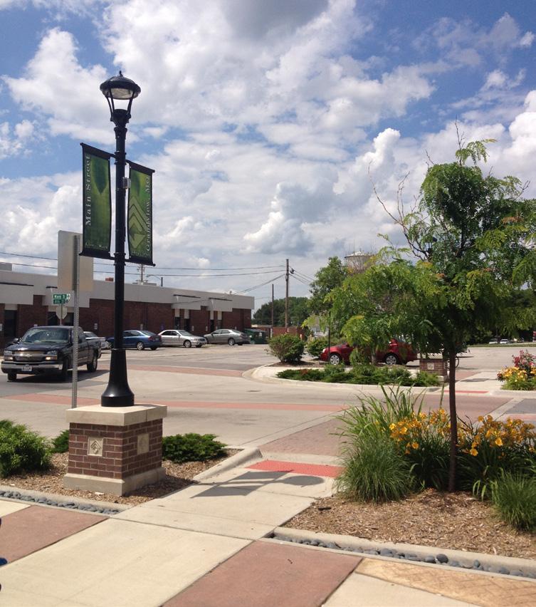
• Landscaping within the corridor is underwhelming, both inside the public right-of-way and out.
• Building structures along the corridor are predominantly single-story and lacking in any unifying architectural qualities.
• Much of the strip commercial development that populates the corridor looks out of place when compared to current development trends. This outdated appearance may be limiting Noland Road’s ability to consistently attract and retain quality tenants.
• The built street profile of Noland Road, including the setback and height of its adjacent building structures, is out of scale and does not align with the desired vision of the corridor.
• The corridor does not currently incorporate any gateway, branding, or wayfinding elements, making it appear to exist as just a collection of properties instead of a corridor or district.
• In many locations throughout the corridor, the distance from the back of curb to the edge of parking is too narrow to support the desired streetscape treatment.
• The railway that runs along a portion of the west side of Noland Road is a visual impediment to the desired aesthetic of the corridor.
• The corridor lacks any meaningful parks or open space that can be accessed or appreciated by visitors, employees, or local residents.

• Public transit stops along the corridor lack the typical amenities expected by transit users. As user demand increases along Noland Road, this deficiency may inhibit the corridor’s desire to attract foot traffic from the surrounding community.
• Noland Road has been overrun by pylon signs, creating unnecessary visual clutter that negatively impacts the perception of the corridor. To date, there is no development standard or mechanism in place to limit the installation of future pylon signs.
1. Design and construct public streetscape improvements aimed at enhancing the aesthetic and user experience along Noland Road, while establishing an identity that speaks to the aspirational qualities of a fully revitalized corridor.
2. Design and construct a system of gateways that serve to introduce visitors to the corridor. The gateways should add aesthetic value, while also helping to reset the Noland Road brand.
3. Soften the visual impact of the railway that runs parallel to the west side of Noland Road.
4. Integrate attractive parks, plazas, and open spaces into the corridor. These spaces should provide aesthetic and functional value that contribute to both the user experience and the overall “quality of life” of Noland Road and the surrounding community.
5. Enhance public transit stops at high-traffic areas via site furnishings and amenities with the intent of better accommodating transit use along Noland Road.
6. Develop a manageable approach to maintain the public streetscape improvements recommended in this document.
7. Develop, approve, and enforce new development standards for Noland Road that reflect the desired vision for the corridor as it relates to aesthetics and character.
STRATEGY TO ADDRESS RECOMMENDATION 1, 2, & 6
Streetscape enhancements can have a dramatic effect on the prospects of an aging corridor by improving its current aesthetic and inspiring private reinvestment. While the Guidelines will guide the character of private reinvestment in the corridor, CID-funded streetscape improvements should be carefully planned. Therefore, written documents are necessary. It is recommended that (1) a Streetscape Improvement Plan and (2) a Gateway, Signage, Branding, and Wayfinding Plan be written and implemented.
The Streetscape Improvement Plan should include elements such as street trees, landscaping, sidewalks, crosswalks, site furnishings, and accent lighting. The Gateway, Signage, Branding, and Wayfinding Plan should direct all CID-funded identity and branding efforts. Designed in concert with one another, this collection of improvements will soften the impact of vehicular traffic and promote community vitality.
Streetscape improvements should also address the street’s basic functionality. For Noland Road, this means potential traffic signalization improvements and the consolidation of access points, as discussed in 5.4 Transportation
Noland Road streetscape improvements have been broken down into multiple zones, based on location, scope, and/ or the anticipated level of impact. Before examining these treatment zones, the family of elements that make up the streetscape toolkit for the Noland Road Corridor have been summarized. When reviewing, understand that the development and design standards discussed throughout this Plan’s recommendations will be created using this toolkit.

Noland Road’s streetscape lacks the level of landscaping that has become a standard requirement of newer developments, and though redevelopment might solve some of this over time, it is recommended that landscaping improvements be made now in order help change the perception of the corridor. Recommended improvements should include the following:
• Street trees – With the proper species selection and spacing, street trees will provide tremendous structure and aesthetic value to the corridor while maintaining visual access to individual properties.
• Understory landscaping – Located at major nodes and gateways, understory landscaping beds will soften the visual impact of high-traffic intersections. Understory landscaping beds may also be used in combination with decorative fencing as an accepted alternative to street trees in some segments of the corridor, as defined within the Noland Road District and Noland Road Design Guidelines.
• Landscaped medians – The addition of welldesigned medians will improve vehicular circulation and safety within a corridor, while landscaping them will add much-needed color and relief to the expansive road profile.

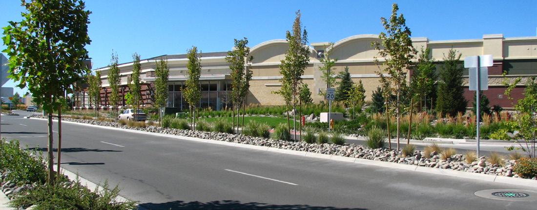
• Turf buffers – Located between a street curb and its parallel sidewalk, turf buffers serve to create a barrier that separates the driver from the pedestrian. While wider buffers offer a perfect location for street trees, Noland Road’s narrow buffers are often less than ideal and should only be planted where conditions are sufficient for a mature tree to survive.
As discussed in 5.4 Transportation, developing a complete pedestrian network of sidewalks and crosswalks is an essential component of creating a more pedestrian-friendly corridor. Increased pedestrian activity will have a dramatic impact on the public perception of Noland Road, and sidewalks and crosswalks provide the infrastructure for such perception changes.
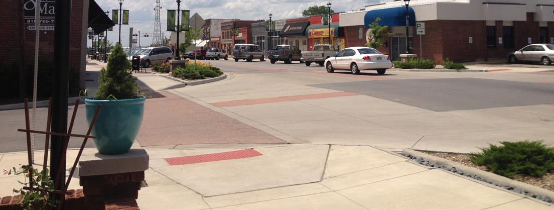
The walkability of Noland Road is about more than sidewalks and crosswalks. To achieve a truly inviting corridor for pedestrians, the streetscape should incorporate site furnishings that provide the essential accommodations that users have come to expect. Such essentials include benches and other forms of seating, trash receptacles, bike racks, informational directories or kiosks, and accent lighting. Transit shelters, which are discussed in 5.4 Transportation, also apply. These furnishings should be predominately located within small plazas or gathering spaces at the corners of major nodes with high levels of pedestrian traffic.
Low security fencing is commonplace along the “Miracle Mile” portion of the corridor, and most of it is very utilitarian in nature. In order to meet new streetscape standards, fencing should be more decorative, and should be combined with small columns that have a similar aesthetic to the secondary and tertiary gateway monuments. Retaining walls should be a block wall system that match the aesthetic of recent 39th Street improvements.


While the existing street lighting along Noland Road is very effective, there are still opportunities to incorporate accent lighting that can add to the visual character of the corridor. One of these opportunities that should be capitalized on is the installation of edge-lit, LED street signs. This simple and relatively inexpensive enhancement offers increased street sign visibility at night and an attractive aesthetic that visitors will notice and appreciate.
Gateways, which are discussed in greater detail in Implement a System of Gateways, should be located at each of the high-traffic nodes as a way to welcome visitors, mark the boundaries and major activity hubs, and contribute to the development of Noland Road’s new identity.
Wayfinding signage enhances the user experience by informing visitors of an area’s attractions and services. In regards to vehicular wayfinding along Noland Road, the sign aesthetic should coordinate with City wayfinding standards that are already in place. The signs should be attached to existing light poles at an easily readable height.
On the other hand, pedestrian wayfinding should match Noland Road’s “brand.” Locations should limited to major activity hubs, like the 23rd Street Node. The signage should act as a directory and be offset away from the street in a pedestrian gathering area.
Branding is absolutely crucial to a corridor looking to establish an identity within the marketplace. Sometimes the message simply accentuates what users know to be true about a place. In other instances, it serves to fight misconceptions or initiate change. In the case of Noland Road, branding should speak to the aspirational qualities that the property and business owners envision for a fully revitalized corridor.
Figure 5.22: Branding Concepts offers some preliminary explorations of branding in the form of conceptual logo designs. They are intended to spark discussion about what exactly the Noland Road brand/identity should be. A Final Branding Plan should be developed with the intent of incorporating logos and other designs into a variety of streetscape elements, including:
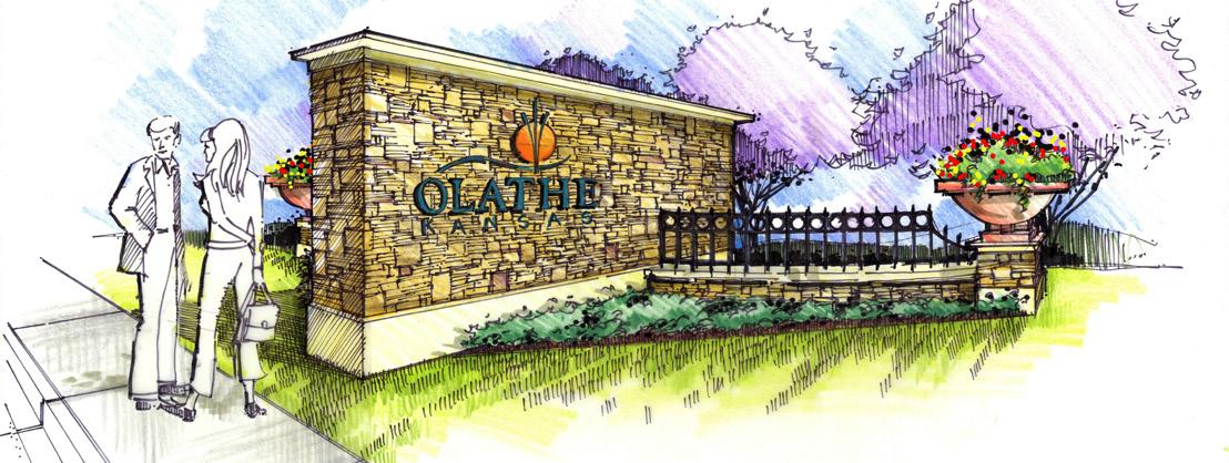
• Gateways
• Banners
• Site Furnishings
• Wayfinding
This final category of the toolkit refers to additional elements and spaces that serve to further enhance both the aesthetic character and user experience of the corridor. Such elements include public art, fountains, and pedestrian plazas.



Now that the toolkit has been established, it is important to understand how it may be applied to each of the recommended Noland Road streetscape zones. The breakout of individual zones does not suggest that each be constructed as part of its own phase. As stated previously, the separation of streetscape enhancements simply sorts the recommended improvements into logical groups based on factors such as location, scope, and level of impact. It is entirely reasonable and even encouraged that multiple zones be combined in the construction process to maximize cost efficiency. The five zones, as identified on Figure 5.28: Aesthetics & Character Recommendations, are as follows:
In addition to gateway enhancements to the Noland Road/I-70 Overpass structure, which is explored in Implement a System of Gateways, streetscape improvements to this major node should include crosswalks and added pedestrian safety measures, gateway monumentation that complements the overpass design, understory landscaping, illuminated street signs, and wayfinding and branding integration.
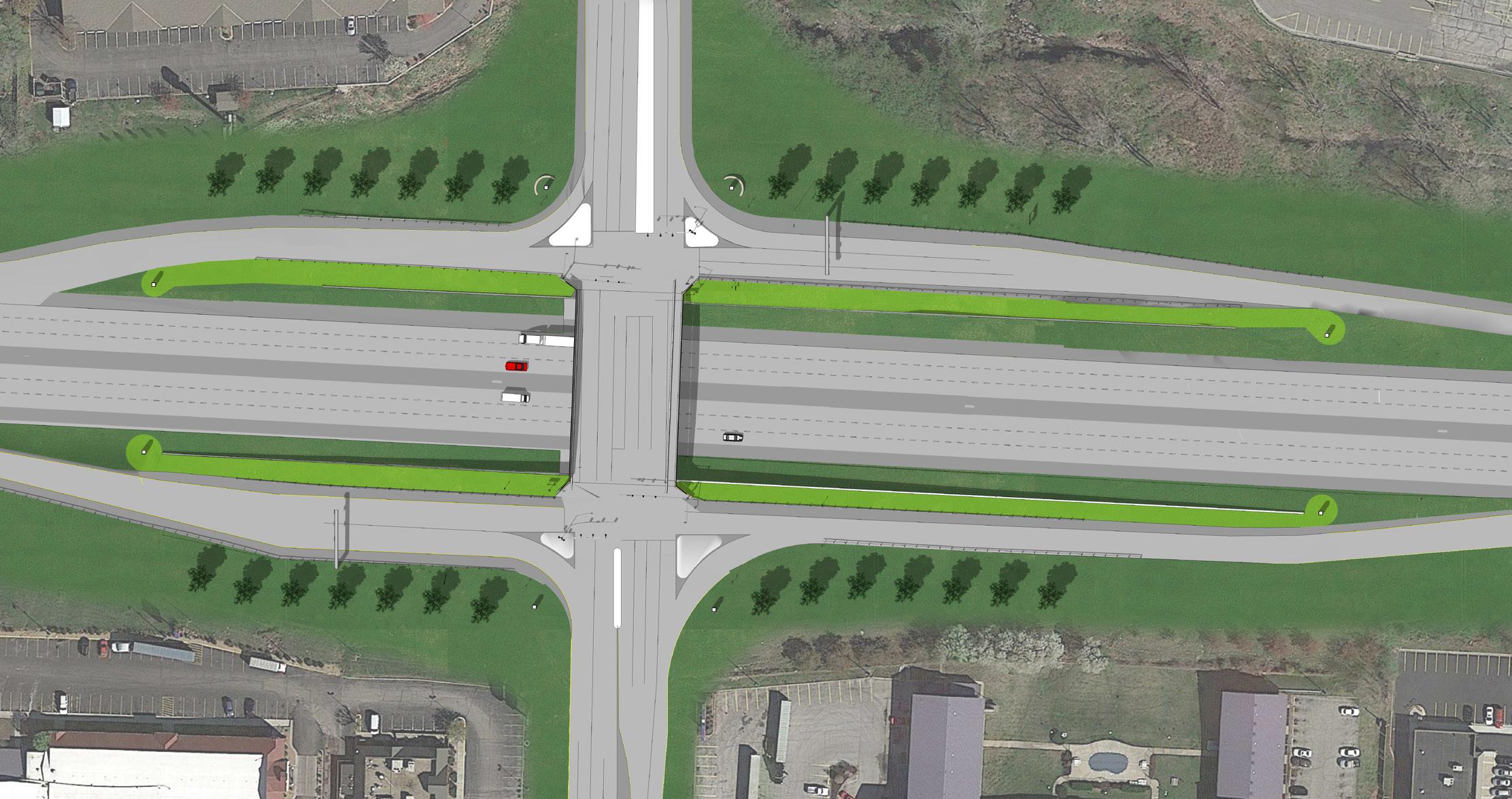

The two secondary nodes, located at 23rd Street and 40 Highway, are the north and south entry points to the district. It is anticipated that these intersections could become major activity hubs of a revitalized corridor; therefore, the streetscape should receive a higher level of treatment than surrounding areas to reflect their significance.
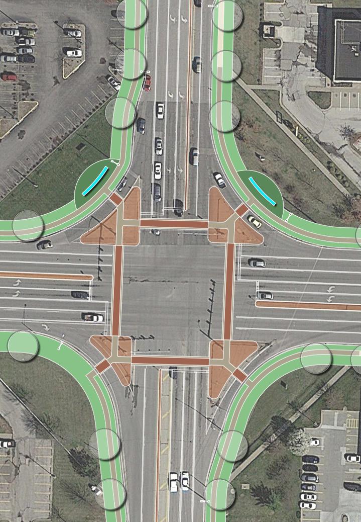
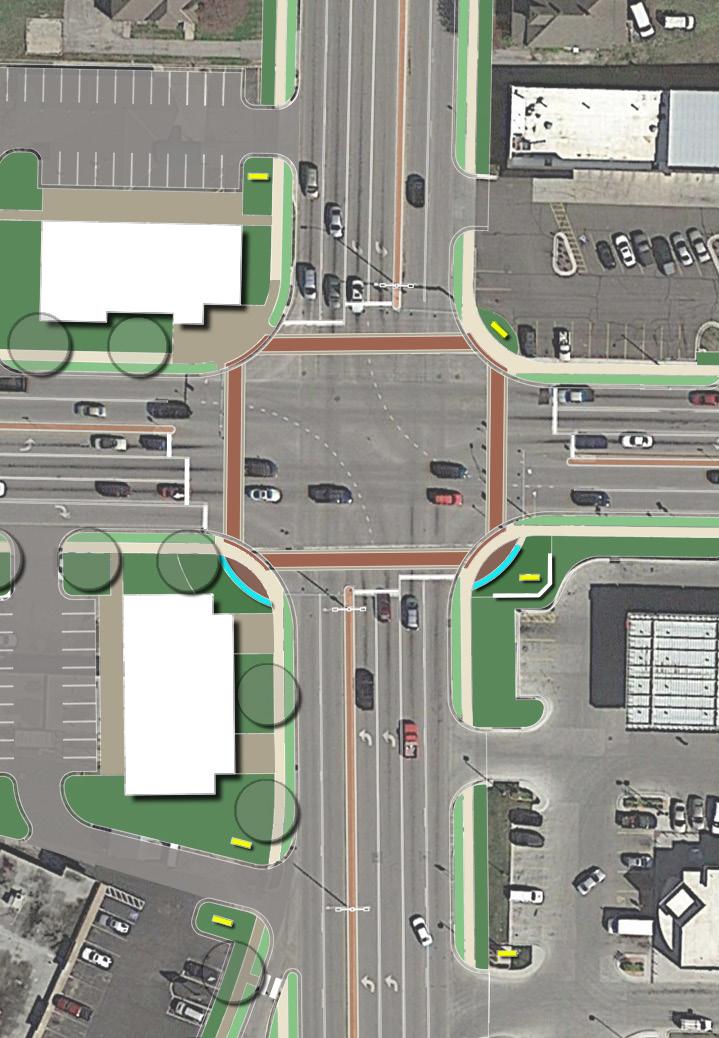
Improvements should include secondary gateways, decorative crosswalks, signalization upgrades as necessary, sidewalk infill, street trees and understory
landscaping, illuminated street signs, site furnishings, enhanced transit stops, and wayfinding and branding integration. The pedestrian walks should be large enough in area to support larger groups of people waiting to cross the street.
Additionally, the recommended redevelopment of the triangle island within the 23rd Street node should include public art and a major pedestrian plaza with site furnishings and an enhanced transit stop.
This area has been targeted for primarily retail, business and entertainment uses, and so it should be treated with a standard level of streetscape enhancements. This should include painted crosswalks at all signalized street crossings, sidewalk infill, street trees, illuminated street signs, enhanced transit stops, and wayfinding and branding integration.
Gudgell Avenue has been identified as an enhancement node, with the expectation that future redevelopment in this area will increase both vehicular and pedestrian activity.
Additional improvements related to this node should include tertiary gateway markers, added pedestrian signalization, illuminated street signs, new east-west crosswalks, and understory landscaping as space allows.
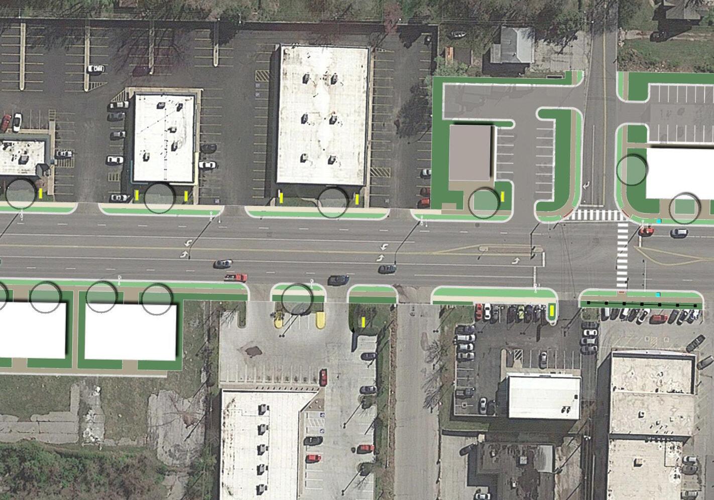
The area from Gudgell Avenue to 35th Street is populated by a high concentration of automobile dealerships. Given the unique nature of these businesses and their importance to the corridor, the streetscape in this area should react to their use and functional needs. While most of the components of a standard streetscape treatment remain, street trees should be replaced with a combination of ornamental fencing and understory landscaping, as shown in Figure 5.27 Gudgell Avenue to 35th Street Streetscape Concept
The other major streetscape enhancement for this stretch should include the screening of the railway along the west side of Noland Road, as detailed under Screen the Railway
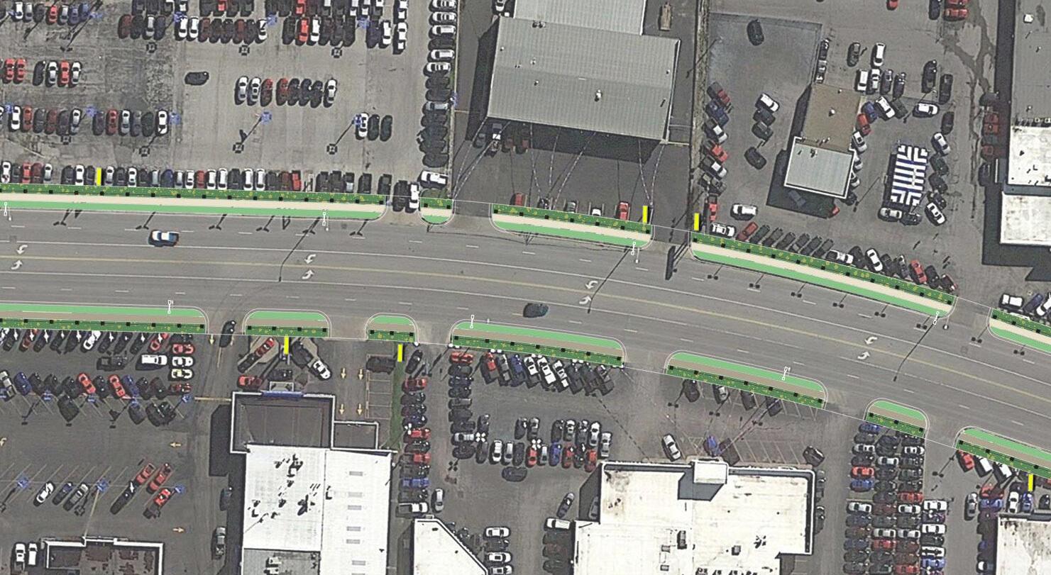
The streetscape treatment for this area should be very similar in nature to that from South of 23rd Street to South of Gudgell Avenue. Sidewalk infill should be a major part of these improvements, due to gaps in the existing network. More so than the northern half of the corridor, this segment often suffers from limited buffer space along the street. To improve this issue, sidewalks should be relocated at select locations where doing so will positively impact pedestrian safety. Replacement of the retaining wall south of 35th Street on the east side should be considered as an opportunity for enhancement of the streetscape aesthetic.
This portion of the corridor also includes two tertiary gateways nodes at 35th Street and 39th Street. These nodes should receive streetscape enhancements that include gateway markers, understory landscaping, site furnishings, enhanced bus stops, painted crosswalks, and added pedestrian signalization as necessary.
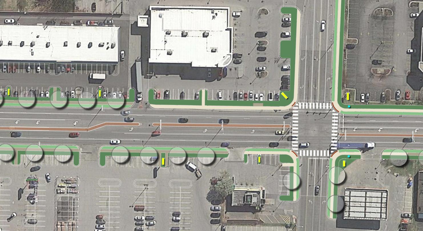
Again, the streetscape treatment for this area should be similar in nature to that from South of 23rd Street to South of Gudgell Avenue. Pedestrian connectivity is severely lacking in this area, and so sidewalk infill will be critical.
Additionally, this stretch of Noland Road is perhaps most conducive to the reintroduction of landscaped medians, due to larger lots sizes and the nature of the businesses that front it. Located properly, medians have the potential to improve both the functional and aesthetic nature of the corridor.
The diagram below locates primary, secondary, and tertiary nodes throughout the corridor. Specific streetscape enhancements are proposed for each type of node, and the street and right-of-way between the nodes. The aesthetic improvements both beautify the corridor and improve functionality.
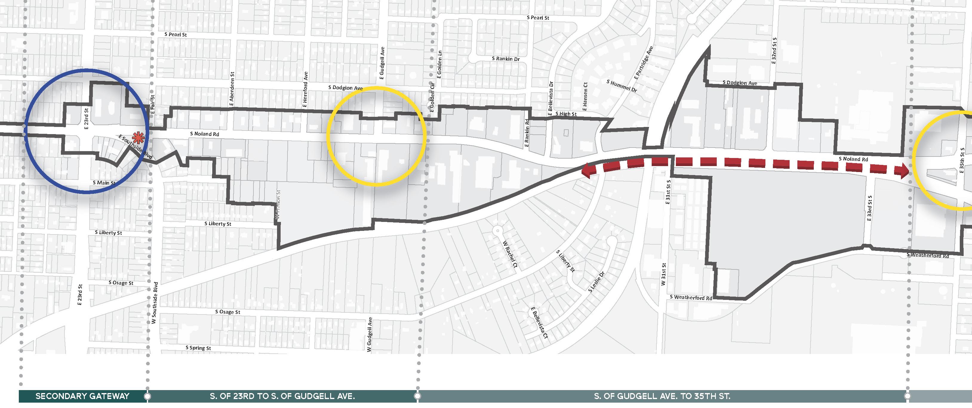
The diagram below locates primary, secondary, and tertiary nodes throughout the corridor. Specific streetscape enhancements are proposed for each type of node, and the street and right-of-way between the nodes. The aesthetic improvements both beautify the corridor and improve functionality.
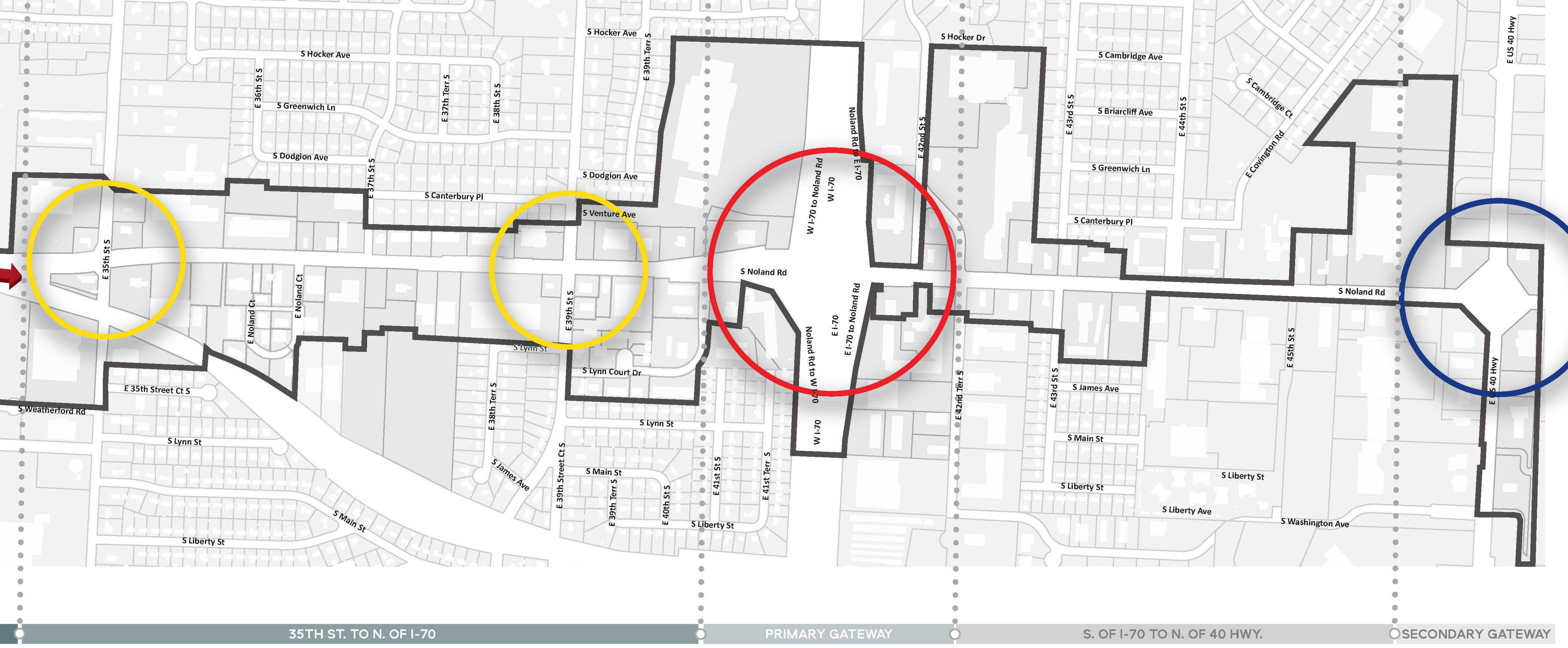
One of the most powerful ways to establish a brand or identity is through the incorporation of gateway elements. Gateways are a form of monumentation that are typically located at important intersections, nodes, or boundaries. Given the length of the Noland Road Corridor, it is not enough to have one gateway. Instead, an entire system or family of gateways that range in scale and significance should be developed. Though the various gateway elements may represent different levels of importance, they should all fit within an overall hierarchy that aims to reinforce identity, improve first impressions, and possibly even tell a story. What follows is a synopsis of the three recommended levels of gateways, including proposed locations and concepts for each.
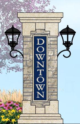
The Noland Road and I-70 Interchange is vital entry point for both the corridor and the City of Independence. Visitors from the west in particular, have no real sense that they are leaving Kansas City and entering Independence. Given the importance of this location and the realities of the existing built environment, the Noland Road overpass structure is the perfect location for the incorporation of a primary gateway element. Designed properly, it will create a sense of arrival that speaks to the character of both the corridor and the surrounding community.
The illustration shown in Figure 5.30 will offer a conceptual look at what the primary gateway might look like. Final design concepts will be added at a later date, pending Board approval.

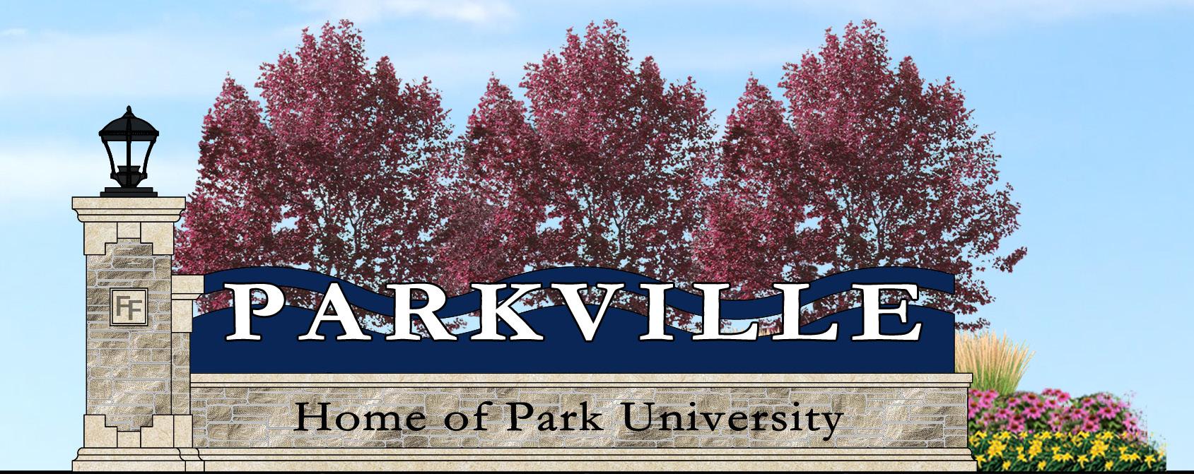

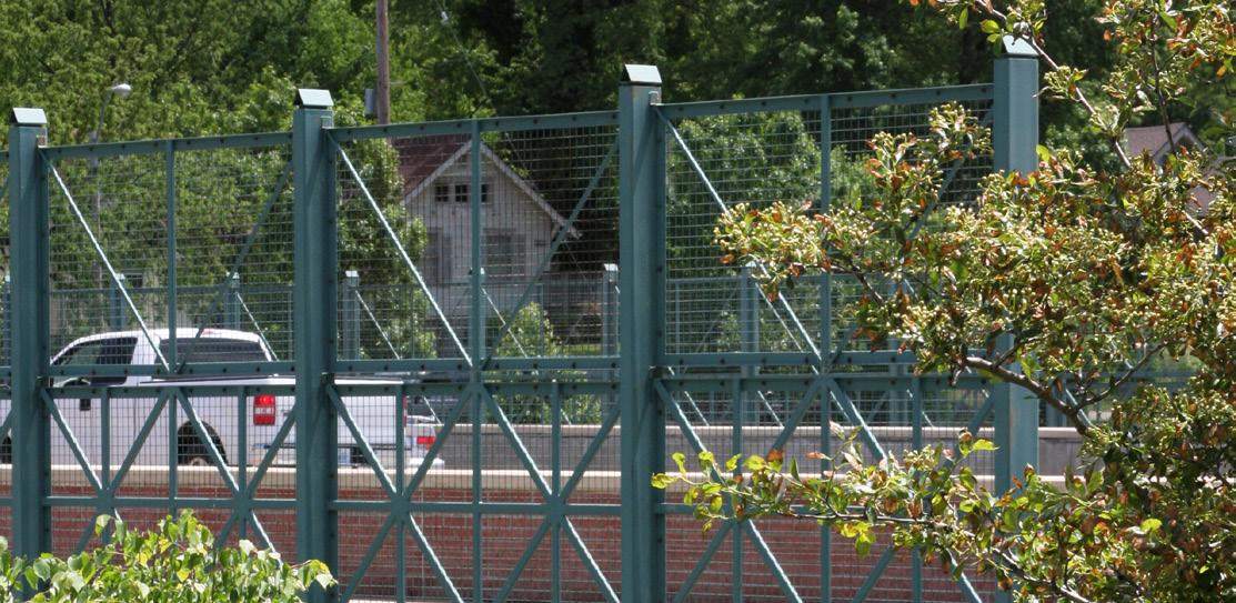
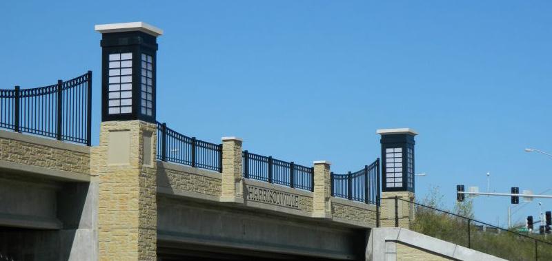

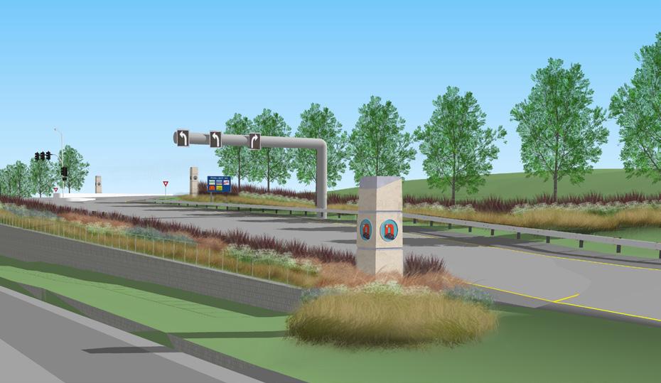
The secondary gateways should be located at the district’s most northern and southern nodes, 23rd Street and 40 Highway. Though the secondary gateways should continue to complement the overall image of Independence, their central function should be to establish an identity for the corridor and to welcome visitors arriving from secondary routes.
illustrates the conceptual look and layout of two potential designs of the secondary gateways. The design shown directly above is inspired by the iconic fifties style gas pump. Noland Road is known as, and will continue to be known in part as, an automotive corridor. Both designs plays on this connotation in a modern fashion.

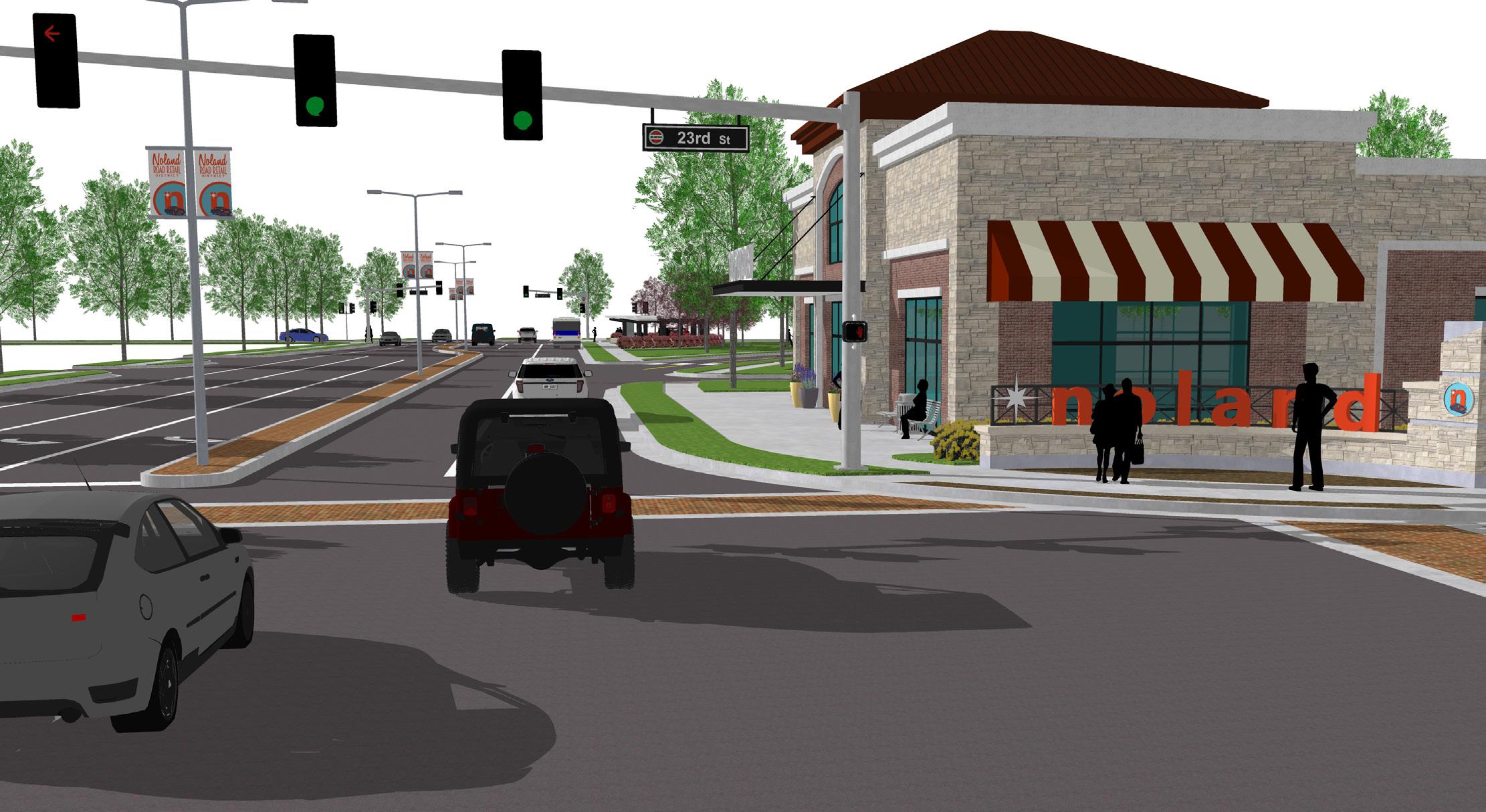

The tertiary gateway should be located at the corridor’s remaining high-traffic nodes (Gudgell Avenue, 35th Street, and 39th Street). While the tertiary elements may be less impactful than the primary and secondary gateways, they should still highlight the significance of the intersection as a hub of activity.

Figure 5.32 illustrates the conceptual look and layout of the tertiary gateways. This gateway design complements the aesthetic of the secondary gateway design, but takes the form of pairs of columns to accommodate the space restrictions of these congested intersections. Similar materials are used in both gateways designs, which establishes a consistent aesthetic throughout the corridor.

The railway running along the west side of Noland Road, particularly from Partridge Avenue to 35th Street, is a negative visual distraction for drivers, pedestrians, and adjacent property and business owners. While efforts have been made in the past to screen the railway with small groupings of landscape plantings, the impact is underwhelming.
The screening of the railway should include two different treatment types, based on surrounding conditions. The southern portion, south of 32nd Street, has an existing treeline that softens the impact of the line. Thus, the screening for this area should incorporate a lighter approach, including street trees and some understory landscaping. The northern portion has no such tree buffer, and should be treated with a “hard” screen that includes walls, columns, and landscaping.
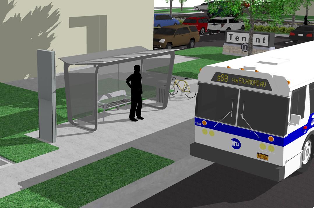
As was previously discussed in 5.4 Transportation, the existing transit stops along Noland Road lack any of the typical furnishings and amenities that have become standard in communities where public transit is more widely used. In order to attract and accommodate users, stops at high-traffic nodes and other significant locations with high ridership should be improved. Though convenience and comfort of the user should be considered, it is also important to ensure that the enhancements coordinate with the approved aesthetic of the streetscape. Without this coordination, the new transit stops will simply look out of place within the greater context of the corridor.

For a corridor striving to achieve sustainable revitalization, valuable green space is a must. Though opportunity is limited in a built-out corridor like Noland Road, there are still a few great possibilities left to be explored:
1. As discussed in 5.3 Development & Redevelopment Recommendations, the triangle-shaped island south of 23rd Street could be redeveloped as a commuter plaza for the bus line. Site furnishings like covered seating, bike racks, and informational kiosks would be provided. Illustrated in Figure 5.35, the island could also include other amenities like a vertical icon or art piece, a fountain element, and colorful landscaping.

2. The second major “green” opportunity includes the restoration of the old lake west of the Hereford Avenue intersection. While the concept illustrated in Figure 5.34
envisions a scenario where the lake is integrated into a planned senior living community, it could just as easily be restored with the intent of making it a communitywide amenity.

3. Development standards for the corridor should be adjusted to require that larger sites and planned developments be designed with the creation or preservation of meaningful open space in mind.
4. In addition to the provision of parks and green space within the corridor, improved connectivity to nearby amenities is also vital. As discussed in more detail in 5.4 Transporation, the extension of Weatherford Road and 31st Street should be addressed to improve vehicular and pedestrian access to Santa Fe Park and Lipton Conservation Area. Doing so will enhance the mobility and quality of life for employees of the corridor and residents of the neighborhoods to the east of Noland Road.
The role that ongoing maintenance will play in the longterm success of the Noland Road Corridor should not be undervalued. No matter how impressive the public improvements prove to be, their impact will quickly fade without the benefit of a comprehensive approach to maintenance. To this end, a Noland Road Maintenance Plan should be developed. Items to be in addressed in the plan should include:
• Irrigation and maintenance of street trees and understory landscape material;
• Regularly scheduled cleaning of gateways;
• Regular rotation and replacement of street banners;
• Repair or replacement of damaged site furnishings and amenities;
• Repair or replacement of damaged sidewalks;
• Emptying of trash receptacles;
• Collection of other trash and debris; and
• Removal of graffiti.
Implementation of the Maintenance Plan should be funded and managed by the Noland Road Community Improvement District. A major component of the Maintenance Plan should include the employment of Maintenance and Awareness Officers. These district employees should be responsible for daily maintenance duties such as trash clean-up, as well as added safety and security measures. Furthermore, they should act as district ambassadors, representing a friendly face who visitors, patrons, and residents can go to for directions or assistance.
STRATEGY TO ADDRESS RECOMMENDATION 7
Improving the aesthetic of Noland Road requires the implementation of effective development and design standards intended to guide all future improvement projects along the corridor. As has been discussed previously, these standards should address all aspects of the built environment that impact character, including streetscape, architecture, site design, and signage.
While new standards will not change the appearance of the corridor overnight, they could have a substantial impact on private reinvestment in the near-term. Combined with the proposed incentive programs outlined in Establish Financial Incentive Programs under 5.3 Development & Redevelopment, new design guidelines could stimulate reinvestment by offering funding assistance and an assurance that future improvements with the district will be held to the same standards.
The importance of such an assurance should not be undersold. Property owners are much more likely to invest in their property when they know others around them are doing the same. While visible change may be slow in the beginning, momentum will eventually take hold and the results will be transformational. Revenue and property values will go up, bad owners will be replaced with good owners, and the physical character of Noland Road and the way that it is perceived as a commercial district will be dramatically altered for the better.
One of the growing trends in commercial districts is the consideration of visitor and resident safety. Awareness officers are being employed to monitor districts, offer assistance and protection as necessary, and perform maintenance-related tasks. Typical services include safety intervention related to trespassing, drug activity, public intoxication, and aggressive panhandling.
Beyond their safety-related duties, awareness officers are expected to be ambassadors for the district, providing directions or assistance to the district’s patrons and visitors.

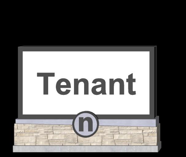
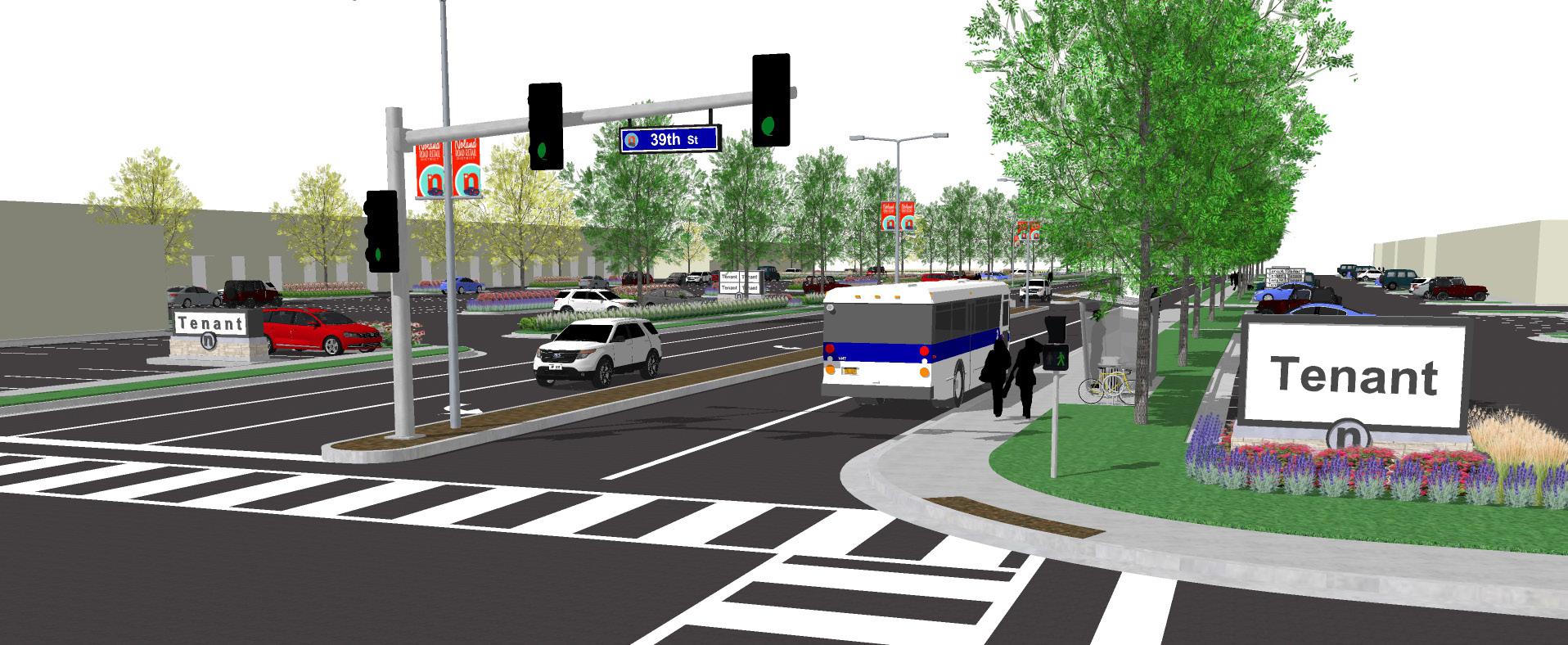

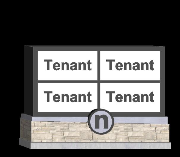
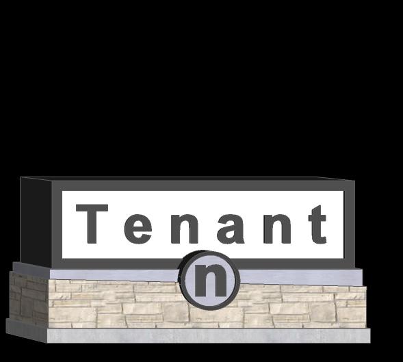
Economic sustainability references the long-term viability of the Noland Road Corridor via a combination of factors such as job expansion, property and sales tax growth, an increased resident base, the recruitment of businesses and services that meet the demands the local resident base, and the establishment of Noland Road as a destination for visitors from beyond the surrounding community. Though vacancy rates along the corridor are surprisingly low, there are still many opportunities for development, redevelopment, and reuse that will facilitate the kind of economic growth necessary for Noland Road to achieve the desired vision of this plan.
• Though vacancy rates along the corridor are low, there are still significant opportunities for development and redevelopment that could positively impact the economic growth of Noland Road.
• The automobile dealerships that front the “Miracle Mile” continue to be the economic engines for attracting traffic and customers from the greater metropolitan area. There is room to grow and expand this market without negatively impacting the desired balance of uses within the corridor.
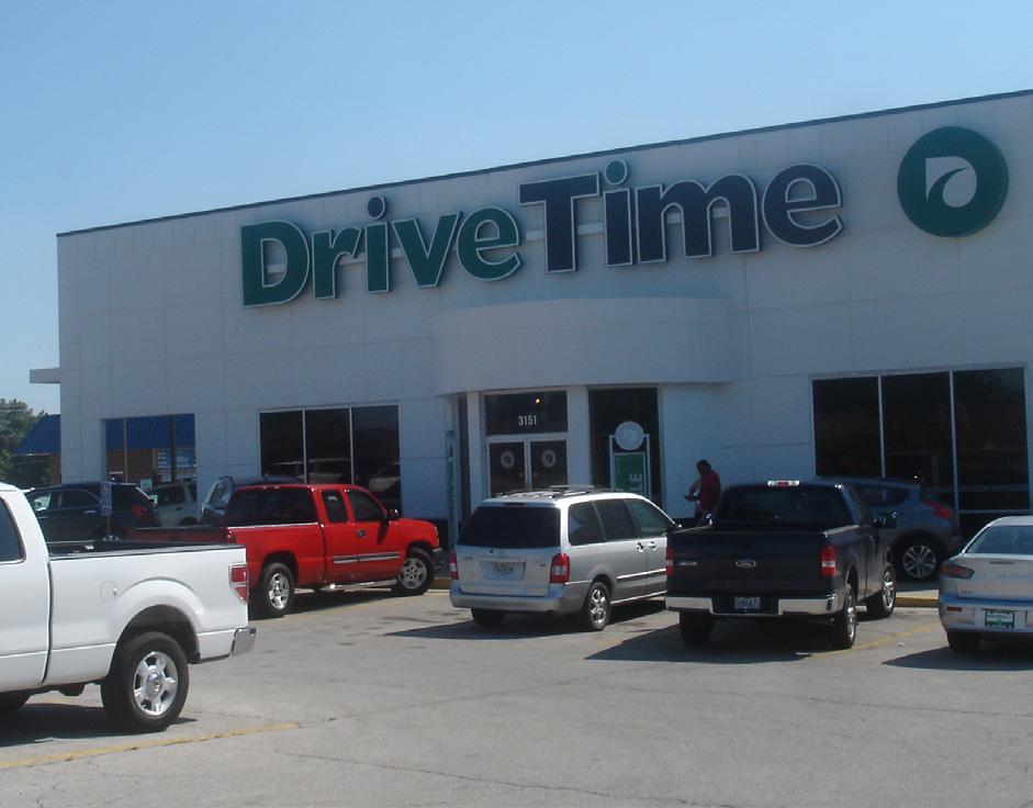

• Beyond the automobile dealerships, the Cargo Largo store, and the Truman High School, there are a lack of major destinations that draw visitors from beyond the primary and secondary market areas. Two-thirds of the businesses within the district are independently owned, and most of them exist to serve the surrounding community.
• While the surrounding residential neighborhoods are mature and mostly built out, there are opportunities for infill along the corridor that could fill a gap in housing demand and grow the population base.
• The educational attainment levels of the surrounding population may limit demand for additional office space, but support the development of new industrial space.
• While Noland Road has seen a noticeable uptick in commercial permitting and construction in the last five years, particularly near 23rd Street, the potential to leverage and build upon this reinvestment with a coordinated approach has gone largely untapped.
• The district does not currently offer incentives targeted toward property improvement or redevelopment assistance, which may be limiting private reinvestment.
• Noland Road does not utilize a coordinated campaign or marketing strategy to help recruit retailers and counteract negative perceptions of the corridor. This limits its ability to fill identified gaps in the business mix, such as sit-down restaurants or apparel stores.
1. Enhance the current business environment through recruitment, retention, and expansion efforts, focusing on identified gaps in the market.
2. Prioritize recruitment efforts toward key nodes and sites that could have the greatest impact on the revitalization of the corridor.
3. Encourage a mix of uses and businesses that serve the needs and unique demographic characteristics of the adjacent neighborhoods, while also attracting visitors from the surrounding metropolitan area.
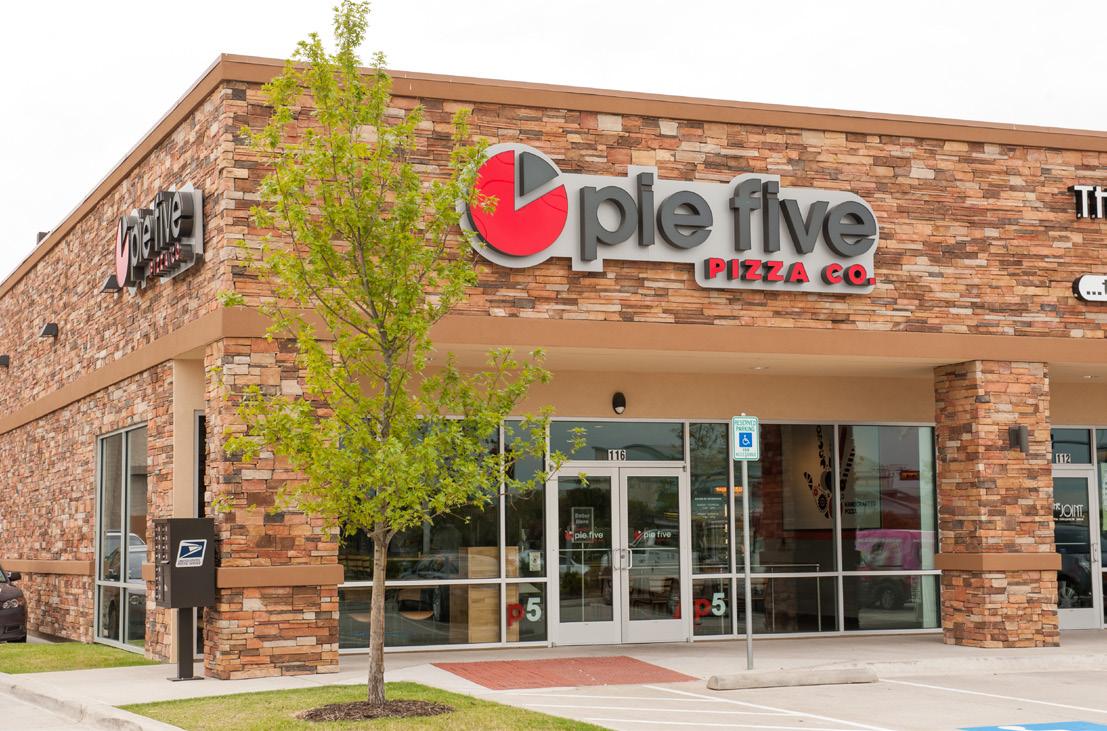
4. Foster the economic growth and expansion of the “Miracle Mile.”
5. Grow the consumer base and supplement gaps in the current housing stock by supporting residential infill within and around the corridor.
6. Grow the employment base through the encouragement of office and industrial development.
7. Stimulate redevelopment and reinvestment in the district through the use of financial incentives.
8. Develop and implement promotional strategies aimed at enhancing the public perception of the corridor and improving investor confidence.
STRATEGY TO ADDRESS RECOMMENDATIONS 1, 2, 3, 4, & 6
In order to effectively attract the desired mix of businesses with the district, it is critical to first develop a Strategic Business Recruitment Plan. The plan should identify the wants and needs of the district from a business market perspective, and then develop strategies for recruitment. Strategies should leverage promotional campaign efforts, as well as the financial incentive programs recommended for implementation by the Noland Road CID.
According to Section 3.0 Market Analysis Summary, prospective commercial business types may include:
• Sit-down restaurants
• Casual dining
• Coffeehouses
• Apparel and accessories
• Variety stores
• Hair and nail salons
• Home furnishings
• Home electronics and appliances

• Hobby and crafts
• Insurance agents
• Personal services
• Medical and dental
While retail and service-based businesses should be prioritized, office and industrial should also be targeted, as they have the ability to grow the corridor’s employment base.
The automobile dealerships that make up the “Miracle Mile” are essential to the success of Noland Road, driving both traffic and sales to the corridor. Given their importance, special consideration should be given to the dealerships to ensure that enhancements to Noland Road do not negatively impact their ability to thrive and grow. Relevant issues to consider include:
• Public streetscape and infrastructure improvements should account for the unique user demands of the dealerships.
• Likewise, development and design standards should be crafted with user needs of the dealerships in mind.
• From a land use perspective, the Auto Sales & Service District, as identified in 5.2 Land Use & Zoning, should provide room for growth of existing operations, as well as the addition of new dealerships.
• Gateway, wayfinding, and branding efforts should consider the “Miracle Mile” and its significance within the corridor.
• Promotional and marketing efforts for the district should be coordinated with the dealerships’ promotional strategies.
Implemented properly, the recommendations of the Noland Road Corridor Plan should only serve to build upon the success of the “Miracle Mile” and enhance its ability to achieve sustainable growth in the future.
The neighborhoods surrounding Noland Road are mature and developed to the extent that significant increases in the future residential population are limited. However, there are some opportunities to close gaps in the existing housing stock via infill within and directly adjacent to the district. Based on the characteristics of the existing stock and the demographic trends of the current population, likely infill opportunities include:
• Market-rate apartments with amenities exceeding the current rental stock

• Senior housing
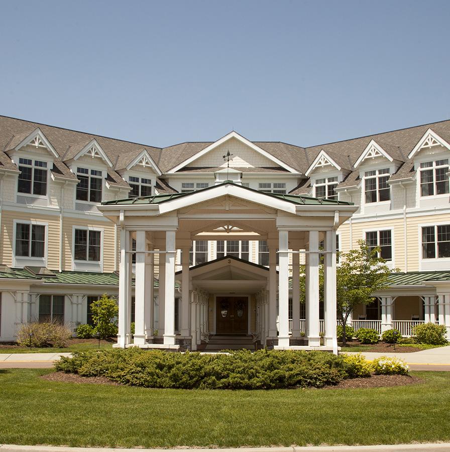
• Mixed use developments that include a blend of retail, office, and residential
Regardless of the type, quality residential infill that complements the desired character of the corridor will be a great benefit to the viability of the corridor and should be encouraged.
Specific residential development opportunities include:
• The parking lot on 23rd Street, directly west of the Shamrock Tire Company building, presents a development opportunity for amenity-rich market rate apartments. The 23rd Street node would be activated by the additional foot traffic generated.
• The primary opportunity for senior housing is as part of the Santa Fe Trail TIF District development. This site is large enough to accommodate apartments or a senior living community within a greater mixed use development.

STRATEGY TO ADDRESS RECOMMENDATION 7
As discussed in 5.3 Development & Redevelopment under Establish Financial Incentive Programs, offering financial assistance to property owners and developers is a great way to incentivize private investment. This is particularly important in the initial stages of revitalization. Development, redevelopment, and building and site rehabilitation projects are great indicators of a healthy corridor. Adjacent property owners will take note of the improvements being made, which may make them more likely to consider their own reinvestment opportunities. Signs of such an effect can be seen in the area south of 23rd Street. The redevelopment of the QuikTrip and McDonald’s properties appears to have triggered additional redevelopment and rehabilitation that may not have occurred otherwise.
To continue this momentum, an agreed upon percentage of dollars generated by the CID should be leveraged by distributing them to the following assistance programs:
• Property Redevelopment Program
• Façade Improvements Program
• Sign Improvements Program
Interested parties who apply for and are successfully awarded funding dollars should be required to follow the Noland Road Design Guidelines, ensuring that all incentivized improvements align with the desired Vision for the district. The CID Board of Directors should review and vote on the approval or rejection of all submitted applications in a timely manner, so as to not unnecessarily stunt or delay progress.
All incentive programs should be widely advertised to both current and potential businesses within the district’s boundary to guarantee fairness and maximize participation.

In operation since 2003, the Downtown Kansas City, Missouri CID is a longstanding, successful effort to improve residents’, visitors’, and employees’ downtown experience. The CID funds services for homeless populations, daily maintenance and cleaning by downtown ambassadors, and marketing and communications assistance to bolster downtown businesses. Direction and parking assistance is also provided during special events.
The Downtown CID has received numerous positive reviews by businesses, visitors, downtown employees, and residents over the years. With a funded maintenance plan in place, additional downtown investment is, and will continue to be, encouraged.
STRATEGY TO ADDRESS RECOMMENDATION 1 & 8
Fair or not, the public perception of Noland Road as a commercial business district is far from ideal. It is perceived to be past its prime, incapable of competing with Independence Center, the newer, shinier retail district in Independence, or retail opportunities in surrounding communities. While some of the negative perceptions of Noland Road are well earned, others stray from reality. For instance, Noland Road is often characterized as having a high vacancy rate, as is often the case with corridors of a similar nature. However, vacancy within the corridor is relatively low and practically non-existent in the northern half.
To fight back against unfair perceptions and highlight the progress being made, it is critical that the district develop and implement a promotional campaign. The campaign should be coordinated with the Strategic Business Recruitment Plan and consist of a combination of physical improvements and promotional strategies. Components of the campaign should include the following:
• Wayfinding that identifies businesses within the district
• Gateways that welcome visitors to the district and highlight key activity nodes
• Integration of district branding into both physical improvements and promotional efforts
• Maintain brochures, maps, flyers, and other marketing materials for the corridor
• Development and maintenance of a website and/or social media platforms that promote corridor business, special events, and attractions
• Special events and promotions coordinated with automobile dealers’ advertising
• Conduct survey research to monitor the public perception and satisfaction with the corridor’s retail market
The campaign and its associated marketing strategies should aim to attract both local and out-of-market visitors. Just as importantly, it should serve to improve business and property owner confidence in the long-term future of the district. And of course, it should act as a promotional tool for recruiting new businesses and investors, as well.


Noland Road’s prominence as a commercial destination is at a crossroads. Obsolete site layouts, a lack of retail variety, and a dated aesthetic all limit Noland Road’s vitality. Yet, recent reinvestment at key commercial nodes demonstrates that change is possible and enforces the belief that now is the time to develop a plan to guide the corridor’s revitalization. Continued reinvestment requires the appropriate identification, implementation, and coordination of policies, projects, and people that support the defined vision and guiding principles for the corridor.
While Noland Road is unique in that a funding source already exists for many of the proposed improvements, complete implementation of this Plan will require a high level of trust, cooperation, and focused attention between citizens, elected officials, City staff, businesses, the CID, community organizations, and importantly, the private sector. Section 6.0 Implementation identifies the phasing, priorities, and potential coordinators of the Plan, as well as additional prospective funding and incentives to supplement CID dollars.
Integral to each implementation step are the following principal elements:
• Partner with City Hall – City-level support is critical to the realization of the vision for Noland Road. City departments and the City Council should coordinate and align with and bolster corridor redevelopment efforts.
• Begin with Policy – Establishing policy creates the essential framework for future implementation of the Plan. Oftentimes, policy changes can be made quickly and for a minimal cost.
• Be Bold and Visible – Early “wins” and visible projects help garner public support. Early successes must be marketed to gain support for long-term ventures.
• Identify and Bolster Plan Champions – Those persons involved in the planning process—likely the CID property owners along Noland Road—must continue to champion the Plan over time to maximize its success.
Section 6.0 utilizes a series of implementation matrices to clearly lay out the next steps that will push the Plan forward. Each implementation matrix details a time frame, cost impact, task coordinators, and progress indicators for the identified strategies and their associated tasks.
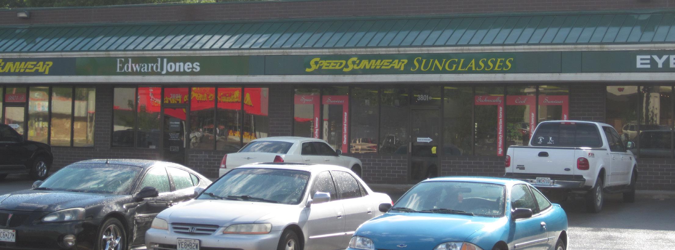
A general time frame is provided for each implementation strategy/task. Generally, low-cost strategies with simple implementation steps are planned for the immediate future. The time frames are detailed as follows:
• Immediately: Low cost, ease of implementation, directly advances other strategies, or addresses critical issues
• Continuous: Varying costs, but necessary tasks to sustain the Plan
• Short-Term: (1-5 years) Fairly significant cost, but with planning can be implemented within this time frame
• Long-Term: (5+ years) Significant cost, requires implementation of other strategies first
Cost impact designations only refer to implementation costs incurred by the CID, and do not account for private investment costs.
• Low: Strategies that require policy changes or partnerships with limited outside funding requirements
• Medium : Strategies that require relatively affordable consulting services and/or infrastructure improvements
• High: Strategies that require high levels of planning, engineering, and/or design and infrastructure improvements
Task participants are assigned to each of the implementation tasks. The identified organizations, entities, or departments are either currently involved with similar revitalization strategies or possess the capability and/or authority to implement and/or assist with such strategies.
To ensure the success of each implementation task, setting a specific task coordinator is recommended. Oftentimes, the CID Staff will be the primary task coordinator, as they are heavily involved in all implementation efforts. The task coordinator is listed first, and is bolded, within each implementation matrix.
Other organizations and entities will play key implementation roles, but will not lead the effort. For example, any development proposal along the corridor will require coordination with the City through the development review process, but the City will not work with the project step by step.
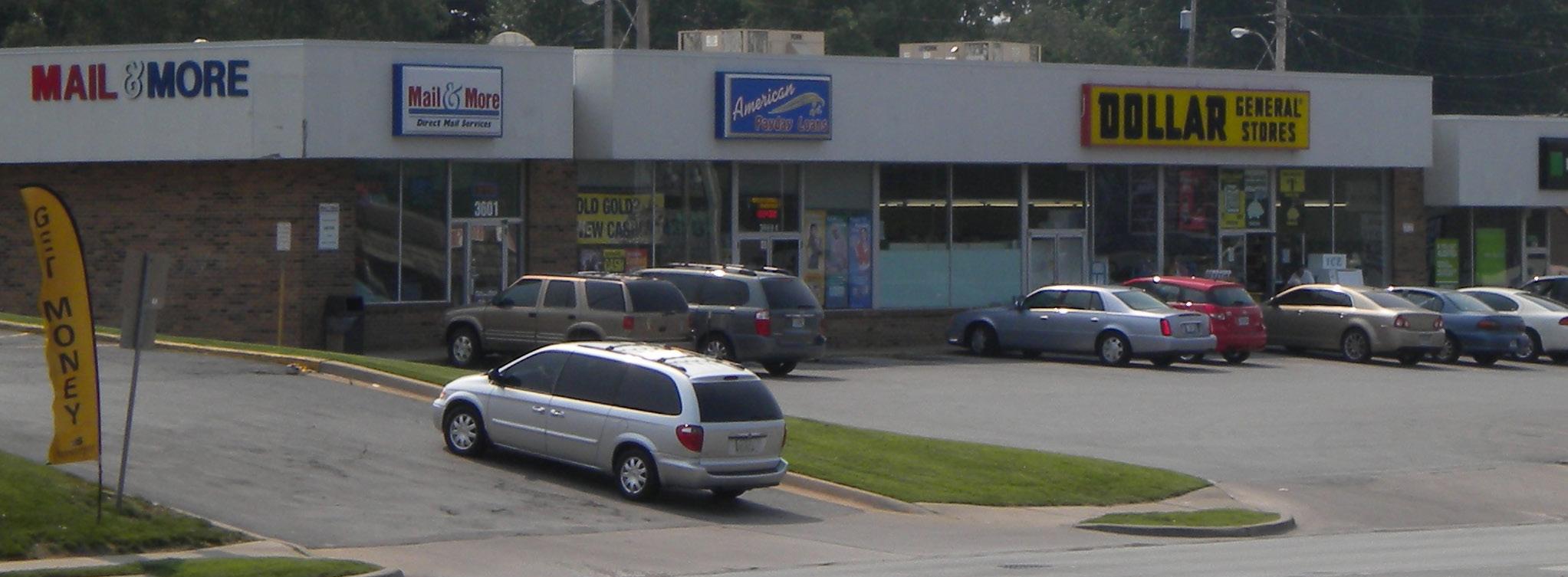
Key progress indicators have been provided for each implementation strategies group. These identify quantifiable metrics for which data should be available on a regular basis, such as demographic data. While not a comprehensive list, these indicators will enable the CID and the City to monitor the corridor’s incremental progress towards revitalization.
Four general steps should be taken, and started immediately, to achieve visible gains and create a strong atmosphere capable of fostering redevelopment and development opportunities. The steps are as follows:
1. Policy, Regulation, & Administrative Alignment
2. Proactive Plan Advancement
3. Additional Planning, Design, & Engineering Documents Preparation
4. Priority Projects Completion
The following summarized policy, regulatory, and administrative implementation strategies should be considered by the City and advocated for by the CID, within the proposed time frames. Generally, policy, regulatory, and administrative changes can be completed in a short time frame and rely on little funding allocation.
The Noland Road Revitalization Plan should be adopted by the Independence City Council as the City’s official policy guide for land use, development, and capital improvements along Noland Road. It is essential that the Plan be used by City staff and the CID Board of Directors when reviewing and evaluating all proposals for improvement (and funding requests) along the corridor. This document should be adopted as a corridor plan.
Once the Noland Road Revitalization Plan has been adopted, the City should amend affected ordinances and plans at their traditional time of review so that they may be aligned with the vision and recommendations of this Plan. This update process should review the following documents, but is not limited to:
• Independence, Missouri Comprehensive Plan (1993)
• 6.4 Proposed Land Use, located in Independence, Missouri Comprehensive Plan (1993)
• Recommended Public Improvements (2014 – 2020)
• Capital Improvements Program (2015 – 2021)
As implementation of the Plan will rely heavily on incentivizing private sector reinvestment, it is necessary to communicate the Plan’s findings and recommendations to those with a current (or future) stake in the corridor’s vitality. To this end, the CID Board of Directors should meet with property owners and potential redevelopers, including major businesses capable of large redevelopment or enhancement projects. Additionally, other public agencies, utility companies, and various neighborhood groups should be provided a copy of the Plan.
The Plan must be readily available to property owners and businesses that occupy the corridor. The City should post a copy of the Plan on the City’s website for download.
This Plan is a foundational document, as it contains recommendations that were made at the time of its creation based upon existing conditions, market analysis, and stakeholder input. This process has set a clear direction for the future of Noland Road. While there are strong recommendations in the Plan for achieving the vision, the needs and desires of the district may shift over time. The Plan should be nimble, able to react to those shifts and be revised to fit the community’s needs over time.
However, significant changes should only be made after careful consideration. Both stakeholder and public feedback are a necessary part of the process, ensuring that proposed revisions are thoroughly vetted. As issues arise, CID staff should maintain a list of future amendments or needs which may be added, revised, or removed from the Plan.
On an annual basis, a cursory progress report should be created by the CID staff and presented for the Board’s review. Additionally, it is recommended that the Plan be reviewed in its entirety every three to five years for progress and relevance. At that time, should that review indicate that conditions, needs, or new opportunities warrant further study, that study should be conducted and the Plan document revised as necessary.
Figure 6.1 Policy, Regulation, & Administrative Alignment lists strategic tasks, and their associated time frame, cost impact, task coordinator(s), and progress indicator(s), to accomplish each previously mentioned strategy.
STRATEGY 1 - Adopt Noland Road Revitalization Plan
Arrange meeting with the City to understand plan adoption procedures.
Conduct town hall meetings with CID property owners to garner support for the Plan’s recommendations, and subsequent adoption.
Determine when and how the City Planning & Zoning Division will utilize the Noland Road Revitalization Plan during the development review process.
Immediately Low
Immediately Low
Immediately Low
STRATEGY 2 - Amend relevant ordinances and plans
Compile comprehensive list of changes necessary to align City documents with Noland Road Revitalization Plan.
Arrange meeting with the City to understand ordinance and plan amendment procedures. Maintain regular communication throughout this process.
Immediately Low
Immediately Low
Provide hard copy of the Plan at the CID office and City Hall, and a digital copy on the City’s and CID’s website.
Conduct informational meetings with CID property owners to explain the Plan’s recommendations, and specifically the CID-funded incentive programs.
Actively market the Plan to the development community through multiple social media platforms, the CID website, and one-on-one developer meetings.
Advertise corridor reinvestment success stories through press releases and reaching out to other local media sources.
Continuous Low
• CID Staff
• City Planning & Zoning Division
• Consultants
• CID Staff
• Consultants
• City Planning & Zoning Division
• CID Staff
• Consultants
• CID Staff/Consultants
• City Planning & Zoning Division
• CID Staff
• City Planning & Zoning Division
• Consultants
• City Community Development Staff
• CID Staff
• CID Staff
• CID Board of Directors
• Consultants
• CID Staff
• City Economic Development Staff
• Adoption of the Noland Road Revitalization Plan by the City
• Reference to the Plan in City staff reports and formal recommendations
• Amendments (and subsequent implementation) of updated City documents
• Increase in CID funding incentive applications
• Stronger social media presence (re-tweeting and number of followers, friends, and posts).
• News stories
• Download counts of the Plan from the CID website
• Increase in building permits along Noland Road
STRATEGY 4 - Review and maintain the Plan periodically Monitor demographic and market data as it becomes available; maintain a list of proposed amendments if necessary.
Prepare an annual cursory presentation reviewing the corridor’s success. Present to the CID Board of Directors.
Prepare a formal report reviewing the corridor’s success every three to five years. Present to the CID Board of Directors and City Council. Continuous
Maintain a list of supplemental planning studies in response to changing market conditions; utilize planning, engineering, and design consultants to complete supplemental planning studies.
•
•
•
•
•
• Amendments to the original Plan in line with new market and social norms
• Completed annual cursory reports on corridor’s progress
• Completed formal reports on corridor’s progress
• Completed supplemental planning studies
Complete redevelopment and revitalization is always a lengthy process, constrained by limited funding and resources. As stated previously, Noland Road is unique in that a funding source for many of the proposed improvements has been secured. Without the CID, implementation would not be as focused, leaving the City to simply monitor and capitalize on market conditions as they change. The establishment of a CID and the development of this Plan represents a proactive first step toward revitalization, but more must be done. The Plan needs a strong, unified voice to champion its cause and provide daily and active implementation guidance. While the City’s role in the process is critical, the CID is ultimately responsible for stewardship of the Plan. Its success is dependent on the CID’s ability and willingness to be a champion for change.
In regards to plan advancement, the CID should have the following responsibilities:
• Seek supplemental funding for projects;
• Seek potential tenants, retailers, and businesses to locate along the corridor;
• Solicit developer interest in redevelopment and development projects;
• Hold biannual meetings with the CID members;
• Implement recommendations, keenly leveraging incentive CID dollars;
• Identify, hire, and manage consultants to assist in implementation efforts; and
• Track the progress of revitalization efforts.
Refer to the Noland Road CID Operations Handbook for the complete organizational structure, funding allocations, processes, functions, and responsibilities of the CID.
It is necessary to outline the proposed organizational structure of the CID, as well as each body’s responsibilities. While its general organizational structure is based on other communities’ and organizations’ successful corridor redevelopment and revitalization strategies, its specific makeup has been modified to fit the unique issues and challenges facing Noland Road.
The CID Board of Directors should be representative of the entire business community along Noland Road and charged with developing a long-term strategy—including budget—for implementation. In order to develop this long-term strategy, it is recommended that the Board take part in a leadership retreat that would have as its goal an implementation action plan.
The Board of Directors should be comprised of no more than five to seven individuals capable of ensuring the Plan’s success. The Board should provide corporate governance, oversight, marketing resources, as well as guidance and oversight to office staff, charged with dayto-day operations of plan implementation. Strong multiyear commitments from the initial Board of Directors are recommended to ensure continuity and focus for the startup and initial operations of the Board.
Coordinating the Plan will be a fulltime job. Because of the amount of the coordination required, a one- or two-person full-time staff (Executive Director and Office Administrator) should be hired to work in the implementation office and funded by the CID. Staff operations should be two-fold: outreach- and enhancement-focused.
Outreach should be outwardly focused on business recruitment and as a liaison/educator to prospective developers and the City. The City must be made aware of corridor successes and any necessary amendments to the Plan. It is expected that the City will utilize the Plan when reviewing proposals along the corridor, as well as educate interested (re)developers on the CID incentive programs. This joint revitalization effort is only possible through the advocacy and educational work of the CID. In addition, the outreach arm of the CID staff should be highly skilled in communication and organization, and capable of tapping into the development market.
Enhancement efforts should have an inward focus— working to brand the corridor and build a strong and supportive business community. These efforts may come in the form of joint marketing, physical branding improvements, printed and online material, and customer and business satisfaction research.
In addition to carrying out specific projects, both arms should provide technical assistance to property owners or potential (re)developers interested in applying for incentive funding. The success of the Plan implementation will be based on the commitment of funds and qualified staff to oversee the project on a day-to-day basis. An annual statement of goals and a timetable for yearly accomplishments should be prepared by the staff and reviewed by the Board of Directors, as part of the annual cursory report. Staff will be accountable to the Board of Directors.
CID property owners should play an informal advisory role in the implementation of the Plan. It is recommended that the CID Board and staff engage the property owners for information exchange and discussion of policy alternatives for the Plan during the biannual meetings. Attendance at these meetings should be highly encouraged. Both the CID staff and Board should maintain open lines of communication to the property owners, encouraging their input.
The Board of Directors may retain the services of outside consultants to address any number of planning, design, engineering, legal, management, and financial issues. These consultants should be hired and funded by the CID Board of Directors. CID staff will provide day-to-day management and guidance to the consultants.
It is recommended that a high quality, visible office space to house the operations of the various implementation components be established along the corridor. The facility should provide:
• CID staff offices
• Space for Board and biannual member meetings
• Audio-visual technology
• Welcoming atmosphere for property owners or (re)developers interested in applying for incentive funding or currently going through the development review process
The office should be utilized for the facilitation of policy discussions by the Board of Directors, CID staff, and participating property owners. Additionally, it should be the focus of initial marketing efforts for introducing prospective property owners, business owners, and developers to the Plan and Noland Road.
An integral function of the Board will be the administration of the three incentive programs: Property Redevelopment & Development Program, Façade Improvements Program, and Sign Improvements Program. Each program will leverage allocated funds at a different development cost to assistance ratio, encouraging the private sector to reinvest in Noland Road. While the submittal process should be managed by the CID staff, the Board should be given the ultimate authority to award CID funding assistance to projects they feel will have the greatest impact on the corridor as a whole.
Every property within the Noland Road CID boundary should be eligible for incentive funding, as long as the property is in good standing with the City. Though all properties are to be eligible, location and forecasted economic impacts should be prioritized when allocating project incentives.
Complete program descriptions, approval processes, requirements, and eligible improvements are included in Noland Road Design Guidelines.
The Property Redevelopment & Development Program should be created to stimulate the private sector to invest in the corridor through permanent major site improvements, the construction of new buildings on vacant or underutilized land, or site redevelopment, all which can serve as catalyst projects. The primary goal should be to achieve significant visual improvements and infill along the corridor. Approved projects eligible for reimbursement after project completion in the form of a matching grant should receive assistance at a 4:1 ratio up to a maximum grant of $200,000 for eligible redevelopment or development improvement costs.
The Façade Improvements Program should be fashioned to encourage current property owners to significantly enhance the exterior appearance and quality of structures along the corridor. These improvements should be visible from the right-of-way and address facade elements such as exterior lighting, awnings, facade wall materials, paint, and new windows. Approved projects eligible for reimbursement after project completion in the form of a matching grant should receive assistance at a 3:1 ratio up to a maximum grant of $100,000 for eligible façade improvement costs.
The Sign Improvements Program should be established to minimize the negative impact of dated or undesirable monument and pylon signs on the corridor’s appearance, quality, and reinvestment potential. This program should work to spur the private sector to make desired improvements to detached signs. Approved projects eligible for reimbursement after project completion in the form of a matching grant should receive assistance at a 2:1 ratio up to a maximum of $20,000 for eligible sign improvement costs.
As previously stated, CID staff should be charged with widely marketing the CID, available properties, incentive programs, and the corridor’s established identity. Action steps should be clearly outlined in the Strategic Business Recruitment Plan and Noland Road Corridor Promotional Campaign documents. These marketing efforts will be in the form of physical branding, a promotional campaign and educational outreach, business recruitment, and business retention and member involvement, as follows.
The CID should utilize the proposed Streetscape Improvements Plan when planning for and funding wayfinding, branding, signage, and gateway improvements. For example, the installation and design of street light banners should be in coordination with gateway monuments. Each physical improvement should work towards establishing a clear, succinct identity through the use of set colors, architectural materials, and a logo.
Once a logo is established, all forms of communication and marketing should display the logo or an acceptable representation. Resources should be dedicated to maintain a consistent message to the public about Noland Road. Included in the promotional campaign are brochures, maps, flyers, and other similar materials. A Noland Road website and/or social media platforms should promote corridor business, special events, joint marketing, and other attractions.
CID staff should make intentional contact with City staff and elected officials, property owners, prospective developers, and the surrounding community on a regular basis to continue to solidify the corridor’s identity. Targeted communication to the region is vital, as well, as Noland Road has been and must continue to be a retail destination.
Strategies should be developed and outlined in the Strategic Business Recruitment Plan to attract both local and out-of-market businesses. Additional retail, sit-down or fast casual restaurants, and larger employers must be targeted. The incentive programs must be widely promoted, as well as the advantages of locating along the corridor. CID staff will play a critical role in forming connections with the development community.
Equally important to the corridor’s successful revitalization is instilling business and property owner confidence in the long-term future of Noland Road. This may come in the form of phased improvements in the right-of-way, business support services, joint marketing opportunities, and open lines of communication between members and CID staff and the Board.
Maintenance is vital to the long-term success of the corridor—and is often undervalued. The CID capital improvement budget must always consider long-term maintenance expenses. If maintenance expenses cannot be funded, the improvement should be reconsidered or redesigned as to minimize its construction cost or maintenance requirements.
The Noland Road Maintenance Plan should be the guiding and comprehensive approach to maintenance along the corridor. Regular irrigation, cleaning, replacement, and infrastructure improvements should be included in the maintenance plan. The CID should employ Maintenance and Awareness Officers responsible for daily maintenance duties such as trash clean-up, as well as added security measures. The officers should also act as district ambassadors, offering a friendly face to corridor visitors.
Figure 6.2 Proactive Plan Advancement lists strategic tasks, and their associated time frame, cost impact, task coordinator(s), and progress indicator(s), to accomplish each previously mentioned strategy.
STRATEGY 1 - Set CID organizational structure and general responsibilities
Develop a long-term implementation strategy and budget for CID operations and projects.
Take part in a leadership retreat to develop a strategic implementation action plan.
Provide corporate governance, oversight, and marketing resources to the CID staff, as outlined in the long-term implementation strategy.
Perform regular business recruitment activities in line with the Strategic Business Recruitment Plan. Regularly report to CID Board of Directors.
Meet and/or communicate with City Planning & Zoning Division, City Council, and the development community to solicit support for the Plan and educate on the recommendations and revitalization successes.
Educate the City on the Plan’s recommendations, and specifically how to administer, interpret, and apply the Plan.
Design and distribute printed and digital corridor promotional material to the City, development community, CID members, and targeted visitor audiences.
Conduct business and customer satisfaction research to guide recommended revitalization strategies.
Provide process-oriented technical assistance to the development community and property owners interested in corridor reinvestment.
Hold biannual meetings with all CID members for an open information exchange, corridor success stories, and discussion of potential policy alternatives.
Monitor and research grants, funding agencies, and programs that apply to the Plan.
Hire outside consultants to address planning, design, engineering, legal, management, and financial issues.
Reuse and enhance the exterior of an existing building along the corridor to serve as the Plan’s implementation office - a space for all CID operations.
Partner with other governmental organizations and utility companies to address site-specific issues along the corridor.
6.2
• Development of CID communication action plan
• Increase in number and variety of businesses
• Reference to the Plan in City staff reports and formal recommendations and City Council meeting minutes
• Increase in number of retail shoppers
• Increase in sales/ services provided (reported by CID members)
• Growth in customer and business satisfaction over time
6.2
Continuous
Priortize funding allocations to projects with the highest forecasted economic impact.
Help facilitate corridor economic growth using strategies such as site assemblage, parcel consolidation, assistance with infrastructure improvements, and marketing of available properties.
Retain a consultancy to prepare the Strategic Business Recruitment Plan, Noland Road Promotional Campaign, and Streetscape Improvements Plan. Integrate the plans’ recommendations into CID responsibilities and goals.
Allocate incentive program funding annually; update previous budget in line with corridor’s current needs.
Design and install physical branding improvements: I-70 bridge improvements, wayfinding, signage, gateways, lighted street signs, and streetlight banners.
Develop brochures, flyers, maps, and other promotional materials with a consistent logo and color scheme.
Continuous Low • CID Staff
Continuous (Annually) Low
Short-term (Catalyst Sites) & Continuous Medium - High
• CID Board of Directors
• CID Staff
• CID Board of Directors
• Consultants
• City Planning & Zoning Division
• City Economic Development Staff
• Increase in number of applications for CID funding by CID members and private developers
• Increase in number of building permits along the corridor
• Increase in sales tax revenue from businesses along the corridor
• Development or redevelopment of existing, marketed properties
Share promotional materials at the local, regional, state, and national levels. Utilize local media, such as interviews and press releases, to spread greater corridor awareness and reduce negative perceptions.
Continuous
(Annually) Low • CID Staff • CID Property/Business Owners
Immediately Medium - High
Continuous (Annually) Low
Short-term High
Immediately Low
• CID Board of Directors
• CID Staff/Consultants
• CID Board of Directors
• CID Staff
• CID Staff/Consultants
• CID Board of Directors
• CID Staff/Consultants
• Preparation of the Strategic Business Recruitment Plan, Noland Road Promotional Campaign, and Streetscape Improvements Plan
• Installation of physical branding
• Development and distribution of brochures, flyers, and maps
• Established corridor color scheme and logo
• Increase in followers and “friends” on social media accounts
• Increase in number of CID website “hits”
Continuous Low
• CID Staff
• CID Board of Directors
• Establishment of a local and regional media presence
Continuous Low
• CID Staff
• Increase in prospective retail businesses located along the corridor Focus promotional resources to reach businesses including: sit-down restaurants, casual dining, coffeehouses, apparel and accessories, variety stores, hair and nail salons, home furnishings, home electronics and appliances, hobby and crafts, insurance agencies, personal services, and medical and dental offices.
STRATEGY 3 CONTINUED - Market the CID and the corridor
Coordinate promotional and special events with the automobile dealerships’ advertising and events.
Publicize both public and private investment in the corridor through various outlets.
Maintain open communication lines between City Economic Development staff and CID staff to ensure business recruitment/retention efforts are aligned.
STRATEGY 4 - Maintain the corridor and future public improvements
Prepare the Noland Road Maintenance Plan, including strategies to manage landscape, street banners, gateways, site furnishings, sidewalks, trash receptacles, and trash/graffiti/debris maintenance.
Employ one to three Maintenance and Awareness Officers to maintain public improvements and provide assistance to corridor visitors.
Consider long-term maintenance expenses when designing and funding capital improvements.
• Decrease in commercial vacancy rate
• Increase in number of demolished and consolidated properties
• Increase in number of reuse, development, and redevelopment projects
• Hiring of Maintenance and Awareness Officers
• Decrease in number of code enforcement issues/complaints
• Increase in number of reuse, development, and redevelopment projects
The following plans, studies, and guidelines should be developed to further the recommendations of the Plan. Many of the plans, studies, and guidelines will reference the overarching Noland Road Revitalization Plan and should be implemented in concert.
As a first priority, a Special Sign Character Overlay District must be put in place in order to not miss opportunities to positively impact current and upcoming projects. A primary issue that Noland Road currently faces is the proliferation of unattractive pole signs. Establishing an overlay district of this nature will allow the district to regulate the size and aesthetic of signage for all new development and redevelopment projects. It is important to note that this tool is a temporary fix; ultimately, Noland Road signage regulations will be incorporated into both the Noland Road Overlay District and Noland Road Design Guidelines.
While the Noland Road Overlay District is intended to be integrated fully into City policy, the Noland Road Design Guidelines should be approved, enforced, and maintained entirely by the CID. As such, the regulatory boundary for the Guidelines should mirror the CID boundary. All property owners who receive funding from one of the CID incentive programs will be required to meet the site design, signage, and architectural standards set forth in the Guidelines.
It is important to note that while the Guidelines may not be adopted as City policy, the expectation is that City staff and elected officials will utilize the Guidelines as a resource through the development approval process. To this end, CID promotional efforts should educate City staff and elected officials on the desired vision for Noland Road, with the hope that the continued application of the Guidelines will lead to increased expectations for everyone along the corridor.
It is important that the Guidelines are flexible, creative, and reflect the vision for Noland Road. Only then will a vibrant destination with a regional draw be realized.
The Noland Road Overlay District should be crafted with the intent of having it adopted by the City of Independence and rolled into the Unified Development Ordinance. The overlay district should work to implement the recommendations in 5.2 Land Use & Zoning, under Section 5.0 Recommendations, that are focused on increasing the variety of uses within the corridor and emphasizing nodal development. The formal adoption of the overlay will ensure that all future improvements required to go through the development review process will be expected to meet the adopted standards.
The overlay district should regulate land use, but also address typical site development and design standards, such as building orientation, setbacks, density, coverage, access, parking, landscaping, and signage. The associated Noland Road Design Guidelines, while similar, will only be formally applied when the site is receiving CID funding assistance.
The current streetscape is dated, worn, and in dire need of redevelopment. A new multimodal streetscape, detailed in a Streetscape Improvement Plan, should be developed along the entire corridor, in line with Figure 5.18 Transportation Recommendations, Figure 5.20 Access Management Recommendations, and Figure 5.29 Aesthetics & Character Recommendations. The Streetscape Improvement Plan should include design concepts, cost estimates, and potential phasing solutions to address the following:
• Transit stop enhancements
• Sidewalk infill
• Crosswalk enhancements
• Node enhancements
• Weatherford Road and 31st Street extension
• Future traffic signals
• Future pedestrian traffic signals
• Lighted street signs
• Landscaped medians
AESTHETICS AND BRANDING-RELATED ITEMS
• Gateway/node enhancements designs
• Wayfinding (pedestrian and vehicular)
• Branding elements, such as streetlight banners
• Public art
• Railway screening
• Drive consolidation opportunity
• Drive sharing opportunity
• Drive narrowing opportunity
These recommended streetscape improvements will set the stage for future development and the expectation of quality, address traffic concerns, and add aesthetic elements that enhance and integrate the overall character of the corridor. Overall, the plan should be focused on creating a quality environment that is aesthetically pleasing and engaging, causing patrons to feel safe and want to return.
Final design and engineering plans should be created for the proposed streetscape improvements. Infrastructure and utility changes necessary for the street improvements should be coordinated with these large-scale projects. A phased approach for improvements may be necessary, depending on planned fund allocation. Limited local, state, and federal funding should be explored to offset the cost of large-scale projects.
A Noland Road Maintenance Plan should be developed to ensure regular maintenance of the proposed streetscape improvements. Ongoing maintenance should not be undervalued, or underfunded. The plan should include:
• Irrigation and maintenance of street trees and understory landscape material;
• Regularly scheduled cleaning of gateways;
• Regular rotation and replacement of street banners;
• Repair or replacement of damaged site furnishings and amenities;
• Repair or replacement of damaged sidewalks;
• Emptying of trash receptacles;
• Collection of other trash and debris; and
• Removal of graffiti.
A major component of the Noland Road Maintenance Plan should include the employment of Maintenance and Awareness Officers. These CID employees should be responsible for daily maintenance duties, such as trash clean-up. Furthermore, they should be a friendly face to direct corridor visitors, patrons, and residents to shopping, entertainment, and dining opportunities.
Noland Road has the ability to support an increased variety of businesses, especially as the residential base grows. According to Section 3.0 Market Analysis Summary, prospective business types include employment opportunities, entertainment and dining options, and variety retail stores. Therefore, each should be encouraged and incentivized to locate along the corridor.
In order to take tactical steps towards attracting businesses of these types, a Strategic Business Recruitment Plan must be developed. This document will specifically guide the CID staff through its promotional efforts. The plan should detail the best way to strengthen connections with the business and development community, while simultaneously bolstering the corridor’s image and appeal through the use of public streetscape enhancements and financial incentives.
The plan’s goal should aim to create an environment that attracts high value new business, fosters entrepreneurship, and encourages job growth by emphasizing the corridor and surrounding area’s strengths, preparedness, and targeted corridor marketing and recruitment efforts. The plan should lay a framework for various business recruitment tools, such as an economic development website, which could provide an online mapping system that shows available sites and buildings, featured properties, navigable site analysis maps, and incentive areas (both CID-funded and City-provided).
The plan must create a full “tool set” capable of attracting multiple industries. These tools must be comprehensive, flexible, and creative; they fall into several broad categories, including: assistance with site acquisitions and building and façade improvements, start-up capital, operating assistance, and business counseling. Regulatory, financial, physical, and market-based incentives and resources can be paired together in cohesive strategies.
It is important to note that no single project will revitalize the corridor. Rather, a series of projects that occur over time, cause excitement, and capture the interest of potential investors will do so. Therefore, as part of the this plan, the CID should design a process that keeps multiple projects moving forward at the same time. To achieve this, the CID Board and staff and the City must be visibly and financially supportive of initial reinvestment efforts that align with the vision of the corridor.
In order to combat negative public perceptions of Noland Road, such as the perceived high vacancy rate, the CID should prepare a Corridor Promotional Campaign. This campaign should advertise the corridor’s advantages for residents and businesses and highlight the progress and success stories. As such, this campaign should be coordinated with the Strategic Business Recruitment Plan and consist of both physical improvements and promotional strategies with a national reach.
Physical improvements will likely include uniform wayfinding, modern gateway improvements at key nodes, streetlight banners, and more. These improvements must be bold, visible, and send a clear message of vibrancy. Both the physical and nonphysical investments should be showcased and advertised through the use and maintenance of a CID website, social media platforms, and brochures and flyers distributed through multiple communication lines. In order to launch a clear identity, all promotional material and physical improvements should incorporate the established branding.
Sustained advertising campaigns and annual events and attractions—such as concerts, food trucks, sidewalk sales, and meet and greets with businesses—will demonstrate the worth of long-term investment in the corridor. The CID should show active support for corridor businesses’ events, through attendance and joint advertising. In conjunction with these events, the CID should conduct survey research to monitor the public perception of the corridor; this information should be provided to businesses.
The campaign and its associated marketing strategies should aim to attract both local and out-of-market visitors. Just as importantly, it should serve to improve business and property owner confidence in the long-term future of the corridor, in turn piquing the interest of new businesses and investors.
Finally, new development patterns are often a hard sell to an uneducated public. As part of the Corridor Promotional Campaign, the CID staff should create a targeted public education plan and welcome one-on-one discussions with community members and specifically Noland Road property/business owners. When the corridor community comes to understand the long-term benefits of redeveloping Noland Road, they themselves will become champions of the Plan.
Given the size of the Santa Fe TIF District, its development has the potential to positively impact the corridor’s revitalization in a large way. The site offers many advantages, such as its significant frontage along Noland Road, minimal demolition costs, and previous lot consolidation. It could be part of a larger effort to establish the Gudgell Avenue node, clearly defining the northern entrance point to the “Miracle Mile.” However, the site’s development would require a lengthy timeline and has a large prospective cost.
As such, this site should be prioritized for CID funding incentives and qualify for additional recruitment assistance. This assistance may go above and beyond that offered in the Property Redevelopment & Development Program. For example, assistance could consist of a site-specific market study to determine the proper development solution, simultaneous and proximate CID funded physical improvements that are mutually beneficial, or neighborhood outreach to help ensure a streamlined City approval process.
The abovementioned details should be compiled in a Santa Fe TIF District Incentive & Assistance Plan by the CID or a hired consultant. Importantly, this plan should emphasize this site’s strong redevelopment potential and its nearby amenities.
Once the plan has been developed, and the most appropriate incentives and assistance mechanisms determined, a Request for Proposal should be written and sent out to inform and entice potential developers. While the site’s development is the ultimate goal, high standards for pedestrian amenities and quality site and architectural development should be required, in line with the Noland Road Design Guidelines.
Similar to the Santa Fe TIF District, the RSO TIF District is large in size, undeveloped, and has been consolidated under sole ownership. The site offers similar advantages to the Santa Fe TIF District, such as limited demolition costs and its adjacency to surrounding successful businesses, but the proximate railway runs along the entirety of the corridor’s frontage. The railway may act as a limiting factor to the site’s development depending on the future occupant’s access needs.
Even so, the development of this site would activate the middle of the corridor and provide valuable employment opportunities for surrounding residents. Therefore, this site’s development should be prioritized.
A CID funding incentive and assistance package should be assembled to promote the development of this site. Additional assistance need not only be in the form of higher ratios of CID matching funds; developers would also benefit from preliminary site plan concepts or a market and feasibility study to ensure viability of the proposed uses. This incentive and assistance package should be widely advertised to the development community.
To ensure connectivity between the corridor, neighborhoods, and the critical (and rare) parks and green spaces, the gaps in Weatherford Road and 31st Street should be closed. This road extension will offer a direct route to Santa Fe Park and the Lipton Conservation Area from Noland Road, and a less direct but equally important route from 35th Street. While an expensive venture, this plan should include detail for the road extension and accompanying pedestrian infrastructure. Final design and engineering plans should be created for the proposed road extension. This project will require high levels of coordination with the City engineering staff.
Figure
lists strategic tasks, and their associated time frame, cost impact, task coordinator(s), and progress indicator(s), to accomplish each previously mentioned strategy.
STRATEGY 1 - Create Special Sign Character Overlay District
Arrange meeting with the City to understand the process of establishing a Special Sign Character Overlay District. Work with the City to write and implement the ovleray during the signage review process.
Coordinate with the Noland Road Design Guidelines to ensure matching signage standards. When the Noland Road Overlay District is adopted, remove the Special Sign Character Overlay District to eliminate redundancy.
Ensure signage standards regulate size, number, site location, and materials.
Immediately Low
• CID Staff
• Consultants
• City Planning & Zoning Division
• Reference to Noland Road Design Guidelines in City signage review process
ImmediatelyShort-Term Low
Immediately Medium
Arrange meeting with the City to understand if and how the Noland Road Design Guidelines can be integrated into the development review process.
Research “model” corridors - those corridors that Noland Road desires to mimic, both in architecture, public improvements, and site planning.
Hire an outside consultant to write the Noland Road Design Guidelines.
Administer and enforce Noland Road Design Guidelines when reviewing projects receiving CID incentive funding.
Immediately Low
Immediately Medium
Immediately Medium - High
Continuous Low
STRATEGY 3 - Craft Noland Road Overlay District
Arrange meeting with the City to understand overlay establishment procedures. Determine when and how the City Planning & Zoning Division will utilize the overlay during the development review process.
Hire an outside consultant to write the overlay district, incorporating land use, building orientation, setbacks, density, coverage, access, parking, landscaping, and signage.
Conduct town hall meetings with CID members to garner support for the overlay.
Take the Noland Road Overlay District through the City’s adoption process.
Immediately Low
• CID Staff/Consultants
• CID Staff/Consultants
• City Planning & Zoning Division
• CID Staff/Consultants
• City Planning & Zoning Division
• CID Staff/Consultants
• CID Board of Directors
• CID Staff
• Consultants
• CID Staff
• CID Board of Directors
• Consultants
• CID Staff
• Consultants
• City Planning & Zoning Division
• CID Board of Directors
• Decrease in number of pole signs
• Increase in number of monument and pylon signs with masonry bases
• Decrease in number of pole signs
• Increase in number of monument and pylon signs with masonry bases
• Decrease in number of code enforcement issues/complaints
Immediately Medium - High
• CID Staff
• Consultants
• CID Staff
Immediately Low
Immediately Low
STRATEGY 4 - Prepare Streetscape Improvement Plan
Coordinate public streetscape improvements with the CIty’s Capital Improvements Program. Partner on mutually beneficial projects.
Prepare preliminary and final engineering and design documents for each streetscape improvement phase.
Continuous High
Short-Term Medium
• CID Property Owners
• CID Staff
• City Council
• City Planning & Zoning Division
• CID Staff
• City Public Works Staff
• CID Staff
• Consultants
• City Public Works Staff
• Adoption of the Noland Road Overlay District
• Increase in quality of architecture, signage, and site planning
• Decrease in commercial vacancy rate
• Increase in number of demolished and consolidated parcels
STRATEGY 4 CONTINUED - Prepare Streetscape Improvement Plan
Address the phasing, funding, and implementation strategies for the following:
• Transit stop enhancements
• Sidewalk infill
• Crosswalk enhancements
• Node enhancements
• Weatherford Road and 31st Street extension
• Future traffic signals
• Future pedestrian traffic signals
• Lighted street signs
• Landscaped medians
• Gateway/node enhancements designs
• Wayfinding (pedestrian and vehicular)
• Branding elements, such as streetlight banners
• Public art
• Railway screening
• Drive consolidations
• Drive sharing
• Drive narrowing
Conduct necessary traffic and engineering studies in order to properly address above-mentioned intersection and signaling changes.
Encourage the creation of a City bike infrastructure planning committee. Advocate for a Citywide bike plan.
Communicate regularly with the Kansas City Area Transportation Authority and IndeBus to set up regular monitoring of public transit activity centers. Jointly plan the location of new stops or stop enhancements.
Work with property owners to facilitate access management solutionss. Incentivize or require better access management for new developments.
Strategically install abovementioned roadway improvements as a tool to spur and direct corridor investment and economic growth.
Explore local, regional, state, and federal funding opportunities to offset the cost of transportation improvements.
Short-term High
• CID Staff
• Consultants
• Kansas City Area Transportation Authority (KCATA) / IndeBus
• MoDOT
• City Planning & Zoning Division
• City Public Works Staff
• CID Board of Directors
• CID Property/Business Owners
• Increase in bike and pedestrian traffic
• Increase in public transit ridership
• Installation of additional transit stops and transit stop enhancements
Short-term Medium
Continuous Low
Continuous Low
Continuous Low
Short-term High
Continuous Low
STRATEGY 5 - Prepare Noland Road Maintenance Plan
Prepare the Noland Road Maintenance Plan, including strategies to manage landscape, street banners, gateways, site furnishings, sidewalks, trash receptacles, and trash/graffiti/debris maintenance.
Employ one to three Maintenance and Awareness Officers to maintain public improvements and provide direction to corridor visitors.
Consider long-term maintenance expenses when designing and funding capital improvements.
Immediately Low
Immediately Medium
Continuous Low
• CID Staff
• Consultants
• City Public Works Staff
• CID Staff
• CID Staff
• KCATA
• IndeBus
• CID Staff
• CID Property Owners
• Private Developers
• CID Staff
• Consultants
• City Public Works Staff
• CID Staff
• Mid-America Regional Council
• City Economic Development Staff
• CID Staff/Consultants
• CID Board of Directors
• CID Board of Directors
• CID Staff
• CID Board of Directors
• CID Staff
• Consultants
• Increase in cross access between properties
• Decrease in access drives along Noland Road
• Increase in number of building permits
• Decrease in automobile accident counts
• Increase in customer and business satisfaction over time
• Hiring of Maintenance and Awareness Officers
• Decrease in number of code enforcement issues/complaints
As a priority, develop a Strategic Business Recruitment Plan to be implemented primarily by the outreach arm of the CID. Coordinate this plan with the Corridor Promotional Campaign in order to capitalize on the initial public improvements.
Encourage current Noland Road workers to eat and shop at nearby businesses.
Connect local entrepreneurs and small business startups to resources and toolkits.
Encourage and educate CID members to partner with local job training programs to increase the quality of local workers and interest in the corridor by outside employers.
Coordinate networking between current and prospective corridor businesses and employees.
Prepare an economic analysis and market study every five years to ensure proper busienss recruitment strategies.
Promote Noland Road’s close proximity to I-70 and rail for distribution purposes.
Phase the CID-funded streetscape improvements strategically in order to attract and spur economic investment and development/redevelopment.
Widely promote the CID incentive programs through various mediums, including social media, the CID website, printed materials, and local media.
Permit flexibility and innovation when assembling catalyst site incentive packages. Offer additional assistance to development/redevelopment projects with high forecasted economic impact.
Invest in online mapping software that can be integrated into the CID website in order to show the spatial location of available properties and incentives.
Encourage CID staff members to be involved in local business organizations in order to network and promote the corridor.
Hold corridor open houses at the CID implementation office to display recent revitalization succcesses, branding material, and reinvestment opportunities.
Immediately Low
• CID Staff
• Consultants
• CID Board of Directors
• Preparation of the Strategic Business Recruitment Plan
• Increase in number of building permits
Continuous Low
Continuous Medium
Continuous Low
Long-term Medium
• CID Staff
• CID Property/Business Owners
•
• CID Property/Business Owners
• CID
• CID Property/Business Owners
• CID Staff
• CID Board of Directors
• Consultants
• CID Staff
• CID Staff
• CIty Public Works Staff
• CID Board of Directors
• Consultants
•
• CID Property/Business Owners
• CID Board of Directors
• CID Staff
• Installation of physical branding and streetscape improvements
• Development and distribution of brochures, flyers, and maps
• Established corridor color scheme and logo
• Stronger social media presence (re-tweeting, number of followers, etc.)
• Increase in number of CID website “hits”
• Establishment of a local and regional media presence
• Increase in prospective retail businesses located along the corridor
• Development of largescale catalyst sites
• Increase in distribution of CID-funded incentives
• Increase in number of new small businesses
• Decrease in amount of retail leakage to other shopping centers
• Increase in commercial property values
Prepare a Corridor Promotional Campaign to be implemented primarily by the outreach arm of the CID. Coordinate this plan with the Strategic Business Recruitment Plan in order to capitalize on the initial public improvements.
Advertise and promote the physical streetscape and branding improvements to the surrounding community.
•
• CID
• CID Property Owners
• Private Developers
•
Create and maintain a CID website, social media platforms, and brochures and flyers that describe the corridor’s advantages and success stories. All promotional material and physical improvements should incorporate the established branding.
Invest in reoccuring advertising campaigns, annual events, and attractions. Align events and campaigns with automotive dealerships advertising when possible. Clearly brand the CID’s efforts during the events and advertisements.
Host special, community-buildling events for the CID members to celebrate corridor reinvestment. Biannual meetings should inform the CID members of the incentive programs and upcoming projects.
Develop a targeted educational plan to inform the surrounding community, elected officials, City staff, and the development community about available incentives, the vision for the corridor, and the recommendations. Welcome one-on-one conversations with those interested.
Immediately Low
STRATEGY 8 - Prepare Santa Fe TIF District Incentive & Assistance Plan
Prepare an incentive and assistance package to spur the development of the Santa Fe TIF District - a key catalyst site. The package should detail the proposed uses of the site, as well as its advantages.
Consider enviromental remediation expenses to restore the old lake to a site amenity, a sitespecific market study, and CID-funded streetscape improvements in close proximity to the site in order to incentivize a large masterplanned development.
Consider preparing a Request for Proposal to send to interested developers. The RFP should detail the available incentive and assistance package. High standards for pedestrian amentities and quality site and architectural development should be required.
STRATEGY 9 - Prepare RSO TIF District Incentive & Assistance Plan
Prepare an incentive and assistance package to spur the development of the RSO TIF District - a key catalyst site. The package should detail the proposed uses of the site, as well as its advantages.
Consider higher ratios of CID matching funds, conceptual site plans, or a site-specific market study as an incentive for development.
STRATEGY 9 - Prepare Weatherford Road and 31st Street Extension Plan
Coordinate with City staff to begin road extension discussions. Determine the City’s priority for this project. Prepare conceptual plans to assist the City in envisioning this project.
Short-termLong-term High
• CID Staff
• CID Board of Directors
• Automotive Dealerships
• CID Property/Business Owners
•
•
• Preparation of the Corridor Promotional Campaign
• Distribution of printed marketing material
• Established corridor color scheme and logo
• Increase in followers/ friends on social media
• Increase in number of CID website “hits”
• Establishment of a media presence
• Increase in prospective retail businesses
• Development of largescale catalyst sites
•
• City Economic Development Staff
• CID Property Owners
• CID
• CID Staff
• Consultants
• Private Developers
•
•
•
• Increase in commercial property values
• Decrease in vacancy
• Increase in number of corridor visitors
•
•
• CID Staff
• Private Developers
•
• CID Staff
• Consultants
• Private Developers
•
• CID Staff
• Private Developers
• Preparation of the incentive and assistance package
• Contract for site’s development
• Associated nodal development at Gudgell Avenue
• CID Staff
• Consultants
• City Public Works Staff
• Preparation of the incentive and assistance package
• Contract for site’s development
• Development of RSO TIF District
• Increase in pedestrian and vehicular connectivity
• Increase in daily park usage rates
The following 10 physical improvement projects are recommended as priority projects for three reasons: they are either manageable, highly visible, and/or critical to the corridor’s revitalization. Through coordination and communication with the City, the development community, and the CID Board, staff, and members, each project has great potential—and is well poised to excite existing businesses, property owners, and the surrounding community. Impactful projects such as these are necessary to spur additional private reinvestment.
In short, the projects listed below are designated as a priority due to the amount of available resources, parties likely to be involved in their completion, and their high visibility, not necessarily because of their inexpensiveness. The City will be a main actor in each of the projects; a strong relationship must be secured between the City and the CID.
The proposed enhancements to the Noland Road and Interstate 70 interchange bridge, including added landscaping and structural and design elements, should be funded through the CID’s capital improvements fund. With a funding source secured, final design and engineering plans should be developed as a top priority.
The visibility and importance of a project of this scale cannot be understated. At a regional scale, this bridge is likely to be the first impression of the corridor; therefore, the design should represent the desired vision for the corridor and set the stage for the corridor-wide branding process.
In a similar way, the I-70 node has been identified as the primary gateway along the corridor. Each corner of the node requires some level of improvement, but the northwest and southwest corners’ redevelopment should be prioritized, as they sit on prominent sites within the corridor. In order to make this happen, these corners should be prioritized for CID incentive funding from the Property Redevelopment & Development Program. While this will require great coordination and willingness from the current property owners, the node’s prominence demands redevelopment.
• The northwest corner is currently anchored by Kmart and Northern Tool + Equipment. While these uses are suitable for a commercial node, the sites’ and buildings’ layout and aesthetic are poor. Instead, this site should be redeveloped as a commercial or mixed use center in line with the Noland Road Design Guidelines. The CID should have conceptual site designs developed to provide a clear picture of redevelopment.
• The southwest corner is home to a wide variety of uses, but in a similar fashion, would benefit from redevelopment and property consolidation. This node’s convenient access and visibility from I-70 would predominantly benefit a large retail anchor and restaurant pads. To pique a developer’s interest, the CID should assist with property consolidation and demolition efforts through communication with the City.
Lighted street signs and streetlight banners will both serve to increase the aesthetic appeal of the corridor, are not cost intensive, and can kick start the proposed widespread streetscape enhancements. Similar branding, including the corridor’s logo, should be integrated into the design for both the street signs and banners. This initial investment will spur excitement, demonstrate upcoming reinvestment, and begin the corridor branding process. The CID should utilize the capital improvements fund to move forward with these installations, and the maintenance fund to rotate seasonal banners and service the lighted street signs.
The triangular-shaped park south of the 23rd Street secondary node, currently functioning as a vacant open space, has the potential to become a district gateway that hosts a transit stop, pedestrian plaza, and public art. The difficulty of development is comparatively low as there are minimal demolition costs. Additionally, the site is adjacent to residential neighborhoods that would benefit from enhanced public transit. A true mixed use corridor should integrate green space and public spaces; this site’s location and size offer an opportunity to add both to the corridor. The CID should dedicate capital improvements funds to construct the transit plaza, install a public art piece, and add landscaping. Importantly, the CID should utilize their maintenance budget to ensure the plaza’s care and cleanliness.
One of the most powerful tools a community organization can deploy to stimulate revitalization is to finance the first steps itself. The CID should install phased streetscape improvements to enhance their credibility and make it easier for investors/developers to picture the desired new development patterns. Additional grant monies should be identified to offset the construction costs; grant applications will likely require a partnership with the City. This multifaceted project will be lengthy process and require much of capital improvement fund, as well as coordination with the City’s administration, planning staff, and engineers, but will likely have one of the greatest impacts. The enhancements outlined in Prepare Streetscape Improvement Plan, under 6.2 Next Steps, Additional Planning, Design, & Engineering Documents should be implemented. Specifically, the 23rd Street secondary gateway, 40 Highway secondary gateway, tertiary gateways (Gudgell Avenue, 35th Street, and 39th Street), landscaped median, and wayfinding signage should be incorporated.
As stated in Prepare Santa Fe TIF District Incentive & Assistance Plan, the CID should assemble an appealing incentive and assistance package to spur development of the Santa Fe TIF District. The development of this site would be an impactful jolt, and would benefit the corridor as a whole. To this end, it is in the CID’s best interest to dedicate resources to its development. The package could include all or some of the following incentives and assistance:
• Matching grant (possibly at a higher ratio) through the Property Redevelopment & Development Program
• Environmental remediation and restoration efforts to regain the old lake as an amenity
• Site-specific market study to determine the proper development solution
• Simultaneous and proximate CID funded physical improvements
• Neighborhood outreach to help ensure a streamlined City approval process
With the incentive and assistance package in hand, the CID should issue a Request for Proposal to the surrounding development community. It is important to note that the high standards established in the Noland Road Design Guidelines for pedestrian amenities, site layout, and architectural development should be required.
As stated in Prepare RSO TIF District Incentive & Assistance Plan, the CID should assemble an appealing incentive and assistance package to encourage the development of the RSO TIF District. Similar to the Santa Fe TIF District, this site is large and undeveloped, but has a limiting factor—the railway. Because of this, an enticing package should be developed. This could include all or some of the following incentives and assistance:
• Matching grant (possibly at a higher ratio) through the Property Redevelopment & Development Program
• Preliminary site plan concepts that address site access and visibility issues
• Site-specific market study to determine the proper development solution
The CID should issue a Request for Proposal to the surrounding development community, and advertise the site-specific incentive and assistance package. While the eventual development of the site is recommended, the incentive and assistance package will require strict application of the Noland Road Design Guidelines, written to ensure quality development.
Green, public spaces are extremely limited along Noland. Because of this, it is necessary to ensure multimodal connectivity to the nearest parks and green spaces. The existing gaps in Weatherford Road and 31st Street should be closed to offer clear access to critical green space. Additionally, the street extensions will connect the industrial uses on the western side of Noland Road, from 31st to 35th Street, perhaps increasing the development potential of the RSO TIF District. The CID should partner with the City to close these gaps and install pedestrian sidewalks or trails along the existing and proposed portions of the street. Depending on the availability of City funding for such a project, the CID should fund this road extension through the capital improvements fund. This road extension should be planned in coordination with the RSO TIF District site development to minimize development deterrents.
In order to build consensus around revitalization efforts, a series of demonstration projects, detailing desired façade and site improvements, should be incentivized or funded by the CID through the Façade Improvements Program and Sign Improvements Program. These projects require great coordination between the current property owner and the CID. A demonstration project helps the public to visualize the end result, which fosters necessary patience and fortitude to support the long planning and implementation process. Moreover, business and property owners are able to see the benefits of the streetscape improvement project to their business. Like the recommended CID-funded streetscape improvements, a high quality redevelopment or façade or site enhancements to a property on a prominent corner can have a substantial impact on the surrounding area. While the CID incentive funding cannot be expected to cover each of the sites below, this list provides a series of demonstration site opportunities:
• Southeast Corner of the 35th Street Node (Site #33 and #34) - Façade and Site Improvements – Both retail strip centers on these sites could set a precedent of expected improvements along the corridor. The sites fall in a tertiary commercial node; reinvestment in this area would serve to establish a higher activity level. The corner retail uses are important to maintain, especially to serve the surrounding residents, but the current facades and site layouts cannot compete with the newer lifestyle centers around the region. A compact retail center that clearly forms a commercial node is key. Overall, the form of the site needs to change. The following changes are recommended:
• Clear pedestrian path to building entrance from Noland Road
• Landscaped islands in the parking lot
• Access consolidation
• Cross access between properties
• Updated signs with masonry bases that mimic the façade improvements and materials
• Welcoming, modern entries into businesses
• Thrift World/Nuts and Bolts/True Value (Site #37) –Site Improvements – The location and size of this site dictate its need for site improvements. Transformative site improvements that offer pedestrian infrastructure, improved site circulation, and aesthetic appeal should be considered, including:
• Access consolidation
• Internal parking lot landscaping
• Parking lot screening
• Clear pedestrian path to building entrance from Noland Road
• Proposed CID Office (Site #40) – Façade and Site Improvements – This site, while not large, presents a key opportunity for a CID office along Noland Road. By reusing this building and investing in façade and site improvements, the CID will be visible, prevalent, and demonstrate its importance in the corridor’s success. Demonstrative exterior improvements should also be implemented, including:
• Main entrance and large windows fronting Noland Road
• Small-scale monument sign with masonry base
• Repainted parking stalls
• Repaved parking lot
• Landscaping installations
While full-scale redevelopment of sites is likely out of the CID’s means, their resources should be used to eliminate barriers to and facilitate private redevelopment. The northwest corner of the 23rd Street node and the property directly to the west should be acquired, consolidated, and cleared for redevelopment. The 23rd Street node has already witnessed much reinvestment—this corner’s redevelopment would capitalize on the adjacent success. A small-scale mixed use development, incorporating medium density residential and corner retail, fronting the street should be encouraged on this site.
Figure 6.4 Priority Projects
lists strategic tasks, and their associated time frame, cost impact, task coordinator(s), and progress indicator(s), to accomplish each previously mentioned strategy.
Prepare final design and engineering plans for the preferred bridge design. The plans should include the proposed landscaping and structural design elements.
Dedicate funding from the CID Capital Improvements fund to cover the cost of designing and constructing the bridge.
Promote the bridge’s enhancements through CID newsletters, postings on the CID website, and press releases. Reveal the final design concepts to help Noland Road businesses, prospective developers, and visitors envision the final product.
STRATEGY 2
Prioritize Property Redevelopment & Development Program funding projects within the I-70 node.
Consider assembling an additional incentive and assistance package to spur private redevelopment, including assistance with conceptual site layouts, property consolidation and demolition efforts, either by coordinating or partly funding.
Immediately Medium
• CID Staff
• Consultants
• MoDOT
• City Public Works Staff
• CID Board of Directors
• Increase in number of corridor visitors
Immediately High
• CID Board of Directors
• Associated I-70 nodal redevelopment
• Positive media coverage
ImmediatelyShort-term Low
• CID Staff
Continuous
Immediately
STRATEGY 3 - Lighted Street Signs and Streetlight Banners
Design and install lighted street signs and streetlight banners, both branded with the Noland Road logo. Fund with the Capital Improvements fund. Coordinate appropriately with the City Public Works Department and MoDOT as necessary.
Rotate streetlight banners on a seasonal basis.
STRATEGY 4 - Transit Plaza (Site #3)
Design and construct a transit stop, pedestrian plaza, and public art piece on the triangular-shaped park south of 23rd Street. Fund with the Capital Improvements fund. Advertise its construction through promotional techniques and joint marketing efforts with KCATA/IndeBus.
Maintain the transit plaza through the employment of Maintenance & Security Officers, funded through the Maintenance fund. This will ensure its cleanliness.
STRATEGY 5 - Streetscape Improvements
Design and install phased streetscape improvements via the Capital Improvements fund.
Research and apply for transportation-related grants that can offset the construction costs.
Partner with the City and educate on the importance of the streetscape improvements to Noland Road’s future vitality. Discuss the addition of the streetscape improvements to the Capital Improvements Program.
Maintain the streetscape improvements through the employment of Maintenance & Security Officers, funded through the Maintenance fund.
Medium Medium - High
Immediately Medium
Short-termLong-term Low
• CID Staff
• CID Board of Directors
• Private Developers
• CID Board of Directors
• City Planning & Zoning Divison
• CID Staff
• Private Developers
• CID Staff
• Consultants
• MoDOT
• City Public Works Staff
• CID Board of Directors
• CID Staff
• CID Staff
• Consultants
• City Public Works Staff
• Preparation of the incentive and assistance package
• Contract for sites’ redevelopment
• Redevelopment of other corners
• Increase in traffic counts at intersection
• Installation of streetlight banners and lighted street signs
• Increase in visibility to nighttime drivers
Short-term High
• City Planning & Zoning Division
• KCATA/IndeBus
• CID Board of Directors
• CID Board of Directors
• CID Staff Continuous Low
• CID Staff
• Construction of transit plaza
• Increase in ridership at this transit stop
• Increase in ridership from surrounding neighborhoods
Short-term High
Short-term Low
Short-term Low
Short-termLong-term Low
• City Public Works Staff
• CID Board of Directors
• CID Staff
• City Staff
• CID Staff
• City Planning & Zoning Division
• CID Board of Directors
• CID Staff
• Development of catalyst sites
• Development of key nodes
• Increase in regional media attention
• Decrease in commercial vacancy
• Increase in number of building permits
• Increase in number of reuse, development, and redevelopment projects.
STRATEGY 6 - Santa Fe TIF District Incentive and Assistance Package
Prepare an incentive and assistance package to spur the development of the Santa Fe TIF District - a key catalyst site. The package should detail the proposed uses of the site, as well as its advantages.
Consider the following incentives/assistance:
• Matching grant at a higher ratio through the Property Redevelopment & Development Program
• Enviromental remediation expenses to restore the old lake to a site amenity
• Site-specific market study
• CID-funded streetscape improvements in close proximity
• Neighborhood outreach to help ensure a streamlined City approval process
STRATEGY 7 - RSO TIF District Incentive and Assistance Package
Prepare an incentive and assistance package to spur the development of the RSO TIF District - a key catalyst site. The package should detail the proposed uses of the site, as well as its advantages.
Consider the following incentives/assistance:
• Matching grant at a higher ratio through the Property Redevelopment & Development Program
• Conceptual site plans
• Site-specific market study
STRATEGY 8 - Extension of Weatherford Road and 31st Street
Coordinate with City staff to begin road extension discussions. Determine the City’s priority for this project. Prepare conceptual plans to assist the City in envisioning this project.
Short-termLong-term High
• CID Board of Directors
• CID Staff
• Consultants
• Preparation of the incentive and assistance package
• CID Board of Directors
• City Public Works Staff
• CID Staff
• Consultants
• Contract for site’s development
• Associated nodal development at Gudgell Avenue
• CID Board of Directors
• CID Staff
• Consultants
• Private Developers
• CID Board of Directors
• CID Staff
• Private Developers
• CID Staff
• Consultants
• City Public Works Staff
• CID Board of Directors
• Preparation of the incentive and assistance package
• Contract for site’s development
• Development of RSO TIF District
• Increase in pedestrian and vehicular connectivity Include Noland Road’s connectivity, access to green space, and multimodal friendly atmosphere in promotional campaigns.
STRATEGY 9 - Facade and Site Improvements Demonstration Sites
Facilitate private reinvestment by targeting high traffic developments located within key commercial nodes for demonstrative facade and site improvements. Arrange a meeting with targeted property owners to discuss matching fund opportunities and the advantages of such improvements.
Promote the facade and site improvements; use images of the improvements in promotional materials.
Monitor the success of properties that receive facade and site improvements. Document in annual report.
Target the following properties for the greatest impact on the corridor as a whole:
• Southeast corner of 35th Street Node (Site #33 and #34) - facade and site improvements
• Thrift World/Nuts and Bolts/True Value (Site #37) - site improvements
• Proposed CID Office (Site #40) - facade and site improvements
ImmediatelyShort-term Low - Medium
• CID Staff
• CID Staff
• City Planning & Zoning Division
• CID Board of Directors
• CID Property Owners
• CID Staff
• CID Property Owners
• CID Staff
• CID Property Owners Continuous Low
• CID Staff
• Consultants
• Increase in applications for CID-funded incentive programs
• Increase in sales and visitor counts for demonstrative sites
• Development/ improvement of surrounding properties
• Increase in regional media attention
• Increase in pedestrian traffic
• Decrease in accidents along Noland Road
Short-term High
• City Planning & Zoning Department
• CID Board of Directors
• CID Property Owners
• Adjacent or proximate site and facade improvements or redevelopment
STRATEGY 10 - Northwest Corner of the 23rd Street Node (Site #2)
Facilitate private reinvestment of the northwest corner of the 23rd node by acquiring, consolidating, and clearing the site. Fund this process through the Property Redevelopment & Development program. Coordinate appropriately with the property owners and City requirements.
Prepare conceptual redevelopment plans to guide future development of the site. Present the plans to the development community via multiple lines of communication.
Short-term Short-term
High Low - Medium
• CID Staff
• City Planning & Zoning Divison
• CID Board of Directors
• CID Property Owners
• CID Staff
• Consultants
• CID Board of Directors
• CID Property Owners
• Contract for sites’ development
• Commercial retail space leased
• Associated nodal redevelopment of the southeast corner of the 23rd Street node
While the CID presents an important source of funding, there will never be enough funding to complete all of the recommendations in the Plan. For this reason, the investment and leverage of private dollars is crucial to the success of the Plan. The following list of regulatory, taxing, districting, bonding, and grant (state and federal) funding opportunities should be should be analyzed for appropriateness, cost benefits, and best application practices as necessary to implement the Plan’s recommendations.
The State of Missouri provides a number of development incentives which the CID, City, or property owners may use to make public infrastructure improvements or invest in specific properties along the corridor.
• Impact Fees – The development applicant pays a fee as a condition of the City’s approval of the development.
• Excise Tax – A tax levied on a particular activity, measured by the amount of business done or income received.
• Economic Development Tax – A tax levied on all sales for the purpose of specifically funding infrastructure and operating expenses within a certain parameter, but also most economic development activities. The revenues cannot be used on retail projects.
• Capital Improvements Tax – A tax levied on all retail sales for the purpose of funding capital improvements.
• Transportation Sales Tax – A sales tax of one-half percent on all retail sales to generate revenues for transportation purposes.
• Storm Water Control and Local Parks Sales Tax – A sales tax of up to one-half percent on all retail sales in order to provide funds specifically for storm water control or parks, or both.
• Special Assessment District – Best used for small projects the City can afford to finance up front.
• Neighborhood Improvement District – Best used for single improvement projects within a fairly narrow geographical area.
• Transportation Development District – Best used for transportation-related projects.
• Tax-Increment Financing District – Best used for retail development or for-sale residential development.
• General Obligation Bonds – Bonds issues with the City’s full faith and credit. Paid by a dedicated amount of property tax.
• Revenue Bonds – Bonds issued to finance facilities with a definable user or revenue base. Citizens using the services pay for the financing through rates or fees.
Mid-America Regional Council (MARC), pursuant to its role as the designated metropolitan planning organization for Jackson County, as well as several other counties in the Kansas City metropolitan area, solicits applications for three transportation funding programs. Project applications are evaluated based on how closely they align with the identified policy goals in the Transportation Outlook 2040 Programming Policy Statement (www.to2040.org/ assets/2015_plan/AppendH_PPS_adopt_final.pdf ), which is the guide for regional transportation investments. It is important to note that MARC is currently encouraging projects that address public transit and other alternative modes of transportation, rather than solely traditional roadway projects. Each program listed below is a reimbursement program.
• Congestion Mitigation/Air Quality (CMAQ) Program –
The CMAQ is a federally-funded program for surface transportation projects designed to reduce traffic congestion and improve air quality.
• Surface Transportation Block Grant Program (STP) –
The STP is a flexible funding program, intended to fund a wide variety of projects that address multiple modes of transportation.
• STP Set-aside (formerly Transportation Alternatives Program – TAP) – The TAP is intended to create safe, accessible, and environmentally-sensitive communities by providing funding for a variety of active transportation projects that were previously funded through the Transportation Enhancements, Safe Routes to School, and Recreational Trails Program.
Each economic development tool has advantages and disadvantages, but real change can be realized when the tools are used in combination with each other. Additional information on programs available in the State of Missouri and their submission and qualification requirements can be found on the Missouri Department of Economic Development website in the development toolbox section at www.ded.mo.gov/Programs.aspx
The role of the private sector in Noland Road’s complete revitalization is critical. The private sector must be invited into and engaged in the planning process, aware of the vision for the corridor, and attentive to available incentives and supportable redevelopment and development sites. The CID offers a unique and appealing opportunity for developers to make their mark. Therefore, a high visibility public relations campaign announcing the Plan and advertising key redevelopment and development opportunities, as well as funding incentives and assistance, is necessary to receive active participation and interest by the private sector.
Investment by the CID in infrastructure, programs, and incentives can guide private investment along the corridor. Infill and redevelopment projects are notoriously high-risk, as they tend to be more difficult and expensive for private developers to complete. Therefore, wise investments in the infrastructure, services, and people living in an area can foster a more development-friendly atmosphere. The City must also invest in projects that make Noland Road more livable and desirable.
Implementation is arguably the most important step in the planning process. Without it, this Plan will sit on a shelf, lifeless. While it can be a lengthy and difficult process, the corridor’s revitalization potential is strong and already being witnessed. Each step towards revitalization must be strategic, championed, and promoted. It is time to capitalize on the proud history of Noland Road, reimagined as the vibrant, mixed use district it can become.