CITY OF CRANBROOK

DOWNTOWN REVITALIZATION MASTERPLAN
ACKNOWLEDGEMENTS
municipal core staff team
• Mike Matejka, AScT, Director Engineering & Development Services
• Rob Veg, RPP, MCIP, Manager of Planning
• Curtis Penson, Manager of Engineering
• Kyle Payne, MCIP, Senior Planner
• Santana Patten, Community Planner
• Rob Price, Community Planner
advisory committee
• Janice Alpine, Ktunaxa Nation Council
• Garry Anderson, Railway Heritage
• Ian McCann, Fire Hall kitchen & Tap
• Joey Sandberg, The Choice
• Heidi Romich, The Heid Out
• Kristy Jahn-Smith, Cranbrook Tourism
• Helen Barron, Cranbrook Chamber of Commerce
• Joey Hoechsmann, Downtown Business Association
• Sioux Browning, Baker Hill Heritage Association
• Melanie Fiorentino, Age Friendly Society
• Jessica Kazemi, Cranbrook Farmers Market
consultant team
quantumplace consulting
• Project Lead: Jessica Karpat, RPP, Principal – Planning
• Adetoun Osuntogun, RPP, MCIP, Community Planner
kasian architecture interior design and planning ltd.
• Project Lead: Will Craig, Architect AAA, Architect, RIBA Part II-Principal
• Lili Wang, BA (Hons) Arch, March, Designer
wsp
• Project Lead: Carolyn Sherstone, MPl, P.Eng, RPP, MCIP- Manager, Transportation Planning
june 2023
"We would like to acknowledge that the research and development completed for this Downtown Revitalization Master Plan was undertaken on the homeland of the Ktunaxa people."
i. introduction ......................................................................... 4 purpose of a master plan .................................................................... 4 role of the plan ................................................................................... 4 relationships to other plans, policies and strategies ................... 4 plan interpretation .............................................................................. 5 what does downtown revitalization look like? ............................ 6 how did we get here? .......................................................................... 6 the role of images in the plan ........................................................... 6 history of cranbrook ......................................................................... 7 ii. vision and principles ............................................................ 8 vision ...................................................................................................... 8 goals of the master plan .................................................................... 9 key planning and design principles ................................................... 9 1.0 existing conditions in cranbrook ................................ 10 1.1 downtown cranbrook today ................................................... 10 1.2 land use and planning existing conditions ........................... 12 1.3 infrastructure existing conditions ........................................ 12 1.4 transportation existing conditions ....................................... 14 2.0 land use framework ....................................................... 16 2.1 key goals ...................................................................................... 16 2.2 land use concept ........................................................................ 16 2.3 general policies .......................................................................... 18 2.4 land use districts ...................................................................... 20 3.0 transportation and infrastructure framework ....... 30 3.1 complete streets ......................................................................... 30 3.2 pedestrian priority ..................................................................... 32 3.3 gateways ...................................................................................... 32 3.4 mobility hub ................................................................................ 33 3.5 bike network ............................................................................... 34 3.6 transit .......................................................................................... 36 3.7 parking ......................................................................................... 36 3.8 transportation safety ............................................................... 36 3.9 infrastructure framework ....................................................... 38 3.10 sanitary ...................................................................................... 38 3.11 water ........................................................................................... 38 3.12 storm .......................................................................................... 38 4.0 urban design guidelines ................................................. 41 4.1 urban identity ............................................................................. 43 4.2 land use framework .................................................................. 53 4.3 public realm connectivity ........................................................ 61 4.4 architecture and built form .................................................... 95 4.5 streetscape and landscape ..................................................... 109 4.6 wayfinding and identity .......................................................... 115 4.7 public art opportunities ......................................................... 117 4.8 activation strategies and interstitial programming .......... 119 5.0 implementation 125 5.1 short term ................................................................................. 125 5.2 medium term .............................................................................. 126 5.3 long term ................................................................................... 127
TABLE OF CONTENTS
I.I INTRODUCTION
purpose of a master plan
A Master Plan is an overarching long-term planning document that will guide future growth and development. The purpose of the plan is to provide a consistent strategy and vision that administration and Council can use to take action and make decisions that affect the economic, physical and social environment of a city. The plan serves as a blueprint for the future redevelopment and expansion of an area. It includes specific goals and policies for land use, urban design, transportation, infrastructure, housing, economic growth, public realm, green space, public art and heritage opportunities, and activation strategies. A Master Plan includes input from affected stakeholders like residents, businesses, not for profit organizations, and other affected parties.
A Master Plan should be a flexible document reviewed and updated regularly to meet the needs and changing conditions occurring in the community.
This plan will be used to inform the policies in the Official Community Bylaw (OCP) and Zoning Bylaw.
what is a downtown revitalization master plan?
The Downtown Revitalization Master Plan (DRMP) is a framework to create a vibrant downtown that has a diversity of businesses and housing options that will improve the experience for pedestrians and enhance the public realm. This will create a more guided approach for future infrastructure upgrades.
In Cranbrook, while there are many services and shops downtown, a large majority of the city’s shopping centers are located on the periphery and along Highway 3. As more shops and services locate outside of downtown, the downtown area is at risk of feeling stale, and may struggle to attract and retain businesses and people. The DRMP can be used to facilitate revitalization and redevelopment, bringing people and businesses into the downtown.
Revitalization does not happen over night; it's a gradual change that occurs over time, through the guidance of planning, economic development, and input from the people who live there. The main goal of this DRMP is to bring people downtown. This DRMP and accompanying conceptual plan will provide the building blocks to achieve that goal.
role of the plan
The role of this plan is to create a strategy that provides a comprehensive vision for the downtown as well as a series of recommendations to achieve that vision. This plan also addresses Council priorities for sidewalk patios, signage, and lighting. The recommendations provide direction for improvements that may be completed when aging above and below-ground infrastructure is replaced in the future.
This plan was developed through careful analysis of the downtown and is built on significant input from stakeholders such as the Stakeholder Advisory Group, Cranbrook Downtown Business Association, and the public. It builds on the vision of the Cranbrook Strategic Plan, Official Community Plan Bylaw (OCP), as well as the direction
articulated in several City policies and guidance documents. The plan identifies redevelopment opportunities based on infrastructure capacity, and the importance of diversifying by adding more people and land uses downtown. A successful DRMP will be a document that not only showcases and highlights the incredible amenities the downtown currently has to offer, but it will also be a guidebook for future economic diversification success spurring innovative economic growth within Cranbrook.
relationships to other plans, policies and strategies
While the DRMP sets the vision for downtown, it is a non-statutory plan that is subordinate to the OCP (OCP, currently under review). This plan has been written to align with both the OCP and Zoning Bylaw. Where inconsistencies between the DRMP and the OCP may occur, the OCP shall prevail. Where inconsistencies between the DRMP and the Zoning Bylaw may occur, the Zoning Bylaw shall prevail. However, consideration should be given to incorporating the recommendations of this plan into other policies and bylaw documents to reduce inconsistencies.
The Cranbrook Downtown Master Plan has also been informed by other non-statutory plans and reports including:
- 2020 Housing Needs Report
- Economic Development Strategy (in progress)
- Tourism Strategy (in progress)
4
plan interpretation
definitions
Where “shall” or must” or “will” is used in a policy, the policy is considered mandatory, usually in relation to a statement of action, legislative direction, or situation where the desired result is required.


Where “should” is used in policy, the intent is that the policy is strongly encouraged. Alternatives can be used where the policy is unreasonable or impractical in a given situation, or where unique or unforeseen circumstances provide for courses of action that would satisfy the general intent of the policy. However, the general intent is for compliance.
Where “may” is used in a policy, it means there is a choice in applying the policy and denotes discretionary compliance or the ability to alter the requirements as presented.

City of Cranbrook Downtown Revitalization Masterplan | June 2023 5
what does downtown revitalization look like?
Revitalization is a step-by-step process that includes immense research, evaluation of current conditions and careful crafting of realistic visions for the future. When discussing revitalization on a large scale, such as a downtown space, the preservation of existing charm and enhancing what has been done well needs to be well balanced with new changes and refreshing improvements.
We are all enamored by beautiful spaces, but beauty should also be purposeful. Throughout this process we tested ideas and gained insight to achieve the best design to improve downtown Cranbrook. Downtown Cranbrook can incorporate additional public spaces that would serve as engaging gathering sites for residents, visitors and professionals working in the area. Increased activity in downtown means a breath of fresh air and revival for the area, creating economic opportunity and tourism draws.
how did we get here?
The City of Cranbrook wished to create a Downtown Plan consistent with Council direction within the Cranbrook Strategic Plan 2020-2024. The Strategic Plan identifies the importance of ensuring adequate downtown parking supply
and availability for existing businesses while evaluating the potential for redevelopment downtown. The Project Team worked closely with the City of Cranbrook to create a conceptual plan that addresses the current needs of the City of Cranbrook and lays out a pathway for effective redevelopment to meet the future goals of residents, businesses, and visitors.
This effort took place over one year of public engagement and consultation processes, including a Key Stakeholder Advisory Group, consultation with the Downtown Business Association, and hundreds of participants at both in person and online engagement events.
the role of images in the plan
Throughout this plan, images are used to assist in explaining the direction, vision, principles, and policies of the plan. In some instances, these images are precedent images of similar situations in other communities or locations. Maps and conceptual drawings are also used to illustrate the DRMP concept throughout the document. Each image contains a caption describing its purpose and content. If an inconsistency between images and the DRMP policy occurs, the content of the policy prevails.
6
history of cranbrook
For more than 10,000 years, the Ktunaxa people, also known as the Kootenai or Kootenay, have occupied a traditional territory that spans what is now known as southeastern British Columbia (BC), Southwestern Alberta, and parts of Washington, Idaho and Western Montana.
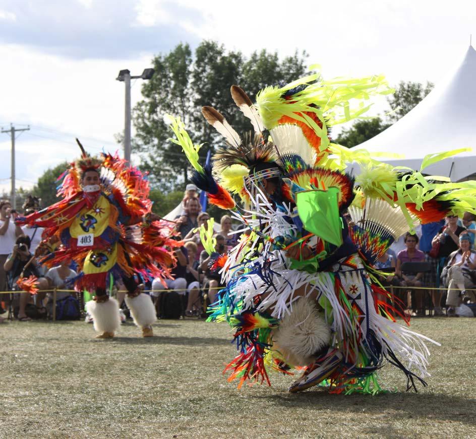
For hundreds of generations, the Ktunaxa used the Elk Valley and the Crowsnest Pass as a trade and travel route through the Rocky Mountains. Long before Provincial boundaries were laid out, twice-yearly Bison hunts were coordinated on the prairies east of the Rockies until the bison population was decimated in the mid-1800s.
The Elk Valley area was the primary home of the easternmost branch of the Ktunaxa people, who are closely connected to families living in the area now known as Tobacco Plains which straddles the US border to the southwest of Fernie. The Michel Prairie people, after whom the town of Michel was named, used the area near Sparwood to plant tobacco. Their Ktunaxa name is s 'k?aqawakanmituqnik'and means "river running into and out again", the Michel Creek into the Elk River (Tourism Fernie, 2022).
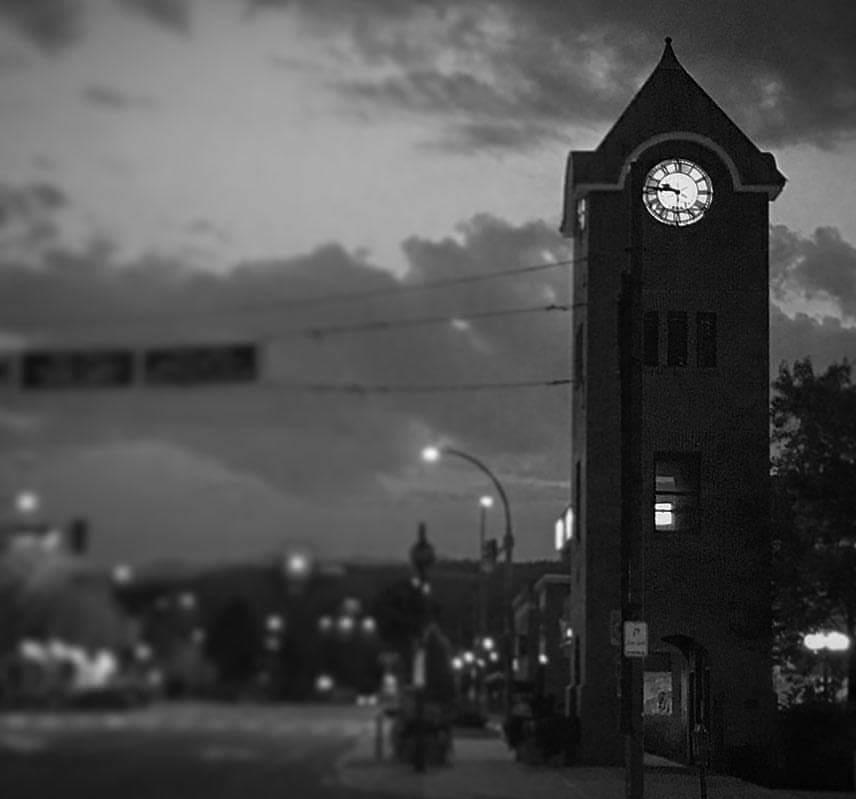
The region was first settled by European settlers in search of gold in about 1863. Cranbrook was named for a town near the farm home in Kent, England of one of the settlers, Colonel James Baker. The Canadian Pacific Railroad's Crowsnest branch line reached the site in 1898.

City of Cranbrook Downtown Revitalization Masterplan | June 2023 7
II. VISION AND PRINCIPLES
vision
take a moment to imagine...
Downtown Cranbrook has a new identity, as the new go-to destination for locals and visitors alike. It's become an urban hub and prime destination within the Kootenay Valley. Downtown is bustling with newfound excitement as businesses and patios are open to the street providing places to sit, relax and enjoy a meal, take a business meeting or call, or meet up with a friend. Everywhere you look you feel a connection to the area around you. Downtown is walkable, safe, and a place people and businesses want to be. Whether you arrive on foot, in a vehicle, or on public transit, getting downtown and staying downtown is easy.
picture this...
Rotary Park is thriving as one of multiple options available to the public when attending an event downtown. Streets are closed to vehicles on some weekends for events and festivals, and no matter where you go, you’re only a short walk to something exciting and engaging to do Downtown. Numerous restaurants have inviting patios, there are great places to grab brunch, a drink, or a meal with family and friends. Tourists and locals alike gather downtown because of all it has to offer. Some empty lots awaiting redevelopment have been transformed into gathering venues and pop-up events. Downtown has been reimagined. The core is thriving!
vision statement
"a friendly, dynamic, diverse and vibrant downtown community. change your watch to kootenay time."
This vision statement was created in collaboration with the key stakeholders. The Cranbrook OCP identifies many goals for the vision of the city. This DRMP will assist in achieving several goals of the OCP, including but not limited to:
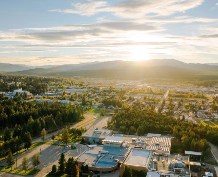
- Continuing beautification of the city to create a lasting, positive impression for residents and visitors;
- Establishing a strong, vibrant downtown with commercial, professional, and financial services supported by low/no cost parking; well-lit and
landscaped pedestrian corridors; functional and well-designed streetscapes, and increased mixed use development;
- Maintain regional hub status;
Support sustainable growth management that helps expand the City’s residential, commercial, and industrial sectors while ensuring sound fiscal and asset management, protection of natural open space areas, long-term interface fire protection, and efficient use of developable parcels.
8
Downtown Cranbrook Cranbrook, BC
goals of the master plan
1. Create Vibrancy
- Utilize Baker Street as a focal point of downtown where there is a priority placed on pedestrians and businesses;
- Create placemaking opportunities within roadways and on vacant lots; and
- Partner with the Downtown Business Association, Tourism Cranbrook, and others to create events that attract people and businesses downtown.
2. Bring People Into Downtown
- Identify ways to leverage heritage and culture to attract visitors downtown;
- Outside of targeted mixed-use areas, identify ways to intensify residential uses; and
- Focus on walking and cycling with transportation connections to and from Baker Street.
3. Promote Downtown Redevelopment
- Create a targeted and focused area within the larger downtown;
- Identify areas for adaptive reuse, strategic zoning, and mixed infill development; and
- Examine parking management solutions.
4. Enhance The Identity Of Downtown
- Target mixed-use development within a focused area of downtown; and
- Focus on walking and cycling with transportation connections to and from Baker Street
- Preserve heritage facades and streetscapes.
5. Bring Business Into Downtown
- Focus on policies that enable alignment of private and public investment downtown;
- Create incentives for businesses (office, hotels, and specifically restaurants and retail below 10,000 sq.ft.) to locate downtown; and
- Discourage small businesses from locating along Highway 3.
key planning and design principles
This plan is based on a set of principles that provide context and direction for decision making in the plan area.
Create diverse housing choices, build mixed use buildings, and encourage adaptive reuse
Make design choices that prioritize the pedestrian experience, promotes activity and a sense of place.
Attract businesses that will enhance the streetscape and provide diverse employment opportunities.
Create complete streets, adopt a “pedestrians and cyclist first” approach, ensure safety for all road users, and adopt universal design for streets.
Create a phased approach for infrastructure upgrades.
City of Cranbrook Downtown Revitalization Masterplan | June 2023 9
1.0 EXISTING CONDITIONS IN CRANBROOK
1.1 downtown cranbrook today
The City of Cranbrook is located in southeastern BC between the Canadian Rockies and the Purcell Range of the Columbia Mountains. Cranbrook is located on Highway 3, BC’s southern Trans-Canada highway and on the Canadian Pacific Railway line. It is the 18th largest city in BC, with a population of approximately 20,499 people (2021 Census). Cranbrook is home to the East Kootenay Regional Hospital, Canadian Rockies International Airport, and the College of the Rockies. Cranbrook is the centre and serves as a regional hub for employment, commerce, education, health care, air transportation, amenities, retail, and recreation.
Downtown Cranbrook is an employment and historic hub of the city. There are several independently owned businesses that support the local economy and are a source of employment. Downtown Cranbrook is home to several heritage buildings, and assets like those found in the Baker Hill Development Permit Area. There are several hiking and biking trails within a 10-minute drive from downtown.

10
City of Cranbrook Downtown Revitalization Masterplan | June 2023 11
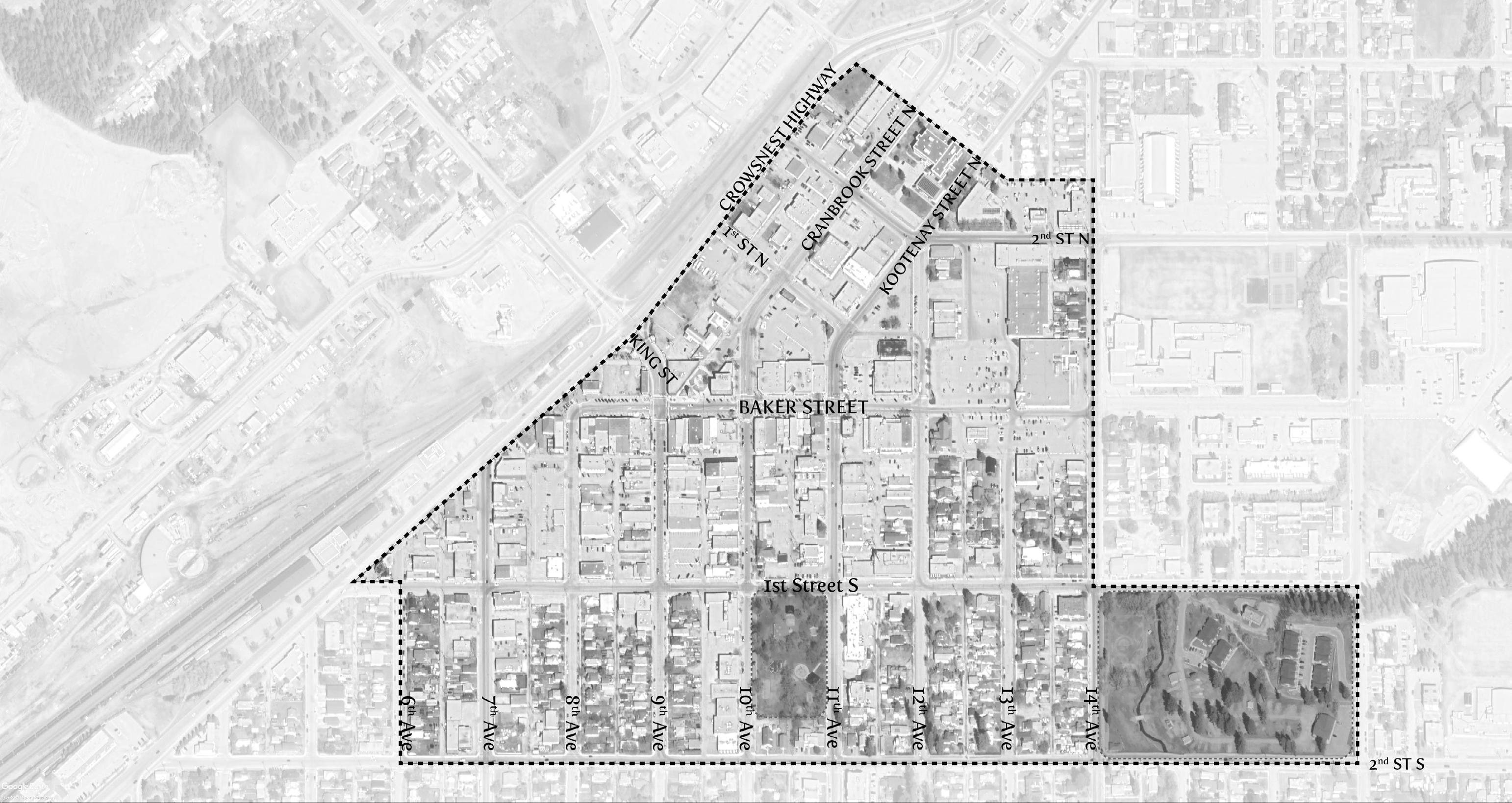
map 1 context-cranbrook downtown plan area
mt baker rv park
rotary park
plan area context
The DRMP area is comprised of 359,663 m2 of land in the city’s downtown. Downtown Cranbrook today consists of mainly commercial and institutional activities. There is an anchor grocery store, Rotary Park, a farmer’s market, civic buildings, shops, restaurants, services, and a decommissioned RV park within the area. There are also heritage buildings and assets such as the Baker Hill Development Permit Area that contribute to the rich cultural history of Cranbrook.
There are not enough residential uses downtown, and the current commercial uses do not bring enough people or generate enough activity during the day and at night. Downtown needs to attract more vibrancy via events, complete streets, and public spaces where people can gather. There have been some street improvement projects and beautification projects in the downtown area that have enhanced the area.
Collectively, the public spaces in the downtown, referred to as the “public realm”, are the outdoor ‘living room’ of the city that includes the streets, sidewalks, lanes and amenity spaces on Baker, 1st St. S, 2nd St. S, as well as the cross streets between the Crowsnest Highway and 14th Ave S.
1.2 land use and planning existing conditions
The majority of the areas downtown have single use buildings, there are many residential uses, but most of the land parcels are zoned for commercial use at-grade. Zoning allows up to seven (7) storeys in the entire downtown, yet no development of this scale has been built. There are not enough residential uses, and there is a lack of middle housing options like infills and secondary suites that can add gentle density to the area. There will need to be significant investment from the development industry to build infill residential and to restore the housing stock.
There needs to be more alignment with downtown revitalization, tourism and economic development. Downtown Cranbrook can become a safe, vibrant, and attractive place that people live, work, play, and visit.
1.3 infrastructure existing conditions
Recently, several reports were completed for the City of Cranbrook which included an analysis of the existing downtown infrastructure. These are: Cranbrook Downtown Revitalization – Existing Infrastructure Review (2021), Integrated Infrastructure Capital Plan (IICP) – Prioritized Sanitary Capital Plan (2016), IICP – Prioritized Stormwater System Capital Plan (2016), Water Supply Master Plan (2021).
These reports find that there is a considerable infrastructure deficit in downtown Cranbrook, related to both the capacity and condition of existing infrastructure. This deficit has a negative impact on redevelopment as any prospective developers face the risk or burden of significant underground infrastructure upgrades to support their development plans. To illustrate the magnitude of the issue, the following map summarizes the linear infrastructure prioritized for replacement based on existing capacity and condition. All capacity analysis was based on existing development only and does not reflect additional density or redevelopment assumptions.
Replacement categories are as follows:
- Priority 1 – Significant Infrastructure Capacity and Condition Concerns
- Priority 2A – Significant Capacity Concerns
- Priority 2B – Significant Condition Concerns
- Priority 3 – Moderate Capacity and/or Condition Concerns
- No Current Priority
12

City of Cranbrook Downtown Revitalization Masterplan | June 2023 13
map 2 integrated infrastructure replacement prioritization map
1.4 transportation existing conditions
Cranbrook’s downtown transportation network provides a strong foundation for revitalization. The network supports the movement of motor vehicles, trucks and buses through a major and minor City-owned road network, and provincial highway corridor. The fine-grained downtown street network consists of 100m by 200m wide blocks which distribute traffic effectively and promote walkability.
Although there are several access points from Highway 95 to downtown, the primary access points with signage from Highway 95 include Cranbrook Street N, 9th Avenue N/King Street, 1st Street S and 2nd Street S. Many of the access points pose significant safety issues. There may be the opportunity to enhance specific access to concentrate vehicle movement and create a gateway into downtown. BC Transit operates several routes throughout downtown that meet at the transit hub located on 12th Avenue S and Baker Street. The location of the transit hub is discrete, with limited signage and visibility, which is likely a barrier for users that are unfamiliar with its location. Enhancements could be made to this hub to provide a seamless transition between modes.
On and off-street parking is provided throughout the downtown area with an approximate 800 on-street parking stalls and 330 off-street parking stalls. While on-street parking is well utilized on Baker Street, there are many vacant stalls throughout the rest of downtown. On-street parking is important to support business vitality and provide accessibility to mobility disadvantaged. However, parking supply requires a delicate balance, as underutilized on-street parking can result in wide streets that can induce speeding and detract from the pedestrian experience. Underutilized surface parking lots can also create public safety concerns and detract from downtown vibrancy.
Although cyclists are accommodated through shared bike lanes on 1st Street S and 7th Avenue and multi-use pathways on 14th Avenue S, 1st Street S and 2nd Street S, there are significant gaps in the cycling network throughout downtown. The existing bike facilities do not support all ages and abilities, which may be a barrier to encouraging more people to bike and may limit the potential of bike tourism.
Pedestrians are supported on all downtown streets with sidewalks on both sides and through enhanced public realms on Baker Street and 10th Avenue S. To further encourage a pedestrian priority downtown, the pedestrian environment could be further improved by narrowing roads, reducing speeds, and reallocating space towards the pedestrian realm for wider sidewalks and furnishing zones. Further establishing Baker Street as a Main Street with pedestrian priority could encourage more people to walk throughout downtown. While the bones of a strong transportation network exist, improving vibrancy in downtown requires investment in complete street elements and to integrate with land use to incorporate space for pedestrians and cyclists.
14
based on the goals identified, the following are the strategic actions for this plan:
- Create a targeted and focused improvement area within the larger Downtown Plan Area;
- Target mixed-use development within a focused area of downtown;
- Identify ways to leverage heritage and culture to attract visitors downtown;
- Outside of targeted mixed-use areas, look at ways to intensify residential uses;
- Focus on policies that enable alignment of private and public investment in downtown;
- Create incentives for small businesses (retail & restaurant below 10,000 sqft) to locate in the downtown and discourage them from location along Highway 3;

- Examine Highway 3 and its relationship to downtown connectivity by looking at changing the driver experience;
- Examine parking management solutions;
- Create placemaking opportunities on vacant lots; and
- Focus on walking and cycling with transportation connections to and from Baker Street.
City of Cranbrook Downtown Revitalization Masterplan | June 2023 15
2.0 LAND USE FRAMEWORK
2.1 key goals
As identified in the previous section, the goals of the DRMP are to:
2.1.1 Create vibrancy;
2.1.2 Bring people to live and work into downtown;
2.1.3 Promote downtown redevelopment;

2.1.4 Enhance the identity of downtown; and
2.1.5 Attract business to the downtown.
2.2 land use concept
The DRMP is the overall guide for land use and development in the downtown area. The Land Use Concept ( map 3 ) identifies areas for commercial, mixed-use, residential, light industrial, and civic uses. The policies that are recommended in this plan are flexible and propose attainable redevelopment that can be phased in with infrastructure upgrades based on Council’s priorities.
Highlights of the Land Use Concept that incorporate these priorities are:
2.2.1 The Land Use Concept concentrates density around Baker Street and can accommodate a high level of redevelopment.
2.2.2 Commercial and mixed-use development focused within the core of downtown.
2.2.3 A minimum of 1,700 units and a maximum 4,200 units are envisioned to be added to the plan area over time.
2.2.4 The highest densities and building heights should be located within the Downtown Core and should adequately transition into other areas in the downtown.
2.2.5 As a result of the Land Use Concept, there needs to be some downzoning that occurs in the periphery.
16

City of Cranbrook Downtown Revitalization Masterplan | June 2023 17
map 3 land use concept
2.3 general policies
2.3.1 Promoting Residential Development Downtown in the downtown, the City should:
1. Encourage a diverse variety of housing options appropriate for all stages of life.
2. Promote infill development consistent with the Urban Design Guidelines of the Downtown Revitalization Master Plan.
3. Discourage the construction of new single detached housing in the plan area.
4. Promote innovative housing types that target attainability like work-live spaces, small studio units, and affordable housing.
2.3.2 Safe & Bright Public Realm in the downtown, the City should:
1. Encourage mixed-use development opportunities.
2. Support the closure of streets during activities or festivals to promote pedestrian and bicyclist safety.
3. Recognize and support downtown, acknowledging that it requires ongoing municipal leadership to strengthen and enhance the area.
4. Encourage high-quality pedestrian-focused buildings and landscaping that conform to Crime Prevention Through Environmental Design (CPTED) standards.
5. Support, coordinate, and lead revitalization opportunities that align with the Downtown Revitalization Master Plan and the Official Community Plan.
6. Support year-round activities within the downtown.
7. Ensure future redevelopment maintains height gradients that preserve downtown’s small-town feel and preserves the Baker Street vista.
8. Ensure that private and public redevelopment initiatives adhere to regulations in alignment with fire and safety codes.
9. Encourage property owners to upgrade their existing properties in alignment with the downtown vision.
2.3.3 Enhancing Character, Preserving History in the downtown, the City should:
1. Ensure that any development proposed that falls within the Baker Hill Development Permit Area should align with the Baker Hill Development Permit guidelines in the Official Community Plan.
2. Encourage any development proposed adjacent to the Baker Hill Development Permit Area to align with the Baker Hill Development Permit guidelines in the Official Community Plan.
3. Encourage the conservation of historically significant sites, buildings, and landmarks
4. Encourage mixed uses and conserve heritage assets form and style.
5. Encourage redevelopment designs that respect the neighbourhood’s historical character and traditional street patterns.
6. Explore and coordinate both redevelopment and heritage initiative projects with federal and provincial partnership programs.
7. Encourage Zoning Bylaw conformity and redevelopment practices in accordance with the Urban Design Guidelines.
8. Encourage Land Use Bylaw conformity and redevelopment practices in accordance with the Downtown Revitalization Master Plan.
9. Incorporate the use of culturally significant and historical references to be included in the naming of public assets.
18
2.3.4 Integrated Transportation in the downtown, the City should:
1. Facilitate a multi-modal transportation network that will connect to other areas of Cranbrook, emphasizing sustainable modes of transportation, including walking, biking, and public transit.

2. Enhance gateways to attract visitors and alert users of the change in environment and transportation operations.
3. Pedestrian and bicycle connections should be encouraged through a complete street and multi-use pathway network.
4. Facilitate access to downtown amenities, public spaces and parking areas for people of all mobilities.
5. Encourage the improvement of movement corridors and ensure redevelopment includes enhancements for the public realm.
6. Connect the bike trails.
7. Ensure an adequate supply of on and off-street parking while maintaining a bright and engaging pedestrian experience, with new parking being located to the rear or sides of buildings.
8. Create a pedestrianized mixed-use core with a variety of services to address resident and visitor needs.
City of Cranbrook Downtown Revitalization Masterplan | June 2023 19
2.4 land use districts
The following are the proposed land use districts based on the recommended Land Use Concept. The plan proposes residential, commercial, retail, light industrial, light manufacturing, and open space uses.
2.4.1 The Gateway
The Gateway district is located at the north end of the downtown core and is an access point from Highway
3. This area is intended to serve as an important arrival gateway into downtown Cranbrook. The commercial/ institutional / mixed-use area is intended to provide some commercial land uses that are complimentary to current and future commercial uses

policy
1. The maximum height within the Gateway district is three storeys.
2. Encourage commercial uses/institutional on the ground floor, and residential uses above.
3. For residential uses, building forms such as stacked townhouses and apartments are encouraged to contribute to the housing choices downtown.
4. For new development, encourage interesting and unique architectural features and frontages.
5. Drive-thrus or auto oriented services located within the district should be discouraged.
6. Freestanding signs that impact the pedestrian realm should be discouraged.
Downtown Cranbrook Gateway Cranbrook, BC
20
This district contains private and institutional buildings. It is unlikely that significant redevelopment will occur in this area unless the City decides to redevelop parcels under their ownership. These parcels are prime opportunities for activation and beautification through public art, murals, public statutes, and pop ups.

policy
1. The maximum height within the Civic district is two storeys.
2. Create public plazas and gathering spaces with landscaping, seating, and adequate lighting to activate the district.
3. Development should be encouraged to enhance the street with architectural components, public art and high quality landscaping.
4. Activate buildings and empty parcels with popup parks, temporary commercial activities, and performances by local artists and historians.
Downtown Brandon, MB
City of Cranbrook Downtown Revitalization Masterplan | June 2023 21
2.4.2 Civic
2.4.3 Maker Village
The Maker Village district is intended to be a place that will support the diversification of downtown Cranbrook’s economy. This district should include a diverse range of uses like light manufacturing, light industrial, creative manufacturing, live/work units, artists’ lofts, office, and retail to support entrepreneurs and promote economic incubation.

policy
1. The maximum height within the Maker Village district is two storeys.
2. This district will accommodate a range of uses including coffee roasters, pottery shops with kilns, bike repair shops, microbreweries/distilleries, light manufacturing, retail, restaurant, travel services, live/ work units, artists’ lofts/studios, co-working spaces for smaller companies and start-ups, and other uses required to support or complement the uses identified in the district.
3. Buildings should be pedestrian-scaled and oriented to the street.
4. Interesting architecture styles like warehouse architecture that would be unique to this district are encouraged.
5. Patios associated with restaurants, breweries or distilleries should activate the street.
6. Uses that have external effects like noise or odor that may impact adjacent properties should be adequately mitigated, especially when adjacent to residential uses.
22
2.4.4 Adaptive Re-Use
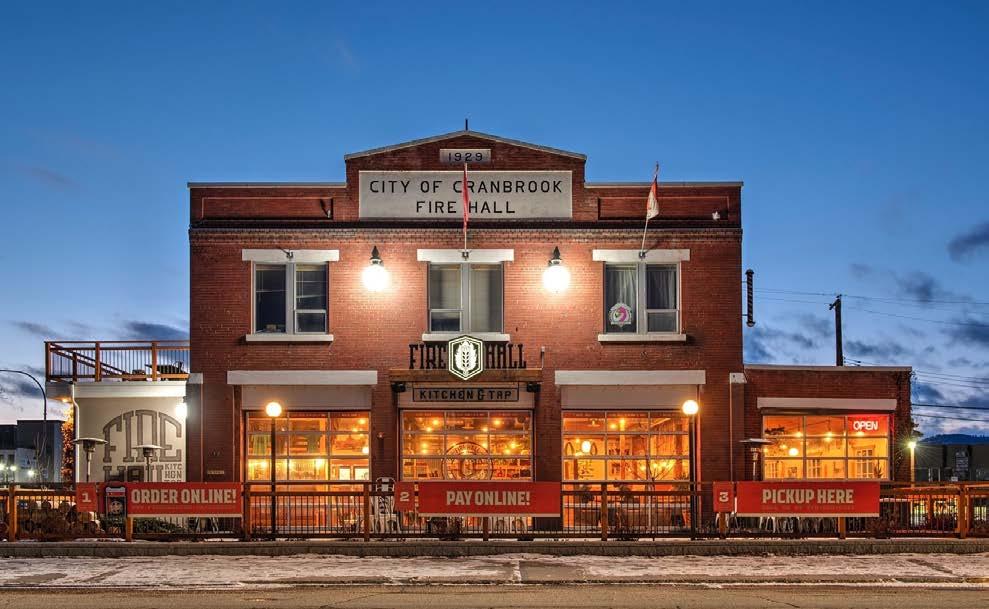
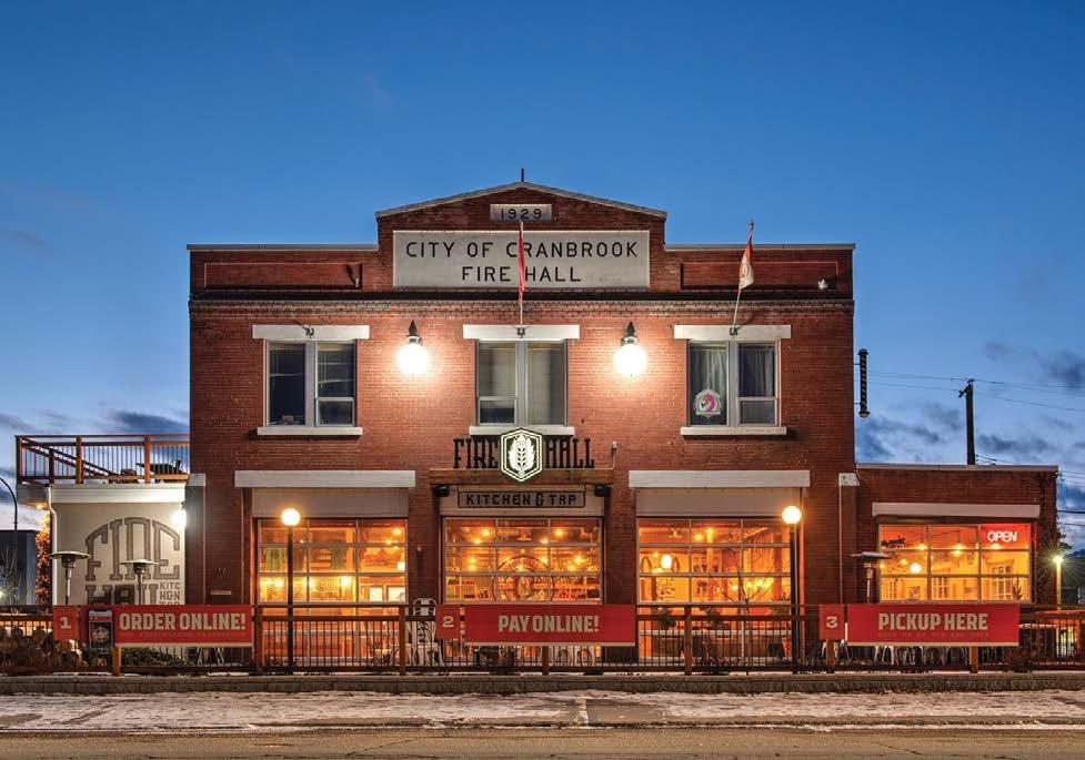
The Adaptive Re-Use district is intended to be a place where old buildings and or buildings with cultural significance can be reused and repurposed. This is a great way to take advantage of the existing infrastructure that exists in downtown Cranbrook. Underutilized buildings can also be repurposed for other uses. Strategic and selective reuse of buildings can create vibrancy downtown. These can be used for commercial, retail, or institutional uses. A great example of this in downtown Cranbrook is the old Fire Hall station that is now a Tap House and the former Masonic Temple that is now a theatre.
policy
1. The maximum height within the Adaptive Re-Use district is three storeys.
2. This district will accommodate a diverse range of uses including retail, coffee roasters, restaurants,offices, banks, live/work units, artists’ lofts/studios, coworking spaces, start-ups and other uses required to support or complement the uses identified in the district.
3. Preserve the cultural and historical relevance through plaques and signs while redevelopment occurs in alignment with a future heritage strategy.

4. Patios associated with restaurants, breweries or distilleries should activate the street.

City of Cranbrook Downtown Revitalization Masterplan | June 2023 23
Google, Spruce Goose Playa Vista, CA
2.4.5 The Core
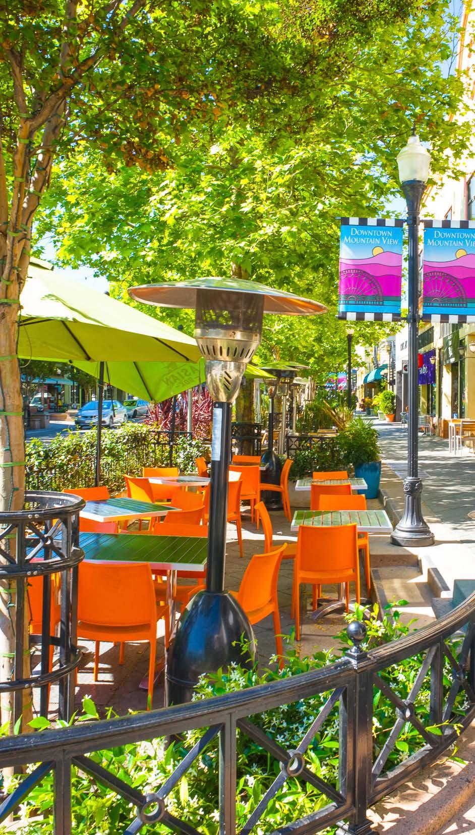
The Core is envisioned to be a pedestrian-centric, vibrant mixed-use area making Baker Street the focal point and the heart of downtown. This area is proposed to be a mixture of commercial, office, and residential uses. This district will provide a range of residential housing options to support the retail and commercial uses while providing much needed vibrancy downtown. The Core will serve as a destination for residents, visitors, and tourists. This area will contain a diverse range of commercial uses like retail, office, commercial, food service, and tourist services.
policy
1. The maximum height within the Core is eight storeys.
2. The Core will accommodate a mixture of residential, office, restaurants, entertainment, commercial, tourist home uses, and other uses required to support or complement the uses identified in the district.
3. Mixed-use development, commercial at-grade with office or residential above, should be required along Baker Street, Cranbrook Street and Kootenay Street.
4. Small-scale retail, restaurants, and entertainment uses below 10,000 sq.ft. should be encouraged to be located at-grade.
5. Retail and restaurants larger than 10,000 sq.ft.should be located in other commercial areas outside the downtown.
6. Commercial and residential uses may occur at-grade on streets not identified above.
7. Offices including medical uses, should be located on the second storey or above.
8. Encourage grocery stores, to remain in the Core to attract customers into the downtown.
9. Activate vacant lots within the Core with temporary uses such as food trucks, performance zones, temporary parks, community gardens and art installations to attract people into downtown.
24
2.4.6 Mixed Infill
The Mixed Infill district is envisioned to be primarily for residential uses but can accommodate some retail/ commercial uses. This district will serve as a transition zone into the open space and Special Plan Area to the east. The density in this district should be limited in a way that it accommodates development while accounting for the infrastructure deficits downtown. This area is intended to encourage missing middle housing options such as duplexes, townhomes, and stacked townhomes.
policy
1. The maximum height within the Mixed Infill district is three storeys.
2. New single-detached housing shall be discouraged. Existing single-detached housing can continue to exist; however, these lots are encouraged to redevelop.
3. Multi-unit housing like semi-detached, duplexes, townhomes, and stacked townhomes, will be accommodated in this district.
4. Accessory dwelling units (secondary suites) should be encouraged within semi-detached building forms.
5. Small-scale retail and businesses like corner stores and coffee shops are encouraged in this district.
6. Live/work units and artists’ lofts are encouraged in this district.

City of Cranbrook Downtown Revitalization Masterplan | June 2023 25
2.4.7 Medium Density Residential Mixed
The Medium Density Residential Mixed districts will provide a wide range of residential housing options and their strategic locations in the plan area will support vibrancy and viability of the commercial, retail, and institutional uses in the area. The building forms in this area will be predominantly townhomes, stacked townhomes, and mid-rise apartment buildings. This will increase housing choice and increase affordability.
policy
1. The maximum height within the Medium Density Residential Mixed district is five storeys.
2. Townhomes, stacked townhomes, and mid-rise apartment buildings should be accommodated within this district.
3. New single-detached and semi-detached dwellings should not be built in this area.

26
2.4.8 Special Plan Area (North)
This Special Plan Area is a large and significant site that should have its own conceptual plan developed in collaboration with the landowner and the City of Cranbrook. The district can be redeveloped in the future into commercial and residential uses. The current grocery store has become an important anchor to downtown and should be retained on the ground floor while the other floors can be developed into residential or other commercial or office uses above. This district is intended to provide the landowner flexibility while ensuring some City of Cranbrook objectives are prioritized.
policy
1. The maximum height within the Special Plan Area (North) shall be determined through a concept plan and land use application submission to the City of Cranbrook.
2. The concept plan should identify how the district will be planned and implemented to achieve the goals of this plan. The plan should demonstrate how the concept will:
3. contribute to placemaking and downtown identity;
4. transition to other districts in relation to height, massing, and density;
5. retain the grocery store in the long-term redevelopment of the area;
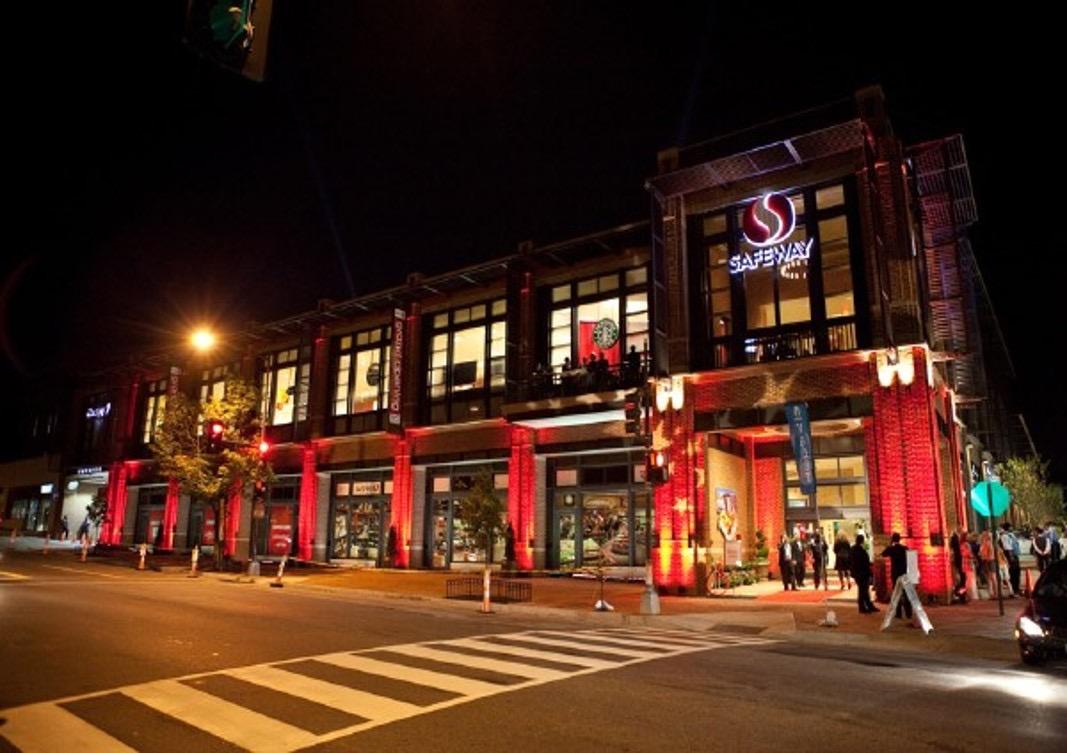
6. enhance the mobility hub and how buildings and streetscaping will enhance and activate this public space;
7. integrate and connect to Baker Street through the placement of buildings and the design of access and egress;
8. promote sustainable transportation options via enhanced pedestrian realm and design; and
9. ensure that parking is located behind or beneath buildings.
10. Other than a grocery store which can occupy a maximum of 60,000 sq.ft., small to medium scale retail should be located at grade within this district.
Safeway
Washington, DC
City of Cranbrook Downtown Revitalization Masterplan | June 2023 27
2.4.9 Special Plan Area (South)
This district is currently underutilized as an RV park. Redevelopment cannot be supported without significant upgrades to infrastructure. This area is not currently a priority given its less prominent location within downtown Cranbrook. After the relevant upgrades to the infrastructure, the site is envisioned to be primarily redeveloped for residential uses that can accommodate a diverse range of low-density building forms.

policy
1. The maximum height and density within the Special Plan Area (South) shall be determined through a concept plan and land use application submission to the City of Cranbrook.
2. Uses contemplated for the district should be primarily residential and should consider the surrounding height and housing forms to determine the appropriate site layout and design for the area.
28

3.0 TRANSPORTATION AND INFRASTRUCTURE FRAMEWORK
transportation framework vision
Cranbrook’s downtown transportation network prioritizes pedestrians and cyclists through complete streets that are accessible and vibrant. Strategically located gateways draw people into downtown where they may linger to experience downtown’s unique character. The gridded street network is enhanced through features like high quality public realm and streetscaping that support people of all ages and abilities, using all modes, to feel safe and comfortable traveling downtown. Downtown has transformed into a place for people.
The policies outlined below are intended to support the implementation of this vision. These policies prioritize placemaking and creating an integrated transportation network downtown to create complete streets, pedestrian priority, establish a mobility hub, connected bike network and enhance transit.
3.1 complete streets
Complete Streets are streets that are planned, designed and operated to be safe and comfortable for all users. Complete Streets also respond to their adjacent land uses. In downtown, Complete Streets are vibrant and pedestrianized, with space dedicated for streetscaping and street furniture, as well as parking for vehicles and bicycles. Downtown Complete Streets incorporate traffic calming elements and operating rules to slow vehicles and create a safer environment for all transportation users.
1. Implement a Complete Street Network composed of the following 3street types per the Complete Streets Network Map.
a. Main Street: the Main Street (Baker Street) is the heart of downtown. It is a destination for people to gather. Although the Main Street is multi-modal, it has pedestrian priority and is characterized by street-level retail and commercial uses. Major streetscaping investments are focused here through wide sidewalks, street trees, furnishings and distinct streetscaping materials that contribute towards the sense of place. Bicycles are accommodated through their own space to eliminate conflicts between pedestrians, vehicles, and transit.
b. Connector Street: Provide a connection through the plan area and to destinations outside the boundaries of the downtown area, carrying higher volumes of vehicles than Main Street or Minor Streets and transit. Key bicycle corridors overlap with the connector street network to provide a continuous active transportation network across the City. Bicycle infrastructure on Connector Streets support all ages and abilities and aligns with recommended practice based on speed and volume of vehicles. The public realm includes wide sidewalks and tree-lined boulevards where feasible. Street-oriented buildings support commercial, retail and institutional uses.
c. Minor Street: Provide local access within the downtown area. These streets carry lower volumes of vehicles than Main Street or Connector Streets and no transit. Pedestrians feel comfortable traveling on wide sidewalks and tree-lined boulevards. Street orientedbuildings may support a mixture of residential and commercial or retail uses.
2. Speed limits should be reduced downtown to 30 km/hr to promote safe and accessible multimodal operations for all ages and, abilities, and modes.
30

City of Cranbrook Downtown Revitalization Masterplan | June 2023 31
map 4 complete streets network map
3.2 pedestrian priority throughout downtown
3.2.1 A high-quality public realm should be implemented through the development and redevelopment process, roadway upgrading projects, and targeted capital expenditures.

3.2.2 Enhance pedestrian safety and accessibility at crossings through curb extensions, tactile walking surface indicators, narrower crossings, and shorter signal lengths.
3.3 create gateways to downtown
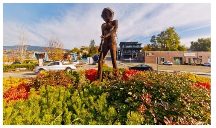
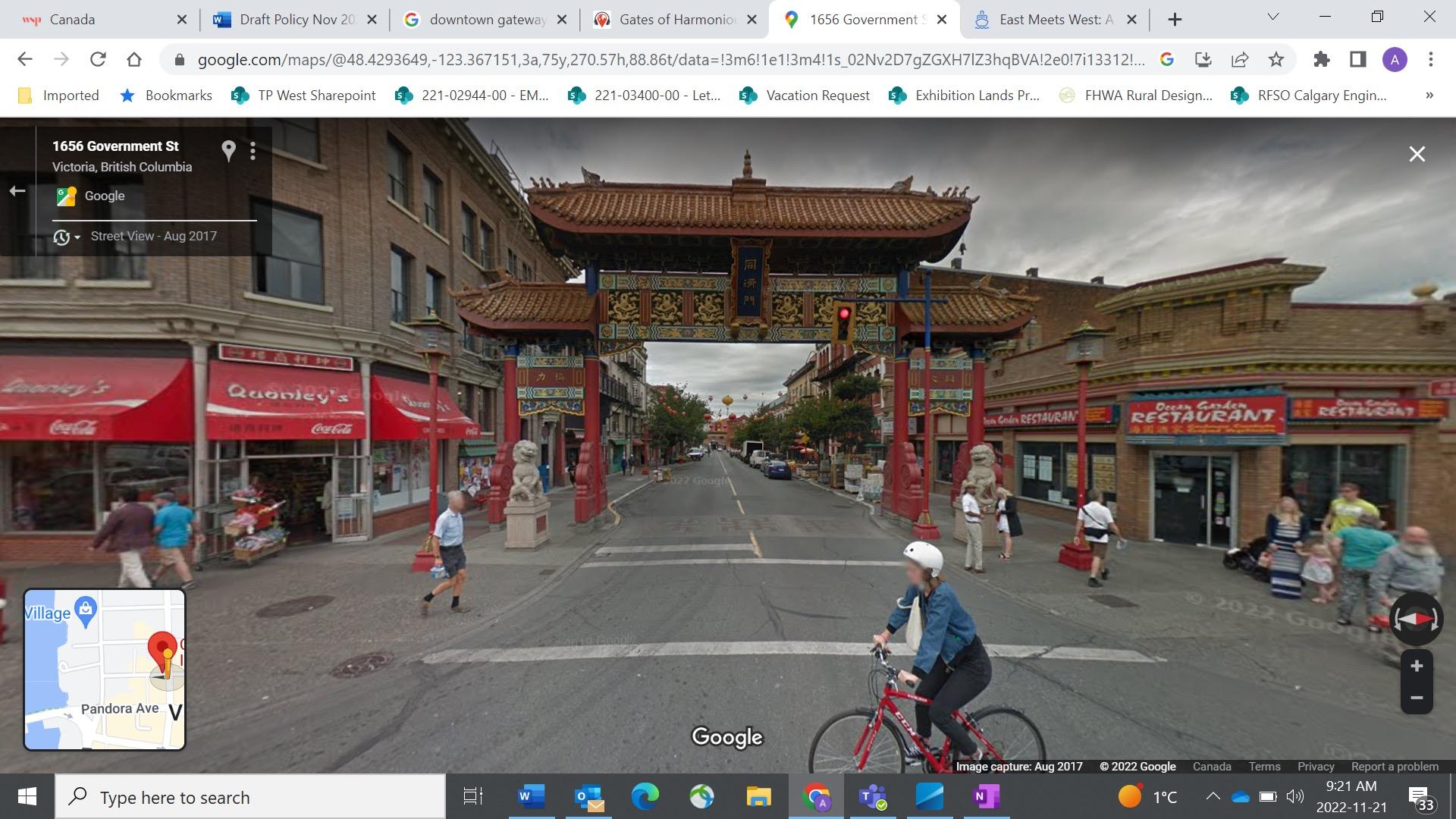
3.3.1 Implement design treatments suitable for Gateways that draws residents and visitors in to downtown from the highway and city. Design treatments should indicate a change in environment for drivers, so they recognize they are entering downtown. Design treatments may include but are not limited to roundabout or curb-extensions, signage and urban design. Gateways should also ensure access for all modes through appropriate crossing treatments.
3.3.2 The primary gateway downtown is located at King Street and Van Horne Street with the highest level of design treatments.
1.1.1 Other primary gateways located outside of the plan area include Cranbrook Street N and Van Horne Street and 2nd Street S and Van Horne Street.
Gateway Treatment Prospect Place and Kingston Avenue, Brooklyn. Source: New York City Street Design Manual. Washington, DC
Roundabout Gateway Treatment, Front Street Penticton
Source: Kelowna Now.
32
3.4 establish a mobility
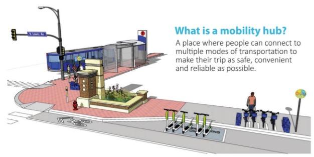
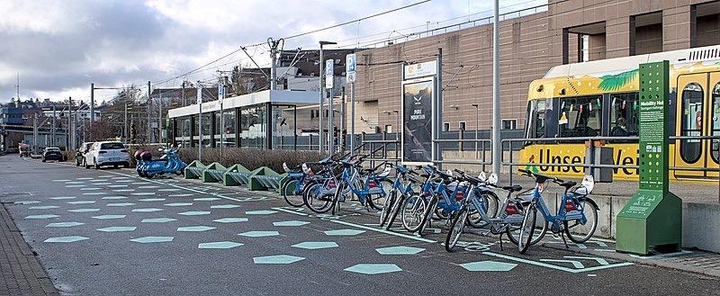
3.4.1 A mobility hub should be established at the existing public transit exchange location to integrate different modes with enhanced design treatments. A hub provides a seamless transition from one mode to another to promote greater access to downtown.
3.4.2 The mobility hub may include the following but is not limited to transit amenities such as bus shelters, secure bike parking, benches, waste receptacles, bathrooms, taxi and future ride-share/car-share curbside loading areas.
City of Cranbrook Downtown Revitalization Masterplan | June 2023 33
Gates of Harmonious interest, Chinatown, Victoria BC. Source: Image Capture 2017, Google Street View 2022.
3.5 provide a connected, all age and ability bike network
3.5.1 Refer to the map 5 for the proposed bike network. Bicycle users are supported through connected bicycle infrastructure that aligns with the City’s broader active transportation network. Bicycle facilities are designed to be suitable for all ages and abilities and in alignment with the BC Active Transportation Design Guide recommended practice.
3.5.2 Short-term bike parking shall be provided within the road right-of-way and integrated with the mobility hub and public open spaces.
3.5.3 Long-term bike parking should be outlined in zoning bylaw and incorporated into new development applications.
3.5.4 Additional end of trip facilities including secure weatherprotected storage, as well as change and shower facilities in public and private buildings is encouraged through development and redevelopment.
3.5.5 Ensure safe active transportation crossings on Van Horne Street/Crowsnest Highway.
3.5.6 An enhanced active transportation crossing shall be maintained on Van Horne Street/Crowsnest Highway and Louis Street to connect active transportation users from downtown to the trail located next to the Cranbrook History Centre. This connection also facilitates access from future proposed district parking lot to downtown.
City of Minneapolis Mobility Hub.
Source: Connect Beyond - A Regional Mobility Initiative
Stuttgart-Vaihingen Train Station Mobility Hub.
Source: https://commons.wikimedia.org/wiki/File:Stuttgart-Vaihingen_Train_Station_Mobility_Hub_IMG_5767.jpg
34

City of Cranbrook Downtown Revitalization Masterplan | June 2023 35
map 5 proposed bike network
3.6 enhance transit throughout downtown
3.6.1 Transit service shall be maintained at the Mobility Hub to facilitate access for residents from the City to downtown:
a. Transit facilities including stops should be enhanced through bus shelters, benches, trash receptacles and bicycle parking wherever feasible.
3.7 balance parking supply to promote vibrancy and support businesses
3.7.1 Maintain on-street parking where there is high demand to support business vitality and to provide a traffic calming effect.
3.7.2 Continue to apply a variety of parking management strategies, such as pricing or time limited parking zones, in alignment with a broader curbside management strategy to address supply and demand.
3.7.3 Consider site redevelopment of off-street parking lots where there is low utilization and a high benefit-cost ratio.
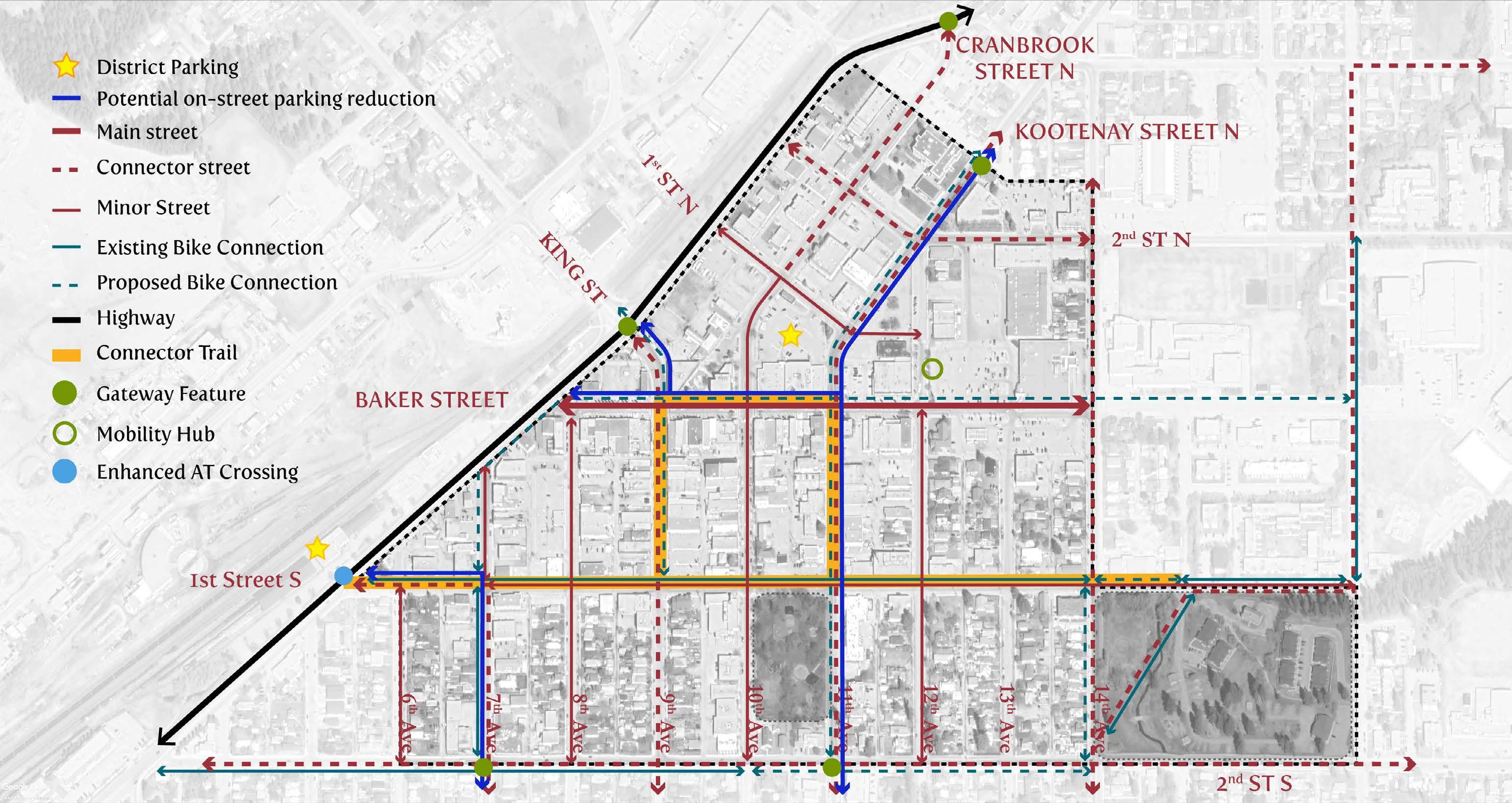
3.7.4 Establish district parking downtown, which may take the form of a parking structure, for residents and visitors on city-owned property. The two primary locations for consideration and further review are the parking lot south of 1st Street N, between Cranbrook Street and Kootenay Street, and the museum parking lot located across the highway from 1st Street S.
3.7.5 Consider opportunities to incorporate EV charging stations to support a shift towards sustainable transportation.
3.7.6 The following map illustrates the potential on-street parking reductions required to accommodate cycling infrastructure along key corridors and the potential locations for the enhancement of district parking lots to balance the overall parking supply
3.8 address transportation safety issues in and adjacent to the downtown
3.8.1 Pursue implementation of recommendations made in the 2019 Kootenay Street N / 2nd Street N Intersection Review - Final Report, to address safety issues and geometric improvements.
3.8.2 Collaborate with the BC Ministry of Transportation and Infrastructure (MoTI) to improve safety on the Highway and integrate with the implementation of the DRMP.
36
City of Cranbrook Downtown Revitalization Masterplan | June 2023 37
6
map
parking
3.9 infrastructure framework
Cranbrook’s downtown infrastructure plan should aim to efficiently complete upgrades, and provide reliable utility services to the community, while preparing for the utilities required for new development. Working with developers, the City can upgrade the utilities to a capacity and condition to allow for the level of development as outlined within this DRMP.
3.9.1 Infrastructure upgrades should be packaged with transportation upgrades wherever possible to prevent the need for repeated ground disturbance, and to decrease overall costs necessary upgrades. This approach should also be applied on MoTI rights-of-way and requires ongoing coordination with MoTI on their capital program in Cranbrook.
3.9.2 When completing annual capital projects, the City can collaborate with developers so that the infrastructure is being upgraded to the proper sizing to service future land uses, to future-proof and provide less resistance for desired development within the plan area.
3.9.3 The City’s high priority capital upgrades may provide opportunities to tailor improvements to support planned developments, particularly for areas where there are significant changes to land use.
3.9.4 Areas with currently no or minimal prioritized upgrades, based on existing conditions, can be opportunities for developments that may require minimal off-site upgrades. This is most likely best for developments that will not result in a dramatic change in the population density of the area and/or changes in property use.
3.10 sanitary
3.10.1 The trunk mains for conveying the sanitary sewer from the downtown area to the Wastewater Treatment Plant should be upgraded based on the City’s existing prioritization. This will provide more desirable development opportunities within the downtown core, without the need for extensive off-site upgrades far downstream from the proposed development. This will involve the City working with MoTI to complete any required trunk main upgrades on Highway 95.
3.10.2 The Wastewater Treatment Plant capacity will need to be continually reviewed over time to ensure it can treat the flows for the planned land use.
3.11 water
3.11.1 Completion of existing high priority upgrades to the water system will help to provide existing and future downtown users with sufficient fire flows to provide fire protection to the plan area.
3.11.2 The City should continue to work on implementing potable water storage for the City to ensure the plan area has sufficient emergency water storage.
3.11.3 The hydrant density should be increased over time as yearly capital upgrades are being completed through the plan area and should be a requirement for any developments completed in areas where no capital upgrades are planned. This will provide the proper hydrant density for the future land uses as required by the Fire Underwriters Survey.
3.11.4 The capacity of the Water Treatment Plant will need to continually be reviewed to ensure it can support the desired land use for the plan area.
3.12 storm
3.12.1 The City will need to work with MoTI to ensure the major storm corridor through Highway 95 will be upgraded to continue to provide a flow path for a large portion of Cranbrook including the plan area to reduce flood risk.
3.12.2 During the development process it should be a priority to maintain, and establish where required, overland flow paths through the plan area to prevent flooding in large scale storm events.
3.12.3 In new development areas, storm flows leaving the property should be limited to pre-development conditions. Pre-development conditions should be defined as prior to any development occurring on the property, not on the state of the property prior to the current proposed development. This will ensure that the new development in the area will not have a negative impact on the capacity of the storm system. New development that is conforming to updated, more conservative, stormwater standards may lessen the load on the storm sewer network.
38

 Photo retrieved from Smith Creek ASP - Investigated bicycle path infrastructure and networking in the project, QPD
4.0 PURPOSE OF URBAN DESIGN GUIDELINES
introduction
Downtown revitalization is a key part of the story to attract more people and life to improve the downtown experience for current residents.
Cranbrook's downtown is a compact, gridded street network that allows for exploration by foot, by bike, by transit or by car. There are convenient services and amenities for residents, a downtown park which hosts events such as the farmer's market, local businesses and many fine heritage buildings.
Based on City and community feedback (refer to What We Heard report), there are some existing challenges, such as: promoting access to and wayfinding within the downtown; an over-abundance of underutilized, parking areas; a lack of complete streets and inviting public places; and at-grade uses within the core that do not contribute to vibrancy.
The urban design guidelines are intended to promote a successful and safe urban environment, while addressing shortfalls and encouraging diverse activities and attractions to serve the needs of the population.
application of the guidelines
The guidelines are an assessment tool during the urban design review process within the designated boundary of the downtown.
The guidelines apply to all development proposals for new construction and building alterations as well as urban streetscape conditions that occur within the designated boundary of Downtown Cranbrook. Specific criteria for treatment of historic buildings within the downtown area are addressed separately and should be reviewed in tandem with these design guidelines.
The City of Cranbrook may use the guidelines as an assessment tool during the design review process and will apply individual discretion as to how a particular design achieves the intent of the guidelines. The guidelines are also intended as a toolkit to enable local property and business owners to help animate their assets and immediate environments in the spirit of achieving a vibrant downtown. The guidelines will be periodically amended as necessary to maintain consistency with statutory policies and best practices.
plans and policies
Existing plans and policies that guide the masterplan. The following summarizes key points and guiding principles from each document.
1. cranbrook strategic plan
Strategic plan created by the City Council to improve the community and future of the city.
2. cranbrook economic development plan
A forward-looking plan that looks to accelerate economic growth and investment, building on the existing initiatives and prepare for new innovative opportunities.
3. official community plan bylaw
The OCP reflects the current needs of the community and guides its growth and development over the next 20 years.
4. downtown seasonal patio bylaw
Regulates the seasonal patios on public land for a vibrant downtown core
5. zoning bylaw
Defines policies that help guide the development of land in an efficient and systematic manner to benefit the public.
City of Cranbrook Downtown Revitalization Masterplan | June 2023 41
As cities compete for investment and talent, a vibrant, quality downtown built around the city's unique identity will position Cranbrook to take advantage of new opportunities.
Plan developed with the community to establish the aesthetics of development and public spaces.
Assist the City's decision-making around tourism initiatives including urban tourism and provide a vision and mission to increase current tourism assets in the region.

Profiles the sector, documents its social, economic and cultural contributions, identifies strengths and gaps and provides future direction through the development of a Cultural Vision and 6 Key Directions.
To develop and implement their cultural objectives with a strategic, viable business plan for the arts, heritage and cultural sector.
A
42
6. integrated community sustainability plan - cranbrook connected
7. tourism masterplan
8. cranbrook arts, heritage and cultural scan
9. cranbrook cultural plan for arts and heritage
10. city of cranbrook development guide
guide designed to assist planning and development within the City of Cranbrook. City of Cranbrook
4.1 urban identity
cranbrook: an urban basecamp

Cranbrook is well situated geographically and is easily accessible year-round. It is a small, growth city with the promise of emerging industries, many amenities for residents and visitors and a bounty of breathtaking natural assets right on its doorstep. Cranbrook has all the charm of a small town with the added advantages of a big city. Its identity is slowly evolving and is seeking to raise its profile as a highly livable option for people visiting or relocating to the area. It is a veritable basecamp for adventure, with numerous urban amenities and services to boot.
Cranbrook must also embrace its historic identity, which is eclectic and if properly acknowledged, can be an asset. Storytelling can be an important component of expressing Cranbrook’s urban identity. The prominence of the city can be linked to regional growth of surrounding communities including its relationship with early settlers, First Nations and rise of industry and trade. Cranbrook is central to the sustainability of the surrounding rural region. Understanding the inclusive, historic context behind its evolution is one thread that can be used to tell its story and express its identity. There are opportunities in the downtown urban context to tell the story of Cranbrook's cultural history, evolution and identity through interpretive elements such as artworks, wayfinding and heritage elements.
Embracing Cranbrook's natural surroundings and historic roots, the Connector Trail is proposed as a cultural trail extension to local trails, pathways, bike routes and gateways into the downtown to promote access and legibility into within the city's core area. Locations within the core and along the Connector Trail route can positively contribute to the urban identity and experience of Cranbrook's downtown.
City of Cranbrook Downtown Revitalization Masterplan | June 2023 43
City of Fernie
indigenous history
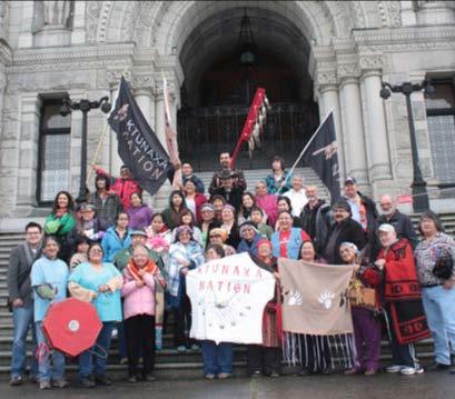
For thousands of years the Ktunaxa people enjoyed the natural bounty of the land, seasonally migrating throughout their Traditional Territory to follow vegetation and hunting cycles. They obtained all their food, medicine and material for shelter and clothing from nature – hunting, fishing and gathering throughout their Territory, across the Rocky Mountains and on the Great Plains of both Canada and the United States. European settlement in the late 1800s, followed by the establishment of Indian Reserves, led to the creation of the present Indian Bands.
Ktunaxa citizenship is comprised of Nation members from six Bands located throughout historic traditional Ktunaxa territory. Five Bands are located in British Columbia, Canada and two are in the United States. Many Ktunaxa citizens also live in urban and rural areas “off reserve”.

The Ktunaxa people describe their territory using ancient place names; some of these names are thousands of years old, having been established at the time of Creation. Ktunaxa place names often describe significant events remembered in oral histories.


More information can be found by contacting the Ktunaxa Nation Indigenous Society.
44
The downtown is characterized by certain areas that have evolved over time and provide uniqueness, cultural context, texture and diversity. They are essential ingredients to the story of the downtown. They will be the building blocks upon which future redevelopment and alteration can occur.
The Character Areas should be considered as part of redevelopment applications in terms of how they reinforce a particular area and the urban identity of the downtown as a whole.
City of Cranbrook Downtown Revitalization Masterplan | June 2023 45
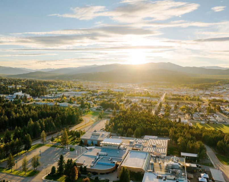
City of Cranbrook, Downtown mountain views

46
7
map
character areas + sense of place
gateways


Situated at the north end of the downtown core, the Gateway area is a primary access point from Highway 3 into the downtown core. It includes a mix of services, commercial, institutional and residential uses. As the gateway, multimodal access improvements along key corridors are to be accompanied by prominent street frontages and legible, double-sided street arrangements, using the built form to create a sense of entry. Promoting visibility to and integration of significant points of interest and heritage buildings as well as appropriate waymarking are urban design priorities within the Gateway area.
City of Cranbrook Downtown Revitalization Masterplan | June 2023 47
Art as welcoming elements. Mural behind Cranbrook's Arch. Cranbrook, BC
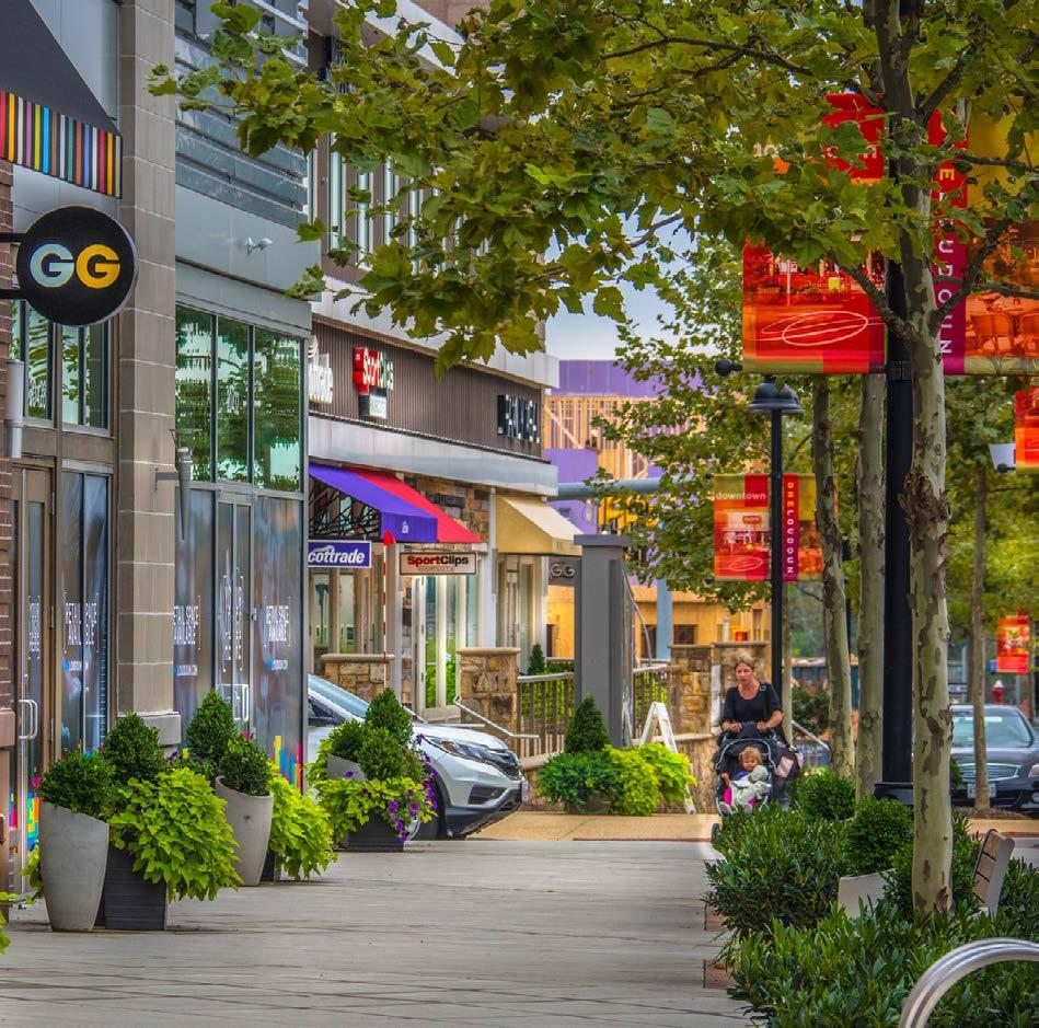
Gateway street with more planters and feature furniture. Ashburn, VA
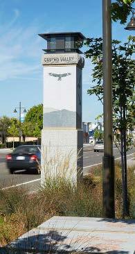
Entrance markers. Castro Valley, CA Feature planters. Gloucester, VA
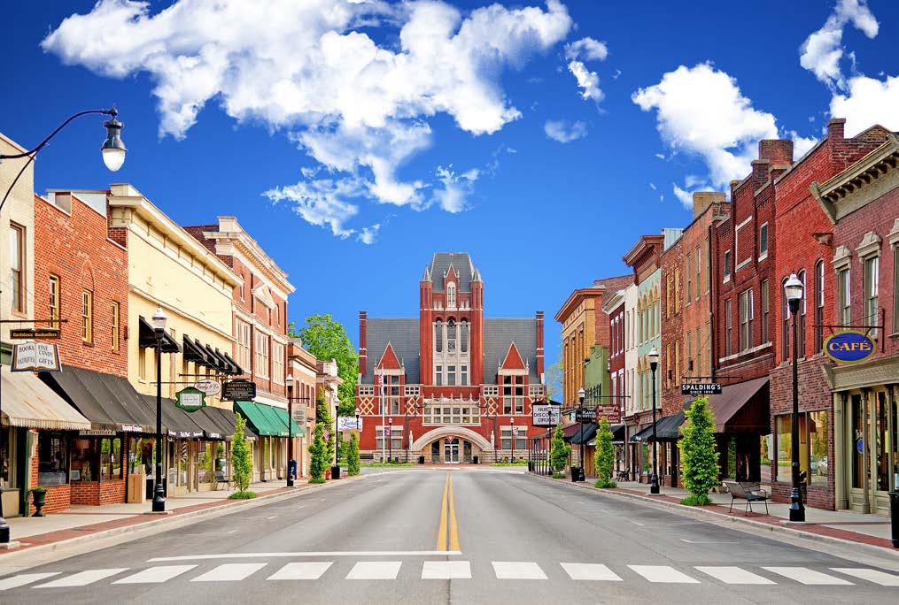
Redirect views to landmarks. Bardstown, KY
baker street

The life and vibrancy of the downtown converges on Baker Street. Special attention is warranted to maintain the heritage character, patchwork of uses and pedestrian vitality along Baker Street. As Cranbrook’s main street, it needs to become a year-round destination, which can accommodate larger events and small gatherings and be adaptable to the changing seasons. The provision of street-level retail that animates Baker Street should be encouraged wherever possible. A variety of urban design and architectural treatments is recommended to help diversify the building frontages. The introduction of new buildings and adaptations to existing frontages along Baker Street should be carefully reviewed to ensure contextual consistency with streetscape in terms of scale, height, proportion and rhythm.


48
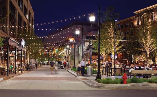
Downtown vibrancy in the evening
Farmers Market
Supporting local businesses
Streetscape design & public seating furniture
vibrant arts district
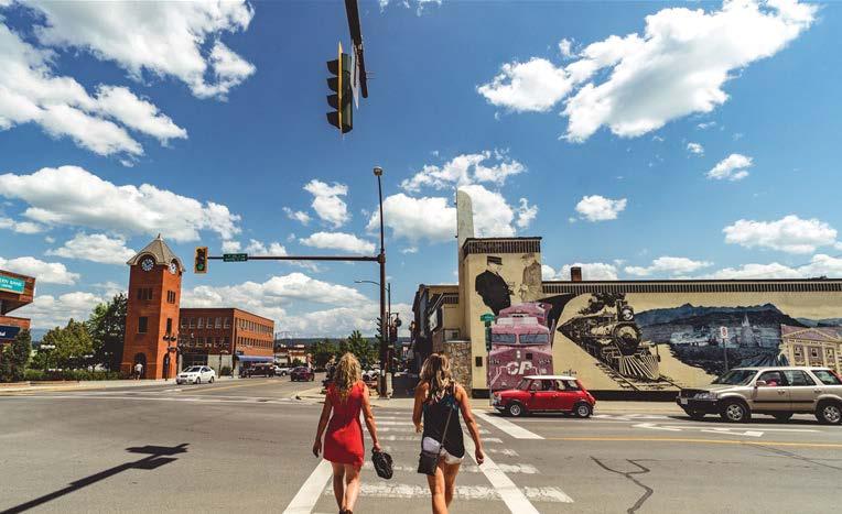

The Arts District is a place to wander and explore Cranbrook’s culture – through community theatre, artwork, murals, history, performances and live entertainment and a collection of locally-run establishments. The Arts District is bounded to the east and west by main axes that connect the Rotary Park events space and residential areas to the south with the Baker Street area. Uses that promote the identity of the Arts District, particularly that encourage animation of the street level by exhibiting art, culture and performance, as well enhancements to the pedestrian experience should be encouraged.

City of Cranbrook Downtown Revitalization Masterplan | June 2023 49
Fire Hall.
CP Holiday Train
Downtown artist murals.
Seasonal Events -Winter Blitzvile
maker village
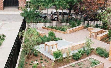
The Maker Village is in a transitional area with an emergence of community, small scale industry and workspaces. Concepts that contain a mixture of collaborative workspaces, training & education spaces, maker spaces, and light manufacturing through craftsmanship and food production that complements the urban scale will be encouraged. Over time, it is anticipated the area will transition to accommodate new uses such as residential, mixed use, office and retail.


50
Community gardens on vacant lots
Community gardening
Maker Spaces
Placemaking
rotary park
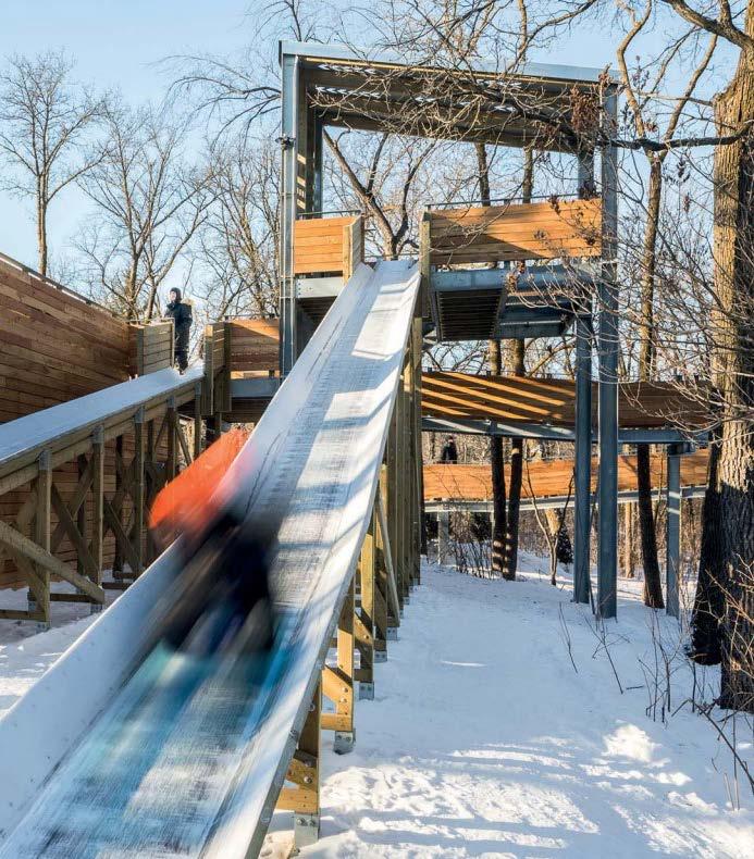
Rotary Park and the immediate environs is an asset to the community, providing a venue for local events as well as a vital green space in the heart of the downtown. The buildings that surround the park have a scale and quality that complements and frames the traditional park setting. Priority will be given to strategies that encourage interaction with the park and an enjoyable experience for pedestrians, cyclists and different demographic users. New developments surrounding the park should be limited in scale so as not to impede the enjoyment of park users.
Efforts to preserve and enhance existing parks and open spaces are of particular importance. The park and its surrounding streets should be integrated into the city’s network of green spaces through the improvement of bike paths and sidewalks, increased usable public and private open spaces and tree planting along streets. It is important to preserve sunlight access to Rotary Park, activate and open the park’s edges and adjacent streets. The built form that provides a strong sense of enclosure to the park should be maintained.

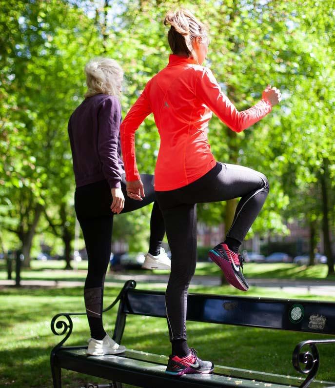

City of Cranbrook Downtown Revitalization Masterplan | June 2023 51
Enhance pedestrian experience
Winter and summer amenities for children. Winnipeg, MB
Games and programming for all ages
Different park users

52 Park amenities
4.2 land use framework
To focus and incentivize the right kinds of development activity, the land use framework provides a guide to types and scales of built form within the designated downtown area. Whereas the Character Areas refer to the qualitative aspects of development sites and their relationships with the urban context, the land use framework assists the reviewer in understanding what scales of development are appropriate within a given area.

City of Cranbrook Downtown Revitalization Masterplan | June 2023 53
City of Cranbrook, Downtown mountain views
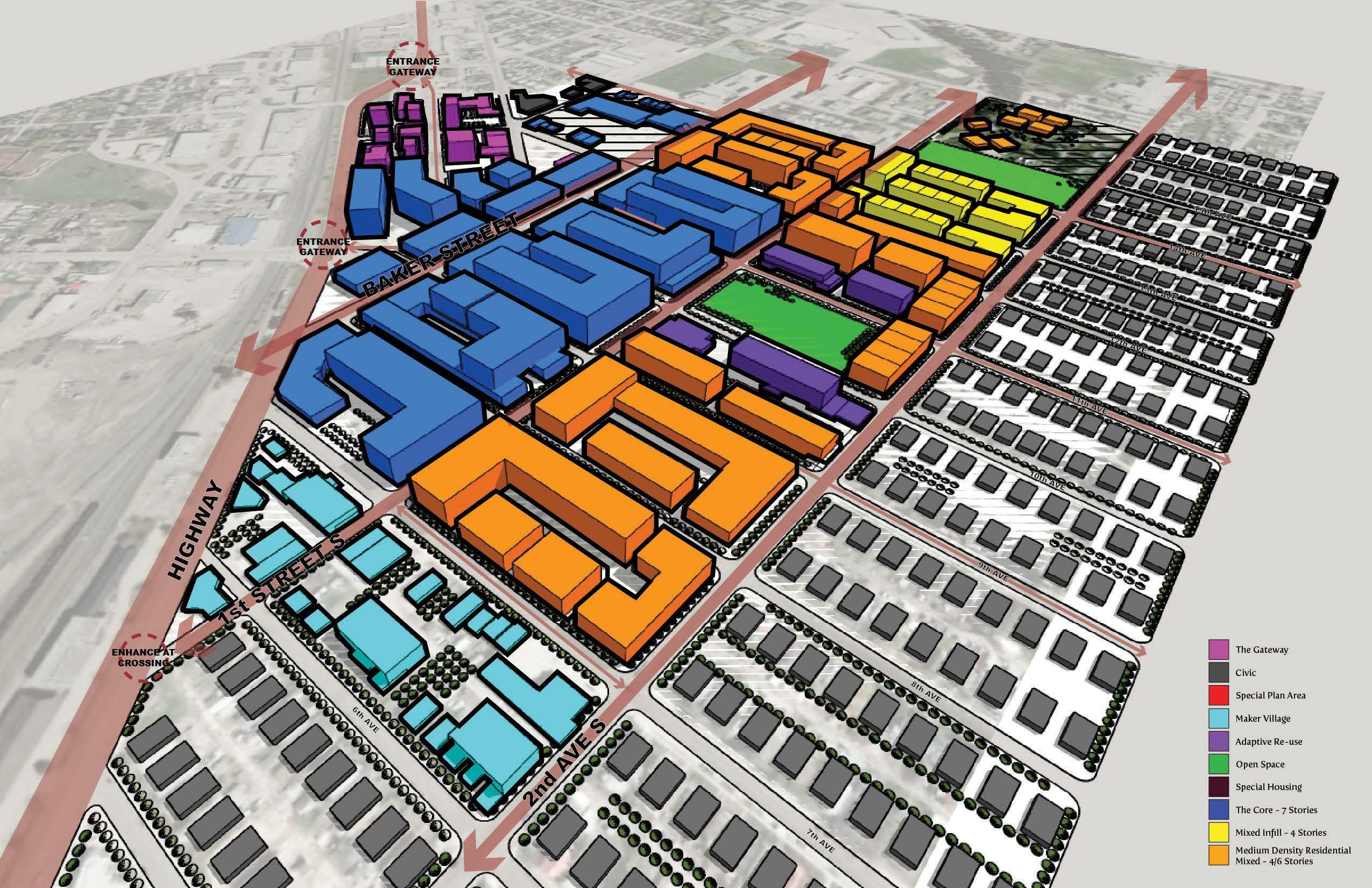
54 map 8 land use developments
- 6-8 storey developments

- Office or residential above; retail and active uses at-grade
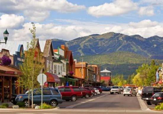

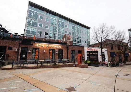
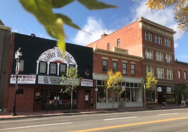
- Limit areas of ground level uses that do not contribute to street activation (particularly Baker Street)

City of Cranbrook Downtown Revitalization Masterplan | June 2023 55 the core
Sensitive repurposing of existing heritage properties. Inglewood, Calgary, AB
Activation at-grade that promotes ground floor business and street corners as lively gathering places. Druid Hills, Atlanta, GA
Enabling lively streets focused on the pedestrian experience. University District, Calgary, AB
At-grade retail and residential above. The Gulch. Nashville, TN
Animated street frontages and flexible areas that support temporary re-use and placemaking. Denver, CO
Fine-grain built form that integrates well with existing heritage. Whitefish, MT
- 2-3 storey development
- Preservation and selective / strategic adaptative re-use of existing properties of particular significance
- Cultural and historic relevance should be assessed as part of any redevelopment proposals

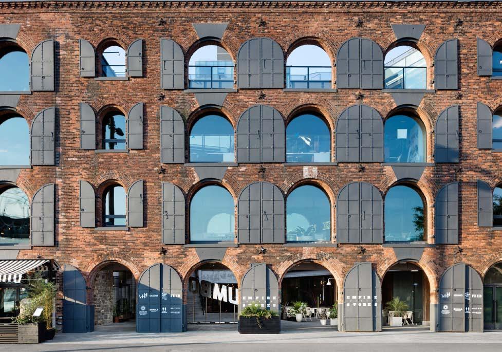
- Sustainably re-use existing infrastructure while contributing to an inclusive and cohesive downtown environment
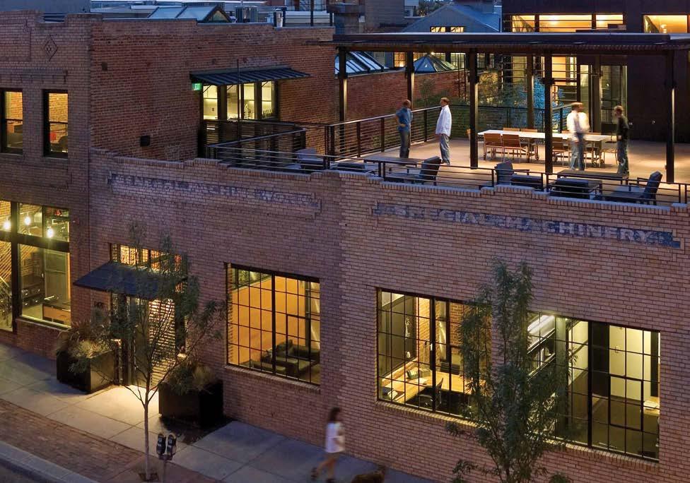


Sensitive adaptation and use of complementary materials. Washington, WA
Relationship to context and adjacent spaces. Moscow, Russia
Fire Hall Kitchen & Tap, Cranbrook's 1929 refurbished heritage building. Cranbrook, BC
Responding to local vernacular. Denver, CO
Provide access and visibility to internal areas. Brooklyn, NY
Contemporary additions that are contextual yet distinguishable from heritage elements. London, UK
56
adaptive re-use
mixed infill
- 2-3 storey development
- Accommodates growth and change in a way that integrates with the fabric of the community
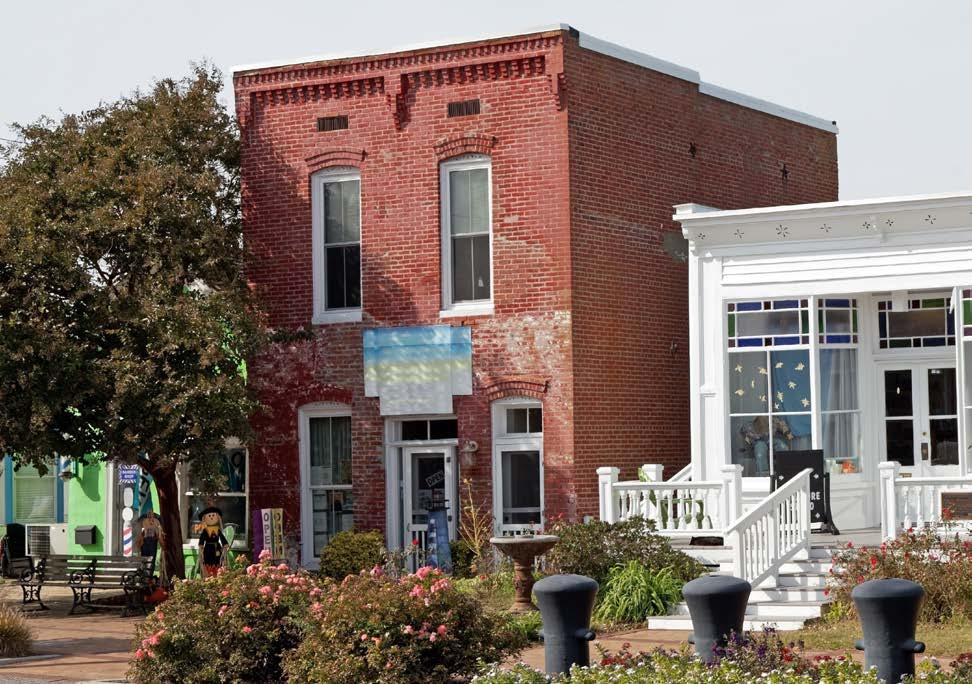
- Offers missing middle housing options


Small Multi Residential Building USA


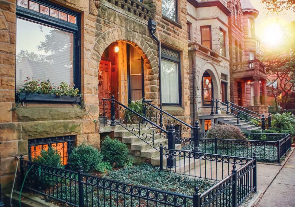
Chicago, IL
Chincoteague, VA Small Town Main Street USA
City of Cranbrook Downtown Revitalization Masterplan | June 2023 57
Gloucester, UK
Ashburn, VA
- Accommodates 3-5 storey buildings and multifamily housing options


- Allows a wide range of building forms to create a vibrant community and offer housing choices

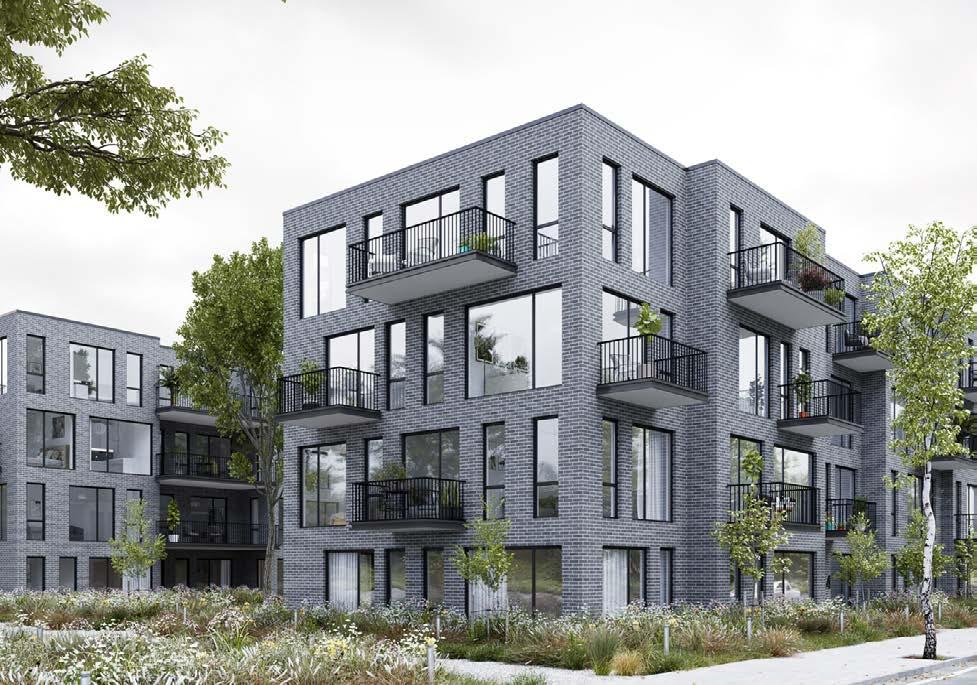
Courtyards and amenity spaces interior to parcels and buffering adjacent developments. Te

Contextual, expressive and varied medium-density building forms. Norway

58 medium density
Hubert Housing. Quebec City, QC
Aro, WA
Ground-oriented loft units incorporated into building form. Laneway mews access. Southbank. Calgary, AB
Berlin, Germany
Le Safran 50 Housing Units. Sene, France
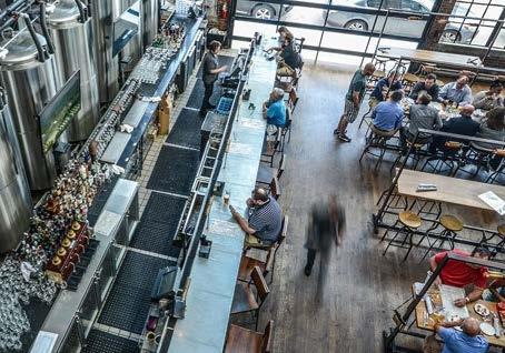
maker village
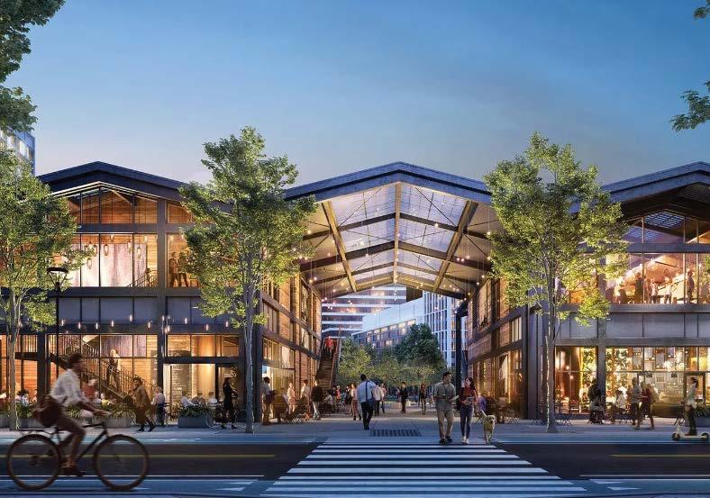
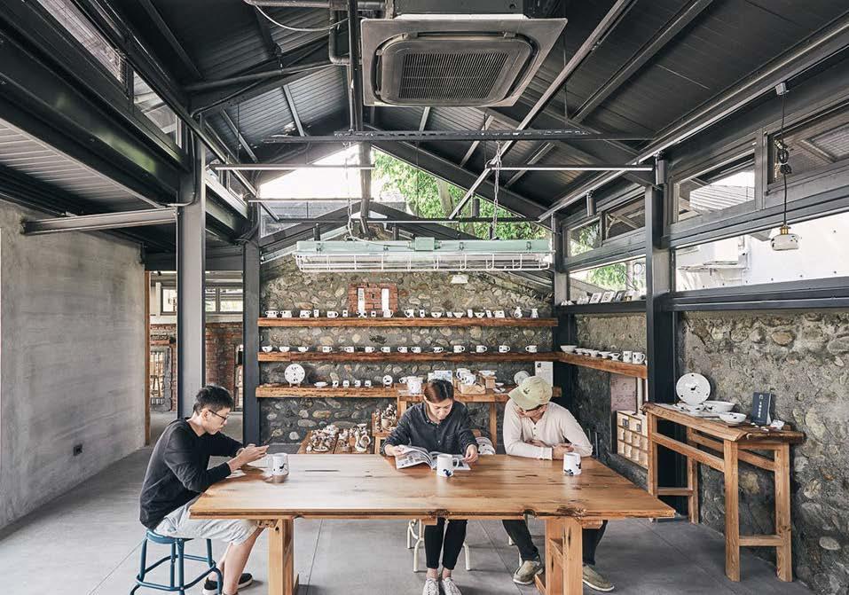
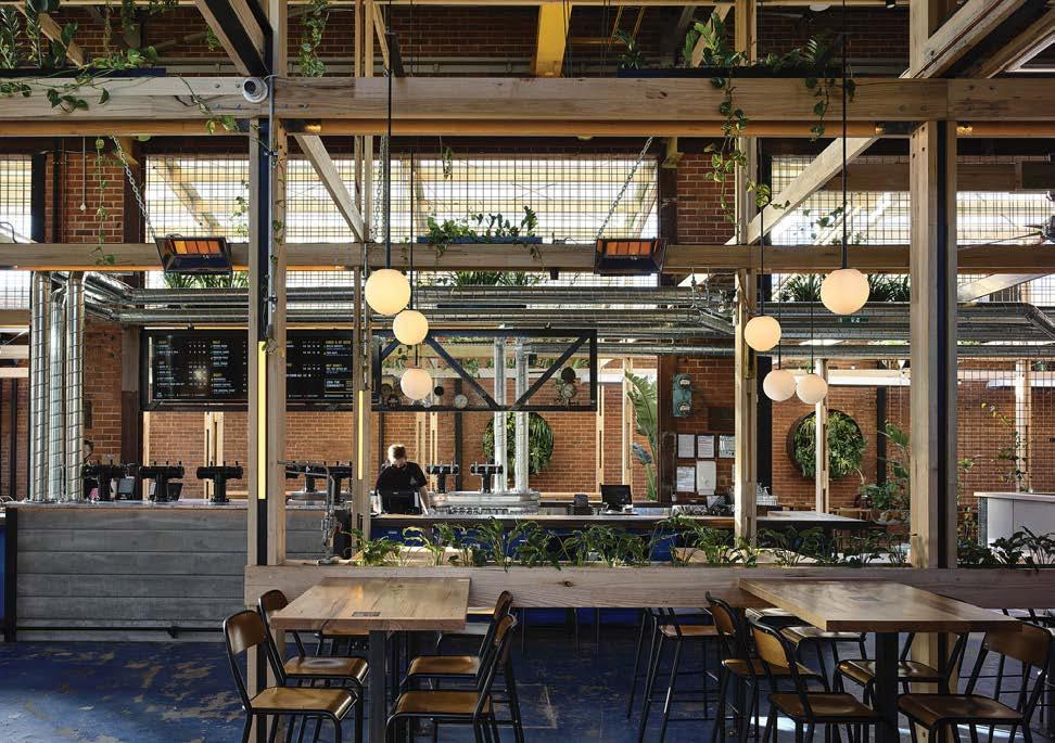
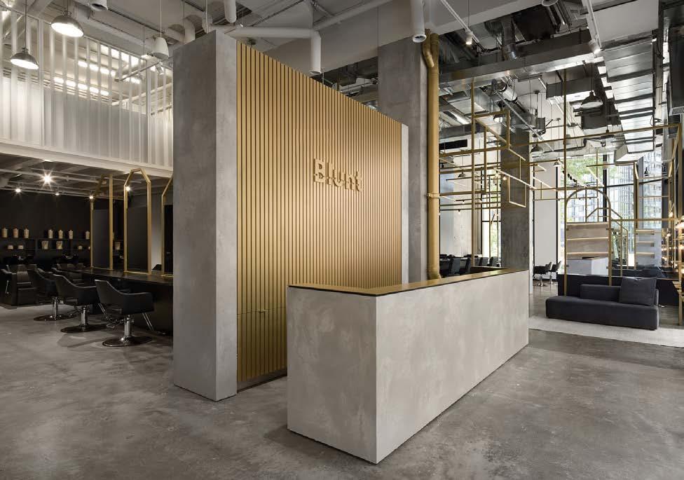
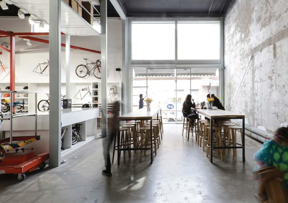
- 1-3 storey development
- Area that fosters small business opportunities, creative groups, hybrid uses and small scale manufacturing
- Light, non-invasive industrial opportunities (e.g. coffee roaster, micro- brewery, art production, bike servicing and repair)
- Creative incubator spaces and cross-disciplinary uses to be encouraged
City of Cranbrook Downtown Revitalization Masterplan | June 2023 59
The Shed. Cambridge Crossing, MA
Blunt Hair Salon. Montreal, QC
Blue Jacket Brewery. Washington, DC
Stomping Ground Brewery. Moorabbin, Australia
Coffee House + Bike Repair Shop. Chaoyang, China
Pottery Studio. China
- 2-3 storey development
- Varied land uses (commercial, residential, institutional)
- Built form and landscape reinforces street framing and gateway experience along main corridors


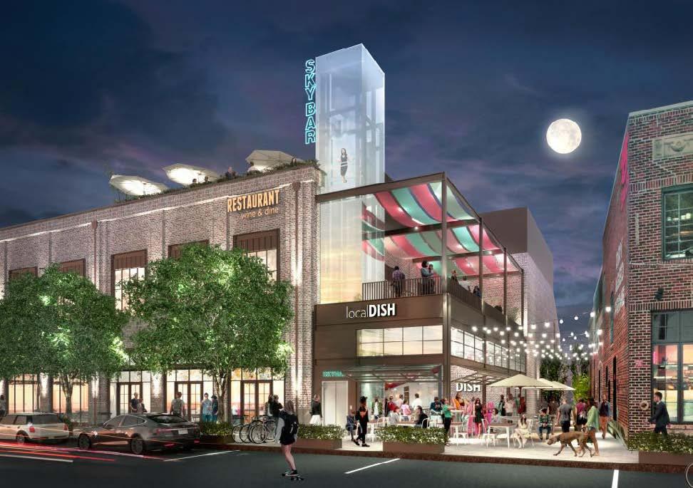
- Promote visibility to places of significance / points of interest
- Use of entrance markers and landmark at strategic locations
60 gateway
Cady's Alley. Washington, DC
Chicago, MI
Denver, CO
Argyle Street. Halifax, NS
Houston, TX
Austin, TX
4.3 public realm connectivity

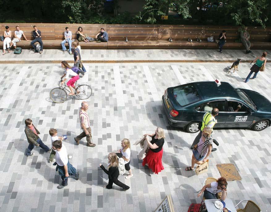
Public spaces are important assets to a city, through which if they are successful, it creates opportunities for people to come together and engage with the community. There are many factors that contribute to the success of public spaces, such as accessibility, comfort, and human scaled elements. The new proposed grid system encourages a multimodal access where pedestrians and cyclers are given importance to promote connections on the street level. These connections should be simultaneously activated through art, furniture, user activities and a consistent approach to the urban realm to create welcoming spaces.

City of Cranbrook Downtown Revitalization Masterplan | June 2023 61
In experiencing the downtown, success hinges on providing inviting and accessible linkages together with street-level walking and cycling connections and an active ground plane.
Shared street. Brighton, UK
Main Street. Cuyahoga
Falls,
OH Montreal, QC
Encourage bike use at points of interest. Brighton, UK
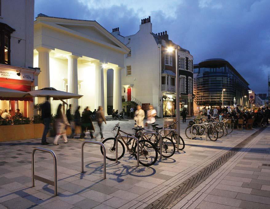
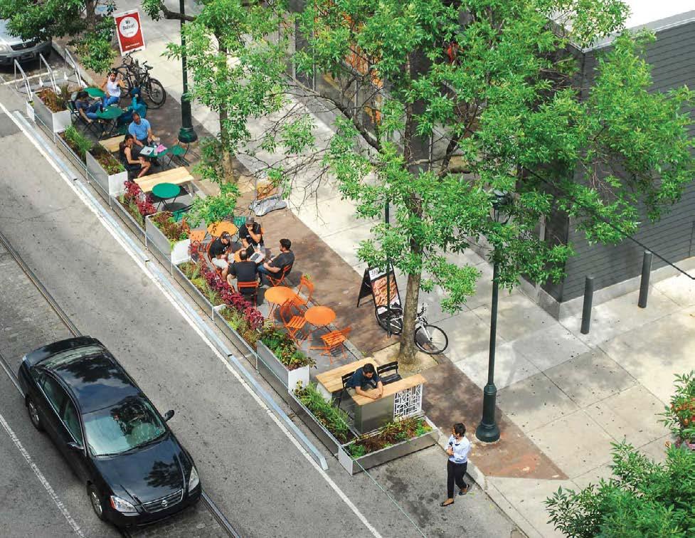
A varied, textured public sidewalk zone that can accommodate different seasonal configurations. University City, Philadelphia, PA
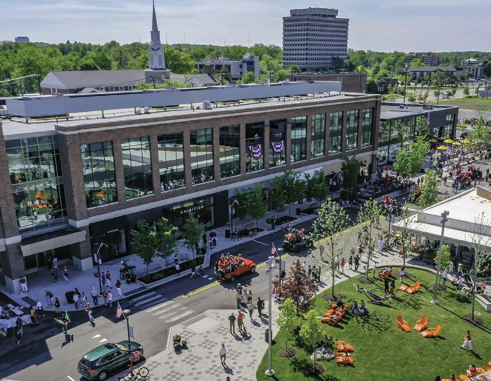
Use open space and park frontages as an advantageous condition and promote porous ground plane connections. Shaker Heights, OH

62
Street furniture providing meeting and gathering places. Castro Valley, CA
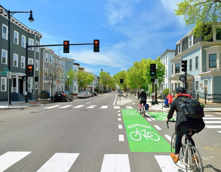
Shared streets. Cambridge, MA
City of Cranbrook Downtown Revitalization Masterplan | June 2023 63
map 9 street typology Design treatments for Main Street, Connector Streets and Minor Streets.

64
map 10 existing pedestrian and bike access Strengthening the current grid system and reinforcing key multi-modal connections into the downtown area.

City of Cranbrook Downtown Revitalization Masterplan | June 2023 65
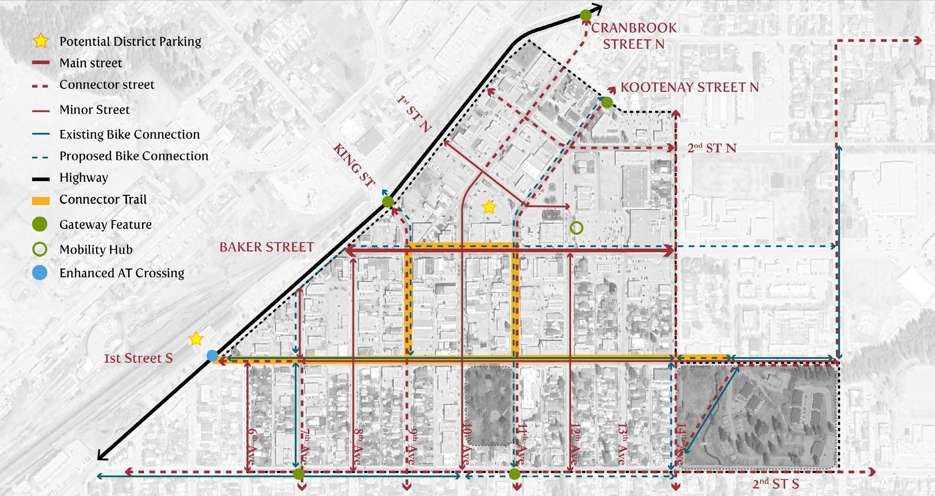
map 11 existing and proposed bike access + connector trail
Introducing new bicycle routes through the downtown and creating a Connector Trail that links together historic areas, points of interest, rural trails, interpretive zones and Baker Street as a place to explore and linger in.

experiencing cranbrook and the connector trail The Connector Trail is a cross-urban route, linking Cranbrook’s downtown to its wider system of regional pathways, such as Rotary Trail, as well as connections to surrounding natural beauty. It is also an opportunity to tie together the diverse experiences of being in the downtown to cultural/interpretive history, public artworks and everyday uses.
Providing this direct access into the downtown through an urban trail system will promote the use and visibility of key locations, promote green linkages by connecting to parks and open spaces, connect the urban lifestyle to the wilderness, as well as providing a convenient, accessible amenity for the resident community.

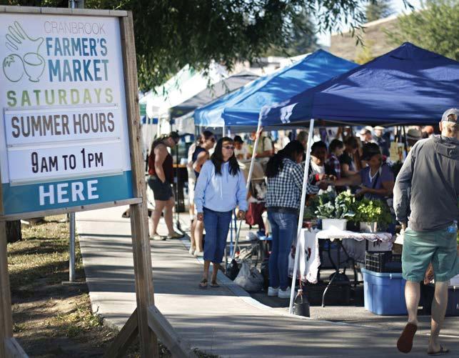


City of Cranbrook Downtown Revitalization Masterplan | June 2023 67
Mt. Baker Heritage Hotel
Armond Theatre
Farmers Market
Rotary Park
The connector trail aims to generate vibrancy in the Downtown while allowing people to experience the history and culture of Cranbrook through highlights along the journey, including historic buildings, arts and interpretive elements.
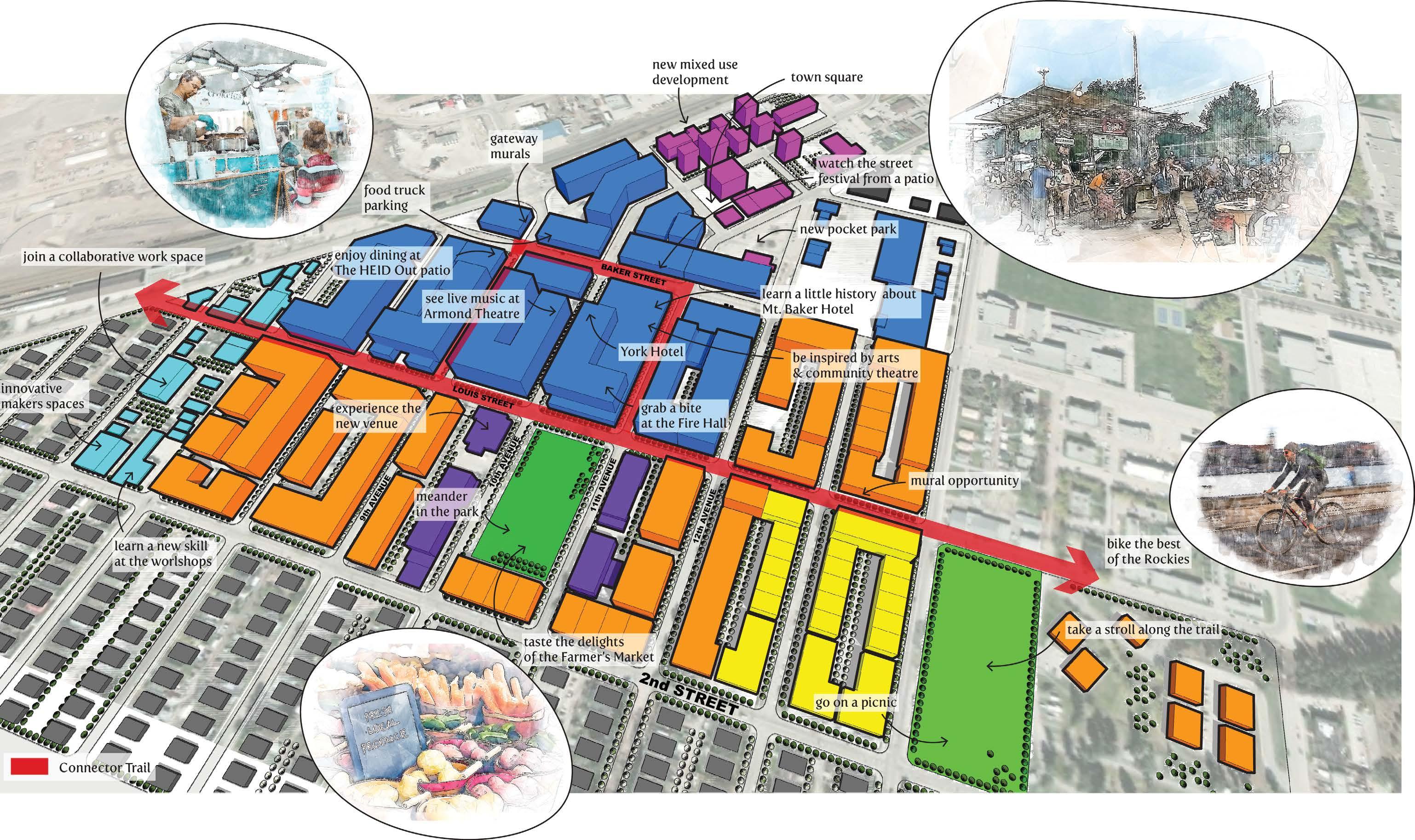
68
map 12 connector trail experience
indianapolis cultural trail


The trail is an 8.1-mile-long urban shared-use path and linear park located in the vicinity of downtown Indianapolis. It aims to connect people and places through dynamic and beautiful experiences and use the Indianapolis Cultural Trail and Pacers Bikeshare program as a catalyst for economic growth.

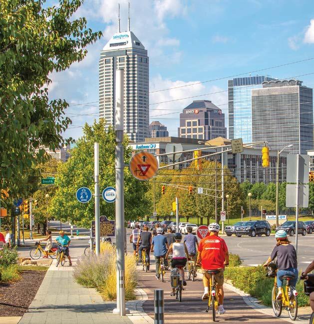

City of Cranbrook Downtown Revitalization Masterplan | June 2023 69


70
cranbrook sculpture art walk downtown


The City's “Sculpture Art Walk” through the downtown core looked at improving community vibrancy and was utilized as a catalyst for tourists and local residents to start talking about the existing artwork, sculptures, and murals that Cranbrook already has on display.
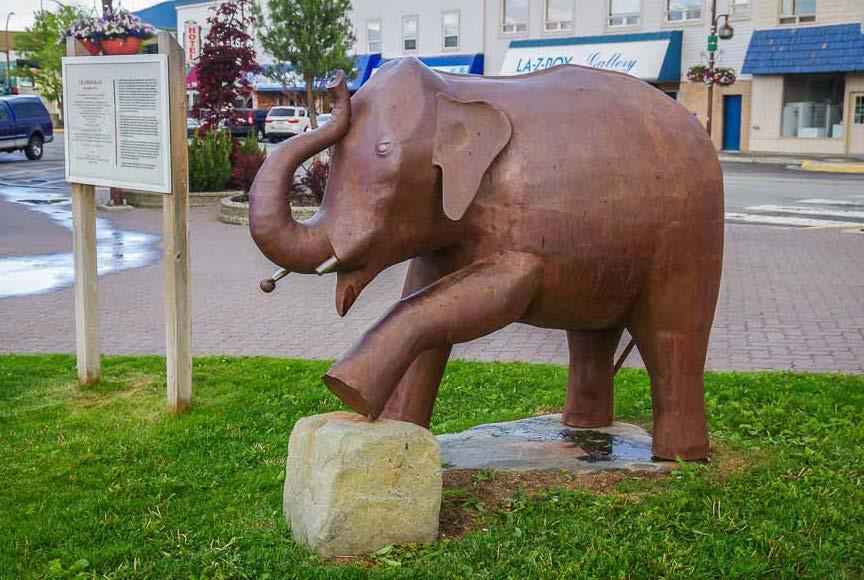
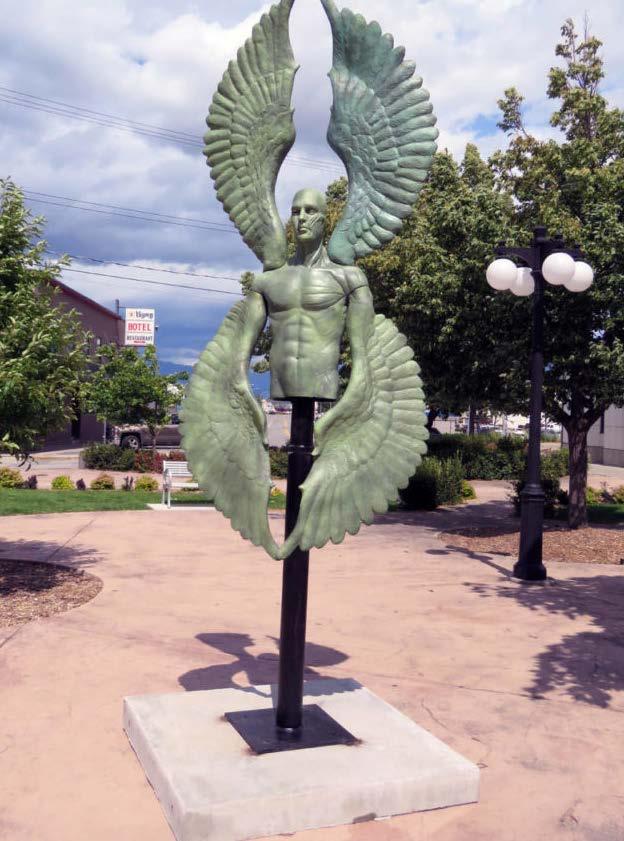

City of Cranbrook Downtown Revitalization Masterplan | June 2023 71
bellevue grand connection
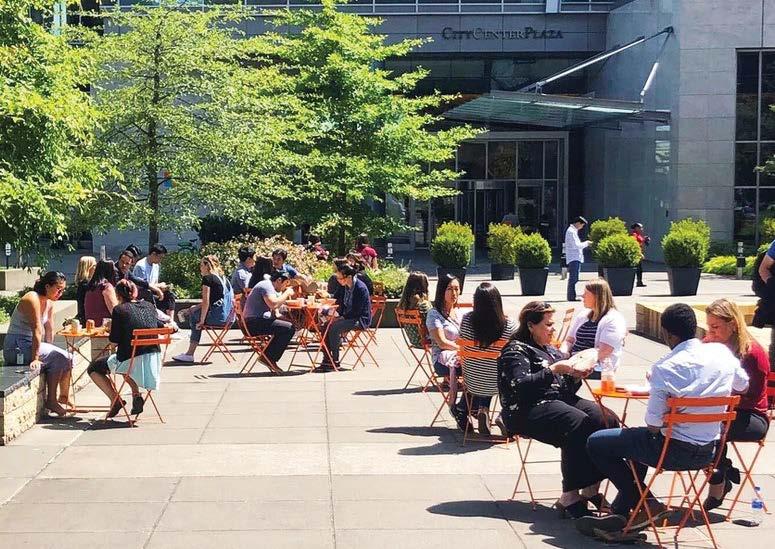
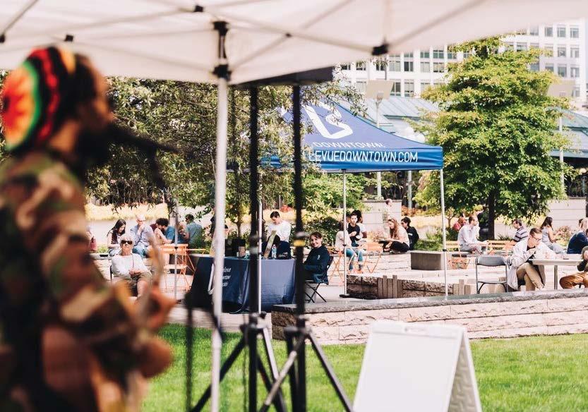


The route links Bellevue’s waterfront to Downtown while also connecting important existing and future civic and public assets. The natural landscape infuses nature into the city. This identity prioritizes natural elements such as vegetation, water retention and runoff, as well as wildlife such as birds.
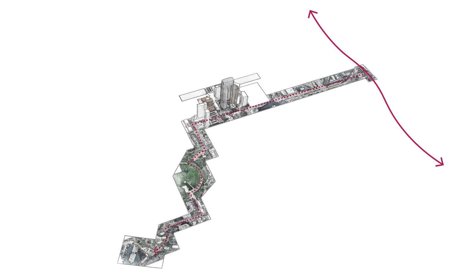
72
Emergent Forest Transit Center
EAST SIDE RAIL CORRIDOR Compass Plaza
Park Entrance
Bellevue Downtown Park Main Street Plaza
Meydenbauer bay
typical street profiles
main street section
Typical main street section.
Note: a variation of this is a one way cycle lane on each side of the street. Layout is as follows: Patio (2m), Sidewalk(3m), Furniture(2m), Bike Lane (1.8m), Buffer (0.7m), Parking Lane (2.2m), 2 x Drive Lane (3.3m x2), Parking Lane (2.2m), Buffer (0.7m), Bike Lane (1.8m), Furniture (2m), Sidewalk (3m), Patio(2m).
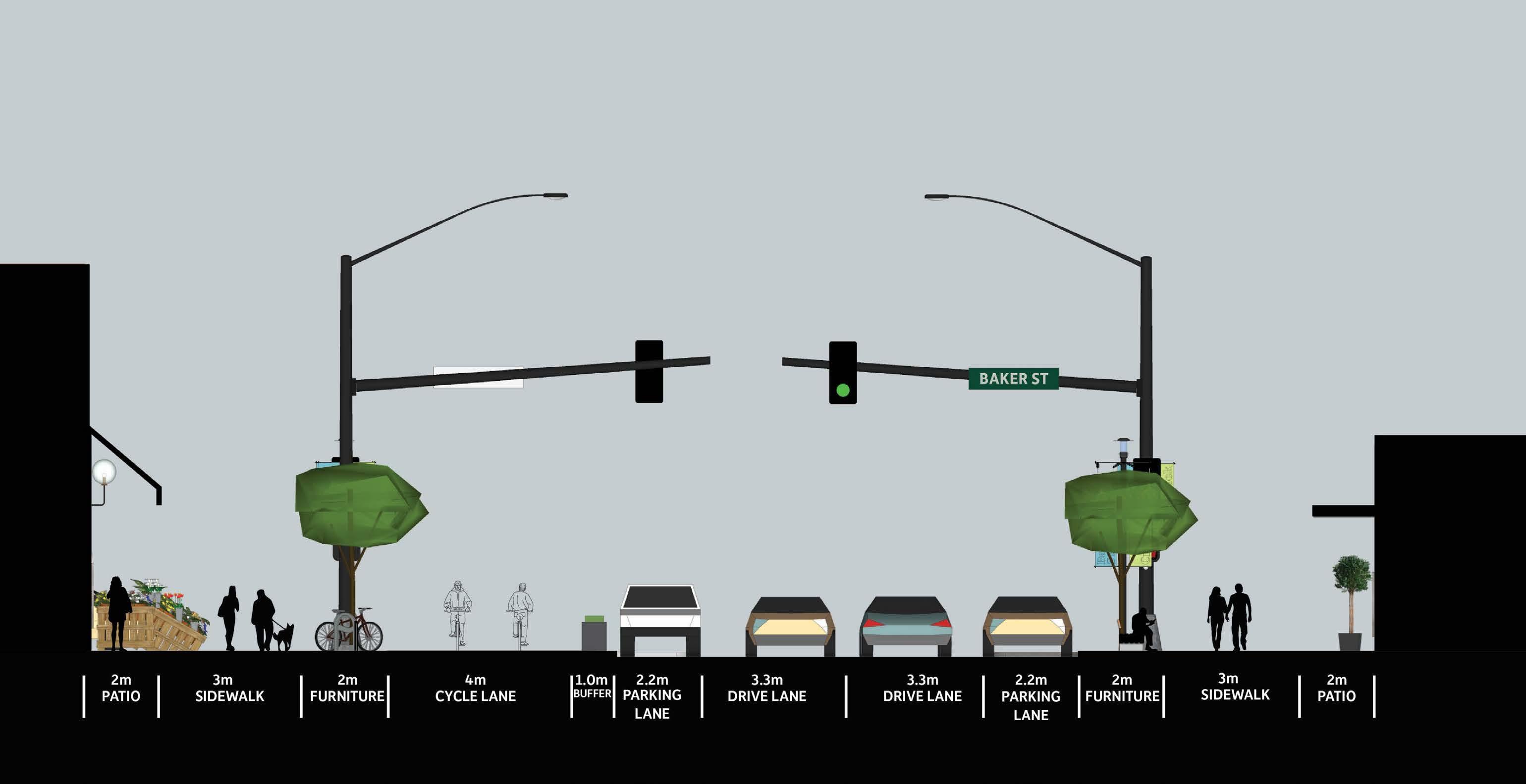
City of Cranbrook Downtown Revitalization Masterplan | June 2023 73


74 main street plan

City of Cranbrook Downtown Revitalization Masterplan | June 2023 75
main street perspective

76 main street perspective
main street section - scenario 1
Temporary patios expanded onto parking lanes and/or sidewalks extended to parking lane to allow expanded patios.

City of Cranbrook Downtown Revitalization Masterplan | June 2023 77


78 main street - scenario 1 plan

City of Cranbrook Downtown Revitalization Masterplan | June 2023 79
main street - scenario 1 perspective
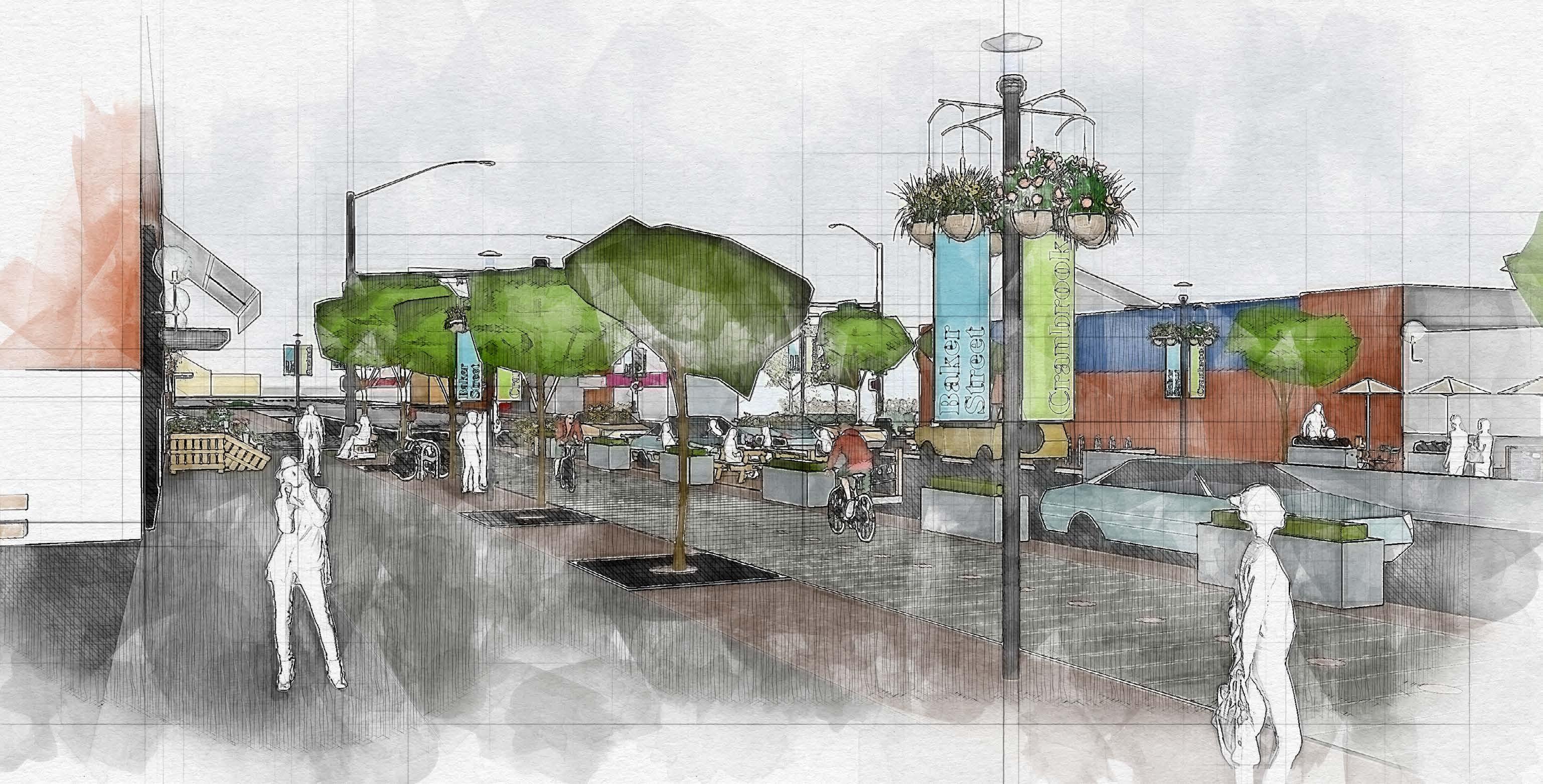
80 main street - scenario 1 perspective
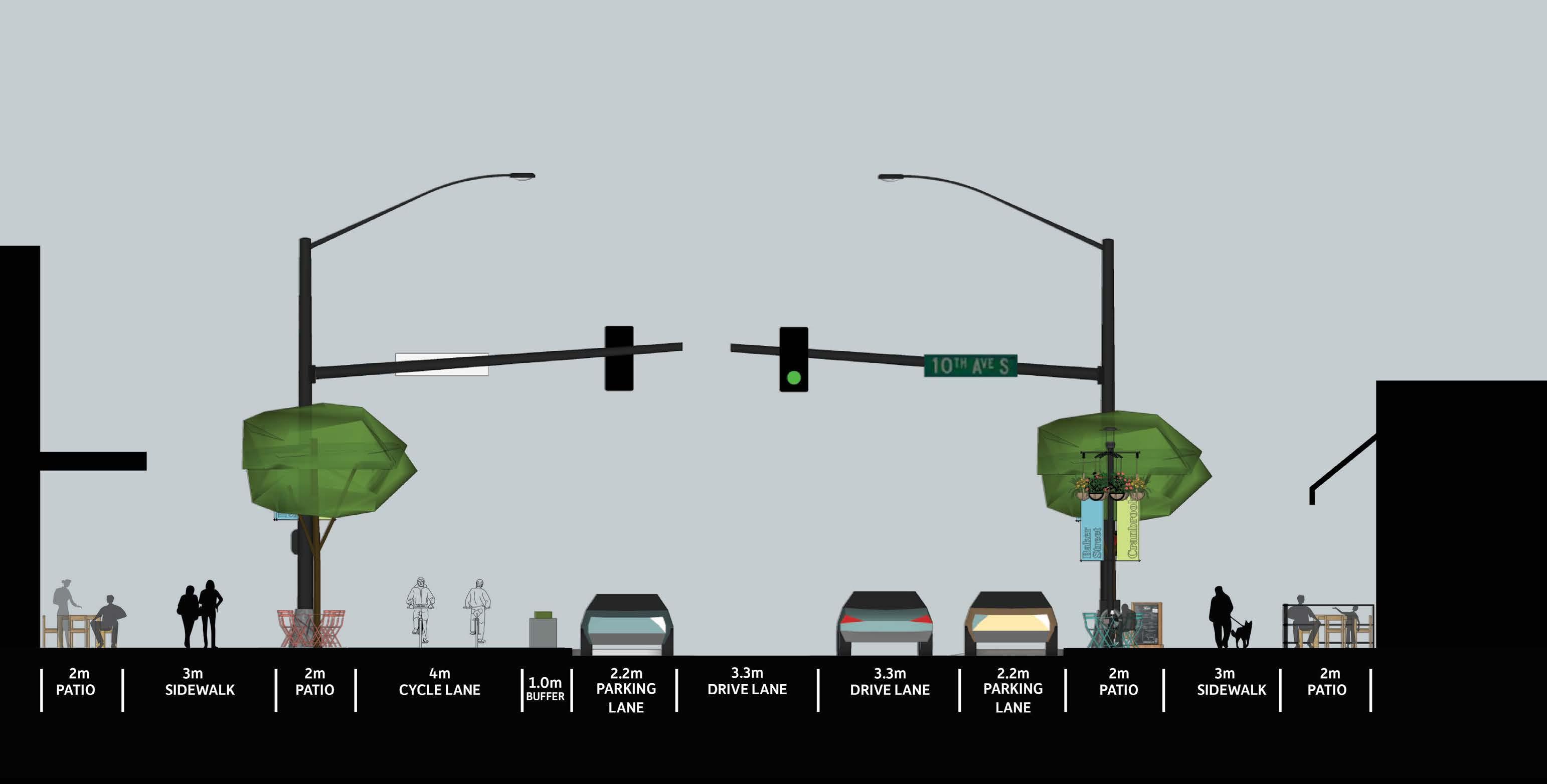
City of Cranbrook Downtown Revitalization Masterplan | June 2023 81
main street section - scenario 2 Patios are located in front of retail's entrance and with the possibility of expanding to the street furniture zone, shaded by trees.


82 main street - scenario 2 plan

City of Cranbrook Downtown Revitalization Masterplan | June 2023 83
main street - scenario 2 perspective
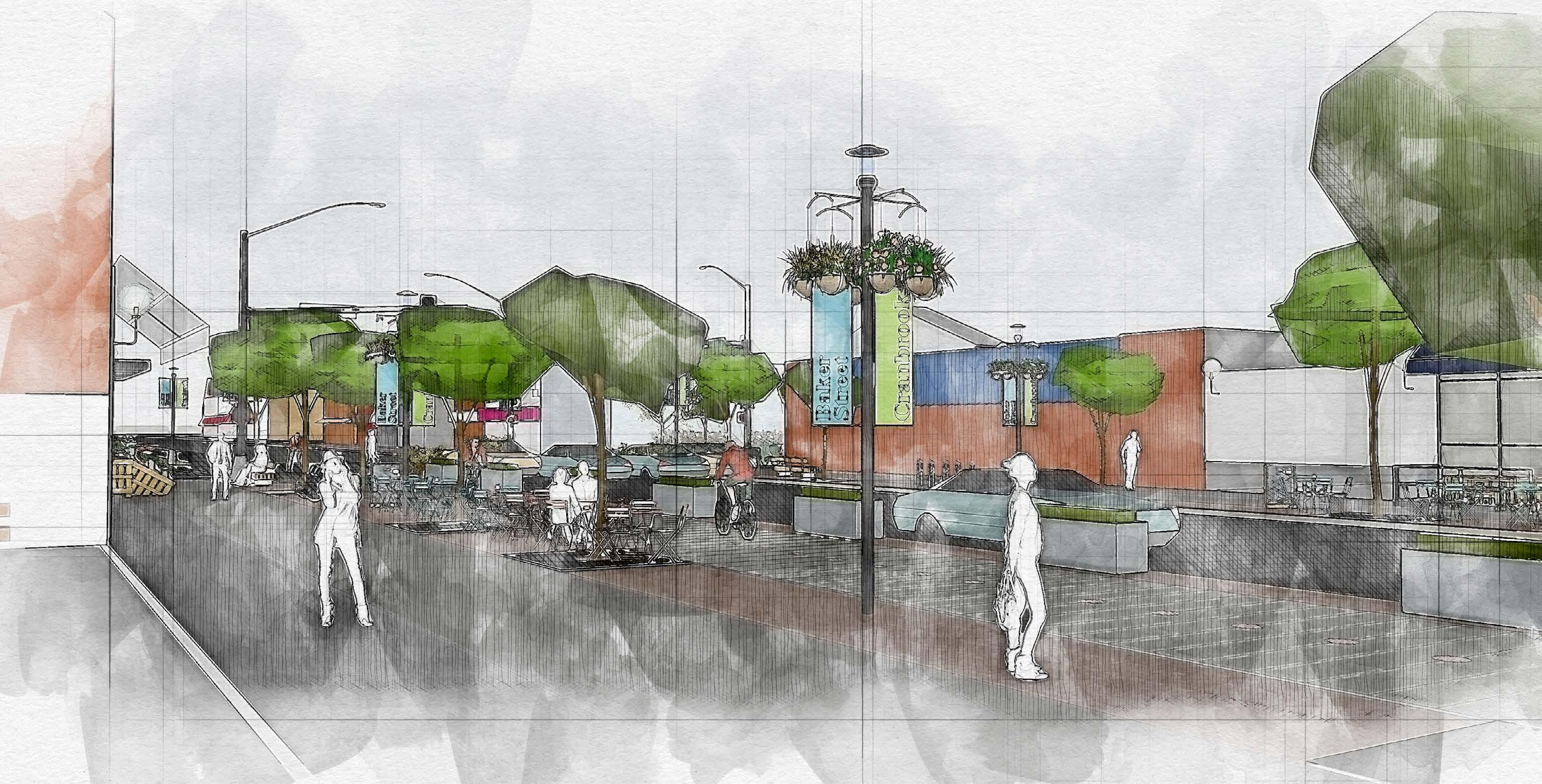
84 main street - scenario 2 perspective
main street section - scenario 3
The sidewalk becomes an expanded patio, and a permanent one-way cycle lane is on each side of the street.
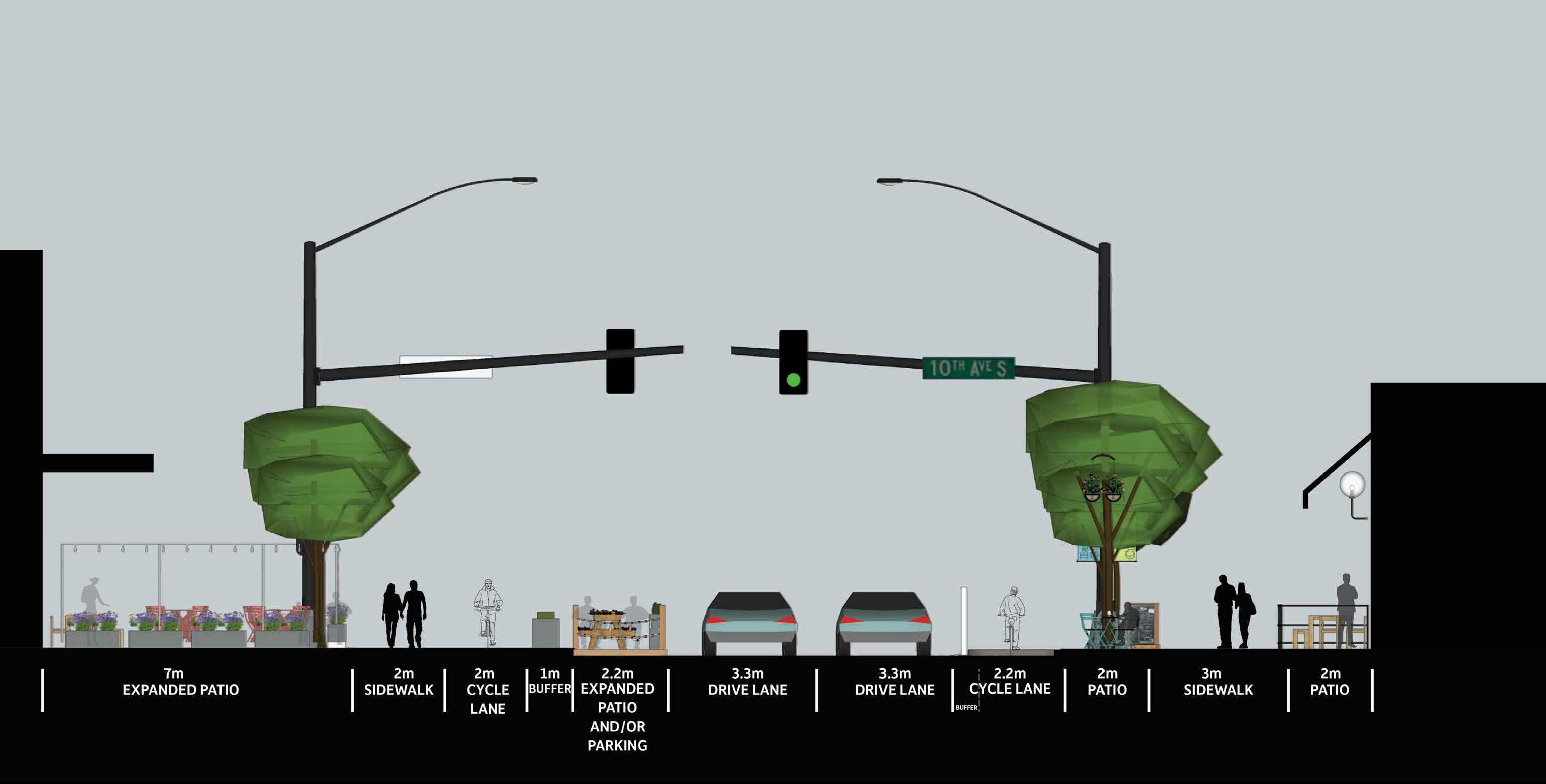
City of Cranbrook Downtown Revitalization Masterplan | June 2023 85

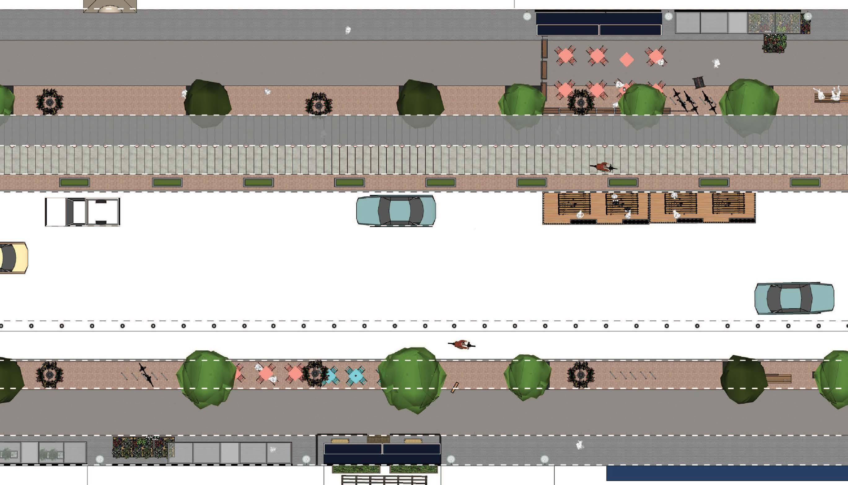
86 main street - scenario 3 plan
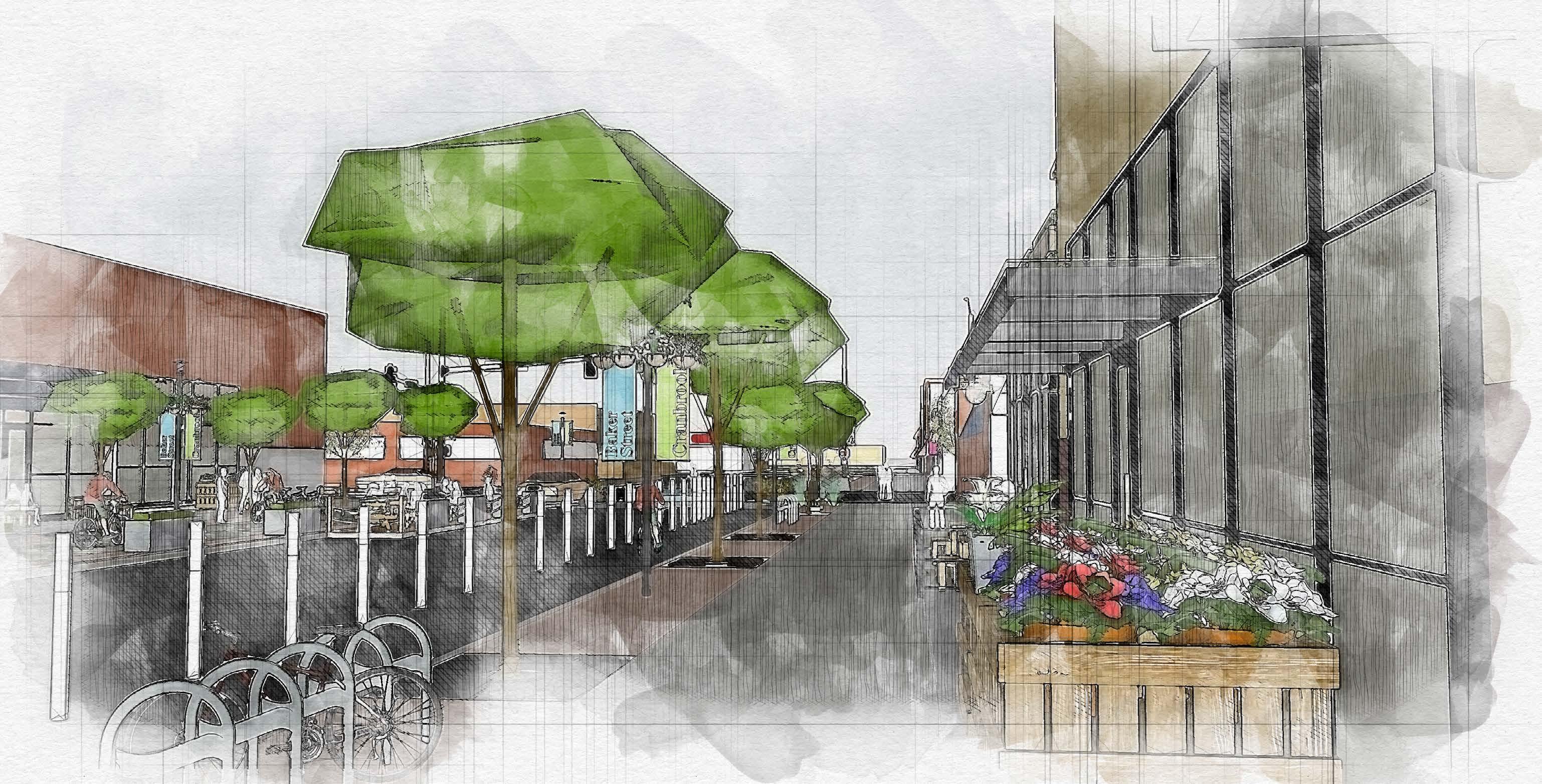
City of Cranbrook Downtown Revitalization Masterplan | June 2023 87
main street - scenario 3 perspective
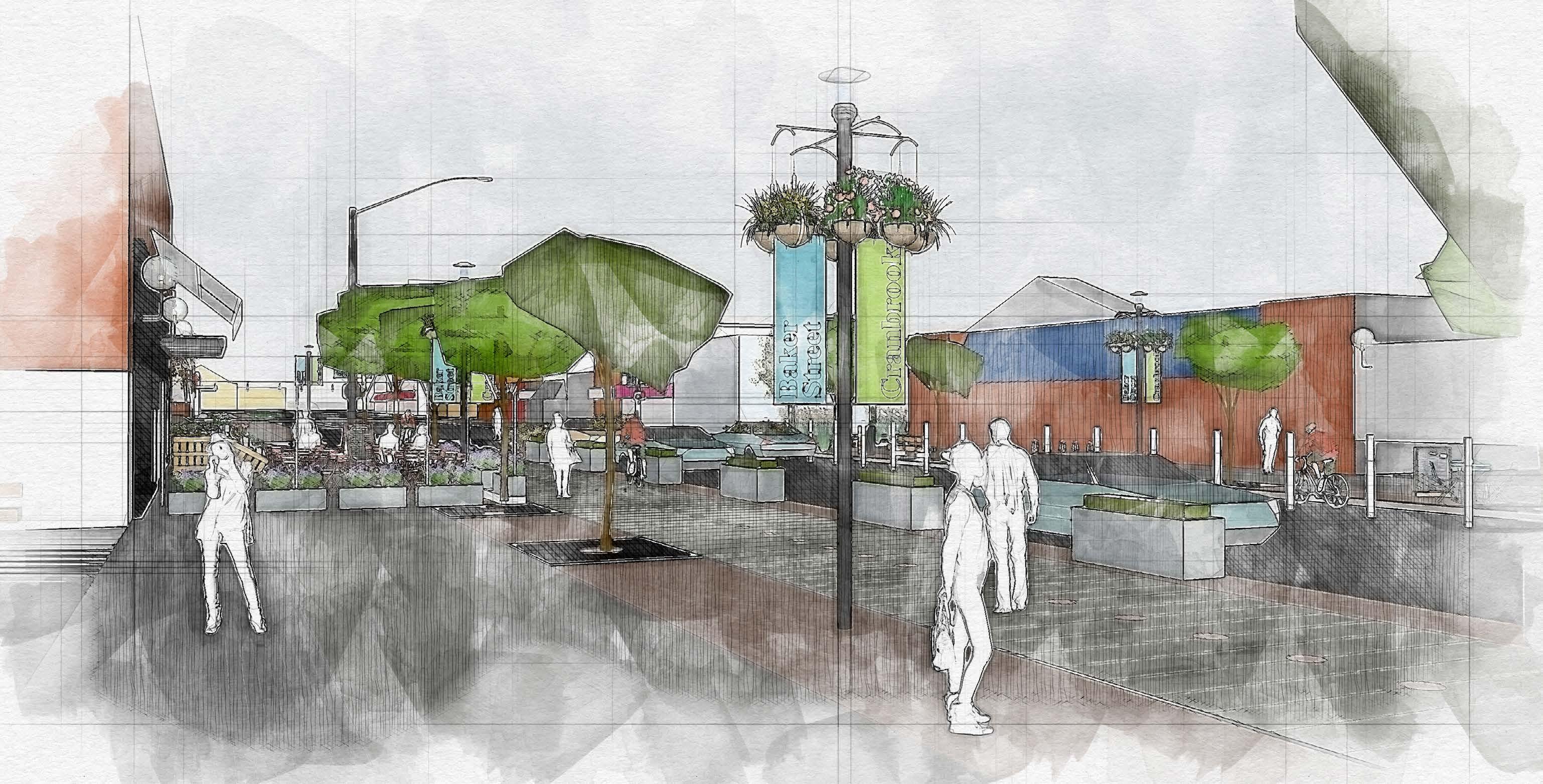
88 main street - scenario 3 perspective
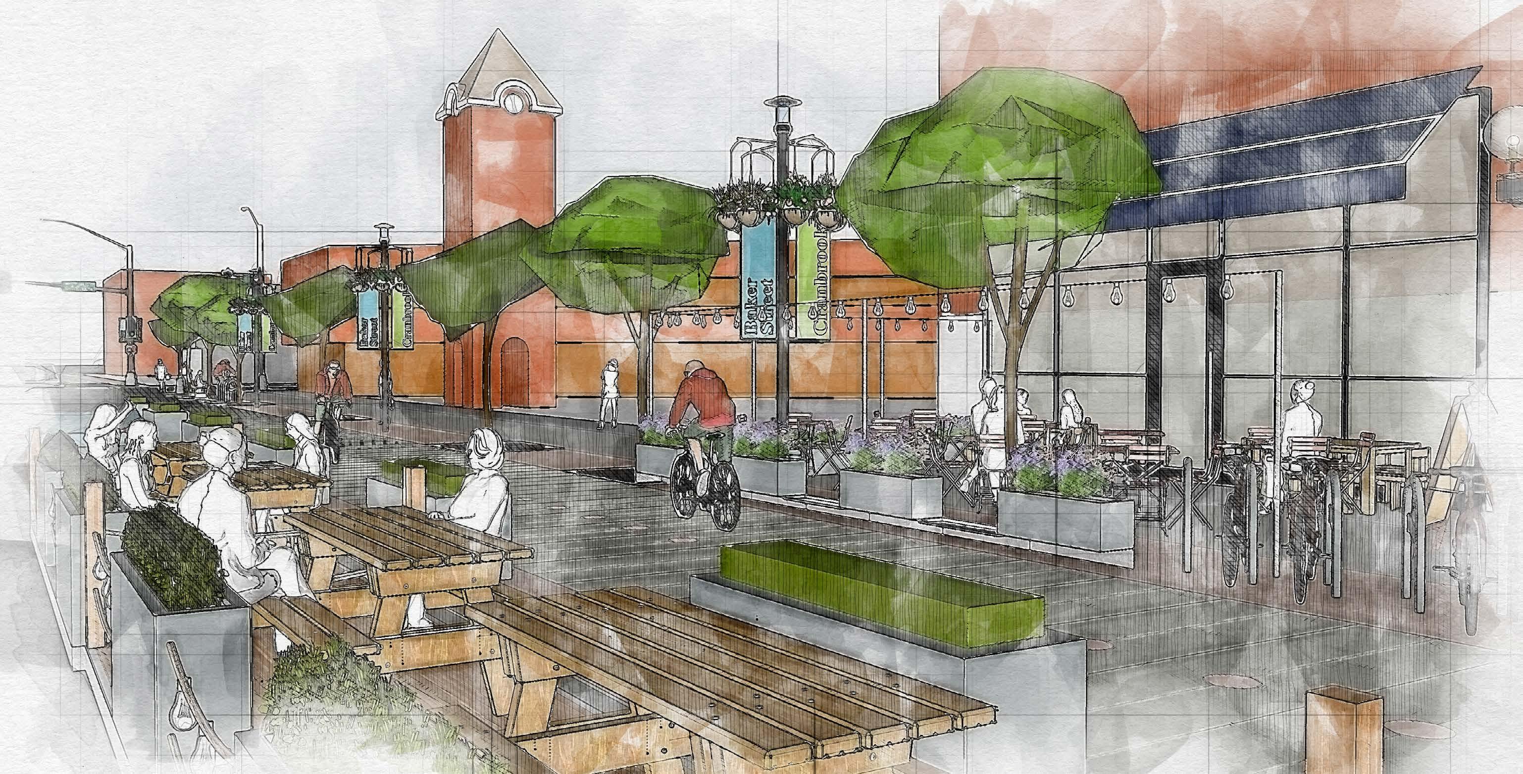
City of Cranbrook Downtown Revitalization Masterplan | June 2023 89
expanded patio layout example

90 raised intersection
Note: on connector streets where there is no bike network, parking lanes will replace it. This will result in additional drive lanes and/or increased width on sidewalk and furniture zones.

City of Cranbrook Downtown Revitalization Masterplan | June 2023 91
connector street section
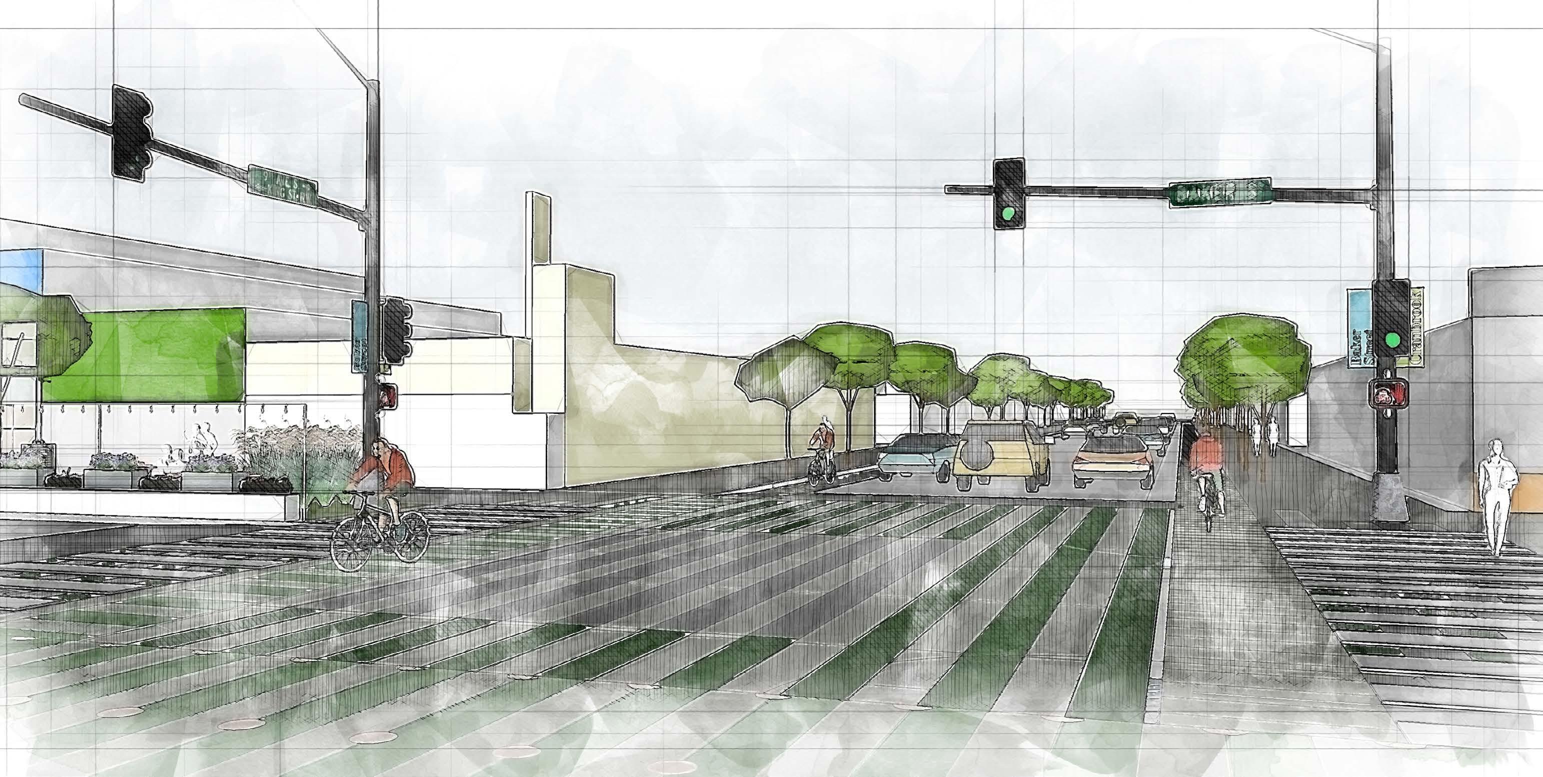
92
intersection between main street and connector street

City of Cranbrook Downtown Revitalization Masterplan | June 2023 93
minor street section

94 minor street perspective
4.4 architecture and built form
Where buildings meet the street, there should be efforts made to prioritize and animate the pedestrian experience. Building entrances and ground-level facades should be sensitive to the human scale, introducing design elements such as clear visual connections, lighting, site furniture, signage, landscaping and building articulation. Each of these elements will serve to create a high-quality pedestrian environment that is completely accessible throughout the year.
street interface
a. Maintain contextual building setbacks to achieve street wall consistency.
b. Orient all primary entrances and active ground floor uses towards the street.
c. Provide frequent building entrances to suit the finegrain rhythm of shop-fronts and/or residential access.
d. Promote inclusive barrier free access that is not differentiated from the building main entrance. Where this is not possible, provide suitable access, in close proximity to the main entrance. Optimize the size and appearance of wheelchair ramps so as not to impede the main public circulation.
e. Activate the building frontages along residential streets, through the use of landscaping, porches, canopies, seat walls etc. On retail-oriented streets, create a fine-grain rhythm of multiple shop fronts, frequent entrances, shop display windows, architectural design articulation, canopies and signage.
f. Provide a small grade separation (<1m) between the ground floor level of residential units and public sidewalks, to offer privacy for residents.
g. Provide private open space for dwelling units like patios, terraces and gardens within building setback areas where possible.
h. Provide building and site lighting to ensure all grade separated areas are well lit.
i. Avoid retaining walls that are large and blank and design to reduce scale and appearance.
j. Avoid use of tinted or coloured glass at grade and use transparent glazing to provide visual access or views to internal uses.
k. Provide a seamless grade transition between shops and the sidewalk.
l. Locate outdoor patios along retail-oriented streets to animate the streetscape, where possible.
m. Building frontages should incorporate facade articulations, including building signage and lighting and should consider providing on-site pedestrian amenities such as bike racks, pedestrian-scaled lighting, displays, public art, patios and sheltered public waiting areas.
n. Building frontages should be sensitive to the human scale using varying design details, different wall surface treatments and modulations and materials that provide animation and texture. Reinforce the expression of the frontage by extending the treatment of the facade around corners.
o. Locate active uses, such as cafés and shop/retail entrances at street corners, to animate the intersection. Wrap active uses around the building corner at grade. Locate residential and office entrances away from street corners.
City of Cranbrook Downtown Revitalization Masterplan | June 2023 95
The priority is to provide an animated and high quality pedestrian experience.


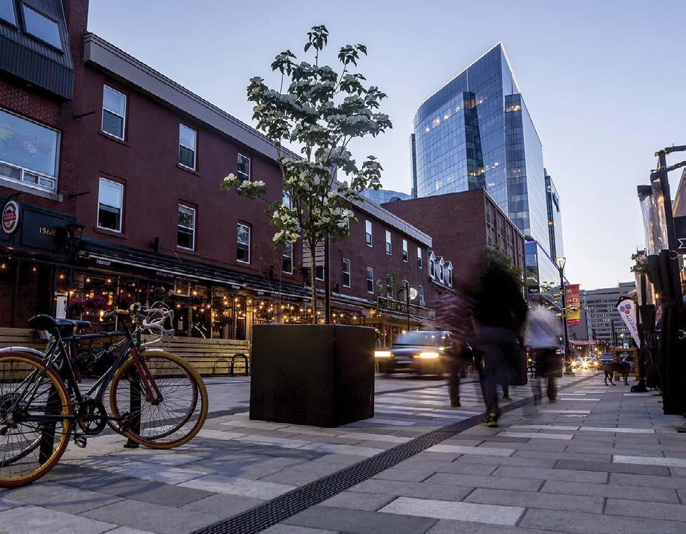

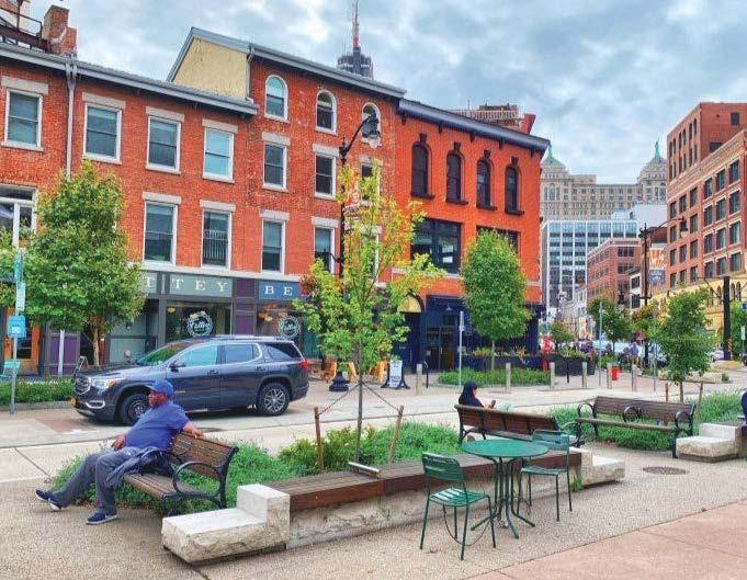
96
Human scale building frontages. Dairy Block. Denver, CO
On site pedestrian amenities in front of buildings. Argyle Street, Halifax, NS
Views to shop interiors. Larimer Square, Denver, CO Toronto's Patio Dining Program: Expanded Sidewalk. Toronto, ON
Outdoor patios along retail-oriented streets. Philadelphia, PA
On site furniture. Roosevelt Plaza, Buffalo, NY
building massing and scale
a. Design buildings to form a consistent and strong edge to streets, especially at the first 9.0m (30ft) from grade.


b. Vary the building heights along a block length to increase street wall height diversity.

c. Step back street walls by a minimum of 2.5m at the upper levels of the podium to allow sunlight access to sidewalks and open spaces (particularly above 4 storey heights along the south sides of east-west streets, such as Baker Street).

d. Buildings that encompass a full or half block or have extensive frontages should be designed to break up the volume of the overall mass. The different volumes should be distinctive from one another, create transitions in the bulk and scale of the buildings and may use different architectural expressions or materials.
e. For traffic safety reasons, height of landscaping at maturity should not exceed 0.6 metres within a ‘sight triangle’, meaning the area within a triangle formed at the corner of an intersection of two roads, or at the corner of the intersection of a road and driveway. Two sides of the ‘sight triangle’ measured from the point of intersection, shall be a minimum of 6.0 metres. The third side is created by joining the two points that are measured 6 metres back from the corner. In general, landscaping, fencing or other structures should not obstruct sight distances at intersections or driveways.
City of Cranbrook Downtown Revitalization Masterplan | June 2023 97
Enhanced, human scale entries with visual transparenc.y
Landscaping height should not obstruct sight distances.
Vary building height blocks to break the volume of overall mass.
Buildings with extensive frontage should break the facade monotony. Kansas City, MO
example of building and massing scale in core area Frontages to include quality design features such as enhanced entries, display windows, and human scaled elements. Visual transparency at grade through commercial and retail storefronts will serve to engage and enrich the pedestrian experience.
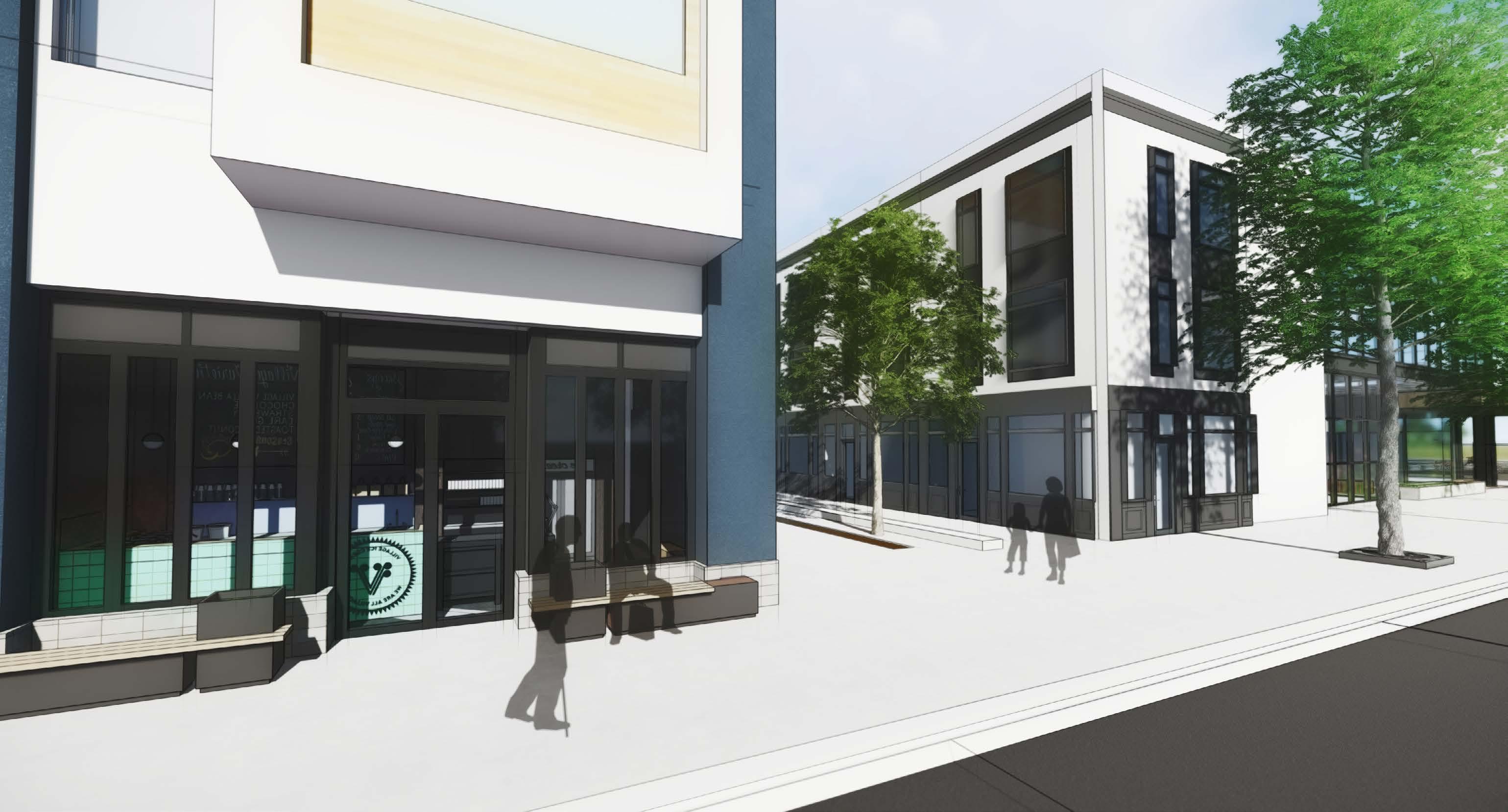
98
renovations
Renovations to existing infill buildings, and for new infill construction, shall respect the stylistic precedent of the prevailing historic architecture within the area.
facade articulation
a. Locate canopies at primary building entries to both protect users and define entries.
b. Ensure canopies are designed to withstand snow loads, can be drained effectively as well as prevent the formation of icicles.
c. Design facades using high quality materials that are durable and contemporary. Where possible, preference the use of locally sourced materials.
d. Keep canopy heights to a maximum of 3.0m to protect pedestrians effectively from weather elements.
e. Incorporate warm, natural materials at building entries such as wood and brick.
f. Use public art, architectural features or details and landscape to mitigate the negative visual impact of blank walls, should such walls be unavoidable.
g. Add visual interest to facades by using contrasting colours. This will also provide visual vibrancy in winter.
h. Use of high quality wood, brick, stone rough face concrete block, stucco and vinyl stucco is preferred.
interfaces with public open space and green spaces
a. Create a continuous street wall at public open spaces to generate a strong sense of enclosure for such open spaces and green areas.
b. Optimize sun exposure for the public spaces and green spaces adjacent to them.
c. Provide a high degree of transparency at the building interfaces to maximize views. for occupants to enjoy and passive surveillance of the adjacent public open space.
d. Increase permeability from the façade onto public open spaces and green spaces through secondary entrances.
e. Activate edges with preferable uses like cafés and restaurants at grade.
seasonal design and sunlight access
Not only does Cranbrook offer unrivalled, natural beauty in a mountain setting, it benefits from more hours of sunlight than any other city in the province. People are attracted to places that are designed to respond to the weather and seasonal variations. Even in winter months, the promotion of sunlight on public spaces or patios can lift the spirits and can extend the patio season, through the use of supplemental heating or shelters.
sunlight access
a. Preserve sunlight access to the following areas: north sided street frontage of east-west streets (Baker Street), public open spaces (town square, Rotary Park, Mt. Baker Park) and on-site open space such as courtyards, plazas and gardens.
b. The following measures can be utilized to enhance sunlight penetration:
i. stepping back the higher levels of building podiums.
ii. reducing the overall mass of upper building levels to optimize sun access.
iii. spacing and orienting mid-rise buildings to minimize adverse shadowing .
weather protection
a. Apply sensitive site design to minimize adverse effects of wind through building form, massing, shelter, recesses and enclosure.
b. Mitigate wind impacts in all developments through weather protection measures such as canopies and landscaping treatments at building frontages.
c. Enhance pedestrian comfort through the application of communal heaters and heat lamps within patios and waiting areas, fire pits, operable/retractable transparent windows or external enclosures at ground level.
City of Cranbrook Downtown Revitalization Masterplan | June 2023 99
Activate building edges. Chicago, IL
Use of public art on large blanc walls. Washington DC

Covered bike parking areas

Preserving sunlight orientation for public spaces. Irvine, CA
Renovations to existing infill buildings. Toronto, ON
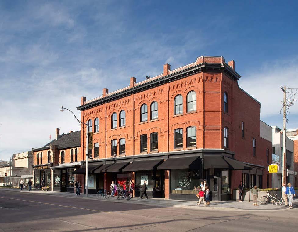
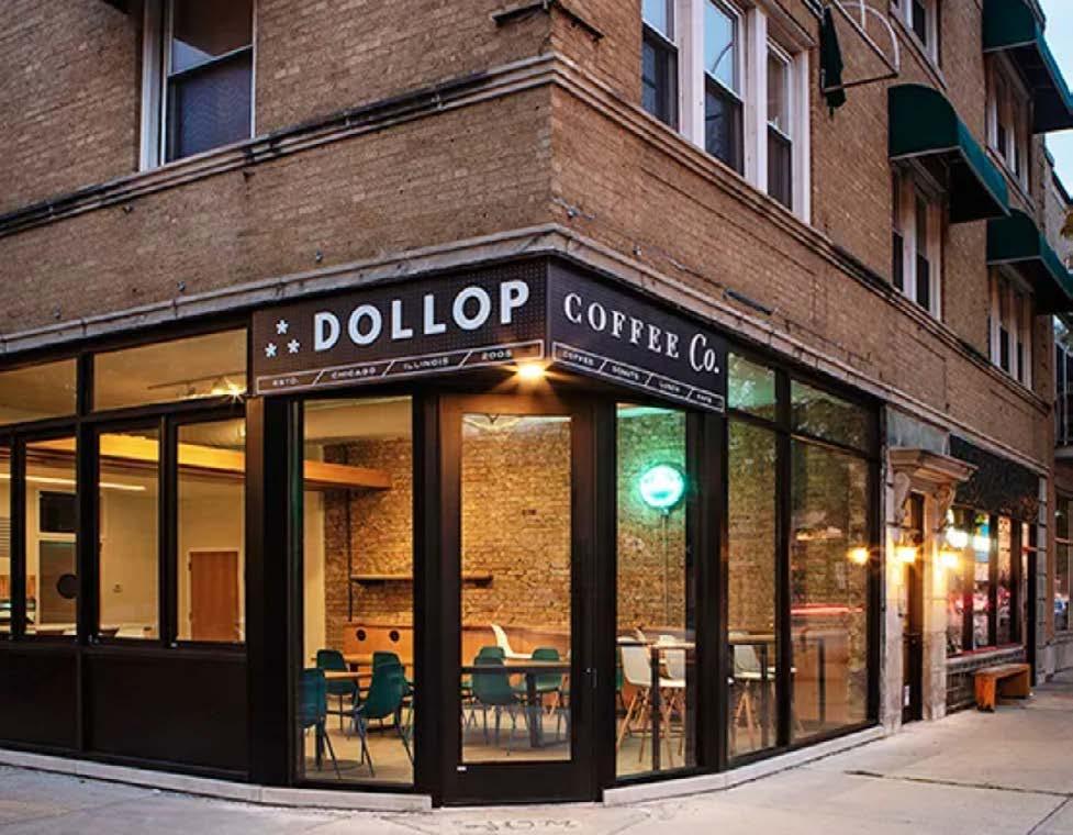
Rooftop patios provide seasonal outdoor spaces. Calgary, AB
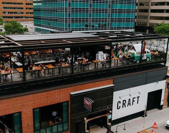
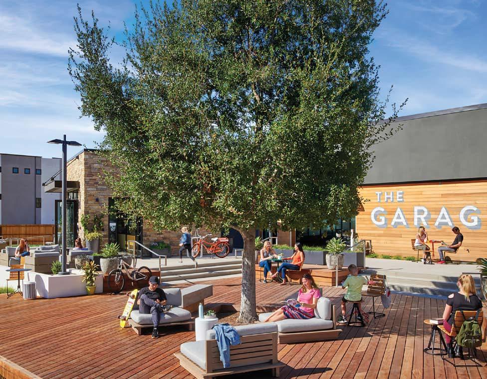
100
d. Construct street furniture that is suitable for all seasons.
e. Bike parking areas and waiting areas should be covered.
f. Consider using heat-tracing and snow-melt systems on canopies, ramps and in well used pedestrian spaces.
g. Consider locations for snow storage, beside planters, planting islands and pedestrian areas so as not to impede pedestrian movement during the winter season.
accessibility
Accessibility and inclusivity within the urban realm is to be encouraged. Recommendation to develop specific City policies regarding local implementation of accessible environments. Refer to the National Building Code and Rick Hansen Foundation for standard requirements and best practices.

safety and security
CPTED works in the following ways:
a. Removing criminal opportunities
b. Detracting offenders by displaying a well-kept neighbourhood
c. Building or community
d. Building relationships between neighbours to strengthen norms against crime. Recommendation for the City to develop locally-specific CPTED principles and adopt relevant policies. For more information refer to International Crime Prevention Through Environmental Design Association.
patios, decks and rooftop patios
Patios, decks and rooftop patios provide seasonal outdoor spaces for public or private use that contribute to the visibly animating the streetscape and provide a usable benefit for local businesses and patrons. For this reason, they should be encouraged in the downtown. Thought should be given to extending the seasonal use of these spaces through the use of heaters and heat lamps, fire pits, operable/retractable transparent windows or seasonal enclosures. Spaces should be designed to be multifunctional rather than single use at certain times of the year. At times when these spaces are not in use but are visible by the public, attention should be given to ensure the space remains visually appealing, through the use of furniture, greenery, landscaping or hardscaping. These spaces should not be used as storage areas. The design of accessory spaces should be sensitive to the adjacent development and historic context of the area. Where a deck is elevated off the ground, skirting shall be used to ensure that the area under the deck is screened from view.

City of Cranbrook Downtown Revitalization Masterplan | June 2023 101
Rooftop. Calgary, AB
Seasonal deck.
sunlight preservation diagram
The building scale in the core area allows for natural sunlight on the ground floor throughout the year. This allows the seasonal use of the public realm for extended patios during summer and the colder seasons.
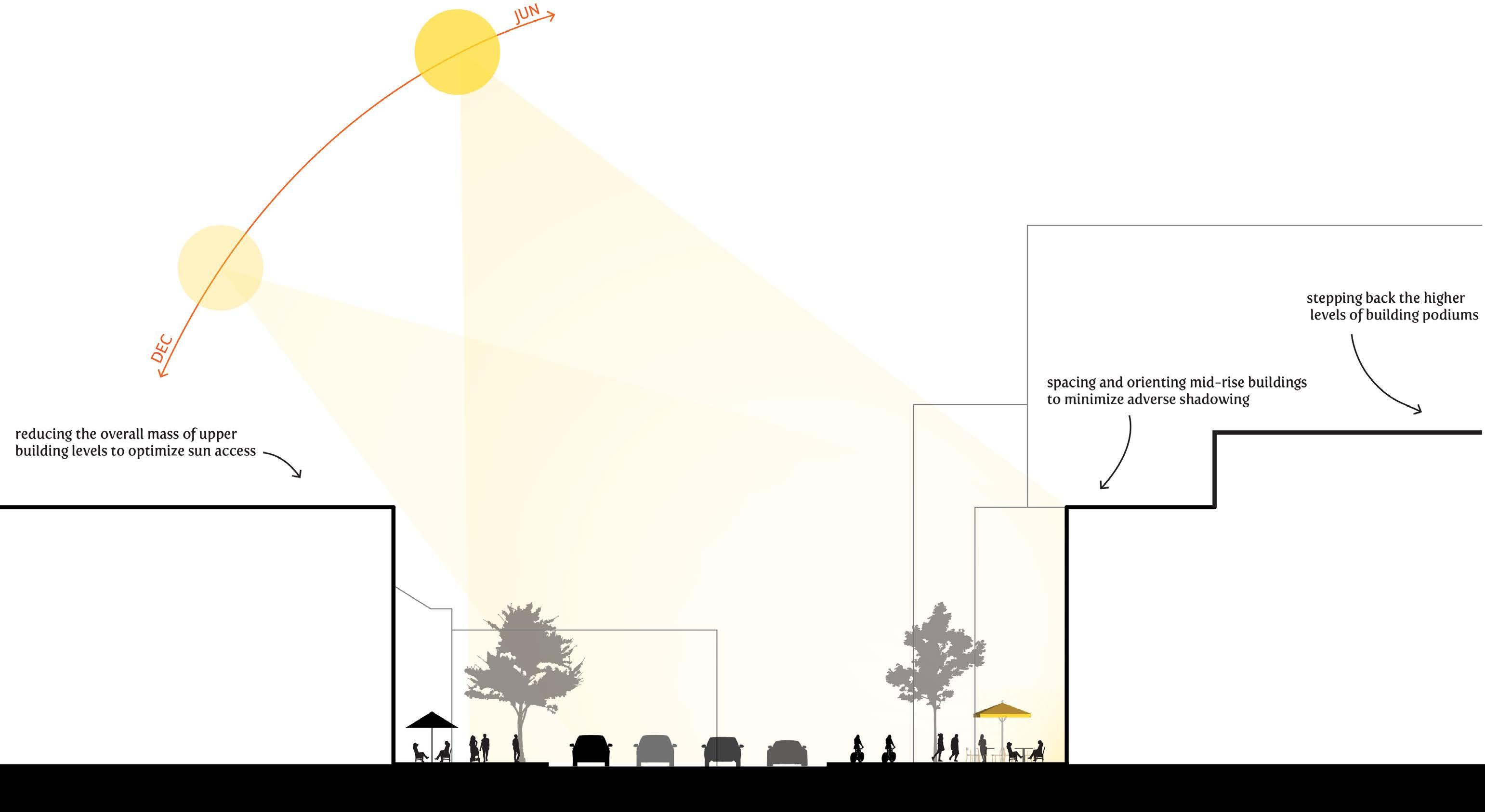
102
parking, servicing and loading areas
a. Required on-site parking, with the exception of visitor parking should predominantly be provided in an underground parking facility.
b. Where above-grade or structured parking is unavoidable, it should be lined and screened with active ground floor uses such as retail for the entire length of its street frontage.


c. Structured parking above ground shall be screened with quality architectural facade treatments.
d. Place and design service entries, loading docks, recycling and waste facilities away from pedestrian areas and highly visible locations.

e. Minimize the visual impact of parking facilities, their entrances and related signs and equipment. Entrances to parking areas should be properly signed and demised from the public realm using railings or an overhead door.
f. Large, continuous parking areas are not permitted. Smaller parking areas should be screened using trees or other landscaping and fencing.
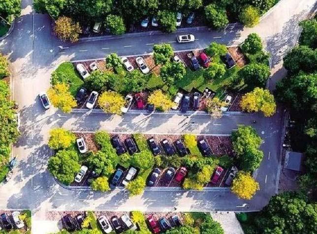
g. Where possible, locate building utilities such as meters, transformers, mechanical equipment and ventilation exhausts away from pedestrian areas and highly visible locations. Consider additional landscaping or screening for these areas.
Visitor parkings in front of businesses.
City of Cranbrook Downtown Revitalization Masterplan | June 2023 103
Screened structured parking above ground. Rüsselsheim, Germany
Active ground floor uses with on site parking.
Larger parkings are screened with landscaping and trees.
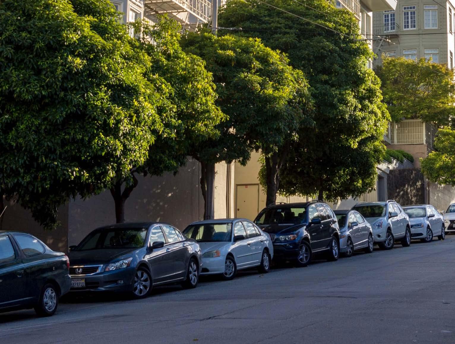
entrance gateways


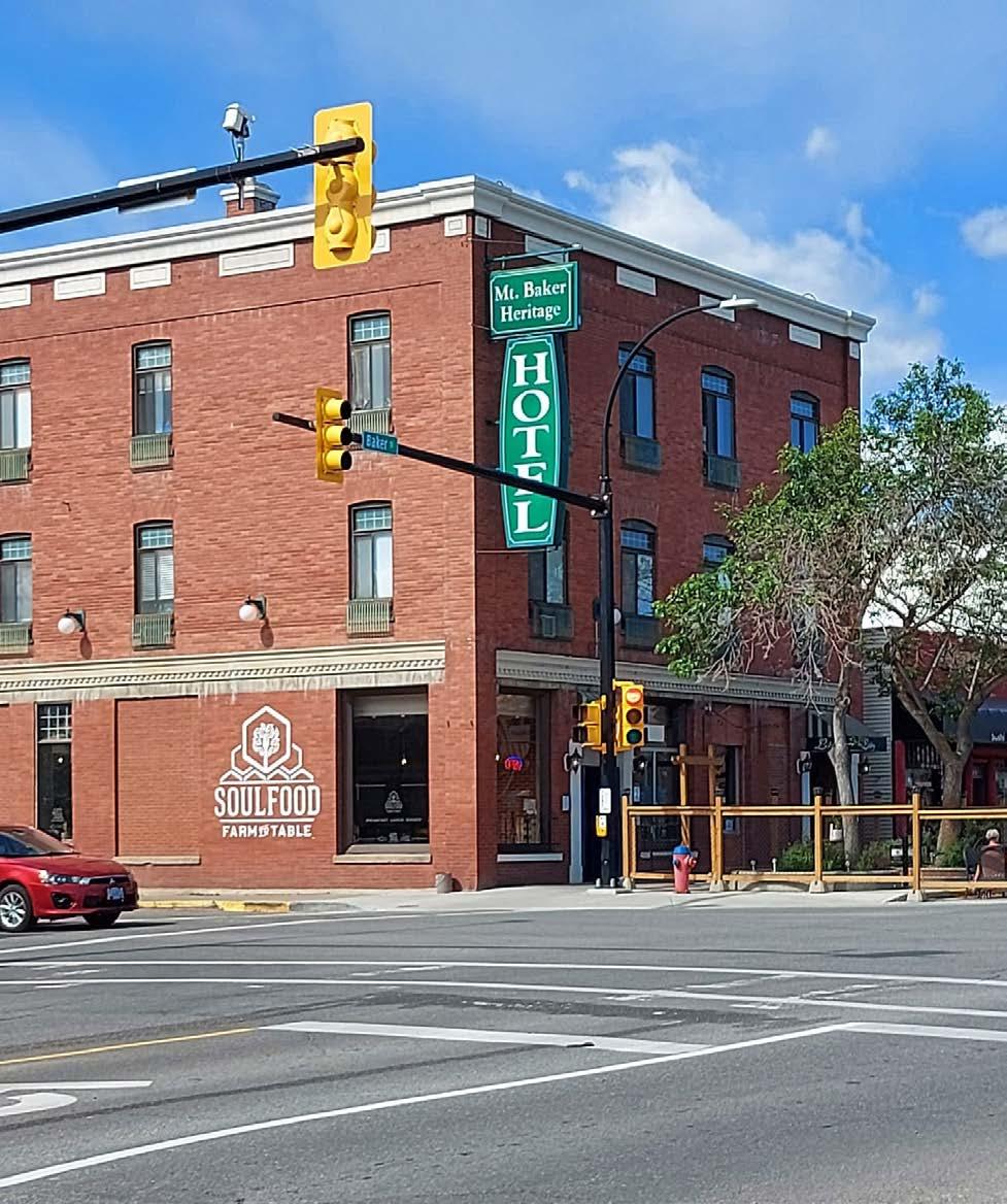
Downtown Cranbrook’s Gateways are located at key entrance points to the downtown and for many, it defines the sense of arrival. As a gateway, there are areas of particular attention that warrant the creation of landmarks such as special buildings, structures or public art located at highway entrances. Sites that border key connector routes, such as Cranbrook St, Kootenay St. and Louis St. have the potential to frame key views and landmarks within the downtown and should encourage built form and massing that will enhance the gateway experience.

City of Cranbrook Downtown Revitalization Masterplan | June 2023 105
Railway Museum
Mt. Baker Heritage Hotel
Cranbrook Gateway Arch
Clock Tower
pocket parks and pop-up ' s


As part of the downtown revitalization process, there are opportunities to exploit gaps in the urban form and strengthen public realm connections that help build the identity of a vibrant downtown, catered to all ages. Temporary installations in vacant parcels, parking areas and pocket parks that exist within the downtown that can allow experimentation, interest and community-building to develop and can help inform longer term placemaking strategies.

These spaces can be animated through pop-up uses and active engagement with neighbouring community uses. Crossproperty programming and local community involvement should be encouraged. Sites identified for pop-uses that are adjacent to local food establishments, hospitality, event and community spaces, should be seen as opportunities to partner with and promote local business interests. Building on Cranbrook’s summer patios policy, it is recommended that the City initiate a program to encourage and support downtown, seasonal initiatives to animate these vacant lots.
106
Pocket parks, temporary activation.
Pop-up street food.
Pocket plaza.
Pocket park resting areas.
heritage assets and special conditions
Cranbrook is a community rich in heritage and has many cultural landscapes. Part of the work of a Cultural Plan for Cranbrook involves alignment of the various historic assets, organizations and communities for the stewardship of the city’s historic resources well into the future. It is outside the scope of these guidelines to determine the extent and relevance of Cranbrook’s cultural history, buildings and artifacts within the downtown. As it relates to downtown buildings, structures or components of the public realm deemed to have historic significance, best practices should be followed to permit sensitive treatment and/or redevelopment of such locations.
It is recommended that the Standards and Guidelines for the Conservation of Historic Places in Canada be followed regarding the conservation, preservation, restoration and levels of intervention suitable for buildings or locations of historic significance. Efforts should be made to sensitively integrate new development that could impact the existing character, retaining existing building elements while allowing for sensitive adaptive re-use of historic structures.
Existing buildings and façades contribute to the historic character of downtown and interventions should be architecturally sympathetic. Efforts to restore heritage and historic buildings to the prevailing styles from the historic period should be encouraged. Applied architectural elements,
such as canopies, awnings, signage, decks and exterior embellishments, where they do not enhance the appreciation of the historic building or structure and sense of history, should be avoided. Contemporary interventions should be clearly distinguishable and subordinate to existing heritage buildings, so as not to be misread as part of the original construction.
New development should be contextual with the existing heritage character of the block, regarding setback, scale, massing, street-wall height and landscaping character. When it is not possible to retain a heritage building in its entirety, pursue the partial retention of the building and its facades, to have these incorporated in the new development. If such a development approach must be taken, the development, in general, should showcase and emphasize the remaining heritage building. Cues for new development should be taken from the existing context, such as window patterns and placements, roof slopes, floor levels, cornice lines, storefront alignment, entrance placement, building finishes and materials and other adjacent historic architectural features.
Use high-quality, durable materials, which are historically authentic such as brick, stone, terracotta and natural wood. Faux heritage and designs intended to mimic heritage buildings, either locally or from elsewhere are not recommended, whereas contemporary interpretations of traditional design and detail are encouraged.
City of Cranbrook Downtown Revitalization Masterplan | June 2023 107
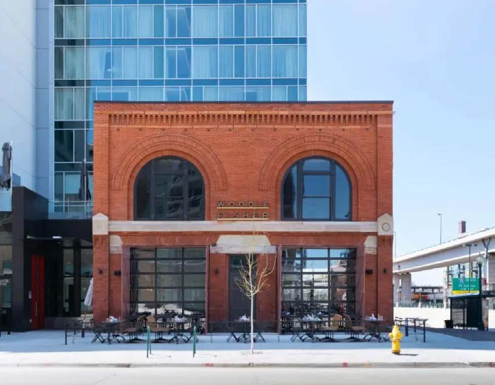


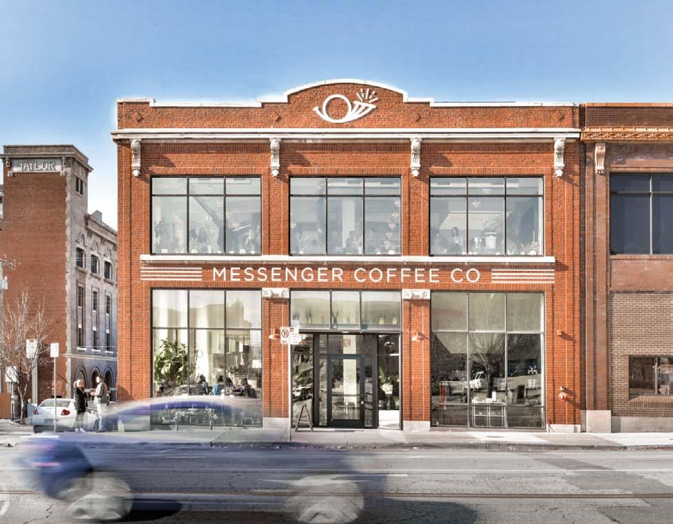
108
1880's building transformed into offices. Cincinnati, OH
Automobile company building turned into a coffee shop. Kansas City, MO
Restaurant located in a historic fire station. Denver, CO
Historic buildings now shops, eateries and art galleries. Sacramento, CA
4.5 streetscape & landscape parks and green spaces
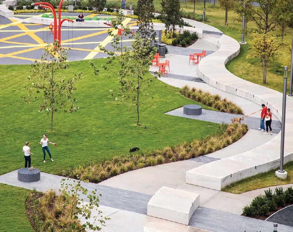

Green spaces are vital to ensuring the downtown becomes a livable, sustainable ecosystem that encourages community and wildlife to flourish. The main park spaces within the downtown boundary area include Rotary Park and Baker Park. Emphasis should be given to strategies that preserve, enhance and connect green spaces and public open spaces within the downtown, and connect to green linkages further afield. Publicly accessible green spaces within privately owned spaces as well as green, private amenity spaces for residents and building users, such as courtyards, gardens, landscaped areas and terraces should be encouraged. In addition, the extension of the street tree network to enhance and green streets that provide connections between green spaces should be prioritized.
rotary way
Rotary Way is a 9km walking, running and biking trail that winds its way through Cranbrook. An extension to Rotary Way by way of the Connector Trail, is proposed to connect green spaces in the downtown such as Baker Park and Rotary Park to urban public spaces as well as Baker Street. This trail connection would extend further beyond the downtown across Highway 3 to link up with the Cranbrook History Centre and a larger system of regional trails.
north star rails to trails
The North Star Rails to Trails is a 26km paved trail from Cranbrook to Kimberley, which allows for running, biking, roller blading and cross-country skiing between locations. It was adopted into the Trans Canada Trail in 2012. The primary access to the trail from Cranbrook’s downtown is via Rotary Way, accessed from 17th Ave and the Rotary Way Connector at the north end of Cranbrook. An extension of Rotary Way into the downtown via the proposed Connector Trail would strengthen its connection to Rails to Trails and the TransCanada Trail.
Green Spaces And Natural Linkages
City of Cranbrook Downtown Revitalization Masterplan | June 2023 109
Green and active urban plaza. Dallas, TX
Double row trees to provide seasonal changes views
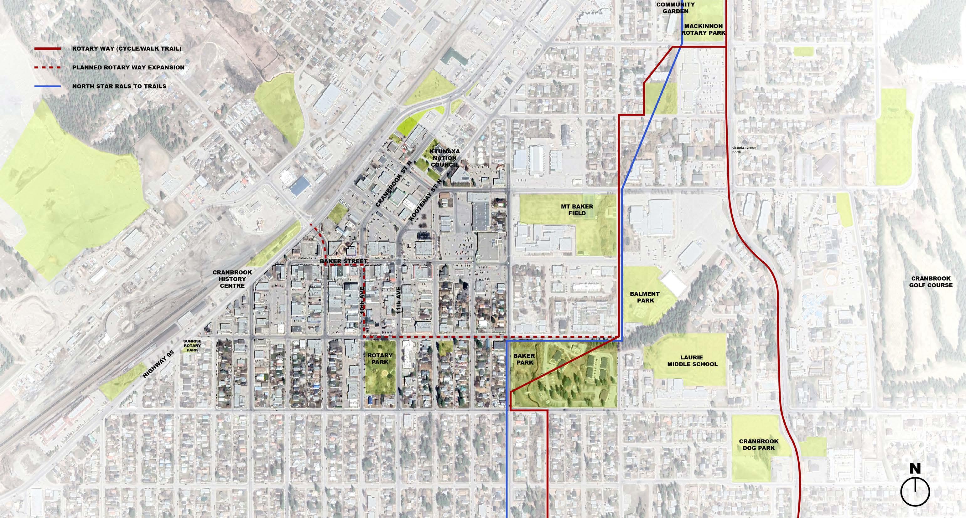
110 map 13 existing
green spaces
sidewalk and paved surfaces
Sidewalk areas should respond to both the adjacent building uses, as well as serving as the connections to downtown public spaces and the civic realm. A variety of paving types which help pedestrians navigate the urban realm intuitively and demarcate circulation, transitional and gathering zones.
Sidewalks should be largely flat and uninterrupted to allow for spill over from adjacent uses and flexible programming for street activities and events, including food festivals, art fairs, farmer's markets, as well as everyday social gatherings.
Locations along bicycle routes and the Connector Trail should be designed to respond to the circulation needs, function and materiality of not only the immediate site context, but to the larger cross-connective and thematic elements.
Public corridors along Baker Street should be wide enough to accommodate the movement of both pedestrians and bicycles throughout the day, while also allowing for intimate gatherings and activities along its route. From people watching, to games, to socializing and eating, the experience along the corridor is intended to be vibrant.
Materials that comprise the pedestrian corridors, such as paving, furnishings, planter walls and signage, should adhere to the overall downtown theme and landscape context. Textures, materials and products are consistent from site frontage to site frontage.
The elements of landscape and streetscape requiring articulation and consistency are as follows:
a. surface materials, patterns, colours and textures.
b. pedestrian zone identification, prioritization.
c. special areas (e.g. building entrances, plaza edges and transit zones)
d. durability, slip resistance.
e. accessible to people of all ages and abilities.
f. application of permeable materials / natural water infiltration.
g. multi-use pathway design
h. drainage and locations of catch basins, grills, vaults and tree grates
i. special conditions
street furniture
Street Furniture should be designed to reflect the special character of downtown Cranbrook as a historic district. The quality and aesthetic language of street furniture elements should be consistent and should enable heritage interpretation. It should aim to promote local character of the downtown area, drawing from the context, regarding scale, materials, finishes and style. Fixed street furniture elements should be integrated within the street furniture zone (refer to street cross sections). Movable and multipurpose street furniture is encouraged along frontages to privately owned areas to allow users the flexibility of creating their own desired configurations for
social interaction. The minimum width of the sidewalk path of travel should be maintained. Furniture should not interfere with building entrances, loading zones, vehicle parking, transit areas, or access to fire hydrants and underground services.
Additional elements that should be considered and can be incorporated into street furniture zones are as follows:
a. transit shelters
b. garbage/recycling bins
c. public seating
d. wayfinding signage and parking signs (see wayfinding section)
e. lighting
f. bike racks
g. parking meters
h. traffic bollards
i. utility poles
j. fire hydrants
City of Cranbrook Downtown Revitalization Masterplan | June 2023 111
lighting
Considerations for lighting include both functional street lighting as well as feature lighting to embellish building facades or public spaces. The quality and aesthetic language of ligthing elements should be consistent with the street furniture plan and enable heritage interpretation. It should aim to promote local character of the downtown area, drawing from the context, regarding scale, materials, finishes and style. Pedestrian lighting should be integrated within the street furniture zone (refer to street cross sections).
a. Street lighting must be functional and facilitate wayfinding in the evening and at night.
b. Emphasis should be given to downlighting of public sidewalks, pathways and entrances.
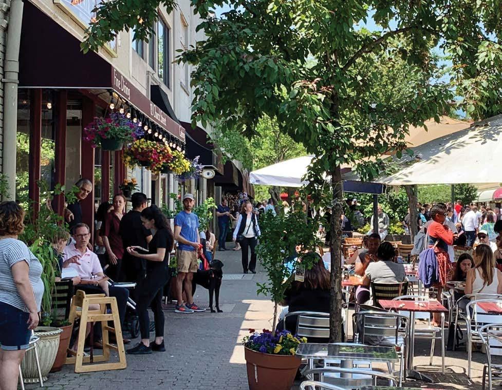


c. Impacts of lighting, especially uplighting, to adjacent residential areas needs to be considered.
d. Additional feature lighting may be integrated on private lands to help create ambiance and to highlight entrances, special places and architectural elements.

e. Consider CPTED principles (Crime Prevention Through Environmental Design): physical security, surveillance, movement control, defensible space, management and maintenance; for proper design and effective use of the built environment. This leads to the reduction of crime incidences and improvement on quality of life.
f. Parking lots and dark, underutilized spaces should be well lit and have well-defined paths for pedestrian movement.
g. Overhangs, canopies and colonnades should incorporate soffit lighting to enhance pedestrian safety and comfort.
h. Light spillover from adjacent uses should be considered as part of the overall lighting concept
112
Paving types help navigate the public realm.
Uninterrupted sidewalks for events.
Moveable furniture along business frontages.
Pedestrian lighting integrated with street furniture zones.
i. Signage, entrances and level-changes such as stairs and ramps should have dedicated lighting and enhanced light levels to facilitate identification by people.
j. Lighting elements should integrate well with the downtown lighting strategy and not be obtrusive or dominant in the overall streetscape design.
k. Feature lighting may be used to highlight heritage and contemporary architectural landmarks, open spaces, gateway and character areas
l. Lighting within parks and green spaces should be confined to defined pedestrian walkways, so as not to create glare and light spill for areas containing wildlife.
m. Lighting should be designed to reduce energy consumption such as integrating LED technology.
n. Maintain minimum distances required for streetlights from trees.
views to surroundings
Views and vistas will be maintained in both directions along key downtown streets and avenues. Unless specifically permitted, projections, lights or wires that impede the appreciation of the mountain views should be minimized. Mechanical rooftop equipment and penthouses should be set back from principal facades and/or shall be screened from view. Mechanical shafts, exhausts and equipment should be placed so as not to be visible from main street frontages. Electrical devices, such as antennas, satellite dishes, transformers, power
lines, shall be kept away from the principal front façade of the building and/or shall be screened from view. Special care should be taken to ensure that additions and mechanical/ electrical equipment, where possible, does not obscure historic facades. Refer to specific guidance for heritage buildings and structures.
resilience, sustainable and low impact design considerations
Resiliency means that our built environment must be adaptable, responsive, and sustainably designed to meet our needs for both today and for the future. Good design is responsive; it addresses and balances immediate needs with considerations about the long term economic, social, and environmental benefits. The result is being a good neighbor by providing a legacy of effectiveness that supports the community with fully integrated services.
Recommendation that the City develop a sustainable design charter and/or checklist which incorporates urban design principles and low impact design criteria. The following climate reslience strategies is not an exhaustive list, but should be encouraged in the development of future policies:
- Stormwater management:
- Sustainable urban drainage
- Bio retention, swales, infiltration
- Water harvesting
- Low impact development that will help reduce Cranbrook's carbon footprint:
- Sensitive building material choices
- Energy use and carbon reduction of building operation
- Take advantage of existing built facilities for redevelopment and re-use
- Contribute to the city natural environment:
- Increase street trees
- Promote biodiversity
- Protect the dark sky
- Reduce the heat island effect and protect from heat waves: designing so exterior spaces are covered/sheltered for the summer, and surfaces are reflective of heat.
- Waste handling to promote reused, recycling and composting during constructions and regular activities of the city
- Produce local source of food (ie: through community gardens)
City of Cranbrook Downtown Revitalization Masterplan | June 2023 113


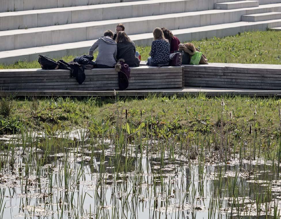
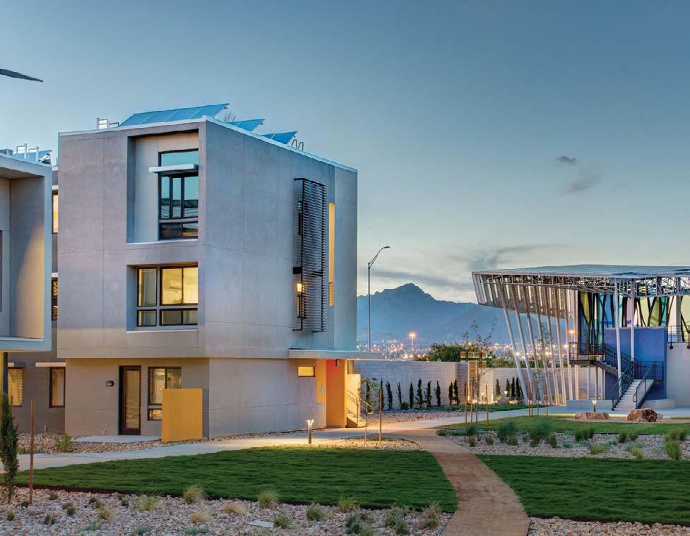

114
Renovable energy for new communities. El Paso, TX
Enhance outdoor living. Minneapolis, MN
Use of building orientation and sunlight. Toronto, ON
Elevated Wetlands: public art and environmental awareness. Toronto, ON
Renovation of old structures. High Line. New York
Rainwater collection integrated with a park. Jardin Argenté, France
4.6 wayfinding & identity signage
The following guidelines apply to pedestrian wayfinding signs, advertising signs and building signage within the Cranbrook downtown area. The quality and aesthetic language of signage elements should be consistent and promote local character of the downtown area, drawing from the context, regarding scale, materials, finishes and style. Signage should be integrated within the street furniture zone (refer to street cross sections).
a. Signage should be used to identify major interfaces such as gateways, entrances, character zones, streets, parks and open spaces and transit locations.
b. Signage applications include building podium signage; storefront or entrance signage; blade signs; banners; street pole signage; third-party advertising; walkway signage; building facades, murals and ghost signs; digital displays; heritage or interpretive signage.
c. Signage should be consistent with the street furniture program for the downtown and should contribute to the local streetscape character.
d. Signage types and styles should be consistent with similar signage types in the downtown area so as to provide a seamless wayfinding experience for users.
e. Signage should support but not overwhelm or replace the overall wayfinding experience. The built environment and public realm should be designed to provide intuitive wayfinding, upon which a layer of informational signage should be provided to ‘annotate’ the user experience.
f. Feature signage that provides variety and builds brand awareness, interpretation or interest may be applied in special circumstances. Signage concepts for new developments or redevelopments should complement the existing context and downtown signage program.
g. Signage should not hinder sightlines or block views to natural surroundings.
h. Banner signage may be accommodated on street poles, subject to the final approval of the City urban design authority.
i. Signage that extends over pedestrian walkways should have a minimum of 2.5m overhead clearance.
j. Third-party advertising at bus shelters should be restricted to one pane only.
k. Building signage should clearly express the main entrance, name and/or address of building.
l. Building signage should be well-integrated into the façade and be sensitive to historic context.
m. Signage should be clear, legible and informative.
n. Transit signage should be highly visible and illuminated at night.
o. Special attention and creativity should be applied to preserve, repair and incorporate historical signage in the downtown. Refer to specific recommendations in Heritage Guidelines.
p. Ensure signage design is legible and accommodates the needs of the aging population.
advertising signage and franchise signage design
a. Corporate brands, for instance national chains, which are an important component of downtown services and economic growth, should consider opportunities to converge their branding and logos with local signage priorities and marry it within the local, historic context.
b. Refer to the following examples/ precedents of good principles regarding the integration of corporate signage within an historic context, noting materiality, color selection, overall size / form and lighting.
c. Corporate signage that reflects the origins and history of established national brands and complements the overall identity strategy of downtown Cranbrook will be encouraged.
City of Cranbrook Downtown Revitalization Masterplan | June 2023 115
Approaches to annotating the urban environment through informational signage, intuitive wayfinding and place branding.


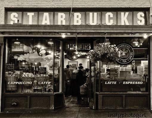

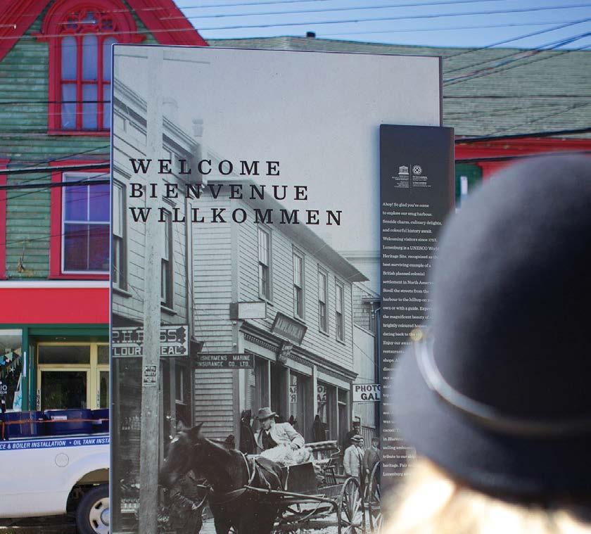
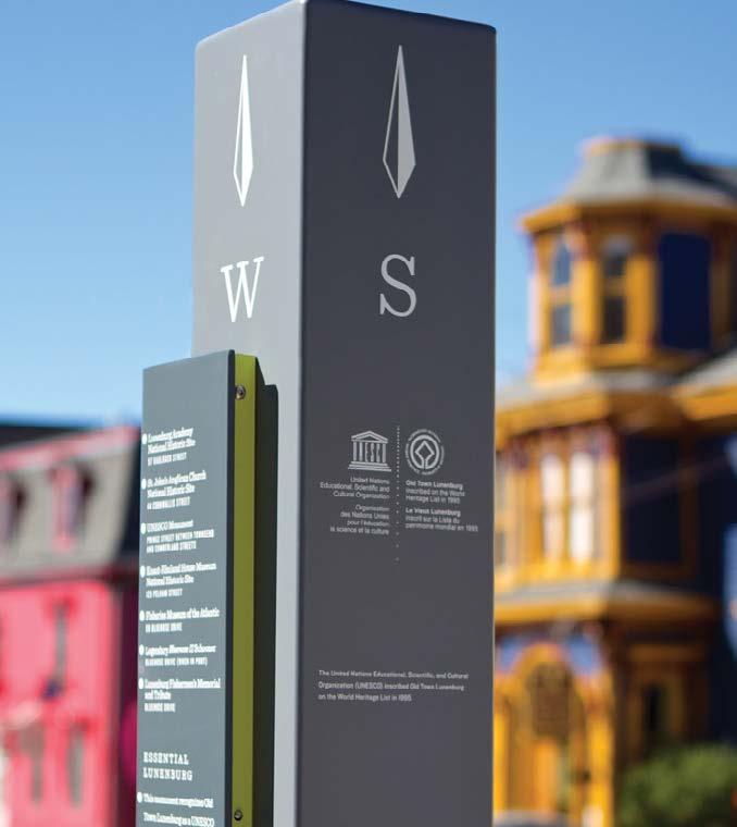
116
Safeway Signage
Connecting With The Past
Llobregat River Park. Barcelona, Spain
Lunenburg, NS
4.7 public art opportunities
public art
Public art is much needed in the urban environment as a means of cultural expression and is integral to people’s enjoyment of the downtown experience. Through its nature, art is pervasive and can take various forms, which may or may not fit the boundaries of expected norms. The following guidelines are not intended to be prescriptive but provide a series of opportunities that exist within the downtown to enhance the overall environment through artworks.
a. Potential suitable public art locations include:
i. Gateway sites
ii. Parks and open spaces
iii. Storefronts or blank walls (e.g. murals)
iv. Pedestrian corridors
v. Traffic intersections
vi. Transit locations
vii. Laneways
viii. Sidewalks
ix. Building lobbies and public entrances
x. Building facades
xi. Locations that align with key view corridors
xii. Sites with significant historic, cultural or interpretive value
xiii. The Connector Trail
b. Artworks may take on various forms, including:
xiv. Sculpture or monuments
xv. Murals
xvi. Graphic displays
xvii. Lighting
xviii. Signage and wayfinding
xix. Digital art
xx. Kinetic art
xxi. Interactive media
xxii. Building façades, material changes or hardscape and softscape treatments
xxiii. Plaques or etchings
xxiv. Sensory art (e.g. auditory, tactile art)
xxv. Temporary installations
xxvi. Performance art
xxvii. Poetry and written word
c. Public art should be publicly accessible, both physically and/or visually or otherwise. When installed on private lands, public access to the artwork should be maintained.
d. The artwork should be commissioned through a formal selection process, organized by the City of Cranbrook. This should be led by a formal public art program that has a secured means of investment.
e. Artists submitting public artworks for consideration should adhere to the City’s guidelines for artists. It is recommended that the Public Art program be developed in collaboration with local arts organizations (such as the Cranbrook District Arts Council) and advocacy groups which represent the interests of local artists.
f. Private developments should consider integrating public art treatments at highly visible, publicly accessible locations.
g. Public art should be located so as not to hinder pedestrian, cyclist or vehicular movement.
h. Public art should contribute to an authentic sense of place and respond to the local context.
i. Public art should consider durability, climatic/ seasonal and night-time use.
j. Artists should be encouraged to engage with the community’s heritage and interpretive history, inclusive of all peoples and cultures.
City of Cranbrook Downtown Revitalization Masterplan | June 2023 117
Embellishing the urban environment and embracing creative and cultural diversity through urban art interventions.


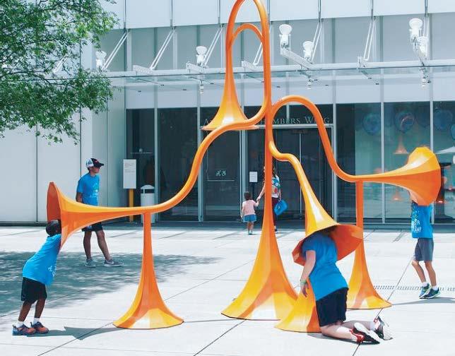
118
77 Steps. Fort Wayne, IN
Sonic Playground, High Museum of Art. Atlanta, GA
YYC Block Party. Calgary, AB
Sydney City Laneway Art.
Musical Swing. Montreal, QC Pink Alleyway. Vancouver, BC
4.8 activation strategies & interstitial programming murals and artwork
The downtown has a rich collection of murals and art works which contribute to the experience of Cranbrook’s downtown as lively and interesting and peak people’s curiosity. It is recommended to extend the art walk experience to include local arts venues and live performance spaces, interpretive history and points of interest as well as promote linkages to the City’s green spaces and established walking/biking routes. For instance, an art walk program could supplement the proposed Connector Trail experience through the downtown.
events and festivals

Major event spaces within the downtown area include Rotary Park and Baker Street. These locations should be prioritized to support local events and festivals and extend their use yearround. There should be the ability to close portions of Baker Street from vehicles, with suitable wayfinding and traffic diversion strategies in place. For larger street festivals, surrounding areas should be considered for overflow and staging space as well as for alternative parking and loading facilities. The streets bordering Rotary Park should also be considered for potential road closure for larger events, pedestrianized zones as well as additional parking and staging spaces. A downtown public events strategy should be developed for these areas.
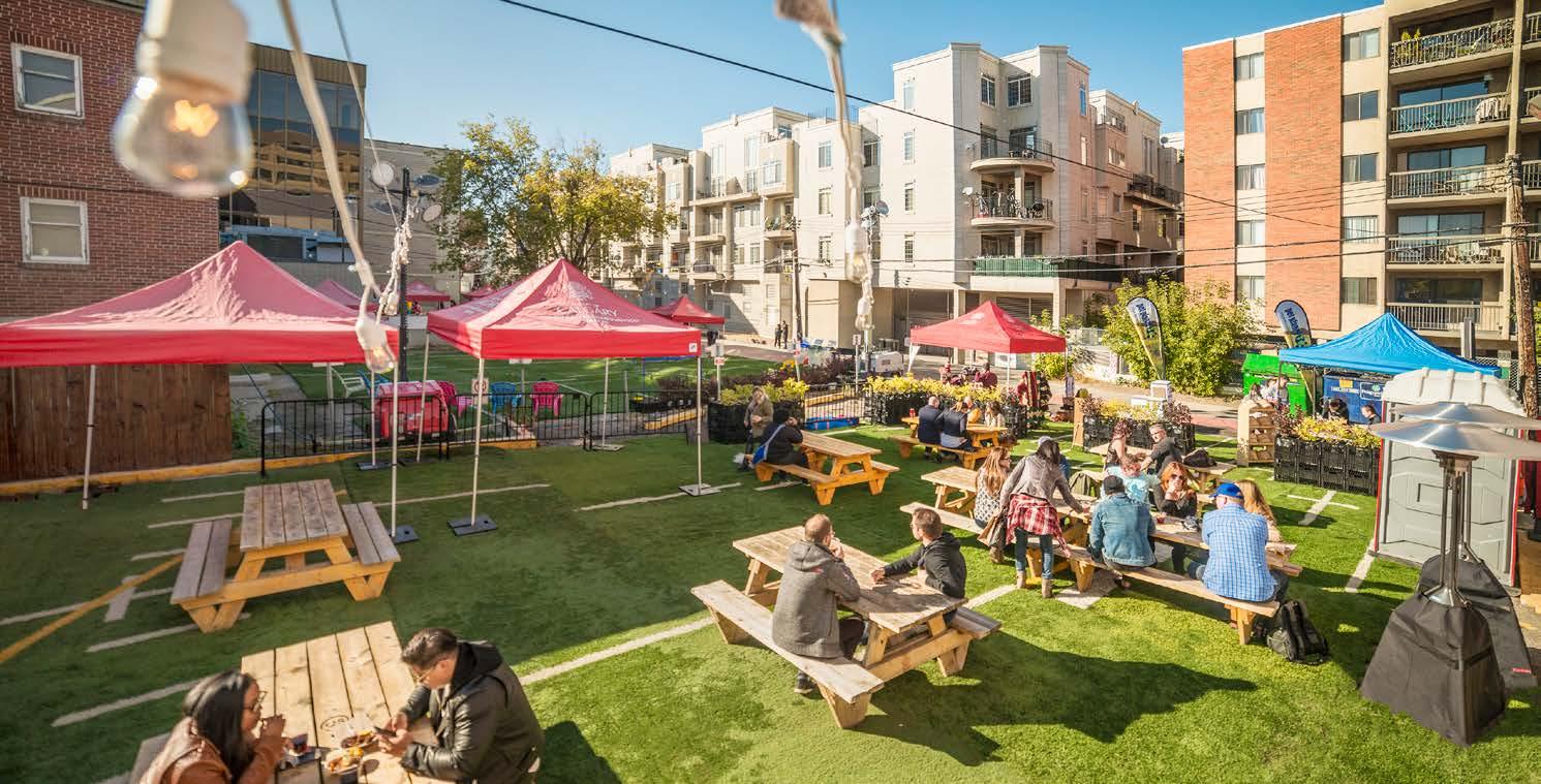
City of Cranbrook Downtown Revitalization Masterplan | June 2023 119
Laneway Cinema Night. San Franciso, CA
The Backyard: Laneway Activation Project. Calgary, AB
temporary activations
Local establishments can benefit from initiatives and policies for business improvement areas that encourage temporary activation of adjacent spaces such as street frontage, patio zones, parking areas and vacant lots. In addition to providing much needed vitality and contributing to an eclectic variety of different seasonal spaces in the downtown, such strategies can be critical to ensuring operational continuity for these businesses. For example, buildings and indoor spaces may require renovations which would limit the number of allowable occupants. Access for patrons to the establishments or seating areas may be compromised by construction activity, sidewalk repairs, removal of parking or utility upgrades. The COVID-19 pandemic in 2020 also underscored the difficulty in maintaining normal operations for front-line businesses at a reduced occupant capacity.
Temporary activations of underutilized spaces can be effectively programmed to create relief and additional capacity, allowing for additional seating, event spaces, redirected parking/loading facilities, public open space, art installations, performances, food truck parking, pop-up retail and food uses, marketplaces and more. Temporary heat and weather-protected outdoor structures may be permitted to allow for longer durations and use during times of inclement weather and shoulder seasons.
Rather than adopt a piecemeal approach, it is recommended the City initiate a program to enable local businesses to enact temporary space activations in an orchestrated fashion. The ability to plan for interventions at a city block or street level or within a business improvement area, will create a more turnkey approach, reduce red tape, time and cost required to initiate an application, which is often a great impediment to individual applicants.
The program should seek to clarify objectives (e.g. community, cultural, commercial benefits), allocate different zones of opportunity and shared facilities which can be co-programmed. Zoning, access, servicing, operation and licensing are all critical to the success of temporary space activations and will be easier to coordinate at a full block/street level.


120
Space activation programs and activities will enhance the downtown experience, connecting its people and places.
Left Over: Pocket park in space between buildings. San Diego, CA
Wynwood Walls: Outdoor Graffiti Museum. Wynwood, Miami, FL

City of Cranbrook Downtown Revitalization Masterplan | June 2023 121
sample downtown block activation plan

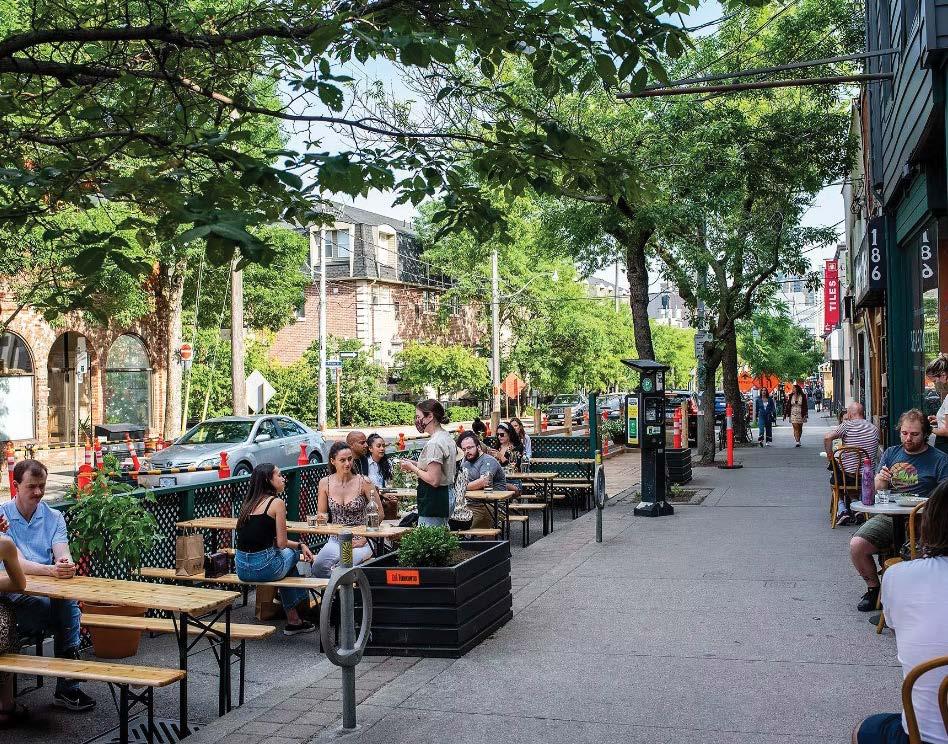


122 downtown activation strategies
Expanded Sidewalks: Patio Dining Program. Toronto, ON
Expanded Patios: Hayden Block. Calgary , AB
Alleyway Boulevard. Rainbow Road, Old Strathcona. Edmonton, AB
Backyard Patios: Belfast Love restaurant. Toronto, ON
Backyard Patios: Lapinou Bistro. Toronto, ON
Backyard Patios: Barcelona Wine Bar. Philadelphia, PA
sample shared circulation and facilities plan Catering for additional seating capacity in overflow areas such as parking zones and rear yard spaces.
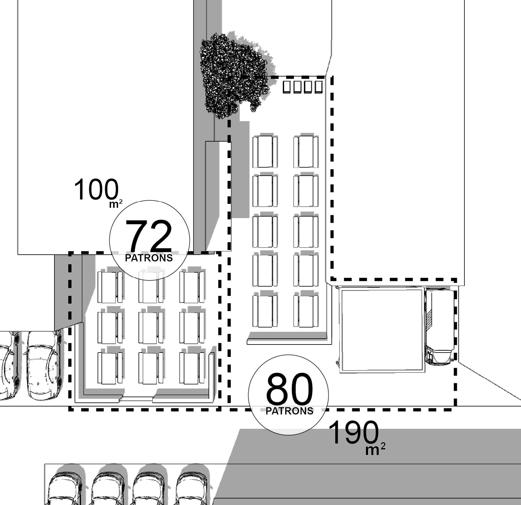

City of Cranbrook Downtown Revitalization Masterplan | June 2023 123
double frontages and extra square footage for businesses.
Laneway Activation Project is about bringing joy to everyday experiences; by curating and activating shared places for people, that are both practical and engaging.


124
laneway activation project, kasian
Backyard Patios,
Backyard Basketball Courts.
Summer backyard movies.
Backyard movies.
Backyard Markets and games.
Backyard Patio - Live Music .
5.0 IMPLEMENTATION
This Downtown Revitalization Master Plan provides recommendations that outline how development can proceed in downtown Cranbrook. For development to proceed and the recommendations to be realized and to achieve the goals highlighted below, significant upgrades to infrastructure is required in alignment with Council priorities. There also needs to be programming and incentives to attract residents, businesses, and tourists into the downtown. To achieve these objectives and to ensure a variety of organizations are working towards the same objectives, collaboration is required between the City, the Downtown Business Association, Tourism Cranbrook, and other stakeholders.
The key goals as identified in the previous sections are:
- Create vibrancy
- Bring people into downtown
- Promote downtown redevelopment
- Enhance the identity of downtown
- Bring business into downtown
Recommendations are being outlined to provide Cranbrook with short, medium, and long-term objectives in working towards the goals outlined within this plan.
short term (within one to three years of plan adoption)
5.1 identify and implement interim improvements that require minimal effort to improve the vibrancy of downtown, this could include:
- Work with existing event providers to assess the feasibility of relocating events to the downtown.
- Improve landscaping and lighting for downtown streets.
- Explore partnerships to initiate gateway improvements.
- Explore grant opportunities that will support activating downtown.
- Enhance wayfinding signage to direct people downtown.
- Permit food trucks and pop-up seating on underutilized city land.
- Consider pilot programs for programming and activating the streets and public spaces.
5.2 integrate the drmp into the ocp and zoning bylaw, integration should be a top priority for the city of cranbrook.
5.2.1 Ensure the OCP and City’s Zoning Bylaw reflects the direction from this plan with respect to land use. OCP future land designations should align with the concept outlined on Map 3 and the policies within this plan.
5.2.2 Ensure the design guidelines in the plan inform the OCP’s Downtown Development Permit guidelines.
5.3 establish a special improvement area to develop a strategic approach to city led downtown infrastructure improvements. downtown improvements should be prioritized in consideration of the city’s asset management plan.
To achieve the goals outlined in the plan, phasing is important. There is a significant infrastructure deficit in the downtown area. A phasing strategy that reflects the current conditions of Downtown Cranbrook should be assessed regularly. Development of future phases should proceed in accordance with infrastructure upgrades and direction from Council.
5.3.1 Create a targeted and focused improvement area within the larger Downtown Plan Area that will direct growth in certain areas in accordance with Council’s capital budget allocations.
5.3.2 Create a Council approved priority list for improvements for Downtown Plan Area.
5.3.3 Consider amendments to the City’s Development Cost Charges (DCC) bylaw, where applicable, to add future infrastructure upgrades to the DCC project list.
5.3.4 Development outside the special improvement area can proceed if infrastructure upgrades are not required or if they are privately funded.
- When development applications outside the special improvement area are proposed, opportunities for collaboration to facilitate increased infrastructure capacity, in alignment with the Integrated Infrastructure Capital Plan, between The City and developer should be explored. This may include examination of City investment in infrastructure within proximity of the proposed development to meet the ultimate infrastructure/ over-capacity requirement for the street. This can result in costsavings to the City and encourage further development.
City of Cranbrook Downtown Revitalization Masterplan | June 2023 125
5.4 establish a downtown strategic working group, led by the city to leverage synergies and opportunities between the city, downtown business association (dba) , tourism and economic development.
5.4.1 Provide support to the existing DBA to establish a formal Business Improvement Area (BIA)
5.4.2 Provide a liaison that can support new and existing businesses and landowners within the downtown to navigate City processes
5.4.3 Work with landowners to activate the downtown through programming and events to bring people and businesses into the downtown with a focus on Baker Street. This can be done in partnership with the DBA.
5.4.4 Work with existing businesses and organizations to relocate some events and plan new ones to activate the core.
5.4.5 Pursue grants that enhance the public realm, improve safety, streetscape improvements, and can fund new festivals and events.
5.5 continue the downtown revitalization tax exemption program within downtown
5.5.1 Continue with the Downtown Revitalization Tax Exemption program by updating the program map to align with Phase 1 of the DRMP (See Map 14).
5.5.2 The City should promote the incentive to current and potential business owners.
5.6 create a public art and events/programming policy for downtown
5.6.1 Work with Cranbrook Arts Council to implement a public arts program and showcase artists at the gallery and through other programs.
5.6.2 Create a strategy to either replace or renew long-term murals.
5.6.3 Connect local and indigenous artists to programs, funding sources, galleries and artists spaces.
5.6.4 Promote public art programs, events, festivals to the public.
5.6.5 Explore grants and other funding sources for art program, events, festivals and installations.
medium term (within three to six years of plan adoption)
5.7 remove barriers and red tape preventing the redevelopment of downtown.
5.7.1 Identify supportive policies and resources that will help address the difficulties and obstacles in redeveloping existing downtown buildings.
a. Review incentive and rebate programs that will help encourage and direct new investments and businesses into downtown buildings.
b. Identify potential funding mechanisms to support architectural and safety upgrades to historic and downtown buildings.
5.7.2 Review the current building code barriers to enable the adaptive reuse of existing buildings and maximize the potential for businesses to locate within them. Create a plan to overcome any barriers and engage landowners and business owners on its progress.
5.8 encourage small businesses (office, retail and restaurant) to locate within the downtown.
Smaller sized businesses have been locating in other commercial areas of the City rather than within the downtown. The City can consider amendments to OCP and zoning regulations to detract certain business from locating outside the downtown. At the same, time regulations should also encourage these businesses to choose the downtown.
5.9 create a downtown parking strategy balance parking supply and location to focus on convenient parking for customers to support the downtown.
5.9.1 Manage existing parking lots to clearly indicate where visitors can and cannot park.
5.9.2 Examine the existing infrastructure and payment system to minimize operational cost to the City.
5.9.3 Examine how parking should be managed as redevelopment occurs within the downtown.
126
5.10 explore options, incentives or grants that would facilitate the activation of underutilized spaces.
5.10.1 Create programs that will ensure stores and spaces are utilized, and active street frontage is maintained.
5.10.2 Create an inventory of commercial, retail, and underutilized spaces (parking lots, storefronts etc.) available for lease to assist with economic development. The inventory should contain details like location, size, and adjacent businesses. The inventory list should be updated regularly and shared via Downtown Business Association, Tourism Cranbrook, and other relevant stakeholders.

a. List of local artist and spaces for them to occupy.
b. List of start-ups that needs space or an opportunity to be featured.
5.11 create and implement a municipal heritage strategy.
5.11.1 Create a plan to protect designated municipal resources.
5.11.2 Create a municipal heritage inventory.
5.11.3 Leverage municipal resources as tourist opportunities.
long term (within six to ten years of plan adoption)
5.12 open new areas for redevelopment in accordance with infrastructure upgrades and council priorities.
5.13 monitor downtown redevelopment progress. Create a list of indicators that can measure success and review them annually against the goals identified in this plan. Examples of indicators include:
- Growth in businesses, restaurants, retail, offices, and employees;
- Increase in the number of residential units and population;
- Number of development permits and building permits and types (residential, commercial, mixed use etc.);
- Property value;
- Commercial occupancy within the downtown;
- Growth in retail sales;
- Citizen perception survey (safety, livability, desirability) of downtown;
- The number of events, festivals, artists pop-ups, lot activations, etc.;
- The number of visitors and increase in tourism;
- Infrastructure upgrades; and
- Pedestrian and bicycle count at key intersections.
City of Cranbrook Downtown Revitalization Masterplan | June 2023 127
map
14 phasing map
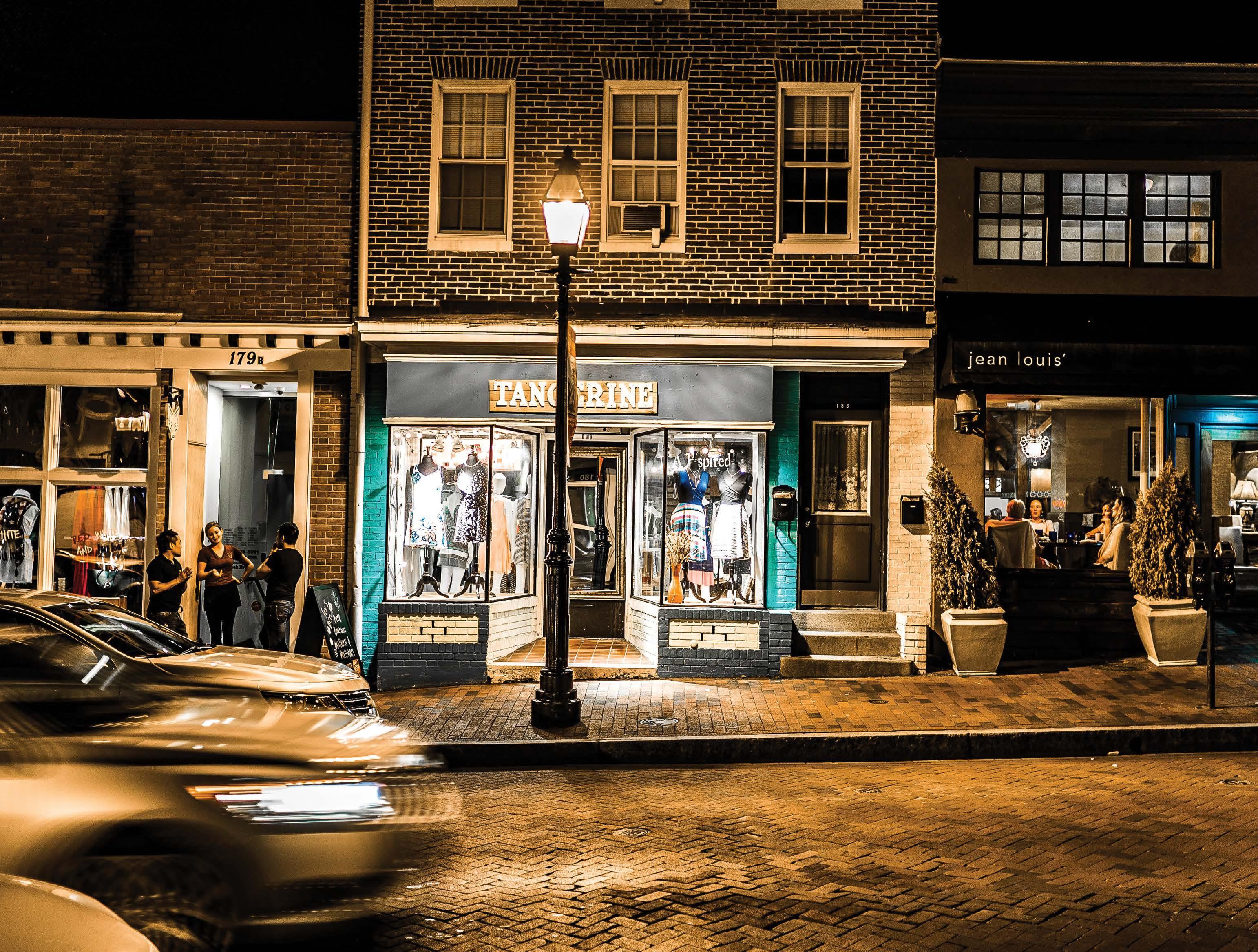
APPENDICES
APPENDIX A
City of Cranbrook Downtown Revitalization Masterplan | June 2023 129
REFERENCES
130


 Photo retrieved from Smith Creek ASP - Investigated bicycle path infrastructure and networking in the project, QPD


