


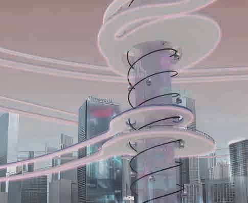
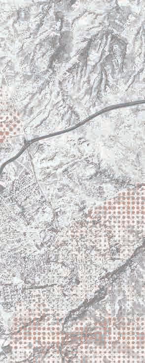
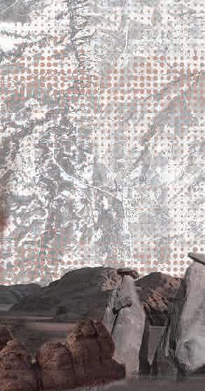
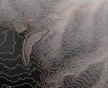
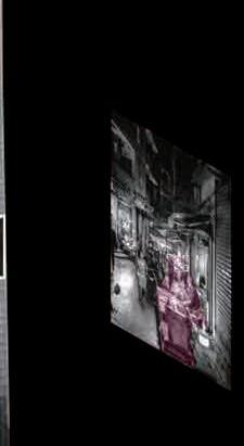
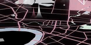
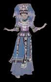
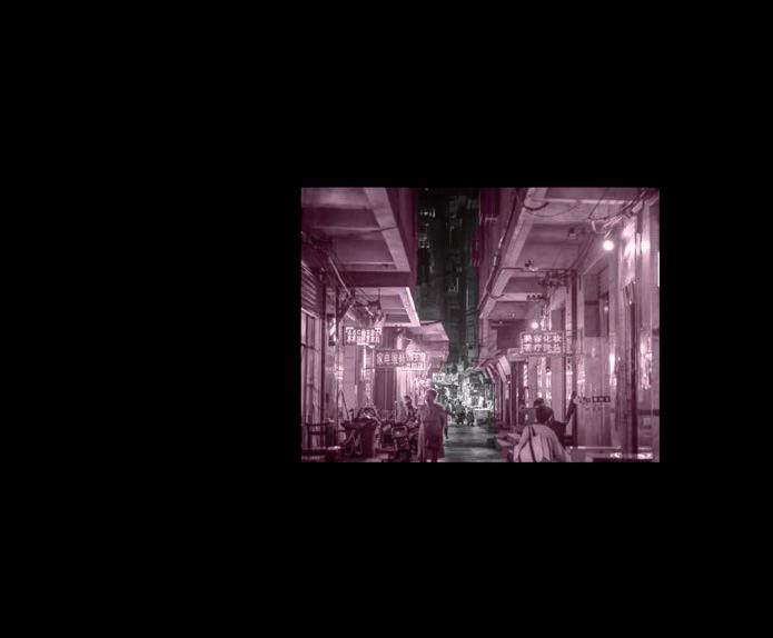
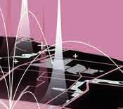
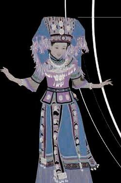
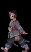
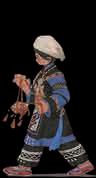
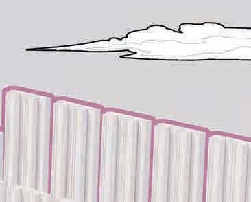
portfolio

Application for Architecture and Historic Urban Environments MA University College London Yaxin Liu


Application number: 24220132
Yaxin Liu
Telephone: +86 18271218861
Email: 18271218861@163.com
1422813900@qq.com
EDUCATION
09/2019 Guangxi Arts University
-07/2023 Bachelor of Arts in Landscape Architecture
GPA: 88.11/100, Ranking: 5/60
INTERNSHIP
07-08/2022 Assista nt Designer
China Construction Third Bureau Green Industry Investment Co., Ltd
Water and Environmental Protection Survey and Design Institute
Assisted in an urban planning project with ethical characteristics: preliminary investigation, the abstract of the city’s local features, analysis of the city’s histories, planning of the architecture, landscape, roads and districts, and project design and reports based on the previous planning work
02-03/2023 Assistant Designer, Department of Architecture and Engineering
Huachengboyuan Engineering Technology Group, Xiangyang Branch
Assisted in the design for an office building and its neighbored greening in the high-density urban areas
Abstracted the site features and its greening part, analysed the pain points of the site and targeted groups
Assisted in the model making and final design
DESIGN EXPERIENCES
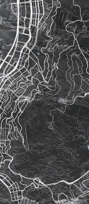
04/2023 Graduation Project
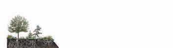
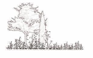
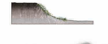
Visited Wuxiangling Forest Park in Wuxiang New District, Nanning City, Guangxi Province, to investigate the project and create an |urban forest park that meets the needs of the neighbouring people
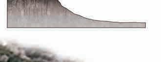
Dealt with the problem of elevation difference within the site
Put forward a strategy for sustainability with regard to the current issues The final results were exhibited and was awarded as the excellent graduation project
07-08/2022 Thesis Writing
The Combination Of Chinese And Western Architectural Styles In The Guangzhou And Guangxi Regions
Published the paper as the first author on Highlights in Science, Engineering and Technology, 05. 2023
Spent two months investigating and analysing the site of Xiang Hanping's former residence in Pubei County, Guangxi, mapping and modelling the site, and conducting a simultaneous study of Chen Jitang's former residence, summarising the modern architectural features of the combination of Chinese and Western architecture in the two Guangdong regions of China
11/2021 Professional Research
Travelled to Liuzhou City, Guilin City and the surrounding natural landscape areas for landscape element extraction and restoration, solving the problems of landscape plants cluttering the wetland periphery, pollution of water quality by invasive alien plants, symbiosis between human and wetland, and tourism development, etc.
05/2021 Professional Research
Travelled to Qinzhou City, Beihai City, Dalu Village in Lingshan County and Hepu County in Guangxi to investigate ancient architecture and courtyard sites, sketching, mapping and modelling the projects investigated, and producing investigation posters
AWARDS & HONOURS
2023 “Excellent Graduate”, Guangxi Arts University
2023 “Excellent Graduate Design”, Guangxi Arts University
2022 Excellent Prize Spatial Design Group, 2022 Guangxi Arts University Cultural and Arts Festival
2021 “Excellent Student Leader”, School of Architecture and Arts, Guangxi Arts University
2020 “Excellent Volunteer ”, “Returning to Hometown” summer vocation social practice, School of Architecture and Arts, Guangxi Arts University
2020 “Excellent Volunteer ”, “Wisdom - Habitat” The 5th China - ASEAN Academy of Architecture and Art Summit Forum and the 8th Seminar on Sustainable and Innovative Rural Research in Southwest China
2020 “Excellent Student Leader”, School of Architecture and Arts, Guangxi Arts University
2020 Excellent Prize 2020 National English Competition for College Students
ACTIVITIES
06/2021 Chairman
-06/2022 The Student Union, School of Architecture and Arts, Guangxi Arts University
Managed the department of secretary and the department of cultures and arts, carried out and arranged various activities, completed planning and site inspection
Planed the university’s cultural and arts festival, arranged the layout, typing, and exhibition of students’ design work
10/2019 Member
-06/2021 Department of Secretary, the Student Union, School of Architecture and Arts
Communicated and cooperated with teachers, drafted notices, collected students and colleges’ files and documents
SKILLS & HOBBIES
Hobbies Skiing, Archery, Jigsaw, K-Pop, Touring, Diving, Sport Climbing, Camping, Off-road Driving, Vocal Music Software Auto CAD, PhotoShop, Adobe Illustrator, InDesign, Premiere, SketchUp, Rhino, Enscape, Lumion, GIS
RESUME
In 1980, the International Union for Conservation of Nature (IUCN) first proposed the concept of sustainable development. In 1987, the World Commission on Environment and Development (WCED) issued a report "Our Common Future", which defined sustainable development as "development that can meet the needs of the present generation without endangering the ability of future generations to meet their needs."
Derived from the concept of sustainable development, sustainable design is a practical process in which the design community deeply thinks about the relationship between human development and environmental issues and constantly seeks for change. It is to incorporate design behavior into the "human-machine-environment" system under the guidance of ecological philosophy, so as to realize social value and protect natural value.
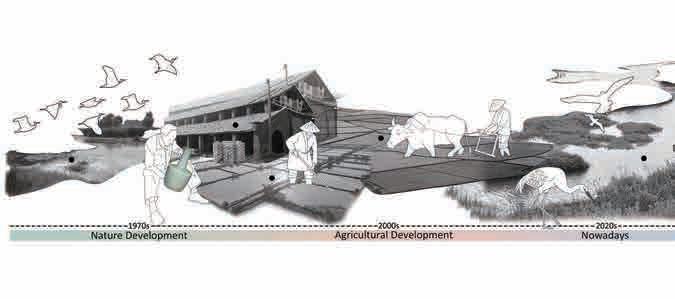
In the context of the overall argument of sustainable design, my design project divides the concept of sustainable development into four specific projects, starting from four different themes, namely:
Project 1: Ecological protection. The project aims to maximize the purification capacity of the "Kidney of the Earth" by tapping the ecological and agricultural resources within the wetland and designing a self-sustaining, non-artificial intervention and self-healing wetland reserve. Protecting wetlands also protects migratory birds, water resources, and even ecosystems.
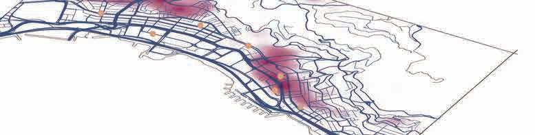
Project 2: Optimize infrastructure and pursue low-carbon concept. The project aims to revitalize the city, relieve traffic pressure, save energy and reduce emissions by improving the transportation system network throughout the city center. TOD mode is used to build a transportation network covering urban commerce, residence and entertainment, improve the travel efficiency of office workers, urban residents and the disabled, and reshuffle urban resources.
Project 3: Conservation of natural heritage. Many natural landforms are rich in biological diversity, and the protection of natural landforms is of great significance for maintaining the local ecological balance and protecting the local human culture and history. The purpose of this project is to use the local characteristic landscape pigeon hole, reduce manual intervention, re-plan and design the catchment line, reduce the contact time between rain and the surface, and thus reduce the erosion of rain on the landscape. And build a complete groundwater purification system underground to achieve sustainable circulation of water resources.
Project 4: Cultural preservation and participatory planning. In addition to the largest number of ethnic groups and races in the world, there are many ethnic minority cultures. In order to achieve the integration of ethnic cultures and dissolve the sense of ethnic estrangement, this project helps ethnic minorities living in cities improve their living environment, establish a sense of belonging, and promote ethnic identity and integration by extracting their living habits and space needs.
In summary, all these efforts in urban design and landscape design begin with the fundamental concept of sustainable design, providing opportunities for people and creatures to be empowered in urban resource management and landscape resource management, co-creating, sharing, green, open, and empowering a sustainable urban future. This direction will be a long-term research and interest, as well as an important goal and driving force shaping my future academic and professional pursuit.


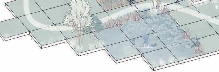
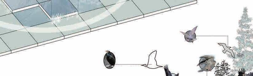
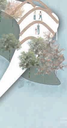
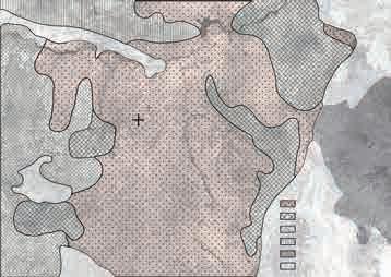
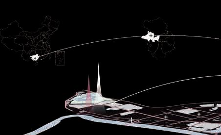
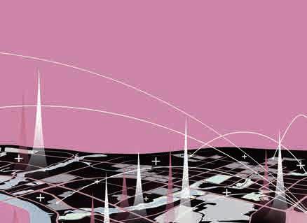
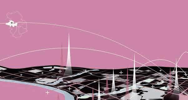
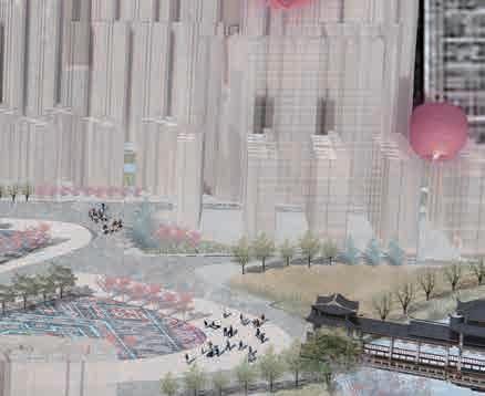
Where There Is Ease, There Is Home Silent Wings: Resurgence of Turkish Urban Linkage Initiative: Bridging Tomorrow's Mobility Harmony Haven: Eco-Agri Wetlands 01 02 03 04 Renewal of urban villages in ethnic minority autonomous region Cappadocia Landscape Heritage Geomorphological Conservation Optimization design of pedestrian bridge road system in Central, Hong Kong Migratory Bird Transit Station——Wetland Ecological Regeneration Design Individual Work:02.2024-04.2024 Individual Work:12.2023-02.2024 Individual Work:10.2023-12.2023 Individual Work:08.2023-10.2023
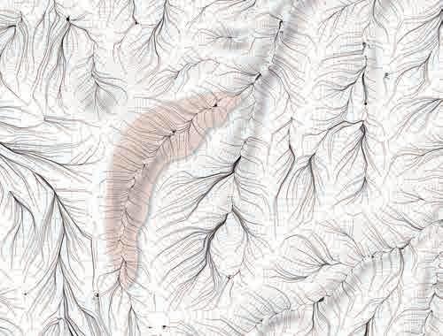
TABLE OF CONTENTS SUSTAINABLE CITY AND LANDSCAPE
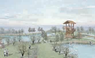
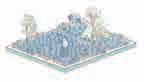
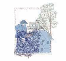
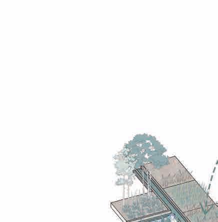
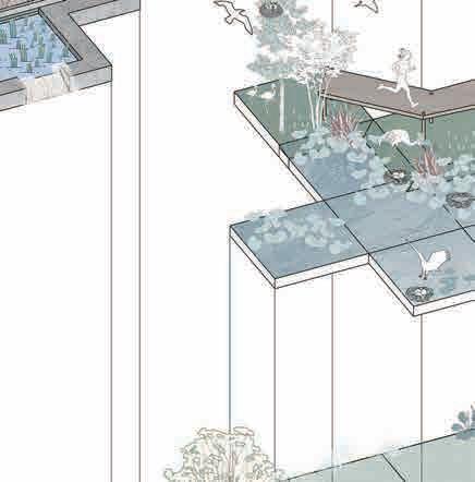
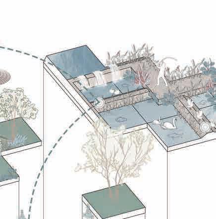
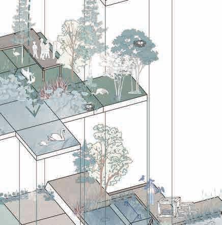
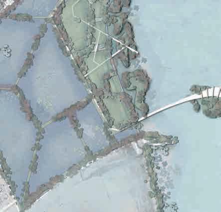
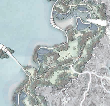
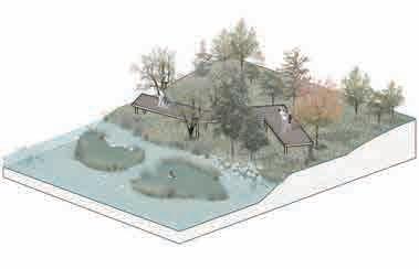
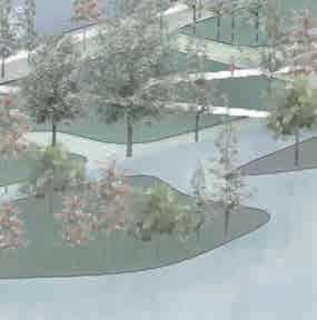
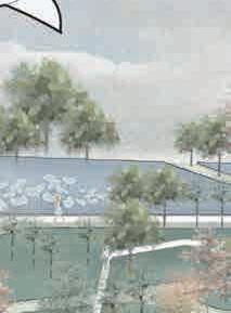
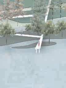
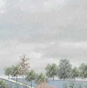
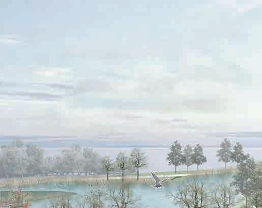
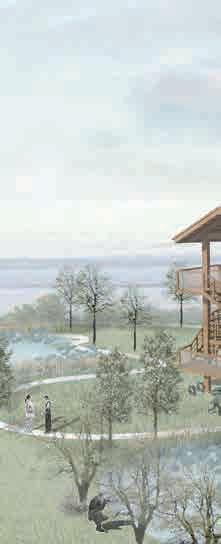
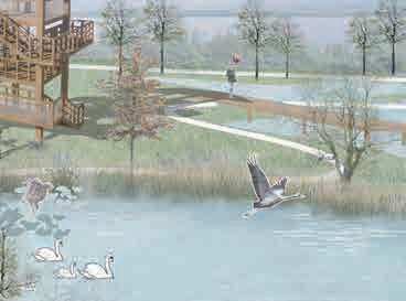
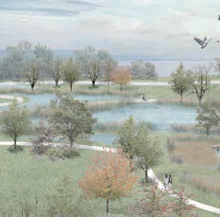
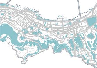
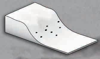
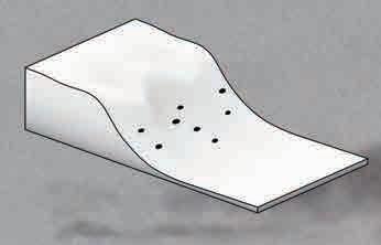
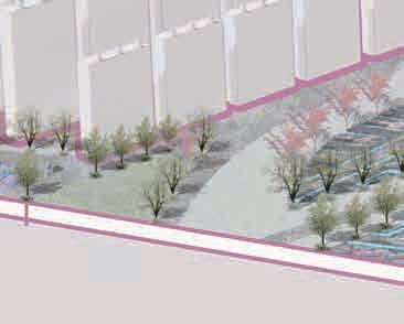
Harmony Haven: Eco-Agri Wetlands
Migratory Bird Transit Station Wetland Ecological Regeneration Design
Individual Work:08.2023-10.2023
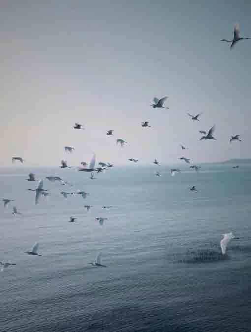
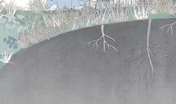
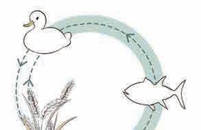
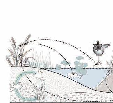
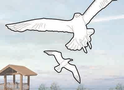
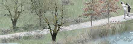
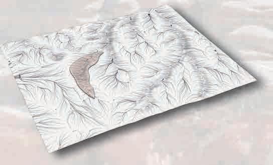
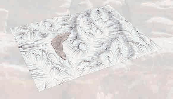
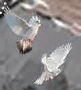
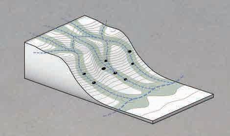
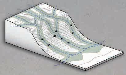
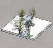
The Ramsar Convention mentions that people and the environment are interdependent. The basic ecological function of wetlands is to act as a regulator of hydrological conditions and a unique flora and fauna. It aims to protect wetlands, especially wetlands that serve as habitats for waterfowl.
Wetlands serve as a transit point for migratory birds. In the past 50 years, people have lacked awareness of wetland protection, and the wetland land loss rate has been as high as 21.6%. Some migratory birds face the problem of having nowhere to live and die from fatigue during their migration. Therefore, protecting wetlands also invisibly protects migratory birds, water resources, and even the ecosystem.
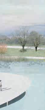
This project aims to design a self-sufficient, non-artificial intervention, self-healing wetland protection zone by excavating ecological and agricultural resources within the wetland, maximizing the purification ability of the "Kidney of the Earth."
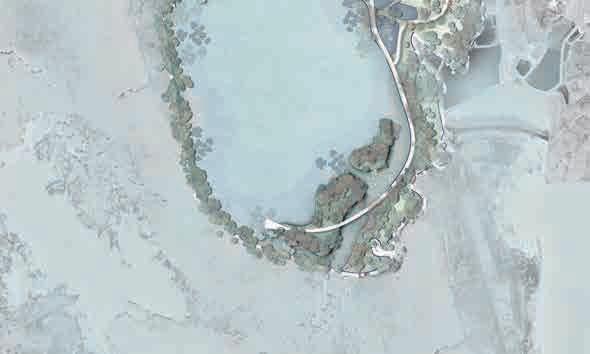
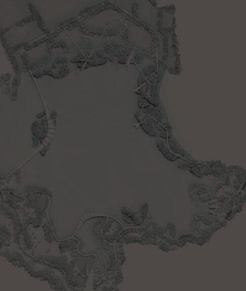
01


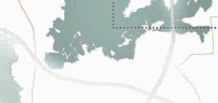
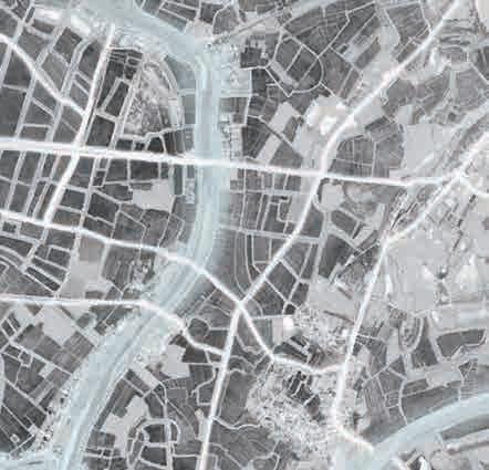
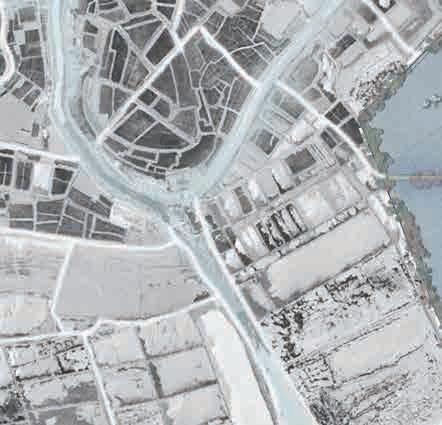
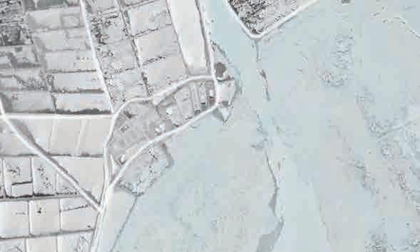
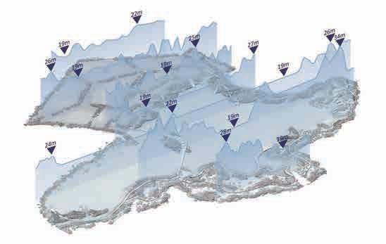
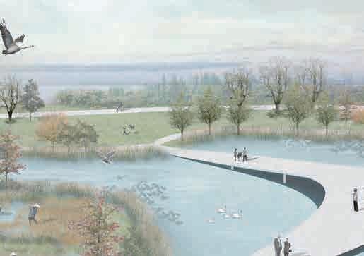
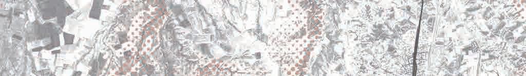
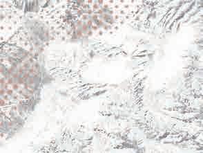
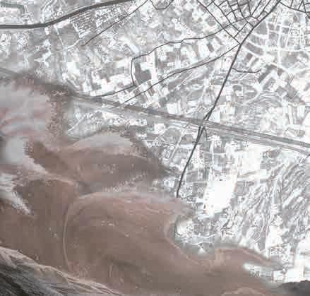
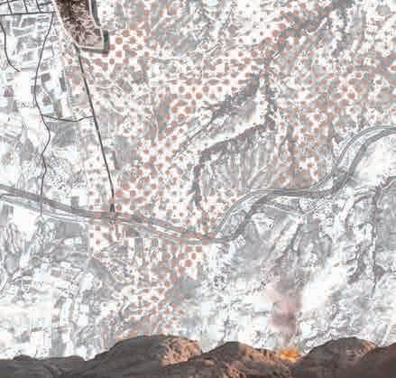
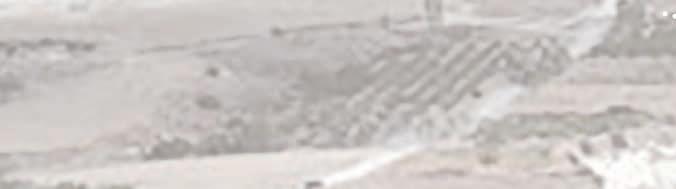
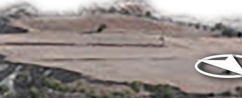
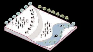
Wuhan Anshan Wetland Park is a comprehensive land parcel containing three land types: cultivated land, fish ponds, and wetlands. The site is located in the outer suburbs of the city, and the main internal problem is the destruction of migratory bird habitats.
This design aims to solve the conflict between humans and migratory birds, and organically combine agriculture and wetlands on the site with a method of creating ecologically sustainable development to improve the ecological chain and become selfsufficient.


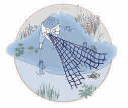
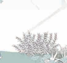
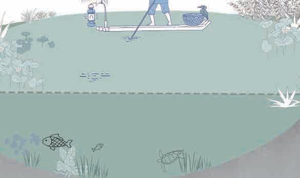
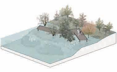
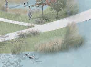
Fishing posts and nets slow down water flow.


Humans and birds compete for food Pesticides contaminate soil.


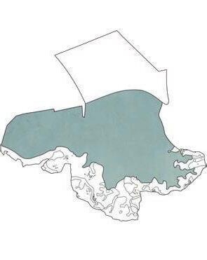


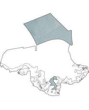


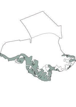


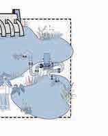
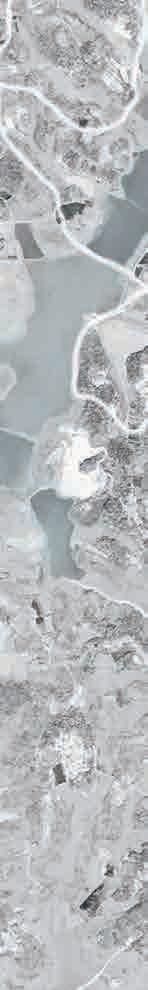
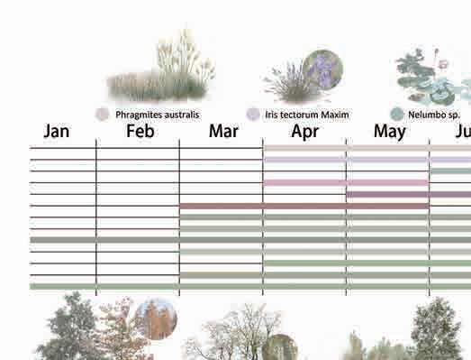
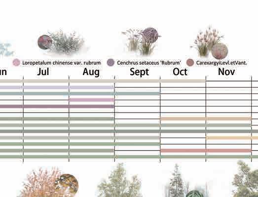
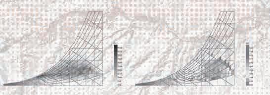
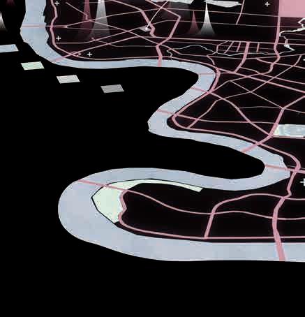
80 60 40 20 00 6.25℃ 10.50℃ 17.15℃ 22.3℃ 26.0℃29.0℃ 28.7℃ 23.9℃ 18.3℃ 12.05℃ 6.55℃ 77% 76% 78% 78% 77% 80% 79% 79% 78% 78% 76% 74% 4.20℃ 1357911Month Data Average humidity in Wuhan(%) Average temperature in Wuhan(℃) 16 12 8 4 00 9.1 9.5 13.5 13.0 13.2 13.3 11.2 9.09.0 9.3 8.0 6.6 3.4h 3.7h3.7h 5.0h 5.9h 6.0h 7.5h 7.8h 5.9h 5.2h 4.8h 4.4h 1357911Month Data Average Rainfall Days in Wuhan(day) Average daily sunshine hours in Wuhan(hour) Fish pond Shoal Wetland Arable land Harmony Haven: Eco-Agri Wetlands Migratory Bird Transit Station——Wetland Ecological Regeneration Design Climate Data Sheet Arable land Woodland Fish pond Land use type Site Introduction Russian Far East Wuhan, China Polar climate Subtropical monsoon climate Western Australia Tropical desert climate New Zealand Tropical monsoon climate Alaska, USA polar climate Cutaway Perspective View 47.33 hectares Freshwater lake Xiliang Lake Wetland 8000 hectares 39 species of wintering migratory birds Ansan National Wetland Park 1215.26 hectares Lake wetlands,swamp wetlands 130 species of birds
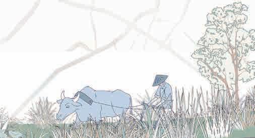
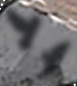
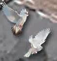
Migratory birds are in short supply of food. TYPE2 TYPE3 The wetland has abundant rainfall, sufficient sunshine, mild climate and clear lake water, making it a paradise for wild animals and plants Rich in cultural heritage, celadon kiln sites from the Tang, Song and Yuan dynasties have been discovered. As the population increased, agriculture gradually prospered, and people competed with migratory birds for food. The breeding industry is developing rapidly, and people are driving away birds to ensure production. The intervention of government organizations and bird lovers has increased people's attention to migratory birds and wetlands. Historical Changes Great Cormorant A migratory bird of the cormorant family Flew to Wuhan in October Migratory birds in summer Chlidonias Hybrida Aythya Baeri A critically endangered species flew to Wuhan in September Black-Winged Stilt Flew to Wuhan in September Platalea Leucorodia Overwintering migratory birds Flew to Wuhan in October Oriental White Stork National first-level protected animal Flew to Wuhan in October China Wu Han Hubei provi
TYPE1


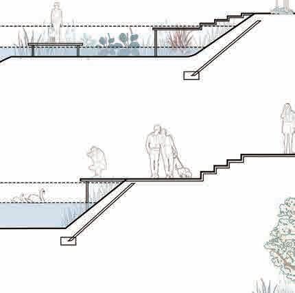
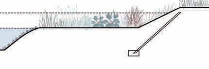


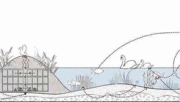
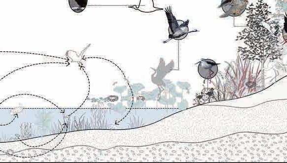
Himantopus himantopus Decomposer Microorganism Algae plants Aythya baeri Duck Fish Oryza rufipogon Griff Compost Peat soil Gley horizon Sandy soil Normal water level Flood storage level Normal water level Flood storage level Normal water level Flood storage level Normal water level Flood storage level Ladder platform type
shoal type
platform type
revetment type
Strategy
Chlidonias hybrida Phalacrocorax sp. Grus grus Ciconia boyciana Concrete ditch + chemical fertilizers Human activities destroy the wetland environment Water pump diversion "Three-network" problem + Embankment barrier + Brick structure house Added farmland type + Low head dam + Spillway drainage Low head dam + Excrement collection + Wooden house Bird watching tower
revetment type + Separate space for people & birds Agriculture Growing wild rice in the field provides a natural food source for birds and fish, while bird and fish feces provide fertilizer for the growth of wild rice, forming a selfsufficient food chain and reducing human intervention. Site Resources Fishery Separating and polluting water Pollution of soil and water Birds Fish Oryza rufipogon Griff Single watering mode Too much human activity + + + + + Human-bird space is too close Old water diversion facilities Brick building "Three networks" problem Hydrostatic system Fertilization Destroying ecosystem Wetland
Natural
Cantilever
Natural
Site
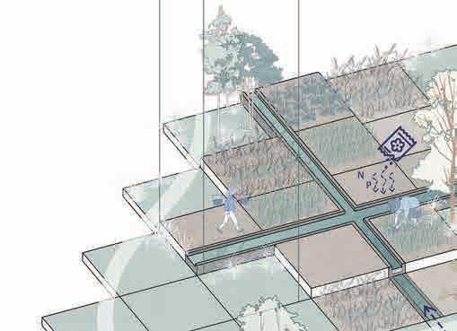
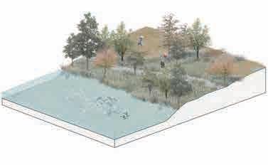
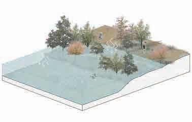
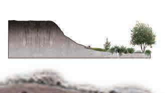
Slope Design Agricultural Wetland Design Strategies
Add


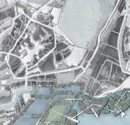


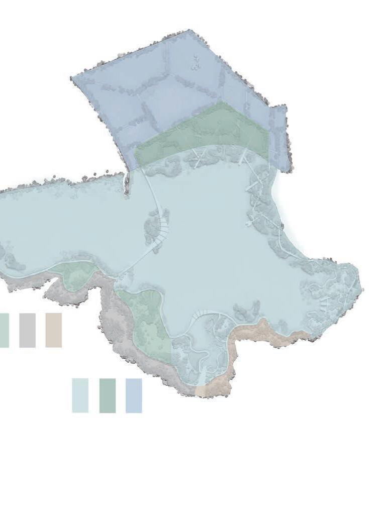

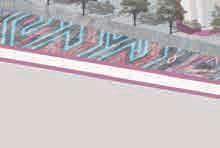
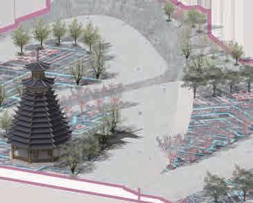
First-gradeMainentrancegardenroadSecondarygardenroad 1 2 3 3 3 4 3 5 5 6 7 7 8
Ecological fish pond
Flush zone wet garden
Ecological floating island
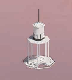
Island in the center of the lake
Pier
Popular science gallery
Agricultural wetland
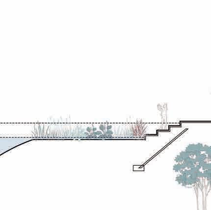
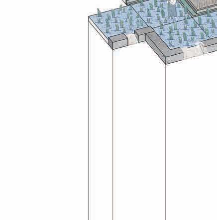
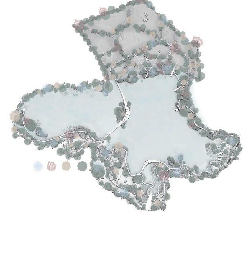
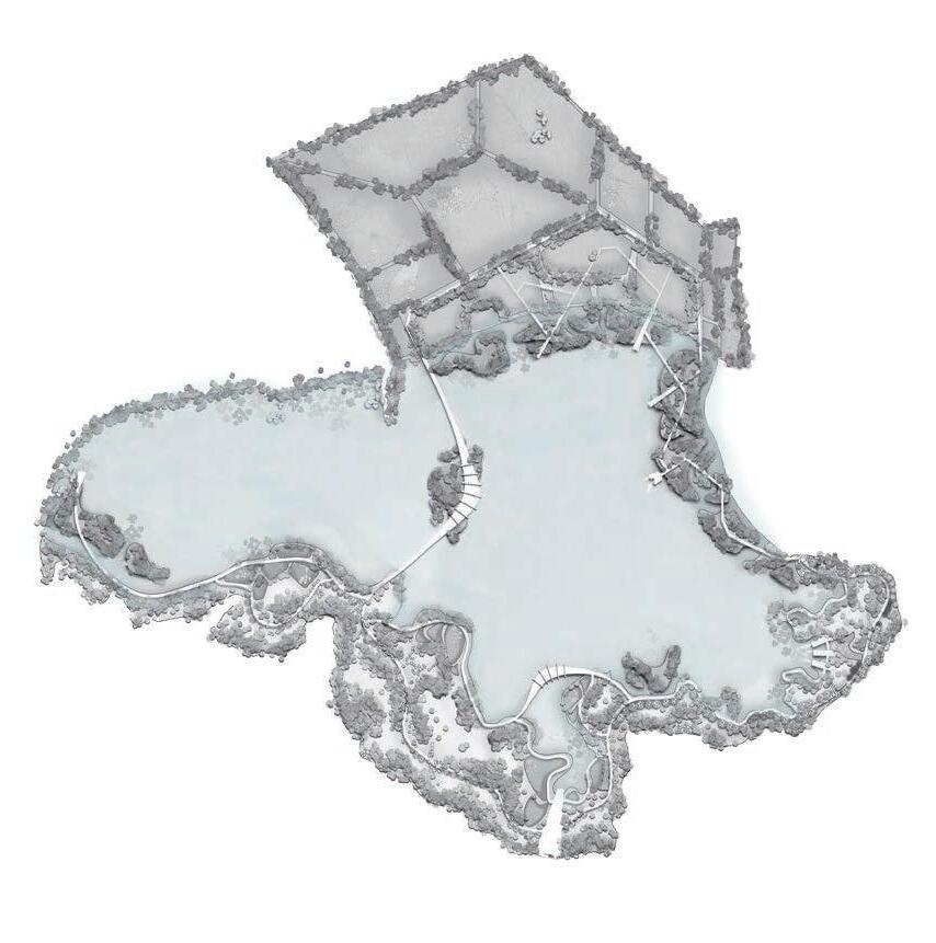
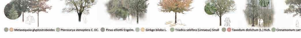
Main entrance 080 120 160(M) andMetasequoia,slashpine,camphor otherevergreentreesandshrubs Iris,CarexReedswildriceandotherhygrophytes Plant Design Terrain Height EcologicalFishpondbreedingarea floodstorageareaWetlandconservationareaLeisurePopularscienceteachingareaAgriculturalwalkingarea wetlandarea Functional Division People Flow Line Masterplan Wetland Water Level Dry Season Flood Season Dry Season Flood Season Elevate the road to properly separate people from the wetland environment. Roads at the edge of the wetland are paved with gravel to improve water seepage capacity. Ecological floating islands buffer flood pressure. Set up ebb and flow zones to purify water bodies. W N E S
1
2
3
4
5
6
7
8


Fish pond area reduced by 30% converted into agricultural wetland.


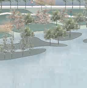


The ecological floating island area has been increased by approximately 50 hectares. Increase the area of the fluctuation zone by 10%.


The


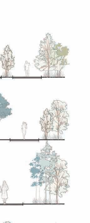
Plant Analysis
wetland rate increased to 85%.
02
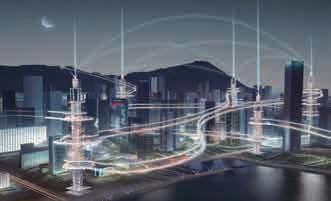
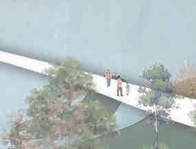
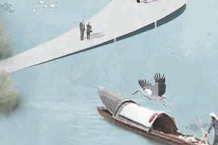
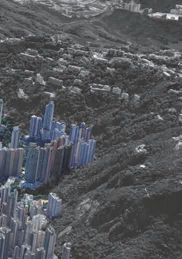
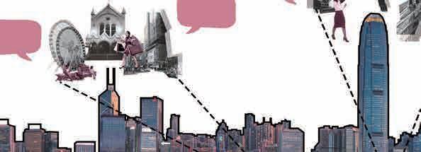
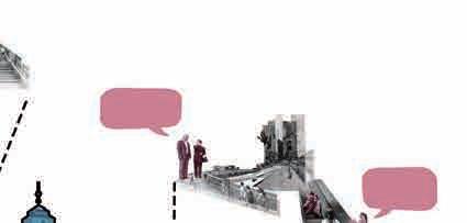
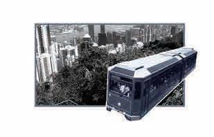
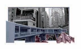
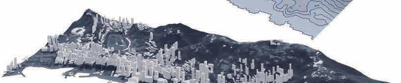
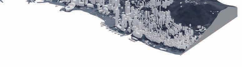
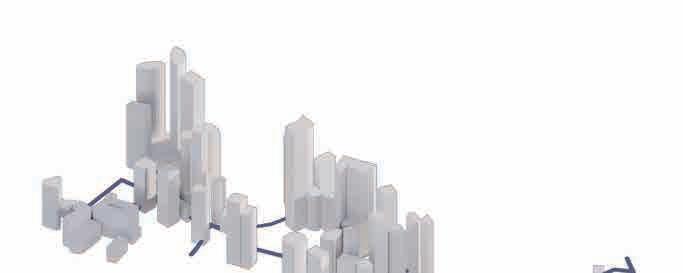
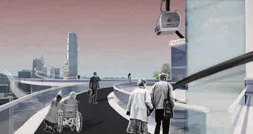
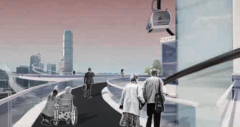
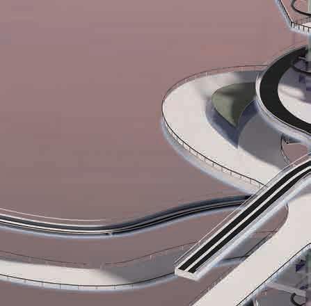
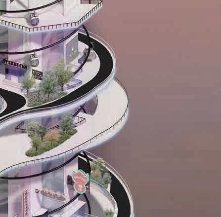
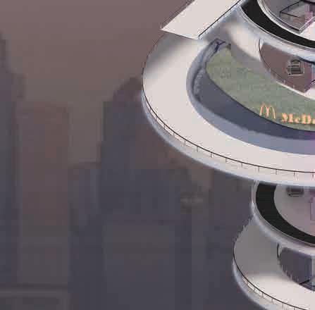
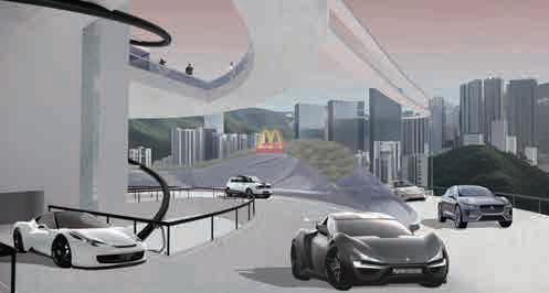
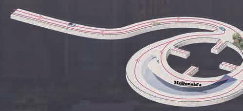
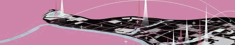
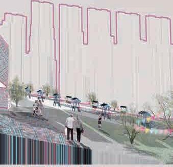
Urban Linkage Initiative: Bridging Tomorrow's Mobility
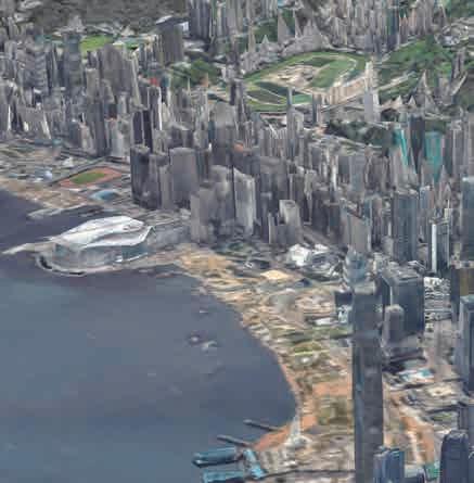
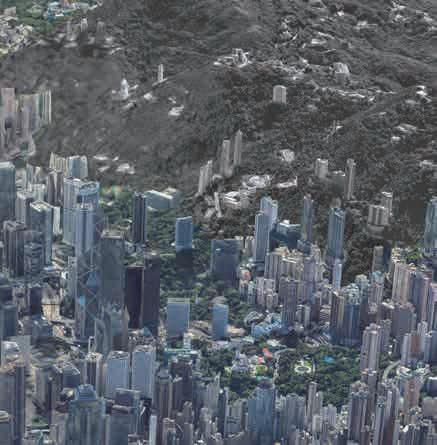
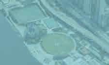
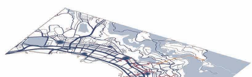
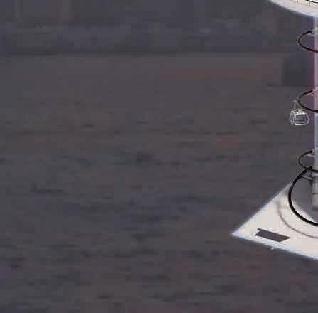
Optimization design of pedestrian bridge road system in Central, Hong Kong
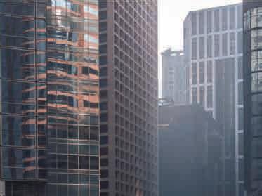
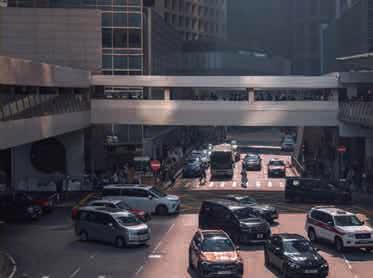
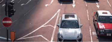
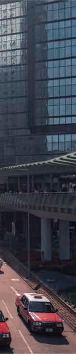
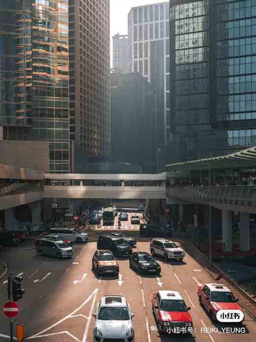
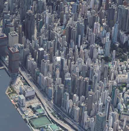
With the intensification of population, the trend of urban construction towards high-density development is intensifying, and traffic network congestion, air pollution, housing pressure, and the urban heat island effect have increased dramatically. Especially in Hong Kong, an international metropolis where land is at a premium, the pressure on infrastructure and land is increasing day by day, and the issue of "carbon neutrality" cannot be ignored.
This project aims to revitalize the city, relieve traffic pressure, and save energy and reduce emissions by improving the transportation system network throughout the city center.
Individual Work:10.2023-12.2023
Urban Linkage Initiative: Bridging Tomorrow's Mobility
Optimization design of pedestrian bridge road system in Central, Hong Kong
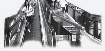
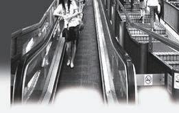
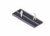
According to statistics, there are 458 pedestrian bridges and pedestrian subways in Hong Kong. These pedestrian bridges revitalized the economy between business districts at the end of the last century and improved the efficiency of citizens' going out. But today, many problems have been exposed. Pedestrian bridges occupy a large area, making the already high-density city more crowded; the space under the bridge is cramped and narrow, affecting urban greening; facilities are aging, and a large number of hard materials are exacerbating the urban heat island effect. There are also a large number of tourists pouring into Hong Kong, making commuters miserable.
This design aims to build a transportation network covering urban commerce, residences, and entertainment in the TOD mode, improve the travel efficiency of office workers, urban residents, and people with disabilities, and reshuffle urban resources.
Policy
As the largest group of


1960


1900


2000


2020


The pedestrian bridge broke down shortly after it opened. Because some parts of the escalator are very close to residential buildings, with the nearest point less than 1 meter, there were security problems during the construction and early stages of operation. The system can promote walking and relieve the pressure on public transport services, but it has failed to attract motorists to give up driving, thereby alleviating traffic congestion in the region. Moreover, due to the aging of the system, maintenance costs are increasing day by day.
The then Assistant Commissioner of Transport, Li Shu-wing, said in an interview: Nowadays Future


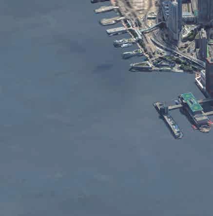
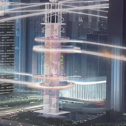
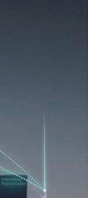
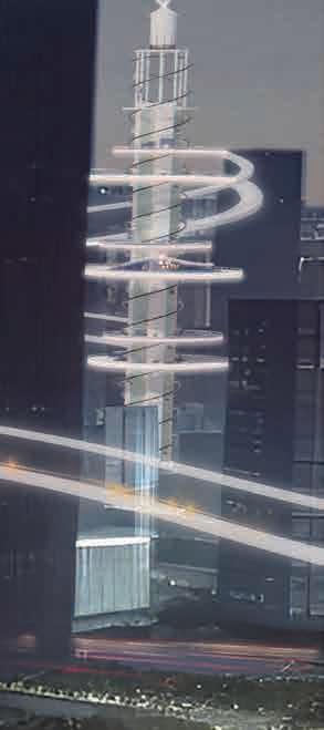
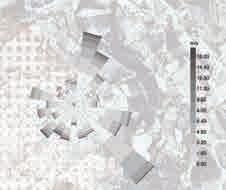
2 The Peak Terminus Queensway Plaza Legislative Couneil Complex ICBC Tower Chater Garden International Finance Centre General Post Office Entertainment Building Star Ferry Pier Peak Tram Central Terminus Kennedy Road stop Jamia Mosque Pedestrian Bridge Automatic Peak Tram Route The green space rate in Central, Hong Kong is 11.85% Urban Green Space Prince's Building Central Market Commercial land(55%) Road and square land(22%) Green land Waters(6%) Residential land(5%) N E S W N E S W )
Educational land Green land and water Attractions Commercial land
It's so busy going to school.It's just in time for the rush hour. Business is not doing well. People are walking on the pedestrian bridge. There are fewer and fewer customers visiting us. Hong Kong is really shopping paradise, but it’s crowded everywhere and the routes are complicated. The pedestrian bridge that must be passed on the way to work full of people, and the traffic efficiency greatly reduced. There are too few places for us to take leisurely walk. We rarely see green the city. The escalator so unfriendly to our wheelchair, it’s hard for us to go out. China Hongkong Greater Bay Area Central and Western District Teenager 8 am 12 am 4 pm 8 pm 12 pm Vendor Tourist Office workerThe elderlyDisabled people
people in the Central area, white-collar workers are also the main users of the pedestrian bridge. With obsolete pedestrian bridges, an aging population, and a sharp increase in the number of tourists, the pedestrian bridge system has become overcrowded. In Central, a city with extremely high density of office buildings, the pedestrian bridge system can no longer improve the efficiency of white-collar traffic.
pedestrian
look
the
Development of
bridgesystems "I
forward to the future of Hong Kong's transport network as a 'magic box,' where people and goods from all over
world can come to Hong Kong at any time and be quickly sent to any destination in the world." Transport and Housing of the Hong Kong Special Administrative Region Government, Chen Fan
35,000 passengers per day 54,000 passengers per day 85,000 passengers per day 1999 2005 2010


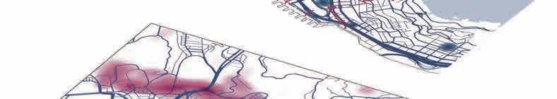


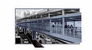


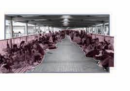


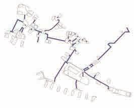


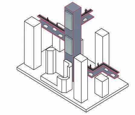
Height(542m) Low(0m) Central Elevated Walkway Occupied sidewalk Affect the growth of green plants Aging facilities Pedestrian overpass Stairway Elevator Cable car Conveyor belt Motor vehicle fast track Compositejoints Overbridge VegetationPlate type microalgae tank Carbon sequestration benefit: External microalgae photobioreactor Pedestrian walkway Motor vehicle way A 100L microalgae photobioreactor can capture 78.8kg of carbon dioxide in year, while a tree can only capture 6.5kg in year. Lack of user-friendly design Public space occupied by vendors Various types of people, overloaded use Hong Kong itself has a very serious traffic problem.The main reason is that the road surface is too narrow, and pedestrians and vehicles are easily jammed. This design plan will lift part of the ground road and pedestrian bridge system, separate people and vehicles, and share part of the vehicle congestion problem on the ground and the space problem caused by pedestrian bridge system.At the same time, The pedestrian walkway connects with the surrounding office buildings, enabling quick access from the building to the transport network,it greatly saves the traffic time and minimizes the traffic congestion caused by Hong Kong's high-density buildings and crowded roads. Space issues Crowd issues Design objective Venue Issues
Site Status Conclusion Of Issues Strategy Deduction
First and second roads Pedestrian bridge system Peak tram line Green land Metro station Legislative Couneil Complex Cheung Kong Center Central Market Jamia Mosque Entertainment Building Shun Tak Centre Prince's Building International Finance Centre Star Ferry Pier Main road Branch road Branch road Main road N Vegetation Office building density Subway station
Pedestrian Routes Car Driving Routes
Strategy Generation


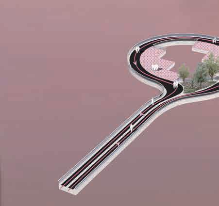


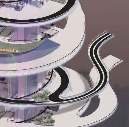


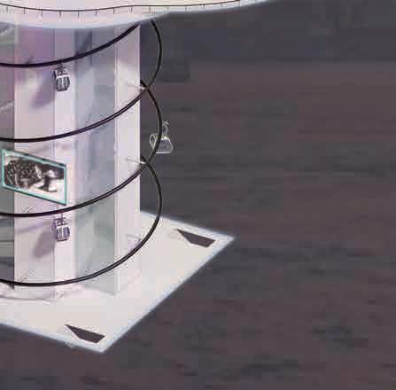
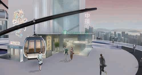
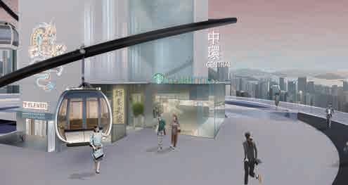


1 2 3 4 5 6 7 1 3 4 6 5 7 Entrance hall Car barrier-free elevator Motorway Business district Pedestrian walkway Passenger cable car Power generation base station Pedestrian conveyor belt Carriageway and drive through Express business area Entrance hall Observation platform Power generation device Steel cable car rail Cable car Rotary circulation elevator Plate type microalgae tank Exploded view of the hall 1F 2F Vehicle entrance and exit Pedestrian entrance and exit Cable car riding area Autowalk Scenic spot Entrance hall Car barrier-free elevator Passenger cable car Power generation base station Motorway Business district Pedestrian walkway Diversion of people and vehicles Vehicle access only Automatic up and down circulation elevator, no need to wait, increasing efficiency For people only Automatic up and down circulation cable car Combined with sightseeing function Combined with sightseeing function For people only Automatic pedestrian elevators not only facilitate travel for all people (including people with disabilities), but also improve efficiency and accessibility. Convenient stores are set up to facilitate people to buy what they need and at the same time drive business Cable car riding area Vehicle access only Set up a drive-thru to provide people with convenient services One-way lanes within the station reduce the probability of traffic jams Driving direction Walking direction


Convention and Exhibition Center Station International Finance Center Station Jamia Mosque Station Kennedy Road Station Central Market Station Fast track is 7.5 km A total of 6 km optimized The pedestrian conveyor belt runs at a speed of 2 m/s The optimizeddistance is2 km, and thewalking timeisexpected to be shortened by 16 minutes. Theoptimizeddistanceis2.5 km, and the walking time is expected to be reduced by 25 minutes. The optimizeddistanceis1 km, and the walking time is expected to be shortened by 8 minutes Theoptimizeddistanceis0.8 km, and the walk ng time is expected to be shortenedby10minutes . The optimized distance is 1.2 km and the wa king time s expected to be shortened by 13 minutes. From Convention and Exhibition Center Station to Jamia Mosque Station.The optimized distance is 2.5 km, and the walking time is expected to be reduced by 25 minutes. From Convention and Exhibition Center Station to Central Market Station.The optimized distance is 2km and the walking time is expected to be shortened by 16minutes. From Kennedy Road Station to Central Market Station.The optimized distance is 1 km, and the walking time is expected to be shortened by 8 minutes From Kennedy Road Station to International Finance Center Station.The optimized distance is 1 2 km and the walking time is expected to be shortened by 13 minutes From Jamia Mosque Station to Central Market Station The optimized distance is 0.8 km and the walking time is expected to be shortened by 10 minutes
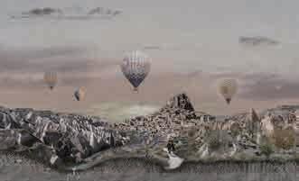
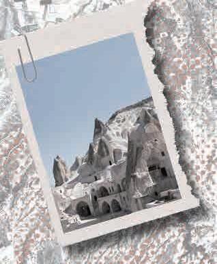
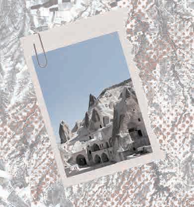
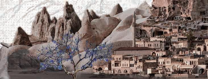
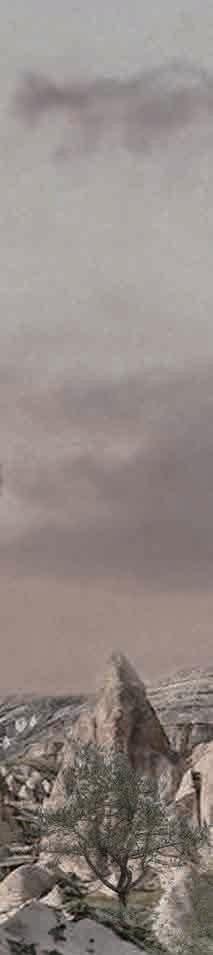
Silent Wings: Resurgence of Turkish
Cappadocia Landscape Heritage Geomorphological Conservation
Individual Work:12.2023-02.2024
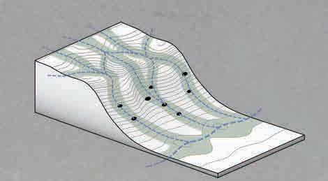
Natural features are a core component of natural landscape heritage, and by protecting them, the integrity and original nature of these beautiful landscapes can be ensured, so that they can be preserved forever. Many natural landforms are rich in biodiversity, and the protection of natural landforms is of great significance for maintaining the local ecological balance.
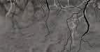
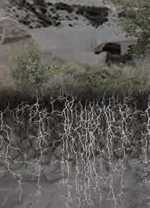
Rainfall, wind and natural disasters are the main factors that cause soil and water loss in natural landforms. According to the geological assessment of Pigeon Valley in Turkey, unstable rainfall factors have caused soil and water loss in the Pigeon Valley area.
This project aims to reduce the contact time between rainwater and the surface by replanning and designing the catchment line through the use of Pigeon Cave, a local characteristic landscape. And a complete groundwater circulation system is built underground to supply water to the surrounding towns.
03
Silent Wings: Resurgence of Turkish Terroir
Cappadocia Landscape Heritage Geomorphological Conservation


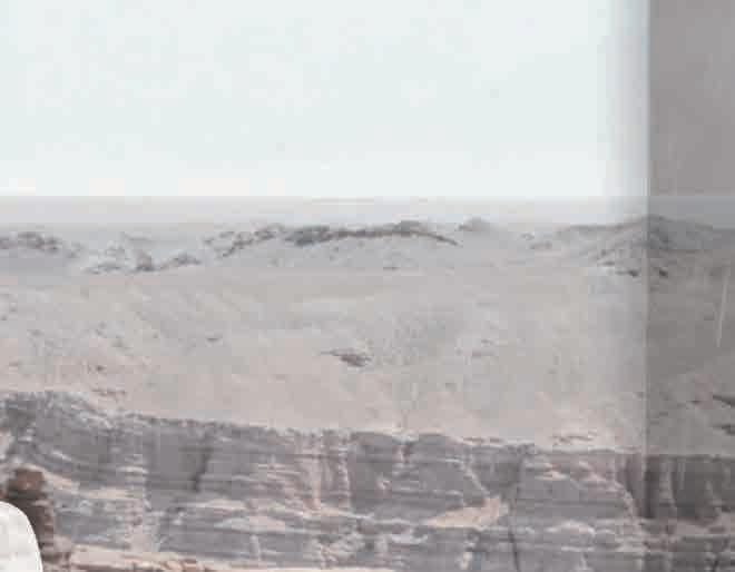
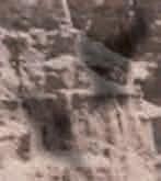
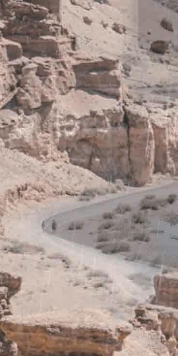
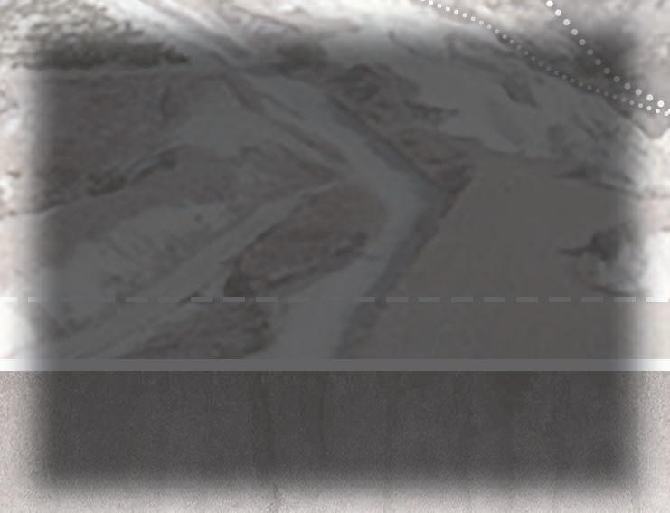
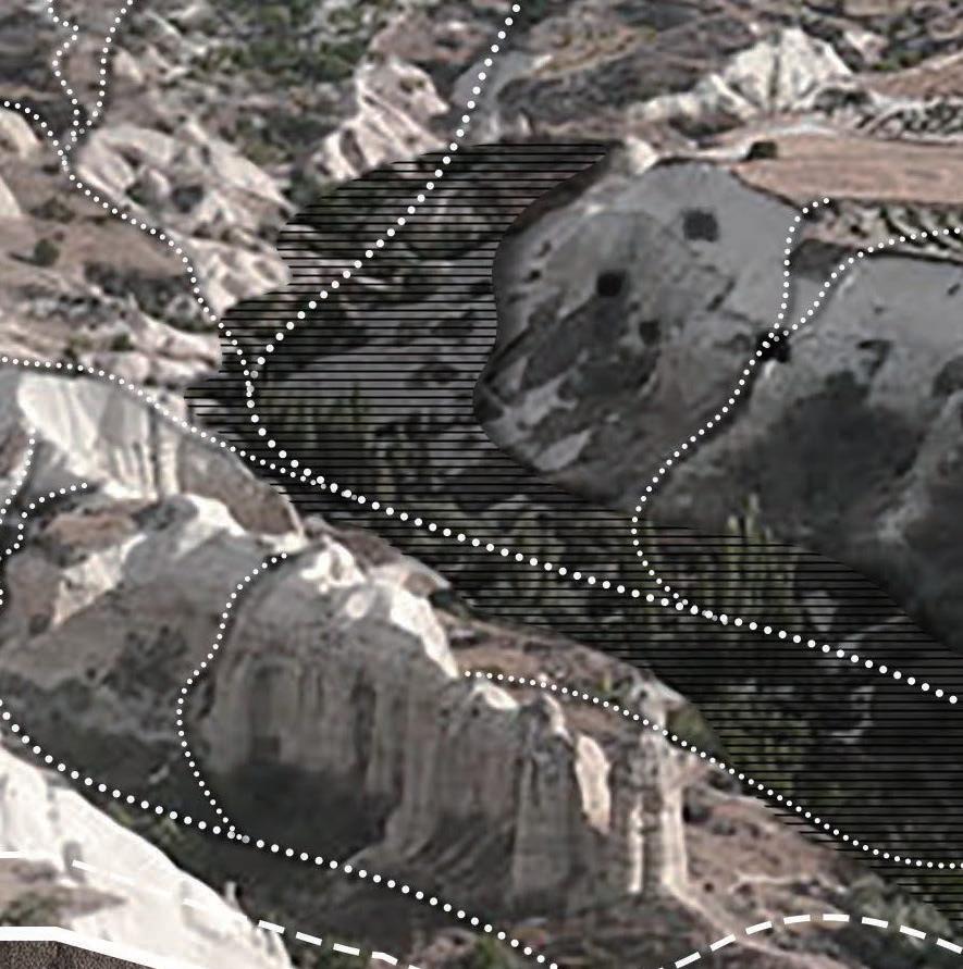
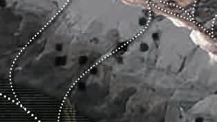
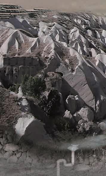
The Pigeon Valley, located in the Cappadocia region of Turkey, is renowned for its picturesque landscape characterized by an abundance of pigeon holes carved into the tuff rock formations. Over thousands of years, intricate volcanic activity has shaped the unique topography of Cappadocia, where tuff stands as one of the predominant geological features. Due to its malleable nature, local inhabitants have utilized tuff to construct cave dwellings; however, this soft composition also render it susceptible to continuous erosion caused primarily by rainfall .
This project aims to employ non-artificial interventions that leverage existing pigeonholes in order to reconfigure drainage patterns while simultaneously implementing localized planting initiatives and establishing a sustainable rainwater harvesting system. By doing so, we aspire to decelerate tuff erosion rates and thereby safeguard the extraordinary landscape of Cappadocia.


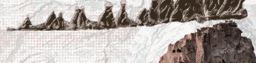


66 million years ago Cretaceous Period 66 million to 23 million years ago Paleogene Period 23 million to 2.8 million years ago 2.8 million to 10,000 years ago Neogene Period Pleistocene Epoch 10,000 years ago to the present Holocene Epoch This area is located on the edge of the ancient Tethys Ocean. The crustal movement is strong and a large amount of seafloor sedimentation occurs, forming a limestone layer. Violent volcanic activity resulted in massive volcanic eruptions, producing thick volcanic ash and basalt flows that covered the original limestone layers. After weathering and erosion, soft tuff was formed, which is the key to the region's unique landforms. Due to global climate change, the area has experienced a lot of glaciation and erosion processes, forming a unique landform, and people began to use the geology to build residences.
the Paleo-Tethys Ocean closed and continental plates collided, the region began to experience land uplift and mountain formation.
the Paleo-Tethys Ocean closed and continental plates collided, the region began to experience land uplift and mountain formation. geologic
tuff Location
Scouring Velocity Plato Phase Transition Phase Peribacasi Phase Peribacasi Erosion Scouring Velocity Scouring Velocity Scouring Velocity 0.6-0.9cm/year 3.3cm/year 4.5cm/year 2.8cm/year
As
As
derived history The formation of
Tuff weathering process Climatic conditions
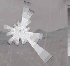
N E W S Turkey Pigeon Valley Distribution of tuff A valley connecting Uchisar and Goreme 38°37'36"N 34°47'43"E Nevsehir Province Nevsehir Time [hr] city: Kapodokya.AP country: TUR time-zone:3.0 source:SRC-TMYx -20C -20-15-10-50510152025303540 0.005 0.01 0.015 0.02 0.025 0.03 50% 40% 30% 20% 10% 70% 90% -15C -10C -5C 0C 5C 10C 15C 20C 25C 30C -20C -20-15-10-50510152025303540 0.005 0.01 0.015 0.02 0.025 0.03 50% 40% 30% 20% 10% 70% 90% -15C -10C -5C 0C 5C 10C 15C 20C 25C 30C Wind Speed [m/s] city:Kapodokya.Ap country: TUR time-zone:3.0 source:SRC-TMYx Humidity Ratio [kg water/kg air] Humidity Ratio [kg water/kg air] Volcano Project site tuffs Major Miocene – Pliocenevolcanic complexes mainly monogenetic Quaternary volcanism basement rocks large Quaternary volcanoes Quaternary alluvium renders N Distribution of tuff At lower dry-bulb temperatures, the humidity ratio is also relatively low, indicating that there is less moisture in the air at cooler temperatures. Also, higher wind speeds occur more frequently in warmer temperatures. 69% soft tuff volcanic ash basalt flow Erosion Wind Rainfall Soil and water loss
Pigeon
Valley cave house


the tuff more susceptible to erosion.


Herb Shrub Fruit Wild Grasses Oregano Bromus Festuca Com m on plants onmountai n t o p s Dactyli s g ataremol Poa Junipe r u s Rosm a r suni silaniciffo Prunu s a acainemr Viti s Cist u s Wildthym e
Dangers of Tuff Erosion Geology
18%
Physical
Chemical
thawing Enough rainfall Tuff
Water flow
rock particles,
accelerating the erosion
Calcite
the tuff, reducing the tuff's structural integrity Water absorbed in tuff Propagation and spalling of tuff cracks. Freeze/Thaw Volume change Thermal expansion -5 5 15 25 20 10 0 Jan May Sep Feb Jun Oct Mar Jul Nov Apr Aug Dec 30 Average temperature(℃) Month Lowest Highest Lowest temperature High Low The project site is higher in the west and lower in the east. The west side is more seriously eroded by rainwater. Stormwaterrunoffroutes
N E W S 0.00 6.40 3.20 9.60 14.40 1.60 8.00 12.80 4.80 11.20 16.00 m/s Small particles carried
wind
like natural sandpaper. The continuous wind changes the microclimate of the site to a certain extent, reducing the humidity and making
+ TuffSmall
+ TuffPersistent
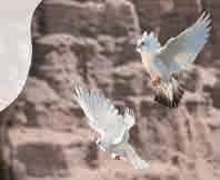
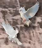
Travel Photography Trading Geological prospecting Planting Crowd activities Ferns Vines Bryophytes Plo y p o diumvulgare A s lp e n iumtricho manes Ttro u la muralis C t e n i dium molluscum Hde e r a helix irtsussiconehtraPuc s p idata munpyH c u pressiform e nommoC lptna s o n t he valleyfloor The valley bottom lacks sunlight and is relatively humid, which is suitable for the growth of shade-loving plants. Travelers Unattractive As weathering intensifies, the characteristic landforms will no longer exist. Geology Geological collapse Groundwater Erosion may cause the pores within the tuff to become larger and damage the geological structure. Erosion may affect groundwater flow paths and storage. Resident Homless Income decrease Some locals live in cave dwellings dug out of the tuff. Some locals rely on tourism to increase their income. 0 Jan May Sep Feb Jun Oct Mar Jul Nov Apr Aug Dec 10 20 30 40 50 60 Average precipitation(mm) Month Heaviest rainfall Soil 5% Contains organic and mineral ingredients Ground Cover There are some plants that can survive in rocks Tuff(volcanic Clastic Rock) 40% 1.Volcanic debris 2.Carbonate minerals,such as calcite 3.Silicate minerals,such as quartz 4.Oxides Sedimentary Rock 30% Such as sandstone, shale, etc, which are deposited from mineral particles Carbonate Rock 15% Contains organic and mineral ingredients Volcanic Rock 5% Produced by volcanic eruptions, such as andesite, rhyolite, etc Carbon dioxide CO Weak carbonic acid Water Calcite A component of tuff Calcium bicarbonate H CO CaCO₃Ca(HCO ) 2 23 32 3 Absorb + Breed pigeons Build dovecotes Increase penetration area and accelerate erosion. Collect feces Nourish fruit trees
Site Status
Plant planting status
rainfall erosion Pigeon Hole Impact on Tuff Vegetation coverage is only about
The top of the mountain is sunny and relatively dry, which is suitable for sun-loving and drought-tolerant plants to grow here.
erosion
erosion Effects of freezing and
Tuff is usually soft and porous
can carry away loose
further
process.
is dissolved and removed from
wind erosion Corrasion effect Microclimate changes The Pigeon valley area is subject to strong northeasterly and southeasterly winds, with the mountains on the west side of the site being the most affected.
by the
wear away the tuff
particlesSurface is worn
windWater evaporates

How to reduce erosion of karst landforms
STRATEGY 1
Planting vegetation to stabilize soil


High nitrogen content
Nourish
Weakly acidic Pigeon dung
Rich organic matter

Drought-tolerant


Balance the alkaline properties of soil in tuff areas and improve soil quality.
Improve plant leaf growth and green pigment synthesis. Increase soil water retention and air permeability.
By planting trees and fertilizing the soil, the moisture and viscosity of the soil can be increased, and the density can be increased. The roots of the plants can stabilize the soil and reduce the rate of rainfall erosion and wind erosion.

Humidity-resistant Sun-lovingunShade-resistant Soil-fixing


Planting pattern


STRATEGY 2
Stormwater management

3.Planting according to mountain conditions


design objectives
Using natural means such as afforestation and terrain improvement, and comprehensively utilize local resources to amplify the effect. On the basis of not changing the original ecology as much as possible, we can promote ecological restoration, reduce soil erosion, slow down tuff erosion, and protect characteristics.


towards the north.
planting
water ingress drain sewer drain sewer drainage water supply to residents Herb Uniperus oxycedrusAgropyron Lithops Lichen Athyrium filix-feminaPolypodium vulgareHedera helixPimpinella tragiumThymus capitatusArctostaphylos uva-ursiGleditsia Ulmus
Conclusion Current status of stormwater runoff The project site is higher in the west and lower in the east, higher in the south and lower in the north, with a maximum drop of 75 meters. After rainwater washes away from the mountain, it flows into the valley bottom and accumulates
2.Staggered
Bryophytes Ferns Vines Shrub Arbor 1.Mixed planting
to form a diverse vegetation community and improve
++++ Arbor Shrub Ground cover Keep a certain distance Dense planting Dense planting Utilize the interweaving and density of plant roots to increase the structural stability and fixation of the soil. Different locations in the valley also have different climates. Choosing appropriate plant plantings
Different types of plants are mixed and planted
soil-fixing ability.
can better stabilize the soil, adjust the microclimate, and reduce soil erosion.
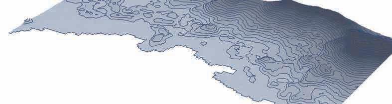
The top of the valley is suitable for the growth of light-loving and drought-tolerant plants. Roots stabilize soil Valley waist is suitable for the growth of plants with developed root systems and strong survivability. The valley bottom is suitable for the growth of plants that tolerate shade and moisture. High:1627 Elevation(m) Low:911 Contour line(m) 10 Contour line(m) 5 Rainwater routes
Water collection tank Water Purification System plant irrigation natural infiltration plant filter plant filter 1 2 3 5 6 Gradient(m) 2-4 4-7 7-9 9-12 12-15 15-20 20-26 26-43 0-2 Standing water Water conduit Modification of pigeon holes to channel water flow drainage Into water collection tank Water Conduit placement point N N


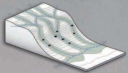


Plant cultivation Catchment line STRATEGY 3 Catchment line design Phase 1 : Terraforming to guide water flow (0-5 years) Phase 1 : 0-5 years Phase 2 : Nurture plant growth (5-10 years) Phase 2 : 5-10 years Phase 3 : Form a closed loop of water resources ( > 10 years) Phase 3 : > 10 years
simulation The terrain is rugged and the water lines are messy. The pigeonhouses are in a messy distribution. Planting along the water catchment line. Catchment line Cut out stepped terrain according to contour lines to guide water flow and reduce flow rate. No vegetation, fast water flow. Water collection tank Rainwater collecting Purify Water Purification System Plants guide water flow and slow it down.The planting density increases, the water flow rate is slower, and the water penetrates into the soil. According to the terrain, available pigeonhouses are integrated to form a water catchment line to reduce the area washed away by rainfall. When plants reach maturity, they form a water cycle and reuse resources. Over time, the flow of rainwater will slow down, the flushing area will decrease, and soil erosion will decrease. Irrigation Water supply
scene
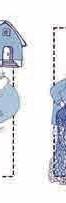
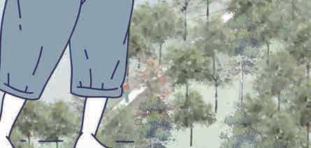
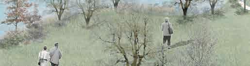
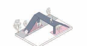
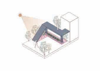
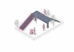
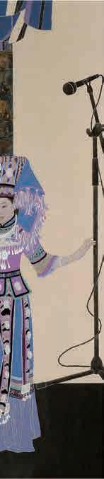
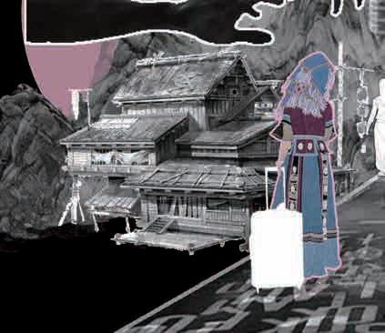
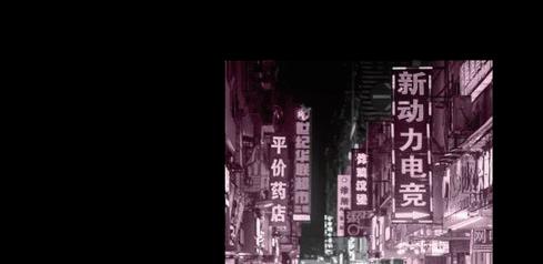
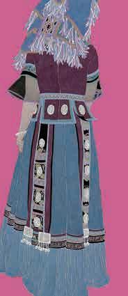
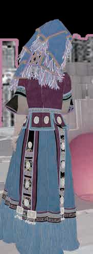
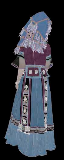
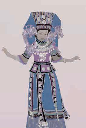
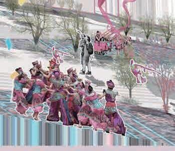
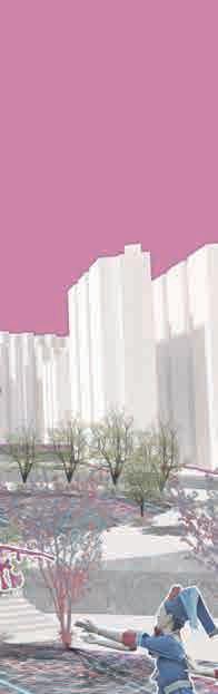
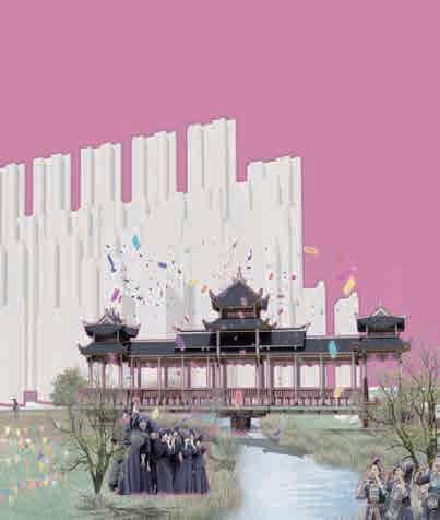
Where There Is Ease, There Is Home
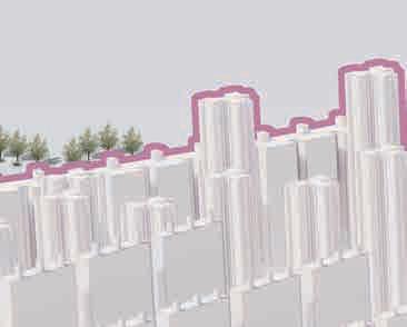
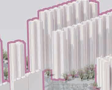
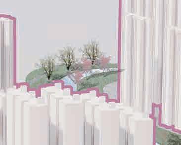
Renewal of urban villages in ethnic minority autonomous region
Individual Work:02.2024-04.2024
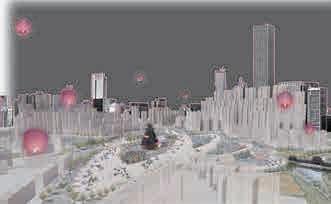
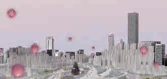
UNESCO research shows that there is a strong link between biological diversity and cultural diversity. We are witnessing urbanization, rapid growth in international tourism and mass migration, which result in an unprecedented mix of languages and cultures. There is indeed a gratifying fusion of cultures within cities, between countries and continents. However, in the process, local backward groups and newcomers often feel alienated, while others suffer from anxiety over the loss of their identity.
This project aims to dissolve the life barriers of ethnic minorities in more developed cities in Guangxi Minority Autonomous Region, China, help ethnic minorities make a living in cities to establish a sense of belonging, improve their living environment, and promote ethnic identity and ethnic integration.
04
Where there is ease, there is home
Renewal of urban villages in ethnic minority autonomous region
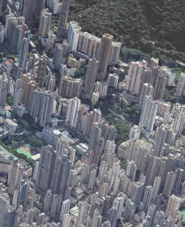
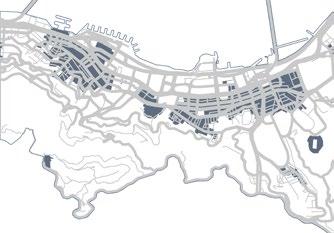
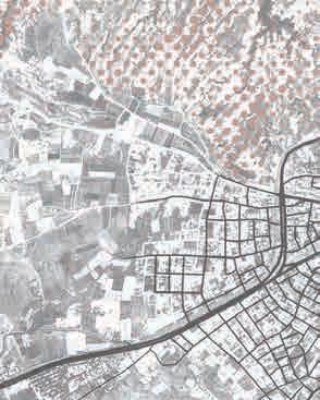
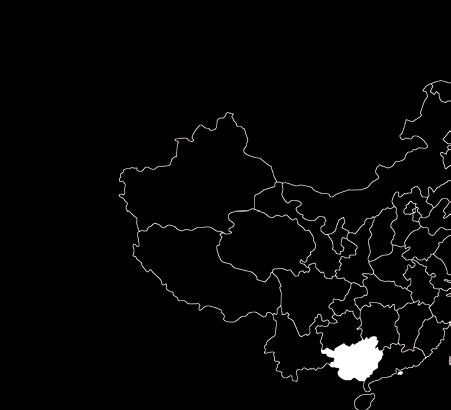
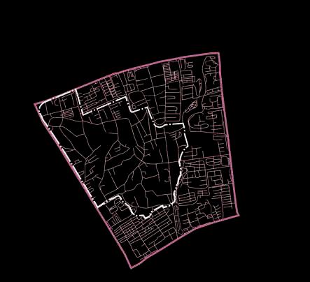
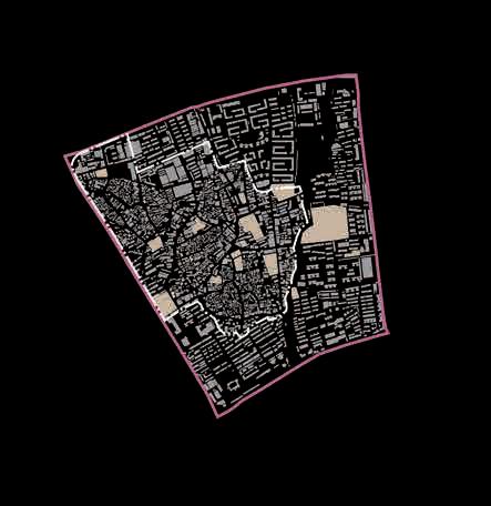
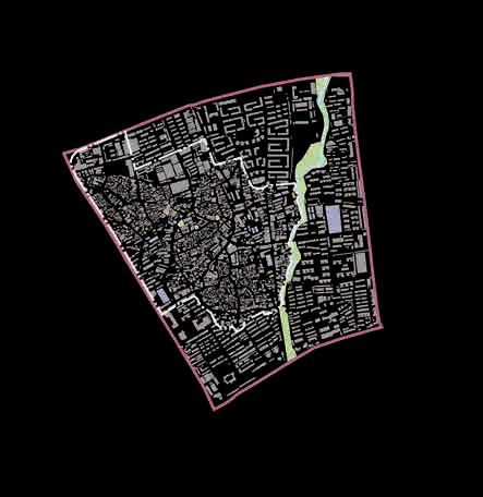
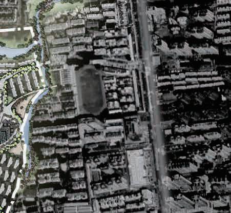
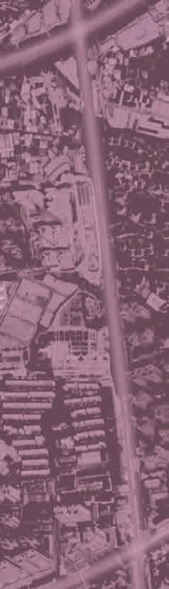
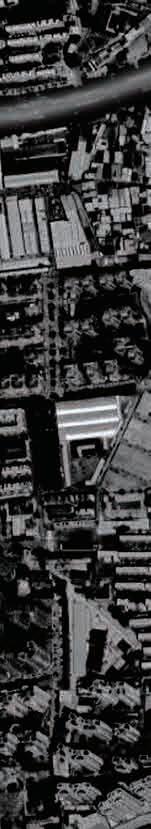
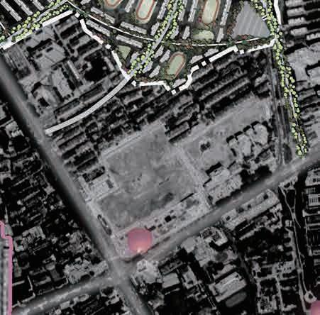
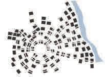
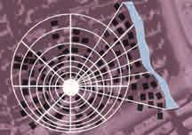
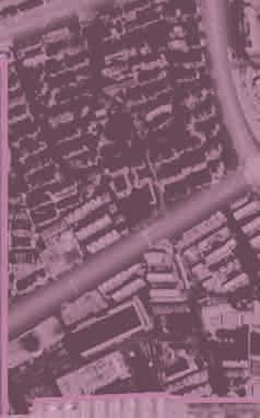
Guangxi is an ethnic minority autonomous region, headed by the Bourau people, with 11 ethnic minorities living here. Nanning, the provincial capital, has attracted more and more ethnic minorities living in towns and villages to live and make a living here. However, in the increasingly homogeneous urban construction , cities have gradually lost their characteristics. People from ethnic minorities have left their hometowns to make a living here, but they cannot integrate into the urban environment and gradually lose their sense of belonging.
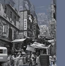
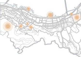
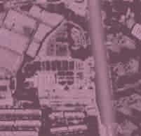
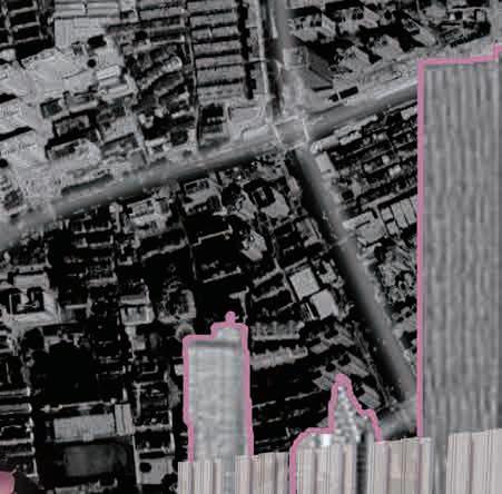
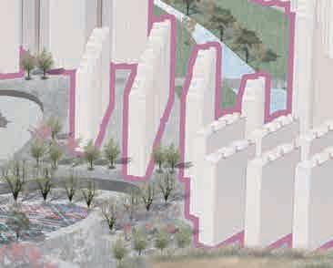
Wanxiu Village, located in Nanning, Guangxi Bourau Autonomous region, is the largest urban village with the largest floating population in the city. Ethnic minorities make up half of the population here.
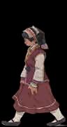
Xiao Qin, a recent college graduate from the Bourau ethnic group, has to live in an urban village with cheap rent in order to gain a foothold in the city. However, life here makes her feel overwhelmed...


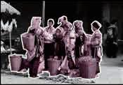
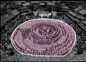
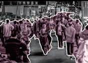
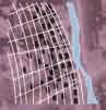
2010 2020 70000 Floating population 36.95% Bourau Han nationality Other ethnic groups 60.43% 2.62% 40.23% Bourau 3.34% Han nationality 56.43% Other ethnic groups Most of the tenants in the venue are graduates and working people aged 18-40 years old. 200000 180000 100000 160000 80000 140000 60000 2000 120000 40000 01-45-910-1415-1920-2425-2930-3435-3940-4445-4950-5455-5960-6465-6970-7475-7980-8485+ Number people Famale Male Nanning City, Guangxi Zhuang Autonomous Region Electric bicycles are the primary mode of transportation for commuting 25-29 45-49 50-54 Narrow street Diverse population types Various stalls occupy the streets Food hygiene is not guaranteed Every night when go home, have to navigate the crowds and electric bicycles, and it is especially dangerous. The narrow streets and crowded houses make it impossible for me to feel the happiness of life. potential risk of criminal activity Wanxiu Village, Xixiangtang District whether there is food safety. spacing is insufficient 50044 80384 65638 12817 16600 85011 52471 67957 95693 123936 106199 81998 96410 48791 63190 124865 65848 85283 104108 64814 Urban village Green land Educational land Industrial land River People’s working paths Han population Minority population People don't know each other here, and feel dangerous living here as a young girl. 15.636 million 6.6852 million 18.807 million 5.1136 million 3.2047 million 3.2047 million 2.5896 million 87.8% 87.8% 35.9% 33.1% 10.06% 37.52% 21.26% Number of ethnic minorities in some provinces Wanxiu Village population composition Bourau Village Have a sense of belonging Lack of humanistic care Economically backward More employment opportunities Scarcity of supplies Comprehensive living facilities City More and more ethnic
choose to leave their homes for cities.
minorities
Since 2010, the number of ethnic minorities living in cities in Guangxi has increased by 14.18%.


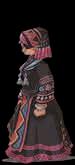
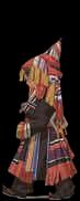
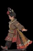


Bourau Mien Hmong Gam MaonanYi nationalitySui nationalityGelao nationality Han nationality
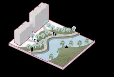
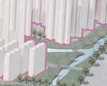
festival space of ethnic minorities and create a spatial pattern with "mountains behind and water on the back".
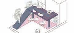
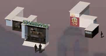
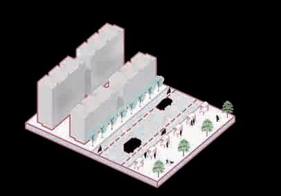
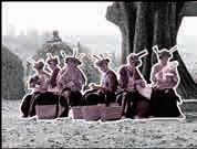
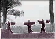
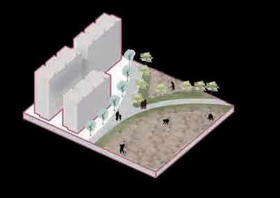
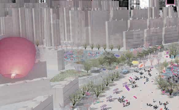
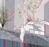
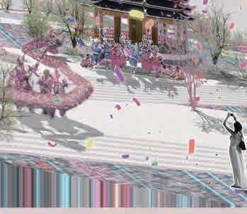
activities Crowded public spaces Festival gathering space Improve river ecology and set up waterfront leisure spaces. Daily entertainment Waterfront green space Recreation space 30 Nov. lunar ca lendar 16 Oct. lunar calendar 4 July. Lunar calendar 29 May. Lunar calendar 24 May. Lunar calendar 8 Apr. Lunar calendar 3 Mar. Lunar calendar 2 Feb. Lunar calendar Dec. Nov. Oct. Sept. Aug. July. June. May. Apr. Mar. Feb. Jan. Bourau New Year Bourau Bourau Bourau Bourau Gam People singing duets to find a partner Rally at the bridge Grab satin ball Scrambling for huapao Brewing rice wine Worship ancestors Make food to worship the king of OX Organize dragon boat racing Make delicious food to entertain friends and family Worship ancestors and light river lanterns Get together to sing antiphonally and dance folk dances Have a reunion dinner and a bonfire party Gam Hmong Gam Hmong Mien Mien Bridge Building Festival Fireworks Festival Bull Soul Festival Sacrifice Festival OX Washing Festival Dragon Boat Festival Mien New Year Song Fair Festival Panwang Festival Hungry Ghost Festival 696 973 24mm Han nationality Sui nationality Hui nationality G e l a o nationality 840 60mm 546,0 40mm 336,0 326 0 Maonan 9740 175mm 19mm 426,184 25mm Bourau 247,72 Mien Mulao ethnic group 394 4 100mm 117 10 Gam 210mm 50mm 214mm Ki nh 75mm 181,60Hmong 150mm Yi nationa l ity 45℃ 30℃ 15℃ 0℃ Go to market Messy stall Diversion of people, motor vehicles and non-motor. Set up stalls in designated areas along the street. Commercial market space encourage young people to start their own businesses and promote local products from their hometown. Farming Urban village farmland Integrate the site for farming, away from residential areas, to provide farming space for farmers in urban villages. Urban farm space Build a sustainable self-sufficient commumity. Average monthly rainfall Minimum temperature Maximum temperature Ethnic minority populations 150,00 300,00 450,00 600,00 50 100 150 200 This paper analyzes the festival activities and customs of ethnic minorities led by the Bourau people, extracts the celebration methods and required space forms during festivals, as well as the living habits and lifestyles in daily life, integrates the construction norms of modern cities, and designs four types of space: market - commercial space, festival - activity space, leisure - waterfront space, and farming - agriculture space. Those cover the daily needs of ethnic minorities and festival activities, help them find the familiarity of their hometown in the city, and give the city a unique ethnic mark, so that the city has its own uniqueness. Our festivals are diverse, but there are almost no places to celebrate our festivals in the city. We need a public space to find a sense of belonging in our hometown. Ethnic minorities Extract life elements +++ MarketFestivalEntertainmentAgriculture
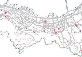
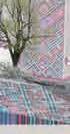
Extraction of ethnic Current situation of urban villages Minority Culture Extraction Guangxi Ethnic Minorities Design Strategy Mimic
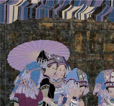
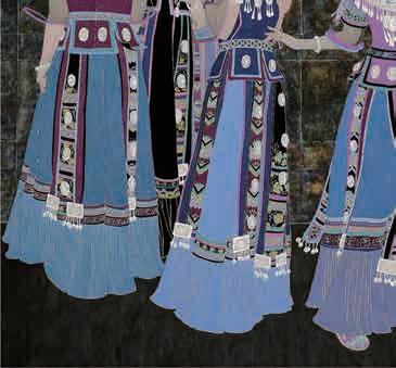
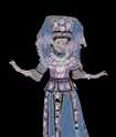
Gathering


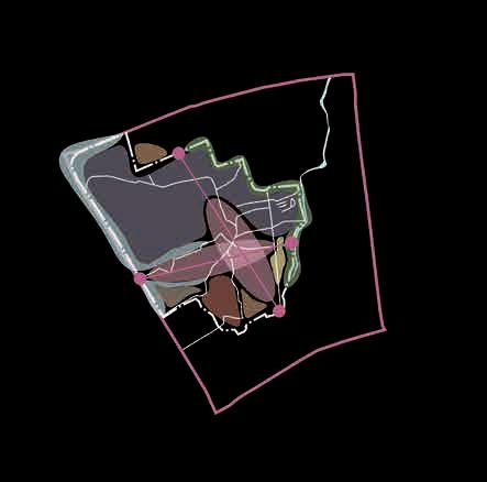


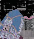
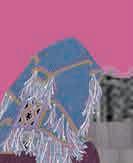


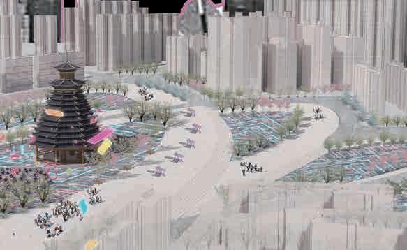


Xiuxiang Avenue Xiuxiang Avenue Beihu North Road Mingxiu East Road City first-class road Main entrance to the urban village Bus stop Metro station City secondary road Internal road in urban village Site scope Sports ground Public activity space River Farmland Site scope Green land Site scope Car park Building Educational land Main business district Residential area Main road extraction River Convenience service area Site scope Educational land Green land Business area Car park Main axis Main entrance to urban village Activity space Urban farm Site Status Functional Area Planning 1 12 10 9 2 3 4 4 7 7 7 7 7 1 6 8 N 5 11 6 1 2 3 4 6 7 8 9 10 11 12 Festival space Waterfront recreational green space Urban farming Bourau wind and Rain Bridge Parking lot Residential green space Business space Residential area Community service center School Drum Tower Design Deconstruction Zhuang Brocade "Fret pattern" Gam Extract element Basic elementFilletOverlay&Deduce The characteristic hand-woven brocade of the Chinese Zhuang ethnic group has vivid patterns, rigorous structure, and is full of warm and cheerful national style. It reflects the Zhuang people's worship of heaven and earth and their pursuit and yearning for a better life. Centripetal layoutParallel to river layout Hmong There is a corresponding relationship between the orientation of the dwellings and the structure of the settlement. Hmong residences are generally oriented parallel to rivers or roads; Gam residences are generally oriented toward the Drum Tower, and their settlement structure is centripetal. Road system design Residential design Increase building height and distance between buildings. Festival space design What a lively event. We celebrate the festival like this at home, and now we can get together to celebrate the festival in the city.


Commercial and residential space


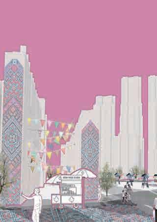

Drum Tower Stall market


Set up street shops and stalls along the entrances and exits.
What a big change. We have dedicated venues to celebrate festivals.In the future, more and more people will know about our culture and customs.We finally have a sense of belonging in the city.


Festival public space


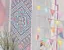
Design ethnic cultural graffiti walls that encourage community engagement. Expand the space between buildings to improve living comfort.


Main activity center.
Different spatial types can meet the needs of different ethnic minorities.

Mimic the event venue of their major events which are often held "backed by the mountains


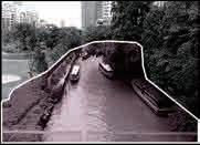
Waterfront and agricultural space
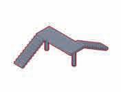
Wind and rain bridge


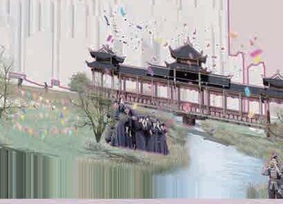


Improve the waterfront space and provide residents with hydrophilic experience.
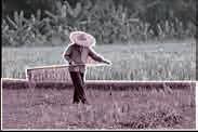
Design urban farms to meet farmers' farming needs.


The waterfront space becomes a venue for the Bouraupeople to sing folk songs.

-1.35m -0.50m 0.00m -2.25m 0.00m
0.00m 0.00m