The Future Past of Atsena Otie
Remembering Tocobaga
New Archaeology at Prospect Bluff
Dog Island Wrecks
Victims of a Gulf Coast Ship Trap
2020
FLORIDA HISTORICAL SOCIETY ARCHAEOLOGICAL INSTITUTE FLORIDA HISTORICAL SOCIETY ARCHAEOLOGICAL INSTITUTE
 ANNE V. STOKES, PH.D.
FLORIDA HISTORICAL SOCIETY BOARD OF DIRECTORS AND CEO OF SEARCH
ANNE V. STOKES, PH.D.
FLORIDA HISTORICAL SOCIETY BOARD OF DIRECTORS AND CEO OF SEARCH
As archaeologists and historians, we are trained to study and interpret major events that changed the course of history and altered the lives of the participants. In this issue of AFA, the articles touch on such events in Florida history, including shipwrecks, massacres, wars, hurricanes, and inundation of settlements due to climate change.
The authors have teased the stories of the event participants from the soil, ecofacts, and artifacts, although as Sassaman notes in his Atsena Otie article, interpreting “coarse-grained data” is “devoid of the sensory, bodily qualities that make experience so memorable.” This idea becomes apparent as we live through a historic event in early 2020—a global pandemic. How will this event be reflected in the archaeological and historical records hundreds of years from now? (How many articles have you seen this year about the 1918 epidemic?) We certainly will have excellent historical documentation; in fact, some historical societies are soliciting photos and other documentation of life during the pandemic for their archives. As we physically distance ourselves from one another, will it be apparent in the archaeological record
 KC SMITH FLORIDA HISTORICAL SOCIETY BOARD OF DIRECTORS
that for an extended period of time meetings were done via video conferencing, and instead of joining friends for a night out of dinner or dancing, we met in our neighbor’s front yard with chairs spaced six feet apart? And though we may be able to detect these behavioral changes in the archaeological record, what we won’t be able to capture is the feeling of what this was like, the sensory experience. What a strange twist that to save lives we have had to distance ourselves from each other, when our human nature is urging us to connect. We hope the articles in this edition inspire you to explore, learn, teach, and connect in ways you haven’t done before. Will we learn the lessons that history has to teach?
We wish to thank the researchers who contributed to this issue and everyone who devotes time to protecting, curating, and interpreting our state’s irreplaceable cultural heritage.
In that vein, we dedicate this year’s AFA to Dr. Roger C. Smith, who taught us the value of solid research and the importance of training and learning from the next generation of participants, observers, and chroniclers.
SHARE YOUR RESEARCH AND PROJECTS IN Adventures in Florida Archaeology
We welcome feature articles and regional news that focus on academic research, CRM projects, new technologies, artifacts, historic sites and museums, and other aspects of archaeological study. Abstracts for proposed articles are due by November 15; finished articles and images are due by January 15. For information and submission details, contact coeditors Dr. Anne Stokes, anne@searchinc.com, or KC Smith, kcsmith614@hotmail.com.
NOTE
EDITORS’
ON THE COVER
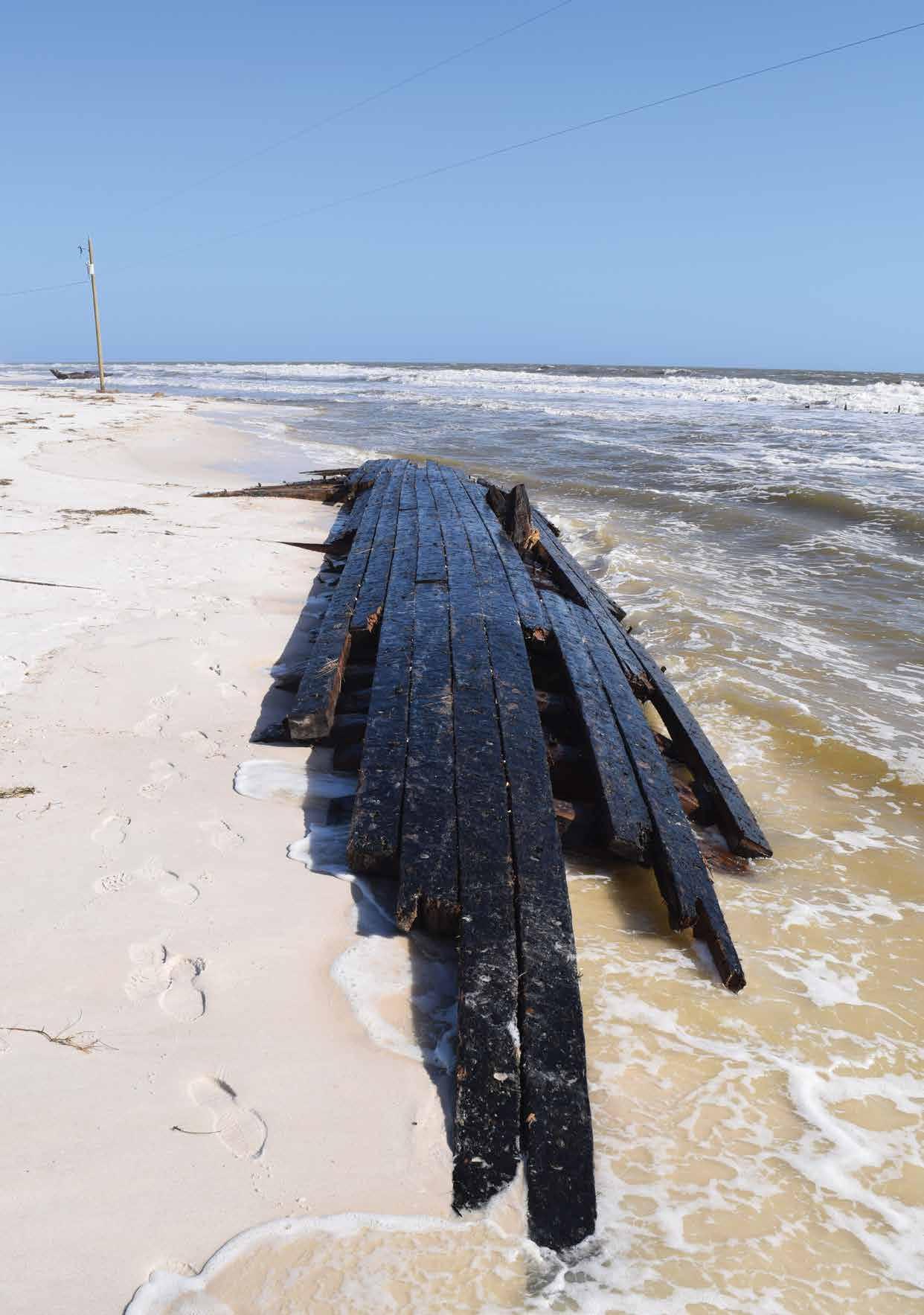
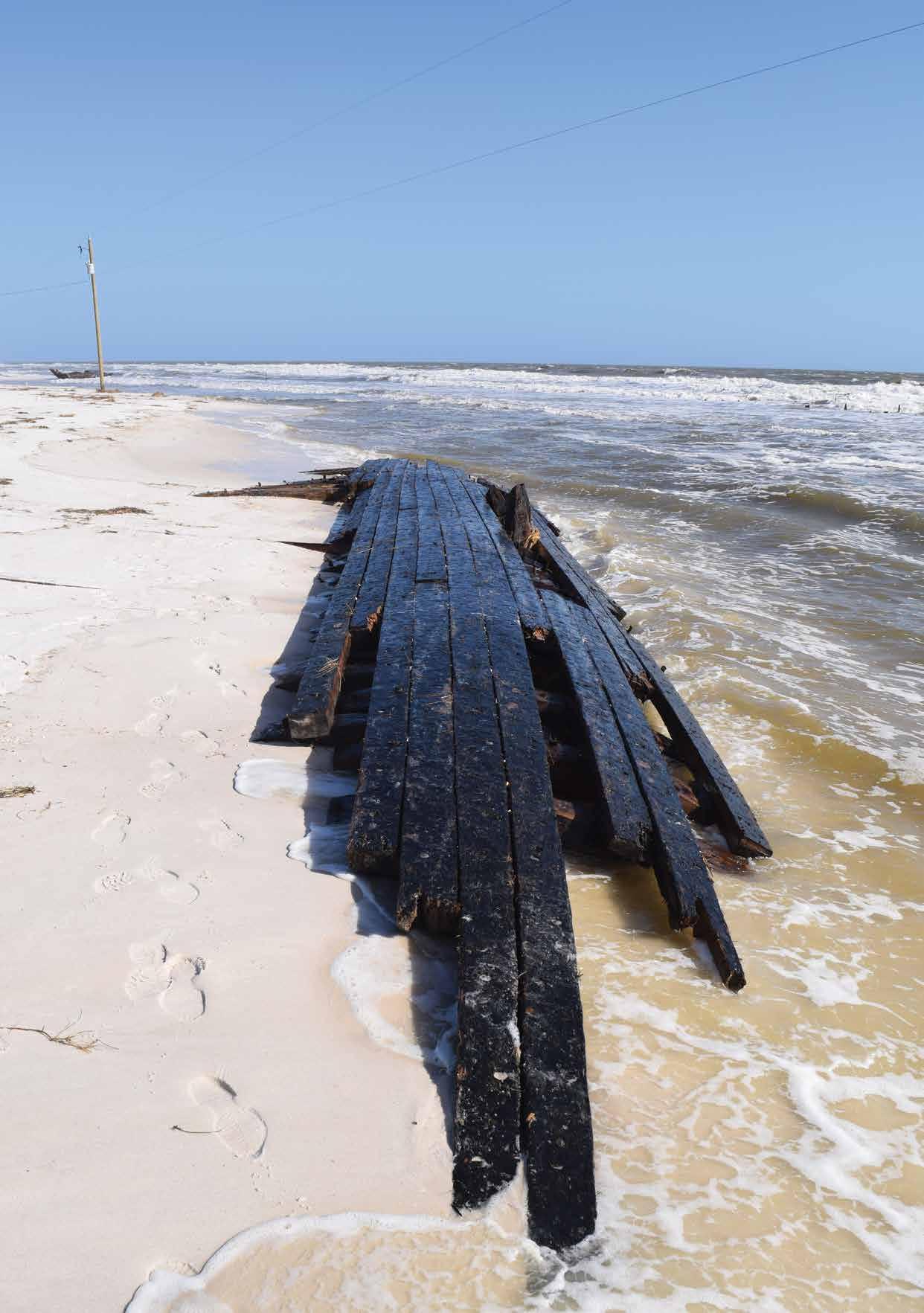
Hurricane Michael exposed a bow fragment of a vessel wrecked on Dog Island in the 1899 hurricane. Florida Division of Historical Resources
BACK COVER
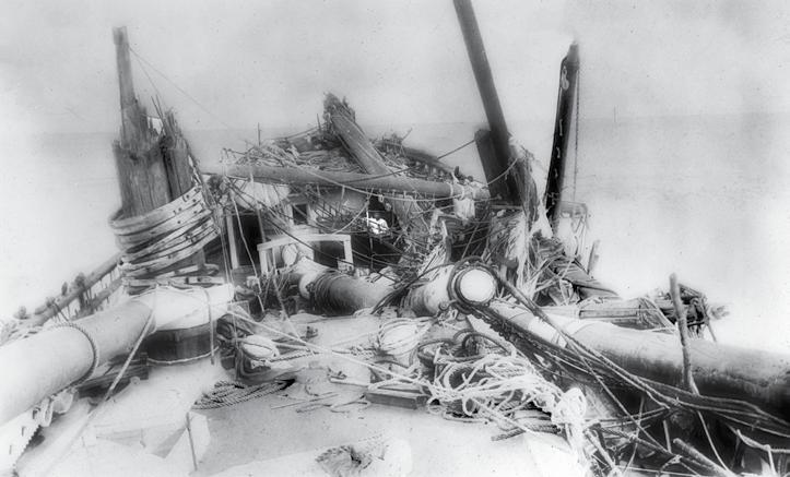
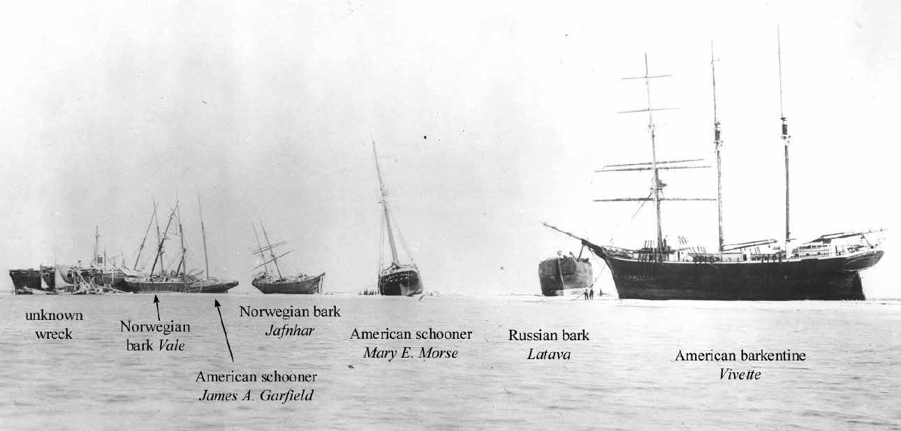
Ships aground on Dog Island after the 1899 hurricane include, left to right: probably the Russian bark Latara [or Latava]; Norwegian bark Vale (foreground); American schooner
James A. Garfield (beyond Vale); and Norwegian bark, Archives, Florida Memory
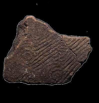
SHELL BEADS, RINGS, AND EXCHANGE
Raleigh Island and the Mississippian in Florida
DOG ISLAND WRECKS
Victims of a Gulf Coast Ship Trap
IN MEMORIAM
FHSAI Board Member Dr. Roger C. Smith
THE FUTURE PAST OF ATSENA OTIE
Experiencing Past Hurricanes Virtually
HERITAGE MONITORING SCOUTS
Stewardship Through Citizen Science
ELUSIVE SPANISH FORT
LOCATED
Archaeologists Verify Mound Key Site
REMEMBERING TOCOBAGA
Preliminary Observations at the Safety Harbor Site
NEW ARCHAEOLOGY AT PROSPECT BLUFF
A Free Black Settlement in Spanish Colonial Florida
A MAMMOTH QUESTION
When and How Was Florida First Settled?
1 2020 Adventures in Florida Archaeology TABLE OF CONTENTS 02 08 14 16 24 32 50 34
42
Graphic design by Charity Myers, The Creative Pool, Tallahassee Produced by Palm Springs Printing, Sanford
BEADS, RINGS, AND EXCHANGE
2 2020 Adventures in Florida Archaeology
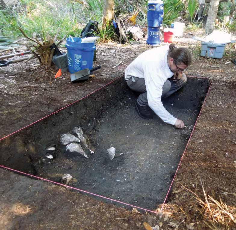
The author excavates a feature within one of the seven test units on Raleigh Island. Several features like this one have been documented during excavations. Photo courtesy of Ken Sassaman
Believe it or not, there are still places to be discovered in our modern age. Located north of Cedar Key, Florida, within the Lower Suwannee National Wildlife Refuge, Raleigh Island is a remarkable place that was largely unknown until recently.
Raleigh Island and the Mississippian in Florida
Originally found in the 1990s, the full extent of archaeological deposits on Raleigh Island was not realized until 2010, largely because the site is inaccessible by land and difficult to reach by boat. A complex of shell rings dating from the 10th through 12th centuries is distributed across the western part of the island. Additionally, shell beads were made in abundance, immediately preceding an increased demand for beads among Mississippian societies of the Southeast during the 11th century. Located far away from population centers in Florida, Raleigh Island provides a glimpse into the lives of a coastal community and its interactions with Mississippian chiefdoms that consumed large quantities of shell beads. After several field expeditions, hard fought through mud, winds, and tides, this remarkable place and the people who lived here are beginning to reveal themselves.
As fate would have it, Raleigh’s story would have remained untold were it not for an environmental tragedy. During an assessment of impacts of the Deepwater Horizon oil spill on cultural resources in the Gulf of Mexico, a crew from the University of Florida Laboratory of Southeastern Archaeology (LSA) became stranded at low tide en route to Raleigh Island. Luckily, they were close enough to reach the island and wait out the tide. After hopping out of the boat and
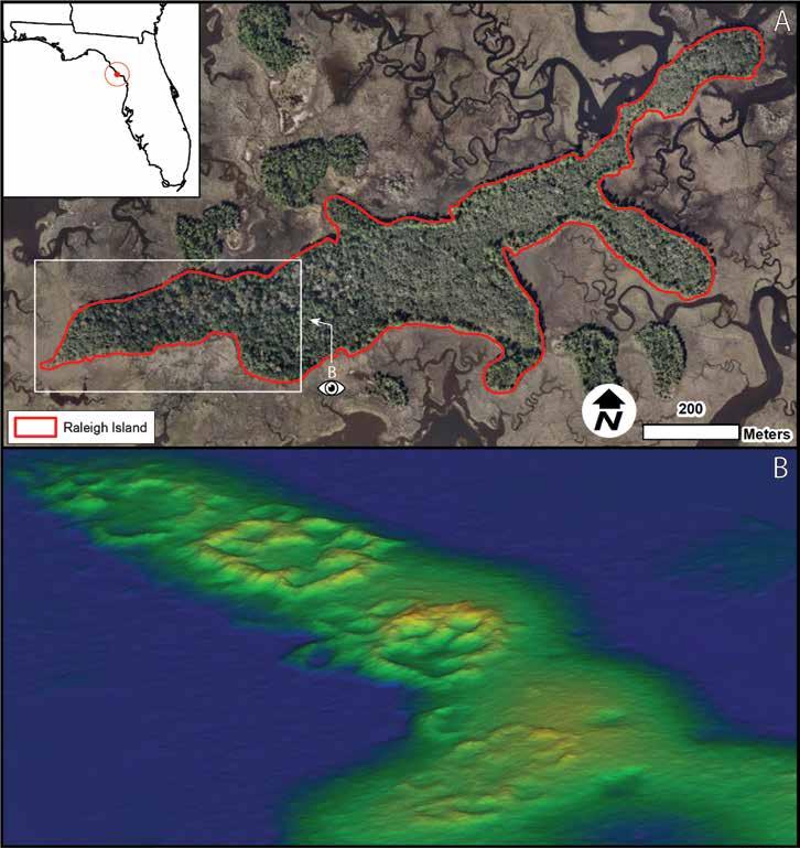
Map A (top) indicates the general location of Raleigh Island and its shell rings (8LV293). Map B (bottom) is a threedimensional rendering of Raleigh Island shell rings. Rings range in height from one to more than four meters above the forest floor. Images courtesy of the author
walking through the sawgrass marsh, they began their assessment and were met with quite a surprise. What they found was one of the most unusual archaeological sites in Florida.
The western portion of the island contains at least thirtyseven shell rings clustered together into four groups. With some reaching more than 4 m high, 30 m wide, and constructed largely from oyster shell, the rings on
3 2020 Adventures in Florida Archaeology
Terry Barbour
Raleigh Island are impressive by any measure. Ramps and pathways wind their ways through each group of rings, and it is easy to get disoriented when exploring the enclosed spaces. Several rings have openings that likely served as points of entrance and exit. As to what these spaces meant, we can only speculate at this point. The working hypothesis is that they represent households, or groups of individual households, where immediate or extended families lived and worked together.
Whatever the case may be, this amalgam of rings is unusual and surprising in many respects. While shell rings are prevalent in some regions of the Southeastern US, construction of these features largely ceased after the end of the Late Archaic period in Florida, about 3,200 years ago. In fact, when LSA staff located the ring complex in 2010, it generally was thought the rings dated to the Late Archaic period. However, after the first round of archaeological testing, it was clear this site did not have Archaic material. Radiocarbon dates on charcoal taken from each ring group indicate that most activity on Raleigh Island took place between AD 900 and AD 1150. Based on these age estimates, we know that Ring Groups 1–3 were occupied by AD 900. Then, around AD 1000, Ring Group 4 came online, and Group 1 appears to have waned in use while the other groups persisted. However, we have only one date from Group 1, and it is possible that more dates will change our current narrative. However, it should be noted that most of the earliest pottery type, Swift Creek Complicated Stamped, occurred most frequently in Group 1. This line of evidence supports our initial hypothesis that Group 1 was the first to be occupied, because Swift
Creek Complicated Stamped pottery typically does not postdate AD 900.
What we know about Raleigh is the result of several expeditions focused on mapping the shell rings and subsurface testing in the rings themselves. When investigations of the island first began, the available maps were inaccurate. In response, a team of researchers from the University of Florida mapped the rings and ridges using the latest in drone-mounted LiDAR technology (Barbour et al. 2019). As a result, current maps of the island are accurate to within a centimeter. Subsurface testing consisted of twenty-five shovel tests and seven 1 x 2-meter excavation units strategically placed among ring groups to determine what these clusters represent.
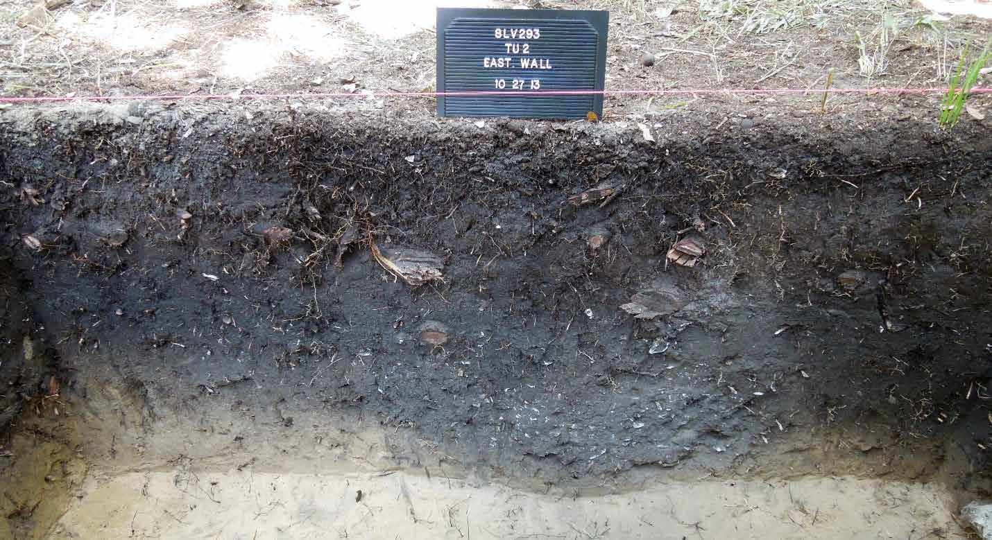
Results of testing to date indicate that each ring encloses dense organic midden and an assemblage of features, including postholes and pits. Pottery, flaked stone, animal bone, and shell are abundant. In the areas we have tested, features are so dense that it is difficult to distinguish individual pits or postholes until reaching the base of the midden deposits. Dense organic midden that developed over 250 years suggests an intensive occupation.
The shape and size of reconstructed pots from Raleigh indicate they were used in day-to-day activities, especially when compared to pottery from earlier civicceremonial centers in the region, where large cooking vessels and nonlocal serving vessels accumulated in the context of large-scale feasts. Based on analysis
4 2020 Adventures in Florida Archaeology
Profile of Test Unit 2 shows the midden present within all the rings tested to date. Photo courtesy of Ken Sassaman
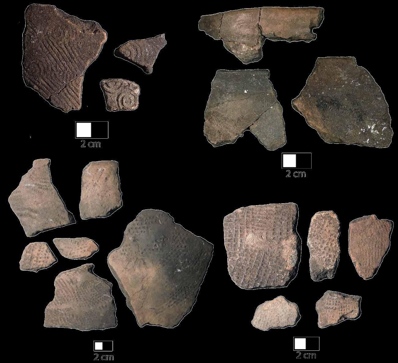
to date, most reconstructed vessels from Raleigh are small, open bowls or medium-sized cooking pots. Some of these small, plain pots and modest cooking vessels are decorated with surface treatments such as dentate and check stamping, but the most common surface treatment is a plain finish. These styles and decorations are common in the study area. However, the most impressive characteristic of the artifact assemblage are the remnants of a substantial shell bead industry.
The scope of shell bead making on Raleigh Island is impressive for several reasons. First and foremost, the turn of the 12th century saw the Mississippian cultural movement spread out of sites such as Cahokia, Moundville, and Etowah. Many communities adopted parts, or all, of this new way of life. Archaeologically, we see this cultural shift in such things as pottery tempered with shell, new construction techniques for mounds and buildings, nonlocal metal and stone, and new rituals and religious iconography. Some of these attributes have been identified among communities in Florida such as the Mill Cove Complex on the St. Johns River, Fort Walton and Lake Jackson complexes in the Panhandle, and among the Safety Harbor population of Tampa Bay. Interestingly, Raleigh is located away from these
Examples of pottery types discussed in this article include: (a) Swift Creek Complicated Stamped; (b) Sand Tempered Plain; (c) Ruskin Dentate Stamped; and (d) Wakulla Check Stamped.
Photo courtesy of the author
large population centers, and the community there was making beads roughly a hundred years before the increased demand for marine shell. This precedence of bead making might indicate that Raleigh’s people were aware of the social movements growing in the interior, or were already making beads for their own purposes and were able to supply beads, and possibly unworked shell, to the emerging population centers after the spread of Mississippian culture.
While several exotic artifacts and raw materials from across the Southeast and beyond were in high demand during this time, marine shell beads were particularly important, especially those made from the lightning whelk (Sinistrofulgur sinistrum). Lightning whelk shells were important among several Native American cultures for ritual and spiritual reasons, and they have been throughout history. In fact, this shell is one of the most enduring ritually and spiritually important materials in the Southeast. More lightning whelk shells moved across the region during the Mississippian period than any other time. Today, Raleigh Island is about ten kilometers from sandy-bottomed seagrass beds that are prime habitat for lightning whelk.
5 2020 Adventures in Florida Archaeology
a b
d
c
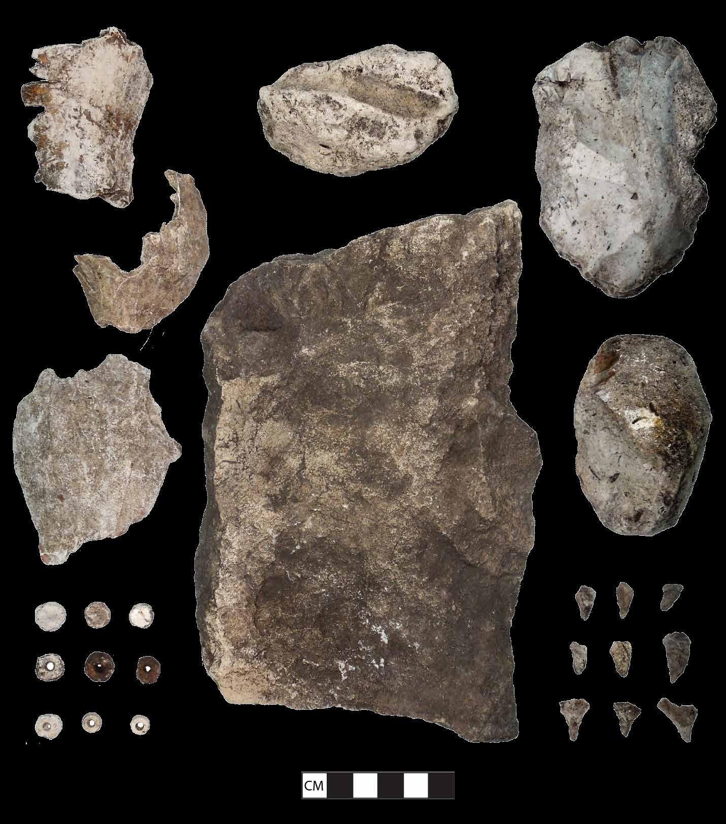
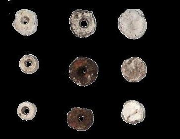
Selected artifacts associated with the shell bead industry on Raleigh Island (8LV293) include: (a) lightning whelk fragments; (b) abrader; (c) chert hammerstones, which also likely served as raw material; (d) anvil; (e) shell beads in various stages of manufacture; and (f) chert drills. Photo courtesy of the author
Lightning whelk beads and fragments in the shell assemblage on Raleigh are one part of the bead-making toolkit. Flaked stone debris from tool manufacture occurs in relatively large quantities. Small stone drills are among the most numerous formal tools found during the excavations. These small tools were used to bore holes in shell beads, and several have patterns of wear consistent with the rotary action of drilling. Many are snapped from the repeated strain of use, or are worn down to the nub. In addition, similar tools that show use-
wear patterns that indicate other uses, such as scoring or etching, have been found.
The numerous small stone tools appear to have been made by a stone tool reduction technique known as hammer-and-anvil, or bipolar reduction. Essentially, the piece of stone to be shaped was positioned on an anvil and struck with a hammerstone. This method of core reduction resulted in rectangular pieces of stone that are ideal for making small drills. In addition to stone drills/
6 2020 Adventures in Florida Archaeology
a b c d e f
microtools, a handful of abraders—tools used to shape beads into their final form, have been found in test units along the interiors of two ring groups. Taken together, these artifacts provide evidence of a shell bead industry that was already in place when demand for whelk shell reached its peak in pre-Columbian history.
Across the Southeast, evidence of shell bead making at the source of raw material is uncommon or poorly defined. This is especially puzzling because the Gulf of Mexico is prime habitat for lightning whelk and supports large numbers of this species. While it is reasonable to assume that people all along the Gulf were capitalizing on this boom in marine shell, for the most part, archaeological evidence of this has been lacking. We know that whole whelk shell was imported to large centers in the interior and that beads were made by their respective local populations. The best evidence of this process comes from the Native American city of Cahokia in present-day Illinois. Aside from Raleigh Island, sites where bead making occurred at a source of marine shell are on Ossabaw Island, Georgia, and locations in Tampa Bay. However, they are in close proximity to coastal Mississippian political centers and, in the case of Ossabaw Island, date to the 14th century. Raleigh is far removed from Mississippian centers, and the absence of completed beads indicates they were not being consumed locally. This begs the question: where and to whom did the shell beads from Raleigh Island go?
Perhaps the greatest potential Raleigh offers is in providing a glimpse into the way shell bead making was integrated into the lives of the island’s population. Much of the literature on making shell beads during the Mississippian period is centered on the popular, wellknown sites of the interior like Cahokia, Moundville in Alabama, and Etowah in Georgia. We know comparatively little about the regions of the Southeast not typically associated with these centers. Research on places away from the aforementioned sites will address gaps in our knowledge and help refine the narrative of how local populations influenced, and were influenced by, the Mississippian sociocultural movement. Raleigh Island and its localized shell bead-making community are now at the center of that discussion.
My dissertation work is designed to address the organization of shell bead manufacturing on Raleigh Island, and to place this community within the larger context of 10th- to 12th-century Florida. Two groups of shell rings, Group 2 and 3, were selected for additional archaeological testing to understand how individual rings and ring groups were being used, and what they represented socially. By documenting things such as techniques used for making stone tools, the source of the
stone used to make tools, and the design and decoration of pottery vessels, we will be able understand how the community on Raleigh Island was organized to make sizable quantities of shell beads.
It is incredible that a place like Raleigh Island remained unknown to archaeologists until 2010. While the island appears on a map to be a short boat ride from shore, it is what some might call a logistical nightmare to undertake an archaeological expedition there. High tide brings only 2.5–3 feet of water in the small inlet of the sawgrass bed surrounding the island. Only after carrying everything needed for life and work through forty meters of mud can excavation begin. Furthermore, recent projections of sea level rise over the next fifty years indicate the ocean will endanger the westernmost group of rings in our lifetime, making work on Raleigh an imperative. Fortunately, the site is on federal land and regulated by the US Fish and Wildlife Service, providing some protection to this now relatively unknown location. However, the time has come to put Raleigh Island on the proverbial map.
Terry E. Barbour is a doctoral student in anthropology at the University of Florida. His dissertation research focuses on Raleigh Island and the early Mississippian period along Florida’s Gulf Coast. He also is a staff member at the UF Laboratory of Southeastern Archaeology.
Acknowledgments: Work on Raleigh Island is made possible through ARPA permit No. LSNWR-102518 and the continued stewardship of the United States Fish and Wildlife Service staff (Rick Kanaski, Andrew Gude, and Larry Woodward) and their ongoing care and maintenance of the cultural resources of the Lower Suwannee. Excavation and mapping costs were paid for by the Hyatt and Cici Brown Endowment for Florida Archaeology, under the supervision of Ken Sassaman. Thanks to the GatorEye team (Eben N. Broadbent, Angelica M. Almeyda Zambrano, and Ben Wilkinson) for helping map this important site, and for their ongoing partnership in mapping other sites in the region. Finally, thanks to field crew members Dr. Mark Donop, Dr. Ken Sassaman, Anthony Boucher, Jessica Jenkins, Emily Bartz, and Matt Newton for their help excavating and documenting this incredible site.
Bibliography
Barbour, Terry E., Kenneth E. Sassaman, Angelica M. Almeyda Zambrano, Eben N. Broadbent, Ben Wilkinson, and Richard Kanaski. 2019. Rare preColumbian Settlement on the Florida Gulf Coast Revealed through High-Resolution Drone LiDAR. Proceedings of the National Academy of Sciences 116 (47):23493–23498.
7 2020 Adventures in Florida Archaeology
DOG ISLAND WRECKS
Victims of a Gulf Coast Ship Trap
After Hurricane Michael made landfall near Mexico Beach on October 10, 2018, archaeologists at the Bureau of Archaeological Research (BAR), Florida Department of State, were alerted by area residents that two shipwrecks and several ship timbers were exposed or washed up on Dog Island. Evidently, locals who had travelled out to the island to check homes and properties also had started exploring the sites.
Archaeologists already realized that the shifting sands of Dog Island and the surrounding seafloor meant that shipwrecks regularly were exposed or moved by major weather events. For example, in late November 2017, a storm had exposed a shipwreck on the Gulf side of the island. As the initial recovery efforts from Hurricane Michael began to wind down in January 2019, BAR archaeologists visited the island to conduct an initial investigation and hopefully identify the exposed shipwrecks.
Background
Located on the northwest Gulf coast of Florida, Dog Island is one of three barrier islands that also include St. Vincent and St. George islands. The archaeological record reflects extensive human activity from prehistoric to modern times. Prehistoric sites dating from the Fort Walton Period (1000–1500 CE) include a log boat and three campsites. Modern sites include nine
historic shipwrecks buried underneath the island and submerged offshore.
In the colonial period, passing ships used Dog Island as a safe harbor and shelter from storms. Early historical records show that Spanish and French visitors surveyed the island and considered it for settlement prior to settling in the region in the early 17th century. From that point on, the island experienced considerable maritime use. Merchant ships sailing to and from lumber ports such as Apalachicola and Carrabelle used the island as a stopping point. The most notable event was the wrecking of at least four ships during a devastating hurricane in 1899. Up to eight other vessels grounded on Dog Island during that storm were salvaged or refloated for repairs. Signs of a modern turpentine collection site and a World War II training camp also are present on the island. Shifting sands have caused the island to stretch out along and toward the mainland as time has progressed. The changing landscapes mean that archaeological sites have shifted and changed location over time, with new ones becoming exposed on a continuous basis.
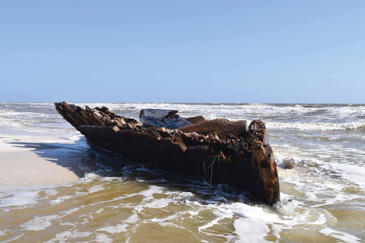
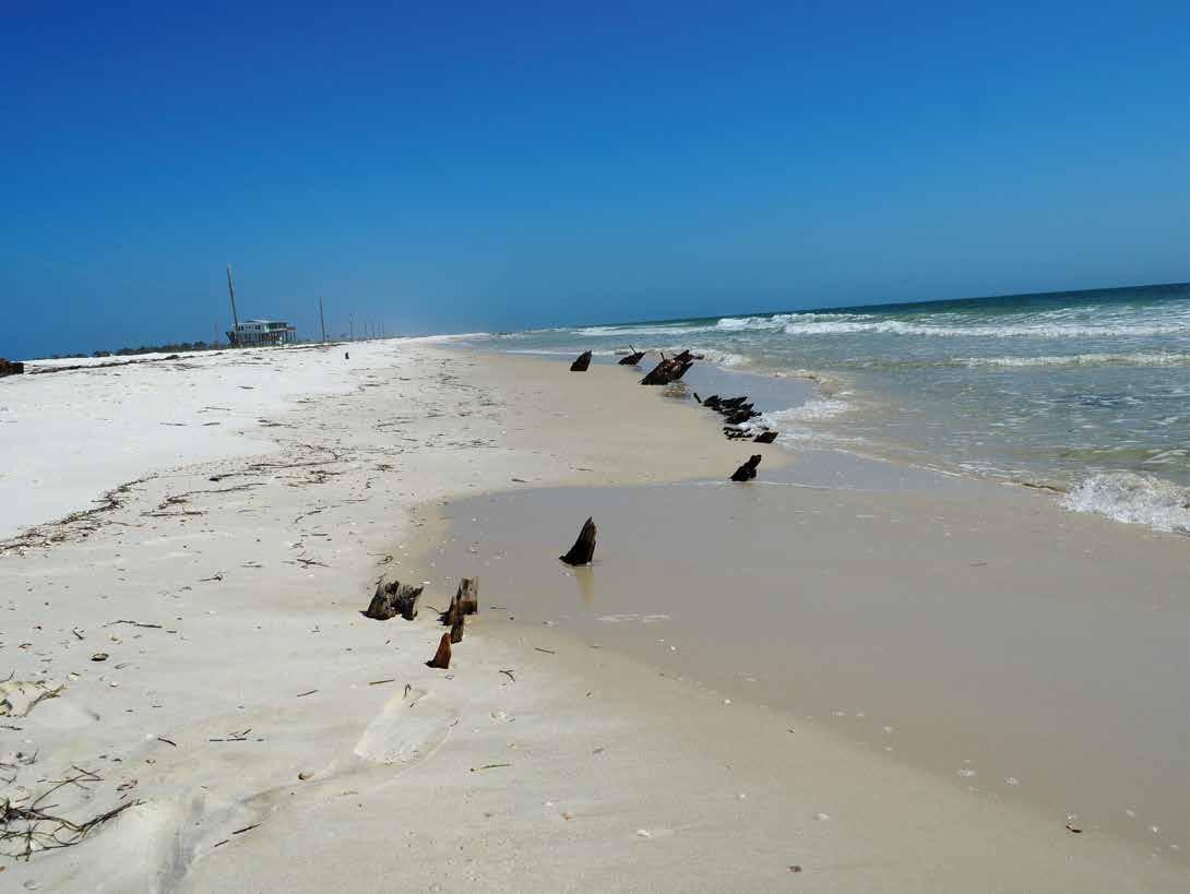
ABOVE: A view of Dog Island Shipwreck No. 3 during the BAR visit in February 2018. Photo courtesy of the Florida Division of Historical Resources
8 2020 Adventures in Florida Archaeology
Previous Investigations
Archaeologists have investigated sites on and around Dog Island several times. Shipwrecks No. 1 and No. 2 initially were recorded in June 1987, which produced detailed site plans and artifact drawings. At the time, they were believed to be wrecks from the 1899 hurricane. In 1995, a terrestrial survey by Nancy White of the University of South Florida also investigated the two wrecks and found very few changes. Research during this survey identified Dog Island Shipwreck No. 1 as Priscilla. Wrecked on September 24, 1917, Priscilla was a red snapper fisherman owned by E. E. Saunders & Co. from Pensacola. The vessel appears in Fishermen of the Atlantic for 1911, but does not appear in 1917, the next available vessel list.
During the same survey, White discovered a firsthand account of the wrecking of Dog Island Shipwreck No. 2. Thorvald Iversen, a Norwegian sailor, visited the island in 1963 to see the spot where his ship, Vale, wrecked in 1899. This account provides good evidence for the identity of Dog Island Shipwreck No. 2, but inconsistencies between Iversen’s account and historical records cast some doubt on the story. It is possible that he misremembered details and his identification of the shipwreck is inaccurate.
In 1999, Florida State University’s Program in Underwater Archaeology (PUA) completed detailed historical research and archaeological field sessions on Dog Island. This work included analyses of Dog Island Shipwrecks No. 1 and 2. Detailed measurements and drawings were taken of their remains. Structural elements of Shipwreck No. 1 matched those of a fishing schooner, confirming its identity as Priscilla. As a result of Dog Island’s movement toward the mainland, Priscilla was found to be in deeper water than previously recorded. Project member Chuck Meide observed that the wreck site probably would become completely submerged as it moved further into the Gulf of Mexico.
The PUA crew’s work on Shipwreck No. 2 produced accurate site measurements and a detailed plan of the exposed remains. They also outlined the possible extent of the shipwreck based on the exposed remains and recreated possible hull lines for the ship. Detailed scantling measurements were taken and are useful as a comparative tool when identifying other shipwrecks from the 1899 hurricane. Scantling measurements refer to the dimensions of parts of the ship like planks, frames, and the keel.
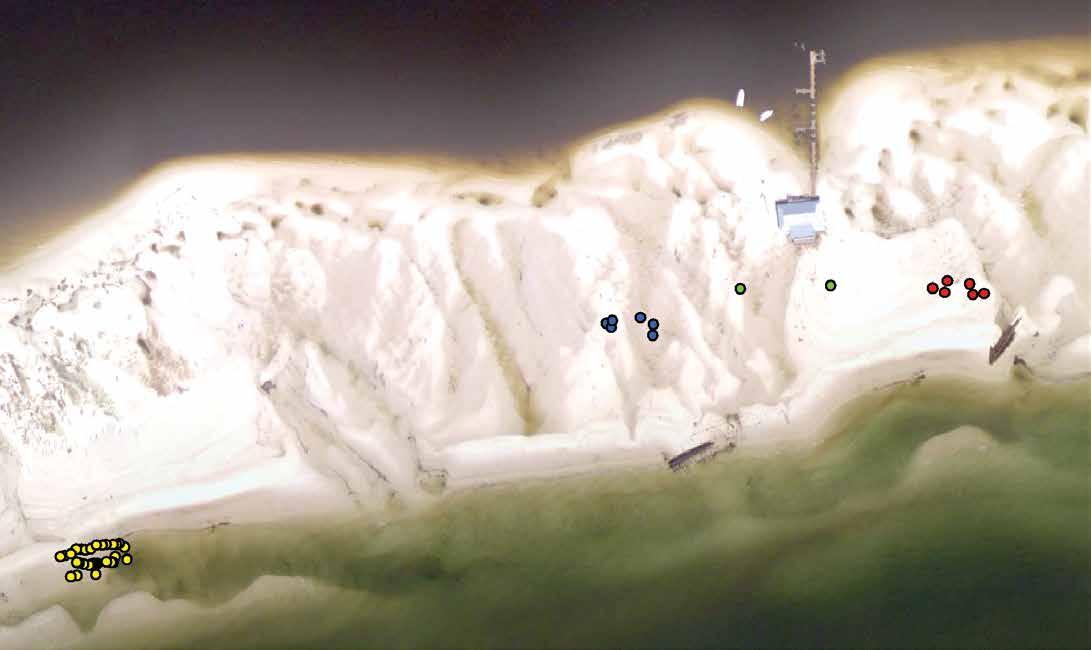

9 2020 Adventures in Florida Archaeology Ivor Mollema
N
This map indicates the migration of Dog Island Shipwreck No. 3 (yellow) to its position on January 23, 2019. Two fragments are visible, the hull fragment (blue) and the bow fragment (SW Points, red). The background imagery indicates the original position of the shipwrecks after Hurricane Michael. They have since shifted due to effects of tide and waves. Courtesy of the Florida Division of Historical Resources
Timber
SW
Hull Points
Dog Island Shipwreck No. 3
Fragments
Points
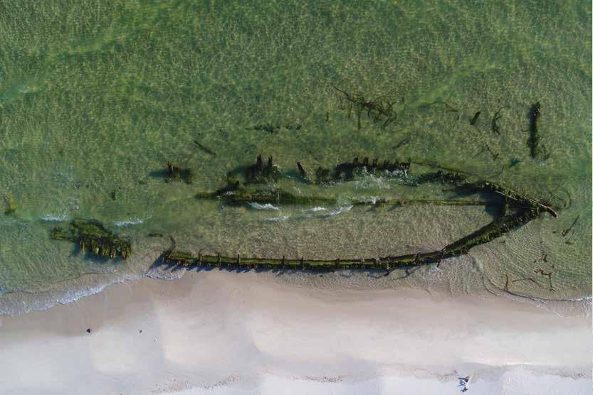
In November 2012, BAR archaeologists led by Lindsay Smith identified a new site on the western end of Dog Island. The existence of the newly exposed wreck on the Gulf side had been reported in September, although no clear location was provided. Nonetheless, staff were able to eliminate Shipwreck No. 2 as a possible identity. When the team visited the site two months later, they discovered the barely visible remains of an undocumented shipwreck. They took photographs and measurements, which they later compared to likely candidates in hopes of identifying the vessel. The likely candidates included the remaining wrecked vessels from the 1899 hurricane—Jafnhar, Latava, and Cortesia, and two unknown schooners. The latter vessels also wrecked during the 1899 hurricane and initially were identified by Iversen’s accounting of the storm. They are visible on historic photographs taken after the hurricane and are labelled as unknown vessels. Photographic analysis allowed Smith to create a rough shipwreck map of the 1899 vessels and to tentatively identify the newly dubbed Dog Island Shipwreck No. 3 as one of the unknown 1899 shipwrecks, based on its location on the photo-rectified map Smith created.
In February 2018, BAR archaeologists Ivor Mollema and Neil Puckett visited Dog Island to inspect a
shipwreck exposed in November 2017. In addition to recording scantling measurements of the timbers, they documented iron knees, iron rigging fragments, and mast fragments. They identified the exposed remains as Dog Island Shipwreck No. 3, recorded in 2012, and used the measurements to confirm the vessel identity as Jafnhar from the 1899 hurricane.
Hurricane
Michael
Within days after this category 5 storm came ashore, social media alerted BAR about two newly exposed shipwrecks on Dog Island. One shipwreck, here referred to as the “bow fragment,” is likely the bottom portion of a ship’s bow. The other shipwreck forms part of a ship’s hull and is referred to as the “hull fragment.” With several archaeological sites already documented on the island, BAR archaeologists sought to identify of the newly uncovered shipwrecks. Scantling measurements, GPS coordinates, photo comparisons, and structural analysis ultimately revealed the answer.
Several shipwrecks were likely candidates for the identity of the remains uncovered by Hurricane Michael. An initial assessment of wrecked vessel fragments, including fastener types, construction style, and materials, indicated a construction date within
10 2020 Adventures in Florida Archaeology
Overhead drone shots provided by a local Dog Island resident. Note the similarities between Dog Island Shipwreck No. 3 in its original position on the left and the Hurricane Michael bow fragment in early 2019. Photo courtesy of the Florida Division of Historical Resources

the latter half of the 19th century. The best clue was the use of Muntz metal in the sheathing on the vessel fragments. Also known as yellow metal, Muntz metal was developed and commercialized in 1832, primarily as a replacement for copper sheathing on the hull of wooden ships. This gave us a terminus post quem (i.e., earliest possible) construction date of the vessel and eliminated any shipwrecks in the area that occurred prior to that time. Vessel construction, including the use of iron knees, also pointed to a later 19th-century vessel. Finally, several of the fastener types showed signs of manufacturing that were not available until the latter half of the 19th century. While some vessels are reported as having wrecked in the general vicinity of Dog Island and the neighboring barrier islands, the likeliest candidates are victims of the 1899 hurricane. These have been documented on Dog Island itself and likely have shifted and moved in the sandy substrate over time. In particular, the Jafnhar, Latava, and Cortesia and the two unknown schooners are good contenders for the identity of the hurricane Michael shipwrecks. While Jafnhar previously was identified by BAR archaeologists as being located farther west along the Gulf side of the island, it is possible that its remains were moved by the hurricane. The other four vessels have not yet been identified and initially were
placed on the Gulf side of the island or just off the island in the Gulf itself.
In the world of maritime commerce, insurance has always been king. Insurance companies set construction standards to ensure that vessels stood a better chance of survival. Shipbuilders and owners had to adhere to these guidelines if they wanted to keep their insured status. The standards provided clear dimensions for all required ship parts and structural features. It is these dimensions that can help provide a clearer picture of the identity of the vessels in question. In particular, the dimensions of the fasteners, frames, planking, and iron knees are the best features to use for comparing with the insurance standards laid out in the Record of American and Foreign Shipping, published by the American Shipmasters’ Association. This record was published each year. Because the new shipwrecks are likely victims of the 1899 hurricane, the standards from that year were used in our analysis. Average sizes of selected features should indicate the size of the ship and allow us to determine the identity of the shipwreck.
On the “bow fragment,” floor timbers, hull planking, ceiling planking, iron fasteners, and the keelson were selected as the best features for comparison with the
11 2020 Adventures in Florida Archaeology
historical insurance standards. Floor timbers, with average dimensions of 10.28 in x 11.21 in, fit the dimensions of a 500-ton ship. The outer hull planking has an average thickness of 3.79 in, which matches the requirements for a ship ranging from 400 to 900 tons. Without a clearer idea of where the planks were located according to insurance standards, it was difficult to determine the right tonnage range for the ceiling planking. Ceiling planking is the planking on the inside of a ship’s frames, or the inner hull planking. Depending on its location on the ship, these planks could indicate a ship size of 400 to 800 tons or 900 to 1400 tons vessel. The keelson is part of the keel construction on a ship. Its width of 14 inches fits the size requirements for a vessel ranging from 600 to 800 tons in size. Iron fasteners, with an average size of 1 1/3 in, would be acceptable for a vessel ranging from 500 to 1200 tons.
The “hull fragment” was difficult to quantify. Without knowing where it was located on the ship, it is not possible to obtain an accurate comparison with the Record of American and Foreign Shipping. Different parts of the ship’s ribs, or frames, and different planking locations, all have different construction requirements. Without knowing the exact location of the fragment, a wide range of possible sizes exists for the vessel. In
fact, frame sizes from the hull fragments provide a tonnage range of 500 to more than 2000 tons. This wide range does not provide a good comparative point for identification. The hull planking on the fragment measured in at an average of 4 in, providing a possible size range of 900 to 1400 tons.
ABOVE, TOP TO BOTTOM: Exposed shipwreck, referenced as the “bow fragment” in this article, shown in January 2019. Photo courtesy of the Florida Division of Historical Resources
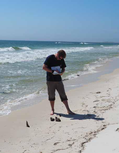
Neil Puckett documents one of the exposed timber features on Dog Island during a reconnaissance in February 2018. Photo courtesy of the Florida Division of Historical Resources
12 2020 Adventures in Florida Archaeology
After analyzing these size comparisons, it became clear that Jafnhar was the most likely candidate. This was especially true of the bow fragment, and likely counts for the hull fragment as well. Jafnhar was a bark built in 1877 in Norway. It measured 130 ft x 29.3 ft x 16 ft and came in at 476 tons. This matches the minimum requirement of about 500 tons from the floor timber. It also fits in all the other size ranges. This identification was further confirmed by drone photos provided by a Dog Island resident. These images show an overhead shot of Dog Island Shipwreck No. 3 before Hurricane Michael compared with an overhead shot of the posthurricane bow fragment. This identification means that the shipwreck shifted approximately 400 meters east during Hurricane Michael.
Future Action
Dog Island is a popular tourist and boating location in the region. As evidenced by social media posts after Hurricane Michael, the public was well aware of the presence of the shipwrecks on Dog Island. Many visitors posed with the shipwrecks for photos. Unfortunately, some people took their visits a step further and removed parts of the shipwreck. This was evidenced clearly by newly cut copper or Muntz fasteners found in both shipwrecks.
To combat this problem, BAR has started cooperating with the Carrabelle History Museum and maintaining a good, communicative relationship with local residents. In January 2019, BAR and the Museum hosted a talk attended by more than 300 local residents. Likewise, residents send regular updates about the shipwreck and its condition. In some cases, they have also discovered several timber fragments that likely originated from
Dog Island shipwrecks. It is not yet clear whether the timbers are directly associated with Jafnhar.
BAR intends to complete a remote sensing survey of Dog Island and the surrounding waters. Further examination of the known shipwrecks is called for to identify the vessels conclusively and provide more comprehensive documentation for future comparative studies. Given the shifting environment of Dog Island, continued monitoring also is warranted.
Ivor Mollema is a Senior Archaeologist with the Bureau of Archaeological Research, Florida Department of State, who specializes in digital recording methods for archaeological sites. He graduated from East Carolina University’s Program in Maritime Studies in 2015.
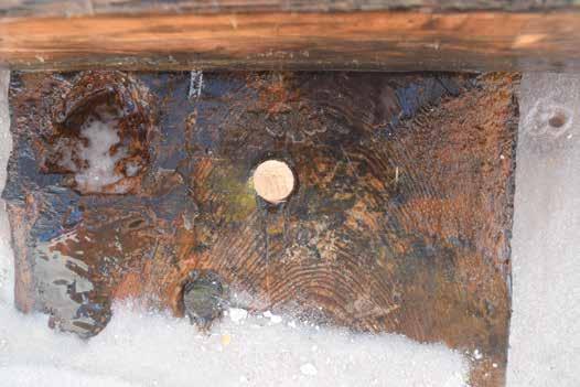
Evidence of looting is clearly shown on this metal fastener on Dog Island Shipwreck No. 3. Note the saw marks on the fastener. Photo courtesy of the Florida Division of Historical Resources
13 2020 Adventures in Florida Archaeology
Some of the victims of the 1899 Hurricane beached on Dog Island are identified in this photo. Photo courtesy of the Florida Division of Historical Resources

of Virginia, took him to College Station, Texas, where he was an early student of the Nautical Archaeology program established by George F. Bass and others at Texas A&M University. As a graduate student, Roger demonstrated more than academic excellence; he was a natural leader, and his passion brought a drive to achieve results. In 1978, he completed a detailed report on all New World shipwrecks from 1500 to 1800 known to have been salvaged or excavated. In 1979–80, while working toward his master’s degree, Roger led an Institute of Nautical Archaeology (INA) survey of shipwrecks in the Cayman Islands. That pioneering survey recorded seventy-seven sites. In 1981, Roger completed his master’s thesis, which focused on the maritime history and archaeology of the Caymans.
He followed that work with a four-year project to locate the remains of two caravels run aground by Christopher Columbus on the north coast of Jamaica in 1504 during his fourth and final voyage to the New World. During those years, with his focus on colonial-era ships, Roger, with his wife KC, were part of a seminal group at Texas
of Historical Resources, and he remained in that post for three decades. His legacy, when he retired in April 2016, can be measured in the development of dedicated programs—academic, nonprofit, and governmental—focused on the scientific archaeological study of Florida’s maritime heritage. Key steps include his pioneering role in the establishment, in concert with dive shop owners and local divers, of three diving/ snorkeling shipwreck trails in the state; the creation of the nautical archaeology program at the University of West Florida; and his leadership in the survey that led to the discovery and subsequent excavation of Florida’s oldest wreck yet located and studied, the Emanuel Point Wreck in Pensacola Bay—one of the lost fleet from Tristan de Luna’s failed 1559 expedition.
Roger believed not only in doing it right in the field, but also following up through laboratory work, conservation, public outreach, and publication. His scholarly work, focused through his graduate studies and field projects, included peer-reviewed articles in the major journals, and major works including Vanguard of Empire: Ships of


14 2020 Adventures in Florida Archaeology
James P. Delgado
Exploration in the Age of Columbus (Oxford University Press, 1993), based on his dissertation, and The Maritime Heritage of the Cayman Islands (University Press of Florida, 2001). He coauthored An Atlas of Maritime Florida (University Press of Florida, 1997) and edited Submerged History: Underwater History in Florida, a detailed, scholarly, informed, and publicly accessible tour of the state’s vast undersea museum (Pineapple Press, 2018). One of his last projects, Submerged History, as well as his book Florida’s Lost Galleon: The Emanuel Point Shipwreck (University Press of Florida, 2018) speak to his scholarship and his commitment to sharing with colleagues and the public.
Sharing with the public is also evident in his role in the creation and support of the various state underwater preserves in Florida, his support of the Florida Public Archaeology Network (FPAN), his mentorship and support of volunteer and nonprofit groups such as the Maritime Archaeology and History Society (MAHS), Diving With A Purpose (DWP), the Lighthouse Archaeology Maritime Program (LAMP), and cooperative work with community leaders, other state officials, and federal agencies such as the National Park Service and NOAA, the latter in Florida Keys National Marine Sanctuary where he as always was there, in the water, observing, teaching, and making a difference. It is altogether fitting that the 2018 Society for Historical Archaeology (SHA) Daniel G. Roberts Award for Excellence in Public Historical Archaeology went to a group that Roger had a leading role in creating, the Tristán de Luna y Arellano Project of the University of West Florida Division of Anthropology and Archaeology: the Department of Anthropology, the Archaeology Institute, the Florida Public Archaeology Network, and the Marine Services Center.
I had the privilege and the pleasure of knowing Roger Smith as a colleague and a friend, and in that capacity to also work with KC Smith, another contributor in our field and a dedicated project member, educator, and mentor. I send my deepest condolences to KC.
God speed, Roger, fair winds, and a following sea.
Sunset and evening star, And one clear call for me!
And may there be no moaning of the bar, When I put out to sea,
But such a tide as moving seems asleep, Too full for sound and foam, When that which drew from out the boundless deep Turns again home.
Twilight and evening bell, And after that the dark!
And may there be no sadness of farewell, When I embark;
For tho’ from out our bourne of Time and Place
The flood may bear me far, I hope to see my Pilot face to face When I have crost the bar.
Alfred, Lord Tennyson (1889)

15 2020 Adventures in Florida Archaeology
THE FUTURE PAST OF ATSENA OTIE
Experiencing Past Hurricanes Virtually
Public concern over climate change has brought into sharp focus the fraught relationship we have with the future. How are we supposed to plan for climate yet to come when the rate and magnitude of change are so uncertain? If every future is truly different than any past, then Edmund Burke was right, and we have no reason to look back to see forward. On the other hand, if the future is the stuff from which the past is made, as George Carlin mused, the archives of history are rife with information about alternative futures, or what some theorists call “futures past.” The past, in this futurist sense, does more than simply benchmark how much things have changed; it also gives substance to our imagination about possible futures.
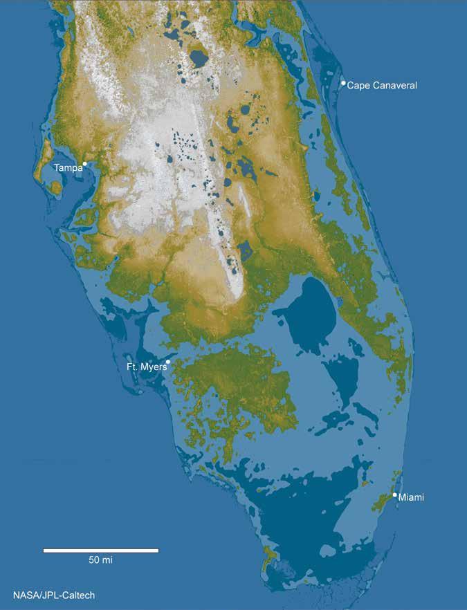
The uncertainty of future climate goes beyond theoretical discourse to affect public policy. Since its inception in 1988, the United Nation’s Intergovernmental Panel on Climate Change (IPCC) has been reluctant to issue projections for sealevel rise that take into account the collapse of the Greenland and West Antarctic ice sheets because it has no reliable data on the rate at which such events elapse. The omission of these events from sea-level rise projections is highly consequential: the projected net increase in sea level this century is less than one meter without ice sheet collapse, and roughly six meters with it. Under the latter scenario, the southern third of Florida and most of its coastlines throughout the rest of the state would be inundated.
Rather than bemoan the lack of data on the rate by which ice sheets collapse, some geologists have taken to the field to find evidence for the last time it happened. That was roughly 125,000 years ago, during the last Interglacial period. Florida was half the land mass it is today, as it will be again in the future. By investigating the rate at which this occurred before, geologists hope to reduce the uncertainty that bedevils sea-level rise projections today, like those of the IPCC. From the depositional records of the last Interglacial era, geologists are reconstructing a futures past for Florida that bears relevance to our own future.
You can never plan the future by the past
—Edmund Burke, Anglo-Irish statesman (1729–1797)
The future will soon be a thing of the past
—George Carlin, comedian (1937–2008)
16 2020 Adventures in Florida Archaeology
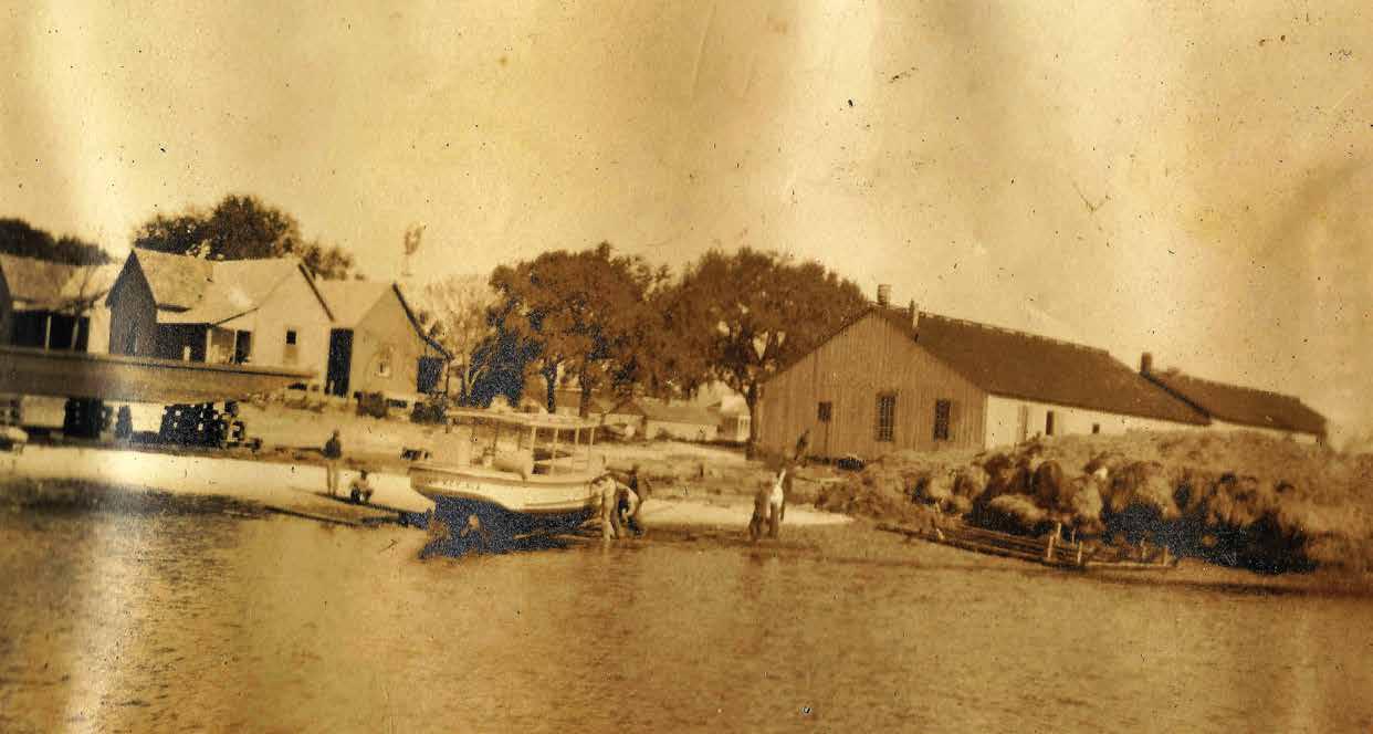
Photograph, left, dating to 1911 or 1912, shows some of the houses that were relocated from Atsena Otie after the 1896 hurricane to the northeast corner of 1st and E streets in Cedar Key. Photo courtesy of Beth Mizell
As an archaeologist, I am interested in ancient human experiences with climate change, which, in Florida, began as soon as people arrived at the end of the last Ice Age. Florida then was twice the land mass it is today. Sea level was about 80 m lower than at present, and the northern Gulf coast of Florida—where my students and I work—was more than 200 km west of its current position. Retreat from a drowning coast must have been routine for people back then. Not so much in recent centuries, but if future projections for sea-level rise are correct, coastal retreat may again become necessary, and common.
I have long wondered how an archaeology of prior experience with sea-level rise might be useful for imagining our own future. Over the last decade, our team has developed good insight on how the ancestors of Native Americans dealt with rising sea, although the resolution of our data is regrettably too coarse to narrate those experiences in biographical terms. It took me a while to appreciate that such coarse-grained reconstructions— devoid of the sensory, bodily qualities that make experience so memorable— had little chance of resonating with modern people. Rather than reach so far back to imagine possible futures, I now wonder how an archaeology of the recent past can help to inform the inevitable need to retreat from locations of growing vulnerability to severe storms and the flooding of rising seas. So I now ask: when was the last time a settlement on the northern Gulf coast was abandoned and relocated in the wake of a climate event, such as a hurricane? In our study area, that would be the late 19th century and the island town of Atsena Otie, a possible future past of the modern town of Cedar Key.
Atsena Otie exists today as “ruins” with limited above-ground visibility. Its cemetery is known by most people as the only thing that remains on the long-abandoned island, which is to
Kenneth E. Sassaman
say that it is the only obvious trace of a bygone era. But below the surface lie the archaeological remains of land use since the early 19th century. Among the remains awaiting discovery are those of a trading post dating to the First Seminole War (1818–20); a US Army hospital from the Second Seminole War (1840–42); a would-be resort and then chartered town of the 1850s; and cedar millworks and associated industry of ensuing decades, when upwards of fifty households occupied lots of a platted community.
Hurricanes were common over this span of time, as they continue to be, and some were so impactful as to be valorized in memory as the cause of structural change. A direct hit on September 29, 1896, is
17 2020 Adventures in Florida Archaeology
A NASA map projection of the south Florida peninsula portends a possible future Florida if the Greenland and West Antarctic ice sheets collapse. Source: NASA/JPL-Caltech, Wikimedia Commons
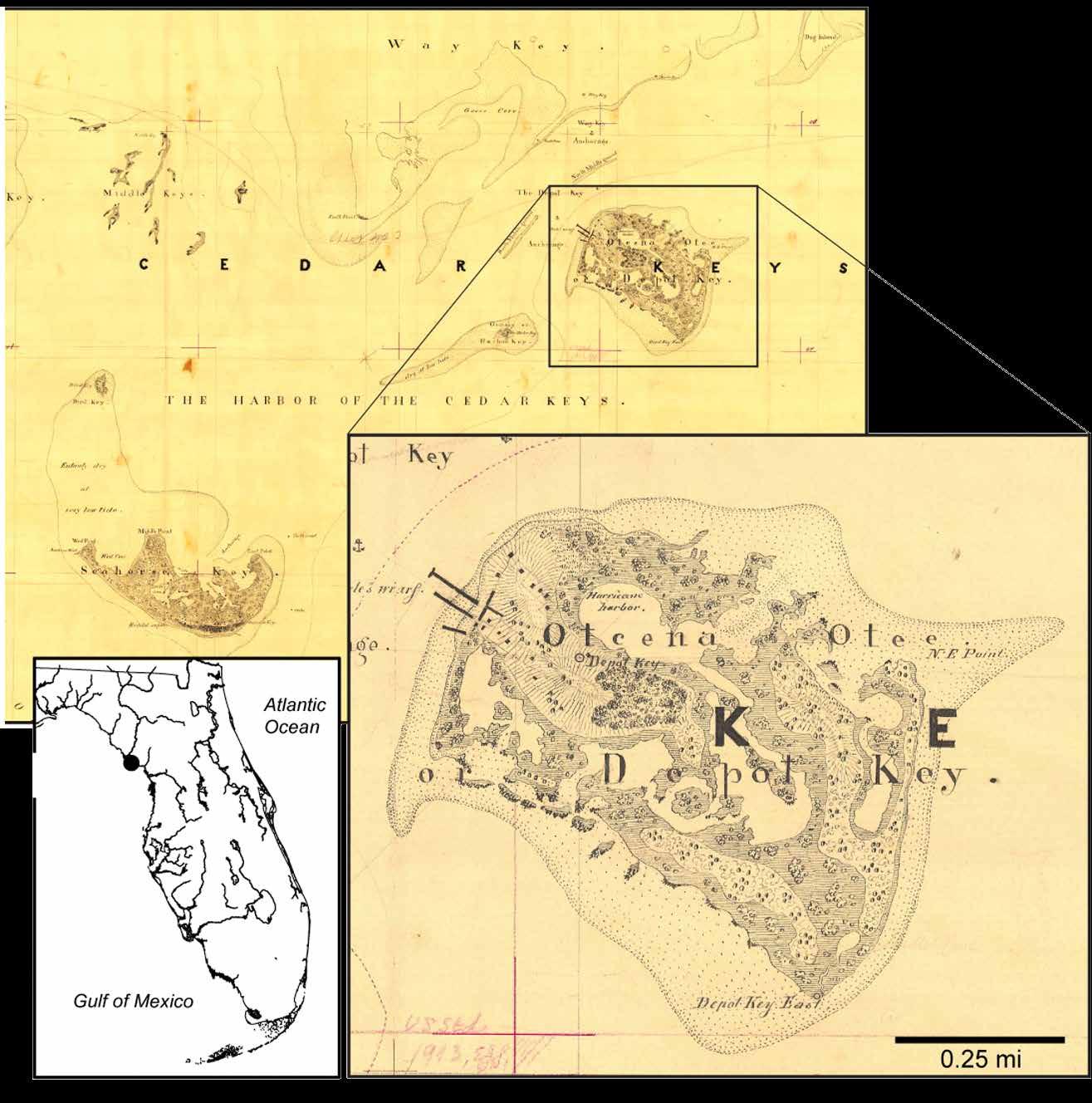
Portion of the draft 1852 Gerdes map of the US Coast Survey, with a closer view of Otcena Otee (now Atsena Otie), formerly Depot Key, depicts the island ten years after a hurricane destroyed an Army hospital and forty-four years before another hurricane destroyed the Eberhard Faber cedar mill that was constructed on the northwest shoreline of the island in 1868. Image courtesy of the author
especially memorable. On that morning, ten-year-old Velma Crevasse and her family walked out of their two-story house on Atsena Otie after a harrowing night of 100-mile-per-hour winds and hard rain. She, her family, and their house survived the night only to be met with a ten-foot storm surge on the backside of the storm. Velma described running upslope to a thirdstory house and climbing to the top floor to watch the surge overtake their home. Many of the houses on the island, as well as the mill, were severely damaged or destroyed. Velma lived to tell the story later, but thirtyone individuals in the area died, as did another eightysix on the storm’s path along the Florida Railroad to Fernandina.
Imagining how the 1896 hurricane is manifested in social memory today is to ask about the relationship between experience and expectation. And it is here that I acknowledge the fragmentary and discontinuous nature of social memory: a bricolage of facts, hearsay, post-hoc rationalization, and fanciful thinking. Nothing unusual about any of this as history has more to do with what we make of the past than what actually happened. But can we—through archaeology and digital technologies to enhance reality—provide a new form of experience, new raw material for memory making that is geared more directly toward futures?
18 2020 Adventures in Florida Archaeology
Atsena Otie/ Cedar Key

For that I recruited the help of two colleagues, Ed and Diana González-Tennant, leaders in the burgeoning field of “New Heritage,” basically the use of digital technologies, including virtual reality, to take heritage studies beyond the limits of its traditional methods. Ed and Diana have created digital resources for a variety of projects, but I was especially attracted to Ed’s work with the history of Rosewood. Drawing on diverse sources, Ed brought Rosewood to 3D digital life, and he continues to expand the platform to realign the virtual experience with an ever-growing body of information. What struck me as especially relevant to the Atsena Otie project was the gravity of a particular event in social memory. In the case of Rosewood, that defining event was the race riot of January 1923. From that point of entry, Ed is able to look both backward and forward to situate the event in the broader context of race relations in the US. His virtual reality platform allows for experimentation in time-bending, because it is not constrained by the linearity of typical historical narrative, or the synchronic moments of living history museums.
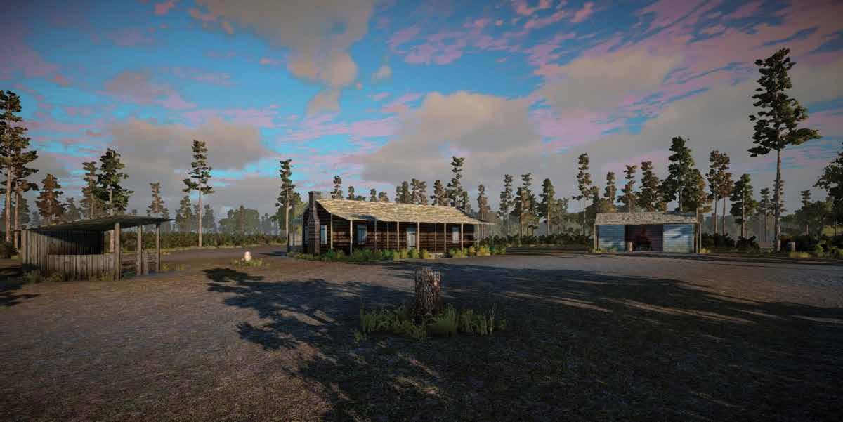
With an ultimate goal of creating a virtual reality platform for exploring the experience and expectation of climate events, the Atsena Otie project draws on archival, geospatial, archaeological, and oral historical data centered on the namesake island in the late 19th century. The geospatial and archaeological components of this project are necessary for sensory purposes—that is, to create bodily experiences
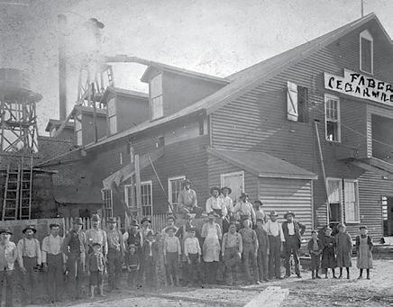
Workers and their children are shown outside the Eberhard Faber Cedar Mill on Atsena Otie in the year before the 1896 hurricane destroyed the mill. Ten-year-old Velma Crevasse is the second child from the right. Her vivid memories of the storm were published in the Florida Times Union in 1965, when she was 80. Like the mill, her family’s home was largely destroyed. Shortly after, they relocated inland to town of Morriston.
Image courtesy of the author
by placing persons in living spaces, temporalizing experience by moving through those spaces, and offering material touchstones to persons whose biographies we can follow backward and forward.
Covered in secondary forest, the surface of the main portion of the island, where the mills, homes, and cemetery were sited, offers few visible vestiges of the built environment. The 1896 storm destroyed some structures and badly damaged the mills, but others survived or were rebuilt and either relocated to Cedar Key later or eventually dismantled. No standing structures exist on the island today. Besides the cemetery, remnants of the Eberhard Faber cedar mill on the north shore and a cistern in the interior of the island are among the few obvious above-ground features.
To enhance our ability to locate subsurface remains of houses, millworks, and other structures—and thus produce virtual reconstructions with accurate spatial and temporal attributes—we recruited the help of colleagues with the University of Florida’s Spatial Ecology and Conservation Lab. Using drone-mounted LiDAR, Lab Codirector Eben Broadbent collected data points at a density far greater than is possible with plane-flown LiDAR. From an hour of drone time and a few more hours of postprocessing, the resultant map of Atsena Otie shows a variety of rectilinear features, many likely to correspond to the locations of structures. We have yet to conduct ground-truthing
19 2020 Adventures in Florida Archaeology
Screen shot of Virtual Rosewood (http://www.virtualrosewood.com/raih/) shows the Carter homestead and blacksmith shop. Informed by abundant historical and archaeological documentation, virtual worlds like this help bring the past to life. Image courtesy of Ed González-Tennant
of any of these surface features, but suspect that in many cases they will consist of now-denuded brick or tabby footers or perhaps driplines and circumferential pathways around houses. A 2002 survey of the island by archaeologists with Panamerican Associates lends credence to this expectation.
Historic plats in the Levy County archives enable us to divide the island into property parcels. Ed and Diana already have digitized and georeferenced several plats. Again, the late-19th century, and 1896 in particular, is the entry point for this project, but all other subdivisions are needed to sort out the components that may present themselves in archaeological context from earlier and later land use. At any given point in time, we hope to be able to connect each parcel to its owners and occupants.
Our intent in prioritizing some properties over others turns on the detail of biographic data we can gather from island residents and mill workers. Who, for example, not only dwelled on Atsena Otie in the late 19th century, but also descended from local forebears and left descendants with memories of them today? We know of some such persons and have begun to develop collaborations with them.
The results will be patchy, no doubt, with some parcels and owners remaining anonymous. Fortunately, from the standpoint of populating a virtual Atsena Otie with all its structures, an 1884 bird’s eye view of the area provides a valuable touchstone. This is among the many perspective maps that were made in the late 19th and early 20th centuries from painstaking
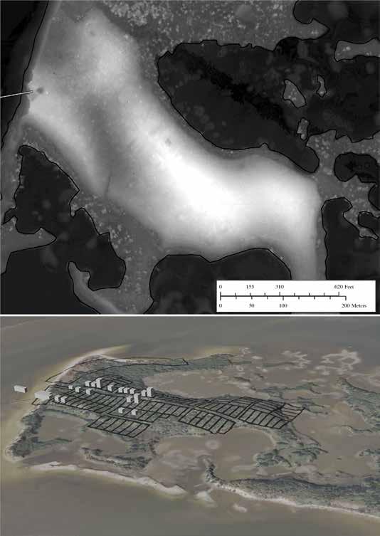
Projection of drone-mounted LiDAR data (top) shows subtle traces of remnants of houses and other infrastructure on Atsena Otie today, and a preliminary 3D model of a historic property plat with some place-holders for buildings that will be enhanced in the future with architectural details. Both images courtesy of Edward González-Tennant
20 2020 Adventures in Florida Archaeology
measurements of the built environment. Although lacking in architectural detail, the locations and basic shapes of buildings and other infrastructure are relatively accurate. Sanford Insurance maps offer additional information about the size and shape of buildings, but in this case only for the Faber mill.
We eventually need to target locations for subsurface testing to substantiate inferences about the locations and forms of structures. We also hope to recover objects that can be connected through virtual reality to actual personal experience. Subsurface testing will commence with targets provided by LiDAR that correspond to properties with ownership and occupancy that are reasonably well known to us, such as the Crevasse home. We also plan to open up some space around and beneath the ruins of the Faber mill.
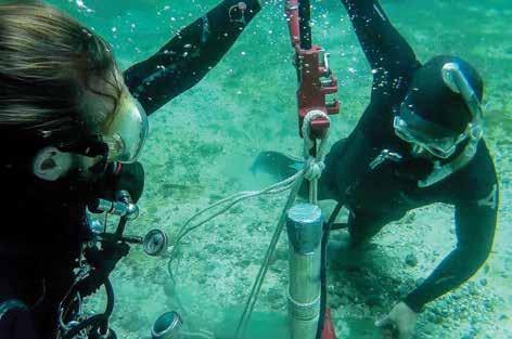
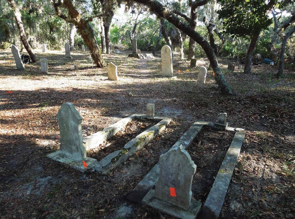
Another priority is a digital reconstruction of the cemetery at the east end of the island. Among the persons buried there are individuals with living descendants in the area. Prior surveys have been conducted, and maintenance and visitation of the graves are ongoing. With the help of project collaborator Ginessa Mahar, archaeologists from the Florida Public Archaeology Network, and volunteers from Cedar Key, we spent two days last December cleaning and mapping the thirty-two graves whose markers are more or less intact. Taking scores of
photos of each grave from multiple angles will enable Ed and Diana to construct 3D models and place them in their respective locations for a complete digital reconstruction. This same method of photogrammetry is used to digitally repair broken headstones. Eventually we hope to be able to use the digital model as a portal into the lives of those buried in the cemetery and to link those persons to the places at which they lived and worked.
No matter how detailed and compelling a virtual Atsena Otie may be, it will not serve more than entertainment purposes if it is uninformed by narratives that reveal the entanglements of place, history, and event in sensory, human terms. Foremost among them are the entanglements of the cedar industry. We need to acquire and analyze records of cedar harvesting, starting with the land acquisitions of Eberhard Faber in the 1850s and working through four decades of reputed overexploitation. We have to square the reality of an ample cedar stock just prior to the 1896 hurricane with evidence that the industry was already on the skids. We have to identify the labor force working at the mills and the timber camps. What were the circumstances surrounding the shift from a predominately black labor force, including citizens of Rosewood, to an increasingly white population? We have to investigate the railroad, both as an enabler of growth in the cedar business and its Achilles heel
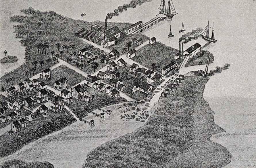
Portion of an 1884 lithograph of a bird’s eye view of Atsena Otie shows the Eberhard Faber mill (building 6) with an abundant stock of cedar awaiting processing and transfer via boat to the railroad depot at Cedar Key. A second wood mill (building 8) and residential structures provide good detail on the size and placement of buildings on Atsena Otie twelve years before the fateful storm. Image courtesy of the author
21 2020 Adventures in Florida Archaeology
under both military and market impingements. We have to consider the role of a traveling John Muir, whose preservationist philosophy usually is attributed to his time in the Sierra Nevada, but likely took shape in Cedar Key as he surveyed a landscape of overharvesting.
Finally, if we ultimately hope to be able to provide insight on future coastal living in the Cedar Key area, we have to work on the links between experience and expectation in human terms. Taking the long view, it is not unreasonable to suggest that Cedar Key will have to be abandoned and relocated in the future. Will the memory of Atsena Otie have any role in this potential future? The friction of time on memory is effective at disconnecting experience from expectation. As we look backward and forward from our entry point of September 1896, we find that the experiences of other hurricanes that live as memory (in mostly literary form) are the 1842 storm that wiped out the US Army installation and the 1950 Labor Day storm that coincided with the waning years of a thriving fiber industry started in 1910. Over this stretch of more than a century, hurricanes have passed close to Cedar Key dozens of times, averaging one every
3.9 years since 1870. They varied in intensity, duration, and direction, but it is safe to say that those experiencing such conditions would judge impact not only from the storm itself, but also the challenges it posed to rebounding and moving forward. The big events that inflect the history of Cedar Key are spaced more than fifty years apart, more than two generations. It will be useful to imagine how the conversion of climate events to historical events takes form, and for what purposes these narratives serve. We are encouraged by the potential of virtual reality to explore these sorts of questions in ways that heighten public awareness about possible futures and hopeful ways to minimize its negative outcomes.
Dr. Kenneth E. Sassaman is the Hyatt and Cici Brown Professor of Florida Archaeology in the Department of Anthropology, University of Florida.
22 2020 Adventures in Florida Archaeology
Acknowledgments. Research at Atsena Otie is made possible through the ongoing support of the US Fish and Wildlife Service, in particular Regional Archaeologist Richard Kanaski and Refuge Managers Andrew Gude and Larry Woodward. Archival research for this project has benefited from the help and encouragement of Dr. John Andrews, Pam Wadley, Anna Hodges, and the Cedar Key Historical Society. Funding for the project is provided by the Hyatt and Cici Brown Endowment for Florida Archaeology and the College of Liberal Arts and Sciences, University of Florida.
Bibliography
Ambrosino, James N., Lisa N. Lamb, Lucy D. Jones, and Paul L. Jones. 2002. An Archaeological Reconnaissance of Atsena Otie Key, Cedar Key National Wildlife Refuge, Levy County, Florida. Tampa: Panamerican Consultants, Inc.
LEFT: A view facing northeast shows the Atsena Otie cemetery in December 2019, when it was cleaned, mapped, and photographed to produce a 3D model that later will be incorporated into the virtual world. Image courtesy of the author
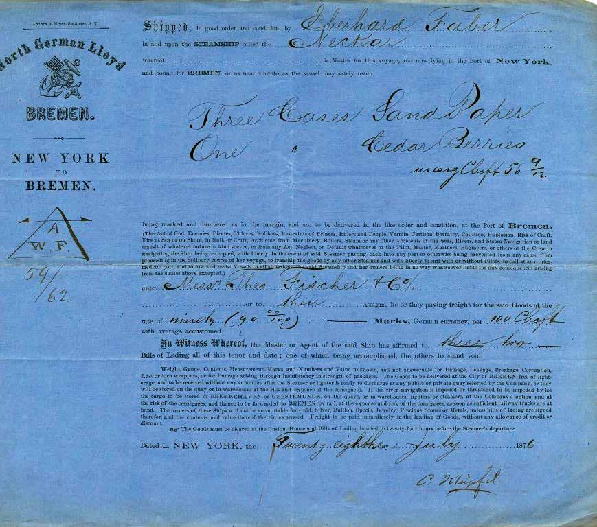
BELOW: A shipping bill dated July 28, 1876, was prepared for three cases of sandpaper and one case of cedar berries sent by Eberhard Faber from his pencil factory in New York to Bremen, Germany. Eberhard’s brother Lothar evidently attempted but failed to grow Florida cedar in Bavaria as the US supply dwindled from overexploitation. Courtesy of the Faber-Castell Company, Stein, Germany
23 2020 Adventures in Florida Archaeology
HERITAGE MONITORING SCOUTS
Stewardship
The Florida Public Archaeology Network (FPAN) is a statewide organization established by the Florida legislature in 2005. Its mission statement—“To promote and facilitate the stewardship, public appreciation, and value of Florida’s archaeological heritage through regional centers, partnerships, and community engagement”—reflects the importance of working with the public to protect cultural resources. Established in 2016, FPAN’s Heritage Monitoring Scouts (HMS Florida) program builds on this framework (Lees et al. 2015). By engaging citizens in the important work of monitoring endangered sites, HMS Florida helps participants build a sense of stewardship and pride in Florida’s cultural heritage.
Through Citizen Science
Citizen science has become something of a buzzword in recent years, but the National Geographic Society points to the North American Bird Phenology Program, established in the late 1800s, as one of the earliest examples of appealing to the public for assistance collecting scientific data. Over time, additional groups began tapping into a network of people already interested in specific areas of study to gather field data and report the information to active researchers. The number of citizen science programs expanded in the late 1990s as the internet connected even more individuals to their area of interest (http://www.nationalgeographic. org/encyclopedia/citizen-science/).
24 2020 Adventures in Florida Archaeology
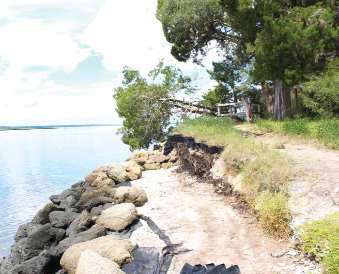
A Minorcan well at Shell Bluff Landing shows evidence of destruction due to sea level rise between 2016 (below) and 2019 (left). Photos courtesy of FPAN Northeast
The advantages of citizen science are clear. By tapping into the interests of community members, it is possible to increase oversight of at-risk resources exponentially while providing a corresponding increase in data gathered. In addition, by educating volunteers about the science of archaeology and the abundant information contained in the archaeological record, a sense of stewardship is developed as well as a desire to protect
Patrisha Meyers-Gidusko
this expanse (Birdsong 2012, in Miller and Murray 2018), all contributing to the state’s rich history. In addition, coastal towns draw visitors from around the world, with tourism being a key contributor to the state’s economy. All of these factors make Florida’s coastline one of the state’s most valuable and vulnerable resources.
The global rate of sea level rise has generated concern across borders and scientific disciplines. Between 2011 and 2015, Florida’s rate of sea level rise was six times higher than the global average (Valle-Levinson et al. 2017:7878).
these resources. Simply stated, “The success of any citizen science project depends on the establishment of a well-devised monitoring program and the dedication of its volunteers” (http://www.nationalgeographic.org/ encyclopedia/citizen-science/). FPAN’s HMS Florida program is a great example of a well-established monitoring program with a strong core of dedicated volunteers.
The type of resources that most scouts monitor fall into three categories: archaeological sites, historic cemeteries, and historic structures. A variety of threats— from abandonment and vandalism to systematic looting—can endanger these resources. However, one of the most pressing threats facing Florida’s cultural resources today is climate change and the resulting sea level rise. Florida boasts more than 8,000 miles of coastline. Nearly 35,000 cultural resources exist within
Putting this concern into perspective, it is anticipated that a 2-meter rise in sea level will impact approximately 6,820 archaeological sites in Florida (Anderson et al. 2017). Each site represents an important thread in a tapestry telling the story of the state’s past. However, imagine an ancient tapestry that depicts an epic moment in time, but the final scene is threadbare and indecipherable. Absent other records, it may be impossible to interpret the full meaning conveyed by the tapestry. Florida’s cultural resources are facing a similar fate. Once a site has eroded away, the information it contains is lost forever, and part of our collective history is erased. When viewed through this lens, it becomes clear that Florida’s vast coastline and accelerated rate of sea level rise pose a greater-than-average risk to the state’s cultural resources.
Why does any of this matter, and what do cultural sites contribute to the fabric of society? City planners and economic development councils are increasingly interested in how these sites can contribute to the economic and social health of their communities. In the past, many “top-down” approaches to cultural site management have proven problematic. In some instances, management was implemented without public consultation, and programs have alienated the very people most connected to the resources in question (Labrador 2012). The HMS Florida program is an opportunity for engagement on all levels. By participating in the program, citizens learn about archaeological sciences, how to apply an anthropological approach to site stewardship, and how this approach can help scientists interpret the past.
HMS scouts are provided information and support to guide them as they learn about Florida’s archaeological
25 2020 Adventures in Florida Archaeology
resources. One of the first concepts covered is that an archaeological site’s value is not found in the artifacts it contains, but in the information the artifacts provide. This is followed with a discussion about archaeological ethics and the laws protecting cultural resources. To further protect archaeological sites, all prospective scouts are required to sign an ethics statement and program agreement prior to joining any monitoring activities.
Monitoring at-risk sites isn’t just about understanding the past; it also is about planning for the future. HMS Florida works closely with land managers in multiple state and local agencies. Monitoring offers scouts an opportunity to provide information that land managers can use to plan future resource management. Even in cases where a site’s condition is known to be deteriorating due to sea level rise, documentation can contribute to understanding the rate of loss. An example of this can be found at Shell Bluff Landing, a well-
recorded archaeological site in the Guana Tolomato Matanzas National Estuarine Research Reserve (Miller and Murray 2018).
Cultural resources found at Shell Bluff Landing span 6,000 years of Florida’s history. Listed on the National Register in 1991, the site has been a rich resource for scientists interested in both the prehistoric and historic periods of Florida’s northeast coast. A survey marker placed in 1988 is used to measure the impacts of sea level rise. Through measurements taken from the marker to the bluff line, and repeated over time, researchers have determined that fifteen meters of erosion have occurred in the span of thirty years. This calculates to approximately 50 centimeters a year, and with every centimeter of erosion, more archaeological material is lost. One of the most visual reminders of this loss is a Minorcan well dating to the 1800s. Photos on pages 24 and 25 clearly depict the rate of loss. In 2016, the feature stood back from the waterline. By 2019,
26 2020 Adventures in Florida Archaeology
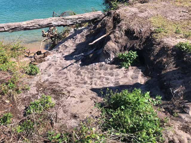
FPAN Southeast Public Archaeology Coordinator Mallory Fenn monitors washout damage at Jupiter Inlet Lighthouse Outstanding Natural Area in 2019 (above). Additional washout activity occurred in 2020 (right). Photos courtesy of FPAN Southeast
scouts reported that the base of the well was covered in brackish water during high tide inundation.
“It is so important to document these resources for future generations.”
“There is so much history being lost. I want to help protect it.”
–Comments from HMS Florida participants
Another example of the impact of sea level rise on archaeological sites can be found at the Jupiter Inlet Lighthouse Outstanding Natural Area in Palm Beach County. This park is the only National Conservation Land unit found east of the Mississippi River and contains archaeological evidence for human occupation dating more than 5,000 years in the past (http://www.blm. gov/programs/national-conservation-lands/easternstates/jupiter-inlet-lighthouse). The photo on page 26 shows washout damage to the site recorded in 2019. Even more extensive damage recorded early in 2020 is shown in the photo above. These images illustrate the importance of frequent monitoring to document the deterioration rate at archaeological sites.
being lost, I want to help protect it” often are heard. Two individuals in particular, Chris Nolan and Joe Dunn, are prolific scouts and great advocates of HMS Florida. To inform the public about HMS and other programs, FPAN partners with community groups to host information sessions, workshops, and training events. Nolan first heard about HMS through the Charlotte County Historical Society. Finding someone with her dedication through a partner organization highlights the importance of community engagement and collaboration to the success of the monitoring program.
One of the best ways to gauge the success of a project is to gather feedback from those involved with the project and those impacted by it. In the case of HMS Florida, FPAN has conducted a series of “Community Conversations” events to hear not only from the scouts, but also from community members who value these endangered cultural resources (Miller et al. 2019). By engaging community members and soliciting their feedback, FPAN is able to bring local concerns to the forefront and keep people informed of HMS activities and the impacts to cultural resources that are being documented.
When HMS scouts comment on the program, remarks such as “it is important to document these resources for future generations” and “there is so much history
Nolan is particularly interested in documenting cemeteries. As a child, her father owned a funeral home, and growing up in this environment led to an interest in cemeteries and the memorialization process. During her monitoring efforts, she has identified and recorded more than twenty historic cemeteries that were undocumented in the Florida Master Site File (FMSF), the state’s official inventory of cultural resources, maintained by the Division of Historical Resources (DHR). Newly recorded sites are added to this inventory, and when information is updated, DHR better understands the state’s cultural resources and is able to enact measures to manage them.
Nolan says she’s passionate about documenting historic cemeteries because she wants people to understand their importance as a touchstone to history. She is saddened to see neglected cemeteries and hopes her efforts contribute to community awareness and cemetery protection.
27 2020 Adventures in Florida Archaeology
Dunn appreciates the opportunity to document sites because, as he says, “They become a part of you, and you come to respect and cherish them.” Moreover, he believes he’s making a difference in their preservation. “It is important for researchers to be able to gather data from cultural sites, but if they’re changed or altered, that can have a lasting impact on future research.” That’s why he’s passionate about documenting the history preserved in cultural sites to ensure that future generations can learn from them.
FPAN’s Heritage Monitoring Scouts program exemplifies the power of citizen science. Exciting new opportunities for citizen engagement lie ahead as HMS enters its fourth year. Through outreach, education, and training, HMS Florida is expanding public knowledge of Florida’s rich cultural past while preserving important information about past populations. FPAN and HMS staff will continue to work closely with DHR and the Bureau of Archaeological Research to identify and monitor many of Florida’s most at-risk cultural resources. With recent grants from DHR, FPAN expects to monitor 500 sites and provide 3D laser scanning for a selection
Joe Dunn is another passionate HMS scout. An avid hiker and explorer, he spent years outdoors discovering Florida’s unique history before becoming an HMS scout. He already had begun documenting and sharing his experiences through his Florida Trailblazer blog Dunn sets a positive example for other adventurers by taking nothing from the places he visits and leaving no traces behind. This type of stewardship meshes perfectly with the tenants of HMS Florida. He says learning about Florida’s historic and prehistoric past through researching, visiting, and documenting endangered sites has added another layer to his love of the outdoors.
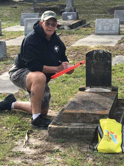
ABOVE: HMS Volunteer Chris Nolan records features in a historic cemetery. Photo courtesy of Chris Nolan
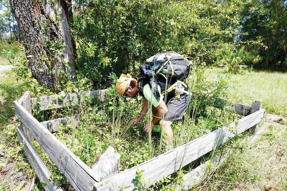
LEFT: HMS Scout Joe Dunn reads a headstone to document the neglected grave marker of a young child. Photo courtesy of Florida Trailblazer
of critical sites eroding into the sea. For information about joining this important effort, go to https://www. fpan.us/projects/HMSflorida and click on “Apply to Become a Scout!” You’ll receive a welcome letter with details about participating and monthly updates about relevant topics such as climate change’s impact on cultural resources and HMS scouting opportunities.
Patrisha Meyers-Gidusko is the HMS Florida project manager. She holds a master’s degree in anthropology and is a registered professional archaeologist.
28 2020 Adventures in Florida Archaeology

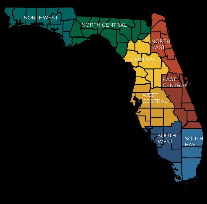
FPAN has HMS scouting opportunities in all of its statewide regions. Photo courtesy of FPAN coordinating center
Bibliography
Anderson, David G., Thaddeus G. Bissett, Stephen J. Yerka, Joshua J. Wells, Eric C. Kansa, Sarah W. Kansa, Kelsey N. Myers, R. Carl DeMuth, and Devin A. White. 2017. Sea-level rise and archaeological site destruction: An example from the southeastern United States using DINAA (Digital Index of North American Archaeology). PLoS ONE 12(11): e0188142 https:// doi.org/10.1371/journal.pone.0188142.
Birdsong, Vincent. 2012. Known cultural resources in Florida potentially affected by sea level rise. In “Heritage Monitoring Scouts: Engaging the Public to Monitor Sites at Risk Across Florida,” by Sarah E. Miller and Emily Jane Murray. 2018. Conservation and Management of Archaeological Sites 20(4):234–260.
Bureau of Land Management, https://www.blm.gov/ programs/national-conservation-lands/eastern-states/ jupiter-inlet-lighthouse, accessed 2/3/2020.
Labrador, A. M. 2012. “Vistas in common: Sharing stories about heritage landscapes.” In Museum International. The social benefits of heritage, No. 249–250, Vol. 63, No. 1–2, 2011, UNESCO publishing and Blackwell Publishing Ltd., pp.17–24.
Lees, William B., Della A. Scott-Ireton, and Sarah E. Miller. 2016. “Lessons Learned Along the Way: The Florida Public Archaeology Network After 10 Years.” Public Archaeology 14(2):1–23.
Miller, Sarah E., and Emily Jane Murray. 2018. “Heritage Monitoring Scouts: Engaging the Public to Monitor Sites at Risk Across Florida.” Conservation and Management of Archaeological Sites 20(4):234–260.
Miller, Sarah E., Emily Jane Murray, Emma Dietrich, and Robbie Boggs. 2019. “Conversations with the Community about Heritage at Risk.” Paper presented at the Florida Anthropological Society annual meeting, May 11, 2019, Crystal River, Fla.
National Geographic. https://www.nationalgeographic. org/encyclopedia/citizen-science/, accessed 12/12/2019.
Valle-Levinson, Arnoldo, Andrea Dutton, and Jonathan B. Martin. 2017. “Spatial and temporal variability of sea level rise hot spots over the eastern United States.” Geophysical Research Letters 44(15):7876–7882, https://agupubs.onlinelibrary.wiley.com/doi/ pdf/10.1002/2017GL073926.
29 2020 Adventures in Florida Archaeology
30 2020 Adventures in Florida Archaeology
31 2020 Adventures in Florida Archaeology 2020
ELUSIVE SPANISH FORT LOCATED
Archaeologists Verify Mound Key Site
F
lorida and Georgia archaeologists have discovered the location of Fort San Antón de Carlos, home of one of the first Jesuit missions in North America. The Spanish fort was built in 1566 in the capital of the Calusa, the most powerful Native American tribe in the region, on present-day Mound Key in the center of Estero Bay on Florida’s Gulf Coast.
Archaeologists and historians have long suspected that the fort, named for the Catholic patron saint of lost things, was located on Mound Key. Researchers have been searching for concrete evidence in the area since 2013.
“Before our work, the only information we had was from Spanish documents, which suggested that the Calusa capital was on Mound Key and that Fort San Antón de Carlos was there, too,” said William Marquardt, curator emeritus of South Florida archaeology and ethnography at the Florida Museum of Natural History. “Archaeologists and historians had visited the site and collected pottery from the surface, but until we found physical evidence of the Calusa king’s house and the fort, we could not be absolutely certain.”
The Calusa were one of the most politically complex groups of fisher-gatherer-hunters in the world and resisted European colonization for nearly 200 years, Marquardt said. They are often considered to be the first “shell collectors,” using shells as tools, utensils, and jewelry and discarding the fragments in enormous mounds. They also constructed massive structures known as watercourts, which acted as fish corrals, providing food to fuel large-scale construction projects and a growing population.
The Calusa kingdom controlled most of south Florida before being devastated by European disease. Researchers believe that by the time the Spanish turned Florida over to the British, any remaining Calusa had already fled to Cuba.
Researchers continue to question how the Spanish survived on Mound Key and met their daily needs despite unreliable shipments of minimal supplies from the Caribbean and strained relations with the Calusa— whose surplus supplies they needed for survival. The only Spanish fort known to be built on a shell mound, Fort San Antón de Carlos was abandoned by 1569 after the Spaniards’ brief alliance with the Calusa deteriorated, causing the Calusa to leave the island and the Spanish to follow shortly after.
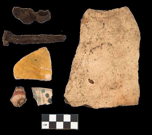
32 2020 Adventures in Florida Archaeology
“Despite being the most powerful society in South Florida, the Calusa were inexorably drawn into the broader world economic system by the Spaniards,” Marquardt said. “However, by staying true to their values and way of life, the Calusa showed a resiliency unmatched by most other Native societies in the Southeastern United States.”
Mary-Lou Watkinson and Halle Marchese
Reprinted with permission from the Florida Museum of Natural History, April 23, 2020, https://www.floridamuseum.ufl.edu/science/spanish-fort-on-mound-key/
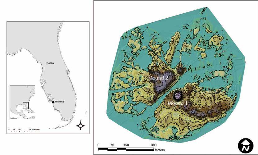
Researchers from the University of Florida, the University of Georgia, and students from UGA’s archaeological field school used a combination of remote sensing, coring, ground-penetrating radar, and excavations to uncover the walls of the fort and a few artifacts, including ceramic sherds and beads.
The fort is also the earliest-known North American example of “tabby” architecture, a rough form of shell concrete. “Tabby,” also called “tabbi” or “tapia,” is made by burning shells to create lime, which is then mixed with sand, ash, water and broken shells. At Mound Key, the Spaniards used primitive tabby as a mortar to stabilize the posts in the walls of their wooden structures. Tabby later was used by the English in their American colonies and in southern plantations.
Marquardt said that while the team uncovered a substantial amount of the walls it found, this is only a small sample of the entire fort, and there is still much more to learn and excavate.
Discovery of the fort has the potential to reduce archaeologists’ dependence on Spanish reports for information about ancient Floridian history, he said.
“Seeing the straight walls of the fort emerge, just inches below the surface, was quite exciting to us,” Marquardt said. “Not only was this a confirmation of the location of the fort, but it shows the promise of Mound Key to shed light on a time in Florida’s—and America’s—history that is very poorly known.”
Acknowledgments: The researchers published their findings in Historical Archaeology.
The Florida Museum’s Karen Walker, Amanda Roberts Thompson of UGA, and Lee Newsom of Flagler College
also coauthored the study. National Geographic provided funding for the research. Additional support for the project came from a faculty research grant from the University of Georgia, the John S. and James L. Knight Endowment for South Florida Archaeology, and the National Science Foundation.
Bibliography
Thompson, V. D., Roberts Thompson, A. D., Marquardt, W. H. et al. 2020. Discovering San Antón de Carlos: The Sixteenth-Century Spanish Buildings and Fortifications of Mound Key, Capital of the Calusa. Historical Archaeology, https://doi.org/10.1007/s41636-02000236-6.
LEFT, TOP: Conflict with the Calusa and other South Florida peoples would ultimately lead to Spanish abandonment of the region during the 16th century. Florida Museum illustration by Merald Clark
LEFT: Researchers discovered Spanish artifacts including a lead-shot mold, clockwise from top left, an olive jar, various ceramics and a hand-wrought spike.
Image by Amanda Roberts Thompson in Historical Archaeology
ABOVE: The people who constructed Fort San Antón de Carlos had to adapt to Mound Key’s unique conditions, researchers said. The fort is the only Spanish structure built atop a shell mound in Florida.
Image by Victor Thompson in Historical Archaeology
33 2020 Adventures in Florida Archaeology
REMEMBERING TOCOBAGA
Preliminary Observations at the Safety Harbor Site
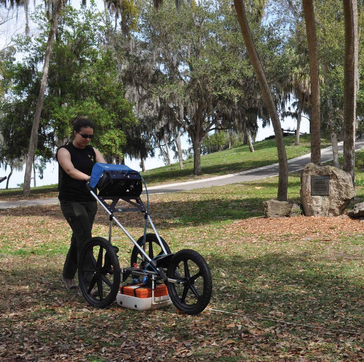
34 2020 Adventures in Florida Archaeology
Researchers use a ground-penetrating radar (GPR) at the Safety Harbor site, with the platform mound in the background. Photo courtesy of Thomas Pluckhahn
Tom
Pluckhahn, Kendal Jackson, Savannah Fredrickson, and Alex Fawbush
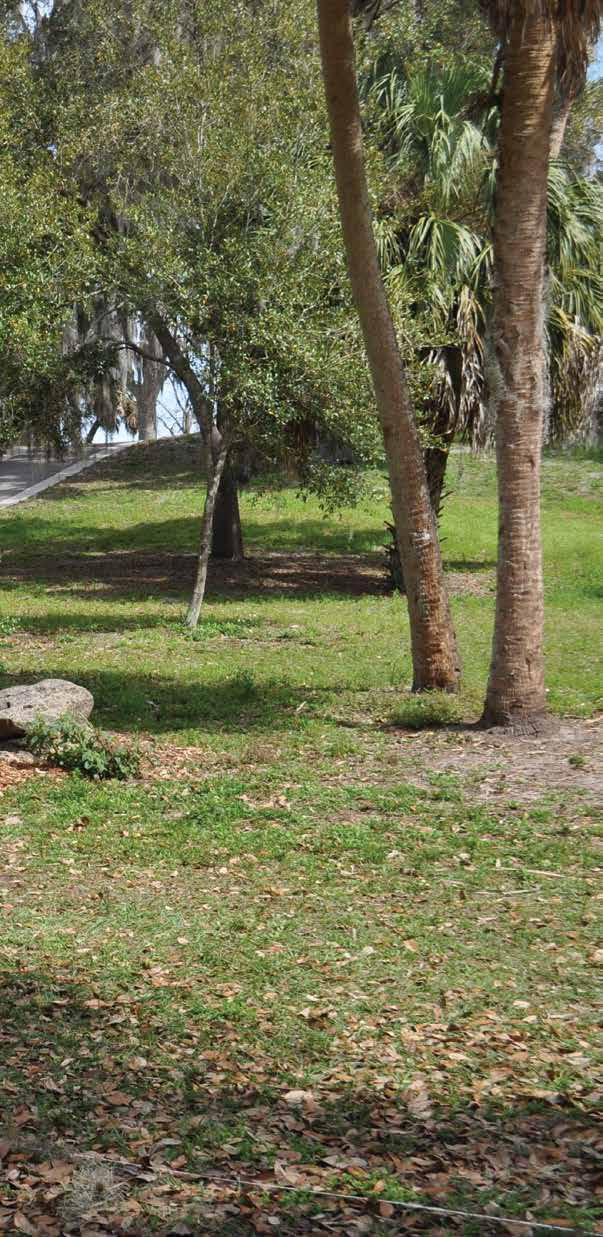
The Safety Harbor site, located within Pinellas County’s Philippe Park, is one of Tampa Bay’s most iconic archaeological sites. The site is widely recognized as the probable location of the native town of Tocobaga (Brinton 1859:118; Mitchem 1989:53; Swanton 1946:195). The town may have been visited by Europeans as early as 1528; Álvar Núñez Cabeza de Vaca’s record of the ill-fated expedition of Pánfilo de Narváez (2003:13) describes a visit to a town “at the end of the bay,” consistent with later accounts of the setting of Tocobaga (Milanich 1995:118). By the 1560s, Tocobaga had assumed a dominant position over less powerful chiefdoms of Tampa Bay and was engaged in an adversarial relationship with the formidable Calusa polity to the south (Fontaneda 1944:29; Hann 1991:317; Marquardt 1988; Worth 1995:351, 2014:260).
In 1567, Governor Pedro Menéndez de Avilés visited Tocobaga and established a mission-fort manned by thirty soldiers (Hann 1991:309; Solís de Merás 2017:178). Attempts to convert the Indians largely were fruitless; on a subsequent visit, Father Juan Rogel found the Native people, particularly chief Tocobaga and his family, fiercely resistant to Christianity (Hann 1991:235–237). Owing to mistreatment of the Indians, an overabundance of rain that left Spanish food stores rotted, and poor provisioning by colonial authorities in Havana, the settlement foundered (Hann 1991:249–250). Less than a year after the mission-fort was established, Rogel and Pedro Menéndez Marquéz (the Governor’s nephew and lieutenant) returned to find Tocobaga deserted and all the soldiers killed (Hann 1991:253–254). Menéndez Marquéz ordered the town burned in retaliation. Tocobaga is mentioned only fleetingly in later archival sources, before disappearing from the documentary record entirely (Hann 2003:120–121). In the mid-1800s, the former Native town later became the location for the plantation owned by one of the Tampa Bay area’s most legendary settlers, “Count” Odet Philippe. Reportedly a childhood friend of Napoleon, Philippe is said to have been the first European settler of Pinellas County, the first to cultivate citrus in Florida, and the first to introduce cigar rolling to Tampa Bay. Generally omitted from such tall tales is the fact that he was slave owner of likely Afro-Caribbean heritage (DeFoor 1997).
Despite the historical importance of the Native town of Tocobaga and the later Philippe plantation, the Safety Harbor site has been investigated infrequently, and rarely using modern archaeological methods. Perhaps fortunately, antiquarians S. T. Walker (1880:410–411)
35 2020 Adventures in Florida Archaeology
and C. B. Moore (1900:356) were refused permission to excavate. Matthew Stirling of the Smithsonian Institution excavated hundreds of human remains, dozens of ceramic vessels, and other artifacts from the burial mound at the site in 1930. However, the methods were coarse, and the results were reported minimally (Stirling 1930, 1931; see also Hrdlička 1940; Stojanowski and Johnson 2011).
Later, in his landmark synthesis of Gulf coast culture history, Gordon Willey (1949:135–141) reexamined the collections excavated by Stirling. He used these to define the Safety Harbor pottery type (mainly plain,
shell, sand, and clay, as well as evidence for a structure on the summit. Griffin and Bullen (1950:19–23) also conducted test excavations in the village, which they described as extending north and west of the platform mound that still stands on the site, on the edge of a bluff above the bay. A test trench west of the mound was particularly productive, encountering an area of very dense occupation with numerous features such as posts and pits.
Avocational archaeologists associated with the Safety Harbor Historical Society conducted additional excavations at the site in the late 1960s (Mitchem
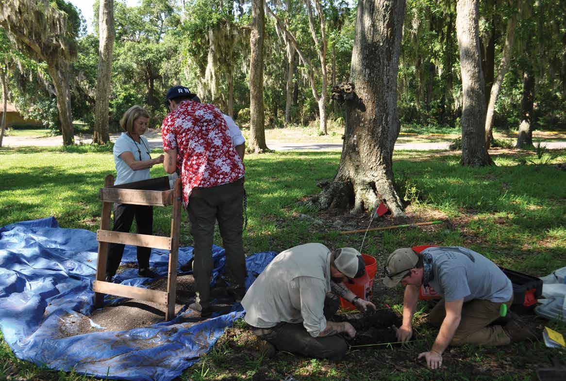
sand-tempered ceramics, occasionally elaborated with incised lines and circular punctations) and period (the local manifestation of the broader spatial, temporal, and cultural category known as “Mississippian,” running from around AD 1050 to 1600).
Until recently, modern-era professional investigation of the Safety Harbor site was limited mainly to work conducted by John Griffin and Ripley Bullen (1950) in 1948, the year the property was acquired by Pinellas County. A test trench in the platform mound that still stands on the site revealed a complicated construction sequence that included alternating layers of dense
1989:52–53). Unfortunately, the results of this work have never been published, there is little extant documentation, and the integrity of the resulting artifact collections has been severely compromised. Archival documents and oral histories collected with several participants suggest that intensive excavations were conducted primarily to the northwest of the platform mound where a picnic shelter is located today. Hundreds of fragments of Spanish olive jar reportedly were recovered from this area.
The only other recent archaeological investigations consisted of salvage excavation at an area of ground
36 2020 Adventures in Florida Archaeology
Archaeologists excavate a shovel test on the Safety Harbor site. Photo courtesy of Thomas Pluckhahn
disturbance resulting from a fallen tree on the slope of the platform mound. This work, conducted by the Alliance for Weeden Island Archaeological Research and Education (AWIARE 2012), demonstrates that one of the final mound layers was constructed of densely packed shell.
In 2019, the Department of Anthropology at the University of South Florida (USF) began the first intensive and professional archaeological investigation of the Safety Harbor site in more than seventy years. Our goals were threefold: to better define the structure and chronology of the Native village, to better define the structure and chronology of the platform mound, and to determine whether any portions of the Spanish mission-fort remain. Recognizing the importance of the site—it was listed as a National Historic Landmark in 1966, and to this day remains the only property so designated in Pinellas County—our investigations were designed to be minimally invasive.
Geophysical survey of the presumed village areas— including ground-penetrating radar (GPR), gradiometry, and electrical resistivity—provides a glimpse of what lies buried beneath the surface. At the Safety Harbor site, this includes everything from buried shell middens associated with the village of Tocobaga, to possible features associated with Philippe, to utility lines associated with the development of the park.
Systematic sampling of the village—including the excavation of sixty-six 50-cm square shovel tests and two 1 x 1-m test units—produced a wide range of artifacts and features. Remnants of the former town of Tocobaga included shell, pottery, and stone tools, as well as occasional postmolds and pits. Kaolin pipe fragments, European ceramics, nails, and bricks attest to the later settlement by Philippe and the enslaved people who worked the plantation. Finally, coins, beer cans, and other debris, as well as occasional utility lines, mark the development of the site as a recreational facility in the modern era.
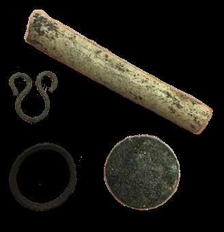
We also conducted GPR transects across the slope of the platform mound in hopes of identifying major construction episodes. To sample the mound, we relied on the collection of two smalldiameter core samples.
Analyses of these data are ongoing, but we can share a few preliminary observations. True to the way the village was described by Griffin and Bullen, shovel tests and geophysics
suggest the village extended northwest and southwest from the mound. The map on page 34 displays a horizontal “slice” of GPR data, showing reflections of various intensity at a depth of around 25 cm; note the higher reflections indicative primarily of buried shell to the upper and bottom left of the mound. The image at the top of page 40, which maps the density of shell in our shovel tests, demonstrates much the same pattern (see Fredrickson 2019 for more detail). Radiocarbon dates from our excavations suggest that the Native

American village at the Safety Harbor site formed sometime around AD 1100 and was occupied more or less continuously until the invasion by the Spanish in the 1500s, but we want to conduct more dating to see how the nature and tempo of village life may have changed over time.
Our GPR transects on the platform mound reveal layers of distinctly different reflection, some very strong and others much less so. This is consistent with the sediment stratigraphy we observed in the cores, which suggests
LEFT: A kaolin pipe stem, buttons, and other artifacts are associated with the Philippe plantation. Photo courtesy of Thomas Pluckhahn
ABOVE: In this Safety Harbor site test unit, note the shell midden in the profile and the features in the floor of the unit. Photo courtesy of Kendal Jackson
37 2020 Adventures in Florida Archaeology
that the platform mound was expanded several times with fill layers of contrasting qualities, from dense layers of shell, to greenish clays, to what appears to be repurposed midden. Radiocarbon dates retrieved thus far suggest that mound construction overlapped temporally with the village occupation.
We recovered a single sherd of Spanish olive jar from the area of the picnic shelter north of the mound, where artifacts of this type reportedly were recovered in large quantities by avocational archaeologists in the 1960s. The limited spatial distribution of contact-period artifacts may indicate that the Spanish occupation
concentrations appear to mark two of the structures associated with Philippe’s plantation, as depicted on maps from the 1800s.
Insights such as these will allow us to tell a more complete history of the Native town of Tocobaga, including the ways this history has been superimposed upon by more recent layers of occupation and meaning. Eventually, we hope to convey this complex history to park visitors through enhanced signage and other interpretation. Finally, we hope our work can help guide future development of the park away from areas that remain intact, so the Native town of Tocobaga not only can be remembered, but also be preserved.
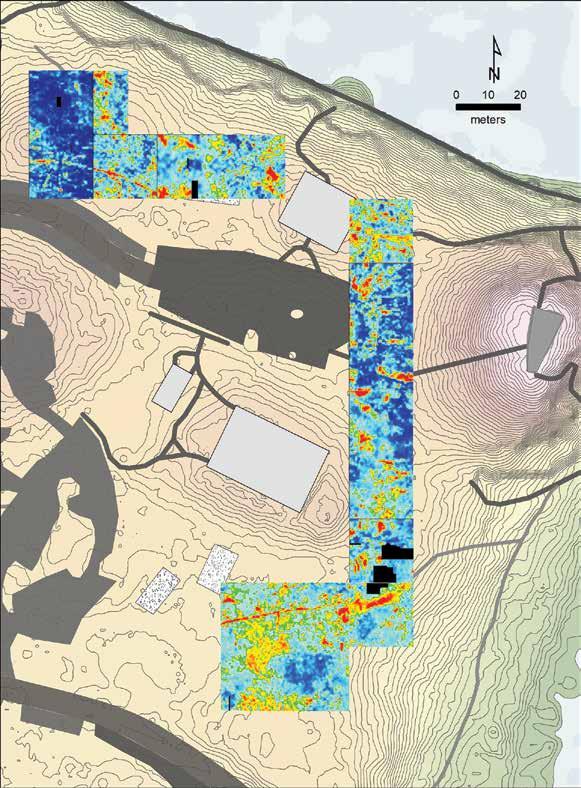
was more restricted than the historical documents suggest, although we can’t rule out the possibility that other areas of Spanish settlement have been lost to later occupations and park developments. Still, the identification of several features in the same shovel test containing Spanish pottery gives hope to the possibility that remnants of the mission-fort might remain.
Later historic ceramics were concentrated to the southwest and northwest of the platform mound. These
Dr. Thomas Pluckhahn is professor of anthropology at the University of South Florida who specializes in the archaeology of the Native societies of the Gulf Coast.
Kendal Jackson is a PhD candidate in anthropology at the University of South Florida, researching the ancient human ecology of Tampa Bay.
Savannah Fredrickson is an undergraduate anthropology student at the University of South Florida.
Alex Fawbush is an undergraduate anthropology student at the University of South Florida.
Bibliography
Alliance for Weeden Island Archaeological Research and Education. 2012. “Safety Harbor (8Pi2) Salvage Investigation.” Report prepared for Pinellas County Parks and Conservation Resources Department.
Brinton, Daniel G. 1859. Notes on the Floridian Peninsula, Its Literary History, Indian Tribes and Antiquities. Philadelphia: Joseph Sabin.
DeFoor, J. Allison, II. 1997. Odet Philippe: Peninsular Pioneer. Safety Harbor, Fla.: Safety Harbor Museum of Regional History.
Fontaneda, Hernando d’Escalante. 1944. Memoir of Hernando d’Escalante Fontaneda Respecting Florida Edited by David O. True, translated by Buckingham Smith. Miami: Greater Miami Bicentennial Project.
Fredrickson, Savannah. 2019. Mapping the Spatial Extent of the Occupations over Time at the Safety Harbor Site (8PI2), Pinellas County, Florida. Undergraduate honors thesis, Department of Anthropology, University of South Florida.
38 2020 Adventures in Florida Archaeology
A “slice” of the GPR data shows the denser reflections northwest and southwest of the mound. Photo courtesy of Thomas Pluckhahn
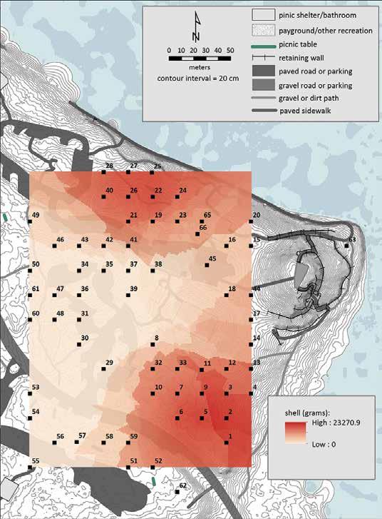
A map illustrating the density of shell in shovel tests indicates that darker areas to the northwest and southwest of the mound produced more shell, consistent with the GPR data.
Photo courtesy of Thomas Pluckhahn
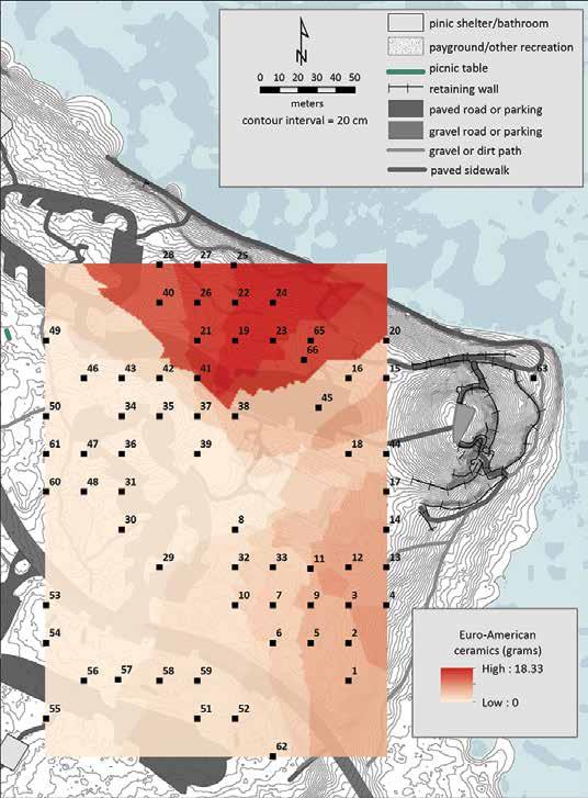
In this map illustrating the density of historic-era pottery in Safety Harbor shovel tests, the denser areas northwest and southwest of the mound are consistent with maps from the 1800s showing structures in these areas. Photo courtesy of Thomas Pluckhahn
Griffin, John W., and Ripley P. Bullen. 1950. The Safety Harbor Site, Pinellas County, Florida. Gainesville: Publication No. 2, Florida Anthropological Society.
Hann, John H. 1991. Missions to the Calusa. Translated and edited by John Hann. Gainesville: University Press of Florida.
----------. 2003. Indians of Central and South Florida 1513–1763. Gainesville: University Press of Florida.
Hrdlička, Aleč. 1940. Catalog of Human Crania in the United States National Museum Collections: Indians of the Gulf States. Proceedings of the United States National Museum 87:315–464. Washington, D.C.: Smithsonian Institution, Explorations and Field-Work of the Smithsonian Institution.
Marquardt, William H. 1988. “Politics and Production among the Calusa of South Florida.” In Hunters and Gatherers, Vol. 1: History, Evolution and Social Change, edited by Tim Ingold, David Riches, and James Woodburn, pp. 161–188. Oxford and New York: Berg Publishers.
Milanich, Jerald T. 1995. Florida Indians and the Invasion from Europe. Gainesville: University Press of Florida.
Mitchem, Jeffrey McClain. 1989. Redefining Safety Harbor: Late Prehistoric/Protohistoric Archaeology in West Peninsular Florida. PhD dissertation, Department of Anthropology, University of Florida, Gainesville.
Moore, Clarence Bloomfield. 1900. Certain Antiquities of the Florida West-Coast. Journal of the Academy of Natural Sciences of Philadelphia 10:351–394.
Núñez Cabeza de Vaca, Álvar. 2003. The Narrative of Cabeza de Vaca. Edited and translated by Rolena Adorno and Patrick Charles Pautz. Lincoln: University of Nebraska Press.
Solís de Merás, Gonzalo. 2017. Pedro Menéndez de Avilés and the Conquest of Florida: A New Manuscript. Edited, annotated, and translated by David Arbesú. Gainesville: University Press of Florida.
39 2020 Adventures in Florida Archaeology
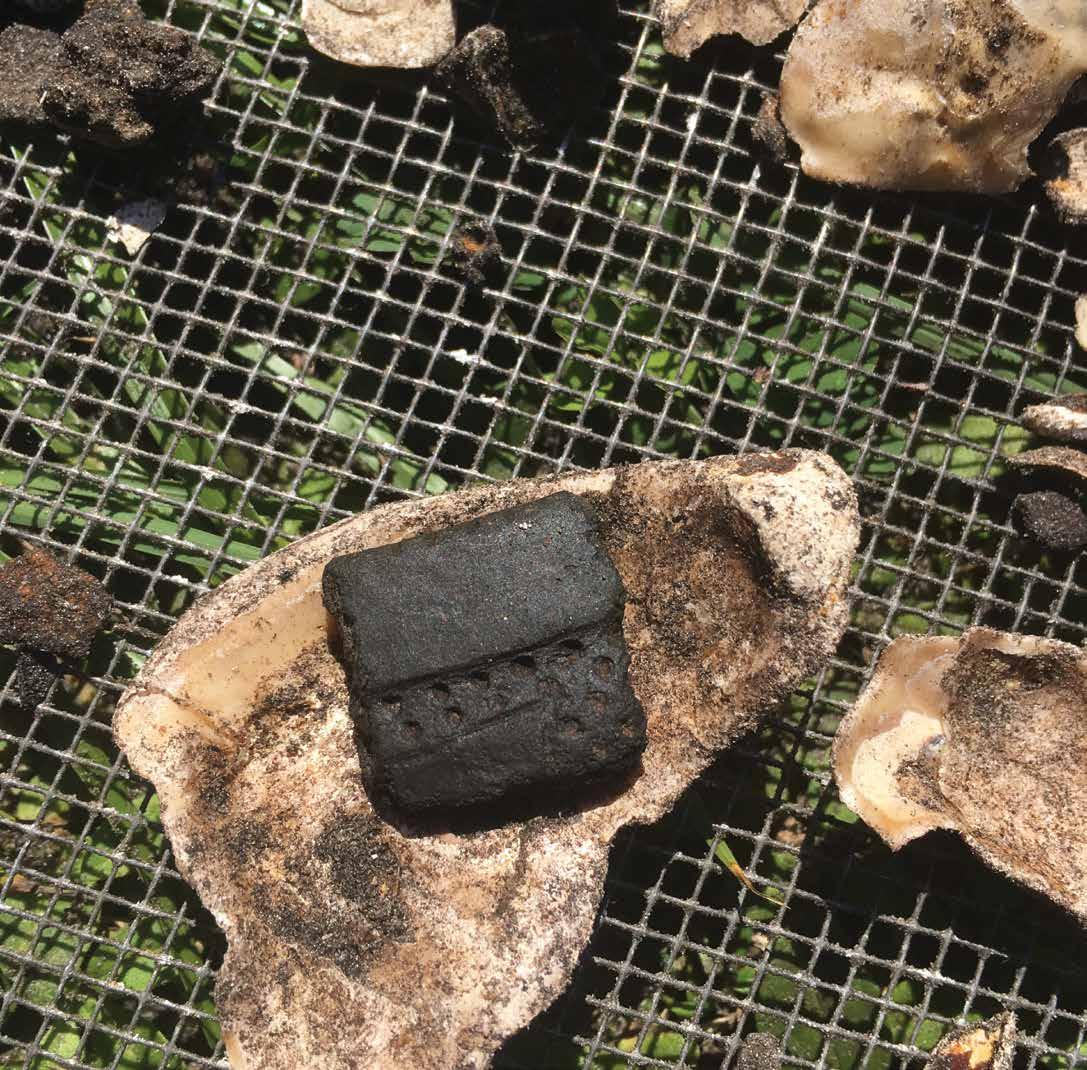
Stirling, Matthew W. 1930. “Prehistoric Mounds in the Vicinity of Tampa Bay, Florida.” Washington, D.C.: Explorations and Field-Work of the Smithsonian Institution in 1929, 183–186.
----------. 1931. “Mounds of the Vanished Calusa Indians of Florida.” Washington, D.C.: Explorations and Field-Work of the Smithsonian Institution in 1930, 167–172.
Stojanowski, Christopher M. 2011. Brief Communication: Preliminary Radiocarbon Dates from Florida Crania in Hrdlička’s Gulf States Catalog. American Journal of Physical Anthropology 145:163–167.
Swanton, John Reed. 1946. The Indians of the Southeastern United States. Smithsonian
Institution Bureau of American Ethnology, Bulletin 137. Washington, D.C., U.S. Government Printing Office.
Walker, S. T. 1880. “Preliminary Explorations among the Indian Mounds in Southern Florida.” Washington, D.C.: Annual Report for the Smithsonian Institution for 1879, 392–413.
Willey, Gordon R. 1949. Archeology of the Florida Gulf Coast. Washington, D.C.: Smithsonian Miscellaneous Collections 113.
Worth, John E. 1995. “Fontaneda Revisited: Five Descriptions of Sixteenth-Century Florida.” Florida Historical Quarterly 73:339–352.
----------. 2014. Discovering Florida: First-Contact Narratives from Spanish Expeditions along the Lower Gulf Coast. Gainesville: University Press of Florida.
40 2020 Adventures in Florida Archaeology
Pottery and shell associated with the Native American settlement of Tocobaga have been recovered. Photo courtesy of Kendal Jackson
FHSAI MEMBERSHIP

Your portal to the past . . .
Established in 1856, the Florida Historical Society was the first statewide organization dedicated to preserving state history and prehistory. More than 160 year later, it still fulfills that mission by collecting and archiving documents, books, and images; publishing scholarly research; and educating the public through projects and programs.
But did you know . . .
In 1905, FHS became the first statewide organization to preserve Native American artifacts, promote archaeological research, and publish findings dating to the early 1900s. Archaeology enthusiast Clarence Moore, who joined the Society in 1907, donated his papers to the FHS Library of Florida History. In the 1940s, FHS helped to create the Florida Anthropological Society and the position of State Archaeologist, and the Florida Historical Quarterly, the Society’s professional journal, has included articles by leading archaeologists for decades. From 2010 to 2013, FHS hosted the East Central Region of the Florida Public Archaeology Network (FPAN), and in 2014, it established the Florida Historical Society Archaeological Institute, based at the Brevard Museum of History and Natural Science in Cocoa. FHSAI’s mission is to educate the public about Florida archaeology through research, publication, educational outreach, and by promoting complementary work by other organizations.
Be part of the team . . .
Whether your interest is history or archaeology, join FHS and enjoy an array of member benefits, including The Society Report newsletter; a 10 percent discount in the FHS and Museum stores; early notice about all events, including the Annual Meeting and Symposium; and additional perks depending on your membership level.
BREVARD MUSEUM MEMBERSHIP
$30
FHS BASIC MEMBERSHIP $50
FHS INSTITUTIONAL MEMBERSHIP $75
FHS STANDARD MEMBERSHIP $75
FHS FAMILY MEMBERSHIP $100
FHS SUPPORTER MEMBERSHIP $250
FHS SPONSOR MEMBERSHIP $500
FHS MEMBERSHIP LEVELS INCLUDE ACCESS TO THE FLORIDA HISTORICAL QUARTERLY
For a list of all benefits and a membership application: https://myfloridahistory.org/membership/application
41 2020 Adventures in Florida Archaeology

NEW ARCHAEOLOGY AT PROSPECT BLUFF
In July 1816, United States forces under the command of future President Andrew Jackson laid siege to what they called “The Negro Fort” at Prospect Bluff in the Florida Panhandle. After a week, it was a single ninepound cannon ball that destroyed the fort, killing Britishtrained black soldiers and their families.
More than 200 years later, in October 2018, Hurricane Michael uprooted more than 100 large trees at Prospect Bluff, allowing new archaeological discoveries to be made.
Free black people, along with enslaved people of African descent, were among the first nonindigenous people to set foot on the land that would become known as Florida. Spanish ships that arrived in Florida as early as 1513 had free black people on board. “When we look at recorded evidence, we say that there were two Africans that came with Ponce de León,” says Anthony Dixon, archivist at Bethune-Cookman University. “One was enslaved, the other one was free.”
All of the Spanish ships that came to La Florida in the 16th and 17th centuries had people of African
descent on board, and many of them were free. As enslaved people were brought to British colonies to the north, the Spanish offered them freedom in Florida, under the conditions that they convert to Catholicism and defend the Spanish crown. “To slow down the process of the English colonizing North America, the Spanish tried to come up with ways to lure those Africans out,” says Dixon.
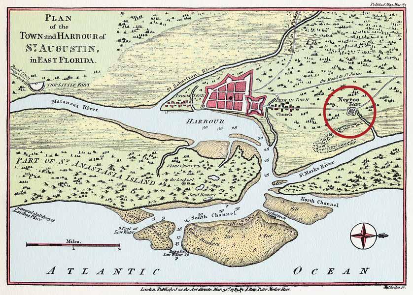
42 2020 Adventures in Florida Archaeology
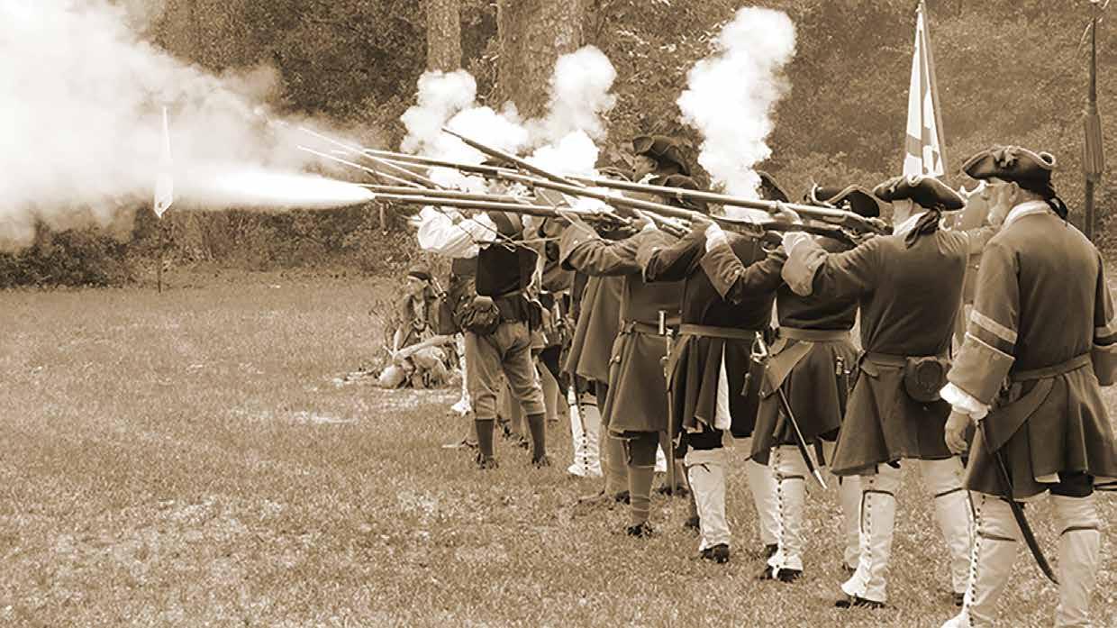
A Free Black Settlement in Spanish Colonial Florida
Gracia Real de Santa Teresa de Mosé, better known as Fort Mose, was established in 1738 by Manuel Montiano, governor of Spanish Colonial Florida. Fort Mose was the first legally sanctioned free black settlement in what would become the United States. Located two miles north of St. Augustine, the fort was the first line of defense from British attacks on the city. Thirty-eight men and their families who had escaped slavery lived at Fort Mose, defending the Spanish from attack and embracing Catholicism. “That was a small price to pay for freedom,” says Thomas Jackson, president of the Fort Mose Historical Society. When the British took control of Florida from Spain in 1763, Fort Mose was abandoned. “All of the people of Mose went to Cuba,” says Kathleen Deagan, the archaeologist who discovered the original site of the community. “There might even be some descendants today.”
Between the demise of Fort Mose in 1763 and the establishment of the “Negro Fort” at Prospect Bluff during the War of 1812, some people escaping slavery joined Native Americans living in Florida. Eventually, these formerly enslaved people became known as Black Seminoles. Anthony Dixon explains that the former plantation workers taught the Seminole about
crop rotation and field rotation. “There was a field that Native Americans worked, then there was a field that the Black Seminoles worked, and then there was a third field that they worked together,” Dixon says. “All of the proceeds and all of the crops (from the third field) went to the Native Americans because that was considered a tribute field, pretty much no different than paying taxes anywhere else.” The Seminole and the formerly enslaved people were both seeking refuge in Florida, and worked cooperatively.
TOP, LEFT: Detail of the 1815 Pintado map shows the fort at Prospect Bluff. Courtesy of the Florida Historical Society
TOP, RIGHT: Historical reenactors depict the Bloody Battle of Fort Mose where Spanish soldiers, free black militiamen, and Yamasee Indians joined forces to defeat British invaders on June 26, 1740. Courtesy of the Fort Mose Historical Society
LEFT: Fort Mose was located about two miles north of St. Augustine, as depicted on this 1783 map by Thomas Jefferys. Courtesy of Visit St. Augustine; from the Library of Congress
43 2020 Adventures in Florida Archaeology
Ben Brotemarkle

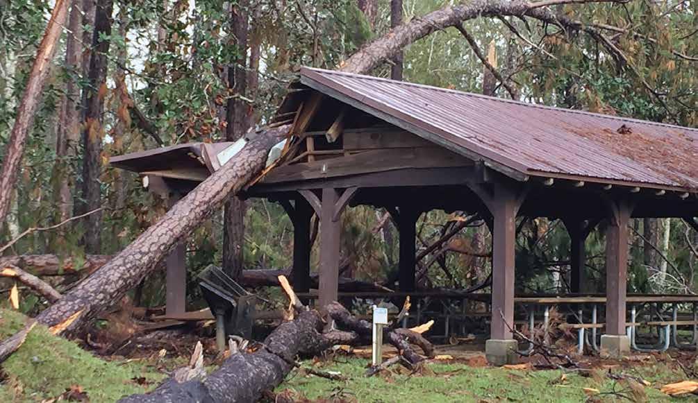
Spain regained control of Florida from England in 1783, following the American Revolution. Some of the people who escaped British slavery in the 1600s and 1700s joined Spanish society in Florida as free people. Others chose to live in freedom among Native Americans, and some established free black settlements.
“You had many, many settlements of free blacks all through Florida, and I think they were a bigger part of the fabric of Florida, particularly late 1700s, early 1800s, than many people realize today,” says Dale Cox, author of the new book The Fort at Prospect Bluff: The British Post on the Apalachicola.
After the American Revolution, the British supported the colonization efforts of free black people in Florida, even as Spain retained ownership of the area. “By the time we get to the 1800s, everyone needs to trade with the Caribbean, because just about every European country is in the Caribbean now, and so Tampa, Panama City, Pensacola, Mobile, Biloxi, and New Orleans, those become the international ports,” says Anthony Dixon. “The Patriot War within the War of 1812, was over those ports.” To strengthen their position in the region, the British built a fort at Prospect Bluff in the Florida Panhandle, and trained free black people as soldiers.
“The War of 1812 was underway and the British were interested in opening a new campaign or a new front in the war, and they saw Florida as sort of a way to get a foothold on the Gulf coast to begin that process,” says Dale Cox. “By establishing a foothold in Florida, they could arm the Muscogee Creek people and the Seminole people, bring them over to fight on the British
side, and open the door for either an attack against Mobile or New Orleans.”
The British envisioned the fort at Prospect Bluff to be part of a threepronged attack to reestablish control over the entire southeastern United States. One attack would be led from British positions in Mississippi, another from Cumberland Island in Georgia, and the third from Prospect Bluff. “So you can imagine the buildup of weaponry here,” says Rhonda Kimbrough, supervisory archaeologist for the US Forest Service, National Forests in Florida.
It was this large reserve of gunpowder and ammunition that led to the destruction of the fort at Prospect Bluff, and the deaths of many people who lived in and around it.
In 1815, at the conclusion of the Patriot War, the British left their fort at Prospect Bluff in the hands of a company of formerly enslaved people called “maroons,” who had been trained in British tactics by the Royal Marines. “They were discharged and given freedom papers by Lieutenant Colonel Edward Nicolls prior to his departure,” says Dale Cox. “When the British evacuated, this company continued to function as a
44 2020 Adventures in Florida Archaeology


military company here. They continued to hoist the colors every day. They performed military drills. They opened farms up and down the Apalachicola River, and they basically established a functioning colony here.”
The leader of the British-trained contingent of soldiers remaining at Prospect Bluff was Garson, a formerly enslaved man from Pensacola. In addition to free black soldiers, the community at Prospect Bluff included Choctaw and Red Stick Creek Indians who had not aligned with the United States during the war. “It was a very diverse community here,” says Rhonda Kimbrough. “It was multilingual, with people from every single ethnicity represented in the southeastern United States of the day.”
The United States government believed that the “Negro Fort” at Prospect Bluff was a beacon for enslaved people seeking freedom in Spanish Colonial Florida, which was a threat to American slavery. “In fact, the term ‘Negro Fort’ itself is a US term,” says Dale Cox. “The people who lived here never called it that. In some of their surviving correspondence they simply state that they’re at Prospect Bluff or the Bluff, and some of the survivors later refer to themselves as ‘the Bluff People.’”
Vincente Sebastián Pintado served in the Spanish military and was surveyor general of Spanish West Florida. In 1815, Pintado came to Prospect Bluff from Pensacola to try to convince the formerly enslaved people there to return with him. He was not successful. “But he did make a map, which was very fortunate for us because even though it’s not to scale by modernday mapping conveyances, it definitely gives us information that we wouldn’t have otherwise,” says
ABOVE: Trees downed by Hurricane Michael in 2018 caused considerable damage at Prospect Bluff Historic Sites in Franklin County, but it also provided a unique opportunity for archaeological excavation. Courtesy of the US Forest Service, National Forests in Florida
LEFT, MIDDLE: Historian and author Dale Cox, who was born and raised in Two Egg, specializes in the history of northwest Florida. Courtesy of the author
LEFT, BOTTOM: Dr. Anthony Dixon of Bethune-Cookman University specializes in African American history in Florida. Courtesy of the author
Rhonda Kimbrough. “On that 1815 map it shows the main citadel. It also shows the water battery that was on the Apalachicola River. Then there’s these little square buildings around it, and they’re very symmetrical. They’re possibly military barracks and the (homes of) maroon community individuals that were the families of the soldiers.”
In July 1816, US forces under the command of Andrew Jackson laid siege to what they called the Negro Fort. After a week, it was a single nine-pound cannon ball that destroyed the fort at Prospect Bluff.
“According to an eyewitness who was in the fort at the time, the cannonball struck a pine tree and ricocheted down into an area at the center of the fort where a group of women and children were filling bags with powder to be used in the fort’s cannon, igniting those bags, which communicated a fire through the open door of the powder magazine, setting off the magazine,” says Dale Cox. “The fort exploded. Most of the people inside
45 2020 Adventures in Florida Archaeology
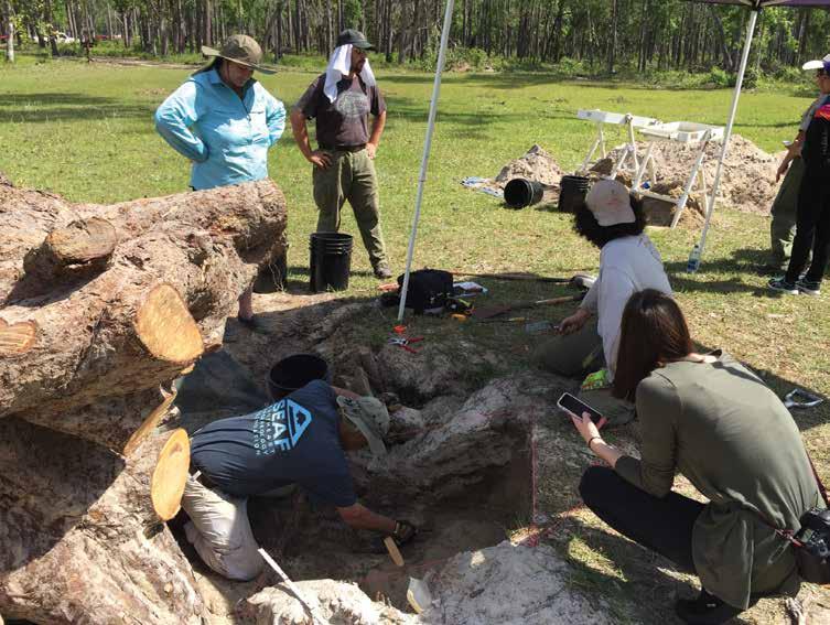
the fort had concentrated into the central citadel, which was a strong point of the fort. When the magazine exploded they were all in such a confined area that the loss of life was enormous.”
One woman named Mary Ashley was severely injured but remained alive, buried under rubble from the explosion. Eventually, she was discovered and returned to slavery. “Many years later, she presented herself at the British consulate and told them that she had gained her freedom here as a British subject,” says Rhonda Kimbrough. “They wrote Edward Nicolls in England for verification of that story, and he verified her story and she was returned to freedom as a British subject.”
After the fort at Prospect Bluff was destroyed, John Forbes and Company reestablished a trading post that they had operated there in the first decade of the 19th century. Recently discovered documentation indicates that some survivors remained in the area after the destruction of the fort. “Some of the badly wounded were reported to still be here after the US troops left,” says Dale Cox. “Some others came out of the woods after the fort blew up and remained in the area, pleading with anyone who arrived to help them with food and medicine, and anything that they could get to survive.” Other survivors joined existing free black settlements including Angola in modern-day Bradenton. Andrew Jackson returned to the Prospect Bluff site in 1818, during the First Seminole War, to establish a supply depot in the strategic location. “He named it after his engineer James Gadsden, and thus Fort Gadsden came into being, which is the name that most people today know the fort by,” says Cox.
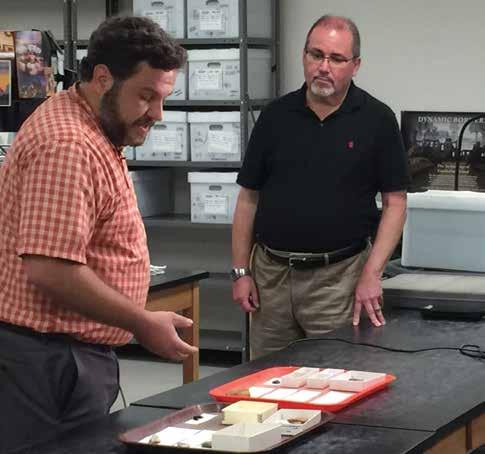
In 2018, Hurricane Michael caused extensive damage at Prospect Bluff, downing more than 100 large trees. The exposed root balls and displaced earth provided a unique opportunity for archaeological excavation. The uprooted trees provided some stratigraphic control, with the oldest artifacts at the bottom of the root balls, and the newest at the top. “Some of the artifacts that came out of the root balls of the trees that fell at the site include musket balls, British gun flints, and European ceramics as well as Native American ceramics,” says Andrew Wise, archaeological technician for the National Park Service Southeast Archeological Center (SEAC). Chattahoochee Brushed pottery discovered near the Negro Fort site supports historical documentation indicating the presence of Creek Indians there. Although Spain technically owned Florida at the time, the presence of annular ware pottery and blue shell-edge pearlware confirm that the British controlled Prospect Bluff in the early 1800s. “We know that the fort was stocked by the British, so it’s not unusual to find these British types of pottery,” Wise says. “It’s exactly what we would expect to find.”
The formerly enslaved people who were trained as British soldiers at Prospect Bluff and the Native Americans who sought refuge there are an important but lesser known part of Florida history. “Were they British, were they Spanish, were they American? They were people,” says Rhonda Kimbrough. “They were people that were looking for a place to live, in safety and in freedom, to have a destiny for their own future, and to plant the seed for their children to live in safety, for their children and their children’s children.” Dale Cox calls the soldiers at Prospect Bluff “freedom fighters” who
46 2020 Adventures in Florida Archaeology

were willing to sacrifice their lives for liberty. “They came here to fight and to be willing to fight and to be willing to die so that their children and their grandchildren and their great-grandchildren could live free. And that’s exactly what they did,” says Cox. “They died here and their blood consecrated this ground to make it a place of freedom. And that’s why we should remember them.” Anthony Dixon agrees. “Native Americans and African descendants have just as much a hand to do with how Florida is today, as the English and the Spanish, and their descendants.”
When Juan Ponce de León first arrived in Florida in 1513 to give our state its name, he was accompanied by a free black man named Juan Garrido. When Pedro Menéndez de Avilés landed here in 1565 to establish the permanent settlement of St. Augustine, there were many people of African descent with him. For three centuries, Florida served as a destination for black people seeking freedom from oppression, even after the United States brought American slavery here in 1821. The fort at Prospect Bluff briefly served as an inspiration for enslaved people seeking liberty for themselves and their descendants.
Dr. Ben Brotemarkle is executive director of the Florida Historical Society. He is producer and host of the public radio and television programs Florida Frontiers, and the author of several books on Florida history and culture.
For additional information, watch Florida Frontiers Television episode 34, “Free Black Settlements in Spanish Colonial Florida,” available at https://myfloridahistory. org/frontiers/television/episodes.
Editors’ note: Agencies of the US federal government typically spell “archaeology” and its derivatives without the second “a.” Readers will notice both variations of the word in this article.
FAR LEFT: Downed trees caused by Hurricane Michael provided an opportunity for archaeological excavation, not only in the root ball, but also in holes left by the tree roots.
MIDDLE & RIGHT: Southeast Archeological Center Technician Andrew Wise (left) shows selected artifacts excavated at Prospect Bluff to Florida Historical Society Executive Director Ben Brotemarkle (center) and US Forest Service Archeologist Rhonda Kimbrough (right). Artifacts included Native American pipe fragments, British gunflint, and English pottery. Photo by Jerry Klein, Florida Historical Society
47 2020 Adventures in Florida Archaeology
BOOKS FROM THE FLORIDA HISTORICAL SOCIETY
ARCHAEOLOGICAL INSTITUTE AND
FHS PRESS
SEARCHING SAND
HANDFULS OF HISTORY: STORIES ABOUT FLORIDA’S PAST
Jerald T. Milanich
$14.95
Dr. Jerald T. Milanich is one of the most respected historical archaeologists in the state. In this book, Dr. Milanich discusses pre-Columbian Florida, Colonial Period people and events, and the 19th-century shipwreck of the steamship City of Vera Cruz. Dr. Milanich explores the origins of archaeology in Florida with Clarence B. Moore and offers advice to future archaeologists. He may even stir up some controversy as he questions the authenticity of the Miami Circle.
AND
SURF:
THE ORGINS OF ARCHAEOLOGY IN FLORIDA
Rachel K. Wentz
$24.95
Searching Sand and Surf explores the roots of modern archaeology in the state, as seen through articles published in the Florida Historical Quarterly Witness the evolution of contemporary archaeology in Florida and trace the development of the discipline through some of the most influential voices. Dr. Kathleen Deagan provides the introduction.
FLORIDA & CARIBBEAN NATIVE PEOPLE
Paintings by Theodore Morris
$39.95 (8.5 x 11 color)
For more than 10,000 years before Juan Ponce de León gave Florida its name, there were thriving, complex societies of indigenous people living here. Theodore Morris is the preeminent painter of Florida’s native people, and he now adds Caribbean culture to his repertoire. Leading archaeologists provide commentary.
48 2020 Adventures in Florida Archaeology
LIFE AND DEATH AT WINDOVER: EXCAVATIONS OF A 7,000-YEAR-OLD POND CEMETERY
Rachel K. Wentz
$14.95
“Windover is truly a unique site that continues to astonish. Dr. Wentz does a wonderful job of telling the two stories of Windover. One is about the people who lived in the area and are buried in the pond. The other introduces you to the amazing people and circumstances that made the excavation possible. From its discovery by a backhoe operator and a concerned and interested landowner to the crew who worked on the project, Wentz effectively captures the stories of a fascinating archaeological discovery.”—Dr. Glen Doran, Windover principal archaeologist.
CHASING BONES: AN
ARCHAEOLOGIST’S
Rachel K. Wentz
FRENCH FLORIDA
Benjamin DiBiase
$39.95 (8.5 x 11 color)
The first English translation of French historian Charles de La Roncière’s Florida Française: Scénes de la Vie Indienne (1928), this book provides a fascinating narrative history of the first French settlements in Florida, along with hand-colored reproductions of Dutch engraver Theodore de Bry’s famous images of Indian life.
PURSUIT OF SKELETONS
$14.95
Former FPAN East Central Region Director Rachel K. Wentz did most of her graduate work focusing on the ancient skeletons from Florida’s Windover site, but in this book she also takes us to fascinating archaeological sites in England, Italy, Ukraine, and the Caribbean before coming back to Florida.
49 2020 Adventures in Florida Archaeology
ORDER THESE BOOKS AND MANY MORE AT FLORIDABOOKS.NET
A MAMMOTH QUESTION A MAMMOTH QUESTION
When and How Was Florida First Settled?
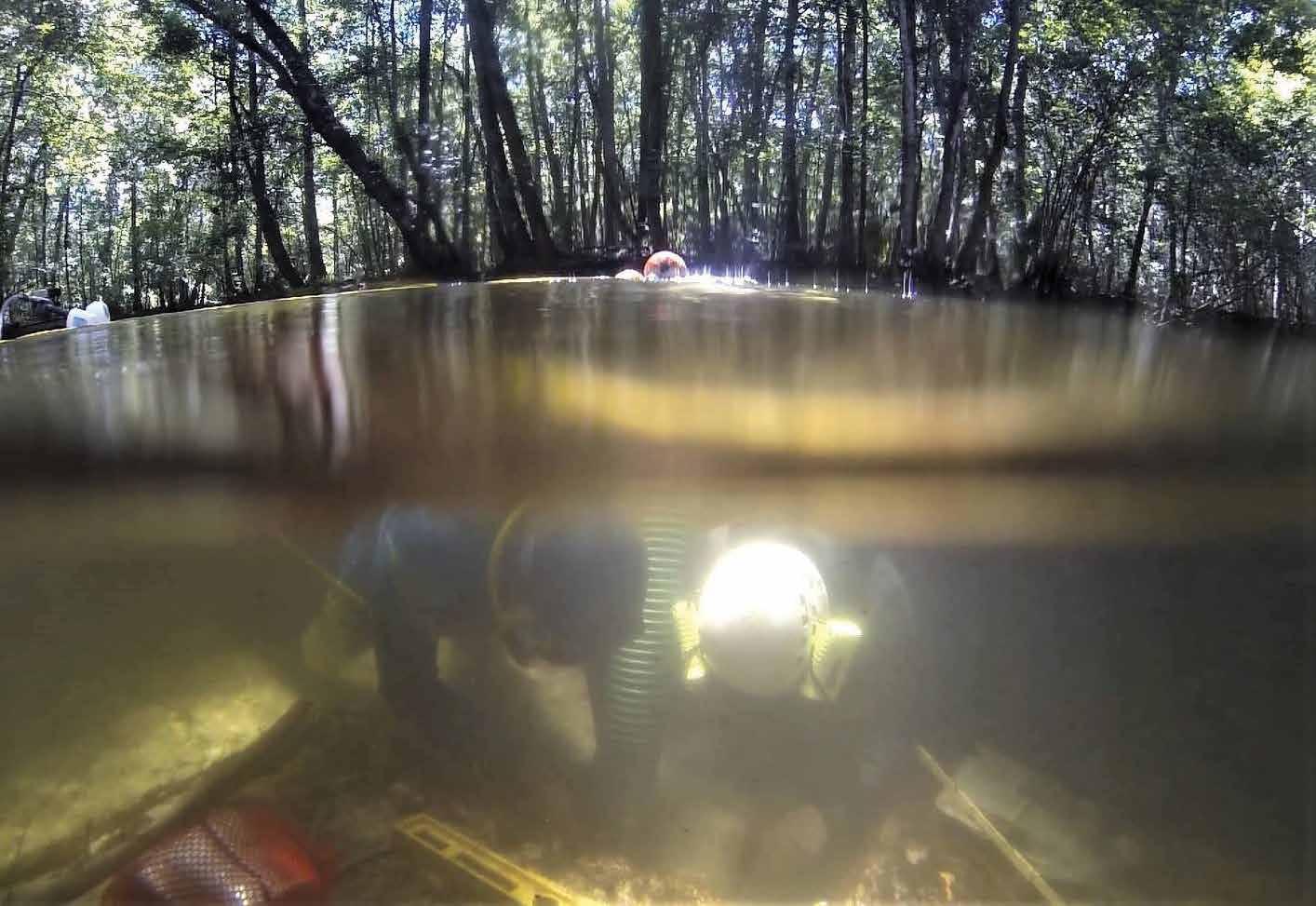
When and how people first settled the Americas is one of the most fascinating stories in human history. For the last time in Earth’s history, people wandered into not one, but two entirely unexplored continents full of flora and fauna, many of which were entirely new to their senses. This remarkable story has long captured the attention of archaeologists, and the field of First Americans archaeology has become an exciting discipline during the last few decades. Discoveries and new datasets are being produced with such dizzying regularity that even those of us dedicated to studying this period often find ourselves struggling to stay apprised of the most current data.
Two decades ago, it was commonly accepted that the Americas were first colonized about 13,500 years ago by the Clovis people, named after the diagnostic point style they produced. However, research in the intervening years has falsified this entrenched hypothesis, based on three specific lines of evidence.
1. Clovis points have not been found in Siberia or Alaska and appear to have originated south of the North American ice sheets. Thus, a population already was in place to facilitate the movement of the Clovis style around North America when it appeared (Waters and Stafford 2013).
2. Sites predating the 13,500-year-old time frame have now been discovered in Alaska, Western Canada, Washington, Oregon, Texas, and Florida in North America, as well as Argentina and Chile in South America (Waters and Stafford 2013).
3. The time-depth necessary to give rise to the genetic and linguistic diversity found in native North and South American populations requires more than 13,500 years (Greenburg et al. 1986; Llamas et al. 2017).
Even the fabled “Bering Land Bridge” model most of us learned about in grade school no longer is the favored explanation for prehistoric entry into the Americas. An Atlantic crossing into the Americas, while hotly debated for decades, has yet to receive substantial archaeological or genetic support, although future excavations planned on the eastern seaboard may shed new light on this topic. Instead, a maritime-based entry model down the Pacific Northwest coast increasingly is suggested by the data, demonstrating that waterways were as important to the earliest Americans as they are to us now (Gustas and Supernant 2019). What makes a coastal route relevant to this article is that, following the end of the last Ice Age, a landmass the size of South America, which contained countless archaeological sites, was inundated by rising sea levels due to a
50 2020 Adventures in Florida Archaeology
worldwide glacial melt (Joy 2018). Thus, it increasingly appears that the true story of the peopling of the Americas is written underwater, both off our coasts and inland.
What is needed are more archaeological sites that can be used as data points in this story. However, to defend an archaeological site successfully to the scientific community, archaeologists must demonstrate that their site has unequivocal human-made artifacts, in a secure geologic context, in association with organic material that can be radiocarbon dated. While needing to meet only three criteria may sound simple, it is exceptionally challenging to meet these in particular, and only a handful of sites hemisphere-wide have passed the test. The question becomes, where does Florida fit into our understanding of the peopling of the Americas?
Well, it’s unclear… at least currently, that is. But recently, national attention has turned to the Sunshine State, which now boasts one of these exceptional sites.
The Crown Jewel of Florida Prehistory
Around 14,500 years ago—a millennium before the first Clovis point makers existed, a group of people stopped at a small sinkhole just south of Tallahassee, Florida. What they did at the sinkhole, we may never
know. What we do know is that these people interacted with the remains of an American Mastodon (Mammut americanum) and left behind archaeological evidence in the form of a broken stone knife, several flakes, and a cut-marked mastodon tusk. 14,500 years later, Drs. Jessi Halligan and Michael Waters directed a small team of underwater prehistoric archaeologists in excavations at the bottom of this sinkhole, known as the Page-Ladson site. In about 11 meters of pitch-black water, the team discovered the archaeological materials left by those people more than fourteen millennia ago in secure geologic context and in association with radiocarbon datable material that placed Page-Ladson among those few sites in the Americas that could pass scientific muster (Halligan et al. 2016).
Springs, sinkholes, and sites offshore are providing clues about the locations and activities of prehistoric people in Florida.
LEFT: Drs. David Thulman and Jessi Halligan plot the location of artifacts at the Ryan-Harley site in the Wacissa River in north Florida.
BELOW: Archaeologists Shawn Joy, Michael Faught, and David Thulman use remote sensing equipment to find sites in Lake George in central Florida.
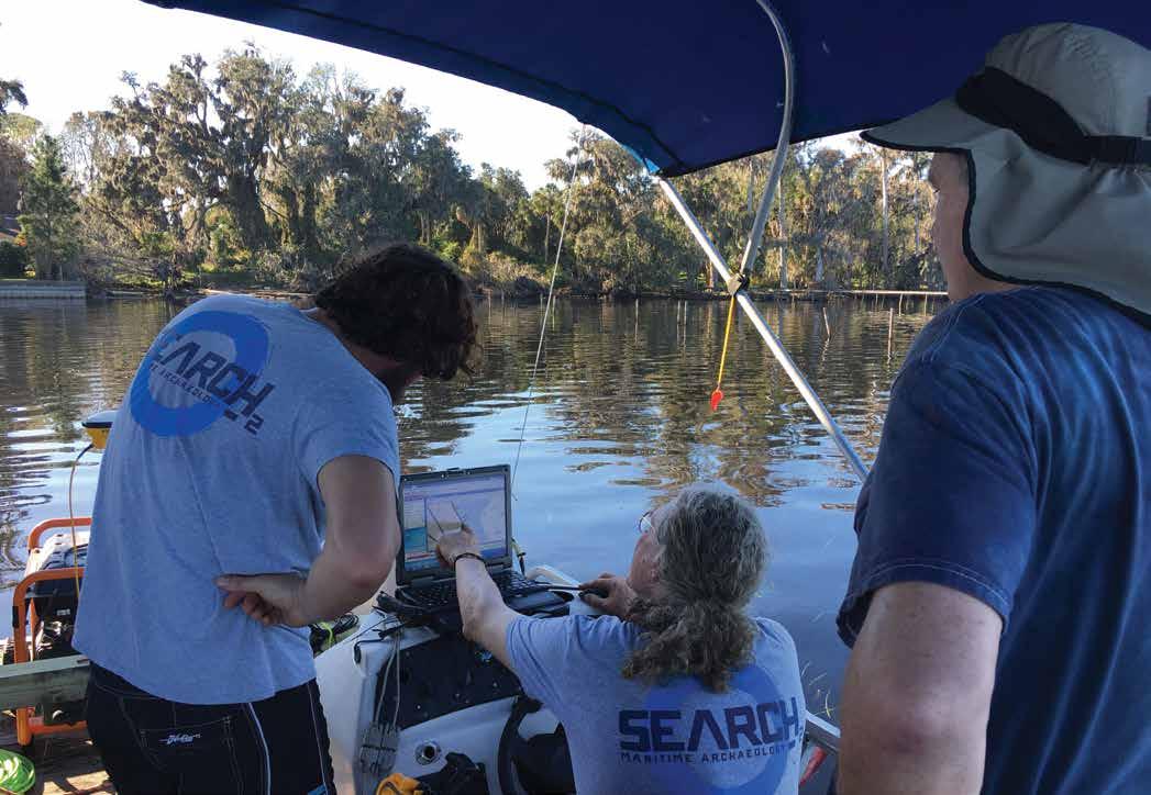
51 2020 Adventures in Florida Archaeology
Morgan F. Smith
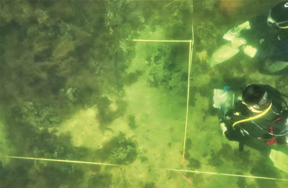
But wait… Florida is about as far as one can get from any of the currently proposed entry points into the Americas. How can such an early site be in such an odd spot, when considered within the current dataset? The answer is simple, but the implications are complex: we don’t know everything yet, and many more discoveries await us.
What Next?
The hunt is on for underwater prehistoric sites of similar or even greater antiquity than Page-Ladson. Florida provides a unique environment for the preservation of these early sites. Slow-moving river systems that wind their way through the karst geology of the state are ideal environments to slowly and steadily bury archaeological sites under sediments that encapsulate them in a stable environment necessary for organic preservation. Ongoing underwater prehistoric research in Florida is occurring in karst river systems including the Wakulla, Aucilla, Wacissa, Silver, and Suwannee Rivers, in addition to offshore in the Gulf of Mexico (Cook Hale et al. 2018; deSmet and Smith 2019; Dunbar 2016; Halligan et al. 2016; Smith 2019). It is an exciting time in Florida archaeology, wherein many brilliant scientists and eager students are feverishly exploring underwater landscapes across the state for the next site that can tell us as much about the first Floridians as Page-Ladson, if not more. This article recounts recent work conducted in central Florida on an enigmatic site that also may have a story to tell regarding when and how Florida was first settled.
Snakes, Six Guns, and SCUBA Divers
We know the Silver River was used throughout prehistory, including by Ice Age people, because Clovis points and ivory tool fragments have been recovered along its length (Dunbar 2016; Hemmings 2004; Neill 1958, 1964). But in the 1970s, the area also was a nexus of a different kind of human activity—home to theme parks, whose business was to entice tourists to stop over on their way to Orlando, Miami, or the Florida Keys and enjoy the air-clear waters and primeval setting of Silver Springs. The site provided a backdrop for such films such as Tarzan, Creature from the Black Lagoon, and Sea Hunt. It was home to several theme parks that reinforced Florida’s reputation for being the wild, wild South. Ross Allen milked rattlesnakes and wrestled alligators for crowds at his renowned reptile institute. Visitors stopping for lunch at the Six Gun Territory theme park in nearby Ocala witnessed reenactments of a duel, bank robbery, or a standoff between “cowboys and Indians.”
One of the few locals, a truck driver from nearby Ocala named George Guest, spent his spare time avoiding the crowds, opting instead to explore the shallow, clear water of the Silver River. In 1971, during one of his routine dives, Guest noticed several large bones and artifacts eroding from a bend in the river. He notified Ben Waller, a well-respected river diver and avocational archaeologist with extensive knowledge of Florida’s prehistory. Waller identified the bones as Columbian mammoth (Mammuthus columbi) and, realizing the
52 2020 Adventures in Florida Archaeology
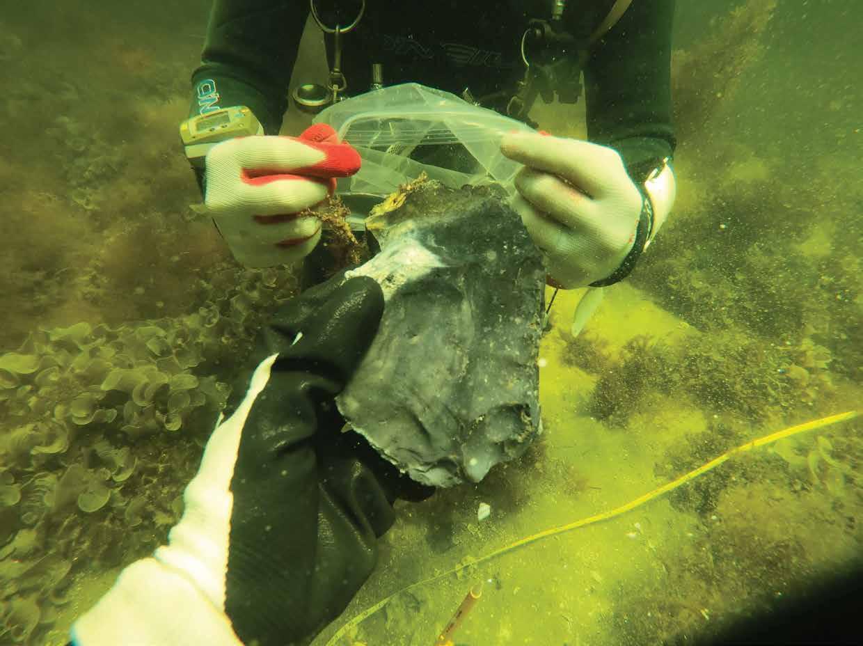
significance of the discovery, alerted University of Florida (UF) Professor Dr. Charles Hoffman, who planned a formal excavation at the Guest locality.
The following year at what became known as the Guest Mammoth site, Hoffman’s team made archaeological history by conducting the first underwater prehistoric excavation in the Americas. Hoffman and a small cohort of graduate students from UF and Northern Arizona University uncovered the remains of three Columbian mammoths that had died on their bellies at the edge of a Pleistocene pond. In direct association with the mammoths were artifacts, including a “Clovis-like fluted point,” six flakes, three butchered bones, and “numerous” pressure flakes (Hoffman 1983; Rayl 1974:42). Hoffman (1983) also said that a “pile” of bones was found at the site—possibly evidence for the stacking of elements seen at other Paleoindian butchery sites (Bement and Carter 2010; Fisher et al. 1994; Kenady et al. 2011). Hoffman and Rayl were divided over whether Guest was a kill or butcher site, but agreed these mammoths died at the edge of a watering hole and subsequently were exploited by Ice Age people (Hoffman 1983). However, an aberrant radiocarbon date obtained from an unpurified sample of mammoth bone collagen
ABOVE: A large stone tool called a biface, found at the offshore quarry, is bagged for recovery. Photos courtesy of the author
and the Guest Mammoth site’s underwater context raised concerns. Hoffman was criticized and received negative feedback for his interpretations at the Society for American Archaeology conference where he first presented his findings (Dunbar 2016). The ridicule led him to quit Florida archaeology and start his career anew working in the Caribbean. The Guest mammoths became a flash in the pan. After Hoffman died in 2005, the exact location of the Guest mammoths and much of the site assemblage faded from memory.
The ensuing forty years since Hoffman’s excavation have demonstrated that Florida contains a substantial Ice Age archaeological record (Dunbar 2016), yet few intact, stratified, and datable sites exist in the state. Obviously, the Guest mammoths needed a second look.
53 2020 Adventures in Florida Archaeology
LEFT: Divers map a newly discovered, now-submerged prehistoric quarry several miles offshore in the Gulf of Mexico.

But going back to the site was not so easy. Despite its importance, few sources existed on the site, and the more I tried to learn, the more ambiguous the true nature of the site became. However, several things were clear. The prevailing hypothesis in 1973 was that the Americas were colonized around 13,500 years ago via the Bering Sea land bridge. An early mammoth exploitation site in Florida directly challenged that entrenched theory. What’s more, the site was underwater… how could it be intact?
Since Hoffman’s efforts, underwater excavations are more accepted in studies of prehistoric people,
allowing us to evaluate his methods and techniques properly. Were Hoffman’s excavations controlled enough to support his interpretations? Is the site intact or a jumbled accumulation of materials? Further, what is the true age of the mammoths? The notes are few, the artifacts and most of the bones are missing, and Hoffman is deceased, so the only way to address these questions was to return to where it all started: a small bend in the Silver River.
Guest in a Nutshell
Hoffman’s unpublished manuscript and field notes are located in the Charles A. Hoffman papers at the
54 2020 Adventures in Florida Archaeology
Divers prepare to enter the water during the 2017 field season at the Guest Mammoth site in the Silver River. Photo courtesy of the author
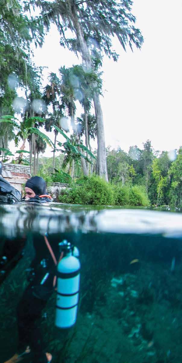
George A. Smathers Library in Gainesville (Hoffman ca. 1985). A short article and a master’s thesis written by a graduate student of Hoffman’s are the only published sources of early work at the site (Hoffman 1983; Rayl 1974). To date, I have not found the Guest Mammoth artifacts or cut-marked bones. Records indicate these items were sent from Northern Arizona University to the University of Florida after Hoffman’s death (Smith 2019). However, a search of the University of Florida collections revealed only a few teeth from the site. The Silver River Museum in Silver Springs curates approximately twenty mammoth bones from the site and a replica cast of the projectile point. After a search
period, I contacted Cynthia Hoffman, Charles’s wife until his death in 2005. Cynthia had an entire banker’s box of unpublished photographs and notes on the site, which she graciously donated to my cause. These images contributed invaluable information to the site’s understanding, including images of missing artifacts and the site’s general location. Pieces were now in place for fieldwork to begin.
In 2014, I began an effort relocate the Guest mammoths. Local knowledge, a few survey dives, and some remote sensing conducted with the help of the Florida Bureau of Archaeological Research combined to determine the exact location of Hoffman’s 1973 excavations. I had a hunch that using a magnetometer to relocate the site, while inherently not useful for finding prehistoric sites which don’t contain metal, might be useful for finding archaeologists. After all, it seems that I can’t get through an underwater field season without losing at least one pocket knife. This hunched paid off, and the magnetometer gave us a suite of anomalies that turned out to be a cluster of unit nails, a lost weight belt buckle from a diver, and the original site datum nail, which unfortunately was displaced from its original location.
I directed excavations at this area in July 2017. We relocated the mammoth bone bed, which was present in at least 4 m2 of the total 13 m2 area excavated. We confirmed the stratigraphy reported by Charles Hoffman. We also piece-plotted seven lithic artifacts insitu in direct association with six mammoth bones. Two mammoth bones have unfused epiphyseal surfaces, replicating Hoffman’s evidence for a juvenile animal. Processing of the 1/16th-inch screen material collected from our excavations confirms the presence of extensive micro debitage in the bone bed. We recovered no cutmarked bone or stacked elements. Two samples of mammoth bone recovered during this excavation failed to yield absolute ages due to insufficient collagen. However, an optically stimulated luminescence (OSL) age from the mammoth bone bed returned an age of 12,600 years ago, which aligns with the known dates for megafauna extinction in the region. So far, so good.
However, an important problem was observed at the Guest Mammoth site when radiocarbon dates were collected above the bone bed. The bone bed lay exposed, or was buried and continually re-exposed, until about 8,000 years ago. This gap of more than
55 2020 Adventures in Florida Archaeology
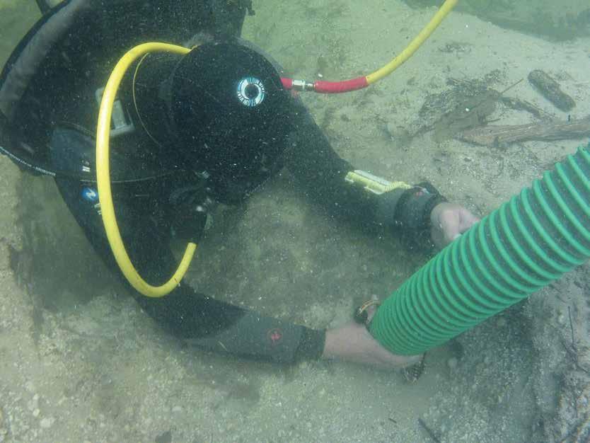
4,000 years raises questions about the geologic context of the entire site. The artifacts are good, and we have dates from the site… but the context currently is lacking. Whether humans killed the Guest mammoths or scavenged their carcasses after the animals died naturally currently is not possible to know (Smith 2019).
Conclusion
However, there may yet be more to the story of the site. The area around the Guest Mammoth site contains extensive Pleistocene bone-bearing deposits. The site does indeed appear to be a pond, and our excavations appear to have been located on its upper edge, indicating that deeper, more intact deposits may still be present. In the meantime, the search continues for more evidence regarding when and how Florida was first colonized. For now, the Page-Ladson site demonstrates that Florida was an early human occupation area of the hemisphere, while sites like Guest Mammoth tease us with other possibilities. This adventure in Florida archaeology is ongoing and undoubtedly will produce many more fascinating stories before we will know anything for certain.
Dr. Morgan Smith is an assistant professor of anthropology at the University of Tennessee, Chattanooga, who specializes in the Late Pleistocene peopling of the Americas, hunter-gatherer groups, prehistoric adaptations to climate change, and the archaeology of underwater landscapes.
Bibliography
After relocating the original Guest Mammoth site in the Silver River, archaeologists mapped, tested, and expanded the research area in 2017.
LEFT: A diver uses a water induction dredge to excavate the bone bed.
RIGHT: A stratigraphic profile shows sediment layers above a bed of mammoth bones, seen at the bottom of the photo.
Bement, Leland C., and Brian J. Carter. 2010. “Jake Bluff: Clovis Bison Hunting on the Southern Plains of North America.” American Antiquity 75(4):907–933.
Cook Hale, Jessica, Nathan L. Hale, and Ervan G. Garrison. 2018. “What is past is prologue: excavations at the Econfina Channel site, Apalachee Bay, Florida, USA.” Southeastern Archaeology, February 2018.
deSmet, Timothy S., and Morgan F. Smith. 2019. Emerging Remote Sensing Methods in Underwater Archaeology In Early Floridians: New Directions in the Search for and Interpretation of Florida’s Earliest Inhabitants, edited by David K. Thulman and Ervan Garrison. Gainesville: University of Florida Press.
Dunbar, James S. 2016. Paleoindian Societies of the Coastal Southeast. Gainesville: University Press of Florida.
Evans, Sean. 2011. Correspondence Involving Ownership of the Guest Mammoth Collection, edited by Donna Rulh and Elise Lecompte. Email communication.
Fisher, Daniel C. Bradley T. Lepper, and Paul E. Hooge. 1994. Evidence for butchery of the Burning Tree mastodon. The First Discovery of America:
56 2020 Adventures in Florida Archaeology
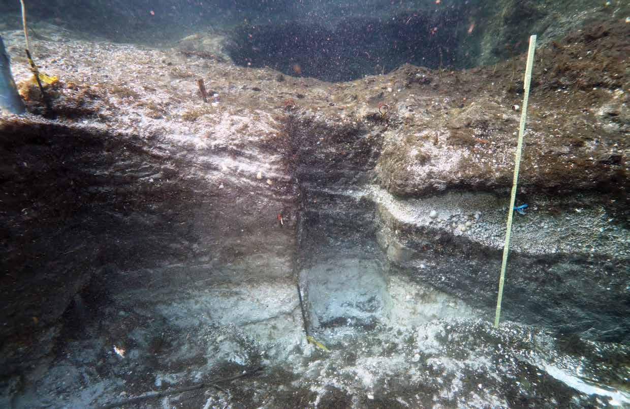
Archaeological Evidence of the Early Inhabitants of the Ohio Area, The Ohio Archaeological Council, Columbus:43–57.
Garrison, Ervan G., Jessica Cook Hale, Christopher Sean Cameron, and Erin Smith. 2016. The archeology, sedimentology and paleontology of Gray’s Reef National Marine Sanctuary and nearby hard bottom reefs along the mid continental shelf of the Georgia Bight. Journal of Archaeological Science: Reports 5:240–262.
Greenburg, J. H., C. G. Turner, and S. L. Zegura. 1986. The Settling of the Americas: A Comparison of the Linguistic, Dental, and Genetic Evidence. Current Anthropology 27(5):477–497.
Gustas, Robert, and Kisha Supernant. 2019. Coastal migration into the Americas and least cost path analysis. Journal of Anthropological Archaeology 54:192–206.
Halligan, Jessi, Michael R. Waters, Angelina Perrotti, Ivy J. Owens, Joshua M. Feinberg, Mark D. Bourne, Brendan Fenerty, Barbara Winsborough, David Carlson, Daniel C. Fisher, Thomas W. Stafford, and James S. Dunbar. 2016. Pre-Clovis occupation 14,550 years ago at the Page-Ladson site, Florida, and the peopling of the Americas. Science Advances 2(5).
Hemmings, C. Andrew. 2004. “The Organic Clovis: A single continent-wide cultural adaptation.” Unpublished PhD dissertation. University of Florida Library Catalog.
Hoffman, Charles A. 1983. “A Mammoth Kill Site in the Silver Springs Run.” The Florida Anthropologist 36(1–2):83–87.
----------. ca. 1985. “Mammoth Hunting Underwater.” Charles A. Hoffman Papers, University of Florida, Unpublished.
Joy, Shawn. 2018. “The Trouble with the Curve: Reevaluating the Gulf of Mexico Sea-level Curve ” Unpublished master’s thesis, Department of Anthropology, Florida State University.
Kenady, Stephen M., Michael C. Wilson, Randall F. Schalk, and Robert R. Mierendorf. 2011. “Late Pleistocene butchered Bison antiquus from Ayer Pond, Orcas Island, Pacific Northwest: Age confirmation and taphonomy.” Quaternary International 233(2):130–141.
Llamas, Bastien, Kelly M. Harkins, and Lars FehrenSchmitz. 2017. “Genetic studies of the peopling of the Americas: What insights do diachronic mitochondrial genome datasets provide?”Quaternary International 444, Part B:26–35.
57 2020 Adventures in Florida Archaeology
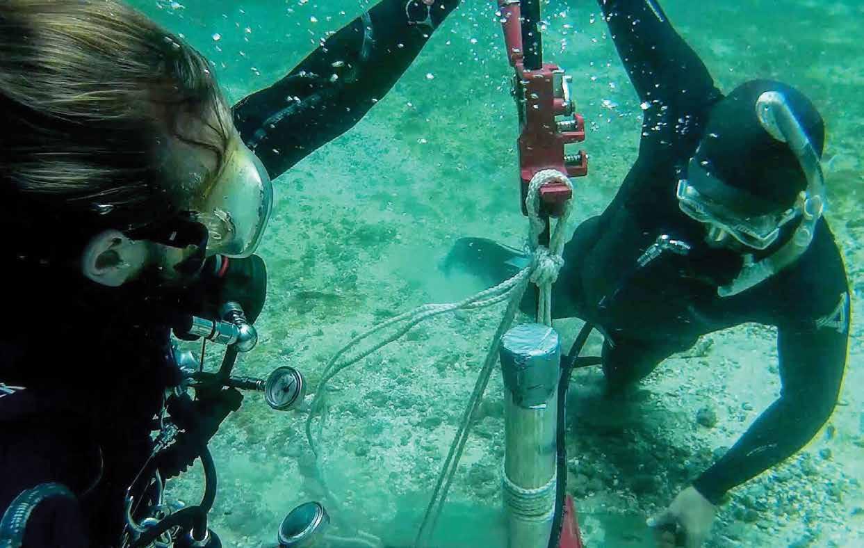
Mackie, Quentin, Loren Davis, Daryl Fedje, Duncan McLaren, and Amy E. Gusick. 2013. “Locating Pleistocene-age Submerged Archaeological Sites on the Northwest Coast: Current Status of Research and Future Directions ” In Paleoamerican Odyssey, edited by Kelly E. Graf, Caroline V. Ketron, and Michael R. Waters, pp. 133–147. College Station: Center for the Study of the First Americans.
Neill, Wilfred T. 1958. “A Stratified Early Site at Silver Springs, Florida.” The Florida Anthropologist 11:33–52.
----------. 1964. “The Association of Suwannee Points and Extinct Animals in Florida.” The Florida Anthropologist 17:17–32.
O’Shea, John M., and Guy A. Meadows. 2009. “Evidence for early hunters beneath the Great Lakes.” Proceedings of the National Academy of Sciences 106(25):10120–10123.
Rayl, Sandra L. 1974. “A Paleo-Indian Mammoth Kill Site Near Silver Springs, Florida.” Unpublished master’s thesis, Department of Anthropology, Northern Arizona University.
Smith, Morgan F. 2019. “Hunting an Underwater Mammoth: A Re-Evaluation of the First Submerged Prehistoric Site Excavated in the Americas.” In Early Floridians: New Directions in the Search for and Interpretation of Florida’s Earliest Inhabitants, edited by David K. Thulman and Ervan Garrison. Gainesville: University of Florida Press, Gainesville.
Steponaitis, Vincas P. 1986. “Prehistoric archaeology in the southeastern United States, 1970–1985.” Annual Review of Anthropology:363–404.
Waguespack, Nicole M., and Todd A. Surovell. 2003. “Clovis hunting strategies, or how to make out on plentiful resources.” American Antiquity 68:(2)2003:333–352.
Waters, Michael R., and Thomas W. Stafford. 2013. “The First Americans: A Review of the Evidence for the Late-Pleistocene Peopling of the Americas.” In Paleoamerican Odyssey, edited by Caroline V. Ketron, Kelly E. Graf, and Michael R. Waters, pp. 541–560. Bryan, Tex.: Tops Printing.
58 2020 Adventures in Florida Archaeology
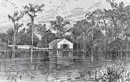
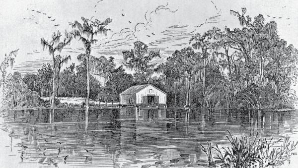
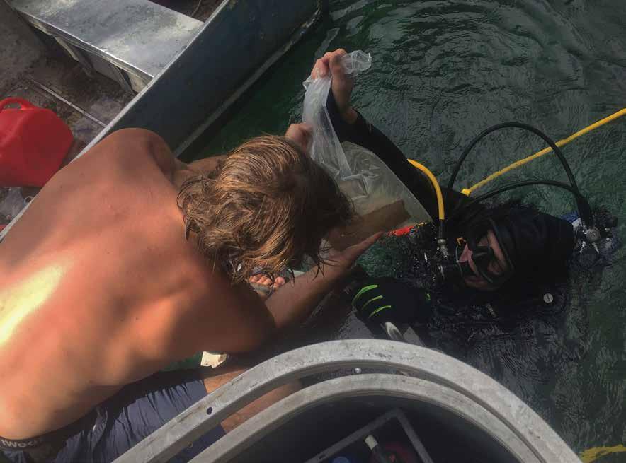
PAGE: Archaeologists take a core sample at Guest Mammoth to learn about sediment deposition over time.
TOP: Engraving of Silver Springs, ca. 1876. Courtesy of State Library and Archives, Florida Memory, PR10441.
BOTTOM: Archaeologist Michael Faught hands Morgan Smith a mammoth rib bone fragment recovered during excavation. Photos courtesy of the author
59 2020 Adventures in Florida Archaeology
LEFT
60 2020 Adventures in Florida Archaeology
THE FLORIDA
HISTORICAL SOCIETY ARCHAEOLOGICAL INSTITUTE
FHSAI is headquartered in the Brevard Museum of History and Natural Science in Cocoa. The Institute presents lectures by professional archaeologists, publishes books about Florida archaeology, maintains permanent museum exhibits including “The People of Windover” and “South Indian Fields,” and develops temporary and traveling displays about Florida archaeology. This magazine, Adventures in Florida Archaeology, is published annually by FHSAI.