PERFORMANCE SPECIFICATIONS
RTK base 8 - 10 hours
MEASUREMENTS • 220 Channels • High precision multiple correlator for GNSS pseudo range measurements • Unfiltered, unsmoothed pseudo range measurements data for low noise, low multipath error, low time domain correlation and high dynamic response • Very low noise GNSS carrier phase measurements with <1 mm precision in a 1 Hz bandwidth • Signal-to-Noise ratios reported in dB-Hz
I/O Interface 1 x Bluetooth(2402MHz to 2480MHz) 1 x standard USB2.0 port 1 x TNC UHF connector 2 x RS232 serial port 2 x DC power input (8-pin & 5-pin) 1 x MicroSD card port
Satellite Signals Tracked Simultaneously GPS……………………………………………………… Simultaneous L1C/A, L2C, L2E, L5 GLONASS………… Simultaneous L1C/A, L1P, L2C/A (GLONASS M only), L2P SBAS…… Simultaneous L1 C/A, L5 (EGNOS, WAAS, MSAS, GAGAN, QZSS) Galileo1………………… Simultaneous L1 BOC, E5A, E5B, E5AltBOC(Optional) BDS………………………………………………………………………………………………… B1, B2 POSITIONING PERFORMANCE2 Hot Start ………………………………………………………………………… Typically <10s Cold Start ……………………………………………………………………… Typically <15s High-Precision Static Horizontal …………………………………………………………… 2.5 mm + 0.1 ppm RMS Vertical ………………………………………………………………… 3.5 mm + 0.4 ppm RMS Static and Fast Static Horizontal …………………………………………………………… 2.5 mm + 0.5 ppm RMS Vertical …………………………………………………………………… 5 mm + 0.5 ppm RMS Post Processing Kinematic (PPK / Stop & Go) GNSS Surveying Horizontal……………………………………………………………………… 8mm+1ppm RMS Vertical………………………………………………………………………… 15mm+1ppm RMS Initialization time……………………………………………………… Typically 10 minutes for base while 5 minutes for rover Initialization reliability…………………………………………………… Typically > 99.9% Real Time Kinematic (RTK) Surveying Horizontal……………………………………………………………………… 8mm+1ppm RMS Vertical………………………………………………………………………… 15mm+1ppm RMS Initialization time………………………………………………………………… Typically 2-10s Initialization reliability…………………………………………………… Typically > 99.9% Code Differential GNSS Positioning Horizontal……………………………………………………………………… 25cm+1ppm RMS Vertical…………………………………………………………………………… 50cm+1ppm RMS SBAS3…………………………………………………… 0.50m Horizontal, 0.85m Vertical HARDWARE Physical Dimensions (W x H)……………………18.20cm x 9.80cm (7.17inch x 3.86inch) Weight………………………………………… 1.25kg (2.76lb) without internal battery Operating temperature………………………… -45℃ to +65℃ (-49℉ to +149℉) Storage temperature…………………………… -55℃ to +85℃ (-67℉ to +185℉) Humidity……………………………………………………………………… 100%, condensing Water/dustproof………………………………………… IP67 dustproof, protected from temporary immersion to depth of 1m (3.28ft). Shock and vibration………………………………………………… Designed to survive a 3m(9.84ft) natural fall onto concrete. Electrical Power 6V to 28V DC external power input Power consumption ≤3.5W Automatic switching between internal power and external power Rechargeable, removable 7.4V, 5000mAh Lithium-ion battery in internal battery compartment
Surveying the world, Mapping the future.
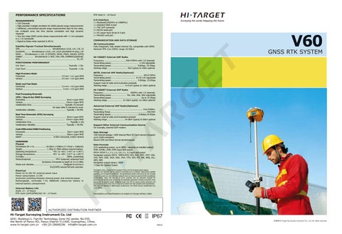
V60
COMMUNICATION AND DATA STORAGE 3G Communication Fully integrated, fully sealed internal 3G, compatible with GPRS Network RTK (via CORS) range 20-50km
HI-TARGET Internal UHF Radio Frequency ……………………………………450-470MHz with 116 channels Transmitting power……………………………………………… 1~5W adjustable Transmitting speed…………………………………………… 9.6Kbps, 19.2Kbps Working range………………………………… 5km typical, 8~10km optimal SATEL Internal UHF Radio(Optional) Frequency…………………..…………………………........………..... 403-473MHz Transmitting power………................................ 0.1W~1W adjustable Transmitting speed………………………….......…………. 9.6Kbps, 19.2Kbps Support most of radio communication protocols Working range…………………......….. 3~5 km typical, 8~10km optimal HI-TARGET External UHF Radio Frequency…………………………………………… 460MHz with 116 channels Transmitting power………………………… 5W, 10W, 20W, 30W adjustable Transmitting speed………………………………………………… Up to 19.2Kbps Working range………………………… 8~10km typical, 15~20km optimal Advanced External UHF Radio(Optional) Frequency.............................………………….................. 410-470MHz Transmiting Power..................…………………………….............. 5W/25W Transmiting Speed.....................……….................9.6Kbps,19.2Kbps Support most of radio communication protocol Working range..............................8-10km typical,15-20km optimal Support Other External Communication Device For example, external GSM modem. Data Storage 1GB Internal storage + 8GB Internal Micro SD Card memory (Support up to 32GB extension) Record GNS and Rinex format simultaneously Data Formats (1Hz positioning output, up to 50Hz - depends on installed option) CMR: sCMRx, CMR, CMR+input and output RTCM: RTCM 2.1, 2.2, 2.3, 3.0, 3.1, 3.2 input and output Navigation outputs ASCII: NMEA-0183 GSV, AVR, RMC, HDT, VGK, VHD, ROT, GGK, GGA, GSA, ZDA, VTG, GST, PJT, PJK, BPQ, GLL, GRS, GBS Navigation outputs binary: GSOF 1 Pulse Per Second Output Developed under a License of the European Union and the European Space Agency.
1
Precision and reliability may be subject to anomalies due to multipath, obstructions, satellite
2
geometry, and atmospheric conditions. The specifications stated recommend the use of stable mounts in an open sky view, EMI and multipath clean environment, optimal GNSS constellation configurations, along with the use of survey practices that are generally accepted for performing the highest-order surveys for the applicable application including occupation times appropriate for baseline length. Baselines longer than 30 km require precise ephemeris and occupations up to 24 hours may be required to achieve the high precision static specification. GPS only and depends on SBAS system performance. FAA WAAS accuracy specifications are
3
Internal Battery Life Static 13 - 15 hours RTK rover (UHF/GPRS/3G) 10 - 12 hours
<5 m 3DRMS.
Descriptions and Specifications are subject to change without notice
AUTHORIZED DISTRIBUTION PARTNER
Hi-Target Surveying Instrument Co. Ltd ADD: Building13, Tian’An Technology Zone HQ center, No.555, the North of Panyu RD, Panyu District 511400, Guangzhou, China. www.hi-target.com.cn +86-20-28688296 info@hi-target.com.cn
2019 19M223