C HAN D ANA N RAO

“AN IDEA IS SALVATION BY IMAGINATION.”
-FL.WRIGHT


“AN IDEA IS SALVATION BY IMAGINATION.”
-FL.WRIGHT
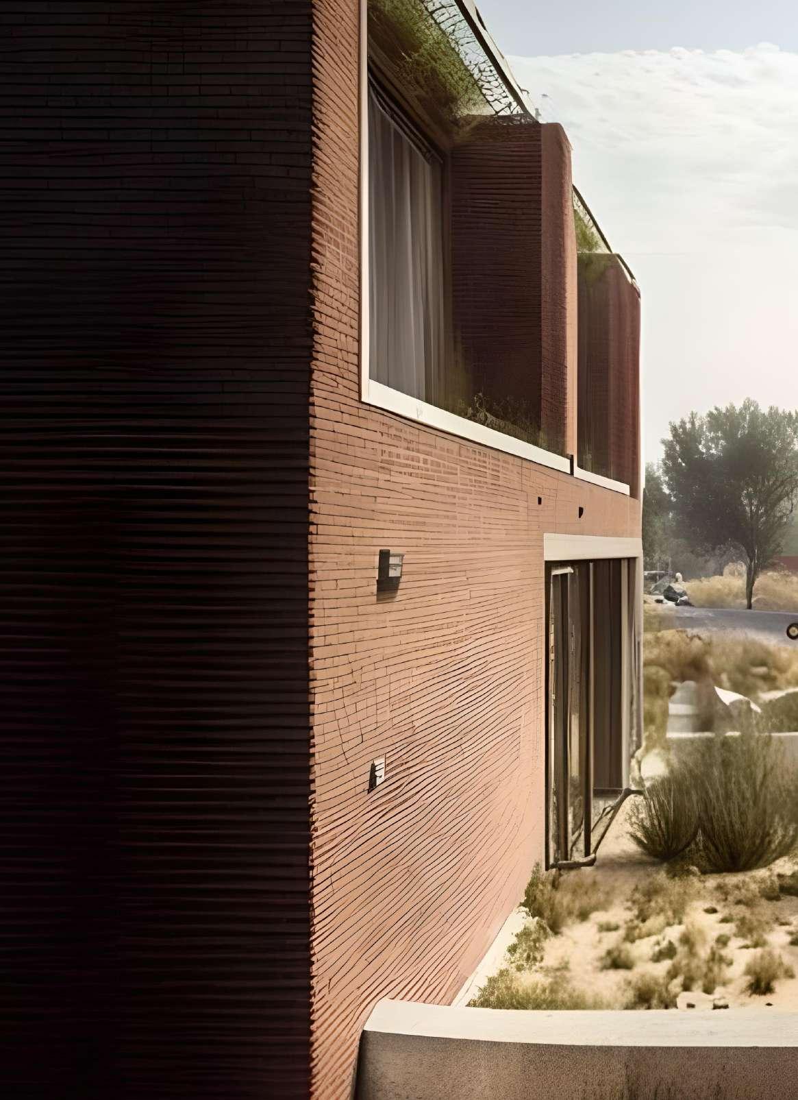
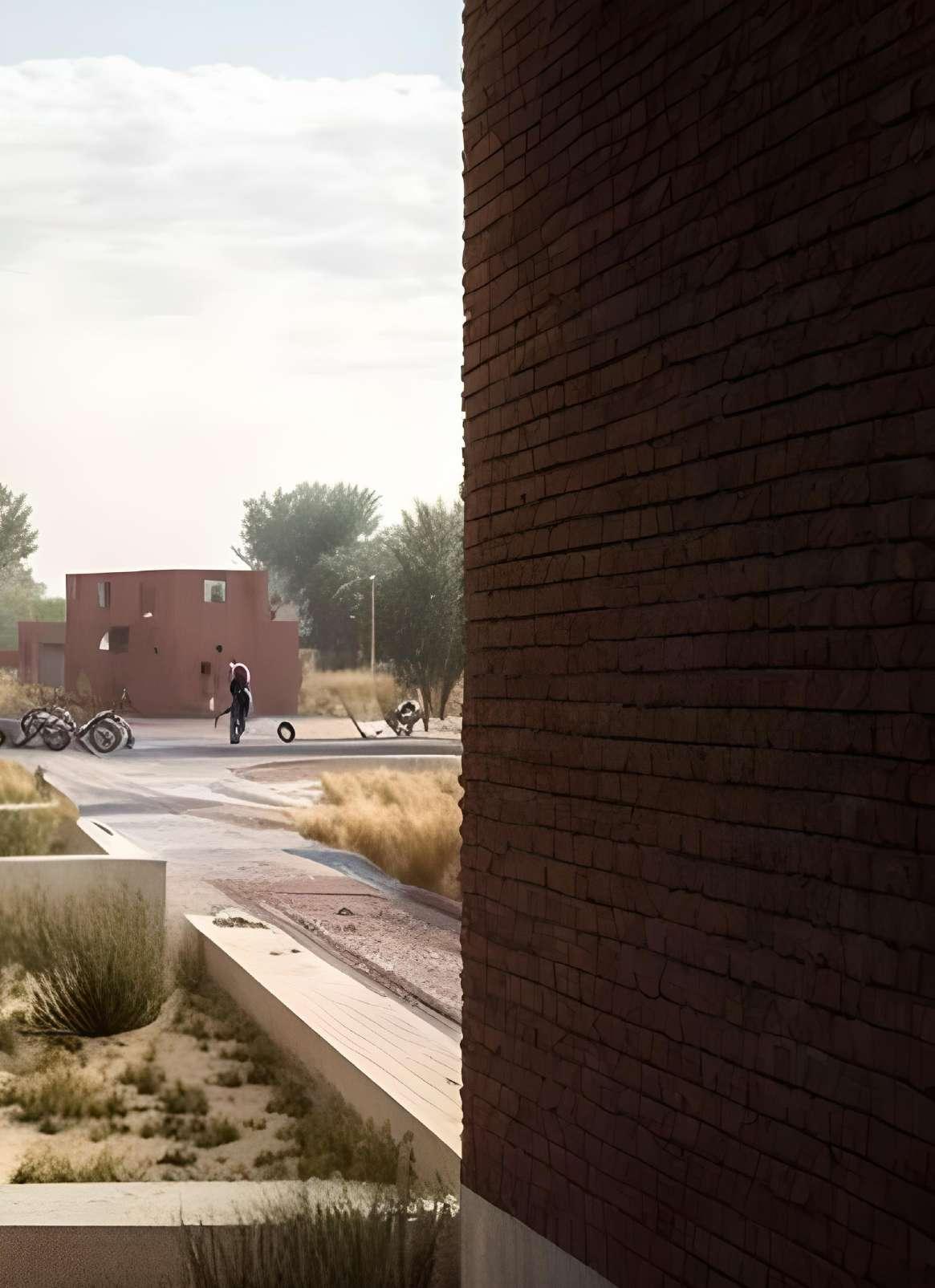
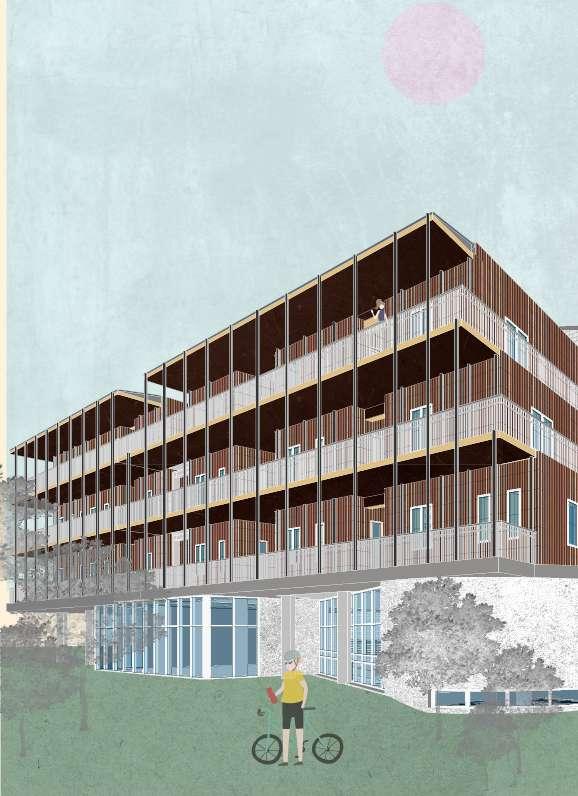
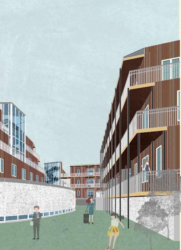
2023 | EL-PASO| MIXED USE RESIDENTIAL HOUSING |
Area :551,700 SQFT
INSTRUCTOR : MATIAS DEL CAMPO
TEAM : JUTANG GAO, RANYA BETTS-CHEN, CHANDANA RAO
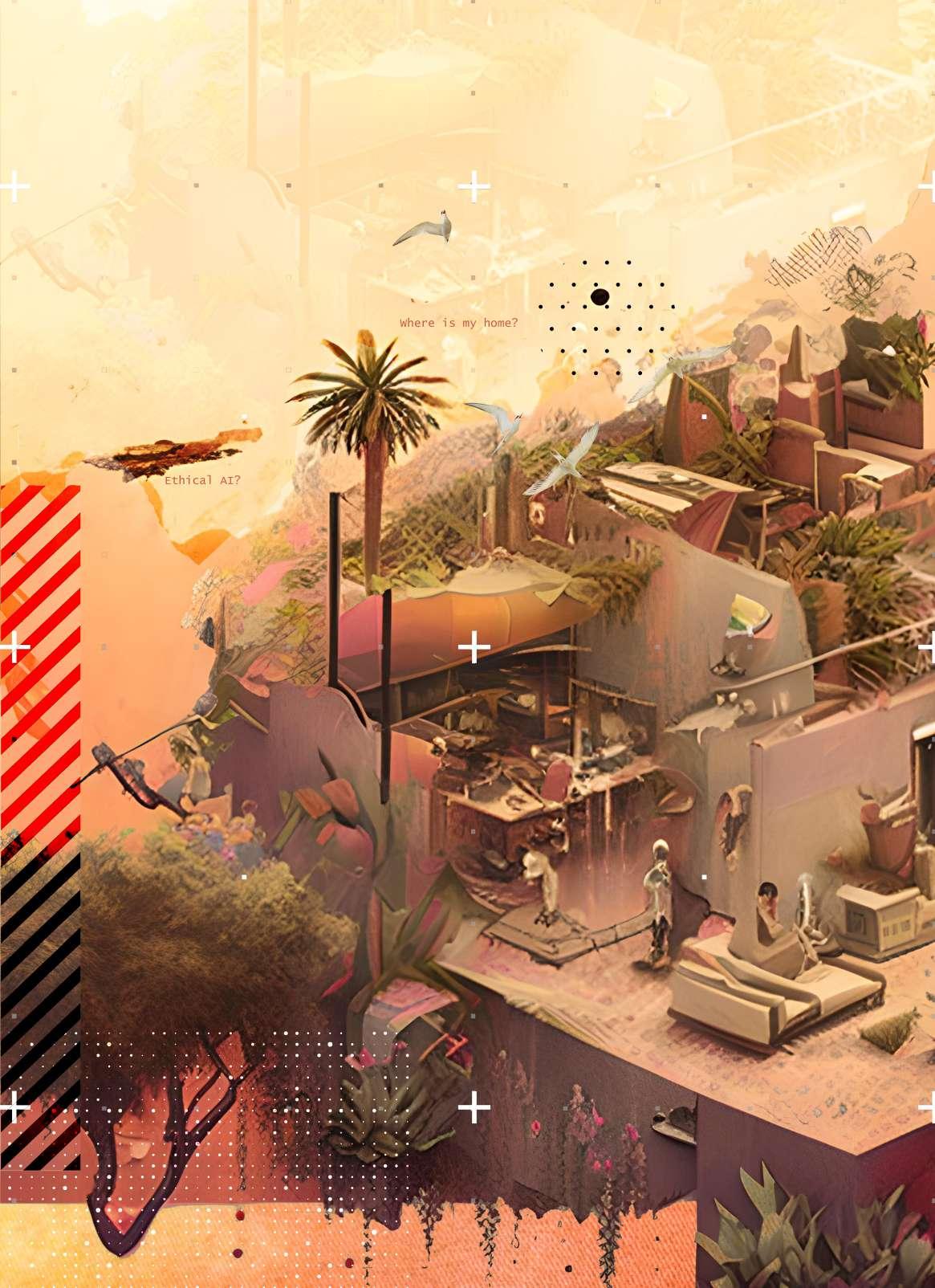
Artificial intelligence (AI) is intelligence demonstrated by machines, as opposed to the intelligence of humans and other animals. Artificial intelligence (AI) is shaping fundamental aspects of Human societies. AI automates, speeds up, and improves the accuracy of the performance of broad categories of undertakings, embracing classification, clustering, and prediction. AI’s prospective contribution to social good is attained by generating a comprehensive socio-political question of the responsibility of the different stakeholders, of cooperation between them, and of shareable principles underpinning the current human understanding of an ‘AI society.’ In other words, a social understating of AI is required to amalgamate a new strategy for AI applications.
Artificial intelligence is designed to assist decision-making when the data, parameters, and variables involved are beyond human comprehension. Most importantly, AI systems make the right decisions given the constraints. However, AI notoriously fails to capture or respond to intangible human factors that go into real-life decisionmaking. Can this be applied to AI systems to measure whether AI is ready for the real world, in which machines can think and make the same design decisions that are justifiable that humans would make?
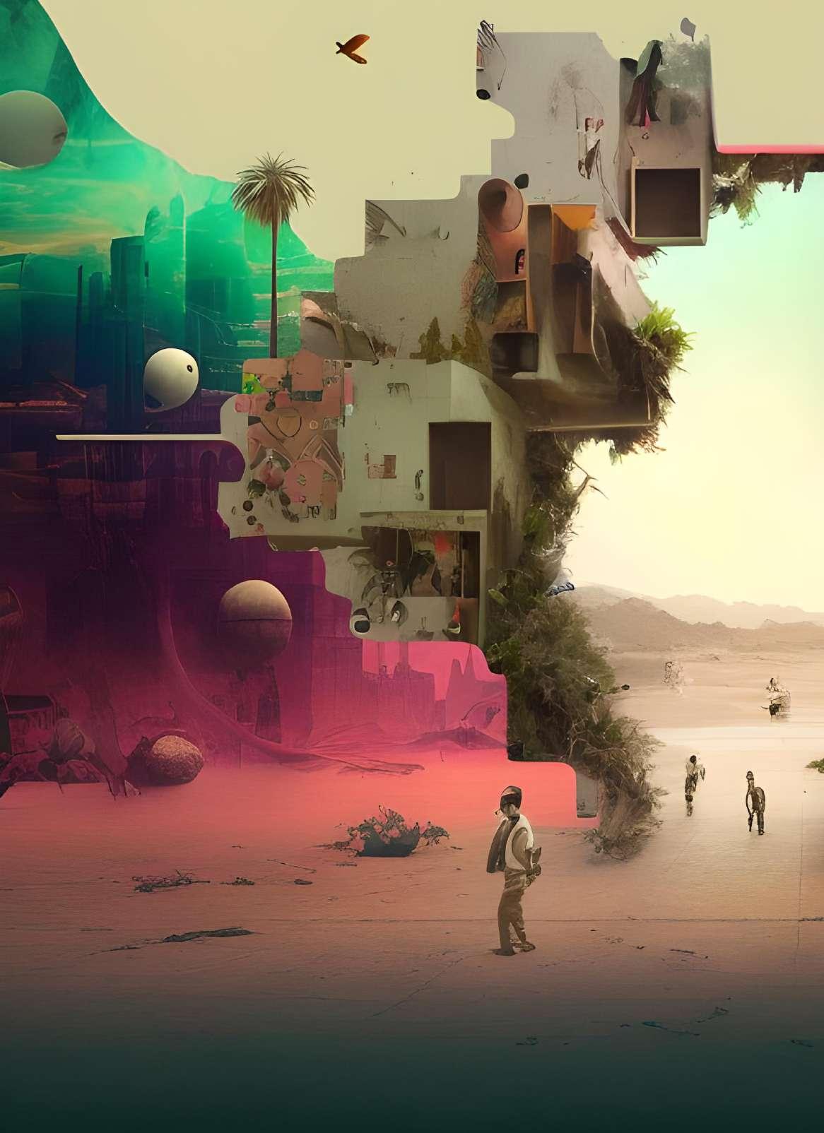
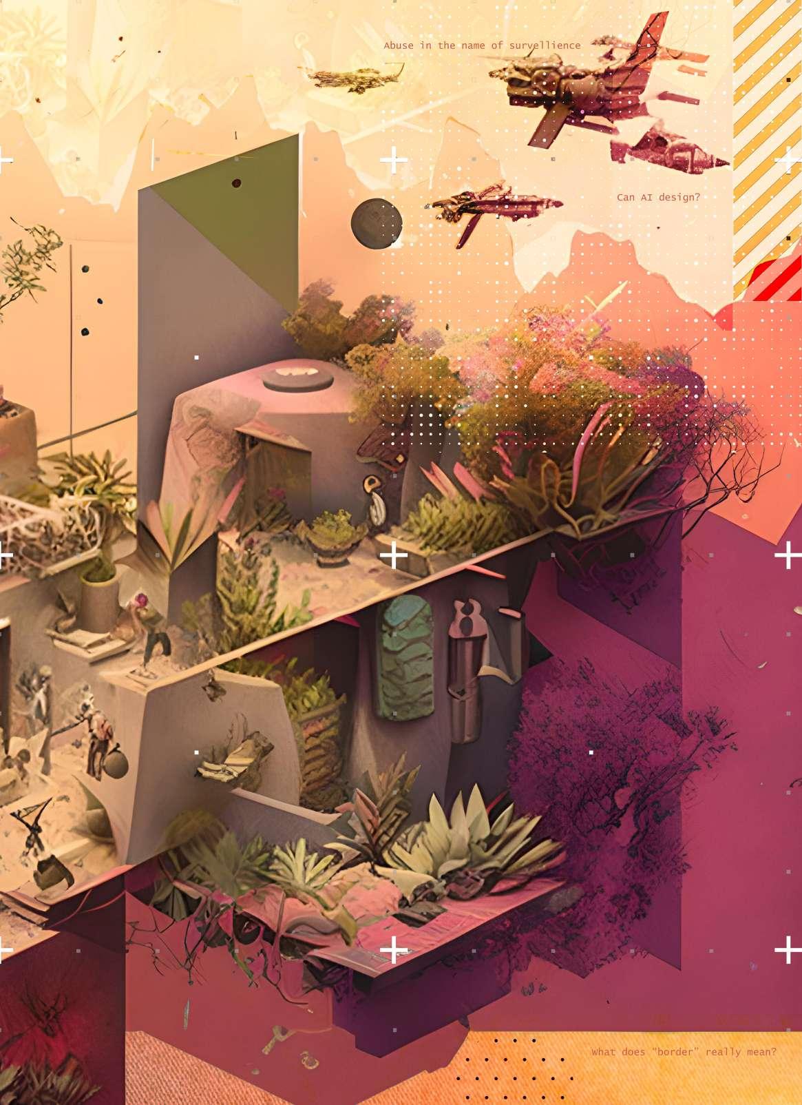
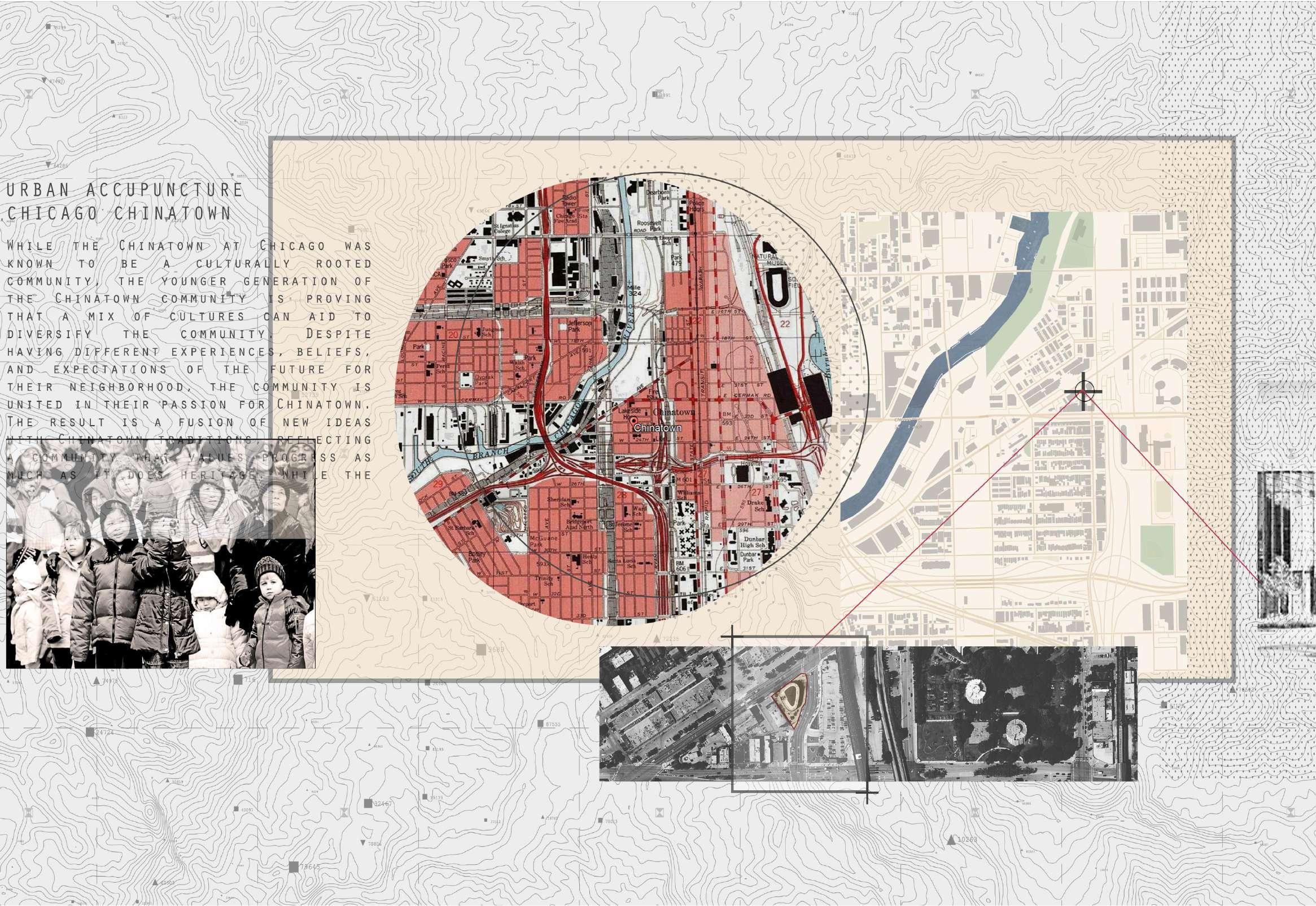
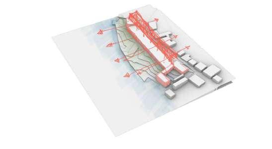
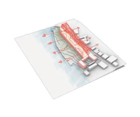
The project In|Between Frontiers aims to test the application of AI in the socio-political realm where interventions, while dire, haven’t taken shape due to many extraneous factors. The project aims to address topics of inclusive data and human-AI interaction by placing AI at the center of one such socio-political issue, the USMexico border. While the extents of interventions are multifold, this project aims to address the issues of migration along the border.
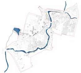
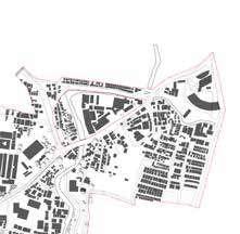
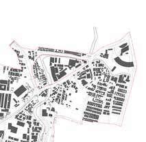
The Juarez-El Paso region, also known as the Borderplex, is a vibrant and dynamic transborder on two major cities: Ciudad Juarez, which is located in the state of Chihuahua, Mexico, and El unique cultural blend, as it shares a rich history and heritage that transcends the international
The Juarez-El Paso region has a significant population, with over 2.7 million people, making it the U.S.-Mexico border, with San Diego-Tijuana being the largest. The region has a diverse population, population.
The Juarez-El Paso region is known for its economic ties and cross-border trade. It is a major commercial activity, including manufacturing, logistics, and transportation. The region is home medical devices. The close proximity of Ciudad Juarez and El Paso allows for seamless cross-border Mexico and the United States.
However, the Juarez-El Paso region also faces unique challenges. One of the notable challenges and migration patterns over the years, leading to changes in border enforcement policies and practices. the El Paso sector highlights the ongoing complexities and issues related to immigration and border
Despite these challenges, the Juarez-El Paso region continues to be a vibrant and dynamic area contributes to the social, cultural, and economic fabric of both Mexico and the United States.
agglomeration located along the border between Mexico and the United States. It is centered El Paso, which is located in the state of Texas, United States. The region is known for its international boundary.
it the second largest conurbation (urban area formed by the merging of two or more cities) on population, with a mix of cultures, languages, and traditions, including a significant Hispanic
major hub for international trade between the United States and Mexico, with significant home to a number of manufacturing industries, including automotive, electronics, aerospace, and cross-border trade and supply chain integration, making it an important economic engine for both
challenges is immigration and border security. The region has seen fluctuations in illegal crossings practices. The statement you provided about a surge in illegal crossings and encounters in border security in the region.
area with a rich cultural heritage, strong economic ties, and a diverse population that States.
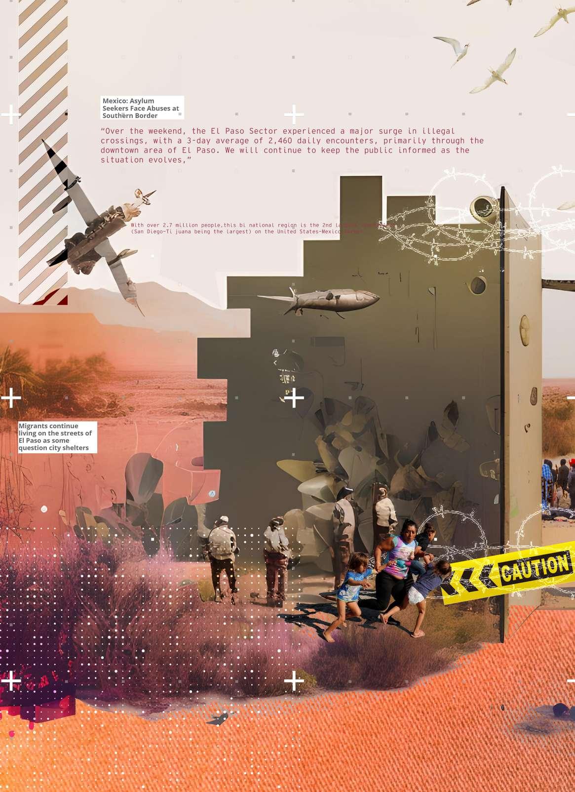
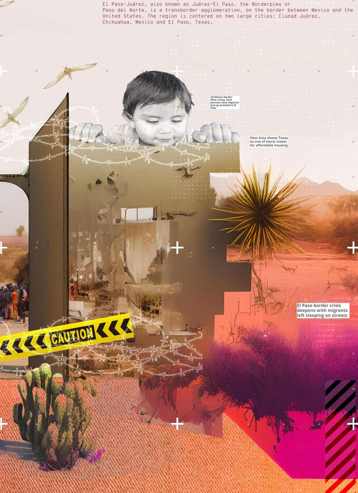
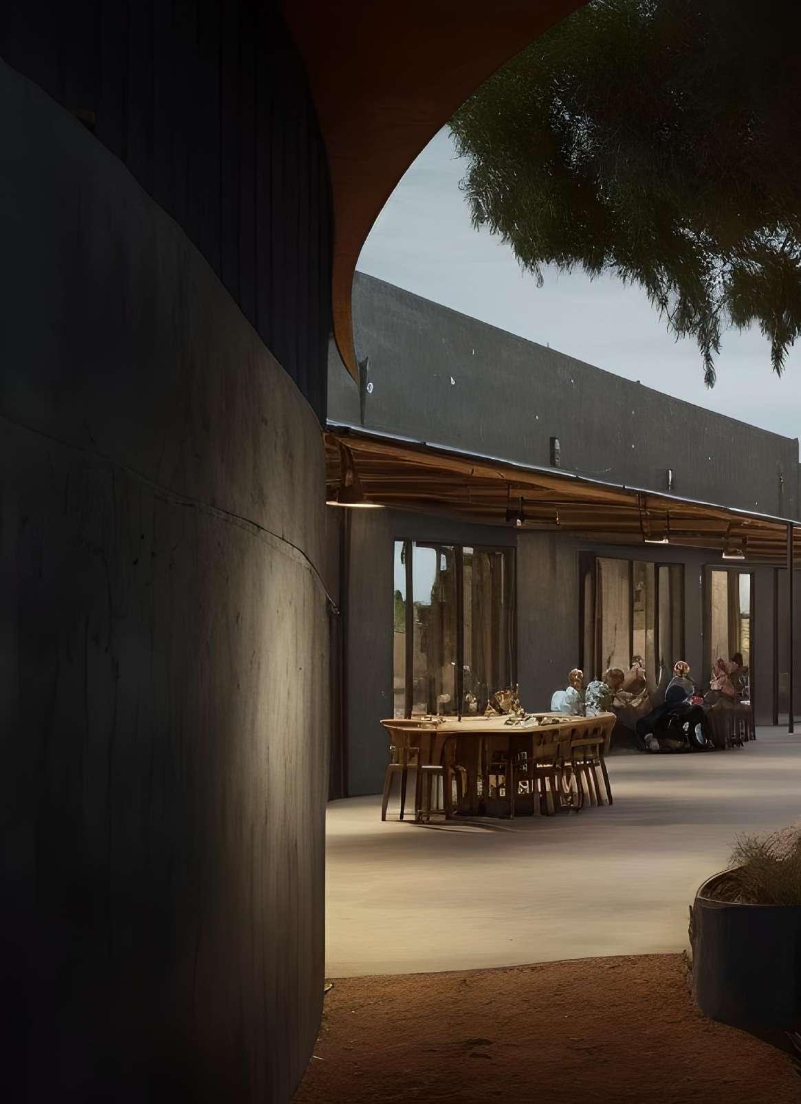
More than 2,500 people arrive in El Paso each day. With the shelters at capacities, migrant camps offering a below-par standard of living, and Texas having fallen short on affordable housing, the question now is where do these people go?
The project aims at addressing this dire need for housing through AI.
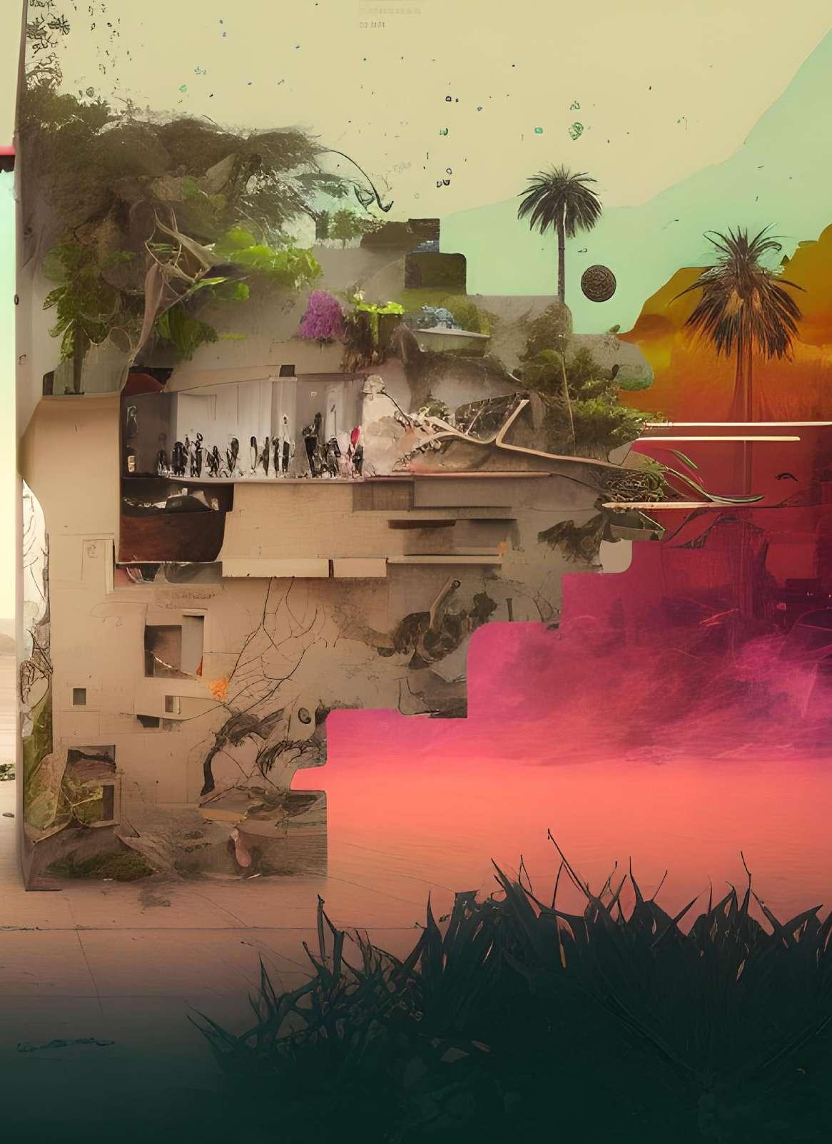
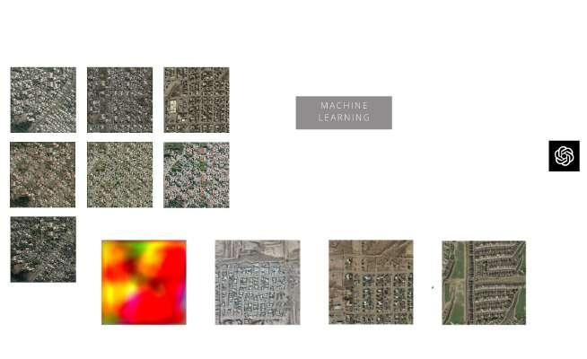
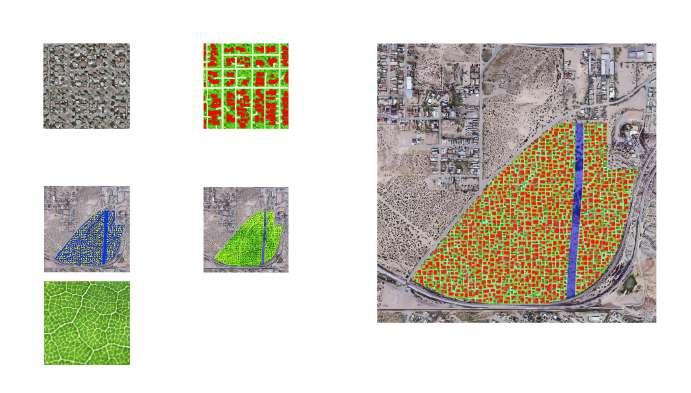
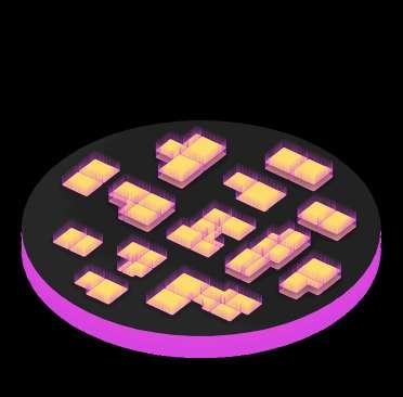
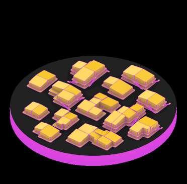
There are three main AI tools we chose to use as the staples of our methodological process. That is StyleGAN-2 ADA—which is a type of machine learning framework for smaller datasets that is useful in training a set of images and then generating new high-resolution images based on the pieces of training. Neural Style Transfer—an optimization technique using two images to blend them together, and Convolutional Neural Networks or CNNs—which is useful for image or object recognition and classification using large amounts of data. It is important to note this as it will be explained further why we used these tools for our project, the results we achieved, and how they work.
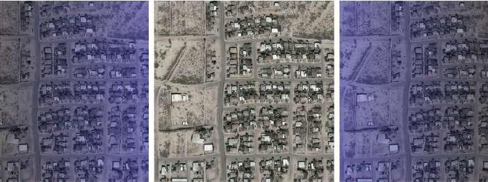
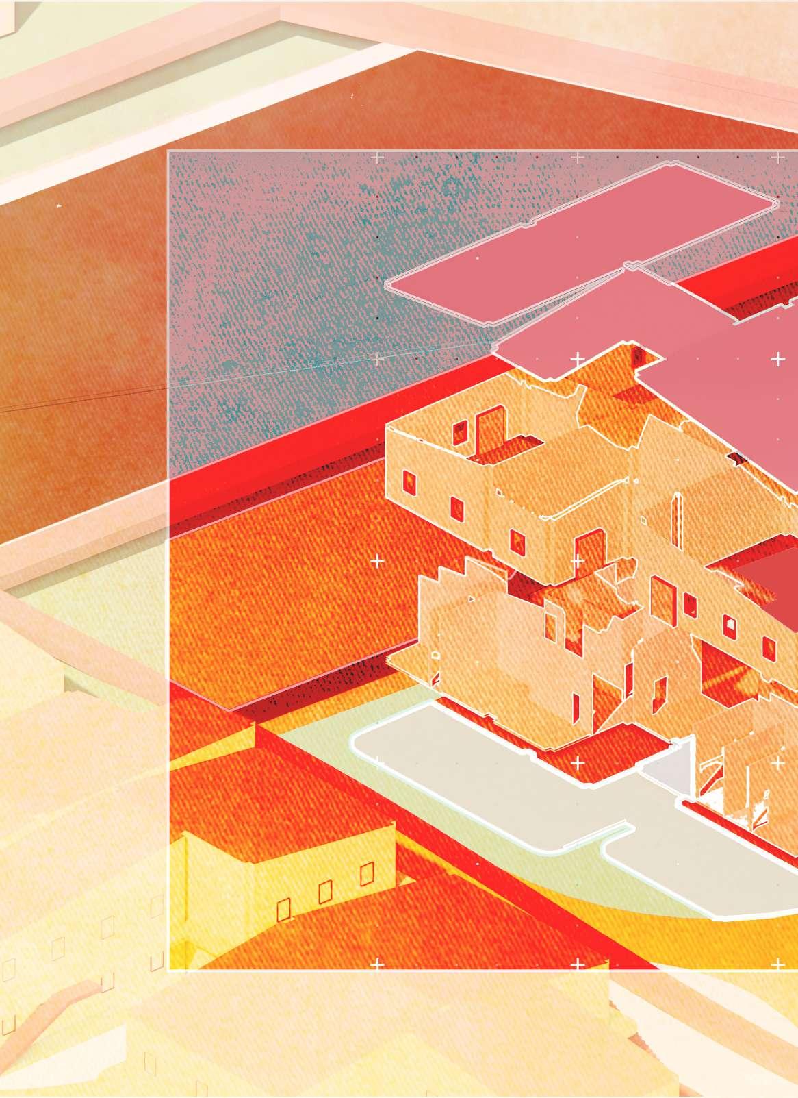
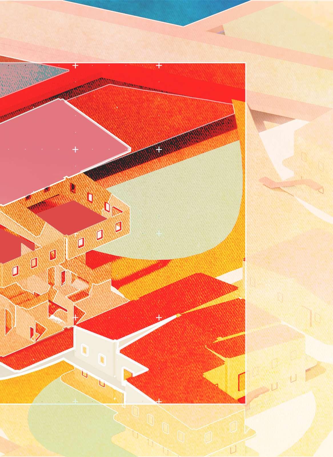
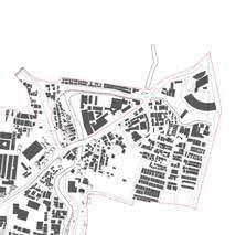
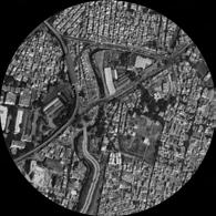
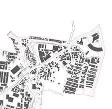
DATA SET CREATION WITH USING 2,100 IMAGES FROM AROUND EL-PASO,NEW MEXICO, AND MEXICO
SEED 0 FROM TRAINING PROGRESSION FROM EARLY STAGES TO CURRENT STAGE. AIMING FOR AN AUGMENT VALUE OF 0.6.
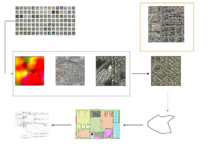

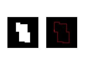
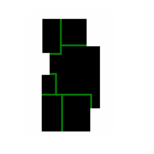
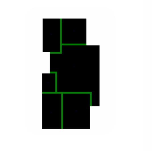
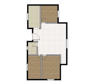
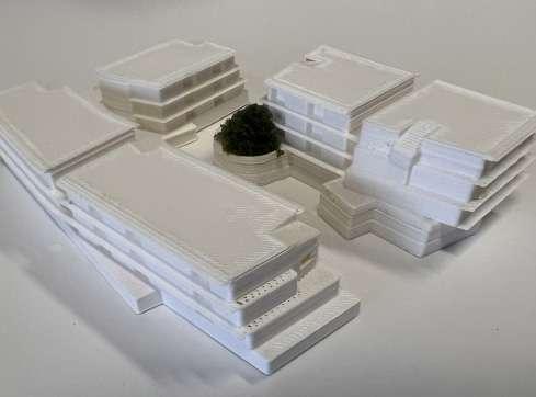
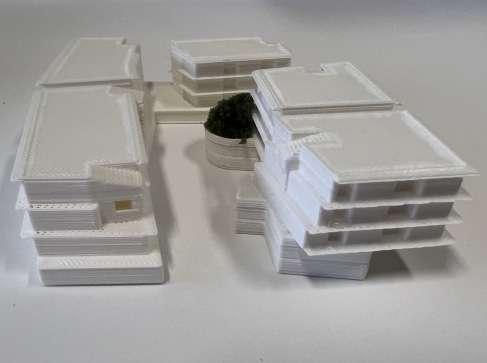
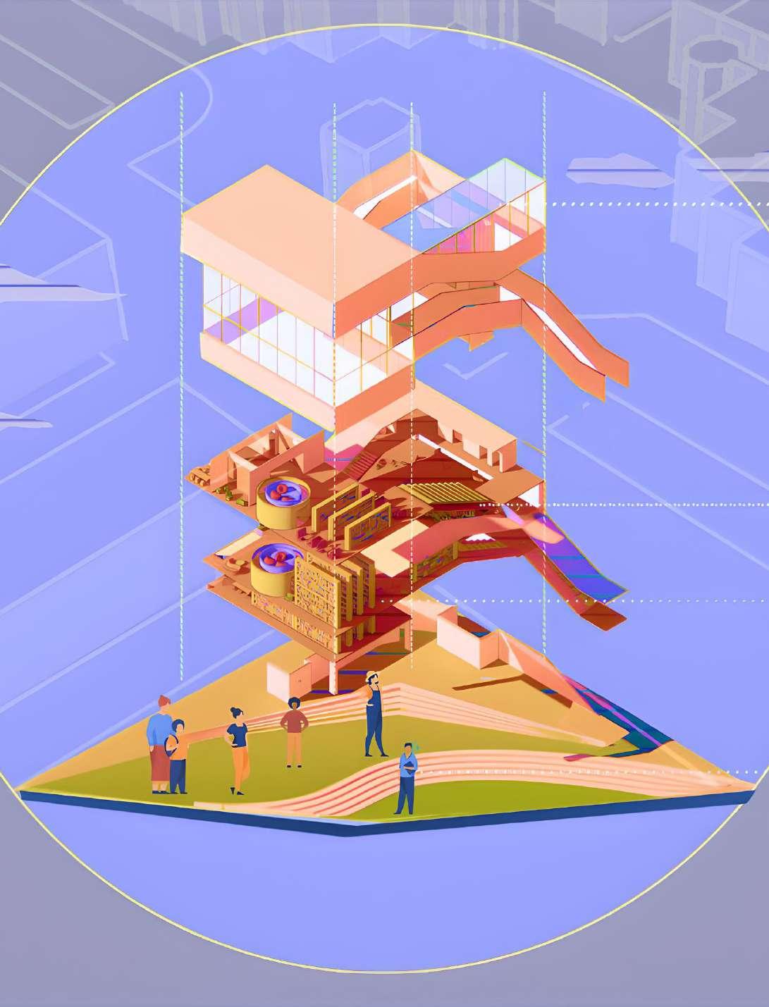
We developed our methodology based on the idea that it will be useful in helping us create new connections based on its versatility—something that is often necessary when addressing large-scale projects. We started out by collecting 2,100 satellite images of NM, TX, and MX, then using those images for training to create our site plan image. From the site plan image, we drew boundaries of the buildings that we wanted to have on our site, which was then used to generate 2-D floor plans. Finally, the 2-D floor plans that were generated were developed into 3-D models using Grasshopper in Rhino 3-D software.
Site Plan Creation (Style-Transfer) Process and Resulting Image
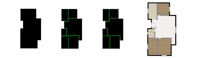
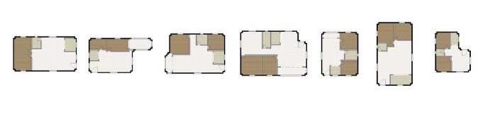
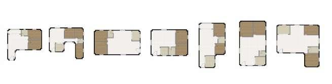
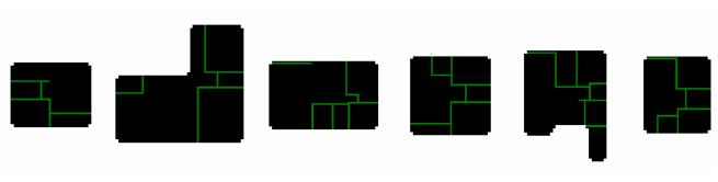
Floor Plan Generation with CNN — Sample of 52 Total Errors
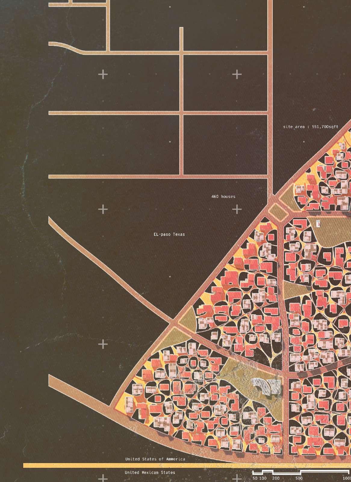
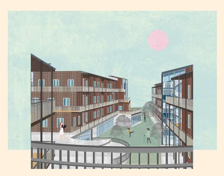
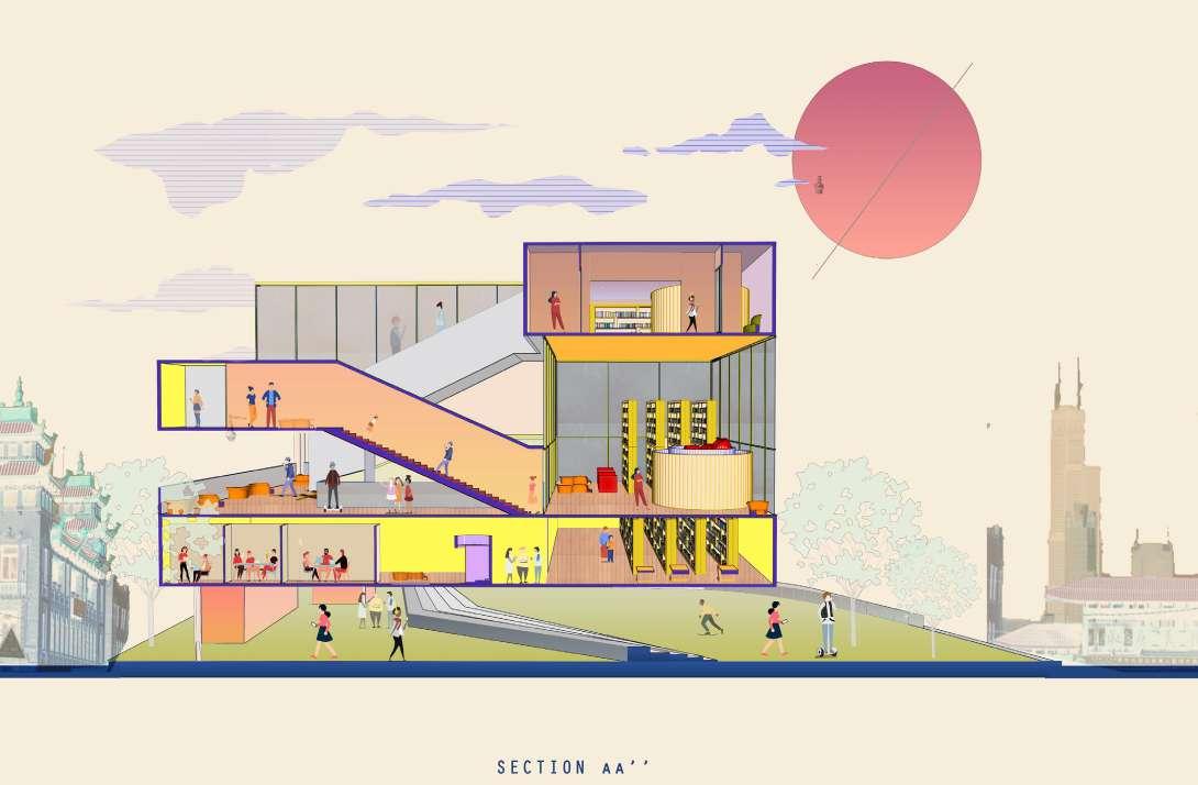
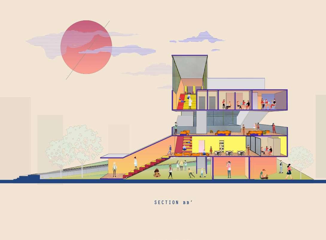
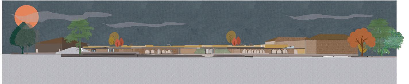
After the generation of functional floor plans, the idea was to take “houses” and convert them into a community that respects the livelihoods of its residents. The community site plan was designed taking into account the immediate needs of the residents, which was aimed at majorly housing the migrant community. Looking into the same, we found that there was an acute need for the following issues:
1. Resources to cover basic needs
2. Medical attention and treatment
3. Safety and protection methods
4. Access to information and orientation
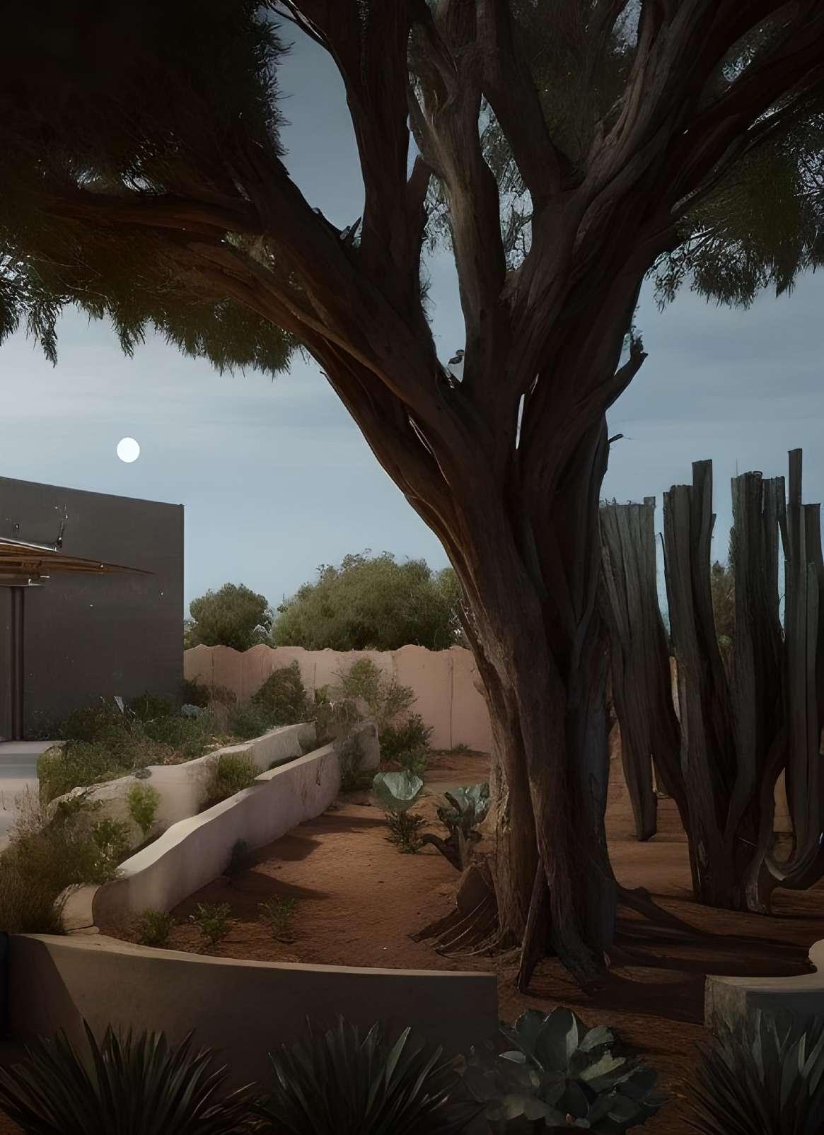
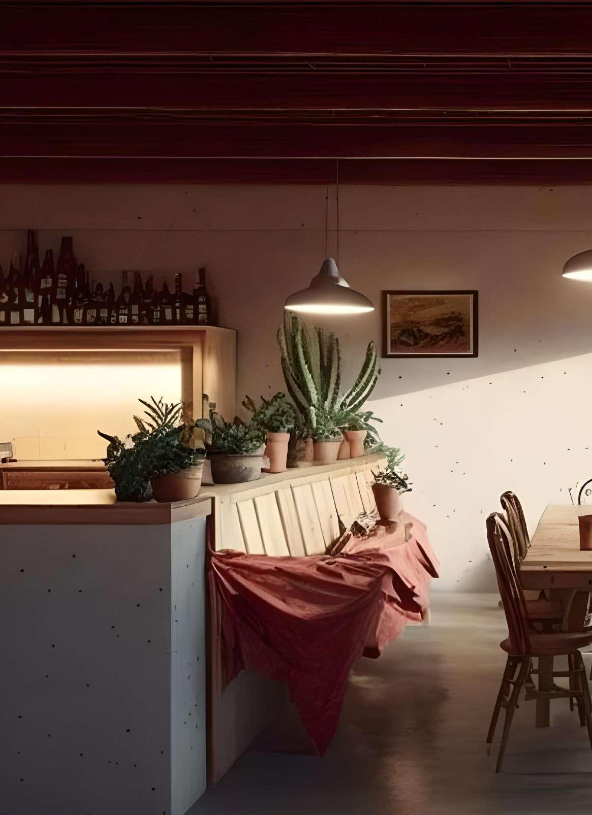
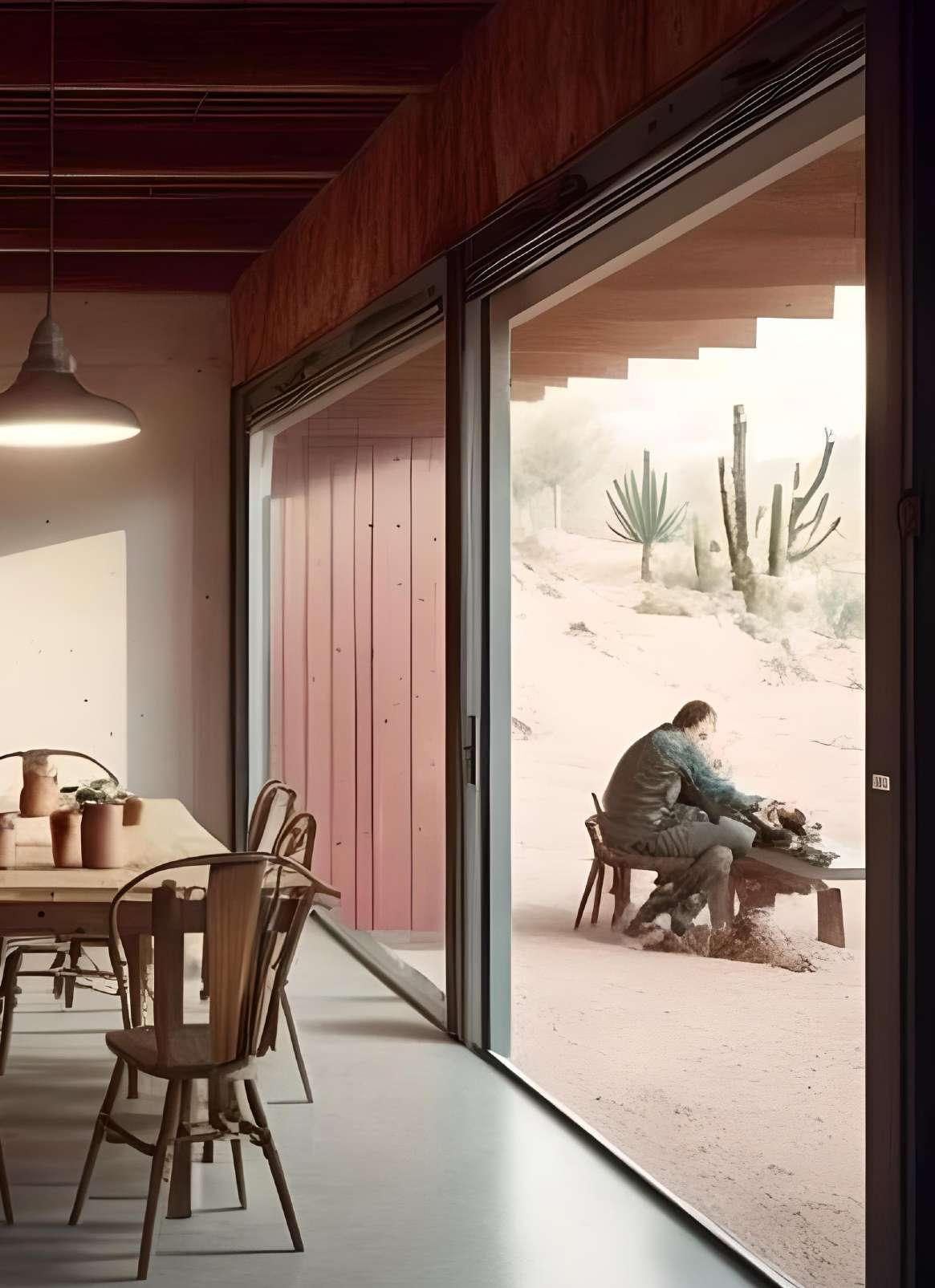
This gave rise to the idea of planned community centers on the site that would meet the rehabilitation and recreation needs of the residents. The community center would house a primary healthcare facility and a recreation facility for adults and children. Communal dining was an idea that was proposed to address the resources required to cover the basic needs of its residents. It would function as a live-work model that encourages the residents to have the means of income generation. This cohesively adds to the nature of the community on the site.
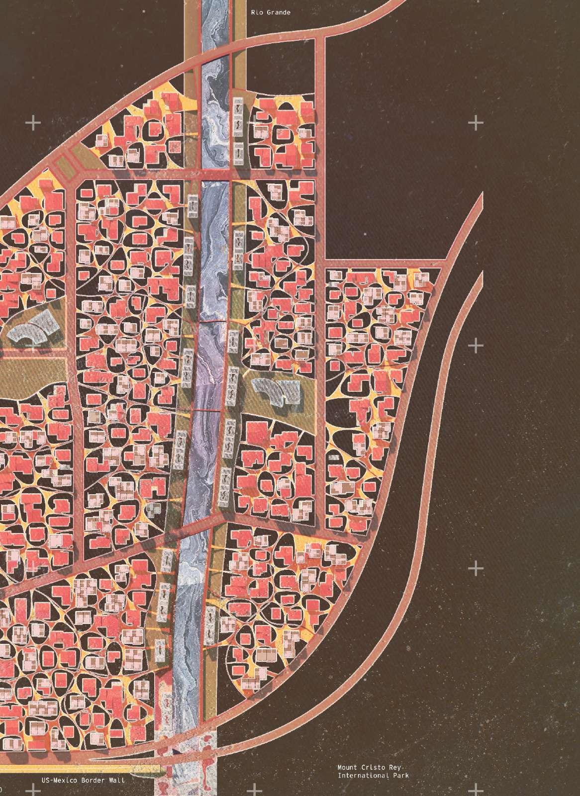
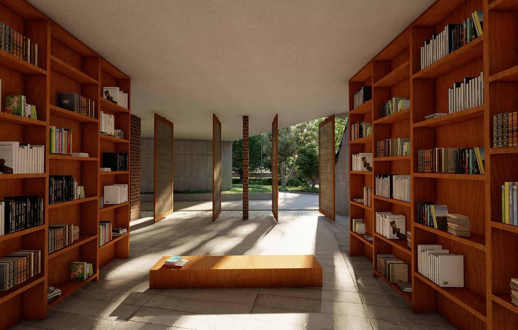
COMMUNITY CENTER DESIGNED FOR THE REHABLITATION OF ITS RESIDENTS
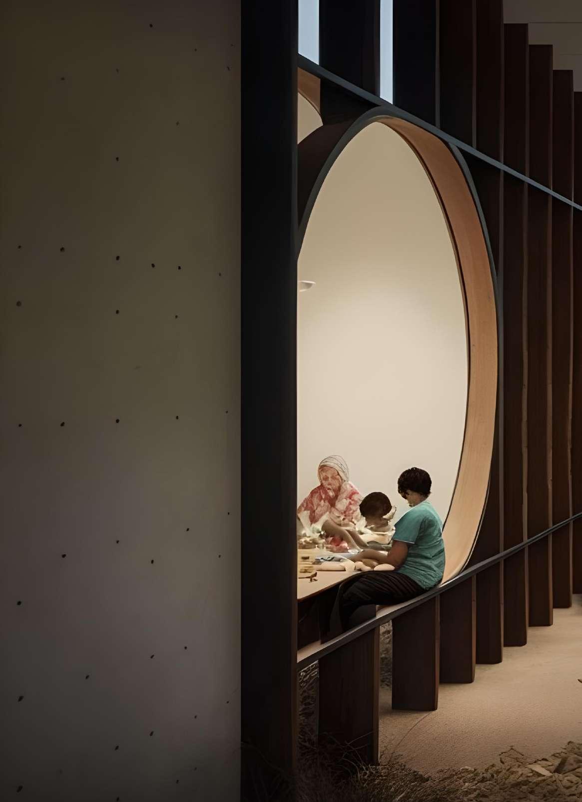
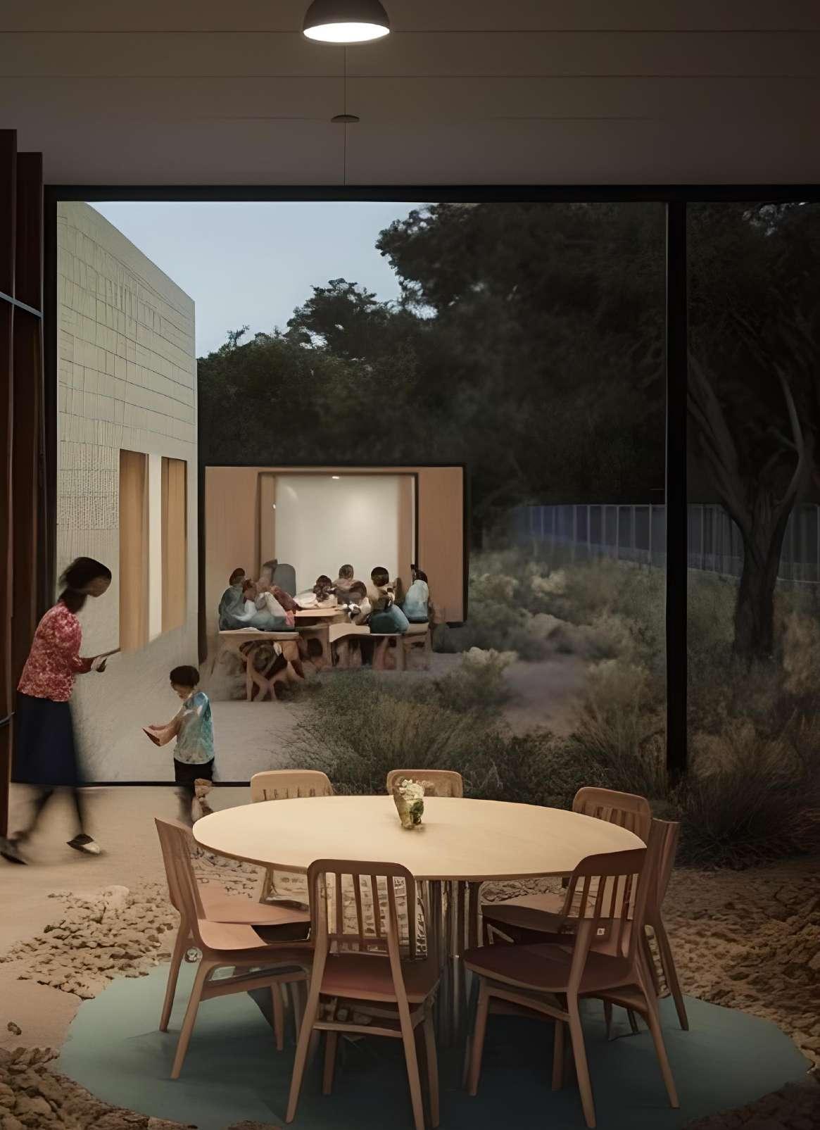
COMMUNITY CENTER DESIGNED FOR THE REHABLITATION OF ITS RESIDENTS

INSTRUCTOR : LISA SUAVE, JOHN DAVID WAGNER
TEAM : CLAYTON ARVIN, PAULINE GERD, CHANDANA RAO
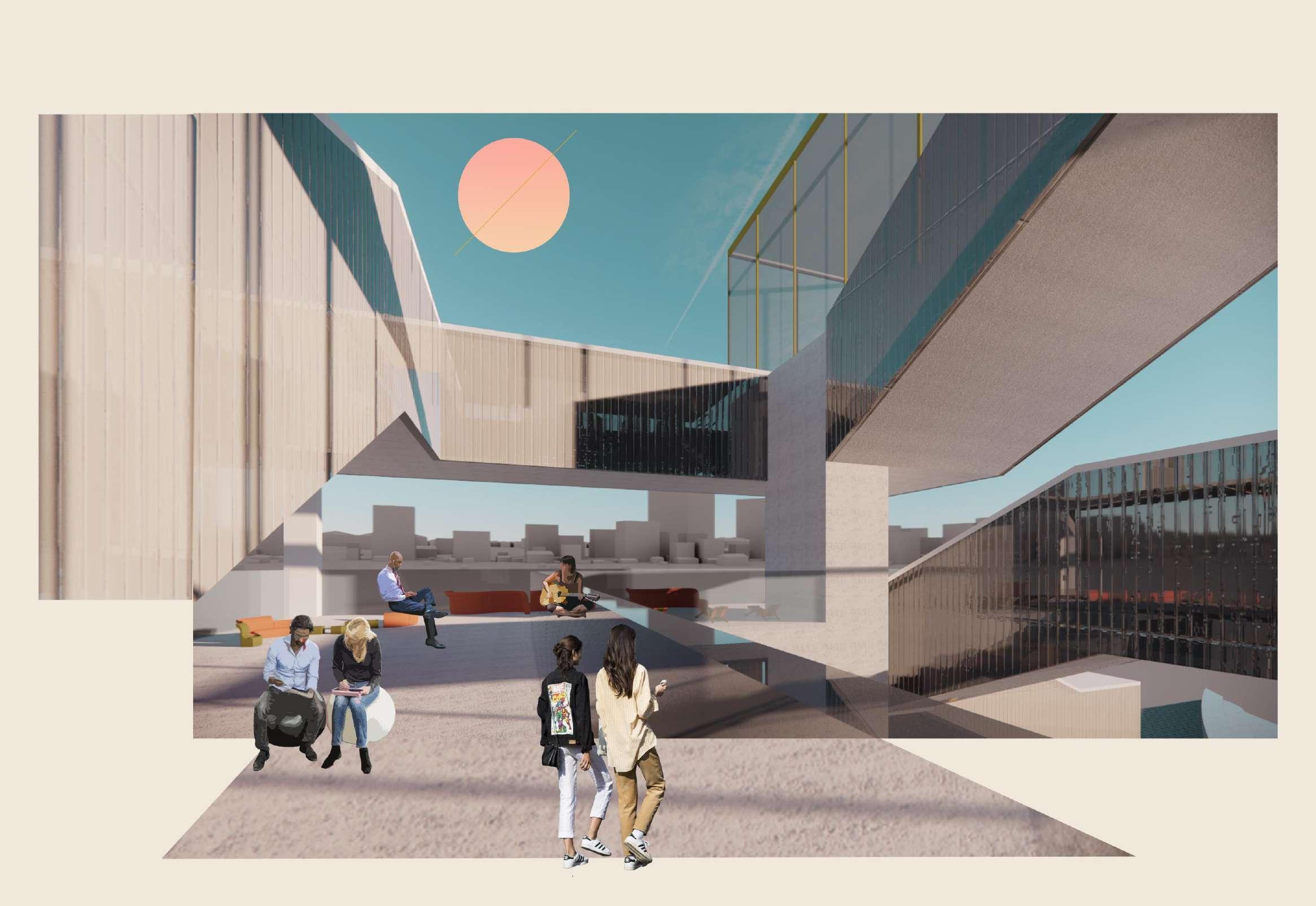
This project focuses on the everyday experiences of affordable housing and supporting how residents live out their daily lives. Affordable housing can often become unengaging aesthetically and minimal within the provided programs. This is typically due to a lack of funding, sourcing for construction practices, or considerate design approaches which can sometimes evolve into uneconomical or buildings or sites. While attempting to make housing more affordable, the consideration of human focused design should not be overlooked, it should be utilized to create or design through morality.
The Wash House hopes to join the community and support them through considerate construction practices and design methods. The design concepts for our site were inspired by “The Concise Townscape” written by Gordon Cullen. In his introduction, Cullen emphasizes how historically designers have overlooked “the speed of change” which then “prevents the environment organizers from settling down and learning by experience how to humanize raw material thrown at them.” (p.13) Considering the humanity for the residents within the design and construction of the spaces will support the individuals within the site as well as providing spaces for the community to connect while going about daily activities.
To eliminate the humanly focused design trade-offs for our affordable housing, the site provides programmed spaces connected dynamically to support daily activities making them more enjoyable. “The process, be it’s in stomach or brain, is part of our human bondage” and how we “digest” our environment is critically important to consider within its design. “And so we have to make organizational changes in order that human scale can be brought into effective contact with the forces of development.” (p.13)
This project focuses on the everyday experiences of affordable housing and supporting how residents live out their daily lives. Affordable housing can often become unengaging aesthetically and minimal within the provided programs. This is typically due to a lack of funding, sourcing for construction practices, or considerate design approaches which can sometimes evolve into uneconomical or buildings or sites. While attempting to make housing more affordable, the consideration of human focused design should not be overlooked, it should be utilized to create or design through morality.
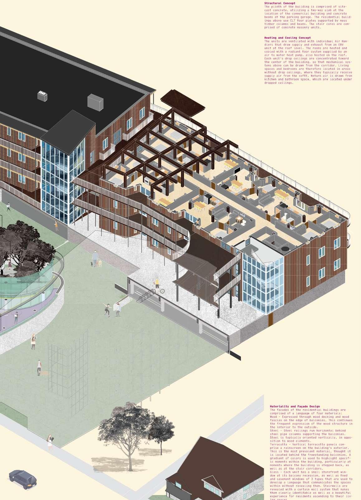
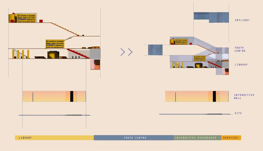
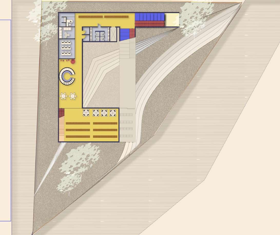
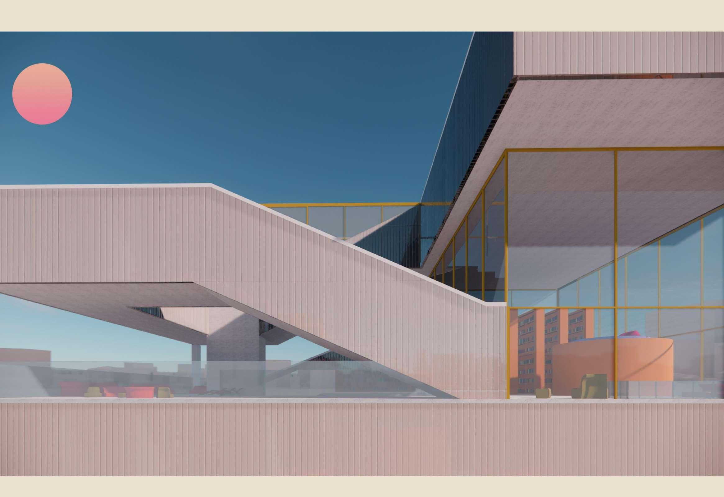
The site’s organizational programs include a grocery, café, and a laundry room. On the first floor is the grocery commercial space, providing the community with healthy food and opportunities for connection through the connected outdoor courtyard. The laundry space and café are connected subgrade, this evolved through the considerations of the waiting time for the wash machines and dryers. Residents and visitors can utilize the laundromat and then go to the café to wait for the machines. This design hopes to encourage connection for the community and the residents. There is a garden space providing views of trees and greenery while folding and using the space within thQe laundromat. The first floor commercial spaces are curving concrete and glass walls formed with deep contemplation regarding the “life of the community” and “pedestrian priority.” (p.123) The moral design approaches recognize how some inhabitants of the site will be familiar with the spaces, while others will see it as more “’foreign’ territory” and will want to explore or move through the programs differently.
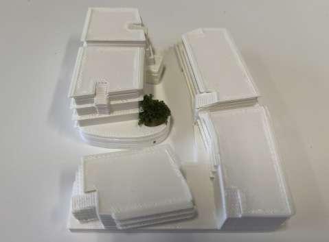
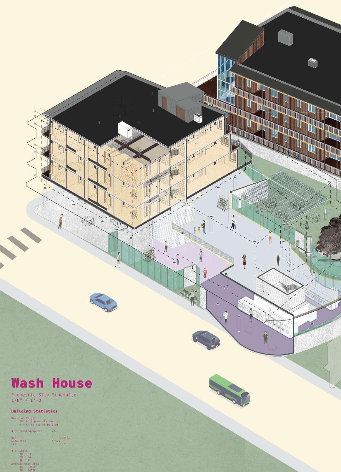


PROJECT : WASH HOUSE Floor Area : 101,463 Sqft FAR : 1.73
No OF FLOORS : 5
DWELLING UNIT COUNT : 64 UNITS
COMMERCIAL SPACE : 10,000 SQFT
BUILDING TYPOLOGY : RESIDENTIAL AFFORDABLE HOUSING

PROJECT TEAM : LIN HAO CHANDANA RAO
PROJECT INSTRUCTOR : LEAH WULFMAN
PROJECT DURATION : 12 WEEKS
PROJECT PHASE : CONCEPT TO COMPLETION
Utilizing spatial computing and real-time gaming technologies, this design-build prototyping studio Gayming Architectures focused on spaces existing and fantastical, taking and collapsing given definitions and mechanics from both architecture and video games in order to promote increasingly hybridized working methods between physical and digital spaces and objects. While physical space is increasingly subjected to gamification, digital space has always been physical; lamps in video games are using real electricity. “Gaming the system” refers to certain methods used to manipulate the rules for a certain system to one’s advantage. Gayming is a way of playing and experiencing games that’s fundamentally gay, non-normative, messy, and out-of-step, non-binary, pessimistic yet joyful. When we “Gayme Architecture”, we disrupt architecture’s own antiquated tendencies towards normatively virtual proposals—the hypothetical building, the speculative future—and instead, develop generative, practical alternative applications for our hybrid present.
In this design-build prototyping studio, we designed and prototyped material, spatial scenarios and furniture in direct conversation with the spatial and aesthetic possibilities of the game engine, which collapses and combines multiple architecture mediums in time and space to create cohesive gaming worlds. These scenarios began to equate certain game concepts and mechanics—like levels, triggers, scenes, assets, colliders, cameras, environment,..—with architectural givens— like room, floors, door, window, furniture, stair, elevator, floor area and height, scale, interior, exterior.Working both at 1:1 room scale and architecture model scale, we framed and approached these interactive spatial scenarios through focused workshops, where we defined and designed our way through each in an extremely playful, informative and iterative fashion. The course culminated in utilizing the workshops to develop their own site-specific 1:1 Mixed Reality (MR) installation and game, which integrated with a building reconfigured and reimagined through the playful logics and aesthetics of their game.
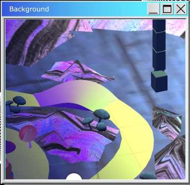
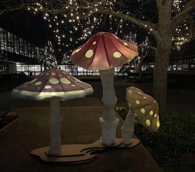
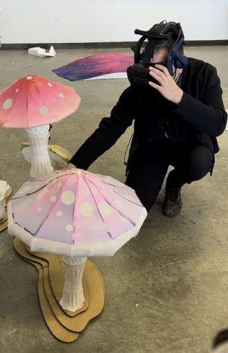
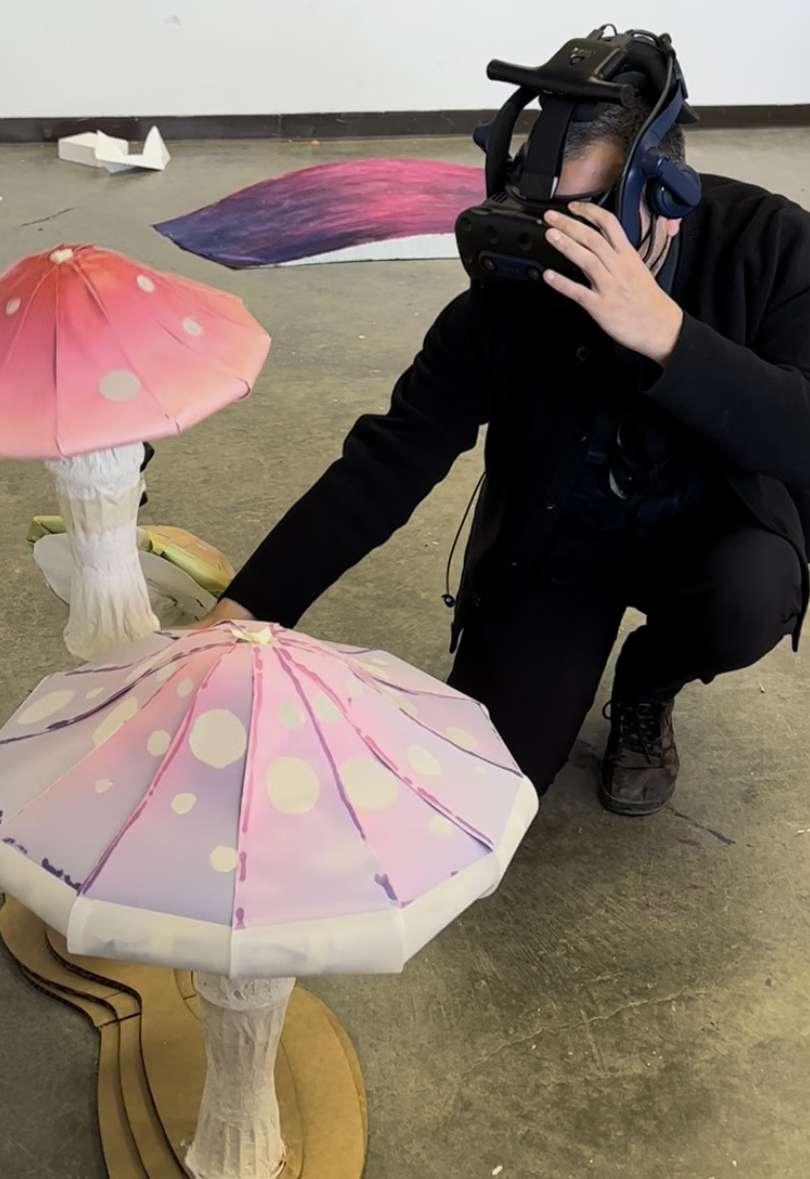
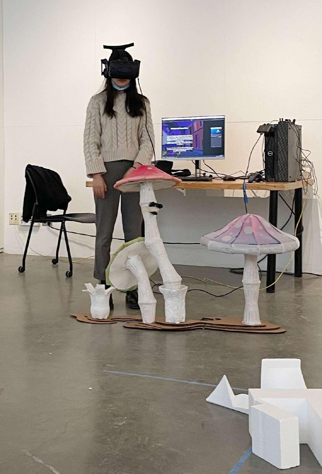
Maoi the Dystopia is a VR world exploration game that takes on themes of Dystopia and Post Dystopia in a fictional land of Maoi. The game takes the player through three scenes, taking the player through the story of the land of Maoi.
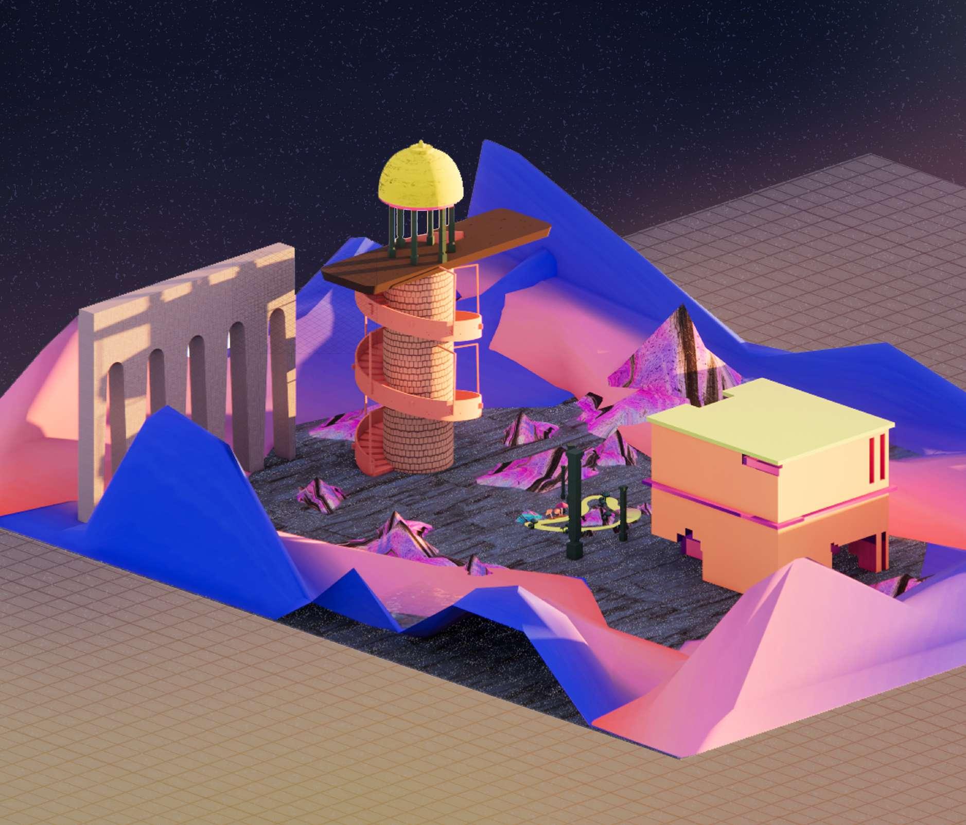
The green path of Maoi, the legend has it that thelast few magical maushrooms are found along this path. Populating these mushrooms in the land, will ensure, that theres still some hope for Maoi. Theres hope that if you can re-populatethese mushrooms across the land, the land can once again be healed.
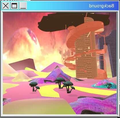
PREMISE : A time not too long ago, there existed a land so green so pristine, that it was the envy of all planets. greed and corruption of the humans inhabiting the land soon plundered the land into a barren ruin. This Welcome to the dystopic land of Maoi. The mining and corruption and pollution has set the meteorite in travelling astronaut rush yourself to the holy tower and plant the
The green path of Maoi, the legend has it that the last few magical maushrooms are found along this path. Populating these mushrooms in the land, will ensure, that theres still some hope for Maoi. Theres hope that if you can re-populate these mushrooms across the land, the land can once again be healed.
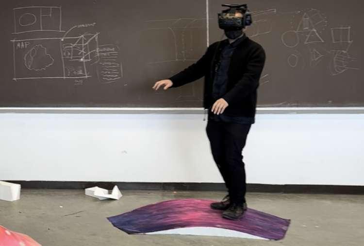
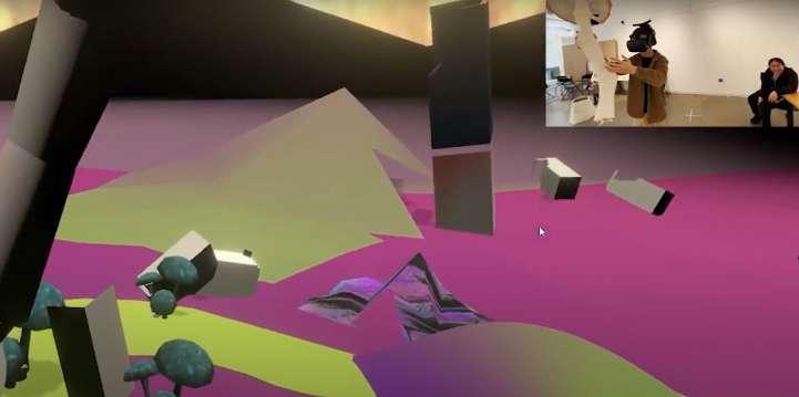
The idea of the game and the VR piece was to map the physical assets and the virtual assets on Unity and Steam VR, to produce a VR piece that was synonmous in both the physical and the virtual realm. As one tries to interact with the virtual assets one is also sensing physically the physical assets, mapped into place in the virtual world. This merges the seemingly different worlds and takes the VR experience up a notch by unifying all the senses.
LINK : https://storymaps.arcgis.com/stories/2fa966a3830e4c4b8e22dd69e7bea0b4
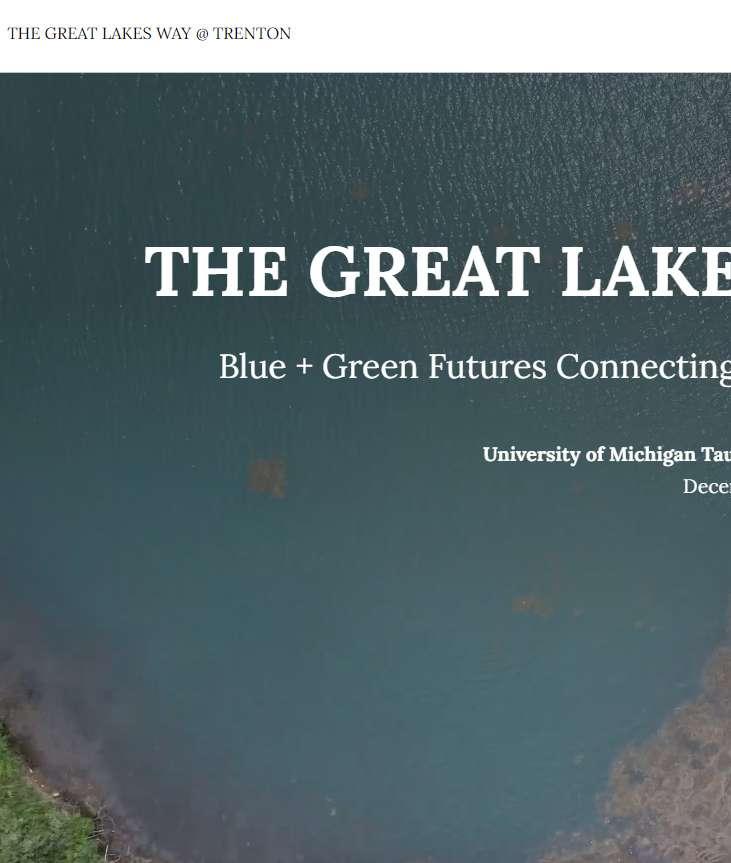
The Great Lakes Way @ Trenton builds on the partnership with the Community WFoundation for Southeast studies the centrality of Trenton in the The Great Lakes Way, a network of 156 miles of blueways 7 miles of shoreline along the Detroit River, the city of Trenton has a critical role to play is only this last year that large industrial and infrastructural riverfront properties are changing designation are a testimony that Trenton is moving away from its industrial past and diversifying connection of the city with the Detroit River and ensure residents continue to share their ideas
https://storymaps.arcgis.com/stories/2fa966a3830e4c4b8e22dd69e7bea0b4
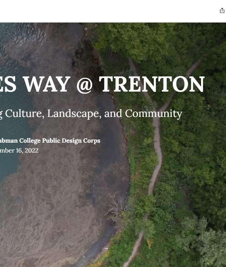
Southeast Michigan and the City of Trenton initiated in the 2021 summer semester. The project blueways and 160 miles of greenways interconnected from Lake Huron through Lake Erie. With almost in this project. While the transformation of the waterfront has been ongoing for decades, it changing ownership (former ARefuge Gateway development, and the recent Pure Michigan Trail Town diversifying its economic base and lifestyles. Therefore, this is a prime time to strengthen the ideas on the possible futures for Trenton´s Waterfront Revitalization District.
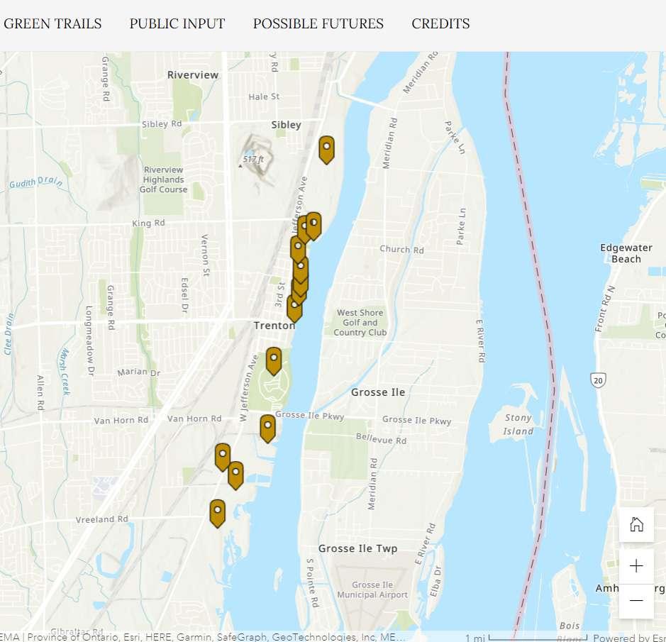
Trenton’s waterfront sites are situated between two important trail systems. These trails serve as essential connections between the city’s most economically and historically important places, including the former McLouth Steel sites, downtown Trenton and its city parks, and the DTE Trenton Channel Power Plant. Considering and improving the quality of these trails is an important part of establishing the Great Lakes Way at Trenton.
This section illustrates the main components of the networks of greenways and blueways that travel along Trenton. Their incremental implementation over the years speaks of a long-term community commitment to expanding the opportunities for land stewardship, outdoor recreation, and healthy living.
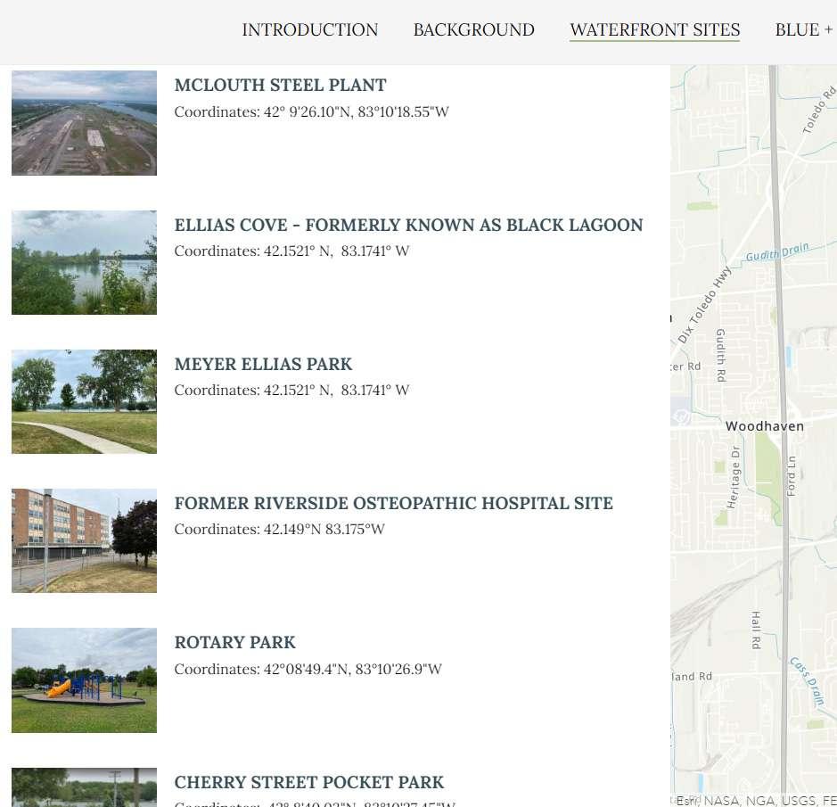
This section provides a close account of Trenton’s waterfront parks and former industrial properties along the Detroit River. Each location includes a brief site history, environmental information detailing the nature of the industrial pollution as well as cleanup efforts, and the cultural and economic situation of the sites under consideration. Please scroll through and interact with the map below to learn more about some of the waterfront sites under transformation in Trenton!
Trenton’s waterfront sites are situated between two important trail systems. These trails serve as essential connections between the city’s most economically and historically important places, including the former McLouth Steel sites, downtown Trenton and its city parks, and the DTE Trenton Channel Power Plant. Considering and improving the quality of these trails is an important part of establishing the Great Lakes Way at Trenton.
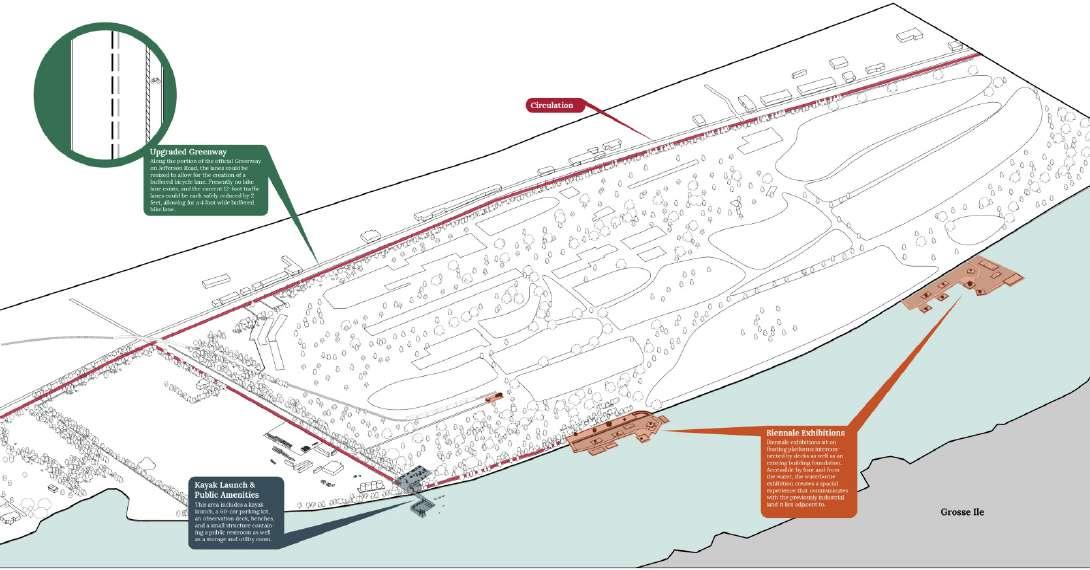
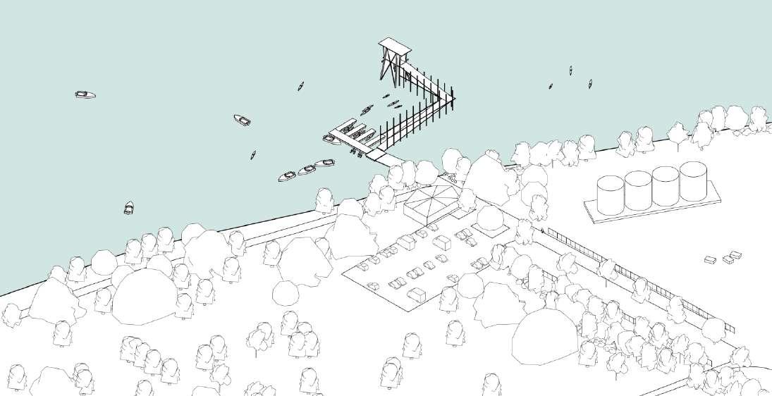
This Scenario has two primary goals: to improve the existing physical infrastructure supporting the Great Lakes Blue and Green Ways at Trenton, and to activate the trail system through cultural programming and small nodes of access to the Detroit River. This proposal doubles down on the importance of celebrating Trenton’s industrial legacy and environmental recovery through temporary public interventions. In its first iteration, the biennial explores Trenton’s industrial history while providing a new level of community engagement with the Iron Belle Trail, the Downriver Linked Greenways, and the Detroit Heritage River Water Trail..
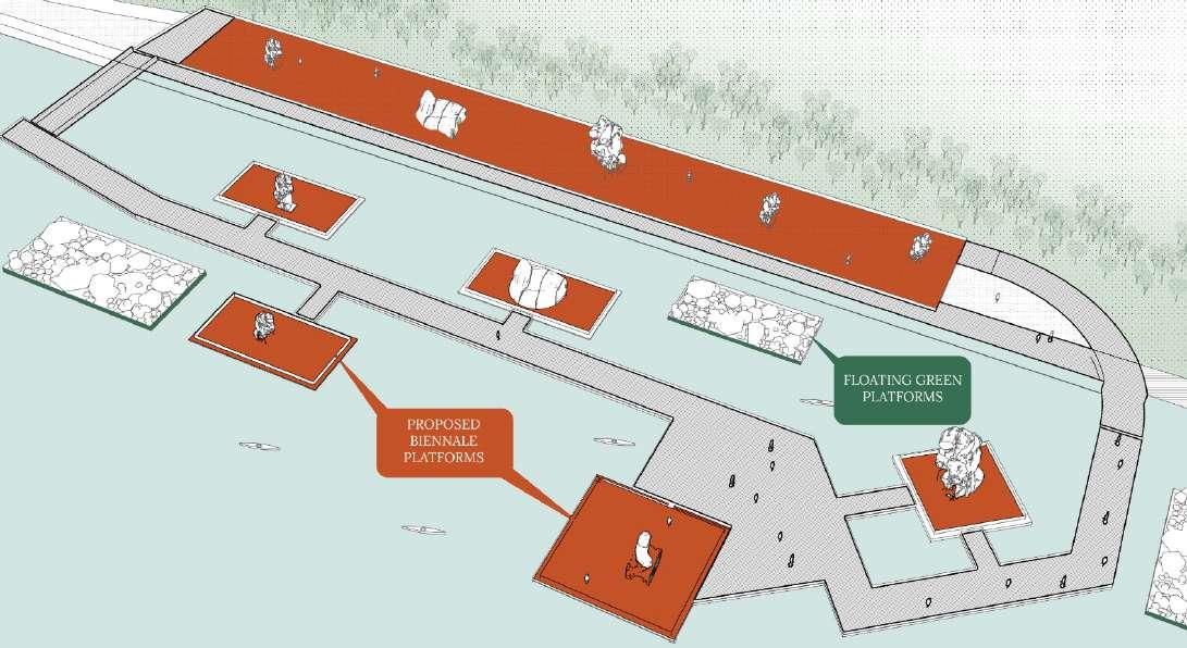
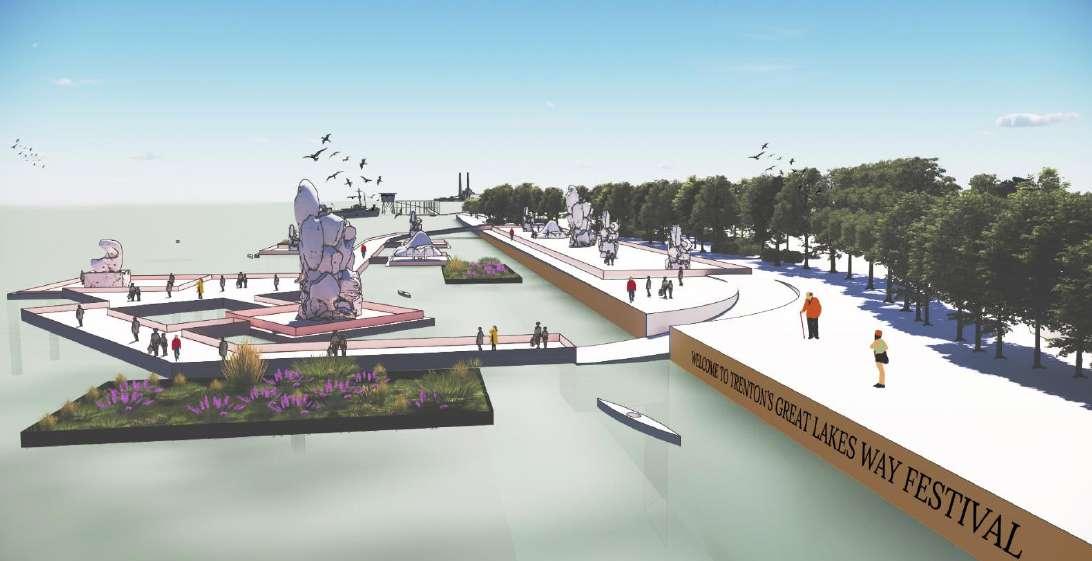
A coalition of regional foundations stewards this project through a permanent endowment of funds for the first regional biennial of de-industrilizing Great Lakes cities. Funds from governments and corporations interested in the curatorial capacities of the Biennial make possible the implementation of more permanent exhibitions and public spaces. Every two years, an organizing team prepares a thematic call for proposals. The organizing team further manages the selection process for the artists, designers, and ecologists who will collaborate in the conceptualization of the interventions and summer programs. In addition, the creation of a Biennial citizen’s council ensures public participation is centered through the organization and the event’s development.
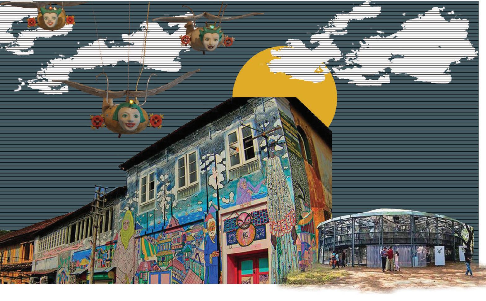
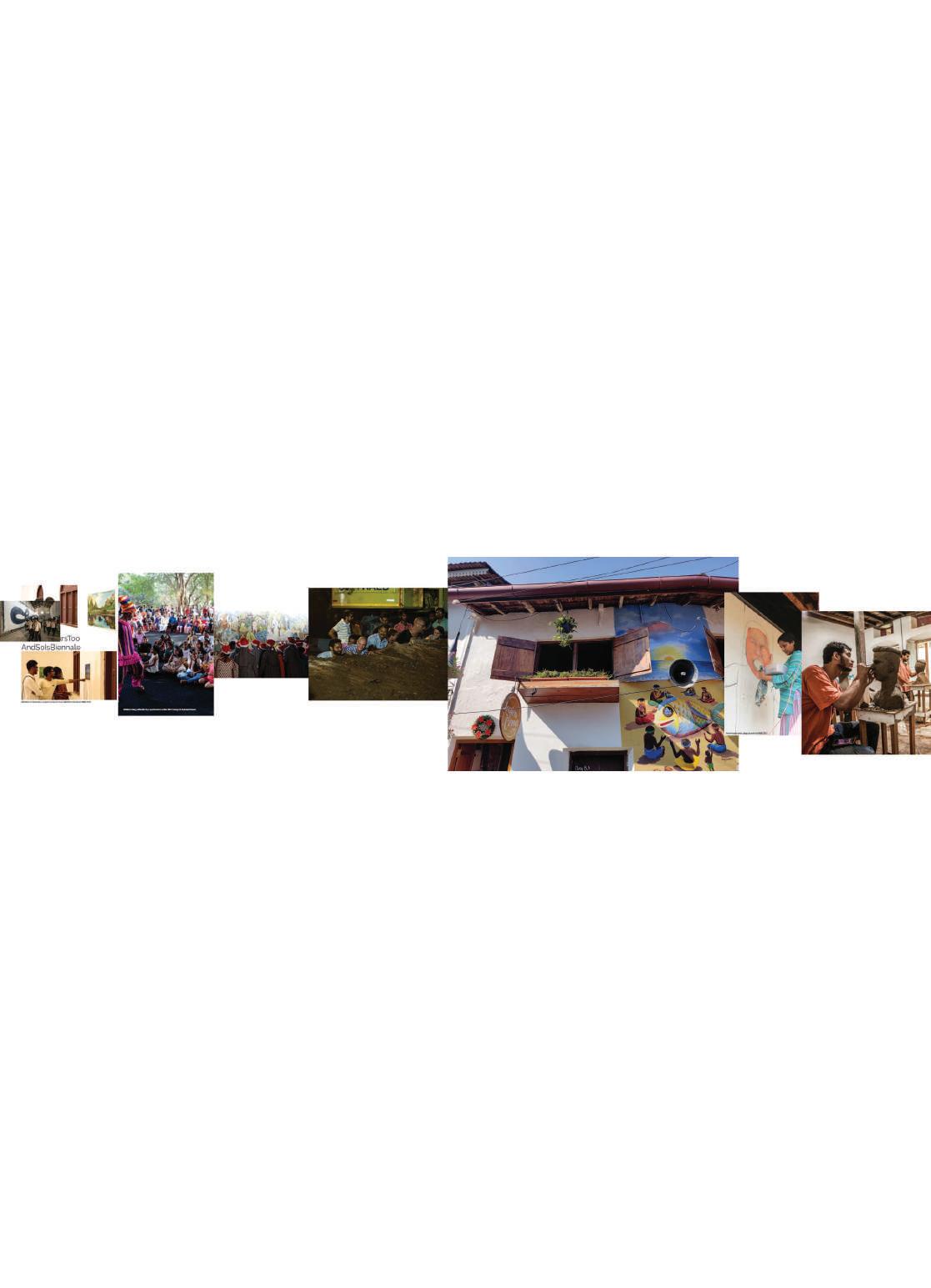
2020 |KOCHI INDIA| CULTURAL |
INSTRUCTOR : SANJAY SHETTY
PROJECT TIMELINE : 12 WEEKS
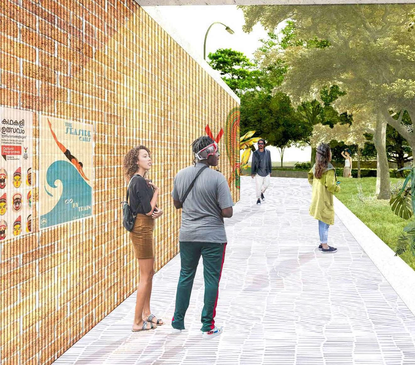
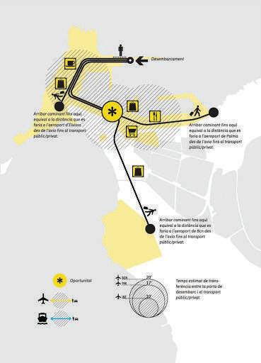
Rapid urbanization is altering the physical and cultural milieus of Indian cities, making it seem as if the past, the present and a somewhat dystopian future are all colliding, snuffing out breathing space. Are our cities facing an identity crisis? Indian cities greatly lack public spaces, and one such Indian city is Fort Kochi. The city being the first Indian city to host Biennale, continues to lack physical space that can emulate the essence of a Biennale, once it’s over. The demographic void left by Biennale in the city, is not addressed. Hence, the introduction of a third space, that can offer the people of the city a home away from home.

physical space that can emulate the essence of a Biennale, once it’s over. The demographic addressed. Hence, the introduction of a third space, that can offer the people of
site selection :
Kochi also known as Cochin is a major port city on the south-west coast of India bordering the Laccadive Sea. It is part of the district of Ernakulam in the state of Kerala and is often referred to as Ernakulam. Kochi is the most densely populated city in Kerala. As of 2011, it has a corporation limit population of 677,381 within an area of 94.88 km² and a total urban population of more than of 2.1 million within an area of 440 km², making it the largest and the most populous metropolitan area in Kerala.
ROAD NETWORK
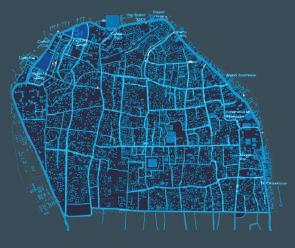
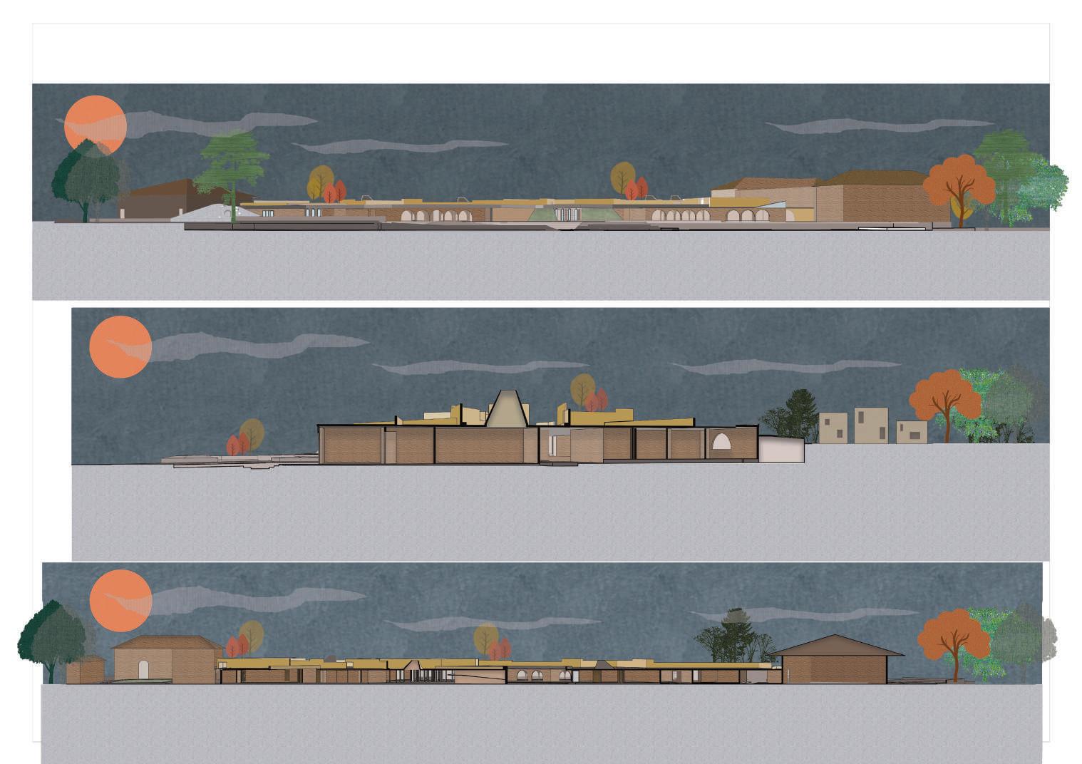
THE CHAIN LINK BIENNALE LOCATIONS ALONG THE CHAIN LINK
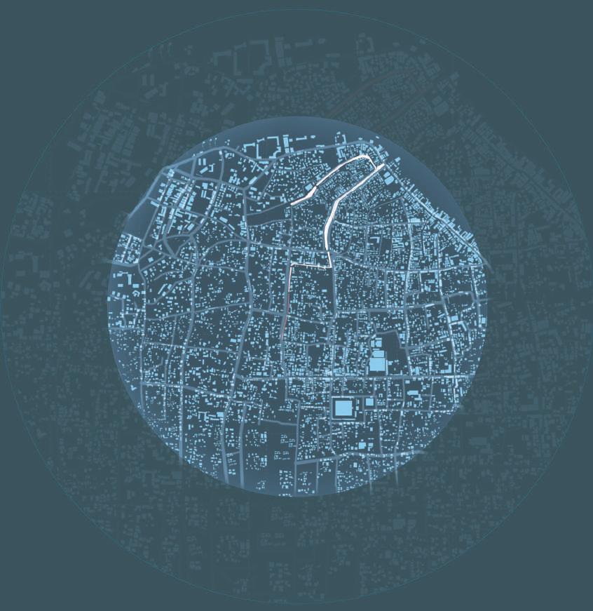
PROPOSED SITE
THE THIRD SPACE : SITE SELECTION ,LOCATION ANALYSIS
Kochi also known as Cochin is a major port city on the south-west coast of India bordering the Laccadive Sea. It is part of the district of Ernakulam in the state of Kerala and is often referred to as Ernakulam. Kochi is the most densely populated city in Kerala. As of 2011, it has a corporation limit population of 677,381 within an area of 94.88 km² and a total urban population of more than of 2.1 million within an area of 440 km², making it the largest and the most populous metropolitan area in Kerala.
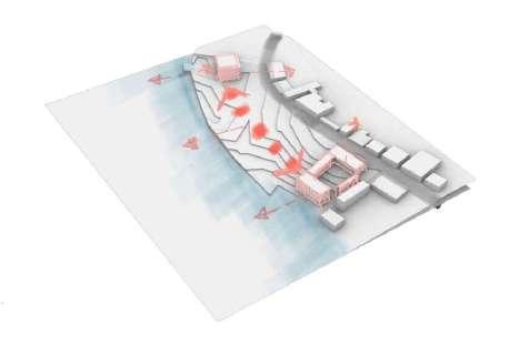
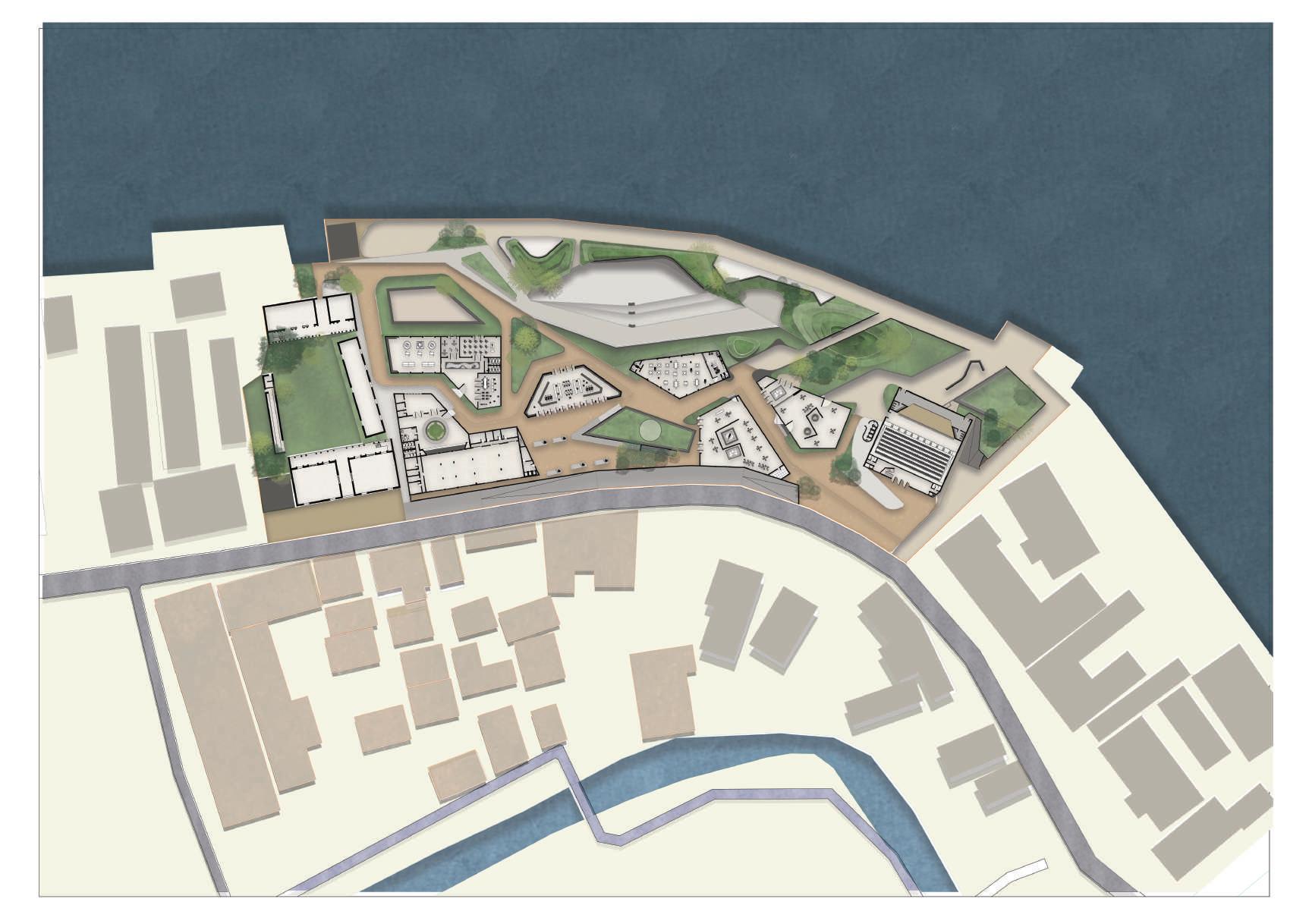
The site, consists, of pepper house, which is already a historic structure, along with an old customs office, which is dilapidated. the site must form a physical/visual link with the two structures on the opposite ends of the site. along with connecting the city to sea. while, ensuring that the view to the sea, from the road isn’t disrupted. THESIS DISSERTATION


FORT KOCHI AND MATTANCHEERY ARE CONNECTED TO MAINLAND BY FERRIES WHICH RUNS FROM EARLY MORNING TO LATE EVENING.
THESIS DISSERTATION
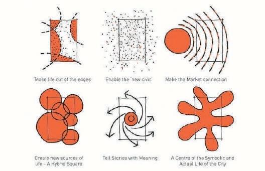
CONCEPT ANALYSIS :
ART SHOULD BE FREE FOR ALL
THIRD SPACE SHOULD BE FREE FOR ALL
ART SHOULD BE AN EXPERIENCE, RATHER THAN SOMETHING THAT’S HUNG ON FOUR WALLS.
THE ESSENCE OF THE EDGES TO BE BROUGHT INTO THE SITE
ENABLE THE NEW CIVIC
INCLUSIVE
CREATING A NEW HYBRID 3RD SPACE.
THESIS DISSERTATION
THESIS DISSERTATION
CONCEPT ANALYSIS :
ART SHOULD BE FREE FOR ALL
ART SHOULD BE FREE FOR ALL THIRD SPACE SHOULD BE FREE FOR ALL
THIRD SPACE SHOULD BE FREE FOR ALL

ART SHOULD BE AN EXPERIENCE, RATHER THAN SOMETHING THAT’S HUNG ON FOUR WALLS.
ART SHOULD BE AN EXPERIENCE, RATHER THAN SOMETHING THAT’S HUNG ON FOUR WALLS.
THE ESSENCE OF THE EDGES TO BE BROUGHT INTO THE SITE
THE ESSENCE OF THE EDGES TO BE BROUGHT INTO THE SITE
15 KMS FROM THE MAIN BUS STOP , CONNECTED BY MAIN NATIONAL HIGHWAYS, TO PLACES WITHIN KERALA AND OUTSIDE KERALA.
ENABLE THE NEW CIVIC
ENABLE THE NEW CIVIC INCLUSIVE
INCLUSIVE
CREATING A NEW HYBRID 3RD SPACE.
CREATING A NEW HYBRID 3RD SPACE.
CREATING A SYMBOLIC AND ACTUAL LIFE OF THE CITY.
CREATING A SYMBOLIC AND ACTUAL LIFE OF THE CITY.
TEASING THE LIFE OUT OF
LOCALS : 30%

TEASING THE LIFE OUT OF THE EDGES ENABLE THE NEW CIVIC
INCLUSIVE IN NATURE
THE SITE IS WELL CONNECTED BY ALL MEANS OF TRANSPORTATION. THE SITE ALMOST SITS AT THE CENTER OF THE CONSISTENT BIENNALE LINK.THE SITE
CREATING A SYMBOLIC AND ACTUAL LIFE OF THE CITY.
PROGRAMME :
CREATING A NEW HYBRID SQUARE TELLING STORIES WITH SPACES

CREATING A SYMBOL OF THE ACTUAL LIFE OF THE CITY
:
STUDENTS :10%
THE SITE, CONSISTS, OF PEPPER HOUSE, WHICH IS ALREADY A HISTORIC STRUCTURE, ALONG WITH AN OLD CUSTOMS OFFICE, WHICH IS DILAPHADATED. THE SITE MUST FORM A PHYICAL/VISUAL LINK WITH THE TWO STRUCTURES ON THE OPPOSITE ENDS OF THE SITE. ALONG WITH CONNECTING THE CITY TO SEA. WHILE, ENSURUING THAT THE VIEW TO THE SEA, FROM THE ROAD ISNT DISRUPTED.

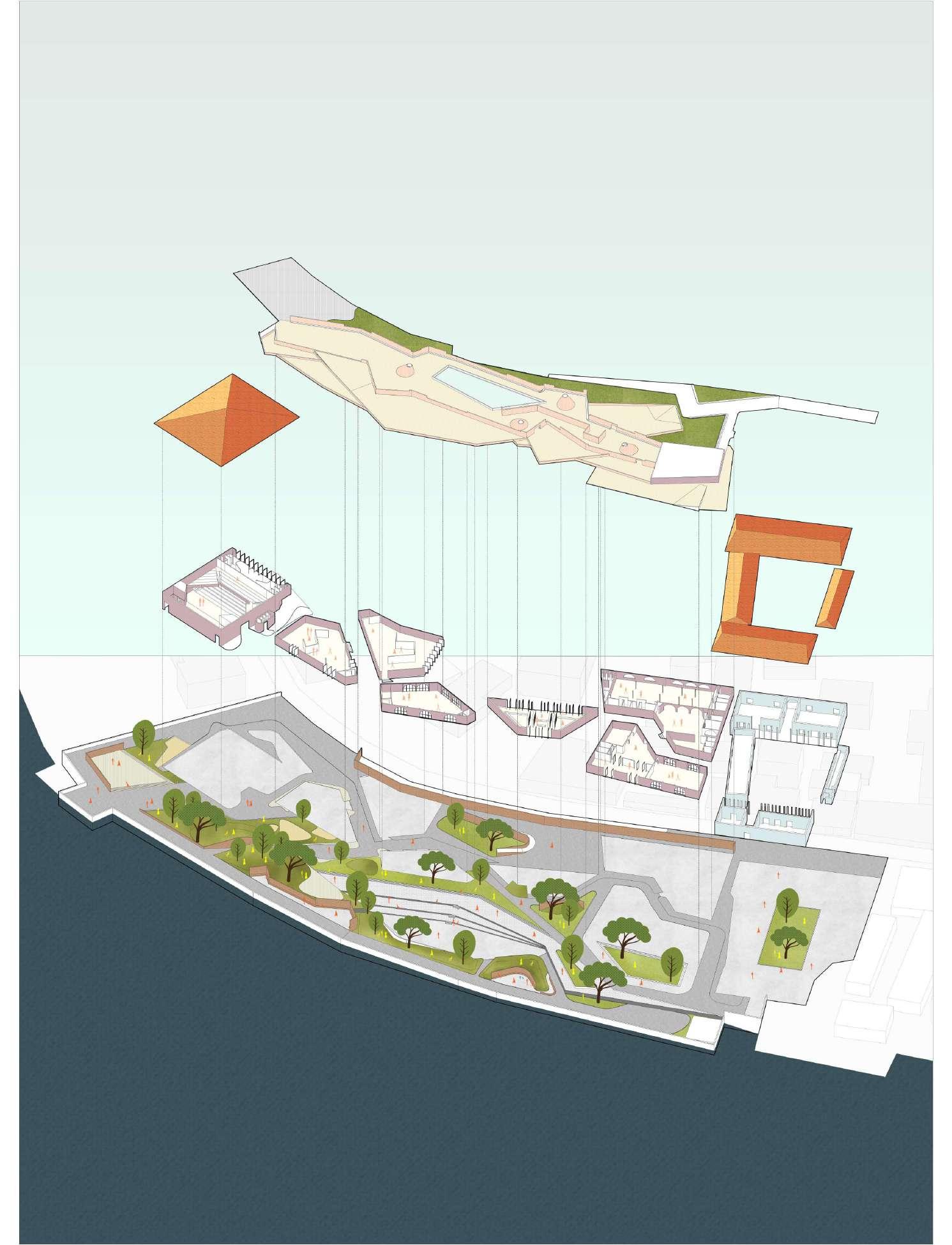
Connecting the Pepper house and the customs office
Dividing the space into a upper court and lower court
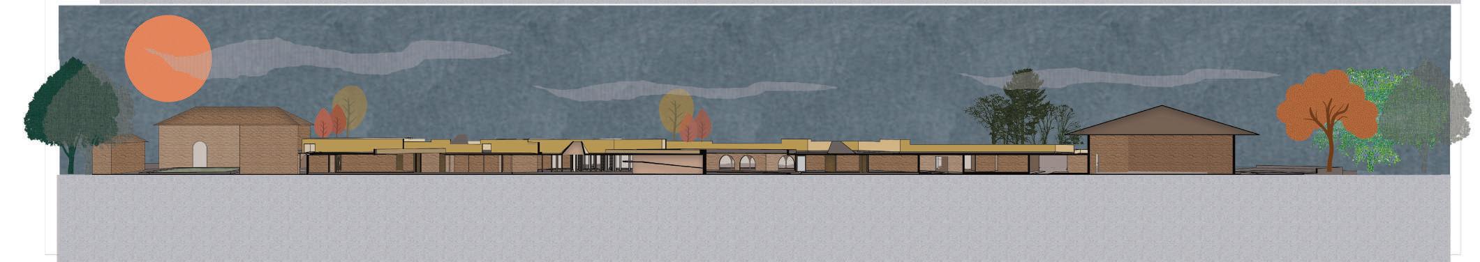
HENCE, A RECTANGULAR BLOCK WAS MADE TO CONNECT THE TWO EXTREME ENDS, AND THIS BLOCK WAS LIFTED, TO FORM A FLUIDIC GALLERY, WITH OTHER FUNCTIONS, TUCKED BELOW. THE FLUIDIC GALLERY ENSURED THAT THE LINK BETWEEN THE CITY AND THE SEA WAS MAINTAINED WHILE CONNECTING THE TWO HISTORIC STRUCTURES ON THE SITE.
THE SITE, CONSISTS, OF PEPPER HOUSE, WHICH IS ALREADY A HISTORIC STRUCTURE, ALONG WITH AN OLD CUSTOMS OFFICE, WHICH IS DILAPHADATED. THE SITE MUST FORM A PHYICAL/VISUAL LINK WITH THE TWO STRUCTURES ON THE OPPOSITE ENDS OF THE SITE. ALONG WITH CONNECTING THE CITY TO SEA. WHILE, ENSURUING THAT THE VIEW TO THE SEA, FROM THE ROAD ISNT DISRUPTED. A FLUIDIC GALLERY, WITH OTHER FUNCTIONS, TUCKED BELOW. THE FLUIDIC GALLERY ENSURED THAT THE LINK BETWEEN THE CITY AND THE SEA WAS MAINTAINED WHILE CONNECTING THE TWO HISTORIC STRUCTURES ON THE SITE.
Creating the lower court, to open out into the third space
THE RECTANGULAR BLOCK WAS PULLED AND PUSHED TO CREATE MULTIPLE VIEWING DECKS, THAT RESEMBLED THE SMALL INTERTWINNING PASSAGEWAYS OF FORT KOCHI. THE SAME INTER-TWINNING ROAD NETWORK WAS USED BELOW THE FLUIDIC GALLERY, TO FORM THE ACCESS BETWEEN THE RESPECTIVE BLOCKS.
SPACE : CONCEPT
THESIS DISSERTATION
THESIS DISSERTATION
project the lower form functions acres
THE LOWER COURT LIES DIRECTLY BELOW THE UPPER COURT, WHERE ALL THE CLOSED FUNCTIONS ARE SITUATED. THEY ARE ORGANISED TERTWINNING PATH THAT RESEMBLES NARROW STREETS OF FORT KOCHI. THE BLOCKS THOUGH BEING PARTIALLY SUBMERGED ALL OPEN THIRD SPACE, OVER LOOKING THE SEA. THE BLOCKS CONSISTS OF CLOSED GALLERIES, WORKSHOPS,CAFE,LIBRARY,AND THE REPURPOSED OFFICE THAT SERVES AS A CONVENTION CENTER. THE BLOCKS, PAY KEEN ATTENTION TO CLIMATOLOGY AND MATERIALITY, BY USING IBLE MATERIALS LIKE LATERITE, AND HAVING LARGE PIVOTABLE DOORS,WHICH ENSURE CONTINOUS CIRCULATION OF AIR,AVOIDING THE HUMID CLIMATE.


THE LOWER COURT LIES DIRECTLY BELOW THE UPPER COURT, WHERE ALL THE CLOSED FUNCTIONS ARE SITUATED. THEY ARE TERTWINNING PATH THAT RESEMBLES NARROW STREETS OF FORT KOCHI. THE BLOCKS THOUGH BEING PARTIALLY SUBMERGED THIRD SPACE, OVER LOOKING THE SEA. THE BLOCKS CONSISTS OF CLOSED GALLERIES, WORKSHOPS,CAFE,LIBRARY,AND THE OFFICE THAT SERVES AS A CONVENTION CENTER. THE BLOCKS, PAY KEEN ATTENTION TO CLIMATOLOGY AND MATERIALITY, IBLE MATERIALS LIKE LATERITE, AND HAVING LARGE PIVOTABLE DOORS,WHICH ENSURE CONTINOUS CIRCULATION OF AIR,AVOIDING HUMID CLIMATE.

ARABIAN SEA
1. PEPPER HOUSE
2.
4. CUSTOMS OFFICE
5.THIRD
6. OAT
7. SCULPTURE GALLERY
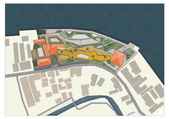

The masterplan of the project consists of two courts the upper court and the lower court, the upper court form the roof of the functions below. The lower court lies directly below the upper court, where all the functions that require a closed environment are situated. They are organized along an intertwining path that resembles narrow streets of Fort Kochi. The blocks though being partially submerged
ensure continuous circulation of air tackling the extremely warm and humid climate.


The circulation of the site depends on various user case scenarios. The different user case scenarios dictate the various tions and their relationship with each other is derived from the functional compatibility this provides an overall image insert into the urban fabric of the city. The functions are linked depending on the different times of the year which is open out into the third space. The lower court which holds all the closed functions is also connects the upper court which

ARABIAN SEA
1. CUSTOMS OFFICE
2. GALLERY
3.EXHIBITION SPACE
4. CAFE
5.LIBRARY
6. WORKSHOP (PERFORMANCE ART)
7. ART WORKSHOP
various circulation that follows. Namely, vehicular, pedestrian to the customs office, and to the third space. The funcimage of how each space ought to respond and interconnect with he rest of the spaces. While becoming an urban is during and after Biennale. The layout plan follows this function mapping to cohesively connect each other and which forms the informal terrace/roof of the structure.
PROJECT TIMELINE : 12 WEEKS
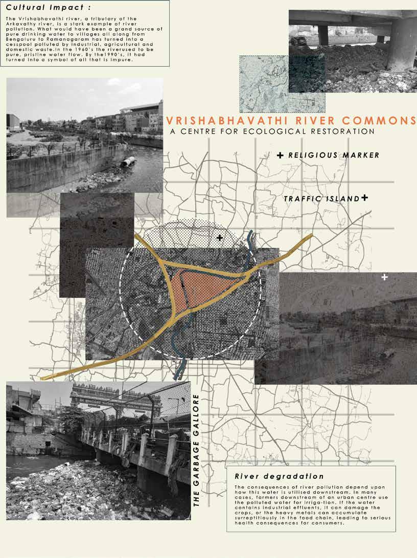
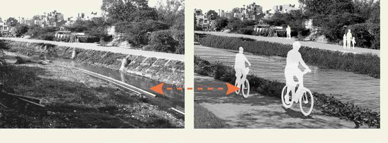
The Vrishabhavati was once a thriving river, but decades of rapid urbanization have deteriorated her into a drain. The fragile riparian ecosystem is all but gone, and the river no longer serves as the cultural identity it once used to. The only things that Vrishabhavathi is famous for now, seems to be the rampant stink, pollution that surrounds all the areas that the river seems to flow in. the aim of this project is to revive the cultural and ecological identity that vrishabhavati was once famous for. The area of study is located at the Gaali Aanjaneya-Kavika factory, which otherwise is known to be the merge of the two tributaries of Vrishabhavathi
THE VRISHABHAVATI WAS ONCE A THRIVING RIVE. BUT DECADES OF RAPID URBANIZATION HAS DETORIATED HER INTO A DRAIN. THE FRAGILE RIPARIAN ECOSYSTEM IS ALL BUT GONE, AND THE RIVER NO LONGER SERVES AS THE CULTURAL IDENTITY IT ONCE USED TO. THE ONLY THINGS THAT VRISHABHAVATHI IS FAMOUS FOR NOW, SEEMS TO BE THE RAMPANT STINK,POLLUTION THAT SURROUNDS ALL THE AREAS THAT THE RIVER SEEMS TO FLOW IN.
THE AIM OF THIS URBAN DESIGN PROJECT IS TO REVIVE THE CULTURAL AND ECOLOGICAL IDENTITY THAT VRISHABHAVATI WAS ONCE FAMOUS FOR.
THE AREA OF STUDY IS LOCATED AT THE GAALI AANJANEYA-KAVIKA FACTORY, WHICH OTHERWISE IS KNOWN TO BE THE MERGE OF THE TWO TRIBUTARIES OF VRISHABHAVATHI.
THE ROADS SURROUNDING THE SITE ACT AS MERE TRAFFIC CORRIDOR THAT ADDS TO THE IMPRESSION OF PERENNIAL TRAFFIC ALONG THE MYSORE ROAD.
1. TO ALLOW THE URBAN GRID TO FLOW INTO THE SITE, IN ORDER FOR THE NEIGHBOURHOODS TO FEEL WELCOME INTO THE SITE, AND PARTICIPATE IN THE ACTIVITIES OF THE SITE.


COMMUNITY PARTICIPATION
SPREADING AWARENESS
VOLUNTEERING TO CLEAN AND PREVENT DUMPING
In the urban level there is huge scope of intervention, with designing and planning strategies as well as policies. Once treated at the plant, the waterfront can be developed as a public park, that serves as a mediator between hardscape and the river. Runoff can be treated with bioswales and phytoremediation.
Other policies that were adopted were :
1. Community Participation
2. Spreading awareness
The river in its present day situation acts as a glorified nalah (gutter). The nala is major threat to the ecosystem and the health and hygiene of the surrounding areas.
RIVER
THE RIVER IN ITS PRESENT DAY SITUATION ACTS AS A GLORIFIED NALA. THE NALA IS MAJOR THREAT TO THE ECOSYSTEM AND THE HEALTH AND HYGIENE OF THE SURROUNDING AREAS
URBAN PROPOSALS TO REVIVE THE IN THE URBAN LEVEL THERE IS HUGE SCOPE OF INTERVENTION, WITH DESIGNING AND PLANNING STRATEGIES AS WELL AS POLICIES. ONCE TREATE AT THE PLANT, THE WATERFRONT CAN BE DEVELOPED AS A PUBLIC PARK, THAT SERVES AS A MEDIATOR BETWEEN HARDSCAPE AND THE RIVER. RUNOFF CAN BE TREATED WITH BIOSWALES AND PHYTOREMIDIATION.

The temple initially was conceived as a marker for the merge of the two tributaries but now seems to have lost its heritage value, due to the rapid urbanization of the surroundings.
THE TEMPLE INTIALLY WAS CONCIEVED AS A MARKER FOR THE MERGE OF THE TWO TRIBUTARIES BUT NOW SEEMS TO HAVE LOST ITS HERITAGE VALUE, DUE TO THE RAPID URBANISATION OF THE SURROUNDINGS.


The site surroundings seem to have no relation to the site or the river or the temple. the surroundings remain independent to the activities in and around the site.
THE SITE SURROUNDINGS SEEM TO HAVE NO RELATION TO THE SITE OR THE RIVER OR THE TEMPLE. THE SURROUNDINGS REMAIN INDEPENDENT TO THE ACTIVITES IN AND AROUND THE SITE.
VRISHABHAVATHI RIVER
TO CREATE ACTIVE CORIDORS
To promote community participation in the rejuvenation of the river, the proposals include the neighbourhoods to be physically linked to the river by means of bridges and river walks which encourages the people to use the river as a large public space.
TO CREATE OPEN PUBLIC SPACES
The river edges must be extended out into the city for public to use and appreciate the water body. The present day scenario is such that the transportation lines are independent of the river. to revive the importance of the river, the river edges can be treated in a way such that there is constant flow of public.


TO HELP CREATE THE RIVER AS A MARKER OF CULTURAL IDENTITY OF THE URBAN FABRIC
TO HELP RESTORE THE LOST HERITAGE VALUE OF THE TEMPLE.

Some ways in which it can be achieved is by creating a river walk, all along the length of the river, such that if one decides to cycle from one end of the river, he/she should be able to reach the other end, easily. This proposal not only strengthens the river, and its lost importance but also educates the public about the river. To restore the lost value of the river, the river edges could be treated as a public walkway, for people to walk or cycle. To prevent further dumping and contamination the proposal could be to have a treatment plant at every 10km distances.
The project aims at connecting the neighbourhoods and embrace community participation in the social revival of the Vrishabhavathi river. The temple is another key aspect of the site, which needs to be carefully treated, and at the same time needs to be integrated into the other functions of the site. the hawkers have been given space inside the site, so as to re-treat the the road edges and to an extent reduce the chaos on the Mysore road. The neighbourhoods are connected using a circular bridge that goes through and through and aims at bringing the people from the neighbourhoods to the site.
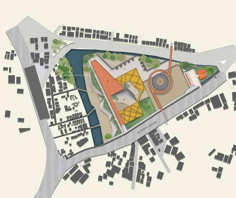
The main Amphitheatre that is situated below the spiral ramp is promote local and classical art performances during the evening, which in turn is an initiative to draw people to the site, and improve the quality of living. the overhead bridge over looks the Vrishabhavathi river and connects the river back into the urban fabric. The seating overlooking the river also act as huge bioswales and help the rainwater seep through to the ground water table. The river is also treated as a public space, by creating a large river walk that connects the neighbouring areas in which it flows thereby connecting the people to the river again.
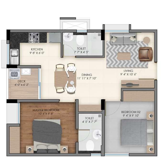
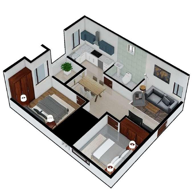
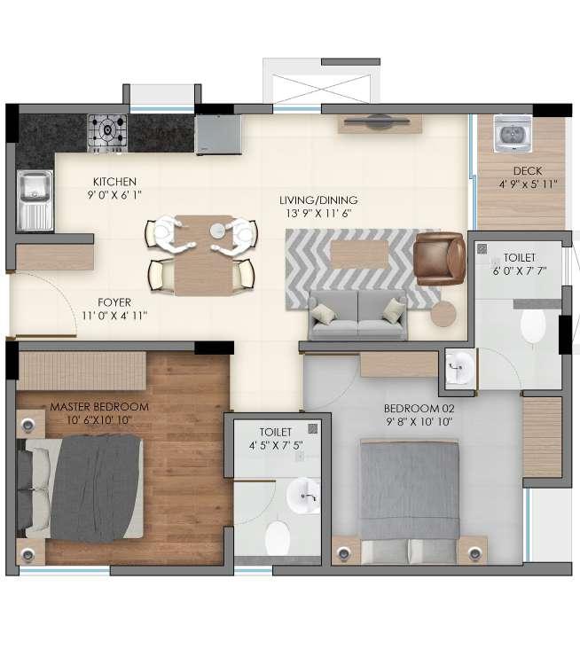
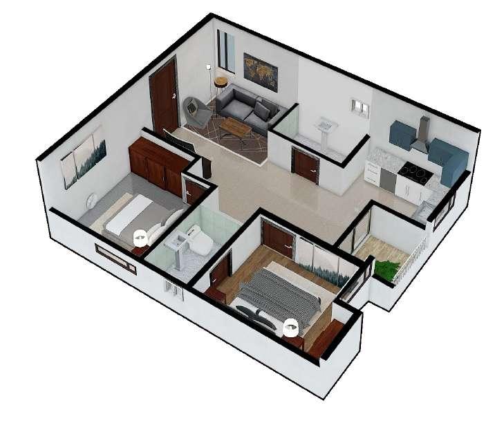
2019 |SDEG INDIA| RESIDENTIAL |
INSTRUCTOR : ARUNA SUJITH
PROJECT TIMELINE : 12 WEEKS
(1:75) DETAIL AT B (1:20)
Juror's Comments :
DETAIL AT A (1:20)