Chaofan Zeng
Landscape Architect
Selected Works 2020 - 2025

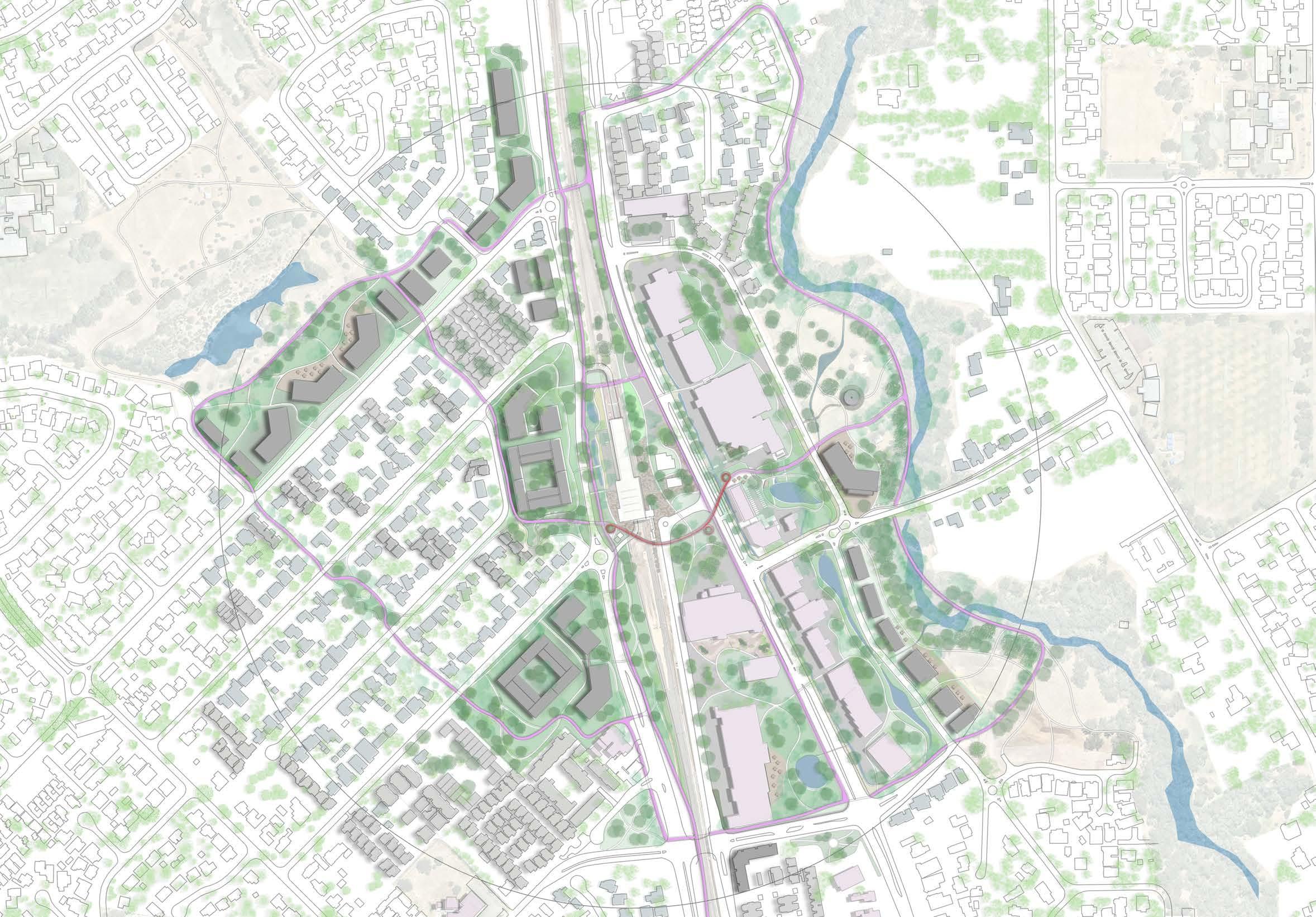
WORK PROJECT AT SYRINX
Canning Vale, WA
Burswood, WA
5.
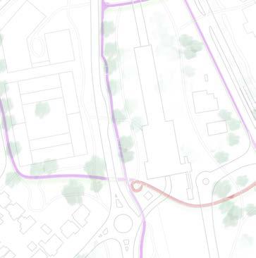
Bayswater, Perth, WA
*All the projects used in the portfolio have been approved.
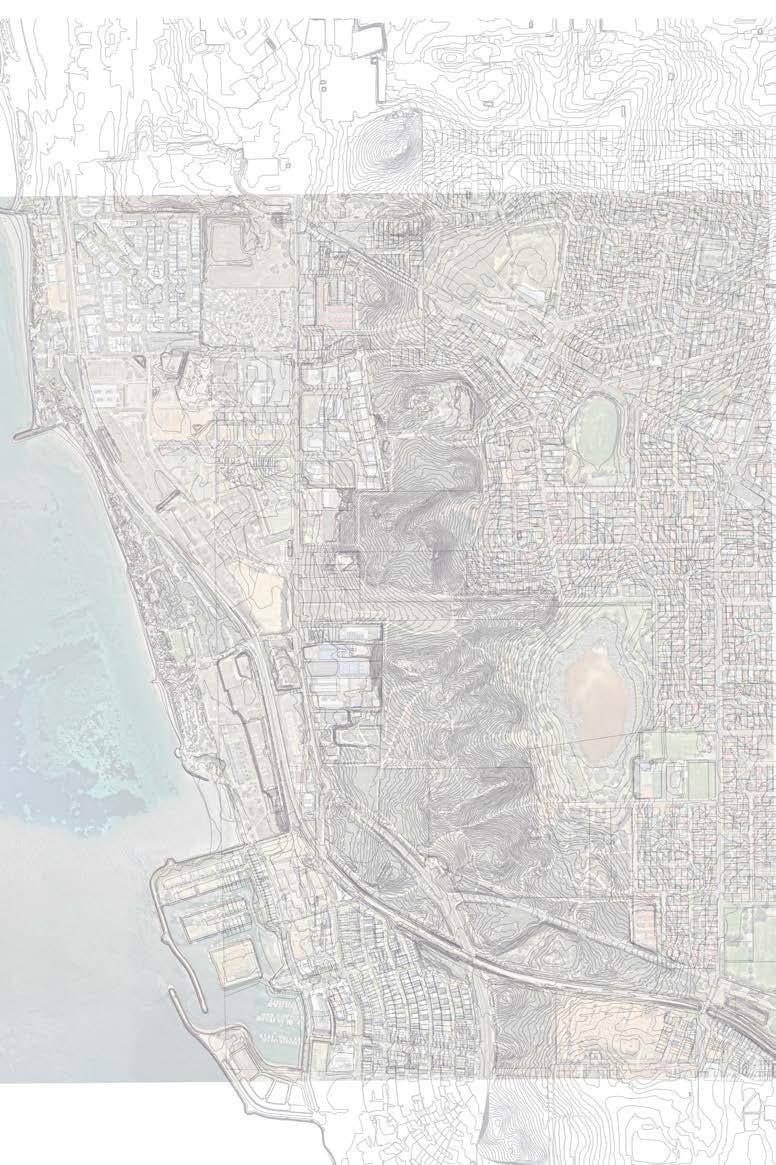
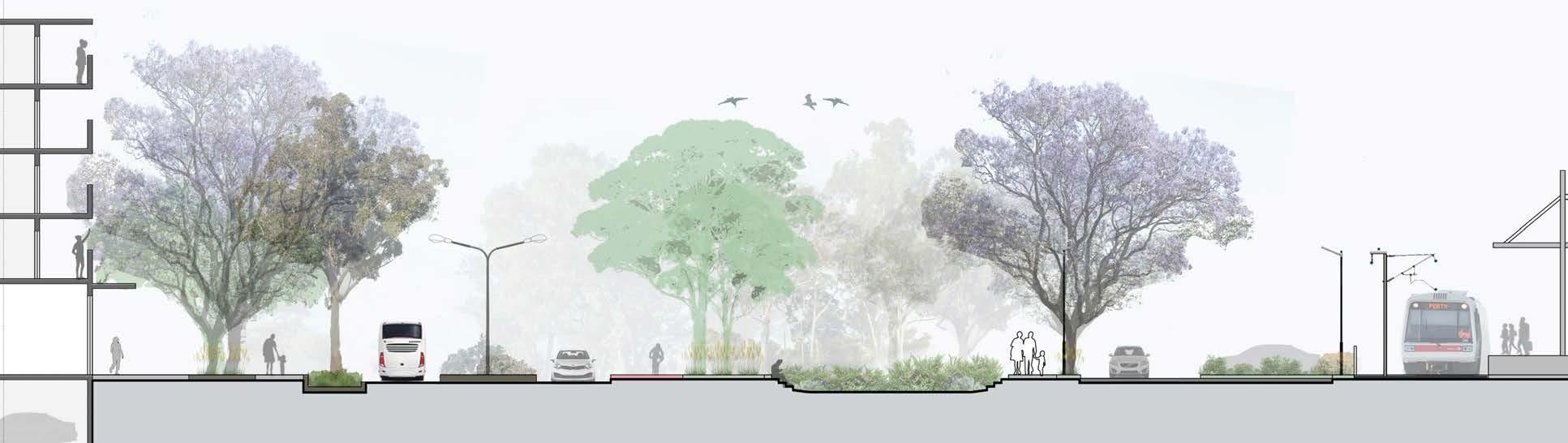
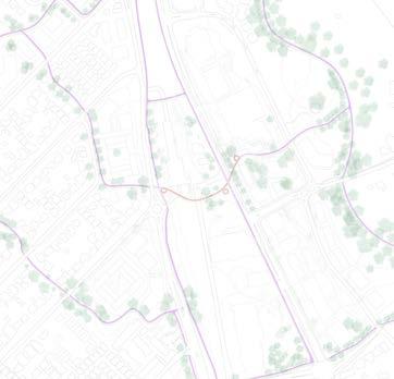
1. Tulloch Way
2. Matagarup Bridge- Redesign of The Stadium Foreshore
Optus Stadium, WA
3. Foreshore Stabilisation of Burswood Park
4. Bayswater Foreshore
31 Ngongotaha Rd Wetland Ngongotaha Rd , New Zealand
STUDENT WORKS AND PRACTICE
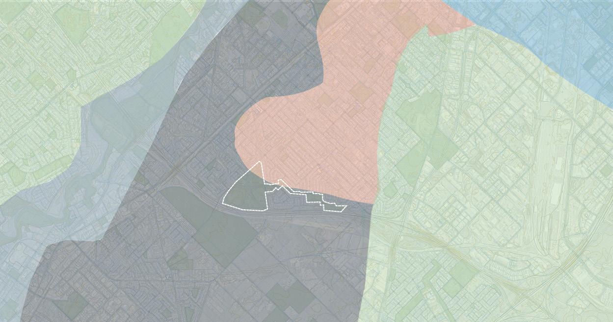
6. 'Living With Urban Water Greenway' LACH5511 Independent Dissertation by Design Part 2Master Levels Dissertation, UWA, 2022 Beckenham, City Of Gosnells, WA
7. ‘Overlapping landscape' LACH5422 Making - Master Levels Landscape Design Studio, UWA, 2021
Site: Manning Park, Cockburn, WA
8. ‘Green Loops’ URBD5804 - Master Levels Urban Design Studio Unit, UWA, 2022 Site: Kelmscott ,WA
9. ‘Semi-open Primary School’ LACH3001 Resolutions - Conversion Levels Landscape Design Studio, UWA, 2020 Site: North Perth Primary School, North Perth, WA
10.Photo Real Rendering Master Levels Architectural Visualisation Unit, UWA, 2021 Site: Ocean View Parade, Gooseberry Hill, WA 11. Practice in 2023
Collaborated with O2 Plant Walls Forrestdale Western Power project - Relaxing outdoor space Site: Forrestdale, Western Australia
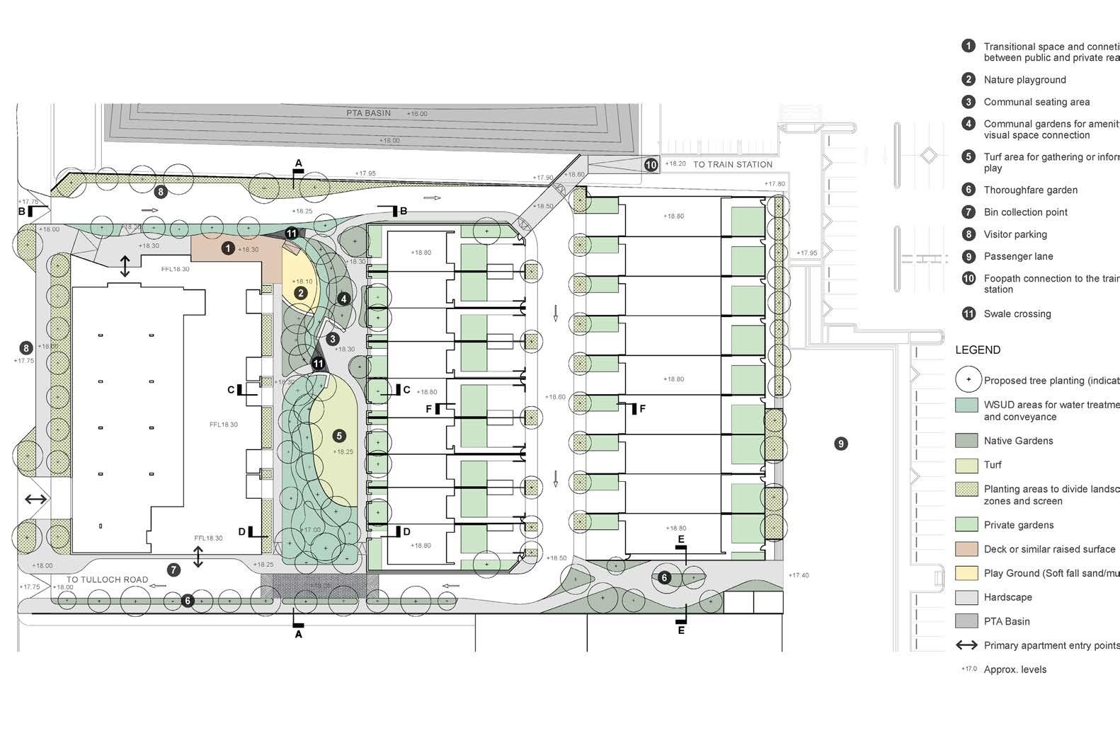
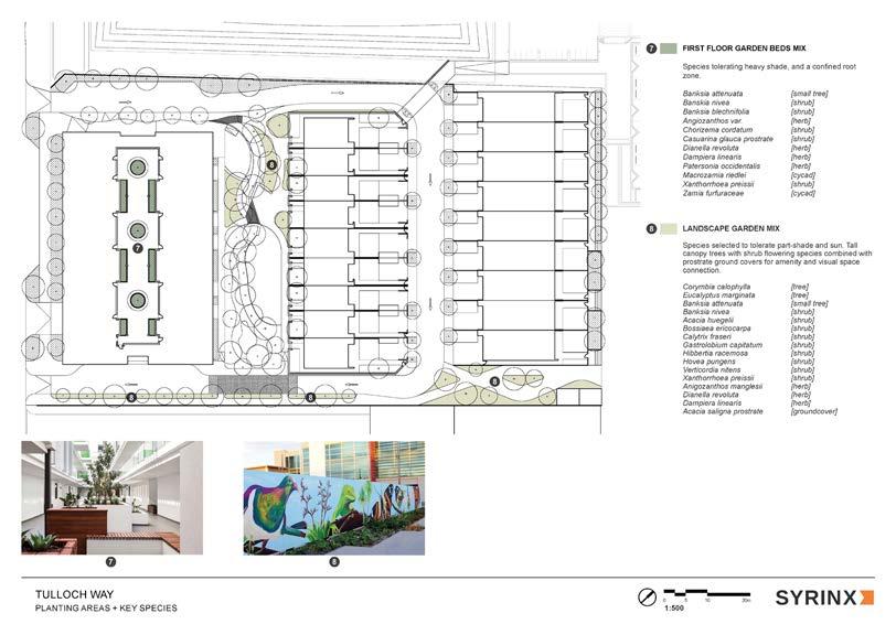
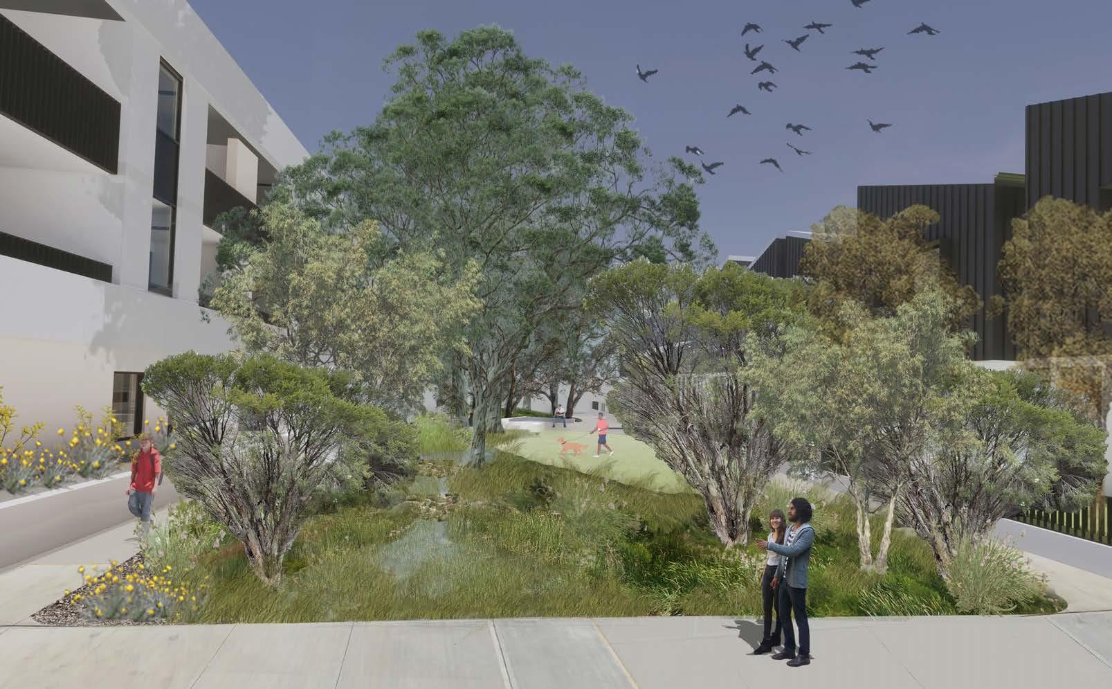
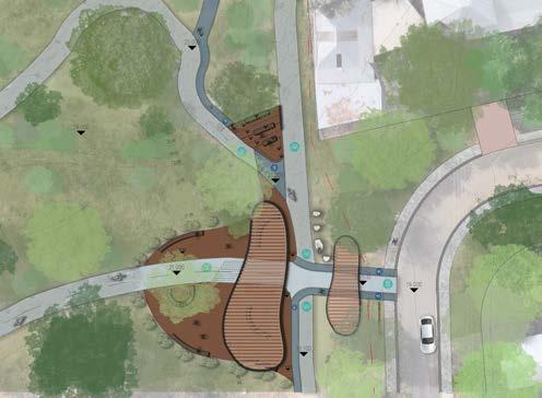
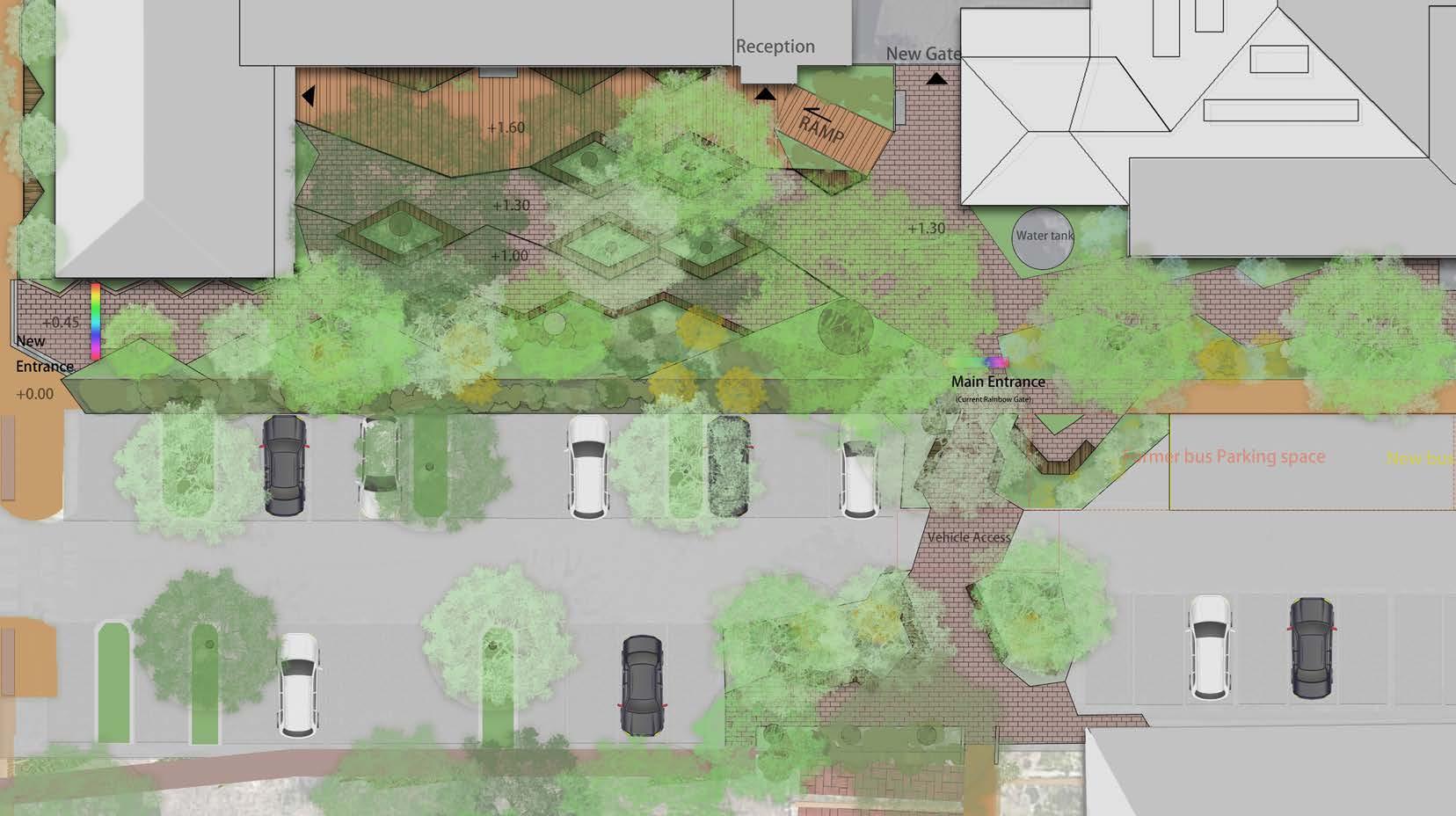
Tulloch Way
Canning Vale, WA
Client: Department of Communities
Project overview: The medium-density residential project aims to enhance the convenience and aesthetics of the public station and surrounding areas, creating a high-quality living and recreational environment. For the landscape concept design, the overall objectives are to enhance the convenience and aesthetics of the public station entrance, provide high-quality pedestrian pathways and recreational areas, create communal spaces for both apartment and townhouse residents, and implement Water Sensitive Urban Design (WSUD) strategies to maximize the potential value of water resources.
Project type: Medium-Density Residential Development with Integrated Landscape and Water Sensitive Urban Design (WSUD)
Responsibilities: Concept design (landscape and WSUD) and preparation of drawings for Development Approval
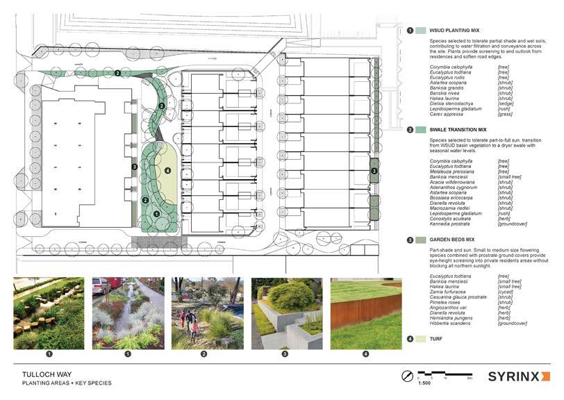
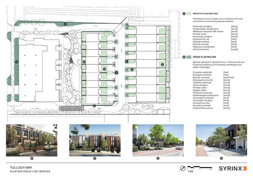
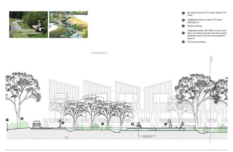
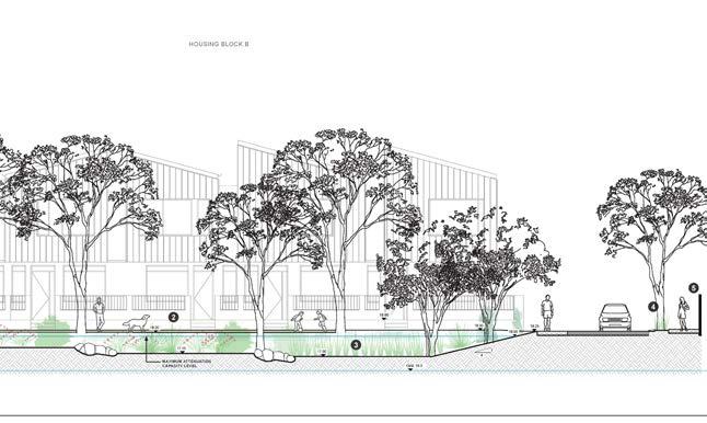
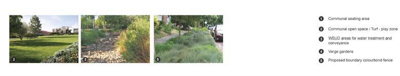
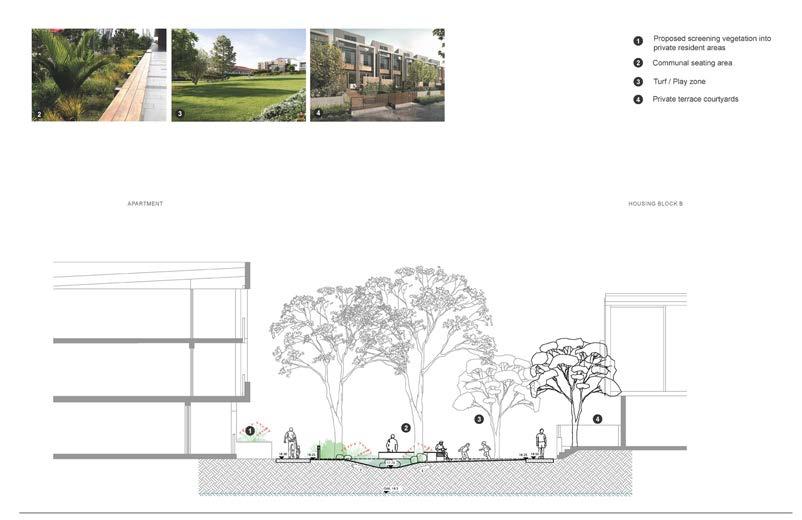
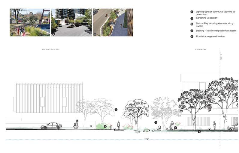
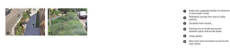
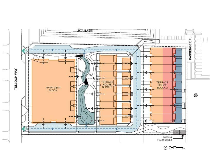
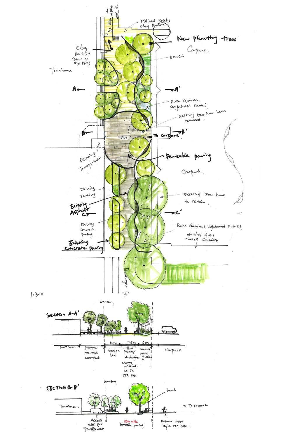
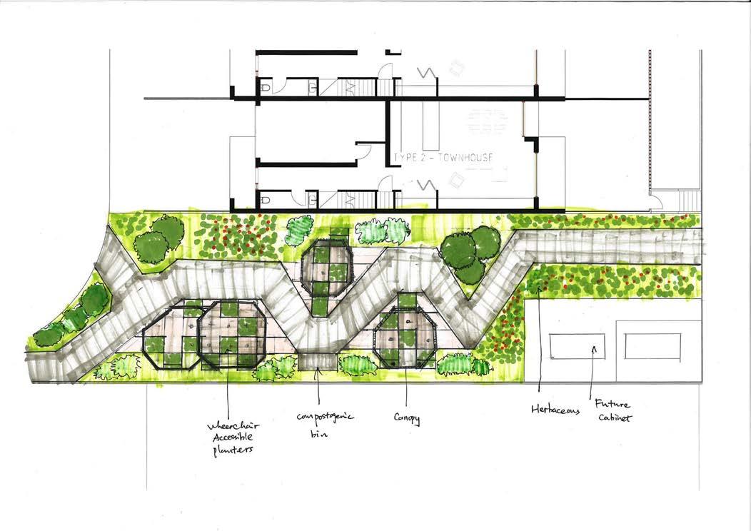
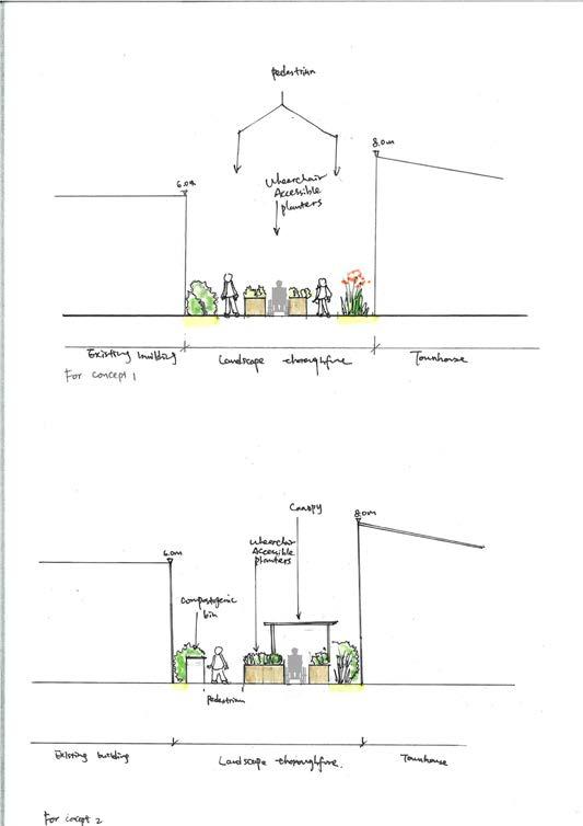
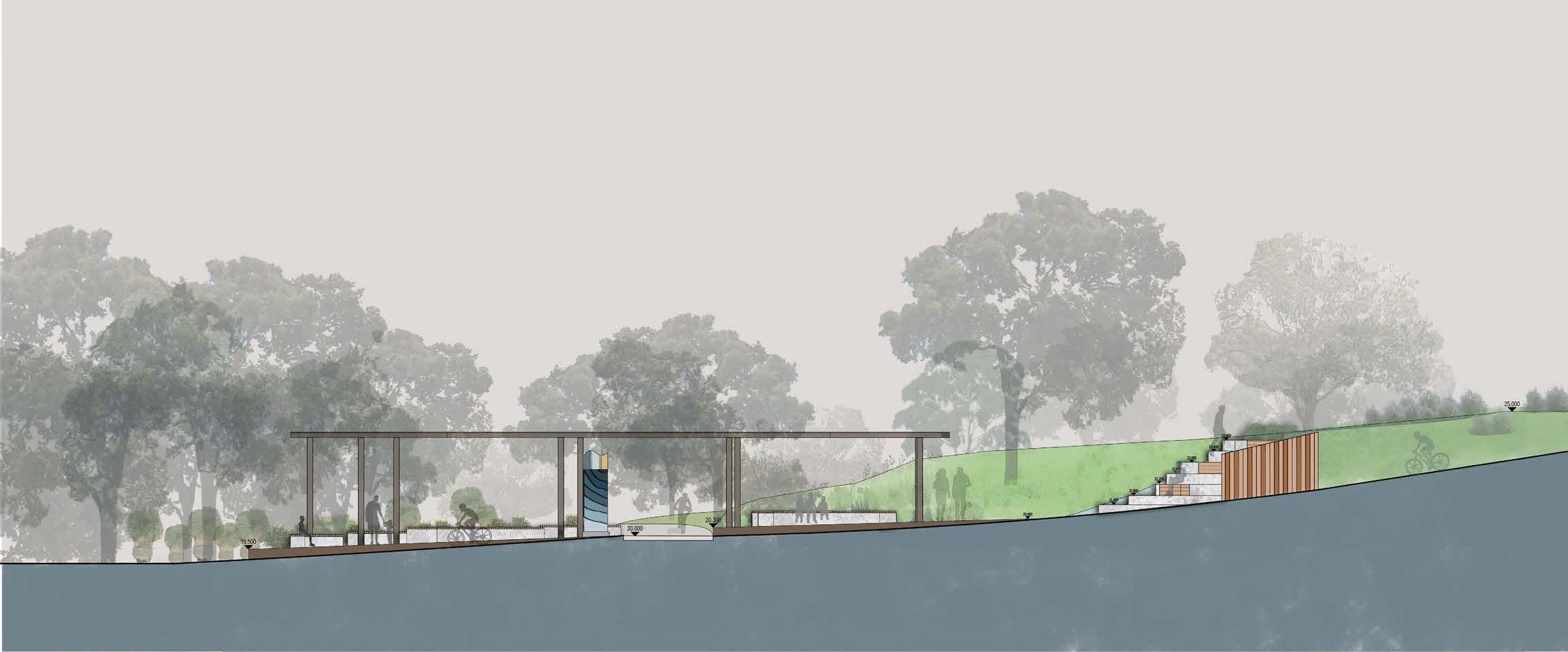
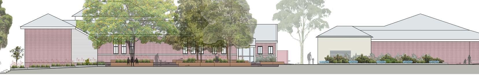
Tulloch Way
Canning Vale, WA
Schematic Design Sections


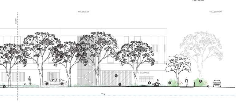


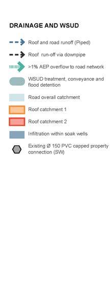
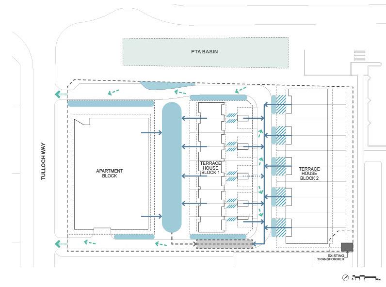
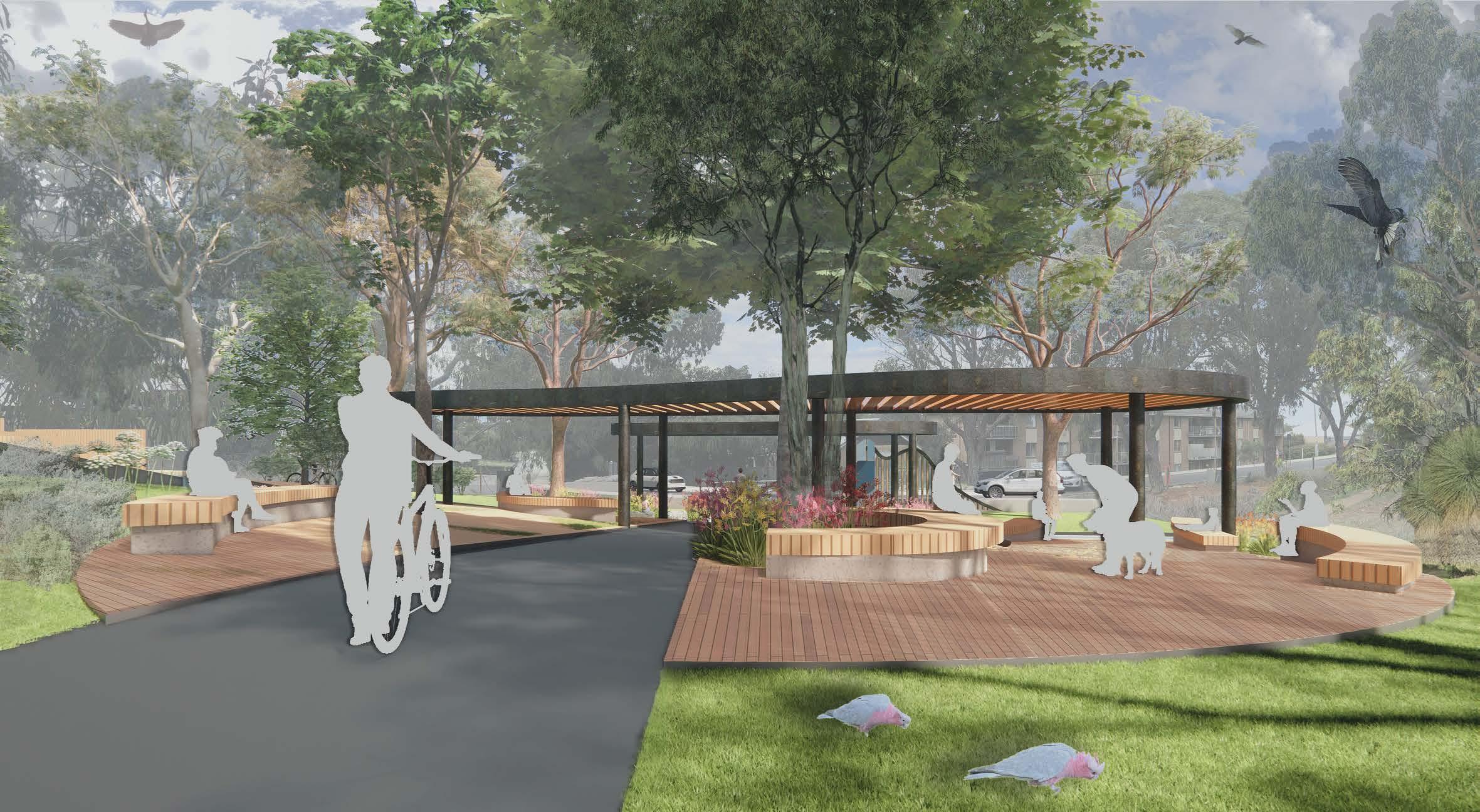
Tulloch Way
Canning Vale, WA
Artist impression and Water Sensitive Urban Design
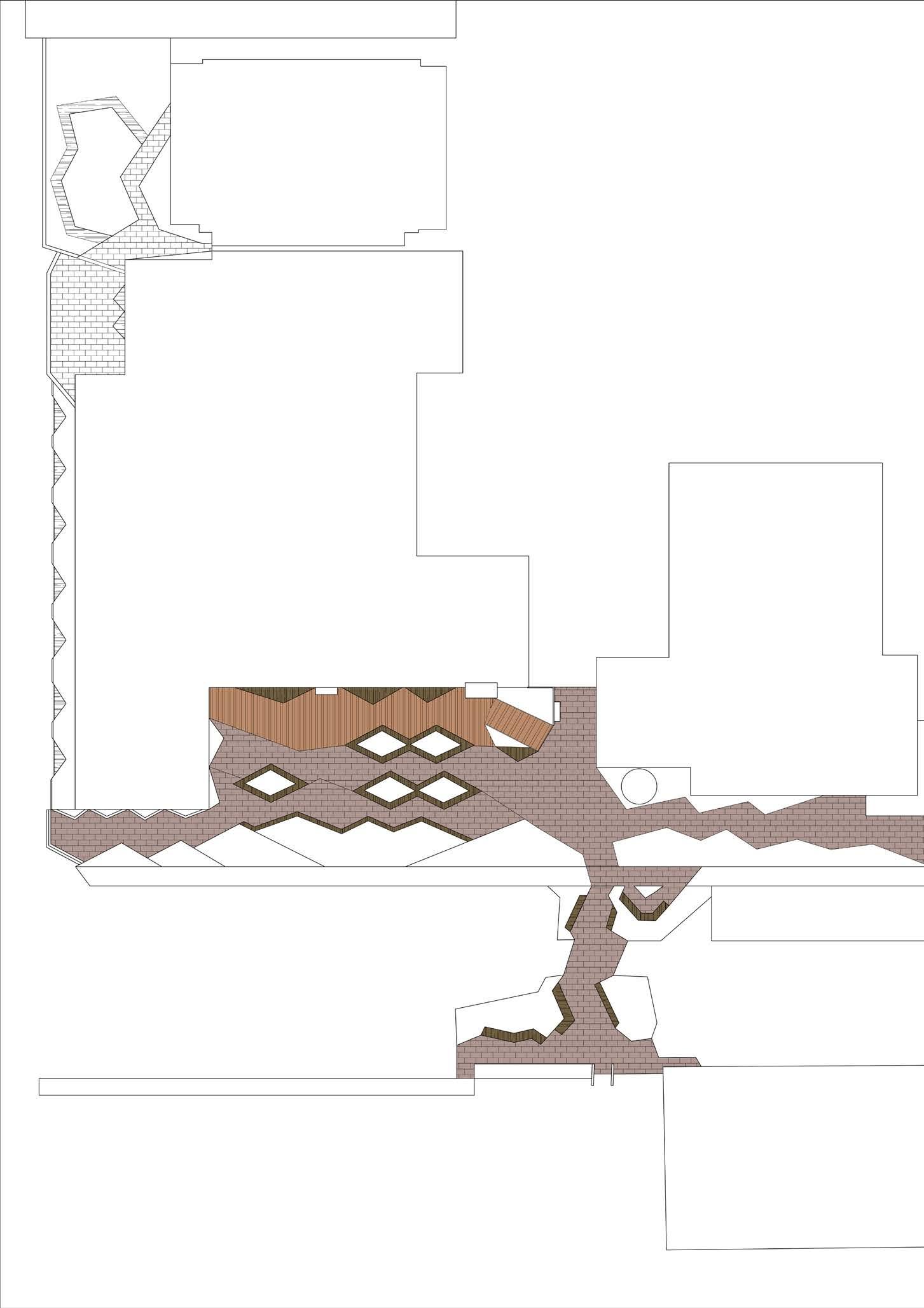
Tulloch Way
Canning Vale, WA
Design Concept Hand Drawings
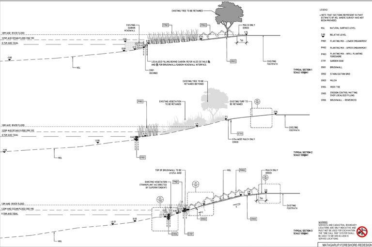
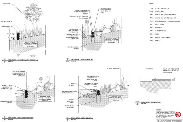
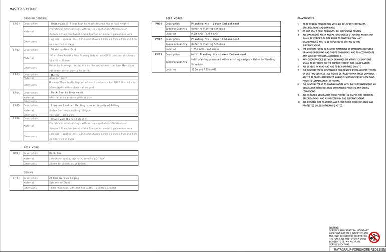
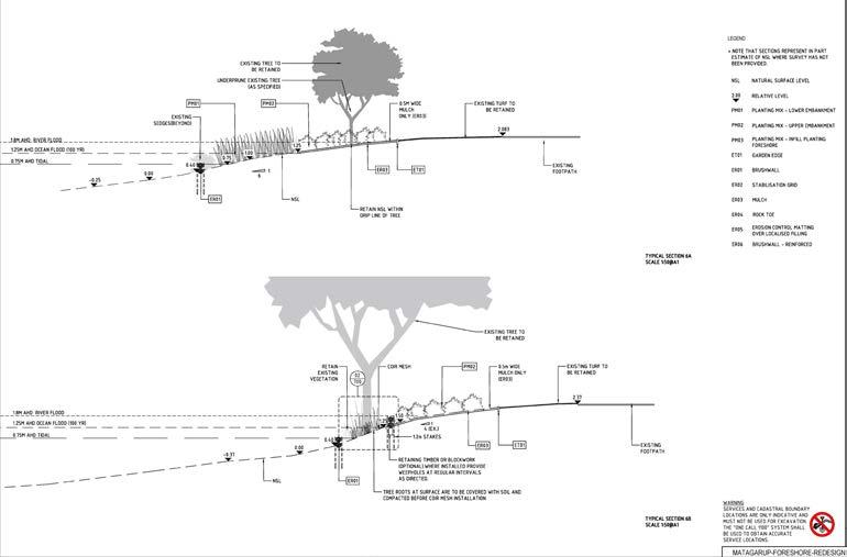
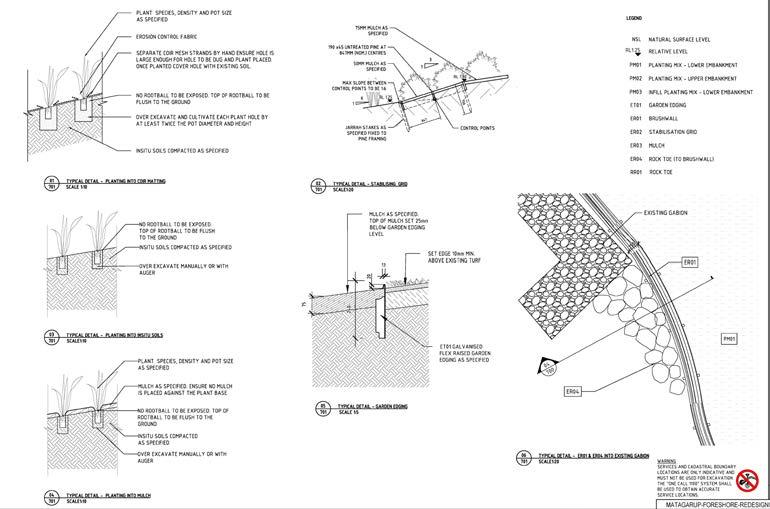
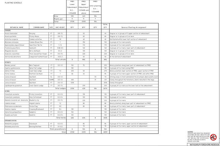
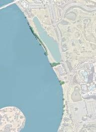
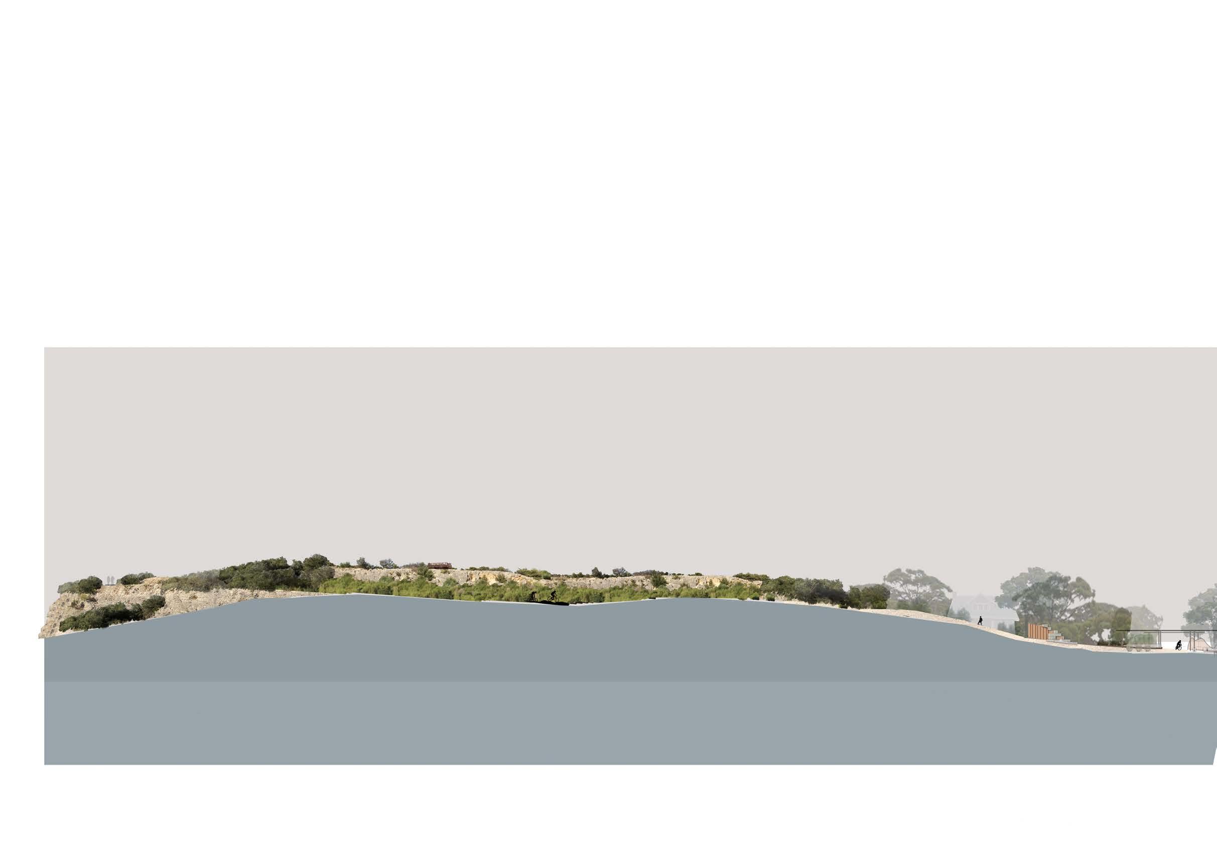
Matagarup Bridge - Redesign Of The Stadium Eastern Foreshore Burswood, WA
Project overview: This project designing foreshore stabilisation works Integration of design, science and engineering disciplines to create robust, adaptive, appropriate, multi-functional and end-user-focused landscape solutions within dynamic riverine conditions, use brushwalling, re-vegetation to provide a long-term solution to the foreshore and address issues of erosion in the broader foreshore. The redesigned restoration zone also includes new structures to allow the public to fully utilize its proximity to the broader foreshore near Perth Stadium.
Project type: Foreshore River Bank Stabilisation
Responsibilities: Preparation of concept design and detailed design (inclusive of drawings, technical specification, maintenance manual and BOQ).
January 2025
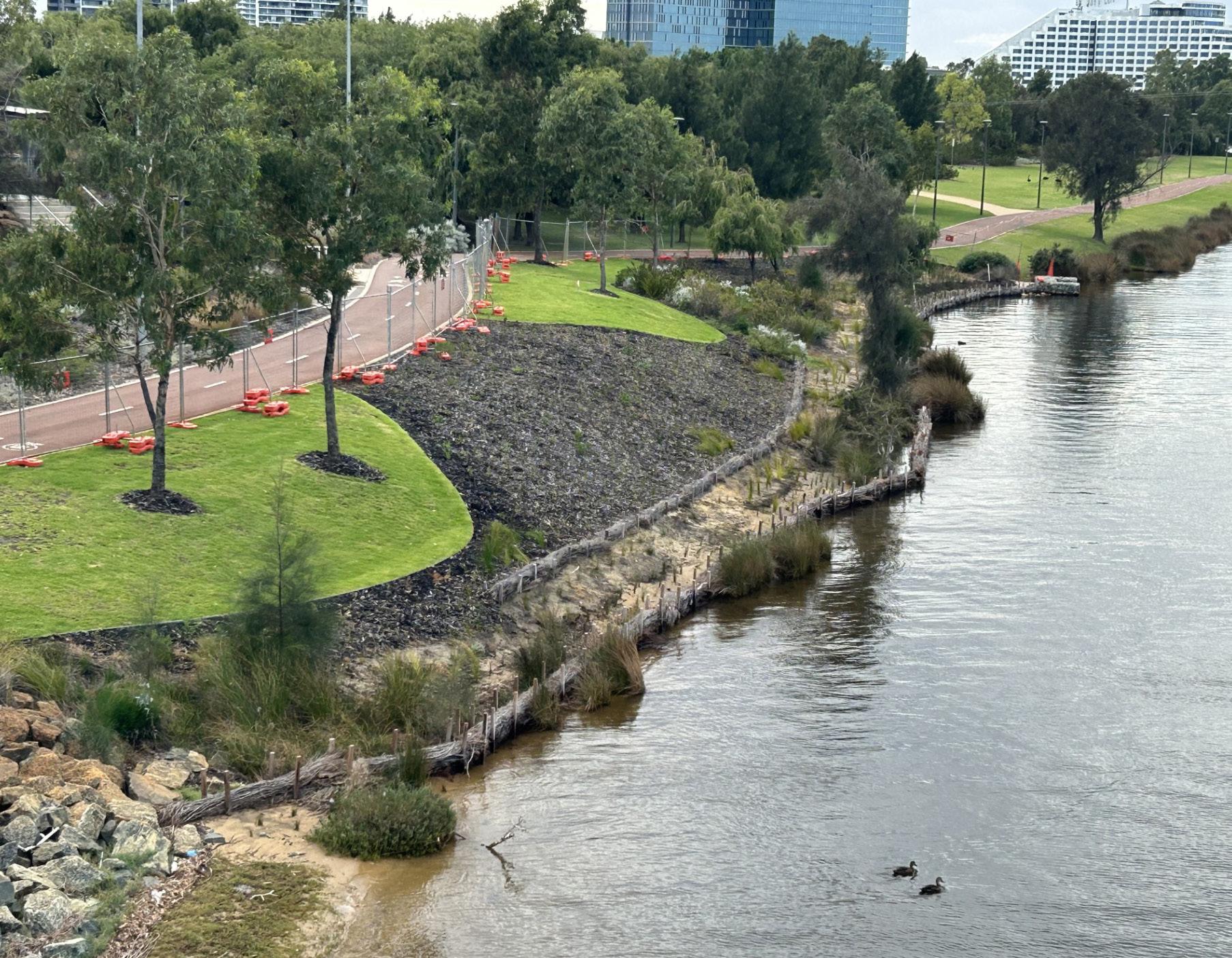
Image: As Constrcuted -
Matagarup Bridge - Redesign Of The Stadium Eastern Foreshore
Burswood, WA
Detailed Design Package
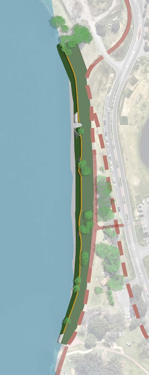
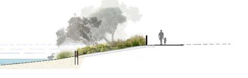
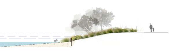
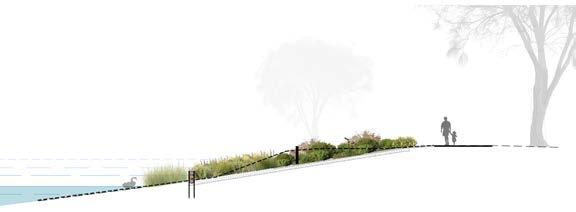
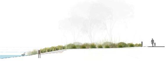
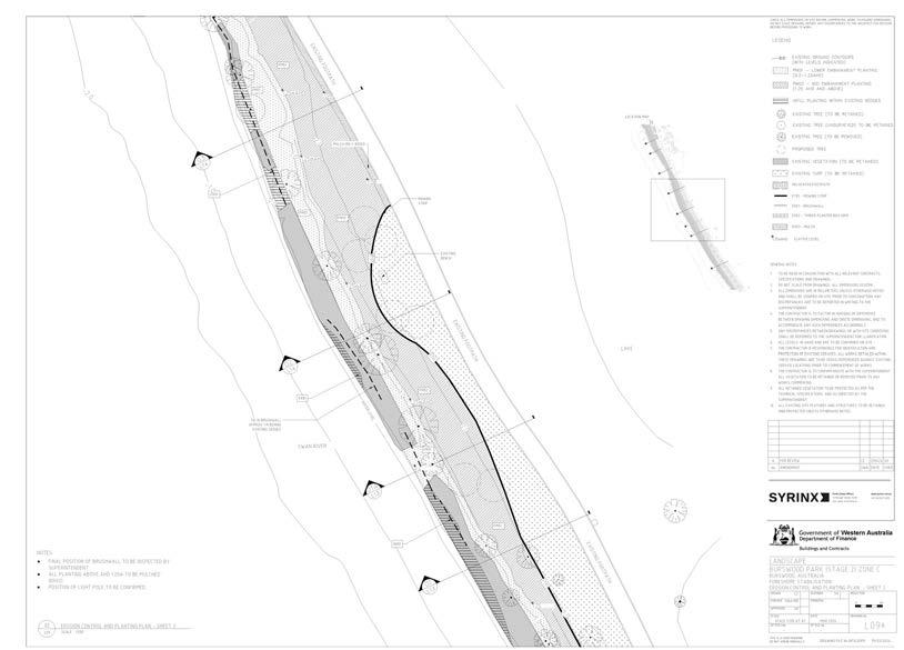
Foreshore Stabilisation of Burswood Park
Burswood, WA
Project overview: Burswood Park foreshore is currently experiencing significant erosion caused by wind generated waves and boat wake. As a result, a combination of stabilisation techniques are being constructed to dissipate wave energy, reducing erosion of the shoreline. These techniques aim to arrest erosion, repair sections, and stabilise the foreshore for years to come.
An outcome of the Stage works will be to improve the amenity, appearance and ecology of the shoreline.
Burswood Park foreshore will be revegetated with native vegetation to help stabilise the foreshore, in addition to providing a vegetation corridor fornative fauna and enhance the amenity of the park.
Project type: Foreshore Stabilisation, Landscape Design
Responsibilities: Preparing site plans, working drawings, and cost estimates, showing location and details of proposals, including ground modelling, vegetation and access. Preparation of concept design and detailed design (inclusive of drawings, technical specification, maintenance manual and BOQ);


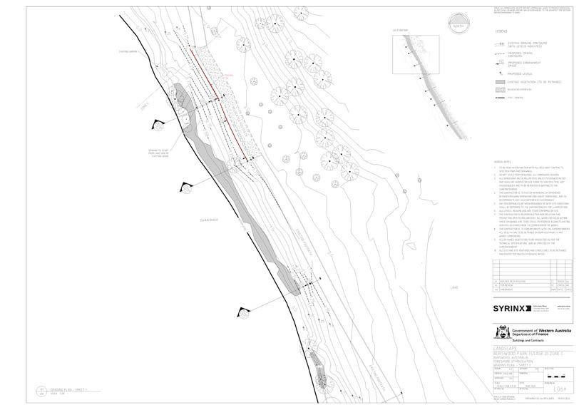
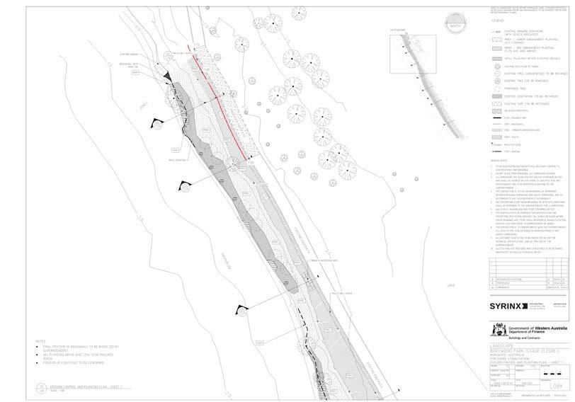
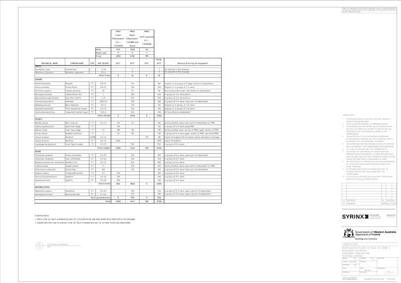
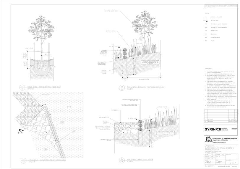
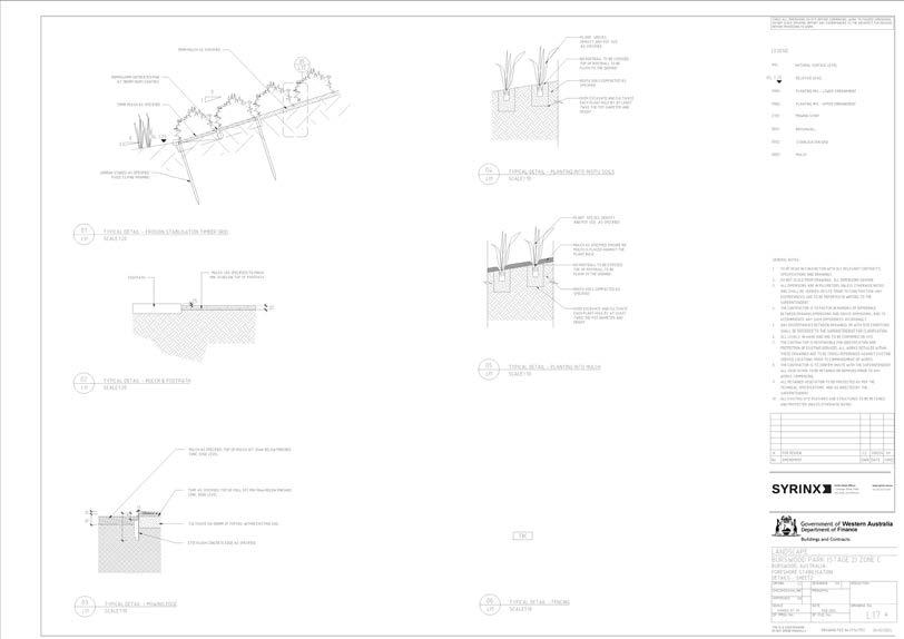
Foreshore Stabilisation of Burswood Park
Burswood, WA
Zone C Detailed Design Package Sample (Grading Plan, Erosion and Planting Plan, Planting schedule, Details)
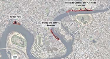
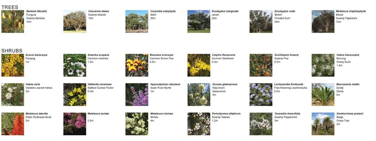
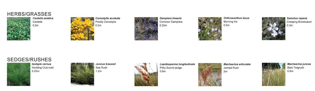
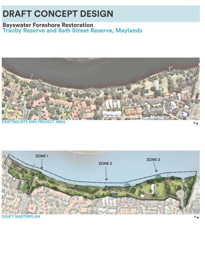
Bayswater Foreshore
Bayswater, Perth, WA
Project overview: As part of their shared responsibility, the City of Bayswater (CoB) in collaboration with the Department of Biodiversity, Conservation and Attractions (DBCA) are developing foreshore restoration designs as part of the Riverbank Funding Program and Foreshore Plan (10-Year) to three of its premier foreshore locations within the COB.
i) Riverside Gardens & Hinds Reserve (Bayswater)
ii) Tranby Reserve & Bath Street Reserve (Maylands)
iii) Bardon Park (Maylands)
The consultant team includes:
• Syrinx (lead-consultant, environmental consultant/landscape architect)
• Carrier and Postmus Architects (landscape architect/architect)
• Seashore Engineering (coastal engineer) Element (community & stakeholder engagement)
Project type: Sustainable Masterplanning, Ecological Restoration, Bioengineering, Project and Stakeholder Management, Landscape Architecture
Responsibilities: Preparing site analysis and engagement, detailed design drawings, and cost estimates, showing location and details of proposals.


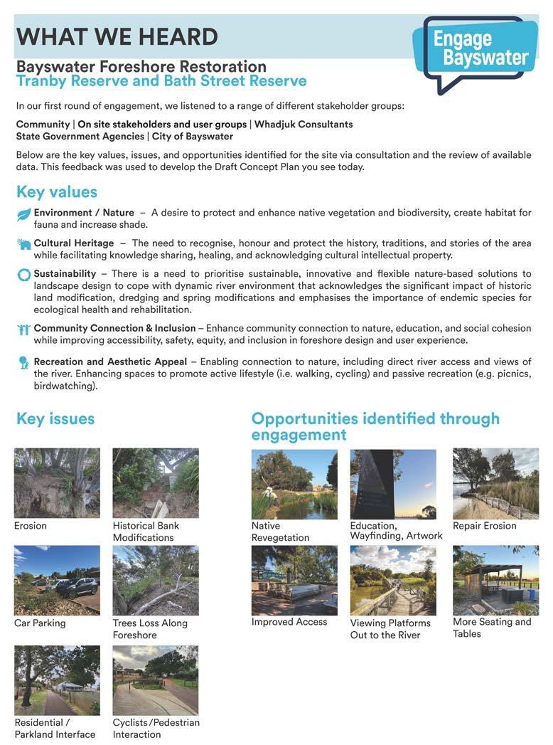
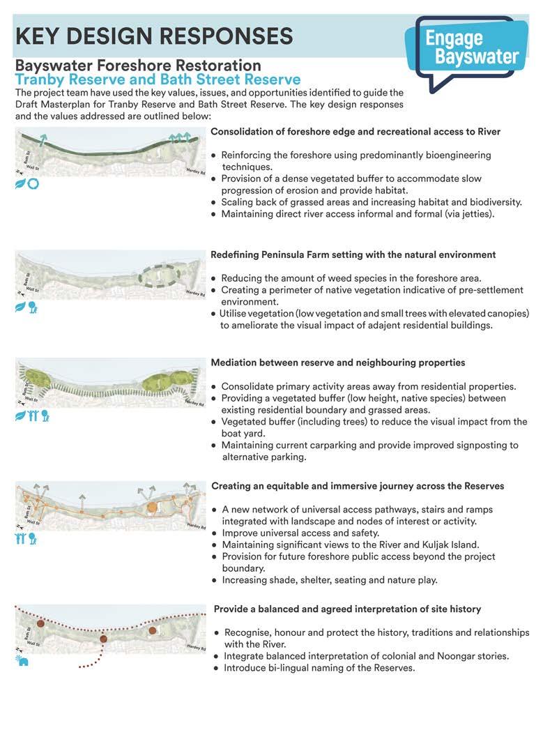
Bayswater Foreshore
Bayswater, Perth, WA
Stakeholder Engagement of Initial Concepts
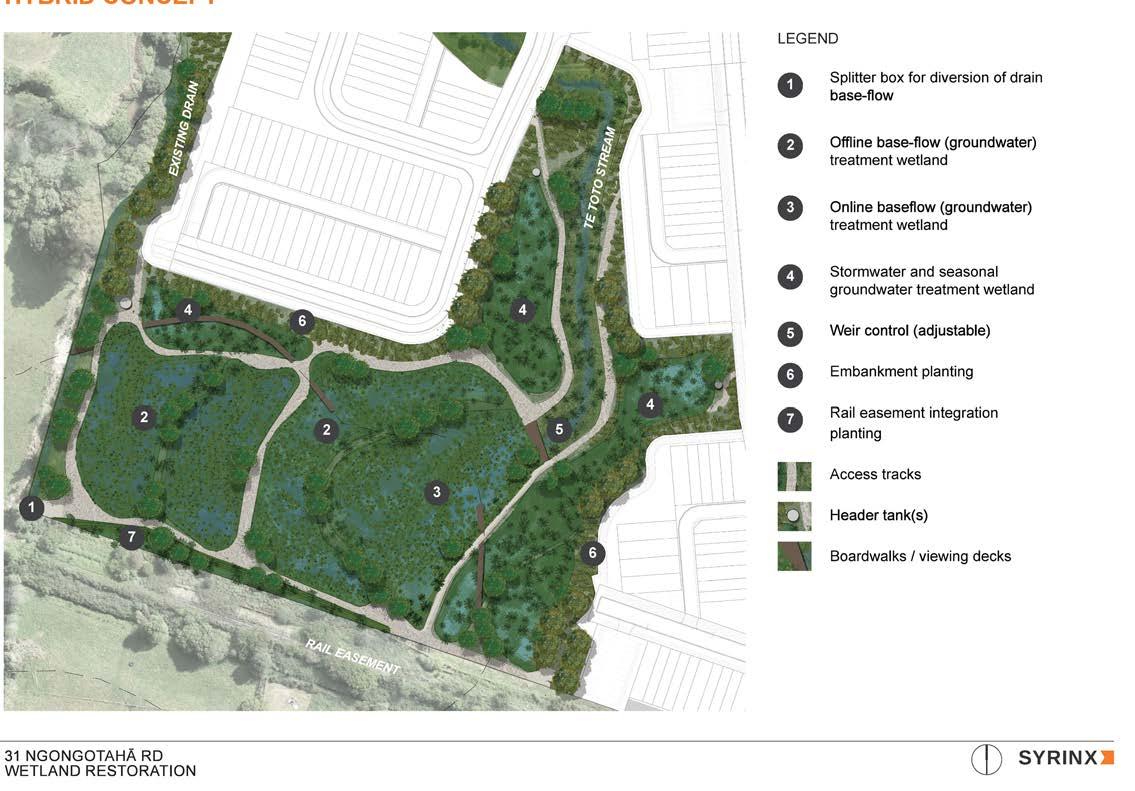
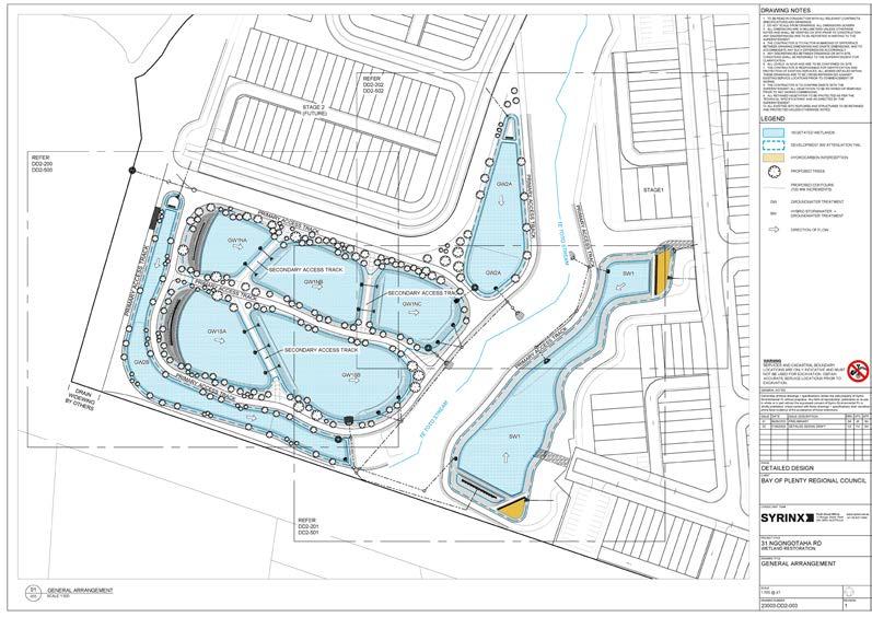
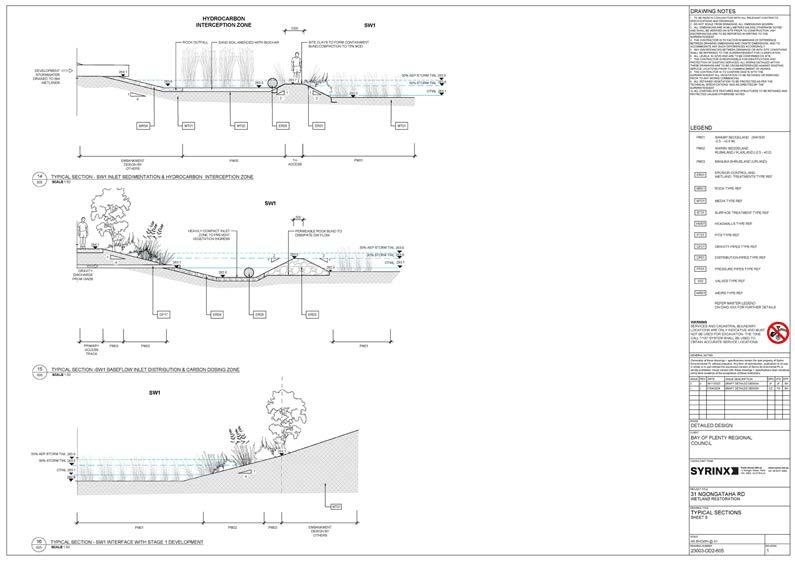
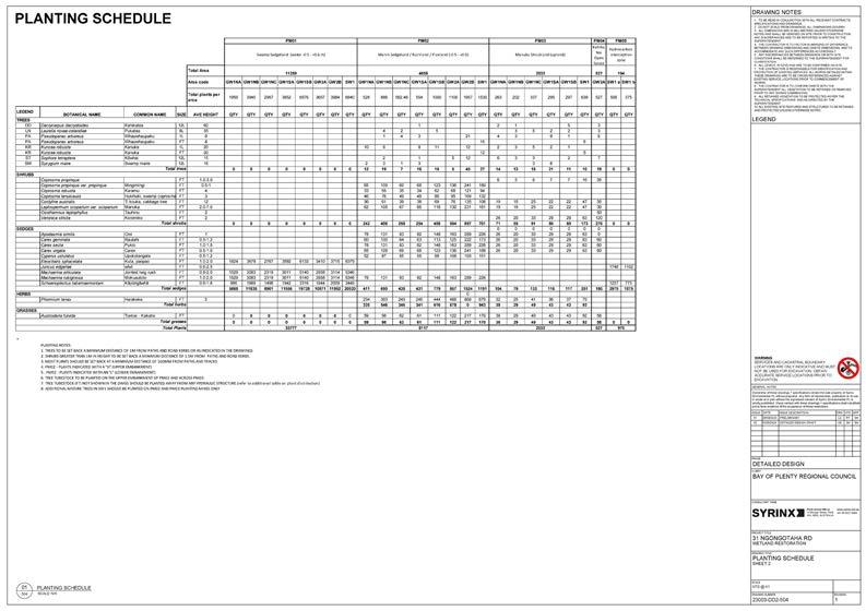
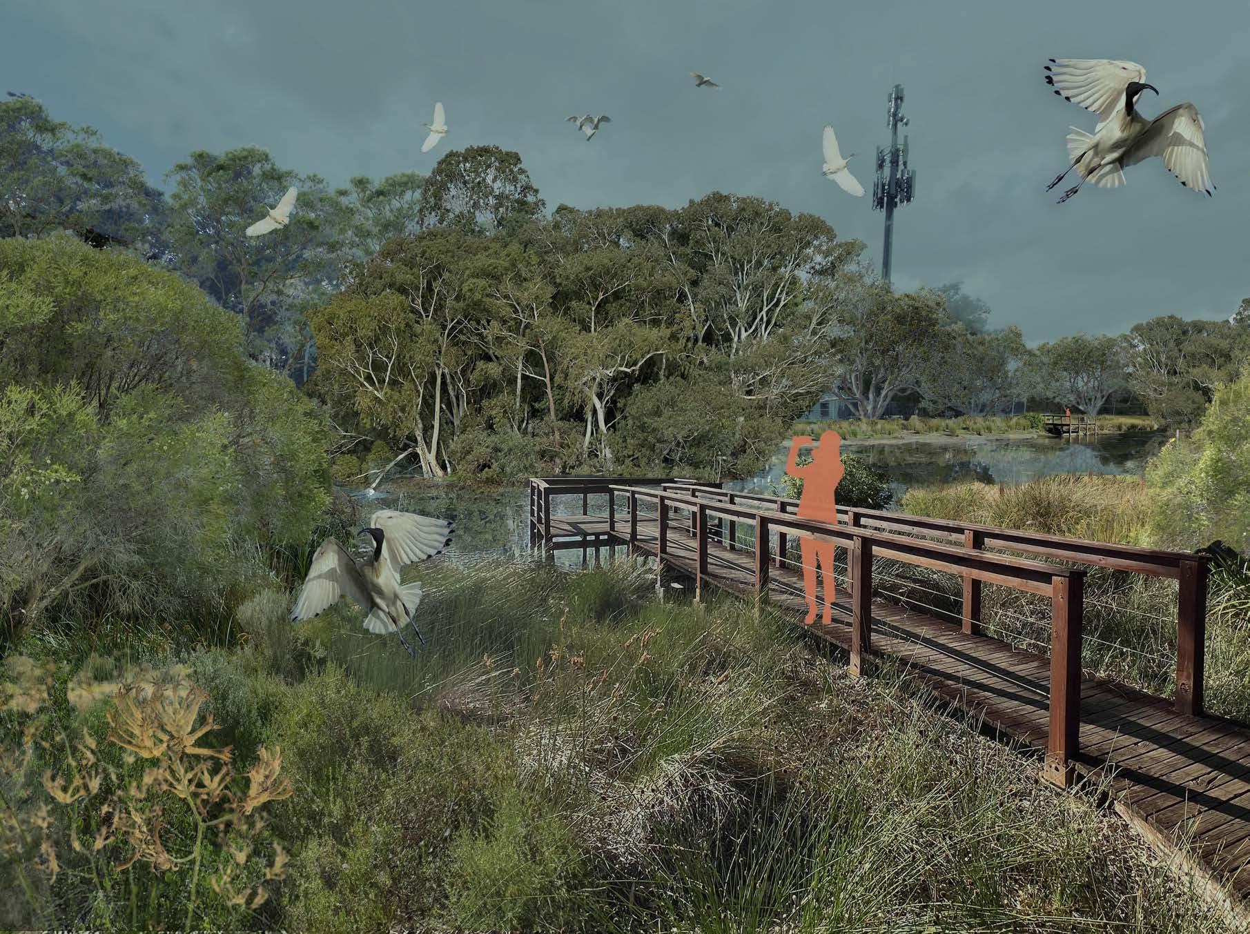
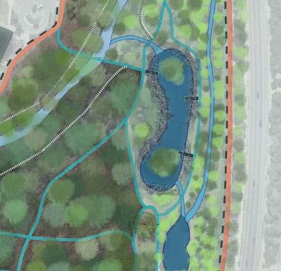
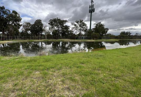
31 Ngongotaha Rd Wetland Ngongotaha Rd , New Zealand
Project Overview: The goal is to develop a sustainable, visually appealing, and engaging public open space that enhances the surrounding development. The design will integrate essential public space features, including safety, aesthetics, recreational areas, and biodiversity, while accommodating the diverse functional needs of its urban environment.
Project type: Wetland restoration; Stormwater Management; WSUD
Responsibilities: Preparing site plans, working drawings, and cost estimates, showing location and details of proposals, including ground modelling, vegetation and access. Preparation of concept design and detailed design (inclusive of drawings, technical specification, maintenance manual and BOQ).
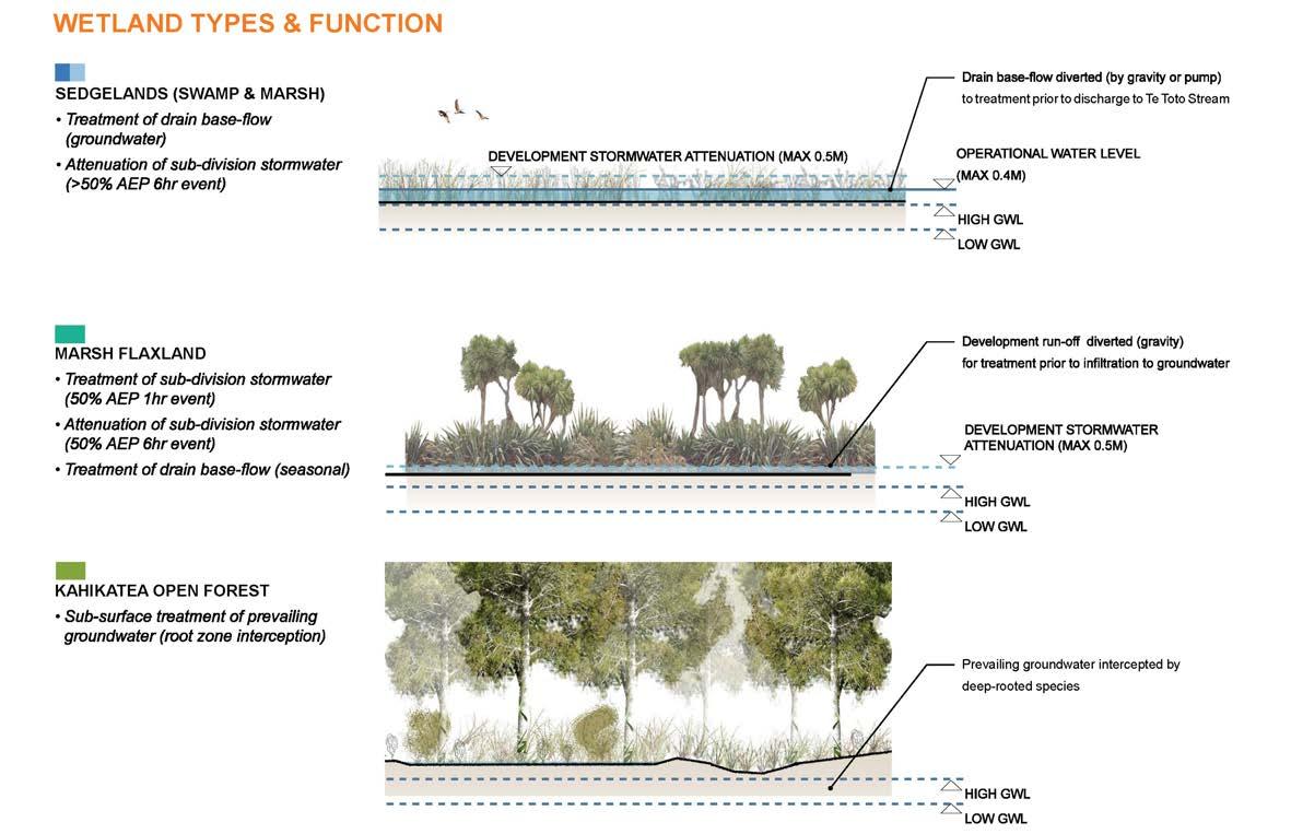
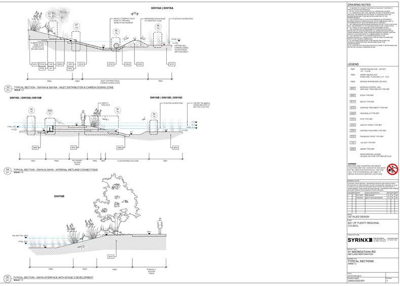
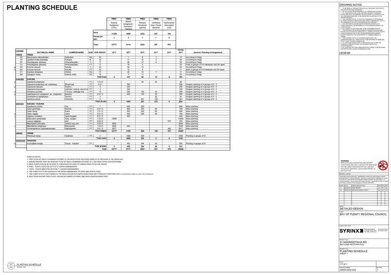
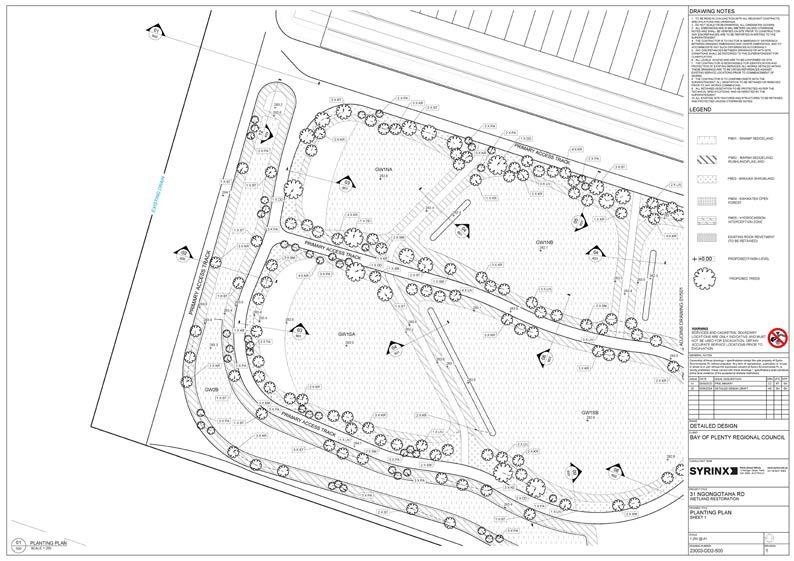
Wetland Types & Function
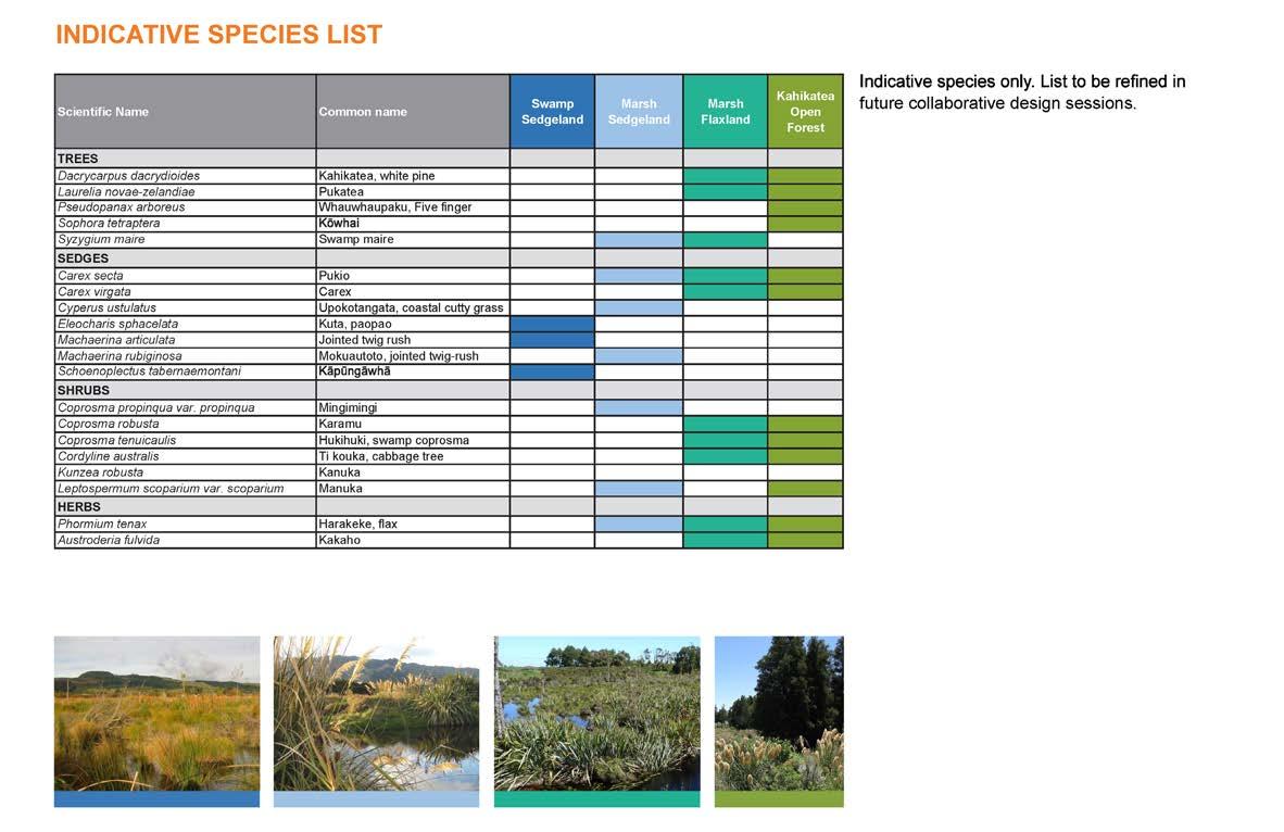
Indicative Species List
31 Ngongotaha Rd Wetland
Ngongotaha Rd , New Zealand
Detailed Design Package
LACH5511 Independent Dissertation by Design Part 2 - Master Levels Dissertation, UWA, 2022
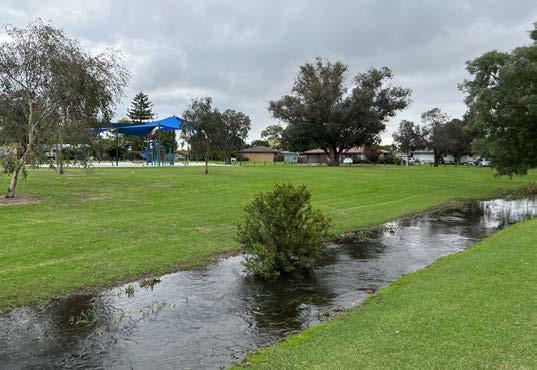
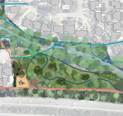
'Living With Urban Water Greenway' Beckenham, City Of Gosnells, WA
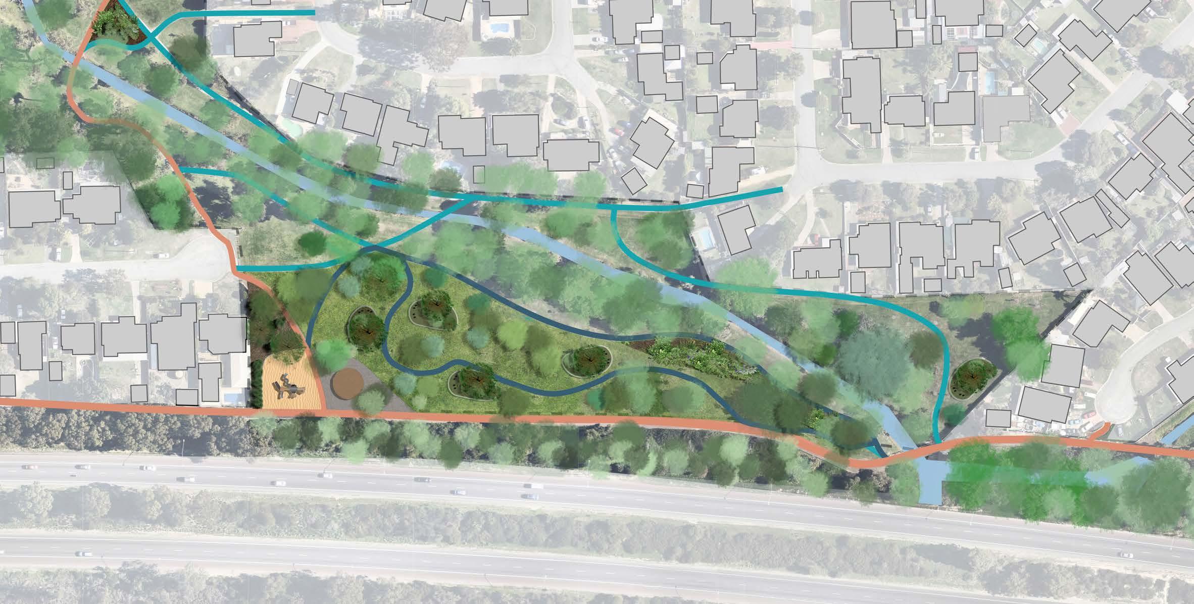
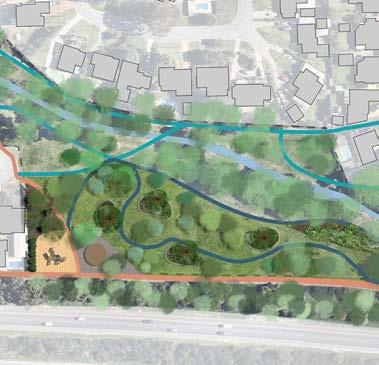
Design Area - Masterplan
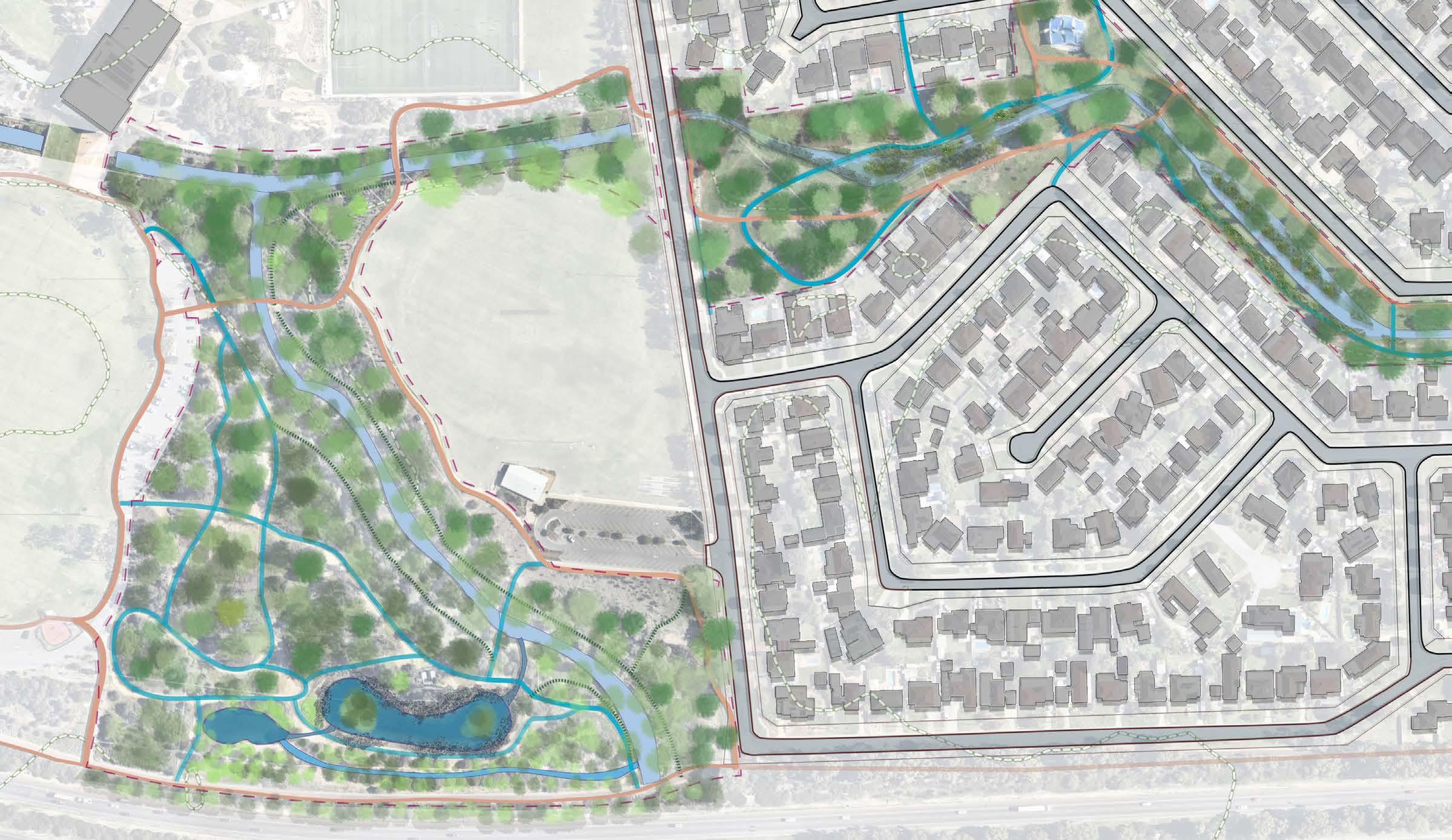
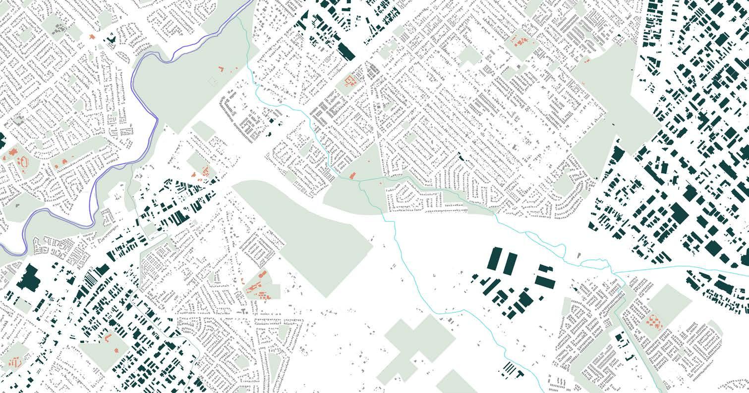
South of Woodlupine Brook Reserve
This Dissertation by Design focusing on Water Sensitive Urban Design in Perth, Water Sensitive Urban Design and similar concepts, such as Low-impact Design and the Sponge City Concept, is rising research attention in urban areas. The hypothesis of this research is: Water Sensitive Urban Design can be used to improve existing urban green spaces and their ecological qualities, including urban biodiversity in urban environments. Also, practical applications and measurements can be developed to suit different physical
environments in urban areas. The aim is to use WSUD in this site not only combines for an urban water drainage system but also as a design to connect different green corridors, providing the public open green space located around a density residential area. To proving WSUD can be used to improve existing urban green spaces and their ecological qualities, including urban biodiversity in urban environments.

Most of the Guildford Complex soil at the site is Flat plain with medium textured deposits and yellow duplex soils. Although it has some poorly drained plains with calcareous substrate overlapping the West side of the site: yellow duplex soils with minor areas of red and black clays over limestone. Most of the Guildford soil dominates the Mills Park and Woodlupine Brook Reserve, in combination with the existing vegetation and hydrology, it is adaptive to re-vegetated local space planting.
Soil Analysis
Land Use and Building Type
Most of the land is used for residential and green space, and only Mills Park has Mills Park Centre used as the community centre.
Guildford Complex:Flat plain with medium textured deposits;yellow duplex soils.
Poorly drained plains with calcareous substrate: yellow duplex soils with minor areas of red and black clays over limestone.
Swan Complex
Southern River Complex
Bassendean Complex
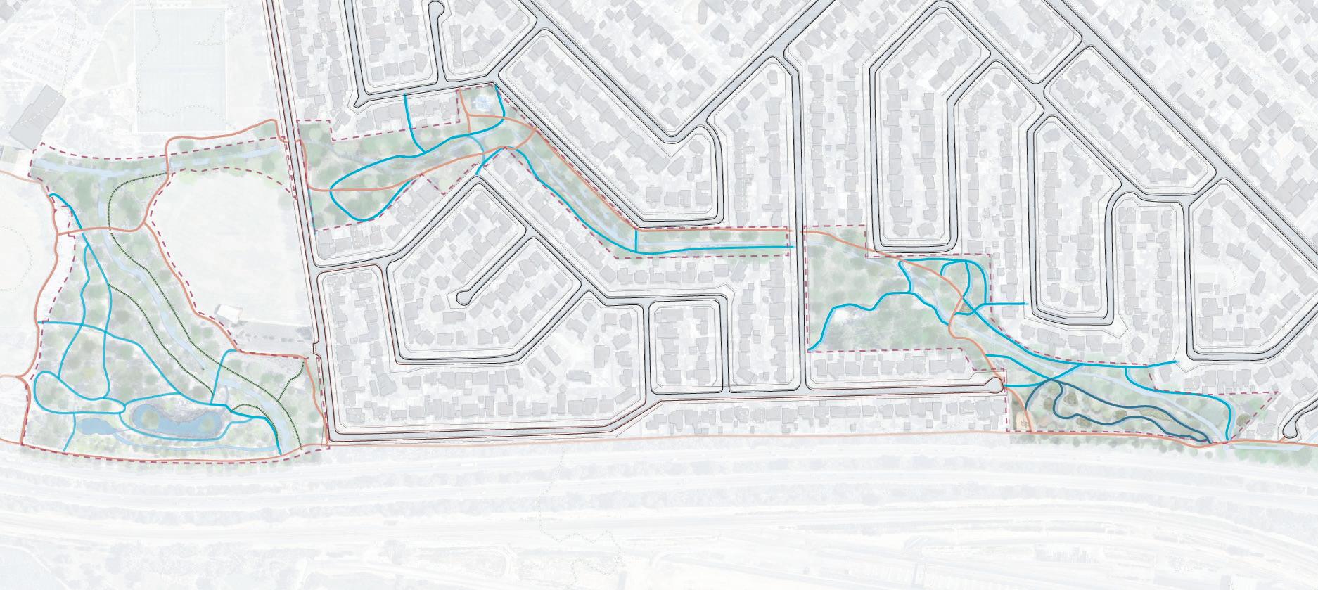
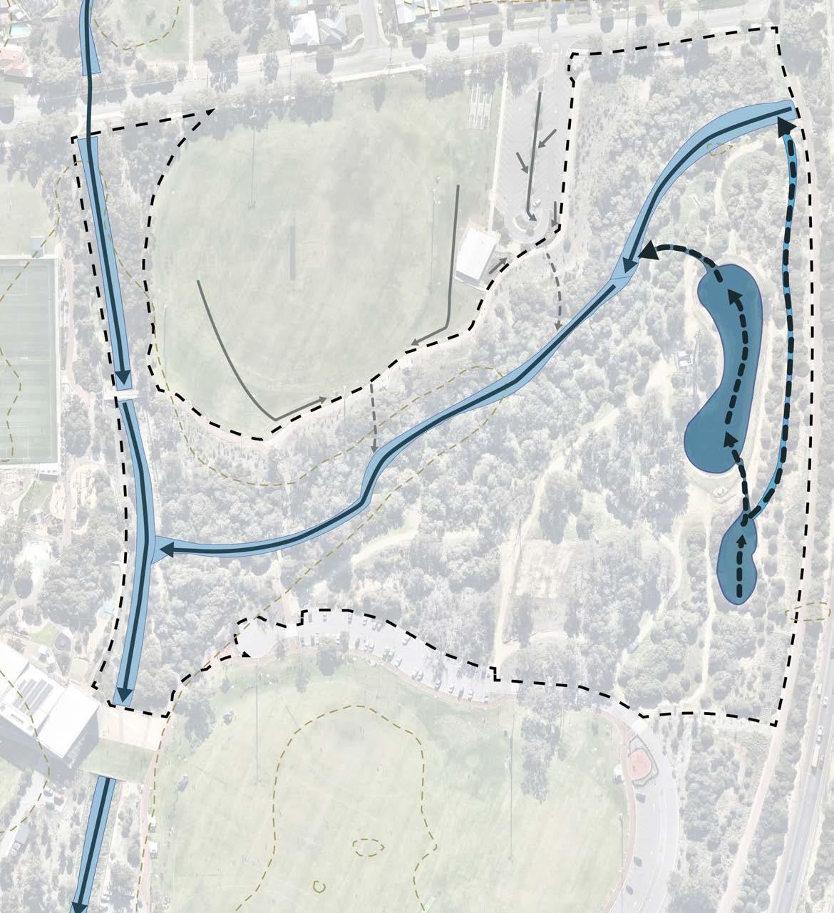
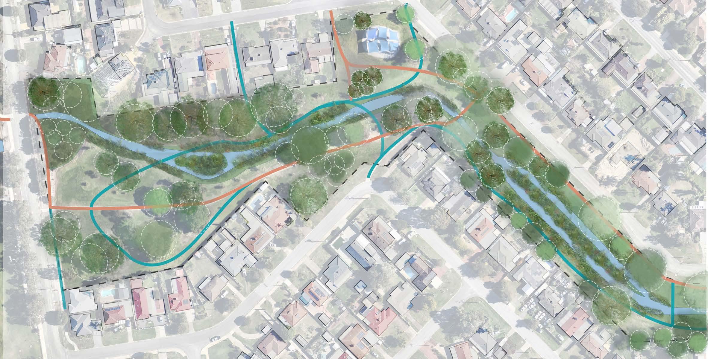
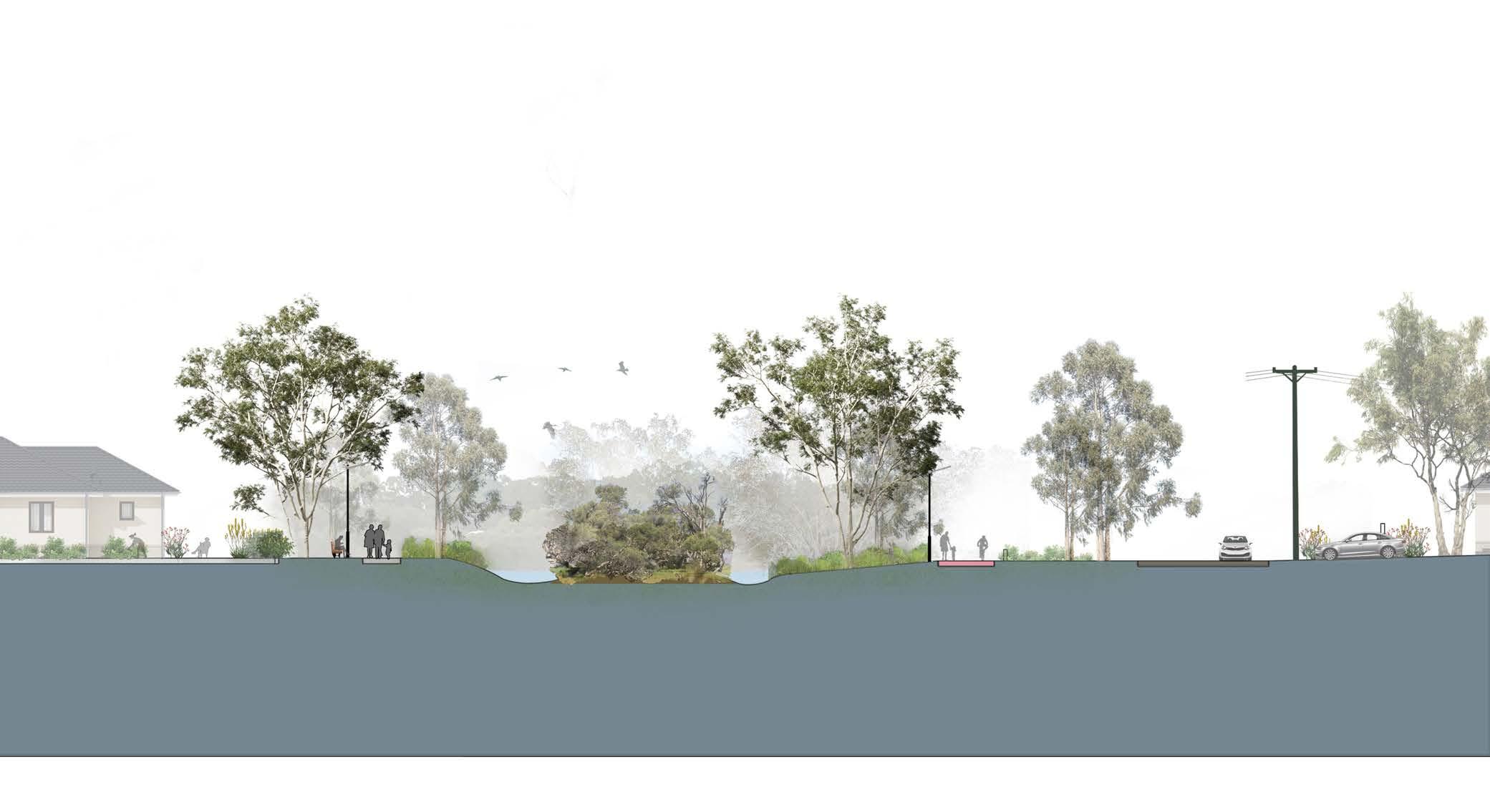
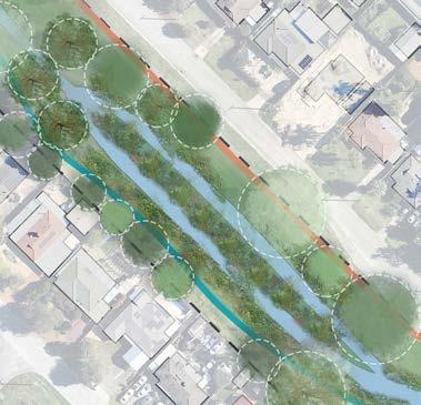
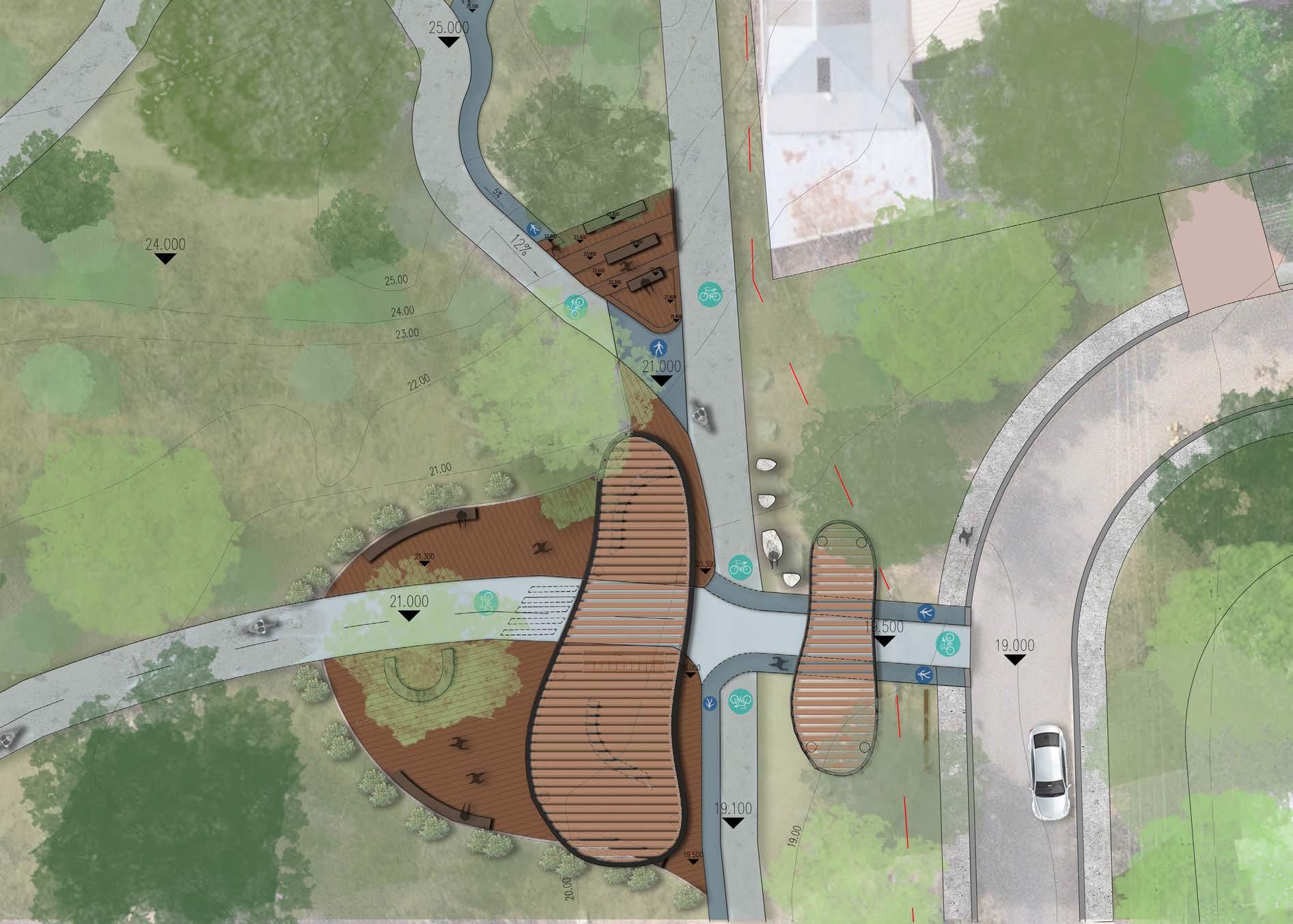
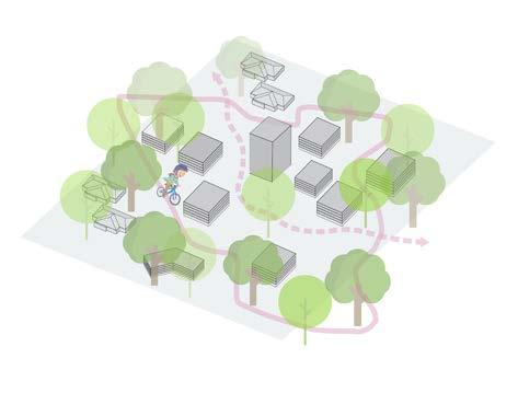
Explain the Masterplan - Connectivity
Connectivity is the important Strategy of this part. The design area is located in a residential area, especially in a dense residential area, the connectivity is an important part to connect different areas so that different directions of people can access this green space. Based on the existing shared path, redesigning different accesses and different theme paths not only can attract nearby residents to use this public open space but also create multi-axis green corridors connecting different roads and zones.
Ecological Broadwalk
BushGlos
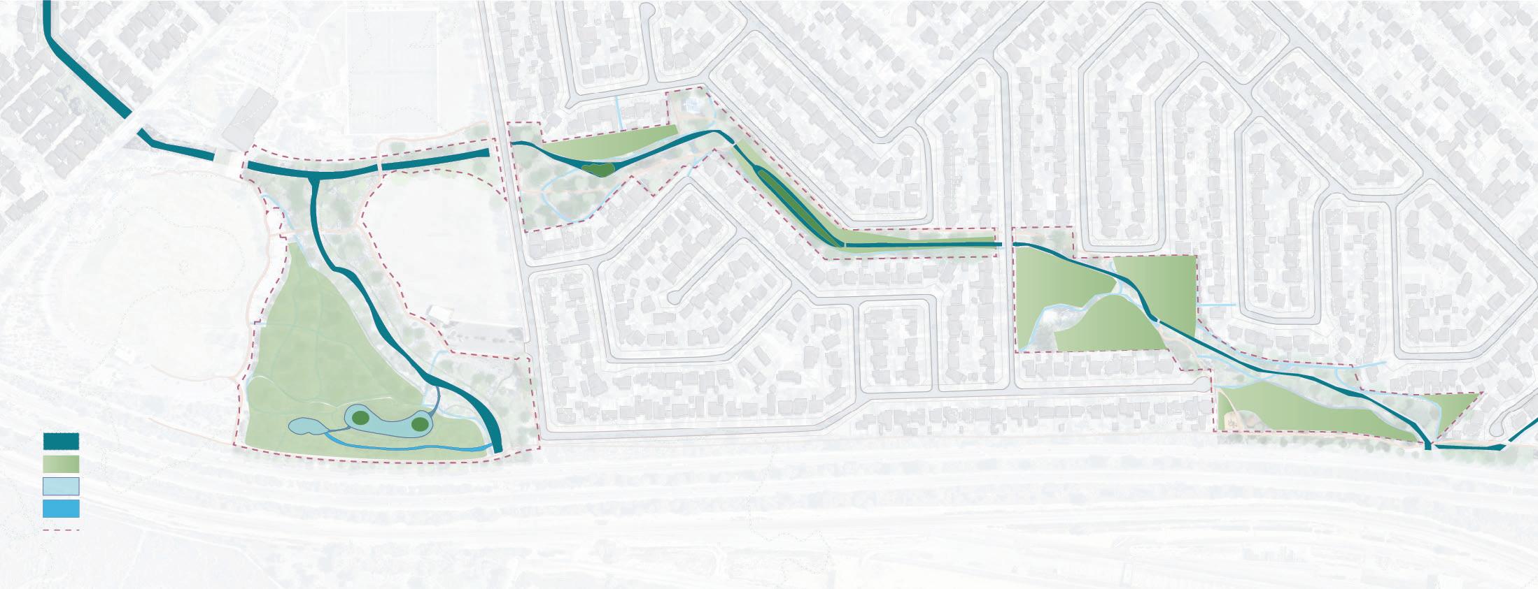
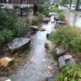
Using the WSUD strategies for the design area: 1) a Living Stream, 2) a Construction Wetland, 3) Vegetated Swales, and 4)re-vegetation in the design area. Based on the current water flow for Yule Brook Drain and Woodlupine Brook Drain, it has opportunities to design the vegetated swale to connect two existing ponds. Before that, the ponds and the drains did not have a connection. For the proposal, the existing swale also has opportunities to connect the existing swale to Yule Brook. As the current situation, the
existing carpark and sports fields Water flow also has already been designed for under pipe drainage system flow into Yule Brook. This proposal can have the different WSUD strategies connected and integrated into one stormwater management. And the revegetation island is designed at the Living Stream and the Constructed Wetland to create a small wetland to increase biodiversity.
ToCanningRiver
Mills Park
Woodlupine Brook Reserve
Woodlupine Brook Living Stream
Zone 1
Located at the Mills Park
WSUD Strategies: Living Stream + Constructed Wetland
Sub Strategy - Improving the environment, providing Public Open Green Space, Connectivity
Based on the current water flow for Yule Brook Drain and Woodlupine Brook Drain, it has opportunities to design the vegetated swale to connect two existing ponds. The existing swale also has opportunities to connect the existing swale to Yule Brook. As the current situation, the existing carpark and sports fields Water flow also has already been designed for under pipe drainage system flow into Yule Brook.
Water Flow on Mills Park
Living Stream
Vegetated swales /Buffer strips
Constructed Wetlands
Mills Park Reserve
SectionB-B’
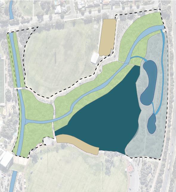
WSUD Strategies: Constructed Wetland +Vegetated Swale
Constructed Wetland theme
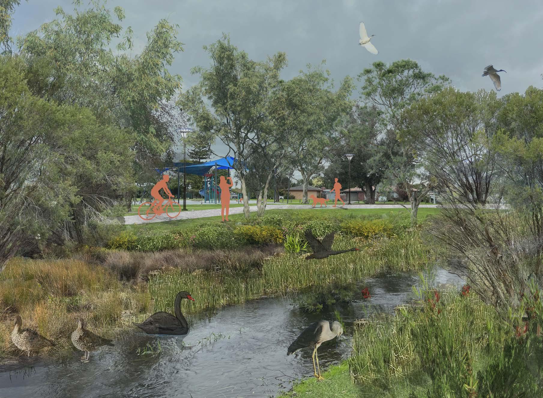
Section B-B' is cover existing ponds and swale. The purpose of ponds is to redesign the constructed wetland not only by planting wetland plants but also designed as a re-vegetated island to attract birds living here and increase biodiversity. New pedestrian trails can also increase the connectivity of nearby zones. Around the two ponds, as designed the trail loops and viewing platform, attract the nearby resident and visitors to visit here and also increase the living quality and environment of nearby residents. Also, the swale is redesigned as a vegetated swale for revegetation and increased biodiversity. This design is not only designed as the constructed wetland and vegetated swales as part of the wetland system to solve the stormwater management, but also the new swales can converge to the living stream as the stormwater system.
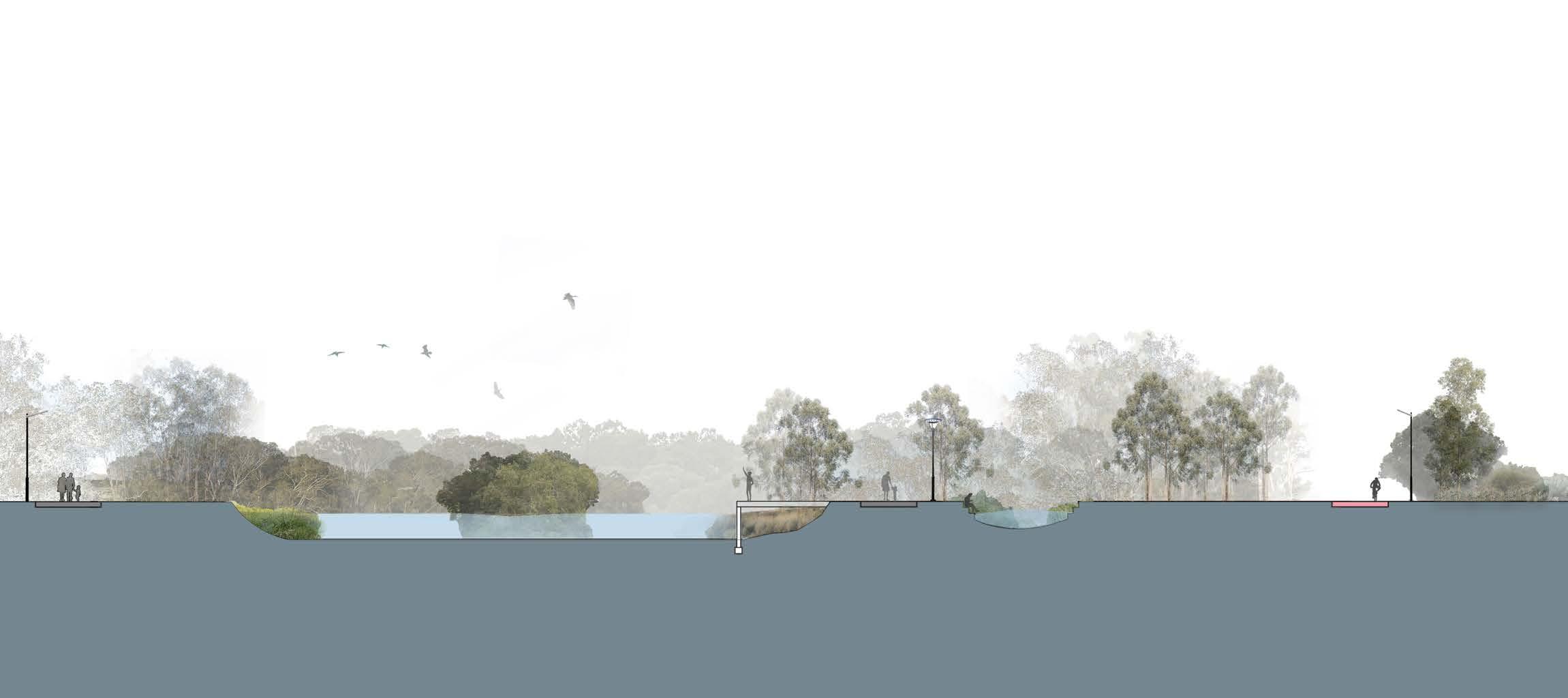
Detailed Section B-B'
Shared Path
Vegetated Swale
Viewing platform
Constructed Wetland
Pedestrian Trail
Pedestrian Trails
Revegation Island
B
Location Map
Mills Park Reserve
Perspective View
WSUD Strategies: Constructed Wetland
Located at the South of Woodlupine Brook Reserve
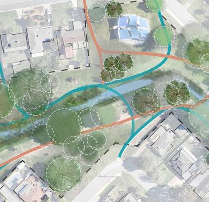
WSUD Strategies: Living Stream + Revegetation Island
Sub Strategy - Connectivity, Public Open Green Space, Revegetation to Improving the environment
The purpose of Zone 2 is to use the WSUD strategies that living stream revegetation of the two islands, to create a stream system that can attract the nearby residents to repair fragmented landscapes and rebuild ecological corridors. This zone can also increase connectivity, attract the nearby residents to use this ecological corridor, and also provide public open green space located around a density residential area.
Revegetation of both ends of the living stream and revegetation islands even developed these two islands to construct a small wetland to increase the green role of native biodiversity in this area. These two revegetate islands can also be the barriers of water for birds - to protect the wildlife bird nesting to increase biodiversity and improve ecology.
WoodlupineBrookBranchLivingStream

South of Woodlupine Brook Reserve Section2-1’
WSUD Strategies: Living Stream + Constructed Wetland
Connecting with nearby residents
South of Woodlupine Brook Reserve
Perspective View
WSUD Strategies: Living Stream + Constructed Wetland
Revegetation Island
Location Map
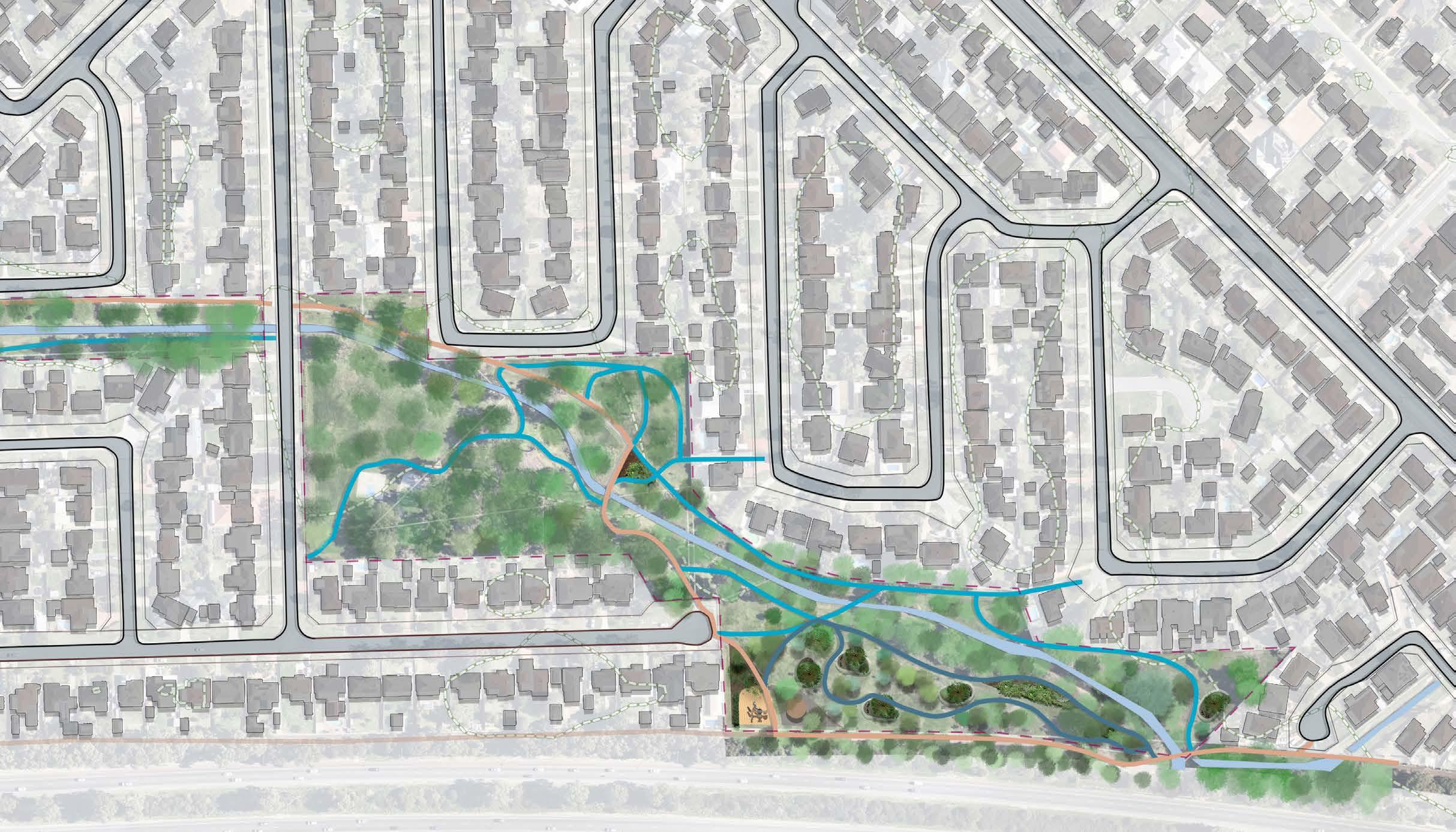
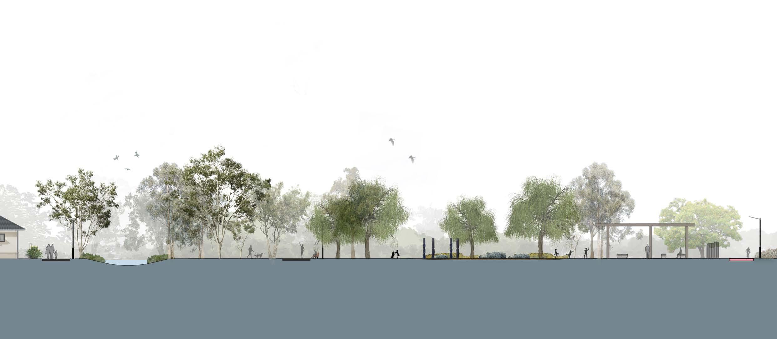
Detailed Area 3 - Zone 3
Zone 3
Located at the North of Woodlupine Brook Reserve
WSUD Strategies: Living Stream+ Revegetation
Sub Strategy - Connectivity, Public Open Green Space, Activities
The purpose of Zone 3 is to provide activity and educational trails in conjunction with the WSUD strategy the Living Stream along the stream. Retaining the current interpretive signs of the Noongar six seasons, as the starting point of the Woodlupine Brook Reserve and education trails, to introduce the story of the Noongar Seasons. The educational trails designed the new Timber Pole with Noongar totem and revegetation shrubs, not only connect different green spaces but also as new planting
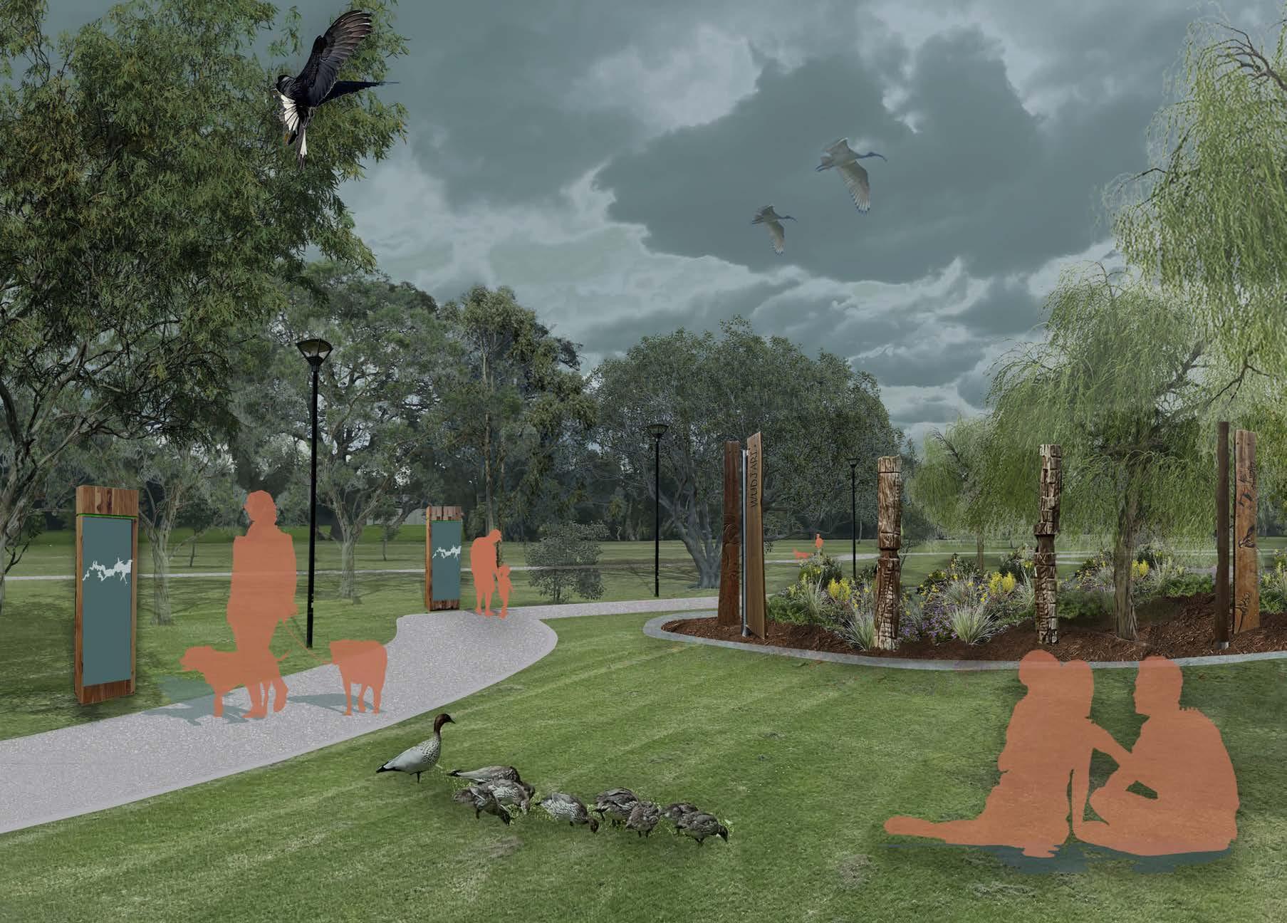
trees to reduce urban heat, grow native low-growing shrubs as lawn alternatives and minimize water use. For the west of the shared path, the lawn area also designs rest area for pedestrians and cyclists, and also design the playground to attract the nearby residents to use this public space. In this area also design the verge garden grows native low-growing shrubs to replace lawn areas and increases biodiversity.
Detailed Area 3 - Zone 3
North of Woodlupine Brook Reserve
Section D-D’
WSUD Strategies: Living Stream+ Revegetation
Providing the POS and rest area for nearby residents and cyclist
Detailed
D-D'
Pedestrian
Shade/ Rest place for pedestrians and cyclists
Timber Pole/Touchwood Totem with re-vegetate shrubs and plant new trees
Location Map
Detailed Area 3 - Zone 3
North of Woodlupine Brook Reserve
Perspective View
Education Trails
After
Location Map Before
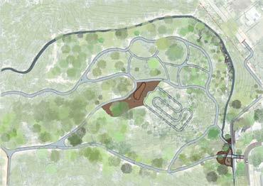
LACH5422 Making - Master Levels Landscape Design Studio, UWA, 2021 'Overlapping landscape‘
Site:Manning Park, Cockburn, WA
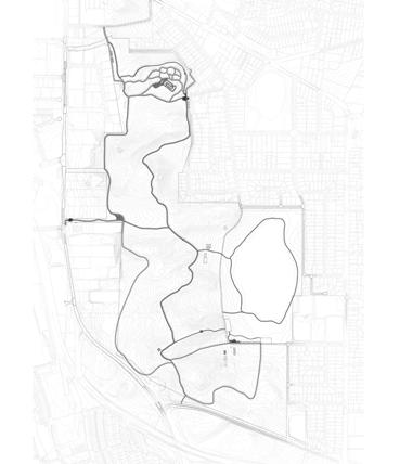
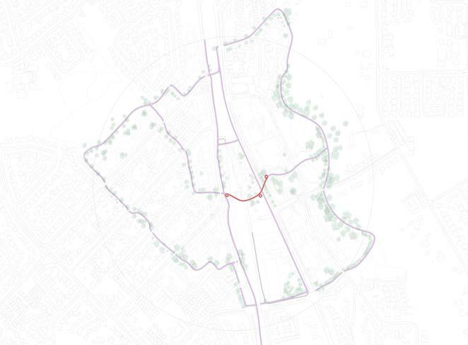
In Manning Park, the horse trail, pedestrian trail and mountain biking trail have an essential part of Manning Park. But in this park, lack of wayfinding to identify different trails and lack of orientation cues are the Manning Park lacks, especially when three different trails always combine into one trail. So that how to design wayfinding to direct different trails and optimize the wellstructured of different trails is the purpose of my design proposal. On this master plan, you can see the different trails and also design the stopping point at bushland. I design Gate 4 as the main entrance example and Gate 8 as the minor entrance example. Overall, I will focus on North Quarry and Gate 4 as my one detail area. And then Gate 8 - the minor entrance as my second detail area. Wayfinding design and detail of different trails as my third detail area.

Bikes Heatmap
Draft plan of Bike Trail at Manning Park, June 2020 "Bike trails had located to minimise impact on other trails used by walkers and runners."
Walks and dogs Heatmap
The frequency of the walking area

Relevent information of horse at Manning Park:"The continuation of the Randwick Stables and its heritage relies heavily on the use of the park for its horses especially during the winter months. In summer most horses use the beach and ocean but in winter the beach is not always suitable for the horses to ride".

Low frequency use zone:No many people using this area, do high intensive exercise, hiking.
Medium frequency use zone:Visiting Davilak heritage trail and Manning stair.
High frequency use zone: Many people visit this area, do low intensive exercise, look around.
Horse trails of Manning Park Bike trails Summer and winter horse trails
Detail Area 1 - Major Entrance of Manning Park Plan of North Quarry
Detail Area 1 - Major Entrance of Manning Park Plan of North Quarry
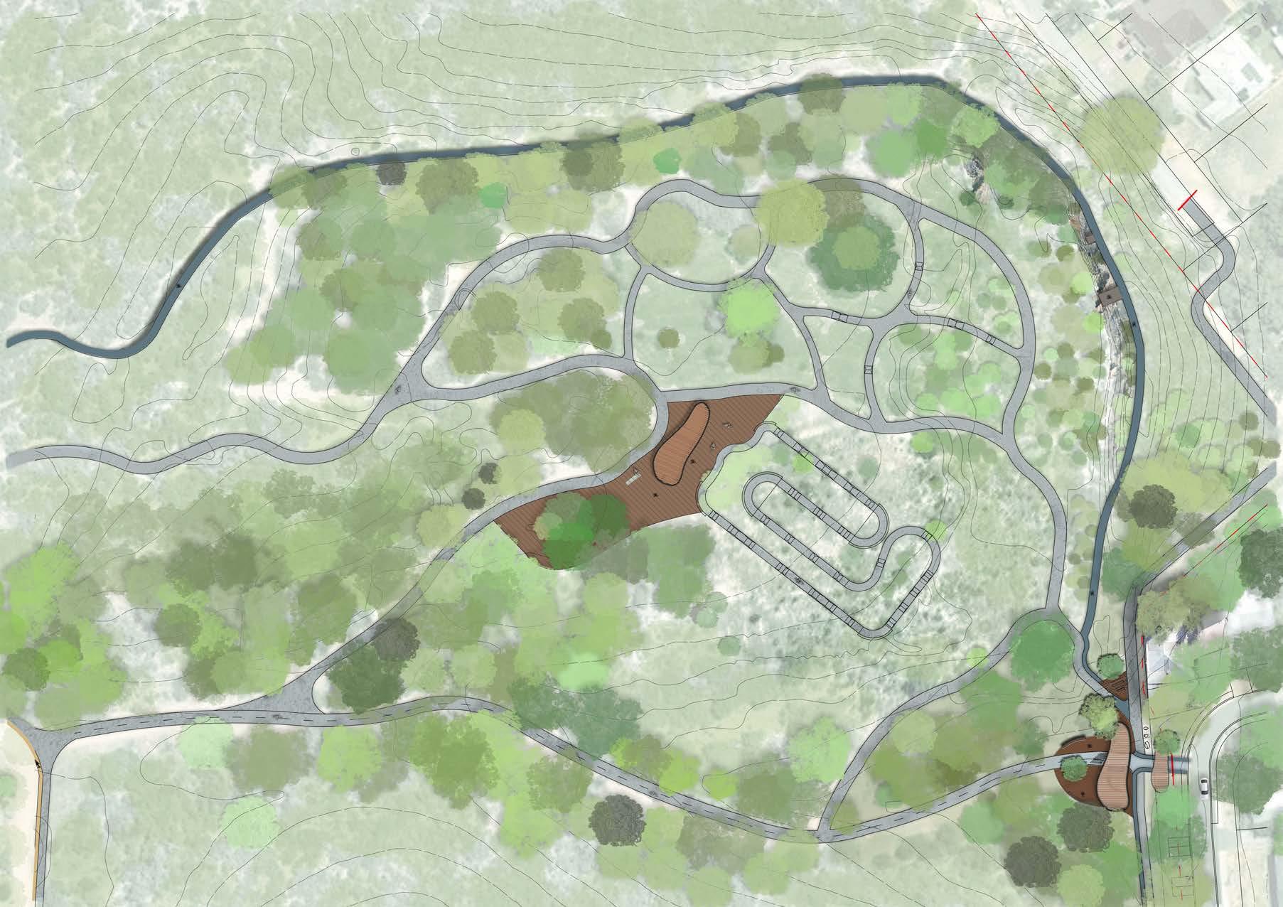
Although North Quarry has always been the favourite place for mountain biking, it lacks design and planning. In my design proposal, the North Quarry can be built into a professional mountain biking track, construct different level's pump track, gathering areas in North Quarry for Mountain Biking Zone. Also, Gate 5 has become the start point of the mountain biking loop. Gate 4 has become the main entrance of Manning park, which is the important entrance of North Quarry. It combines gathering areas, seating area for pedestrians and starting of mountain biking. Also, pedestrians have a special walk on North Quarry, from Gate 4, to direct to walk around the North Quarry, enjoy the highest point's outlook of North Quarry.

Pedestrian
Detail Area 1 - Major Entrance of Manning Park
Detail Area 1 - Major Entrance of Manning Park


As the main entrance of North Quarry and also the example of the main entrance of Manning Park, Gate 4 provides a welcoming gathering area and seating area. It also uses color and wayfinding to divide the pedestrian trails and mountain biking trails. Through newly planted plants and signage, visitors to Manning Park can feel unique and unified. By retaining the existing local plants and the existing terrain, the design step seats the North of Gate 4.
Pedestrian
Mountain biking
Xanthorrhoeapreissii Banksiaspp.(New) Eucalyptusspp. Corymbiacalophylla Eucalyptuserythrocorys
Xanthorrhoeapreissii Banksiaspp.(Newvegetation)
Eucalyptusspp.
Eucalyptuserythrocorys
Corymbiacalophylla
Concept Sketches - Details of North Quarry
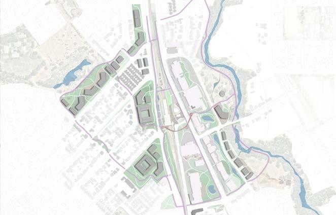
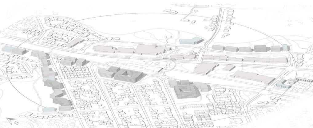
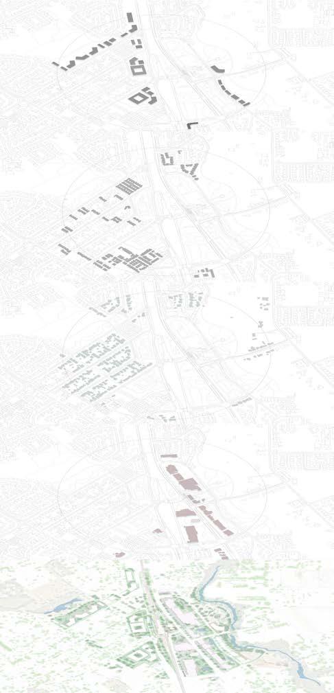
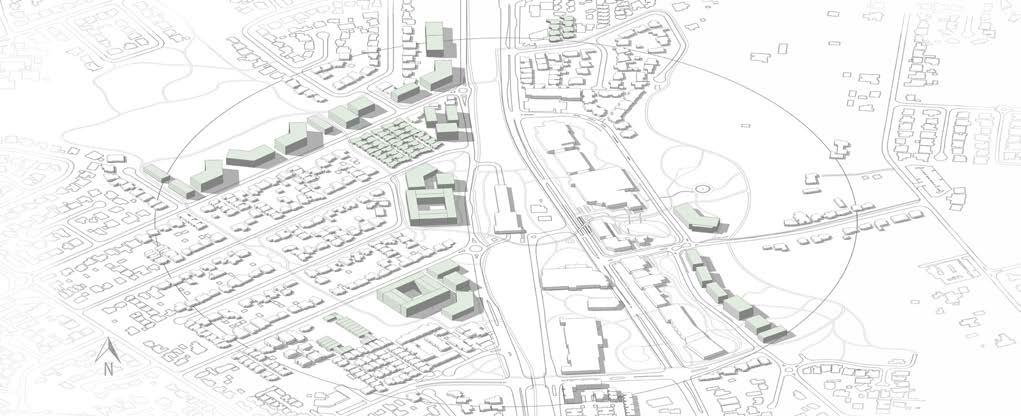
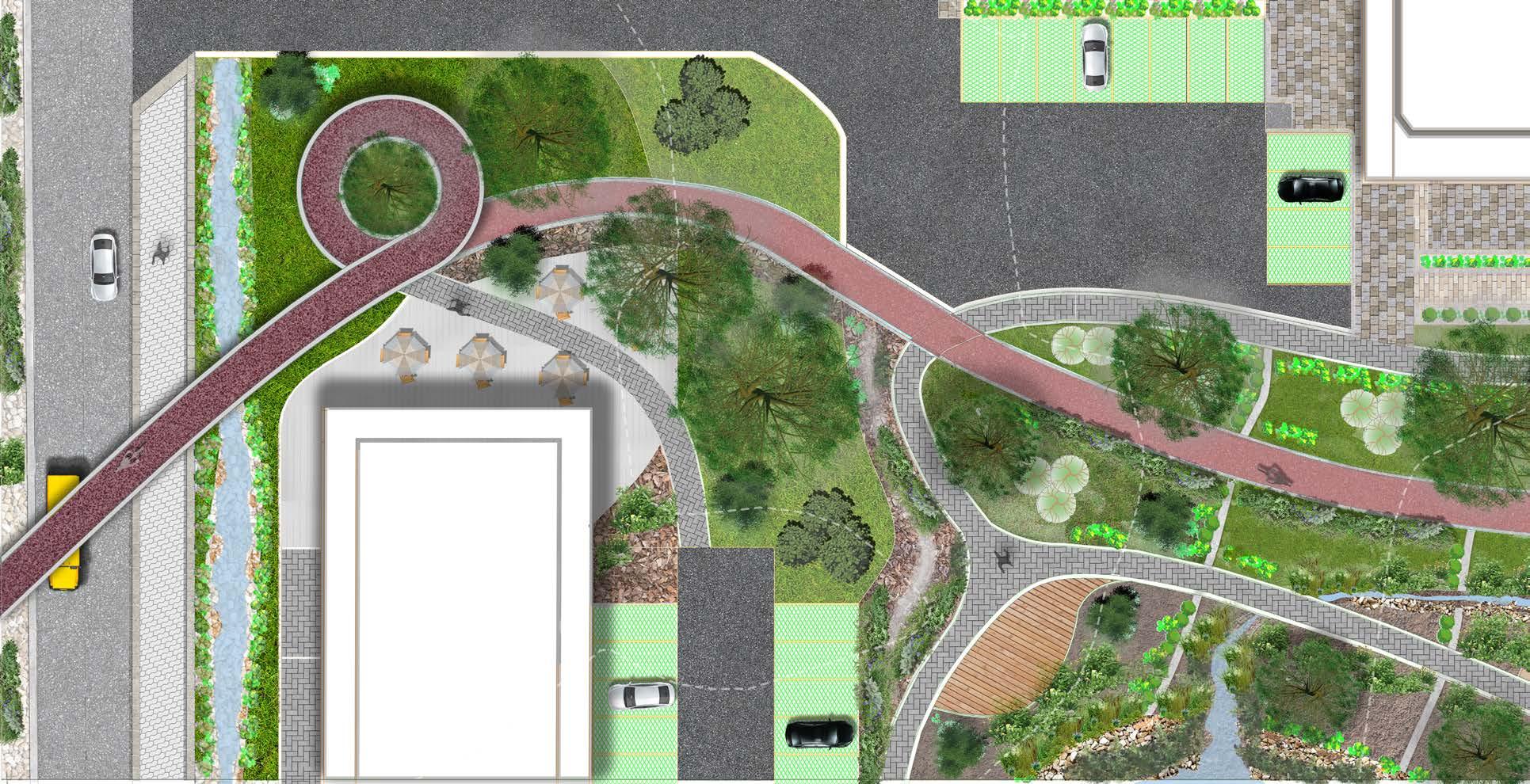
URBD5804 Master Levels Urban Design
Studio Unit, UWA, 2022
Kelmscott Activity Precinct
Site: Kelmscott , Western Australia
In 2040, the Kelmscott precinct will develop more than 20000 dwellings because of the influx of immigrants into Australia. But the population growth leads to a series of problems: Population growth leads to the reduction of public space per capita and brings environmental problems and traffic congestion because relying on only one railway line cannot meet people’s travel needs. More motor vehicles, more pedestrians, and more families, not only need more apartments than a single residential area but also need more outdoor space, social space and parent-child space.
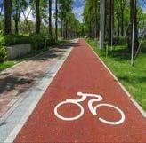
Forced isolation and social distancing during the pandemic have exacerbated solitude and anxiety for part of the population. Therefore, public spaces, especially parks, have also proven to be essential for socialization. Access to nature, wide-open spaces and sports and leisure facilities has emerged as a vital need, with both individual and collective benefits. Walking and cycling, two of the only forms of exercise accessible to many people have made it possible to escape from confinement with exposure to fresh air and sunshine. The pandemic shows the need for walk-ability, wider sidewalks and share paths in some major streets. The ‘Green Loop’ creates a circuit for pedestrians and biking.
Transforming parking lots into temporary cafes and markets can encourage people to go out of their homes and promote social contacts, and a combination of WSUD, providing more green public space for the residents. Kelmscott also realized the importance of maximizing the use of public space.
'Green Loops' - Concept Diagrams
The ‘Green Loop’ is designed for bicycles and pedestrians to enhance connectivity

Levels Landscape Design Studio, UWA, 2020
The North Perth Primary School Site: North Perth, WA
This studio introduces the process of design resolution (or design development) and provides a fantastic opportunity to work on real projects. Students are equipped with the core technical skills
necessary to develop a concept level plan through to a resolved design, which will ultimately be used to inform documentation for construction.
This year's studio is a collaboration with the community of North Perth Primary School, investigating the possibilities of developing a bituminised campus into biodiverse teaching, learning and playing environment.
The students worked hard and earnestly to develop ideas for a better school life for the primary school students, staff and community, achieving great results with a very complex project site. Developing interesting creative responses without getting "bogged down" in the practical solutions,
whilst still achieving excellent design strategies to resolve the project's complex problems and enhance a sense of place.
The key briefing points were:
improving the façade and identity of the school improving access, circulation and waiting areas during drop-off and pick-up times, highly discouraging access through the school by the general public,
improving the connection from the main campus (through the carpark) to the oval and music and art rooms
decreasing bitumen and increasing biodiversity, acknowledging Whajuk Noongar living culture.


Planting Plan & Planting Schedule
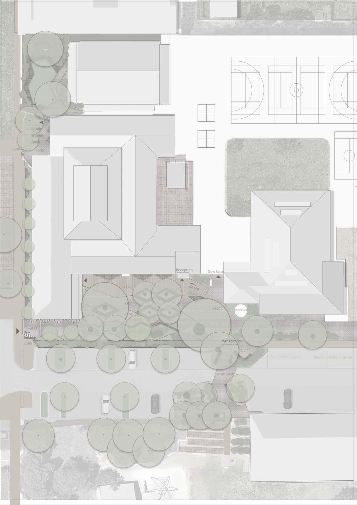


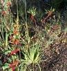
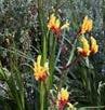

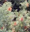
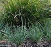
Photo Real Rendering - Master Levels
Architectural Visualisation Unit, UWA, 2021
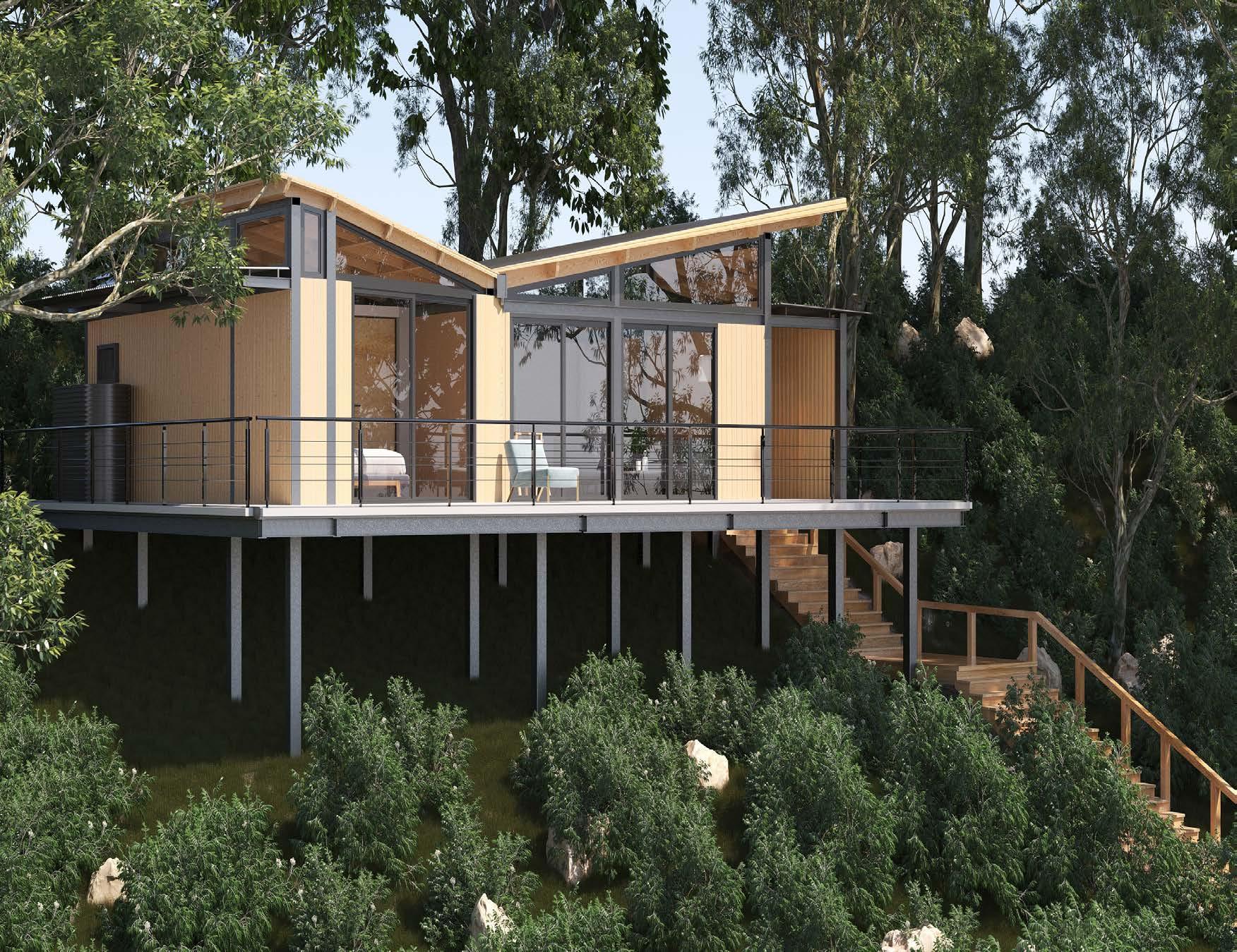
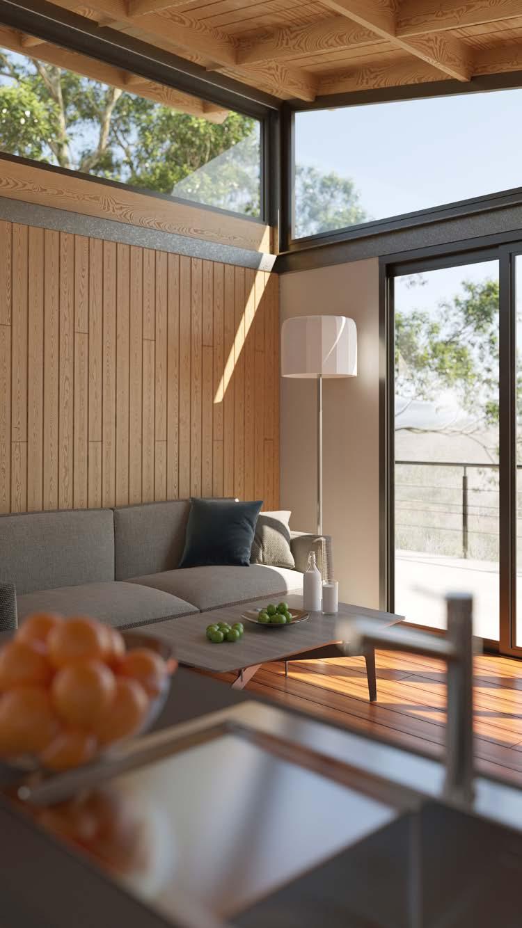
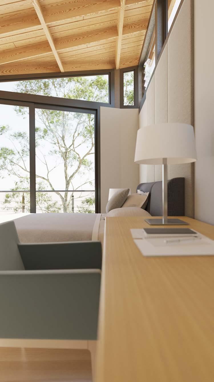
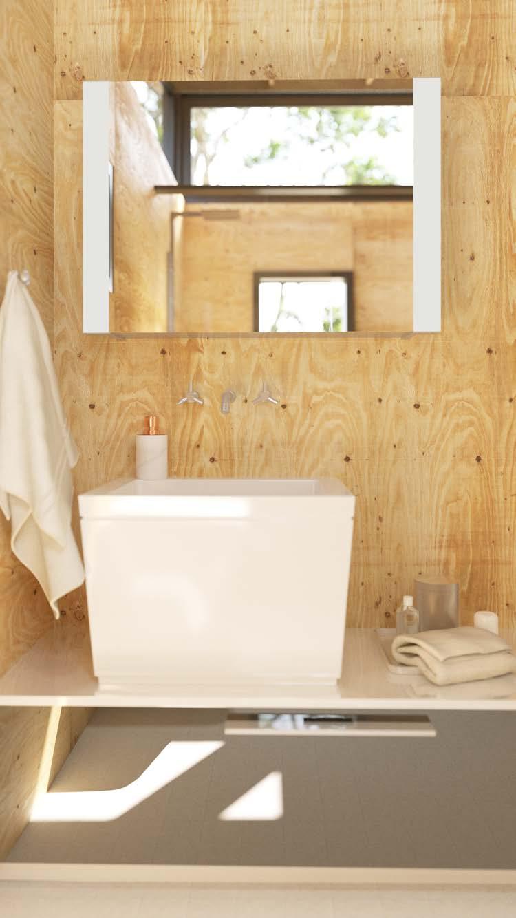
Idyllic Cabin Getaway - 'Stilt cabin'
Site:Ocean View Parade, Gooseberry Hill, WA
The world of visualisation is changing rapidly. New rendering engines and methods are being developed constantly. This unit explores the use of Photorealism in the Autodesk 3D Studio Max environment predominantly using VRay, a dedicated physics-based rendering engine. Students are introduced to real world lighting, materials and effects, as well as 3D modelling techniques from the micro to the macro. The unit runs in two parts. Part 1 (five weeks) looks at high end single frame high resolution rendering and post production for printing images. Part 2 (seven weeks) looks at high definition rendering for the purposes of animation. A single virtual model is used through the course of the semester, developing more detail each week. Students aim to reproduce real world lighting and materials in a simulated digital environment which enables them to create design proposals that specifically utilise the lighting and material conditions of the project.
11.
Practice in 2023
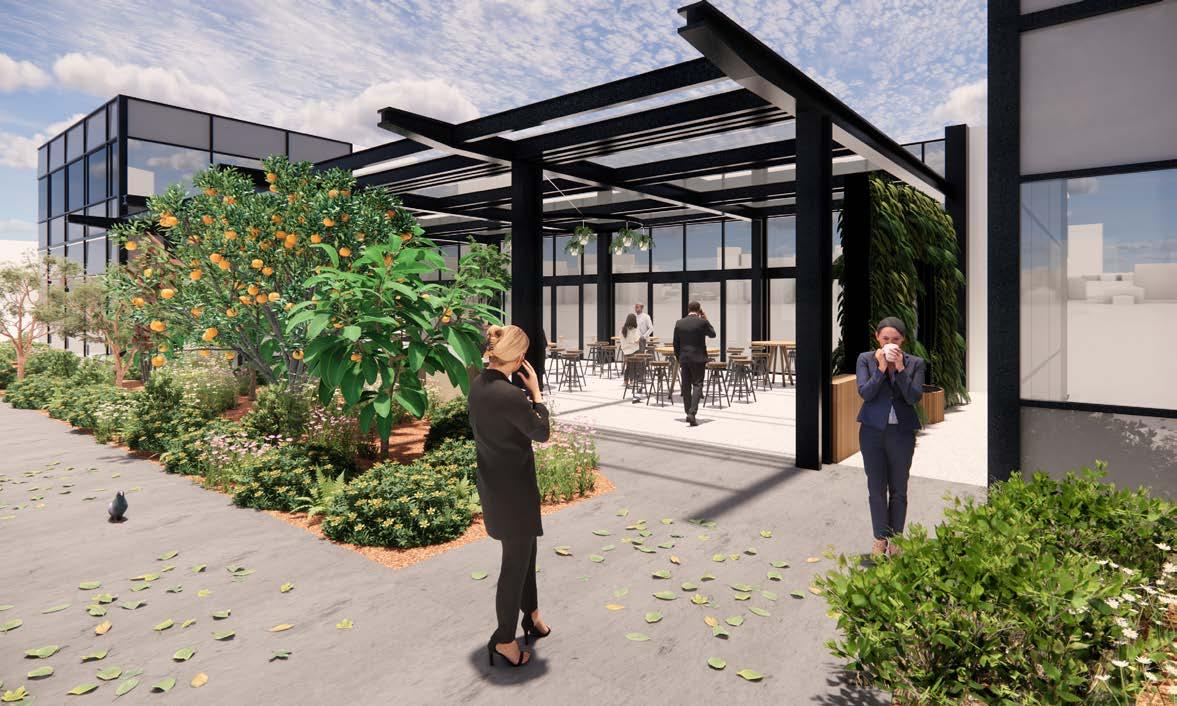
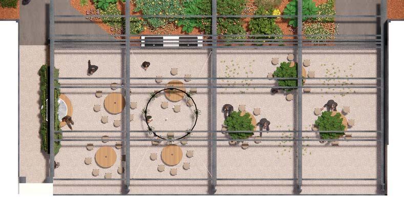
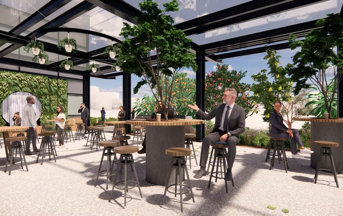
Collaborated with O2 Plant Walls Forrestdale Western Power projectRelaxing outdoor space
Site: Forrestdale, WA
Commissioned by the person in charge of Plant Walls, it is necessary to model and render an outdoor space of WesternPower. This outdoor space that creates a relaxing and green place for staff to use within the facility.The brief identifies a green wall, with small BBQ, a memorial for past employees, and a fruit/herb garden.

https://issuu.com/ cf_zeng/docs/ portfolio_2502_ver.