Please submit RESERVOIR articles to the CSPG office.Submission deadline is the 23rd day of the month,two months prior to issue date. (e.g.,January 23 for the March issue).
To publish an article,the CSPG requires digital copies of the document.Text should be in Microsoft Word format and illustrations should be in TIFF format at 300 dpi.For additional information on manuscript preparation,refer to the Guidelines for Authors published in the CSPG Bulletin or contact the editor.
COORDINATING EDITOR & OPERATIONS
Jaimè Croft Larsen
CSPG
Tel:403-264-5610 Fax:403-264-5898
Email:jaime.croftlarsen@cspg.org
TECHNICAL EDITOR
Ben McKenzie
Tarheel Exploration
Tel:403-277-4496
Email:bjmck@telusplanet.net
ADVERTISING
Kim MacLean
Corporate Relations,CSPG
Tel:403-264-5610,Ext 205
Email:kim.maclean@cspg.org
Advertising inquiries should be directed to Kim MacLean.The deadline to reserve advertising space is the 23rd day of the month, two months prior to issue date.All advertising artwork should be sent directly to Kim MacLean.
The RESERVOIR is published 11 times per year by the Canadian Society of Petroleum Geologists. This includes a combined issue for the months of July/August.
Advertisements,as well as inserts,mailed with the publication are paid advertisements.No endorsement or sponsorship by the Canadian Society of Petroleum Geologists is implied.
The CSPG Rock Shop is an attractive and affordable way to target the CSPG readership. Spaces are sold at business card sizes (3.5” wide by 2” high).To reserve space or for more information,please contact Kim MacLean at 403-264-5610,ext.205.
The contents of this publication may not be reproduced either in part or in full without the consent of the publisher.
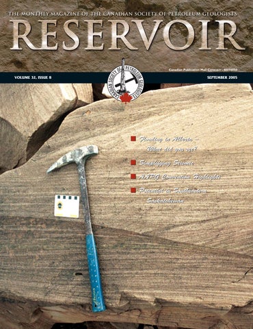
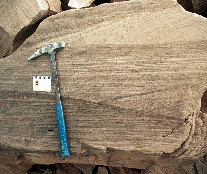
FRONT COVER
Ellesmere Island,Nunavut. Cross-bedded sandstones of the Lower Triassic (Bjorne Formation) in the Sawtooth Range of Ellesmere Island.Photo by Derek Evoy.
The CSPG’s fiscal year begins September 1 and on behalf of the CSPG Executive,I would like to welcome you back to a new year filled with exciting technical and education programs,publications,outreach initiatives, and a wide array of member services. Hopefully,you’ve had a relaxing summer,spent some time with family and friends,and perhaps have had the opportunity for some travel.
Many of us are currently involved in the budgeting process at our own companies and the CSPG is no different.At the time of writing this article,your Executive is putting the final touches to the 2006 budget which has been an ongoing process since May.The CSPG, now in its 78th year,is a large and active organization with 3,500 members around the world,over 60 committees,and 400-plus volunteers.The CSPG’s strategic planning and budgeting process reflects this large and diverse organization.
My main responsibility as Assistant Finance Director is to work closely with the CSPG’s Business Manager,Tim Howard,and my colleagues on the Executive Committee to prepare the budget for the upcoming year.In reality,the majority of budget preparation is completed by Tim,and I would like to thank him for coordinating this year’s budget.
For 2006,revenues are projected to be approximately $2.3 MM,consistent with what the Society has experienced for the past few
years.Critical to this revenue stream are three main elements:conventions,technical luncheons,and membership dues,which contribute 35%,15%,and 13%,respectively, of total revenues (Figure 1).On the expense side,operations (e.g.,office,staff,financing charges),conventions,and technical luncheons comprise 64% of the total (Figure 2).Expenses are anticipated to be approximately 15% higher than 2005,largely the result of increased outreach initiatives which Outreach Director,David Middleton,addressed in the June Reservoir.A modest surplus of approximately $70,000 is still,however, anticipated for 2006.This surplus approximates the average surplus for the past ten years.As a non-profit organization,our budget is very conservative,designed to break even or have a small surplus.Surpluses are invested in enhanced programs and services for our membership or transferred to the CSPG’s Educational Trust Fund endowment.
Like any organization,the CSPG is faced with several challenges.Our annual convention is critical to the Society’s cash flow and is a planning wild card each year.Consequently,the underlying budgeting assumptions are very conservative with respect to revenues and quite aggressive on the expense side. Outreach initiatives are vital to the ongoing strength of our Society and industry but costs must be managed.The CSPG’s office lease expires in August 2006 and Calgary’s red-hot corporate real estate market will impact the 2006 and future budgets.
Overall,the CSPG continues to enjoy excellent financial health.Our long-term investment portfolio continues to grow relative to book value and we expect to generate a modest surplus in 2006 and beyond.
It’s an honour to serve the CSPG membership in my capacity as Assistant Finance Director. Thank you for the opportunity.
Marty Hewitt,Assistant Finance Director
Dave Thomas VP of Exploration, Concho Equity Holdings Corp.
“
THE CSPG GRATEFULLY ACKNOWLEDGES ITS CORPORATE MEMBERS:
THE CSPG GRATEFULLY ACKNOWLEDGES ITS CORPORATE MEMBERS:
ABU DHABI OIL CO., LTD. (JAPAN)
ARCHEAN ENERGY LTD.
BAKER ATLAS
BG CANADA EXPLORATION & PRODUCTION, INC.
BP CANADA ENERGY COMPANY
BURLINGTON RESOURCES CANADA LTD.
CALPINE CANADA
CANADIAN FOREST OIL LTD.
CONOCOPHILLIPS CANADA
CORE LABORATORIES CANADA LTD.
DEVON CANADA CORPORATION
DOMINION EXPLORATION CANADA LTD.
DUVERNAY OIL CORP.
ECL CANADA
geoLOGICsystems ltd.
HUNT OIL COMPANY OF CANADA, INC.
HUSKY ENERGY INC.
IHS ENERGY
IMPERIAL OIL RESOURCES LIMITED
LARIO OIL & GAS COMPANY
MJ SYSTEMS
MURPHY OIL COMPANY LTD.
NCE RESOURCES GROUP INC.
NEXEN INC.
NORTHROCK RESOURCES LTD.
PENN WEST PETROLEUM LTD.
PETRO-CANADA OIL AND GAS
PETROCRAFT PRODUCTS LTD.
PRECISION WIRELINE
PRIMEWEST ENERGY INC.
SAMSON CANADA
SHELL CANADA LIMITED
SPROULE ASSOCIATES LIMITED
STARPOINT ENERGY LTD.
SUNCOR ENERGY INC.
TALISMAN ENERGY INC.
TOTAL E&P CANADA LIMITED
CORPORATE MEMBERS AS OF JULY 24, 2005
TECHNICAL LUNCHEONS
TICKET REPRESENTATIVE REGISTRATION
It is once again time to plan for the CSPG bi-monthly Technical Luncheons.The CSPG has nineteen luncheons planned for the 2005/2006 Season.There are two methods for having tickets sent directly to a ticket representative in your office:
1) FOR CORPORATE MEMBERS OF CSPG
Corporate Members may order a set number of tickets per luncheon,which will be couriered to you with an invoice.For orders of less than 10 tickets per luncheon, a $5.00 handling fee will be added to the invoice.You must take the same number of tickets for each luncheon and returns are not accepted.The following month’s tickets will be sent out if the previous month’s invoice has been paid.Any changes to your standard number of tickets must be made well prior to tickets being sent out.
Additional tickets may be arranged through the CSPG office.If you wish to use this option,you must register with the office by September 1,2005.
2) PREPAYMENT FOR THOSE WHO ARE NOT CORPORATE MEMBERS
For companies who are not Corporate Members,you may elect to pre-purchase a set number of tickets for the 2005-2006 Season’s 19 luncheons.For orders of less than 10 tickets per luncheon,a $5.00 handling fee needs to be added to each mailing to cover courier/mailing/handling costs.Returns are not accepted and extra tickets can be purchased direct from the CSPG office.If you wish to use this option, you must register with the office by September 1,2005.Payment is required upon registration for this program.
If you wish to register in this program, please use the form below.
If you do not wish to use either of these options,tickets can be purchased directly from the CSPG office,using cheque,cash, debit,Visa,or MasterCard.Luncheon tickets are $28.00 plus GST each and go on sale two months in advance.Please watch your Reservoir or visit www.cspg.org for luncheon abstracts.
If you have any questions please feel free to contact Jaime Croft Larsen at 264-5610 or via email at jaime.croftlarsen@cspg.org.
TICKET REPRESENTATIVE REGISTRATION FORM
OPTION 1 – CSPG CORPORATE MEMBERS ONLY
__________ NUMBER OF TICKETS FOR EACH LUNCHEON For Ticket Orders of less than 10 tickets per luncheon,a $5/month Handling fee will be added to your invoice.
OPTION 2 – PREPAYMENT
__________ NUMBER OF TICKETS FOR EACH LUNCHEON
Prepayment due:________ Tickets x $29.96 (incl.GST) X 19 (Total # of luncheons) = $_____________ If less than 10 tickets per luncheon ordered,a handling fee of $53.50 ($5.00 plus GST per month) is included in this payment.
TOTAL PREPAYMENT ENCLOSED IS: $ _____________ (TICKETS) + $ ___________ (HANDLING FEE) = $ __________________
We accept Visa,MasterCard,or cheque as payment. If paying by credit card:
Jaimè Croft Larsen, Communications Manager
The Beaufort Mackenzie Basin: assessing the future resource potential
SPEAKER
Peter Graham
AUTHORS
Peter Graham and Christoper L.Bergquist
11:30 am Thursday,September 8,2005
TELUS CONVENTION CENTRE CALGARY, ALBERTA
Please note:
The cut-off date for ticket sales is 1:00 pm,Tuesday,September 6th. Ticket price is $28.00 + GST.
Oil and gas exploration in the Beaufort Mackenzie Basin has seen a recent resurgence as energy companies attempt to tap this basin’s proven resource potential in light of the current North American gas market.After a nearly ten-year operational hiatus and beginning in 1999,over 4 million acres of land has been leased with associated work commitments in excess of 500 million dollars,17 new 3-D seismic surveys have been acquired (including one major offshore survey),fourteen new wells have been drilled, and major advancement has been realized on the proposed Mackenzie Valley pipeline.
But the Beaufort Mackenzie is a considerably different landscape than that during initial phases of exploration in the 1970s and 80s. Challenges today result from isolation by geography and from infrastructure.In particular,the once sizeable northern-based oilfield service network that supplied early arctic operations has diminished to a remaining few stalwart operators.The extensive marine drilling fleet that was developed by Canmar and Beaudril has been either sold and moved to other regions of the world,has been dismantled,or has been cold stacked and left to the harsh Arctic environment.
But the opportunities that remain today are significant,though also different than what the Beaufort Mackenzie initially offered. Preliminary exploration was focused toward oil but discovered mostly gas.Early explorers relied on an extensive grid of 2-D seismic,but newly acquired 3-D surveys have clearly
imaged new play types that have the potential to exceed the resource size of previously discovered fields in the Beaufort Mackenzie. These new 3-D data sets have allowed for a more comprehensive understanding of the basin’s sequence stratigraphy and have been effective in identifying new play fairways and reservoir intervals.A reassessment of the petroleum system has notably enhanced the basin’s richness and supports a greatly expanded range of prospectivity,and innovation in Arctic operations has significantly lowered costs and increased environmental protection.
Though it is still early in this current exploration cycle,significant advances have been made in understanding the basin’s complete hydrocarbon potential.If a final agreement can be reached towards the timely completion of the Mackenzie Valley Pipeline the Beaufort Mackenzie will play a key role in North America’s energy supply.
BIOGRAPHY
P eter Graham (peter.graham@devoncanada .com) is an exploration geologist with Devon Canada – Frontiers.He has worked the past five years in the Beaufort Mackenzie Basin with the previous ten years in the BC foothills,NWT,and the Yukon.He is a graduate of the University of Calgary with B.Sc.degrees in geology and zoology.
Christopher L.Bergquist (chris.bergquist@ devoncanada.com) is an exploration geologist with Devon Canada – Frontiers.He has worked 25 years in exploration and development,in both clastics and carbonates.He started his career with Gulf Oil in the Gulf of Mexico,West Africa, and Canada,and then consulted internationally. He is currently with Devon Energy working in the Beaufort Mackenzie Basin,where he has ten years’overall experience,and the Mackenzie Corridor.Chris has a B.A.in Earth Sciences from Dartmouth College.
2005 CSPG STANLEY SLIPPER MEDAL CALL FOR NOMINATIONS
The Stanley Slipper Medal is the CSPG’s highest Honour. The medal is presented annually by the CSPG for outstanding contributions to oil and gas exploration in Canada.
Last year the medal was awarded to Pat Lee of Shell Canada.
The contributions of the winner of this award should encompass a number of activities related to aspects of petroleum exploration.Such activities include;initiating and or leading exploration programs,significant discoveries on new or existing exploration tends,teaching and or training of explorationists,and involvement in and leadership within geological societies and professional organizations.
The Committee is currently calling on the CSPG membership to provide additional nominations for this prestigious award. The Award winner must be a CSPG member and should be able to attend the awards ceremony to be held in 2005.
Please include an updated bibliography and letters in support of your nominee.
Nominations should mail,faxed or emailed before Friday September 30,2005 to: John Hogg
The cut-off date for ticket sales is 1:00 pm,Monday,September 19th. Ticket price is $28.00 + GST.
PART 1. OPERATION FRANKLIN
Speaker:J.W.(Bill) Kerr
Formerly Geological Survey of Canada
Fifty years ago,in the summer of 1955,the Geological Survey of Canada conducted Operation Franklin,the first helicoptersupported exploration program in the Canadian Arctic Islands.It was a
reconnaissance program,covering approximately 200,000 square miles,about the same area as France.The project used a DC-3 aircraft,two Sikorsky S55 helicopters, and three dog teams.
Four base camps were established and,as work was completed,the group moved from one to the next.Key areas,selected from trimetregon air photos,were studied by two-man teams.These teams were put into fly camps by helicopter and they mapped the areas they could reach on foot and worked out the stratigraphy.
The results of Operation Franklin were published in Memoir 320 of the Geological Survey of Canada.It contains a chapter for each study area,and chapters that integrate the knowledge learned about them.Many of the current formations and concepts were established by the project.
The geologists did a lot of walking from their fly camps,but the study areas still look small and scattered when they are plotted on a map of the Arctic.We jokingly referred to this phase of exploration as “postage stamp geology.”
For those of us who were on Operation Franklin,it was an unforgettable adventure. It also was a scientific milestone that set the stage for government and industry to further explore and understand our high Arctic.
PART 2. AFTER OPERATION FRANKLIN
Speaker:Christopher Harrison Geological Survey of Canada
(Thorough Basic Course) October 3-7
(More advanced, for those ìco mfortable” with DST charts) October 17-18
Operation Franklin provided a framework geological understanding of the central Arctic Islands that led to 25 years of successful oil and gas exploration,the development of the Bent Horn Oil Field on Cameron Island,and Canada’s northernmost mine,the Polaris zinc-lead deposit on Little Cornwallis Island. Map units defined as a result of Operation Franklin fieldwork led to the first systematic description of strata ranging from Proterozoic to Tertiary in age.Descriptions include strata of the Sverdrup Basin,which hosts vast reserves of gas and some oil in the Triassic and Jurassic strata,and coal in those of the Cretaceous and Paleogene. Geological maps,based on the interpretation of trimet imagery,provided a reconnaissance-scale picture of the Cenozoic deformation of Ellesmere Island,
salt diapirs of the Ringnes and Axel Heiberg islands,Devonian salt-based folds of Bathurst Island,and the basement-involved structures of the Cornwallis fold belt and Boothia Uplift.
The geology of this vast region is now understood from the combined efforts of industry,government,and university-based research.The contributions from industry are derived in large part from reflectionseismic profiling and exploratory drilling during the period between 1960 and 1985. University-based research has focussed on topics such as sedimentology,sequence stratigraphy,biostratigraphy,organic geochemistry,fission-track analysis, geomagnetics,and halokinetic processes. Government-supported geoscience,mostly executed by the Geological Survey of Canada (GSC) and supported logistically by the Polar Continental Shelf Project,has provided an up-to-date regional-scale understanding of bedrock and surficial geology.GSC Calgary maintains a permanent archive of collected samples,well cuttings,core,geophysical,geochemical and biostratigraphic data,and published and unpublished reports.Although field-based research continues at a modest level, government efforts are now concentrated on providing public access to current and archived information using GIS and standardized web delivery methods.
BIOGRAPHY
Bill Kerr was a summer assistant on Operation Franklin while he was a student at the University of Alberta.He later completed a Ph.D.at Columbia University and then taught at Queens.He subsequently joined the GSC and worked in the Arctic for 19 years.He published many reports on the Arctic and wrote a popular book on the Frank Slide.He consulted internationally from 1980 to 1997.Recently,he built a self-storage business in Calgary,which he now owns and operates.
Christopher Harrison worked for ten years in mineral exploration in the Arctic and across Canada before joining the GSC in 1984.His Ph.D.from Rice University,examined the structure of the fold belt on Melville Island.He has spent the last 23 years studying and mapping the geology of Canada’s Arctic Islands and offshore.His most recent work has been on the salt diapirs and salt-withdrawal minibasins of western Axel Heiberg Island,an area first studied during Operation Franklin.
The Veritas Experience
Veritas is Canada’s leading innovator of advanced geophysical information and services. Our comprehensive suite of technologies and unmatched experience maximizeyour drilling success,optimize data-imaging accuracy,and minimizeyour exploration risk.When you need results, call Veritas at 403.205.6000.
Work with Veritas and you’ll experience the advantages of local research and development, geologically driven solutions, and close client collaboration.
Seismic Data Processing
>the most experience in 3D anisotropic depth imaging in the Canadian Foothills
>industryleader multicomponent processing and fracture detection
>Calgary’s largest marine processing centre
>professional staff focused on customer satisfaction
Seismic Data Acquisition
>consistently delivering dataquality
>more 3D data acquired in the Canadian Foothills than any other acquisition company
>industry leading QHSES record
Multi-Client Data Library
>nearly 10,000 km2 of 3D data available in the Alberta and British Columbia Foothills
www.veritasdgc.com
OCTOBER LUNCHEON
Resevoir development in the Wabamun Formation, Peace RiverArch,Alberta –resurrection of an “Old Play”
SPEAKERS
Steve Vadnai and Gerry Yamada Devon Canada Corporation and Petro-Canada
AUTHORS
Steve Vadnai,Gerry Yamada, Justine Sagan,John Gordon, Alexis Anastas,Graeme Bloy
11:30 am
Tuesday,October 4,2005
TELUS CONVENTION CENTRE CALGARY, ALBERTA
Please note:
The cut-off date for ticket sales is 1:00 pm,Thursday,September 29th. Ticket price is $28.00 + GST.
Exploration and production for hydrocarbons from the Wabamun Formation in the BelloyTangent area on the Peace River Arch has been active since the early 1980s.Two hundred wells
Now available for impor t into ACCUMAP and other mapping programs:
1) New 2004 Version: Glauconitic Channel Trends - Southern and central Alberta, West-central Saskatchewan
2) New: Lloydminster Reservoir Trends - Eastern Alberta
3) Mississippian Subcrops and Devonian Reef Edges - Alberta, NE BC, NWT and Saskatchewan
4) Colony/Sparky Reservoir Trends - East - central Alberta
5) Bluesky-Dunlevy Reservoir Trends - NE BC
6) Halfway-Doig Shoreline Trends - Peace River Arch, NE BC
7) Charlie Lake Siphon, Cecil and North Pine Reservoir Trends - NE BC
All edges are formatted as map features for use in Accumap and ESRI Shape files for other programs.
For more information contact: Mike Sherwin 403-263-0594
have been or are currently producing from this formation.These wells have cumulatively produced 21.2 million barrels of 35 degreeAPI oil.Single well averages are 2.2 years production life,with a cumulative production of 105 MBO and 150 BOPD first year daily production rates.Often thought to be well understood,the application of new data, technology,and ideas is revitalizing this play and leading to significant activity.Since 2002, Devon Canada has implemented a Wabamun drilling program on the PRA that is yielding considerable economic returns.Our work on the Wabamun,though not answering all the questions,has uncovered a number of important observations and results.
The Wabamun reservoirs consist of heterogeneous dolostones encased in tight limestones (mudstones/wackestones) with variable geometry and hydrocarbon-water contacts.These dolostone reservoirs frequently occur in association with mudstone/shale intervals that are brecciated or laminated.The origin of these mudstone/shale zones has historically been interpreted several ways.However,their presence within the upper Wabamun limestone,as seen in certain wells,points to karst-related,low-temperature, meteoric origin.
Mapping using seismic and well control shows that reservoir bodies are distinguished by circular structural features that are tens to hundreds of metres in diameter.These features are arranged in linear trends which are interpreted as part of a regional extensional fault system.Their spatial distribution also supports an origin related to meteoric karst processes,with preferential development along the pre-existing regional joints/faults. Reactivation of the faults during early burial provided fracture conduits for fluid movements to dolomitize and create subsequent porosity.Many workers have minimized the relationship between Wabamun karst and reservoir development.However, these reservoirs are complex,and not simply the product of one dominant mechanism.They are the result of a number of inter-related and overprinted processes.
The key to the revitalization of this play was Devon’s pre-stack merge of over 65 contiguous 3D seismic surveys into a single seismic volume,covering nearly 400 square miles.The resulting 3D volume reveals remarkable seismic expression of the distribution of porous dolostone within the Wabamun Formation.Moreover,the integration of logs,core,and 3D seismic has assisted in determining several diagnostic
indicators that identify dolostone reservoir occurrence.Improved drilling success results when two key seismic attributes are spatially coincident,namely,amplitude dimming within the Wabamun reflector and evidence of early structural movement as shown by an anomalously thin Wabamun-Banff isochron.
Historically,the casing success rates for this play have been less than 38%,with a commercial success rate of approximately 25%. With the utilization of pre-stack seismic merges,diagnostic indicators,and geologic interpretation,Devon has increased commercial success rates substantially.
BIOGRAPHY
Gerry Yamada has plied his geologist’s career for 28 years,successively in the employ of Hudson’s Bay Oil & Gas,AGIP Canada,Unocal Canada, Chauvco/Pioneer Natural Resources and Ulster/Anderson/Devon Canada.Throughout this time he has been involved in the exploration for Lower Cretaceous,Devonian carbonate and Granite Wash hydrocarbon reservoirs.He graduated from the University of Manitoba with a B.Sc.(Honours) in Geology and holds memberships in the CSPG,APEGGA,and AAPG.
Steve Vadnai received his B.Sc.in Geology (Minor in Geophysics) from the University of Calgary in 1991.He has worked as a geophysicist for UNOCAL Canada Exploration Limited,Geophysical Microcomputer Applications Ltd.,Numac Energy Inc.,and Anderson Exploration Ltd.He is currently Senior Geophysicist at Devon Canada Corporation. Steve has previously co-authored a paper presented at GeoCanada2000.He is a member of the CSEG.
Graeme Bloy:Exploration Manager PRA,Devon Canada.Former chairman of the CSPG Educational Trust Fund (2000 - 2004),has presented at,and has organized numerous CSPG field seminars, workshops,lectures,core sessions,etcetera.
John Gordon:Senior Geologist,Petro-Canada,most recently with Devon Canada.M.Sc.from the University of Regina,followed by experience with several Calgary-based oil and gas companies over the past 8 years.
Justine Sagan:Geologist at Devon Canada.She received both her B.Sc.Honours (2002) and her M.Sc.(2004) in Geology from McGill University. Her thesis focused on the seismic imaging of porosity in carbonates.
OCTOBER LUNCHEON
Coarse clastic marine sedimentation - understanding the interplay of basin physiography,base level change, and sediment dynamics
SPEAKER
Laurie Davis
Fugro Jacques Geosurveys Inc.
11:30 am Tuesday,October 25,2005
TELUS CONVENTION CENTRE CALGARY, ALBERTA
Please note:
The cut-off date for ticket sales is 1:00 pm,Thursday,October 20th. Ticket price is $28.00 + GST.
Many producing reservoirs in the Western Canada Sedimentary Basin (WCSB) consist of coarse clastic marginal- to shallow-marine deposits embedded in marine shales,such as those occurring in the Cretaceous Viking and Cardium formations.The deposits exhibit significant facies heterogeneity and sharp lateral and vertical transitions with surrounding finegrained sediments.Interpretation of such coarse clastic deposits requires an appreciation and understanding of their formative allocyclic and autocyclic processes.
This talk explores the inter-relationships between basin physiography,base level change, and sediment supply and dynamics that influence coarse clastic marine sedimentation and facies architecture.The presentation draws on the author’s doctoral study of the Cenozoic coarse clastic Flat Island barrier complex,incorporating sequential aerial photography,outcrop and pit observations, radiometric age dates,cores,seabed sediment samples and video,multibeam and sidescan sonar,shallow reflection seismic,wave and current measurements,and sediment transport predictions.
The Flat Island barrier complex is situated on the margin of a formerly glaciated 100m deep inner-shelf basin,western Newfoundland, Canada.The complex evolved under a cyclic base level regime associated with eustatic sea level rise and superimposed isostatic uplift. Isostatically-forced regression within the basin resulted in the development of a subaerial unconformity with pulses of coarse-grained fluvio-deltaic sedimentation.Subsequent base level rise led to transgressive ravinement and alongshore transport of coastal deltaic deposits.
The present-day barrier consists of a 12-km long,coarse-grained beach ridge and washover complex that shelters a microtidal estuarine embayment and bayhead delta;and overlies seaward-prograded shoreface sand deposits. Progradation of the barrier complex occurred during regional sea level rise due to high rates of littoral sediment supply.The barrier shoreface extends to a slope break at 25 m water depth,above a complex of submarine slope fans.The break shallows to <10 m off the distal end of the barrier.
Shoreface sediment transport is stormdominated and cyclic,with efficient partitioning of coarse and fine sediments.Coarse clastics are transported alongshore and landward, forming conglomeratic foreshore beach ridge and overwash deposits with distinct facies characteristics.Sands are transported alongshore and obliquely seaward,or are lost to the littoral system as washover.The shoreface sands are organized into a series of large-scale ridges with wavelengths of 200 to 700 m and
(Continued on page 53...)
Department of Energy, Mines and Resources
Yukon Geological Survey/Oil and Gas Management Branch
Not sure about the Yukon? In 2000, the United Nations, using a Human Development Index, ranked Canada the best place in the world to live for the seventh consecutive year. In 2001, the Pembina Institute of Alberta, using the same index for Canada’s provinces and territories, ranked Yukon the best place in Canada to live.
The Yukon Government provides relocation assistance and a competitive benefits package. Persons who live and work in the north are entitled to significant tax incentives. French first language and French immersion school programs are available.
Visit:
www.gov.yk.ca
www.geology.gov.yk.ca
www.emr.gov.yk.ca/oilandgas/
The Yukon Geological Survey provides the geoscience and related technical information required to enable stewardship and sustainable development of the Territory’s energy, mineral, and land resources. The YGS has recently entered into an agreement with the Oil and Gas Management Branch of the Yukon Government to provide geological and related information to support exploration, development and management of Yukon’s oil and gas resources. If you would like to be part of this exciting new initiative, we are currently recruiting for two positions.
For additional information on these competitions please contact Grant Abbott at (867)667-3200 or feel free to email at grant.abbott@gov.yk.ca
Please quote the competition number and title on your application when applying.
For more job information visit www.employment.gov.yk.ca
Please apply to:
The Yukon Government
Public Service Commission
P.O. Box 2703
Whitehorse, Yukon Y1A 2C6
Telephone: (867)667-5653
Fax: (867)667-5755
Email: resume@gov.yk.ca
GEOLOGICAL
By PETER B. JONES
Sept. 20-22, 2005
Geoscience Professional Development Centre At U. of C.
U. OF C. STRUCTURAL GEOLOGY FIELD TRIP
Sept. 28-29 also with PETER JONES Call (403) 264-0173 or judith.lentin@thementors.com
C. Alex Francoeur, P.Geol. President
Tel/Fax: (403) 281-6694
Cell: (403) 861-6753
Email: afran@telusplanet.net
403.263.0449
www.ecqc.com
DIVISION TALKS
GEOFLUIDS DIVISION
The long-standing Hydrogeology Division has now been reinvented as the Geofluids division,to reflect the understanding that sedimentary basins are complex,multiphase dynamic systems which integrate a range of biological,chemical,and physical processes over geological time to produce petroleum and other economic resources. This division will provide a forum for discussion of research into the role of all fluids in mineralogical,chemical,and structural evolution of the Earth's crust,by emphasizing subsurface fluid movement and the associated bio-geo-chemical and physical processes of petroleum systems.In this division,presentation of ideas across a wide range of sub-disciplines will be encouraged to better understand complex basin environments through time.The Geofluids division will encompass studies of groundwater,and basin terrestrial or submarine fluids,such as basinal brines, petroleum,and non-hydrocarbon gases,in terms of (bio)geochemistry and physical fluid flow.Such investigations may derive from laboratory,field or numerical simulation experiments to better quantify and integrate the complex components of petroleum systems.
We would like to assemble a distribution list for division members. Please email Jennifer Adams at adamsjj@ucalgary.ca to be included on the list.
Optimizing exploration and production using a multidimensional basin simulator
SPEAKER
Andre Vayssaire
Beicip Inc.
12:00 Noon
Thursday,September 15,2005
Encana Amphitheatre
2nd Floor, east end of the Calgary Tower Complex 1st Street and 9th Avenue S.W. Calgary, Alberta
Basin modeling is a deterministic, quantitative geological technique that simulates basin history through time while taking into account transient heat flow for the temperature and source rock maturity
evolution,and flow dynamics for calculating pressure and hydrocarbon migration.The workflow consists of integrating all geological data in a 2D cross-section or 3D block to run simulations and calibrate the model with measured temperatures, vitrinite reflectance,pressures,hydrocarbon accumulations and shows,etc.Having a consistent,calibrated 2D or 3D model reduces the uncertainty of pre-drill predictions of hydrocarbon accumulations.
After a brief introduction of the basic principles of basin modeling,we will highlight some of the key features recently developed by IFP research teams and implemented in its Temis basin modeling tool.Specifically,we will discuss:
1.The ability to reproduce complex 3D heat distributions in areas with salt.An example will be presented comparing temperature results given by 1D,2D,and 3D simulators in such areas.
2.Recent progress in finite numerical
schemes and parallel processing have enabled us to provide full 3D Darcy results in very reasonable computational times. We believe in full physics for coupling temperature,pressure,and hydrocarbon composition for solving water and hydrocarbon fluid flows,and ensuring mass conservation as is commonly achieved by reservoir simulators.
3.Monte Carlo modeling is not suited for these types of simulators,thus a new approach has been developed using experimental design methods to quantify uncertainties in basin models (QUBS).
4.The modeling tool also handles the evolution of petroleum systems in folded and thrust belts with an example of a Canadian transect.
Finally,we will present a number of case studies carried out by the IFP/Beicip team using IFP technologies that have helped the industry to better understand their petroleum systems (North Sea,Brazil,Gulf of Mexico).
STRATEGY 2005
STRUCTURAL DIVISION
Superimposed folding and its effect on hydrocarbon migration
SPEAKER
James R.(Jim) Taylor
Canadian Natural Resources Limited
12:00 Noon
Thursday,September 15,2005
Petro-Canada
West Tower, room 17B/C (17th floor)
150 6th Avenue S.W.
Calgary, Alberta
Superimposed folds are refolded folds – folds whose fold axes or axial surfaces,have been themselves folded by younger folds. Superimposed folding is recognized in the Paleozoic sedimentary strata exposed in the Mackenzie Mountains of the Yukon and Northwest Territories.
In the Mackenzies,three types of interference patterns or hinge migration refolds may form depending on the
geometry of the first generation folds,F1, and on the convergent angle of later F2 folds as they cross F1 fold axes. Interference patterns are the outcrop configurations produced by the refolding of non-coaxial folds.Hinge migration is the mechanism of fold interference where folds cross at an oblique angle or are parallel or coaxial as described in the French Alps and in paraffin model experiments by Odonne & Vialon (1987).
Three cases are examined from exposures at Caribou,Merrill,and Whittaker structures. F1 folds are broad,open folds that allow ‘Type 1 – Dome and Basin’ patterns to form when the planar F1 fold limbs are cut at approximately 75-90 degrees by a series of later,low amplitude,closely spaced F2 folds. When F2 fold axes intersect earlier F1 fold axes at an oblique angle,less than 60 degrees,the resulting ‘Type 0 – Oblique’ fold interference gives rise to hinge migration accompanied by transverse movement along tear faults.When F2 and F1 fold axes are parallel,only a single fold axis direction is observed in outcrop and F1 folds may
Milk River Medicine Hat
Second White Specks
This is a one-day workshop on the geology and reservoir characteristics of these shallow, low-permeability, gas-bearing formations in southern Alberta and Saskatchewan. This popular and well-reviewed course has been updated to include many recent developments in shallow gas exploration.
Topics include:
Stratigraphy, facies, structure, lithological properties and log characteristics of each formation.
Shallow gas production issues, including reserve estimation. The geology of all current play trends.
32 cores from Alberta and Saskatchewan will be shown. There is a newly updated 250 page book of course notes containing many unpublished maps and sections
Date and location: October 14th, 2005 at the EUB core facility, Calgary. Course Fee: $700
become F2 folds by ‘Type 0 – Coaxial’ hinge migration.In the cases where the fold axes cross at an oblique angle or are parallel, structural relicts of F1 folds or F1 fold segments may be preserved.
The contrast in style and orientation of the two generations of folds,although not absolute,may be clues to correlating structures.Orientation of bedding,fold axes and cleavage,if present,may or may not be diagnostic.Hinge migration means that the orientation of folds may not be used directly for correlating structures.Some classic interference patterns can be present in the same time as hinge migration.The transition from one type of interference structure to another is not sudden.In the Mackenzie Mountains,the change in incidence angle of the F2 folds compared to the F1 fold axial trend is gradual from the 60-90 degree angle at the Caribou Syncline,through less than 60 degrees at the Merrill Anticline to coaxial at the Whittaker Anticline.
An interpretation,using the concepts of superimposed folding,may identify those structures which are F1 folds or are F2 successors to F1 folds that may have been available to trap and hold hydrocarbons generated from the Mississippian - Devonian shale source rocks which expelled hydrocarbons during the period from the Permian to the Jurassic.Late F2 folds that postdate Mississippian-and Devonian-sourced hydrocarbon migration and do not involve refolds of pre-existing F1 folds may have formed too late and in the wrong positions to trap hydrocarbons.
BIOGRAPHY
Jim Taylor is a Structural Geologist with the foothills exploration team at Canadian Natural Resources Limited in Calgary.Jim’s career has taken him on various oil company field and office assignments in northern Canada,China,Norway, and the United States.Mr.Taylor holds a Master of Science Degree (Earth Science) in structural geology and petrography from the University of Manitoba.
INFORMATION
Talks are free;please bring your lunch.Goodies and drinks are provided by HEF Petrophysical Consulting.If you would like to be on the Structural Division e-mail list,or if you’d like to give a talk,please contact Elizabeth Atkinson at (403) 296-3694 or eatkinso@petro-canada.ca.
GEOMATHEMATICS AND COMPUTER DIVISION
Improving
depositional analogues through Simulation
Updating – examples from a clastic and a carbonate setting in Western Canada
SPEAKER
Anthony S.Wain
Talisman Energy Inc.
CO-AUTHORS
Sean Hayes and Jason Lavigne
Talisman Energy Inc.
William Martindale
W.Martindale Consulting Ltd
Emmanuelle Piron,Beicip Inc.
12:00 Noon
Wednesday,September 28,2005
ConocoPhillips Auditorium
3rd Floor- above Plus 15+ level 401 9th Avenue S.W.
Calgary, Alberta
Traditionally,sedimentologic studies use a depositional analogue to give a “best guess” depositional model that ultimately may not be entirely appropriate.The depositional model is rarely upgraded and remains a “stick man” visualisation.Advances in reservoir modelling technology are changing the way we evaluate depositional models.We are now able to understand the spatial relationships between data in wells,which allows us to simulate 3D facies distributions and the result often doesn’t replicate the analogue.In this study we use the cell-based,pluri-gaussian simulation (PGS) method to re-evaluate the appropriateness of the “a priori” model.
Two western Canadian examples,one from a clastic estuarine setting and the other from a ramp carbonate setting are used to illustrate this PGS method.In the clastic example,the depositional model was developed from a study of 135m of core in 18 wells and comparison with a modern estuarine analogue from the Oregon (US) coast.
In the carbonate example,regional and detailed core-based studies resulted in a carbonate ramp model,which used the tidal flats of the Trucial Coast (UAE),as a modern analogue.The sequence was interpreted to have prograded basinwards as a series of high order cycles.However,2D palaeogeographic maps only gave a subjective indication of the areal position of the individual cycles.
In both cases,the PGS results concurred with the basic depositional model.However,the
results improved understanding of the spatial evolution of the depositional system,which differed significantly from that expected from the “a priori” analogues.
BIOGRAPHY
Tony Wain is a senior geologist at Talisman Energy, specializing in reservoir modelling and geostatistics. He joined Talisman (previously Bow Valley) in 1989 in Jakarta,Indonesia where he worked until moving to Calgary in 1996 where he was assigned to various international evaluations.Tony studied
geostatistics at the Ecole des Mines de Paris between 2001 and 2002 (CSFG Diploma),and he obtained a Citation Diploma in geostatistics from the University of Alberta in 2004.
INFORMATION
There is no charge.Non-members of the CSPG are also welcome.Please bring your lunch.For details or to present a talk in the future,please contact David Garner at 403-233-3126,e-mail:David.Garner@ ConocoPhillips.com or Peter Dankers at 403770-0350,e-mail Peter.Dankers@divestco.com.
T.H. Clark Chair in Sedimentary and Petroleum Geology
The Department of Earth and Planetary Sciences at McGill University invites applications for the T. H. Clark Chair in Petroleum and Sedimentary Geology. The Department seeks applicants for a tenure-track position in exploration geophysics. We seek a person whose research focuses on the application of geophysical methods to the characterization of the sub-surface and the exploration for petroleum and other fluids. The appointee will establish an externally funded research program, mentor graduate students and teach undergraduate and graduate courses in geophysics, geology and Earth System Science. The appointee will be expected to establish strong collaborations with researchers inside and outside the Department.
A Ph.D. in geophysics is required at the time of appointment and post-doctoral experience is desirable. Salary will be commensurate with experience and standing in the community. Applicants should submit a letter of application, curriculum vitae, statement of research interests and teaching philosophy, and three confidential letters of recommendation sent under separate cover by the candidate’s references upon the request of the candidate.
Applications should be sent to:
Prof. Alfonso Mucci, Chair, Department of Earth and Planetary Sciences, McGill University, 3450 University Street, Montreal, Quebec, Canada H3A 2A7
The anticipated start date for the position is July 1, 2006. Review of the applications will begin on December 1st, 2005 and continue until the position is filled.
All qualified candidates are encouraged to apply; however, Canadian citizens and permanent residents of Canada will be given priority. McGill University is committed to equity in employment.
PALAEONTOLOGY DIVISION
Late Cretaceous dinosaurs of Madagascar: implications for Gondwanan biogeography
SPEAKER
Dr.Scott Sampson
7:30 pm
Thursday,September 22,2005
Mount Royal College
Jenkins Theatre
4825 Richard Road S.W. Calgary, Alberta
Recent paleontological expeditions to Madagascar have resulted in a number of spectacular,significant discoveries of Late Cretaceous dinosaurs and other vertebrates that are beginning to illuminate the nature of ancient faunas from the island.These fossil finds,which have important implications for the origins of the remarkable and unique extant Malagasy biota,include avian and nonavian dinosaurs,mammals,crocodiles,turtles, snakes,lizards,frogs,and fishes.The dinosaur diversity now includes at least two species of sauropods,two species of non-avian theropods,and three species of birds.
Dinosaurs and other vertebrates have great potential to elucidate issues surrounding fragmentation of the southern supercontinent Gondwana.Until recently, dinosaur faunas of the southern hemisphere were poorly known,but a number of ongoing
field projects have begun to fill this gap. Despite the proximity of Africa and Madagascar,the new Cretaceous finds from the Red Island appear to share greatest evolutionary similarities with coeval faunas from India and South America.Thus,in contrast to most geophysical models,which suggest that most Gondwanan landmasses were separated by 100 Ma,we have postulated that:1) Africa was the first Gondwanan landmass to become isolated; and 2) Indo-Madagascar was linked to South America via intervening Antarctica until about 80 Ma.This controversial plate tectonic and biogeographic hypothesis has been challenged,resulting in a lively debate.
BIOGRAPHY
Scott Sampson is a Canadian paleontologist who received his Ph.D.in Zoology from the University of Toronto in 1993.His doctoral dissertation examined the evolution of horned dinosaurs from western North America.As part of this project,he named and described two new and rather bizarre species from Montana – Einiosaurus procurvicornis and Achelousaurus horneri,one of which has been featured on a US postage stamp. After a year working at the American Museum of Natural History in New York City,Sampson spent five years as Assistant professor of Anatomy at the New York College of Osteopathic Medicine on Long Island.He came to the University of Utah in 1999,where he currently serves as Chief Curator and Curator of Vertebrate Paleontology at the Utah Museum of Natural History,as well as Associate Professor in the Department of Geology and Geophysics.
Full body reconstruction of the small-bodied abelisauroid theropod,Masiakasaurus knopfleri.
Sampson has conducted paleontological fieldwork in a number of countries,including Kenya,Zimbabwe,South Africa,Mexico,and Madagascar,as well as the United States and Canada.In particular,several field seasons on the island of Madagascar have resulted in a great number of well-preserved dinosaur specimens, with several new species.The most recent addition is a small-bodied,buck-toothed carnivorous dinosaur (theropod) dubbed Masiakasaurus knopfleri.Since arriving in Utah, Sampson has initiated several field projects within the state.Foremost among these has been a large-scale effort in Grand Staircase-Escalante National Monument,southern Utah,which has produced remains of several previously unknown dinosaur species that are currently under study. Sampson has published numerous scientific and popular articles on dinosaurs,and he is now working on a book for University of California Press addressing the role of dinosaurs in the web of life.He is also the on-air host of a four-part documentary series on the Discovery Channel called Dinosaur Planet.
INFORMATION
This event is jointly presented by the Alberta Palaeontological Society,Mount Royal College and the CSPG Palaeontology Division.For information or to present a talk in the future please contact CSPG Paleo Divison Chair Philip Benham at 403-691-3343 or programs@albertapaleo.org. Visit the APS website for confirmation of event times and upcoming speakers:http://www. albertapaleo.org/
Artwork by Bill Parsons.(Courtesy of Scott Sampson)
FLOODING IN ALBERTA – WHAT DID YOU SEE?
Since we are a geological society,we would be remiss if we didn’t mention the significant geological event that took place in June (no,not the convention).
Touted as “critical” and “unprecedented”,the flooding that hit the city and other parts of the province was a major news item.A state of emergency was called and evacuation orders were issued as the Elbow and Bow rivers rose,inundating low-lying areas,and flow-rates exceeded five times the norm,thanks to the wettest June since record-keeping began in 1885.
Not to minimize the damages many people suffered,it is,however,appropriate to reflect on the flooding from a geological viewpoint.First,it shows that Nature is a non-trivial force to deal with,regardless of how in control of their environment people might believe they are. Second,“unprecedented” is an awfully ambitious description given the time-frame of events we normally deal with.
For more photos of the June floods,please visit the following websites:
Did you see any important geological changes due to the recent flooding? If so, please submit your photos and descriptions to the CSPG Reservoir,care of jaime.croftlarsen@cspg.org.
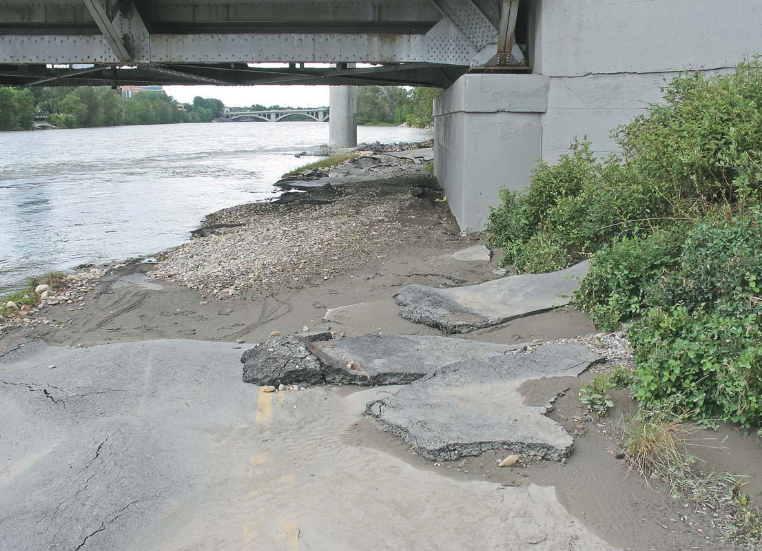
Looking east at the bike path going under the Langevin Bridge (Memorial Drive and 4th Avenue SE).This represents the near-crest of the Bow River during the flood.
Date:June 26,2005
Prince’s Island Park,downtown Calgary.Access denied!!
Photos and descriptions courtesy of Stan Williams.
Close-up of clast size ranging from 1- 10 cm.
Date:June 26,2005
Langevin Bridge,looking west.in the foreground,large about halfmetre square “flakes”of pavement have been moved and deposited downstream about five metres.The gravel/cobble bar under the bridge has a clast size ranging from 1- 10 cm.
(Continued on page 22...)
Photos and descriptions courtesy of Stan Williams.
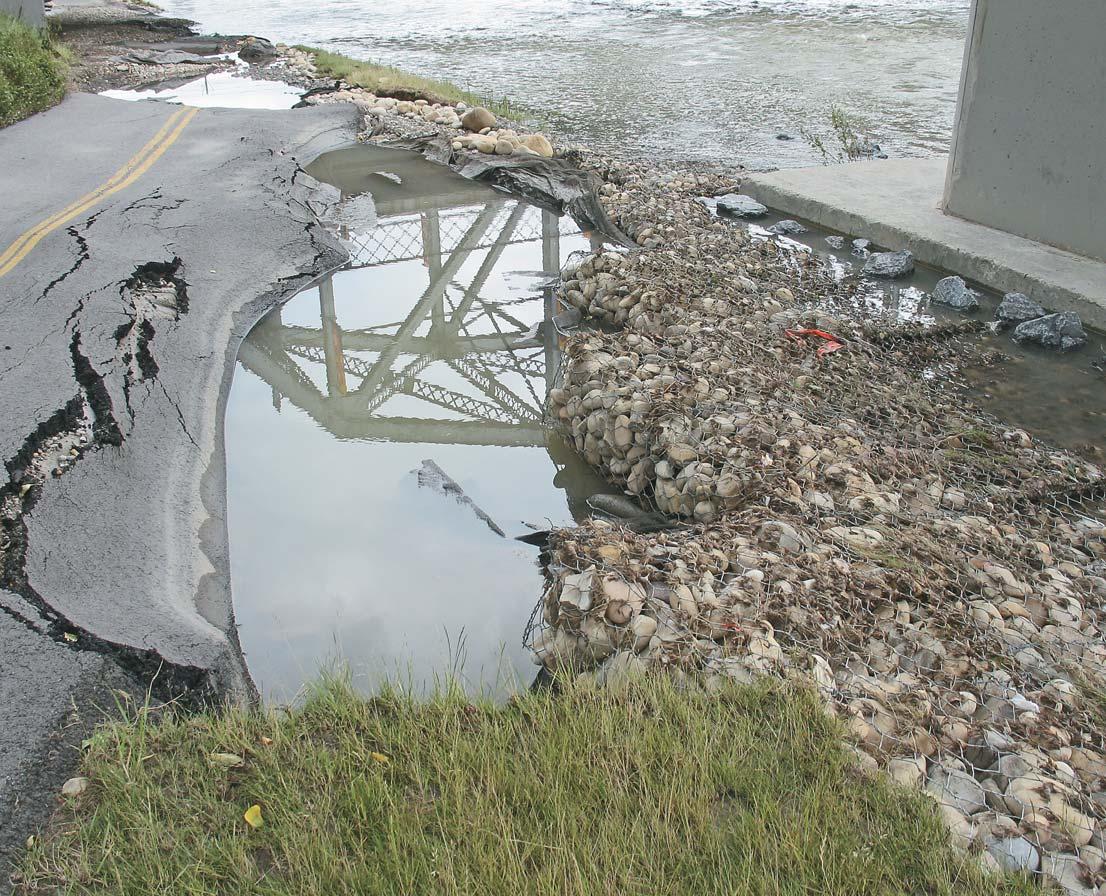
Date:June 26,2005
The causeway at the west end of Prince’s Island Park,downtown Calgary was washed out.The photo shows utility services to the Island were severed.The causeway was large enough to carry large dump trucks to the island and had replaced one washed out previously (in 1986?) Erosion on the far bank of the channel widened it.
Date:June 26,2005.
Prince's Island Park,downtown Calgary.A large bar consisting of gravel,cobbles and boulders was deposited a few metres downstream from the (former)causeway.A line of boulder transverse to the channel is visible about 3 metres downstream from the bar.It seems amazing how large the material is that was moved by the Bow River flood.The erosion control measures (large rocks) seemed to have protected the far bank downstream.There is a park bench in the rubble for scale!
Update:July 19,2005:
The water has receded further and there is a large boulder bar now exposed and the gravel bar shown in the above photo is sitting on top of it. This boulder material,the largest size being about 30 cm in diameter,was probably fill used to build the causeway.Still,it was moved 10-15 metres downstream from the causeway.
Photos and descriptions courtesy of Stan Williams.
Date:June 26,2005
Langevin Bridge near the location of the June 19 2005 photo;looking east.The bike path eroded and the pavement was destroyed and deposited upstream.These holes are greater than a metre deep.Perhaps the gabion baskets (erosion control measure) on the right of the photo actually increased the erosion by allowing the water to undermine the path when it ran over the edge of the gabion basket.
Photos and descriptions courtesy of Stan
Williams.
JACK PORTERVIGNETTES OF CANADIAN PETROLEUM GEOLOGY
Continued from the July/August Reservoir
THE ROLE OF MARTIN FROBISHER IN THE DEFEAT OF THE SPANISH ARMADA
Ever since Francis Drake’s circumnavigation of the world in the period 1577-1580 and his pillaging during this voyage of Spanish settlements on the west coast of South America,he had been the bane of Spain’s Imperial Navy.Queen Elizabeth,having sanctioned his privateering,had honoured Drake’s navigational feat by conferring on him a knighthood following his jubilant return to England.His subsequent raids on the high seas of Spanish galleons and on ports in Europe,and including similar acts by Martin Frobisher and other Elizabethan privateers, finally drove King Phillip 11 to attempt an invasion of England,the Protestant domain of Queen Elizabeth 1,and restore Catholicism.
In May of 1588,King Phillip’s cousin,the Duke of Medina-Sidonia was made Commander-inChief of the Spanish Armada.This fleet consisted of 130 galleons whose armament totalled 2,500 cannons.It was divided into six squadrons with an aggregated crew of 10,000 mariners.The Armada was to escort an invading force,in auxiliary transport vessels, of 20,000 soldiers.An additional 16,000 troops,under the leadership of Duke Alexander of Parma,had been recruited in the Low Countries.They were to reinforce Medina-Sidonia’s army,following a prearranged rendezvous on the coast of France,near Dunkirk.The area of the assault landing was to be on the beaches of Essex,in an areas called The Downs,from where their joint forces were to proceed west and north, their objective being London.
To counter the anticipated invasion,Queen Elizabeth appointed Lord Howard as High Admiral of the English fleet,who in turn appointed Sir Francis Drake as his ViceAdmiral.One hundred and two ships were selected to comprise the fleet from an initial gathering of 190 assorted vessels – almost half of which were eliminated as being too small or deemed ineffective for naval engagement.However,the trimmer fleet contained 34 of the English navy’s revolutionary deep-keeled,trim “ships-ofthe-line” which were designed by John Hawkins for speed,stability,and maneuverability.Their armament consisted of large long-range cannons.
In contrast,Spain’s massive galleons were flatbottomed vessels and somewhat cumbersome.Some,which were impelled by a combination of oar power and sail thrust, were designated galleases,were larger and heavier than their sister galleons,but compensated for this by having greater maneuverability.The oars were arranged in a row,with each being pulled by five or six slaves and were located above a tier of cannons.The Armada’s engagement tactic was to employ grappling hooks to restrain their adversary’s vessel,following which boarding parties would engage in hand-to-hand combat.A salvo of their short-range cannon usually served to signal a boarding confrontation.Admiral Howard’s plan of action was to pursue the Spanish Armada beyond range of their cannonade and with his fleet’s speed, maneuverability,and superior fire power,to disable their vessels,thus preventing opportunities for boarding engagements.
Charles Howard divided his fleet into four squadrons:his flagship being the Ark Royal; Vice-Admiral Sir Francis Drake’s flagship,the
Revenge;Martin Frobisher’s flagship,the Triumph,it being a massive vessel of 1,000 tons and the largest ship in the English fleet; and John Hawkins’ flagship,the Victory.
The Spanish Armada had first sailed from the mouth of the Tagus River at Lisbon,Portugal on May 20,1588.Once at sea the fleet encountered a severe storm and was forced to put in at La Carunna located on the northwest coast of Spain,for refitting of two of its galleons.Their second departure was on July 12th and after crossing the Bay of Biscay, were first sighted off The Lizard (a peninsula in Cornwall,representing the extreme south point of Great Britain).
The English fleet,laying at berth in Plymouth Sound,received news of the sighting by late July 19th and immediately put out to sea.On the following afternoon,Spain’s Armada was observed proceeding up the English Channel to linkup with Parma.The same evening Admiral Howard pursued the Spanish by attacking their fleet with his long-range
on page 26...)
(...Continued from page 25)
cannons.As a very strong westerly wind thrust the two fleets up the Channel, Howard’s fleet,through skilled tacking and speed,was able to maneuver up-wind of the Spanish.This strategy played a decisive role in enabling the English fleet to restrain Medina-Sidonia’s Spanish Armada from being the attacker and effecting a landing on England’s beaches.
By July 23rd the strong west wind had abated and both fleets became becalmed off Portland Bill (a peninsula extending from the south coast of Dorset).Frobisher,in his flagship,Triumph,had became isolated from his squadron.He was anchored near shore when attacked twice by four of the Armada’s galleasses,each propelled by 300 oarsmen. On both occasions he was successful in driving them off.In a close engagement, Martin Frobisher directed his firepower at the rowing deck(s) of the galleasses; shattering their oars while causing mayhem amongst the oarsmen and mariners.Admiral Howard,in his flagship,Ark Royal,along with several other vessels from his squadron,came to Frobishers’s rescue.Likewise,MedinaSidonia,in his flagship,San Martin, accompanied by 16 of his galleons,arrived to escort his four disabled vessels to safety.
During the darkness of the night of July 24th, Frobisher,utilizing his ships’ boats,towed his squadron through becalmed waters to lay offshore from Dunnose Head,in order to block the east entrance to The Solent (the channel separating the Isle of Wight from the mainland.One may assume that he was anticipating Medina-Sidonia’s contingency plan, based on weather conditions,to occupy the Isle of Wight as a temporary staging area, pending his main thrust to London.At daybreak,Frobisher,from his flagship,Triumph, observed Medina-Sidonia’s flagship,San Martin. Believing he was in cannon range,Frobisher commenced firing,all the while awaiting for an offshore breeze that would allow his Triumph to close in on the San Martin.By disabling her, he had anticipated the capturing of Commander-in-Chief Medina-Sidonia. Unfortunately for Frobisher,a soft wind came up from the south,allowing 12 of the Armada’s galleons to come to the rescue of the partially disabled San Martin and with her,their commander.A number of English ships,aware of Frobisher’s precarious situation,arrived later to attempt a rescue.Employing 11 of the rescuers’ longboats,the English mariners successfully towed,in concert,the Triumph from her inshore stagnant position.It was during this procedure that the wind commenced blowing from the southwest, allowing the intact Triumph to set her sails and rejoin her fleet.
The next morning,being July 26th,which followed the seaward retreat of the Armada from the English coast,Lord High Admiral Charles Howard summoned Martin Frobisher and John Hawkins to his flagship, Ark Royal.Here he conferred knighthood on both men.Frobisher’s honour was recognized in respect to his aggressive conduct at Portland Bill,where he prevented MedinaSidonia’s troops from making a landing at Portland harbour.Two days later he repeated this feat at Dunnose Head,where he repulsed Medina-Sidonia’s intention to attempt a landing of his forces on the Isle of Wight. These were the only two opportunities afforded the Spanish Armada,during their entire naval campaign to have been sufficiently close to England’s coastline to have secured a landing of their troops.
On July 28th,the Spanish Armada was resigned to anchor its ships off Calais in anticipation of a rendezvous with the Duke of Parma with his barges containing 16,000 soldiers.Admiral Howard,taking advantage of a strong west by northwest wind and incoming tide,directed,during the night,eight unmanned fireboats at the congested galleons.These 16th century “torpedoes” consisted of open boats,which contained active fire chambers in proximity to explosives.They were manually aimed,with stationary rudders,at stagnant enemy vessels, each being propelled by a single semicanopied small sail,located at the prow of the boat and secured by short-ropes to the gunwales.The trajectories of the “torpedoes” were on target and the ensuing explosions caused great confusion and panic amongst the crews of Medina-Sidonia’s vessels.The conflagration of several galleons forced an erratic dispersal of the congested ships,as each weighed their anchor and headed for safety in the open sea.
Admiral Howard’s major and decisive encounter of the entire naval campaign occured off Gravelines,near Dunkirk,at dawn on July 29th.The English continuously harried the Spanish ships for eight hours,immediately following their fireboats attacks.The battle was devoid of boarding tactics,which in the past had proven successfull by the Armada, since Howard’s squadrons purposely remained beyond range of their cannons.The beleaguered Armada lost seven of its galleons and sustained damage to many others. Howard’s success was,once again,attributed to having the wind in his fleet’s favour and to the superior firepower of its long-range cannons.
Medina-Sidonia’s planned rendezvous with the Duke of Parma and his barges containing
(Continued on page 30...)
UNDERSTANDING OIL & GAS START-UPS (Part I)
September 29, 2005 - 8:30 a.m. to 4:30 p.m.
Targeted for more senior personnel of all disciplines within the industry that have an entrepreneurial spirit, this course will provide you with the necessary tools to assist you in starting an oil & gas company. The course focuses in detail on “The Three Ingredients for Success”:
Management
■ “The Right Stuff”; which includes, among other things; Skills, Attitude, Ethics, Philosophy, Confidentiality Agreements and Insider Regulations.
■ “Management Benefits”; Salary, Shares (Founder/Other/Options), Bonus and Bonus Plans, Share Appreciation Rights Plans, RRSP/Pension, Net Profits Interest, Gross Overriding Royalties, Company Policy (Holidays/ Medical/Working Hours etc.).
■ “Management Protection”; Other Protection/Indemnification, Directors and Officers Liability Insurance, Employment Agreements
Time
Career Cycles, Equity Market Cycles, Measuring Time Value - Rate Of Return, Return On Investment, Present Worth, Corporate Cycles - When is it time to exit.
■ “Mechanism to Capitalization”: Fundamentals of a Business Plan, Legal Counsel - Why/Cost
■ “Board of Directors/Officers”: Who should be on the Board, Responsibilities, General Outline of Board Meeting and Minutes, Responsibilities of the Various Committees, Third Parties - Engineering Consultants, Auditors, Bankers and Financial Advisors.
■ “Fiscal”; How to prepare a Corporate Budget, Types of Budgets, How to Present Budgets to the Board, How to Monitor a Budget’s Implementation and Success.
■ “Overview of Financial Reporting”: Reporting - Daily/Monthly/ Quarterly/Yearly
Instructors:
Fee:
David Monachello - P.Geol. CAPL Member $350.00 plus GST
T. Ross Lennox - P.Geol. Non-Member $400.00 plus GST
To Register, please contact: Denise Grieve at 237-6635 or dgrieve@landman.ca
Ultra High Data Resolution – Only From RECON
This example of RECON’s ultra high data resolution open hole log vs. core data demonstrates the precision of our industry-leading technology.
Experience the RECON Advantage
• Greater precision from 133 samples per meter
• Proven data quality
• Efficient, reliable service at the well site
• Data delivered to your desktop within minutes via satellite
RECON’s “whatever it takes” approach to customer service and leading technology is helping producers throughout Western Canada minimize risk while maximizing recoverable reserves.
For more information on RECON Open Hole Logging Services, contact our Well Logging Sales Representatives at 403-517-3266.
RECON Petrotechnologies Ltd.
410, 510 – 5th St. S.W.Calgary, Alberta T2P 3S2Phone: 403-517-3266 www.reconpetro.com
RECON’S new Production Logging service offers superior low flow rate measurement capability – perfect for coal bed methane opportunities!
RECON’S industry-leading tool string has a tighter sensor array than conventional tools and provides up to six times increased in-flow identification resolution. Logging time is decreased with our continuous velocity measurements. Optimize production!
RECON’S expert interpretation team ensures reliability of high sample rate data with superior reservoir evaluation, depletion rates and production problem identification. Our team turns data into practical information that helps you optimize production.
Less Equipment. Less time. Superior Data Quality. Practical Production Information.
16,000 soldiers never materialized. Apparently,his troops had been garrisoned at Flushing,a seaport in the Netherlands,but were restrained at the upper reaches of the Wester Schelde estuary by Dutch rebels.
The following day,being July 30th,the wind direction changed from west-northwest to west-southwest,fortuitously affording the battered Armada an escape route homeward by sailing up the North Sea and around the tip of Scotland.Howard’s fleet pursued the Armada during the course of her initial retreat as far as the Firth of Forth in the latitude of Edinborough.The
English,with their ammunition and food supplies exhausted,ended the chase on August 8th,to return to their home ports in southeast England.
The Armada,after arriving off the west coast of the Outer Hebrides,was subject to the full brunt of a North Atlantic gale.Disaster occurred along the rocky west coast of Ireland,at Donegal and Galway,when MedinaSidonia’s battered ships,attempted to land in order to obtain supplies of fresh water. Seventeen galleons,as a result,were dashed to their destruction with the loss of approximately 5,000 lives.
Spain’s fatalities in July and August of 1588,in her attempt to invade England amounted to more than 10,000 of her forces.Her previously acknowledged invulnerable fleet was to lose 64 of her galleons,amounting to nearly one half of her entire fleet.In contrast, the English fleet sustained a loss of some 100 of her mariners with no loss of any ships in her fleet.
One of the two Spanish vessels seized,during the Armada’s engagement with the English, was the Nuestra Senora del Rosario.She was captured during the blackness of a moonless night of July 21/22 by Sir Francis Drake in his flagship,Revenge.The captain of the Rosario was Don Pedro de Valdes who on recognizing his adversary as the notorious el Draque, meekly surrendered his ship and crew.In reality,this distinguished Spanish captain had no other alternative since his ship was in a crippled state,causing her to drift listlessly. The Rosario had previously collided with one of her sister galleons and,with a severely damaged bow,was unable to join the fleet. During the process of her being towed,the cables failed and she was left adrift,to be the only galleon with an intact crew to be taken as a prize to Dartmouth,Devonshire.The San Salvadore,the other ship involved in the collision with the Rosario,suffered a crippling internal explosion and accompanying fire.A successful evacuation of her captain and crew was accomplished by her fleet members, following which she was abandoned and subsequently towed by English vessels to Weymouth Bay,Dorset.
Accordingly,the value of the Rosario and its contained possessions were to be treated as a prize,the monies realized from its sale,to be shared amongst Queen Elizabeth,Drake, and his crew.Following the defeat of the Armada,Sir Martin Frobisher felt he and his shipmates should share in the prize money because Drake’s ship,the Revenge,as the lead vessel was required to keep her stern lantern lit during the entire night.With both Admiral Howard’s Ark Royal and Frobisher’s Triumph following in Drake’s wake;the later deliberately extinguished his lantern on viewing the shadowed form of the Rosario.As a result,Howard’s Ark Royal,being disoriented,passed Drake’s Revenge and only fortuitously escaped running into MedinaSidonia’s fleet.Apparently,Drake was determined to deny Frobisher and Howard from sharing in the capture of the Rosario,so as to exclude them from the prize money she would bring.
Frobisher,in justifying his and his crew’s rights to a share of the prize money derived from the Rosario,acrimoniously chastised Drake: “...lyke a coward,he kept by her all nyght,
because he wold have the spoyle.He thinketh to cozen us of our shares of XV thousande duckatts,but we will have our shares,or I will make hym spend the best blood in his belly...”.
Frobisher’s quarrel with Drake was eventually adjudicated by members of the Privy Council and Frobisher was awarded £4979 by their decision.Furthermore,High Admiral Lord Charles Howard of Effingham made him a commander of a division of fighting ships.
By defeating Spain’s purportedly invincible Armada,the actions of the redoubtable “sea
dogs” – Martin Frobisher and Francis Drake – as well as the strategies of Charles Howard and the innovative designs of naval designer, John Hawkins,together set the stage for England’s reliance on a future powerful navy. Accordingly,England earned the bragging rights as expressed in the open line of their patriotic,but somewhat jingostic song ... “Rule Britannia,Britannia rules the waves...”
SELECTED REFERENCES:
Churchill,Winston S.,1956:A History of the English Speaking Peoples;Volume Two - The New World,Book IV, Chapter IX;The Spanish Armada,McClelland & Stewart Ltd.Toronto,pp.120 - 132.
McDermott,James,2001:Martin FrobisherElizabethan Privateer;chap.18,‘The Warre of 21 Julie:’ The Armada Campaign,pub.Yale University Press,New Haven and London,pp.347 - 368.
Morison,Samuel Eliot,1971:The European Discovery of America - The Northern Voyages;Oxford University Press,New York,pp.547 -550.
INFORMATION: Professional geoscientists and their associates are asked to share their wisdom with future geoscientists in this fun and informal setting. APEGGA volunteers are invited to join with several geoscience societies (CSEG,CSPG,CWLS) to meet next year’s graduating geoscience students and others enrolled at the University of Calgary and the University of Alberta.Pizza and soft drinks will be provided.For more information or to register for this function please contact Penny Colton at the APEGGA Calgary office 403-262-7714 (phone) e-mail pcolton@apegga.org.
DATE: October 28-30,2005
EVENT: AUGC
LOCATION: Memorial University of Newfoundland, St.John’s,Newfoundland
INFORMATION: For more information please e-mail augc2005@mun.ca
DATE: November 8-10,2005
EVENT: 7th Annual Unconventional Gas Conference
LOCATION: Telus Convention Centre,Calgary,Alberta
INFORMATION: 7th Annual Unconventional Gas Conference.The largest conference on unconventional gas in North America will be hosted by the Canadian Society for Unconventional Gas.E-mail:kmarkle@csug.ca, 403-218-7720,Website:http://events.csug.ca/ugc
DATE: November 13-17,2005
EVENT: SETAC North America 26th Annual Meeting
LOCATION: Baltimore,Maryland
INFORMATION: The Society of Environmental Toxicology and Chemistry (SETAC) will hold the SETAC North America 26th Annual Meeting at the Baltimore Convention Center in Baltimore,Maryland, November 13-17,2005.This year’s theme is “Environmental Science in a Global Society: SETAC’s Role in the Next 25 Years.” More information can be found on the society’s website www.setac.org
2006
DATE: April 9-12,2006
EVENT: AAPG Annual Convention
LOCATION: Houston,Texas
INFORMATION: For more information please visit www.aapg.org
DATE: May 15-17,2006
EVENT: GAC/MAC Annual Meeting
LOCATION: Montreal,Quebec
INFORMATION: For more information please visit http://www.er.uqam.ca/ nobel/gacmac/index.htm
2005 SEG / EAGE DISTINGUISHED INSTRUCTOR SHORT COURSE (DISC) Insights and Methods for 4D Reservoir Monitoring and Characterization
By Dr. Rodney Calvert (Shell)
DATE: Tuesday September 27, 2005
TIME: 8:30am – 4:45pm
Location: Metropolitan Conference Centre
333 4th Avenue S.W, Calgary, Alberta Canada
Deadline for Registration: Friday Sept 16, 2005 (Max 240)
Mail or fax registration form to CSEG Office Tel: 403-262-0015 Fax: 403-262-7383
(For registration form - see http://www.cseg.ca/luncheons/Disc_2005/disc2005_regform.pdf)
BIOGRAPHY: Rodney Calvert started his first time-lapse work measuring continental drift in Iceland as part of a Ph.D. from 1966-69. He joined Shell in The Hague as a seismic processor, then became a processing manager for Shell Malaysia. He was heavily involved with Shell’s early 3D efforts in the North Sea. He held several research and management positions in geophysics and integrated reservoir characterization before returning to 4D. A highlight of his career has been working in Canada where he developed an addiction to backcountry skiing. He is now stationed in Houston where the closest he gets to skiing is frightening himself and the local community on his roller blades.
ABSTRACT- OVERVIEW: 4D can give major returns if applied properly. However, it is still a rapidly evolving technology. Participants in this one-day course come away with a basic understanding of the issues leading to success and failure and the methods to ensure success.
SUMMARY: The course will start with an overview of the geology of deep-water systems, past, present and future. This review will cover the recent trends in deep-water in terms of drilling results. The course will address the following questions:
• What methods of seismic 4D monitoring are appropriate for different types of fields and production mechanisms? What questions can 4D answer? Are there any alternatives?
• What are the seismic quality requirements and how can we assure they are sufficient? What 3D problems can we difference away to get good 4D?
• There are now more and more options available for seismic acquisition with streamers, OBC, OBS, and down-hole possibilities. How do we make the best choice for quality and price? Some real breakthroughs are now possible.
• What should we measure from our data? What are the important reservoir engineering questions? What do people mean by “quantitative 4D” and what is possible with petrophysical and reservoir engineering co-operation?
• How can we update a reservoir model using 4D data and 4D history matching?
• How should we make 4D monitoring an integral part of field development and management? How might this change our industry?
Participants will be able to take home and use the answers and methods discussed in this course
WHO SHOULD ATTEND?
Anyone interested in understanding the methods of 4D and their potential. This course is suitable for managers who must make the important decisions, for reservoir engineers who want to understand the results, for seismologists who have to get the results, and for anyone else who would like to learn how to remotely track subsurface processes in 3D as they happen. Advanced knowledge of seismic theory is not required; this course is about understanding and practice.
2005 APEGGA GEOSCIENCE MIXER:
5 pm – 8 pm, Tues. Sept 27t - immediately after the DISC course. The annual APEGGA Geoscience Mixer will be held at the Metropolitan Centre in Calgary from 5:00 pm - 8:00 pm. Professionals in geology and geophysics are invited to join geoscience technical societies (CSEG, CSPG, CWLS …) and APEGGA volunteers to meet geoscience students enrolled at the University of Calgary and the University of Alberta. Pizza and soft drinks will be provided. Pre-registration is advised. To sign up for the APEGGA Geoscience Mixer: Please contact Penny Colton, P.Geoph., Manager Geoscience Affairs, APEGGA Calgary office (pcolton@apegga.org) or notify the APEGGA Calgary office at 403-262-7714.
May 15 – 18, 2006
Call For Abstracts
The 2006 convention will be a joint meeting of the Canadian Association of Petroleum Geologists (CSPG), the Canadian Society of Exploration Geophysicists (CSEG) and the Canadian Well Logging Society (CWLS). It will be the first time since 1998 that these three Societies have teamed up to present a joint convention.
The Oil & Gas industry has been on a wild ride over the past few years, and with this in mind we chose as our theme WHAT'S NEXT? Where is Our Industry Heading? These questions are on the on the mind of everyone who works in the exploration industry, and it is hoped that our exhibitors, the technical programme and the social events will showcase this theme and light the way forward.
The technical programme is soliciting scientific, technical and business presentations that address the “What’s Next” for Canada’s upstream petroleum industry in a sustainable and socially responsible manner. The “Key Challenges” to what’s next are posed as a series of thematic questions intended to motivate contributors to address the issues of replacing production, finding new reserves, and identifying future resources in a variety of settings. Please join us in this quest to create a roadmap to the future, with your contributions to the oral, poster, core, short course and field trip components of the meeting.
Invitation to Submit
You are invited to submit a paper abstract to the following proposed oral and poster sessions:
• Unconventional Gas
-Can unconventional gas compete?
-How can we evaluate potential without production testing?
• Tar Sand & Heavy Oil
-What are the limits on production?
• Offshore, Arctic, Foothills, and Deep Carbonates (Frontiers)
-Is the Arctic the next Saudi Arabia?
-Will Canada’s Offshore realize it’s dreams?
-Is there additional deep gas in the foothills and deep carbonates?
• New Petroleum from Old Basin Plays
-What can we bring from old plays and old basins?
• Business
-How long can this continue?
• New Technologies and Techniques
-The tools in the toolbox – what’s new?
• International
-Can Canadian companies compete internationally?
• Environmental
-Can companies respond to and anticipate the environmental challenges today and tomorrow?
-How can we minimize the environmental impact of heavy oil operations?
• What’s Next?
Submittal Process
You must submit an abstract in conformity with the requirements below if your presentation is to be accepted. The deadline to submit abstracts for oral, poster and core presentations is JANUARY 31, 2006. Late submissions will not be accepted.
All abstracts should be submitted online at www.GEOconvention.org. Only electronic submissions will be accepted.
Abstracts submitted by the deadline should be either a short abstract of 250 words or less or a final extended abstract, not exceeding four pages, following instructions and format that will be available on the convention website at www.GEOconvention.org. Authors of accepted presentations who submitted short abstracts by the January 31st dead line will have the opportunity to submit extended abstracts, prior to a later date for inclusion on the conference CD-ROM. To maintain a high quality within the 2006 Technical Programme, abstracts will be accepted based on the review and recommendations of session chairpersons
and the availability of oral and poster session slots. All accepted abstracts will be published on the CD-Rom for distribution to delegates attending the 2006 Convention. Abstracts may also appear on-line on the convention website. Abstracts will not be edited before publishing so please ensure you have edited it prior to submittal.
Oral Presentations
Oral presentations will be 25 minutes in length with a short question and answer period. Presentations should be prepared in single screen electronic format (i.e., power point presentation) exclusively.
Poster Presentations
Poster Presentations will be set out for the duration of the convention. Posters will be presented as either one (1) or two (2) 4’ x 8’ panels. Presenters are required to indicate their preference for the number of poster boards with their abstract submission by the January 31st deadline. They are also responsible for additional materials, including laptops, spot lights, microscopes, etc., at poster booths.
Core Presentations
Core presentations may also be submitted online. Submission procedures and deadlines are the same as those for Oral and Poster Presentations. Core samples will be presented at the AEUB Core Research Centre on Wednesday, May 17 & Thursday, May 18.
Field Trips & Short Courses
Individuals interested in leading a field trip or delivering a short course are encouraged to contact the Technical Co-Chairs.
For More Information, please contact
Mark CooperKirk Osadetz
General Co-Chair, CSPGTechnical Co-Chair, CSPG Mark.cooper@encana.comKOsadetz@NRCan.gc.ca
Kevin MarshSatinder Chopra
General Co-Chair, CSEGTechnical Co-Chair, CSEG Kevin@statcomltd.comschopra@arcis.com
Roy BenteauAllan Pickel
General Co-Chair, CWLSTechnical Co-Chair, CWLS rbenteau@eogresources.comAPickel@suncor.com
This is the eighth chapter in a series,which will explain the seismic business in simple terms.Designed specifically for geological personnel in the oil industry it should provide a forum for information and questions.This installment will focus on the interpretation of seismic data,beginning with structural and,in the next chapter,the stratigraphic aspects.
INTRODUCTION
Interpretation is the process of determining the ambient geology from the seismic data response.In general,we refer to seismic illumination or imaging.We rarely achieve perfect images because of the nature of seismic data and the vagaries of a complex earth.Seismic rarely provides the quality (S/N) and resolution (frequency) we require for the more subtle targets.Larger targets (Figure 8-1) in the offshore frontiers are much simpler imaging objectives than the skinny Glauconitic channels of the Western Canada Sedimentary Basin.However, regardless of seismic’s imperfections,it is the best predictive tool we have to image ahead of the drill.
The practice of interpreting seismic data, either on paper sections or in the workstation is subjective and fraught with pitfalls.Artefacts caused by noise interference (especially multiples),out-of-the-plane effects in 2D,problems associated with recording in time rather than depth and the resulting velocity anomalies (pull-up),and inadequate acquisition and processing design are aspects which must be understood by the interpreter.The industry has repeatedly been fooled by such expressions in both 2D and 3D data sets and dry holes are the inevitable consequence.There is no substitute for experience and the professional caution that is generated through making mistakes.
Interpretation is primarily an exercise in modeling the geology from the seismic response and an understanding of the fundamentals of the depositional process, structural deformation and the habitat of hydrocarbons is vital.Hence,many companies have utilised geologists as seismic interpreters.
SEISMIC MODELING AS AN INTERPRETIVE TOOL
Experience and understanding of the seismic response of geological structure is quickly established through a study of simple models.The “Step Model” illustrated in Figure 8-2,covers many geological possibilities such as a low-angle fault,a
Figure 8-3.Seismic section with velocity pull-up and demigration artefacts.
Figure 8-4.Migrated response of the data in Figure 8-3.
Figure 8-5.Differential compaction and drape over a reef (courtesy:Doug Layer).
monocline,the edge of a channel,and the flank of a reef.This model is displayed in horizontal distance and vertical depth.
The seismic section is displayed in time (Figure 8-3) and there are at least two artefacts that can cause concern.The first is the structural feature on the lower horizon,which is referred to as velocity pull-up.This is correct in seismic time and would require a careful velocity-depth conversion to correct in a structural sense. The second artefact is the moving of the dipping interface downdip.This is referred to as demigration and requires migration to position it properly.Figure 8-4 shows the migrated response but since the vertical scale is still in time,the velocity anomaly persists at the lower horizon.
With models such as this it is possible to gain insight into the way seismic data is distorted by geological structure much the same way as the human form is distorted by gazing into mirrors that are concave or convex (The House of Mirrors).Convex shapes in the subsurface such as anticlines and reefs will enlarge the seismic image while concave surfaces such as channels and synclines will reduce the reflection signature.This must be corrected in both 2D and 3D data sets by migration.Modeling techniques for both 2D and 3D objectives are commonly available as PC software packages.
THE LIVING MODEL
TRACKING AND GUIDING YOUR RESERVOIR DEVELOPMENT: THE ULTIMATE WORKFLOW SOLUTION
THE LIVING MODEL TM WORKFLOW FACILITATES A COMPLETELY DIFFERENT APPROACH TO SUBSURFACE CHARACTERIZATION—FROMSEISMIC TO SIMULATION. Instead of each domain passing its results down the chain, an asset team can now share the same reservoir model and focus on the areas that really impact day-to-day business decisions.
PetrelTM is at the heart of the Living Model, complemented by GeoFrame®, ECLIPSE®,Merak® , and InsideReality.TM
Blending these Schlumberger Information Solutions technologies and potentially third-party products and services, the Living Model provides a 3D representation of the reservoir with both static and dynamic modeling capabilities. It enables modeling for the masses, uniformity for decision making and models that can be updated easily.
A combination of speed and application depth, the Living Model is the ultimate workflow solution.
(...Continued from page 35)
EXAMPLES
Structural targets in the Western Canada Sedimentary Basin include anticlines and faults, typical of the complex overthrust formations of the Foothills,as well as reefs and channels which are both stratigraphic in nature but have structural criteria that facilitate identification with seismic data.In
the case of channels,stacked data may be used to locate the channel system but,as we shall see in the next chapter,the nature of the fill cannot be established from the same data.Pre-stack data (utilising AVO) will be required to distinguish reservoir from non-reservoir lithologies.
One such example from the annals of exploration in western Canada is the
success achieved in reef plays,beginning with Leduc in 1947 and moving through Rainbow,Zama,and Shakillie in the mid to late 1960s to the frantic excitement of West Pembina and the Nisku play of the late 1970s.For the most part,the data sets were 2D and there were numerous out-ofthe-plane prospects,which proved to be extremely disappointing.However early success at Leduc led to the realisation that seismic could identify the reefs (Figure 8-5) on the basis of the drape (differential compaction above the reef) and velocity pull-up caused by the change in velocity between the fast (6,000 m/s) reef and the slower off-reef Ireton and Duvernay (4,000 m/s).Even single fold analog data from 1947 was adequate to locate the discovery well. This was followed by key discoveries at Golden Spike (1949) and Redwater (1953), all based on seismic data.In the mid sixties the industry had moved to 600% though still not digital and the Keg River reefs of Rainbow and Zama proved to be amenable to seismic imaging.
With time,the advent of 3D seismic improved imaging of pinnacle reef plays (Figure 8-6) as well as bank-edge targets such as the Swan Hills.In this case,imaging of the lithology proved more difficult since the carbonate,gas-charged porosity looked the same as off-reef shales and,again,there were numerous disappointments. Eventually,the Devonian bank-edge plays were resolved to some extent with the introduction of AVO pre-stack analysis and interpretation techniques,which removed the ambiguity and facilitated discoveries such as Caroline (Figure 8-7) and Hamburg. 3D seismic interpretation has made a huge contribution to the success rate over the last 25 years or so and its primary contribution has been structural imaging in vector space to facilitate accurate positioning of the exploratory well.
Note:Questions on this and subsequent articles are invited.Please send any question by e-mail to the author at eastonw@telus.net.A selection of questions with answers will be published regularly
Figure 8-6.3D imaging of Golden Spike (courtesy:Geo-X).
Figure 8-7.Swan Hills carbonate bank margin at Caroline (courtesy:Petrel).
Autumn Education
Well Log Analysis
School
Instructor: Daniel A. Krygowski, Chevron, Houston, TX
Date: September 17-18, 2005, with AAPG Eastern Section Meeting
Location: Morgantown, West Virginia
Tuition: $100 , includes course notes & refreshments
Who Should Attend
Geologists, engineers, geophysicists, and other professionals with a need to understand the responses of common logging measurements to subsurface conditions, and become familiar with basic openhole well log interpretation techniques.
Submarine Fan and Canyon Reservoirs, California
Leader: Tor H. Nilsen, Consultant, San Carlos, CA
Dates: October 3-8, 2005
Location: Begins in San Francisco and ends in Bakersfield, CA
Tuition: $1,800 (increases to $1900 after 9/5/05), includes field transportation, lunches and guidebook
Who Should Attend Geologists, geophysicists, log analysts, engineers, and exploration and development managers.
Geological Insights in Seismic Interpretation
Instructors: Donald A. Herron, BP, Houston, TX, and Timothy E. Smith, Unocal, Houston, TX
Date: November 5-6, 2005
Location: Houston, Texas, with SEG annual meeting
Tuition: $895 (increases to $995 after October 7, 2005), includes course notes and refreshments
Who Should Attend
This course is designed for geologically based interpreters who wish to gain greater geological insight into seismic interpretation and to expand their understanding of significant techniques and developments in exploration geophysics.
And don’t miss this terrific Online Course that begins soon!!
Introduction to Geological Reservoir Characterization
Instructor: Roger M. Slatt, University of Oklahoma, Norman, OK
Class Begins: September 19, and runs through December 16, 2005
Lectures and Slides: ONLINE, Exercises and Exams administered by instructor via email
Tuition: $700 (includes textbook)
Limit: 25 students
Who Should Take this Course?
This course is ideal for the petroleum industry professional who is involved in analysis and/or decision-making. Geologists, project managers, engineers, and geophysicists will find this course to be both useful and stimulating. It should be considered an intermediate-level course which will provide individuals with the knowledge necessary to take more advanced courses.
THANK YOU TO ATTENDEES
BY GODFRIED WASSER AND DAVE RUSSUM,CHAIRPERSONS OF THE CSPG EDUCATION COMMITTEE
The 2005 Annual Convention of the AAPG was a great success for all.The incredible technical program,outstanding social events, and the trade show offered delegates many outstanding opportunities.
With a final Delegate count of 7,799 this was the largest convention that AAPG has held since 1981 in San Francisco.We should all be proud of this success.
I would like to thank the Organizing Committee for their outstanding efforts and for the time they contributed over the past two years that we have worked together.I would also like to thank the AAPG and CSPG staff for their work and the professional manner in which many obstacles were overcome.Thanks also go to the sponsors. Without them,the cost of the convention would be considerably higher.
Finally,I would like to thank all of the CSPG members that attended the event and showed the world what a great city Calgary is and what great people Calgarians are when it comes to hosting an event as large as this.
John Hogg
General Chairman AAPG 2005
THANK YOU TO THE 2005 AAPG ANNUAL CONVENTION COMMITTEE
COORDINATING COMMITTEE
General Chair
John Hogg EnCana Corporation
General Vice Chair
Marty Hewitt EnCana Oil and Gas (USA) Inc.
DEG Vice Co-Chairs
Susan Eaton
SR ECO Consultants Inc.
Chris Steincamp
Depew Gillen Rathbun and McInteer,LC
DPA Vice Chair
George Eynon
Canadian Energy Research Institution
EMD Vice Chair
Rick Richardson
Alberta Energy & Utilities Board, Alberta Geological Survey
SEPM Vice Co-Chairs
Brian Zaitlin
Suncor Energy Inc.
Prospect Generation Services
Bob Dalrymple
Queen’s University
Department of Geological Sciences and Geological Engineering
Technical Program
Coordinator
Ashton Embry
Geological Survey of Canada
TECHNICAL PROGRAM
AAPG Oral Program Chair
Tony Hamblin
Geological Survey of Canada
AAPG Poster Session Chair
Mark Cooper EnCana Corporation
DEG Technical Program CoChairs
Susan Eaton
SR ECO Consultants Inc.
Chris Steincamp
Depew Gillen Rathbun and McInteer,LC
DPA Technical Program Chair
George Eynon
Canadian Energy Research Institution
EMD Technical Program Chair
Rick Richardson
Alberta Energy & Utilities Board, Alberta Geological Survey
SEPM Oral Program Chair
Guy Plint
University of Western Ontario Department of Earth Sciences
SEPM Poster Session Chair
James MacEachern
Simon Fraser University Department of Earth Sciences
Short Course Chair
Dale Issler
Geological Survey of Canada
SEPM Short Course Chair
Cindy Riediger
University of Calgary
Department of Geology and Geophysics
Field Trip Chair
Keith Dewing
Geological Survey of Canada
SEPM Field Trip Chair
Dave Eberth Tyrrell Museum
CSPG Core Conference Chair
Gerry Reinson Reinson Consultants Ltd.
SEPM Core Display Chair
Jeff Lukasik Petro-Canada
AWARDS COMMITTEE
AAPG Matson Award Chair
Kevin Meyer EnCana Corporation
AAPG Braunstein Award Chair
Lori Meyer
Imperial Oil Resources
SEPM Awards Chair
Lisa Griffith
Griffith Geoconsulting,Inc.
Activities and Services
Entertainment and Spouse/Guest Activities Chair
Karen Greengrass Husky Energy Inc
Sponsorship Chair
Bob Dick ECL Canada
SEPM Sponsorship Chair
Bruce Shultz Huron Energy Corporation
Volunteer Chair
Peter Kouremenos geoLOGIC Systems Ltd.
International Pavilion Chair
Ted Bogle Nexen Inc.
AAPG CONVENTION DEPARTMENT
Numerous AAPG & CSPG personnel were responsible for various aspects of the 2005 AAPG Annual Convention.The following people played major roles in planning the convention.
Annual Meeting Manager
Randa Reeder-Briggs
Annual Meeting Assistant
Melissa Howerton
Exhibitions Manager
Steph Benton
Exhibitions Assistant Marvetta McNeel
Registration Supervisor
Kim Van Delft
Technical Program/Abstract Coordinator
Sandy Hensley
Publications Coordinator
Crystal Garvin
International Conference Coordinator
Theresa Curry
Global Development Director
Brenda Cunningham
CSPG STAFF
Assistant Conventions Manager
Sarah Venance
Corporate Relations Manager
Kim MacLean
Business Manager
Tim Howard
AAPG 2005 CONVENTION MAJOR SOCIAL EVENTS
The 2005 AAPG Convention was a huge success on both the technical and social sides! Although,when there are close to 8,000 delegates… it doesn’t take much to get a festive atmosphere started!
Within the convention schedule there were several cocktail gatherings and reunions with three major social events added to these.The first event was the Soul of Downtown Calgary at the Piq Niq Café and Beat Niq Jazz Club,which was sold out over two months prior to the convention! The multi-level venue was packed and we had a great time! Food stations were scattered around the club providing mouth-watering European cuisine such as duck pate,tarragon seared shrimp, and fresh made-to-order chocolate crepes! The jazz band consisted of local talent and played two one-hour sets for the crowd,
including performing several requests from the audience.Both the music and food were excellent,and at the end of the night, delegates left with great insight to one of the various aspects of Calgary’s nightlife!
The second major social event was the Celebration of the Alberta Centennial at Heritage Park.This birthday party offered the entire historical village to attendees in order to experience Alberta at the turn of the century! Luckily,the rain stayed far away and we ended up with a perfect summer evening! Delegates walked around the park to view various exhibits and enjoyed rides on the midway,train,and boat.There also were a number of musical engagements such as the Barbershop Quartet and Calgary Fiddlers.A highlight of the night was the toast to Alberta given by David Hood, President of geoLOGIC,who was the main entertainment sponsor for the convention. Another highlight (particularly for us on the convention organizing committee) was seeing 2005 AAPG Chair John Hogg roughed up by Heritage Park Gunfighters! Sorry John…had to pick on you,but we knew you could take it! Overall,the night
was a great success and full of wonderful western style hospitality!
The third major social event consisted of the Core Meltdown and wrapped up all convention activities.The event,traditionally located behind the AEUB Core Facility,was expanded in size from previous years due to the record-breaking number of AAPG 2005 delegates.However,the party was still stuffed with people ! Despite a few brief rain showers,everyone was able to enjoy the food and beverages catered by Sunterra Market,and spend time inspecting the Focus truck supplied by Baker Hughes,who also graciously sponsored the Core Meltdown.
Every social event (large and small) held during the convention was successful.This was due to our great corporate sponsors and the volunteers behind the scenes.Thank you very much to everyone who helped out with the social program.
Cheers!
Karen Greengrass
AAPG 2005 Entertainment and Spouse/ Guest Activities Chair
2005 AAPG Convention Chair John Hogg getting “roughed up”in good fun by Heritage Park Gunfighters.
Core Meltdown party sponsored by Baker Hughes.
A delegate dancing with the Calgary Fiddlers at Heritage Park - event sponsored by geoLOGIC.
Musicians on stage at Beat Niq Jazz Club.
Photos courtesy of Karen Greengrass and Penny Colton.
OUR AAPG PHOTO ALBUM
Field Trips
A lovely view of Mount Kidd from Rocky Creek.Margot McMechan describing the geology as the “Structure of the Rocky Mountain Foothills and Front Ranges, Kananaskis Country,Alberta.” Field Trip attendees look on. Photos by Chuck Buckley.
Poster Sessions
Convention Delegates enjoying the AAPG Ice Breaker,held on Sunday evening, June 19th.Photo by Penny Colton.
The poster sessions were very well intended,including these by Robert Van Wyngaarden and Kevin Graham (above) and Wade Zaluski (below).
Photos by Penny Colton.
Having fun at Heritage Park
Bob Dyck,Amy Hogg and friends enjoying a relaxing ride.
Wayne and Lynn Dwyer teaching everyone how to master the two-step.Their lessons were enjoyed by many who attended the Alberta Centennial Celebrations at Heritage Park.Many thanks to Wayne and Lynn for all their help! Photos by Penny Colton.
Ice Breaker
CSPG Centre was a hub of activity for the entire Convention. It also acted as headquarters for the ETF Eggstravaganza Campaign.Many thanks to all who made donations! Photos by Penny Colton.
2005 CSPG CORE CONFERENCE
This year,the annual CSPG Core Conference,held at the AEUB Core Research Centre on June 23-24,2005,was undertaken as a “follow-up” to the 2005 AAPG Annual Convention which took place in Calgary,June 19-22,2005.Thus,the Core Conference was organized to align with the AAPG Convention theme “Exploring Energy Systems”.Efforts were made to recruit core displays of reservoirs covering three sub-themes:Conventional, Unconventional,and Frontier/International.
Because of the cooperation and enthusiasm of participating individuals and their companies,22 outstanding core displays covering a range of reservoir types were presented.Unique to this year’s Core Conference was the inclusion of several international displays,as well as a comprehensive coal-bed methane presentation.The 1,900 attendees also received a CD compilation (366 electronic pages) of extended abstracts and papers submitted by the participating presenters.
By all accounts the core displays were extremely well received,and the overall quality was considered to be excellent.As is the tradition,awards were presented for the Overall Best core display and Honorable Mention core display as voted on by a random sampling of attendees.Two displays were given an honorable mention, 1) J.Visser and D.Scott’s presentation on An Early Tertiary Meteorite Impact Structure at Eagle Butte,Alberta and,2) Chris Forster’s display of Deep-water
Reservoir Facies of the Jurassic Buzzard Field,North Sea,United Kingdom.The overall best core award went to John Melvin,R.Sprague,and C.J.Heine for their presentation of Diamictites to Eolianites: Carboniferous-Permian Climatic Change
Seen in Subsurface Cores from the Unayzah Formation,East-Central Saudi Arabia.
In summary,I would like to thank the AEUB Core Research Centre staff for their continued unwavering support of the CSPG,and all the sponsors who continue to support this event year after year.I would also like to recognize all those people who contributed to making the Core Conference such a success.The organizing committee consisted of Pat Jans, Dave Hills,Holly Crawford,Errin Kimball, and Les Eliuk,as well as several “on-site” volunteers including Jill Fehr,Sid Leggett, Garnett Knopp,Adam MacDonald,and a number of student volunteers.Dale Leckie, Peter Putnam,and John Hogg assisted with the recruitment of potential display contributors.Finally,I express my appreciation to Sarah Venance,CSPG Assistant Convention Manager,for her excellent administrative support and enthusiasm throughout the planning and undertaking of the 2005 Core Conference.
Gerry Reinson
2005 Core Conference Chair
Best Overall Core Award - Core Conference Coordinator Gerry Reinson presents the Best Core award to John Melvin.
Chris Forster accepts the award for Honourable Mention from Gerry,with Convention Chair John Hogg looking on.
AAPG TECHNICAL PROGRAM – MANY THANKS
I hope everyone who attended the AAPG convention found value in the extensive technical program of talks,posters,field trips, short courses,and the core conference.There is no doubt that Calgary does not have an adequate convention facility that can host an event like the AAPG.However,compared with what we had in 1992,I was pleased with how we accommodated eight simultaneous oral sessions and 100 posters each half-day.Many of our visitors thought it was great and somewhat appropriate that the poster hall was a hockey rink.The sound interference between the three makeshift session halls, which were named after notable CSPG members who also made major contributions to AAPG,was a bit annoying sometimes but overall I found it did not prevent my hearing the speaker.It will be nice when we eventually have eight or more proper session rooms in the Roundup Centre.
I am sure many people found there was more material of interest than they could possibly take in and our committee believed it was better to have this situation than vice-versa.
Given the large turnout,we would not have wanted a smaller program because session rooms were almost always full and the poster hall was crowded and abuzz with innumerable discussions.
I found all the talks I heard and posters that I viewed to be of excellent quality and I am still staggered by the images from 3D seismic.I was also pleased that there were very few late cancellations and the program had very few holes.
The short courses went off without a hitch and seemed to meet the needs of all the participants.The pre-convention field trips
ANDREW D. BAILIE AWARD
It was my pleasure to present the Andrew D.Baillie Awards for the 2005 annual conference on behalf of the Canadian Society of Petroleum Geologists.The Andrew Baillie Award has been presented annually since 1991 for the Best Student Oral and Best Student Poster presentation
given at the annual technical conference. The award is to recognize excellence in presentation and encourage a high level of technical prowess worthy of Andrew Dollar Baillie.
Andrew D.Baillie was an active CSPG member and in particular,an avid supporter of the CSPG Educational Trust Fund,and the educational activities that the CSPG promoted to the student members of the society and the general public in geology.
This year’s conference had the CSPG hosting the Annual American Association of Petroleum Geologists conference here in Calgary.Kevin Meyer,Lori Meyer,and Lisa Griffiths were the Awards Chairs for the conference,and kindly made certain that all the presentations by Canadian Students were evaluated,so a big thank you to Lisa, Lori,Kevin,and all of the session judges.
The winners of the 2005 Andrew D.Baillie Awards presented a unique opportunity to recognize excellence in presentation and technical prowess,in one individual.
The winner of the award for Best Student Oral Presentation is Stephen M.Hubbard, for his talk “Large-Scale Sedimentary
survived the deluge and only one was washed out.The field trip participants who came from many areas of the world were very impressed with the geology in our backyard. The core conference was an outstanding success and the great variety of cores from convention and unconventional fields as well as a number of international areas was most impressive.
I would like to thank all the technical program committee members,who represented six different organizations (AAPG,SEPM,EMD,DPA,DEG,and CSPG), for their hard work in putting the program together.We worked as one big team putting together one big conference and somehow it all came together.
Ashton Embry Technical Program Coordinator
Intrusions Sourced from Deep-Water Channel Deposits,Cerro Toro Formation, Chilean Patagonia:An Outcrop Analog to North Sea Reservoirs”,with his co-authors B.W.Romans and S.A.Graham.
The winner of the award for Best Student Poster Presentation is Stephen M.Hubbard, for his poster “Deep-Water Axial Channel Deposition in Foreland Basins,Cretaceous Magallanes Basin,Chile and Oligo-Miocene Molasse Basin,Austria“ with his co-author M.J.De Ruig.
Stephen Hubbard completed his M.Sc.at the University of Alberta under George Pemberton,and he is currently working on his Ph.D.at Stanford Univerisity under Steven Graham.The CSPG was happy that Stephen could take time out from his extreme mountain biking pursuits to join us for this presentation.Stephen received the 2005 Andrew D.Baillie Awards for Best Student Oral Presentation and Best Student Poster Presentation,and a cheque from the CSPG for $1,000 for each award.
David W.Middleton CSPG Outreach Director
Stephen Hubbard accepting his award from David Middleton.
2005 AAPG Annual Convention Sponsors
and Contributors
Thank you to the following companies and individuals for graciously contributing to the 2005 Annual Convention.
Titanium ($20,000+)
Platinum ($10,000–19,999)
EOG Resources, Inc.
Silver ($3,500–5,999)
The Association of Professional Engineers, Geologists and Geophysicists of Alberta (APEGGA)
Bass Enterprises Production Co.
Cabot Petroleum Canada Corporation
Canadian Natural Resources Limited
Chemostrat
Compton Petroleum Corporation
Core Laboratories
EnCana Oil and Gas (USA) Inc.
Hycal Energy Research Laboratories Ltd.
Samson Canada Ltd.
Sproule Associates Limited
Tucker Wireline Services
XTO Energy Inc.
Gold ($6,000–9,999)
Marathon Oil Company Petro-Canada Oil and Gas
Bronze ($1,000–3,499)
AGAT Laboratories
ARC Financial Corp
Beicip Inc.
Duvernay Oil Corp
ECL (Exploration Consultants Limited)
Fugro Airborne Systems
Genesis Executive Corporation
Government of Alberta
Lario Oil & Gas Company
McMoran Oil & Gas
Paramount Resources Ltd.
Penn West Petroleum Ltd.
Priority Oil & Gas LLC
Pro Geo Consultants
Real Resources Inc.
Seneca Resources Corp.
United Oil & Gas Consulting Ltd.
Patron ($150–999)
A&R Resources, LLC
Belloy Petroleum Consulting Ltd.
Braumiller & Braumiller, Inc.
Canadian Stratigraphic Services (2000) Ltd
GE Energy
Humble Geochemical
Huron Energy Corporation
KS Management Services Inc
MJ Systems
Petroleum Place Energy Advisors
Petroleum Systems International, Inc.
Rakhit Petroleum Consulting Ltd.
Toreador Resources Corp.
White Eagle Exploration
Woodson Exploration LLC
Zargon Oil & Gas Ltd
We appreciate your continued support!
FRED HALKOW –MEMORIAL
In February 2005,Fred Halkow passed away at the age of 82 years after a long illness. Fred was born in Wostok,Alberta on June 25,1923 and spent his childhood on the family farm where he gained a love of the land.At the age of nineteen,he joined the R.C.A.F.and served until the end of WWII.
Following his service,Fred pursued studies in geology and in 1949 was hired by Bear Oil Co.as an apprentice geologist and sample catcher.He worked with me and other geologists throughout Alberta and British Columbia.When Bear Oil Co.was acquired by Pacific Petroleum,Fred moved to Link and Nauss,then Link,Downing and Cook,and then Cree Oil of Canada in progressively more responsible positions.
In the 1960s Fred joined with John Ontco, Doug Haddow,Bruce Tiffin,Bill Smith,and Don Clark to form the Geo Energy Consulting Group.Fred was a highly competent geologist and was in wide demand as a well site geological and engineering supervisor.He worked in many areas,including Bolivia,Peru,Yemen,and throughout the Western Provinces.
Fred married Susan Gurin in 1955 and they raised two daughters.Fred and Susan traveled extensively in South America, Europe,the Soviet Union,and of course North America.Fred was a member of the Calgary Flying Club,he had his own plane and would sometimes use it to travel to well-sites.
Although Fred was a quiet person who spoke of little of his own accomplishments, he is remembered not only for his skill as a geologist and his dedication to his family and friends,but also for his courage.Doug Haddow tells a story of how Fred averted a potential disaster.
“During a drill stem test at a drilling rig in the Rainbow area,Fred arrived at the crucial moment when things were beginning to shake and rumble and could have gotten out of control.Without a moment’s hesitation,he leaped on the rig floor and turned off the appropriate valves to quiet things down to a manageable level.”
Fred,we miss you.
John A.Downing Past President,CSPG
Thank you for
The Canadian Society of Petroleum Geologists would like to
g
e
nero
u
s investment and valued role in the Society. We look
AAPG & AAPG Datapages
Abu Dhabi Oil Co., Ltd. (Japan)
Addison Energy
Adidas
AEUB
AGAT Laboratories
AJM Petroleum Consultants
Akita Drilling Ltd.
Alberta Energy and Utilities Board
Alberta Geological Survey
Alliance Pipeline Ltd.
Anadarko Canada Corporation
Antrim Energ y Inc.
AOA Geophysics Inc.
APEGGA
Apoterra Seismic Processing Ltd.
Aramco Services Company
Archean Energy Ltd.
Arcis Corporation
ATCO Gas
Atwell International Consultants
Auto-trol Technology (Canada) Ltd.
Avenida Art Gallery
Ayrton Exploration Consulting Ltd.
Bailey Geological Services
Baker Atlas
Baker Hughes Canada Company
Ballina Resources Ltd.
Baytex Energy Ltd.
Beicip Inc.
Belfield Resources Inc.
Belloy Petroleum Consulting Ltd.
BJ Services Company Canada
Blue Castle Corporation
Blue Grouse Seismic Solutions Ltd.
Borden Ladner Gervais LLP
Boyd PetroSearch
BP Canada Energy Company
Brandon University
Brooklyn Energy Corporation
Burgess Shale Geoscience Foundation
Burlington Resources Canada Energy Ltd.
Calgary Marriott Hotel
Calgary Science Centre
Calgary Science Fair
Calgary Zoo
Callera Energy Ltd.
Calpine Canada
Calsport Inc.
Canada Fossils
Canadian Discovery Ltd.
Canadian Forest Oil Ltd.
Canadian Hydrodynamics Ltd.
Canadian Natural Resources Limited
Canadian Spring Water
Canadian Subsurface Wireline &
Services
Canadian Superior Energy Inc. CAPL
Case Resources Inc.
CBM Solutions
CCEI
CDX Resources Ltd.
Cequel Energy Inc.
Chase Clinic
ChevronTexaco
Chimo Equipment
CHOA
Cire Resources Ltd.
CL Consultants Limited
Colorado School of Mines
Compton Petroleum
Computalog Wireline Services
Conference Board of Canada
ConocoPhillips Canada Resources Limited
Continental Laboratories (1985) Ltd.
Continental Rocktell Services
Cora Lynn Drilli
Direct Digital Online
Divestco Inc.
Dominion Exploration Canada Ltd.
Doug Cant Geological Consulting
Dravis Geological Services
Duvernay Oil Corporation
Dynamic Oil & Gas
Eagle Exploration, Inc.
Earth Signal Processing
ECL Canada
Edge Technologies Inc.
El Paso Oil & Gas Canada Inc.
EnCana Corporation
Energy North Inc.
Enermarket Solutions Ltd.
ESRI Canada Ltd.
ExxonMobil Canada
Fekete Associates Inc.
Financial Management Alberta Ltd.
FirstEnergy Capital Corp.
Fugro Airborne Surveys
GEDCO
Genesis Corporate Search Ltd.
GEOCAN Energy Inc.
Geographix
Geo-Help Inc.
geoLOGIC systems ltd.
Geological Survey of Canada
Geology Ring
Geomodeling Technology Corp.
Core Laboratories Canada Ltd.
Corion Diamond Products Ltd.
Corporate Express
Crackers Promotional Products
Crow River Resources
CS Lord Northern Geoscience Centre
CSEG
CSUG
CWLS
Daily Oil Bulletin
Dalhousie University
Datalog Technology Inc.
Datamaxx Oilfield Corporation
Davis & Associates
Deadeye Engineering Inc.
DeGolyer & MacNaughton Canada
Devon Canada Corporation
Digital Formation Inc.
geoPLUS Corporation
GeoStar Consultants Inc.
GeoStrata Resources Inc.
GeoVision Consulting Ltd.
Geo-X Systems Ltd.
Gibson Energ y Ltd.
Gilbert Laustsen Jung Associates
Global Link Data Solutions Ltd.
Glyde Resources Ltd.
Gord’s Running Store
GR Petrology Consultants Inc.
Graham Davies Geological Consultants Ltd.
Greystone Resources Ltd.
Hampson-Russell Software Services Ltd.
Hayden Geological Consultants
Hayden Resources Ltd.
Highwire Press & GeoScienceWorld.org
Horizontal Solutions Intl.
for your support.
to recognize and thank the following corporations and organizations for their look forward to our continued partnerships with you in 2006.
Houghton Boston Printers
Hugh W. Reid & Associates Ltd.
Hunt Oil Company of Canada Inc.
Husky Energy Inc.
Hycal Energy Research Laboratories Ltd.
Hydrocarbon Data Systems
Hydro-Fax Resources Ltd.
IHS Energy
Impact Energy Inc.
Imperial Oil Resources Limited
Intercontinental Seismic
International Tectonics Consultants
Jennifer Wells & Associates Ltd.
Just 4 Eyes Inc.
Kelman Seismic Processing
Kenn Borek Air Ltd.
Kensington Wine Market
Kestrel Data Ltd.
Key Seismic Solutions Ltd.
Kiva Promotions
Komarevich Originals Ltd.
Krang Energy Inc.
Landmark Graphics Corporation
Lane ’s Studio
Lario Oil & Gas Company
LIB Consultants Ltd.
LiDAR Services International Inc.
Lightning Energ y Inc.
macdonaldcole inc.
Mancal Energy Inc.
MarkWest Resources Ltd.
McAra Printing
McLeay Geological Consultants
Meloche Monnex
Memorial University of Newfoundland
MICOTAN Software Company Ltd.
Midnight Oil and Gas Ltd.
Norwest Labs
Ogden Financial Planners Ltd.
Ogilvie Printing Ltd.
Oh Canada Restaurant & Bar
Oil City Press Ltd.
oilfinancier.com
Olympic Exploration & Production Co.
Olympic Seismic Ltd.
onlinetv
O’Regan Resources Ltd.
OyoGeospace Canada, Inc.
Paradigm Geophysical Canada Ltd.
Paramount Resources Ltd.
Pason Systems Corp.
Peice
Penn West Petroleum Ltd.
Petcom, Inc.
Petrel, A Schlumberger Product Group
Petrel Robertson Consulting Ltd.
Petro-Logic Services
Petro-Canada Oil & Gas
Petrocraft Products
Petro Staff International
Pinnacle Promotions
Polaris Explorer Ltd.
Precision Wireline Technologies
PrimeWest Energ y Inc.
Pro Geo Consultants
Provident Energy Ltd.
Pulse Data Inc.
Sensor Geophysical Ltd.
Serpa Petroleum Consulting Ltd.
Servipetrol Ltd.
T u e Tota sI e ploratio t Res es co p is e a ste st A ob a cle io Explo sta o Lt es i rc r eu es s d. T Divisio T TE al ra Rakh Ree R Ra poratio Pa adig u Sy a, c s L da L
Minerals Diversified Services, Inc.
MJ Systems
Monolith Oil Corp.
Shell Canada Ltd.
Q-Byte Services, A Division of IBM Canada
Q’max Solutions Inc.
R E Newman Exploration Consultants Ltd.
Rakhit Petroleum Consulting Ltd.
Ta LU nde E& SIO ker iv r ess o plorati s L eso rce ace Ca Geophys n r te s Cor t Schl bertso C Servic a ns Ltd T o C etroleu
Recon Petrotechnologies Ltd.
Reeves Wireline
Sherwin Geological Consulting Ltd.
Sigma Explorations Inc.
Signal Geophysical Consulting
Signature Seismic Processing Inc.
SilverTip Surveys Ltd.
Natural Rocknobs
Nexen Inc.
Regent Resources Ltd.
Reinson Consultants Ltd.
Murphy Oil Company Ltd.
NCE Resources Group Inc.
North Dakota Geological Survey
North Rim Exploration Ltd.
Northrock Resources Ltd.
Northstar Drillstem Testers Inc.
Spirit Energy Inc.
I Ca Pa N Geos r yI c sity B d. td. orporatio a s a Re OyoGeospa G ra t n Petr Petr t C seS . s ical ces rp
Simmon Exploration Consultants
SLM Direct Marketing Ltd.
T TEL hund er l E TRIVIS cke it role ew P N m c Wes Ro Polaris E eW lseDa h Ltd d P it rp.
Response Seismic Surveys Ltd.
RGI Resource GIS and Imaging Ltd.
RGS Consultants Ltd.
RigSkills
Roxar Software Solutions
Rubicon Energy Corporation
Samson Canada Ltd.
Schlumberger Information Solutions
Schlumberger of Canada
Seismic Processing Ltd.
Spirit Ridge Vineyard Resort & Spa
Sproule Associates Limited
Stoakes Consulting Group
Suncor Energy Inc.
Sundog Printing
Spr St a co u or e alis Explorat S v y it &PCa Servi Geosy S d rsity Br o Br versityive versity Re ridat Var V x So a S o sio Q-B a d. eli y L Wir o e xp W plor tio o Ltd rod te o o ore a P f Se da er ce be m hlu rtso Sc b ch Pet P ole be rvic d r at r s C Reso e ys eopphys h ce C rc so o ic loratio c t st ploratio ves rveys Ltd d.
Subsurface Consulting Canada
Talisman Energy Inc.
Taurus Exploration Ltd.
TELUS Convention Centre
Thunder Energy Inc.
Tiger Energy Limited
Total E&P Canada Limited
Trace Energ y Services
True Energy Inc.
TRIVISION Geosystems Ltd.
Tucker Wireline Services
United Oil & Gas Consulting Ltd.
University of British Columbia
University of Brandon
University of Tulsa
University of Calgary
Upton Resources Inc.
Varco Canada
Spi l C C y ng y US der c &P Service ON r Ser ed C Britis Ca C Ver ch iesLtd.
Varidata Surveys Ltd.
Veridata Surveys Ltd.
Veritas GeoServices
td. Lt Co p a d OyoG po Se Ltd o s e r o C d i es e erv ish a d so r a o Verid V xplo er s td ivisio
W.L. Gore & Associates Inc.
Waterous Securities Inc.
Wellsite Gas Detection Inc.
Wellsight Systems Inc.
Wild Rose Geological Services
Wildcat Scouting Services
Wood MacKenzie
Wyn Cal Resources Ltd.
Xperience Media
YMCA
Zokero Inc.
POTENTIAL IN SOUTHEASTERN SASKATCHEWAN
BY STAFF GEOLOGISTS, PETROLEUM BRANCH, SASKATCHEWAN INDUSTRY AND RESOURCES
This article is reprinted with permission from the Prospect Saskatchewan informational brochure series.The series is intended to highlight prospective areas in order to further develop the oil and natural gas resources of Saskatchewan. Further information may be obtained by emailing:prospectsask@ir.gov.sk.ca.
Bakken and Torquay Light Oil New Potential in Southeastern Saskatchewan
INTRODUCTION
Shales of the Upper Devonian to Lower Misssissippian Bakken Formation in the Williston Basin have generated and expelled at least 16 billion m3 of oil (100 billion of barrels),of which only a small fraction has been identified in,or produced from, Williston Basin reservoirs.Recently, horizontal drilling and large sand-fracture completions have resulted in significant production of Bakken oil in Richland County, Montana.Detailed examination of Bakken cores,geophysical logs,and production data in southeastern Saskatchewan indicates that similar exploitation potential exists using horizontal completions,identifying by-passed pay,and finding additional oil in siltstones and sandstones of the Middle Member of the Bakken Formation.Weathered and brecciated dolostones of the Torquay Formation in southeastern Saskatchewan also exhibit high and relatively untested,potential for oil production.
To date,most Bakken production in Saskatchewan has been from siltstones and sandstones of the Middle Member.During the late 1980s to early 1990s,however,additional production in North Dakota was obtained from overlying and underlying Bakken shale members.More recently in Richland County eastern Montana (Figure 1),horizontal drilling has proved to be a successful method for exploiting Bakken oil from sandstones, siltstones,and limestones of the Middle Member.Common practice in this area is to drill one or two laterals that are subsequently subjected to sand-fractured completions using as much as 450,000 kg (1,000,000 lbs) of sand.The economic success of this play has spurred a renewed interest in land acquisition and exploration of the Bakken eastward and northward into North Dakota,and into the Estevan area of southeastern Saskatchewan. In the last 19 months,Bakken oil production in southeastern Saskatchewan jumped from approx.3,000 m3/mo (July 2003) to approx. 5,700 m3/mo (February 2005) during which
the number of producing wells rose from 62 to 81.
BAKKEN REGIONAL GEOLOGY
Sandstones and siltstones of the Middle Member of the Bakken Formation become increasingly thick towards the Member’s depositional centre in northwestern North Dakota and northeastern Montana.In Saskatchewan,the Middle Member reaches a regional thickness of about 25 m,but, above areas of known salt dissolution,it
attains thicknesses of up to 44 m. Anomalous thickening is also observed in shales of the Lower Member at these locales.Christopher (1961) recognized regionally thick Bakken trends and named two thick areas in the south the Torquay and Herald embayments (Figure 2),and a thick region along the western margin the Elbow Sub-Basin,a feature related to contemporaneous dissolution of the underlying Prairie Evaporite Formation. Relatively thin Middle Bakken occurs in the vicinity of the Regina-Melville Platform (T18-R23W2) and in the extreme southeast portion of the map,which is discussed later relative to its significance to the Torquay Formation play.A noteworthy feature of the isopach map of the Middle Member is a zone of thickness that extends southwestern from the Rocanville Pool to the Torquay Embayment.This northeastsoutheast trend is coincident with the Rocanville-Torquay trend,named also by Christopher (1961),about which he stated “…this trend consists of a band of northeasterly aligned furrows into which the study beds are downwarped.” He noted that salt sinks in the Rocanville,Wapella, and Kisbey pools,and oil shows and oil production in Bakken and older strata were aligned along this trend.Recent examination of cores and geophysical logs suggests that sandstones developed along
Figure 1 - Areas of Bakken production in Saskatchewan,North Dakota,and Montana;also shown are core-based oil shows and DST shows.Red line indicates Bakken zero-edge.
Figure 2 - Isopach map of the Middle Member of the Bakken Formation.
this trend are potential migration conduits for Bakken-sourced oil into the Rocanville region.
RESISTIVITY ANOMALY
In places,the Upper and Lower Member shales of the Bakken Formation show very high resistivity values (Figures 3 and 4) that are attributed to the presence of oil which has replaced conductive pore waters.With continued oil replacement,oil saturation increases to produce progressively higher formation resistivity values.Other rock characteristics such as mineralogy,porosity, tortuosity,and the salinity of water within pore volume also contribute to the resistivity log response of the shale,but these parameters are apparently secondary to the presence of oil in the shales themselves. Although resistivity values do not distinguish whether oil has been generated in situ within the shales at a given location or has migrated into or within the shales,extensive Bakken core research by Schmoker and Hester (1990) has indicated that a resistivity value of greater than 35 ohms coincides with the onset of observable oil generation within Bakken shale. Resistivity values for Upper and Lower Member shales were mapped in southeastern Saskatchewan (Figure 3) using only deepreading laterologs and without applying borehole or environmental corrections.Areas having resistivity values in excess of 35 ohms in the Upper Member shale oversteps that of the Lower Member shale.
on page 50...)
Figure 4 - Resistivity logs showing normal (left) and anomalous (right) readings in the Upper and Lower Bakken Member shales.
Figure 3 - Maps indicating distribution of anomalous resistivity values in the upper Shale Member (upper map) and Lower Shale Member (lower map) of the Bakken Formation. (Continued
(...Continued from page 49)
TORQUAY REGIONAL GEOLOGY
The Torquay Formation in the eastern highlighted area (Figure 6) shows depositional or erosional thinning in a region interpreted to have been uplifted prior to deposition of the Bakken Formation.Significant to this play is that weathering in the uplifted area prior to Bakken deposition has enhanced reservoir characteristics of the Torquay Formation
where it immediately underlies the regional unconformity.Primary development of reservoir conditions in this area were also enhanced due to the shallower depositional setting for the sediments that now host the oil.For example, well developed ripplebedded dolarenite is common in Torquay Formation cores from the Rocanville Pool area (e.g.,8-5-16-31W1).Another critical element to this accumulation is the onlapping relationship of the overlying porous and permeable sandstones of the Middle Member of the Bakken Formation.Thinning and onlap of Bakken sediments are recognized throughout the eastern portion of Saskatchewan.The Lower Member shale is absent in this area so that oil-saturated sandstones of the Middle Member are in
direct contact with reservoir quality-rocks of the underlying Torquay Formation.The Torquay rocks are interpreted to have been charged with light Bakken-sourced oil that migrated from hydrocarbon kitchens to the south and west.
The Torquay Formation in the inferred area of uplift exhibits reservoir-quality brecciated dolostones that show moderate to good porosity on sonic,density,and neutron logs. Streaming,milky white fluorescent cuts from dolostones have been observed in cores from 1-30W1 to 22-1W2.Resistivity logs also indicate the presence of hydrocarbons in wells from this area.Production has been attempted from three wells,8-35-6-30W1,12-36-6-30W1, and 13-10-8-30W1;the first two of which were vertical completions and have each produced approximately 3180 m3 (20,000 bbls) of oil in three years.In this area,the Bakken Middle Member sandstone is generally less than 3 m thick,whereas geophysical logs and core from the Torquay Formation indicate
Figure 5 - Photographs of Lower Bakken shale displaying microfracturing generated by oil expulsion in 13-31-6-13W2 (top and middle) and 12-27-1-8W2 (bottom) wells.Note the bituminous-coaly material (vitrinite?) in the top photograph.
Table 2 - Specific gravity of oils from selected Bakken pools in southeastern Saskatchewan.
Table 1 - From July 2003 to January 2005 Bakken production in southeastern Saskatchewan.
Figure 6 - Isopach map of the Torquay Formation.Also shown are the Lower Bakken zero edge (dashed line),and approximated Big Valley Formation zero edge (white line).Highlighted area along eastern edge shows region of depositional and erosional thinning in the Torquay and Bakken formations.
that approximately 9 m thick porous intervals are oil-saturated from the unconformity
down to the top of a well developed oxidized, reddish brown siltstone-mudstone.
SUMMARY
Analogs:For Bakken production:Richland County,Montana;McKenzie and Divide Counties,North Dakota.
For Torquay production:Sinclair and Daly pools,Manitoba.
Trap:Stratigraphic;subtle structure.
Seal:Bakken Shale.
Characteristics:Bakken reservoirs generally respond unconventionally to resistivity readings,have low permeabilities of 1 to 20 mD,and porosity values that range from 5 to 20%.
Source:Bakken Shales.
REFERENCES
Christopher,J.E.(1961):Transitional Devonian-Mississippian Formations of Southern Saskatchewan:Sask.Dep.Miner. Resour.,Rep.66,103p.
Schmoker,J.W.and Hester,T.C.(1990):Formation resistivity as an indicator of oil generation-Bakken Formation of North Dakota and Woodford Shale of Oklahoma;The Log Analyst,January-February 1990,9p.
Download documents and other information related to hydrocarbon resources of Saskatchewan at:http://www.ir.gov.sk.ca/ subsurfacelab.If you wish to subscribe to all Prospect Saskatchewan issues,please email prospectsask@ir.gov.sk.ca.
CONTOURING
Faulted contours
Isopachs
Volumetrics
Grid operations
New flexing options
CROSS SECTIONS
New Unassigned Tops
Digital and/or Raster
Geocolumn shading
Stratigraphic/Structural
Shade between crossover
Dipmeter data
MAPPING OPTIONS
Expanded GIS Functions
Bubble maps
Production charts
Log curves
Posted data
Highlighted Symbols
3D VISUALIZATION
Deviated wellbores
Digital logs
Grid surfaces
Tops, Shows and Perfs
Land grid overlay
Map images
PETRA® delivers the industry’s only easy-to-use and affordable integrated solution for today’s workflows. It provides multi-user access to large projects through geological, petrophysical and engineering analysis tools. The PetraSeis™ option extends PETRA® into 2D/3D seismic interpretation with practical tools such as RasterSeis™ Download a trial version at www.geoplus.com, or call us at 888-738-7265 (Houston: 713-862-9449 / Calgary: 403-264-9523) for more product information.
DECLINE CURVES
Compute EUR, RR, etc.
Hyperbolic or exp.
Rate/Time or Cum P/Z
User defined Econ. Limit
User defined Extrap. Time
crest heights of 1 to 5 m,which drape the slope margin and contribute to oversteepening and slope failure.
The barrier slope consists of stacked retrogressive slump deposits with superimposed active turbidite channel-levee complexes,suggesting an evolution in the style of gravity-flow sedimentation over time.Distal turbidite fans thin rapidly basinward.
The talk will illustrate depositional facies and processes from supratidal barrier to basin floor,using a variety of temporal and spatial data visualizations.Attention is given to the significance and process interpretation of stratal discontinuities.
BIOGRAPHY
Laurie Davis,Ph.D.,is a Senior Geologist with Fugro Jacques GeoSurveys Inc.,specializing in shelf and deepwater geohazard assessment and related marine geoscience investigations.He was previously affiliated with C-CORE,Memorial University of Newfoundland,where he managed a joint industry-government funded Marine Minerals Research Program.Laurie holds a B.Sc.Honours from Memorial University (1986),a M.Sc.from the University of Toronto (1988),and completed his Ph.D.(Geology) at Memorial in 2003 (Pass with Distinction).He was awarded the 2004 CSPG Thesis Award for his doctoral thesis entitled “Allostratigraphic Interpretation of a Modern Coarse Clastic Barrier Complex:depositional facies,processes and relative sea level relationships.”During his academic career,Laurie received NSERC Undergraduate Research Awards,a Gold Medal for Academic Excellence (Memorial),an Ontario Graduate Scholarship,a Connaught Scholarship (U of T),a CCORE Fellowship and an Atlantic Accord Career Development Award (Memorial).
CORRECTION
The July/August Photo Caption should have read:“Tombstone Mountains,Yukon. Three Syenite intrusions make up the spectacular black jagged glacially carved peaks of the Tombstone Range in north central Yukon.These Early Cretaceous plutons intruded into mostly Ordovician and Carboniferous dolostones and sandstones during the NW migration of the North America continent after the breakup of Pangea.The range gets its name from Tombstone Mountain (2,193 meters),a soaring granite massif visible in the right of the photo.Photo by Mark Dzikowski.
Our apologies to Mark for this mistake.
Thank You!
The CSPG is c u rre n tly collecti ng CSPG Me m oirs for Phase III o f o u r di g itizatio n project. We wo u ld like to tha n k the followi ng people for their Me m oir do n atio n s:
Ted Best
Robert Maso n Al Je n ik
Ja m es Brow n Barry Robbi n s To m Acheso n
Ke n M u rray Keith Skipper Astrid Arts
Alice Pay n e Mike Ro g ers Richard Wi g i ng to n
Joh n A m bler
Phase I & II, i n cl u di ng the e n tire B u lleti n Collectio n , are n ow available at AAPG Datapa g es (www.aap g .or g ) & www. g eoscie n ceworld.or g
We a g ai n wo u ld like to tha n k Alla n Mel nych u k, Michael Wilso n & all others who m ade B u lleti n do n atio n s.
CSPG m e m bers will have fu ll access to the e n tire B u lleti n Collectio n via the n ew CSPG website, la un chi ng this Fall.
NEW MEMBER LIST
Alyson Baran Burlington Resources Canada
Keith V. DodsworthNeo Exploration
Jeffrey M. DunleavyBHP Billiton Petroleum (Americas) Inc.
Lukas Fikr
Colin J. FrostadAnadarko Canada Corporation
Grant GerlaCanadian Natural Resources Ltd.
Neil A. HarburyNautilus Limited
Heather M. HuntAlberta Energ y And Utilities Board
Steven J. IngsDalhousie University
Robert B. LeeFortune Energ y Inc.
Elizabeth A. LevesqueSamson Canada
Tania LewProgress Energ y Ltd.
David E. Mann BHP Billiton Petroleum (Americas) Inc.
Kathleen M. Moncrieff Fairsky Resources Inc.
Chukwuemeka K. Obasi McLeay Geological Consultants (1986) Ltd.
Bamidele S. Olutusin
Sharlene M. PollockTalisman Energ y Inc.
Domenico RanieriDevon Canada Corporation
Graham S. RossoCanadian Natural Resources Ltd.
Cameron A. SearleTRAFINA Energ y Ltd.
Diane SmathersNorwest Labs
Lorne SmithPetro-Canada Oil And Gas
Richard P. SteeleNautilus
Steven M. TobiasSouth Bay Resources
Jane Wang AGAT Laboratories
William G. Young Renegade Oil and Gas Ltd.
The EARTH ImagerSM service delivers high-resolution micro-resistivity images in oil-based mud with great hole coverage.
This proven micro-resistivity imager from Baker Atlas offers a vertical resolution of less than 8mm at a standard logging speed of 274m/hr giving you details never seen before in oil-based mud images.
The EARTH Imager service operates in 149mm to 533mm diameter boreholes. With its 6 pads mounted on individually articulated arms, it provides you with 64.9% borehole coverage in 200mm diameter holes while maintaining pad contact at all hole deviations.
Call us today to find out how you can use the EARTH Imager service in your next oil-based well to accurately identify structural and sedimentary features, rock texture, fracture orientation and estimate net-to-gross.