
// ACKNOWLEDGMENTS
PARSONS NCR LEADER
Curtis Davis
cdavis@team-icsc.com
614.684.2500 Ext.1100 2025 S. High St. Columbus, OH 43207
NCR PROGRAM LEADER
Kasia Richey
KLRichey@columbus.gov
614.645.8172
// INTRODUCTION
The Neighborhood Commercial Revitalization Program (NCR) sponsored by the City of Columbus historically consisted of matching grants for interior and exterior improvements to commercial properties in designated corridors. The program also historically consisted of competitive interest loan programs, technical assistance, capital improvements, and planning services available to tenants and business owners within the following eligible areas: Franklinton (W Broad St), Hilltop (W Broad St), East Main (E Main St), Parsons (Parsons Ave), KingLincoln (E Long St/Mt Vernon Ave) and Linden (Cleveland Ave).
This report consists of collected data and on-site assessments of commercial properties in each corridor. This document serves as a planning resource to assist in strategically selecting sites and areas of targeted redevelopment to enhance the impact of coordinated and unified NCR development.
This document provides data for each commercial property within the Parsons Avenue NCR corridor. The Parsons NCR corridor consists of properties along Parsons Ave. from E. Livingston Ave. south to Hosack St. Several overall conclusions are illustrated by the graphs in the following pages. The Parsons NCR corridor is predominantly comprised of Convenience Goods. Of the commercial storefronts, 29% are vacant. As for the exterior condition of buildings, 28% were in average condition, followed by 42% in good condition.
// PROCESS
DATA COLLECTION
This document inventories the current built condition of the corridor using a combination of data from the U.S. Census Bureau, City of Columbus, MORPC, The Franklin County Auditor, and Esri with on-site assessment. Data collected is represented by a series of maps, charts, and infographics highlighting property details, vacancy data, demographic trends, and commercial type. Property data, commercial typology, building condition, and vacancy rates utilize data of NCR eligible properties only, while data trends encompass the 20 minute walkshed from the section of Parsons Avenue part of the NCR corridor. Collected data is representative of conditions present at the time of the inventory and are subject to change.
CONDITION: THE BUILT COMMERCIAL ENVIRONMENT
In order to evaluate the condition of the built commercial environment, each commercial property was evaluated on three dimensions. These three dimensions were evaluated in-person for every corridor. The first is the existing building, which was judged at three levels: front facade, visible side facade(s), and window and door conditions. The second dimension is the condition of the site, including paving and landscaping in the front and side yards. The third is the condition of the signage. All levels were comparatively graded as excellent, good, average, or poor. Excellent building examples include The Crest, Parsons North Brewing Co., and Jimmyluka’s Bar Deli. Poor buildings included those requiring a substantial amount of rehabilitation to bring them up to a good standing.
Regarding site conditions, well-maintained sidewalks, paved entrances, parking lots and landscaped areas were judged excellent. Parking lots with potholes and/or areas of overgrown vegetation, site debris, abandoned temporary structures, or refuse were deemed poor. Regarding signage, excellent signs were those newly installed or newly maintained (or changed), while “homemade” signs, not maintained or vacant copy signs were judged poor. Some addresses were part of or attached to other buildings and had only front facades. These were judged only on the merit of the front. Buildings directly adjacent to the pavement and have neither private paving nor landscaping were not assigned a value.
// PARSONS AVENUE OVERVIEW
20 MIN WALKSHED

Franklinton
Hilltop
Linden
RESIDENTS
The total population is
Area Commission
Population: 28,161
The median income is years with $51 k median disposable income
HOUSING
The median home value is
33,895 $288 K
The housing affordability index is # of housing units increased at a 3% annual change. Living in total households, a 3% annual change. is the average households size is under 18 years old housing ownership is owner occupied are living in nonfamily households is 65+ years old is renter occupied vacant
The median age is
78 2% $58 K 36 16,288 2.04 20% 33% 14% 53% 14% 60%
30% The % of income for mortgage is and 56 wealth index
EMPLOYMENT
1,831 29,876
1,525
The # of businesses is employees people are both living and employed within the 20-minute walkshed with a total of approximately
MOBILITY Travel time to worK:
lifestyle spending (index) top five industries (NAICS)
88 electronics & appliances
32
4
There are Serving and bus stops bus routes marked crosswalks per mile
12.50
The % of businesses by type is
commercial properties within the NCR boundary
commercial vacancy of the NCR corridor
CONVENIENCE SERVICES RELIGIOUS INSTITUTIONS CONVENIENCE GOODS
and the remaining 8% are other uses
The building exterior condition improved from last assessment:
// COMMERCIAL DEVELOPMENT
Notable improvements documented across 2022 to 2024 inventories
NEW BUSINESS
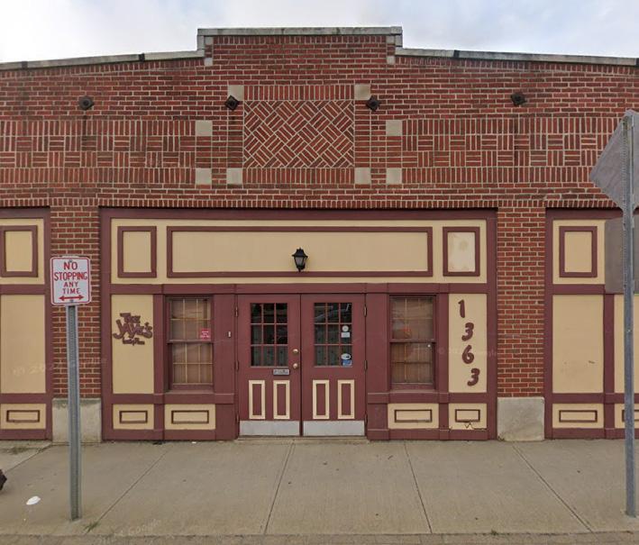
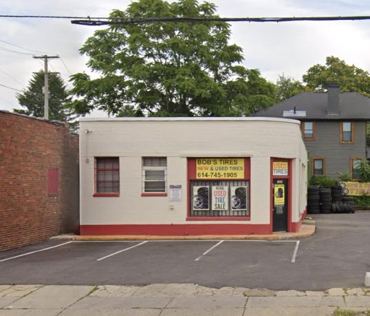
765 Parsons Ave


// CORRIDOR CONDITIONS
Livingston Ave. Beck St.
Sycamore St. Forest St.
Kossuth St.
Reinhard St.
Stewart Ave.
Deshler Ave.
Thurman Ave.
Parsons Ave.
Moler St.
Jenkins Ave.
Markinson Ave.
Morril Ave.
Woodrow Ave.
Innis Pl.
Reeb Ave.
Hosack St.
Parsons Ave.
// E. LIVINGSTON AVE. TO E. KOSSUTH ST.

EAST ELEVATION

Parsons Avenue

WEST ELEVATION
OCCUPIED
VACANT
RESIDENTIAL
PARKING LOT VACANT LOT GRASS/PERMEABLE


// BUILDING ANALYSIS
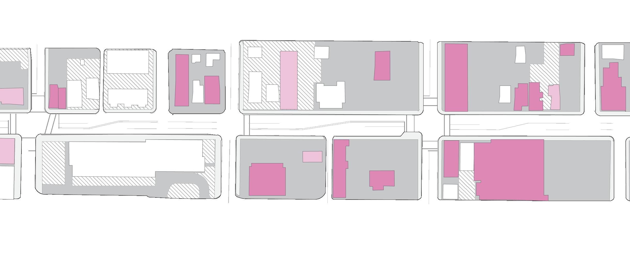
Sample from E. Livingston Ave. to E. Kossuth St.
CONTRIBUTING
BUILDING FRONTAGE


NON-CONTRIBUTING


BUILDING STOCK


// E. KOSSUTH ST. TO E. DESHLER AVE.

EAST ELEVATION

Parsons Avenue

WEST ELEVATION
OCCUPIED
VACANT
RESIDENTIAL
PARKING LOT VACANT LOT GRASS/PERMEABLE


// BUILDING ANALYSIS
Sample from E. Kossuth St. to E. Deshler Ave.
CONTRIBUTING
BUILDING FRONTAGE


NON-CONTRIBUTING


BUILDING STOCK


// E. DESHLER AVE. TO
MOLER ST.

EAST ELEVATION


WEST ELEVATION
Parsons Avenue
OCCUPIED
VACANT
RESIDENTIAL
PARKING LOT VACANT LOT GRASS/PERMEABLE


// BUILDING ANALYSIS
Sample From E. Deshler Ave. to Moler St.
BUILDING FRONTAGE
CONTRIBUTING NON-CONTRIBUTING


BUILDING STOCK


// MOLER ST. TO MORRIL AVE.

EAST ELEVATION


WEST ELEVATION
Parsons Avenue
OCCUPIED
VACANT
RESIDENTIAL
PARKING LOT VACANT LOT GRASS/PERMEABLE


// BUILDING ANALYSIS
Sample From Moler St. to Morril Ave.
BUILDING FRONTAGE
CONTRIBUTING


NON-CONTRIBUTING


BUILDING STOCK


// MORRIL AVE. TO HOSACK ST.

EAST ELEVATION


WEST ELEVATION
Parsons Avenue
OCCUPIED
VACANT
RESIDENTIAL
PARKING LOT VACANT LOT GRASS/PERMEABLE


// BUILDING ANALYSIS
Sample From Morril Ave. to Hosack St.
BUILDING FRONTAGE
CONTRIBUTING


NON-CONTRIBUTING


BUILDING STOCK


// APPENDIX
DATA SOURCES
Page 3: Corridor Overview
• Parcel GIS layer provided by Franklin County Auditor
• Other GIS layers provided through City of Columbus Open Data Portal
• Walkshed calculated through ArcGIS Online
Page 4: Residents
• ArcGIS Business Analyst Demographic Profile
• ArcGIS Business Analyst Population Trends
Page 4: Housing
• ArcGIS Business Analyst Market Profile
• ArcGIS Business Analyst Population Trends
Page 5: Employment
• ArcGIS Business Analyst Business Summary
• ArcGIS Business Analyst Market Profile
• Census OnTheMap Inflow/Outflow Analysis
Page 5: Mobility
• ArcGIS Business Analyst Commute Profile
• MORPC Mid-Ohio Open Data Portal
Page 6: Commercial Corridor
• Parcel and building ArcGIS layers provided by Franklin County Auditor
• Corridor conditions assessed by Neighborhood Design Center through windshield survey
Page 7: Commercial Development
• Imagery provided through Google Images
• Corridor conditions assessed by Neighborhood Design Center through windshield survey
Page 9: Corridor Conditions
• Parcel and building ArcGIS layers provided by Franklin County Auditor
• Street ArcGIS layers provided through City of Columbus Open Data Portal
• Corridor conditions assessed by Neighborhood Design Center through windshield survey
Page 11: Building Analysis
• Parcel and building ArcGIS layers provided by Franklin County Auditor
• Street ArcGIS layers provided through City of Columbus Open Data Portal
• Corridor conditions assessed by Neighborhood Design Center through windshield survey
• Imagery provided through Google Earth
