CARSON J. BUTLER
LANDSCAPE ARCHITECTURE PORTFOLIO
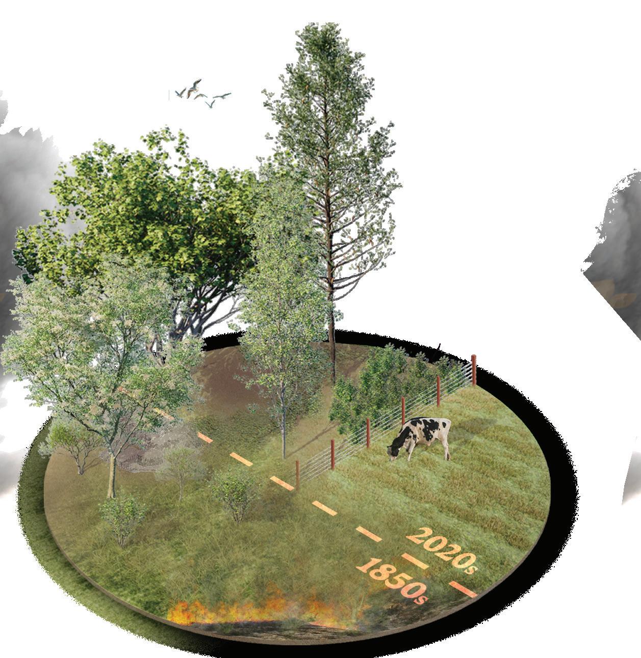
Image: 1850 vs 2020 Willamette Valley habitat comparison. (LA489) Letitia Carson’s Legacy.
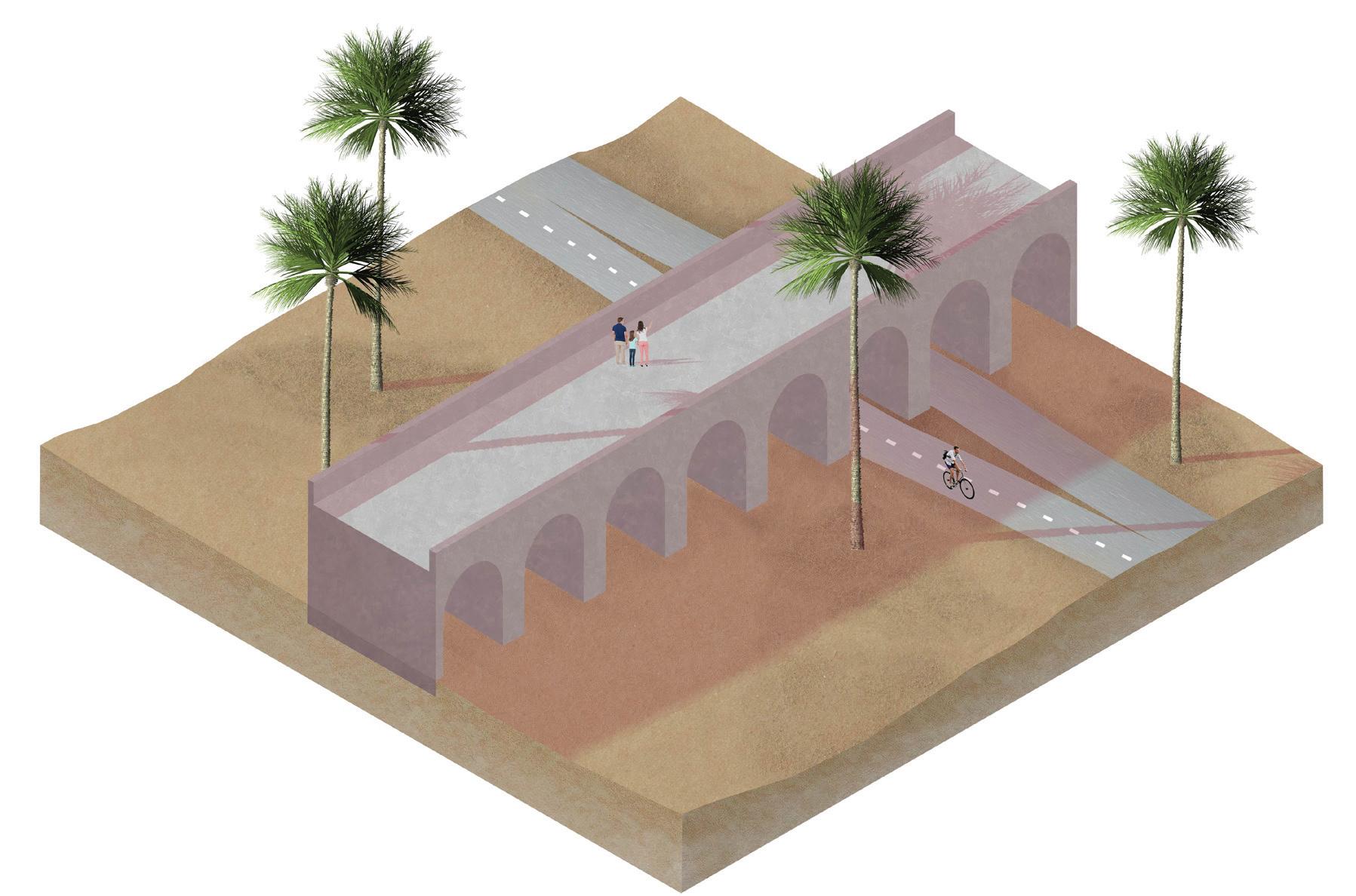
Image: Pedestrian viaduct over floodplain in Lanzarote. Canary Islands, Spain. (LA452) Landscape Media.
(303)-521-9787 - carsonbutlerj@gmail.com - cbutle10@uoregon.edu - linkedin.com/in/carson-butler-77a1a8254/
SUMMARY
Bachelor of Landscape Architecture student at the University of Oregon with a versatile skillset, 2 years of internship experience, and an ASLA honor award winning studio project. Passionate about functional landscapes centered around people, ecology, & the environment, & the iterative design process. Skilled in the Adobe Suite, ArcGIS, AutoCAD/Civil3D w/ LandFX, Rhino, sketching, & various rendering softwares. Key strengths in communication, iterative design, leadership, organization, & time management.
University of Oregon
Bachelor of Landscape Architecture Eugene, OR
3.69 GPA
Lead volunteer for the Student Sustainability Center: Habitat Restoration Team Member of the University of Oregon Transportation & Liveability Group (LiveMove UO)
Columbine High School
HONORS & AWARDS ASLA Student
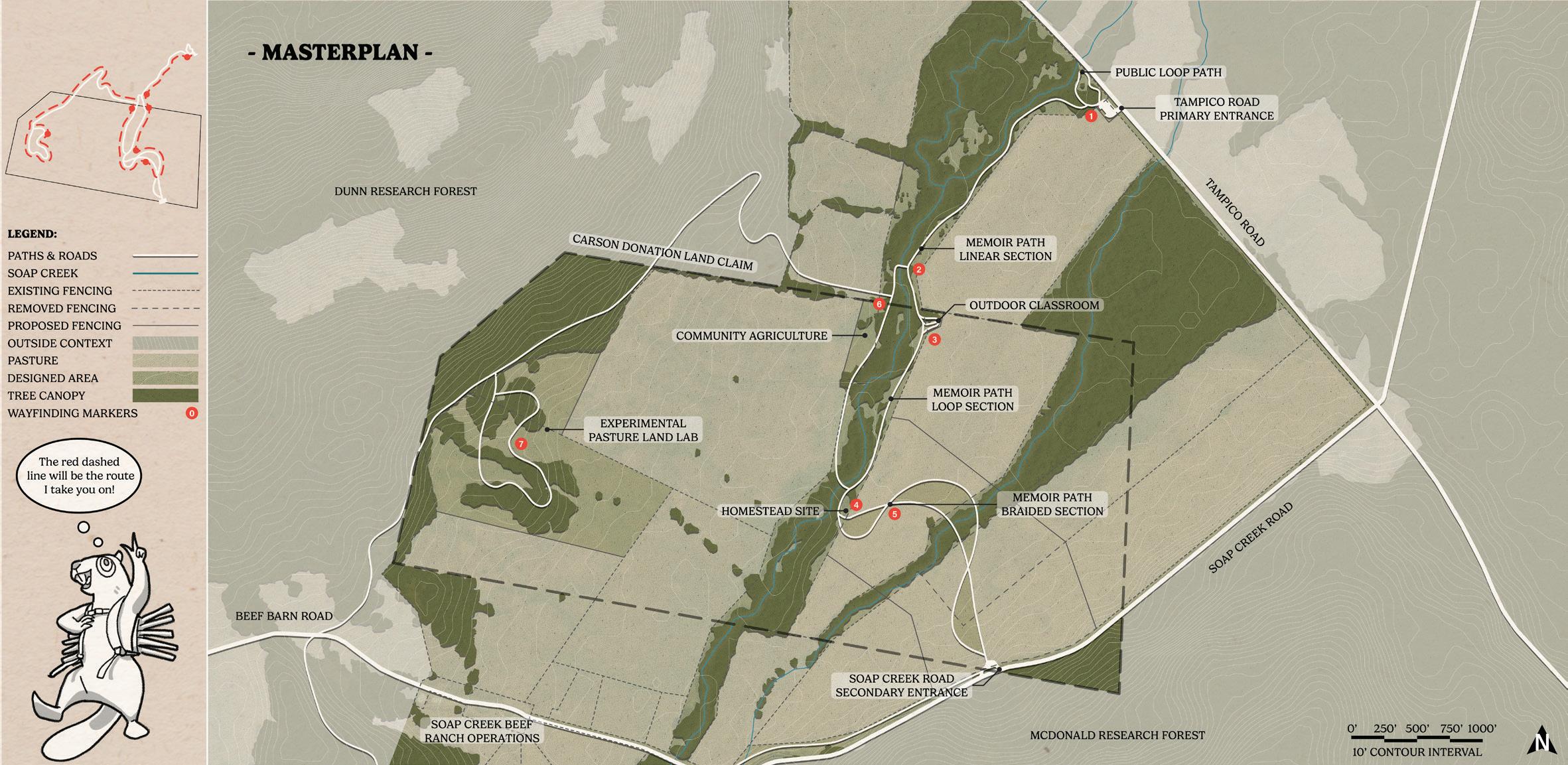
“Letitia Carson’s Legacy: Healing Ourselves, Our Community, & Our Land”
- Led group effort to synthesize & improve project for award submission after completion of two-term studio sequence
Oregon Student Honor Award
“Letitia Carson’s Legacy: Healing Ourselves, Our Community, & Our Land”
Marie and Arthur Berger Scholarship in Landscape Architecture
William Riley “Tex” Matsler Memorial Scholarship in Landscape Architecture
Landscape Architecture / Urban Design Internship
- Designed historic reuse concepts for the Oregon & Washington Interstate Bridge Replacement (IBR) project
- Developed ecological restoration plans for climate resillience with predictive planting in the IBR corridor
- Planting & landscape design in a variety of urban, suburban, rural, & industrial settings across different climates
- Research & site analysis for miscellaneous projects leading to an optimization in the design process
- Implemented a new file structure organizational standard to improve efficency in project development
- Established a mentorship program guiding preBLA & first-year BLA students in collaboration with the DEI committee
- Planned events and social opportunites like Shadow Mentor Day, increasing interaction & community over previous years
2024 2023
BLA Outreach Coordinator Eugene, OR
Landscape Design Internship
4.2 GPA Littleton, CO Longmont, CO
- Designed hardscapes & softscapes in residential landscapes based on client budget
- Surveyed sites for existing plant material, elevation, & dimensions for efficient base map creation
- Urban design & highways relationship
- Equitable transportation
- Landscape ecology
- Masterplanning & planning analysis
- Rendering & graphic creation
- 3D modeling
Prof. Ellee Stapleton (LA489)
OSU Soap Creek Beef Ranch. Corvallis, OR.
Community outreach, research & site design.
Letitia Carson’s Legacy utilizes the skills of landscape design to uplift several community organizations dedicated to honoring Letitia Carson, one of the first Black homesteaders in Oregon. This conceptual design made tangible the visions of our partners through the process of building authentic relationships & finding common ground through land stewardship. This studio addresses many challenging concepts, including the delicacy of telling a history embedded in narratives of race, gender, displacement, and colonialism, all while supporting current agricultural land use. My contributions were an experimental land lab for ecological & land based education & research, masterplan development, & award submission material development
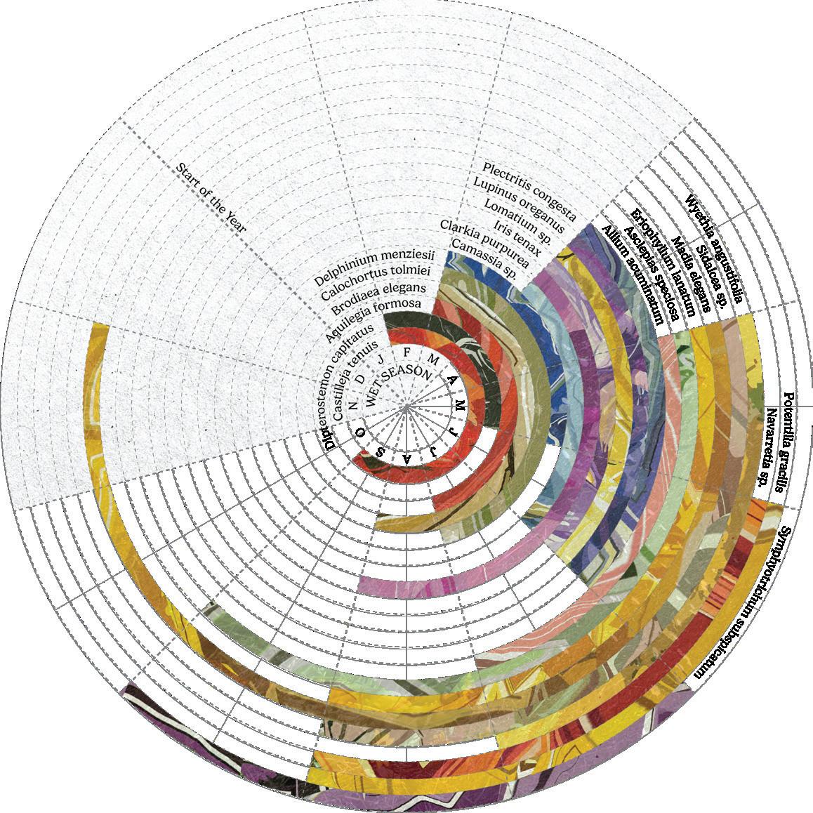
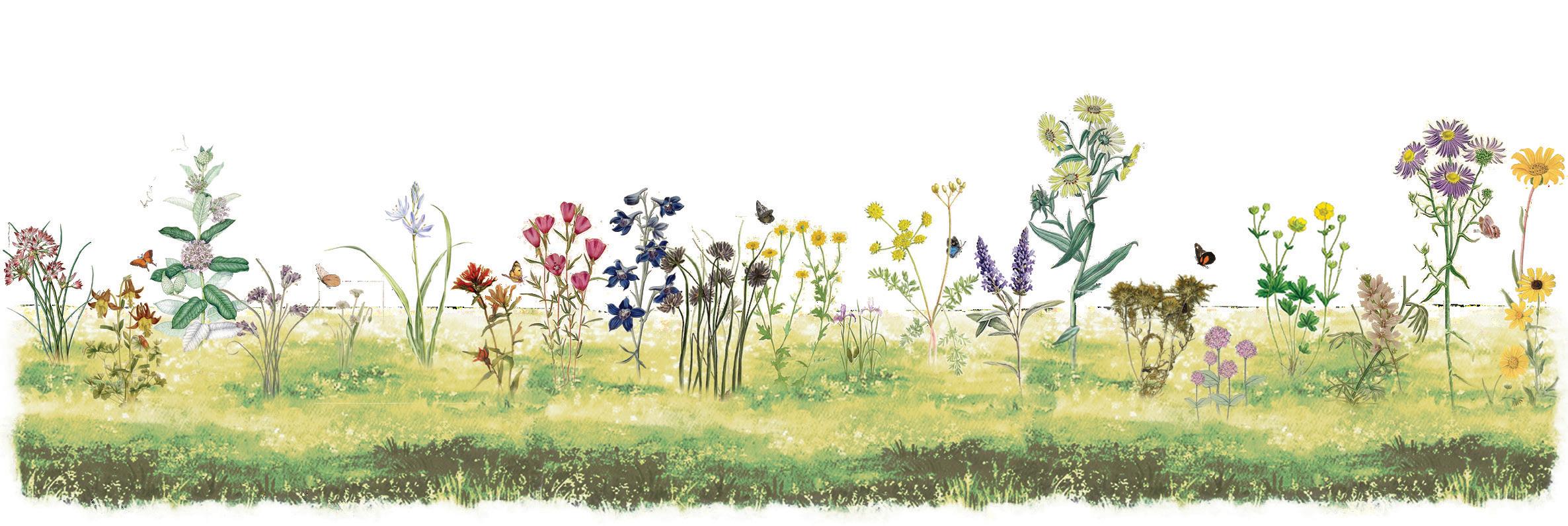
Image: Bloom wheel & section of native prairie flowers found in 2023 botanical survey on site.
*2024 ASLA STUDENT COMMUNITY SERVICE HONOR AWARD WINNER*
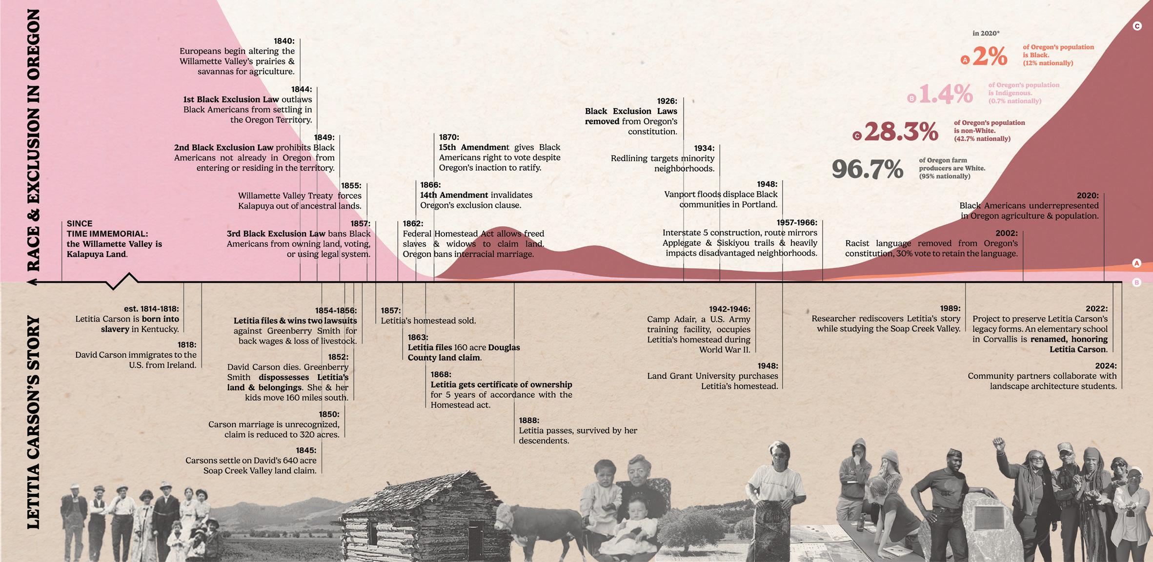
Letitia Carson’s story is embedded in Oregon’s complex history of race, gender, colonialism, displacement, & land.
Graphics & Layout: Carson Butler BLA ‘25

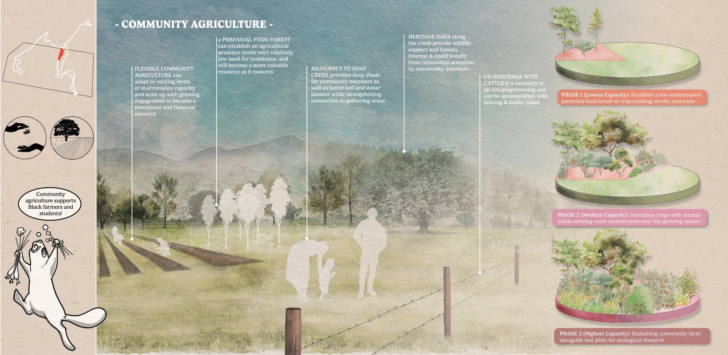
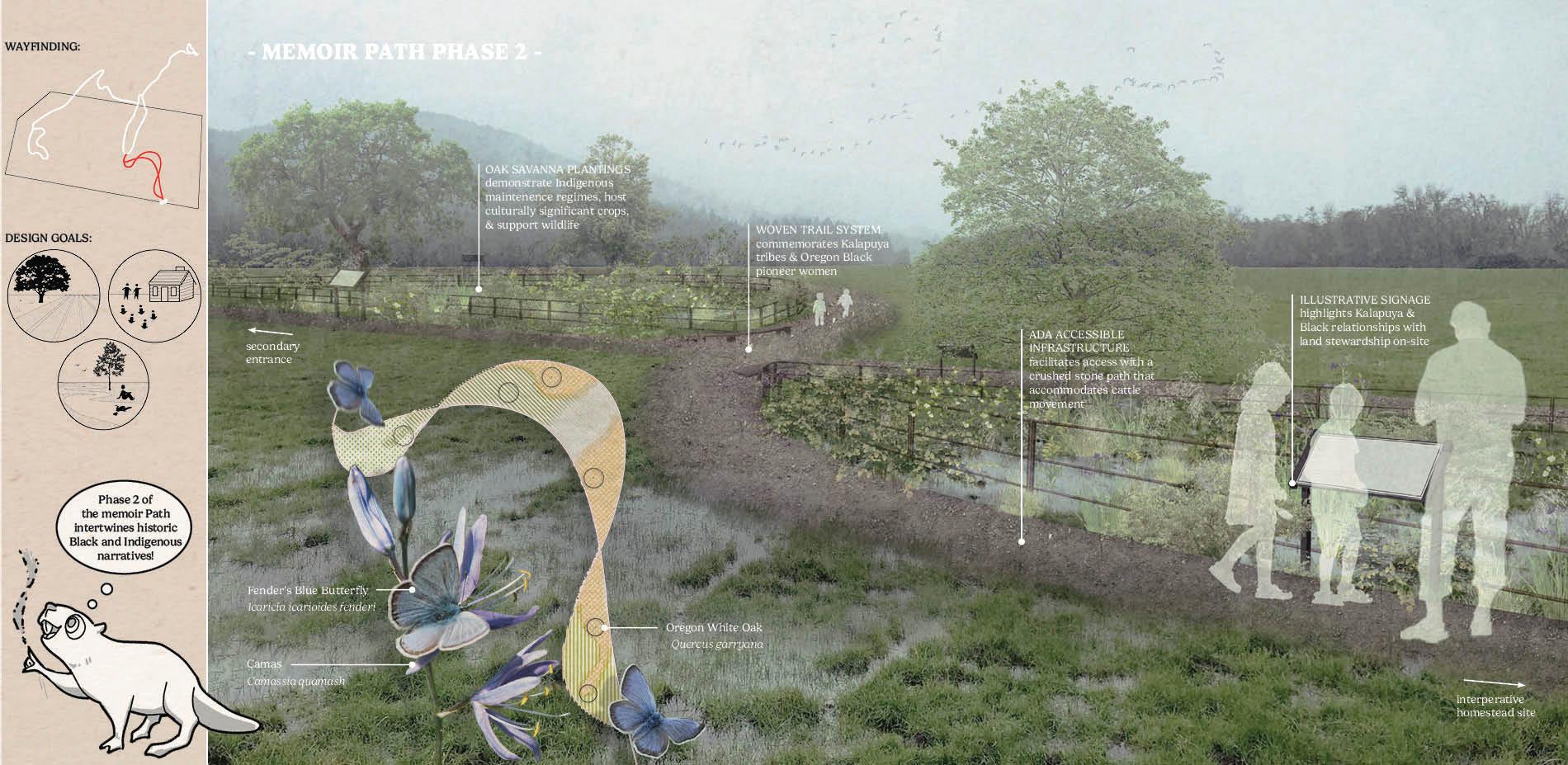
The braided portion of the interpretive trail system focuses on ecological restoration, stewardship, & storytelling.
Graphics: Steven Garcia MLA ‘25 - Layout: Carson Butler BLA ‘25
To avoid impacts to the cattle pasture, design interventions are concentrated in the riparian area.
Graphics & Layout: Carson Butler BLA ‘25
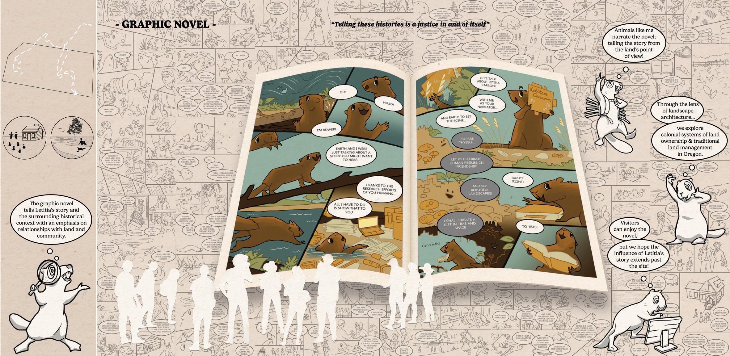
The graphic novel supports the Letitia Carson Legacy Project’s mission to widely share Letitia’s story.
Graphics: Emma LoCicero BLA ‘25 - Layout: Carson Butler BLA ‘25


Prof. Ignacio López Busón (LA489)
University of Oregon. Eugene, OR.
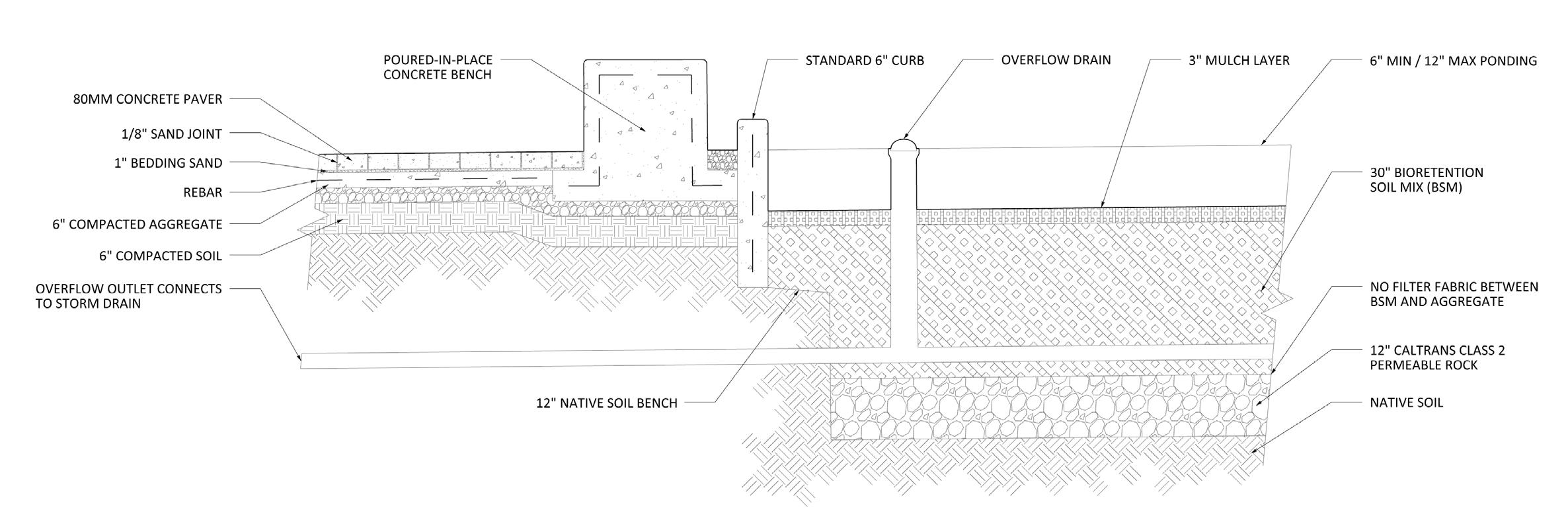
Design documentation, construction details, & grasshopper.
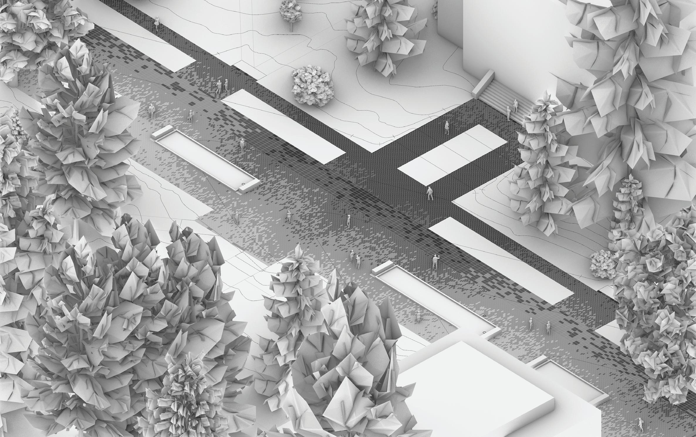
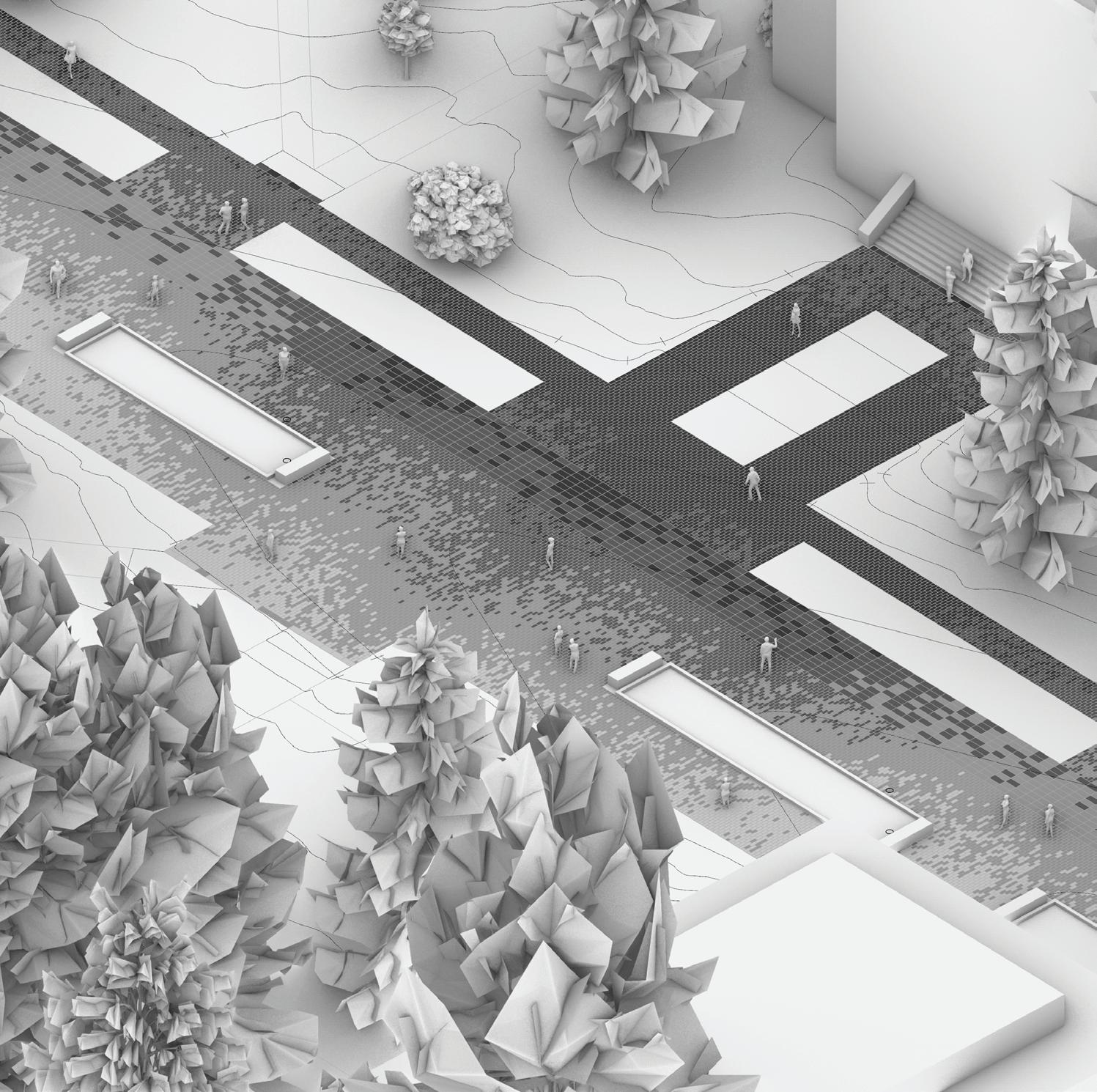
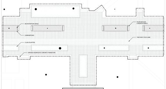
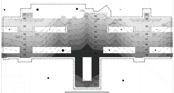
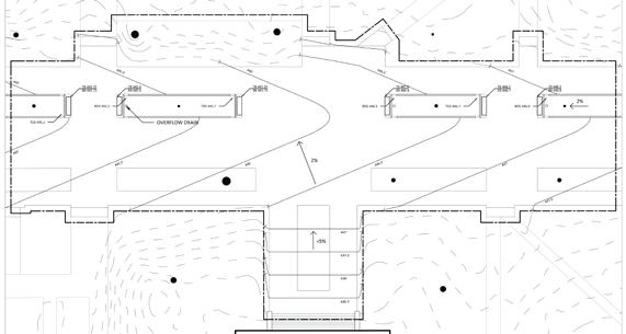
13th Avenue, the University of Oregon’s main street, retains an auto-oriented design, despite its complete pedestrianization in the late 20th century.
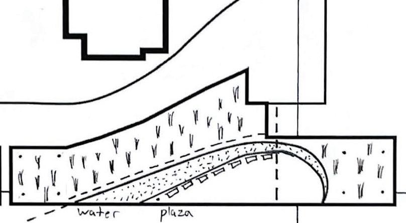
The redesign, focusing on how paving systems can create a cohesive aesthetic along a pedestrian open space axis. Based on a conceptual masterplan and a 20’ scale focus site, an in-depth design documentation set concerning materiality, constructability, accessibility, place-making, water management, & sustainability
The paving is inspired by Oregon’s Cascade range with a volcanic peak in the central plaza. The curbless design doubles the pedestrian area, & adds a combined bike & essential vehicle access lane
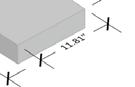
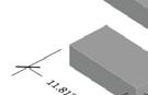
Image: Rendered isometric, stormwater detail, paver specifications, & design documentation plans.

Prof. Joan Honeyman (LA439)
Fairmount. Eugene, OR.
Group collaboration & thematic design.
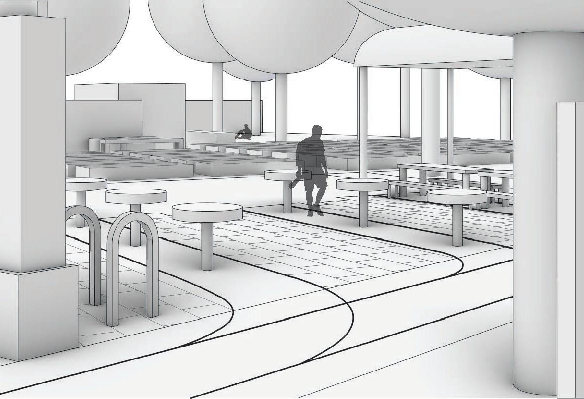
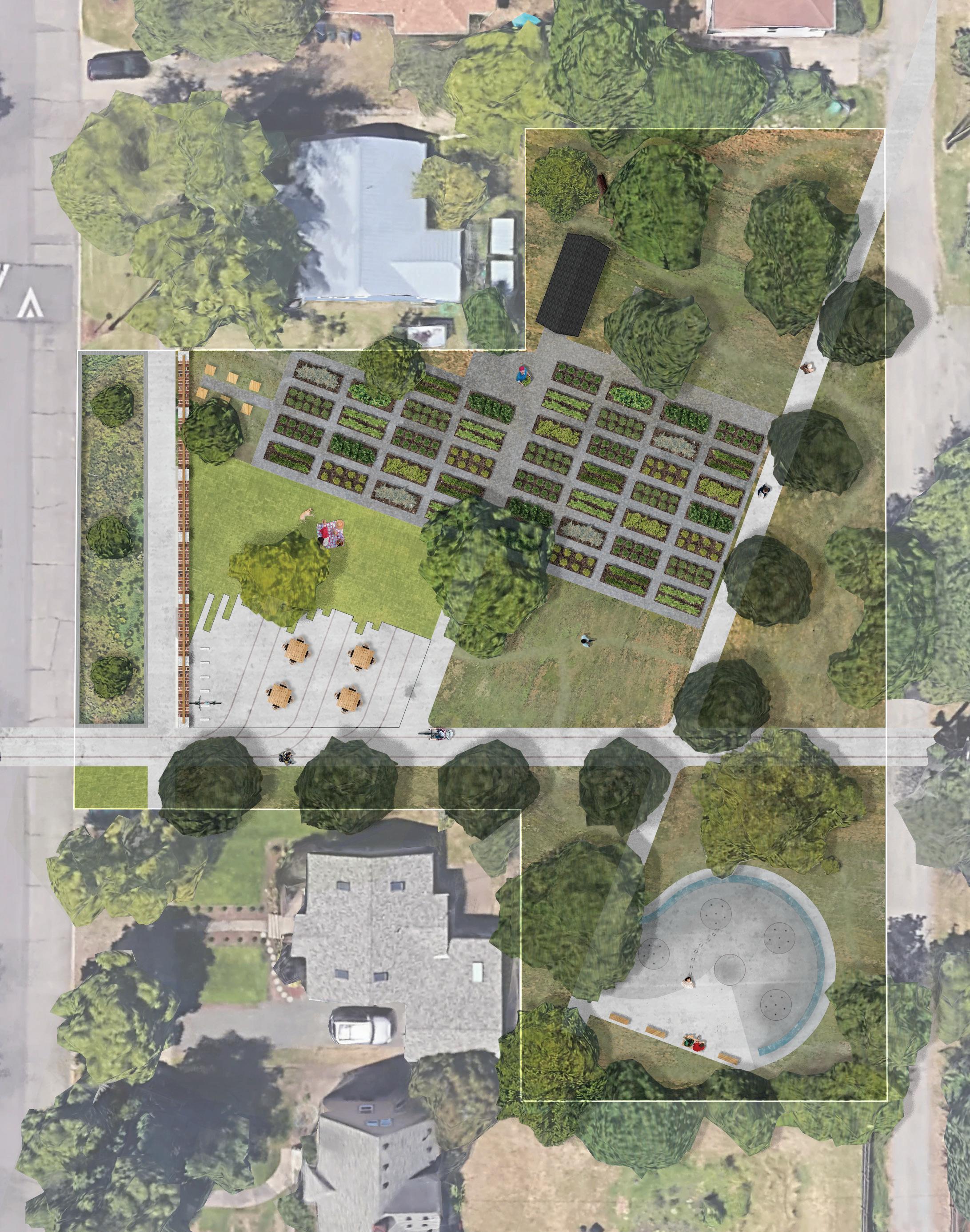
The Graceful Edge is a compromise & aesthetic transtition between the rapid development of the University of Oregon to the north & the wealthy Fairmount neighborhood to the south. Four disconnected University plots were chosen for a linear park that serves the needs of both communities.
As a group, we created the Fairmount Line Park, a streetcar themed park based on Eugene’s transportation history. The separate lots are stitched together through a main multi-use path serving as a mock streetcar line. My site, the third on the line, is “The Railyard.”
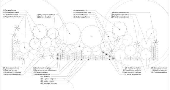
The .7 acre park is anchored by a community garden, an entrance plaza, a wheel splash pad, & educational nature patches.
Image: “The Railyards” park plan with entrance perspective & site disconnection diagram.
Prof. Mark Eischeid, Liska Chan, & Kim Karlsrud (LA494/9)
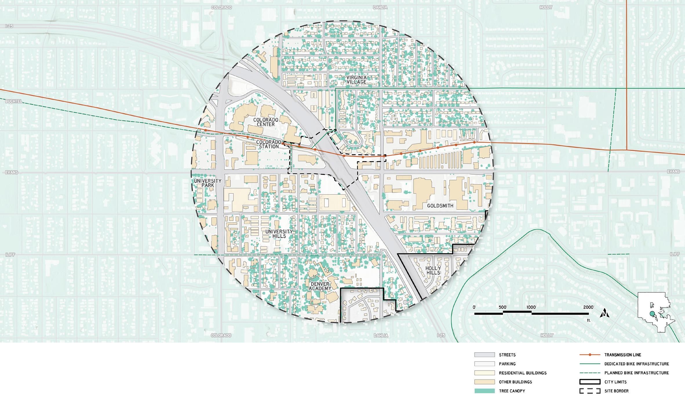
Evans & I-25. Denver, Colorado.
Comprehensive BLA project.
Denver’s rail network suffers from low ridership induced by transit allignment along freeway & freight corridors, poor land-use adjacent to stations, & car centric planning. These issues culminate in Southeast Denver at Evans & I-25 -- the edge of Denver’s prewar core.
Colorado station, the future terminus of the Colorado BRT line, is a sunken station serving the E & H lines on a former railroad ROW adjacent to the Colorado Center office complex.
After a term of analysis, I’m recommending the decommissioning of the Evans & I-25 interchange with the constrution of a highway cap park integrated into transit orientated development along a multimodal greenway through a transmission line & former railroad right-of-way.
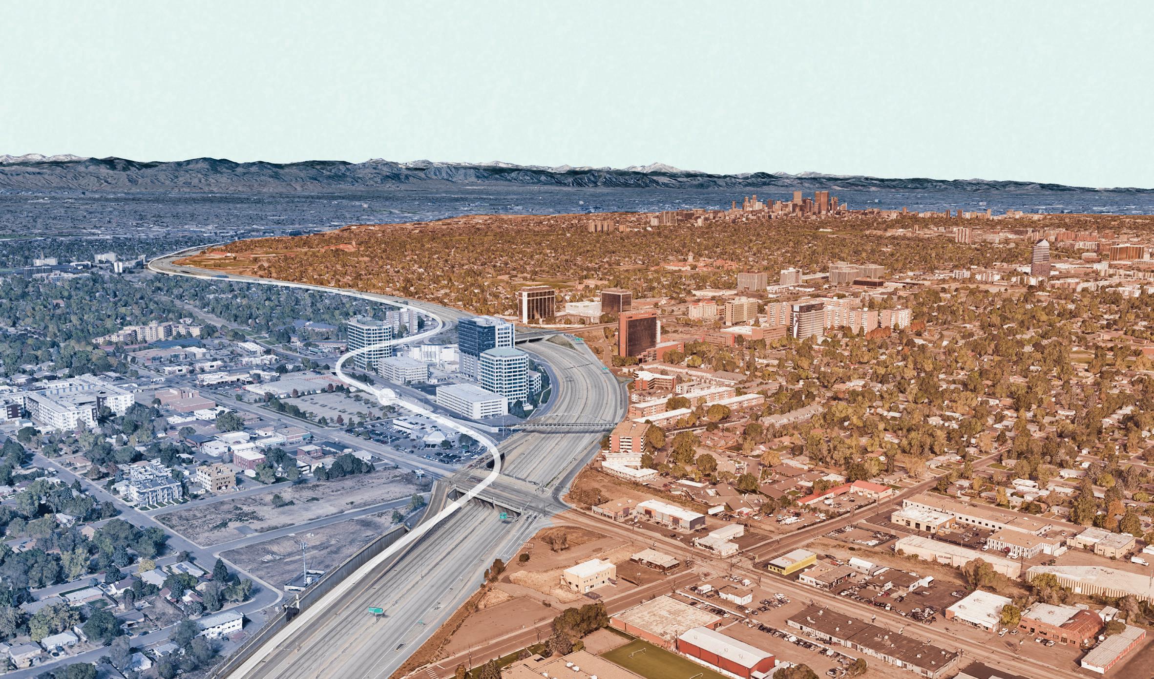
Image: A bird’s-eye view from Evans & I-25 looking northwest towards Downtown Denver & the foothills.
Regional Context: City & County of Denver
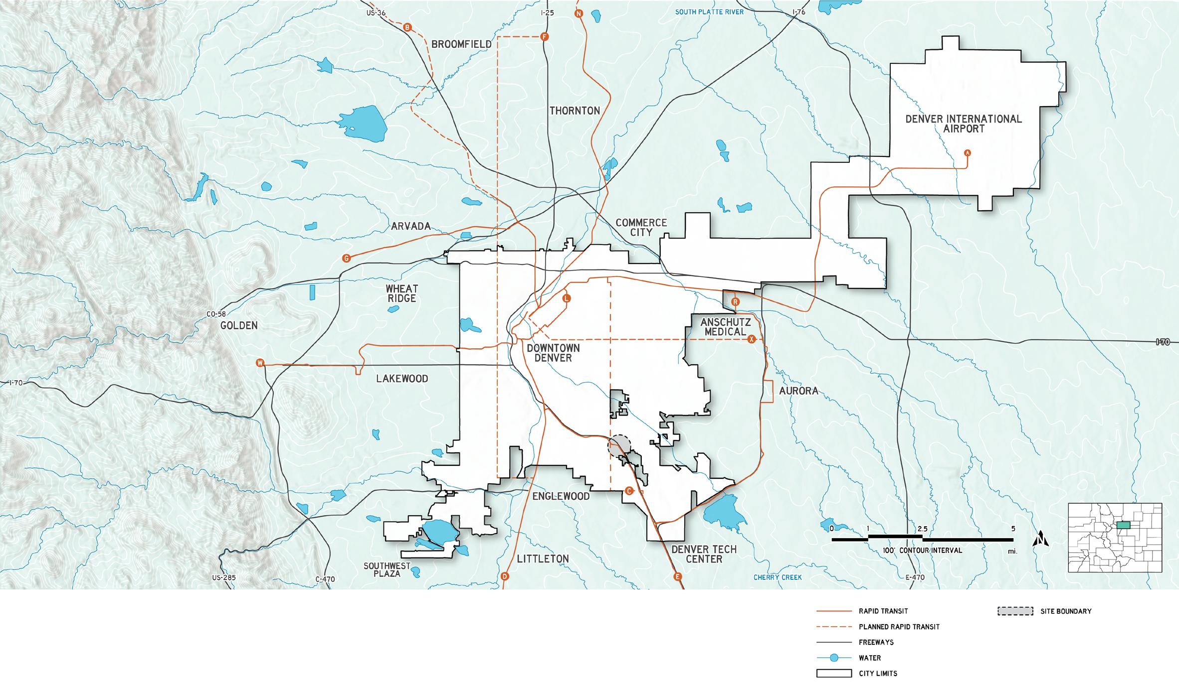
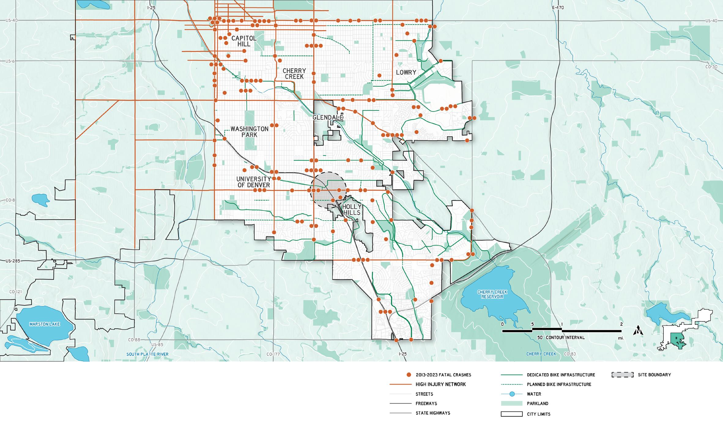
Local Context: Southeast Denver
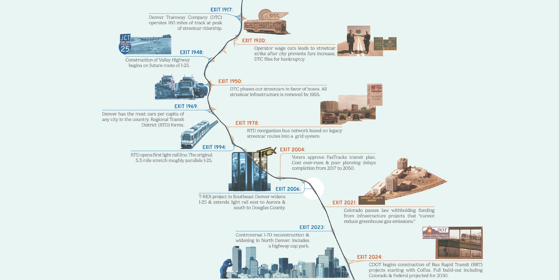
Denver Transportation Timeline
Site Context: Evans & I-25
Existing conditions
Editing: multiplication
Contextualization: present
Contextualization: future
Materiality: Douglas-Fir
Materiality: concrete
Verbal Prompts: to observe
Verbal Prompts: to contrast


BIKE PARKING
Prof. Mark Eischeid (LA439)
University of Oregon. Eugene, OR.
Hand drawing & AutoCAD
Assembly can be understood as the tangible relationship between a complete object & its constituent elements. This studio focuses on the design & communication of landscape elements & spaces through assembly
The existing plaza north of the intersection of 13th Ave. & University St. at the center of the University of Oregon campus is to be developed as a promenade that doubles as a gathering space for students.
The core of the promenade took inspiration from the campus’s connections with the Willamette river, creating an abstract river-like paving pattern made from exposed aggregate concrete. Program includes accessible car & bike parking, small plazas, intimate seating areas & native planting.
Image: Prompt-based sketch iterations & drafted plan.
L.I.D. Landscapes Internship.
Boulder County, Colorado.
Residential design, planting, & drafting
L.I.D. Landscapes is a design-build landscape design build company serving Boulder County & the North Denver suburbs.
As intern, I worked on measuring sites, creating base maps, budgeting & concept designs in AutoCAD for a variety of sites. For each client, I designed three different plans.
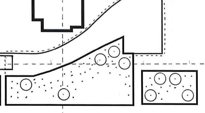
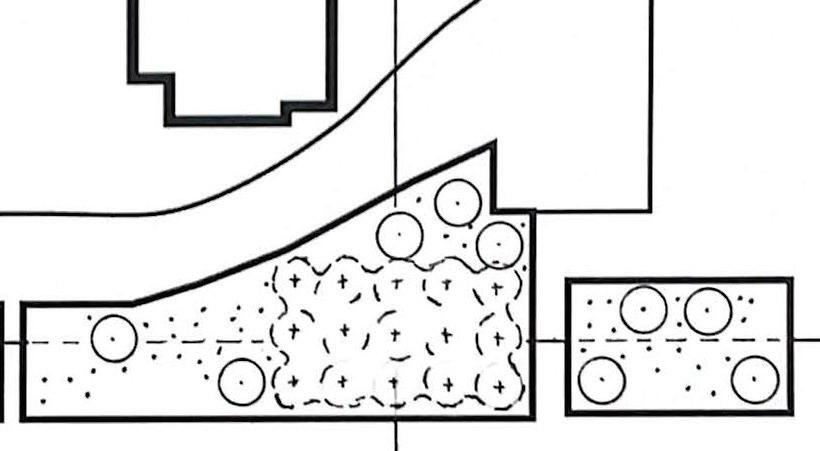
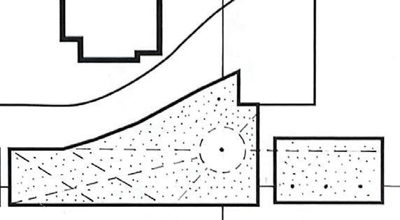
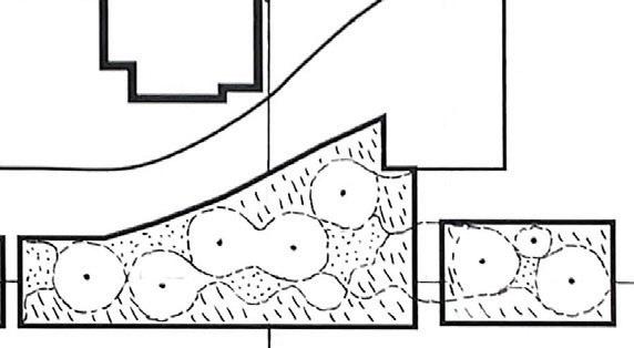
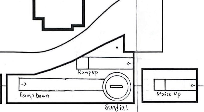
The client asked for a flat turf area for a large wedding tent, alpine inspired native planting & easier access to the turf areas & garden spaces.
Image: Alpine inspired backyard planting design.
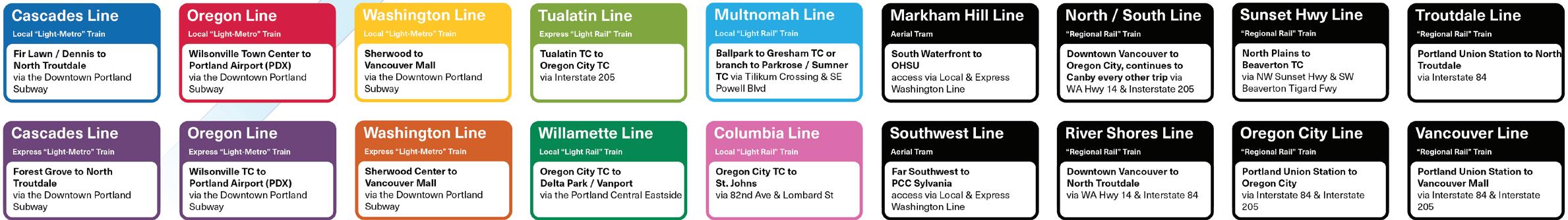
Portland, OR Metropolitan Area.
Transit system design & planning-scale analysis.
The existing TriMet MAX system consists of 5 light rail lines that run in freeway medians, exclusive rail right-of-ways & in mixed-traffic. The headways are restricted by a bottleneck crossing the Willamette River. The system lacks express trains & grade separation, causing infrequent & unreliable service. TriMet’s existing 2050 plan has an overeliance on standard bus service & unsuitable & poorly routed rail extensions showing little advancement from 20th century planning.
The expansion consists of local (6 min. frequencies) & express (12 min.) automated light-metro lines, regional rail (30 min.) light rail (8 min.) & aerial tramways (5 min.).
Currently, Downtown to the airport takes 40 minutes. On a new express train it takes 20 minutes, 5 minutes faster than driving. These time savings are made possible by automated trains, downtown subway, dedicated express tracks on light metro lines & full grade separation.
Image: Diagrammatic transit expansion map.