GOING WITH THE FLOWS 5a


GROUP 5A

Porto Marghera is one of the most important European industrial sites, located in a strategic area given the presence of a strong infrastructure that better connects it with the coastline and the inner mainland.
The evolution and growth of the industrial harbor started in the first half of the 20th century allowing Marghera to become one of the most important sites for the production and processing of chemical products. The logistic component was also relevant due to the presence of warehouses for goods exchange between the Mediterranean routes and Northern Europe.
By the end of the 1960s an exponential growth of workers' presence occurred, influencing and changing the urban conditions of the area and its surroundings. Hence, there was a better development of streets and railways to link the working areas to the outskirts of Mestre.
During the last decades of the 20th century Porto Marghera faced a period of crisis and changes which are still visible and continue nowadays. Throughout the years, this condition worsened the presence of abandoned places and urban voids generating new limits inside the area that influence the flows related to human activities.
The following analysis has as main objective the research and the study of the site to understand if Porto Marghera is only a transition zone for workers and processed goods or a livable ecosystem, therefore which relationship exists between humans and this “industrial island”.
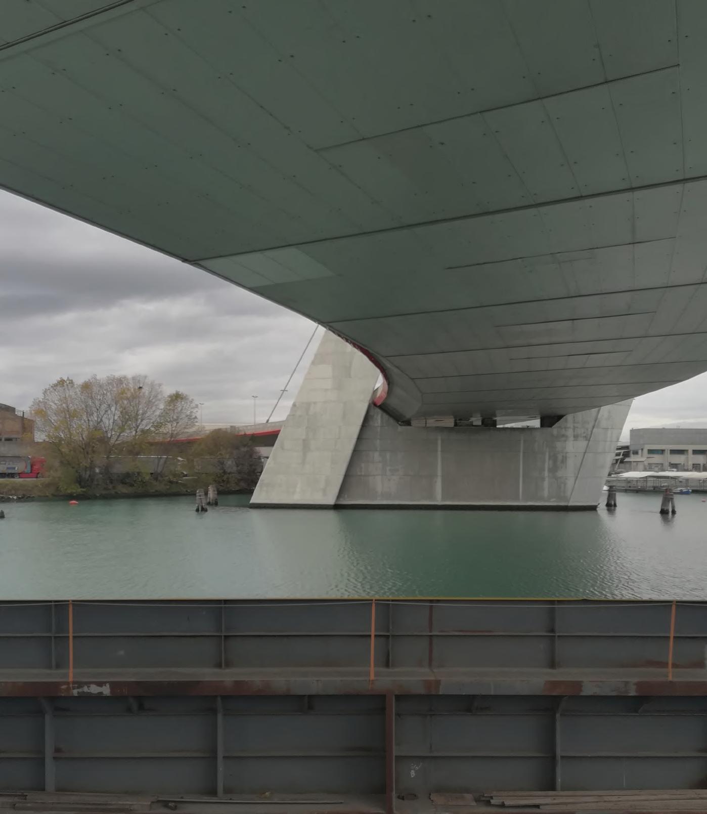
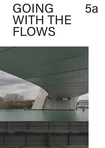
Starting from our site inspection, the first impression we had of the area was that the large vastity of the site is home to big industries, with very few spaces left for the human scale. The clear division of the private industries lots is easily understandable due to the presence of fences and boundary walls. At the same time the railways and some of the infrastructures present there are elements that don't allow an easy connection between this part of the city and the historical centre of Meste.
Site inspection_01 2nd December
Site inspection_02 19th December
Site inspection_03 27th January


During the 1930s the metallurgical industry started to grow thanks to the presence of one of the biggest thermal power station in Italy. Other activities took place in the area in order to be connected with the pre-existing infrastracture such as transport companies and textile industries.


By the end of the 1970s Porto Marghera reached its maximum expansion in terms of working population and urban settlment. A new third industrial zone was completed in the previous decade to host new activities related to the petrochemical industry.


With the last decade of the 20th century and the first of the 21st century Porto Marghera has undergone a period of delocalization and dismantling of some industrial sectors. At the same time new activities related to the services and logistic sectors took place in the area.

[The following analysis has as main objective the research and study of the site of Porto Marghera to understand if it is only a transition zone for workers and processed goods or a livable ecosystem, therefore comprehending which relationship exists between humans and this “industrial island”.]
The work conducted started from an historical evolutions of the area and the territorial mapping of building typologies, area usages and ongoing transformations of the harbour. Subsequently, the flows typologies were analysed to comprehend what and who lives Porto Marghera, starting from goods traffic to electricity and waste collectors, continuing with the tertiary services and the available transportations. Afterword, another important point of the analysis was the understanding of what kind of boundaries and limits take form from the areas’ conditions, and if they are either visual or physical ones.
As a result, do these types of flows and infrastructures, the building typology and the environment perception allow to create a connection with Porto Marghera and its surroundings? How do these flows mould the daily life in this ecosystem?


Visive or physical limit?

Starting from the wrong idea of Porto Marghera being just an industrial site without any other activities, we created a de-layering in order to better comprehend the complexity of the area and the different functions collocated there.
INDUSTRIAL ACTIVITIES
Utilities Manufacturing sector
Logistics Services (kibs)
COMMERCIAL ACTIVITIES
Retail trade (hotels, restaurants and entertainment)
Reselling activities
PUBLIC ACTIVITIES
Public services
As one of the most important industrial sites of the last century, Marghera is the perfect example of a space in need of continuous transformations. These changes, unfortunately, in the last few decades left behind a lot of areas that are now still abandoned, damaging the overall appearance of the site.
The aim of the map is to classify the different unused spaces to understand the various situations we have. Some areas are still waiting for a future transformation, others are being acquired by the Municipality and others are actually ongoing projects.
Focusing on the ongoing evolution of the private and public space of the harbour.


CURRENT SITUATION OF NON-PLACES
Abandoned areas waiting for future transformations
Areas waiting for future transformations, being acquired by the Municipality
Areas waiting for future transformations with advanced planning in the implementation phase
Scale 1:15000
From the analysis just led, the urban flows study is the chosen method to further develop the understanding of this urban ecosystem. The analyzed flows are: goods, electricity, waste, advanced tertiary services and mobility.


Urban metabolism as a new way to describe the relationship between Porto Marghera and its surroundings.


The Venetian Harbour (Porto Marghera and Chioggia) is at the crossroad of the principal European corridors, allowing fast connections to the mainland between Northern Italy and Central Europe.
Through the harbor arrive diverse types of goods, from containers to liquid and solid bulk, from cereal to steel products, and Ro-Ro/RoPax.
Industries and logistics are both part of this system and they generate flows that go way beyond the boundaries of the "industrial island".
CEREALS, FLOURS AND FERTILIZER
Grandi Molini Italiani
Cereal Docks Marghera Plant
Cereal Docks Spa Marghera Coastal Depository
ITALY
80% of the imported flours in Italy are stocked and pass through Porto Marghera
Italia
NORTHERN ITALY
Mostly in Veneto and Lombardy region thanks to the harbours in Marghera and Mantova
Acciaierie d'Italia Spa
Idromacchine Spa
TRV (Berth 28)
Posto di controllo frontalieroPorto Marghera
CONTAINERS
Terminal Intermodale Venezia
The presence of two important energy power stations near Porto Marghera is one of the reasons why the area underwent a strong development during the second half of the last century. This infrastructure allows the industrial site to become an important crossroad for the electricity in the Italian North-East region, creating a stronger connection between the energetic flows which come from the South (mostly from the Greek pipeline) and from the North-West (French pipeline).
Porto Marghera seen as an energetic hub for the North-East of Italy.
Porto Marghera's plan, focus on the main electric infrastractures
Scale 1:25000
The Municipality of Venice in these last few years has given the green light to the project for the Ecodistrict in Porto Marghera by handing 10 hectares of industrial and productive sites to the Veritas Group in order to create an ambiental district with a place for the treatment of undifferentiated waste and one to recover materials or recycle waste produced by the population or by the industries.
The final goal is the transition from a linear to a circular economy with the aim, in the future, to also involve tertiary advanced services and industries in the process.
Will Marghera be a future hub for the
At the end of the ‘90s, with the establishment of the scientific park VEGA, Venice Gateway for Science and Technology, Porto Marghera opened its doors to the advanced tertiary sector and to cultural creative services, as well as the social ones.
Meanwhile with the birth of new university centres like Ca’ Foscari and IUAV and social hubs for the leisure time like Forte Marghera and Parco San Giuliano, VEGA acquires the role of engine for urban regeneration of Porto Marghera allowing the flows of people and datas inside and outside Venice.
Porto Marghera regarded as a new multifunctional space for the social and public life of the neighbourhood.
Timetable of the users of VEGA
Connections between industries, services and the territory
As for what concerns the public mobility in Porto Marghera, the bike sharing service, bike lanes, and the tram service don’t arrive to the industrial site, but some bus lines are especially dedicated to this area having some specific time tables directly linked to the workers’ schedules. Moreover, Porto Marghera train stop is located in front of VEGA park. However, people relying on private transportation don’t have many parking lots available, therefore arranging informal ones on the streetside and on available open spaces.
The lack of connections between the industrial site and its surroundings.


Porto Marghera's plan, focus on the accessibility of the area
Scale 1:30000
MestreFSCSCavalcaviaVempa AzotoSottana
AzotoSottana
8:15 17:30 8:16 17:31 8:22 17:37 CavalcaviaMestreFSCS Vempa MestreFSC5 8:31 17:46 8:32 17:47 8:25 17:40 CavalcaviaVempa 5:24 6:48 7:38 8:24 13:24 21:24 5:25 6:49 7:39 8:25 13:25 21:25 BandieraDurando 5:27 6:51 7:41 8:27 13:27 21:27 BandieraCantore 5:28 6:52 7:42 8:28 13:28 21:28 BandieraTommaseo 5:29 6:53 7:43 8:29 13:29 21:29 BandieraGhega 5:30 6:54 7:43 8:30 13:30 21:30 BandieraCruto 5:31 6:55 7:44 8:31
ChimicaIngresso8ChimicaIngresso7
LibertàPortoMargheraLibertàFincantieri BandieraDurando 17:37 17:38 17:41 BandieraCantore 17:42 BandieraTommaseo 17:42 BandieraGhega 17:43 BandieraCruto 17:44 PadanaColombara 17:46 MalcontentaPadana 17:47 MalcontentaPadanaPadanaColombaraBandieraCruto 6:27 6:30 6:49 7:05 16:30 6:28 6:31 6:50
15:41 16:30 6:29 6:32 6:51 7:07 15:42 16:31 BandieraGhega 6:30 6:33 6:52 7:07 15:43 16:32 BandieraTommaseo 6:30 6:33 6:52 7:08 15:43 16:33 BandieraCantore 6:31 6:34 6:53 7:09 15:44 16:34 BandieraDurando 6:32 6:35 6:54 7:10 15:45 16:35 LibertàFincantieri
6:35 6:38 6:57 7:13 15:48 16:38 LibertàPortoMarghera
6:36 6:39 6:58 7:13 15:49 16:38
BandieraColombara 5:32 6:56 7:45 8:32
MalcontentaPadana 5:33 6:57 7:46 8:33 13:33 21:33 MalcontentaChimica 5:34 6:58 7:47 8:34 13:34 21:34 ChimicaMeccanica 5:35 6:59 7:48 8:35 13:35 21:35 ChimicaIngresso4 5:36 7:00 7:50 8:36 13:36 21:36 ChimicaIngresso5 5:37 7:01 7:51 8:37 13:37 21:37 ChimicaIngresso7 5:38 7:02 7:52 8:38 13:38 21:38 ChimicaIngresso8 5:40 7:04 7:54 8:40
ChimicaIngresso5BandieraCantoreChimicaMeccanicaMalcontentaChimicaMalcontentaPadanaPadanaColombaraBandieraCrutoBandieraGegaBandieraTommaseoBandieraCantore 6:15
BandieraDurando
CavalcaviaVempaMestreFSC5
LibertàPortoMarghera LibertàFincantieri
BandieraDurandoBandieraCantoreBandieraTommaseoBandieraGhegaBandieraCrutoPadanaColombara
BandieraGhegaBandieraCantore BandieraTommaseo LibertàFincantieri
PadanaAvenaBandieraCruto 4:53 5:17 5:23 5:57 6:18 6:23 6:52 6:56 7:13 7:17 7:27 7:32 7:52 8:07 8:13 8:22 8:32 8:52 9:13 9:22 9:32 9:43 9:52 10:13 13:32 10:52 12:13 15:52 13:13 13:22 13:32 13:44 13:52 14:13 14:32 14:52 15:13 15:32 15:52 16:13 16:32 16:52 17:13 17:32 17:52 18:13 18:32 18:52 19:13 19:32 19:52 20:33 20:52 21:28 21:52 22:28 23:23
4:54 5:18 5:24 5:58 6:19 6:24 6:53 6:57 7:14 7:18 7:28 7:33 7:53 8:08 8:14 8:23 8:33 8:53 9:14 9:23 9:33 9:44 9:53 10:14 13:33 10:53 12:14 15:53 13:14 13:23 13:33 13:45 13:53 14:14 14:33 14:53 15:14 15:33 15:53 16:14 16:33 16:53 17:14 17:33 17:53 18:14 18:33 18:53 19:14 19:33 19:53 20:34 20:53 21:29 21:53 22:29 23:24 4:54 5:18 5:24 5:58 6:19 6:24 6:53 6:57 7:14 7:18 7:28 7:33 7:53 8:08 8:14 8:23 8:33 8:53 9:14 9:23 9:33 9:44 9:53 10:14 13:33 10:53 12:14 15:53 13:14 13:23 13:33 13:45 13:53 14:14 14:33 14:53 15:14 15:33 15:53 16:14 16:33 16:53 17:14 17:33 17:53 18:14 18:33 18:53 19:14 19:33 19:53 20:34 20:53 21:29 21:53 22:29 23:24 4:55 5:19 5:25 5:59 6:20 6:25 6:54 6:58 7:15 7:19 7:29 7:34 7:54 8:09 8:15 8:24 8:34 8:54 9:15 9:24 9:34 9:45 9:54 10:15 13:34 10:54 12:15 15:54 13:15 13:24 13:34 13:46 13:54 14:15 14:34 14:54 15:15 15:34 15:54 16:15 16:34 16:54 17:15 17:34 17:54 18:15 18:34 18:54 19:15 19:34 19:54 20:35 20:54 21:30 21:54 22:30 23:25 4:56 5:20 5:26 6:00 6:21 6:26 6:55 6:59 7:16 7:20 7:30 7:35 7:55 8:10 8:16 8:25 8:35 8:55 9:16 9:25 9:35 9:46 9:55 10:16 13:35 10:55 12:16 15:55 13:16 13:25 13:35 13:47 13:55 14:16 14:35 14:55 15:16 15:35 15:55 16:16 16:35 16:55 17:16 17:35 17:55 18:16 18:35 18:55 19:16 19:35 19:55 20:36 20:55 21:31 21:55 22:31 23:26
4:57 5:21 5:27 6:01 6:22 6:27 6:56 7:00 7:17 7:21 7:31 7:36 7:56 8:11 8:17 8:26 8:36 8:56 9:17 9:26 9:36 9:47 9:56 10:17 13:36 10:56 12:17 15:56 13:17 13:26 13:36 13:48 13:56 14:17 14:36 14:56 15:17 15:36 15:56 16:17 16:36 16:56 17:17 17:36 17:56 18:17 18:36 18:56 19:17 19:36 19:56 20:37 20:56 21:32 21:56 22:32 23:27 5:00 5:24 5:30 6:04 6:25 6:30 6:59 7:03 7:20 7:24 7:34 7:39 7:59 8:14 8:20 8:29 8:39 8:59 9:20 9:29 9:39 9:50 9:59 10:20 13:39 10:59 12:20 15:59 13:20 13:29 13:39 13:51 13:59 14:20 14:39 14:59 15:20 15:39 15:59 16:20 16:39
Being Marghera a constellation of different industries it is understandable that the distinction between private and public space must be strong and clear. The presence of boundaries, both physical and visual, defines a very peculiar conformation of the area.
In the map, the accessible roads and paths are highlighted together with a more precise differentiation of the kinds of limits present with high walls and grid fences being the most prevalent ones.
Another boundary is the railway that splits the city in two but it can be overcome by the presence of different streets, bridges and underpasses.
Strong division between Marghera and Mestre due to the presence of some infrastructures such as railways and the regional highway SR11.
How infrastructures interact with the urban settlement? From the diagram it can be seen how some streets follow the borders of the area while others overcome them with bridges and underpasses.


With the use of the section we can better understand the difference between the physical and visual limits we find in the area. The distinction of the two types is important because not always one can substitute the other. The aim of the physical limit is to create a distinction between the reachable and unreachable areas but visually the connection with the private sites is kept.
On the other hand, with the use of the visual limits the level of privacy and distinction is much higher, not letting perceive what it’s on the other side.


Section


Given the flows analysis just conducted it was possible to highlight three macro themes to describe and comprehend Porto Marghera: the physical conditions of the area, to whom/what are the spaces dedicated to and how flows influence the site.
Given the transformations Porto Marghera underwent over the past decades we can, nowadays, see the presence of many abandoned sites and a strongly marked division between the public and private spaces. Another consequence is the absence of people-friendly spaces due to the failure of the improvement of the diversification in the economy and the infrastructure.
As far as the second topic is concerned it is possible to see a clear zoning of the spaces which creates a sharp division in functions and area livability, such as sites only dedicated to logistics and goods trade and the ones dedicated to advanced tertiary services where the human presence is surely more visible.
Consequently there is an highly presence of wide streets for cars and trucks and a low presence of sidewalks, public transportations and the almost absence of gathering spaces unless linked with the already present VEGA park.
Therefore the analysis leaves us with a question to answer: is Marghera just an industrial site?
The first approach when starting to study Marghera was to think about it just as a big industrial site with no specific differentiations between the different realities that characterise the harbour.
Beyond this first impression, we discovered a more complex area than what we thought and through the usage of the urban metabolism and the comprehension of the different flows, building typologies and usages that compose the ecosystem.
Trying to answer the question if Marghera is just an industrial site, we can now confidently answer that it is not. Besides, regarding the livability of the space we can declare that in the last years different activities were born in order to diversify the economy and the typologies of human and goods flows.
The workers of the advanced tertiary services become the main actors and inhabitants of this area of the city thanks to the addition of services that go beyond the working aspects.
In conclusion, we can say that the potential of the area is already there but in order to improve it we think there should be a better development of some aspects such as public transportation, creation of gathering spaces not only for workers but for the community as well and development of the existing infrastructure.
All the assignment has been carried out with the contribution of every single member of the group. We divided the different topics within each other but we always worked together with video calls to solve problems and doubts. Some materials used in the booklet, such as photos and diagrams, were uploaded on our drive so everyone was aware of what the others were doing.
Grulois G. & Tosi M. C. & Crosas C. (2018) - Designing Territorial Metabolism, Jovis Verlag GmbH, Berlin
Tosi M. C. & Faraone C. (2021) - Città e lavoro; spazi, attori e pratiche della transizione tra Mestre e Marghera, Quodlibet, Macerata
History and evolution
Information for maps obtained from: http://mestrenovecento.silvenezia.it/map=porto_marghera_1935 https://circe.iuav.it/catalogo-foto-aeree/
pp. 12-13
Is Marghera just an industrial site? pp. 18-19
Information for maps and delayerings obtained from: https://idt2.regione.veneto.it/idt/search/searchPage
Movements in the harbour pp. 24-25
Information for maps and diagrams obtained from: https://www.port.venice.it/it
Cyber Network pp. 26-27
Information for maps and diagrams obtained from: https://idt2.regione.veneto.it/idt/search/searchPage https://www.limesonline.com/litalia-elettrica/7319
Waste Cycle
pp. 28-29
Information for maps and diagram obtained from: https://www.comune.venezia.it/sites/comune.venezia.it/files/page/files/20200908%20Ecodistretto%20PortoMarghera%20-%20relazione%20rev05.pdf
Advanced tertiary services
Information for maps and diagrams obtained from: https://www.vegapark.ve.it/
pp. 30-31
Mobility pp. 32-35
Information for maps, delayerings and diagrams obtained from: https://actv.avmspa.it/sites/default/files/Mappa_linee_Mestre_mod_02_22.pdf https://www.comune.venezia.it/sites/comune.venezia.it/files/immagini/MobilityManager/mappaBKSH_2022.pdf