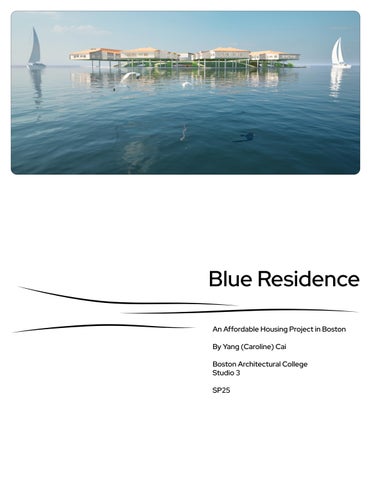
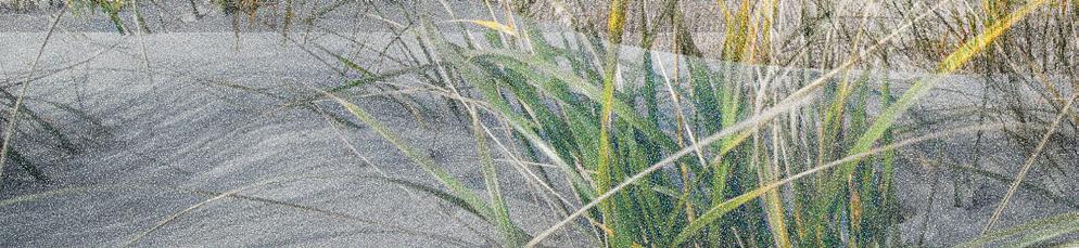
Blue Residence
An Affordable Housing Project in Boston
By Yang (Caroline) Cai
Boston Architectural College
Studio 3
SP25
Table of Content Site Analysis
Project Manifesto
Basis of Design
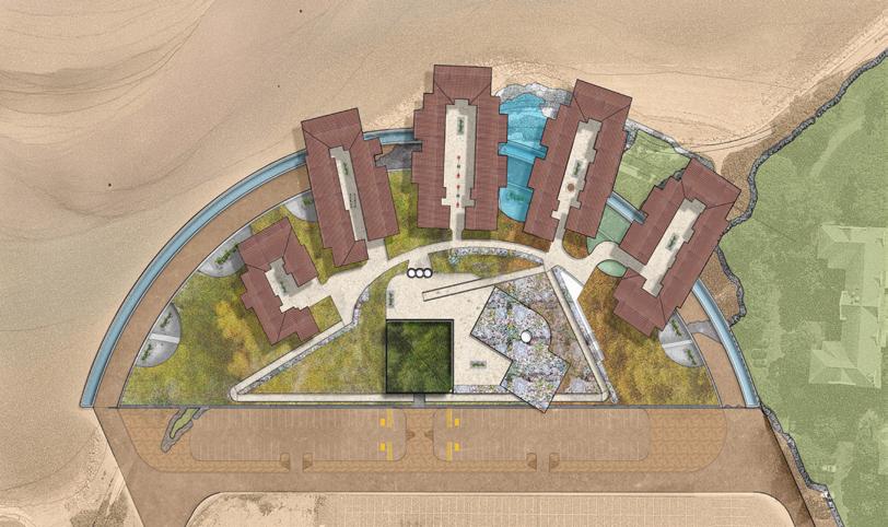
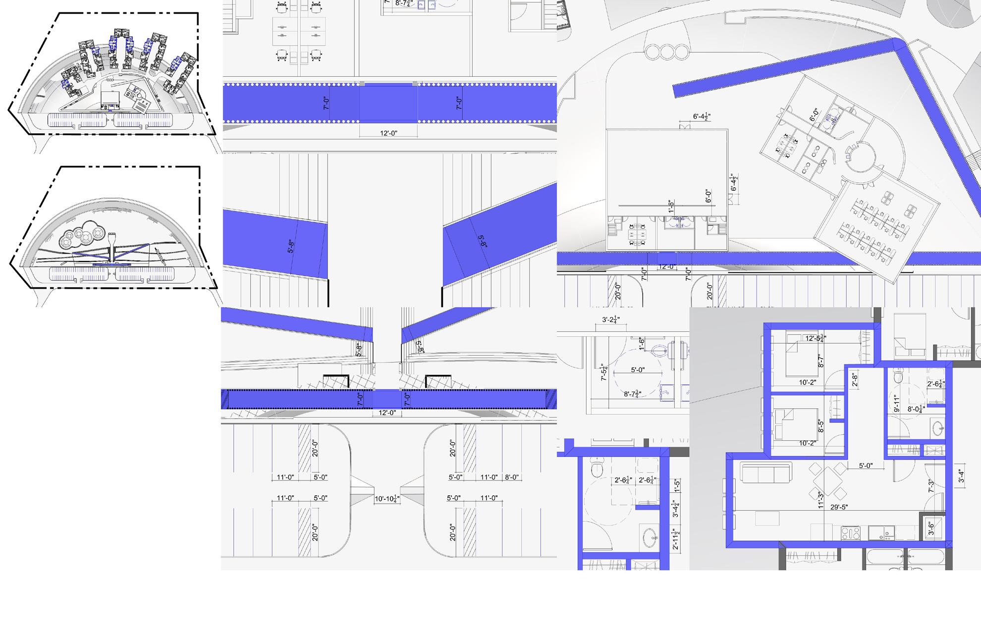
Schematic Design
Structure Inspiration
Hydrology
Circulation
Materials
Flood Mitigation
Visualization
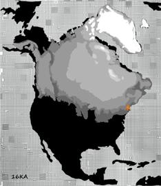
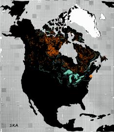
One hundred and fifteen thousand years ago, Boston was covered under the largest ice sheet - Laurentide Ice Sheet.
The melting of the Laurentide Ice Sheet significantly contributed to the geological landscape of the City of Boston as we know today.
When further examining the history of Dorchester Bay, the heart-wrenching history of the prisoners of World War I & II, tell the story of virtue of resilience and hope.
To which, I think architecture is merely a quiet statue, if without life in it. But what kind of life might that be, in such a time when spaces are created by the lifeless materiality that we all consume? After all, it is us humans, who infuse meanings into memories and turn stories into realities.
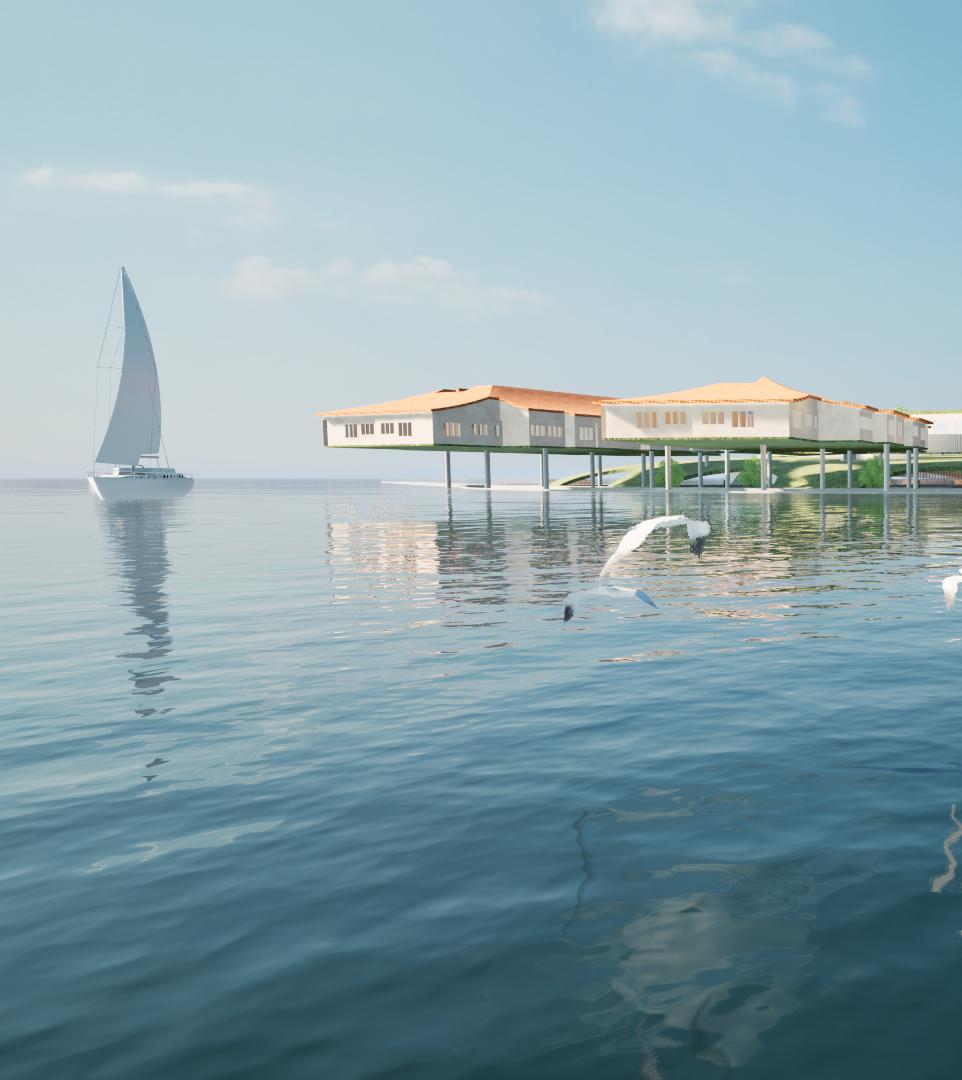
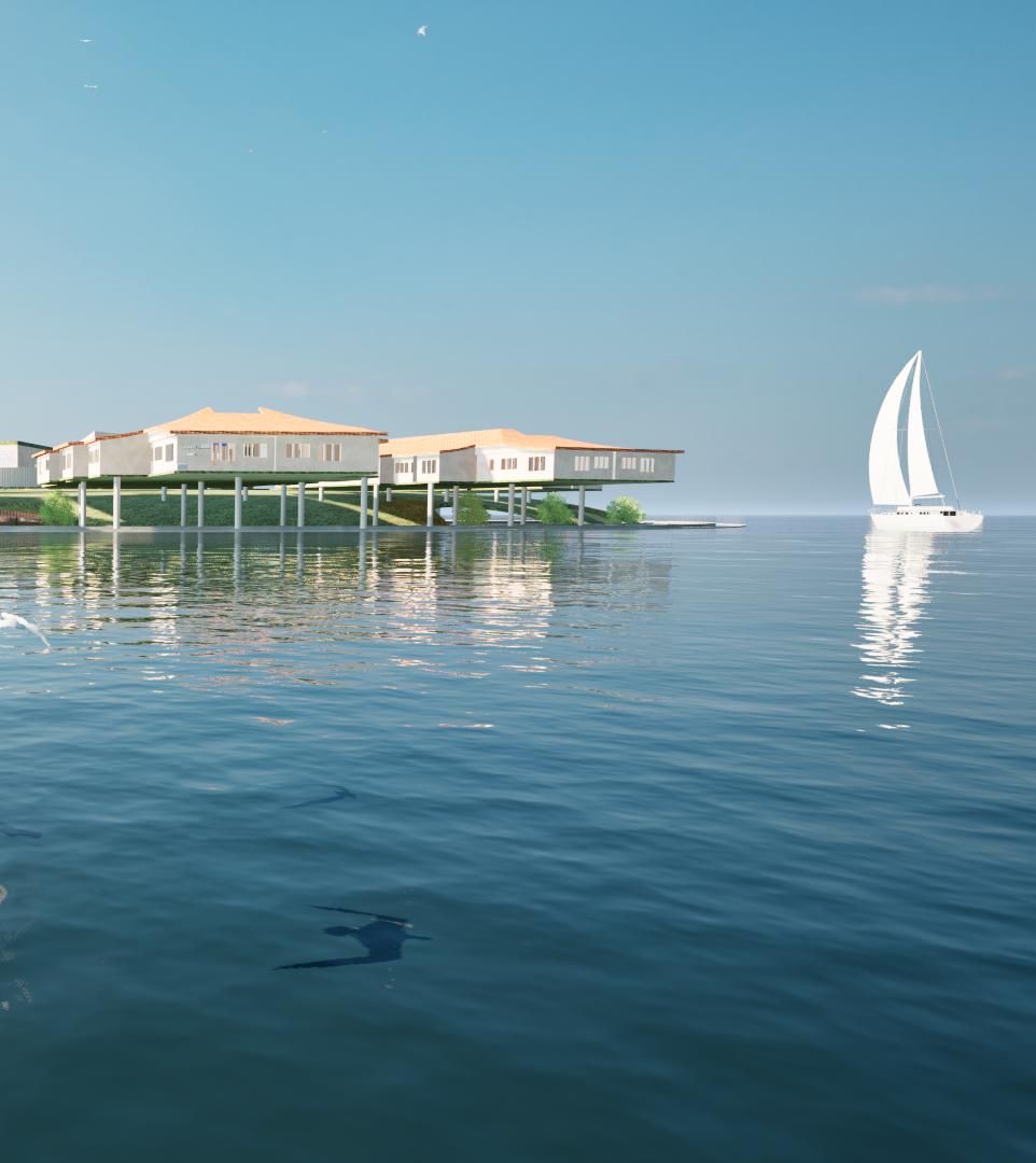
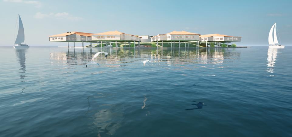
Blue Residence is an affordable housing project for the low income artist community in Boston’s Dorchester Bay area, which explores the historical elements of geology and wars, to spark a future opportunity that embodies resilience and hope.
Site Analysis Abiotic Environment
Laurentide Ice Sheet Melting Process During the Last Ice Age


City of Boston

Site Tectonics

Pelitic Bedrock, Tectonic Plate
Floodplain Alluvium
Sand and Gravel
Till or Bedrock
Fine Grained Deposit

Project Site

Dorcheseter Bay
Charles River


Hydraulic Conductivity & Corrosion of Concrete
0-6 Average Feet per Day, Moderate Corrosion of Concrete
0-6 Average Feet per Day, High Corrosion of Concrete
7-35 Average Feet per Day, Little to No Corrosion of Concrete
146-214 Average Feet per Day, Little to No Corrosion of Concrete
Project Site

Dorchester Bay
Charles River
Ice Sheet Retrieval Path Glacier River and Lakes
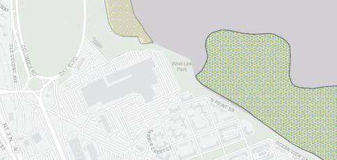
Site Analysis Biotic Environment
Illustration of Dorchester Bay Biotic Environment
Cranberry Bog Tidal Flats Forest Land & Wetlands
Marsh/Bog Open Water
Wooded Marsh Reservoir
Salt Marsh Beach/Dune
Pirme 1 Forest Land
Pirme 2 Forest Land
Pirme 3 Forest Land
Statewide Importance
Local Importance
Project Site
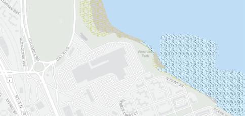

Dorcheseter Bay
Charles River
Tidal Flats
Beach/Dune

Sea Scallop Shellfish Suitable Areas


Quahog
Razor Clam
Soft-Shelled Clam
Surf Clam
American Oyster
Bay Scallop
Blue Mussel
European Oyster
Ocean Quahog
Project Site

Dorchester Bay
Charles River
NeponsetRiver 15min
Soft-Shelled Clam & Razor Clam
Soft-Shelled Clam
Site Analysis Social & Cultural

Local Reported Assault Activities
ASSAULT REPORTED IN 2024
ASSAULT REPORTED IN 2023
SITE
Transportation
Census 2020 TIGER Major Roads
Commuter Rail Stations
Airports
MBTA Bus Routes
Commuter Rail Lines
Ferry Routes


Ferry Route
Project Site

Dorcheseter
Charles River

DORCHESTER
Non-acute Care Hospitals
Farmers Markets
Infrastructure

Non-acute Care Hospitals
Acute Care Hospitals Emergency Department Status
Non-acute Care Hospital

Libraries Buildings
x 2 x 2 x 14 x 6
Acute Care Hospitals Emergency Department Status
Licensed Child Care Programs Police Stations
Library

Licensed Childcare

Local Police Station
State Police Station
Project Site
Dorchester Bay
Charles River
NeponsetRiver 15min
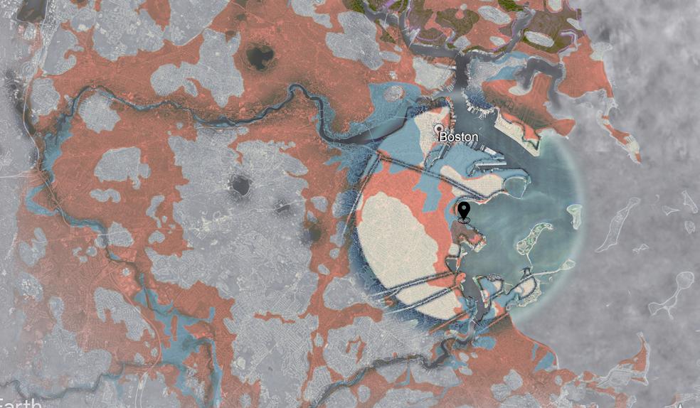
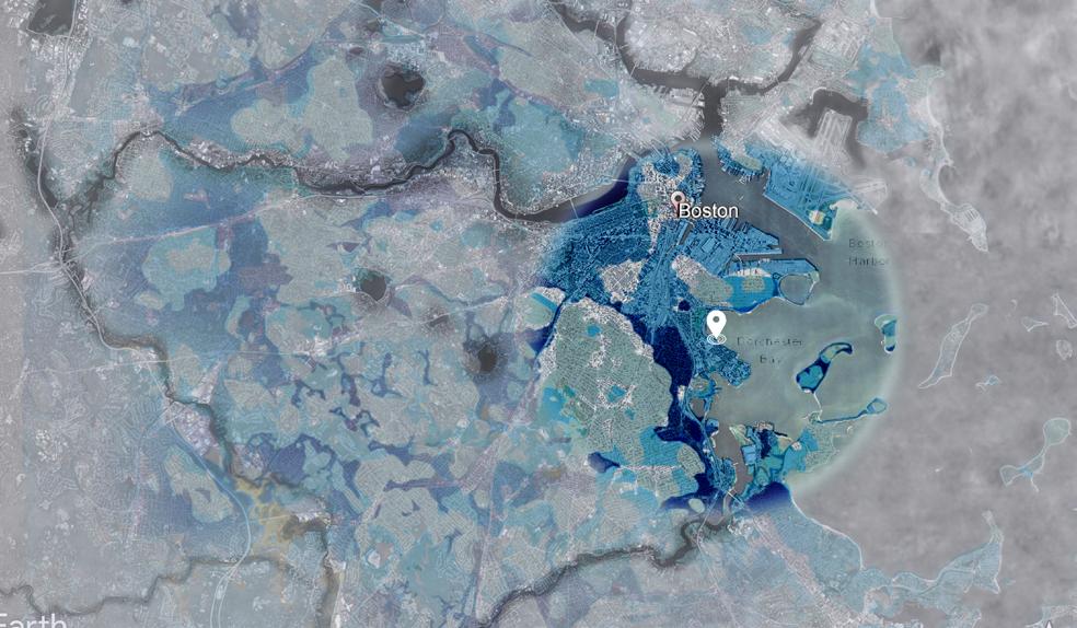
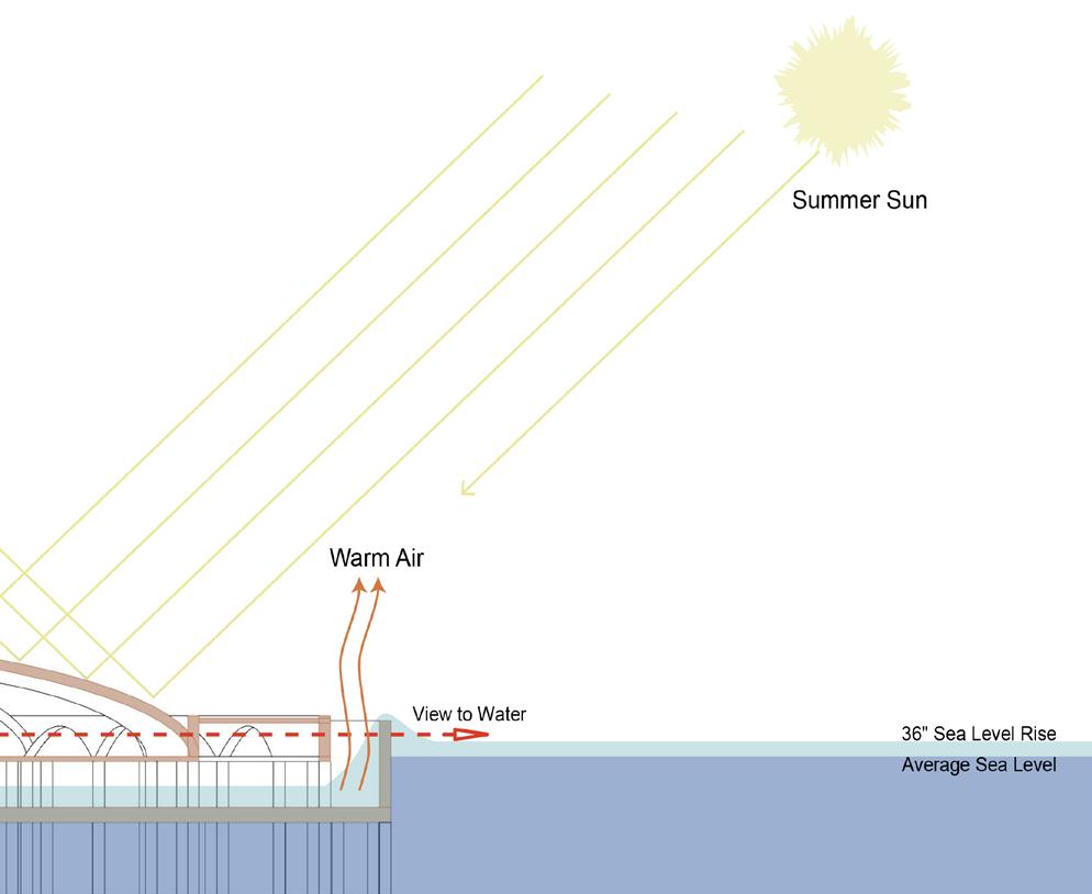
Site Analysis Sea Level Rise & Flooding
Boston Climate Ready Sea Level Rise Scenarios

Flood Vulnerable Neighborhood


Flood Impacted Neighborhood
Project Site
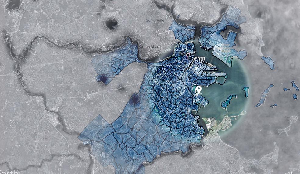
Dorcheseter

(2050s-2100s) SLR Induced Flooding
36” Sea Level
Rise High Tide
36” Sea Level Rise
10pct Annual Flood
36” Sea Level Rise 1pct Annual Flood
50% Likelihood Later-Term (2070s +) SLR Induced Flooding
2.5 inches of local land subsidence) by 2070. This does not represent the worst case scenario.
Environmental Justic Populations
Minority
Income
English Isolation
Minority and Income
Minority and English Isolation
Income and English Isolation
Minority, Income and English Isolation
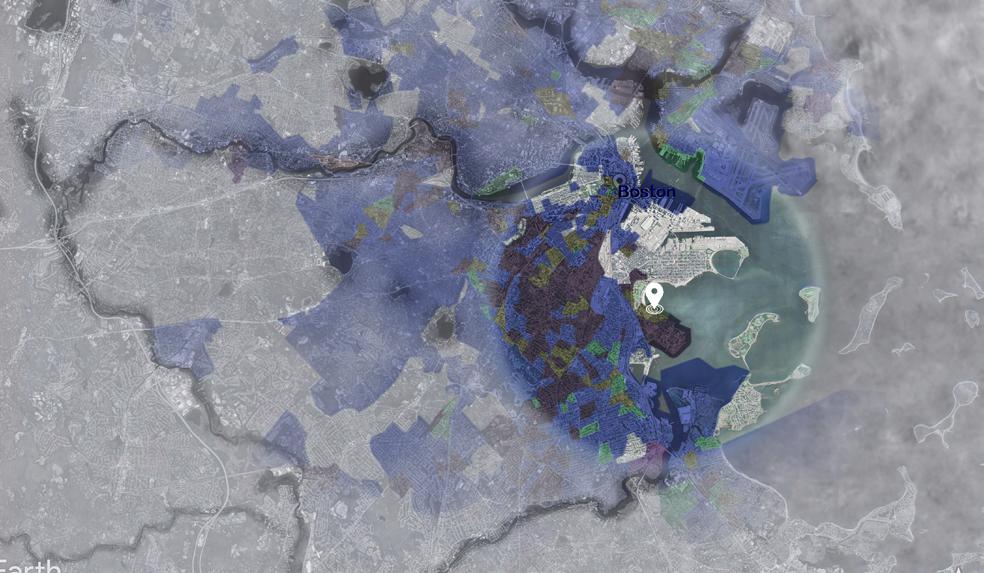
Project Site
Dorchester Bay
Charles River
Proposed Project Characters Project Manifesto


When looking into the project site’s history, I was overwhelmed by its richness and many stories of the war prisoners at Camp McKay.
To which, I think architecture is merely a quiet statue if without life in it. But what kind of life might that be, in such a time when spaces are created by the lifeless materiality that we all consumed? After all, it’s us humans who infuse meanings into memories and turn stories into realities.
Project Blue Residence is inspired by the life story of a fictional character, Luigi Ferrari, who was a Prison of War during the World War I & II. He battled with mental health issues due to dramatic life changes and found his way back into the society after a prolonged period as a war prisoner. Luigi’s struggle and strength are shared by many people today. Project Blue Residence is home to refugees, the struggling artists, and the low income families. It is a community for healing and growth through the form of art.
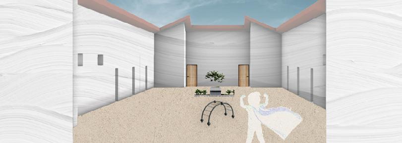
Left: one of Luigi’s letters to his loving wife, after he was transferred to Camp McKay.
Basis of Design
Problem Identification & Design Solution
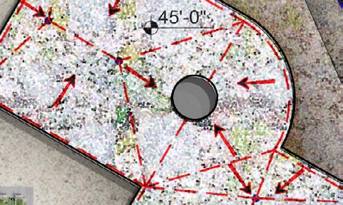
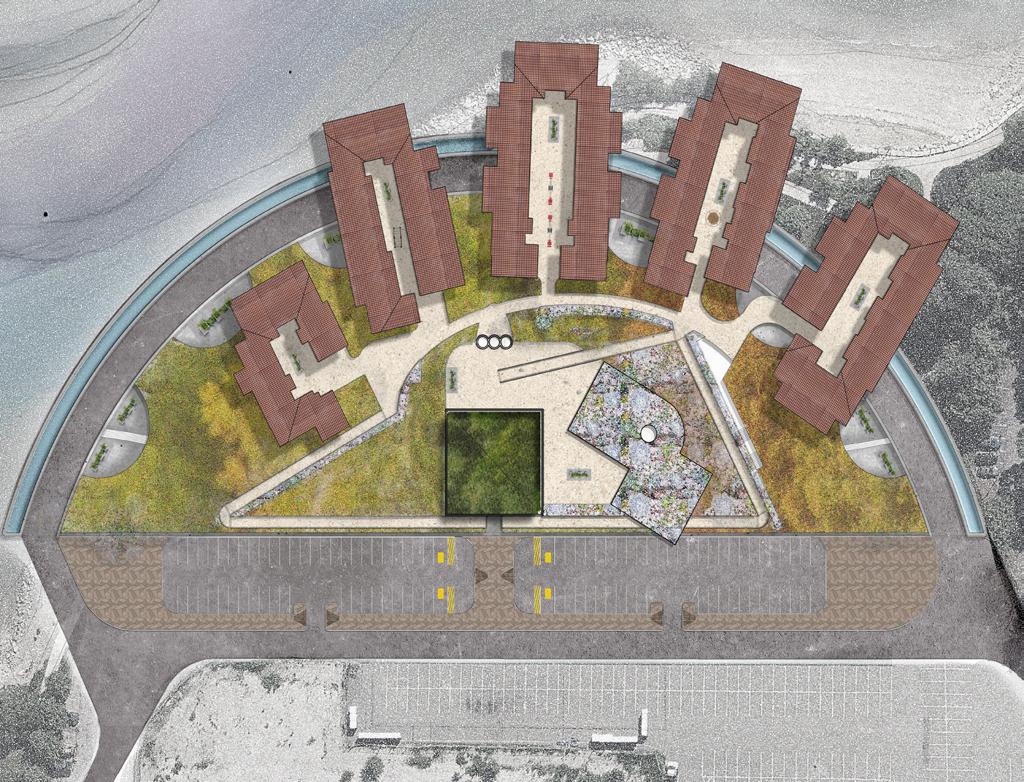
1 4 2 5 Programming Adjacency Matrix Neighborhood Key Plan Activity Grouping Neighbors & Connectivity

3 6 People Grouping Safety Strategy
The basis of design responds to the previous identifies issue. The programming includes affordable housing for the low income artist community, particular who are newcomers. The public spaces are divided into three major functions, a Memorial Gallery to remember the history and celebrate the present; a Employment and training center to provide skills and support for emerging artists. The last is an open park that welcomes everyone to learn about the climate topics and rising sea level.
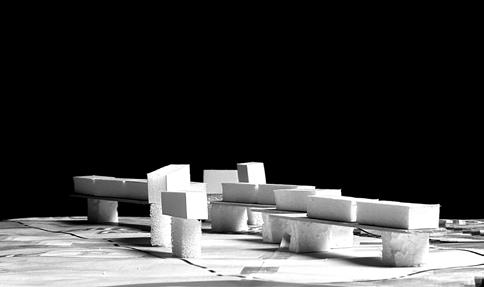
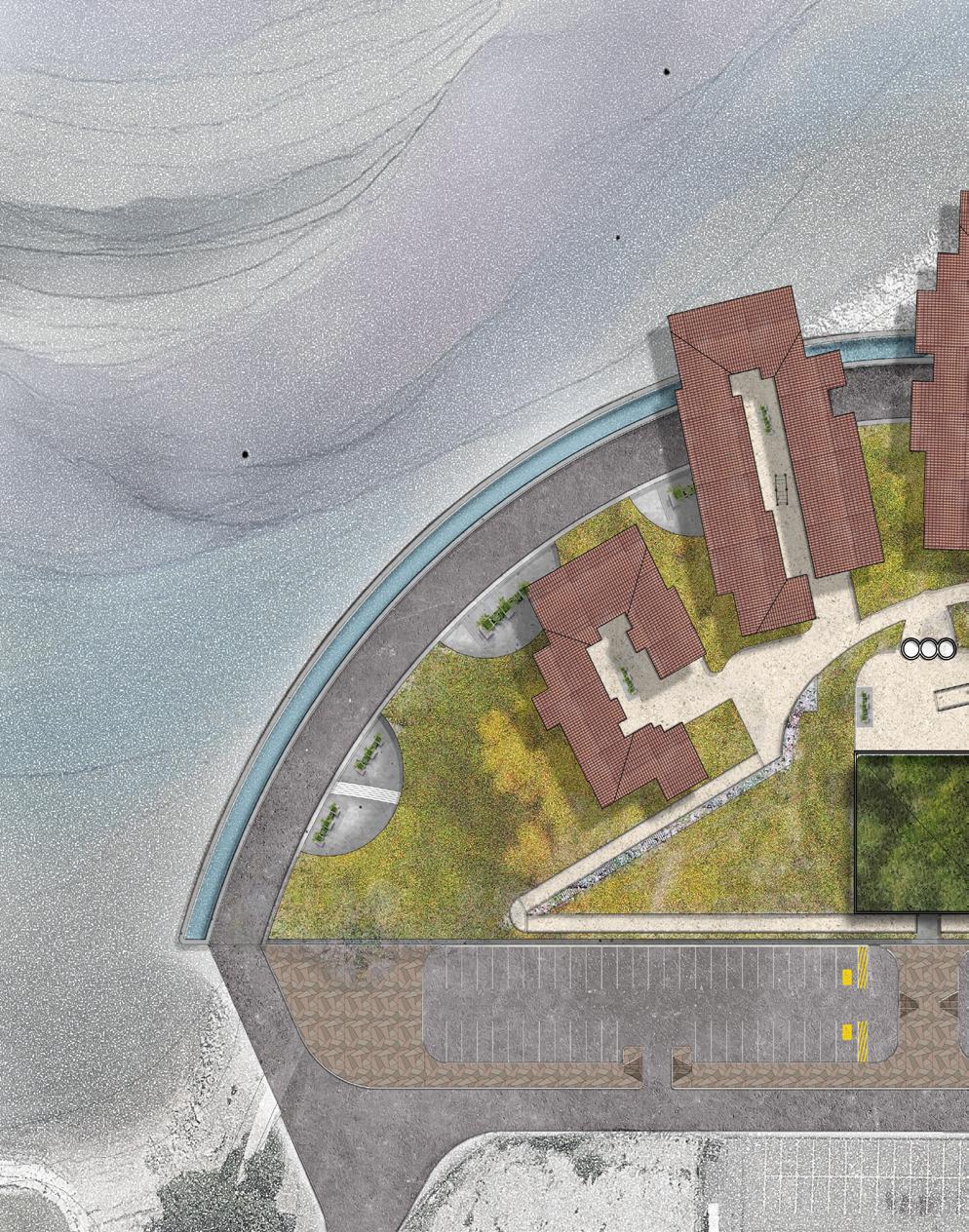
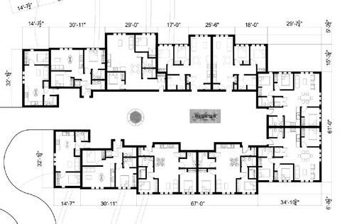
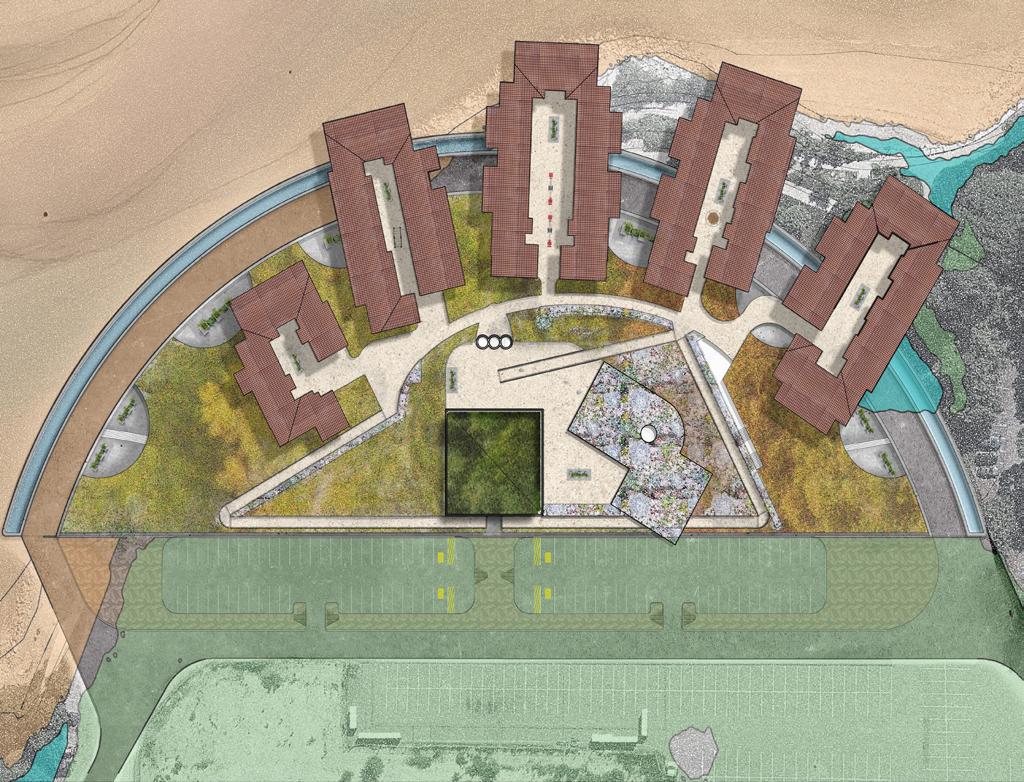
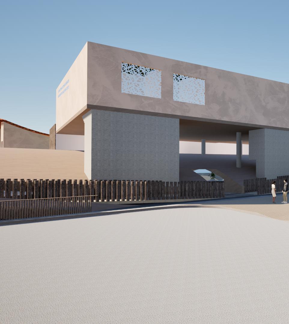
Massing Models Schematic Design

Preliminary Massing
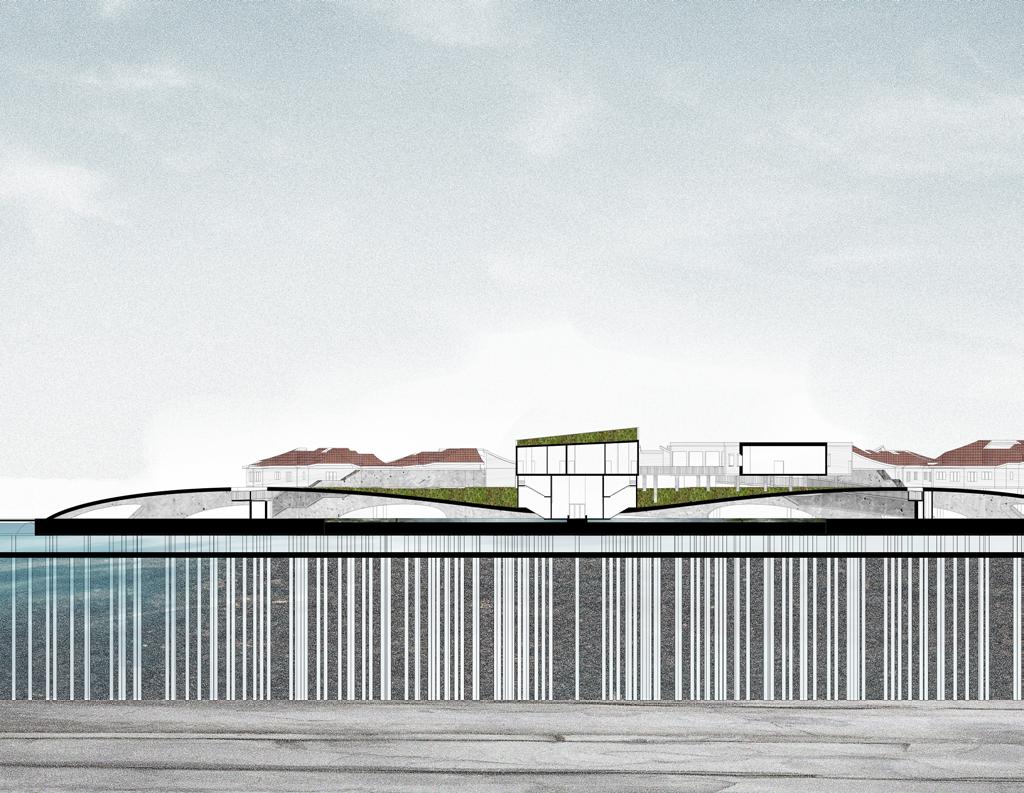
Schematic Section
Raised Platform

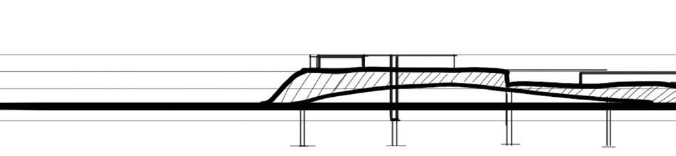

Schematic Lower Level


Schematic Upper Level
Artificial Hill with Accessible Cave
Built on Raised Rafters
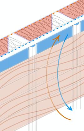
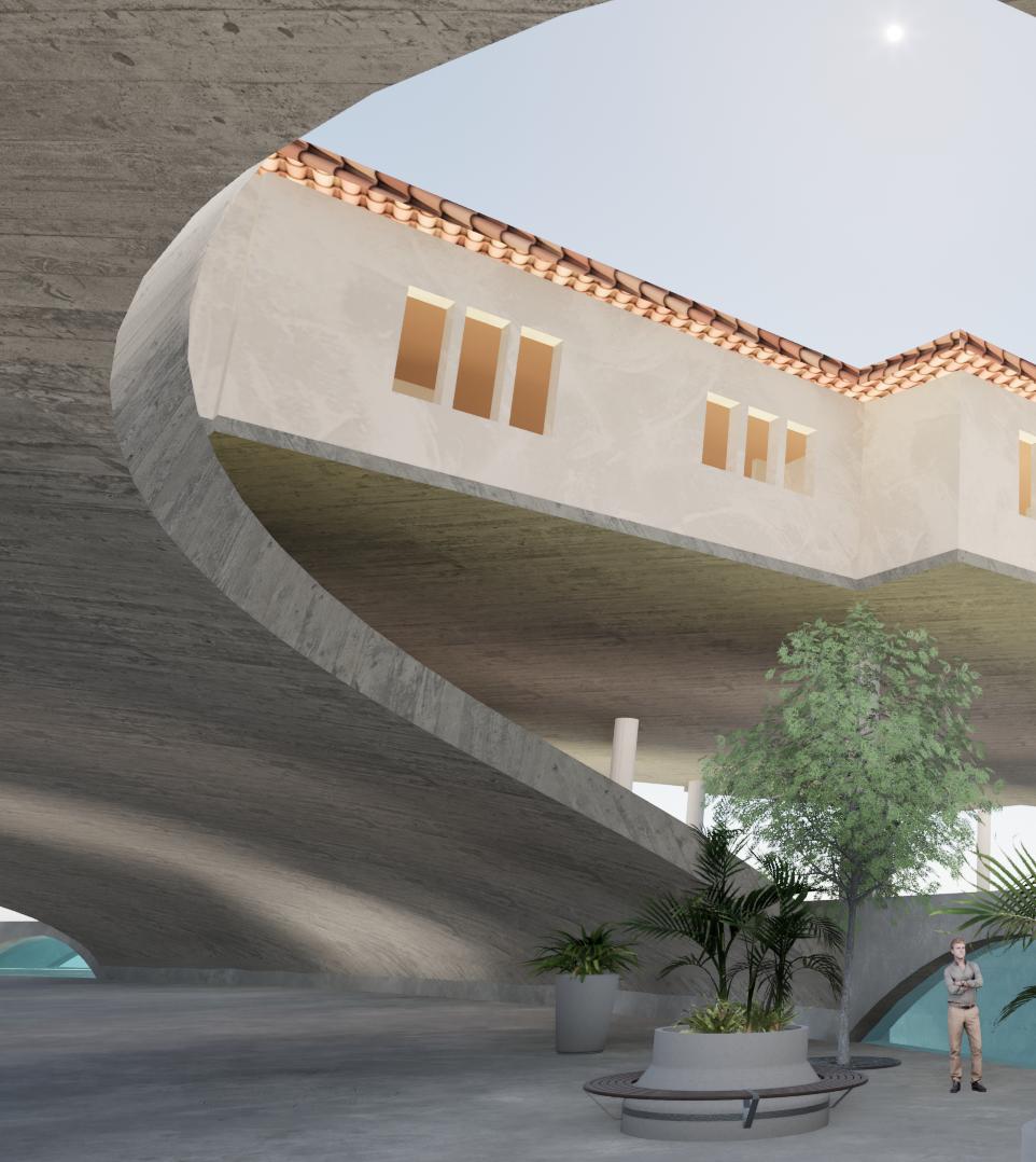
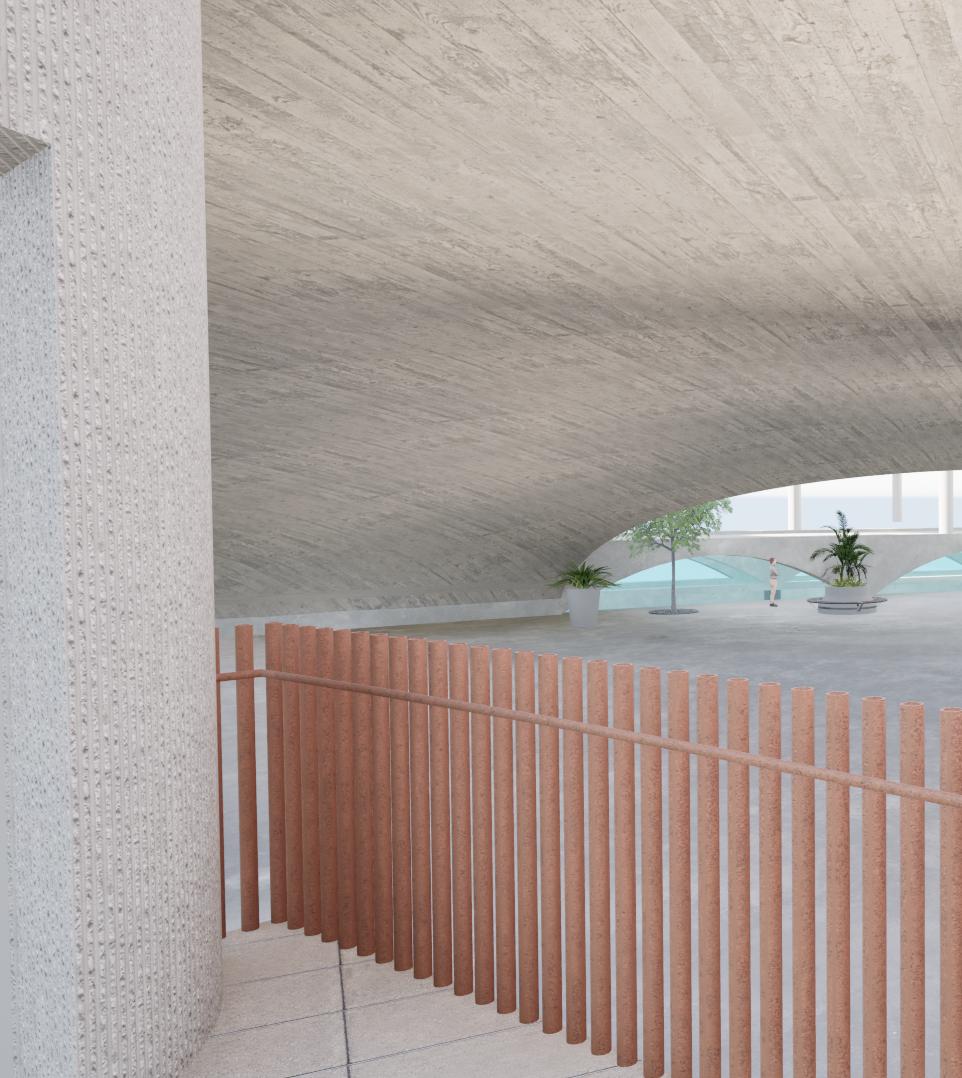
Structure Inspirations
Self Watering Planter & Back Flow Preventer
The structure system was inspired by “self watering planter” and “back flow prevention valve”.
A thickened sea slab is supported by a forest of pile foundations that are around 76’. A raised secondary slab is typical 8” concrete slab.
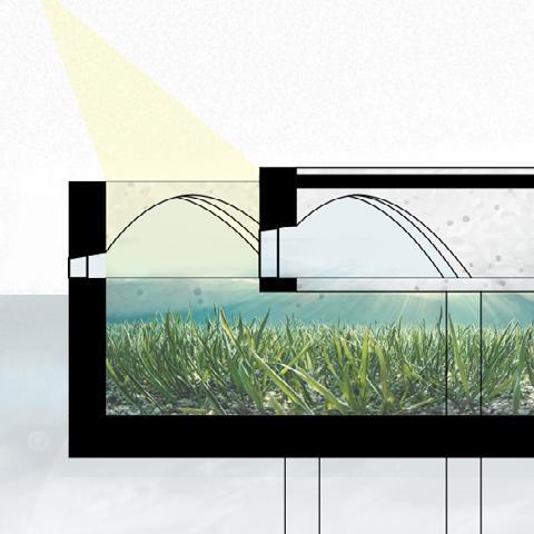
Space between the two slabs is a water basin to collect flood water.
The arch opening on the seawalls are equipped with mechanical water hatches that allows water collected in the park level to drain into the water basin.

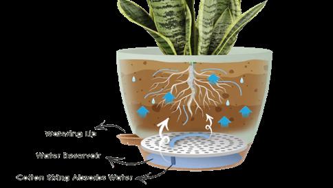
5 Pack Self Watering Planters-6 inch. (n.d.). Jofamy. https://jofamy.com/products/5-pack-self-watering-planters-6-inch
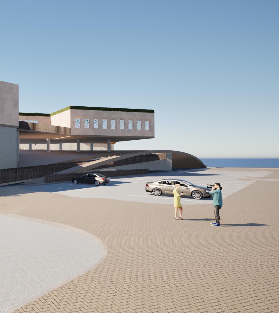
Proposed Structure
Domed Arch
Seawalls
Slabs
Pile Foundation

Square One Insurance Services. (2024, July 23). Getting to know backwater valves. Affordable Home and Car Insurance. https://www.squareone.ca/resource-centres/getting-to-know-your-home/backwater-valve
High Tide Flood

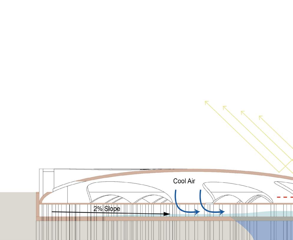
Hydrology Plan Upper Level

Proposed Contour
Water Flow Direction
Water Flow on Dome Structure
Roof Drain
Scupper Drain
Catch Basin
Roof Trench Drain
Trench Drain at Grade

Scale1” =120’
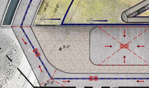
1 Road & Side Walk

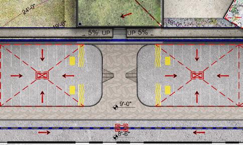
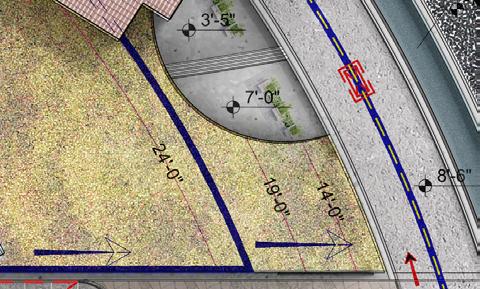


Parking & Accessible Curb Dome
Paths of Circulation
Primary Vehicle Access
Access to Parking
Pedestrian Access
1
Scale1” =120’
1 2 3 4
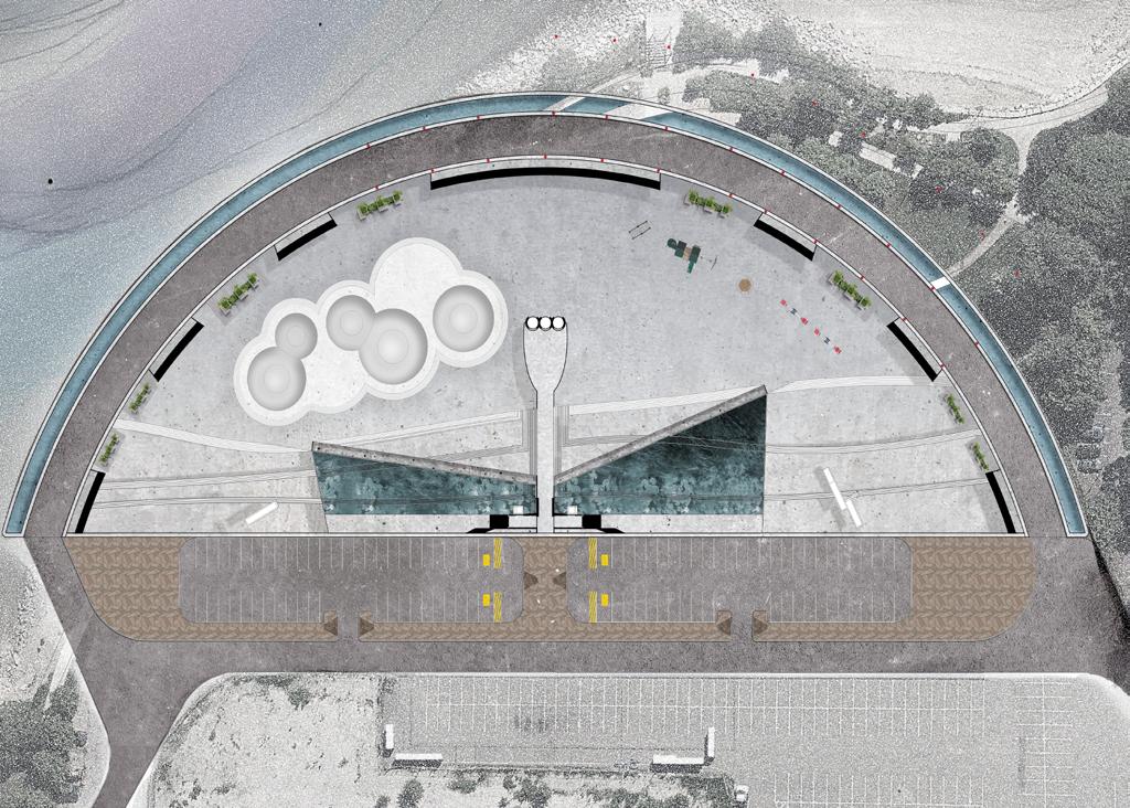
Skateboarding Park
2 Water Retention Pond
Retention Pond
Paths of Circulation
Primary Vehicle Access
Access to Parking
Pedestrian Access

Healing Space
Scale1” =120’


2 Residential Block
Residential Unit
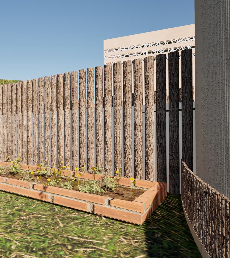
Materials Lower Level
Illustration of Materials
Concrete
Underwater
Durability
Versatility
Strength
Sustainability
ADA Friendly


Scale1” =120’
Porous
Concrete
Drainage
Filtration
Versatility
Sustainability
ADA Friendly

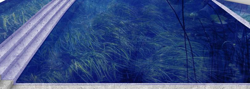
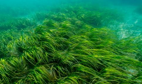
Eelgrass
Salt Tolerant
Submerged
Marine Habitat
Native Species
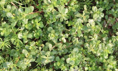
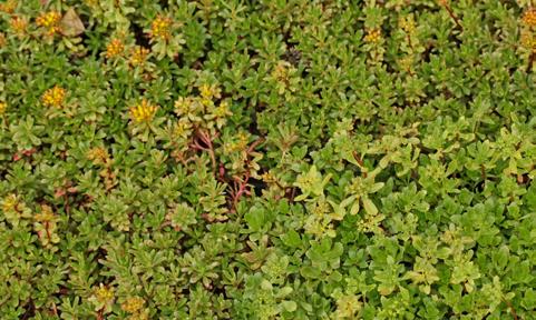
Purslane
Salt Tolerant
Native Species
Adaptability
Edible
3 4


Interlocking
Pavement
Permeability
Low Maintenance
ADA Friendly
Sustainability
Ease of Repair
Aesthetics
5
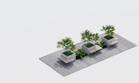
Granite
Built-in Planter
Durability
Versatility
Strength
Sustainability
Longevity
Materials Upper Level
Illustration of Materials
Concrete

Sustainability
ADA Friendly
Terracotta Shingles
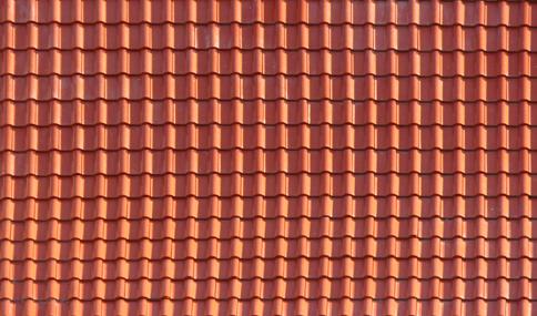
Sustainability
Energy
Succulent
Salt Tolerant
Native Species
Adaptability
Low Maintenance Variety
Aesthetics
Toxin Removal
Drought Resistant
3
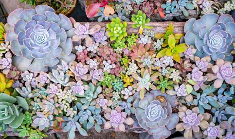
Succulent
Salt Tolerant
Native Species
Adaptability
Low Maintenance
Variety
Aesthetics
Toxin Removal
Drought Resistant
4
Interlocking Pavement
Permeability
Low Maintenance
ADA Friendly
Sustainability
Ease of Repair
Aesthetics

5
Granite
Built-in Planter
Durability
Versatility
Strength
Sustainability
Longevity


Block I Block II

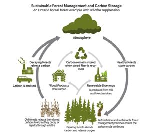
ontario.ca. “Sustainable Growth: Ontario’s Forest Sector Strategy,” n.d. https://www.ontario.ca/page/ sustainable-growth-ontarios-forest-sector-strategy.

Fiber Cement Siding
- 1/2” Gypsum Board - Vapor Barrier
- 2”x6” Lumber Framing @ 16” O.C., c/w
Fiber Glass Insulation - 1/2” Sheathing Board - Air Barrier
- 2” Rigid Insulation
- 1-1/2” Metal Furring Channel
- 1/2” Fiber Cement Board w Patterns

Block III
Block IV
Block V
Commercial Units
1
2 Camp McKay Memorial Museum & Community Art Gallery
- Permanent display of Camp McKay historical images
- Open space for community events and temporary art exhibition
Refugee Welcome Center & Community Employment Service
- Resources center for newcomers
- Skills training services
1 2


Section North-Shouth
Illustration of Flood Mitigation
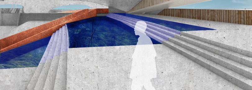
In a heavy rain fall condition, water will run off from the dome structure and be collected in the water pond at the lower level.
Then the water will continue to overflow into the water basin, where eelgrass farm is located.
When water in the water basin is full, it will rise up through the openings in the skateboarding park, to provide visual cue for people to exit the area and move the higher ground.
In a severe flooding scenario, the sea water will first flood into the water basin, and continue to rise through the skateboarding parking openings providing early warning cues.

Scale1” =96’
Water Pond
Water Basin


Eelgrass Farm
Water Pond 2
Section West-East
Illustration of Flood Mitigation
In a heavy rain fall condition, water will run off from the dome structure and be collected in the water pond at the lower level.
Then the water will continue to overflow into the water basin, where eelgrass farm is located.
When water in the water basin is full, it will rise up through the openings in the skateboarding park, to provide visual cue for people to exit the area and move the higher ground.
In a severe flooding scenario, the sea water will first flood into the water basin, and continue to rise through the skateboarding parking openings providing early warning cues.


Water Pond


Flood Early Warning
Eelgrass Farm
Water Pond
Sea Level Rise Scenarios Sections
Expected Near Term (2030s-2050s) 9” SLR
9”

Expected Mid Term (2050s-2100s) 21” SLR

50% Likelihood Later Term (2070s +) 40” SLR

40” SLR High Tide
40” SLR Base Flood Elevation
Sea Level Rise - (2070s+) Extreme Scenario
40” SLR Mean Sea Level Top of Residential FF

Top of Sea Wall Mean Sea Level NAVD88
of Sea Slab
*BPDA Recommendation
Sea Level Rise Scenario
SLR Mean Sea Level

SLR High Tide
SLR Base Flood Elevation
SLR Mean Sea Level
SLR High Tide

SLR Base Flood Elevation 40” SLR Base Flood Elevation
SLR Mean Sea Level
SLR High Tide
SLR Mean Sea Level
SLR High Tide
SLR Base Flood Elevation

Sea Level Rise Scenarios Plans
Sea Level Rise Scenarios Legend
High Tide Flood
10pct Annual Flood
1pct Annual Flood


ADA Standards


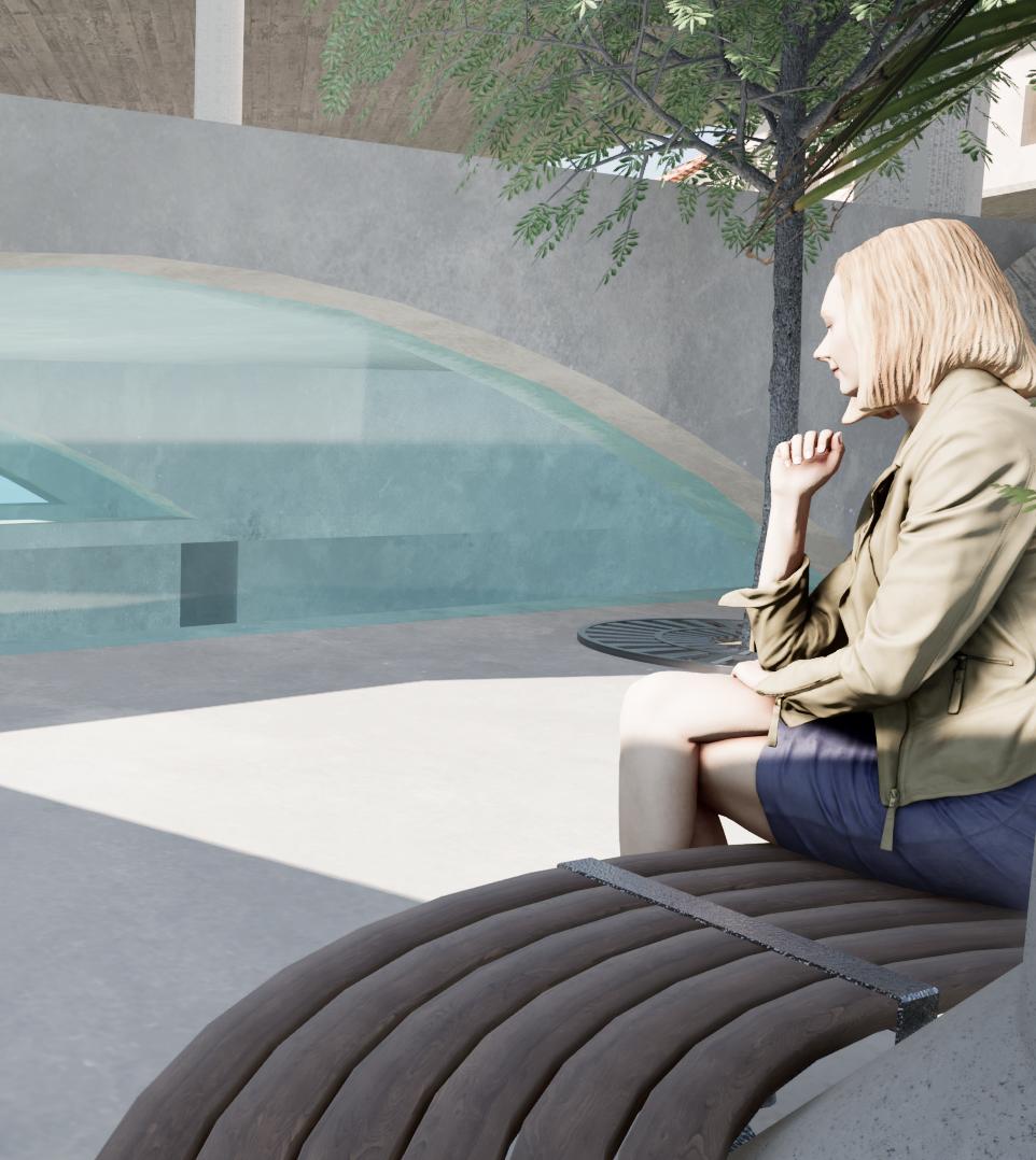
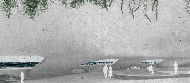
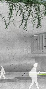
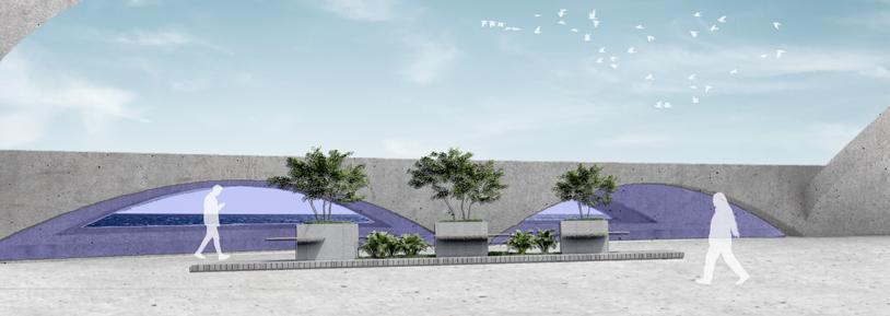
Rendering Seating & Arches

Rendering Children’s Playground

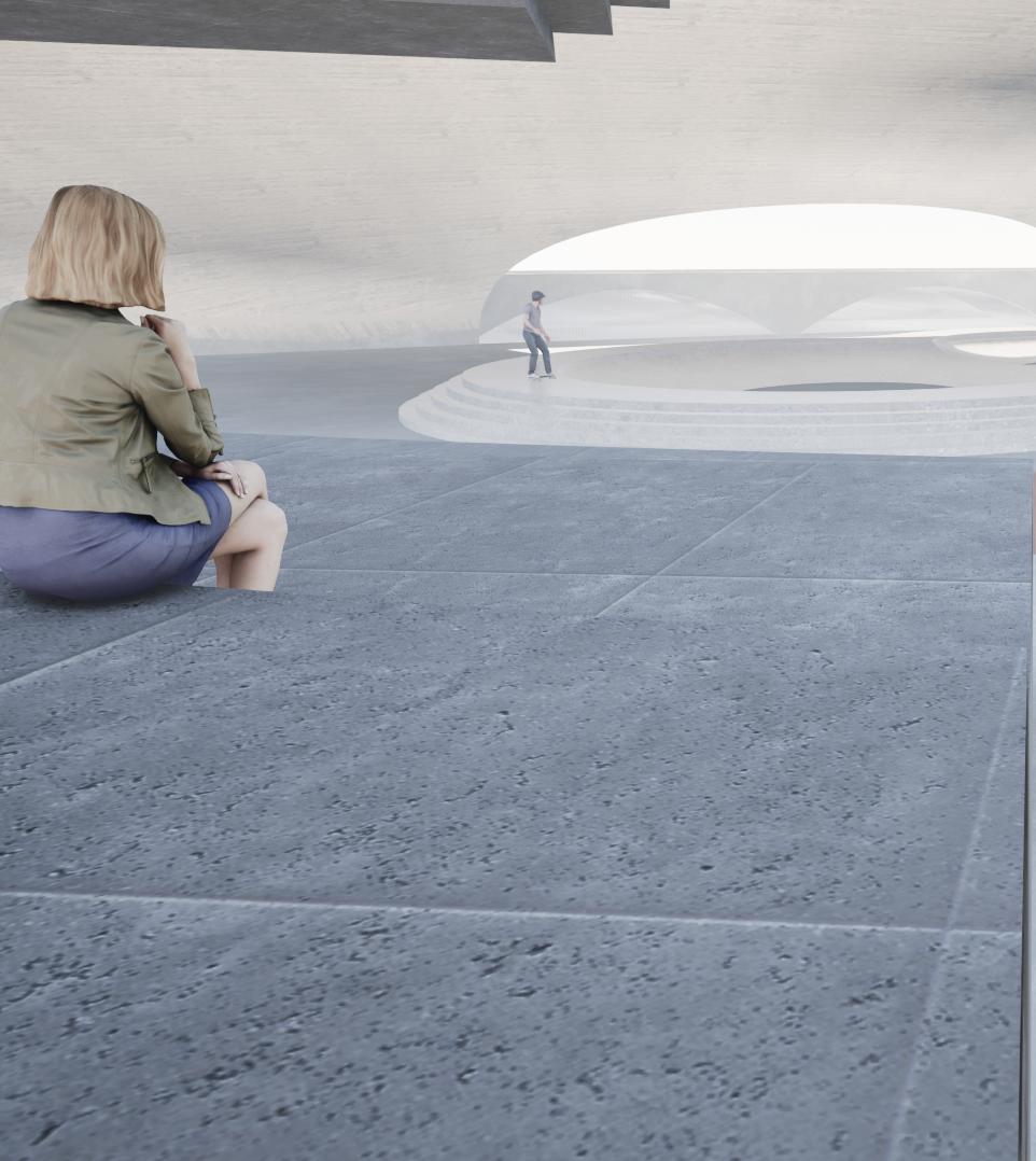
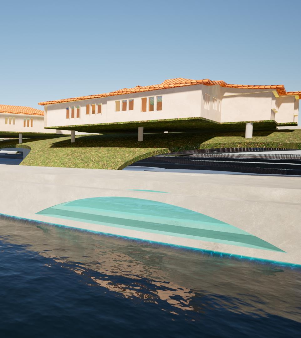
Rendering Skateboarding Park


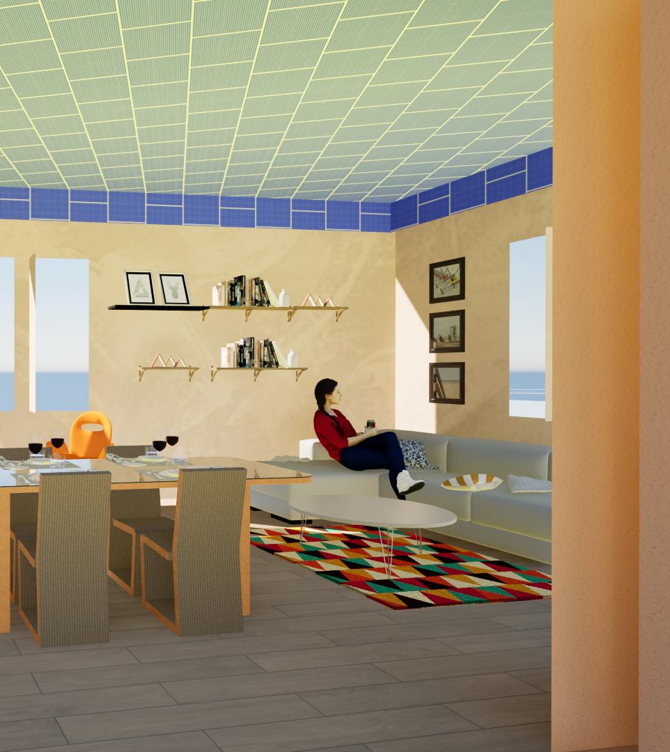

Rendering View from Parking

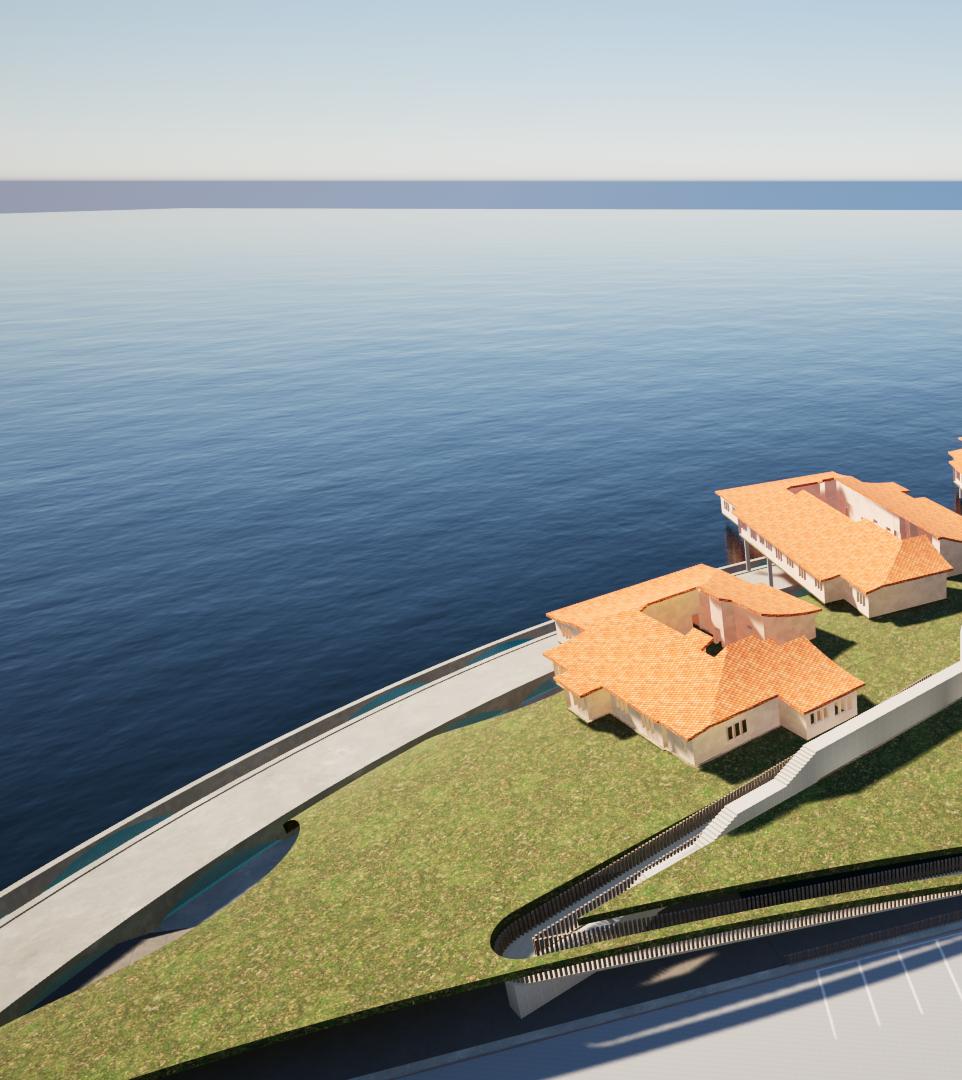

Rendering View From Water 2100s