AROLINE ANBUSKIRK C V

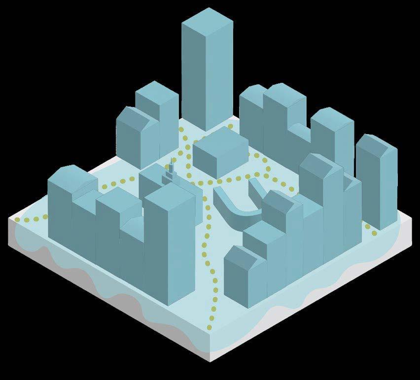
Urban Design + Planning Portfolio


Urban Design + Planning Portfolio
As a curious and creative person, I am motivated to make connections, find patterns, and the desire to be a lifelong learner. I approach cities and planning through a lens of curiosity and use that as inspiration to design and create places that serve the needs of those who inhabit them. I am passionate about urban design, biophilic design, and community engagement, and I am eager to learn through experience and connection with others.
I am pursuing a bachelor’s degree in Urban Planning at the College of Design, Architecture, Art, and Planning at the University of Cincinnati. With a background in biology and a minor in anthropology, I have a unique, multi-disciplinary perspective on planning and urban design.
• Verbal + written communication
• Creative thinking
• Time management
• Willingness to learn
• Flexibility
• Open-minded
• Self-directed
• Libraries, museums (wandering, absorbing)
• Reading and not realizing hours have passed; finding a phrase to underline
• Vocabulary; remembering known words, learning a new one
• Wind, windy days; clouds, flowers, bees, beeswax (a grounding material)
• Cold dog ears
• Honey, peanut butter, chocolate
• A free morning
• Shuffling a deck of cards; the texture the deck
• Georgia O’Keeffe, Vincent Van Gogh
• Writing; my handwriting; pens
• Doodling; blending colors together; the joy of play when creating; finishing a crochet project
• Looking for small pieces of people’s art around a city (stickers, posters)
• Laughing so hard I cry
• A walk, a hike, a deep breathe of fresh air
· 513 · 348 · 5778413 Southview Ave Cincinnati, OH 45219
COLLABO| Planning + Urban Design
Chicago, IL | 01/2025 - 04/2025
• Contributed to the development of seven federally funded Choice Neighborhood (CN) Plans, centered around public housing sites. Participated in stakeholder and community engagement meetings.
• Designed graphic materials for community meetings including flyers, posters, aerials, surveys, and engagement activties.
• Developed two InDesign templates to streamline formatting and production for CN Plans. Edited narrative and technical content across multiple sections of draft plans.
3CDC (Cincinnati Center City Development Corp.)| Development Cincinnati, OH | 05/2024 - 08/2024
• Supported the Development team in revitalizing downtown Cincinnati through historic renovations, commercial build-outs, and redevelopments.
• Created maps to track development progress, operating districts, and property ownership. Input and analyzed data for property management and project tracking.
• Assisted with zoning and lease research; drafted documents, applications, and supported project closeouts. Documented site progress with site visits and photography.
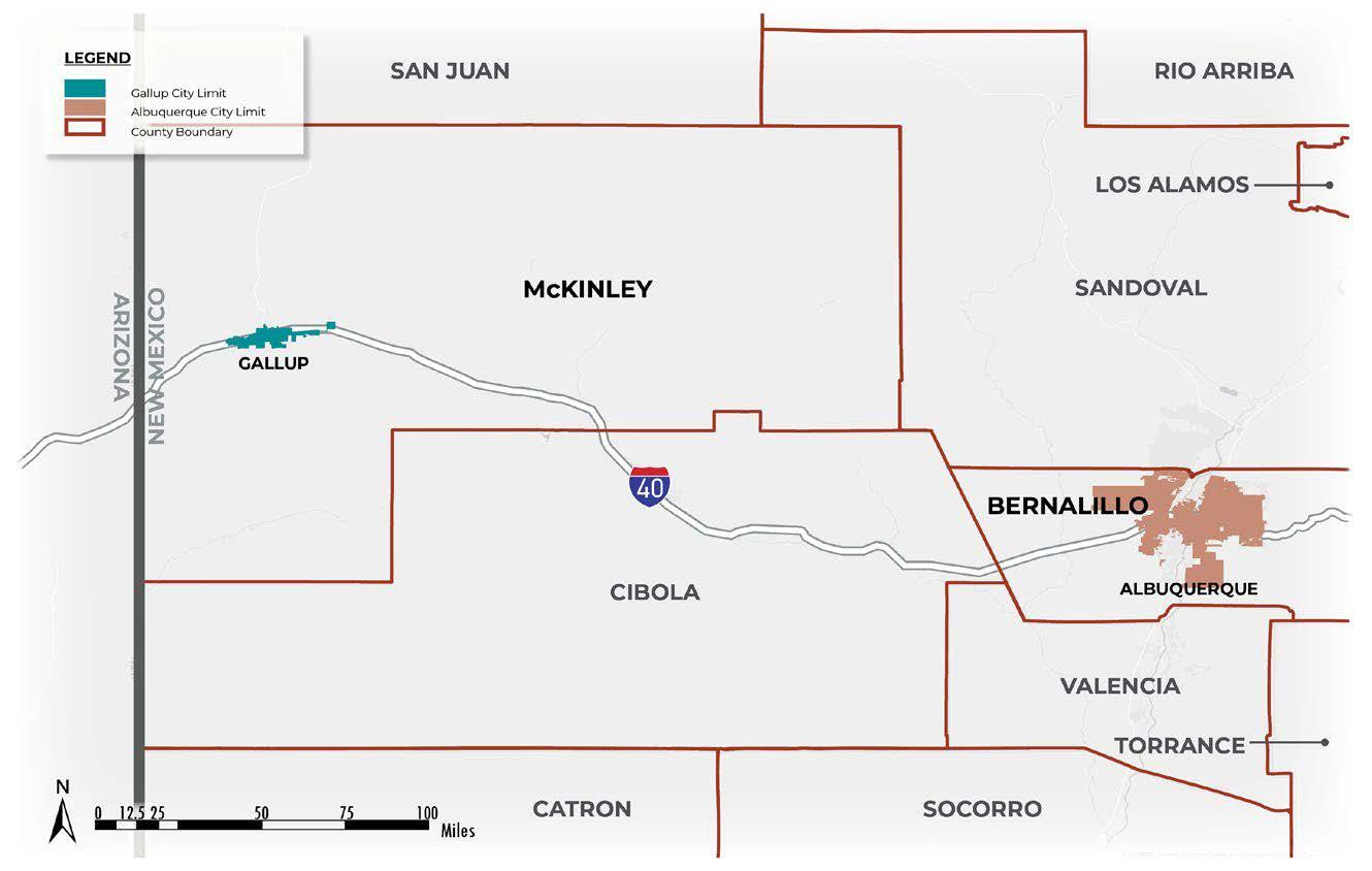
Dekker Perich Sabatini | Master Planning + Site Planning Albuquerque, NM | 08/2023 - 12/2023
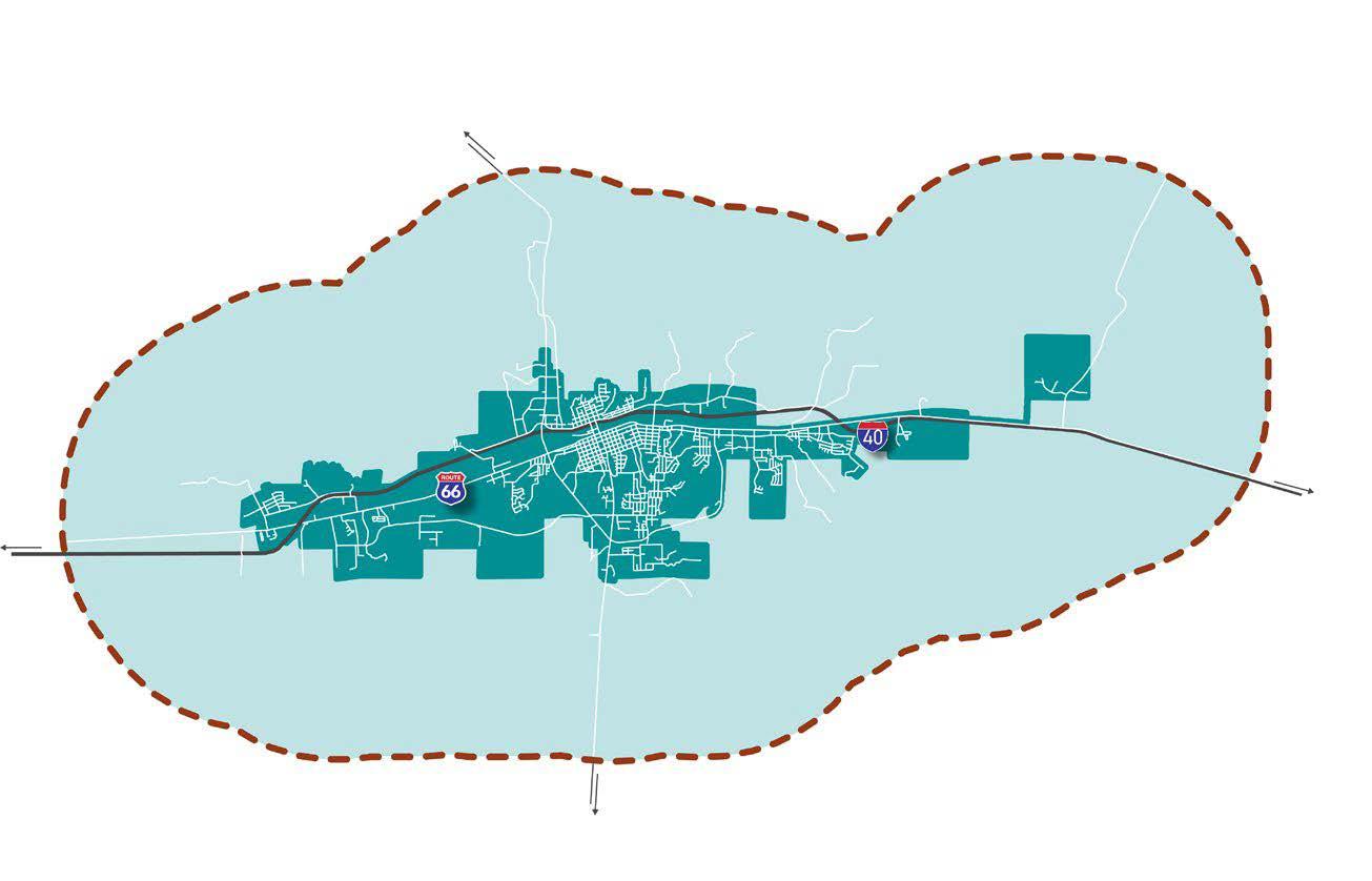
• Contributed to the completion of Gallup Growth Management Plan for the city of Gallup, NM. Facilitated community engagement events. Updated the project website with plans, maps, polls, and events.
• Formatted ~9 plan chapters with text and graphics in an InDesign Book. Created 15+ maps using ArcMap/ ArcGIS Pro.
• Researched Gallup’s history to create a timeline with 20+ events and wrote portions of the historical chapter for the plan.
• Collaborated on Urban Land Institute site project to design a site plan from CAD work.
• Designed 9 graphics to illustrate regulation language for Rio Rancho’s Development Process Manual.
Fischer Homes | Urban Infill
Erlanger, KY | 01/2023 - 04/2023
• Conducted infill lot research across six markets using municipality GIS systems. Sketched 50+ scaled site concepts. Analyzed zoning codes to determine best fits zones for Fischer’s Urban products.
University of Cincinnati | Cincinnati, OH
College of Design, Architecture, Art and Planning
Bachelor of Urban Planning
Minor in Anthropology
Two years of course work in biology
GPA: 3.87| 2019 - 2026
Participating in the Professional Practice Program, alternating semesters of classroom study with work in the field of planning + design.
KU Leuven | Brussels, BE
Faculty of Architecture
Urban Design and Spatial Planning
Fall 2024 | Study Abroad Program
Loveland High School | Loveland, OH
High Honors Diploma
GPA 4.062 | 2015 - 2019
• Dean’s List | Fall 2019-Present
• Cincinnatus Scholarship 2019-2023
• Volunteer work | Cincinnati Animal CARE, Smithsonian Digital Volunteers, Dress for Success, Krohn Conservatory
• Adobe Creative Suite
• ArcGIS Pro + Online
• ArcMap
• Microsoft Office
• SketchUp
• AutoCAD
• Bluebeam
• Miro
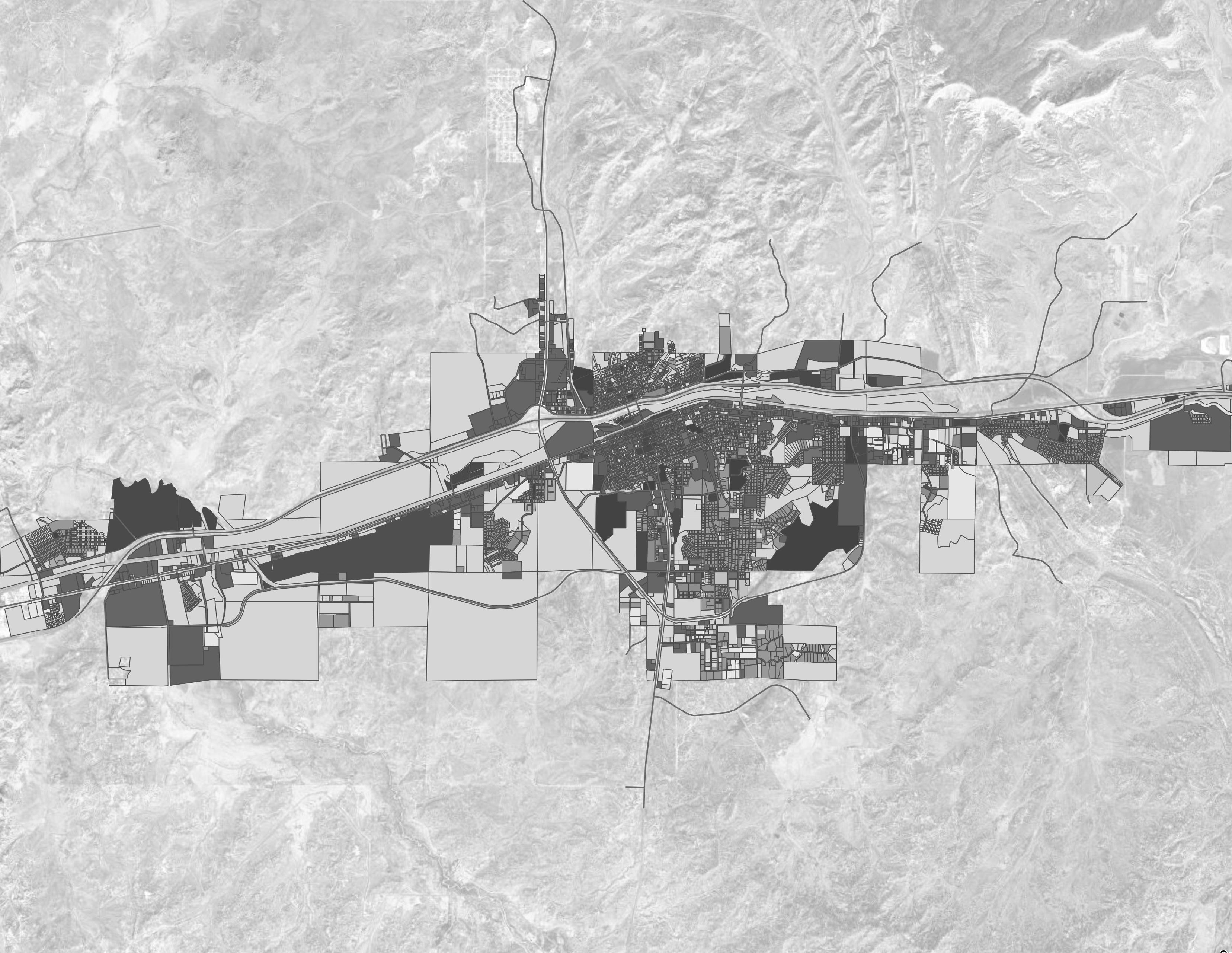
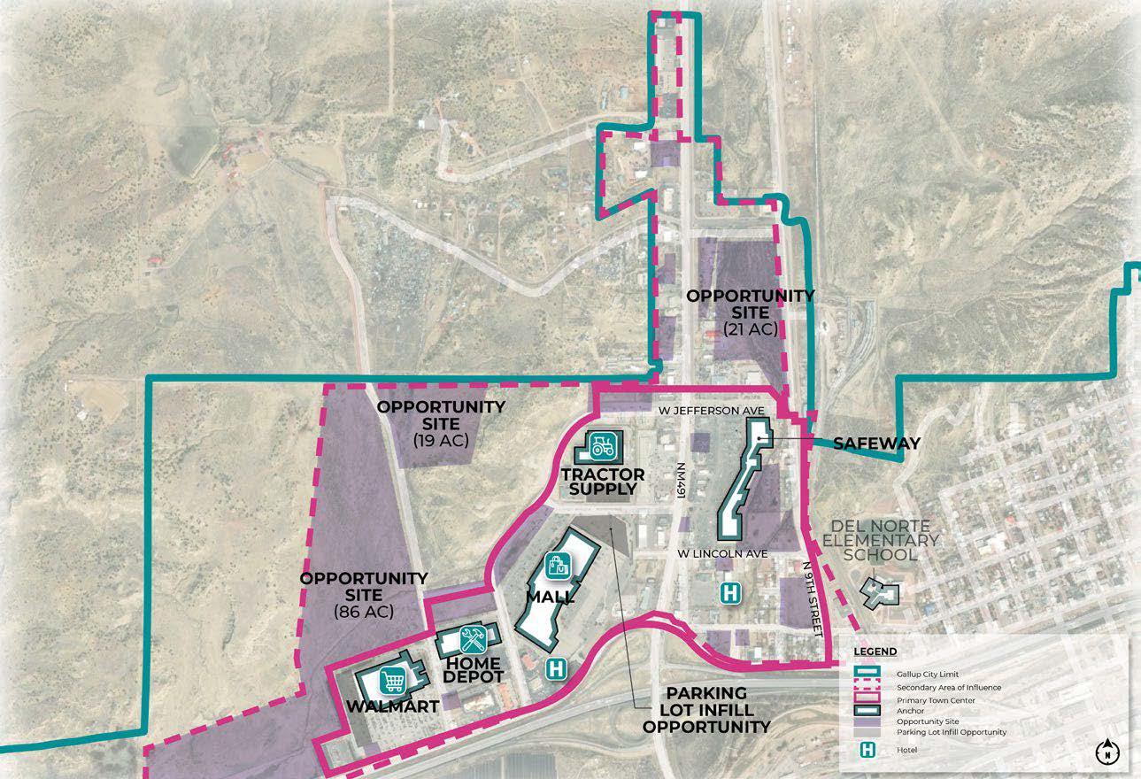
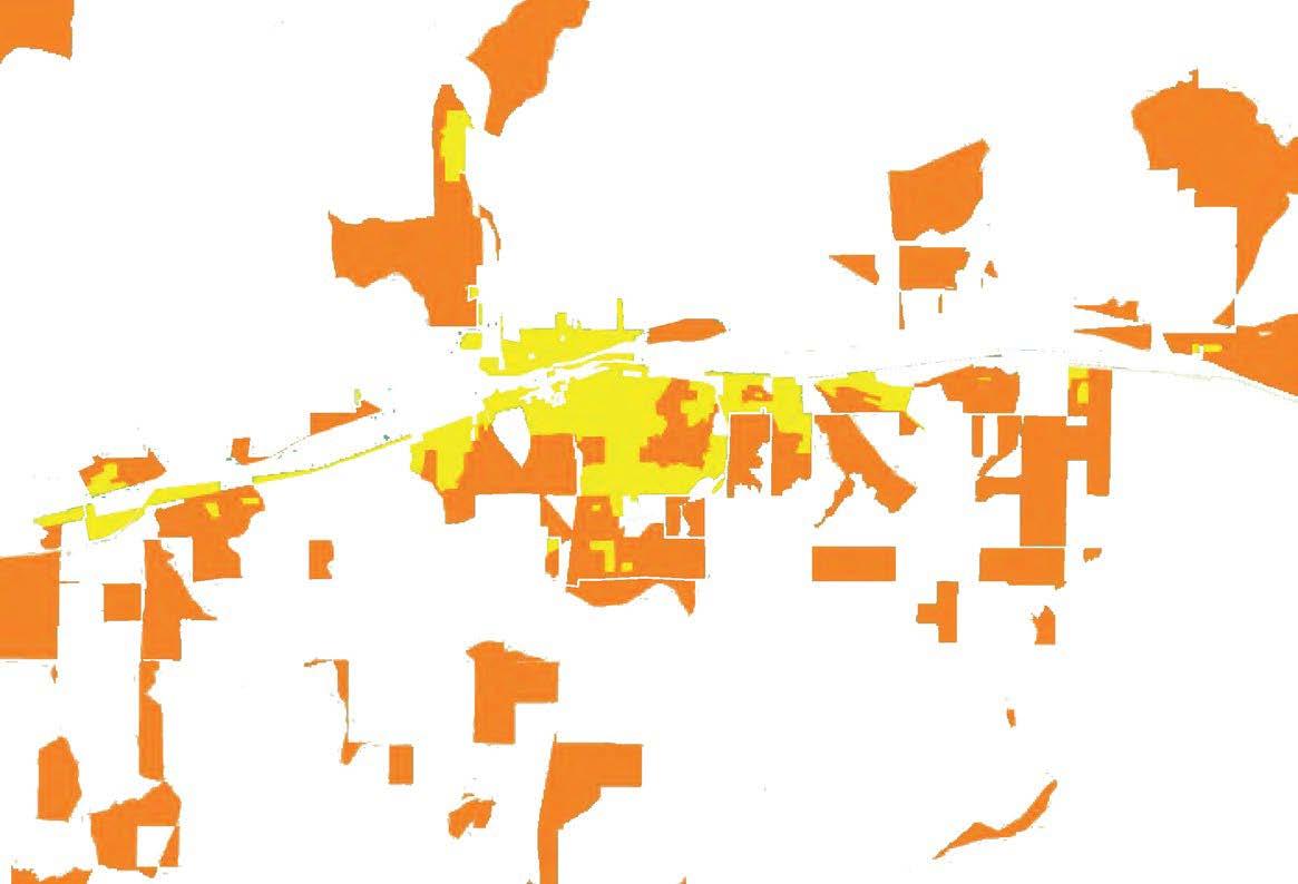
At Dekker Perich Sabatini (DPS), I worked substantially on the Gallup Growth Management Master Plan (GMMP). This page depicts several maps I made for various chapters of the plan including: Community Profile, Community Vision, Public Facilities and Services, and Hazard Mitigation. Maps were created using ArcMap and/or ArcGIS and finalized using Illustrator + InDesign.
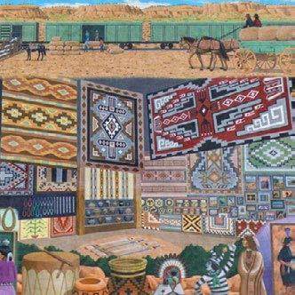
Tribe Lands: Reservations + Trusts


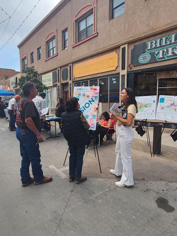
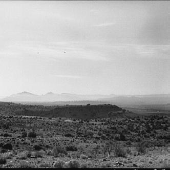
An additional contribution I made to the GMMP was researching Gallup’s history and boiling it down into a succinct timeline format as well as traveling to Gallup for the 30% and 80% draft plans for outreach from both community members and stakeholders.
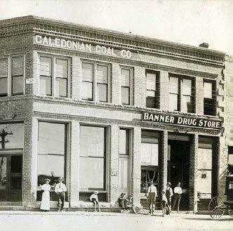
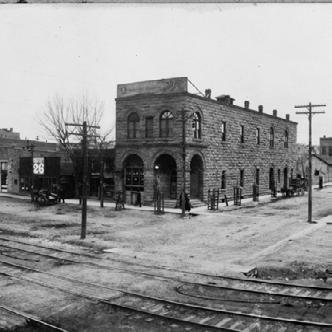
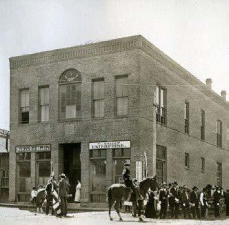
Gallup Timeline. Divided into “eras of influence” that contributed to the formation of Gallup’s physical and cultural character. Completed using InDesign.
Ancestral Pueblo people lived in what would later become northwest New Mexico.
Spanish conquistadors arrive in the region.
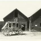
Stagecoach stop in Blue Goose Salon built on what is now the east end of downtown.
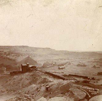
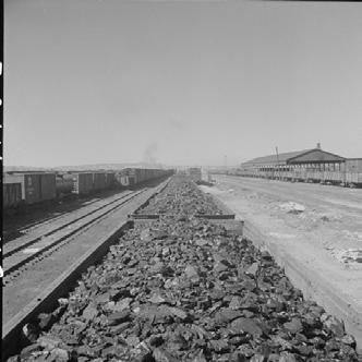
Coal is discovered in Gallup. Consequently, Gallup’s population began to increase.
First record of Indian trading in the area.
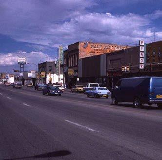
Outreach Photos. The photos to the left are taken from the first trip to Gallup for the 30% draft and “Visioning” outreach. The left is at the Gallup Arts Crawl, the right is at the Gallup Flea Market.
Approximately 100 immigrant workers were brought to work in Gallup mines from southern Colorado. Many later became prominent Gallup merchants.
1881
Railroad becomes accessible, population increased.
1890-1895 1891
First coal boom. Buildings were constructed to accommodate the population increase and diversify the town’s offerings.
The town was incorporated as Gallup, named after David L. Gallup, the Atlantic and Pacific Railroad paymaster.
McKinley county was created, Gallup was made the county seat
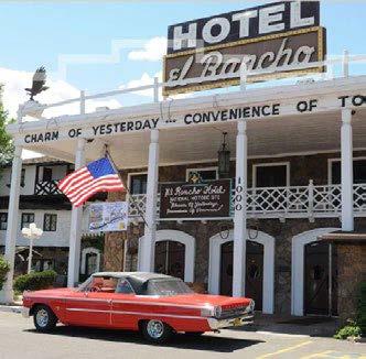
El Rancho hotel was built.
Many Hollywood stars stayed at the El Rancho while filming for Hollywood movies in Gallup.
Early 1900s 1901 1917 1920s
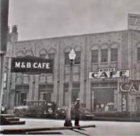
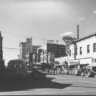
Second coal boom. More buildings were built along what is now known as Route 66, including the Drake Hotel, Rex Hotel, Palace Hotel, and the White Cafe.
Gallup accumulated wealth that allowed the town to support a leisure industry. Retail trade boomed on Coal Ave.
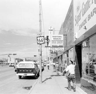
The railroad deeded property south of the tracks to the city of Gallup.The street became known as Railroad Ave (later Route 66).
1970s/80s
Many of Gallup’s coal mines close down.
Interstate 40 was completed, and bypassed downtown Gallup to the north.
The coal industry began to decline to due the railroads switching from coal to diesel fuel.
1923
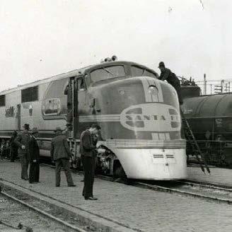
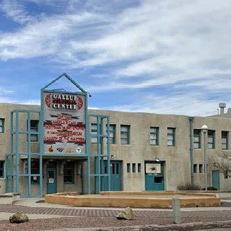
Atchison, Topeka, and Santa Fe Railroad built a passenger depot on the northside of Railroad Ave. Tourism increased. Today, the building has been repurposed as the Gallup Cultural Center.
1930s 1930s 1936 1940s/50s 1980 1982 2013 2023
Today, Gallup is known as a center for Native American culture and arts, with a variety of scenic recreational activities

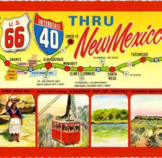
Railroad tourism declined as the popularity of the automobile increased. Tourism in Gallup became centered around the automobile. highway was from Gallup to Albuquerque, creating tourism boom.
Gallup Historical Society was established, and is now housed in the Rex Museum.
Gallup
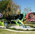
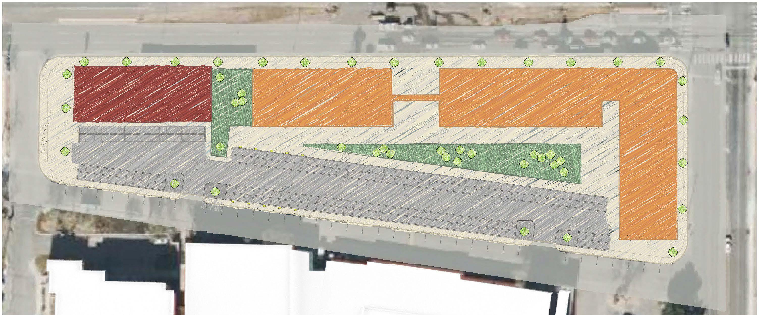
Urban Land Institute (ULI) New Mexico held an “Intersections” conference in October 2023, where several planning + architecture firms contributed site designs for intersections in Albuquerque that could be considered to redevelopment. Architecture interns at DPS designed a mixed-used concept called “The Hub” and the intersection of Menaul and University.
ULI Site Render. Completed using architectural CAD as the base Designed in Photoshop + Illustrator.
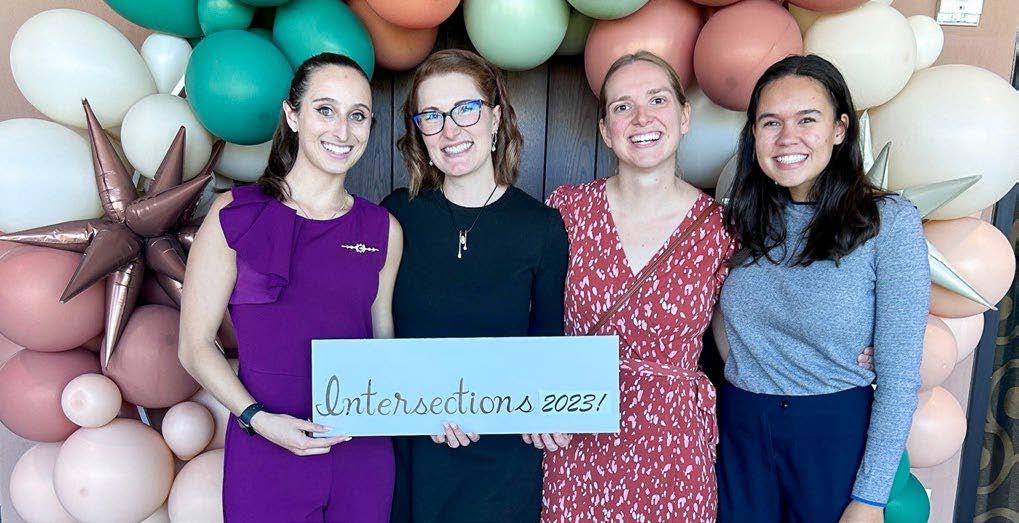
ULI Intersections Conference. Photo from the ULI Intersections conference with some of the project members.
DPS worked on updating the City of Rio Rancho’s Development Process Manual (DPM). Below are graphics I created from development standards to serve as additional visual explanation.
Resilient Urban Design Studio - Spring 2024
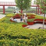
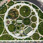
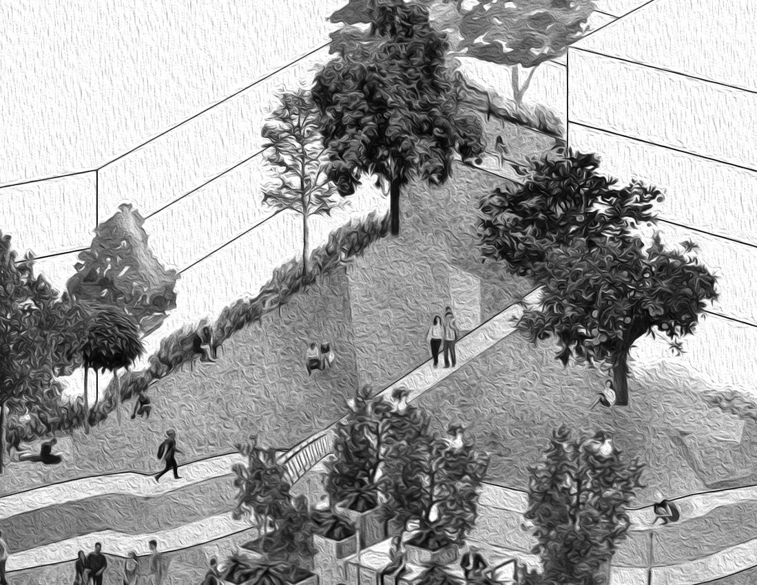
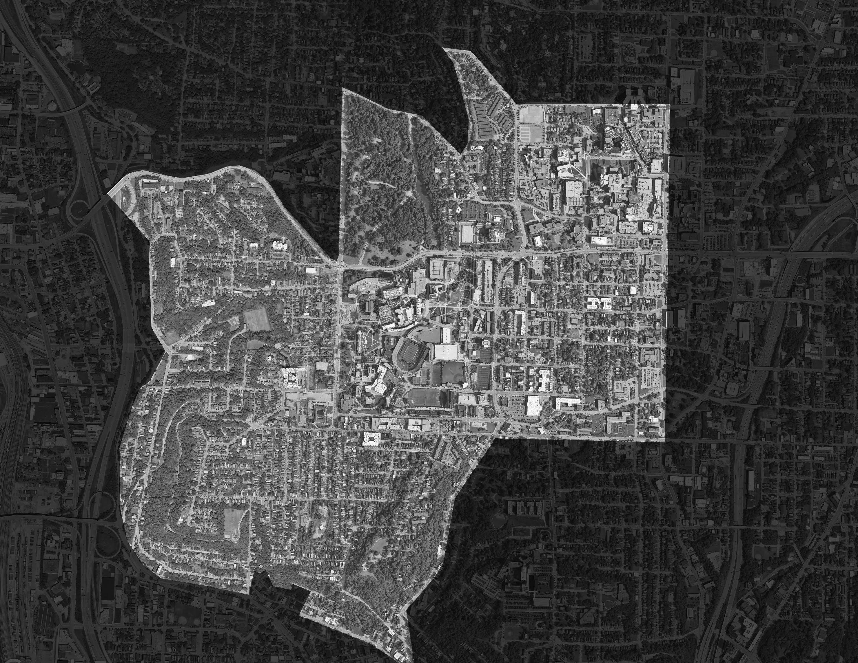
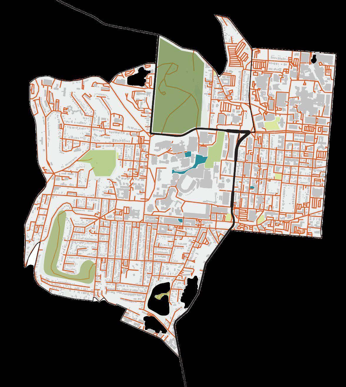
This studio explored urban design in both conceptual and concrete ways, emphasizing how urban design shapes places and in turn how people go about living their lives. The studio stressed the importance of resilience in urban design. Six urban design tenants and were then explored in how they could be applied to South Fairmount, a Cincinnati neighborhood that has historically faced disinvestment. South Fairmount had substantial investment in the form of the Lick Run Greenway, completed in 2021, that created ample greenspace in the neighborhood, while operating as a stormwater management project that helps to control sewage overflow into the Mill Creek. This, in many ways, served as a backbone and catalyst for the studio proposals. Individual work.
Plan. This map takes a heavily conceptual approach to a plan for South Fairmount; it envisions where tenants could be implemented, to best align with existing characteristics of the neighborhood and design intentions. Completed using illustrator.
Development/Built Environment District


Urban Forest/Greenery District
Business District/Mixed Use
Activity Node
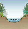
Daylit Stream
Map: Urban Design Tenets. This map proposes general locations for where urban design tenants could be implemented within South Fairmount. Based off research for selected urban design tenants, The bolded sections within the legend delineate each tenet. Completed using ArcGIS Online and Illustrator.
Daylighting Streams Priority Ranking:
Highest Priority
Medium Priority
Lowest Priority Infeasible
Pedestrian Pathways:
Pedestrian Priority Hub
Primary Pedestrian Pathway
Secondary Pedestrian Pathway
Tertiary Pedestrian Pathway
Trail
Urban Forests:
Urban Forest
Third Spaces + Business District:
Activity Node
Business District
Housing + Infill:
Mid-High Density Housing + Mixed Use
Variety of Housing Typologies
Infill Areas
Adaptive Reuse:
Adaptive Reuse
Buildings

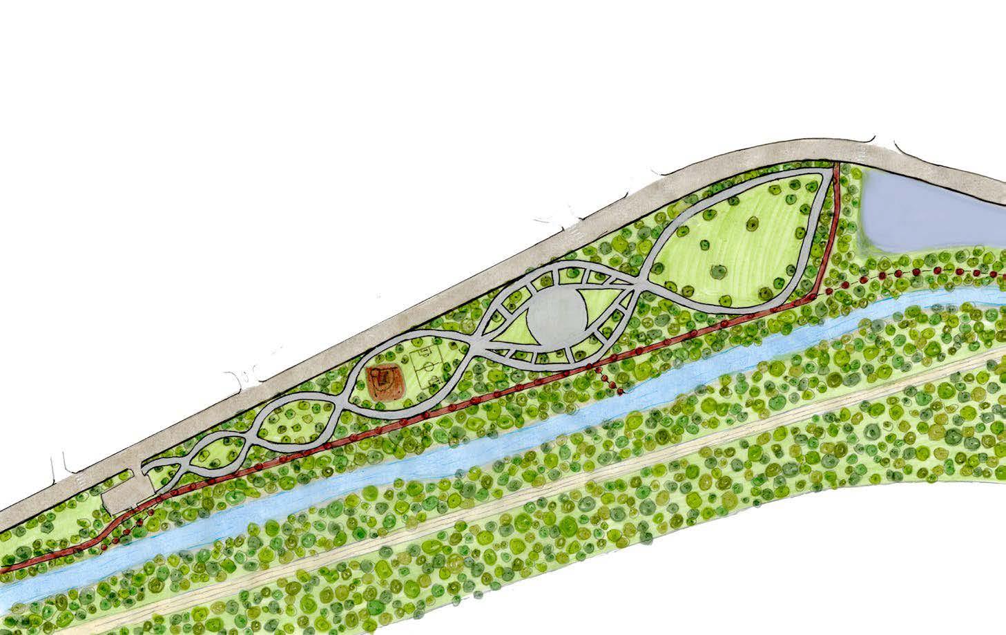
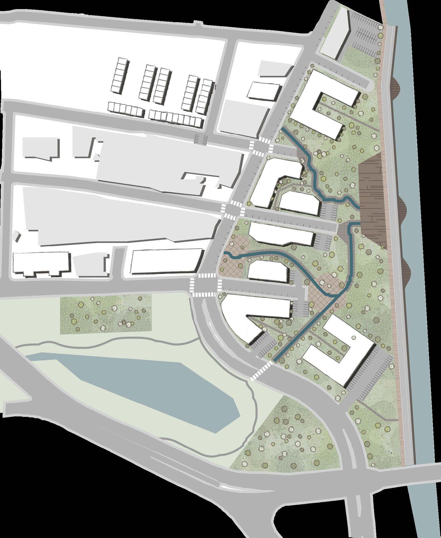
Urban Design Tenets Focus Area (below). Depicts urban design tenets in the context of the focus area, with proposed building footprints. Created using ArcGIS Online, AutoCAD, and Illustrator.
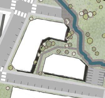
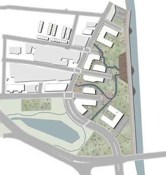
Site Master Plan (right). Master plan for focus area with proposed building footprints highlighted in white. The plan emphasizes daylighting of streams as a catalyst for pathway creation and public space activation. Plazas and deck space also align with daylighted streams. Pockets of parking were added to contribute to the overall feasibility of the site. Completed to Completed using ArcGIS Online, AutoCAD, and Illustrator.

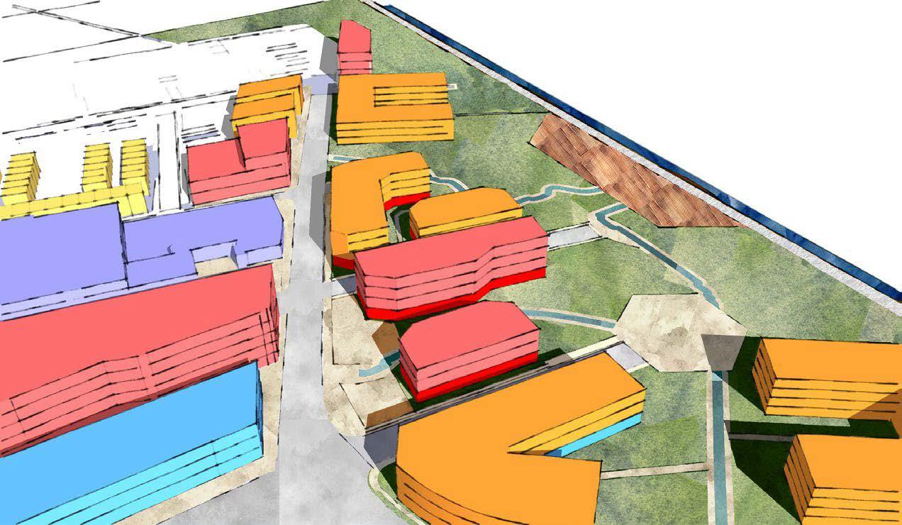
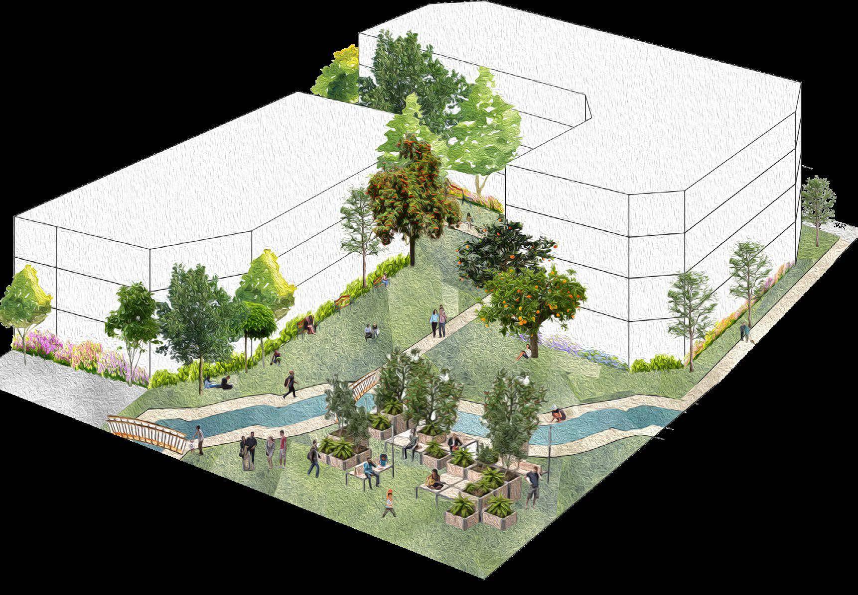
The models below explore the usage, massing, and public space within the focus area. On the right, the focus is on the usage per floor of each proposed building, while the model on the right depicts a scene of what public space may look like along one of the daylighted streams.
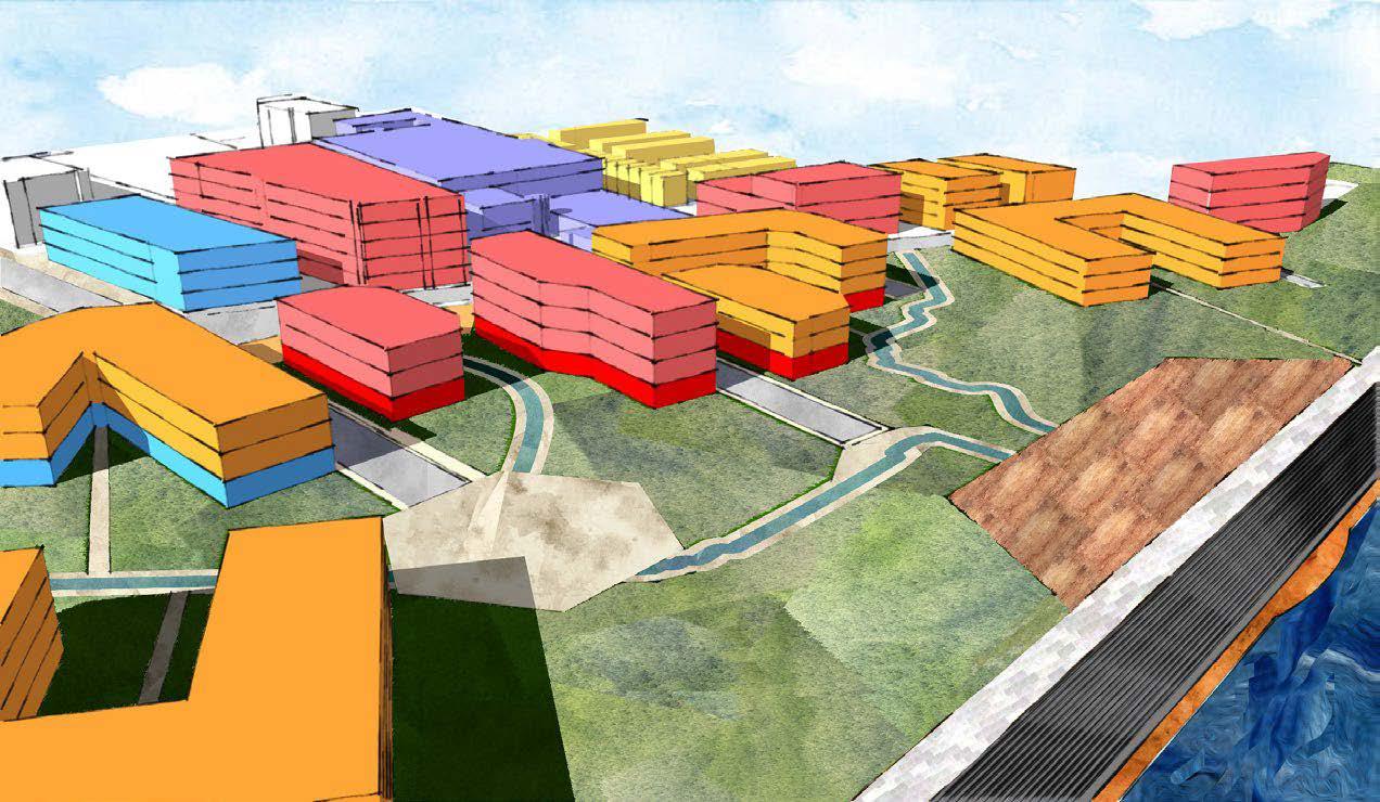
Land Use Massing Models (left). Depicts daylighted streams and greenspace while portraying the existing and proposed buildings in terms of their number of floors and specified use of each floor. Modeled in SketchUp, completed in Photoshop.
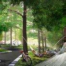
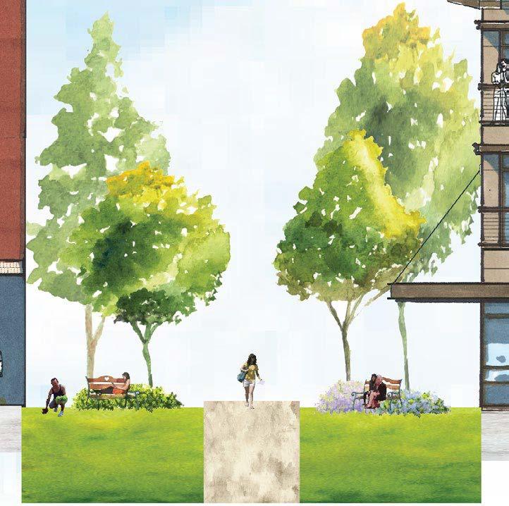
Focus Area Model (below). Illustrates a scene of what the public greenspace might look like along one of the proposed daylighted streams. Modeled in SketchUp, collaged in Photoshop.


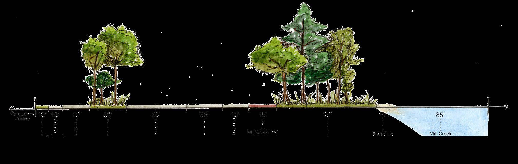
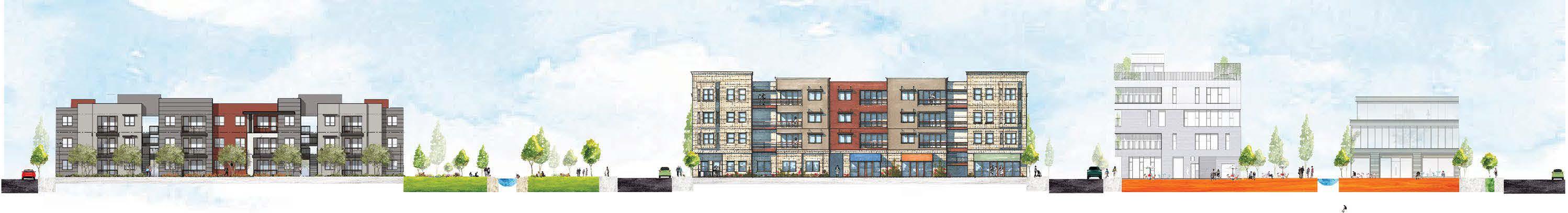
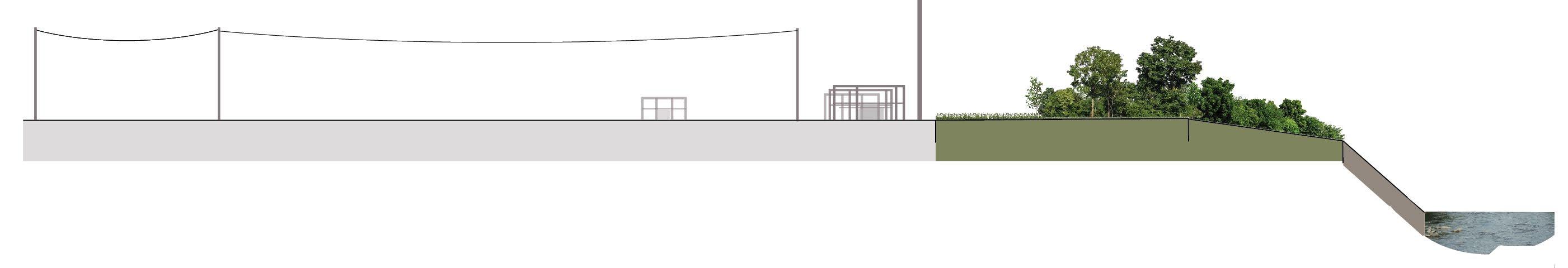
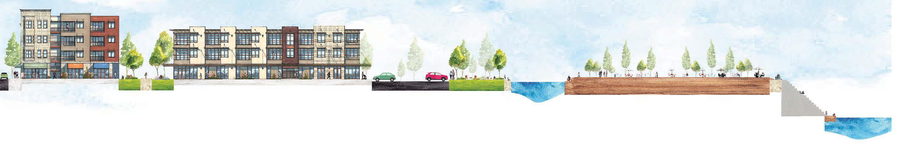
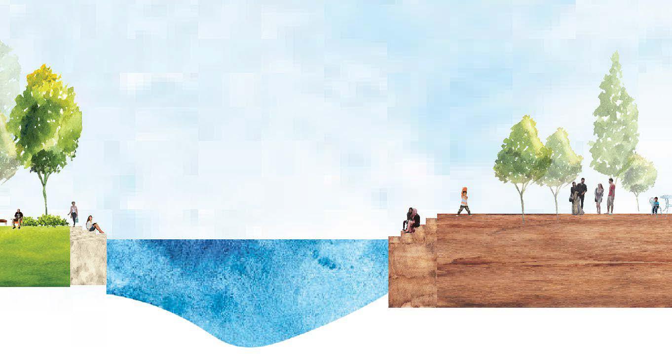
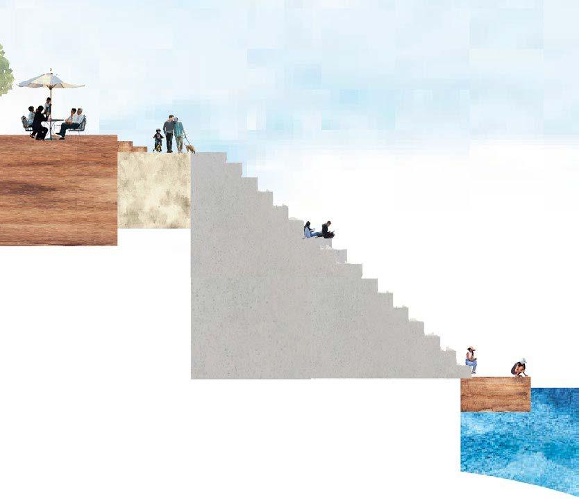
The cross sections below depict the existing and proposed cross sections along Beekman Street. The existing is an underutilized site, while the proposed envisions a vibrant neighborhood center that connects the Mill Creek and the Lick Run. Cross sections completed in AutoCAD and Illustrator.
Existing

Proposed
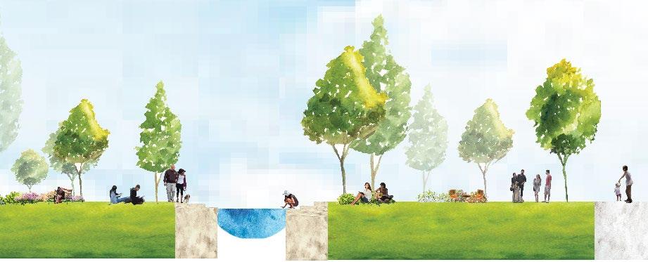
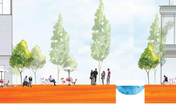
The cross sections below illustrate from Beekman Street inwards, to the Mill Creek. The existing emphasizes the lack of connection and engagement with the Mill Creek, while the proposed seeks to establish that connection, while creating public space along the daylighted streams that lead to the creek.
Existing
Proposed
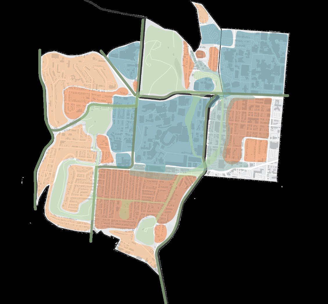
District + Neighborhood - Summer 2023
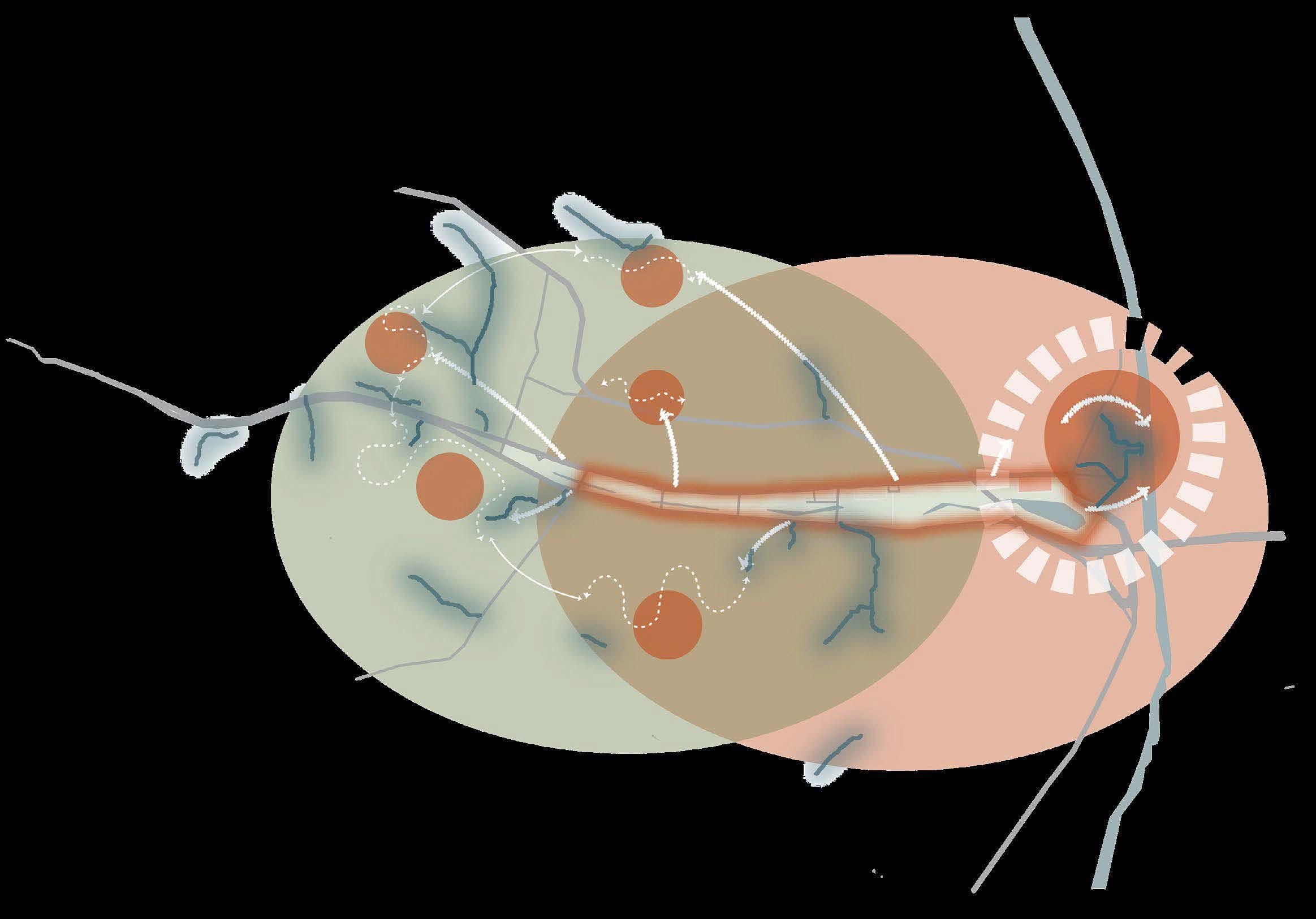
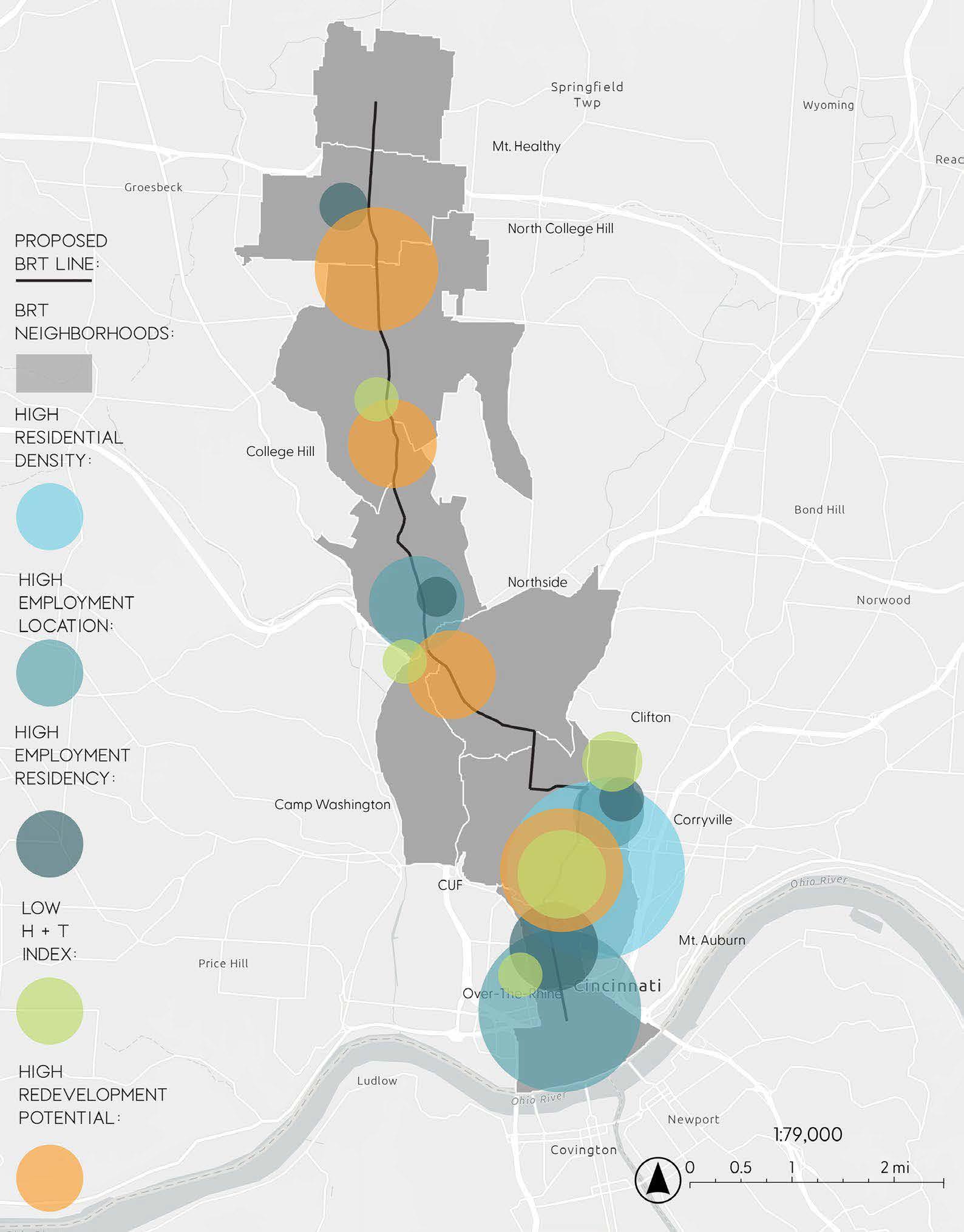
This studio focused on the proposed Bus Rapid Transit (BRT) Corridor along Hamilton Avenue and explored it’s potential as a smart mobility corridor. Background research was conducted to assess the location efficiency of neighborhoods along the proposed Bus Rapid Transit (BRT) corridor. Individual and group work with Reese Stangelo.
Below are six attributes that define location efficiency:


Location efficiency is measured by three main attributes: 1. Employment Centrality
2. Housing and Transportation Index
3. [Re]Development Potential
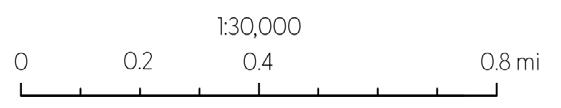
Corridor Location Efficiency Metrics (right). This map summarizes data from the three main metrics of location efficiency. Larger circles indicate a higher value/concentration of a metric. Areas with more overlap between the metrics are more location efficient. Created using ArcGIS, Photoshop & Illustrator.
This project was forward-focused, envisioning what the BRT corridor could be in 2050. The concept of location efficiency was used to envision the corridor as a catalyst for the decentralization of work and the creation of 15-minute neighborhoods. The concepts of sustainable and equitable placemaking and development were used to support the vision of decentralized work. Reese focused on development, I focused on placemaking.
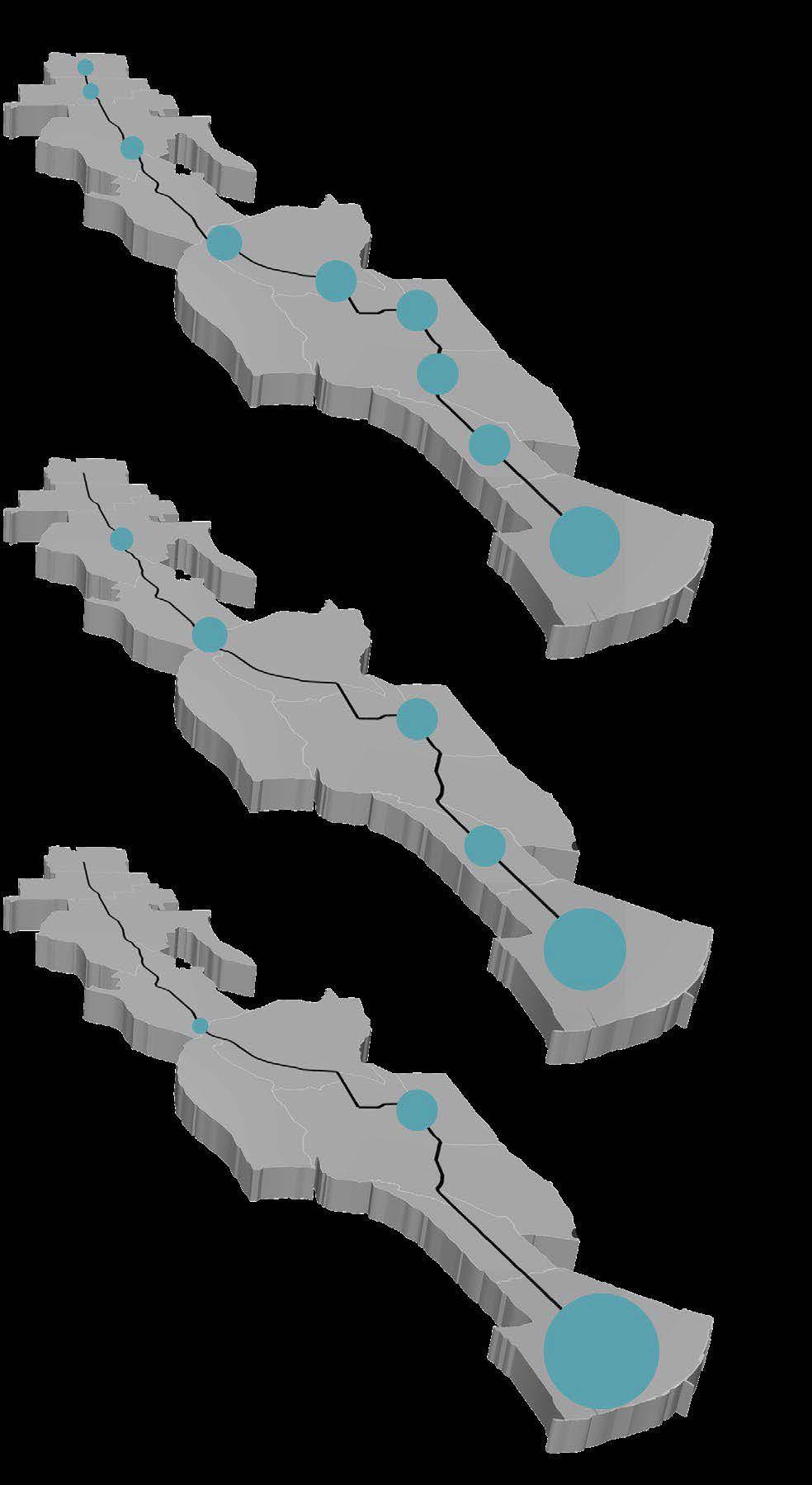
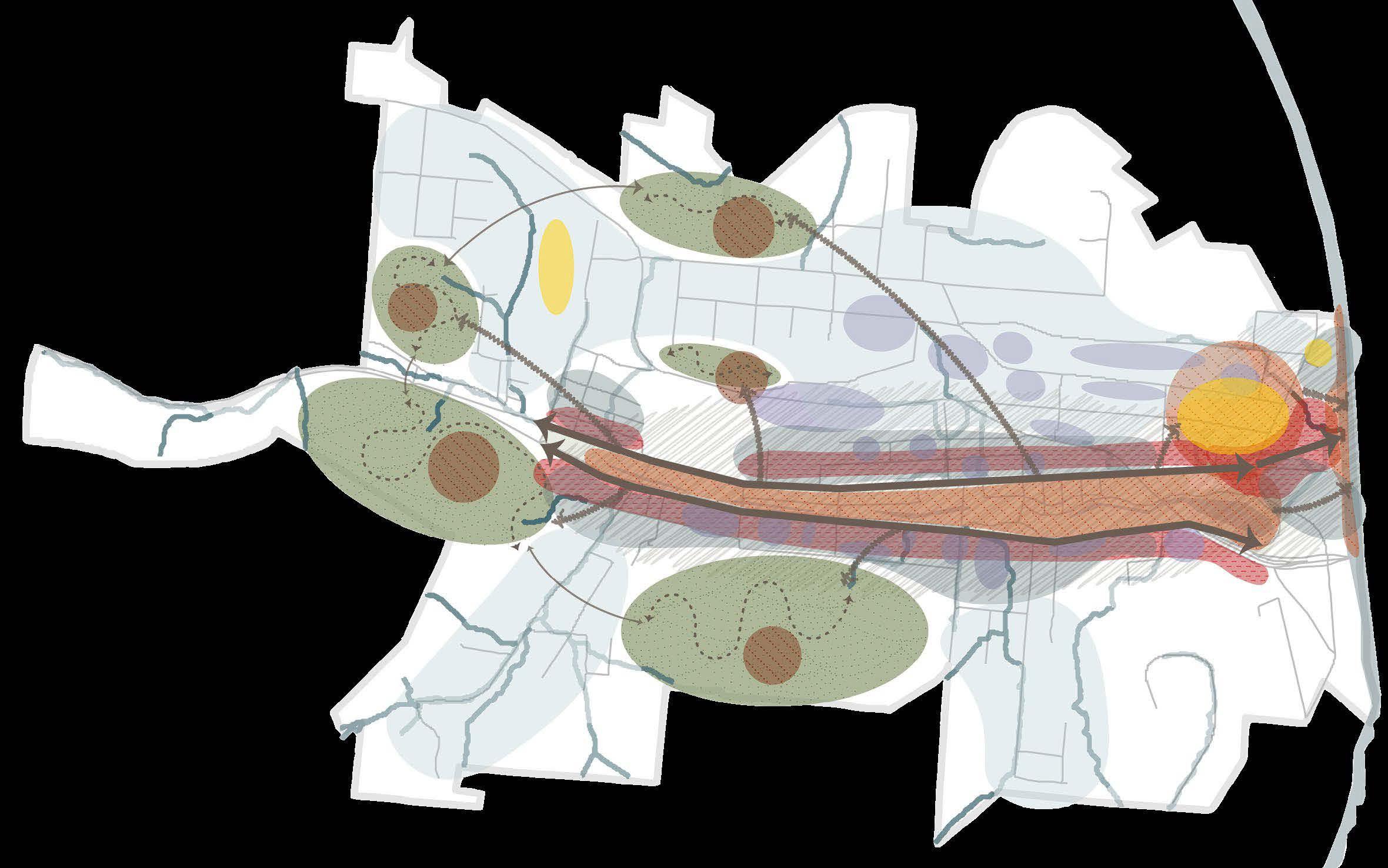
Work in 2050: Three Scenarios. Conceptual map of possible employment concentrations in 2050. Created using ArcGIS, Photoshop & Illustrator.
3. TOTAL DECENTRALIZATION
Downtown lacks a traditional core but has a significant employment concentration. Employment is somewhat evenly distributed through the corridor, creating a linear “Core-idor” along the BRT route.
2. SOME DECENTRALIZATION
Neighborhood business districts become higher centers of employment concentration, but downtown still acts as the main core.
1. NO DECENTRALIZATION
Downtown Cincinnati remains as the largest core concentration of employment.
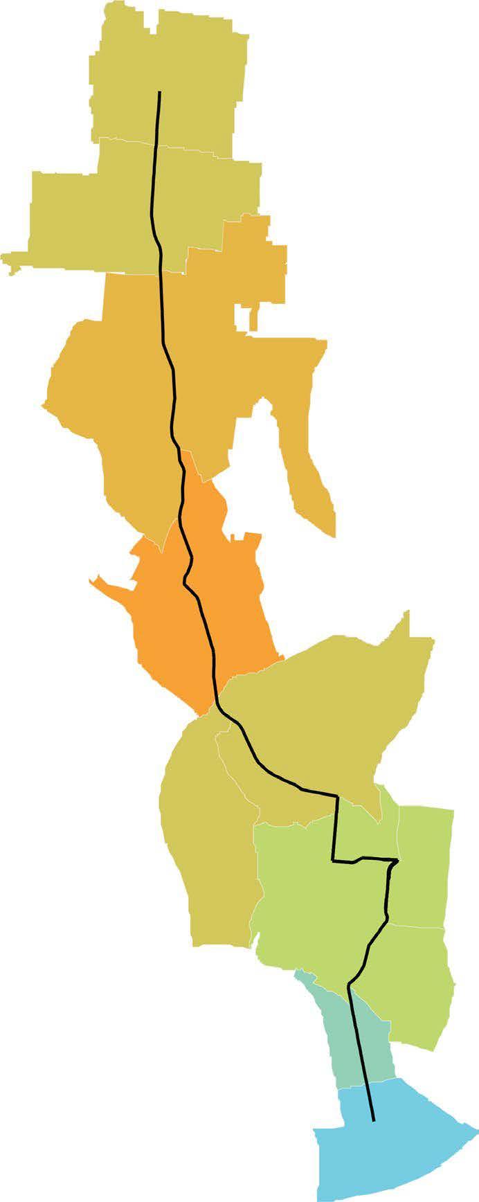
Total Decentralization of work: Corridor Typologies. BRT Corridor neighborhood map showing hypothetical changes in employment concentration based off of current location efficient attributes. Created with ArcGIS + Illustrator.
INCREASE IN CONCENTRATION OF EMPLOYMENT DECREASE IN CONCENTRATION OF EMPLOYMENT
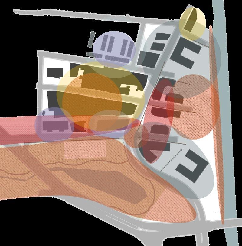
This portion of the project focuses on the proposed Hamilton Ave BRT Corridor at a neighborhood scale and asks, “What does a location efficient neighborhood look like?” The neighborhood focused on is CUF + Corryville. Due to the presence of institutional employers, the decentralization of work will look different in CUF than in other neighborhoods along the corridor.
The Vision: From a Bubble to a Blob. With the decentralization of work, 15 minute neighborhoods will become more prominent as people live closer to where they work. CUF can become a 15-minute neighborhood by densifying and diversifying the built environment and resident population. The “bubble” refers to the institutional employers in CUF that often act as isolated units, separate from the rest of the community. From a bubble to a blob envisions the breaking down of these barriers. Models created using Illustrator.

A BLOB
Placemaking Strategies. The icons represent five strategies developed to promote placemaking along the proposed BRT and in CUF + Corryille.
Character bubbles were created based on the predominant form + use in a given area. The 2050 character map envisions a CUF + Corryville with popped institutional bubbles to allow for connected areas and a mix of uses. The map depicts a connected park system via green streets, increased residential density, as well a connection of the three main streets that currently exist within the neighborhood. Made with ArcGIS, Illustrator & InDesign.
CONNECTED OPEN SPACE/PARKS SYSTEM + GREEN STREETS
EXPANDED BIKE ROUTES
MAIN CAMPUS + MED CAMPUS CONNECTED
INCREASED RESIDENTIAL DENSITY
CONNECTED + EXPANDED MAIN STREET
INCREASED RESIDENTIAL DENSITY
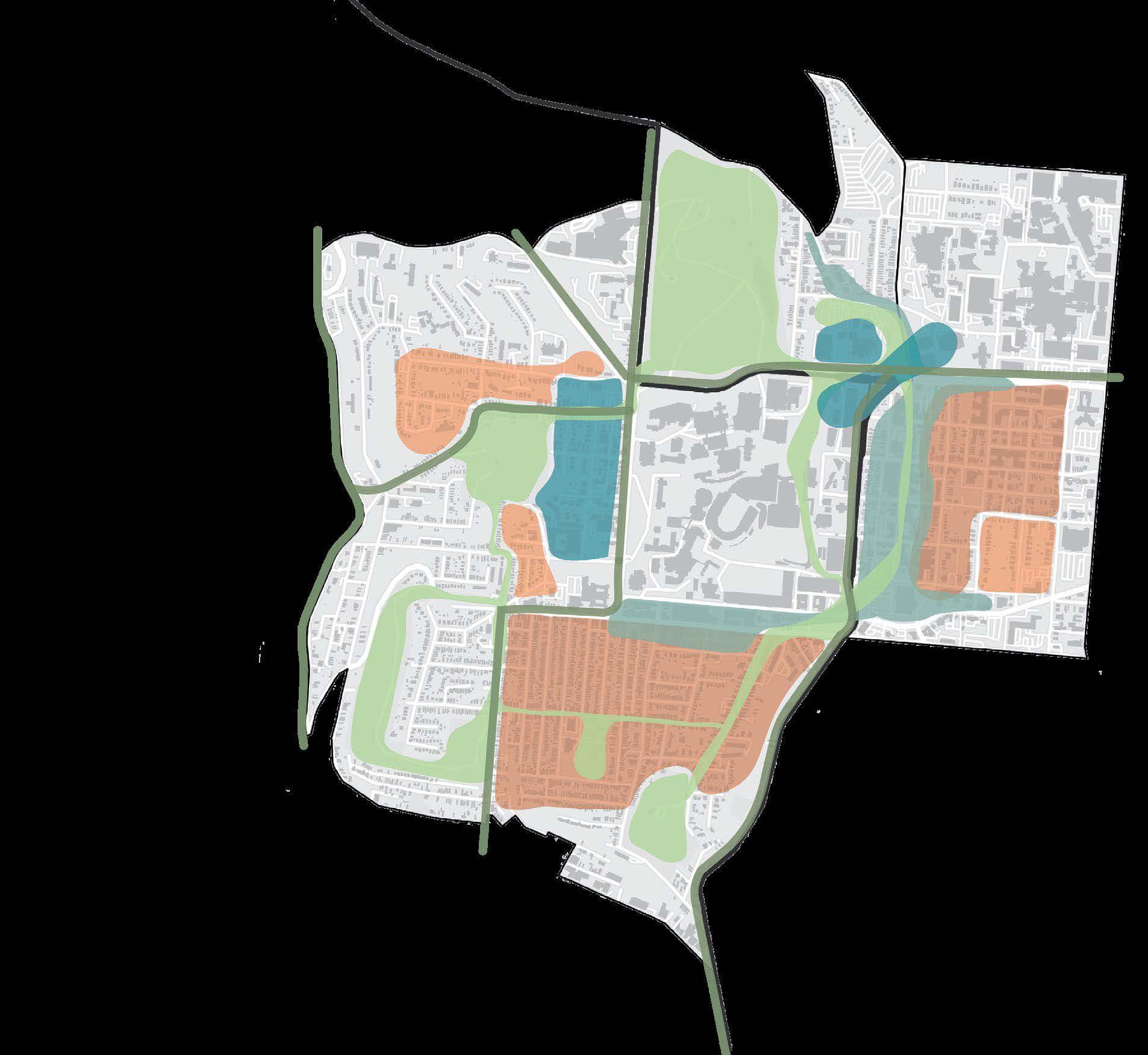
This section breaks down placemaking into three typologies and maps where they are in CUF and Corryville. Short Vine, located on the east side of campus and between CUF and Corryville was chosen as a design site due to its existing location, use, and pedestrian infrastructure.
Placemaking Typologies.
Categorizes placemaking into three categories: parks + open space, plazas + squares, and streets, and depicts them on the map. Created with ArcGIS, Illustrator & InDesign.
Short Vine: Plan View. Details the 76,500-square-foot proposed pedestrian street and its surrounding context. The design proposes increased walkability by removing parking on surrounding streets and widening the sidewalks. The pedestrian pathway passes the Kroger entrance and connects to the BRT stop. The design proposes dividing the street into seasonal sections, each of which has a greenhouse to grow food for that season and serve as a multi-use space.

Short Vine: Existing Cross Section. Short Vine currently has two lanes of opposite traffic with parking on both sides and wide sidewalks on both side of the street.
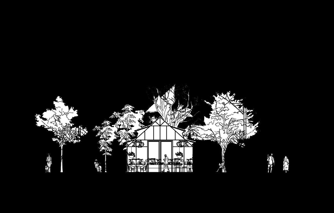
Short Vine: Existing Proposed Cross Section (top right). Diagrams a pedestrian-only street, with a greenhouse in the center serving as a multiuse space and food supply for the neighborhoods. Outside the greenhouse is additional seating and trees to create an urban orchard. The sidewalks stay wide at 20 feet to allow for both pedestrian and cycling traffic. Created using AutoCAD + Illustrator.
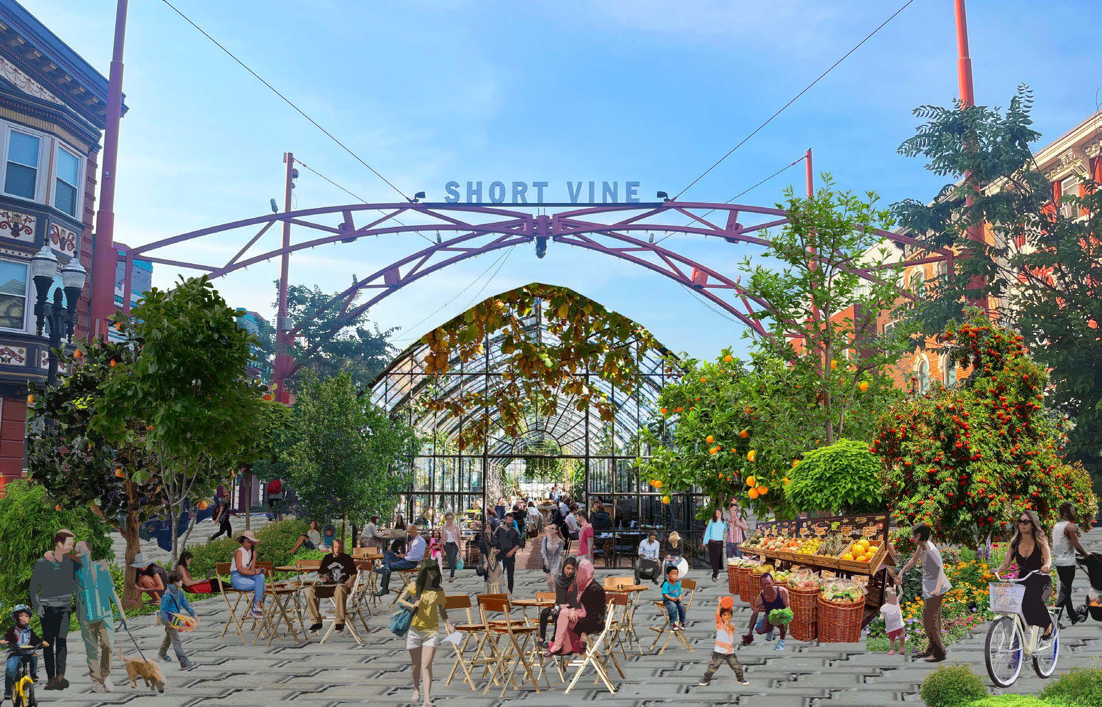
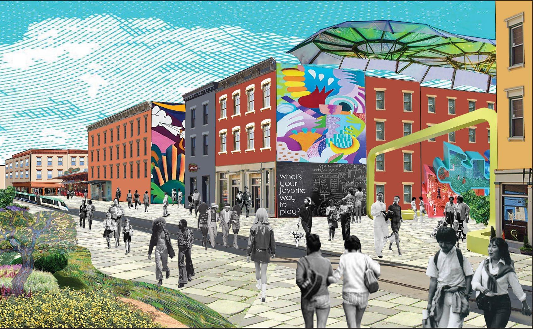
Short Vine: Collage (right). The collage to the right envisions short vine as a pedestrian-only street to be enjoyed year-round by working, living, and eating with the seasons. Created in Photoshop.

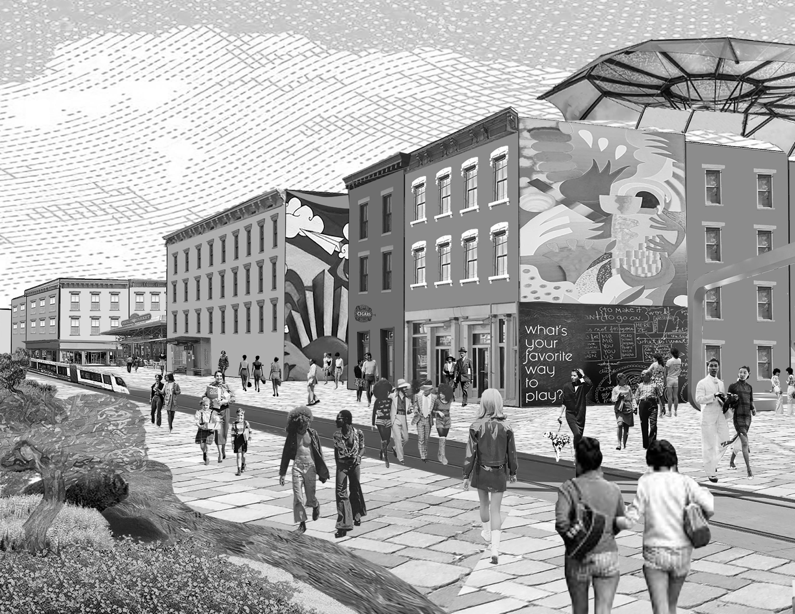
Fall semester 2022 focused on the Connector Streetcar in Over-The-Rhine + Downtown Cincinnati. The site area includes Findlay Market and its surrounding blocks and envisioned them as a social playground. Individual + group work with Lanie Tarowsky.
The two maps below look at the entire scale of the site. First, by inventorying existing conditions to determine strengths and weaknesses, then by creating site-wide interventions based off those strengths and weaknesses. “Green Spines” are proposed as the backbone of the interventions. The spines consist of pedestrian-oriented streets with green infrastructure. Additional interventions include green spaces and alleyway revitalization to support the larger vision for green spines.
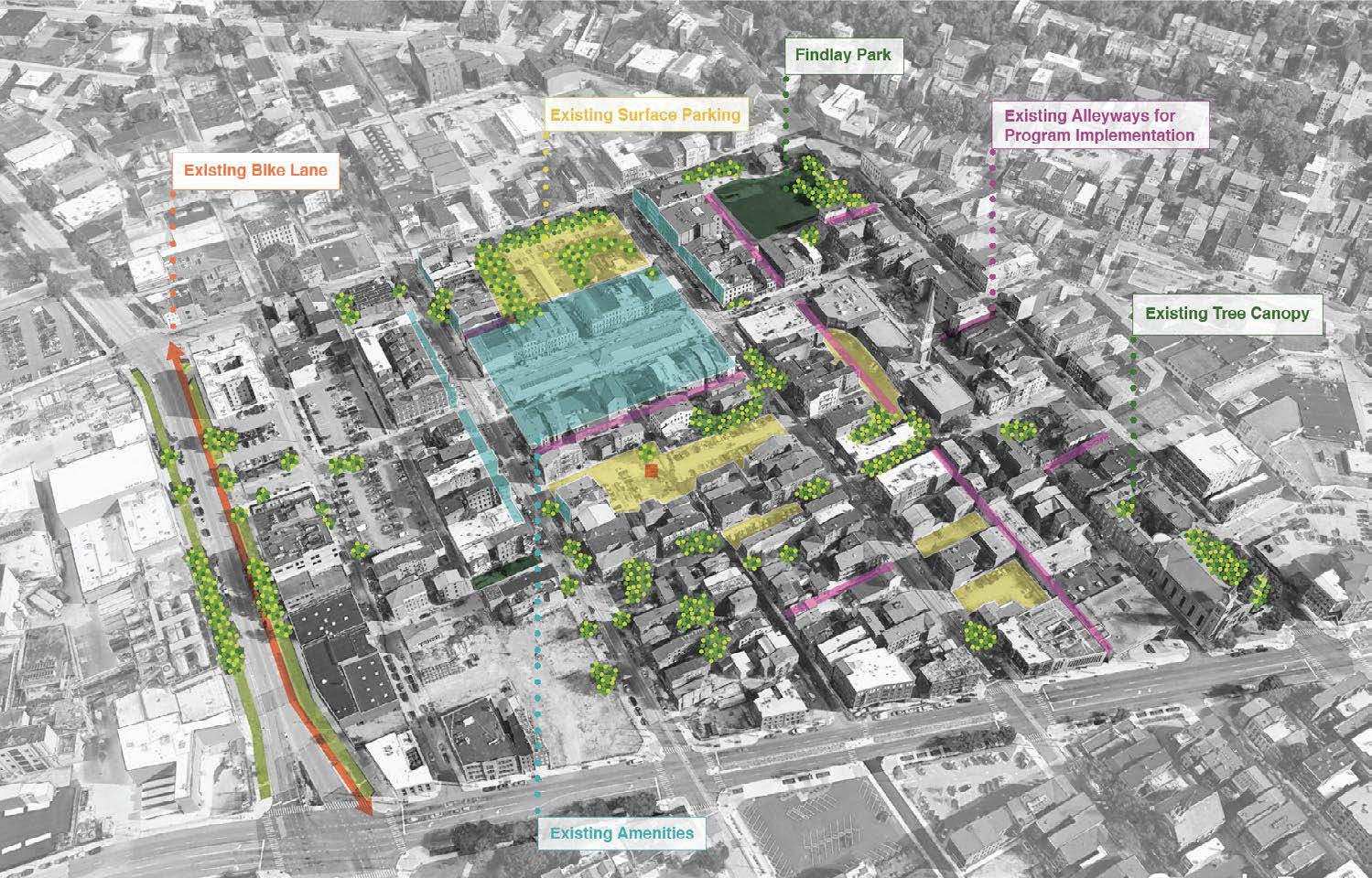
Strategic Map: Existing Conditions. Highlights prominent existing features on the Findlay Market Site. Completed using Google Earth, Photoshop, Illustrator & InDesign.
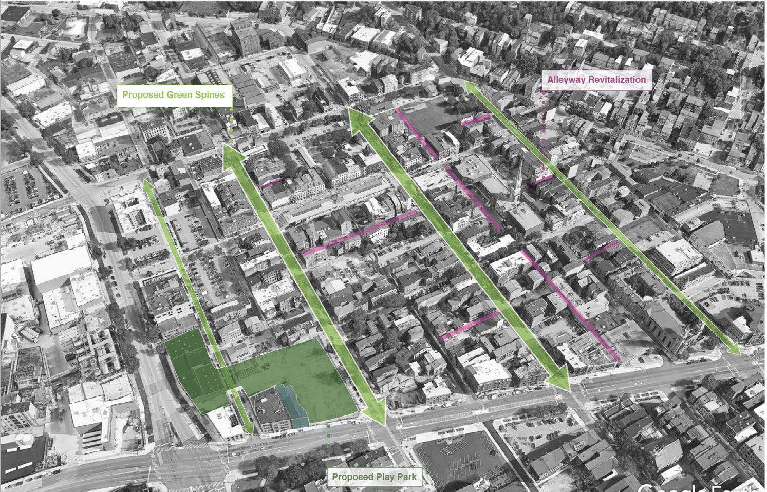
Strategic Map: Interventions. Depicts three main interventions: Green spines, alleyway revitalization and a play park. Completed with Google Earth, Photoshop, Illustrator & InDesign.
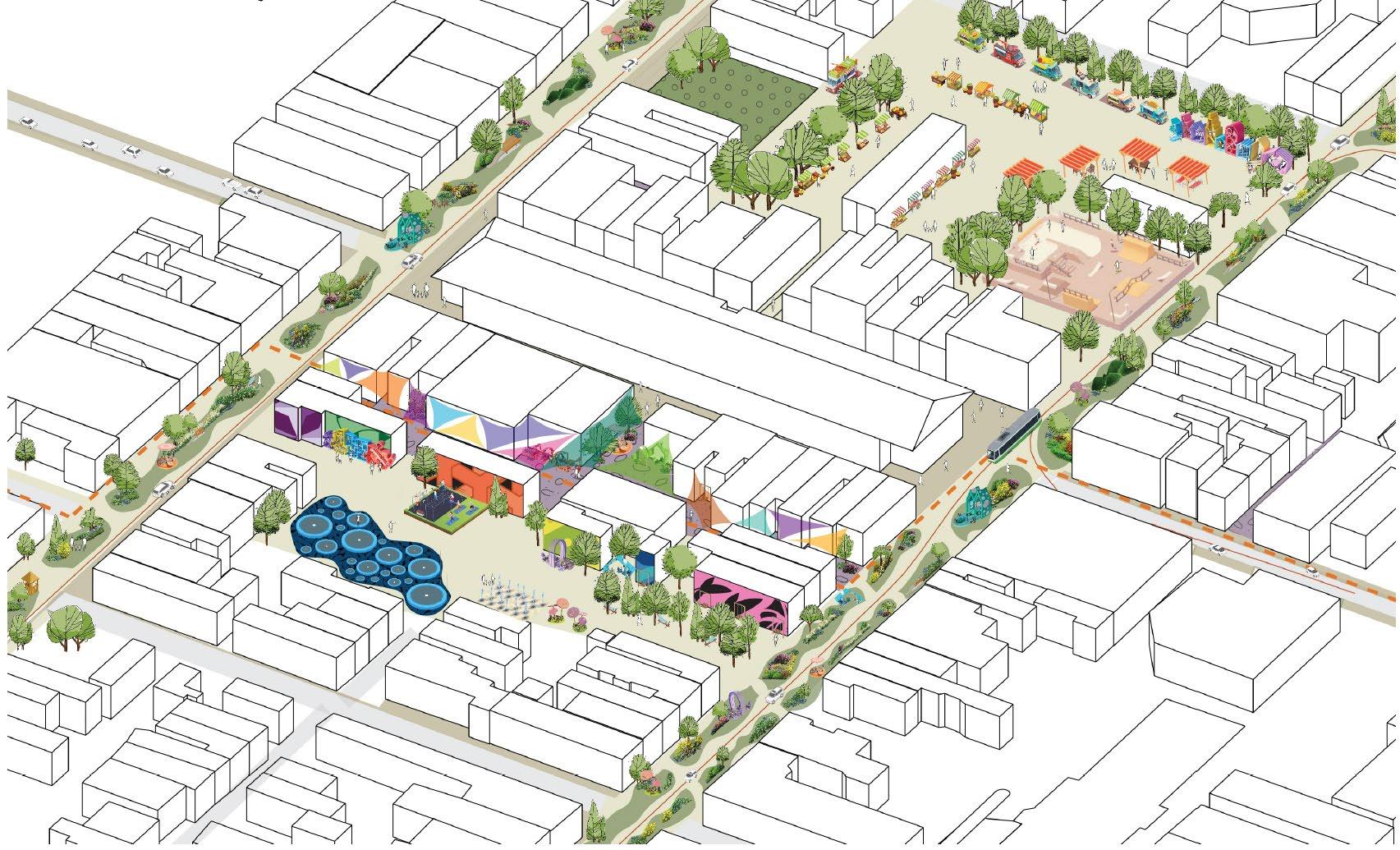
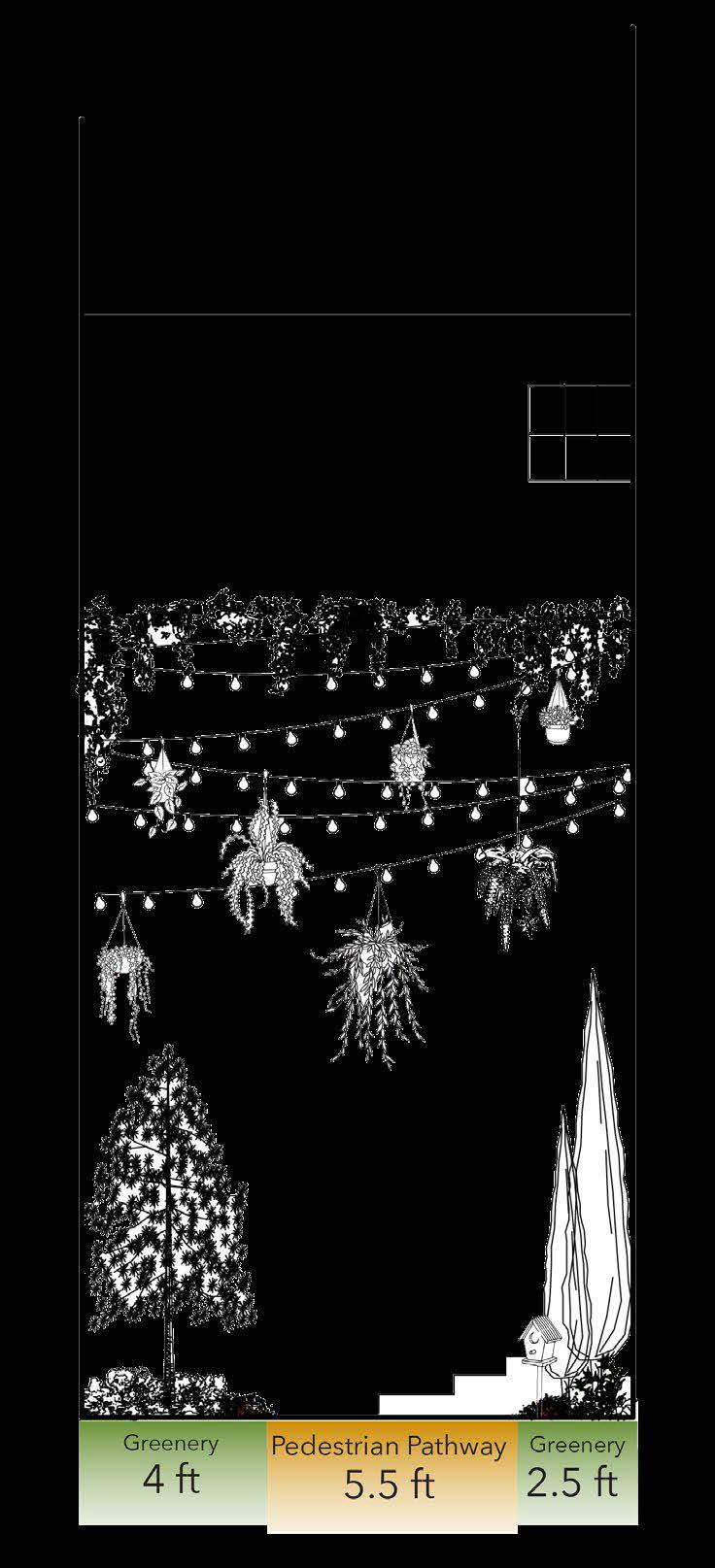
Models the proposed Green Spines in a 3D isometric view as well as in scaled cross sections. Emphasizes the greenery in the environment + focuses on creating a pedestrian-scaled environment.
Existing Conditions
3D Model (left).
Proposed 3D Model (below). Envisions the green spines surrounding Findlay Market, with an emphasis on play and sociability. Models completed using SketchUp + Illustrator.
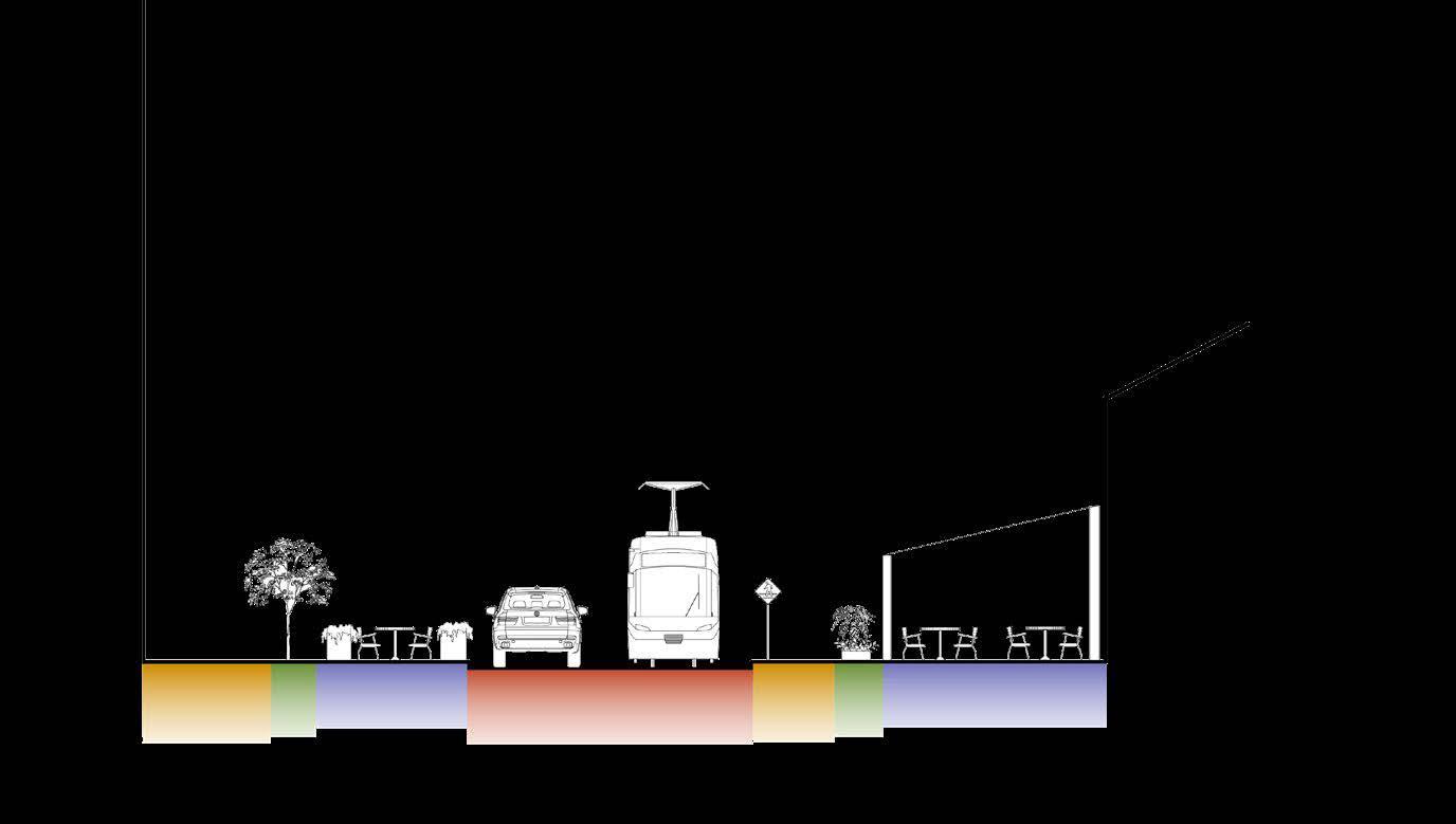
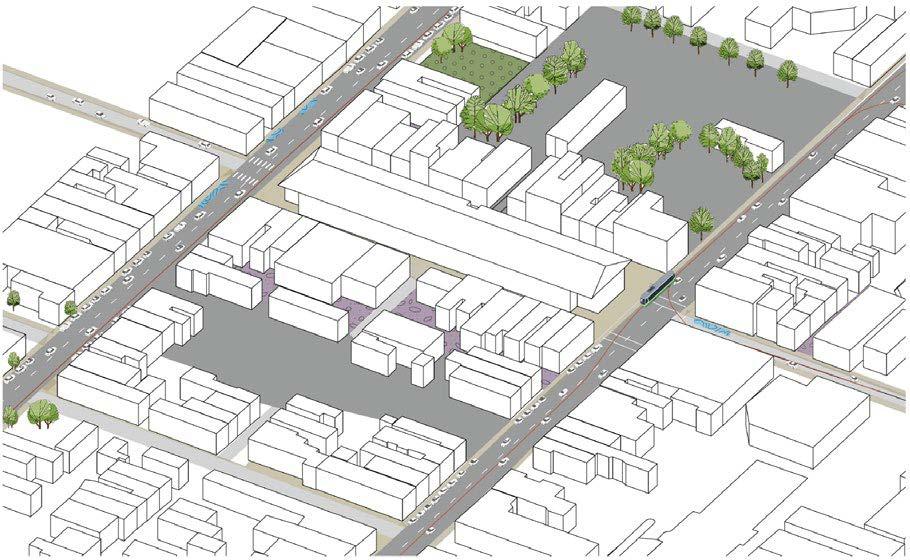
Existing Elm St Cross Section. Depicts a caroriented street. Completed using AutoCAD + Illustrator.

Proposed Elm St. Cross Section. Street design that is centered around the pedestrian, leaving one lane for the Streetcar + Cars. Created by Lanie Tarowsky using AutoCAD + Illustrator.
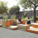
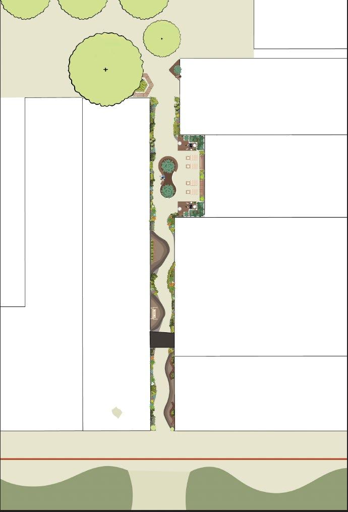
An additional intervention for the Findlay Market site. The site has a number of under-utilized alleyways. Revitalizing alleyways are proposed as a “quick-win” to further support the larger green spine vision.
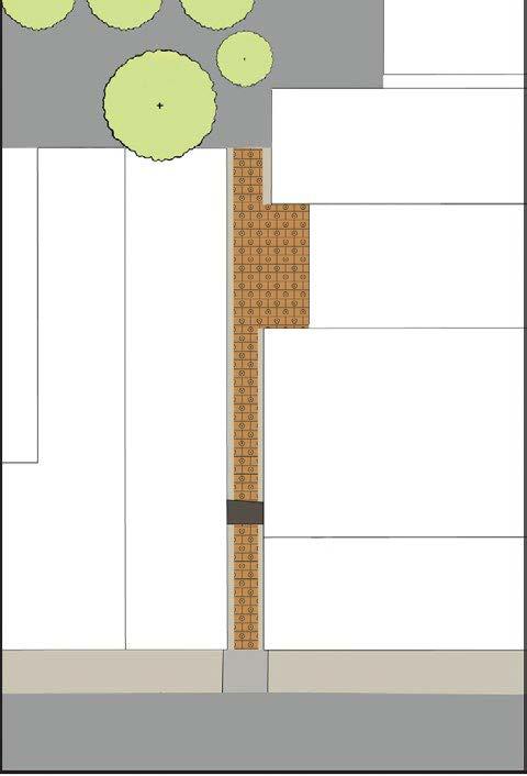
Existing Alleyway: Plan View (above). Created using SketchUp + Illustrator.
Proposed Revitalized Alleyway: Plan View (right). Proposes a path with seating, greenery, and table games. Created using SketchUp + Illustrator.
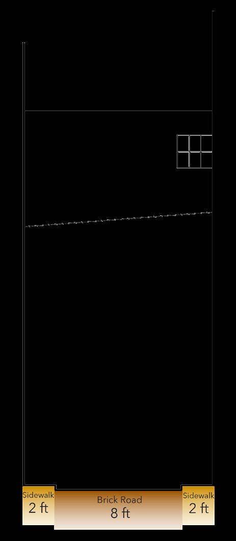
Existing Alleyway: Cross Section (above). Created using AutoCAD + Illustrator.
Proposed Alleyway: Cross Section (right). Proposes greenery as a means to create a sanctuary. Created using AutoCAD + Illustrator.
Collaged model showcasing the vision for the Green Spines on Elm Street from a pedestrian’s point of view. The building base was exported from SketchUp. Collaged using Photoshop.
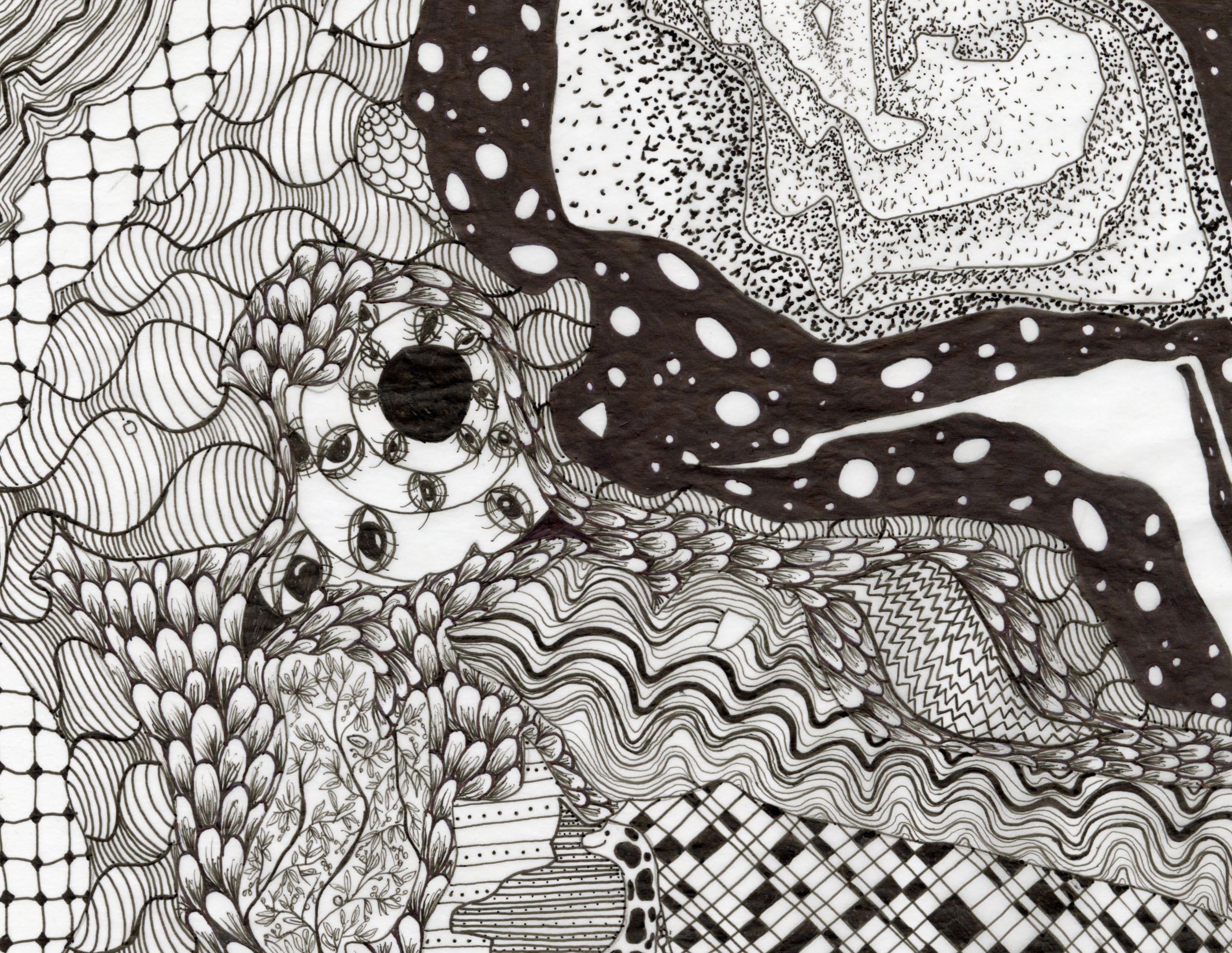
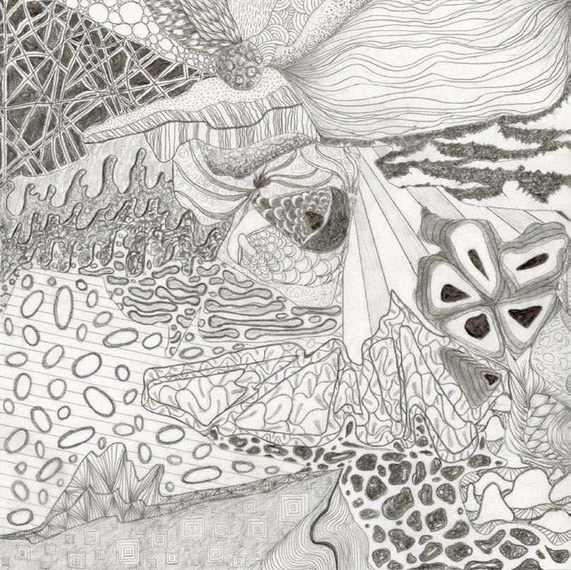
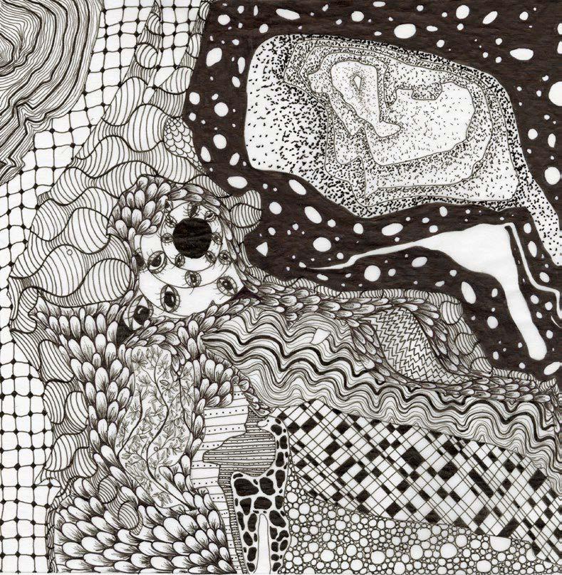
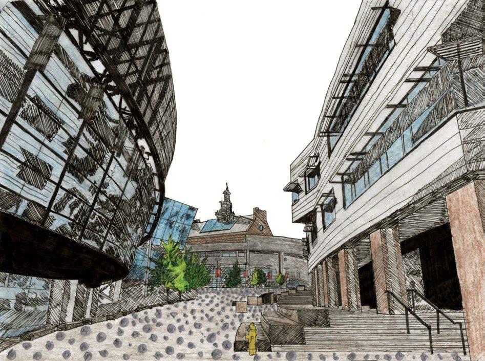
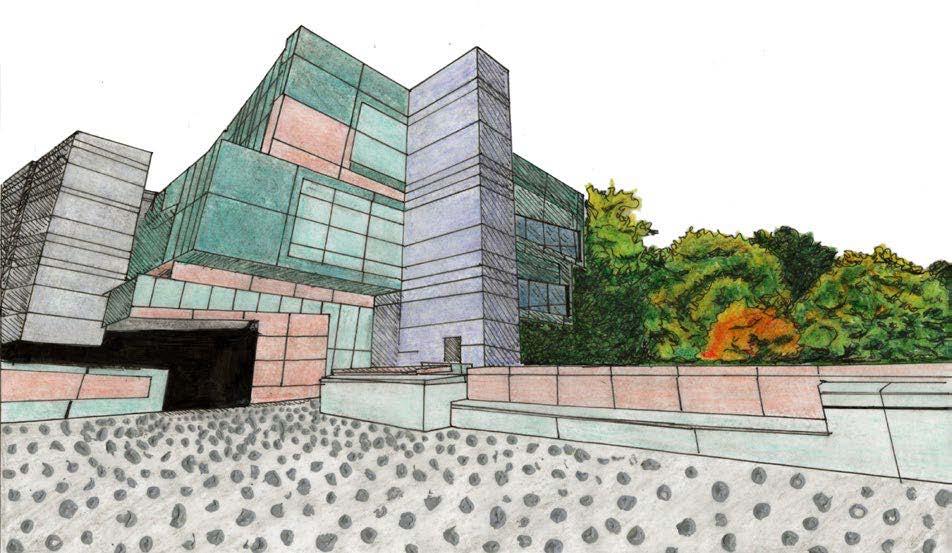
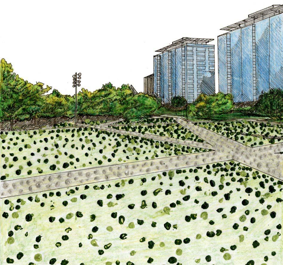
Topography Maps: Pencil + Pen Compositions. Inspired by biological patterns. Pencil completed using graphite and mechanical. Pen completed using Microns and felt tip brush marker. Finalized in Photoshop.
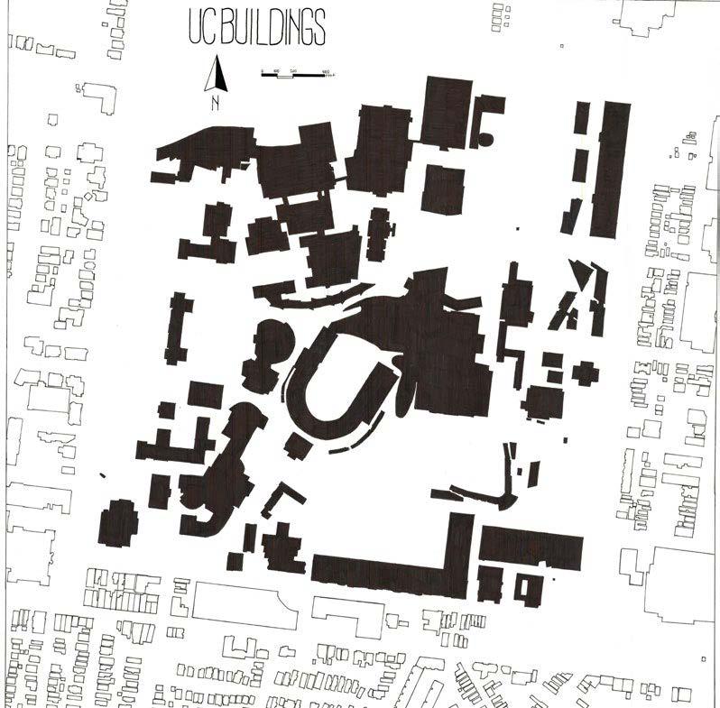
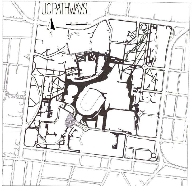
Building Footprint + Pathways Maps.
Hand-drawn on trace paper using an ArcGIS map as a base. Completed using Microns + felt tip brush marker. Finalized in Photoshop.
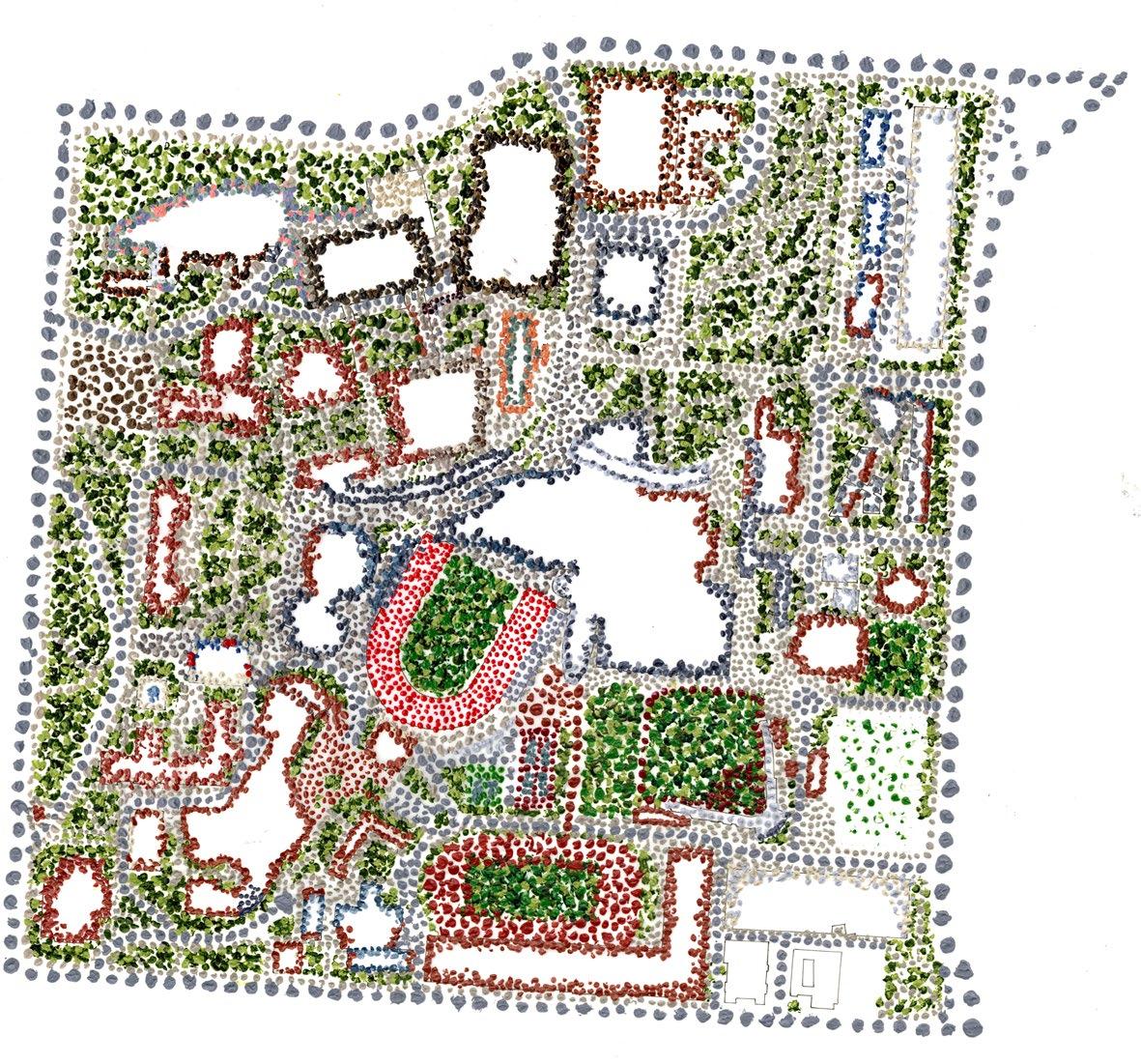
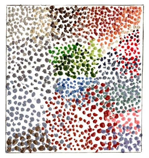
Thematic Map: Color. Depicts hues on UC’s campus and what kind of material a color is seen on. Completed using acrylic paint and the end of paintbrushes to create small dots. Vignettes to the right depict notable areas on campus and were completed on trace paper using microns and colored pencils.
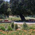
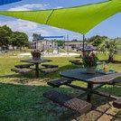
Re-design of Salway Park. Site design proposal for an underutilized park in Spring Grove Village along the Mill Creek. This re-design creates a park with multiple pockets of space. Park and cross section created using markers and microns. Finalized in Photoshop and InDesign.