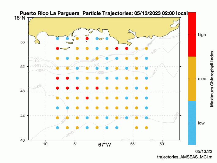
Monitoring and Forecasting of Sargassum Inundation Events (SIEs)
Monitoring and forecasting of Sargassum Inundation Events (SIEs)
Biogeochemical Empirical Model
Loraine Martell-Bonet1, Julio Morell1, Priscilla N. Molina Cora1 , Luis Rodríguez1, Julián Morell1 , Haibo Xu2 , Yonggang Liu 2 , Brian Barnes 2 , Chuanmin Hu 2, Edward Cruz1, Patricia Chardon1
1. Caribbean Coastal Ocean Observing System, Isla Magueyes, La Parguera, PO Box 3446, Lajas, PR 00667
2. College of Marine Science, University of South Florida, St. Petersburg, FL, 33701, USA
Sargassum Monitoring Program Objectives
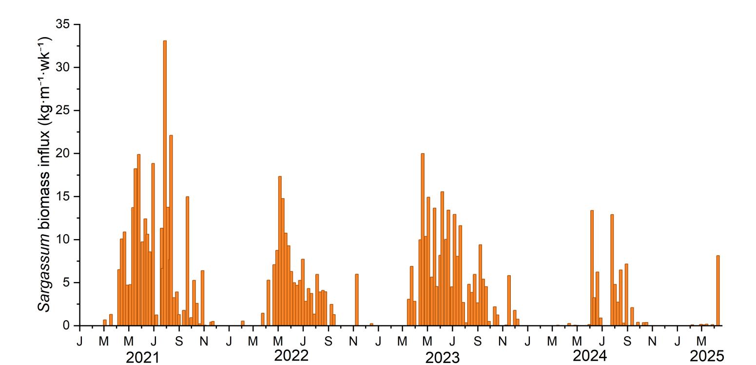
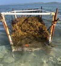
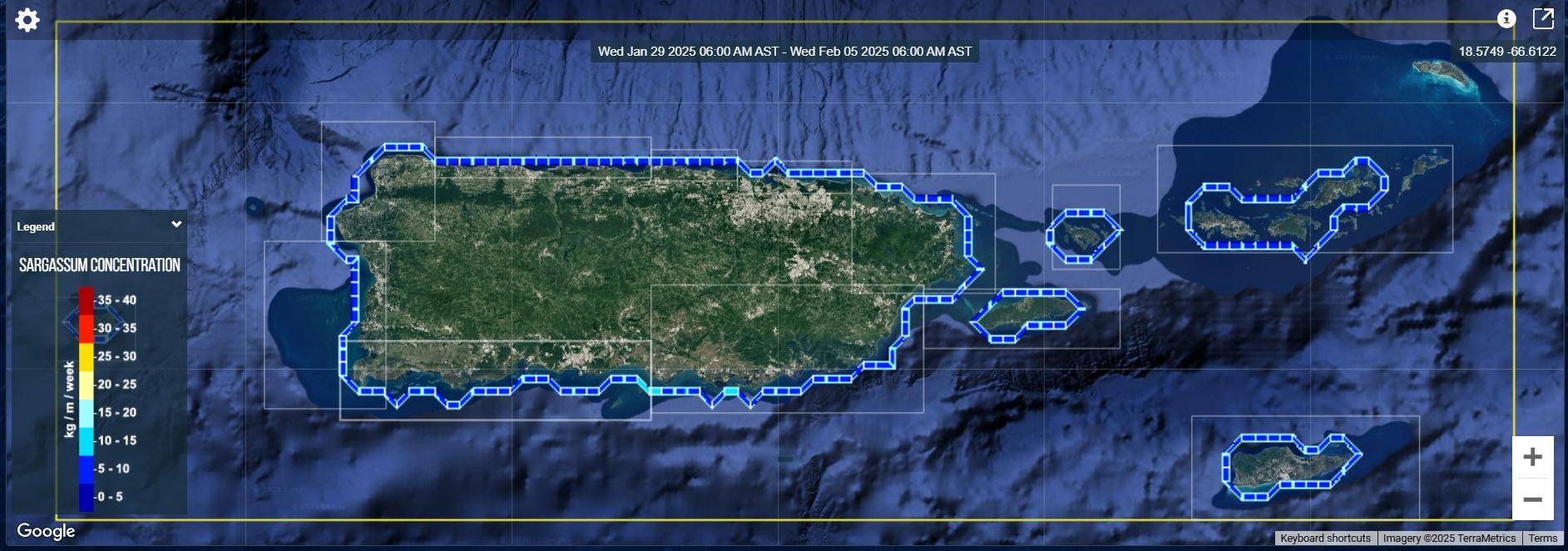
Sargassum influx monitoring
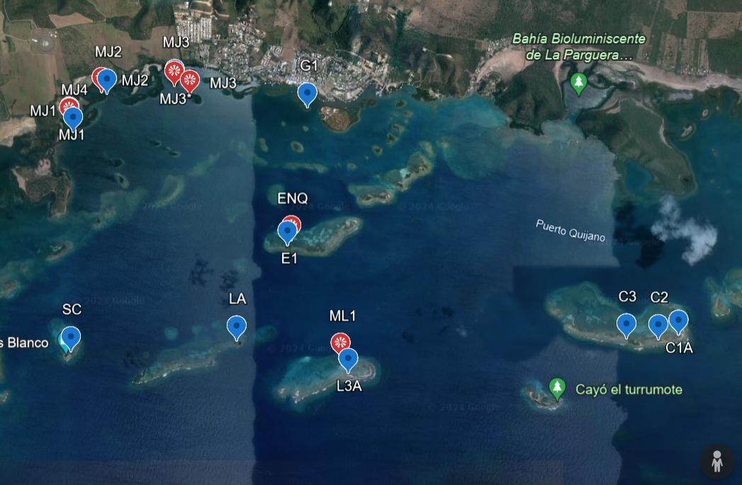
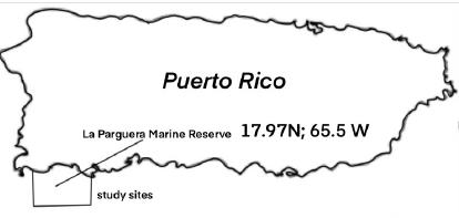
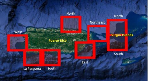
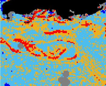
• Assessment of magnitude, spatial, and temporal variability of Sargassum Inundation Events (SIE) at basin and reef/key scales in La Parguera Marine Reserve (LPMR)
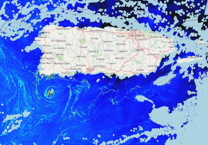
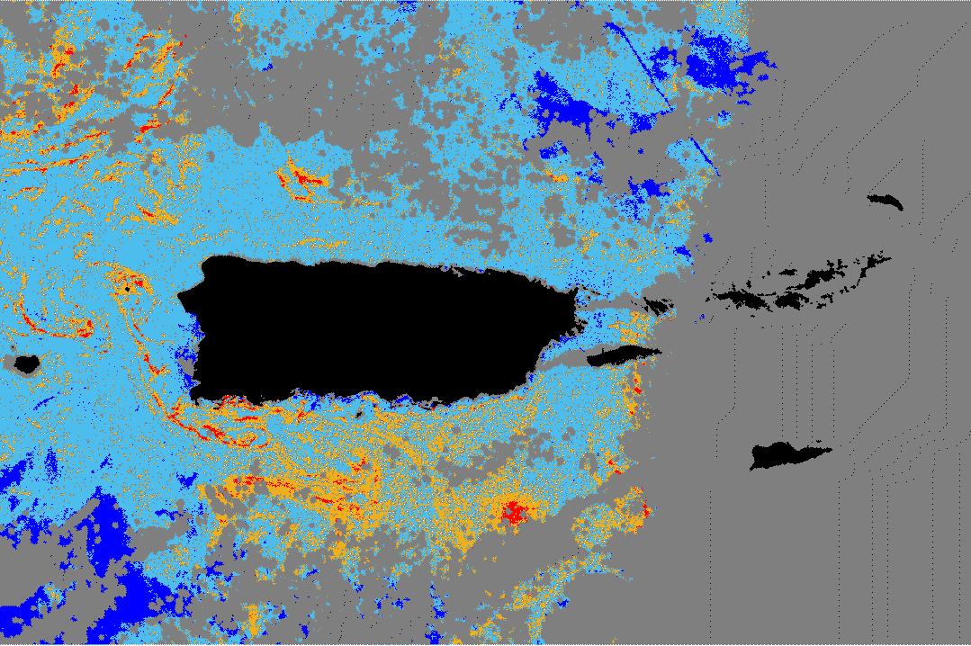
Biogeochemical Impacts
• Assessment of spatial and temporal variability of biogeochemical impacts on reefs and mangrove keys
Forecasting Tools
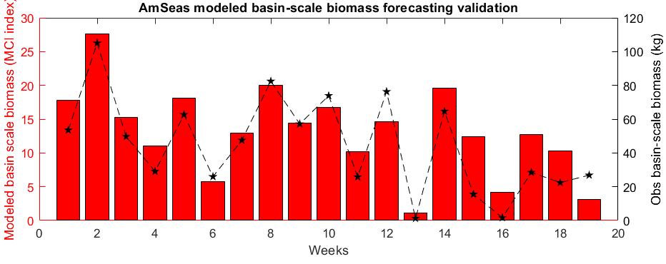
• Development and validation of inundation forecast tools
• Support for marine operations, tourism/recreation, coastal infrastructure, and ecosystem management
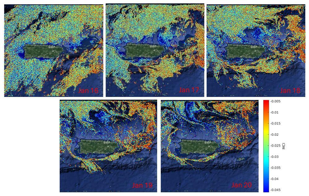
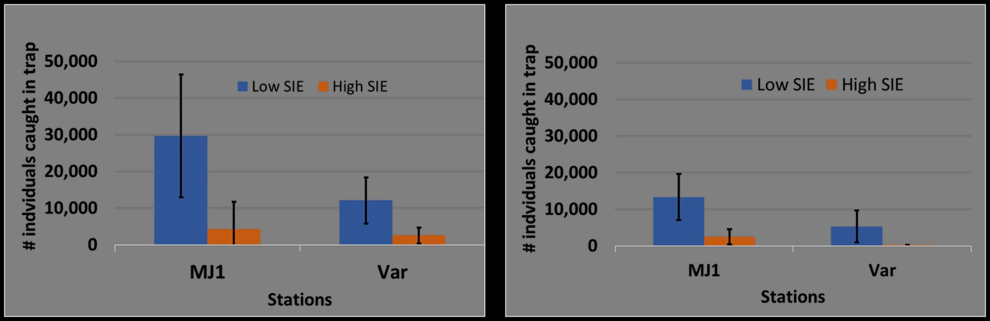
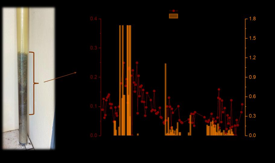
Holoplankton (A) and Meroplankton (B) captured using light traps under low and high Sargassum inundation events (SIE) during 2022 at MJ1, La Parguera, Puerto Rico.
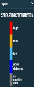
Bars= ±2SE. The low vs. Sargasso threshold used was 18,000 kg/week of Sargasso for La Parguera Marine Reserve Basin (Sargassum inundation estimates supplied by P. Molina for 2022).
Study performed by Dr. Otero,
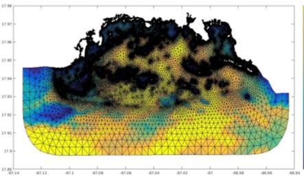
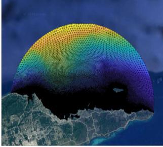
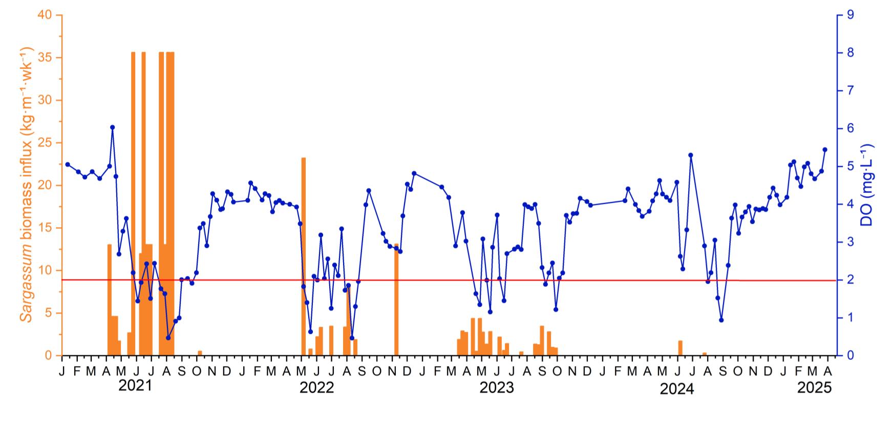
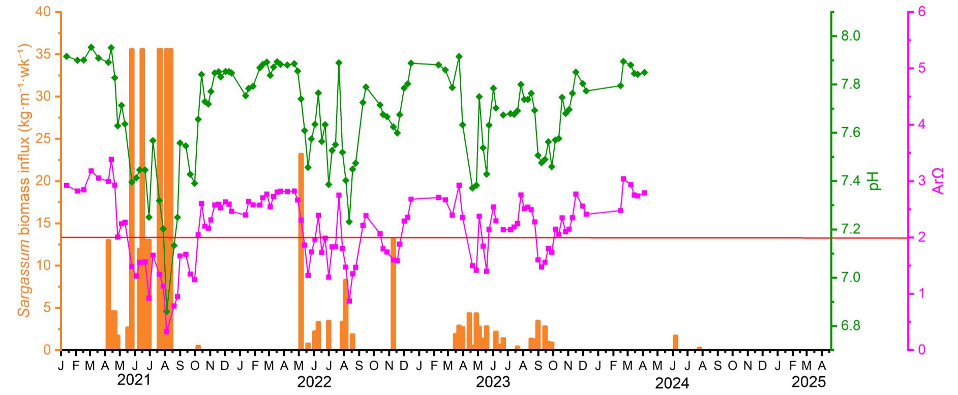
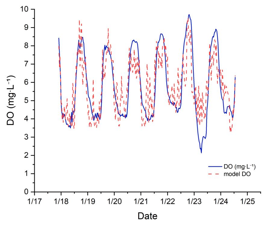
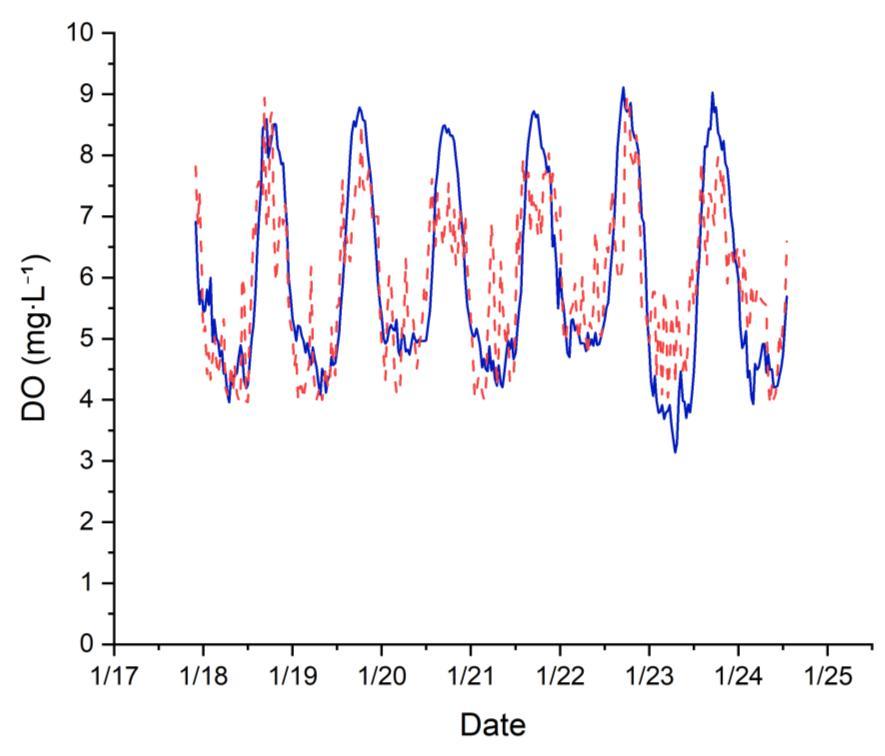
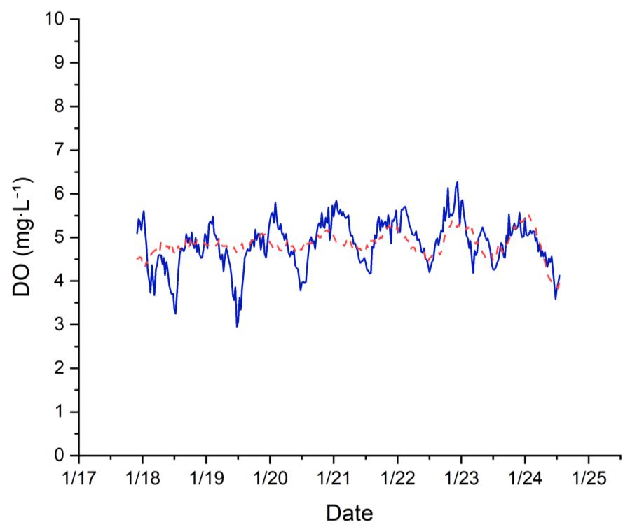
Biogeochemical Modeling and Forecasting
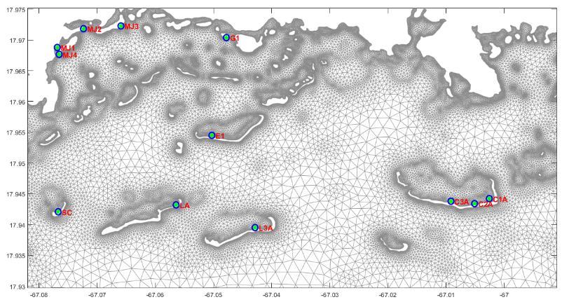
Media Luna Enrique
Biogeochemical Modeling and Forecasting
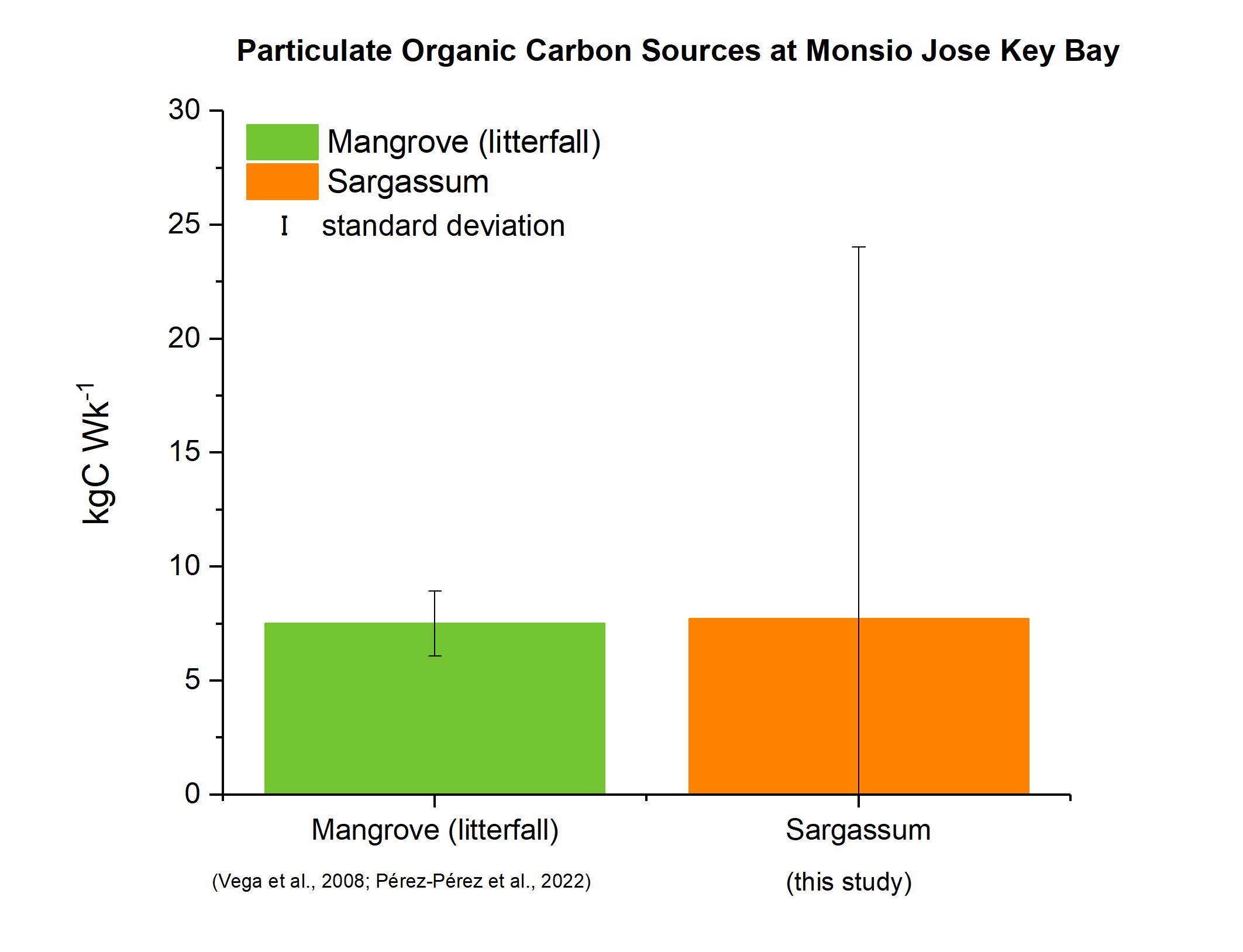
The bottom at Monsio José is highly organic unlike the other stations where the bottom is composed of coral rubble
Monsio José
CARIBBEAN COASTAL OCEAN OBSERVING SYSTEM
SISTEMA DE OBSERVACIÓN DEL OCÉANO COSTERO DEL CARIBE