CAMERON CORONADO
design & planning portfolio
CAMERON CORONADO

Eugene, OR 97402
360-296-4101
ccoronado712@gmail.com
https://www.linkedin.com/in/ cameron-coronado-456210209/
GRADUATE EMPLOYEE RESEARCHER University of Oregon 2023 - Present
BOARD MEMBER
Lane County Equity Program Advisory Board September 2024 - Present
PLANNING & DESIGN INTERN The Satre Group June 2024 - September 2024
DIVERSITY, EQUITY, INCLUSION COMMITTEE CO-CHAIR
December 2022 - April 2024
Department of Landscape Architecture, University of Oregon
LANDSCAPE ARCHITECTURE INTERN City of Eugene June 2023 - September 2023
NATURESCAPING DESIGN INTERN
McKenzie Watershed Council June 2022 - September 2022
STORMWATER ENGINEERING TECHNICIAN City of Lynnwood February 2019 - September 2021
STEERING COMMITTEE MEMBER
September 2019 - September 2021
Stormwater Outreach for Regional Municipalities
RESOURCE SPECIALIST II
October 2016 - February 2019
Snohomish Conservation District
I am dedicated to community-driven planning and design that authentically reflects the needs and values of the people it serves. As a planner and designer, I collaborate across disciplines to create equitable, sustainable, and healthy landscapes, with a strong focus on supporting historically underserved communities.
2024 National Graduate Olmsted Scholar Finalist Landscape Architecture Foundation
2024 University of Oregon Graduate Olmsted Scholar University of Oregon
2024 University of Oregon Graduate CELA Fountain Scholar Council of Educators in Landscape Architecture
2024 Oregon ASLA Honor Award Reviving Rivers
2023 National ASLA Honor Award From Shelter to Home
2023 Oregon ASLA Honor Award Honoring Old Camp
2023 LAF Scholarship Recipient Inclusive Community Design
Masters of Landscape Architecture
University of Oregon 2021-2025
Masters of Community & Regional Planning
University of Oregon 2021-2025
Bachelors of Environmental Science Western Washington University 2009-2014
Urban Design
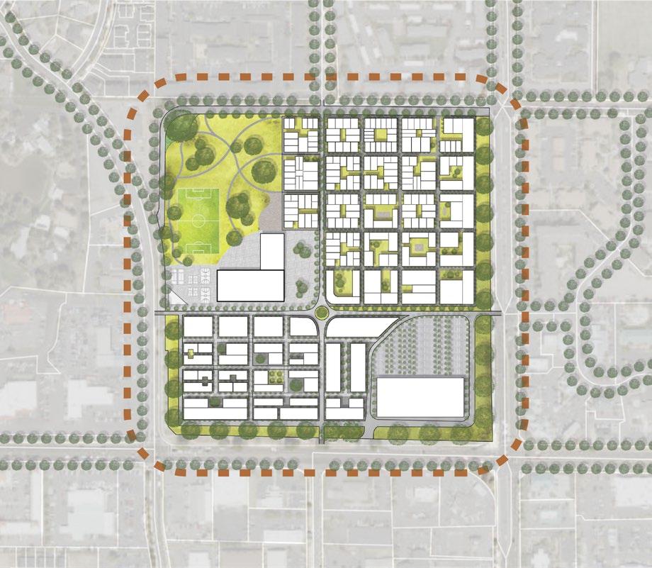
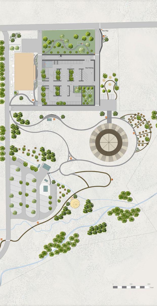
Building a Stronger Community in the Heart of Oregon
The Fall 2024 Sustainable City Year project transformed a 35-acre commercial big-box store site on Bend, Oregon’s east side into an equitable, sustainable, and communitycentered development. As the Equitable Community Team, our objective proposed a redevelopment that prioritizes inclusive growth, addressing the needs of existing neighbors while integrating accessibility, affordability, and sustainability for the future. The proposed design integrates affordable housing, mixeduse developments, and ample green space to create a vibrant, self-sustaining community.
Connectivity is a cornerstone of the design, fostering multimodal transportation options to reduce car dependency and promote healthier lifestyles. This proposal represents a transformative vision for Bend’s Eastside CFA that integrates principles of equity, sustainability, and resilience. By leveraging a blend of public and private investments, our design proposal has the potential to serve as a model for equitable urban redevelopment not just in Central Oregon, but across the region and beyond.
1. Sustainable Urban Design
Shaping the public realm to benefit all
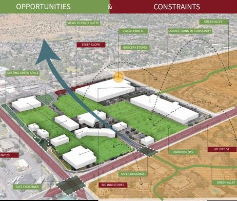
2. Opportunities & Constraints
Site analysis
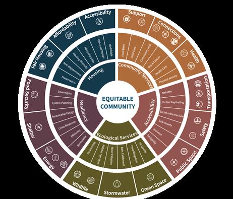
3. Equitable Design Framework
Applying an equity lens to urban design
4. Visions of the Future
Community gathering in Bend’s Eastside
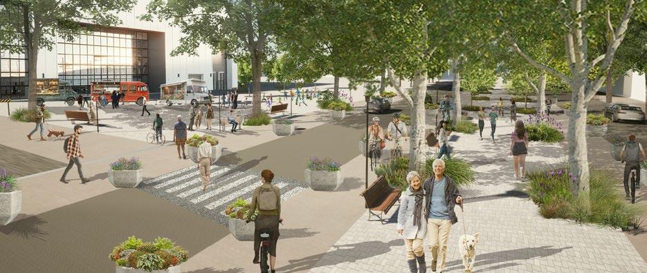
5.Multimodal Street Design
Integrated transportation system focused on people


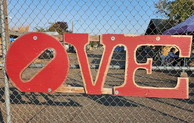
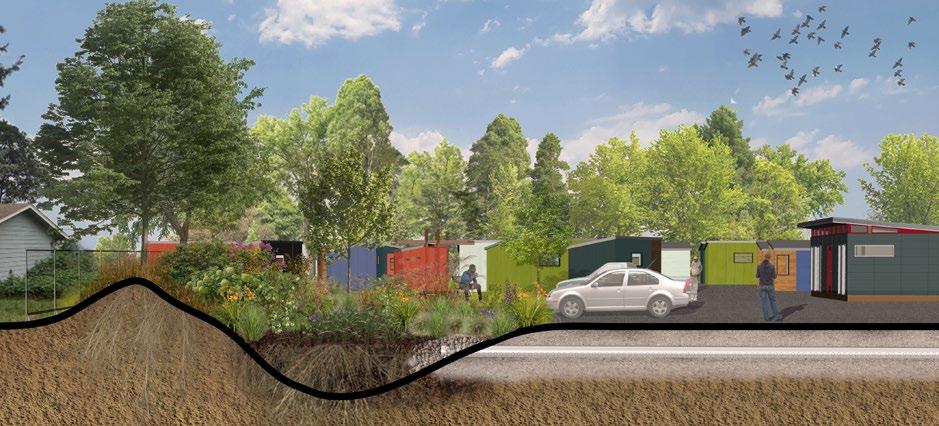
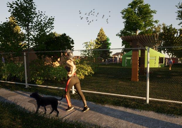
Opportunity Village Eugene
From Shelter to Home
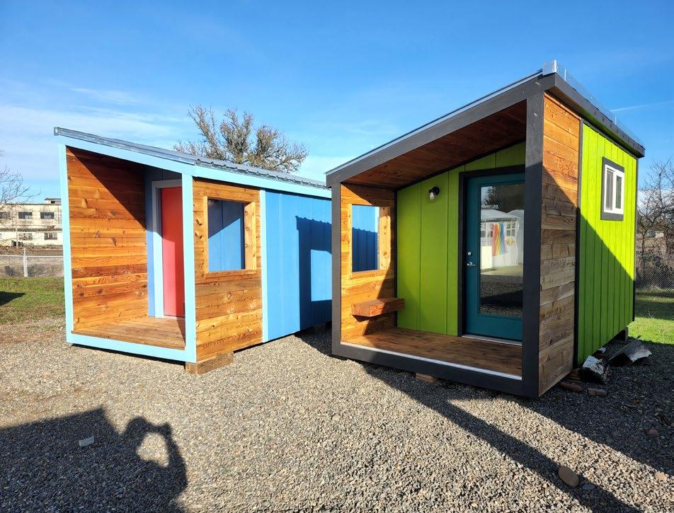
Houselessness is one of the defining crises of our time. The growing houseless crisis has affected 1 in 4 of us directly. As future landscape architects, we must use our unique ecological and cultural viewpoint to address this crisis. A real-world project, “From Shelter to Home” captures our year of work with Opportunity Village (OVE) a tiny home community for the otherwise houseless. With community partnership, we sought to understand how landscape architecture’s methods of inquiry, impact, and methods can help untangle the crisis. Our designs respond to daily routines, neighborhood concerns,
and political, economic cultural practicalities. Through months of deep listening and relationship building, we learned how to embed design elements that showcase and reinforce the resident’s core values. Our time with the community taught us that we are much more than designers. We are facilitators, listeners, and catalysts for change, capable of empowering and elevating a community’s voice and values. Through regular visits, shared meals, and village projects, we built trust and created friendships, which led to respectful and meaningful engagement.


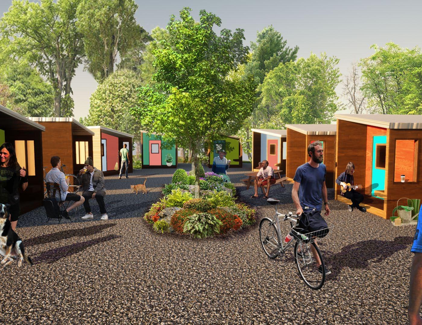
Front Gate Community Spaces Around Home
Opportunity Village Eugene
From Shelter to Home
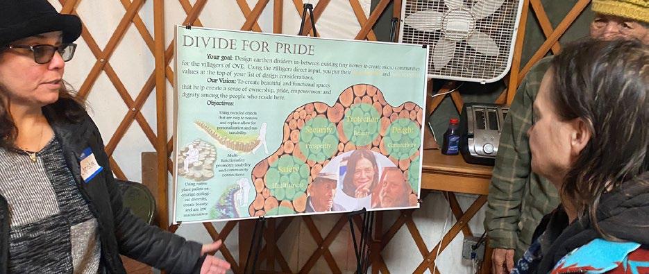
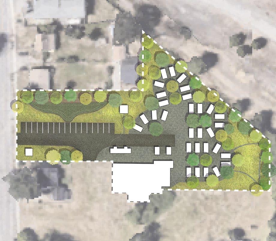
During our year with OVE the village was forced to relocate. Thankfully, we were able to provide a variety of design typologies for the proposed sites. As part of our team’s community engagement efforts, we conducted an analysis of the existing conditions through observation, interviews, and co-generations workshops. Based on our findings, we determined the specific core values which would best support our vision and design concepts for the new site. These values include PRIVACY, HEALTH, DIGNITY, SUSTAINABILITY, and SAFETY.
The design of transient communities typically focuses on efficiency. They fail to design for unique interconnections and interplays. Our approach focuses on sensitively working and designing with our vulnerable friends – creating more nuanced ways to organize territories, ecosystems, network, and infrastructure. The designs deconstruct community and housing concepts, while meeting objectives from the city, developer, and the community.
Permeating the village, our designs seek to redefine the relationship between villagers and the environment – supporting a rhythm of time and creativity.
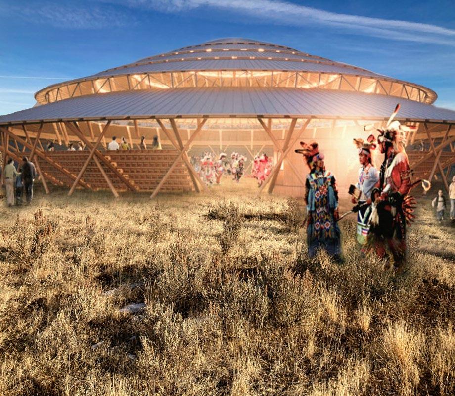
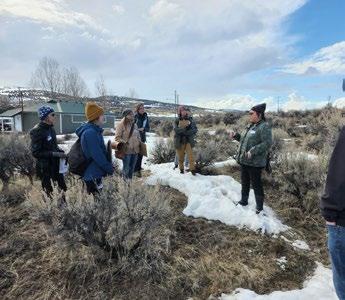
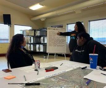
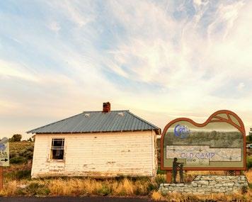
Honoring Old Camp
A Community Driven Conceptual Masterplan
This community-driven project frames the visions and considerations of the Burns Paiute Tribe for developing an essential historical and cultural site. Under the leadership and guidance of the Tribe, our team created a conceptual master plan for Old Camp to synthesize the history, values, and goals of the Burns Paiute Tribe into a spatial form. Recommendations for expansion focus on increasing recreation facilities, including trails, bi-lingual interpretive signs, Powwow grounds, and the potential adaptive reuse of the casino structure.
This planning process brought together the Tribal community and leadership to form a vision with community-wide support. Honoring Old Camp highlights ways in which landscape designers can work in service towards Indigenous justice through partnerships with Tribal governments.
1. Render- Powwow Grounds
Multi-use community gathering space
2. Conceptual Masterplan
Credit: Candi Rosario
3. Site Visit
Storytelling & reflection
4. Community Listening Session
Listening & learning
5. Render- Educational Signage
Preservation & storytelling
6. 2023 OR ASLA Honor Award
Student Award- Community Service

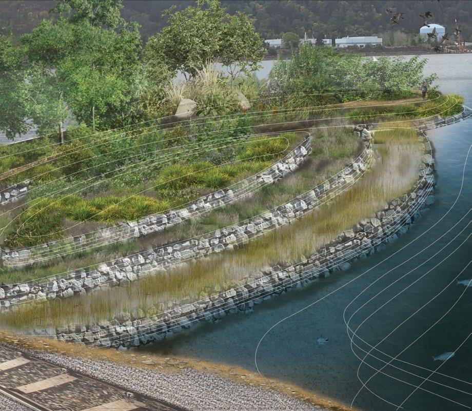
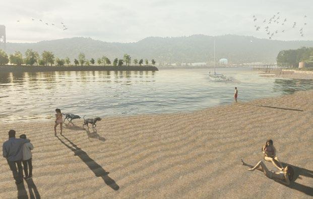
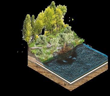
Reviving Rivers
Balancing Stability & Biodiversity
At the confluence of the Columbia and Willamette rivers, Willamette Cove has long served the inhabitants of its grounds. Today, the site sits vacant, polluted, and devoid of the richness it once provided. Through a multi-agency partnership, Willamette Cove will be rehabilitated into a natural park to support the plants, animals, and people that call this place home. The design prioritizes equilibrium between stability and biodiversity. We aim to restore native habitats, promote diverse species, and clean up contaminated soil responsibly.
This approach supports resilience against environmental challenges, climate change, benefits the community, and contributes to scientific research while maintaining ecological harmony.
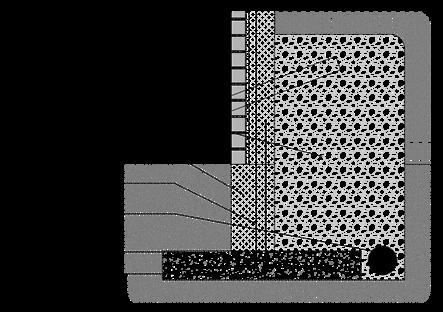
1. Constructed Wetland
Maintaining shallow water habitat
2. Bank Reconfiguration
Terraces
3. Willamette Cove Beach
Restored river access
4.Site Plan
Balancing stability and biodiversity
5. Bioengineering
Functional stability

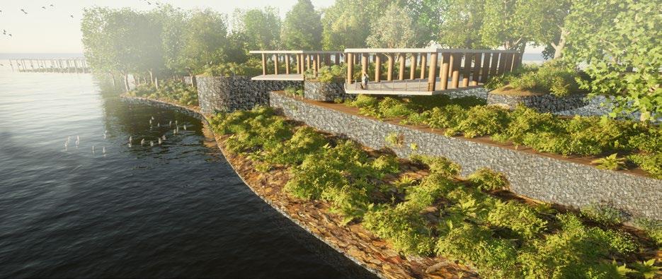

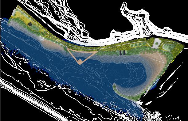
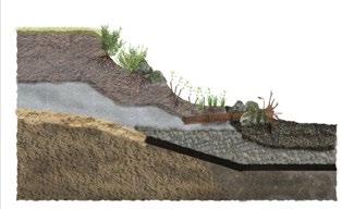
Embedding LWD Gabion Walls
Layered Vegetation
2024 Oregon ASLA Design Award
Grounded Experience
From Working a Shovel to Working a Mouse
I have worked in all types of landscapes throughout my career from commercial complexes and multi-million-dollar designer gardens, to stream restoration projects and urban retrofits. I have first hand experience working off plans to complete a project. I have now traded in my shovel for a computer mouse. Years of landscape and construction experience give me the practical knowledge required for construction documents of varying scale.
Although landscape architecture projects vary in scale from community master planning and forest management plans, to pocket parks and outdoor furniture, attention to detail is necessary for a successful project. Tools such as AutoCAD, Rhino, and Grasshopper allow us to lay out designs that lead to successful constructibility.
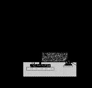
1. Riverfront Overlook
Creating a sense of place
2. Amphitheater Detail
Nature promotes creativity
3. Site Details
Handrail, retaining wall, planter, living wall, fountain


Amphitheater Fountain
Seating Planter
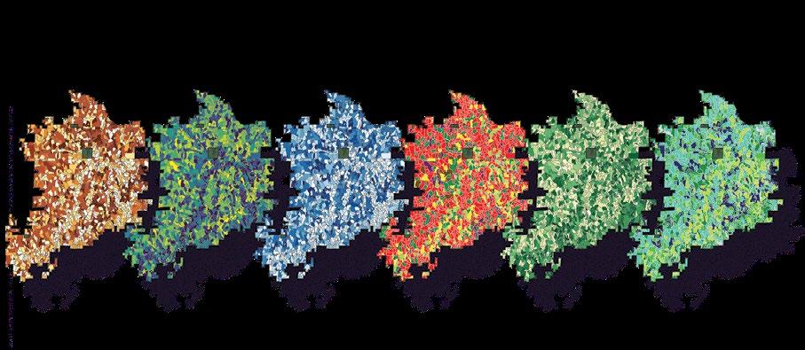
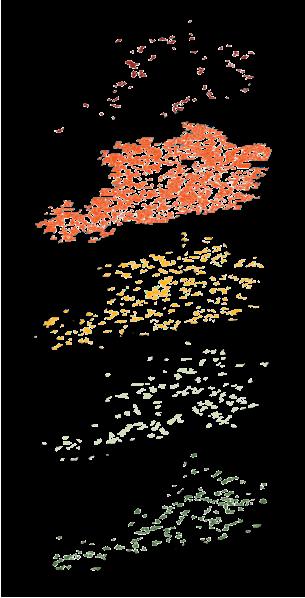
Data Driving Design
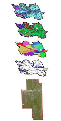
From mapping critical habitats to environmental justice factors, GIS is a powerful tool for conducting in-depth site analysis. As a dual major in Landscape Architecture and Community and Regional Planning, I am well suited to work across various scales. Because of my environmental background, I lean heavily on data to inform design decisions. GIS allows me to make informed choices and explore endless options.
1.
Understanding the ecosystem
2. Forest Stand Diversity
Visualizing stand complexity
3. Regional Analysis
Looking at the bigger picture
4. Terrain Exploration
Surveying the land
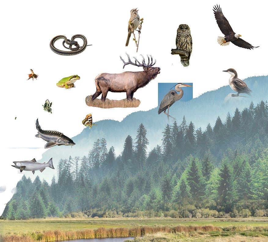
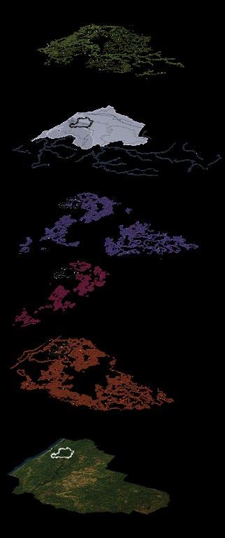
Valley to Ridge
Coho Salmon Oncorhynchus kisutch
Green Sturgeon Acipenser medirostris
Lorquin’s Admiral Limenitis lorquini
Anise Swallowtail Papilio zelicaon
Black-tailed Bumble Bee Bombus melanopygus
N. Pacific Tree Frog Psuedacris regilla
Garter Snake Thamnophis ordinoides
Elk Cervus canadensis
Great Blue Heron Ardea herodias
Song Sparrow Melospiza melodia
Northern Spotted Owl Strix occidentalis caurina
Marbled Murrelet Brachyramphus marmoratus
Bald Eagle Haliaeetus leucocephalus
Aquatic
Endangered Species Critical Habitat
Coos & Douglas County
Elevation
Slope
Contours
Marbled Murrelet Critical Habitat
Northern Spotted Owl Critical Habitat
Green Sturgeon Critical Habitat
Coho Salmon Critical Habitat
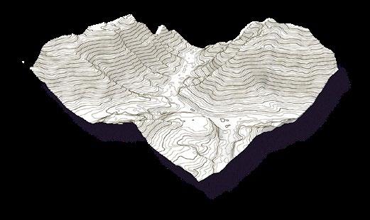
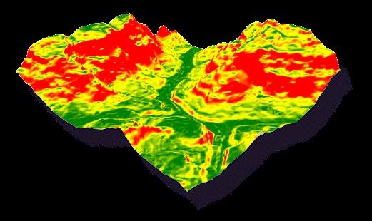
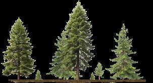
A Trail for the Masses
Trails to Educate, Celebrate, & Inspire
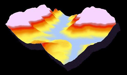
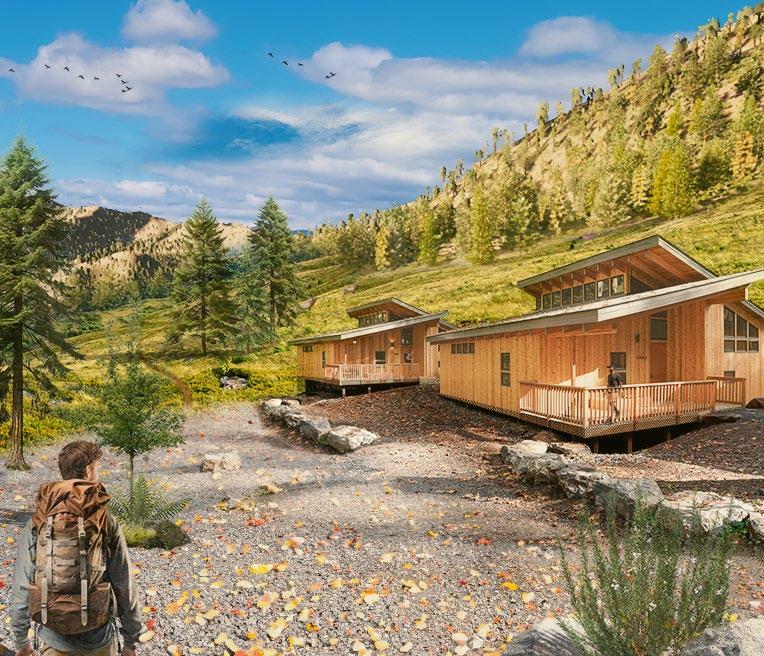
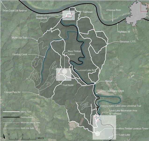
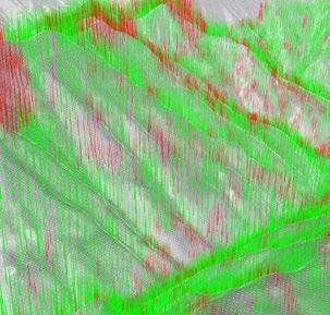
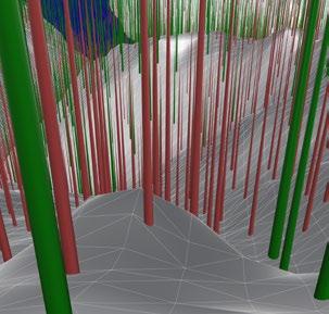
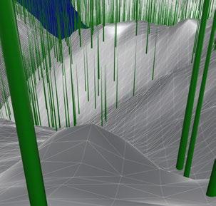
For my terminal master’s project, I focused on the intersection of forest management, timber production, recreation, and education. Using stand-level data, GIS, and grasshopper algorithms, I designed a trail system that coupled thinning operations with mass timber production. The trail masterplan was created using the least-cost path tool in GIS, avoiding areas with steep slopes and waterbodies like rivers and streams. For more finetuned trail design, I used 3D modeling techniques to select smaller diameter trees (shown in red) to be removed for a thinning operation. Once these trees were removed, the path of the trail could
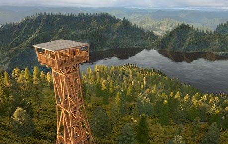
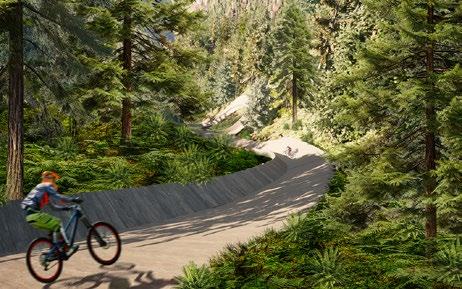
be better determined as the forest opened up. The smaller diameter trees would be used to build mass timber educational demonstration projects, including a mountain biking skills course, an overlook tower, and cabins. This project demonstrated how landscape architects can use their skills to work across various scales to drive research and innovation, from using CAD to design outdoor mass timber features to using GIS and Rhino to run models on large-scale forest stewardship treatments. Through mass timber demonstrations, hiking paths that weave through forest stands in different phases of treatment, and interpretive signage, these trails can educate, celebrate, and inspire the masses.
1. Demonstration Project
Mass timber cabins
2. GIS Analysis
Forest thinning classification
3. Trail Master Plan
Created using GIS, Rhino, & Grasshopper
4. Demonstration Project
Mass timber overlook
5.Demonstration Project
Mass timber mountain bike skills course
6. 3D Visualization
Tree segmentation based on diameter
7. Pre-thinning Conditions
Trees to be removed in red
8. Post-thinning Conditions
Decreased competition, increase resilience
Drawing from the Past, Planting Seeds for the Future
Environmentally Rooted
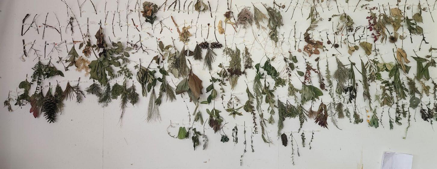
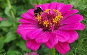
As a long time landscaper and an Environmental Science major, ecological concerns are always at the forefront of my mind. Planners and designers need to anticipate a changing climate and choose diverse species that will withstand hotter and dryer conditions. As a PNW native, I am passionate about the use of native plants in our landscapes. I believe that every landscape can provide not only beauty, but also beneficial impacts for birds, bees, and other birds and animals.
My graduate studies have allowed me to explore the plants I love in deeper ways. Through drawing, specimen collection, and observation, I have a much more intimate relationship with plants that will help to grow my future career.
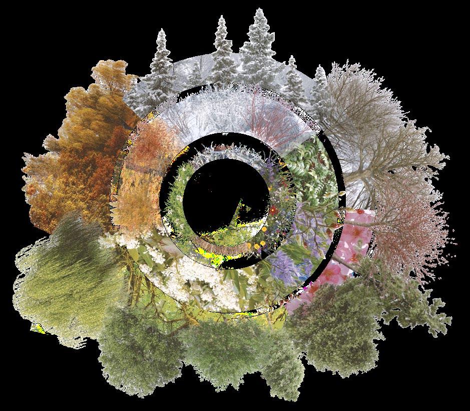
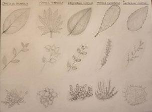
1. Seasonal Palette
Providing interest year round
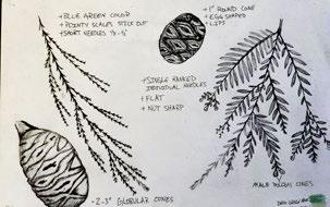
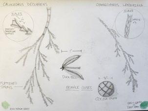
2. Plant Specimen Collection
Winter twig identification practice
3. Alton Baker Natural Area Map
Field mapping
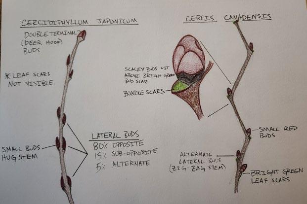
4. Twig Identification
Buds, leaf scars, and lenticels
5.Plant Exploration
Drawing and photography

Design Builds From Paper to Soil
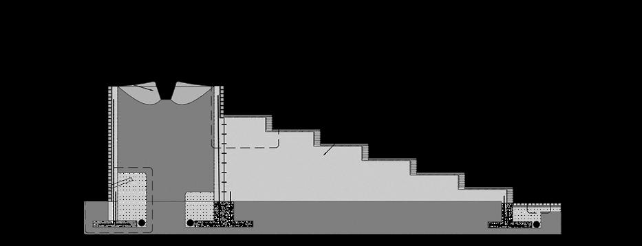
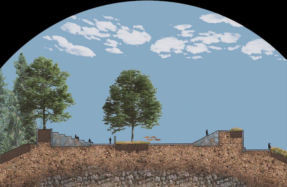
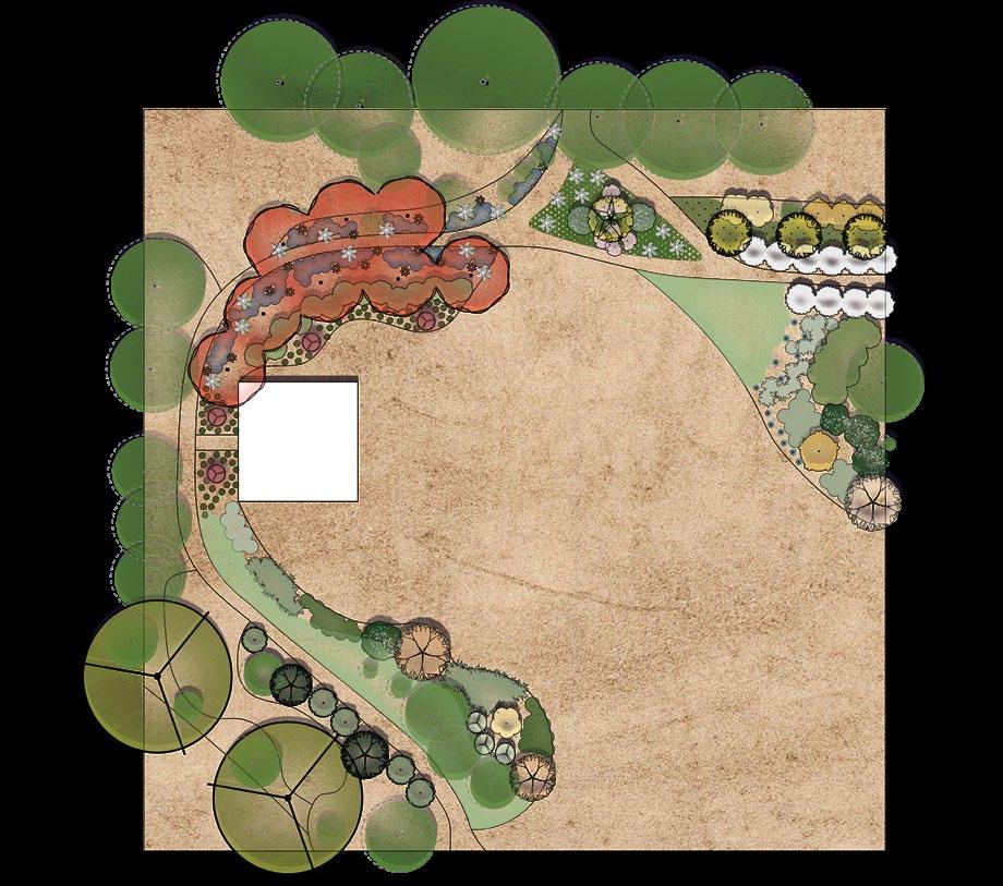
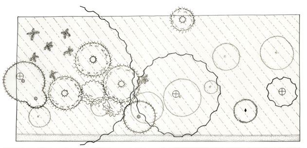
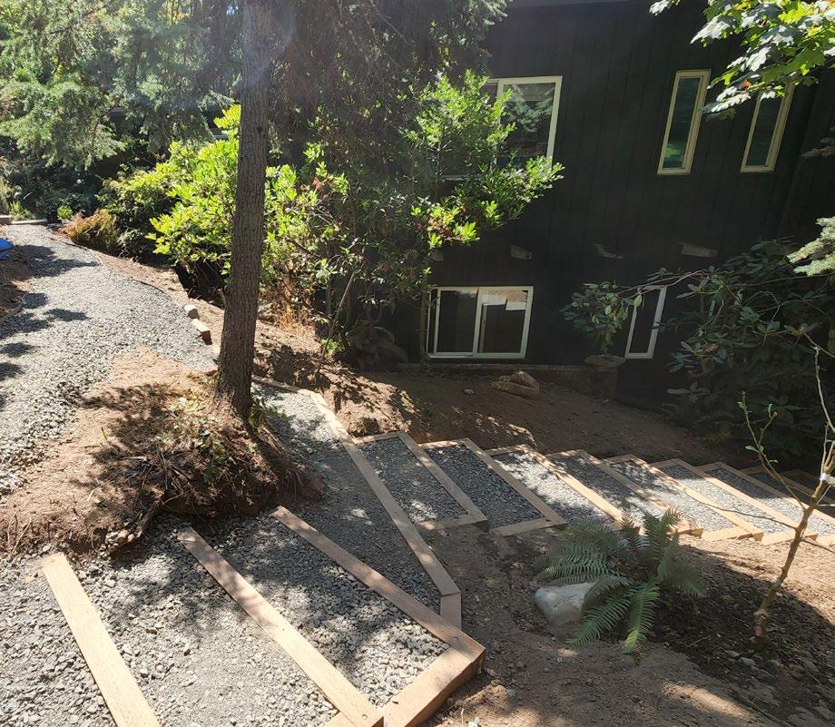
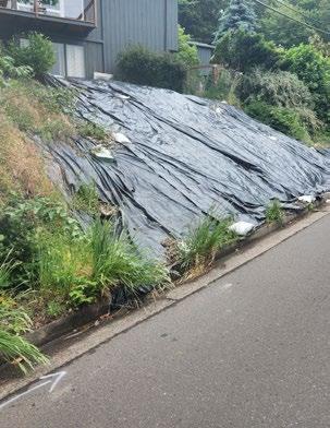
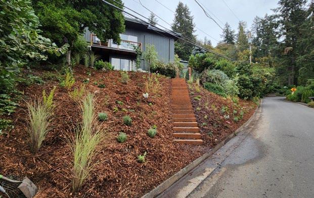
Located in southeast Eugene, this property is positioned on a steep hillside that sat underutilized for years. When the current homeowners moved in, the hillside was overgrown with grass and invasive plants. Knowing that they wanted to someday develop this portion of their property, they covered the hillside with black plastic to kill the unwanted vegetation. The hillside sat like this for over two years, proving to be quite an eye-sore in an affluent neighborhood. Finally ready to transform this space, we began discussing goals and visions for this space.
The homeowner looked to activate this space by adding a path or stairs and new planting. Initially, the project was only going to address the steep hillside on the west side of their property (Phase 1). Once the staircase was installed, the homeowner was so pleased that they decided to move forward with a second set of stairs on the north side of their property (Phase 2).
1. Upper Stairs
Creating functional spaces
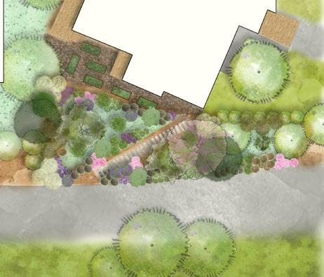
2. Planting Plan
Sierra Nevada Foothills palette
3.Rendered Plan
Low water, clay, and drought tolerant 4. Before
Barren hillside
5. After
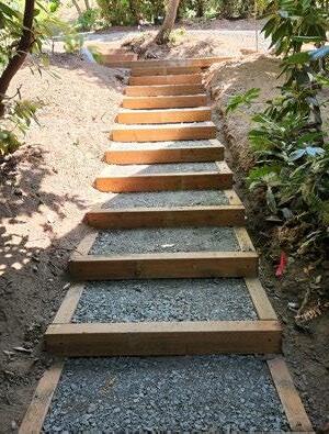
Stairs, plants, beauty, function 6. CAD Details
Honoring the rise over run 7. Landscape Stairs
Pressure treated lumber & compacted gravel


Design Builds From Paper to Soil
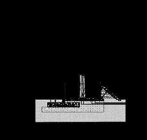
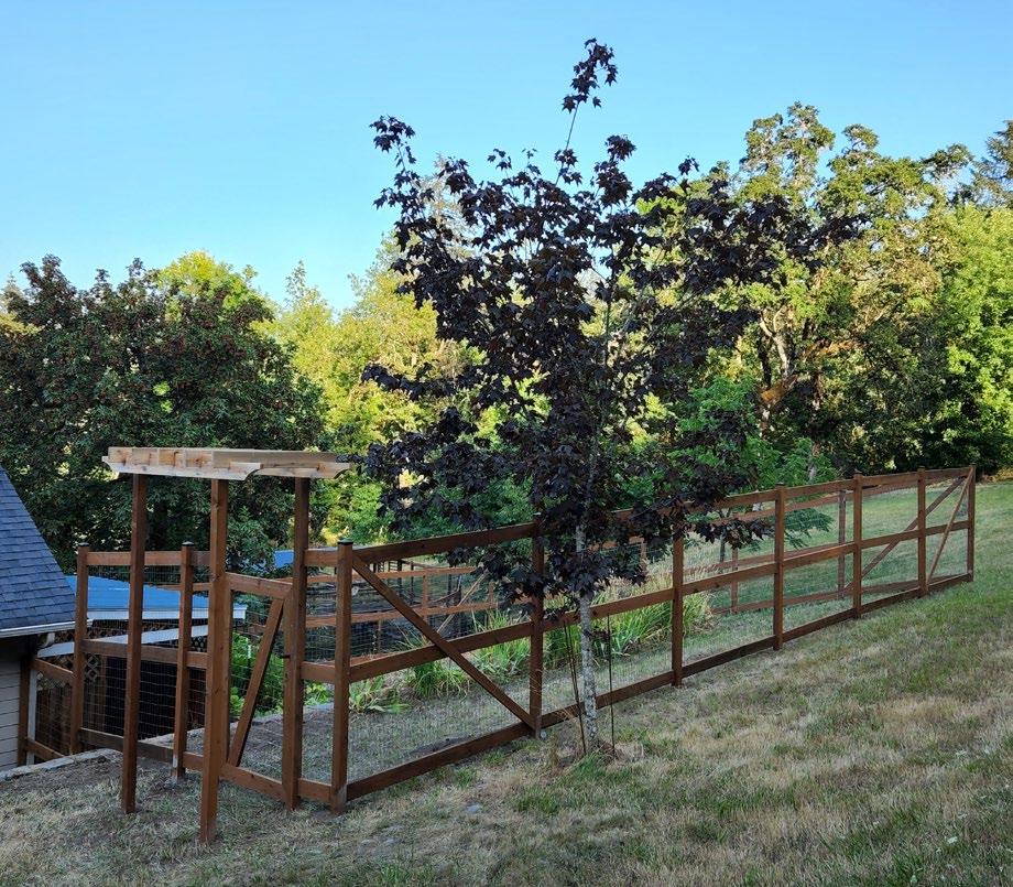
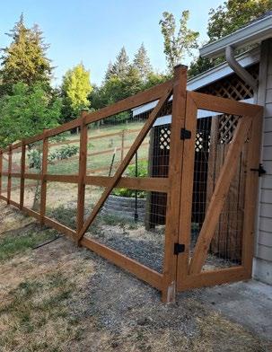
During my last summer break as a student, I worked hard to put my new design skills to good use. Using CAD and drone imagery, I designed and installed a deer exclusion fence for a homeowner living in Lane County. The homeowner has had trouble with deer eating their garden and was looking for a way to keep them out. This fence was constructed over the course of a week with the help of a friend. Welded wire was used as a building material to help keep project costs down while still keeping deer out. Measuring in at just under eight feet tall, this fence should keep hungry deer out of the veggie garden.
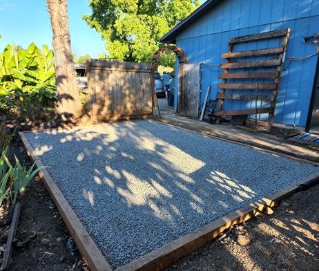
Another client wanted to build a storage shed in their backyard and needed a sturdy pad for the shed to sit. Not wanting to use concrete, I designed and installed a pad using pressuretreated lumber and compacted gravel. These design-build projects taught me valuable lessons that can not be learned in a classroom. This experience has made me a better designer and a more confident builder.
1. Deer Exclusion Fence
150 linear feet of fencing
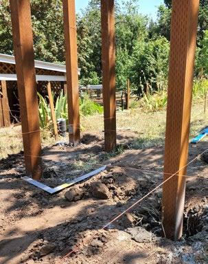
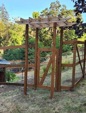
2. Pergola Details
Inviting entrance
3. Construction Process
Laying it all out
4.Completed Pergola
Putting it all together
5. Completed Fence
No deer allowed 6. Shed Pad Details
Keep it simple 7. Completed Shed Pad Sturdy foundation
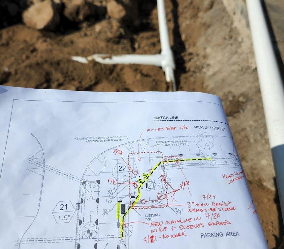
Construction Administration
From Blueprint to Build
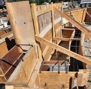
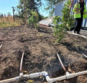
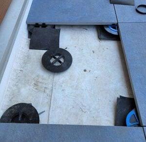
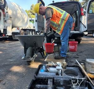
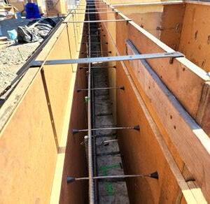
Internships at the City of Eugene and The Satre Group provided valuable experience in construction administration. Despite my background in landscaping and construction, I was not initially well-versed in many aspects of a project, including irrigation design and concrete work. As a student, you learn about construction details but rarely get a chance to see this work in progress. These internships allowed me to follow the construction process from blueprint to build.
As a visual and hands-on learner, this experience helped me better understand the process of building a project, from initial site grading and excavation to subgrade preparation, irrigation, and utility installation, planting, and final site punch list items. Having a better understanding of the construction process will help me be a better designer, paying attention to small details like irrigation bedding and mow strips.
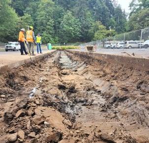
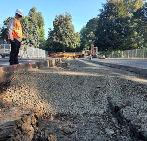
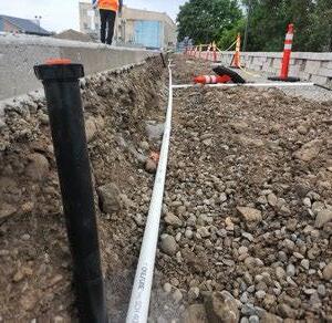
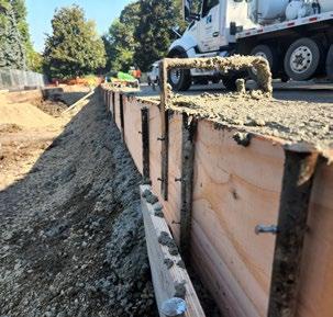
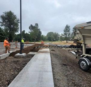
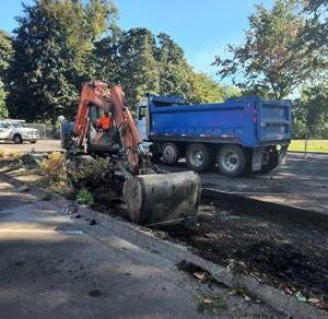
Construction Administration
These photos were taken at various project sites throughout the City of Eugene. During this phase of construction I ensured that the projects were built according to the design, specifications, and contract documents. This involved reviewing contractor submittals, conducting site visits, addressing issues that arose during construction, coordinating between stakeholders, and ensuring quality control.

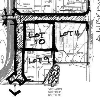
Land Use Planning
Understanding City Code and Processes
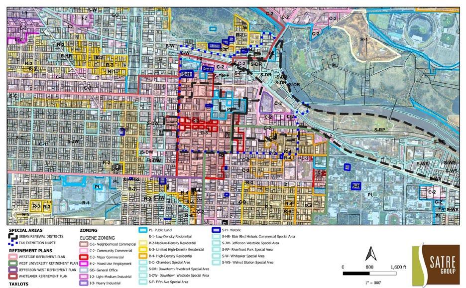
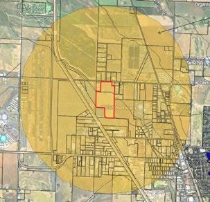
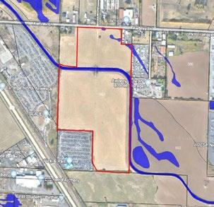
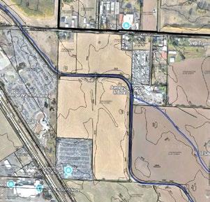
Through my academic studies in Community and Regional Planning, coupled with internships at the City of Eugene and The Satre Group, a private landscape architecture and land use planning firm, I have developed a strong understanding of land use planning principles and their critical role in shaping development and site design. Utilizing GIS, I analyze project sites to assess zoning, natural resources, utility connections, transportation networks, and access to parks and open spaces, among other factors.
Through my experience, I have learned that planning and design are deeply interrelated, and effective designers recognize and respect this connection. Specific zoning regulations necessitate design considerations such as building setbacks, vegetation buffers, canopy cover, parking, and stormwater requirements. Additionally, leveraging graphic design skills acquired through my MLA degree, I can effectively communicate planning processes in visually engaging formats, as demonstrated in the development timeline below.
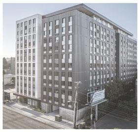
1. Multi-Family Development Process
Graphic timeline of development process
2. City of Eugene Zoning Map Understanding our city 3. Connectivity Sketch


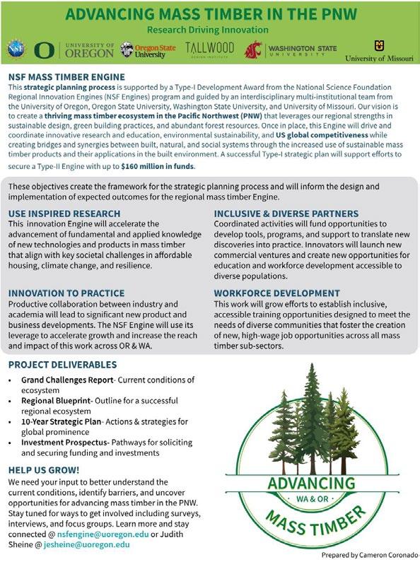
Advancing Mass Timber in the PNW
Graduate Researcher
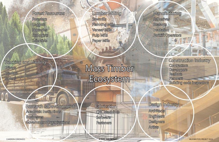
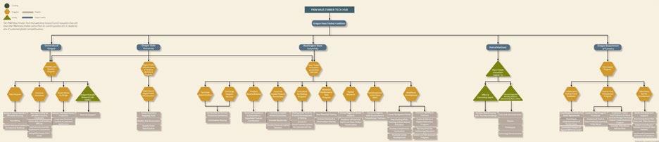
While pursuing dual graduate degrees at the University of Oregon, I worked throughout my academic journey, balancing full-time studies with professional responsibilities. During my third and fourth years, I served as a Graduate Research Assistant with the Institute for Policy, Research, and Engagement. This role was part of a $1 million National Science Foundation (NSF) grant aimed at fostering a thriving ecosystem in the Pacific Northwest to advance research and educational innovations in mass timber architecture, engineering, and construction, as well
as manufacturing and forest management. The project sought to address social and environmental challenges related to housing, workforce development, and natural resource stewardship. Key outputs included a grand challenges report, a regional engine blueprint, a 10-year strategic plan, and an investment prospectus. My graphic design expertise was instrumental in this initiative, helping to convey complex research findings through visually engaging graphics and outreach materials.
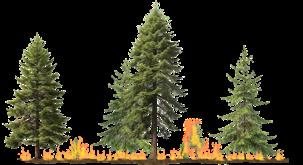
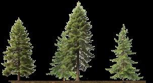
1. Managed Forest
Decreased fire intensity of thinned forest
2. Mass Timber Ecosystem Collage
Visualizing all the players
3. Systems Thinking Diagram
Build Back Regional Challenge
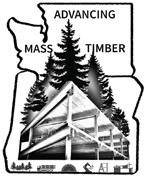
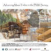
4. Mass Timber Graphics
Logos and outreach materials
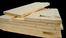
5. Mass Timber Simplified
The process of creating mass timber
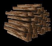
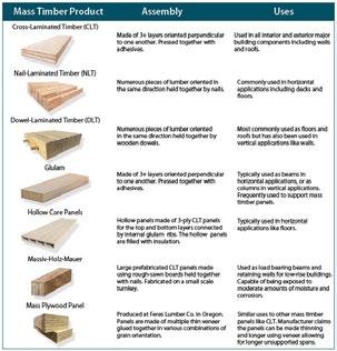
6. Mass Timber Products
Massive opportunities
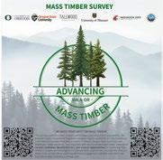
7. NSF One Pager Conference outreach materials

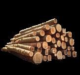
Milled Lumber