YUNAN CAI
Master of Urban Design
University of Michigan
Taubman Collage of Architechture and Urban Planning
2023 Candidate


Master of Urban Design
University of Michigan
Taubman Collage of Architechture and Urban Planning
2023 Candidate
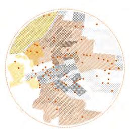
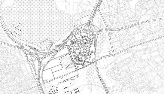
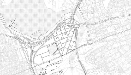
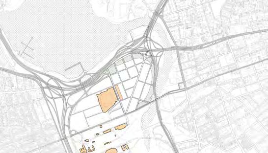
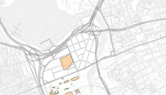
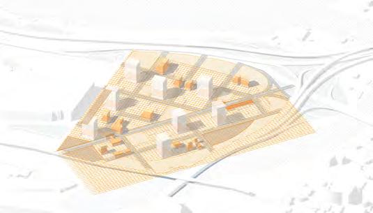
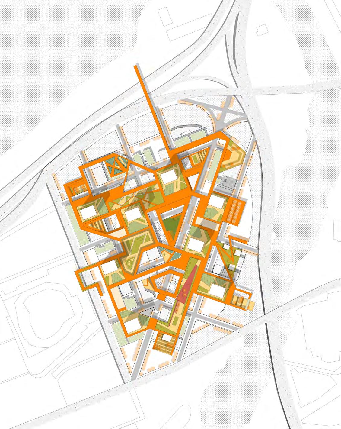
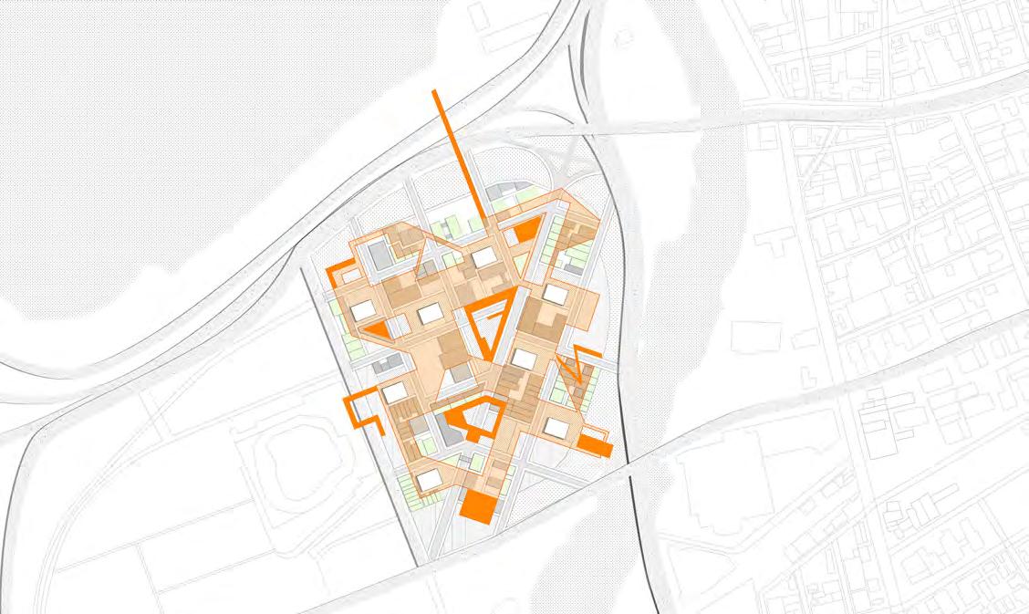
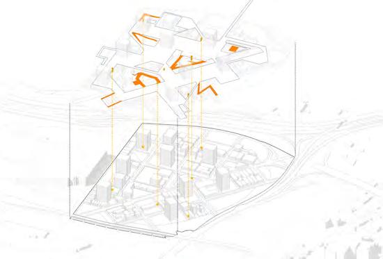
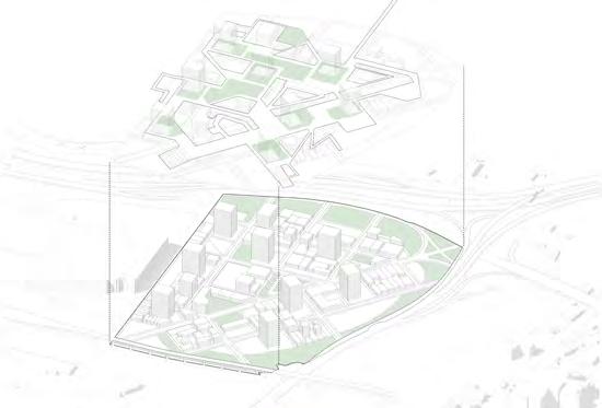
Location: Guangzhou, China
Area: 3.4 ha
Institution: Studio Alpha, academic Instructor: Shirley & Joyce Zhu
Cooperation with Zhen Qin
Role in the team: design stategy, modeling, presentations and drawings. Period: 08.2021—12.2021
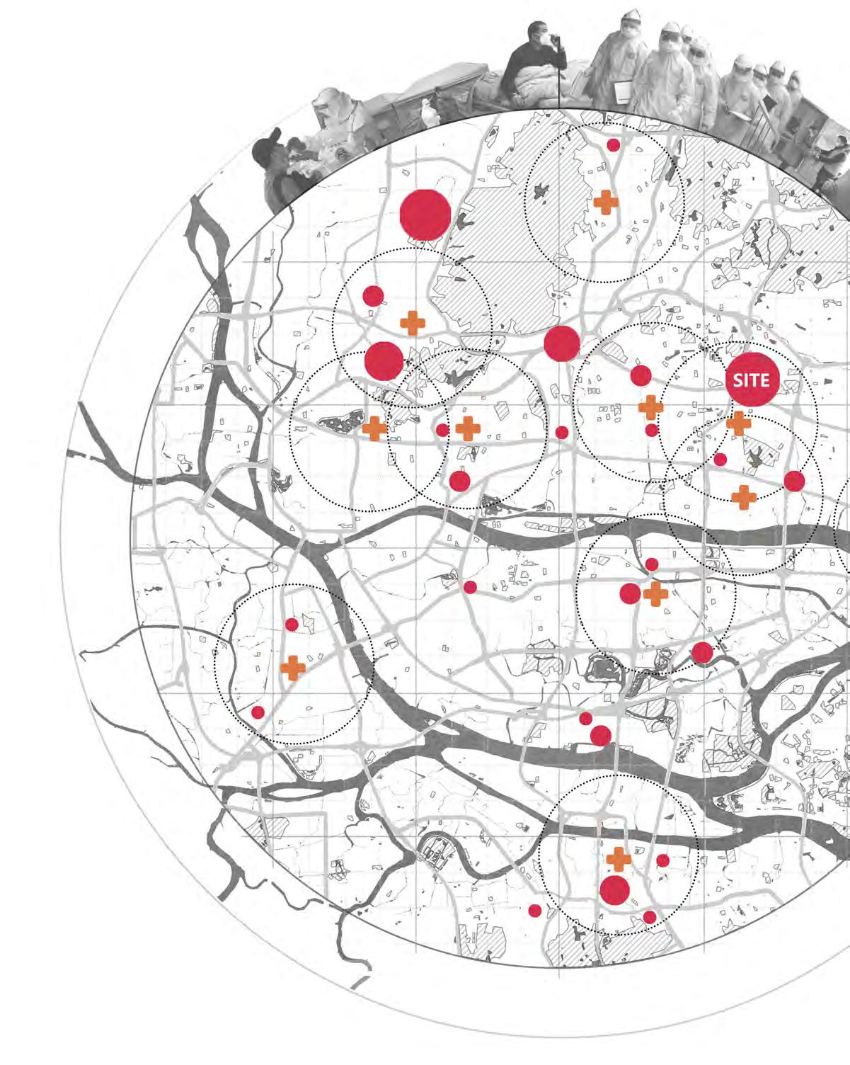
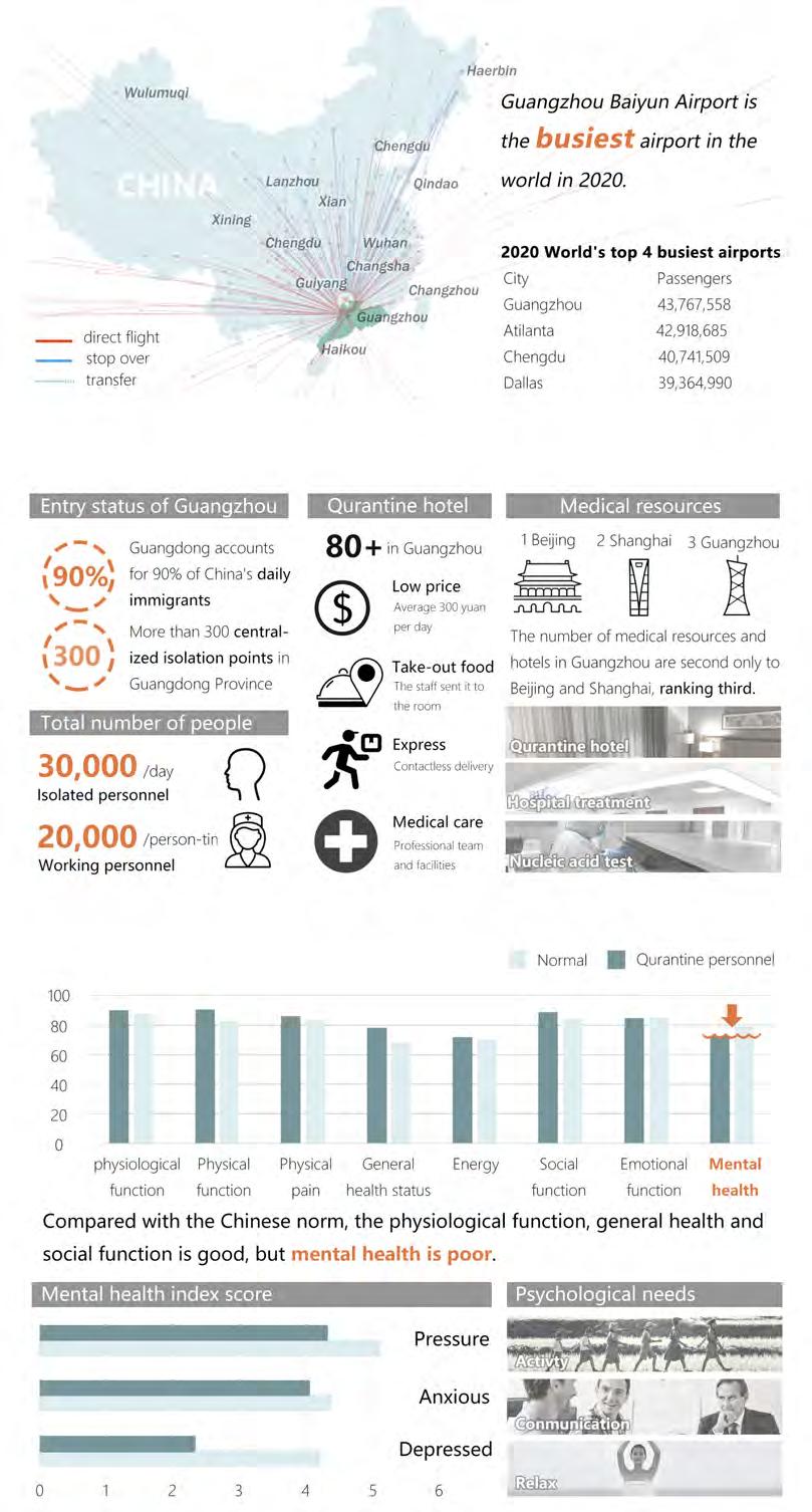
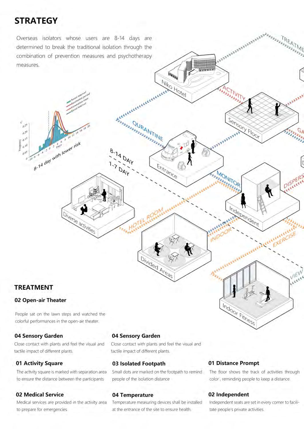
In 2021, during the Covid-19 epidemic, the Chinese government required all persons from outside mainland China to implement a 14+7(14-day centralized quarantine & 7-day at-home quarantine) quarantine policy when entering mainland China.
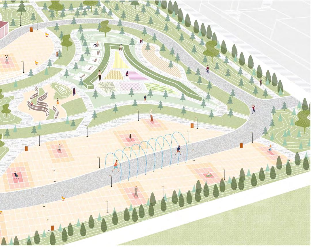
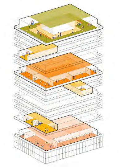
However, how much freedom of movement should the returning overseas travellers can get in the hotels they are isolating? Are they only allowed to stay within their room, or they can move freely within a certain area? How to identify the scope of a certain space that can guarantee collective life safety for larger groups of people and assure physical and mental health of the quarantined people? Among the isolated, minimum to none inclined to develop Covid-19. Therefore, creating a public space that can be used during isolation, while ensuring everyone's health safety, so that they can enjoy certain amount of social activities while being isolated, rather than being confined to the room, as outlined through scientific and technological means.
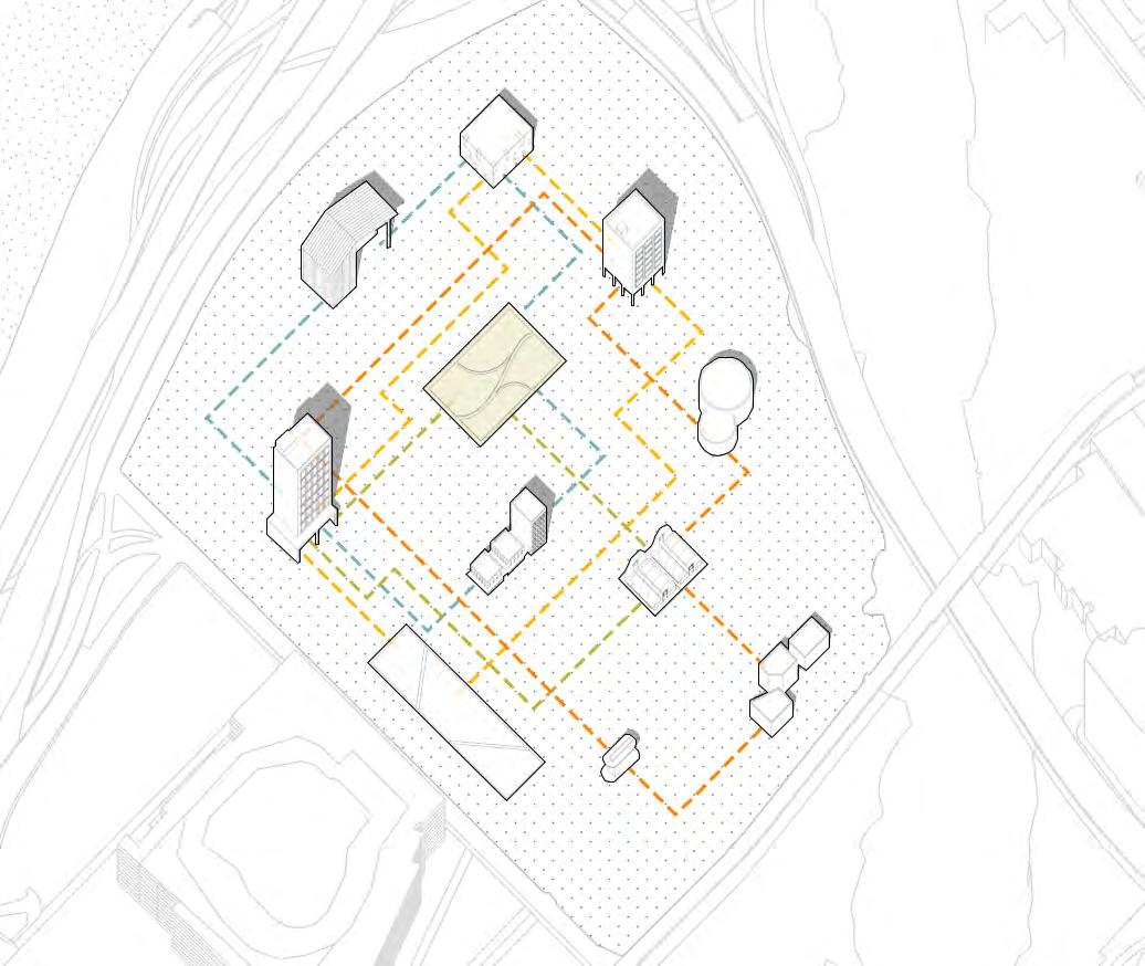
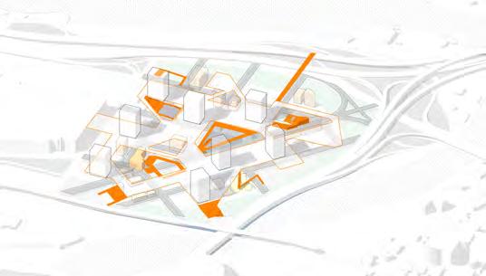
Highway
River
Green Space
Quarantine Hotel
General Hospital
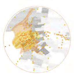
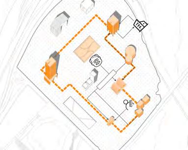
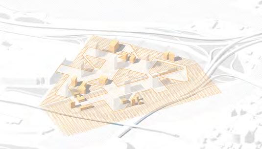
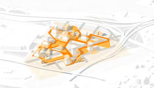
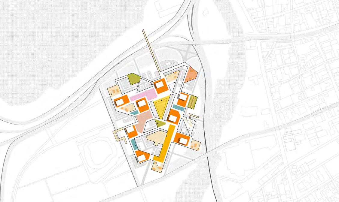
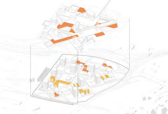
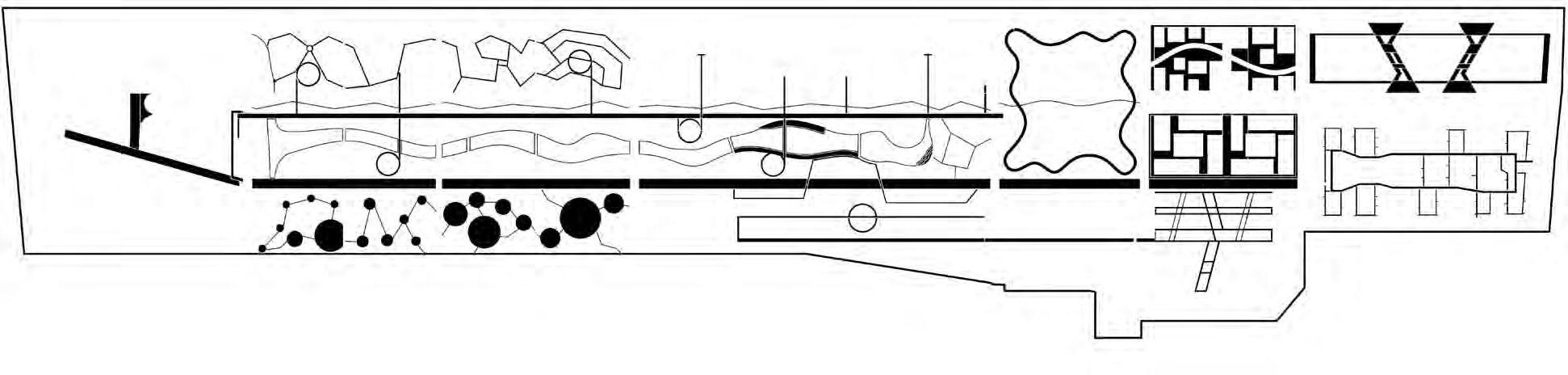
Overseas isolators in Day 8 to Day 14 are determined to break the traditional isolation through the combination of prevention measures and psychotherapy measures.
02
05
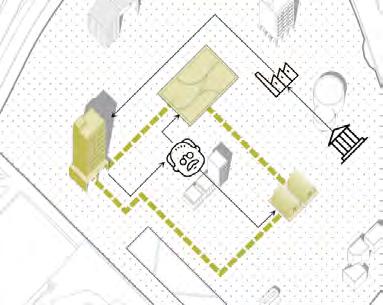
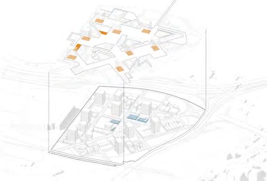
The flexibility and vitality of water can meeet people's hydrophilic needs.
03
Small dots are marked on the footpath to remind people of the isolation distance.
04 Medical Service
07 Medical Service
Medical services are provided in the activity area to prepare for emergencies.
09
The floor shows the track of activities through color, reminding people to keep distance. Independent seats are set in every corner of facilitate people's private activities.
People sat on the lawn steps and watched the colorful performances in the open-air theater. People sat on the lawn steps and watched the colorful performances in the open-air theater. The activity square is marked with separation area to ensure the distance between the participants. Medical services are provided in the activity area to prepare for emergencies.The fitness place is seperated by plants, which can not interfere with each other. Wear masks to enter the conversation place and enjoy the fun of communicating with each other.
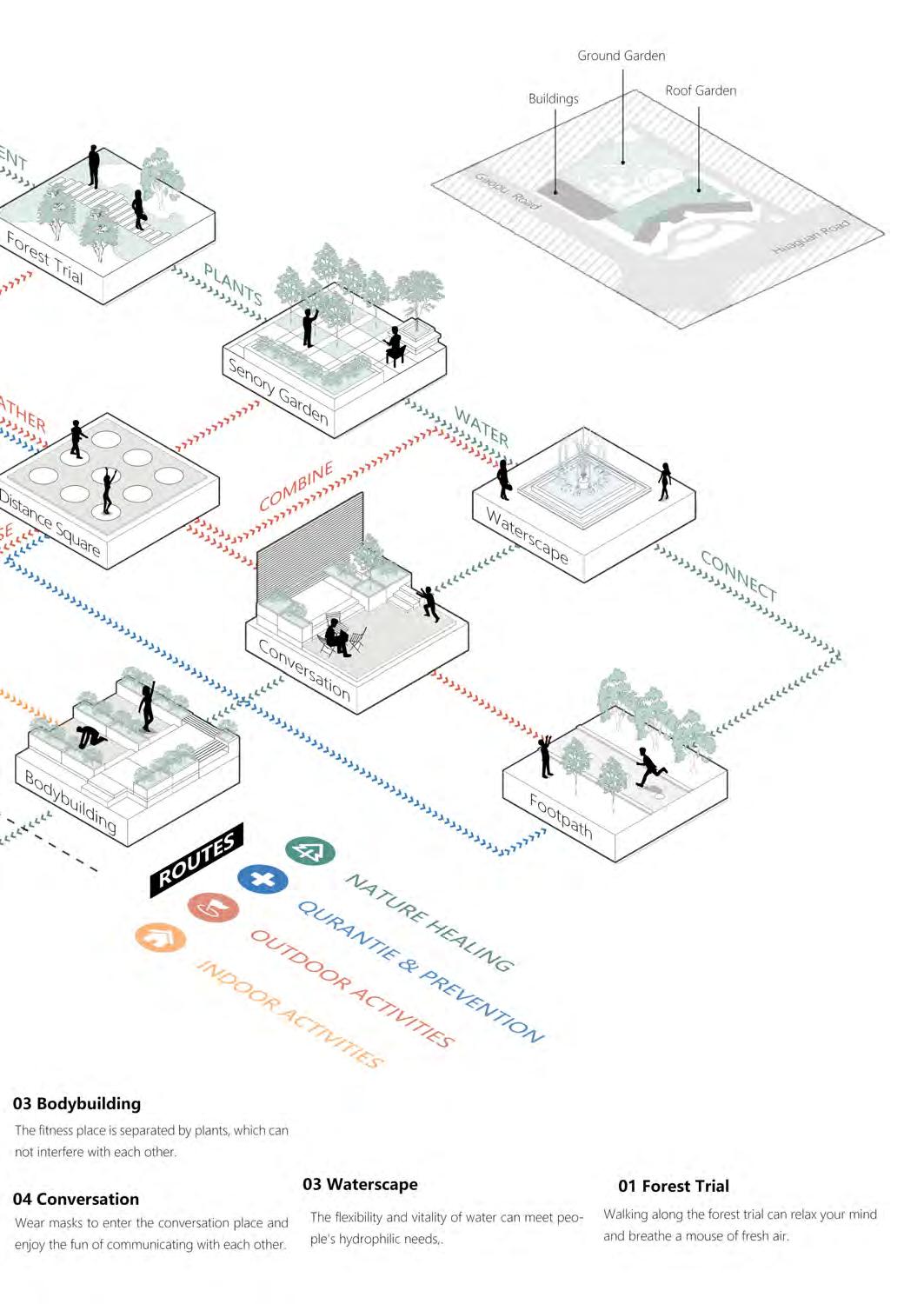
Walking along the forest trial can relax your mind and have a breath of fresh air.
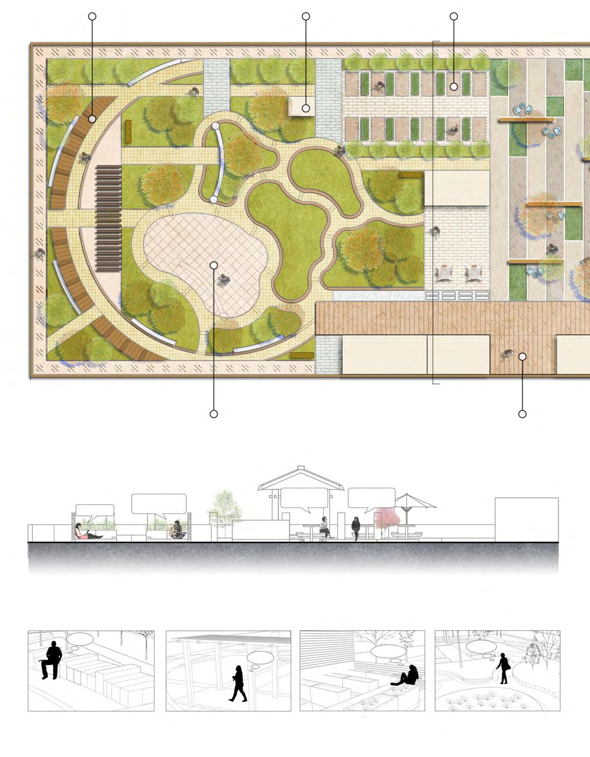
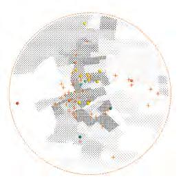
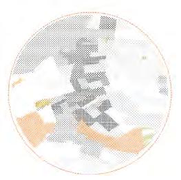
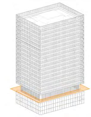
Quarantine Garden Model | Refroming the Roof of Guangzhou Nikko Hotel as an Example
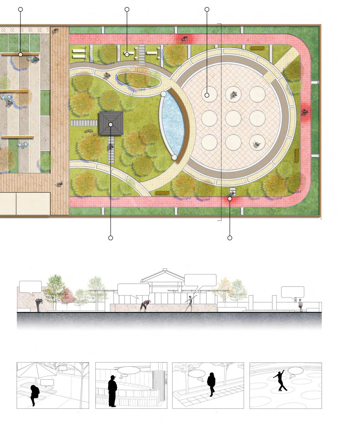
DIstance divisions clearly delineate safe areas to people to keep a proper distance so that activities be carried out safe.


to remind activities can


plants, planks formed,

Ecological waterscape not only beautifies the environment visually, but also meets the hydrophilic needs of quarantined people in touch.


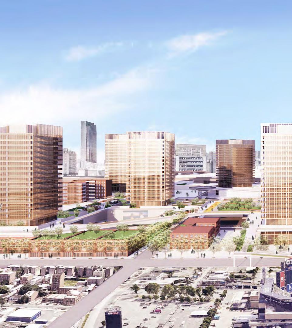
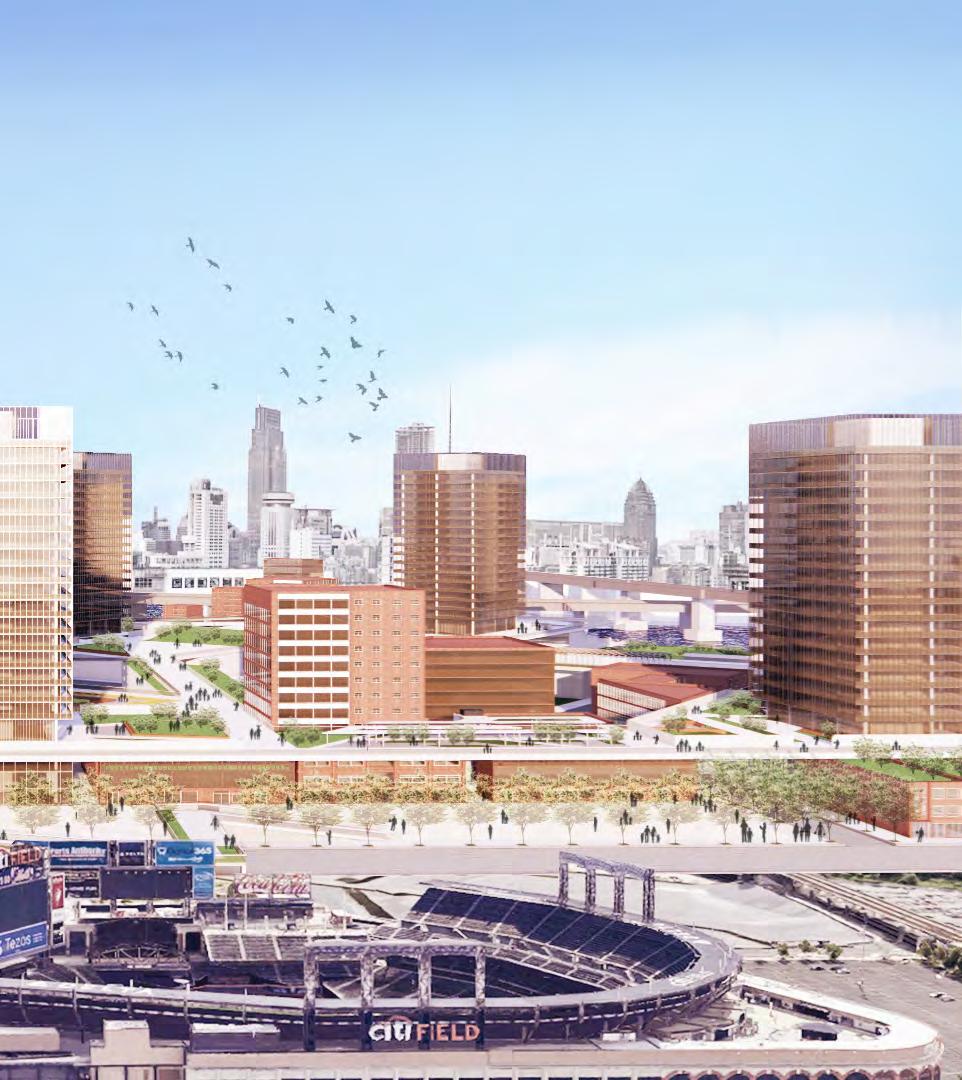
Location: Willets Point, New York City
Area: 27.4 ha
Institution: Taubman College
Instructor: McLain Clutter & Alina Nazmeeva
Cooperation with Shaoqun Zhao, Yufei Tang and Jingwen Zhang
Role in the team: design stategy, modeling, presentations and drawings. Period: 09.2022—12.2022
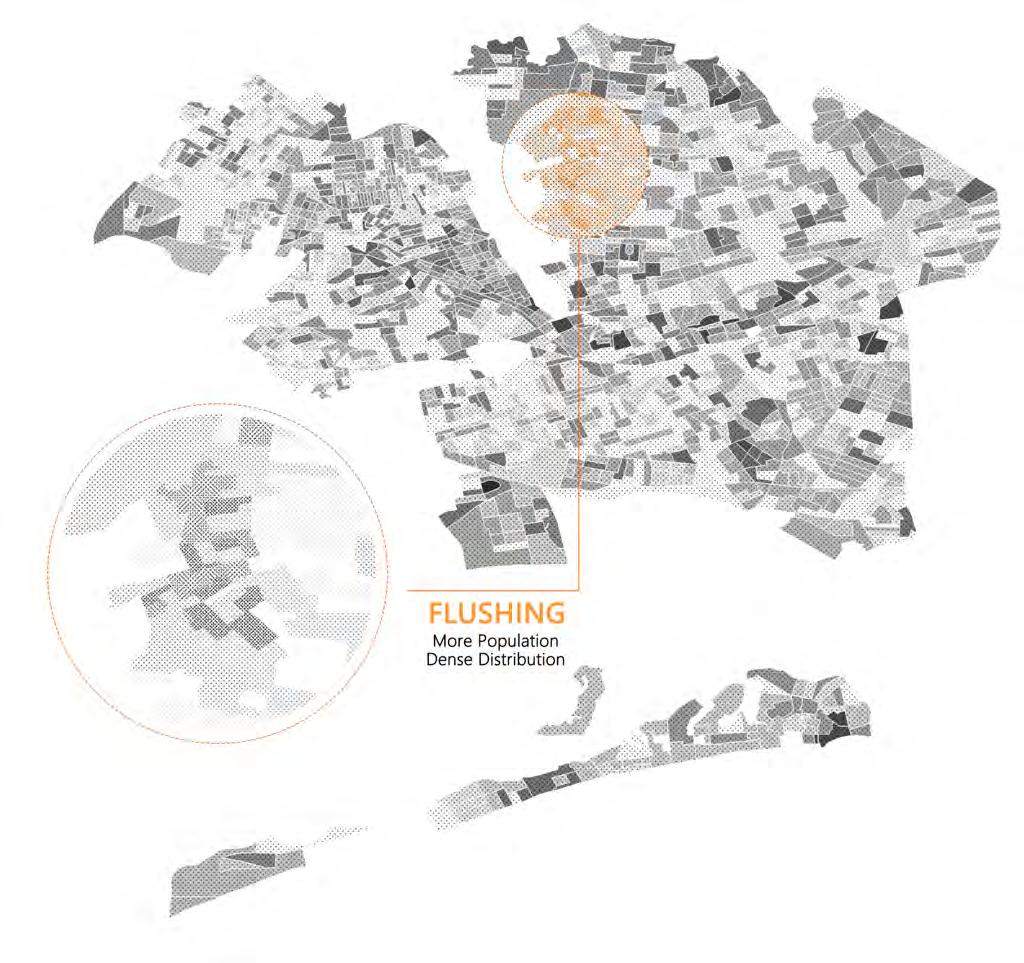
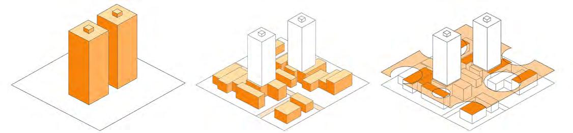
Willet Points is located in Queens, New York City. It is known for its automobile shops and junkyards. According to the census in 2010, the population in Willet Points was 10. The Willet Points has a great location, it is very close to Flushing. There is also a subway station and is a baseball field named Citi Field.
The idea of redeveloping Willet Points has been in the works since the end of World War II. Why does it only have a population of 10? What is its place in the city? What problems in Queens or New York would its redevelopment solve?
By studying the communities around willet points, especially Flushing, we believe that aging is a more prominent issue. Therefore, we want to build a senior-friendly community in willet points. But that doesn't mean it's a community just for seniors. We want this community to serve not only seniors, but also to attract people of other ages to live at Willet Points. We want Willet Points to be part of New York City as a brand new community and hope to design a process that can be applied to most cities so that these cities can think about the problems that seniors encounter in their community life and in turn solve problems for them and provide a higher quality of life.
Here is a short movie Ama's Magic Trip showing the senior-friendly community that we imagine:
https://youtu.be/WxMc914hxPc
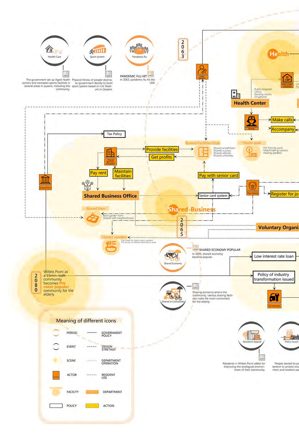
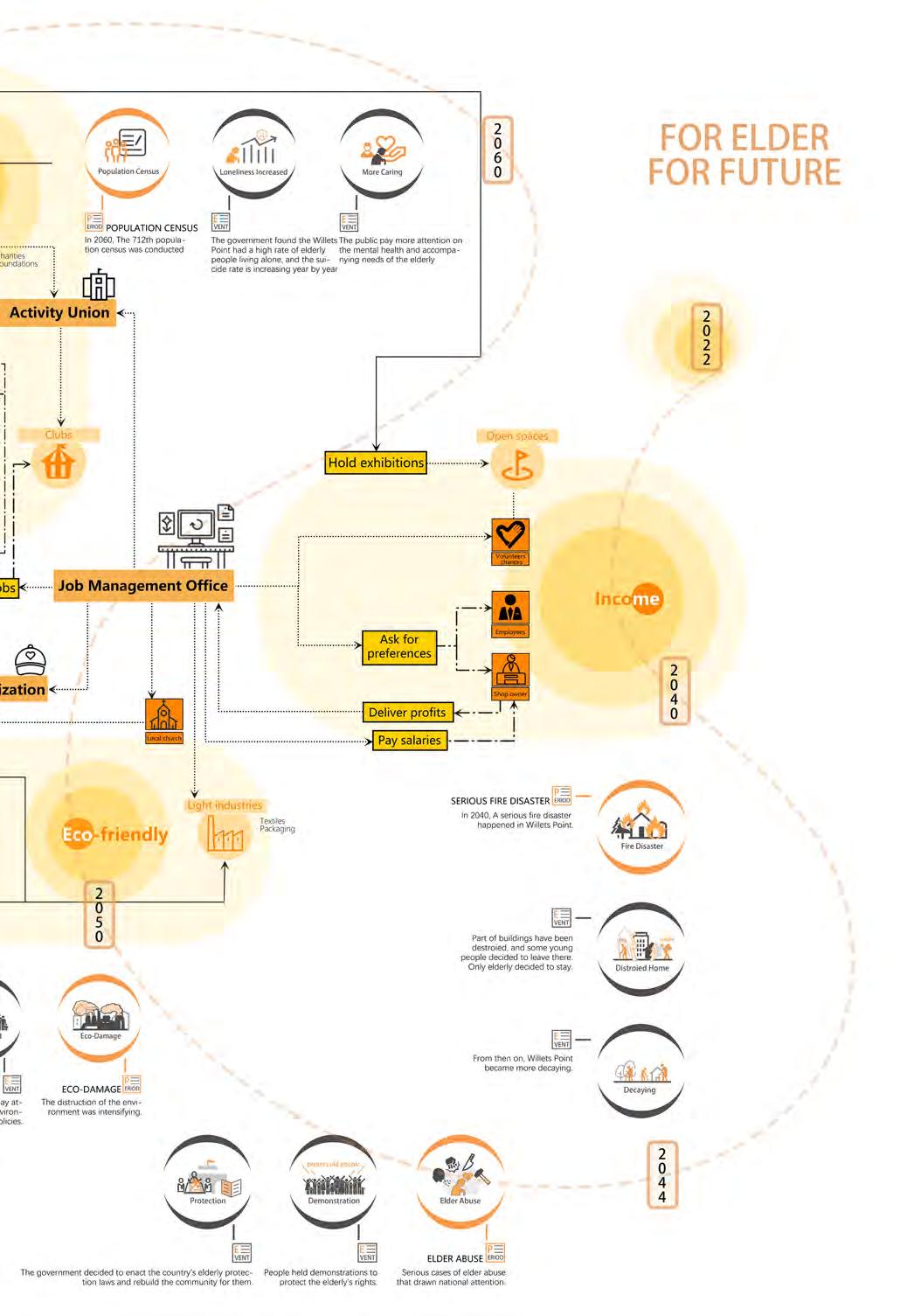
NORC means " Natural Occuring Retirement Community". This is a special kind of community formed because of the large proportion of seniors in the community, and it is popular among the seniors.
Towers with basic facilities are the ideal architectrue. Social spaces, shopping and service facilities are easily accessible
Another lifestyle favored by seniors in Queens is in Flushing. Seniors live in buildings that are not too tall, but are very connected to the city downtown. Seniors rely on the nearest commercial center for all of their needs.


More contact opportunities with the city
Make seniors' lives more active
· Elevators
· Community Service Point
· Small Pharmacies
· Leisure Space
· Building road networks
· Commercial, medical & other urban functions
· Multiple acitivity spaces
· Create joints that connect with the city
· Connect roof place of the city
Create Arichitecture
· To meet residents' basic living needs.
· To satisfied the more diverse needs of residents in addition to living.
· To meet the need for communication between residents and the city and between regions.
· Increase the activity space of residents and ensure the convinience of their travel.
A variety of facilities are planned within the building to form a complex that meets the most basic living needs of residents.


Residential Units Museum
Green Space Church
Protective Green Space School
Natural Green Space Office
Open Space Hospital
Sports Club
Library Pharmacy
Commercial Building Mall
Parking Lots
Shared Facilities
Entrance Garden
Exhibition
Joint
Healing Garden
Pet Park
Shared Canteen
Community Market
Concert
Activity Buildings
Roof Garden
Greenspace on the Ground City
Office
Education Buildings
2nd Layer's Outline
Joint to connect 2 layers
Commercial Buildings
Medical Buildings
Open Space
Relationships Analysis
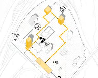
Respond to Living Quality Demand - Barrier Free
Respond to Living Quality Demand - Shared Business
Respond to Eco-Friendly Demand
Respond to Health Demand
Shared Canteen
Shared Facilities Stop
Physical Health
Mental Health
Green Space Ramp Elavator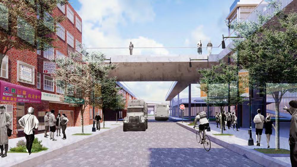
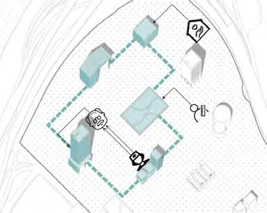
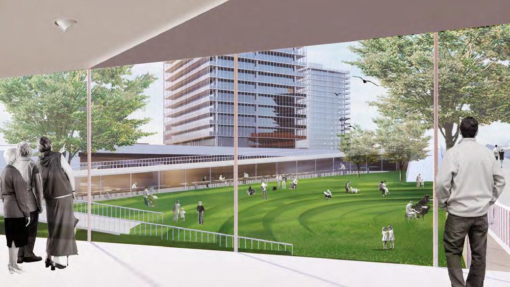 Street View
Shared Canteen & Courtyard
Street View
Shared Canteen & Courtyard
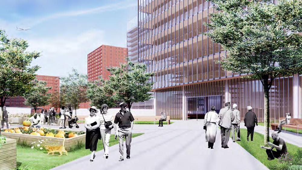
 Entrance Garden
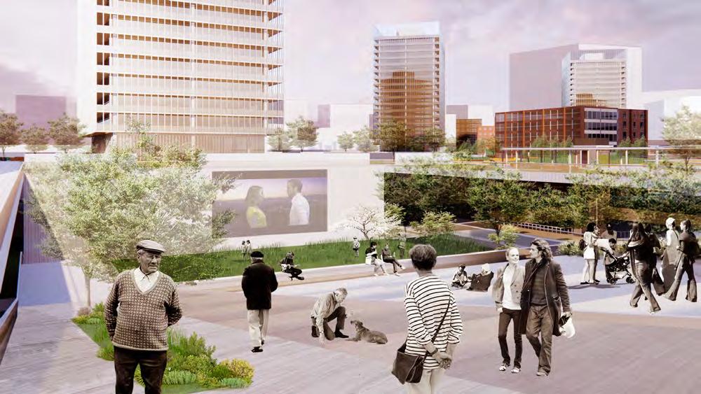
Movie Square
Entrance Garden
Movie Square
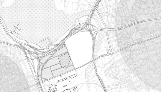
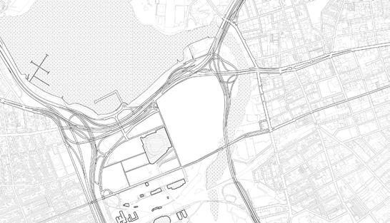
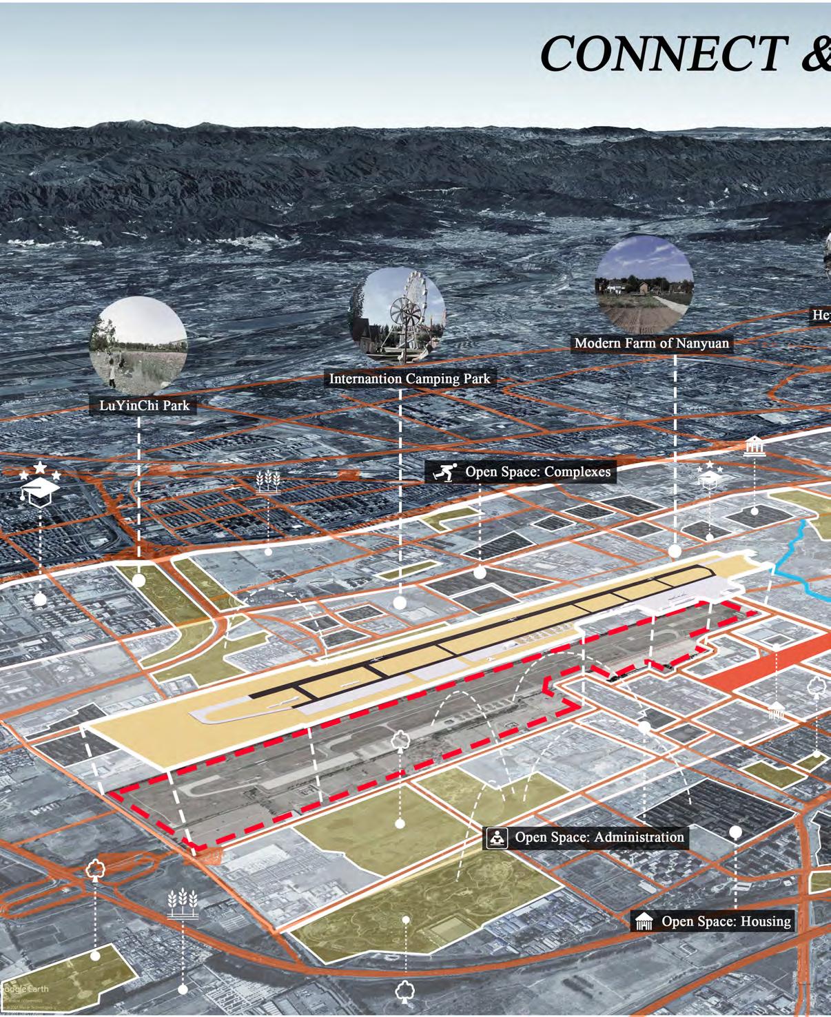
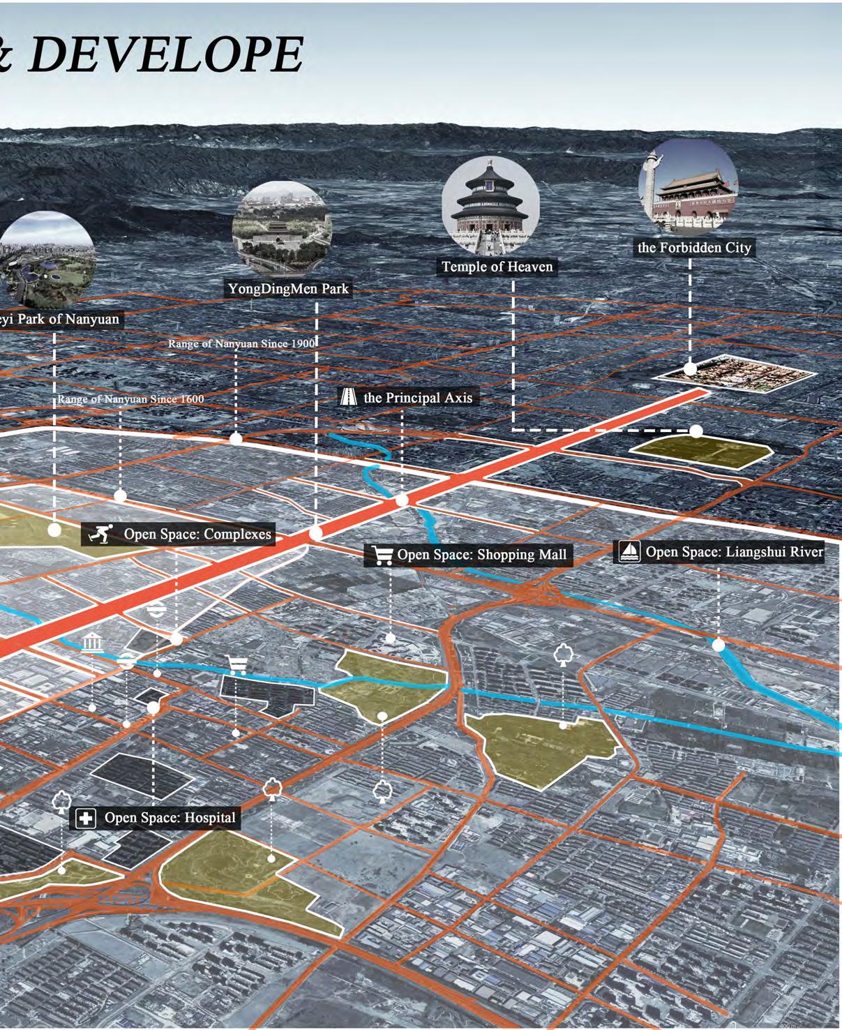
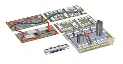
Location: Beijing, China
Area: 232 ha
Institution: Studio Alpha, academic Instructor: Ouyang Mengying
Cooperation with Zhichao Wang, Yadan Mo
Role in the team: design stategy, modeling, presentations and drawings. Period: 09.2021—10.2021
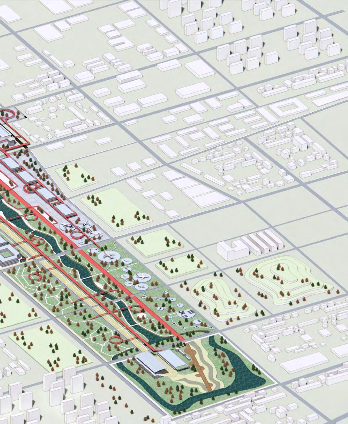
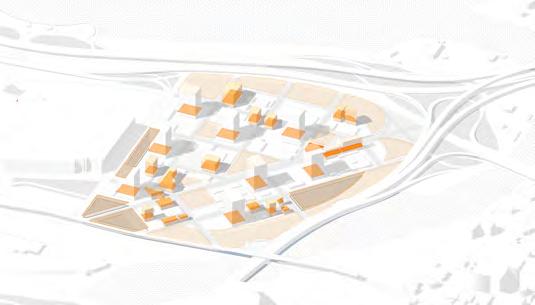
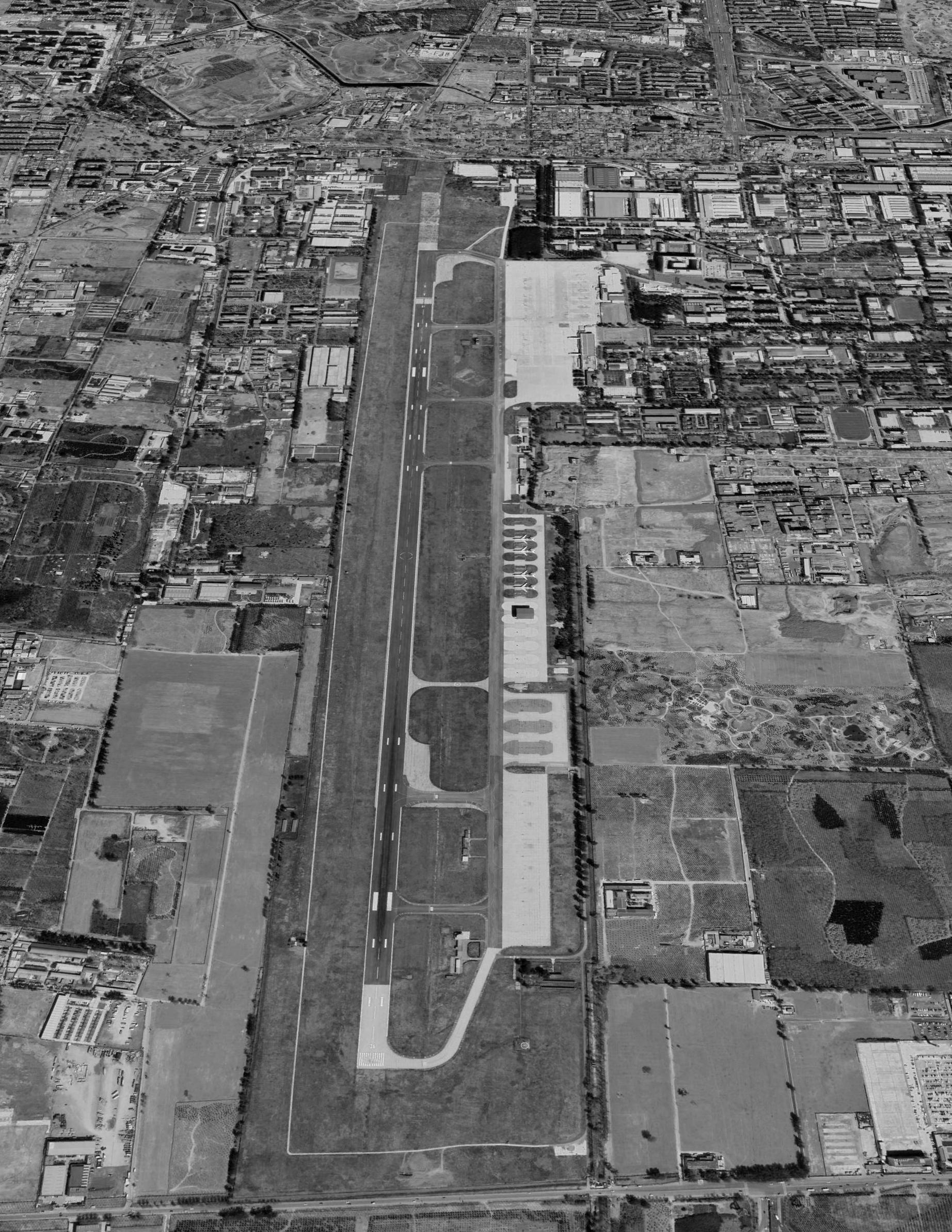
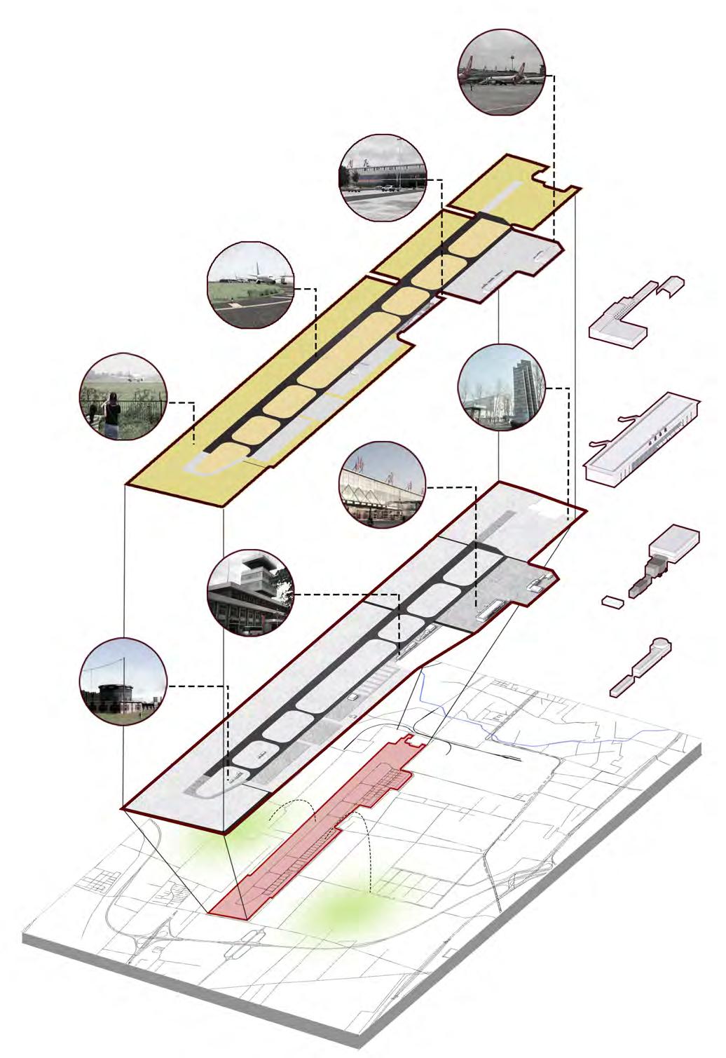
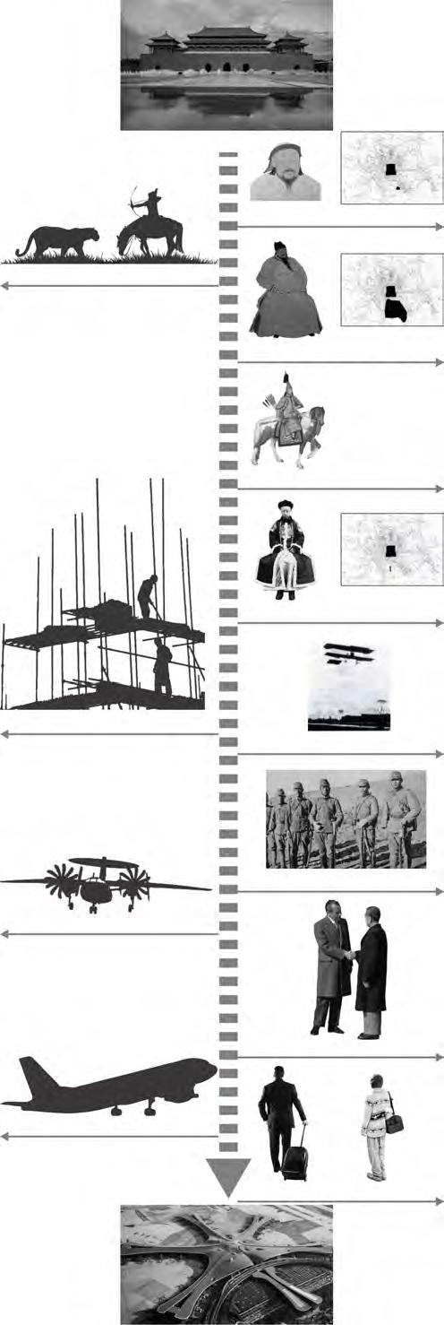
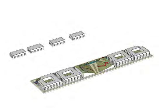
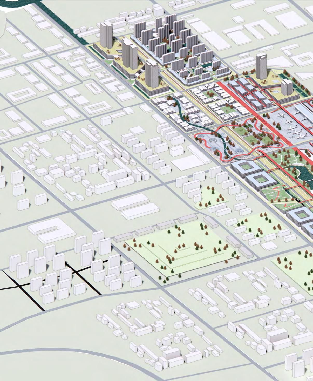
Beijing has been the capital of China since the Yuan Dynasty, and the centralized power represented by dozens of emperors has deeply influenced the layout of the city. As the end of the city's central axis, Nanyuan has changed and evolved over the past 800 years, changing from a royal park to a military airport and then a civilian airport since the end of the Qing Dynasty. As Beijing continues to develop, Nanyuan Airport has been unable to keep up with its pace. As a result, Daxing Airport was built and Nanyuan Airport was abandoned as a wasteland, becoming a huge partition in the city.
Nanyuan Airport which belongs to the government are supposed to be shared by ci tizens. This principle gives birth to the idea: repatch and renovate existing construct ions memorial spaces and insert 3 parks with different themes to enhance the conne ction around the neighborhood. This design will provide citizens with public spaces full of historical significance.
In 1910, Nanyuan Airport was completed and put into use. This airport is located in Fengtai District, 15 kilometers away from the city center. Furthermore, the airport is in the axis of Beijing, facing to the Forbidden City.
However, because of the relocation of the airport, moving to Daxing District, it is now abandoned and overgrown with weeds. Our plan will makes the dead place alive again.
Landtype: Concrete
Land Types
Landtype: Bitulith
Landtype: Tile
Existings: Factory
Existings: Entrance Mark
Landtype: Grass
Existing Constructions
Existings: Office Building
Existings: Terminal
Existings: Terminal
Existings: Office Building
Existings: Storage
Existings: Storage
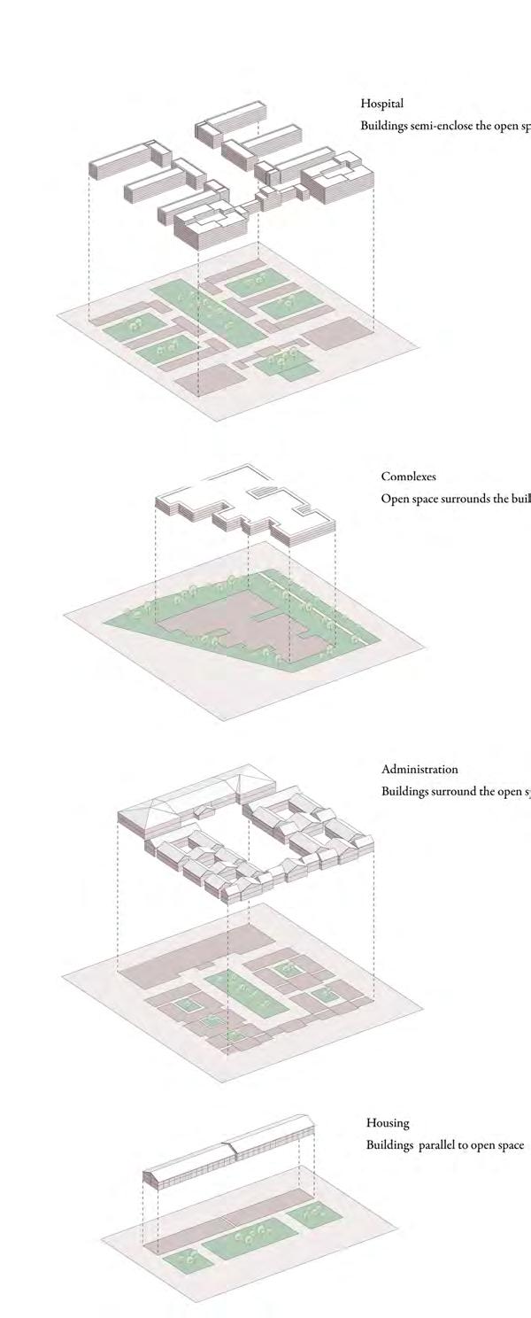
Hospital
Buildings semi-enclose the open space
1272: Capital of China
Royal Hunting Ground
1200s: Setting up of Nanyuan
1400s: Expand the Range
Complexes
Open space surrounds the building
1700s: Peak of Nanyuan
1910 Construction of Airport
Administration
Buildings surround the open space
Military Airport
1937 Occupied by Japan
1937 Occupied by Japan
1972: Nixon's Visit in China
Housing
Buildings parallel to open space
Civil Airport
2005: Opened to Citizens
Issue 1: The airport which is unaccessible for normal people cut off the connections between the surrounding neighborhoods.
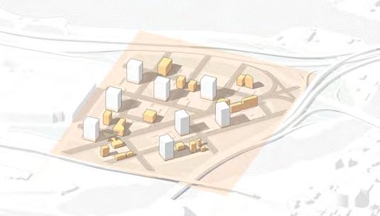
Phase 1: Repatch existing constructions, define their fuctions according to history-line and form a seris of linear space.
Issue 2 : The usage rate of open spaces is low because of sparse population and underdevelopment infrastructure.
Phase 2: Add residential and office area to attract people and offer them service spaces like shopping mall.
Issue 3 : The site which belongs to the government can provide a central public space where citizens can use and rest.
Phase 3: Renovate grassland into a natural park and runways into walking-scenery path to improve the living quality.
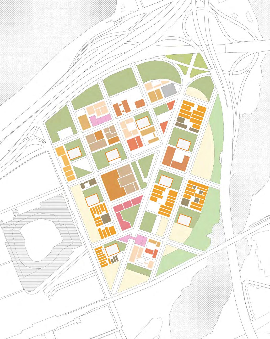
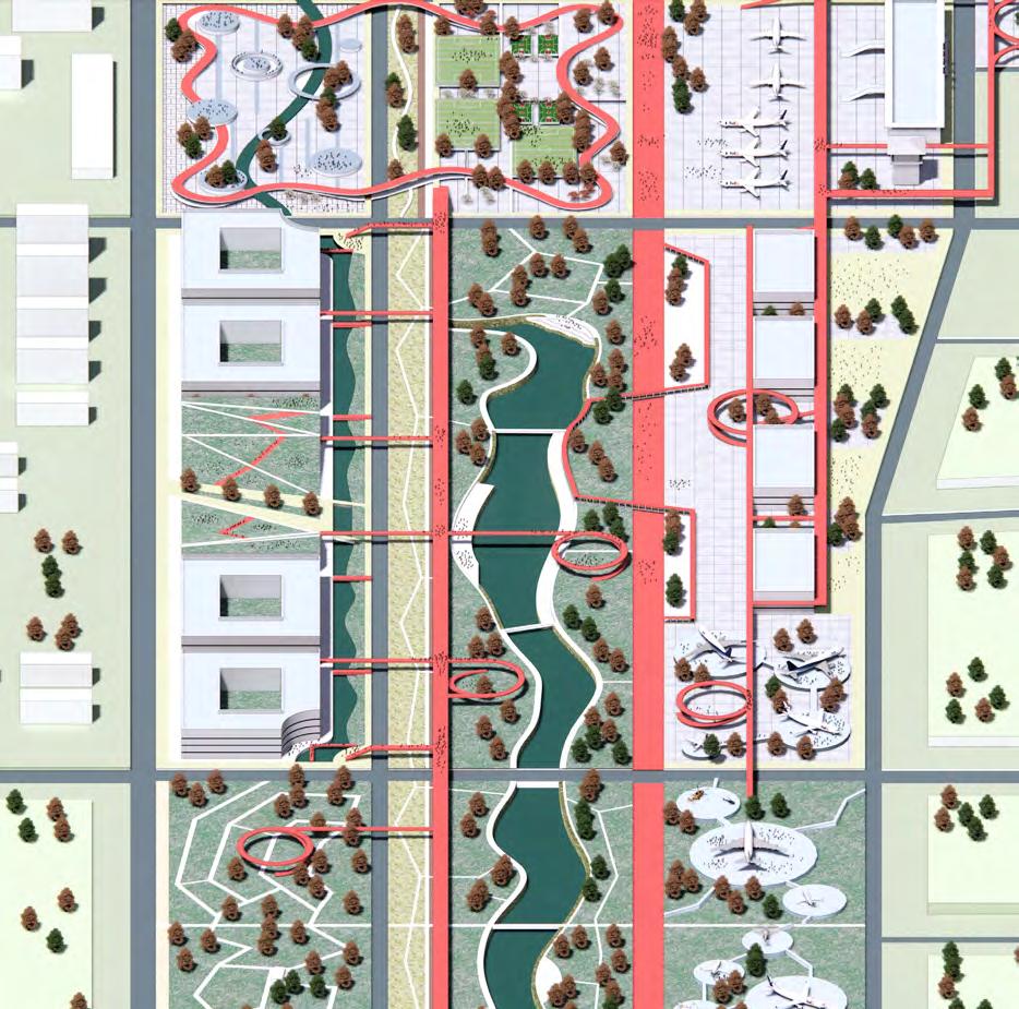
Concept generation : Extend original road network and construct new roads; Put a community and three parks with different themes in the site constructing them in different phases.
Phase 4 : Put a recreational park with communication and fitness functions; Perfect this site with a cultural park.
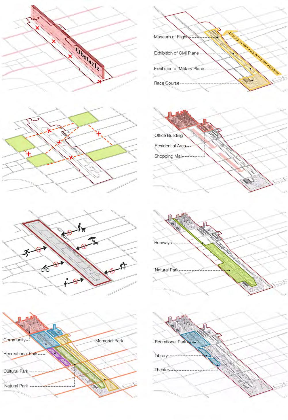
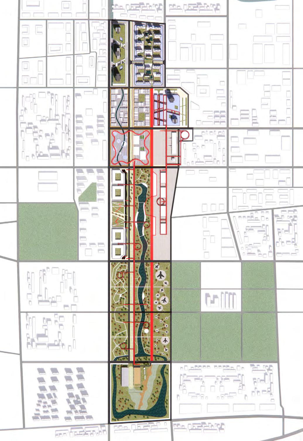
Tarmac: The Axis of the Airport
Roads: Turn the main runway to road and equip the site with perfect road system.
Buildings: The building height and dense gradually decreases from north to south.
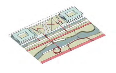
Water: Water introduced from Liangshui River provide hydrophilic platform to visitors.
Paths: Large number of air corridors consist of the path system.
Paths: Large number of air corridors consist of the path system.
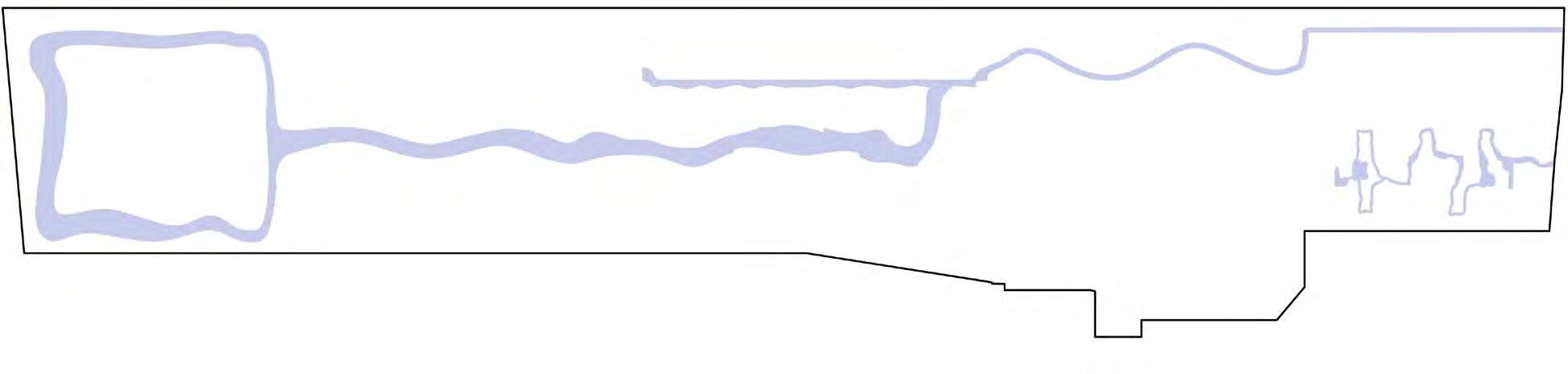
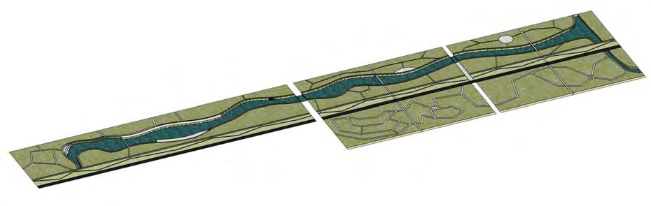
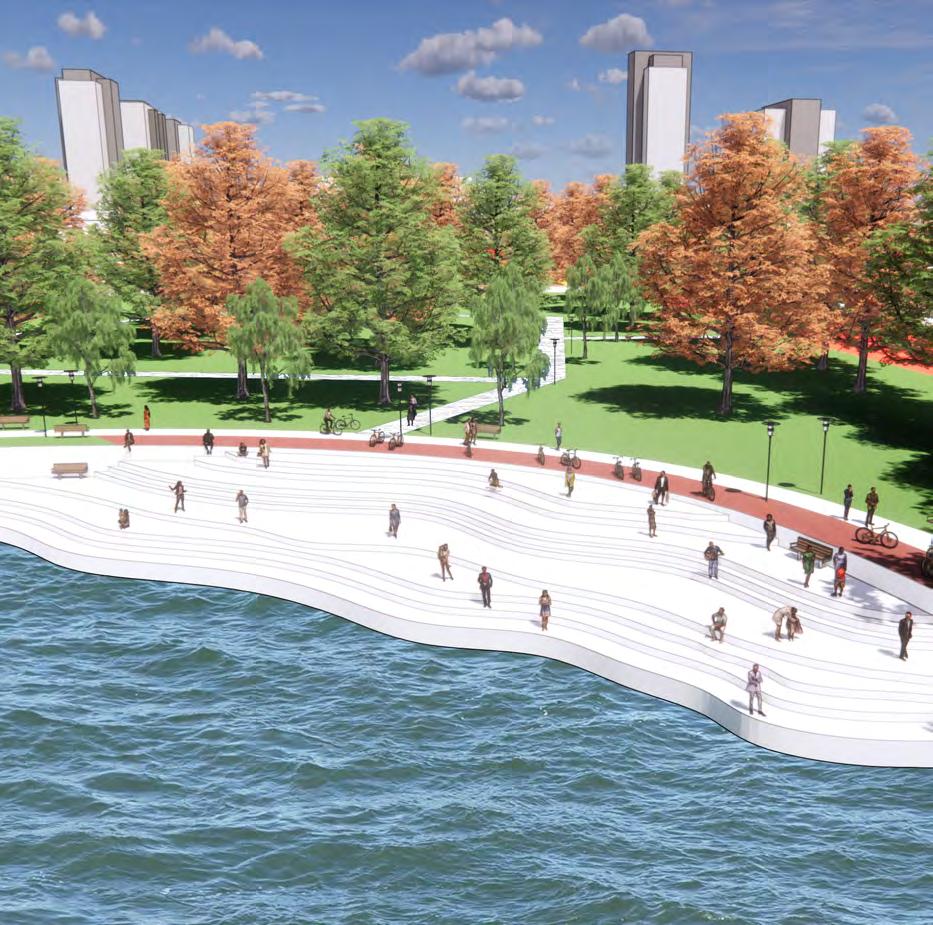 The nature park take the original airplane runway as the axis. On one side is a forest park, on the other side is a waterfront park. People can choose to walk in the dense and tall forests or near the river and the hydrophilic platform.
Scenes & Facilities | From Human Society to Nature: Modern building & Nature park
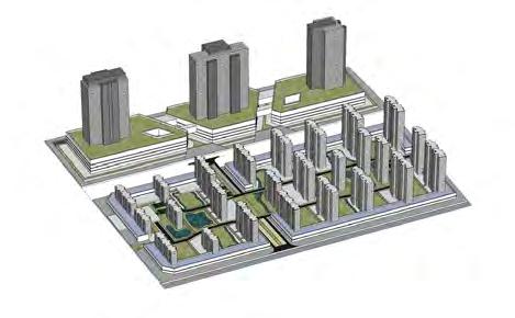
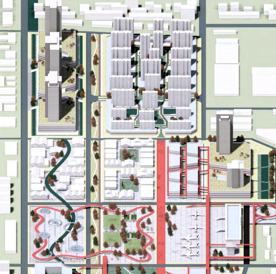 The modern building area includes residential area, business area, community park and aircraft museum.
 The nature park take the original airplane runway as the axis. On one side is a forest park, on the other side is a waterfront park.
The aerospace industry made a great progress in the past 100 year. In order to show the aerospace development of China, the aircraft exhibition will be set up near the old terminal. Citizens can come to the exhibition to see how Chinese aircraft developed after Qing Dynasty.


The Racecourse will reappear the old history of the royal huting ground and remind people the interesting past events happening in the area. The feed for horses are all from the nearby landscape.


In this design, the building height gradually decreases from north to south, and the historical
historical trend gradually develops from south to North according to the development of time.