
Ball State University | Selected Works |
Anuska Singh


DESIGN AND GRAPHICS
My urban design journey, from concepts to refined graphics and development.
Ball State University | Selected Works |
My urban design journey, from concepts to refined graphics and development.

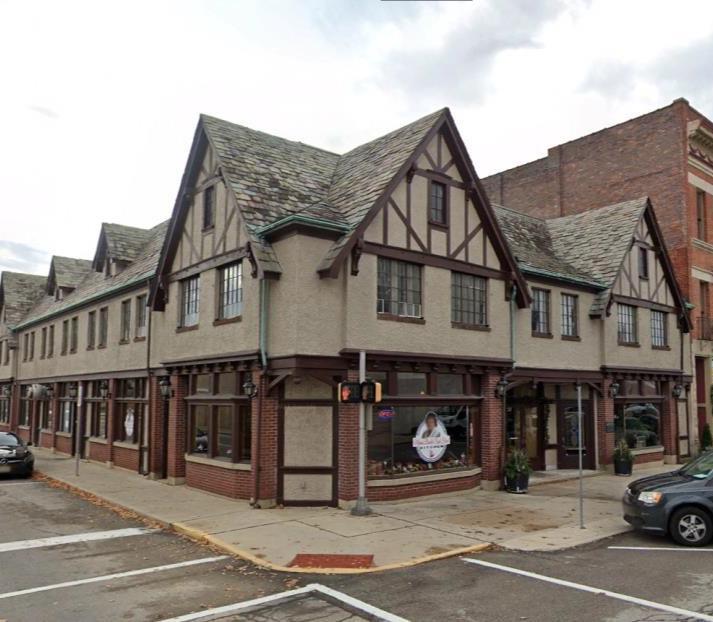
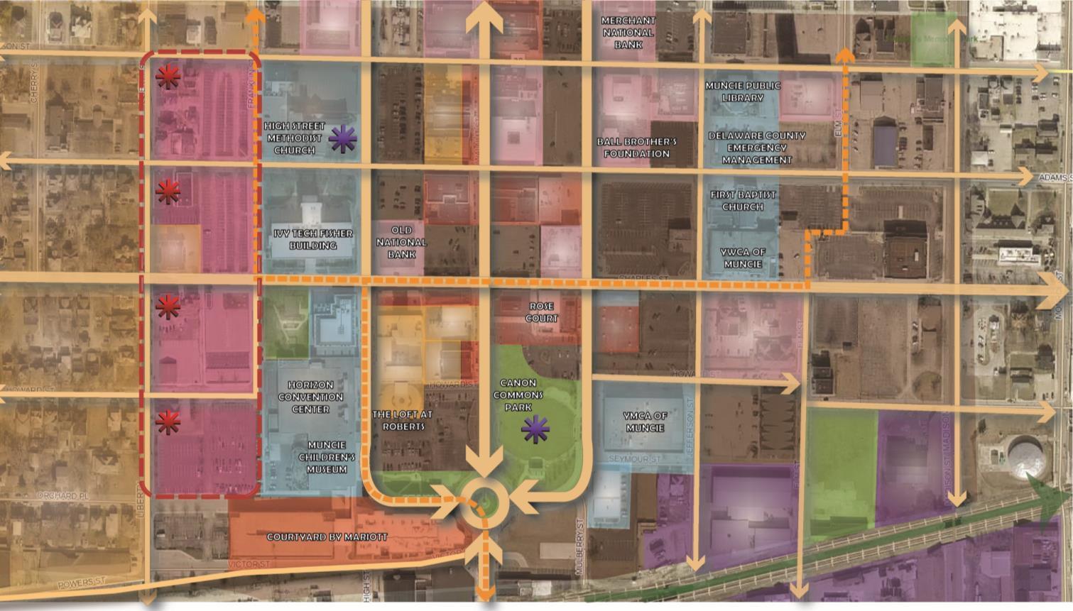
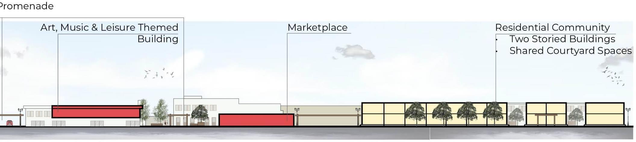
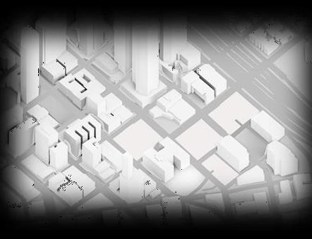
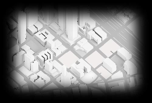
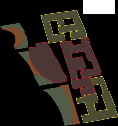
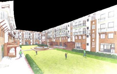
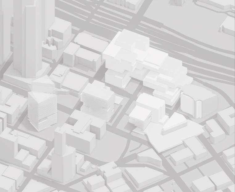
Built in 1926, the historic Rose Court, inspired by European arcades, now faces taller neighbors.
The arcade style continues, preserving the skyline, blending timber buildings with modern architecture.
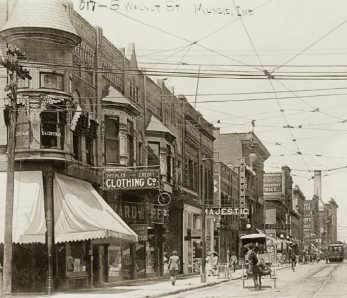
Walnut Street showcases Victorian, Beaux Arts, Italianate, and Colonial Revival styles with exposed wires, rail tracks, and large sign poles.
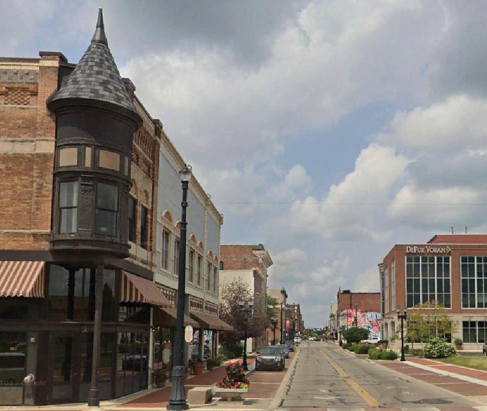
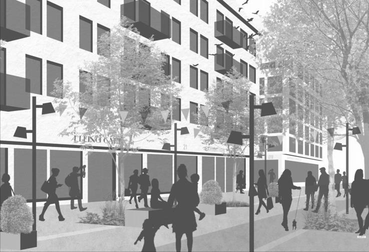
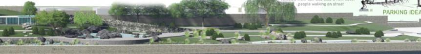
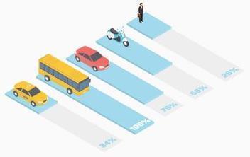
Many historic buildings in downtown Muncie were modernized or replaced, leaving few as heritage. Pedestrian-friendly streets lack public activities.
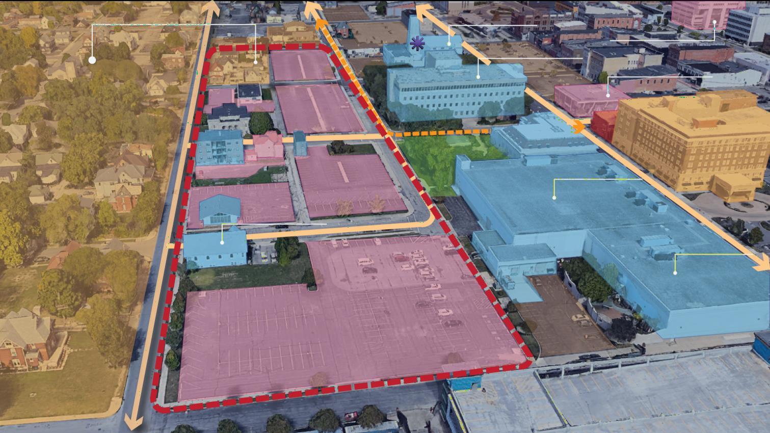
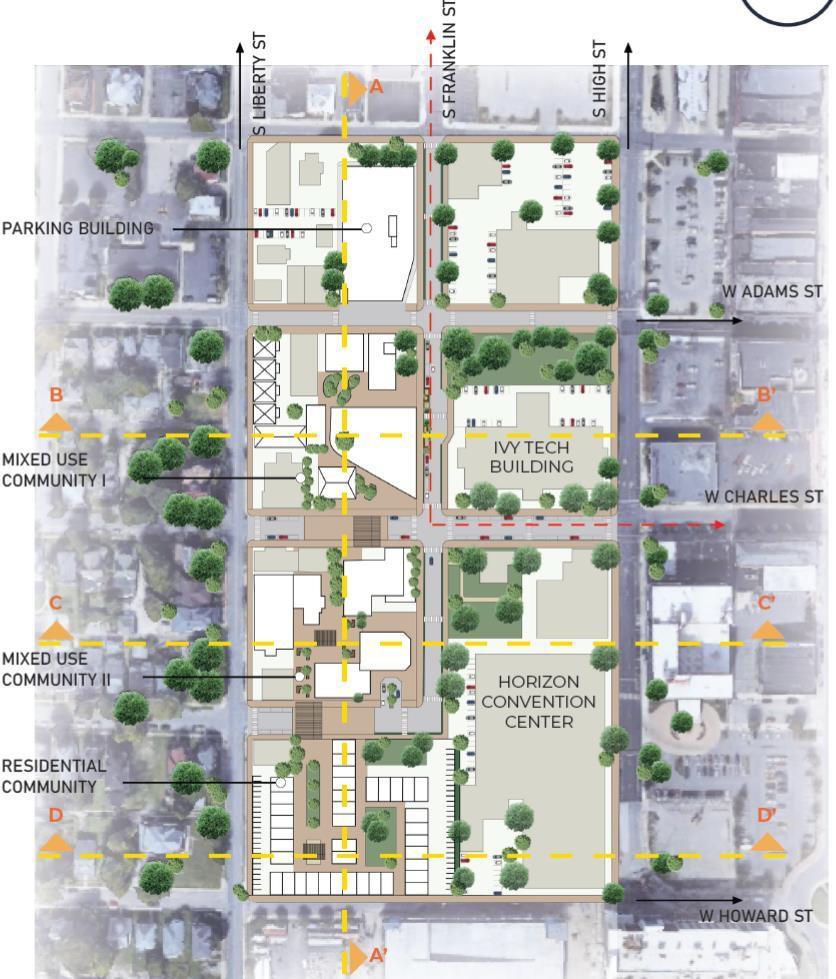
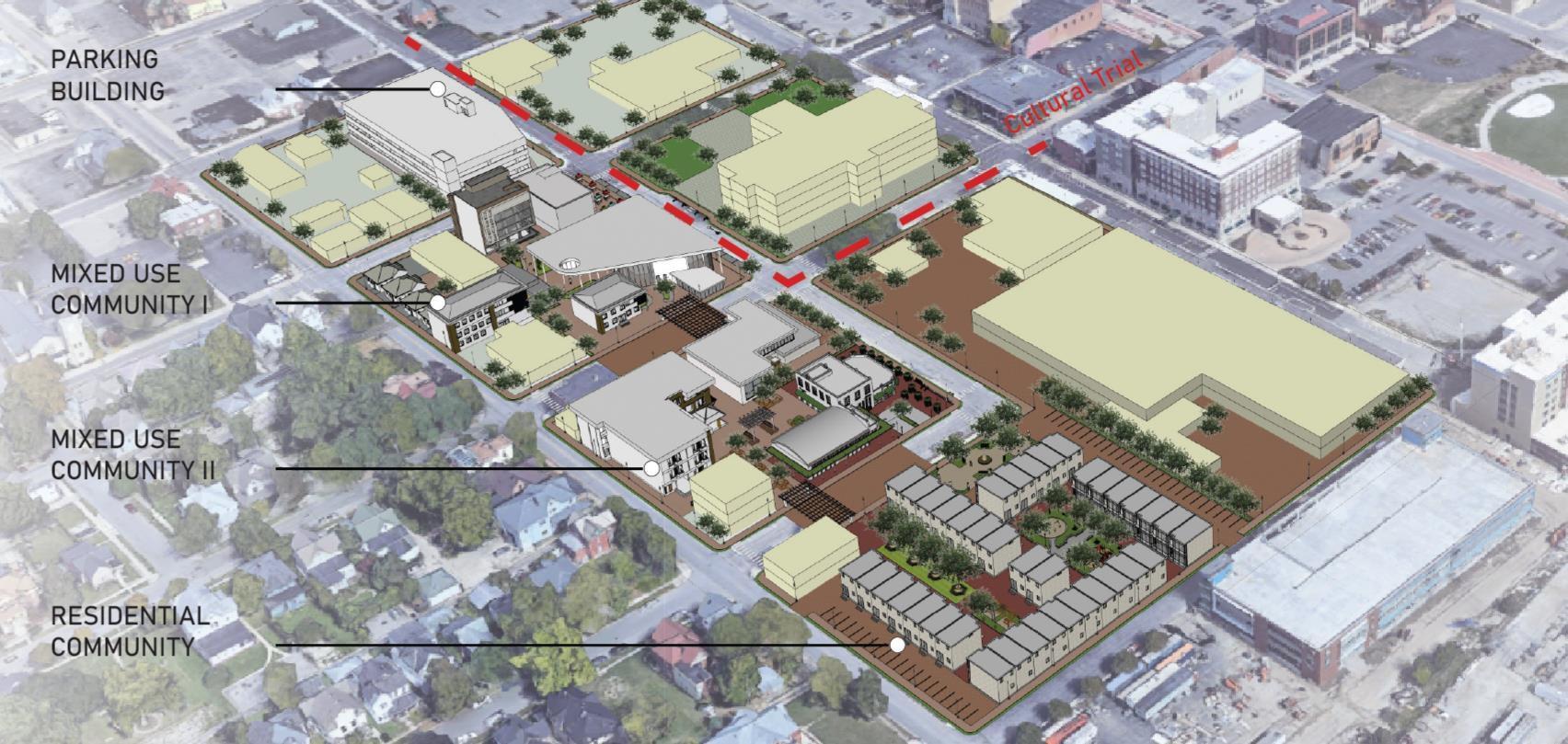
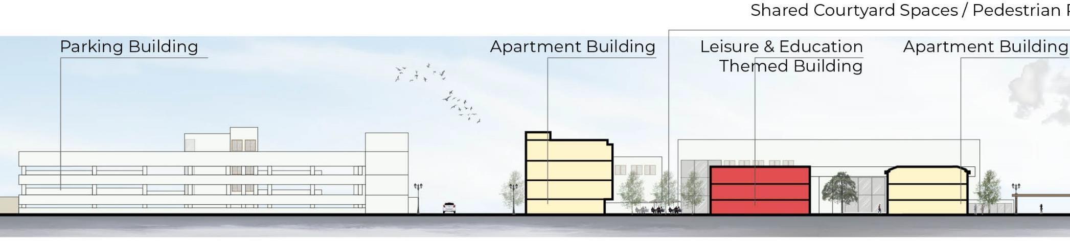
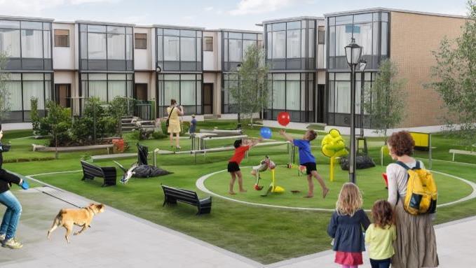
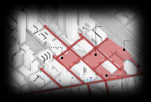
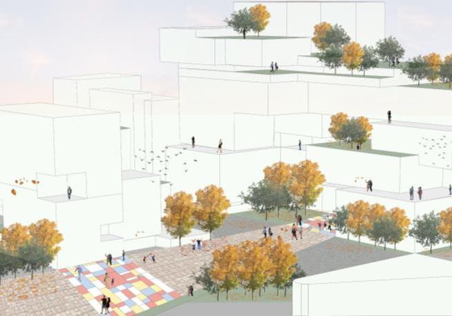
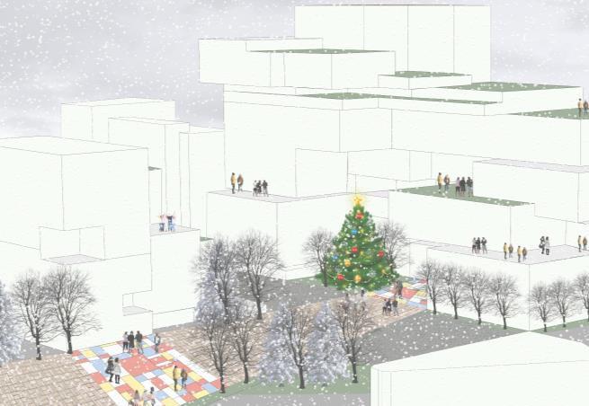
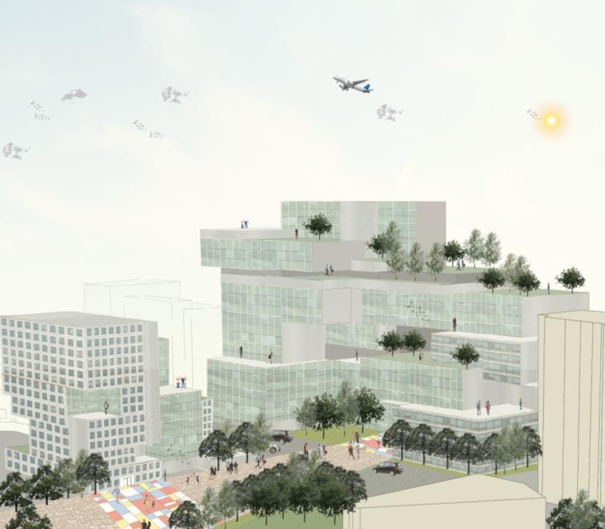
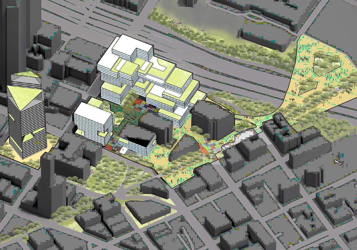
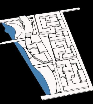
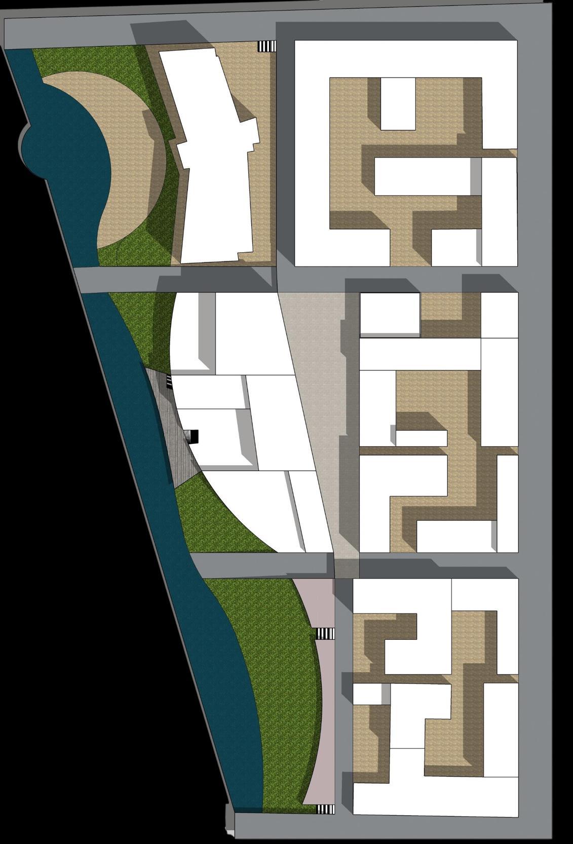
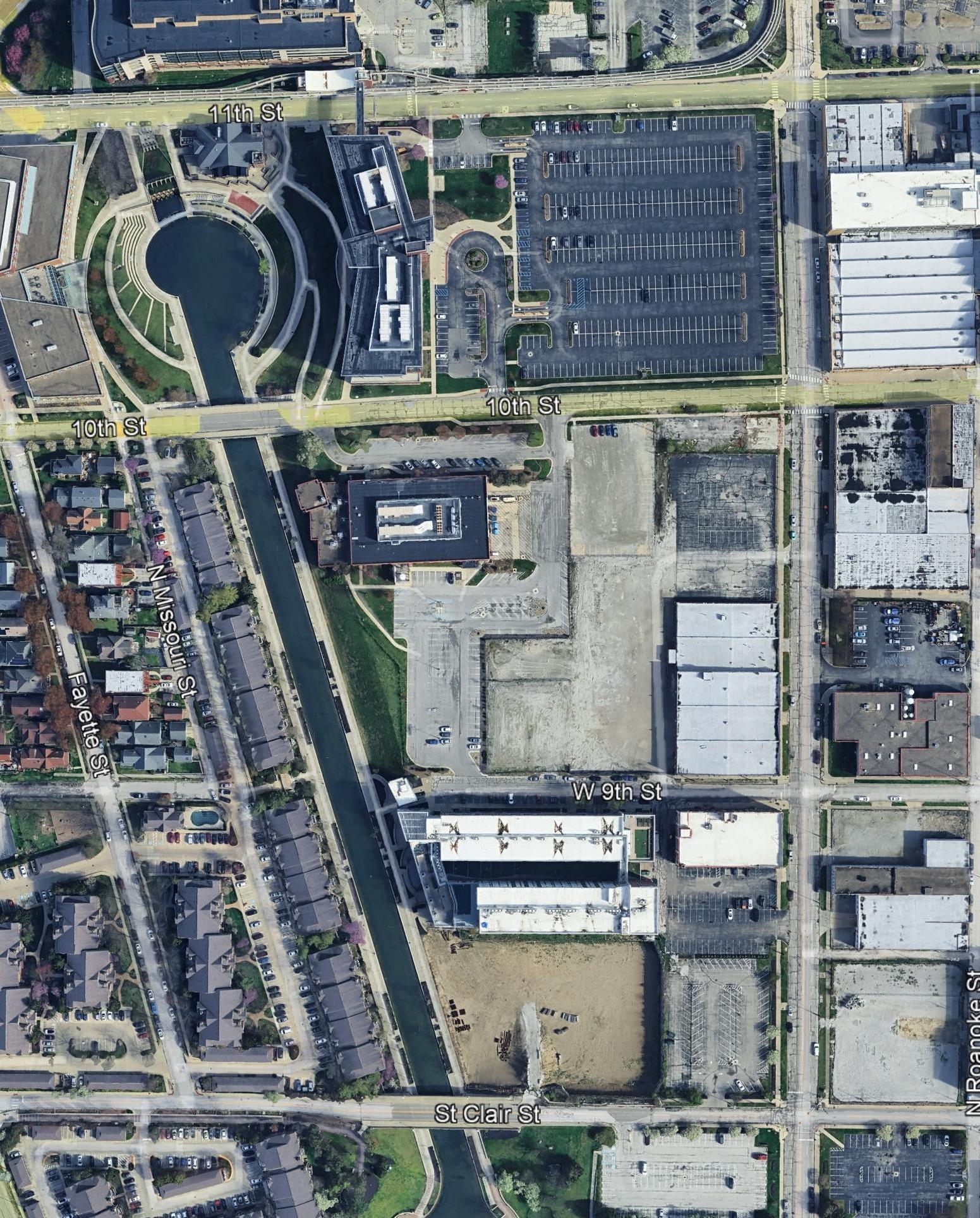
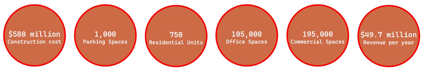
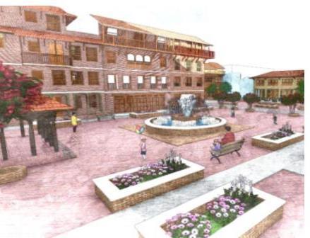
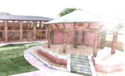
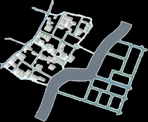
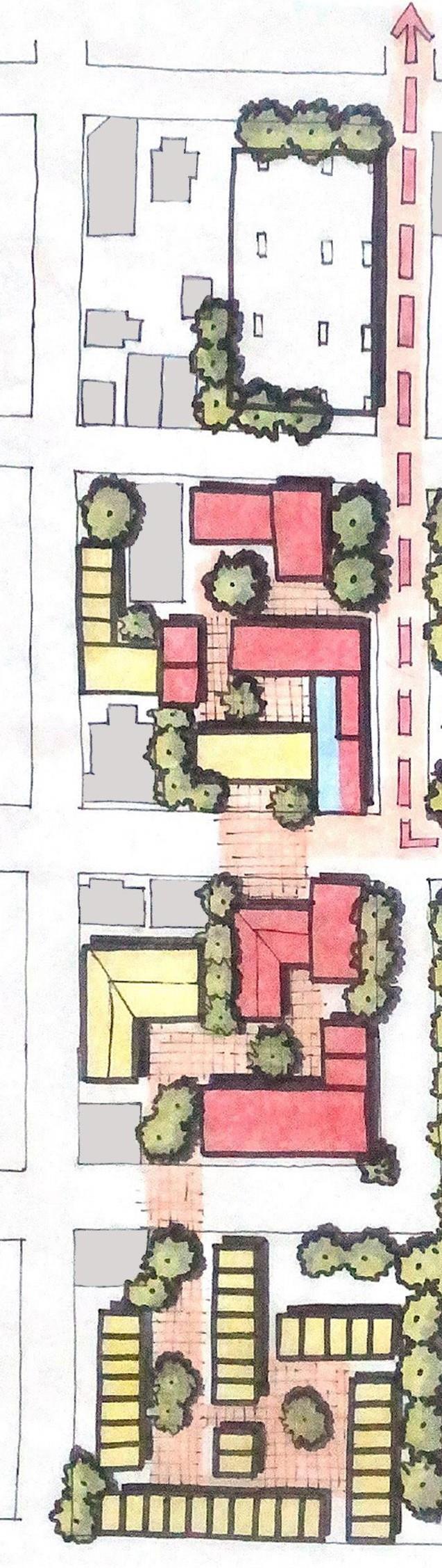
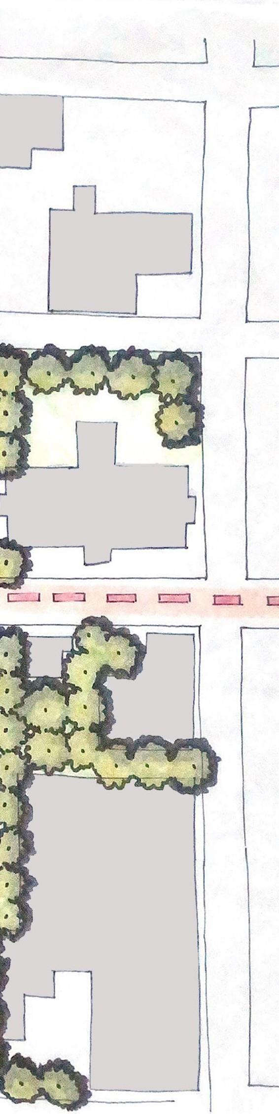
The site includes four downtown Muncie parking lots, aiming to become a vibrant, connected community.


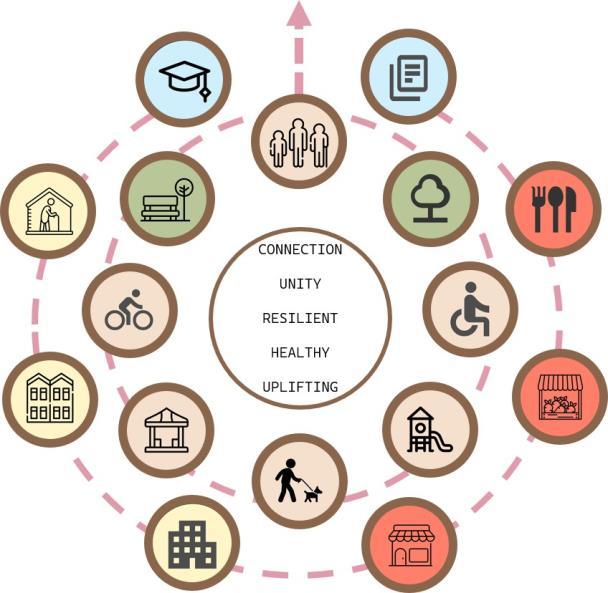
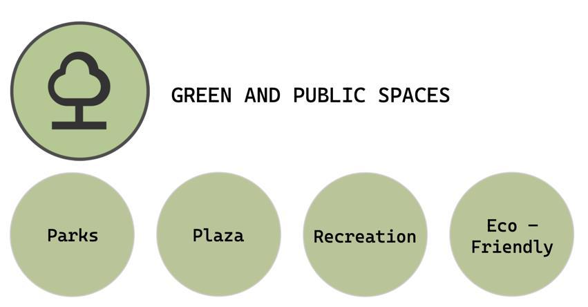
RESILIENT with essential resources parking, eateries, and small-scale groceries.
UNITY through multigenerational interaction.
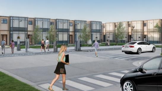
HEALTHY with safe homes and active lifestyles.
CONNECTION via housing, parks, shopping, and Ivy Tech Extension.
UPLIFTING by supporting local markets and universal access.


B U D
Blossoming Unity in Diversity
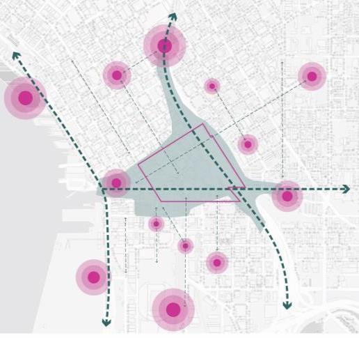
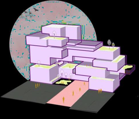
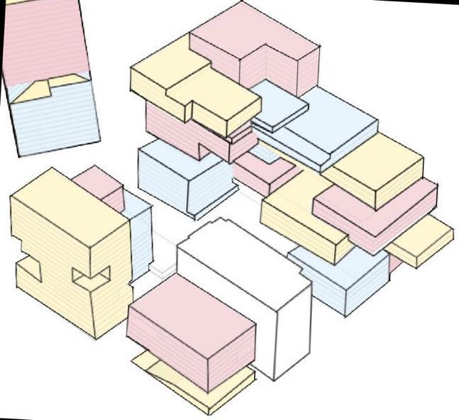
Pioneer Square
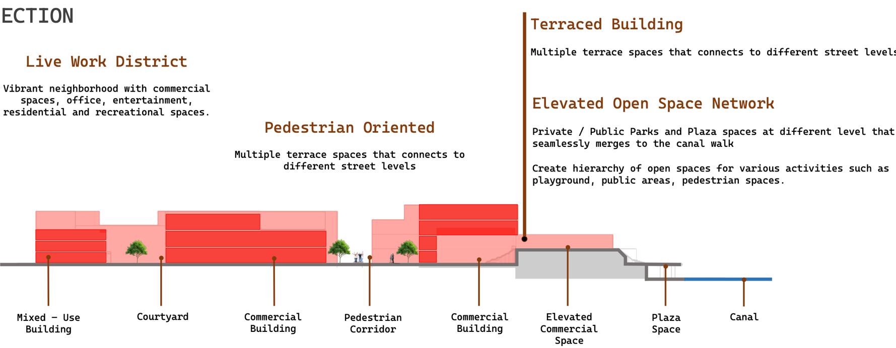
Surrounding Context


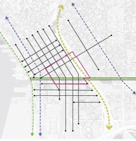
Pedestrian Activity Green Spaces
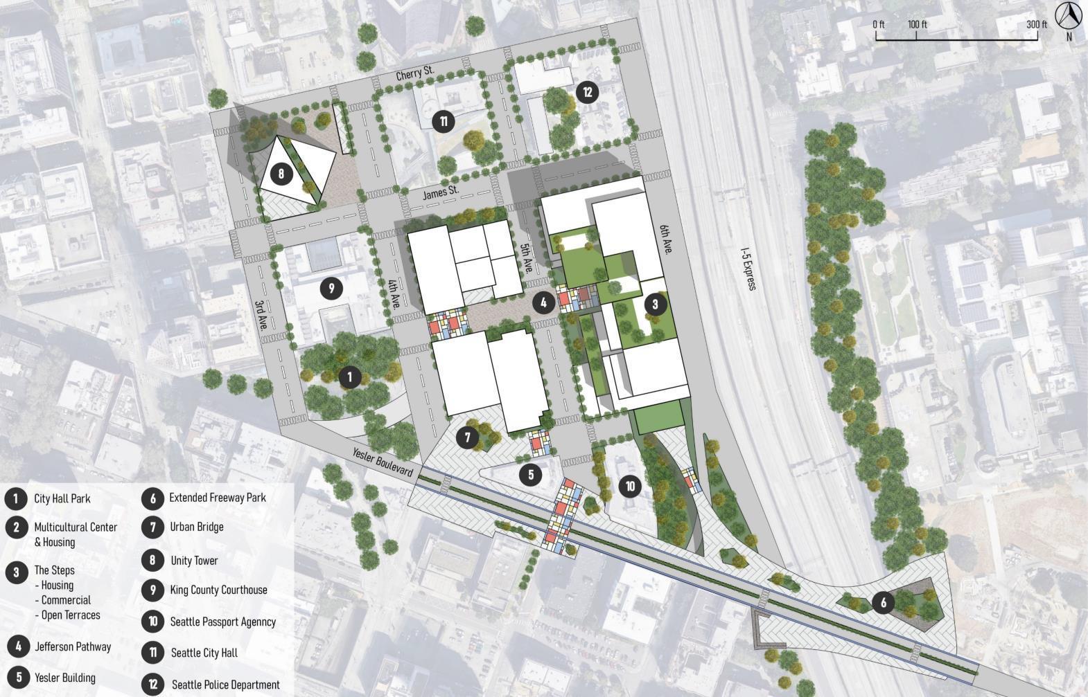
Diverse Culture


It promotes economic growth, visual connectivity, and housing through mixeduse development and sustainability.


Diverse Users
Mosaics connects people, businesses, and nature, fostering an inclusive and vibrant urban hub.

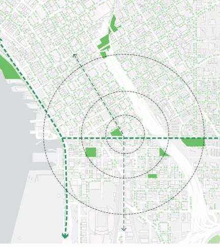
MOSAIC transforms the area into a transit and cultural hub, driving social change in Seattle.
Its modular, replicable design revitalizes disinvested areas and supports the future Lid I-5 project.
The logo draws from De Stijl’s geometric abstraction and primary colors, while Mosaics uses small colored pieces to form intricate shapes .
Ideal for mixed-use development, the site boosts housing, culture, walkability, and sustainability.
and
Residential (Market Rate)
Unity Tower (Office Space)
Green Terraces
Jefferson Pathway
Attainable Housing
Multicultural Center
Urban Plaza
Commercial Retail
spanning 2.5
including affordable
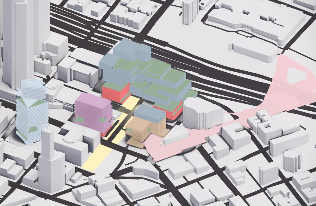
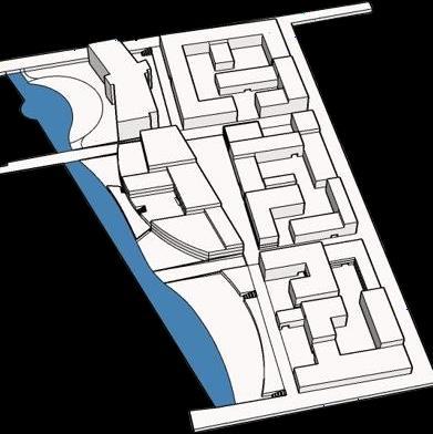
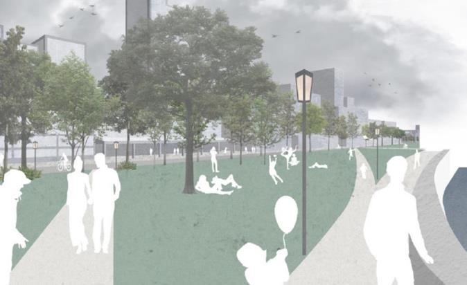
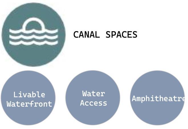
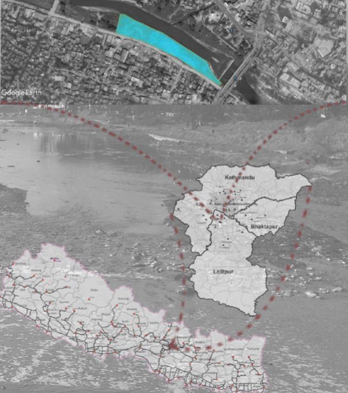
Canalscape transforms an area along the Indianapolis Canal Walk into a vibrant, mixeduse neighborhood, enhancing connectivity, public engagement, and waterfront access.
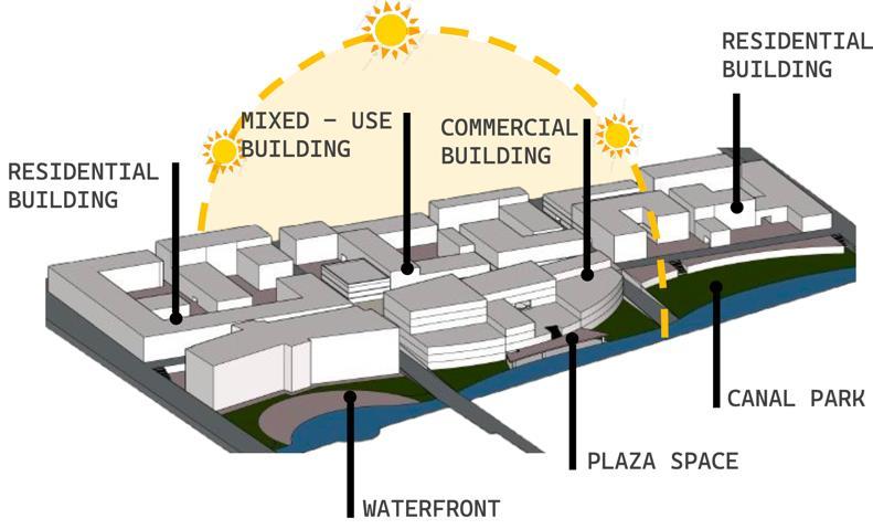
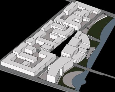
Active Nodes
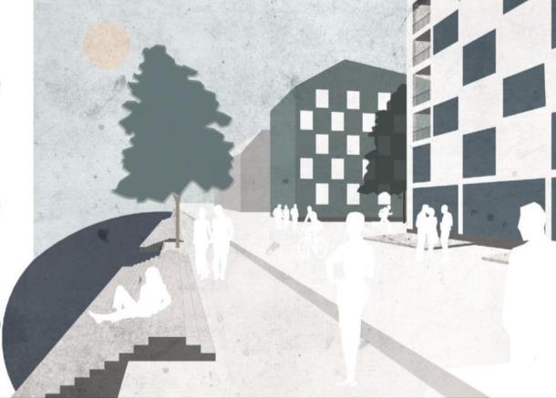
Connected Spaces - Courtyards
Attracts residents and visitors with a vibrant yet peaceful setting.

Challenges in unifying underutilized spaces.

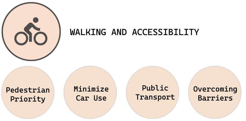
Enhances connectivity for a walkable, bike-friendly area.
Canal and dense structures limit expansion and integration.


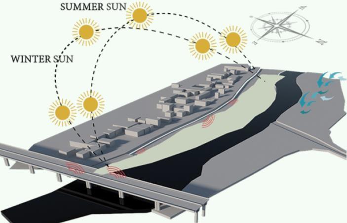
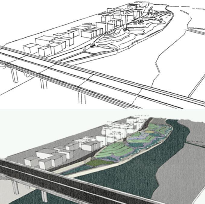
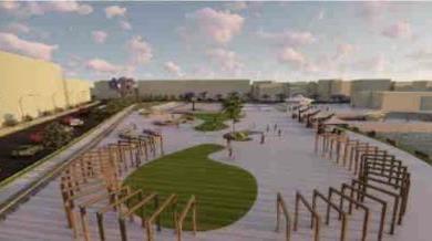
PEDESTRIAN CORRIDOR CONCEPT


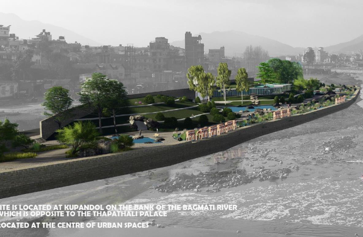
The design concept is derived from the ancient Chinese philosophy of Taoism that suggests to go with the flow and the natural order of things. It revolves around the idea of the Harmony of the Universe.
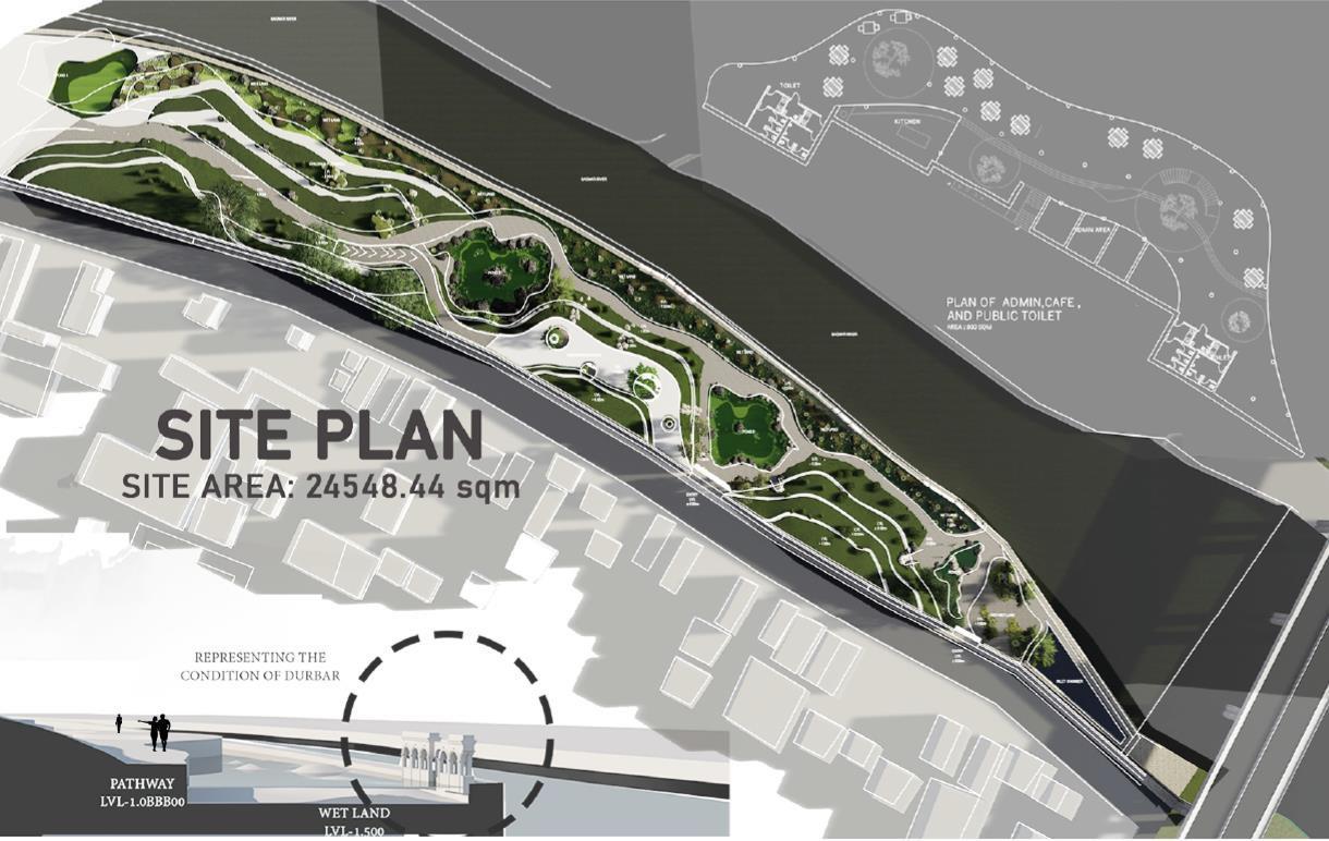

Final
Collecting chamber
Wet Land
Collecting chamber 2
Collecting chamber 1
Dry wet land
Setting out
Chamber
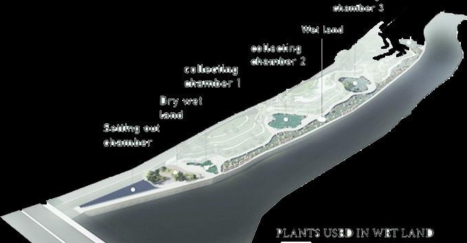
water of river is purified and used for gardening and artificial pond on site for a fresh natural environment.


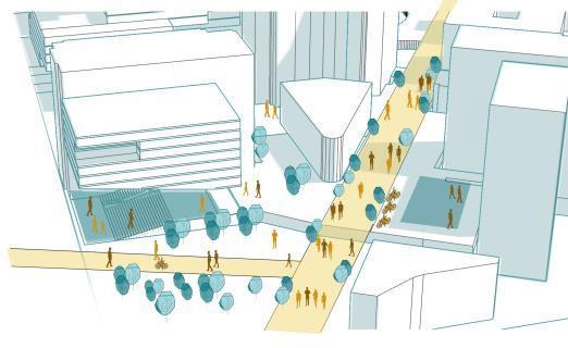
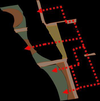
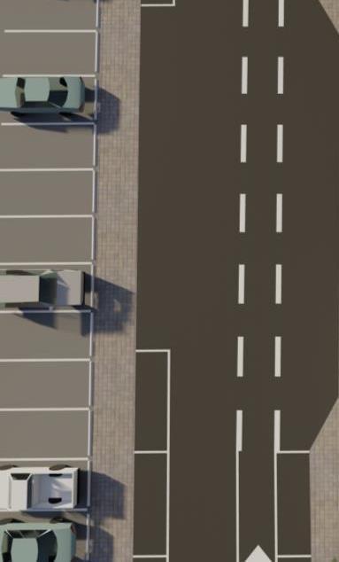
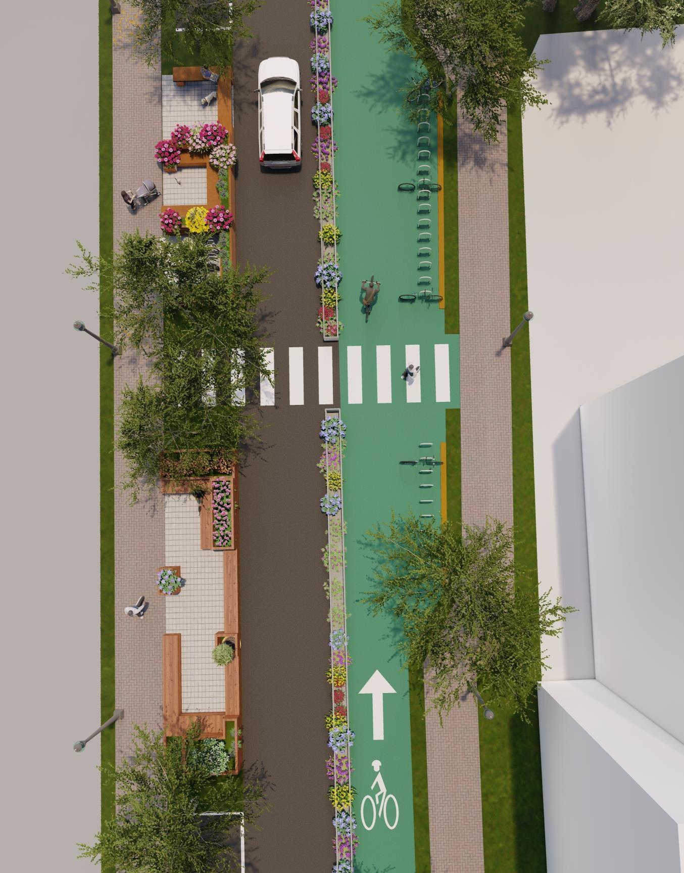
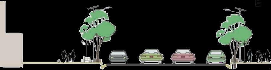
South Franklin St. is part of Muncie’s Cultural Trail, featuring driving lanes, bike lanes, and parking.
Proposed Street Cultural Trial
Existing Street Plan
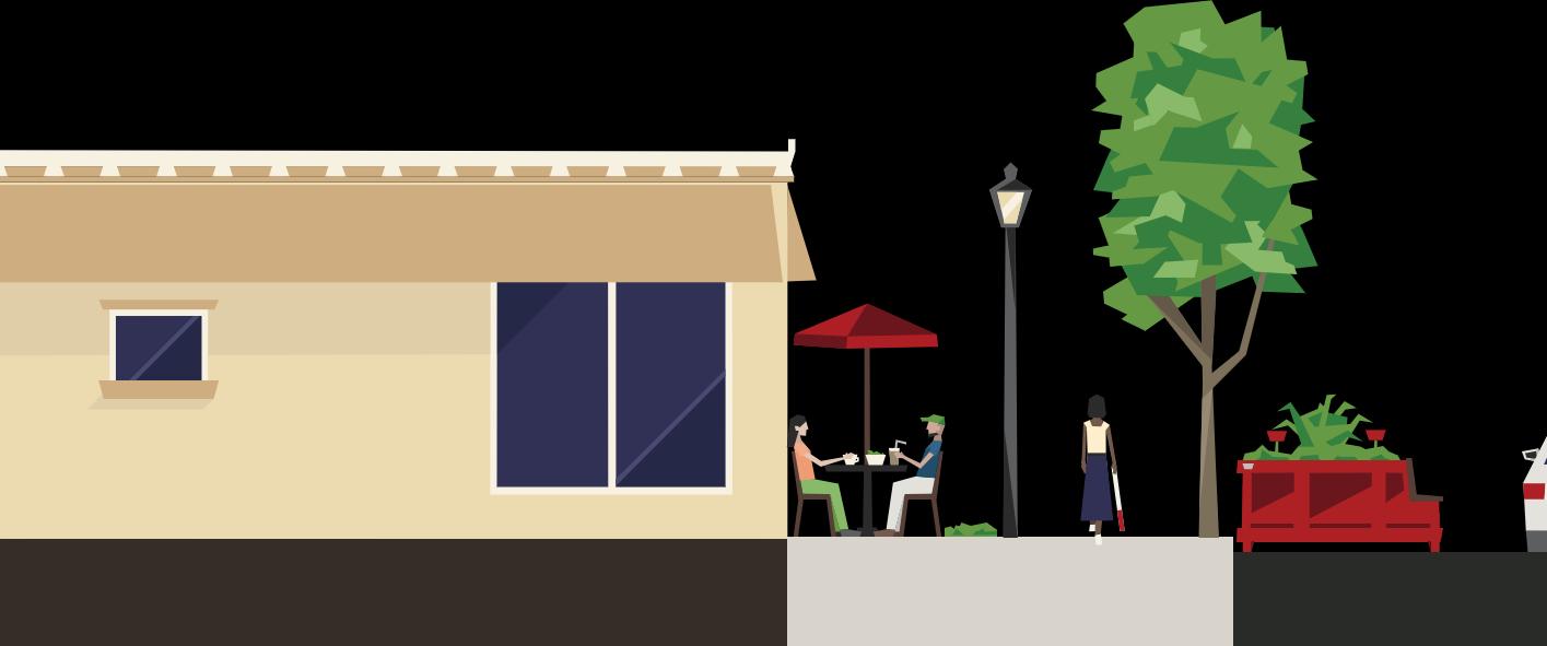
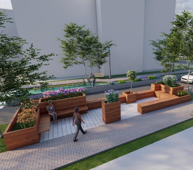
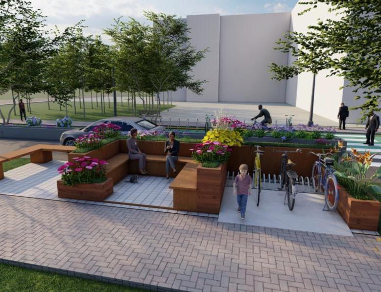
Proposed Open Space / Cafe Area


Parking
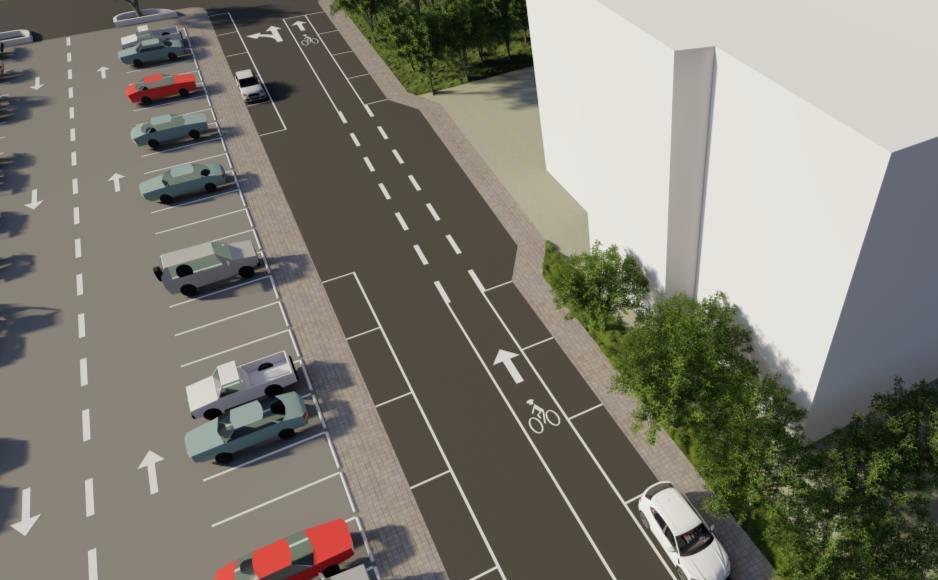
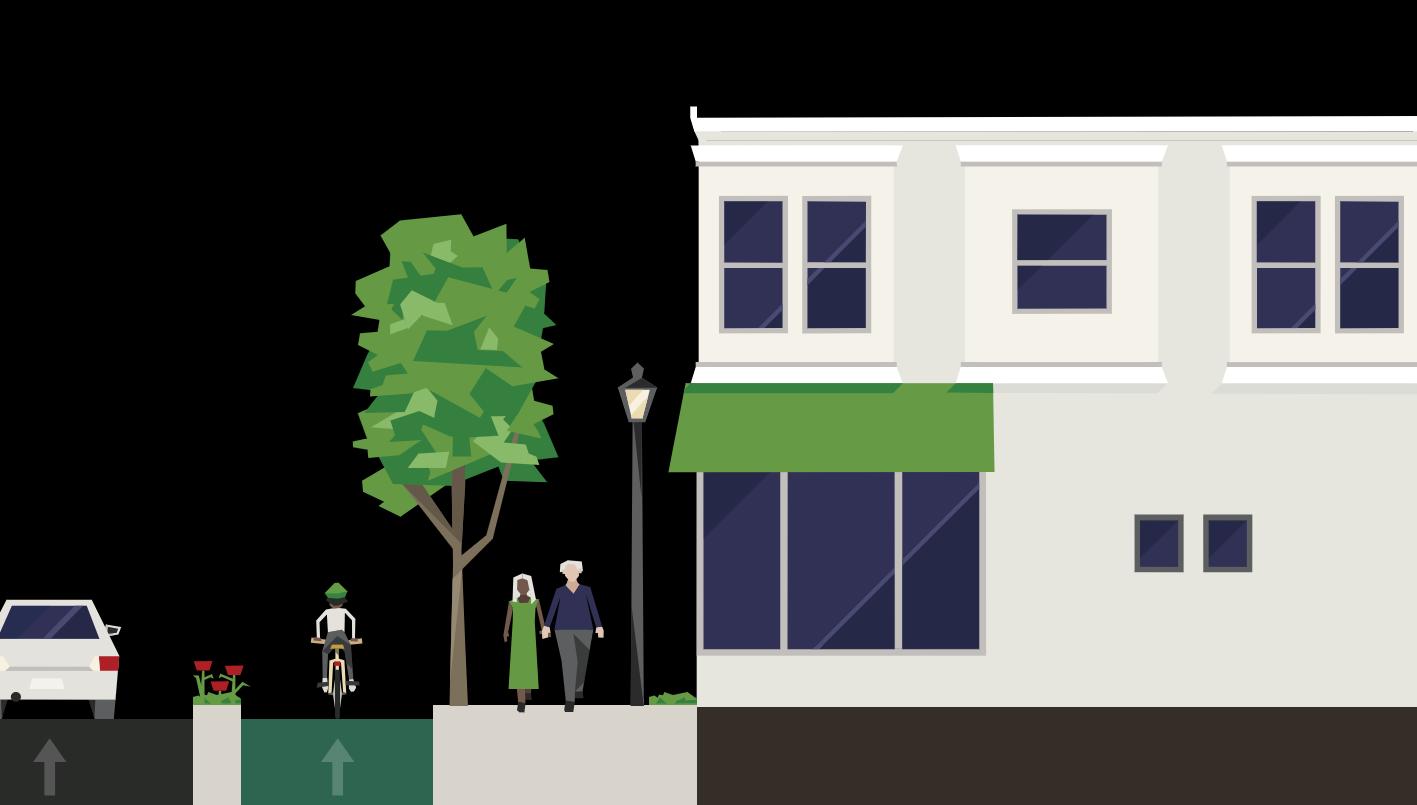

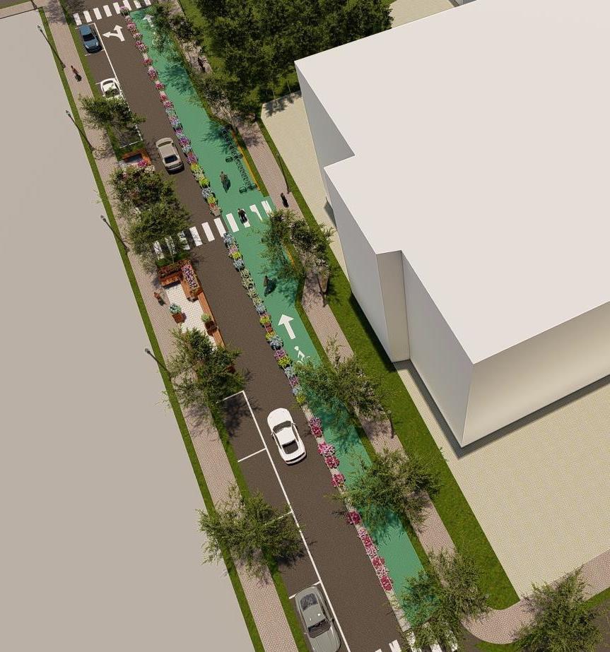
The proposed South Franklin St. is designed to enhance the Muncie’s cultural trial.
The proposed street has enhanced the existing driving lane, sidewalks bike lane andparking along with parklets.
The proposed street adds more pedestrian movement in the street.


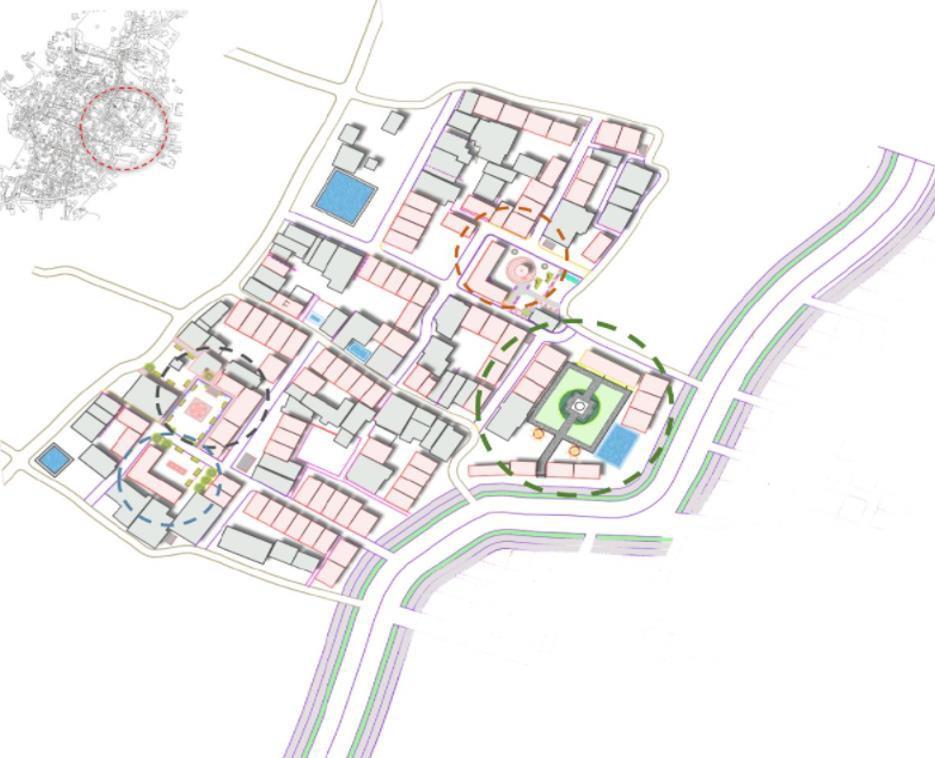
Preserve the heritage town’s essence through planning that enhances accessibility, usage, culture, and tradition
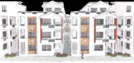
TYPOLOGY D
A mirror image of the roadways of the existing heritage fabric was created and placed on the other side of the road. Later, it was modified and blended into straight lines. Continuation of the existing secondary road to the expansion areacarried out.
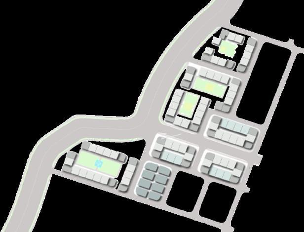
Theshorterside facesthestreetfor maximum access, withthree courtyardsaligned to the30m road.

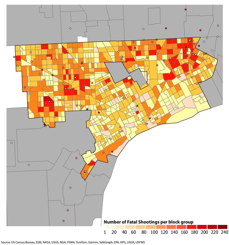
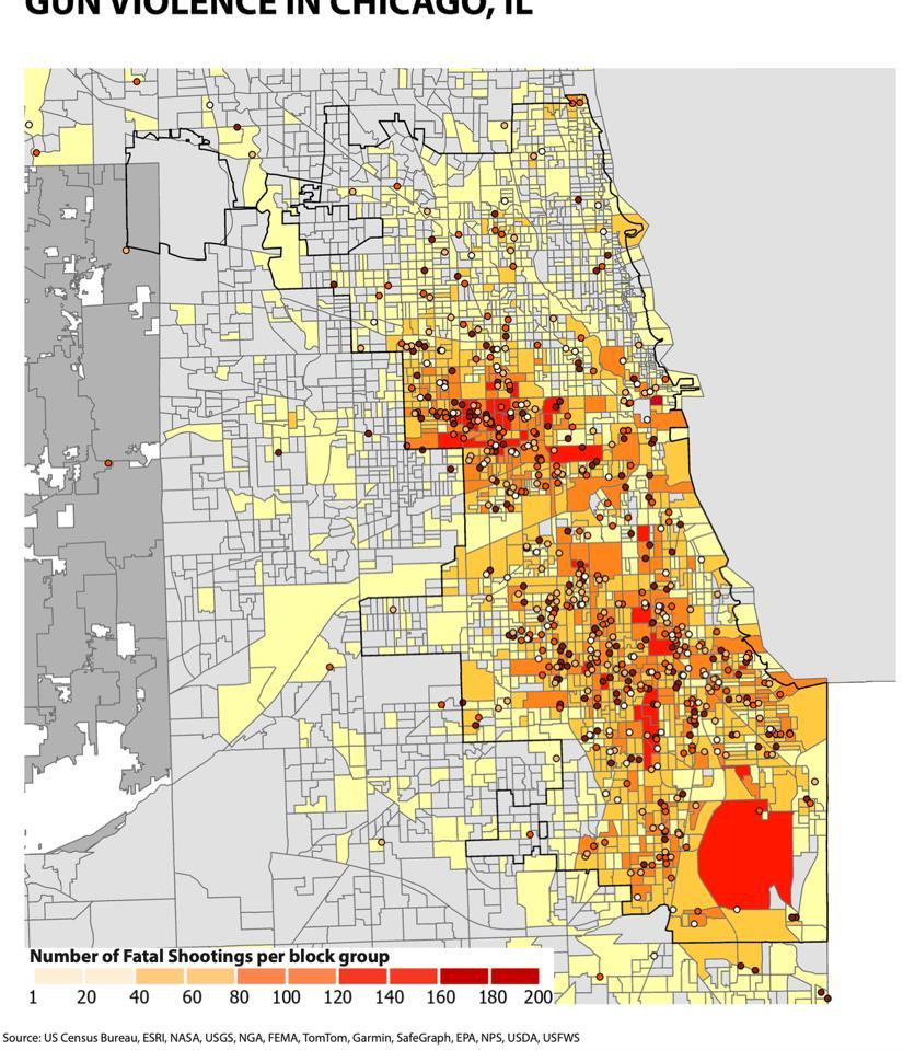
GIS work featuring spatial analysis, mapping, cartography, and network modeling.
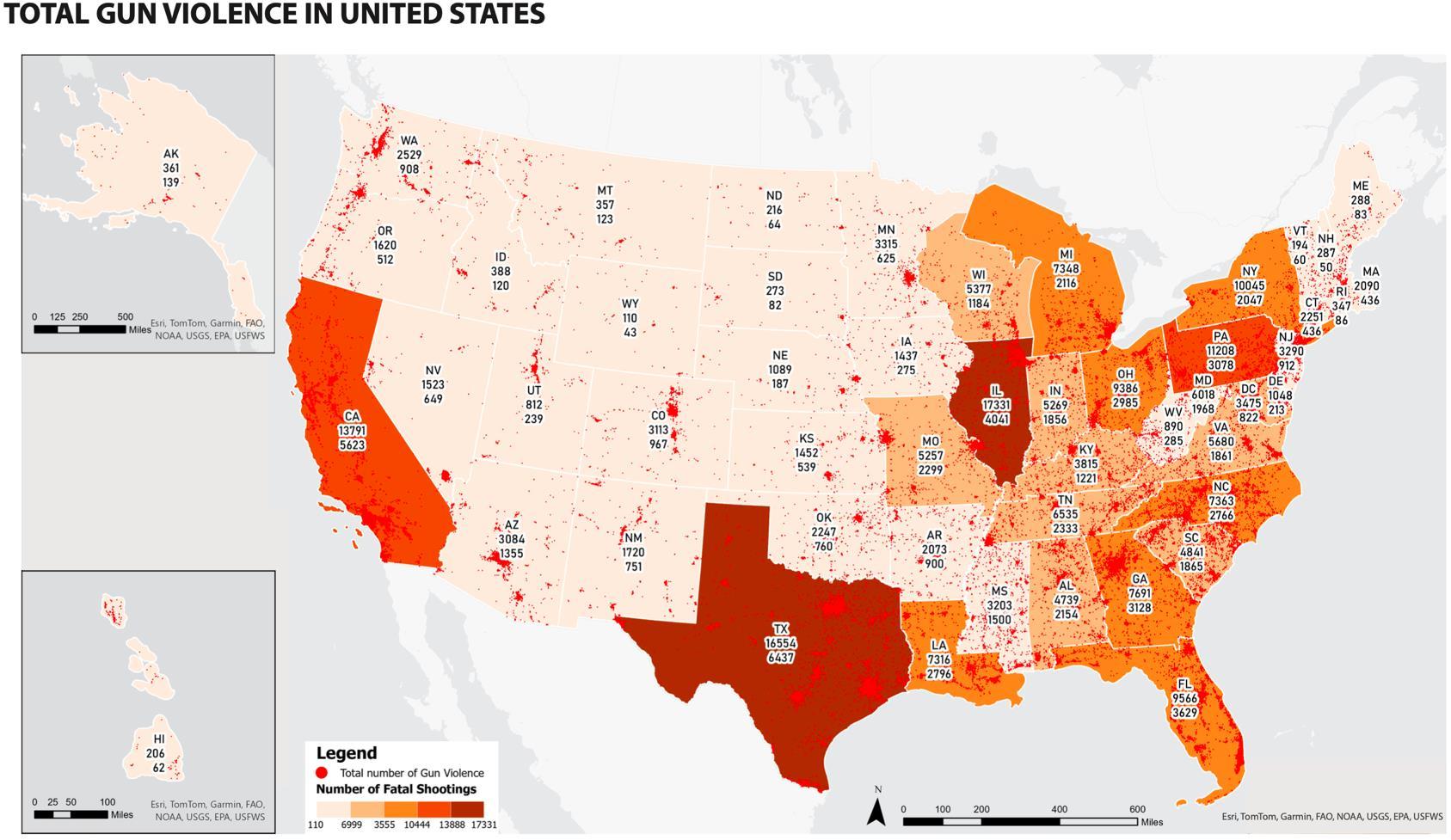
o I downloaded the gun violence dataset and the shapefile for state and city boundaries from the US Census Bureau.
o Using ArcGIS Pro, I geocoded the latitude and longitude of each gun violence incident to create a shapefile. This allowed me to plot each incident on the map.
o I applied the NAD 1927 Contiguous Albers projection for the U.S. map and the State Plane projections for the four cities.
o I joined the gun violence data with the Census Block Group shapefile to aggregate the total number of incidents per block group.
o I used symbology in ArcGIS Pro to represent the density of incidents with a color gradient. For the U.S. map, I labeled states with the total number of incidents and victims, while for the city maps, I highlighted the areas with the highest concentration of incidents.
o I inserted Alaska and Hawaii in separate map frames for the U.S. map. For the city maps, I ensured a clear layout with legends and labels.
Gun Violence in Detroit, MI
Violence in Chicago, IL
Violence in Columbus, OH
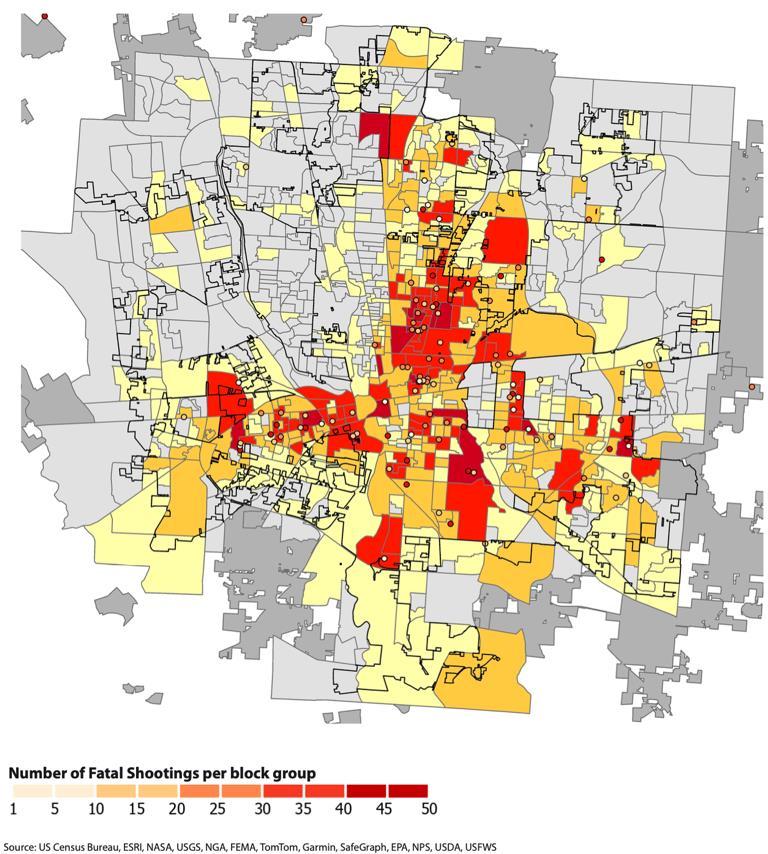
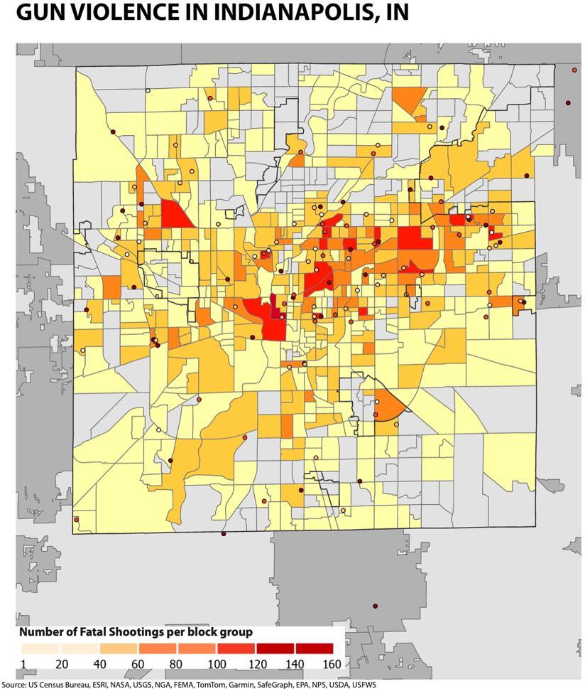
Gun Violence in Indianapolis, IN
Process Legend
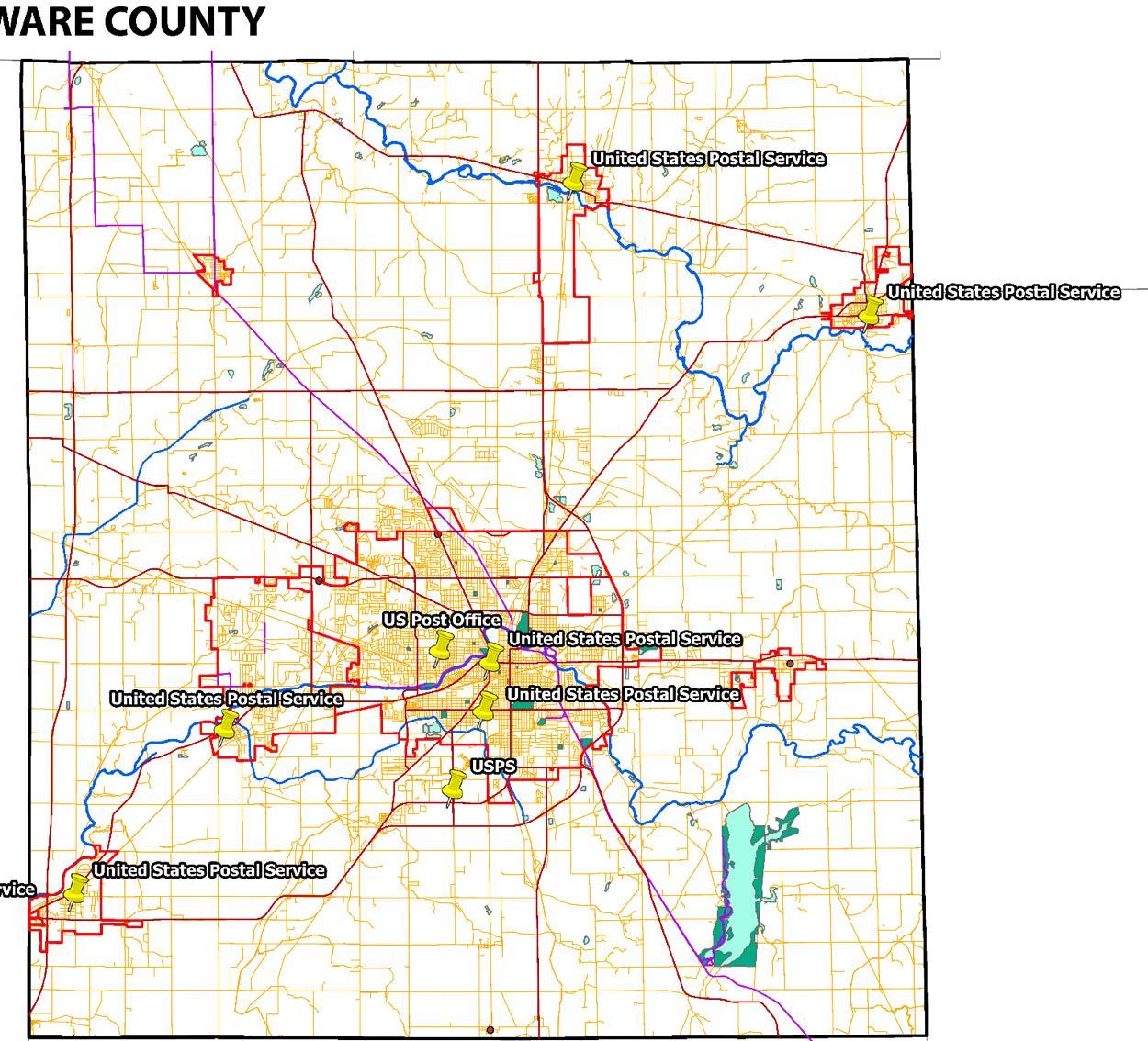
I used the US Census TIGER/Line Shapefiles for Delaware County as reference data in ArcGIS Pro and set up the address locator. Then, with the Geocode Addresses tool, I transformed location descriptions into geographic features to map the post offices.
Recreation

Legend

I downloaded the police station data from IndianaMap and used the shapefile. I then selected Marion County and clipped the police station data to focus on that area.
I accessed the Service Area tool from the Network Analyst extension in ArcGIS Pro and imported the police station data as input facilities.
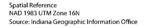
I generated service area polygons for 5, 10, 20, and 30-minute driving times around the police stations.
I adjusted the travel settings to miles and created service areas for ¼, ½, 1, and 5-mile distances.
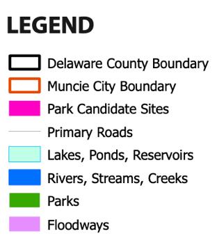
I obtained data from TIGER/Line Shapefiles, IndianaMap, and the Delaware County Geodatabase. After clipping water and floodplain data to the county boundary, I selected parcels in residential or recreation zones. I created buffers for water bodies, excluded parcels in floodplains and parks, and filtered those between 10 to 15 acres.
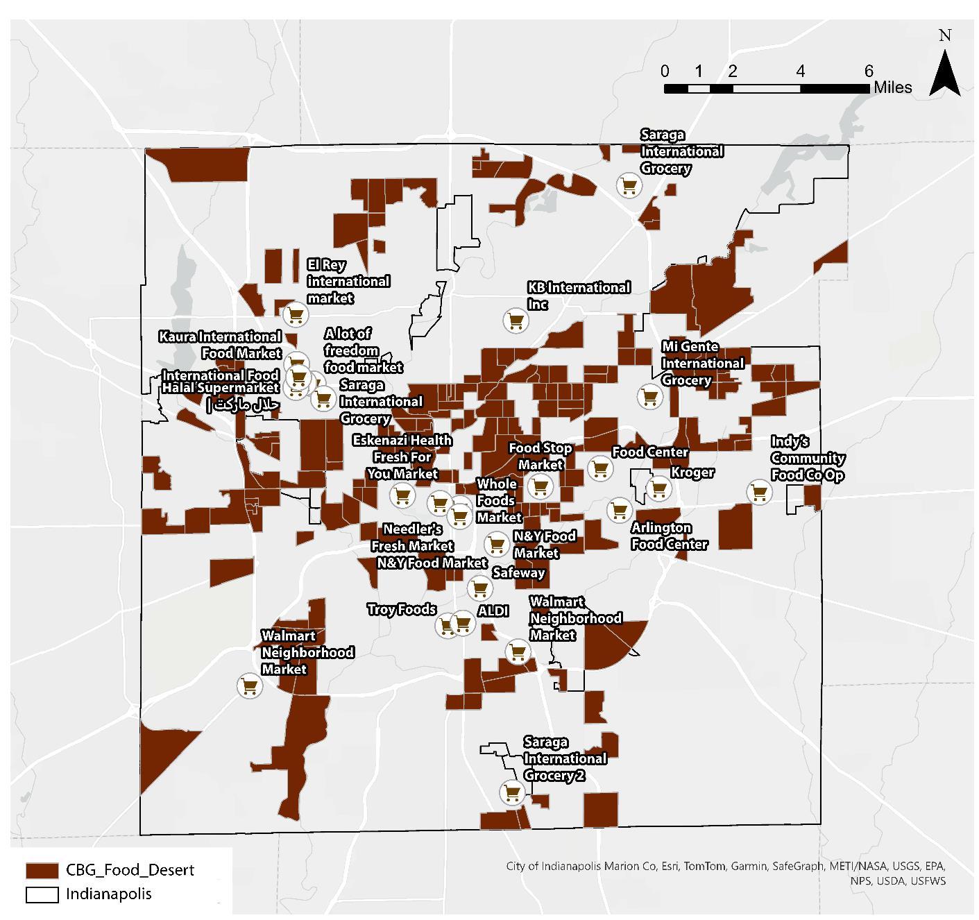
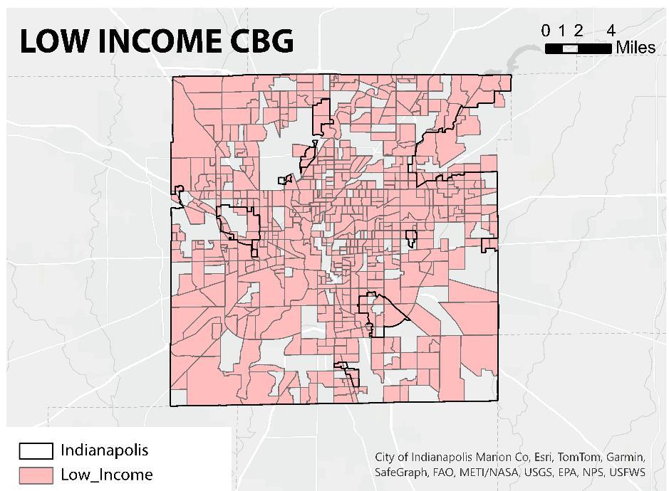
I gathered Census data and USDA Food Access Research Atlas data to identify low-access Census Block Groups (CBGs) and analyze population demographics.
I geocoded grocery store locations, applied buffer analysis to measure accessibility, and used network analysis to assess travel distances along road networks.
I classified low-income and low-access areas using USDA’s vehicle-based definition and performed spatial joins to integrate datasets. I visualized disparities with choropleth maps and validated results by comparing them with food insecurity reports.
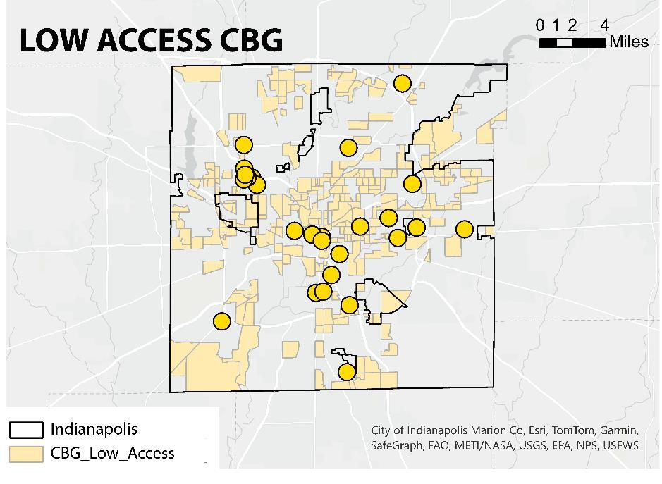
Low Access CBG


Urban analysis, from site studies to economic development and building proforma.
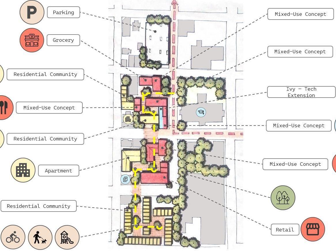
Mixed – Use Concept
Building A: 2,954 sq. ft. grocery store, $29,542 annual revenue. Building B: 6,872 sq. ft. farmer’s market/retail, $68,720 annual revenue. Residential: 24 one-bed units ($158,400/year) and 8 three-bed units ($115,200/year). Parking: 39 commercial and 32 residential spaces.


A 3-story building with 26,945.64 sq. ft. of leasable space. It includes 10 two-bedroom units (900 sq. ft. @ $750/month) and 12 threebedroom units (1,600 sq. ft. @ $1,200/month), generating $262,800 annually. Parking: 34 spaces (1/DU + 2/DU).


The two-story building has 50,645 sq. ft. of leasable space, with 46 one-bedroom units ($550/month) and 28 two-bedroom units ($750/month), generating $555,600 annually. It also offers 74 parking spaces.


300 parking = 3 floors
Mixed – Use Concept
The 1-2 story retail building has 7,452 sq. ft. generating $74,520 annually, with 29 parking spaces. The Ivy Tech Extension on the second floor generates $26,176 annually from 2,617.67 sq. ft. The residential section has 10 two-bedroom units, generating $90,000 annually, with 50 parking spaces.
Mixed – Use Concept
Building A (Restaurant) has 7,461.66 sq. ft. of leasable space, generating $74,616 annually at $10 per sq. ft. Building B (Retail) has 5,151.62 sq. ft., generating $51,516 annually. The property includes 84 parking spaces (1 per 100 sq. ft.).
Mixed – Use Concept
The two-story retail building has 21,044 sq. ft. of leasable space, generating $210,440 annually at $10 per sq. ft., with 84 parking spaces (1 per 250 sq. ft.).
I love bringing my grandson
here. The nearby terraced green spaces and facilities offer endless exploration. As retirement approaches, I'm considering moving to this vibrant area, where there's always something exciting to do.
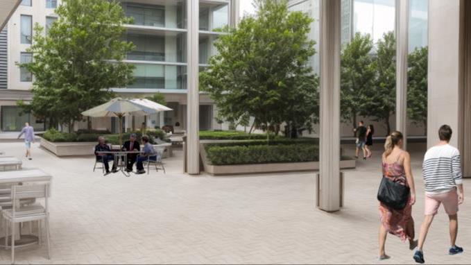
I’m thrilled to developed property near Yesler Avenue’s Multicultural Center and spaces around the Yesler Building. It offers seamless indoor-outdoor spaces connected to City Hall Park and the courthouse. That’s a game changing transformation.
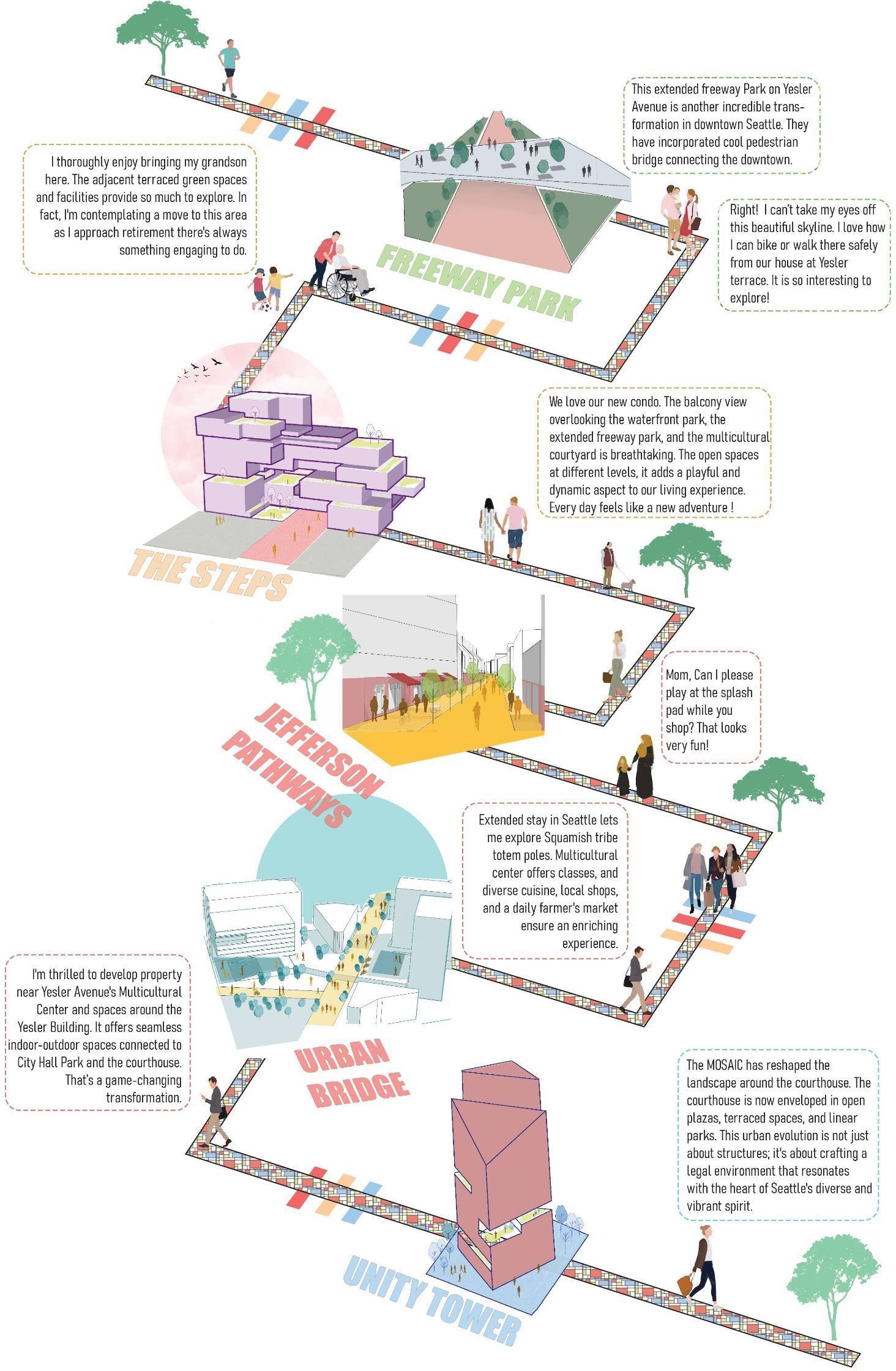
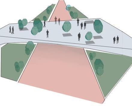
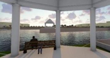
The extended Freeway Park on Yesler Avenue includes a pedestrian bridge, transforming downtown Seattle with enhanced connectivity.
Right! I can’t take my eyes off this beautiful skyline. I love how I can bike or walk there safely from our house at Yesler terrace. It is so interesting to explore!
We love our new condo. The view is breathtaking, with open spaces adding a dynamic touch. Everyday feels like an adventure.
Extended stay in Seattle: exploring, multicultural center, diverse cuisine, local shops, and daily farmer’s market.
Mom, Can I please play at the splash pad while you shop? That looks very fun!
The MOSAIC has redesigned the courthouse area with open plazas and terraced spaces, reflecting Seattle's diverse spirit and crafting a legal environment aligned with the city's vibrancy.
PHASE - 1


PHASE - 2


PHASE - 3
IRR: 11%


IRR: 23%
Cost: $ 169,220,422

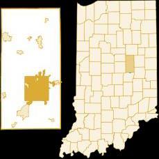
Madison County, in central Indiana’s Anderson MSA, saw population decline. Anderson grew with railroads and natural gas, later shifting to auto manufacturing.
City of Anderson Cluster Analysis (2018-2023)
Location Quotient
Anderson’s population declined 22.6% since 1970, with high housing vacancy (17.5%) and crime rates. Education and income lag behind state averages, with a 23% poverty rate. Despite economic decline, the city offers cultural amenities and strategic transportation infrastructure.
Anderson boasts excellent amenities, infrastructure, and quality employers, supporting quality of life and economic growth.
Regional connections & available land offer potential for growth and development in various industries.
Anderson faces historical disinvestment, declining population, and educational challenges.
Economic uncertainties, post-industrial decline, & competition for skilled workforce.
Anderson will foster economic growth by honoring its industrial legacy while embracing technology, sustainability, and resident well-being. Through job diversification, innovation, and quality-of-life investments, the city will thrive, attract new talent, and retain local assets.


Goal #1: Diversify and expand employment opportunities
Goal #2: Develop talent and connect residents to satisfying careers
Goal #3: Spur innovation and entrepreneurship
Goal #4: Foster a vibrant and inclusive community through investments in quality of life
Goal #5: Improve quality of place by encouraging housing development and community revitalization.
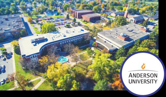

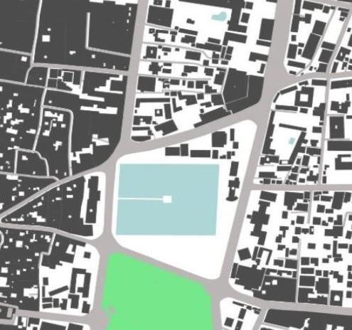
FIGURE AND GROUND
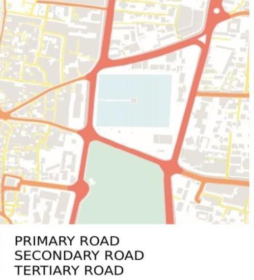
ROAD NETWORKS
LANDMARKS
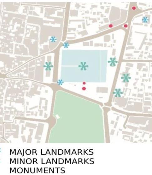
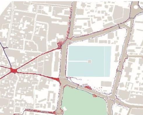
FIGURE AND GROUND
Centrally located open space with compact settlements on the periphery and unmanaged, crowded areas. Black denotes buildings, white denotes open spaces.
GREEN SPACE ANALYSIS
Unmanaged tree placement with minimal space for long-term growth.
ROAD/ ALLEY NETWORK
Depicts the street hierarchy within the built environment, with small alleys at building frontages featuring improper streetscapes.
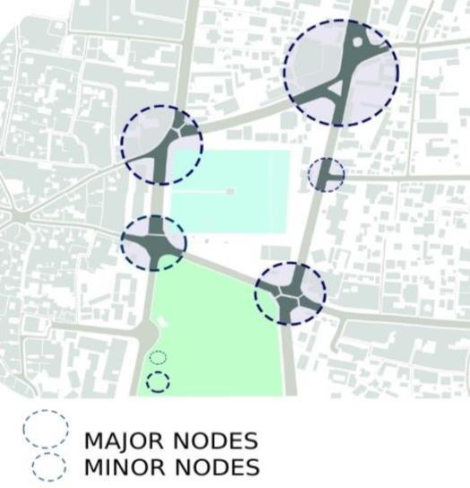
Higher activity intensity occurred at four major nodes, causing traffic congestion from converging paths.
LANDMARKS
Major Landmarks: Rani Pokhari, Saraswati sadan, Durbar High School, Ghantaghar, Mosque ; Minor Landmarks: Nachghar, Ganesh Mandir, Seto Dhoka
PEDESTRIAN MOVEMENT
Red spots denote stationary pedestrians, while blue spots denote moving pedestrians.
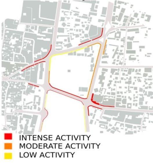
High activity intensity at nodes and areas with shops and bus parks.
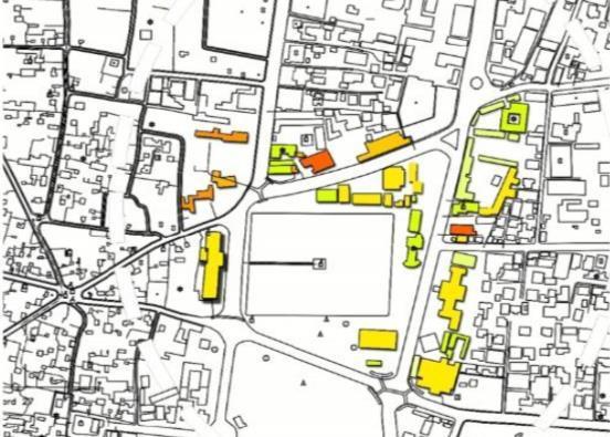
BUILDING TYPE : STOREY
Buildings with various functions, height, façade were found. Number of storey was also one of the major determining the aesthetics of the area.
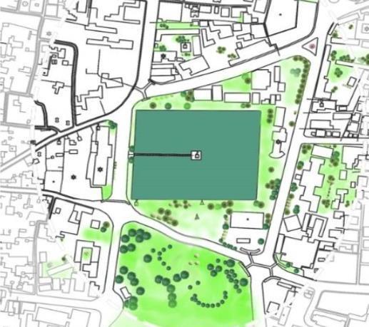
MASTERPLAN: RANIPOKHARI
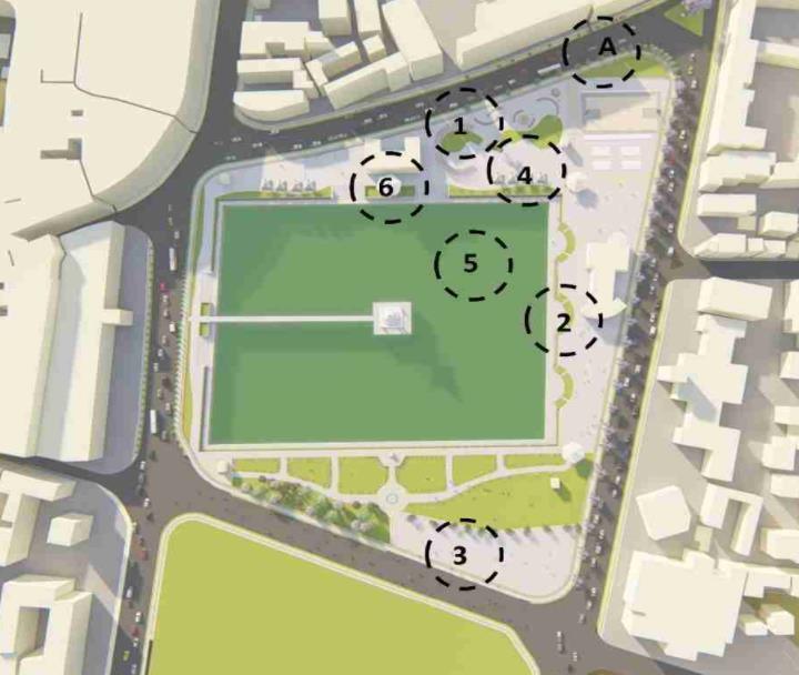
DETAIL PLAN AT A
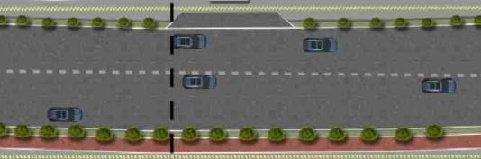
STREET SECTION

04 MISCELLANEOUS
The Kathmandu Post, January 05, 2023
On December 4, Wednesday, the Kathmandu Metropolitan City Office implemented an eviction plan for the Bagmati Corridor squatter settlements. The action met with resistance from the residents of these communities and sparked a debate among intellectuals about the morality of the actions taken by both sides. While there is consensus that the longstanding squatter settlements need to be correctly rehabilitated and removed from the Bagmati Corridor, the main question remains: how can this be done fairly and equitably?
The urban population has increased significantly compared to the rural areas. Projections indicate that the population will continue to grow until around 2050. The inability of governments to keep up with the rapid pace of urbanization and provide affordable housing has increased slums and squatter settlements When asked themselves, how squatters see many representatives of squatter settlements stated that they do not “capture the land, but they save the land”. They described that if the squatters had not been there, the private sector would have bought the public land.
The general public often perceives squatters negatively, particularly in developing countries like Nepal, where land is valuable. There is also a perception that many squatters are wealthy and own land in their villages. However, it is essential to remember that these perceptions are only sometimes accurate and do not represent all squatters It is also necessary to recognize that the voices of strong community figures may be louder and
visible in the media while silencing the voices of real squatters due to their perceived weakness.
The government may view squatter settlements as illegal because they build their shelters on land owned by the government without proper legal documentation or permits. By taking the stance that squatter settlements are illegal and not taking responsibility for their residents, the government sends a message that these communities are not valued and do not deserve support. This attitude only serves to widen the gap between the government and the landless, making it more difficult to find solution for rehabilitating these settlements.
The proximity to income-earning opportunities in the city is often a crucial issue for the urban poor Squatters build their shelters on public land and other environmentally-sensitive areas like or flood plains, steep vacant spaces under highelectrical transmission riverbanks slopes and voltage lines. To housing, sacrifices gain access to land for the urban poor usually tenure security. Situations force them to illegally infringe on any vacant land (often ill-suited for accommodation).
Due to lack of affordable land, and housing, the migrant population squats. In Nepal, squatting can be done openly or covertly by individuals or groups. Squatters often use scavenged materials such as plastic and corrugated metal to construct shelters or reside in
abandoned buildings. Several factors contribute to the rural exodus, including push factors such as caste segregation, social exclusion of widows and the Dalits, and uncertain economic conditions, as well as pull factors such as the availability of better jobs, healthcare, and other amenities. This education phenomenon problems, has led to several including the continuation of informal settlements, a between wealthy individuals, a widening gap and impoverished lack of tenure unsustainable land use security and patterns.
Even though it may seem that squatters occupy valuable land in the city center, they still face several problems The fundamental issues inherent in slums are health risks The settlements are generally along the river, polluted, and at risk of flooding. Most use open-sky toilets or drains connected directly to the river. The residents have immediate impacts on health and the environment, namely infant mortality, diarrhea, and respiratory diseases.
Further, the squatter environment cultural problems and also faces social populations exclusion. Squatter rely primarily on daily wages and small businesses for their income. High unemployment often leaves people to domestic alcohol or settlements’ frustrated. These lead violence, including drug abuse. These lack of shelter and lead to increased privacy can exposure to sexual violence. Regardless of its form, tenure is often registered in the name of men, leaving women dependent on their male relatives for tenure security. The quality of influences housing children’s profoundly health, advancement, and general It can profoundly impact growth, including the education,health and educational well-being. children’s right to personal security. The poverty alleviation strategy and the current housing development trend have failed to meet the housing needs of the urban poor living in slums and squatter settlements The squatter settlements were established on the
Bagmati river bank over a long time, and some have lived there for 20 years.
By disregarding the squatter settlements, the government is effectively disincentivizing the development of these communities and making it more challenging to address the potential solutions. Instead, it would be more effective to adopt a more proactive and inclusive approach that seeks to understand the root causes of informal settlements and works to find solutions that benefit both the government and the landless.
Providing housing solutions that are affordable, safe and appropriate for the needs of squatter settlement residents can be an essential step in improving living conditions and reducing the risk of increment of squatters. Overall, addressing the challenges faced by squatter settlements in Kathmandu will require a combination of approaches, including providing basic infrastructure and services and regularizing land tenure, among others.
“ Over all, addressing the challenges faced by squatter settlements in Kathmandu will require a combination of approaches, including providing basic infrastructure.
Anuska Singh | Ball State University | Selected Works 2016-2024