Site Analysis
HISTORY OF FISHERMANS BEND
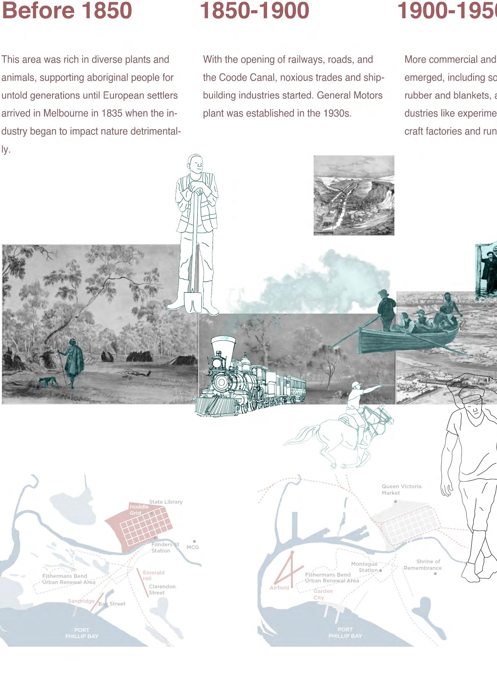
Fishermans Bend used to be a sandy, watery, and scrubby landscape where aboriginal people hunted for around 40,000 years before British colonization in the 1830s [1].
The landscape was reshaped and transformed to meet the demands of industry and economic development, including many private enterprises, some of which developed into largescale manufacturing companies (e.g., General Motors Holden) later, especially after World War II, and this attracted many migrant workers. The construc tion of the Coode Canal in the 1880s and the West Gate Bridge in the 1970s continued to impact land usage and local communities [1].
The place was also a recreational des tination for local communities since the start of colonial settlement, popular for fishing, riding, strolling, and picnicking [1]. There were also many attractive organized events, like horse racing, car racing, and football games.
By the 1990s, Fishermans Bend had evolved into a light industrial district with some international commercial projects, and it continues to change to day, towards an innovative and creative
business and new residential use [2].

OPPORTUNITIES AND CHALLENGES FOR EMPLOYMENT PRECINCT
Plan Melbourne identifies the Employ ment Precinct as one of Melbourne’s seven National Economic and Innova tion Clusters (NEIC) [2], which can in herit its industrial legacy and serve as a hub for innovation, and entrepreneur ship, linking the industry with education and research institutions. The former General Motors Holden (GMH) site was purchased by the Victorian Govern ment and has the potential to pilot the transformation in Fishermans Bend.
Fragmented Ownership
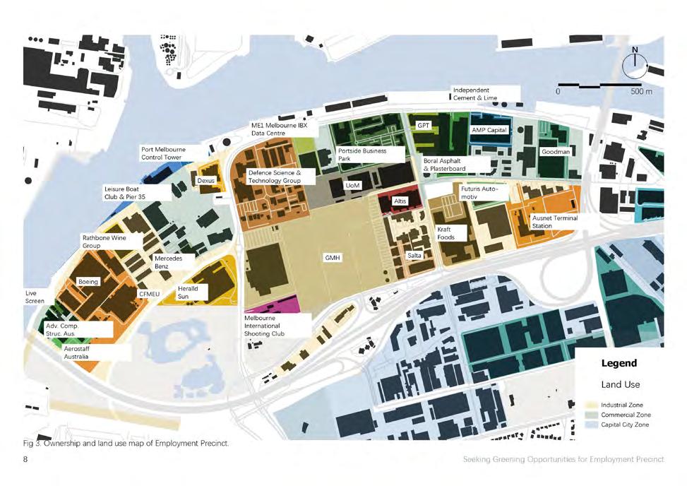
90% of Fishermans Bend is private ly owned, and this could potentially complicate the Government’s task of creating and realizing the vision. The land ownership structure is significant for the government to determine the policy tools which can influence the precinct’s future. Most areas in Em ployment Precinct are privately owned, with fragmented ownership [3]. This may make coordination across the area difficult.
Transport
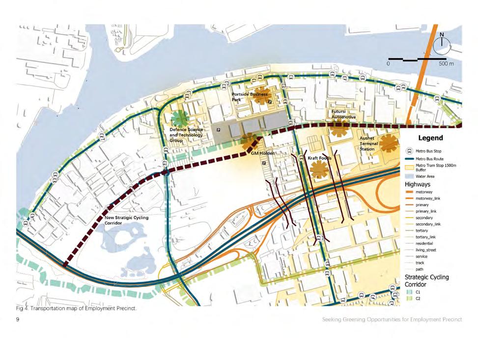
The Fishermans Bend Framework in cludes commentary on a potential un derground rail station and future tram
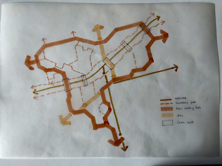
route along Turner Street [2]. While the existing public transport, walking and cycling network connection is poor and upgradation takes time to meet future population and employment demands [2]. The West Gate Freeway and limited river crossings constrain access and movement around the precinct. Links for non-motorized transportation are fragmented and are often shared with large trucks and high-speed traffic, which are unsafe for cyclists and pe destrians. Large industrial block sizes and poor walking permeability also increase walking distances and detract from the attractiveness and viability of pedestrian movement.
Environmental Challenges
Flooding is one of the most complex challenges in Fishermans Bend. There are several triggers: the riverine and coastal sources from Yarra River and Port Phillip Bay, as well as the im pounded stormwater due to the flat geography and hard surfaces with low permeabilities [4], as well as capacity constraints in the underground drain age system [2].
Contaminated soils occur across much of Fishermans Bend, because of past
TRANSPORT
TOPOGRAPHY
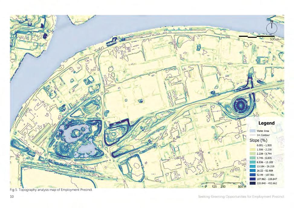


use of contaminated imported materials for broad-scale filling which could be 1-2 m thick, and the past industrial uses of the land. Excavation, offsite disposal, and remediation of the soil could add significant costs to all kinds of renewal works [5].
Groundwater is also contaminated with highly saline because it is so shallow that leached contaminants from the fill are likely to extend below the wa ter table [5]. It may cause risk to the community if the untreated contami nated groundwater is exposed to open water bodies. Remediation and ongo ing management of groundwater are needed to prevent community contact, for example avoiding storage in low-ly ing areas, sealing/lining of storage, or application of dense plantings and riparian furniture.
The natural environment and birdlife of Fishermans Bend had been eroded with intensive industrial development since the 1850s, due to the impacted soil and underground water [2]. Much of the new open space will need to be delivered on private land or within road reserves. There is a great opportunity to accommodate campuses that will combine buildings with the landscape surrounding them. This emphasizes the need to coordinate public and private open space environments, including active frontages onto streetscapes where possible [7].
Design Framework
DESIGN STATEMENT
Employment Precinct is quite chal lenged with poor water management and access, contamination, loss of habitats, and fragmented ownership. From a landscape architecture per spective, the challenge is establishing a habitat network that stitches the neighbourhood across properties. There are opportunities to resolve the above issues by considering the context of each property and how they might contribute and incorporate into the entire system. This project put forward a “green-blue-brown” concept that approaches the site from three layers and proposes an interconnected green system for a sustainable future.
Interconnected Green Spaces
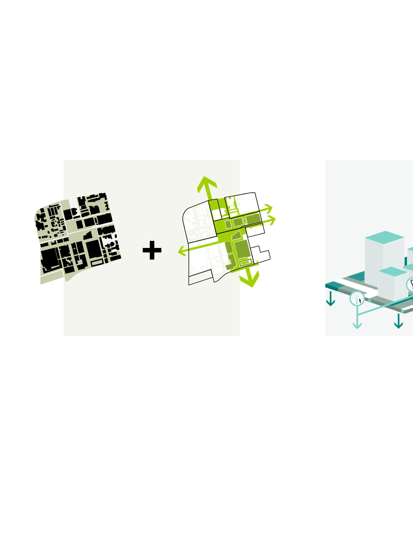
Use a top-down mapping method to determine the greening spaces and strat egies. Then design bottom-up to create flexible public spaces that suit various activities and stimulate community inter action. Stitch their edges to maximize the ecological value of the entire system.
Water Management
Utilize stormwater for flushing systems with underground rainwater tanks. Collect dens/bioswales to reduce the existing drainage system flooding risks.
Management
irrigation and underground smart Collect runoff in rain gar reduce the pressure on system and minimize

Soil Remediation
The adoption of ecological remediation will shorten the process of natural ecosystem restoration on brownfields. Use physical (cut & fill) and chemical approaches to remediate the soil and use plants to extract and remove elemental pollutants (need to be harvested).
ROADMAP
Use a top-down method to determine the greening priorities. Map layers of information that influence the opportu nities for interconnected green spac es in the Employment Precinct. Then based on the ownership and landform of each part of the patchwork, design bottom-up to create flexible public spaces that suit various activities and stimulate community interaction, such as plazas, roof gardens, green street scapes, and temporary /removable landscape infrastructure. Stitch their edges to maximize the ecological value of the entire system.


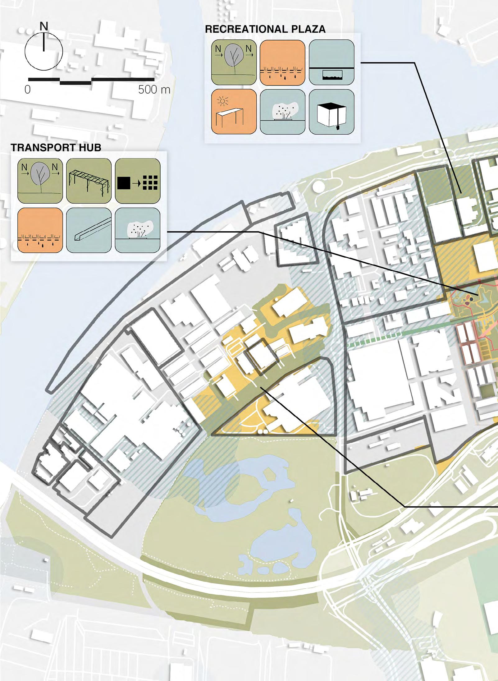
MASTER PLAN
Underground Ground Surface
water retention, cool sink to store rainwater from heavy rainfall events which are used for irrigation during drought periods

the creation of several (several small ones ing effect than one


rows of trees with streets) or the sprawl spaces) provide shadow greening of tram
permeable materials tration and decreasing (such as grass, hedges/shrubs, pavers)
water gutters (stormwater or glass-covered water features such and fountains (water cooling)

several small green areas ones providing a better cool one larger)
with dense canopies (on sprawl of trees (on small evapotranspiration and
Roofs and Facades
green roofs to reduce the temperature inside buildings and reduce air conditioning usage
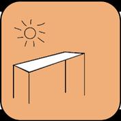
vertical garden, and/or green wall, prefer ably on the north-facing side of buildings (highest radiation during the day)
tram lines

materials providing water infil decreasing surface temperature hedges/shrubs, and grass
(stormwater drainage in open glass-covered gutters)
such as ponds, mist, sprouts, (water in the movement for

pergolas and/ or shelters with climbing plants (on narrow space for tree planting insufficient)

temporary structures that can be moved and provide shelter
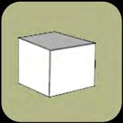
water buffer (on roofs)

EVOLUTION PROCESS
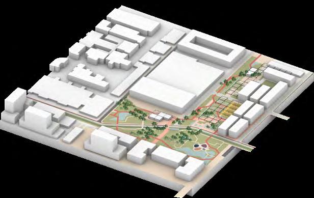
Now
Use physical and chemical techniques to remove the contaminants as much as possible.
By 5 Years
Apply a combination of nitrogen-fixing, indigenous and pioneering plants to quickly establish a landscape for newly constructed buildings. Also, consid er green roofs and walls for the new construction.
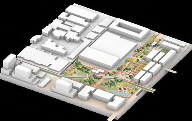

By 10 years
Replace some of the plants with new ones to remove the contaminants from the ecosystem.
By 50 years
With further regional development, the landscape may need to be changed for new demands. Plants start to lush. The site becomes more attractive to all lives.
Detail Design
DETAIL DESIGN
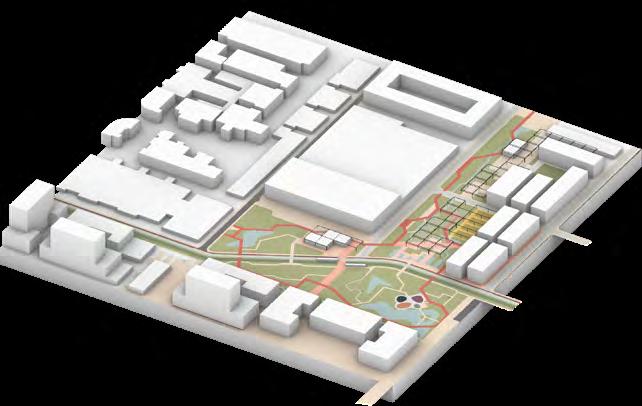
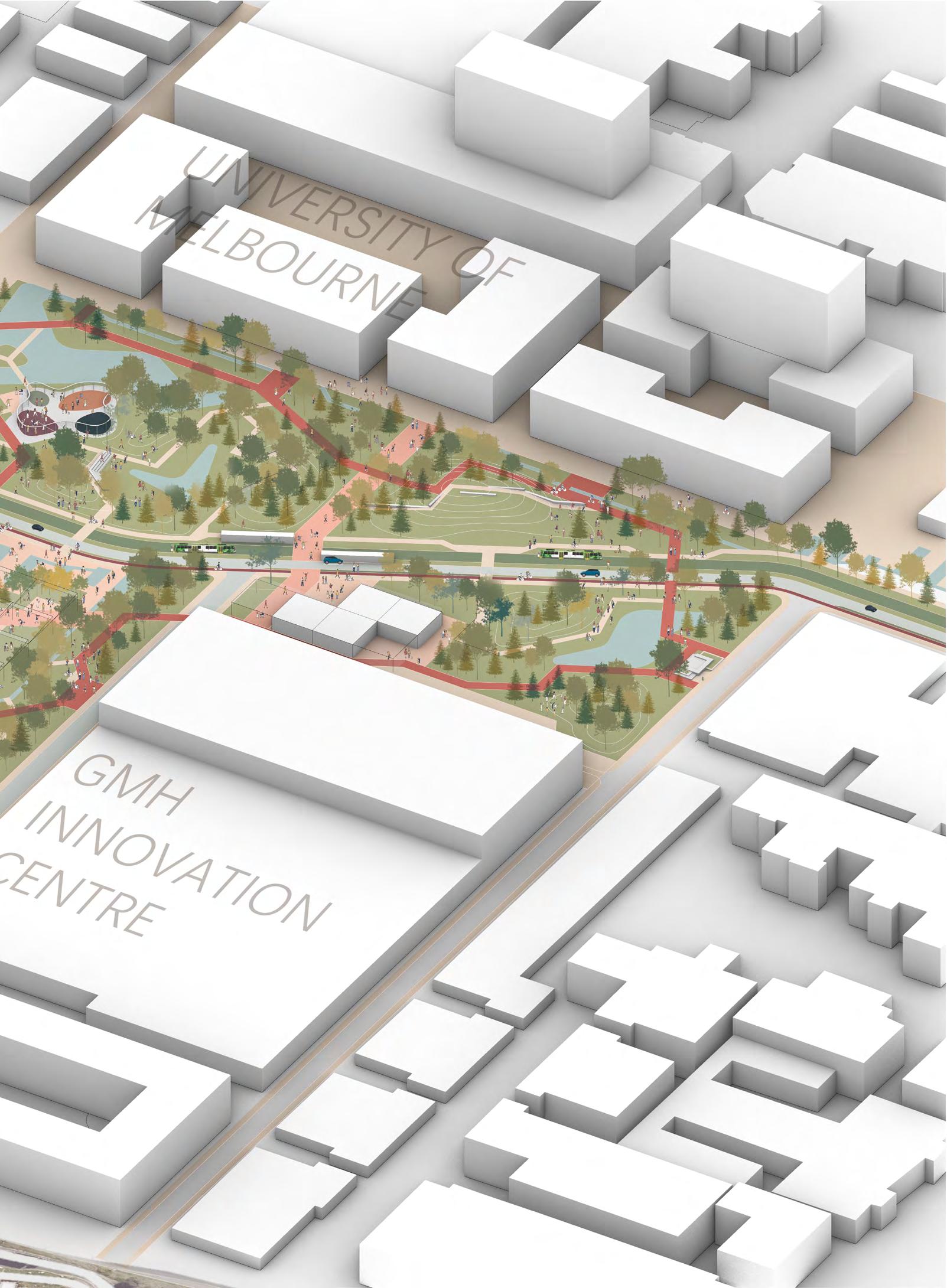
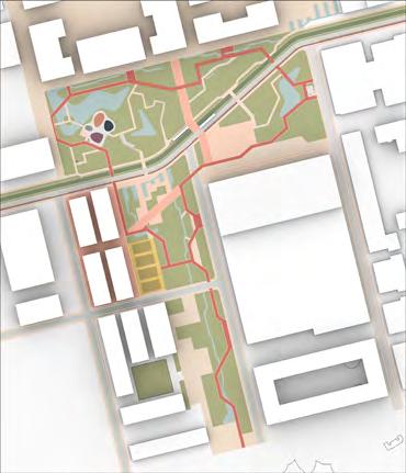
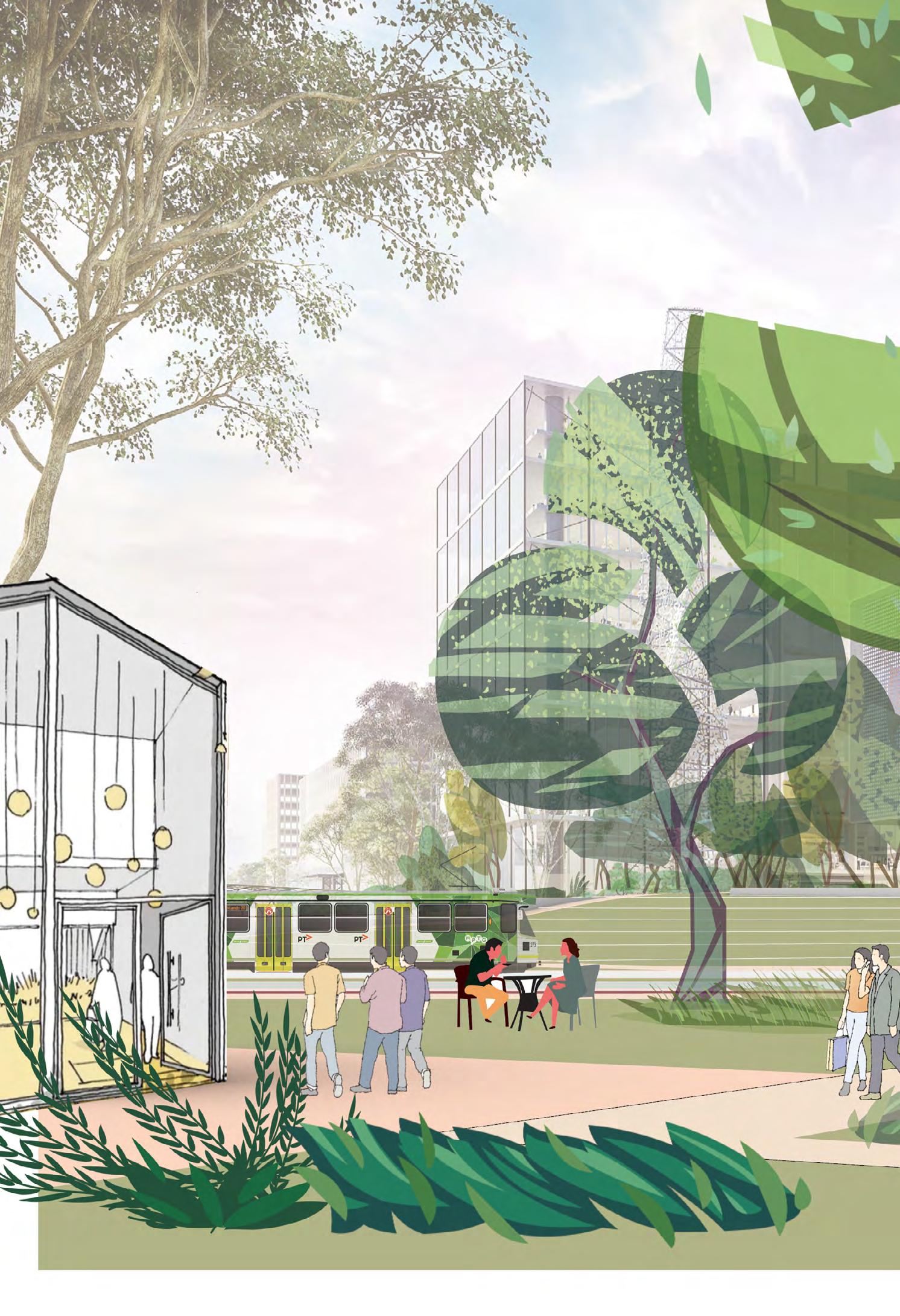
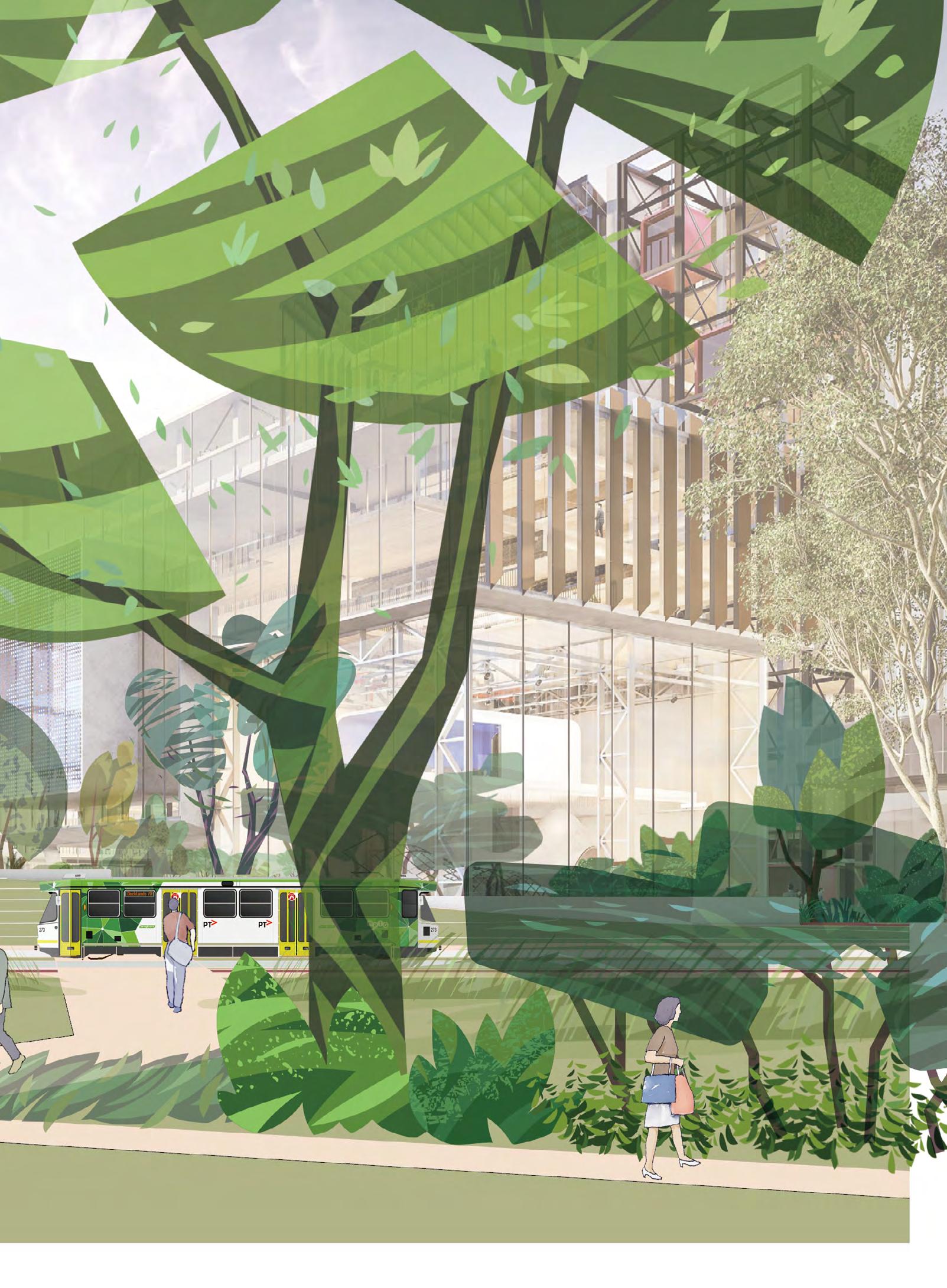
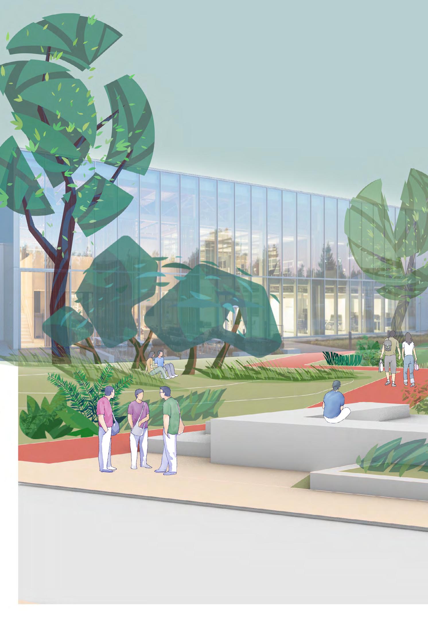
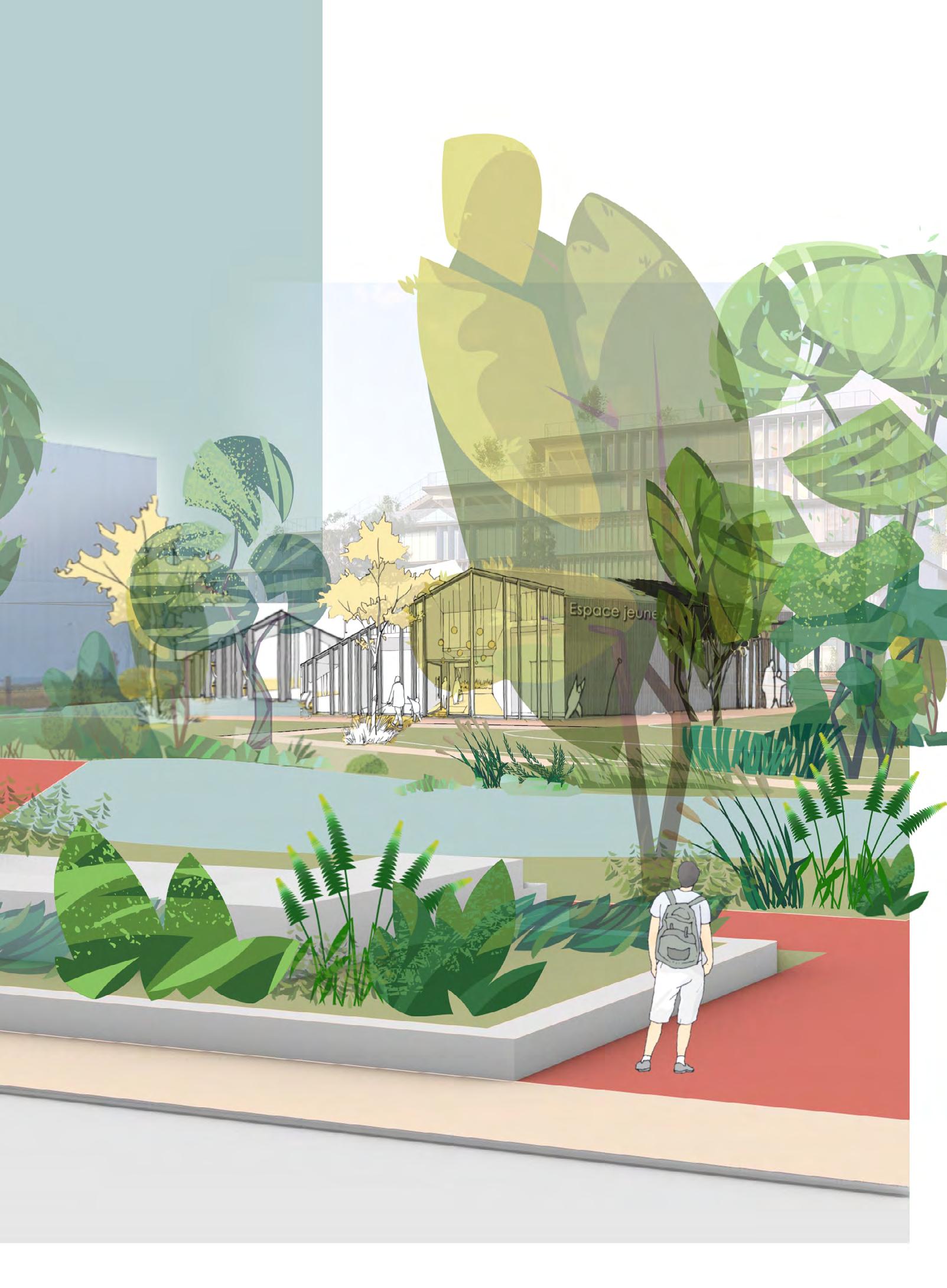
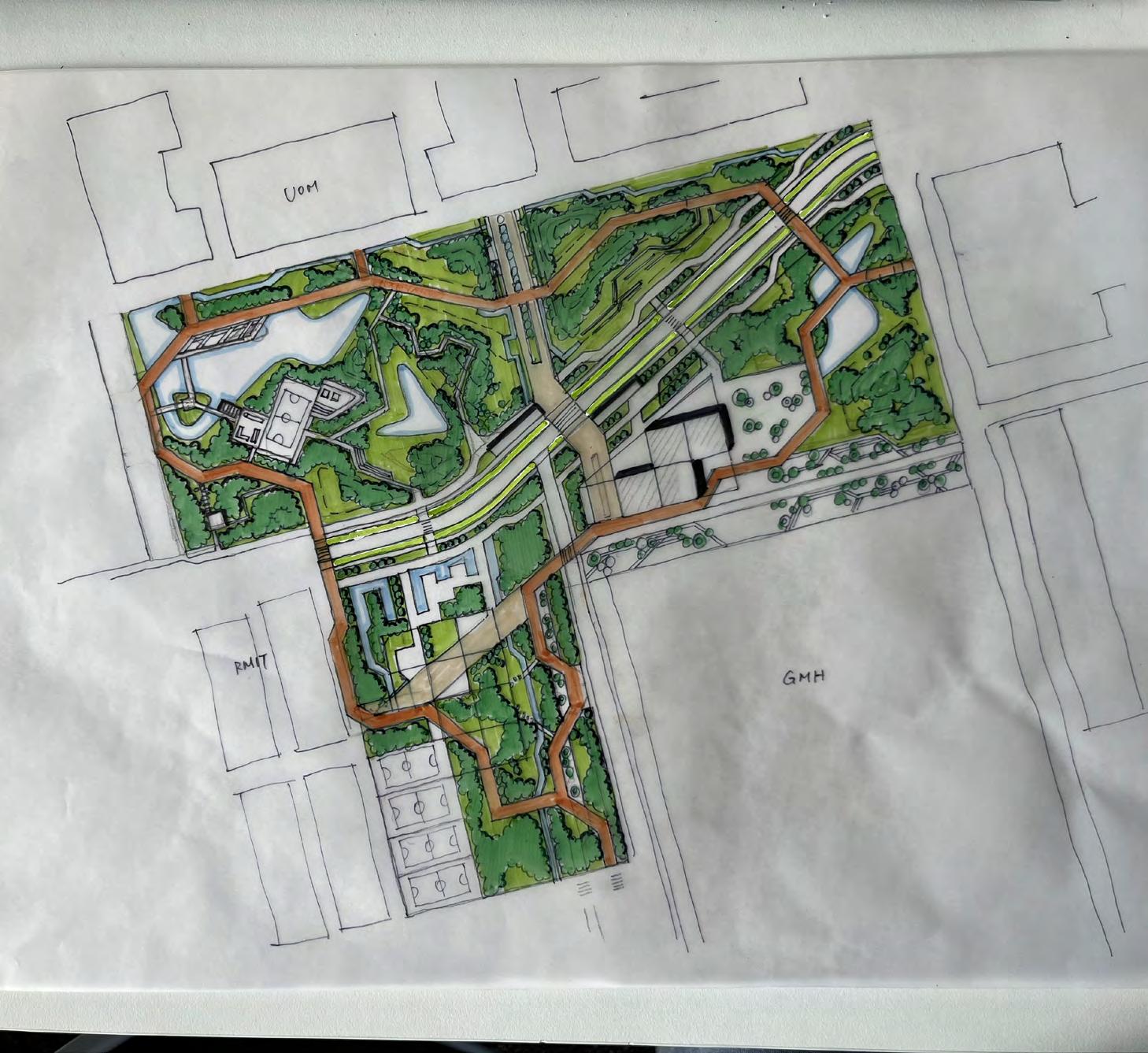
This plan shows the idea of an urban park on the edge of the University of Melbourne, RMIT and GMH Innovation Centre.
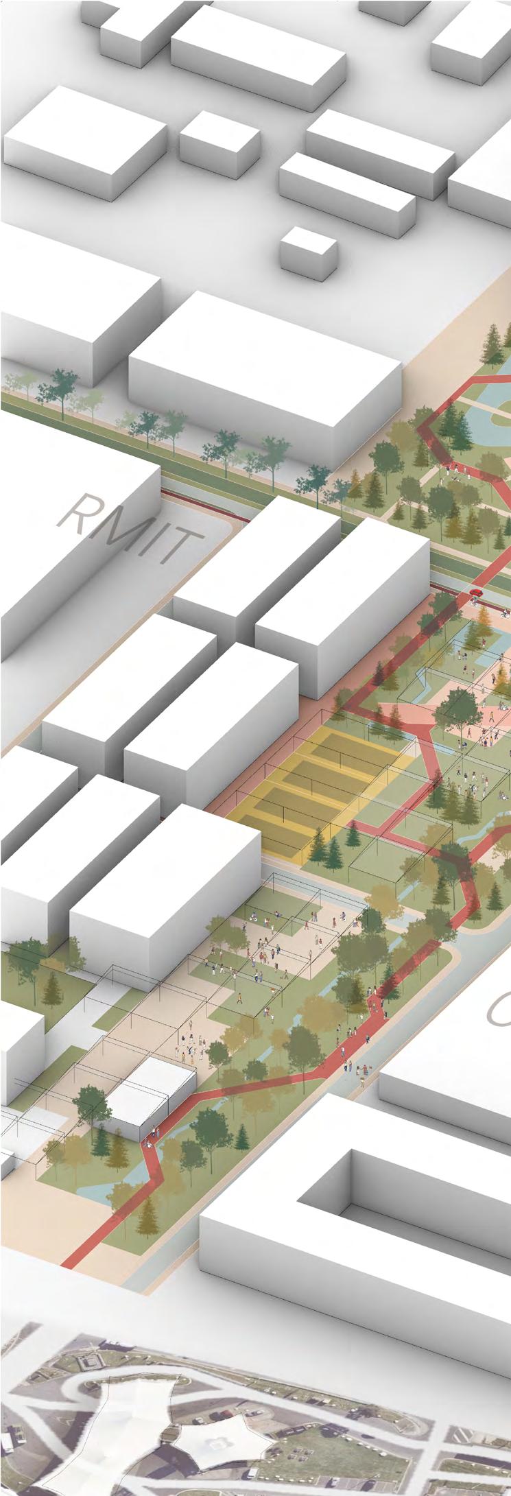
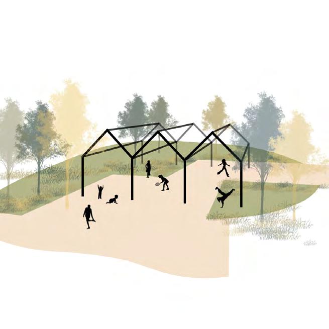
Unpowered Playground
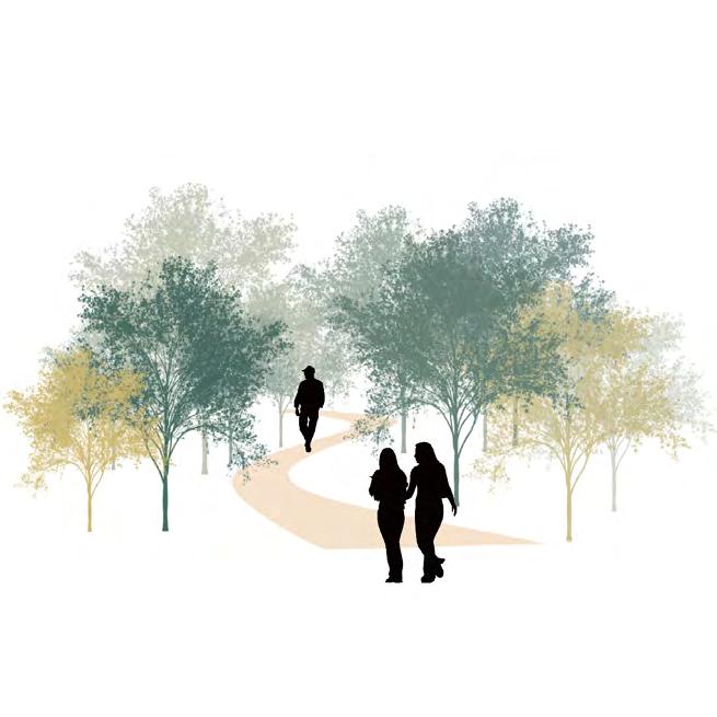
Forest Walk
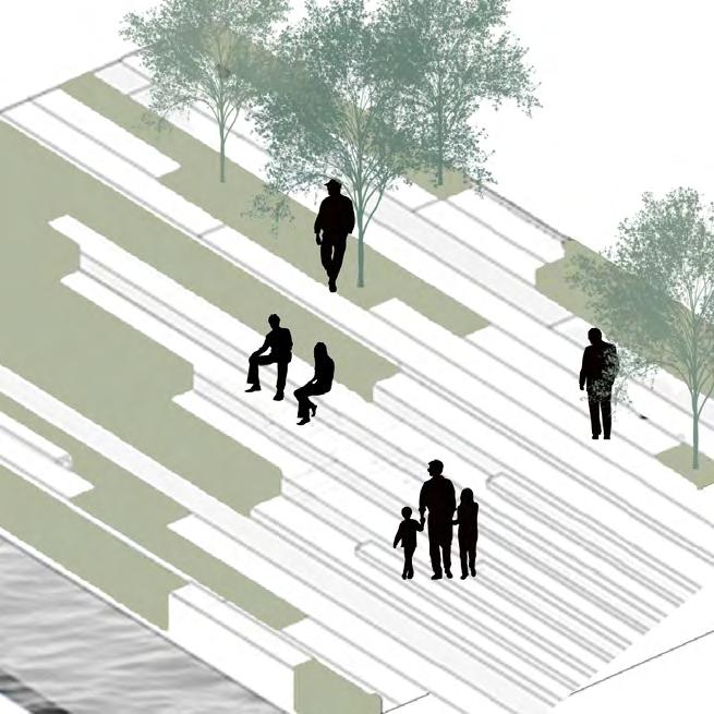
Central Parade
Picnic Lawn
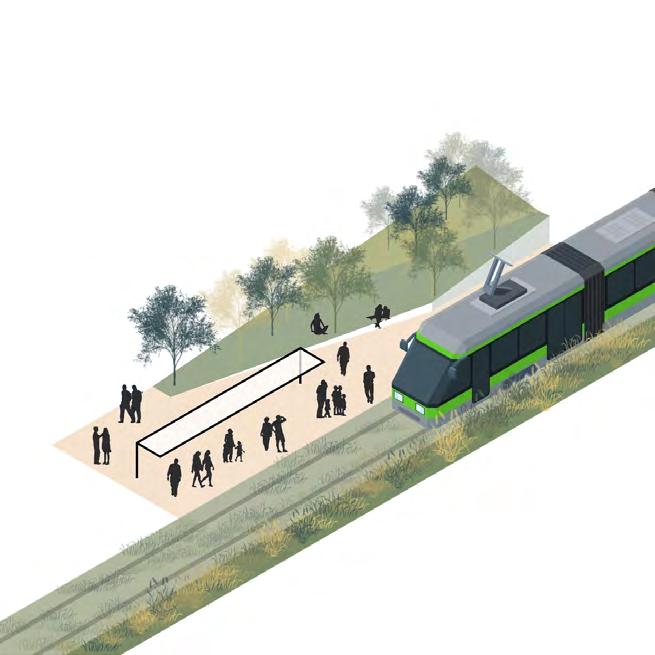
Tram Stop
Community Centre
Wetland Habitat
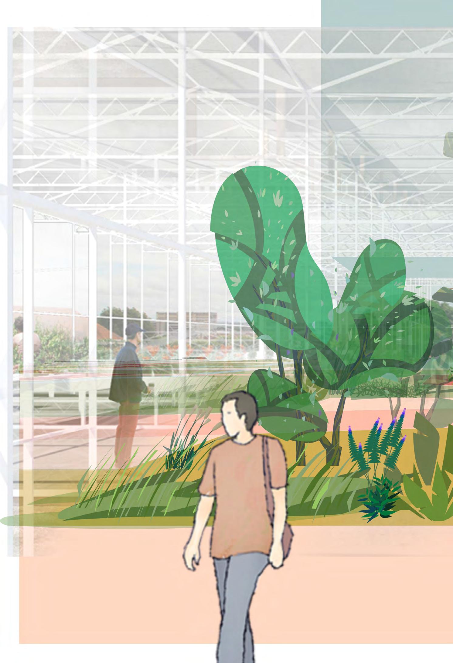
Glasshouse Plaza
Professional Training Zone
Circulation System
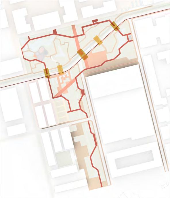
Resolve the gap at the future street for trams and vehicles, by using consist ent pavements across the street and emphasizing the pedestrians. Also, link all the functional spaces along a contin uous walking system. Finally, create a more active open space at the intersec tion of the axis towards both campuses.

Water System Design
The design changed the original flat landform and create microtopography to redirect surface runoff and collect clean water in artificial lakes and rain gardens, to support plant growth and people engagement.
BLUE
Soil Remediation
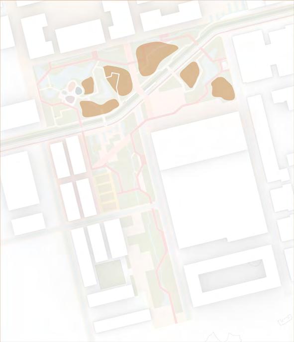
Use earthwork to remediate the soil and create interesting spaces for hu mans. This diagram shows the areas covered by good thick topsoil. This approach can protect plant species that are important to re-establish the ecosystem.
BROWN



GREEN: INTERCONNECTED SPACES


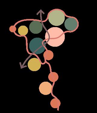
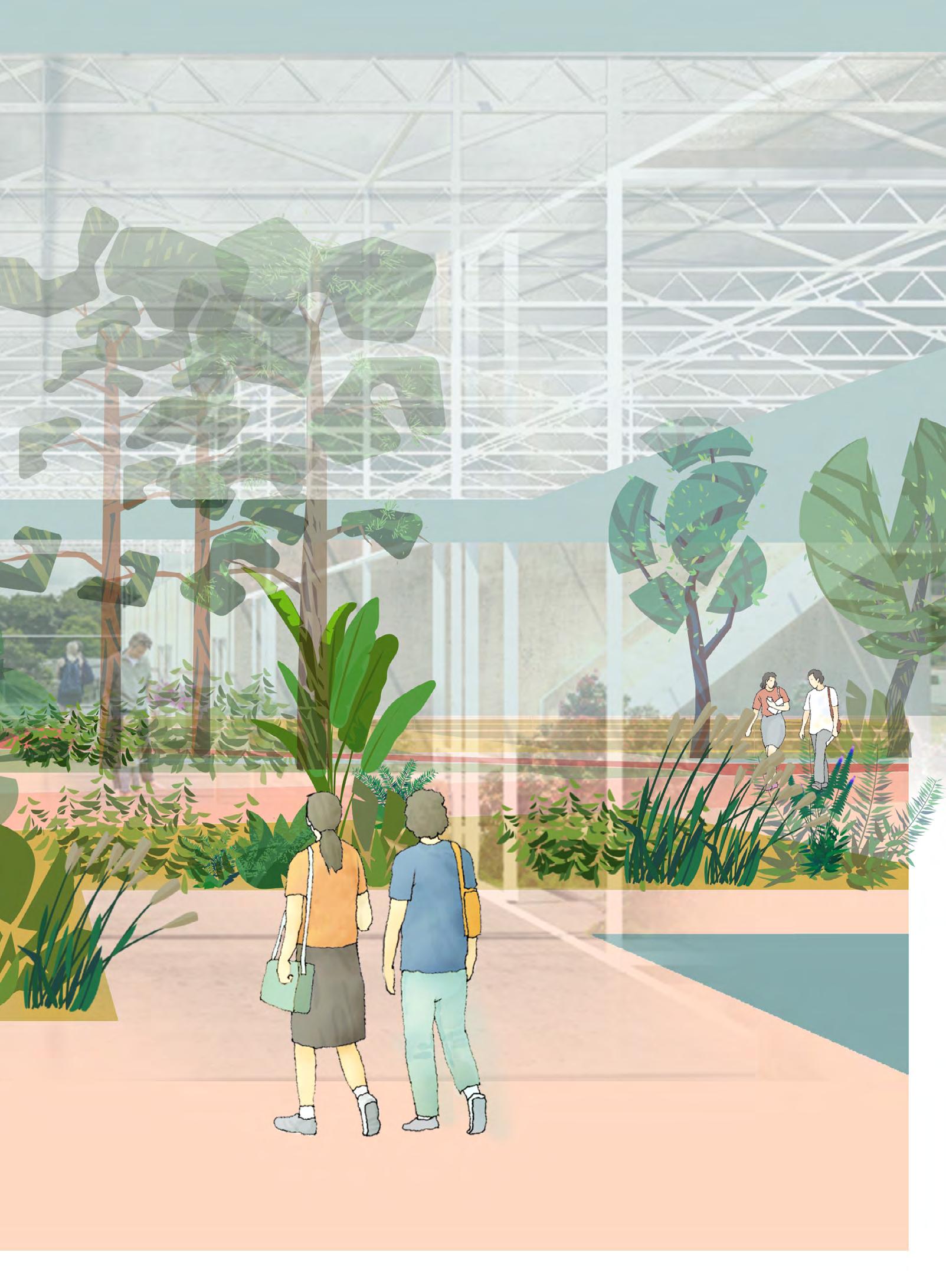
The final design links the green spaces across different ownerships from three aspects. The first is resolving the gap at the future street for trams and vehicles, by using consistent pavements across the street and emphasizing the pedes trians. The second approach is to link all the functional spaces along a contin uous walking system. Finally, create a more active open space at the intersec tion of the axis towards both campuses.
BEFORE AFTER
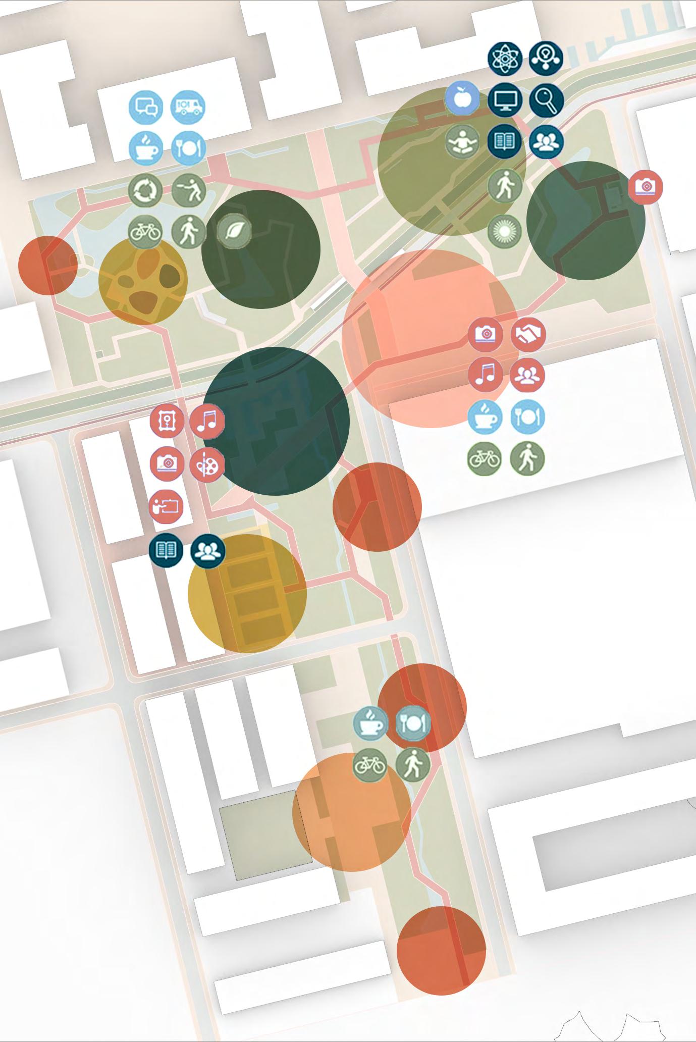
The interconnected green space system generates a diverse public realm and connects various services and facilities. Many types of landscapes are accessi ble, such as hills, rivers, ponds, and gar dens, which are surrounded by clearly identified ownerships offering diverse urban experiences. Within 15 minutes, people can shift from a highly dynamic
environment on a new plaza, to a nat ural and quiet environment in the park. Both are loaded with associated pro grams. Spaces for research, industry, recreational, sports, commercial and public events are also within reach. The design outcome allows for a generous environment to work and live in.

BLUE: WATER MANAGEMENT
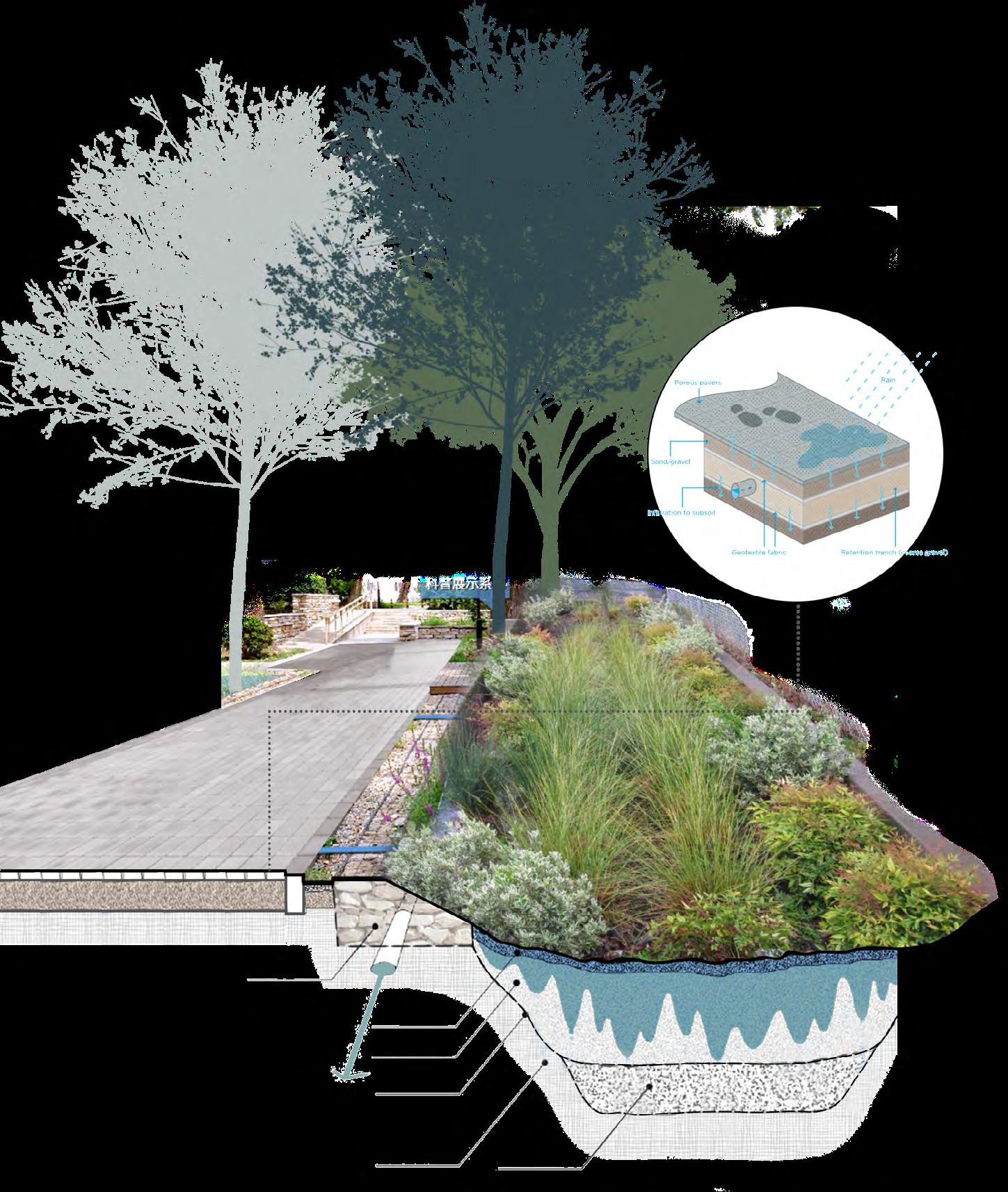
The infrastructure system leading towards the Yarra River is transformed into a green-blue network. As the up per catchment area of the UoM campus to the Yarra River, the site integrates open and underground water systems, increasing stormwater collection and storage capacity. The central greenblue system integrates wadis to delay water discharge to the river. The lower catchment area of the campus will integrate amphibious streets to drain and utilize the stormwater as much as possible before it runs into the river.
Gabion Mulch Topsoil Geotextile
People
BROWN: ECOLOGICAL REMEDIATION

Main Park Road
Cut and fill not only helps water management, but also the process of remediation, as illustrated in the right diagrams. The first step is identify ing the locations of the contaminated materials and digging out those “hot spots” of very heavy pollutants. Then cut the surrounding soil to fill the new slopes and remove those “hot spots” simultaneously. The last step is the placement of the isolation layer, includ ing the clay liner, which can protect the stormwater from polluted underground water, and high-quality topsoil, to support the early stage of plant growth.
Thus the plant species at the original contaminated locations should be more resilient to pollutants from the soil and water and can remediate the soil over time (this process is called phytoreme diation), the other ones on top of the slopes might be delicate but could pro vide other ecological values and enrich the ecosystem.
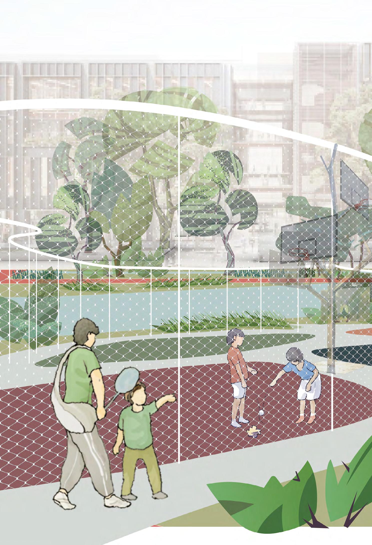
The noise from the busy street discourag es wildlife activities.
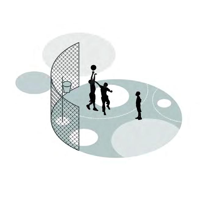
Unpowered Playground
The extremely high temperature at noon in summer will also impact wildlife. However, there are also opportunities to get food from people’s lunch, which might become annoying. Thus, creating cool and comfortable spaces is important for both people and wildlife.
Secondary Park Road Green Street Central Parade
Secondary Park Road
The site is not close to the residential area, so when most people go back home, the space becomes dark and quiet at night and serves as a paradise for urban wild life. This design will use a low-light system to reduce impacts on biodiversity.


Main Park Road
Picnic Lawn Wetland Habitat Entrance Plaza




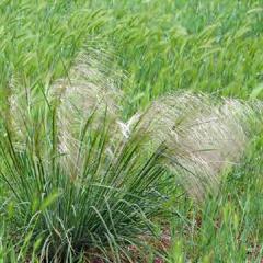
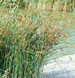
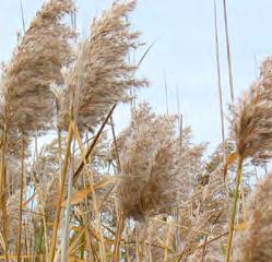
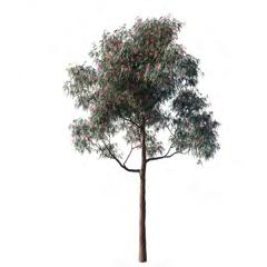
PLANT PALETTE
Trees

Urban Nature
Metals
Small trees and Shrubs
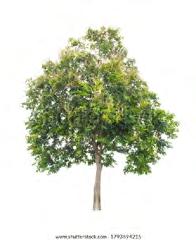
Allocasuarina ssp.
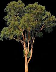
Corymbia spp.


Groundcover
Dracaena draco

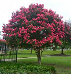
Pyrus callery ana


Allocasuarina ssp.
Corymbia spp.
Acacia man gium Acacia man gium
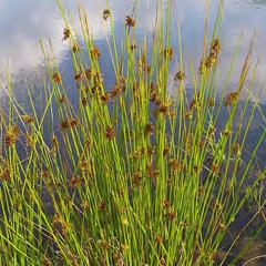
Eucalyptus viminalis
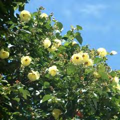
Hibiscus tilia ceous
Eucalyptus viminalis










ITERATION PROCESS


IMAGES
Timeline
George Rossi Ashton. (2022 Sep tember). Antique Print & Map Room. https://antiqueprintmaproom.com/ product/1835-john-batman-on-theyarra/ Tirin. (2010 March). Boltebridge. Wiki media Commons. https://commons. wikimedia.org/wiki/File:Boltebridge.jpg
Fishermans Bend Urban Renewal Area Draft Vision. (2013 September). https:// www.fishermansbend.vic.gov.au/__data/ assets/pdf_file/0020/30359/Draft_2013_ Vision.pdf
Fishermans Bend Taskforce. (2017 July). LIFE ON THE BEND - A social history of Fishermans Bend, Melbourne. https:// www.fishermansbend.vic.gov.au/docu ments
Mapping
GRIMSHAW. (2019 February). Lemaire Campus Development FrameworkVOLUME 2: EXISTING CONDITIONS REPORT.
Department of Environment, Land, Wa ter & Planning. (2022). Land Use 2017. [Data set]. Spatial Department Victoria. http://services.land.vic.gov.au/Spatial Datamart/
The State of Victoria Department of Environment, Land, Water and Plan ning. (2018 February). Fishermans Bend Framework. https://www.fishermans bend.vic.gov.au/documents
Department of Environment, Land, Wa ter & Planning. (2022). Public Transport. [Data set]. Spatial Department Victoria. http://services.land.vic.gov.au/Spatial Datamart/
State Government of Victoria. (2022 May). Fishermans Bend Water Sensitive City Strategy. https://www.fishermans bend.vic.gov.au/documents
GHD. (2019 July). Fishermans Bend Water Sensitive Drainage and Flood Strategy Final Report. https://www.fish
ermansbend.vic.gov.au/documents
City of Melbourne. Water flow routes over land. (2020 February). https://data. melbourne.vic.gov.au/Environment/ Water-flow-routes-over-land-UrbanForest-/6yxs-smdz
Golder Associates. (2016 September). PRELIMINARY LAND CONTAMINATION
STUDY - Employment Precinct, Fisher mans Bend. https://www.fishermans bend.vic.gov.au/documents
Department of Environment, Land, Water & Planning. (2022). EVC 1750. [Data set]. Spatial Department Victoria. http://services.land.vic.gov.au/Spatial Datamart/
Department of Environment, Land, Wa ter & Planning. (2022). Flora & Fauna. [Data set]. Spatial Department Victoria. http://services.land.vic.gov.au/Spatial Datamart/
The State of Victoria Department of Environment, Land, Water and Plan ning. (2018 February). Fishermans Bend Framework. https://www.fishermans bend.vic.gov.au/documents
Department of Environment, Land, Water & Planning. (2022). Open Space. [Data set]. Spatial Department Victoria. http://services.land.vic.gov.au/Spatial Datamart/
TEXT
[1] Fishermans Bend Taskforce. (2017). LIFE ON THE BEND - A social history of Fishermans Bend, Melbourne.
[2] The State of Victoria Department of Environment, Land, Water and Plan ning. (2018). Fishermans Bend Frame work.
[3] Fishermans Bend Taskforce. (2016). Fishermans Bend Economic and Em ployment Study Final Report.
[4] State Government of Victoria. (2022). Fishermans Bend Water Sensi tive City Strategy.
[5] Golder Associates. (2016). PRELIMI NARY LAND CONTAMINATION STUDY - Employment Precinct, Fishermans Bend.
[6] URBIS. (2018). The University of Melbourne Fishermans Bend Campus Planning Advice and Strategy.
[7] City of Melbourne (2015). Fisher mans Bend Urban Forest Precinct Plan 2015-2025.
