
BOSTON CORTIS LANDSCAPE
ARCHITECTURE
PORTFOLIO
Photograph: Boston Cortis, 2024
Photograph: Boston Cortis, 2023
ACKNOLODGEMENT OF COUNTRY
I wish to acknowledge the Traditional Custodians of the lands upon which my portfolio projects have been developed and presented. I pay my respects to the Elders past, present, and emerging of the Aboriginal communities who have been the guardians of these lands for thousands of years. Their deep connection to and stewardship of the land, waterways, and skies are a source of inspiration and learning in my journey as a landscape architect. I am committed to honoring and celebrating this rich heritage in my work and collaborations.
PERSONAL STATEMENT
From a young age, I was fascinated by the outdoors and the relationship that people have with landscapes and nature, which inspired my pursuit of landscape architecture. At UNSW, I’ve developed a strong foundation in design principles, landscape ecology, and technical skills like CAD and GIS, which have enabled me to bring my innovative design concepts to life.
These four years have been transformative, significantly enhancing my technical abilities, soft skills and understanding of landscape architecture’s impact on both communities and the environment. This joined with my work experience at Beaches Group has further cemented my real-world understanding of the field, giving me insights into stakeholder/ client relationships, communication and dynamics. Looking forward, I am eager to contribute to projects that prioritise sustainability and community needs.
I am excited about the future and am committed to making a meaningful contribution to the landscape architecture profession.
Photograph: Boston Cortis, 2023

BOSTON CORTIS


Project Goals and Principles
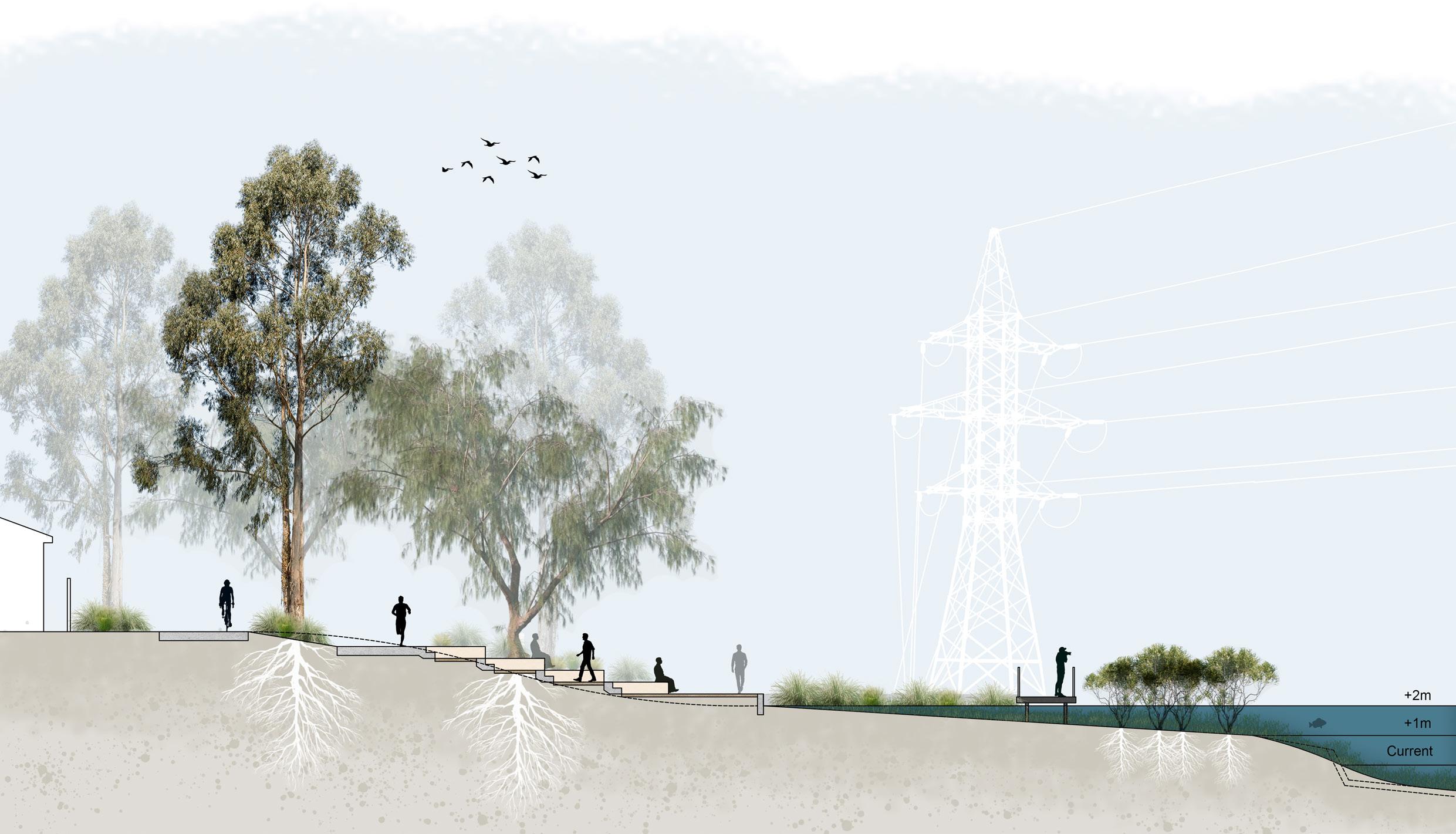
Riparian Recreational Trail
INTER-DESTINATIONS
Term 3 2024
LAND2413: Studio 10
Location:
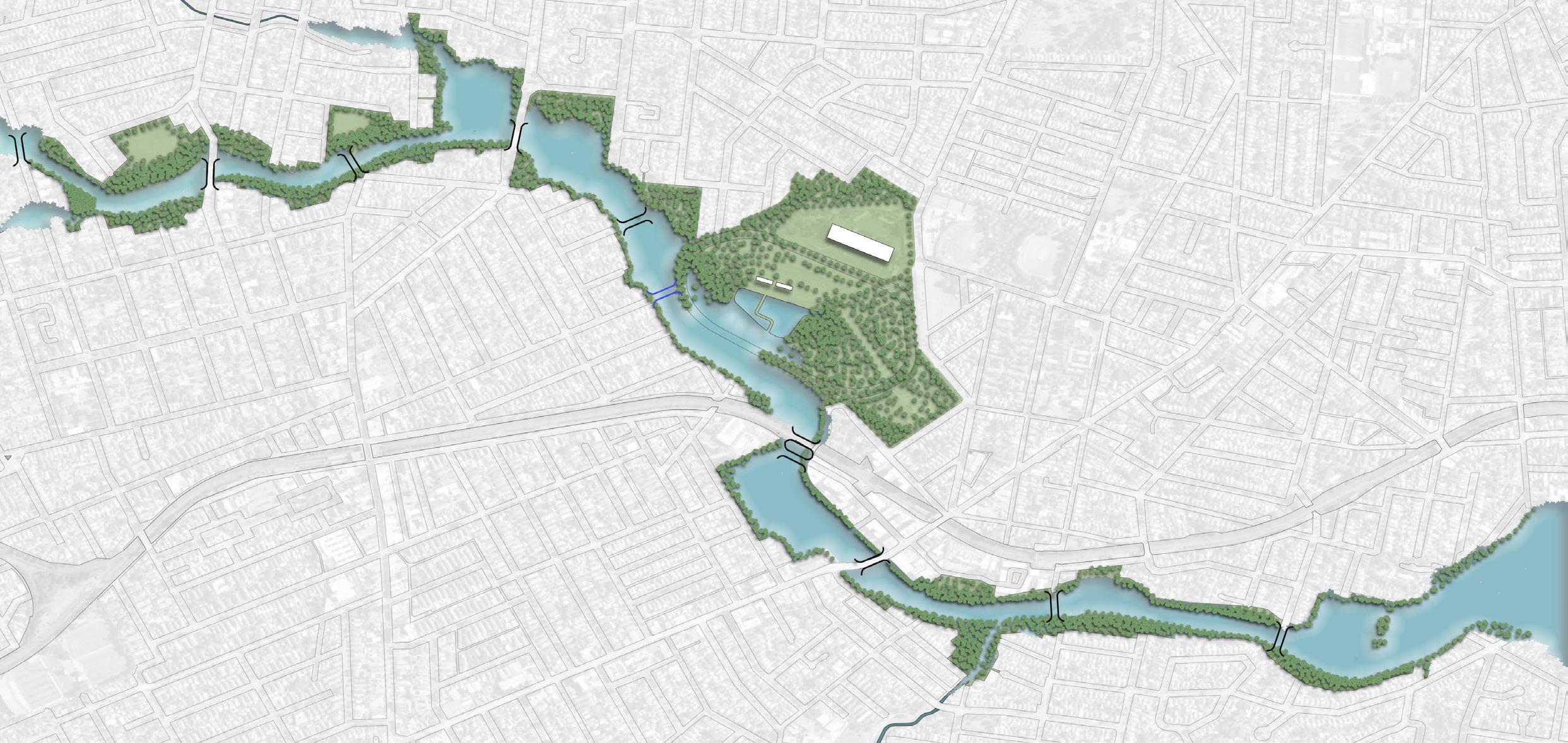
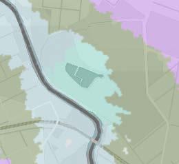
Cook’s River (Goolay’yari), Canterbury
Project Vision:
Re-shaping the Cook’s River (Goolay’yari) into a Riparian Recreational Trail that integrates Landscape Resilience to climate change and sea level rise whilst enhancing Familiarity and Social Well-being of the local community.
Goal 1 - Landscape Resilience
Create different design proposals that are adapted for the various climate change and sea level rise scenarios.
Goal 2 - Social Well-being
Create a sense of spatial familiarity for diverse demographic groups that enhances community engagement and social interaction.
Local Familiarity
– Inclusiveness
– Community Engagement
– Multiculturalism
Eco-awareness
– Sea Level Rise
– Tidal Movements
– Ecological Communities
Continous Access
– Landscape Resilience
– “The Everyday”
– Access to River
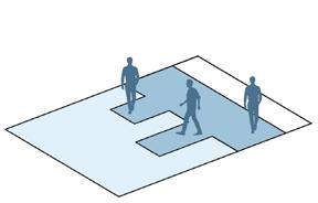
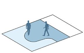
Trail Design Toolkit
Ecological Connection Active Mobility & Continuous Access Community Gathering & Social Interaction
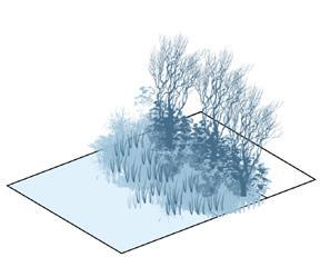
Adaptive Riparian Buffer Zones
Principles: Continuous Access Eco-Awareness
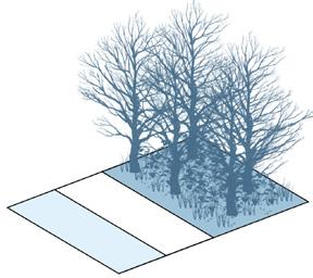
Adaptive Floodplain Forest Zones
Principles: Continuous Access Eco-Awareness
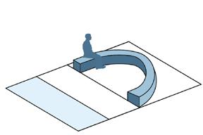
Adaptive Gathering Spaces
Principles: Local Familiarity Continuous Access
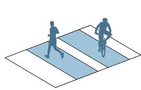
Seperated Cycle and Pedestrain Pathways
Principles: Local Familiarity Continuous Access
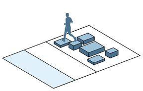
Flexible Play & Activity Areas
Principles: Local Familiarity Continuous Access Eco-awareness
Resilient Adaptive Pathways
Principles: Local Familiarity Continuous Access Eco-awareness
Educational Engagement & Environmental Awareness Comfort & Resilience in
Interactive Water Markers
Principles: Local Familiarity Eco-awareness
Frequent Adaptive Rest and Amenity Areas
Principles: Local Familiarity Continuous Access Eco-awareness
Eco-educational Zones
Principles: Local Familiarity Eco-awareness
IPCC Sea Level Rise Responses
Lookout and Viewing Areas
Principles: Local Familiarity Continuous Access Eco-awareness

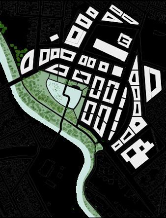
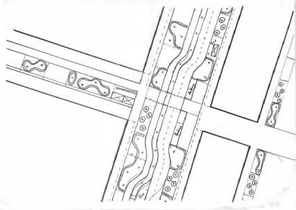
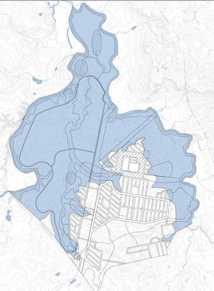
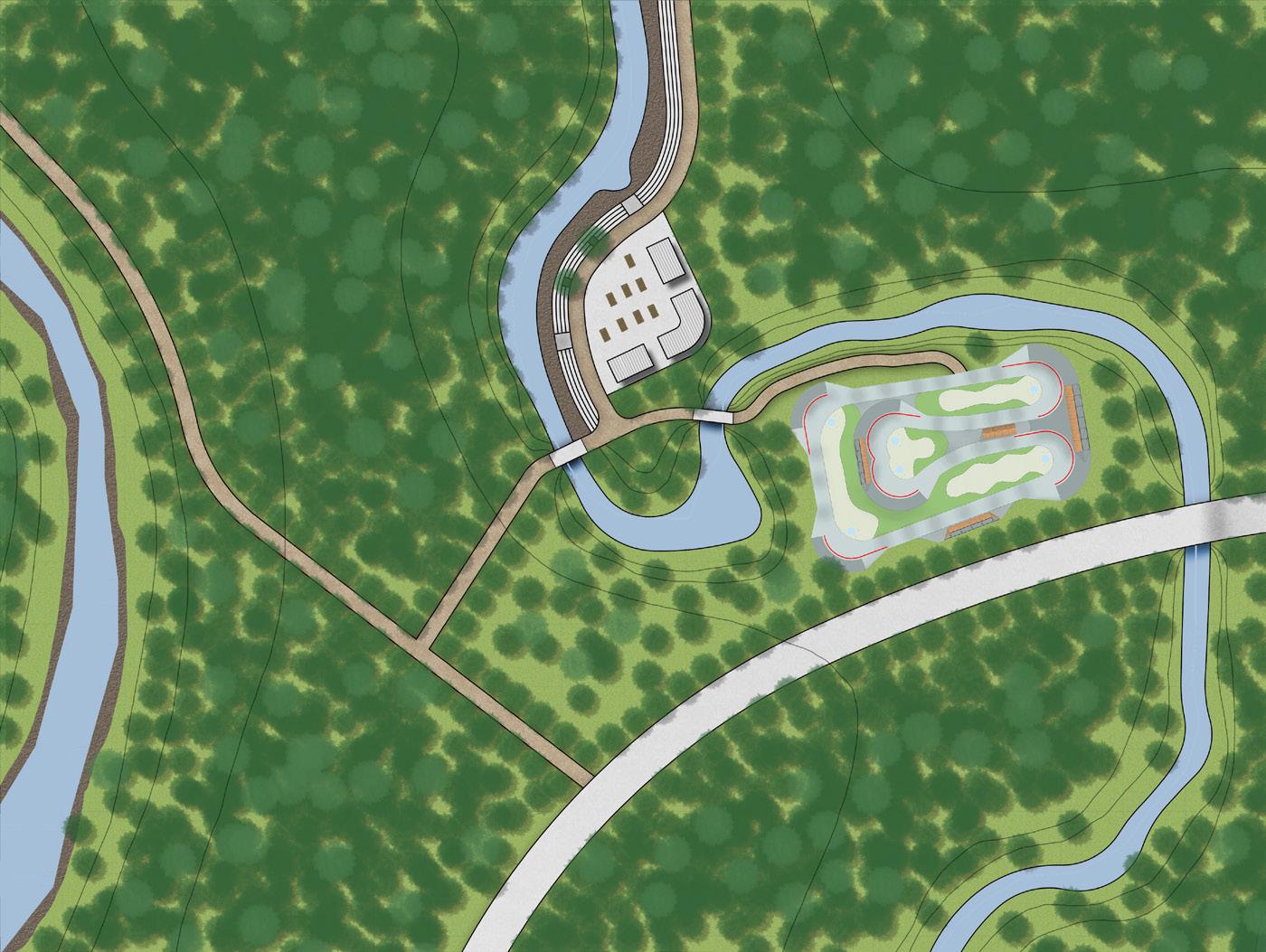
Scenario 1 Masterplan
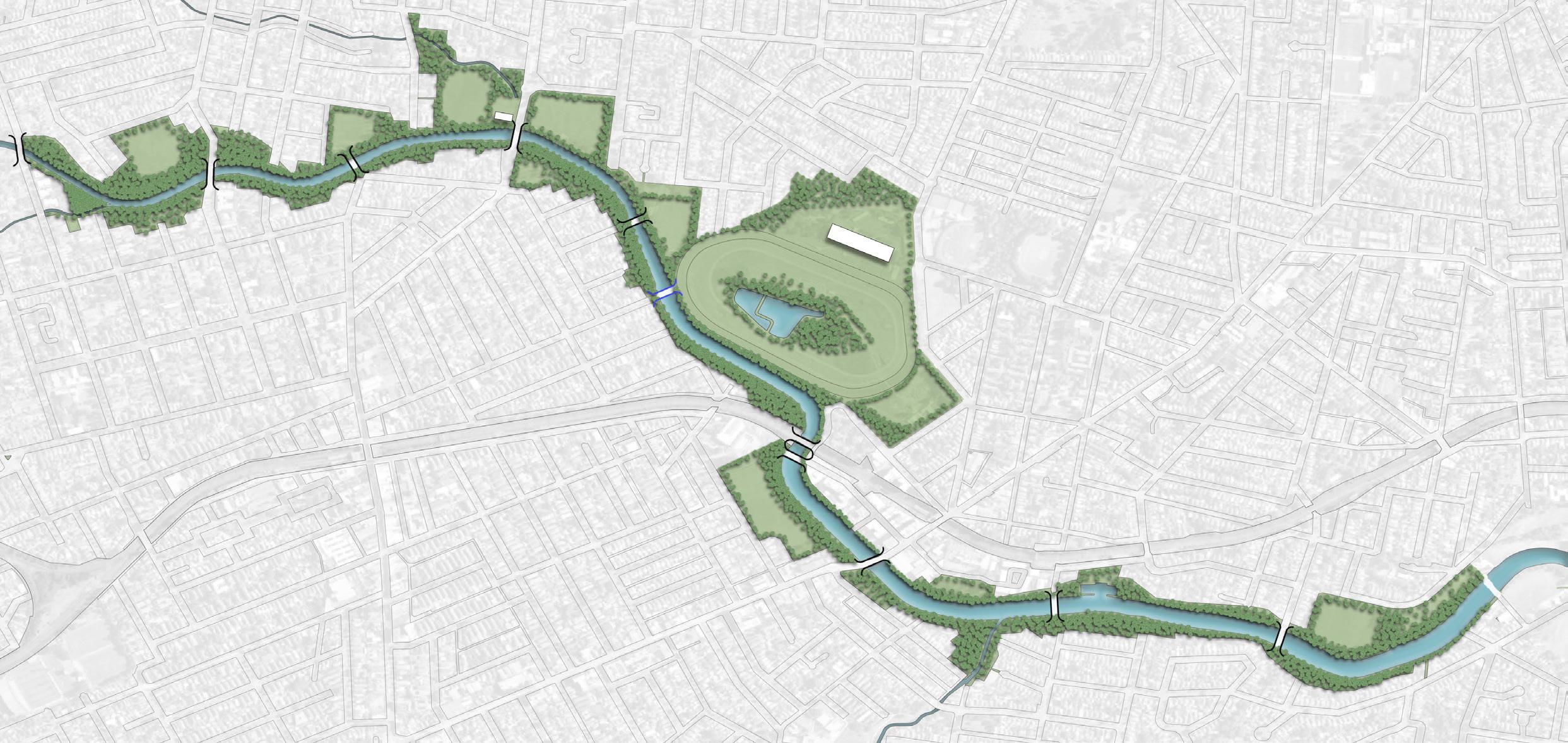
Concrete Cyclway
FRP Cyclway
Concrete Footpath
FRP/Gravel Footpath
Stopping/Rest Point
Trail Access
Access Point

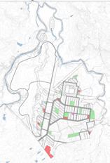
Character Zones
Annotations:
This scenario design focuses on intergrating the riverside recreational trail into the current site characteristics and future design plans (Campsie MP), whilst also catering for a moderate sea level rise of 1-2m.
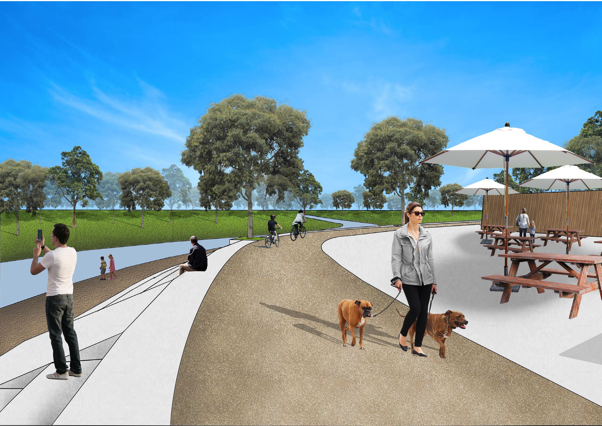
This design includes seperated cycle and pedestrian trails to cater for the different user experiences. It also has ample accessibilty with access points to residential areas and new metro stations as well as intergrating river crossings for an enhanced circulation network. Rest points have been placed within a 5 minute walk (500m) of each other for greater accessiblity to amenities, enhancing current infrastructure with proposed amenities. The scenario also sees the Canterbury racecourse site remain as a racecourse, with minor changes to site boundaries along the riverside to allow for better circulation.
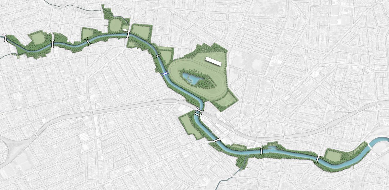
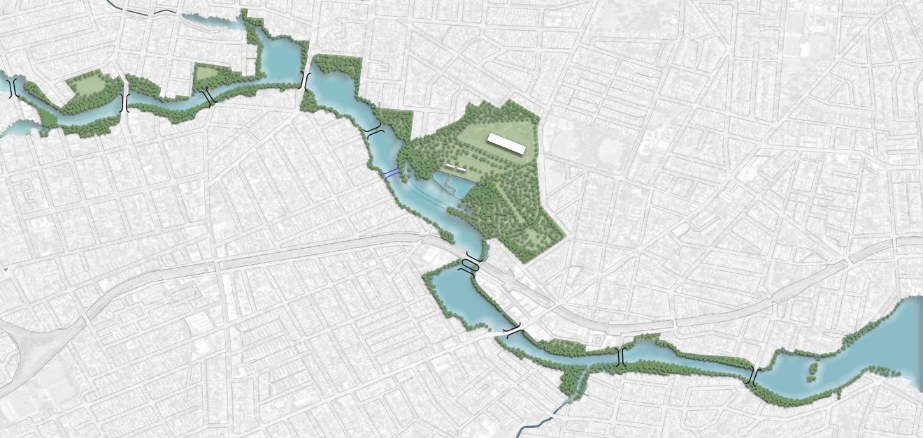
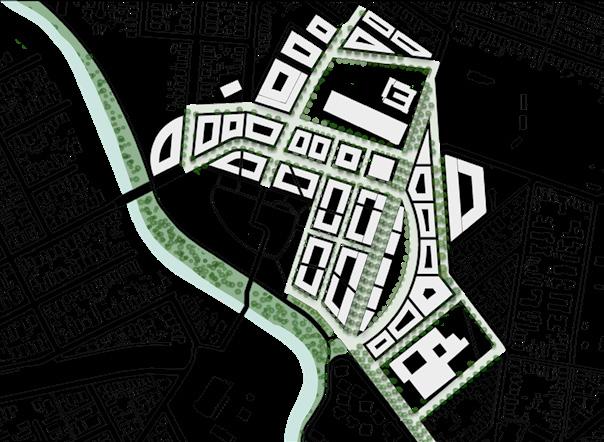
Scenario 2 Masterplan
Concrete Cyclway
FRP Cyclway
Concrete Footpath
FRP/Gravel Footpath
Stopping/Rest Point
Metro Trail Access
Access Point
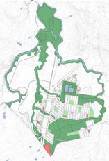
Character Zones
Annotations:
This scenario design focuses on a more drastic approach to mitigate a high level of sea level rise of 2-5m.
Therefore, this design makes more use of the IPCC sea level rise responses in order to mitigate the impacts to the built and natural environments along the Cook’s River. This scenario also sees a large character change with the programs of particular areas shifting to fit with the rising water level. This is seen in Canterbury racecourse with the site program changing from horse racing to a large ecological zone with a recreational area for water activities.
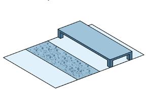
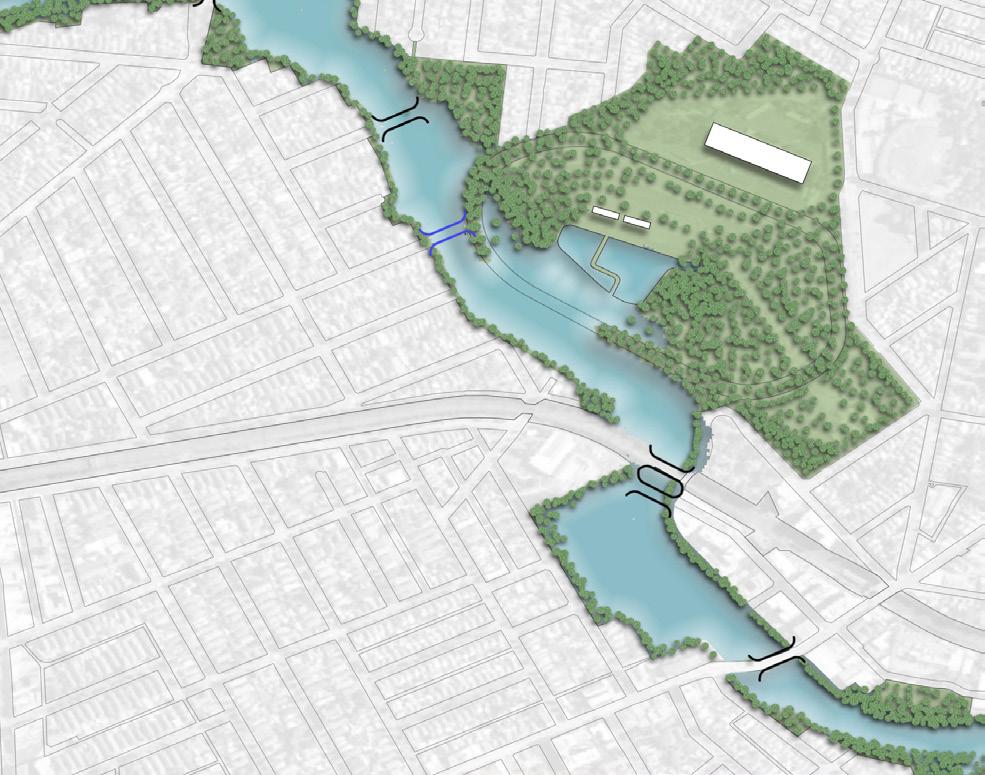
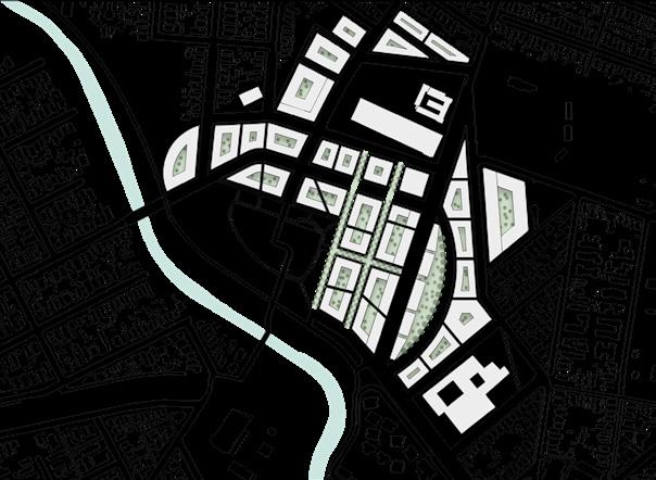
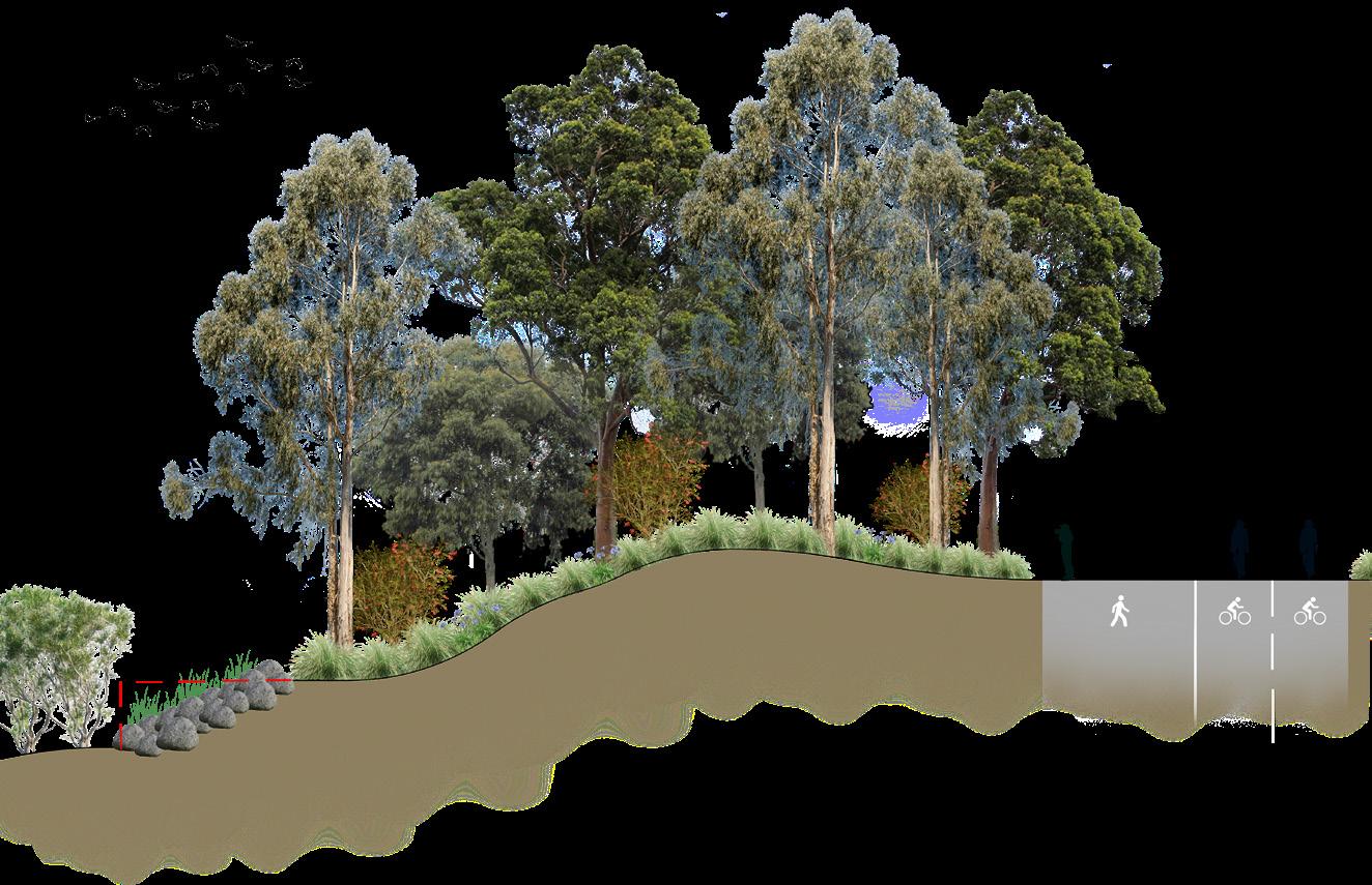
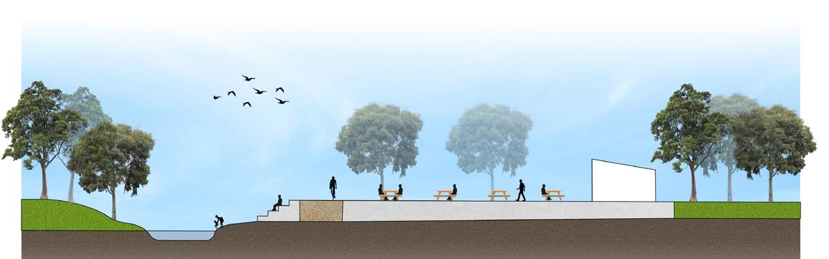
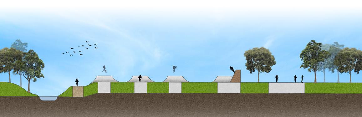
Campsie Riverside: Riparian Ecological Track
This space is a ecological experience that is engages the community with the Cooks River’s natural ecosystems and vegetation communities
Grey Mangrove-River Mangrove Forest Swamp Oak Floodplain Forest

Grey Mangrove-River Mangrove Forest Swamp Oak Floodplain Forest
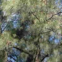
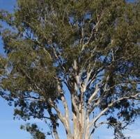
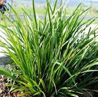
Casuarina glauca Eucalyptus tereticornis Lomandra longifolia
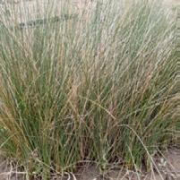
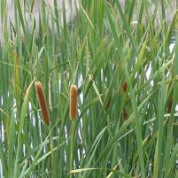
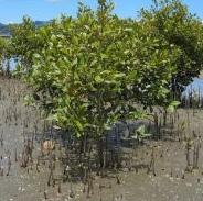
Juncus kraussii subsp. australiensis Typha orientalis Avicennia marina
02
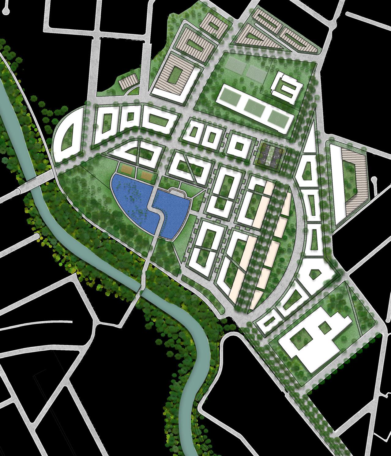
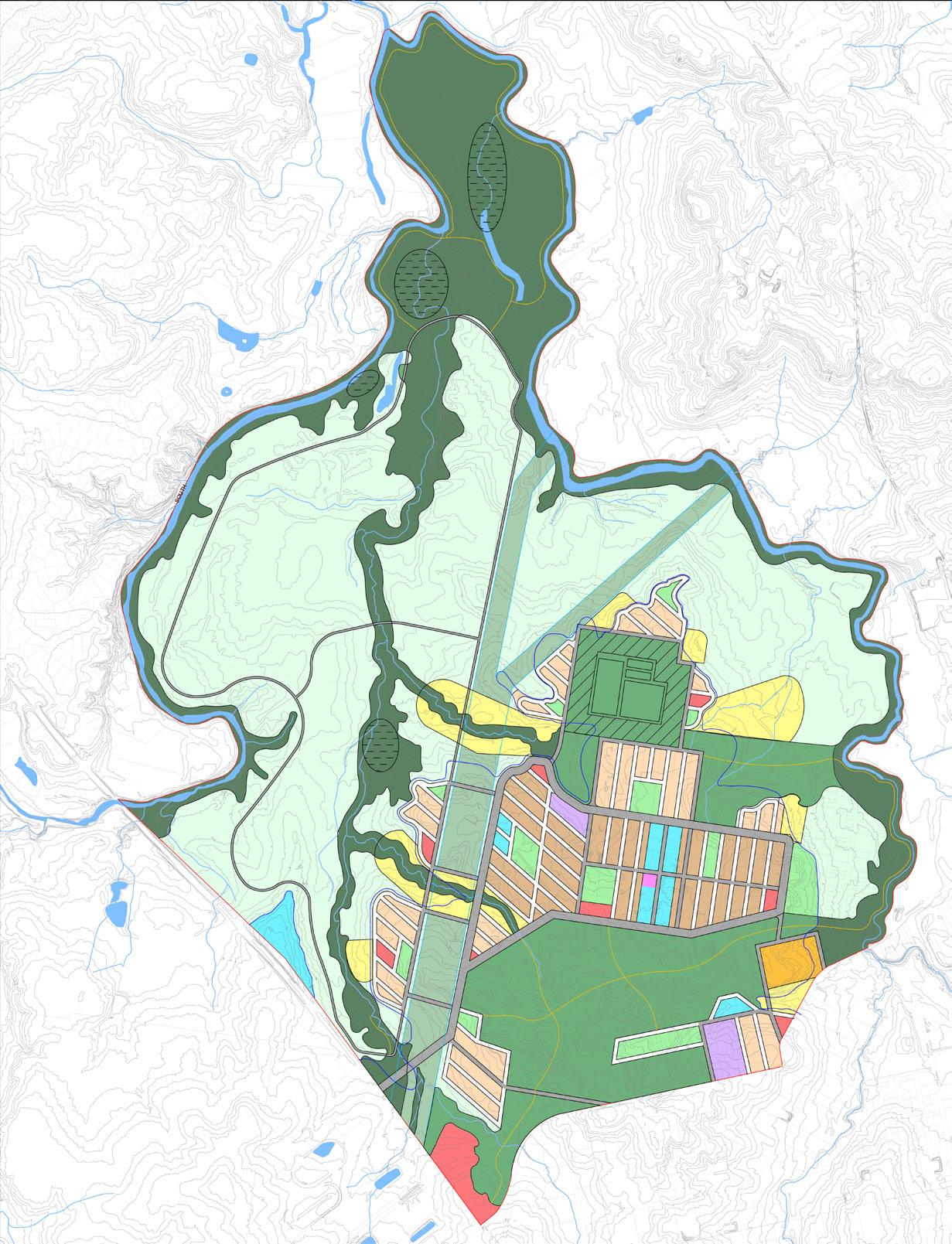
THE URBAN VILLAGE
Term 1 & 2 2024
LAND2411: Studio 8
Location:
Canterbury Park Racecourse
Project Vision: Transform Canterbury into a flourishing and supportive urban village connecting place and people while rehabilitating natural ecosystems.
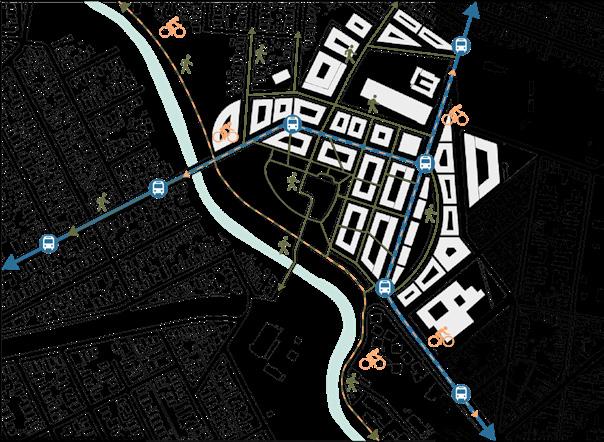
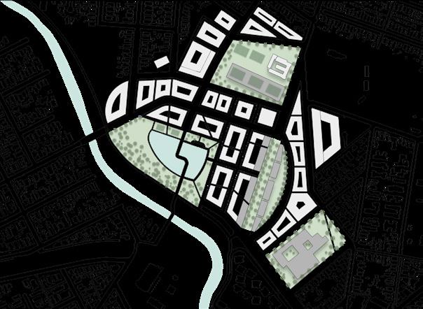
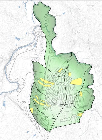
Structure Plan
Principle 1
Create an urban village that promotes livability and quality of life by integrating accessible recreational and social opportunities.`
Reference: Rendered by Another Student
Strategy 1:
Strengthen local and regional transportation links to Canterbury train station and surrounding suburbs that encourage active commuting and equitable access to recreational and social opportunities.
Principle 2
Strategy 2:
Establish designated community spaces that utilise existing features and character to foster social interaction and community engagement.
Enhance and sustain the sites natural riparian ecosystems in order to improve biodiversity and landscape resilience.
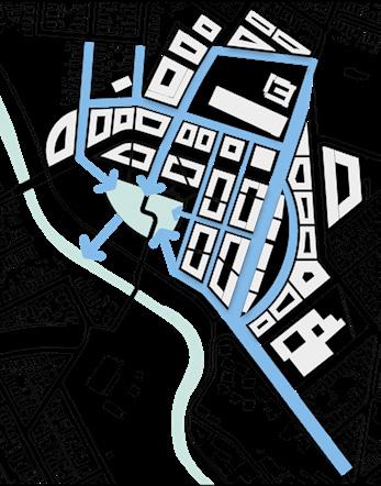
Strategy 1:
Undertake the ecological restoration of the Cooks River foreshore and wetlands, focusing on habitat creation with native planting and rainwater filtration
Strategy 2:
Develop a network of green corridors that link proposed urban green spaces in the site to facilitate ecological connectivity, reduce UHI effect, mitigates air and noise pollution.
Strategy 3:
Implement Biophilic design principles to develop therapeutic and restorative spaces that enhance liveability for residents.
Strategy 3:
Develop shaded, permeable streets to combat climate change and increase natural disaster resilience by improving existing vegetation, tree canopy and blue infrastructure.
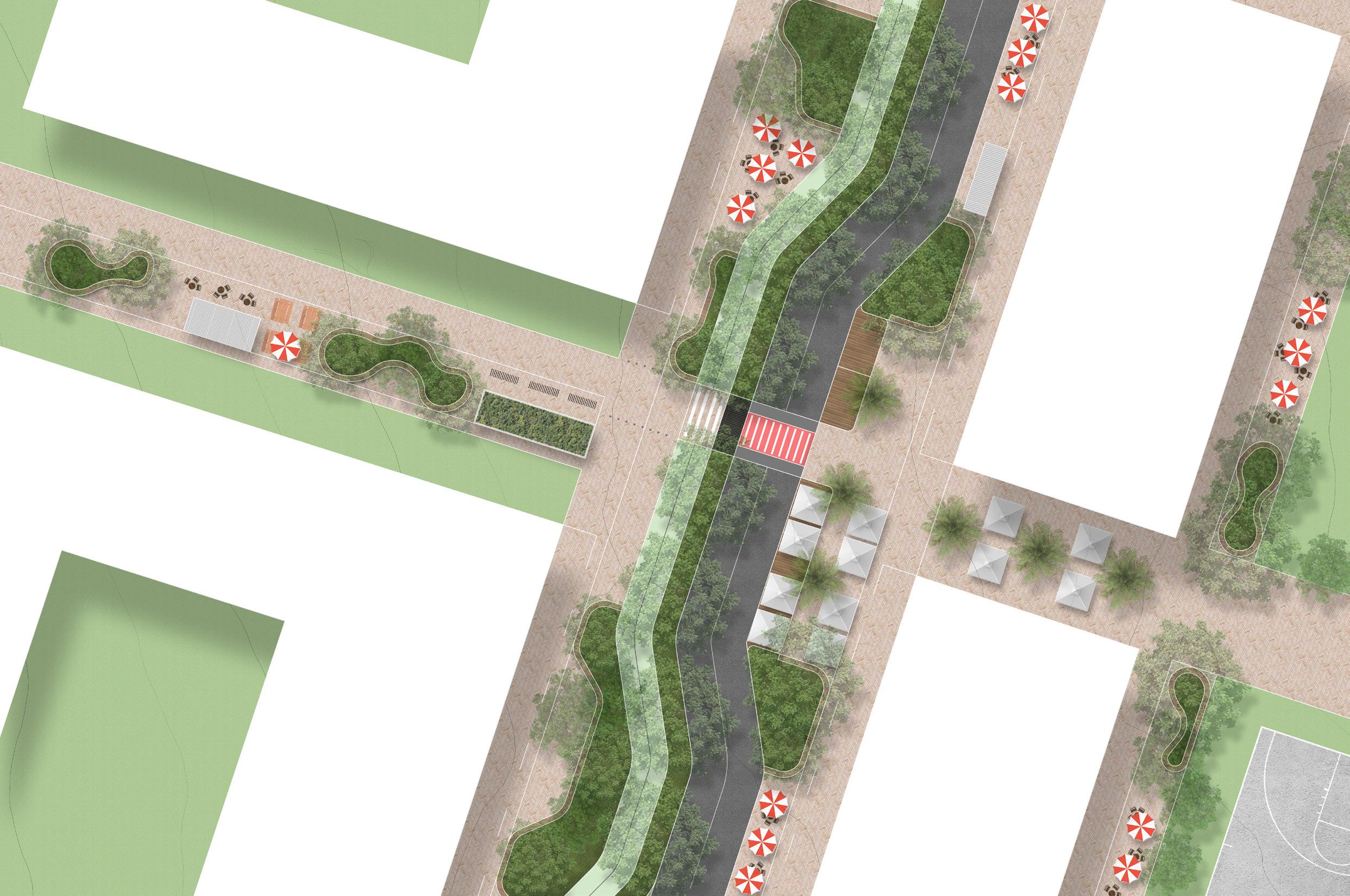
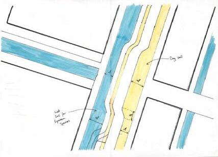
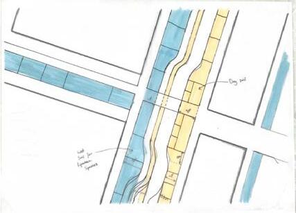
1. Raised garden bed that has Estuarine Swamp Oak Twig-rush Forest plant species (Coastal floodplain wetlands for wet soil zone)(Biodiversity in Place).
2. Curved timber seating on top of exposed concrete around garden bed border (seating is flat on sloped surface allowing for people of various heights)(Precedent 3).
3. 3.5m pedestrian shared zone (including emergency vehicle access)
4. Shade structure with BBQ’s and seating for social gathering
5. Outdoor seating in sun for winter use
6. Outdoor seating in shade for summer use
7. Amenities structure with green roof (toilets, water, etc)
8. Bike storage rack
9. Poles prohibiting vehicle access onto footpath.
10. Open space area for increased safety due to higher foot traffic from crossing and bike path exit.
11. Open space for outdoor cafe seating (cafes on west side of street to get morning sun)
12. Dense connected tree canopy coverage for shade and animal habitat/ migrational movements.
13. 3m Bi-directional cycleway. (Cycleway Design Toolbox doc)
14. 2m green strip buffer to protect cyclists from cars and connect tree canopy - Sydney Coastal Sandstone Foreshores Forest plant species (Sydney Coastal Dry Sclerophyll Forests for dry soil zone).
15. Open space for weekend markets and stalls to continue site history and culture of current markets that happen on racecourse. Also doubles as multi use space for cafe/restaurant tables and umbrellas during the week. (Precedent x)
16. Tall palm trees that give vertical space for market gazebo’s and cafe umbrellas. (Precedent x)
17. Parking spaces that are used on weekdays that can be filled for markets on weekends. (Precedent x)
18. Pedestrian crossing that prioritises safety by: increasing visibility by having an open crossing area, material indicators such as colour and tactile form, wide crossing surface
19. Garden bed that has Sydney Coastal Sandstone Foreshores Forest plant species (Sydney Coastal Dry Sclerophyll Forests for dry soil zone).
20. Open space for outdoor restaurant seating (restaurants on east side of street to get afternoon sun).
21. Bus stop shelter made from recyclyed materials
22. 4m clear zone (footpath) for pedestrian movements
23. Basketball court for recreation
24. Urban green space for community gathering and recreation
25. FRP surface over green buffer to allow connected groundcover
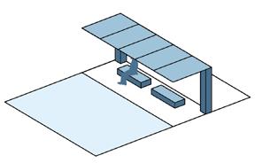
Section 01
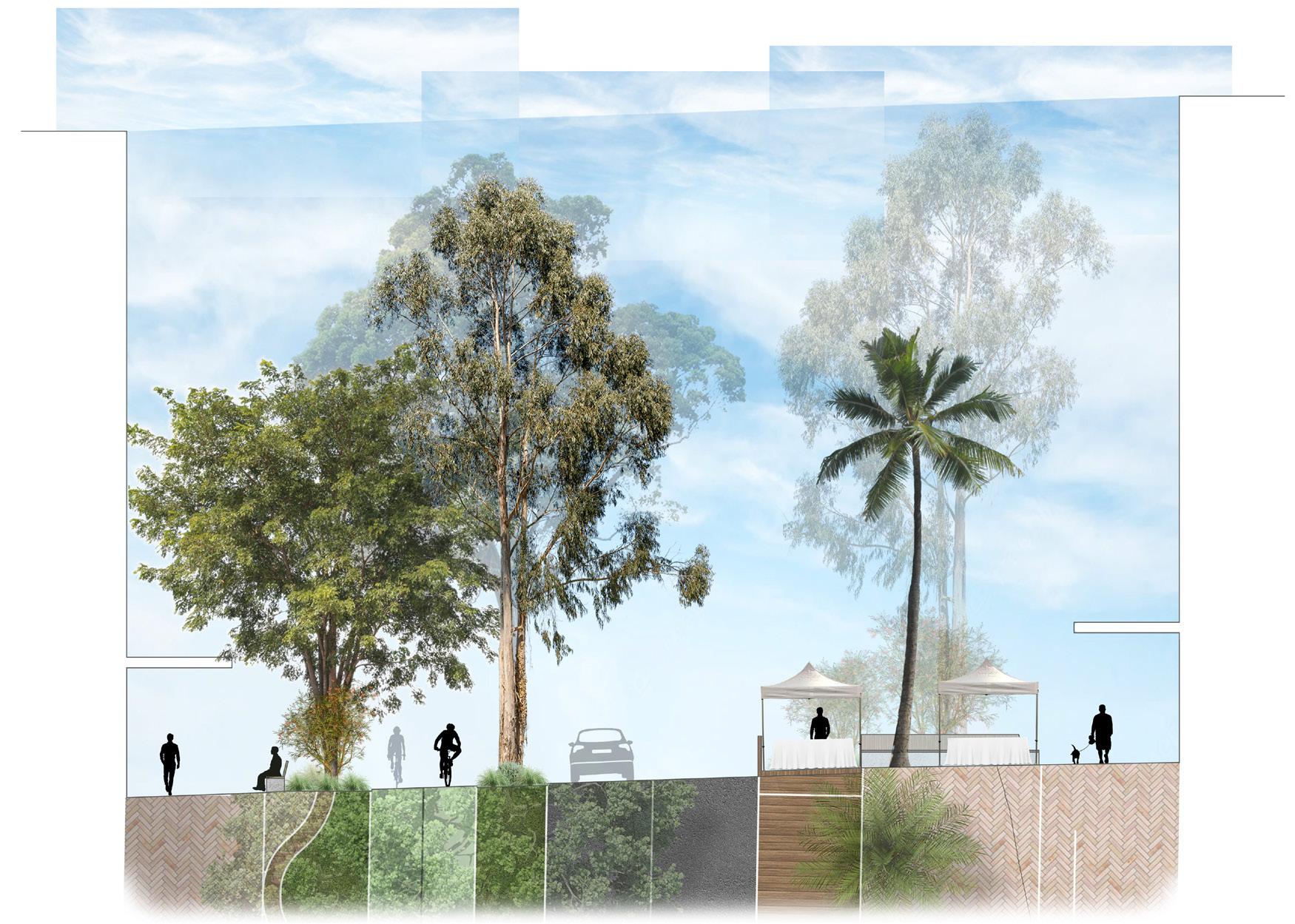
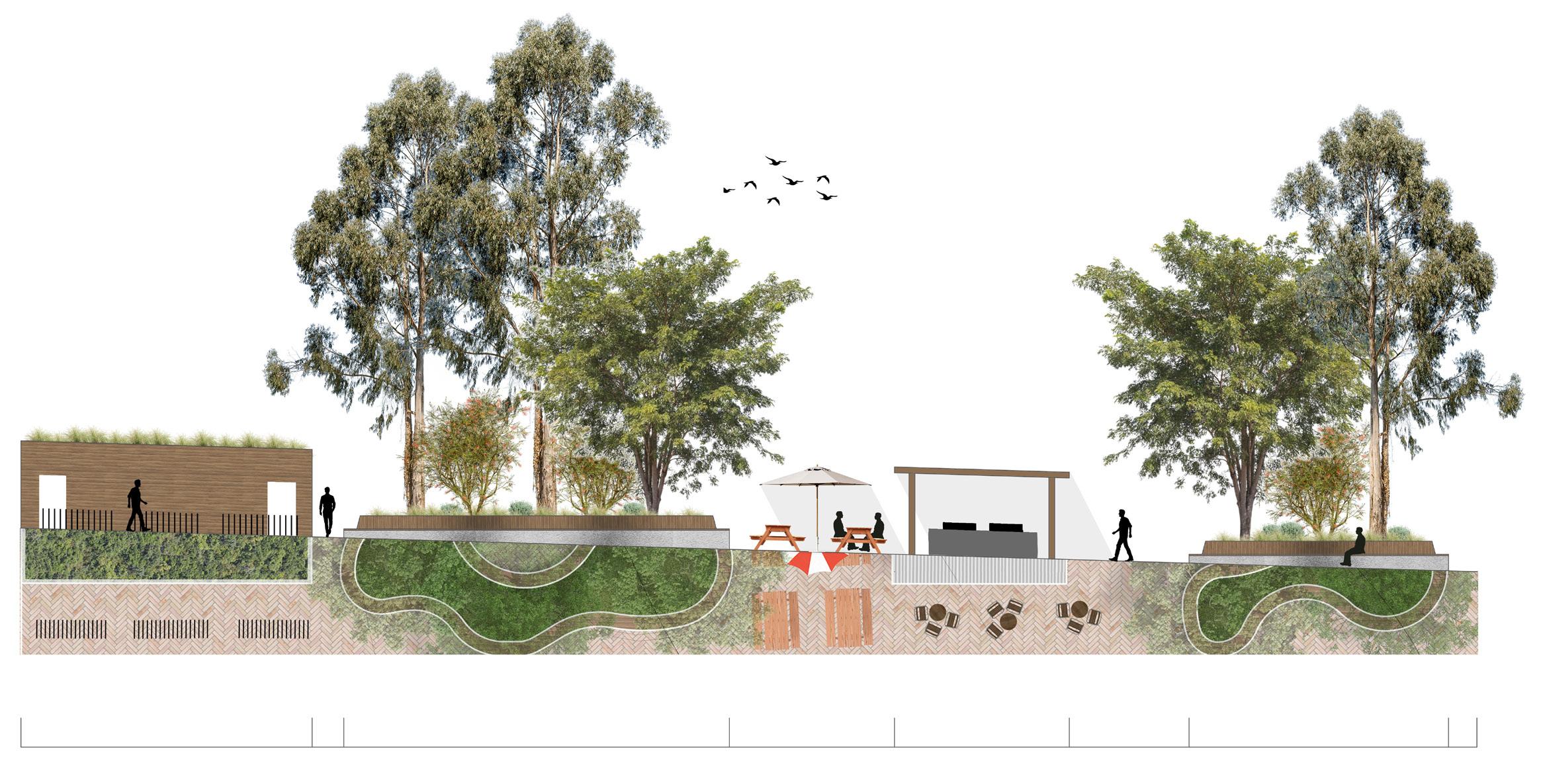
Amenities structure and bike racks
Raised garden bed with timber seating
Picnic tables for social gathering
Shaded BBQ area
Raised garden bed with timber seating
balanced environment for both
Principles and Techniques:
Design Iterations
1 . Estuarine Swamp Oak Twig-rush Forest plant species (Coastal floodplain wetlands for wet soil zone) - Blue on map
Design Iterations
linkages to residential areas spaces in order to increase
multipurpose social spaces that foster engagement and social interaction
canopy to support animal migrational movements understory vegetation that vertically and ground cover to enhance animal species richness.
2. Sydney Coastal
The study area I have chosen is a portion of high street and the surrounding pedestrian links. This is because streetscapes play a vital role in the enhancement of community engagement and social interaction in many ways from providing recreation, accessibilty, transportation, culture, and landscape ecology. By implementing BDE’s through these means, it will not only enhance the connection humans have to nature, but also improve overall social well-being of the community. Create a balanced environment for both humans and non-humans
- Casuarina glauca
- Eucalyptus tereticornis
- Grevillea robusta
- Acacia longifolia
- Dianella caerulea
road, zones
multiuse spaces that support interaction and comfortable pedestrian paths used as indicator for landuse seasonal spaces utilising sun and opportunities through planting events/activities. balanced environment for both non-humans linkages to residential areas spaces in order to increase canopy to support animal migrational movements understory vegetation that vertically and ground cover to enhance animal species richness.
beds, stops, etc.
1 . Estuarine Swamp Oak Twig-rush Forest plant species (Coastal floodplain wetlands for wet soil zone) - Blue on map
2. Sydney Coastal Sandstone
Other - Archontophoenix alexandrae
Foreshores Forest plant species (Sydney Coastal Dry Sclerophyll Forests for dry soil zone)green on map
Detail Design Principles
- Casuarina glauca
- Angophora costata
Techniques:
- Eucalyptus sieberi
- Acacia longifolia
- Eucalyptus tereticornis
- Angophora costata
- Banksia ericifolia
- Lomandra longifolia
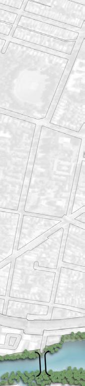
Key Plan (Red identifies site)
- Hibbertia scandens
- Viola hederacea
3. Other
- Archontophoenix alexandrae

• Active transport linkages to residential areas and community spaces in order to increase accessibility
- Westringia fruticosa
- Lomandra longifolia
Principle 1:
- Grevillea robusta
- Acacia longifolia
- Dianella caerulea
- Eucalyptus sieberi
- Acacia longifolia
Principle 2:
- Lomandra longifolia
Create multipurpose social spaces that foster community engagement and social interaction
- Banksia ericifolia
- Westringia fruticosa
Create a balanced environment for both humans and non-humans
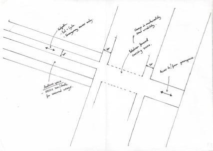
Design Iterations
1 - Testing pedestrian focused crossing
Planting Palettes:
Derived from pre-colonial plant communities that mostly consist of endemic species. species chosen are also considered habitat for animals such as the grey-headed flying fox, migatory birds, etc.
1 . Estuarine Swamp Oak Twig-rush Forest plant species (Coastal floodplain wetlands for wet soil zone) - Blue on map
• Connected tree canopy to support animal habitat and migrational movements Dense understory vegetation that vertically connects trees and ground cover to enhance plant and animal species richness.
1 - Testing pedestrian focused crossing 2 - Testing street requirements such as the road, bikepath, footpaths, etc alongside multiuse flexi zones
(Trees near me, 2024)
- Hibbertia scandens
- Viola hederacea
Techniques:
- Lomandra longifolia
- Viola hederacea
3. Other
• Flexible multiuse spaces that support gathering and interaction
- Archontophoenix alexandrae
3 - Combining last two with accurately measured spaces as well as colour coding footpath clear zones and multiuse flexi zones.
• Create a safe and comfortable pedestrian environment
• 4m+ footpaths
• Clear crossing paths
Techniques:
• Active transport linkages to residential areas and community spaces in order to increase accessibility
• Connected tree canopy to support animal habitat and migrational movements
4 - Analysing areas on the site that will have wet soil and dry soil due to sloped nature of the site and designing the space around that
• Materiality used as indicator for landuse
• Create seasonal spaces utilising sun and shade.
• Dense understory vegetation that vertically connects trees and ground cover to enhance plant and animal species richness.
• Create cultural opportunities through planting and events/activities.
3 - Combining last two with accurately measured spaces as well as colour coding footpath clear zones and multiuse flexi zones.
2. Sydney Coastal Sandstone Foreshores Forest plant species (Sydney Coastal Dry Sclerophyll Forests for dry soil zone)green on map
5 - Started to divide up space for the different landuses and needs I had.
- Casuarina glauca
- Eucalyptus tereticornis
- Grevillea robusta
- Acacia longifolia
- Dianella caerulea
2 - Testing street requirements such as the road, bikepath, footpaths, etc alongside multiuse flexi zones
4 - Analysing areas on the site that will have wet soil and dry soil due to sloped nature of the site and designing the space around that
6 - Designed details into these spaces. eg, garden beds, seating, dining areas, built structures, bus stops, etc.
- Angophora costata
- Eucalyptus sieberi
- Acacia longifolia
- Banksia ericifolia
https://www.outdoordesign.com.au/news-info/summer-in-the-park-bbq-shelter-offer/6513.htm https://shademap.app/@-33.90735,151.11677,18.36854z,1718589605267t,0b,0p,1m!1703106000000!1703141640000
- Lomandra longifolia
- Hibbertia scandens
- Westringia fruticosa
- Lomandra longifolia
https://www.movementandplace.nsw.gov.au/design-principles/supporting-guides/cycleway-design-toolbox-designing-cycling-and-micromobility https://globaldesigningcities.org/publication/global-street-design-guide/designing-streets-people/designing-for-pedestrians/ped https://www.planning.nsw.gov.au/sites/default/files/2024-05/biodiversity-in-place.pdf
- Viola hederacea
- Viola hederacea
https://www.movementandplace.nsw.gov.au/sites/default/files/guides/pdf/design-of-roads-and-streets.pdf https://www.planning.nsw.gov.au/sites/default/files/2023-10/greener-neighbourhoods-guide.pdf
https://djinjama.com/wp-content/uploads/Engaging-with-Country_Daniele-Hromek.pdf
https://issuu.com/gehlarchitects/docs/gehl_services_-_public_life_booklet
3. Other - Archontophoenix alexandrae
5 - Started to divide up space for the different landuses and needs I had.
7 - Testing green space connections, hard to connect individual garden beds on streetscape especially with human focused design principle
8 - Therefore utilised tree canopy and dense vertical planting to connect green spaces to allow for animal habitat and migrational movements
6 - Designed details into these spaces. eg, garden beds, seating, dining areas, built structures, bus stops, etc.
References: https://www.outdoordesign.com.au/news-info/summer-in-the-park-bbq-shelter-offer/6513.htm https://treesnearme.app/explore
https://shademap.app/@-33.90735,151.11677,18.36854z,1718589605267t,0b,0p,1m!1703106000000!1703141640000 https://www.movementandplace.nsw.gov.au/design-principles/supporting-guides/cycleway-design-toolbox-designing-cycling-and-micromobility https://globaldesigningcities.org/publication/global-street-design-guide/designing-streets-people/designing-for-pedestrians/ped https://www.planning.nsw.gov.au/sites/default/files/2024-05/biodiversity-in-place.pdf
https://www.movementandplace.nsw.gov.au/sites/default/files/guides/pdf/design-of-roads-and-streets.pdf https://www.planning.nsw.gov.au/sites/default/files/2023-10/greener-neighbourhoods-guide.pdf
https://djinjama.com/wp-content/uploads/Engaging-with-Country_Daniele-Hromek.pdf
https://issuu.com/gehlarchitects/docs/gehl_services_-_public_life_booklet
4 - Analysing areas on the site that will have wet soil and dry soil due to sloped nature of the site and designing the space around that
7 - Testing green space connections, hard to connect individual garden beds on streetscape especially with human focused design principle
3 - Combining last two with accurately measured spaces as well as colour coding footpath clear zones and multiuse flexi zones.
7 - Testing green space connections, hard to connect individual garden beds on streetscape especially with human focused design principle
4 - Analysing areas on the site that will have wet soil and dry soil due to sloped nature of the site and designing the space around that
8 - Therefore utilised tree canopy and dense vertical planting to connect green spaces to allow for animal habitat and migrational movements
Section 03
8 - Therefore utilised tree canopy and dense vertical planting to connect green spaces to allow for animal habitat and migrational movements
03
THE ‘ISLAND’ SANCTUARY
Term 2 2023
LAND2312: Studio 6
Location:
Angus / Marsden Park North
Project Vision:
A diverse island community that sits in a ring of biodiverse, natural habitat. The development provides a wide range of recreational and social opportunities as well as environmental benefits to ensure a resilient and long lasting community.

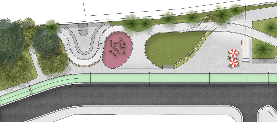
Perspective 01
Section
Detail Plan
Annotations:
1. BMX/MTN Bike pump track. Provides physical activity and recreation to local community. Meets principles of access to recreation and diversity of recreational spaces.
2. Recreational pathway (10km loop) that allows running, cycling, walking, as well as access for emergency vehicles. Meets principles of access to recreation and Micro-mobile network.
3. Outdoor rest area with picnic tables for social gathering. Meets access to social space principle.
4. Toilet facilities
5. Canteen facilities for special events
6 Shelter with seating for outdoor weather protection
7. Decomposed granite trail and path allowing access to creeks and recreation areas. Trail is low maintenance, permeable and resilient in the event of flooding. Meets, Flood protection, Micro-mobile network, and access to recreational space principles.
8. Water runoff from developed zone is of a clean, safe quality, making it suitable for recreation due to drainage infrastructure that treats water runoff to the south before it flows to the focus site. Meets principles of diversity of blue recreational spaces, access to recreational spaces and flood protection
9. Large steps down to creek act as access to creek and seating.
10. Ramps down to creek allow for disabled and water equipment access
11. Small bridge infrastructure over creeks. Flood protection principle.
12. Densely planted tree canopy to create habitat and increase biodiversity.
13. South creek
14. Tree canopy runs along pathways to provide shade and act as screening between path and natural areas. (Reduce noise pollution from path to natural habitat). Habitat conservation principle.
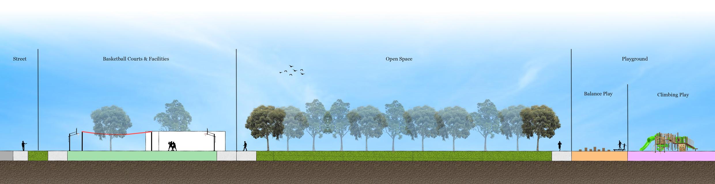
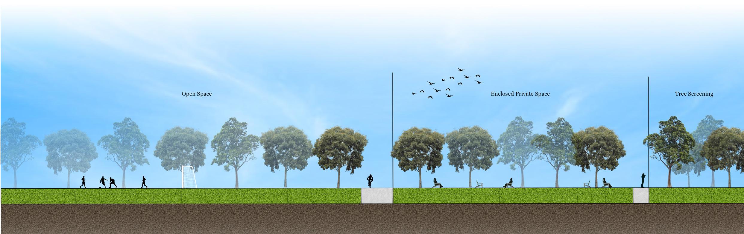
Section

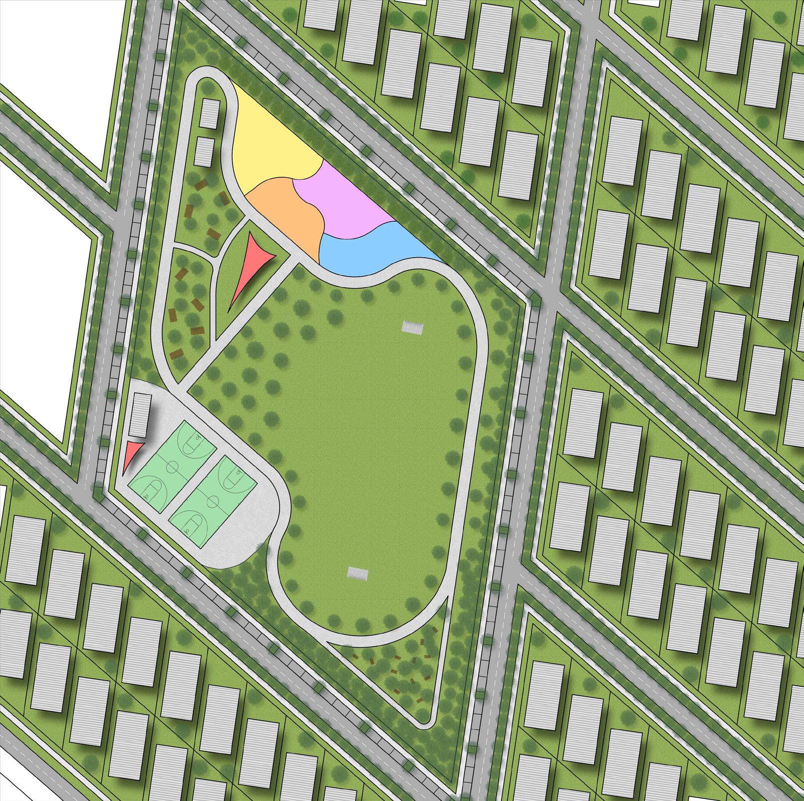
Detail Plan 02
Annotations:
1. Multi use open space to allow for a variety of field activities (eg. soccer, rugby, AFL, etc). Meets access to recreational spaces, diversity of recreation spaces principles.
2. Outdoor basketball courts provide recreation and physical activity. Meets access to recreational spaces, diversity of recreation spaces principles
3. No trees or planting between road pathways and park/basketball courts to allow people to view park space from road and feel invited into space.
4. Outdoor shelter to provide outdoor weather protection (eg. shade, rain, etc)
5. Toilet facilities
6. Outdoor social gathering space with seating for rest and picnic tables for eating and socialising. Meets access to social spaces principle.
7. Outdoor private space that is enclosed by planting and trees to provide a more private and secluded space for study, reading, etc.
8. Dense tree planting to act as noise and viewing screening from road to enclosed private space, creating a more secluded space.
9. Path around park for running, walking, and access to facilities/ infrastructure.meets access to recreational space principle.
10. Playground infrastructure to account for younger family demographics of Blacktown LGA. Access to recreation and social spaces principle.
1. Water and creek play area for a better connection to nature
2. Balance play area for better health and well-being.
3. Climbing play area for better health and well-being.
4. Toddler play area for better socialisation and health and wellbeing.
11. High density residential buildings. 2-3 storey apartments with light coloured roofing to reduce UHI.
12. 1 mature 5m+ Native tree per block to reduce UHI
13. Street tree canopy to reduce UHI and temperature
14. Car parking around park for better accessibility.
15. Shopping/ local area building infrastructure.
Term 2 2023
LAND2272: Design Documentation 2
Location:
Bradfield Park North, Milsons Point
Photograph: Boston Cortis, 2023
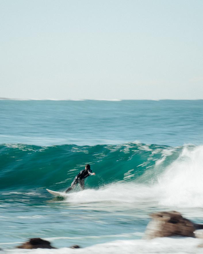
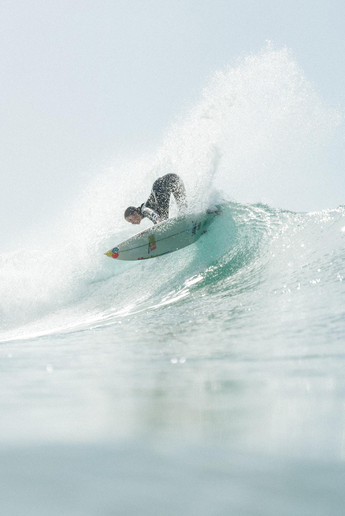
ADDITIONAL DESIGN SKILL
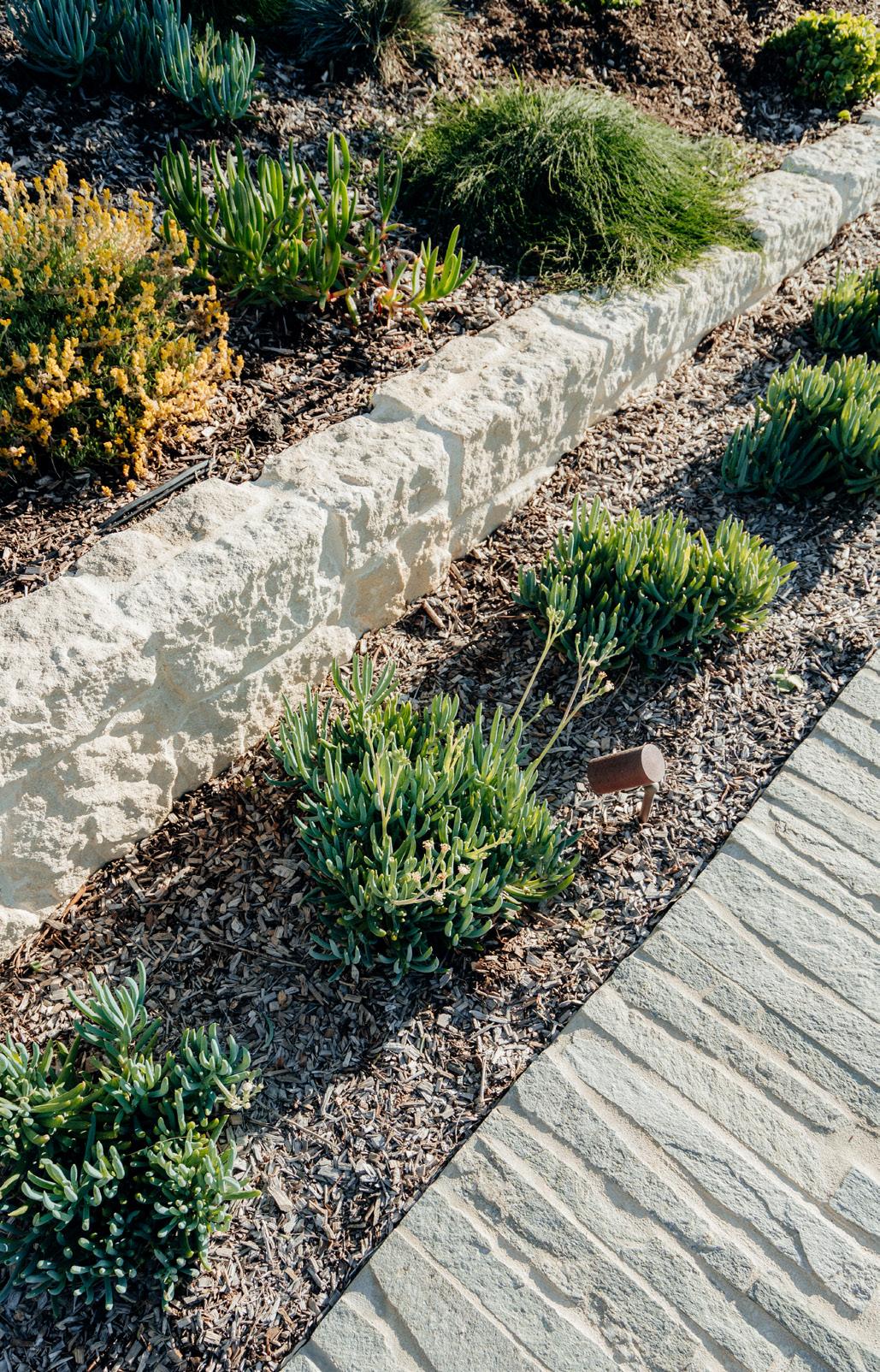
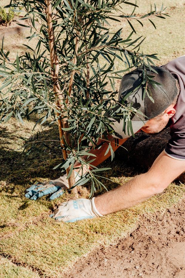
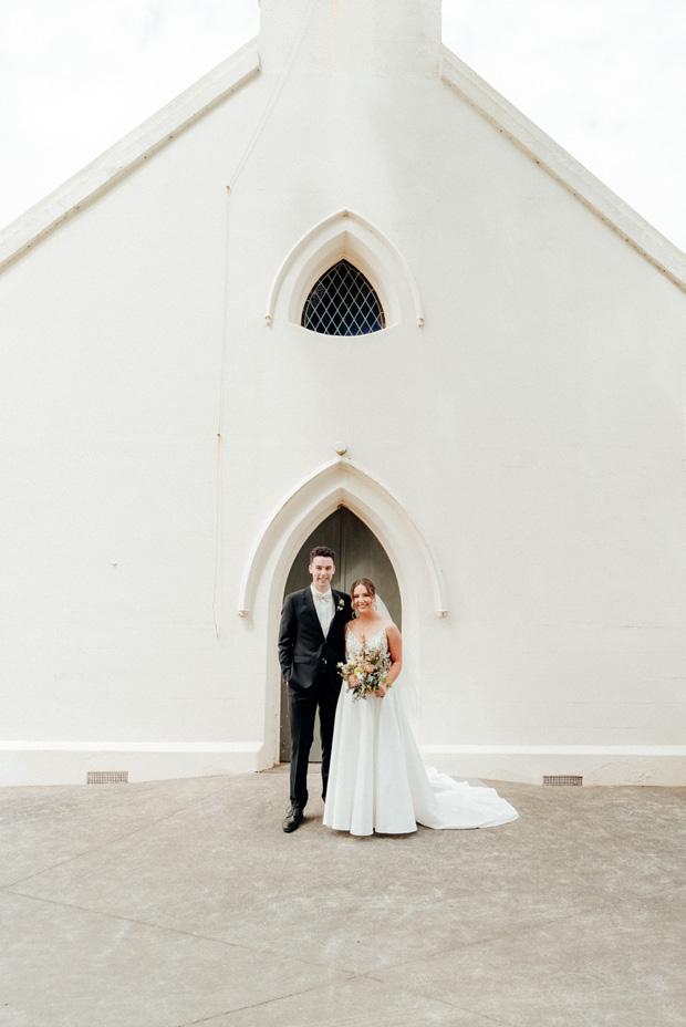
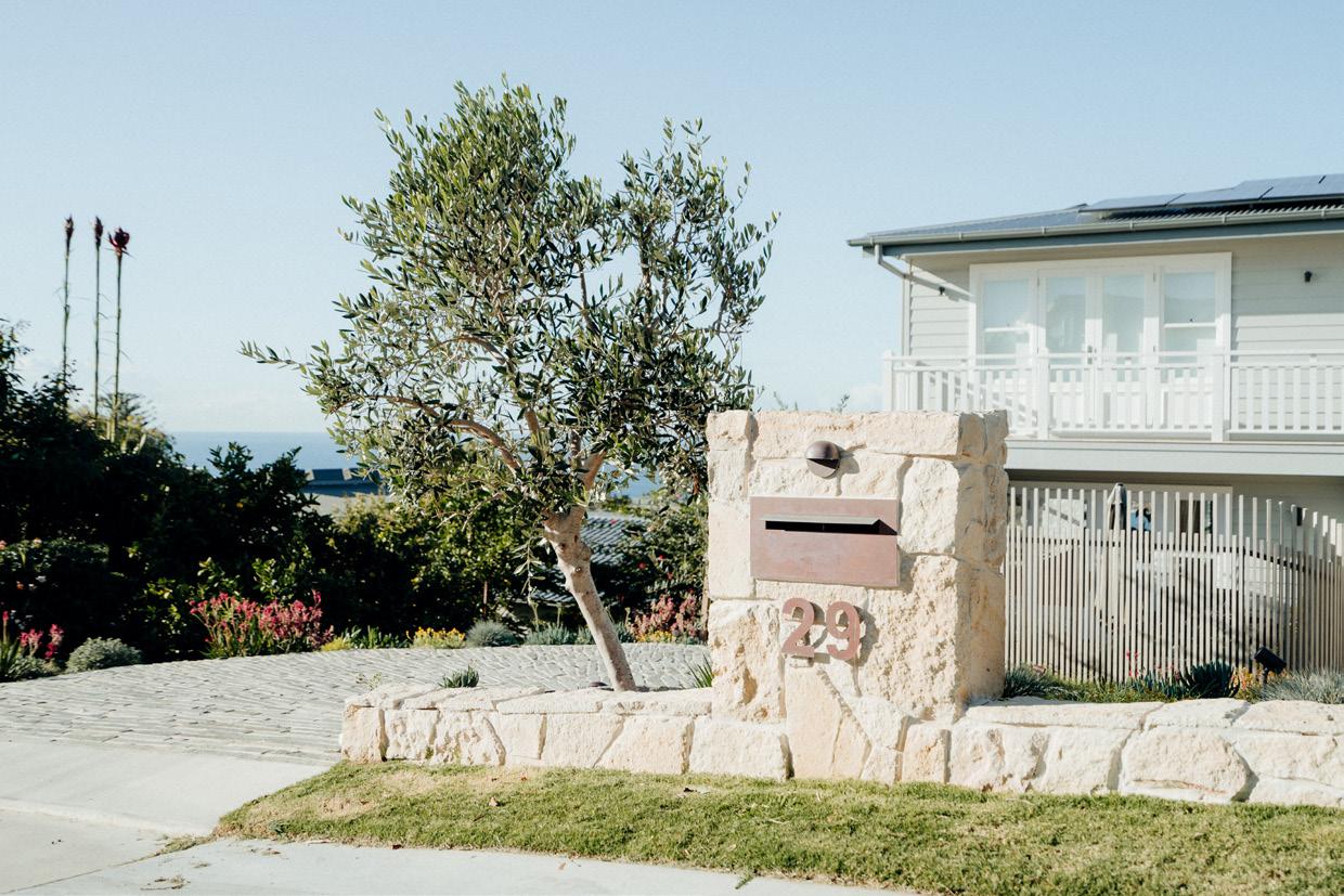
Photography
• Landscape
• Residential Construction
• Real Estate
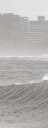
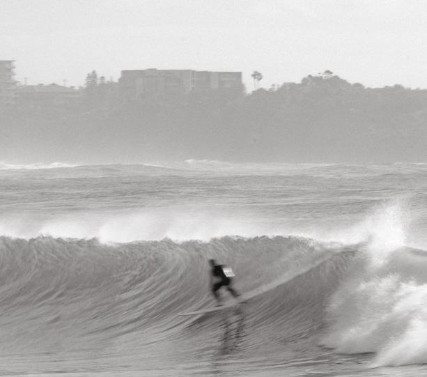
• Sport (Surfing)
• Wedding
• Travel
Photographs: Boston Cortis, 2023
BOSTON CORTIS
Photograph: Boston Cortis, 2023