PORTFOLIO Brooke Mehney
CONTENTS
Regenerating the Range: A Framework for Livestock Management
NASEM Gulf Studio
The Commons: A New Orleans Hostel
Integrated Studio
Tchula, MS: Safety and Domesticity
Town.House. Advanced Research Studio
Muskegon River Residence: A Net-Zero Home
DOE Solar Decathlon Design Challenge
Mixed Media
Selected Works
02 03 01 04 05
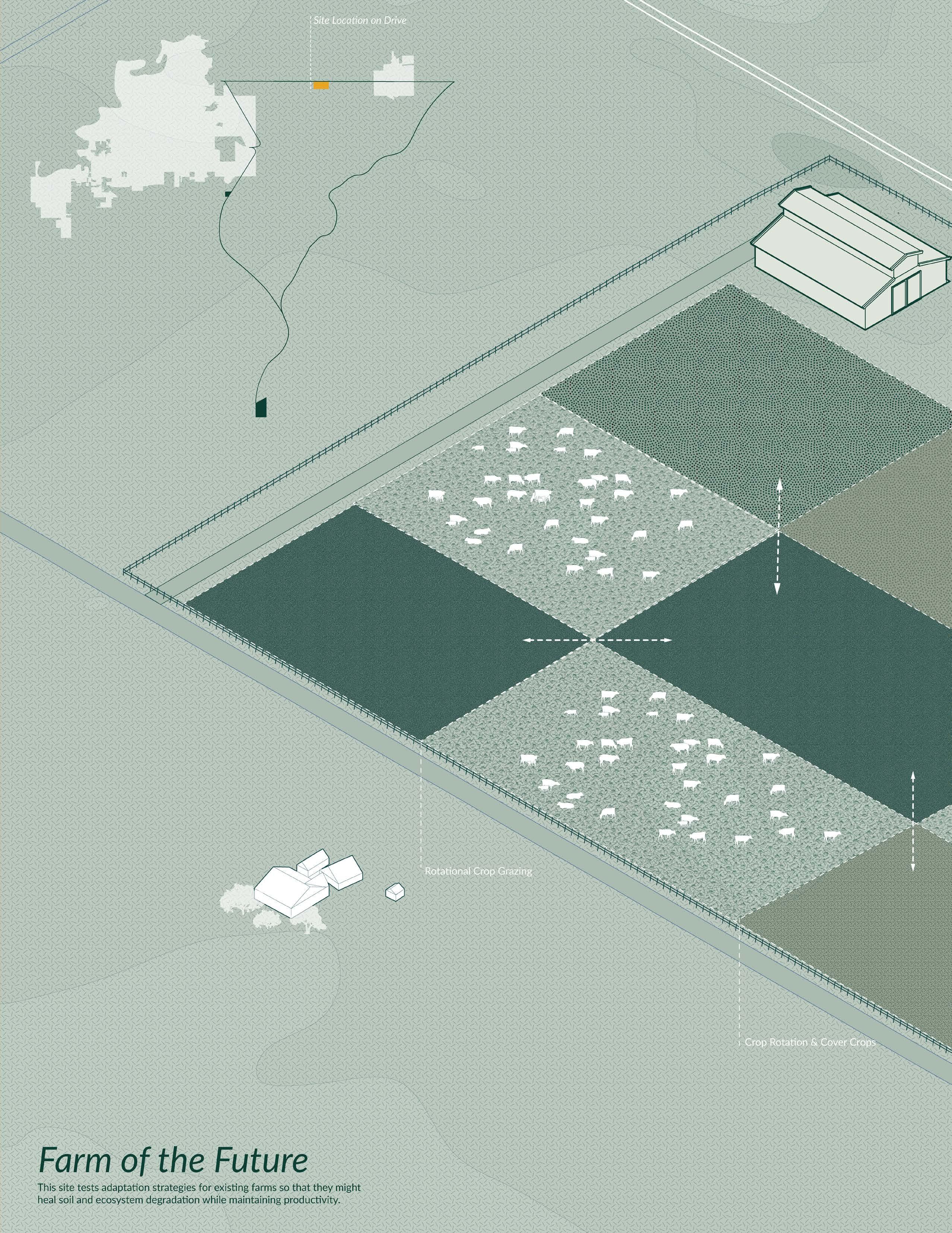
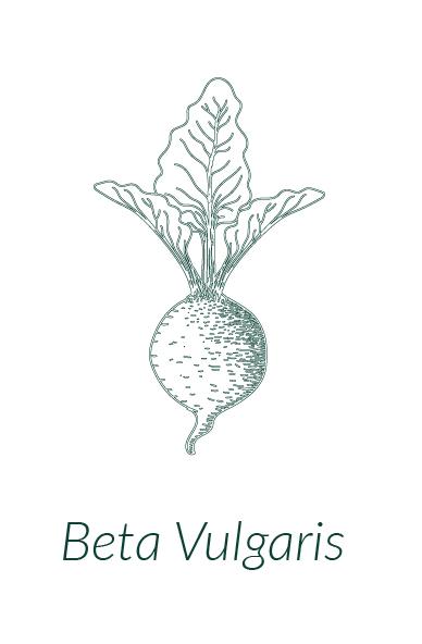
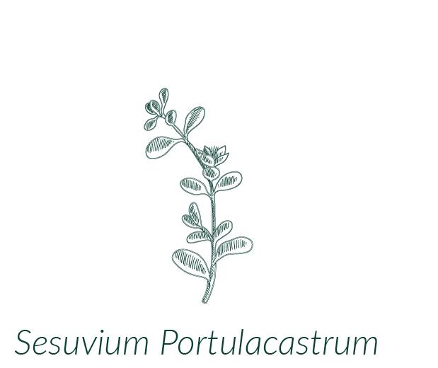
Regenerating the Range: A Framework for Livestock Management in the Gulf South
NASEM Gulf Studio Research for Design, Design as Research
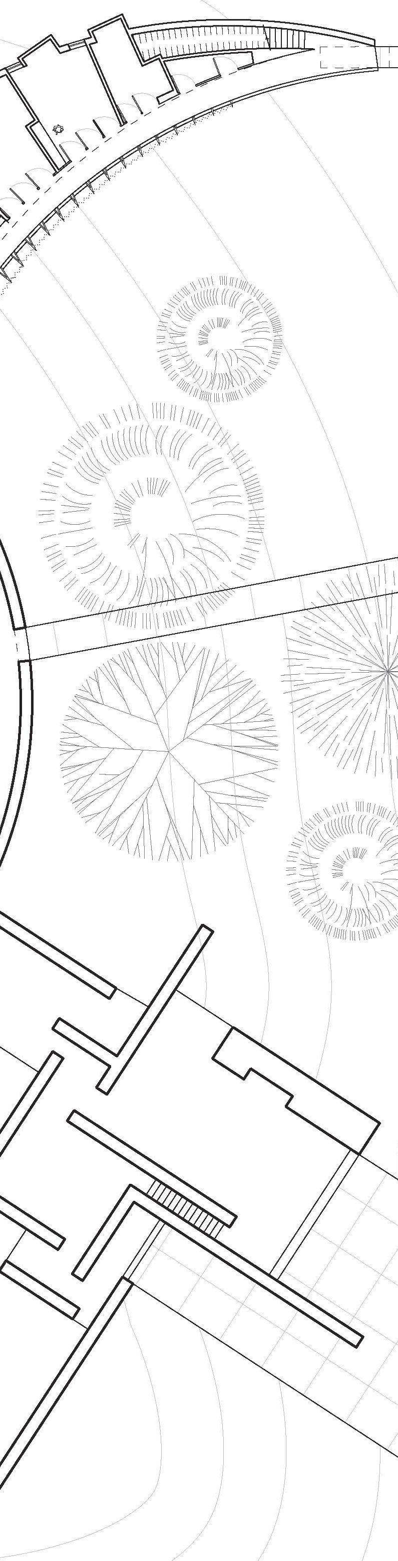
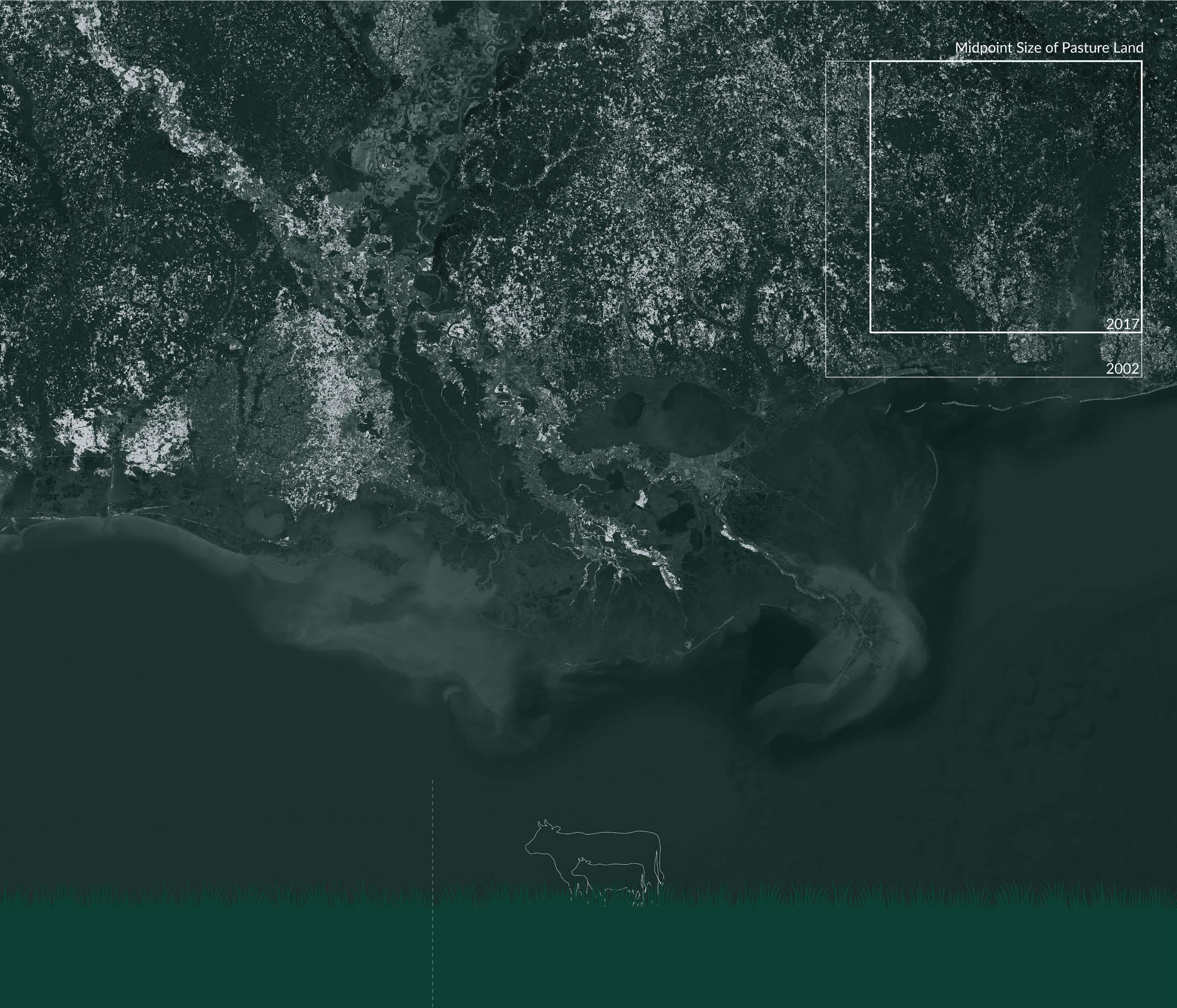
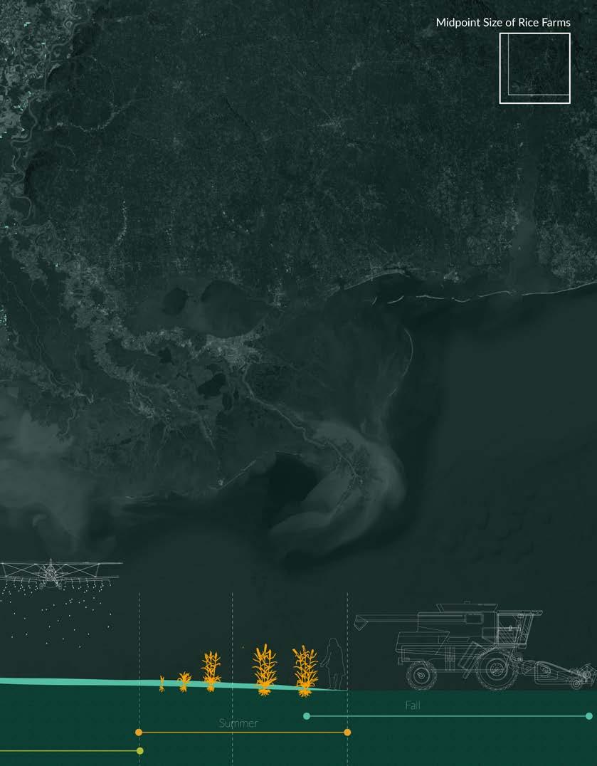
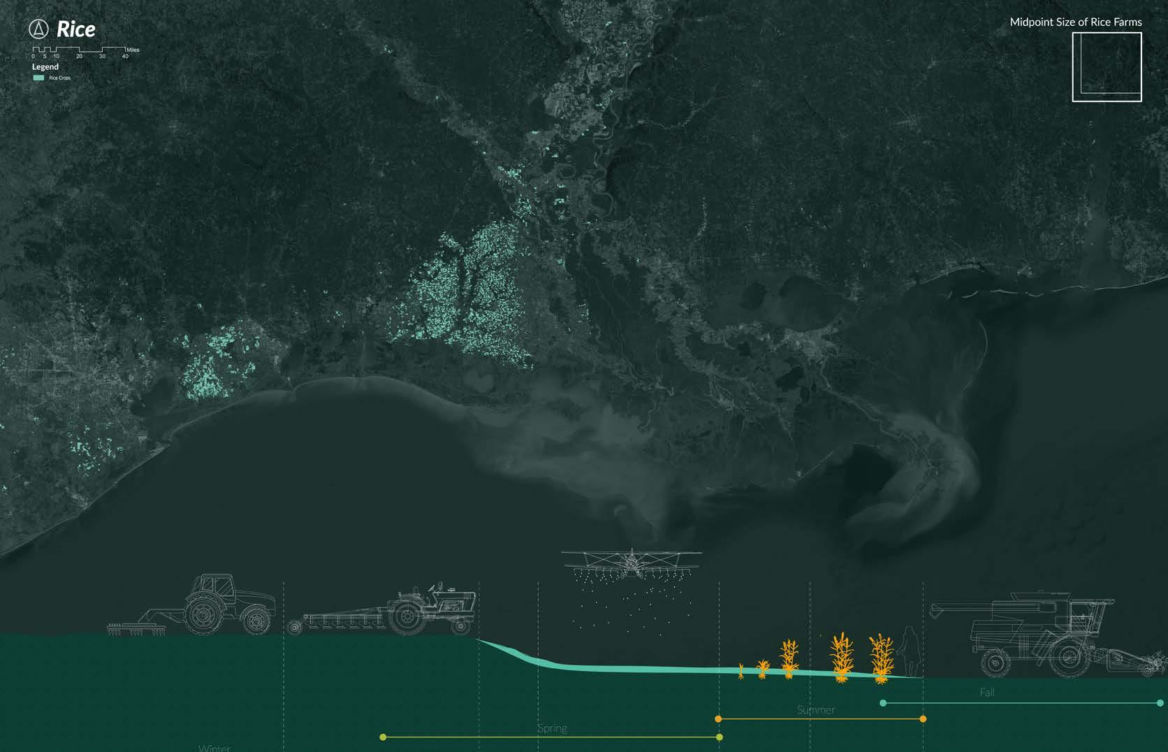
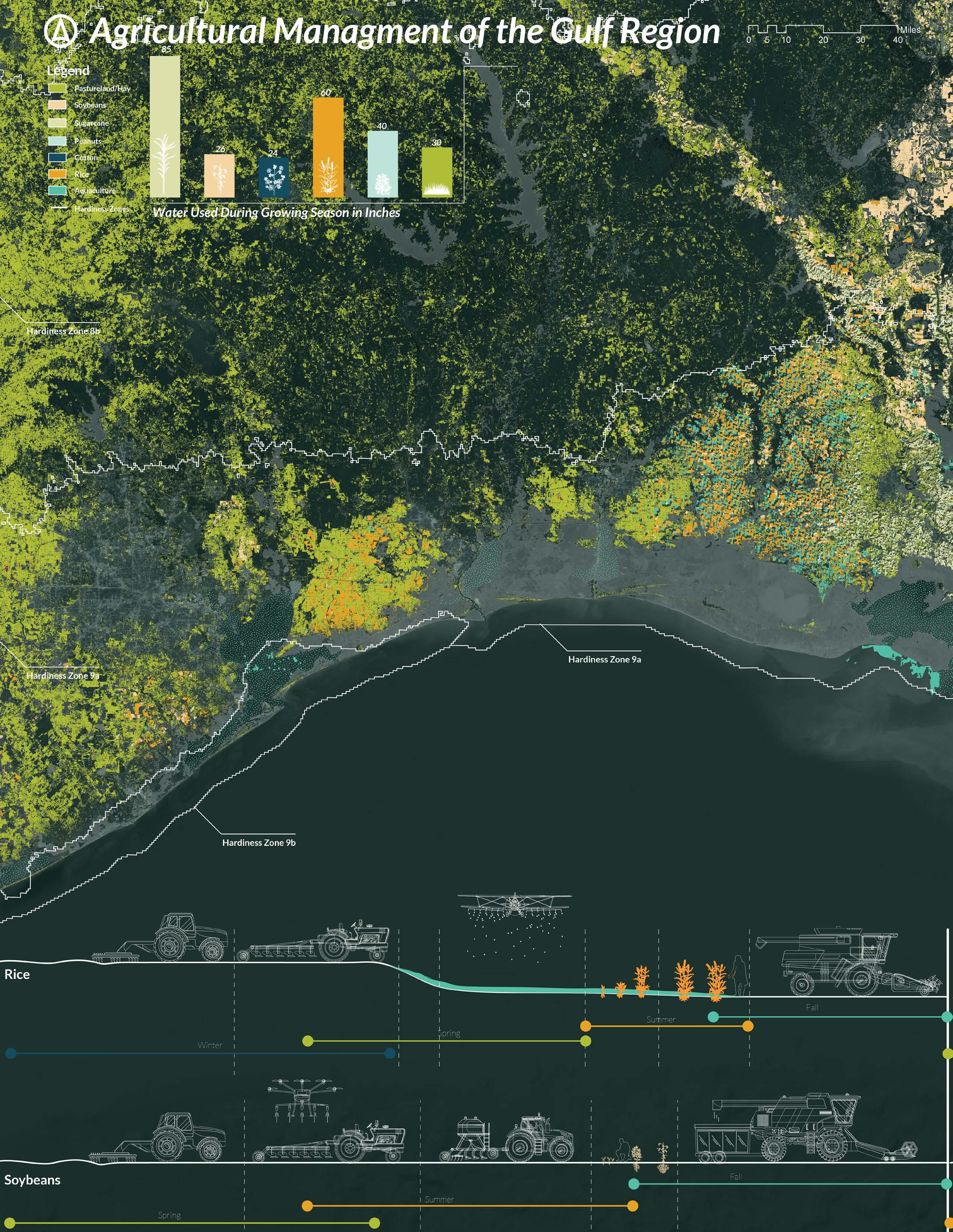
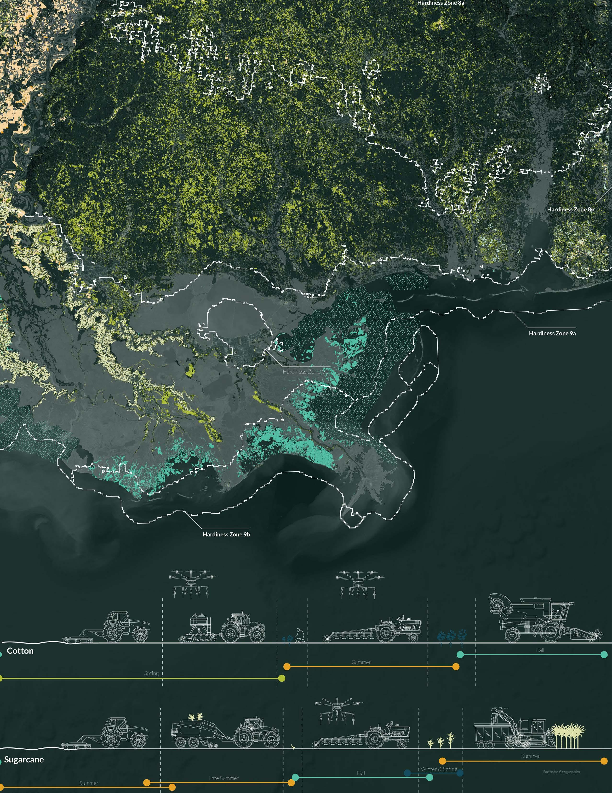
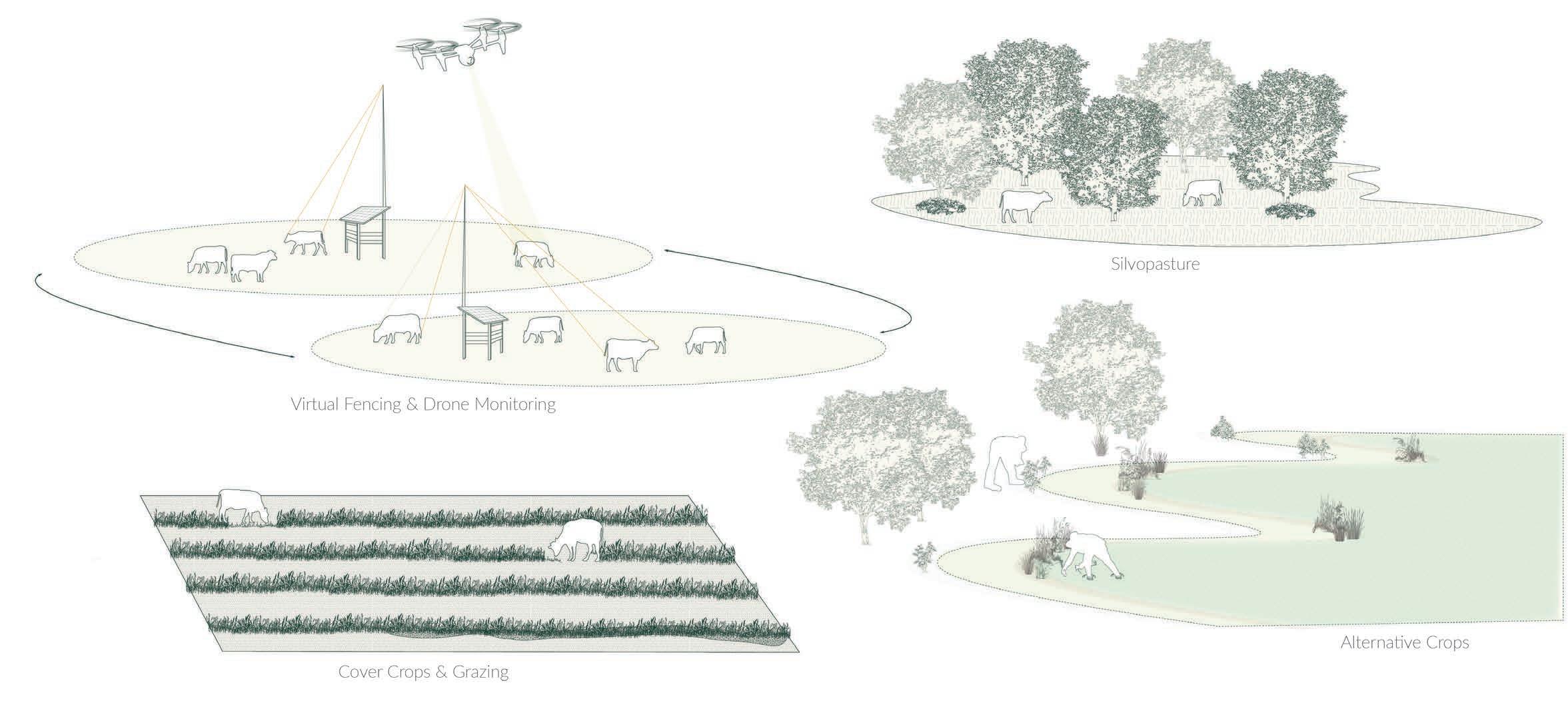
Phase 1 of this design as research project primarily looked at the agricultural practices of the Gulf South region. To highlight the land use for cultivation, I generated a series of maps, with main crops detailed, along with a graphic representation of their growing seasons. Additionally, upon identifying pastureland as a significant human centric, single-use land scape, I conducted additional research into regional historical practices and current technological advancements in the cattle industry of southern Louisiana. This led to my proposal of reinstating the cattle drive as a means for regional grazing utilizing existing and emerging technologies in agriculture.
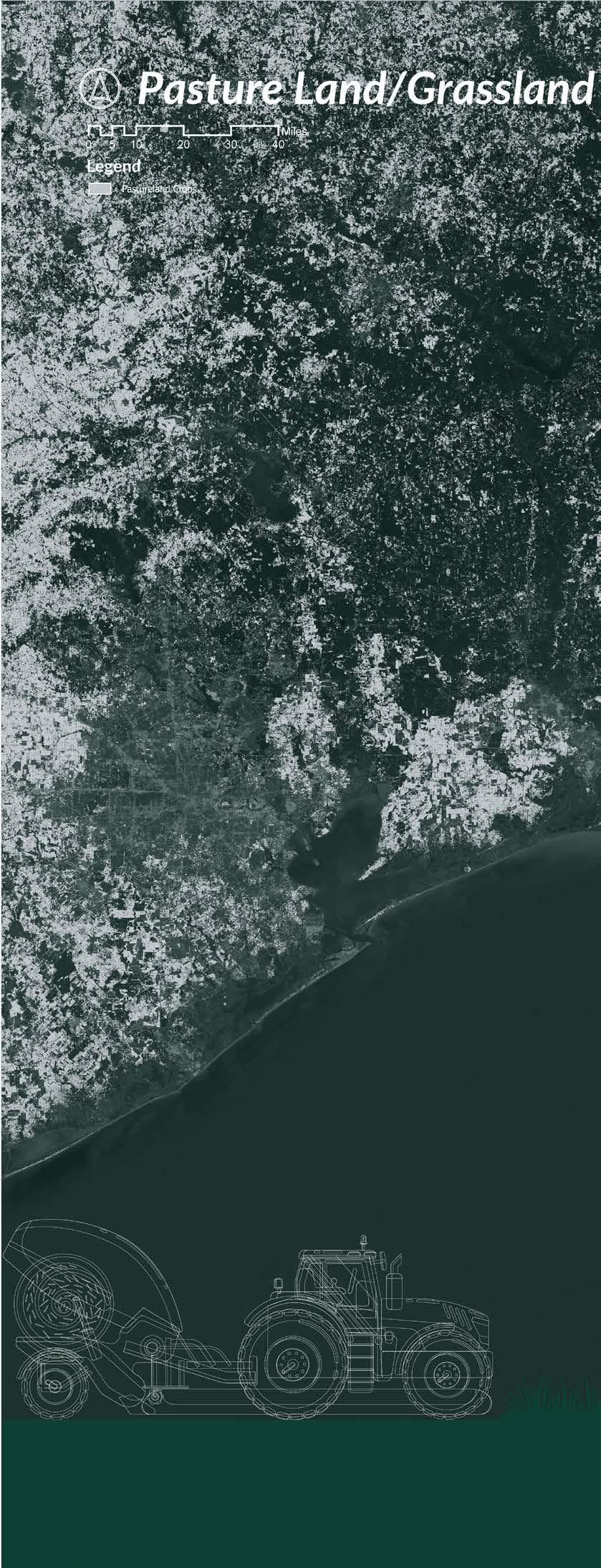
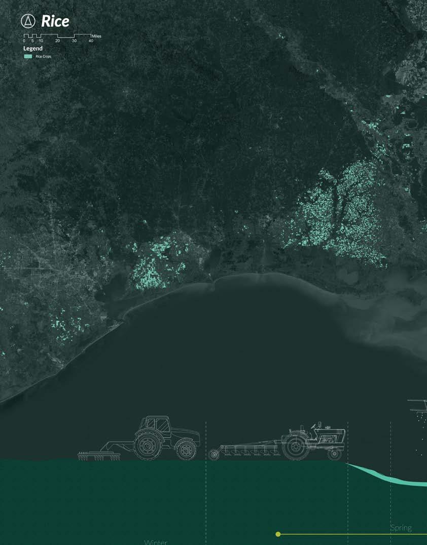 ArcGIS Pro. Rhino 3D, Adobe Illustrator, Adobe Photoshop
01
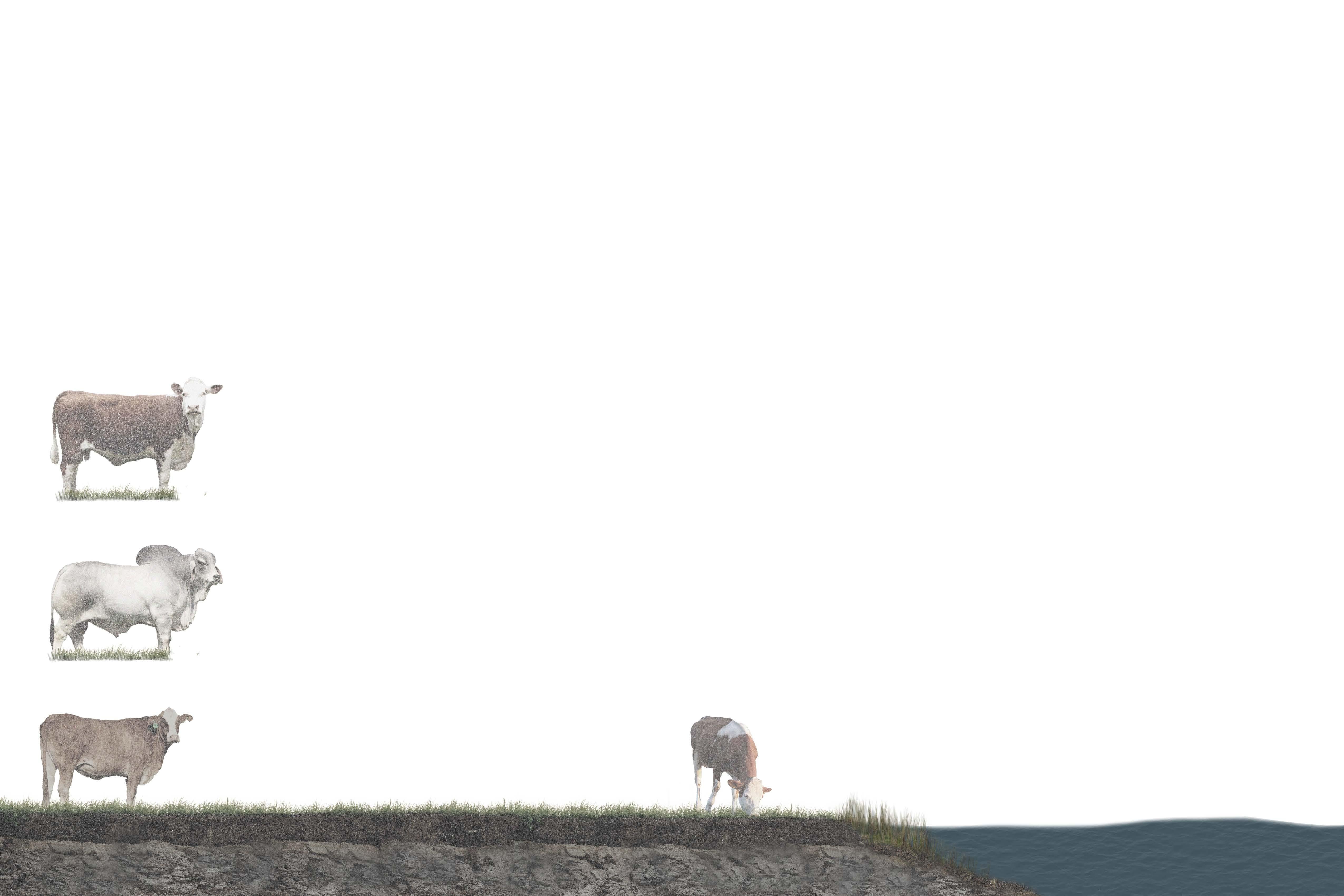
Along with research into the spatial dynamics of crops in the Region, I developed drawings to educate and illustrate regional cattle characteristics that make these animals resilient to the climate and landscape of Southern Louisiana. Further, land requirements for cattle and emerging agricultural technologies are detailed.
100
Hereford
Heat Resistance Insect Resistance
lbs CH4/head/year CH4 NO
tons manure/head/year NH3 N P2O5 K2O S ZN
Strong Maternal Instinct
SF of grass per cow/day
165
12
Brahman Braford
CH4/head/year
Stocking Rates
CH4 manure/head/year
Salinity Tolerance
6-11 hours a day of grazing
<5000 ppm <900 ppm
Cal f
2Acres neededperCow
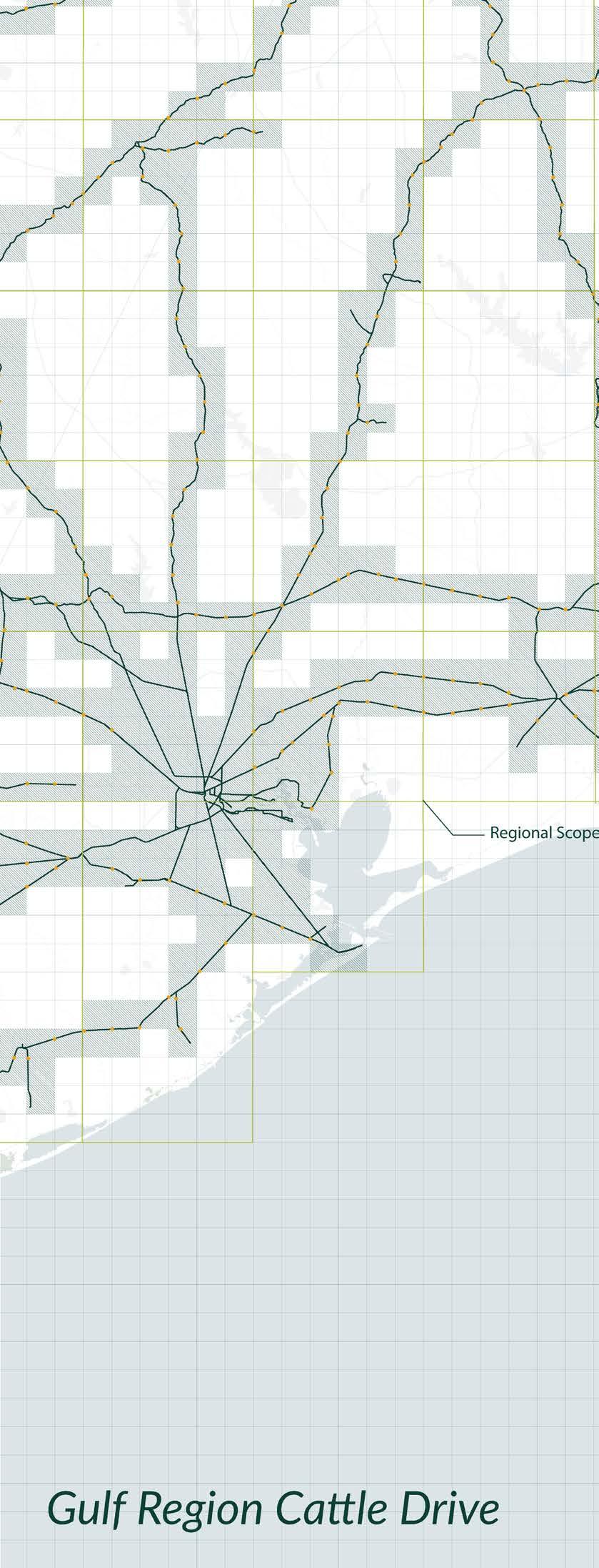
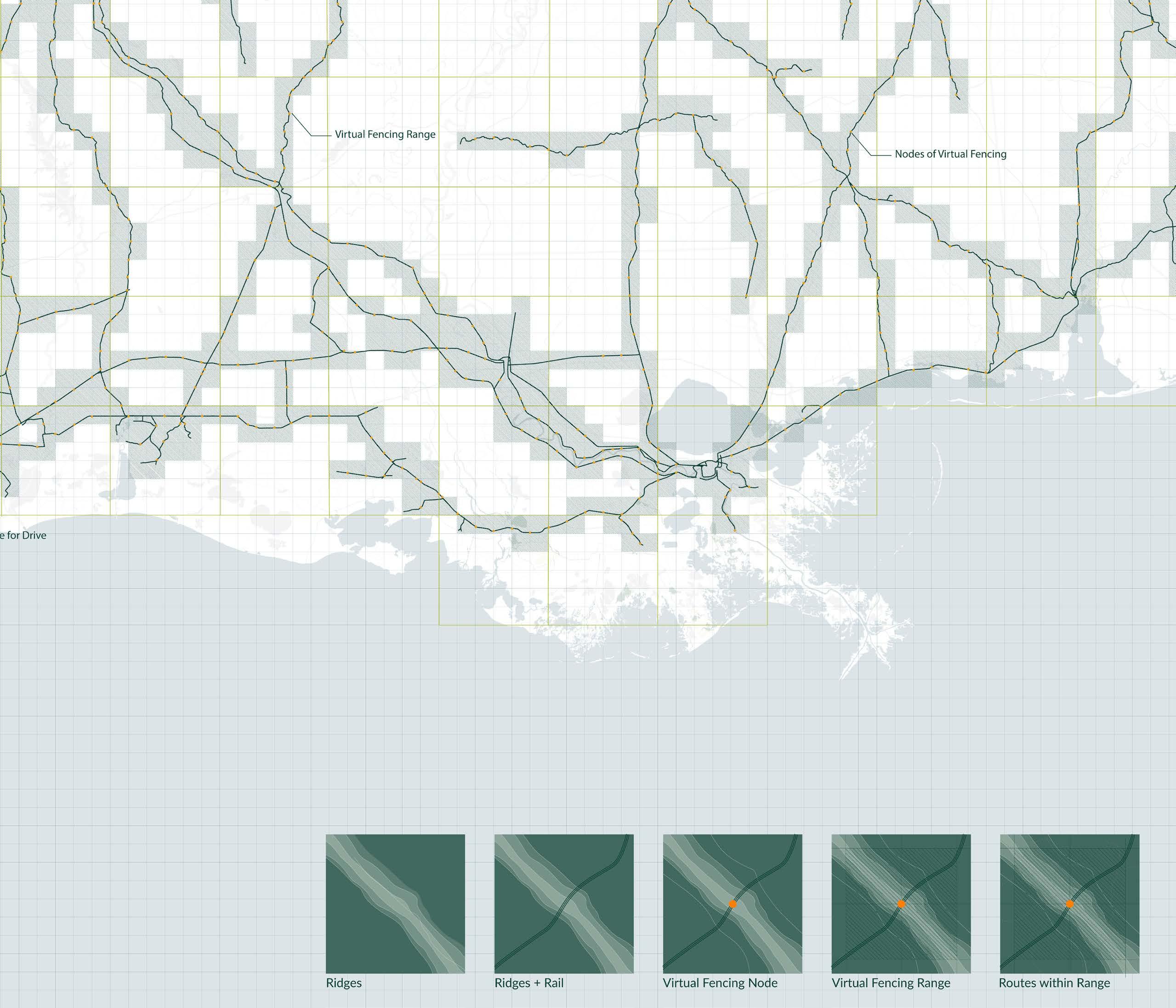
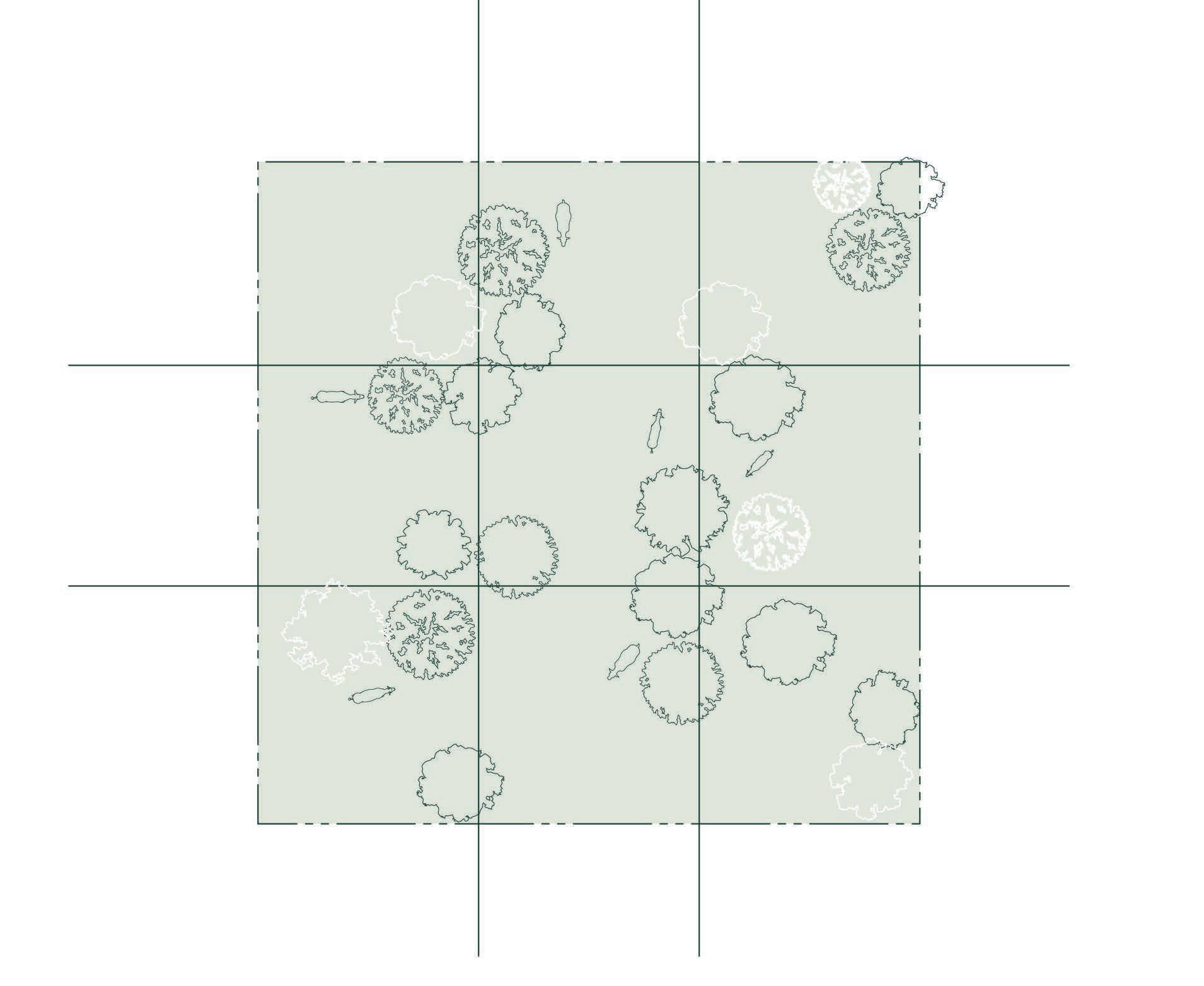
Using virtual fencing, cattle are grazed within the region grid defined by solar powered towers that send signals to collars placed on cattle, which then guide the livestock via audio cues. Due to cattle having higher salinity tolerance and other resiliency adaptations, Louisiana bred cattle can inhabit areas humans cannot, specifically when sea level rise and subsidence begins to shape a new coastal boundary.
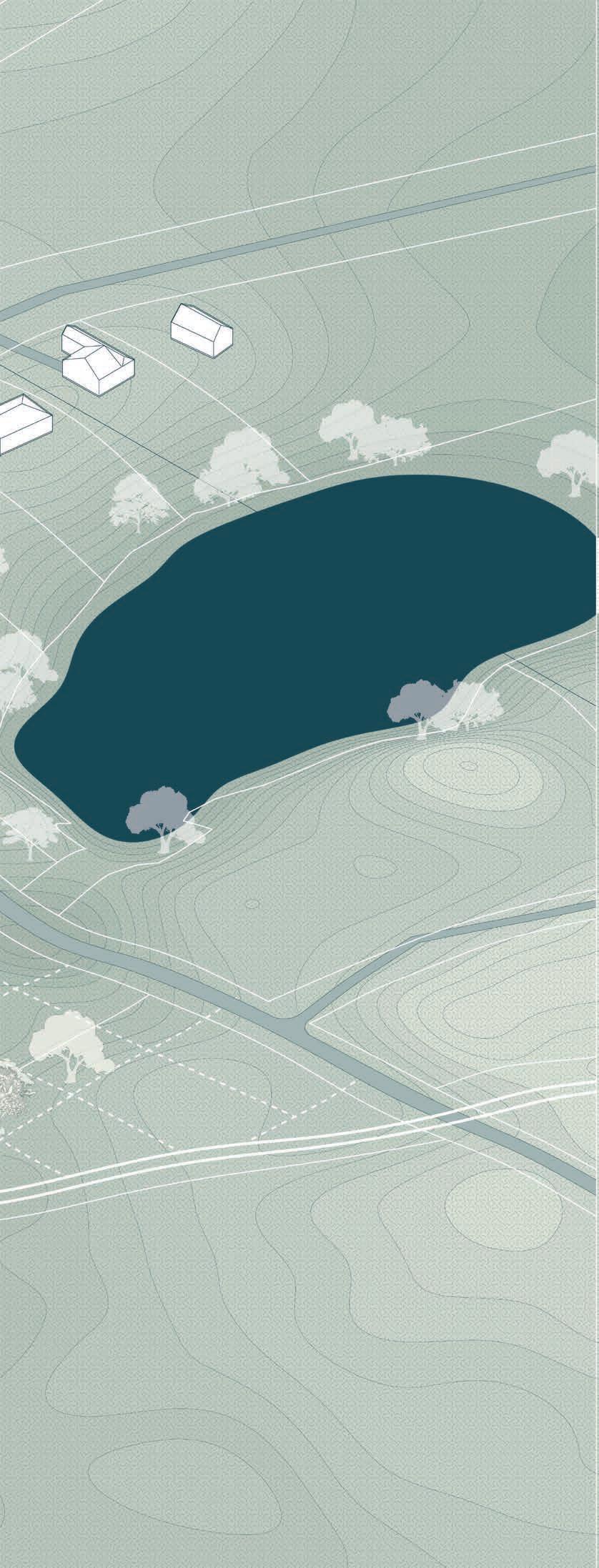
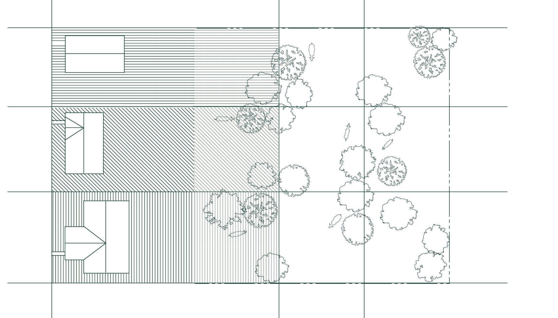
Within this framework, I selected three sites along the path of the new cattle drive, each representative of a current or future condition that affects agriculture: monocultures, sea level rise, and suburban sprawl.
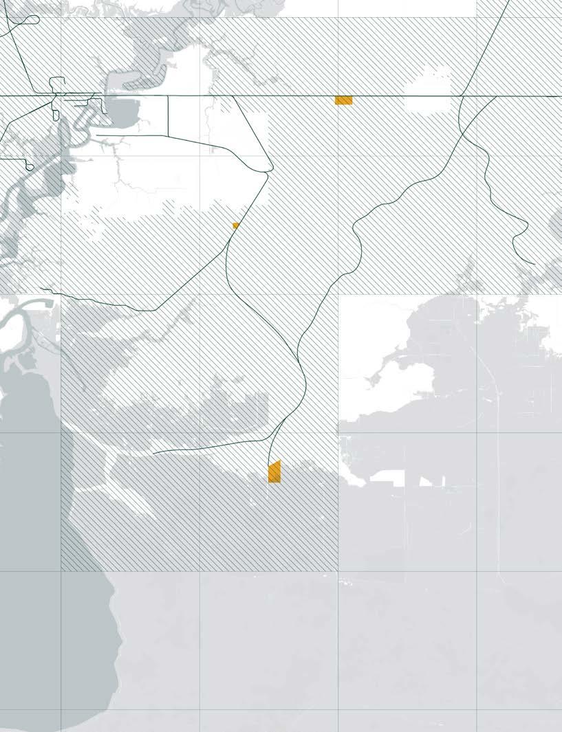
Regional Application
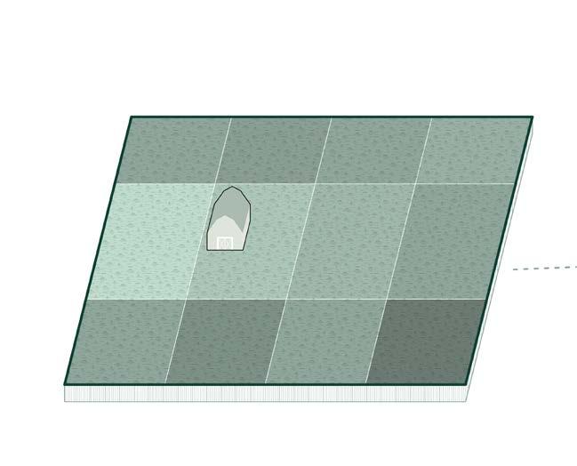
 1. Monoculture Farm
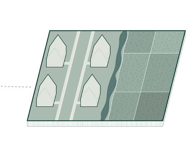
3. Suburbia and Agriculture Intersection
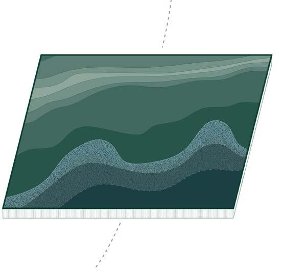
2. New Coast
1. Monoculture Farm
3. Suburbia and Agriculture Intersection
2. New Coast
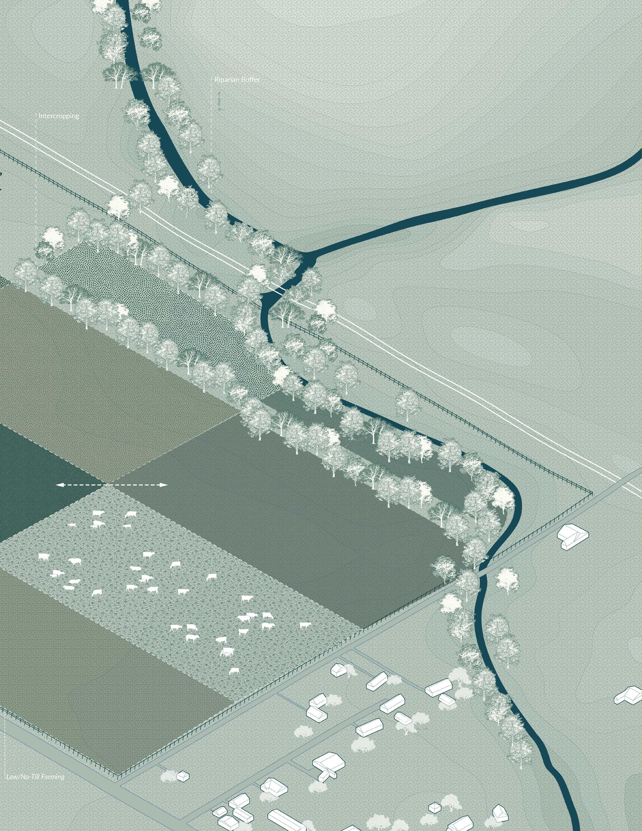
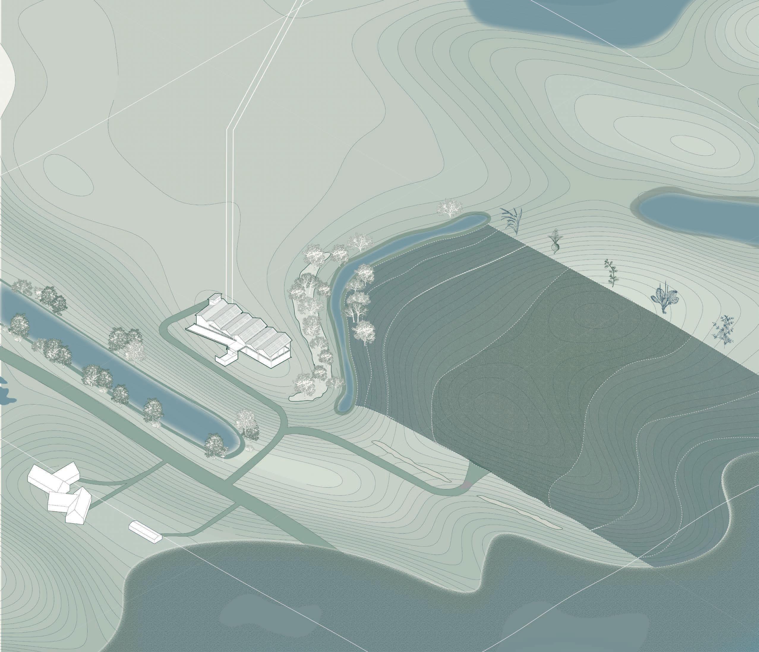
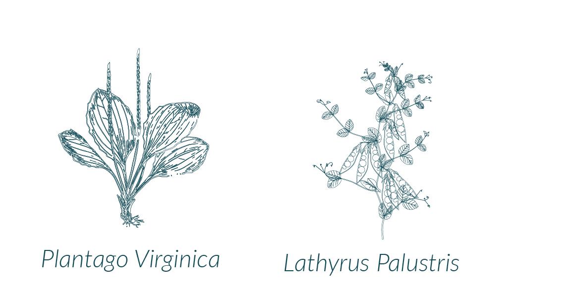
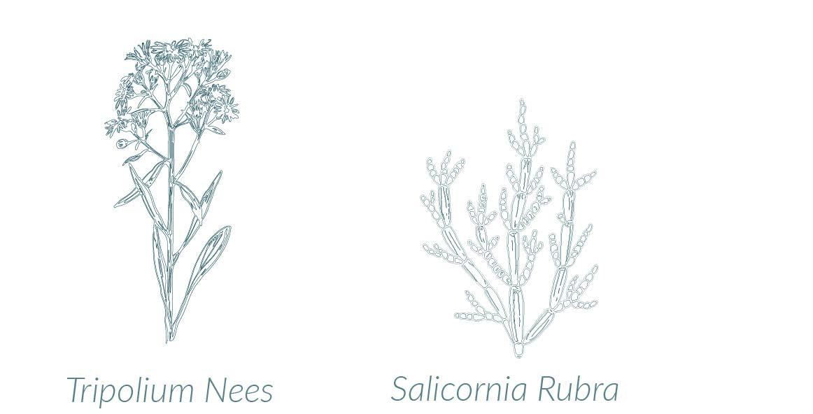
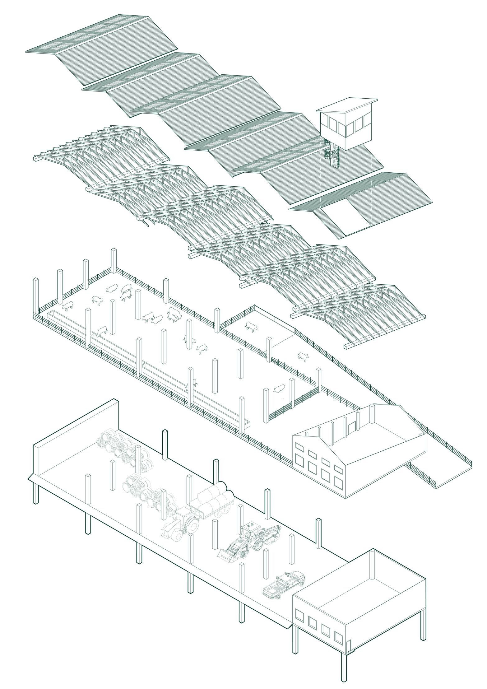
Southern Louisiana Land and the agriculture it supports is increasingly threatened by climate change and as a result, sea level rise. Imagining the creation of a new landscape when sea water intrudes significantly inland, this proposal develops a new way for crop cultivation and cattle to inhabit the fringe. The site acts as testing ground for the creation of artificial chenier ridges, cultivation of meat alternatives in a brackish ecosystem, and finally a stilted barn prototype for both cattle care and technology storage.
New Coast due to Sea Level Rise
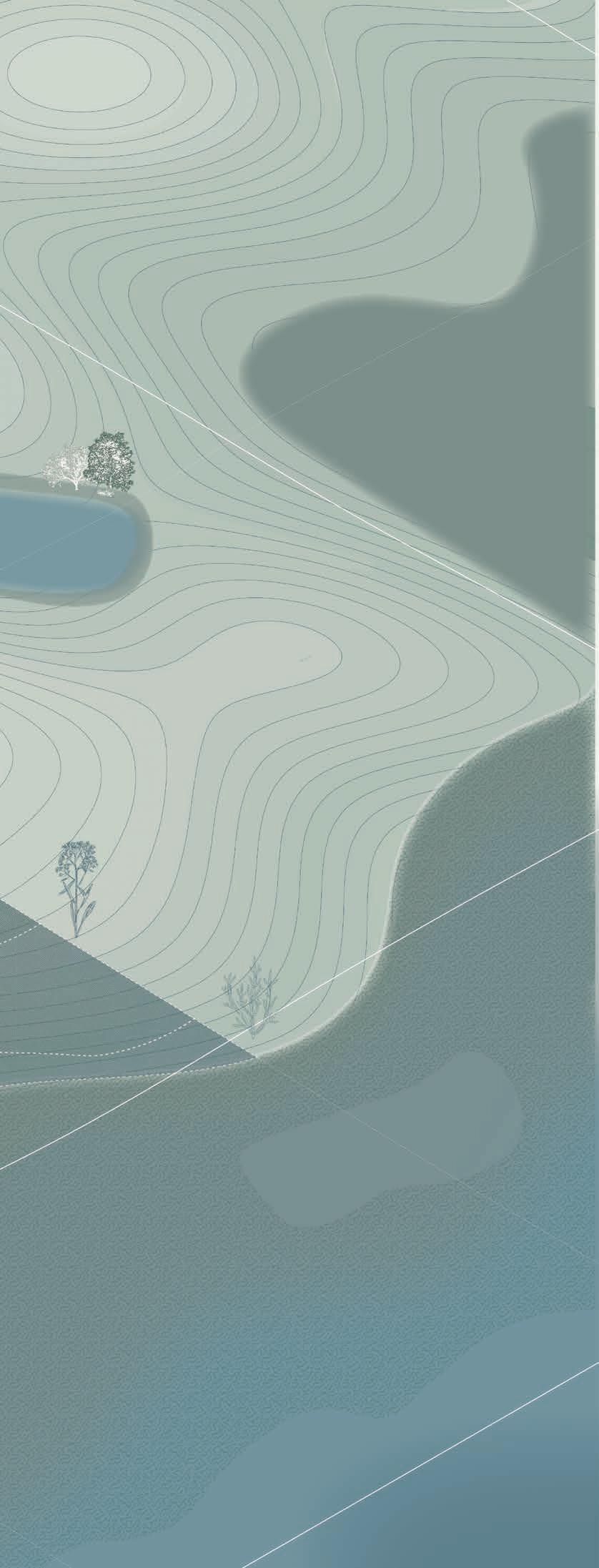
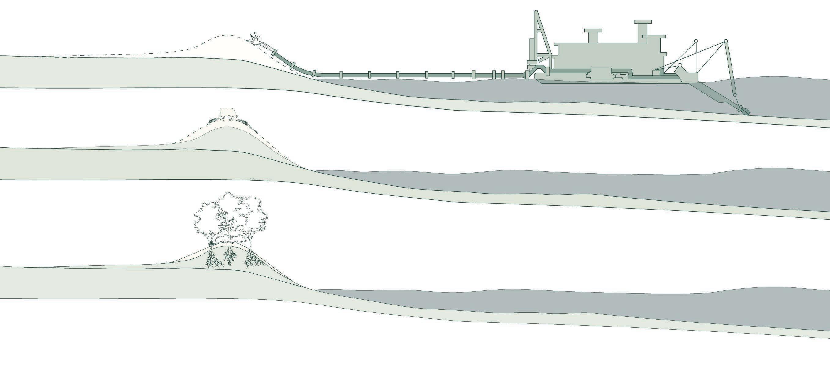 Creation of an Artificial Chenier
Cow Excrement
Dredged Material
Stilted Barn
Creation of an Artificial Chenier
Cow Excrement
Dredged Material
Stilted Barn
Human + Cattle Interface Preserved Greenspace Animal/Forestry Product Acess
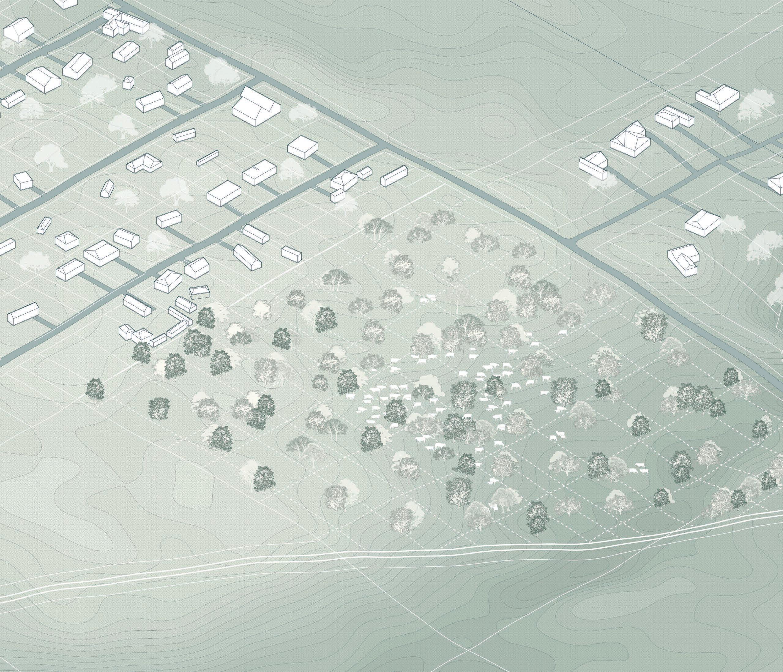
Suburbia + Cattle
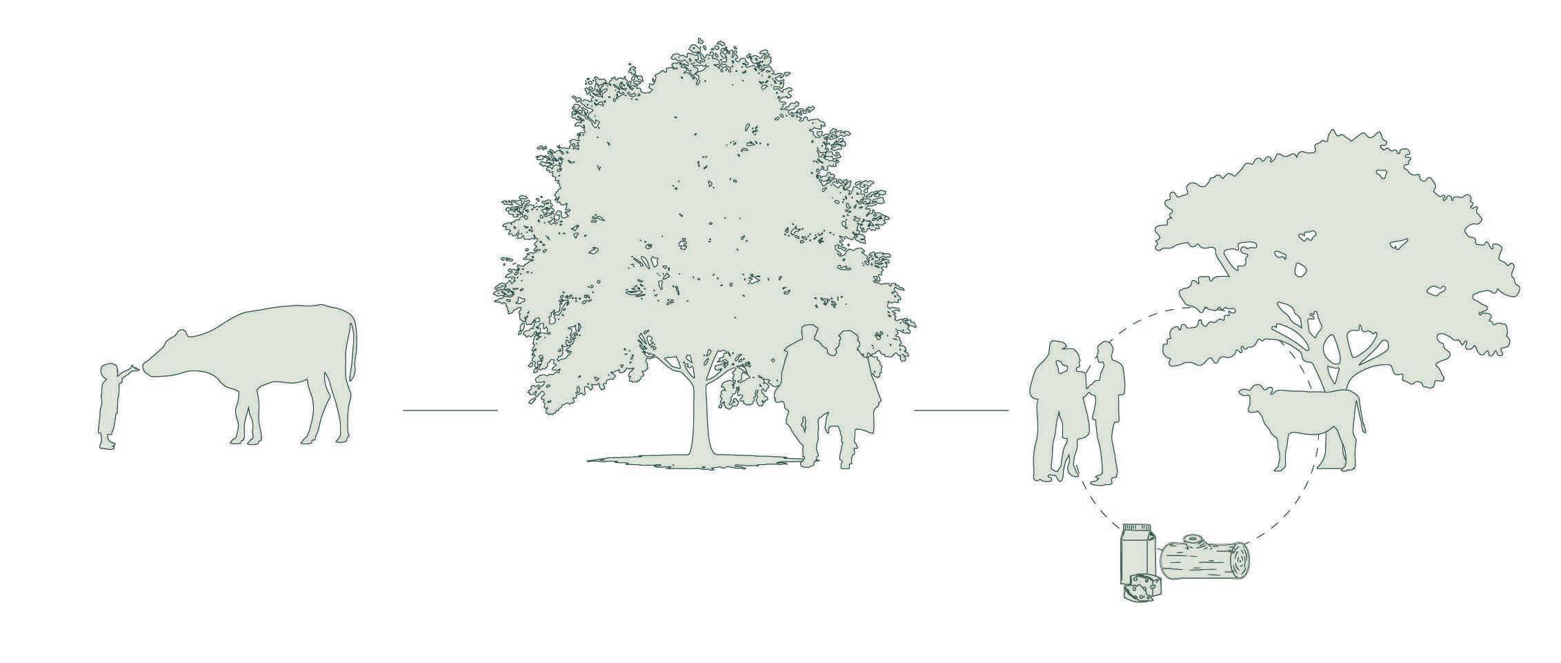
The locations where agriculture and suburban sprawl meet continue to be spatial points of conflict. This site and the resulting proposal offer a new methods for cattle raising that plays into the suburban grid and decreases the distance between the consumer and the agricultural process. By extending the grid, suburban residents can steward a “plot” of the pasture, and claim ownership of both the cattle and agroforestry products that reside upon it. This system preserves greenspace for suburban residents, prevents additional sprawl, and allows for a direct human + animal interface that can serve as an educational tool.
Ownership of Pasture Lots via Extension of Suburban Grid
Agroforestry + Silvopasture
02
NEW ORLEANS HOSTEL
INDIVIDUAL GRADUATE ACADEMIC PROJECT RHINO, ADOBE ILLUSTRATOR
The Commons: A New Orleans Hostel
Integrated Studio Research for Design
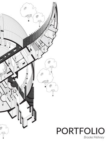
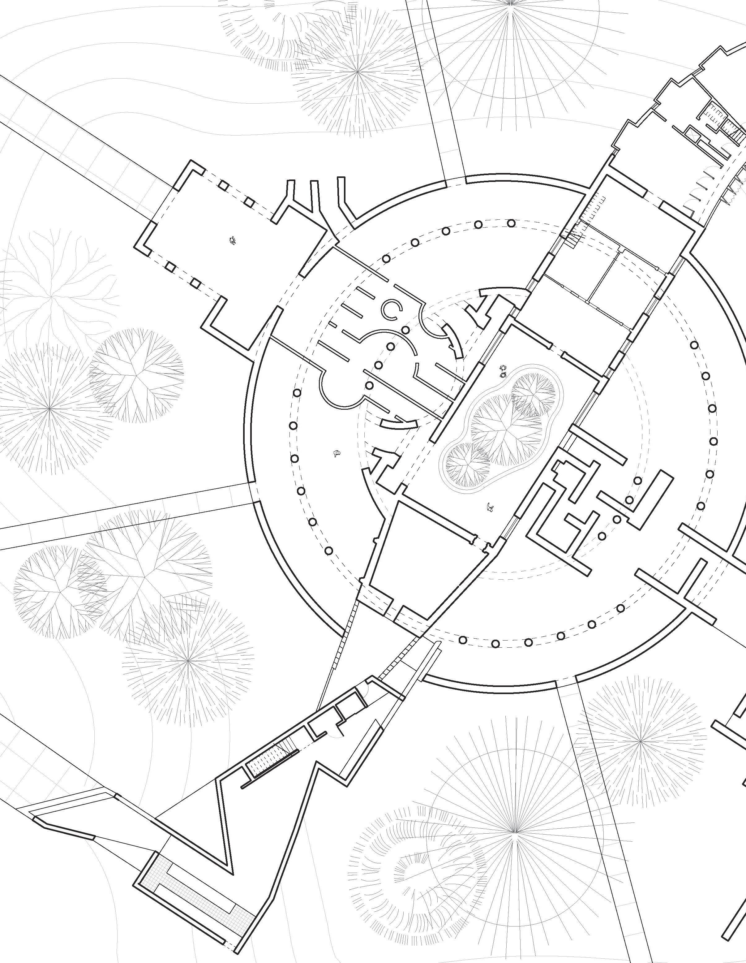
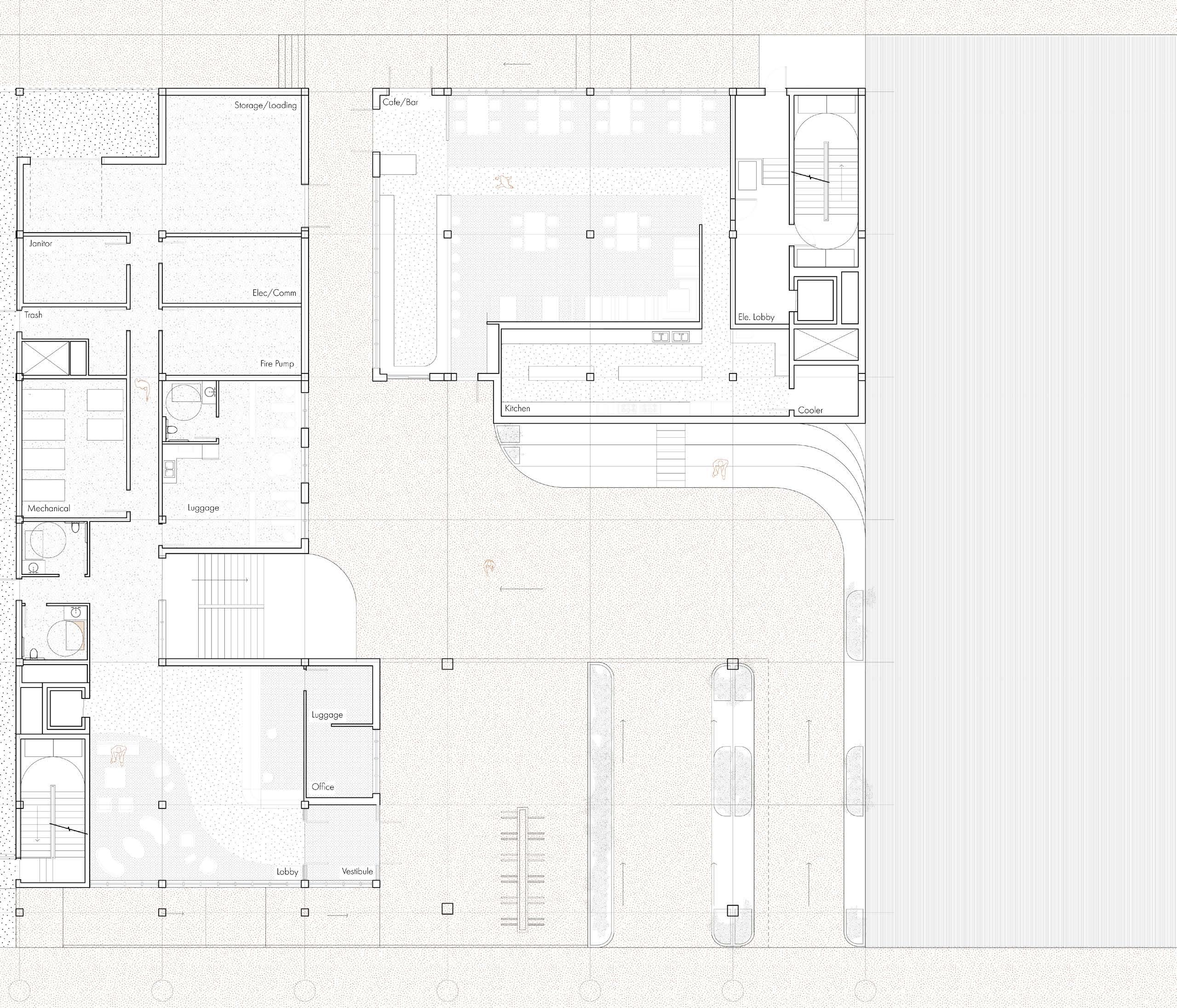
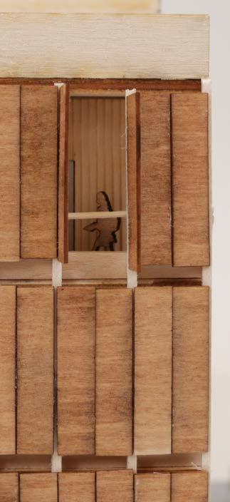
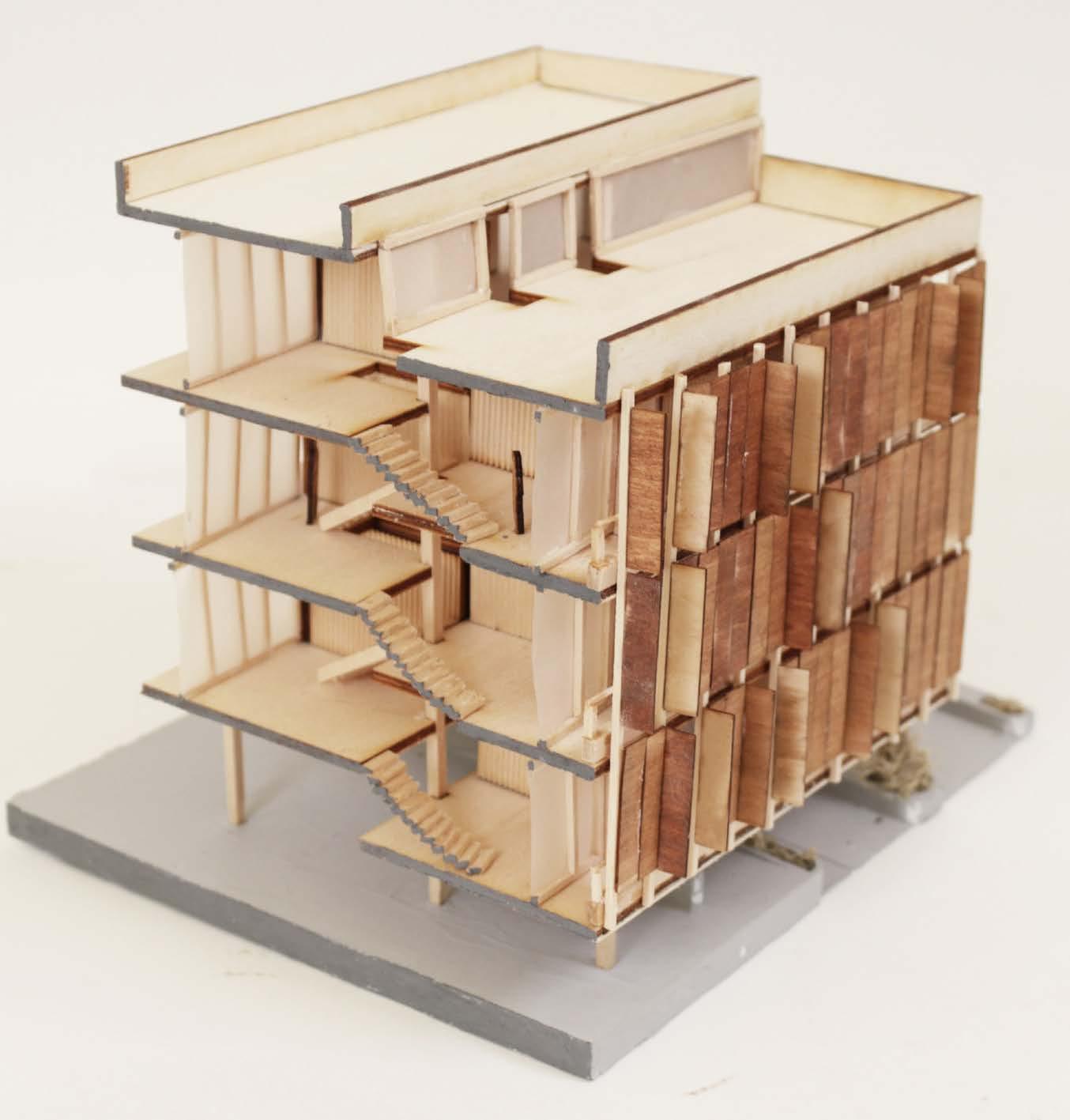
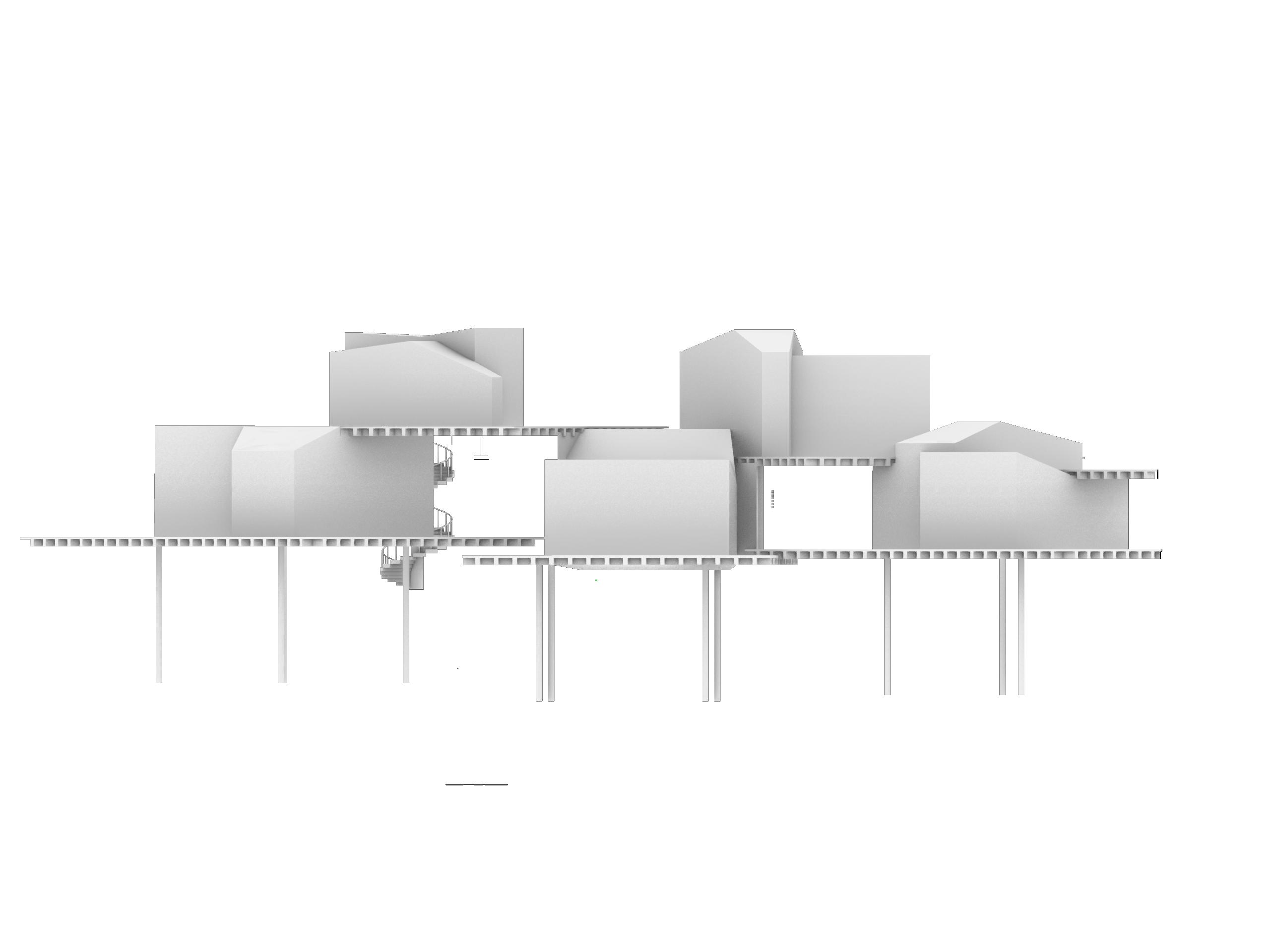
A proposed hostel for Integrated Studio, this building engages the sectional relationship between the public and private hostel sphere. To show the project in its totality, this section perspective was generated to highlight the project relationships between the entry, courtyard, dining spaces, and guest rooms.
A proposed hostel for Integrated Studio, this building engages the sectional relationship between the public cityscape and private hostel sphere. The existing site served as a pedestrian thoroughfare between Rampart St and Basin St as the only break in the street facade. To retain this function, the building features a public plaza with intentional seating and programmed functions
Rhino 3D, Adobe Illustrator, Adobe Photoshop, Enscape, Physical Modeling
01
Section Perspective
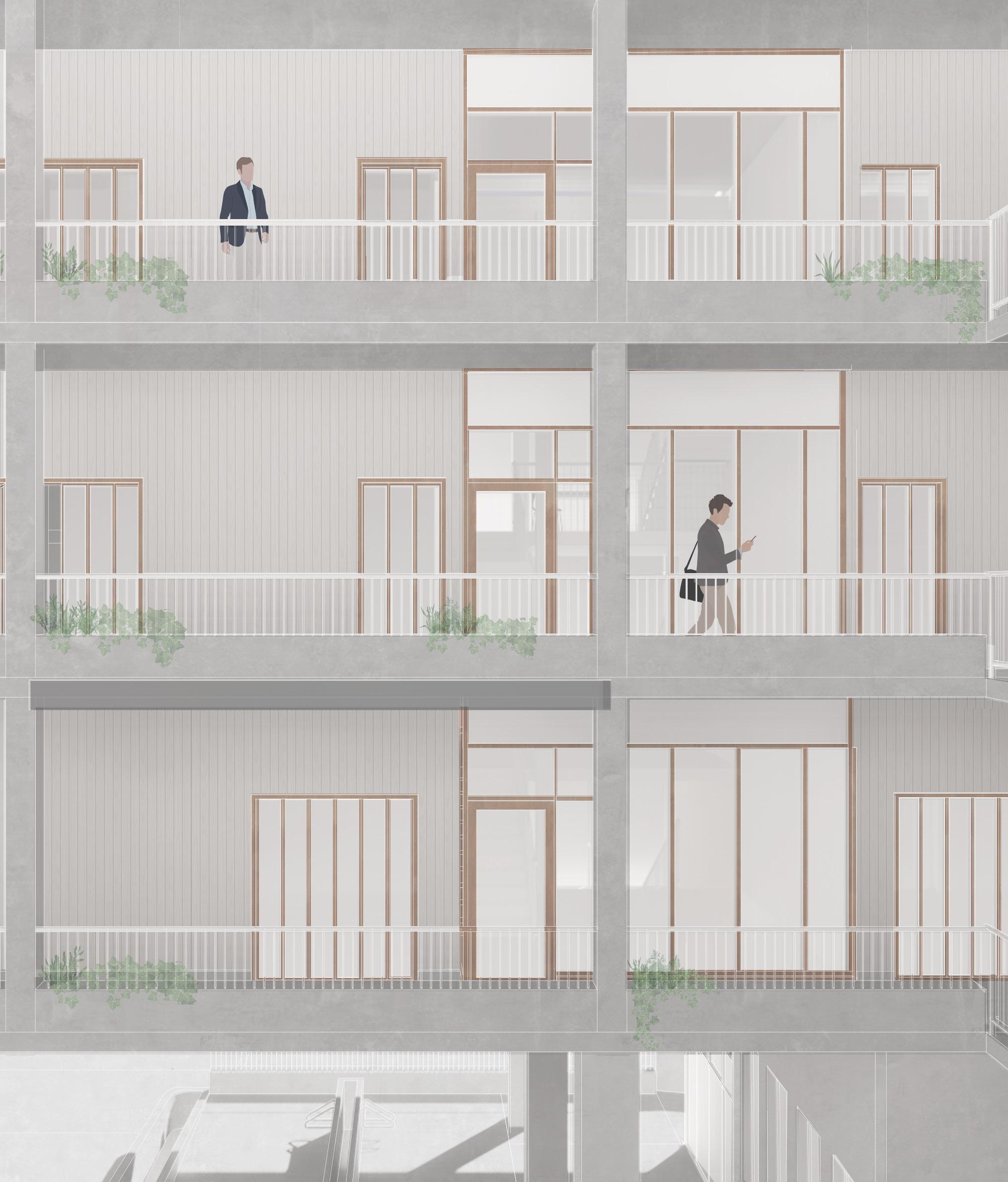
To connect the concept of the building within the hostel rooms, these spaces are comprised of unique modules that connect to outdoor galleries which serve as both circulation and public gathering space. Each room module is reflected in the operable panel facade, allows for a dynamic facade controlled by hostel guests. These panels reflect the language of the French Quarter, where window shutters are common and a means for ornament, Offset floor plates allow for varying ceiling height and a unique sectional experience that ties into views of the city.


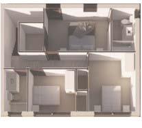
First Floor Plan
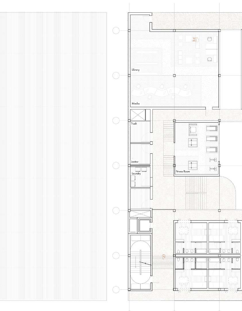
Second Floor Plan Site Plan
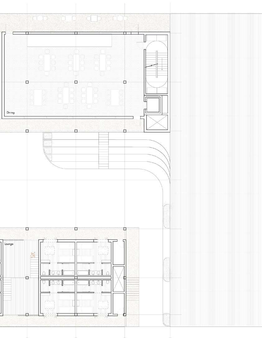
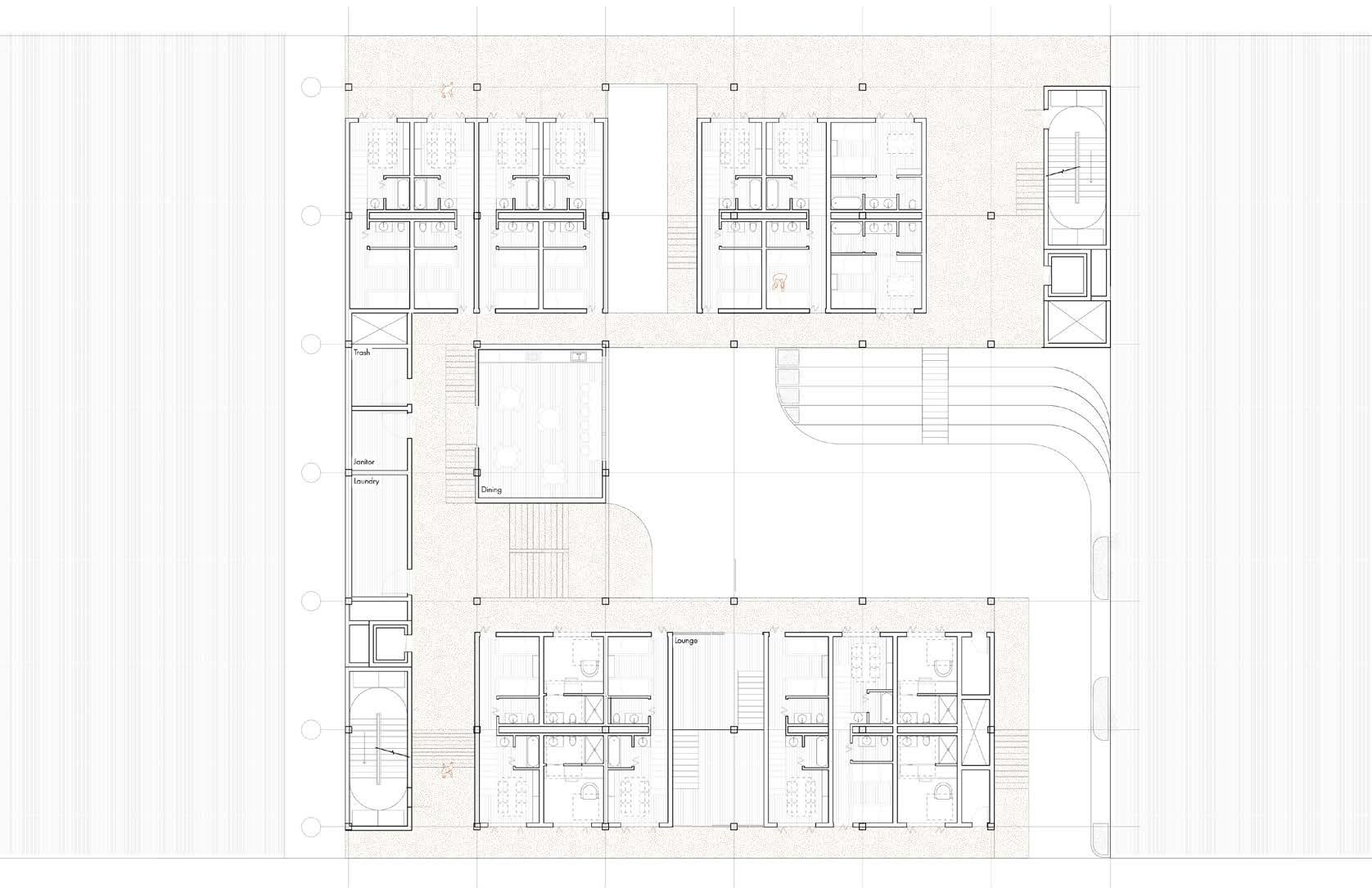
Third Floor Plan

Single Bed Module
NEW ORLEANS HOSTEL
GRADUATE ACADEMIC PROJECT ADOBE ILLUSTRATOR, ADOBE PHOTOSHOP for Integrated Studio, this building engages the sectional between the public and private hostel sphere. To address this hostel rooms, these spaces are comprised of unique connect to outdoor galleries which serve as both circulation gatherings spaces.
Four Bed Module
Six Bed Module
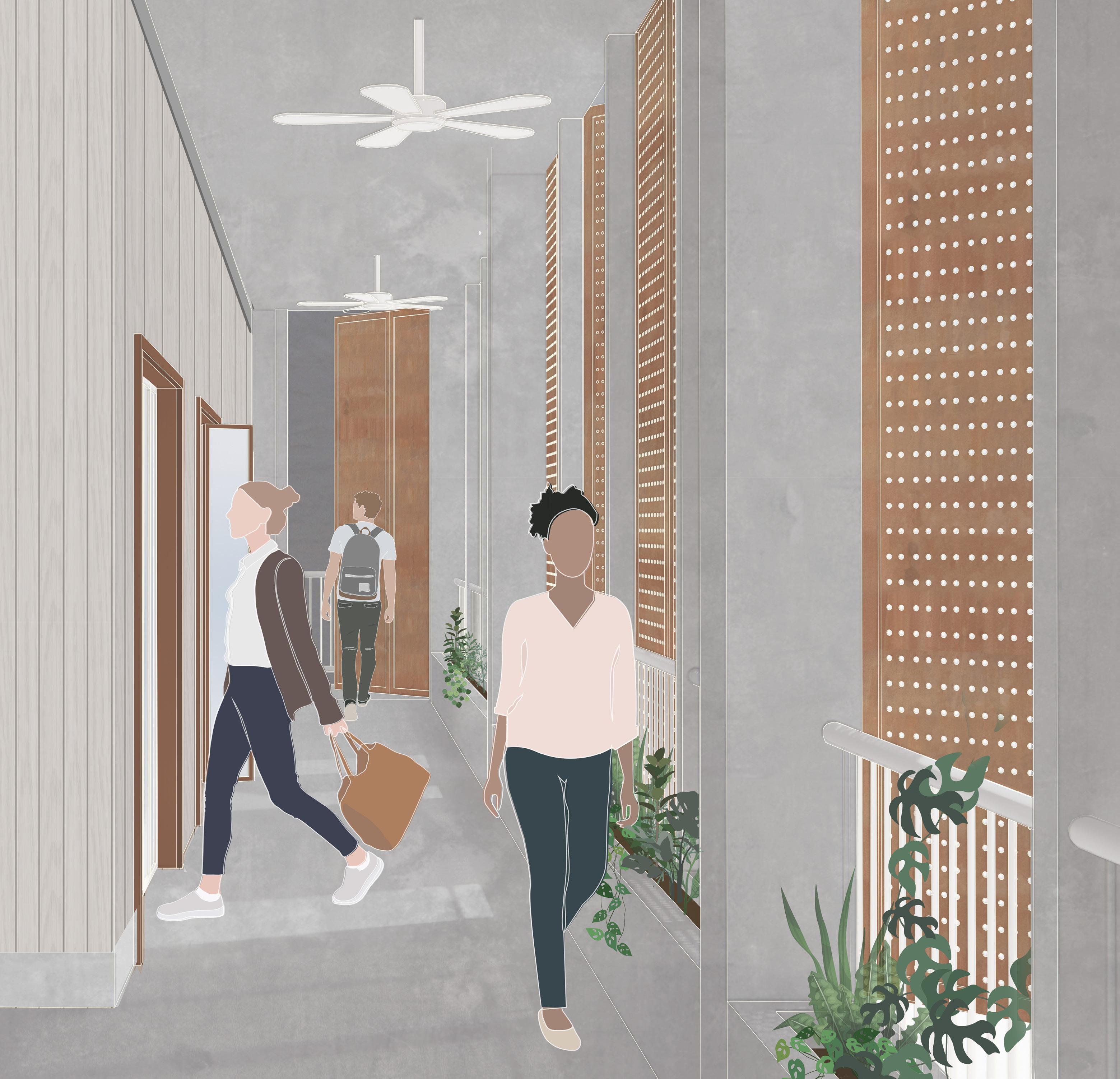
Gallery Perspective
Gallery Courtyard Perspective
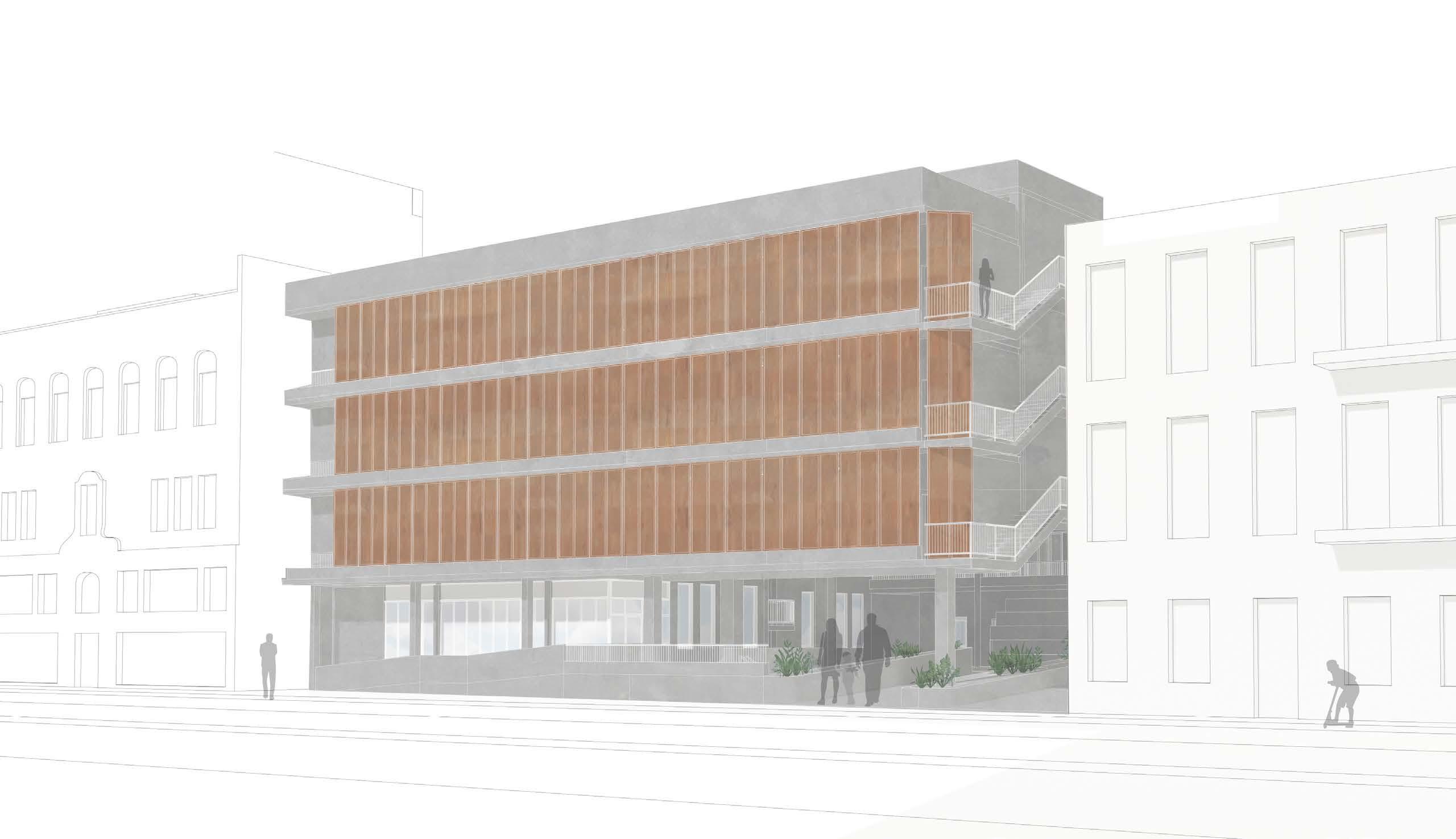
Basin St Facade
Sectional Model
Module + Slab Connection Modules + Structure
Storefront + Slab Connection
Gallery Planter Detail
Parapet Wall
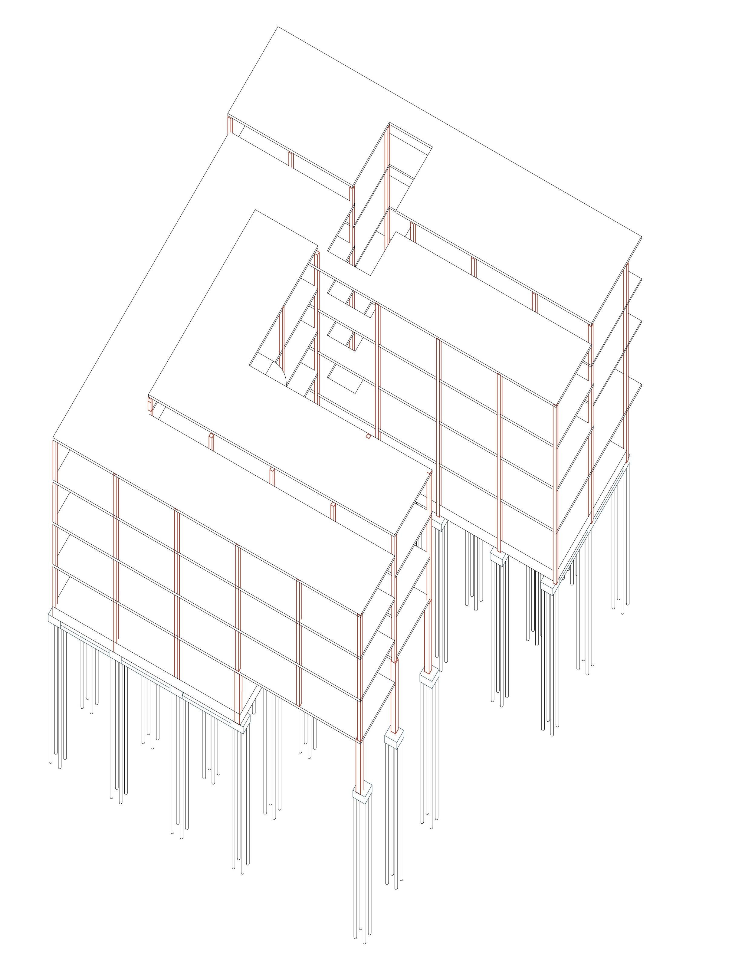
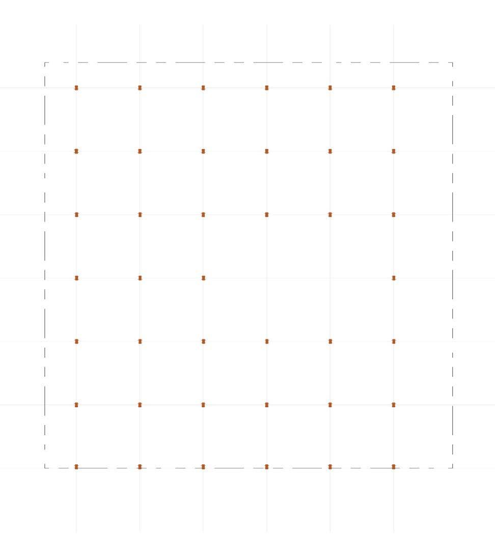
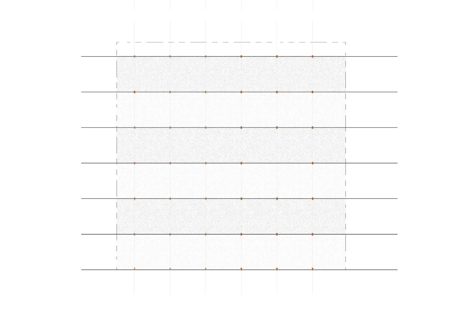
Structural Grid Structural Bays Post-Tensioned Concrete Structure
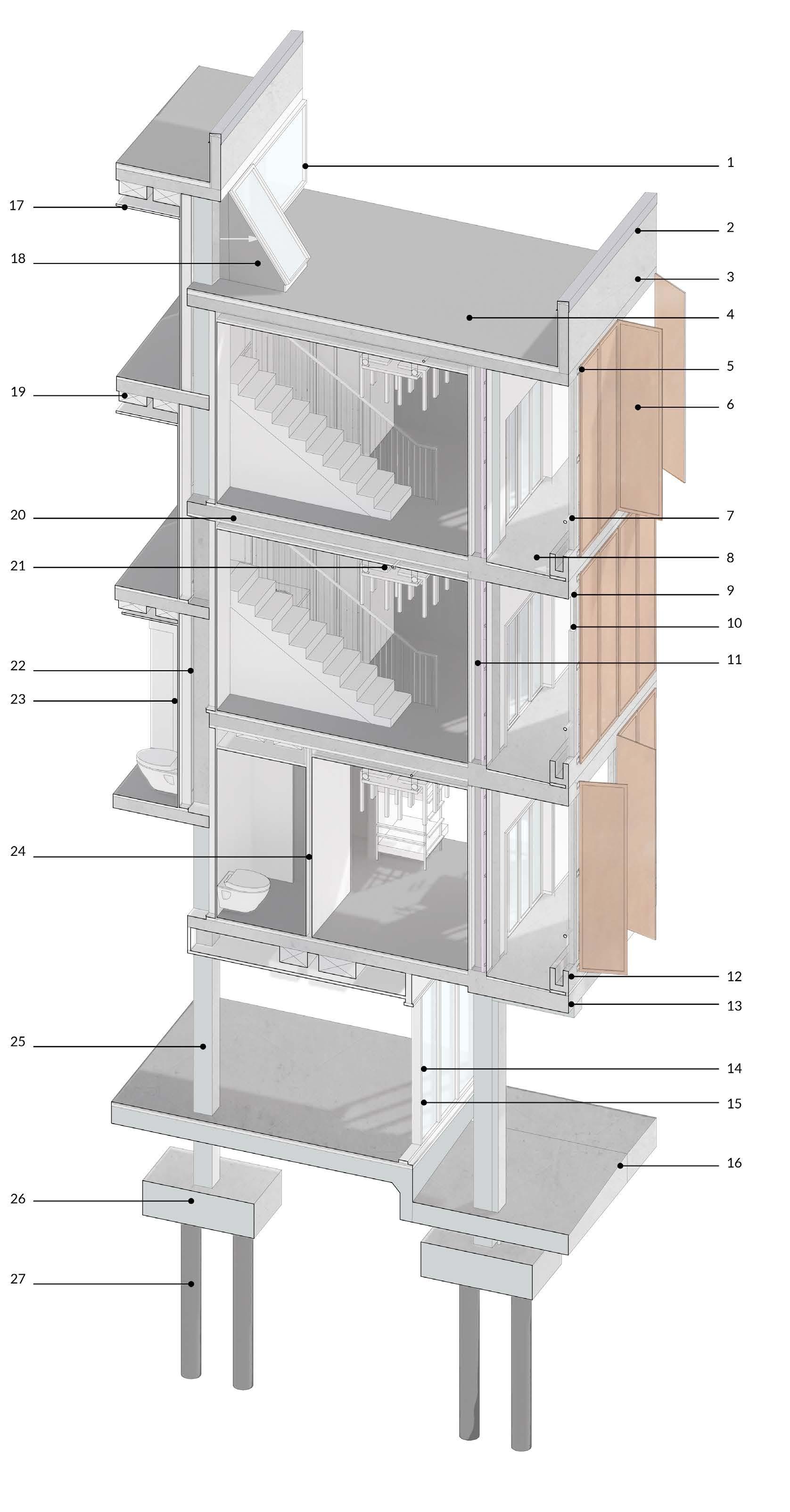
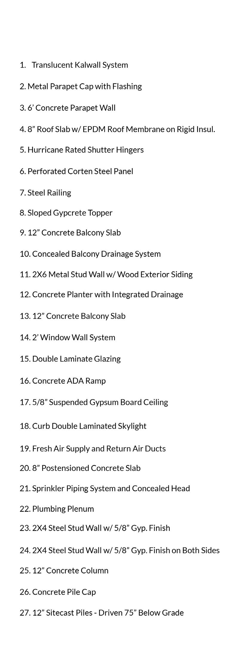
Sectional Building Detail
Tchula, MS: Safety and Domesticity
Town.House. Advanced Research Studio
Research for Design, Design as Research
The town of Tchula, MS contains Tchula Lake, a body of water that runs directly through the town. This lake experiences frequent flooding, putting lakeside homes, often mobile units, at risk. This housing proposal lifts vulnerable individuals above the flood plain, while exploring the boundaries of private and public space and the typologies of apartment buildings versus single-family homes. Additionally, the proposal looks to link the town with the two wildlife refuges to the north and south via a lake trail through the region that is reconnected to the site by reorganizing of the existing road system.
ArcGIS Pro. Rhino 3D, Adobe Illustrator
Building Section
03
Wildlife Refuges + Tchula
Tchula, MS + Tchula Lake
Tchula, MS + Site
In addition to moving vulnerable residents out of the flood plain, a city street was reworked into the development to allow occupants a direct connection to the lake front and the wildlife trail. In generating the form of the buildings, I explored a lifted lawn condition, along with the intersection of private+ public space, for a community accustomed with small and compact lots. The modularity of the units allows for later expansion across the city.
Existing Site Conditions
Redirection of Road
Site + Lake Section
Completed Site Intervention
Process Diagrams
Front Elevation
1. Typical “House and Yard”
2. Rotation of Plinths
3. Setback of Structures
Final Massing
4. Stratify Height of Plinths
5. Connection of Forms
6. Slicing of Structures
Muskegon River Residence: A Net-Zero Home
DOE Solar Decathlon, Group Project Research for Design, Design for Research
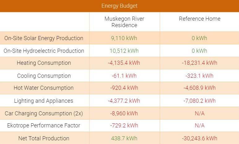
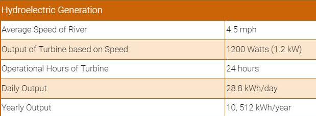
The Muskegon River Residence was the Suburban Single-Family Home Division Winner at the 2021 Solar Decathlon competition. The project submittal comprised of a 60 page technical document detailing all aspects of the project, from construction details and material selections to energy consumption. This project was designed to be a net-zero home for the suburban family, within the cold Michigan climate. The integration of technical research and design allows for a high performance home in all aspects. I specifically managed the energy rating of the home, by modeling consumption and developing generation systems, including solar and an in-stream turbine, to guarantee net-positive energy use.
SINGLE FAMILY SUBURBAN HOME DIVISION WINNER
Autodesk Revit, Adobe Illustrator, Adobe Photoshop, Enscape, Ekotrope RATER, Velux Daylight Visualizer,
04 First Floor Plan
Site Plan
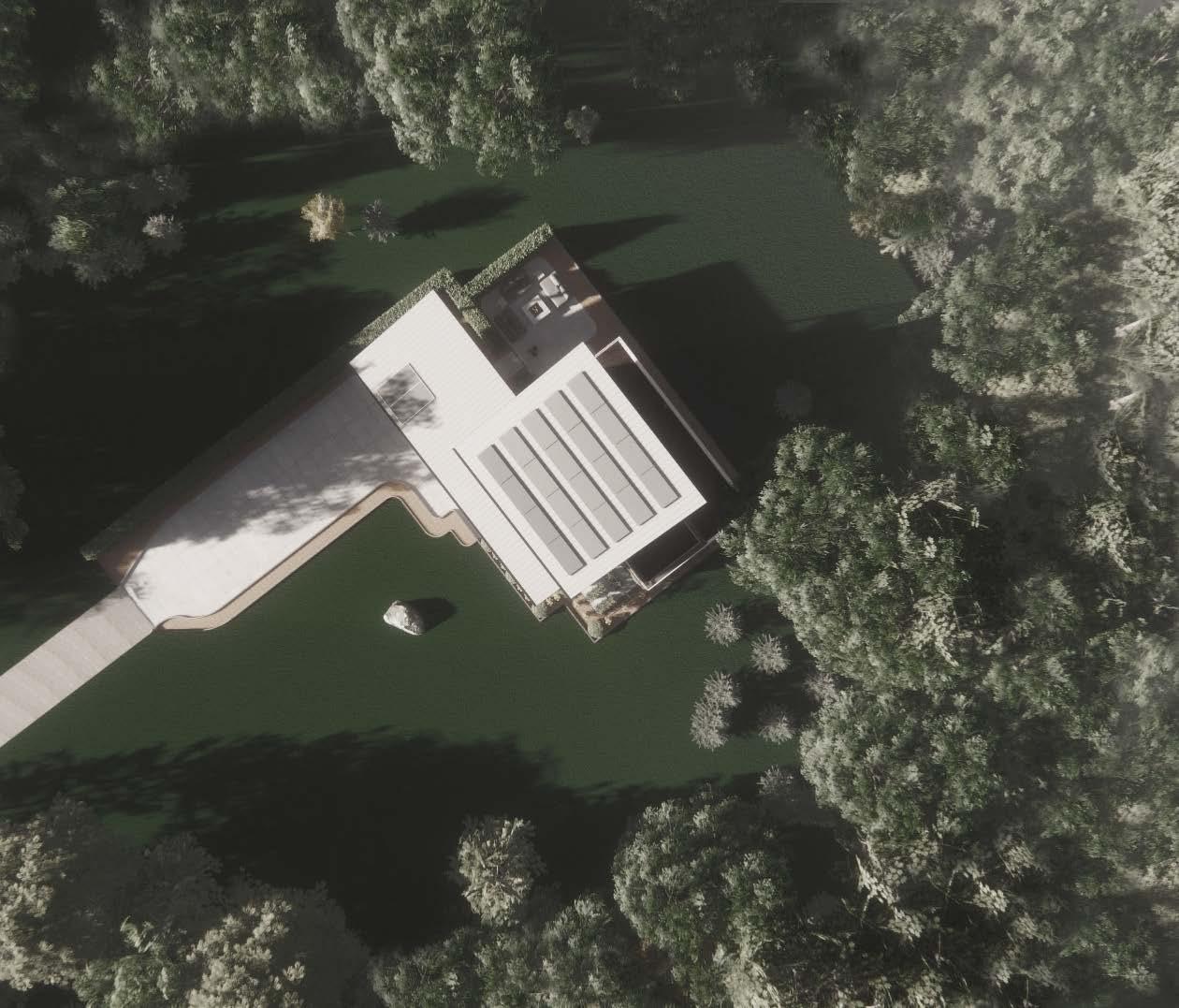
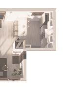
Second Floor Plan
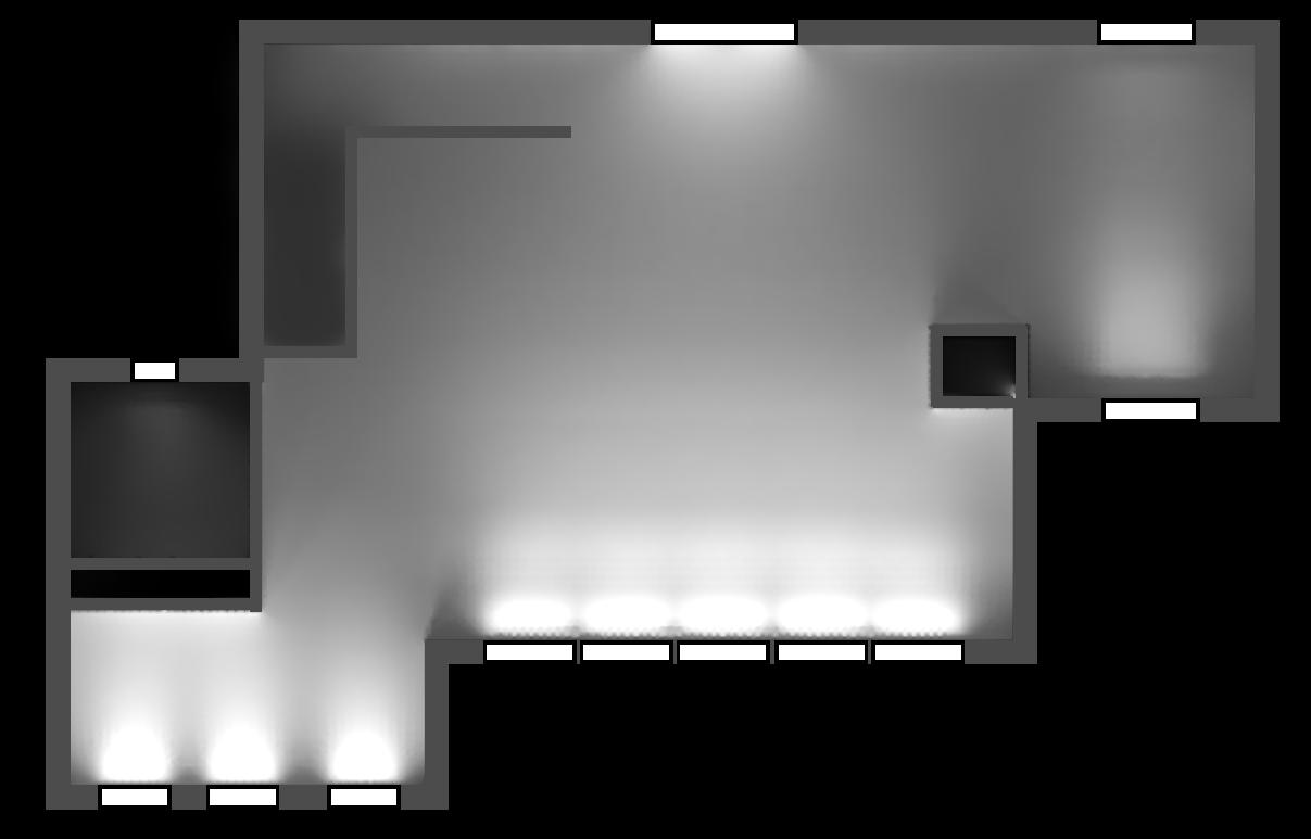
Light Study
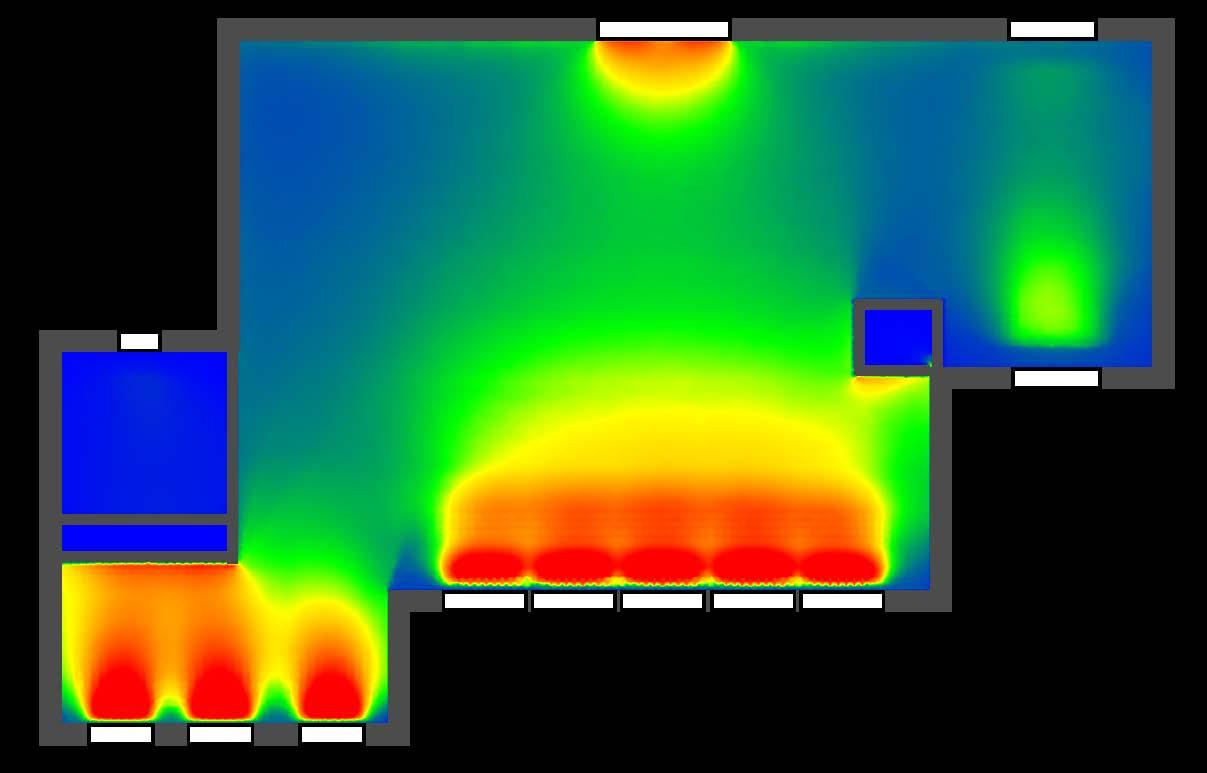
Thermal Gain Study
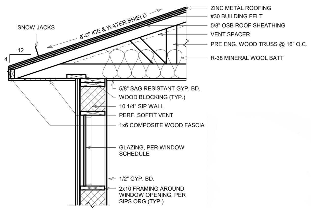

Foundation Wall Detail
Roof Detail
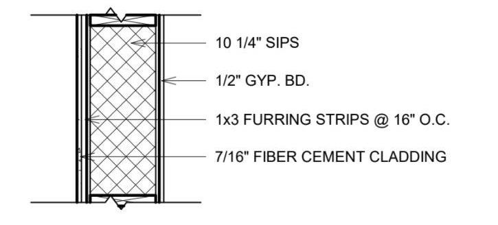
Wall Detail

30 -3 HERS w/ RENEWABLES HERS w/o RENEWABLES HERS RENEWABLES 19 EUI w/o EV (kBTU/SF/yr.) 36 EUI w/ EV (kBTU/SF/yr.)
Calculations
Energy
 LOAD METER
5000 4000 3000 2000 1000 0 2.2 3.1 3.6 4.0 4.5 1200 Watts 4.9 5.4 5.0 5.6. 6.7 7.2 2.7 P ( W ) V (mph)
Hydroelectric Generation
AC Inverter Electrical Panel GRID Rectifier + Dumpload
Output Curve of Turbine
Mixed Media
Individual Works
Rhino 3D, Adobe Illustrator, Adobe Photoshop, Hand Drawing, Watercolor Painting
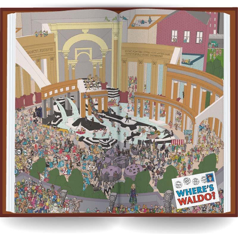
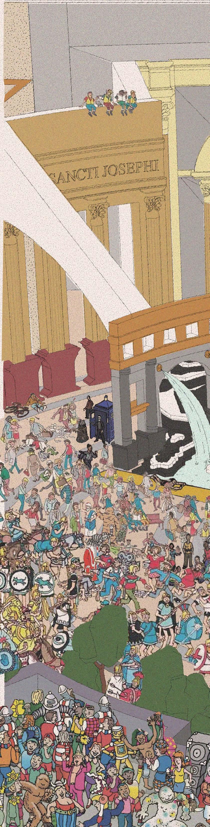
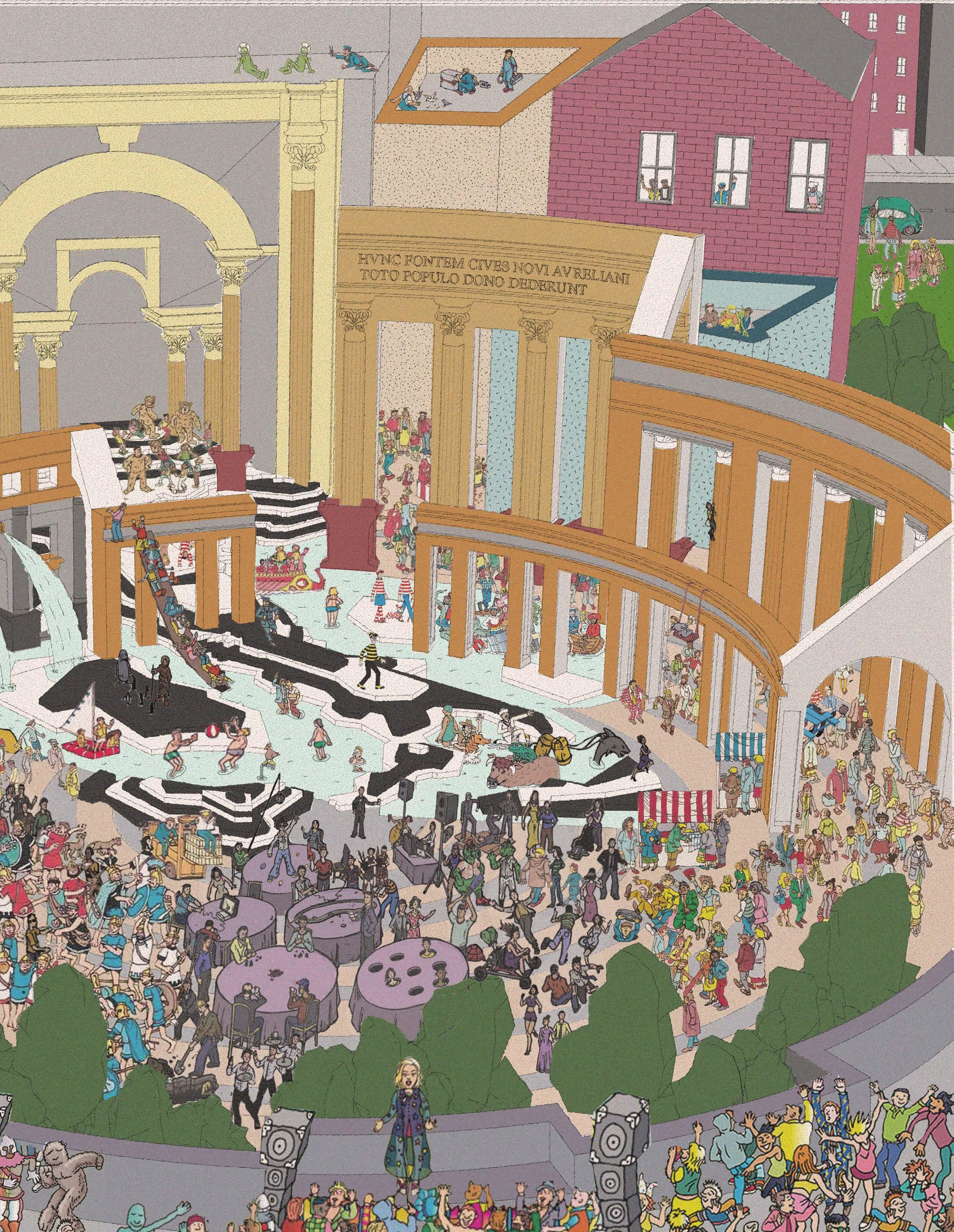
Where’s Waldo? (In the Piazza)
05
 Plaza Tower
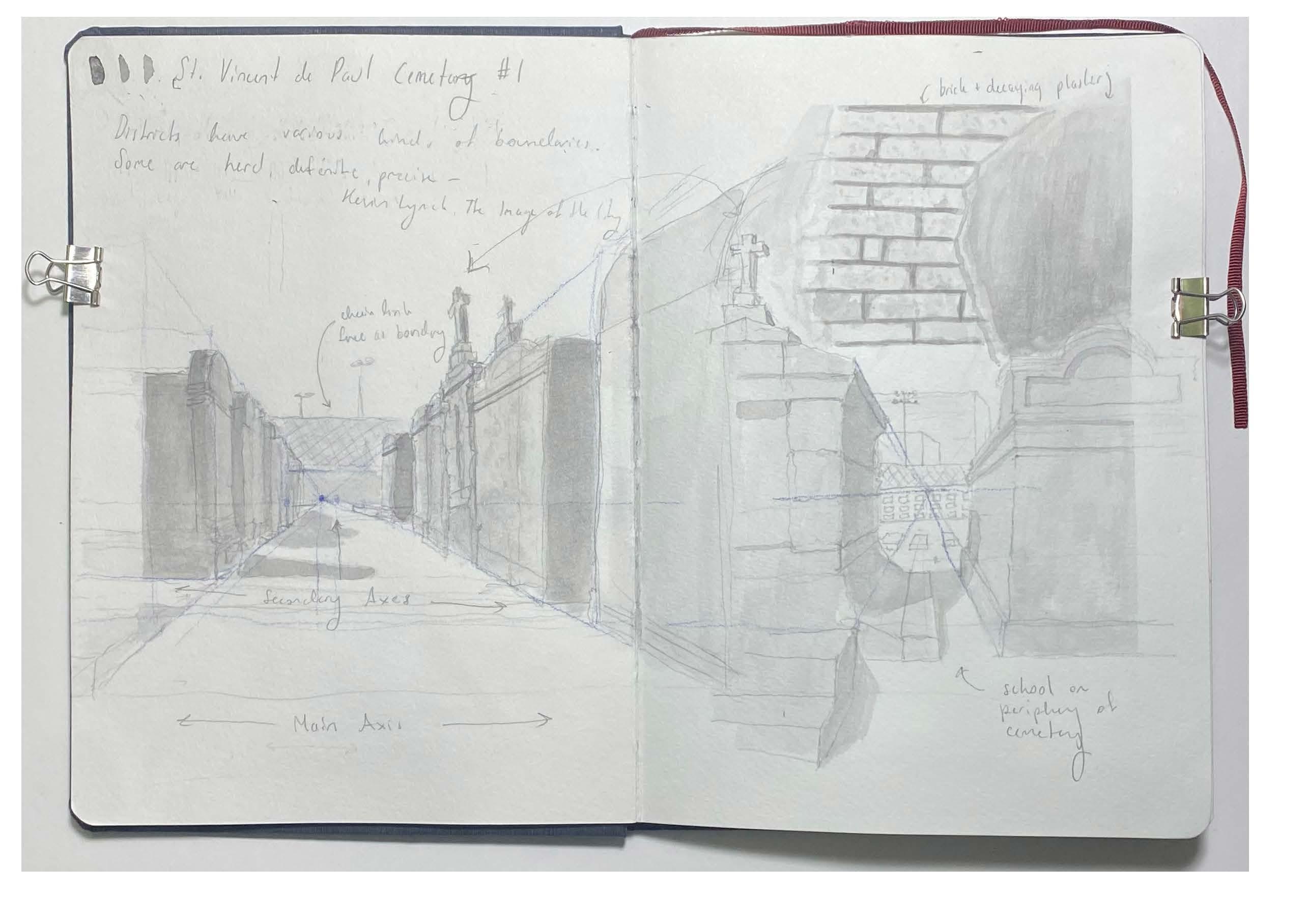
St. Vincent de Paul Cemetery
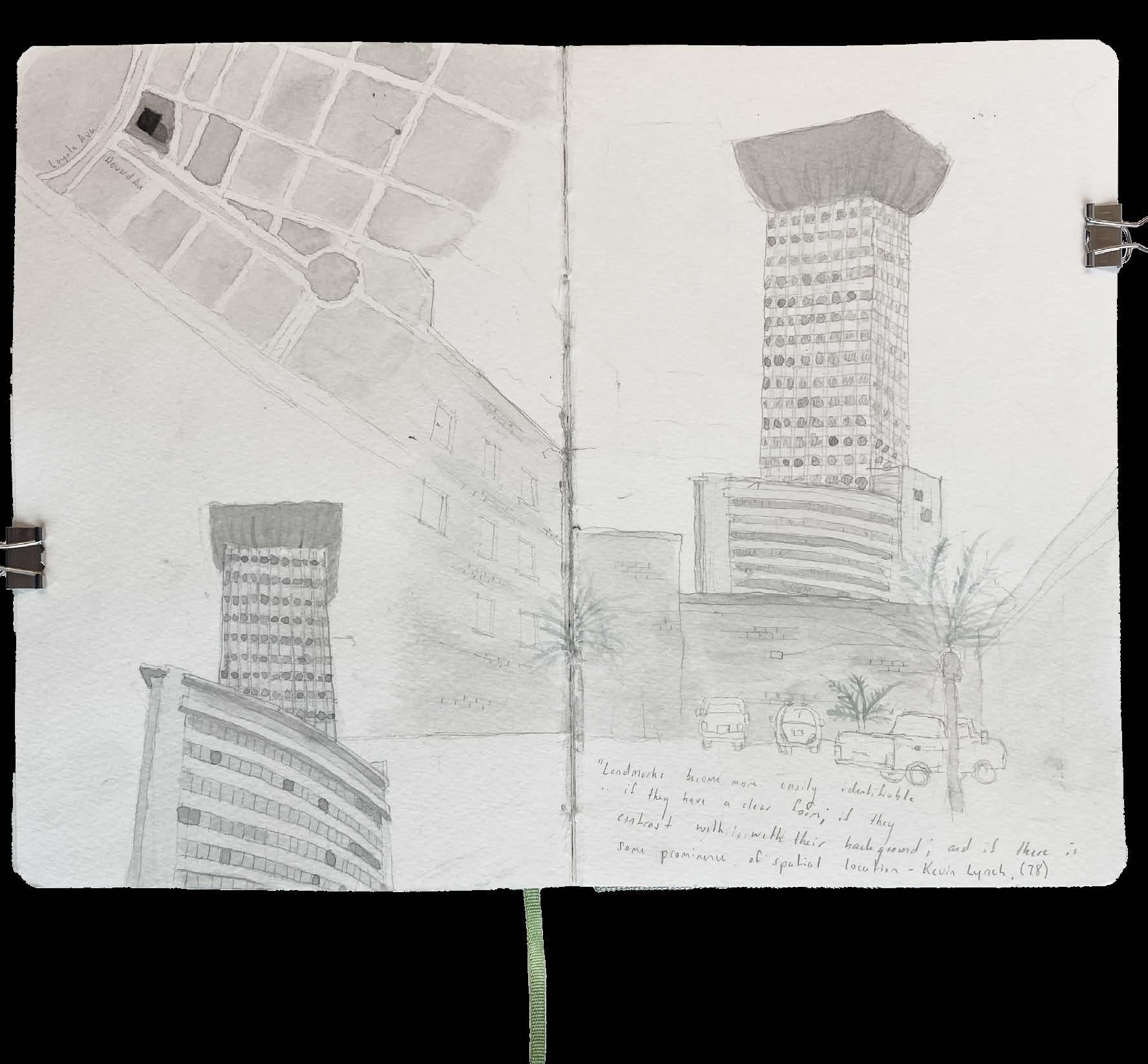
Plaza Tower
St. Vincent de Paul Cemetery

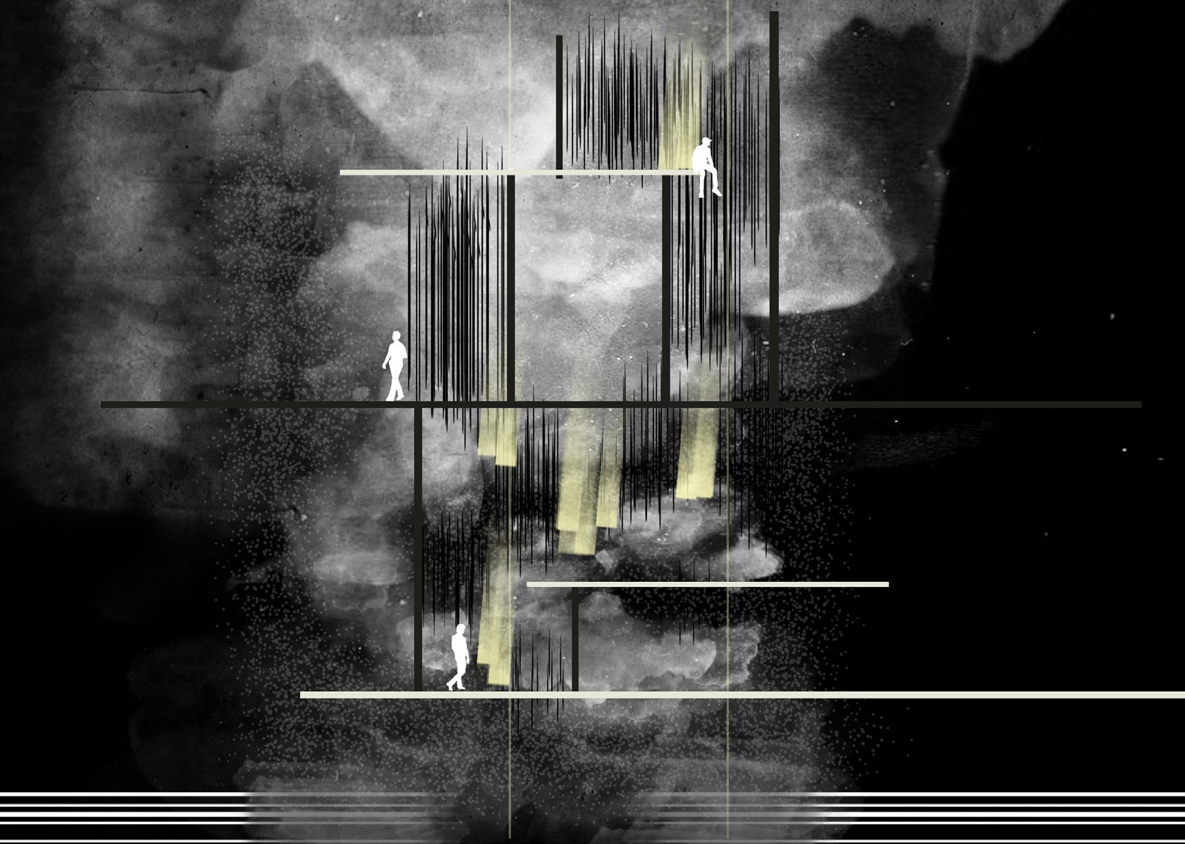 Sectional Collage
Sectional Collage
Sectional Collage
BROOKE MEHNEY
4609 S. CLAIBORNE AVE
NEW ORLEANS, LA 70125
BMEHNEY@TULANE.EDU
517-862-6117