I am Bianca, a specialist in Sustainable Architecture and BIM Project Management, holding a Master’s degree in Sustainable Urbanism, with a strong interest in integrating sustainable concepts into the development of projects.
With 10 years of experience working in private sector ventures, I also have a keen interest in public spaces and urban development. I have worked on urban and architectural projects of various typologies, from medium to large scale, overseeing the process from conception to approvals and executive planning. This has provided me with a comprehensive perspective on architecture, allowing me to understand the entire design process in depth.
I am eager to collaborate on projects and with teams where I can further develop and refine the skills I have gained through both my academic and professional experiences, contributing to the creation of unique and innovative proposals.
This portfolio highlights a selection of my work over the course of my career, aiming to showcase my skills and expertise. However, I have contributed to over 50 projects to date.
2015 2018 2021 2023
Career Path
ACADEMIC BACKGROUND
Architecture and Urbanism (University of Passo Fundo - Passo Fundo / RS)
Specialization in Sustainable Architecture (UNILEYA - Brasília / DF)
Specialization in BIM Management (IPOG - Florianópolis / SC)
Master’s in Urban Climate and Sustainability (Glasgow Caledonian University - Scotland)
PROFESSIONAL EXPERIENCE
2012-2014
2014-2015
2015-2017
2017-2020
2020-2021
2023-2025
Native Fluent
Intermediate
Basic
Urbanism Intern (Municipal City Hall - Passo Fundo / RS)
Urbanism Intern (Base Planning Systems - Passo Fundo / RS)
Architect and Urban Planner (RS Concept - Itapema / SC)
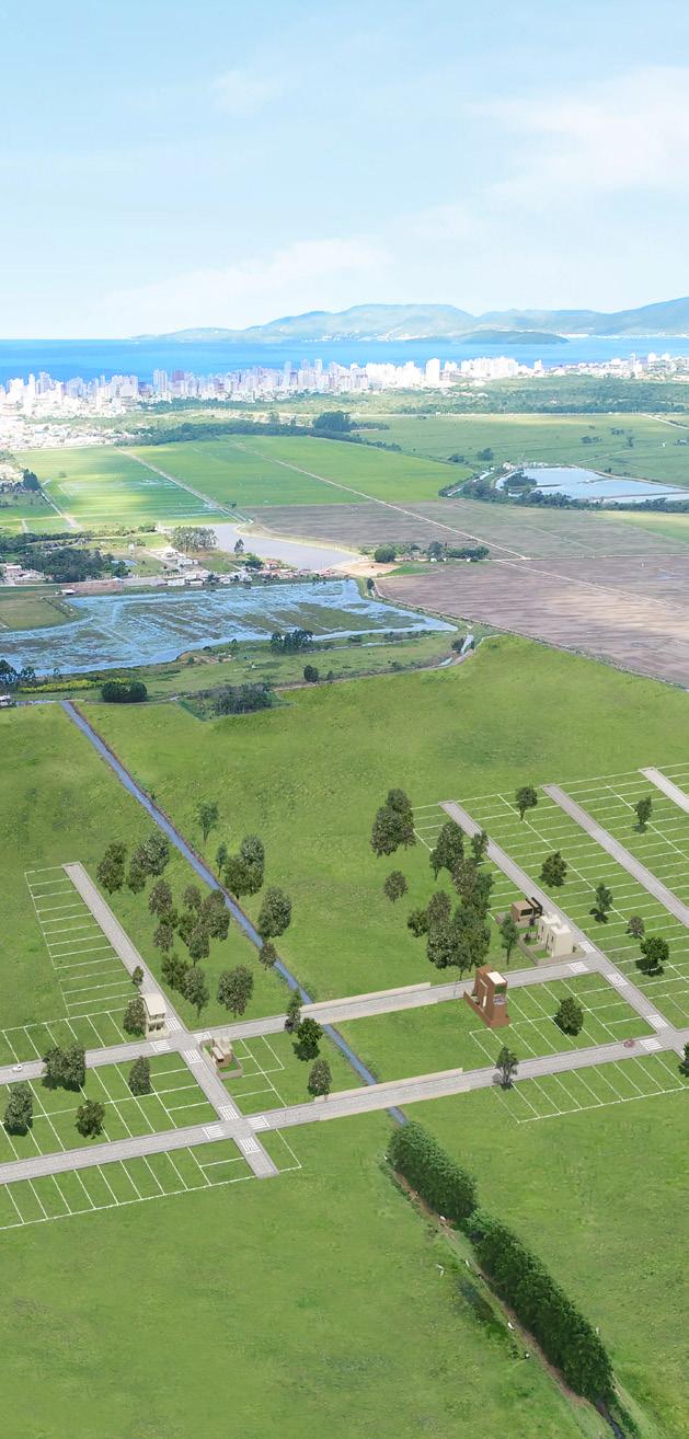
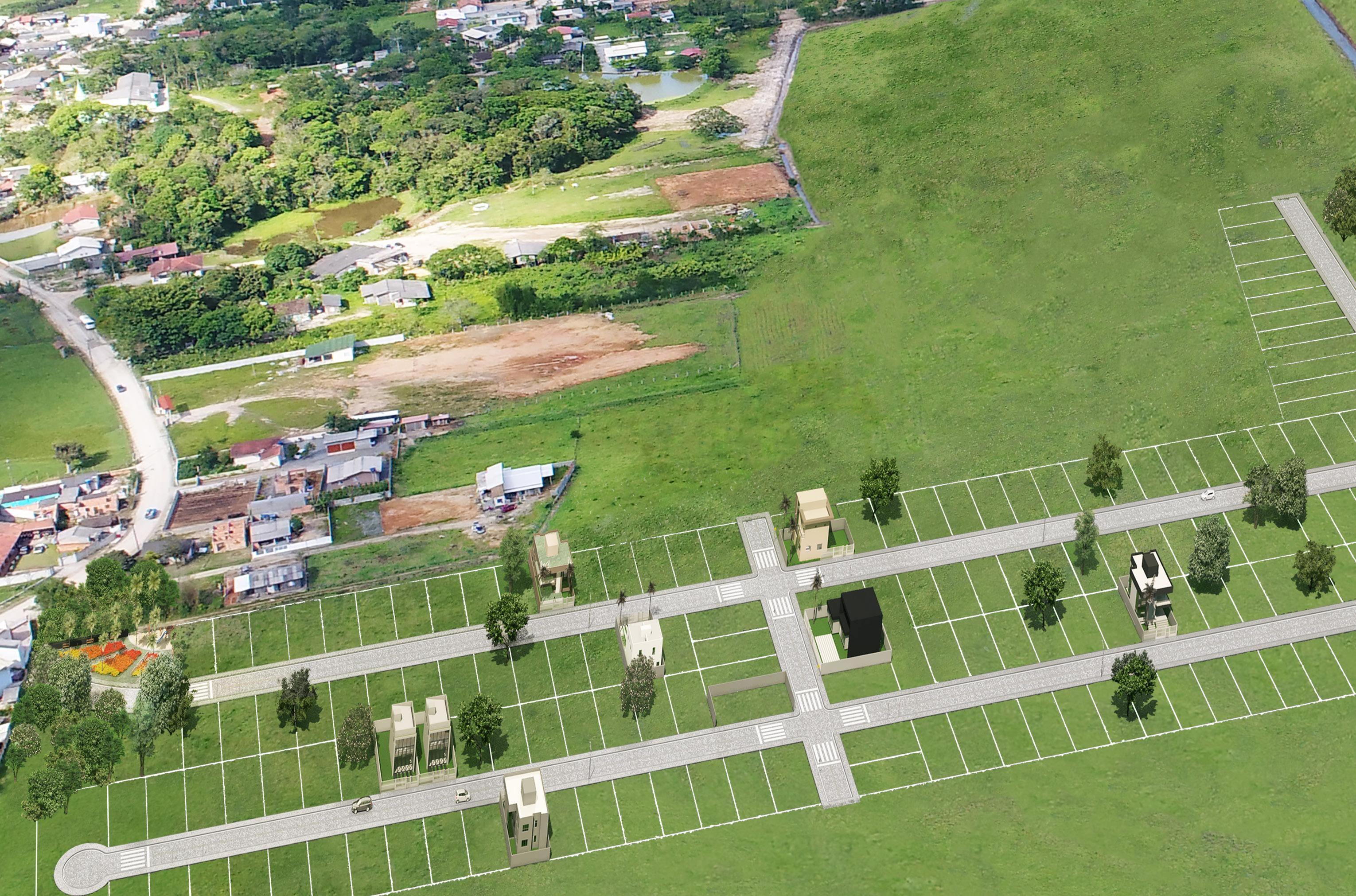
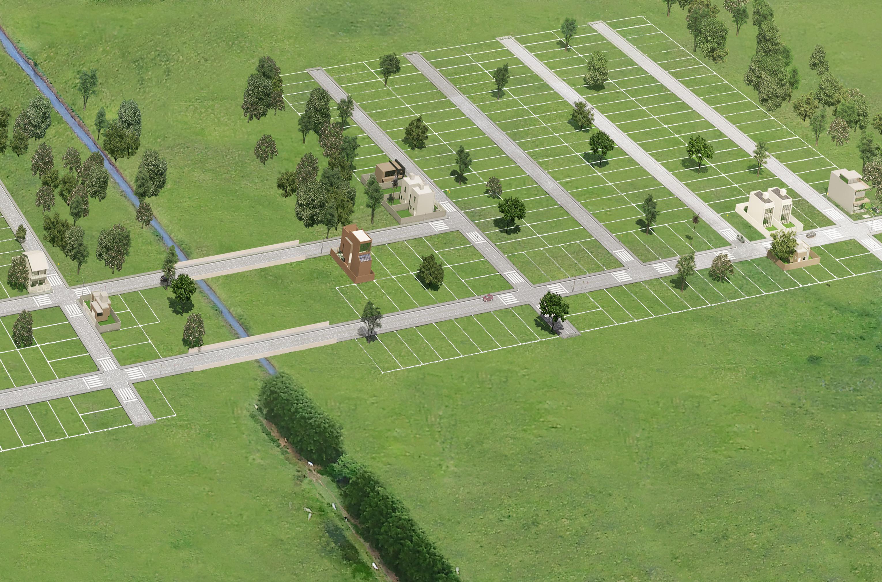
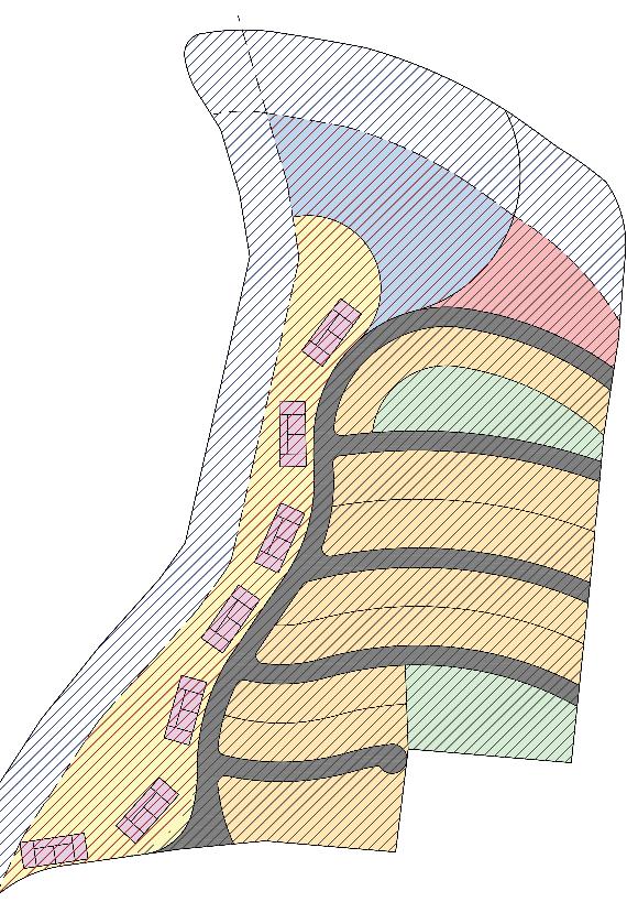
This residential subdivision was developed for a construction company with the goal of creating a space for people seeking land to build homes, as the city center is filled with residential buildings and high-priced land. The client requested a project that could accommodate people looking for a peaceful area, yet still easily accessible from the city center and close to the beaches. Another request was to make the most of the land area.
Thus, based on the city’s zoning laws, the neighborhood was designed in a longitudinal manner, with tree-lined streets and public spaces along the way, as well as areas designated for commercial and service activities.
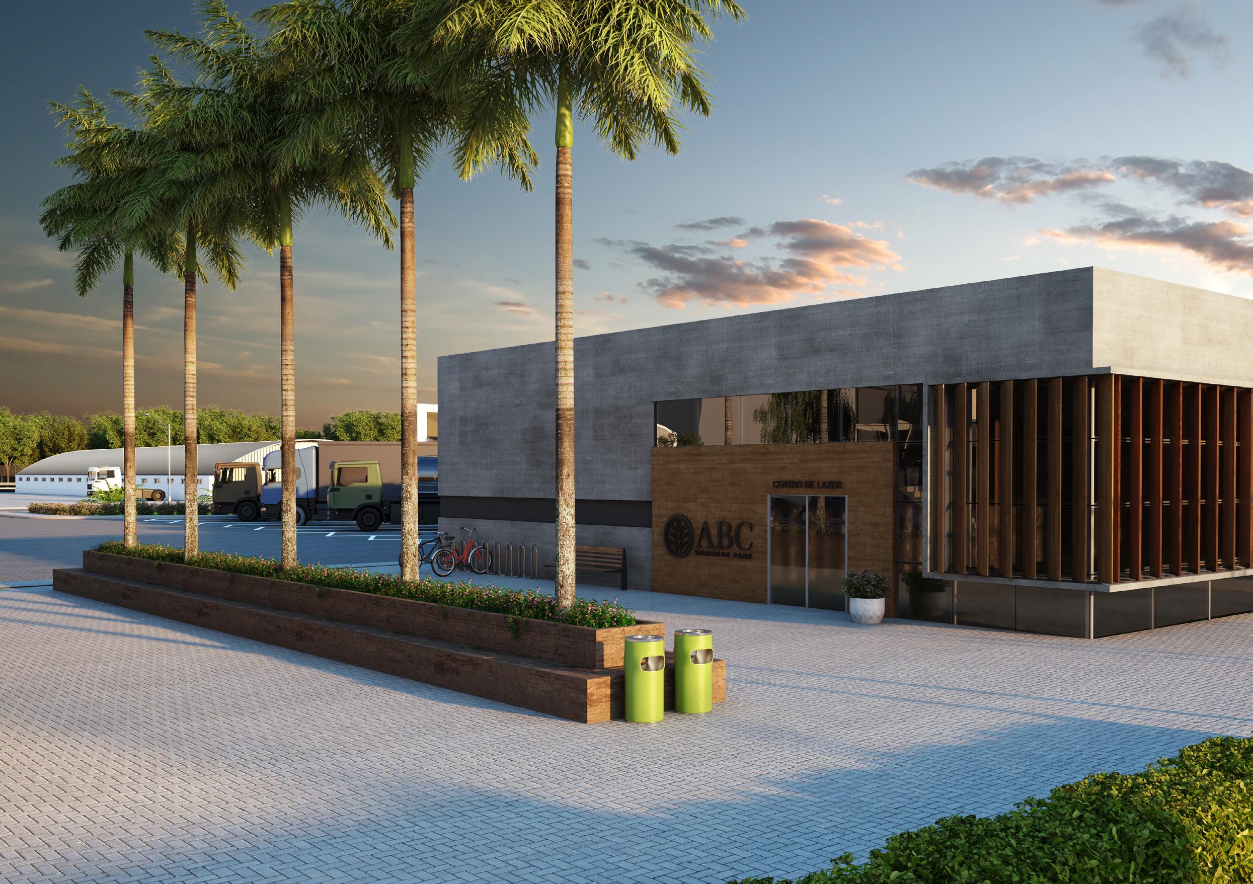
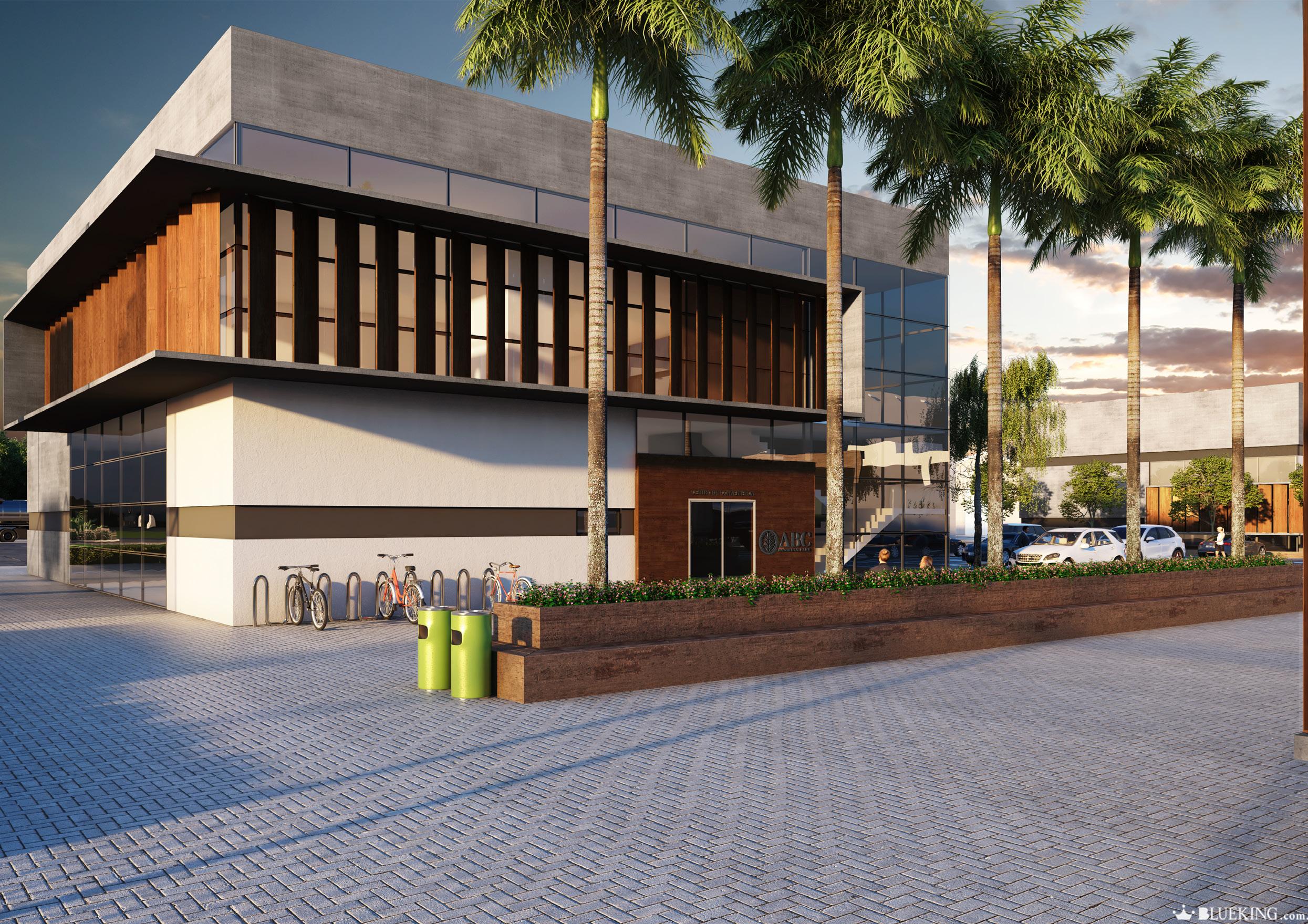
ABC BUSINESS PARK
General Data About
Project Typology: Industrial and Commercial Condominium
This project was created for a construction company that wanted to offer a differentiated option for the industrial demand in the region. The goal was to create not only a location conducive to industrial activity but also a place where employees could enjoy a high-quality work environment and spend their free time with recreational and social activities.
The development was designed to be comfortable for both vehicles and people using the complex, with common areas for meetings and networking, recreational spaces, and tree-lined areas for rest, as well as cafés and restaurants.
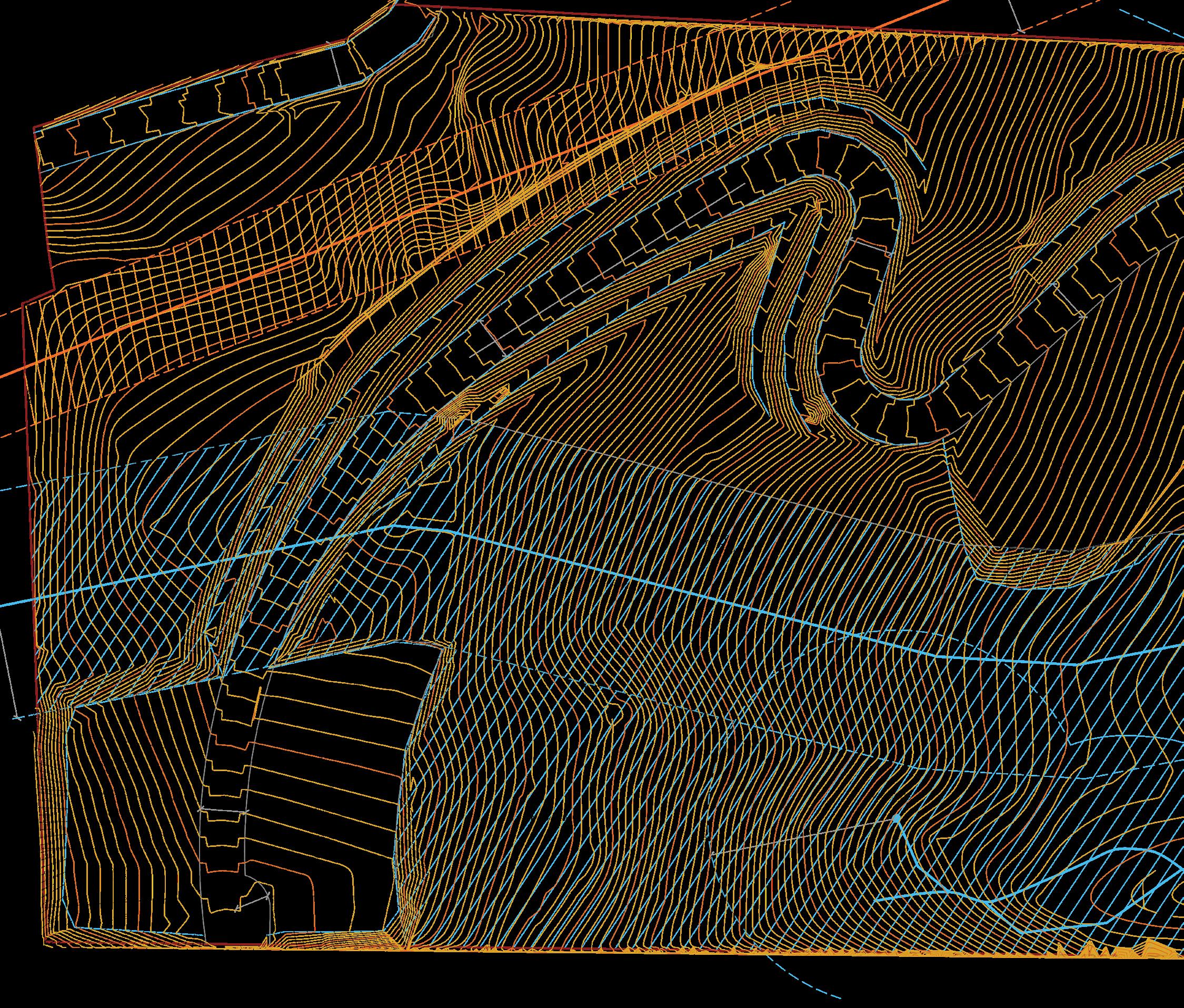
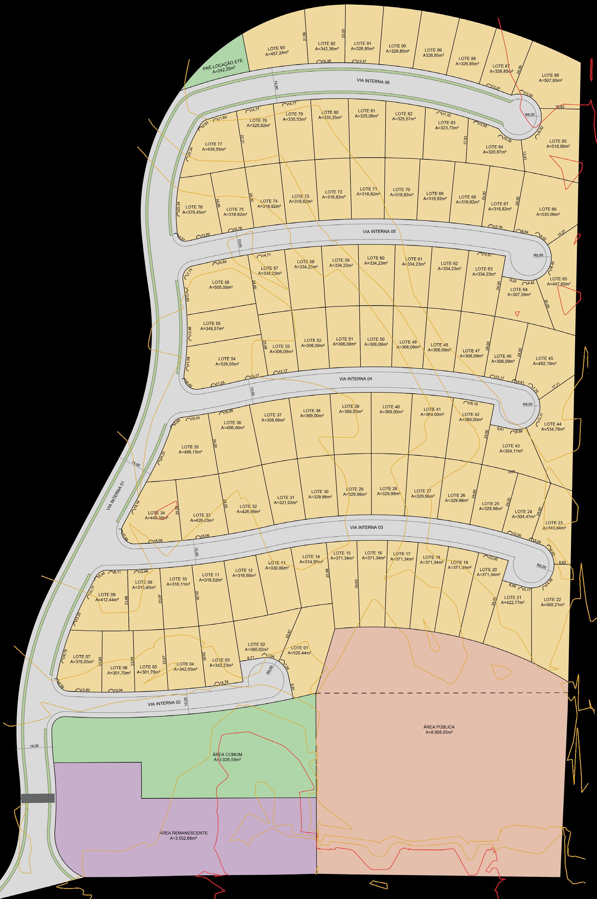
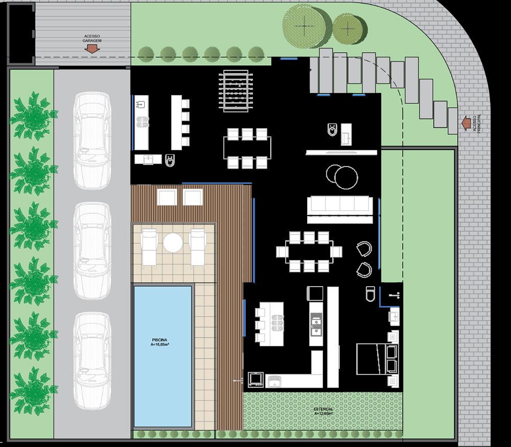
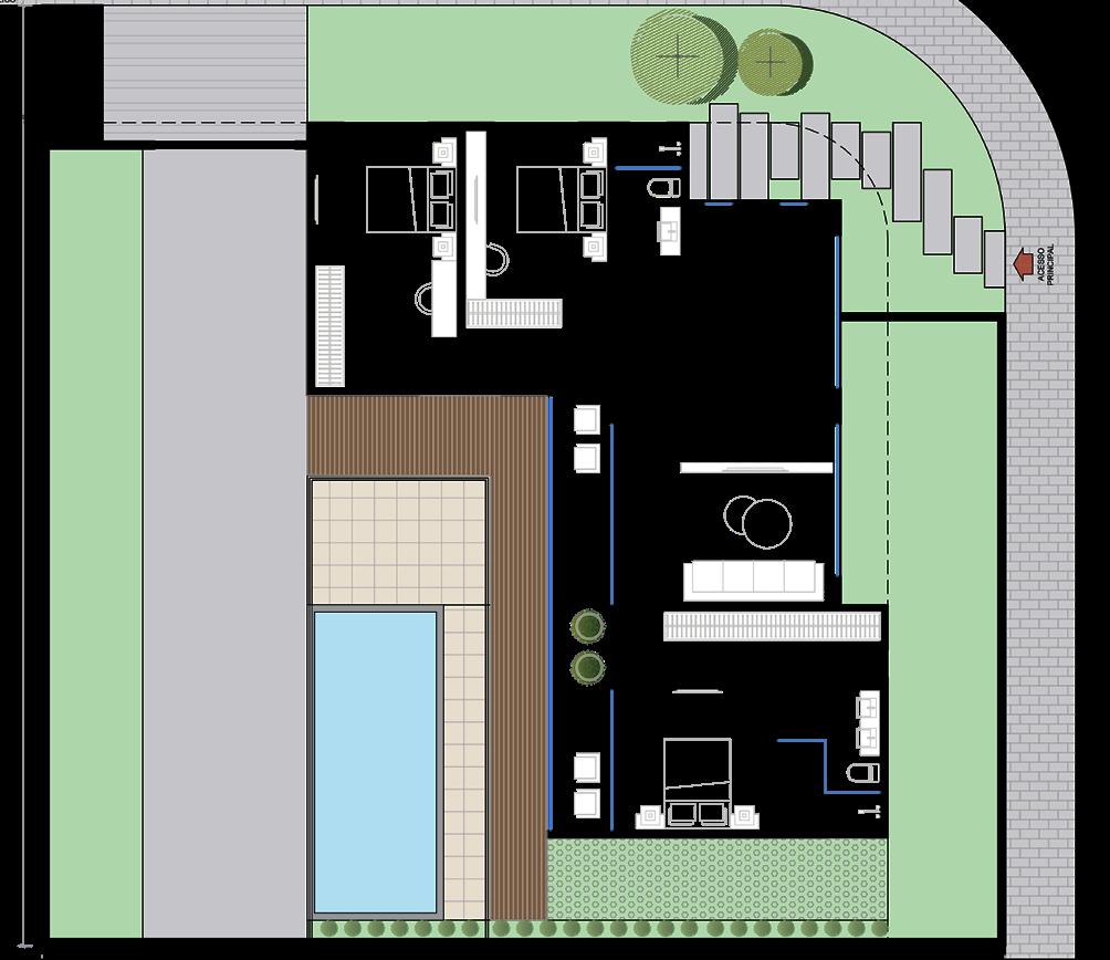
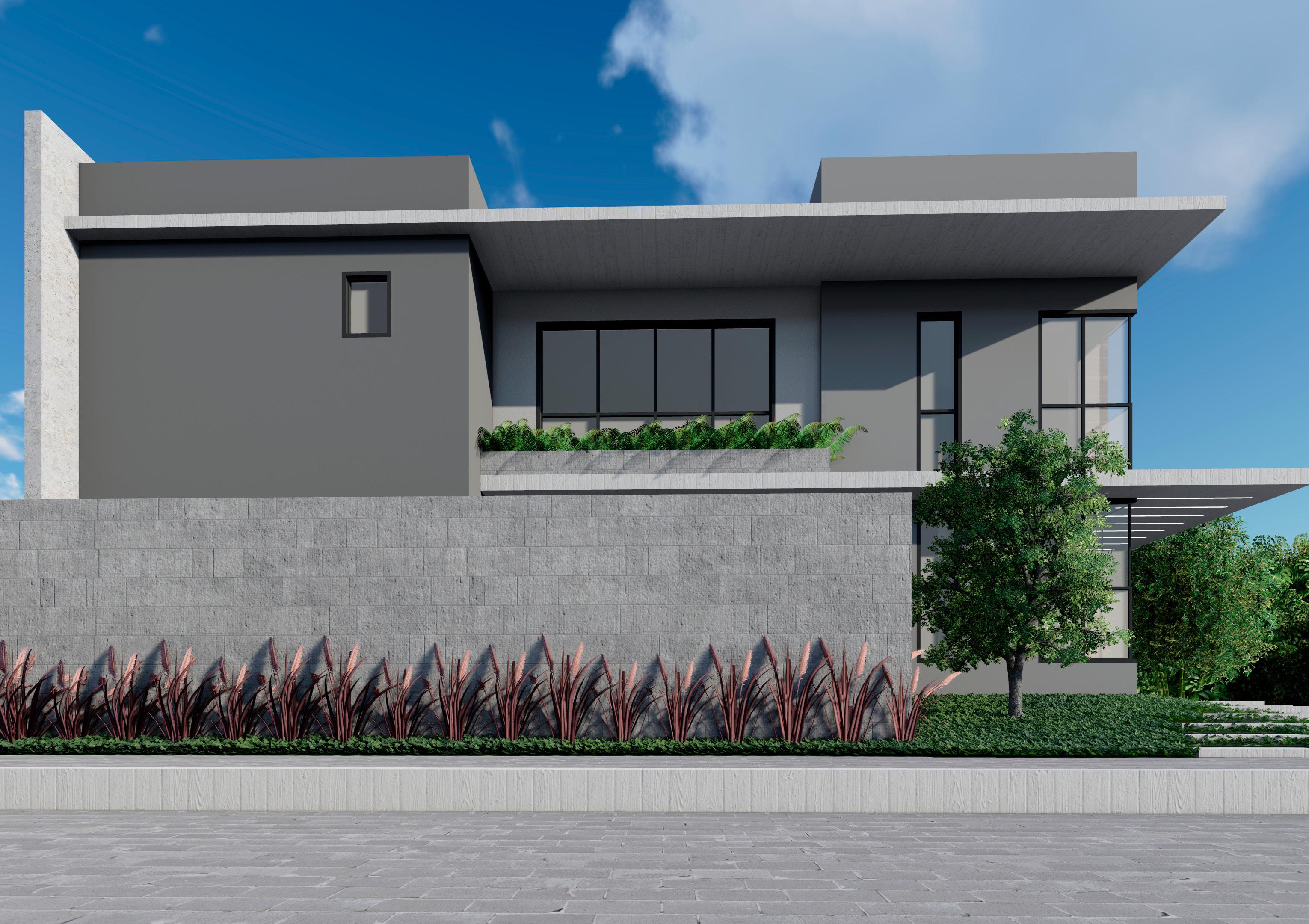
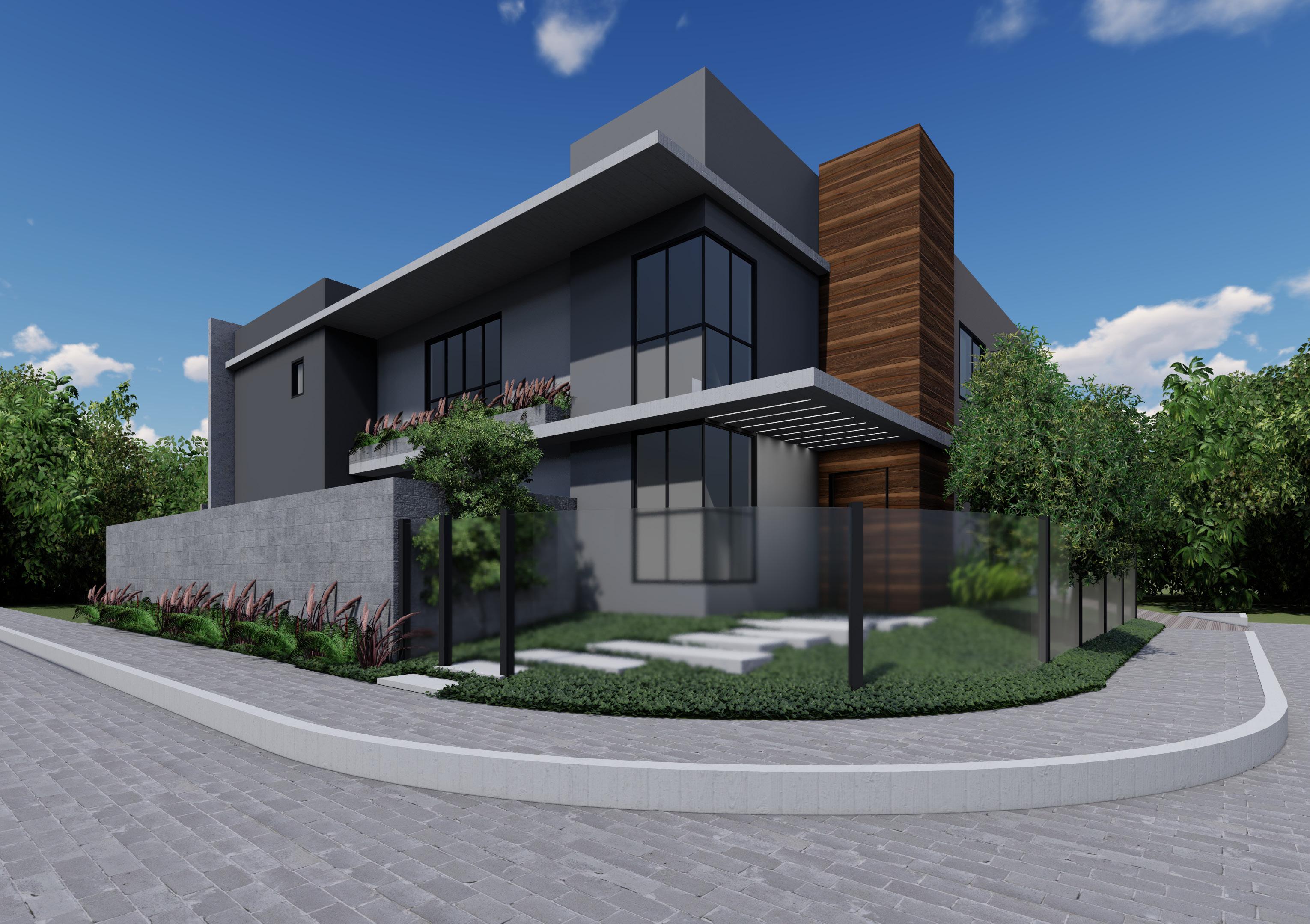
BOSQUE PARIS 3
General Data
Project Typology: Residential and MixedUse Subdivision
Role: Conception, design, approval
Project Year: 2019
Tools Used: AutoCAD, SketchUp, Google
Earth
Status: Executive project development phase by the construction company
Location: São José - SC
COND. CAMBORIÚ
General Data About
Project Typology: Residential Condominium
Role: Conception, design
Project Year: 2020
Tools Used: AutoCAD, SketchUp, Google
Earth
Location: Camboriú - SC
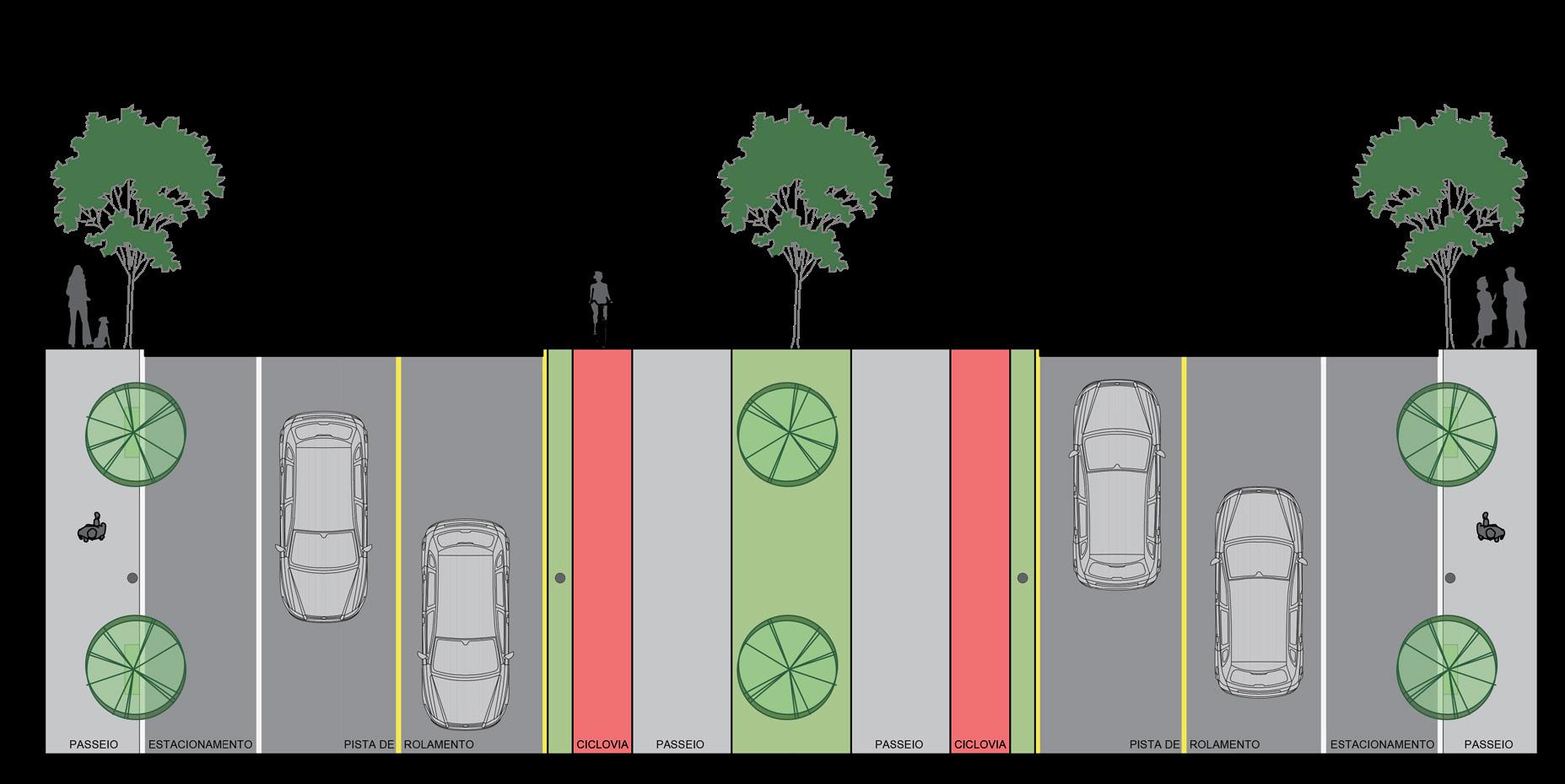
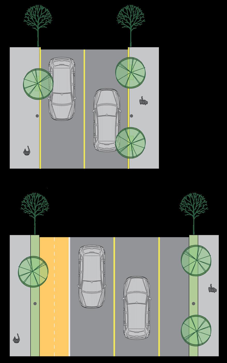
This condominium was created to offer a development option that is not very common in the region. The project was designed to be a safe neighborhood, with tree-lined streets and options for leisure and social activities, as well as bike lanes and a shared street model, encouraging active transportation. The idea was also to include multifamily buildings, creating a mixed-use condominium with different usage options and medium density.
Tools Used: AutoCAD, SketchUp, Google Earth, Lumion
Status: Under construction
Location: Balneário Camboriú - SC
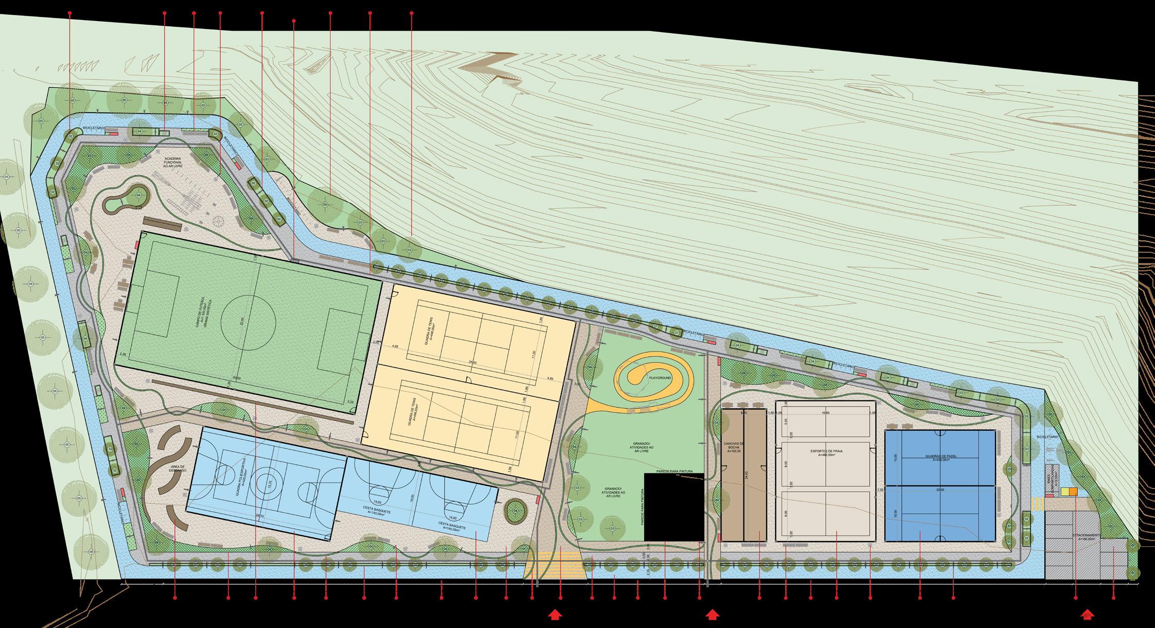
About
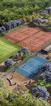
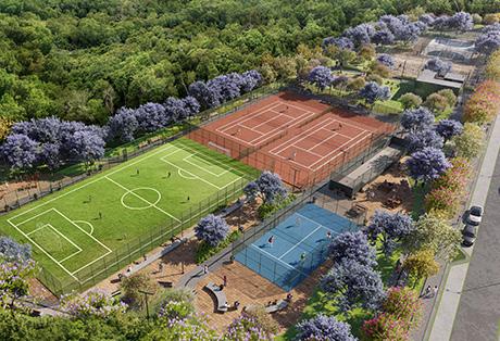
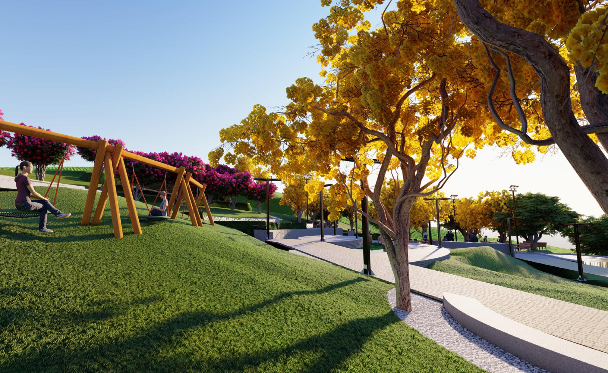
This project was created using strategies for stakeholder interaction, allowing the park to meet the requirements of the developers as well as the expectations of future residents. This park is one of a series of three parks to be implemented in a new sustainable neighborhood called Colinas de Camboriú, with the aim of providing various sports activities for the entire community, creating a safe and inclusive space.
To cater to all ages and preferences within the community, the park was designed with multiple sports courts, such as soccer, basketball, volleyball, and beach sports, as well as areas for children, seniors, and youth activities, such as skateboarding and internet access points. The park is surrounded by a bike lane and includes bike racks along its route.
WATER PARK 6
General Data
Project Typology: Urban Park
Role: Conception, design
Project Year: 2021
Tools Used: AutoCAD, SketchUp, Google Earth, Lumion
Status: Ongoing project by the construction company
Location: Balneário Camboriú - SC
About
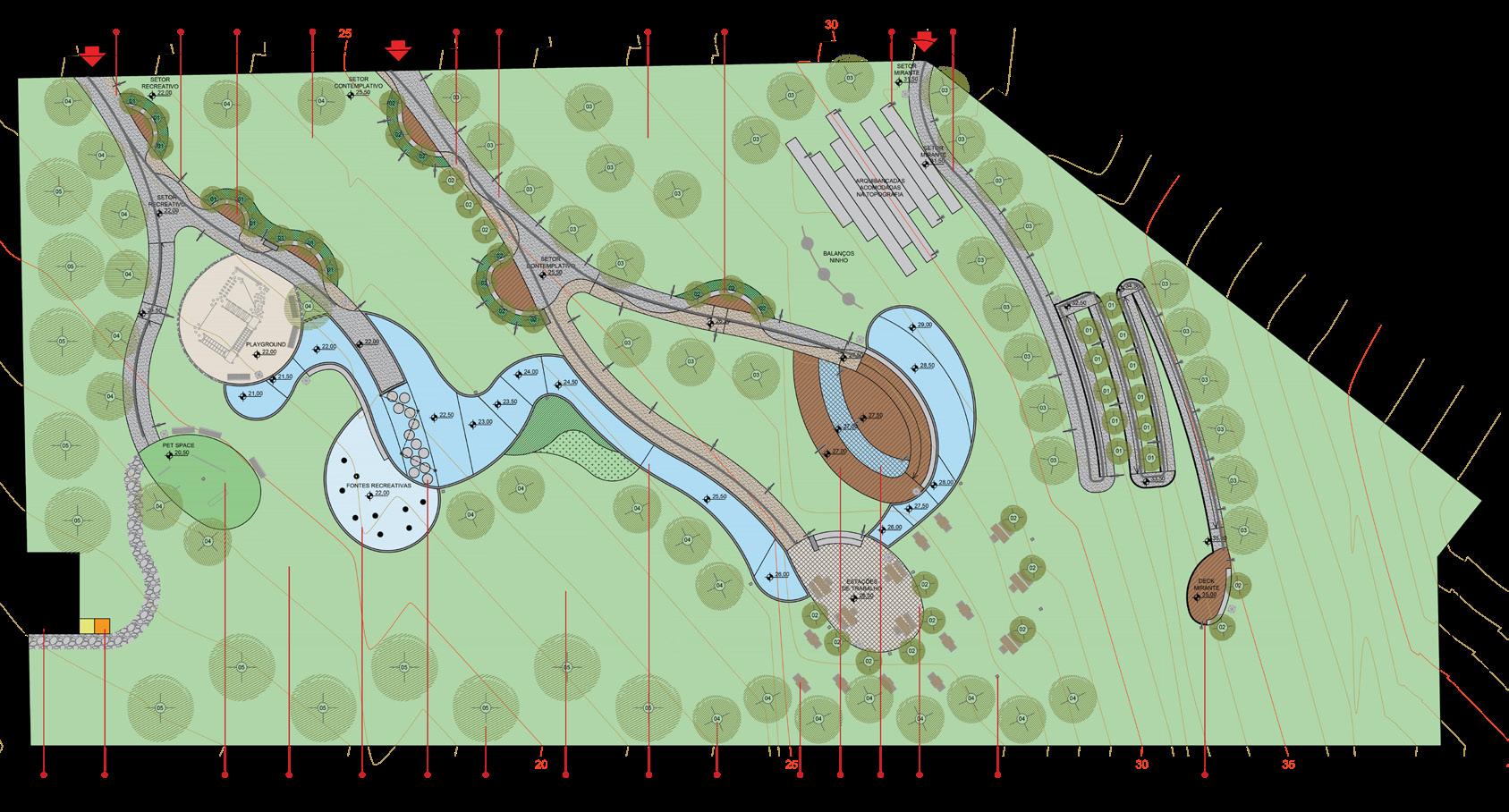
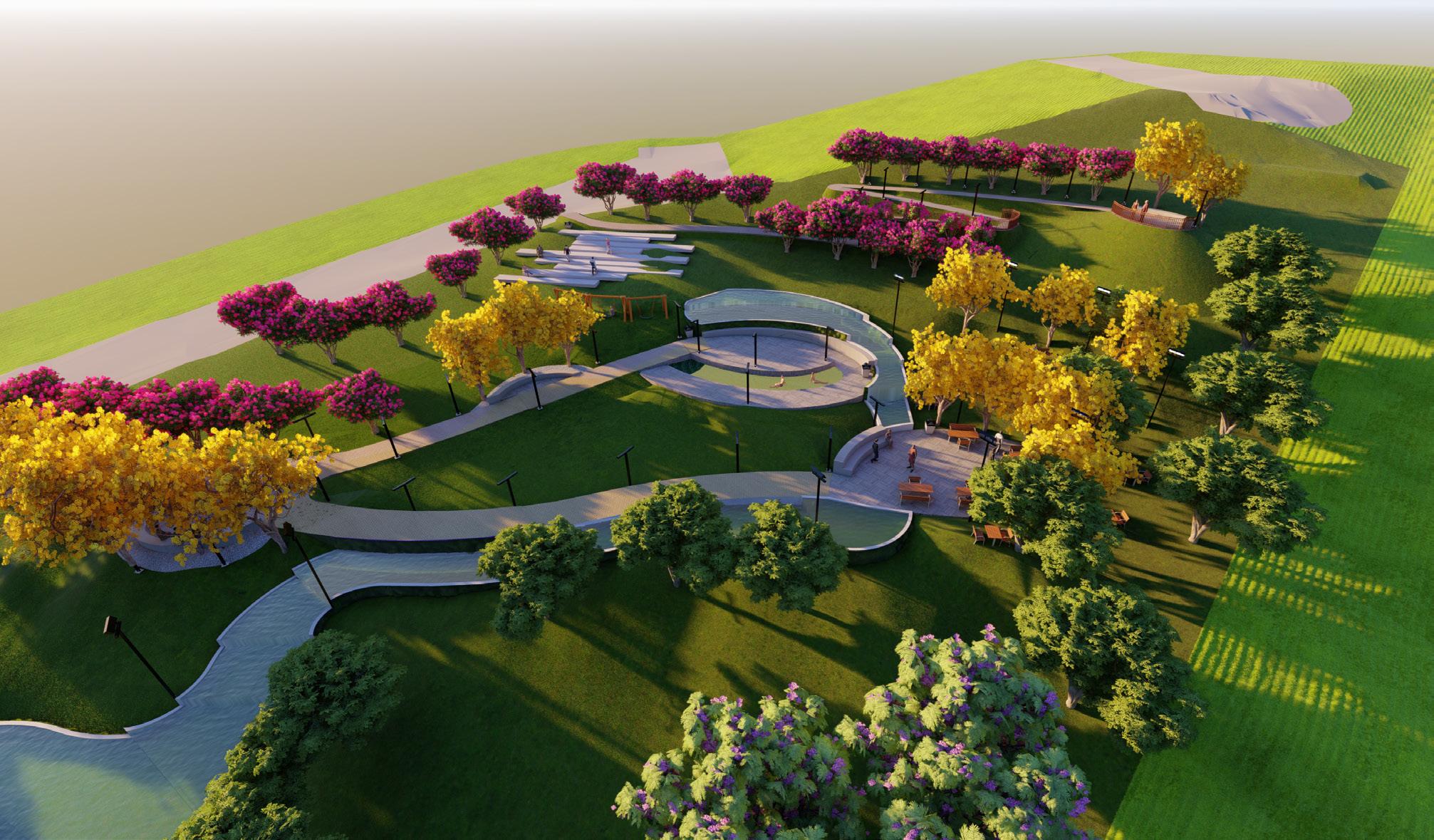
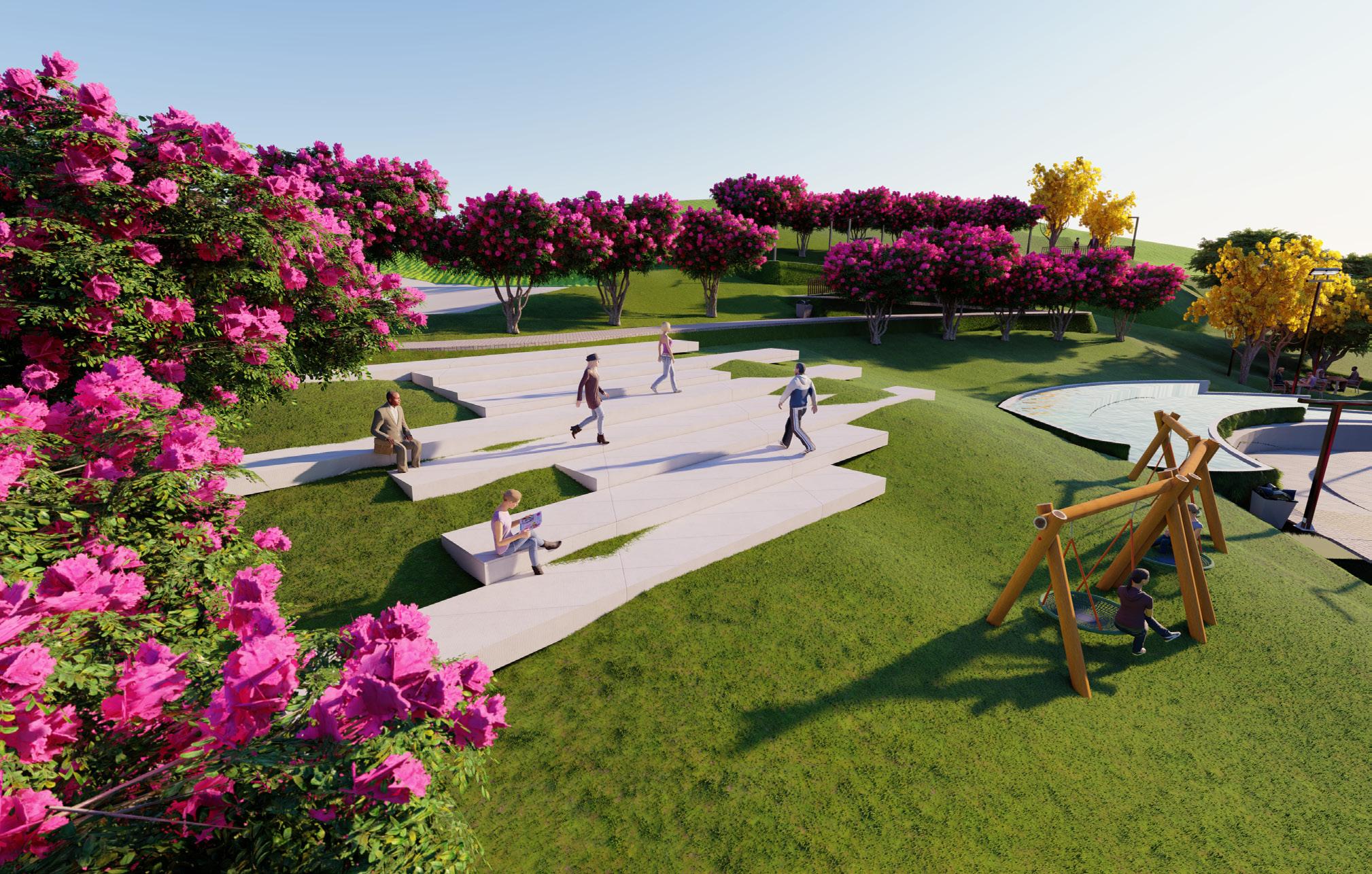
This is the second park to be implemented in the Colinas de Camboriú Village, and it has a challenging terrain. The entire development is located on a slope, and the goal of the project was to preserve the natural formation while adjusting the design to the elevation changes.
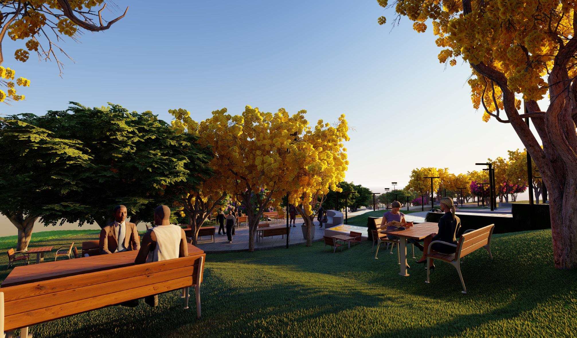
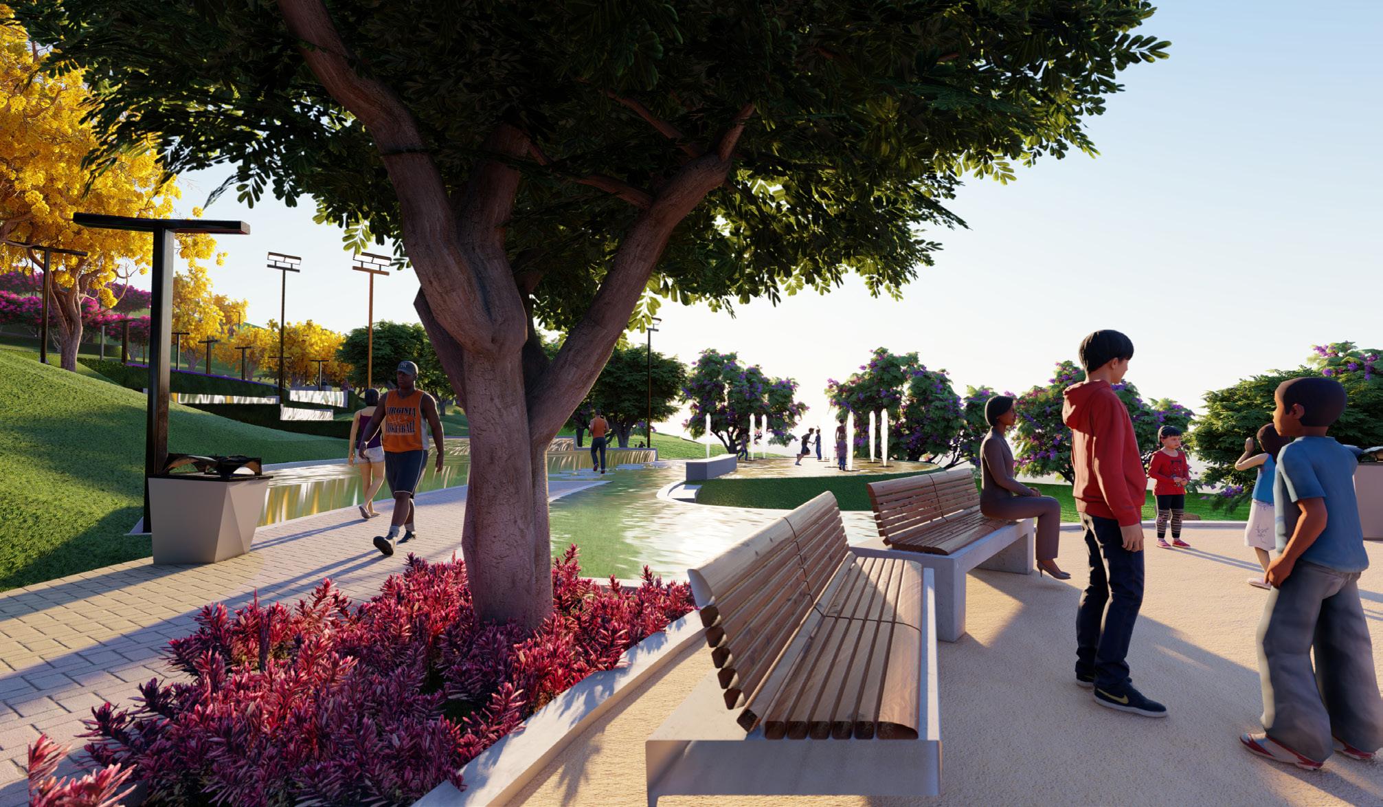
To achieve this, the project was developed using “water design” strategies, starting from the highest point of the land and flowing down to the lowest point, creating waterfalls and different spots along this watercourse. The aim is to create a contemplative park that can be used by the entire community, with resting areas, yoga decks, water playgrounds, viewpoints, and shaded picnic zones.
Both images on the right show areas created for resting and enjoying the view of the park. These spots are located at the highest points of the park, so it’s possible to see that the urban furniture is adapted to the natural terrain and slopes.
The entire area will be landscaped with native tree species. The idea is to create a comfortable space for the community’s use, but also a place where biodiversity can thrive through the use of green surfaces and trees.
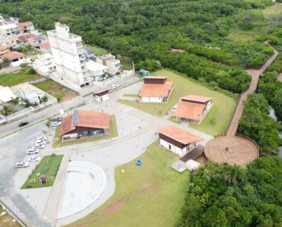
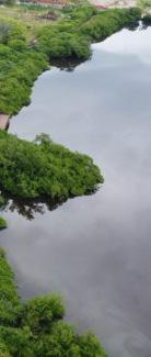
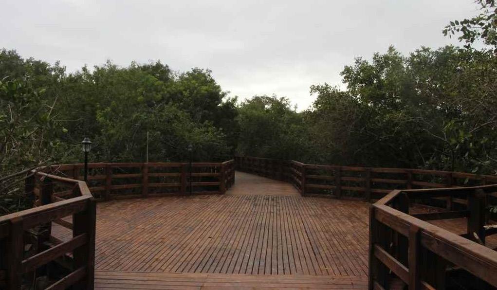
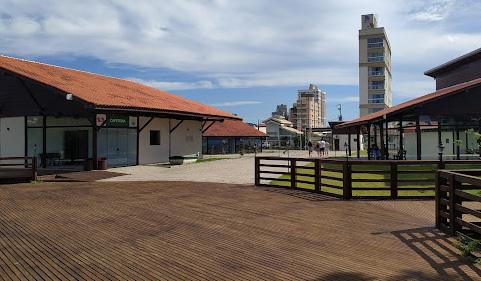
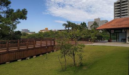
This ecological park was implemented through a public-private partnership, with the main goal of protecting the natural environment and providing spaces for environmental education. The wetlands were preserved in their natural state, and along them, elevated wooden decks were installed, designed to have minimal impact on the vegetation. The open area was used to install sustainable buildings with classrooms and administrative spaces for the Department of the Environment of Porto Belo, as well as vegetation and leisure areas.
The images on the side show the park already built, with structures used as the headquarters for the city’s environmental sector, designed in the portion of the land without vegetation. From a central path that passes through all the buildings, one reaches a circular wooden area, designed to be a place where educational and recreational activities can take place, with a view of the lake and a space for classes and events. From the central deck, there is access to other decks that lead to a trail through the marshland, implemented for the preservation of native vegetation. The main areas have already been established, but the park is still being developed to complement the landscaping with lawns and trees.
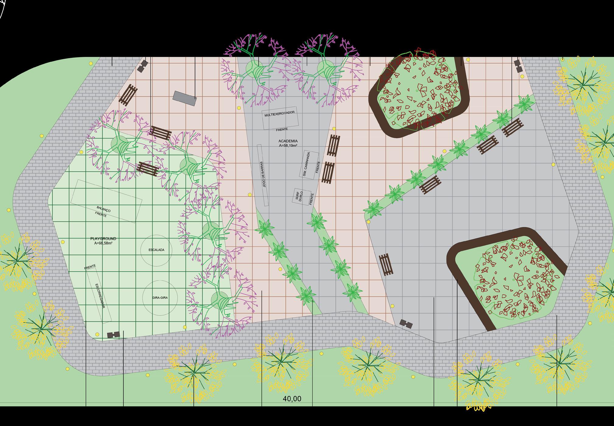
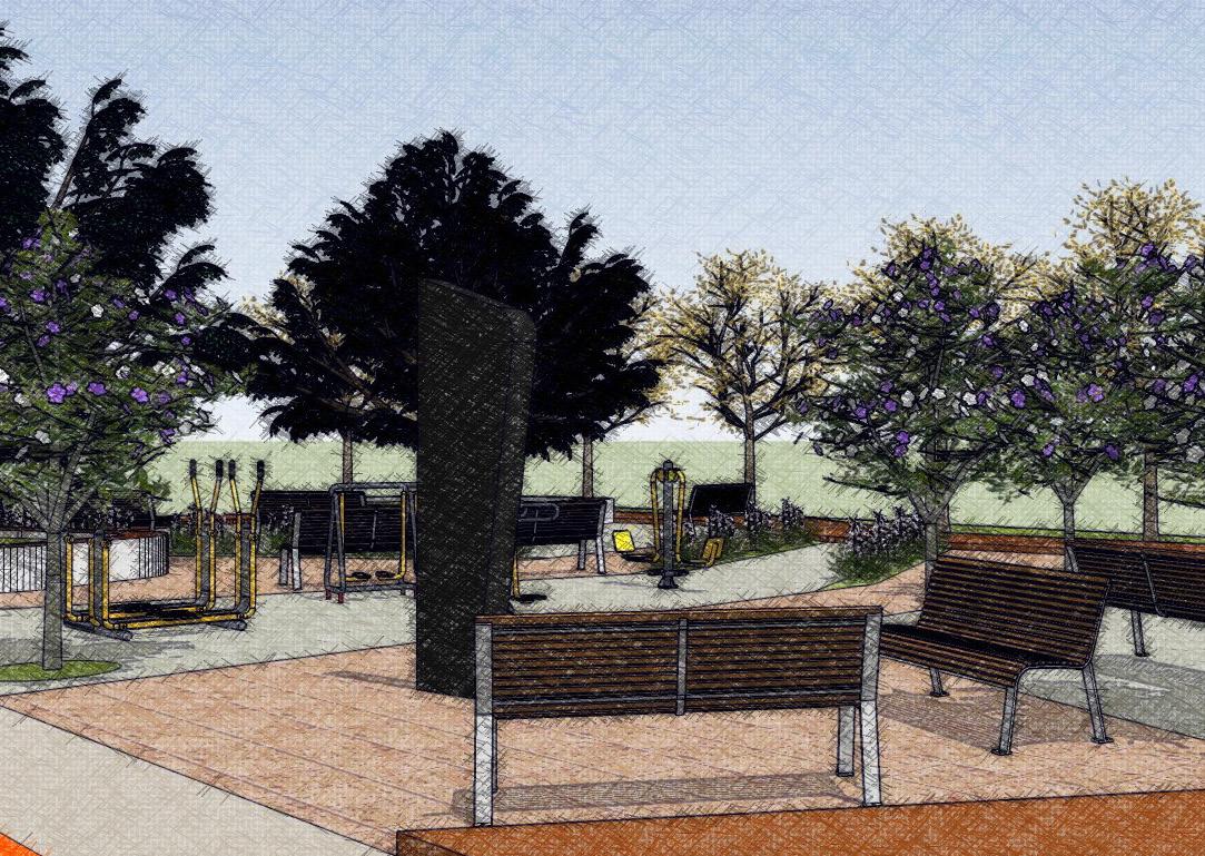
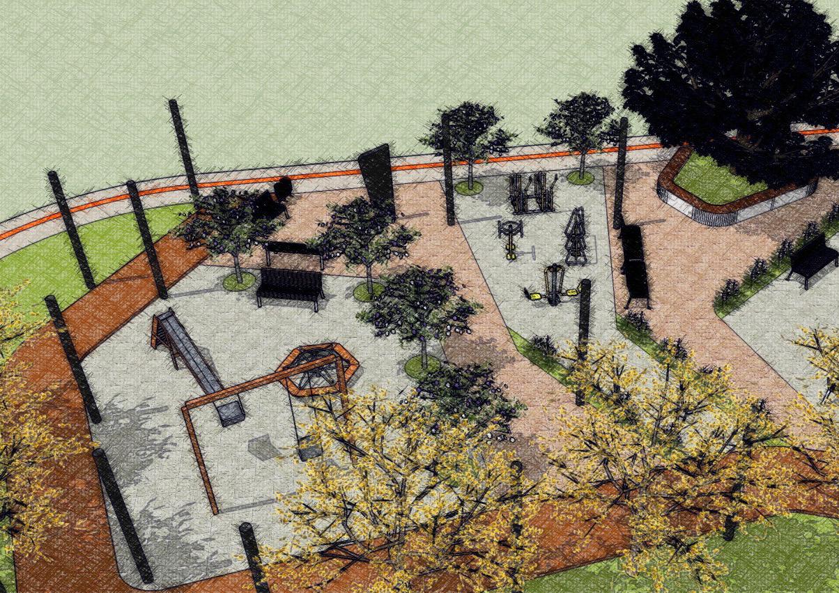
This square was created to serve as a space for the community, offering social and recreational activities. The square features a playground, outdoor gym, picnic area, and urban furniture for rest and socialization. All the trees are native species to encourage biodiversity.
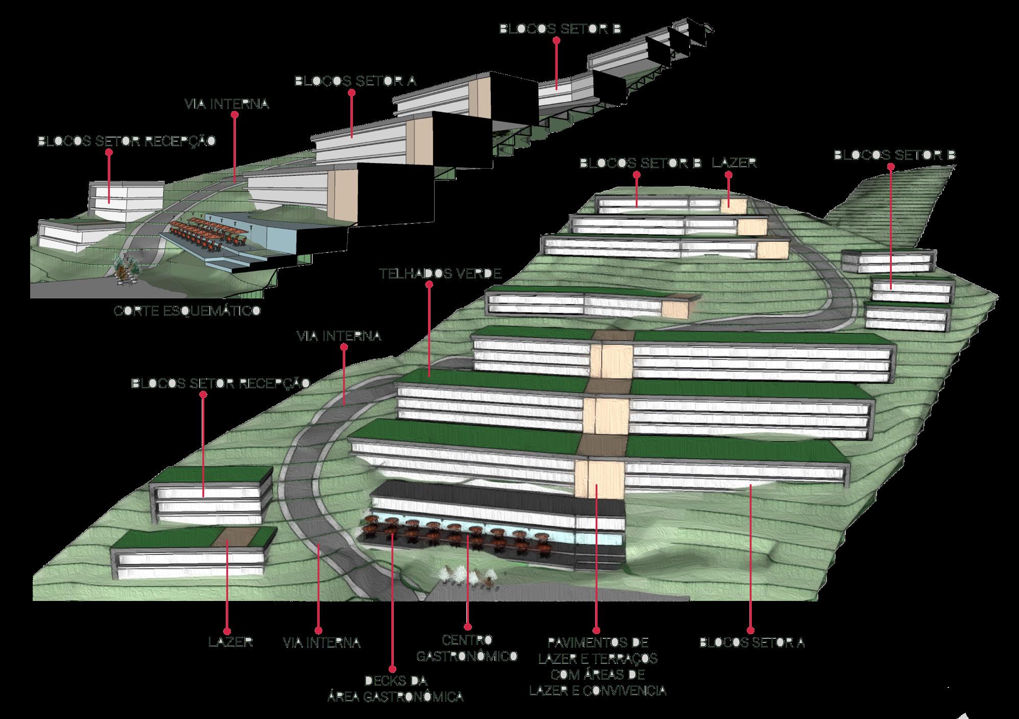
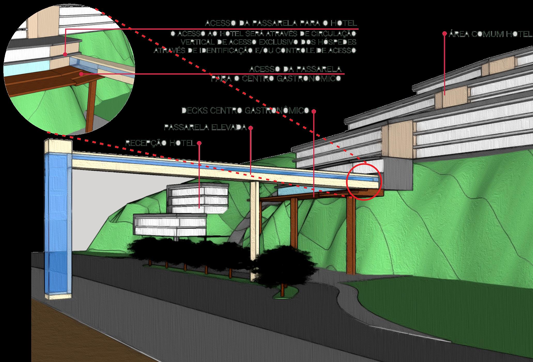
Z HOTEL
General Data
Project Typology: Hotel
Role: Conception, design
Project Year: 2021
Tools Used: AutoCAD, SketchUp, Google Earth, Photoshop
Location: Porto Belo - SC
About
This was a very challenging project, where the goal was to find the best way to make use of this sloped land, while respecting all development plans and environmental laws. The economic feasibility of this development is still being studied.
The proposal took advantage of the land’s slope to implement stepped buildings, allowing each one to have a sea view. Additionally, this type of construction would allow the development to respect the natural slope, preserving a large percentage of the natural vegetation. One major issue identified in the area is access to the site, which would only be possible via a very narrow and congested street. Several options were considered, and the area is still under study to find the best solution.
Tools Used: AutoCAD, SketchUp, Google Earth, Lumion, Photoshop
Status: Under construction
Location: Balneário Piçarras - SC
About
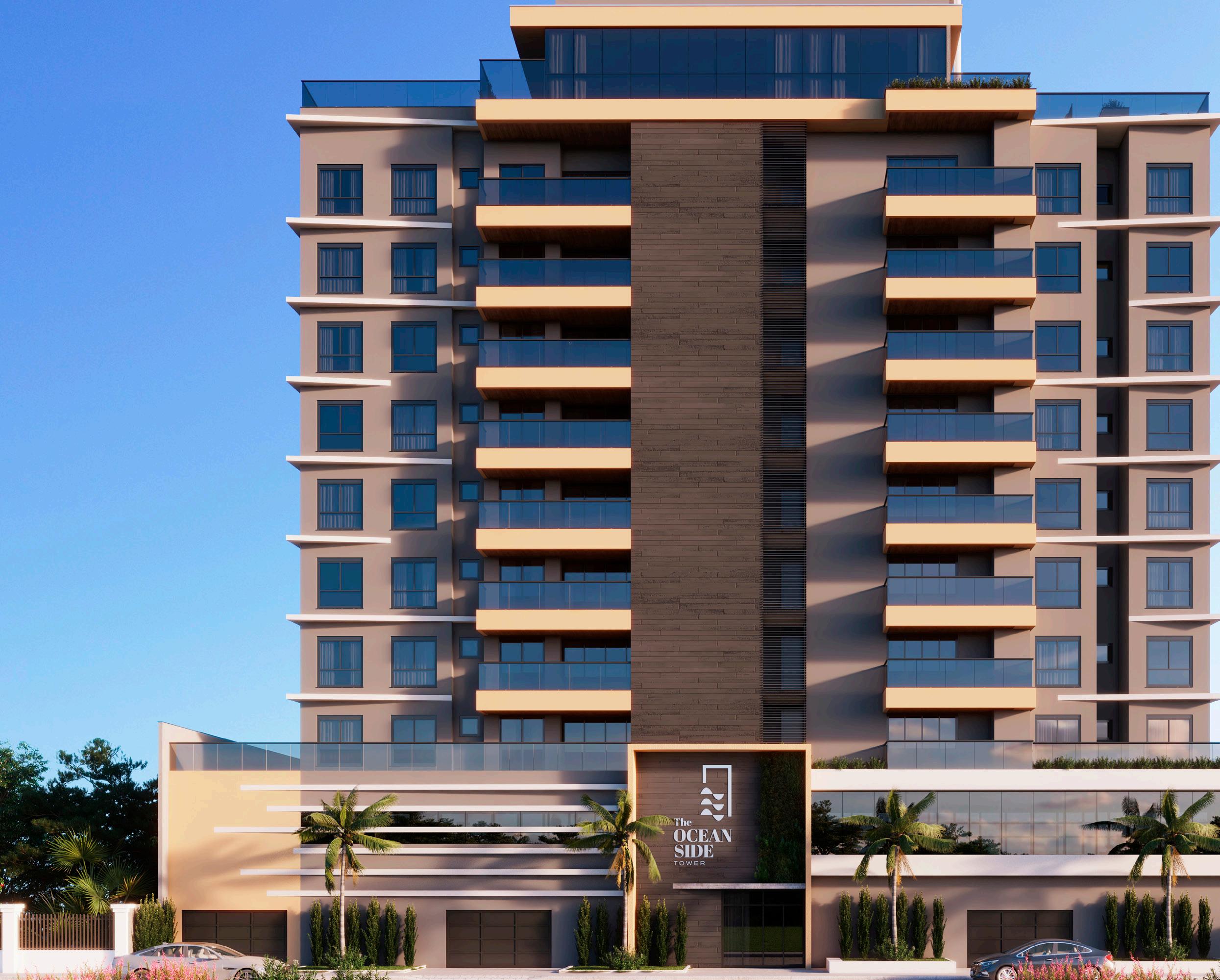
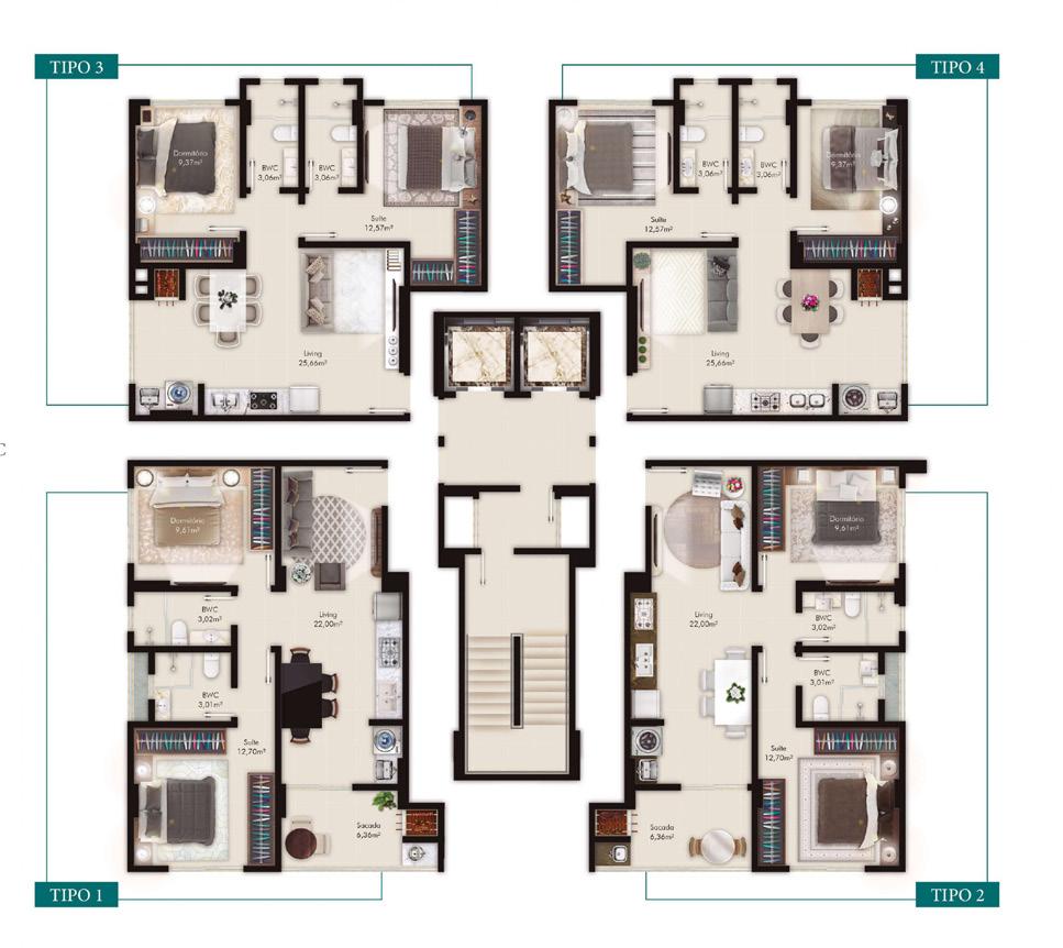
This residential building is located in an area with vertical growth, still surrounded by houses and natural land. The idea was to create apartments that would offer sea views now, while also preparing for the future, where other developments will arise in the vicinity.
Each floor has 4 apartments with different layouts, and the façade was designed to provide solar lighting and natural ventilation in a rather humid region. On the rooftop, a recreational area was created for residents, with communal spaces such as a pool and bar, and activity spaces like a gym and coworking area. On the sidewalk, areas with benches, greenery, and bike racks were created, aiming to bring residents closer to city life.
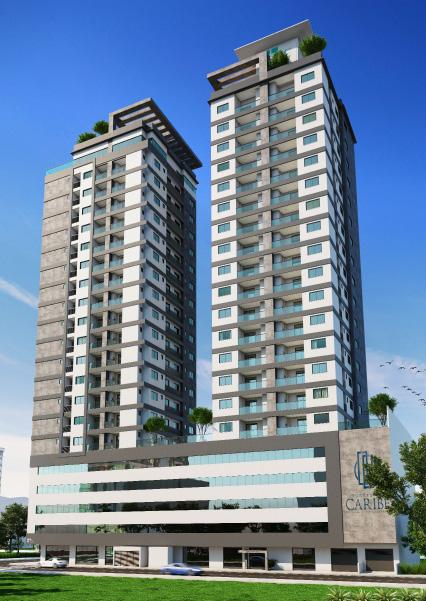
TORRES DO CARIBE
General Data
Project Typology: Residential and Commercial Building
This project was intended to offer viable options for small apartments in a very busy area of the city. The demand for small apartments has been growing in the region, as many young families are moving to the city. The developer wanted to maximize the use of the land.
The project is divided into two towers, with 4 apartments per floor, each measuring 60m². All the apartments have different layouts, allowing buyers to choose the most suitable option. A recreational area for residents was created on the rooftop. On the ground floor, the building offers commercial spaces, providing a mixed-use proposal for the region and increasing the number of commercial and leisure spots in the neighborhood.
CL HOME 12
General Data
Project Typology: Residential
Role: Conception, design, approval
Project Year: 2021
Tools Used: AutoCAD, SketchUp, Google Earth
Status: Under construction
Location: Itapema - SC
About
This project was developed with materials that would avoid high construction costs, which is why the façade made use of light and shadow elements to add a sense of lightness to the composition, without using cladding that would increase the cost of the project. The harmony of the façade was also achieved through the use of neutral and discreet colors, and the floor plans were created with integrated spaces that connect with each other and with the exterior, meeting all of the client’s expectations.
FLOW HEINOLA
master’s work
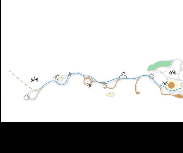
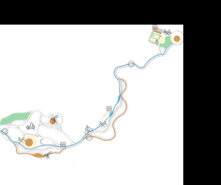
AboutThis master plan was developed during the Urban Interactive Planning course, where the goal was to create a proposal for the coastal zone of the city of Heinola, Finland.
The development of the master plan included many stages, such as site visits, meetings with stakeholders, and design and implementation strategies. We observed that the waterfront was segregated from the urban area, so the idea was to integrate the waterfront with the city and its citizens, using strategies such as architectural landmarks and activities. The proposal suggests an identity for the coastal zone, respecting the natural environment and the needs of the neighborhood, by implementing a continuous path
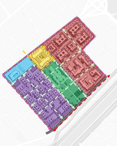
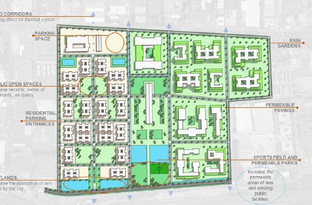
CEAGESP WMASTERPLAN
master’s work
About
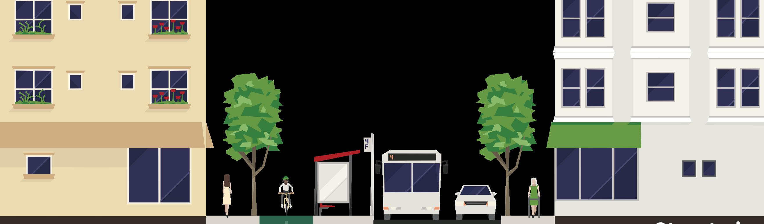
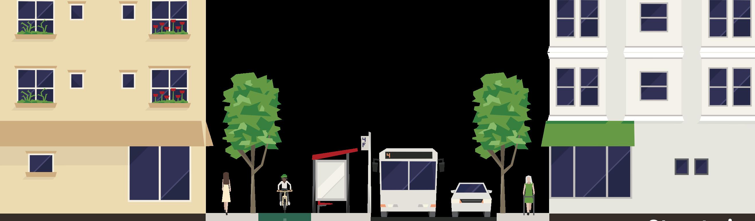
This was a project developed for an area in the city of São Paulo, a large metropolis facing growing issues with Urban Heat Islands.
The project for the area aimed to implement strategies to address the effects of heat islands, using green and blue infrastructure. Many strategies were included, such as street design, the creation of wind corridors, and “water design” to help cool the city.
Envi-Met Analysis
About master’s work
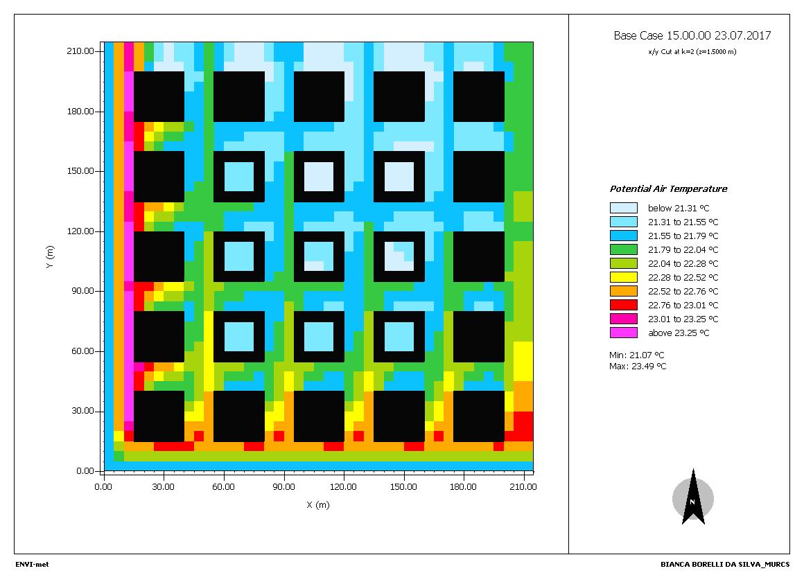
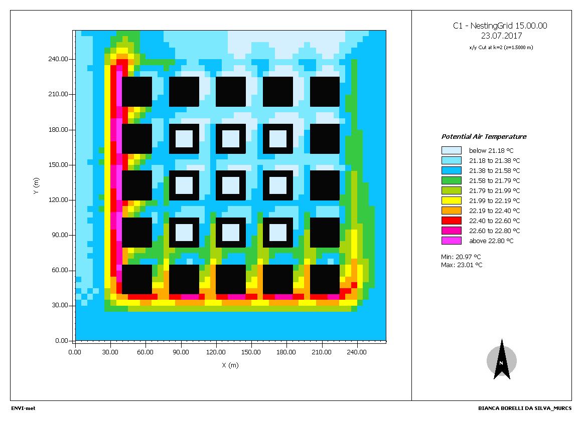
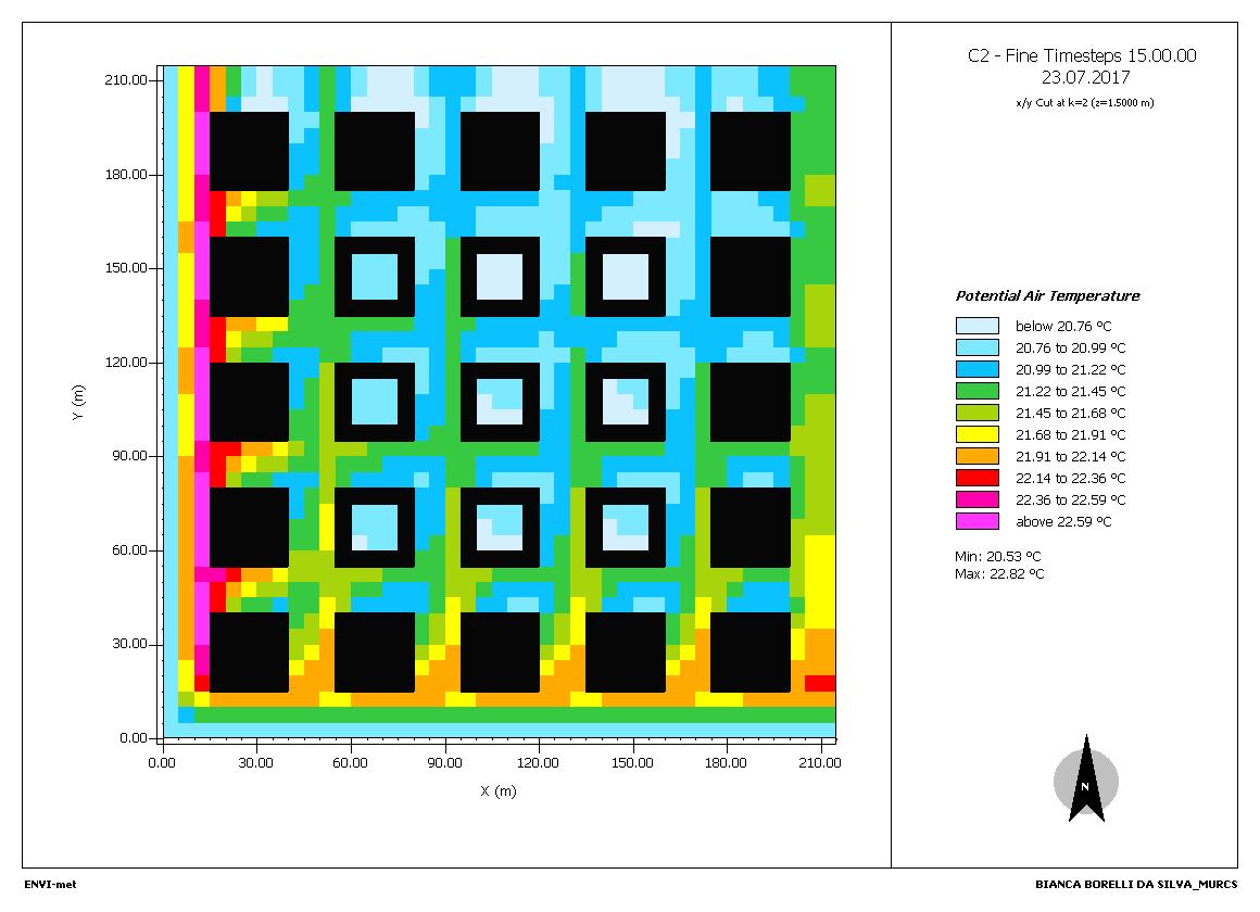
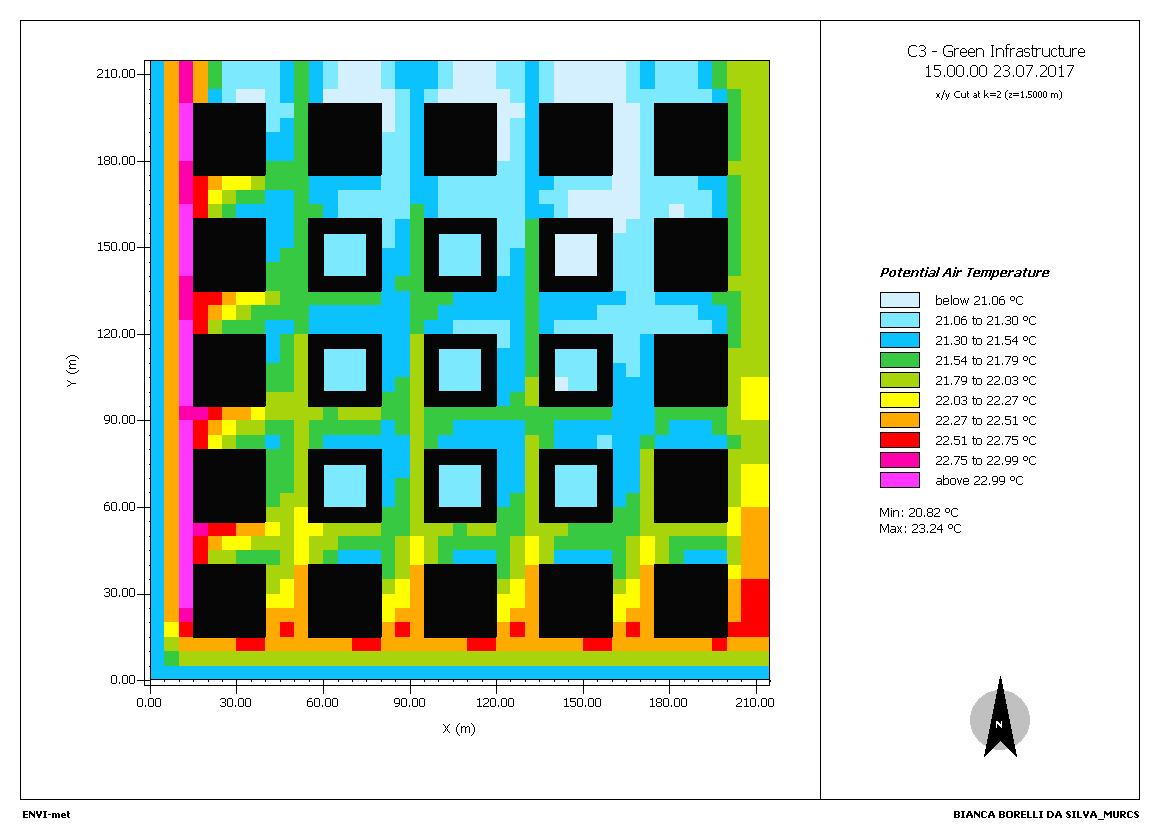
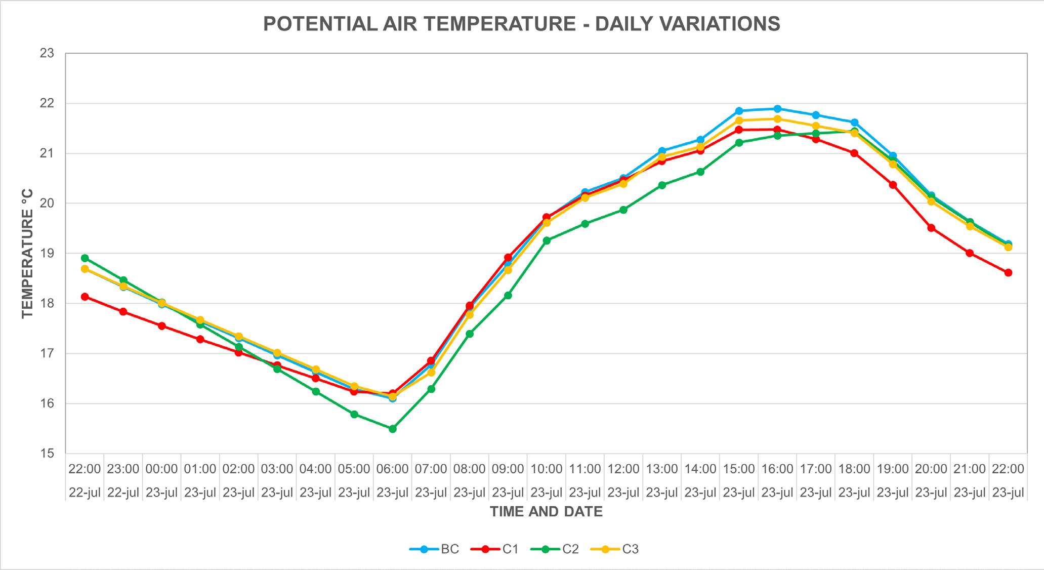
This was an analysis exercise developed during the Climate Change class in the Urban Environment course, where different heat island scenarios were analyzed using the Envi-Met software.
A hypothetical neighborhood was created using real conditions to simulate temperatures in the urban environment. The baseline case (top left corner) presents the current situation, and the other three simulations show the same location with different strategies and simulated conditions, such as temperature change, implementation of green infrastructure, or changes in surface and cladding materials.
GIS Analysis
About master’s work
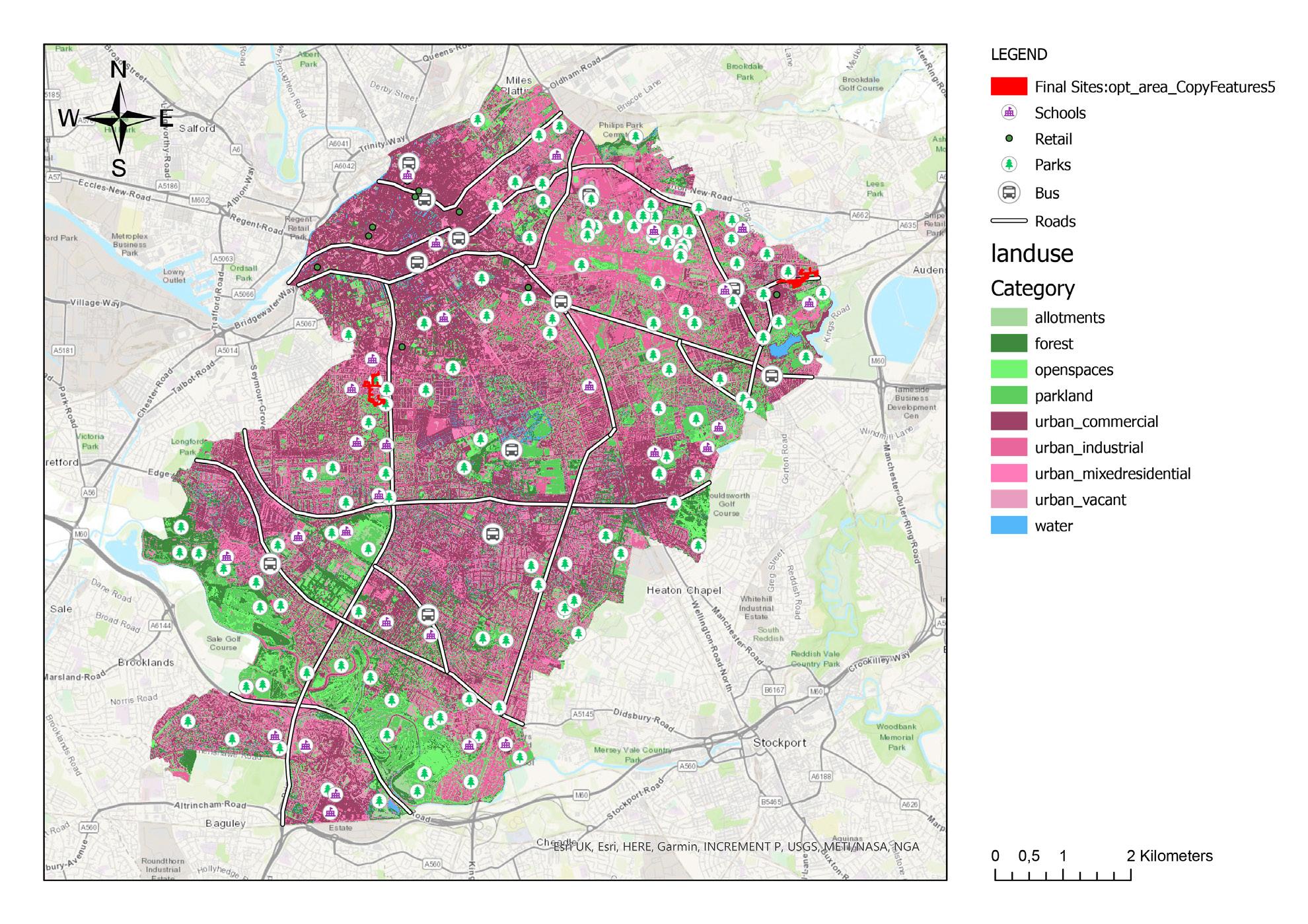
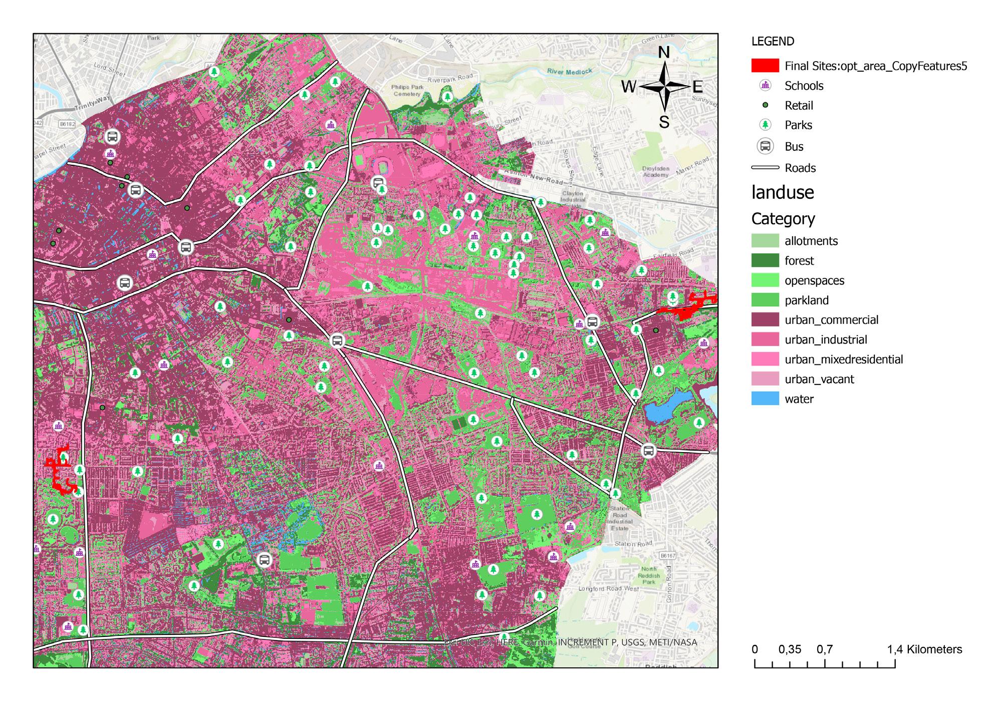
This was my first experience with the ArcGIS software, where I had to analyze the entire city of Manchester and find the best location for a development.
The maps were created using a set of indicators to identify the most suitable areas for the development, such as proximity to bus lines, preference for deforested areas over preserved ones, proximity to commercial areas, as well as the size and shape of the plots.
The two areas in red on the image below were the most suitable locations found for the implementation of the development.
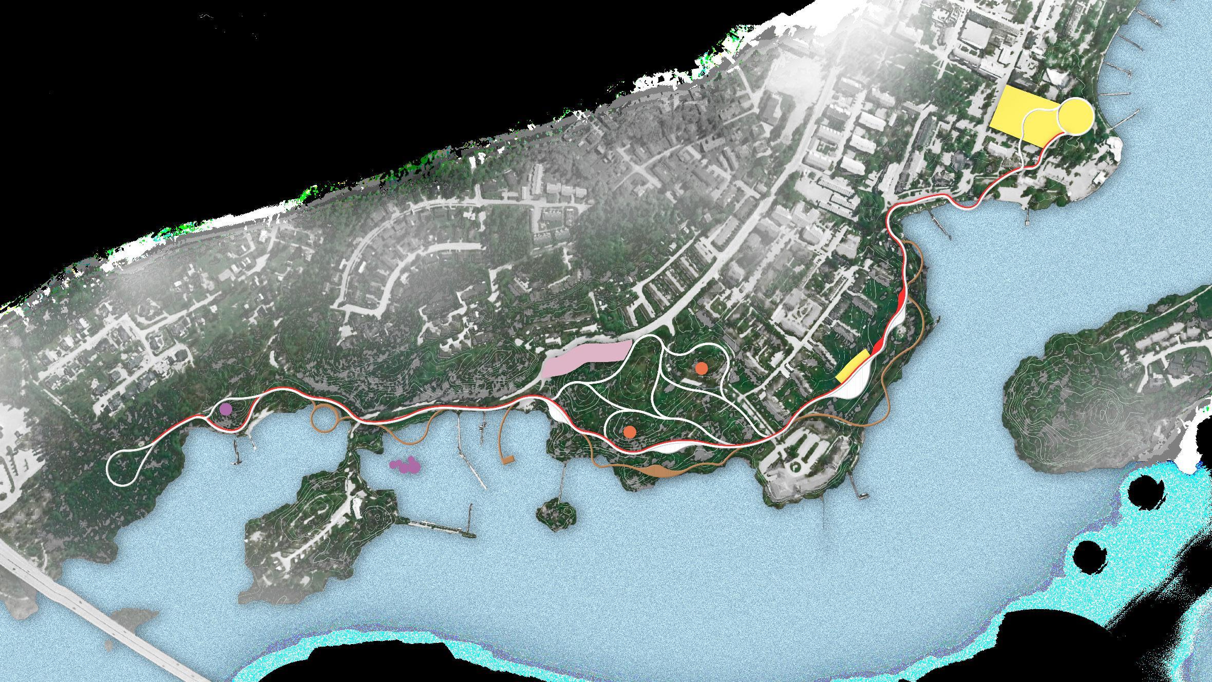
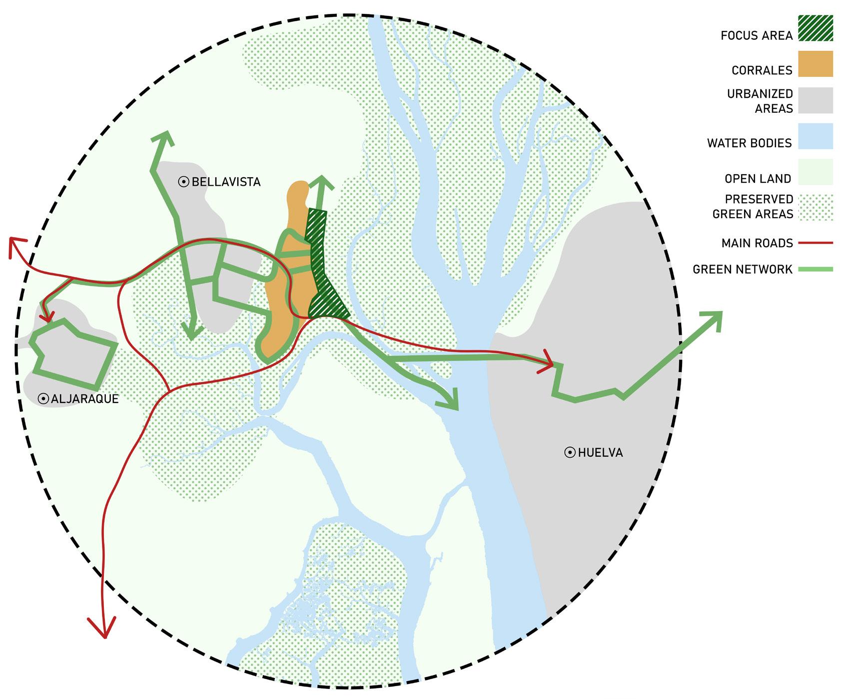
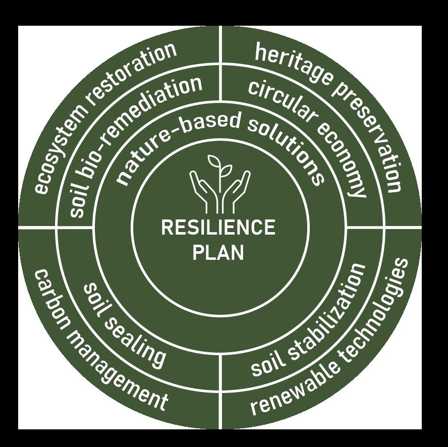
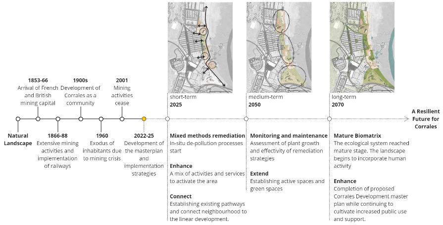
THE GREEN ARTERY OF CORRALES
master’s work
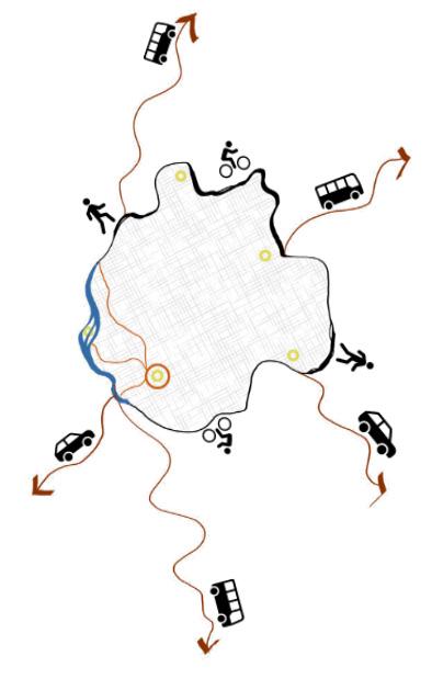
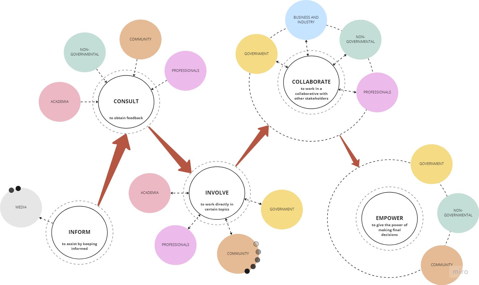
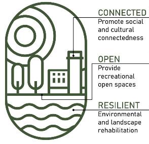
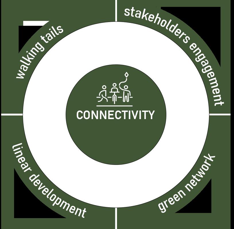
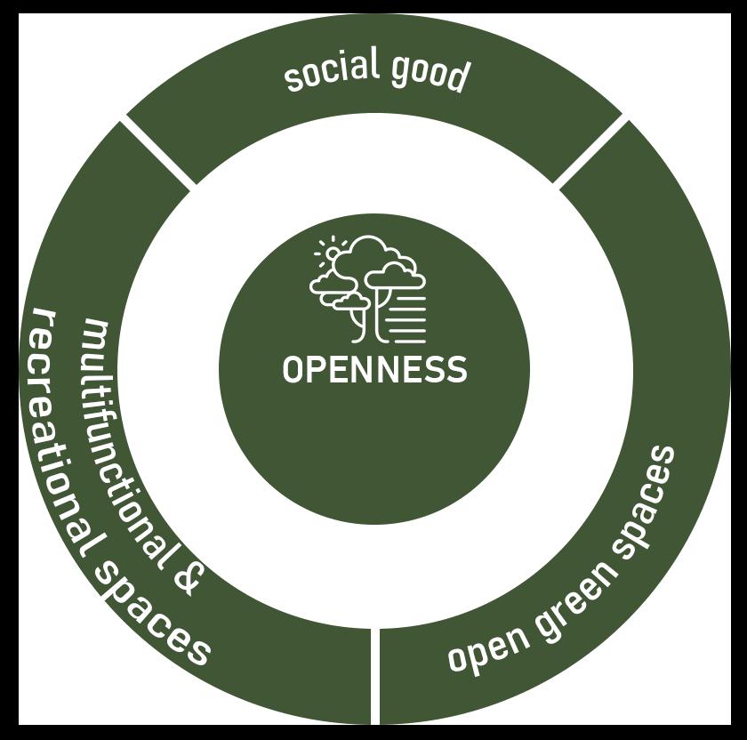
This was a very challenging master plan that we developed in the city of Huelva, Spain. The project was created as a team effort and included the entire development of the master plan, from background analysis, community contributions, to nature-based solutions aimed at addressing the area’s main environmental issues: pollution and rising temperatures due to climate change.
I’ve included here the phases in which I was more deeply involved in the development, which were the site analysis (at the end of this page), the stakeholder engagement plan diagram, and the vision and strategies for dealing with the area’s challenges. In the end, a timeline was also developed with the implementation plan for the project, considering short, medium, and long-term goals to achieve the vision.
The development is indicated by the green hatching in the image below, where we proposed the implementation of a coastal park, which would serve as a connection point between various regions in the area. It is expected that the suggested strategies, such as ecosystem restoration, soil