
bgcengineering.ca
bgcengineering.ca
Innovation is intrinsic to BGC’s identity. It is embedded in our core values and reflected in the technical services provided to our clients and partners. Innovation is crucial for delivering practical solutions and promoting environmental stewardship in resource, transportation, and land development projects across diverse geophysical environments.
We are passionate about discovering new ways to tackle challenging problems, expanding our knowledge, and applying our expertise to create a better world for the industries and communities we serve. Since 2014, BGC has invested over $38M in 364 projects. These initiatives have supported BGC staff, graduate students, postdoctoral researchers, and industryacademic teams across various fields.
We invest in our people through innovation with equitable access and support to all staff. In 2024, 44% of our funded R&D projects were led by women, accounting for 36% of the total expenditure.
Our investments in innovation have led to the launch of new companies, the development of commercial software, the filing of key patents, and the publication of influential research. We’ve also pioneered industry-leading methods for tackling some of the toughest challenges in applied earth sciences - and we’re just getting started.
We are thankful for the dedication to innovation and contribution of all BGC staff and our partners who make these advancements possible.
Matt Lato , Ph.D. Eng., P.Eng. Chief Innovation Officer, Geotechnical Engineer


In 2024, 240 BGC staff participated in 115 different R&D projects.
Our investments broadly fit into three categories:
01 Horizon 1 (~60% of projects):
Projects that aim to enhance or develop a current method. These projects increase our skills and work quality. They are often used in client projects right away.
02 Horizon 2 (~25% of projects):
Projects that experiment with new technologies, methods, or algorithms under realistic conditions. These projects build on existing knowledge and enhance our abilities. They are often done in partnership with academic institutions.
03 Horizon 3 (~15% of projects):
Projects that create new ideas, methods, or hypotheses. These projects can result in significant advances in their fields if they work. Horizon 3 projects allow for more exploration and higher risks.
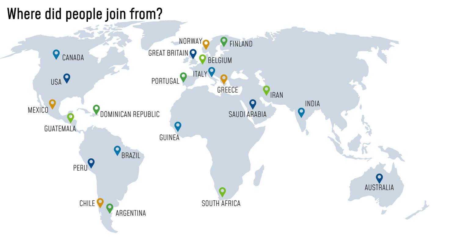
In 2024, BGC supported 17 initiatives connected to universities in North America, Australia, and Europe.
BGC staff published 28 papers in peer-reviewed journals, 175 conference papers and presentations, and authored 10 book chapters.
In 2024, 240 BGC staff members participated in 115 different internal R&D projects, in addition to innovative, client-funded projects. These R&D projects are managed and executed by BGC staff and typically involve multi-disciplinary teams to bring ideas to fruition. As we work to solve real-world problems, collaborative efforts with academics, clients, and industry are often integral to the success of these projects.
The 2024 R&D projects encompass all technical areas we operate in, from assessing climate change impacts on flooding to numerical modelling of natural hazard and tailings dam breach runout, analyzing pipeline displacement and strain, and laboratory testing of soil and rock. We are excited to work in partnership with universities around the world, from the University of Fribourg, Switzerland, to the University of Newcastle, Australia.
The journey from idea to innovation is often complex and non-linear, and BGC‘s R&D projects embody this reality. Our initiatives span from collaboration with university professors on exploratory research, such as utilizing bacteria for tailings solidification, to employing advanced statistical analyses for improved flood flow forecasting with direct application to client projects. Our investment in innovation contributes to advancing applied earth science practices, developing new or more efficient methods, reducing uncertainty, and enhancing the quality and communication of our work.
Over the past year, we have continued to harness machine learning and data science capabilities to solve complex applied earth science problems. An exciting focus area this past year has been in probabilistic machine learning, which captures the uncertainty in predictions and is integral to the responsible application of machine learning to engineering problems. Machine learning applications we advanced in the past year include:
Flood forecasting on gauged and ungauged rivers
Predicting future changes to flood magnitudes due to climate change
Predicting pipeline probability of failure at watercourse crossings
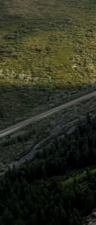
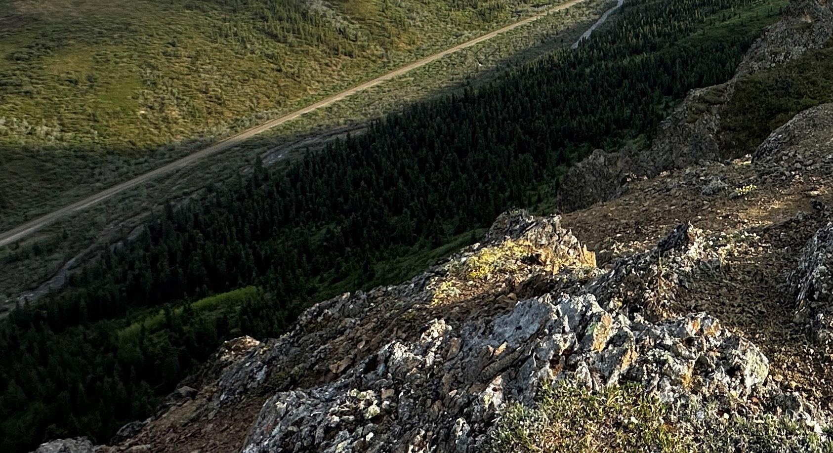
Screening-level mapping of active landslides in lidar change detection (LCD) and lidar imagery
Automatic mapping of riverbanks on aerial and satellite imagery
Mapping tailings dam bathymetry and beach discoloration on satellite imagery
Detecting permafrost ice wedges in lidar imagery
This report highlights a selection of our 2024 R&D investments and showcases the project teams bringing these initiatives to life. We encourage you to reach out to learn more about any projects that pique your interest or that could assist you in addressing complex applied earth science challenges.
Lauren Hutchinson , M.A.Sc., P.Eng.
Innovation Lead, Geotechnical Engineer
Cambio Earth is a cloud-based earth science platform that empowers organizations to make risk-informed decisions, enhancing the resilience of their infrastructure in the face of a changing planet.
www.cambioearth.com
Over the past eight years, BGC has invested over $24M into the development of the Cambio Earth software platform, transforming it from a specialized tool for pipeline geohazard management into an enterprise-scale solution adopted by more than 100 organizations across the rail, highway, mining, energy, and public infrastructure sectors. In January 2024, BGC established Cambio Earth Systems Inc. (Cambio Earth) as part of the BGC group of companies, to support the continued evolution and commercialization of the platform.
Cambio is an earth science intelligence platform engineered to drive operational efficiency and unlock new insights to support systematic, riskinformed decision making for critical infrastructure. Leveraging BGC’s decades of geohazard expertise, Cambio integrates multi-source spatial and temporal data—including earth observation data, instrumentation, climate forecasts, asset mapping, inspections, and field observations—within a robust geospatial data architecture and analytics framework. Embedded predictive models, realtime alerting, and integrated program management tools enable standardized risk assessments, modern digital workflows, and smarter, faster operational decision making.
In 2024, Cambio expanded its data ecosystem with the integration of four high-value datasets, enhancing users’ ability to assess environmental conditions and make risk-informed decisions. These additions include:
USGS 3D Elevation Program (3DEP) lidar data, providing detailed topography across North America
Copernicus Sentinel-2 satellite imagery from the European Space Agency for multispectral land monitoring
NOAA Multi-Radar Multi-Sensor (MRMS) high-resolution precipitation data across the U.S.
Global landslide susceptibility maps developed by USGS and NASA
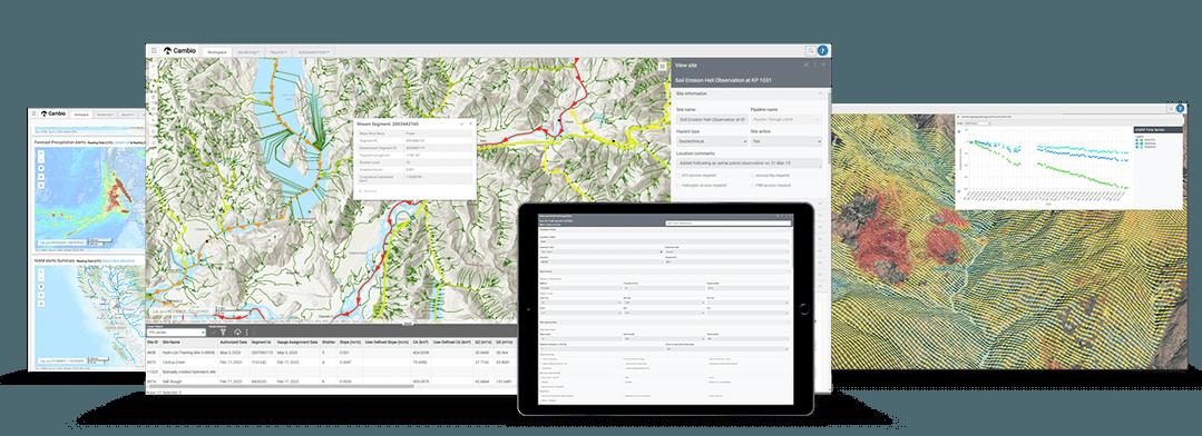
The Remote Sensing Module received key upgrades, including slope shader and terrain visualization enhancements, enabling more intuitive interpretation of complex terrain. New capabilities in Workspaces improved user collaboration and sharing within and across organizations.
A major 2024 milestone was the co-development of the Instrumentation Management Module by Cambio Earth and BGC. This flexible tool allows users to ingest, visualize, and report on a wide range of time-series sensor data—including shape accel arrays (SAAs), slope inclinometers, vibrating wire piezometers (VWPs), climate stations, and strain gauges—supporting comprehensive monitoring programs and streamlined workflows.
Ongoing collaboration between BGC and the growing community of Cambio users continues to drive innovation, refine platform capabilities, and advance industry standards in geohazard and geo-asset management.
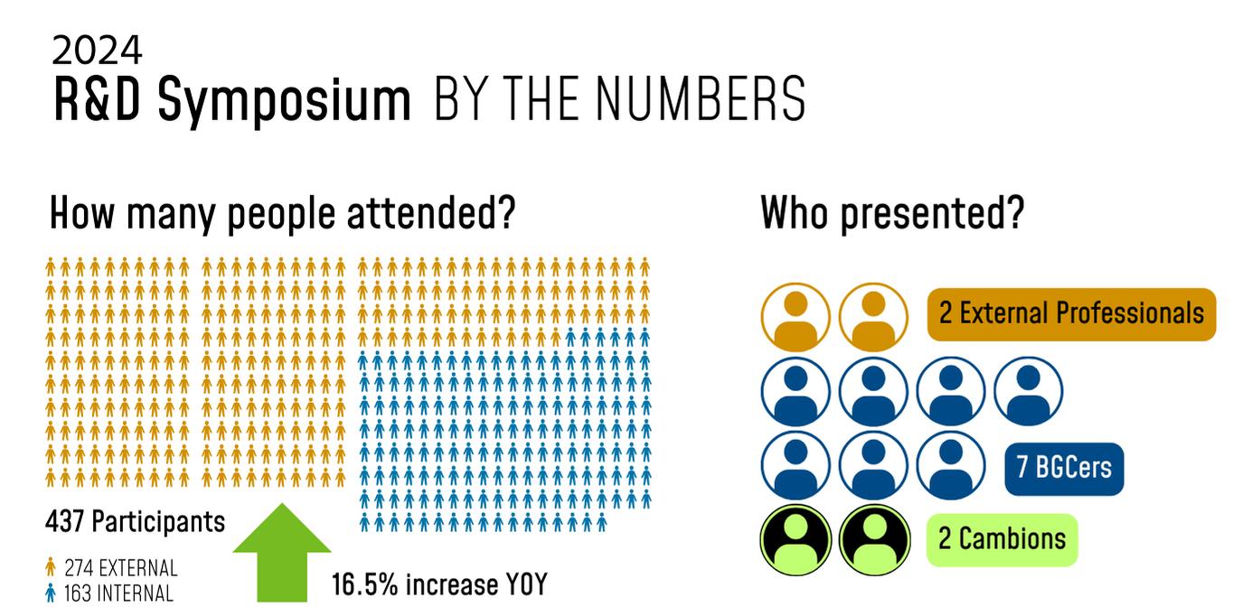
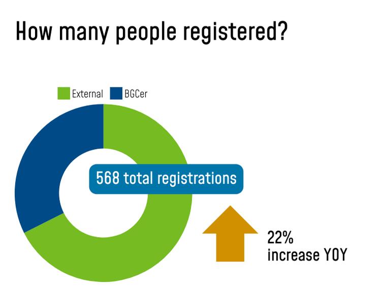
On October 24th 2024, BGC hosted its second online R&D symposium. Seven BGC staff across a variety of sectors and disiplines, as well as two Cambio staff members, presented their work in this four-hour online event. These talks were bookended with an opening Keynote by Dr. Jean Hutchinson (formerly of Queen’s University) on the importance of industry collaboration and a closing keynote by Dr. Pooneh Maghoul on nature-based solutions for the stabilization of problematic soils.

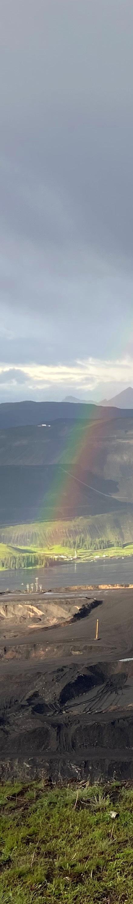
Advanced flood forecasting enables proactive decision-making to reduce flood damage.
Across Canada, linear infrastructure intersects rivers and streams, making it highly vulnerable to damage during flood events. To mitigate risks, infrastructure owners establish critical river flow thresholds that dictate when protective actions are necessary. Accurately predicting the probability of these flood events is essential, enabling proactive decision-making and reducing potential damage. Unfortunately, the availability of river flow predictions across Canada is limited. Sources like Google Flood Hub, the BC River Forecast Center, and the National Water Model provide flow forecasts at some gauged river crossings in Canada, however, the vast majority of watercourses have no public flow forecast available.
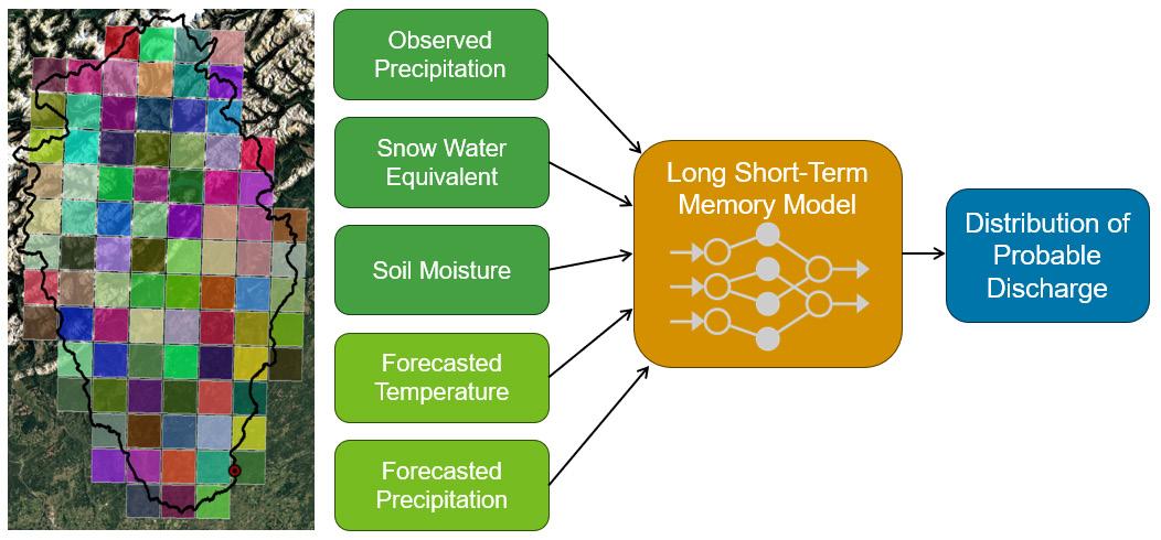
In 2024, BGC began addressing this gap in flood forecasts by building models in Alberta and British Columbia to predict discharge at both gauged and ungauged river crossings 48 hours into the future. The data-driven models were Long ShortTerm Memory (LSTM) models, a type of neural network that can learn and retain long and short-term trends for forecasting. The models use weather data from the upstream catchment, including precipitation, soil moisture, snowpack, and temperature, to predict flow at the crossing. This data is sourced from gridded datasets and aggregated across the catchment to provide the best estimate.
A key feature of the model is its ability to generate probabilistic outputs, which help decision-makers assess the likelihood of flow exceeding a threshold based on current and forecasted conditions. Unlike public forecast sources, which provide deterministic flow estimates, this approach offers a more comprehensive risk assessment.
During the 2024 flood season, two BGC clients in BC and Alberta successfully used the models to support decision-making. Our goal is to develop a unified model framework applicable across Canada for any client. To achieve this, work began in late 2024 on a generalized model capable of predicting flow at any gauged or ungauged location in Canada. Unlike the previous approach, which required separate models for each site, this framework enhances accuracy by leveraging a larger training dataset, allowing the model to better understand how discharge varies across catchments of different sizes and characteristics. This work continues into 2025, which will see the generalized model tested during the 2025 flood season.
BGC Team
Evelyn Moorhouse , M.Sc., M.D.S, GIT
Patrick Grover , Ph.D., P.Eng.
Pascal Szeftel , Ph.D., Ing., P.Eng.
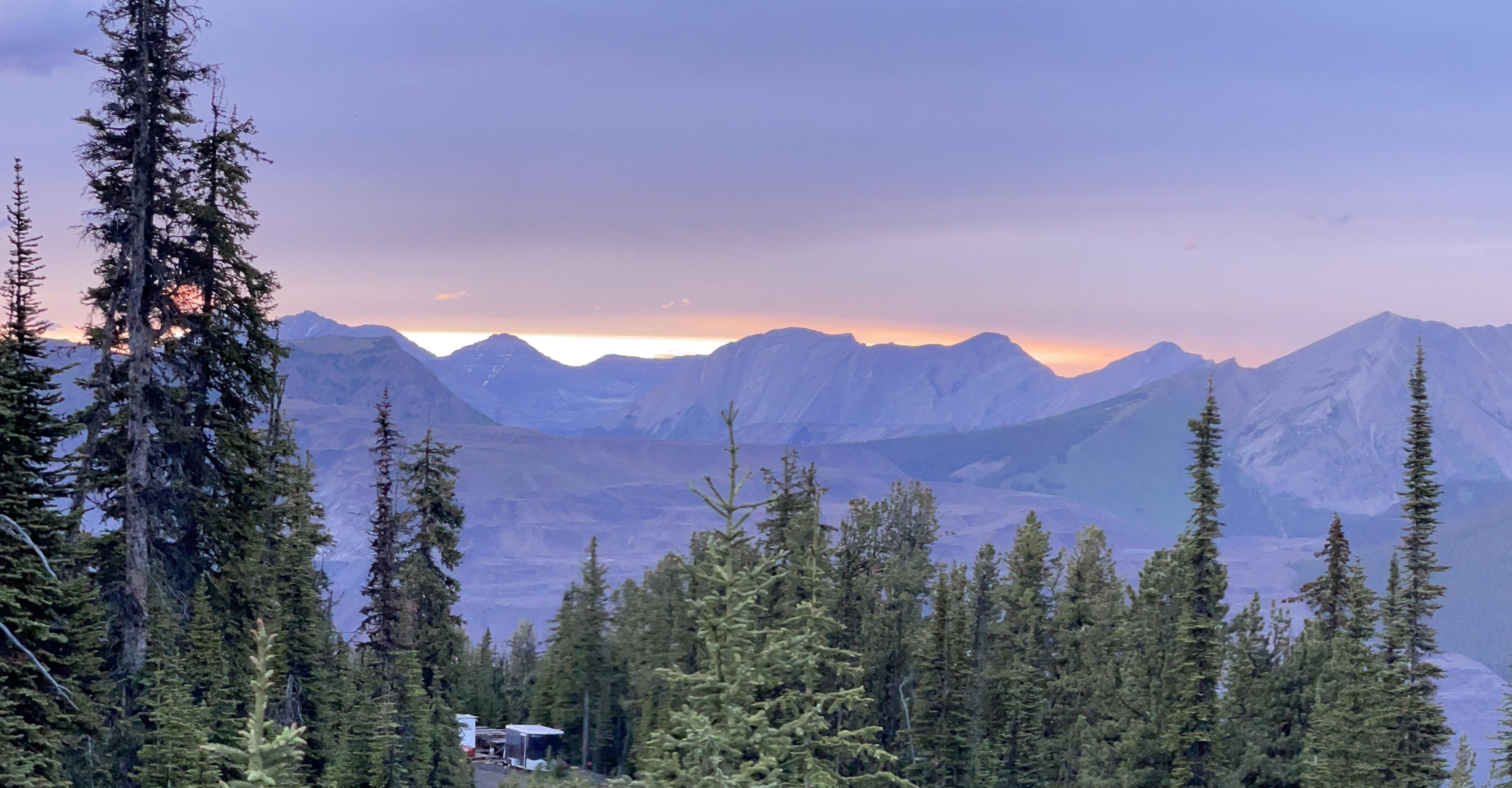
Geotechnical instrumentation and monitoring improve safety, efficiency, and resilience for projects around the world.
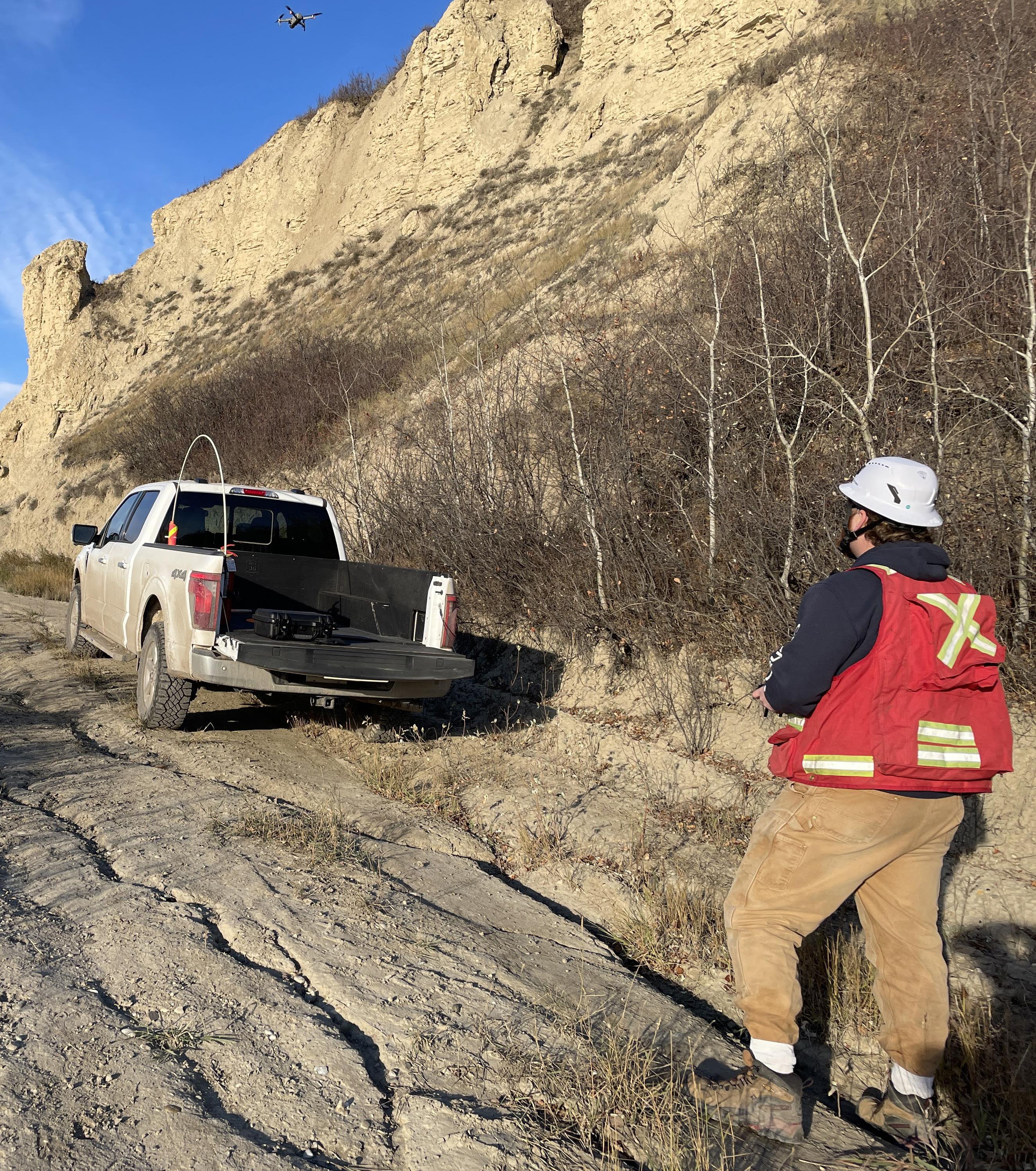
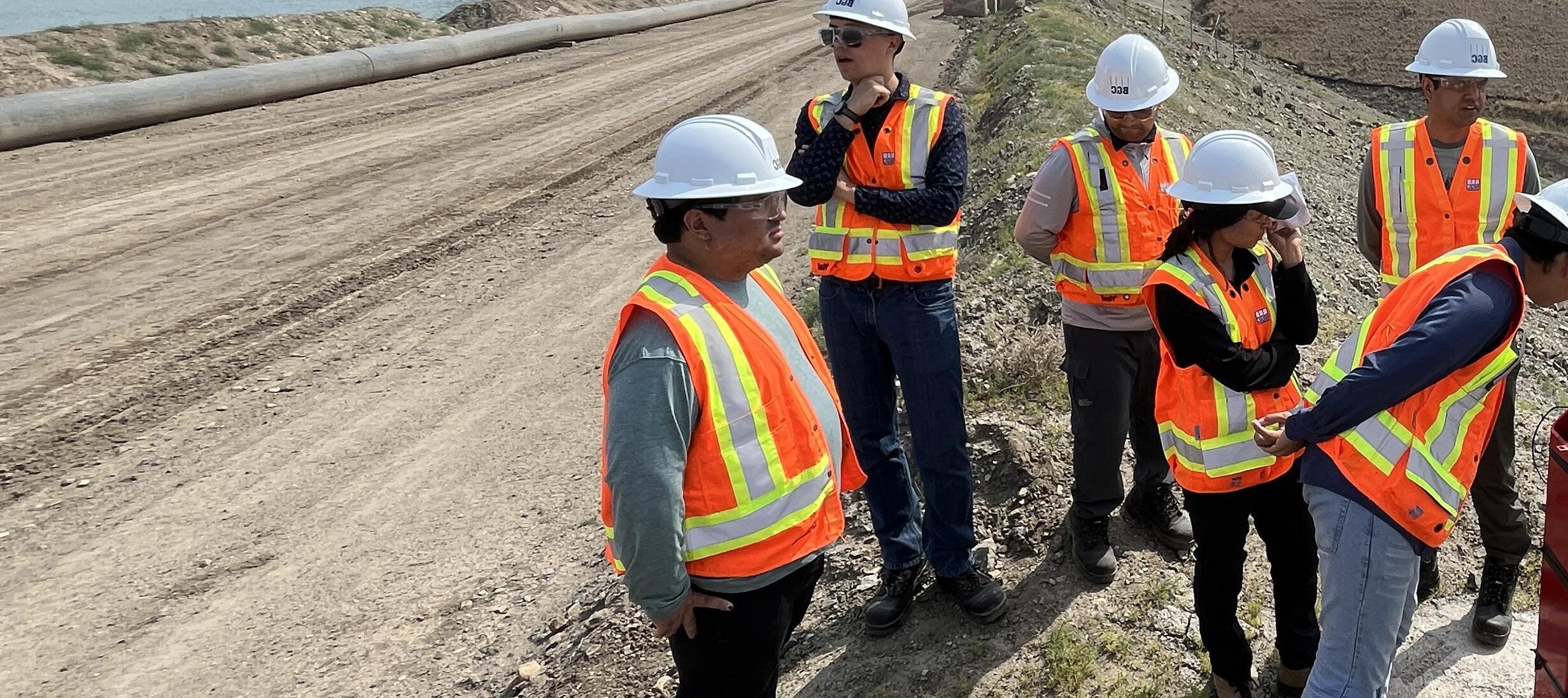
Instrumentation and monitoring are integral to solving the most complex earth science challenges at BGC. Our team strives to develop a deep understanding and to make informed decisions that improve safety, efficiency, and resilience for the projects we work on. Achieving this requires meaningful and reliable measurements of surface and subsurface conditions. Our approach is to identify the most appropriate instruments, monitoring techniques, and installation procedures to address geotechnical, geological, and geoenvironmental questions. We leverage proven sensing techniques and adopt innovative technologies for this purpose and are dedicated to pushing the boundaries of geotechnical monitoring and expanding the possibilities of instrumentation.
One of our key R&D initiatives focuses on advancing installation guidelines for fully grouted piezometers in tailings storage facilities. These instruments are essential for monitoring groundwater levels and pore pressures in foundational soils and tailings strata. They provide critical data for assessing facility performance during construction, operations, and long-term surveillance. With thousands of piezometers actively monitored across BGC mining projects, ensuring their accuracy and reliability is essential to our work and to the broader tailings industry. To achieve this, we have undertaken a multi-year effort to refine installation practices, including advancing optimal grout designs and the development of in-situ and laboratory quality assurance and quality control procedures. This work is part of BGC’s alignment with the Global Industry Standard on Tailings Management (GISTM) and contributes to reducing risk at Tailings storage facilities.
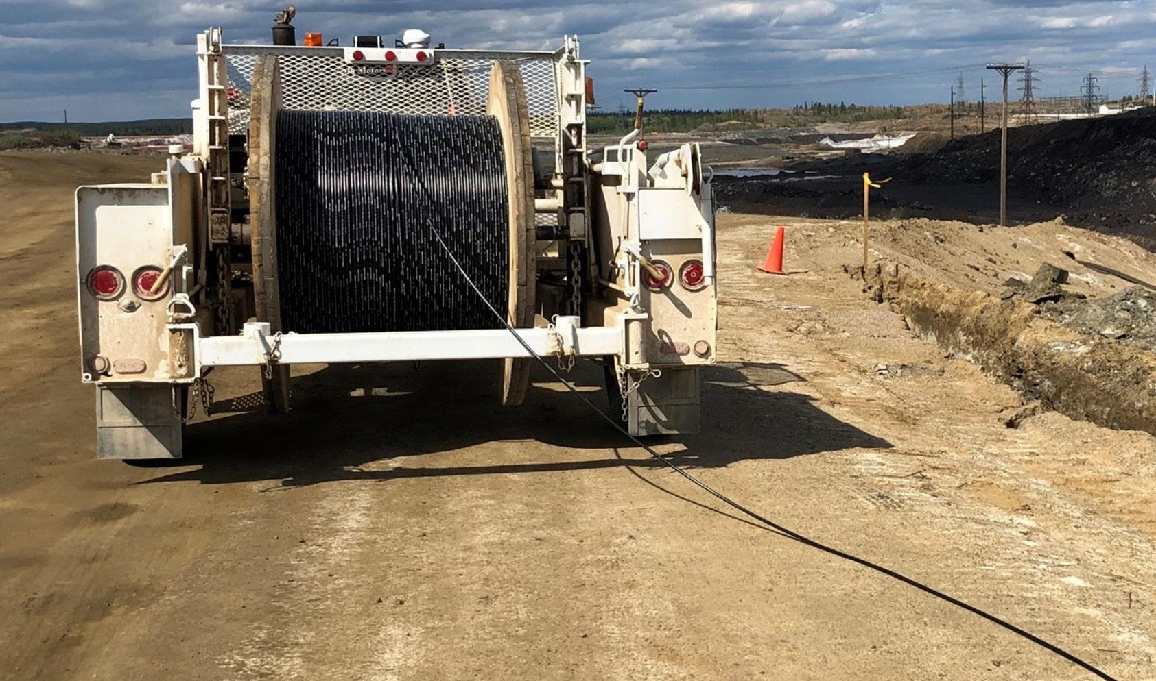
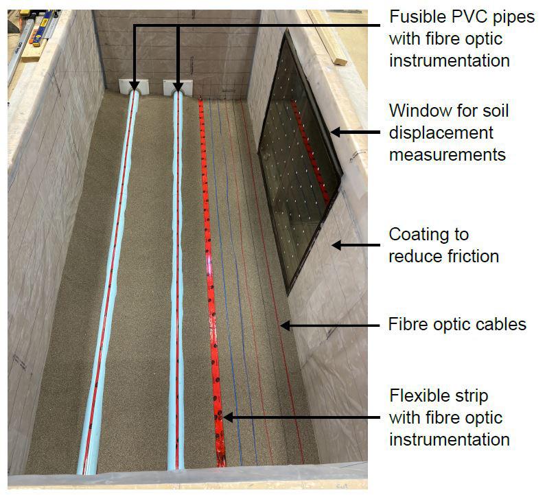
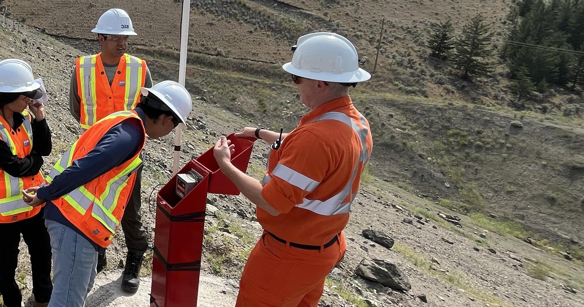
Expanding beyond established instruments, such as piezometers, which provide a single measurement point, BGC has been investing in the application of distributed fiber optic sensing (DFOS) technologies. These technologies allow for high-resolution monitoring of strain, temperature, and vibrations along a single optical fiber sensor, capturing measurements at thousands of points over distances of many kilometers. This capability represents a significant advancement for stakeholders, allowing previously unmeasured or unseen behaviours between point-based instruments to be captured and integrated into a more complete understanding of site behaviour. BGC is collaborating with multiple fiber optic sensor manufacturers and Queen’s University to conduct controlled experiments that examine how ground deformations and soil strains transfer to fiber optic sensors, refining their application for assessing the condition of earthen and buried infrastructure. BGC has also partnered with Dr. Susanne Ouellet at Lumidas Inc., a company specializing in distributed acoustic sensing (DAS) for geotechnical monitoring applications, on a multi-year R&D initiative. The project includes the development of advanced monitoring tools to analyze changes in soil strain and seismic velocities using DAS technology. The research outcomes aim to support owners and operators of tailings facilities in improving the assessment of asset performance and proactively managing risk against credible failure modes.
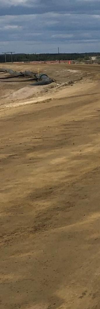
Testing different fibre optic strain sensing methods and materials for burial beside a deforming pipe
Bradley Forbes , Ph.D., P.Eng.,
Naia Suszek , M.Sc.
Kyle Mason , M.Eng., P.Eng.
Mitchael Hamer , B.A.Sc., P.Eng.
Alex Baumgard ,Ph.D., P.Eng., P.Geo.
Jason Waldick , B.A.Sc., P.Eng.
Creating new capabilities and methods to expand applied earth science practice.
Horizon 3 is described in The Alchemy of Growth (2000) as deliberately creating options for future opportunities. To Bill Sharpe, in his 2013 book, Three Horizons – Patterning of Hope, the third horizon is about positive transformation. To us, the Horizon 3 mindset is aspirational and is about creating new ways of working that fit emerging needs and building entirely new capabilities to bring a vision for the future into reality.
As Horizon 3 innovations mature with demonstrated success, the path to broader applications becomes clear. We know that all Horizon 3 projects integrate risk, and not all will lead to successful widespread application. With our pioneering spirit, we are dedicated to investing in these projects for their transformational potential and are grateful to the BGC team and partners who believe the outcomes are worth striving for, together.
Bill Burton , M.Eng., P.Eng.
Horizon 3 R&D Lead, Geotechnical / Geological Engineer
Biocementation and microbially induced carbonate precipitation (MICP) have been studied by BGC since 2016 and in the civil engineering space since the early 2000s. The nature-based approach relies on microbes to cement soil particles together with calcium carbonate to create a stiff, cemented soil. In the mining industry, this presents opportunities to stabilize tailings, manage dust, neutralize acid rock drainage, and capture carbon. Beyond the mining industry, biocementation has promise for riverbank and shoreline erosion.
In support of our commitment to “mining done right”, BGC’s biocemention team is working towards mine tailings stabilization. With funding support from Genome BC, BGC has partnered with the University of British Columbia (UBC), Rio Tinto, Teck, and Koonkie to use bacteria that occur naturally in tailings to produce a hardened biocement crust on tailings beaches to control fugitive dust. The hardened biocement crust is intended to keep the tailings dust in the tailings storage facility and out of the surrounding environment and workers’ lungs. This current project is on a pathway to making tailings facilities more stable and creating opportunities to enhance reclamation.
To date, BGC’s biocementation trials have relied on the ureolytic metabolic pathway where microbes convert urea (fertilizer) to carbonate. Optimizing and scaling up this biotechnology to the tailings storage facility scale requires alternate inputs and metabolic pathways. The carbonic anhydrase pathway is of particular interest to BGC, as carbonic anhydrase is an enzyme that converts carbon dioxide to carbonate, effectively capturing and storing carbon. With BGC’s support, UBC has identified bacteria that produce carbonic anhydrase in tailings samples from three different mines so far.
In 2025, BGC will continue working with its partners to scale up biocement technologies that improve the stability of tailings and explore opportunities to turn tailings storage facilities into megatonne-scale carbon storage facilities. If you would be interested in partnering to evaluate this technology please reach out to us.
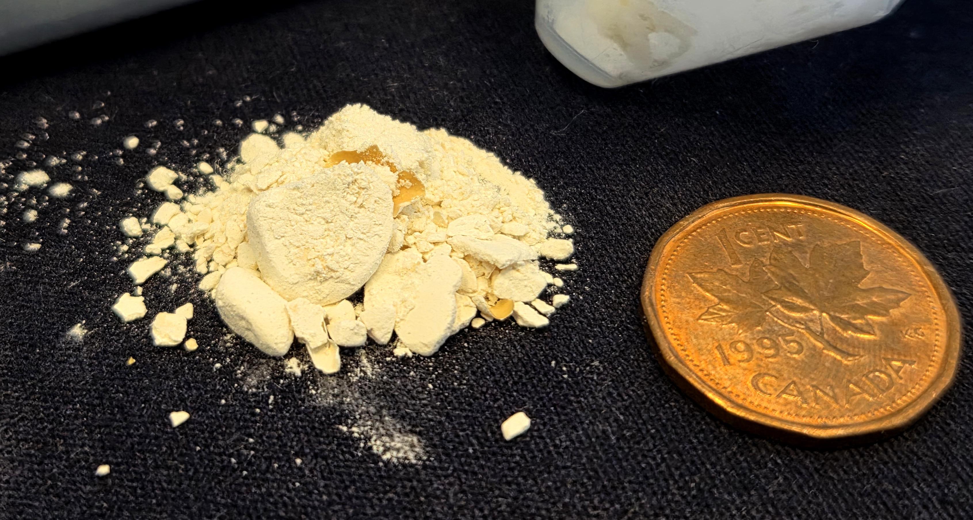
Nature at work – Carbon capture by microbes found living naturally in a tailings pond –grains of calcium carbonate
Project Team
Bill Burton , M.Eng., P.Eng.
Sean Deen , M.Sc., P.Eng.
Brett Smith , Ph.D.
Md Al Imran , Ph.D.
Bringing together teams from across the company to collaborate on critical applied earth science challenges.
BGC’s fourth annual Hackathon took place in Calgary, Alberta, from April 12 to 14, 2024. Ten teams with over 50 total participants gathered in the Rocky Mountain office for a weekend full of collaboration and intense focus. The Hackathon is a place of creativity and chaos; a garden where big ideas are cultivated and distilled to achievable tasks in a high-intensity, timeconstrained event.
The 2024 Hackathon featured a diverse array of projects focused on the business sectors and technical areas BGC supports Teams had a little over 40 hours to put together a product, tool, research paper, or proof-of-concept and present the outcome to an audience of peers and a panel of judges. The projects included innovative approaches to:
Leverage AI to delineate riverbank lines from satellite imagery and map terrain features
Estimate flood magnitudes in British Columbia for ungauged watersheds
Improve visualization of datasets through a 3D Digital Twin Software for Geotechnical Projects on Apple Vision Pro
Develop a screening-level tool for the mining industry to complement expert-based risk assessment methods and accelerate adoption of risk-informed decision making in all phases of tailings dam management
Efficiently create report-quality instrumentation data plots customized for specific project needs usingma flexible pythonbased workflow
Digitally log borehole data
Share digital viewports for GIS data hosted within Cambio
The energy and success of the 2024 Hackathon continued after the event, with multiple projects receiving client funding for further development and ongoing application of the outcomes on client projects.


– Improving and Validating our AI-powered Structural Geology Characterization Tool
Principal investigators: John Danielson, M.Sc., P.Eng.; Eric Wilton, B.A.Sc., EIT; Marco Diazgranados, B.Sc.; Ian Stilwell, B.A.Sc., P.Eng.; Derek Kinakin , M.Sc., P.Geo., P.L.Eng., CPG.
Description: In 2024, BGC significantly improved Structura, BGC’s automated televiewer data processing tool. Through BGC-funded research and a collaborative project with Rio Tinto Kennecott, BGC addressed limitations with our proof-ofconcept workflow by adding structure classification, borehole breakout recognition, and survey quality classification. A blind test of these new features on approximately 10,000 ft of data highlighted Structura’s advantages: its processed data were cleaner and contained fewer errors than the manually logged data. BGC also rolled out a beta web portal for internal use, making Structura much easier to use, and with help from the Cambio team, began developing an external portal.
Principal investigators: Jeanine Engelbrecht, Ph.D.; Caio Stringari, Ph.D.; Brett Eaton, Ph.D., P.Geo.
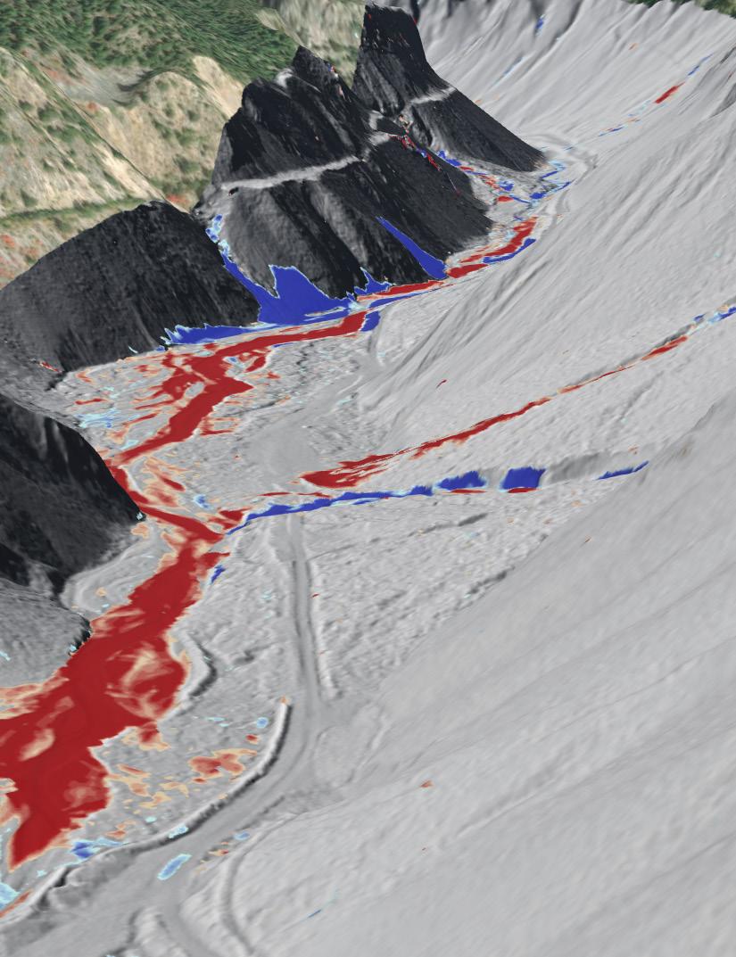
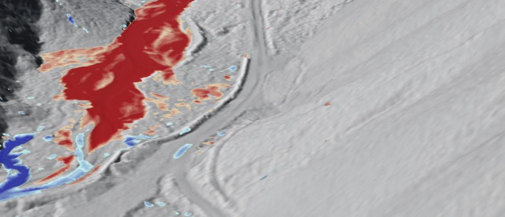
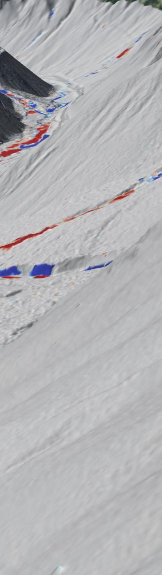
Description: BGC leveraged machine learning models to estimate bathymetry in tailings storage facilities (TSFs) from satellite data. Traditionally, TSF bathymetry surveys are boatbased and can be time-consuming and risky. Remote sensing solutions could help to address both issues. The results demonstrated that high-accuracy bathymetric estimates can be obtained from Sentinel-2 and Landsat-8/9 satellite data. However, mixed pixel effects lowered accuracy in shallow areas. The findings underscore the potential of satellite data and machine learning for TSF bathymetry monitoring, which could enhance efficiency and reduce risk, ultimately leading to improved environmental and safety standards in mining operations.
Principal investigators: Luke Weidner, Ph.D., EI; Michael George, Ph.D., P.E.
Description: Advances in the development of a new method for 3D numerical simulation of hydraulic plucking of rock blocks under flowing water. Currently, 3D numerical methods are too complex to accurately simulate rock-water interactions at practical scales with thousands of blocks, such as a spillway. Our proposed approach uses analytical block theory to compute rock block stability based on pressures computed from the FLOW-3D fluid dynamics model. The coupled analytical-numerical approach shows promise in being able to model scour processes at a fraction of the computational cost of currently available methods.
Principal investigators: Eric Wilton, B.A.Sc., EIT; John Danielson, M.Sc., P.Eng.
Description: BGC used advancements in open-source machine learning models to automate the tedious task of renaming site investigation photos. Photos taken from drilling site investigation projects previously either went unnamed rendering them difficult to use during data reviews or were manually renamed by junior office staff. The project deliverable was a python script which uses both supervised and generative artificial intelligence models to extract data from the photos and rename them with useful file names. In testing, the workflow was able to name photos with an accuracy of 95% and attached flags to the low confidence file names.
Principal investigators: Caio Stringari, Ph.D.; Sarah Davidson, Ph.D., P.Geo.; Steven Brazda, M.Sc., EIT; Lucy MacKenzie, Ph.D.
Description: RiverBankAI is a semi-automated segmentation tool that BGC is currently developing to delineate river extents and evaluate morphologic change. RiverBankAI leverages training datasets to segment images into floodplain, wetted area, and bar surfaces. Since RiverBankAI does not rely on the frequency of inundation to identify river extents, it can be used to define the riverbank locations in a single image, or to identify morphologic change from the comparison of two images. The use of high-resolution imagery and the differentiation of exposed bars allows the approach to be used on small rivers and those with complex morphologies (e.g., braided rivers). In the future, BGC plans to use RiverBankAI to develop automated erosion alerting in Cambio.
Principal investigators: Eric Johnson, B.Sc., P.Geo.; Alastair McClymont, Ph.D.; P.Geo., Erin Ernst M.Sc., P.Geo.
Description: Development of Python-based algorithms to automatically sample physical properties from geophysical models across various lithological units and contacts logged in nearby boreholes and test pits. The outputs can include crosssections showing the highest probability of where a contact or unit occurs, as well as maps displaying locations with higher or lower confidence in the interpreted depths to a geological contact. This approach enhances the accuracy of geophysical interpretations and helps identify outliers, where further review of the borehole or geophysical data may be required. It also improves the communication of the results, ultimately supporting more informed decision-making in geotechnical investigations.


In 2024, BGC partnered with universities on projects and initiatives that align with our organizational goals, collaborating with graduate-level research programs in Canada and internationally. Through our sponsorship of research chairs and programs, we have influenced research directions toward significant societal challenges, advanced the state of the art in our field, and inspired the next generation of geoprofessionals. BGC’s ongoing collaboration and partnership with academia continues to be an important part of recruiting staff passionate about research and innovation and encouraging BGC staff to pursue advanced graduate degrees.
BGC provides funding support and actively participates in field- and lab-based studies. Our ongoing support for university programs includes contributions from Katherine Johnston, M.Sc., P.Eng., P.Geo., and Matt Lato, Ph.D. Eng., P.Eng. who serve on the curriculum advisory boards at the University of British Columbia and Queen’s University in support of their Geological Engineering Programs. Additionally, Caroline Bates, M.A.Sc., P.Eng. is a member of the Advisory Board for FRBC Endowed Chair in Resource Geoscience and Geotechnics, held by Sergio Sepulveda, Ph.D. at Simon Fraser University.
In 2024, BGC collaborated with nine universities, including University of Newcastle (Aus), Dalhousie University, Queen’s University, University of British Columbia, and University of Calgary. A selection of these collaborative projects is showcased in the coming pages.
Gemma Bullard , Ph.D., P.Eng. University Connections R&D Lead, Civil Engineer
Underground Trenchless Construction
University: University of Alberta
BGC Team: Jeremy Groves, M.A.Sc., P.Eng. and Pete Barlow, M.Sc., P.Eng.
Biocementation of Mine Tailings
University: University of British Columbia (UBC)
BGC Team: Bill Burton, M.Eng., P.Eng. and Julian McGreevy, B.A.Sc., P.Eng.
Experimental and Numerical Experiments Related to River Width and Effect on Bedload Transport and Morphology
University: UBC and University of Waterloo
BGC Team: Rob Millar, Ph.D., P.Eng., P.Geo.
Nicola River Geomorphic Change University: UBC
BGC Team: Sarah Davidson, Ph.D., P.Geo.
Mentorship with Graduate Students University: UBC
BGC Team: Lucy MacKenzie, Ph.D.
Tailings Dam Breach Detection Monitoring with Fibre Optics and Seismic Sensors
University: University of Calgary
BGC Team: Susanne Ouellet, Ph.D., P.Eng., Matt Lato, Ph.D. Eng., P.Eng., Angela Kupper, Ph.D., P.Eng., FEIC, Saman Zarnani, Ph.D., P.Eng.
Hazards Arising from Permafrost Thaw
University: University of Calgary
BGC Team: Lukas Arenson, Dr.Sc.Techn.ETH, P.Eng.
Practical Applications of Anisotropic and Distributed Rock Mass Strengths in Slope Stability Analyses
University: Dalhousie University
BGC Team: Derek Kinakin, M.Sc., P.Geo., P.L.Eng., CPG
Permafrost and Geophysics Research to Support Water Balance Modelling
University: University of Fribourg
BGC Team: Cassandra Koenig, Ph.D. Candidate, P.Geo., Lukas Arenson, and Pablo Wainstein. Ph.D., P.Eng.
Nature-based Solutions for Permafrost Stabilization and Permafrost Carbon Fixation Based Solutions
University: Polytechnique Montreal
BGC Team: Lukas Arenson
Tertiary/Quaternary Geology and Glacial History of
Quesnel, BC
University: Simon Fraser University
BGC Team: Ashlyn Secord, M.Sc. Candidate, P.Eng., GIT, Martin Devonald, M.Sc., LL.B., P.Eng.
SaniSand Constitutive Model Modifications
University: UBC
BGC Team: Saman Zarnani, Ph.D., P.Eng.
Impacts of Climate Change on Convective Storms
University: University of Calgary
BGC Team: Melissa Hairabedian, M.Sc., P.Geo.
Geo-Engineering & Geoscience Research Accelerator (GeoRA) 2024
University: Multiple
BGC Team: Colin Miazga, B.Sc., P.Geo., Alex Baumgard, Ph.D., P.Eng., P.Geo., Lauren Hutchinson, M.Sc., P.Eng., Gemma Bullard, Ph.D., P.Eng., Katherine Hess, B.A.
Development of Universal Wave Overwash Model That Can Be Used as an Early Warning System for Region of New South Wales, AUS
University: Univeristy of Newcastle
BGC Team: Colleen Fish, M.Phil (candidate), GIT, Gemma Bullard, Ph.D., P.Eng.
University: University of British Columbia (UBC), Queen’s University
BGC Team: Gemma Bullard, Ph.D., P.Eng., Andrea Walsh, M.A.Sc., P.Eng., Kayleigh Barlow, M.A.Sc., EIT, Ed Carey, B.Sc., P.Eng., Vlad Rojanschi, Dr. -Ing., Ing., P.Eng., Brad Russell, M.Sc., P.Eng., Cindy Wang, B.A.Sc., P.Eng., Angela Küpper, Ph.D., P.Eng., FEIC
Description: CanBreach is a collaboration between universities and industry aimed at enhancing our understanding of tailings dam failure processes and the techniques used by professionals to analyze them. This program started its second four-year funding cycle in September 2024. The overarching long-term objectives of the CanBreach partnership are to: significantly improve our understanding of tailings dam breach processes and characteristics, including failures of unconventional tailings storage facilities; develop improved tailings dam breach analysis methods that contribute to the improved safety of tailings storage facilities in Canada and around the world; and to foster a community of practice that helps train the next generation of tailings engineers and places Canadian firms at the forefront of this topic.
University: University of British Columbia
BGC Team: Andrew Mitchell, Ph.D., P.Eng.
Description: Hazard assessments for debris flows often rely heavily on one-time observations following events. These observations tend to be biased towards larger events, and the effects of small events and fluvial re-working of deposits between events is not well understood. Annual surveys using a UAV-lidar system have been completed at four debris-flow fans in southwest BC since 2019 in collaboration with Dr. Scott McDougall at UBC to obtain detailed topographic information on both debris-flow deposition and subsequent re-working of the deposits. Data from the program to date was used to validate a technique to identify debris-flow events using satellite-based InSAR data (Botting et al., in review). Individual trees can also be identified in the full-feature lidar data, which is being examined as a method to validate lab-scale testing of the protective effect of forests at the University of Utrecht in a research program lead by Dr. Tjalling de Haas.
University: Queen’s University
BGC Team: Alex Baumgard, Ph.D., P.Eng., P.Geo., Colden Van Ommen, B.A.Sc., P.Eng.
Description: There are many pipeline sites that cross active landslides. When these landslides can’t be arrested using traditional techniques, excavation and stress relief of the pipelines is required periodically. Pipeline backfill materials conventionally consist of either a native, locally sourced soil or an imported granular backfill. In either case, the backfill material readily compacts which applies large frictional forces against the pipeline resulting in increased stress to the pipe as it is dragged through moving ground. This research proposes an innovative means of preventing failures by allowing the landslide to move past the pipe without accumulating the normal drag and stresses. By burying the pipeline within backfill materials that are designed to be compliant, it is anticipated that the backfill will deform such that the stresses applied to the pipe by landslide movement are dramatically reduced. In the present study, a Master’s student is in the process of conducting both laboratory testing of the compliant backfill and numerical modelling to investigate if compliant backfill is an appropriate mitigation strategy compared to using conventional backfill.
In June 2024, BGC ran its third installment of the Geo-Engineering and Geoscience Research Accelerator (GeoRA) Program. Six researchers from universities in Canada and Puerto Rico participated in this program hosted in the BGC Vancouver office. The GeoRA program is designed to provide a physical forum for university graduate students to work on aspects of their research in a collaborative and open environment. In this environment, students work side-by-side with those from other universities and have access to people in industry. While focusing on their individual research, students benefit from proximity to peers while completing research that addresses a wide range of challenges at leading institutions across Canada and internationally. The program fosters interdisciplinary exchange among the specialized fields of each applicant’s research interests and allows the researchers to develop a network of colleagues while gaining exposure to a consulting office environment and culture.
To ensure that the students maintain momentum in their registered program, regular check-ins with their professors are maintained. In addition, a member of the BGC staff facilitates a weekly internal roundtable meeting and broader technical seminar hosted by BGC’s senior and principal staff who have project experience fields related to the researchers. This provides the opportunity to interact with practicing professionals and subject matter experts outside of the academic environment at BGC.
Given the success of the GEORA Program in 2024, BGC is expanding the 2025 program with international university participation.
Several BGC staff serve as adjunct professors and sessional lecturers at universities and colleges across North America:
Brett Eaton, Ph.D., P.Geo.: University of British Columbia (Professor Emeritus)
Carl Mendoza, Ph.D., P.Eng., P.Geo.: Simon Fraser University; University of Alberta (Professor Emeritus)
Chris Pederson, M.S., PE: Colorado School of Mines
Dave Gauthier, Ph.D., P.Eng., P.Geo.: Queen’s University; Lakehead University
Lukas Arenson, Dr.Sc.Techn.ETH, P.Eng.: University of Manitoba; Polytechnique Montreal
Matt Lato, Ph.D. Eng., P.Eng.: Queen’s University
Sarah Davidson, Ph.D., P.Geo.: University of British Columbia
Willy Zawadzki, M.Sc., P.Geo.: University of British Columbia
These BGC staff, along with other senior BGC personnel, act as primary, secondary, or external co-supervisors and advisors on various masters and doctorate-level theses. In 2024, many of our staff also presented guest lectures across Canada, the US, South America, Europe, and Australia.
In 2024, BGC staff produced over 200 research publications and presentations with wide-ranging applications for the mining, pipelines, transportation, and communities sectors. More than 260 staff members contributed to at least one publication or presentation over the past year, collaborating with colleagues in and outside the company to advance knowledge in applied earth sciences.
Research topics reflect our team’s diverse expertise and interests, including artificial intelligence, climate change, cold regions engineering, earthquake engineering, foundations engineering, geohazards, geophysics, groundwater, hydrology, tailings and dam engineering, remote sensing, soil and rock mechanics, and mine closure.
BGC staff published 28 articles within journals such as the Bulletin of Engineering Geology and the Environment, The Cryosphere, International Journal of Physical Modelling in Geotechnics, Journal of Geotechnical and Geoenvironmental Engineering, Journal of Hydrology, Mine Water and the Environment, Natural Hazards Review, and Nature Communications
Selected highlights from the year include:
Matthew Lato, Ph.D. Eng., P.Eng., was recognized at GeoMontreal 2024 with the Canadian Geotechnical Society’s Early Achievement Award.
Angela Küpper, Ph.D., P.Eng ., FEIC, gave the opening plenary keynote, “Tailings Management – Where We Are Today and Where Do We Go From Here?”, at the 2023 Tailings and Mine Waste Conference.
BGC staff Paul Bauman, B.Sc.E., P.Eng, M.Sc., P.Geoph., Landon Woods, M.Sc., P.Geo., and Kate Robey, M.Sc., Pr.Sci.Nat., along with Selda Edris (IsraAID), won best conference paper for “Building Water Resilience in Uganda, One Well at a Time” at the 36th Symposium on the Application of Geophysics to Engineering and Environmental Problems.
Michael Porter, M.Eng., P.Eng., Joel Van Hove, M.Eng., P.Eng, Owen Bunce, B.A.Sc., P.Eng., and Pete Barlow, M.Sc., P.Eng., won the Academic Distinction Award for Risk for their paper, “Assessment and Cost Benefit Analysis for Pipelines Buried in Slow-Moving Landslides”, at the 2023 International Pipeline Geotechnical Conference.
Carie-Ann Hancock, M.Sc., P.Geo., delivered a keynote speech, “What’s Next? Risk Reduction Considerations for PostWildfire Debris Flows”, at the 2024 Establishing Directions in Postfire Debris Flow Science Conference. The paper’s coauthors include BGC staff Alex Strouth, Ph.D., P.E., P.Eng., Joseph Gartner, Ph.D., P.Eng., P.E., Sophia Zubrycky, M.A.Sc., P.Eng, and Emily Mark, M.Sc., P.Eng.
American Geophysical Union Fall Meeting
Annual Meeting of the Seismological Society of America
APEGA NEXUS
ARMA U.S. Rock Mechanics/Geomechanics Symposium
ASCE Geo-Institute Geo-Congress
ASCE Geo-Institute Web Conference
Australian and New Zealand Geomorphology Group (ANZGG)
Canadian Quaternary Association Canadian Geomorphological Research Group (CANQUA-CGRG)
Canadian & Cold Regions Rail Research Conference
Canadian Geotechnical Conference
Canadian Symposium on Remote Sensing (CSRS)
Canadian Water Resources Association BC Branch Conference
CIM Connect
Establishing Directions in Postfire Debris Flow Science Conference
GSA Connects
International Conference on Acid Rock Drainage
International Conference on Cold Regions Engineering
International Conference on Earthquake Geotechnical Engineering
International Conference on Engineering Geophysics
International Conference on Estuaries and Coasts
International Conference on Geotechnical and Geophysical
Site Characterization
International Conference on Ground Support in Mining
International Conference on Permafrost
International Conference on Tailings Management
International Congress on Water Management and Industrial Processes
International Mine Water Association Conference
International Pipeline Geotechnical Conference
International Pipeline Conference (IPC)
International Pipeline Pigging and Integrity Management Conference
International Slope Stability in Mining Conference
International Slope Stability Symposium
International Snow Science Workshop
International Society for Rock Mechanics (ISRM) Congress & Geomechanics Colloquium
International Symposium on Landslides
Liquefaction Experiments and Analysis Projects (LEAP)
Near Surface Geoscience
North American Tunneling Conference
Pipeline Research Council International Fall TDC Meetings
Pipeline Technology Conference
Project Management Conference
River Restoration Northwest Symposium
Saskatchewan Geological Survey Open House
Southeastern Transportation Geotechnical Engineering Conference
Symposium on the Application of Geophysics to Engineering and Environmental Problems (SAGEEP)
Tailings and Mine Waste Conference
West Virginia Mine Drainage Task Force Symposium
World Conference on Earthquake Engineering
World Landslide Forum


The Astronomical Journal
Australian Geomechanics Journal
Bulletin of Engineering Geology and the Environment
Canadian Geotechnical Journal
Coastal Engineering
The Cryosphere
Earth Surface Processes and Landforms
Environmental Earth Sciences
Geosciences
GEOSTRATA
Geotechnics
Heritage
Hydrological Processes
International Journal of Physical Modelling in Geotechnics
Journal of Geophysical Research: Earth Surface
Journal of Geotechnical and Geoenvironmental Engineering
Journal of Hydrology
Journal of Multivariate Analysis
Landslides
Mine Water and the Environment
Nature
Nature Communications
Natural Hazards and Earth System Sciences
Natural Hazards Review
Remote Sensing
Science of the Total Environment
The Seismic Record
Water Resources Research
BGC acknowledges and is grateful for the work by Julia Kimball, M.A.Sc., E.I.T. to prepare and compile this report and to Maddie Threndyle for the design.