BETH VINCE Selected Works 2024
I am a Master of Design candidate at Concordia University. I have a Bachelor of Architectural Studies from the University of Waterloo School of Architecture. I am interested in sustainable design within the built environment, a topic that is incorporated into my undergraduate work. My thesis research is focused on developing sustainable materials from waste, and how material engagement can inform this process. I’m inspired by the simultaneous simplicity and complexity of nature, and how it can be integrated into the built environment. I’m interested in the liveliness of nature and nonhuman matter, which also drives my research. The following is a selection of my design work. email: beth.vince@yahoo.com
CONTENTS Collaborating with Construction Materials The Island School Pleasant Pits 10 22 4 Museum of the City & the Tiber Bain Mathieu Adaptive Re-Use 30 40 3
COLLABORATING WITH CONSTRUCTION MATERIALS
DART 631 Critical Materiality, Concordia University
FALL 2023
Supervised by Alice Jarry
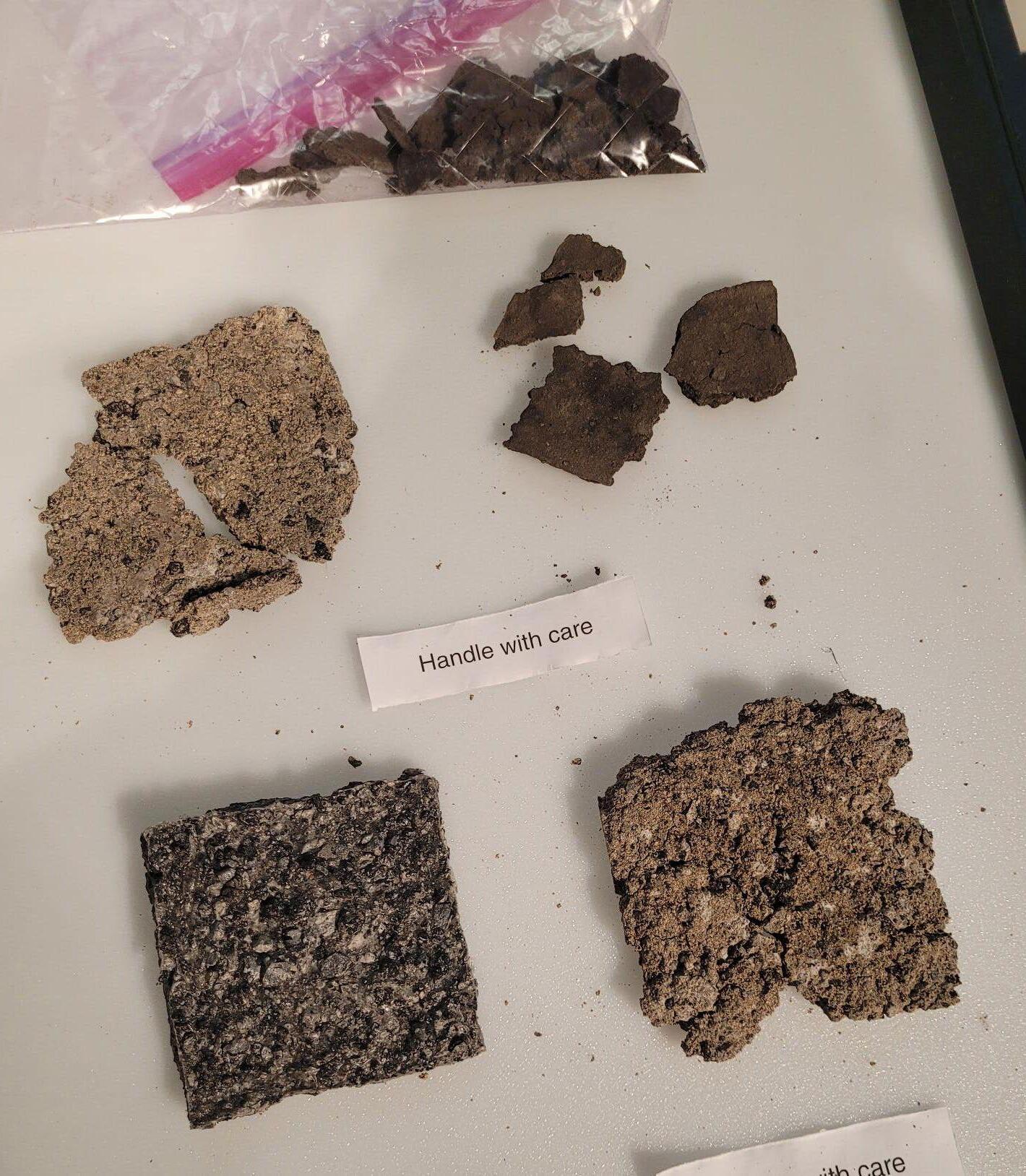
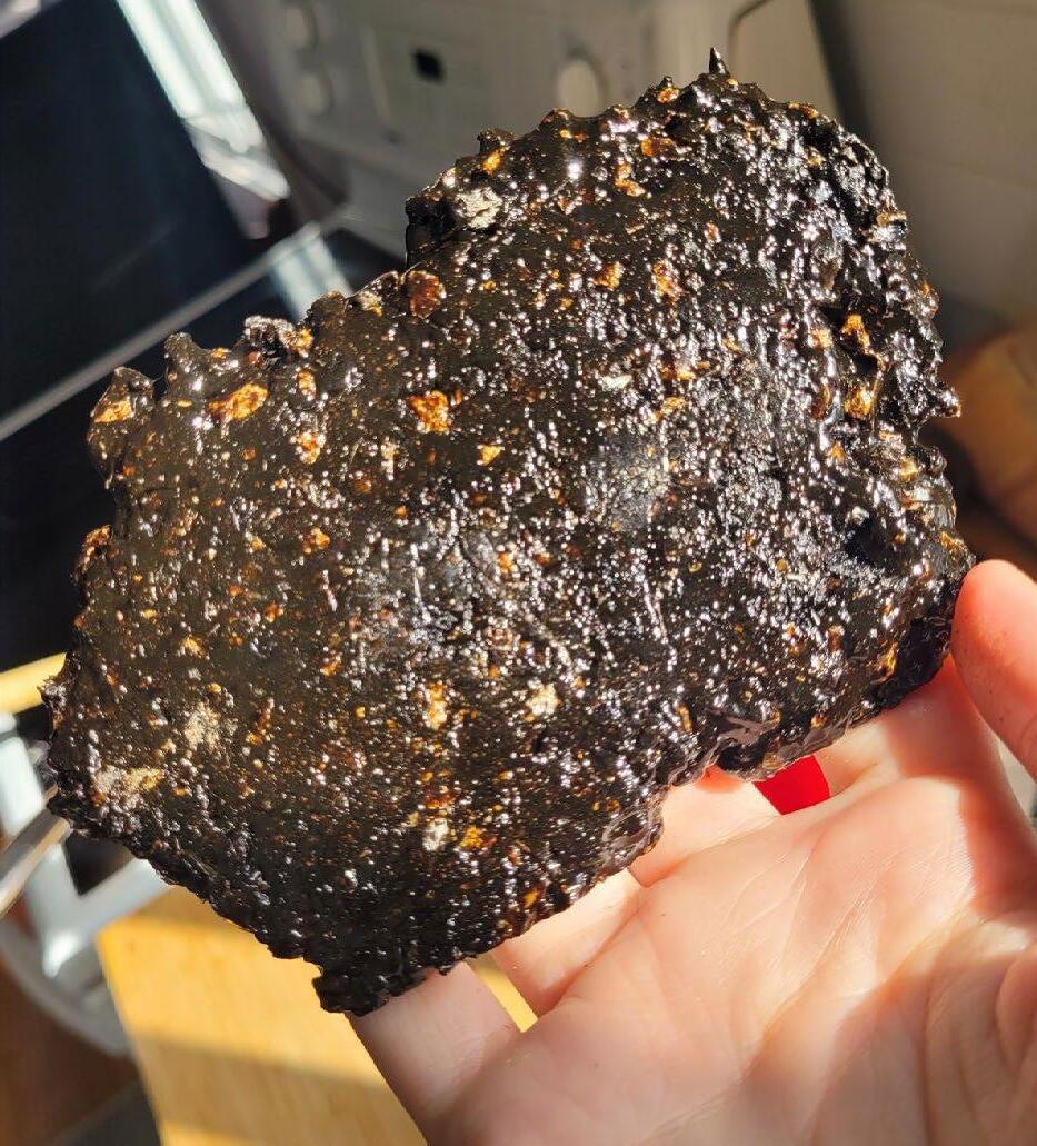
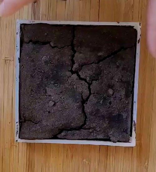
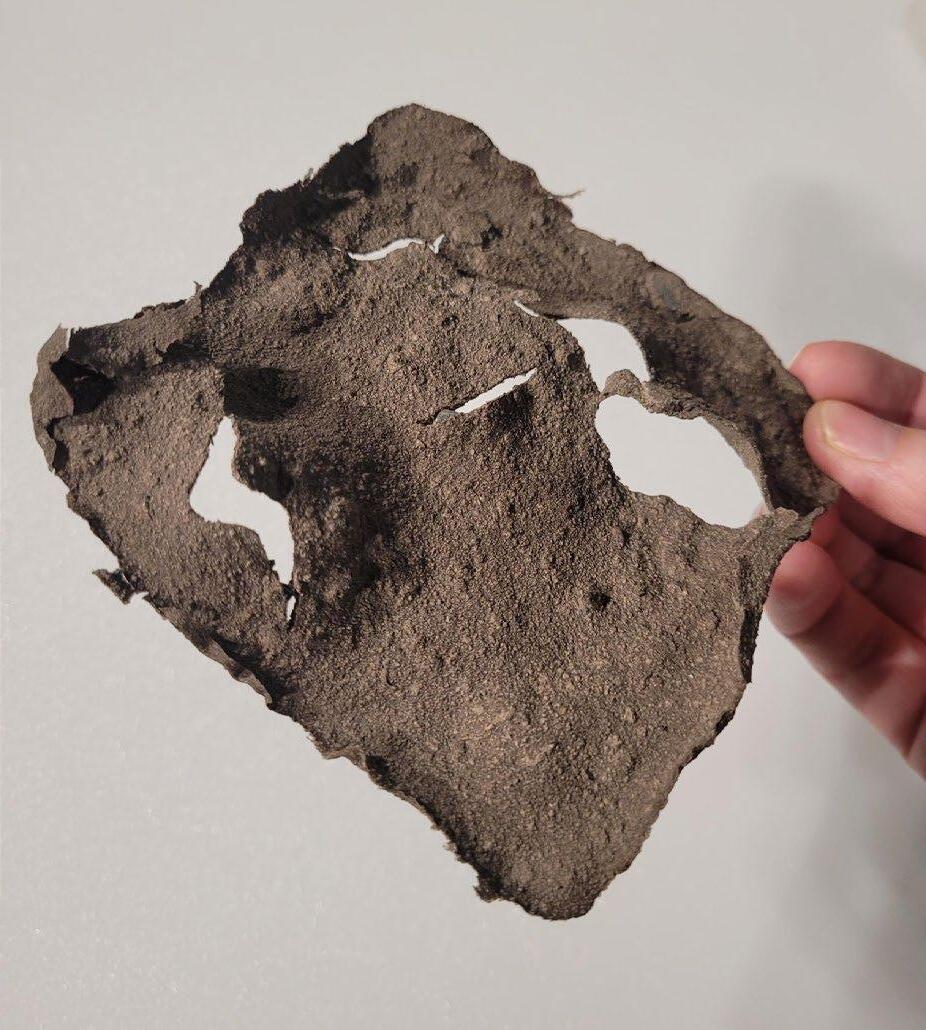
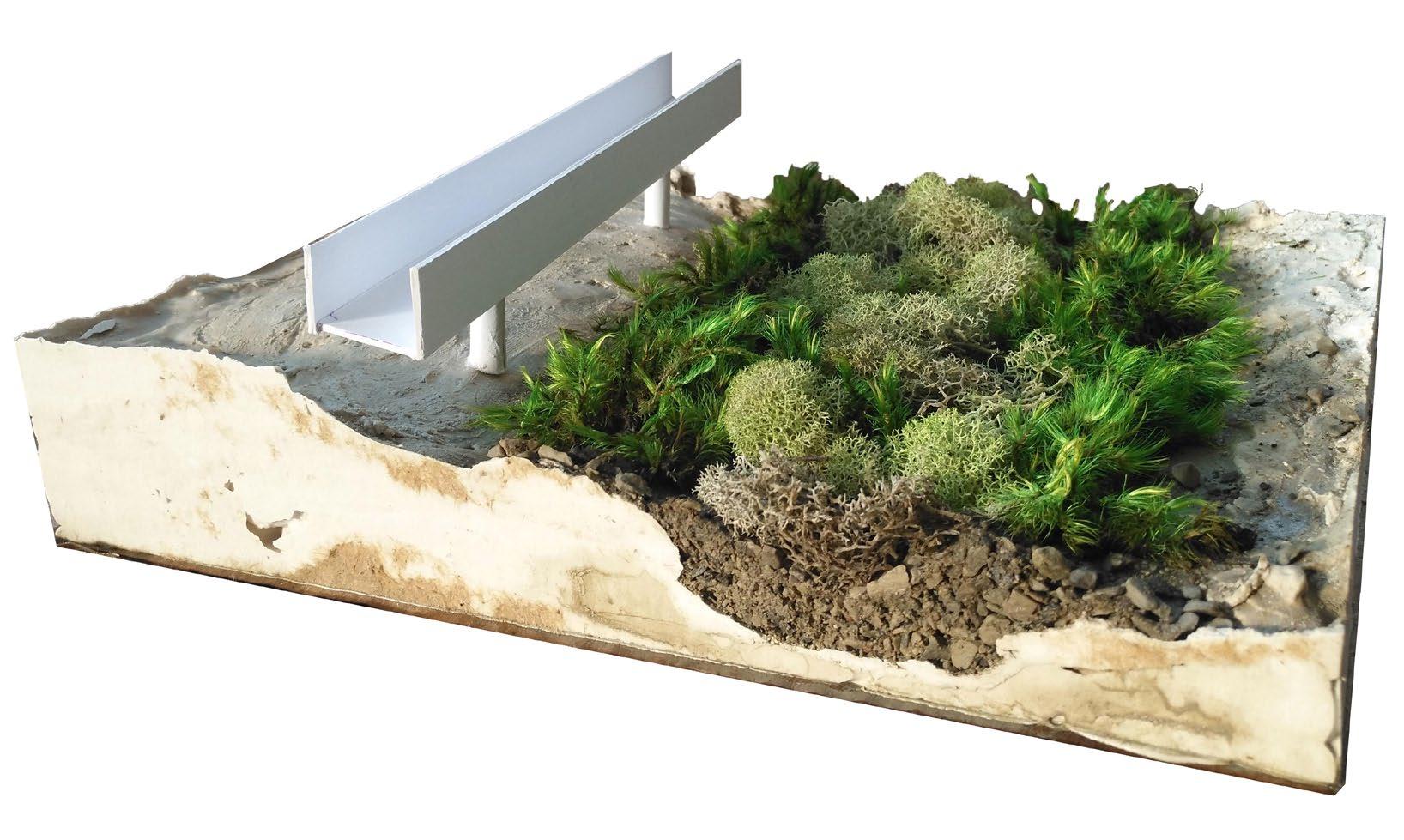
Construction, renovation and demolition waste makes up roughly 12% of the solid waste stream in Canada. Within the construction industry, waste reduction and recycling strategies typically focus on wood and steel, materials that are both abundant and relatively easy to recycle. Concrete and asphalt are also abundant in the construction industry, but are less frequently reused in innovative ways, and create harmful emissions in their production processes. In this project, I explored how concrete and asphalt waste might be reused in new ways within the built environment, to divert materials from the waste stream and theoretically reduce the building industry’s contribution to global greenhouse gas emissions. Inspired by some of the assigned readings in the course, I was interested in exploring how I might engage with the idea of material agency. The theoretical idea of material agency suggests that agency is not rooted in intention and consciousness, but an emergent property of interaction. To engage with a material’s agency suggests working with it rather than using it, responding to the feedback you receive from your interactions with it, rather than trying to control it. The material experimentation within this project was guided both by material agency and the properties, composition, and history of concrete and asphalt. Using dust and chunks of concrete and asphalt recovered from construction sites in Montreal, I experimented with three biomaterial recipes and refined my approach through a prototyping process to form an array of new material composites.
Right: Various material prototypes.
SITE VISITS
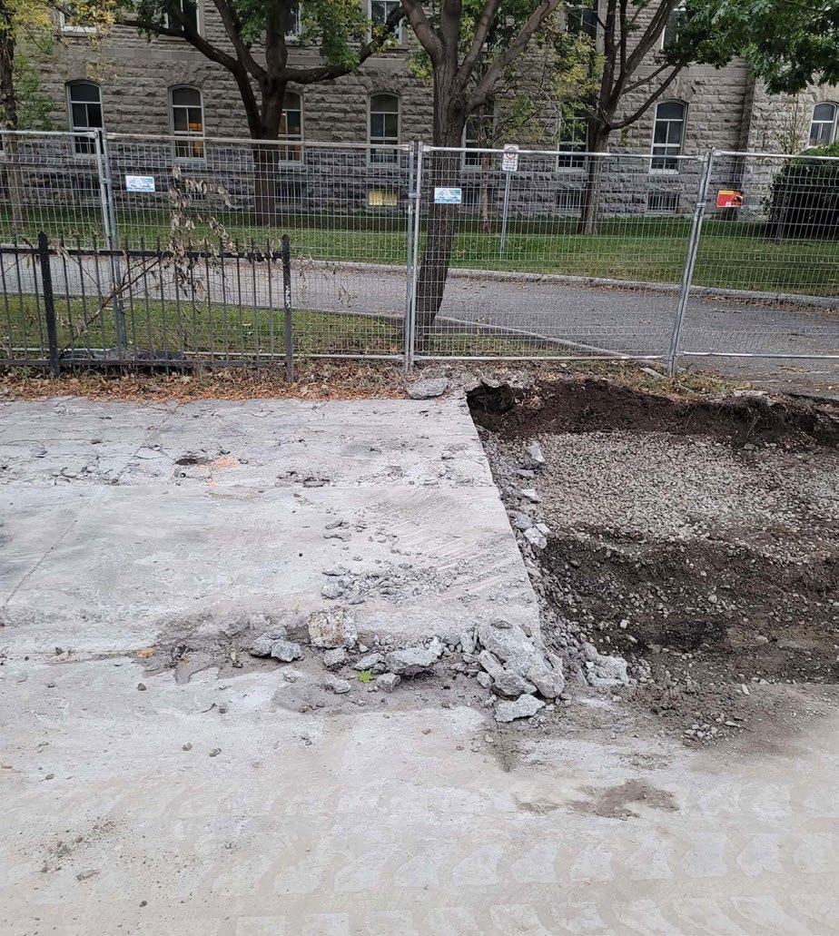
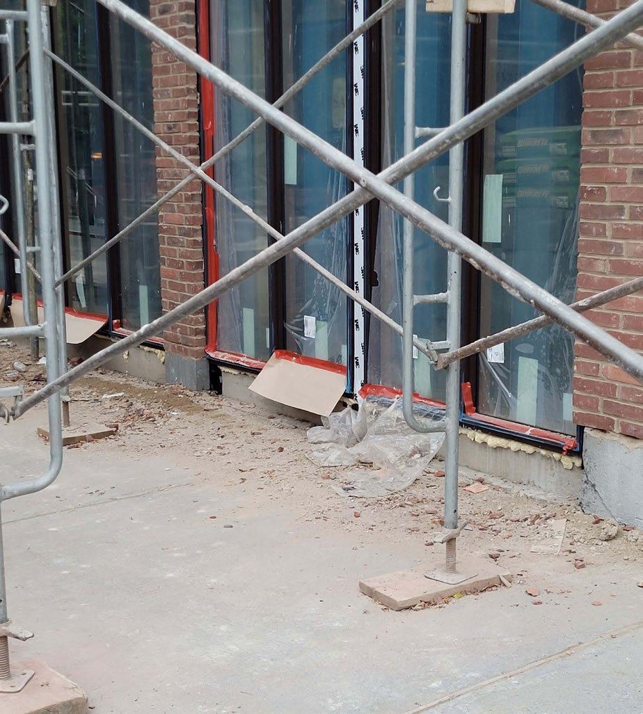
I chose to source my own waste materials from accessible construction sites in Montreal. I collected the materials I used for my prototyping process from a series of four site visits.
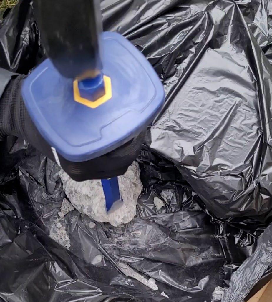
BREAKDOWN PROCESS
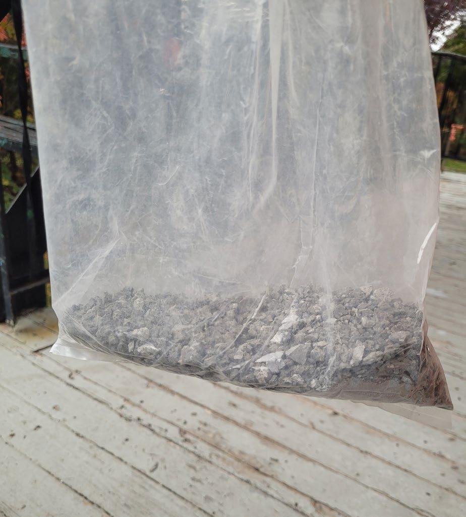
To reform my collected construction waste into a new material composition, I first needed to break them down into aggregate that could be combined with a reactive material - in this case, biomaterials.
6
Collection site for concrete dust.
Collection site for concrete chunks and dust.
Chiseling the concrete chunks into dust/aggregate.
The collected aggregate.
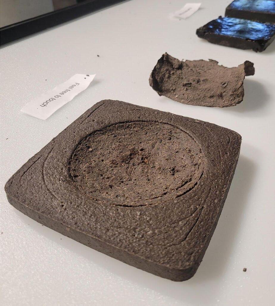
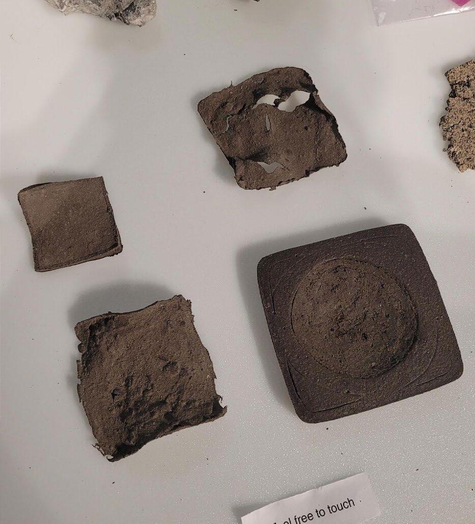
PROTOTYPING
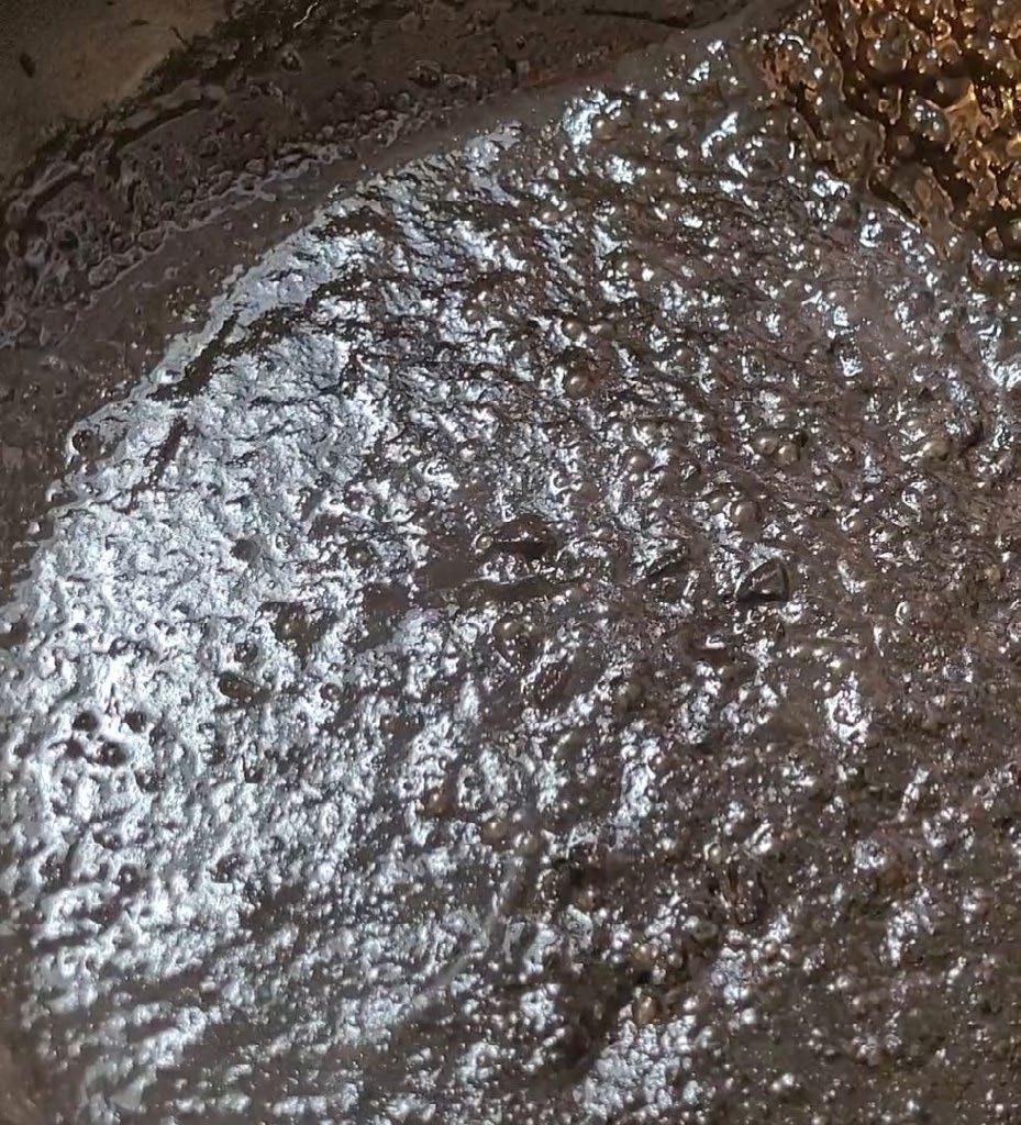
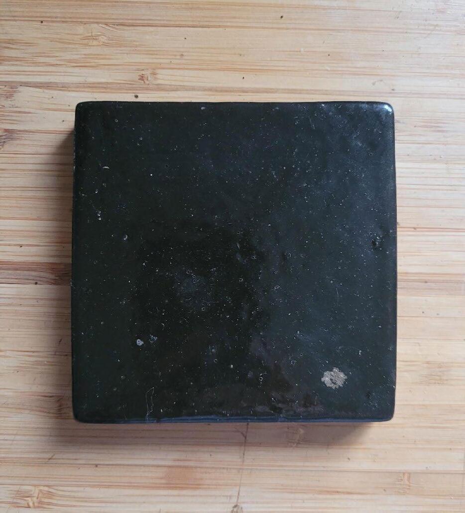
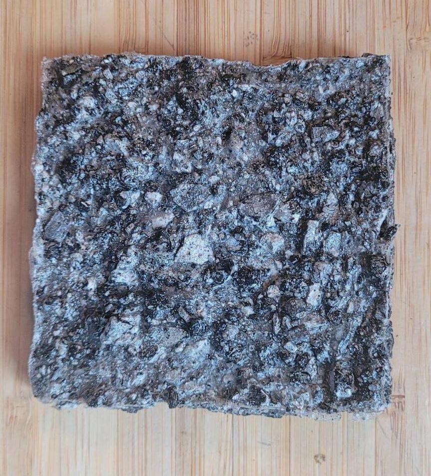
I experimented with three biomaterial recipes in the prototyping process. The first used damar resin, a natural resin from damar trees. Melting the resin and mixing with my aggregate produced a viscous liquid that could be molded.
PROTOTYPE DEVELOPMENT
By experimenting with the recipe, I produced a hard, strong material, reminiscent of a tile. The material was not easily broken, and could be remelted and reformed multiple times. This recipe was the most successful of the three.
7
First prototype.
The preparation process.
A later, more successful prototype.
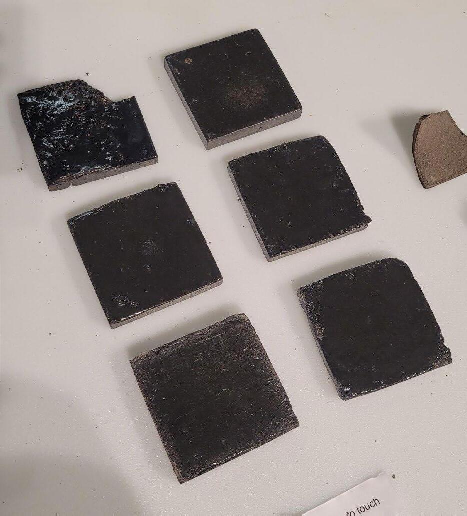
The final set of prototypes.
PROTOTYPING
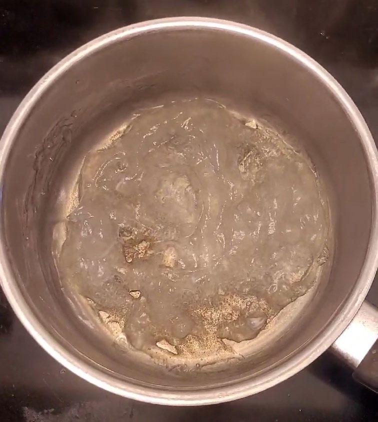
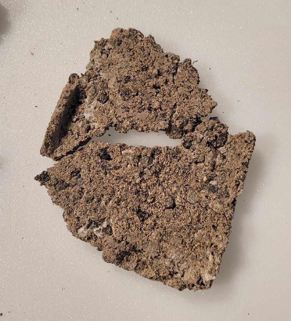
The second biomaterial recipe involved creating a thermoplastic starch. For my first prototypes with this recipe I combined my collected concrete dust with the thermoplastic starch. This created a fragile material that fell apart when handled.
PROTOTYPE DEVELOPMENT
After the failure of the concrete dust prototype, I instead used the aggregate I had crushed. The resulting prototypes had an interesting surface texture and varied in strength depending on the amount of aggregate.
 First prototype.
The thermoplastic starch.
Prototype with both dust and aggregate, broke while curing.
First prototype.
The thermoplastic starch.
Prototype with both dust and aggregate, broke while curing.
8
The most successful prototype was not easily broken by hand.
PROTOTYPING
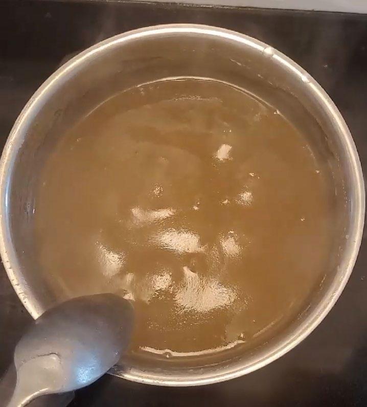
The last recipe was a bioplastic recipe. When mixed with the concrete dust, this recipe formed a hard material that shrunk considerably and warped while drying.
PROTOTYPE DEVELOPMENT
I explored various thicknesses to see how this would affect warping and cracking, also experimenting with carving into the thicker material while it dried. The resulting material was strong, but left behind a dusty residue after being handled.
 A thinner prototype cracked and warped while drying.
Preparing the bioplastic.
A thicker prototype warped less while drying.
A thinner prototype cracked and warped while drying.
Preparing the bioplastic.
A thicker prototype warped less while drying.
9
The final set of bioplastic prototypes.
4A
THE ISLAND SCHOOL
Comprehensive Building Design Studio University of Waterloo School of Architecture
FALL 2021
Supervised by Mohamad Araji, Christie Pearson, & Jaliya Fonseka
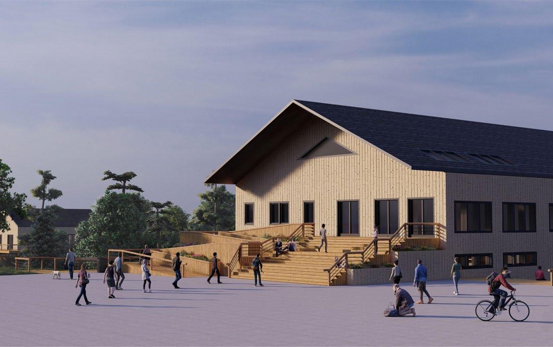
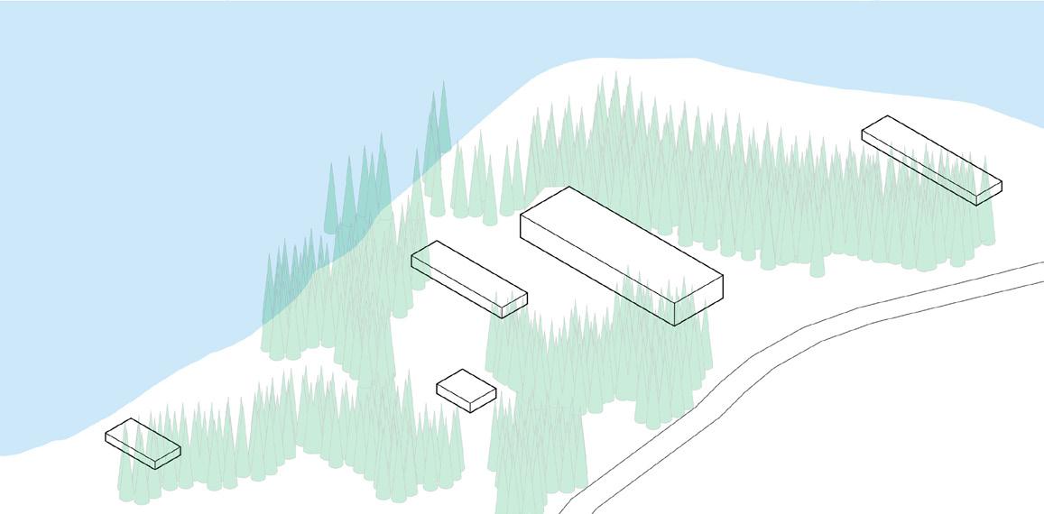
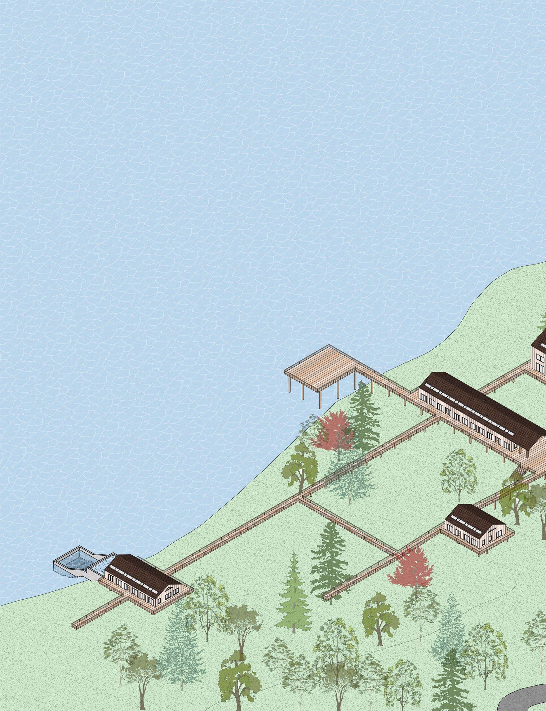
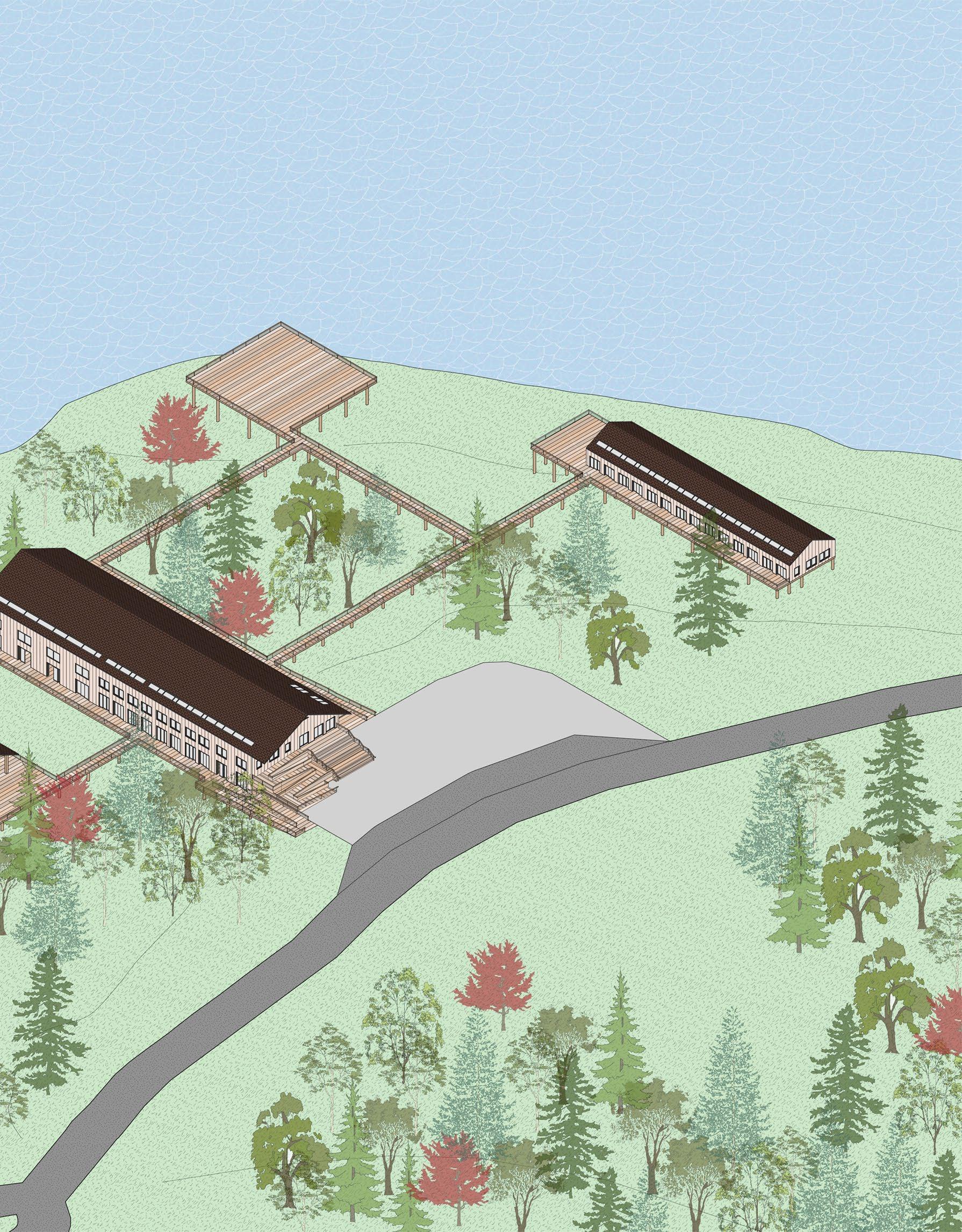
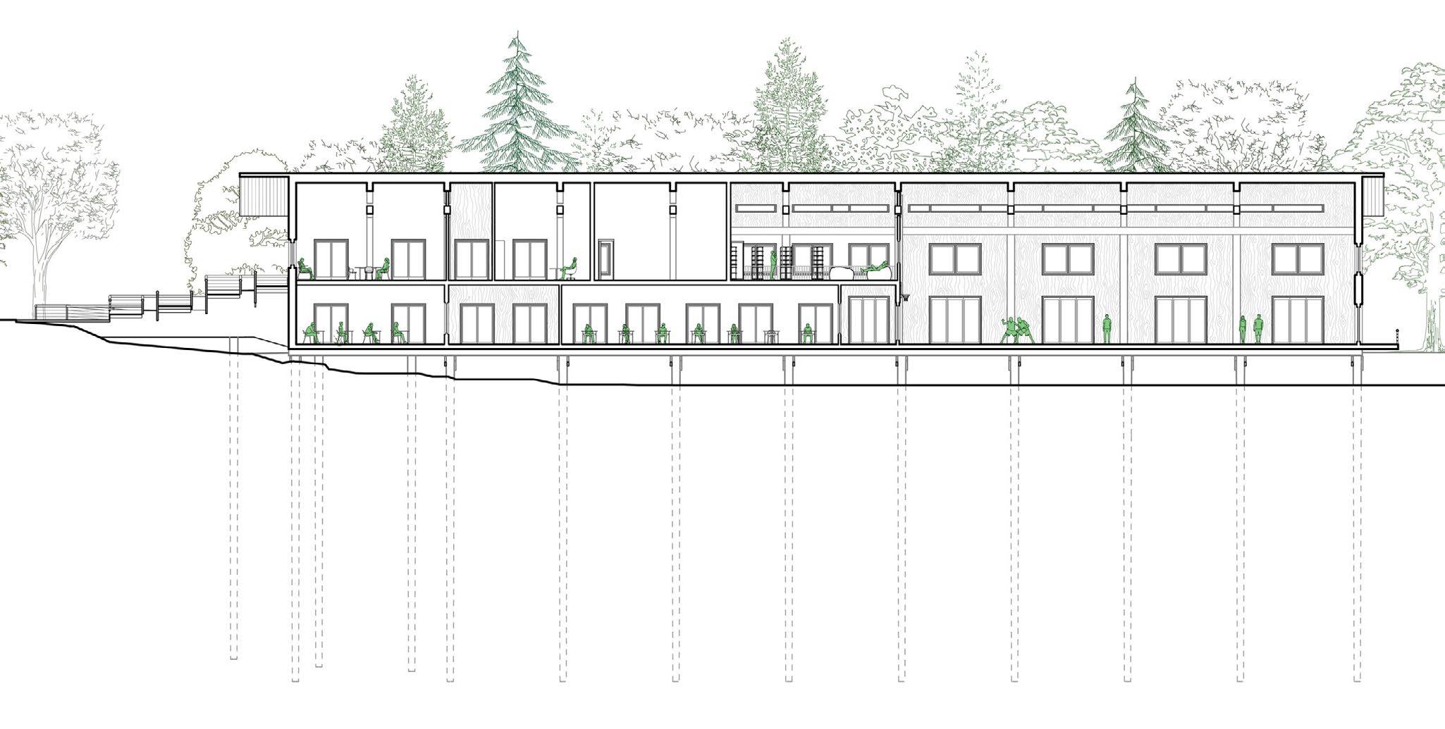
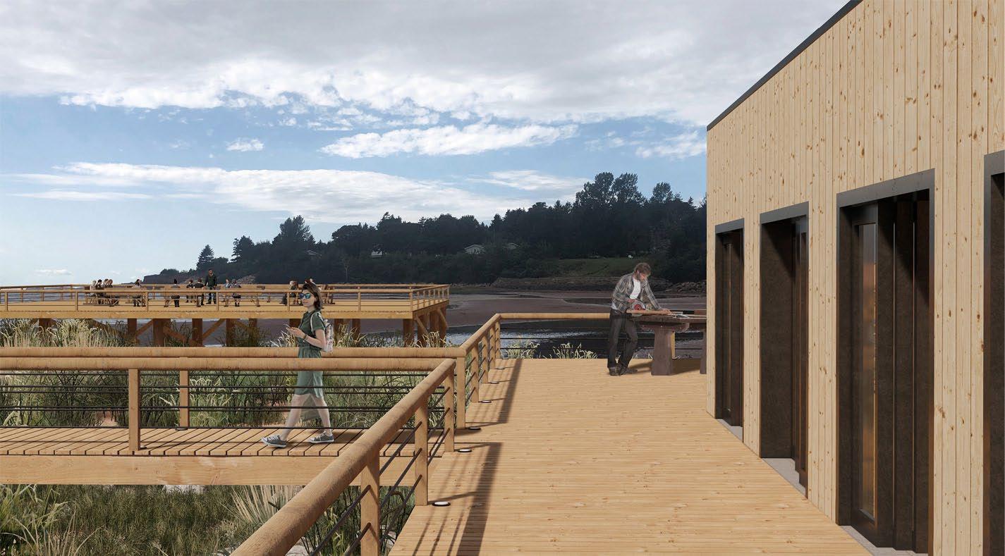
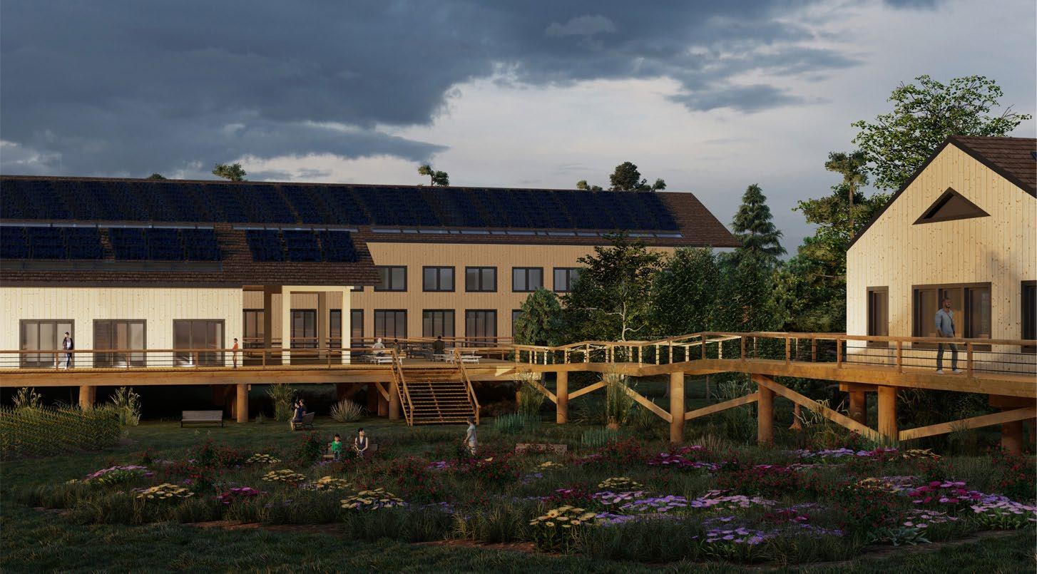
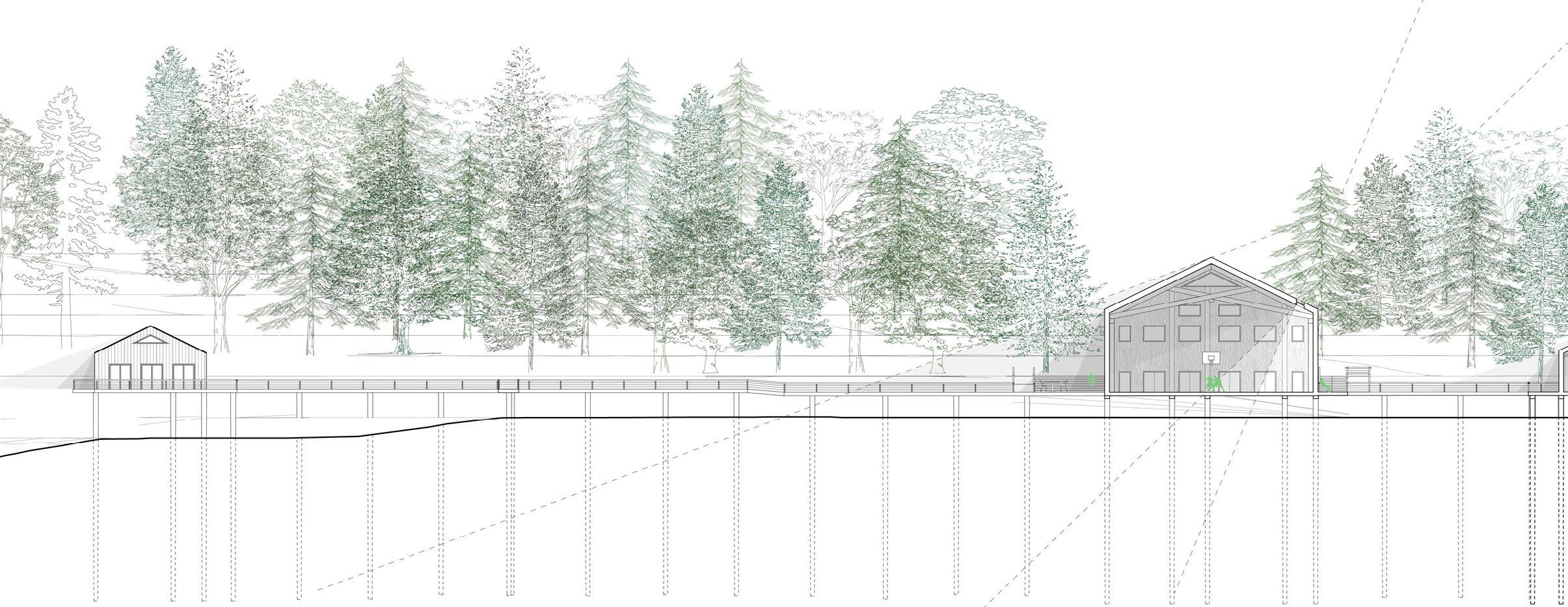
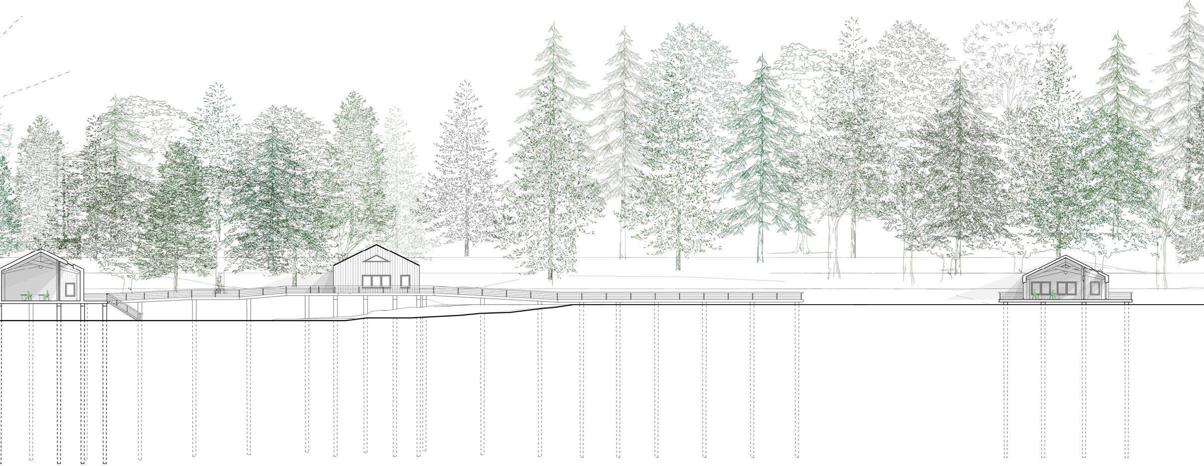
The Island School demonstrates the potential for a school to be the center of a community, and to reimagine what a learning environment might look like. The site borders Bellevue Cove, on the coast of Prince Edward Island. Much of the site is covered in forest, grassland and wetland, and retaining as much of the existing natural landscape as possible became a vital part of my design. The school is designed to host grade 9-12 students, and the program requirements included 5 classrooms, a workshop, gymnasium, library, kitchen and dining area, a bathhouse and an artist-inresidence studio. To encourage experiential learning and movement throughout the large, beautiful site, I divided the programming up into 5 buildings. 4 of the buildings host classrooms and an alternative type of learning space (kitchen, shop, etc.) to encourage a balance of learning and doing. The artist-in-residence has a separate building for increased privacy, but is still connected to the complex. Many of the buildings have an outdoor deck to encourage programs to extend outside and allow spatial flexibility. Environmental stewardship and the sustainable impact of the building was also a required consideration for this project. To address these factors, I chose to raise my buildings off the site on piles, and connect them by a walkway, to keep foot traffic off of the site, and add additional planting along the vulnerable and receding shoreline. I was environmentally conscious with material choices, using lumber that could be source locally and designing to maximize passive heating and cooling.
Right: Exterior perspective of Building 1
Skilled Used: Rhino, Photoshop, Illustrator, Lumion
Flora Catalogue - Native Trees
predominant summer winds
Site Plan
MASSING DIAGRAM
Massing Diagram
predominant winter winds
Legend
wetland
forest grassland
new planting
softscaping
90cm sea level rise
+255 cm storm surge
+470 cm storm surge
predominant summer winds
Flora Catalogue - Native Site Plan
1. Locate buildings within existing environment on the site. Use the tree cover to protect from weather. Orient length-wise along east-west axis to optimize south-facing facade and roof.
1. Locate buildings within existing environment on the site. Use the tree cover to protect from weather. Orient length-wise along east-west axis to optimize south-facing facade and roof.
Flora Catalogue - Native Plants/Shrubbery

low
moderate
2. Apply gable shape to volumes. Only B1 gets a 2nd storey, to assure ease of accessibility across the site. B1 will be the “hub” of the buildings and will include a combination of public and private program.
2. Apply gable shape to volumes. Only B1 gets a 2nd “hub” of the buildings and will include a combination of
2. Apply gable shape to volumes. Only B1 gets a 2nd storey, to assure ease of accessibility across the site. B1 will be the “hub” of the buildings and will include a combination of public and private program.
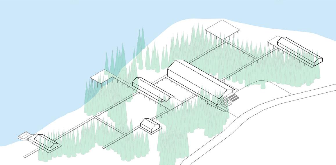
B1 will be the 3. Connect all buildings with a raised walkway. The raised walkway keeps the majority of foot traffic off of the site, and also divides up the open space and create smaller pockets of outdoor space, some of which become productive gardens. In two places near the water’s edge, the walkway is enlarged to create a space that could serve as a lookout or an outdoor classroom. 0m
3. Connect all buildings with a raised walkway. The raised walkway keeps the majority of foot traffic off of the site, and also divides up the open space and create smaller pockets of outdoor space, some of which become productive gardens. In two places near the water’s edge, the walkway is enlarged to create a space that could serve as a lookout or an outdoor classroom.
summer solstice sun path
solar noon: 12:14
max. altitude 67.24°
daylight: 15hrs 47 min.
3. Connect all buildings with a raised walkway. The raised also divides up the open space and create smaller pockets dens. In two places near the water’s edge, the walkway outdoor classroom.
spring/autumn equinox sun path
solar noon: 12:20
max. altitude 43.75°
daylight: 12hrs 9 min.
winter sun path
solar noon: 12:10
max. altitude 20.41°
daylight: 8hrs 37 min.
white ash linden red oak poplar
B1 B2 B2 B4 B4 B5 B5 B3
length-wise
0m 50m 100m 150m 200m 250m
predominant winter winds predominant summer winds
bike & car parking B1 B2 B2 B4 B4 B5 B5 B3
clover daisy fireweed sunflower
50m 100m 150m 200m 250m
coastal
maram
mugwort starflower
sunflower sea rocket violet bedstraw aster beach pea birdsfoot trefoil sowthistle goldenrod
marsh
wetland Legend forest grassland new planting 90cm sea level rise softscaping +255 cm storm surge +470 cm storm surge
boundary
grass rose clover daisy
fireweed
salt
erosion risk (0-30cm/yr)
accretion B1 B2 B4 B5 B3
erosion risk (30-90cm/yr) creek waterflow
12
SITE PLAN
A
wetland Legend
coastal boundary maram grass rose clover daisy mugwort starflower fireweed sunflower sea rocket violet bedstraw aster beach pea birdsfoot trefoil sowthistle goldenrod
forest grassland new planting
0m
softscaping
90cm sea level rise
Flora Catalogue - Native Plants/Shrubbery
Flora Catalogue - Native Plants/Shrubbery
Flora Catalogue - Native Plants/Shrubbery
+255 cm storm surge
salt marsh
accretion
wetland Legend
low erosion risk (0-30cm/yr)
forest grassland new planting
90cm sea level rise softscaping
creek waterflow
coastal boundary maram grass rose clover daisy mugwort starflower fireweed sunflower
sea rocket violet bedstraw aster beach pea
Flora Catalogue - Native Plants/Shrubbery
moderate erosion risk (30-90cm/yr)
+255 cm storm surge
+470 cm storm surge
Flora Catalogue - Native Plants/Shrubbery
coastal boundary maram grass rose clover daisy mugwort starflower fireweed sunflower sea rocket violet bedstraw aster beach pea birdsfoot trefoil sowthistle goldenrod
low erosion risk (0-30cm/yr)
moderate erosion risk (30-90cm/yr) creek waterflow
salt marsh
low erosion risk (0-30cm/yr)
moderate erosion risk (30-90cm/yr)
salt marsh
birdsfoot trefoil sowthistle goldenrod
low erosion risk (0-30cm/yr)
moderate erosion risk (30-90cm/yr)
path
creek waterflow accretion
50m 100m 150m 200m 250m
wetland Legend forest grassland new planting 90cm sea level rise softscaping +255 cm storm surge +470 cm storm surge
creek waterflow accretion
50m 100m 150m 200m 250m wetland Legend forest grassland new planting 90cm sea level rise softscaping +255 cm storm surge +470 cm storm surge
maram
rose clover daisy
0m
coastal boundary
grass
mugwort starflower fireweed sunflower sea rocket violet bedstraw aster beach pea birdsfoot trefoil sowthistle goldenrod salt marsh
low erosion risk (0-30cm/yr)
accretion
moderate erosion risk (30-90cm/yr) creek waterflow
0m 50m 100m 150m 200m 250m
cm
cm
wetland Legend forest grassland new planting 90cm sea level rise softscaping +255
storm surge +470
storm surge coastal boundary maram grass rose clover daisy mugwort starflower fireweed sunflower sea rocket violet bedstraw aster beach pea birdsfoot trefoil sowthistle goldenrod salt marsh
accretion
LEGEND
a 13
ocean lookout outdoor gym/ seating area outdoor productive gardens
entry courtyard outdoor classroom
14
AXONOMETRIC
SITE
15
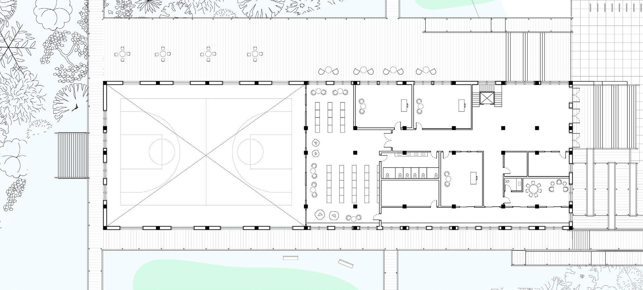
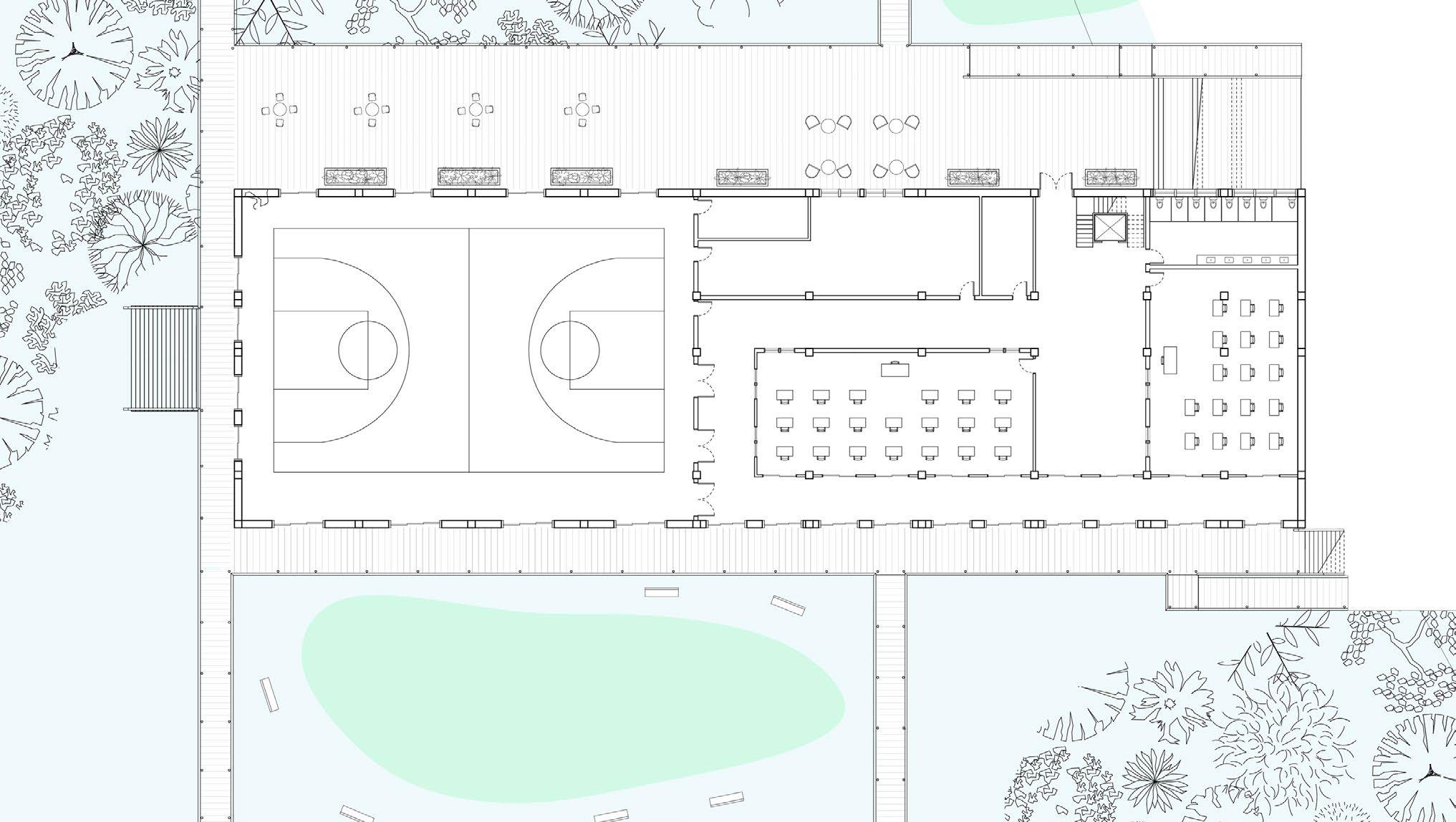
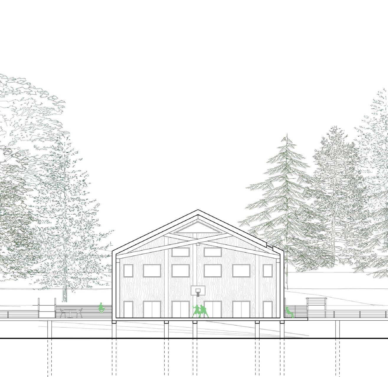
B1 SECOND FLOOR PLAN
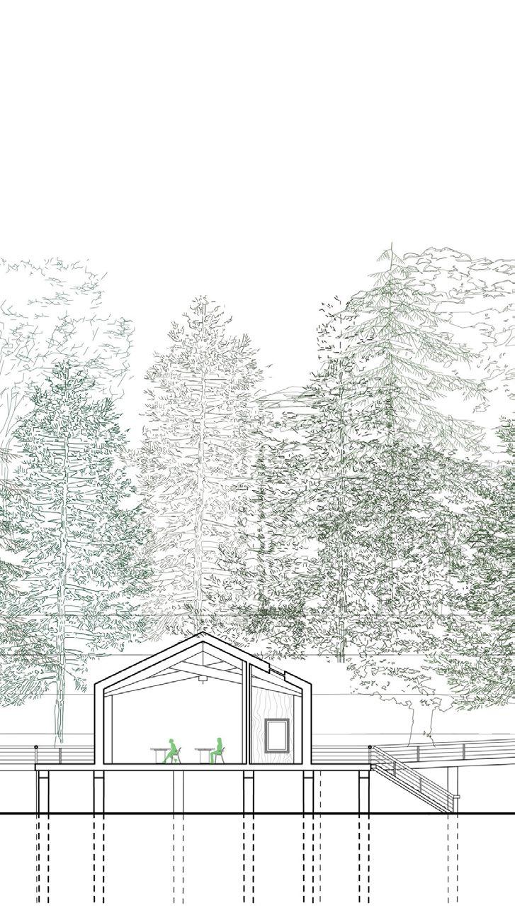
B1 is sited next to a hill on its east side, so the main entrance and atrium are accessed by set of stairs/ramp on the second floor. Also on this floor are administrative/staff spaces, and the library. Along the south side of every building is a central hallway, which acts as a climatic buffer zone. It allows for maximum passive solar heating while also taking advantage of prevailing S/SSW summer winds for passive ventilation.
B1 GROUND FLOOR PLAN
Situated on the ground floor of B1 are the two classrooms in this building and the gymnasium. This level exits directly onto the boardwalk which connects all of the buildings, allowing indoor programs to extend onto the boardwalk, and a large deck on the north side.
library office office atrium office staff room w/c
gym classroom classroom change room w/c
B b
B b
16
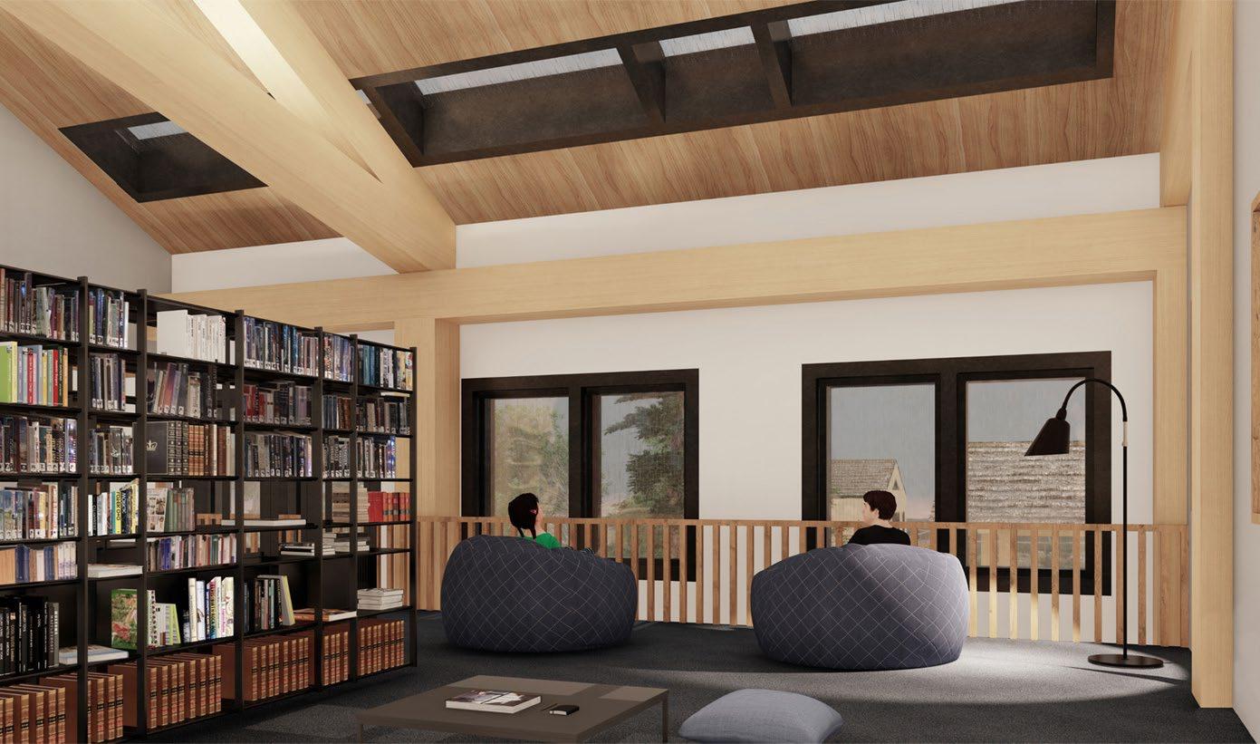
LIBRARY
B1
VIEW - MID-AFTERNOON
17
SECTION Bb - EAST/WEST LONGITUDINAL SECTION
18
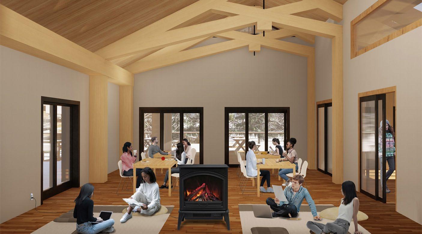
B2 KITCHEN/DINING VIEW - MID-DAY
B3 EXTERIOR VIEW - MID-MORNING
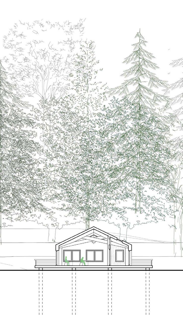
The outdoor classroom and the shore of Bellevue Cove can be seen in the distance while the grasslands grow uninterrupted beneath the walkways.
19
EXTERIOR VIEW LOOKING NORTH TO B2, B4, B1 - EVENING
TIDE POOL VIEW - SUNSET
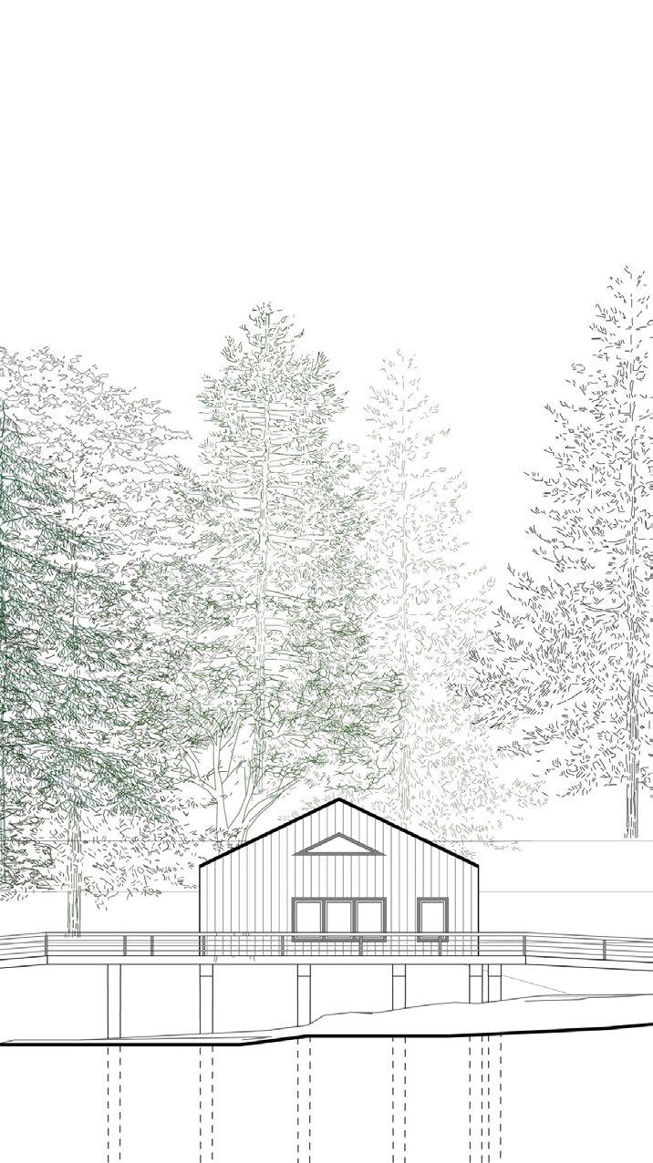
B3 ENLARGED ELEVATION
B1 ENLARGED SECTION
SECTION Bb - LONGITUDINAL NORTH/SOUTH SITE SECTION
The same overall massing and shape is repeated throughout all of the buildings, while the size and facade of the building changes depending on the program. This unifies the buildings as smaller parts of the larger whole and also simplifies portions of the manufacturing and construction process.
20
ENLARGED
B2
 B4 ENLARGED ELEVATION
ENLARGED SECTION
B4 ENLARGED ELEVATION
ENLARGED SECTION
21
B5 ENLARGED SECTION
PLEASANT PITS
2B Design Studio
University of Waterloo School of Architecture
SPRING 2019
Supervised by Jane Hutton
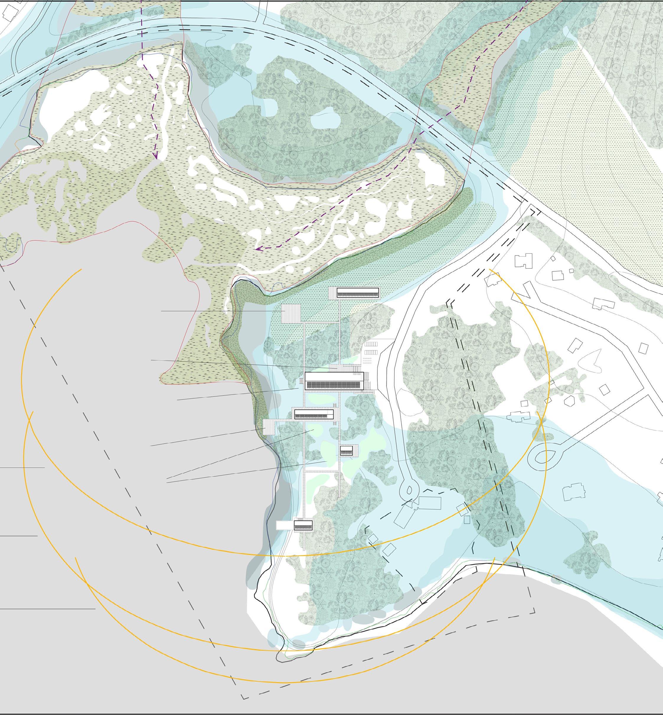
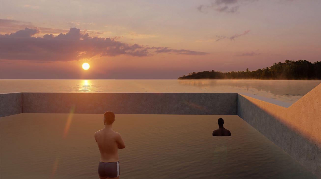
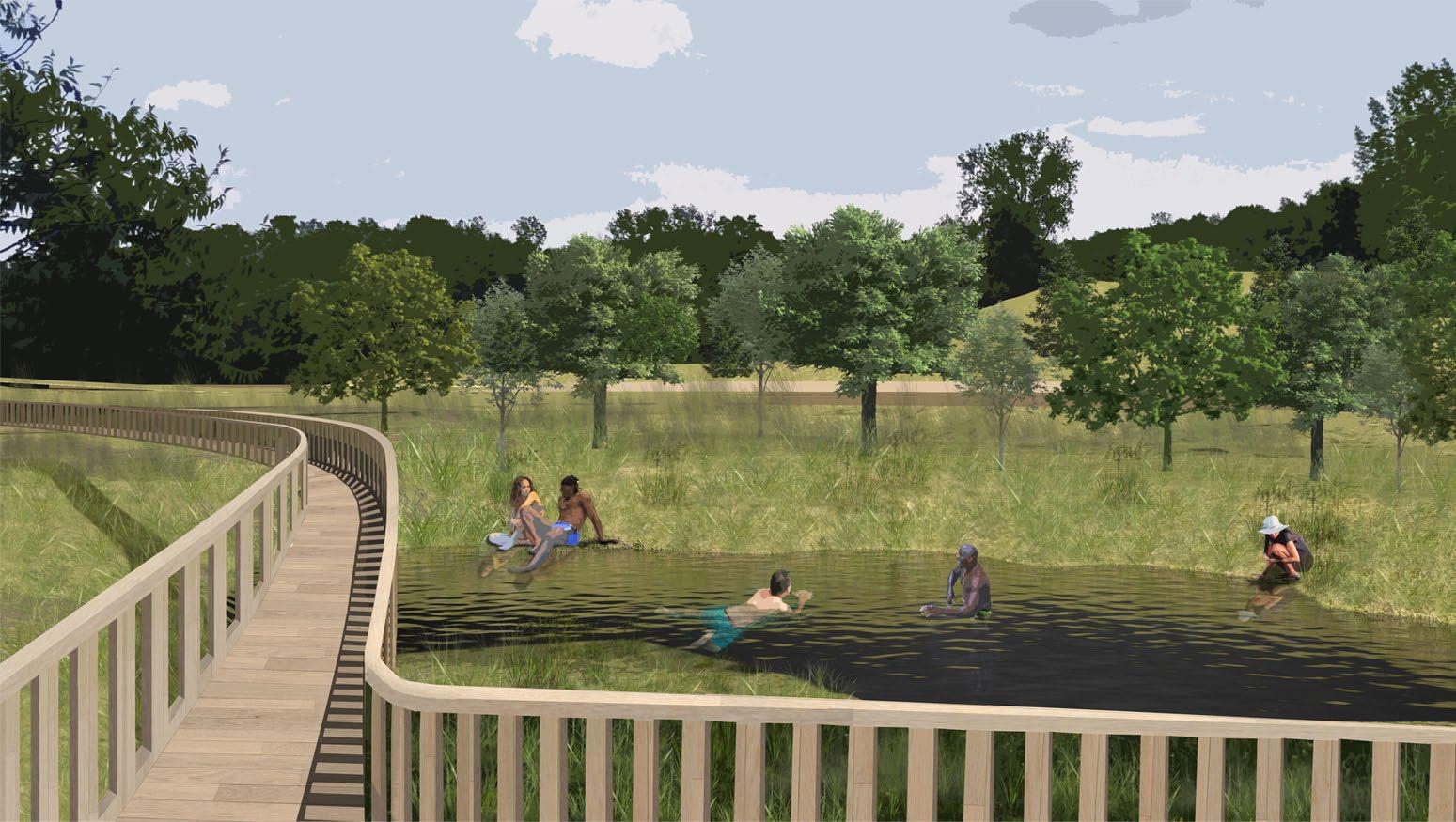
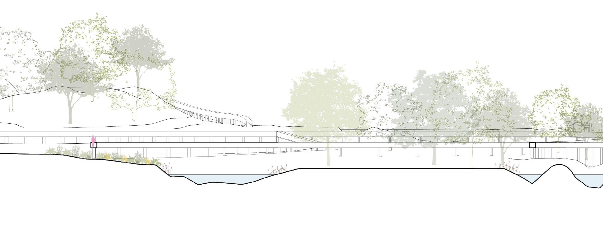
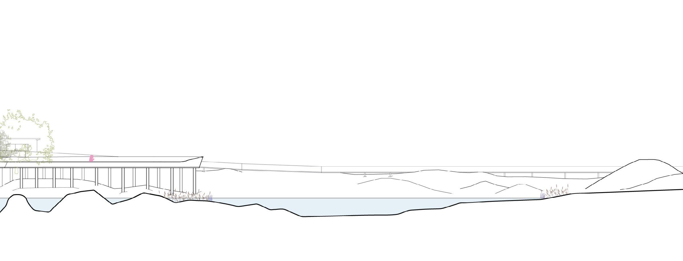
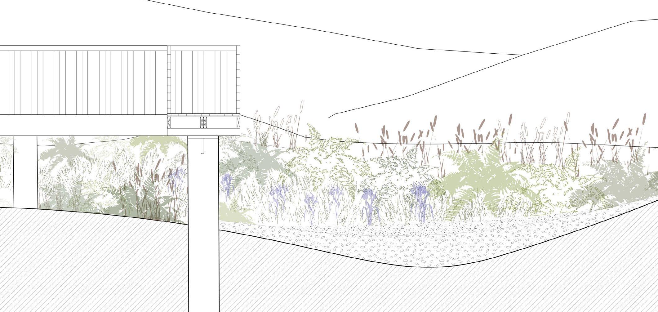
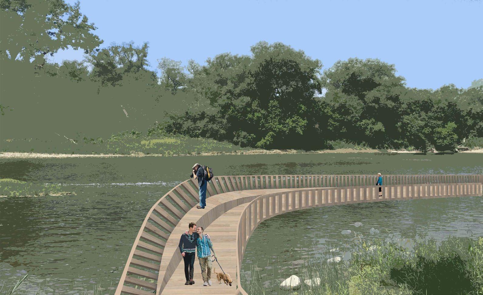
The site of this project is a section of shoreline on the Grand River, which runs through Southwestern Ontario from Dundalk to Lake Ontario. Pleasant Pits is, in part, a bioremediation effort to rehabilitate and restore the habitat of the Redhorse - a species of fish that is native to the Grand River but at the time of this project was not thriving due to the river’s polluted nature. A detailed planting strategy was employed to improve water quality in the river itself and in surface runoff, including the creation of a bioswale. The river’s edge is reformed using local limestone, which acts as a buffer for acidity in the water, and specific plant species to create the necessary habitats for the Redhorse throughout their lives. The project is also intended to bring human awareness to these fish, and create a place where visitors can observe them. The scope of the built environment mirrors that of the restored fish habitat, with cabins for long stays and a winding observation deck for day visitors, inviting the inhabitant to enjoy, relax, and move like a fish.
Right: Collage of walkway and naturally filtered swimming pools
Skilled Used: Rhino, Photoshop, Illustrator,V-Ray
22
23
AXONOMETRIC ILLUSTRATING SITE FACTORS
This drawing illustrates how all of the relevant site factors and design choices converge in the final proposed design. These factors include vegetation, both existing and proposed as part of the bioremediation effort, various water levels, the path of surface run off from the north edge of the site (where a construction project was underway) to the bioswale where it is filtered, proposed infrastructural additions, and the circulation path of both fish and humans through the reformed site.
LEGENDS
Vegetation
existing grasslands
existing forest, to be retained
new wetland
new shoreline planting
Water Levels
high (flooded)
mean
low
Runoff Infrastructure
unfiltered surface runoff entrance building
cabin
GRCA monitoring station
Circulation
filtered surface runoff
primary human
secondary human
primary fish
The gradient indicates age of fish: yellow = eggs & newly hatched, purple = adult. Riffles, or areas where the current is broken up by rocks, are created to facilitate spawning. Downstream of the riffles, plant beds and vegetated zones are created for juvenile Redhorse. Further downstream, shallow inland pools are created, as this is the preferred habitat of adult Redhorse. This sequence of habitat is repeated twice throughout the site.
24
25
SITE SECTION THROUGH CABIN AREA
naturally filtered swimming pool
SITE SECTION THROUGH WALKWAY AND RIVER
The site sections illustrate the landscape interventions involved in this project. The main intervention includes a reformation of the river’s edge to create sequential habitats for fish as they age. A site-wide planting strategy is also employed to improve the general water quality. The land area that houses the visitor cabins has been reformed to mimic the undulating habitat of the fish.
26
spawning habitat
shallow pool, adult habitat
27
The bioswale is a bioremediation method used to capture and filter surface runoff. The bioswale is a small ditch filled with gravel and various plants that act as biofilters to stop harmful pollutants from draining off the site into the Grand River.
walkway overlook
ferns
BIO-SWALE SECTION & COMPOSITION BIOSWALE SECTIONAL MODEL 6%
orchard grass
(sensitive, ostrich, crested wood) cattails (rhizofiltration)
127-305mm of rip-rap maximum 6% slope of the ditch
28
blue-flag iris (rhizofiltration)
WALKWAY VIEW
The walkway extends out over the reformed fish habitat, allowing visitors to observe without disturbing the fish. As it begins to extend over the pool, the walkway widens, and a combined step-seat rises out of the floor, to encourage people the linger in this specific area.
38 x 140mm beams
38 x 89mm post
25mm plywood sub-floor
38 x 140mm joists, 400mm o/c
white oak decking
anchor bolt
concrete column post base
concrete pile
1:20
WALKWAY STRUCTURAL SECTION
29
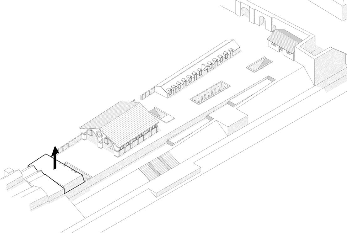
MUSEUM OF THE CITY AND THE TIBER
In Collaboration with Steven Starkell
4B Design Studio
University of Waterloo School of Architecture SPRING
2022
Supervised by Beatrice Bruscoli
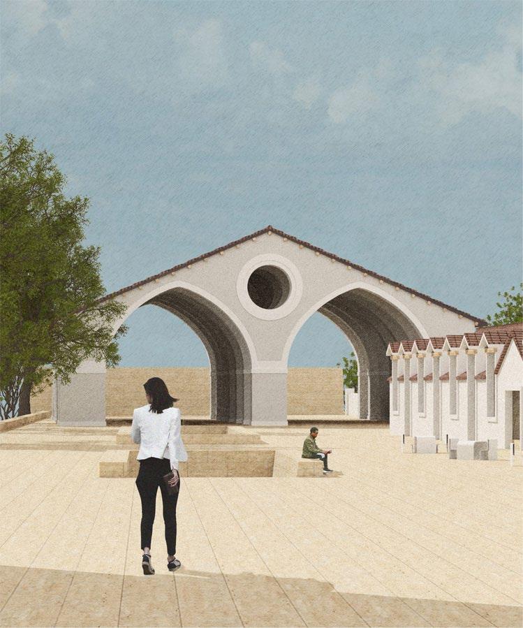
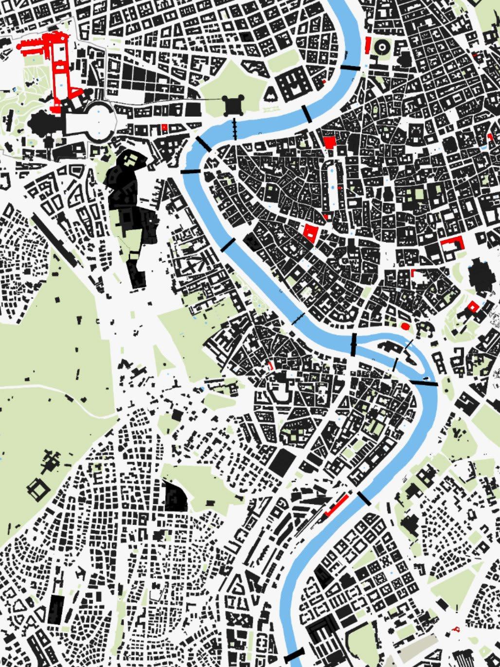
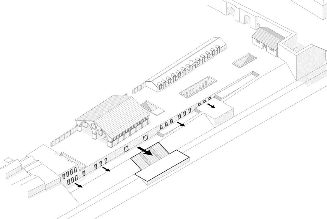
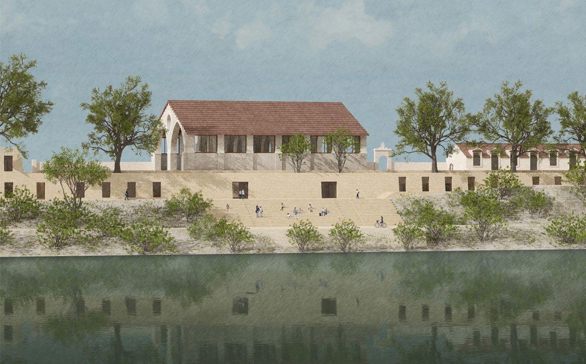
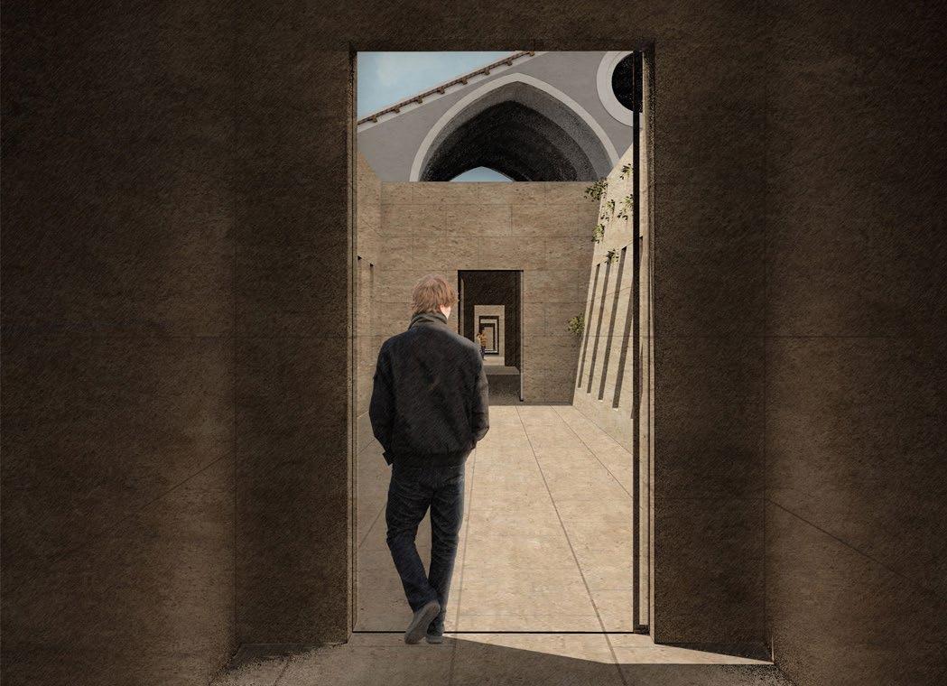
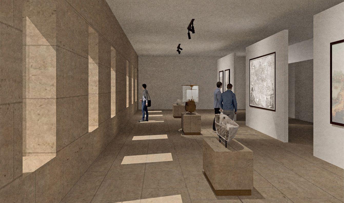
The Museum of the City and the Tiber is located in Rome, and was completed during the final term of my undergraduate degree while studying at Waterloo Architecture’s Rome Studio. The goal of this studio was to address the Tiber as a major natural and historical element in the city of Rome, in the context of a museum. The site is a former papal arsenal, and is located on the edge of the River Tiber near Porta Portese, an ancient city gate and part of the Janiculum Walls. The project features the re-use of the 3 buildings which were part of the papal arsenal: the Magazzino del Sale, the Corderie, and the Arsenale. While designing this project, my partner and I were inspired by the piazzas of Rome, the courtyards in museums and palazzos we’d visited, and the lush greenery along the river’s edge. We chose to leave most of the ground level as is, keeping the courtyard created by the arsenal buildings intact and retaining the historic appearance. We introduced a series of terraces to transition from street level to river level and make the river more accessible. We located the museum below street level, so it could have direct access to the river and allow people to experience the river and the museum at the same time. Drawings created by me are labeled “BV”.
Right: Perspective looking onto the ground level piazza
Skilled Used: Rhino, Photoshop, Illustrator
 park museum
FIGURE GROUND CONTEXT MAP - PARKS AND MUSEUMS
park museum
FIGURE GROUND CONTEXT MAP - PARKS AND MUSEUMS
32
Identifying how our project will fit into the existing urban fabric of Rome and the network of parks and museums.
BV
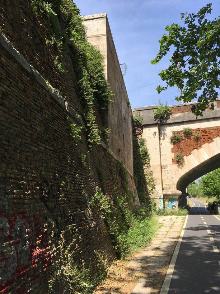
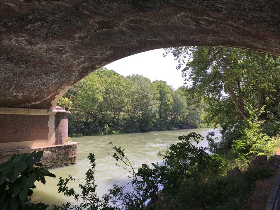
While developing our design we drew from some of the pre-existing conditions on the site: the Janiculum wall meeting the river path, slightly sloping and growing vegetation (above), and the procession of light and shadow experienced along traveling on the river path, shielded by the lush vegetation (below).
EXISTING SITE CONDITIONS
33
PARTI DIAGRAM
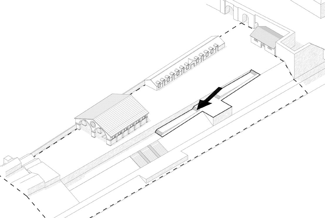
1. Terrace down to river level on the site. This mimics the ramp on the other site of the bridge and begins to create a connection to the river. The stepped terraces are located near the three existing buildings to ensure they have a spatial relationship to each other.
3. Introduce a new edge condition by creating a building on the far end of the site. This creates a destination at this end of the site and will draw circulation throughout the length of the site.
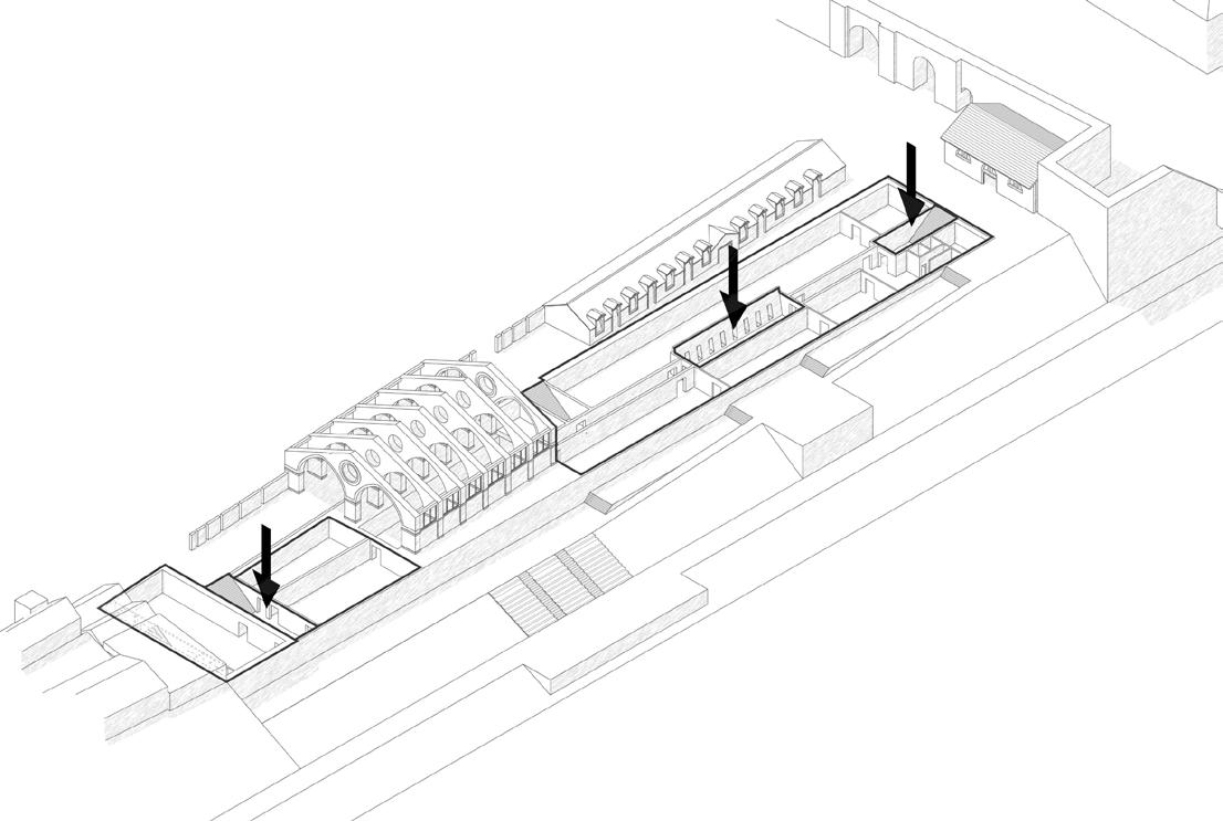
2. Introduce sunken courtyards and lower level. This keeps the ground level open as a public piazza and creates a connection between the museum on the lower level and the river.
4. Open up the lower level to the river. This creates a visual connection from inside the museum and draws people down to the river path.
34
35
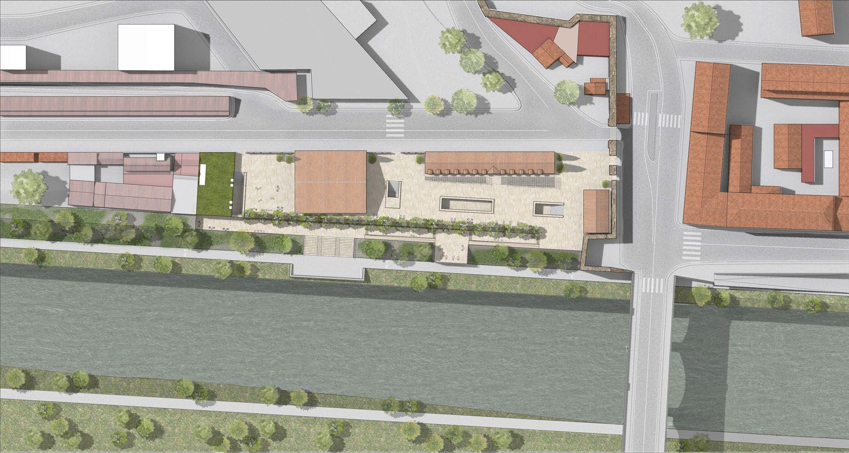
SITE PLAN
Portuense
VIEW FROM RIVER
Via
di Porta Portese
River
Tiber Piazza
BV
EXPLODED AXONOMETRIC BV
The exploded axonometric helps to illustrate our material choices. We chose to use travertine at a variety of scales to match the scale of certain spaces, and to help our project fit in to the Roman landscape.
36
37
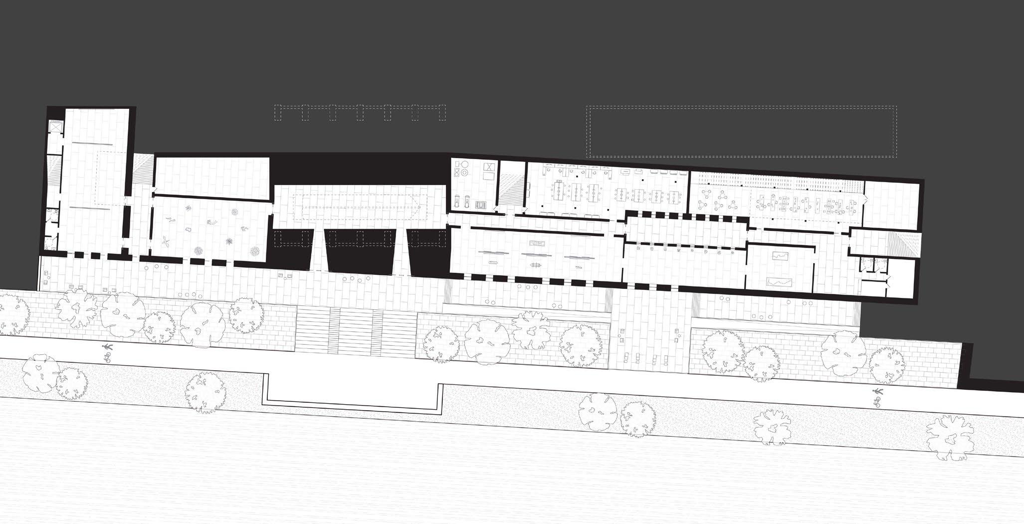
GROUND FLOOR PLAN
The ground floor of the project features the primary social programs on the site: the restaurants and shops, meeting rooms, public exhibition in the arsenale, the piazzas, and the terraces to the river. This is intended to draw people from Via Portuense through the site and down to the river, and vice versa. BV
38
SUNKEN COURTYARD VIEW
1. entrance pavilion
2. piazza
3. corderie, shops/restaurants
4. terraces to river
5. arsenale exhibition
6. secondary piazza
7. new museum - gift shop
8 8 8 7 6 5 3 2 1 4 Via Portuense
8. new museum - meeting rooms
River Tiber
PERMANENT EXHIBIT VIEW
LOWER LEVEL FLOOR PLAN
The lower level houses the exhibition spaces, archives, labs, and services of the museum. Exhibition spaces face the river and have an exit onto the terraces under the arsenale. More private spaces and services are on the other side of the central hallway, which connects all the spaces and the sunken courtyards. BV
6. auditorium
7. temporary exhibition
8. W/C
9. storage
10. mechanical room
1. museum lobby (W/C & cloakroom)
2. permanent exhibition
3. archives
4. labs
River Tiber 9 9 10 8 8 7 6 5 3 2 2 2 2 1 4
5. arsenale exhibition
39
3B Design Studio
University of Waterloo School of Architecture
BAIN MATHIEU ADAPTIVE RE-USE FALL 2020
Supervised by Christie Pearson
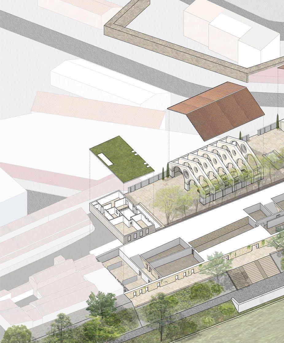
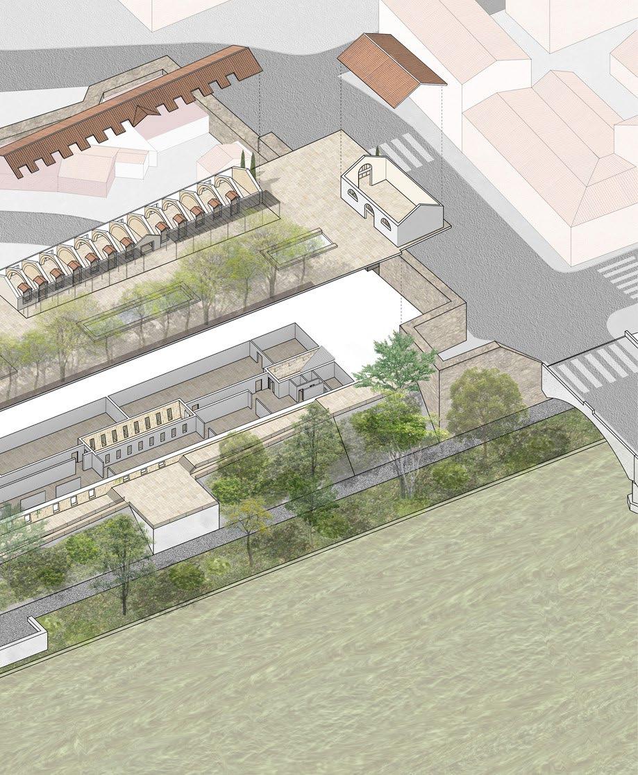
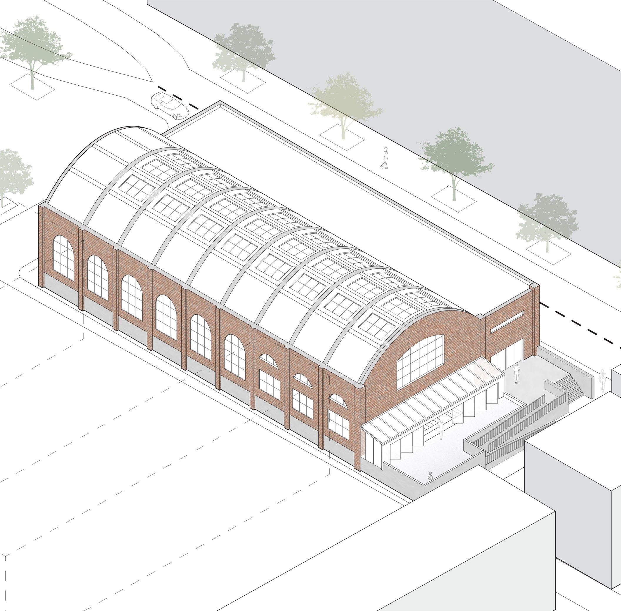
The Bain Mathieu was built by the city of Montreal in 1930 along with 22 other public baths as part of a larger movement to increase cleanliness in the city at a time when baths in the home were uncommon. It was abandoned as a bathhouse in 1990, and repurposed as an event space in 2000, with most of the original building remaining. This project aims to merge the history of the Bain Mathieu with its present use, while also creating a new type of communal space. A place that can be a space of total regeneration for every body, and support the diverse needs of its users. The original exterior facade and existing structural column grid are preserved - the grid serving as a basis for division of spaces on the interior. The windows on the exterior facade retain their existing position, although on the North, West and South facades the windows are enlarged to increase daylighting within the space. Skylights have been added to the roof for the same reason. The south facade is transformed by the addition of glass doors at the ground level, to create a flexible and continuous space between the indoor and outdoor. Throughout the course of this studio, I studied various bathing typologies around the world, and this influenced my final design. One key inspiration that influenced my spatial organization was the Korean jjimjilbang which has a central space and various programs organized around the exterior, providing the user with the opportunity to create their own sequential bathing experience.
Right: Exterior axonometric from the Southwest
Skilled Used: Rhino, Photoshop, Illustrator, Lumion
SPATIAL ORGANIZATION & MATERIAL DIAGRAM
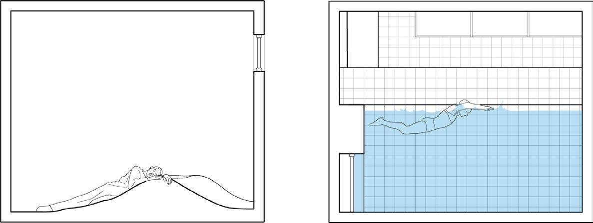
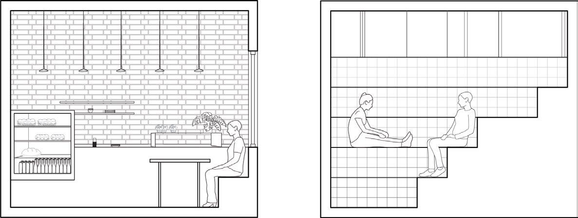
Users enter into an atrium from which they can view the pool, and immediately are presented with the circulation core and change rooms. An important factor in the project was for it to be accessible for non-conforming bodies, meaning people with physical disabilities and also people who are not cisgender, as their needs are often overlooked in design. For this reason there’s no gender segregation anywhere in the building. This also informed the layout of change rooms, as being a large open space divided into spaces for individual use. The change rooms exit onto the swimming pool. Also on the ground level is a conversation pit, which extends into the outdoors, and is enclosed by folding glass accordion doors to make this space adaptable and all season. The second floor is a mezzanine, housing the public bath and the sauna, as well as a restaurant. The basement has individual bathing spaces and a sleep space, and the conversation pit is accessible from here as well. Material choices are informed by foot traffic, wetness, and the atmosphere being created. Most of the bathing spaces are tiled as it is durable and not porous which is beneficial for wet spaces. On the floor and some seating areas is a soft, non-slip durable rubber surfacing.
sleep space personal bathing spaces w/c conversation space transition to basement shower stalls toilets changing stalls lockers foyer pool conversation pit entry outdoor gathering space sauna cold plunge restaurant kitchen w/c utaseyu bath tile slate EPDM rubber red cedar concrete black anodized aluminium glass brick linen burlap A A B B
42
EXAMPLE STEP-BY-STEP SPATIAL PROGRESSION
1. Prepare/Undress
6. Sauna
7. Rest
8. Swim
9. Eat
10. Socialize
2. Clean
3. Hot Utaseyu
4. Cold Plunge
43
5. Warm Soak

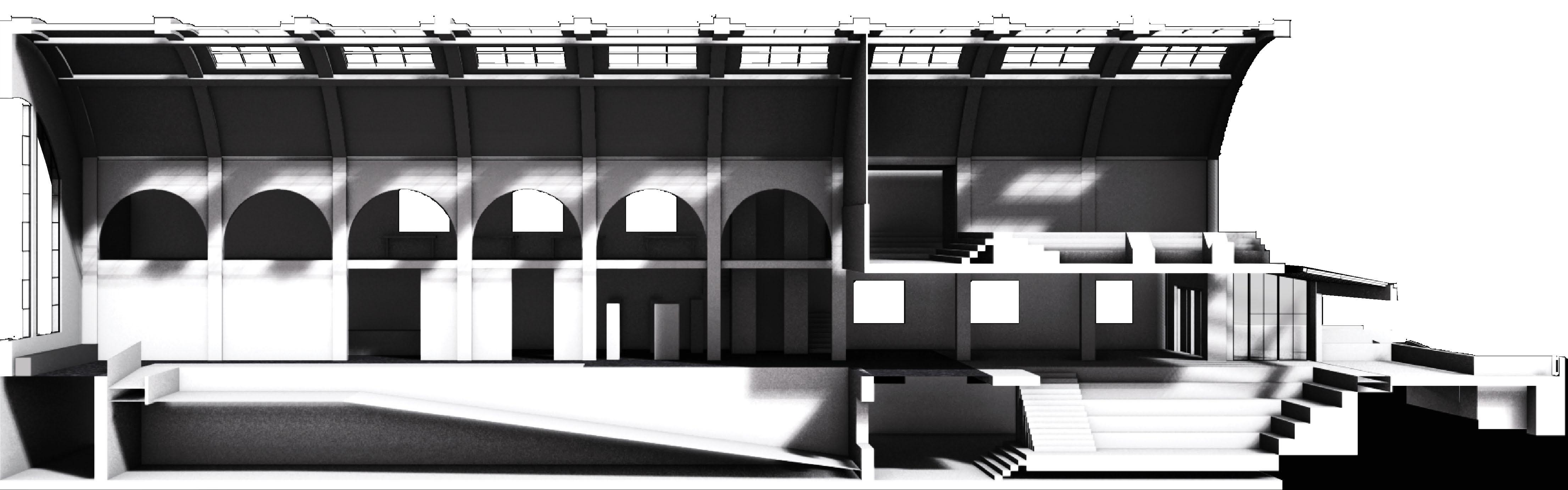
N/S SECTIONAL PERSPECTIVE
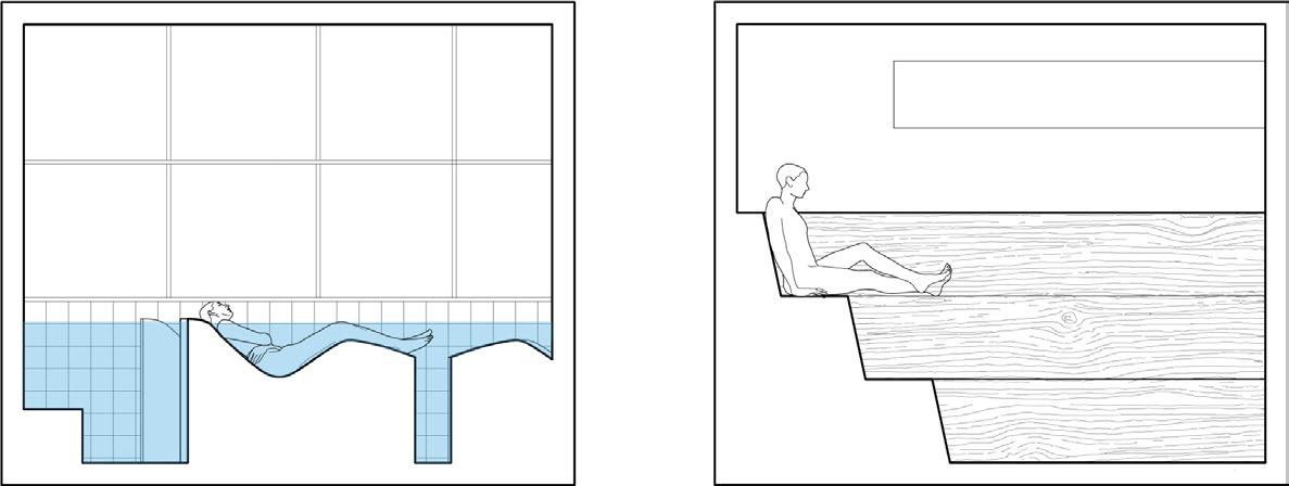
This longitudinal sectional perspective highlights the organization of programs around the main swimming pool, and how they are related back to it or separated from it. This view highlights the visual connection between the pool and the conversation pit, and the pit’s access to the lower level. Also illustrated in this section is the public bath’s separation from the pool by a solid wall which becomes glazing at the top of the wall, so the bath has more privacy in that the view into it from the pool is blocked but light from the skylights is not. Lastly of note in this section is the glazing separating the restaurant/lounge from the pool, so there can still be a visual connection but some noise is reduced and the smell of chlorine is contained to the pool space.
N
44


S 45
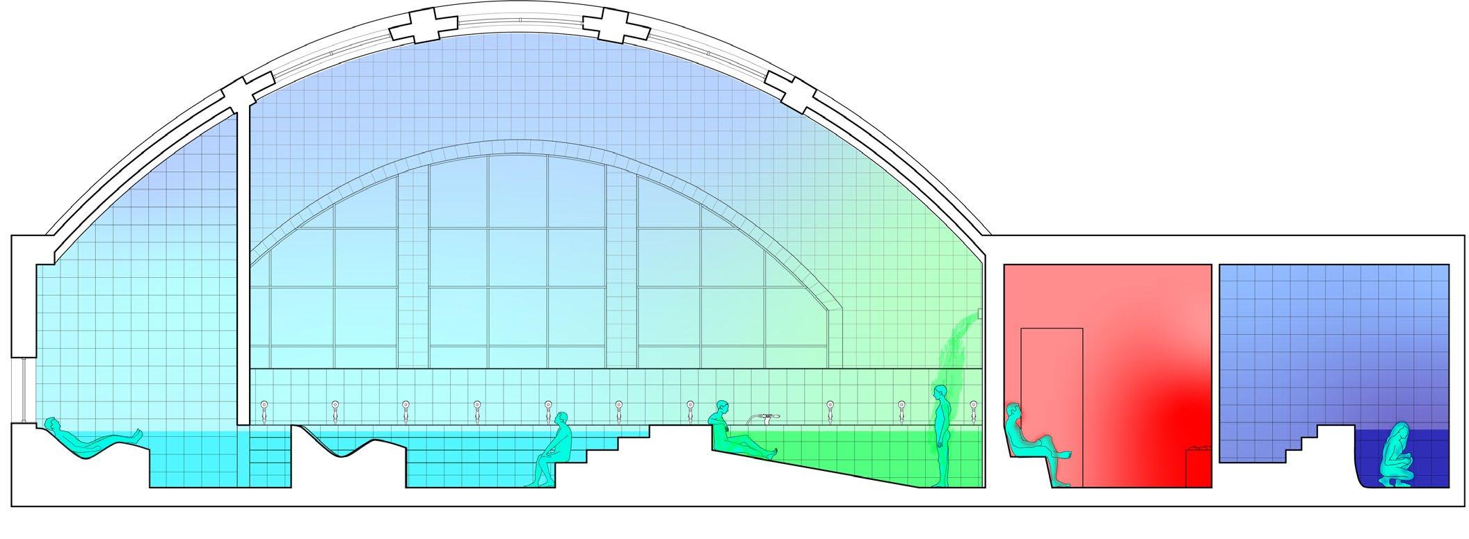
SECTION AA - BATHING SPACES - THERMAL CONDITIONS
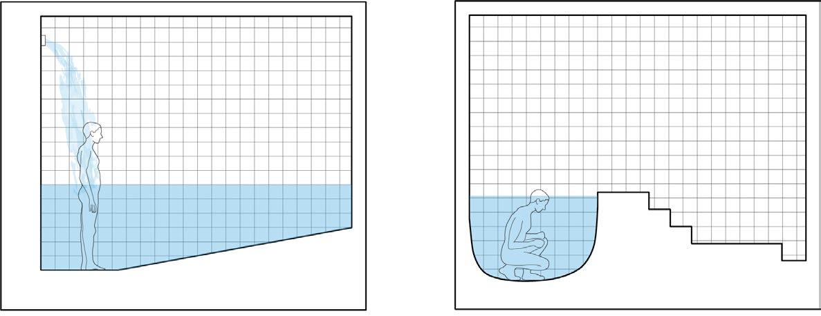
This section shows the various bathing spaces and the range of temperatures. The main soak pool sits around 32 degrees, and is also divided by a wall that someone can swim under into a secondary smaller space. In the middle of the bath are fixed body supporting lounges. The utaseyu (japanese for beating water, a feature present in some onsen) is 44 degrees. The sauna is 80 degrees, and the cold plunge is 10. The main bath has a high roof which allows any humidity to dissipate.
Soak
Utaseyu Sauna
0°
Temperature - Celsius
Pool
Cold Plunge
100
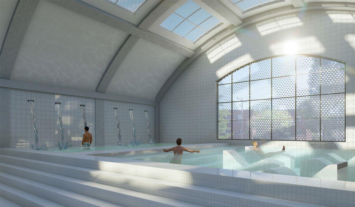
BATH VIEW - MORNING
46
The location of the bath on the second level provides privacy from eyes on the street, and the glazing is covered in a ceramic frit to cut down on thermal gain while still providing daylighting, and providing additional visual privacy.
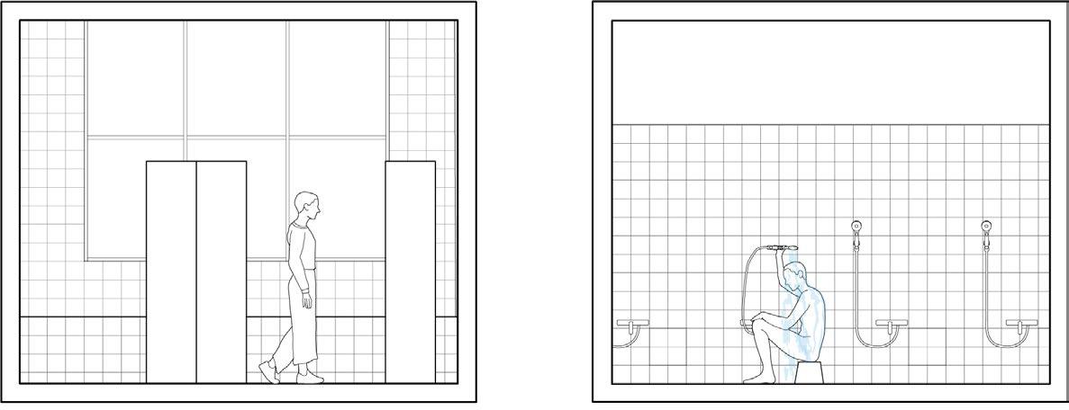
SECTION BB - PERSONAL BATHING SPACE
The personal bathing space has a shower, a body-supporting lounge and steps down into a small pool. The space is big enough to accommodate a parent and child, and could also be used by an individual who still wants the bathing experience but wants to do so privately.
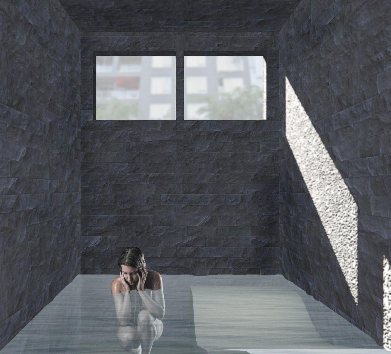
PERSONAL BATHING SPACE VIEW - MID-DAY
This view highlights the slate walls in this space, chosen to give the space a cave-like feeling, and for its durability when exposed to water. The lounge chair is covered with the same rubber material used elsewhere in the building. Since this space is partially below grade, natural light is important, but the glass is frosted for visual privacy.
47
Thank you!
