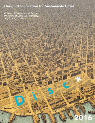
Design & Innovation for Sustainable Cities College of Environmental Design University of California - Berkeley July 5 - Aug 5, 2016
2016
Disc* 2016
2
index* 1.
Program Introduction
2. Calendar 3. Schedule 4. Faculty 5. Speakers 6. Fieldwork 7. Seminars 8. Workshops
Disc* 2016
9.
Studio Syllabus
10.
Site Maps
3
program introduction* DISC is an immersive five-week program that explores an interdisciplinary and multi-scalar approach to design and analysis of the urban environment. Through a combination of design and digital fabrication, studio sessions, lectures and seminars, demos and workshops, field work and site visits, students will be able to engage in the discourse of urban innovation, while gaining hands on experience developing design proposals. The program is built upon four main platforms. The Urban Innovation Talk - Keynote Lecture Series introduces students to some of the most forward-thinking researchers and practitioners from the Bay Area design community. Fieldwork + Site Visits give students an opportunity to engage directly with the dynamic built and natural environment of the Bay Area, while meeting with expert guest speakers. The Global Cities/ Global Challenges + Urban Innovation Seminars are meant to develop a theoretical framework for understanding the complex urban issues that face cities and strategies for design. The Studio + Digital Workshops are at the core of the program, building skills and offering a hands-on makerspace for creative work to take place. Working in teams, students develop a project from design conception to prototyping and present the final result of their work to instructors and guest critics. Upon completion of the DISC program, graduates have a strong understanding of urban processes and a broad toolkit with which to tackle its urgent demands, as well as compelling artifacts for their academic portfolio. Students develop the necessary skills and theory to effectively represent their design ideas and become the next thought shapers and game changers.
Disc* 2016
4
calendar* DISC 2016 // UC Berkeley
JULY AUGUST S
3
M
4
T
5
(Regional + City)
Holiday
6
First Day of DISC Introductions
Research + Mapping
10 (City + Neighborhood) Research + Mapping Initial Design Proposal
11 Urban Seminar 1 Home City Presentations
W
12 Keynote 1: Will Travis GIS Workshop 2
7
Fieldwork 1 Mt. Tamalpais Bay Model Bay Observatory (Susan Swartzenburg)
13 Fieldwork 2 SPUR (Laura Tam) Visit Sites Field Work
17
18
19
20
(Neighborhood + Human)
Urban Seminar 1
Fieldwork 3 Walkabout (Ali Sant) Eastern Waterfront Heron’s Head Park
Rhino Workshop 1
26
27
Digital Modeling Design Development
24
Studio Work
25 Urban Seminar 3
Digital Fabrication Design Production
Rhino Workshop 2
Keynote 4: Neeraj Bhatia
T
DFab Orientation
F 1
2
8
9
GIS Workshop 1
GCGC Lecture 1
Bay Area Research
Bay Area Presentations
14 Keynote 2: Antje Steinmuller GIS Workshop 3
21 Keynote3: Victoria Salinas
S
15
16
GCGC Lecture 2 Mapping Review
22
23
Mid Review
Adobe Workshop
28
Reality Computing Keynote5: Workshop Nathaniel Kauffman
Studio Work
Studio Work
Studio Work
Studio Work
Final Presentation
Work Documentation
29
30
Final Review Mockup
31 Studio Work Presentation Design Refinement
Disc* 2016
DISC Portfolio
Exploratorium Presentation DISC Certificates Party!
5
schedule* Week One Tuesday, July 5th 08:30 am – Pick up CALNET ID 09:30 am – Welcome Breakfast & Check-in (Wurster Hall Lobby) 10:00 am – Program Introduction (Room 101) 01:00 pm – DISC team Introduction 01:00 pm – Lunch Break 02:00 pm – Studio Orientation (5th Floor) 03:30 pm – Mike Bond Safety Intro 04:00 pm – Q&A Session Wednesday, July 6th 08:00 am – Meet at Plaza Fountain 08:30 am – 05:00 pm – Field Trip #1 (Bay Area) Thursday, July 7th 09:00 am – Workshop: GIS Software #1 (Room 479) 01:00 pm – Lunch Break 01:00 pm – Studio: Bay Area Research (5th Floor) Friday, July 8th 09:00 am – GCGC Seminar #1 (Room 101) 01:00 pm – Lunch Break 01:00 pm – Studio: Bay Area Research (5th Floor) 03:00pm – Review: Bay Area Research Presentations (Room 101)
Disc* 2016 - Schedule
6
Week Two Monday, July 11th 10:00 am – Urban Innovation Seminar #1 (Room 101) 01:00 pm – Lunch Break 01:00 pm – Review: Home City Presentations (Room 101) Tuesday, July 12th 10:00 am – Keynote Lecture #1: Will Travis (Room 101) 01:00 pm – Lunch Break 01:00 pm – Workshop: GIS Software #2 (Room 479) 03:00 pm – Studio: Digital Mapping (Room 479) Wednesday, July 13th 08:00 am – Meet at Plaza Fountain 08:00 am – 05:00 pm – Field Trip #2 (San Francisco) Thursday, July 14th 10:00 am – Keynote Lecture #2: Antje Steinmuller (Room 101) 01:00 pm – Lunch Break 01:00 pm – Workshop: GIS Software #3 (Room 479) 03:00 pm – Studio: Analog Mapping (5th Floor) Friday, July 15th 09:00 am – GCGC Seminar #2 (Room 101) 01:00 pm – Lunch Break 01:00 – Review: Site Mapping (5th Floor) Disc* 2016 - Schedule
7
Week Three Monday, July 18th 10:00 am – Urban Innovation Seminar #2 (Room 101) 01:00 pm – Lunch Break 01:00 pm – Studio: Analog Modeling (5th Floor) Tuesday, July 19th 08:00 am – Meet at Plaza Fountain 08:30 am – 05:00 pm – Field Trip #3 (Walkabout) Wednesday, July 20th 09:00 am – Workshop: Rhino Software (Room 214) 01:00 pm – Lunch Break 01:00 pm – Dfab Orientation 03:00 pm – Studio: Digital Modeling (Room 214) Thursday, July 21st 10:00 am – Keynote Lecture #3: Victoria Salinas 01:00 pm – Lunch Break 01:00 pm – Workshop: Adobe Software (Room 214) Friday, July 22nd 09:00 am – Studio: Presentation Development (5th Floor) 01:00 pm – Lunch Break 01:00 – Mid Review: Design Proposal (Room 101)
Disc* 2016 - Schedule
8
Disc* 2016 - Schedule
9
Week Four Monday, July 25th 10:00 am – Urban Seminar #3 (Room 101) 01:00 pm – Lunch Break 01:00 pm – Workshop: Rhino Software #2 (Room 214) Tuesday, July 26th 10:00 am – Keynote Lecture #4: Neeraj Bhatia 01:00 pm – Lunch Break 01:00 pm – Studio: Design Development (5th Floor) Wednesday, July 27th 09:00 am – Workshop: Reality Computing Software (Room 479) 01:00 pm – Lunch Break 01:00 pm – Studio: Digital Fabrication (5th Floor) Thursday, July 28th 10:00 am – Keynote Lecture #5: Nathaniel Kauffman 01:00 pm – Lunch Break 03:00 pm – Studio: Digital Fabrication (5th Floor) Friday, July 29th 09:00 am – Studio: Design Production (5th Floor) 01:00 pm – Lunch Break 01:00 pm –Final Review Mock-up Presentation (5th Floor)
Disc* 2016 - Schedule
10
Week Five Monday, August 1st 10:00 am – Studio: Design Refinement (5th Floor) 01:00 pm – Lunch Break 01:00 pm – Studio: Design Refinement (5th Floor) Tuesday, August 2nd 09:00 am – Studio: Finalize Presentation (5th Floor) 01:00 pm – Lunch Break 01:00 pm – Studio: Finalize Presentation (5th Floor) Wednesday, August 3rd 09:00 am – Studio: Presentation Set-up (5th Floor) 01:00 pm – Lunch Break 01:00 – Final Review: Presentations (Wurster Gallery) Thursday, August 4th 09:00 am – Studio: Work Documentation (5th Floor) 01:00 pm – Lunch Break 01:00 pm – Studio: DISC Portfolio (5th Floor) Friday, August 5th 09:00 am – Studio: Move and Set up Presentation (5th Floor) 01:00 pm – Lunch Break 01:00 pm – Exploratorium Presentation (Fisher Bay Observatory) 05:00 pm – DISC*2016 Final Celebration
Disc* 2016 - Schedule
11
faculty* Gabriel Kaprielian | Program Director Gabriel Kaprielian is a designer, urbanist, and artist based in the Bay Area. With degrees in both architecture and city planning, his creative work and research focus on resilient cities, sustainable design, emergent technologies, and digital fabrication. His professional experience includes traditional architecture practice with award-winning firms, social focused architecture as a Design Fellow for Architecture for Humanity, urban design in the public sector, and as an Artist-in-Resident at Autodesk’s Pier 9 Workshop in San Francisco. In addition to serving as the Program Director of DISC in the College of Environmental Design, Gabriel has served as a lecturer at a Cal Poly, California College of the Arts, and UC Berkeley. Gabriel holds a BArch from Cal Poly in San Luis Obispo, CA, and a MArch and MCP from UC Berkeley.
Kent Wilson | Design Studio Lead Kent earned BArch (with a minor in Sustainable Design) and MArch degrees from UC Berkeley after a career in marketing, graphic design, print production and fabrication management. His work positions architectural production within broader social, economic, technological and ecological concerns while maintaining a strong focus on making, with models, drawings and photo renderings that convey social and political critique as integral to spatial concepts. As a studio instructor, he continues his research at the intersections of design, materiality, sustainability, and social change.
Ghigo DiTommaso | Global Cities Global Challenges Lecturer Ghigo DiTommaso was trained as an architect in Florence, where he picked up the tools of the trade while feeding a strong interest in urban history and theory. Licensure in hand, he moved to Barcelona to become part of its thriving design community. There he worked with prominent Catalan architects on numerous award-winning projects while also conducting research at the EtsaB School of Architecture and teaching at the ESDi School of Design. Based in the Bay Area since 2010, he has been a core member of the Rebar Art & Design Studio and more recently of the new San Francisco offices of Gehl Studio, where he continues to practice the profession. At CED, while serving as Program Director of Disc*, he also collaborates with the LAEP department as a lecturer and project researcher. Ghigo holds a BArch and an MArch from the FacoltĂ di Architettura di Firenze, and an MSArch and PhD from EtsaBarcelona. Disc* 2016 - Faculty
12
Katie Mcknight | Digital Lead GIS Katie earned her Masters of Landscape Architecture in Environmental Planning from UC Berkeley’s College of Environmental Design. Originally from North Carolina, Katie draws on her background in environmental science, planning and permaculture to conduct diverse research studies on resilient planning strategies. Through the use of spatial analysis software such as ArcGIS, FlamMap, FARSite and ENVI, Katie’s research focuses on a range of topics such as fire risk, land cover changes, flood dynamics, wildlife corridors and food access.As a current Berkeley Food Institute research fellow, Katie is working to optimize and expand the UC Gill Tract Community Farm’s food distribution network to better support students and communities experiencing food insecurity. She hopes to contribute to creative environmental planning efforts working towards a healthier and more just campus and community.
Jonah Merris | Graduate Student Instructor Jonah Merris is a graduate student of architecture at UC Berkeley’s College of Environmental Design. He received a BA in Architectural Studies and Political Science from Middlebury College. Jonah has explored issues of architecture, sustainability, and urbanism through work on the US Department of Energy Solar Decathlon, as well as internships with Kava Massih Architects in Berkeley, CA, and Vermont Integrated Architecture in Middlebury, VT. His current creative work investigates the changing spatial implications of place amidst the proliferation of personal digital branding.
Sonali Praharaj | Graduate Student Instructor Sonali has worked across various architectural, urban design, landscape and urban planning projects across cities in India, Europe, and San Francisco Bay Area. Some of her interest areas have been exploring adaptive and compact growth models to tackle issues of climate change and urban sprawl in our cities, Building resilient urban waterfronts and revitalizing underutilized post-industrial urban cores and infrastructures into healthier communities. Sonali has completed her architectural studies from Sir JJ College of Architecture, Mumbai and is currently pursuing her graduate program in Urban Design from University of California, Berkeley.
Disc* 2016 - Faculty
13
DISC*2016 Urban Innovation Talks:
keynote lecturers* Will Travis | Former Executive Director for BCDC Will Travis is a consultant, writer, teacher and speaker on climate change, and particularly sea level rise adaptation. Will received Bachelor of Architecture and Master of Regional Planning degrees, both from Penn State University. He has worked in the fields of architecture, local planning, private consulting, advertising and public relations. In 1972 he was a consultant on the first master plan for the East Bay Regional Park District. From 1973 to 1995 he served in a number of staff positions at the California Coastal Commission. In 1985 he was appointed deputy director of the San Francisco Bay Conservation and Development Commission, commonly called BCDC. In 1995 he was appointed executive director of BCDC and under his leadership in 2011 BCDC became the nation’s first state coastal management agency to adopt development regulations for addressing sea level rise. In 2012 he served as the senior advisor to the Bay Area Joint Policy Committee, which coordinates the land use planning of four regional agencies. Will spearheaded the public acquisition of 10,000 acres of privatelyowned salt ponds along the northern shoreline of San Francisco Bay so the ponds can be restored to coastal wetlands. He is a popular public speaker, has written extensively on coastal management, and has been a lecturer at universities throughout North America. He serves on the boards of directors of a number of professional and civic organizations. He was a member of the Berkeley city planning commission and was chairman of a special committee that worked with the University of California to formulate a new plan for downtown Berkeley. Will is the 2009 recipient of the Jean Auer Environmental Award, presented by the San Francisco Estuary Partnership, and the 2012 recipient of the Frank C. Boerger Award, presented by the Bay Planning Coalition. He and his wife, Jody Loeffler, are the authors of Katherine’s Gift, a memoir on international adoption. They live in Berkeley, California.
Disc* 2016 - Speakers
14
Antje Steinmuller | Assistant Professor of Architecture at California College of the Arts and a Principal at Studio URBIS Antje Steinmuller is an assistant professor of Architecture at California College of the Arts and a principal at Studio URBIS, a sustainable architecture, urban design, and research practice in the Bay Area. She holds a professional degree in interior architecture from the Hochschule for Technik Stuttgart, a degree in architecture from the Technical University Berlin, and an MArch from the University of California, Berkeley, where she was a John K. Branner Fellow and received the Henry Adams Medal and Certificate of Merit as well as the Howard Friedman Thesis Prize. Before moving to the US, Steinmuller worked in architecture firms in Stuttgart and Berlin, where she was involved in residential work as well as landmark government projects including the German Parliament office building. While a graduate student at Berkeley, she returned to Berlin during a year-long traveling research fellowship to investigate urban-scale transformational processes, a project that also included substantial work in Johannesburg, Belfast, and several countries in Eastern Europe. Continuing related research in both education and professional practice, Steinmuller codirected student research excursions to China while involved in teaching design studios at the University of California, Berkeley. At Studio URBIS, her work includes urban-scale work in China, research in the application of prefabrication technologies in multifamily housing, and several residential projects. Steinmuller has been a lecturer at the University of California, Berkeley, and in 2006, she joined the architecture faculty at CCA, where she teaches and coordinates the first core design studio and media course in the graduate program, Architectural Analysis, housing studios as well as advanced and travel studios. Her research areas include the relationship of visualization methods to design thinking, as well as temporary urban strategies and their capacity to inform longer-term urban development.
Victoria Salinas | Chief Resilience Officer, City of Oakland As the Chief Resilience Officer for the City of Oakland, Victoria has worked to bring together Oakland’s city departments, partners, and residents to develop and implement a Resilience Action Plan that enables the community to thrive in the face of any kind of adversity. This work helps to ensure that the action planning and implementation process are inclusive of and responsive to economically and under-served populations; addresses social equity and economic development concerns; addresses potential natural and man-made disasters, seismic and climate change priorities and other sustainability issues. Victoria has served as the City’s main point of contact to 100 Resilient Cities, Pioneered by The Rockefeller Foundation. Victoria has worked around the world, and in the U.S. at the Federal and City levels. In addition to working as the Chief Resilience Officer for the City of Oakland, she has also worked with the World Bank in Disaster Recovery Management and as a consultant with Social Development Sector/Conflict Prevention and Reconstruction Unit, with FEMA as the Deputy Branch Chief for Long-Term Recovery, with the United Nations in the Democratic Republic of Congo and Sierra Leone, and with the US Department of State as a Strategic Planner in the Office of the Coordinator for Reconstruction and Stabilization. Victoria hold degrees from both Harvard and Georgetown University.
Disc* 2016 - Speakers
15
Disc* 2016 - Speakers
16
Neeraj Bhatia | Assistant Professor of Architecture at California College of the Arts Architect and urban designer from Toronto. His work resides at the intersection of politics, infrastructure, and urbanism. Bhatia is a co-director of InfraNet Lab, a nonprofit research collective probing the spatial byproducts of contemporary resource logistics, and the founder of The Open Workshop, a design office examining the project of plurality. Further, he is the research director of The Petropolis of Tomorrow, which explores the relationship between urbanism and resource extraction. He has worked for Eisenman Architects, Coop Himmelblau, Bruce Mau Design, OMA, Lateral Office, and ORG.
Nathaniel Kaufmann | Founder of LEAP and Director of Projects at Owlized Nate is a private consultant, advising clients on strategic approaches to sustainability, resilience and adaptation. As a Visualization Contractor, Nate assists clients to express and articulate their concepts and values through digital 3D modeling and competitionlevel drawings and models. Nate has done work for the San Francisco Estuary Institute (SFEI), The Bay Institute, the California State Coastal Conservancy, the California Natural Resources Agency, Bay Nature Magazine, the Oro Loma Sanitary District, local design firms and others. Nate founded LEAP (the Live Edge Adaptation Project) and is actively developing LEARN (the Live Edge Adaptation and Resilience Network) to address the social and environmental justice issues embodied and emerging in the challenge posed by Climate Change and Sea Level Rise. His approach to this challenge is synthetic, networking across groups of stakeholders to develop platforms in public awareness, political lobbying and envisioning projects that can serve as common ground + proofs of concepts to shape and improve the built and natural worlds. Nate has taught at the Massachusetts Institute of Technology’s School of Architecture as an URBANFRAME fellow, a youth-centered design/build summer studio for an international cadre of teens. Nate has an Master of Landscspe Architecture from UC Berkeley.
Disc* 2016 - Speakers
17
guest speakers* Jennifer Wolch | Dean of the College of Environmental Design at UC Berkeley Jennifer Wolch is a scholar of urban analysis and planning. Her past work focused on urban homelessness and the delivery of affordable housing and human services for poor people. She has also studied urban sprawl and alternative approaches to city-building such as smart growth and new urbanism. An early investigator of animalsociety relations in cities, she has proposed strategies for humananimal co-existence in an urbanizing world. Her most recent work analyzes connections between city form, physical activity, and public health, and develops strategies to address environmental justice issues by improving access to urban parks and recreational resources. Wolch has authored or co-authored over 125 academic journal articles and book chapters. She was also a recipient of fellowships from the Guggenheim Foundation, Center for Advanced Study in the Behavioral Sciences, the Rockefeller Foundation’s Bellagio Study Center, and other prestigious honors.
Laura Tam | Sustainability Development Policy Director at SPUR Laura Tam coordinates SPUR’s work in five major policy areas: green buildings, water supply, wastewater, energy and climate change. In this role since 2007, she works to improve climate resilience and reduce the environmental footprint of cities. As a thought leader on climate adaptation and water management, she has produced and participated in numerous public programs, citywide task forces, major research reports and advocacy recommending strategies for sea level rise, water efficiency and reuse, green infrastructure and reducing climate-change emissions. Laura currently serves on the board of directors of Friends of the Urban Forest, the board of the Green Infrastructure Foundation and the advisory council of the Bay Area Air Quality Management District. Prior to working at SPUR, she worked for the U.S. Environmental Protection Agency. She has a Master’s degree in environmental management from the Yale School of Forestry and Environmental Studies and a BA in geography from Dartmouth College.
Disc* 2016 - Speakers
18
Susan Schwartzenberg | Senior Artist and Curator at the Exploratorium Susan Schwartzenberg is a senior artist at the Exploratorium, where she leads the development of the Fisher Bay Observatory Gallery. She has been a curator, photographer, designer, and artist, and served as director of media for the museum. She has participated in many exhibit development and Web-based projects. Susan was a Loeb Fellow at the Harvard Graduate School of Design, and has taught at the San Francisco Art Institute, the California College of Art, and Stanford University. As a photographer and visual artist, she has received numerous awards, and has taken part in residencies and exhibitions worldwide. She is known for her public art, including recent works at Stanford Alison Sant | Urban Designer, Artist, Studio for Urban Projects Alison Sant (alisant.net) is an artist, with a background in digital media, architecture, and urban art practice. Her work explores the city as both a site for investigation and intervention and focuses on the intersection of technology, architecture, and ecology. She has exhibited nationally and internationally at venues including the Berkeley Art Museum, Yerba Buena Center for the Arts, VIPER Basel, ISEA and the Conflux Festival. Sant has taught classes that blend urban art practice, ecology, and new media at the California College of Art, San Francisco Art Institute and Mills College. Sant has been awarded artist residencies at the Djerassi Resident Artists Program, Headlands Center for the Arts, and the McColl Center for Visual Art. She is the recipient of grants from the San Francisco Exploratorium and the Creative Work Fund. She has been invited to speak at a variety of symposia including ISEA2006, IDEA2006, the Mobile Digital Commons Network Symposium and VIPERBasel|2004. Her essays have been published in the Leonardo Electronic Almanac, Intelligent Agent and the Transcultural Mapping Reader. She received her BFA from New York University in the Departments of Photography and Interactive Telecommunications and received her Masters in Design at the College of Environmental Design, University of California Berkeley. Sant is a curator and board member of Southern Exposure and a member of the Art Program Oversight committee for the San Jose Airport. Lidia D’Amico | Wildlife Biologist, Artist Lidia D’Amico is a Bay Area native and biological consultant with knowledge of the unique ecological systems and wildlife of California. She received her B.S. in Biology with a concentration in Field Biology from Cal Poly State University, San Luis Obispo specializing in avian ecology. Her naturalist adventures have taken her to remote regions of Hawai`i, the central Sierras, and finally back to the San Francisco Bay Area where she worked with the Golden Gate National Recreation Area (GGNRA) and associated Park partners. Her experience includes conducting field studies of different wildlife populations throughout the Bay Area, including endangered and threatened species such as the CA red-legged frog, Western snowy plover and Northern spotted owl. You can usually find her hiking the many beautiful trails of the Bay, looking for birds. Disc* 2016 - Speakers
19
Disc* 2016 - Fieldwork
20
fieldwork* Field Trip 1 | Regional + City | July 6th Mt. Tamalpais – Bay Model – Exploratorium Fisher Bay Observatory Our first field trip will focus on the dynamic interplay between the built and natural environments of the Bay Area. You will learn about the historical transformations that have shaped the region into the place that you see today. We will begin at the top of Mt. Tamalpais, one of the highest peaks in the area, which offers a panoramic view of the entire San Francisco Bay and surrounding cities. We will be joined by LEAP founder Nathaniel Kaufmann and Wildlife Biologist Lidia D’Amico as they led an interpretive tour. Next, we will visit the Bay Model in Sausalito, constructed by the U.S. Army Corps of Engineers as a working hydraulic scale model of the San Francisco Bay. A Park Ranger will guide us through the exhibit and talk about the pivotal history of the models construction and the Save the Bay movement. We will then travel via ferry to the Exploratorium’s Fisher Bay Observatory in San Francisco where we will be joined by Senior Artist and Curator Susan Schwartzenberg to explore the scientific exhibits and maps that allow us to understand the functioning of the Bay ecology and urban morphology of San Francisco.
Field Trip 2 | City + Neighborhood | July 13th SPUR – San Francisco Site Visits The second field trip will explore the city of San Francisco and its neighborhoods as we investigate the studio sites, which will become a living laboratory for speculative design proposals. To put our site visits and fieldwork in perspective, we will begin by visiting SPUR, the San Francisco Bay Area Planning and Urban Research Association. Sustainability Development Policy Director Laura Tam will join us to talk about the work of SPUR and the urban challenges and opportunities that San Francisco is facing. Afterwards we will visit each of the studio sites and conduct fieldwork through on-site analysis and observation. You will be expected to document notes in your sketchbook, geo-reference site elements on your base maps, and take relevant photographs. The site visit fieldwork will require significant walking and San Francisco is notorious for microclimates and weather changes. Dress accordingly and be prepared for this urban expedition.
Disc* 2016 - Fieldwork
21
Field Trip 3 | Walkabout | July 13th Eastern Waterfront – Heron’s Head Park The walkabout curated by Alison Sant and Ghigo DiTommaso will be an exploration of San Francisco’s Eastern Waterfront. This area, on the verge of massive change, represents, perhaps more than any other in the city, the complexity and contradiction that characterize contemporary urban process. Remnants of its industrial past and long-time residential communities here coexist with the first signs of a series of transformations that will reshape the urban form and the ecology of the area in radical ways. Throughout the walk we will hear from Stephanie Kiriakopolos, from the Romberg Tiburon Center for Environmental Studies and Jeremy Lowe from the San Francisco Estuary Institute about the experimental practices for climate change mitigation that are taking place there; talk with Philip Vitale from the Trust of Public Land about the future of green public space and discuss with John Bela from Gehl Studio about the ambitious projects for new development that are currently underway. Note: For all field trips bring the following items.
• • • • • • • •
Disc* 2016 - Fieldwork
Sketchbook DISC booklet Camera or smartphone Sun protection (hat, sunglasses, sunblock) Warm clothing (jacket or sweater) Water bottle Food (lunch + snacks) Clipper card
22
Disc* 2016 - Fieldwork
23
seminars* Global Cities | Global Challenges Seminar - Ghigo DiTommaso Global Cities/Global Challenges is a series of lectures addressing some of the most pressing challenges our cities are facing today. The series will focus on issues of social and environmental justice while exploring a variety of strategies and tactics for good city-making. We will learn about some of the causes of the ‘wicked problems’ we are tackling and discuss what is at stake if we don’t find viable solutions soon, while also hearing about several recent success stories that show how things can really change for the better. We will look at case studies from across the world to illustrate what environmental design can do to make our urban regions more resilient, livable and equitable.
Urban Innovation Seminar - Gabriel Kaprielian The Urban Innovation Seminar is meant to supplement the studio with theory and lively discourse. Students will be active participants in the learning process. There will be weekly assigned readings and writing that in addition to a seminar presentation by the Program Director will provide a framework to discuss and contextualize the program goals and studio work. The Urban Innovation Seminar will be presented in three modules: Urban Place, Urban Form, and Urban Futures. Urban Place will focus on understanding the transformations of the built and natural environment of cities and how this can be used to inform future design decisions. Topics will include the use of mapping to georeference and layer past, present, and potential future urban and natural conditions to develop a narrative of place. Urban Form will explore precedents of city block and housing typologies around the world and the factors and urban theory that shaped it. Examples will include built urban form from various time periods and the speculative urban form proposals and theory that influenced it. Urban Futures looks at the continually evolving nature of cities, which are ever changing based on economic, social, environmental, and technological factors. Topics will include smart cities, big data, autonomous driving vehicles, ecoblocks, sustainability initiatives, resilience cities, and the role of science fiction and speculative design.
Disc* 2016 - Seminars
24
Disc* 2016 - Seminars
25
workshops* GIS Workshops | July 7th, 12th, 14th Katie McKnight – Digital Lead GIS The GIS workshops will cover the basics of digital Geographic Information System mapping and will directly support the studio project work. GIS Workshop One will include geo-referencing historic maps, creating thematic maps, and visualizing data geospatially. GIS Workshop Two will focus on topics that will assist you in creating a past, present, future narrative of your assigned team site in San Francisco. You will use historic maps to understand the urban morphology and historic ecology, while layering current and projected future maps to see areas of intersection and transformation. Additionally, you will create scaled base maps to use as reference during Field Work. GIS Workshop Three will explore higher level mapping functions such as 3D visualization with ArcScene, while paying particular attention to mapping as an art to achieve compelling and informative graphics. Rhino Workshops | July 20th, July 25th Kent Wilson – Studio Lead The Rhino workshops will demonstrate digital 3D modeling and 2D drafting techniques, rendering with the VRay plug-in, graphic exporting, and digital fabrication file processing. Topics in the workshops will directly support the studio project work. Rhino Workshop One will focus on digital modeling and drafting to develop your urban design proposals, in addition to exporting 2D graphics for Adobe software and presentations. Rhino Workshop Two will focus on creating perspective renderings with VRay and digital fabrication output for lasercutting, 3D printing, and CNC milling.
Disc* 2016 - Workshops
26
Adobe Workshop | July 21st Kent Wilson – Studio Lead The Adobe workshop will include instruction with Photoshop, Illustrator, and InDesign. The workshop will link the workflow from Rhino 2D graphic exports, digital rendering, and generally focus creating high quality presentation materials from design work. Photoshop will include instruction on rendering techniques. Illustrator will be used primarily to create 2D vector graphics. InDesign will be used for presentation board layouts. Reality Computing Workshop | July 27th Gabriel Kaprielian – Program Director The Reality Computing workshop will demonstrate an alternative process to design and digital fabrication that utilizes the Autodesk software 123D Catch, 123D Make, and Meshmixer. Through the use of the 3D scanning technology of photogrammetry, you will learn how to digitize physical objects, edit their mesh facsimile, and create a digitally fabricated rematerialization. The process allows for haptic hand modeling in place of digital modeling to achieve a desired form, which can be transformed through a metamorphosis traversing physical and digital worlds.
Disc* 2016 - Workshops
27
studio syllabus* “We need to view the fragility of the planet and its resources as an opportunity for speculative design innovations rather than as a form for technical legitimation for promoting conventional solutions. By extension, the problems confronting our cities and regions would then become opportunities to define a new approach.”
- Mohsen Mostafavi, Ecological Urbanism
Studio Goals Learn theory and skills to analyze a complex urban environment, assess need through research and mapping, develop an informed design proposal, and create effective representation utilizing computer software and digital fabrication methods. Studio Overview Through mapping, research, and design you will envision the future of San Francisco’s built environment as a model for resilient and sustainable urban design. You will use the city as a living laboratory for speculative design interventions. Building off of the city plan for a Resilient San Francisco, which aims to increase the population to 1 million by the year 2040, you will propose solutions that address housing, infrastructure, transportation, social inequity, climate change, and livability, etc. To accomplish this task, you will work at multiple scales (Regional + City + Neighborhood + Human) to understand the interconnection and complexity of the urban fabric and local ecology. Working in teams, you will focus on a given site context in San Francisco to produce speculative designs for an innovative new urban form. Utilizing a variety of computer software, the final design and research will be represented both physically with digitally fabricated models and graphically with presentation boards and a final program book. Each of you will be a contributor to the content of this work and making DISC 2016 a success! Studio Project – SF@1Million San Francisco is facing pressure for growth and at the same is looking toward the future as it plans to create a more resilient and sustainable urban fabric. In a recent report titled Resilient San Francisco, the city unveiled its goal to accommodate a projected 1 million people by the year 2040, a significant growth from the current population of 837, 442 people. The report also focused on several interconnected challenges that are planning priorities including, infrastructure, climate change, social inequity, sea level rise, and unaffordability. Disc* 2016 - Syllabus
28
Since San Francisco is on a peninsula, it cannot grow outwards and sprawl like many other cities, but must rather densify. How can this be accomplished while still retaining the traditional character of the city? Who will this new housing be for? There is a growing trend in San Francisco where low and middle-income residents are being priced out of the city as tech companies and employees continue to move in. What will or should San Francisco look like in 2040? Will people still be driving private automobiles or will there only be autonomous driving cars? How will this change the city streets and public space? Will housing become more flexible and communal such as WeLive or AirBnB? Can the urban infrastructure become more resilient to climate change to face sea-level rise and drought? Can some infrastructure be more adaptable and decentralized to accommodate grey-water recycling and alternative energy harvesting? Can we harness the power of big data to better understand our city and how people use it? How do we design for increased livability, accessibility, and social equity? Through mapping, research, and design the focus of our studio work will be to envision the future of San Francisco’s built environment as a model for resilient and sustainable urban design. Building off of the city plan for a Resilient San Francisco, you will work in teams to propose solutions that address these urban issues. Each of the sites has been chosen for their distinct characteristics, challenges, and opportunities for growth and redesign. You will be tasked with identifying the potential for adding new housing and innovative urban design solutions. Studio Deliverables You will be conducting research and design work on a weekly basis, individually and in teams. This work will build towards the final studio deliverables described below:
• Past, Present, Future Model – This model will represent the
culmination of research and design efforts for your team’s assigned site. It will be a layering of maps and analysis of the site’s past and present with a proposed future urban design on top. The model will be lit from inside to illuminate the layered maps, while utilizing a variety of digital fabrication methods to construct the final product, including 3D printing, lasercutting, and CNC manufacturing. The result should be a hybridized work of mapping and design that is an informative and artistic artifact. • Presentation Boards – The final presentation boards will display the research and design efforts of your team graphically. You will be given specific guidelines for content that will include such graphics as a master plan, site and street sections, perspective renderings, etc. You will be expected to illustrate your design with visually compelling and clear graphics, combined together in a professional format. • DISC 2016 Book – The DISC book will serve as a final archive of the studio work. The book will be compilation of the design process and final work, in addition to other DISC program content. Disc* 2016 - Syllabus
29
Weekly Overview Week One: Regional + City • Software: ArcGIS, InDesign • Field Trip #1 – Bay Area • Research + Mapping • Bay Area Analysis Presentations Week Two: City + Neighborhood • Software: ArcGIS, ArcScene • Field Trip #2 – San Francisco • Research + Mapping • Initial Design Proposal Review Week Three: Neighborhood + Human • Software: Rhino, Adobe CS • Field Trip #3 – Walkabout • Design Development + Representation • Mid Review Presentations Week Four: Design Production • Software: 123D Catch, Meshmixer, 123D Make, VRay for Rhino • Digital Fabrication Models > Past, Present, Future Model • Presentation Boards + Scale Models Week Five: Presentation • Design Refinement • Finalize Work > Prepare for Display • Work Documentation > Portfolio and Studio Book Week One: Regional + City Bay Area Research + Mapping “… maps give us reality, a reality that exceeds our reach, our vision, the span of our days, a reality that we achieve in no other way.”
- Dennis Woods, “The Power of Maps”
Learning Objectives Gain a greater understanding of San Francisco city in the context of the Bay Area region through research, mapping, and first-person observation. Week One Overview You will begin with a first-person observation of the Bay Area during our Field Trip #1 that will include a visit to Mt. Tamalpais, the Bay Model, and Fisher Bay Observatory in the Exploratorium. Joining us will be expert professionals who will interpret and explain the urban and natural Disc* 2016 - Syllabus
30
transformations of the Bay Area. You will continue your analysis of the Bay Area through mapping and research. During the ArcGIS Workshop, you will learn skills for digital mapping. Working in teams, you will use ArcGIS as a tool for exploring the past, present, and future built and natural environment at the scale of the region and city of San Francisco. Utilizing Internet databases and library resources at UC Berkeley, you will compile information, written descriptions, and images that will combine with your mapping to create a narrative of the Bay Area. In teams, you will create a presentation with (20) slides that are visually compelling and informative. Each team will be assigned a specific area of focus that will serve as a combined studio resource throughout the program. In addition to mapping, teams will conduct research into their assigned focus area. Specific areas of focus:
• • • • • • • •
Historical Ecology (wetlands, flora, fauna) Indigenous History + Culture Coastal Transformations (bay fill, sea-level rise, levees) Urban Morphology (current housing stock, history of urban development, future planning) Infrastructure (water, waste, energy) Demographics (race, income, social equity, gentrification) Transportation (roads, rails, ferries, bicycle routes, public transportation) Land Use (built land, open space, parks, public space)
Week Two: City + Neighborhood San Francisco Research + Mapping + Design “Mapping is a fantastic cultural project, creating and building the world as much as measuring and describing it.” - James Corner, “The Agency of Mapping: Speculation, Critique and Invention” Learning Objectives Utilize mapping techniques in combination with research and fieldwork to gain a greater understanding of your assigned neighborhood in the context of San Francisco. Develop a narrative of the urban transformations, historical ecology, current built and natural environment, and potential future urban design that can inform an initial design proposal.
Disc* 2016 - Syllabus
31
Weekly Overview During the second week, we will take a closer look at cities and neighborhoods. We will explore city form that has been built around the world, including your own hometowns. We will attempt to understand why cities are built the way they are based on a variety of factors including environmental, economic, and cultural. In particular, we will focus on the city of San Francisco and the neighborhoods where our studio project sites are located. We will begin with extensive mapping to understand the urban morphology and underlying historic ecology of San Francisco. Through mapping, we can investigate the past, present, and future context of our sites and their relationship to the city as a whole. Mapping will allow us to geo-reference historic maps that show how the city has been shaped over time. We can see what lies underneath the city streets and explore the site ecology that existed before and what remains today. Layering current maps of the city, we can see the intersection of infrastructure, housing density, demographics, and transportation to gain a more informed perspective for urban design solutions. In combination with mapping, you will work in teams conducting research on San Francisco and in particular your site. This will include exploring the history of the neighborhood and the future city plans. As part of the research, Field Trip #2 will include site visits for first-person observation and documentation. By the end of the week, your team should have compiled work with mapping and research that creates a compelling narrative for an initial design proposal. Week Three: Neighborhood + Human Design Development “Most of our housing and city planning has been handicapped because those who have undertaken the work have had no clear notion of the social function of the city.”
- Lewis Mumford, “What Is a City?”
Learning Objectives Develop an innovative urban design proposal that responds to the city plan for a Resilient San Francisco, informed by previous mapping and site research. Create effective and compelling representation of your designs for graphic presentation and prepare files for digital fabrication. Weekly Overview Building off of the mapping, research, and fieldwork in week two, you will further develop your urban design proposals in the assigned neighborhood area in San Francisco. The mapping will serve as the literal Disc* 2016 - Syllabus
32
Disc* 2016 - Syllabus
33
base and basis for your speculative design interventions as they begin to take on three-dimensional form through rough physical hand modeling and digital modeling with Rhino software. Following the city plan for a Resilient San Francisco, which aims to increase the population to 1 million by the year 2040, you will propose solutions that address housing, infrastructure, transportation, social inequity, climate change, and livability, etc. As a team, you will develop a plan for adding housing in the neighborhood to reach density goals to meet the city’s growing population demand, while incorporating principles of urban theory that aim to create a more resilient, sustainable, and livable city. You will be working across multiple scales as you develop your urban design proposal for the neighborhood site. Your design should reflect the relationship to the greater city of San Francisco and the Bay Area region, when considering interconnected elements such as infrastructure and transportation. At the same time your urban design proposal should also consider the social function of the city at the human scale. Digital workshops with Rhino 3D modeling software and Adobe Creative Suite are aimed at building your skills in order to design and represent your ideas effectively. Specific design production guidelines will be given to assist in developing a clear, comprehensive, and professional final output. This will include presentation boards with outlined deliverables such as a master plan, site sections, perspective renderings, diagrams, etc. Additionally, you will begin to develop files for digital fabrication in week four. Week Four: Design Production Digital Fabrication + Representation “Construction is the art of making a meaningful whole out of many parts. Buildings are witnesses to the human ability to construct concrete things.”
- Peter Zumthor, “Thinking Architecture”
Learning Objectives Produce effective and compelling two-dimensional graphic representation and three-dimensional models of your design proposals. Utilize advanced computer software and digital fabrication machines to create inspiring work that meets the studio deliverables. Weekly Overview Week four will focus on the production of your urban design proposals. During this week, you will have full access to the Digital Fabrication Lab to create rapid prototypes and your final Past, Present, Future model. This Disc* 2016 - Syllabus
34
will include using the 3D printers, lasercutters, and CNC milling machine. Additionally, you will refine your design and the two-dimensional graphic representation for your presentation boards. You will receive an orientation on how to use the equipment in the Digital Fabrication Lab, in addition to instruction on how to create cut and print files in preparation for digital fabrication. Digital workshops with the rendering software VRay for Rhino and Autodesk’s Reality Computing software, will demonstrate methods of effective design representation and fabrication. Week Five: Presentation Refinement + Exhibition “The timeless task of architecture is to create embodied existential metaphors that concretize and structure man’s being in the world. Images of architecture reflect and externalize ideas and images of life; architecture materializes our images of idea life. Buildings and towns enable us to structure, understand and remember who we are. Architecture enables us to place ourselves in the continuum of culture.”
- Juhani Pallasmaa, “An Architecture of the Seven Senses”
Learning Objectives Refine and produce final representative work of design proposals and research for public presentation. Documentation of work for archiving. Weekly Overview During the final week of the program, the focus will be on finalizing work for public presentation and documentation. You will present your final work both at UC Berkeley and in San Francisco to the public and invited guests. This is your opportunity to demonstrate what you have learned and to also be part of the continuing discourse in planning the future of San Francisco and the Bay Area. By week five, the bulk of the work should be done and you will be tasked with refining graphic content for the presentation. This will require working effectively as a team to finish work in a timely and professional manner. You will need to practice the oral presentation as a team, developing a narrative that describes the final proposals, design process, and research. In addition to the exhibition and presentation of final work, we will also be documenting work for the DISC book and your portfolio.
Disc* 2016 - Syllabus
35
DISC Studio Culture The studio environment is at the core of the DISC program. While all components of the program are vital and interconnected, it can be said that all roads lead back to the studio. This is where you can put the knowledge that you have gained from the lectures, seminars, workshops, and fieldwork to use in developing your design work. The design studio is an exceptional learning environment, where you will gain just as much from the instructors and as from your teammates and DISC colleagues. Much of the work in DISC will be conducted in teams. Working productively and respectfully with your teammates will be essential to gain the most from the program. If conflict arises, do your best to respectfully discuss your perspectives with each other. Studio Space The studio on the 5th floor is a shared environment between your DISC colleagues and different programs. You are responsible for your worktable, its storage space, and the space around it. Do not leave valuables unattended such as computers, smartphones, etc. You may purchase a lock to secure your valuables in your worktable. Health and Safety The intensity, energy and exhilaration of the design studio are why we’re here. Yet creativity demands balance. Efficiency, responsibility and health are equally essential components of effective studio work, and are valued by our design culture. You are not effective in your own work or in collaboration with others if you regularly work beyond your reasonable limits. Ecology of Materials The College and the Department ask that studio culture embrace a holistic approach to studio ecology. We ask for restraint in using materials that are unsustainable, the recycling of (ideally all) materials for the future reuse by others, and an exchange of information within the studio about material issues. Respect and Collaboration In studio culture, we believe collaboration trumps competition. Students and faculty maintain an atmosphere of mutual respect for and interest in each other’s ideas. Our work will always benefit from conversations with colleagues about shared themes, precedents and resources. Even in a portable, digital age, it is an essential requirement that design happens in the studio. Working in studio moves beyond logistics, nurturing studio culture and fostering the collaborative atmosphere that we most value. At the same time, care for our working environment is an essential part of our design ethic. Disc* 2016 - Syllabus
36
Attendance and Participation With a condensed five-week summer schedule, regular attendance is vital to your successful completion of the DISC program. Due to the immersive nature of the program, missing any part can adversely affect your work and that of your team. If you will miss class due to a pre-scheduled event or if a personal emergency comes up, please communicate with the Studio Lead or Program Director. In studio, we will have regular class meetings, desk critiques, and presentations. As part of your attendance, you are expected to be present for the entire duration of the day. Since we will be working in the studio, computer labs, and digital fabrication lab, communicating amongst your team and instructors is essential. You are expected to work on your projects during studio hours and outside studio hours. Sometimes you will need to work after hours during evenings and weekends to complete project deliverables. This is considered a unique part of design education and is a privilege that can yield a rewarding experience. You will have 24/7 access to the Wurster Hall building, 5th floor studio, and computer labs. Computing and Equipment You will have access to computer labs in Rooms 214 and 479 in Wurster Hall. These computers are equipped with all of the software that you will need for the program and will be the locations for our Digital Workshops. You can download Adobe Software on your personal computer for free. ArcGIS is also available for student use on personal computers. You can request a copy in room 477 Wurster Hall (south tower). For printing and plotting, your Cal1Card has been credited with a $20 allowance to spend on printing materials for studio pin-ups and presentations. Evaluation and Grading Students in DISC will be evaluated and graded based on the follow criteria:
• • • •
Timeliness and effort on assignments Participation and engagement in teamwork Personal progress and development Quality of work production and representation
Students who meet the satisfactory level of achievement in each of these categories will pass the program. Due to the compact program schedule, two unexcused absences will be considered unsatisfactory performance.
Disc* 2016 - Syllabus
37
DISC Instructor Contact: Gabriel Kaprielian - Program Director email: gabriel.kaprielian@berkeley.edu cell: 805.704.4223 Kent Wilson - Studio Lead email: kent.wilson@berkeley.edu Sonali Praharaj - Graduate Student Instructor email: sonalipraharaj@berkeley.edu Jonah Merris - Graduate Student Instructor email: jonah.merris@berkeley.edu Katie McKnight email: kmcknight@berkeley.edu Ghigo DiTommaso email: gditommaso@berkeley.edu
Important Phone Numbers Campus Police Department: 510.642.3333 Night Walk to BART or across campus: 510.642.9255
Disc* 2016 - Syllabus
38
site maps*
µ Disc* 2016 - Site Maps
0
0.75
1.5
Miles 3
39
SOMA
Copyright:© 2013 National Geographic Society, i-cubed
µ Disc* 2016 - Site Maps
0
750
1,500
Feet 3,000
40
Market
Copyright:© 2013 National Geographic Society, i-cubed
µ Disc* 2016 - Site Maps
0
750
1,500
Feet 3,000
41
Mission
Copyright:© 2013 National Geographic Society, i-cubed
µ Disc* 2016 - Site Maps
0
750
1,500
Feet 3,000
42
Geary
Copyright:© 2013 National Geographic Society, i-cubed
µ Disc* 2016 - Site Maps
0
750
1,500
Feet 3,000
43
Disc* College of Environmental Design University of California - Berkeley July 5 - Aug 5, 2016