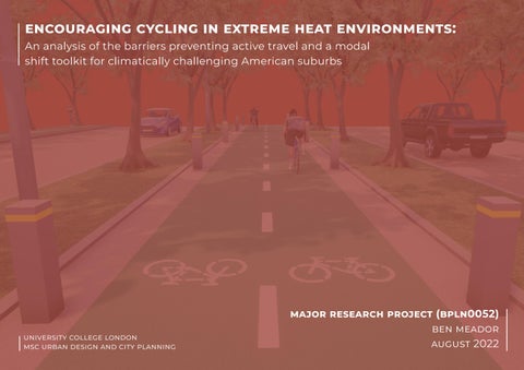
encouraging cycling in extreme heat environments: An analysis of the barriers preventing active travel and a modal shift toolkit for climatically challenging American suburbs major research project (bpln0052) ben augustmeador2022university college london msc urban design and city planning
“In many cultures – not least in North America – the bicycle is still sadly misunderstood. It remains a tolerated tag-along in the resplendent urbanism parade.”
Mikael Colville-Andersen Copenhagenize
The bicycle has played a role in urban life for over one hundred years. The positive impacts of an environment conducive to active travel are wide-ranging, while the negative externalities associated with an overreliance on cars is well understood.
abstract
After World War II, an explosion of American suburban growth occurred, drawing city dwellers from around the country to live in newly created, car-centric neighbourhoods. Cars were promoted as the pinnacle of freedom in American society – eventually making bicycles and active travel almost obsolete outside a few major cities in the
acknowledgements
3
the past several decades, the financial, social, physical, and climatic impacts of prioritising the automobile have grown increasingly evident. However, most of the current dialogue surrounding the reprioritisation of active travel and bicycling
OverUS.
I want to thank Leyla, Maria, Yashvi, Narayan, Diana, Lena, Euan, and Nick for being in credible friends and for the support we’ve been able to give each other throughout the year. Wherever we may go after this, these memories will be with us forever.
Mom and Dad - your endless love and sup port is the foundation on which I’ve been able to carry out one of my lifelong dreams. Thank you.
Lastly, I want to extend the greatest grati tude to my wife, Kieran, who - at every step of the way - was willing to help when times were stressful. Thank you for your walks with Odie, your cooking, your support, your great company. and, finally, your willing ness to always “go with the flow” - even if that means moving across an entire ocean.
– normally at the expense of cars – is heavily skewed towards dense, climaticallytemperate cities. While there might be a correlation between a region’s climate and the amount of active travel its residents engage in, there lacks a comparatively similar amount of research on active travel in climates that experience extreme heat.
Moreover, much of the existing research –although changing quickly – has centred around best practices found in cities with relatively high bicycle mode share instead of the common barriers and challenges residents face to bicycling in their built environments. This Project aims to examine and intervene in the latter, hoping to provide a base foundation for future research into the ways to mitigate these challenges and barriers for residents living in places that consistently experience extreme heat events year-to-year.
I’d like to first thank Matthias Wunderlich, who helped guide me with consistent, thorough, and adequate feedback through the MRP process.
F31: Study sites within geographic context
F52: Site 4 Proposal
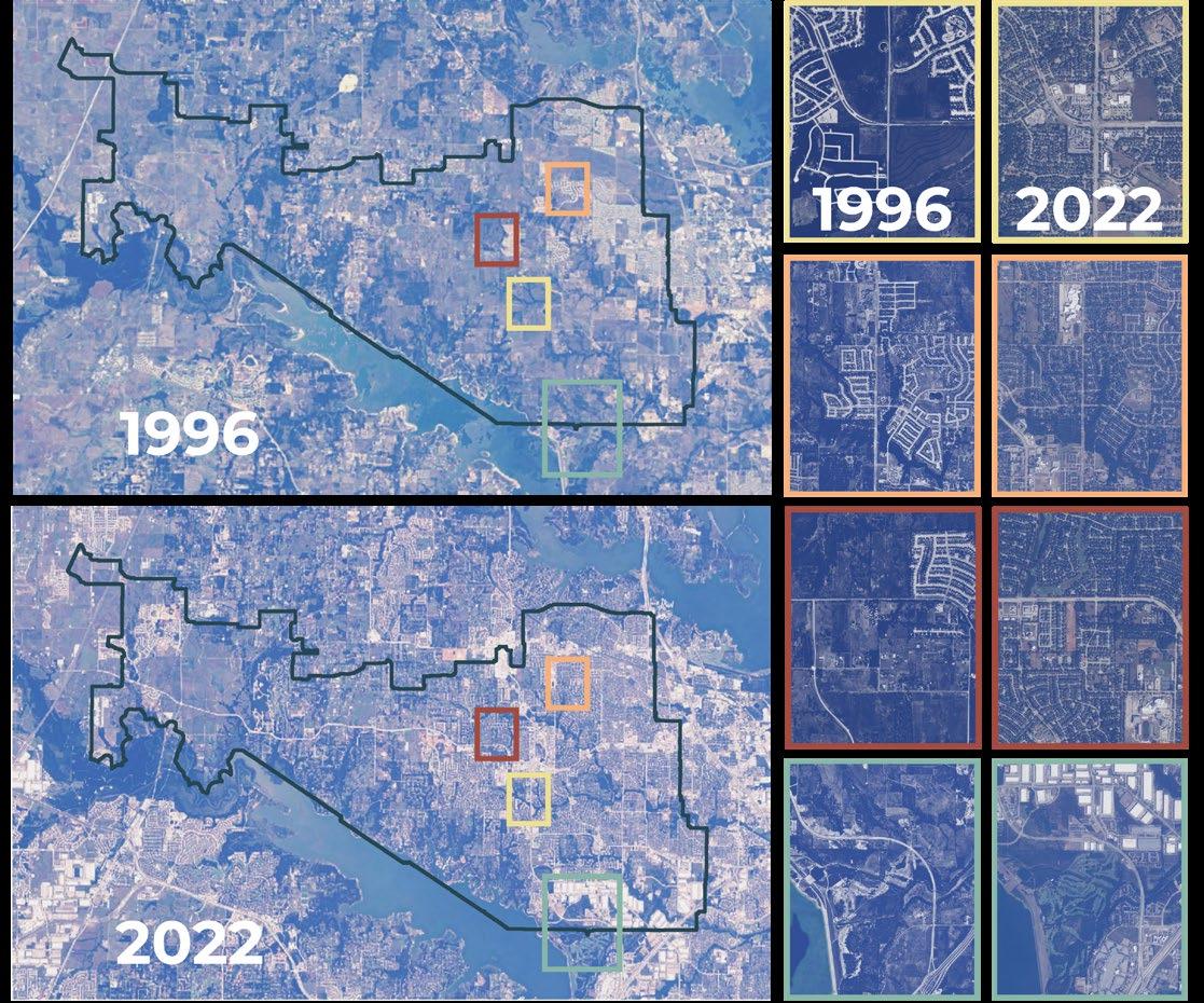
F1b: Change in Flower Mound’s built context over time
F24: Different types of bicycle users
F39: Site 4 Analysis
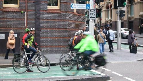
F9: Case study of Sydney, Australia
F7: Average weather of case study cities & overview
F17: Case study comparison
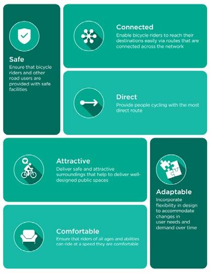
F5: Design Principles origins
F34: Site 1 existing sections
4
F35: Site 2 Analysis
F13: Case study of Carmel, Indiana
F41: Junction 1 interventions & context
F42: Junction 2 interventions & context
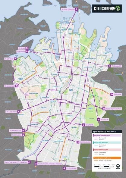
F10: Sydney Cycle Map
F48: Site 2 Proposal
F27: Safe junctions and their components
F18: Conceptual framework
F30a: American built environments through the 20th century F30b: Streets, roads, buildings, and pathways in Flower Mound
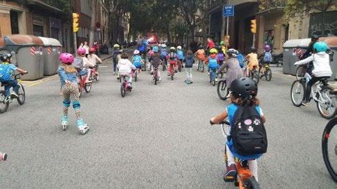
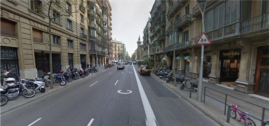
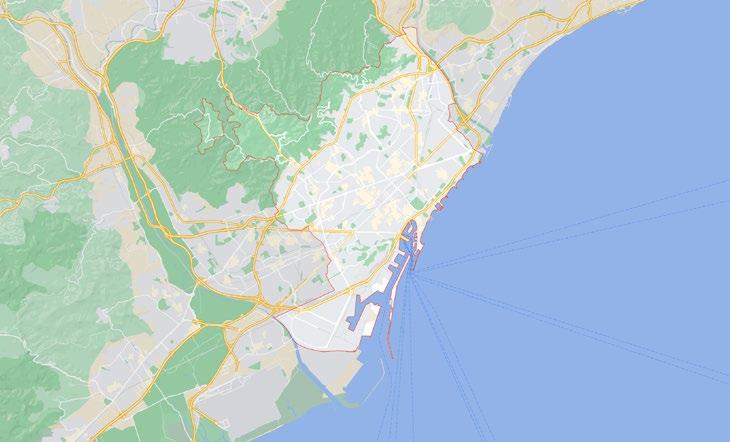
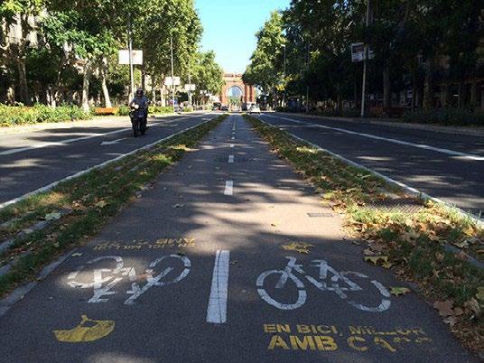
F15: Case study of Barcelona, Spain
F3: Methodology
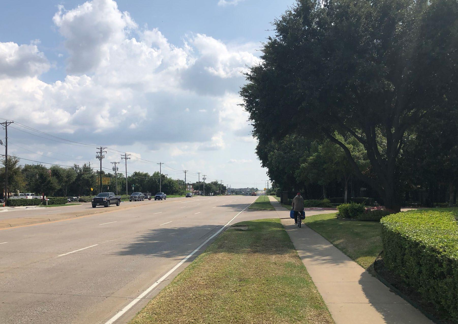
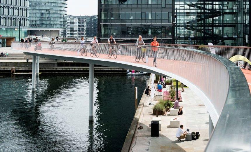
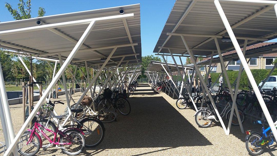
F23: Shaded pathways and facilities
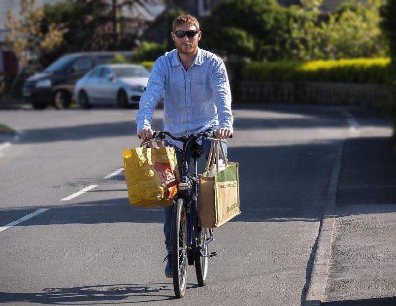
F8: study site and case studies
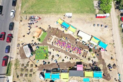
F25: Activated spaces by Better Block
F19: Strategies and their relevant Design Principles
F36: Site 2 existing sections
F40: Site 4 existing sections
F4: Strategies, Principles, and Examples from Literature Review
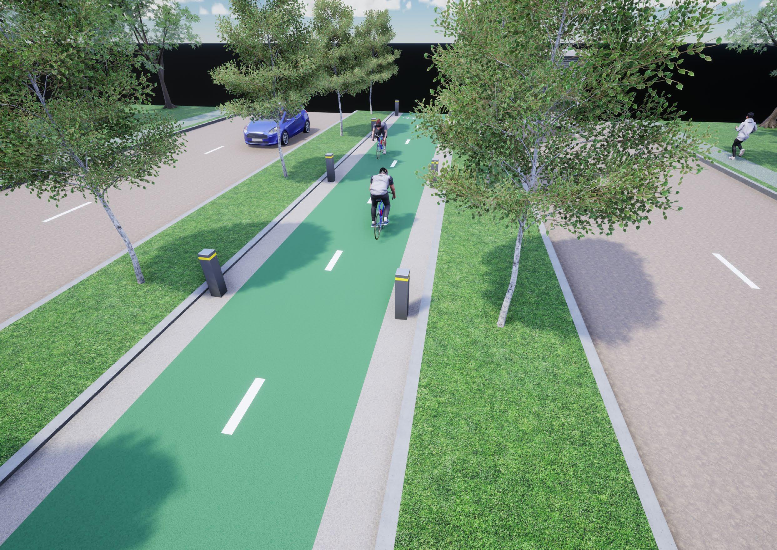
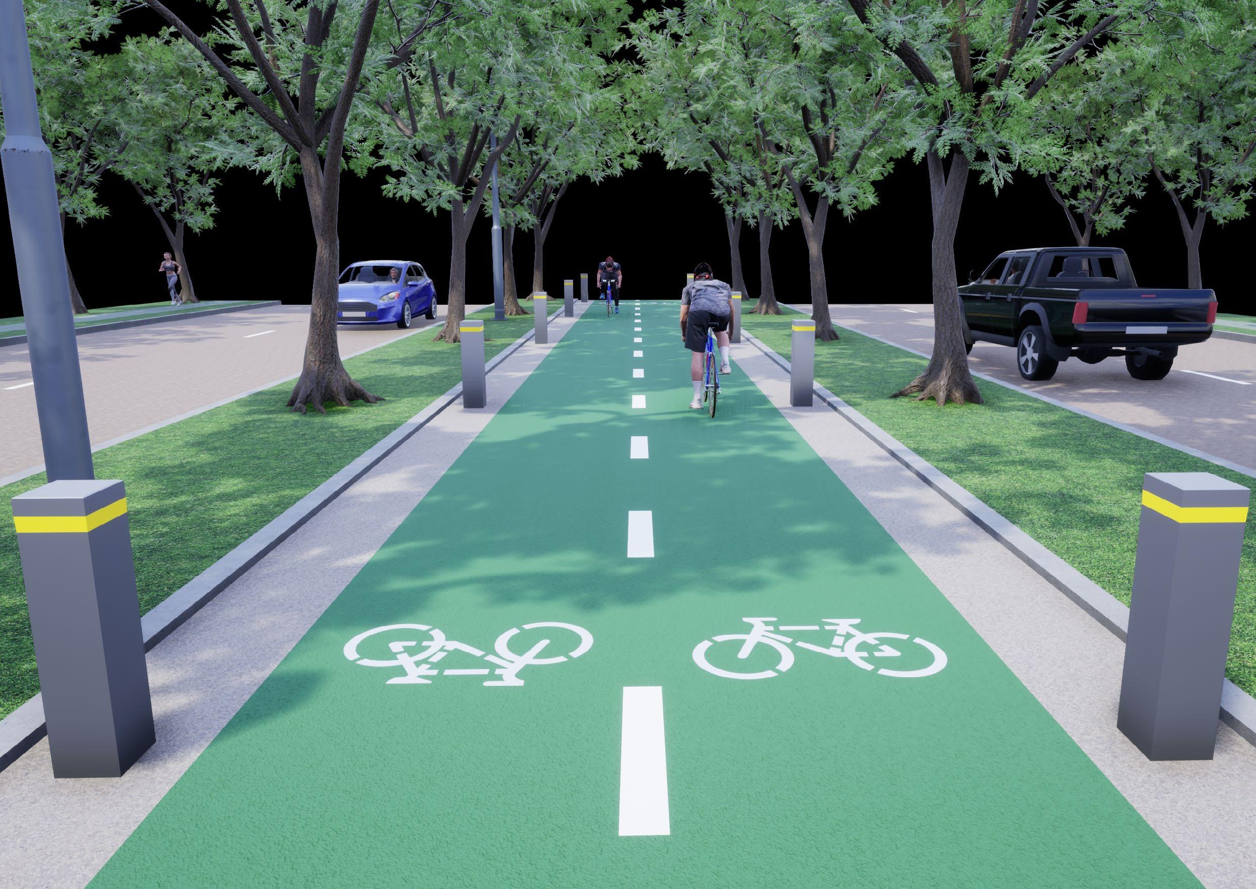
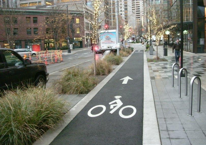
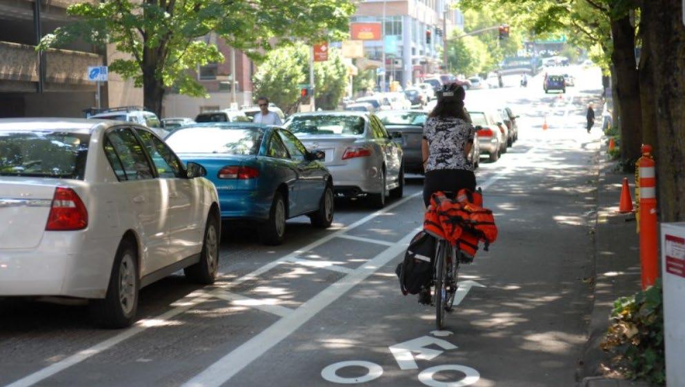
F21: Separated cycle infrastructure
F47: Site 2 proposed section interventions
F2: Problem definition chart with location context
F14: Carmel Cycle Map
F22: Variation in pathways
F29: Flower Mound’s existing trails and bikeways
F51: Site 4 proposed section interventions
F50: Site 3 Proposal
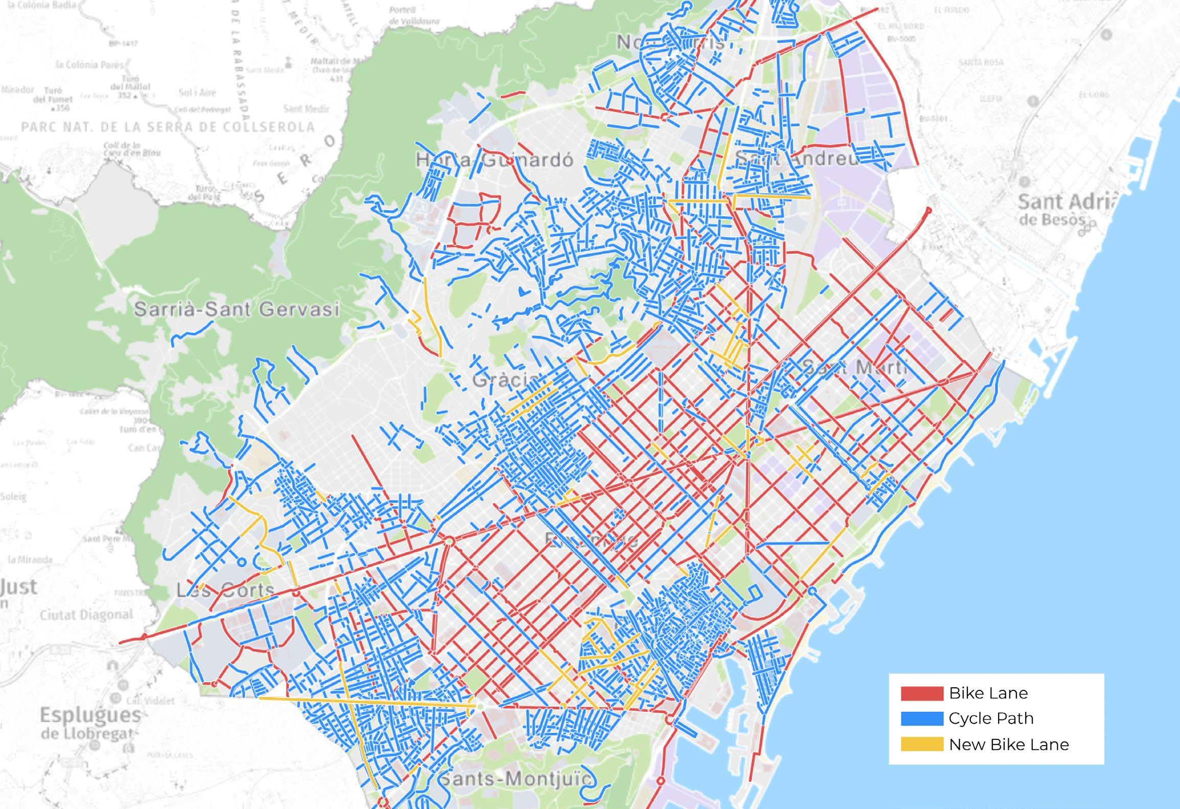
F16: Barcelona Cycle Map
F33: Site 1 Analysis
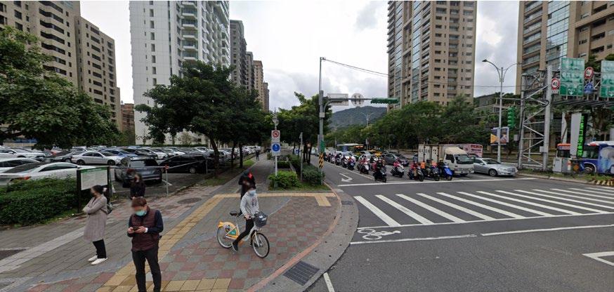
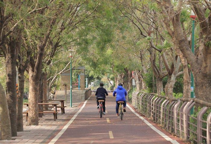
F11: Case study of Taipei, Taiwan
F26: Connected bicycle networks
F38: Site 3 existing sections
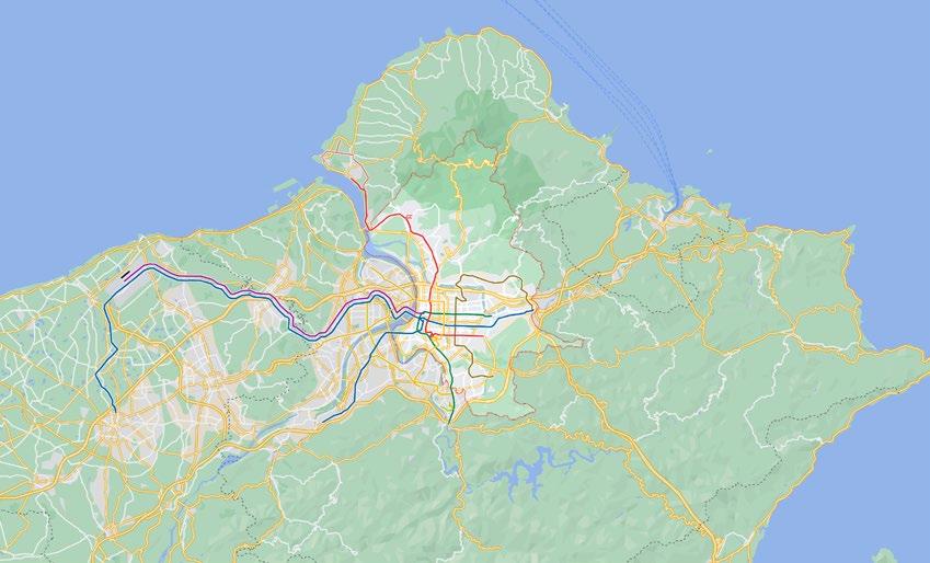
F12: Taipei Cycle Map
F37: Site 3 Analysis
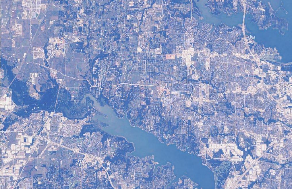
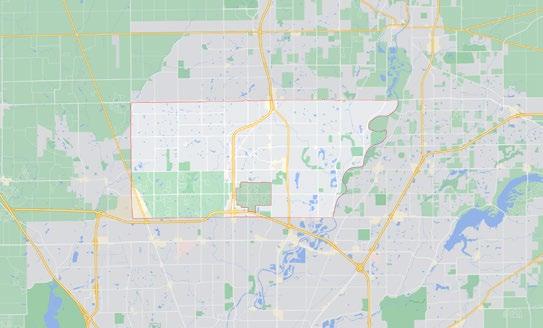
F32: Flower Mound’s vicinity to Dallas
F45: Site 1 proposed section interventions
F49: Site 3 proposed section interventions
F20: Explanation of Design Principles
F43: Activation space example 1 F44: Activation space example 2
list of figures
F46: Site 1 Proposal
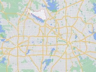
F1a: Outline of Flower Mound, Texas
F6: Strategies and examples
F28: The built form of Flower Mound & demographics
5 1introduction 2methodology 3literature review 4case studies 5framework & toolkit 6site analysis 7implementation 8conclusions & reflections 1. introduction 2. site issue context 3. key objectives 4. research questions 5. limitations 6. contribution to practice 1. methodology 2. ethical considerations 1. a car-centric society 2. barriers 1. case studies introduction 2. sydney, australia 3. taipei, taiwan 4. carmel, indiana, usa 5. barcelona, spain 6. case study comparison 1. conceptual framework 2. design toolkit 1. site context 2. site analysis 3. site 1: fm 2499 4. site 2: fm 1171 5. site 3: fm 3040 6. site 4: morriss road 1. safe junctions 2. activation of space 3. site 1: proposal 4. site 2: proposal 5. site 3: proposal 6. site 4: proposal 1. conclusions & reflections 7 - 8 483628262318121010999-141415-16-22-25-27-2930-3132-333435-37-46-5051-5354-5556-5758-5960-6163-6566-6768-6970-7172-7374-7576-77
6 43215678conclusionsframeworkliteraturemethodologyintroductionreviewcasestudies&toolkitsiteanalysisimplementation&reflections 1. introduction 2. site issue context 3. key objectives 4. research questions 5. limitations 6. contribution to practice 1. methodology 2. ethical considerations 1. a car-centric society 2. barriers 1. case studies introduction 2. sydney, australia 3. taipei, taiwan 4. carmel, indiana, usa 5. barcelona, spain 6. case study comparison 1. conceptual framework 2. design toolkit 1. site context 2. site analysis 3. site 1: fm 2499 4. site 2: fm 1171 5. site 3: fm 3040 6. site 4: morriss road 1. safe junctions 2. activation of space 3. site 1: proposal 4. site 2: proposal 5. site 3: proposal 6. site 4: proposal 1. conclusions & reflections
1.1 | introduction
Research on the reasons why people across North America choose to transport themselves by car rather than by bicycle points to several common barriers to active travel. A study by Manaugh et al. (2016) on residents near McGill University in Montreal, Canada reveals that concerns about safety, effort, and comfort are frequently cited as the largest barriers to overcome for people who bicycle or are interested in bicycling, with others like availability of bicycle parking, cost, and distance also cited. Research by an array of authors, such as Pucher & Buehler (2006), Buehler & Dill (2016), Boufous et al. (2021), Butterworth & Pojani (2018), Higgins & Ahern (2021), and Pearson et al. (2022) also suggest that barriers related to culture and infrastructure significantly impact the decision to walk, bike, or use a car in the United States. However, answering why people don’t cycle more in places around the US involves an almost-infinitely complex set of issues and interconnected factors. (An et al., 2019) Furthermore, little research exists that examines bicycling as a mode of active travel in environments that reliably and consistently experience extreme heat events for prolonged periods of time. (Pearson et al., 2022)
DallasFortDFWWorthInt’lFlowerAirportMound10km

This Major Research Project investigates the possibilities for the prompting of modal shift from driving to bicycling in American suburbs that reliably experience extreme heat. Examination strategies will look existing dialogue and literature on barriers to increased cycling and how chosen case studies have mitigated the most cited barriers to active travel by bicycle in the context of extreme heat environments. By using examples from cities around the world with similar environments and best practices cited in literature, the project looks to bring together lessons successes and failures in cities that have increased their bicycle mode share and apply them in a climate-sensitive design application for a study site located in a Dallas, Texas suburb.
F1a: Outline of Flower Mound, Texas

7
Extreme heat is defined by the US Federal Emergency Management Agency (FEMA) as “a long period (2 to 3 days) of high heat and humidity with temperatures above 90 degrees [32C].” (Ready.gov, 2022) Places like Dallas, Atlanta, and Phoenix can experience months-long periods of extreme heat. While there are myriad different influences on American suburban residents’ choice to drive over walking or cycling, extreme heat or cold can operate as a deterrent for active travel. (An et al., 2019; Butterworth & Pojani, 2018) However, the relationship between extreme heat, mode choice, and barriers to bicycling or walking is not as extensively studied, whereas research into the correlations between weather patterns, climate, and active travel trends towards more temperate climates or those that experience extreme weather on the opposite end of the spectrum. (Masoumi, 2019) Many of the most cited exemplars of bicycle-friendly environments are geographically and climatically related, often having flat landscapes and mild weather patterns.
2. In more temperate cities, cycling modal share has jumped. How have other cities achieved targeted and purposeful increases in cycling participation?
1.4 | research questions
1. How can you augment American suburbia to prompt residents living in hot climates to decrease their reliance on cars and increase bicycle usage?
1. Examine existing dialogue on active travel and bicycle infrastructure and incorporate research and contextual analysis of relatively bicycle-friendly cities who reliably and consistently experience extreme heat events yearto-year.
3. Curate and implement a design toolkit for application on study area (Flower Mound, TX). Then, review and reflect on findings of implementation.
1.3 | key objectives
by Groot (2016) and Rosen et al. (2007):
2. Gather best practices within literature and aspects of case study cities that have successfully helped increase bicycle mode share and explore the various principles that influence peoples’ decision to bicycle/not bicycle.
4. How can you change perceptions of cycling for users who do not already cycle?
F1b: Change in Flower Mound’s built context over time
3. What are the common barriers to cycling in cities that experience extreme heat?
8
1.2 | site-issue context
Flower Mound is a suburb located northwest of Dallas, Texas. The young suburban “town” exploded with development after Dallas-Fort Worth International Airport, located a 20-minute drive to the south and the second busiest airport by foot traffic in the US, was completed in 1974 – becoming one of the fastest-growing communities in the United States. While most of the eastern part of the city is built up, the western portion remains largely open and rural, with neighbourhoods spread throughout as farmhouses and ranches dot the landscape. Much like the surrounding region, Flower Mound is relatively flat, with only gentle rolling hills. As is common in suburban areas around the United States, the city is much a result of post-World War II movement patterns and prioritisation of cars as the means of travel. Its land use is also heavily separated, with relatively little of its built-up area zoned as mixed-
Althoughuse. it boasts an extensive 65.5mile disconnected network of trails – of which include 8’ mixed-use pathways and a small portion of unprotected onstreet bicycle lanes – the network suffers from a shortage of the factors needed for a successful bicycle network defined
(1) coherence; (2) comprehensiveness; (3) directness; (4) attractiveness; (5) safety; and (6) comfortability. Recently, however, the city has made progress in addressing these challenges, as well as the challenges formulated through the following literature review in a new Trails and Bikeways Masterplan. (Flower Mound Trails and Bikeways Master Plan, 2022)
The myriad causal factors in influencing the relationship between people and their mode choices are well studied and increasingly understood. However, there is little research that tests the possible correlation between extreme heat and active travel, while more exists on colder weather and in milder climate contexts.
With limited direct, built environmentrelated primary research on the causes and effects of active travel in extreme heat, the Project is limited by the question of whether extreme heat is a non-negligible influence on people’s decisions to use a car over a bike rather than other factors like shading, routing, infrastructure availability, and others.
overarching
how can you augment american suburbia to prompt residents living in hot climates to decrease their reliance on cars and increase bicycle usage? thesitequestioncontext
The Project is also limited by the global spread of the case study cities. The global spread and appeal of bicycling has created cities around the world to learn from. Unfortunately, the author of this Project was unable to visit most cities and had to rely solely on academic literature and secondary resources.
american suburbia: active travel by bicycle in extreme heat barriers to cycling in the usa
1.5 | limitations
1.6 | contribution to practice

Furthermore, the Project looks at ways to cater design to meet the needs of a built environment inherently hostile to travel modes other than cars, with additional regards to the needs of different age groups. This catered design is theoretically applied to the study site and tested through a research-led design approach
effortinfrastructureculture safety comfort Dallas El Paso Austin Houston


This Major Research Project aims to pull together literature from not only the fields associated with the built environment, but also health, physiology, psychology, and finance, among others, to attempt to better understand the relationships and possible correlations between extreme heat and active travel patterns.
9
F2: Problem definition chart with location context

10 43215678conclusionsframeworkliteraturemethodologyintroductionreviewcasestudies&toolkitsiteanalysisimplementation&reflections 1. introduction 2. site issue context 3. key objectives 4. research questions 5. limitations 6. contribution to practice 1. methodology 2. ethical considerations 1. a car-centric society 2. barriers 1. case studies introduction 2. sydney, australia 3. taipei, taiwan 4. carmel, indiana, usa 5. barcelona, spain 6. case study comparison 1. conceptual framework 2. design toolkit 1. site context 2. site analysis 3. site 1: fm 2499 4. site 2: fm 1171 5. site 3: fm 3040 6. site 4: morriss road 1. safe junctions 2. activation of space 3. site 1: proposal 4. site 2: proposal 5. site 3: proposal 6. site 4: proposal 1. conclusions & reflections
This Project’s methodology for research, design, and implementation first began with an initial literature review following a research question on the overarching barriers to bicycling in urban/suburban environments, specificities as to how humans operate in extreme heat, and climate-sensitive catered design solutions. (February – April 2021). Examination of case studies and construction of a design framework followed (April – June 2021), which helped inspire the creation of a design proposal for the study site (June – August 2021. Lastly, reflections and conclusions regarding the theoretical and practical implementation of the design proposal and design framework were collected (August 2021).
2.1 | methodology
The initial literature review analysed various pieces of academic literature, government data, contemporary professional dialogue, and subject books relevant to active travel and urban design around the world. An emphasis on climatesensitive research and examinations in literature guided the Project’s pursuit of questioning whether places that reliably experience extreme heat events yearto-year could be conducive to higher
chosen to apply the conceptual design framework. These thoroughfares serve a vast majority of north-south and east-west traffic in the city but are underutilised in serving non-car modes of travel. The framework does not aim to provide solutions for long-distance, intraregional bicycle travel in the Dallas-Fort Worth region. It instead looks at the potential to replace cars with bicycles for local trips to supermarkets, schools, workplaces, and others – scaled to fit similar built environment contexts in American suburbs. Connecting the existing bicycle network with safe bicycle infrastructure on these roadways can potentially induce local commuter and leisure trips.
bicycle mode share. Commonalities between cities and suburban areas around the world that have successfully increased the number of residents that bicycle (commuting, leisure, or both) were connected. Disparities between research on colder-climate areas and warmer-climates were found, where the former seems to draw more attention as more temperate cities may be more conducive to active travel by bicycle. This Project aims to contribute to the existing vacancies in active travel dialogue for extreme weather climates.
11
The four case studies include (1) Sydney, Australia; (2) Taipei, Taiwan; (3) Carmel, Indiana; and (4) Barcelona, Spain. These locations were chosen based on a mix of their relative similarities in climate to the study site’s (Flower Mound, Texas) politics, cultural similarities, exemplary solutions to the overarching barriers to bicycling in the US, and/or their built environment. These similarities enable the transposition of successful interventions, implementations, and initiatives found in these cities to the study site in conjunction with the constructed design framework. Four roads in Flower Mound, Texas were
The theoretical implementation of the design proposal and conceptual framework provide the basis for reflections of the entire process and outcomes at the final stages of the Major Research Project. Following conclusionary reflections, the potential for future research, literature, and debate on bicycles as a mode of comprehensive active travel in extreme heat environments is made clear.
literature
As part of this Major Research Project, secondary research on existing literature and review of contemporary dialogue on urban design theory and practicum within professional discourse was undertaken. No primary data, personal data (including identity information), or special category data pertaining to the General Data Protection Regulation was collected as part of the project.
12
site selection choice and analysis of case studies construction of conceptual framework & initial toolkit site (author’sanalysishometown)agglomeration of findings application of framework & toolkit on selected site conclusions, reflections, & further implementation F3: Methodology
initial research question
/
2.2 | ethical considerations
contextualbackgroundresearch review on problem issue-at-hand
13 43215678conclusionsframeworkliteraturemethodologyintroductionreviewcasestudies&toolkitsiteanalysisimplementation&reflections 1. introduction 2. site issue context 3. key objectives 4. research questions 5. limitations 6. contribution to practice 1. methodology 2. ethical considerations 1. a car-centric society 2. barriers 1. case studies introduction 2. sydney, australia 3. taipei, taiwan 4. carmel, indiana, usa 5. barcelona, spain 6. case study comparison 1. conceptual framework 2. design toolkit 1. site context 2. site analysis 3. site 1: fm 2499 4. site 2: fm 1171 5. site 3: fm 3040 6. site 4: morriss road 1. safe junctions 2. activation of space 3. site 1: proposal 4. site 2: proposal 5. site 3: proposal 6. site 4: proposal 1. conclusions & reflections
It is no secret that the United States struggles with an obesity and health
14
Having such large distances between work and home impacts both the individual and society. (Prud’homme & Lee, 1999) Relying on car infrastructure is financially detrimental to many American cities, and the cost to both the individual and society by driving is six times greater than cycling. (European Commission, 2015; Goessling, Nicolosi, & Litman, 2015; Cortright, 2015) Cars also cost more to operate and maintain than cycles and relying on cars as the primary means of transport in the United States does nothing to address the socioeconomic and financial shortcomings of such
over the age of 50 cite “physical and mental health as the main reasons for riding”, and “were more likely to report mental health reasons compared to older groups”. In addition to providing necessary physical exercise to combat
3.1 | a car-centric society: finance · health · climate
some of the musculoskeletal effects of general aging and sedentary lifestyles, recreational cycle infrastructure and ebikes can provide additional mobility options for older residents who may lose their ability to drive a car, helping them maintain independence by providing mobility freedom. By encouraging more cycle activity, older residents can also maintain social activity through cycle clubs and social riding activities. (Boufous et al., Overall,2021)cycling is a healthy and sustainable form of transportation compared to driving either ICE or electric cars. The activity also promotes an array of physical, mental, and social benefits and actively contributes to the reduction of emissions in society.
It is well known that the transportation sector plays a large role in the direct anthropogenic causes of climate change. (Anable, Maibach, & Steg, 2009) Additionally, pollution created by NOx, CO2, tyres, and PM2.5/10 is well known to be the cause of significant negative health and wellbeing externalities. Active travel methods like cycling and walking are virtually emissions-free. Electric cars while a step-up from Internal Combustion Engine (ICE) automobiles, are still cars and require expensive maintenance, operation, and infrastructure. Particles (PM2.5/10) produced by vehicles tyres, CO2, and NOx contribute to countless health issues. Moreover, electric cars create upstream emissions and require exploitative metals like Cobalt for their batteries. (Pope, 2007)
The Project’s literature review revolves around the study and research into five (5) common, interrelated barriers found and often cited within the literature: (1) culture; (2) infrastructure; (3) safety; (4) comfort; and (5) effort. Additionally, it expands briefly on the effect of extreme heat on different age groups, as well as the financial and health/climate externalities associated with car-centric environments and – contrarily – active travel environments.
problem. In part, it may be exacerbated by Americans’ reliance on cars as their primary method of transportation. (Jacobson, King, & Yuan, 2011) The difficulty of active travel in excessive heat is exacerbated by the obesity epidemic in the United States and elsewhere. The ability of the human body to cool down and counteract some of the negative effects of excessive heat is directly correlated with a person’s fitness levels and daily activity. Creating a more positive culture for bicycling and other active travel methods in the United States can not only help Americans become more physically fit – but also help them better adapt to warming climates and excessive heat. Effectively inducing more usage of bicycles to commute by creating safe and comfortable travel environments can positively benefit the health of society in American suburban environments. (Whitehurst et al., 2021; Pearson et al., Bicyclists2022)
reliance that has occurred in the past 70+ years. (Bureau of Transportation Statistics, 2020; Marohn, 2019) Lastly, motorists, on average, fail to accurately estimate the total costs incurred for the maintenance and upkeep of their cars. (Farr et al., 2021)
15 s t r a t e g i e s effort infrastructureculture safety comfort c h a l l e n g e s designing environmentsextremebicyclingforinheat under-utilisedActivatesspacesInitiates a positive feedbackpolicyloop Appeals to people who don’t already desire to morebicycle TaxPublicReductionIncentivesinCarParkingSpacesSpaceActivationexamplesexamplesinfrastructurededicate incentivisefacilitatenudge CommunityVisualiseBenefitsEventsBike/eBikeHireIncrementalstepshelpadaptation Creates snowballaeffect morelong-termachievelikelyMoretochangeIncreasesSafetyEnableslocaltripsbybicycle InteractionsDangerousReducesToxic& WayfindingSignallingRouting&PhysicalSeparation examplesexamples barrierAlleviatesplacesProvidesforpeopletoshowerrelatedtosecureparkingavailability localEncouragestripsbybicycle AdequateShadingShowers,Toilets,&LockersSecureBicycleParkingCatered Design + Designing for Humans in the Heat Giving people a reason to bikeShowing people the alternative Giving people the means to bicycle Fulfilling the needs of bicycling Accommodating for Commutes + Local + Leisure Trips F4: Strategies, Principles, and Examples from Literature Review
16
Bicycle infrastructure that caters to different age groups and travel patterns (commuting vs. leisure) and publicises the act bicycling can encourage higher bicycle mode share. Men, women, children, the elderly, and minorities – among other groups – all experience travel in different ways. (Heesch et al., 2012; den Hoed & Jarvis, 2021) For example, young bicyclists are often overlooked in contemporary multi-modal infrastructure design. Even if infrastructure like bike pathways, cycle tracks, and trailways exist, they are often intersected by dangerous junctions –where most accidents occur. Ensuring that these junctions are especially safe for young cyclists can benefit older demographics as Thewell. coherence, comprehensiveness, directness, attractiveness, safety, and comfortability of a bicycle network all influence how people perceive their ability to ride a bicycle – either for commuting or leisure – in their own environments. (Groot, 2016; Rosen et. al, 2007) Additionally, the use of colours and special, visible markings to signify bicycle infrastructure increase and relate to the attractiveness, route legibility, and safety across junctions of bicycle networks. (Autelitano & Giuliani,
Cycle paths and tracks strongly correlate with increased use of bicycles as a form of active travel. (Manaugh et. al., 2016; Buehler & Dill, 2016; Pearson et al., 2022; Fields et al., 2022) Existing research points to evidence that latent demand exists for bicycling as a form of transportation in many American cities. (Fields et al., 2022) However, the existence of bicycle paths and tracks are not the only determinants for how much a city or neighbourhood cycles, nor do they particularly correlate with higher levels of cycling in auto-dominated environments or with people who are unfamiliar with cycling. (Dill & Carr, 2003; Dill & Voros, 2007)
Young demographics will experience climate change in more ways than their older counterparts. While also taking an increased interest in the issue than generations before them, they also have the most to lose from inaction while holding the least amount of power to enact widespread change. The physical, social, and mental benefits to children who lead active lifestyles is well documented. During such formative years, the establishment of healthy habits and other positive externalities point to the importance of ensuring that built environments cater to young demographics. (Sun et al., 2021; Lubans et al., 2011)
TheCulturevisibility and physical nature of bicycling as a form of active travel can work against positive advancements in bicycling infrastructure in car-centric places. For children and young adults, using a bicycle to get to or from their place of education in extreme heat environments and without adequate end-of-trip facilities can create concern regarding appearance, hygiene, and class status. (Higgins & Ahern, 2021)
Aspects like network connectivity (Titze et al., 2008; Saelens et al., 2003), separation of cycle infrastructure from auto infrastructure (Higgins & Ahern, 2021; Dill & Voros, 2007), variation and frequency of cycle-specific markings, bike boxes, and coloured lanes, distance between home and destination, geography, and separation of land uses (Butterworth & Pojani, 2018), all influence bicycle mode share. Therefore, dedicated infrastructure that allows residents to travel between home and destination safely, comfortably, and efficiently – at any age – is critical to increasing active travel mode share in extreme heat environments.
Social pressures to maintain certain ideals relating to appearance also appear to be a deterrent to cycling for women. Excessive heat can exacerbate this concern, creating barriers for both young and older demographics. (Higgins & Ahern, 2021; Masoumi, 2019) Additionally, negative social attitudes (including assumptions about class status) towards bicyclists can function as another barrier to cycling. (Pearson et al., 2022) Creating an inclusive environment that deconstructs these barriers is essential to widening the appeal of cycling instead of driving in car-centric environments.
3.2 | barriers:
why don’t people cycle more?
Infrastructure
Even if a child wants to bicycle, many parents and guardians who are unfamiliar with biking or who grew up in car-centric environments hostile to active travel methods may not allow their children to travel independently. Girls and young women are often afforded less freedom by their parents or guardians than boys and young men. (Higgins & Ahern, 2021) In addition to empowering young children to maintain an important form of independence, better infrastructure that accounts for both safety and heat can create a cultural shift – prompting parental figures to consider allowing their child to use a bicycle to get around their own town or city.
of excessive heat – local officials and built environment professionals can ensure that all residents have safe, comfortable cycle ASafetyinfrastructure.vastarrayof
the bicycles down and eventually stops them once inside the Dismount Zone. (Texas A&M University, 2018) Prioritising the reduction of toxic interactions between cars, bicyclists, micromobility users, and pedestrians can increase safety and reduce concerns associated with the barrier.
While interactions between motorists and bicyclists or pedestrians are the most dangerous, the interactions between bicyclists and pedestrians are also important in understanding the barriers to cycling and other active travel methods. At Texas A&M University, “Dismount Zones” have been implemented where large numbers of bicyclists and pedestrians cross paths. Users of the Veo Ride bikeshare program are required to dismount their bicycles and walk, reinforced by the university’s technology system that slows
2021; Pearson et al., 2022) This evidence points to a need for a diverse approach to implementing bicycle infrastructure networks in American suburbs, as simply placing down bicycle lanes does not directly correlate with increased ridership.
The existing literature precisely points to the importance of a broad and comprehensive approach to the implementation of successful bicycle infrastructure. By designing adequately for these environments – particularly in the context
Safety is cited more often as a concern by women bicyclists than males. (Bopp et al., 2012; Heesch et al., 2012) According to Garrard, Crawford, & Hackman (2006), sexual harassment was reported by women at a rate of 25 times more than males. Additionally, bicycling is more public in nature than driving, making the activity more susceptible to physical, verbal, and sexual abuse from motorists. (Higgins & Ahern, 2021) While the root of this issue won’t simply be resolved by fully separating bicyclists from motorists, there is potential to decrease these toxic interactions and provide safer environments for active travellers by providing exclusive infrastructure for those using bicycles.
17
safety issues and concerns serve as barriers to existing and potential cyclists around the world. Safety is also commonly the most cited barrier to bicycling. (Higgins & Ahern, 2021; Manaugh et al., 2016) Toxic interactions with motorists and incompatible levels of traffic, high speeds, and the lack of adequate and separated infrastructure, specifically, are commonly cited as safety barriers to cycling. (Boufous et al., 2021; Pearson et al., 2022) Moreover, cyclists generally prefer separation from motorists over riding on shared roadways. (Buehler & Dill, 2016) This concern extends beyond the act of bicycling as well, with concerns over adequate, safe bicycling parking adding to perceived and actual barriers. (Vietinghoff, 2021; Pearson et al., 2022) These concerns can be mitigated with a mix of investments into high-quality infrastructure, facilities, and incentive policies – like bicycle signals, bike boxes, and bicycle-specific phases at intersections. (Buehler & Dill, 2016)
According to a survey by Boufous et al. (2021) on older cyclists in New South Wales, Australia, the majority of those surveyed indicated that safety concerns related to interactions with motorists and cars were among their top barriers to cycling. Specifically, issues like lack of separation between motorists and cyclists, motorist aggression, and traffic speeds were among the most cited safety concerns. Notably, however, when asked what factors might encourage them to cycle more, respondents cited better modal separation, better cultural attitudes towards cycling, and better cycle infrastructure. (Boufous et al., In2021)addition to the elderly, children are more prone to the effects and consequences of intense heat than adults. (Sun et al., 2021) They are also less aware of the dangers of excessive heat exposure and are more atrisk of experiencing problems like heat stroke.
Even with robust cycle infrastructure, heat can deter older demographics because of their increased susceptibility to the effects of intense heat and sunshine and increased likelihood of immobility. However, even with potential deterrents like excessive heat, rain, snow, or other extreme weather, some research indicates that older demographics who maintain active lifestyles fare better in the heat, thus benefitting the case for better active travel infrastructure in the United States and elsewhere. (Schuster et al., 2017) Ensuring that active travellers are shaded and kept comfortable throughout their journey can assist young people, adults, and the elderly in maintaining a base level of comfort in extreme heat.
• Pavements meant for leisure
socio-economicchildrenfinancialclimatehealth
• No end-of-trip facilities
• Enables more space for housing
• Frequent interactions between cars and bicycles
Butterworth & Pojani (2018)
• Infrastructure connects to age-specific interest points Safe surfacing & fall spots
design principles
• Reduce toxic interactions on-street and at junctions
• Perceived safe by parents
• Encourages climate-sensitive design
• Better air quality
Prud’homme & Lee (1999)Higgins & Ahern (2021)Manaugh et al. (2016)
• Shaded routing near schools
challenges of american car-centric extreme heat environments
• Better mobility for lower incomes & people with disabilities
• Encourages mixed-uses Enhances social activity
Buehler & Dill (2016)
shading safe junctions routing activationvariety connectivity
Boufous et al. (2021)Marohn (2019)
• Commute vs. leisure/recreation
• Bicycles are cheaper than cars
• Intuitive (incl. new learners)
• Shower facilities (not just work)
• Little shade to protect from extreme heat
designing for all ages & abilities in extreme heat environments
• Hostility towards other modes Lack of education on bicycling
• Can improve mental health
• Lack of intuitive routing
• Perceived & actual barriers to active travel caused by cars
value of a bicycle-centric landscape
• Long distances between different stops, i.e. grocery store, food, etc.
separation
elderlywomenadults
• Various speeds
• Decreased energy consumption & fossil fuel reliance
• Routing for local trips
• Higher land value
• Cheaper infrastructure costs
• Enables & encourages active living
• Not designed to human scale
18 children
• 80th-percentile road design unsafe for pedestrians & bicyclists
• Adequate lighting
• Decreased noise & air pollution
infrastructurechildrenculturesafety
• Routes stay active throughout day Safe junctions & separation
childrencomforteffort
• Enough space for families
• Prioritises / induces cars for all trips
• Roads designed for fast car speeds
Manaugh et al. (2016) Pearson et al. (2022)
F5: Design Principles origins
19
A disconnected bicycle network decreases user comfort level. Intersection design and perceived safety also play roles in residents’ decisions to cycle or walk. (Buehler & Dill, 2016) According to Bigazzi et al. (2022), bicyclists travelling at high speeds, pedestrian and bicyclist safety, and path capacity all decreased user comfort.
Hot weather can deter young bicyclists as they age to and through puberty as social pressures change and increase. Hygiene and personal appearance play increasingly prominent roles in these demographics’ lives, and excessive heat can create complicated circumstances for young bicyclists. According to Sun et. al (2021), older demographics’ sensitivity to heat stress and the impacts of intense
Perception of Safety and Comfort (PSC) is a measurement focused on the perceived, relative safety and comfort associated with bicyclists’ and pedestrians’ built environments. Extreme heat can increase physiological stress on active travellers and decrease PSC in car-centric,
4. “Facilitate” attempts to fulfill the needs of active travel in extreme heat.
The rise of eBikes and microtransit offer the potential to attract an increase in active travel for users who emphasise effort as a large barrier. Particularly within hotter climates, those that experience extreme heat, and built environments with long distances between uses, reducing the amount of effort required to use a bicycle to get from point A to point B, in conjunction with other efforts, can help mitigate the perceived obstacles associated with exertion in these climates. (Pucher & Buehler, 2006; Noland, 2021 Comfort
WeatherEffort patterns influence the inclination of residents to use active travel for commuter or leisure purposes. (An et al., 2019; Pearson et al., 2022) To what extent is lesser known, but the definitively exists and is important in understanding how to construct environments conducive to healthier, cheaper, socially beneficial, financially stable, and more climate-friendly modes of travel. Existing literature focuses extensively on climates that are normally much cooler than the temperatures, humidity, and conditions found in places closer to the equator. (Pucher & Buehler, 2006)
heat on physical activity relates more to their physical fitness and general health levels than their age. Ensuring that the built environment safely and comfortably invites active travel throughout the stages of a person’s life can benefit their ability to combat heat stress later in life. By providing adequate mid-route and endof-trip facilities and a functional network of shaded infrastructure, active travel –including eBikes and microtransit – can mitigate the perceived and actual barriers associated with comfort regarding active travel. (Pearson et al., 2022)
1. “Nudge” aims to visualise the alternative to car-centric environments.
3. “Dedicate Infrastructure” provides residents of all ages the physical means to actually bicycle for commutes, leisure, or local trips.
hot environments. (Bigazzi et al., 2022)
(2) effort; (3) comfort; (4) safety; (5) cost; and (6) presence of bicycle parking. There is also evidence that points to a correlation between the amount of mixed-uses (living, shopping, fitness, education, office, etc.) and the likelihood that residents walk or cycle between these destinations. (Saelens et. al., 2003; Pucher & Buehler, 2006)
Perceived distances play a role in peoples’ perceptions of effort as a barrier to bicycling. (Manaugh et al., 2016) However, there is strong evidence that significant latent demand exists for trips less than 2.5km – especially within the context of sprawling built environments like those found in many American cities and suburbs. (Krizek et al., 2009; Butterworth & Pojani, 2018) Additionally, in Manaugh et al.’s study (2016), distance was found to be the “second least important barrier” – after cost – out of the six most-commonly cited barriers by residents surveyed in Montreal: (1) distance;
2. “Incentivise” brings together policy and design to give people valid and attractive reasons to bicycle.
Additionally, factors like the adjacency of fast-moving traffic, large and unprotected junctions, and the quality of roads increased stress and decreased comfort. Emphasising stress reduction for bicyclists and pedestrians in the context of PSC measurements – among other factors – can assist in understanding how to increase the share of residents who use these modes as active travel rather than cars.
Bringing together these five different barriers, four strategies are created that look to address the biggest physical, mental, and social issues people face when bicycling or thinking about bicycling:
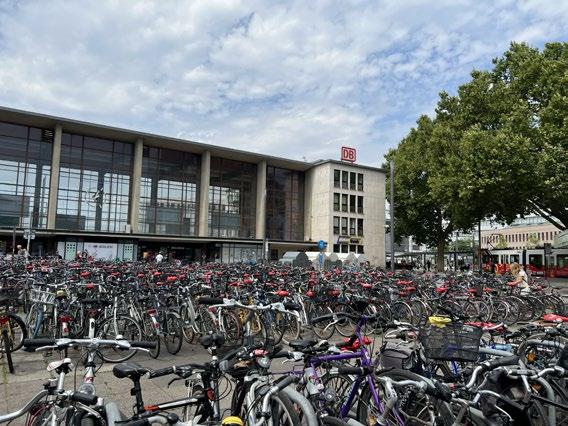
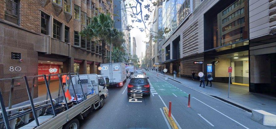
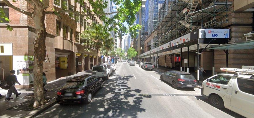
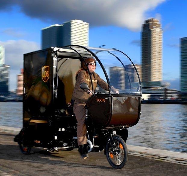
End-of-trip facilities Sydney, Australia
20 strategies
Santander Cycle Hire London
Giving people a reason to bike

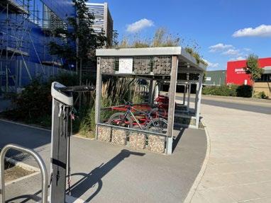
Shaded cycle parking and repair station Ikea, Greenwich, London
Bicycle Signaling
F6: Strategies and examples
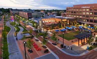
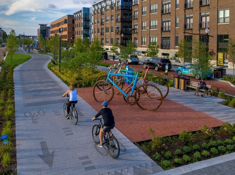
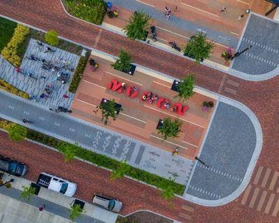
MononProgrammingBoulevard, USA
Fulfilling the needs of bicycling Cycle parking
incentivise
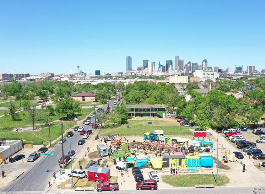
Block’s empty lot activation MLK Park, Dallas, Texas facilitate
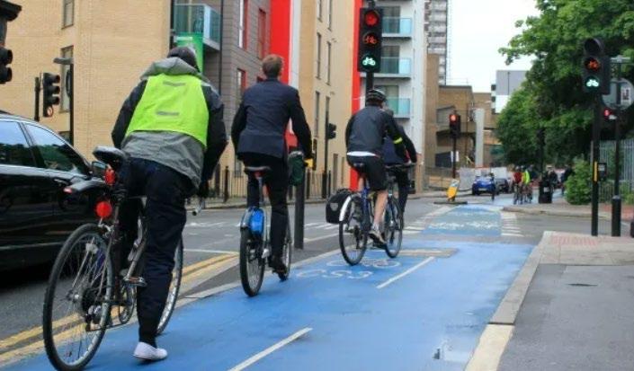
Cycle Superhighway 3 London, UK
“Safe Routes to Schools”Better
21 43215678conclusionsframeworkliteraturemethodologyintroductionreviewcasestudies&toolkitsiteanalysisimplementation&reflections 1. introduction 2. site issue context 3. key objectives 4. research questions 5. limitations 6. contribution to practice 1. methodology 2. ethical considerations 1. a car-centric society 2. barriers 1. case studies introduction 2. sydney, australia 3. taipei, taiwan 4. carmel, indiana, usa 5. barcelona, spain 6. case study comparison 1. conceptual framework 2. design toolkit 1. site context 2. site analysis 3. site 1: fm 2499 4. site 2: fm 1171 5. site 3: fm 3040 6. site 4: morriss road 1. safe junctions 2. activation of space 3. site 1: proposal 4. site 2: proposal 5. site 3: proposal 6. site 4: proposal 1. conclusions & reflections
Lastly,suburb.
Overall,usage.
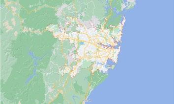
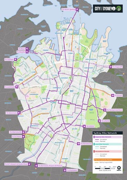
Known as “the city that hates bikes”, Sydney con tinues to push forward with new bicycle tracks, paths, and pop-up lanes - with plenty of room still yet to
Average weather of case study cities & overview
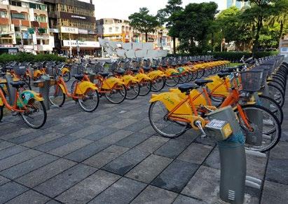
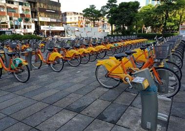
Taipei’sgrow.YouBike
Four case studies from around the world were chosen according to various similarities to the study site’s context.
TAIWAN CARMEL
Briefly, Sydney’s culture towards bicycling is reminiscent of the Dallas region’s –where cars are so engrained into society that people who don’t use one are at-risk of breaking strong cultural mores.
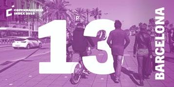
Barcelona’s climate proves that with the right environment, hotter climates can successfully attract and induce bicycle
While not perfect, the Catalonian capital is well-known for its expansive bicycle network and educational outreach programmes that cater to all types of users.
BARCELONA
4.1 | case studies introduction
bike share programme and inte grated, tree-covered network is an exemplar for cities around the world.
these case studies and the various aspects of their bicycle networks, culture, and built environment are brought together to assist this project’s conceptual framework and design toolkit in application on the study site.
F7:
AUSTRALIA
SYDNEY
INDIANA, USA
Taipei’s success in its climate and bike share programme provides an excellent example of how to pursue increased bicycle travel in extreme heat environments.
22 80607090-18ºC-12-7-141016212732 month (ºC/ºF)temperature average monthly temperatures (all case studies + flower mound) J F M A M J J A S O N D (ºC/ºF)temperature sydney*taipeicarmel barcelonaflowermound *J *J *A *S *O *N *D *J *F *M *A *Month alignment changed to match Northern Hemisphere
TAIPEI
This Indianapolis suburb proves that car-centric built environments in the US can, in fact, re-ori ent themselves around pedestrian-friendly and bicycle-friendly landscapes that are financially, socially, and politically attractive.
SPAIN
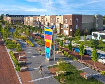
Carmel, Indiana’s Monon Boulevard has brought life to the midtown of an Industrial Belt
23 barcelona taipeisydney*flowercarmel mound F8: Study site and case study cities

• Protected & pop-up lanes
• Visual on-street cycle counters
Location: Sydney, Australia
mitigation challengesof sydney,
• Network of bicycle pumps and repair facilities
Average Yearly High: 81°F / 27°C

• Publishing of self-guided rides on website
Bicycle Network: ≈120km / 75mi
• Separated & shared bicycle paths
• Bike parking requirements for new developments
• According to a city survey, 60% of those who responded said they feel at least moderately safe while bicycling around Sydney. australia
24
• Commuter, local, and recreational networks
• Free community bicycle events
• Secure bicycle parking
• Bicycle hire scheme
• City-sanctioned cycling courses
Avg. # Extreme Heat Days/year: 4 Main Strength: Nudge (momentum)
• Use of tactical urbanism
J J A S O N D J F M A M 0ºF402010305060708090-18ºC-12-7-141016212732 month (ºC/ºF)temperature average monthly temperatures (sydney, australia) 20182021 4.2 | sydney, australia F9: Case study of Sydney, Australia
Considered “the city that hates bikes”, Sydney has long been a hostile place to cyclists. However, the city has come a long way in newly reformatting their built environment to cater to more bicyclists. Sydney serves as an important example of implementation in a complex environment. Although one of the comparable milder climates studied, Sydney’s comprehensive approach to increasing cycling and is noteworthy.
• Sydney has come a long way in increasing the number and types of bicycle users, with an increasingly well-connected network of an assortment of bicycle infrastructure.
culture infrastructure safety effort comfort takeaways
infrastructurededicatecontextfacilitateincentivisenudge
25 LILYFIELD CONVENTION ST MARTINJAMESPLACE WYNYARD CIRCULAR QUAY PYRMONT BAY TOWN HALL MUSEUM EDGECLIFF CENTRAL REDFERN MACDONALDTOWN CROSSKINGSROZELLE BAY JUBILEE PARK GLEBE WENTWORTH PARK THE STAR ERSKINEVILLE STANMORE PETERSHAM MARKETPADDY’S MARKETFISH CENTREEXHIBITION JOHN SQUARESTREET NEWTOWN ROAD SUSSEX DR ROAD STREETHICKSON VICTORIASTREET MACQUARIESTREETMACQUARIE PALMER BOURKE ST BOURKEST STREET SIR ST ST ST ELIZABETHCASTLEREAGH STREET STREET PHILLIPST HOSPITALROAD COLLEGECOLLEGE JOHN YOUNG STSTREETHIGHSTREET ARGYLE KENT TRINITYLOWERFORTSTREETAVE STGEORGESTREETGLOUCESTERCUMBERLANDSTREETST YOUNGST PHILLIPST O’CONNELLSTBLIGHSTBENT CAHILL GROSVENOR ST DALLEY UNDERWOODSTST STREET HUNTER ERSKINE AGAR ST GLOBESTREETLIMESTREET SHELLEYSTREET MARGARETSTJAMISONSTWYNYARDSTST BOND ST STREET KENT STREETSTREET SUSSEXSTREET BARLOW ST ROAD BULWARAJONES STREET COWPER STREETCROWN ST KELLY ST QUEEN STCAMPBELL STDERWENTDERWENTST LA GLEBEBROUGHTONSTREETST DARLING STREET BROUGHTONSTCOLBOURNEAVERAILWAYSTDARGHANLADARGHANST YORK JOHNSTREETROSS STREETBELLST MAXWELL RD COOK STFORSYTH ST MANSFIELDST ALLENST LODGEST ALLENLA TOXTETH ST BOYCE ST ARCADIA RD VICTORIA EGLINGTONRDRD FERRY ROAD ROSS STREET STYORK SCOTSMANRD LA BELLEVUE LANE CAMPBELL LA PITTPITT CR COWPER BRIDGE GEORGEST HICKSONDALGETYRD STREETST STREETKING CROWNST ST MARKETDARLNG WHARF BROADWAY RILEYSTREET RILEYST RILEYST LIBERTY STREET ROAD ENMORE ROAD EDGEWJULI MARIAN STREETMETROPOLITANRD SIMMONS KING PEXPRESSWAYHILLIPST ART GALLERY ROAD KCIHSONROAD WESTERN DISTRIBUTOR HARRINGTON ROSLYN ST UND RWOOD STREET RA LWAY AVENUE REIBYST STATIONSTCOLLEGEREIBY MARGARETSTTST ANE NEWMAN STNEWMAN LA MUNN ST HAROLD STANGEL ST ST ST ROCHFORDST BUCKLAND STREETBUCKLAND LA PHILLIPSST WYNDHAMST RENR CK ALEXANDERSTREET SUTTOR ST ST GERARDST GARDENSTMAR AN ST NEDRAGST COOPERCOPE STREET JOHN POWER AVE WEST K L C STR E POW L HUNTERST S KE T E S RED ERN ST BORON A T TELOPEA S THURLOW ST CHAR ES S CHE S A SBORON A A MADD SON S CHAR S MOORE DANK STREE PO T R T CRYSTALST ABROOMESTVENUE COOPER ST AMES ST PITTST ST ST STREETST WELLINGTON TR ET PARKSTCLARAST MONKSLA NEWTONSTHENDERSON PROSPECTST ALCOLMSTREETMORRISSEYRD STREET RA LWAY LA EXP ORER S STDRUITT STREETDISTRIBUTORCLARENCE BRADFIELD HIGHWAY WESTERN YORK GEORGE STREETSTREET CENTENNIAL ROADPIRRAMA ROADHEAD SOUTH NEW AVE STREET HARRIS STREET P ER STREET GEORGE STREET GEORGE STREET CASTLEREAGH PITTST STREET WATTLE STREET PYRMONT DR DARLING STREET HARRIS CROADITY BROADWAYABERCROMBIEST AVENUE DRIVER AVE MCLACHLAN VICTORIA SOUTH ST ROAD STREET STREET OXFORD CROWNSTREET CROWNSTREETBOURKESTREET AVEHUGHESCHALLISST EXPRESSWAY CAHILL STREETPARK PITTST ELIZABETHSTREET ELIZABETHSTREET ROAD BRIDGE PYRMONT DRIVE THOMAS STREET GRAFTON DSANIELSST MYRTLE STR E BALFOURST MEAGHER T DANGAR LAC IVYST LANDER STREET QUEEN ST CHIPPENSTREET CARLTONST KENSINGTONSTDNALKCUB TEERTS C NTRA ARK AVE O CON OR S R E ROSE ST SHEPARD MAZE CR BUTLINAVECODRINGTONSTGOLDENGROVESTFORBESSTQUEEN STFITZROYSTGEORGINAST CHURCH STREET CHURCH RAPER ST FOWLER ST DUNBLANE ST SC ENCE PROADHYCS RD FISHERRD EASTERNAVE UNIVERSTYPL LUCAS ST BRIGGS ST LAMBERT ST PURK S ST LYONSRDCHESTER ST LAYTONSTBIGNELLLA FOWLER LA ETON ST ST ST ST DERBYSTROSSST DENISONST DENISON STREET HOPETOUNST HORDERNSTOCONNELL AUSTRALIA AUSTRALIAPROBERT STREETCHELMSFORD CARDIGANCARDIGAN LANEST STREET CARDIGAN LANE CARDIGAN STMARYSSTREETROSEVEAR STREET ROW EY ST TRADE ST BALTICSTALBERMARLE ST LENNOX STREET STREET HARROW CAVENDISH CAVEND SH STREET MERCHANT ST HOLT ST STREET GARSTENGLANDAVE JOHNST WILLIAMST BRIGHTSTMARSHALLST BEMYSSROWNSAVE STREET TUPPERSTALMAAVE FOTHERINGHAMST MIDDLDETONST ST BE MORE STLONDONST PHILLIPSTCAVENDSH LANE CAMBRDGE STREET STREET GLADSTONE ROADSTAFFORD LANE STAFFORD MACAU AY AL ANY PERCIVALLA MACAU AY ROADROAD HORDERNPLACE PROSPECT ST STREET ST ELIZAST MARYST SOUDANLA BROWN WATKINST CHARLESSTJOHNST LA BUCKNELLST DARLNGTON RD STREET MOUNTAINSTBBAYSTREETAYSTREETSMAIL ST GR EK S REET RANC S STRE T MARYANN STREET MACARTHUR ST THOMAS ST QUAY STREET DARLINGST HARRIS STREET HARRIS ST LEE SL V RPOOL S REET L VERPOOL STREET STREET CAMPBELL STREET STREET BATHUR T ROAD PIRRAMA STREET STREET OXFORD WILLIAM STREET WILLIAM STREE CRA GEND S DARLINGHURST DARLINGHURST RD MACLEAYSTREET OXFORD GREENKNOWEBARODASTWARDAVE GOU BURN ULTIMO ROAD HAY ST HARBOURSTREET HUNT ST ALBION STREET FOVEAUX STRE T CAMPBE L STREET PYRMONTBRIDGEWROADILLIAM HENRY STREET QUARRY STREET FIGSTREET WYLDE ST MOORE PARK ROAD GREENSRD OATLEYROADANZAC PARADE DOWLING MLLER STREET BOUNDARY TREET BARCOM ST OUNDARY ST BURTON STREETWENTWORTH AVENUE RILEYST ST MARYSRD STJAMES RD ALLEN ST R OAD PARRAMATTAPYRMONTBRIDGE PARRAMATTA BALMAIN ROAD ROAD ROAD GLEBEPOINT TALFORD STHEREFORD STREET HEREFORDALFRED RD CREEK STTAYLORSTNELSON TRAFALGAR STREET YOUNG STREET RO E T LE CHHARDT ST S ARTHURST DERBYSHIREST STANLEY ST YOUNGLANE SUSANSTREETNELSON STREET STREETSTREETTRAFALGARTRAFALGARVIEW PIPERLA BREILLATST PRITCHARDST PPERCIVALSTALINGST EDNASTSTARLNGST WHITEST LKA ST WEYNTON ST HUTCHINSON ST ROSE STREET ALFRED ST GLADSTONEST LANE STREET WIGRAM LANE GLEBEPOINT ROAD WIGRAM ALEXANDRA RD CHARLES ST CROSSST JUNCTIONSTREET CRESCENT M NOGUE ARUNDEL ARUND S RE MITCHELL STREET CATHER NE S REE JOHNSTON EUNEVADNALREBMUCHTRON DOUGLAS S REET KNGSTONROADKNGSTONLANESALISBURY ROAD ADDSON AL BURY ROADPERCIVALROAD BRIDGE ROAD
STREET
COLLINS STREET H LL STREET COLL NS STREETRESERVE ST YOUNG STREET WHITES CREEKLANE HWITESCREEKLAANNANDALE STREET ANNANDALE ST PIPER STREET CATHERINE STREET HAYSTREET CATHERINE STREET AINSWORTHSTREET CATHERINESTREETLONSDALESTREET JOHNSTREETCOLERIDGEST HER LL S REET T PO NTST WHARF ROAD HELENASTREET GROVESTREETCARRINGTONST JUSTINSTSTREET O NEILL STREET EVANS STREET CAMBRIDGESTWATERLOOSTPOXFORDSTARKST CALLAN ST MOODIE ST MANNINGST BELMORESTREDLIONST STREETCHE TENHAM STREET STREET FOUCART QU RK T HORNSEY ST COOKSTDENISON STREET CECILY O EPH MAIDASTREET ALBERTO ST ANNES EY STREET EMMASTEZNEKCAMSTREET S RE T ALB ON A B ON WESTBOURNEWESTBOURNE STREET LANE BUDDS LANEST CHARLES STREET CORUNNA ALBANY ROAD MARGAR T ROADMYRTLE ST CO UNNA LAN ANE SA SBURY A ROAD ANE STYLES STREE NAMLAB DAOR ROADCK T LTELA STREET SEXST AUBREYSTMOORE STREET WEST LINK ROAD STREET DAORNIAMLAB BOOTH STREET BOOTHSTREET MALLET STREET BALMAN ROAD JOHNSTON STREET BROADRIDGE ROADSTJOHNS ROAD WENTWORTHPARK ROAD CITY ROAD AVENUEMCARILLONISSENDEN ROAD ABERCROMBIE STREETSTREET WILSON CALDER VINE ST CARO NE ST URNER S RE T PH LIP ST A BERT S WE LS TR ET HUDSONST HUGOST EVELEIGHSTBOUNDARYSTRD WILSON STREETKINGSTREETBUCKLANDLAALBERT STREETBURRENSTREET RAILWAYPARADE NDER ON ROADFOUNTAIN S AW ON ST YOUNG GIBBONSST ROAD OY STREET RAG AN S RE ERSKINEVILLE ROAD SWANSON STREET COPELANDSTREETCOPELANDLAJENNINGSST CLEVELAND STREET STREET GEORGE H L P STREET CRESCENT STREET BAPTSTSTREETPITT DOUGLASST MOREHEAD STREETWALKER BEAMONTSTTSTTIP STREET STREET STREET YOUNG MARROT BAPTSTLANE BOURKELANEKEPOSSTREET ST STREETST STREET RENWICKGEORGESTREETCORNWALLSST LOCOMOT VE ST EPOCMTCHELL WAY CHALMERS ELIZABETHSTREETBUCKINGHAMSTLITBUCKNGHAMST GREATBUCKINGHAMSTCASTLEREAGHLA ELIZABETHLA R DFERN STREET DEVONSHIRE STREET MCEVOY ST LACHLAN ST STREET BOURKE STREET CLEVELAND STREET STREET CLEVELAND STREET LANG ROAD CROWN STREET BOURKE TEERTS BOTANY R STREET RN DISTRIBUTOR EASTERN DISTRIBUTOR DACEY AVENUE ANZACPARADE FLINDERS STREETSTREET STREET TRAFA G STREET STANMORE ROAD STANMORE ROAD CRYSTAL STREET VICTORIA ROAD VICTORIA ROAD WELLINGTONSTTERRY TERRYSTREET ELLIOT STREETLAWSON STREETHGH ST ROWNTREESTNORTHST ROWNTREESHORT ST STREETSTREETGPHILLIPCHURCHIPPSTHOMAS ST ST ST MACQUARIE CAMERON STCURTIS MORTCLAYTONTHAMESCSTAMPBELL ST EWENTONST JUBILEE PLWATERVIEWSTNCEN T ADOLPHUSSTG ADSTON ST EE BRADFORD ST HYAM ST STREET SMITHSTREETROSSERSTREETWORTLEY STREET DONNELLY SHTOOBSTREET STREETST TROUTON ST WELLSCAROLINE LNICHOLSONSTREET STREET W L M S JOHNSTON WESTONST ST ST ROAD TERRACECARDWELLHAMPTONST KINGST GLASSOP STREET ROAD BIRCHGROVE STREETMARGARETST STREET RY LA THORNLEY PARK AVE ROSEBY AVE T NELSON STREET REYNO DS ST MERTON STREET BRENT ST MOORESTREETBODROGNSTEATTIE STREET BEATTIE STREET ROBERTMULLENSSTREET OMNTAGUEST DARLING STREET DARL NG STREET DAR NG STREET NEWINGTON NEWINGTON ROAD HARRINGTON STROAD NORTH STREETMIDDLE ST FREDERICK T CITY WEST LINK ROAD VICTORIA ROAD GLENMORE OAD GLENMORE ROAD GLENMOREROAD ORMONDSTREET GURNER STREECAMBRDGEST ROYLSTONSTGOODHOPST HOPETOUN ST BROUGHTON S STA FORD STYOUNGST RENNY RSTEGENTSTSTEWART ST BENTSTPOATE ST POATE CLANEOOK ROAD GORDON STREET GIPPS ST SELWYNST RSST PARKHAM LA PARKHAM S A B ON AV HOPEWELLSTHOPEWEL A DILLON ST MACDONALDST WILLIAMST QUEENRD ELIZABETHSTREET JERSEY ROADGEORGEST VICTORIARD QUEEN STREE CASCADE STREET HARGRAVE STREET HARGRAVE LANE SUTHERLAND STREET PADDINGTON STREET PADDINGTON LANE WINDSOR STREET RE ERVO RMARYST MARYST BELLEVUESTWATERLOOSTREETBELMOREST NITHSDALEST COMMWEALTH ST ANNSMITHST STREETPOPLARSTREET PALMERSTREET THOMSONST FORBES HARDIESTDARLEYST SURREYST STREET FORBESST MCELHONEST BROUGHAMFARRELLDOWLINGAVEKIRKETONRD STREETST NICHOLSON ST MCDONALD LA STREET CATHEDRAL FRANCISSTANLEYLIVERPOOLSTYURONGSTREET NIMRODST FOLEY STSTST GOULBURNBRISBANESTREET COMMONWEALTHSTREET WESTERN DISTRIBUTOR BLACKWATTLELA GROSE S REETSTREET STERL NG CCT DRAYLLBAVE LAWSON ST BROWN ST NEILD DUXFORD STHEELEYSTREET WEST ST TAYLORST NAP ER ST COMBERST ACAMPBELLVE CLAPTONPL LEINSTER STREET LANE SMTCHELLTREET WHATELEYLANEBEDFORD STREET ROBERTSSTNORTHWOODST GROSE FARM LANE WESTERNAVENUE UN VERSITYRD STREET GORDON CR EDWARDSTEDWARDLA NEDISON ST GRAFTON T REYNOLDS HCSTBUANANST MANSF ELD ST GOODSIR ST MANSFELD ST RTNECSERCD PALMERST E ZABETHBAY RD ROSLYN GARDENS TEEWARATAHSTR BA SWATER ROADEDISTRIBUTORASTERN WYNDHAM LANG ROAD YORKROAD OCEANSTBOWDEN ST HOLDSWORTHSTREET REGENT ST / KIRRIBILLI DAWES POINT / TAR-RATHEROCKSMILLERSPOINT BARANGAROO WOOLLOOMOOLOO ELIZABETH BAY / GURRAJINRUSHCUTTERSBAYPOTTS POINT / DARLINGHURSTDERRAWUNNKINGSCROSSPADDINGTON WOOLLAHRA SURRY HILLS CHIPPENDALEREDFERN HAYMARKET ULTIMO PYRMONT HARBOURDARLING ANNANDALE LILYFIELD ROZELLE BALMAIN BALMAINEAST BIRCHGROVE STANMORE PETERSHAM GLEBE FORESTLODGE CAMPERDOWN MOOREPARK WATERLOO EVELEIGH UNIVERSITYOFSYDNEY COLLEGESYDNEYOFTHEARTS EDGECLIFF NEWTOWN ROAD LILYFIELD WOMERAH AVE BARCOM AVE GLENVEWST MARY PLACE COOPER S Scale 1:14,000 0 200 400 600 800 1,000 Metres Low traffic street or bike lane Separated off-road cycleway Off-road shared path Direct route with higher traffic Routes with wayfinding signage Steep hill (arrows point up hill) Stairs Lift Pump F10: Sydney Cycle Map
• Recreational paths connect to sports facilities
• Taiwan is 2nd-largest exporter of bicycles
• Quickly-expanding network
• Intuitive, easy, & wide access to YouBikes
• YouBike integration with public transport network
• 50/50 male-female split among Taipei bicyclists

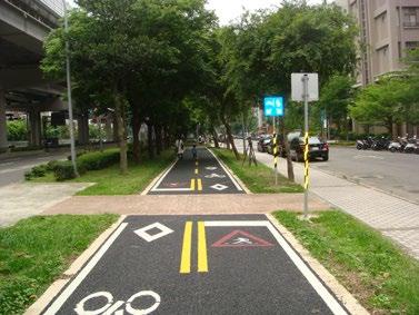
• Bicycle pathways frequently shaded by trees
Location: Taipei, Taiwan Bicycle Network: ≈600km+ / 373mi+ Average Yearly High: 86°F / 30°C Avg. # Extreme Heat Days/year: 13 Main Strength: Facilitate (YouBike Hire)
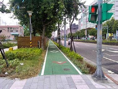
mitigation challengesof 0ºF402010305060708090-18ºC-12-7-141016212732 month (ºC/ºF)temperature average monthly temperatures (taipei, taiwan) F M A M J J A S O N D taipei, taiwan20092022 J4.3 | taipei, taiwan F11: Case study of Taipei, Taiwan
• The YouBike programme is well-referenced by other Asian cities and serves as an important example of how a comprehensive bike share scheme can help create a foundation for bicycling in cities.
• Extensive recreational routes
26 !"#$%"&"$'()(($*++,-. 2"3#.3$43&5infrastructurededicatecontextfacilitateincentivisenudge
•city.Shared paths (bike + pedestrian)
culture infrastructure safety effort comfort takeaways
• YouBike is free for first 30 minutes

• Culture-led push for better bicycle conditions
• Bicycle hire scheme
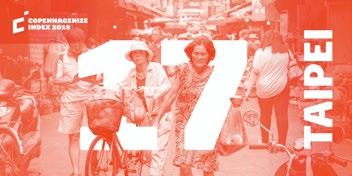
Ranked #17 / 20 in the 2019 Copenhagenize Index, Taipei is one of the hottest cities that consistently finds itself in the lists and rankings of the best cycling cities in the world. While it has plenty of room to grow in the bicycle-commuter infrastructure region, it boasts a vast network of recreational routes that connect citizens across the
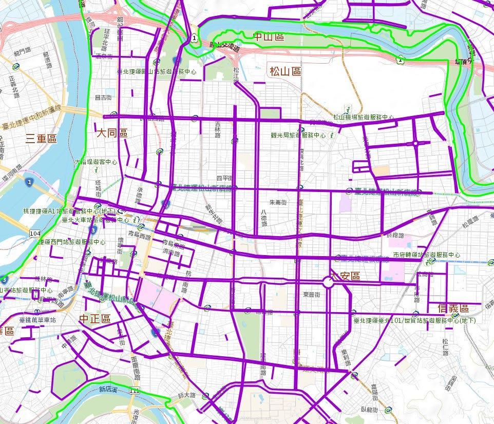
27 F12: Taipei Cycle Map
Location: Carmel, Indiana Bicycle Network: ≈483km+ / 300mi+ Average Yearly High: 84°F / 29°C Avg. # Extreme Heat Days/year: 7 Main Strength: Incentives, Nudge

• Award-winning design that caters to all modes
• Showers and restrooms at trailheads
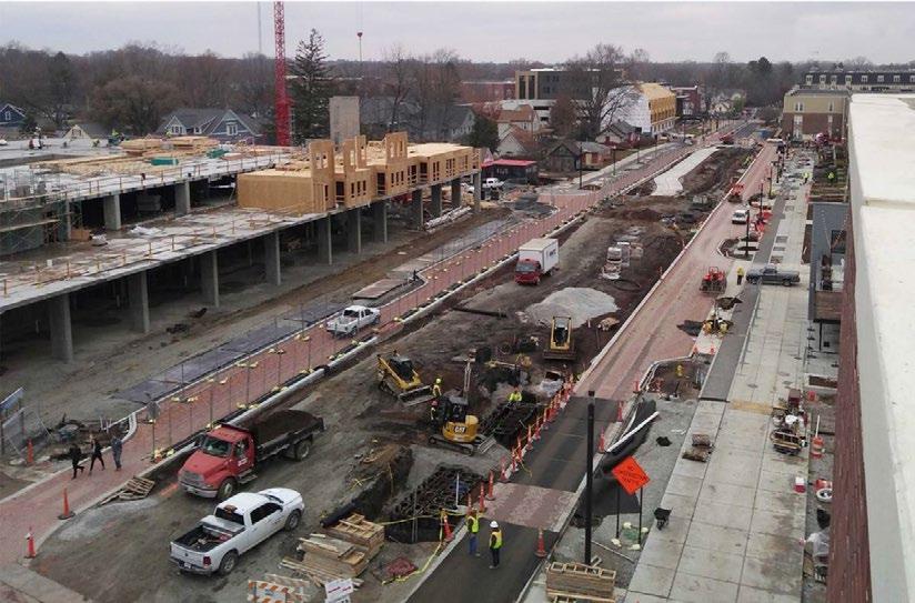
A relatively non-descript location compared to major global cities, Carmel, Indiana’s revitalisation of an old rail corridor includes an award-winning boulevard that has attracted hundreds of millions of dollars in investment while successfully helping incentivise and nudge its 90,000+ residents to bicycle more. PeopleForBikes’s City Ratings rank Carmel 37th overall out of 1105 cities in the US.
• Integration with trails and greenways
• Shops, housing, and amenities surround bike path
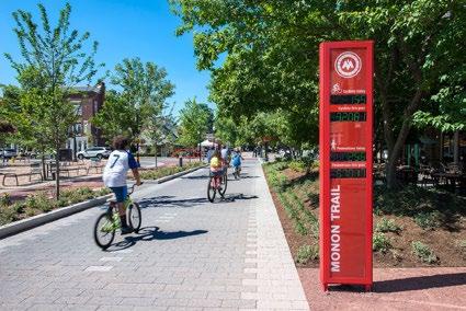
• Visibility of bike path directly down centre
• There are plenty of similarities between Flower Mound and Carmel, including population size and composition, to median incomes and geographic landscape. However, Carmel shows that American suburbia benefits greatly from investment in places like Monon Boulevard, and similar projects could find success in places like Flower Mound as well.
• Seamless and comfortable integration with daily life
culture infrastructure safety effort comfort takeaways
• Benches, play areas, bike parking, water features
• Visual bicycle count signs
mitigation challengesof
indiana20182022 0ºF4020103050607080902710-7-14162132(ºC/ºF)temperature average monthly temperatures (carmel, indiana) month J F M A M J J A S O N D4.4 | carmel, indiana, usa F13: Case study of Carmel, Indiana
• Bike Share programme
28 !"#$%"&"$'()(($*++,-. ($/0 1"20.-infrastructurededicatecontextfacilitateincentivisenudge
• N-S-E-W regional path connections
carmel,
29 F14: Carmel Cycle Map


• Bicycle Pay-to-Park programme + reg. parking
30 !"#$%"&"$'()(($*+,&-$./012-$3"450+"67$.0016/ ($89 :"24/60+"infrastructurededicatecontextfacilitateincentivisenudge
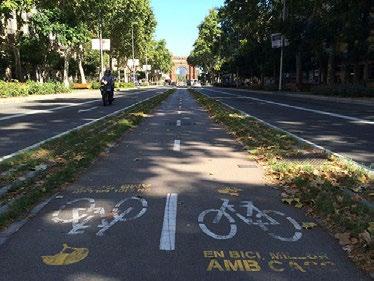
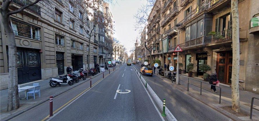
• Narrow urban canyons create adequate shade
• “On your bike” (BICIA’T) programme
Location: Barcelona, Spain
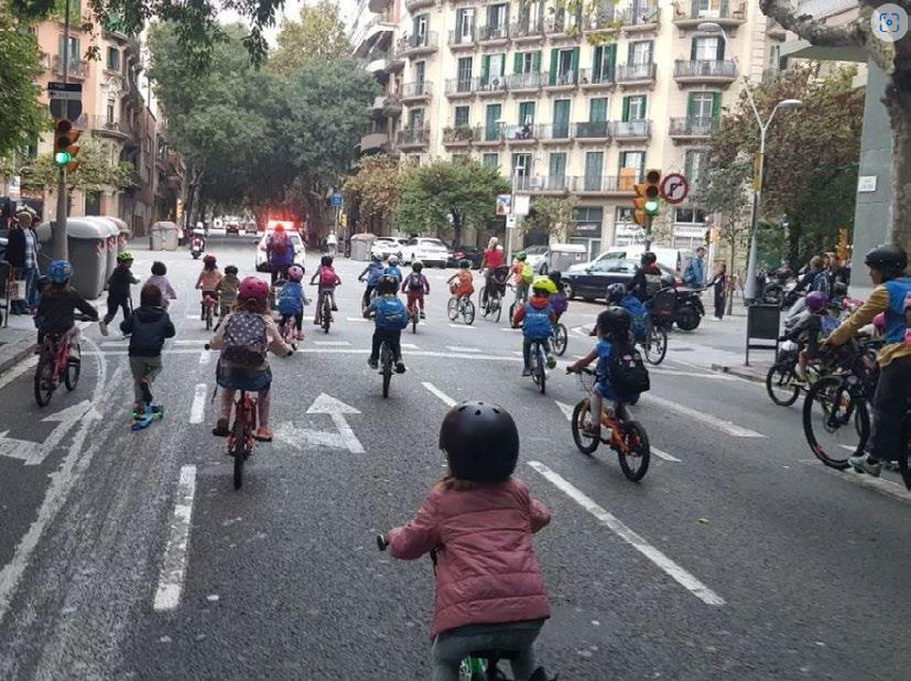
• Promoting safe routes to school for children

•priorities.Vastnetwork
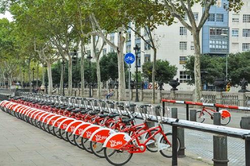
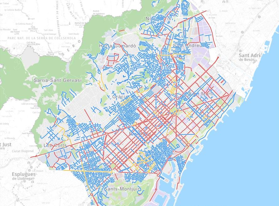
It’s no secret that the Catalonian capital is already well-known as a great place to bicycle. It ranks 15th out of 20 in the Copenhagenize Index, with plenty of room for improvement. However, Barcelona has been innovative and fast-acting in their approach towards bicycling as a better mode of transportation. Their creation of Superblocks, closure of streets to cars, vast network of cycle paths and lanes make it a great example of bicycle-centric
• Bike share integrated with transport system
• Mainstreamed education on the benefits of cycling for in-school programmes
• City-sanctioned training, rides, courses, and events
• “Bicing” bike share programme

mitigation challengesof
J F M A M J J A S O N D 0ºF4020103050607080902710-7-14162132(ºC/ºF)temperature average monthly temperatures (barcelona, spain) month barcelona, spain20142022 4.5 | barcelona, spain F15: Case study of Barcelona, Spain
culture infrastructure safety effort comfort takeaways
of pathways and protected lanes
• City-backed “Bicycle Strategy for Barcelona”
• Superblocks (Supermanzanas)
• Barcelona’s emphasis on bicycling as a cleaner, more efficient form of getting from place to place represents the type of fervour cities and governments should have about increasing bicycle mode share in everyday life. While Flower Mound is not Barcelona, it can learn quite a bit from the way the capital prioritises the way its citizens move around.
Bicycle Network: ≈300km+ / 186mi+
Average Yearly High: 86°F / 30°C
Avg. # Extreme Heat Days/year: 5-7
• Bike boxes (ZAB)
Main Strength: Dedicate Infrastructure
31 F16: Barcelona Cycle Map
Carmel undoubtedly suffers from some of the same issues that other suburban American cities encounter, but it has taken tremendous steps to draw investment in bicycle infrastructure and prove that multi-modal infrastructure is an attractive financial model.
barcelona, spain
Carmel and its surrounding areas maintain high connectivity, with recreational pathways along district boundaries also serving as commuter routes, intermingling with new developments along Monon Boulevard and elsewhere.
While Monon Boulevard is an ideal example, the rest of Carmel’s trail system and typical separation of land use and distance between home, work, and leisure work against the city’s increased emphasis on bicycles.
Aside from Monon Boulevard and shower/toilet facilities at trailheads, commuting in Carmel and throughout the region - especially in hotter weather - can deter people from ditching their cars to commute by bicycle.
Government guidance on the inclusion of end-of-trip facilities has helped increase the amount of showers, toilets, and lockers available to bicyclists who need them for their commute or recreational trip. case study comparison
4.6 |
While its recreational paths are noteworthy, inner city bicycle paths rely heavily on shared spaces with pedestrians. This can create toxic interactions and be counterintuitive to increasing the amount of people who commute by bicycle.
There’s no lack of solid bicycle infrastructure that caters to all users in the city. However, its famous centred bicycle tracks in the middle of some thoroughfares draws some concern for safety, accessibility, and comfort.
Many of Taipei’s inner city routes are either shared with pedestrians or cars, often changing between one or the other. The mix of scooters, cars, and bicycles on the roadways can create dangerous interactions before, at, and after junctions.
32 culture infrastructure safety effort comfort
The variation in commuter, recreational, and leisure routes allow for different users to bicycle around Sydney for different reasons. The city’s network allows for either direct or leisurely routes, but often don’t contain adequate shading.
Sydney’s infrastructure strengths lie in its variety. With an array of bike lanes, paths, commuter routes, and recreational pathways there is no lack of choice. Where it falls short, however, is its overall connectivity.
carmel, indiana, usa
The bicycle network is mostly separated from cars, but may share space with the occasional pedestrian or jogger in the more rural routes. Online materials and safety courses help teach residents safety basics.
The Barcelona government has been a monumental force in the reformation of its city blocks as places for people instead of cars. However, its been more difficult to fully convince a larger portion of its population to get around by bicycle.
The layout, urban canyons, and design of many of Barcelona’s streets are conducive to safer speeds than wide intoresidentseducationGovernment-backedthoroughfares.measuresallowofallagestogrowtheirbicyclessafely.
The Bici hire scheme’s integration with Barcelona’s transit system, extent and variation of the city’s bicycle network, and land use allow for residents to get where they need by bicycle without undergoing an extensive workout.
“The Bicycle Kingdom” gets its namesake from its behemoth bicycle export industry. But until recently, Taipei’s cityscape catered almost solely to cars. The YouBike hire programme, however, has been monumental to the curation of a cycle culture.
F17: Case study comparison
The city’s efforts to fight several battles on different fronts - including against the New South Wales government and powerful voice of motorists - have been semi-fruitful in influencing its bicycle culture. But there’s still plenty of room to grow.
Many of the inner city routes are shaded by tree canopies and building shadows, helping alleviate some of the discomfort of bicycling in the heat.
taipei, taiwan
The NSW capital is still very much a car city. Yet, its bicycle infrastructure, facilities, educational outreach, and access to online cycling materials help create a culture of safety on its netwoks.
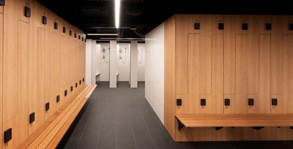
Government guidance on the inclusion of end-of-trip facilities has helped increase the amount of showers, toilets, and lockers available to bicyclists who need them for their commute or recreational trip.
The YouBike programme’s seamless integration with the public transport system is an example any city with a share programme should strive for.
sydney, australia
33 43215678conclusionsframeworkliteraturemethodologyintroductionreviewcasestudies&toolkitsiteanalysisimplementation&reflections 1. introduction 2. site issue context 3. key objectives 4. research questions 5. limitations 6. contribution to practice 1. methodology 2. ethical considerations 1. a car-centric society 2. barriers 1. case studies introduction 2. sydney, australia 3. taipei, taiwan 4. carmel, indiana, usa 5. barcelona, spain 6. case study comparison 1. conceptual framework 2. design toolkit 1. site context 2. site analysis 3. site 1: fm 2499 4. site 2: fm 1171 5. site 3: fm 3040 6. site 4: morriss road 1. safe junctions 2. activation of space 3. site 1: proposal 4. site 2: proposal 5. site 3: proposal 6. site 4: proposal 1. conclusions & reflections
4. Safe Junctions
This Project’s conceptual framework and subsequent design toolkit aim to address the challenges and barriers of bicycling in extreme heat environments.
34
5.1 | conceptual framework
The five identified challenges are used contextually to examine and extract relevant information from the study sites.
2. Variety
6. Activation
These are then used to propose design interventions on the study sites, where the framework and toolkit are theoretically tested.
5. Routing
1. Separation
3. Shading
7. Connectivity
Emerging from the framework are seven key design principles aimed at physically addressing the challenges, barriers, and vacancies of extreme heat environments in American suburbs:
5.2 | design toolkit
With a comprehensive investigation, extrapolation, and utilisation process, seven key design principles naturally emerge. These design principles – which are extensively inspired by the literature review and case study analysis – look to physically address these challenges and barriers to Thebicycling.entire
framework serves as an expandable and scalable set of strategies and principles that can be applied to built environments elsewhere.
35 Identify the specific needs and barriers to bicycling in the physical and political environment Gather applicable and climate-sensitive aspects to induce increased bicycle mode share21 culture infrastructure safety effort comfort Investigate challenges 4 nudge incentivisefacilitatededicate infrastructure Utilise comprehensive strategies Analyse&Contexualise componentsmissing existing routes & types land use & urban form modeexistingshare 5 6 3 Transpose design principles to site8Identify applicable design principles7 Extrapolate solutions separation shading safe junctions routing activationvariety connectivity F18: Conceptual framework
4. All route types (commuter, leisure, local) should aim to utilise existing greenery, tree canopies, and narrow urban canyons for shading
3. Provide safe, adequate, and visible parking/storage facilities along routes and at destinations
4. Include adequate shading (trees, quick-build canopies & structures) and water features along routes that help mitigate extreme heat and hot weather shading strategies
separationshading safe junctionsvariety
adjacencyconnectivityactivationroutingseparationvariety
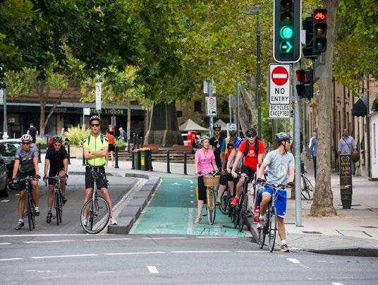
1. Separate infrastructure to give existing and new bicyclists better safety conditions and intuitive routing
2. Dedicate bike-specific investment that gives residents commuter and leisure routes, allowing commutes across the city and local tasks by bicycle
3. Target “first movers” - or those most likely to pick up bicycling initially - which may encourage other residents to think about changing their mode choice
1. Incrementally “nudge” residents to move from cars to bicycles
2. Aim first to increase local trips, as many Flower Mound residents’ commutes to work are long and difficult to immediately replace
3. Introduce educational programmes not only for children, but all ages - however, educating children at an early age can help change and create a bicycle-aware culture
36
design principlesobjective(s)
F19: Chart of Strategies and their relevant Design Principles
infrastructureincentivisenudgededicatefacilitate
3. Commuter routes should follow direct paths
2. Incentivise local businesses to include end-of-trip facilities for commuters
2. Promote financial incentives with policy, community events, tax deductions, etc.
1. Build dedicated public shower and toilet facilities along local, leisure, and commuter routes
1. Give people reasons to ditch their cars for bicycles - by, for example, decreasing available parking and replacing vacant space with bicycle and pedestrian-only programming
4. Increase demand for better bicycling conditions
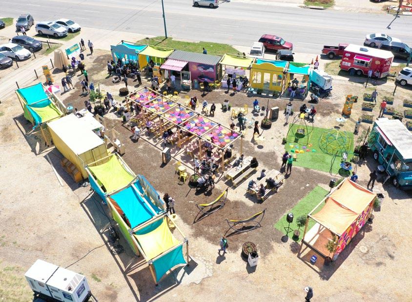
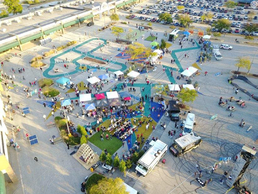
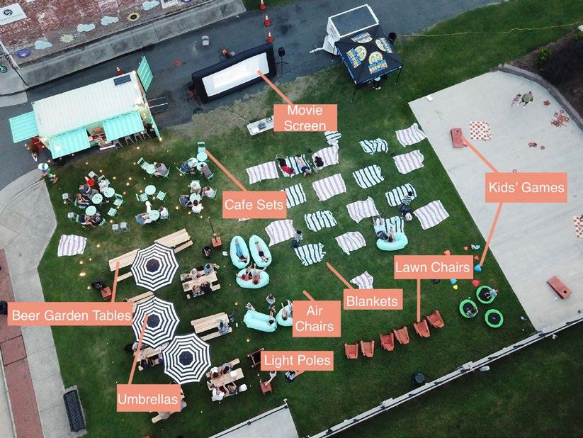
Replacing underutilised space (i.e. parking lots, malls, etc.) with activated places (Better Block, pop-ups) that cater specificly to bicyclists and pedestrians
Considering existing sources of shade and building upon these resources to mitigate extreme heat and hot weather - includes covered rest areas, water features, play spaces, and locals’ spaces
Ensuring that the bicycle network is connected and all route types are integrated
37
Utilising existing thoroughfares to create intuitive commuter routes, while providing leisure and local routes that use some of the same space and consider different speeds, ages, and trip goals
Separation of bicycle infrastructure with protected lanes, paths, and tracks and all of the facets that create adequate separation
separationshadingvariety
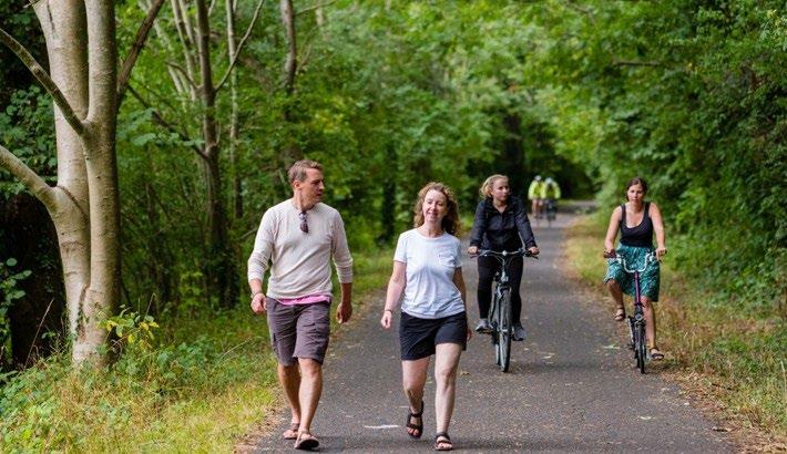
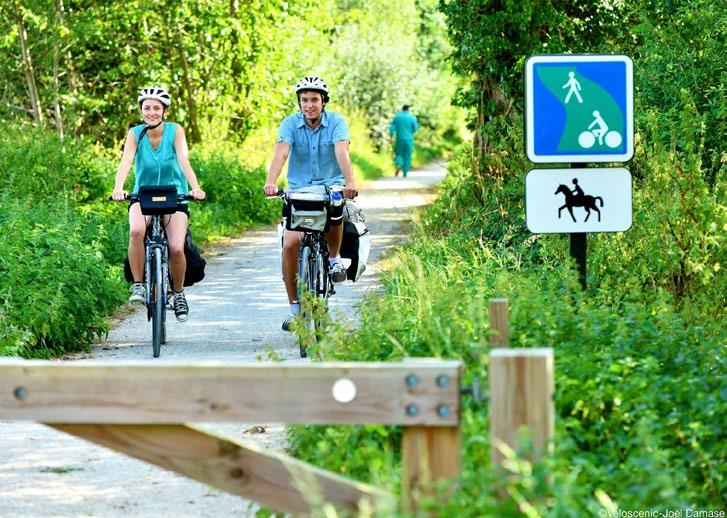
Providing a variety of facilities and route types that cater to different needs of various age groups and abilities
connectivityactivationrouting
Protecting bicyclists and pedestrians by integrating innovative and best-practice crossing facilities - which must also include changes on existing policies and engineering dialogues
5.3 | design principles F20: Explanation of Design Principles
safe junctions
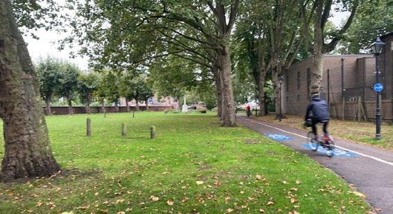
38 F21: Separated cycle infrastructure
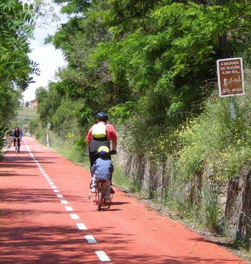
F22: Variation in pathways
39
40
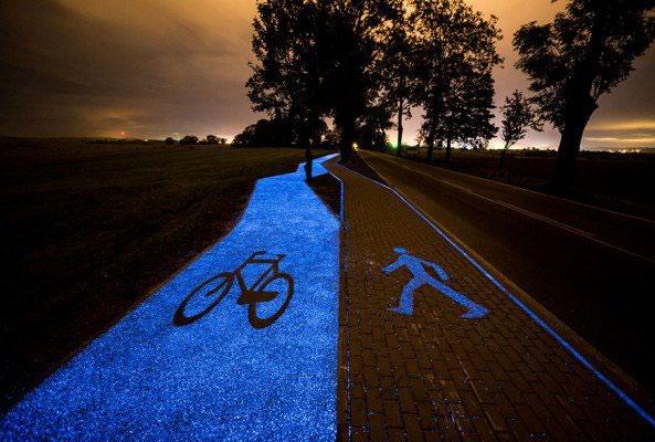
F23: Shaded pathways and facilities

F24: Different types of bicycle users
41
F25: Activated spaces by Better Block
42
Ljabruveien Mortensrudveien
LANDEVEJ GAMMEL LANDEVEJ FREDERIKSSUNDSV
Ulvenveien Enebakkveien
FOLKEBERNADOTTESALLÉ FOLEHAVEN ENGLANDSVEJ ENGHAVEVEJ
FrysjaveienSolligrendaSømveien
Bygdø Drammensveien Drammensveien
AVEDØREHAVNEVEJ AVEDØREHAVNEVEJ AVEDØREHAVNEVEJ AMAGERMOTORVEJEN GERMOTORVEJEN MAGER AMAGERLANDEVEJ ALLINGV ALLÉEN ALLÉEN Kongens Amagerbro Hovedbanegård USGA ÅLHOLMVEJ

DEBR
ÅLEKISTEVEJ ÅGADE ÅBOU ÅBOULEVARD ØSTRIGSGADE VOLDGADEØSTERSØGADEØSTERARIMAGSG
FARIMAGSGADEVESTERBROGA VERMLANDSGADE ALLÉ VEJLANDSALLÉ VEJLANDSALLÉ
UPLAND UNIVERSITETS-PARKEN


ØRESUNDSVEJ
RYVANGSALLÉ ØRRESØGADE ARIMAGSGADE NØR BROGADE NØRREBROGADE RDREFRIHAVNSG
JYLLINGEVEJ LINGEVEJ JAGTVEJ ITALIENSVEJ ISLEVHUSVEJ INGERSLEVSGADE NGERSLEVSGAD
BOULEVARDANDERSENS
BREDGADE BLEGDAMSV BLEGDAMBISPEENGBUEN ERNSTORFFSGADE BACKERS BACKE ARTILLERIVEJ ARTILLERIVEJ ARTILLERIVEJ STRANDVEJ AMAGERSTRANDVEJ AMAGERMOTORVEJEN AMAGERFÆLLEDVEJ AMAGERBROGADE AMAGERBROGADE NORDHAVNSVEJ -SAMSØESALLÉ SMALLEGADEROSKILDEVEJ ROSENØRNS ROLIGHEDSVEJ BANGS FASANVEJ NORDREFASANVEJ ØRSTEDS DTHÅ GODTHÅBSVEJ GAMMELKONGEV FALKONE VestvolVestvolden VestvoldenVestvolden FredenParkParkKrogebjergparkenKrogebjergparke HørsholmparkenHørsholmparken Kirkegård GrøndalsparkenGrøndalsparken Amororparken ASSISTENS KIRKEGÅRD GRØNDALSPARKENGRØNDALSPARKEN Vej med cykelsti eller cykelbane Grøn BycyklerS-togMetroSupercykelstiCykelruteStationStation Road with cycle track or cycle lane Green Cycle Route Cycle Super Highway Metro CityS-trainStationStationBikes Professor Oksenøyveien Pedersens Lilløyveien Kilenveien Parkveien Forneburingen Nansens Snarøyveien Linges ddvei RolfsbuktalleenFramnesveienHaldenskogveienRolfsbuktveienTeistveienterrasseHaldenveienrømstangveien LILLESTRØM KØBENHAVN/FREDRIKSHAVN LESTRØM ULSRUDVANNNØKLEVANN DRAMMEN Lysakerelva Alnaelva Grünerløkka Frogner Sagene Gamle Oslo NordstrandSøndreNordstrand Østensjø Alna Stovner Grorud Bjerke Nordre Aker Vestre Aker Ullern St. Hanshaugen Lilloseterveien Sørkedalsve Voksenkollveien Haugakollveien
Lyseveien sveienÅsbakkenUllernkollen belloterrasseUllernchausseen Hoffsveien Monoli Gullkroken Konventveien nveien akonveiBorgenveien årnveien SuhmsGardeveiTrudvanGydas Apalveien WilhelmBlinder GeneralBirchs GeitmyrsveiSchjothsnderngata aridalsveien BiermannsSandakerveien Askergata BraathensTorshovgataergataPreside egata SchouterStallaresilundv Ullagerveien Bahusve Breisjåveien Ribstonveien Spireaveien Møllers HammarskjøldsLørenvangenLiljeveien Nordalveien Nordalveien Tschudis Kabelgatenøkkveien Haraldrudveien Brobekkveien Alfasetveien Alfaset ndustr ndebergveienberglia StrømsveienLindebergveienBjørnerabbenKvernkallveienBjørnslettveienLysehagan GenerallundenUllern Åsjordet ogsvingen AbbedikollenGråbrødreveienMontebelloveienJarlsborgveie Vigelands Monolitveien MiddeltEssendrops rstuveie AallsgateNansens Neuberggata VigsHårfagresgategate Eugenies Johann levålsveie VallegataPavels' Herman gate ØvrefossDarresVoyensvingen Mølleparken DælenenggataøbenhavngataFagerheimgataStockholmgata Hamm RosenhoffgatagataDynekil Hasleveien Seljeveien Schous Hekkveien HaslevangenFrydenbergveien Hasleva Lørenveien esving DronningMargretes Tårngata Haraldrudveien Bjerckes TittutgrendaVollaveien VerkseiertubberudveienFurulunds trivei Tevlingveien Munkebekken Sponhoggbakken Ørakerstien SponhoggveienØrakerveienLilleakerveien Ullernchauss lgerslystveSkogveiBlokkavei HarbitzalleenEdmundsElmholtveien ngstuveien Adventveien Hoffsveien KarenslystAskeveien MadserudThorvald FearnleysGyldenløvesFuglehauggata Briskebyveien Industrigata HoltegataHolmbo Uranienborgveien HolbergsrhaugsveienWelhavens AkersbakkenensensStensberggataFrimannsgateWaldemarThranes Telthusbakken Vulkan TrondheimsveienSnippenFjellgataLanggata Sverdrups Narvesens Jørgens Ragnfrids augerud HaugeruOmberg Kirkehaugsvei Haråsv BestumveiSkogbrynet Sjølystveien Hengsengveien gate Skjalgssons MogensThorsens Skovveien Inkognitogata Løkkeveien dervolds Colbjørnsens Camilla Kristian KristianUniversitetsga ohans Wergelandsveien Pilestred Møllerga Munchs kersgata orgveien eimsveBadstugataCalmeyersBrenneriveienTorggataMariboesOsterhaus' Krohgs MotzfeldtsTøyen Heimdalsgata Nylandsveien Vahls Hagegata Hovinve haugv nspurten Agmund Regnbueveien mveien Rundtjernveien
Enebakkveien
Enebakkveien
Kongsve EkebergveienErlandstuveien Lambertseterveien Lambertseterveien
Tvetenveien Østensjøveien Frogner Vækerøveie hristian lsen
STRANDVEJEN STRANDPROMENADEN STRANDBOULEVARDENSTORMGADESTRANDBOULEVARDEN STOREKONGENSGADE SLOTSHERRENSVEJ SLOTSHERRENSVEJ SJÆLLANDSBROEN
ÅLEKISTEVEJ
FREDERIKSBORGVEJFREDERIKSSUND
VIGERLEVVEJ VIGERSLEVVEJ VIGERSLEV VIGE ALLÉ
REBILDVEJ PRAGSBOULEVARD PETER KNUDSENS ADE NØRREVOLDGADE
LYNGBYVEJ LYNGBY LYGTEN PARKALLÉ LANGEB KRISTIANIAGAD KLØVERMARKSVEJ KASTRUPVEJ KASTRUP KASTRUPVEJ KALVEBODBRYGGE KALKBRÆNDERIHAVNSGADE KALVEBODBRYGGE
MØRKHØJVEJ
StrømsveienTvetenveienØstensjøveien
Slemdalsveien Slemdalsveien Bærumsveie Tvetenveien
HaugerudhaganHaugerudveienLanderoveienStjernem istianFrederiks DronningBlancas Framnesveien DokkveienRuseløkkveienAdelersParkveienSolligata TollbugataPrinsensRådhusg Pløens Kongens Stenersgata Langk NorbygataBreigataGrønland EnerhauggataTøyenbekkenMandalls SørligataKolstadgata Bøgata ÅkebergveienBorggataSigurdsMagnus' HedmarksgataRolfHofmos Svovelstikka ngengen stikkalleen BrynsengveieEtterstadkrourstoffveien KlosterheimveienHansens Fyrstikkb Thyges Stordamsnaret Trolldals Strømsborgvei FredriksborgveienDronninghavnveienMellbyedalenMuseumsveienChristianBenneches Dronnin Operagata JordalgataNormannsgata ensgataVålerenggataDanmarks Furuveien Brynsengfaret øyenbakkenHjemliveienHøyenhallveieneveien ugleliv TrasoppterraHellerudfaret TheodorLøvstadsFredriksborgveien Mallings Løchenveien gdøynesveienBørresens Bygdøynesveien rengkaiaKongshavnve Ekebergveien Kongsveien Ryenbergveien ebergveien ellvei Freserveien FiolveienLinneaveien Utsikt Simensbratveienvaleveie Traktorveien SteinborgveienKorsmosKildalsDrivhusveienManglerudveien Granhekkve Skappels Fugleliverrasseveien Kranveien Filerveien Schiotts Bygdoøylund Vårveien ellshøgda Plogveien HavreveienByggveien VåronnveRugveienPlogveien Løypeveien OppsalstubbenKampheimveienTyristubbveien Sjursøya SmedstusvingenHøgdefaretFrierveien BauneveienVarde Høgdavei TreskeveienGrasveienkterve Valborgs ØstbyveienØstbyfaret Sarabråtveien Ulsru Østmarkveien Kongshavnveien Samvirkev Brattbakken BekkelagsveienHeiasvingenJomfrubråtveien Skogroveien EinerveienSandstuveien Kirkeåsveien Tormods Østerliterrasse AgronomveSmedberg Bølersvingen BølerslettaBølerbakken UtmarkveienOrmsundveien SingasteinveienOrmsundveien OrmsundbakkenHeimlibakken yversens Alvheimveien Grottenveien KjeldsensTorsborgveien Raschs SeterhøyveienGranveiNordseterveienUtsynsveien Gisles Nylænde Lambertseterv SvaneveienLangerudsvGrågåsveien BølerliaNøkleveien Nøklevannsveien Ormøybakken Ulvøybrua Fiskekroken Midttunveien Cappel ÅssidenterrasseVestbrynetLunaveien Birger Mylskerudveien Antenn Stallerudveien Rustadsaga Brattoddveien rnålveienSkjellveien Høybove Vargveienkeveien Vikingveien KastellbakkenSeterliveien Karistuveien GlimmersvingenMellombølgenSteinsprangetGlimmerveien SkullerudveienWeldingOlsens Fossilveien Krokkleiva Schiotz' Seterveien TyslevLindbäckveien Freidigveien Øgårdsveien Urtestien Skullerudbakken Leirskallsvin Stuttvegen TungebråtveienKransen Stenbråtveien rudkleiva yrstienFrostveienBrattvollveien Øyens Munkerudåsenomve StenbråtveienStenbråtveien Olasrudveien DalsløkkaDalsåsen
Plogveien
ØSTBANEGADE
AMAGERSTRANDVEJ
HELSINGØRMOTORVEJEN HILLERØDGADE
OULEVAR BØRSGADE BORUPSALLÉ Kringlebekkveien Hambros Vestlisving trostveien Langmyrgre Grinda ldveien Frysjave Kjelsåsveien dveien Rønningve Furukollveien erdesmuttenParkengaGruvelia BergensveienHagaløkka RommibakkSolbergsRommiskogenFossumveien Margr Bjørnson okerudbe Ankerveien Golfstubben Ankerveien Aslaug Lillevannsveien SigbjørnDagalikrokenObstfelders SkogryggveienKristianiasvingen Bantjernveie veienosterudve Nordbergveien FlesåsveienStorkenebbveien Holsteinveien Krokus NypeveienØsthornveienKongleveienNordbergveien Fjellstie Barliveien KorsvollbråtanRabakkenLangåsveiSkibakkeveien Saturnveien KapellveienKjelsåslø Kjelsåsveien HareveienNeptunveien astor Rosenbergveien Vestbyveien RingnesveienMartinsens lrikkes vnerveien ortofts steens Fossums Fossumveien Røatoppe Landingsveien nkerveienkken Gaupefaret DagaliveieBjørnveien åsveielsveienTennisveien Gråkamveien Risbekkv Gaustadveien Stenersens Staudeveien Brattelia HavnabakkenTirilveienNordbergbakkenDyrlandsveien Konvallveien TåsenveienterrasseBergrådveituveie KjelsbergsOthilie JupiterveienLyngåsveien Platåve Nandrups Dugnadsveien rkastienSidsæ Nordlies Rødtvetveien
Trondheimsveien
ILLERØDMOTOR
HøybråtenveienTjonerudveienIdasveiTangerudbakken
Strømsveien Kongsveien
FREDERIKSBORGGADEFREDENSHAVEVEJ ENGHAV
ElisenbergveiennerveienTidemandsEckersbergsOdinsLøvenskiolds
ENGVEJ CHRISTIANSMMARSKJÖLDSBRYG
Ekebergveien Ruges Gener Ruges Skullerudveien
KvibergHusebybakken Biskop Hemmestveitbakken
Kristianoseterveien RasmusbakkenFlaengrendaFlaenveienKalbakkveien BekkenstenGrorudveienSagstuveien StjerneblokkveienJernkroken Kristoffer Ulrikkes miuvegen Jorines Stovnerbakken Landingsveien Luftfartsveien HolmenslettaHolmengr rnehietTråkkaParkdammen Frognereterveien lemdavingen Risveien Tennisveien Risalléen BrantenborgveienRugdeveien Torgards Bergslia Lauritssøns Pasto Hauges terrasseBakkehaugBlåsbortveienHoigardsUstvedNygårdsAllé Nydalsveien Sandakerv NydalenTamburveien KastanjeBråtenalléen DoktorSmithsOlsens bakkeskoge Kildeveienrvollveien Kildeveien BonneviesKruttveien PottemakerveienGrevlingveienKakkelovnskroken etveien Akerlia Stanseveien albakkstubben Gårdsveien Gangs Nordtve dlisvi GransdalenVestre BrummsLinjeveien Hagaveien NøtteveienKristianuberts RøaveienHals Stasjonsveien SkjerstadveieØvreSmestad Aspehaugveienolmenkollveien Lønnhaugenshaugen HolmenveienTuengenAndersens VinjesWinderens Bukken Eventyrvei Vestgre keladdveien Tyrihansveien ElgveienHjorteveienVålveie JutulveienSpångbergveienøvåsvei GodalsStavangerga Badebakken KristofferAamotsFernandaNissens Birch-ReichenwaldsMeinichsVitaminveien Åsensvin sheimveiensåsveien Lofthusveien Skolemesters BrobekkveienRefstadveienadsving Selvbyggerveien rnveien
Mosseveien Bygdøy Grefsenveien Trondheimsveien Sørkedalsveien
BOULEVARD

Vettalivei
Ljabruveien
Mosseveien Nordstrandveien Nordstrandveien Ekebergveien
Enebakkveien Østensjøveien
TvetenNedreKalbakkvei ØstreAker Ytreringvei Strø Birkelands ndheimsveie Trondheimsveien Trondheimsveien Østre
Trondheimsvei aridalsveien Sognsveien Slemdalsveien Sørkedalsveien Sørkedalsveien riniveien Økernve Grenseveien Kirkeveien Sognsveien HalvdanSvartes Sandakerveie enveien Sars' DyvekesSchweigaardsgate Konows Ryenbergveien
Linderudsletta ErichMogensons Veitvetstubben Statsråd tvetsvingenBeverveienHubroveien SvenOftedals Bedriftsvei Brubakkveien ndstien Slåtteve BergtunveienFredheimveien Elvefaret Kristiansens MoserabbenMosekollen heimbakken GjøaveienSmestadveien Svalbardveien VillaveienHafslundveien Havna Sælands Prestegårdsve Kierscho strups Kongsberggata Kristiansands Bentsegata Mogata Ålesund Åsengata ikgata Treschows BrettevillesNordkappgate Hegnas Eltonveien Haugmansveien ndlivei Gurinestubben udveien LønneveiensholtvAlnaparkveien Fjeldhøikroken Nilsens terrasse PionerstienMunchs rsens
erpefare pitsveien Langsetveien Sverre Karen BankallstubbenMarthaTynes'
Arnebråtveien lleakerveien
VASBYGADE VALBYLANGGADE ALBYLANGGADE
HARESKOVVEJ GYLDENL VESGAGRØNDALSPARKVEJ GOTHERSGADE GAMMELONG GAMMEL
TUBORGVEJ
TUBORGVEJ
RUPSALLÉ
SvarttrostveCollettVogts
TrasoppveienDronningEufemias Ring Ring Griniveien AKERSHUS
ttverkveienMadameMarenGladvollveien KronveienIngolfRuuds Bispeluelia åkerenBrennagrendaGamleBrennaveiDalsroa veien Hallagerbakken Herregårdsveien OlavesHvervens ørnerudveien Lerdalsfaret Brunas Klemetsrudveien Pasoplia Gamlelinja vnkroken Sørliveien DølerudveienLjansbrukveien Nordåsveien Høydalsveien GrensestienÅsbråtenDyretråkketBertramjordet Hanåveien Maurtuveie StensrudåsveienStensrudlia Stensrudsvingen Siggerudveien
VEG TOMSGÅRDSVEJ TIETGENSGADE AGENSVEJ TAGENSVE TAGENSVEJ VNSGADE STRANDØRE
43 ØRESUNDSMOTORVEJEN ØRESUNDSMOTORVEJEN VANDTÅRNSV TÅRNBYVEJ TÅRNBYVEJ TÅRNVEJ TÅRNVEJ TÅRNVEJ ORGHOVEDGADE STRANDVEJEN SHERRENS SALTVÆRKSVEJ SALTVÆRKSVE RØDOVREVEJROSKILDEVEJRØDOVREVEJ NOVEMBERVEJ MOTORRING LØJTEGÅRDSVEJ LYNGBYLYNGBYVEJ KASTRUPVEJ KASTRUPVEJ KASTRUPLUNDGADE HVIDOVREVEJ HOLBÆKMOTORVEJEN HOLBÆKMOTORVEJEN MOTORVEJE ERLE RINGVE GLAD INGVEJ ADSAXEVEJ GAMMELKØGELANDEVEJ GAMMELKØGELANDEVEJ DYSSEGÅRDSVEJ BROSTYKKEVEJ BROSTYKKEVE AVEDØRETVÆRVEJ
FREDERIKSBORGVEJ
Strømsveien
BOULEVARD GADE
AKERSHUS Skilt for syklister Signs for cyclists Gang- og sykkelvei Separat vei der syklister deler veien med gående. Vis hensyn! Separate shared-use path for cyclists and pedestrians Kilometer 0,25 0,5 N Layout kartproduksjon Bymiljøetaten Trykk TS Trykk Foto Bymiljøetaten, Oslo Bysykkel Illustrasjon Uredd, Bymiljøetaten Opplag Kartgrunnlag OpenSourceMap, Uredd Sykkelvei Separat vei for syklister Separate bicycle path Sykkelfelt Eget felt for syklister kjørebanen Bicycle lane the street Veivisningsskilt Bicycle route sign Veivisningsskilt Bicycle route sign Blindvei unntatt sykkel Dead-end, cyclists excepted Innkjøring forbudt unntatt sykkel One-way street, cyclists excepted Enveiskjøring unntatt sykkel One-way street, cyclists excepted Tegnforklaring Map legend Tilrettelagte sykkelveier Sykkelfelt, sykkelvei gang- og sykkelvei Bicycle lanes and shared pedestrian/bicycle paths Sykling blandet trafikk lite trafikk Anbefalte ruter ikke tilrettelagt Cycling mixed traffic, low traffic Sykkelvennlige turveier Sykling på gåendes premisser Bicycle-friendly walking trails. Be mindful. Sykehus/legevakt Hospital Offentlig badeplass Public swimming area Gågater Sykling på gåendes premisser Pedestrian street. Be mindful. T-bane UtsiktspunktTog Scenic viewpoint Sykling blandet trafikk middels/mye trafikk Anbefalte ruter ikke tilrettelagt Cycling mixed traffic, medium/high traffic Grønne sykkelruter Green bicycle routes Syklistenes Landsforening har kartlagt naturpregede og bilfrie sykkeltraseer Oslo. Dette er «opplevelses-alternativer» for både pendlere, familier og eldre; trygge, grønne traseer hvor du kan komme unna støyen og stresset fra bilveiene. Husk vise hensyn til gående og andre syklende. grønnesykkelruter.no/oslo Du finner også rutene som eget lag den digitale versjonen av sykkelkartet. The Norwegian Cyclists’ Association has mapped green and car-free cycling routes Oslo. These are scenic alternatives for both commuters, families and elders; safe paths where you can get away from the noise from the roads. See the routes here: gronnesykkelruter.no/oslo F26: Connected bicycle networks


HULGÅRDSVEJ
SCANDIAGADE LLINGVEJSALLINGVEJ MELLEMVEJ
F27: Safe junctions and their components
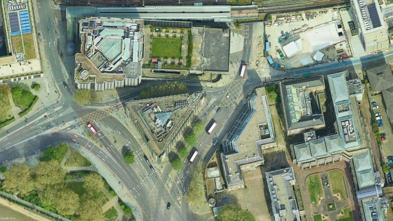
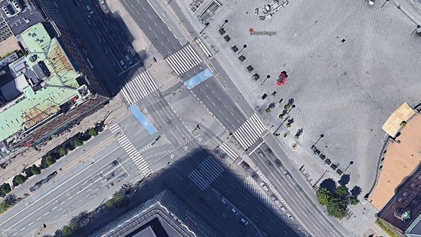
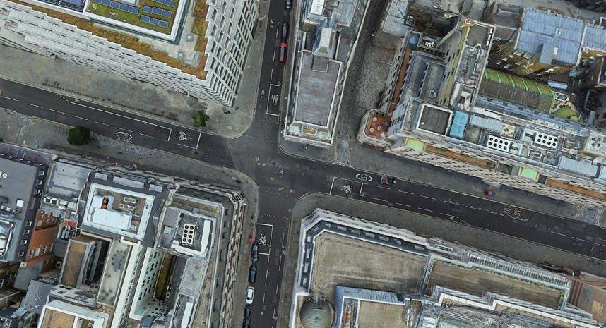
44
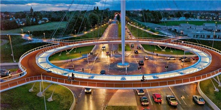
45 page left blank
46 43215678conclusionsframeworkliteraturemethodologyintroductionreviewcasestudies&toolkitsiteanalysisimplementation&reflections 1. introduction 2. site issue context 3. key objectives 4. research questions 5. limitations 6. contribution to practice 1. methodology 2. ethical considerations 1. a car-centric society 2. barriers 1. case studies introduction 2. sydney, australia 3. taipei, taiwan 4. carmel, indiana, usa 5. barcelona, spain 6. case study comparison 1. conceptual framework 2. design toolkit 1. site context 2. site analysis 3. site 1: fm 2499 4. site 2: fm 1171 5. site 3: fm 3040 6. site 4: morriss road 1. safe junctions 2. activation of space 3. site 1: proposal 4. site 2: proposal 5. site 3: proposal 6. site 4: proposal 1. conclusions & reflections
45-5435-4425-340-45-910-1415-2455-6465-7475-8485+
6.1 | site context
47
Theothers.author’s
The four “study sites” are (1) FM 2499 Long Prairie Road); (2) FM 1171 Cross Timbers Road; (3) FM 3040 Flower Mound Road; and (4) Morriss Road. Flower Mound’s extensiveyet-disconnected trail and bikeway system fails to utilise these roads, where ample space for cycle tracks and pathways could help increase the amount of residents who not only use bicycles to get to or from their workplace in the city, but also for grocery shoppers, restaurant-goers, children, and
F28: The built form of Flower Mound & demographics
Median Age: 39 years
Much of Flower Mound’s built environment revolves around the operation and storage of cars. Four ‘main’ roads – two each –run north-south and east-west across the city, serving a large amount of traffic and connecting residents to surrounding suburban areas. Three of these roads originally served as routes for farmers to get their products to and from older cities closer to Dallas. While their street names represent historical aspects of the city, such as Long Prairie Road or Cross Timbers Road, they also officially go by their former Farm-to-Market designations – FM 2499 and FM 1171, respectively, for example.
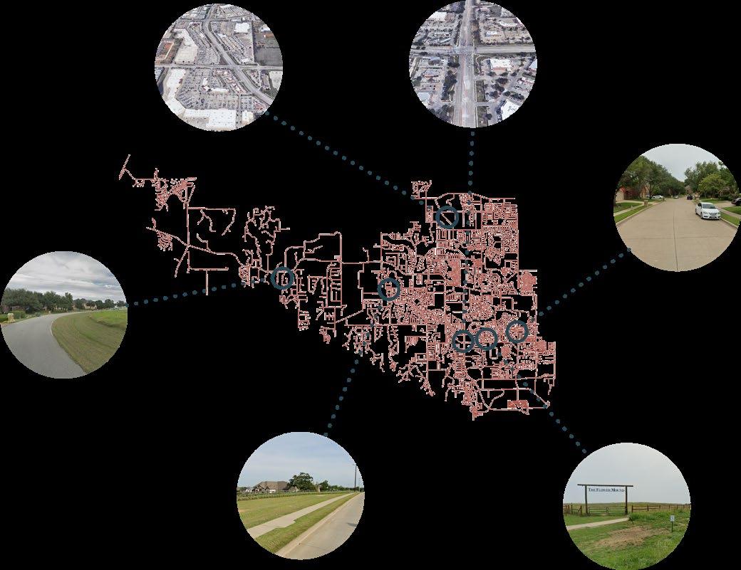
Median Income: $141,152 (£120,120)
flower mound age distribution (2022)
flower mound, texas
Location: Flower Mound, Texas, United States
low density / rural medium-low density / suburban
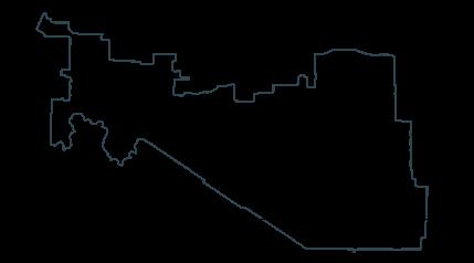

growing up and familiarity within the city and region allow for a unique perspective on the specific issues in its built environment and influences the site for selection.
Population: 78,570
Average # Extreme Heat Days: 90
6.8.2022 DRAFTF29: Flower Mound’s existing trails and bikeways
48 Community Context 28 F IGURE 2.13: EXISTING TRAILS
LEGEND
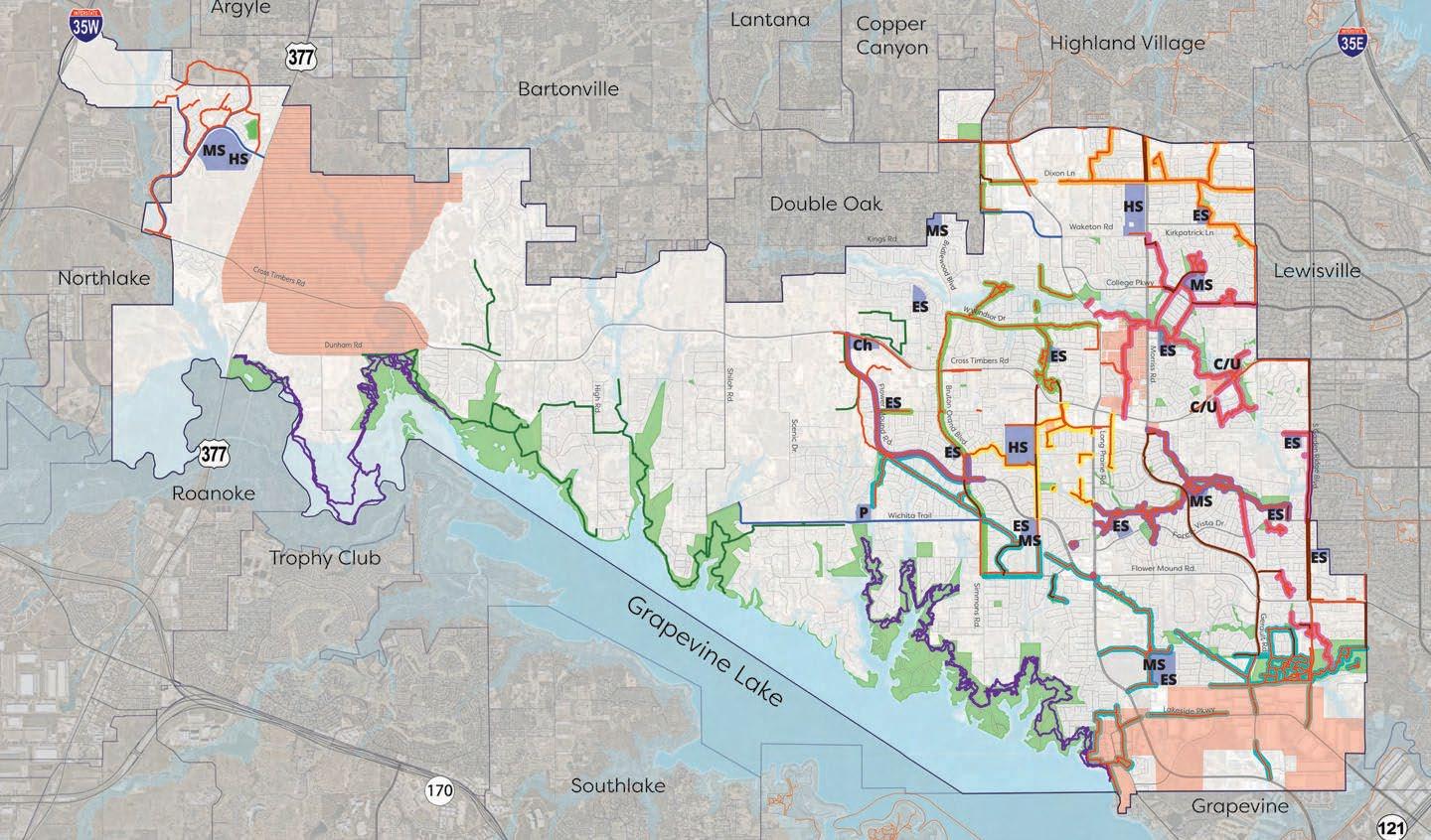
F30a: American built environments through the 20th century F30b: Streets, roads, buildings, and pathways in Flower Mound
EXISTINGBUILDINGSBIKEWAYSSTREETS&ROADS
The diagrams to the right show Flower Mound’s building concentration, existing bikeways, and car streets and roads. The disconnection of the existing bikeway network prompts evaluation for better ways to connect areas within the city by active travel methods.
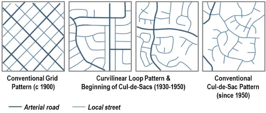
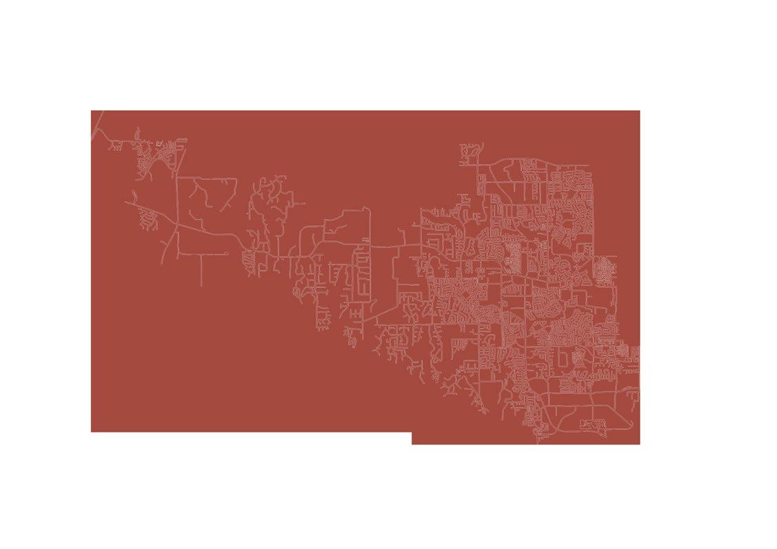

commuter routes leisure on-streetroutesbike lanes
49
Flower Mound’s built environment is reminiscent of other American suburbs constructed after World War II in the United States. Whereas cities like New York and San Francisco – constructed before the mass adoption of the car – follow a grid pattern, places like Flower Mound were built with winding road patterns that stopped at dead-ends (AKA Cul-de-Sac).
6.2 | site analysis
Flower Mound’s existing trailway network is extensive for the size of its population, but it remains disconnected. Furthermore, infrastructure for commuter travel barely exists and the connection between commuter and leisure pathways is almost Thenonexistant.city’seast-west connection is minimal, even for car standards. As Flower Mound continues to grow and expand, it will be critical for its residents’ health, safety, and prosperity to connect these different areas.
50 n fm 1171 fm 2499 morriss rd fm 3040 denton, texas dfw int’l airport F31: Study sites within geographic context
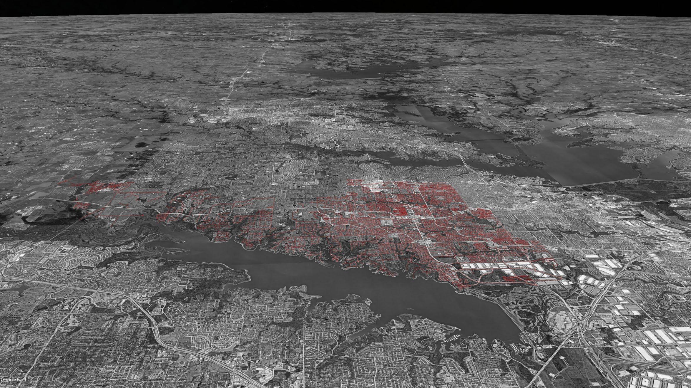
51 n dallas, texas flower mound4060minutes(driving)| 3hours(bicycling) notransitaccesswithin20minutesofflowermound dfw int’l airport F32: Flower Mound’s vicinity to Dallas and DFW Int’l Airport
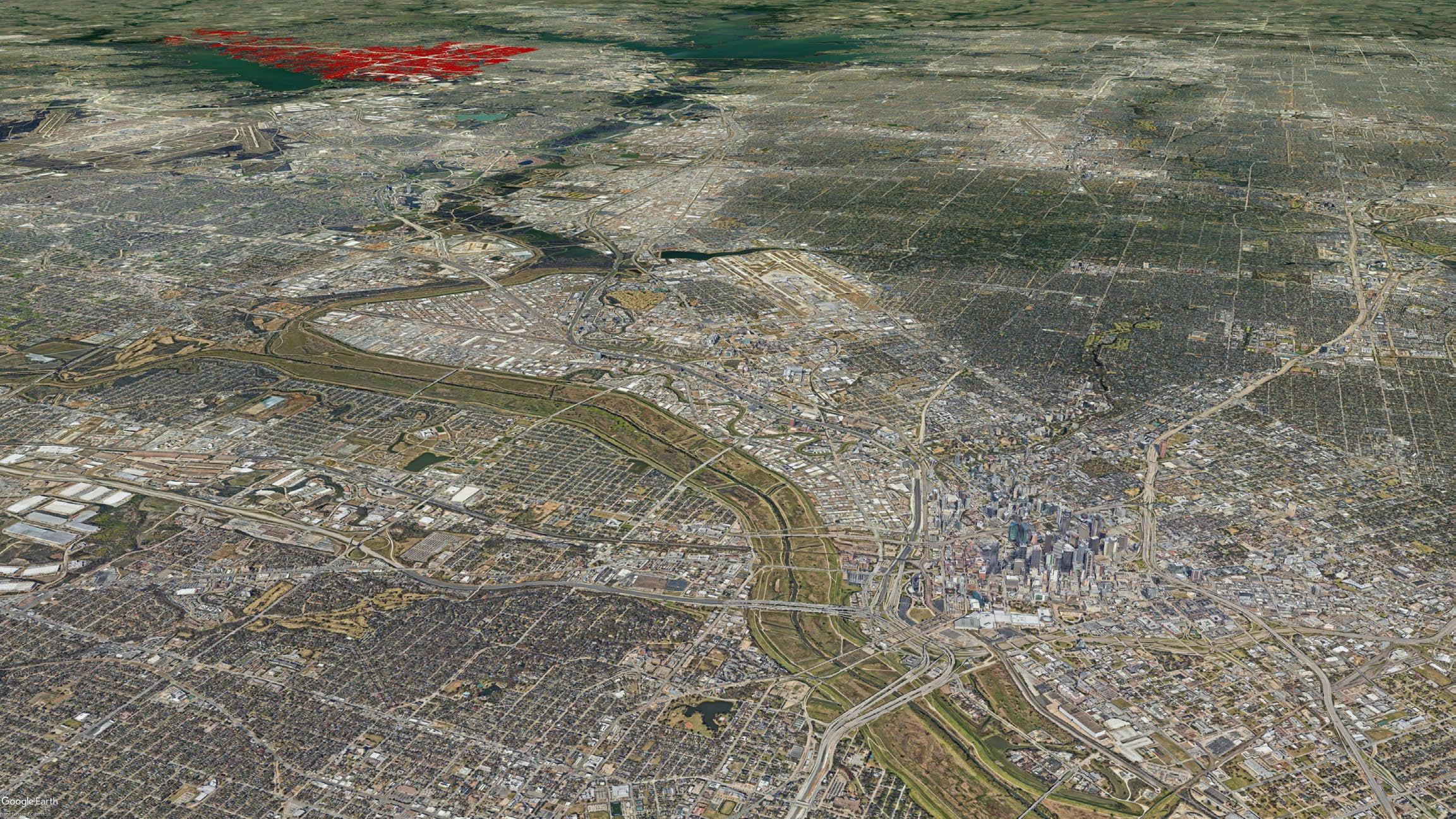
Name: FM 2499 | Long Prairie Road
commercial / office community / school green residentialspace
FM 2499 runs north-south through the middle of Flower Mound. To the south, it turns into a state-controlled roadway that merges with Interstate Highway 35 (I-35). It carries a large amount of car traffic within and through the city. Commercial and office use is found adjacent to this road, and residential is often blocked off with walls to mitigate sound pollution.
F33: Site 1 Analysis
52 major arterial minor arterial local roads
Lanes: 4 + turns
6.3 | site 1: fm 2499
Speed Limit: 45-55mph
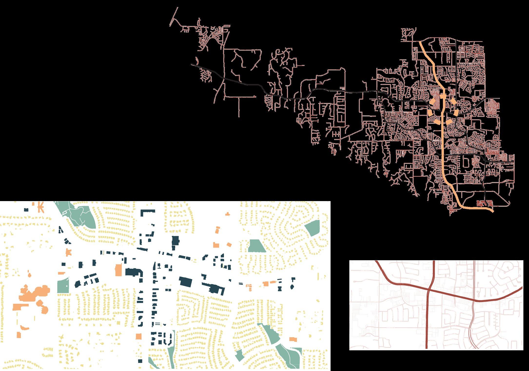
53 7.5 2 2.5 4 4443.5 3.5 3.55 22 7.5 ~54m fm 2499 | existing condition F34: Site 1 existing sections
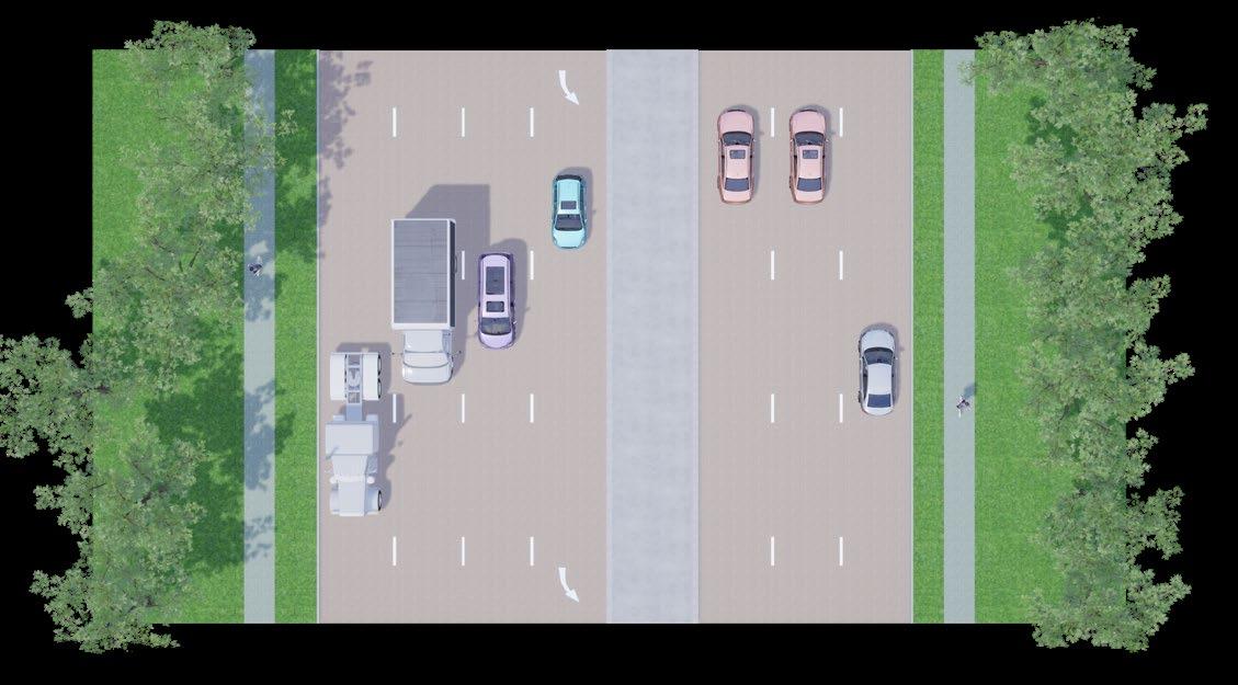
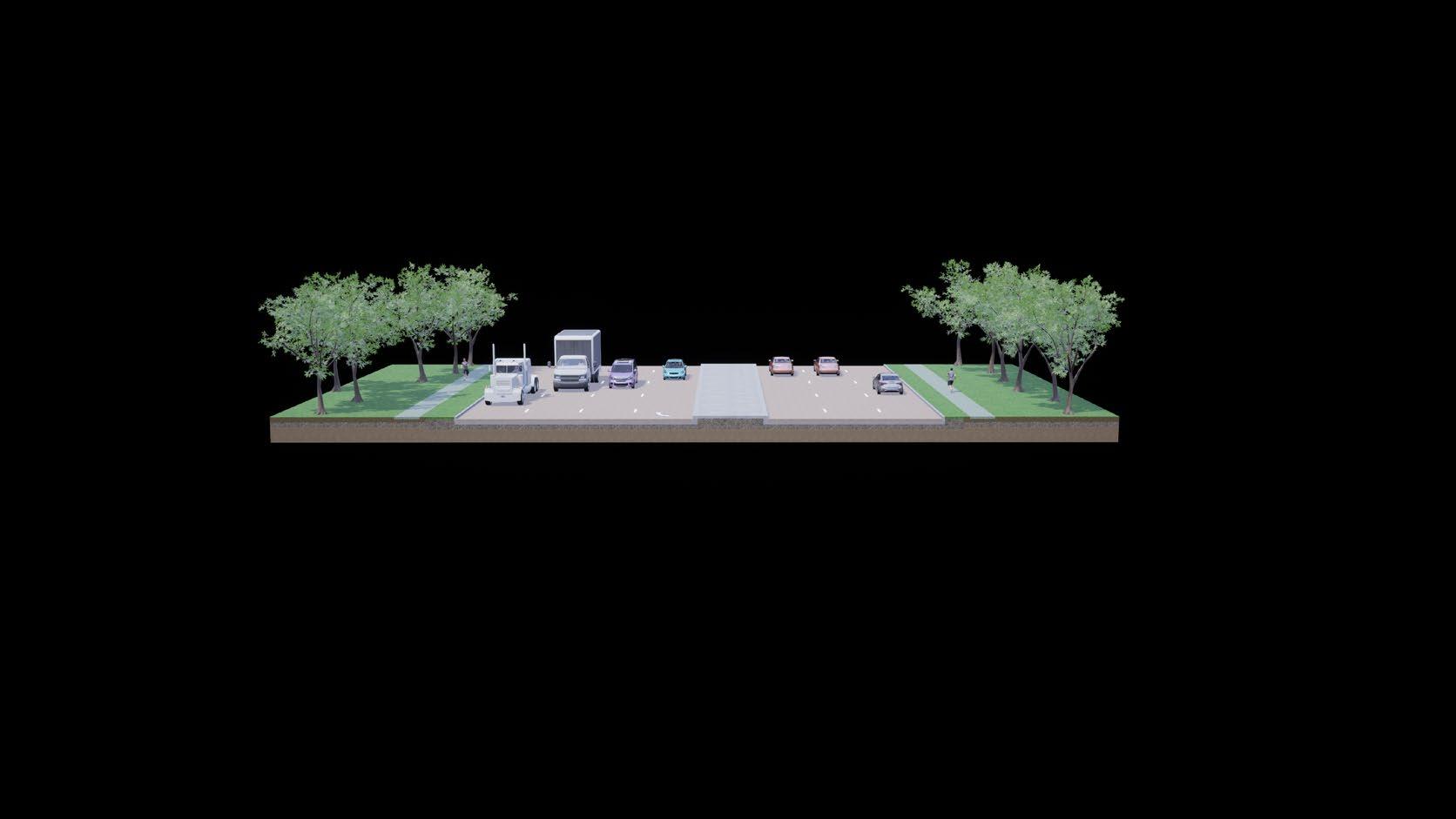
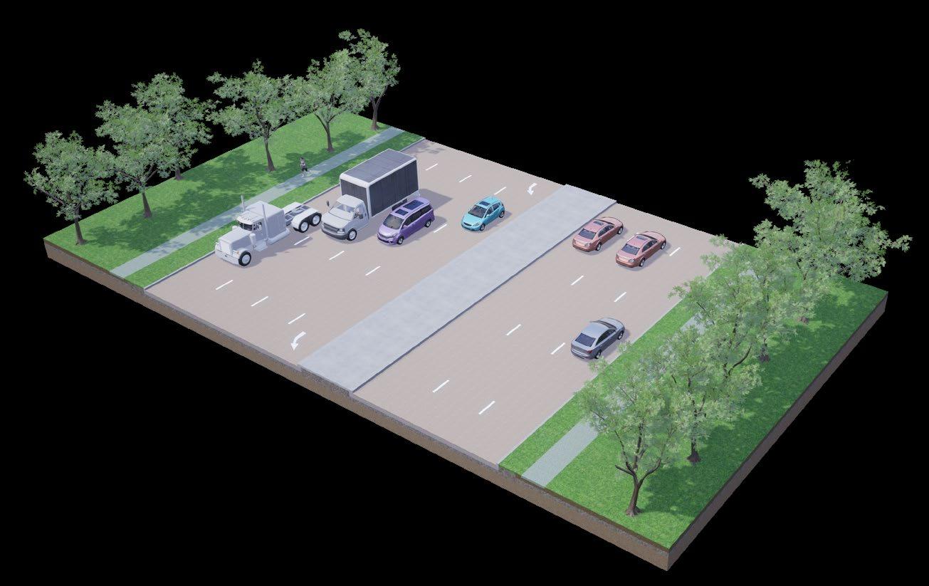
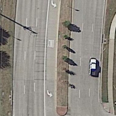
F35: Site 2 Analysis
54 major arterial minor arterial local roads
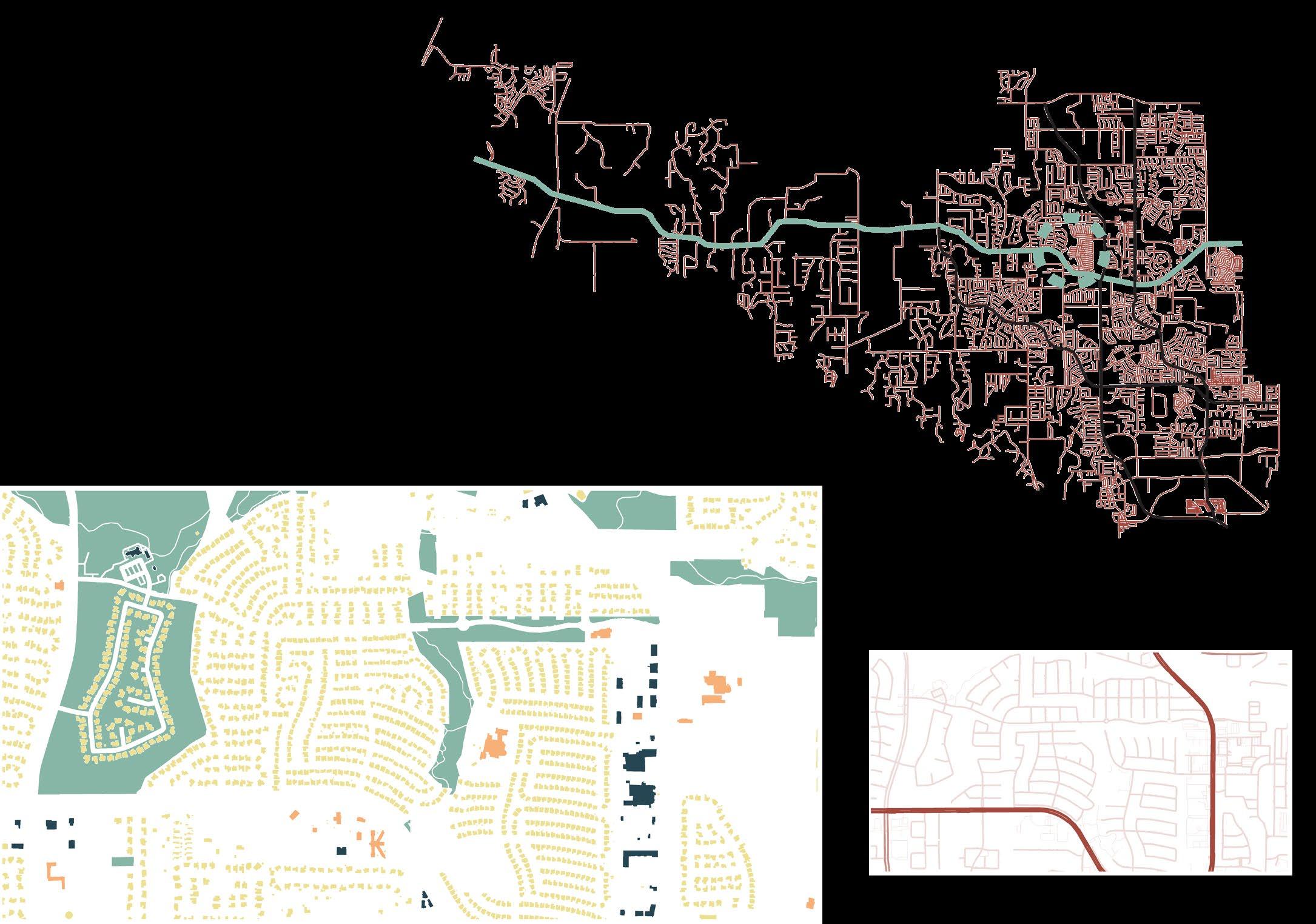
Lanes: 6 + turns
Speed Limit: 45-55mph
commercial / office community / school green residentialspace
6.4 | site 2: fm 1171
This east-west thorougfare is the only road that connects the denser eastern part of Flower Mound with the rural (denser in future) west. It intersects with both FM 2499 and Morriss Road, creating critical junctions that need to be revamped to ensure active travellers’ safety and comfort.
Name: FM 1171 | Cross Timbers Road
55 ~50m 7.5 2 2 4 43.5 4 43.5 2 2 7.55 fm 1171 | existing condition F36: Site 2 existing sections
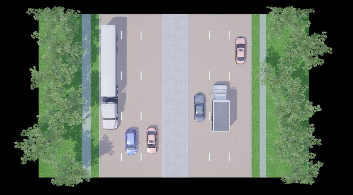
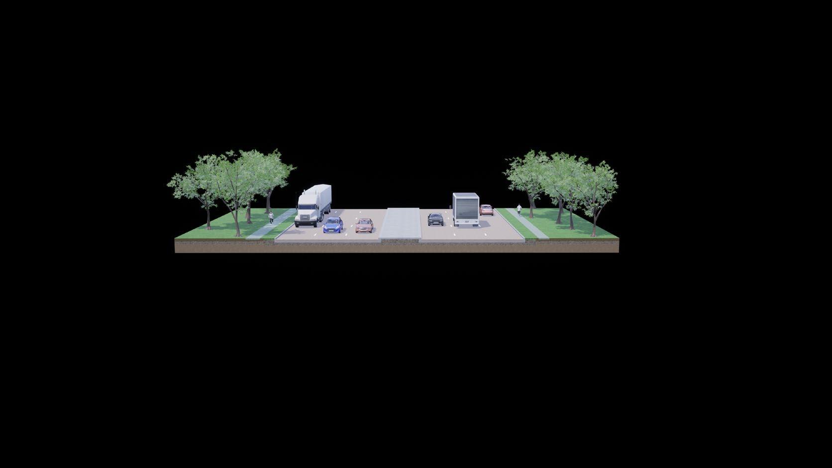

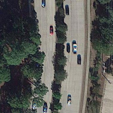
Name: FM 3040 | Flower Mound Road
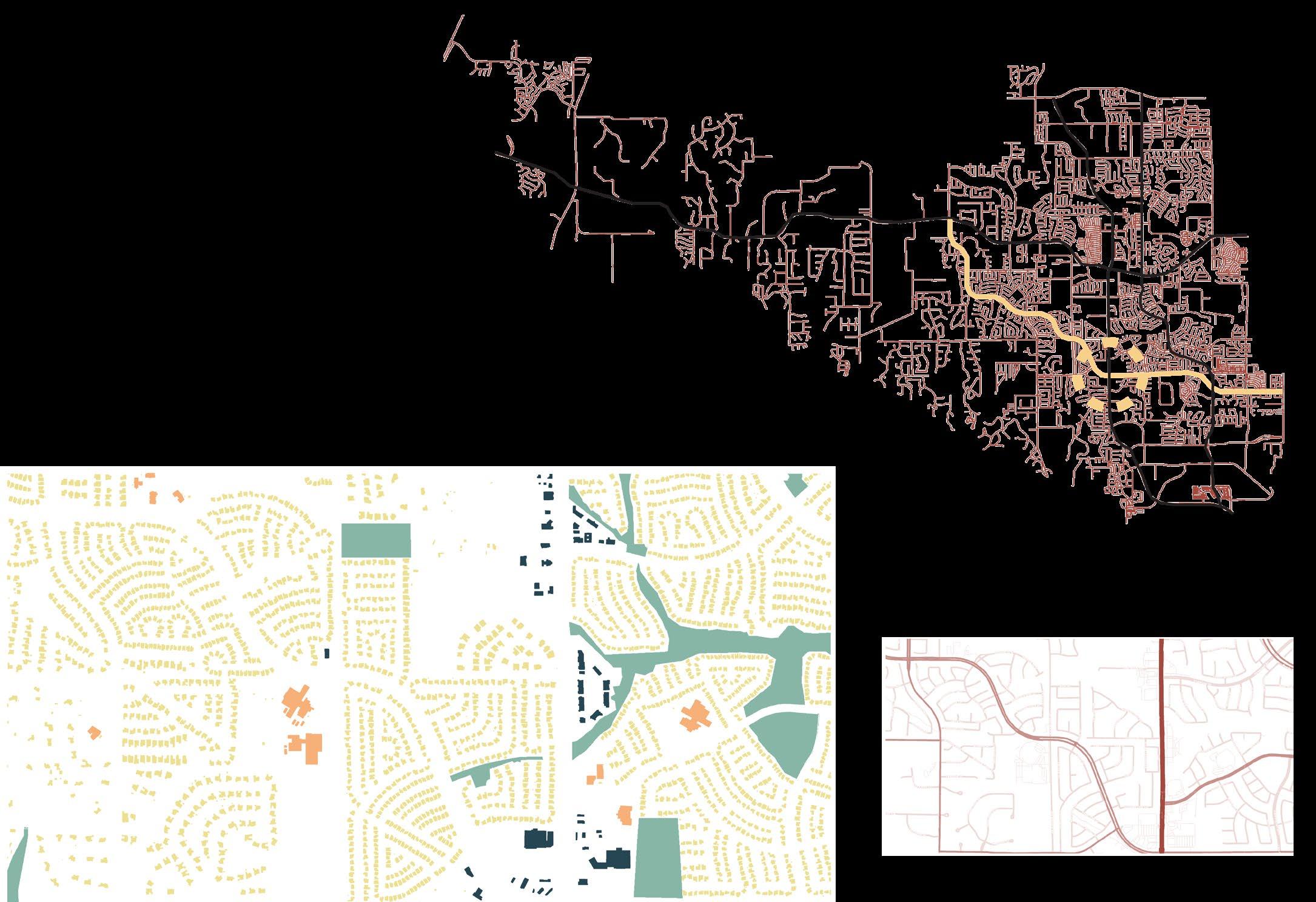
Smaller than the previous sites, this road is more residential in nature and contains a wide median separating four lanes of car traffic. However, this road still serves to carry traffic east-west through the eastern part of the city, and runs through several schools zones.
56 major arterial minor arterial local roads
6.5 | site 3: fm 3040
F37: Site 3 Analysis
commercial / office community / school green residentialspace
Lanes: 4 + turns
Speed Limit: 40mph
57 ~34m1044 4 42 1.2 1.2 1.2 1.2 2 fm 3040 | existing condition F38: Site 3 existing sections
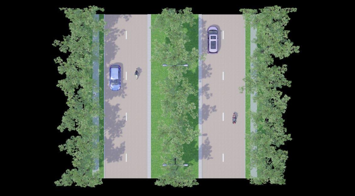
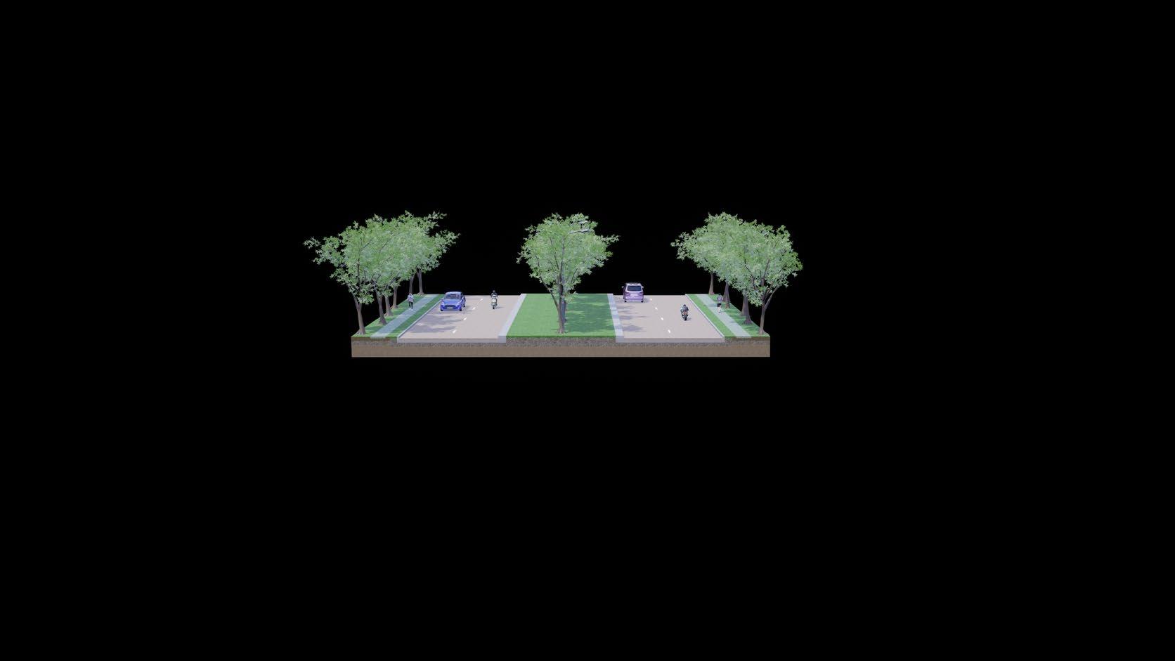
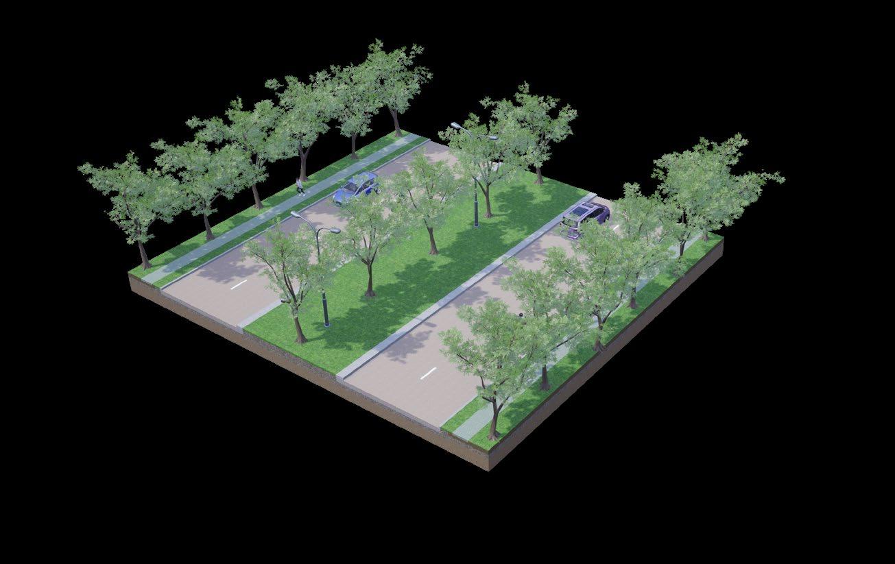
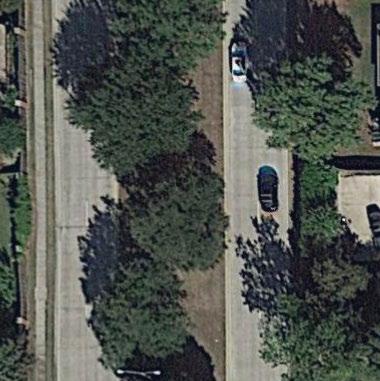
commercial / office community / school green residentialspace
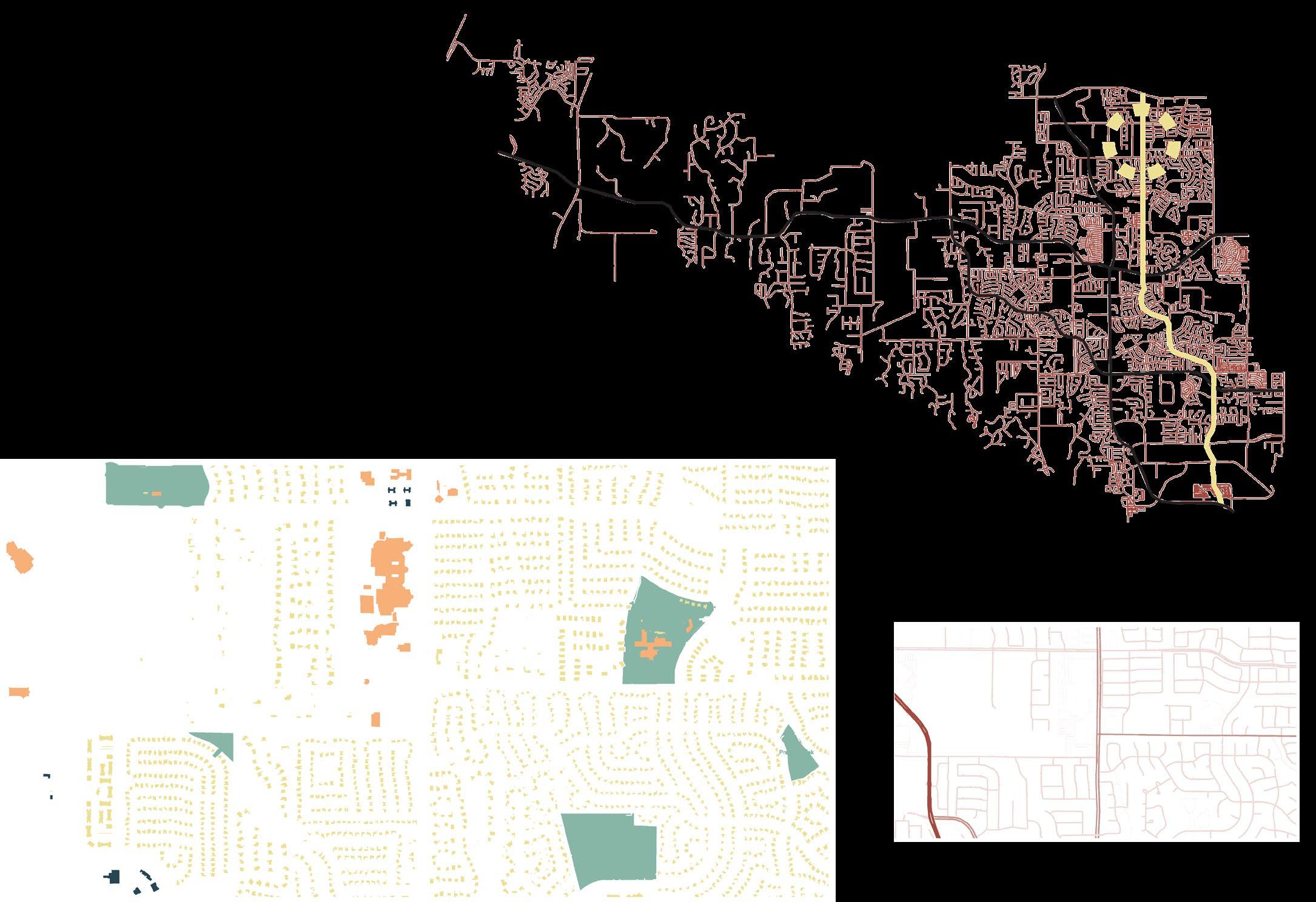
Speed Limit: 40mph Lanes: 4 + turns
58 major arterial minor arterial local roads
6.6 | site 4: morriss road
F39: Site 4 Analysis
Similar to FM 3040, Morriss Road is four lanes with a wide median dividing it. It mainly serves residential and commercial use. Several of the city’s schools are located close to this road - much like FM 3040.
Name: Morriss Road
F40: Site 4 existing sections
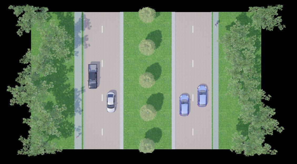
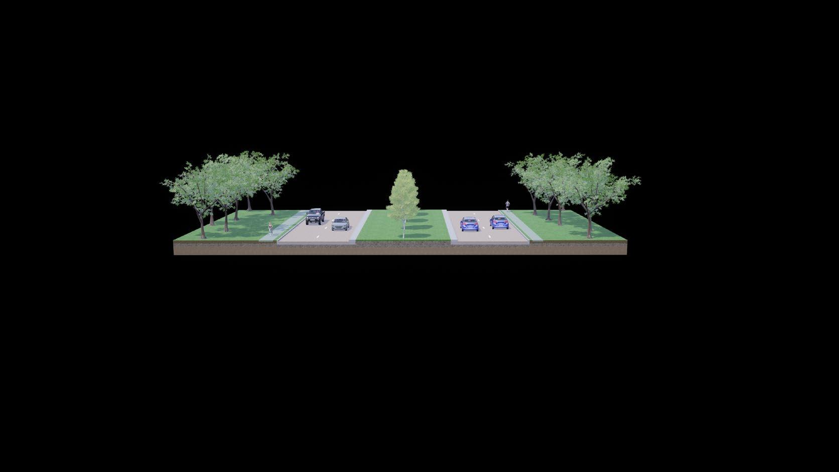

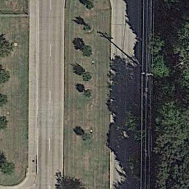
59 ~50m 9 2 4 4 44 2 912
morriss road | existing condition
60 page left blank
61 43215678conclusionsframeworkliteraturemethodologyintroductionreviewcasestudies&toolkitsiteanalysisimplementation&reflections 1. introduction 2. site issue context 3. key objectives 4. research questions 5. limitations 6. contribution to practice 1. methodology 2. ethical considerations 1. a car-centric society 2. barriers 1. case studies introduction 2. sydney, australia 3. taipei, taiwan 4. carmel, indiana, usa 5. barcelona, spain 6. case study comparison 1. conceptual framework 2. design toolkit 1. site context 2. site analysis 3. site 1: fm 2499 4. site 2: fm 1171 5. site 3: fm 3040 6. site 4: morriss road 1. safe junctions 2. activation of space 3. site 1: proposal 4. site 2: proposal 5. site 3: proposal 6. site 4: proposal 1. conclusions & reflections
CycleMound.tracks
primary principles safe junctions (ex.
with shade structures, foot rests, bicycle-specific traffic signals, and prevention of rights-on-red by cars are used to create a safer, more enjoyable place for
As found in the literature review, junction safety and comfort while travelling are important barriers to cycling. This first junction is found at the intersection of FM 2499 and FM 1171, where 35 lanes converge at two of the busiest roadways in Flower
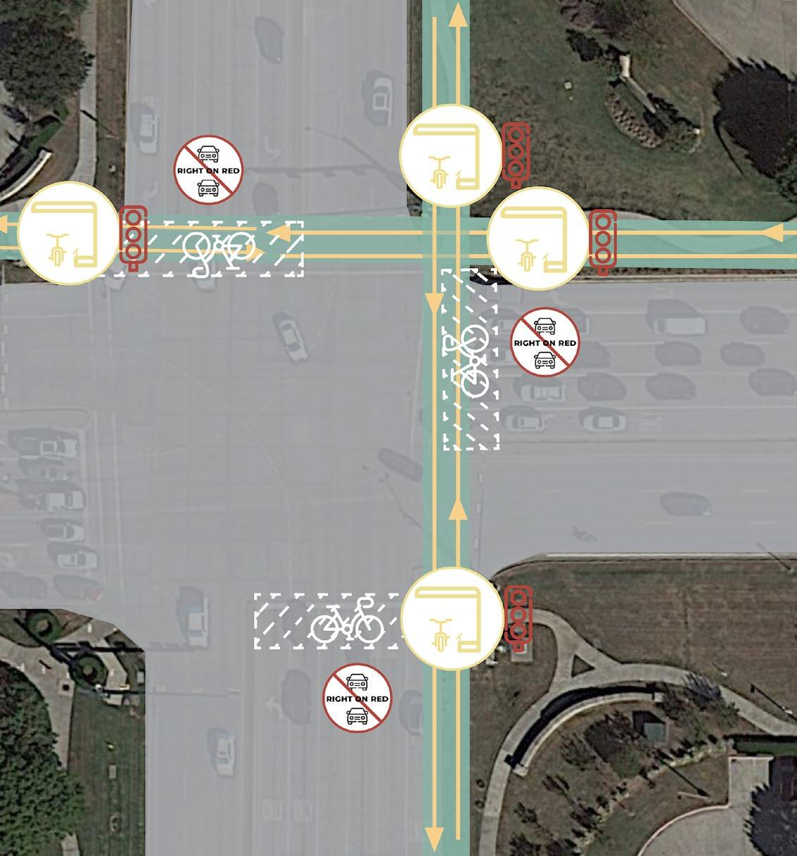
7.1 |
F41: Junction 1 interventions & context
1)
62
7.1 | safe junctions (ex. 2)
F42: Junction 2 interventions & context
Morriss Road contains a wide median separating its four lanes. The proposed cycle track runs within this median and is connected with either side throughout the junction by painted cycle tracks.
63
primary principles
At the intersection of FM 1171 and Morriss Road, 32 lanes converge. Similar to the previous junction intervention, cyclist safety and comfort is increased with the implementation of shaded structures, foot rests, bicycle-specific traffic signals, and prevention of right-on-reds by cars.
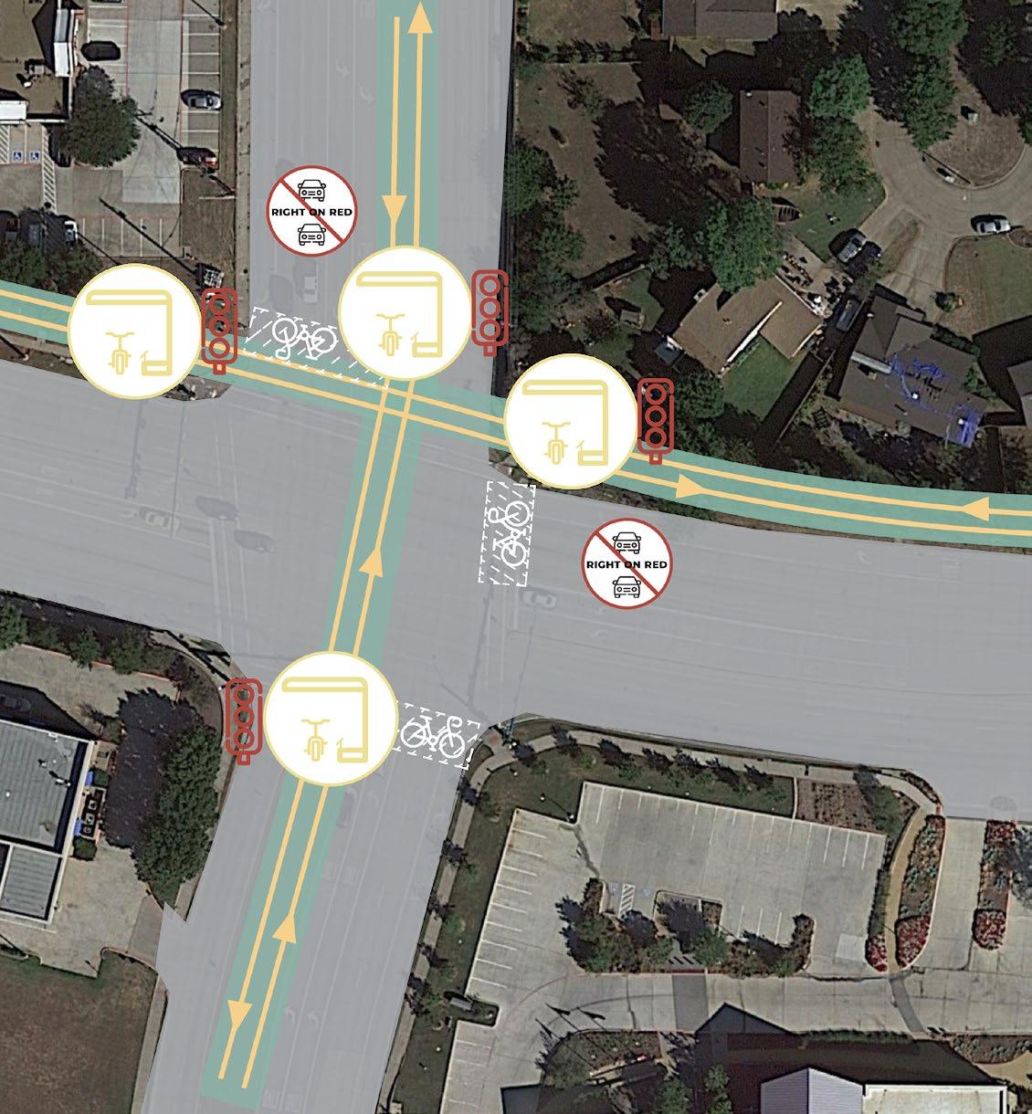
64
7.2 | activation of space (ex. 1)
Located adjacent to the southern portion of FM 2499, this large parking lot sits next to a relatively dense, mixed-use neighbourhood called Lakeside. This open parking lot is only ever close to capacity on Friday and Saturday nights, sitting as an underutilised space for the rest of the week.
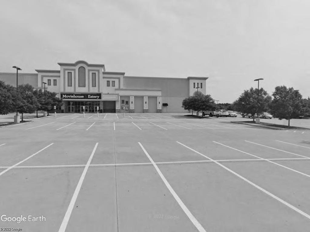
By activating this space with market stalls, miniature libraries, and community events, active travellers can be encouraged to make a bicycle trip or stop by on their way to or from daily activities.
F43: Activation space example 1
This large, empty lot has been vacant for several years as the supermarket it once served is now derelict. This lot sits directly adjacent to FM 2499 and FM 3040 at the northeastern corner of the junction.
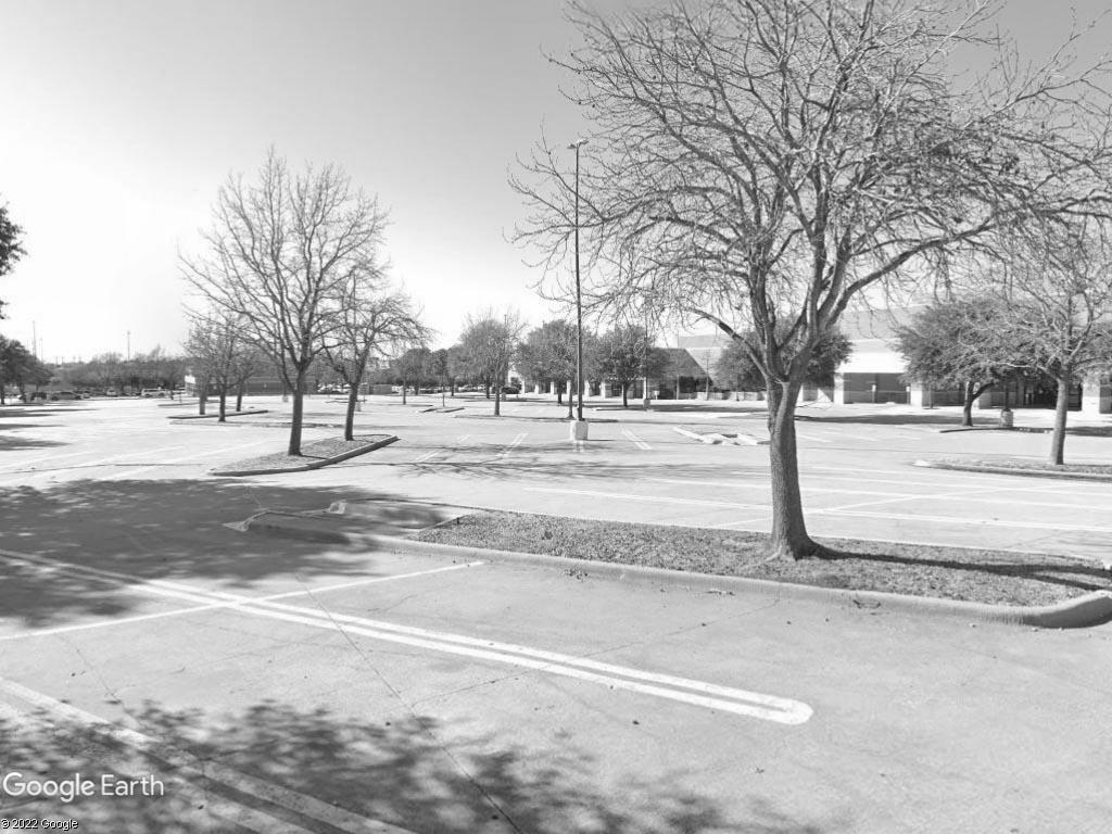
65
7.2 | activation of space (ex. 2)
This lot could be used in conjunction with the now-empty supermarket building (located to the right in the background) to provide market and community space.
F44: Activation space example 2
66 ~54m 4443.5 3.5 3.55 4.5 22 2.57.5 2 2.5 4 4443.5 3.5 3.55 22 7.5 ~54m fm 2499 | long prairie road existing proposed primary principles 7.3 | site 1: proposal F45: Site 1 proposed section interventions
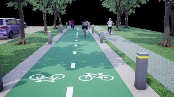
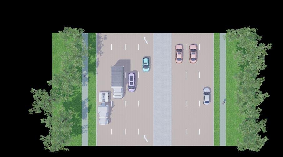

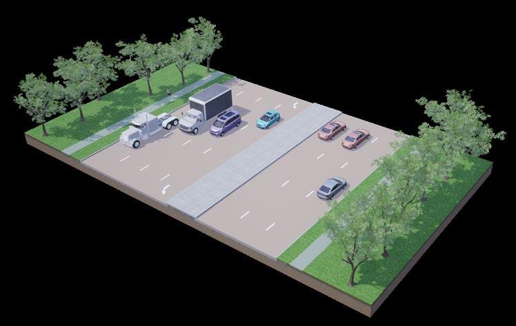
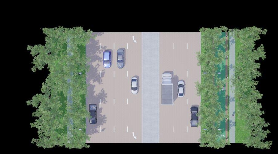
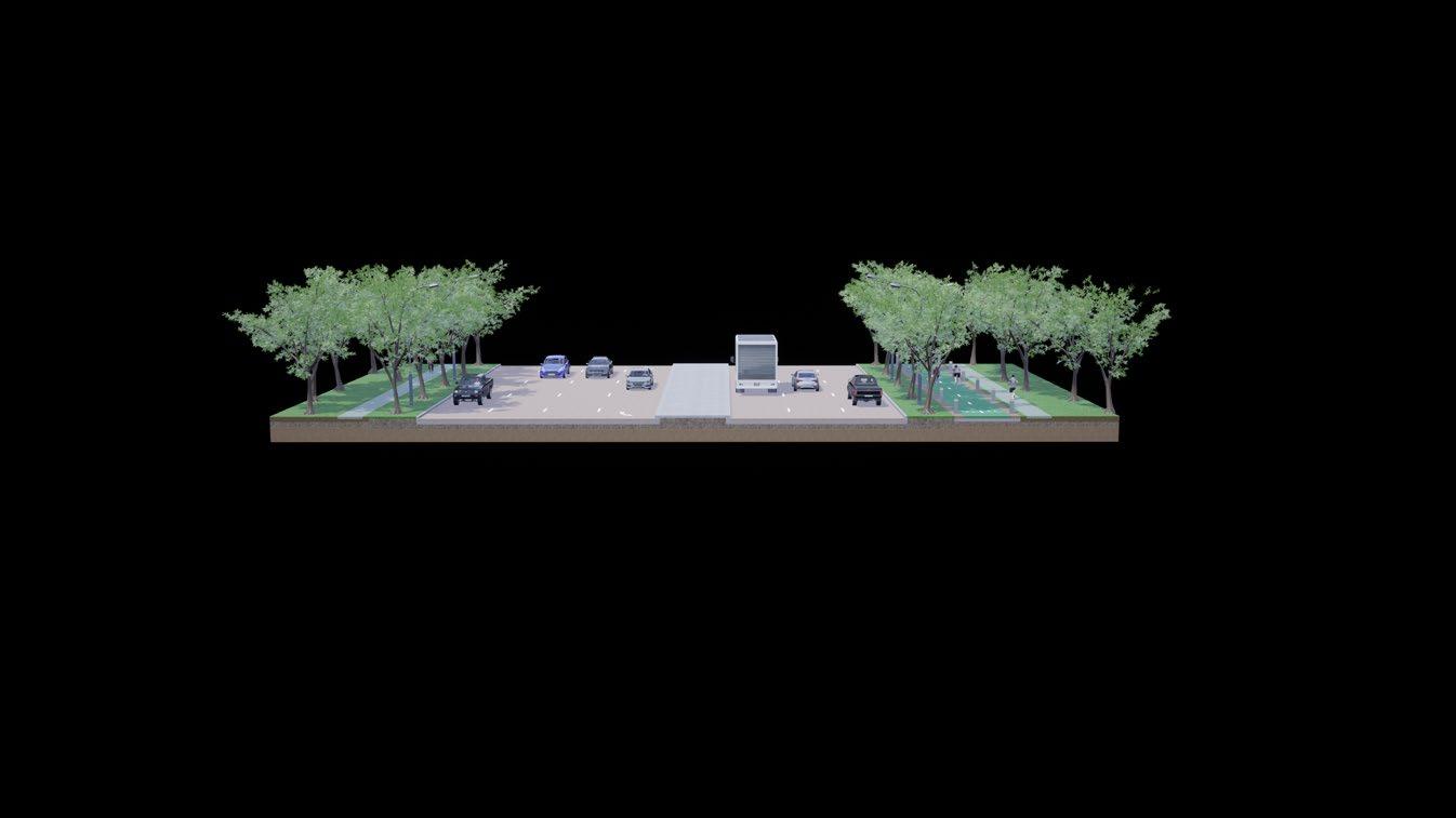
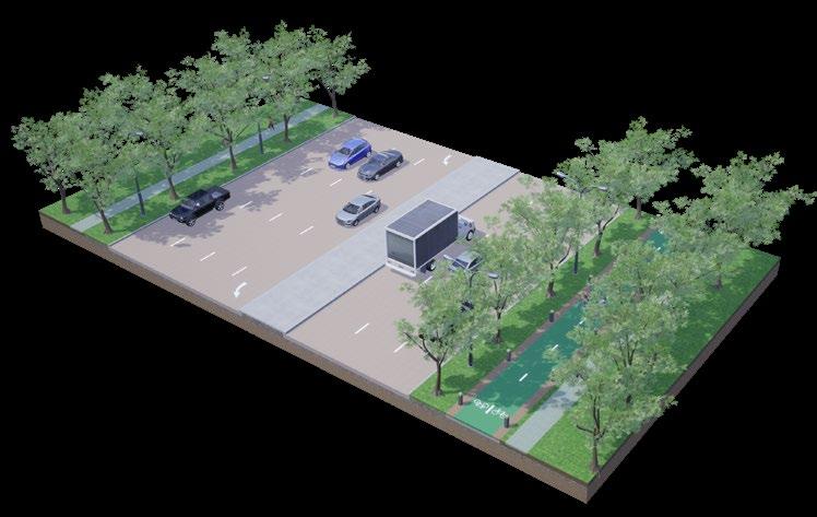
The proposed intervention includes a cycle track with bollards that run under a tree canopy on the eastern side of FM 2499. Activation zones are located at large, underutilised parking lots near commercial big-box stores.
F46: Site 1 Proposal
primary principles
The proposed route connects many of Flower Mound’s existing trails, greatly increasing connectivity and route choice across the eastern part of the city. proposed
existing

67 fm 2499 | long prairie rd fm 1171 | cross timbers rd fm 3040 | flower mound rd morris rd commuter routes leisure on-streetroutesbike lanes
Activation area
7.3 | site 1: proposal
68 ~50m 43.5 4 43.55 4.3 22.5 2.5 ~50m 7.5 2 2 4 43.5 4 43.5 2 2 7.55 fm 1171 | cross timbers road existing proposed primary principles 7.4 | site 2: proposal F47: Site 2 proposed section interventions
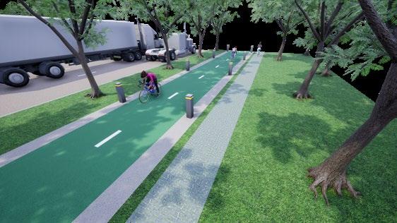
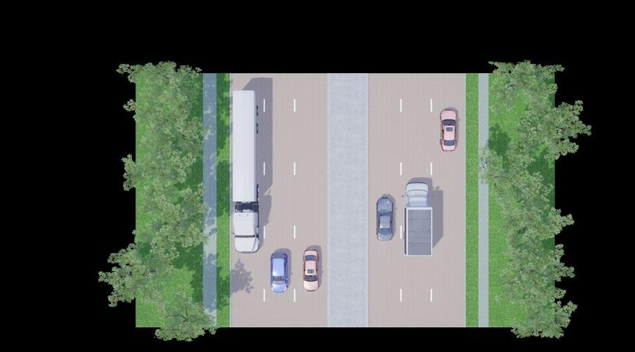
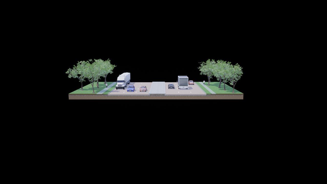
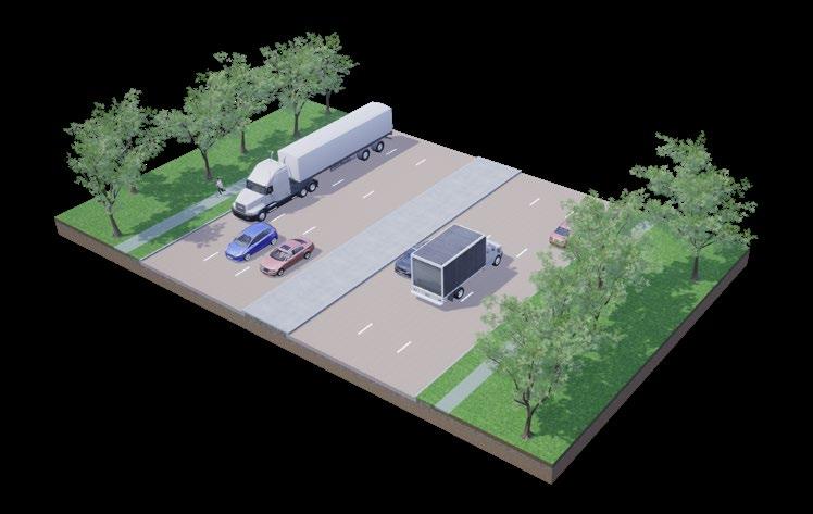
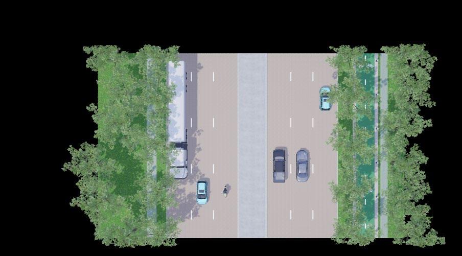
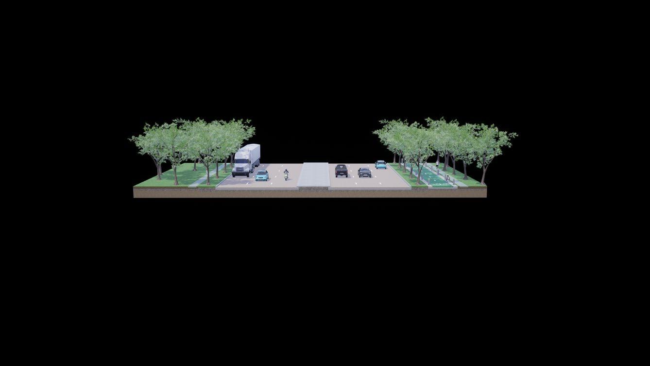

The proposed route connects the rural western part of Flower Mound with the denser eastern side, creating a crucial piece of infrastructure for the future development planned for the western part of the city.
existing proposed
7.4 | site 2: proposal
The proposed intervention includes a cycle track with bollards that run under a tree canopy on the northern side of FM 1171.

F48: Site 2 Proposal
primary principles
Activation area
69 fm 2499 | long prairie rd fm 1171 | cross timbers rd fm 3040 | flower mound rd morris rd commuter routes leisure on-streetroutesbike lanes
70 ~34m 4 4 4 1.2 1.2 24.3 33~34m1044 4 42 1.2 1.2 1.2 1.2 2 fm 3040 | flower mound road existing proposed primary principles 7.5 | site 3: proposal F49: Site 3 proposed section interventions
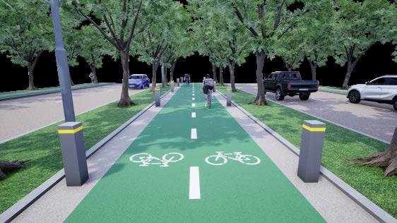
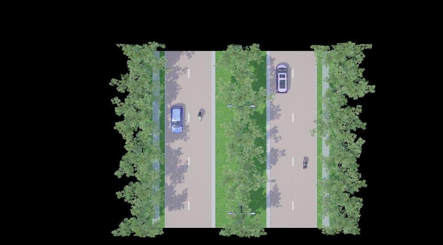

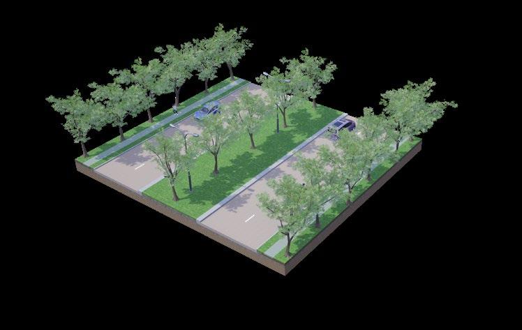
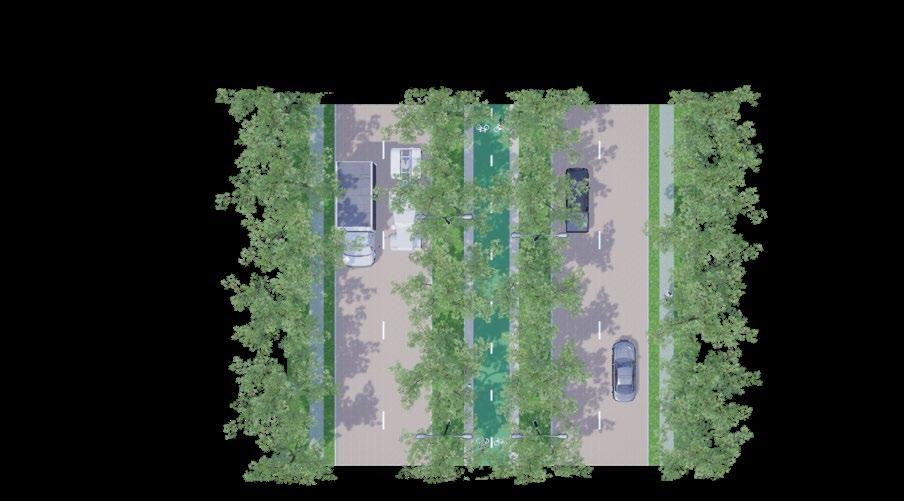
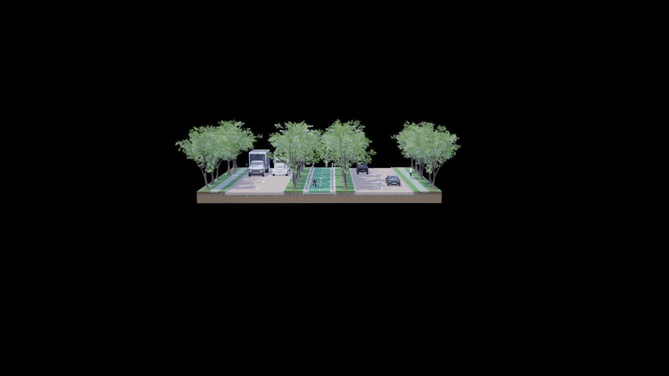
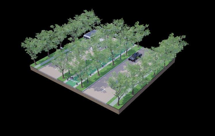
existing proposed
The proposed intervention includes a cycle track with bollards that run under a tree canopy within the median of FM 3040.
7.5 | site 3: proposal
71 fm 2499 | long prairie rd fm 1171 | cross timbers rd fm 3040 | flower mound rd morris rd commuter routes leisure on-streetroutesbike lanes
primary principles
F50: Site 3 Proposal
The proposed route connects Flower Mound’s southern trailways with a solid piece of direct bicycle infrastructure. This route also ensures that large groupings of residential areas located along the road are served by adequate infrastructure.
Activation area

72 ~50m 4 4 44 2 94.3 44 ~50m 9 2 4 4 44 2 912 morriss road existing proposed primary principles 7.6 | site 4: proposal F51: Site 4 proposed section interventions
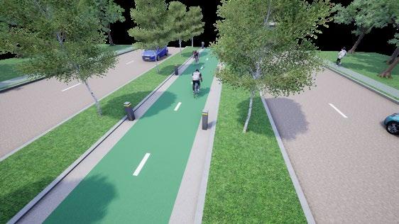
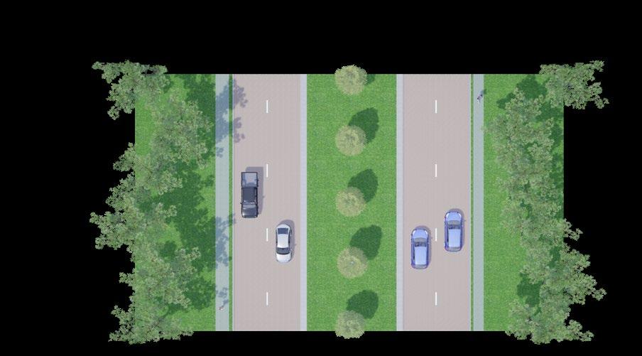

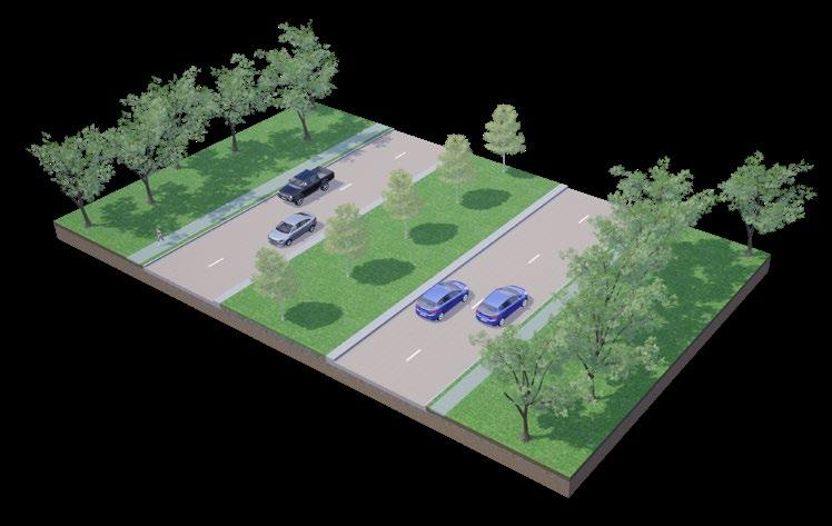
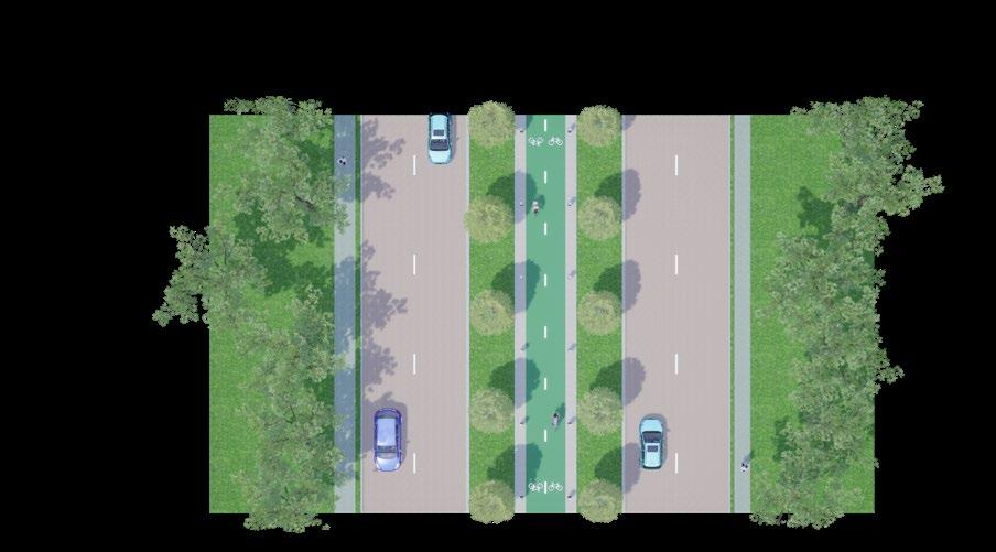
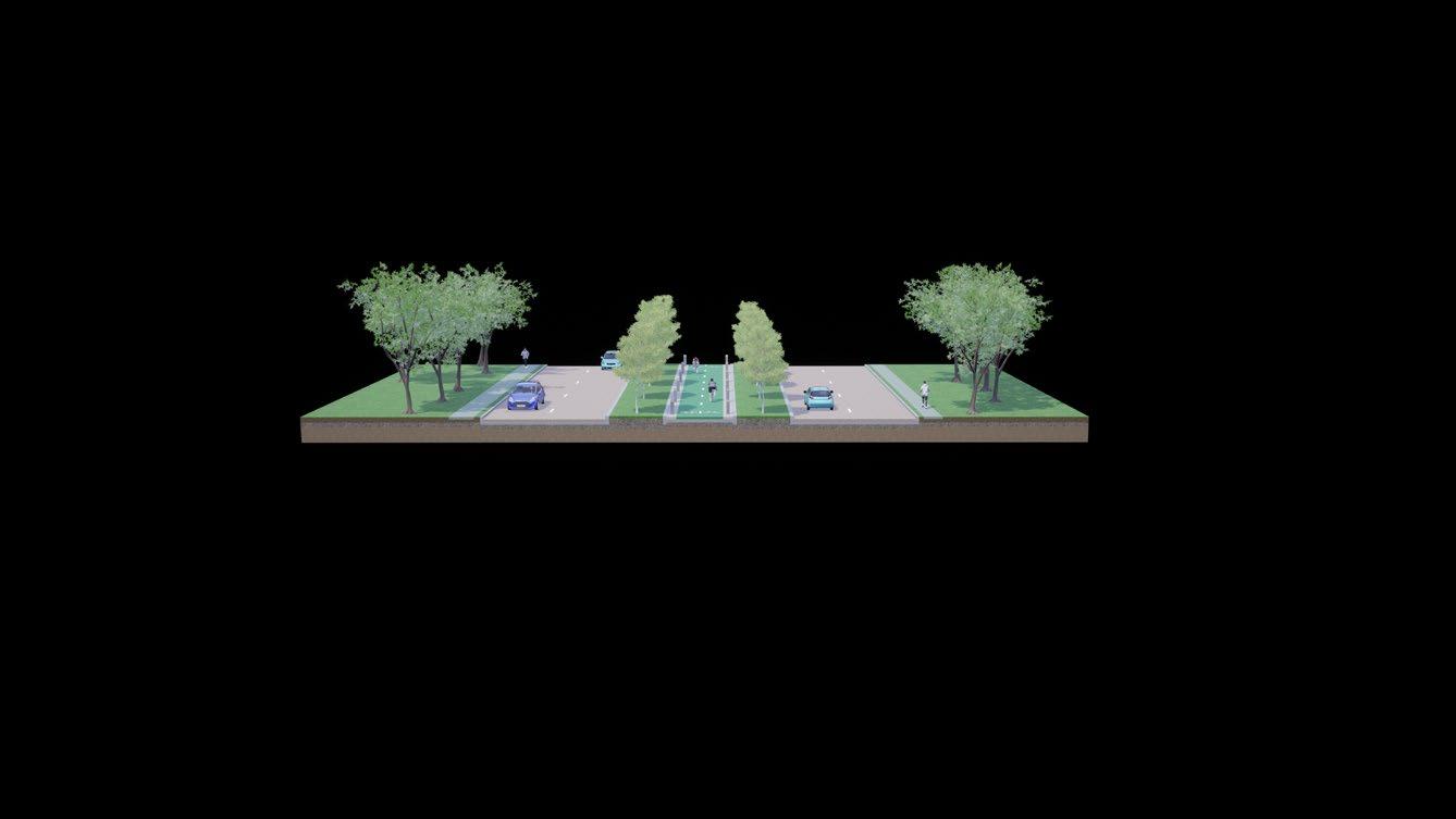
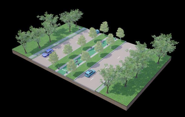
The proposed intervention includes a cycle track with bollards that run under a tree canopy within the median of Morriss Road. The proposed route connects Flower Mound’s eastern trailways with a solid piece of direct bicycle infrastructure. This route also ensures that large groupings of residential areas located along the road are served by adequate infrastructure.
F52: Site 4 Proposal
73 fm 2499 | long prairie rd fm 1171 | cross timbers rd fm 3040 | flower mound rd morris rd commuter routes leisure on-streetroutesbike lanes
Activation area proposed
primary principles
existing
7.6 | site 4: proposal

74 43215678conclusionsframeworkliteraturemethodologyintroductionreviewcasestudies&toolkitsiteanalysisimplementation&reflections 1. introduction 2. site issue context 3. key objectives 4. research questions 5. limitations 6. contribution to practice 1. methodology 2. ethical considerations 1. a car-centric society 2. barriers 1. case studies introduction 2. sydney, australia 3. taipei, taiwan 4. carmel, indiana, usa 5. barcelona, spain 6. case study comparison 1. conceptual framework 2. design toolkit 1. site context 2. site analysis 3. site 1: fm 2499 4. site 2: fm 1171 5. site 3: fm 3040 6. site 4: morriss road 1. safe junctions 2. activation of space 3. site 1: proposal 4. site 2: proposal 5. site 3: proposal 6. site 4: proposal 1. conclusions & reflections
This Major Research Project’s initial and main research question arises from the author’s own experiences growing up in Flower Mound. Without a car, a place like Flower Mound is virtually impossible to traverse in day-to-day life. Why was the city built like this? What are the past and future implications of the economic, social, health, and climate externalities caused by the city’s overreliance on cars? Is there a viable Floweralternative?Mound’scontext
On top of base-level contextual understanding, a literature review, examination of current dialogue on urban design theory and practice surrounding active travel, and case study analysis revealed that the current paradigm for transportation in places like Flower Mound is not sustainable. A city’s dependence on cars is financially, socially, climatically, and physically detrimental to its success in the long-term. There are countless examples of best practices found around the world that point to the effectiveness of a comprehensive approach to the investment and implementation of active travel However,infrastructure.thisanalysis also revealed that there is no simple answer to getting people to bike more. Simply placing bike lanes down and expecting bike modal share to increase is not adequate; cities must take a multifaceted approach to the issue of societal overreliance on cars and address the barriers and challenges that residents face that are unique to the political,
8.1 | conclusions & reflections
geographical, and climatic context.
as a climaticallychallenging American suburb is unique regarding existing literature and dialogue surrounding bicycling as a viable form of active travel; it experiences nearly 90 days of weather above 90°F / 32°C (considered extreme heat by FEMA). Most of the existing dialogue on active travel design and policy centres around larger cities with much more temperate climates – and even as the attention has started to shift towards cities like Taipei and Singapore, the debates and research on bicycling and the barriers and challenges that residents face revolves largely around cities that don’t experience nearly the same types of temperatures.
This Project argues that the most important thing a city can do is to address the barriers that its residents face to active travel, especially within the context of bicycling. Places like Flower Mound are wide and expansive and are inherently built with separation of land uses in mind. Bicycles are the ideal (existing) medium, providing more efficiency and independent mobility than walking while being substantially less resource-intensive than cars. With the inherent complexity of a built environment, cities must approach this issue with a broad, yet well-rounded foundation of
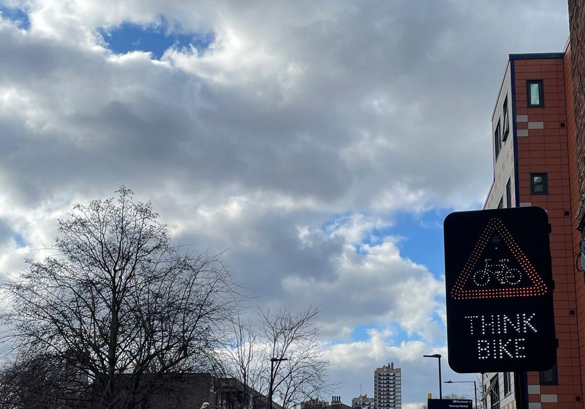
Theunderstanding.Project’sframework and design toolkit aims to provide this foundation with a multi-step, scalable, and well-rounded set of strategies and design principles that can be applied to the built environments of American suburbs across the country, with the potential to extend to cities around the world.
This Project can serve as a foundation for a shift of existing understandings about bicycling in cities around the world towards environments that, perhaps, need just as much attention. In the end, the large negative externalities associated with a reliance on cars will not be fixed by electric vehicles; American suburbs were created for the car, and from the car they should evolve. In fact, the answer we’re searching for in our cities may already exist – as a twowheeled revolution we’ve been using for over 100 years.
Cortright, J. (2015) Even If You Don’t Drive, You’re Still Paying for Everyone Who Does. [online] The Atlantic. Available at: https://www.theatlantic.com/business/archive/2015/10/ driving-true- costs/412237/ (Accessed 02 Apr. 2022).
Butterworth, E. & Pojani, D. (2018) Why Isn’t Australia a Cycling Mecca?. European Transport. [Online].
Bureau of Transportation Statistics. (2020) Average Cost of Owning and Operating an Automobile. [online] Available at: https://www.bts.gov/content/average-cost-owning-andoperating- automobilea-assuming-15000-vehicle-miles-year. (Accessed on 25 February 2022).
Corcoran, J. et al. (2014) Spatio-temporal patterns of a Public Bicycle Sharing Program: the effect of weather and calendar events. Journal of transport geography. [Online] 41292–305.
Dill, J. & Voros, K. (2007) Factors Affecting Bicycling Demand : Initial Survey Findings from the Portland, Oregon, Region: Bicycles and Motorcycles. Transportation research record. (2031), 9–17.
Bigazzi, A. et al. (2022) Physiological markers of traffic-related stress during active travel. Transportation research. Part F, Traffic psychology and behaviour. [Online] 84223–238.
Boufous, S. et al. (2021) Facilitators and barriers to cycling in older residents of New South Wales, Australia. Journal of transport & health. [Online] 21101056–.
Fields, B. et al. (2022) Active transportation pilot program evaluation: A longitudinal assessment of bicycle facility density changes on use in Minneapolis. Transportation research interdisciplinary perspectives. [Online] 14100604–.
Autelitano, F. & Giuliani, F. (2021) Colored Bicycle Lanes and Intersection Treatments: International Overview and Best Practices. Journal of Traffic and Transportation Engineering (English Edition), 2021.
Colville-Andersen, M. (2018) Copenhagenize : the definitive guide to global bicycle urbanism / Mikael Colville-Andersen. Washington, DC: Island Press.
76
Bopp, M. et al. (2012) Active commuting influences among adults. Preventive medicine. [Online] 54 (3), 237–241.
references
den Hoed, W. & Jarvis, H. (2021) Normalising cycling mobilities: an age-friendly approach to cycling in the Netherlands. Applied mobilities. [Online] ahead-of-print (ahead-of-print), 1–21
Dill, J. & Carr, T. (2003) Bicycle Commuting and Facilities in Major U.S. Cities: If You Build Them, Commuters Will Use Them. Transportation research record. [Online] 1828 (1), 116–123.
Buehler, R. & Dill, J. (2016) Bikeway Networks: A Review of Effects on Cycling. Transport reviews. [Online] 36 (1), 9–27.
Town of Flower Mound (2022) Flower Mound GIS Open Data. Available at: https://www.
Texas A&M University (2018). Dismount Zone Expansion. Available at: 20tamu.edu/WebFS/Transport/TSAC/presentations/2018/DismountZones.pdf.https://transport.(AccessedonJune2022).
Lubans, D.R. et al. (2011) The relationship between active travel to school and healthrelated fitness in children and adolescents: a systematic review. International Journal of Behavioral Nutrition and Physical Activity, 8(1), pp.1-12.
Groot, R. de (2016) Design manual for bicycle traffic / editor-in-chief Rik de Groot. Rik de Groot (ed.). Ede, The Netherlands: CROW.
Sun, Q.C. et al. (2021) A human-centred assessment framework to prioritise heat mitigation efforts for active travel at city scale. Science of the Total Environment, 763, p.143033.
Garrard, J., Crawford, S., & Hakman, N. (2006) Revolutions for Women: Increasing women’s participation in cycling for recreation and transport (Executive Summary).
Gössling, S., Nicolosi, J. and Litman, T. (2021) The Health Cost of Transport in Cities. Current Environmental Health Reports
Krizek, K., Forsyth, A., Baum, L. (2009) Walking and cycling international literature review. Report for Department of Transport, Melbourne.
Pucher, J. & Buehler, R. (2006) Why Canadians cycle more than Americans: A comparative analysis of bicycling trends and policies. Transport policy. [Online] 13 (3), 265–279.
Jacobson, S. H. et al. (2011) A note on the relationship between obesity and driving. Transport policy. [Online] 18 (5), 772–776.
Maibach, E. et al. (2009) Promoting physical activity and reducing climate change: Opportunities to replace short car trips with active transportation. Preventive medicine. [Online] 49 (4), 326–327.
77
Marohn, C. L. (2019) Strong Towns: A Bottom-Up Revolution to Rebuild American Prosperity. Newark: John Wiley & Sons, Incorporated.
Prud’homme, R. & Lee, C.-W. (1999) Size, Sprawl, Speed and the Efficiency of Cities. Urban studies (Edinburgh, Scotland). [Online] 36 (11), 1849–1858.
Pope, C. A. (2007) Mortality Effects of Longer Term Exposures to Fine Particulate Air
Whitehurst, D. G. T. et al. (2021) An economic analysis of the health-related benefits associated with bicycle infrastructure investment in three Canadian cities. PloS one [Online] 16 (2), e0246419–e0246419.
Pollution: Review of Recent Epidemiological Evidence. Inhalation toxicology. [Online] 19 (S1), 33–38.
flower-mound.com/131/GIS-Maps. (Accessed on 20 June 2022).
Pearson, L. et al. (2022) Adults’ self-reported barriers and enablers to riding a bike for transport: a systematic review. Transport reviews. [Online] ahead-of-print (ahead-of-print), 1–29.
Saelens, B. E. et al. (2003) Environmental correlates of walking and cycling: findings from the transportation, urban design, and planning literatures. Annals of behavioral medicine [Online] 25 (2), 80–91.
Transport for NSW (2020) Cycleway Design Toolbox: Designing for cycling and micromobility. Available at: (Accessedprinciples/guides-and-tools/cycleway-design-toolkit-designing-cycling-and-micromobility.https://www.movementandplace.nsw.gov.au/design-on20June2022).
Higgins, R. & Ahern, A. (2021) Students’ and Parents’ Perceptions of Barriers to Cycling to School—An Analysis by Gender. Sustainability (Basel, Switzerland). [Online] 13 (23), 13213–.
Heesch, K. C. et al. (2012) Gender differences in recreational and transport cycling: a cross-sectional mixed-methods comparison of cycling patterns, motivators, and constraints. The international journal of behavioral nutrition and physical activity [Online] 9 (1), 106–106.
Masoumi, H. E. (2019) A discrete choice analysis of transport mode choice causality and perceived barriers of sustainable mobility in the MENA region. Transport policy. [Online] 7937–53.
Noland, R. B. (2021) Scootin’ in the rain: Does weather affect micromobility? Transportation research. Part A, Policy and practice. [Online] 149114–123.
Manaugh, K. et al. (2016) Overcoming barriers to cycling: understanding frequency of cycling in a University setting and the factors preventing commuters from cycling on a regular basis. Transportation (Dordrecht). [Online] 44 (4), 871–884.
Vietinghoff, C. (2021) An intersectional analysis of barriers to cycling for marginalized communities in a cycling-friendly French City. Journal of transport geography. [Online] 91102967–.
Schuster, C. et al. (2016) Urban heat stress: novel survey suggests health and fitness as future avenue for research and adaptation strategies. Environmental research letters. [Online] 12 (4), 44021–.
Titze, S. et al. (2008) Association of built-environment, social-environment and personal factors with bicycling as a mode of transportation among Austrian city dwellers. Preventive medicine. [Online] 47 (3), 252–259.
Rosen, P. et al. (2007) Cycling and society / edited by Paul Rosen, Peter Cox, and David Horton. Aldershot: Ashgate. 70.
image sources
F6: Programming. https://www.reasite.com/projects/monon-blvd-midtown-plaza [Accessed on 20 August 2022].
F7: Sydney, Australia. https://www.abc.net.au/news/2019-08-29/moore-constance-announce-sydney-bike-paths/11459678 [Accessed on 30 July 2022].
F6: Sydney Cycle Map. https://www.cityofsydney.nsw.gov.au/lists-maps-inventories/sydney-cycling-map [Accessed on 05 August 2022].
F7: Carmel, Indiana. https://www.reasite.com/projects/monon-blvd-midtown-plaza [Accessed on 20 August 2022].
F11: Google Earth Pro Version 7.3.4 (2022). Sydney, Australia. [Software].
F15: Google Earth Pro Version 7.3.4 (2022). Barcelona, Spain. [Software].
F9: World map. https://www.clipartbest.com/usa-blank-map [Accessed 02 August 2022]
F11: World map. https://www.clipartbest.com/usa-blank-map [Accessed 02 August 2022]
F11: Taipei Bike Path 1. http://www.bikingintaiwan.com/2010/07/bike_paths_revisited_again/ [Accessed on 19 August 2022].
F15: Barcelona Bike Track. https://barcelona-top-travel-tips.com/cycle-lanes-barcelona/ [Accessed on 04 August 2022].
F11: Taipei Copenhagenize Index Ranking. https://copenhagenizeindex.eu/cities/taipei [Accessed on 17 July 2022].
F16: Barcelona Cycle Map. https://ajuntament.barcelona.cat/bicicleta/en [Accessed on 14 August 2022].
F22: Variation in pathways 2. https://www.publicspace.org/works/-/project/j193-cykelslangen [Accessed on 22 August 2022].
F22: Variation in pathways 4. https://techcrunch.com/2016/10/07/poland-builds-a-solar-powered-bike-path-that-glows-a-ghostly-blue/ [Accessed on 22 August 2022].
F13: Google Earth Pro Version 7.3.4 (2022). Carmel, Indiana, USA. [Software].
F14: Carmel Cycling Map. https://www.carmel.in.gov/home/showdocument?id=19131 [Accessed on 20 August 2022].
F1b: Google Earth Pro Version 7.3.4 (2022). Flower Mound, Texas. [Software].
F9: Sydney Cycle Map. https://www.cityofsydney.nsw.gov.au/building-new-infrastructure/creating-pop-up-cycleways-in-sydney [Accessed on 05 August 2022].
F13: Google Maps (2022). Carmel, Indiana, USA. [Online]. https://google.co.uk/maps [Accessed on 14 June 2022].
Photographs were captured by the author unless otherwise stated.
F11: Taipei Bike Path 2. https://www.pinterest.fr/pin/road-signs-remind-cyclist-watch-for-pedestrians-bike-lanes-taipei-city--462744930437285716/ [Accessed on 19 August 2022].
F11: Taipei YouBike. https://www.taipeitravelgeek.com/taipei-youbike [Accessed on 19 August 2022].
F1a: Google Maps (2022). Flower Mound, Texas. [Online]. https://google.co.uk/maps [Accessed on 13 March 2022]. Adapted by author.
F2: Google Maps (2022). Flower Mound, Texas. [Online]. https://google.co.uk/maps [Accessed on 13 March 2022]. Adapted by author.
F9: Google Maps (2022). Sydney, Australia. [Online]. https://google.co.uk/maps [Accessed on 12 May 2022].
F15: Barcelona Copenhagenize Index Ranking. https://copenhagenizeindex.eu/cities/barcelona [Accessed on 17 July 2022].
F6: ”End-of-trip facilities”. https://www.hubaustralia.com/end-of-trip/ [Accessed on 18 August 2022].
F21: Separated cycle infrastructure 3. https://www.theurbanist.org/2017/12/29/work-seventh-avenue-protected-bike-lane-begin-early-2018/ [Accessed on 22 August 2022].
F7: Barcelona, Spain. https://newsforkids.net/articles/2021/10/28/barcelona-kids-are-taking-the-bike-bus-to-school/ [Accessed on 20 August 2022].
78
F11: Google Maps (2022). Taipei, Taiwan. [Online]. https://google.co.uk/maps [Accessed on 12 May 2022].
F21: Separated cycle infrastructure 4. https://guide.michelin.com/tw/en/article/travel/biking-travel-taiwan-michelin-recommended-cuisine-street-foods-taipei-taichung-en [Accessed on 22 August 2022].
F8: World map. https://www.clipartbest.com/usa-blank-map [Accessed 02 August 2022]
F22: Variation in pathways 3. https://www.sustrans.org.uk/our-blog/get-active/2019/everyday-walking-and-cycling/advice-on-using-shared-use-paths [Accessed on 22 August 2022].
F6: ”Safe Routes to Schools”. https://www.npr.org/2021/10/22/1047341052/barcelona-bicibus-kids-parents-bike-ride-to-school [Accessed on 18 August 2022].
F13: World map. https://www.clipartbest.com/usa-blank-map [Accessed 02 August 2022]
F6: “DJ on a Bike”. https://www.domwhiting.co.uk/ [Accessed on 16 August 2022].
F15: World map. https://www.clipartbest.com/usa-blank-map [Accessed 02 August 2022].
F7: Taipei, Taiwan. https://www.taipeitravelgeek.com/taipei-youbike [Accessed on 30 July 2022].
F9: Google Earth Pro Version 7.3.4 (2022). Sydney, Australia. [Software].
F21: Separated cycle infrastructure 1. https://www.spain.info/en/discover-spain/cycle-touring-spain/ [Accessed on 22 August 2022].
F21: Separated cycle infrastructure 2. https://www.londoncyclist.co.uk/ive-learned-hitting-tarmac/ [Accessed on 22 August 2022].
F1a: Google Earth Pro Version 7.3.4 (2022). Flower Mound, Texas. [Software].
F9: Cycleway Design Toolkit. https://www.movementandplace.nsw.gov.au/design-principles/guides-and-tools/cycleway-design-toolkit-designing-cycling-and-micromobility [Accessed on 22 July 2022]
F13: Monon Boulevard (before). https://www.cnu.org/what-we-do/build-great-places/monon-boulevard-corridor [Accessed on 02 August 2022].
Vector iconography used in this Project was downloaded from https://flaticon.com. (Accessed on 15 August 2022). Adapted by author.
F10: Sydney Cycle Map. Sydney Cycle Map. https://www.cityofsydney.nsw.gov.au/lists-maps-inventories/sydney-cycling-map [Accessed on 05 August 2022].
F15: Barcelona Bicibus. https://newsforkids.net/articles/2021/10/28/barcelona-kids-are-taking-the-bike-bus-to-school/ [Accessed on 20 August 2022].
F15: Google Maps (2022). Barcelona, Spain. [Online]. https://google.co.uk/maps [Accessed on 14 June 2022].
F13: Monon Boulevard (after). https://www.reasite.com/projects/monon-blvd-midtown-plaza [Accessed on 20 August 2022].
F15: Barcelona Bicing. https://barcelona-top-travel-tips.com/cycle-lanes-barcelona/ [Accessed on 04 August 2022].
F2: USA & Texas. https://www.clipartbest.com/usa-blank-map [Accessed 15 August 2022].
F12: Taipei Cycle Map. https://taipeiurbanism.com/best-practices/ [Accessed on 19 August 2022].
F22: Variation in pathways 1. https://www.standard.co.uk/escapist/travel/10-reasons-why-cyclists-should-visit-the-veloscenic-route-in-normandy-a3638246.html [Accessed on 22 August 2022].
F44: Activation space example 2. Google Earth Pro Version 7.3.4. [Software]. Flower Mound, Texas. Adapted by author.
F28: The built form of Flower Mound & demographics 3. https://www.census.gov/programs-surveys/acs/data.html [Accessed on 12 August 2022].
F38: Site 3 existing sections. Google Earth Pro Version 7.3.4. [Software]. Flower Mound, Texas.
F24: Different types of bicycle users 3. https://www.npr.org/2021/10/22/1047341052/barcelona-bicibus-kids-parents-bike-ride-to-school [Accessed on 18 August 2022].
F43: Activation space example 1. Google Earth Pro Version 7.3.4. [Software]. Flower Mound, Texas. Adapted by author.
F26: Connected bicycle networks 1. https://ajuntament.barcelona.cat/bicicleta/en [Accessed on 14 August 2022].
F32: Flower Mound’s vicinity to Dallas. Google Earth Pro Version 7.3.4. [Software]. Flower Mound, Texas. Adapted by author.
F23: Shaded pathways and facilities 2. https://www.wweek.com/news/city/2018/06/06/heres-where-portland-officials-want-to-create-protected-bike-lanes-downtown/ [Accessed on 22 August 2022].
F28: The built form of Flower Mound & demographics 2. https://www.flower-mound.com/131/GIS-Maps [Accessed on 12 August 2022].
F36: Site 2 existing sections. Google Earth Pro Version 7.3.4. [Software]. Flower Mound, Texas.
F26: Connected bicycle networks 3. https://www.bikingamsterdam.com/map/ [Accessed on 22 August 2022].
F26: Connected bicycle networks 2. https://kk.sites.itera.dk/apps/kk_pub2/pdf/1537_YKrGCQhXLR.pdf [Accessed on 22 August 2022].
F26: Connected bicycle networks 4. https://www.oslo.kommune.no/gate-transport-og-parkering/sykkel/sykkelkart/ [Accessed on 22 August 2022].
F40: Site 4 existing sections. Google Earth Pro Version 7.3.4. [Software]. Flower Mound, Texas.
F23: Shaded pathways and facilities 5. https://barcelona-top-travel-tips.com/cycle-lanes-barcelona/ [Accessed on 22 August 2022].
F24: Different types of bicycle users 2. https://www.sustrans.org.uk/our-blog/opinion/2020/may/e-cargo-bikes-answer-the-call-for-grocery-deliveries-during-lockdown [Accessed on 22 August 2022].
F30a: American built environments through the 20th century. https://transportgeography.org/contents/chapter8/transportation-urban-form/street-network-types/ [Accessed on 25 August 2022].
F27: Safe junctions and their components 2-4. Google Earth Pro Verson 7.3.4. [Software]. London, United Kingdom and Copenhagen, Denmark.
F34: Site 1 existing sections. Google Earth Pro Version 7.3.4. [Software]. Flower Mound, Texas.
F41: Junction 1 interventions & context. Google Earth Pro Version 7.3.4. [Software]. Flower Mound, Texas. Adapted by author.
F42: Junction 2 interventions & context. Google Earth Pro Version 7.3.4. [Software]. Flower Mound, Texas. Adapted by author.
F23: Shaded pathways and facilities 4. https://whatson.cityofsydney.nsw.gov.au/articles/an-intro-to-cycling-in-sydney [Accessed on 22 August 2022].
F31: Study sites within geographic context. Google Earth Pro Version 7.3.4. [Software]. Flower Mound, Texas. Adapted by author.
F27: Safe junctions and their components 1. https://www.welovecycling.com/wide/2016/11/16/top-10-pieces-cycling-infrastructure-country-right/ [Accessed on 22 August 2022].
F28: The built form of Flower Mound & demographics 1. Google Earth Pro Version 7.3.4. [Software]. Flower Mound, Texas.
F24: Different types of bicycle users 1. https://about.ups.com/be/en/our-stories/innovation-driven/lessons-from-the-e-bike-journey-of-ups.html [Accessed on 22 August 2022].
F24: Different types of bicycle users 4. https://www.cyclinguk.org/article/guide-shopping-cycle [Accessed on 22 August 2022].
F23: Shaded pathways and facilities 1. https://cyclingsolutions.info/good-bicycle-parking-isnt-rocket-science-just-get-it-right/ [Accessed on 22 August 2022].
79
F25: Activated spaces by Better Block 1-4. https://www.betterblock.org/our-work [Accessed on 22 August 2022].
F30b: Streets, roads, buildings, and pathways in Flower Mound. https://www.flower-mound.com/131/GIS-Maps [Accessed on 12 August 2022].
F23: Shaded pathways and facilities 3. https://usa.streetsblog.org/2018/05/25/portland-plans-to-make-protected-bike-lanes-standard-street-infrastructure/ [Accessed on 22 August 2022].
F29: Flower Mound’s existing trails and bikeways. https://www.flowermoundtrailsplan.com [Accessed on 23 August 2022].