I think it will always be difficult to build; it should be difficult. We cannot always succeed and sometimes will not even recognize our own success or failure. But we want to stay with grace, and therefore do what we can, whether we are making a tiny house in the woods or a great city. Our gradual understanding is that we are not true colonists, with our homes elsewhere. Our home is here, and what we build will be its parts. It is worth the effort to try to build well.
- W.G. Clark, Writings: Replacement
“
HYDROSCAPE
ASHEVILLE, NORTH CAROLINA
4TH YEAR
WINTER 2023 - SPRING 2024 ARCH STUDIO V
REFORESTATION HUB
DENVER, COLORADO
4TH YEAR
FALL 2023
ARCH STUDIO IV
DAFFIN PARK
SAVANNAH, GEORGIA
3RD YEAR
SPRING 2023
ARCH STUDIO III
STANDPOINT
THUNDERBOLT, GEORGIA
3RD YEAR
WINTER 2023
ARCH STUDIO III
PHOTOGRAPHY
UNITED STATES 2018 - PRESENT
HYDROSCAPE
ENVIRON. AWARENESS AND COMM. CENTER
4TH YEAR
DURATION: 20 WEEKS
PROJECT TYPE:
INDIVIDUAL
COMPETITION
WINTER 2023 & SPRING 2024
SOFTWARE: RHINO 3D
GRASSHOPPER
AUTOCAD
ILLUSTRATOR INDESIGN
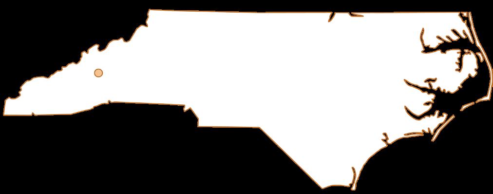
ASHEVILLE, NC
ARCH STUDIO V
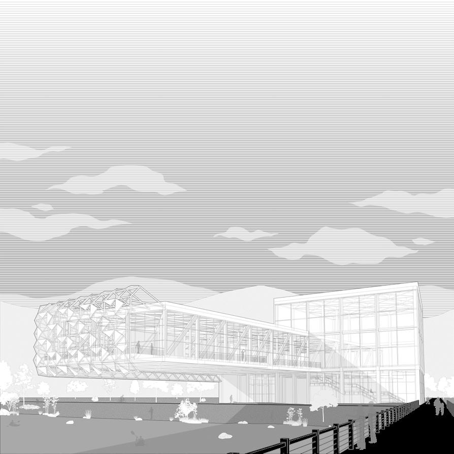
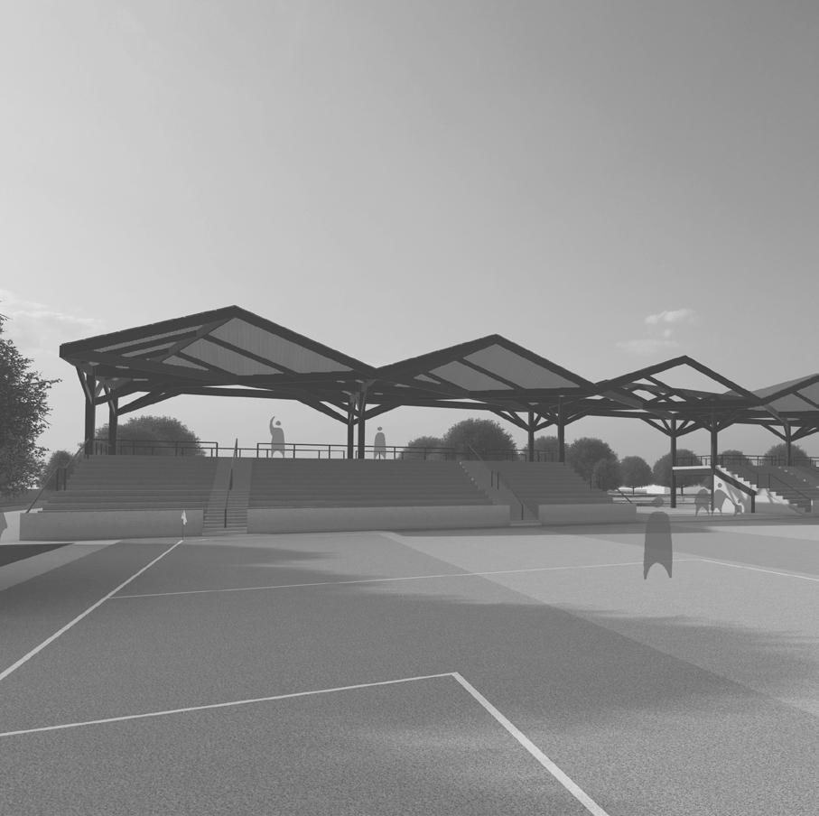
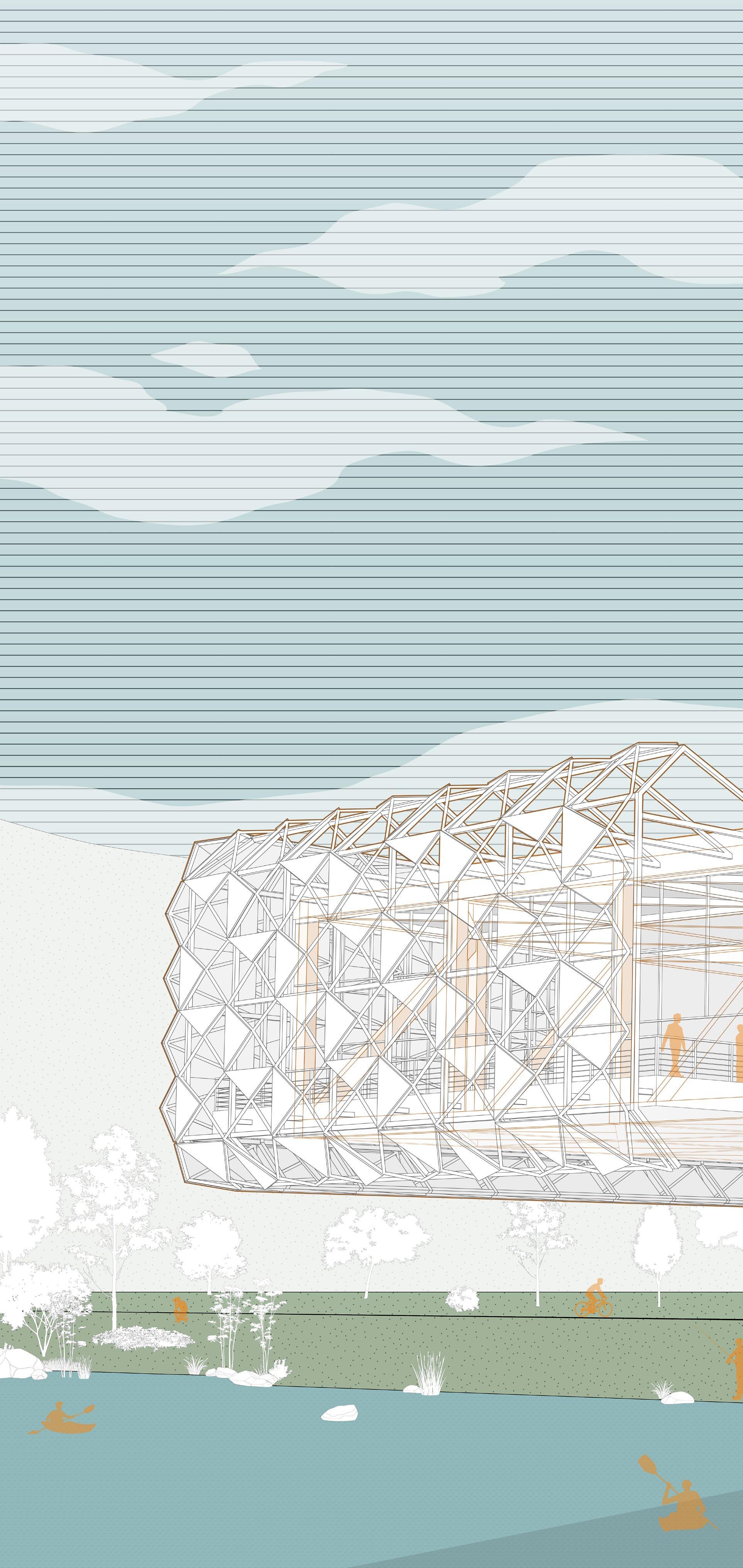
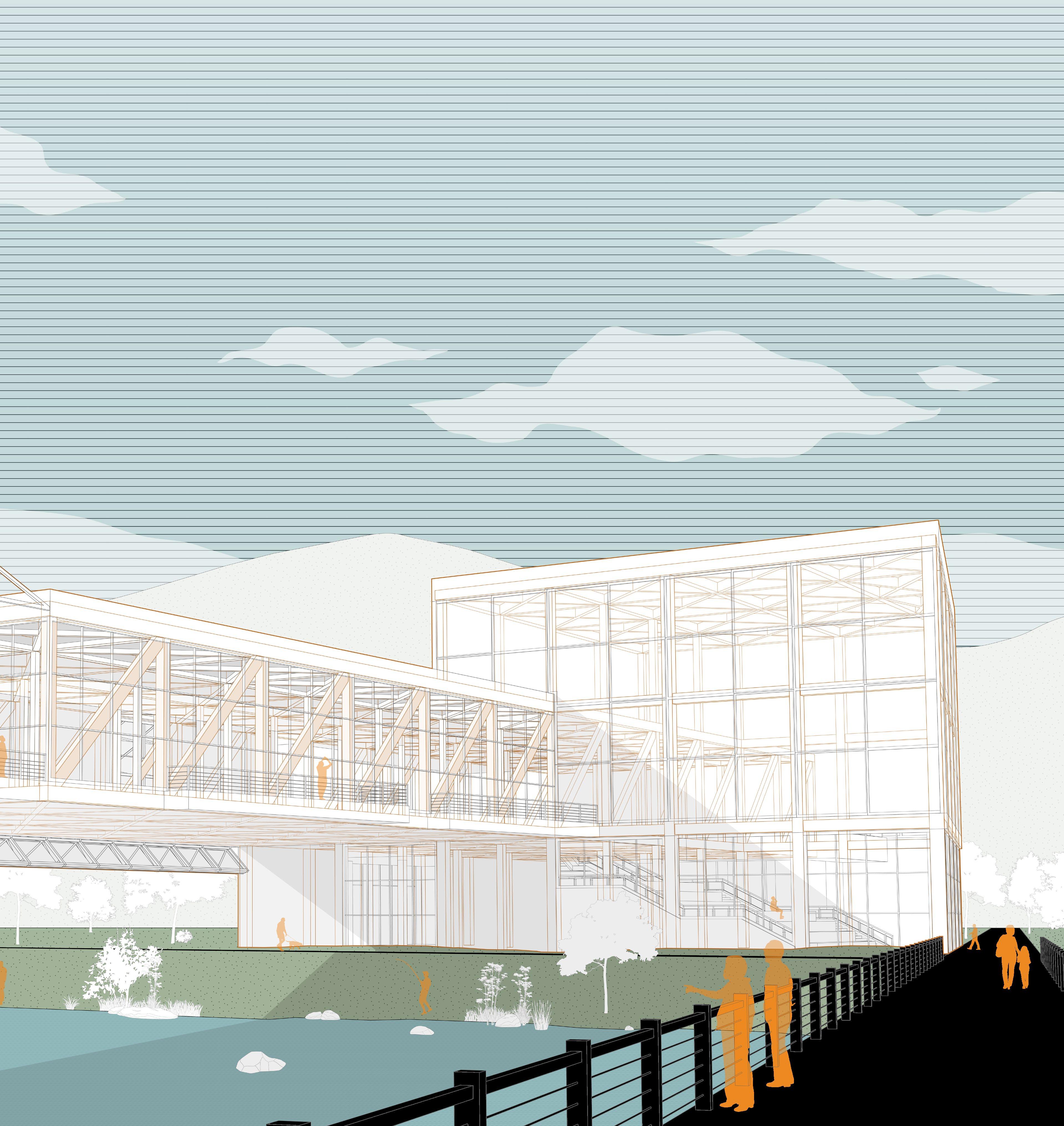
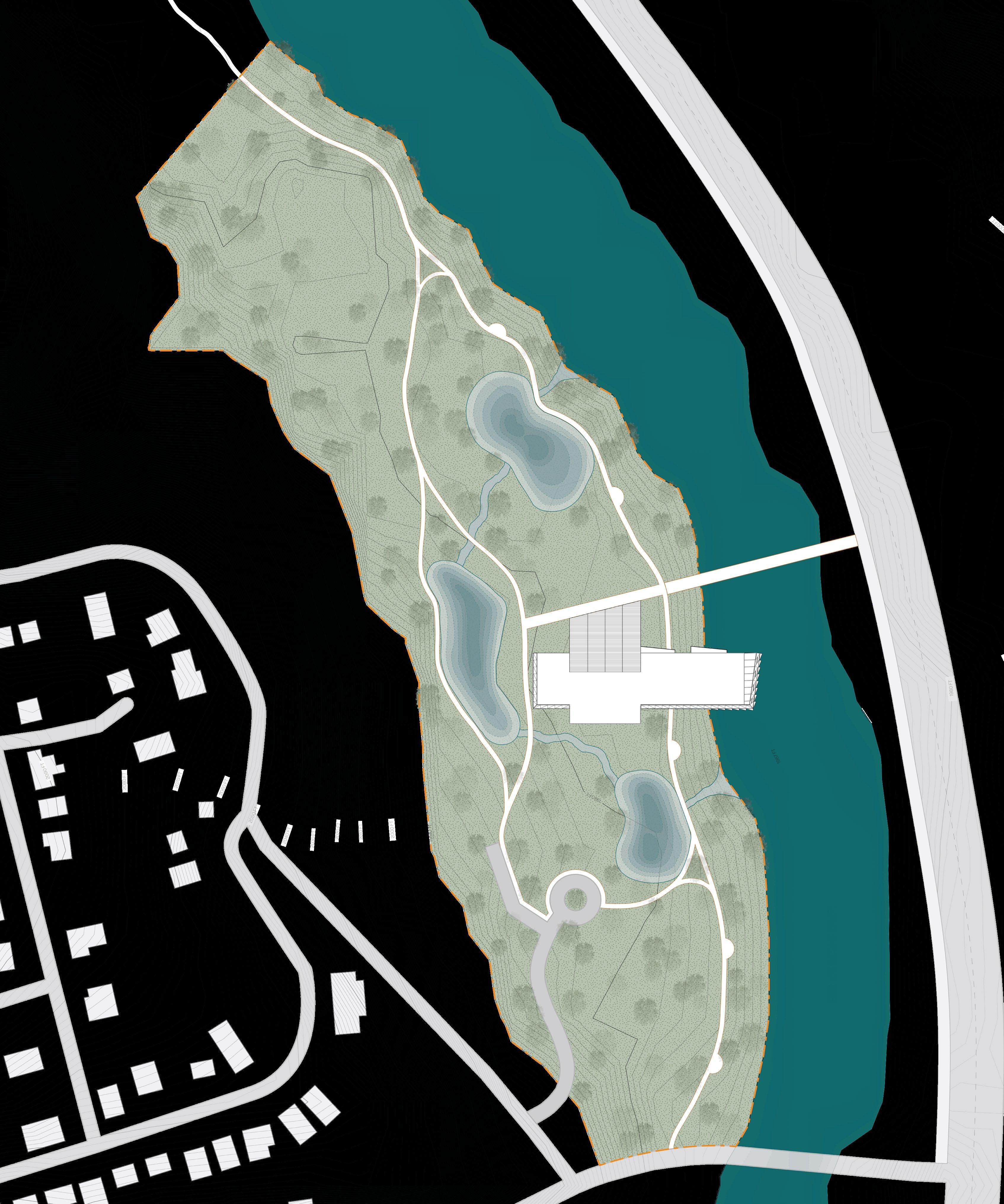
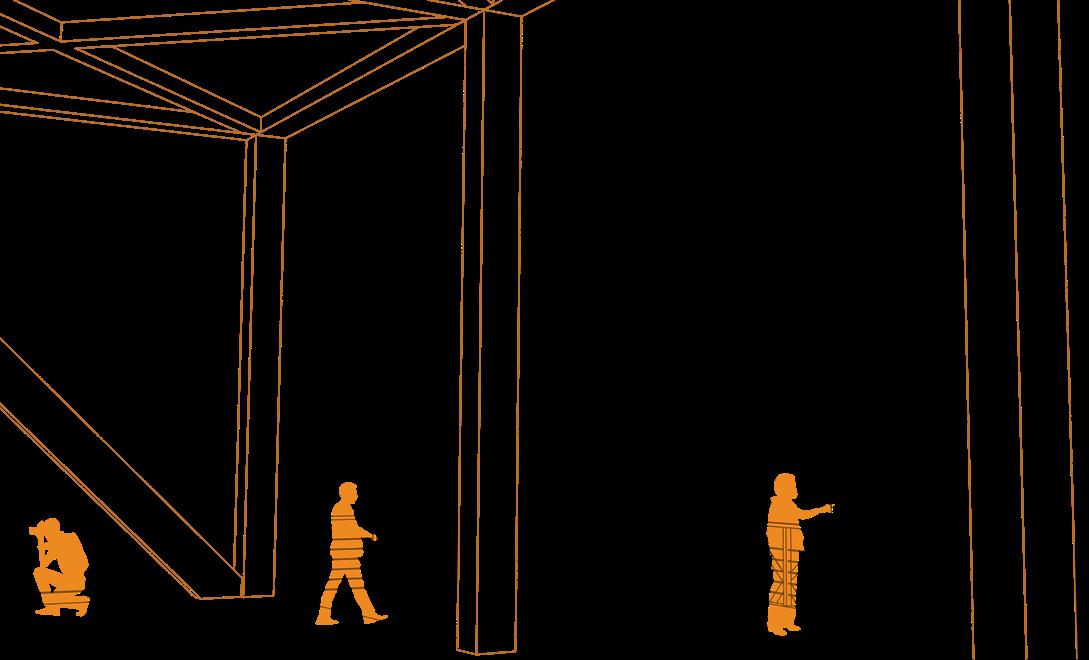
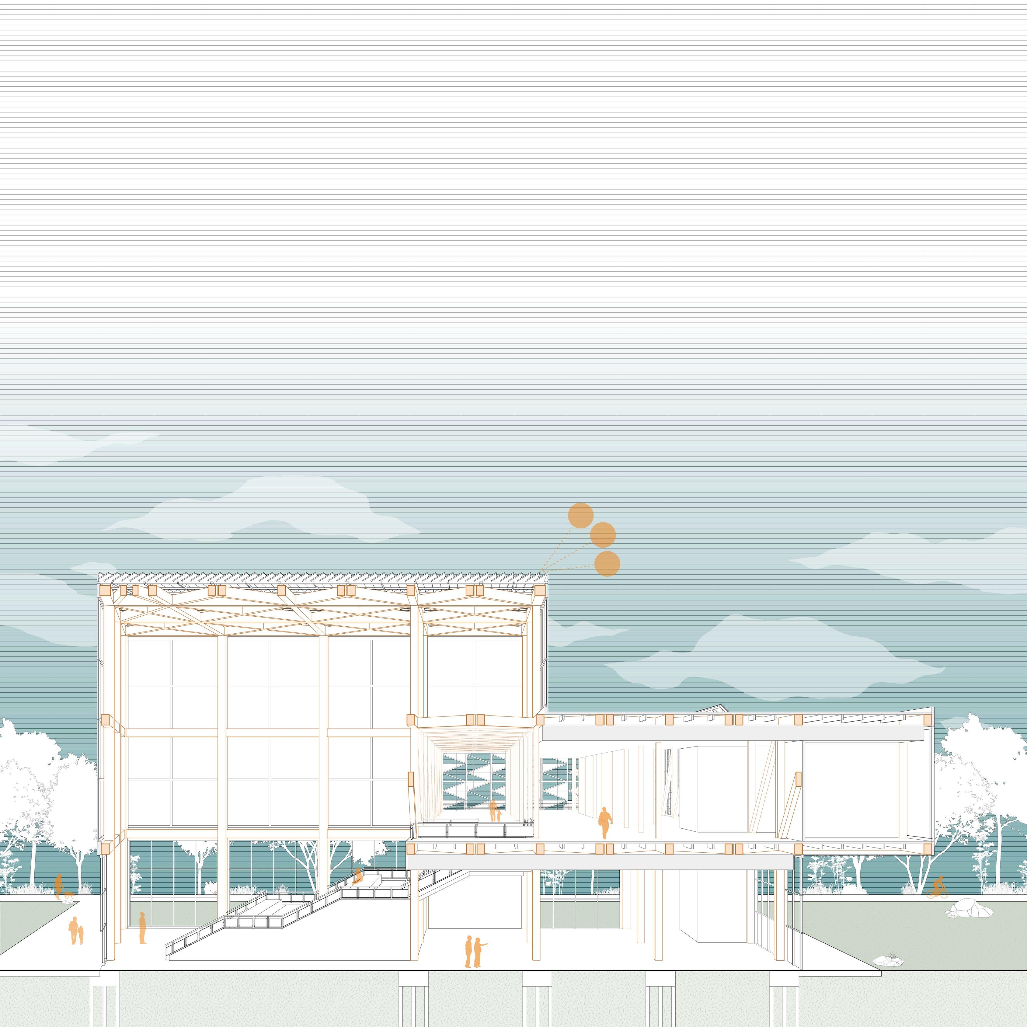
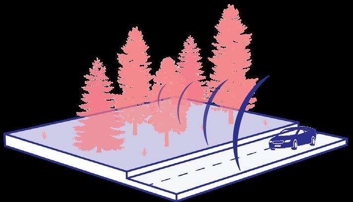
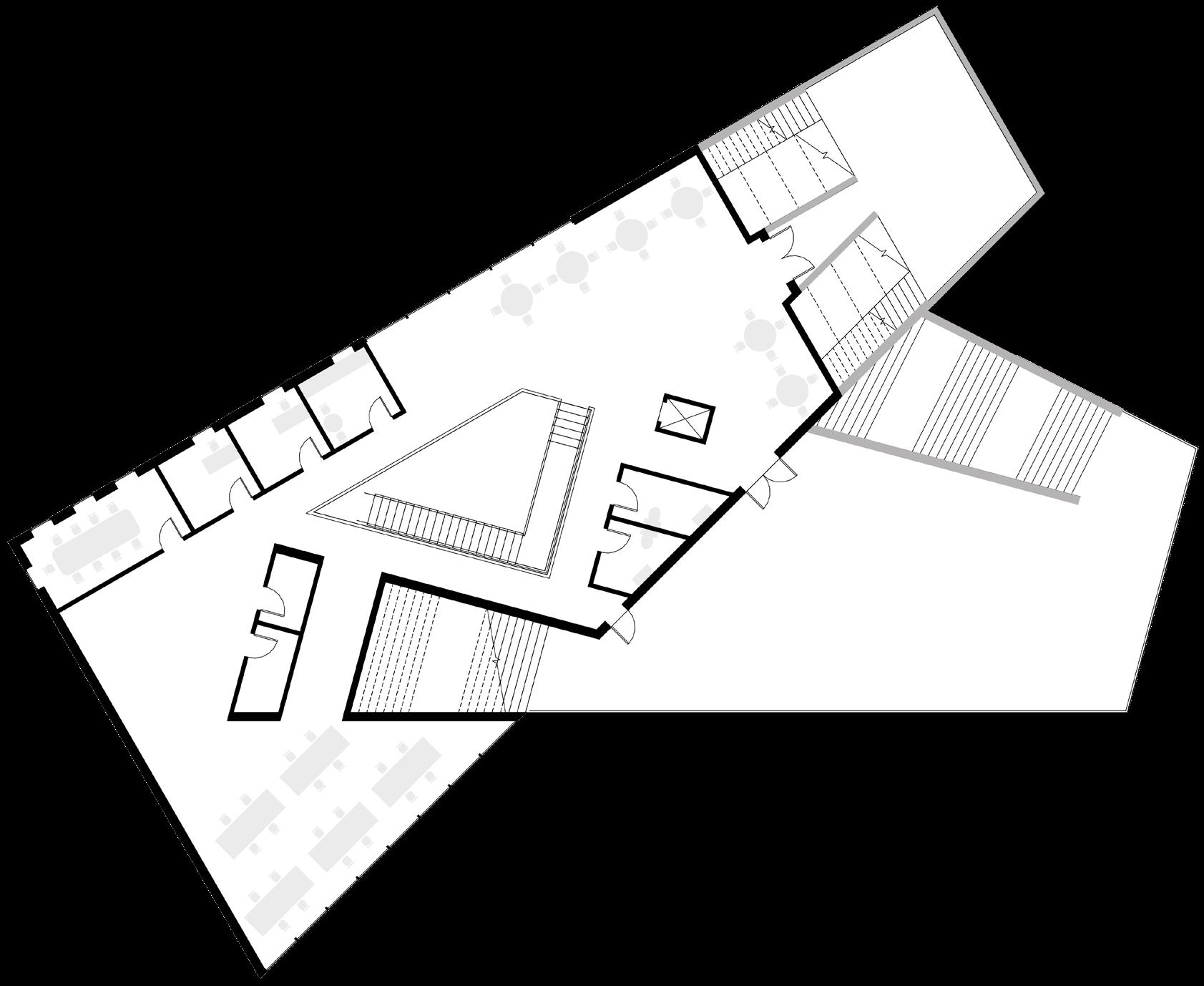
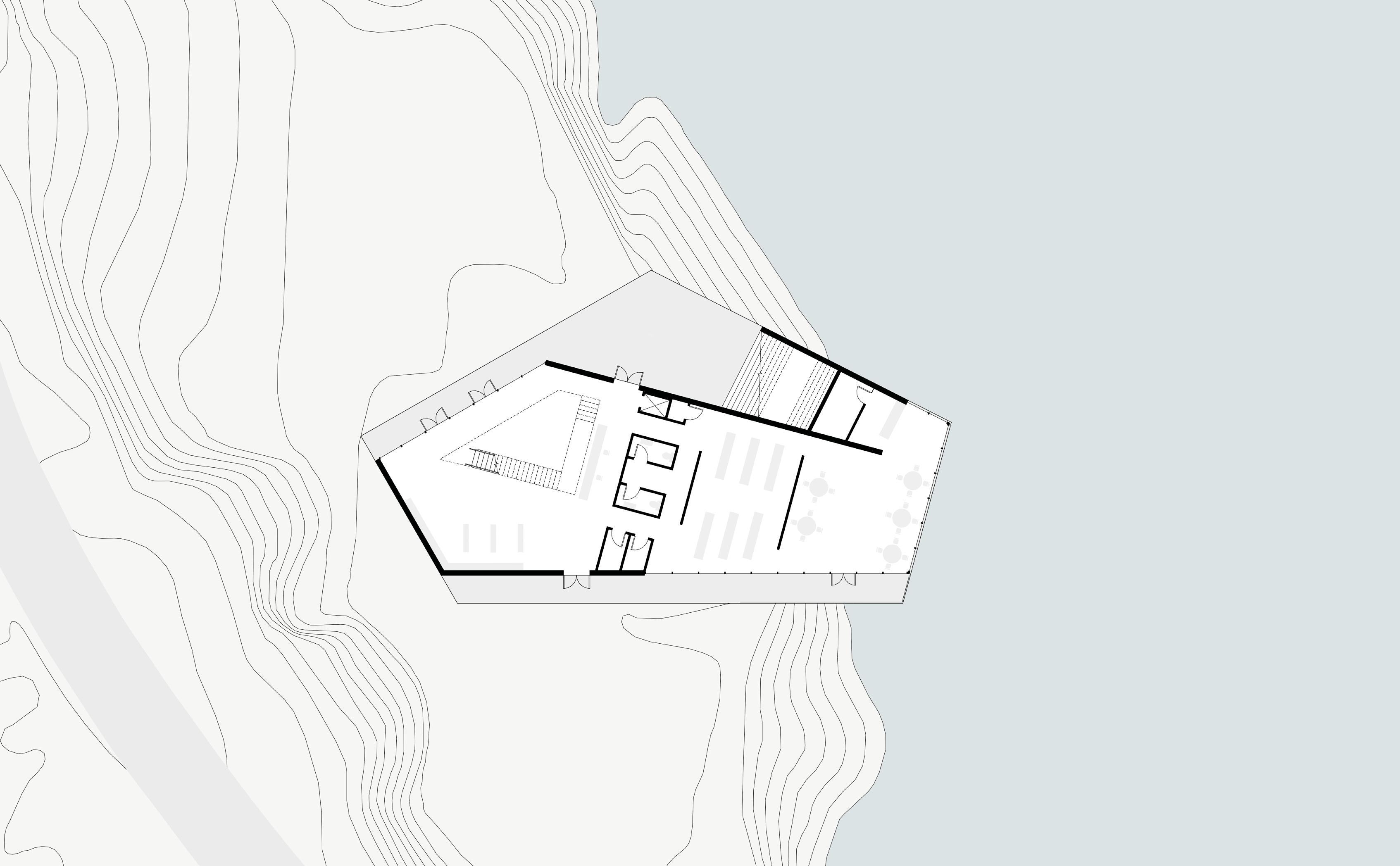
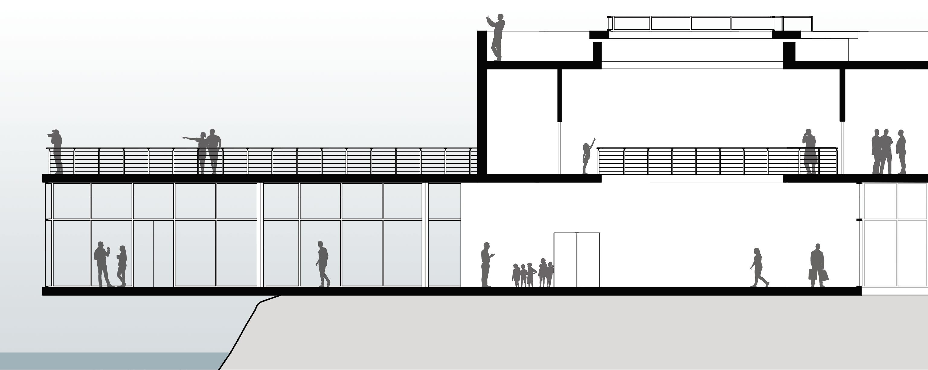
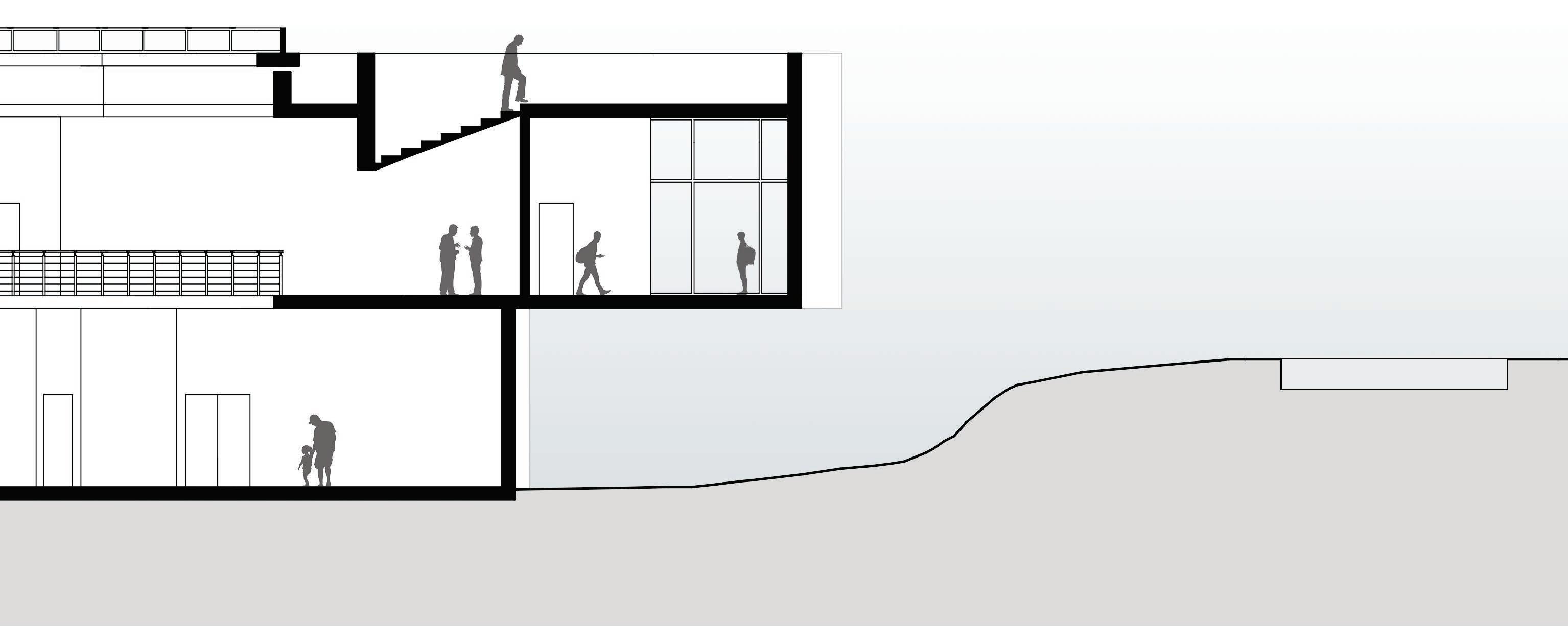
Located in ASHEVILLE, NORTH CAROLINA, Hydroscape is an ENVIRONMENTAL AWARENESS and COMMUNITY CENTER that is strategically cantilevered over the French Broad River. Utilizing an HSS steel structure, the architecture not only spans over the historic river but also symbolizes a COMMITMENT TO SUSTAINABILITY AND UNITY within the local community. Hydroscape’s purpose is to raise awareness about WATER MANAGEMENT and sustainability practices, promoting positive change in individuals and communities alike. Through RESEARCH EXHIBITS, IMMERSIVE WORKSHOPS, AND COMMUNITY EVENTS, locals and visitors are empowered to embrace greenminded lifestyles and become stewards of the environment.
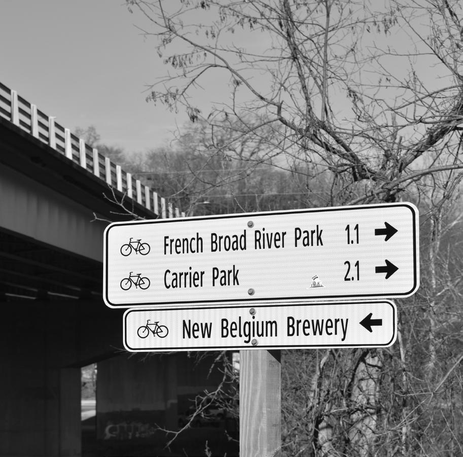
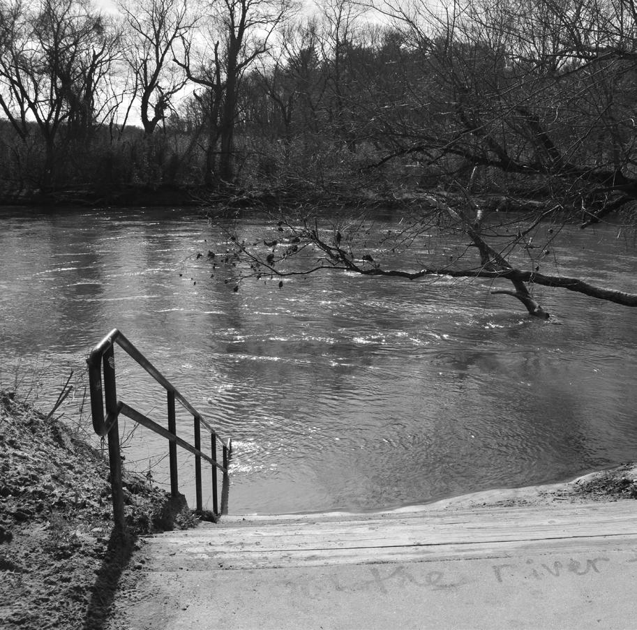
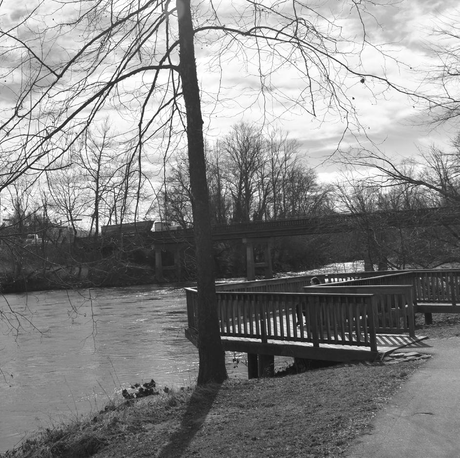
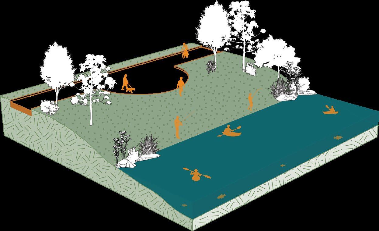
RIVER WALK
This sign is located on a busy walking trail that follows the French Broad River and passes through the site.
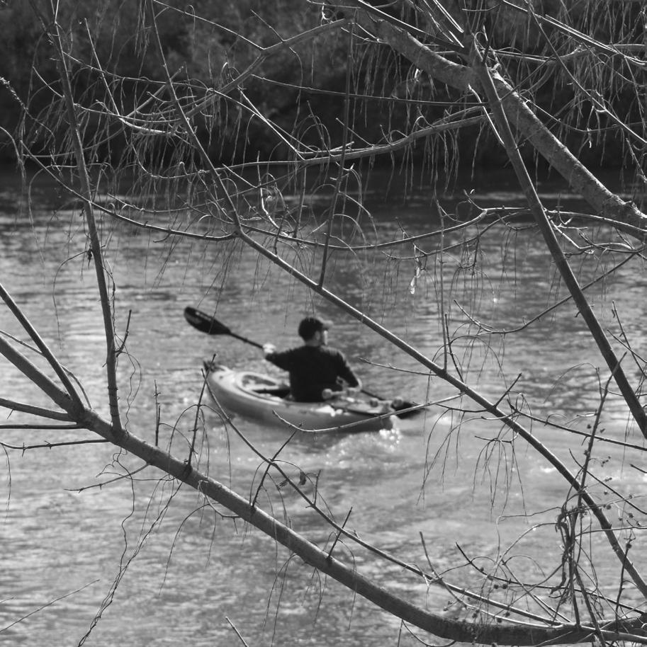
RECREATION
Locals and tourists use the river for various recreation such as canoing, tubing, fishing, rafting, etc.
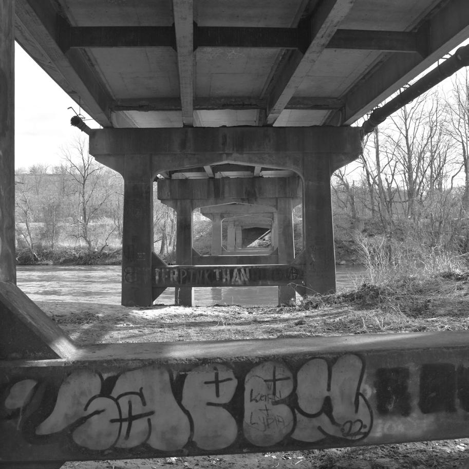
AMBOY RD BRIDGE
A view under the main point of vehicular entry to the site that additionally spans the French Broad River.
ACCESS
Multiple points of river access are located on the main river walk. Here people can enjoy the water.
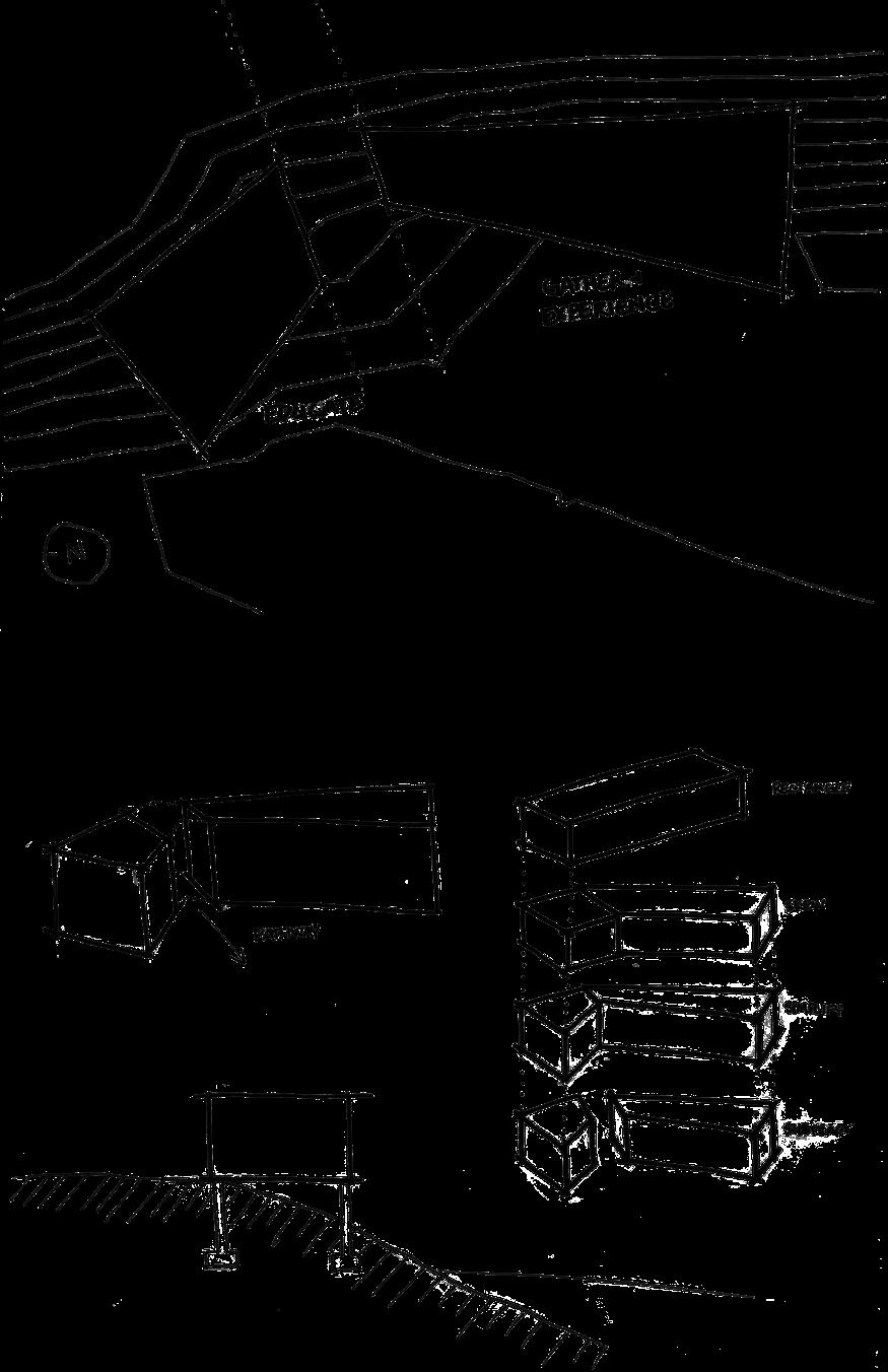
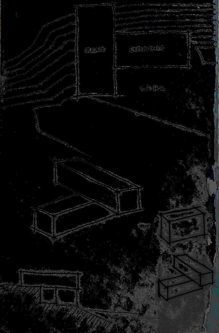
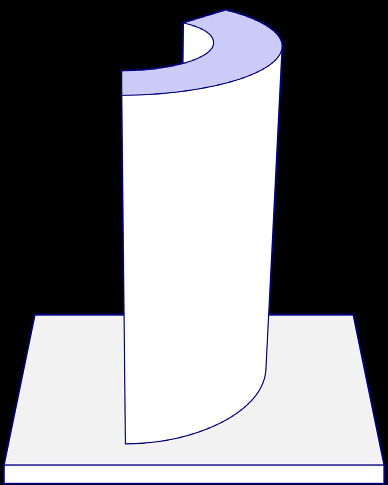
MASSING IDEATION
RESEARCH
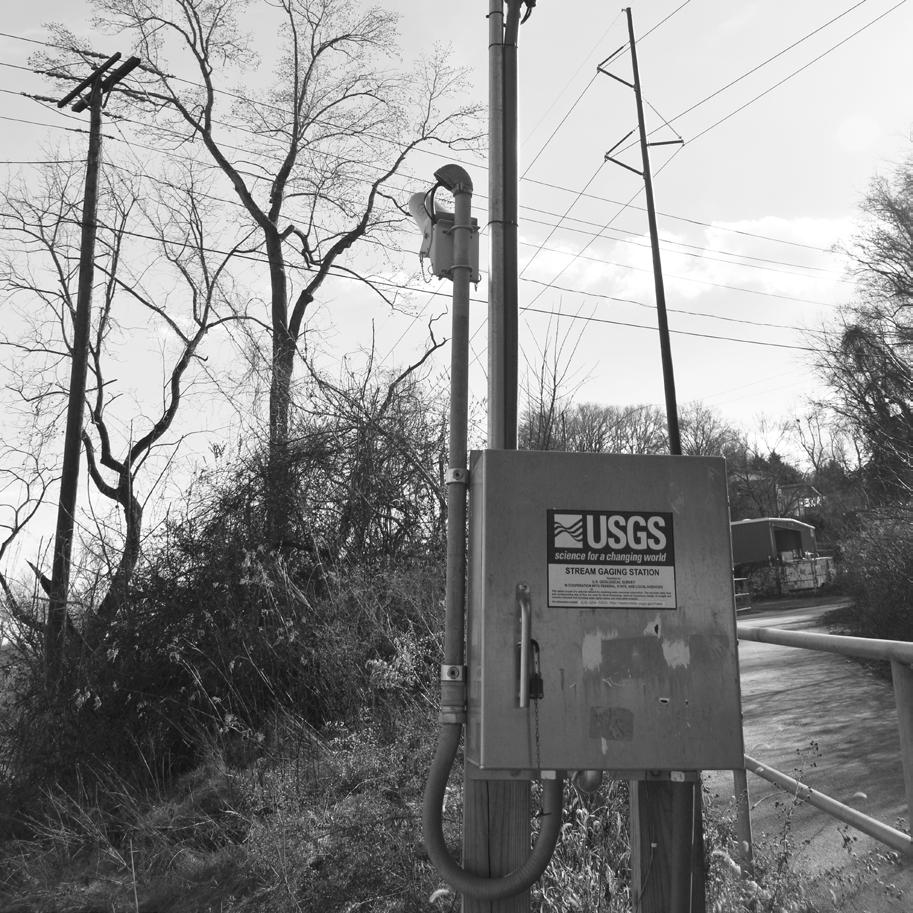
This USGS Station actively measures, records, and posts several features of the French Broad River.
VIEW
Viewing decks are also present off of the river walk path. These project off of the bank and over the river.
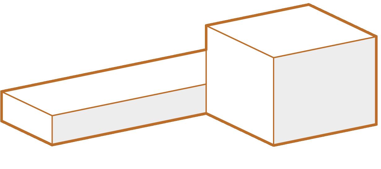
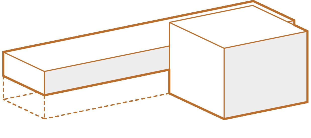
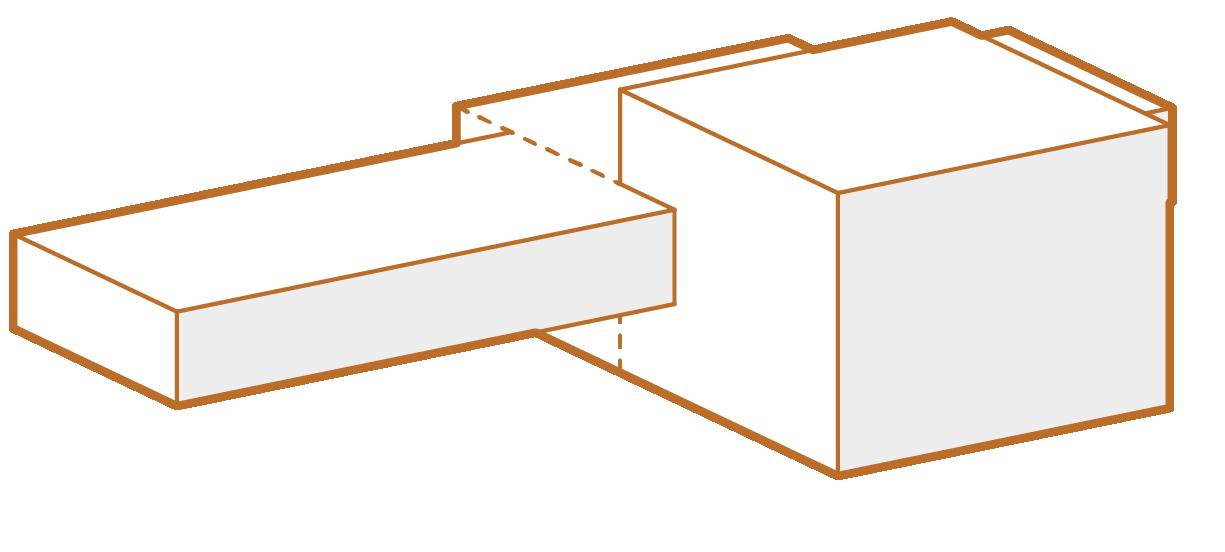
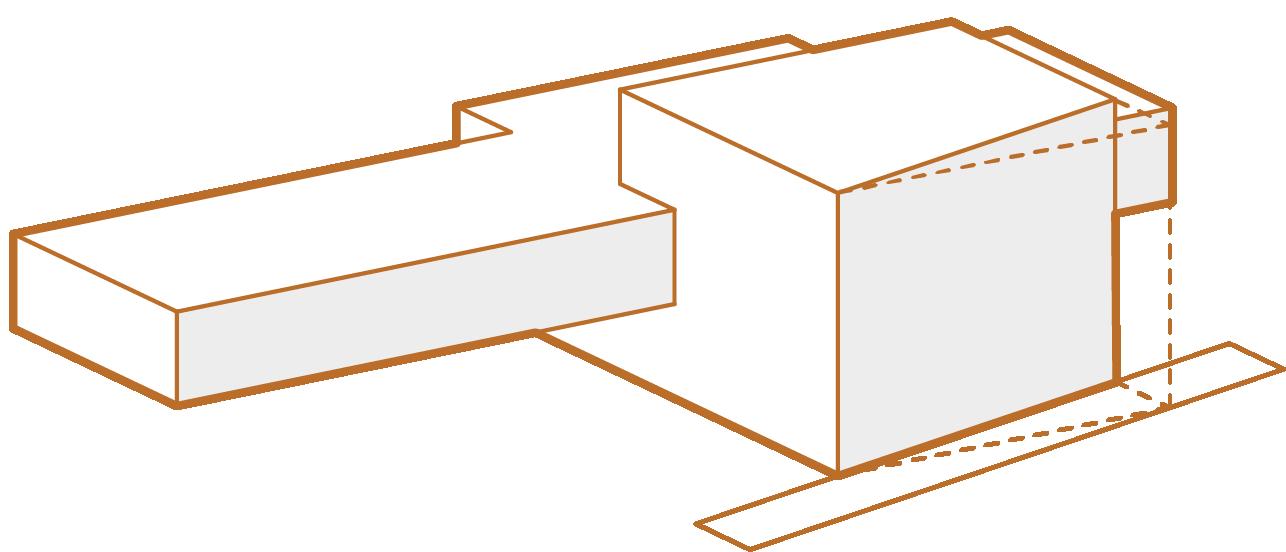
FINAL MASSING
PROGRAM
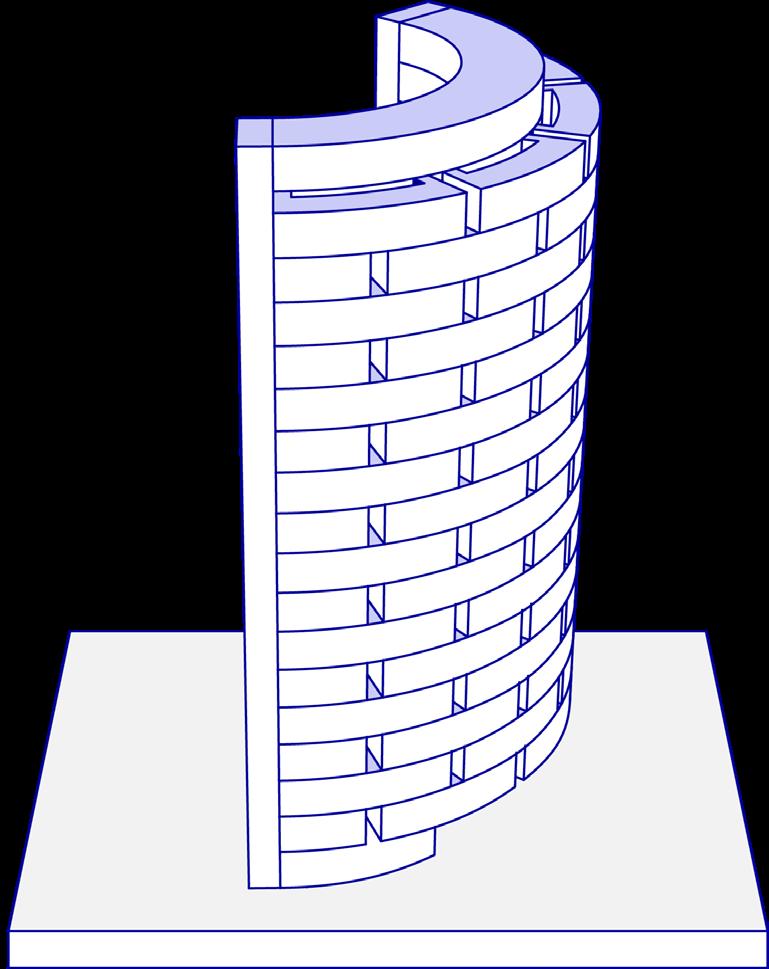
The original mass was created based on the existing site conditions. This east to west spanning mass allows for maximum sun exposure and control.
ELEVATE
The linear mass is elevated from the ground and cantilevered over the French Broad River. This mass visually bridges and connects the land and water.
MERGE
The cantilever and tower are merged to join the various program. The long spanning cantilever structure is reinforced and supported by the tower.
SLICE
A slice of the entry tower is removed by a pathway created by a new pedestrian bridge. This new point of entry leads users to the main entrance.
ASHEVILLE, NORTH CAROLINA
VEHICULAR
BUILDING
PEDESTRIAN BRIDGE
RETENTION POND
DRAINAGE CREEK
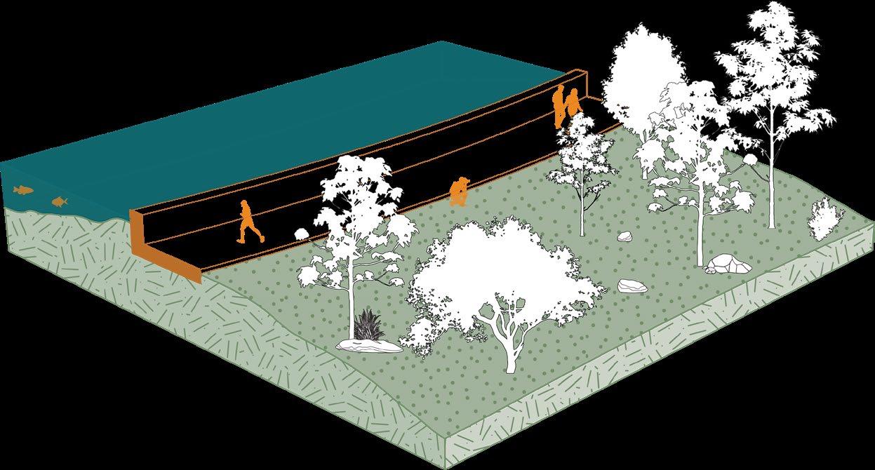
RIVER WALK
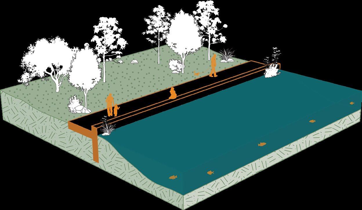
A: RIVER ACCESS
The French Broad River is the center for may recreational activities such as rafting, tubing, kayaking, & fishing. Providing river access will promote public interaction and enjoyment.
1. FRENCH BROAD RIVER WATER
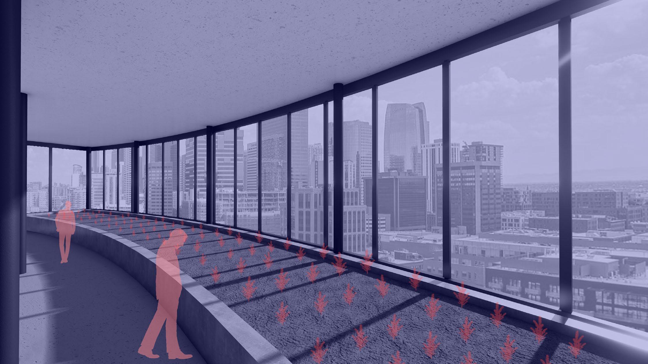
B: RETAINING WALL
This specific pathway is located next to a retaining wall that encloses a retention pond. This allows users to see the surface of the water, vegetation, and wildlife at eye level.
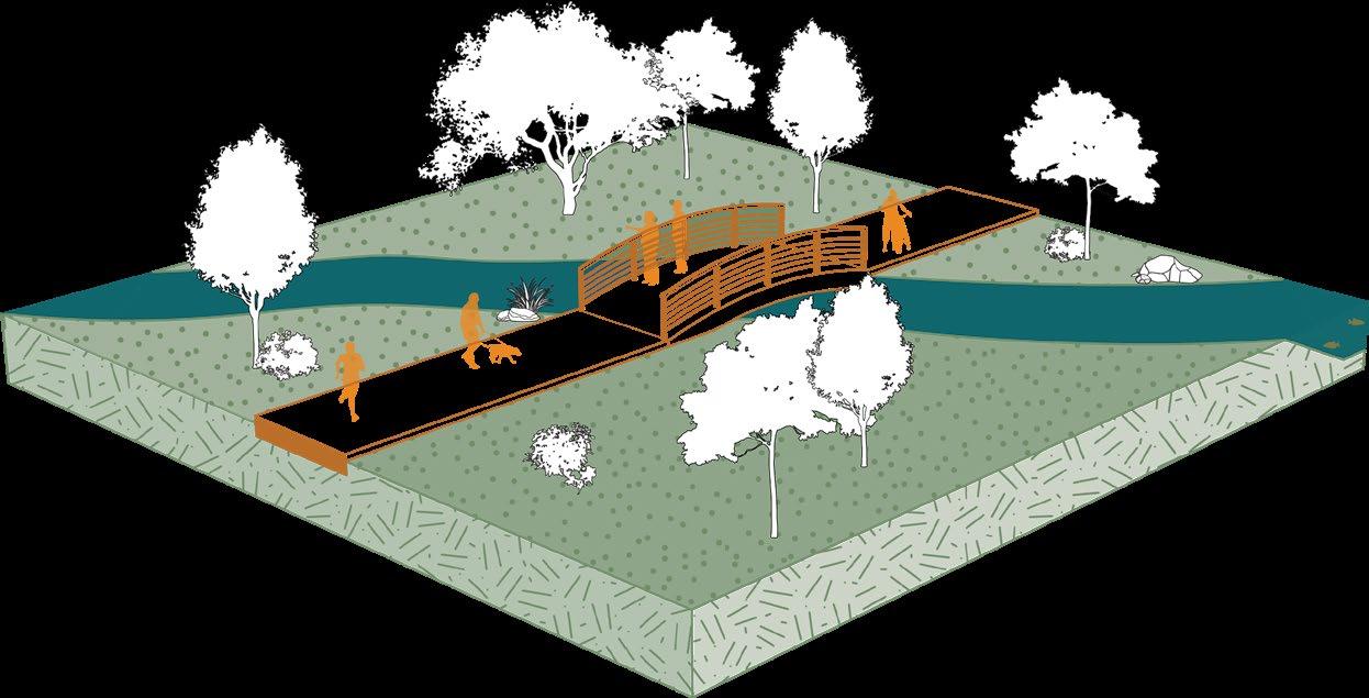
C: CREEK BRIDGE
All paths that lead to the entry of the building cross over a body of water. This threshold allows users to acknowledge the importance of water on the site before entering the building.
D: RETENTION POND
This pathway is located at the same elevation as the retention pond. This allows users to sit along the water’s edge and look at the vegetation and wildlife living within the water.
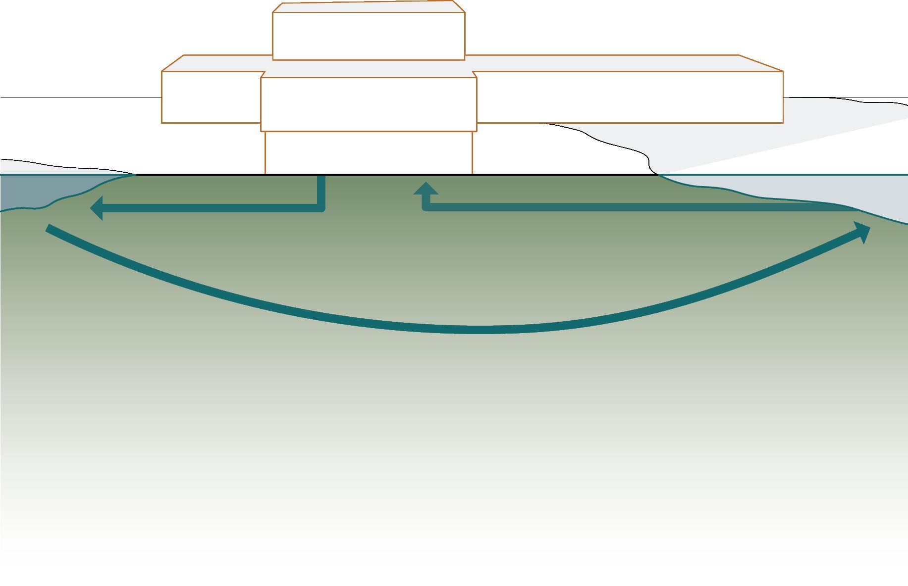
The French Broad River is heavily polluted by grazing cattle waste and outdated sewer & septic systems up river. This unhealthy and contaminated water is pumped into the building for use and treatment.
2. WATER USE
The incoming contaminated water is used for the building’s gray water systems such as toilets, urinals, and surrounding landscape irrigation. The remaining gray water is treated on site.
3. FILTRATION
The gray water waste from the building and the river is sent through a filtration process. After several contaminates are removed, the water is pumped into the primary retention pond located directly west of the building.
4. CLEAN WATER
The plants and fish that live within the retention pond act as the last stage of filtration. Eventually, the water seeps into the ground or flows back into the French Broad River cleaner and healthier than before.
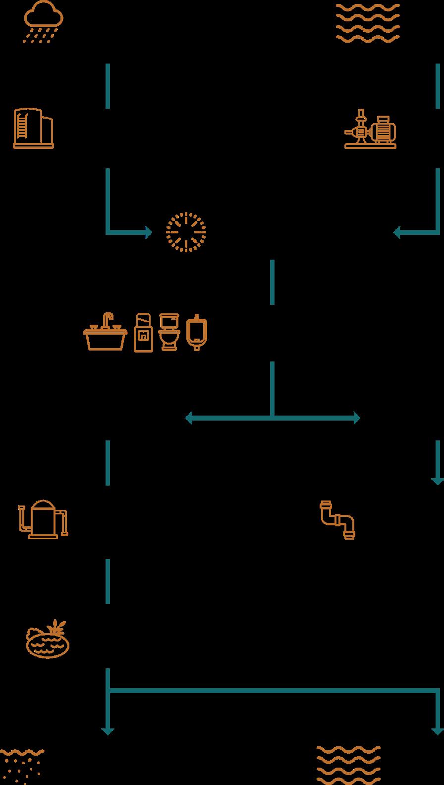
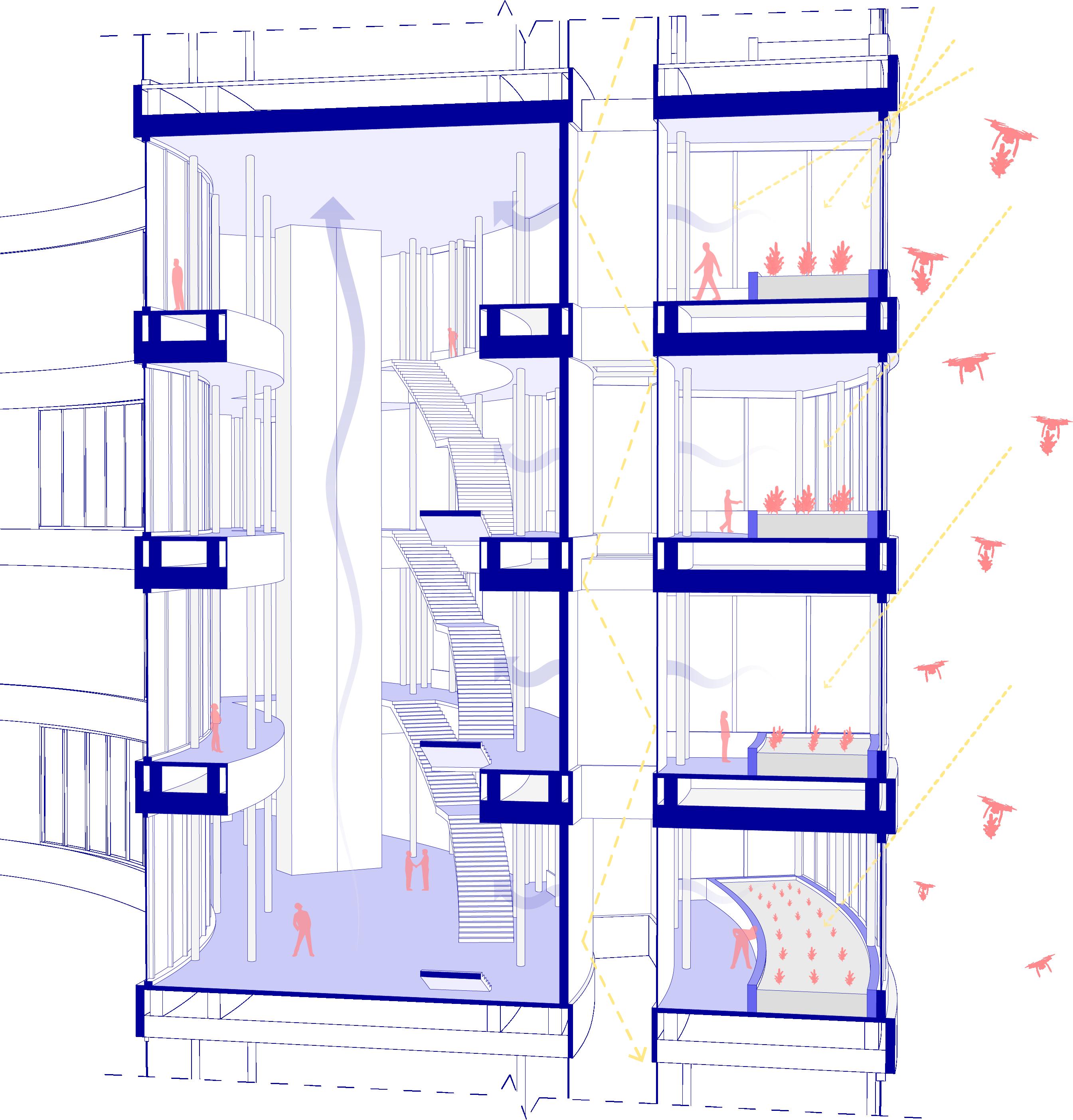
WATER MANAGEMENT SYSTEM
RAIN WATER (ROOF) RIVER WATER (POLLUTED)
WATER CISTERN WATER PUMP
POTABLE WATER UV FILTRATION
SINKS, DRINKING WATER, TOILETS, URINALS
GREY WATER BLACK WATER
TREATMENT TANK
RETENTION POND
GROUND WATER RECHARGE
WATER TREATMENT PLANT
RIVER WATER (CLEAN)
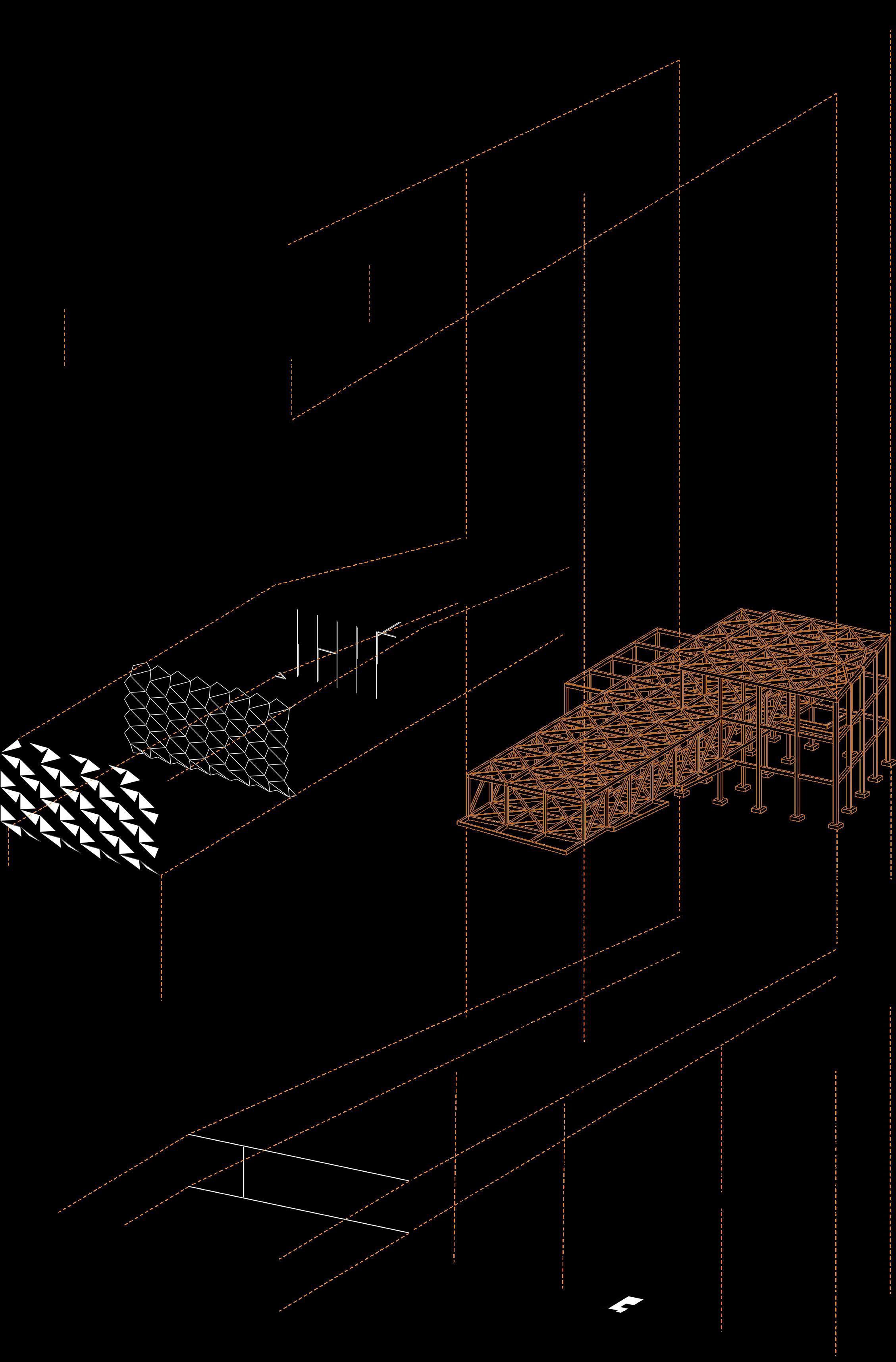
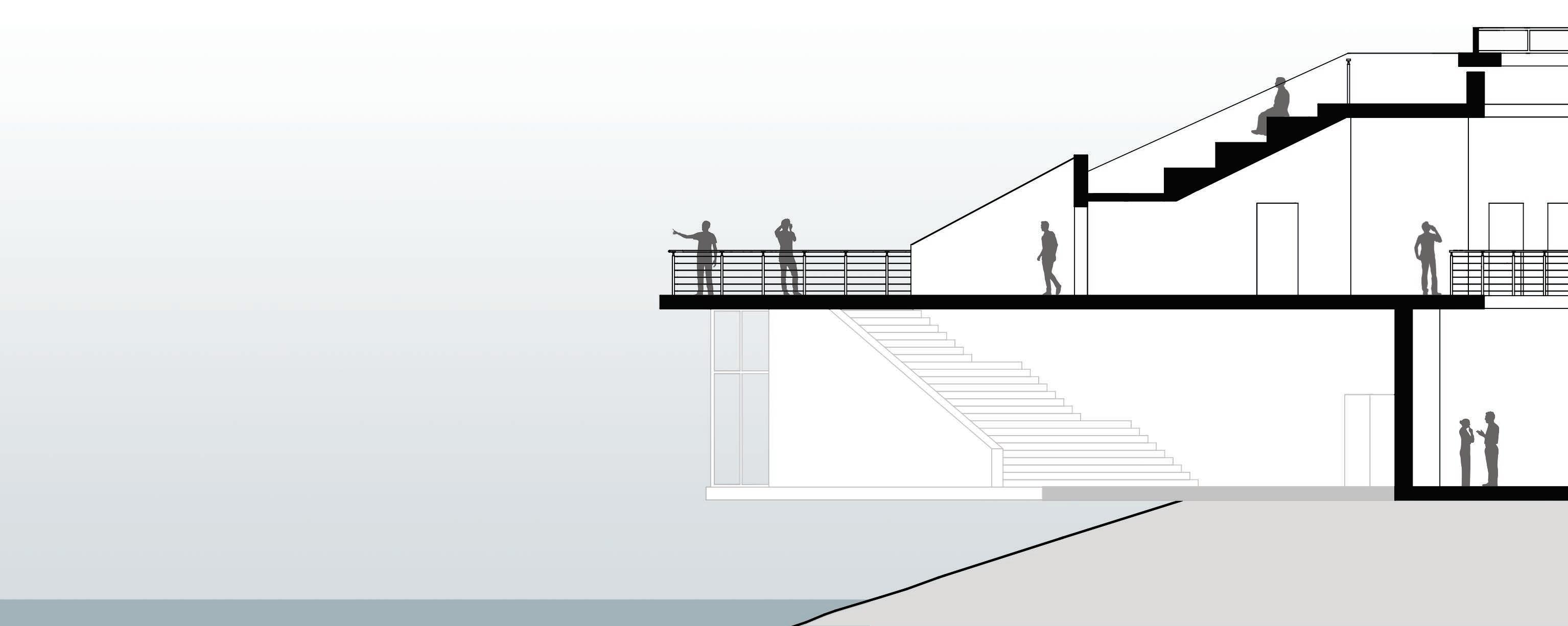
ATRIUM STAIRS
PRIMARYFRAMING
SECONDARYFRAMING
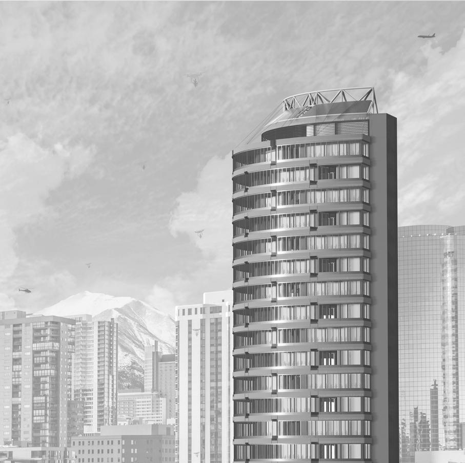
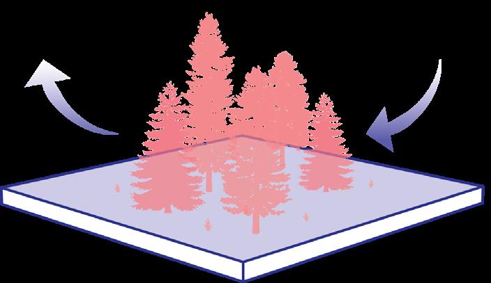
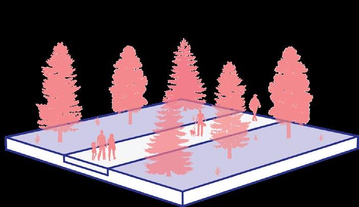
REFORESTATION HUB
URBAN SKYSCRAPER
4TH YEAR
DURATION: 10 WEEKS +REVISIONS
PROJECT TYPE: INDIVIDUAL COMPETITION
SOFTWARE: RHINO 3D GRASSHOPPER
LUMION ILLUSTRATOR PHOTOSHOP INDESIGN
PROCREATE
FALL 2023
ARCH STUDIO IV
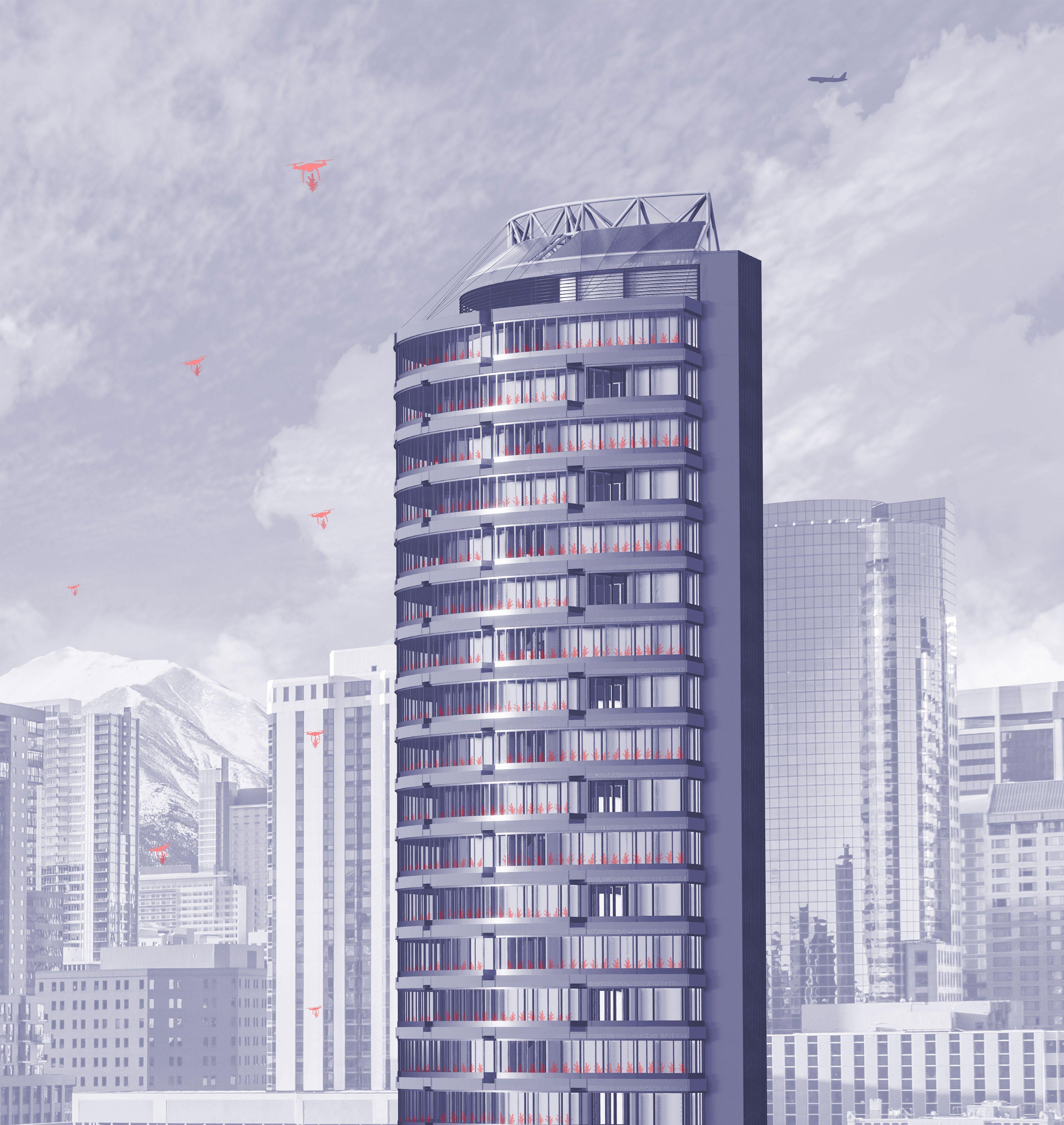
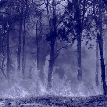
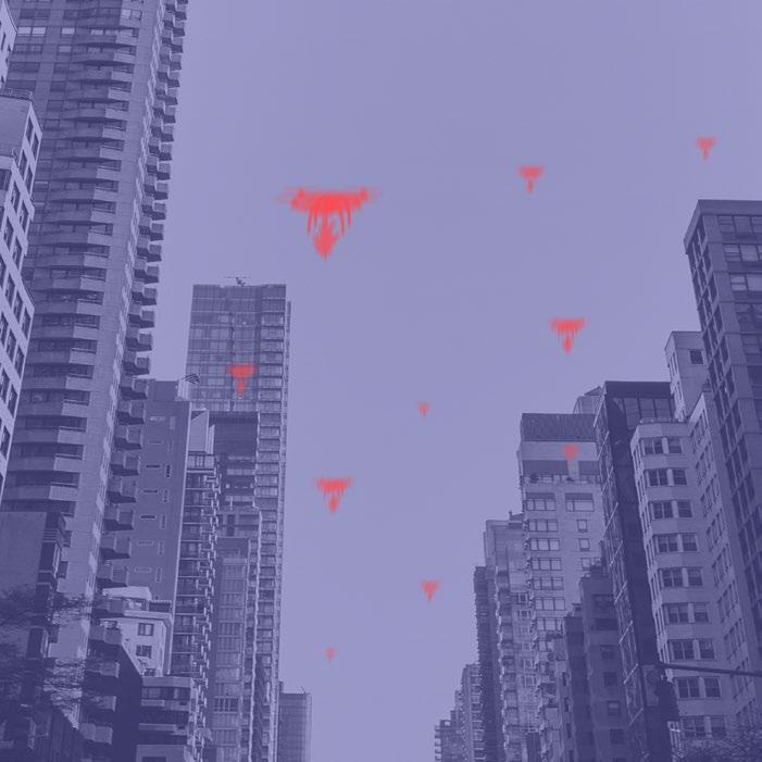
In Earth’s complex ecosystem, TREES are essential to sustaining life, yet approximately 41 million are cut down each day, threatening both human and tree existence. The URBAN REFORESTATION HUB replenishes the global tree population while providing densely inhabited urban areas with the vast benefits of trees. The architecture creates spaces that GROW TREES from SEED TO SAPLING which are then distributed and planted via DRONE in nearby deforested regions. Although the test site is situated in DENVER, COLORADO, its model can be implemented in urban cities worldwide.
DENVER, CO
WHAT IS DESTROYING THE FORESTS?
LOGGING INVASIVE SPECIES
URBANIZATION
HOW DO TREES BENEFIT US?
CO2 ABSORPTION
NOISE DAMPENING
AGRICULTURE WILDFIRES
80% of all deforestation is caused by agricultural production.
5.2 million hectares of tree cover are lost to wildfires each year. 15 billion trees are cut down annually because of the logging industry.
CLIMATE CHANGE
Droughts, extreme weather, etc. destroy millions of hectares.
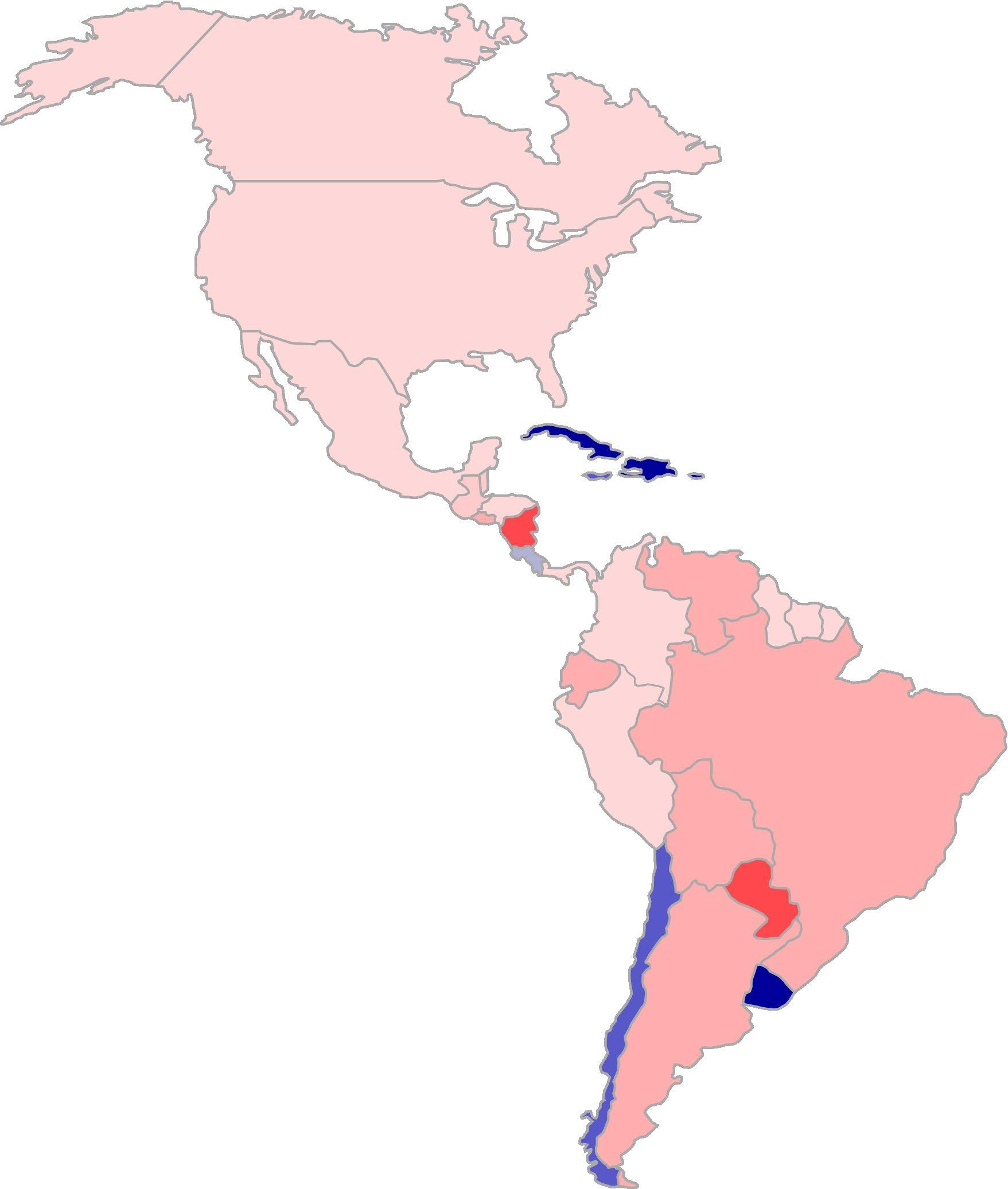
FOREST GROWTH CHANGE (1990-2020)
SITE FUTURE SITES
Source: Mapped: 30 Years of Deforestation, Niccolo Conte, 2021
After assessing the overall impact of the Urban Reforestation Hub and fine tuning the processes, it will be implemented in areas that experience extreme levels of deforestations such as Nicaragua, Brazil, and Paraguay.
On average 1 tree can absorb an estimated 48 lb of CO2 in one year.
HEAT REDUCTION
Trees can reduce ambient heat by up to 10° F in high heat areas.
A group of trees can dampen up to 6 dB of sound from their surroundings.
MOOD IMPROVEMENT
Trees can reduces stress, lowers blood pressure, and improves moods
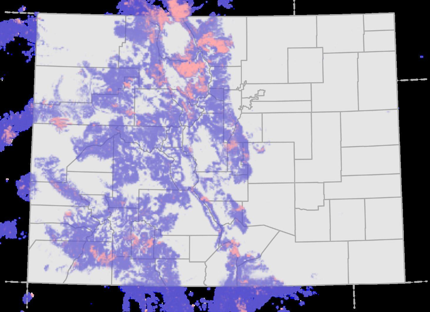
TEST SITE: DENVER, COLORADO
Source: Colorado, USA, Global Forest Watch, 2022
TREE COVER LOSS
PRIMARY FORESTS
The Urban Reforestation Hub is intended to serve as a model for cities near regions affected by deforestation. Denver, Colorado was chosen as the test site due to its growing urbanization and close proximity to the Rocky Mountain forests. The local tree population faces ongoing threats caused by invasive species like the mountain pine beetle and wildfires due to the dry climate and dense vegetation.
The Urban Reforestation Hub is intentionally designed as an urban skyscraper to address the global population shift from rural neighborhoods to urban cities. 4.4 billion people now live in cities which contribute 70% of the global CO2 emissions.
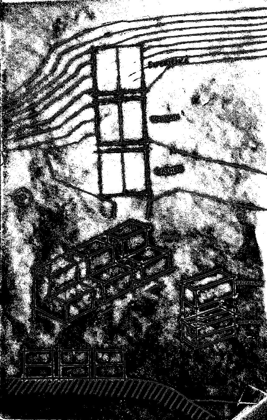
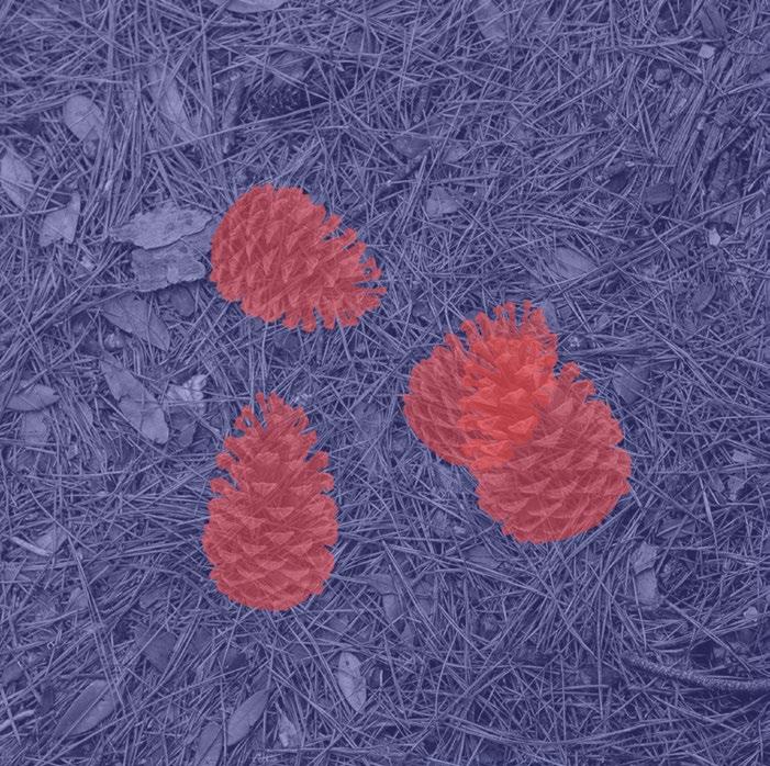
GATHER
Tree seeds are gathered from nearby forests and other areas to be stored within the building. They are only used for research in the lab spaces and grown when that specific species of tree is needed by certain regions.
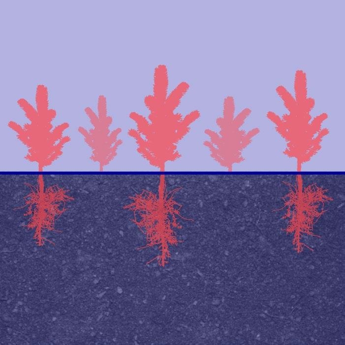
GROW
Trees are grown from seed to sapling within the building. A wide variety of local trees are able to develop together until they are small tree saplings. From there, they are removed from the tree nursery and prepped for distribution.
DISTRIBUTE
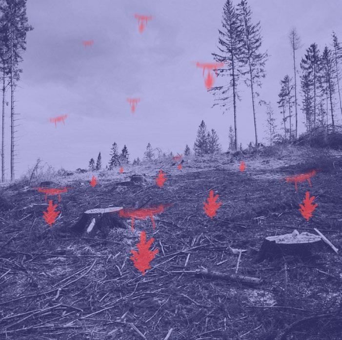
After preparation, the tree saplings are then loaded onto drones. The control center located on the top floor of the building guide drones to the deforested regions. Once the drones arrive, the trees are safely planted in the ground.
PLANT
The drones are programmed to deposit the tree saplings at the target location and then return back to the building. The tree saplings will continue to live and grow until they reach their full size, replenishing the deforested area.
REPLENISH
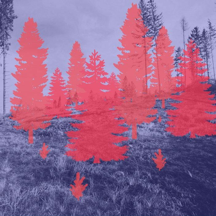
The replenished forest will revitalize the surrounding area. Trees will promote the return of local flora and fauna, creating a well balanced ecosystem once again. This cycle then repeats, replenishing new deforested areas.
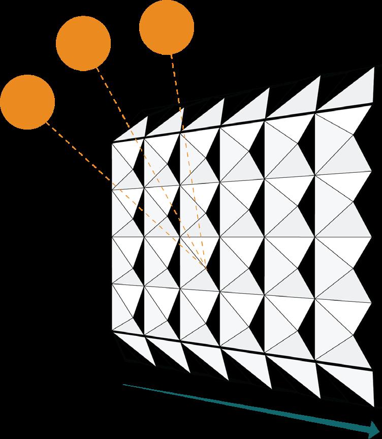
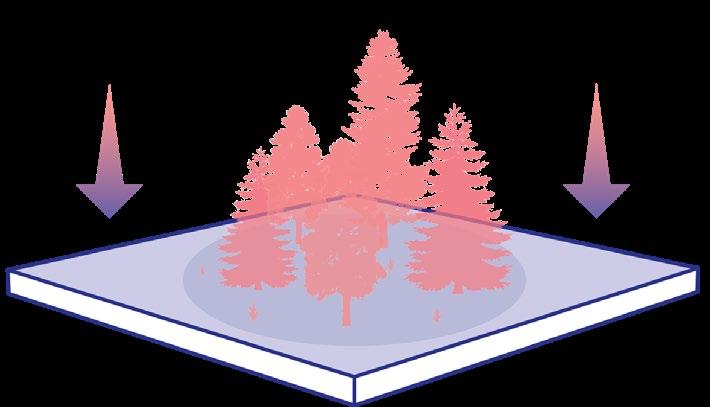
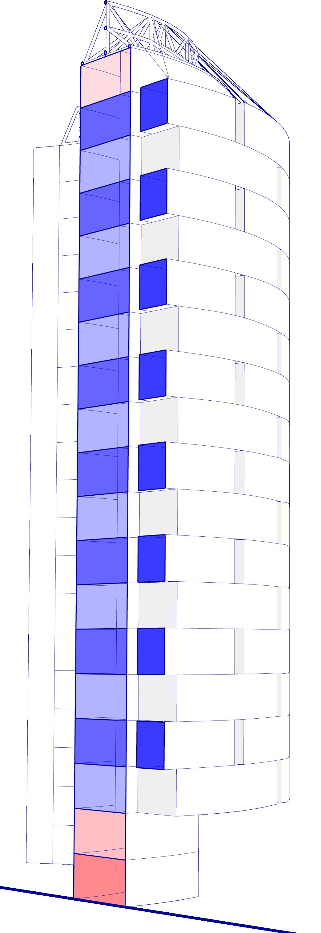
To promote growth, the sun angle for the 8 most intense hours of sunlight each day was utilized to create the building footprint. This flat 30,000 sq ft strip of land alone can cultivate ~15,000 tree saplings each year without room for supporting programs and distribution.
By extruding this strip upward and allocating space for key supporting programs like research, distribution, and storage, everything is centralized within the same area. Each 4-floor module can grow ~7,500 tree saplings each year due to efficient water use and care.
BASE SIMPLIFY PROJECT
Alternating masses are projected from the southern facade to create the tree nurseries. Light wells are subtracted to maximize sun exposure to the tree nurseries and building interior. Each 4-floor module can absorb ~163 tonnes of CO2 from the atmosphere each year.
PROGRAM
SURVEYING & CONTROL CENTER
Surveying equipment will monitor nearby forests, aiding in the detection of wildfire outbreaks and the implementation of effective containment strategies for responders. Also, tree distribution drones will be guided from here to their target areas and back.
TREE NURSERY
Trees will be grown from seed to sapling in periodic growing cycles per floor to ensure that there are always trees in the building. Various local tree species can be grown according to each floor.
DRONE MAINTENANCE & STORAGE
Drones will be utilized as the main mode of distribution for the tree saplings. Here they will be stored, charged, and maintained.
The supporting labs are specifically designed for improving the resilience of trees by studying relevant topics like invasive species and developing strategies to prevent them.
4-FLOOR MODULE
To effectively replenish the surrounding tree population in the area, a module system was created. This unit can be continuously stacked according to the tree population need in the area to ensure enough trees are being produced.
EDUCATIONAL EXHIBIT
An immersive exhibit at the ground level engages with the public to raise awareness and encourage the community to become more invested in their environmental impact.
LABORATORY ENTRANCE
The main entrance will be utilized by all building occupants, such as volunteers, scientists, students, or curious pedestrians.
FLOOR 4
TREE NURSERY LABORATORY STORAGE RESTROOM CENTRAL ATRIUM 1. 2. 3. 4. 5.
FLOOR 3
1. 2. 3. 4.
TREE NURSERY AGRICULTURE STORAGE
DRONE MAINTENANCE CENTRAL ATRIUM
FLOOR 2
TREE NURSERY LABORATORY STORAGE RESTROOM CENTRAL ATRIUM 1. 2. 3. 4. 5.
FLOOR 1
2. 3. 4.
TREE NURSERY AGRICULTURE STORAGE
DRONE MAINTENANCE CENTRAL ATRIUM
GROUND FLOOR MAIN ENTRY
SECTION: 4 FLOOR MODULE
TREE NURSERY
CENTRAL ATRIUM
DAFFIN PARK
PARK & STADIUM SAVANNAH, GA
SPRING 2023 3RD YEAR
DURATION: 10 WEEKS
PROJECT TYPE: INDIVIDUAL
SOFTWARE: RHINO 3D LUMION ILLUSTRATOR PHOTOSHOP INDESIGN PROCREATE
ARCH STUDIO III
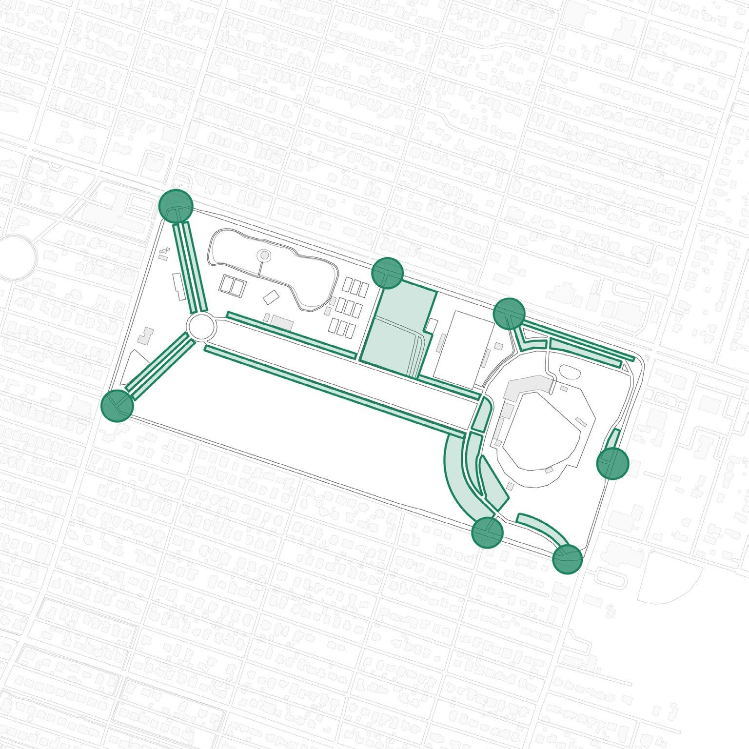
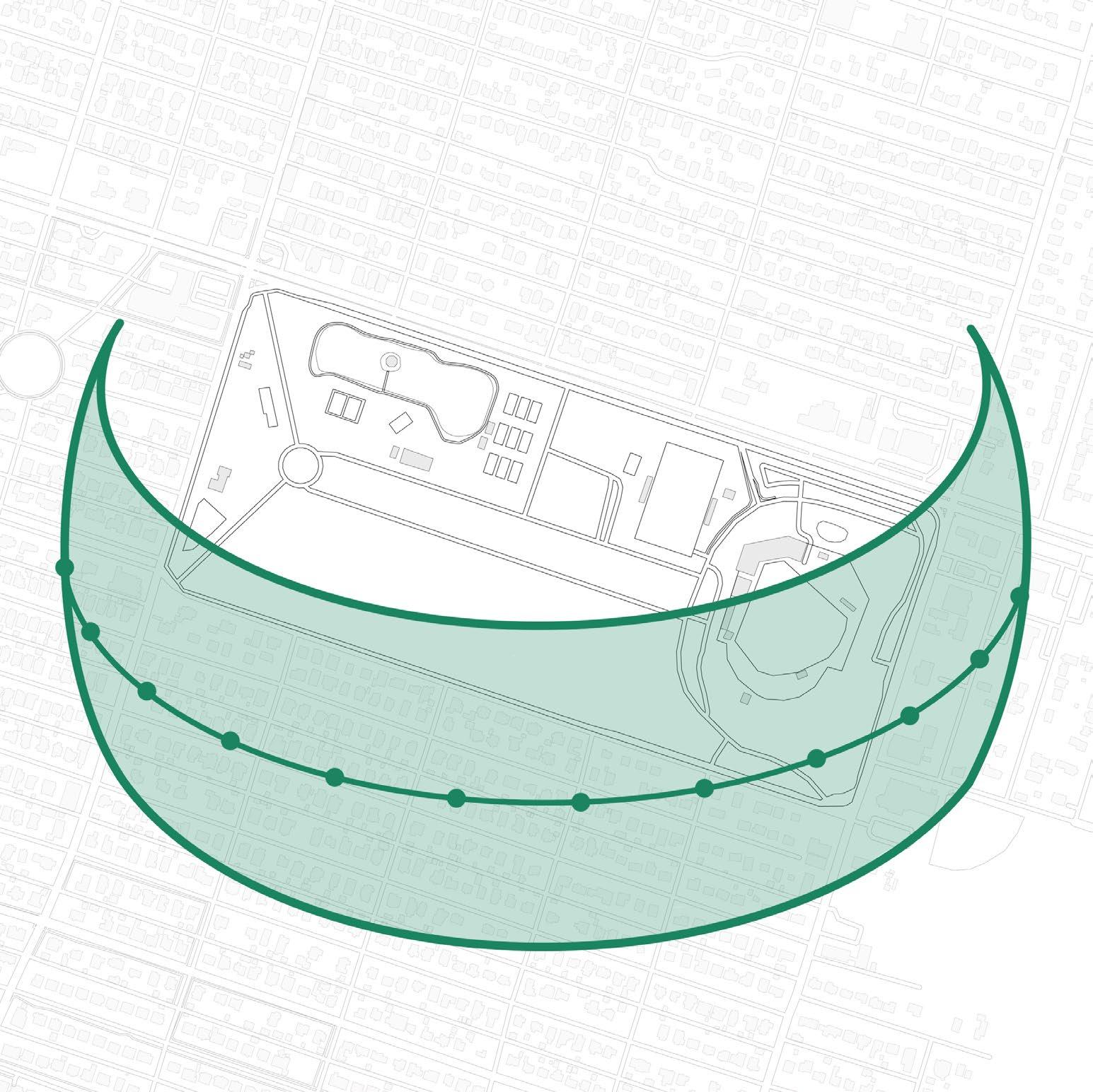
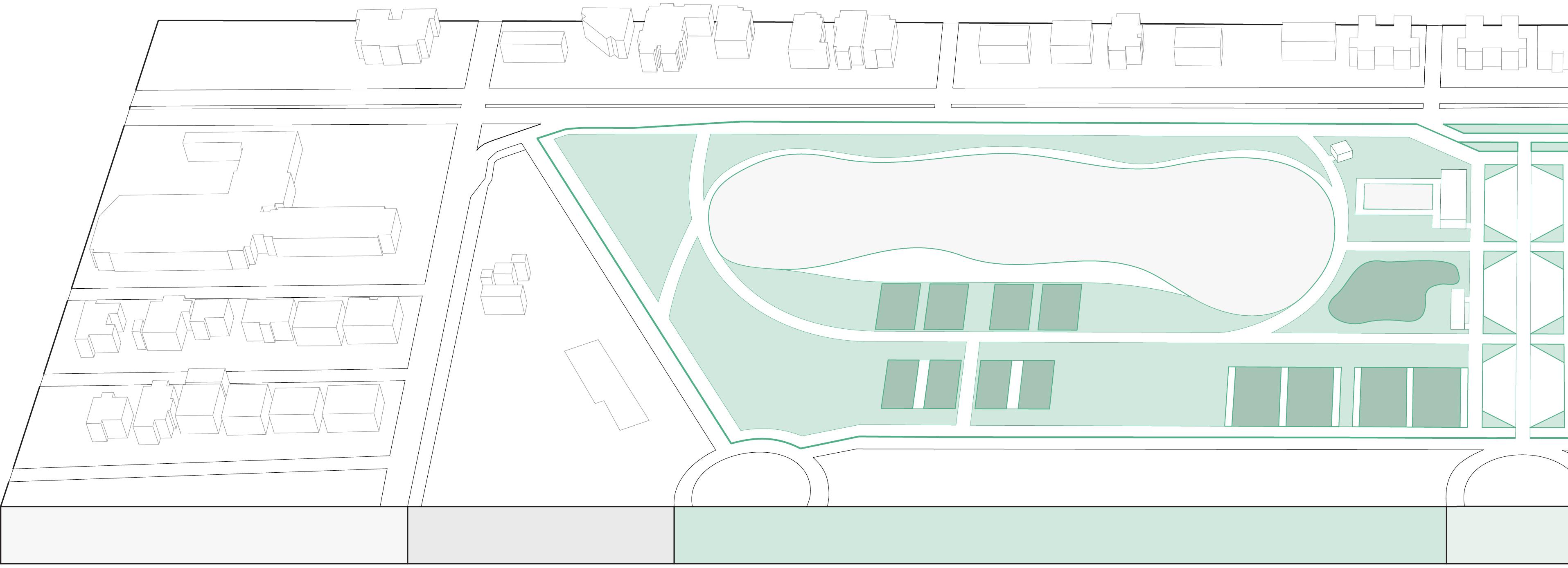
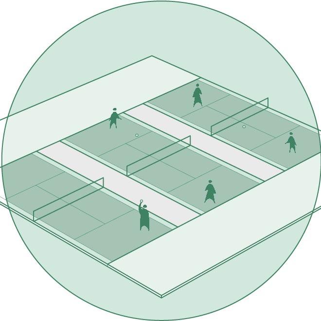
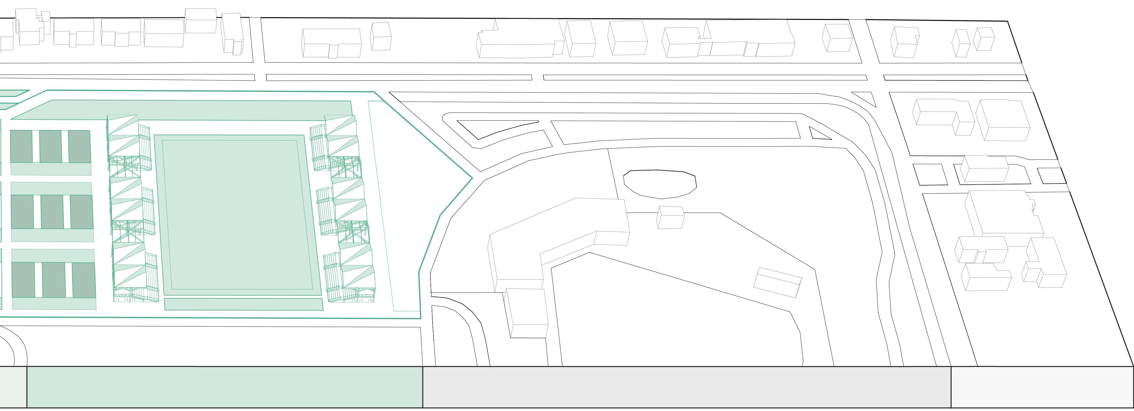
The purpose of this project is to REVITALIZE and MAXIMIZE the experience for the INFORMAL and FORMAL user groups in DAFFIN PARK, an existing site located in Savannah, Georgia. The two general reasons people come to the park are to watch or participate in formal sports or for their own leisure. The leisure and formal programs are separated from each other by a road and parking for vehicular CIRCULATION and user ACCESS. By separating the two user groups, formal sporting facilities were established while also creating a relaxing leisure experience.
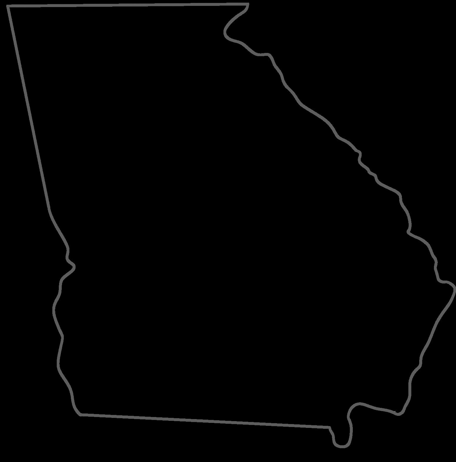
GEORGIA, USA
The state of Georgia is located in the southeast United States bordering the Atlantic Ocean. SAVANNAH, Georgia’s oldest and most historic city, was founded in 1733 by James E. Oglethorpe.
SAVANNAH, GEORGIA
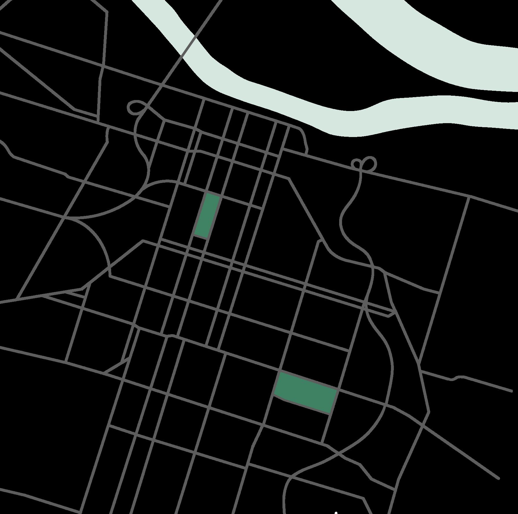
Savannah is located just south of South Carolina on the Savannah River. This historic town is most known for its successful urban plan which includes two large open parks: Forsyth Park and DAFFIN PARK
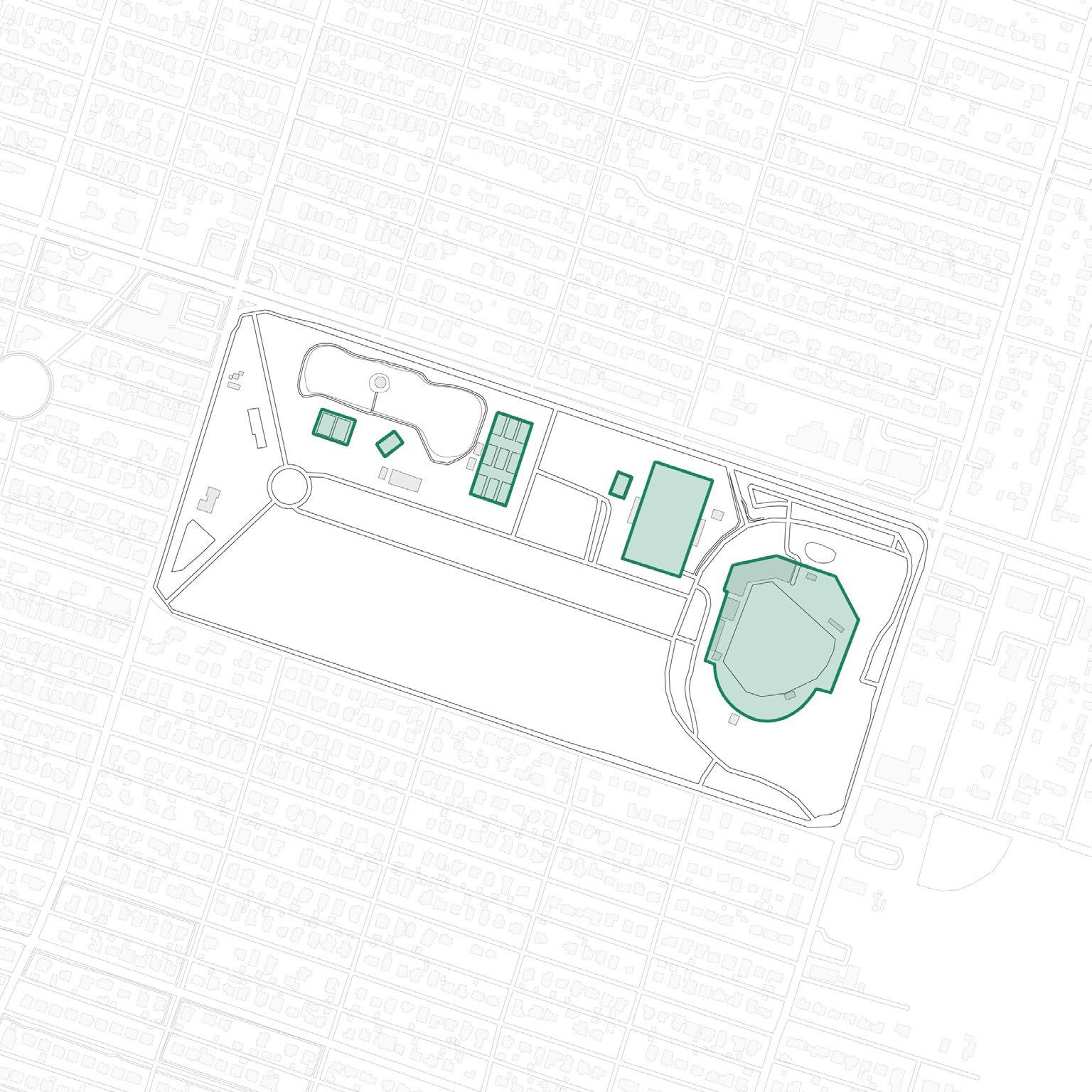
EXISTING PROGRAM
The existing park is made up of many paths and areas for formal and informal activities throughout. This mix causes unexpected experiences that are unintended by certain user groups.
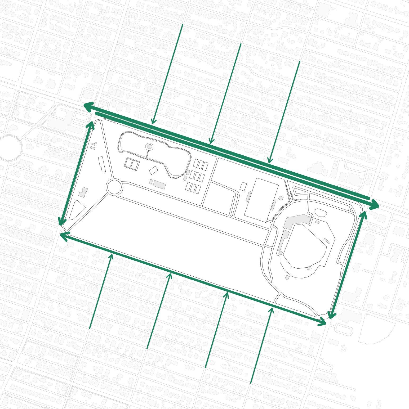
VEHICULAR ACCESS & PARKING
There are seven vehicular entry points into the park. The most used entrances are located on Victory Dr. to the north. Parking is very limited and many users park on the open grass during crowded formal sporting events.
SURROUNDING STREETS SUN PATH
There are several neighborhood streets that terminate at Daffin Park. The primary street is Victory Dr. which is a busy and high speed street. This is a safety concern for pedestrian crossings.
Daffin Park is oriented along Victory Dr. that spans north-west to south-east. To maximize this large amount of exposure to the sun, solar power systems were implemented into the new structures.
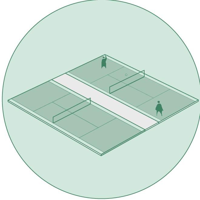
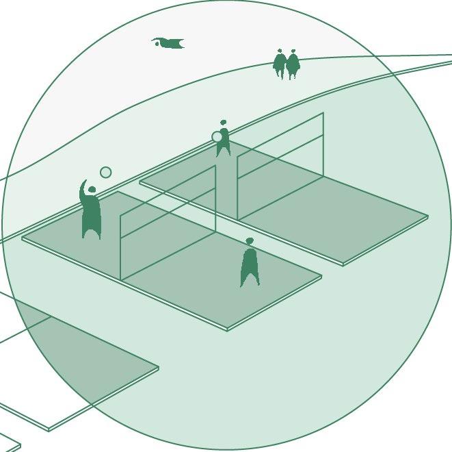
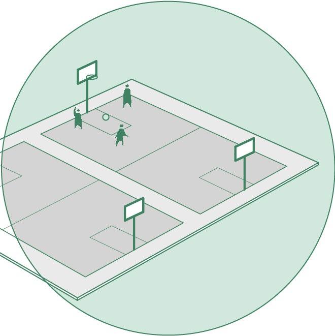
PUBLIC TENNIS COURTS
BEACH VOLLEYBALL
BASKETBALL COURTS PLAYGROUND
PLAN: DAFFIN PARK
NEIGHBORHOOD
The surrounding neighborhood is primarily composed of single family homes. Some multiunit housing, religious, and commercial buildings also are located on the park’s perimeter.
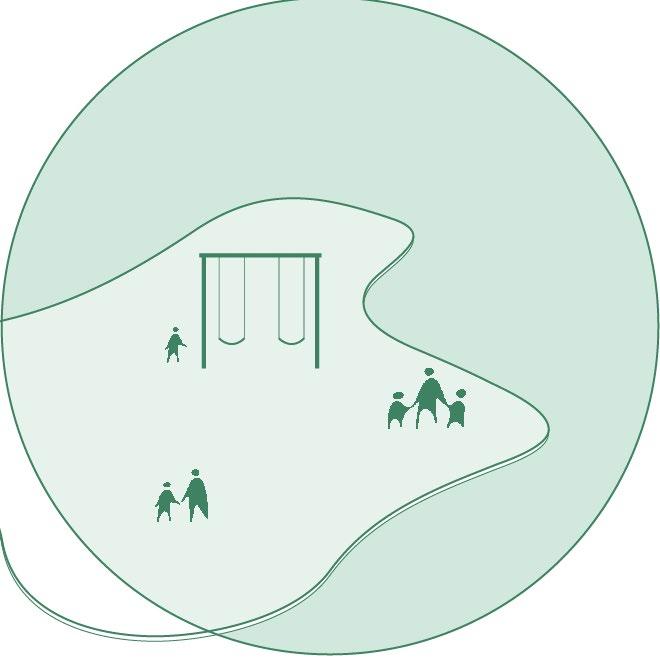
EXISTING PARK PUBLIC LEISURE
This new master plan only changes a portion of the existing park. Other existing areas that are not being altered are open grass fields and playgrounds.
This side of the park is zoned for daily public use. This half features a large pond and various walking paths. Informal activity spaces are located directly on these paths.
MASTER
TOURNAMENT TENNIS COURTS
ATHLETICS GRAYSON STADIUM VEHICULAR ACCESS
The pre-existing street was reused. A new turn off/on lane was added to the Victory Dr end. A round-a-bout was placed on the opposite side to increase vehicular flow. Parking is also located on this street for user accessibility.
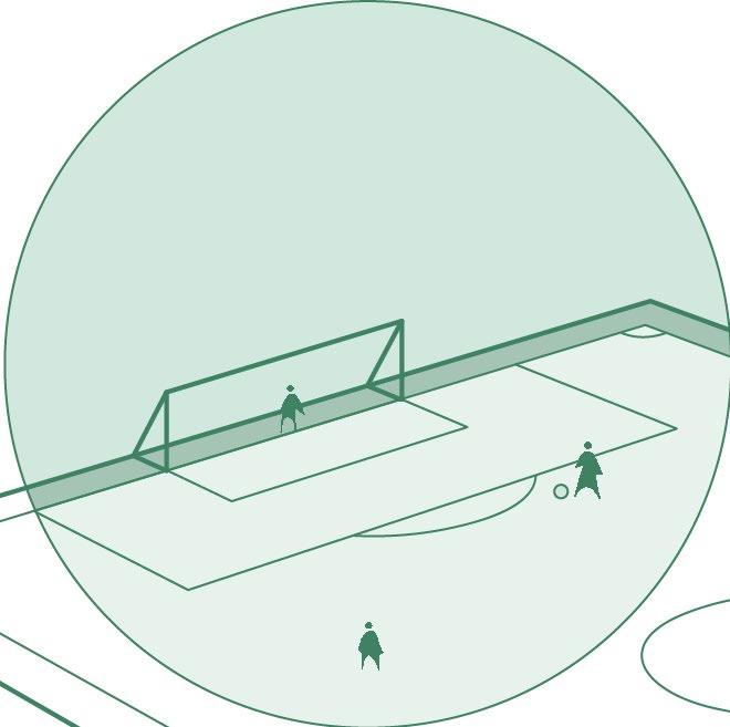
FORMAL
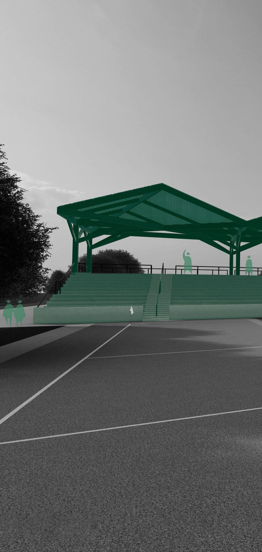
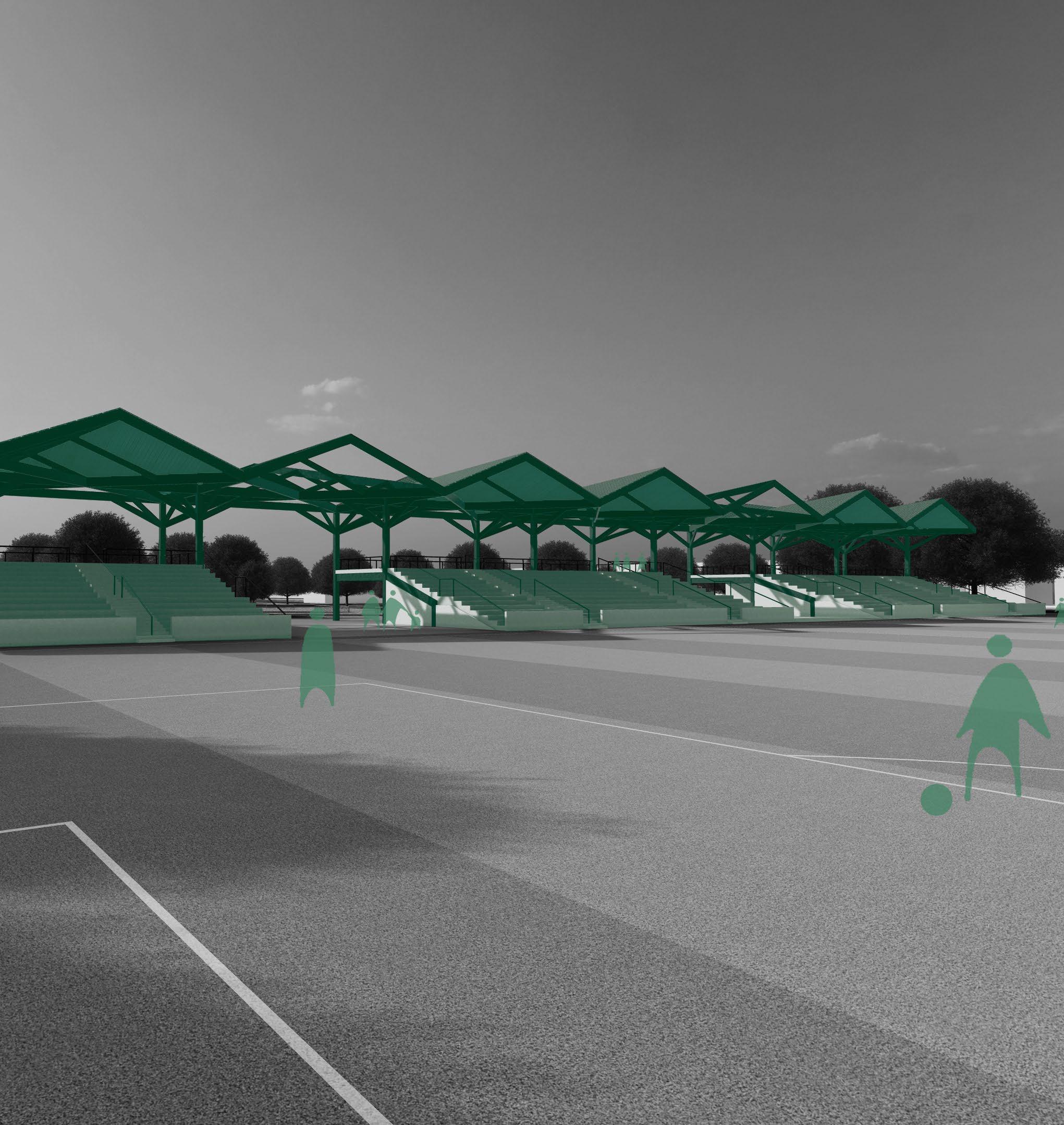
This side of the park is for formal athletic facilities. A new seating structure around the soccer field was added along with tournament tennis courts. This was to concentrate the large amount of people and noise close to the existing Grayson Stadium.
Grayson Stadium creates the eastern border of Daffin Park. This baseball stadium is the focal point of the park and brings in the most users. There is a large amount of existing parking that can be used for other park programs.
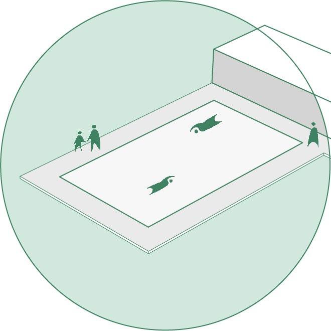
LAP POOL
SOCCER STADIUM
BACK SHEET
ENCAPSULANT - EVA
SOLAR CELLS
ENCAPSULANT - EVA
TEMPERED GLASS
ALUMINUM FRAME
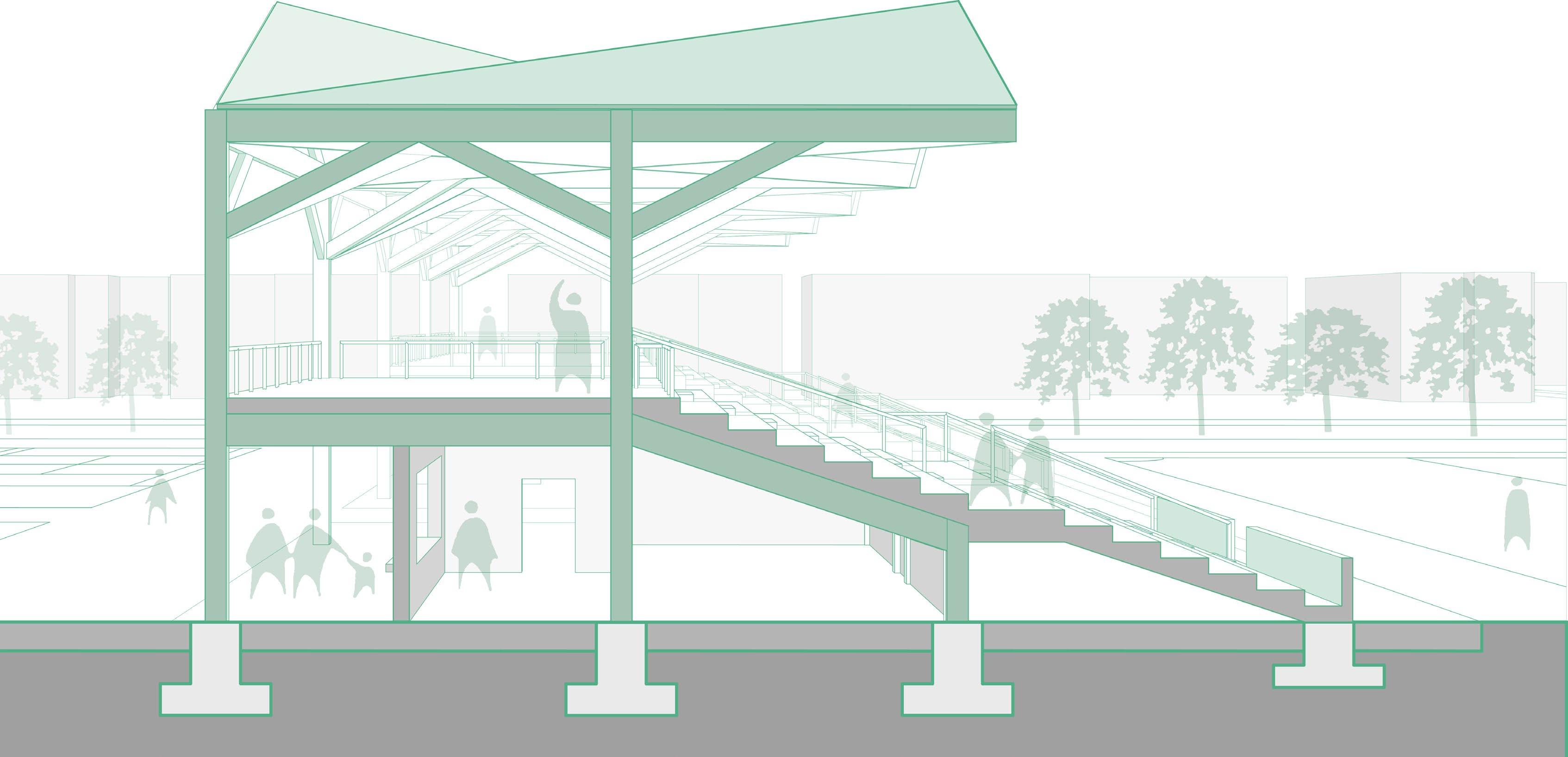
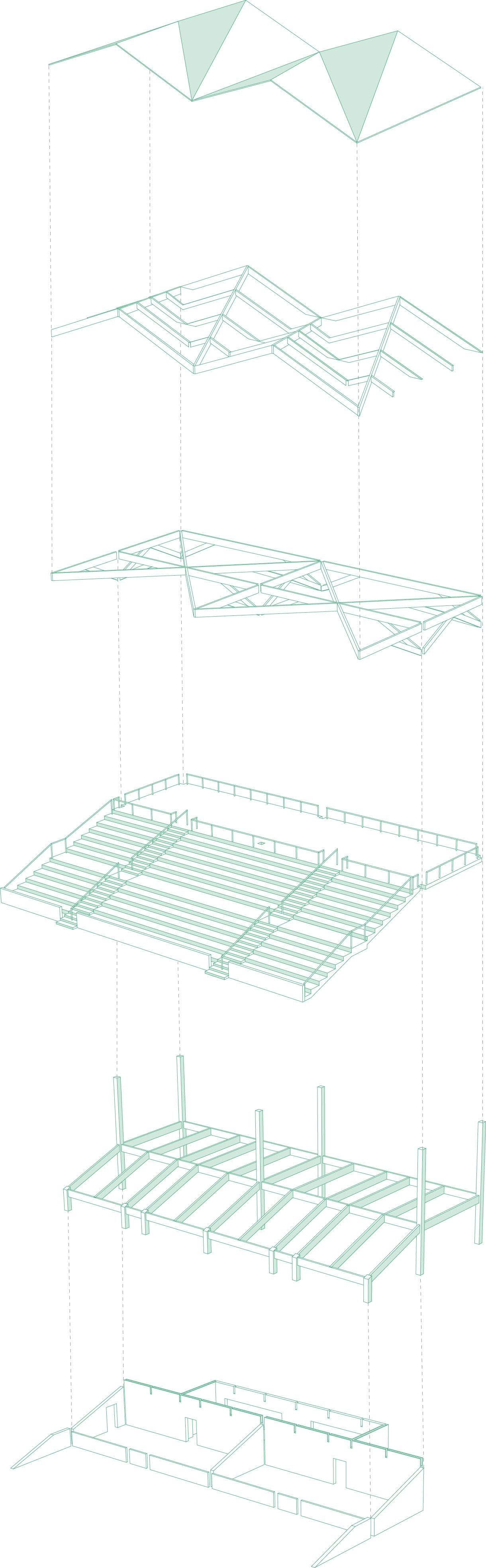
SECTION: SOCCER STADIUM SEATING
PHOTO VOLTAIC PANEL
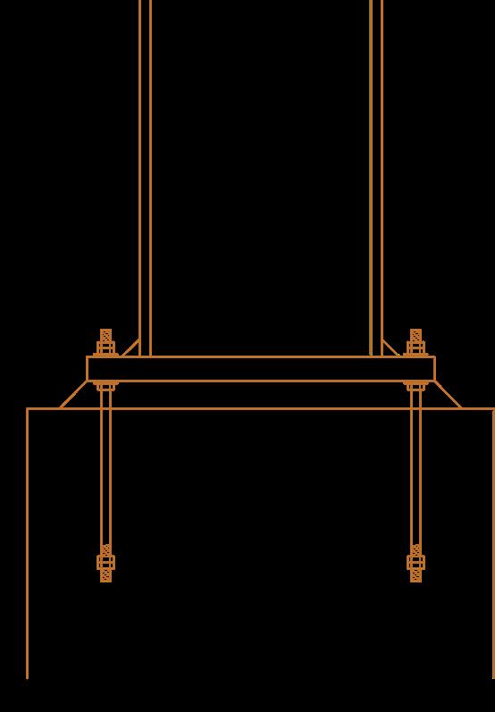
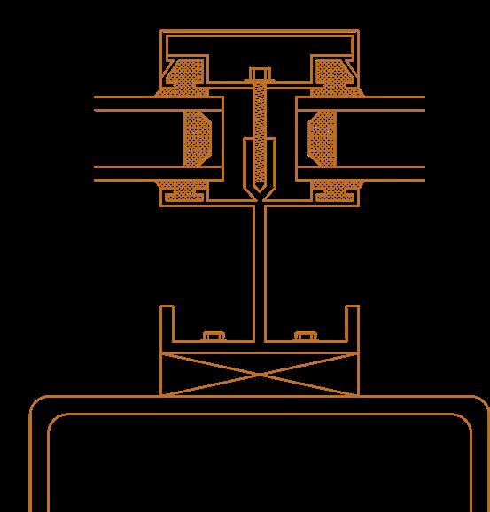
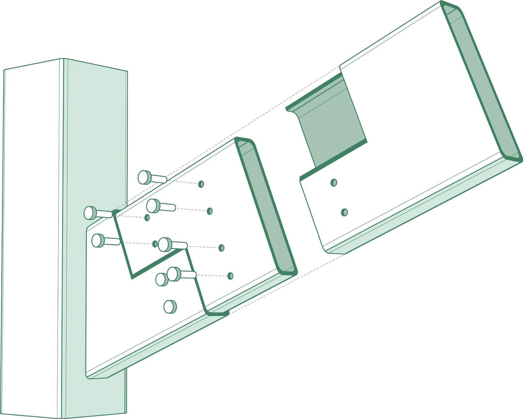
HSS
BLIND BOLT CONNECTION
6” X 24” HSS BEAM
INTERIOR PLATE
EXPANSION BOLTS
CONNECTION PLATE WELDED SEEM
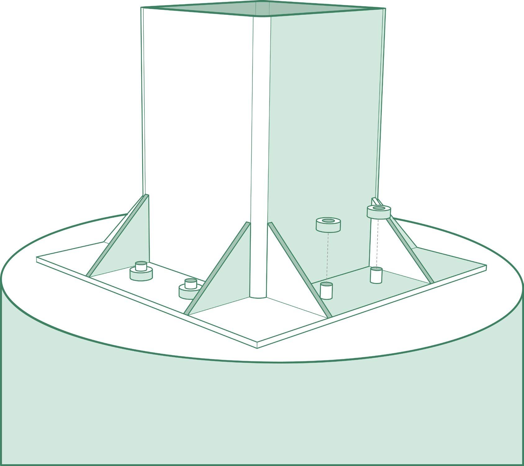
18” X 18” HSS COLUMN
CONCRETE PIER FOUNDATION CONNECTION
18” X 18” HSS COLUMN WELDED STEEL PLATE ANCHOR BOLTS
CONCRETE PIER
CANOPY FINISH
SECONDARY STRUCTURE
PRIMARY STRUCTURE
PRIMARY PROGRAMMING
PRIMARY STRUCTURE
SECONDARY PROGRAMMING
STANDPOINT
AWARENESS CENTER THUNDERBOLT, GA
3RD YEAR
DURATION: 10 WEEKS
PROJECT TYPE:
INDIVIDUAL
SOFTWARE: REVIT
ILLUSTRATOR PHOTOSHOP INDESIGN PROCREATE
WINTER 2023
ARCH STUDIO II
STANDPOINT is an environmental awareness center that is located in THUNDERBOLT, GEORGIA. Two words that drove the design process were IMMERSION and OBSERVATION The two large masses allow users to directly view and interact with ecosystems that are being studied inside. This creates a more engaging and interesting experience compared to traditional learning. These surrounding ecosystems can also be viewed from varying heights for close-up interactions as well as a generalized and overall VIEW
SITE LOCATION: THUNDERBOLT, GA
Thunderbolt, Georgia, is a small town located east of Savannah. Marshland and water cover most of the area which provide an excellent habitat for wildlife along with spectacular views. The locals mainly partake in many marine activities such as boating and fishing.
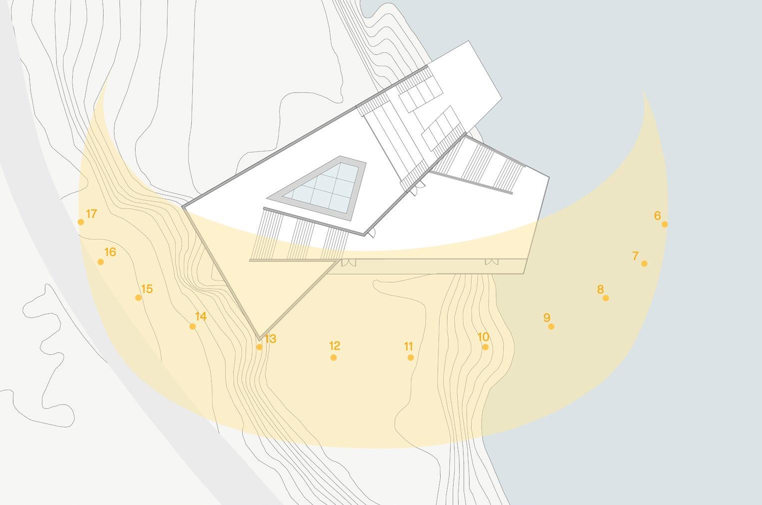
SEPT 21, 12:00PM (EQUINOX)
SUN PATH
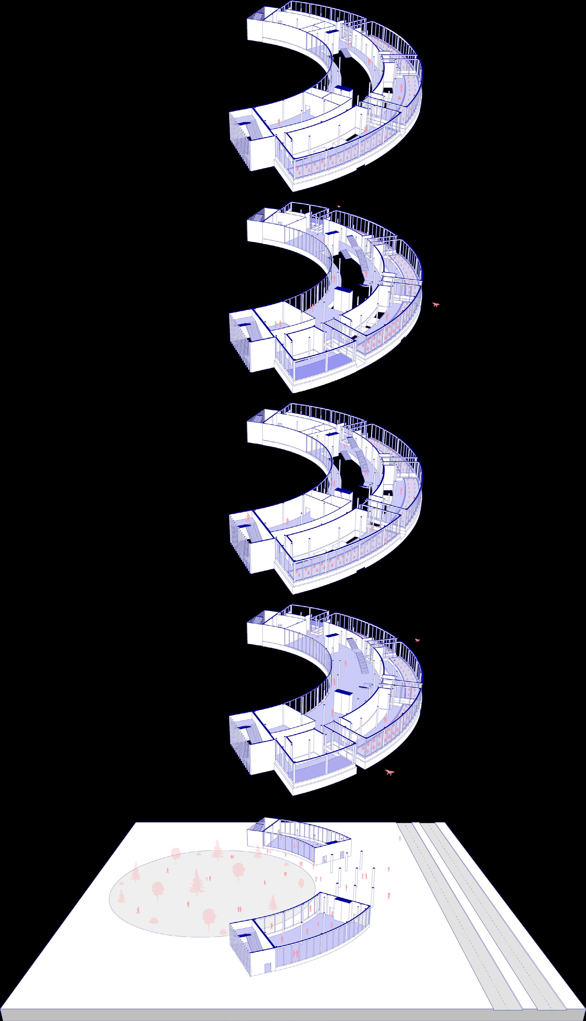
The building’s longest side spans east to west to effectively control the Sun’s rays. The shape of the masses create an exposed courtyard, balcony, and outdoor event space.
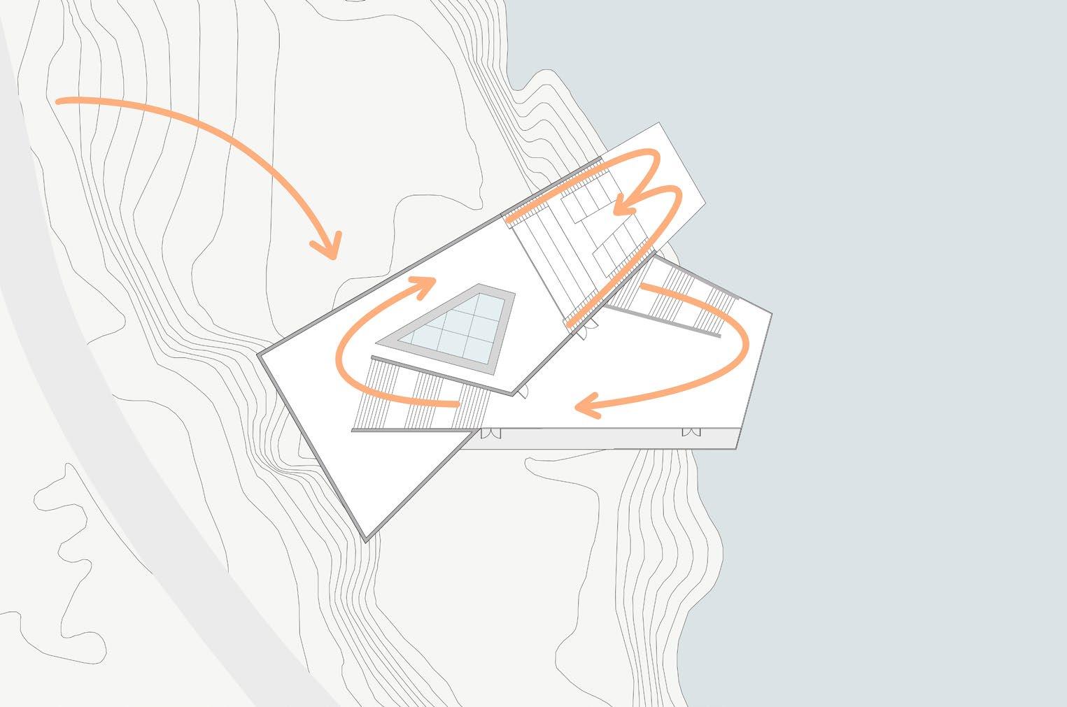
CIRCULATION
The main masses were subtracted from to create a flowing path for users to experience. This sequence takes users from the ground floor and allows them to experience the change in view that is associated with the change in elevation.
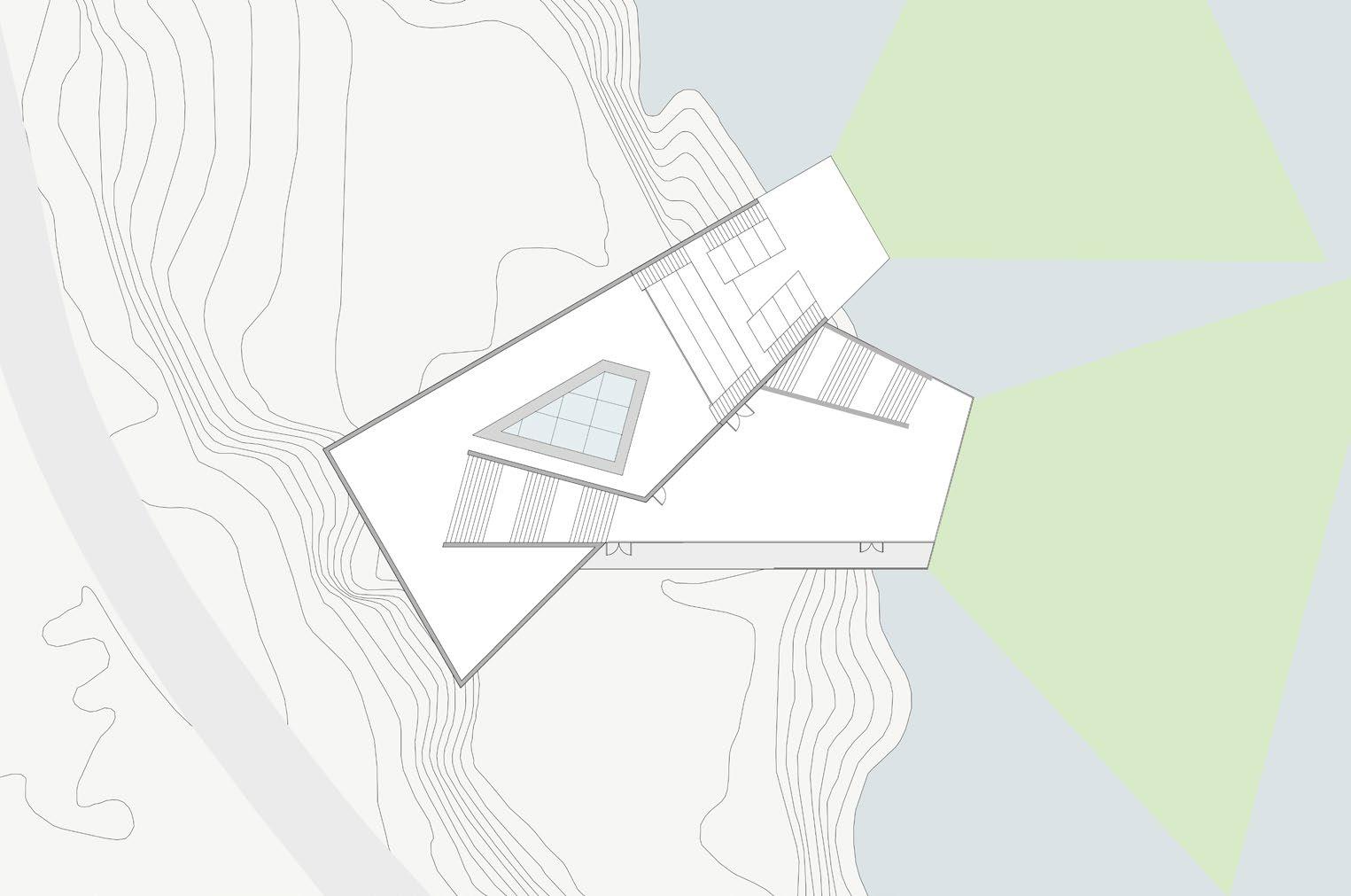
VIEWS
This site sits directly at the bend of the Wilmington River. To take advantage of the views, the two main floors are positioned up and down the river and taper towards the water to lead users to view the surrounding marsh and wildlife.
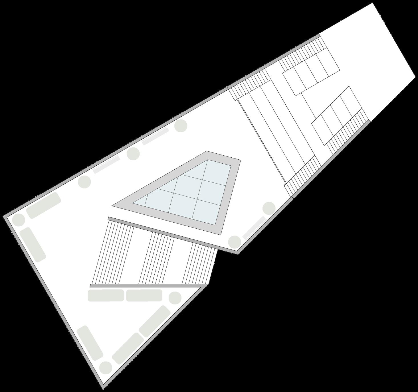
SECOND FLOOR
GROUND FLOOR
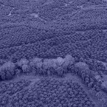
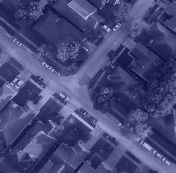
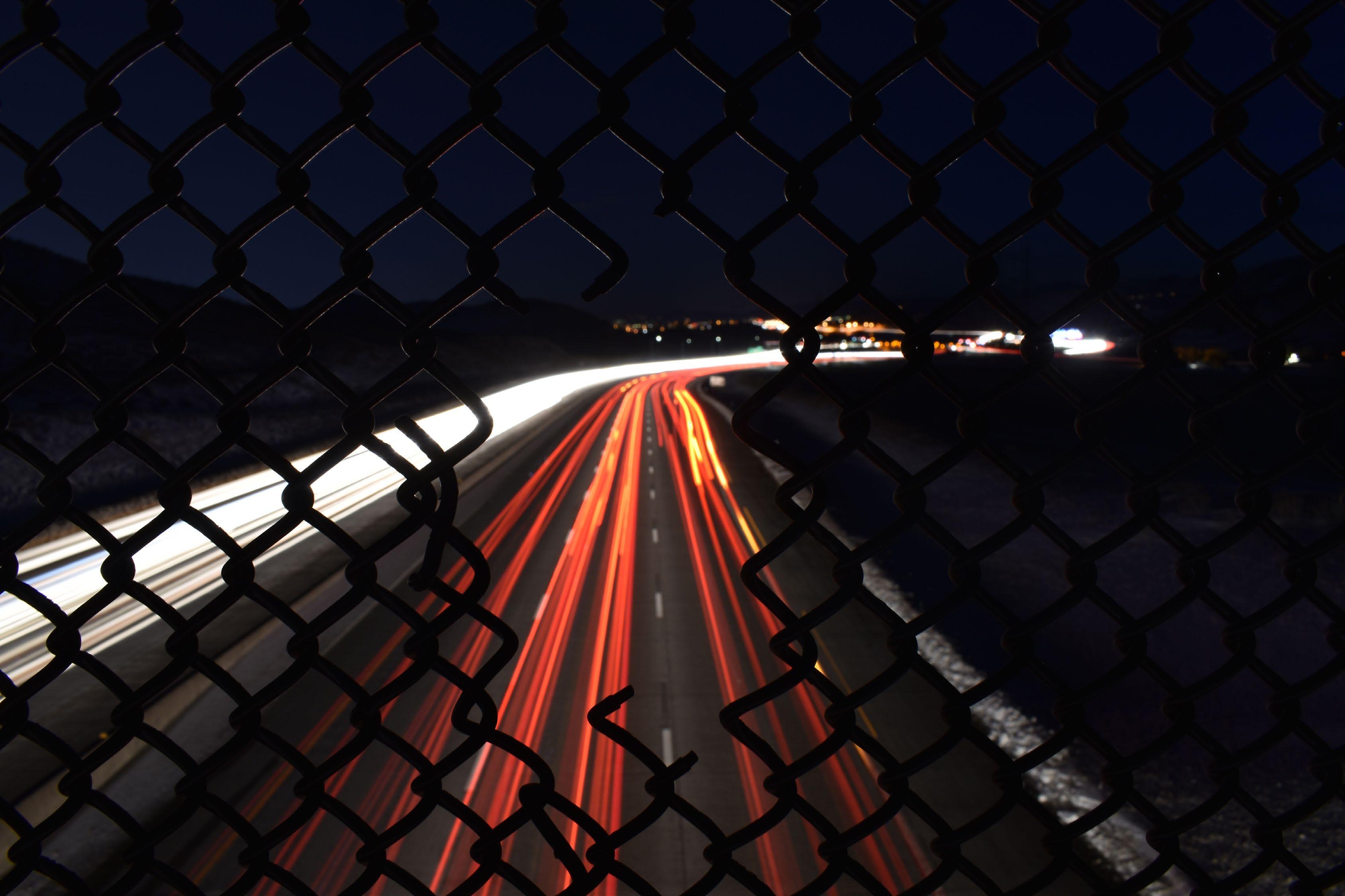
PHOTOGRAPHY
BASED IN GOLDEN, COLORADO
2018-PRESENT
30 MM FILM & DIGITAL MEDIA
Photography has always had a special place in my life. I was introduced to it during high school in my film photography art classes. I was gifted my first film camera from my grandfather which he passed down to me after he moved to the United States from South Korea. I immediately fell in love with photography and received my first digital camera soon after from my parents. Every time I look through the view finder I think of my family and how I am able to capture and preserve beautiful moments in time from my travels to show them.