
B E L Y N S K I Y


H Y D R A
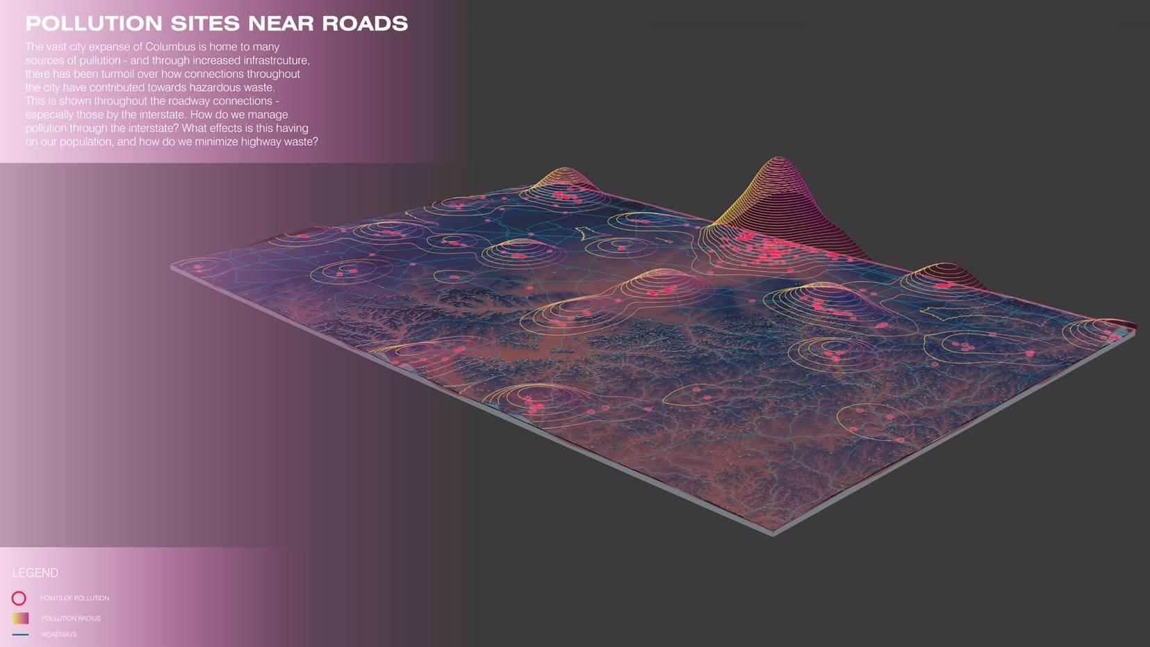
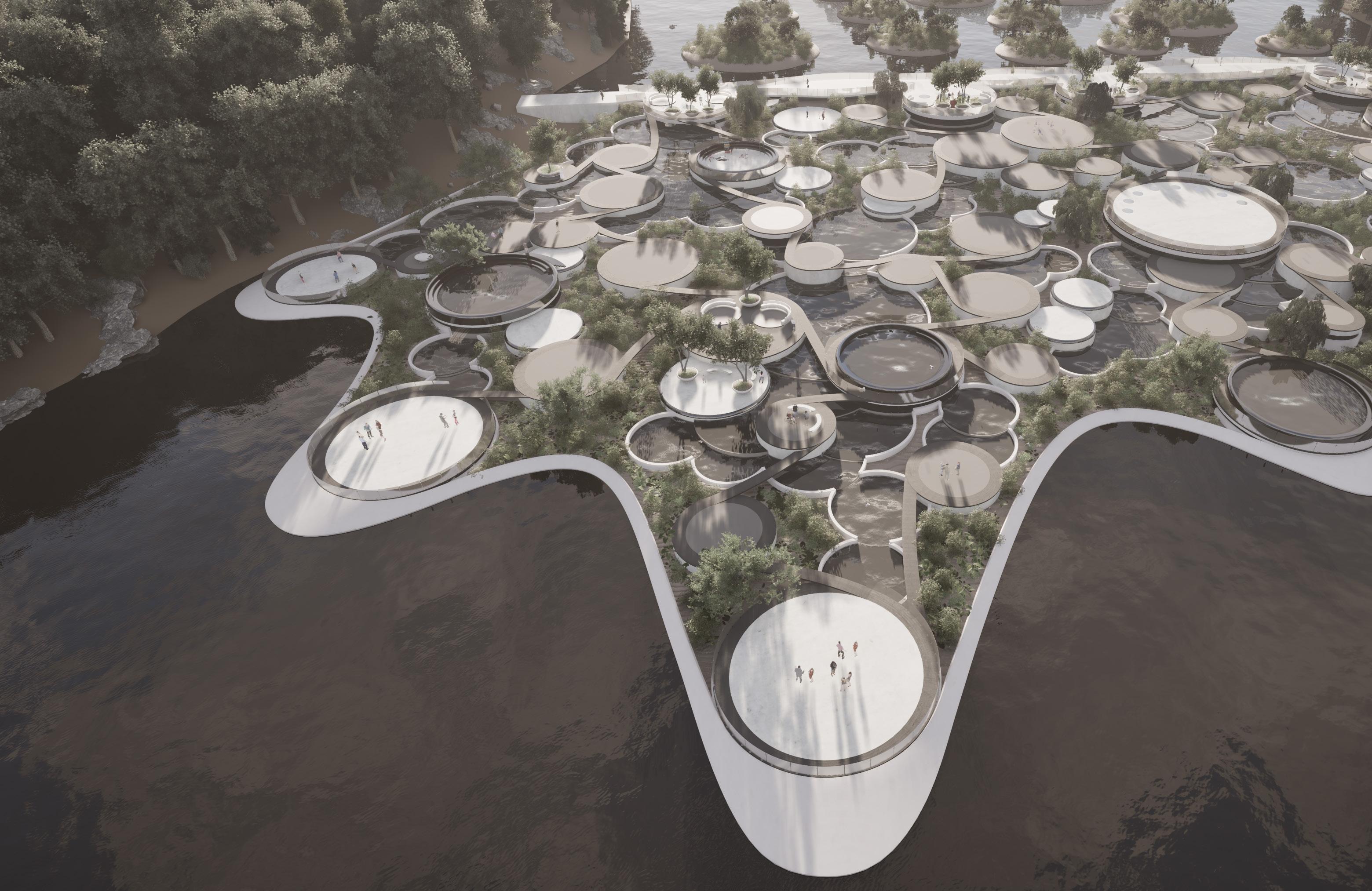
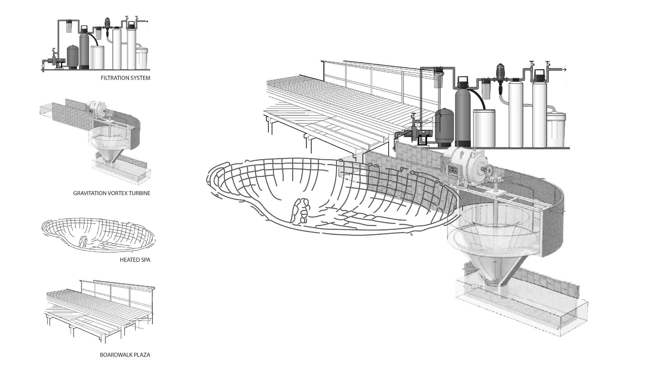
In collaboration with Allie Kim, Hydra reimagines the Greenlawn Avenue low-head dam within Columbus’s Scioto Audubon Metro Park as a multi-functional civic amenity that harvests hydropower while transforming a hazardous “drowning machine” into a dynamic public space. By integrating gravitational vortex turbines, carefully orchestrated water features, and layered “bowls and plates” inspired by our Kitchen Sink Studies, Hydra captures energy at an impressively high efficiency while creating engaging social and recreational opportunities.
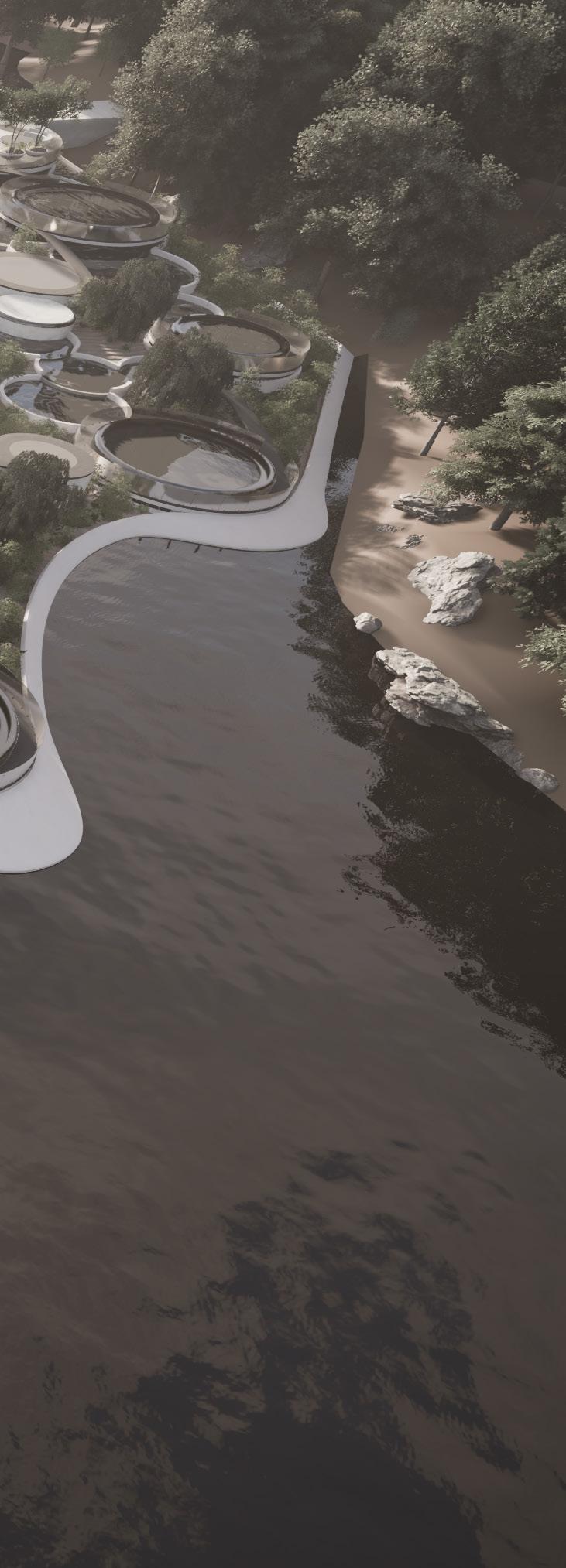
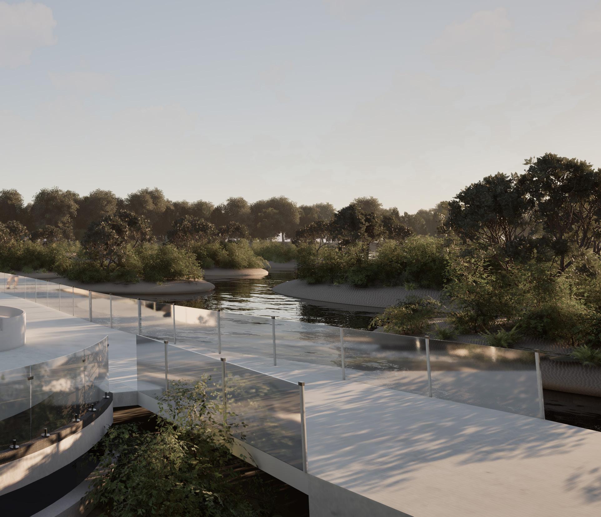
A pedestrian bridge and connected pathways unify the site, ensuring safe crossings and improved community access. Ecological enhancements—from floating plant mats to willow stakes—clean and aerate the river, supporting local wildlife and habitats. In blending renewable energy, public recreation, and environmental stewardship, Hydra illustrates how urban infrastructure can be both innovative and welcoming.
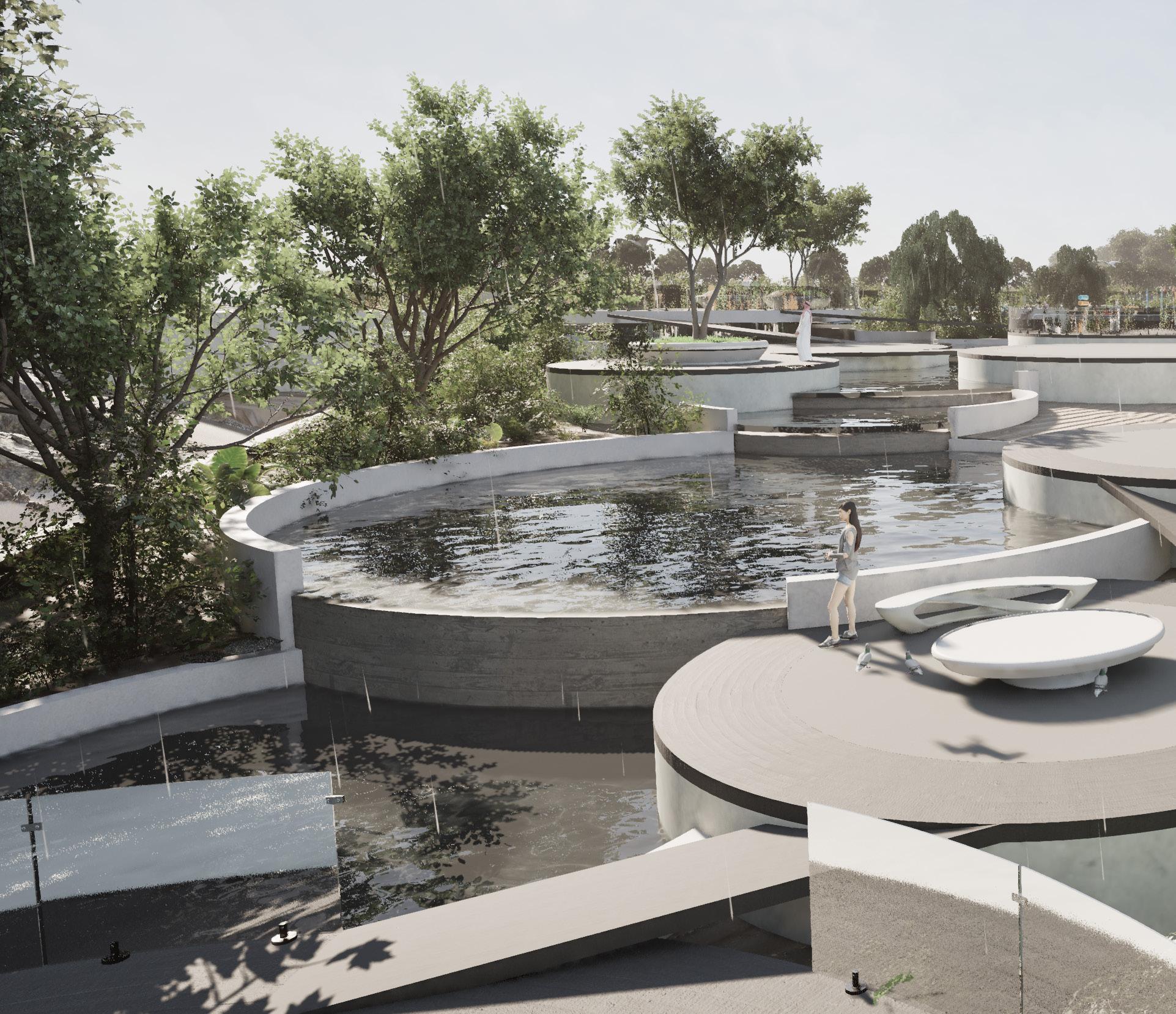
During warmer months, water is channeled through a series of pools and cascades—inviting play, soaking, and wading opportunities for the public. In colder seasons, these pools and wet areas can freeze, creating a unique winter skating experience. Seasonal water fluctuations and rainfall are also incorporated into the design.
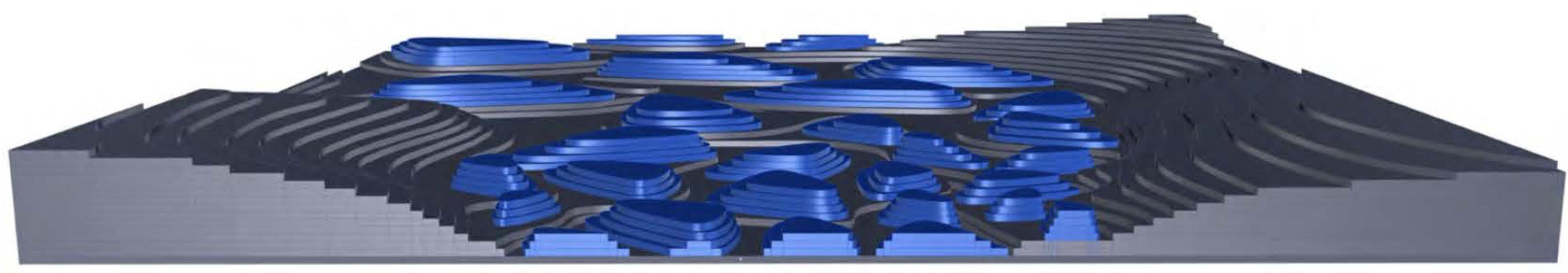
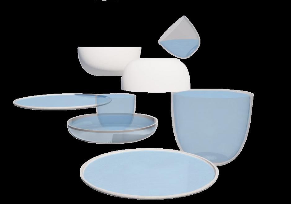
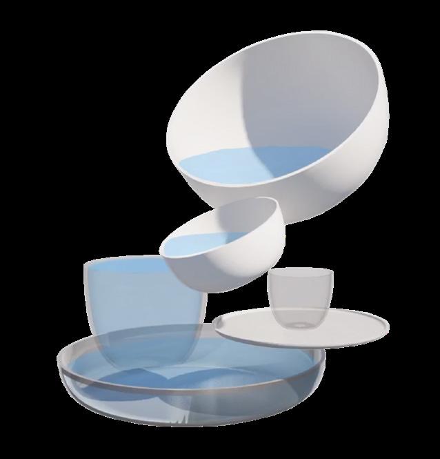
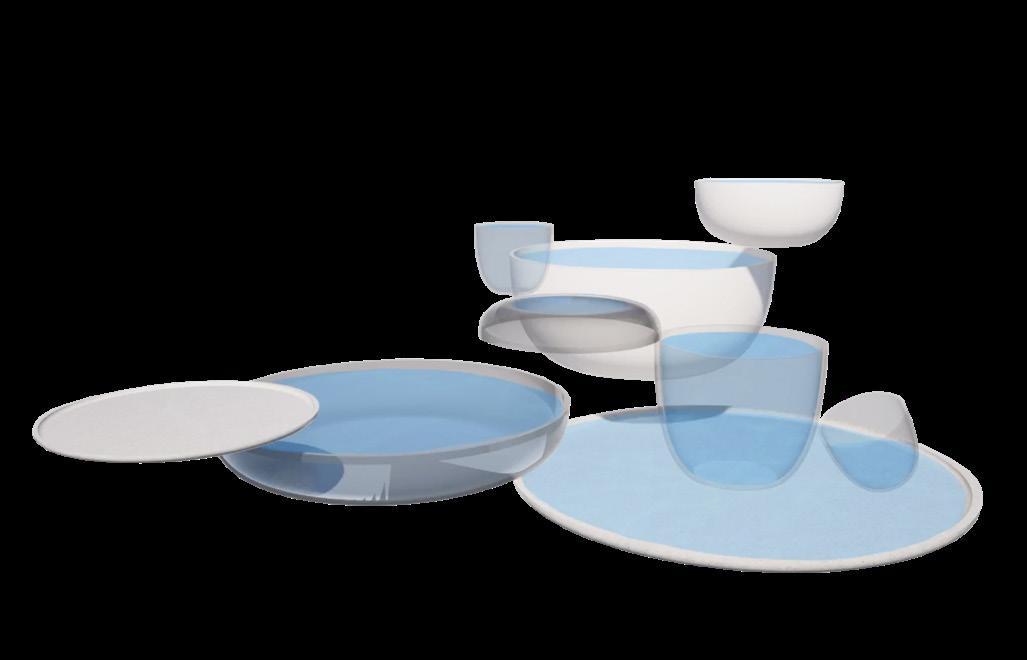
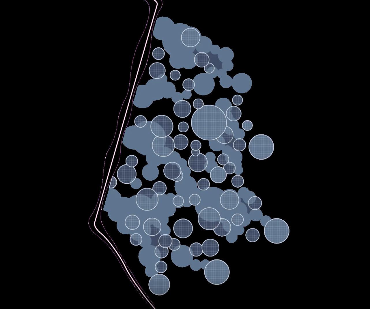
The stacked “bowls and plates” naturally accommodate varying river levels, maintaining functionality and visual interest. This in turn enables the vortex turbines to be able to achieve around 85–90% efficiency, potentially generating anywhere from a few to dozens of kilowatts each under ideal conditions.
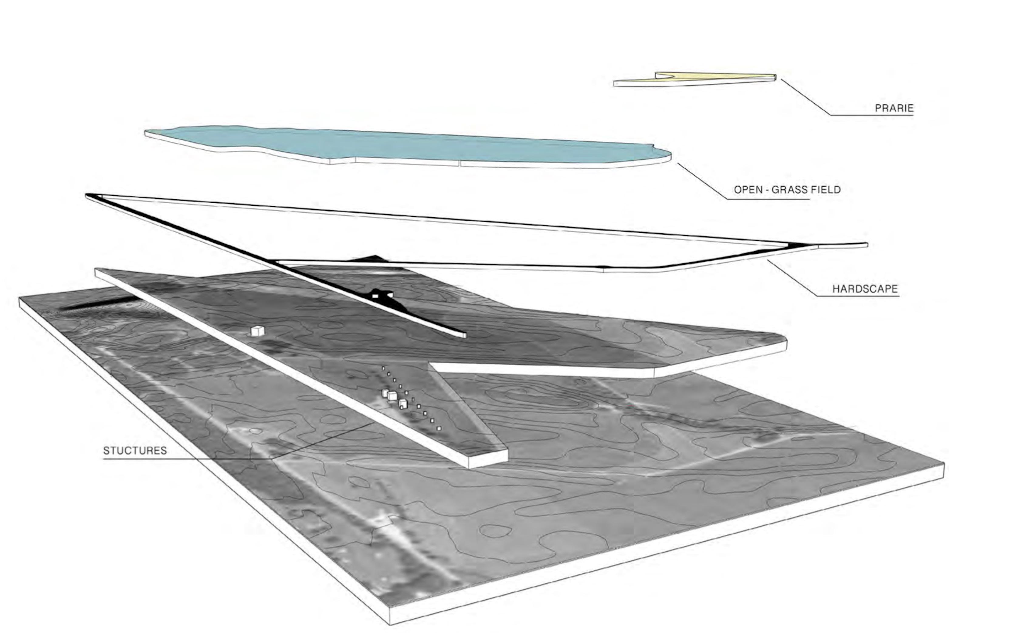
SITE PROGRAM
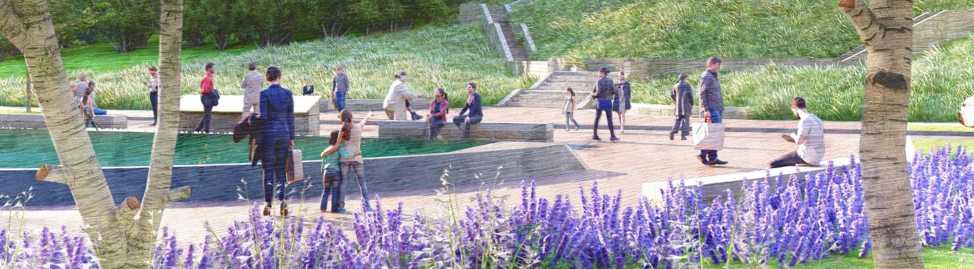
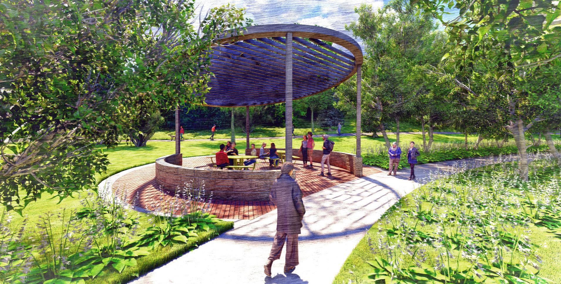
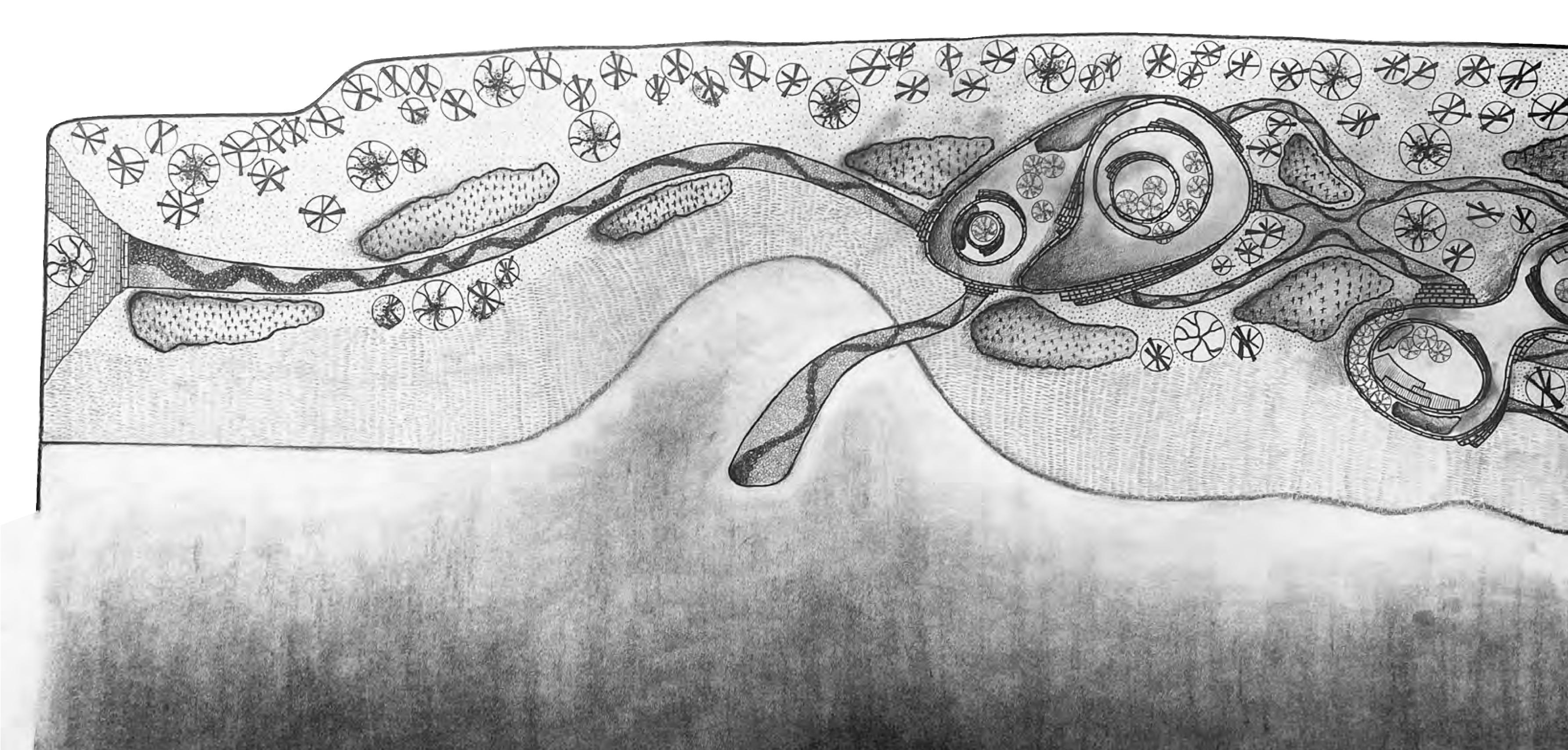
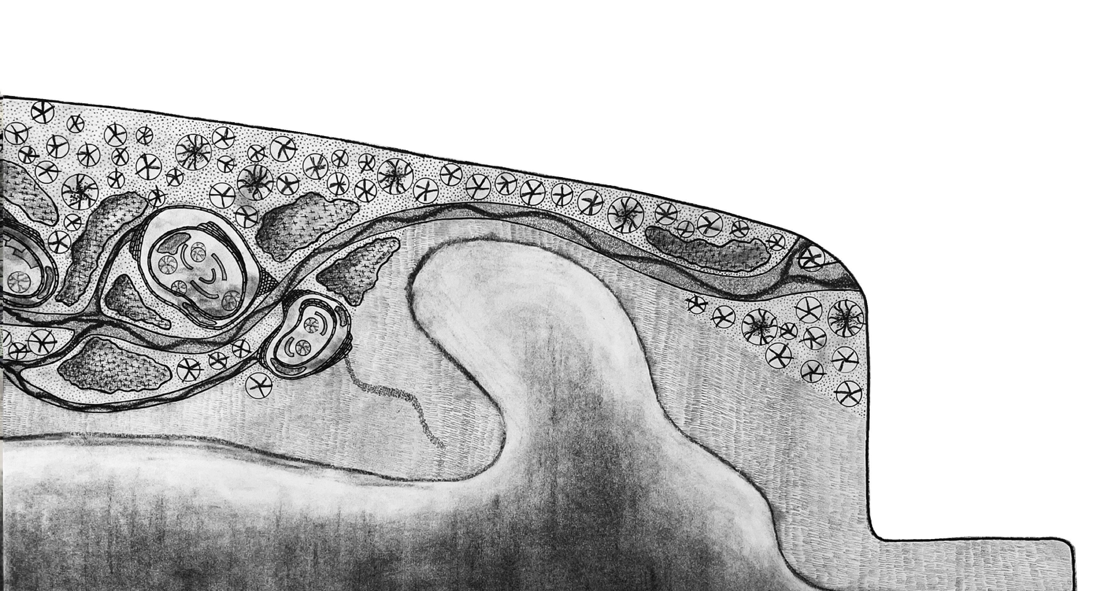
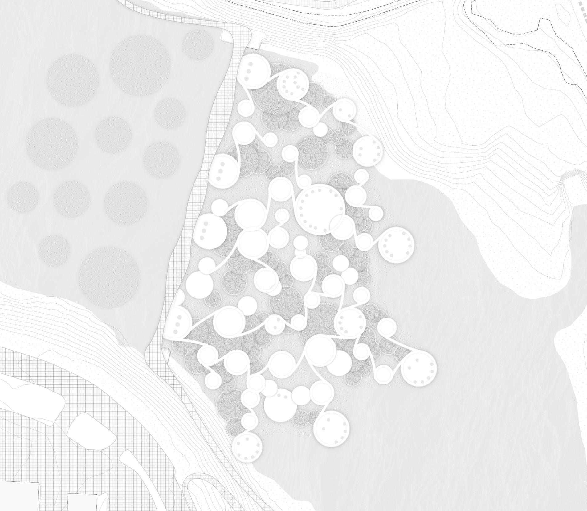
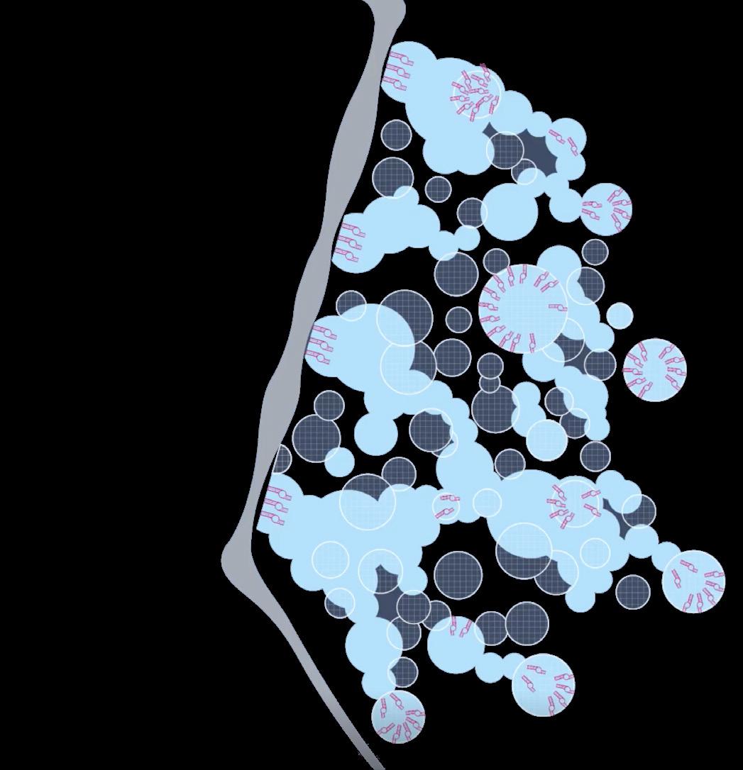
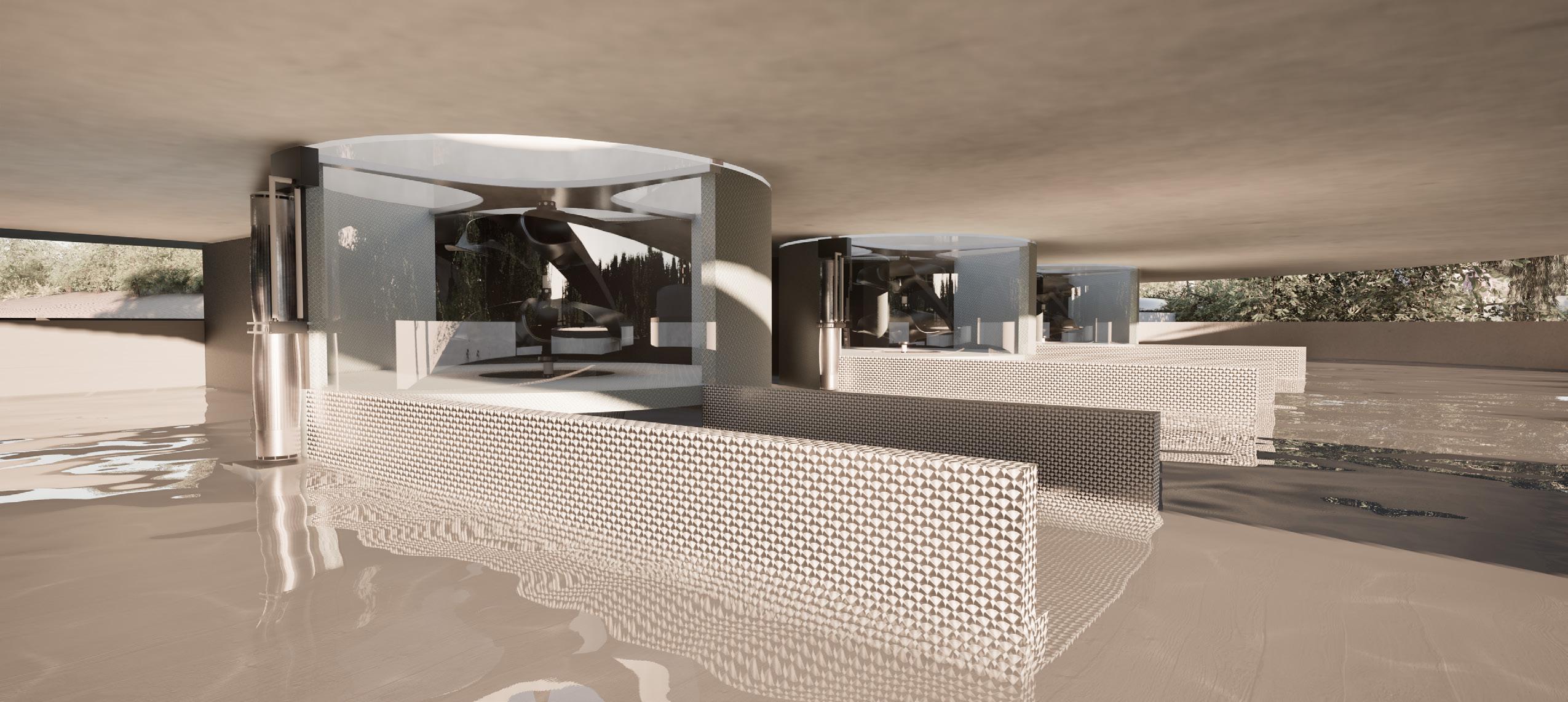
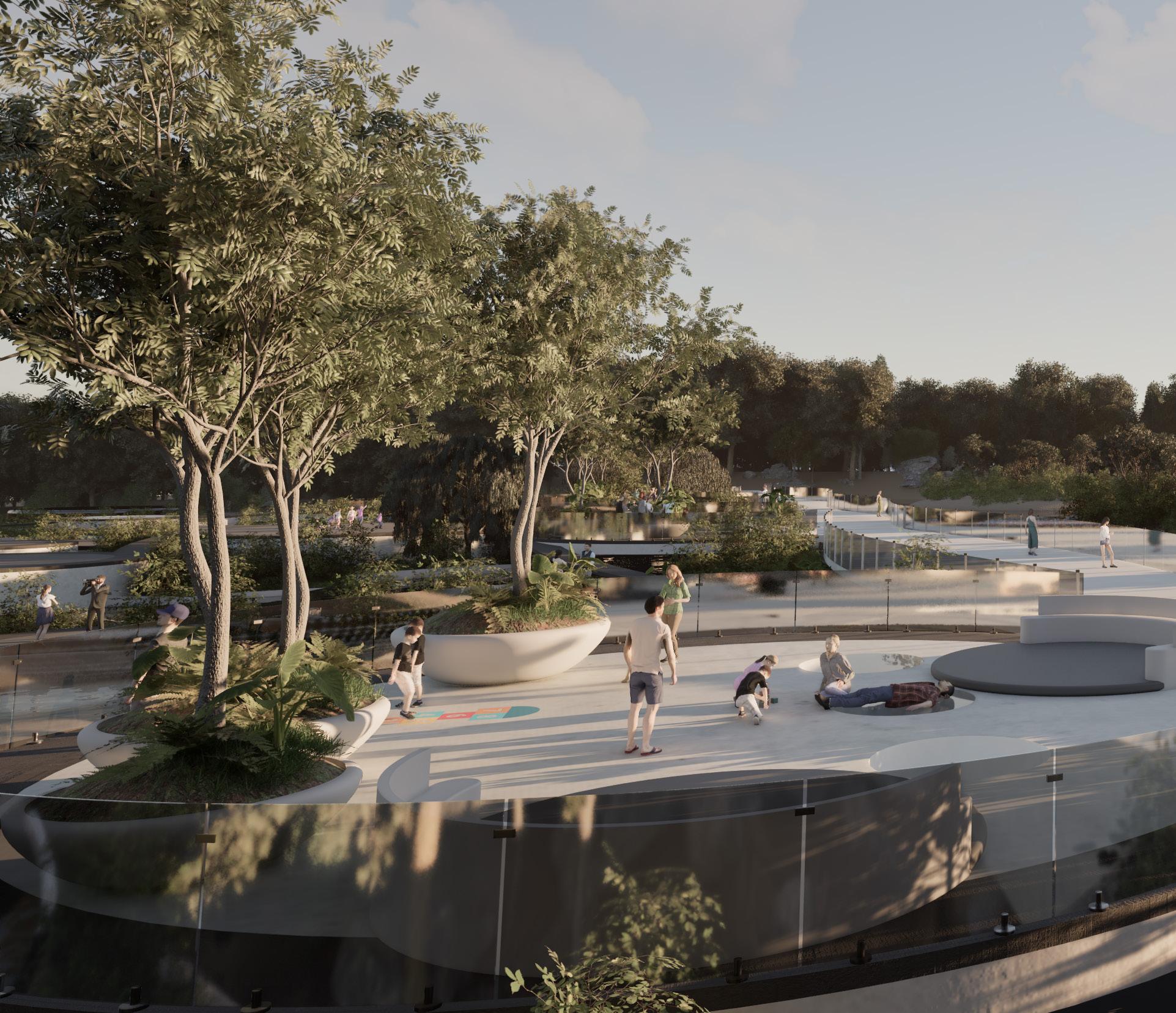
Hydra’s design centers on a multi-level network of plates and bowls that guide water flow and create interactive zones for visitors. Pathways wind through these elevated and submerged levels, inviting people to observe and engage with waterfalls and pools in both close-up and panoramic views. Water features range from shallow wading areas perfect for children and family enjoyment to deeper soaking spas for relaxation, while stacked bowls generate dynamic cascades that heighten the site’s ambiance.
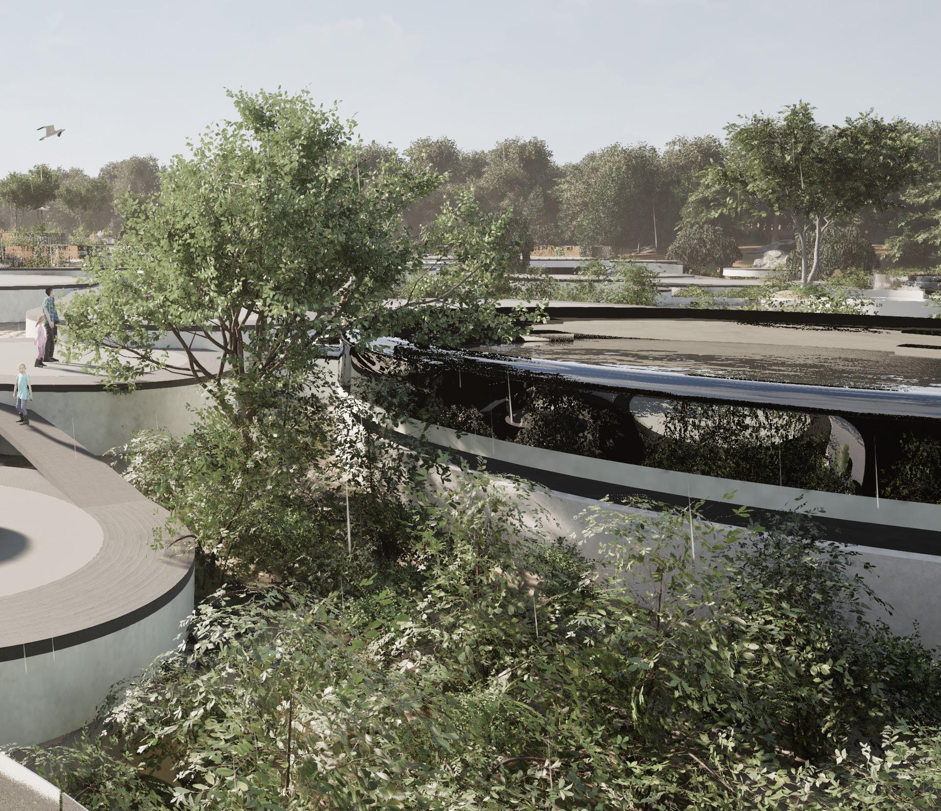
Dry terraces and seating nooks provide spaces for picnicking, reading, and social gatherings, fostering a sense of community within a striking natural setting. Artful lighting and transparent platform elements allow guests to witness the gravitational vortex turbines below, blending renewable energy education with a fun, immersive experience. The design adapts to seasonal changes, offering opportunities such as winter skating when pools freeze, ensuring that Hydra remains an engaging, multifunctional destination year-round.
DESIGN PROCESS
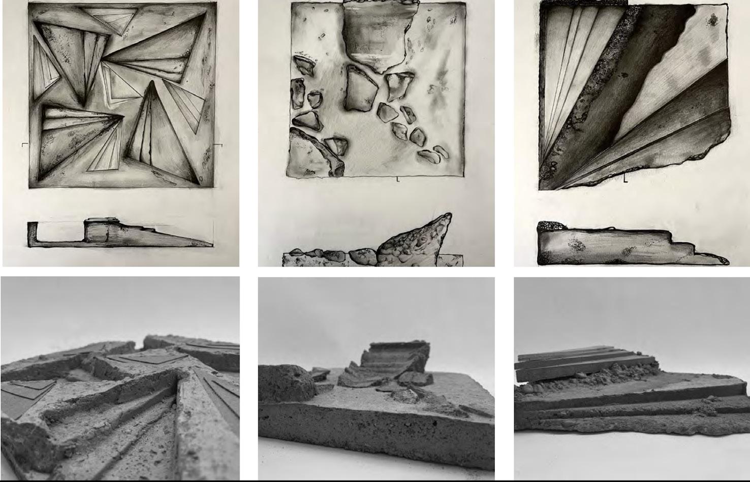
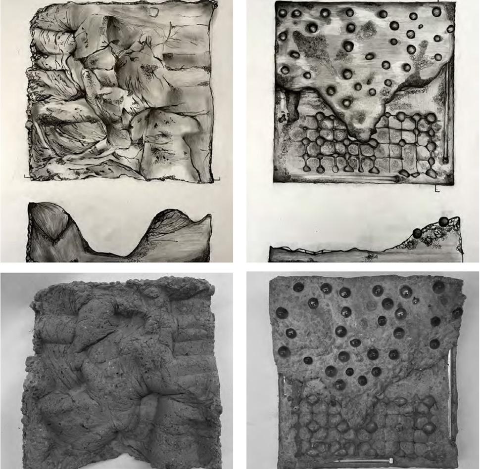
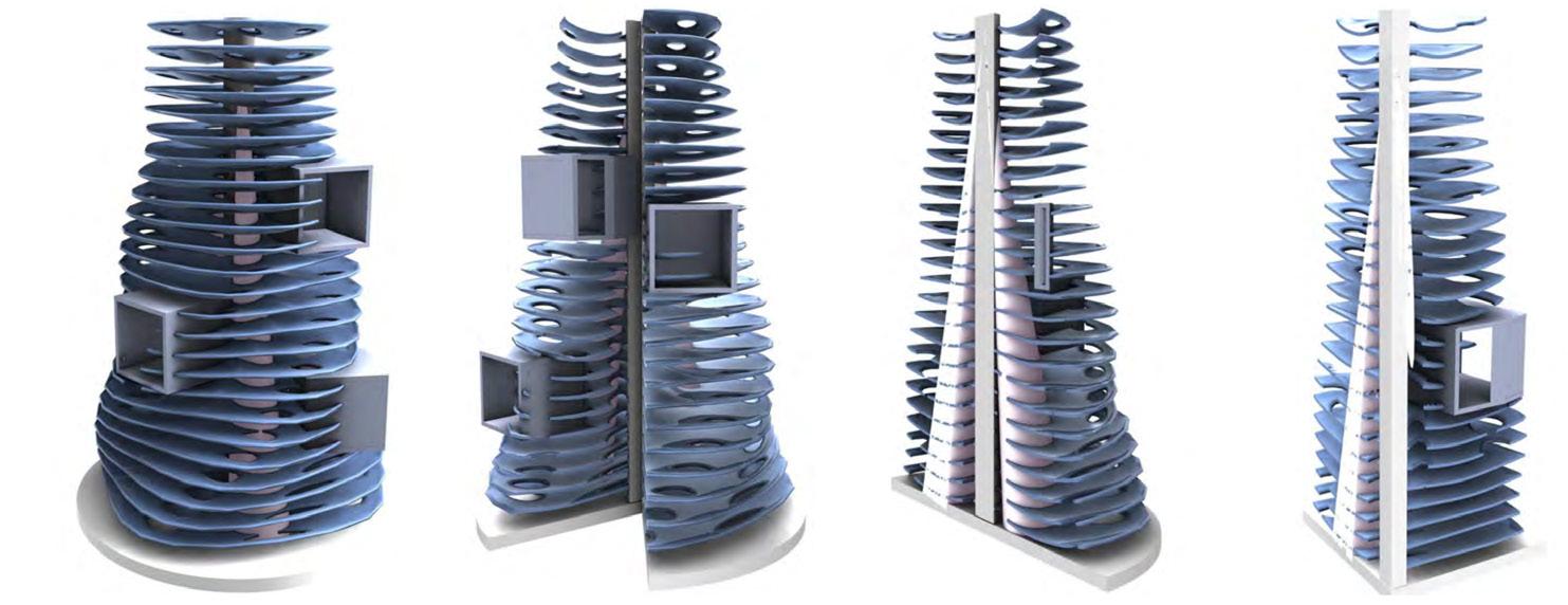
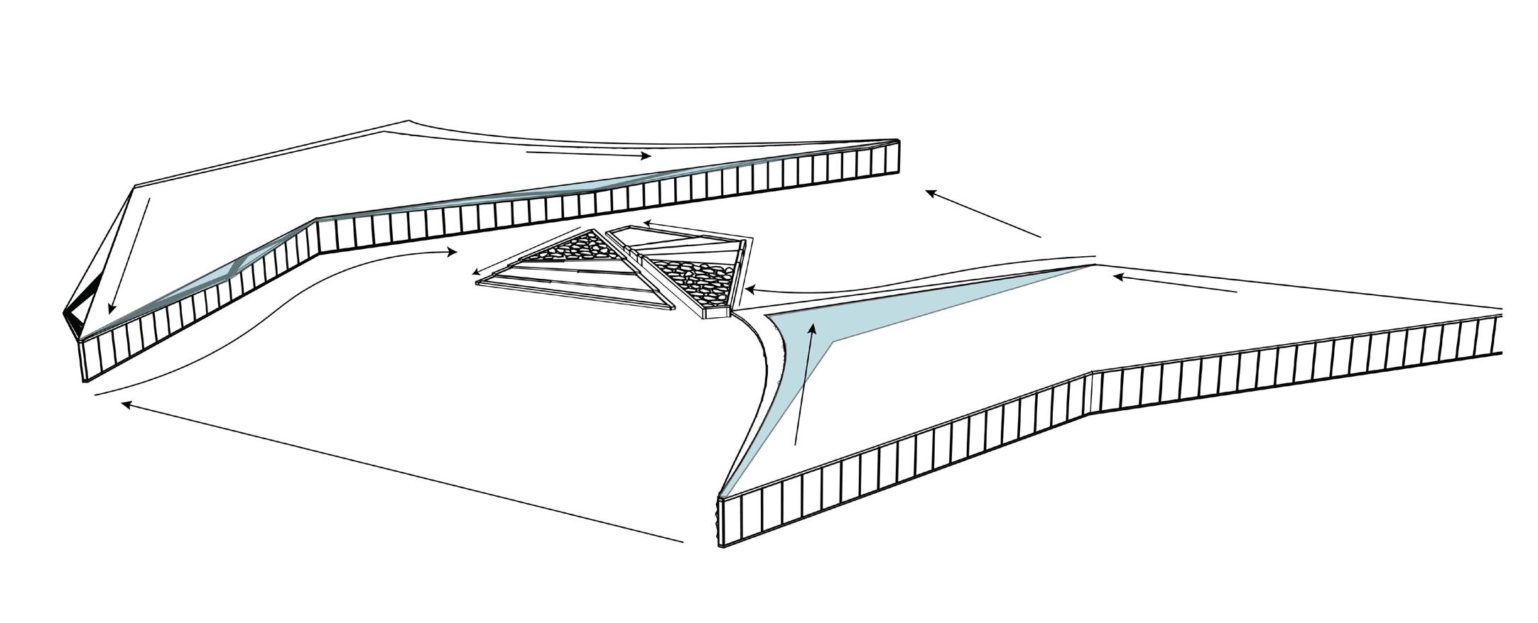
Allie and I spent an extensive amount of time studying the relationships between water and impervious/ pervious surfaces. The “plate study” in Hydra explores a multi-layered design approach that reimagines dam infrastructure as a dynamic, interactive space. By stacking and overlapping plate-like forms, the study integrates hydropower generation with inviting public areas for recreation and ecological engagement. Each plate is strategically positioned to direct water flow, host immersive planting, and create safe zones for wading or observation that can be changed intermittently. We were also challenged with the task of how to make our own machine or - “Energy Prosthesis” that would power the site.
PROSTHESIS
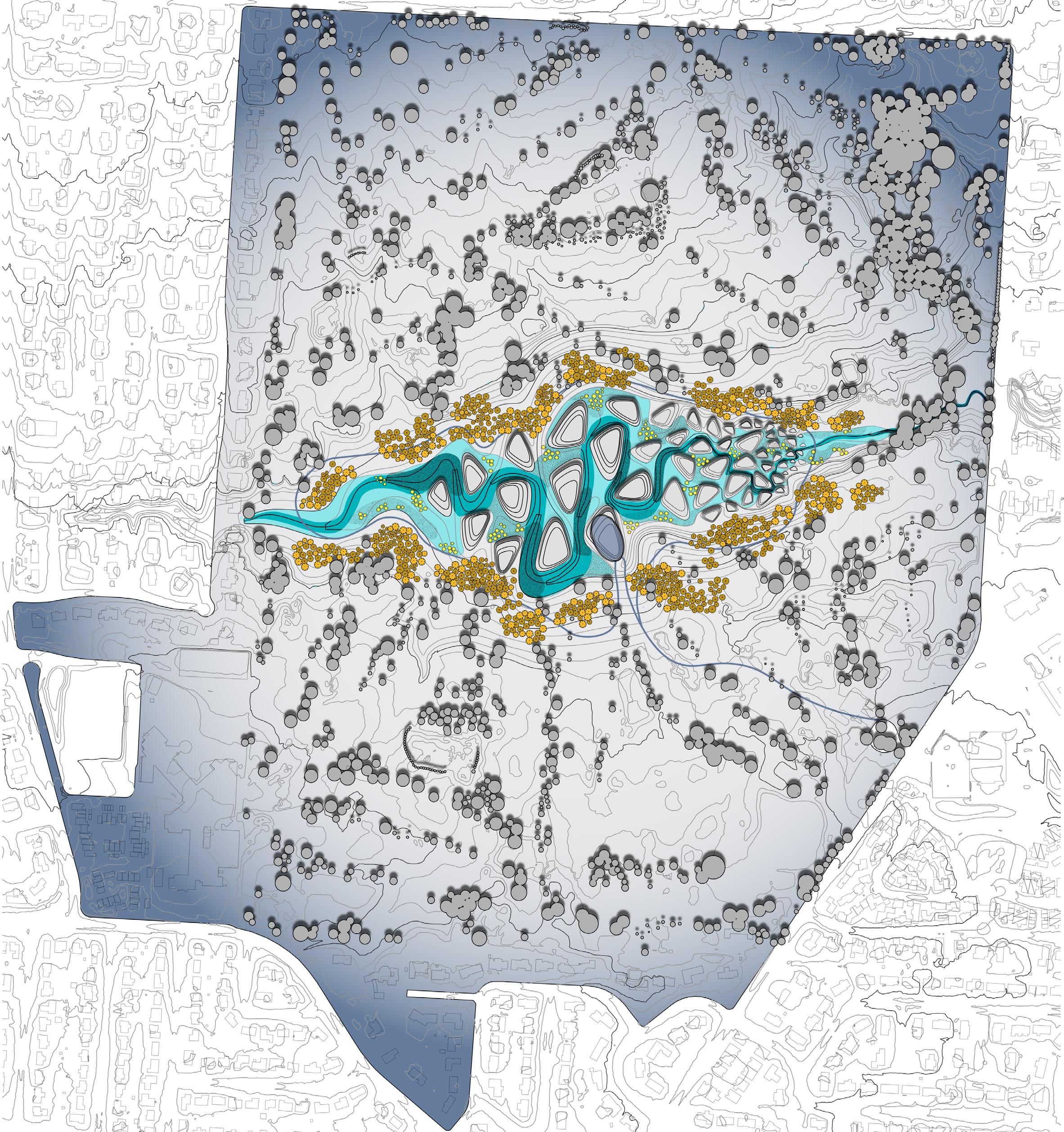
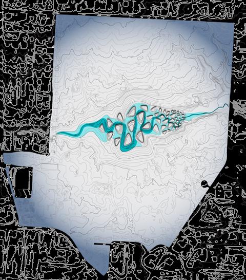
SITE DIAGRAMS
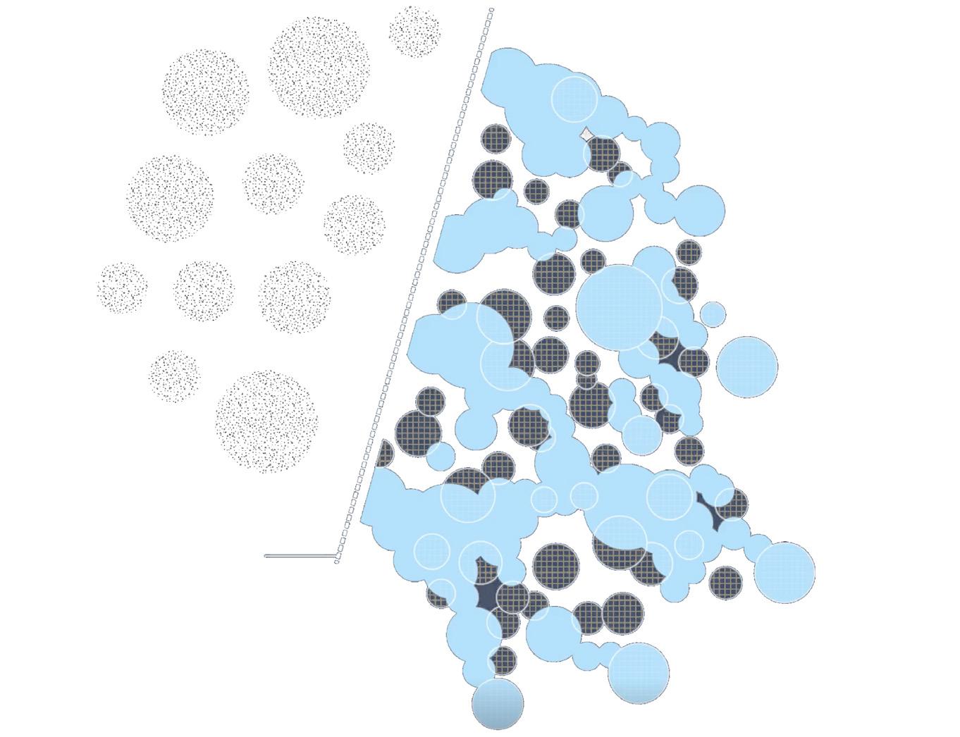
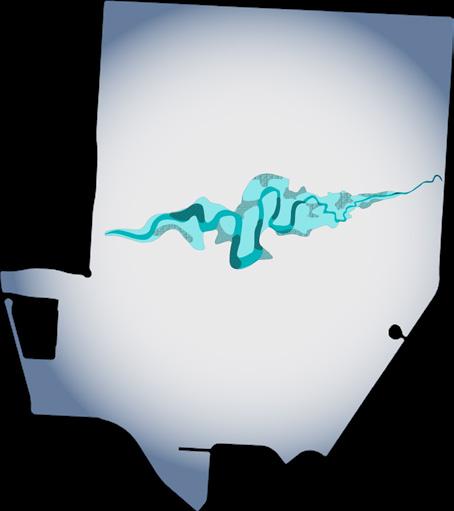
PLANT MATS
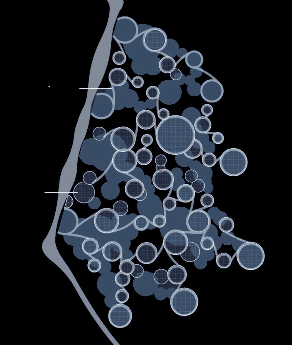
CIRCULATION
TURBINE LOCATIONS BRIDGE
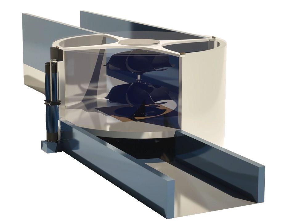
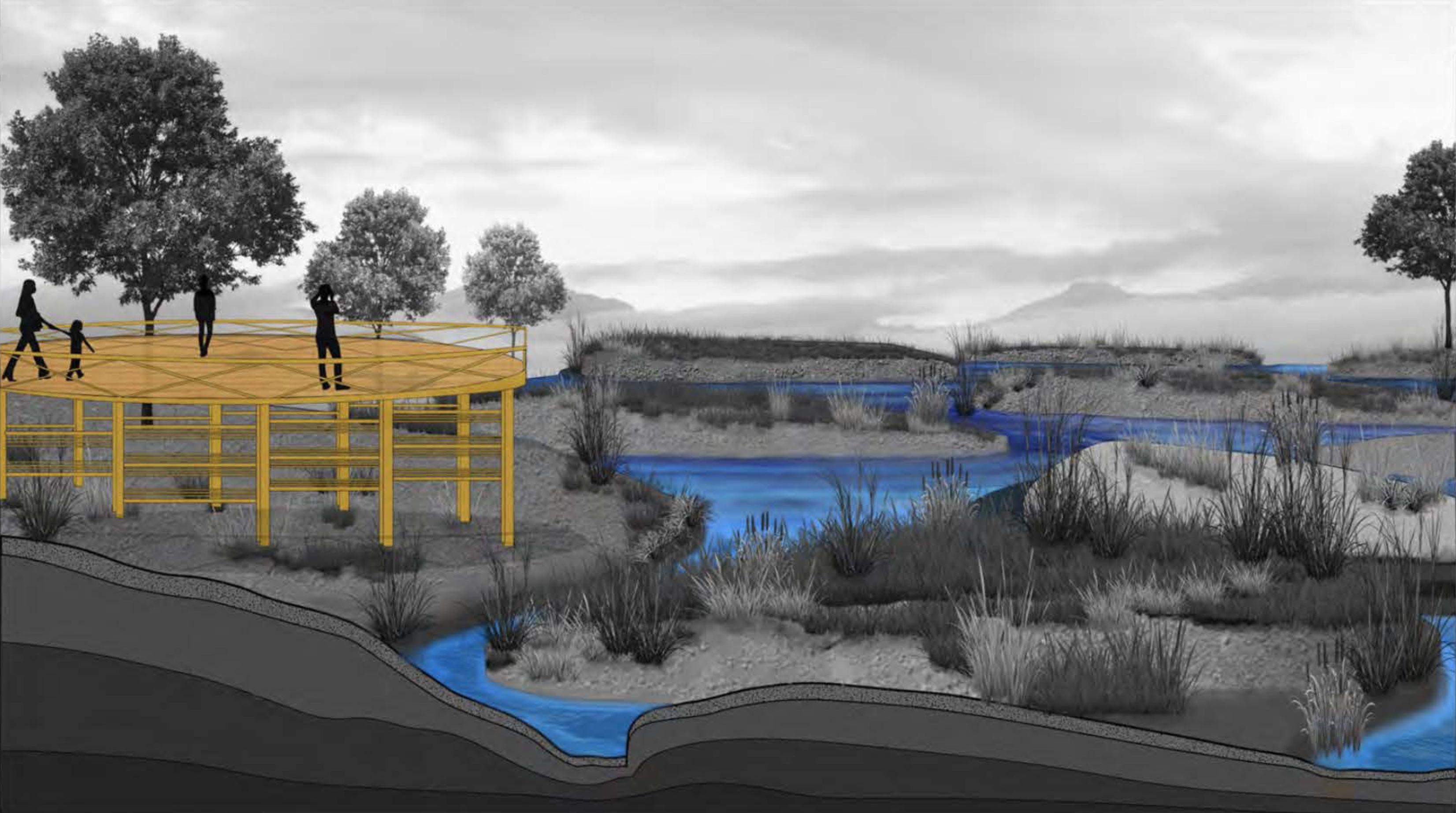
A gravitational vortex turbine typically comprises an inflow channel that guides water from the river or stream into a circular or conical vortex basin, where the water enters tangentially and forms a stable spiral flow.
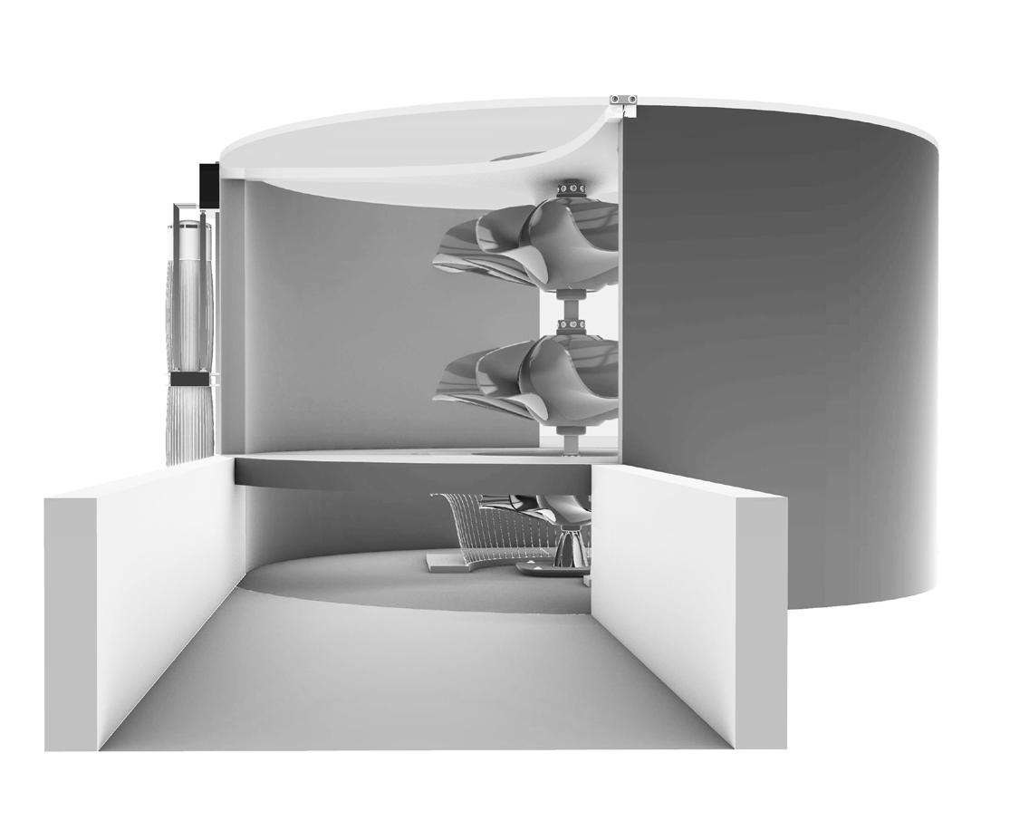
At the center or bottom of this basin lies a central drain or outlet, which funnels water out after it has passed the turbine rotor.
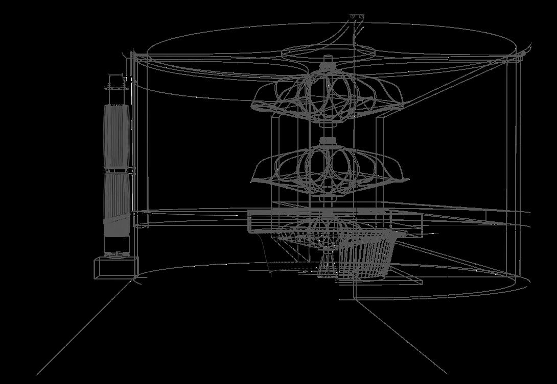
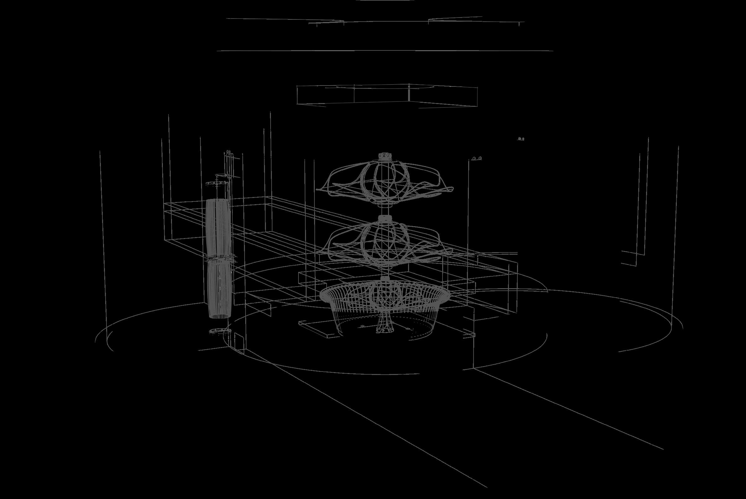
The rotor is connected to a shaft and generator positioned above the basin, converting mechanical motion into electricity. A supporting structure stabilizes and protects these components, while an outflow channel releases water back into the original watercourse, ensuring minimal ecological disruption.
BRIDGE
A new pedestrian bridge spans the Scioto River, linking Hydra’s central site features with the Olentangy Recreational Trail and the south side of Columbus. By offering a safer and more scenic alternative to the high-traffic Greenlawn Avenue Bridge, this crossing encourages bike and pedestrian travel, uniting existing paths and creating a continuous recreational corridor. The bridge itself is designed as an immersive gateway into Hydra: users can pause mid-span to appreciate the gravitational vortex turbines below, observe wa-
HEAT DISTRIUBUTION
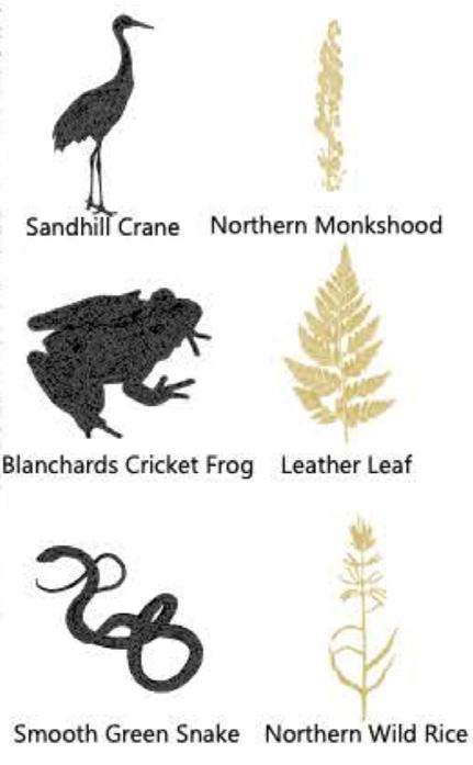
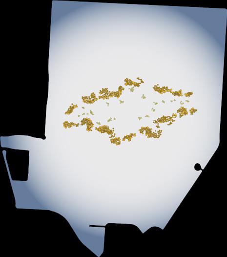
While minimal, the gravitational vortex turbines do release some heat as a byproduct of energy conversion. This localized thermal output creates slightly elevated water temperatures near the turbines, enabling a microclimate where tropical or warm-water vegetation can thrive. By mapping these warmer zones, we introduced non-invasive tropical plantings, enriching biodiversity and heightening visual interest. These specialized plantings also highlight Hydra’s synergy between renewable energy technology and ecological systems, helping visitors understand how even minor thermal shifts can reshape habitats.
STATUS: THEORETICAL
H O N E Y P Y R A
M I D
ABOUT THE PROJECT
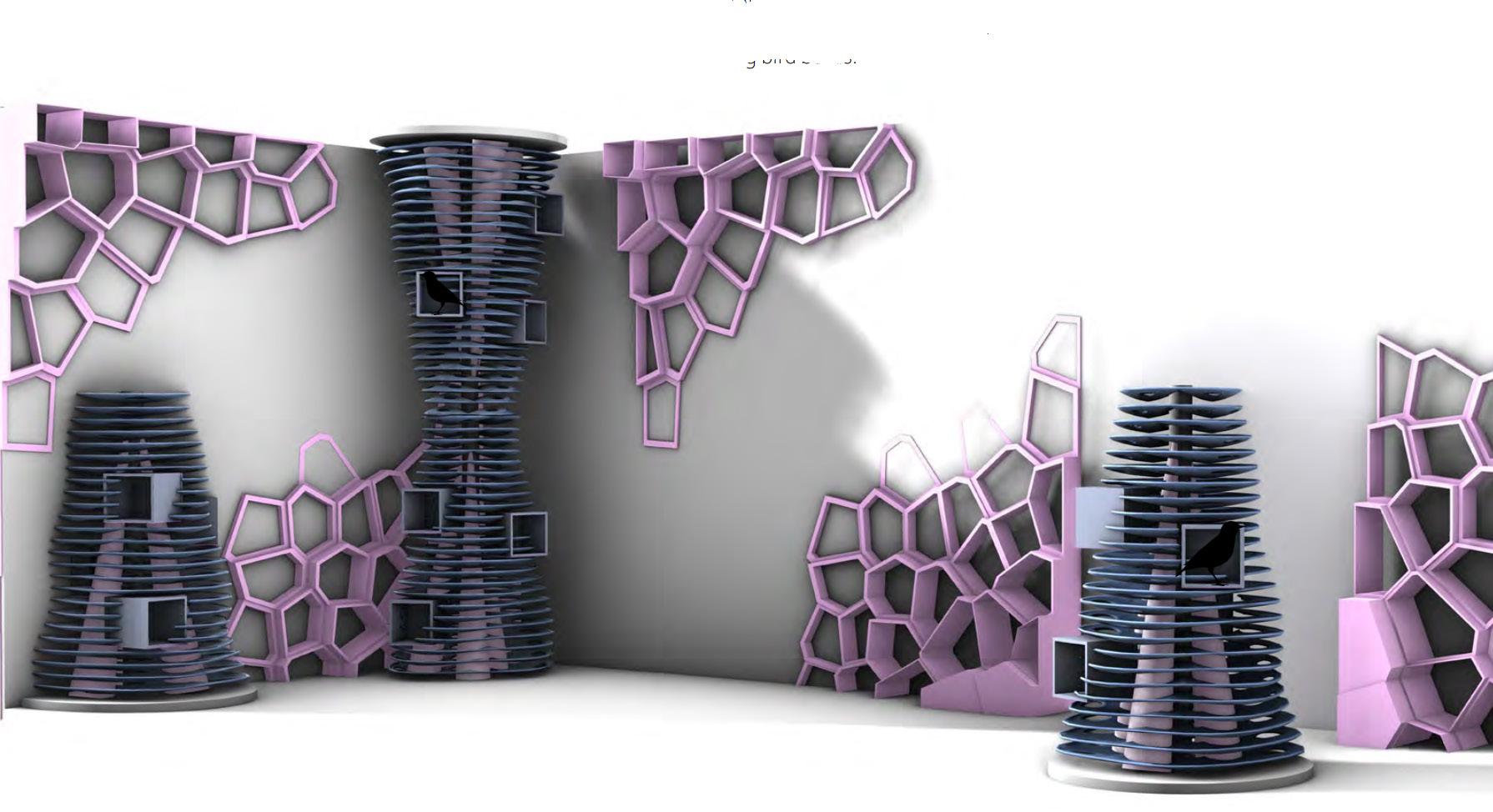
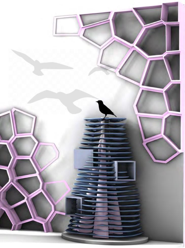
In collaboration with Olivia Sorenson, and drawing inspiration from the intricate geometry of honeycombs and the vital role project investigates how parametric design can inform large-scale architectural interventions. Using Grasshopper to generate tions, the design process embraced a series of experimental prototypes—ranging from full-scale forms to fractional reductions—that and spatial impact. By stacking and interlocking these honeycomb-inspired components, the resulting towers highlight the and contemporary fabrication methods. This iterative approach culminated in a physical assembly that demonstrates how ed into compelling architectural systems, prompting new perspectives on adaptability, scalability, and ecological integration

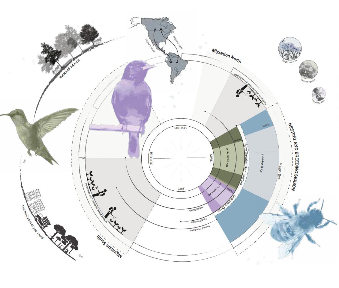
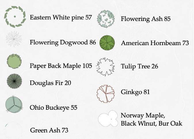
SEASONALITY SPECIES INDEX
role of pollinators, the Honey Pyramid generate and iterate on multiple configurareductions—that tested structural feasibility the interplay between organic patterns how nature’s inherent logic can be translatintegration for bee and bird species alike.
SITE IMPLEMENTATION
Progressing through the semester, we gathered foundational information for our site analysis and planned how best to advance the project. Olivia and I envisioned a site that would serve students in an educational way while also offering a variety of amenities. With my interest in architecture, I took on the challenge of designing two classroom spaces connected by a central water feature—an element that could reuse stormwater and provide ecological benefits to the community.
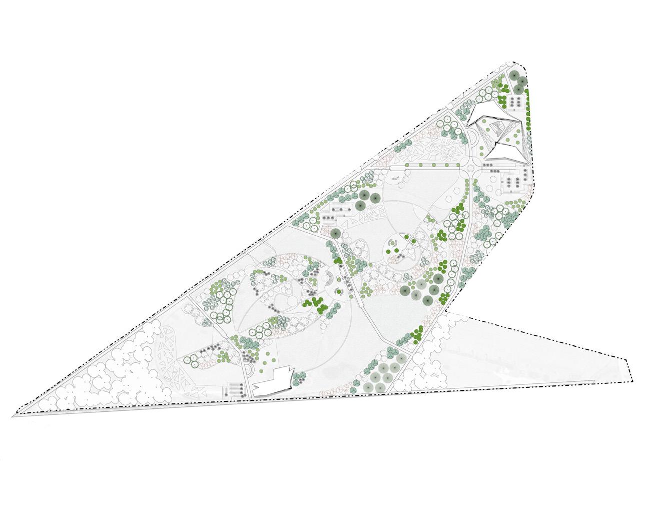
TYPOLOGIES IN THE SITE PLANTING
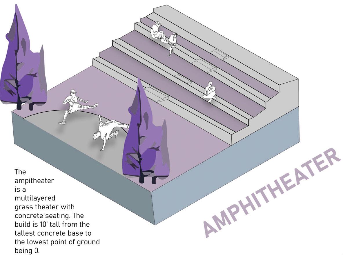
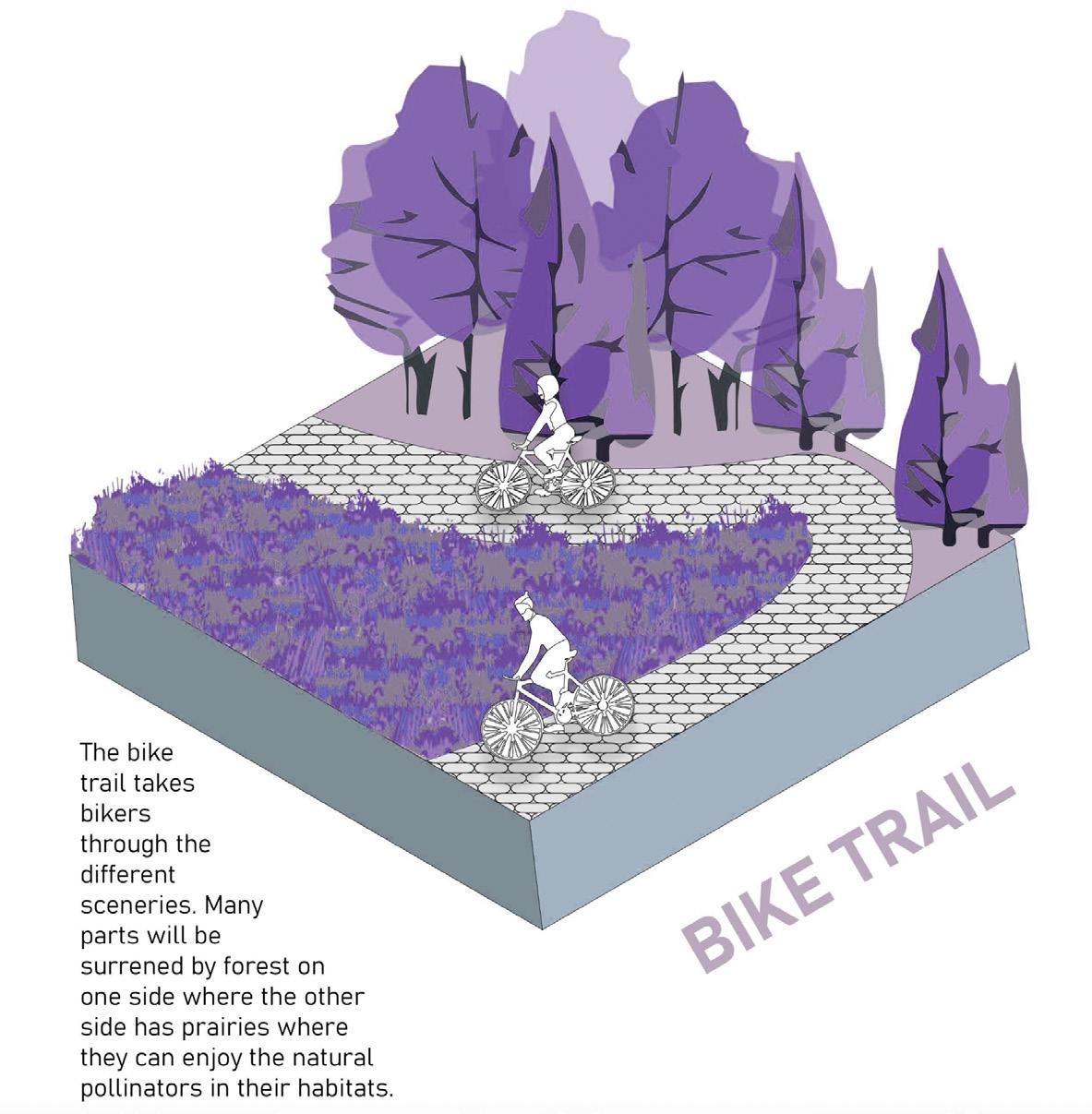
We envisioned an amphitheater functioning as an outdoor classroom, integrating carefully designed grading typologies that echo the architecture of the buildings while embracing the organic contours of the natural landscape. To accommodate the extensive size of the site, we introduced a network of bike trails, transforming the area into a self-contained campus that can serve multiple purposes.
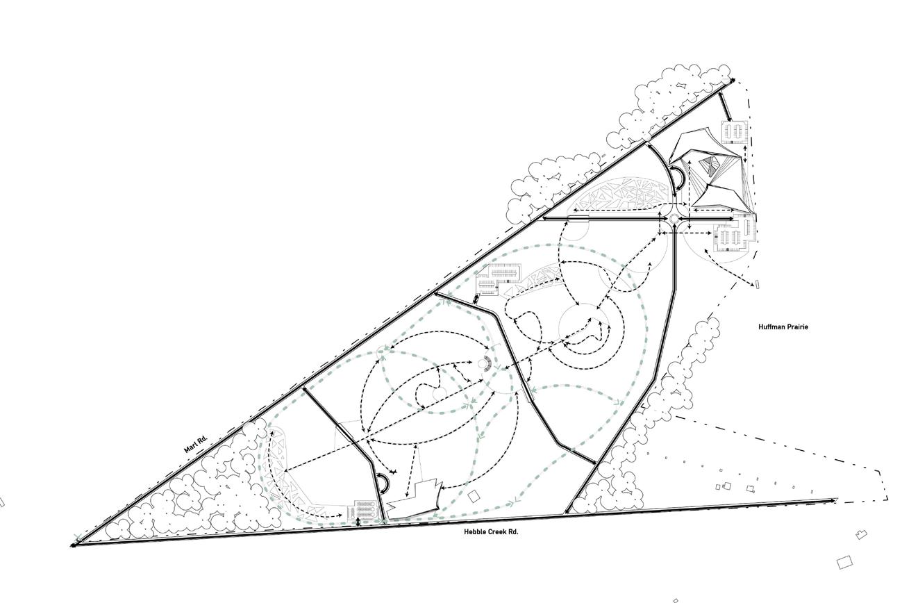
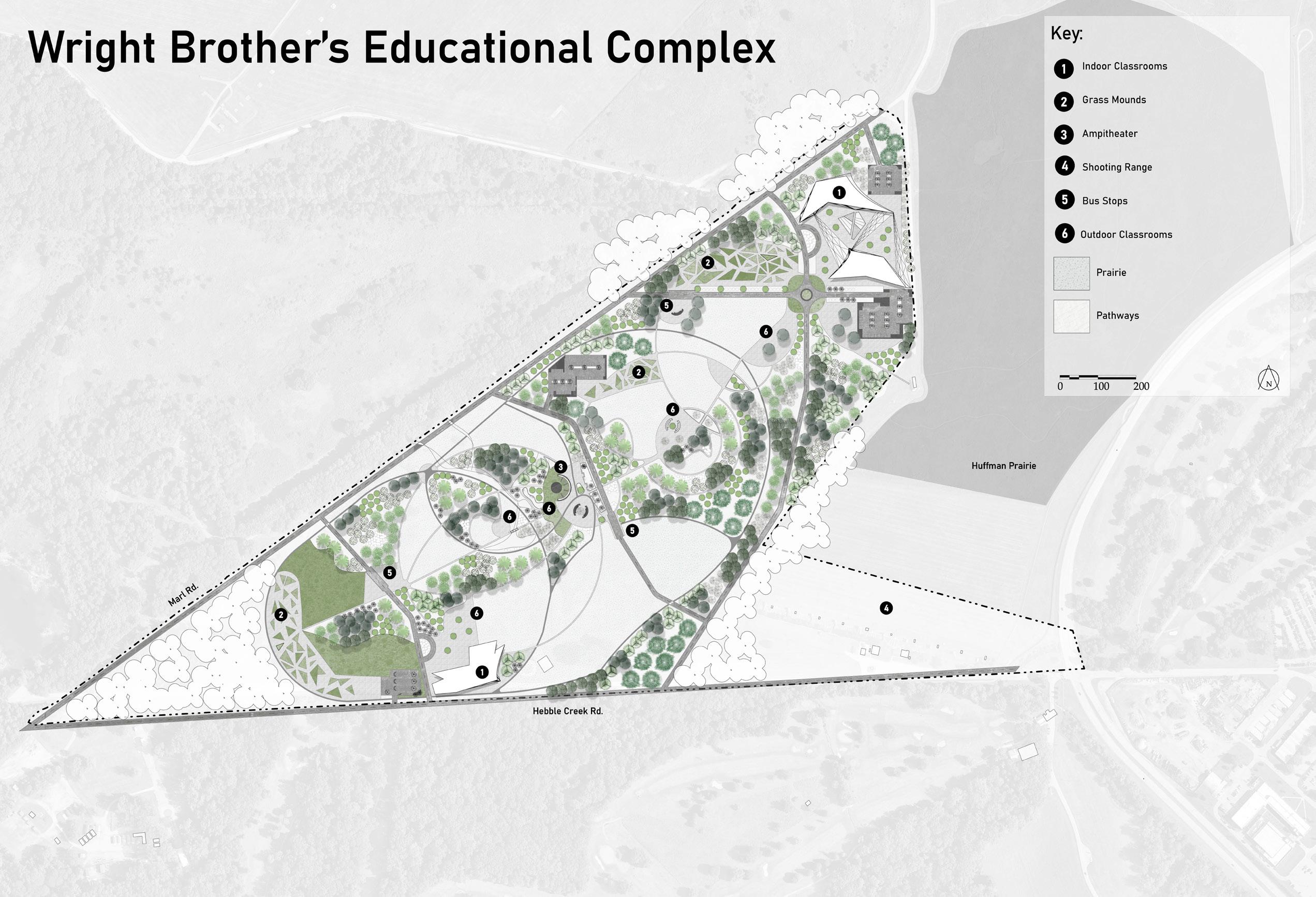
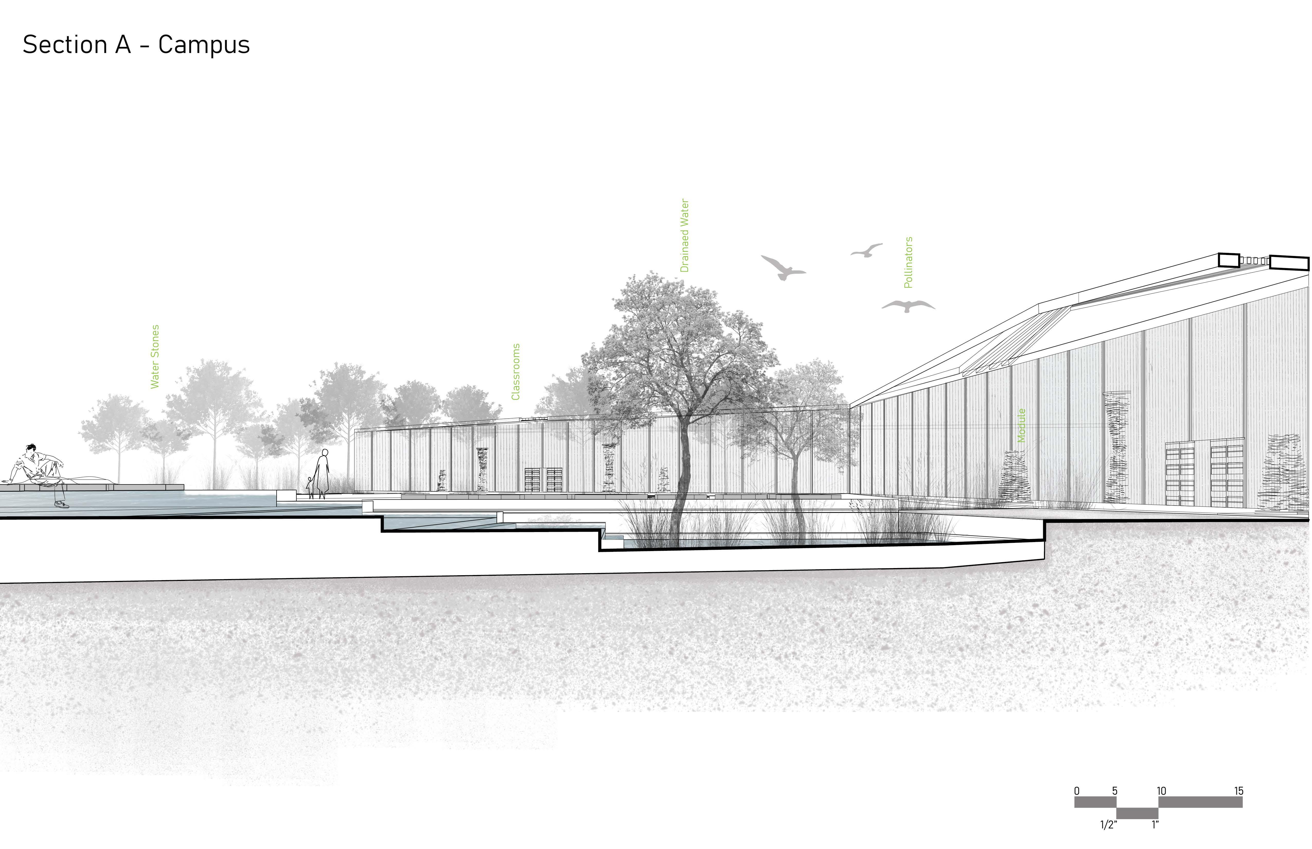
In collaboration with Olivia Sorenson, The modular design of the Honey Pyramid was strategically implemented into the landscape design for the Wright Brothers Educational Complex in Dayton, Ohio. This site, envisioned as an educational campus, was designed to inform visitors about both the historical significance of the Wright Brothers and the broader impact of their innovations. The modular system was integrated throughout the campus, creating interactive spaces for learning, gathering, and reflection. The site plan itself was carefully crafted to mirror the flight paths once taken by the Wright Brothers, embedding their legacy into the very geometry of the landscape.

L I F E
A F T E R D E A T H
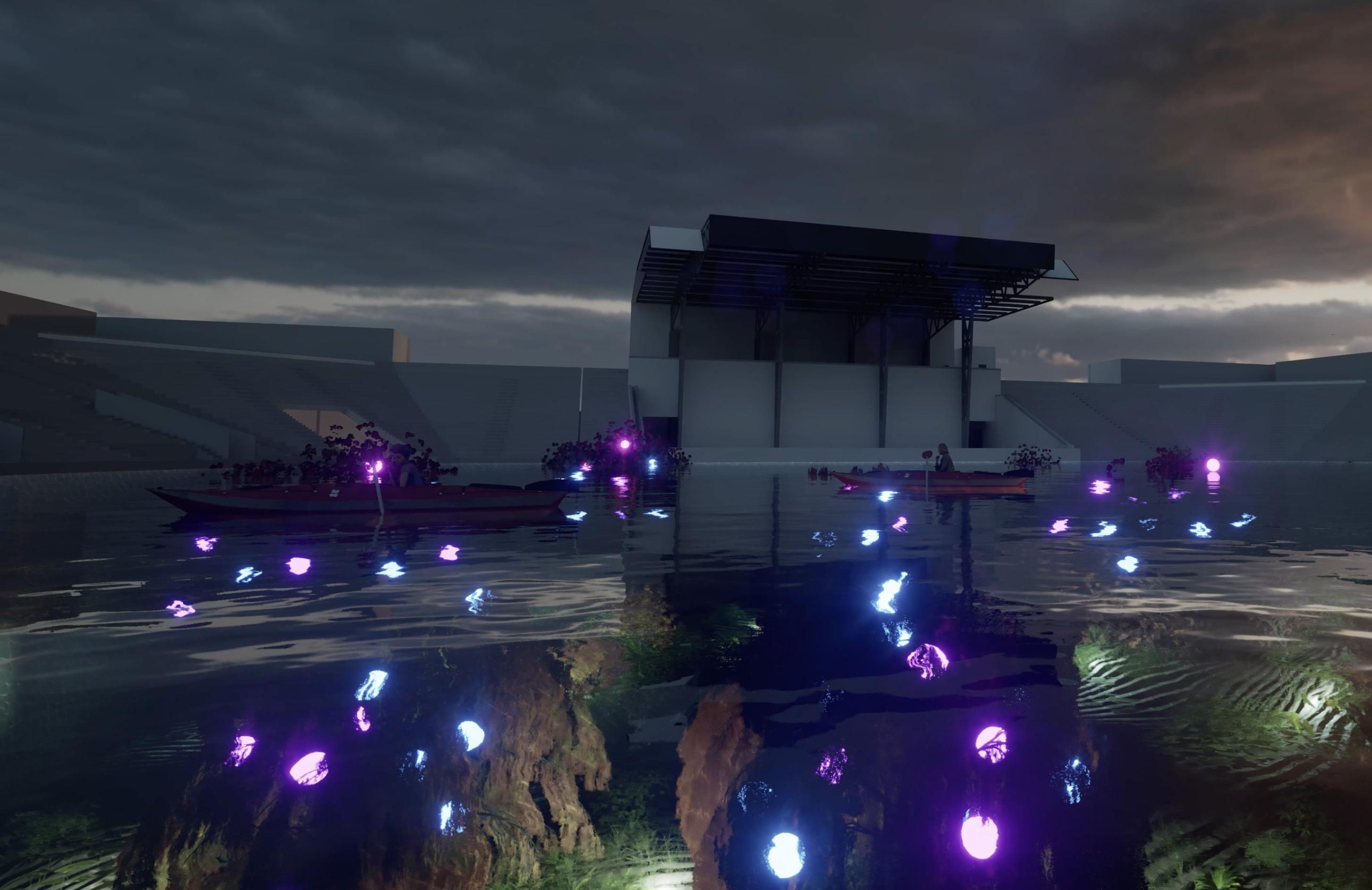
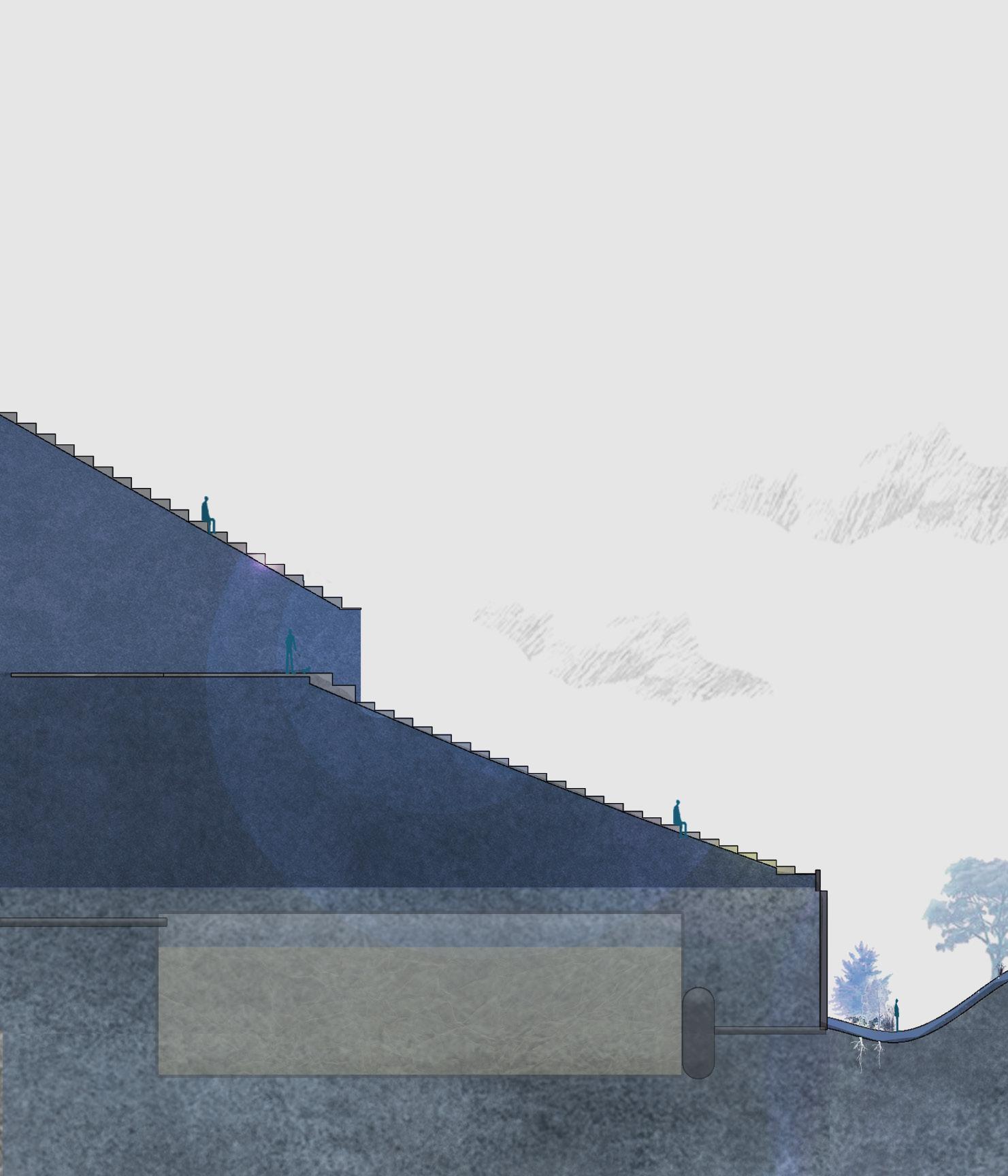
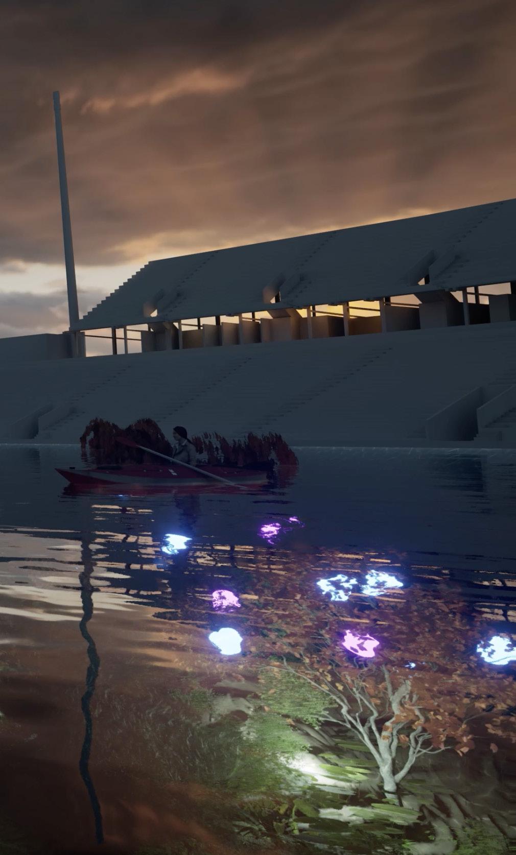
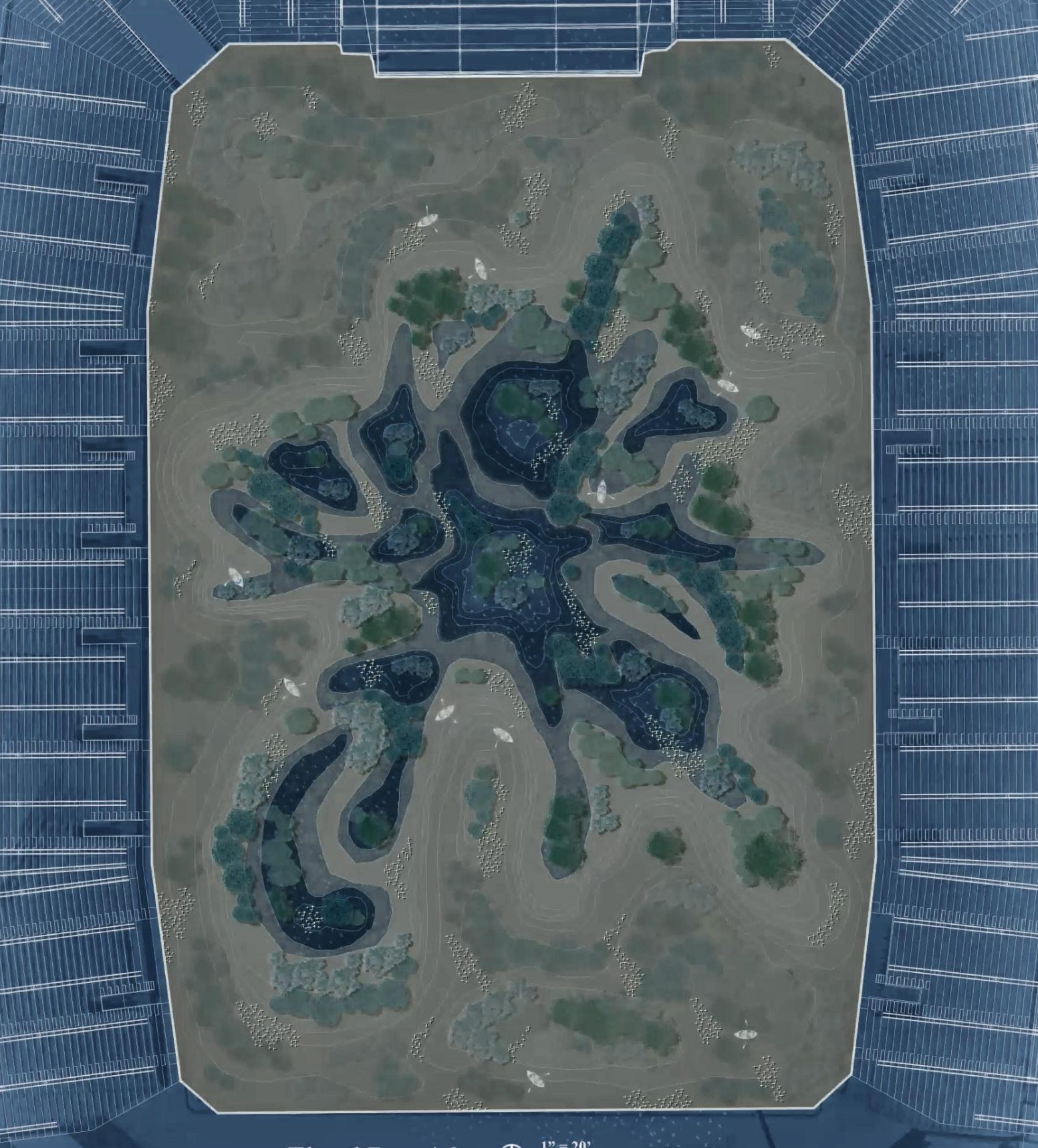
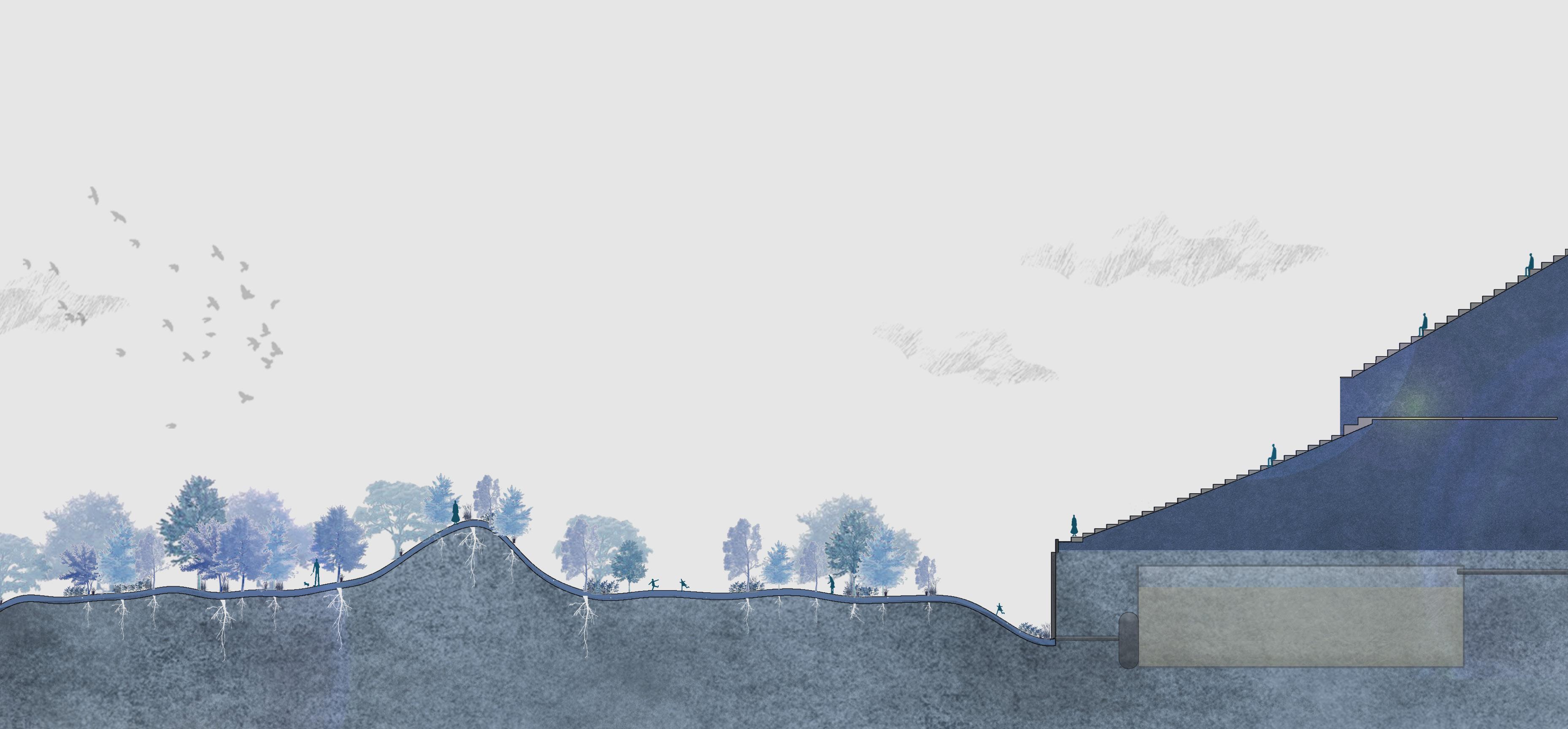
Within less than a week of design for our sping semester competition project, Life After Death emerged as our contender. By transforming the former Columbus Crew Stadium into a dynamic, evolving landscape, over a month, water slowly floods the site, submerging trees and creating shifting islands. At its peak, a synchronized light installation pulses beneath the water, symbolizing death. Yet, this is not an end—it is renewal. The water drains the next day, revealing a revitalized landscape. Inspired by historical tragedies, the project redefines devastation as a catalyst for rebirth. The annual flood and light show create a shared experience, celebrating resilience, transformation, and the beauty of life’s cycles. (Section/Plan done by Allie Kim, and Dai. J, concept + physical model Samantha Grant and Daniel O’brien, 3-D model/Render by Pavel)
STATUS: IN CONSTRUCTION
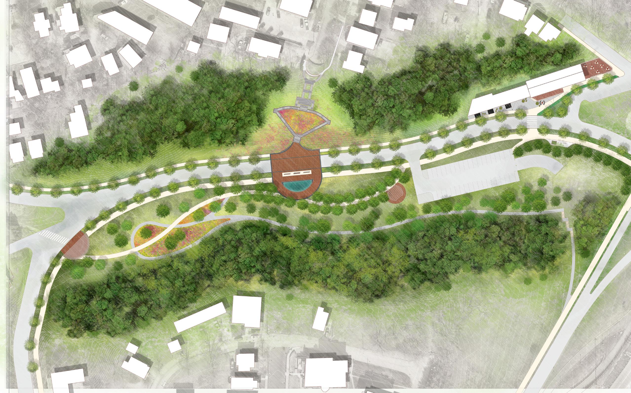
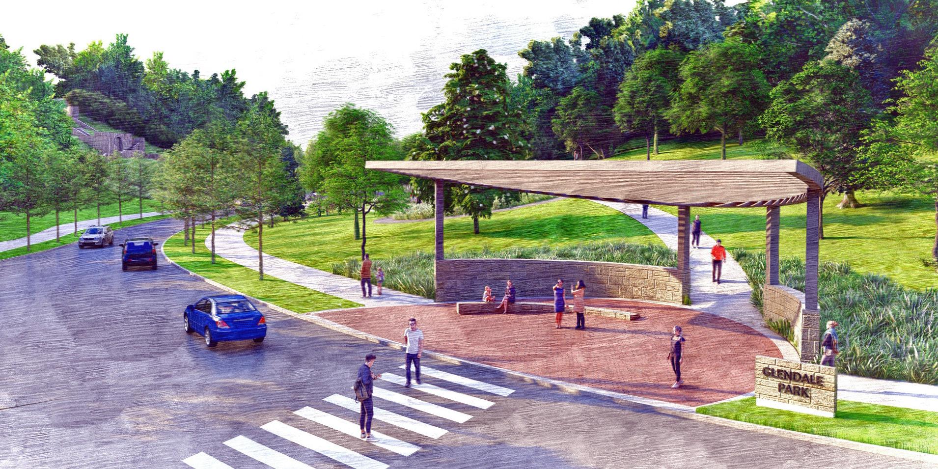
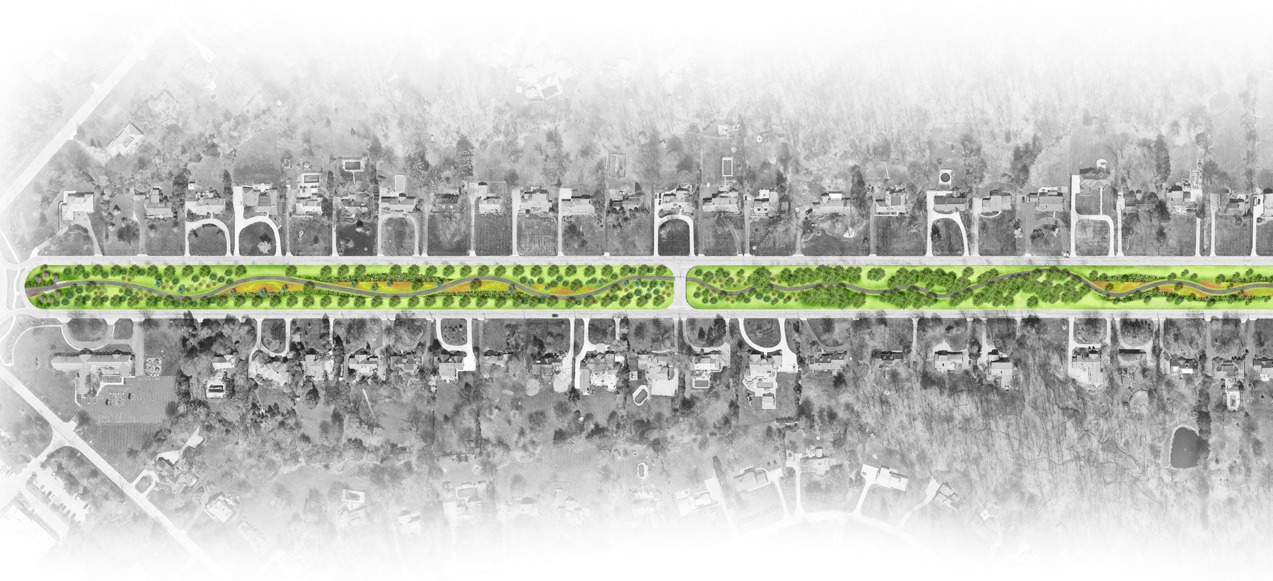
P E P P E R P I K E
ABOUT THE PROJECT
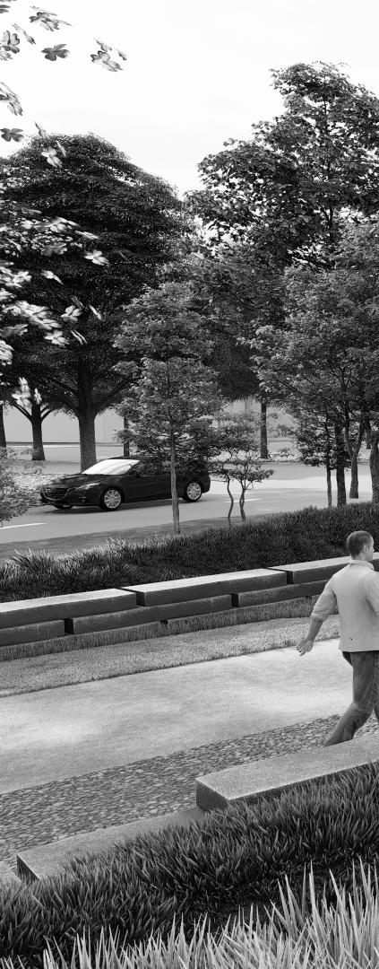
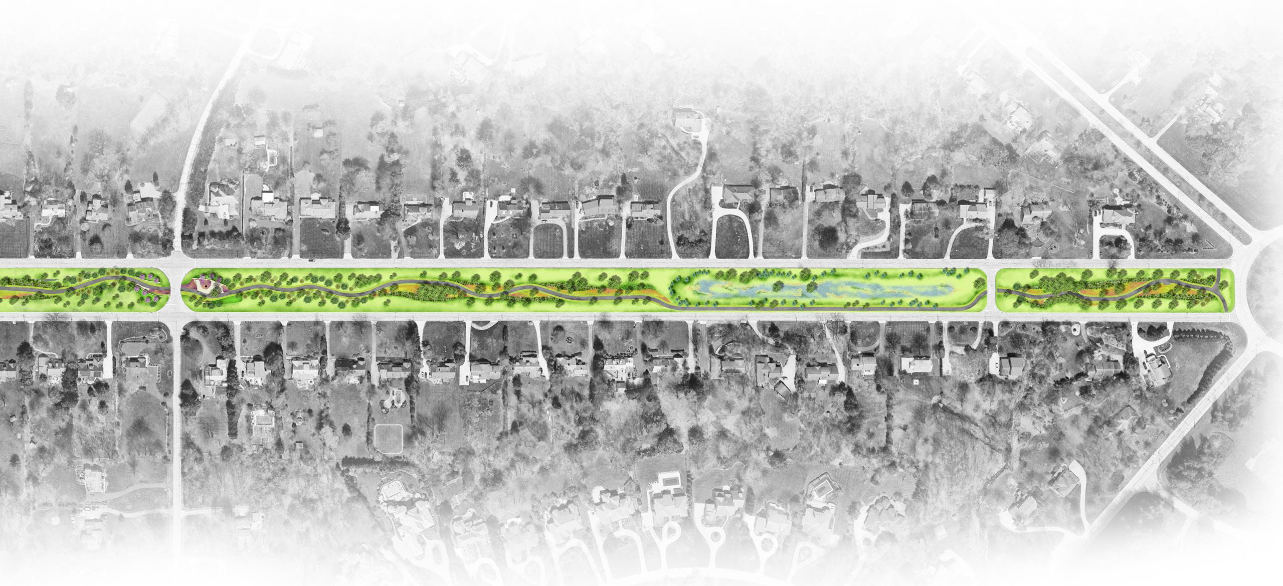
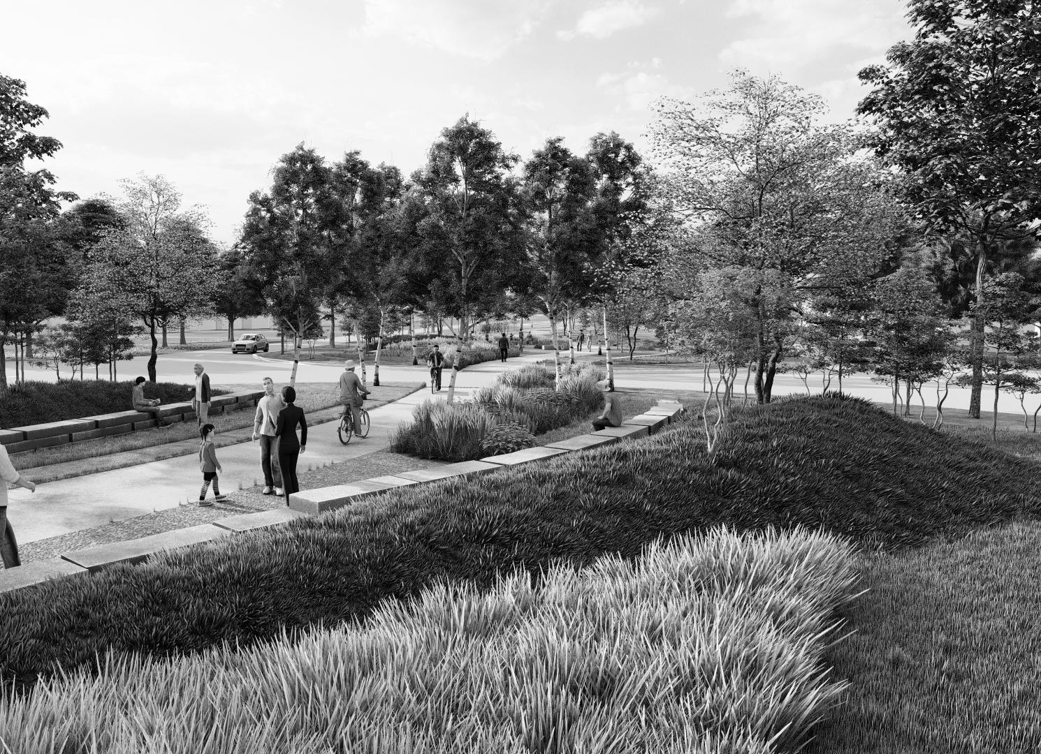
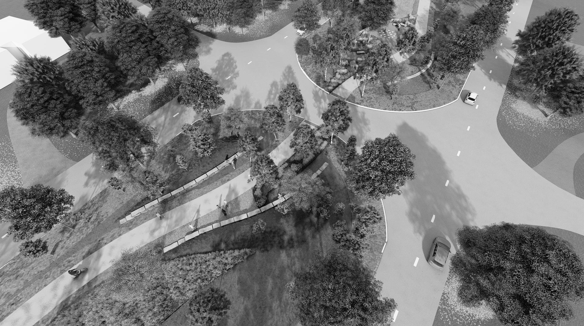
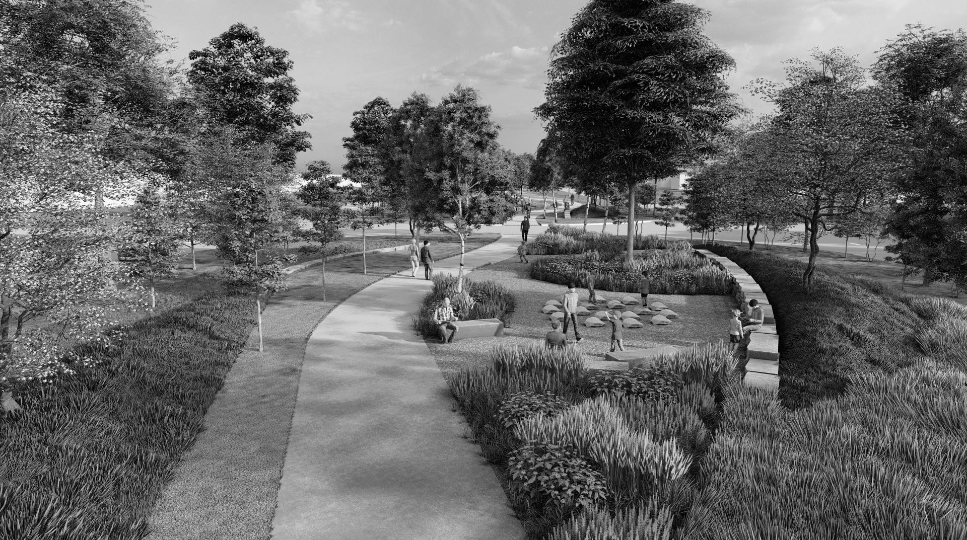
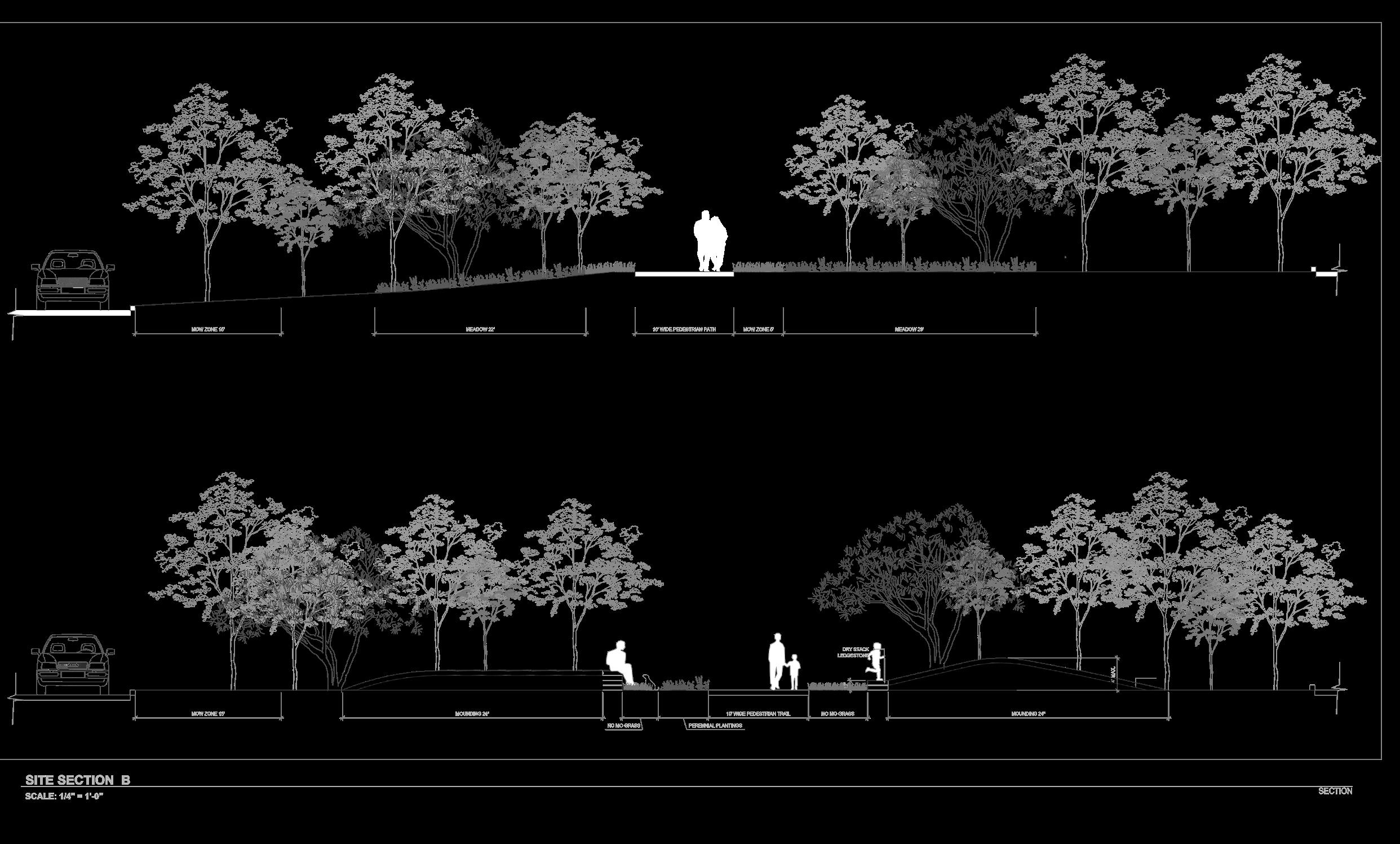
In collaboration with the MKSK team, this corridor revitalization initiative establishes a safe, visually compelling pedestrian link between Lander Circle and a nearby historic park. The design leverages subtle topographical modifications—specifically the creation of mounding—to shield the central pathway from neighboring residences while adding sculptural dimension to the site. A thoughtfully curated palette of native trees, prairie plantings, and brick accents further enhances privacy, fosters ecological diversity, and reflects Pepper Pike’s architectural heritage.
ABOUT THE PROJECT
We incorporated native tree plantings and prairie grasses to enhance natural screening, support local biodiversity, and offer seasonal visual interest. Building on Pepper Pike’s historical character, we emphasized brick accents and complementary materials that reflect the area’s architectural heritage. The design ties the new pedestrian route into the existing urban fabric, strengthening neighborhood connections while maintaining a respectful buffer for local residents. Now under construction, this corridor will serve as a dynamic, functional greenspace that aligns with Pepper Pike’s ongoing dedication to thoughtful landscape design and community well-being. All plan drawings, sections, 3D modeling, renderings, and portions of the construction documents were produced by me, thanks to the Cleveland team and the opportunity to contribute to this transformative initiative.
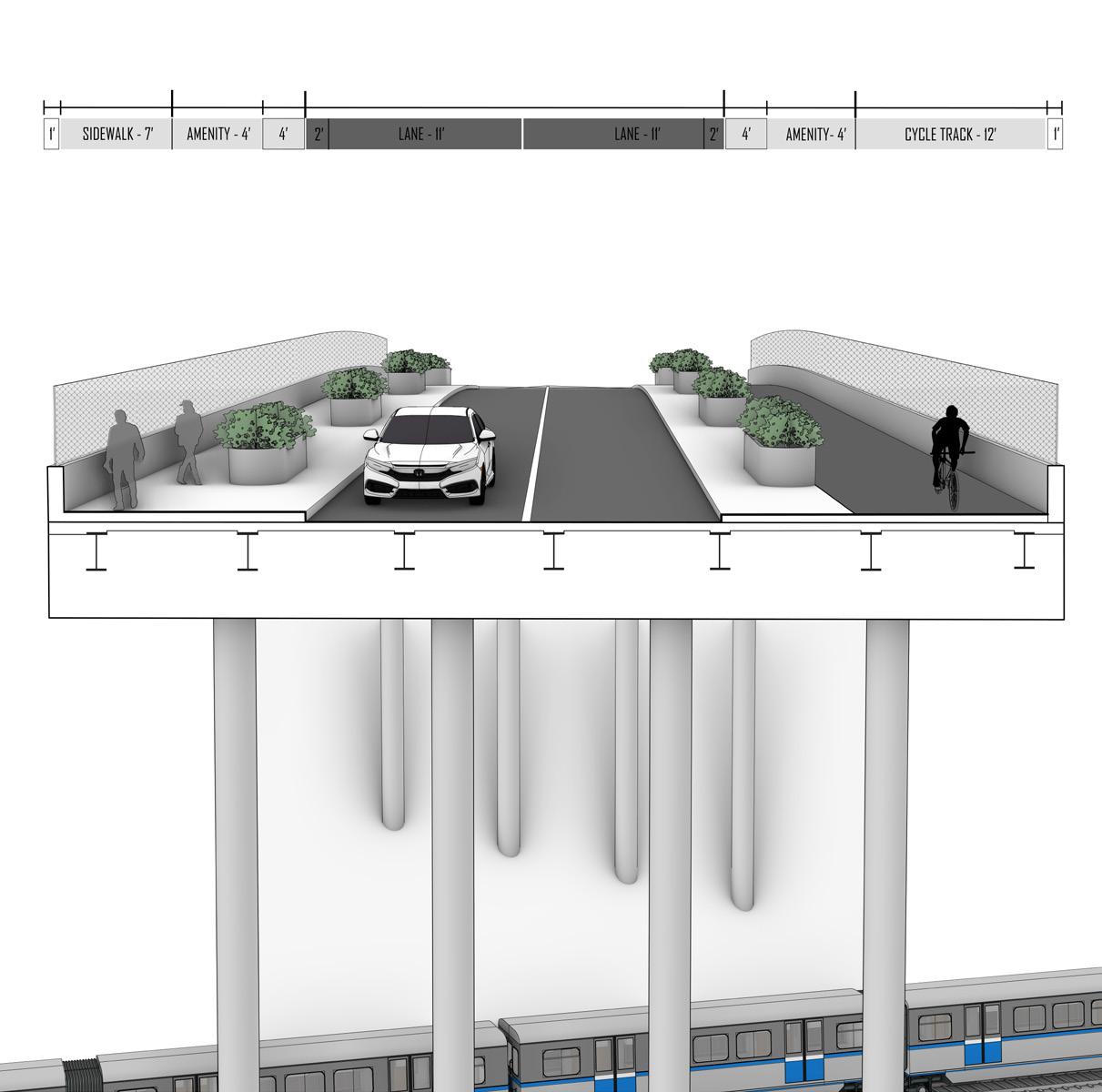
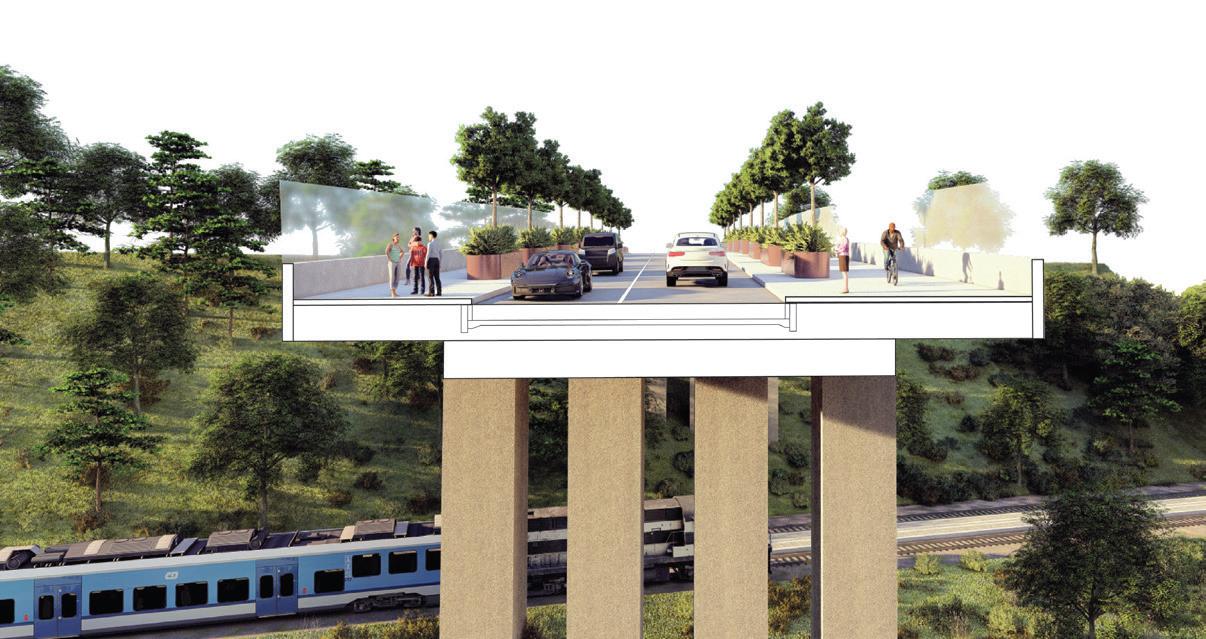
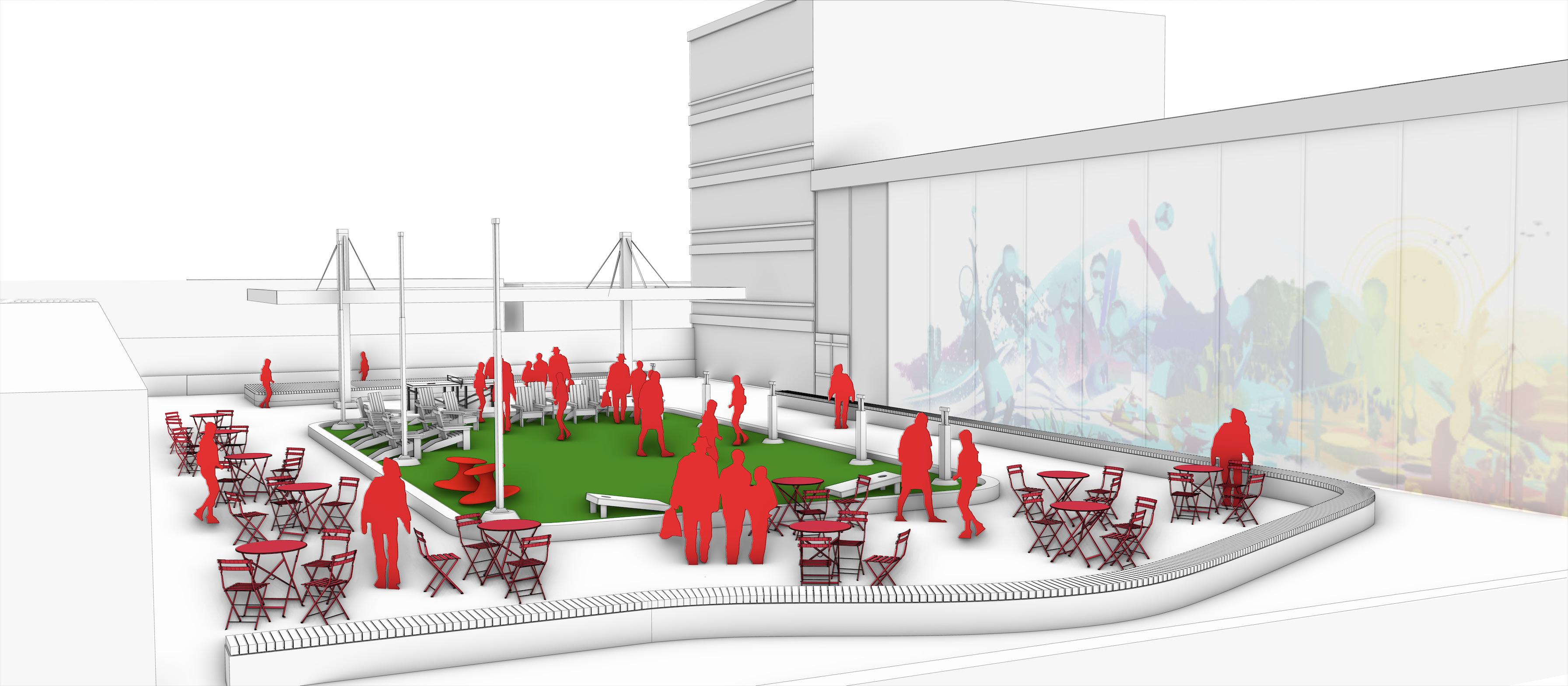
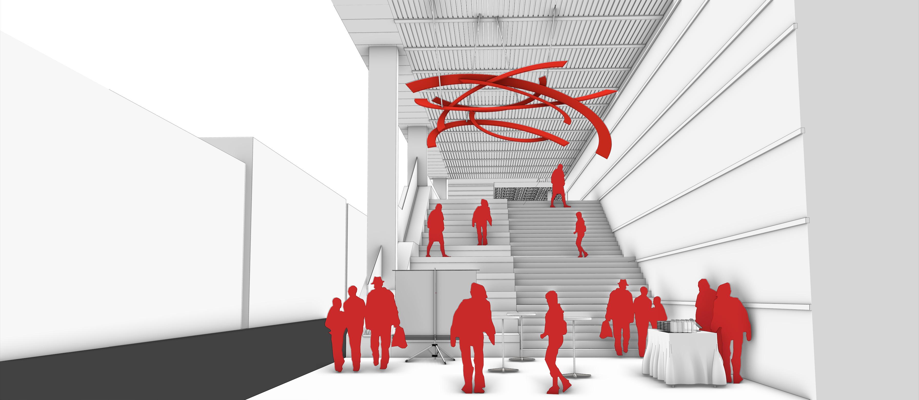
B E D R O C K
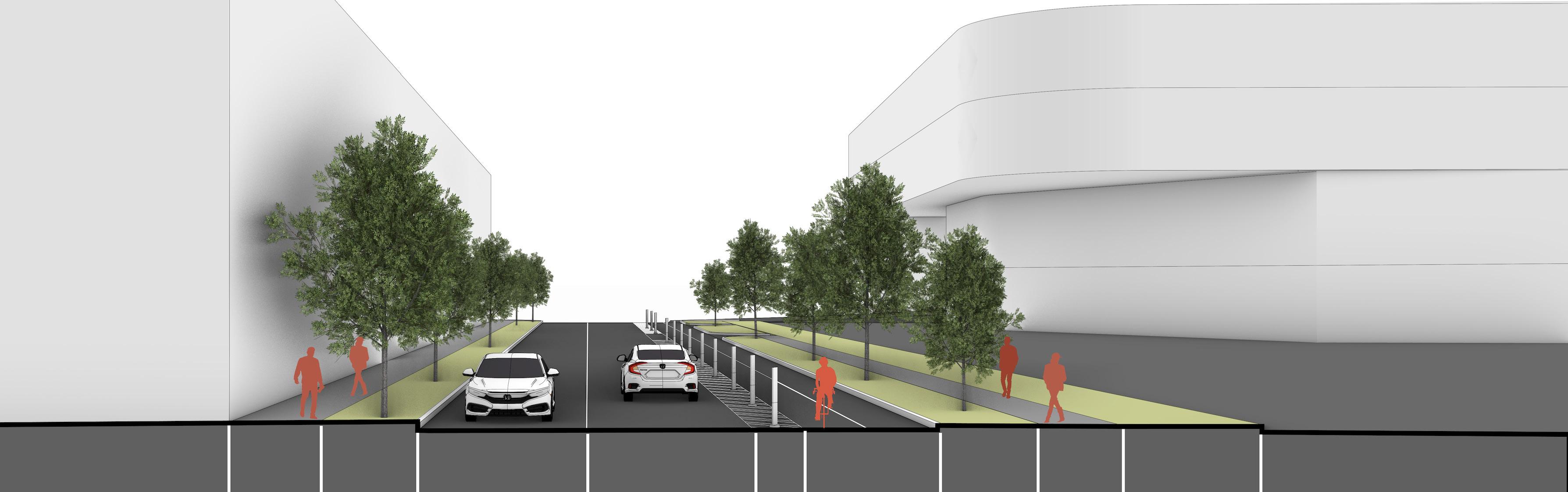
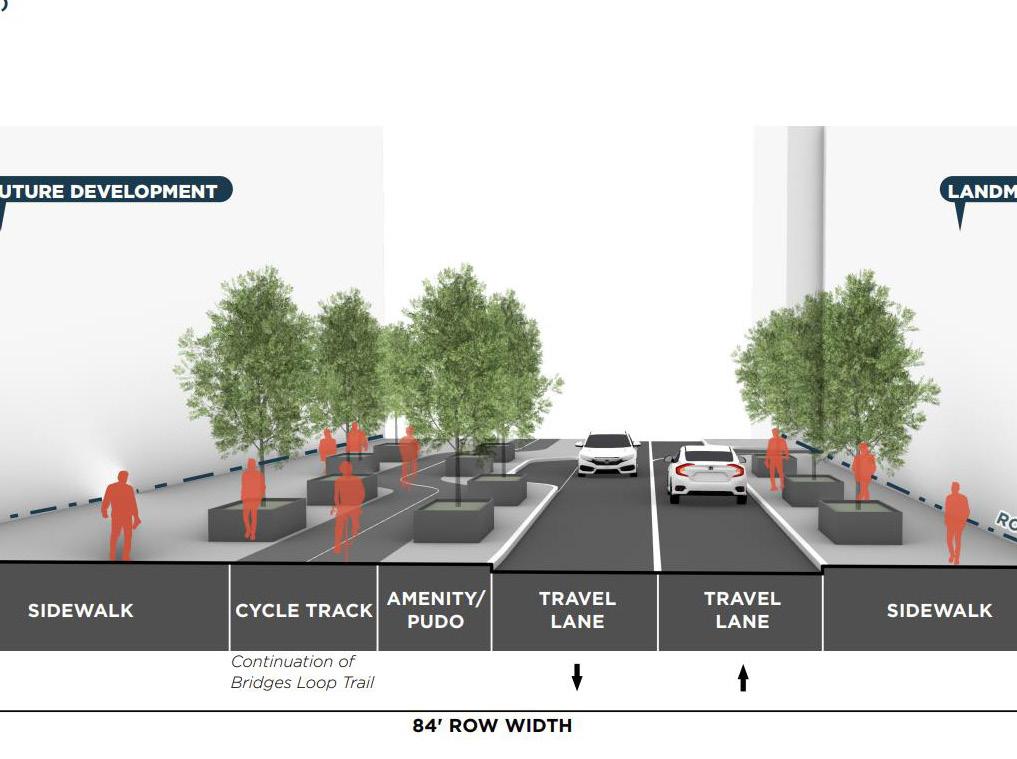
As part of the Bedrock Huron Master Plan—a large-scale, multi-biilion-dollar redevelopment effort designed to revitalize downtown Cleveland and reconnect it to the Cuyahoga River—I contributed conceptual street-scape designs and bridge conditions aimed at enhancing pedestrian flow, visual appeal, and neighborhood connectivity. My role involved 3D modeling the proposed improvements and refining them through Illustrator, Photoshop, and Lumion to produce clear, immersive presentations that capture the project’s vision of safe, inviting public spaces that stimulate economic growth while honoring Cleveland’s historic urban fabric.