Weiyong Zhang Selected Work 2015-2020 | Admitted to Harvard GSD, UPenn, Cornell and RISD
WEIYONG ZHANG
SELECTED WORKS 2015-2020
BACHELOR OF ARCHITECTURE
BOSTON ARCHITECTURAL COLLEGE
Preface
My enthusiasm for landscape architecture and urban design can be traced back to my childhood. was raised in Macau, one of the densest cities in China and in the world, There, was exposed to an environment filled with congestion and lacking clarity of design. At a young age, I recall walking around my family’s company, observing the meticulous process of creating intricate pieces of furniture, a process which included making the rough designs come to life by hand sketching and carving carefully on the wood forms, along with handwork with textiles. Watching this process from a young age inspired me to think about how design is a process that encompasses all scales and mediums, from the design of a small piece of furniture to a large landscape project.
With these lifelong memories instilled in me, it was in college that I decided to seriously follow my passion for design and to pursue my undergraduate degree from 2015 to 2020 at the Boston Architectural College (BAC). During my years at BAC, I learned that the successful design ideas that create building environments are not only satisfying people’s living conditions, they also respond to the local, context, even the demands in the world.
Being able to study in one of the best universities in the world will allow me to explore the advanced realm of Landscape Architecture. It also grants me the opportunity to involve a wide variety of people in society which is beyond just presenting the design ideas. In the long run, concentrating on the landscape design of a space will motivate me to learn how to make a great difference in society
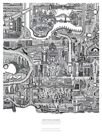
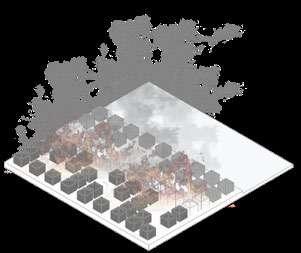
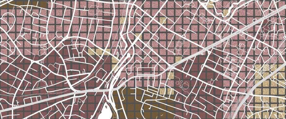
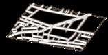
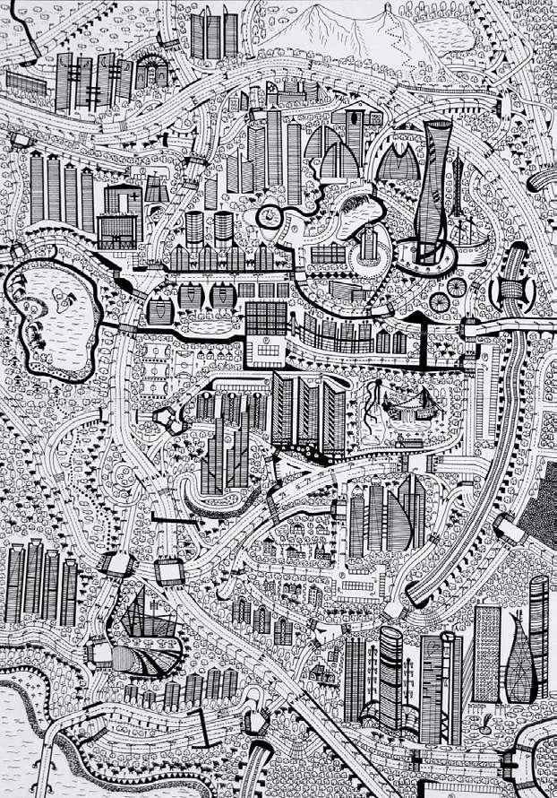
Hand Drawing: Metropolis Episode I (2015)
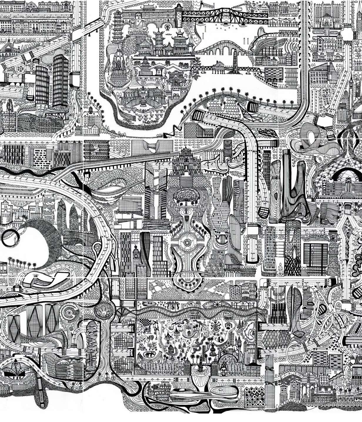
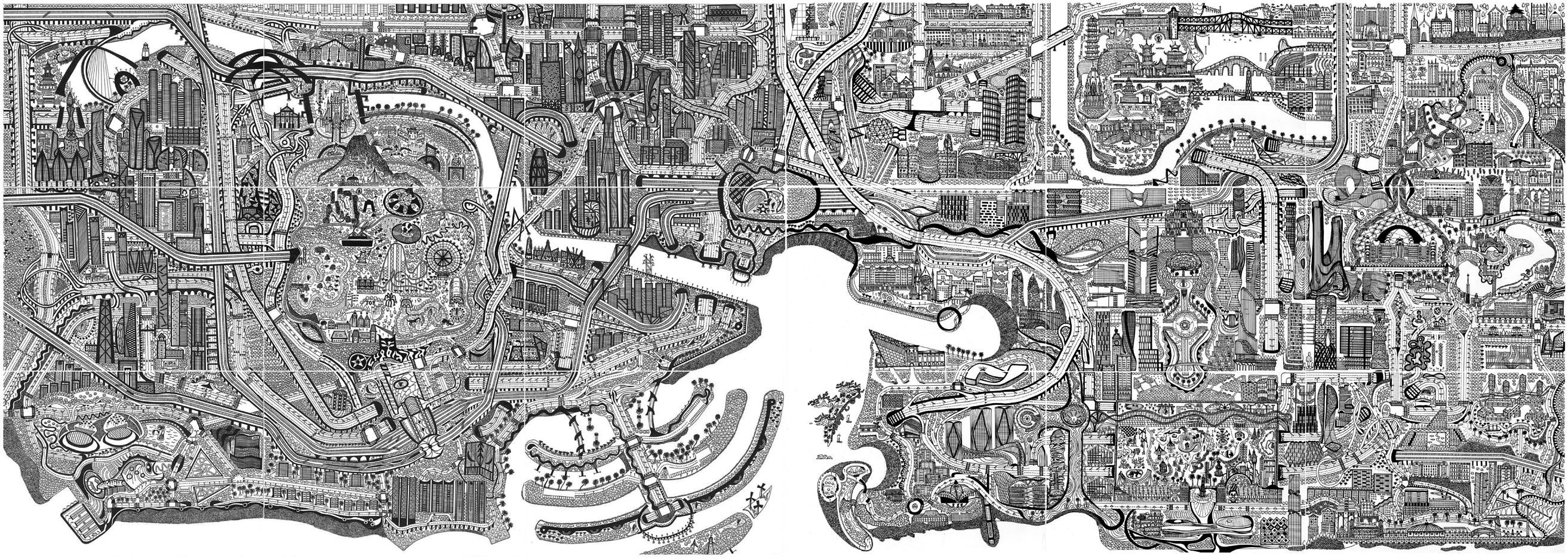
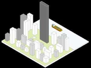
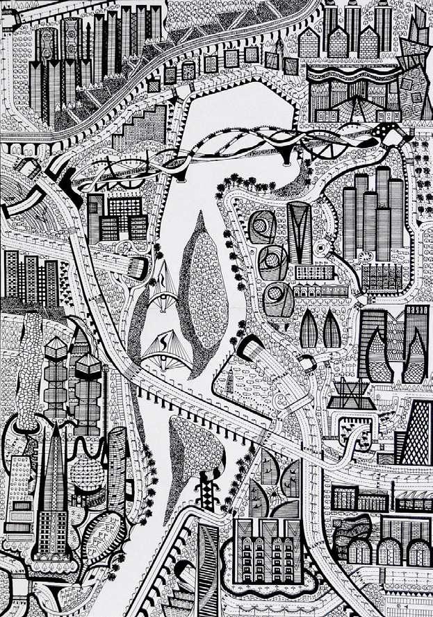
Hand Drawing: Metropolis Episode II (2020)
Size: 24 in x 36 in
“Daddy, where are we going? am so hungry.” Son asked impatiently while looking at the ocean. “Son, be a little more patient. We will arrive in the country of angels. The country is filled with joy and we wouldn’t be suffering from any pain.” Father answered.
Perhaps, they don’t know that an unknown abhorrent journey has just begun. As a decent Chinese, it is common that when the person passes away, the elder often tells a white lie to children that he is going to the United States (heaven) because travelling to the United States is a long journey at that moment, like sailing to the pure land.
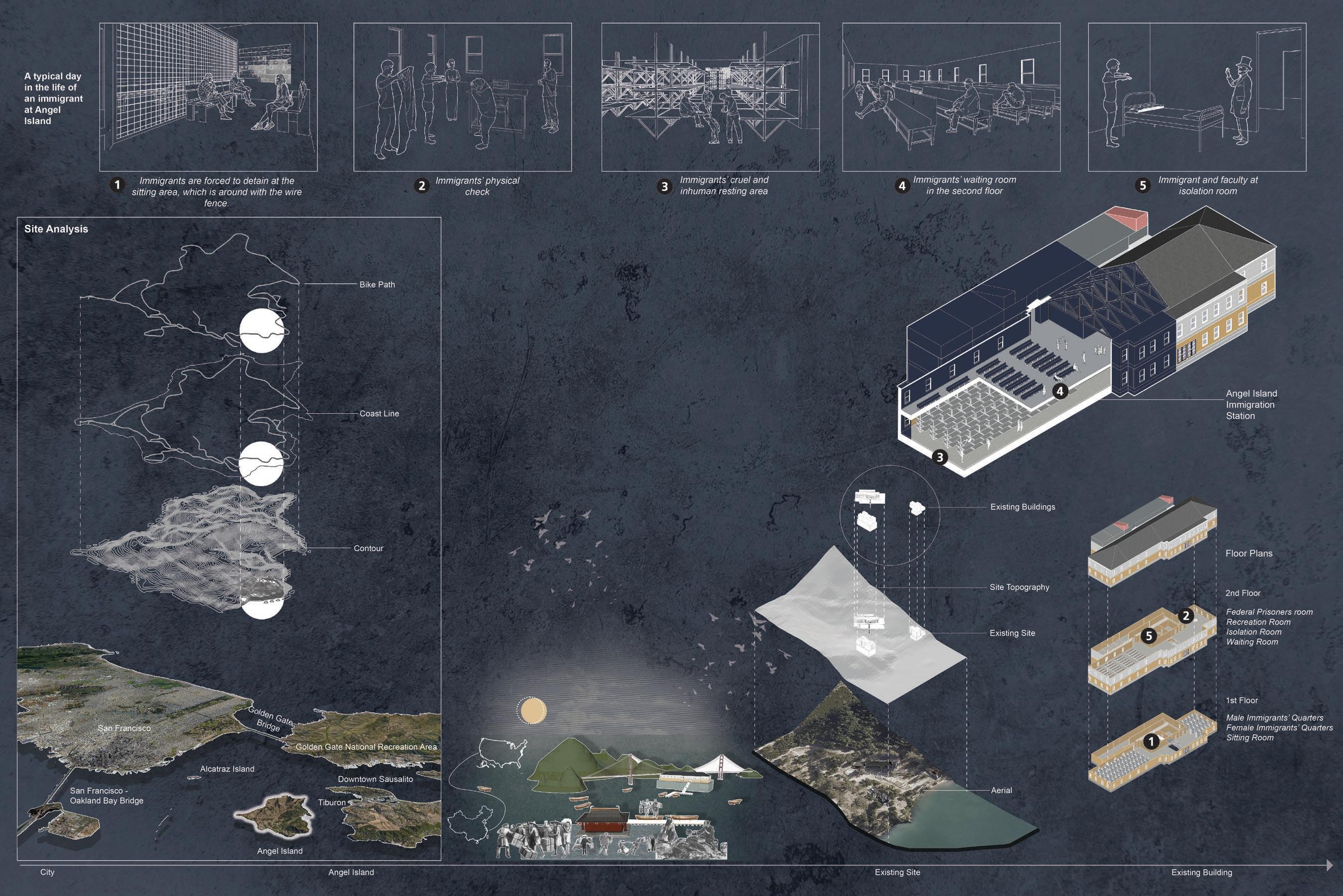
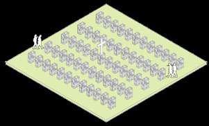
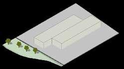
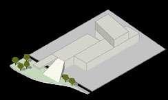
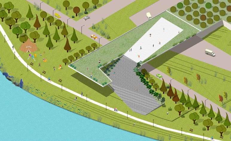
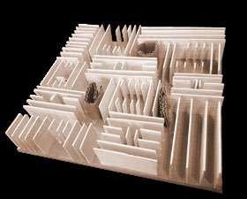
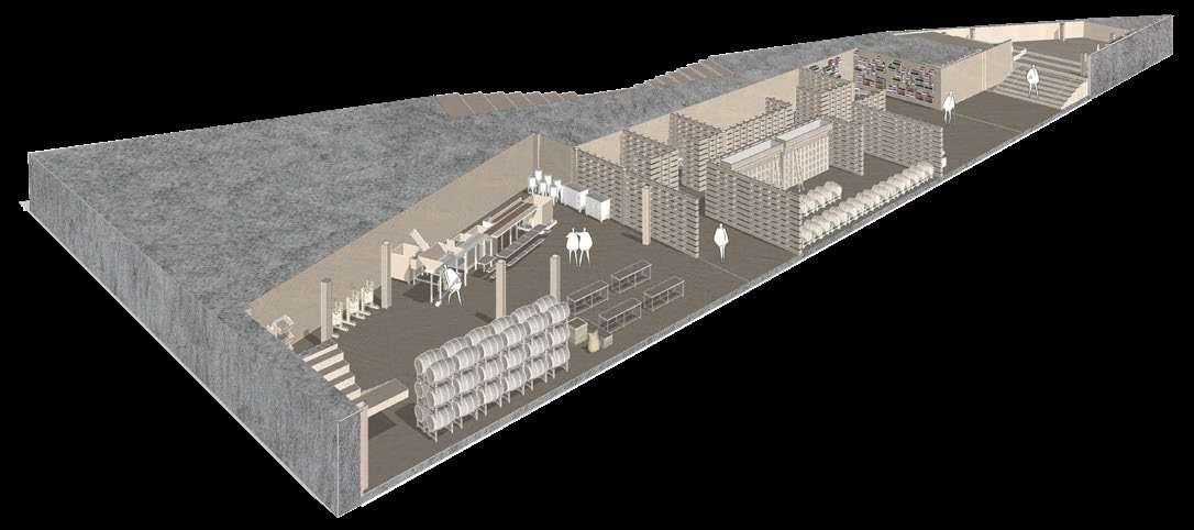
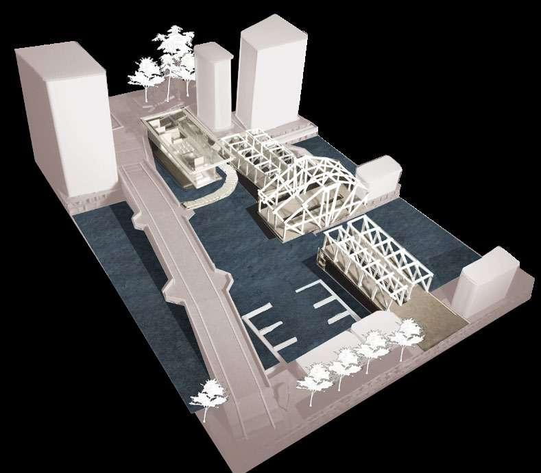
01 ANGEL PAVILION
MEMORIAL TO THE PAST
ADVANCED INTERDISCIPLINARY STUDIO
INSTRUCTOR: LYNCH, SHAUN FRANCIS
LYCEUM COMPETITION: SANCTUARY
BOSTON ARCHITECTURAL COLLEGE
SPRING
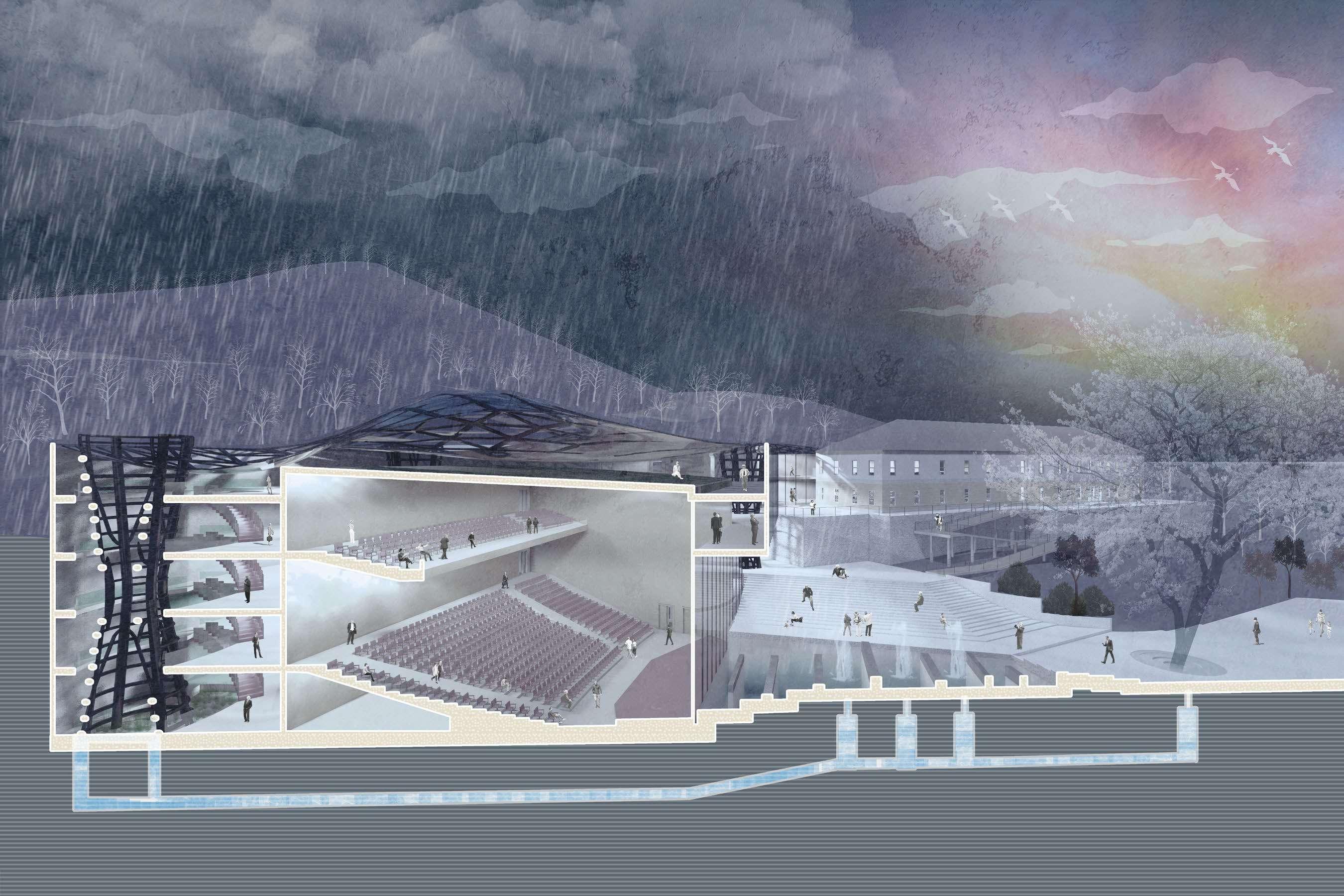
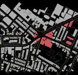
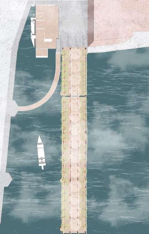
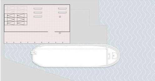
Throughout the late 19th century and early 20th century, Chinese immigrants were detained on Angel Island in San Francisco. This project is a memorial auditorium to the experiences of those Chinese immigrants who were treated unfairly on this site.
Angel Island is located in the San Francisco Bay.
The San Francisco citizens usually take the ferry from City to Tiburon, and to Angel Island. Angel Island offers hiking, biking, and historic activities.
The early Inhabitants began visiting the island about 2,000 years ago. They established camps and used the island primarily as a fishing and hunting purpose. In 1863, during the Civil War, the U.S. Army established Camp Reynolds on Angel Island to protect San Francisco Bay.
In 1882, most of the Chinese immigrants who arrived at Angel Island were detained at Quarantine Station for a few weeks, even some were detained up to 3 months and a few for almost two years because they were suspected of carrying diseases. However, most immigrants were eventually granted entry to America.
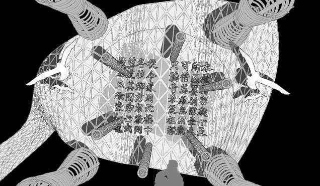
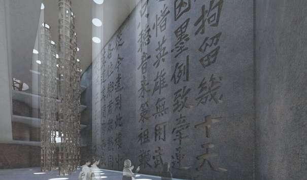
Many immigrants expressed their anxiety and despair by carving poems on the wooden barracks walls. These poems still remain in the building today.
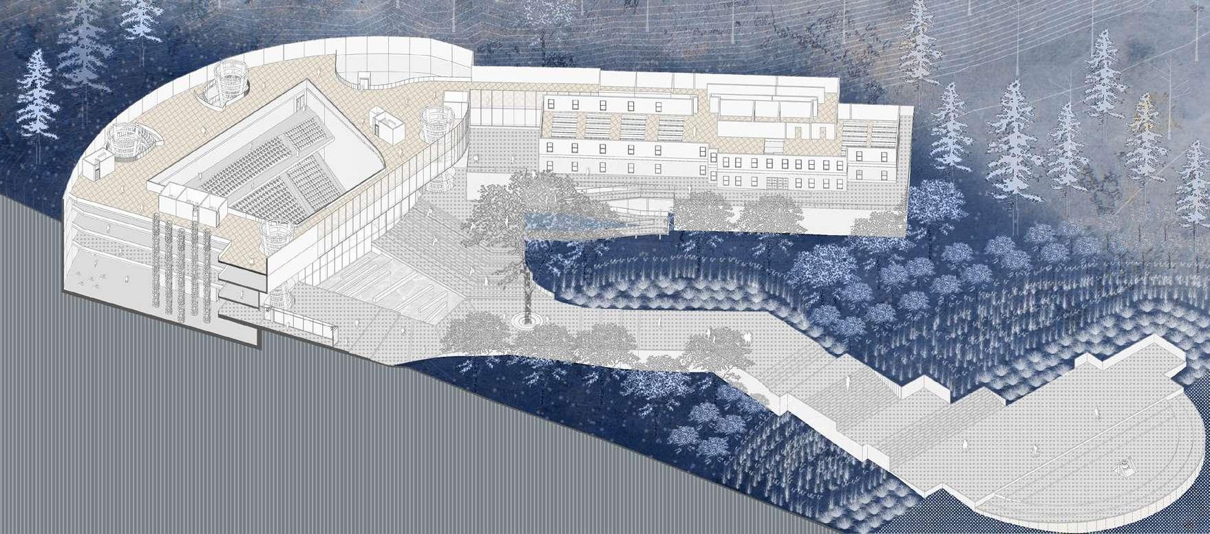
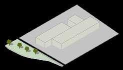
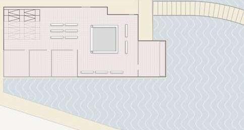
The angel motif is originally inspired from the content of an existing wall poem on the walls of the Station. The poem briefly describes the nostalgic and helpless moments for new arrivals to the immigration station. The new building and landscape design work cohesively to reflect the newcomer’s hope for a future life in the United States as well as giving them courage to resist past suppression. The design also engages historic conservation, which responds to and physically connects to the existing building on site, which served as the immigration station.
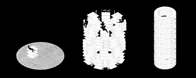
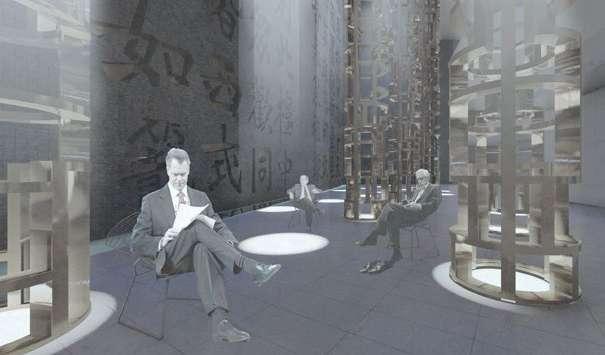
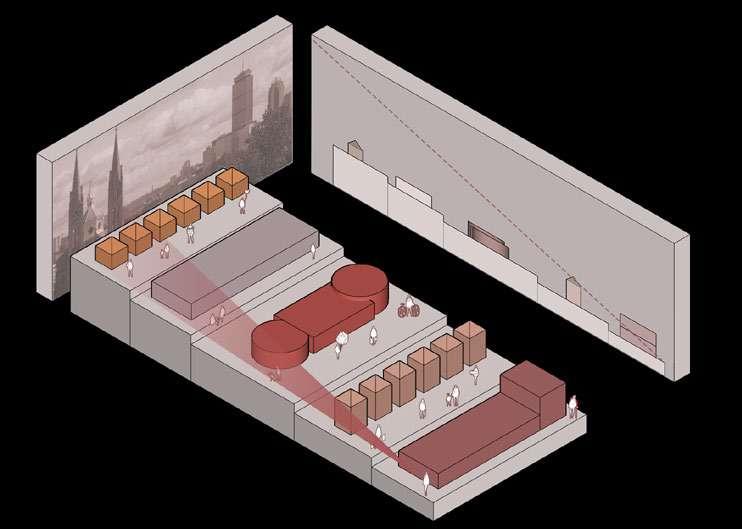
The general idea of the structure arises from a moment in which a frustrated immigrant sits in the cage-like room and looks up at the ceiling. The curved ceiling of the angel pavilion could be represented equivocally. The seeming ceiling contrasts with the rigid, rectangular plan of the existing immigration station, representing a shift to an expression of freedom from a time of control. Also, the idea of that curved ceiling could be nefarious as it looks like a spectacular steel cage.
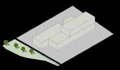
The spatial condition of sadness is also considered in both architecture and landscape architecture design. When the visitors get off the ferry and walk to the Angel Plaza, they feel curious about this mysterious atmosphere as the walkway gradually turns narrow, simultaneously the planting height grows gradually higher.
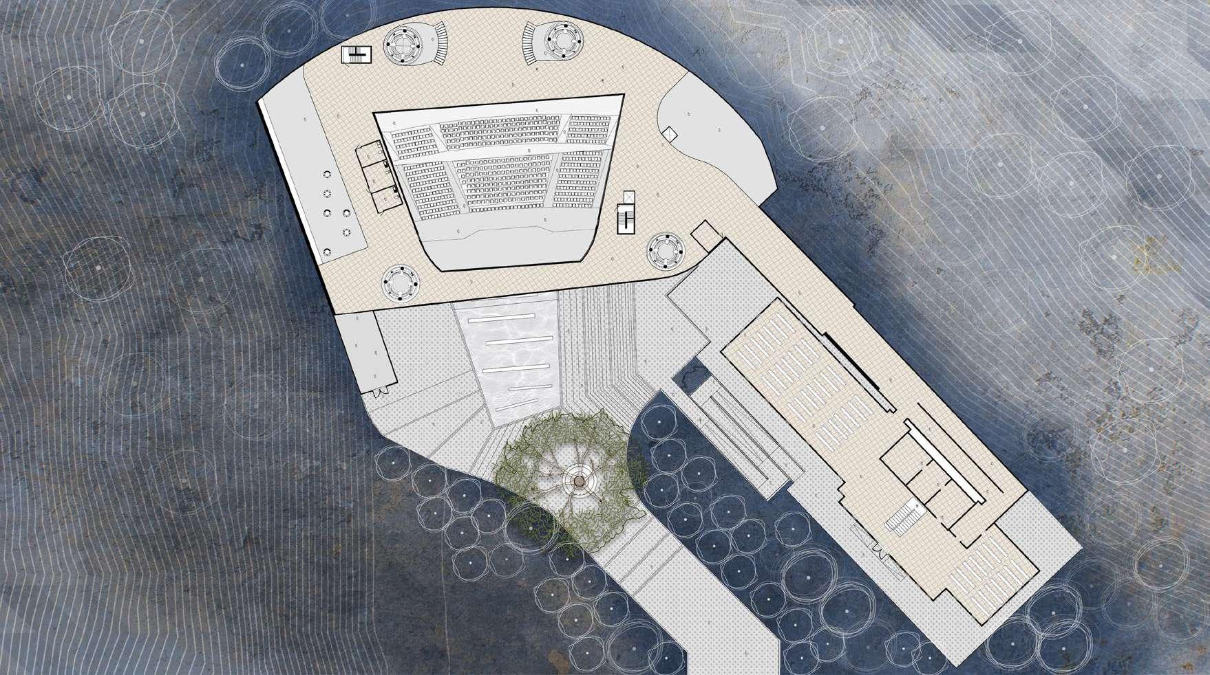
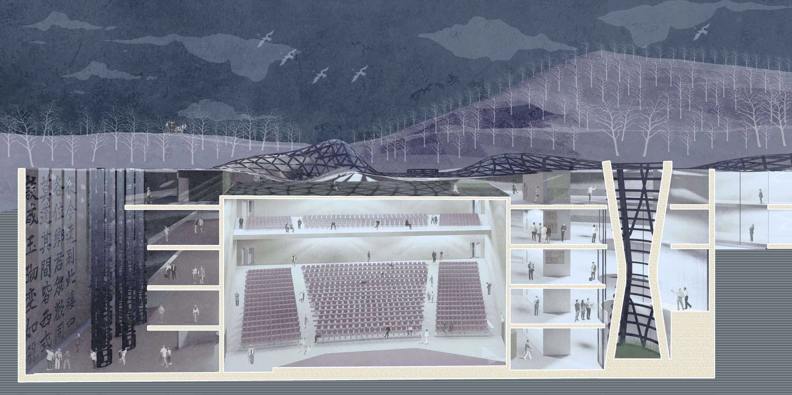
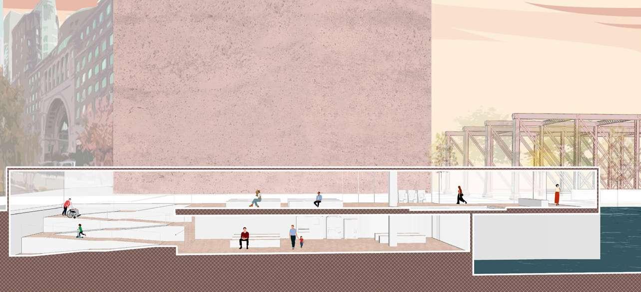
Section A-A’
Wall Poems
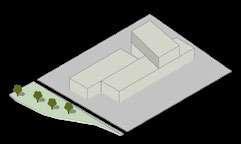
The conservation of Existing Immigration Station
The inspiration of column
The inspiration of ceiling: A man detained in a cage
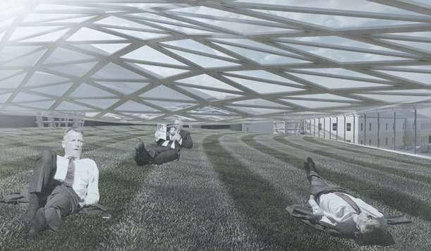
Roof Garden
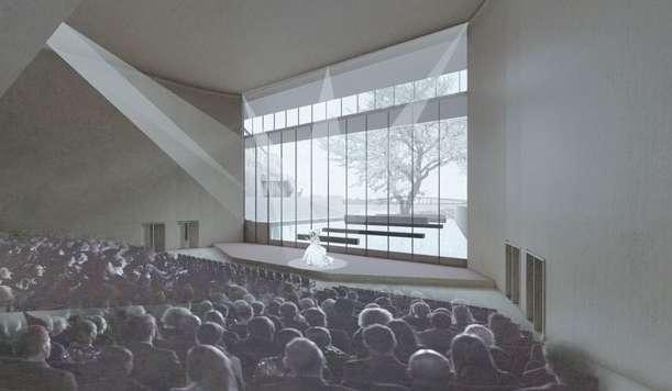
Auditorium
Praying Hall and Poem Wall
Praying Hall and Poem Wall
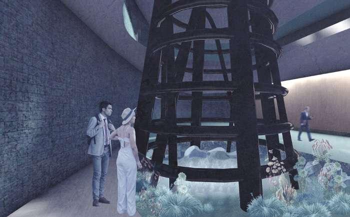
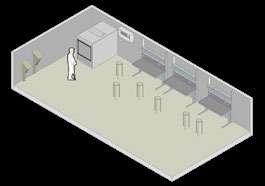
The Indoor rain garden also plays a role in expressing depressed moments. The columns are located intentionally at the corner of the building, and the distance between column and wall remains just wide enough to allow a person to walk through. It gives the feeling of tension to visitors. While they observe the daylight coming from the top of the column, it feels the same as the detainee looking at the light from the ceiling in the quarter room.
Indoor Rain Garden
Existing Immigriation Station Angel Pavilion
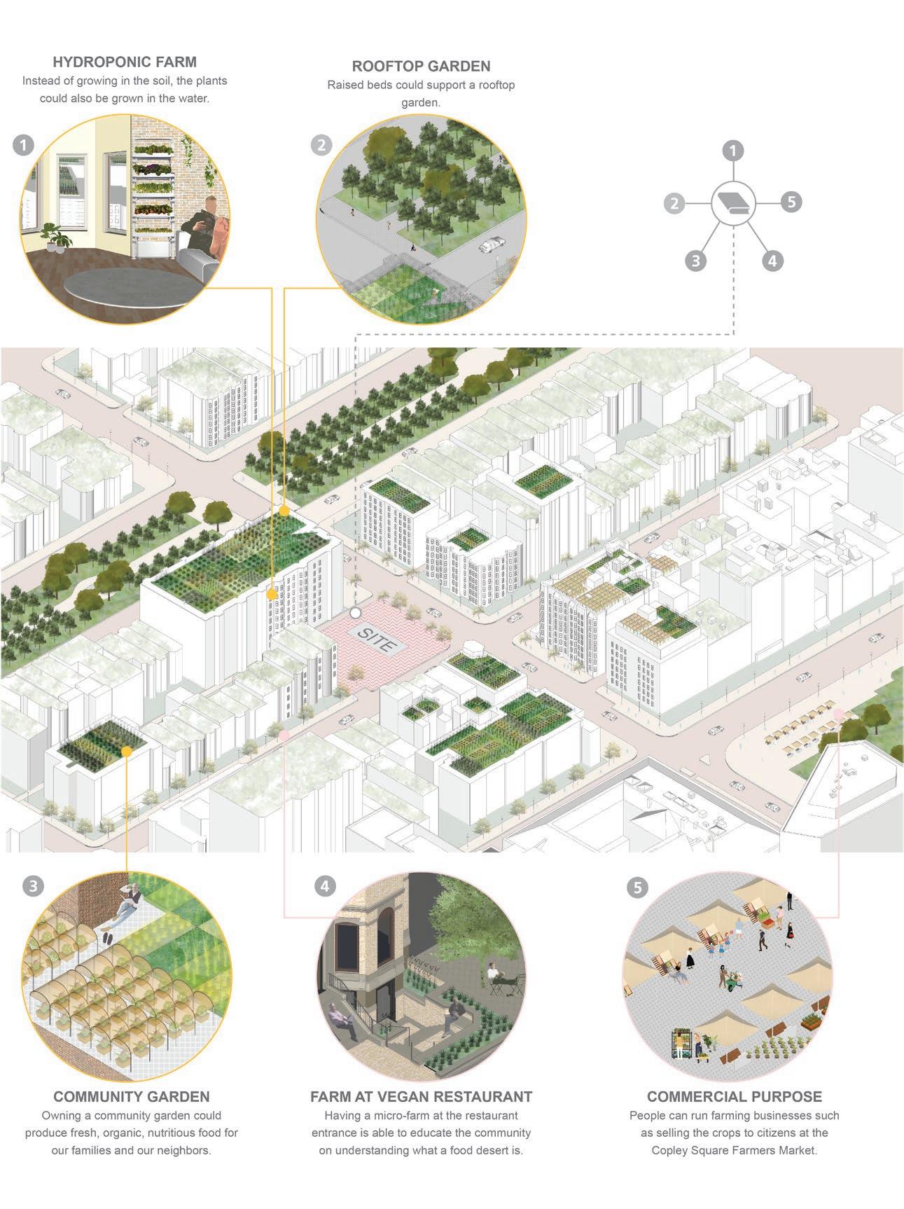
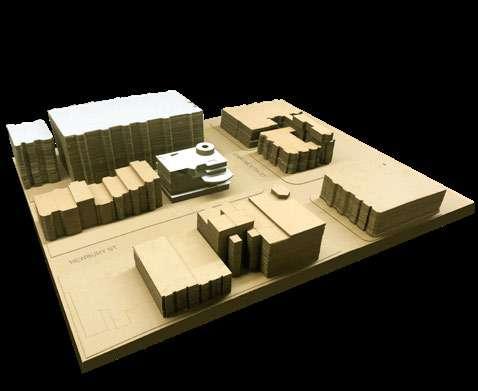
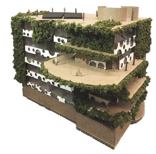
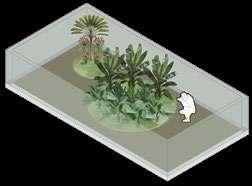
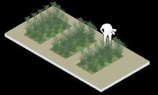
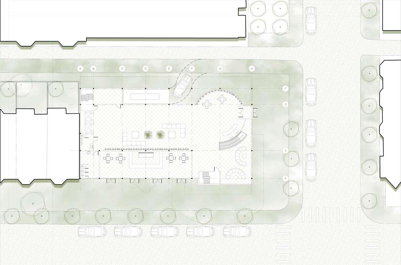
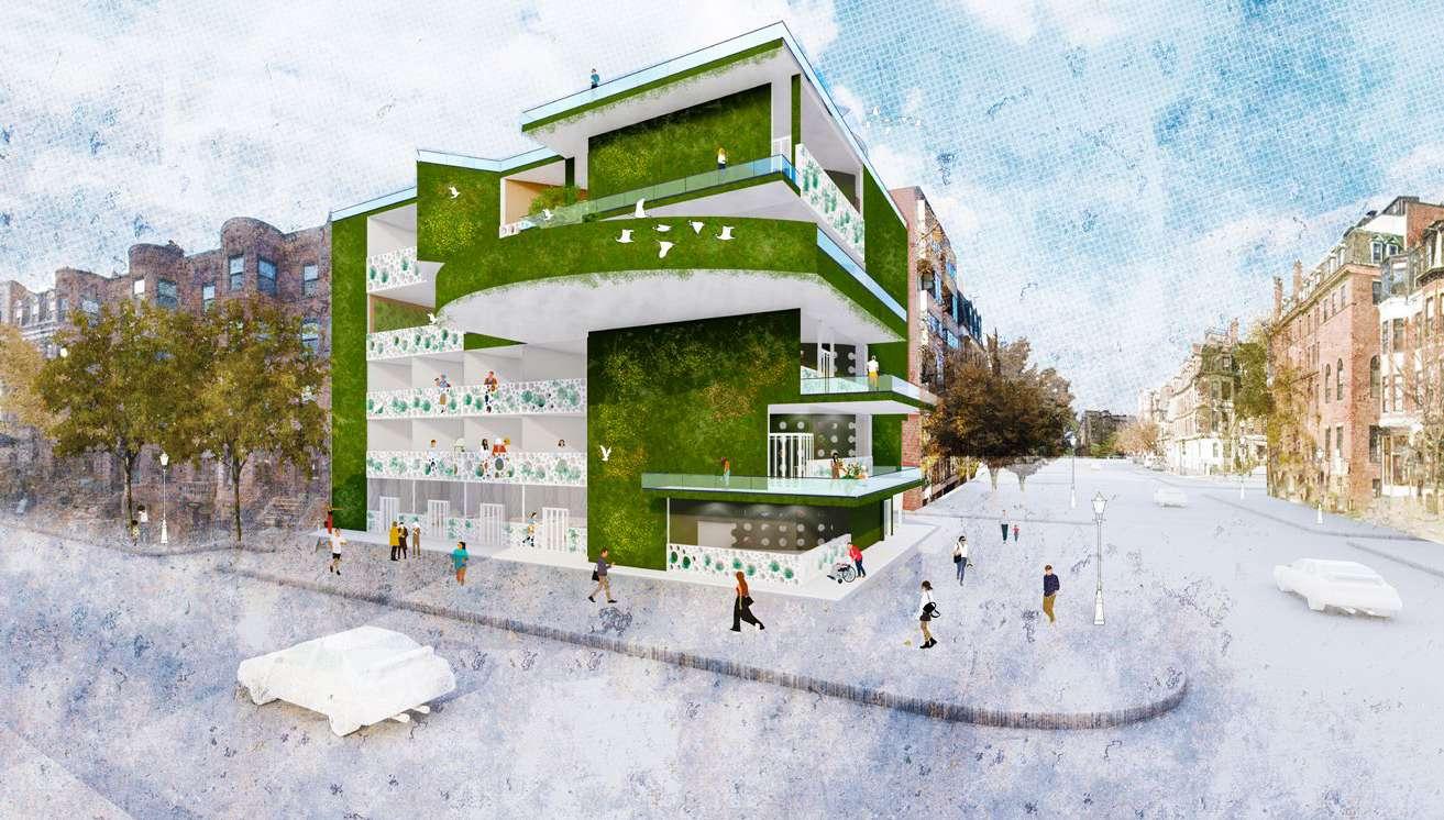
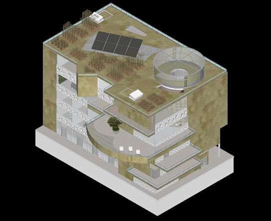
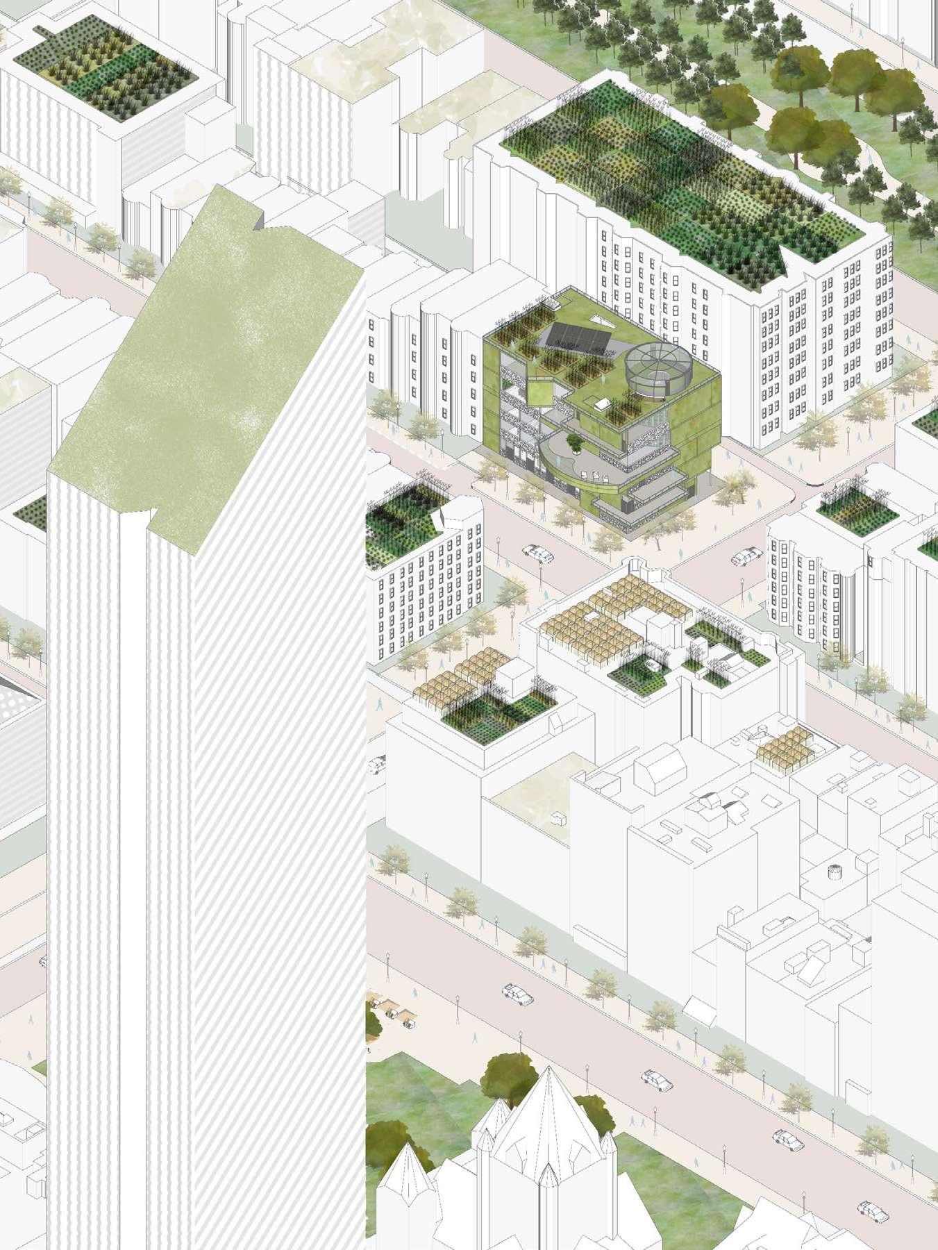
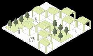
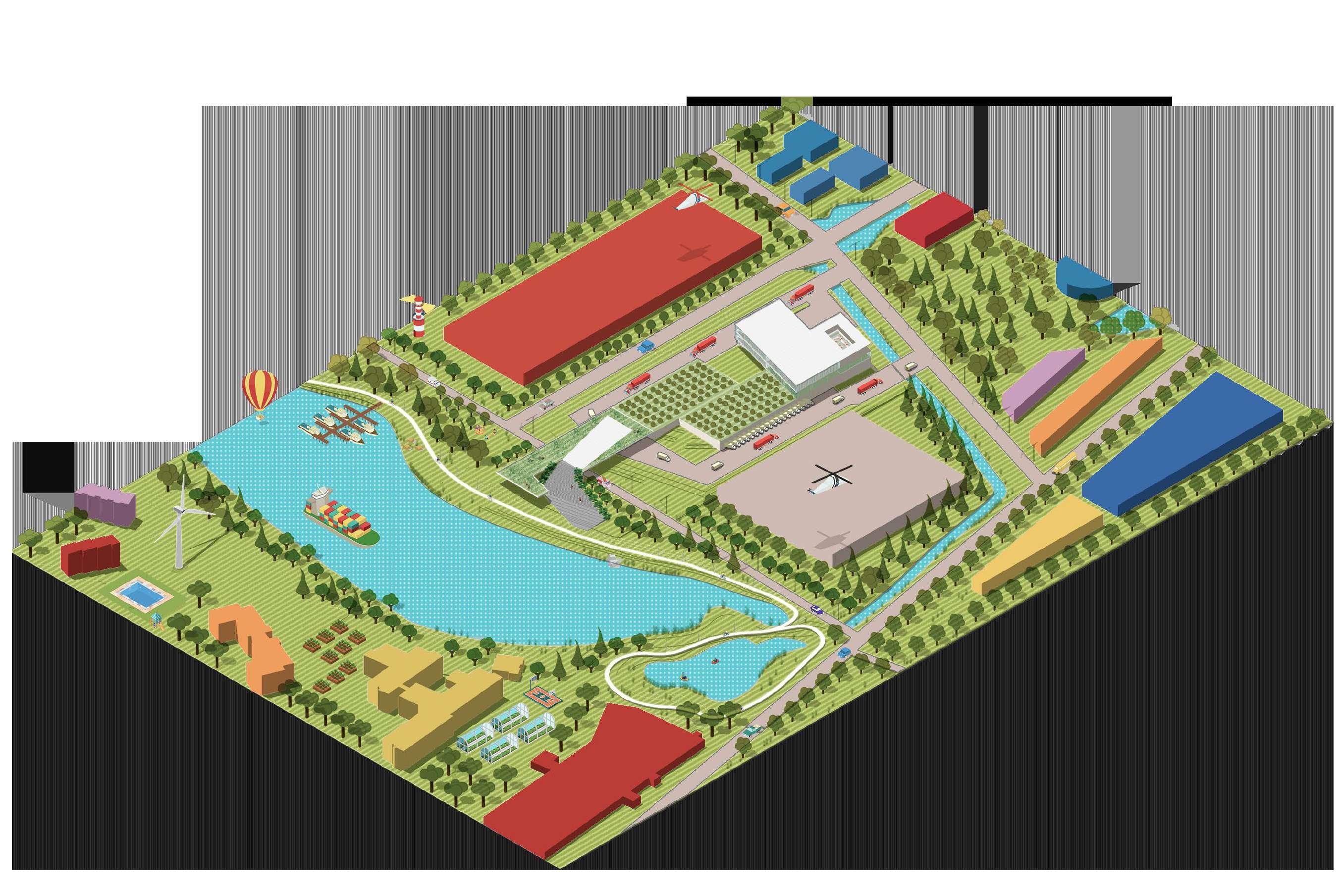
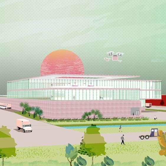
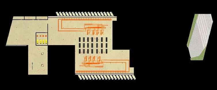
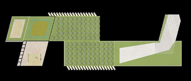
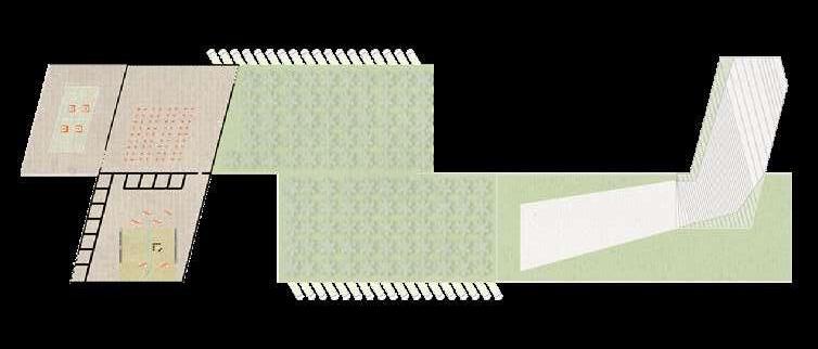
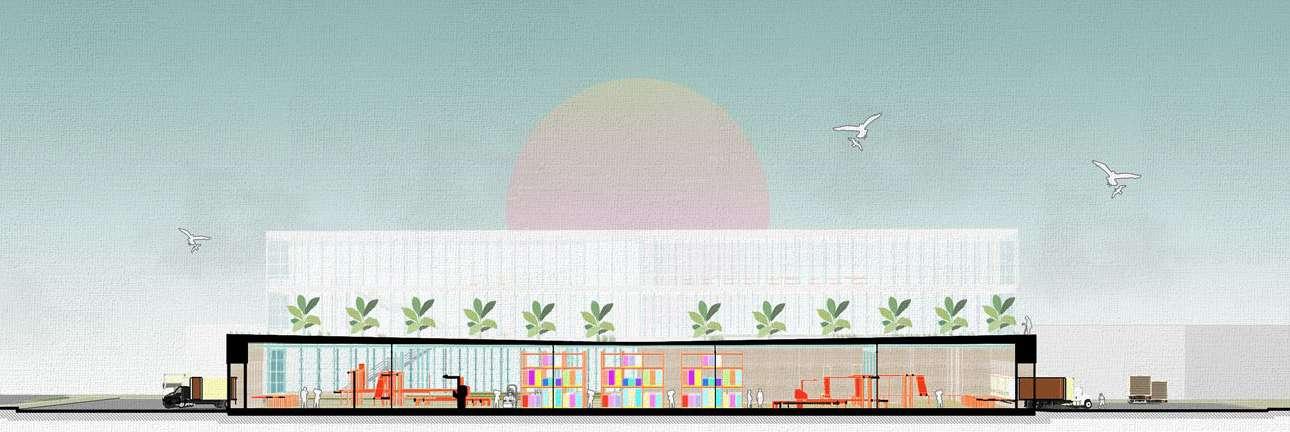
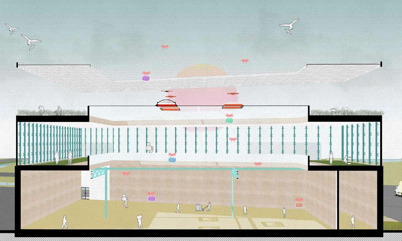
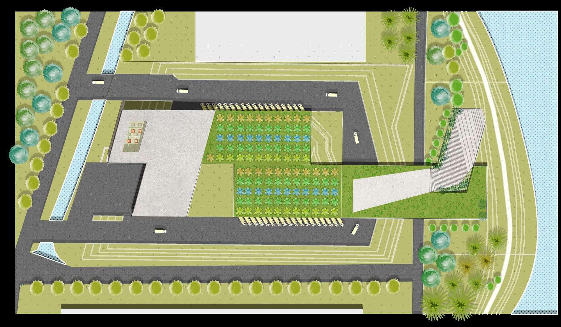
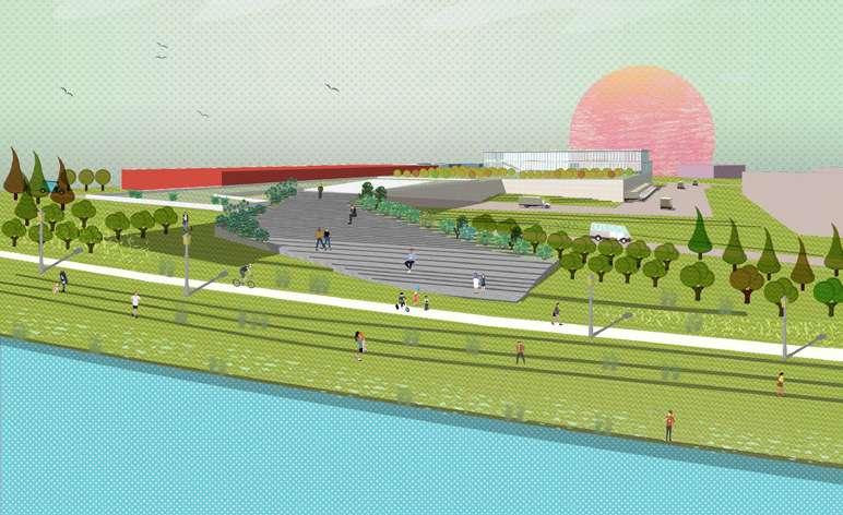
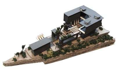
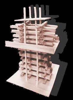
02 TEACHING AGRICULTURE IN THE CITY
Conceputal Model (Scale: 1/16”=1’-0”)
Presentation Model (Scale: 1/4”=1’-0”)
Main Programs
1. Food science
The students are able to explore how the study and application of science and technology could foster economic development and provide a high-quality, safe and healthy food supply to everyone.
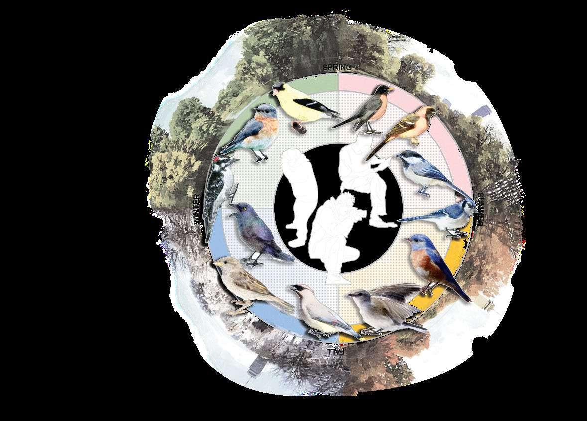
2. Ornithology & Entomology
The program focuses on how insects and birds affect our daily lives in agriculture, urban and environmental settings, and public health.
3. Plant Taxonomy
In the program, students can research the science of naming organisms and placing them in a hierarchical structure, in which each plant has its own class, order, family, genus, and species.
4. Sustainable Food and Farming
The program enables students to focus on specific crop production, soils research, biodiversity, responsible sourcing, pesticides, and land use.
Ground Floor Plan
Curtain
Concrete
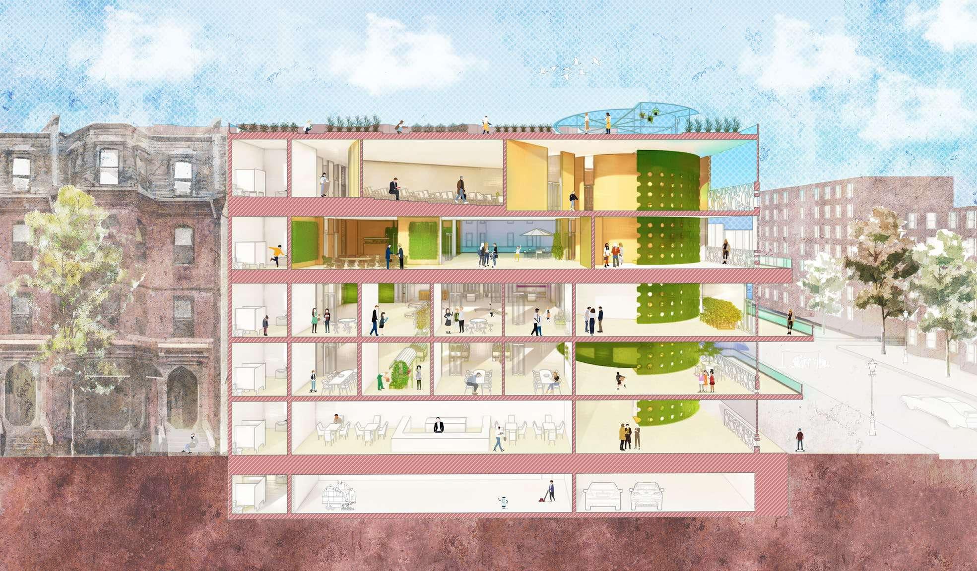
Section B-B’
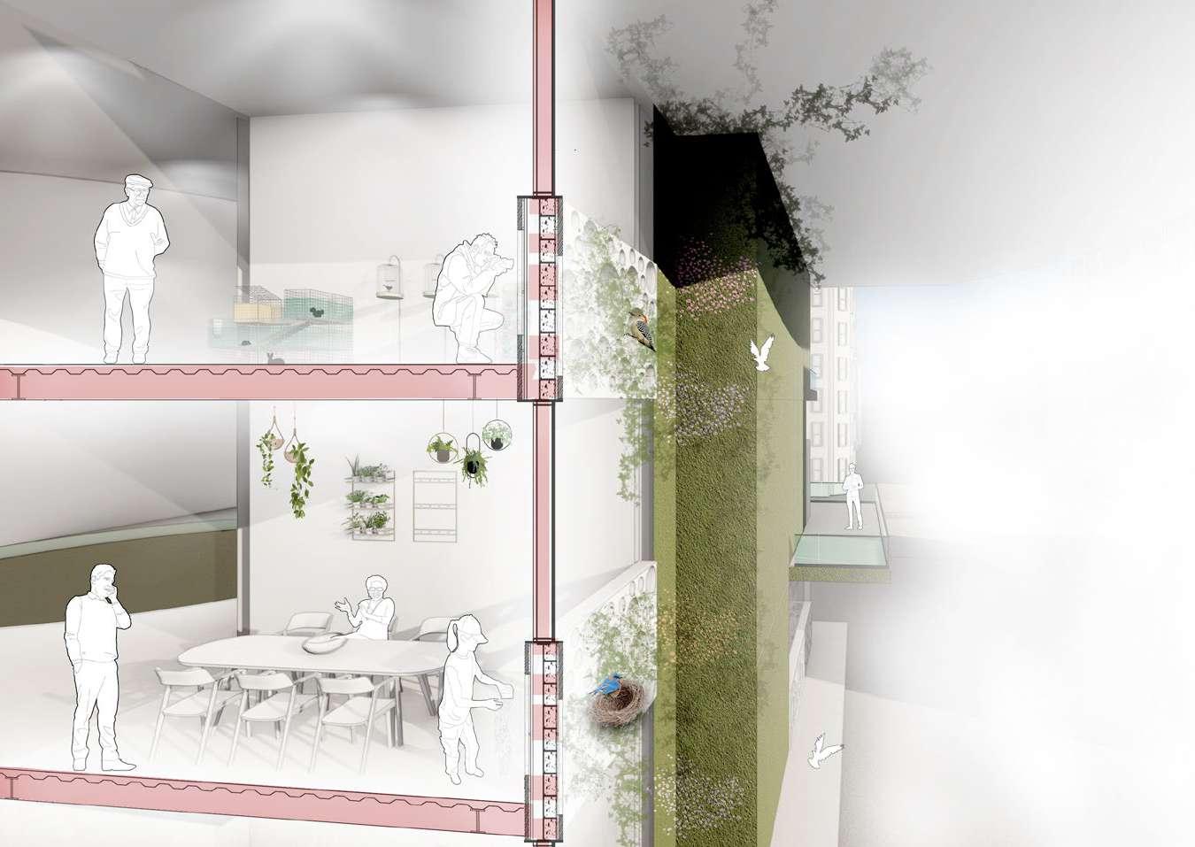
The building encompasses three types of facades: the green walls, the concrete walls, and the curtain walls with symbiotic cladding panels. The symbiotic cladding panel means not only the interaction between plantings and birds but also means the interplay between agriculture programs even the urban environment in Boston.
The facade allows the students to set up the bird feeder, so they can incorporate some science easily into bird watching. The student can investigate the bird’s daily behavior and adaptations, collect and analyze data. The green exterior wall also creates an experiment to determine bird food preference.
Common Birds in Massachusetts
Symbiotic cladding penel
Bird’s nest
Measuring indicators (noise pollution, bad smell around the site)
Laser cut panel
Curtain wall
Exterior green wall
Facade engages the program of Ornithology
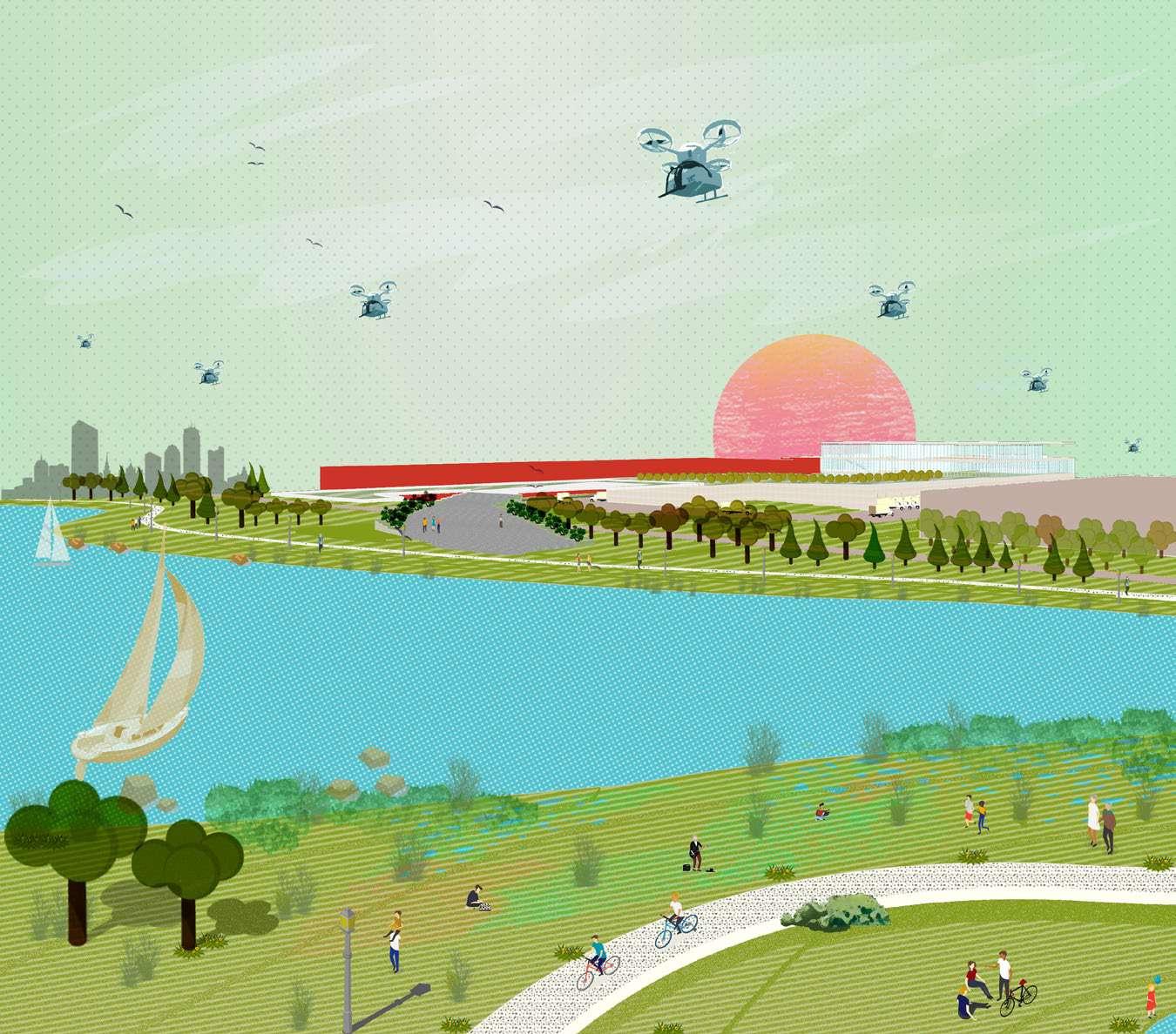
03 RESILIENCE
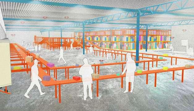
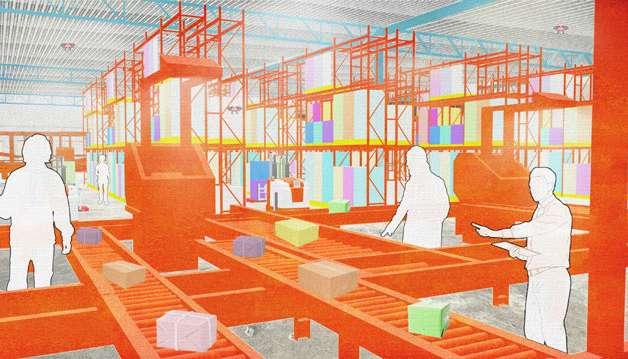
FOOD DISTRIBUTION CENTER
ARCHITECTURE STUDIO 3
INSTRUCTOR: ARLEN STAWASZ, TYLER HINCKLEY
FALL
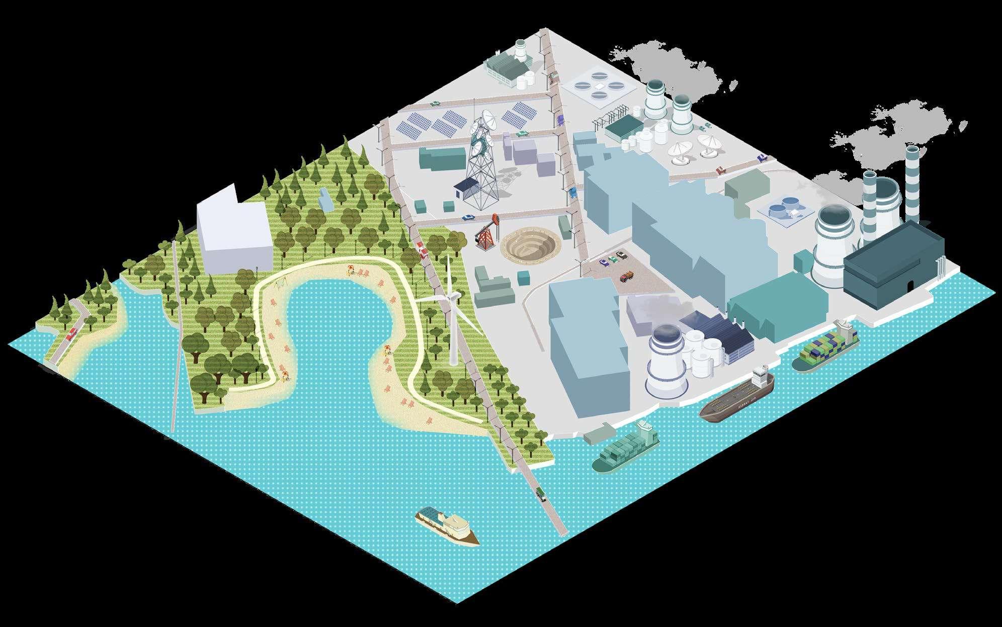
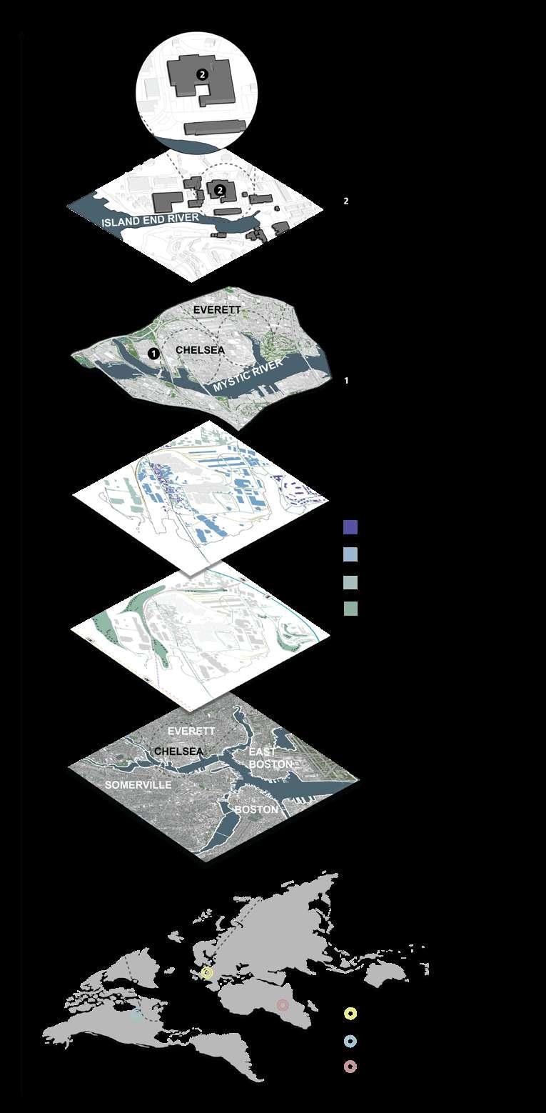
Resilience is defined as the ability of something to spring back into shape or redefine its elasticity after a major transformation or event. Resilience could be defined as social resilience, economic resilience and environmental resilience in the realm of the bult environment. Social resilience focuses on effects felt by communities and their inhabitants. Economic resilience focuses on effects shocks and stressors have on business. Environmental resilience focuses on how changes due to acute shocks and chronic stressors impact the environment. In 2012, hurricane Sandy damaged the area of Chelsea. In June 2017, Amazon bought the upscale grocery chain Wholefoods. This food distribution center uses the idea of resilience, and it aims to better serve the residents of Chelsea and Everett, Massachusetts by providing neighborhood-friendly spaces within the Amazon and Wholefoods food distribution center for community engagement, social activities, and retail.
The topic of resilience design has been significant in architecture. The environmental resilience design enabled Copenhagen to recover from the issue of sea-level rise. The economic resilience strategy allowed Chicago to survive the great fire. It made Chicago become one of the most skyscraper-filled cities in the world. Also, the social resilience design helped pregnant women reduce death during pregnancy in Kasungu.
In Copenhagen, the architects applied resilience design to reduce flooding. The river edge has been improved as a sloping buffer which divides into a safety zone and a flood pathway, in order to increase the flow capacity during the flooding events.
River Edge Analysis
Resilience design could be expanded as the city grows. In 1871, a great fire burned most areas of downtown Chicago. This calamity caused the citizen of Chicago to reimagine a whole city by redesigning the downtown as one of the earliest cities which have the skyscrapers in the world.
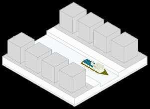
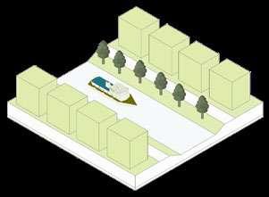
In the selected area of Chelsea, Alford St separates the soft edge and hard edge of Mystic River. The soft edge is near the Casino and several parks which are for people to gather. The hard edge is located along the industrial zone, such as Exelon Mystic Generating Station . Hard edge isn’t a great place for people to gather, and it impedes the growth of plants and animals. Environmental Purpose Economic Purpose Social Purpose
Resilience design also plays a role in the social aspect. The Kasungu Maternity Waiting Village solved the issue of the high rate of maternal and infant mortality. The project offered the local women to have a safe environment during pregnancy and delivery.
Hardedge
Alford St
Rooftop Rainwater Harvesting
Resilience The food distribution center responds to environmental change by adapting during hurricane and sea level rise by raising up the elevation of the waterfront and creating the canal which enables water to flood through. My goal is to create a food distribution center which not only improves the working efficiency and delivery qualities, but also encourages people to walk through the site, to educate themselves on the realm of resilience.
At the end, resilience design enables my proactive personalities while pursing the architecture degree. I learned how to use the resilient design to rethink from planning to conceptual design.
04 ENGAGING A DIVERSE NEIGHBORHOOD
CIDER MILL AT CALUMET ST.
ARCHITECTURE STUDIO 2
INSTRUCTOR: JOSE LEANDRO COMPRES & EVA VALDECANTOS BOSTON ARCHITECTURAL COLLEGE 2017 SPRING
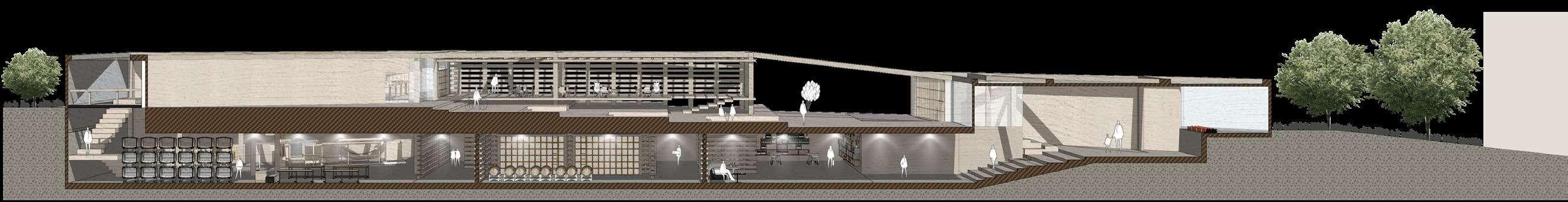
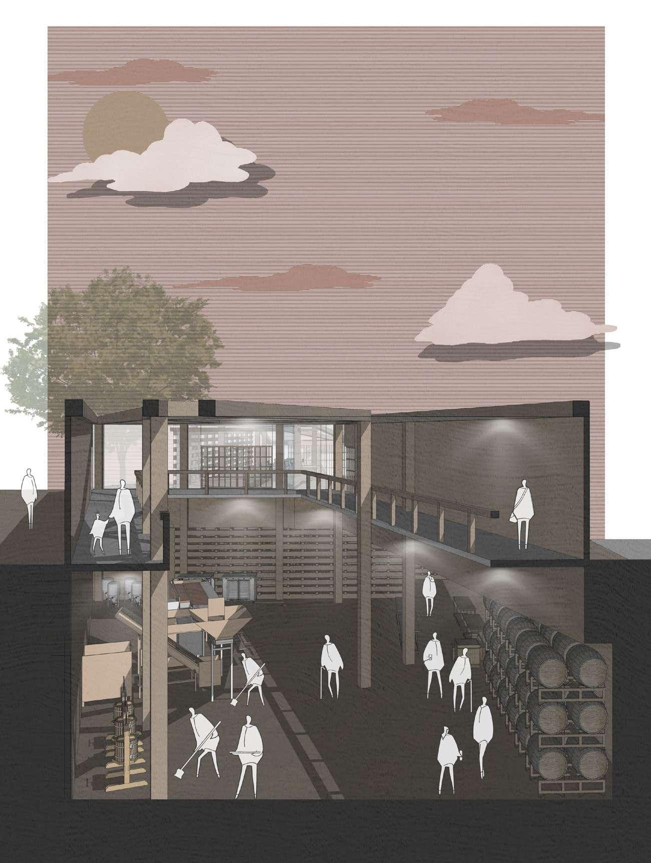
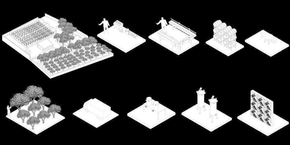
In this school studio project, the Cider Mill is located at Calumet St. Boston, beside the Brigham Circle T station. The site is a sloping triangle, currently owned by a private parking company. There are several mixed use programs around the site. For example, a Shop & Shop store is located across from the site; Kevin W. Fitzgerald Park, a hilltop open space that enables people to enjoy a view of city, is located between the site and Shop & Shop. Harvard Medical School and Brigham and Women’s Hospital buildings are located less than 200 feet from the site.
In addition to serving an industrial function, the Cider Mill should engage the diverse neighborhood. In Boston, 50% of residents are white, 24% are Black or African American, 13% are Hispanic, 9% are Asian, and 4% are other races are 4%. Imagine purchasing a locally-produced hard cider at Cider Mill and grab your lunch of your favorite ethnic cuisine at the same time.
Drone Pad
Raised Sidewalk
Living Shoreline
Bike Path
Congregation Pier
Waterfront Recreation Zone
Sparking an emotional attachment is significant in designing the Cider Mill. The site can be seen by people getting off of the train at the Brigham Circle T station. Calumet St. is also an important route for pedestrians from the busy junction to the residential area on the hill.
Moreover, in order to satisfy as many as visitor’s possible,it is vital to understand how essential community and human interaction are for wellbeing. Human beings have an emotional need for connectedness. Hence, analyzing their socializing preferences is important. Some people are introverted and prefer a relatively wide sphere of personal space. Colleagues, friends, and family members appreciate community spaces to interact and socialize. And couples may prefer a quieter, more private space.
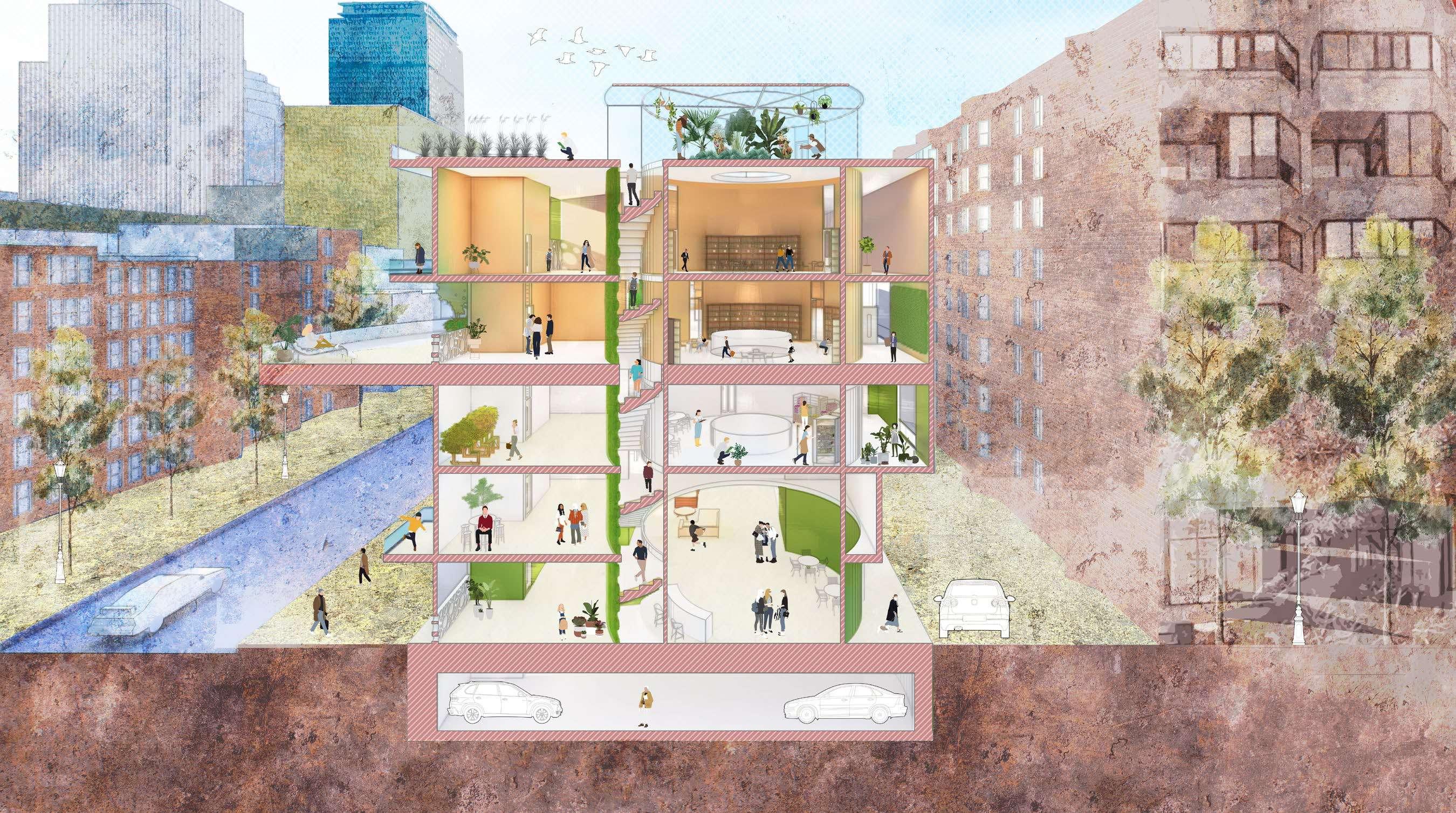
The image of apple tree branches is central to the design of the Cider Mill, reflecting the intricate urban road structure of the neighborhood. Apple branches also suggest the way in which the Cider Mill connects with and engages the neighborhood. The programs of the Cider Mill are connected by an applebranches-like layout.
In order to cater to different types of socializing preferences, there are three types of personal space in the Cider Mill. Inspired by Peter Zumthor’s Swiss Sound Box, multiple spatial conditions are created through installing stacking beams. The structure establishes distinct sound, light, and personal spaces. The stacked beams of the Swiss Sound Box further reflect the image of apple branches.
Process Model 1
The boxes represent each program of the Cider Mill and they are evenly distributed at the site. The boxes are like the apples that are hanging on the tree. Process Model 2
The walking paths bridge the programs, also connect the adjacency. The walking path has a stair step pattern that aligns with the sloping topography.
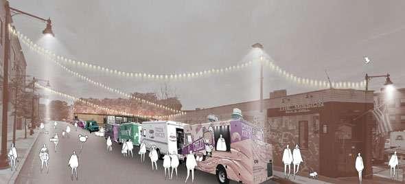
The sloping open space extends from the sidewalk, inviting people to stop by,take a break, and enjoy a hard cider. Food trucks will park on Calumet Stand provide a range of ethnic cuisines reflecting the diversity of the neighborhood.
Intimate
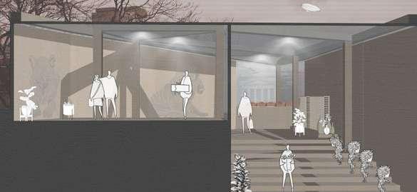
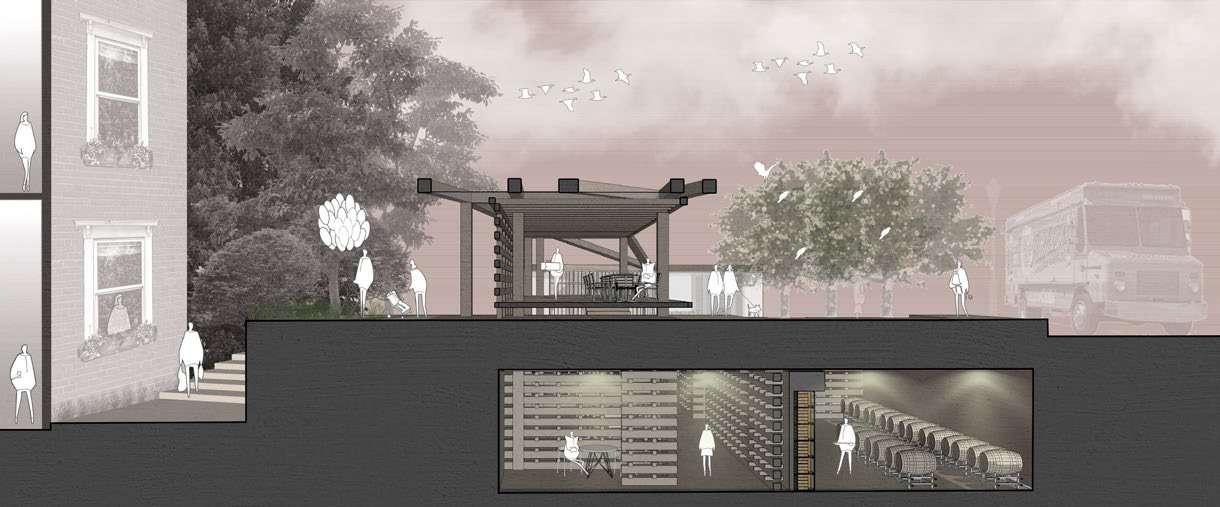
The apple-branch-like layout of the Cider Mill comprises a production building, a cider tasting patio, a visitor center, and open space. The visitor center in the basement uses stacking beams to provide different types of personal spaces.
The open space extends from the production building to the visitor center with patio, granite treads, and four apple trees. The people are welcomed to enjoy the hard cider and food from the food trucks in the exterior seating area. A stair is built next to the entrance that enables pedestrians to pass through from Calumet St. to residential areas downhill.
Pedestrians looking the Cider Mill and food trucks from downhill
Visitor center entrance
Section C-C’
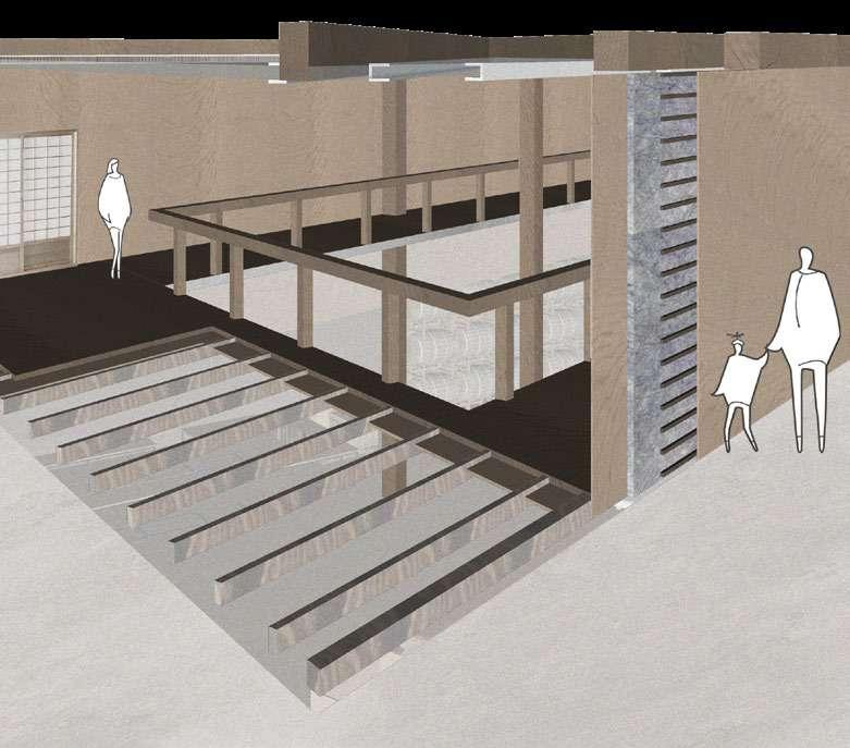
The production building is designed as an atrium. The first floor runs the mixed public and private function: a corridor connects from each corner of the building. The corridor enables visitors to observe the progress of making cider. In order to maximize the working efficiency cider production in the building, stages of cider production are arranged in a U shape production line. The equipment is located under the corridor above, so that the cider progress could remain in the dark condition, as the fermentation cannot be exposed to sunlight condition, as light and heat can harm the yeast and interfere with cider fermentation.
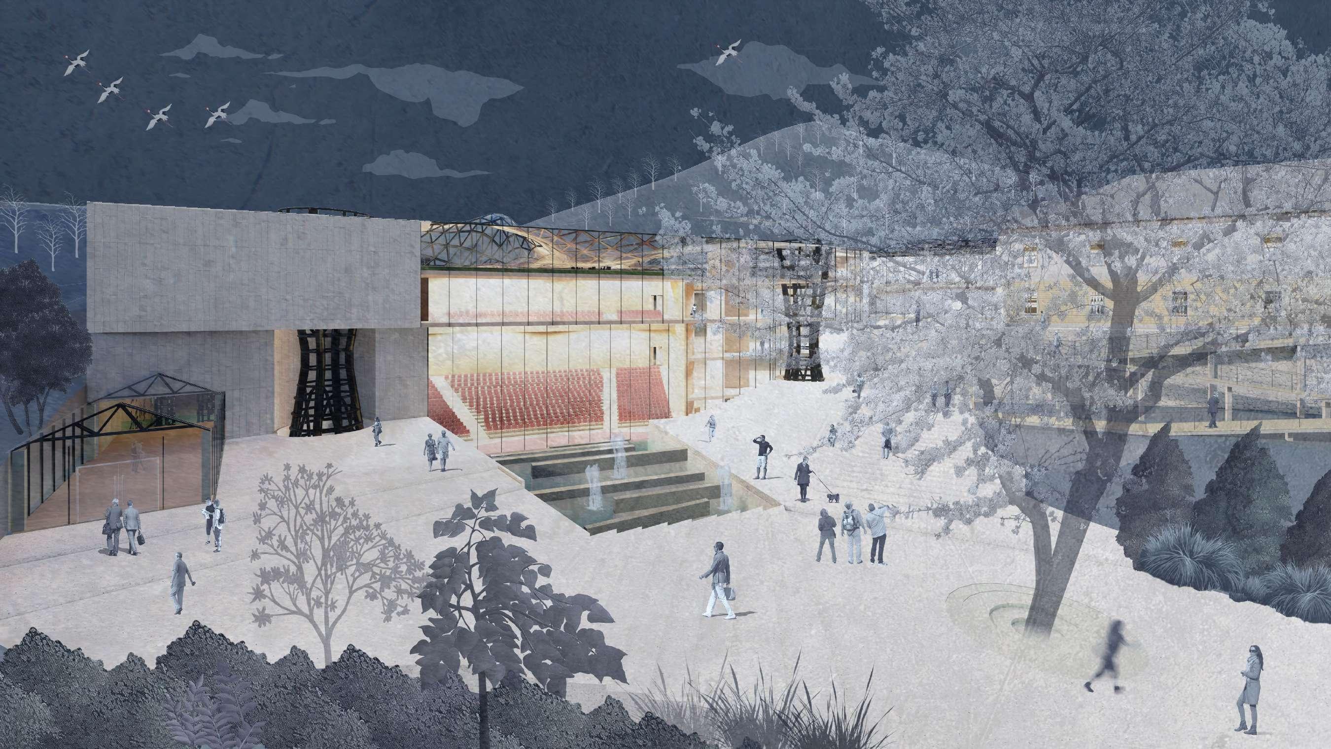
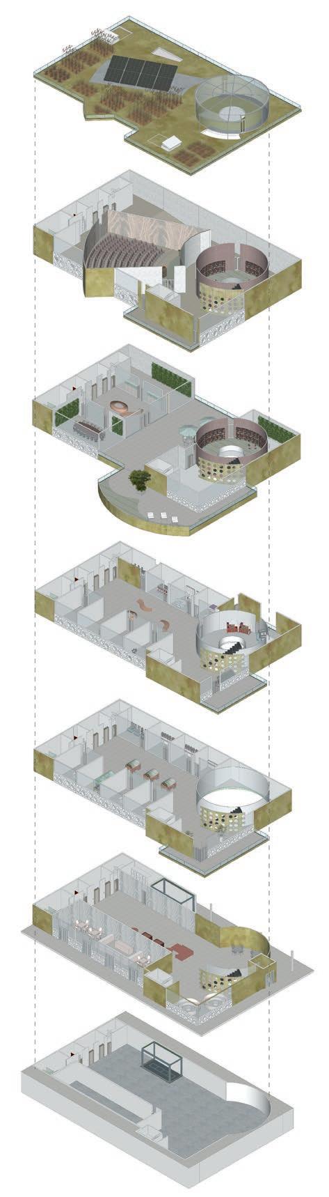
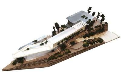
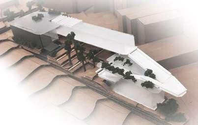
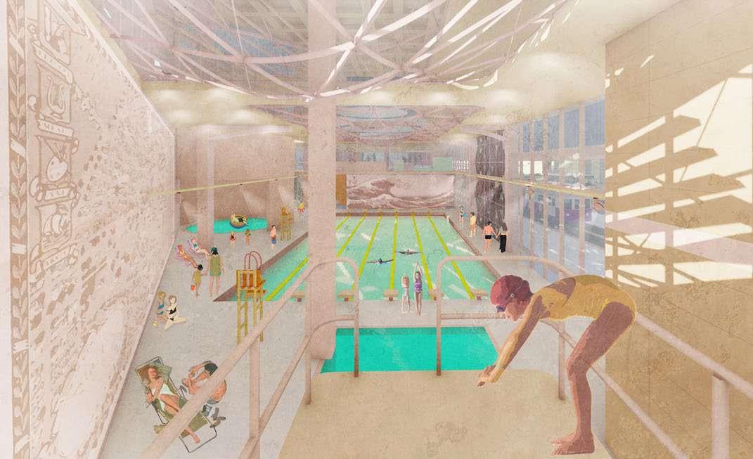
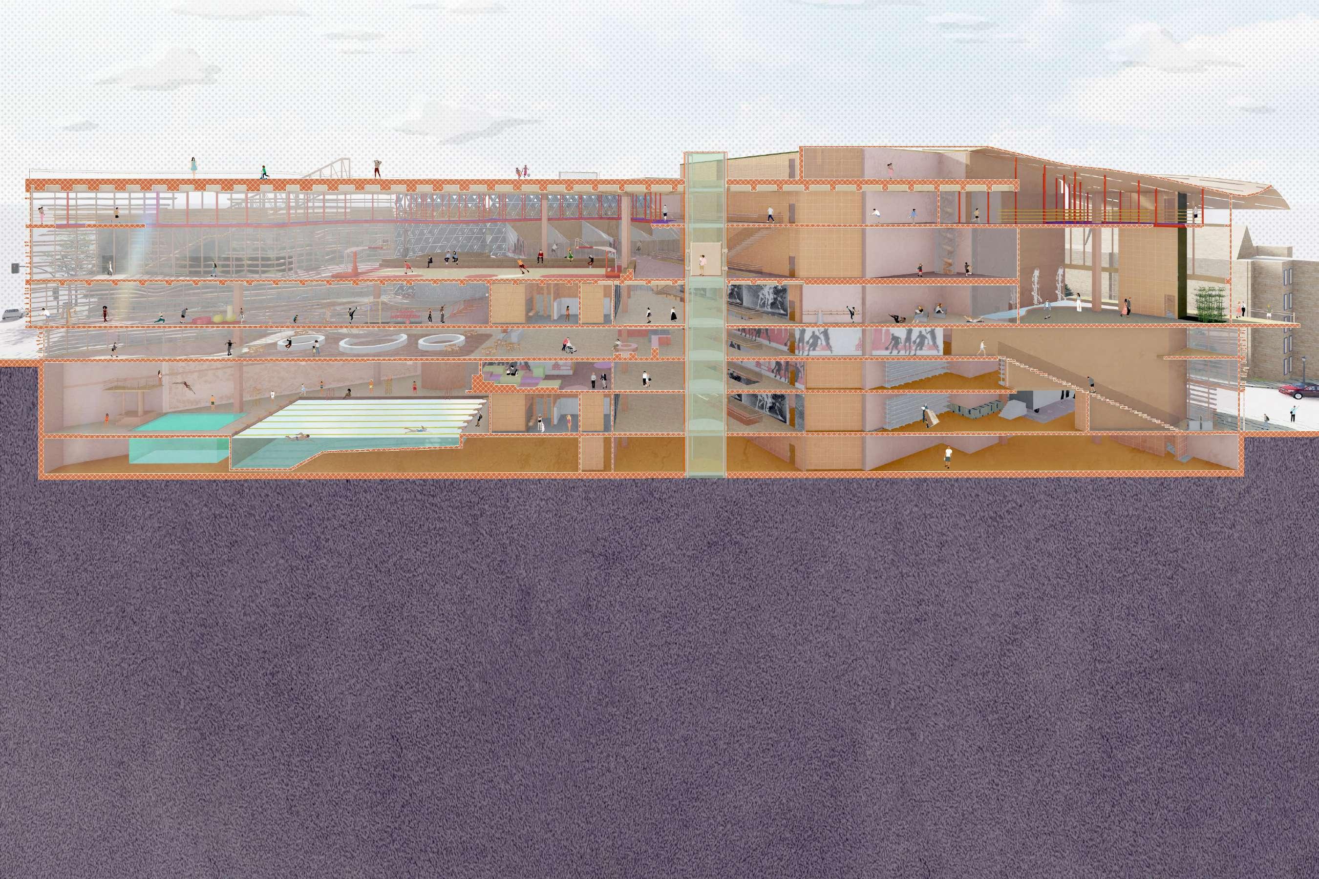
05 MOTIVATION | TRANQUILITY
UNIVERSITY FITNESS CENTER
THESIS DEGREE PROJECT
INSTRUCTOR: PETER MARTIN
BOSTON ARCHITECTURAL COLLEGE
2020 SPRING - FALL
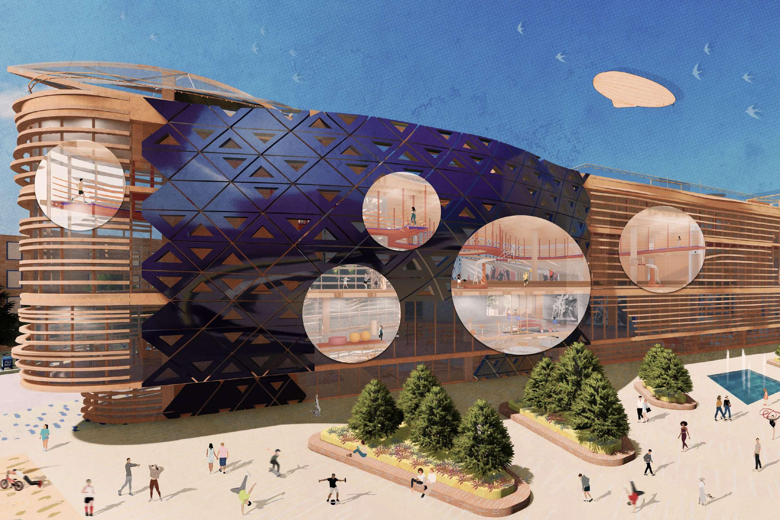
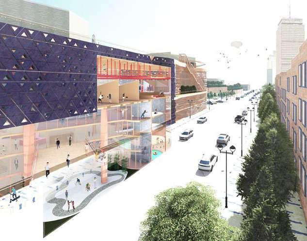
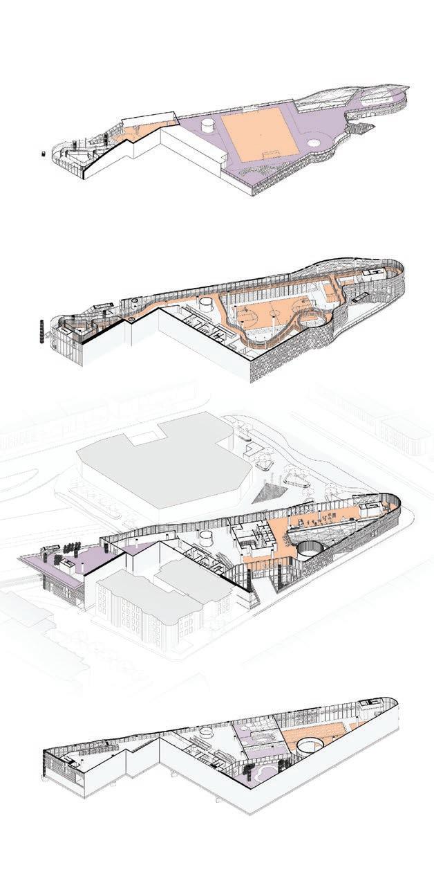
Motivation | Tranquility delves into the ways of the university fitness and recreational center located in Back Bay, Boston, taking into account two parts: to enliven the urban connection by applying the sport notion; to generate a spatial layout that flexibly occupies a wide range of sport programs. The design represents the synergy between motivation and tranquility, inspired by the dramatic difference in noise level.
Motivation | Tranquility.
The two contrasting characters function as a whole, reminding me of the Japanese woodblock print called The Great Wave off Kanagawa. While Mount Fuji is eracted horizontally in the center with the clean snow coverage on the top, the dramatic movement of the wave runs against the tranquil scene of the mountain. The spiral and curvilinear form of the wave drove the movement of the boat. The noise of the wave serves as a white skeleton threatening the people on the boat.
Relating the print back to the project, the curvilinear movement and triangular module both affect and originate from the process of the building complex. It has become a symbolic gesture, reflecting the broader sport culture of urban conditions in flux.
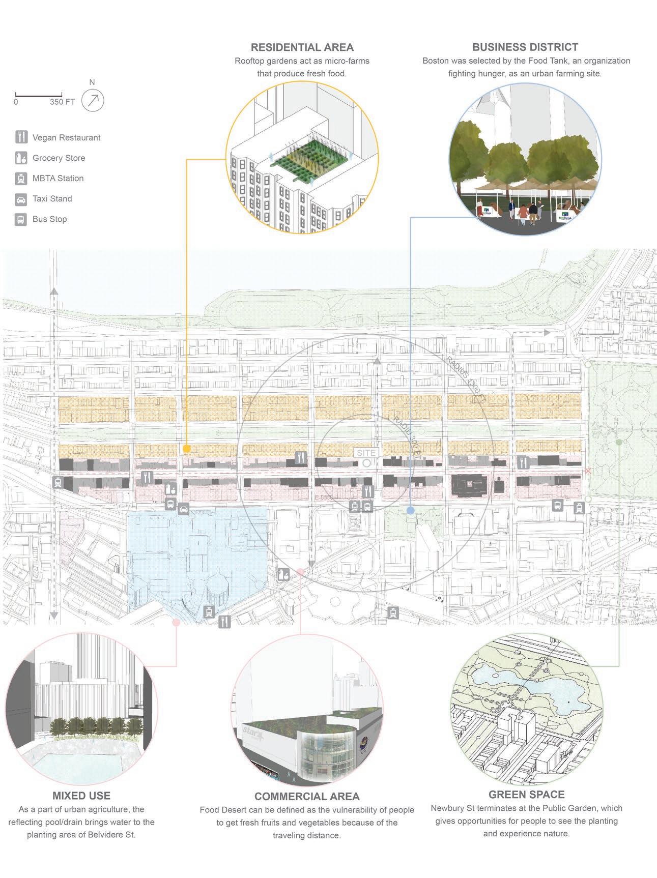
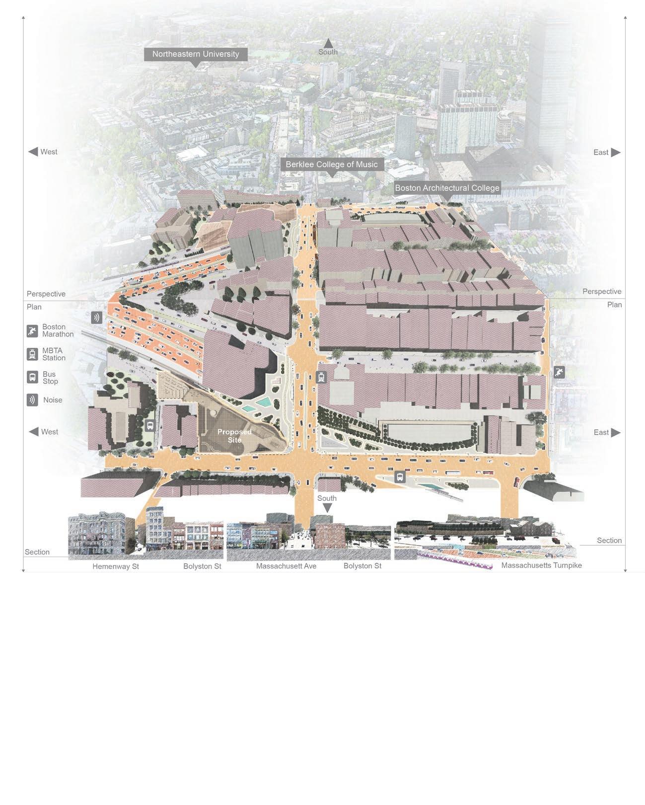
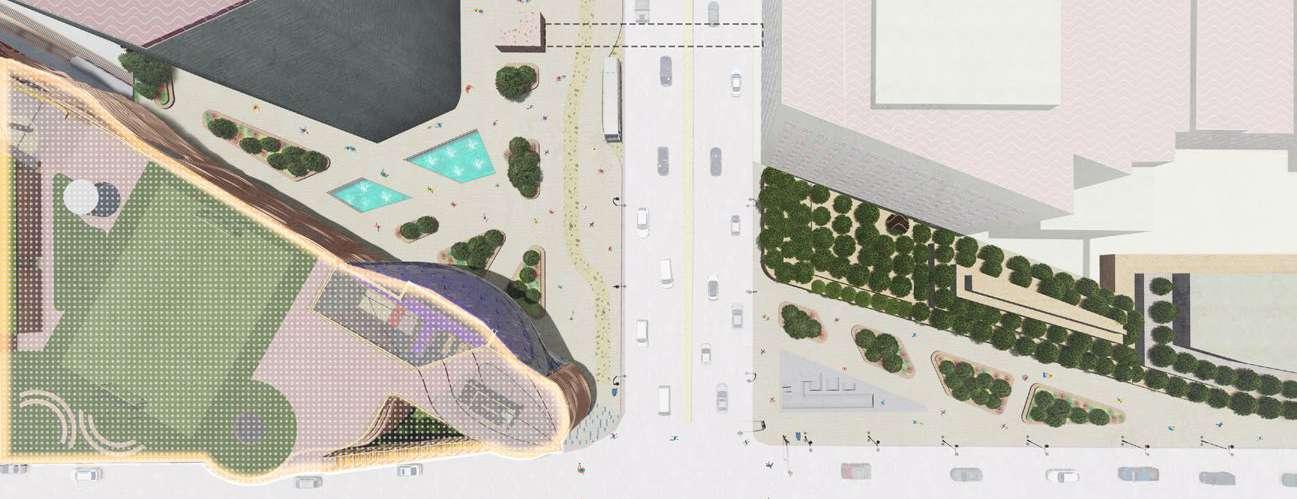
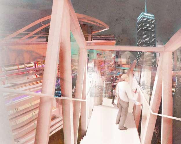
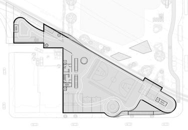
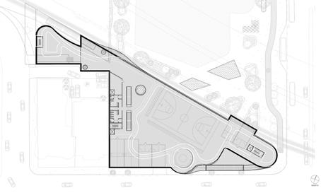
The dialectic MOTIVATION | TRANQUILITY creates an opportunity to view the endurable intervention of bringing sport into the city. The site consists of a triangular site that is located at the corwner of Mass. Ave., and Bolyston St., with the commercial street and several institutions nearby, such as Boston Architectural College (BAC) and Berklee College of Music, and is just 15 minutes walking from Northeastern University (NEU) and 19 minutes walking from MIT. The requirement of the degree project reminds me of the first formation studio, which asked students to design a program for the Boston triathlon and marathon at a similar site. Over 5 years studying at Boston Architectural College (BAC) enabled me to reinterpret the site in a different way. For instance, Newbury Street, a representative commercial street in Boston. I walk from the Campus to the bus stop every day to commute. I feel uncomfortable while waiting at the bus stop because of the narrow sidewalk and the noise coming from the Massachusetts Turnpike.
The discovery leads me to investigate the site via. noise level, poor circulation, and the demand for the sports center. First, the Massachusetts Turnpike is a highway that runs from Downtown Boston to New York State. The turnpike always remains at an extremely high traffic flow and extremely high noise level. Also, as the Turnpike tunnel ends near the Hynes Convention Center MBTA station. It engenders the noise throughout that site.
Second, it appears that there is a safety issue because sometimes homeless people lie on the street and take up the sidewalk beside the bus stop. The current design of the intersection lacks concern for pedestrians walking around the Hynes Convention Center MBTA station. It also lacks concern for vehicular circulation, as the entrance of the Turnpike is located at the junction. It causes the driver to be distracted by the flow of traffic coming from the Turnpike to ignore a pedestrian walking across the street. It ends up with car accidents happening often. Overall, the area near the Hynes Convention Center MBTA station is one of the unwelcoming public areas in Boston.
Third, some students often complain that the gym is crowded and the fitness equipment is occupied. Their college proposes to build a fitness and recreation center for college students in Boston. The maintenance expenses come from the tuition fee, donations by alumni, and the government’s subsidy. Hence, as an architecture designer, it is vital to consider how to deliver the well-being of people through transforming the complex and contrasting ideas into architectural representation. Inspired by traffic noise and the complainant’s expectation of living in a quiet environment, the design of the university fitness and recreational center focused on the concept of both contrast and synergy, called Motivation | Tranquility.
Noise Level Analysis of Selected Areas
In order to gather the student’s behavior by taking exercise, 30 students from BAC, Berklee and NEU answered a quick survey. They told the surveyors five favorite places of doing fitness and the time of exercise. After analyzing the data, it was observed that these locations are less noisy than the site, also those places encompass humanized design. In the process of program arrangement, each fitness program could be ordered in a plausible way which are judged by program volumes, noise level and sport participation motivation.
Analysis of College Students’ Survey
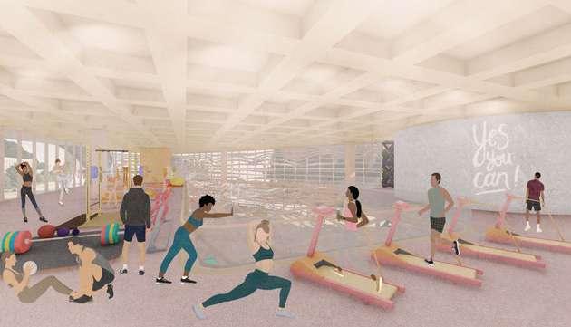
Programs of University Fitness Center
Models of Back Bay
Selected Noise and Quiet Locations at Back Bay
Master Plan of Site Improvement
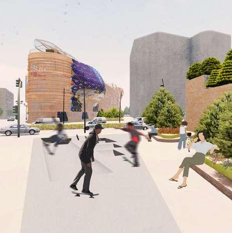
The new master plan enhances the circulation by adding an MBTA station exit and a bus stop. The walking paths are designed directly from the transportation to the Fitness center. The motivation | tranquility could begin with the water fountain in the left zone and the skatepark in the right zone. The water fountain plays the role of reducing the turnpike’s noise by creating white noise. The Skatepark is not only to satisfy the students who answered the survey’s question, but also the skating feature caters to the driving flow of Boylston Street.
Boylston
Boylston Street Outdoor Staircase
Skatepark
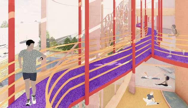
Concept Translates into Spatial Experience
The generated interior designs are used as a structure, long span, voids, and apertures that can interact with, producing a circulation and sport program logic present throughout the building. Meditation spaces, on the other hand, are tranquil and allow for moments of self-reflection and pause. The building features waterfalls throughout the interior, masking noise from the more active spaces as well as from the traffic on the Turnpike.
The curvature of the façade reflects the motion of the traffic on the Massachusetts Turnpike and, in turn, represents the large range of fitness activities that take place inside the building.
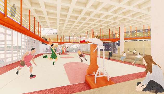
Basketball Court & Running Path
Extended Running Path Section
Sidewalk
Entrance
Entrance
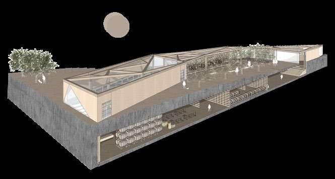
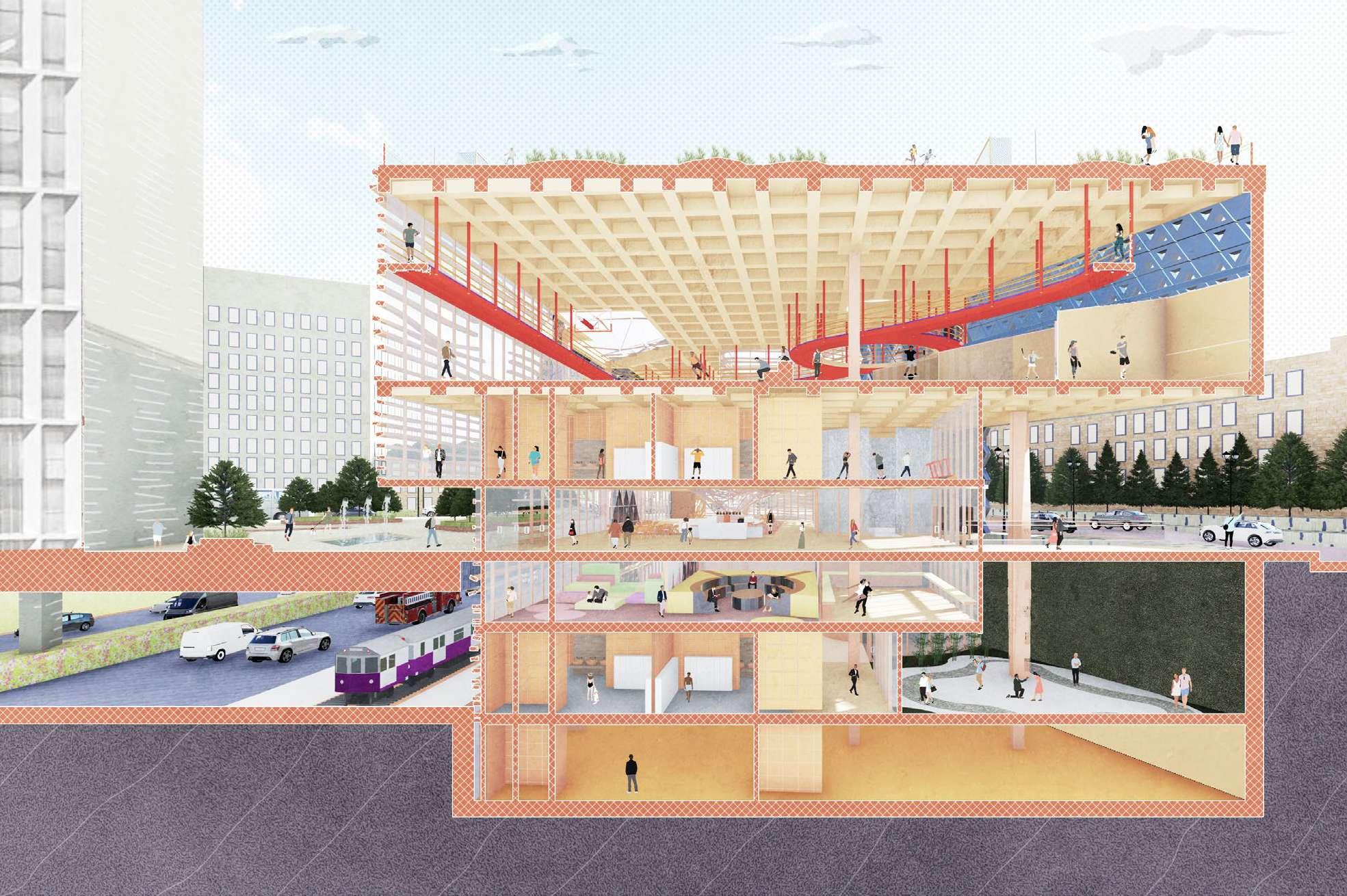
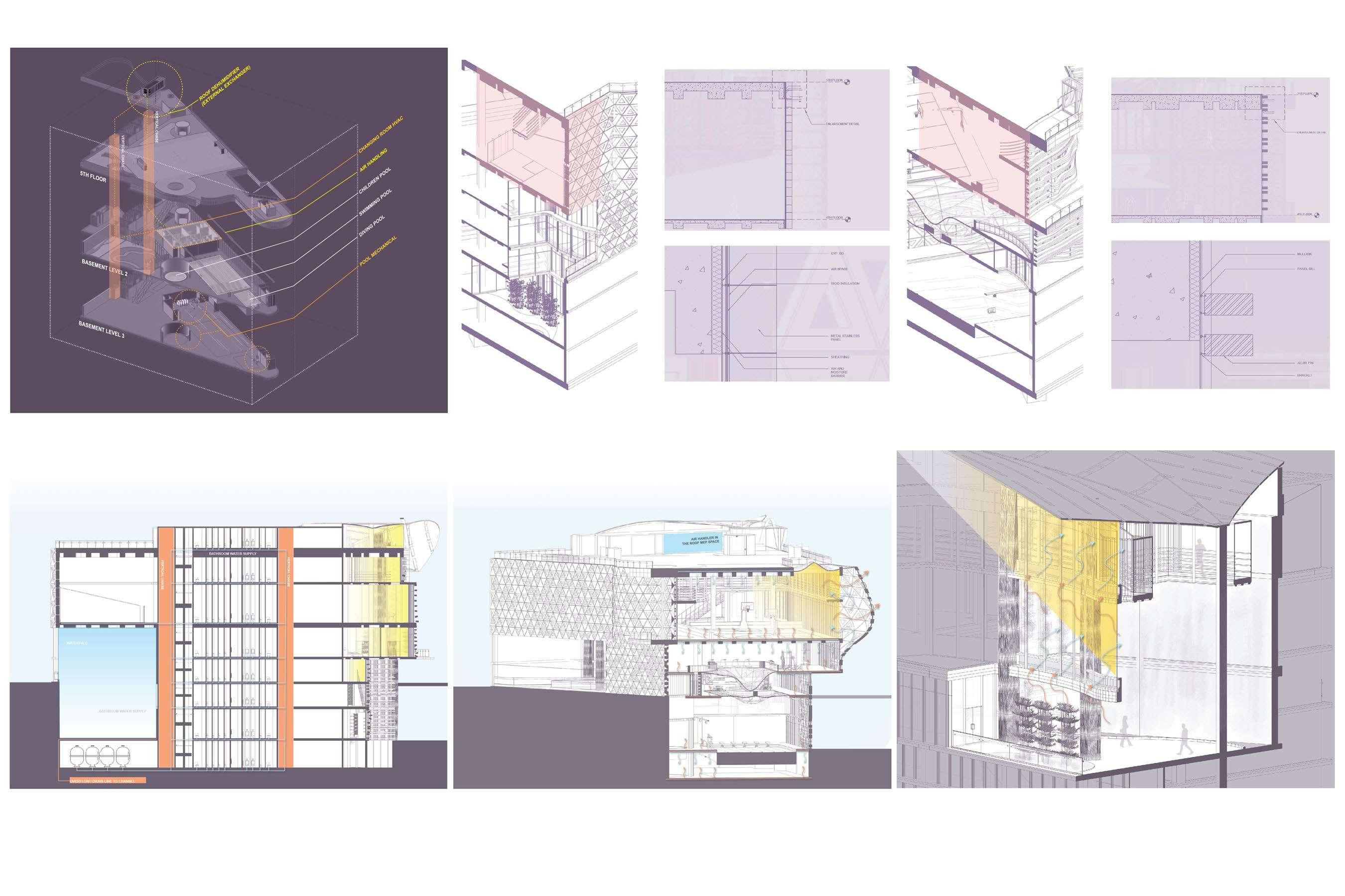
Building System: Structure, MEP, and HVAC - Part I
The building integrates environmental strategies to enhance comfort and efficiency. A HVAC system maintains positive air pressure in the changing rooms relative to the swimming pool, preventing humidity and odor migration. Fresh air is delivered and exhaust air is recovered through an air handling unit, while underfloor air distribution supports thermal comfort.
Another strategies include a glass ceiling skylight and curtain wall system that provides natural ventilation and daylighting. A horizontal louver with operable dampers manages outside air intake and exhaust, and exterior planting offers seasonal solar shading. An acoustic and thermal waterfall mitigates noise from the adjacent Mass Turnpike and reduces indoor temperatures during summer. Renewable energy is utilized via evacuated tube solar collectors that feed warm water to an absorption chiller for cooling. Structurally, the building employs a waffle slab floor system for enhanced load distribution and design flexibility.
Waffle Slab System - Enlargement Plan
Building Plumbing Systems Variable Air Volume (VAV) System How VAV System Perform at Patio
1. The evacuated tube solar collector provides warm water to the absorption chiller.
2. Horizontal louver with an operating damper to control outside air intake and exhaust.
3. Planting provides natural solar control by blocking harsh summer sun.
4. Curtain wall with aluminum panel.
5. Waterfall reduces the Mass Turnpike’s noise and interior temperature in the harsh summer.
1. The Air handler delivers fresh air and recovers the exhaust air.
2. Glass ceiling skylight.
3. Curtain wall provides natural ventilation.
4. Underfloor air distribution (UFAD) contributes to the thermal comfort of the building.
1. Curtain Wall with Aluminum panel affects the daylight absorption.
A separate HVAC system in the changing rooms will run at a positive pressure relative to the swimming pool.
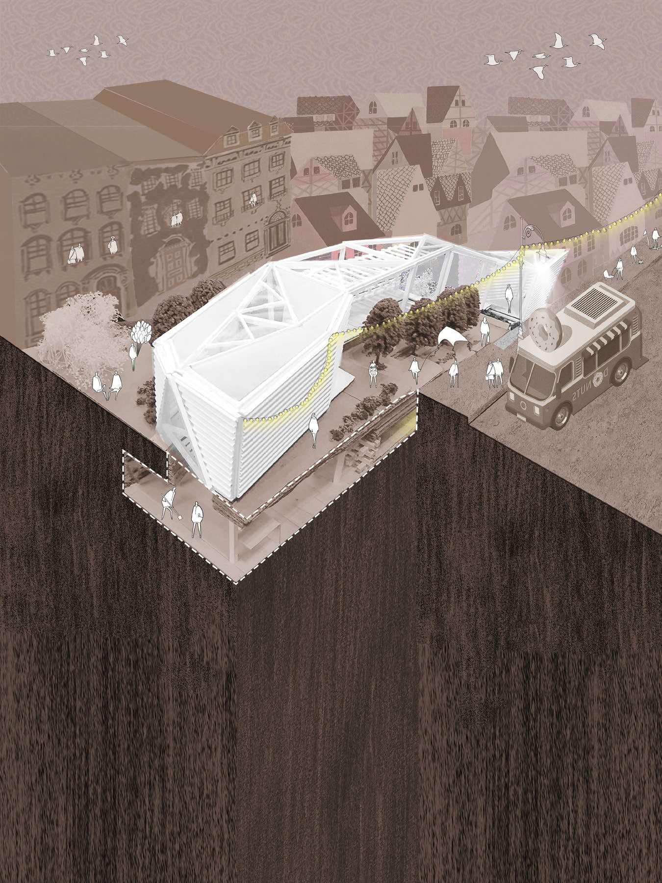
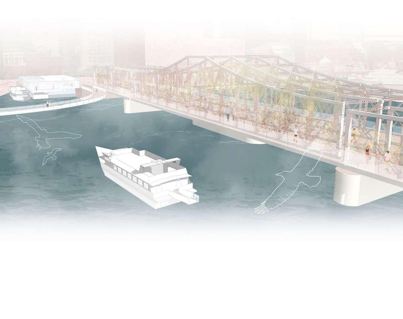
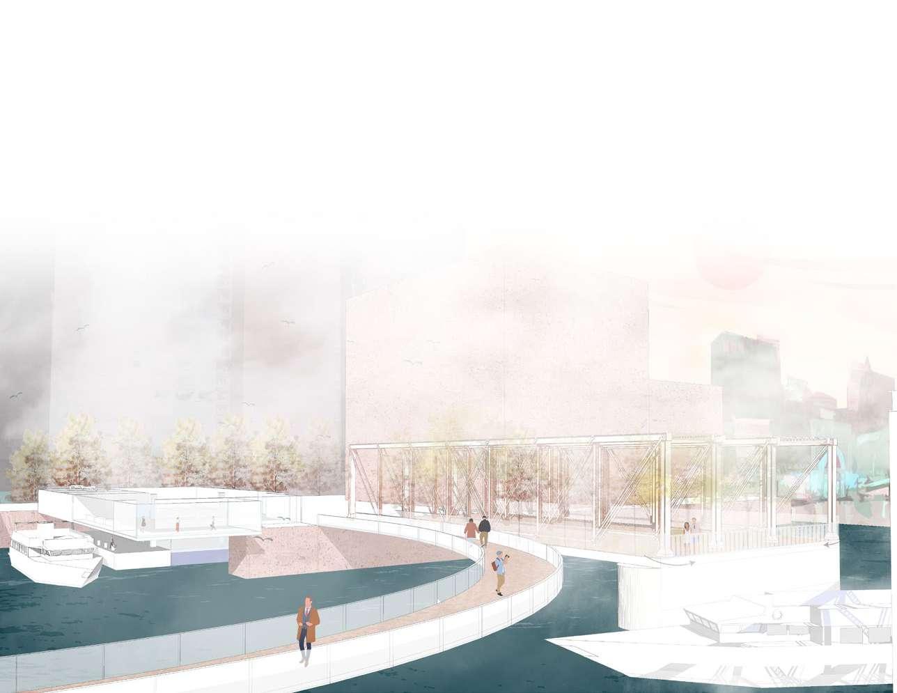
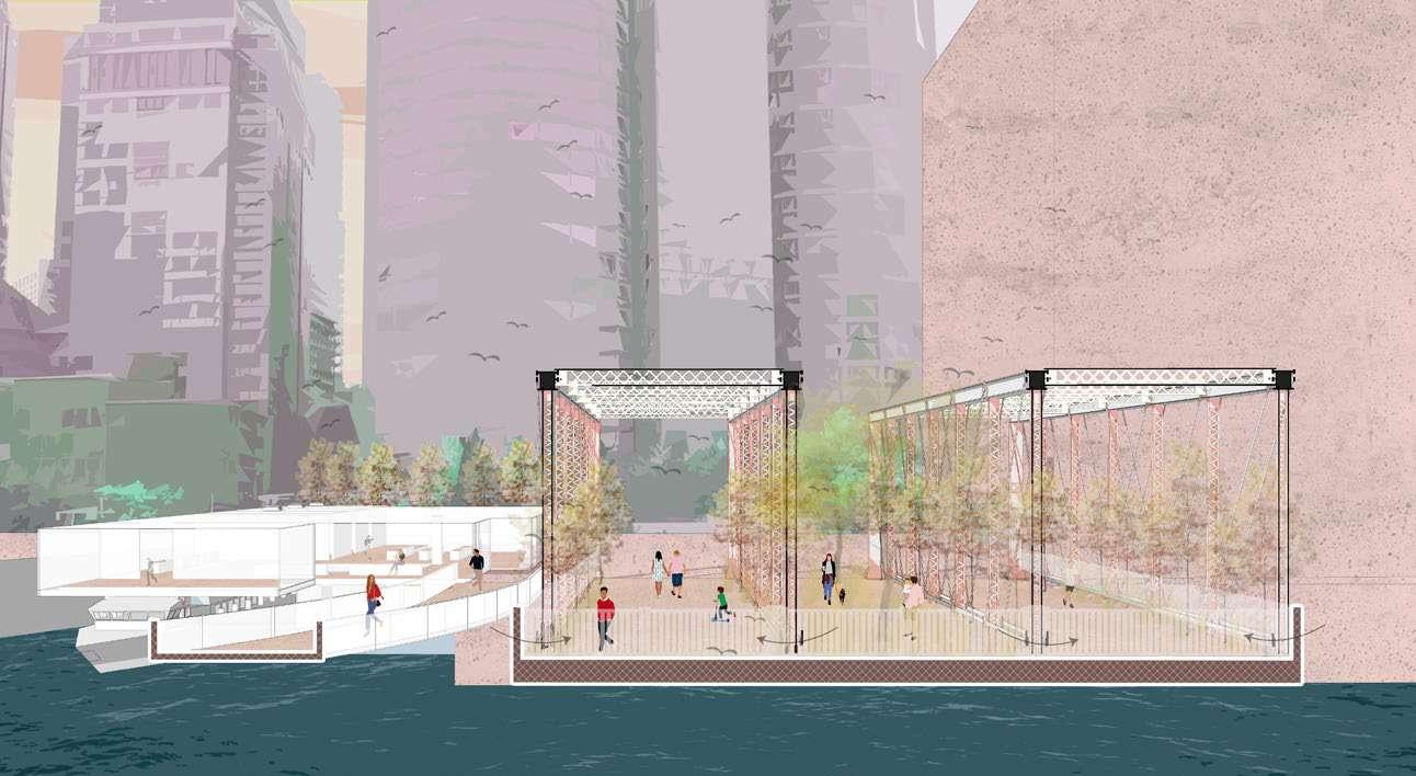
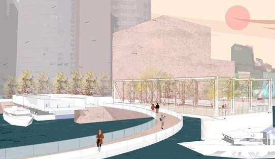
06 MIRAGE ON THE WATER
BOSTON FERRY TERMINAL | REACTIVATING INACTIVE BRIDGE
ARCHITECTURE STUDIO 1
INSTRUCTOR:
KATHRYN A. FRIEDMAN
BOSTON ARCHITECTUAL COLLEGE 2016 FALL
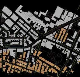
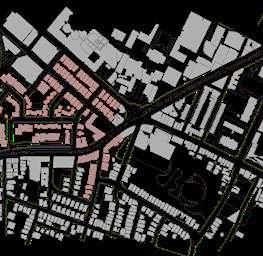
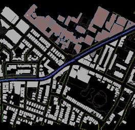
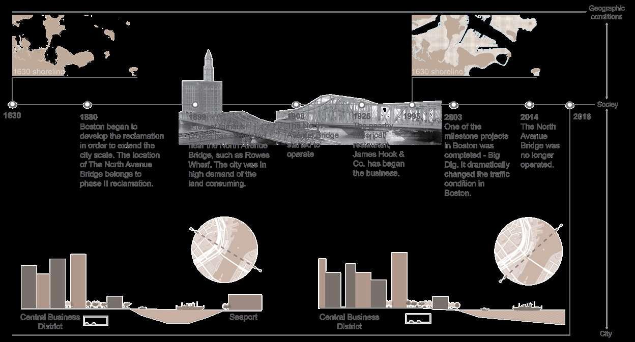
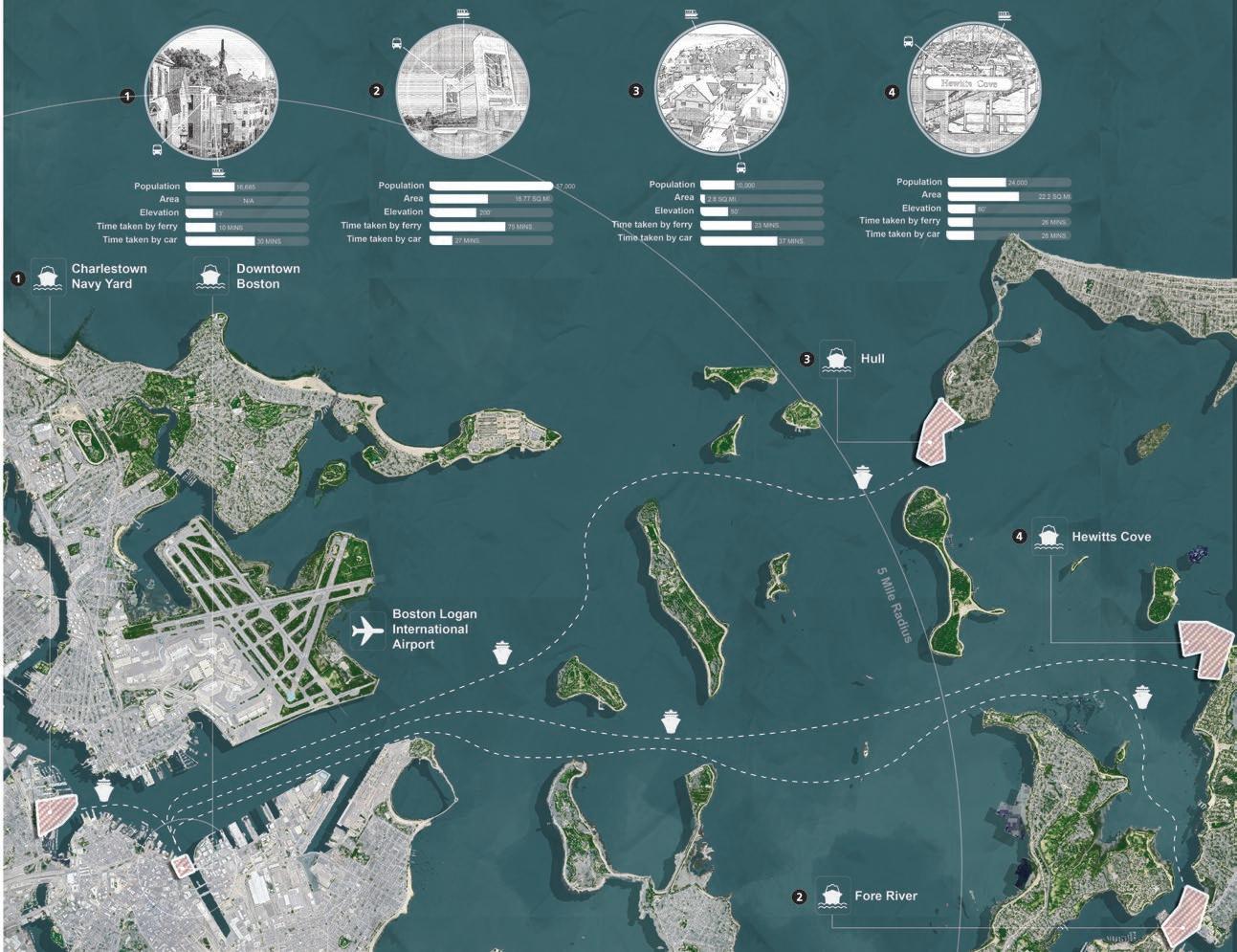
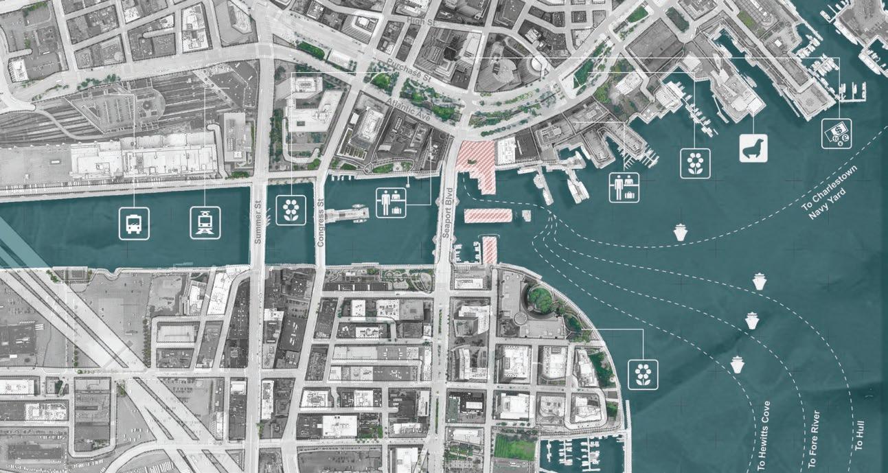
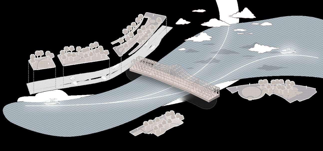
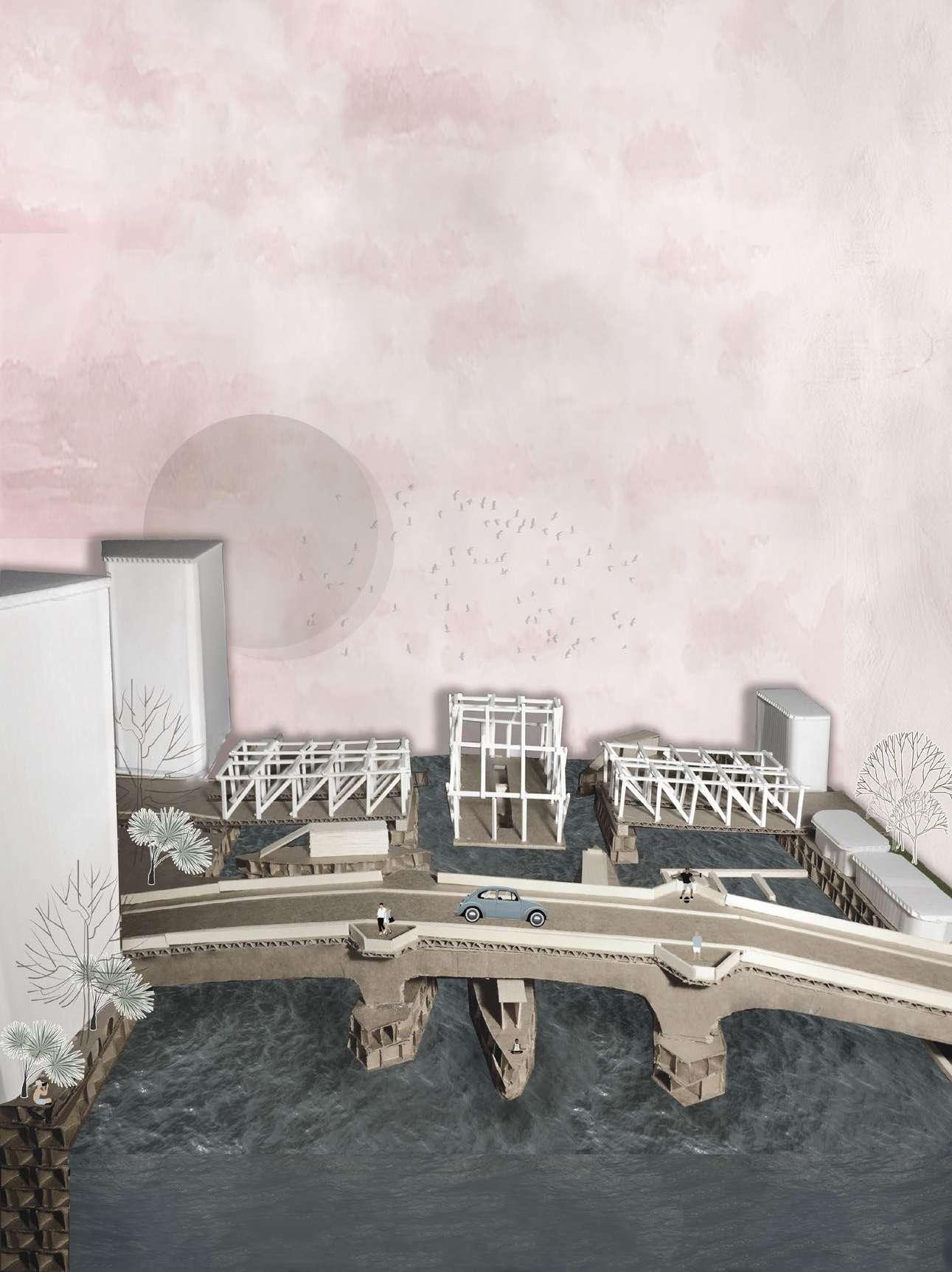
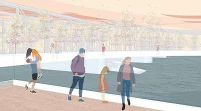
The site is located next to a busy downtown business district. It is completely visible because people often walk or drive through this piece of land. The area is 27,000 feet and the perimeter is 710 feet long. Currently, the site is owned by James Hook & Co., which uses it as a seafood restaurant. The Old Northern Ave Bridge, which connects from Downtown Boston to Seaport, is located next to the site. Presently, the bridge is permanently closed.
Today, the site is surrounded by several ambiguous conditions: functional and valuable because the zoning of that area is mixed, with business, commercial, historical programs, and public spaces located close to each other. More importantly, the location on the water is a resource, and tourism around the site brings opportunity. The resource of green space is hard to ignore at the site. The Rose Kennedy Greenway is built upon the Big Dig tunnel, comprising several open green spaces. These spaces engage not only the community but also the urban environments, such as allowing people to take exercise and enabling Downtown Boston to have a living shoreline. The Rose Kennedy Greenway used to be an elevated highway. Due to the congestion issue, the government decided to build a wider expressway and to eliminate the existing highway in order to relieve the traffic. Big Dig has become the most expensive project ever in the United States. It aimed to bring the vehicles from elevated to the tunnel, to reduce transport visibility.
The Big Dig project made the highway invisible to pedestrians and strengthened the green spaces’ connection. In the last decade, a lot of new programs have been built at Seaport, especially the Institute of Contemporary Art Boston (ICA) with the landscape design along the shoreline. It became one of the favorite relaxation spots in Boston. The pedestrian could walk easily from Downtown through Seaport Blvd to the destination.
However, most people are curious about the closure of the Old Northern Ave Bridge. Demolishing the entire bridge would be costly. Mightn’t it be a good idea to reopen the bridge for other purposes, like walking paths?
This means that people can plan a day to visit the entire area, for example, they can bring their kids in on the train to visit the ICA and stay in a hotel and eat at James Hook & Co, all in the same neighborhood, because of the zoning. Thus, the demand for ferry service is significant. Although there are several ferry terminals along Boston Harbor, they are disorganized and find it hard to maintain a high volume of passengers. Also, many people find it hard to reach the ferry terminal because the harbor walk is blocked by Seaport Blvd and James Hook & Co. Furthermore, the Seaport Blvd looks less vivid and unwelcoming.
Site
Timeline of Boston Harbor
Ferry routes map Site
The Mirage on the Water is originally inspired by Boston’s unique climate condition, including an unassuming ferry terminal that looks like a semitransparent box. The terminal connects the harbor walk from both sides and Reactivating the old Northern Avenue Bridge. The Mirage on the water is also expressed as the visibility of transportation. It is learned from the Big Dig, which
was to bring the vehicle from elevated to tunnel and disappear in front of the walking pedestrian. Likewise, ferry passengers could see the less conspicuous terminal faintly and dimly. It accelerates the ferry passengers’ curiosity. It could also be comprehended as to weaken the transport visibility but strengthen the connection of the green space.
The Old Northern Ave operates as usual. The pedestrians are free to walk across the bridge from Downtown Boston to Seaport. The sliding gates will automatically close while the center of the bridge rotates 90 degrees. The handrails are installed on both sides. Also, the Bay walking path connects from the Ferry Terminal to the Seaport blvd bridge. It not only shortens the distance of the harbor walk from Rowes Wharf to the Intercontinental Boston hotel, but also provides pedestrians with a different point of view
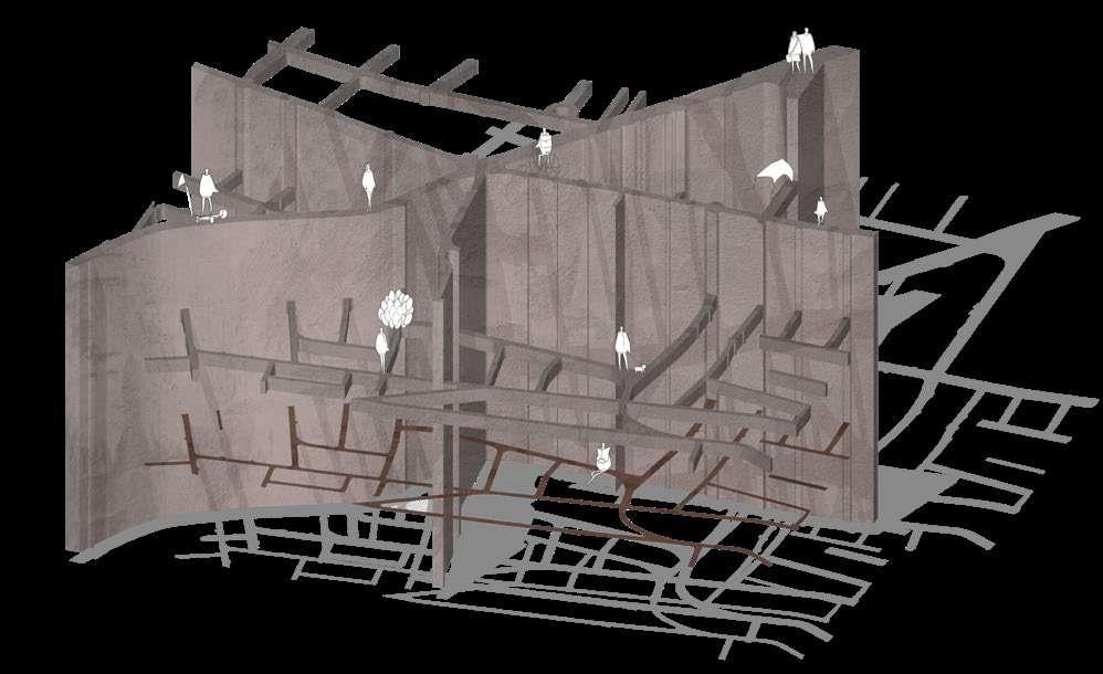
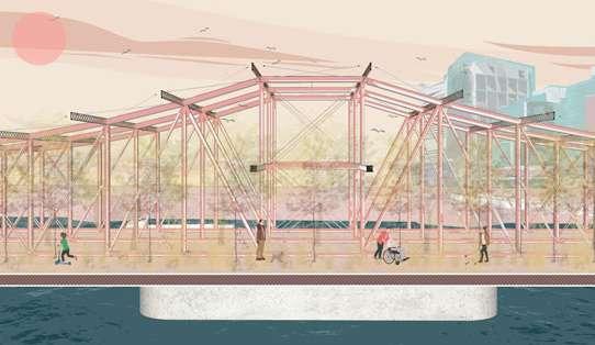
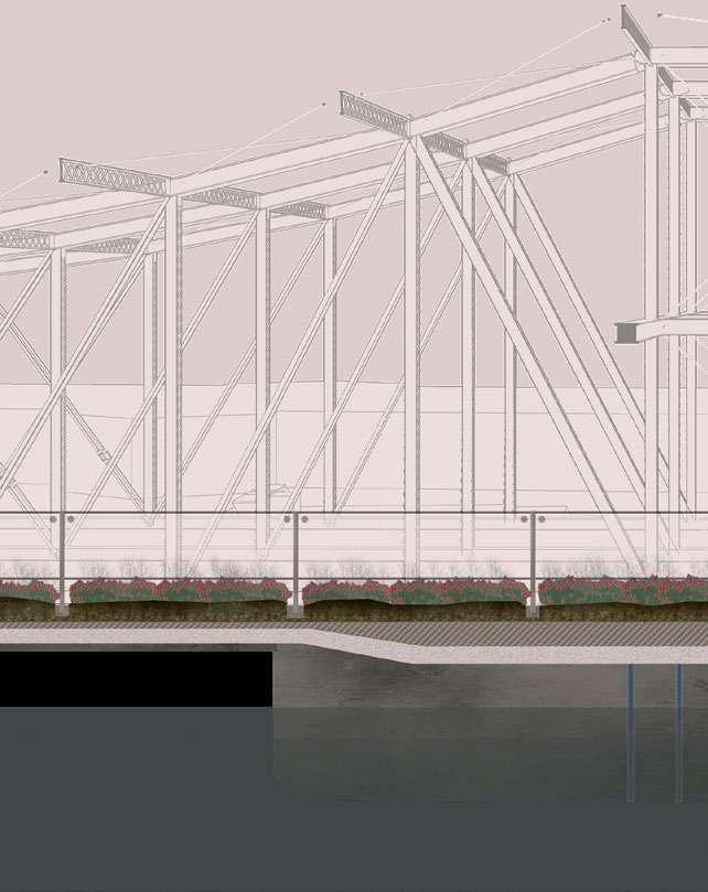
07 MISSING LINK - FROM RAIL TO TRAIL
VOLUNTEER TEAM DESIGN IN CAPE COD
GATEWAY
INSTRUCTOR: JACK COCHRAN
BOSTON ARCHITECTURAL COLLEGE
Planting trees on the Old Northern Ave Bridge could be challenging. However, the styrofoam underneath the soil can lighten the weight of trees, in order to protect the bridge’s steel structure. Also, an irrigation system is installed under the bridge. It includes a filter that automatically transforms the seawater into freshwater. The freshwater passes through the drainage layer and reaches the plants.
2017 FALL
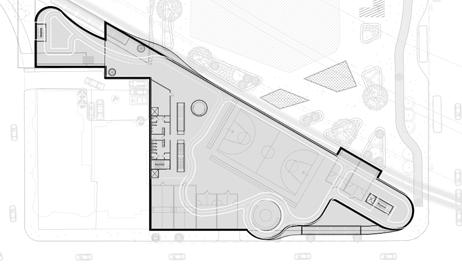
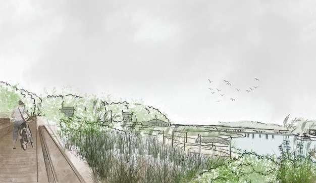
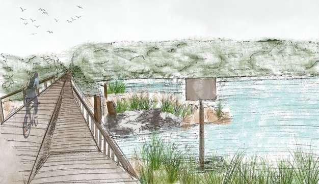
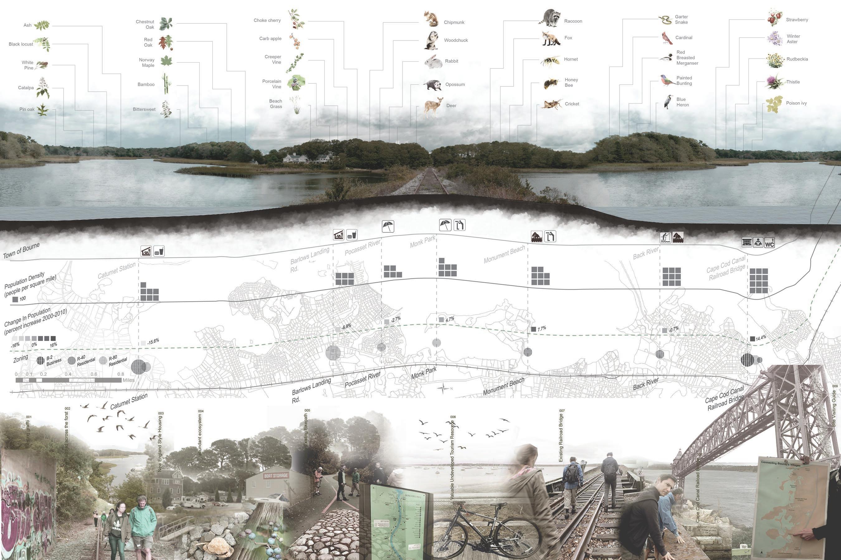
In Fall 2017, the Friends of the Bourne Rail Trail, the non-profit leading the development for the project, cooperated with Boston Architectural College Gateway Team. The project analyzed the Bourne Rail Trail corridor, a railroad that has the potential to be transformed into a new bike and running trail. Also, the project reconnected the missing connection between two other trails and stitched together a significant portion of Cape Cod. The design progress took place from September 2017 to May 2018. In the first semester, my role focused on the precedent studies and the zoning, ecosystem and site analysis. In the second semester, my role was to contribute to the designs of three resting areas along the path.
Cape Cod, is one of the most famous peninsulas in the United States. On November 11, 1620, the Pilgrims got their first look at the New World when they saw Cape Cod. The Pilgrim group decided to settle in this piece of land. Today, Cape Cod has become a popular destination for vacationers, because people get attracted by the spectacular landscape view and historical summer houses. Also, there are abundant natural resources from forest to ocean throughout Cape Cod including sharks and seals. According to Henry David Thoreau’s novel, sharks have been dramatized in Cape Cod culture.
Even though most people stay in Cape Cod only during the summer, there are a lot of permanent residents living in Cape Cod year round. In the past, people took the train from Cape Cod to Boston for work. One of the routes of the Old Colony Railroad, which operated from 1845 to 1893, was from Boston to Cape Cod. The train service stopped operating, in part due to people changing their commuting method from taking the train to driving. It caused the railroad right of way to be abandoned. However, some people felt inconvenienced without train service. They decided to move from the suburb to the city. Finally, the neighborhood became insular and the residents were getting older. Rebuilding the abandoned railroad as a new bike path could bolster the economy and tourism in this aging neighborhood.
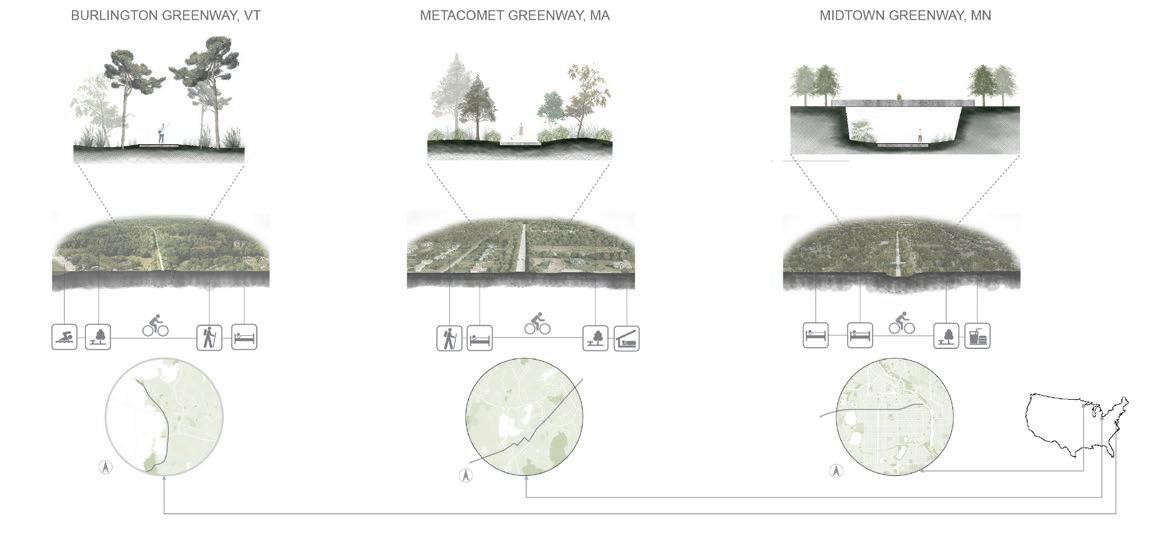
There are several successful projects of reconstructing the railroad as a new bike path in the United States. The Midtown Greenway is a 5.7-mile rail trail in Minneapolis, Minnesota. In the past, the railroad was separated from the street grid. The new bike path can enable residents to pass across the street much more easily. Also, the project engages the local community.
At the end, the new bike and pedestrian path program in the Town of Bourne aims to enhance and improve some of the run-down or weak areas of the path.
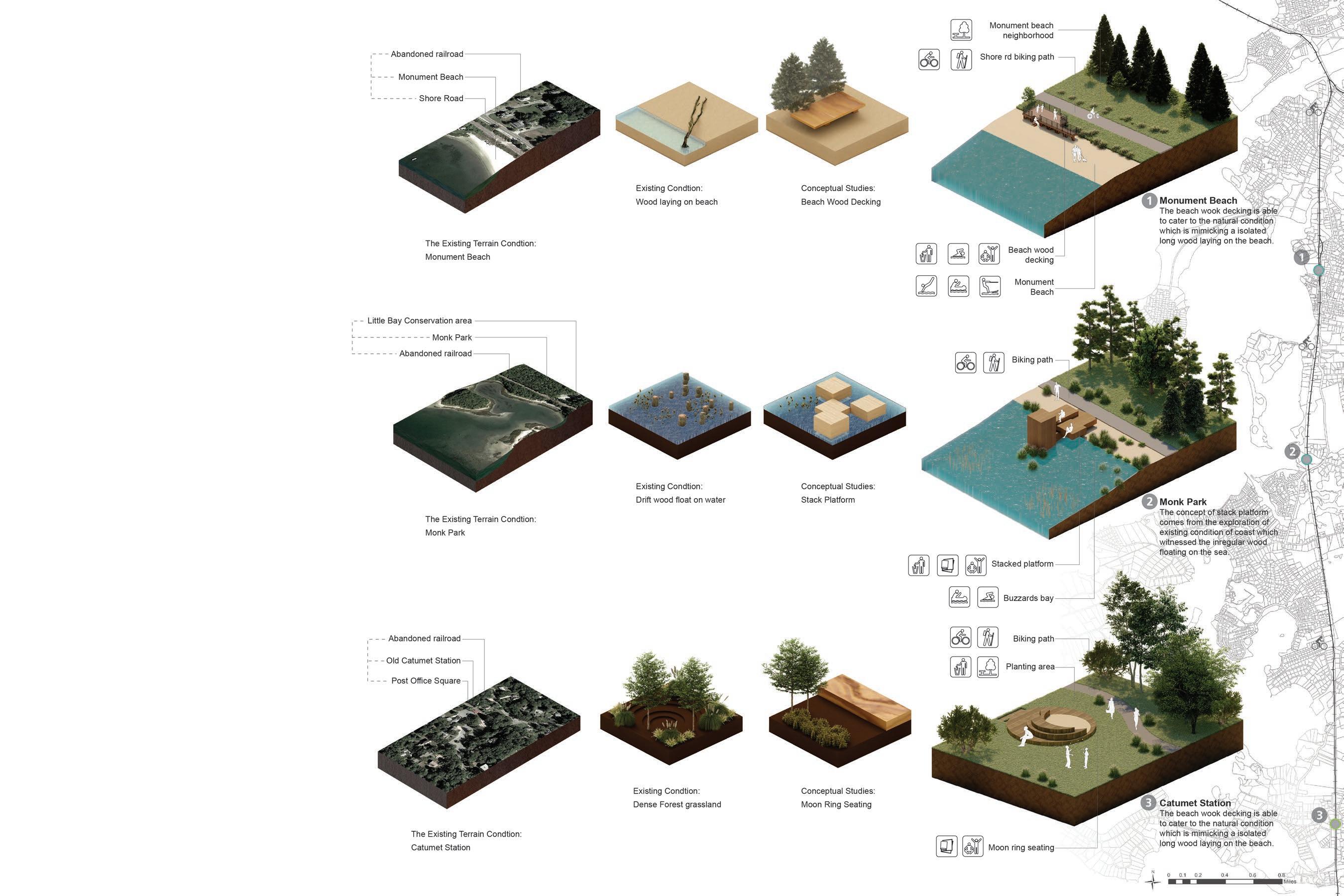
Hand drawing: The envision of new biking path at Town of Bourne I Hand drawing: The envision of new biking path at Town of Bourne II
(Above) Ecosystem Diagram
(Below) Site Analysis of Town of Bourne
Catumet Station
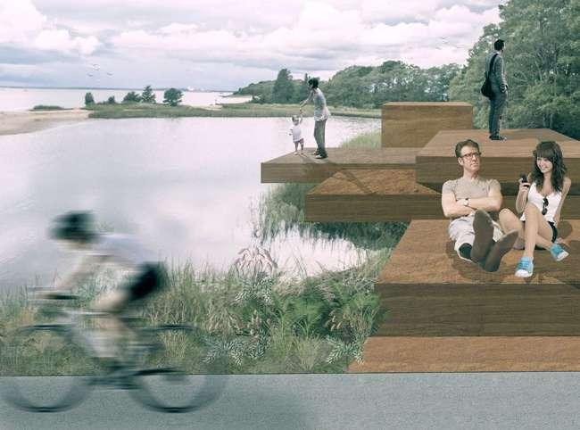
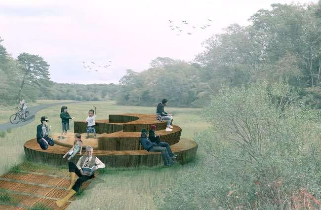
Stacked platform at Monk Park
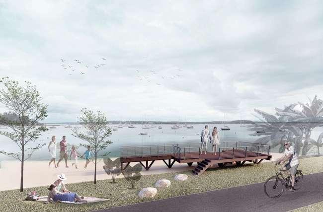
Beach wood decking at Monument Beach
PROFESSIONAL WORK
01. MANCHESTER BY THE SEA TOWN HALL IMPROVEMENT
Project Landscape Architect: Ray Dunetz With Wolf Landscape Architecture
Other Team Members: Ray Dunetz, Tobias Wolf, Nancy Leask, Michelle De Tarnowsky, Sakina Dong
Project Location: 10 Central St, Manchester-by-the-Sea, MA 01944
Time of Participation: July, 2019 - January, 2020
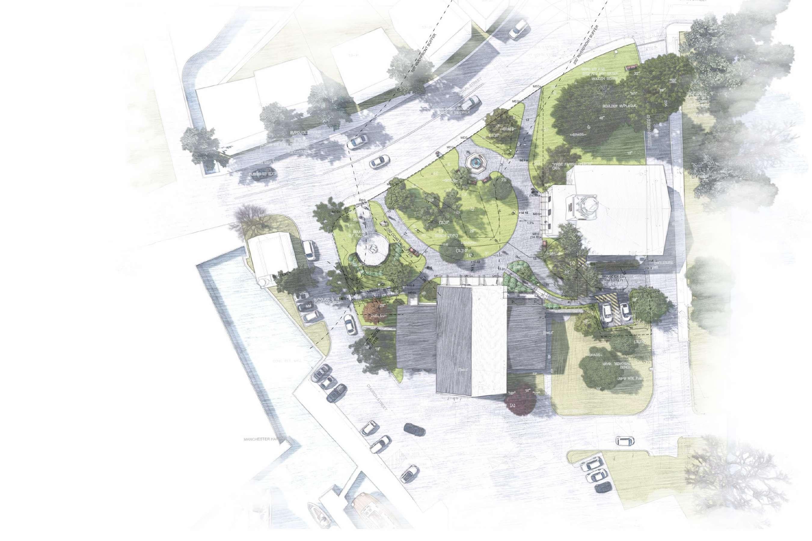
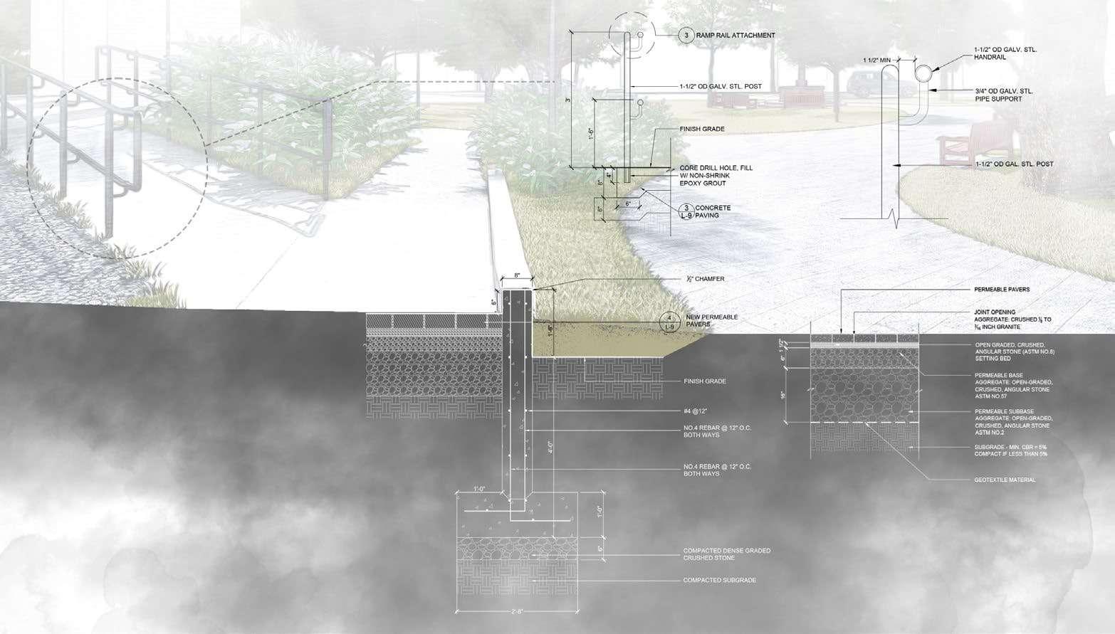
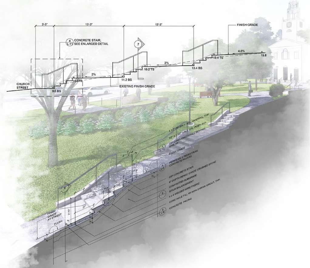
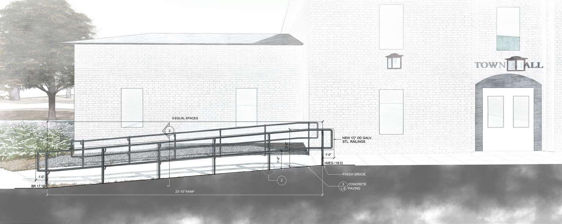
Contribution: In this project, I led design of the main pedestrian path, optimizing aesthetic design, construction feasibility, and accessibility. I explored and tested a range of angles and radii in order to achieve an optimal design. Throughout the project, held primary responsibility for renderings and construction documents.
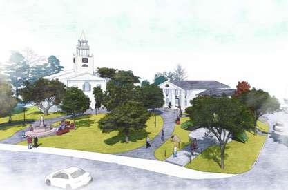
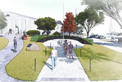
Project description: To improve the outmoded style of the existing pedestrian path and meet accessibility requirements, the firm designed the renovation of the Town Common in Manchester-by-the-Sea. The design included demolishing the old paths and replacing them with a more elegant permeable concrete paver. The new pedestrian path improves accessibility by adding new stairs and a handicap ramp that provides access from the parking area to the Town Hall. In addition, several planting areas around the pedestrian path were redesigned. The renovated landscape design also reduces coastal erosion from the Manchester Harbor.
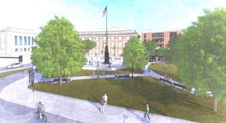
Memorial Square
Bird’s-eye of the Town Hall
Permeable vehicular pavers and Ramp rail - Section
Concrete Stair - Section
LANDSCAPE ARCHITECTURE IMPROVEMENT
Project Landscape Architect: Ray Dunetz
Other Team Members: Carol Moyles, Nancy Leask, Michelle De Tarnowsky, Sakina Dong
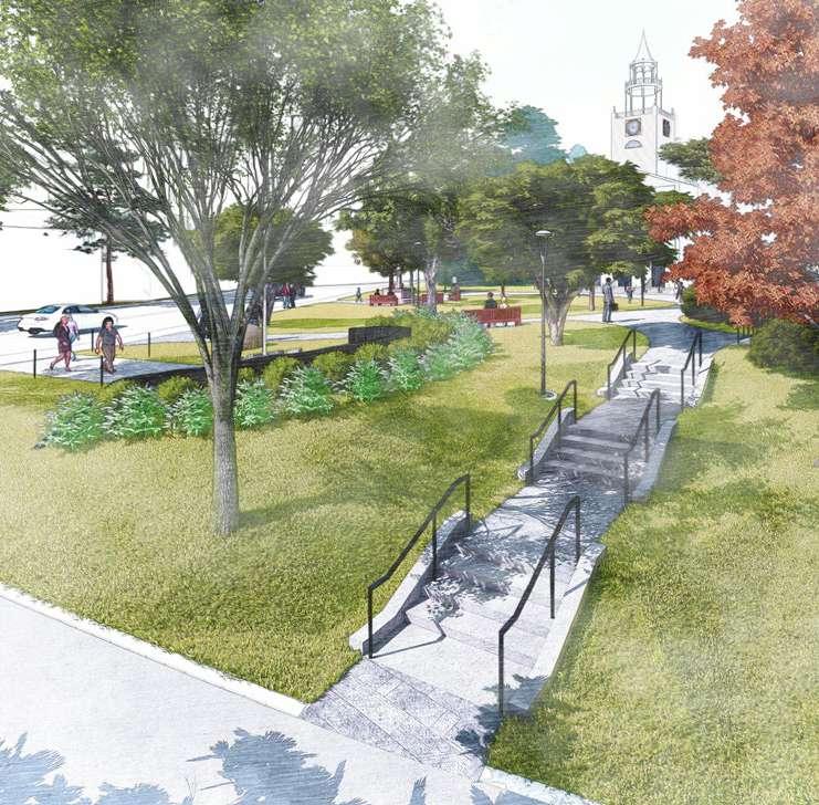
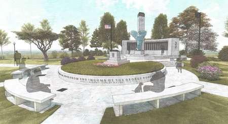
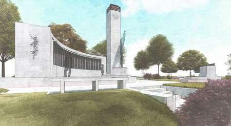
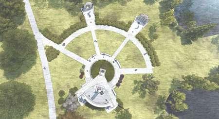
Project Location: War Memorial, Back Bay Fens, Boston, MA 02115
Time of Participation: July, 2020 - Present
Contribution: To date, have been responsible for all renderings of the primary design concept and for 70% of the construction drawings, as well as participating in the site analysis and assessing existing site dimensions.
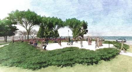
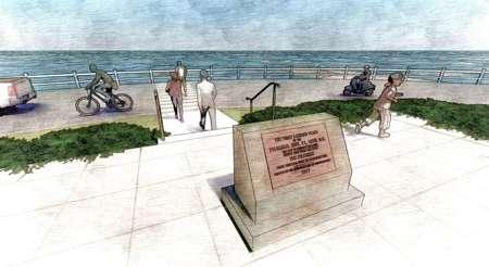
Project description: The new design renovates and restores the existing monuments and improves the landscape design to better highlight key features of the monument design. The design conserves and protects important aspects of the existing design while increasing accessibility, including providing opportunities for wheelchair users to be in conversational space with other seated visitors. The design includes relocating the Vietnam War and Korean War memorial monuments, enlarging the paving area to increase accessibility, reorganizing seating areas, and improving plantings.
03. FIRST LANDING PARK
LANDSCAPE ARCHITECTURE IMPROVEMENT
Project Landscape Architect: Ray Dunetz
Other Team Members: Carol Moyles, Nancy Leask, Michelle De Tarnowsky, Sakina Dong
Project Location: Provincetown, MA 02657
Time of Participation: October, 2019 - October, 2020
Contribution: I was responsible for all renderings of the primary design concept and collaborated on the construction drawings.
Project description: In the past, many travelers have not visited this park space because of overgrown plantings and unmaintained benches and pedestrian paths. The new design provides additional entry points and increases accessibility.
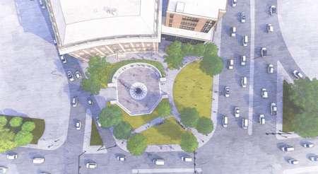
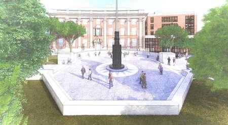
04. LINCOLN SQUARE
LANDSCAPE ARCHITECTURE
IMPROVEMENT
Project Landscape Architect: Ray Dunetz
Other Team Members: Carol Moyles, Nancy Leask, Michelle De Tarnowsky, Sakina Dong
Project Location: Worcester, MA
Time of Participation: September, 2020 - Present
Contribution: To date, RDLA generated the alternative site design for the square. have created three alternative renderings to visualize different options.
Project description: The new landscape design coordinates with the design of the new senior housing and expansion into a renovation of the former Lincoln Square Boys Club. The landscape design relocates the existing memorial square structures to the center of the Boys Club entrance in order to improve pedestrian circulation.The design takes into account accommodating existing underground infrastructure. New plantings and other new facilities make the memorial square area a more welcoming place.
05. HOPE CEMETERY
DEPARTMENT OF PUBLIC WORKS AND PARKS
Project Landscape Architect: Ray Dunetz
Other Team Members: Carol Moyles, Nancy Leask, Michelle De Tarnowsky, Sakina Dong
Project Location: 119 Webster St. Worcester, MA 01603
Time of Participation: June, 2020 - April, 2021
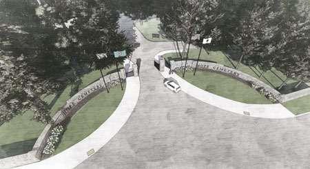
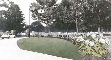
Contribution: I was responsible for all renderings of the primary design concept for the main entrance and vehicular gate design. I also contributed to the construction drawings.
Project description: The new design encompasses the main entrance, secondary entrance, alternative entrance, and monument protection. The driving paths of each area were redesigned. The main entrance redesign included a pair of vehicular gates and a pair of pedestrian gates and replacing the existing perpendicular stone walls with new curved granite walls. The redesign also protects the existing main monument and perimeter walls. Created multiple alternative designs to accommodate uncertain budget availability.
New stairway behind the existing monument
Front view of the First Landing Park
Bird’s-eye of the First Landing Park
Replacing by the new stone and bronze at WWII Memorial
New granite seating in front of WWII Memorial
Bird’s-eye of the Lincoln Square
Perspective of the walking path entering to the Lincoln Square
Bird’s-eye view of the main entrance
Detail drawing of the new concrete wall with fonts
Rendering of new wall at the main entrance
Plan of alternative design of Lincoln Square
1. Charcoal Drawing: Emotional Kaleidoscope
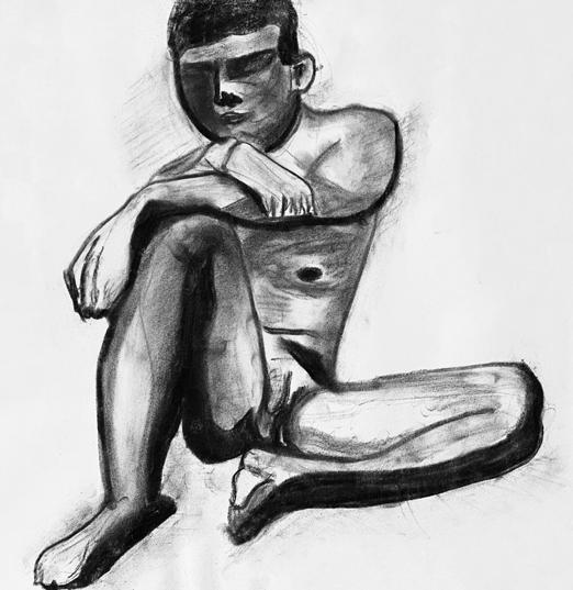
2. Charcoal Drawing: Meditation
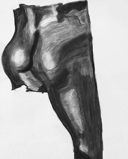
3. Charcoal Drawing: Muscles of Bicep Femoris
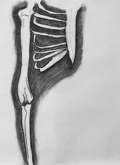
4. Charcoal Drawing: Partial Skeleton
5. Charcoal Drawing: Chilly Moment
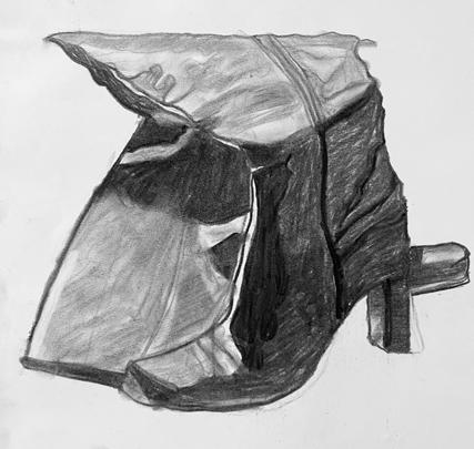
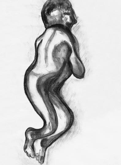
6. Charcoal Drawing: High Heel Boots
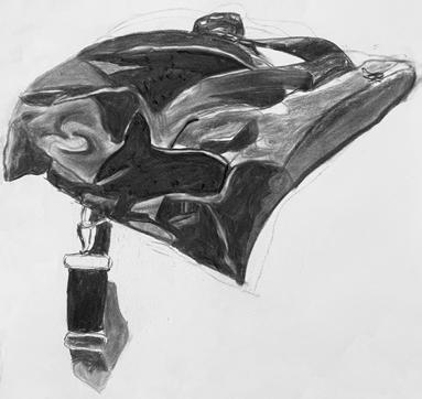
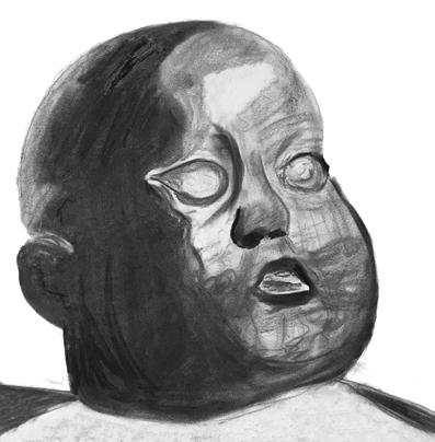
7. Charcoal Drawing: Leisure Style Bag 8. Charcoal Drawing: Baby Heads at Museum of Fine Arts, Boston
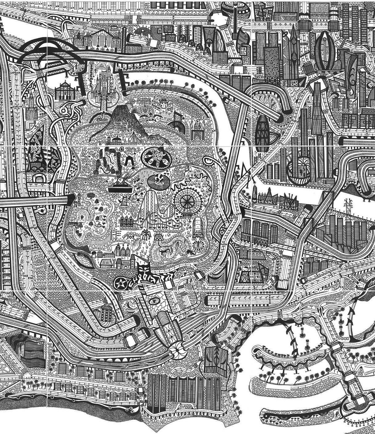
Hand drawing: The imagination of my city episode I
Hand drawing: The imagination of
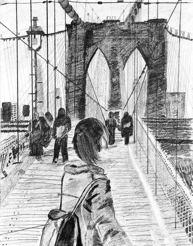
Pencil drawing: A girl walking at the Brooklyn Bridge