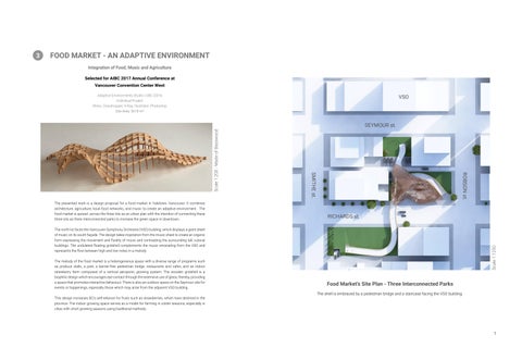
FOOD MARKET - AN ADAPTIVE ENVIRONMENT
Integration of Food, Music and Agriculture
Selected for AIBC 2017 Annual Conference at Vancouver Convention Center West
Adaptive Environments Studio | UBC |2016
Individual Project
Rhino, Grasshopper, V-Ray, Illustrator, Photoshop
Site Area: 5618 m²
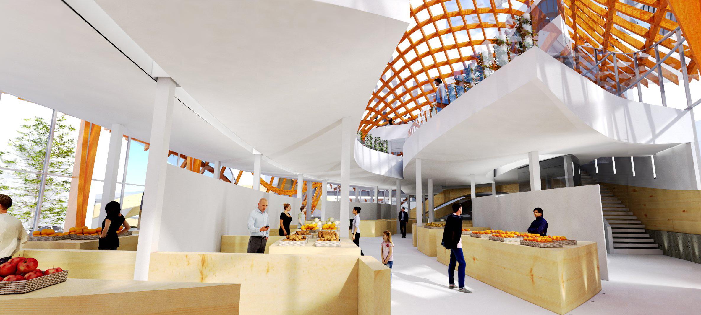
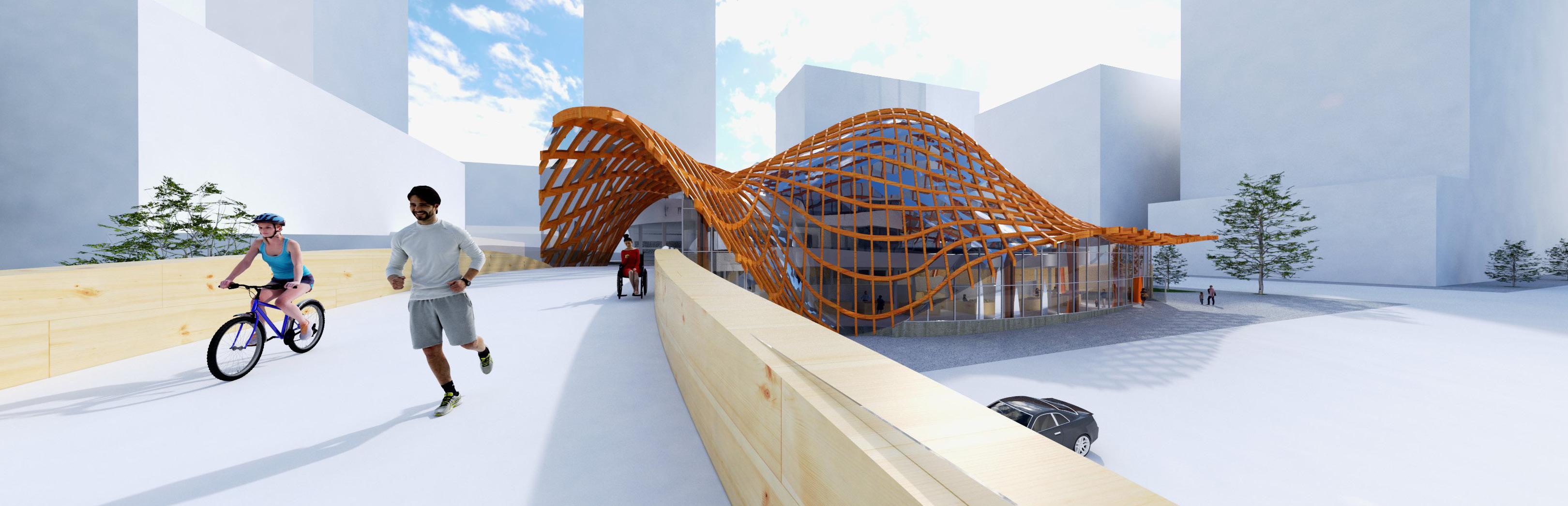
The presented work is a design proposal for a food market in Yaletown, Vancouver. It combines architecture, agriculture, local food networks, and music to create an adaptive environment. The food market is spread across the three lots as an urban plan with the intention of connecting these three lots as three interconnected parks to increase the green space in downtown.
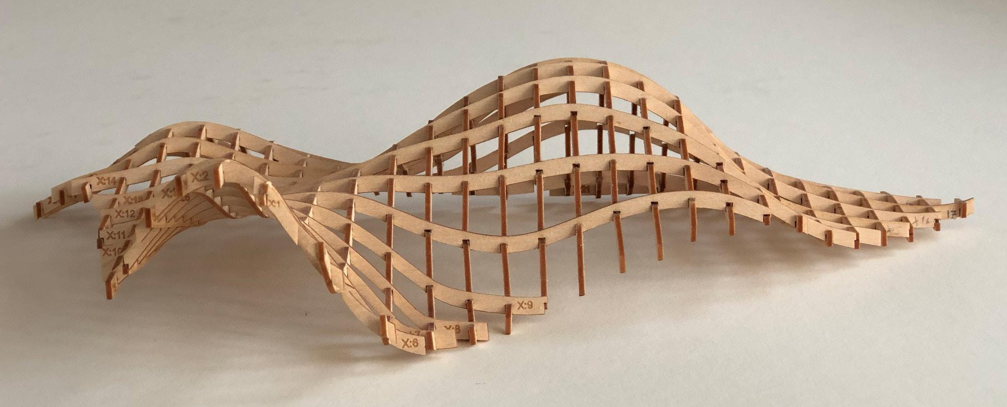
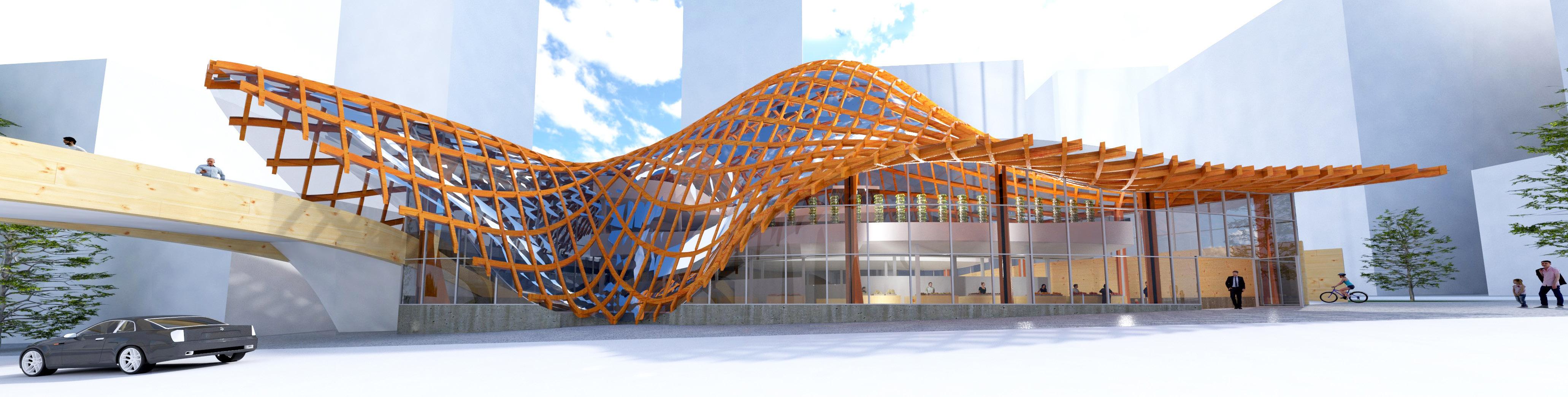
The north lot faces the Vancouver Symphony Orchestra (VSO) building, which displays a giant sheet of music on its south façade. The design takes inspiration from the music sheet to create an organic form expressing the movement and fluidity of music and contrasting the surrounding tall, cubical buildings. The undulated floating gridshell complements the music emanating from the VSO and represents the flow between high and low notes in a melody.
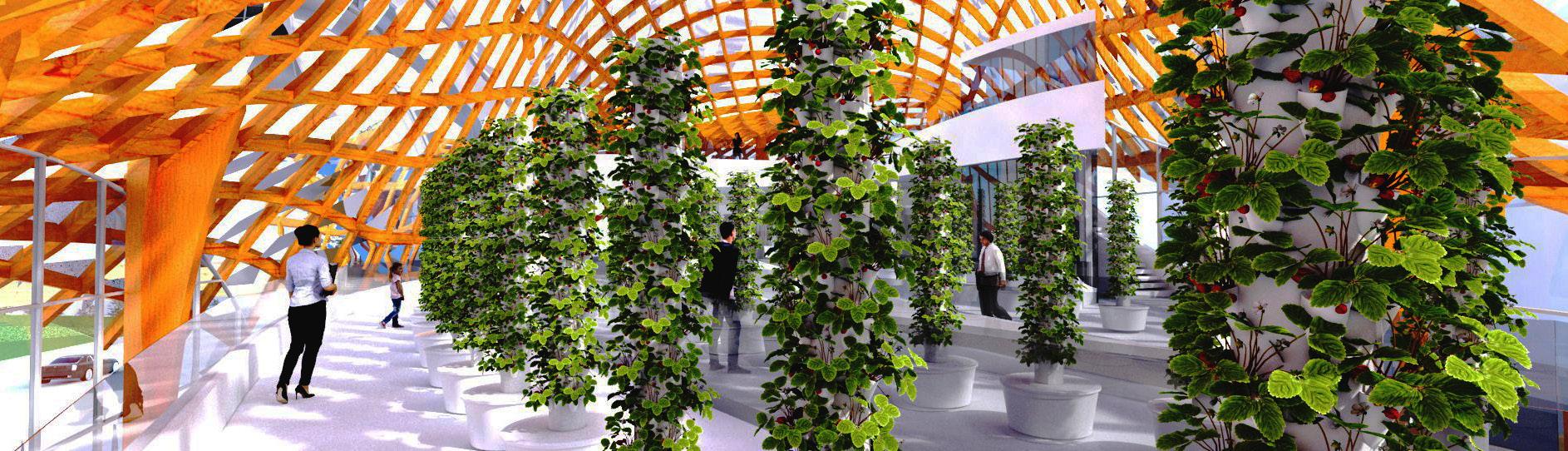
The melody of the food market is a heterogeneous space with a diverse range of programs such as produce stalls, a park, a barrier-free pedestrian bridge, restaurants and cafes, and an indoor strawberry farm composed of a vertical aeroponic growing system. The wooden gridshell is a biophilic design which encourages eye contact through the extensive use of glass, thereby, providing a space that promotes interactive behaviour. There is also an outdoor space on the Seymour site for events or happenings, especially those which may arise from the adjacent VSO building.
This design increases BC’s self-reliance for fruits such as strawberries, which have declined in the province. The indoor growing space serves as a model for farming in colder seasons, especially in cities with short growing seasons using traditional methods.

Food Market’s Site Plan - Three Interconnected Parks
The shell is embraced by a pedestrian bridge and a staircase facing the VSO building.
Food Market’s
Program Visualization
A Gridshell - A Biophilic Design
Inspired by the Movement of a Melody
Yaletown Park
Study Sites - Presently used as Parking Lots Streets Surrounding the Study Sites
The south façade of the VSO building displays a sheet of music by Beethoven, and that inspired the organic form of the food market which expresses the movement and fluidity of music.
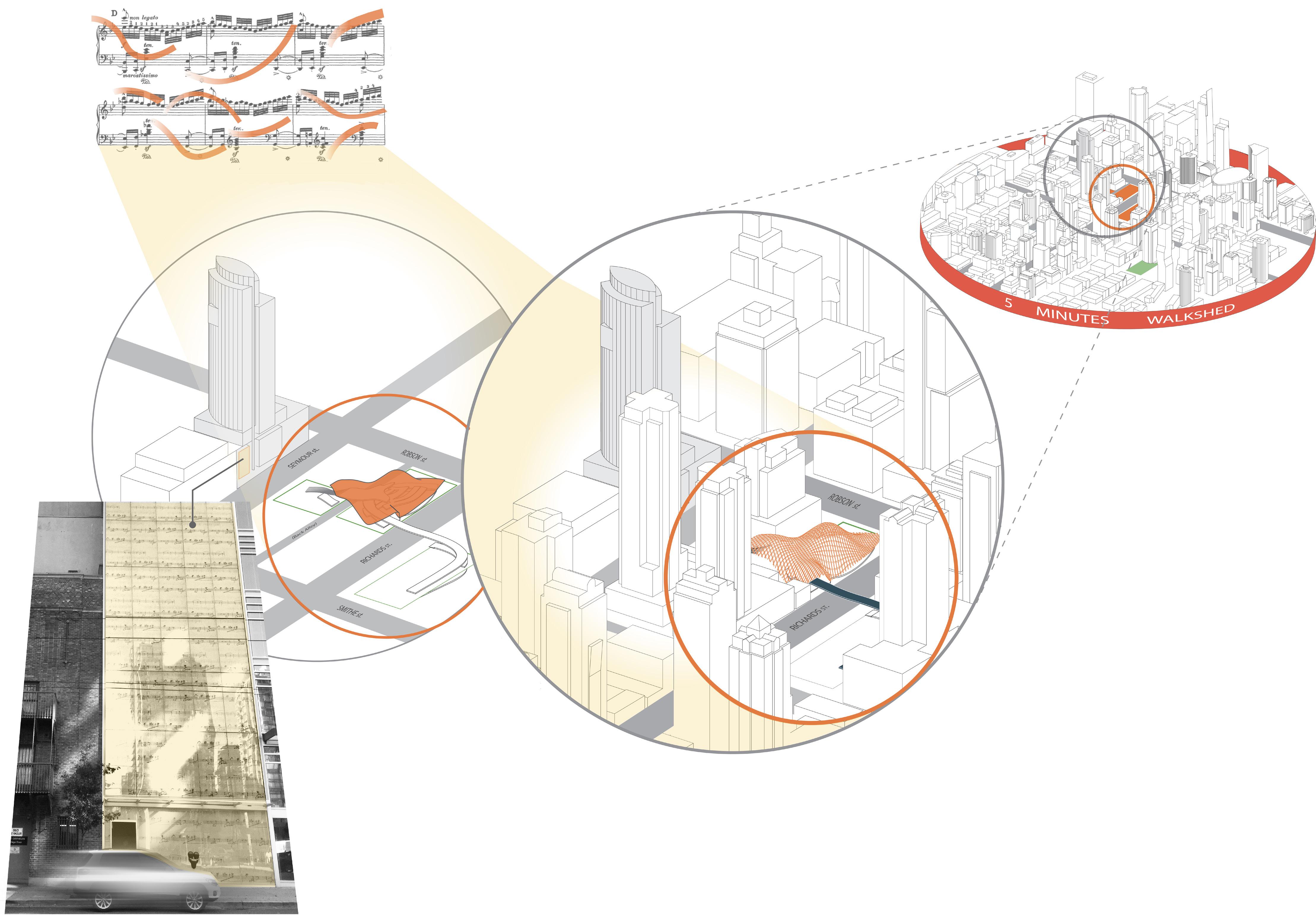
Vancouver Symphony Orchestra - The VSO School of Music
The current Yaletown neighbourhood is a mostly impervious landscape with only one park within the 5 minute walk-shed.
● Total impervious area (TIA) within the 5 minute walk-shed is 76%.
● This fraction does not include other paved surfaces, such as sidewalks or parking lots, therefore the estimated TIA is likely over 90%.
Source: Smithe and Richards Downtown Park - Phase 1 Report - August 2015 - http://vancouver.ca/les/cov/richards-and-smithe-phase-1-report.pdf
** Please see the next page for an agricultural analysis of the selection of strawberries for this indoor farm.