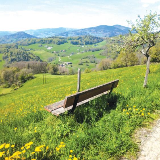
Ancient Paths to Rome II: Ancient Volcanic Landscapes
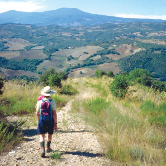
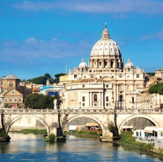
Ancient Paths to Rome III: Approach to Rome
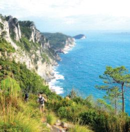
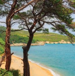
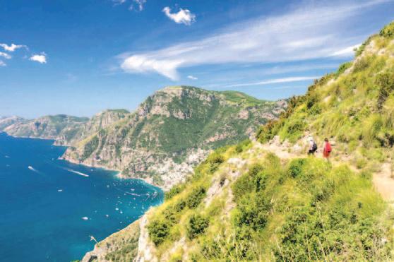
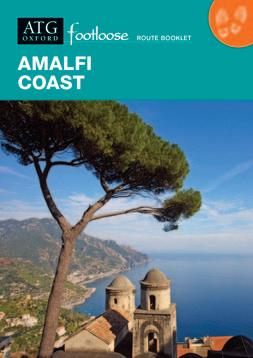
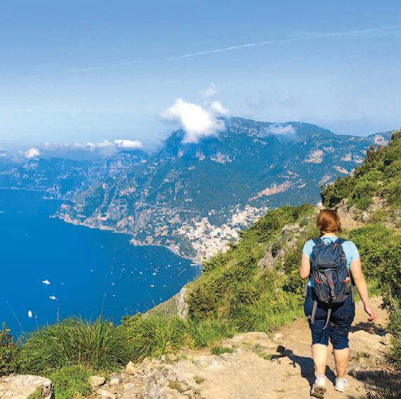
Amalfi Coast
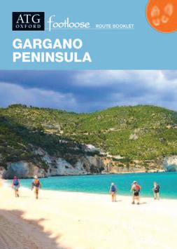
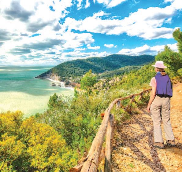
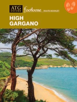
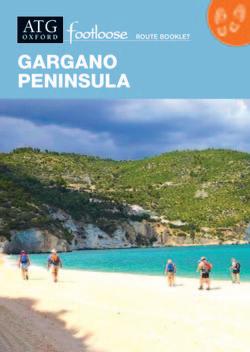
Gargano Peninsula
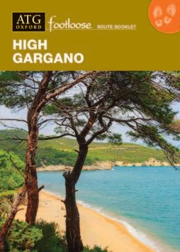
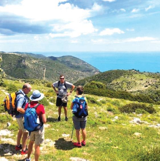
High Gargano
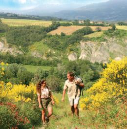
Sicily: From the Centre to the Sea
Apr to 14 Oct 02 Mar to 30 Jun; 01 Sep to 16 Nov 01 Apr to 31 Jul; 01 Sep to 14 Nov
01 Mar to 30 Jun; 01 Sep to 31 Oct 01 Apr to 30 Jun; 01 Sep to 31 Oct 10 Apr to 30 Jun; 01 Sep to 31 Oct 13 Apr to 15 Oct 01 Apr to 30 Jun; 01 Sep to 31 Oct 01
01 May to 31 Jul; 01 Sep to 31 Oct
Mar to 31 Oct
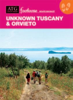
Unknown Tuscany & Orvieto 16 Apr to 31 Oct
Apr to 30 Nov
Apr to 31 Oct 01 Apr to 31 Oct
Making it happen...
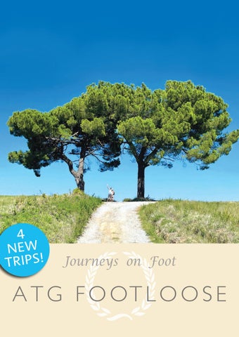
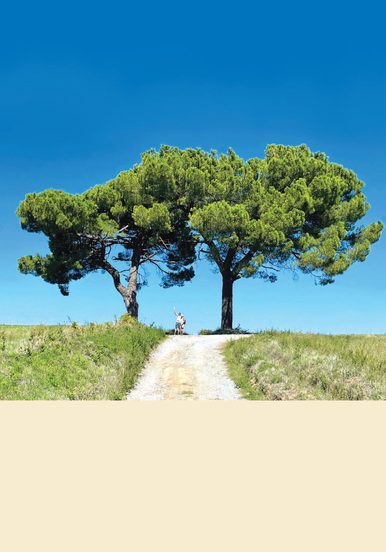
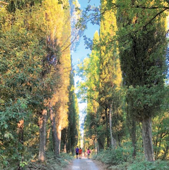
JOURNEYS ON FOOT
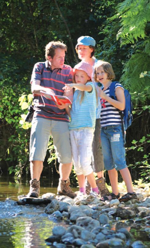
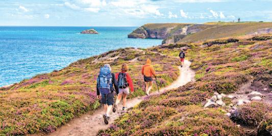
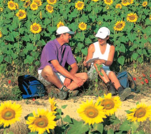
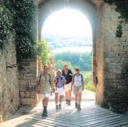
ATG Footloose offers journeys on foot in Europe through areas of outstanding interest and natural beauty – over 1,500 miles of selfguided discovery.
How will you find the way?
You will have an ATG Footloose Route Book –with easy-to-follow, measured directions and maps marked with the route, as well as GPS coordinates, and extensive background and local knowledge and information.
So how does it work?
After arrival in the area you have chosen, the ATG-trained local Route Manager, resident in the area, will meet and brief you, discuss contact options and any requirements you may have. They will move your luggage to await you in your room at each hotel along the route… and always be available to help ensure the success of your trip.
Do you have to walk all the way?
You can walk as much, or as little, as you like –or not at all – by taking a ride with the Route Manager and your luggage to the next hotel!
So, what sort of areas will you visit?
Areas include: inspiring high routes with spectacular views, scenic coastal paths, great wilderness areas burgeoning with exciting biodiversity, rare and profuse wild flowers and birds, historic journeys on foot, ‘World-Class’ art & architecture and superb medieval hill towns, all with comfortable hotels, fine local gastronomy – and some with superlative ice creams!
So with all the practicalities taken care of:
Whether your chosen Footloose itinerary is one steeped in history, cultural heritage or wild scenic beauty and rare species, or – as with many trips – all of these together, you will be left free to enjoy the best of your chosen area at your own pace and in your own time.
For FAQs and more information see pages 8 & 9.
How will you find your way?
The ATG Route Book is the key to the success of a Footloose holiday. With it you will have an excellent holiday. Without it you will be –literally – lost!
You won’t get lost, but if you do... simply phone the Route Manager.
Easy-to-follow instructions and maps
The book anticipates your needs…
The ATG Route Book for your chosen area has easy-to-follow instructions, maps, plans and other information that will guide you to discover the best that the area has to offer.
• Walking route with measurements (measured with a surveyor’s wheel)
• Marked maps of the route (facing the instructions) and GPS coordinates for those who wish to use satellite navigation
• Town plans marked with walking routes and ATG hotels
• Notes on history, geology, flora and fauna, regional cuisine, etc.
• Places of interest (monuments and sights) with notes and opening/closing times
• Restaurants, etc., with notes and price guides
• Shops to buy picnic lunches, etc. – includes a substantial shopping guide
• Other information – locations and opening times for banks, post offices, pharmacies, etc.
• Route Books are kept continually updated, and the Route Manager will advise you of any very recent changes when you meet at the start of your trip.
PHOTO: JIM SCOTT
A TG Route Managers
What about the practicalities en route?
On each Footloose route there is an ATG Route Manager, who is there to take care of all the practicalities and ensure the success of your trip. Route Managers have all been ATGtrained, speak English and the language of the country fluently, and live in the local area.
What will your Route Manager do?
• Welcome you at your first hotel, either on the day of your arrival or on the morning before you set off on your first walk
• Check through your chosen itinerary with you and confirm all your arrangements
• Provide you with information about events in the area, such as festivals or exhibitions
• Make reservations for you at recommended restaurants en route, if required
• Advise you on local transport services as required
• Answer any questions you may have
• Transport your luggage on the route
• Provide you with their mobile number should you require any assistance (24/7)
• Contact you at the end of your trip for any feedback you may have
• Do everything possible to ensure that you derive maximum enjoyment from your holiday
‘You will be welcomed...’
Monika Tyburska Route Manager
What sor t of Hotels?
All the hotels we use on Footloose routes are conveniently situated along the route...
On most routes you can choose Standard or Superior accommodation
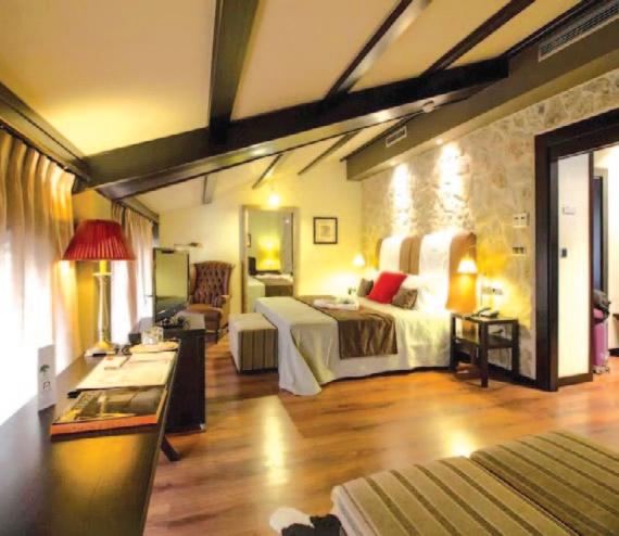
Superior accommodation includes upgraded hotels or upgraded rooms where available. The type of room booked varies according to the hotels’ room classifications. Further upgrades may be available at an additional cost – please enquire on booking. Where there is no Superior or upgrade option available, all accommodation in this location is at the same hotel, in the same standard of room. Single travellers are accommodated in double rooms for single occupancy (DFS) for a supplemental charge.
The Route Manager visits the hotels regularly.
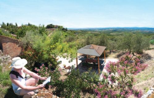
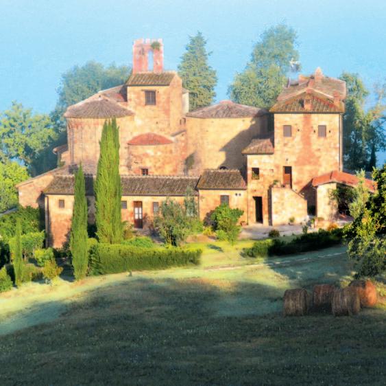
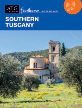
Southern Tuscany
On the trip pages the Standard and Superior/upgrade options are indicated as:
• (std): Hotel used for Standard itinerary • (sup): Hotel used for Superior/upgrade itinerary
• (std & sup rooms): The same hotel is used for both itineraries; however room types differ
• If there is no ‘std/sup’ indication, all accommodation in this location is at the same hotel, in the same standard of room.
• HStar ratings indicate official classification.
• Many delightful places have no star rating. These include Residenza d’Epoca (historic buildings –such as ATG’s Pieve a Castello), agriturismi (farm stays), guest houses, traditional village and mountain houses. All such accommodation is well-organised, provides en suite rooms, and indicated as:
• With breakfast provided and restaurant(s) nearby
• With breakfast provided and dinner included
Classic Alsace
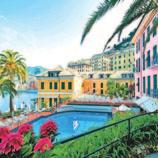
Riviera & Portofino
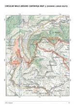
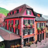
4H Hotel Balfagon & Spa, Cantavieja; High Teruel, Nights 2 + 3
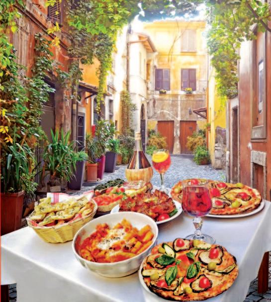
What sor t of Food & Wine?
On Footloose, again, you have a choice...
Lunch
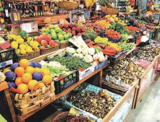
The ATG Route Book and our ‘Sustainable Shopping Guides’ are filled with information about markets and shops in which to buy your lunch. From seasonal fruits, local cheeses, cured hams and freshly baked breads, you are limited only by what you can carry in your pack!
Provisions for packed lunch…
Restaurant Bookings
Your Route Manager will be delighted to book restaurants for you if required, ensuring the places you eat at are...
• Your first choice
• The highest standard
• The best value
...and you are not disappointed by finding the restaurant full.
…often with a view!
Dinner
In some locations, usually where there is no other restaurant within walking distance, dinner at the hotel's restaurant is included.
Some restaurants are recommended because they have provided meals that have been regularly enjoyed by ATG clients; other restaurants are renowned internationally (e.g., within the Guide Michelin).
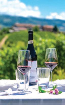
Wine
Several of the routes pass through well-known wineproducing regions, including the famous Chianti, Brunello, Barolo and Alsace hills, with opportunities for wine tasting along the route.
If you are particularly interested in wine you may like to consider...
• Classic Alsace
• Provence
• Sintra & Portuguese Coast
• Barolo & Langhe Hills
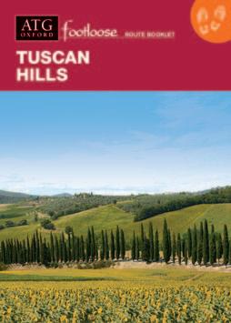
• Tuscan Hills
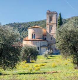
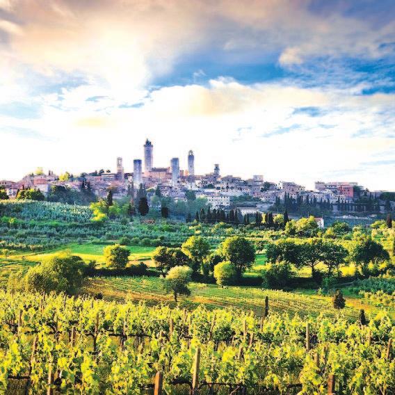
• Tuscany & Siena
• Siena to Florence
• Florence to Volterra
• Southern Tuscany
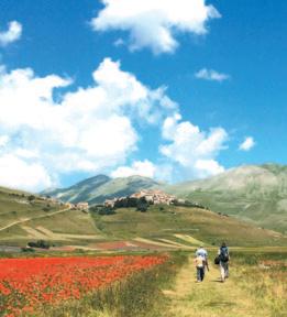
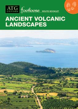
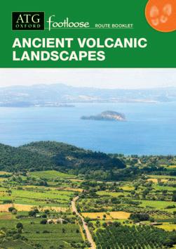
• Ancient Volcanic Landscapes
• Unknown Tuscany
• Roman Roads to Orvieto
• Southern Lakes
• Umbria & Assisi
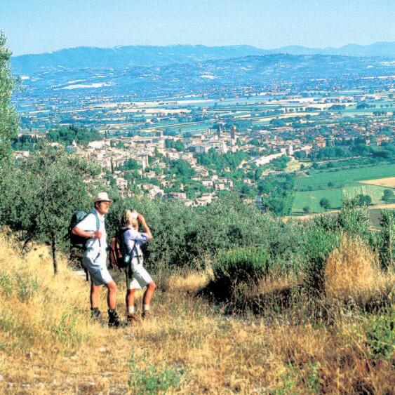
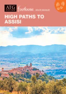
• High Paths to Assisi
Renowned wine regions
PHOTO: MICHELA THOMANN
Some Questions Answered
5 days or 8 days? 5-day, 4-night trips will give you at least 3 full days of walking – and a worthwhile journey on foot of perhaps 25-30 miles. 8 days will provide a more relaxed and perhaps more fulfilling experience and usually 6 days and 50-70 miles of walking. By linking Footloose itineraries you can keep walking continuously along ATG researched paths for over 200 miles – with a total, on all routes offered, of over 1,500 miles to look forward to!
Are the walks graded according to difficulty? Yes, although with assistance from the Route Manager you can walk as much or as little as you like.
• Grade 2: walking along well established paths and tracks. Occasional loose (gravel) surfaces. Ascents/descents up to 1 hour.
• Grade 3: walking along a variety of paths and tracks. Occasional uneven areas. Ascents/descents 1-2 hours.
• Grade 4: walking along varied paths and surfaces, occasionally challenging, with ascents/descents of 2-3 hours.
Standard or Superior Hotels? All hotels used by ATG have been carefully selected, and all are conveniently situated for travellers on foot – and are named and listed with their *rating. If there is not a choice of hotels, where possible upgraded rooms are reserved for those selecting the ‘Superior’ option.
What about lunch and dinner? There are suggestions in the Route Book about where to buy provisions for a picnic lunch, as well as restaurant recommendations and information about local cuisine, particular specialities and local wines. On most evenings there is a choice of places at which to eat, and in more remote areas a good menu selection. The Route Manager will be pleased to make restaurant reservations for you.
What about dietary restrictions? The Route Manager will be pleased to help.
What about on-line ‘Tracking Security’? Your Route Manager will be pleased to discuss this and has been trained to provide this as required.
Will it be too hot? Up-dating and training all those who work with ATG on managing every aspect of the possible effects of Climate Change on ATG clients and their trips has been a priority for many years. Your Route Manager will always be available to provide solutions ensuring that you enjoy your trip – whatever the weather!
What about bringing children? Children are very welcome. Footloose is not only an ideal introduction to real travel, but it also encompasses many of the transitional values and practicalities required to reverse the process of Global Warming. Most children over the age of 10 can manage the walking and enjoy the adventure of a journey on foot. Give them the Route Book and let them guide you!
What about discounts? Persons under the age of 18 are eligible for a 20% discount on the basic cost (excluding single rooms) of any Footloose trip.
And what about Climate Change? ATG was founded on principles of Conservation and Sustainable Development, and is an internationally recognised pioneer of Environmental Best Practice in tourism. All trips are designed to have minimal Environmental impact, and all trips exceed ‘Net-Zero’ criteria.
ALL TRIPS ‘NET ZERO’
From 2024 all ATG trips will have Net-Zero greenhouse gas emissions.
What is ‘Net Zero’?
Net Zero refers to a state in which the greenhouse gases going into the atmosphere are balanced by removal out of the atmosphere – for example by planting trees to absorb CO2 produced.
So how does it work?
Exact calculation of each individual client’s greenhouse gas emissions whilst travelling with ATG is an almost impossible task…. However, as an integral part of its Environmental Management System (EMS), certified annually by ISO14001, ATG has been meticulously measuring and recording its environmental impacts, including greenhouse gas emissions, so has 20 years of data from which to calculate the average environmental impact of each client.
ATG, founded on principles of Conservation and Sustainable Development, has had over 40 years to ensure that all trips have very low environmental impact… so the Net-Zero contribution is relatively small – about £14 per client.
What does this contingency contribution ‘cover’?
As a contingency it makes provisions for any future event or circumstance which is possible but cannot be predicted with certainty. It has been calculated to cover:
• All European road, rail and air travel directly relating to ATG trips… whether sourced and purchased independently or through ATG (e.g. all flights, trains, taxis etc.)
• All other ‘consumption emissions’ – i.e. greenhouse emissions accrued in connection with the production and distribution of purchases made or services used, that relate directly to ATG itineraries – including use of light, heating, air-con, hotel laundry, or food and wine etc.
• ATG trips outside Europe – as above with flight emissions measured from London (return).
What happens to the contributions?
Funds will be allocated to specific ‘Gold Standard’ -certified and other bonafide ‘Net-Zero’ projects and the results published.
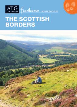
Scottish Borders
Day 1 • Arrive in Kelso
Arrive in the market town of Kelso, with its impressive abbey and nearby Floors Castle. Kelso sits at the confluence of the Tweed and Teviot Rivers.
HHH Cross Keys Hotel
Day 2 • Kelso to Jedburgh (Day 1 – Arrive Jedburgh)*
Walk southwest across the original stone bridge over the River Tweed, out of town onto the banks of the River Teviot, and along former railway tracks to an uphill stretch of Dere Street, before descending into Jedburgh. An easy walk between two historic Borders abbey towns (13.4 miles, 6.5 hrs).
HHHH Allerton House
Day 3 • Jedburgh to Denholm
After an exploration of the abbey and Mary Queen of Scots’ House, climb up steadily over farm and woodland tracks leading down past the hamlet of Bedrule and on to Denholm, with fine views across the surrounding hillsides (8.1 miles, 4 hrs).
HHHHH Auld Cross Keys Inn
Day 4 • Denholm to Dryburgh (Day 2 – Jedburgh to Dryburgh)
After a short transfer by road, head north, following a stretch of Dere Street – the Roman Road between York and Scotland, along farm tracks and winding Tweed riverside paths to Dryburgh. Wonderful views (10.1 miles, 6 hrs).
HHHH Dryburgh Abbey Hotel
Day 5 (3) • Dryburgh to Melrose
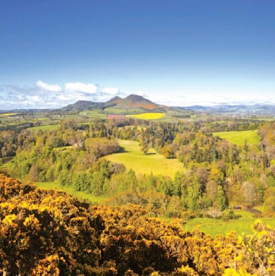
Walk up to the viewpoint, beloved of Sir Walter Scott, before descending to the Victorian viaduct at Leaderfoot, where three bridges converge. Then walk up to the viewpoints over the former Roman settlement at Trimontium, before following paths to the foot of the Eildon Hills. Walk around the northern flanks of the hills and down to Melrose, with its magnificent abbey (7.5 miles, 4 hrs).
HHH Townhouse Hotel
Day 6 (4) • Melrose to Selkirk
Take a riverside walk before visiting Sir Walter Scott’s baronial mansion at Abbotsford. A steady long climb over paths and farm tracks and a section of ancient drove road lead down into Selkirk, where the courthouse used by Sir Walter Scott can be found near the town square (11.6 miles, 6 hrs). Optional, picturesque walk along the River Ettrick to salmon jumping viewing station (4.1 miles, 2 hrs).
HHHH Philipburn Country House
Day 7 • Selkirk to Galashiels
A steady, steeper climb up through the Philiphaugh Estate leads to the Three Brethren cairns, with outstanding views over the surrounding countryside. The route descends to Yair Bridge, then rises again to the hills above Galashiels, leading around the perimeter of the town with views across the valley (10 miles, 5 hrs).
HHH Kingsknowes Hotel
Day 8 (5) • Departure day
*Days in brackets refer to 5-day itinerary
Route open: April-October
Airport to first hotel: u Edinburgh (51 miles)
Train/bus: 2.5 hrs - ~£25 Taxi: 1 hr 15 - ~£170
Train from London: u Kings Cross to Berwickupon-Tweed, then bus, 4.5-5 hrs, from £75
Route Manager: ATG-trained, lives locally and speaks fluent English.
Route Book: 117 pages – detailed walking directions, maps, comprehensive local and background information.
Walking: Moderate (Grade 3). See p.8.
Terrain: Riverside and hillside paths; farm, forest, and woodland tracks. Hill climbs range from 150m to 450m.
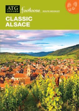
Classic Alsace
Day 1 (1)* • Arrive in Obernai –
Picturesque small town with delightful main square. Option to pre-extend for a circular walk through the wooded hills of the Vosges to the monastery of Mont St. Odile, with panoramic views across the Rhine Valley (8.1 or 15.2 miles, 4 or 8 hrs).
HHHH Le Colombier (std) HHHH A La Cour d’Alsace (sup)
Day 2 • Barr to Itterswiller (2) Barr to Scherwiller
After a short train ride to Barr, a centre of wine-making, quiet lanes lead through vineyards via the picturesque village of Mittelbergheim with its Renaissance houses; then continue up into the hills to two dramatically situated ruined châteaux. Continue via the flower-filled village of Andlau, to Itterswiller, set amongst vineyards in a small valley (5.2 or 8.5 miles, 2.5 or 4 hrs).
HHH Hôtel Arnold (std & sup 8-day only)
Day 3 • Itterswiller to Scherwiller
Paths through colourful villages, vineyards and across forested hills of the Vosges lead to the picturesque, walled village of Dambach-la-Ville, before reaching the village of Scherwiller (6.8 or 10.9 miles, 3.5 or 5.5 hrs).
HHH Auberge Ramstein (std & sup rooms)
Day 4 (3) • Scherwiller to St Hippolyte
Paths through woods and vineyards lead along the edge of the hills, or via the Castle of Koenigsbourg, to the delightful village of St Hippolyte (5.9 or 10.5 miles, 3 or 5.5 hrs).
HHH Hostellerie Munsch (std) HHHH Hôtel Le Parc (sup)
Day 5 (4) • St Hippolyte to Riquewihr
Paths through forested hills lead to Ribeauvillé, famous for its Traminer and Riesling wines. Continue to the picturesque village of Riquewihr, with its perfectly preserved medieval houses (9.4 or 12.5 miles, 4.5 or 7 hrs).
HHH La Couronne (std) HHH Le Schoenenbourg (sup)
Day 6 • Riquewihr to Lapoutroie
Quiet lanes lead up through woods to a ridge, before descending to Lapoutroie. A longer walk continues around the edge of a wide ‘bowl’ – the Orbey Valley, noted for its scenery, then descends to the village of Le Bonhomme before continuing to Lapoutroie (11.7 or 17.8 miles, 6.5 or 9.5 hrs).
HH Le Faudé (std & sup)
Day 7 • Lapoutroie to Kaysersberg
Two very scenic options lead up, via mountain pastures, woods and low hills, before descending via vineyards to the delightful town of Kaysersberg (10 or 18.8 miles, 5 or 9 hrs).
HHH Hôtel les Remparts (std) HHHHH Le Chambard (sup)
Day 8 (5) • Departure day Or, extend for plenty of further walking options around Kaysersberg.
Long route
*Days in brackets refer to 5-day itinerary
Terrain: Tracks through vineyards, forests, high hills and meadows. Quiet lanes through picturesque villages and pilgrimage routes. ..... 5-day route
Route open: April-Oct
Airport to first hotel: u Strasbourg (15 miles)
Train: 20 mins - ~€5
Taxi: 25 mins - ~€60 u Basel-Mulhouse (66 miles)
Train/bus: 2.5 hrs - ~€25 Taxi: 1 hr - ~€250
Train from London u St Pancras to Obernai 6.5 hrs - from £120
Route Manager: ATG-trained, lives locally and speaks fluent English, French, Spanish and conversational Japanese.
Route Book: 157 pages – detailed walking directions, maps, comprehensive local and background information.
Walking: Moderate to challenging (Grade 2+ – 4). See p.8.
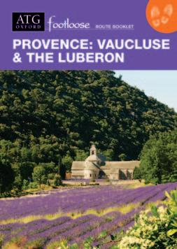
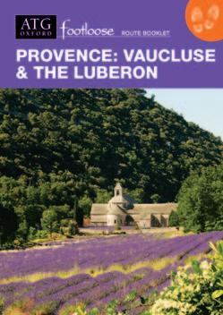
Provence: Vaucluse & the Luberon
Day 1 • Arrive in Fontaine-de-Vaucluse
Visit the village where the Italian poet Petrarch lived from 1337–1353 and composed 366 poems to ‘Laura’; the small Romanesque church; and the world-famous resurgent spring.
HHH Hôtel du Poète (std & sup rooms)
Day 2 • Fontaine-de-Vaucluse to Gordes
Paths lead up through a dry limestone gorge, onto the plateau of the Vaucluse, through pine woods and stonewalled meadows, before descending to the 12C Cistercian Abbey of Sénanque. Set in a quiet valley amongst lavender fields, the abbey retains all its original 12C buildings. A path then leads up to Gordes (10 miles, 5 hrs). Alternative gentler option (6.2 miles, 3 hrs).
HHHH Le Jas de Gordes (std) HHHHH Les Bories (sup)
Day 3 • Free day in Gordes (Day 1 – Arrive Gordes)*
Explore the picturesque village of Gordes with old houses rising in tiers from the valley, and its Renaissance château with very fine chimneypiece. Optional walk to a village of restored bories (stone huts), grouped around a communal bread oven (5.3 miles, 2.5 hrs).
HHHH Le Jas de Gordes (std) HHHHH Les Bories (sup)
Day 4 (2) • Gordes to Roussillon
Walk down through the old streets of Gordes and through olive groves, to a valley with fields of wheat, lavender and poppies (!) to Roussillon. Explore the village set high on a rocky outcrop, with its ochre-coloured houses along the picturesque streets (6–7.3 miles, 3–3.5 hrs).
HHH Omma, Le Clos de la Glycine
Day 5 (3) • Roussillon to Bonnieux
Follow paths and farm tracks down the valley to a Roman bridge, then through meadows and olive groves, up towards the col between the Grand Luberon and Petit Luberon ‘mountains’, and the medieval village of Bonnieux, its houses rising on terraces to its 12C parish church surrounded by cedar trees (9.3 miles, 4.5–5 hrs).
HHHH La Bastide de Capelongue
Day 6 (4) • Bonnieux to Lourmarin
From the valley walk through woods and high meadows to the ridge of the Grand Luberon, with views across the Vaucluse to Mont Ventoux and across southern Provence to the sea. An optional route then diverts to the panoramic summit of Mourre Nègre, highest point of the Luberon. Descend through maquis scrub to the village of Vaugines (setting for Jean de Florette) before following a wide farm track towards Lourmarin. Explore the village, dominated by its château, set high on a rock bluff (12.4 miles, 7 hrs or 19.6 miles, 10 hrs).
HHHH Le Moulin de Lourmarin
Day 7 (5) • Departure day
*Days in brackets refer to 5-day itinerary
Route open: March-June; Sept-Nov
Airports to first hotel:
u Marseille (43 miles)
Train/bus: 2 hrs - ~€22
Taxi: 1 hr - ~€155
u Avignon (15 miles)
Taxi: 35 mins - ~€75 Via Avignon TGV
Route Manager: ATG-trained, lives locally and speaks fluent English and French.
Route Book: 111 pages – detailed walking directions, maps, comprehensive local and background information.
Walking: Easy to moderate (Grade 2 – 3). See p.8.
Terrain: Paths over hills stony and dry underfoot. In valleys: wood and farmland tracks; open country paths; asphalt lanes.
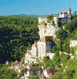
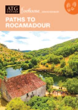
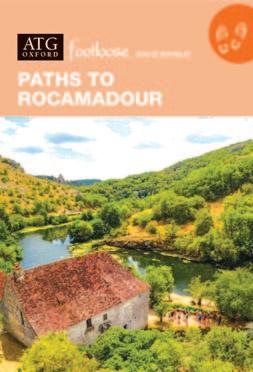
Paths to Rocamadour
Day 1 • Arrive in Sarlat-la-Canéda
Explore this attractive market town in the heart of Périgord Noir, with its narrow medieval and Renaissance streets. Sarlat has the highest concentration of historical monuments in all of France.
NB Market days: Wednesdays and Saturdays.
HHH Hôtel Renoir (std) HHHH Plaza Madeleine (sup)
Day 2 • Sarlat-la-Canéda to Carsac-Aillac
Walk from the valley up into low hills with fertile farmland, before descending to the Dordogne Valley (sup. 11.3 miles, 5.5 hrs; std. 9.3 miles, 5 hrs).
Domaine Lacoste (std) HHHH Villa Romaine (sup)
Day 3 • Carsac-Aillac to Rouffillac
Paths and tracks along the valley bring us to Rouffillac on the river Dordogne (sup. 6 miles, std. 5.3 miles (3 hrs); or via the Château de Fénelon (sup. 10 miles; std. 10.7 miles, 5.5 hrs).
HH Hôtel Le Rouffillac
Day 4 • Rouffillac to Souillac (Day 1 – Arrive Souillac)*
Paths across the hills, with farm and woodland tracks, and views of the Dordogne Valley bring us to the market town of Souillac, where we stay in the old town, close to the fine 11-12th century Benedictine Abbey church (10.3–11.2 miles, 5–6 hrs).
HHH Le Pavillon Saint Martin
Day 5 (2) • Souillac to Lacave
Paths through farmland and woods lead across low hills, then back down to the Dordogne river and at its confluence with the river Ouysse, the small village of Lacave with its impressive cave system – visited on a small electric train (7.3 miles, 3.5 hrs).
HHHH Le Pont de l’Ouysse (with MichelinH restaurant)
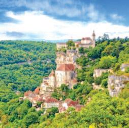
Day 6 (3) • Lacave to Rocamadour
Following the resurgent river Ouysse, good paths and tracks lead through dramatic limestone gorges and the causse of Quercy – as birds of prey wheel high overhead, to historic, cliff-side Rocamadour (8.4 miles, 4 hrs).
HH Le Terminus des Pèlerins (std)
HHH Le Beau Site (sup)
Day 7 (4) • Free day in Rocamadour
Time to visit the medieval monastic complex high on the cliff, its churches and sanctuary with its famous Black Madonna. Optional circular walk along wooded paths and tracks across hills of the causse to the Moulin du Saut, returning through the valley of the Gorge d'Alzou (9 miles, 4.5 hrs).
u Brive-la-Vallée (25 miles) Taxi: 50 mins - ~€150
u Paris: TGV to Souillac + taxi: 6 hrs, from ~€90
Route Manager: ATG-trained, lives locally and speaks fluent English, French and Swiss German.
Route Book: 107 pages – detailed measured directions, maps marked with the route, GPS and extensive background and local information
Walking: Easy to moderate (Grade 2 – 3). See p.8.
Terrain: Low hills with valley views, limestone gorges, farm and woodland paths and tracks, a section of disused rail track, quiet country lanes and gravel roads.
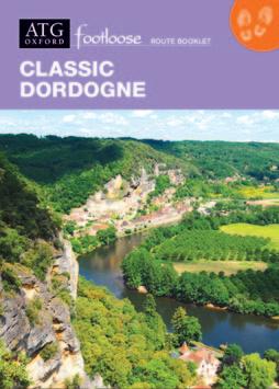
Classic Dordogne
Day 1
• Arrive in Sarlat-la-Canéda
Explore this attractive market town in the heart of Périgord Noir, with its narrow medieval and Renaissance streets. Sarlat has the highest concentration of historical monuments in all of France.
NB Market days: Wednesdays and Saturdays.
HHH Hôtel Renoir (std) HHHH Plaza Madeleine (sup)
Day 2 • Sarlat-la-Canéda to Carsac-Aillac
Walk from the valley up into low hills with fertile farmland, before descending to the Dordogne Valley (standard: 9 miles, 5 hrs / superior: 11.3 miles, 5.5 hrs).
Domaine Lacoste (std) HHHH Villa Romaine (sup)
Day 3 • Carsac-Aillac to Domme (Day 1 – Arrive Domme)*
Forest paths lead to a wonderful cliff-top viewpoint and past a Gallo-Roman rock chapel, before ascending to the walled bastide town of Domme, overlooking the Dordogne Valley (std: 10 miles, 5 hrs / sup: 9.7 miles, 5 hrs). Alternative route via woods and farmland tracks up to a plateau with wide views, and on to Domme (std: 8.1 miles, 4.5 hrs / sup: 7.9 miles, 4 hrs).
HHH L’Esplanade
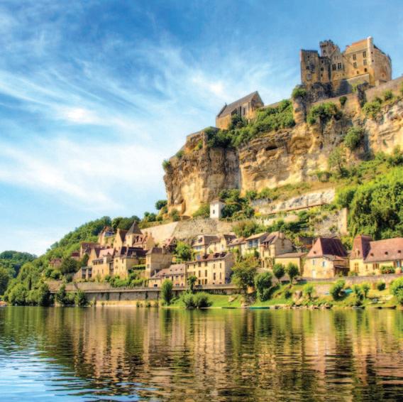
Day 4 (2) • Domme to Beynac
After descending to the valley, paths lead along the river to the impressive castle of Castelnaud (superb view from terrace). Continue up to the delightful gardens of Marqueyssac, then on to the small village of Vézac, and crag-top castle of Beynac (9.1 or 11 miles, 4.5 or 5.5 hrs).
NB: Canoeing options on this day.
HHHH Château de Monrecour
Day 5 (3) • Beynac to Meyrals
A choice of routes lead along the river, then across low hills to the village of Meyrals in a quiet valley. Optional routes via St Cyprien (fine church) or via Château des Milandes, once home of Josephine Baker (9.2, 12.3 or 17.8 miles, 5–9 hrs).
HHH La Ferme Lamy (std & sup rooms)
Day 6 (4) • Meyrals to Les Eyzies-de-Tayac-Sireuil
Paths lead up into hills, then down to the Beune Valley (optional excursion to prehistoric settlement site of Cap Blanc), before continuing through the picturesque village of Sireuil, and then on to Les Eyzies, the ‘world capital of prehistoric art’ (std: 8.1 or 10 miles, 4 or 5 hrs / sup: 8.7 or 10.6 miles, 4.5 or 5.5 hrs).
HHH Moulin de la Beune (std) HHHH Le Centenaire (sup)
Day 7 • Free day in Les Eyzies-de-Tayac-Sireuil
Explore Les Eyzies and its prehistoric museums. Optional walks to visit prehistoric sites (4–17.7 miles).
HHH Moulin de la Beune (std) HHHH Le Centenaire (sup)
Day 8 (5) • Departure day
Or – optional extension to Montignac (11.5 or 19.6 miles, 6 or 10 hrs).
*Days in brackets refer to 5-day itinerary
Route open: March-July; Sept-Oct
Airports
Route Manager: ATG-trained, lives locally and speaks fluent English, French and Swiss German.
Route Book: 131 pages – detailed walking directions, maps, comprehensive local and background information.
Walking: Easy to moderate (Grade 2 – 2+). See p.8.
Terrain: Easy walking paths, with quiet lanes along river valleys and farm tracks over low hills.
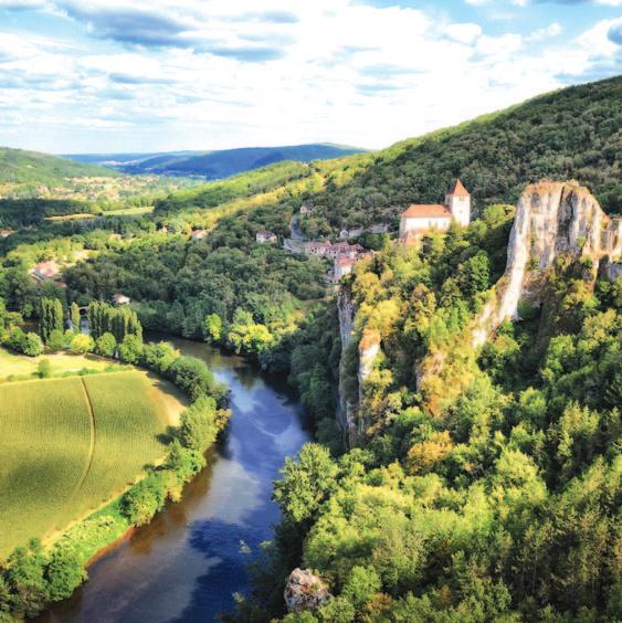
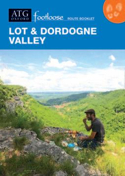
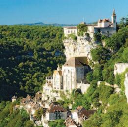
Lot & Dordogne Valley
Day 1 • Arrive in Rocamadour
Majestic, cliff-side medieval pilgrimage site, dramatically perched 120 metres above a canyon. UNESCO World Heritage Site.
HH Le Terminus des Pèlerins (std)
HHH Le Beau Site (sup)
Day 2 • Free day in Rocamadour
A delightful circular walk leading up and along a limestone plateau, through ancient pastures bordered by drystone walls, and past a wonderful lookout point, before returning via the green, fertile valley of the Alzou, with its four ruined watermills (9 miles, 4 hrs).
HH Le Terminus des Pèlerins (std)
HHH Le Beau Site (sup)
Day 3 • Rocamadour to Lacave
Follow the gorge to Lacave with its spectacular, extensive cave system (8.4 miles, 4 hrs). Dinner at the hotel’s MichelinH restaurant.
HHHH Le Pont de l’Ouysse
Day 4 • Lacave to Meyronne
Follow farm tracks up to the village of Mayrinhac, then descend to Meyronne (8.9 or 9.6 miles, 4–4.5 hrs).
HHH La Terrasse (std & sup rooms)
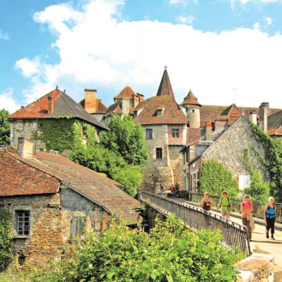
Day 5 • Meyronne to Carennac
Paths lead through farmland and woods above the river before descending to Carennac, a village of traditional stone houses clustered around a medieval priory on the banks of the Dordogne (14.3 miles, 6.5 hrs).
HHH Petite Auberge de Carennac
Day 6 • Carennac to Loubressac
Walk up from the river to Loubressac, a quintessential medieval village with a jumble of pointed tiled roofs, and views of the imposing Château de Castelnau. There is an optional longer route via the Gouffre de Padirac, a 300ft deep chasm, with a boat ride through caves, along an underground river (7.4, 8.9 or 10 miles, 3.5–5 hrs).
HH Le Cantou 354 (std) HHH Relais de Castelnau (sup)
Day 7 • Loubressac to St Céré
Walk along paths overlooking the 'Cirque d’Autoire' –dramatic cliffs of the edge of the causses – to the Château de Montal and St Céré, a bustling medieval market town (7.4, 10.1 or 11.8 miles, 3.5–5.5 hrs).
HHH Les Trois Soleils de Montal (std & sup rooms)
Day 8 • Departure day
Route open: April-July; Sept-Nov
Airports to first hotel: u Brive-la-Vallée (26 miles)
Taxi: 45 mins - ~€140 u Limoges (100 miles)
Taxi & train: 3 hrs - ~€50 u Toulouse (100 miles)
Train/bus: 4.5 hrs - ~€65 u Paris: TGV to Souillac, then taxi: 5 hrs -
Route Manager: ATG-trained, lives locally and speaks fluent English, French and Swiss German.
Route Book: 107 pages – detailed walking directions, maps, comprehensive local and background information.
Walking: Easy to moderate (Grade 2 – 3). See p.8.
Terrain: Quiet country lanes, gravel tracks, woodland and mule paths, and the occasional steep, rocky path.
051015miles
St Céré
Loubressac
Rocamadour
Gouffre de Padirac
Lacave
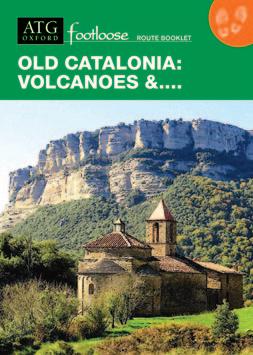
Old Catalonia: Volcanoes &....
Day 1 (1)* • Arrive in Rupit
Situated on a rocky promontory at an altitude of 840m, medieval Rupit's cobbled streets are set in a dramatic landscape of wooded ravines, high meadows and towering cliffs.
HH Hostal Estrella
Day 2 • Free day in Rupit
Optional circular walk from Rupit, visiting the impressive Salt de Sallent waterfall and church of Sant Joan de Fàbregues, one of the best examples of Catalan Romanesque architecture in the area (4.3 miles, 2.5–3 hrs).
HH Hostal Estrella
Day 3 (2) • Rupit to Mas La Serra (via La Salut)
Follow paths along the edge of the Collsacabra escarpment with spectacular views, and continue through open grassy pastures and woodland to the superbly situated Santuari de Nostra Senyora de la Salut. Continue through farmland, meadow and beechwoods with views across the Alta Garrotxa and Pyrenees (10.7 miles, 5-5.5 hrs; low-level: 8 miles, 3.5–4 hrs).
Mas de la Serra
Day 4 (3) • Mas La Serra to Joanetes
Paths lead you across the hills of the Collsacabra, with wide views over the Garrotxa. After visiting the hermitage of Sant Miquel de Castelló perched on a rocky outcrop, descend steeply through woodland into the farmed valley below to the quiet rural hamlet of Joanetes. Optional afternoon walk to the charming village of Els Hostalets d’en Bas (6.3 miles, 3.5 hrs + optional 4.6 miles, 2.5 hrs).
El Ferres
Day 5 (4) • Joanetes to Santa Pau
Paths climb into the richly wooded Natural Park of the Garrotxa Volcanic Zone, passing between dormant volcanoes and through the Fageda d'en Jordà beech forest to the medieval village of Santa Pau, an ancient barony with a castle founded in the 11th century (11.5 miles, 6 hrs).
HHHH Cal Sastre
Day 6 • Free day with optional excursions
Visit the craters of Santa Margarida and Croscat volcanoes, then back along country lanes to Santa Pau (8.3 miles, 4.5 hrs or 5.7 miles, 3 hrs). Or, explore the excellent museums, Art Nouveau architecture and volcanic remains of nearby Olot
HHHH Cal Sastre
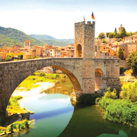
Day 7 • Santa Pau to Besalú Footpaths follow the valley (opportunities for swimming in natural pools), before climbing to a high ridge with views. Then paths across wooded hills and valleys lead to the medieval town of Besalú with its 11th century fortified bridge, Jewish bathhouse and 12th century monastery church (12.7 miles, 6.5–7 hrs).
Route Manager: ATG-trained, lives locally and speaks fluent English, Spanish and Catalan.
Route Book: 111 pages – detailed walking directions, maps, comprehensive local and background information.
Walking: Easy to moderate (Grade 2 – 3). See p.8.
Terrain: Mostly gentle, well-defined tracks across serra and through farmland; forest tracks and country lanes.
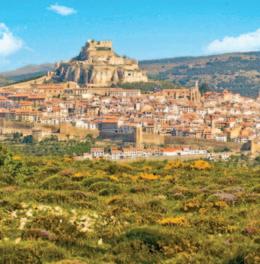
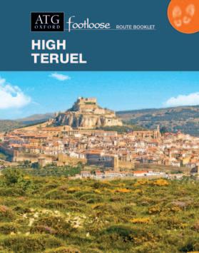
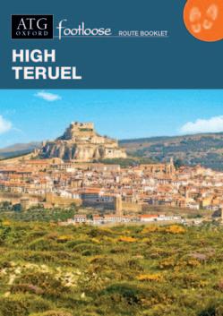
High Teruel
Day 1 • Arrive in Iglesuela del Cid
A small village with finely preserved casas palacios dating from the 16th-18th centuries.
HHHH Palacio Matutano Dauden
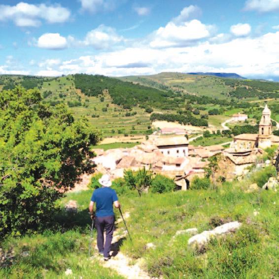
Day 2 • Iglesuela del Cid to Cantavieja
Cross open sierra and stony pastures with wide views to Cantavieja, sited on a high outcrop of rock, its medieval walls enclosing a Baroque church (18th-century), municipal buildings dating from the 15th-century, a medieval castle and a beautiful 14th-century Templar church (6.6 or 12.4 miles, 3.5 or 6.5 hrs).
HHHH Hotel & Spa Balfagón
Day 3 • Cantavieja
Time for exploring Cantavieja, its porticoed Plaza de Cristo Rey and fine views. Optional walk to a panoramic viewpoint (6.4 or 9.6 miles, 4.5 or 6.5 hrs).
HHHH Hotel & Spa Balfagón
Day 4 • Cantavieja to Mirambel
Cross the valley to a hermitage overlooking Cantavieja, and follow a ridge with extensive views through wild, empty country, before descending to the riverside village of Mirambel – a walled Templar town fortified in the 13th-century with five gates, remarkable for their carvings, a fine 17th-century church and 16th-century convent, and two casas palacios (10.1 miles, 6 hrs).
Las Moradas del Temple
Day 5 • Mirambel to Forcall
An ancient path up from Mirambel leads to the tiny village of La Cuba, from where another ascent and paths through scrub forest lead to a pilgrim track with fine views of our destination, Forcall, with its fine plaza mayor and Renaissance porticos with two 16th-century palacios (14.7 miles, 7.5–8 hrs). Brief transfer to your hotel in Todolella.
Hostal El Guerrer
Day 6 • Forcall to Morella
After a short transfer back to Forcall: Paths lead up to the top of one of the most famous muelas in the Alto Maestrazgo, the Garumba, from where we enjoy wonderful views of Morella – which we enter through one of the four medieval gates (10.7 miles, 5–6 hrs).
HHH Hotel Cardenal Ram
Day 7 • Free day in Morella
Morella is enclosed within 1.5 miles of 14th-century walls with 14 towers and four gateways, and dominated by ruins of its 12th-century castle. 14th-century aqueduct; Basilica de Santa María la Mayor (1330) with carved portals; Monastery of San Francisco with fine 13th-century cloister and museum. Optional walk to the picturesque village of Chiva (4.2 miles, 2.5–3 hrs).
HHH Hotel Cardenal Ram
Day 8 • Departure day
Route open: April-June; Sept-Oct
Airports to first hotel: u Castellon (50 miles)
(104 miles)
Route Manager: ATG-trained, lives locally and speaks fluent English and Spanish.
Route Book: 111 pages – detailed walking directions, maps, comprehensive local and background information. Walking: Moderate to challenging (Grade 3 – 4). See p.8.
Terrain: Farm tracks; rocky cart and drove roads; mountainous paths. Low, green table-top hills, with rises and valleys.
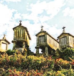
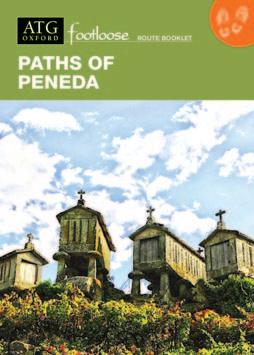
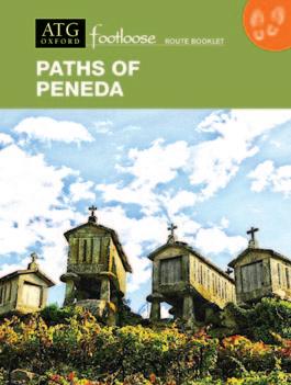
Paths of Peneda
Day 1 (1)* • Arrive in Arcos de Valdevez
Arrive in Arcos de Valdevez. Arcos, with cobbled streets and ornate churches, is picturesquely set on the banks of the River Vez.
HHHH Ribeira Collection Hotel
Day 2 (2) • Arcos de Valdevez to Soajo
Paths through forest, pasture and scrub lead up to the megalithic monuments at Mezio, ‘gateway’ to the Peneda National Park, from where ancient tracks and paths lead down to the delightful village of Soajo. Arcos-Soajo (13.8 miles, 6–7 hrs); Mezio-Soajo (4 miles, 2 hrs).
Casa do Adro
Day 3 • Soajo
Explore Soajo’s quaint alleys, admire espigueiros (granite grain stores) and walk through terraces and valleys around the village (3.4 miles, 2 hrs). Alternatively, transfer by taxi to old Lindoso with its castle and 53 espigueiros, before crossing the Alto (high) Lindoso Dam and following the Lima Valley to an ancient bridge and natural pools below Soajo (7.1 miles, 4 hrs).
Casa do Adro
Day 4 (3) • Soajo to Peneda
Increasingly scenic ancient trails lead up to the village of Adrão, then across a ridge (views!) before descending into the Peneda Valley and following the pilgrimage path to the Sanctuary of Nossa Senhora da Peneda (9.8 miles, 5–6 hrs).
HHH Hotel Peneda
Day 5 (4) • Peneda to Castro Laboreiro
Follow gentle paths up the wooded Peneda Valley before climbing over the high serra to descend to the frontier settlement of Castro Laboreiro (9.6 miles, 5–6 hrs). Alternatively, spend the morning exploring the beautiful and dramatic granite highlands above Peneda (6 miles, 3–4 hrs) before transferring by road (taxi) to Lamas de Mouro to complete your onward route over the high serra (4.3 miles, 2.5–3 hrs).
HHH Albergaria Miracastro
Day 6 • Castro Laboreiro
Options to explore the splendid landscapes around Castro Laboreiro: rocky outcrops, moorland and valleys, megalithic monuments, small granite villages, ancient bridges and 13C castle (up to 11.1 miles, 1.5–6.5 hrs).
HHH Albergaria Miracastro
Day 7 • Castro Laboreiro to Melgaço
Old paths link granite villages close to the Spanish border, before an open ridge and well-graded descent with wide views of the Minho Valley and distant Galicia... and Melgaço, with its castle, vineyards and thermal springs... (13.5 miles, 6 hrs – or 9 miles, 4 hrs).
Solar do Castelo
Day 8 (5) • Departure day
*Days in brackets refer to 5-day itinerary
Route open: May-July; Sept-Oct
Airport to first hotel: u Porto (60 miles)
Train/bus: 2 hrs - ~€16
1 hr - ~€120
Route Manager: ATG-trained, lives locally and speaks fluent English, Portuguese, French and conversational Spanish.
Route Book: 157 pages – detailed walking directions, maps, comprehensive local and background information. Walking: Moderate to challenging (Grade 2+ – 4). See p.8
Terrain: Ancient granite paths, gravel roads and tracks.
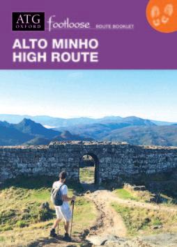
Alto Minho High Route
Day 1 • Arrive in Arcos de Valdevez
Arrive in Arcos de Valdevez, its cobbled streets and ornate churches, picturesquely situated on banks of the River Vez.
HHHH Ribeira Collection
Day 2 • Arcos de Valdevez to Sistelo
Paths follow the River Vez, from its broad calm waters near Arcos, past medieval bridges, to where it becomes a tumbling mountain stream below the green terraced slopes of Sistelo (13.4 miles, 6–7 hrs, or, with a lift from your Route Manager 5.9 miles, 3 hrs).
Traditional village house
Day 3 • Sistelo to Branda da Aveleira
Ancient paved paths linking valley villages, climb steadily through the famous landscapes of Portugal’s ‘Little Tibet’, to high open serra and summer grazing settlements of the branda (7.1 miles, 5–6 hrs).
Traditional branda (renovated traditional summer habitation)
Day 4 • Branda da Aveleira
Paths across the serra offer superb views over the Minho valley into Spain, descending to visit picturesque hamlets before climbing back to the branda (9.6 miles, 5–6 hrs). Or take it easy with a gentle circuit exploring the branda’s immediate landscape (4.3 miles, 2–3 hrs, or 9.5 miles, 5–6 hrs).
Traditional branda
Day 5 • Branda da Aveleira to Peneda
High paths above a rugged glacial valley, source of the River Vez, descend to Sao Bento do Cando with its delightful village square (& bar!), then climb again into the epic granite scenery of the high serra before a final descent to the pilgrim sanctuary of Peneda (9.1 miles, 5 hrs). A shorter option visits a megalithic tomb before also climbing into the serra (5.3 miles, 3 hrs).
HHH Hotel Peneda
Day 6 • Peneda to Aldeia de Pontes
Wooded paths up the Peneda valley then ascend to the highest serra, with panoramic views and a wild landscape. Descend through ancient inverneiras (winter hamlets) and past historic stone bridges to reach picture-perfect Pontes (7.7 miles, 5 hrs).
Traditional village house
Day 7 • Aldeia de Pontes to Castro Laboreiro
Paths follow the Laboreiro river valley, crossing a Roman bridge and passing pools and cascades to reach Castro Laboreiro and its crag-top castle (5.4 miles, 3–4 hrs). A longer option leaves the valley to pass the extraordinary Duck Beak Rock and explore Castro’s higher, summer settlements (9.9 miles, 5–6 hrs).
HHH Albergaria Miracastro
Day 8 • Departure day
Or, extension to delightful Melgaço, with its castle, vineyards and thermal spring (13.5 or 9 miles).
Route open: May-July; Sept-Oct
Airport to first hotel: u Porto (60 miles)
Train/bus: 2 hrs - ~€16 Taxi: 1 hr - ~€120
Route Manager: ATG-trained, lives locally and speaks fluent English, Portuguese, French and conversational Spanish.
Route Book: Detailed walking instructions, marked maps and comprehensive local and background information. GPS also provided
Walking: Moderate to challenging (Grade 3+ – 4). See p.8.
Terrain: An impressive granite landscape with ancient paved paths, forest tracks, gravel roads, walkways along river banks and ways across open mountains.
Arcos de ValdevezSistelo
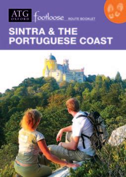
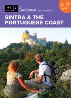
Sintra & the Portuguese Coast
Day 1 • Arrive in Cascais
A fashionable resort with a marina, smart shops, elegant restaurants and one of the best (and cleanest!) surfing beaches in Europe. Optional exploratory walk (2 hrs).
HHH Hotel Baía (std)
HHHHH Hotel Albatroz (sup)
Day 2 • Cascais to Guincho
A 'promenade' walk along the coast, past lighthouses and interesting cliff formations (6.5 miles, 3 hrs); or a 15minute transfer to the start of an 7.8-mile/4 hr walk through the serra and down to Guincho Beach (extensive views!), one of Portugal's best windsurfing locations.
HHHHH Hotel Fortaleza do Guincho (std & sup rooms)
Day 3 • Guincho
to Azóia
Follow coastal paths before heading inland into the Serra de Sintra. Opportunity to visit the interesting Convento dos Capuchos (Capuchin monastery) (+2 hrs), before returning through the Serra up to the spectacularly situated 14th-century Peninha Chapel. Paths then lead down to your hotel near the coast (5.6 or 12.6 miles, 2.5 or 6 hrs).
Quinta Vale da Roca (std & sup rooms)
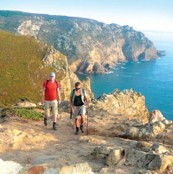
Day 4 • Azóia to Praia Grande
A cliff-top walk with spectacular views leads to Cabo (Cape) da Roca, the most westerly point of Portugal –and mainland Europe. Continue inland through the vineyards of the famous ‘Colares’ wine before returning to the coast and the beach of Praia Grande, with its world-famous swirling waves (7.4 miles, 3.5–4 hrs).
HHHH Hotel Arribas
Day 5 • Praia Grande to Colares
Continue along the coast to the small seaside resort of Azenhas do Mar, with its pretty whitewashed houses perched on a cliff; then past more fine beaches before heading inland to the curious church of São Mamede, ‘protector of the animals’. Minor roads then lead to Colares, famous for its wine (6.7 or 9.6 miles, 3.5 or 5 hrs). Return transfer to Praia Grande.
HHHH Hotel Arribas
Day 6 • Colares to Sintra
After a brief transfer: Follow a Roman road before joining wide forest paths passing through the serra to the ‘Romantic’ Palace of Monserrate, with exotic gardens and follies. Continue through the serra and reach the arch of the old west entrance to Sintra (7.1 miles, 3.5 hrs).
HHHH Sintra Boutique (std) HHHHH Lawrence’s (sup)
Day 7 • Free day in Sintra
Described by Byron as a ‘glorious Eden’, and boasting UNESCO World Heritage status. Optional city walk.
HHHH Sintra Boutique (std) HHHHH Lawrence’s (sup)
Day 8 • Departure day
Route open: March-June; Sept-Oct
Airport to first hotel: u Lisbon (24 miles)
Train/bus: 1.5 hrs - ~€6 Taxi: 35
Route Manager: ATG-trained, lives locally and speaks fluent English, Portuguese and Spanish.
Route Book: 113 pages – detailed walking directions, maps, comprehensive local and background information.
Walking: Easy to moderate (Grade 3). See p.8.
Terrain: Well-established paths along the Atlantic coast, through low hills, vineyards and forest.
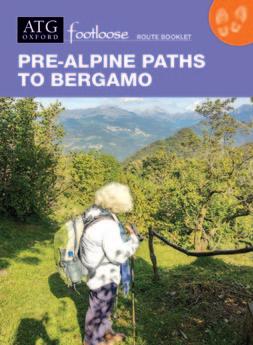
Pre-Alpine Paths to Bergamo
Day 1 (1)* • Arrive in Selvino
Relax at your spa hotel in this modern mountain resort surrounded by 1,000-metre peaks. Optional circular walk to the top of Monte Purito (2.5 miles, 1.5 hrs).
HHH Hotel T’Ami
Day 2 (2) • Selvino to Serina
Woodland paths and the cobbled Via Mercatorum lead over two ridges, passing ancient hamlets, rocks and ferns to medieval Serina, birthplace of Venetian Renaissance artist Palma Vecchio (10.2 miles, 6–6.5 hrs or 7.3 miles, 4.5 hrs).
HHH Hotel Moderno
Day 3 (3) • Serina to Cornello dei Tasso
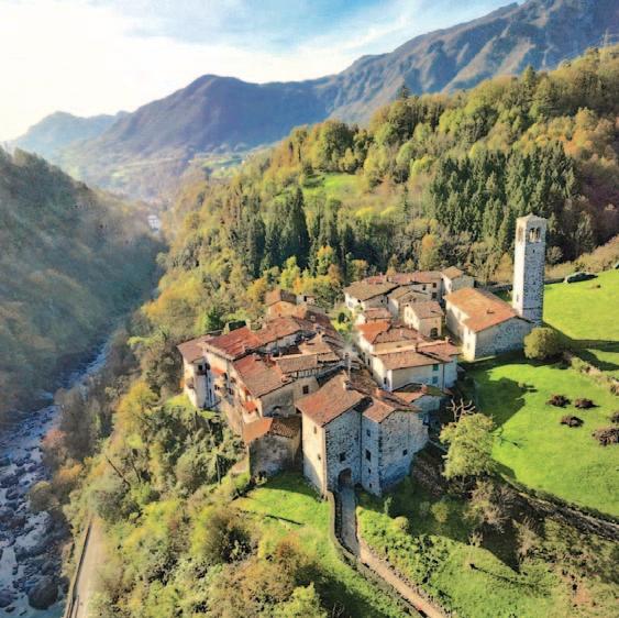
The old merchants’ route crosses a mountain pass to panoramic, frescoed Dossena. Paths lead to mines mapped by Leonardo da Vinci, now used to mature local cheese, before descending to the River Brembo and arcaded Cornello, voted one of Italy’s most beautiful villages (7.2 miles, 4.5 hrs).
B & B La Tana del Tasso
Day 4 (4) • Cornello dei Tasso to San Pellegrino
Quiet lanes, stone steps and a cycle path lead through the arched streets of Oneta, then San Giovanni Bianco with its Holy Thorn, before paths climb a small ridge with views to San Pellegrino. Free afternoon in this famous spa town with its Art Nouveau casino and Liberty-style Grand Hotel, now being restored (5.6 miles, 3 hrs).
HHH Hotel Bigio
Day 5 • San Pellegrino to Zogno & Clanezzo
A cable car takes you to the start of an exhilarating climb on good paths through woods to 1,200-metre meadows, before a steep descent. Or, follow level lanes and tracks past churches, villages and farms. Routes meet in Zogno, before following the river on foot or by bike to Clanezzo (high route 13.9 miles, 8 hrs; low route 10.6 miles, 6 hrs).
HHH Hotel Cascina Belvedi
Day 6 • Clanezzo to Bergamo Alta
Minor lanes pass old Clanezzo port. An optional loop leads to three Romanesque churches before re-joining the trail along a former railway line up to a spectacularly situated sanctuary church. Leafy paths with views then descend to Bergamo Alta (11.6 miles, 6 hrs or 8.6 miles, 4.5 hrs).
Locanda Mimmo (std) HHHH Relais San Vigilio (sup)
Day 7 • Free day in Bergamo Alta
Visit this hilltop, medieval citadel, with its elegant eateries, UNESCO World Heritage Venetian walls, Piazza Vecchia, Santa Maria Maggiore church where composer Donizetti is buried and exceptional art museum (Titian, Bellini, Canaletto, Raphael).
Locanda Mimmo (std) HHHH Relais San Vigilio (sup) Day 8 (5) • Departure Day
*Days in brackets refer to 5-day itinerary
Route open: April-October Airports to first hotel: u Bergamo (16 miles) Bus to rail station, then tram & cable car: 1.5 hrs - ~€14
Taxi: 45 mins - ~€80 u Milan Linate (44 miles) Train + tram, or bus: 3 hrs - ~€24
Taxi: 1 hr 15 - ~€160 u Milan Malpensa (71 miles) Train & tram, or bus: 3.5 hrs - ~€25-€40
Taxi: 1 hr 40 - ~€190
Route Manager: ATG-trained, lives locally and speaks fluent English and Italian.
Route Book: 179 pages – detailed walking directions, maps, comprehensive local and background information.
Walking: Moderate to challenging (Grade 3 – 4). See p.8.
Terrain: Mountain earth and stone paths, woodland tracks, valley lanes and cycle paths, some asphalt.
Zogno
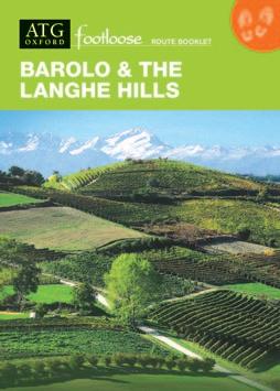
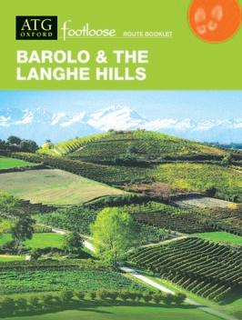
Barolo & the Langhe Hills
Day 1 • Arrive in Mondovì
Founded in 1198, Mondovì overlooks the Maritime and Ligurian Alps, the Langhe Hills and the fertile plains stretching all the way to Turin.
HH Albergo dell’Academia (std & sup rooms)
Day 2 • Ceva to Igliano (San Luigi)
Travel by train to Ceva (15 mins) and walk up to a ridge affording superb views of both the Maritime and Ligurian Alps. Pass farmland and mixed woods before descending into a valley. Ascend along forest tracks to another ridge, the site of an important battle during the French Revolutionary Wars. Pass through fertile fields, then descend to a secluded valley (11.1 miles, 6.5 hrs).
HHHH Le Piemontesine (std & sup rooms)
Day 3 • Igliano to Bossolaschetto (Day 1 – Arrive Bossolaschetto)*
Follow tracks across hills and meadows to the charming medieval village of Murazzano. Then follow a ridge, enjoying superb views of the Alte Langhe, before reaching the ‘Pearl of Le Langhe’, Bossolasco. Continue to the hamlet of Bossolaschetto (13.9 miles, 7.5–8 hrs).
Da Fabiana (std & sup rooms)
Day 4 (2) • Bossolaschetto to Monforte d’Alba
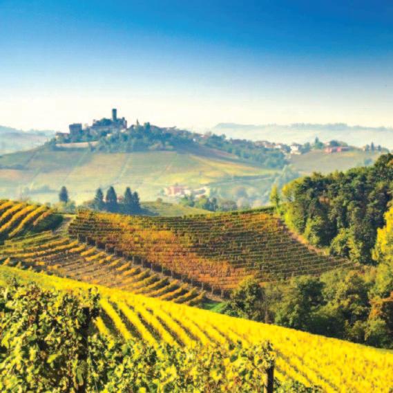
Follow paths across hills, through woodland and meadows, flower-filled in spring and early summer. Emerge amongst vineyards of Nebbiolo (grape variety used for producing Barolo), before arriving at the small bustling ‘wine town’ of Monforte d’Alba (8.2 miles, 5 hrs).
HHH Grappolo d’Oro (std) HHHH Villa Beccaris (sup)
Day 5 • Free day in Monforte d'Alba
Optional walk along the crest of the hills behind Monforte affording wide views of the Barolo vineyards, to Castiglione Falletto. Continue on to Serralunga d’Alba (or up through a scenic valley), before returning to Monforte (9.9, 8.4 or 7.3 miles, 6, 5 or 4.5 hrs).
HHH Grappolo d’Oro (std) HHHH Villa Beccaris (sup)
Day 6 (3) • Monforte d’Alba to La Morra
A ridge route leads down into a wide ‘bowl’ in the hills –covered with some of the area’s most renowned vineyards – to the small town of Barolo, with its wine museum and renowned enoteca. Continue through vineyards up to La Morra, noted for its fine Baroque churches and palaces (5.5 miles, 3.5 hrs).
Blueberry Rooms GUESTHOUSE (std)
HHHH Corte Gondina (sup)
Day 7 (4) • La Morra to Alba
Descend through vineyards to picturesque Verduno, then continue along a ridge to Roddi (5 miles, 2.5 hrs). Then, after a brief transfer to Alba (Europe’s white truffle capital!), optional circular walk (6.5 miles, 4 hrs) in the surrounding vine-clad hills.
HH Albergo San Lorenzo (std)
HHH Casa Dellatorre PRIVATE GUESTHOUSE (sup)
Day 8 (5) • Departure day
*Days in brackets refer to 5-day itinerary
Route open: April-July; Sept-Nov
Airports
Route Manager: ATG-trained, lives locally and speaks fluent English, Italian and Serbo-Croatian.
Route Book: 149 pages – detailed walking directions, maps, comprehensive local and background information.
Walking: Moderate (Grade 3). See p.8.
Terrain: Gentle, rolling hills, with occasional challenging ascents following well-made dirt roads; paths through vineyards; farm and woodland tracks.
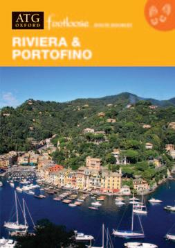
Riviera & Portofino
Day 1 (1)* • Arrive in Sestri Levante
Trompe l’oeil painted houses smile across the Bay of Silence; a bustling pedestrian street, flanked with shops and fine palazzi, leads up onto the ‘Isola’, Sestri’s pinecovered peninsula. Excellent beaches.
HHHH Miramare (std & sup rooms)
Day 2 • Free day in Sestri Levante
Explore Sestri Levante with its picturesque medieval streets and port, tranquil bay and excellent beaches. Optional circular walk (4 miles, 2.5 hrs) or high coastal walk southwards (10.5 miles, 6 hrs).
HHHH Miramare (std & sup rooms)
Day 3 (2) • Sestri Levante to Chiavari
Follow a high, coastal path with fine views, then cross hills to the 12C basilica of San Salvatore dei Fieschi, before continuing to bustling medieval Chiavari with its fine botanic gardens (12.3 miles, 7 hrs).
HHHH Monte Rosa
Day 4 (3) • Chiavari to Rapallo
Paved paths through olive groves and small farms lead past two fine churches before descending to Rapallo (8.3 miles, 4.5 hrs). Alternative high route through remote, wilder country with spectacular views (9.4 miles, 5.5 hrs).
HHHH Tigullio Royal (std & sup rooms)
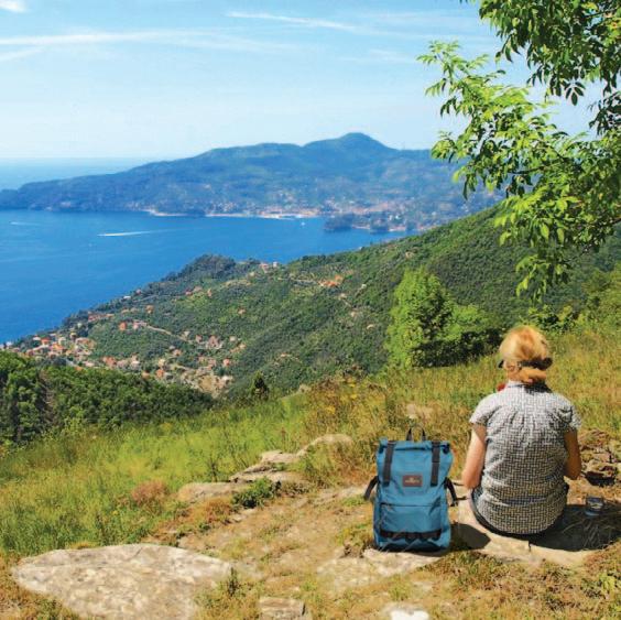
Day 5 (4) • Rapallo to Paraggi/Portofino
Optional cable-car ascent to Montallegro, with pilgrim path descent (2.8 miles, 2.5 hrs). Then, from Rapallo, quiet paths and alleys lead around the bay to Santa Margherita Ligure and on to the tiny cove of Paraggi –Standard hotel (4.8 miles, 3 hrs). Continue via a wooded headland to the delightful village of Portofino – Superior hotel (1.1 miles, 30 mins).
HH Hotel Argentina (std) HHHHH Eight Hotel (sup)
Day 6 • Free day to explore Portofino
Opportunities to explore this famously picturesque resort, where exotic ‘glitterati’ coexist with the local fishing community, and farmers of the terraces and hidden valleys behind the village (3.1 miles, 2.5 hrs).
HH Hotel Argentina (std) HHHHH Eight Hotel (sup)
Day 7 (5) • Paraggi/Portofino to Camogli
Climb past ruined mills to pine-shaded paths with lovely views and down to the 11C monastery of San Fruttuoso. Visit the monastery and swim to view the famous underwater statue Cristo degli Abissi. Ascend through woods and terraces before descending past the church of San Rocco to Camogli (7.6/7.2 miles, 5.5–6 hrs).
HHHH Cenobio Dei Dogi (std & sup rooms)
Day 8 (6) • Departure day
*Days in brackets refer to 6-day itinerary
Route open: April-June; Sept-Oct
Airports to first hotel:
u Genoa (37 miles)
Train: 2 hrs - ~€9
Taxi: 45 mins - ~€120
u Pisa (74 miles)
Train: 2.5 hrs - ~€22
Taxi: 1 hr 15 - ~€220
Route Manager: ATG-trained, lives locally and speaks fluent English, Italian and conversational Chinese.
Route Book: 131 pages – detailed walking directions, maps, comprehensive local and background information.
Walking: Moderate to challenging (Grade 3 – 3+). See p.8.
Terrain: Ancient paths through olive groves and woodland, traversing hillsides above coast. A few steep climbs and ascents.
Recco
Sestri Levante
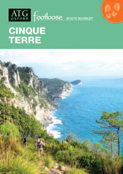
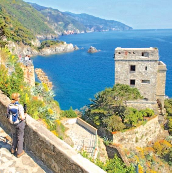
Cinque Terre
Day 1 (1)* • Arrive in Levanto
Originally a Roman town, it now has medieval walls, a 13th-century castle and elegant Neo-Classical buildings from its days of grandeur as a fashionable bathing resort in the 19th century.
HHH Nazionale (std) HHH Palazzo Vannoni (sup)
Day 2 • Free day in Levanto
Optional circular walk in the hills, once the domain of the feared Zolaschi, who controlled the ancient ridge-top trade route (6.4–8.5 miles, 3.5–5 hrs). Walk on to the coastal village of Bonassola (1.5 hrs). Return by train or on foot.
HHH Nazionale (std) HHH Palazzo Vannoni (sup)
Day 3 (2) • Levanto to Monterosso
Superb coastal path, through pine woods and scented scrub, with views of the whole Cinque Terre. A stepped path leads down to Monterosso, with medieval centre, castle and Capuchin convent (5.8 or 9.5 miles, 3 or 6 hrs).
HHH Villa Steno (std) HHHH Porto Roca (sup)
Day 4 • Free day in the area
A steady climb up a cobbled path brings you to a ridge with wonderful views – both inland and seaward, leading to the sanctuary of Madonna di Reggio, from where a fine pilgrim path leads gently down to Vernazza, the former Roman port of 'Vulnetia' (7.5 miles, 5 hrs). Return along the coast by train, boat or on foot.
HHH Villa Steno (std) HHHH Porto Roca (sup)
Day 5 (3) • Monterosso to Riomaggiore
Follow paths along the coast, with views of the famously picturesque villages of the Cinque Terre, and their terraced vineyards. Range of routes (up to 14.6 miles, 8 hrs).
NB: Some coastal sections of this day's options may be crowded or closed, particularly in high season, but there are delightful alternatives.
HH Villa Argentina
Day 6 (4) • Riomaggiore to Portovenere
Up through terraced vineyards to the wooded ridge, via the sanctuary church of Montenero, then through pine, chestnut woods and scrub, before emerging to views of the dramatic coastline and descending to Portovenere (8.7 miles, 5.5 hrs).
HHH Albergo Paradiso (std)
HHHHH Grand Hotel Portovenere (sup)
Day 7 • Free day in Portovenere
Explore Portovenere or take a boat to the island of Palmaria, with picturesque paths and beaches for swimming (3 miles, 2.5 hrs).
HHH Albergo Paradiso (std)
HHHHH Grand Hotel Portovenere (sup)
Day 8 (5) • Departure day
*Days in brackets refer to 5-day itinerary
Italy
Route open: April-June; Sept-Nov
Airports
Route Manager: ATG-trained, lives locally and speaks fluent English, Italian and conversational Chinese.
Route Book: 127 pages – detailed walking directions, maps, comprehensive local and background information.
Walking: Easy to challenging (Grade 2 – 4+). See p.8.
Terrain: Paths mostly ancient but well-preserved, though steep, narrow and rough in places. A variety of options to suit a wide range of fitness levels.
Longer/higher route
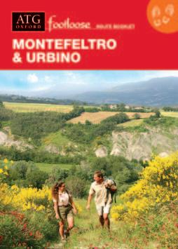
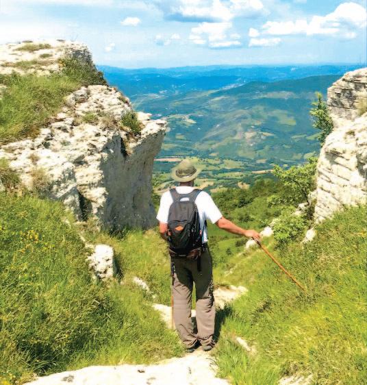
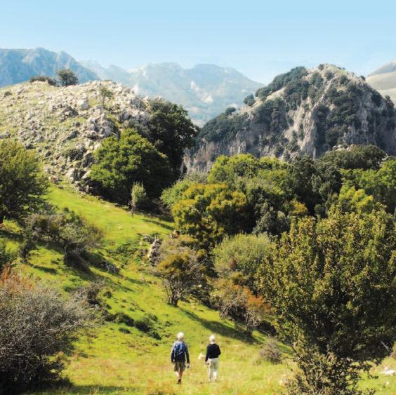
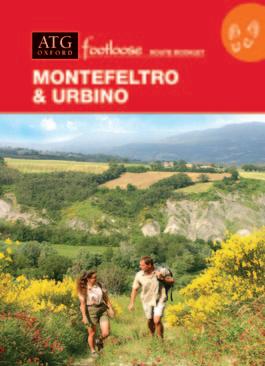
Montefeltro & Urbino
Day 1 • Arrive in San Leo
A scenic walk from the valley, along strade bianche leads up to the dramatically situated fortified medieval village of San Leo, with its 9th-century proto-Romanesque Pieve, 12th-century Romanesque ‘cathedral’ and impressive castle (2.9 or 5.3 miles, 1.5 or 3 hrs). NB: taxi driver can drop you at the start of the optional walk en route to San Leo and take your luggage on to the first hotel.
San Leo Albergo Diffuso
Day 2 • San Leo to Pennabilli
Small lanes and tracks through farmland and woods with fine views over the Marecchia Valley lead to Pennabilli, a delightful village in a picturesque setting at the heart of a national park, with charming historical centre, wonderful viewpoints, and MichelinH restaurant (11.8 miles, 6.5 hrs).
HHHH Hotel Il Duca del Montefeltro
Day 3 • Pennabilli to Locanda Le Querce (Near Frontino)
Farm tracks through woods and pastures ascend towards high meadows on top of Monte Carpegna (4,634ft), with spectacular views, before descending through pine woods to the village of Carpegna, and on to your hotel in countryside setting (12.6 miles, 7 hrs).
Country House ‘Locanda Le Querce’
Day 4 • Locanda Le Querce to Piandimeleto
From farmhouse Le Querce, tracks lead towards the fortified medieval village of Frontino and onto the Monastery of Montefiorentino, with its cloister and Madonna by Giovanni Santi, father of Raphael. Then, farm and forest tracks descend to the small town of Piandimeleto, distinguished by its fine castle complex (10.3 miles, 5 hrs).
HH Hotel Ester
Day 5 • Piandimeleto to Urbania
Follow farm tracks up into the hills, enjoying panoramic views. Beyond a ridge (1,602ft) follow tracks and small gravel lanes through open farmland and down to Urbania (917ft) (12.3 miles, 6 hrs).
La Caputa
Day 6 • Urbania to Urbino
Visit Urbania, its arcaded streets, fine 15th-century Ducal Palace, ceramics museum and many interesting churches. Then quiet gravel lanes lead across hills, past farms and isolated churches, to Urbino (1,575ft) (12.6 miles, 6.5 hrs).
HHH Hotel Italia (std) HHHH San Domenico (sup)
Day 7 • Free day in Urbino
Visit the superb palace built by Duke Federico da Montefeltro, with paintings by Piero della Francesca, Raphael, Paolo Uccello, etc.
HHH Hotel Italia (std)
HHHH San Domenico (sup)
Day 8 • Departure day
Italy
Route open: April-Oct Airports
Route Manager: ATG-trained, lives locally and speaks fluent English and Italian.
Route Book: 111 pages – detailed walking directions, maps, comprehensive local and background information.
Walking: Moderate to challenging (Grade 3 – 4). See p.8.
Terrain: Walking on small gravel roads, grassy meadow paths, and woodland/farm tracks along ridges with superb views.
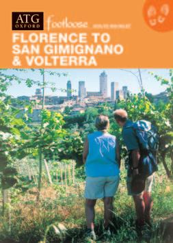
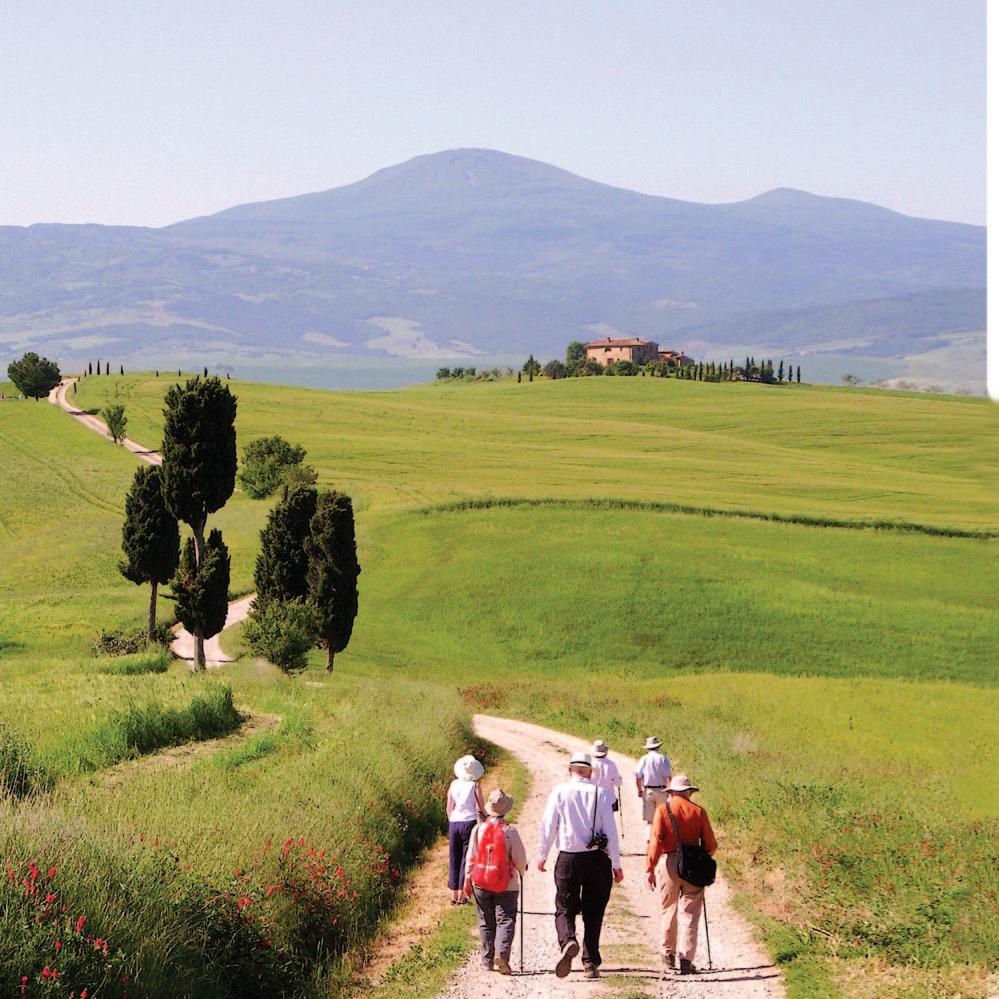
Florence to San Gimignano & Volterra
Day 1 (1)* • Arrive in Florence World-Class sightseeing (& shopping!).
HHH Hotel Silla (std) HHHH Degli Orafi (sup)
If you would prefer to start at San Casciano in Val di Pesa, a taxi from Florence airport takes 25 minutes and costs €50-€60. Regular buses between San Casciano and central Florence take 25 mins and cost €2-€4.
Day 2 (2) • Florence to San Casciano in Val di Pesa
From the Ponte Vecchio, follow roads and ancient lanes to La Certosa, the Cistercian monastery at Galluzzo, from where quiet lanes lead up through vineyards and olive groves to medieval San Casciano, with churches and museums containing 14C works by Ambrogio Lorenzetti and Simone Martini (14.7 or 11 miles, 8 or 5.5 hrs).
B&B Art (std) HHHH Villa Il Fedino (sup)
Day 3 (3) • San Casciano in Val di Pesa to San Pancrazio
Paths lead down into the fertile Pesa Valley, then up through olive groves and vineyards (6.3 miles, 3 hrs).
From the wine estate where you stay it is a 10-minute walk to the 9th-century Pieve di San Pancrazio.
Agriturismo Tenuta Il Corno
Day 4 (4) • San Pancrazio to Certaldo
Paths with some inspiring panoramic views lead across picturesque hills and valleys to the Elsa Valley and the small, walled medieval hill town of Certaldo, with its fine brick ramparts, and house of Giovanni Boccaccio, where in 1349 he wrote The Decameron (11.6 miles, 6.5 hrs).
HH Albergo Il Castello (std & sup rooms)
Day 5 (5) • Certaldo to San Gimignano
Strade bianche lined with cypress trees and paths through vineyards, olive groves and woods lead to San Gimignano, ‘the medieval Manhattan’ (10 miles, 5 hrs).
HHH Leon Bianco (std & sup rooms)
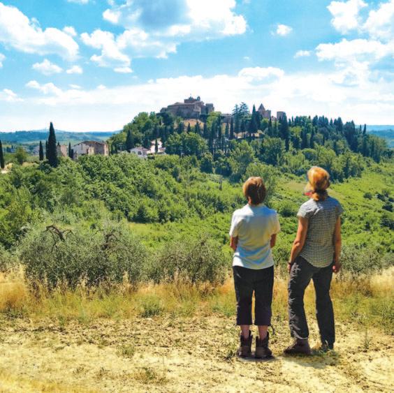
Day 6 • San Gimignano to Volterra
Paths lead down across a valley and then through forest before climbing to a ridge with views to Volterra. After following a strada bianca down into the Era Valley, an ancient path leads up (and up!) to the great Etruscan city of Volterra (16 or 12.1 miles, 9 or 6 hrs).
HHH Hotel Etruria (std) HHHH San Lino (sup)
Day 7 • Volterra
Free day to explore its three miles of Etruscan walls, Etruscan tombs and excellent Etruscan museum, cathedral and medieval town. Optional circular walk (3 miles, 2 hrs).
HHH Hotel Etruria (std) HHHH San Lino (sup)
Day 8 (6) • Departure day
*Days in brackets refer to 6-day itinerary
Route open: April-Jun; Sept-Oct
Airports to first hotel: u Florence (4 miles)
Airport tram: 20 mins - €1.5 Taxi: 20 mins - ~€30 u Pisa (50 miles) Train: 1.5 hrs - ~€15
1
Route Manager: ATG-trained, lives locally and speaks fluent English and Italian.
Route Book: 121 pages – detailed walking directions, maps, comprehensive local and background information.
Walking: Moderate to challenging (Grade 3 – 3+). See p.8.
Terrain: Paths and tracks uphill through vineyards, olive groves and forest. Some gravel roads; some asphalt.
Certaldo 010miles 5
Volterra
San Pancrazio
San Casciano in Val di Pesa Florence
San Gimignano
6-day route
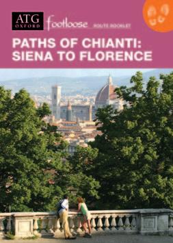
Paths of Chianti: Siena to Florence Italy
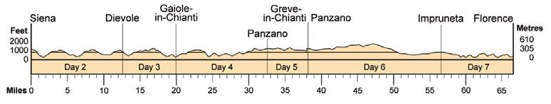
Day 1 • Arrive in Siena
The best-preserved, great medieval city in Europe. Magnificent cathedral, the Piazza del Campo (scene of the Palio horse race), and an abundance of outstanding 14th and 15th-century art and architecture.
HHHH Athena
Day 2 • Siena to Dievole
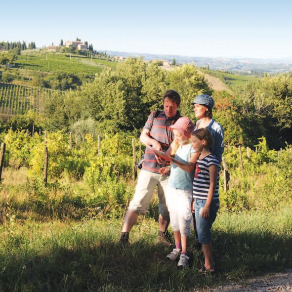
Follow tracks across hills with stone-walled olive groves, oak forest, and world-renowned Chianti Classico vineyards, to Dievole, set amongst its own vineyards (12.7 miles, 6.5 hrs).
HHHH Dievole Wine Resort (std & sup rooms)
Day 3 • Dievole to Gaiole-in-Chianti
Cross a valley to the fortified Romanesque church of San Polo in Rosso, where paths lead to Gaiole-in-Chianti, a centre of Chianti wine production, overlooked by the Castello di Spaltenna and its 11th-century Romanesque church (7.2 miles, 4 hrs).
B&B L’Eroico (std) HHHHH Castello di Spaltenna (sup)
Day 4 • Gaiole-in-Chianti to Panzano
Farm roads (strade bianche) lead to a ridge, from where a track descends to the valley, continuing past stone farmhouses and vineyards to a second ridge with extensive views, and the characteristic medieval hill town of Panzano (12.6 miles, 7 hrs).
HHH Fattoria Valle (std) HHHH Villa Le Barone (sup)
Day 5 • Free day in Panzano
Short optional walk to Greve-in-Chianti, a busy centre of the wine industry, with some fine medieval buildings and arcaded central piazza (5.8 miles, 3 hrs).
HHH Fattoria Valle (std) HHHH Villa Le Barone (sup)
Day 6 • Panzano to Impruneta (via Greve-in-Chianti)
Undulating paths and strade bianche with fine views across vine-filled valleys and castles protecting the rich wine estates. A wooded riverside path then leads to the final climb to Impruneta (18.3 miles, 9.5 hrs). Shorter option: starting from Greve (12.1 miles, 6 hrs).
HHH Bellavista (std) HHHH Relais Villa Olmo (sup)
Day 7 • Impruneta to Florence
Tracks and strade bianche lead through farmland to the outskirts of Florence, before minor roads and pathways for the final two miles emerge at a panoramic view of the city and a descent to the Ponte Vecchio, in the heart of the world’s greatest ‘Art City’ (10 miles, 5.5 hrs).
HHH Hotel Silla (std) HHHH Degli Orafi (sup)
Day 8 • Departure day
Route open: April-Oct
Airports to first hotel:
u Florence (50 miles)
Tram/train: 1.5 hrs - €12
Taxi: 1 hr - ~€160
u Pisa (74 miles)
Train/bus: 2 hrs - ~€17
Taxi: 1.5 hrs - ~€200
Route Manager: ATG-trained, lives locally and speaks fluent English, Italian and Romanian.
Route Book: 121 pages – detailed walking directions, maps, comprehensive local and background information.
Walking: Moderate to challenging (Grade 3 – 3+). See p.8.
Terrain: Paths through vineyards and olive groves; farm and forest paths/tracks; small gravel roads; some asphalt.
Tuscany & Siena
Day 1 • Arrive in Certaldo
Ramparted medieval and Renaissance town, with commanding views over the route that lies ahead. Famous for its associations with Boccaccio, author of 'The Decameron'.
HH Albergo Il Castello (std & sup rooms)
Day 1 • Arrive in San Gimignano*
The ‘medieval Manhattan' is irresistibly charming and perfectly preserved. It houses a fine array of religious and secular frescoes and monuments.
HHH Leon Bianco (std & sup rooms)
Day 2 • Certaldo to San Gimignano
Follow a ridge offering superb views of the surrounding countryside, before paths descend into a valley and follow vineyards onwards and up towards iconic San Gimignano, Italy's 'medieval Manhattan' (10.2 miles, 5 hrs).
HHH Leon Bianco (std & sup rooms)
Day 3 • Free day in San Gimignano
Opportunities to explore the walled medieval town. Optional circular walk in the countryside around San Gimignano, offering superb views of the town (5.5 miles, 2.5 hrs).
HHH Leon Bianco (std & sup rooms)
Day 4 (2) • San Gimignano to Colle Val d’Elsa
Walk across low hills with vines, woods, olive groves, and views of an almost unchanged medieval landscape...to the ancient walled town of Colle Val d’Elsa, renowned for its perfectly preserved medieval ‘tunnel’ streets (also noted for its crystal glass and ice creams!) (8.7 miles, 4.5 hrs).
HHHH Palazzo San Lorenzo (std & sup rooms)
Day 5 (3) • Colle Val d’Elsa to Monteriggioni
Follow farm tracks and gravel lanes across fertile farmland, with olive groves and vineyards, to the Romanesque abbey of Abbadia Isola, and on to Monteriggioni, a tiny medieval village, with 85 inhabitants, encircled by 13th century walls with 14 watchtowers (11.9 miles, 6 hrs).
HHH Rooms & Wine al Castello
Day 6 (4) • Monteriggioni to Siena
Through forests, past a castle, open farmland and wooded slopes. Wonderful views on the approach to Siena, the best-preserved great medieval city in Europe (11.9 miles, 6 hrs).
HHHH Athena (std)
HHHHH Grand Hotel Continental (sup)
Day 7 • Free day in Siena
Free day in Siena, with its abundance of outstanding 14th and 15th-century art and architecture, from the famous Piazza del Campo, scene of the Palio horse race, to galleries filled with iconic medieval masterpieces, and the great cathedral. Optional city walk (3.5 hrs).
HHHH Athena (std)
HHHHH Grand Hotel Continental (sup)
Day 8 (5) • Departure day
*Days in brackets refer to 5-day itinerary
Route open: March-Oct
Airports to first hotel:
u Florence (39 miles)
Train: 1 hr - ~€7
Taxi: 1 hr - ~€140
u Pisa (46 miles)
Train: 1 hr 20 - ~€14
Taxi: 1 hr 10 - ~€150
Route Manager: ATG-trained, lives locally and speaks fluent English and Italian.
Route Book: 107 pages – detailed walking directions, maps, comprehensive local and background information.
Walking: Easy to moderate (Grade 2+). See p.8.
Terrain: Hilly countryside crossed by small gravel roads, mule tracks, farm and woodland tracks/paths; some asphalt near towns.
010miles
Gimignano Colle Val d’Elsa Monteriggioni
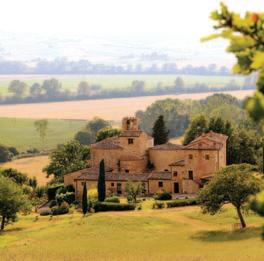
Southern Tuscany
Day 1 • Arrive in Siena
The best-preserved great medieval city in Europe.
HH Piccolo Hotel Etruria (std) HHH Santa Caterina (sup)
Day 2 • Siena to Lucignano
Walk south from Siena following the route of the early medieval Via Francigena, across the open hills of the crete, to Lucignano (14.5 miles, 7 hrs).
HHH Borgo Antico
Day 3 • Lucignano to Buonconvento (Day 1 – Arrive Buonconvento)*
Walk through pastures, vineyards and olive groves overlooking the Arbia and Ombrone valleys, to walled Buonconvento, with its small museum housing 14th/15th century masterpieces (10.7 miles, 5.5 hrs).
Pieve a Salti (8-day std & sup)
HHH Il Ghibellino (5-day std) HHH Albergo Roma (sup)
Day 4 • Excursion
Walk to visit one of the finest abbeys in Europe – the Benedictine Monte Oliveto Maggiore, with its superb cloister of magnificent frescoes by Signorelli and Sodoma (return journey 11.6 miles, 6 hrs).
Pieve a Salti (8-day std & sup)
Day 5 (2) • Buonconvento to Montalcino
Over open hills and through the famous vineyards of Brunello to panoramically situated Montalcino, centre of the Brunello wine area and home to a 14th century castle and excellent museum (11.4 or 13.1 miles, 5.5 or 6.5 hrs).
HHH Dei Capitani
Day 6 (3) • Montalcino to Bagno Vignoni
Walk through the vineyards of Brunello to the superb Romanesque abbey-church of Sant’Antimo, built of alabaster and onyx. Then on to the Orcia Valley and Bagno Vignoni, with its Roman thermal baths in central piazza (11.2 or 14.1 miles, 5.5 or 7 hrs).
HHHH Le Terme Spa & Resort
Day 7 (4) • Bagno Vignoni to Pienza
Walk along the Orcia Valley then across open farmland to Pienza, birthplace of Aeneas Piccolomini. When elected Pope Pius II in 1458, he commissioned the architect Rossellino to convert it into the first Renaissance city, with a delightful papal palace, ‘cathedral’ and museum (5.8 miles, 2.5 hrs).
HHH Residence San Gregorio (std)
HHHH Il Chiostro (sup)
Day 8 (5) • Departure day, or...
Optional extension to Montepulciano (std, 8.3 miles) or Montefollonico (sup, 8.7 miles). Wonderfully scenic walking!
*Days in brackets refer to 5-day itinerary
Route open: April-Oct
Airports to first hotel:
u Florence (50 miles)
Tram/train: 2 hrs - ~€15 Taxi: 1 hr - ~€150
u Pisa (74 miles)
Route Manager: ATG-trained, lives locally and speaks fluent English and Italian.
Route Book: 157 pages – detailed walking directions, maps, comprehensive local and background information.
Walking: Moderate (Grade 3 – 3+). See p.8.
Terrain: Open rolling hills with spectacular views. Paths along farm tracks, ancient drove roads and gravel lanes.
Siena
Siena
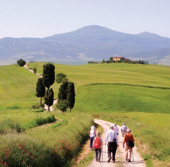
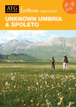
Unknown Tuscany & Orvieto
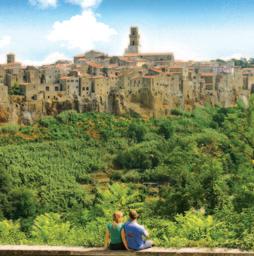
Day 1 • Arrive in Pitigliano
Dramatic approach to Pitigliano on foot (1 mile) via 2,500-yearold Etruscan lanes is strongly recommended. Alternatively, this walk can be done as an excursion after arrival (2 miles).
Le Camere del Ceccottino GUESTHOUSE (std & sup rooms)
Day 2 • Pitigliano to Sovana
Free morning to explore crag-top Pitigliano, its Etruscan houses, medieval fortress and synagogue. Then follow an Etruscan lane to a small plateau, with pastures and vines, to the charming village of Sovana (4.9 miles, 2.5–3 hrs).
HHHH Sovana Hotel & Resort (std & sup rooms)
Day 3 • Free day in Sovana
Visit Sovana’s fine Romanesque churches. Walk to see the outstanding Etruscan necropolis, including the Tomba della Sirena, restored by the ATG Trust (2.5 miles).
HHHH Sovana Hotel & Resort (std & sup rooms)
Day 4 • Sovana to San Quirico
Paths across farmland lead to an isolated church and fine Etruscan lane that descends into a gorge, from which rises crag-top Sorano. After exploring Sorano, paths along the gorge lead to the troglodyte habitations at Vitozza and the village of San Quirico (10.3 miles, 5.5 hrs).
HHH Agnelli
Day 5 • San Quirico to Bolsena
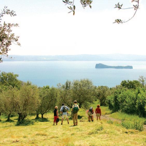
Cart tracks across farmland lead to an escarpment, where paths descend towards the small town of Latera. A climb through chestnut woods to the rim of a volcanic crater offers superb views. Tracks lead down to Lake Bolsena (10.4 miles, 5.5 hrs), from where a private boat takes you across the lake to Bolsena (town).
HHHH Hotel Columbus (std)
HHHHH Ludwig Boutique Hotel (sup)
Day 6 • Free day in Bolsena
Explore Bolsena, its ancient streets, castle, Etruscan temples and church, and catacombs of Santa Cristina, site of the miracle of Corpus Christi. Swimming in the lake. Optional walk from Acquapendente through the low Monti Volsinii (12.5 miles, 6 hrs).
HHHH Hotel Columbus (std)
HHHHH Ludwig Boutique Hotel (sup)
Day 7 • Bolsena to Orvieto
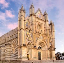
An old Etruscan lane leads up through woods to a plateau and across farmland. The first view of Orvieto, situated high on its extinct volcano, is unforgettable (10.7 miles, 5.5 hrs). Don’t miss the magnificent cathedral!
HHH Hotel Corso (std)
HHHH Palazzo Piccolomini (sup)
Day 8 • Departure day
Route open: April-Oct
Airports to first hotel:
u Rome Ciampino/Fiumicino
Train + taxi: 3.5 hrs - ~€120
Taxi: 2 hrs - ~€340
u Perugia (75 miles)
Train + taxi: 3 hrs - ~€115
Taxi: 2 hrs - ~€300
Route Manager: ATG-trained, lives locally and speaks fluent English, Italian and Polish.
Route Book: 135 pages – detailed walking directions, maps, comprehensive local and background information.
Walking: Easy to moderate (Grade 2 – 3). See p.8.
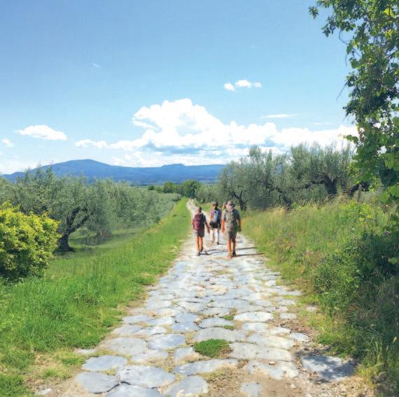
Terrain: Dirt roads/farm tracks/mule paths across hills and plateaux, via vineyards, gorges and narrow wooded valleys. Fascinating volcanic landscape.
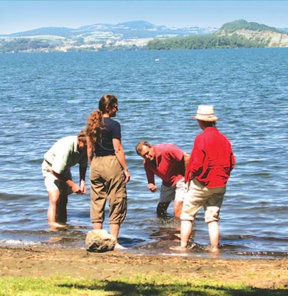
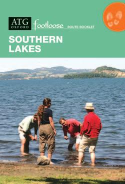
Southern Lakes
Day 1 • Arrive in Trevignano Romano... ...to stay at a fine, restored villa with views across Lake Bracciano.
HHH Albergo Borgo Vistalago
Day 2 • Trevignano Romano to Ronciglione
Walk through hazel groves and beech woods; and along pleasant tracks and lanes with impressive views of Lake Bracciano... en route to Sutri (8.9 miles, 5 hrs). After visiting its famous frescoed pilgrim church and impressive amphitheatre, the onward walk to Ronciglione is along easy paths (5.2 miles, 2.5 hrs).
B&B La Canonica dei Fiori
Day 3 • Ronciglione to Viterbo
Walk to Lake Vico (1,600ft), then follow a track up through oak forest to the rim of the ancient crater (2,935ft) and the Monti Cimini. From here, walk down through chestnut groves and forest to the walled city of Viterbo (1,300ft), (12.5 miles, 5.5–6 hrs). Or: Visit the splendid Villa Farnese at Caprarola, then transfer for the walk (7.5 or 8.8 miles, 3–4 hrs) to Viterbo.
HHH Hotel Tuscia (std) HHHH Palazzo Ubertini (sup)
Day 4 • Viterbo to Montefiascone
Visit the elegant 16C garden of Villa Lante, then walk across a plateau with long views, past thermal Roman baths and along superbly preserved Roman road (7.7 miles, 4 hrs). Stay in the medieval centre of Montefiascone. Or walk all the way (11.6 miles, 6 hrs).
HHH Urbano V
Day 5 • Montefiascone to Bolsena
Walk along paths with panoramic views across the wide waters of Lake Bolsena, following some original paved stretches of ancient Roman road, before descending across meadows and through woods to the lakeside, and Bolsena (9.9 miles, 5.5 hrs).
HHHH Hotel Columbus (std)
HHHHH Ludwig Boutique Hotel (sup)
Day 6 • Bolsena to Orvieto
Walk up to the castle through Etruscan, Roman and medieval levels of Bolsena, then follow the old pilgim route across a high plateau with extensive views, to the great crag-top city of Orvieto (10.7 miles, 5.5 hrs).
HHH Hotel Corso (std) HHHH Palazzo Piccolomini (sup)
Day 7 • Free day to explore Orvieto, with its magnificent cathedral, double-helix well of San Patrizio, Etruscan necropolis, museums, elegant cafés and bars, and good shopping. A city walk is included in the Route Book.
HHH Hotel Corso (std) HHHH Palazzo Piccolomini (sup)
Day 8 • Departure day
Route Manager: ATG-trained, lives locally and speaks fluent English, Italian and Polish.
Route Book: 137 pages – detailed walking directions, maps, comprehensive local and background information.
Walking: Moderate (Grade 3). See p.8.
Terrain: Low volcanic hills with long views across lakes; established paths through woods and vineyards; farm tracks; some asphalt near towns.
Roman Roads to Orvieto
Day 1 (1)* • Arrive in Viterbo
Walled city with historic papal palace, cathedral, fine Romanesque churches and medieval quarter.
HHH Hotel Tuscia (std) HHHH Palazzo Ubertini (sup)
Day 2 • Free day in Viterbo
Opportunities for city walk, exploring Viterbo (2 miles, 1 hr). Walk (or bus) to Bagnaia to visit the Villa Lante gardens, Vignola’s Renaissance masterpiece, using the natural flow of water (closed Mondays) (5.3 miles, 2.5 hrs).
HHH Hotel Tuscia (std) HHHH Palazzo Ubertini (sup)
Day 3 (2) • Viterbo to Montefiascone
Gravel lanes lead across a plain, via ancient thermal pools, to a fine section of paved Roman Via Cassia, and on to panoramically situated Montefiascone (2,070ft), with its castle, and church of San Flaviano with a famously inscribed tomb of Bishop Fugger (11.6 miles, 6 hrs).
HHH Urbano V
Day 4 (3) • Montefiascone to Bolsena
Follow the route of the ancient Via Cassia until it disappears into woods. Then paths and farm tracks with fine views lead down along sand beaches beside the lake (swim!)…to Bolsena (1,080ft) (9.9 miles, 5.5 hrs).
HHHH Hotel Columbus (std)
HHHHH Ludwig Boutique Hotel (sup)
Day 5 • Free day in Bolsena
Explore Bolsena, its ancient streets, castle, Etruscan temples, and ‘triple’ church of Santa Cristina, site of the miracle of Corpus Christi (1263). Opportunity for lake excursions and swimming. Optional walk from Acquapendente through the low Monti Volsinii (12.5 miles, 6 hrs).
HHHH Hotel Columbus (std)
HHHHH Ludwig Boutique Hotel (sup)
Day 6 (4) • Bolsena to Orvieto
Follow the old pilgrim route across a high plateau (2,000ft) with extensive views, towards Orvieto. The first view of the crag-top city is unforgettable (10.7 miles, 5.5 hrs).
HHH Hotel Corso (std)
HHHH Palazzo Piccolomini (sup)
Day 7 • Free day in Orvieto
Optional city walk (2 hrs), including Orvieto’s magnificent cathedral and Capella della Madonna di San Brizio, with outstanding frescoes by Fra Angelico and Signorelli, Etruscan tombs, museums and remarkable well – ‘one of the second seven wonders of the world’.
HHH Hotel Corso (std)
HHHH Palazzo Piccolomini (sup)
Day 8 (5) • Departure day
*Days in brackets refer to 5-day itinerary
Route open: April-Oct Airports
Route Manager: ATG-trained, lives locally and speaks fluent English, Italian and Polish.
Route Book: 103 pages – detailed walking directions, maps, comprehensive local and background information.
Walking: Easy (Grade 2). See p.8.
Terrain: Roman/Etruscan roads. Volcanic ash paths; farm tracks; occasional mule and forest paths; stretches of asphalt near towns.
Umbria & Assisi
Day 1 • Arrive in Spoleto
Elegant and medieval city with important Romanesque churches and a 12th-century cathedral with frescoes by Fra Filippo Lippi.
From Spoleto follow a scenic disused railway line with long views across the Umbra Valley, then paths that climb and fall between small villages, through woodland, olive groves and farmland, to the tiny hamlet of Poreta (10.7 miles, 6–6.5 hrs).
Borgo della Marmotta (std & sup)
Day 3 • Poreta to San Luca
Follow small lanes and tracks to Campello Alto, a delightful medieval hilltop village, with wonderful views. Then descend to the valley passing the limpid waters of the Roman Fonti del Clitunno, and follow farm tracks and lanes across the plain to San Luca (8.2 miles, 4.5 hrs).
HHHH Villa Santa Barbara (8-day std & sup rooms)
Day 1 – Arrive Montefalco*
HHHH Villa Pambuffetti (5-day std & sup rooms)
Day 4 • San Luca to Bevagna (8-day) (Day 2 – Montefalco to Bevagna)
Walk up through the Sagrantino vineyards to hilltop Montefalco, ‘the balcony of Umbria’. Visit the superbly frescoed church of San Francesco before continuing on down through renowned vineyards to the little walled town of Bevagna (9.5 miles, 5 hrs).
(5-day itinerary: 5.4 miles, 2.5 hrs).
Residenza Porta Guelfa
Day 5 (3) • Bevagna to Spello
After visiting Bevagna’s Roman theatre and impressive mosaic baths, follow small lanes and tracks across the valley to Spello, where there is time to explore the attractive Roman and medieval town (8.3 miles, 4.5 hrs).
HHH Il Cacciatore (std) HHHH La Bastiglia (sup)
Day 6 (4) • Spello to Assisi
Set off early to climb the high flower-filled pastures of Monte Subasio (1,278m / 4,192ft), or take a ride to near the top, enjoying fabulous views, before descending a mountain spur to enter Assisi on the stony pilgrim path once frequented by St Francis (10.1 or 11 miles, 6 hrs).
HHHH Hotel Giotto & Spa (std) HHHHH Nun Assisi (sup)
Day 7 • Free day in Assisi
Free day to explore Assisi, or visit the nearby Franciscan sites of the Carceri hermitage or churches of San Damiano or Santa Maria degli Angeli.
HHHH Hotel Giotto & Spa (std) HHHHH Nun Assisi (sup)
Day 8 (5) • Departure day
*Days in brackets refer to 5-day itinerary
Italy
..... 5-day route
Route open: April-Nov
Airports to
Route Manager: ATG-trained, lives locally and speaks fluent English and Italian.
Route Book: 105 pages – detailed walking directions, maps, comprehensive local and background information.
Walking: Moderate (Grade 3). See p.8.
Terrain: Small gravel roads, woodland paths, grassy meadows and forest paths/tracks.
PHOTO:
High Paths to Assisi
Day 1 • Arrive in Spoleto
Elegant and medieval city with Romanesque churches and a 12C cathedral with frescoes by Fra Filippo Lippi. HHH Charleston (std) HHH Palazzo Sant’Angelo (sup)
Day 2 • Spoleto to Poreta
Follow a scenic disused railway line with long views across the Umbra Valley, then paths that climb and fall between small villages, through woodland, olive groves and farmland, to the tiny hamlet of Poreta (std: 10.7 miles / sup: 10.5 miles, 6–6.5 hrs).
Borgo della Marmotta (std & sup rooms)
Day 3 • Poreta to Trevi
Tracks lead up to Campello Alto, a delightful medieval hilltop village with wonderful views, and then on to the village of Pissignano, with its majestic 11C castle. Ancient olive grove terraces lead us via spectacular scenery and a Roman aqueduct, to the ancient hilltop town of Trevi, with its museums housing numerous art treasures –frescoes by Perugino and Lo Spagna (8.9 miles, 5 hrs).
Albergo Il Terziere
Day 4 • Trevi to Carpello
Paths continue along the slope of Monte Serano, offering splendid views over the valley. Walk via a series of tiny, remote hilltop villages, Roman settlements and an impressive ‘keep’ before descending to Agriturismo La Quercetta, with wonderful views (9.2 miles, 5.5 hrs).
La Quercetta
Day 5 • Carpello to Spello
Paths lead gently up through oak forests and olive groves to the impressively situated 11th-century Benedictine Abbey of Santa Croce in Sassovivo. Then descend through juniper and pine forest, via waterfalls and ancient hamlets, across the Topino Valley, up and on to the splendid Roman town of Spello (Std: 13.7 miles / Sup: 13.4 miles, 7.5–8 hrs).
HHH Il Cacciatore (std) HHHH La Bastiglia (sup)
Day 6 • Spello to Assisi
Climb the high flower-filled pastures of Monte Subasio, or take a ride to near the top, enjoying fabulous views, before descending to Assisi on the stony pilgrim path once frequented by St Francis (std: 11 miles / sup: 10.6 miles, 6 hrs).
HHHH Hotel Giotto & Spa (std) HHHHH Nun Assisi (sup)
Day 7 • Free day in Assisi
Explore Assisi, or visit the nearby Franciscan sites of the Carceri hermitage or churches of San Damiano or Santa Maria degli Angeli.
HHHH Hotel Giotto & Spa (std) HHHHH Nun Assisi (sup)
Day 8 • Departure day
Route open: April-Nov
Airports to first hotel: u Rome (100 miles)
Perugia (34 miles)
Route Manager: ATG-trained, lives locally and speaks fluent English and Italian.
Route Book: 107 pages – detailed walking directions, maps, comprehensive local and background information.
Walking: Moderate to challenging (Grade 3 – 4). See p.8.
Terrain: Small gravel roads; woodland paths; grassy meadows, forest paths and ancient olive grove tracks.
Spello
Unknown Umbria & Spoleto
Day 1
• Arrive in Norcia
Historic walled town, birthplace of St Benedict and renowned for its much cherished gastronomic speciality –the truffle.
HHHH Palazzo Seneca
Day 2
• Free day around Norcia
Travel by road to picturesque Castelluccio (4,000ft) and walk across the Piano Grande, the most inspiring highland plain in Europe, then back down to Norcia (9.7 miles, 5 hrs). Alternatively, explore Norcia, its central piazza with church of St Benedict (480–543 AD) and medieval town walls.
HHHH Palazzo Seneca
Day 3
• Norcia to Roccaporena
Follow farm tracks across low hills to the small town of Cascia and churches with 14th-century frescoes. Then follow an ancient pilgrim path along the gorge to Roccaporena, birthplace of St Rita, patron saint of desperate causes (12.6 miles, 7.5 hrs).
HHH Hotel Roccaporena-Margherita (std & sup rooms)
Day 4 • Roccaporena to Scheggino
Cross hills with oak woods famous for their truffles to Gavelli, with fine frescoes restored by the ATG Trust. Follow an old (dirt) road steeply down to Scheggino or, alternatively, take a gentler route via Caso (12.4 miles direct or 13 miles via Caso, 6.5 hrs).
HHHH Antica Torre del Nera (std & sup rooms)
Day 5 • Valley Walk
Optional walk along the Valnerina Valley to the superb 5th-century monastery of San Pietro in Valle, with frescoes, Roman decorative fragments and sarcophagi of 8th century Lombard dukes (6.3 miles, 2.5 hrs one way).
HHHH Antica Torre del Nera (std & sup rooms)
Day 6 • Scheggino to Spoleto
Follow the 'Path of Pope Pius IX' along a valley, then climb up, in and out of woods, to a ridge with fine views of the surrounding hills, before descending, via chestnut woods and olive groves, to Spoleto (8.3 or 12.5 miles. 4.5 or 7 hrs).
HHH Hotel Charleston (std)
HHH Palazzo Sant’Angelo (sup)
Day 7 • Free day in Spoleto
Explore the medieval city, its 12th-century cathedral with frescoes by Fra Filippo Lippi, and important Romanesque churches. The Spoleto festival takes place early-mid July.
HHH Hotel Charleston (std)
HHH Palazzo Sant’Angelo (sup)
Day 8 • Departure day
Route Manager: ATG-trained, lives locally and speaks fluent English and Italian.
Route Book: 111 pages – detailed walking directions, maps, comprehensive local and background information.
Walking: Moderate to challenging (Grade 3 – 4). See p.8.
Terrain: Woodland, sheep and mule tracks, dirt roads and ways over high open grassland with wide views.
PHOTO:
Tuscan Hills
Ancient Paths to Rome: Section I of 225 Miles to Rome
A walk through central and Southern Tuscany, characterised by paths through vineyards, olive groves and forest, and landscapes punctuated with cypress trees and walled hill towns and villages.
Day 1 • Arrive in San Gimignano
The ‘Medieval Manhattan' is irresistibly charming and perfectly preserved. It houses a fine array of religious and secular frescoes and monuments. Stay on the central piazza.
HHH Leon Bianco
Day 2 • San Gimignano to Colle Val d’Elsa
Walk across low hills with vineyards and olive groves to the medieval hill town of Colle Val d’Elsa, renowned for its ‘tunnel’ streets (8.7 miles, 4.5 hrs).
HHHH Palazzo San Lorenzo
Day 3 • Colle Val d’Elsa to Monteriggioni
Paths across open farmland and through woods lead to the high village of Monteriggioni, encircled by walls with 14 watchtowers (11.6 miles, 6 hrs).
HHH Rooms & Wine al Castello
Day 4 • Monteriggioni to Siena
Follow paths through woods and meadows to Siena, the best-preserved, great medieval city in Europe (11.9 miles, 6.5 hrs).
HHHH Athena
Day 5 • Siena to Lucignano
Tracks across low open hills of the Crete region lead to the village of Lucignano (15 miles, 7–7.5 hrs).
HHH Borgo Antico
Day 6 • Lucignano to Buonconvento
Gravel lanes along the Arbia Valley lead to Buonconvento, with its interesting museum of medieval Masters (10.7 miles, 5.5 hrs). Optional walk to the abbey of Monte Oliveto Maggiore (magnificent frescoed cloister) (6.5 miles, 3–3.5 hrs).
Fattoria Pieve a Salti
Day 7 • Buonconvento to Montalcino
Paths up through renowned vineyards of Brunello (Italy’s most expensive red wine!) lead to hilltop Montalcino (10 or 13.9 miles, 5.5 or 7 hrs).
HHH Dei Capitani
Day 8 • Departure day, or...
Continue with Section 2 of the 225 Miles to Rome route: ‘Ancient Volcanic Landscapes’ (following pages)...
Please note: The Romans rested ‘every four days’. If you plan to walk more than one section of 225 Miles to Rome, we strongly urge you to book some rest days between the sections. Please contact the office for advice.
Italy
open: April-Oct
Route Manager: ATG-trained, lives locally and speaks fluent English and Italian.
Route Book: 145 pages – detailed walking directions, maps, comprehensive local and background information. Walking: Moderate (Grade 3). See p.8.
Terrain: Small gravel roads; mule/farm/woodland tracks and paths; some asphalt near towns.
Ancient Volcanic Landscapes
Ancient Paths to Rome: Section II of 225 Miles to Rome South of Montalcino the country becomes wilder, with forests, low plateaux and ancient volcanic landscapes dominated by Monte Amiata (1,753m / 5,750ft) and the wide crater Lake of Bolsena.
Day 1 • Free day in Montalcino Centre of Brunello wine production. Hotel with pool and panoramic views.
HHH Dei Capitani
Day 2 • Montalcino to Pescina Paths through vineyards lead down to the superb Romanesque abbey church of Sant’Antimo. You then continue down through olive groves into the Orcia Valley, before walking up to the forested slopes of Monte Amiata (17.5 miles, 9 hrs).
HH Hotel La Scottiglia
Day 3 • Pescina to Piancastagnaio
Walk through forest of chestnut and beech, to the ancient volcanic peak of Monte Amiata. Then continue down through forest, and a cleft in the volcanic cliffs, to Piancastagnaio, on the side of the mountain with panoramic views (12.6 miles, 7 hrs).
HHH Hotel Relais San Lorenzo
Day 4 • Piancastagnaio to Acquapendente
Tracks along low ridges with long views bring us to the ancient town of Proceno, from where you descend to the Serlate Valley before walking up to the town of Acquapendente, with its fine square and waterfalls (20.2 miles, 9 hrs).
HHH Albergo Toscana
Day 5 • Acquapendente to Bolsena Forest tracks through the low Monte Volsinii lead to the edge of a wide ancient volcanic crater, then down to the wide blue waters of Lake Bolsena (12.5 or 14.9 miles, 6 or 7.5 hrs).
HHHH Hotel Columbus
Day 6 • Bolsena to Montefiascone
Ancient paths with lake views lead to panoramic Montefiascone. Amongst its fine churches is that of San Flaviano, which houses the tomb of the bishop whose visit to the town is famously commemorated in the name of its wine: Est! Est!! Est!!! (11.1 miles, 5.5 hrs).
HHH Urbano V
Day 7 • Montefiascone to Viterbo
Following one of the finest sections of paved Roman road in Italy we cross a plateau, pausing to enjoy Roman baths and thermal springs on the ancient route, before continuing to the walled city of Viterbo (11.4 miles, 5.5 hrs).
HHH Hotel Tuscia
Day 8 • Departure day, or...
Continue with Section 3 of the 225 Miles to Rome route: ‘Approach to Rome’ (following pages)...
Please note: The Romans rested ‘every four days’. If you plan to walk more than one section of 225 Miles to Rome, we strongly urge you to book some rest days between the sections. Please contact the office for advice.
Italy
Route open: April-Oct
Route Manager: ATG-trained, lives locally and speaks fluent English and Italian.
Route Book: 153 pages – detailed walking directions, maps, comprehensive local and background information.
Walking: Moderate to challenging (Grade 3 – 4). See p.8.
Terrain: Dirt roads; farm tracks and smaller wooded paths; broad gravel and cart tracks.
PHOTO:
Approach to Rome
Ancient Paths to Rome: Section III of 225 Miles to Rome
Historic towns and villages now influenced by the vortex of Rome, whilst in the ancient volcanic landscapes, are evocative reminders of the Via Francigena, its ancient origins, and the millions who have travelled the route.
Day 1 • Arrive in Viterbo
Free day in Viterbo, with its fine churches, papal palace and medieval quarter. Optional walk to the Villa Lante gardens (5.3 miles, 2.5 hrs).
HHH Hotel Tuscia
Day 2 • Viterbo to Lake Vico
Paths through oak and chestnut forest lead to a ridge, then down to an ancient crater and Lake Vico, with its secondary cone, Monte Venere, surmounted by a small temple to Venus. We walk through hazel groves to our lakeside hotel (9.2 miles, 4.5 hrs).
HHH Hotel La Bella Venere
Day 3 • Lake Vico to Sutri
Tracks lead down beside a river flowing from the lake, which powers over 20 watermills, en route to the picturesque ancient citadel of Ronciglione. Lanes then lead through hazelnut groves to the ancient walled town of Sutri, birthplace of Pontius Pilate, with its atmospheric amphitheatre, frescoed church of the Madonna del Parto, and Etruscan sites (9.9 miles, 4.5 hrs).
B&B Le Terrecotte
Day 4 • Sutri to Campagnano di Roma
Follow tracks across low hills, with farmland and woods, before walking up to the gates of the walled town of Campagnano di Roma (16.7 miles, 8 hrs).
HHH Albergo da Righetto
Day 5 • Campagnano di Roma to Isola Farnese
Quiet lanes and farm tracks lead via an isolated pilgrim church to the necropolis of Etruscan Veio, then, still in unspoilt country, to the medieval hilltop village of Isola Farnese, and on through farm tracks to an elegant agriturismo (14.6 miles, 7.5 hrs).
AGRITURISMO I Casali del Pino
Day 6 • Isola Farnese to Rome
Follow the Via Cassia before passing through the nature reserves of Insugherata and Monte Mario for your first magnificent views over Rome. Then follow the Viale Angelico to reach the walls of the Vatican, and on to St. Peter’s Square. Stay at a very well-situated hotel in the centre of the old city (12.4 miles, 6 hrs + sightseeing).
HHHH Monti Palace Hotel
Day 7 • Free day in Rome
HHHH Monti Palace Hotel
Day 8 • Departure day
Route open: April-Oct
Airports to first hotel: u Rome Fiumicino (65 miles)
Route Manager: ATG-trained, lives locally and speaks fluent English, Italian and Polish.
Route Book: 119 pages – detailed walking directions, maps, comprehensive local and background information.
Walking: Moderate (Grade 3). See p.8.
Terrain: Varied paths: Etruscan roads; Roman roads; mule paths; wooded paths; cart tracks and dirt roads.
Amalfi Coast
Day 1 • Arrive in Ravello
…with its splendid villas, gardens and art treasures in an incomparable setting.
HHHH Hotel Bonadies (std & sup)
Day 2 • Ravello
A relaxing day to walk and explore Ravello – its cathedral, fine churches, Villa Ruffolo and Villa Cimbrone.
HHHH Hotel Bonadies (std & sup)
Day 3 • Ravello – excursion
Follow ancient stairways down to the fishing village of Atrani, a maze of whitewashed alleys. Paths then lead through lemon groves to Scala, the oldest ‘little’ city of the coast, then back to Ravello (6.7 miles, 5 hrs).
HHHH Hotel Bonadies (std & sup)
Day 4 • Ravello to Amalfi (Day 1 – Arrive Amalfi)*
A high path leads to the famous nature reserve of Valle delle Ferriere, through meadows, chestnut groves and past waterfalls towards the village of Pogerola, and then down an ancient flight of steps towards the historic ‘city’ of Amalfi (8.5 miles, 6 hrs).
HHHH Luna Convento (std & sup)
Day 5 (2) • Amalfi to Conca dei Marini
Time to visit Amalfi and its cathedral, with bronze door cast in Constantinople, mosaic façade and 13th-century cloister. A 1,000-year-old footpath leads through historic villages to Conca dei Marini. Opportunities to visit the Grotta dello Smeraldo (3.7 miles, 3 hrs).
HHH Le Terrazze
Day 6 (3) • Conca dei Marini to Vettica Maggiore
A stepped footpath passes churches with panoramic views, and descends into the spectacular fjord of Furore. Then the Via dell’Amore leads into the green Praia Valley, before descending to the quiet village of Vettica Maggiore (5.5 miles, 4 hrs).
HHHH Hotel Tramonto d’Oro
Day 7 (4) • Vettica Maggiore
An optional walk leads up to the monastery of San Damiano then to the Sentiero degli Dei (Path of the Gods), a high open ridge walk with fine views, before descending to Positano (5.8 miles 4.5 hrs). Return to Vettica Maggiore by taxi.
HHHH Hotel Tramonto d’Oro
There is the option to stay in Positano – but hotels frequently require a 3-5-night minimum stay.
Day 8 (5) • Departure day
Or, if you opt to extend in Positano, there is a delightful circular walk in the route book – in the hills above Positano, with panoramic views (5.8 miles, 4.5 hrs).
*Days in brackets refer to 5-day itinerary
Italy
Route open: April-June; Sept-Oct
Airport to first hotel: u Naples (40 miles) Train/bus:
Route Manager: ATG-trained, lives locally and speaks fluent English and Italian.
Route Book: 96 pages – detailed walking directions, maps, comprehensive local and background information.
Walking: Moderate to challenging (Grade 3 – 3+). See p.8.
Terrain: Ancient paths with long steep flights of steps, which climb and descend through lemon groves.
Vettica Maggiore Positano Santa Maria del Castello Conca dei Marini
RavelloRavelloAmalfi Scala Concadei Marini
Vettica Maggiore Positano
Gargano Peninsula
Day 1 • Arrive in Manfredonia
Time to explore the town with its port and castle.
HHH Hotel Panorama del Golfo
Day 2 • Manfredonia to Monte Sant’Angelo
Walk along the coast then across a small plain before ascending an ancient pilgrim route, once used by crusaders before they embarked for the Holy Land. The route, now a grassy ravine with ruined monasteries on either side, leads to the ancient town of Monte Sant’Angelo (2,755ft), with its whitewashed houses, steep narrow alleys, and views across the bay of Manfredonia (9.3 miles, 5 hrs / bus 20 mins!).
HHHH Palace Hotel San Michele
Day 3 • Monte Sant'Angelo to Mattinata
Time to explore the town and visit the famous cave church, venerated as being the last place St Michael appeared on Earth in 491 AD, before setting off down a well-made pilgrim path to the small town of Mattinata (650ft) set in olive groves, close to the coast (9.2 miles, 5 hrs).
HHHH Residence Il Porto
Day 4 • Mattinata to Baia Fontana delle Rose
Follow paths along the coast and into hills overlooking the sea, before descending to the picturesque bay of Fontana delle Rose (7.3 miles, 3.5 hours). Transfer (15 mins) back to Mattinata.
HHHH Residence Il Porto
Day 5 • Baia Fontana delle Rose to San Salvatore
Brief transfer, then: Tracks lead up through limestone hills and aromatic scrub to a viewpoint (1,115ft) before continuing to the isolated Masseria Sgarrazza, beautifully situated on a ridge overlooking the Gargano coast (8.6 miles, 5.5 hrs). Optional 3.5-mile circular walk to a necropolis and natural well.
Masseria Sgarrazza
Day 6 • San Salvatore to Vieste
Paths lead along a ridge with fine open views, before descending to a long sandy beach and Vieste (7.7 miles, 4 hrs).
HHHH Palace Hotel Vieste
Day 7 • Free day in Vieste
Alternatively, the walk to Peschici (see day 8) can be done on this day, returning to Vieste by bus.
HHHH Palace Hotel Vieste
Day 8 • Extension
Optional extension to Peschici. Follow paths through ancient olive groves and farmland, then across coastal headlands to the whitewashed village of Peschici, perched on a buttress of rock (13 miles, 7 hrs).
Italy
Route open: April-June; Sept-Nov
Airports
Route Manager: ATG-trained, lives locally and speaks fluent English, Italian and conversational Spanish.
Route Book: 105 pages – detailed walking directions, maps, comprehensive local and background information.
Walking: Moderate (Grade 3). See p.8.
Terrain: Limestone hills with coastal paths; quiet lanes; farm and woodland tracks; and pilgrim routes.
Peschici
Vieste
Manfredonia
Mattinata
Baia Fontana delle Rose
San Salvatore Monte Sant’Angelo
Manfredonia Monte Sant’Angelo Mattinata Baia Fontana delle Rose
High Gargano
Day 1 • Arrive in Manfredonia
Time to explore the town with its port and castle.
HHH Hotel Panorama del Golfo
Day 2 • Manfredonia to Monte Sant’Angelo
Walk along the coast before ascending an ancient pilgrim path, once used by crusaders before they embarked for the Holy Land, to hilltop Monte Sant' Angelo, with its whitewashed houses and views across the bay of Manfredonia (9.3 miles, 5 hrs / bus 20 mins!).
HHHH Palace Hotel San Michele
Day 3 • Monte Sant’Angelo to Mattinata
Time to explore the town and visit the famous cave church, venerated as being the last place St Michael appeared on Earth in 491 AD, before setting off down a well-made pilgrim path to the small town of Mattinata (650ft), set in olive groves, close to the coast (9.2 miles, 5 hrs).
HHHH Residence Il Porto
Day 4 • Mattinata to Baia Fontana delle Rose
Follow paths along the coast and into hills overlooking the sea, before descending to the picturesque bay of Fontana delle Rose (7.3 miles, 3.5 hrs). Transfer (15 mins) back to Mattinata.
HHHH Residence Il Porto
Day 5 • Baia Fontana delle Rose to San Salvatore
Brief transfer, then: Tracks lead up through limestone hills and a wooded valley to a high point (2,224ft), before continuing to the isolated Masseria Sgarrazza, situated on a ridge overlooking the sea (8.6 miles, 5.5 hrs).
Optional extra walk (3.5 miles, 2 hrs).
Masseria Sgarrazza
Day 6 • San Salvatore to Foresta Umbra
Walk through olive groves and meadows, gently climbing toward superb view of the coast. Paths then lead into the heart of the Foresta Umbra, the best-preserved area of ancient woodland in Puglia, with an abundance of bird and orchid species. Tracks through beech wood then bring you to the warm hospitality of Hotel Elda (12.4 miles, 6.5 hrs).
HHHH Hotel Elda
Day 7 • Foresta Umbra to Peschici
Follow forest tracks and meadows... to an open ridge with extensive views of the coast and clustered 'white village' of Peschici in the distance. Then continue down through olive groves and quiet lanes to your seaside hotel (13.2 miles, 7 hrs).
HHH Locanda al Castello
Day 8 • Departure day, or...
Optional extension to Vieste (additional cost): Follow small lanes across a series of coastal headlands, then paths across farmland and through ancient olive groves to long sandy beaches and Vieste (13 miles, 7 hrs).
Italy
Route open: April-June; Sept-Nov
Airports to first hotel:
u Bari (66 miles)
Train/bus + taxi: 2.5-3 hrs - ~€70
Route Manager: ATG-trained, lives locally and speaks fluent English, Italian and conversational Spanish.
Route Book: 119 pages – detailed walking directions, maps, comprehensive local and background information.
Walking: Moderate to challenging (Grade 3 – 4). See p.8.
Terrain: Limestone hills with coastal paths; quiet lanes; farm and woodland tracks; and pilgrim routes.
Sicily: From the Centre to the Sea
Day 1 • Arrive in Enna
Panoramic views, historic fortress and cathedral.
HHH B&B del Centro (std & sup rooms)
Day 2 • Enna (Villadoro) to Gangi
Transfer to the town of Villadoro, from where paths and ancient drove roads cross gently rolling hills, with views to Mt. Etna, to the dramatically situated town of Gangi (9 or 11.7 miles, 5 or 6 hrs).
H Miramonti (std) Villa Rainò (sup)
Day 3 • Gangi to Geraci Siculo
Time for relaxing or a visit to Gangi (3.8 miles, 2 hrs), before walking on. Paths across farmland lead to the route of an ancient road to the hilltop village of Geraci Siculo, with its ruined Saracen castle, Saracen fountain and picturesque alleys (8.2 or 8.8 miles, 4–5 hrs).
HHH Notti O’Tunn (std) HHHH Donna Vi (sup)
Day 4 • Geraci Siculo to Madonie National Park
Paths through open mountain meadows, with extensive views, lead gently up to a ridge, where we stay at a comfortable mountain refuge (11.8 miles, 6.5 hrs).
Mountain Refuge
Day 5 • Madonie Mountains to Isnello
After an (optional) walk to explore the nearby peaks, (1,979m/6,493ft), we descend through inspiring scenery, past a nature reserve with fallow deer and wild boar, and through a geologically interesting secluded valley, to the village of Isnello (8.1 miles, 4.5 hrs).
Guesthouse
Day 6 • Isnello to Cefalù
After a short descent and stream-crossing, farm tracks lead up to a ridge and pilgrim church with panoramic views – the sea! An ancient pilgrim path then leads down through woods and meadows, olive groves and vineyards; and through scrub to lemon groves, Cefalù and the sea (11.4 miles, 7 hrs).
HHHH Hotel Artemis (std)
HHHHH Hotel Calette N.5 (sup)
Day 7 • Free day in Cefalù
Explore the picturesque ancient streets and fishing port of Cefalù, its magnificent Romanesque cathedral, and the massive buttress of rock above the town, with paths to prehistoric, Phoenician, Greek, Roman and medieval sites and fortifications, and spectacular views (2 miles). Good beaches for swimming.
HHHH Hotel Artemis (std)
HHHHH Hotel Calette N.5 (sup)
Day 8 • Departure day
TEMPERATURE & RAINFALL
Route open: April-June; Sept-Oct
Airports to first hotel: u Catania (52 miles)
Train/bus:
Route Manager: ATG-trained, lives locally and speaks fluent English and Italian.
Route Book: 143 pages – detailed walking directions, maps, comprehensive local and background information.
Walking: Moderate to challenging (Grade 3 – 4). See p.8.
Terrain: Drove roads; dirt roads; mule, mountain and rough animal paths across rolling hills and low mountains.
For those looking to combine the independence of ATG Footloose, and excursions with walking options, whilst enjoying the unique facilities and experience of a week at Pieve a Castello, there are weeks scheduled for you!
Visits include iconic San Gimignano, Monteriggioni and Siena, whilst there are over 200 miles of self-guided walks through idyllic Tuscan landscapes of vineyards, olive groves, meadows and forests…. Or, relax and simply enjoy being at Pieve a Castello, where...
The ATG staff look forward to welcoming you!
Saturday: Colle Val d’Elsa
Lower town, with remarkable old subterranean mill-race canals, with ancient (pedestrian) brick road (or elevator!) to high, walled medieval hill town with fine tunnel streets. Excellent icecreams! Walk back through meadows and woods (2-3 hours). Driving time 10 minutes.
Sunday: Monteriggioni
Iconic, walled hill village with 14 watchtowers and 84 inhabitants (and restored main arched gate – an ATG Trust project). Approach on foot – 1 hour from the Benedictine Abbey of Isola or 15 minutes from below the village. Walk to/from Pieve a Castello – through forests (3-4 hours). Driving time 10 minutes.
Monday: San Gimignano
‘The medieval Manhattan’ – famous for its towers and churches with superb, medieval frescoes. Climb a tower, see a museum. Go shopping, eat an ice cream. Scenic approach on foot (20 minutes). Return walk 7 hours. Driving time 25 minutes.
Tuesday: Pieve a Castello
A day to enjoy the 8th century Augustinian canonry and the 200 miles of self-guided walks that fan out through vineyards, olive groves and forest.
Wednesday: Casole d’Elsa
Casole, whose lights we see twinkling across the valley at night, is a small, medieval hill town with fine walls, churches and museum. Walks through meadows of the Elsa Valley. Driving time 15 minutes.
Thursday: Siena
Best-preserved, great medieval city in Europe. Cathedral. Piazza del Campo. Great medieval Art by Sienese Masters. City walk in Route Book – 2 hours. Walking to/from Pieve a Castello – 7 hours… or there is a fine part-way walk back through forest tracks of the ancient Via Francigena (2-3 hours). Driving time 25 minutes.
Friday: Pieve a Castello
A day to enjoy… with opportunities to walk some of the 200 miles of ancient paths and tracks – through vineyards, olive groves and extensive forests of the Montagnola Senese.
Getting there:
u From Pisa or Florence airport: Train to Poggibonsi or bus to Colle Val d’Elsa; taxi ex- Pisa €170; taxi ex- Florence €150; hire car for maximum flexibility
Route Book: 200 pages with detailed walking directions, marked maps, comprehensive local and background information.
Walking: As much or as little as you like – with over 200 miles of self-guided walks from 1- to 2-hour circular routes from Pieve a Castello to longer 7- to 8hour walks to San Gimignano and Siena… and the possibility of utilising the daily ‘excursion shuttle’ for a convenient ‘drop off’ to walk back to Pieve a Castello.
Terrain: Paths and tracks including routes of the ancient Via Francigena, through vineyards, olive groves, meadows and extensive forest.