PORTFOLIO ATEET KAWA Selected Works 2018 - 2022 Urban Planner / Architect ateetkawa@gmail.com 773.931.5993
I am an architect and a recent urban planning graduate. from the University of Illinois at Chicago.

My main areas of interest include active spatial planning, sustainable transportation development, and public involvement. My expertise in design sparked my interest in spatial organization and the creation of sustainable living and working circumstances, as well as the role transportation, plays in linking communities to resources.
I feel that urban planning and architecture are more than simply art and engineering. Our job is to thoughtfully beautify and render our surroundings to provide for human and environmental pleasures. It is also a process of continual growth and experimentation, with a desire to keep developing and creating new ideas, shapes, materials, and procedures to satisfy the demands of ever changing settings.
The following portfolio features work from my career as an urban planner and architect that highlights my interests and experience. I am excited to pursue a meaningful career in planning and aspire to have an influence on the world around me.
2 3 Contents Resume Community Planning - Bronzeville Re-Thinking the Chicago river Environmental Data Mining Revitalization of Tapi river at Surat, GJ, India Working Drawing Internship Work - CDM Smith Sample Renderings 04 06 08 10 12 14 16 20
About Me
Resume
Ateet Kawa
Urban Planner / Architect
Chicago, IL 60607
Email: ateetkawa@gmail.com Phone: 773.931.5993
Education
The University of Illinois at Chicago, Chicago, IL, United States
Master of Urban Planning and Policy | January 2021 - December 2022
University of Mumbai, Mumbai, MH, India
Bachelor of Architecture | August 2013 - June 2018
Experience
CDM Smith, Charleston, SC, United States | May 2022 August 2022
Planning Intern (Public Involvement - Transportation)
Assistedseveralstatetransportationdepartmentswithgraphicdesignfor potentialalternativesinordertosetuppublichearings
Cardboard Furniture by Amrish Kawa, Mumbai, MH, India
Interior and Product Designer (Part-Time) | April 2018 December 2020
Working on residential and commercial interior design, planning, and basic 3D renderingviews.
Using cardboard as a medium, I created cardboard furniture such as seats, beds, couches,tables,andantiquessuchastableclocks.
Kalindi Developers, Mumbai, MH, India | May 2020 November 2020 Architect
Designed and planned for the residential building, including plans, sections, sale layouts,BUA,CA,andparkingcalculationsusingAutoCADandExcel.
Umesh Bhatt Architects, Mumbai, MH, India | December 2018 - April 2020 Architect
Executed planning and designing of residential, commercial, and educational which includes calculations like FSI (floor space index), BUA (built up area), CA (carpetarea),andparkingstatements.
Experience in working drawings which includes all working plans like centerline, electrical, plumbing layouts, sections, elevations, and details like a compound wall,gate,railing,andpavingdetails.
Worked on municipal drawings with extensive site layouts, plans, BUA and CA calculationsdiagrams,andsections

Somaiya and Associates, Mumbai, MH, India | November 2016 - February 2017
Intern Architect
Worked on detailed drawings and 3D modeling of the entrance lobby, gate details,watchmancabin,andlandscaping.
Producedpresentationsforclientmeetings.
American Planning Association (APA) - Illinois Chapter Volunteer
Yogi Divine Society (YDS), Chicago, IL, United States Volunteer
Organizing technical events & workshops by inviting professionals from various fields to share their knowledge and expertise which would help youths to preparefortheirfuture.
4
5
Skills Autodesk AutoCAD,Revit Geographic Information Systems ArcGISPro,ArcGISOnline,ArcMap Adobe Suite InDesign,Photoshop,Illustrator 3D Softwares SketchUp,Lumion,Vray Microsoft Suite MSWord,MSExcel,MSPowerpoint Other Skills
Communication,Leadership,Teamwork,Creativity,Visualization
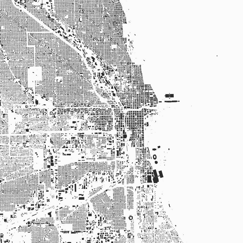
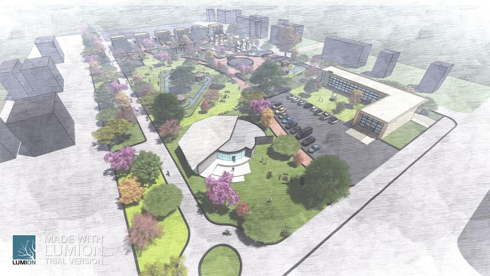
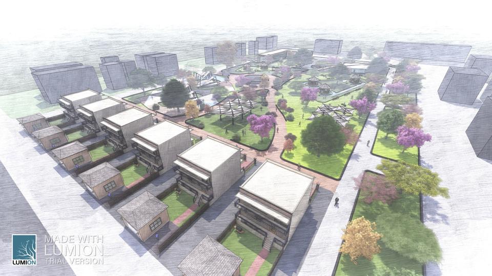
Community Planning - Bronzeville, IL
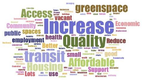
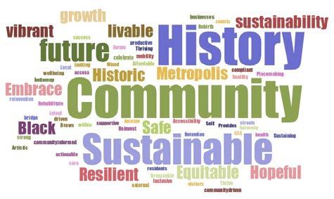
In this group project, we examined the current conditions of the Bronzeville community located on Chicago’s South Side. We have evaluated previous and ongoing planning efforts, with a focus on the City's INVEST South/West planning initiative, using sustainability as a guiding framework to prioritize the primary issuesfacingthecommunityandrecommendationsforfutureplanningefforts.
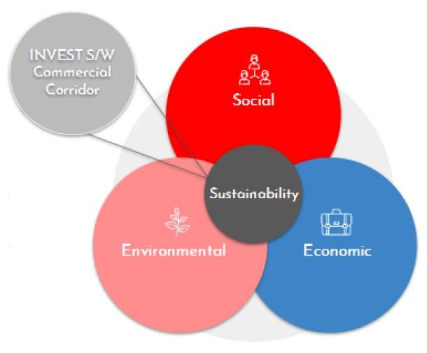
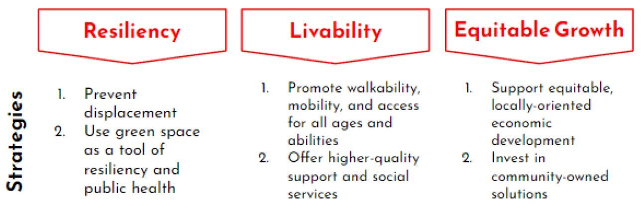
The planning process is developed under a sustainability framework, including the elements of economic, environmental, and social values. Through that framework, we identified a set of interventions designed around activating vacant lots as a means to achieve our planning goals. The process developed a series of definitions, but also was recursive, defining how we approached the planning process. This process helped refined our vision, goals, strategies, and metrics. Taking these factors, we evaluated community alternatives, including future projections as well as a continuation of the status quo. Finally, the report will detail a commercial corridor case study of the recommended implementationforBronzeville.
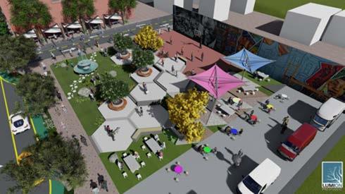
Commercial Corridor - POP! Court Community Plaza
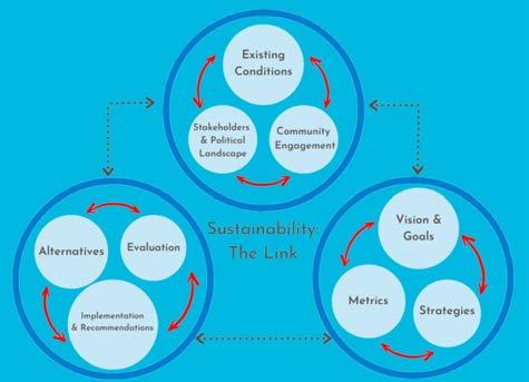
Framework
Planning Process Vision
Goals
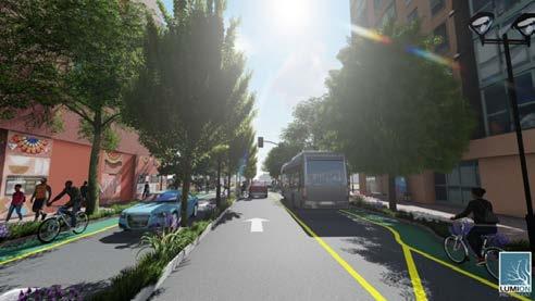
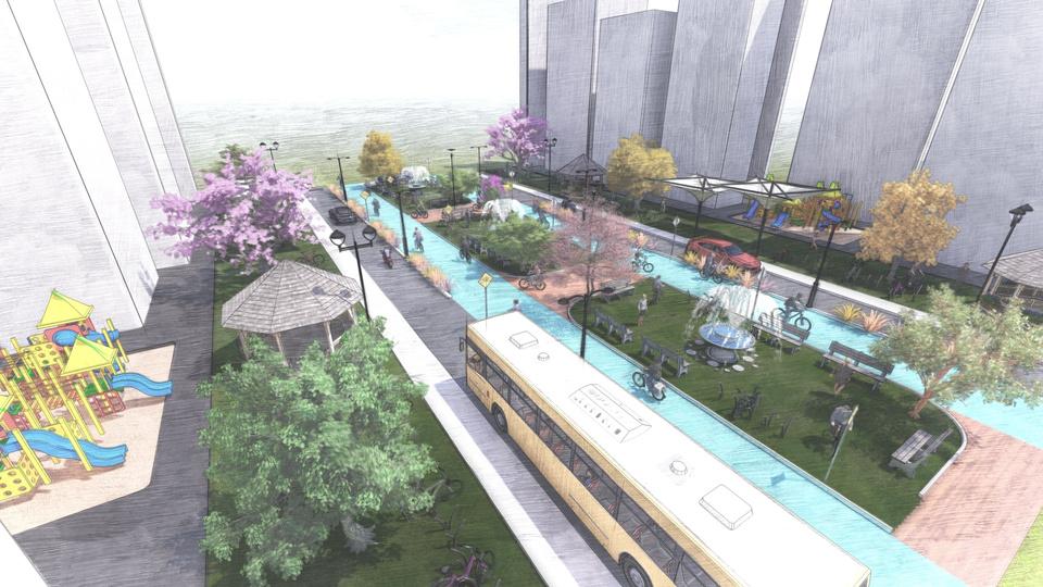
Understanding the actual context of the proposed design, we provided 3D renderings and walkthroughs. As design lead, I utilized SketchUp and Lumion to create 3D renderings of POP! Court Community Plaza for the vacant lots. Visualizingthesekeyfeatureshelpedtheaudienceandmyotherteammembers betterunderstandtheperspectiveofCommercialCorridor.
6
POP! Court Plaza aerial view
Reimagined Bronzeville Streetscape
GraduateWork
Re-Thinking the Chicago river
Natural Restoration to Improve Social Wellbeing
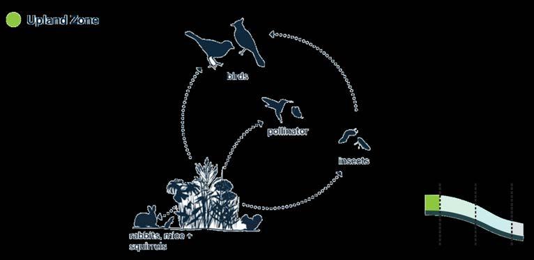
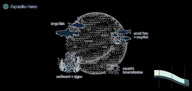
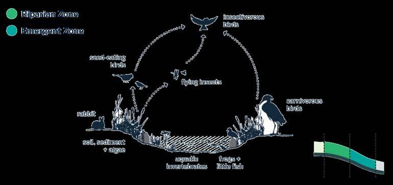
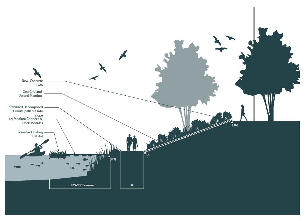
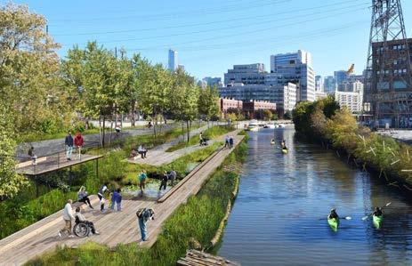
Considering the potential that Chicago has to become an example of how to integrate natural and urban ecosystems around its river, the main goal of this workwastogenerateaframeworkforfutureideasandproposalsforanewstage of riverfront development: Generation 3.0. I look for a redefinition of the edge of the river, in which re-naturalization could be seen not only as the creation of ecological habitats for cultural or cosmetic purposes, but as a key policy to address social restoration, connect the city and its inhabitants, and improve the well-beingofcommunities.
Proposed Design Solutions
Upland Zone
I have addressed past, current, and future riverfront projects, to then analyze the generation 3.0 framework and its proposals. First, I described the issue being discussed in this document and defined the different generations of developments along the river. Then, we reviewed three study cases of cities that have developed riverfronts similar to what would be expected under the generation3.0perspective.Afterthat,Iexploredsomeofthemainissuesthatthe ChicagoRivercurrentlyexperiences,describedpreviousdevelopmentsandplans along the branches of the river, and present our re-naturalization recommendation. Finally, I concluded by reviewing our work as a whole and stating how we considered ecological planning should be positioned within the disciplineinthefuture.
Aquatic Zone
8
9
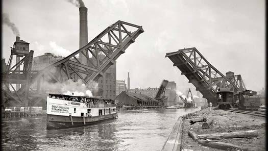
Chicago River in 1900s Proposed Riverfront
Riparian and Emergent Zone
GraduateWork
Proposed River edge
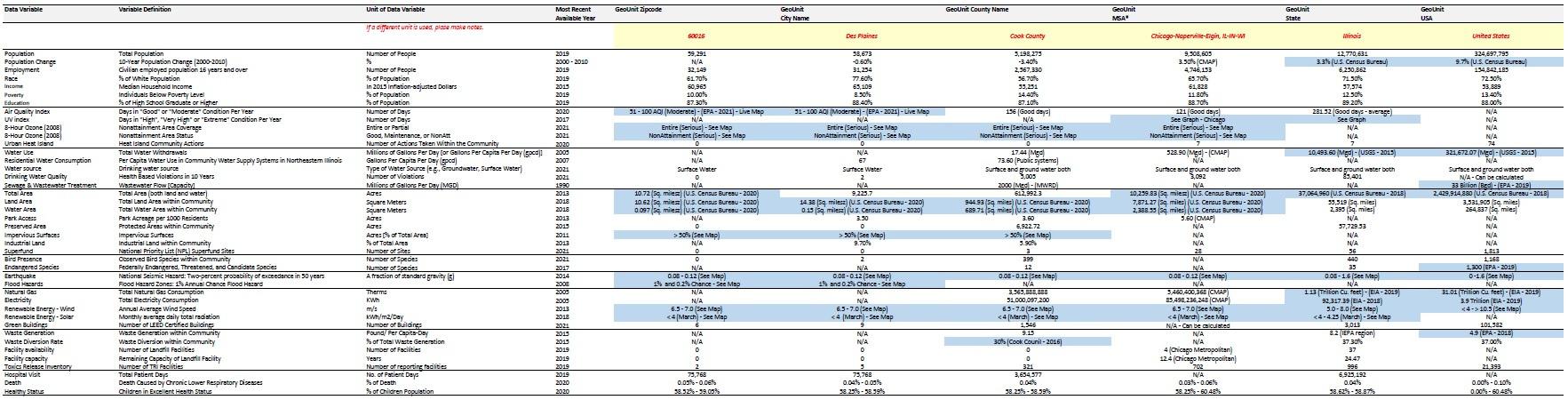
Environmental Data Mining
This task involved collecting data regarding environmental factors from various open sources and comparing the availability of environmental data on various levels of the geographic units including zip code, city, county, MSA, state, and country.
60016(DesPlaines)whichisthezipcodeofmyselectedareawaslatercompared to 5 other zip codes and presented as a 5 personal oral presentation. The information collected for the purpose of this project includes demographics, ecosystems, hazards, energy, waste, and health. The environmental technical report is useful in understanding the environmental conditions associated with specific locations allowing decision-makers to make comparative assessments betweenvariousregionsofanalysis.
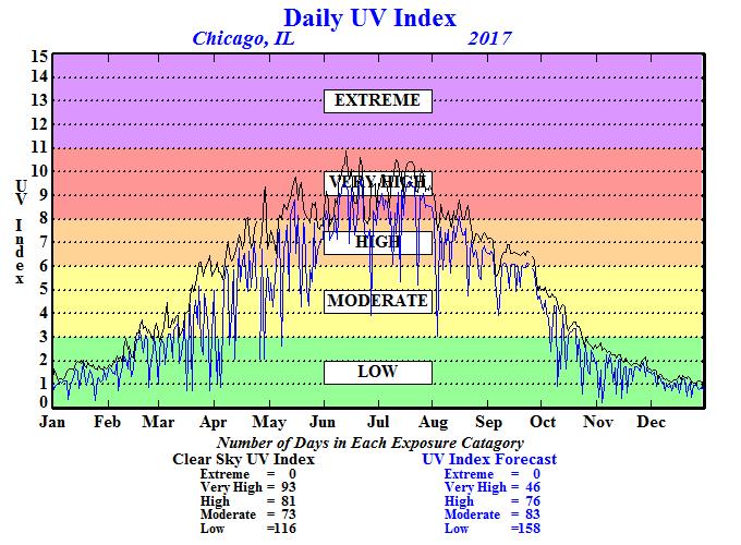
UV Index
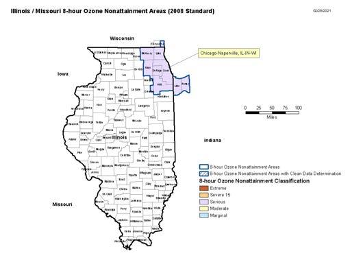
8 – Hour Ozone (2008) (Nonattainment area Coverage & Status)
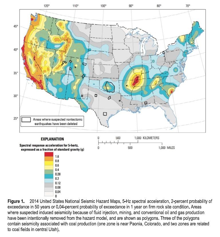
Earthquake
Data Mining
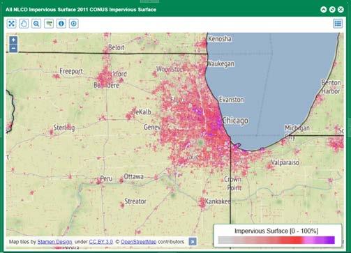
Imprevious Surface
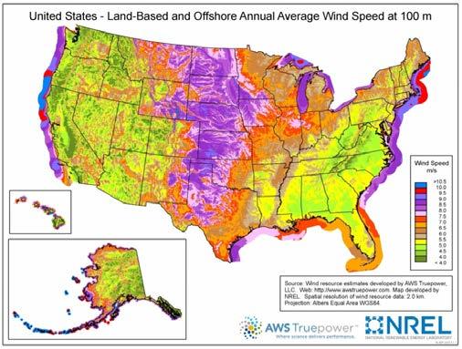
Renewable Energy - Wind
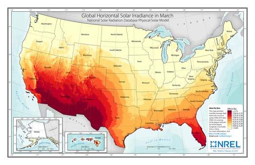
Renewable Energy - Solar
10
11
GraduateWork
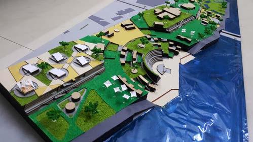
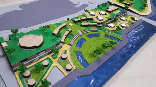
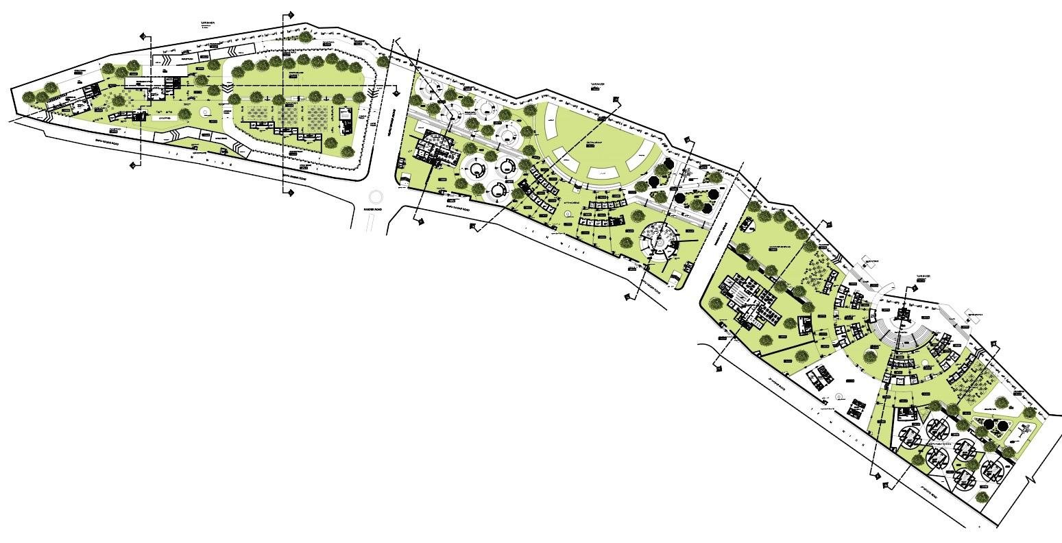
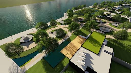
Revitalization of Tapi river at Surat, GJ, India
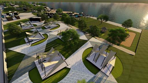
People like you & me come & go, but the river has flowed for millions of years & sustains lives in proportions that you cannot imagine. A river is not a resource, it is an immense life. The very nature of our existence is such that literally threefourths of our body is water. So, water is not a commodity – water is life-making material.Whenitisinthisbody,howmuchofanattachmentwehavetowardsit! Whenitisflowingoutthere,whyarewetreatingitanydifferently?
Tapi river has been an integral part of the life of Surat since the time the city was founded along the river banks. Besides being an important water source, it provides livelihood support to the poor. Untreated sewage flowed into the river through stormwater outfalls & dumping of industrial waste posed major health & environmentalhazard.Suchconditionsmadetheriverinaccessible.
There had been a long-standing acknowledgment that the riverfront could be turned into a significant urban asset from its undesirable state. Surat Municipal Cooperation (SMC) made proposals to achieve the same, but unfortunately, it is notsuccessful.ThedissertationdealswiththerevitalizationofTapiRiverfrontasa whole new proposal by providing spaces that enhance the quality of life for local people.Tocreateapleasantenvironmenttolive,work&recreate.
12
13
Model 01
Renderings 01 3D Renderings 02
Model 02 Key FeaturesFlyAshBricks GreenRoofs TensileStructures SolarPowers UndergraduateWork
Site Plan Handmade
3D
Handmade
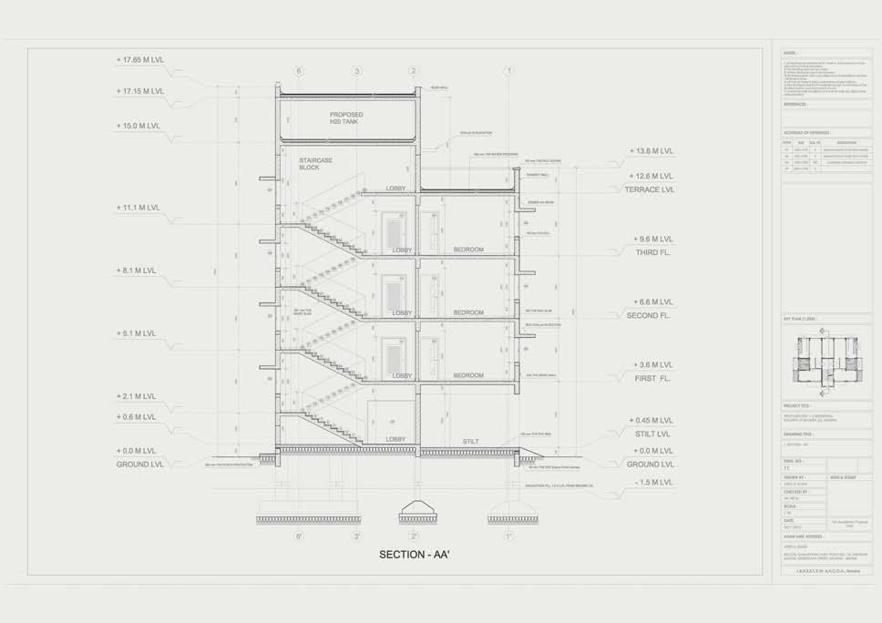
Working Drawing
Proposed Stilt + 3 Residential Building, Bandra (E), Mumbai, MH, India
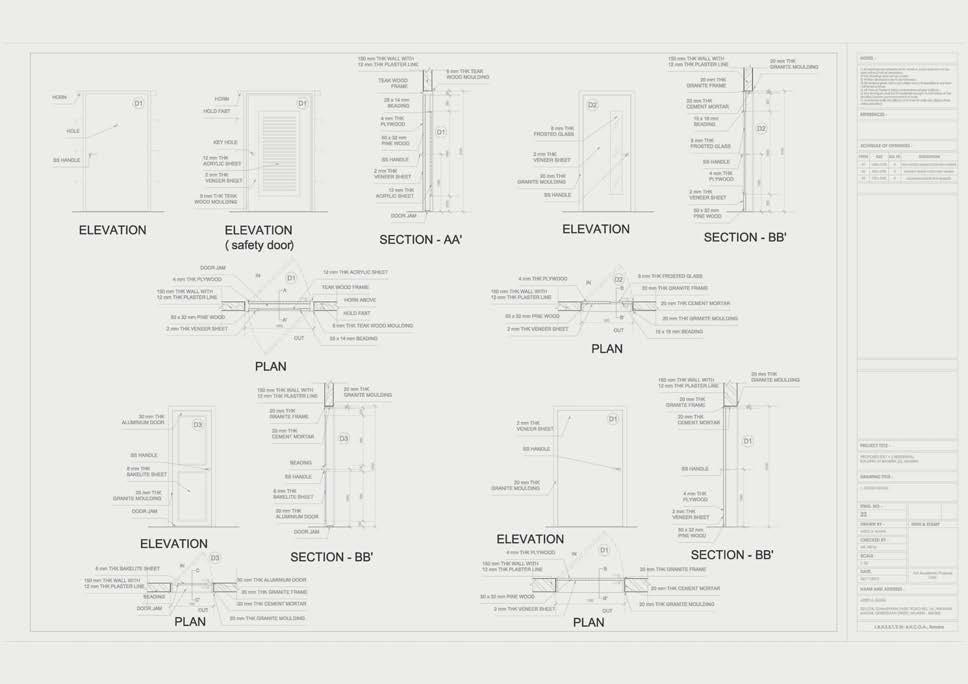
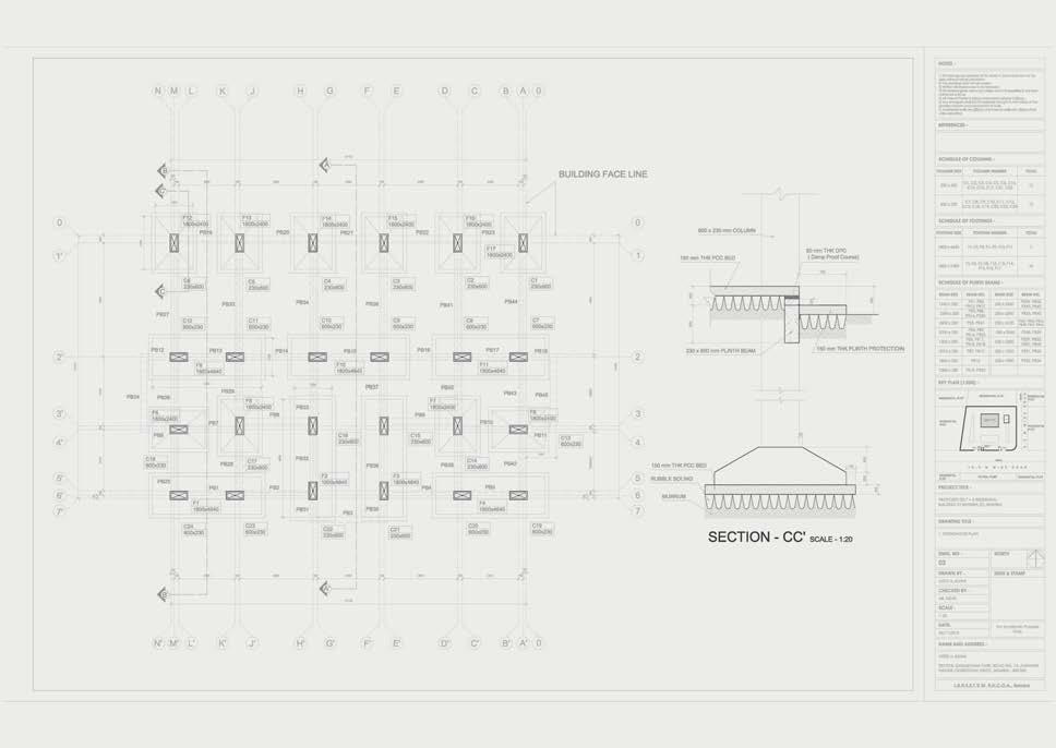
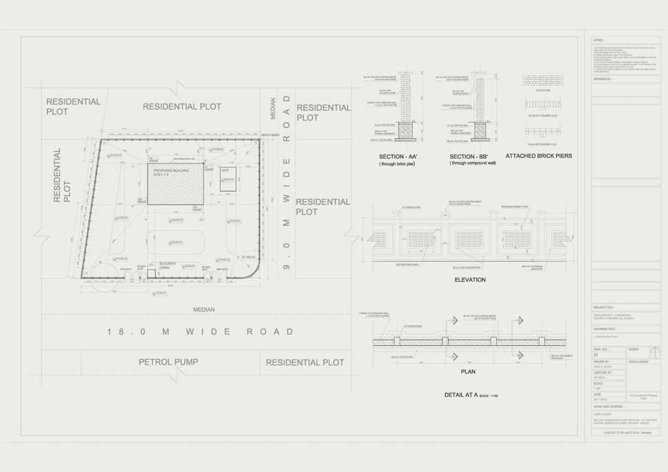
UndergraduateWork
14
15
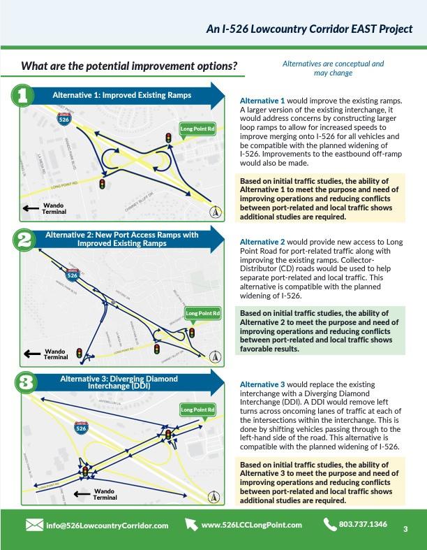
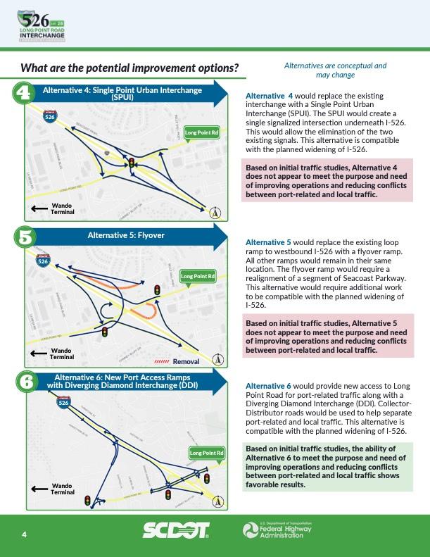
Internship Work - CDM Smith
I-526/ Long point road interchange project
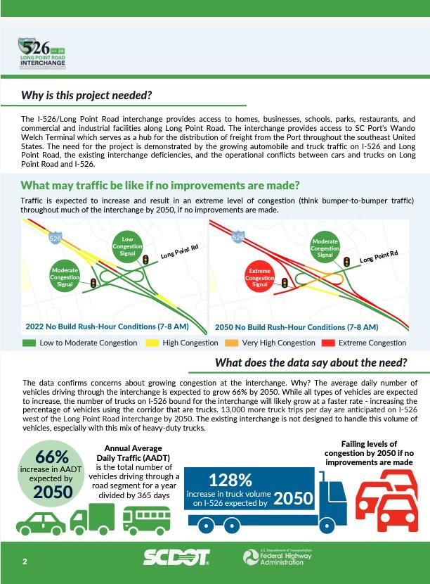
In 2022, the South Carolina Department of Transportation (SCDOT) completed a Planning & Environmental Linkages (PEL) Study for I 526 LCC EAST, from Virginia Avenue in North Charleston to US 17 in Mount Pleasant. The PEL study identified existing and projected transportation issues within the corridor through analysis and public and stakeholder engagement. The results of the study established a vision to guide future transportation decision-making in the corridor. After the needs were better understood, potential improvements were identified One such improvement is the I 526 @ Long Point Road Interchange Improvements project. Carrying forward the analysis and public input, the I 526 @ Long Point Road Interchange project is now going through the National Environmental Policy Act (NEPA) process, a federal review of the natural and human environment.
The purpose of the proposed project is to improve the operations of the I 526/Long Point Road interchange and I 526 mainline and reduce operational conflictsbetweenport relatedandlocaltraffic.
I had got opportunity to create booklets, brochures, presentations, flyers, websites, and project themes for suggested route alternatives and public meetings to help seniors organize Public Information Meetings. Keep an excel file of people's comments as well, and contact them with practical responses. Fieldwork was completed in which data was collected and surveyed for businesses located near the recommended alternatives. In addition, noise calculations for existing routes were performed, and worked on traffic studies for existing and future transportation networks. Demographic and Census data from the locations were collected in order to investigate the state's current situationfurther.
16
17
ProfessionalWork
Public Meeting Handout
18 19 ProfessionalWork
20 21
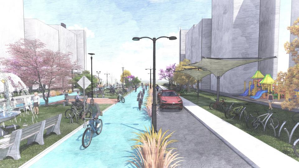
Tools: AutoCAD, Revit, Photoshop, SketchUp, and Lumion. GraduateWork
Sample - 3D Renderings
Contact ATEET KAWA Urban Planner / Architect ateetkawa@gmail.com 773.931.5993 https://www.linkedin.com/in/ateetkawa/
