
TECHNICAL
Revit
AutoCAD
Lumion

aseel.e.haddad@outlook.com
+971 56 4628 934
Dubai, UAE
SketchUp
Rhino
Photoshop
InDesign
Illustrator
ArcGIS
Microsoft Office
SOFT
Problem solver
Fast learner
Time manager
Effective communicator
Detail-oriented
Multitasker
Strong interpersonal skills
ARCHITECT AND URBAN DESIGN ANALYST
2024
ADMIN ASSISTANT
2021 - Present GRADUATE
TEACHNING ASSISTANT
2022 - 2024
ENGINEER INTERN
2021
Collaborated with the Department of Town Planning, analyzed urban fabric, proposed aesthetic solutions, and delivered project proposals.
Managed data with Microsoft Word and Excel, attended meetings and documented detailed minutes.
Coordinated with professors, facilitated discussions, and monitored student progress.
Contributed to architectural plans and facades for mixeduse buildings, proposed a rooftop snow park design using AutoCAD, Revit, Photoshop, and Lumion.
SOTI PROJECT
2021
EDUCATION
BACHELORS
2017 - 2022
MASTERS
2022 - 2024
Certificate of Recognition – Sharjah Chamber of Commerce and Industry – Third Place Winner, SOTI Competition: Urban design with sustainability.
Bachelor of Science in Architectural Engineering, University of Sharjah
Master of Urban Planning, American University of Sharjah
• Social Inclusion and Blue Economy: The Role of Social Inclusion in Mussafah's Transition to a Blue Economy by 2040.
• What would an "ecocity" look like on a hypothetical coastal location in the Gulf?
• Al Wahda Boulevard: Modifying and Reviving Al Wahda street in Sharjah, United Arab Emirates.
• Land Use Planning Negotiations in Future Cities.

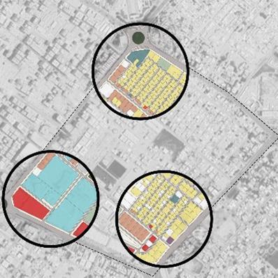
02 Land Use AnalysisAl Nasserya Neighbor hood in Sharjah
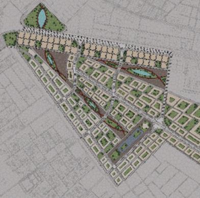
01 Developing the Shared Area Between Sharjah and Ajman Based on its Location and Urban Context


04 Al Wahda BoulevardDeveloping Al Wahda Street in Sharjah
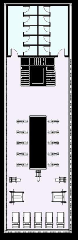
03 SOTI –Sharjah Oasis for Technology and Innovation
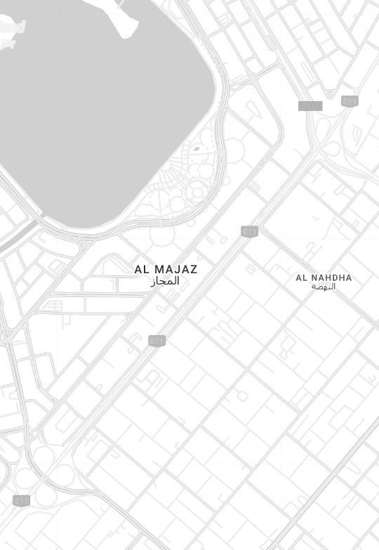
05 Transportation Analysis – Al Majaz Area in Sharjah


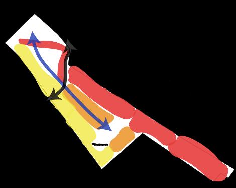
Restaurants’ Complex
Corniche Street
Low-rise buildings
Mid-rise buildings
High-rise buildings
Primary Road Secondary Road Tertiary Road
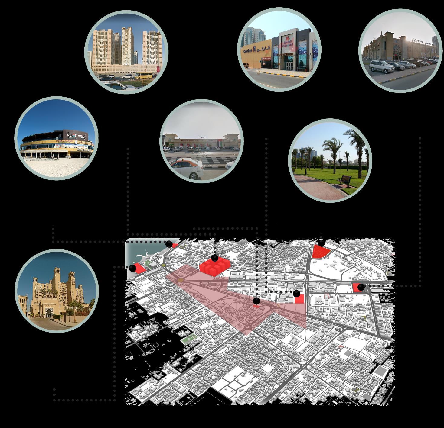
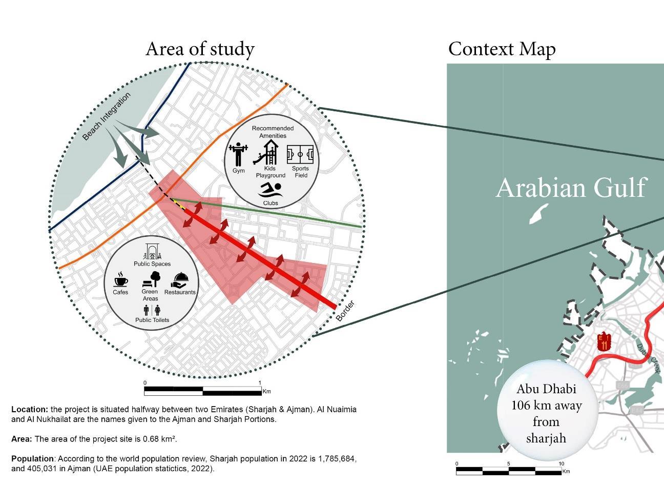
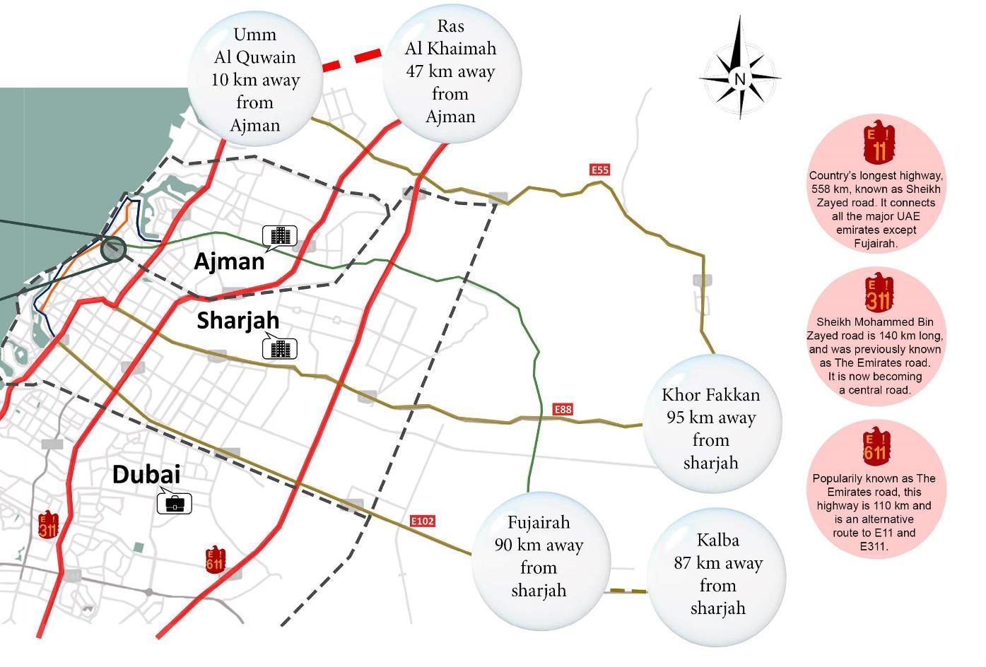
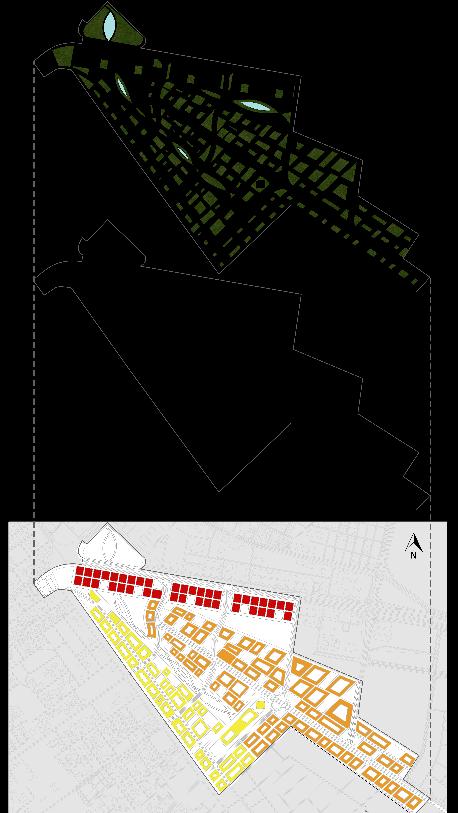
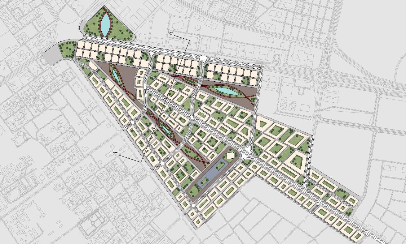
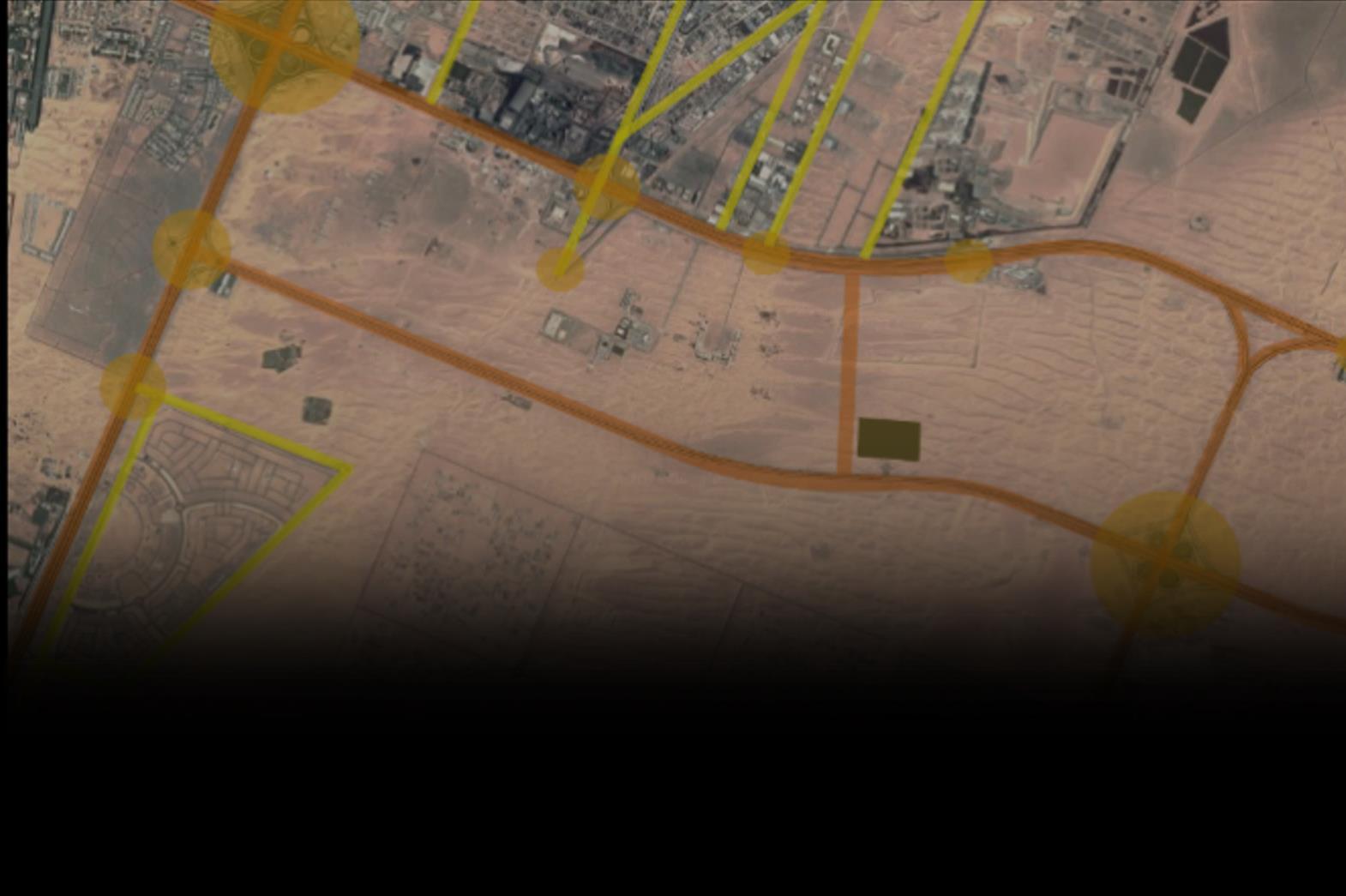
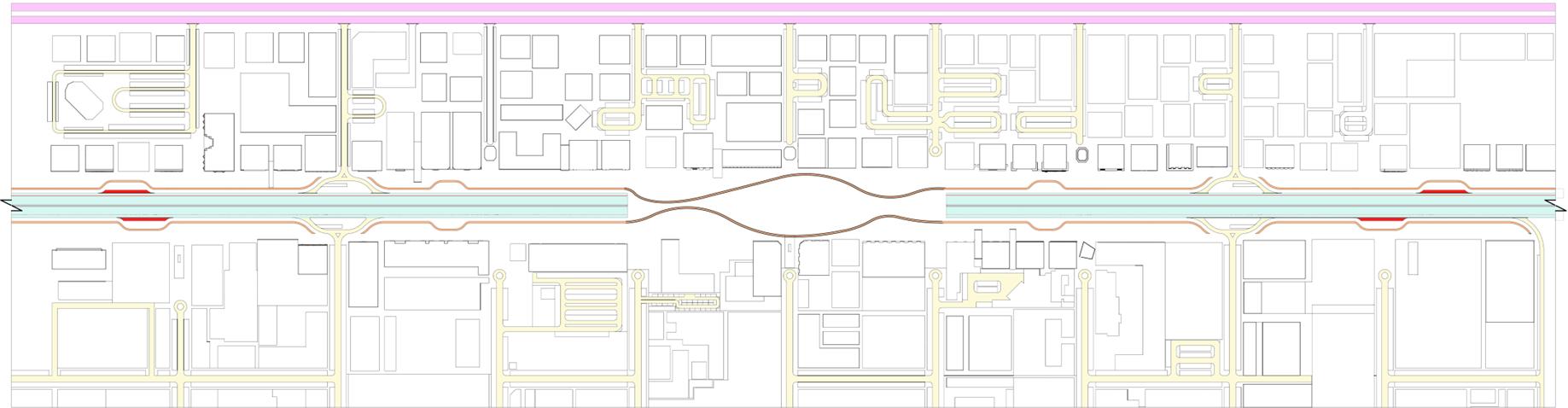
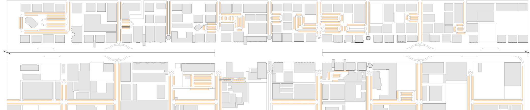
The project focuses on developing the shared area between Sharjah and Ajman, drawing insights from an analysis of the surrounding urban context and its strategic location on the map.
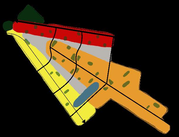
The study area lacks physical borders, allowing shared cultural, architectural, and social characteristics between the two emirates. It has inconsistent urban density, where Ajman features mixed-density (low, mid, and high-rise) buildings, while Sharjah is predominantly low-density, highlighting a lack of cohesion.
Despite its strategic location near attractions like Ajman and Sharjah corniche, it remains underutilized, with insufficient social spaces, greenery, and a well-planned road system transition.
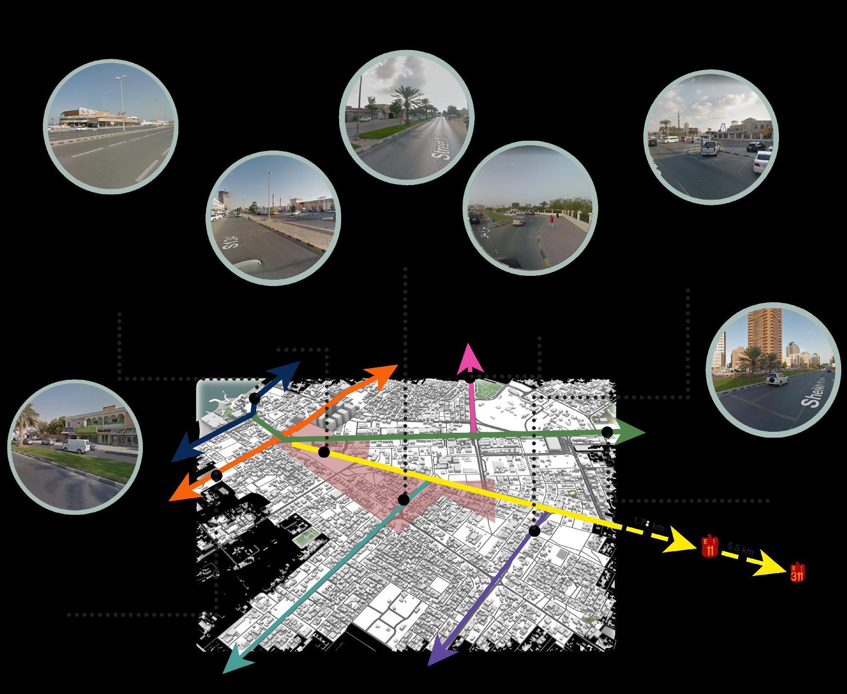
The methodology involved analyzing the area, its surroundings, its location, and its relationship with the surrounding context to determine what modifications or additions were needed, such as:
• Introducing activities and amenities
• Expanding green and open spaces
• Enhancing urban density
• Modifying building typologies

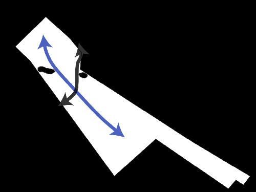

01 Connect both emirates vertically and horizontally Mobility
02 Add green corridors, pockets, parks and public spaces
03 Add a landmark that acts as an attraction point
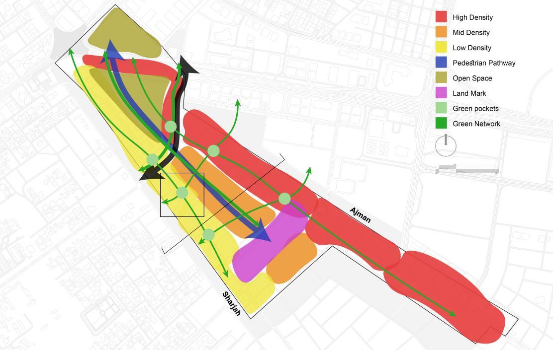
Land Use
04 Establish an appropriate scale for residential urban density

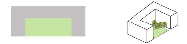
05 Modify building typologies to incorporate courtyard-style designs with greenery
Typologies
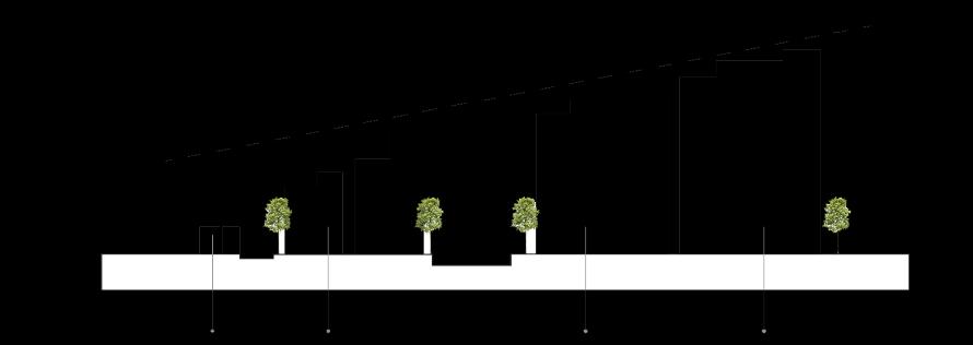
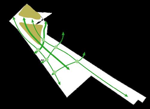
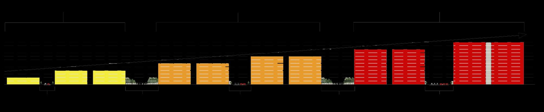
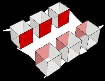
Street Section Showcasing Buildings’ Densities (Conceptual)
The

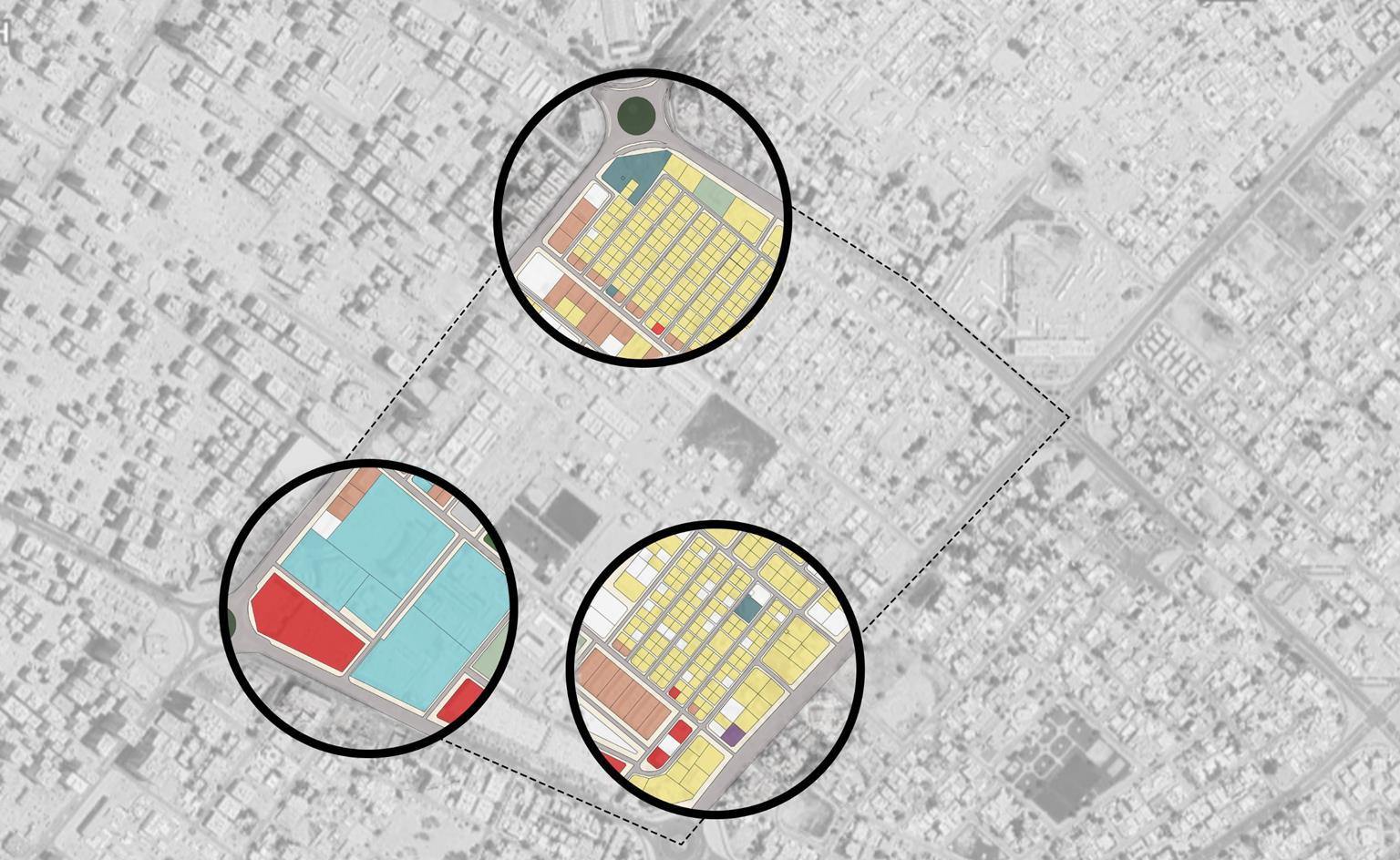
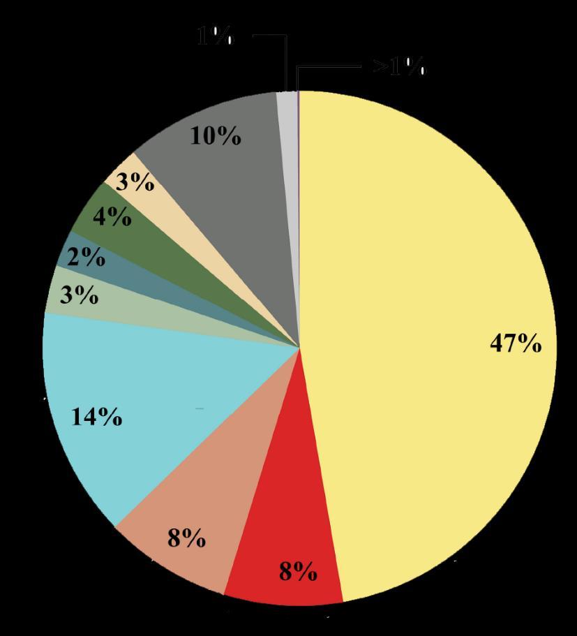
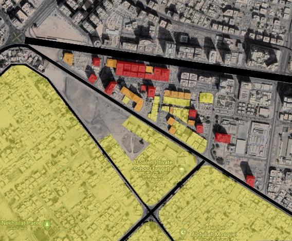
This project analyzes land use in Al Nasserya in Sharjah, focusing on its impact on land management and systems like mobility and transportation. The map reveals diverse uses, including residential, commercial, mixed-use, governmental, and more.
Also, the analysis reveals that Al Nasserya neighborhood is home to various people from different ethnic backgrounds, with 93% of its residents being expats, particularly low-income individuals, and only 7% locals.


The forces and issues map is created to understand the various factors influencing the area and to identify key challenges and opportunities in the neighborhood. The map below provides a visual representation of the forces and issues related to three systems: land use, street conditions, and public transportation.


Using vacant plots for parking wastes the opportunity to transform them into more efficient, usable spaces.
As the region's economy grows, vacant plots can be developed to enhance the neighborhood's image and value.
Cars that illegally double park in front of mixed-use structures create traffic congestion on the main roads.
Mixed-use structures on the west side boost the local economy and keep it vibrant with numerous commercial and retail shops.
The institutions do not provide enough parking spaces for the beneficiaries, which leads to traffic congestion in the neighborhood.

Streets that surround institutions are neat, well designed and constructed to facilitate easy access to the structures.
The area's lack of infrastructure and safety standards disrupts pedestrian movement among Al Nasserya and the surrounding neighborhoods.
Helps reroute traffic away from the neighborhood's inner streets.
Buses stay on the outer main streets of the neighborhood and do not go into the neighborhood itself.
Since the majority of the population is from the lower stratum, most of the population relies on public transportation, reducing traffic congestion in the region.
Poor infrastructure has turned villa street sides into parking lots, damaging the neighborhood's image and raising safety concerns.
Relieves main streets from traffic and has the potential to be developed into a better, more efficient condition.
(2023 - 2027)
The influx of migrants and neglect of housing units have led to hazardous conditions, with no renovations by owners, causing property values to drop.
Land use policy requires mixed-use buildings to function as intended, with shops on the ground floor and residential units above, rather than using upper floors as storage.
(2028 - 2032)
The park has been renovated with new amenities, including additional playgrounds and children's facilities.
Empty plots are used to build 1-2 story parking facilities to ease traffic congestion near governmental and commercial areas.
For the increasing number of laborers, the government demolishes houses in a delicate condition and builds new ones.
The government improves streetscapes and amenities on main streets to promote safe and comfortable walking and cycling.

New bus stops and routes are introduced into the neighborhood to ensure residents are within a five-minute walk of transportation.
What potential scenario could Al Nasserya face in 2037 based on current indicators?
Based on the analysis and the Forces and Issues map, a forecasting summary plan was developed. Forecasting predicts possible future scenarios based on current conditions. The summary map was created to project a potential scenario for 2037, outlining key actions to be taken at five-year intervals. It considers various factors such as government policies, housing, transportation, land use, economy, and the public realm.
To accommodate the growing population, the government develops vacant land into residential properties for labor migrants.
To improve public realm, the government uses some vacant plots to add open and recreational spaces (e.g., green areas and restaurants).
Newly constructed homes and the added public spaces contribute to the growth of the local economy in the area.
Light grey plots represent areas preserved or left untouched due to their good condition or importance to the neighborhood.


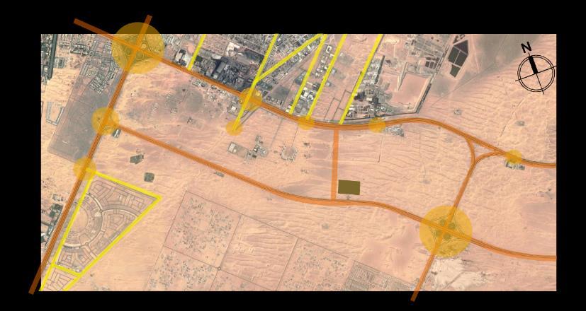
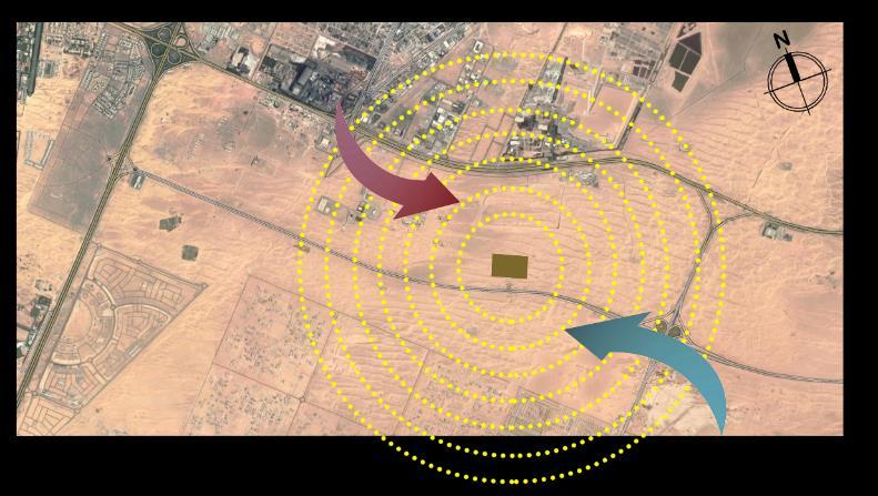
The site is easily accessible via major and minor roads on two sides.

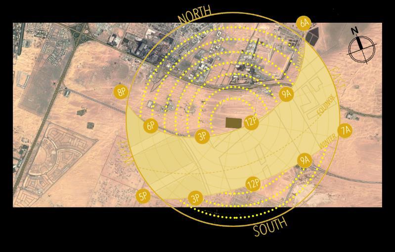
With summer highs of 45°C and winter highs of 25°C, Sharjah's sun path is key to effective passive design.

Sharjah’ s
“Shamal” wind brings dry heat, while easterly winds bring occasional humidity.
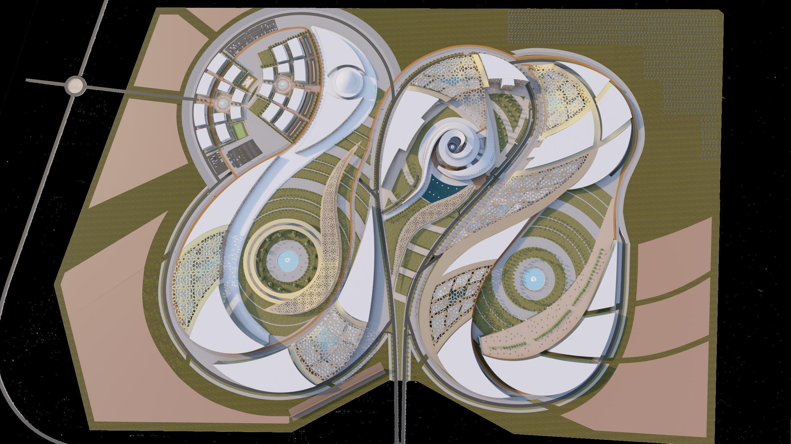


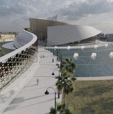
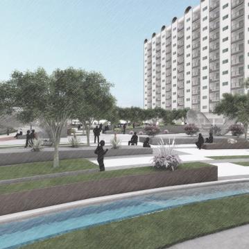
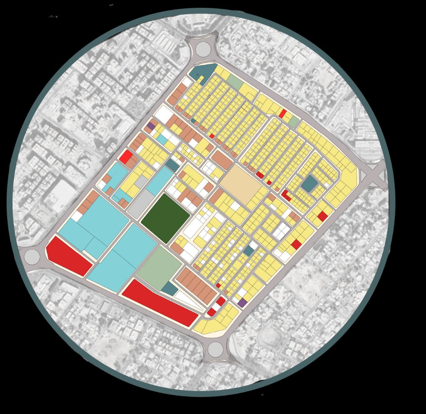
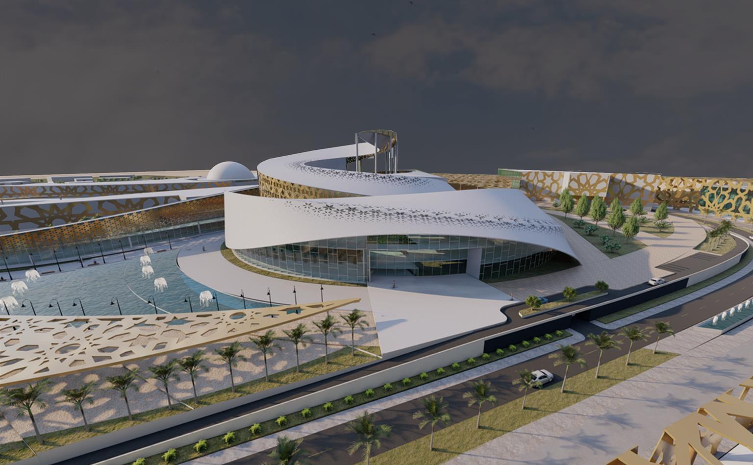
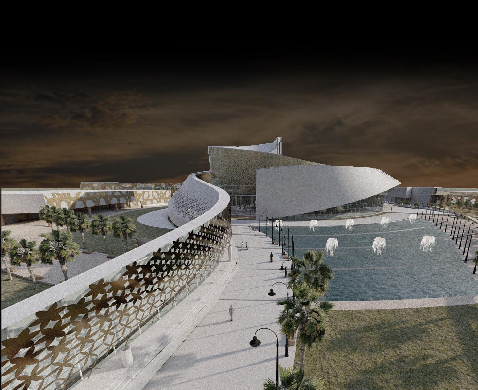
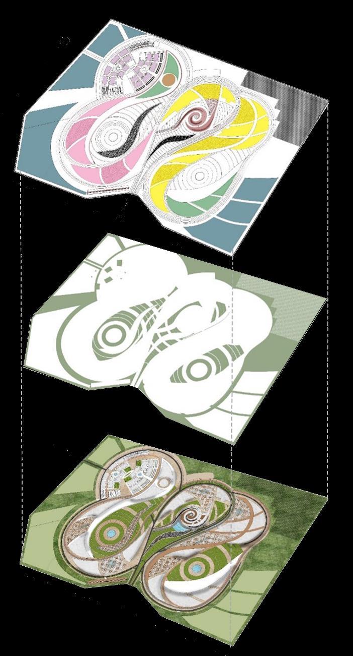
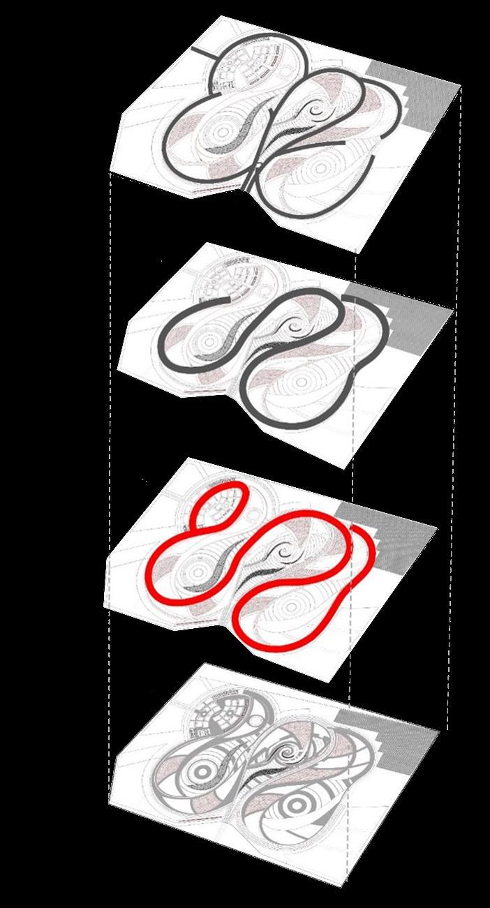
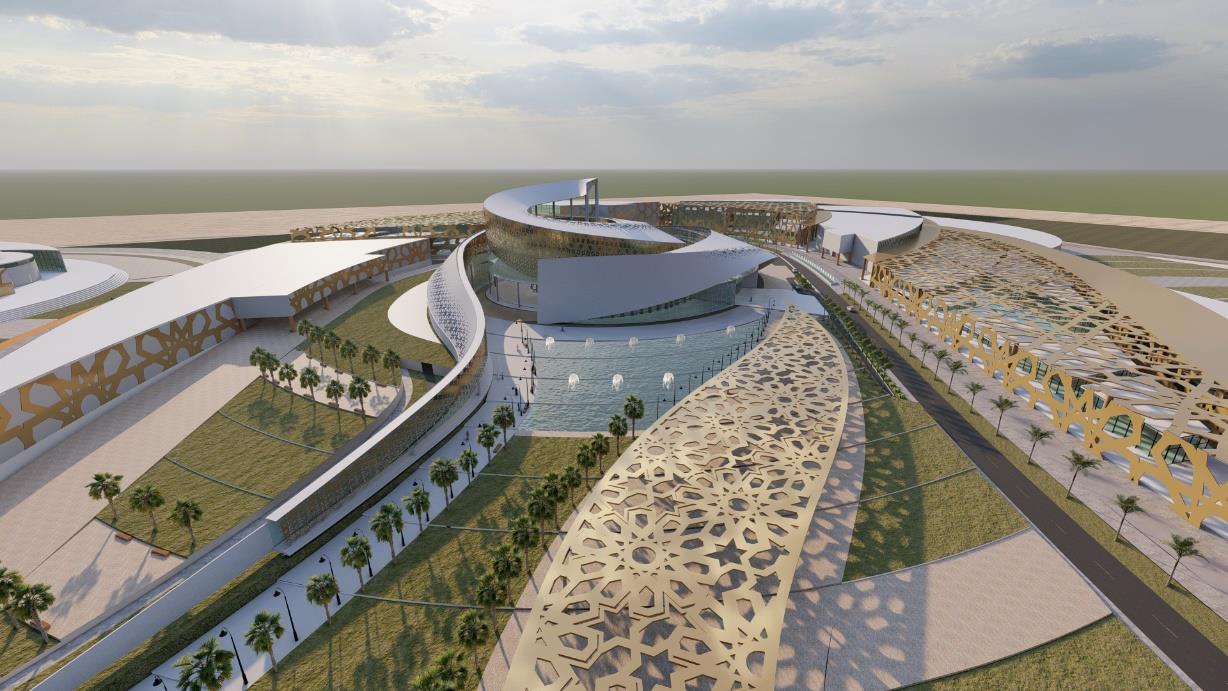
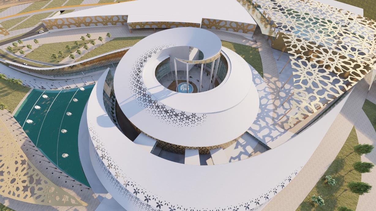
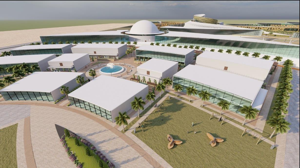
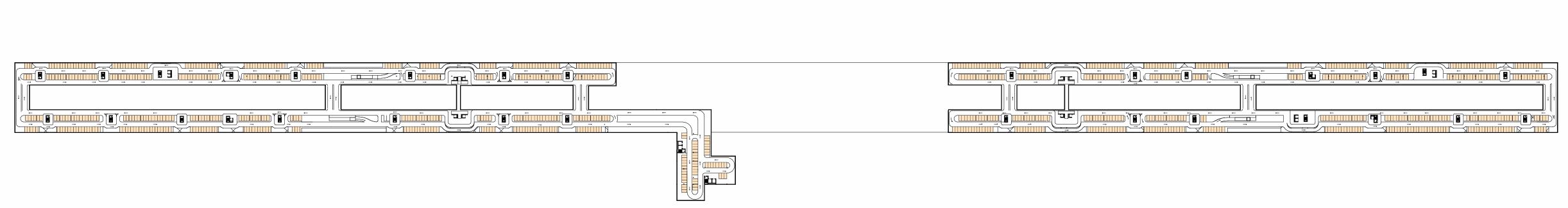
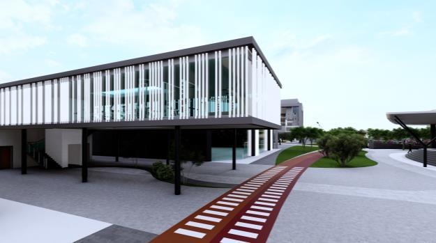
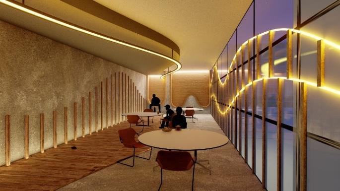
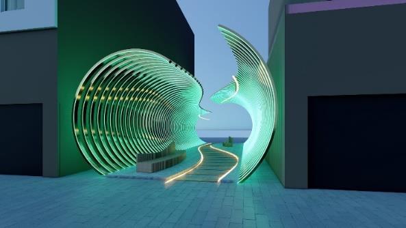
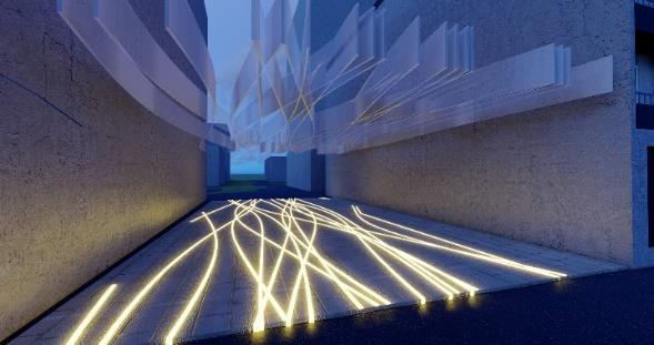
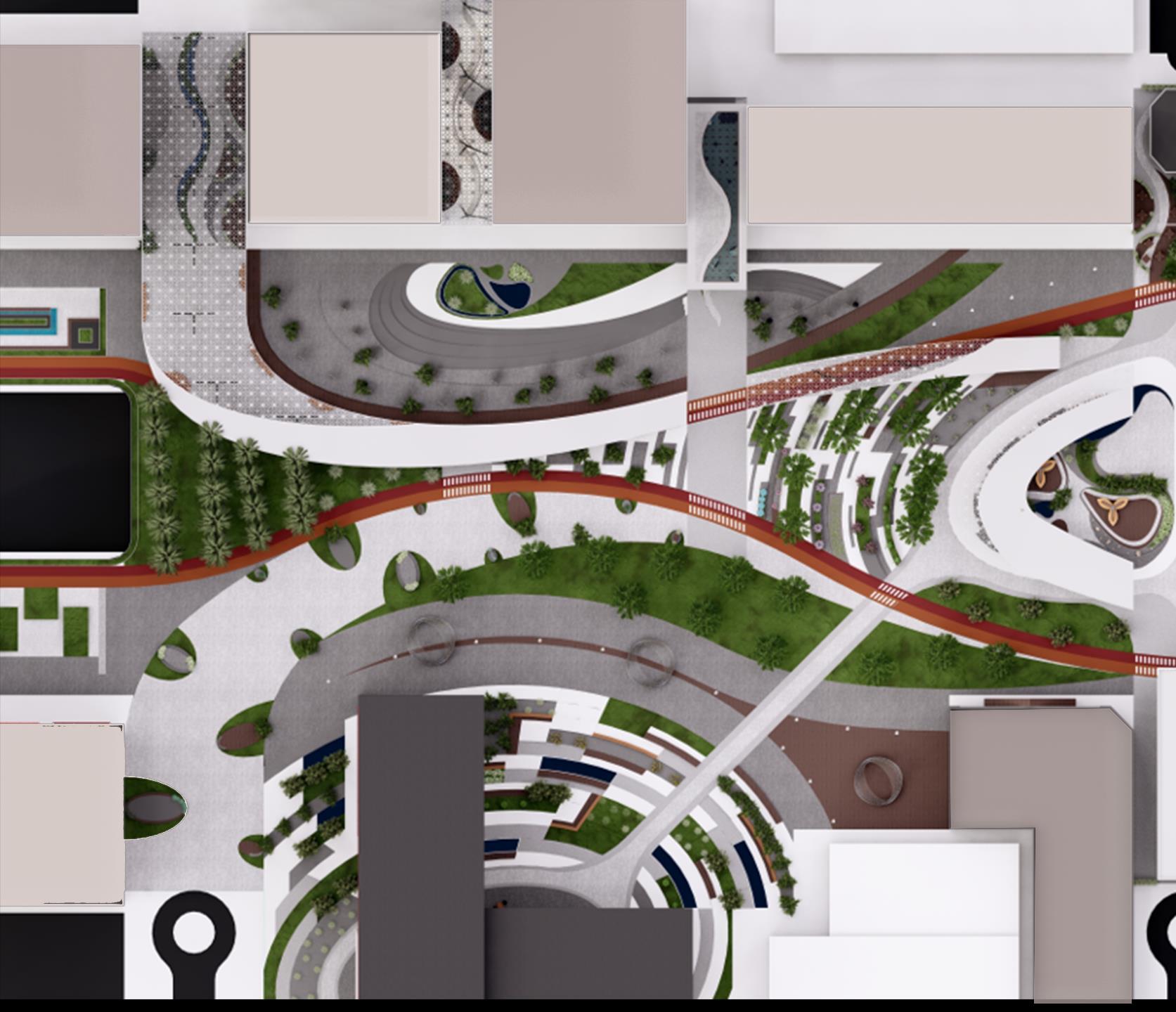
The Sharjah Oasis for Technology and Innovation (SOTI) is an urban project aimed at fostering applied scientific research to drive the development of new technologies and innovations.
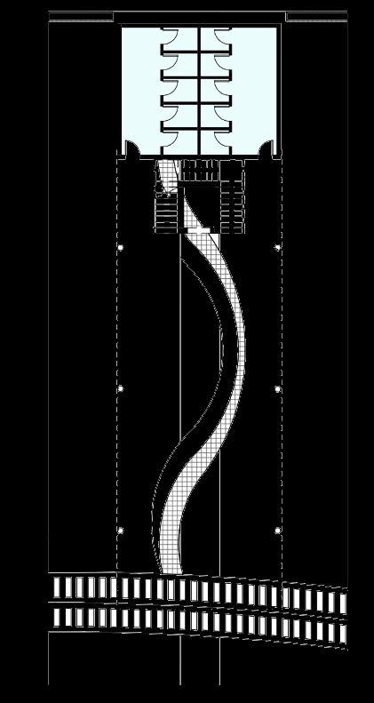
The project’ s core concept, inspired by abstract art, revolves around a looped structure that enhances connectivity and promotes sustainability. This design creates a continuous and interconnected pathway linking all zones within the site, ensuring smooth circulation for pedestrians, vehicles, and other modes of transportation. The loop design also reduces travel distances, and fosters user interaction, aligning with the project's vision of sustainable and connected urban development.
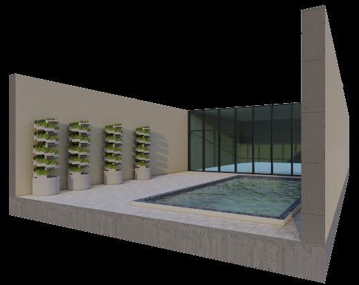
Hydroponics is implemented in SOTI project to grow vegetables and crops for residents' use. This approach provides fresh products, supports sustainable urban agriculture, and enhances community self-sufficiency.
Greywater from domestic sources such as sinks and showers in SOTI project is managed and utilized for irrigation. This approach conserves freshwater resources, and promotes sustainability by reducing wastewater and enhancing the growth of community gardens and green spaces.
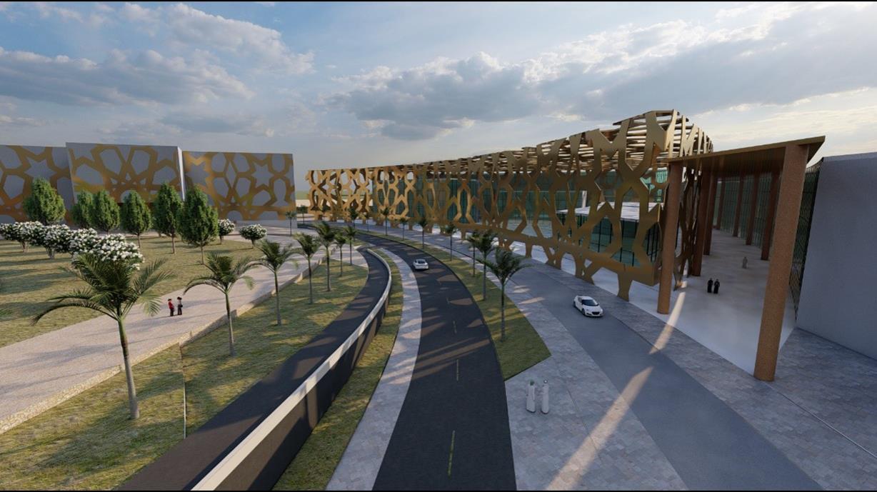
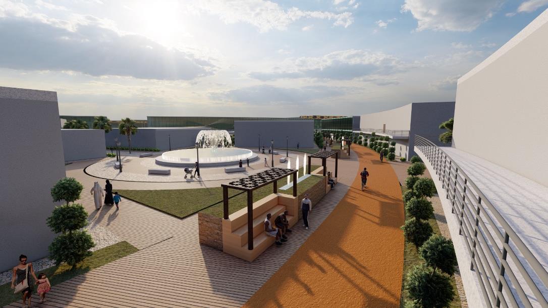
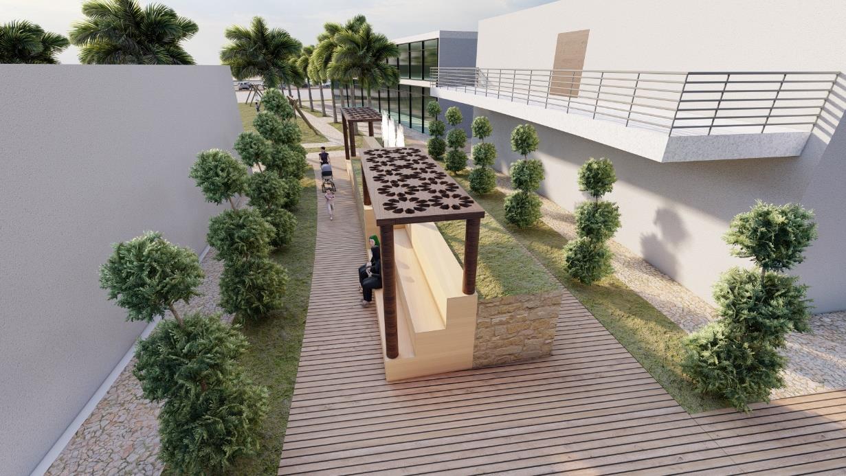
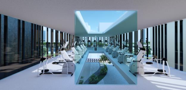
Active transportation, a central element of SOTI, promotes walking, cycling, and jogging through dedicated pathways and bike lanes. This approach enhances community connectivity, improves air quality, and encourages a healthier lifestyle.
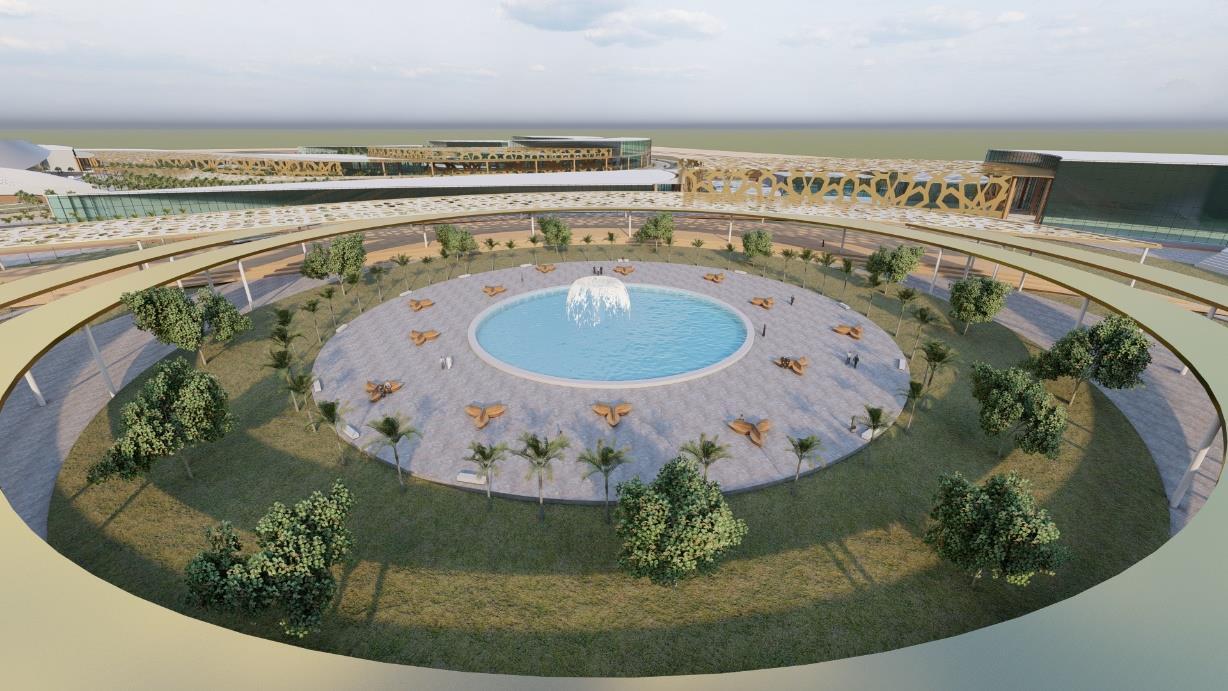
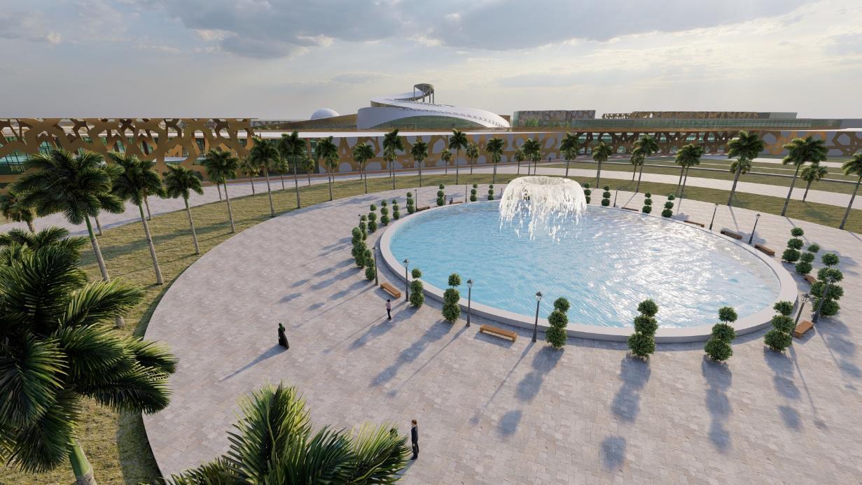
Ample green and open spaces are incorporated into the site, including outdoor activities such as basketball, football, a kids' playground, and more.

The site is seamlessly connected through walkways, cycling paths, road networks, and more, promoting active transportation and reducing dependence on conventional vehicles.
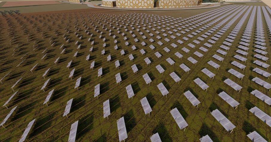
A total of 66,400 m² has been equipped with solar panels, each generating approximately 250 watts. This installation is sufficient to power the headquarters' lighting systems and various appliances, including computers, printers, and laboratory equipment, as well as providing 10% of the lighting for the site, such as the illumination of buildings and outdoor streetlights.

The site design incorporates flexibility for future expansions (land lease), ensuring adaptability to accommodate new facilities, infrastructure, and evolving community needs.

The site design supports the integration of electric vehicles by including charging stations and prioritizing infrastructure that promotes sustainable transportation.

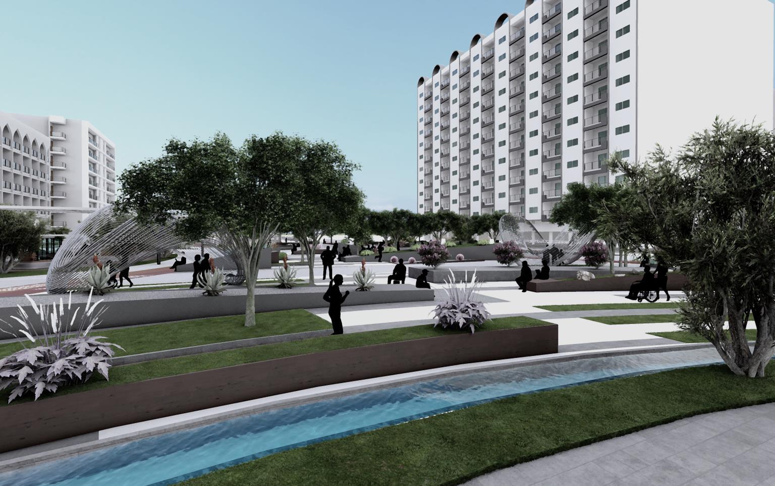


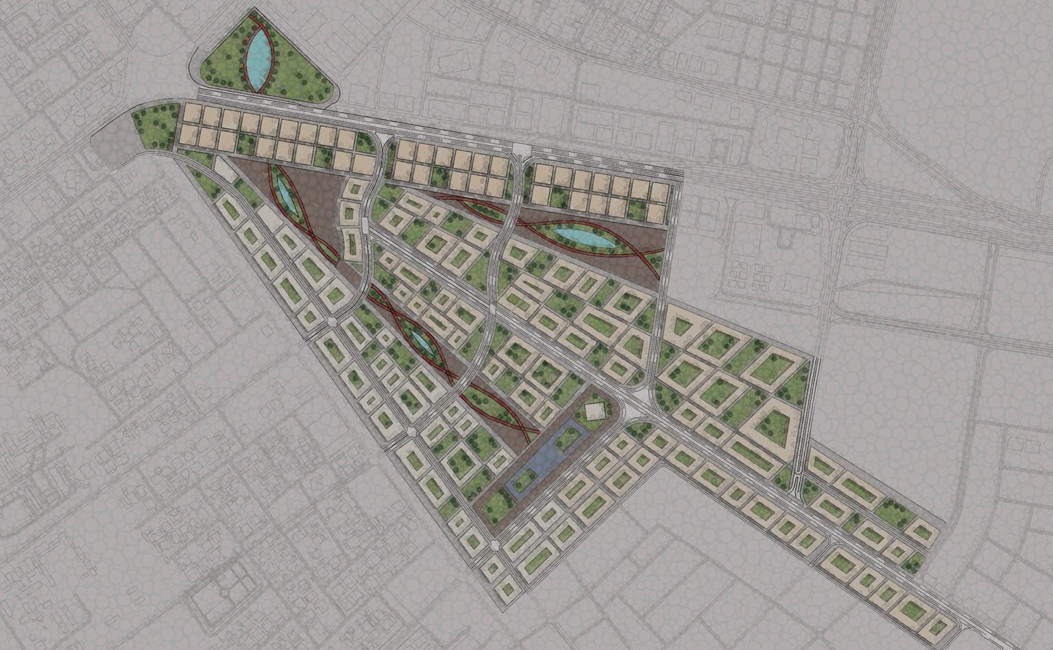
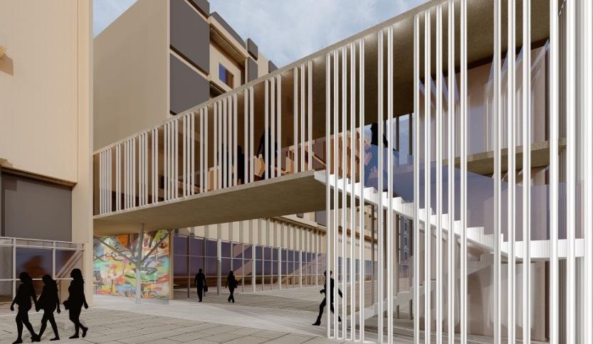
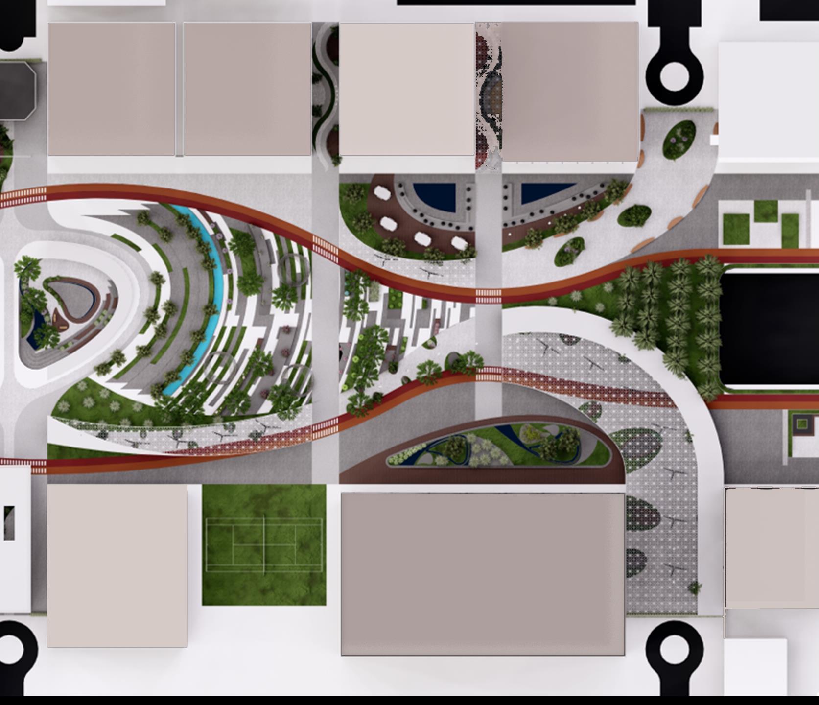
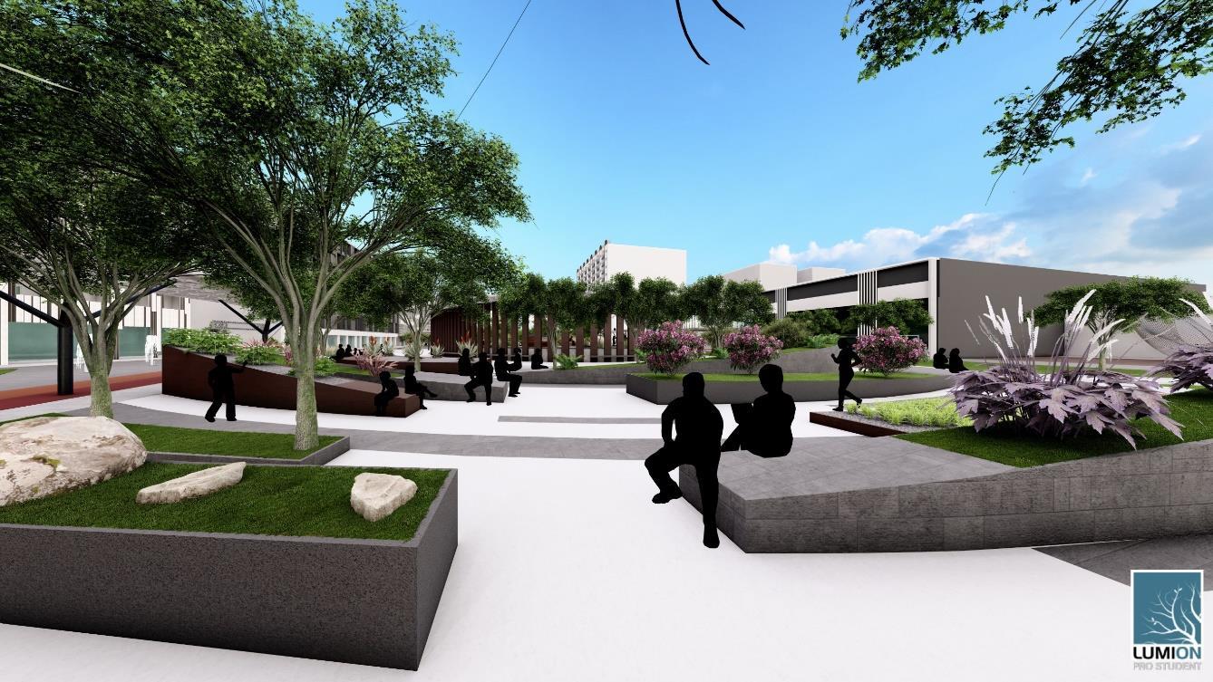
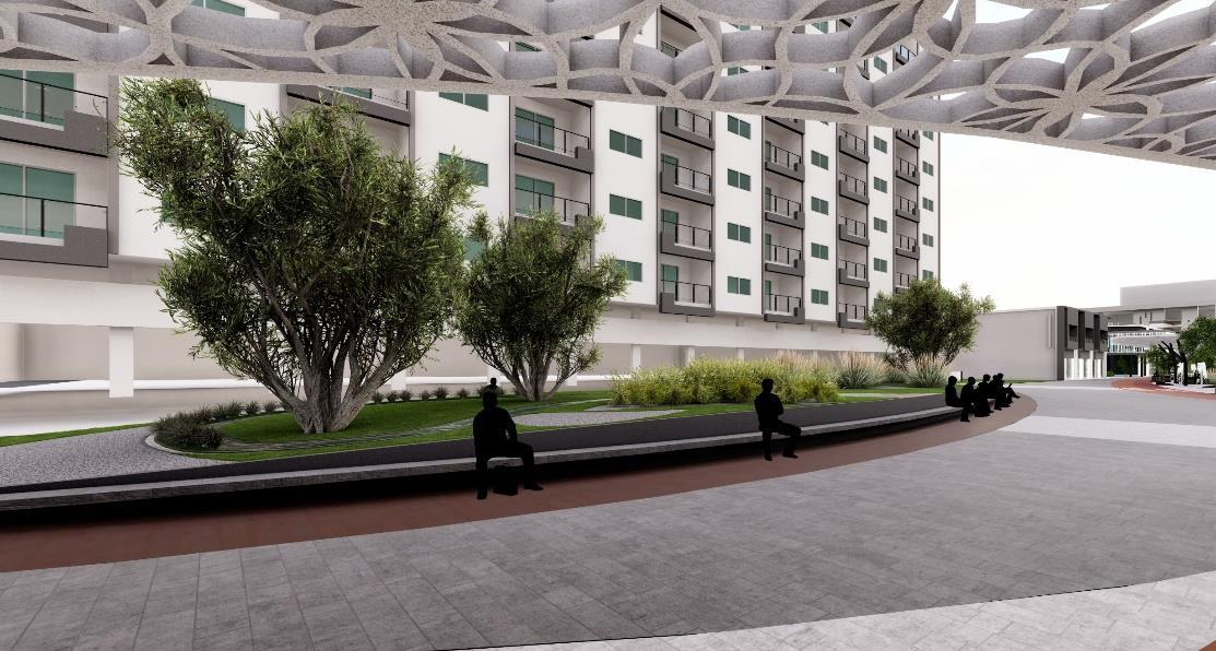
Al Wahda Street revitalization project aims to modify the existing street conditions, foster economic growth, enhance social integration, while preserving cultural heritage, reminiscent of its vibrancy in the 1980s and 1990s.
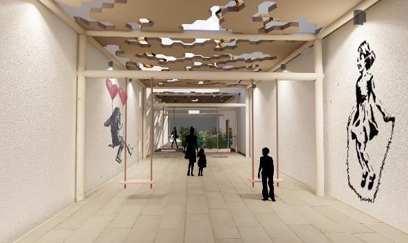
The project focuses on four key areas: establishing a well-connected and secure boulevard to safely link both sides of the road, revitalizing and optimizing the underutilized spaces between buildings, modifying outdated street elevations, and boosting economic value by creating a business incubator that supports local entrepreneurs and strengthens the local economy.
01
Stage 1 – foster social integration and establish connectivity between both sides of the road.
03
Stage 3 – enhance the visual appeal of the facades and improve the street elevations.
Current situation – a motorway creates a barrier, dividing the two sides, with underutilized spaces between buildings and outdated building facades.
02
Stage 2 – modify the spaces between buildings to improve the area, create activities, and foster engagement. 04


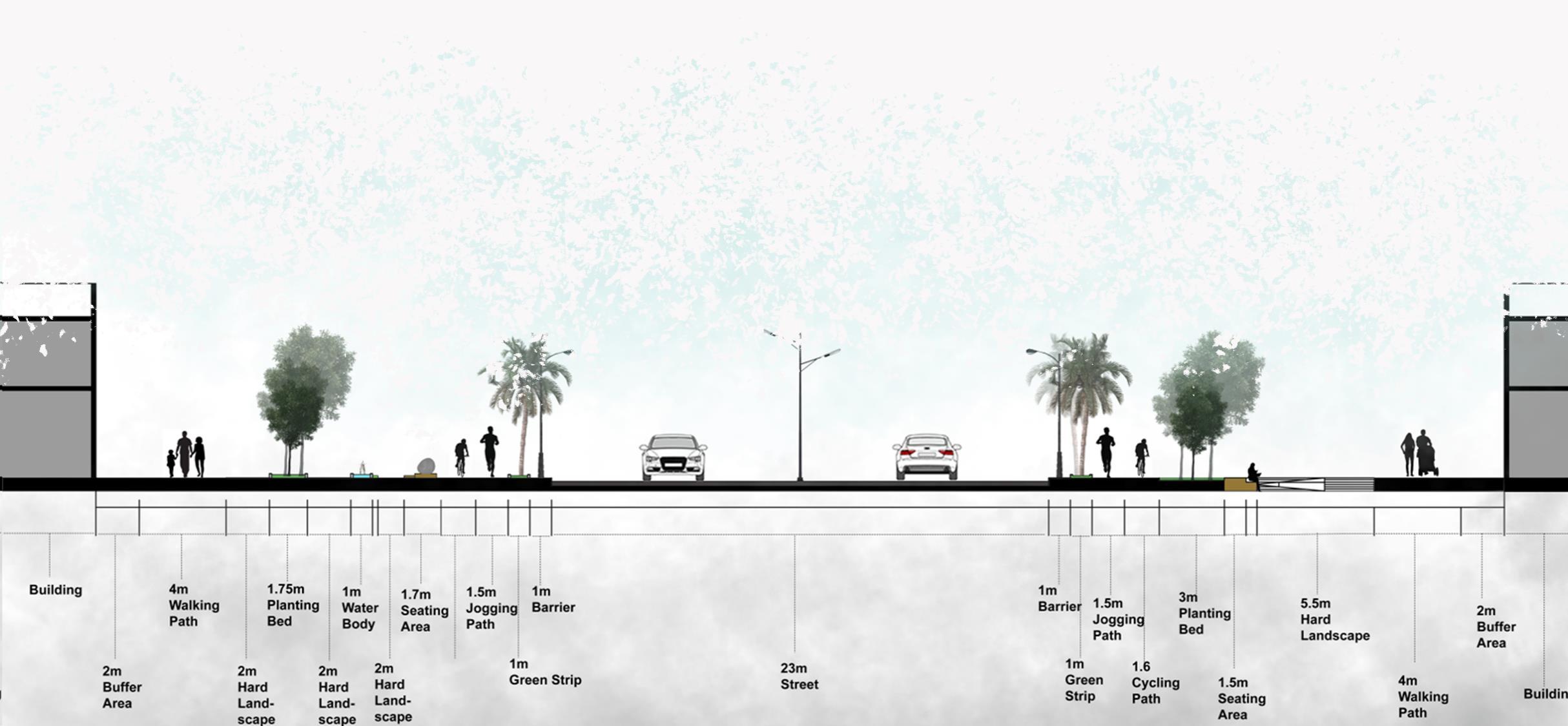
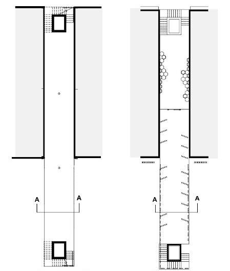
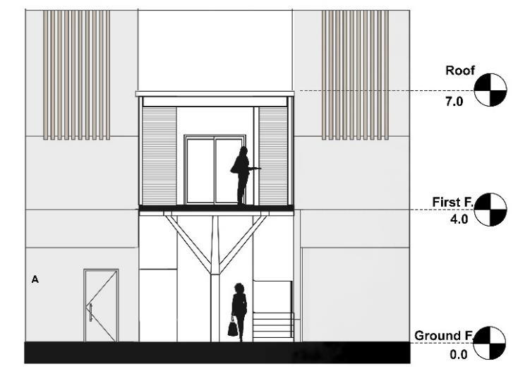
Architectural Section - A-A

Parking Lots
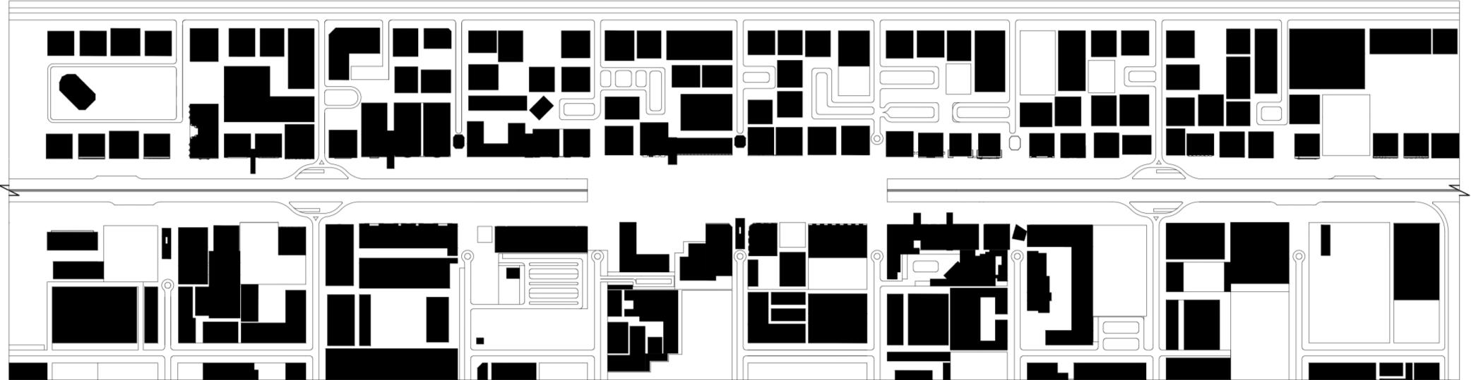
The study area was examined across various systems, including road networks, pedestrian connectivity, parking facilities, land use, transportation, and more. Based on the analysis and in collaboration with the Department of Town Planning and Survey in Sharjah, to determine restrictions and permitted actions, appropriate enhancements were implemented.
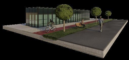
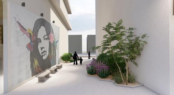
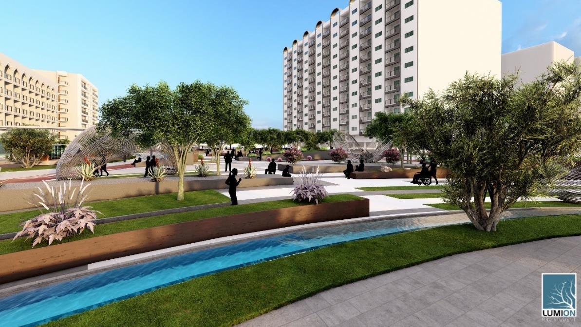
To promote community interaction, various activities have been incorporated into the spaces between buildings, such as gyms, galleries, cafes, libraries, playgrounds for children, and more.
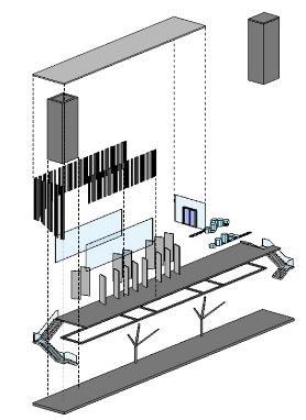
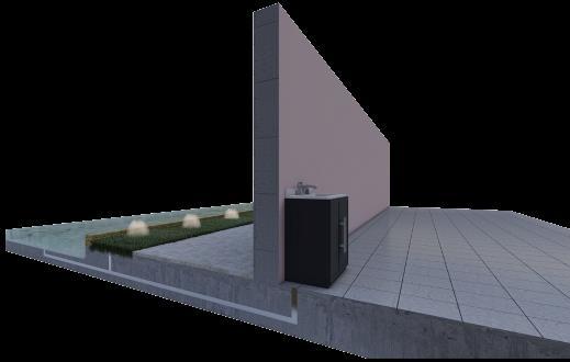
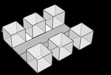
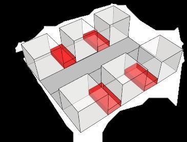
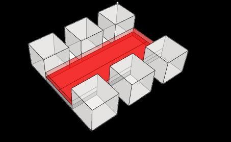
A self-supporting structure is constructed between the buildings, designed so that its weight is independent of the adjacent structures. This approach ensures that the stability of the self-supporting element are maintained without relying on support from either side.
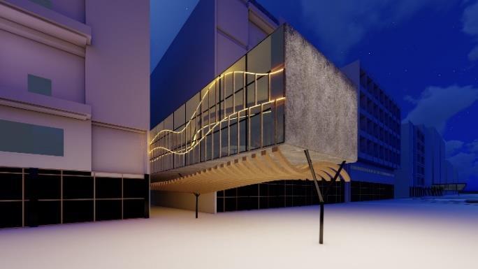
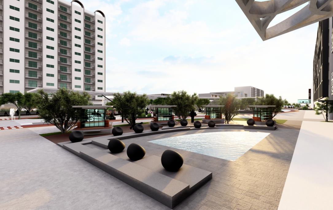
To establish a connection between the two sides of the road and provide a space for various activities, a plaza was designed.
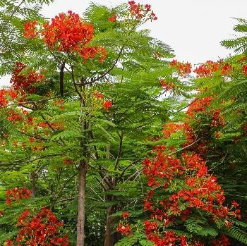
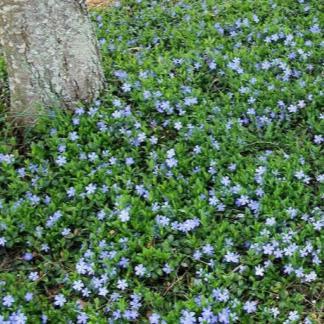
It features a diverse selection of trees, shrubs, and flowers often selected for their vibrant colors, and ability to handle heat, making them ideal for the UAE's climate and aesthetic needs.


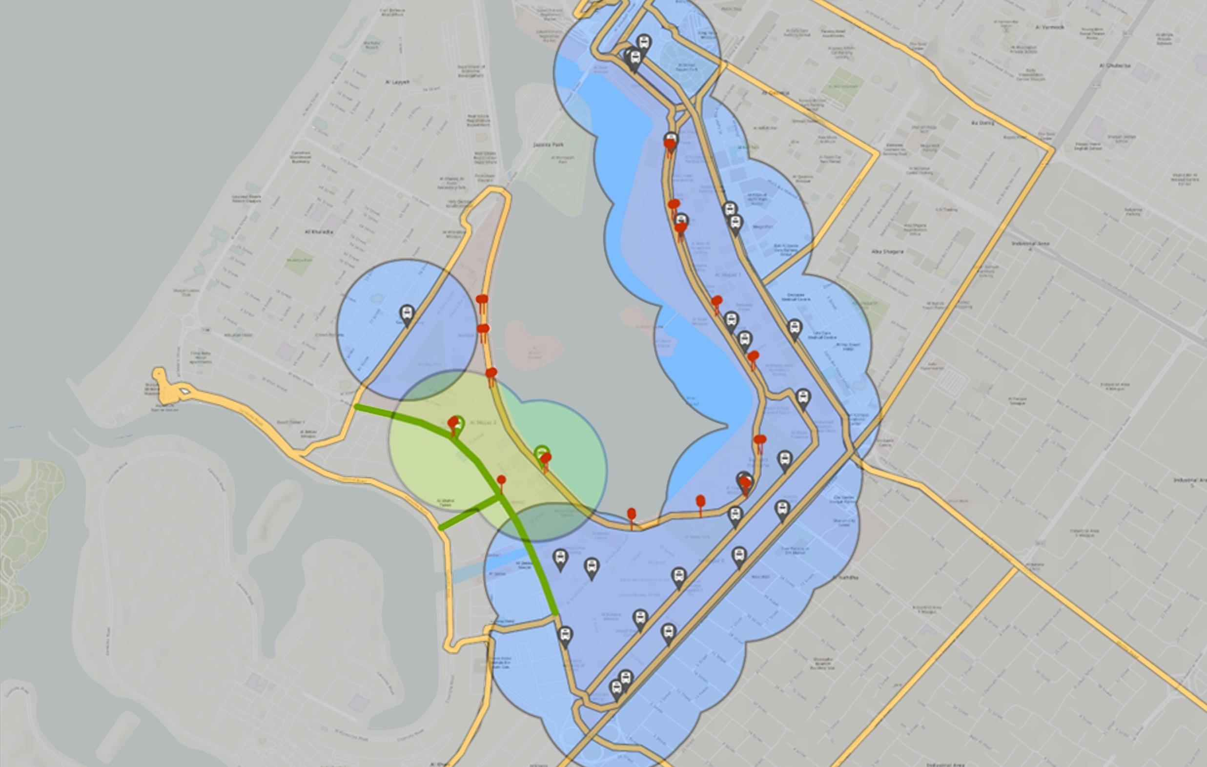

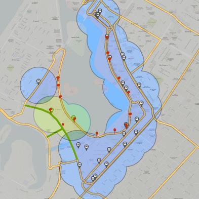
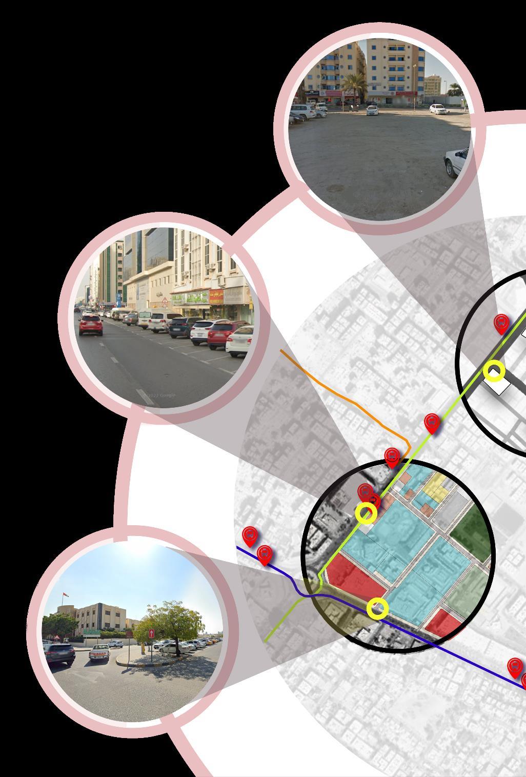
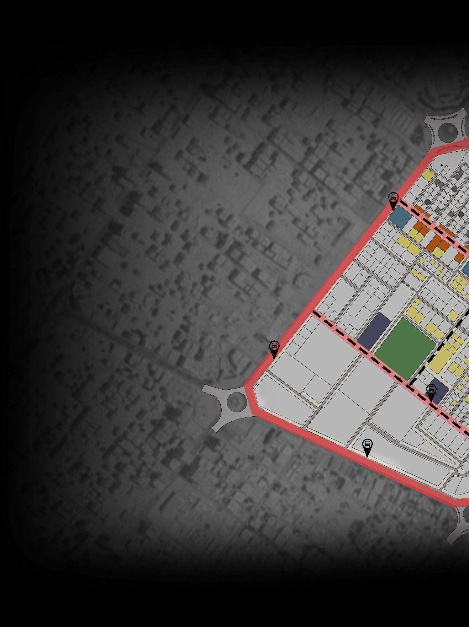
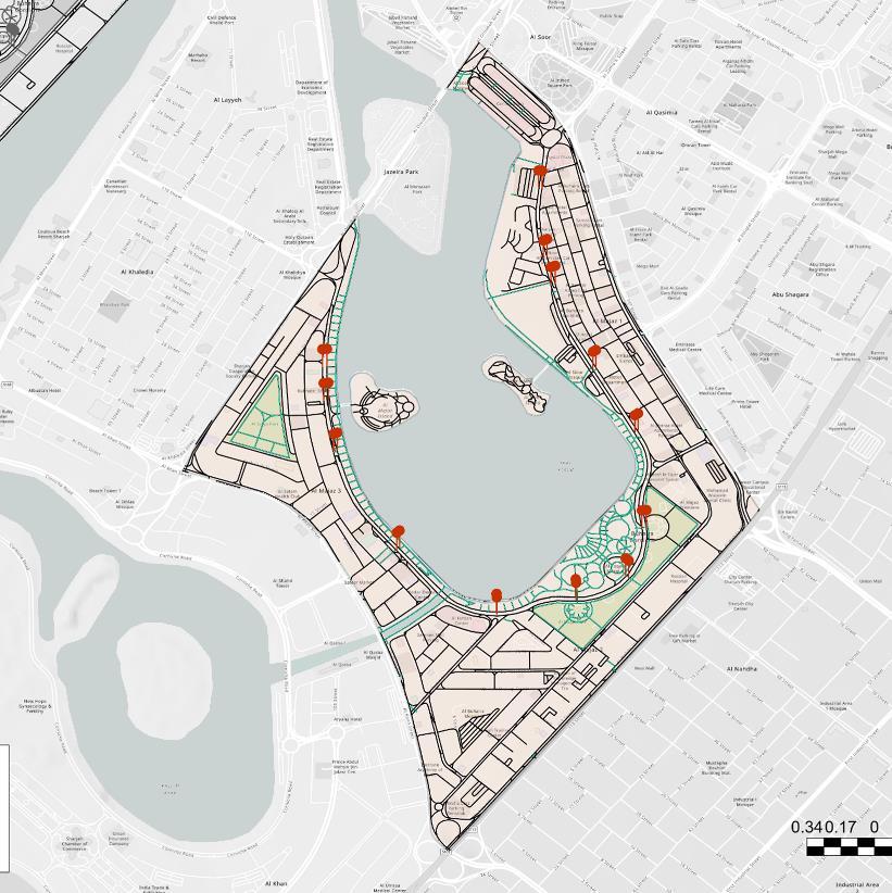
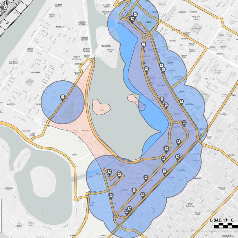
The project aims to improve connectivity in Al Majaz area by analyzing various systems, including the road network, residential buildings, and transportation infrastructure. It focuses on evaluating bus routes and stops to propose new additions that ensure comprehensive coverage of the area.
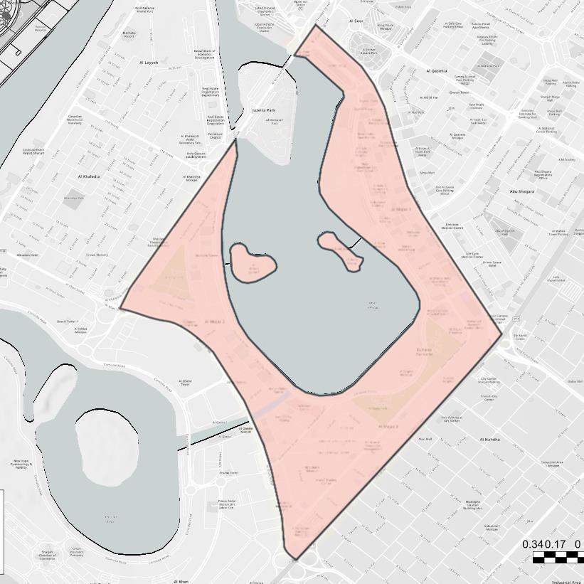
Al Majaz Area
Area: 2.87 ����2

Traffic Lights
Al Majaz Roads
Pedestrian Walkways
The area includes various primary and secondary roads, with a strong focus on safety by incorporating numerous traffic lights along the primary roads.
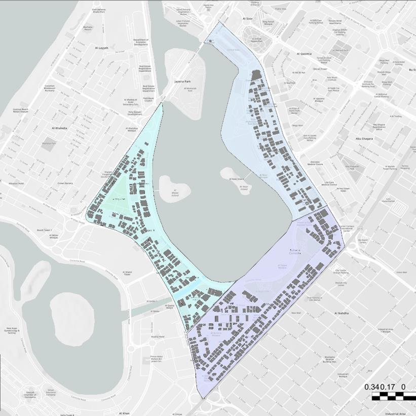
Residential Buildings
The area consists of densely packed high-rise residential buildings.
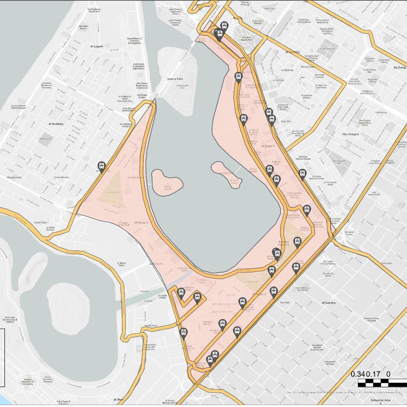

Bus Stops
Bus Routes
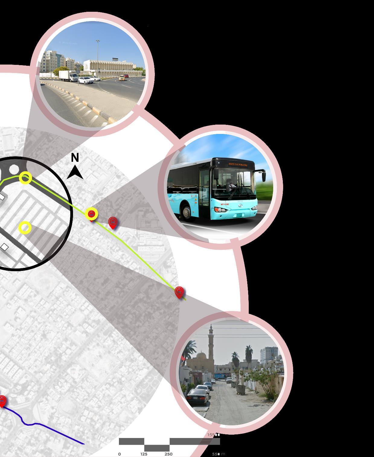
Six different bus lines pass through Al Majaz on their route from the first stop to the final destination. And the area features 26 distinct bus stops.
Bus Stops
Bus Routes
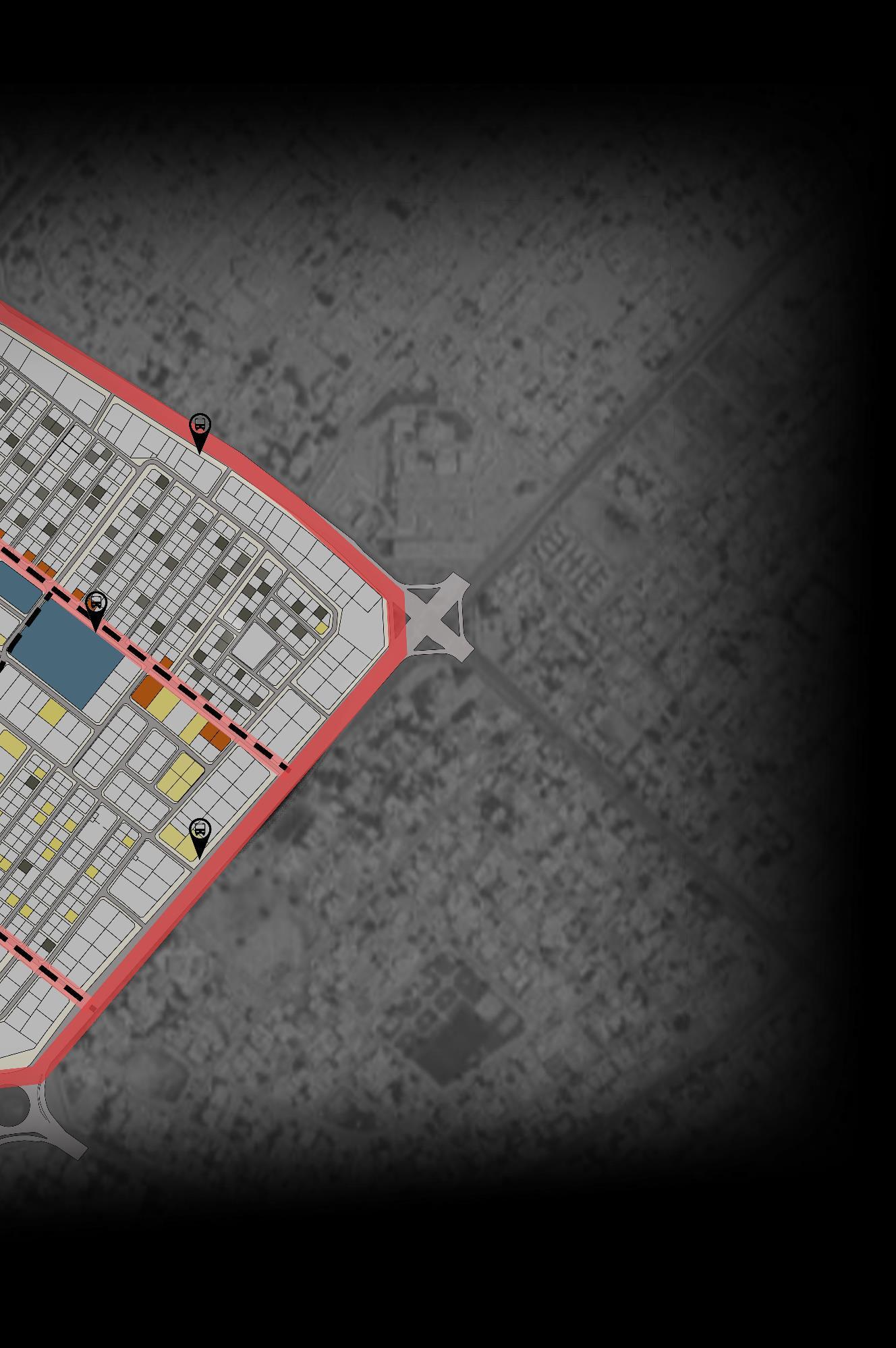
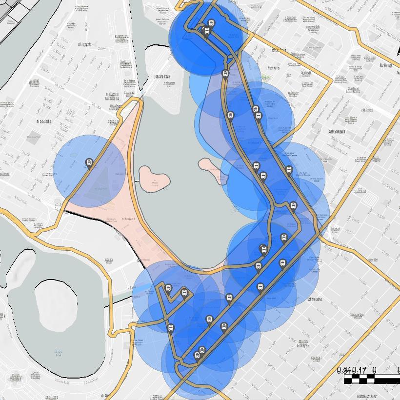
Bus Stops Buffer
The buffers (circles) indicate a fiveminute walking distance from each bus stop.
Bus Routes and
(Buffer Study - Dissolved)
Bus Stops
Majaz Roads
Bus Stops Buffer
The majority of Al Majaz is wellcovered in terms of bus stops, except for the western area which partially falls outside the buffer zone.
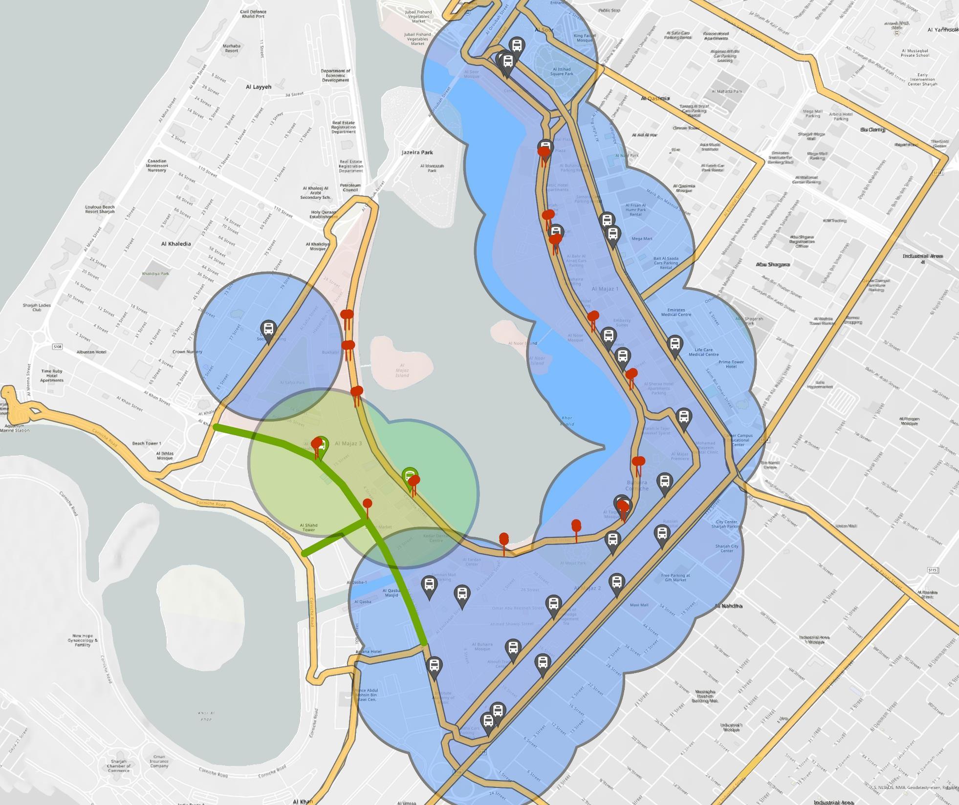
To improve connectivity and ensure better transportation coverage in the area, the following measures were implemented:
• Two additional bus stops were introduced to ensure no location in Al Majaz is more than a five-minute walk from the nearest stop.
• New bus routes were established where needed to improve accessibility to bus stops.
• Traffic lights were installed to enhance pedestrian safety and ease of access to bus stops.

Added Bus Stops
Added Bus Routes
Added Traffic Lights