FACT OR FICTION
Common Beliefs About Dams
FICTION FACT
The Army Corps of Engineers is responsible for most of the dams in the U.S.
Dams are like roads and bridges, the government takes care of them.
State dam safety programs have oversight of most dams in the U.S.
There are over 92,00 dams in the United States. State agencies regulate more than 71% of the nation’s dams, and the federal government is responsible for only 5% of those dams.
Most dams are privately owned. Dam owners are responsible for maintenance and upgrades.
Private dam owners are responsible for more than 65% of the nation’s dams. Many lack the financial resources necessary for adequate dam maintenance.
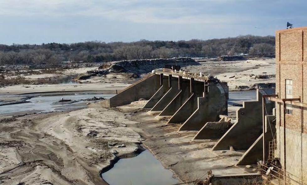
There are only a few dams in my state.
That dam has been here for years – it’s not going anywhere.
According to the National Inventory of Dams, there are more than 92,000 dams in the U.S. Most states are home to hundreds – or thousands – of dams meeting regulatory criteria.
■ Texas has the most dams – more than 7,000 – followed by Kansas (6,490), Mississippi (6,093), Georgia (5,412), Missouri (5,385), and Oklahoma (5,010). [2025 data]
■ Montana, North Carolina, and Iowa each have more than 3,000 dams.
■ Five states – Alabama, Nebraska, South Carolina, South Dakota, and Virginia – each have more than 2,000 dams.
■ More than 1,000 dams are in each of 16 additional states.
■ Of all states, Delaware has the fewest number of dams, with 83.
Advancing age can make dams more susceptible to failure.
The average age of dams in the U.S. is 64 years old.
As dams get older, deterioration increases and repair costs rise. Some common problems of older dams are:
■ Deteriorating metal pipes and structural components— after 50 years, metal rusts and fails.
■ Sediment-filled reservoirs. Some sediment may have contaminants from chemicals in runoff from upstream areas.
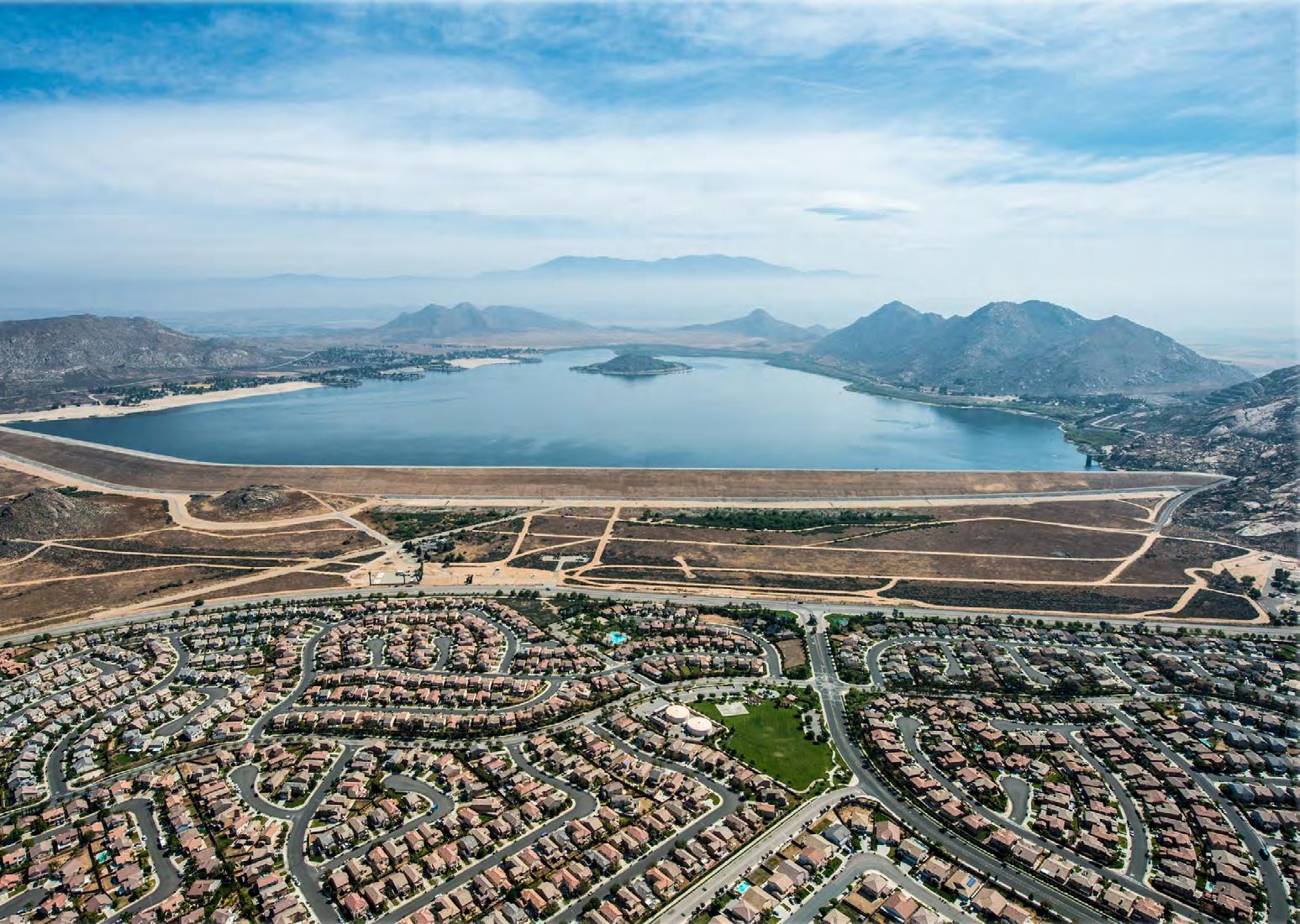
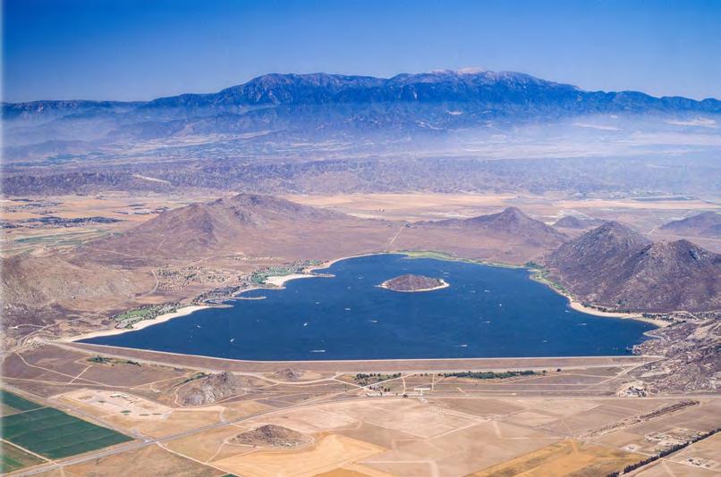
■ Subdivisions and businesses built upstream—roofs and concrete streets and sidewalks increase the volume of runoff to the reservoir.
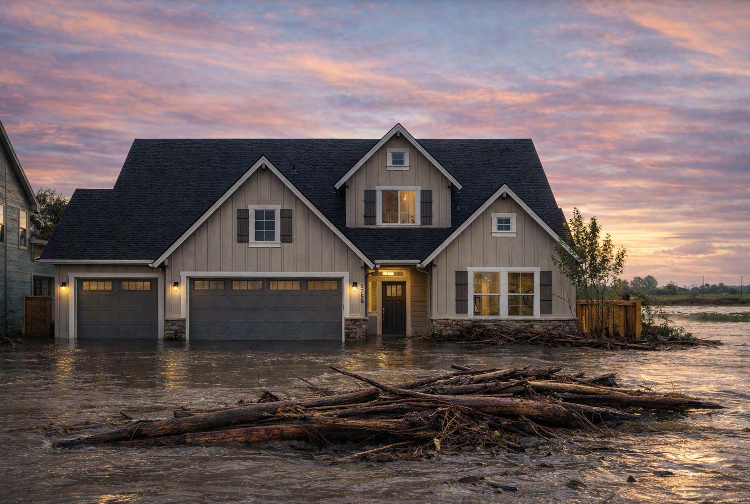
Could my life and property be affected by a nearby dam?
Dams provide drinking water, hydroelectric or water power, flood control, recreation and many other benefits to people or local economies. However, dams can pose significant risks to people living downstream should they fail.
There are dams in every U.S. state. It is important to know if you and your loved ones live, work or recreate in areas that may be affected by the presence of a dam and what to do if this is the case.
This booklet was created to help answer questions about dams: what purposes they serve, what risks are associated with dams and where you can get information about how to react if you are affected by a dam.
This booklet was prepared by the Association of State Dam Safety Officials.
WHY SHOULD I CARE ABOUT DAMS?

WHAT ARE THE RISKS ASSOCIATED WITH DAMS?

AM I OR COULD I BE AFFECTED BY A DAM AND WHAT IS THE DAM FAILURE FLOOD INUNDATION AREA?

ONCE I DETERMINE THAT MY PROPERTY IS IN A DAM FAILURE FLOOD INUNDATION AREA, WHAT’S NEXT?
1. WHY SHOULD I CARE ABOUT DAMS?
Although dam failures are infrequent, the impacts can be catastrophic, often far exceeding typical stream/ river flood events.
WHAT DAMS PROVIDE
Dams are often hidden assets, but they can also be hidden liabilities.
Dams provide vital benefits, including flood protection, water supply, hydropower, irrigation, and recreation. Imagine the impact of losing a major reservoir or flood control dam:
■ Would there be catastrophic flooding? How many homes and businesses might be flooded? How many people might be displaced?
■ Would there be adequate water for domestic use? Irrigating crops? Caring for livestock? Fighting fires?
■ Are local utilities dependent on hydropower? How many lives and jobs could be affected by the temporary shutdown or closure of an industry dependent on hydropower?
■ How would transportation systems be affected including railroads or navigable waterways?
■ How would economies, jobs and areas dependent on recreation be affected should the reservoir be lost?
■ Would there be a negative impact on local property values if homes or other type of property were in a dam inundation area or if there were an increase in insurance rates due to potential or past flooding issues?
Dale Kolke (California Department of Water Resources)
Dams can pose risks to those living downstream if they are not maintained and operated correctly.
Some dams increase safety risks to an often-unaware public when they age, deteriorate, or malfunction, releasing sudden, dangerous flood flows.
There are over 90,000 dams in the U.S. Each state has hundreds of dams and most states have over 1000.
More than half of these dams are older than 50 years, and like other types of infrastructure, many need extensive rehabilitation.
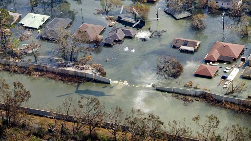
When dams fail or malfunction, they can adversely affect people, their livelihood, and property. Many communities in the United States are impacted by dams. In many cases, large populations and vital elements of our critical infrastructure are located downstream of dams. And dams may play a vital role to communities.
Dam failure floods are most often more sudden and violent than normal streams, rivers, or coastal floods. They often produce extreme localized damage that looks similar to tornado damage.
Dams are owned and operated by many different types of owners. Sometimes they only serve the interest of the owner, for instance, in the case of a neighborhood association that wants to build homes around a lake— and sometimes they serve the interest of communities, for instance, in the case of a water supply utility.
Downstream development affects a dam’s risk. Dams that used to be in rural areas, affecting nothing but open fields, now have potential impacts on neighborhoods and industrial areas. Due to increased development, dam failure consequences have become much higher. In the last decade, the
number of high-hazard potential dams that pose a risk to human life has increased. The cause of this increase is a combination of new dam construction and/or downstream development.
New Jersey Bureau of Dam Safety
Luke Trumble and Ryan Schwarb (Michigan EGLE Water Resources Division)
FACTS ABOUT DAMS
Purposes
The purpose of a dam is to impound (store) water, or other liquid-borne materials for various reasons, such as water supply, irrigation, livestock water supply, energy generation, containment of mine tailings, recreation, pollution, or flood control. Many dams fulfill a combination of the above functions. The original reason the dam was built may not be the same today.
Ownership
Dams are unique components of the U.S. infrastructure in that most dams are privately owned.
Dam owners are solely responsible for keeping their dams safe and financing maintenance, repairs, and upgrades. Dam investigations, maintenance, repairs, and upgrades can be expensive. Price tags for non-federal dam rehabilitation projects commonly range from $100,000 to millions of dollars per dam. Such high price tags place a huge burden on dam owners, many of whom cannot afford to maintain their dams.
Regulation
The vast majority of dams are regulated for safety by state and federal governments, much the same way as are bridges, food, drugs, factories, etc. States regulate the vast majority of dams in the U.S. (about 71%). The federal government regulates the remaining number. A small percentage of dams go unregulated.
DAMS BY OWNER TYPE
MAIN TYPES OF DAMS
Dams may be classified according to the type of construction material used, the methods used in construction, the slope or cross-section of the dam, the way the dam resists the forces of the water pressure behind it, the means used for controlling seepage, storage characteristics (on a watercourse, off-stream, above or below ground level), and, occasionally, according to the purpose of the dam.
The materials used for the construction of dams include earth, rock, tailings from mining or milling, concrete, masonry, steel, timber, miscellaneous materials (such as plastic or rubber) or a combination of these materials.
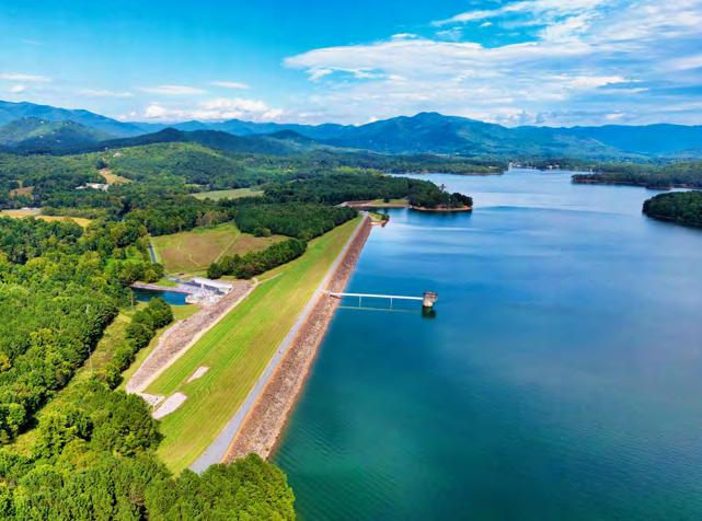
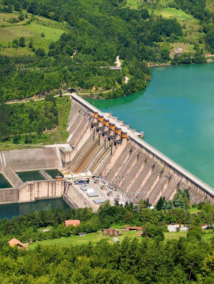
Embankment Dams
Embankment dams are the most common type of dam in use today. They have the general shape shown above. Materials used for embankment dams include natural soil or rock or waste materials obtained from mining or milling operations. An embankment dam is termed an “earthfill” or “rockfill” dam depending on whether it is comprised of compacted earth or mostly compacted or dumped rock. The ability of an embankment dam to resist the reservoir water pressure is primarily a result of the mass weight, type and strength of the materials from which the dam is made.
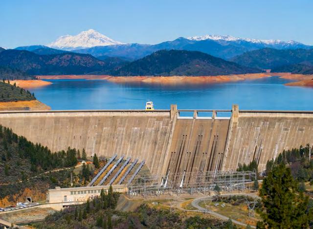
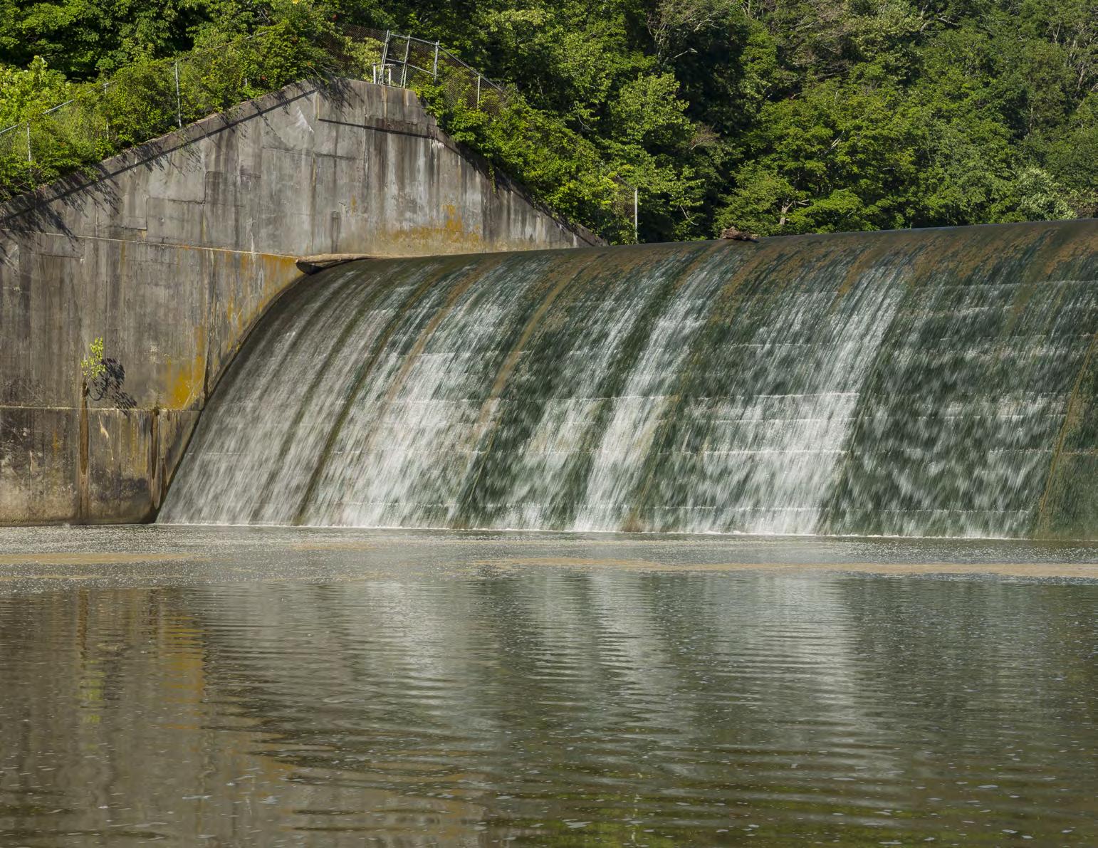
Concrete Dams
Concrete dams may be categorized into gravity and arch dams according to the designs used to resist the stress due to reservoir water pressure. The most common type of concrete dam is a concrete gravity dam, shown above. The mass weight of concrete and friction resist the reservoir water pressure. A buttress dam is a specific type of gravity dam in which the large mass of concrete is reduced, and the forces are diverted to the dam foundation through vertical or sloping buttresses. Gravity and buttress dams are constructed of vertical blocks of concrete with flexible seals in the joints between the blocks.
Concrete Dams
(Continued from previous page)
Concrete arch dams are typically thinner in cross-section. The reservoir water forces acting on an arch dam are carried laterally into the abutments. The shape of the arch may resemble a segment of a circle or an ellipse, and the arch may be curved in the vertical plane as well. Such dams are usually constructed of a series of vertical blocks that are keyed together; barriers to stop water from flowing are provided between blocks. Variations of arch dams include multi-arch dams in which more than one curved section is used and arch-gravity dams which combine some features of the two types of dams.
Other Types of Dams
Tailings dams are industrial waste dams that impound waste materials from mining operations or mineral processing. Ash impoundments, or ponds, are used to store or dispose of ash primarily from the combustion of coal. These impoundments are a type of waste management facility consisting of an excavated, dammed or diked reservoir in which coal ash is stored for future removal or disposed as a slurry or sludge. The coal ash solids settle out and leave water at the surface that is discharged through a designed and managed outlet structure to a nearby stream, surface water, or plant process water system.
Dam Discharge
Because the purpose of a dam is to retain water effectively and safely, the water retention ability of a dam is of prime importance. Water may safely pass from
the reservoir to the downstream side of a dam by:
■ Passing through the main (primary) spillway or outlet works.
■ Passing over or through an auxiliary spillway.
■ Controlled seepage by means of constructed and engineered systems to allow for water movement under or through dams.
■ Overtopping the dam when designed to do so (typically at an area designated as an emergency or auxiliary spillway).
Less desirable or even potentially catastrophic means of discharge can occur by:
■ Uncontrolled seepage through dams, through abutments or under or through dams.
■ Overtopping the dam when not designed to do so.
■ Failure of outlet works, large gates or other mechanisms designed to control discharge.
Dam Construction Cutaway ODNR Division of Water
Overtopping of an embankment dam is very undesirable because the embankment materials may be eroded away. A number of concrete dams have been designed to be overtopped.
Water normally passes through the main spillway or outlet works; it should pass over an auxiliary spillway only during periods of high reservoir levels and high -water inflow.
All embankment and most concrete dams have some seepage. However, it is important to control the seepage to prevent internal erosion and instability. Proper dam construction and maintenance and monitoring of seepage provide this control.
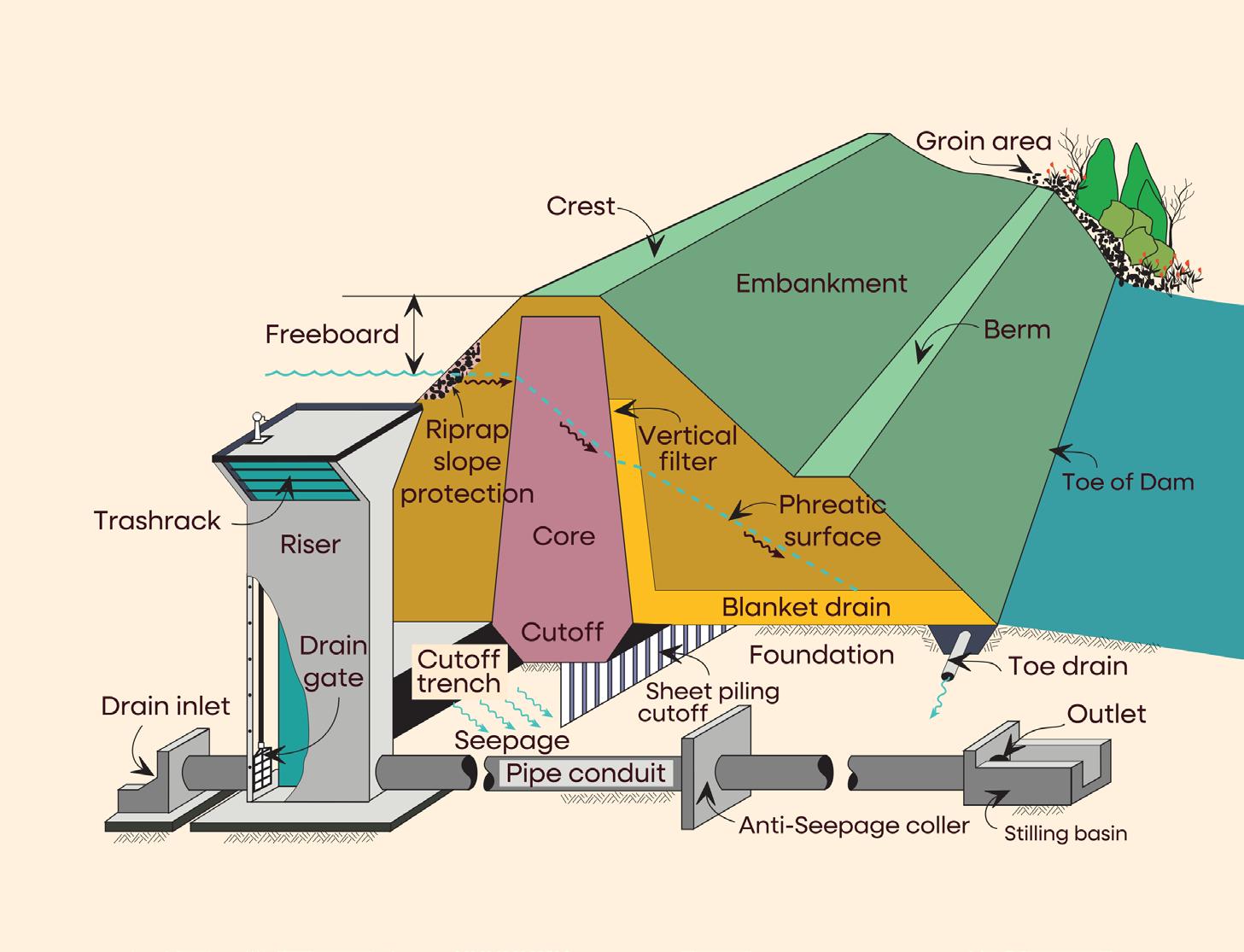
RELEASE OF WATER
Intentional releases of water from dams should be confined to outlet works and spillways. A dam typically has a principal (main) or mechanical spillway and a drawdown facility.
Additionally, some dams are equipped with auxiliary (secondary) spillways to safely pass extreme floods.
Even when operated as designed, many dams will pass huge volumes of flood water into downstream areas.
Outlet Works
In addition to spillways designed to prevent overtopping of dams, dams contain outlet works that allow water to be drawn continuously, or as needed, from the reservoir, and provide a way to draw down the reservoir for repair or safety concerns. Water withdrawn may be discharged into the river below the dam, run through generators to provide hydroelectric power, or used for irrigation. Dam outlets usually consist of pipes, box culverts or tunnels with intake inverts near minimum reservoir level. Such outlets are provided with gates or valves to regulate the flow rate.
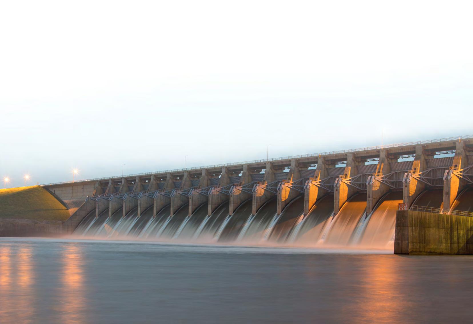
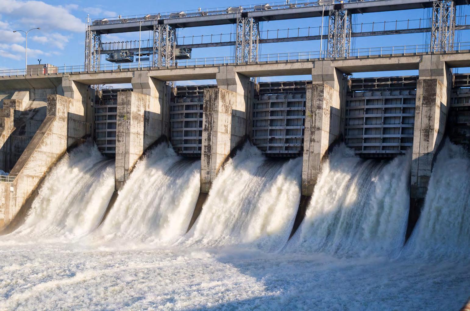
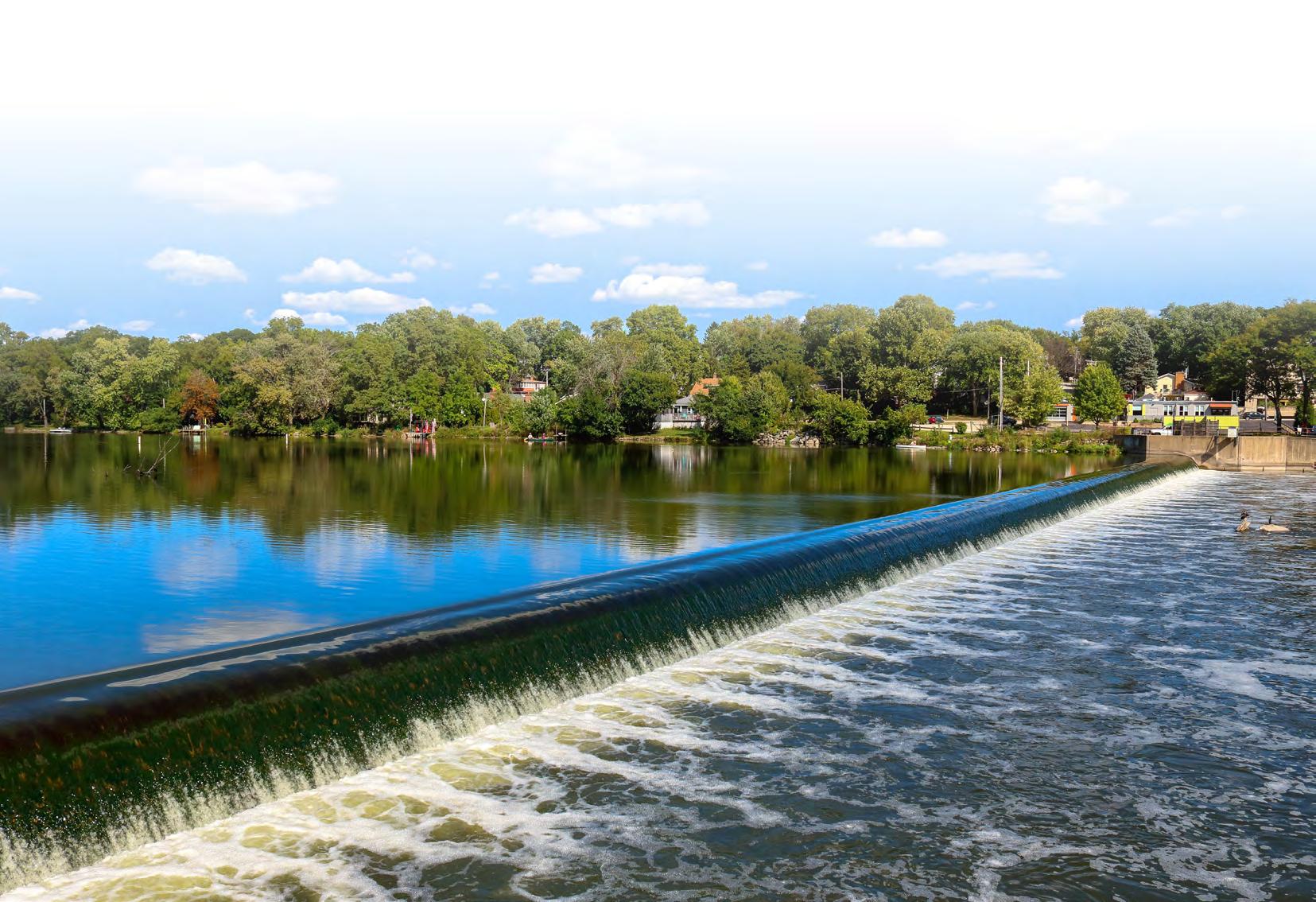
Spillways
The most common type of spillway is the free overflow spillway. This spillway may be located over or through the dam or an abutment. To permit maximum use of storage volume, movable gates are sometimes installed above the spillway crest to control discharge. Many smaller dams have a pipe and riser spillway, used to carry most flows, and a vegetated earth or rock cut spillway through an abutment to carry infrequent high flood flows. In dams such as those on the Mississippi River, flood discharges are of such magnitude that the spillway occupies the entire width of the dam, and the overall structure appears as a succession of vertical piers supporting movable gates. High arch-type dams in rock canyons usually have downstream faces too steep for an overflow spillway. In Hoover Dam on the Colorado River, for example, a shaft spillway is used. In shaft spillways, a vertical shaft upstream from the dam drains water from the reservoir when the water level becomes high enough to enter the shaft or riser; the vertical shaft connects to a horizontal conduit through the dam or abutment into the river below.
2. WHAT ARE THE RISKS ASSOCIATED WITH DAMS?
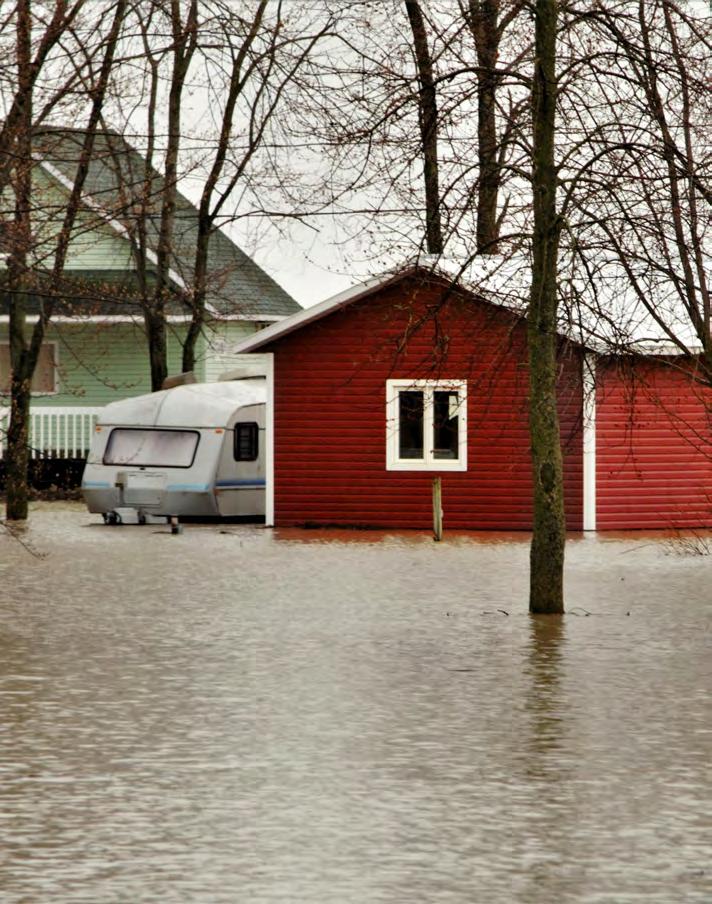
Flooding Due to Failure and Planned Releases
DAM FAILURE
Dam failures are low probability but high consequence. Yet they typically happen somewhere in the U.S. every year.
While thousands of lives have been lost and substantial property damage has occurred due to dam failure, good planning and improved dam safety programs have reduced loss of life dramatically in recent years.
Dam failures or partial failures are not always caused by storm events. Most fall into one or more of the following categories:
1. Structural failures - Foundation defects, including settlement and slope instability or damage caused by earthquakes, have caused about 30% of all U.S. dam failures.
2. Mechanical failures - Malfunctioning gates, conduits, or valves can cause dam failure or flooding both upstream and downstream.
3. Hydraulic failures - Overtopping of a dam is often a precursor of dam failure. National statistics show that overtopping due to inadequate spillway design, debris blockage of spillways, or settlement of the dam crest account for approximately 34% of all U.S. dam failures.
Nebraska Department of Natural Resources
Near failures include:
■ malfunction of dam control mechanisms;
■ partial dam breach;
■ auxiliary spillway flow;
■ principal spillway damage or malfunction;
■ seepage problems; and
■ embankment damage or signs of distress (erosion, cracks, slides, sinkholes, settlements, or bulges).
There are thousands of dams nationwide that are considered deficient and susceptible to failure because of reasons cited here.
PLANNED RELEASES
Operation of spillways, both planned and due to emergency situations, can create flooding and public safety hazards, even in the absence of a dam failure. During extreme rain events or extreme flow, dams may fill to capacity, necessitating emergency releases that can flood downstream areas. People swimming and fishing downstream of dams have been caught in planned spillway releases, at times with tragic results. Many dams incorporate sirens to warn the public of an impending release.
RECENT DAM FAILURES
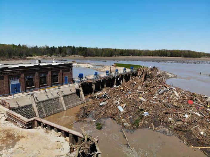
May 19, 2020 – Edenville and Sanford Dams, Michigan
On May 19, 2020, following several days of rain, failure occurred at both Edenville and Sanford Dams, located in central Michigan (United States), with resulting downstream flooding that caused extensive property and environmental damage. Two other dams failed in a cascading effect. Fortunately, there was no loss of life because a cautious decision was made to evacuate about 10,000 people starting about 18 hours before it was clear that either dam was going to fail. Environmental and property damage totaled more than $120 million. The pricetag for rebuilding the four dams is over $215 million. Several lawsuits ensued and homeowners around the drained lakes have seen property values decrease.
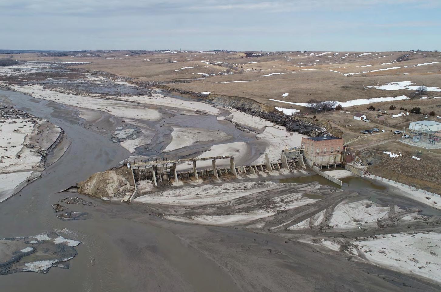
March 14, 2019 – Spencer Dam, Nebraska
The Spencer Dam failed from overtopping during a major ice run on the river. The homeowner could not be located after the event. His home and the other structures were swept downstream by the dam failure. The owner was later declared dead by drowning.
Hawaii AG's Office
Dale Kolke (California Department of Water Resources)
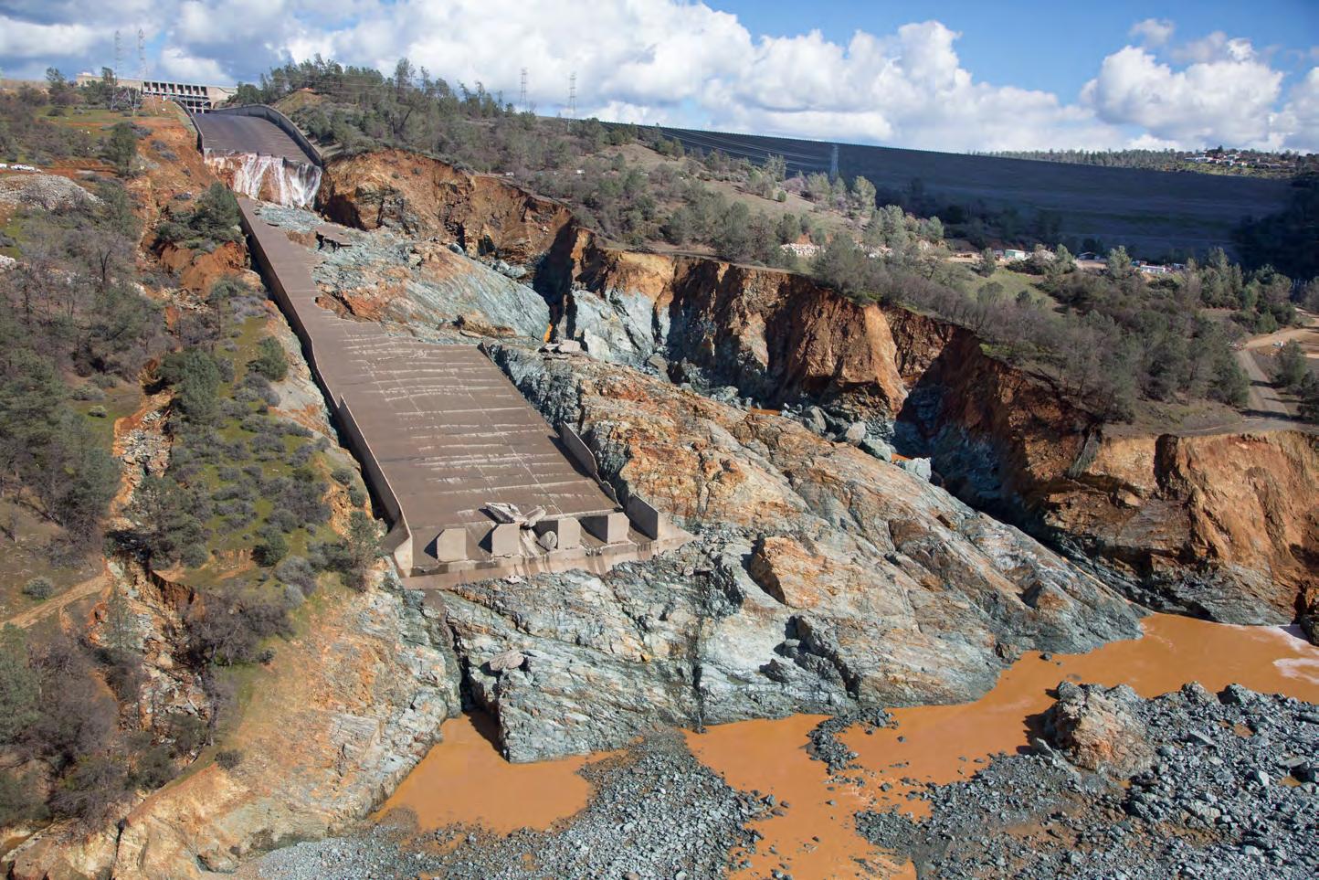
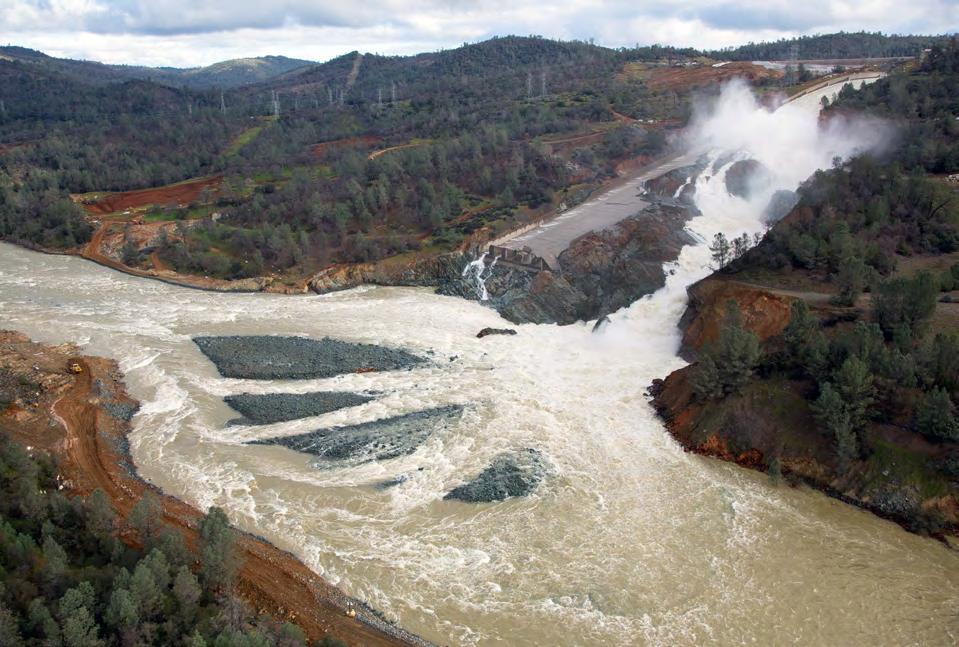
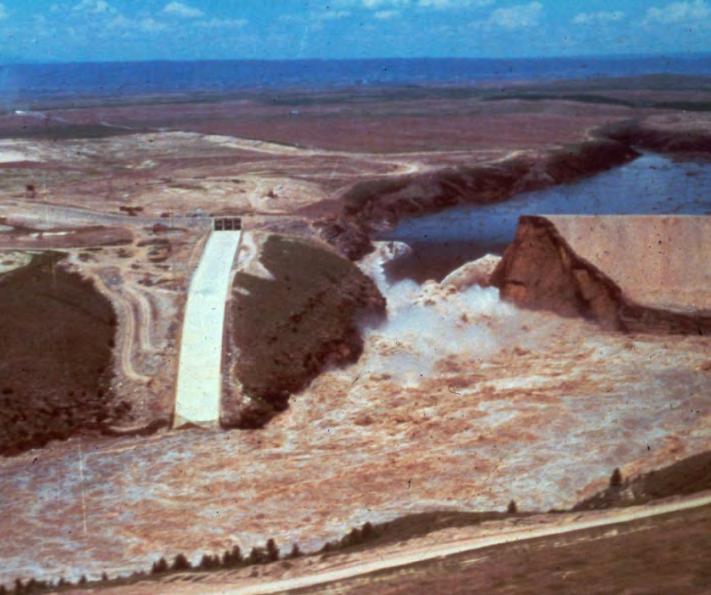
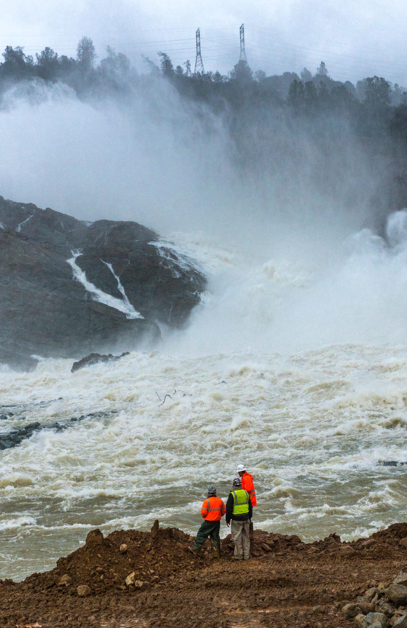
February 2017 – Oroville Dam, City of Oroville, California
On February 7, 2017, while the service spillway flow was about 52,500 cfs (much less than the historical maximum of 160,000 cfs about a decade prior), the service spillway chute suddenly experienced failure and removal of a section of the concrete slab about halfway down the chute. This was immediately followed by rapid erosion of the foundation and adjacent ground, and progressive failure and removal of the chute slab in the upstream and downstream directions. To monitor and control the damage to the chute while managing the reservoir level, adjustments were made to the chute flow, but major storms in the large watershed ultimately resulted in the reservoir rising until the crest of the emergency spillway was overtopped for the first time in its history, four days after the chute damage initiated. Despite the maximum flow at the emergency spillway reaching only about 12,500 cfs (less than 4% of its design capacity), staff of the owner and regulators were shocked to see that the hillside was eroding and headcutting rapidly due to the overflow. This posed a risk that the ogee weir structure at the crest of the emergency spillway could potentially be undermined and fail due to overturning or sliding instability, resulting in downstream flooding due to uncontrolled release of the reservoir. The service spillway gates were opened increasing flow to about 100,000 cfs, which lowered the reservoir level. A massive evacuation effort saw 188,000 people displaced for several days during the event. Due to the very large size of the dam and spillways, and the number of people at risk, this was one of the most serious dam safety incidents in United States history, and the estimated cost for the repairs and recovery was about $1.1 billion.
July 25, 2010 – Lake Delhi Dam, Delaware County, Iowa
The failure drained a nine-mile recreational lake and damaged or destroyed up to 300 homes.
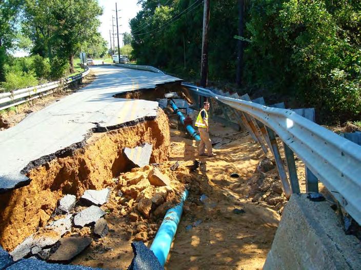
January 6, 2009 – Dam in Etowah County, Alabama
Floodwaters washed away a culvert and a private dam broke producing up to 12 ft. of flooding in the area causing residences to be evacuated. A dozen roads were also closed due to the floodwaters and property damage was reported to be $100,000*.
December 22, 2008 – Kingston Coal Waste Dam, Roane County, Tennessee
5.4 million cubic yards (> 1 billion gal) of sludge damaged 12 homes and covered hundreds of acres. Cleanup costing ~$1 million* per day. The Kingston Dam was a 40-acre pond used by the Tennessee Valley Authority to hold slurry of ash generated by the coal-burning Kingston Steam Plant. The dam gave way just before 1 a.m., burying a road and railroad tracks leading to the plant. No one was seriously injured or hospitalized.
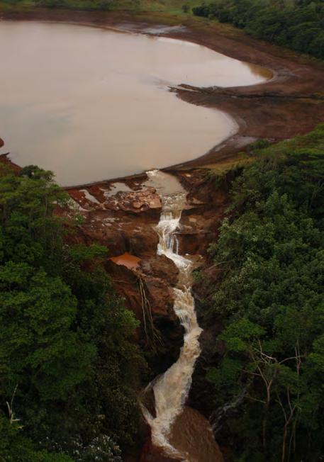
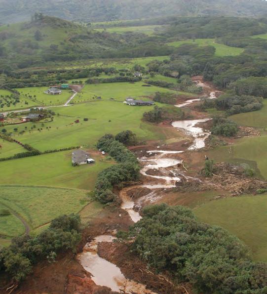
March 14, 2006 – Ka Loko Dam, Kauai, Hawaii
The failure of an embankment dam in a relatively undeveloped area killed seven people and caused extensive environmental damages.
December 14, 2005 – Taum Sauk Dam, Lesterville, Missouri
The failure of this off-stream hydropower facility, located high above Johnson’s Shut-Ins State Park, destroyed the home of the park superintendent and swept his family downstream. Miraculously, all survived. The flood washed out part of a state road and caused extensive environmental damages to the East Fork
of the Black River and to the park, which in warm weather months is typically populated with hundreds of campers and hikers.
HISTORICALLY SIGNIFICANT DAM FAILURES
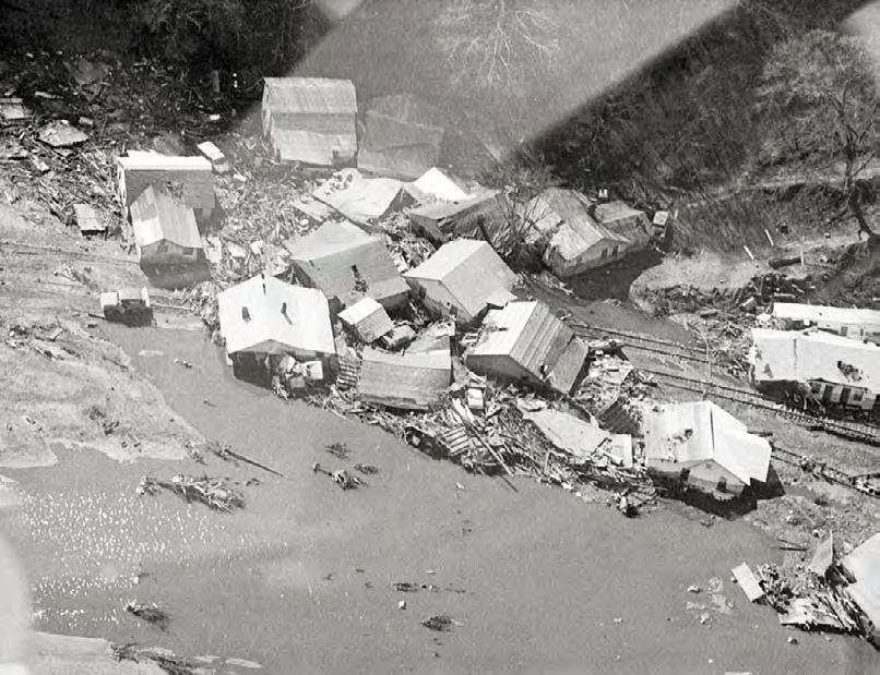
February 26, 1972 – Buffalo Creek Valley, West Virginia
The failure of a coal-waste impoundment at the valley’s head took 125 lives, and caused more than $400 million* in damages, including destruction of over 500 homes. This disaster wiped out 16 communities.
June 9, 1972 – Rapid City, South Dakota
The Canyon Lake Dam failure took an undetermined number of lives (estimates range from 33 to 237). Damages, including destruction of 1,335 homes, totaled more than $60 million*.
June 5, 1976 – Eastern Idaho
Eleven people perished when Teton Dam failed. The failure caused an unprecedented amount of property damage totaling more than $1 billion*. The failure flooded at least six communities and tens of thousands of acres.
July 19-20, 1977 – Laurel Run, Pennsylvania
Laurel Run Dam failed, killing over 40 people and causing $5.3 million* in damages.
November 5, 1977 – Toccoa Falls, Georgia
Kelly Barnes Dam failed, killing 39 students and college staff and causing about $2.5 million* in damages.
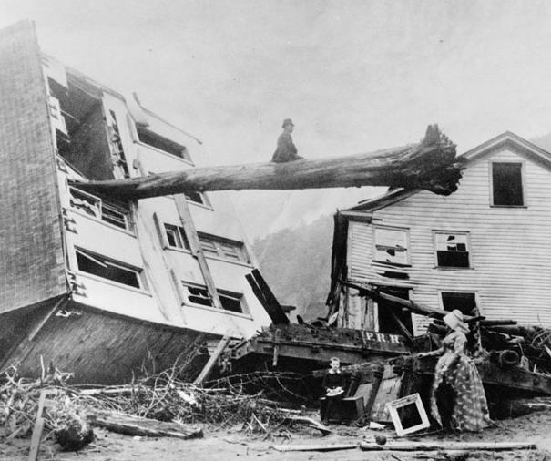
May 31, 1889 – Johnstown, Pennsylvania
The deadliest dam failure in U.S. history took the lives of more than 2,200 people.
*Dollar amounts have not been calculated to account for current monetary inflation.
Herald-Dispatch
Johnstown Area Heritage Association
U.S. Bureau of Reclamation
California Department of Water Resources, 2014
3. AM I OR COULD I BE AFFECTED BY A DAM AND WHAT IS THE DAM FAILURE FLOOD INUNDATION AREA?
Many people who live in dam failure inundation zones are completely unaware of the potential hazard lurking upstream.
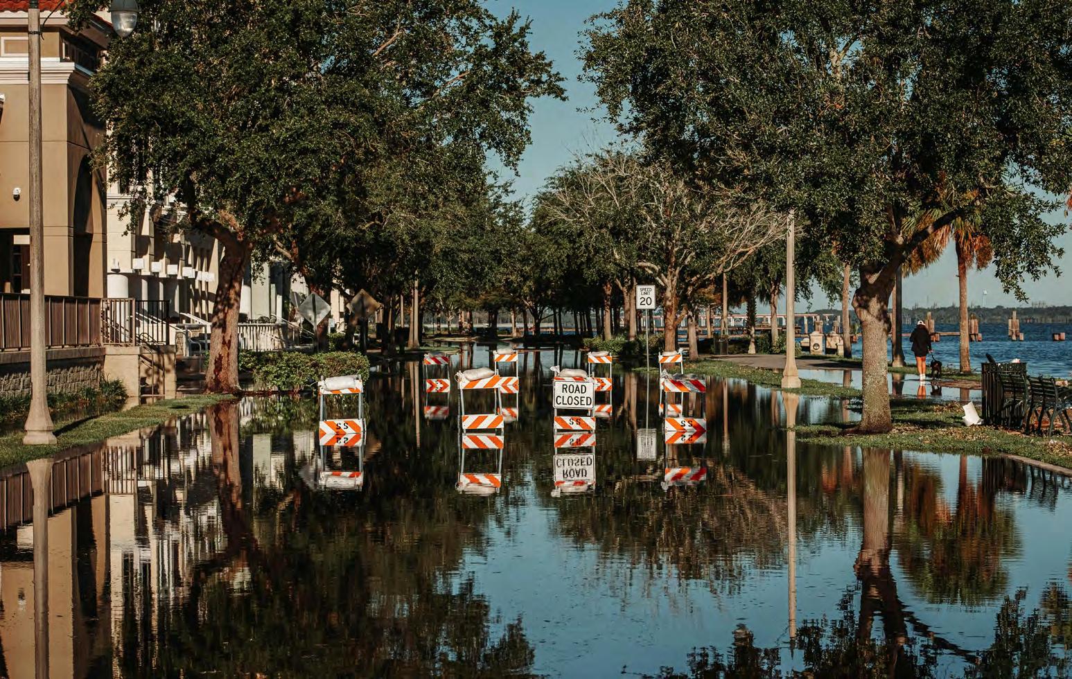
The “inundation zone” is the area that would be impacted downstream of the dam in the event of a failure or uncontrolled release of water generally much larger than the normal river or stream flood event.
The “dam failure inundation zone” is broader than the FEMA “100-year flood” insurance mapped zone.
How do I find out if I live in a dam failure inundation zone:
■ Contact your local emergency management agency (a simple internet search will most likely locate the appropriate office).
■ Contact the state dam safety program (see the U.S. map at www.damsafety.org).
Before Buying: Do Some Research, Know the Facts
Before buying a home or business, determine whether it is in a dam failure inundation zone. This determination is the buyer’s responsibility. Prospective buyers should know if there is an upstream existing dam or the potential for an upstream dam to be built. This is sometimes very difficult to determine while standing on the property since the upstream dam may not be in sight. In some cases, the dam site may be several miles upstream of the property and the view may be obscured. Listed below are some resources that will assist your research:
■ USGS topographic maps
■ Google Earth
■ The state dam safety agency office, the local emergency management office or the local soil and water district office.
Likewise, buying property on or near a manmade lake requires an understanding of what that entails. Such properties tend to have higher values than similar sized properties not associated with a lake. The removal of the lake or a permanent lowering of the lake can dramatically reduce property values on or near the lake.
The fluctuation of the lake levels from normal pool to flood pool elevations can hinder or eliminate the use of the property and associated structures. In many cases the dam is owned by a neighborhood association of lakeside property owners who are therefore responsible for the dam’s maintenance and are liable for any risk posed by the dam.
It is critical that the prospective buyer acquires knowledge of the risks, legal and financial liabilities and other issues associated with the lake, dam and/or control structure prior to the purchase.
Changing weather patterns, erosion, and development can affect areas at risk. Flood maps can help the public better understand risk. FEMA has published almost 100,000 individual Flood Insurance Rate Maps (FIRMs). Find your map and learn how to read it so you can make informed decisions about protecting your property, both financially and structurally.
Currently, the larger dam inundation areas are not shown on these maps as areas requiring flood insurance. It may be wise to buy flood insurance even though it is not required to protect the financial investment in homes and businesses located below dams.
» Go to www.fema.gov/flood-maps for more information on flood insurance.
California Department of Water Resources, 1989
4. ONCE I DETERMINE THAT MY PROPERTY IS IN A DAM FAILURE FLOOD INUNDATION AREA, WHAT’S NEXT?
Find out the dam’s condition. Does it meet federal or state safety criteria?
Contact your county emergency management coordinator or state dam safety program office to find out who owns the dam, and which agencies regulate it. Contact information for state dam safety programs is listed at www.damsafety.org.
Ask what plans are in place in the
event of a dam failure
One of the most important questions to ask state dam safety officials or dam owners is if there is an updated Emergency Action Plan (EAP) for the dam in question. An EAP is a formal document that identifies potential emergency conditions at a dam and specifies actions to reduce property damage and loss of life, including actions the dam owner should take to
mitigate problems at the dam and issue warnings to responsible emergency management authorities.
If you live or work in a dam failure flood inundation area, find out your evacuation route so that you can quickly get out of harm’s way in the event of a dam incident. To obtain this information, contact your state and local emergency management officials, who are generally responsible for evacuation planning and implementation.
United States Army
Communication with emergency managers is key.
Points to remember:
■ Find out if there is an updated Emergency Action Plan for the dam.
■ Determine what types of warning systems are in place to warn residents of a dam incident. For example, are there sirens, a Reverse-911 phone messaging system, bullhorns, or door-to-door warning procedures in place? Always heed warnings to leave. Make sure to ask your local emergency management if there are any notification systems you can sign up for.
■ Find out how to get to a place of safety and what evacuation routes will be open.
■ Ask about the location of community emergency shelters.
■ Inform emergency management officials of family members who have a disability or will need additional assistance in the event of an evacuation and the location of any pets.
Prepare your home and your family
■ Inform your family of dam failure flood risks, and make sure each family member knows what to do in the event of an emergency.
■ Elevate your furnace, water heater, and electric panel if they are susceptible to flooding.
■ Install “check valves” in sewer traps to prevent floodwater from backing up into drains.
■ Seal basement walls with waterproofing compounds to avoid seepage.
■ Keep valued possessions and important papers on an upper level of your home or in a safety deposit box.
■ Prepare an emergency kit (https://www.ready.gov/kit).
What
should you do in the event of an emergency? If a flood is likely in your area, you should:
■ Listen to internet media outlets, television, or radio for information.
■ Be aware that dam failure or operational flooding can occur. If there is any possibility of a flash flood, move immediately to higher ground. Do not wait for instructions to move. Get to high ground if flooding is imminent.
■ Be aware of streams, drainage channels, canyons, and other areas that may flood suddenly. Flash floods can occur in these areas with or without such typical warnings as rain clouds or heavy rain.
If you must prepare to evacuate, you should do the following:
■ Secure your home. If you have time, bring in outdoor furniture. Move essential items to an upper floor.
■ Turn off utilities at the main breaker switches or valves if instructed to do so. Disconnect electrical appliances. Do not touch electrical equipment if you are wet or standing in water.
If you have to leave your home, remember these evacuation tips:
■ Do not walk through moving water. Six inches of moving water can make you fall, twelve inches of water can carry away a car, and just two feet of water can carry away SUVs and trucks. If you have to walk in water, walk where the water is not moving. Use a stick to check the firmness of the ground in front of you.
■ Do not drive into flooded areas. If floodwaters rise around your car, abandon the car and move to higher ground if you can do so safely. You and the vehicle can be quickly swept away.
Do I need to buy flood insurance?
Since standard homeowners insurance doesn’t cover flooding, it’s important to have protection from the floods associated with hurricanes, tropical storms, heavy rains, dam failures and other conditions that impact the U.S.
In 1968, Congress created the National Flood Insurance Program (NFIP) to help provide a means for property owners to financially protect themselves. The NFIP offers flood insurance to homeowners, renters, and business owners if their community participates in the NFIP. Participating communities agree to adopt and enforce ordinances that meet or exceed FEMA requirements to reduce the risk of flooding.
Flood insurance is highly recommended but not required for those living in dam failure flood inundation areas.
To identify a community’s flood risk, FEMA conducts a Flood Insurance Study. The study includes statistical data for river flow, storm tides, hydrologic/hydraulic analyses, and rainfall and topographic surveys. FEMA uses this data to create the flood hazard maps that outline your community’s different flood risk areas.
To find out more about the NFIP and how it can help you protect yourself go to the FloodSmart.Gov website. At this site you can learn your risk, find out how to get flood insurance and find an agent.
Your community has to be participating in the National Flood Insurance Program for you to be able to purchase flood insurance. Communities participating in the NFIP can be found at: https://www.fema.gov/flood-insurance
Just because you haven’t experienced a flood in the past, doesn’t mean you won’t in the future. Flood risk isn’t just based on history. It’s also based on a number of other factors: potential dam failure, rainfall, river flow, topography, flood control measures, and changes due to building and development.
Nebraska Department of Natural Resources
Hawaii AG's Office
Dam Safety, Flood Risk and Emergency Management
Responsibilities
The Public
■ Understand that you are at risk and that there are steps you can take now to protect yourself from floods should a dam fail or release flood waters.
■ Know your evacuation routes and how you can expect to be notified.
Dam Owners and Operators
■ Maintain and operate the dam to assure that the dam does not fail.
■ Work with state and local officials to mitigate the consequences of dam incidents.
■ Maintain an Emergency Action Plan. Inform local officials of risks associated with the dam.
■ Coordinate with local Emergency Management to prepare for dam emergencies.
■ Work with the federal or state regulator to comply with safety standards.
State and Local Governments
■ State governments are responsible for public safety regulation for more than 71% of the nation’s dams (non-federal dams).
■ State and local governments are responsible for determining how land is used in floodplains and for enforcing floodplain management regulations.
■ Local governments are responsible for emergency response and evacuation in a flooding situation.
■ Communicate inspection results and other resources with dam owners and operators.
Federal Dam Safety, Floodplain and Emergency Management Programs
■ Several federal agencies have built or own dams including the U.S. Army Corps of Engineers, the Department of the Interior, the Tennessee Valley Authority and the Department of Agriculture. Collectively, the federal government owns 3,451 (2025 data) dams. Additionally, the Department of Agriculture’s Natural Resources Conservation Service assisted in building over 11,000 dams now owned by local watershed districts.
■ Some federal agencies including the Federal Energy Regulatory Commission (FERC) and the Mine Safety and Health Administration (MSHA) regulate privately owned dams. According to the National Inventory of Dams, FERC and MSHA collectively regulate more than 2,100 dams (2025 data).
■ FEMA provides federal, state and local governments with valuable data for assessing and reducing the risk of floods to people and their homes and businesses.
■ FEMA analyzes and identifies the flood hazards near levees and dam inundation areas and helps communities identify the risks associated with levees and dams.
■ FEMA does not own, operate, maintain, or certify dams or levees for safety.
How Can Public Advocacy Improve Dams Near You and Lessen Your Risk?
■ Urge your state policymakers to incorporate a dam failure flood inundation area clause on the state’s uniform Sellers Disclosure of Property Condition statement.
■ Urge local zoning restrictions near dams.
■ Likewise, urge policymakers to require disclosure of dam-related issues to potential owners of dams and property bordering impoundments, as well as property within dam failure flood inundation zones.
■ Support a comprehensive and well-funded state dam safety program. While it is impossible to guarantee that a dam will never fail, it is possible to minimize the chances of dam failure through a wellorganized and funded dam safety program. Legislation is vitally important because it defines responsibility and authority for dam safety and provides funding for state dam safety programs. Many state dam safety programs are underfunded and do not have sufficient authorities to effectively regulate dam safety. States have identified many dams as deficient, but without strong enforcement authority, they have few options for ensuring their safety.
■ Funding for dam rehabilitation needs to be a national policy priority. Just as states often lack enforcement authority, many dam owners lack a reliable funding source that would enable them to make needed repairs and upgrades.
■ All states should have the authority to require Emergency Action Plans (EAPs). Most states require dam owners to have an EAP for the dam owner to use with local emergency management officials in an emergency situation. The EAP includes actions to mitigate a potential dam failure and a failure inundation map for local officials to use for evacuations. While numbers have been increasing, only about 76% of all high hazard potential dams (those whose failure could result in loss of life) have an EAP.
■ Inundation maps and emergency action plans should be updated routinely. Plans should be exercised routinely.
State dam safety regulation and the need to increase EAPs on High-Hazard Potential (HHP) and Significant Hazard Potential (SHP) dams can be impacted by the involvement and action of citizens. Most people enjoying a day on a lake, fishing or camping along a stream, or hunting in hill country never give a thought to how they would be notified or evacuated if an upland dam failed. There is more that you can do as a concerned and perhaps affected citizen or as a member of a civic or other organization with a risk or a stake in EAP compliance by owners of HHP and SHP dams.
■ Learn the state laws and regulations regarding dam safety and EAPs.
■ Follow legislative initiatives. Contact your state legislators, state dam safety office or aides to the governor to learn the status of dam safety laws, regulations and policies.
■ Contact your area’s city hall or county courthouse and get to know your local city or county Emergency Management Coordinator (EMC). EAPs are developed with the help of EMCs and are on file with them.
■ Contact owners of dams in your area and ask if they have completed an EAP. Finding out who owns a dam may not always be easy, but county courthouse records or the Dam Safety Program office will assist you (find contact info at www.damsafety.org). Keep in mind, there may be many owners for one dam.
■ Organize with neighbors to assist dam owners with limited resources to help them complete their EAPs for the health and safety benefit of all.
■ Knowing your risk, making sure an EAP is in place and updated regularly, and evacuating when directed by emergency response officials are the most important steps you can take to stay safe from a dam failure.
What is the 100-Year Flood?
The 100-year flood is a flood event that has a 1% chance of occurring in any given year. The 100-year floodplain is mapped on FEMA’s Flood Insurance Rate Maps which is intended for insurance, floodplain management, and planning purposes and is not intended to be a safety standard.
■ If your home is located in a 100-year floodplain, you have a 26 percent chance of experiencing a flood of that magnitude or greater during the life of a 30-year mortgage. You have a 4 percent chance of experiencing a fire during the same period of time.
■ Dam failure flood inundation areas may far exceed the 1 percent flood zones (100-year flood) mapped by FEMA.
■ Dam failure floods are almost always more violent than the normal stream, river or coastal flood.
RESOURCES
For More Information
Association of State Dam Safety Officials: https://damsafety.org
National Dam Safety Program: https://www.fema.gov/grants/mitigation/learn/dam-safety
National Inventory of Dams: https://nid.sec.usace.army.mil
American Society of Civil Engineers Infrastructure Report Card–Dams: https://infrastructurereportcard.org
FEMA FloodSmart: https://www.floodsmart.gov
Ready.Gov: https://www.ready.gov/floods
USDA Natural Resources Conservation Service Watershed Rehabilitation Information: https://www.nrcs.usda.gov
National Weather Service: https://www.weather.gov
The National Emergency Management Association: https://nemaweb.org
The International Association of Emergency Managers: https://www.iaem.org
Find out more about the maps used to determine flood risk:
In addition, you can order maps online or by emailing or phoning the FEMA Flood Map Service Center.
FEMA Mapping and Insurance eXchange: https://floodmaps.fema.gov/fhm/fmx_main.html (877) 336-2627
Email Address: FEMA-FMIX@fema.dhs.gov
Contacting FEMA: For a comprehensive list of contact information, please see the FEMA Web site: www.fema.gov
FEMA publishes maps indicating a community’s flood hazard areas and the degree of risk in those areas. Flood insurance maps usually are on file in a local repository in the community, such as the planning and zoning or engineering offices in the town hall or the county building.
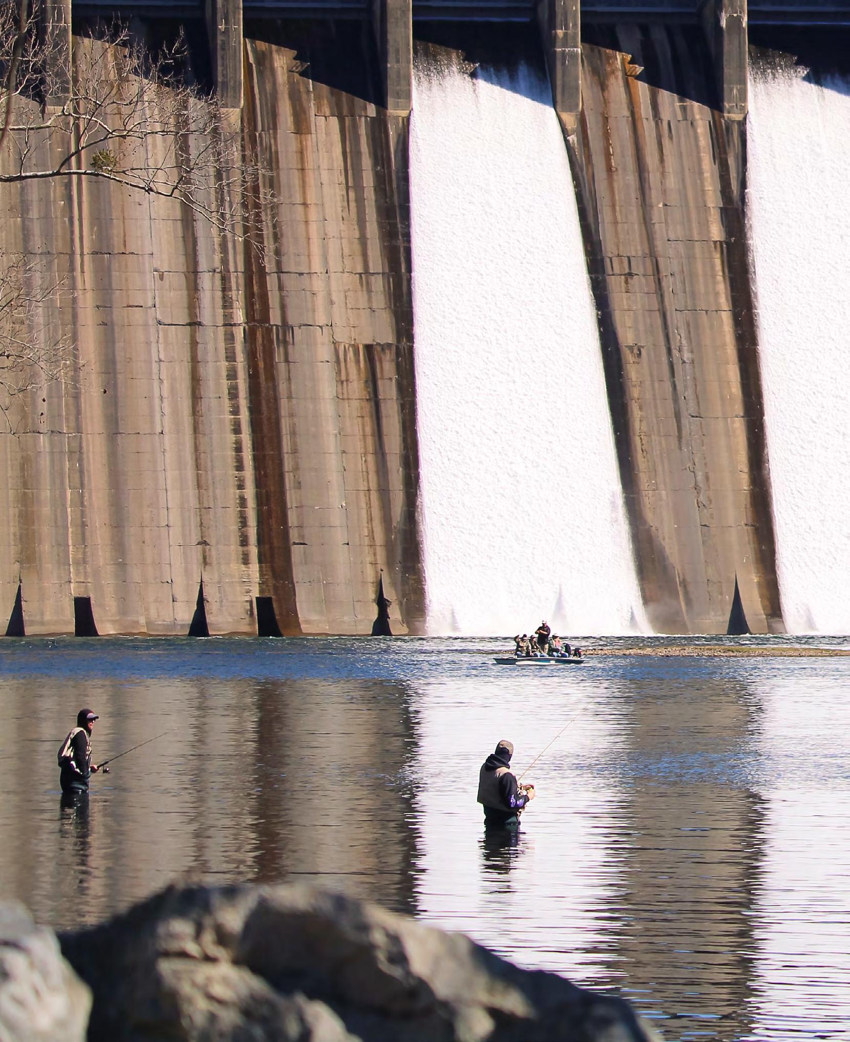
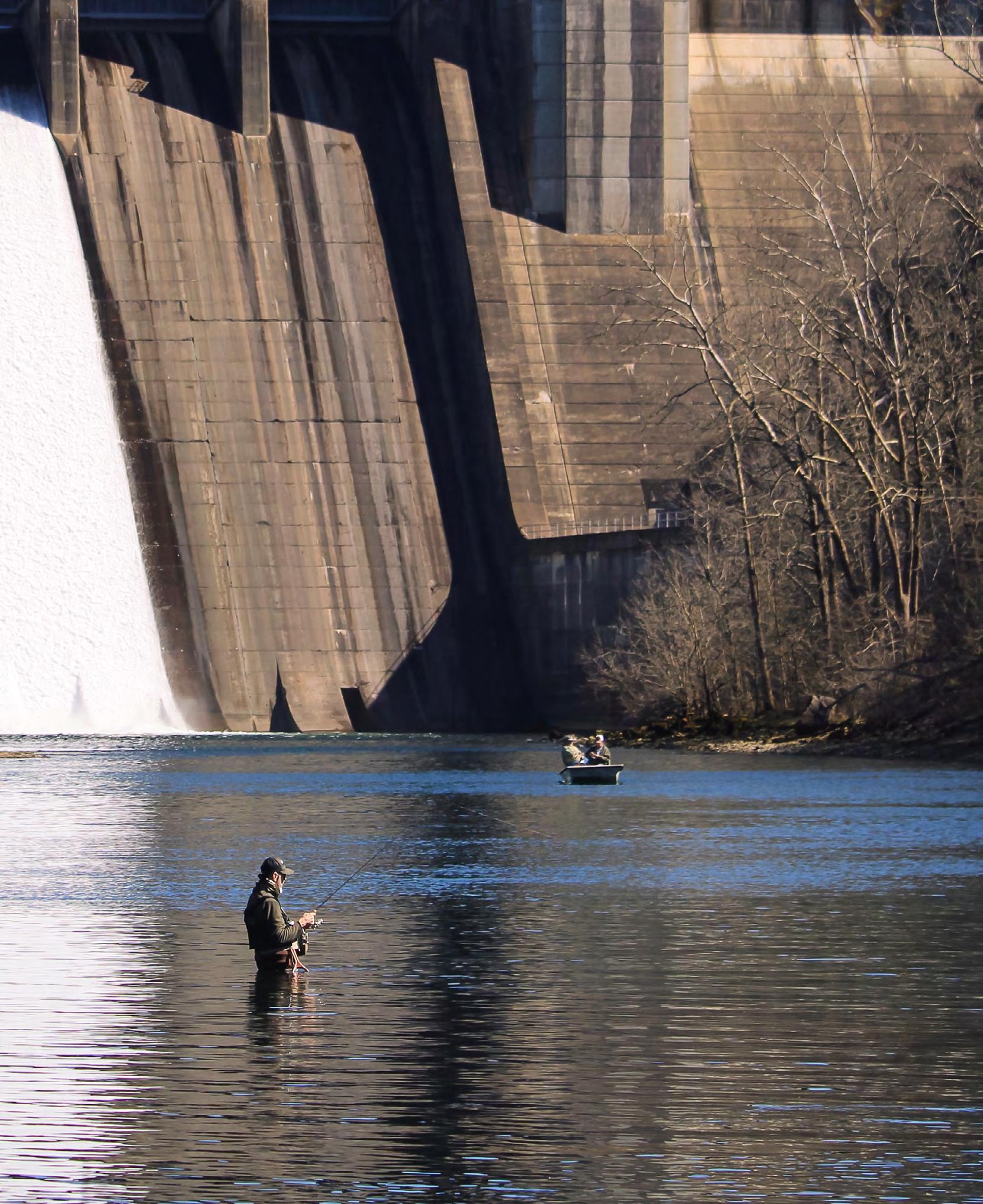
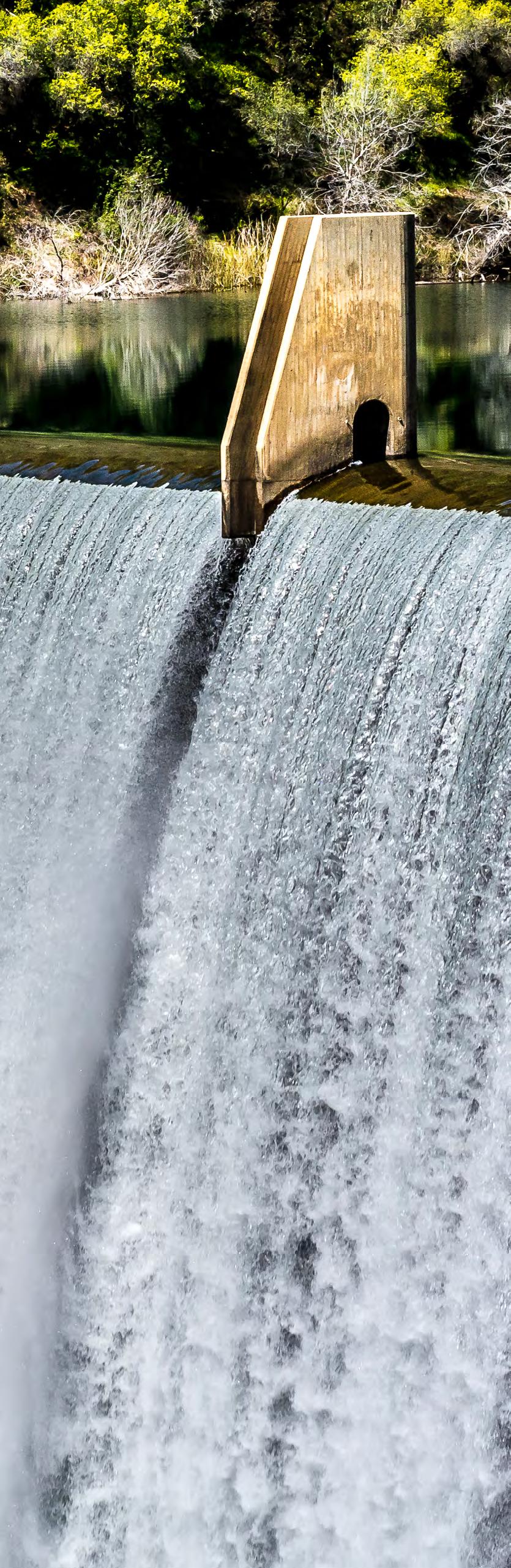
Aside from the possibility of failure, dams also pose risks to swimmers, fishermen and boaters.
Small dams, also known as low-head dams, “killer dams” or “drowning machines,” are deceptively dangerous. A low head dam is a manufactured structure, built in a river or stream channel, extending fully across the banks. A low-head dam is designed and built such that water flows continuously over the crest from bank to bank. These dams are especially dangerous to swimmers and boaters since they are often hard to see, especially from the upstream side. Boaters who go over a low-head dam are often trapped in a submerged hydraulic jump or “roller” formed just below the dam. Likewise, swimmers and fishermen who get too close to dams can be caught in this dangerous circulating current.
Hundreds of people have been killed at low-head dams, but few states inventory or monitor safety at these dangerous structures.
STAY SAFE AROUND DAMS *
Summer
→ Always stay outside booms and away from all dam structures.
→ Never swim above a dam or dive from a dam structure. Currents can pull you through the dam or pull you against flow structures with such force that you could not escape.
→ Never fish, boat, or swim below a dam. Water levels and flows can change very quickly and you may not be able to react in time to avoid the danger.
→ Personal water craft and boats should always stay clear from dams. Never moor, tie or anchor your boat below a dam.
→ Never sunbathe, picnic or camp in an area which may become flooded due to dam operations.
Autumn
→ All-Terrain Vehicles (ATVs) should be used with caution around water. Operators should be aware of possible changes in water flows or levels from dam operations.
→ Always obey posted signs, and do not enter fenced areas to hike, or access hunting or nature viewing areas.
Winter
→ Beware of thin ice that may develop due to dam operations.
→ Never venture out on the ice alone. Always wear a life jacket and carry a throw rope.
→ Dam operations often result in lowering of water levels throughout the winter and spring. However, this can result in ice collapsing onto lower water levels and then water seeping up under the snow. When venturing out on the ice, always be aware of the potential of slush under the snow over ice. Travel in slush conditions is very difficult regardless of the mode of travel.
Spring
→ Stay clear of dams when fishing. Water flows and levels can change quickly.
→ Canoers and kayakers should always stay clear of dams.
General
→ Stay off the dam structures unless the area is clearly marked for public travel.
→ Be alert to changes in water levels.
*Ontario Ministry of Natural Resources website - 2012
WHAT WOULD YOU DO IF YOUR PROPERTY WERE FLOODED? ARE YOU PREPARED?
Even if you feel you live in a community with a low risk of stream or river flooding, remember that anywhere it rains, it can flood. Water releases from upstream dams can also cause flooding. Just because you haven’t experienced a flood in the past, doesn’t mean you won’t in the future. Flood risk isn’t just based on history. It’s also based on a number of factors including the condition of upstream dams, rainfall, topography, failure or mis-operation of manmade structures, flood-control measures, river-flow and tidal-surge data, and changes in runoff patterns due to new construction and development.
What to Do Before a Flood
■ Be observant of rapidly changing conditions.
■ Build an emergency kit and make a family communications plan.
■ Avoid building in a 100-year floodplain unless you elevate and flood proof your home.
■ Elevate the furnace, water heater and electric panel in your home if you live in an area that has a high flood risk. Consider installing “check valves” to prevent flood water from backing up into the drains of your home.
■ If feasible, construct barriers to stop floodwater from entering the building and seal walls in basements with waterproofing compounds.
■ Study dam failure inundation maps to pre-plan your family’s or employees’ evacuation routes.
What to Do During a Flood or Flood Warning
■ Listen to the radio or television for information.
■ Be aware that dam failure or operational flooding can occur. If there is any possibility of a flood, move immediately to higher ground. Do not wait for instructions to move.
■ Be aware of stream, drainage channels, canyons and other areas that may flood suddenly. Dam failure or operational floods can occur in these areas with or without typical warnings such as rain clouds or heavy rain.
If you must prepare to evacuate, you should do the following:
■ Secure your home. If you have time, bring in outdoor furniture. Move essential items to an upper floor.
■ Turn off utilities at the main switches or valves if instructed to do so. Disconnect electrical appliances. Do not touch electrical equipment if you are wet or standing in water.
If you have to leave your home, remember these evacuation tips:
■ Do not walk through moving water. Six inches of moving water can make you fall. If you have to walk in water, walk where the water is not moving. Use a stick to check the firmness of the ground in front of you.
■ Do not drive into flooded areas. If floodwaters rise around your car, abandon the car and move to higher ground if you can do so safely. You and the vehicle can be swept away quickly.
■ Do not camp or park your vehicle along streams, rivers or creeks, particularly during threatening conditions.