KEY SKILLS
HISTORY OF NAVIGATION 1914-18 ‘Map and compass’ taught to help officers locate artillery targets
1930s Map and compass syllabus revised to include current grid reference system
1939-45 Big expansion of ACF: map and compass syllabus is designed to prepare cadets to join the Army
1958 ACF syllabus updated: still use map and compass
1960 onwards Orienteering becomes increasingly popular. Scandinavians introduce idea of ‘navigation’ to British enthusiasts
1970s British orienteerers identify problems of conventional map and compass (e.g. little practical time to develop efficient land navigation). Vow to promote navigation as an alternative
1980
Training includes learning to recognise features on a map
The National Navigation Award Scheme (NNAS) is formed
1990s The British Orienteering Federation introduces a navigation methodology that is promoted by the NNAS
2011 Training and development committee approves prep work on new syllabus
I LIKE THE GREAT OUTDOORS AND WANTED TO FIND A WAY TO GET THE CADETS INTERESTED IN NAVIGATION SGT ANN BEVAN
2012 Navigation is mapped to the demands of the APC syllabus. Implementation plan approved
2013 Navigation introduced by APC Star level; ‘train the trainer’ courses run
2015 NNAS gains Scottish Credit and Qualifications Framework level 4 status for its bronze award
2017 APC 3 Star and NNAS tutor courses are delivered in the ACF
24 ACF WINTER 2017/18
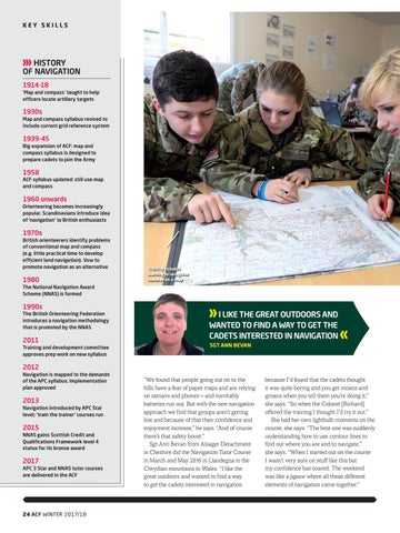
“We found that people going out on to the hills have a fear of paper maps and are relying on satnavs and phones – and inevitably batteries run out. But with the new navigation approach we find that groups aren’t getting lost and because of that their confidence and enjoyment increase,” he says. “And of course there’s that safety boost.” Sgt Ann Bevan from Alsager Detachment in Cheshire did the Navigation Tutor Course in March and May 2016 in Llandegna in the Clwydian mountains in Wales. “I like the great outdoors and wanted to find a way to get the cadets interested in navigation
because I’d found that the cadets thought it was quite boring and you get moans and groans when you tell them you’re doing it,” she says. “So when the Colonel [Richard] offered the training I thought I’d try it out.” She had her own lightbulb moments on the course, she says. “The best one was suddenly understanding how to use contour lines to find out where you are and to navigate,” she says. “When I started out on the course I wasn’t very sure on stuff like this but my confidence has soared. The weekend was like a jigsaw where all these different elements of navigation came together.”