portfolio urban design | arina novikova
I am enthusiastic about discovering more about urbanism through my varied skillset including strong graphic vision and technical tools as well as my interest in topics related to the sharing economy and green energy. I also value the power of team work a lot.
2
+31 6 13830656 Sittard, NL Arina.Novikova.Igorevna@gmail.com Arina Novikova 25 y.o. Contacts
|
Designer
Architect
Urban
education workshops
2014 - 2019
Belgorod State Technological University named after V.G.Shukhov
Bachelor of Design of the architectural space diploma with distinction; 4,94 2020 - 2021
Universitat Politècnica de Catalunya [UPC] Institute for Advanced Architecture of Catalonia Post-professional Master in City & Technology 2021 - 2022
Escuela Superior de Informática CIPSA Barcelona y Bilbao Big Data con Python experience 10.2017 - 04.2018 Gelan Assistant Designer 02.2019 - 05.2019 Department of Architecture and Urban Planning of the Belgorod Region Intern
2019
Assistance in process of design and installation of the art object |Christmas Tree of Friendship| Faculty: prof. Pertsev, Victor Babaev 2020
Urban AI |Rewilding Luxembourg| Faculty: Dr.Sandra Manninger, Dr.Matias del Campo 2021
Urban Ecology |The New Old: Envisioning the future of our past| Faculty: Winy Maas, Javier Arpa, Adrien Ravon
Urban Intelligence |The one minute rayon| Faculty: Foster + Partners: Andy Bow, Bruno Moser, Laura Narvaez Zertuche
Wallacei Workshop |Venice 2.0| Faculty: Milad Showkatbakhsh, co-founder of ‘Wallacei’, an evolutionary and analytic engine with embedded machine learning algorithms
Platform Urbanism |The 4th death| Faculty: Nicolay Boyadjiev, Co Director at Strelka Institute
Blockchain 4 Cities |Homeless data sharing for services| Faculty: Lluïsa Marsal, Technological Innovation Lead
competitions conferences
International scientific and technical conference of young scientists | Russia “Types of concrete in modern building processes” 1st degree laureate 2019
VIII International Youth Forum | Ukraine “Modern construction systems in architecture” 1st degree diploma 2021
Responsive Cities Symposium | Spain “Rewilding Luxembourg“
&
2018
QGIS ArchiCAD Lumion
InDesign Rhinoceros Photoshop Python AutoCAD Vray SketchUp After Effects 3Ds Max Illustrator skills
Grasshopper
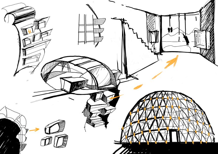
selected works 2018 - 2021
4
contents
one minute rayon
group project phoenix poblenou
2021 group project
2021
group project 2020
2 3
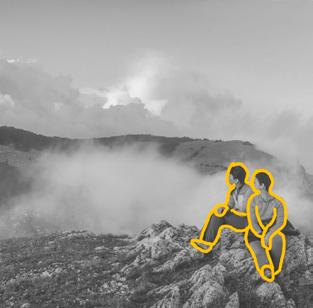
2019 bachelor thesis park of extreme sport
tower of knowledge museum of hiking
individual project individual project
rewilding Luxembourg new nomad world group project 2021 2021 group project resilient waterfront 2019 2018
5
1
4 5 6 7 8 22 - 33 96 - 103 4 - 21 52 - 65 74 - 87 34 - 51 66 - 73 88 - 95
one minute

one minute rayon
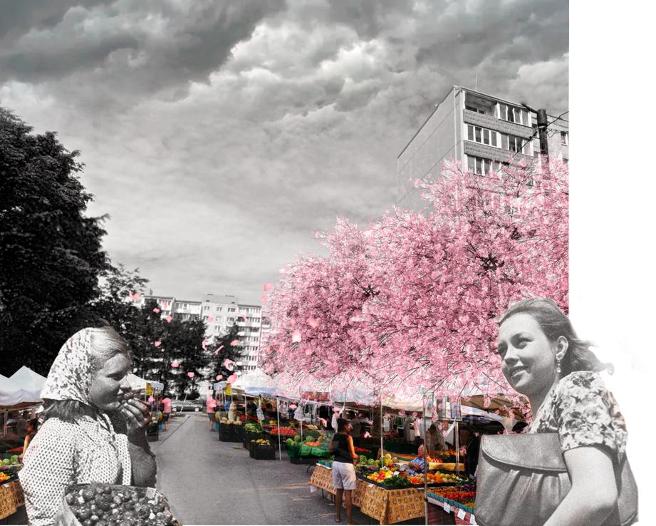
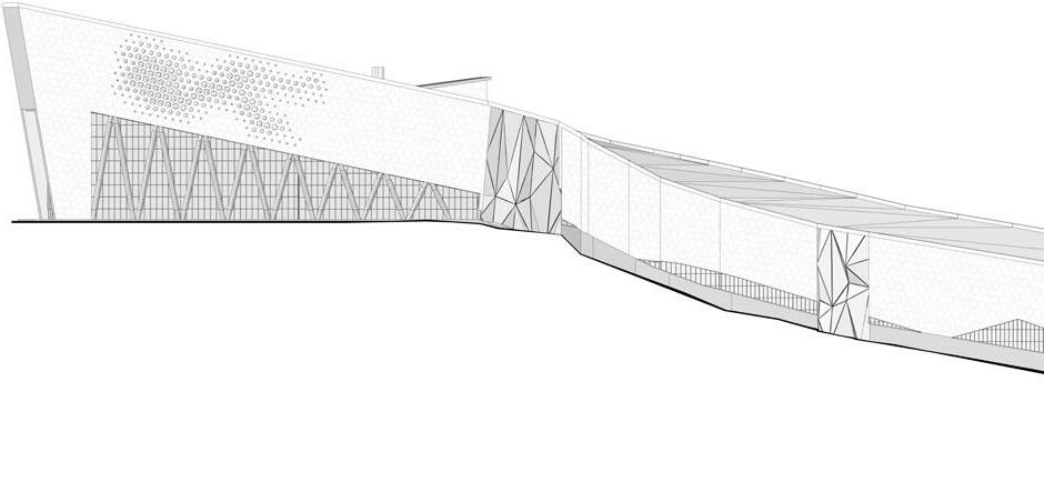
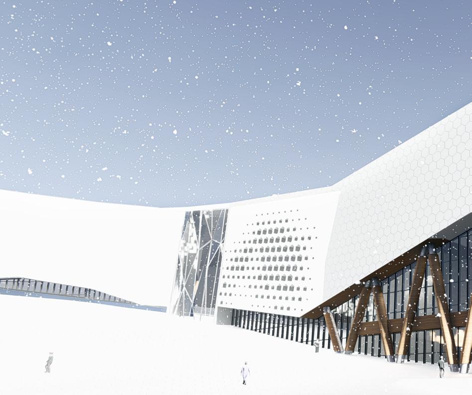
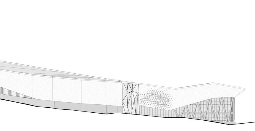
The one minute rayon, reimagines post soviet urban design and planning through tactics of circularity and community engagement. The proposal aims at bringing back a sense of place and belonging to a forgotten district in Tallinn, with a focus on micro economy as a tool to re-en ergize and activate the local community.
one minute rayon
6
Laura Narvaez Zertuche, Bruno Moser and Andy Bow
one minute rayon 53
rayon June 2021 under the direction of: team: Arina Novikova, Hebah Qatanany and Leyla Saadi
Laura Narvaez Zertuche, Bruno Moser and Andy Bow
7 5
one minute rayon
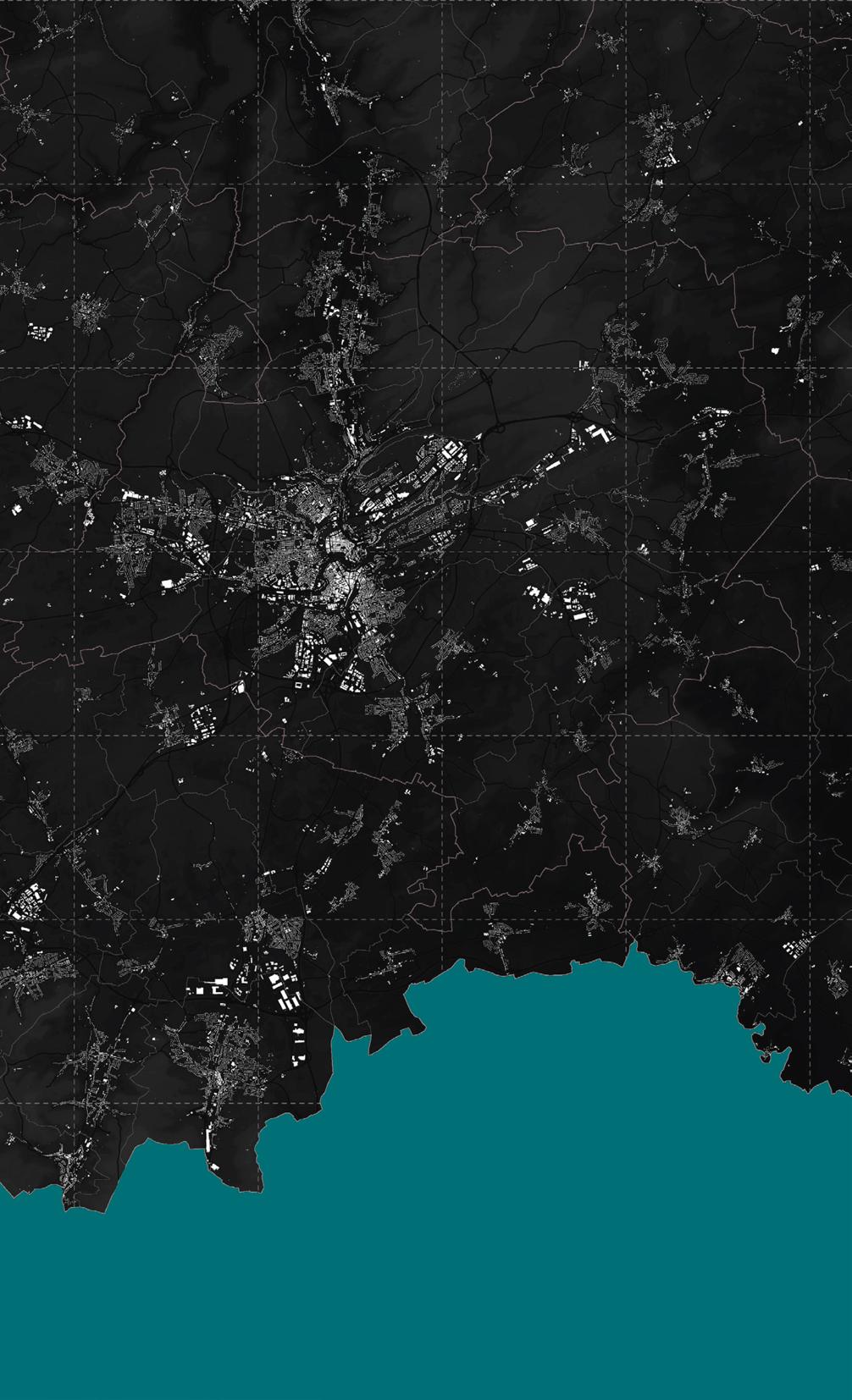
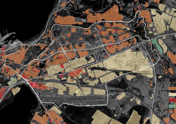
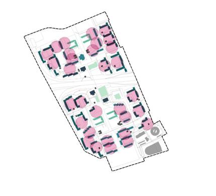
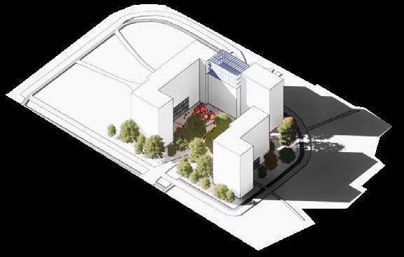
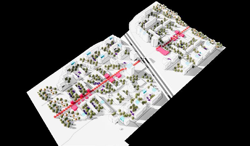
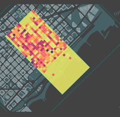
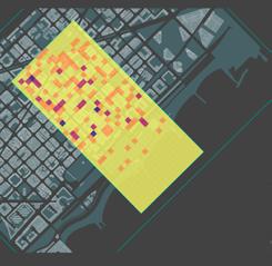
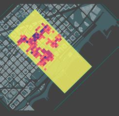
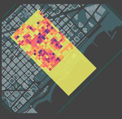
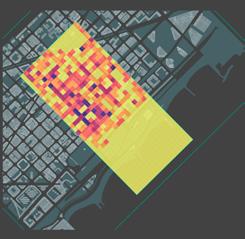
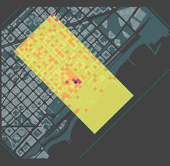
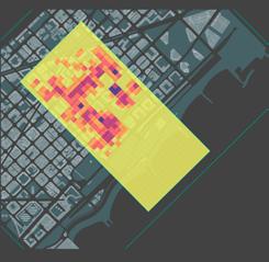
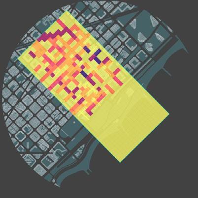
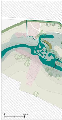
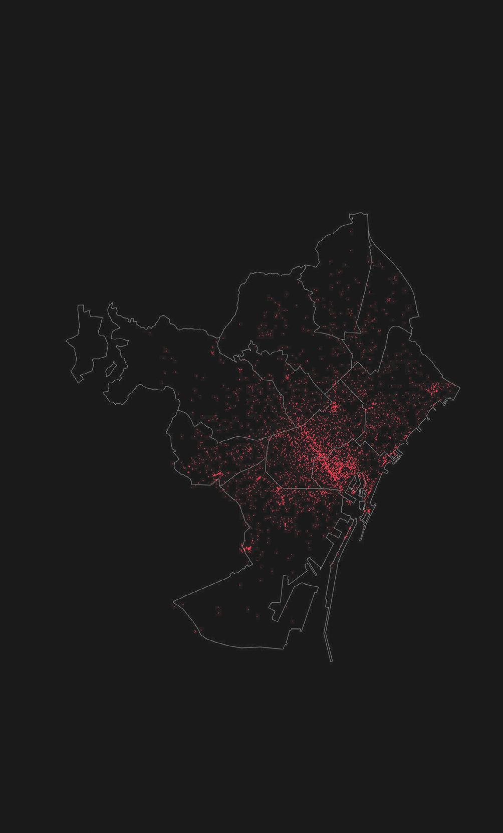
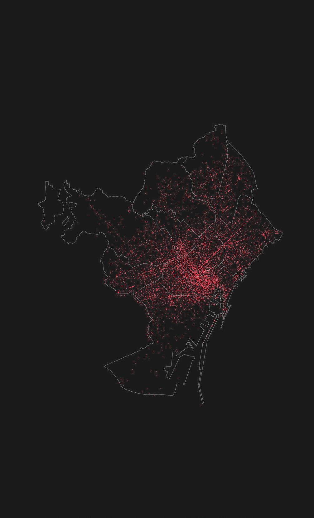
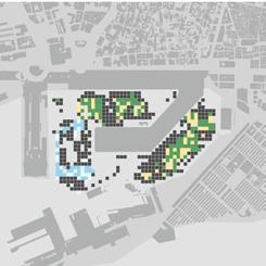
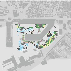
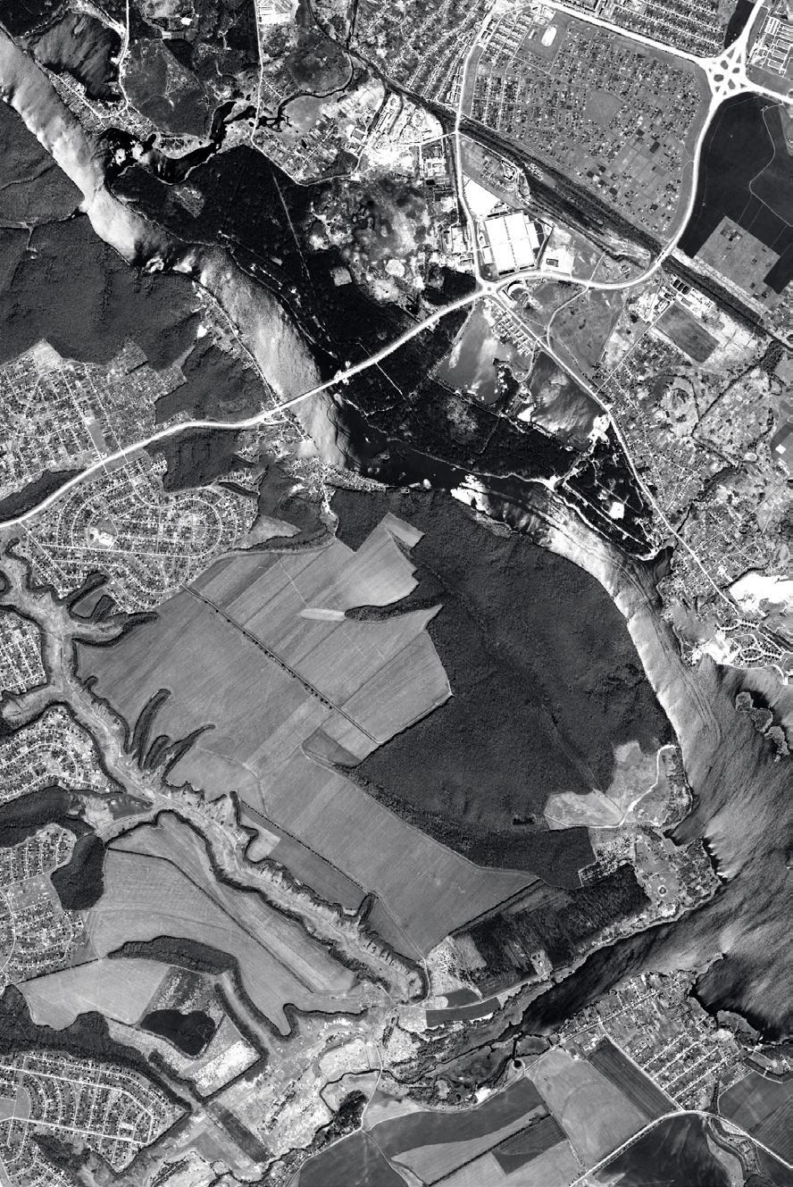
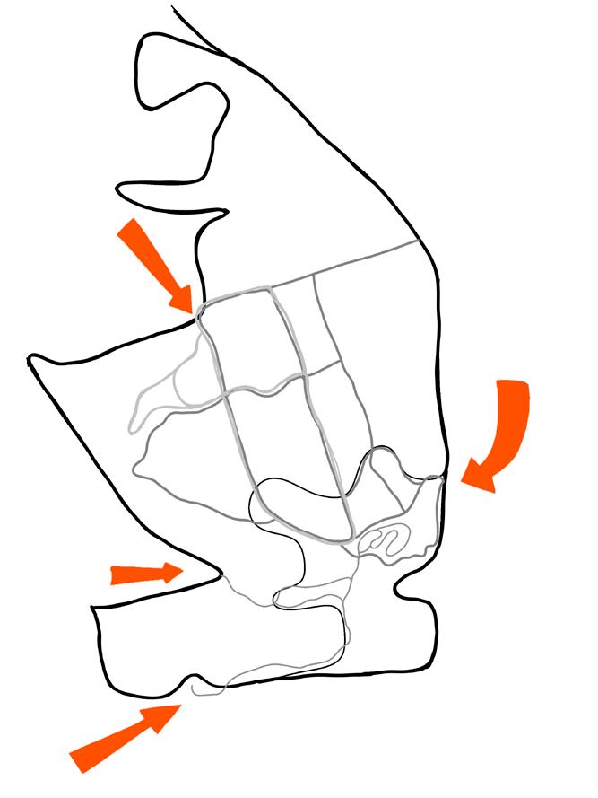
Site location
site analysis
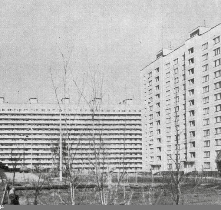
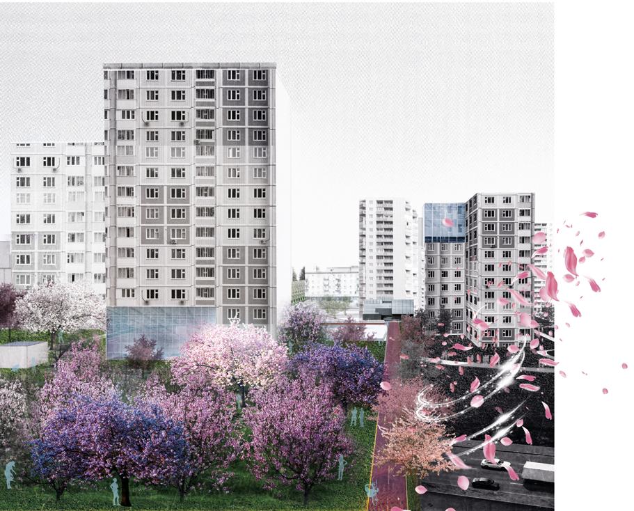
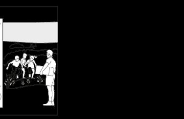
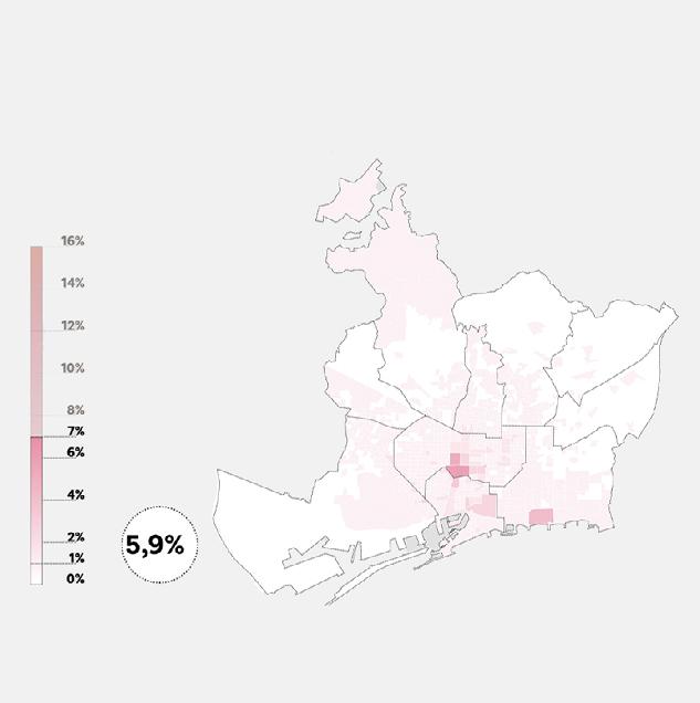
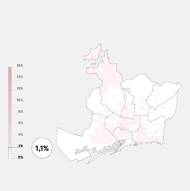
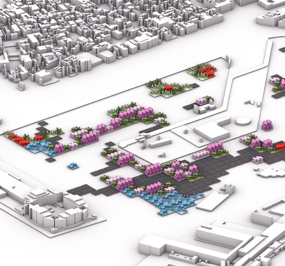
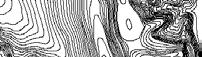
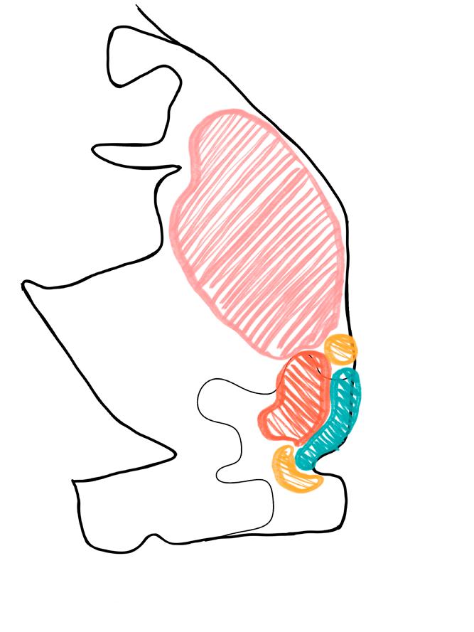
Lasnamäe is the most populous administrative district of Tallinn, the capital of Estonia. The district’s population is about 119,000. Local housing is mostly represented by 5–16 stories high panel blocks of flats, built in the 1970–1990s. The site is located between the intersection of two major roads, the road to Tallinn city centre, and to the airport. Due to the zoning in land-use most of the commercial and industrial areas are segregated and as a result many people have to commute by car to reach their place of work. The sprawl of housing of the former natural and agricultural landscape goes with a dramatic increase in the number of commuters from the suburbs to Tallinn.
8
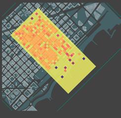
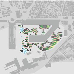
Launduse distribution
residential industrial commercial greenery
one minute rayon
About Lasnamäe
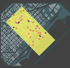
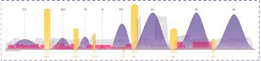
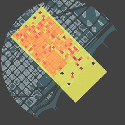
challenges
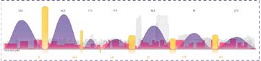
High level of unemployment
25 %
0 2,000 4,000 6,000 8,000 10,000
9
2009
Tallinn 2010 2011 2012 2013 2014 2015 2016 2017 2018 2019
Aging population lack of landuse diversity hostile architecture one minute rayon
Lasnamäe
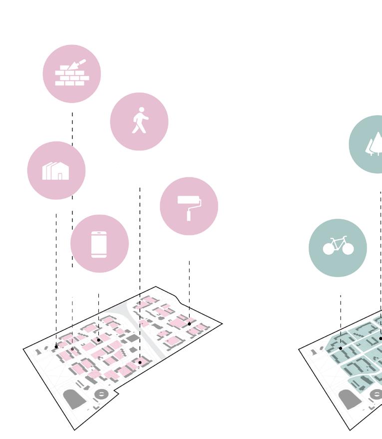
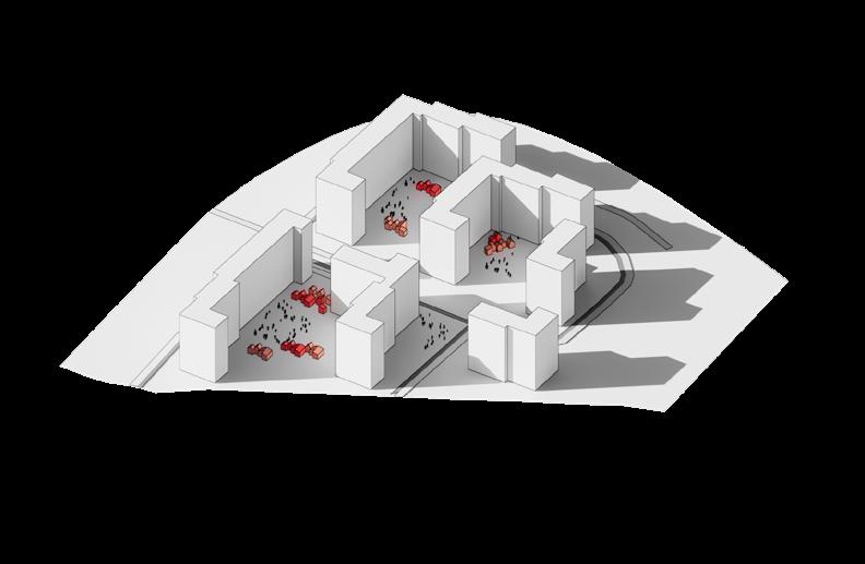
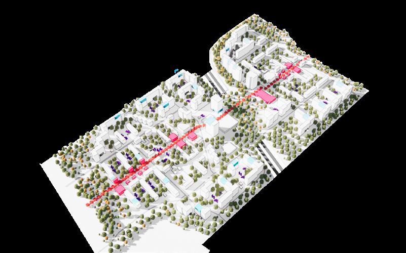
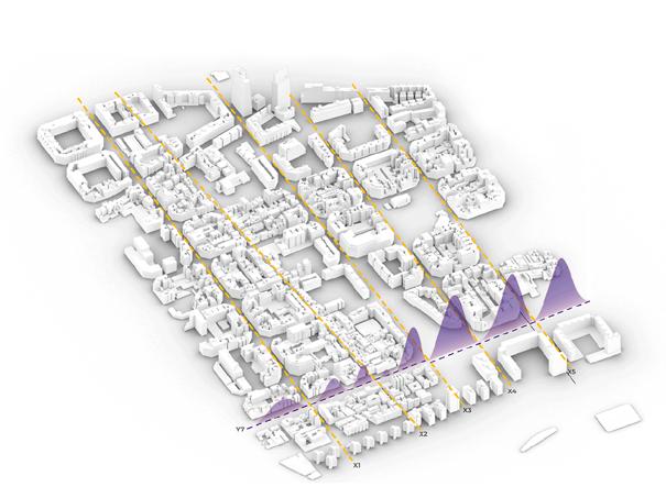
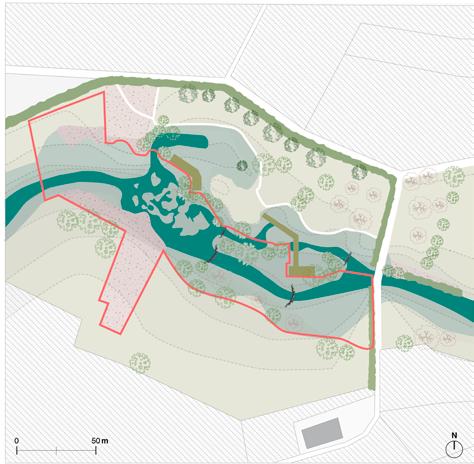
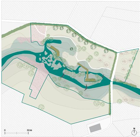
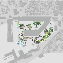
time based // scale based

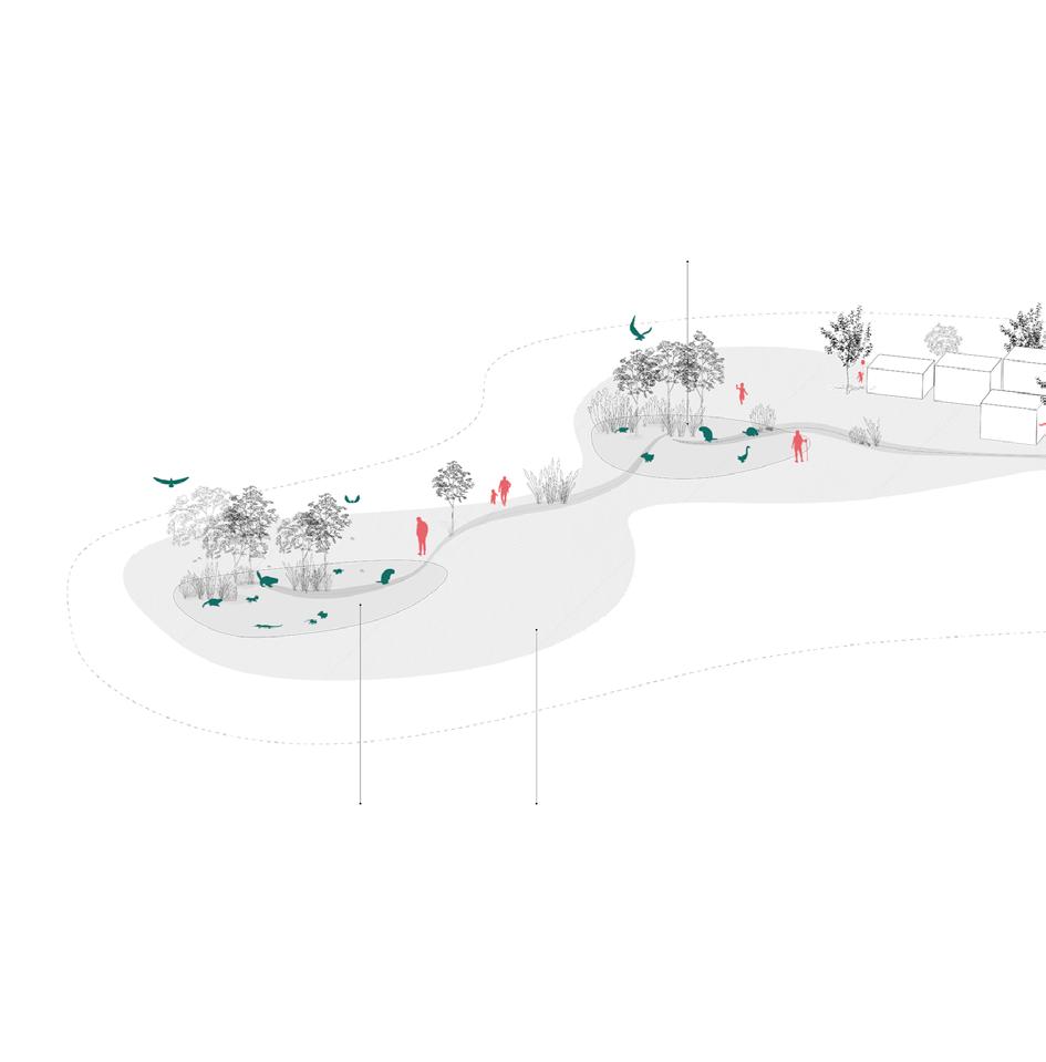
The interventions are split over 3 scales of actions which are envisioned to occur over a span of 10 years. Beginning at the community scale (1 minute walk), smaller interventions begin early on such as the installation of the flexible pods which begin to activate the community and create a local economy. Scaling up to large infrastructure intervention in the mid term such as mobility changes and building of an elevated green link and new residential buildings. Starting from the community scale to impact the direct community and slowly scale up to enhance the entire district.
10
proposal Scale Time 0 years 10 years
one minute rayon
Flexible
Micro
Mobility change Improve walkability Phase 01 Tactical Urbanism
Pods Architectural works
- forests Co-managment platform - launch
forests
Connectivity between communities
Connectivity between communities Phase 01
New buildings redensifying
Mobility changes
Bridge connection Ground level activation
Launch community reforestation

11 one minute rayon
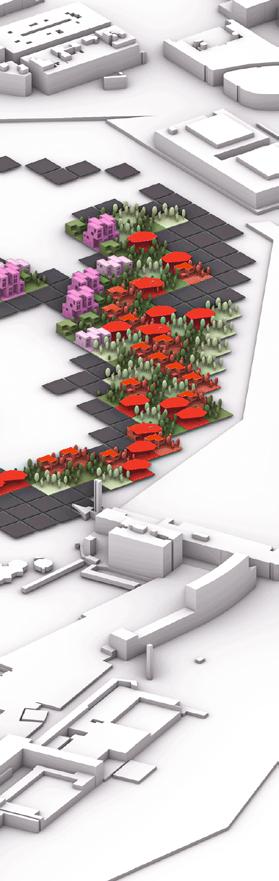
circularity
implementation of circular economy
To achieve a strong and sustainable community, we focus on 6 pillars of a circular economy (biodiversity, food, waste, energy, water and community) with the aim of creating jobs through each one of those. For example, some food would be grown locally creating jobs in the community farms, biodiversity will be improved through reforestation and also adding jobs in the plantation.

Fab-lab
inorganic
organic
Community
12 one minute rayon
Community farm
F&B pod Handcraft pod Waste Recycling
Kitchen
13
one minute rayon
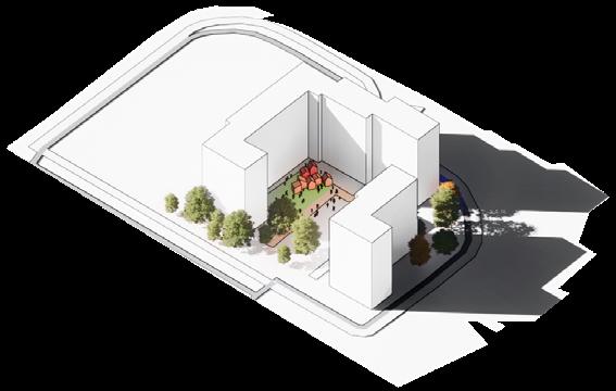
community scale
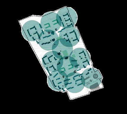
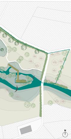
1 minutes walk
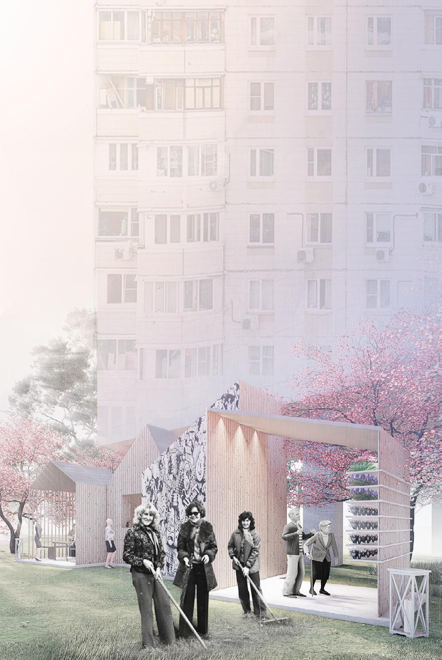
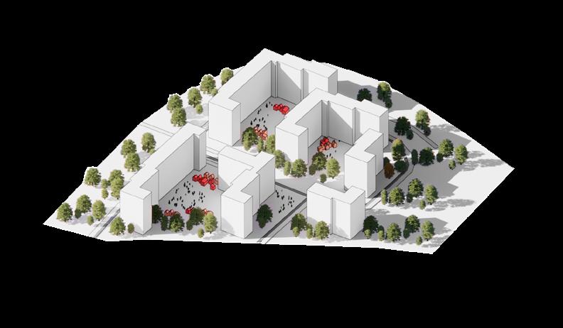
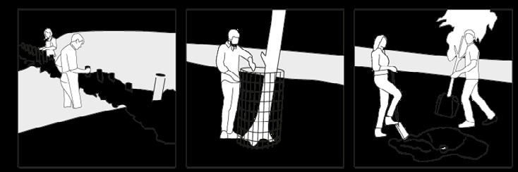
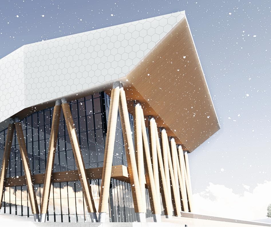
We start from the community scale by introducing the flexible pop-up pods that will serve as the first step to economy and community engagement. The temporary structure creates a playful environment which promotes social activity inside the courtyards of each building. The structure consists of a series of timber frames,a local material on – pods can be connected together to form a progression of spaces that can serve different purposes from community kitchens to fabrication labs.
14
one minute rayon


15
long-term Architectural works Improve walkability
Flexible Pod Co-management Platform - Launch Tactical Urbanism one minute rayon
short-term mid-term
Phase 01
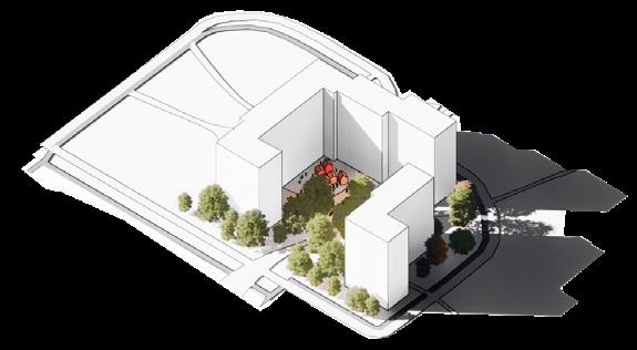
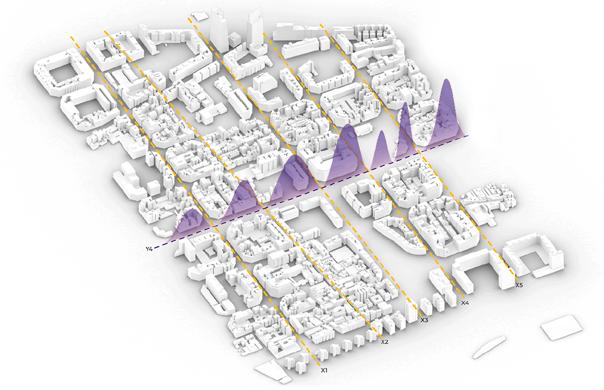
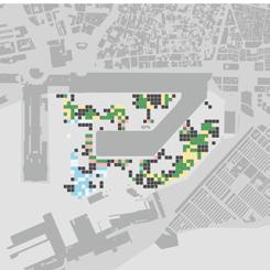
block scale
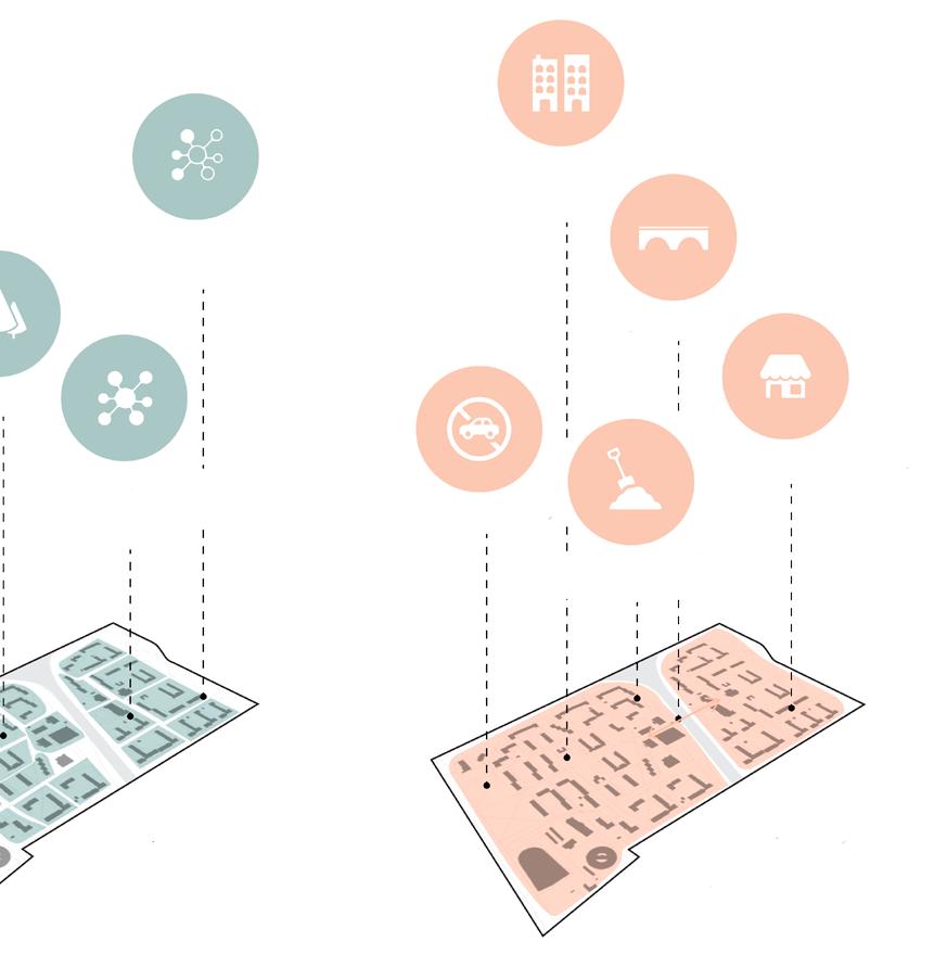
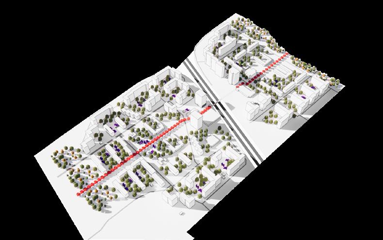
On the block scale we re-purpose the former parking lots as grounds for the public interventions and the economy pods and create a buffer zone of greenery that would line the buildings and prevent any strong cold winds from entering the court yards. Then provide pathways that connect the different.
16 one minute rayon
3 minutes walk
Mobility changes

Connectivity between communities - phase 01


short-term mid-term long-term
Connectivity between communities - phase 02

17 one minute rayon
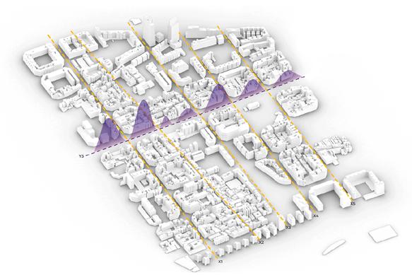
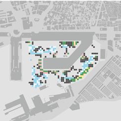
Micro-Forests
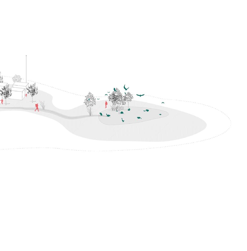
district scale
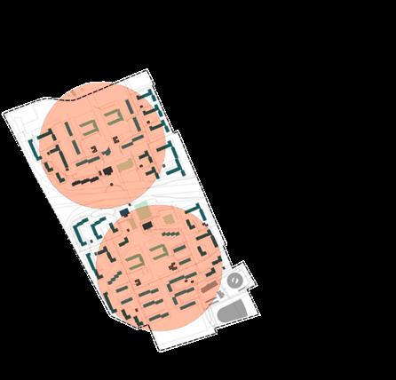
10 minutes walk
On the district scale the interven tions begin with the initiation of the community reforestation initiative in the buffer areas and the edges of the site. A green axis running across the site also begins to take form with dense trees defining the space. Next, car access to communities will be restricted to the block scale allowing vehicles to access and park around the edges of the superblock while reefing up the central spaces for greenery and community activities.
18 one minute rayon


19 one minute rayon
short-term mid-term long-term Mobility changes Launch community reforestation New residential buildings redensifying Ground level activation Bridge connection
The economy and community pods are envisioned to operate in a circular manner, where organic waste from the community kitchen for example is used as fertilizer in a community farm. Meanwhile food from the community gardens would make its way to the community kitchen or on fresh market stalls to be sold back to the community. Recyclable materials from clothing shops could be re-used to build new things at the community fab lab. By establishing these circular relationships we ensure a more sustainable and self-sufficient ecosystem in the district.
limiting car access
Split building
Elevated groundfloor
20 section
one minute rayon
sun gardens
improved insulation Rain water collection
Pop-up activation
21 one minute rayon
job creation
impact
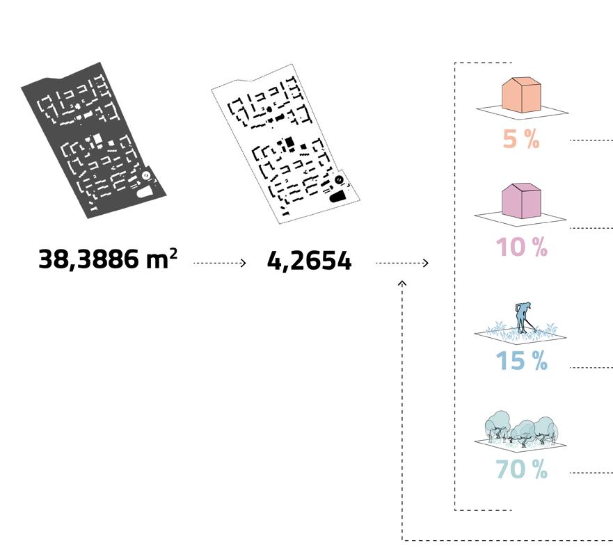
From an initial 383,886m of empty monocultural land we are able to achieve a reactivation of space that has the potential to employ an average of 7,000 people. Populate a forest of approximately 30,000 trees. In footprint sense, this saves more than 4,000 tons of annual CO2 – A surplus that can possibly be sold to generate an income to be used back in the system.
22
one minute rayon
Number of workers per pod
x1 x1 x1/10 x1/10
Aproximate number of people employed
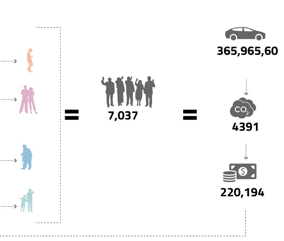
km of annual car trips
Saved from CO2
Saved from CO2
23 one minute rayon
phoenix poblenou
June 2021 under

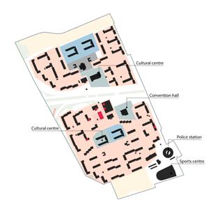
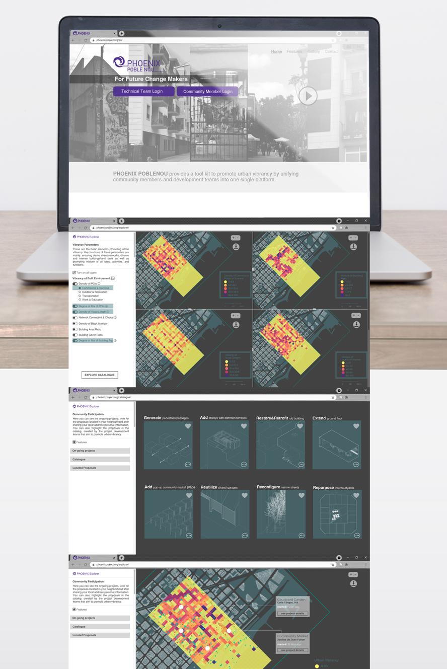
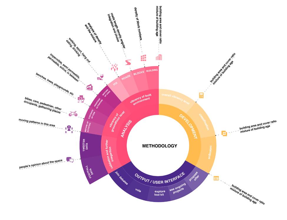
Phoenix Project aims to promote urban vibrancy, by making use of morphological metrics. It mainly refers to updated plan decisions for 22@ District by providing all the layers of analysis, development and proposal for the radical change that awaits the area in the near future. Phoenix PobleNou promises an inclusive platform to create a communi cation channel between those who propose changes and those who will experience them in an urban environment.

24
the direction of: team: Arina Novikova, Kshama Patil, Simone Grasso, Sinay Coskun and Stephania Kousoula
Angelos Chronis, Iacopo Neri, Mahsa Nikoufar and Androniki Pappa
22
phoenix poblenou
25 phoenix poblenou
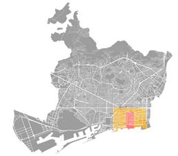
site analysis about
 poblenou
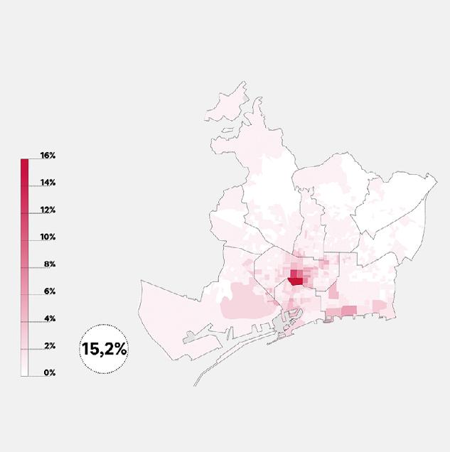
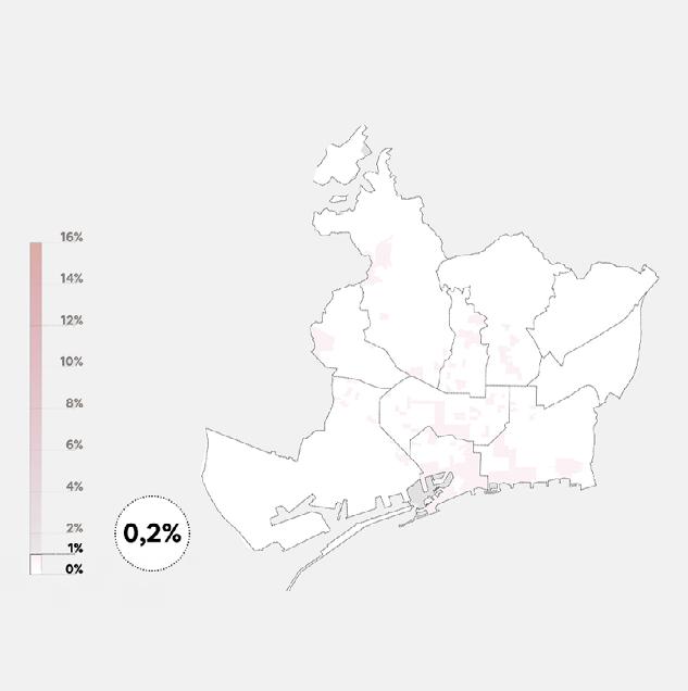
PobleNou is the innovative district of Barcelona and is developed under the 22@proposal. The next phase of 22@ reflects new challenges for the area that are going to be implemented through the next few years. Some of the main conclusions from the updated plan, which we will also highlight in this study, are the development of green streets, new buildings tackling social housing and new sectors expanded to a more green and circular economy.
To know more about urban vibrancy concept:
26
phoenix poblenou

27 phoenix poblenou
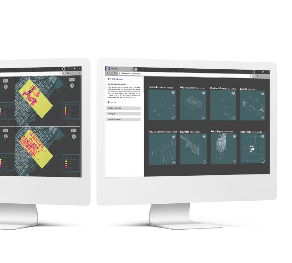
vibrancy
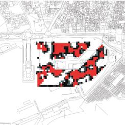
of built environment
angular integration
density of road length
density of transport POIs
mixture of building age
mixture of POIs
density of building cover ratio
density of bloc number
density of building area ratio


density of educational POIs
density of choice
density of comertial POIs
density of outdoor POIs
density of residential POIs
28
phoenix poblenou
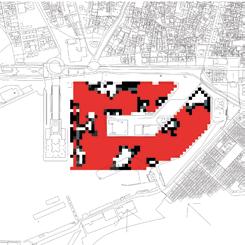
vibrancy
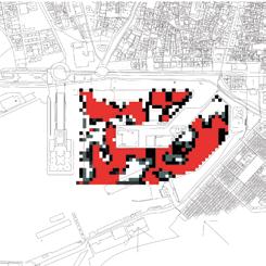
ground floor level
carrer de Llull
29
of
carrer de Pujades carrer del Taulat phoenix poblenou
vibrancy
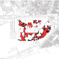
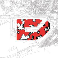
of built environment and ground level
Built environment Groundfloor level
30
phoenix poblenou
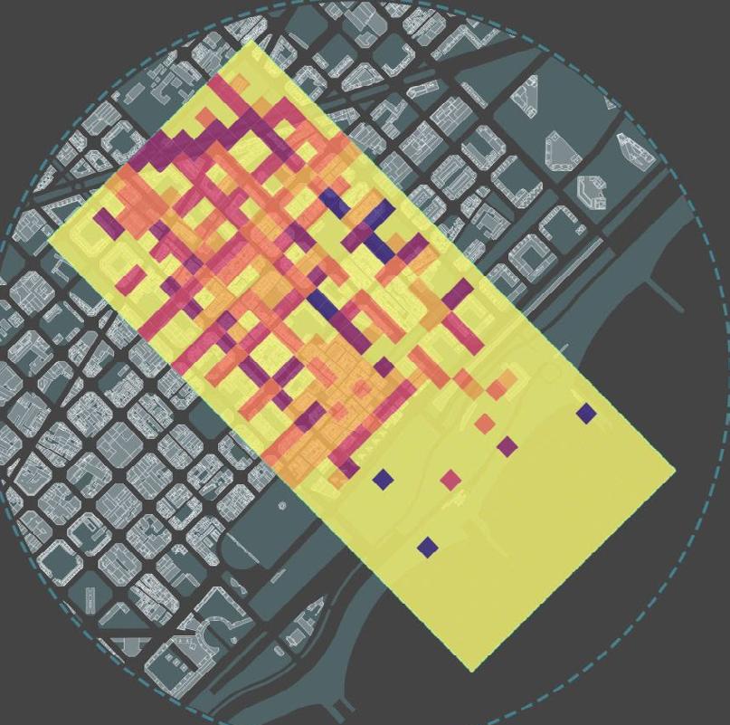
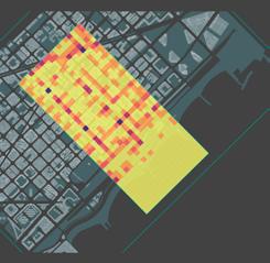
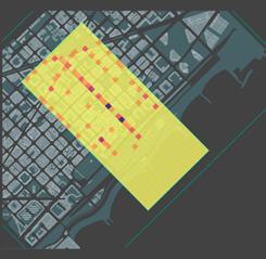
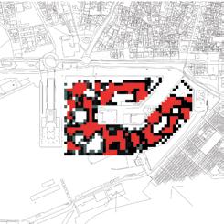
31 overall level
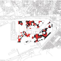
0 - 10 10 - 25 25 - 42 42 - 64 64 - 84 84 - 100 0 250 500 Urban vibrancy phoenix poblenou
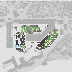
vibrancy
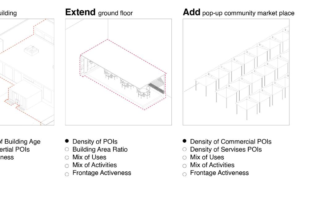
tool kit of possible interventions
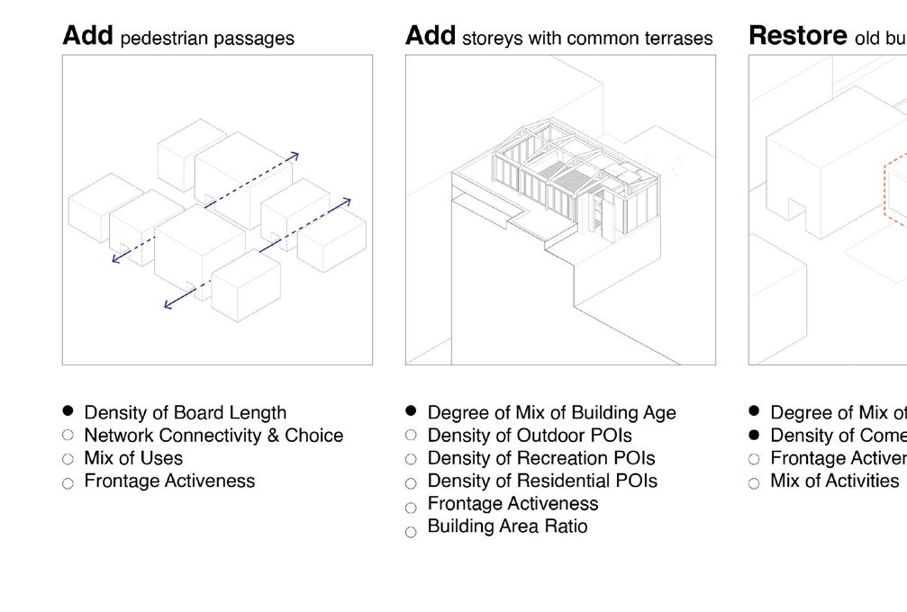
32
phoenix poblenou
catalogue
33 phoenix poblenou
user interface
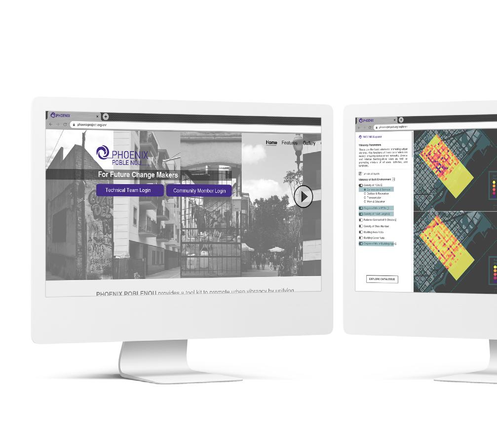
enabling participatory process
34
phoenix poblenou
Check the video here:

35
phoenix poblenou
rewilding luxembourg

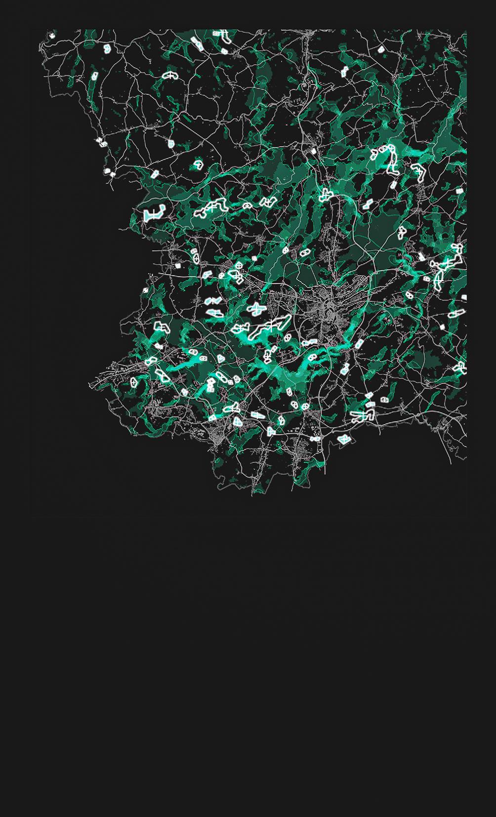
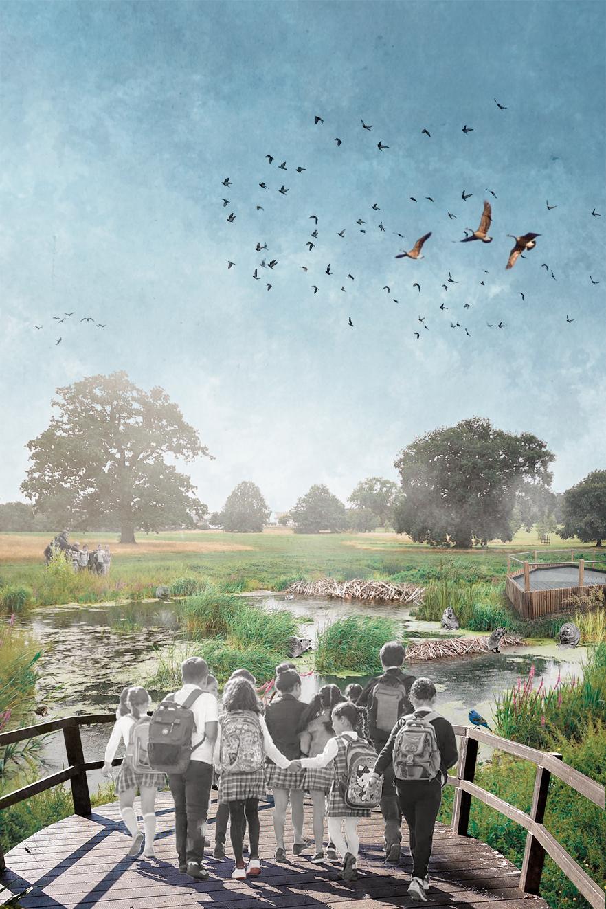
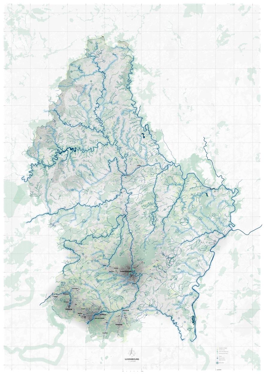
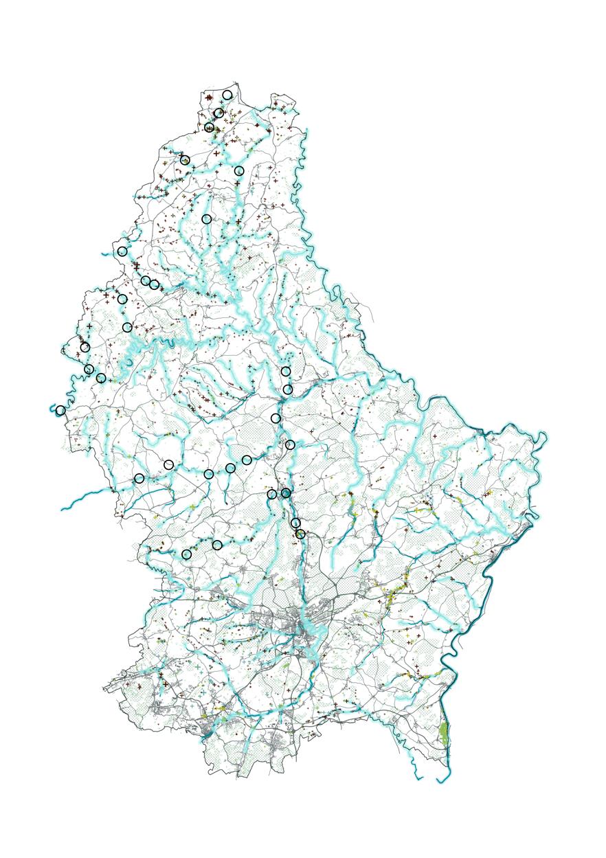
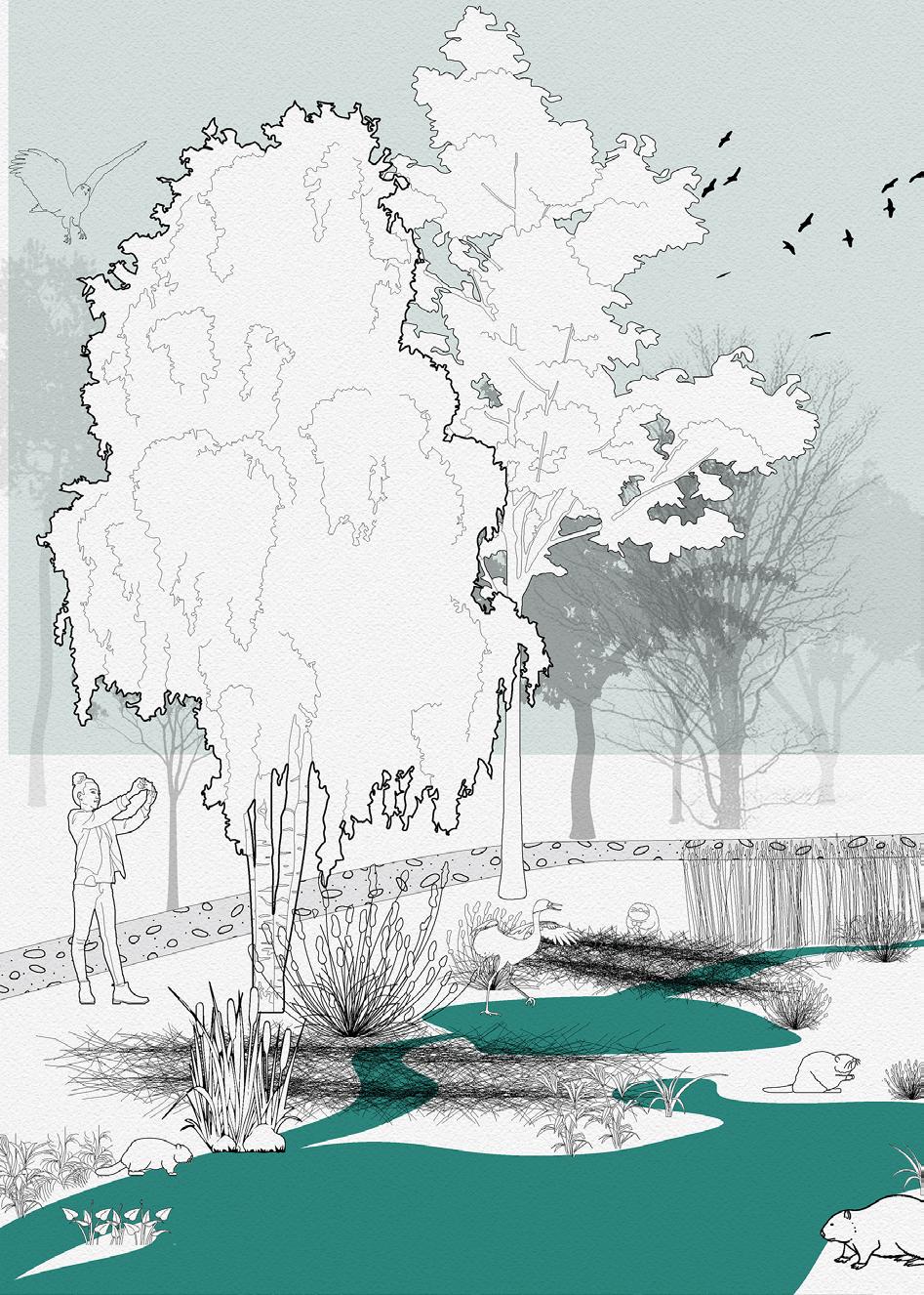
“Rewilding” is a habitat conservation concept that increasingly draws attention to the public. The challenge is taken in the Luxem bourg context, where habitat fragmentation is a significant issue under urban sprawl and highway network expansion. Among natural habitats affected, wetland habitats are the most vulnerable ones.
 December 2020 under the direction of: team: Alvaro Cerezo Carrizo, Arina Novikova, Dongxuan Zhu and Stefania-Maria Kousoula
rewilding
34
Eduardo Rico, Mathilde Marengo and Iacopo Neri
luxembourg
rewilding luxembourg 35
rewilding
conservation biology
“Rewilding” is a habitat conservation concept that increasingly draws attention to the public. However, the existing rewilding practices are often established upon binary views on ecosystems, such as isolating “artificial” from “the wild” or illustrating ecosystems as “services” to human “beneficiaries”. We aim to challenge these binary views by inviting other species to co-managing the trial fields: In the “core area”, the autonomy of other species is respected; In the “buffer area”, humans’ capability in living friendly with other species is valued and emphasized.
buffer area core area
wetlands
38
rewilding luxembourg
urban infrastructure
39 rewilding luxembourg
wetlands habitat
beavers as cross-species collaborators
40 rewilding luxembourg
Riperian forests
Public forests + + + +
Currecnt beaver location
Wetland typology

Shellow marshes
Deep marshes Fens
Main water corridors Wet meadows
41 rewilding luxembourg
stakeholders

kids as human collaborators
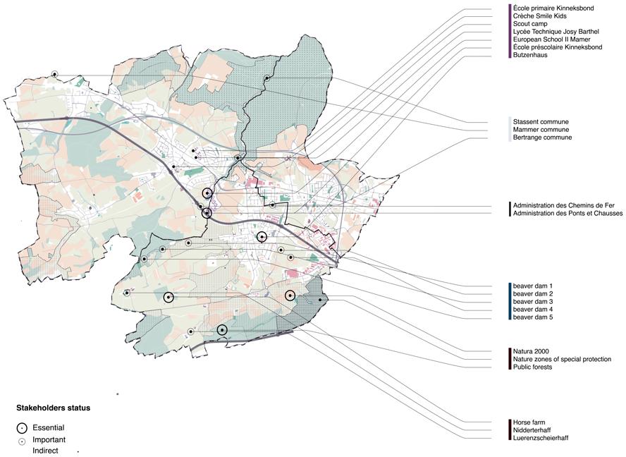
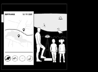
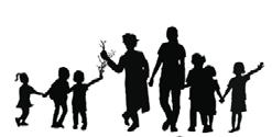
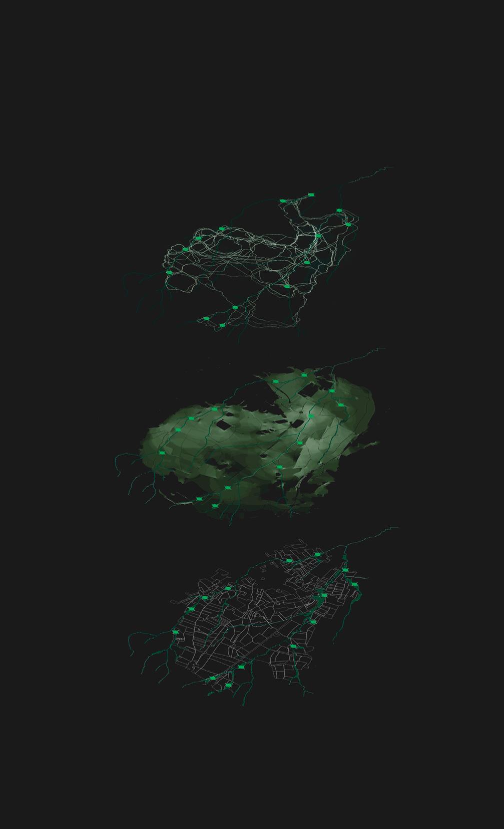
We identify school kids in Luxembourg as our closest human collaborators. After the top-down initiation of our project, kids could stimulate bottom-up awareness by monitoring the whole process, as citizen scientists. Teachers are also encouraged to collaborate with other relevant parties, supporting kids and raising awareness. And once kids grow up, they themselves would be the advocates/decision makers for the new landscape they monitor and intervene. Based on the wetland corridors identified, we choose the pilot cities with the highest potential for cross-sector conversation.
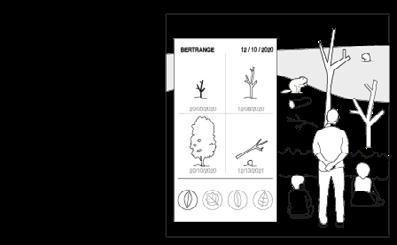
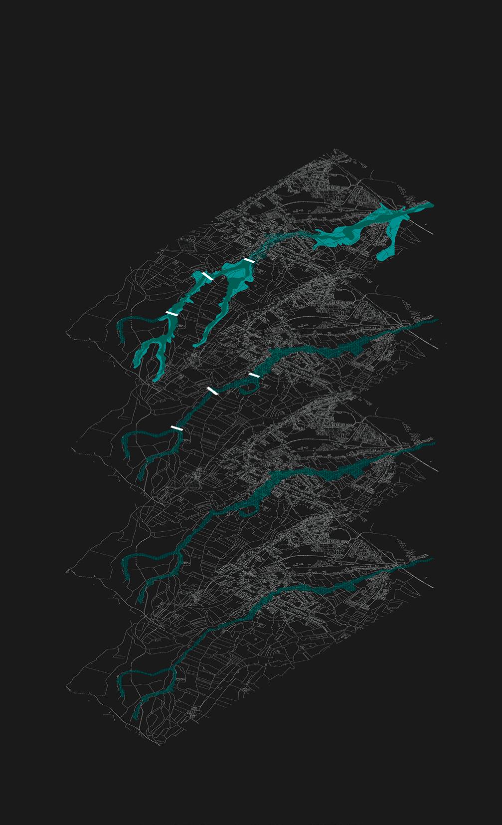
From the previous simulation, we decide to scale down to the main wetland connectivity corridor, crossing central Luxembourg, between most of the pilot cities from our stakeholder map. Among the cities along this corridor, we choose Bertrange municipality as an example for detailed analysis. In the Bertrange area we identified the main stakeholders to be involved in our proposal, among which teachers from education institu tions, natural protection experts and land owners will be directly reached.
42 rewilding luxembourg
Bertrange
Stakeholders status


Essential Important Indirect
43 30 years 1 year rewilding luxembourg
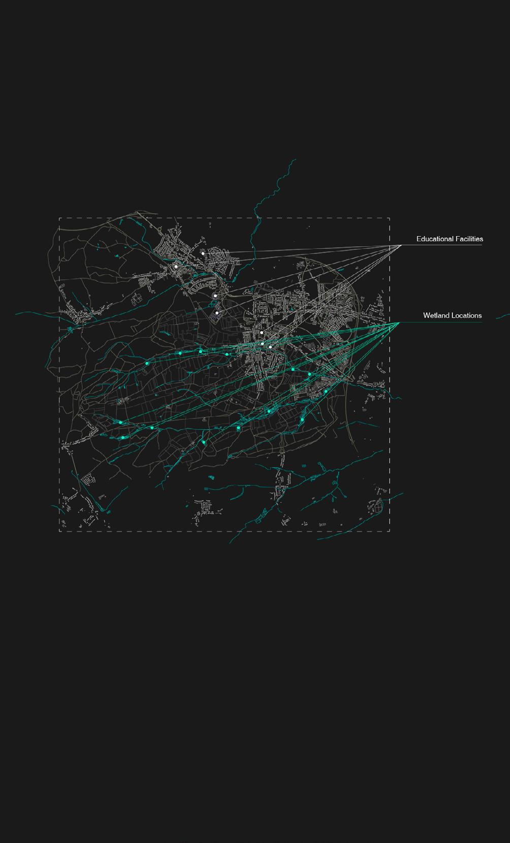
rewilding luxembourg 42 connectivity distribution of wetlands and educational facilities Streams Roads Croplands Buildings
43 rewilding luxembourg 1h walk 2h walk
proposal
stages of implementation

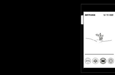
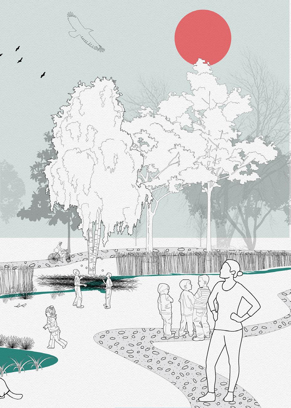
Introducing our vision of this territory, where beavers in Luxembourg does not simply appear in isolated reserves, but are actively engaged in changing the landscape of human society. With the adaptive intervention and monitoring from kids and local communities, we believe a more tolerant, non-binary coexistence could take place, with the human society been “rewilded”.
bomb seeds
in experimental
stage
Teacher and kids

46
construction dam analogy protection existing trees planting alluvial forests
rewilding luxembourg
stage 2 stage 3

experimental field organizing observation spots collecting data kids engagement Kids as citizens scientists

47
rewilding luxembourg
simulations hydrological simulations // caesar
The intervention area is divided into core and buffer areas. The core areas are firstly identified through flood simulation using Caesar lisflood. With different iteration counts, we chose the most frequently flooded zones as core restoration zones. These lands are initially prepared by humans using the Beaver Dam Analog technique, along with tree protection techniques and planting new vegetation.
rewilding luxembourg 46
connectivity analysis // circuitscape
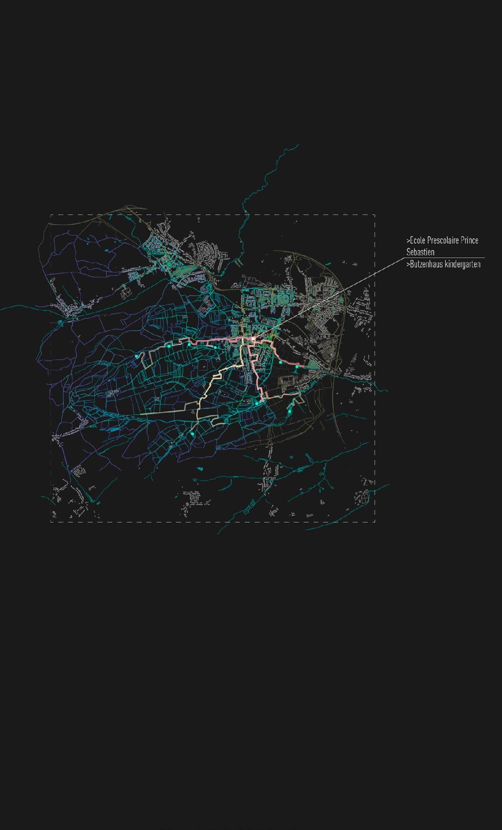
Through Circuitscape software we simulated possible animal movement in our area. In order to avoid severe conflict and at the same time increase the citizen’s awareness for our project, we allocate the trial fields at the periphery of Bertrange city along River Petrusse.
47 rewilding
luxembourg
proposal
stages of implementation
After one year of preparation, beavers are reintroduced to the site, creating a complex wetland matrix that inundates part of the adjacent buffer zone. Then kids can plant in the wet experimental field the seed bombs wherever they want, while their access is restricted to the core area by notice and a row of plantings. The obser vation spots used as key thresholds for kids and visitors to observe changes in the core zone, whereas camera trapping provides better monitoring on buffer zone.
core area buffer area
stage 1
New noise barrier
New natural beaver dams
Alluvial forest plantation
Tree protection
stage 2
Experimental Fields
50
rewilding luxembourg
51 Fields stage 3 rewilding luxembourg Observation spots Camera tracking buffer area
52 rewilding luxembourg
53 rewilding luxembourg
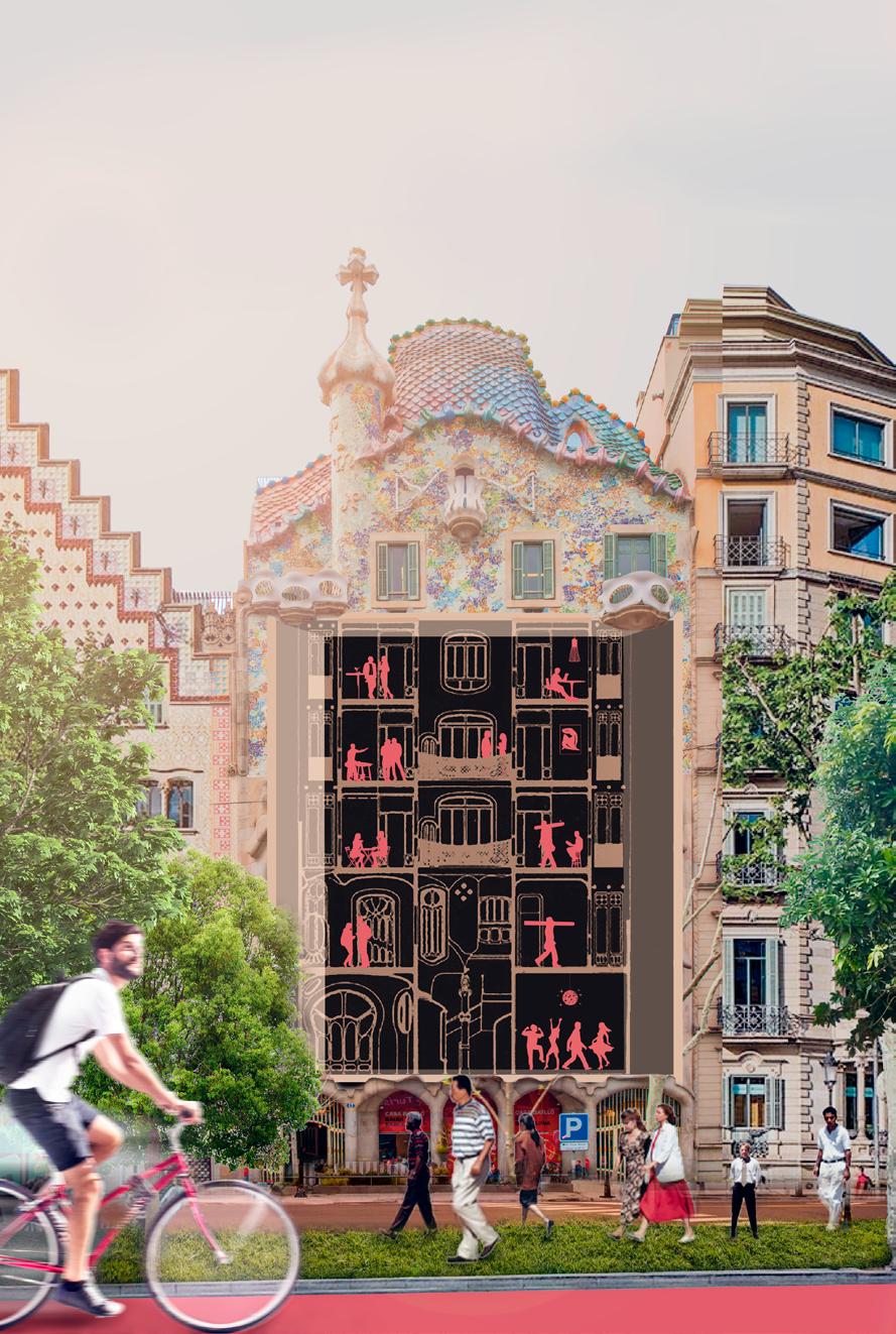
new nomad world
March 2021 under
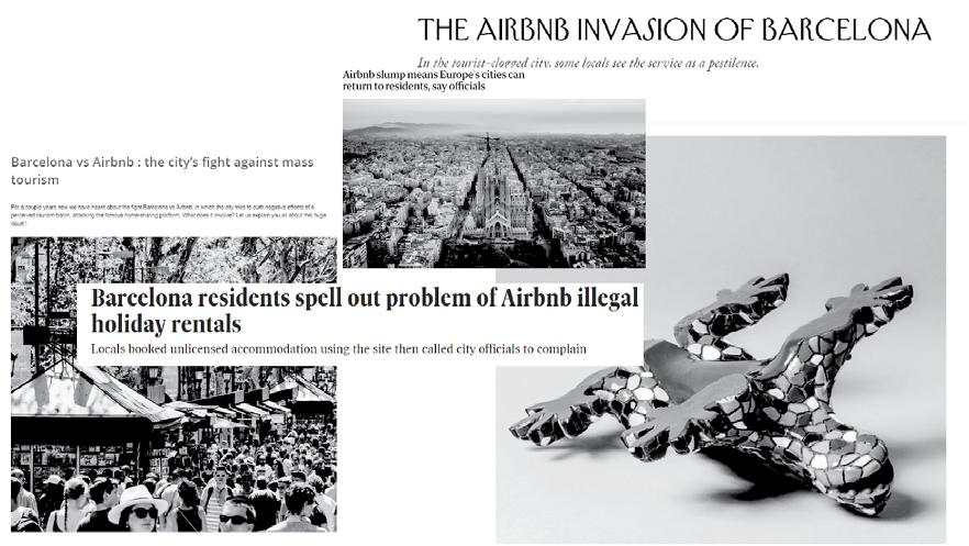
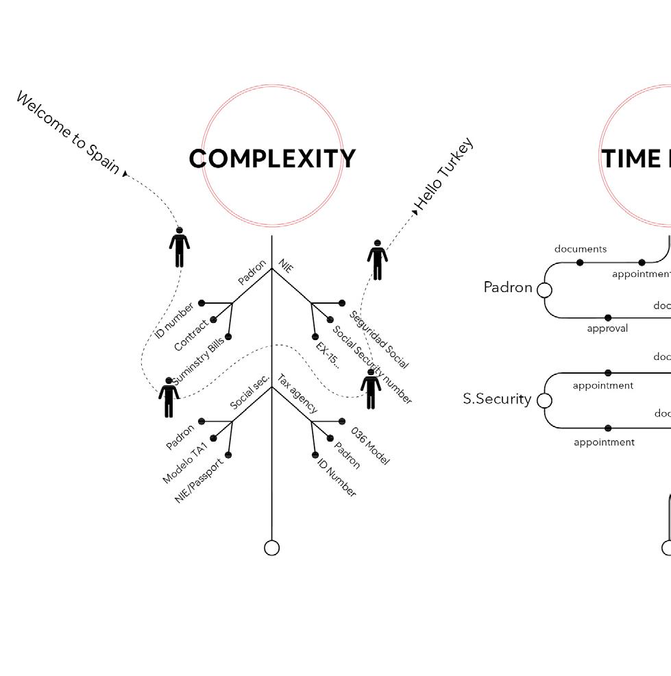
The aim of this project is to question the actual system of tourism and its future in a post-capitalistic world by making assumptions of what will happen in the next years. The challenge was to take the specific role of the Airbnb company proposed by the faculty in order to reconvert its failed business model after Covid 19. And to answer the main and most important question: How we can reconvert tourism in order to provide a beneficial layer to the city and its citizens?
54
52
new nomad world
the direction of: team: Arina Novikova, Aishath Nadh Ha Naseer, Sinay Coskun, Adriana Aguirre Such
Luis Falcón and Iacopo Neri
55 new
nomad world
context analysis
tourism in Barcelona
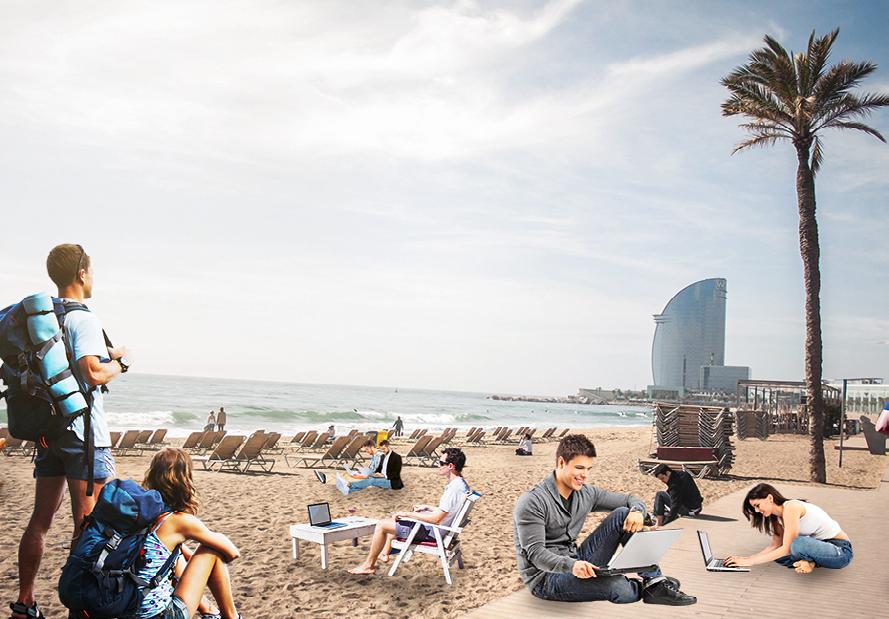
By 2035, 1 billion people will be digital nomads. The nomads were the ones who were constantly travelling and looking for new resources as a community. And digital nomads today know where are the resources, but they look for the commu nities to be included in. They choose location-independent and technology-en abled lifestyle that allows them to travel and work remotely. And thus, they regret owning any commodity. Their main charac teristic is that they are constantly travelling for long periods of time, regardless desti nation.
From the previous simulation, we decide to scale down to the main wetland connectivity corridor, crossing central Luxembourg, between most of the pilot cities from our stakeholder map. Among the cities along this corridor, we choose Bertrange municipality as an example for detailed analysis. In the Bertrange area we identified the main stakeholders to be involved in our proposal, among which teachers from education institu tions, natural protection experts and land owners will be directly reached.
56
new nomad world
Shifting skill need
57
new nomad world
Remote work
mapping twitter data
Here we found that the short termers are focused in touristic hot spots. You can recognize them perfectly: Passatge de Gracia, La Ramblas, Sagrada Familia, Camp Nou and so on.
For the long termers, which were so called the locals, they are more and more spread. Shows that the more they stay, the more they explore the city beyond the central touristic hotspots. Nevertheless, the center is center for all of the profiles.
short termers
new nomad world 56
long termers
57
new nomad world
60
new nomad world
entire homes
< 1 month August 2019 > 1 month > 6 month
61 > 1 month > 6 months < 1 year new nomad world Data: INE, Cadastre & Inside Airbnb
nomad barriers
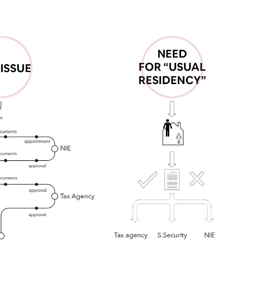
The statal and local regulations also contribute to this issue. The PEUAT (Strategic Touristic Plan of Barcelona) establishes that for homes, apartment and rooms that have touristic licenses they are only allowed to rent a place one month or less. The LAU (Spanish Urban Leasing law) only allows to have a home contract for one year or more but also contemplates the possi bility of rescinding your house contract after 6 months. While in touristic accommodations, (such as hotels, hostels and so on) there is an opportunity to stay no matter its duration, for housing we have a void that doesn’t give you the possibility to have a home if your stay is from one to 6 months.
62
new nomad world
63 new nomad world
user interface
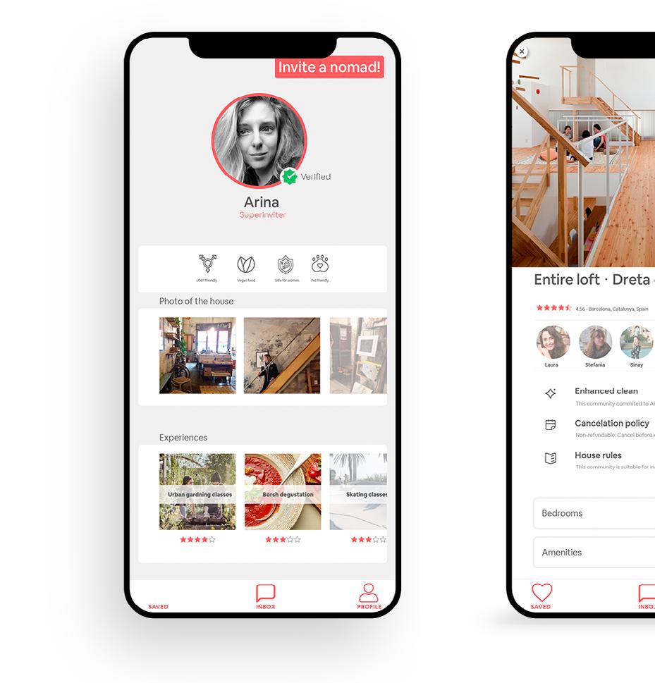
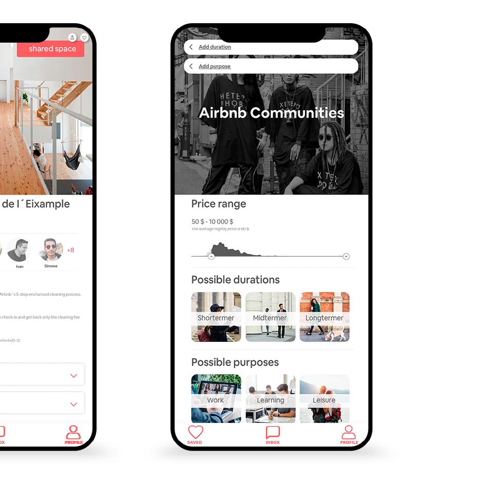
When nomads open the app they can create the profile and set filters that describe the person. These filters feed the algorithm to choose the proper community for them. The next step for finding proper community is to set 3 main criteria: price, duration and purpose of staying. Once the community has been found they can choose if they want to live in shared and non-shared space. They also can see other profiles of nomads inside the community. The algorithm makes the community constantly change that allows it to be dynamic and adaptable system
64
new nomad world
65 new nomad world
sharing cities
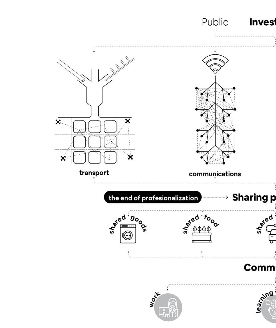
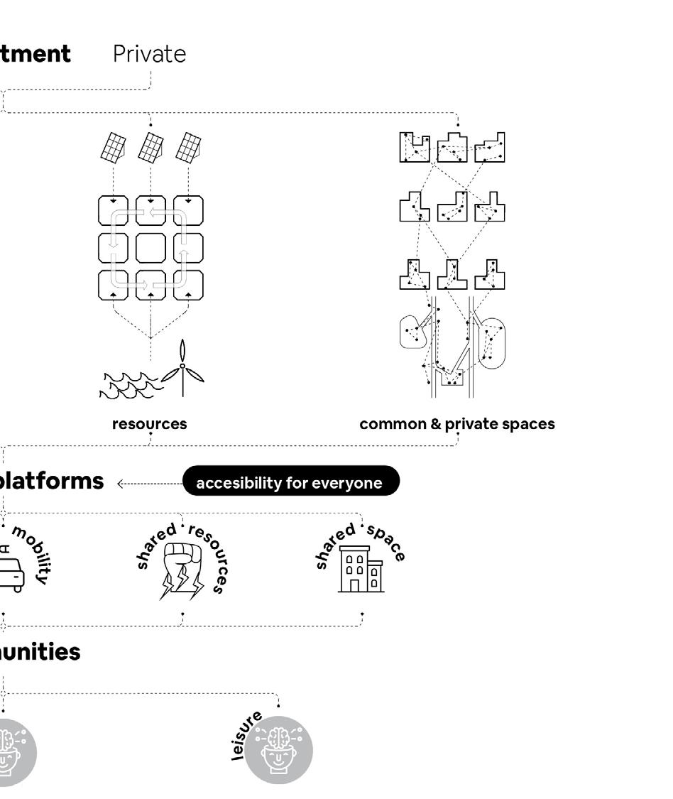
This will create Cities based on sharing. Public and private companies will invest in Barcelona in order to create shareable infrastructure for transport, communications, resources and common and private spaces. That will be managed by sharing platforms that will grant access to everyone and will create co-owning dynamics. It will also mean the end of profe sionalization because all people will become microoferents of the platforms.
66
new nomad world
67 new nomad world
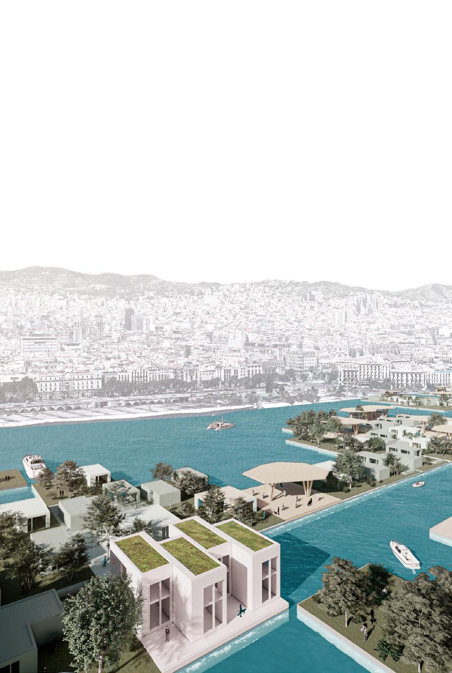
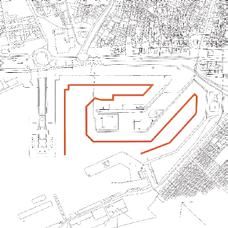
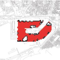
resilient waterfront December
The project reflects on how adaptable solutions on the waterfront infrastructure can help accom modate the demands of the location of Barcelona’s port. The design specifically focuses on the semi-fixed and moving elements on the water. These moving elements bring additional functional space based on the demand of a particular scenario. The main tool that helped to generate urban distribution planning was cellular automata.
68
tower of knowledge 66
2019 under the direction of: team: Arina Novikova, Aishath Nadh Ha Naseer, Marta Galdys, Sridhar Subramani
Eugenio Bettucchi, Alex Mademochoritis and Iacopo Neri
69 tower of knowledge
70 curve 1 resilient waterfront
occupancy scatter 3 1 - 3 5 1 - 3 occupancy scatter 7 1 - 3 3 1 - 5 occupancy scatter occupancy scatter occupancy scatter occupancy scatter occupancy scatter 7 1 - 5 5 1 - 5 3 1 - 7 occupancy scatter occupancy scatter 7 1 - 7 5 1 - 7
high high low
high low high
public residential office
public residential office high medium low
public residential office
public residential office low high low
public residential office medium high low
public residential office
medium low high
public residential office
low low high
medium medium medium
public residential office
low high medium
71 resilient waterfront
moving scenarios
The user can then also have an overview of their selected scenarios in order to narrow down their choices. After that the user go to their preferred choice. The scenarios are developed based on the existing configuration of the fixed cells and with that for example, the user can move the modules towards the areas with higher residential density , higher leisure densities or even interconnect all the islands or have the modules be placed around certain functions.
72
resilient waterfront
leisure work
work density
size of bigger islands
leisure density islands based on strength
size of smaller islands connecting the residential
leisure based on strength
residential residential density connecting all islands
residence based on strength resilient waterfront
73
connecting the leisure
user interface
In the end, this urban planning simulator can help the city to perform better on the key performance indicators by reclaiming some amount of usable area through the floaters. Then the temporal reconfiguration of these new functional spaces helps better improve the adaptabil ity for the different scenarios based on addressing both short and long term. The cities are becoming intelligent so the infrastructure has to become flexible enough to address the demands.
74
resilient waterfront
Check the video here:

75
resilient waterfront
park of extreme sports
May 2019
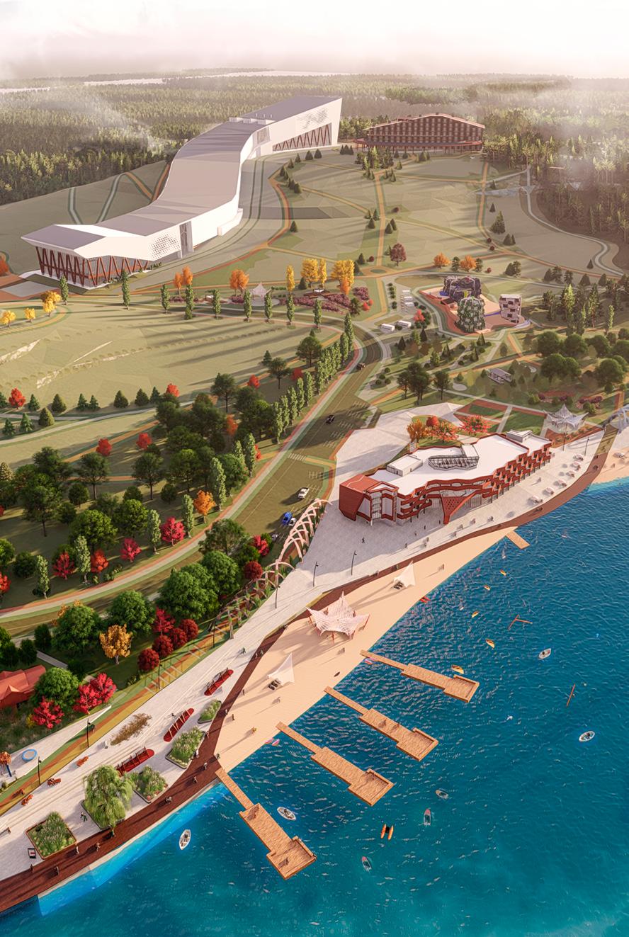
under the direction of: prof. Pertsev V.V. Extreme sports are becoming more popular by the day. This has led to recreational facilities such as extreme amusement parks to appear rapidly all over the world. As for Belgorod, an analysis of the existing recreational facilities of forests and tracks showed that they are mainly focused on short-term family vacations in the warm season, and there is practically no infra structure for extreme sports.
76
park of extreme sport
77
park of extreme sport
site analysis
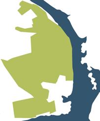
A new natural park “Murom Forest” has appeared in the Belgorod region. It is located on the banks of the Belgorod reservoir near the village of Solomino. The total area of the park is over 40 thousand hectares that contains huge natural reserve. At the first stage, 880 hectares will be equipped. The arrangement of the park has not yet been completed, but it is already possible to visit it and walk along the forest paths. To get to the park, you need to go to the Belgorod bypass road.
78
waterfront
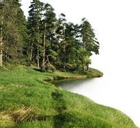
coniferous forest near the water
hills and hollows park of extreme sport
natural reserve
79
park of extreme sport
bike path main pedestrian roads horse trails
80 4 entrances
park of extreme sport
park of extreme sport
main object (indoor ski slope) water park extreme park
81
nature park glamping park 4 parks
water park
The water park is also divided into two zones: sports and recreational. In the sports area, visitors can enjoy water sports such as canoeing, kayaking, wakeboarding, windsurfing, and yachting. Recreational activities include fishing, boat excursions and walking routes above the water. Close by, there is also a restaurant with local cuisine.
82
park of extreme sport
nature park
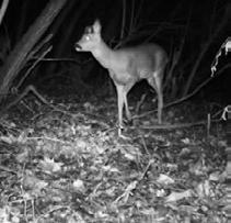
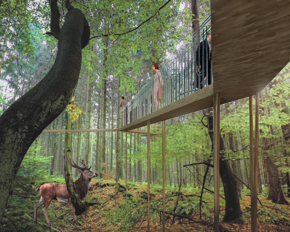
The complex is also partly a kind of natural reserve where animals such as the European deer, badger, and gray heron are preserved. In order to minimalize damage to the existing ecosystem, were planned at the height of 5 - 7 meters above the ground in the forest part to keep the animals protected. Visitors can also see the process of feeding the animals in the feeders installed around the park.
83
park of extreme sport
extreme park
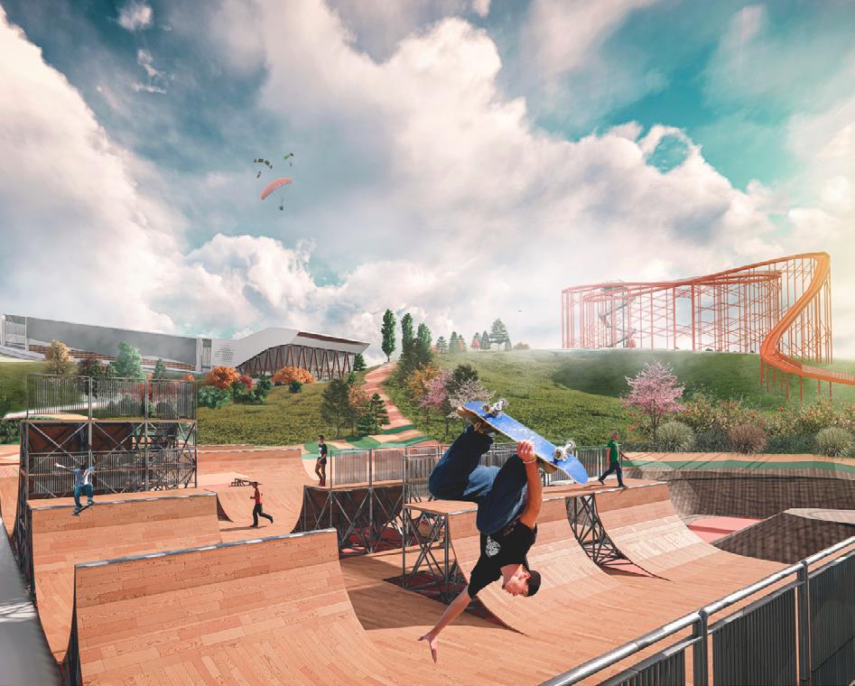
The extreme park is located on the hilly part of the site. In this are, there are many sports facilities, such as an indoor ski slope, a toboggan slope, a skatepark, and climbing walls. As It’s open during all seasons, this section of the park is the most traffic-generating part of the complex.
84
park of extreme sport
glamping park
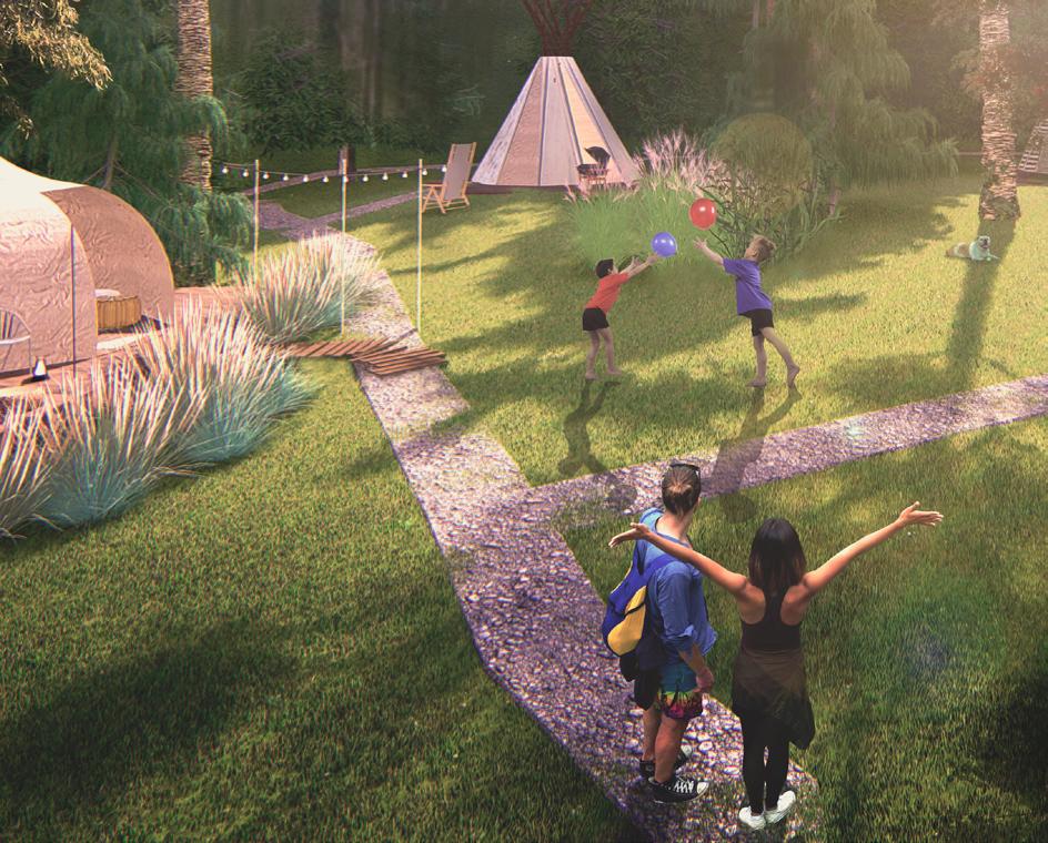
Glamping is short for “glamorous camping.” The glamping park is a tent camp with the maximum level of comfort and a focus on good design. Two types of glamping are presented on the territory of the complex: forest glamping and an eсo village, where various types of ecological shelters are collected such as yurts, wigwams and tipies. Glamping by the water in a small house with a bathhouse, place for fishing and a beautiful view of the water surface is also an option.
85
park of extreme sport
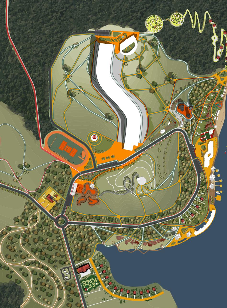
86 masterplan 1 7 4 10 16 22 13 19 25 2 8 11 17 23 14 20 26 3 9 6 12 18 24 15 21 park of extreme sport
87 1. Indoor ski slope 2. Hotel 3. Glamping “Eco Village” 4. Glamping “Tree Houses” 5. Boat Mooring 6. Beach Pavilion 7. Playground 8. Climbing centre 9. BBQ area 10. Volleyball court 11. Badminton court 12. Water sports centre 13. Boat mooring and catamarans 14. Food Court 15. Picnic area 16. Zip-line tower 17. The toboggan track 18. Ride Park 19. Walking area above the water 20. Water Area Glamping 21. Cafe 22. Mini-golf 23. Technical area 24. The farm 25. Stadium with sports sites 26. Platform for drones 5 park of extreme sport
indoor ski slope
park of extreme sport
park of extreme sport
88
84
89 85
park of extreme sport
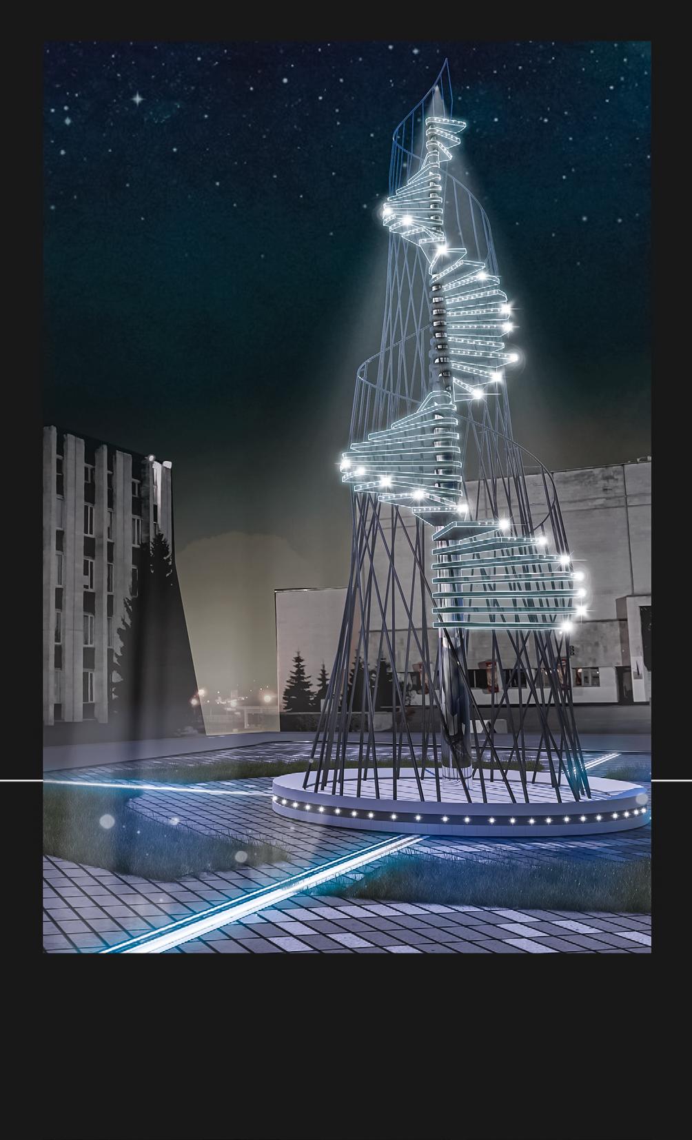
tower of knowledge
December 2019
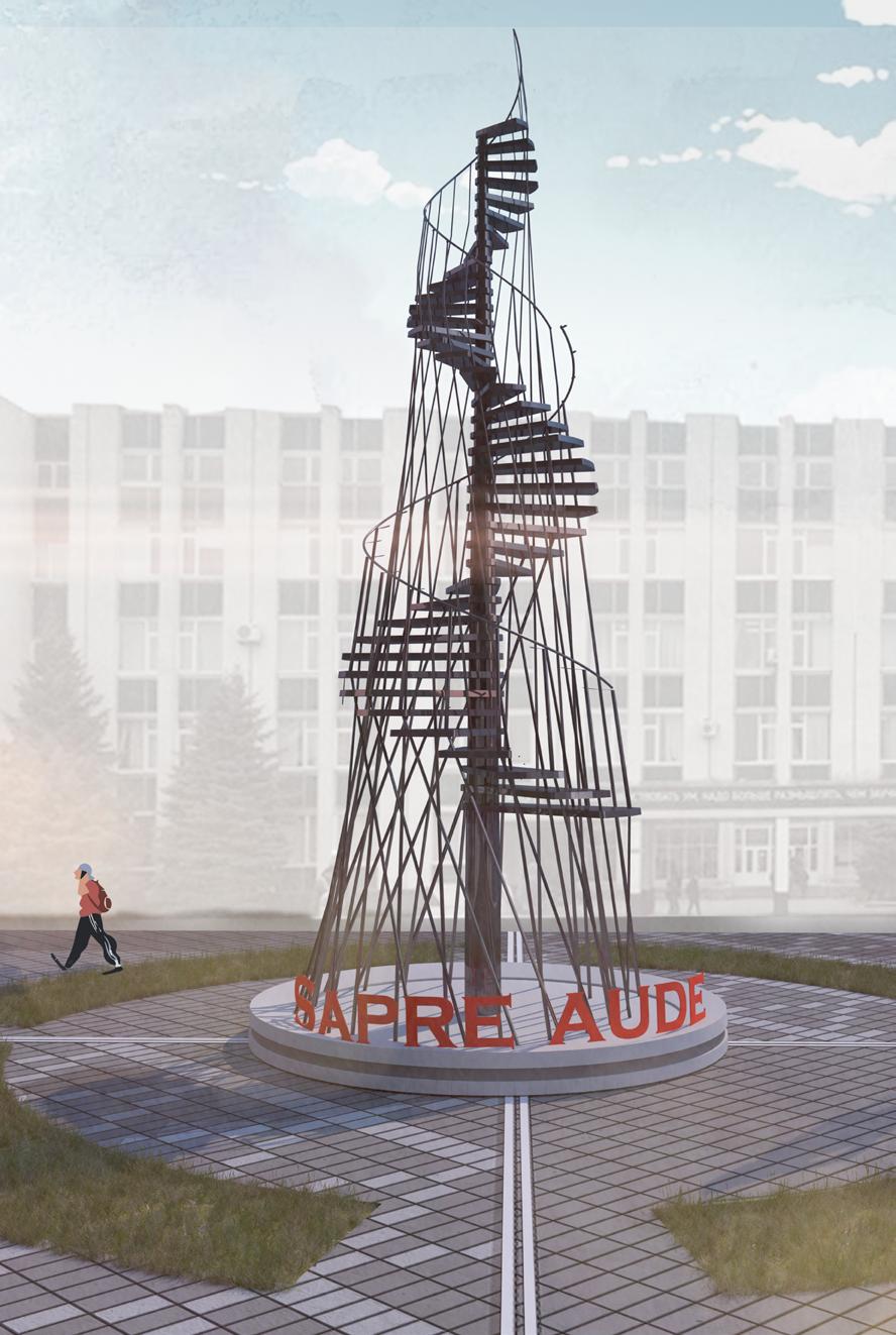
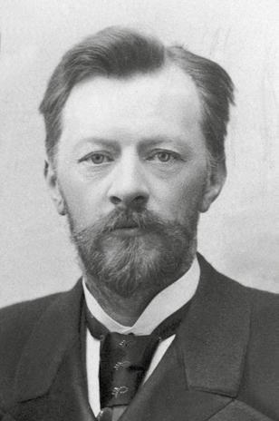
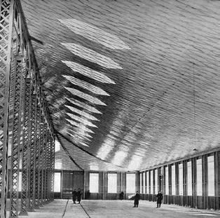
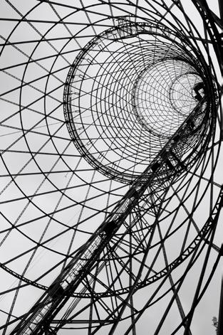
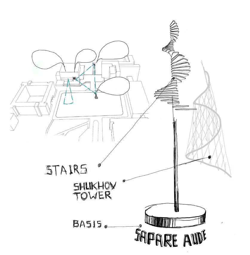
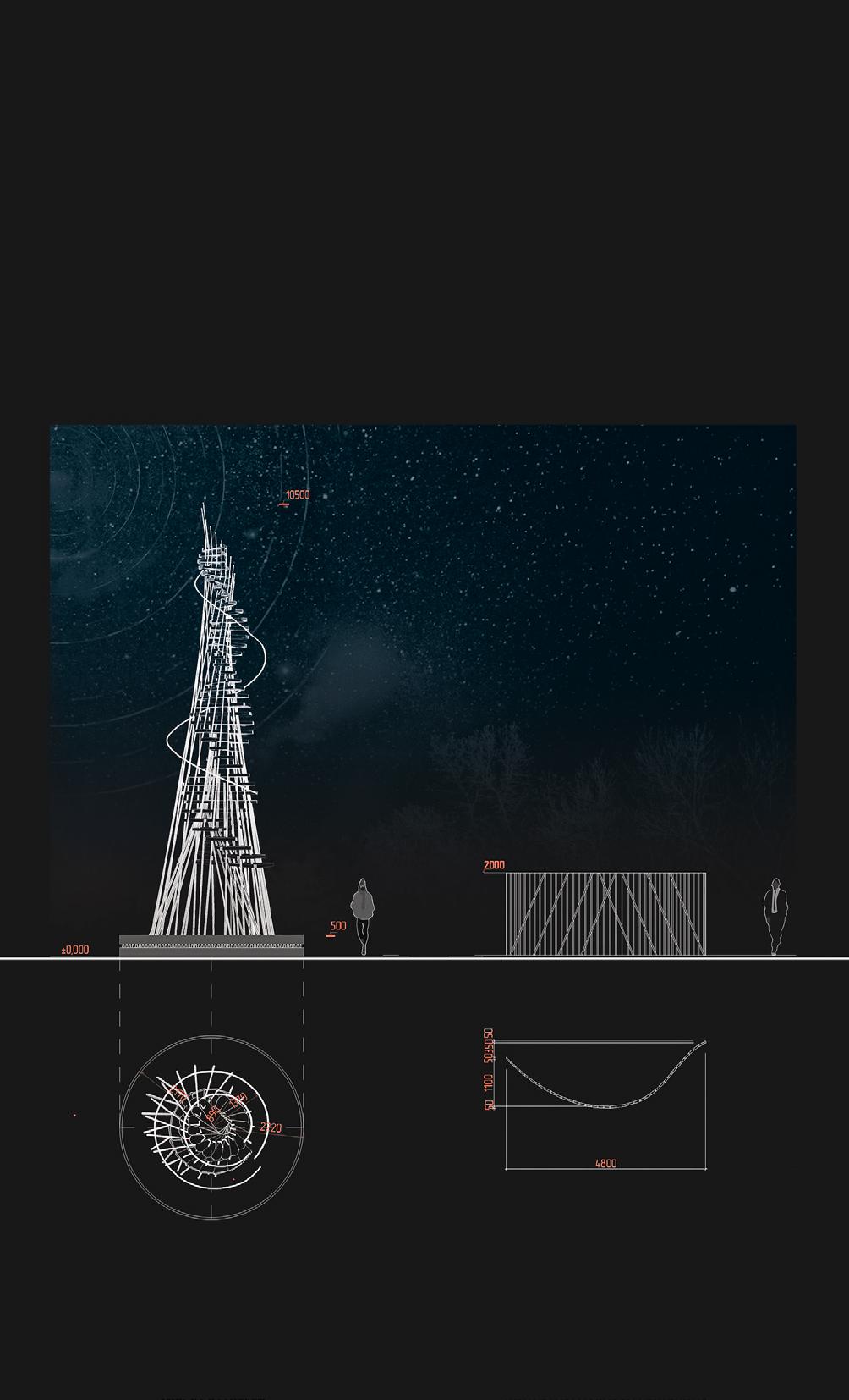
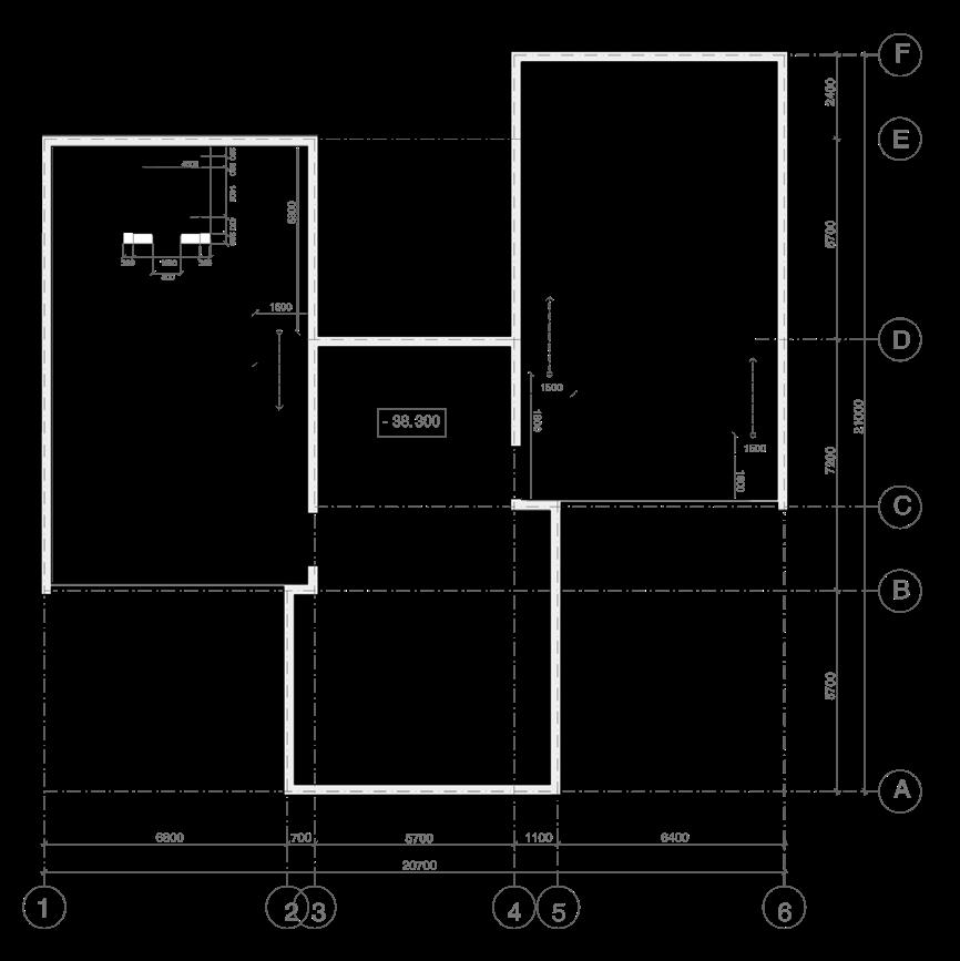
under the direction of: Fedotova N.N Each university has its own character and its own history. While walking on a campus, students should remain inspired and joyful, so a variety of art objects are an integral part of the infrastructure for young people. The tower of knowledge has many meanings. T he main message contained in this sculpture of steel pipes is the desire upward but the ladder of self-development. The form itself refers to the works of the famous Russian engineer V. Shukhov.
90
tower of knowledge 86
91 87 tower of knowledge
92 concept tower of knowledge
Photo of Vladimir Shukhov Pavilion in N.Novgorod
Tower in Moscow
93 tower of knowledge AIM UNITE LEARN INVENT *
STAIRS SHUKHOV TOWER BASIS
site plan
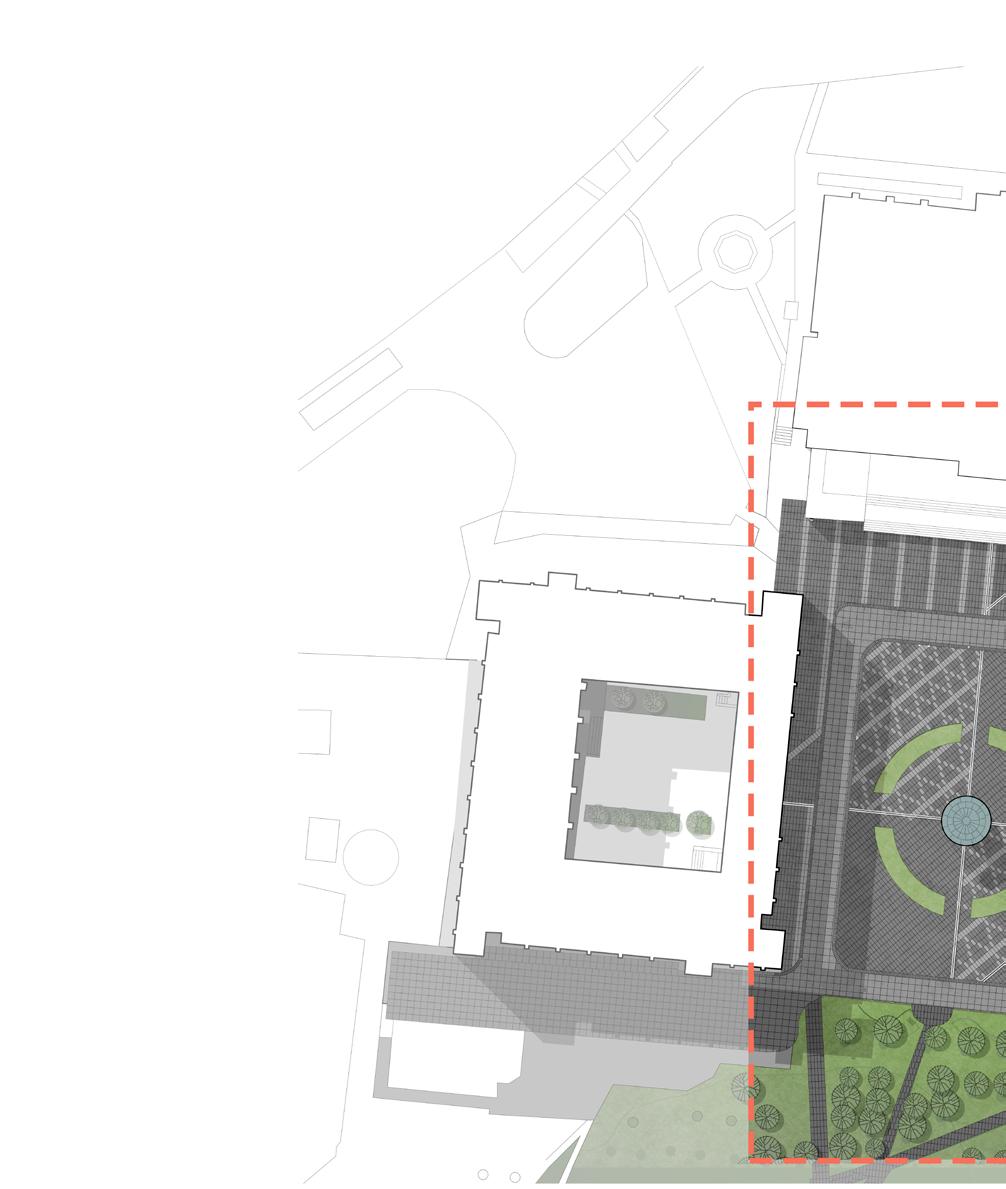
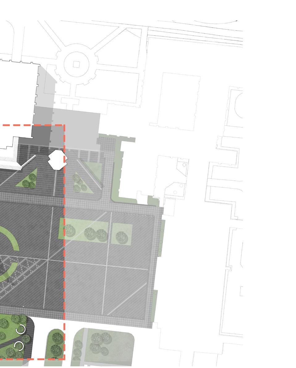
The monument is located in the centre of the square, which ensures its visibility from the windows of each building. The paving pattern echoes the elements of the tower, giving the impression of its continuation on the plane. Moreover, in the direction of the main building there are benches that correlate with the round shape of the sculpture.
94
tower of knowledge
95 tower of knowledge
95
tower of knowledge
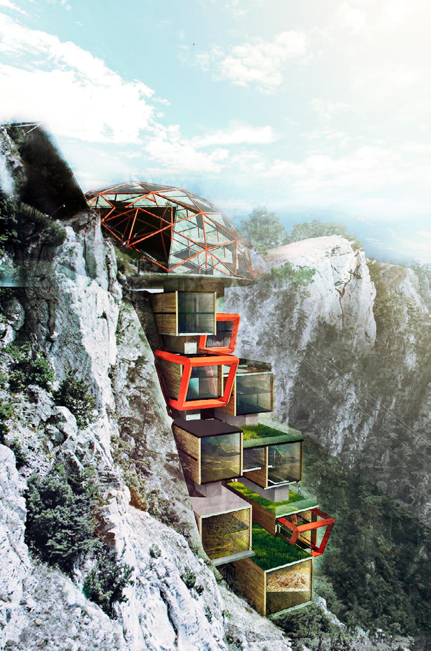
museum of hiking
February 2017
under the direction of:
Emel’yanova E.A.
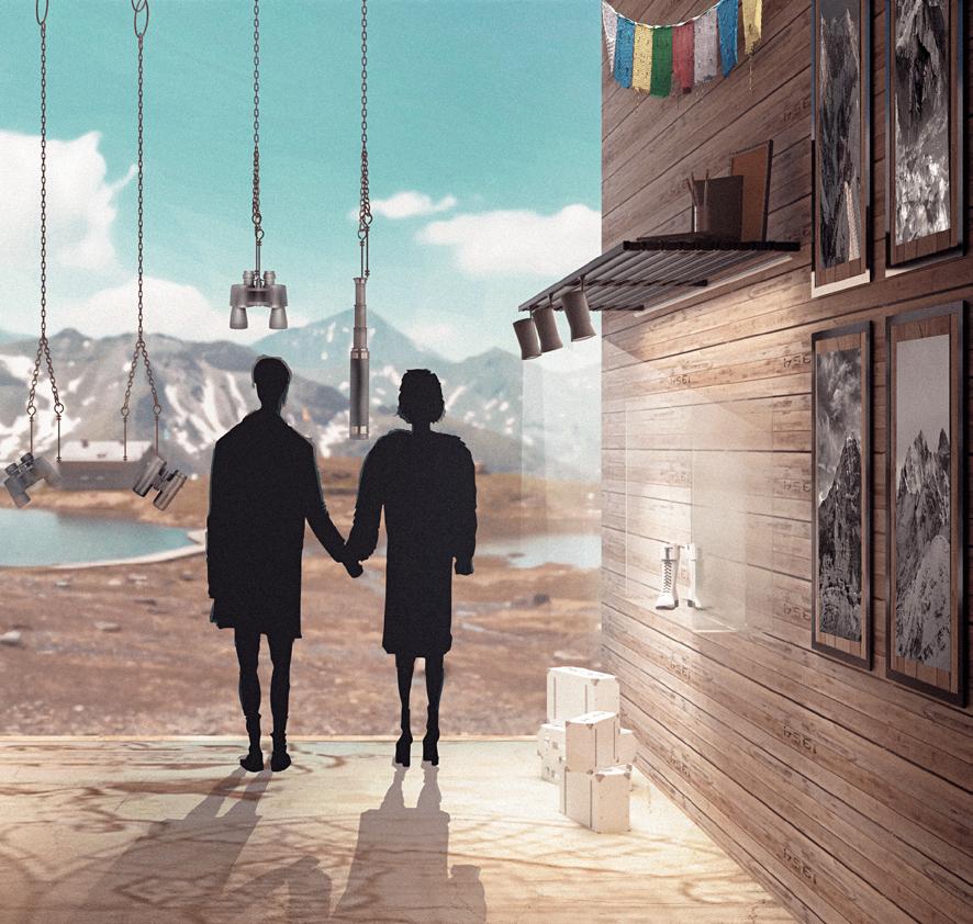
Hiking is the preferred term for a long, vigorous walk, usually on trails in the countryside. Such kind of activity has becoming more and more popular today. That’s why people are interested in information about its history, innovations and challenges. Surprisingly, the number of places offering information and artefacts connected to hiking is fairly limited. Museum of hiking offers a wide range of different items related to the area such as old maps.
98
96
of hiking
museum
99
museum of hiking
Steep cliff
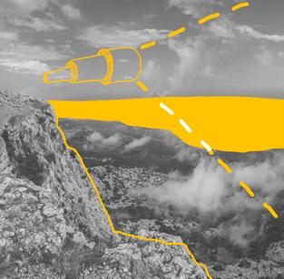
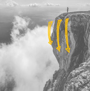
Touristic place Appealing view
Rare plants

100 museum of hiking concept
101 museum of hiking
The main element of the interior are the ropes hanging directly from the ceiling, on which most of the exhibits are located. This makes the museum complex interactive immersing even those to the exhibition who were not as familiar with the subject matter before arriving. From each “pocket” a magnificent panorama of the Black Sea opens.
102
interior museum of hiking
103 museum of hiking
contacts arina.novikova.igorevna@gmail.com +31 613830656 Arina Novikova // IaaC blog @karrakuly
